Received in today’s mail. Thanks to the person/s who nominated me, and thankyou to the WIA.
I am very pleased to receive this certificate.


Marija VK5FMAZ and I headed down to Mount Gambier on the June long weekend to attend the South East Radio Group’s annual convention/buy and sell/National Fox hunting championships. Unfortunately this weekend clashes with the annual VK Shires Contest. However this year we did sneak in some portable operating for the contest.
Marija and I activated the Mumbannar Nature Conservation Reserve VKFF-2161 in Victoria, and the Piccanninie Ponds Conservation Park 5CP-178 & VKFF-0927 in South Australia.
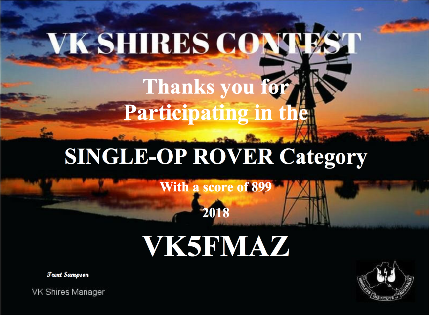
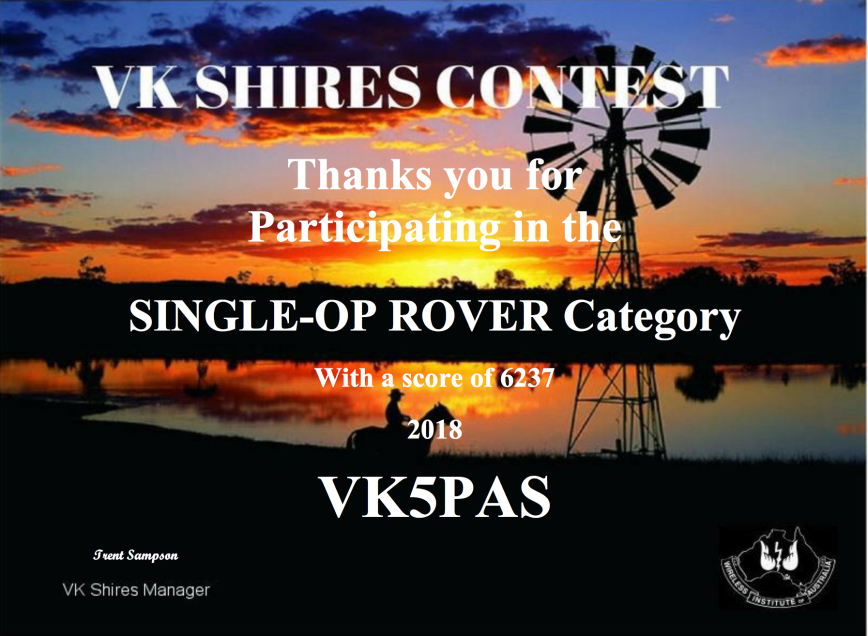
Considering we spent just a few hours on air, we were very pleased to come 5th and 7th in the VK Single Op Rover category. Marija made 29 contacts and had a score of 899 points. I made a total of 77 QSOs with a score of 6,237 points.
Congratulations to Tony VK3XV who came in at position number 1 in this category with a score of 18,176 points.
And thanks to Trent VK4TS and Alan VK4SN, the organisers of the event.
In the last few days a post appeared on the WWFF Australia Facebook page from an Australian park activator who was displeased by the lack of Australian park hunters placing up a spot for him during his activations. His concerns and the post really resonated with me, as I have been advocating for a long time for more park hunters to spot on the various platforms. Which sadly many do not.
I see the same callsigns appearing time and time again as the spotters. And I often hear the comment ‘I saw your spot on parksnpeaks’, but I never see those particular amateurs place up a spot themselves.
Yes, I’m about to get up on my spotting & alerting soapbox again. I hope you read this post and by the end of it, those who do not spot, reconsider their position in the future. I am going to mainly deal with park activations in this post, but will touch briefly on SOTA as well.

What is a spot?
A spot shows the callsign of the park/SOTA activator or the DX station and the frequency they are operating on, and usually the callsign of the station who placed the original spot. The spot shows up on various platforms, e.g. parksnpeaks, SOTAwatch2, the DX Cluster. I’ll talk about these soon.
Rather than monitoring some of the regularly used frequencies, e.g. 7.144, or tuning across the bands hoping to come across a park activator, hunters can use these spotting facilities to their advantage.
What is an alert?

An alert is a post made on parksnpeaks and/or SOTAwatch2 which alerts hunters/chasers to the fact that a station is going to activate a particular park or summit on a particular day. It often includes details such as the proposed frequencies and modes.
Why place a spot?
If you have worked a park activator, then don’t just the log the station and move on. Consider the activator and your fellow park hunter. In some instances, the activator may not have internet coverage, so self spotting by the activator is not possible. Placing a spot up for him/her will assist in dragging in the hunters.
There is no doubt that spotting results in more calls to the activator.
Where do I place a spot?

There are a variety of different areas you can place a spot including parsknpeaks, SOTAwatch2, the DX Cluster, Facebook and Yahoo groups. I’ll discuss in more detail a little later, the various sites including parksnpeaks and the DX Cluster.
Why place an alert?
The more amateurs who know you are going to be out in a park, the more likely you are that you will fill up your logbook. There will be occasions when you activate a park on the spur of the moment, or when you do not have internet coverage. But if you know that you are going to be out in a park, alerts on as many platforms as possible, will certainly ensure that you end up with more callers.
Consider placing an alert on parksnpeaks, the WWFF Australia Facebook page, and/or the WWFF Australia Yahoo group. Put a call out on the local repeater. Tell your mates the day before about your intentions.
Alerts are not held in concrete. By that I mean, if you do not activate the park at the specific time you have placed on your alert, then you are not going to be criticised. Things change, e.g. travelling times, weather, etc. And with parksnpeaks, you can either select a specific UTC time for your activation, or you have the ability to select ‘All Day”, ‘Morning”, “Afternoon”, etc.
parksnpeaks
For Australian park activators, the main spotting and alterting facility is the parksnpeaks website. The parksnpeaks website commenced its life as a collection of scripts on a computer on the table at the home of Allen VK3ARH. The initial goal of parksnpeaks was to highlight SOTA opportunities that would also qualify as a contact for a National Park award. With the explosion in popularity of the various parks programs and SOTA in recent years, parsknpeaks now has a number of very useful features.
This includes the ability to spot park activators and place alerts re upcoming park activations.
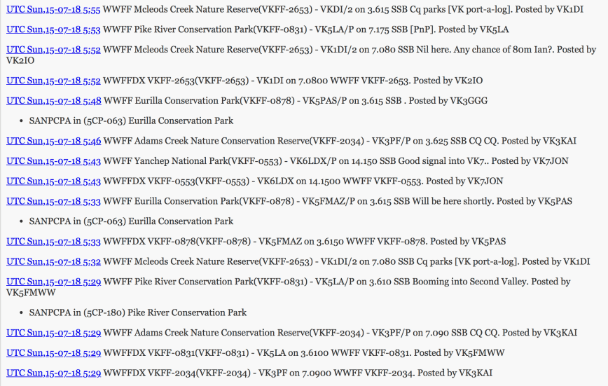
Above:- A screen shot of spots on parksnpeaks
How easy is it to place a spot on parksnpeaks?
EASY! It should take you no more than one minute.
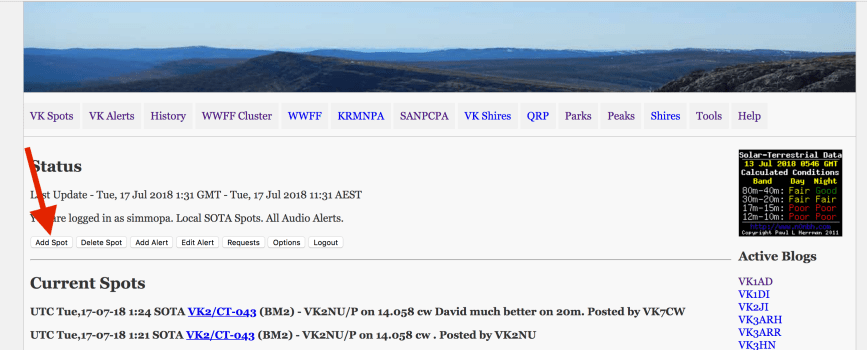
From the VK Spots main page, click on ‘Add Spot”. See below
This will bring you to the ‘Select Class of Activation for Spot’ Page. In the first drop down box, select what sot of activity it is, e.g. QRO, VK Shires, VK WWFF, ZL WWFF, DX WWFF, IOTA, KRMNPA, SANPCPA, VK SOTA, ZL SOTA, DXCluster. See the screen shot below.
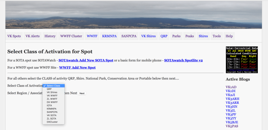
If you select VK WWFF, you will then need to select which State the spot applies to in the second drop down box. Then click ‘Next’. See the screen shot below.
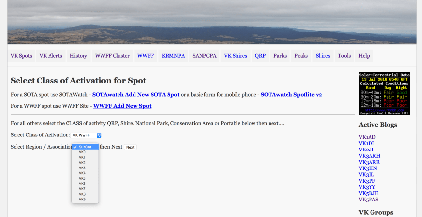
This will bring you to the ‘Add VK or ZL World Wide Flora & Fauna Award Spot’ page. You need to fill in a few fields here as you can see on the screen shot below. These details include:
Once you’ve entered those details, click on ‘Process’.
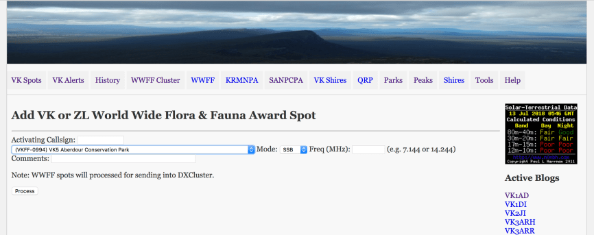
Once you have placed a spot on parksnpeaks, the spot will also be sent to the DX Cluster (if you have enabled the DX Spots option), exposing the activator’s activities to an even bigger international audience. I’ll talk about the DX Cluster shortly.
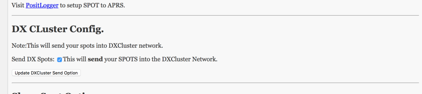
How do you enable the DX Spots option on parksnpeaks. Go into ‘Options’ (see screen shot below).
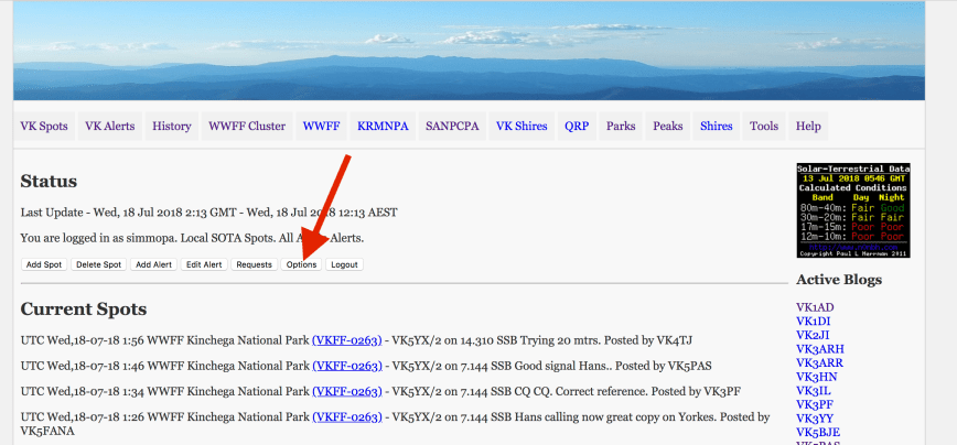
Then scroll down to ‘DX CLuster Config’. Highlight the ‘Send DX Spots’. This will send spots into the DX Cluster Network.
And if you spot a park activator, once the spot has appeared on parksnpeaks, you will hear the audio alert of a singing kookaburra, which notifies park hunters to the presence of a park activator. If you have spotted a SOTA activator, the audio alert will be that of a goat bleating.


To add an alert on parksnpeaks, click on ‘Add Alert’ and then follow the prompts.
SOTAWatch
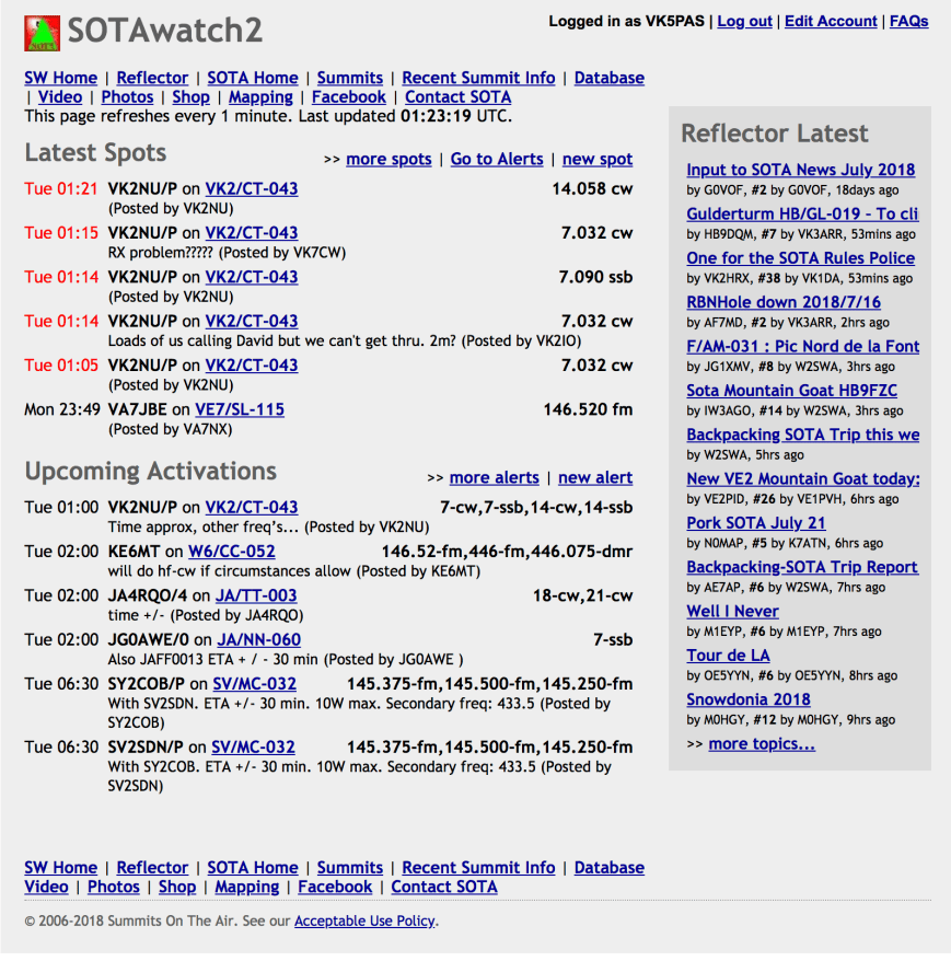
For activators and chasers in SOTA, the main spotting and alerting facility is SOTAwatch2.
DX Cluster
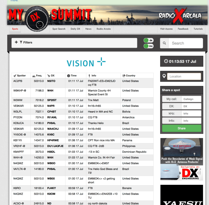
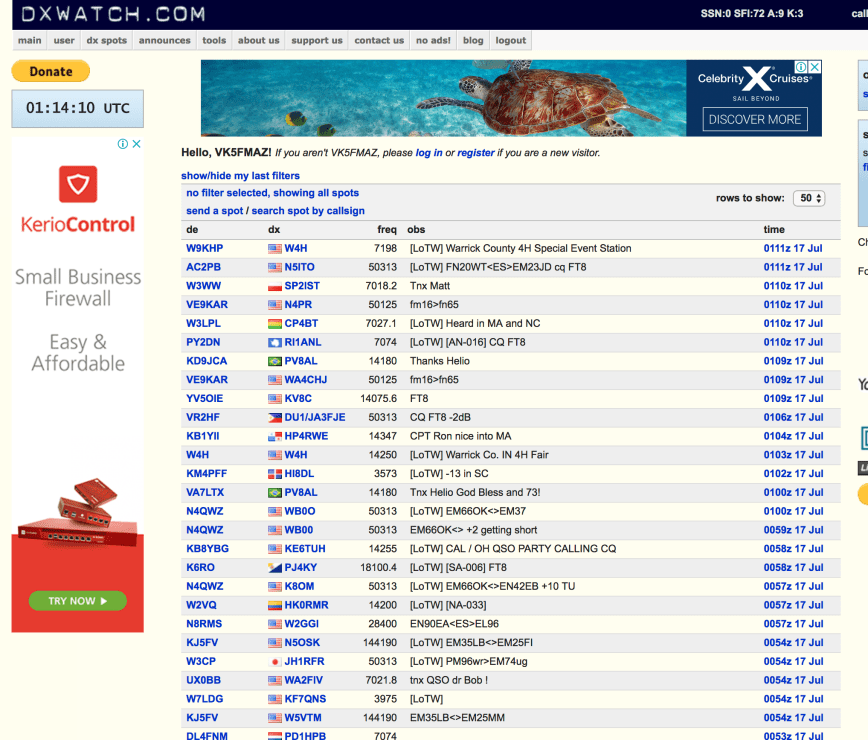
A DX Cluster is in essence a “chatroom” or node into which amateur DX hunters can post information about DX either worked or heard. Physically, it is a central computer that collects, stores and disseminates information that hams send to it. There are thousands of nodes around the world, connected together via the internet or radio.
The first DX cluster software, PacketCluster was realised by US radio amateur Dick Newell, AK1A in the late 1980s, and quickly became popular as a means of exchanging DX-related information.
Below is an example of ‘My DX Summit’.
And this is an example of DX Watch.
DX Cluster Code of Conduct

A Code of Conduct exists for using the DX cluster. This includes:
One of the other issues listed on the Code of Conduct for the DX Cluster, is the issue of self spotting. It states:
However, self spotting for park activating is acceptable via parksnpeaks.
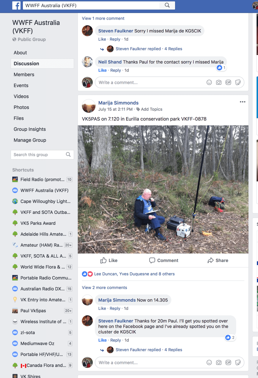
The WWFF Facebook page has become very popular and now has 279 members worldwide. Placing a post on Facebook often draws in more hunters for the activator.
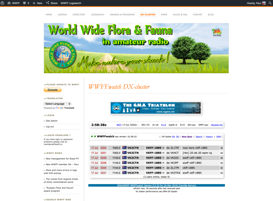
WWFFwatch DX cluster
Another useful tool in the WWFFwatch DX cluster which can be accessed via the global WWFF website.
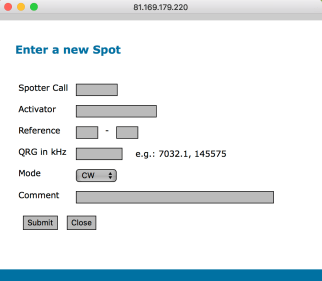
Entering a new spot there is as simple as clicking on ‘New Spot’ and filling in the required details and then clicking on ‘Submit’.
Summary
There seems to be a lot of park hunters who use parsknpeaks to their advantage, but never take the time to place a spot for the activator they worked. This is a great shame. Not only are you letting down the activator you just worked, but you are also letting down your fellow hunters and chasers.
So please, take the time out to place a spot.

References.
parksnpeaks, 2018, <https://parksnpeaks.org/>, viewed 17th July 2018
Wikipedia, 2018, <http://www.amateur-radio-wiki.net/index.php?title=What_is_a_DX_cluster%3F>, viewed 17th July 2018
Wikipedia, 2018, <https://en.wikipedia.org/wiki/DX_cluster>, viewed 17th July 2018
This afternoon (Sunday 15th July 2018), Marija and I headed out to activate the Eurilla Conservation Park 5CP-063 & VKFF-0878. This was to be a unique park for both Marija and I in the World Wide Flora Fauna (WWFF) program. I activated the park back in August, 2013, but this was prior to the park being added to the VKFF program.
Eurilla is located about 11 km south east of the city of Adelaide, and about 2.4 km north of Stirling.
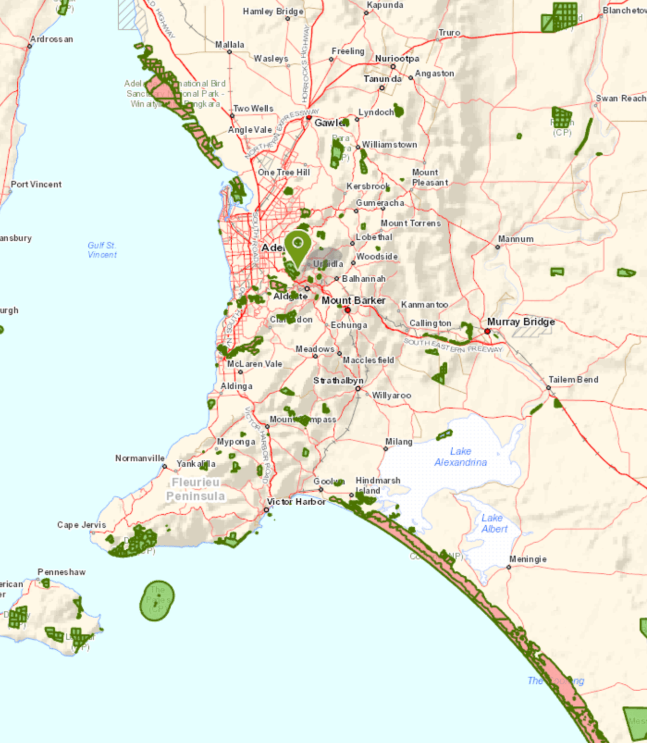
Above:- Map showing the location of the Eurilla Conservation Park in the Adelaide Hills. Map courtesy of Location SA Map Viewer.
The Eurilla Conservation Park is a small park, comprising just 7 hectares (17 acres). The park was proclaimed on 22nd September 2017 and is located between Mount Lofty summit and the northern boundary of the Mount Lofty Botanic Gardens at Piccadilly. Access to the park is via the Eurilla Track at Sprigg Road or via the Heysen Trail at Mount Lofty Summit Road.
The reason for dedication of the park, is an undisturbed bog consisting of a dense mat of the rare coral fern and a sizeable colony of mature king fern, an endangered species in South Australia.
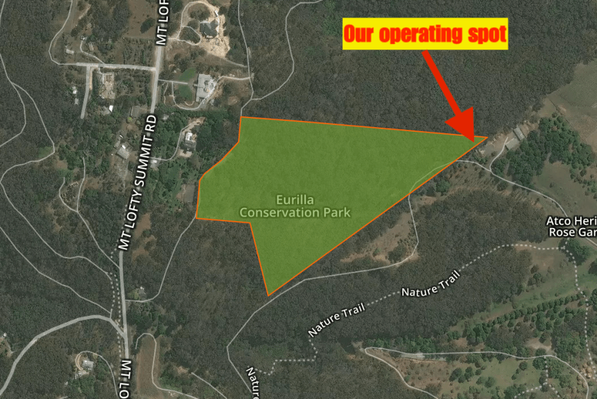
Above:- Aerial shot of the Eurilla Conservation Park showing out operating spot in the north eastern corner of the park. Image courtesy of Protected Planet.
The park was named in honour of Charles ‘Warren’ Bonython (1916-2012), one of the members of the famous South Australian Bonython family. He was a conservationist, explorer, author, chemical engineer, and a keen bushwalker.
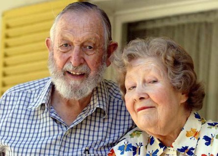
Above:- Warren Bonython with his wife. Photo courtesy of Adelaide Bushwalkers
The Bonython family lived nearby in ‘Eurilla’ mansion, which was built in 1884, but was burnt to the ground during the 1983 Ash Wednesday bushfires. The name Eurilla is believed to come from the Kaurna Aboriginal word for Mt. Lofty, Yureidla.
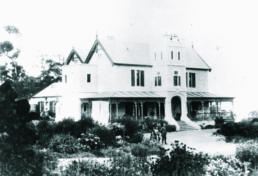
Above:- The Eurilla mansion, c. 1890. Image courtesy of Trove.
Woodland is the main habit within this park with Messmate Stringybark (Eucalyptus obliqua) the main component. Understory plants include tea-trees (Leptospermum spp.), Blackwood (Acacia melanoxylon), Myrtle Wattle (Acacia myrtifolia), Coral Fern (Gleichenia microphylla) and Bracken (Pteridium esculentum).
Birds SA have recorded a total of 34 native bird species in Eurilla. This includes Adelaide Rosella, White-throated Treecreeper, Eastern Spinebill, Crescent Honeyeater, White-browed Scrubwren, Superb Fairywren, Buff-rumped Thornbill, Spotted Pardalote, and Australian Golden Whistler.


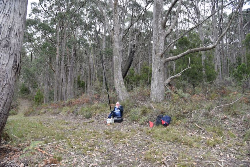
Marija and I parked the Hi Lux at Gate 27 on Sprigg Road. We then followed the eastern boundary of the Cleland Conservation Park and then the south eastern boundary of Cleland, passing through a creekline. We soon reached the north eastern corner of Eurilla Conservation Park.


We ran the Yaesu FT-857 and the 20/40/80m linked dipole for this activation. I ran the transceiver at 40 watts output, whilst Marija ran 10 watts PEP as per her Foundation licence requirements.
I kicked off the activation. I could not get on to 7.144 as the 40m band was extremely busy due to the IARU Contest. I moved down to 7.120 and called CQ which was answered by Tony VK3AN mobile 2 with a nice signal. Next in the log was Rob VK2QR and his 4 other call signs. Contact number 10 came within 5 minutes of setting up, with a QSO with Rick VK4RF.
Band conditions were very good and as there was no man made noise in the park, Marija and I could hear a pin drop on the band. Our first Park to Park contact was with Ian VK1DI/2 in the McLeods Creek Nature Reserve VKFF-2653.
I logged 40 stations before OP0HQ came up onto the frequency and started calling CQ Contest. He was so loud that I didn’t both trying to compete and moved down the band to 7.095. John VK5BJE was first in the log on this new frequency, followed by Russell CJ3DRW who was maritime mobile on his vessell ‘C U Agn’. I also spoke with Perrin VK3XPT who was operating remote from Vanuatu into his Victorian home station. I also logged Peter VK3PF/p who was activating the Adams Creek Nature Conservation Reserve VKFF-2034.
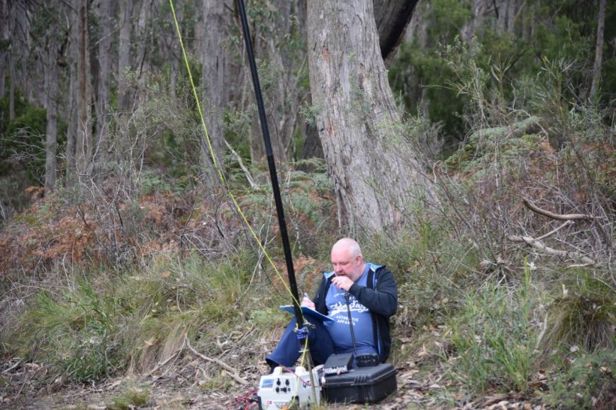
I now had 46 contacts in the log and it was time for Marija to qualify the park. We lowered down the power to 10 watts PEP and Marija called CQ on 7.095. Ross VK3MY was first in the log, with a 5/9 plus signal. Next was Jonathan VK7JON with an equally strong signal, followed by Deryck VK4FDJL, and then Graeme VK3GL.
Within 12 minutes Marija had her 10th contact in log, a QSO with Graham VK3PGK. Marija logged a further 2 stations before we QSYd to the 80m band. First in the log on 80m was a Park to Park contact with Andy VK5LA/p who was activating the Pike River Conservation Park VKFF-0831. We then moved up to 3.615 where Marija logged John VK5BJE, Mick VK3GGG, and then David VK5PL.
Marija logged a further 3 stations including a Park to Park, with Peter VK3PF/p in the Adams Creek Nature Conservation Reserve VKFF-2034.


We then swapped the mic and I logged a total of 11 stations on 80m including a Park to Park with Ian VK1DI/2 in the McLeods Creek Nature Reserve VKFF-2653. Marija also logged Ian.
We started to experience a few drops of rain at this stage, so we quickly lowered the squid pole and removed the links so we could operate on the 20m band. I called CQ on 14.305 and was pleasantly surprised to be called by Steve KG5CIK in Texas with a good 5/7 signal. I then logged Gerard VK2IO, Cliff VK2NP, Keith VK2PKT, and was then called by Deme EA5IPC in Spain.
It was starting to spit a little more with rain, so we packed up and headed back to the vehicle. Marija had 21 contacts in the log, including 5 Park to Park contacts. I had 64 contacts in the log, including 5 Park to Park contacts.
Many thanks to everyone who called us, and special thanks to those who took the time to spot us.
Marija worked the following stations on 40m SSB:-
Marija worked the following stations on 80m SSB:-
I worked the following stations on 40m SSB:-
I worked the following stations on 80m SSB:-
I worked the following stations on 20m SSB:-
References.
Birds SA, 2018, <https://birdssa.asn.au/location/eurilla-conservation-park/>, viewed 15th July 2018
Wikipedia, 2018, <https://en.wikipedia.org/wiki/Eurilla_Conservation_Park>, viewed 15th July 2018
Wikipedia, 2018, <https://en.wikipedia.org/wiki/Warren_Bonython>, viewed 15th July 2018
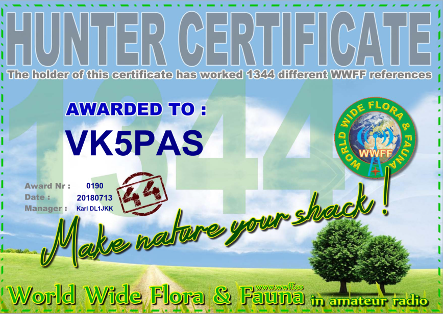
Last night I received my WWFF 1344 Hunter certificate, issued for having worked a total of 1,344 different WWFF certificates.
Thankyou to all of the WWFF & VKFF activators.
And thankyou to Karl DL1JKK, the WWFF Hunter Award Manager.
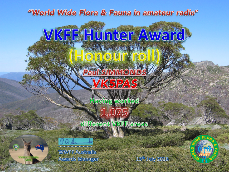
Tonight I qualified for my latest certificate in the VKFF program. It is the VKFF Hunter Honour Roll 1,075 certificate, issued for having worked 1,075 different VKFF reference areas.
Many thanks to all of the activators who made this possible.
After leaving the Geegeela Conservation Park I decided to do a quick activation at the Poocher Swamp Game Reserve VKFF-1741. This would be my 5th park for the day, and another unique park for me as an activator.
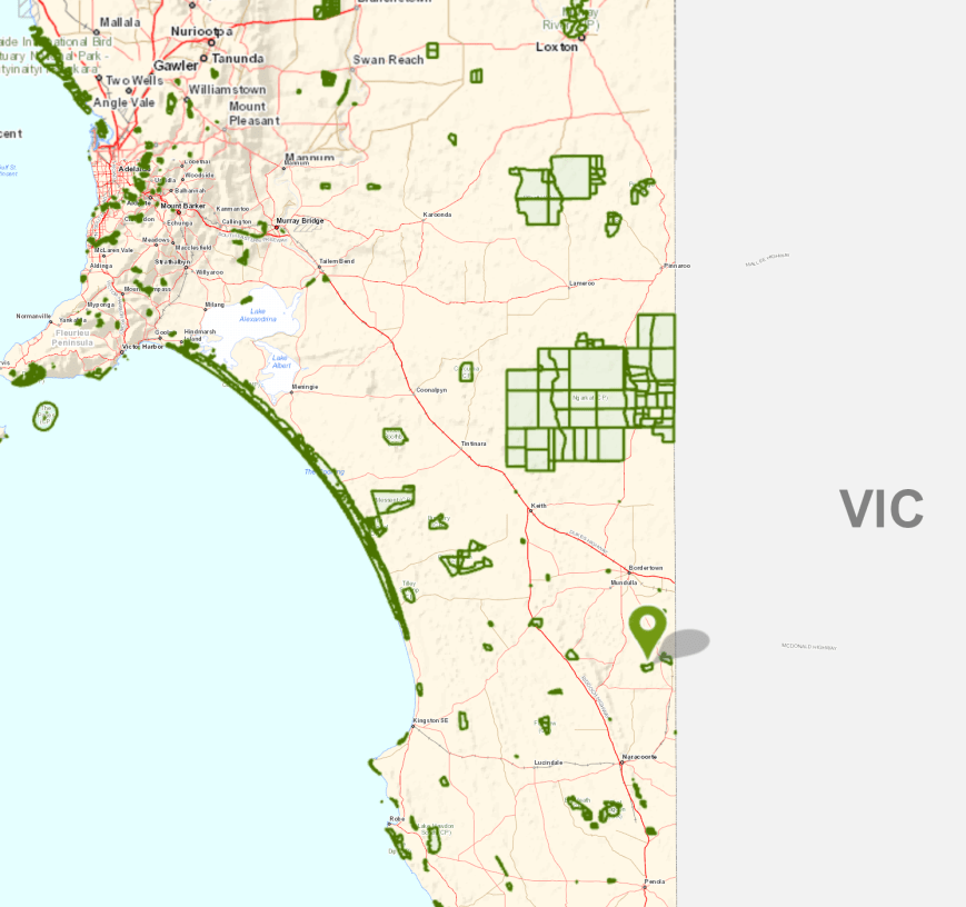
Poocher Swamp is about 271 km south east of Adelaide, and about 8 km west of the town of Bordertown.
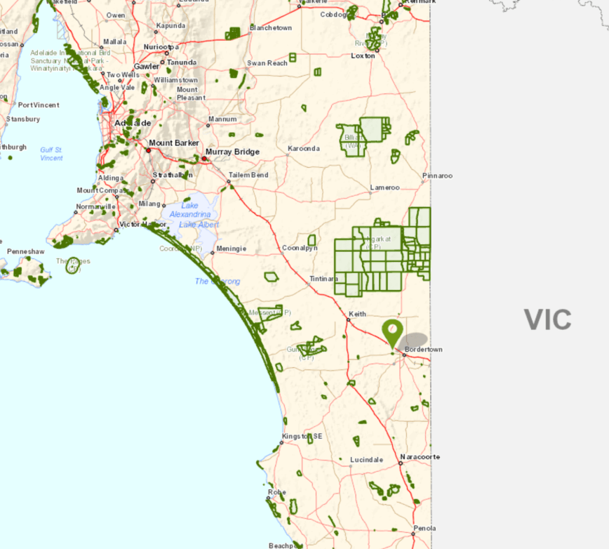
Above:- Map showing the location of the Poocher Swamp Game Reserve in the south east of South Australia. Map courtesy of Location SA Map Viewer.
This was to be a quick activation, as it was now 5.30 p.m. and I had a 2 & 1/2 hour drive ahead of me. As I drove towards the park I enjoyed a magnificent sunset.
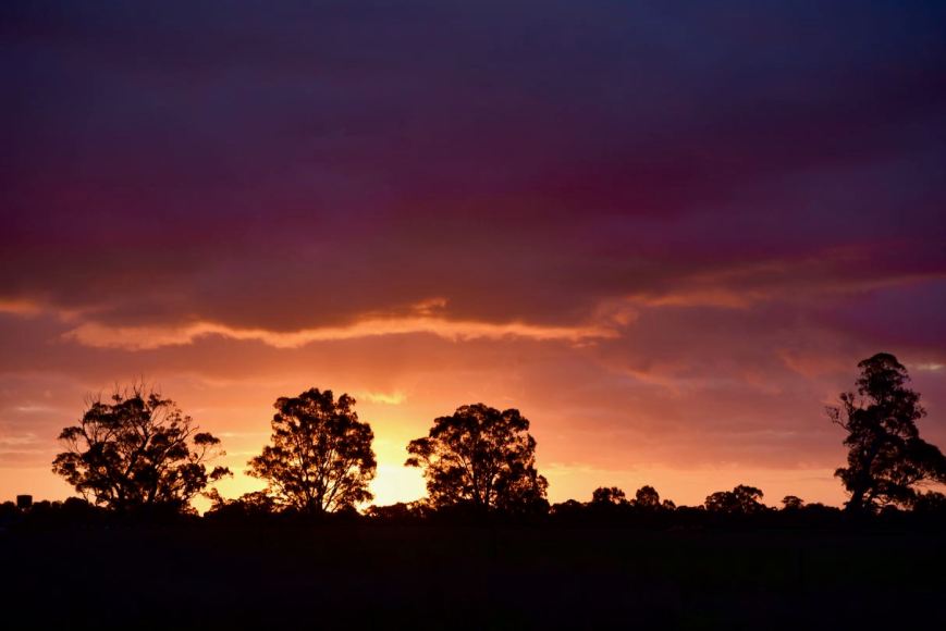
The Poocher Swamp Game Reserve is 77 hectares in size and was proclaimed on 14th November 1985, with additional land added on 16th March 1989. During the late 1950’s, a number of levee banks were constructed in the swamp to impound water and attract bird life.
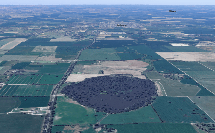
Above:- Aerial view of the Poocher Swamp Game Reserve. Image courtesy of google maps
Over many years, the impoundment of water has caused the inundation of the River Red Gums in the reserve, and as a result many have died. However regrowth is occurring at the upper limits of the floor waters and at the Tatiara Creek entrance to the swamp.


Birds SA have recorded a total of 85 bird species in the park including Grey Teal, Pacific Black Duck, Black-tailed Nativehen, Galah, Red-rumped Parrot, Australian Magpie, White-plumed Honeyeater, Magpielark, Australian Pelican, Royal Spoonbill, Purple-crowned Lorikeet, New Holland Honeyeater, and Rufous Songlark
Unfortunately I was very short of time, so I only spent a few short minutes having a look at the park. I didn’t even get the time to walk down to the actual swamp in the reserve. I set up just inside the gate leading into the reserve.
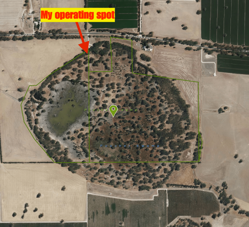
Above:- Aerial view of Poocher Swamp showing my operating spot. Image courtesy of Location SA Map Viewer.
Once I had set up it was almost dark, so I decided to kick off the activation on the 80m band. I self spotted on parksnpeaks and called CQ on 3.610 and this was answered by Adrian VK5FANA. This was followed by Gerard VK2IO, Compton VK2HRX, and then Peter VK3PF. Contact number 10, qualifying the park for me for VKFF, was a QSO with Bill VI50IARU3 in the Calliope Conservation Park VKFF-1499, just 9 minutes into the activation.
I logged a total of 26 stations on 80m from VK1, VK2, VK3, VK4, and VK5. Unfortunately callers then dried up, so I headed off to 7.144 on 40m. First in the log there was Ray VK4NH. After working 11 stations, Bill VI50IARU3 gave me a shout, and remained on the frequency with me, working the hunters, giving them 2 parks at the same time.
Contact number 44 was a QSO with Gerard VK2IO, who was struggling to hear me. We moved frequency 3 times as Gerard was suffering from noise, but we eventually made it. At just after 6.30 p.m. local time I had 46 contacts in the log after an hour in the park, which really amazed me. Time to pack up and hit the road.
THANKYOU to everyone who called me during my 5 activations. And a BIG THANKYOU to those who took the time to spot me, as I had no internet coverage at some of the parks.
I worked the following stations on 80m SSB:-
I worked the following stations on 40m SSB:-
References.
Birds SA, 2018, <https://birdssa.asn.au/location/poocher-swamp-game-reserve/>, viewed 12th July 2018
My fourth planned park for the day (Tuesday 10th July 2018) was the Geegeela Conservation Park 5CP-075 & VKFF-0883. This was to be another unique park for me as an activator.
Geegeela is situated about 298 km south east of Adelaide and about 27 km south of the town of Bordertown.
Above:- Map showing the location of the Geegeela Conservation Park. Map courtesy of Location SA Map Viewer.
The Geegeela Conservation Park, which is 858 hectares in size, was established in July 2005. It takes its name from the Hundred of Geegeela which was originally known as the Hundred of Pflaum. However this was changed in 1918 as a result of the anti German sentiment during World War One. Geegeela is derived from the Aboriginal Tjitjila language meaning ‘wallaby’.
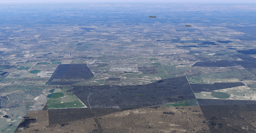
Above:- Aerial view of the Geegeela Conservation Park. Image courtesy of google maps
The Geegeela Conservation Park is home to numerous rare and endangered plant and animal species. More than 90 species of native bird have been recorded in the park. These include 17 threatened species within South Australia and 29 which have an identified conservation rating within the south east region. The park provides critical habitat for the endangered South-Eastern Red-Tailed Black Cockatoo and Swift Parrot. Other vulnerable listed birdlife includes the Brown Quail, Little Lorikeet, Brolga, Blue Winged Parrot, and the rare Shining Bronze-cuckoo, Blue Faced Honeyeater and Flame Robin.


The park consists of Blue Gum, and River Red Gum woodland. The woodland and shrubland ecosystems found in the park are threatened on both State and National levels.


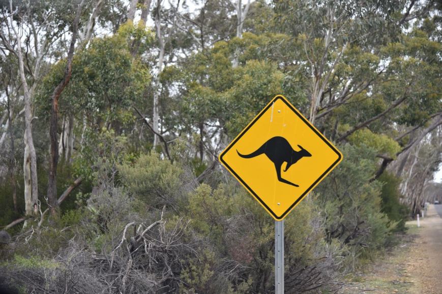
As I travelled along the Frances Road and then My Mi Mi Road, there were signs warning of kangaroos.
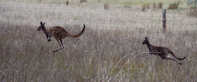
And it didn’t take me long to bump into a few of the locals.
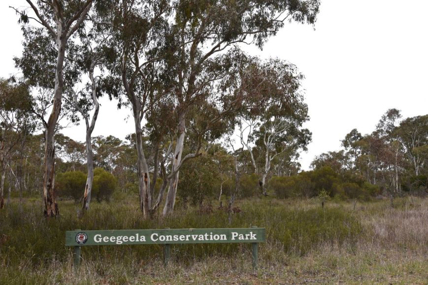
I soon reached the north eastern corner of the park which was well signposted.
A short distance from the NE corner, I found an opened gate and drove along the perimeter track.
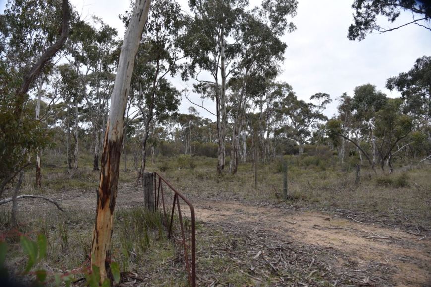
I set up about 20 metres from the gate. There was plenty of room to string out the 20/40/80m linked dipole.
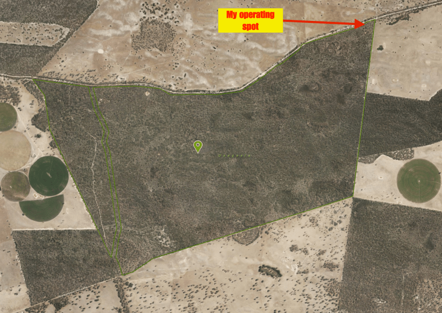
Above:- Aerial view of the Geegeela Conservation Park, showing my operating spot in the north eastern corner of the park. Image courtesy of Location SA Map Viewer.
Fortunately I had some internet coverage from Geegeela and was able to throw up a self spot on parksnpeaks. I called CQ on 7.144 and this was answered by Adrian VK5FANA, followed by John VK2YW, Gerard VK2JNG mobile, and then John VK4TJ. Contact number 10, with Linda VK7QP, came 7 minutes into the activation. I had qualified the park for the VKFF National program.
The 40m band was in excellent shape, and within 37 minutes I had my 44th contact in the log, with a QSO with Rob VK2TTY. After logging 49 contacts on 40m I moved off to 3.610 on the 80m band, which was also in great shape. I logged 16 stations on 80m from VK2, VK3, VK5, and VK7.
I then put out about 10 or so CQ calls on 14.310 on the 20m band, but had no takers, so with it now being 4.10 p.m. local time, it was time to pack up and move on. I still had a 2 & 1/2 hour drive to get home and I was contemplating activating the Poocher Swamp Game Reserve.


I worked the following stations on 40m SSB:-
I worked the following stations on 80m SSB:-
References.
National Parks South Australia, 2018, <https://www.environment.sa.gov.au/parks/find-a-park/Browse_by_region/Limestone_Coast/geegeela-conservation-park>, viewed 12th July 2018
State Library South Australia, 2018, <http://www.slsa.sa.gov.au/digitalpubs/placenamesofsouthaustralia/G.pdf>, viewed 12th July 2018
My third park for the day was the Bangham Conservation Park 5CP-009 & VKFF-0869, which is located about 304 km south east of Adelaide and about 34 km south east of the town of Bordertown. Again, this was to be another unique park for me as an activator.
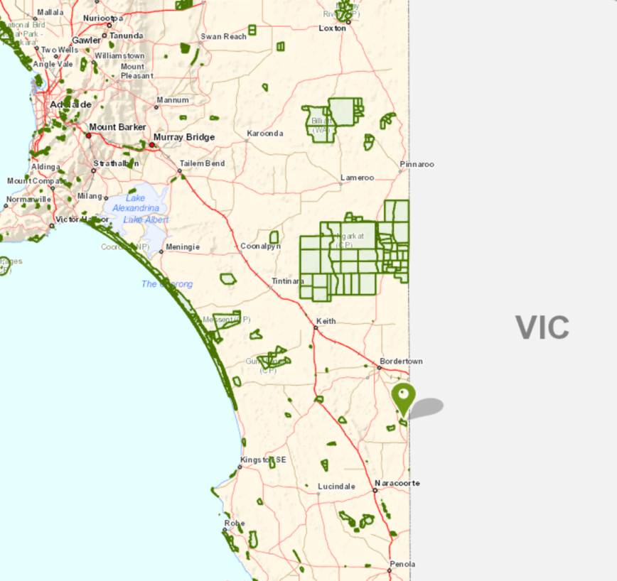
Above:- Map showing the location of the Bangham Conservation Park. Map courtesy of Location SA Map Viewer.
The Bangham Conservation Park is a large park, comprising 869 hectares. In 1971 the land was offered to the South Australian State Government for conservation purposes. At the time it consisted of 6.76 square kilometres of “native scrub” and 1.25 square kilometres of “cleared land” with the majority of the latter occupying its south-east corner.
There was a subsequent study which revealed that the land was used by the endangered Red-Tailed Black Cockatoo. This made the land “particularly suitable for conservation purposes”. Bangham was first proclaimed on the 22nd November 1973, with further land being added on 18th February 2010. A Government survey of 1908 described the area as having the ‘greater part undulating white sand, with stringybark, buck honeysuckle, heath, yacca with a few pines’ and supporting ‘little grass’, and considered to be ‘inferior pasture’.

Above:- Aerial view of the Bangham Conservation Park, looking north. Image courtesy of google maps
Three major associations located in the park are: South Australian Blue Gum (Eucalyptus leucoxylon) open forest – woodland; River Red Gum (E. camaldulensis) – in areas subject to inundation; and Brown Stringybark (E. baxteri) open forest – low open forest.


The park takes its name from the nearby area of Bangham. Edward Bangham had land in the area in the 1840’s. The Bangham Hall opened in 1953 and can still be found on the Frances Road.
Birds SA have recorded a total of 135 species of native birds in the park including Sulphur-crested Cockatoo, Crimson Rosella, White-throated Treecreeper, Brown Treecreeper, Superb Fairywren, Tawny-crowned Honeyeater, Red Wattlebird, Black-chinned Honeyeater, Little Corella, Spiny-cheeked Honeyeater, Blue-faced Honeyeater, White-fronted Chat, Crested Bellbird, Hooded Robin, and Grey-crowned Babbler.
I turned into the park off the Frances Road and travelled down a sandy 4WD track which then took me to the northern boundary of the park.
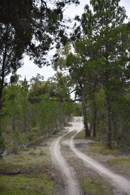
Above:- the track in the park
I pulled the Hi Lux off to the side of the track and set up ‘the shack’ comprising the Yaesu FT-857d (set at 40 watts output) and the 20/40/80m linked dipole.

Above:- Aerial shot of the Bangham Conservation Park showing my operating spot in the northern section of the park. Image courtesy of Location SA Map Viewer.
Once I had set up I headed to 7.144 and found Alan VK2MG/p calling CQ from the Tuggerah State Conservation Area VKFF-1383. After logging Alan, Park to Park, I moved down the band to 7.135 and called CQ. Unfortunately I had no internet coverage and was hoping that someone would find me. Fortunately Peter VK3PF did. I then logged Peter VK7LCW, Adrian VK5FANA, and Gerard VK2JNG mobile.
Contact number 10 was a QSO with Brett VK2VW, nine minutes into the activation. I logged 33 stations on 40m from VK2, VK3, VK4, VK5 and VK7. I then moved to 3.610 on the 80m band and logged 11 stations from VK2, VK3, and VK5. This included Andrew VK1DA/3 who was activating SOTA summit Goonmirk Rocks VK3/ VG-048 in the Errinundra National Park VKFF-0158. Contact number 44 was Geoff VK3SQ.
I then QSYd to the 20m band and called CQ on 14.310. First in the log on that band was Ray VK4NH, followed by John VK4TJ and Rob VK4SYD.
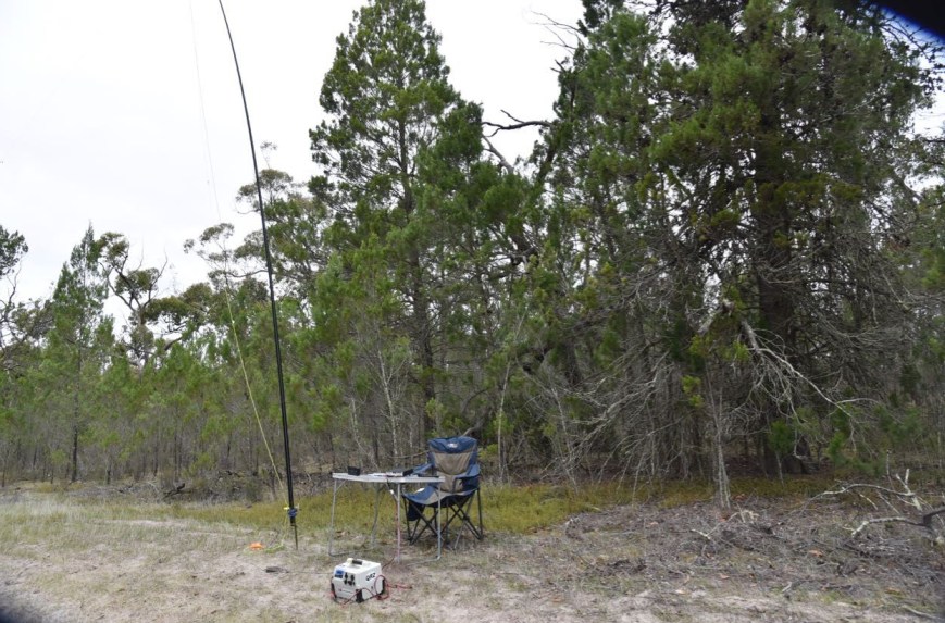
I had qualified the park, with 49 contacts in the log, and time to head to my fourth park, the Geegeela Conservation Park.
I worked the following stations on 40m SSB:-
I worked the following stations on 80m SSB:-
I worked the following stations on 20m SSB:-
References.
Birds SA, 2018, <https://birdssa.asn.au/location/bangham-conservation-park/>, viewed
State Library South Australia, 2018, <http://www.slsa.sa.gov.au/digitalpubs/placenamesofsouthaustralia/>, viewed
Wikipedia, 2018, <https://en.wikipedia.org/wiki/Bangham_Conservation_Park>, viewed
My second park for the day (Tuesday 10th July 2018) was the Pine Hill Soak Conservation Park 5CP-181 & VKFF-1078. This was to be another unique park for me as an activator in the WWFF program and the VK5 Parks Award.
Pine Hill Soak is located about 301 km south east of Adelaide, and about 30 km south of the town of Bordertown.
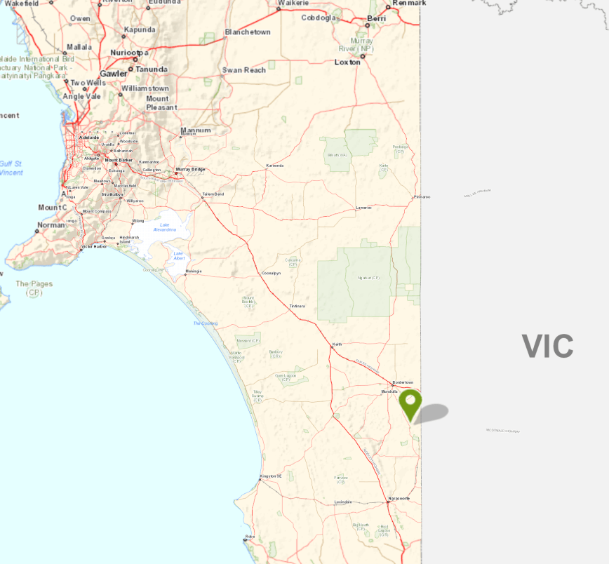
Above:- Map showing the location of the Pine Hill Soak Conservation Park in the south east of South Australia. Map courtesy of Location SA Map Viewer.
Pine Hill Soak Conservation Park is 51 hectares (130 acres) in size and was proclaimed on the 17th September 1987. The park’s name is derived from a soak known as Pine Hill Soak which is located near the conservation park’s southern boundary. A soak or soakage, is a source of water and is so called because the water generally seeps into the and, and is stored below, sometimes as part of an ephemeral river or creek.
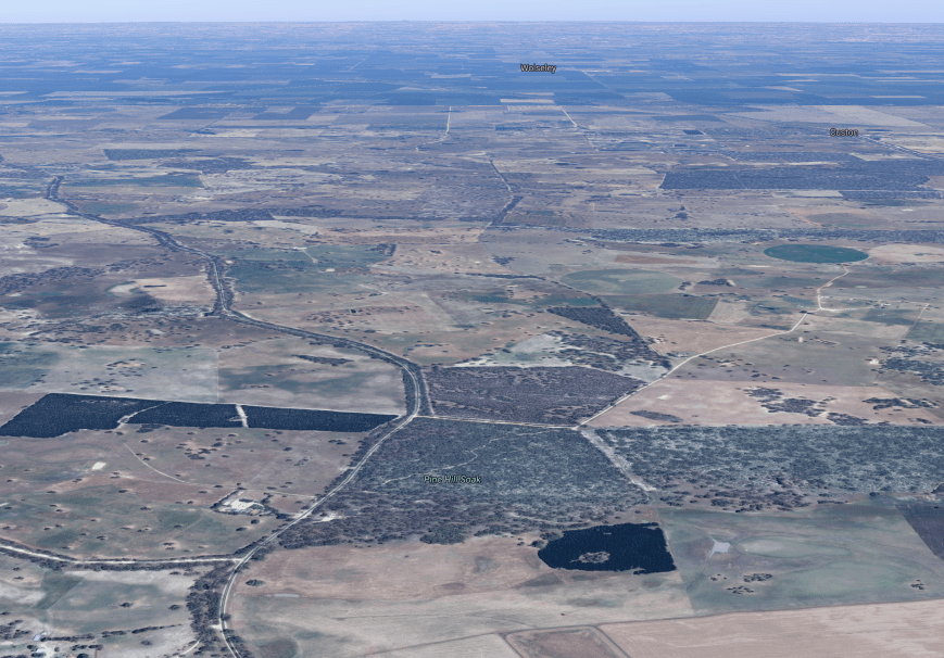
Above:- Aerial view of the Pine Hill Soak Conservation Park. Image courtesy of google maps
The park is bounded on the western side by the Frances Road, McCarthy Road to the north and by a vehicle track to its east and south boundaries. The park consists of brown stringybark open forest, with desert banksia, and woodland of river red gum and South Australian blue gum with an open understorey of grasses, sedges and herbs. The park also contains native pine.


After I left Custon Conservation Park I put Pine Hill Soak into the GPS. All was looking good until the GPS took me down a dead end road (Ivan Road) and into a farmer’s property. So it was a manual look at some maps, and back to the Frances Road. I then encountered a flock of sheep and alpaccas who were out grazing on the side of the road under the watchful eye of a local farmer.


I soon reached the north western corner of the park and travelled down McCarthy Road, which is a no through road. I travelled down a sandy track which passed through the park. I found a clearing in the scrub and pulled off the track and set up. I ran the Yaesu FT-857d and the 20/40/80m linked dipole for this activation.
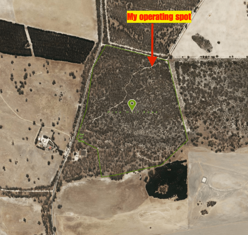
Above:- Aerial view of the Pine Hill Soak Conservation Park, showing my operating spot in the northern section of the park. Image courtesy of google maps
First in the log was Rob VK2QR with a big signal, followed by Geoff VK3SQ, Neil VK4HNS, and then Ron VK3AHR. Within 6 minutes I had contact number 10 in the log, with a QSO with Vinnie VK2VIN in Wollongong.
The band had really opened up nicely since my first activation, with some excellent signals. Contact number 44, a QSO with Rob VK3QJ/2 came within 28 minutes. I logged a total of 50 stations on 40m from VK1, VK2, VK3, VK4, VK5 VK7 and New Zealand. I was pleased as always to log regular park hunter Andrei ZL1TM. I also made two Park to Park contacts, with Gerard VK2JNG/p in the Bullala National Park VKFF-0580, and Alan Vk2MG/p in Tuggerah State Conservation Area VKFF-1383.


So with the park qualified, everything from here on in was going to be a bonus. I lowered the squid pole and inserted the links for the 80m section of the dipole. First in the log on 3.610 was Mick VK3GGG with a big big 5/9 plus signal. This was followed by Ron VK3VBI and then John VK5BJE. I logged a further 4 stations on 80m from VK2, VK3 and VK5.
To finish off the activation I called CQ on 14.310 and logged John VK4TJ and then Ray VK4NH and his 2 other callsigns.
I had a total of 62 contacts in the log and it was now 1.10 p.m. local time, and time for me to pack up and head off to the Bangham Conservation Park.
I worked the following stations on 40m SSB:-
I worked the following stations on 80m SSB:-
I worked the following stations on 20m SSB:-
References.
Wikipedia, 2018, <https://en.wikipedia.org/wiki/Pine_Hill_Soak_Conservation_Park>, viewed 12th July 2018
Wikipedia, 2018, <https://en.wikipedia.org/wiki/Soakage_(source_of_water)>, viewed 12th July 2018
Amateur Radio, Short Wave Listening, travel and history
Amateur radio experiences with VK1DA
Brisbane - Australia
german amateur radio station
Summits On The Air
SOTA on the peaks, wilderness QRP and some bushwalking
A fine WordPress.com site
Amateur Radio Adventures
Summits on the Ai
Radio craft, homebrew, QRP/SOTA, AM
Ego loqui ad viros super montes
My adventures with Amateur Radio and Geocaching!
The rantings of VK2GAZ on his SOTA experiences in Australia
A survivor, with minor cuts and abrasions.
The Art and Craft of Blogging
News, Tips & Website Tutorials
Blog of Justin Giles-Clark VK7TW's SOTA and amateur radio adventures.
Occasional SOTA & Microwave operation
Some accounts of SOTA and other radio outings

