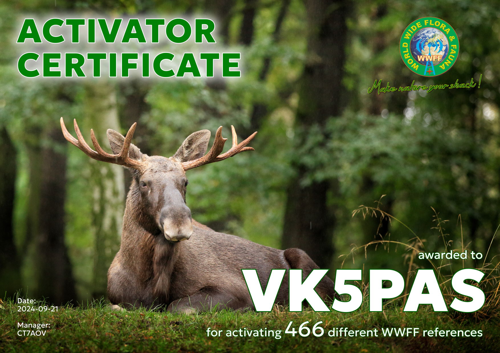
About a week ago I received in my email Inbox, my latest WWFF Activator certificate. It is issued for having activated a total of 466 different references and reaching at least 44 QSOs in each.
Thank you to all of the WWFF Hunters and thank you to Hugo CT7AOV the Award Manager.
Last night (Thursday 5th September 2024) I tuned in to Air Traffic Control on 8822 kHz and 8866 kHz.
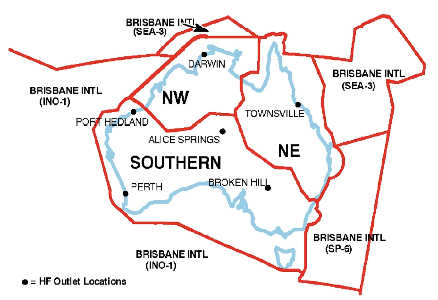
For civil aviation HF communication, Australia is divided into 6 HF network areas known as Regional Domestic Air Route Areas (RDARA’s) and Major World Air Route Areas (MWARA’s). These are FLIGHTWATCH frequencies and are all controlled from Brisbane, Queensland. (Swld.com 2024)
Above:- RDARA areas.
The 8822 kHz frequency is the Southern area.
The 8866 kHz is in the Brisbane International area.
Last night (Thursday 5th September 2024) I tuned in to Air Traffic Control on 11285 kHz.
The 11285 kHz frequency is part of the Major World Air Route Areas (MWARA), which support HF Radio communications to aircraft outside of VHF range. The transmissions operate on Upper Sideband (USB). The world is divided into 11 areas. (Wiki 2024)
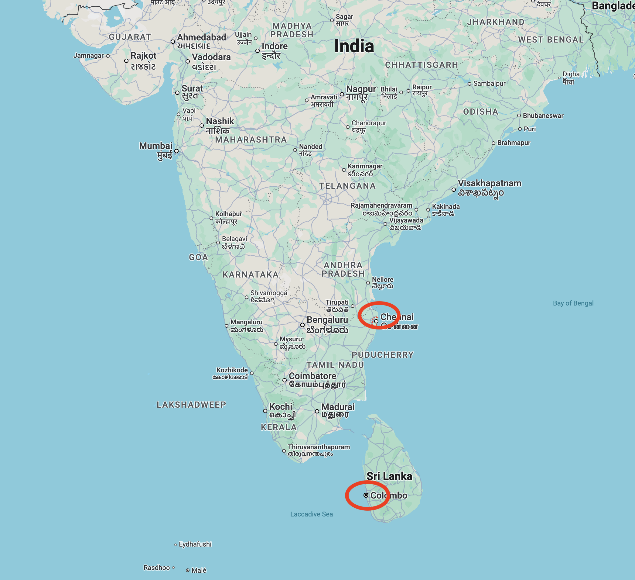
Colombo SRI LANKA and Chennai INDIA operate on the same frequency of 11285 kHz.
Above:- Map showing the location of Chennai India and Colombo Sri Lanka. Map c/o Google Maps.
Below is a short video of my reception.
References.
HF Radio – Major World Air Route Areas – MWARA. (2024). HF Radio – Major World Air Route Areas – MWARA. [online] Available at: https://aeronauticalradio.weebly.com/ [Accessed 6 Sep. 2024].
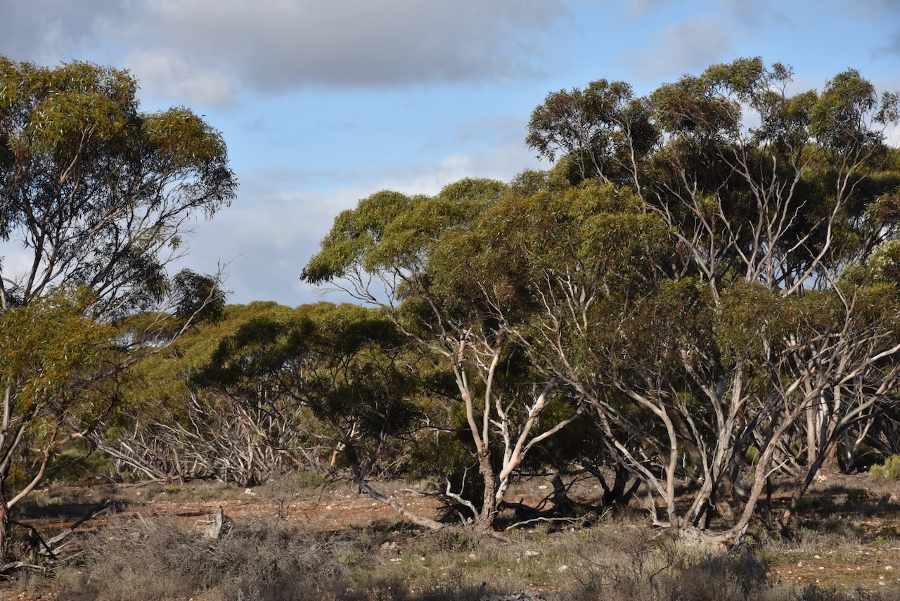
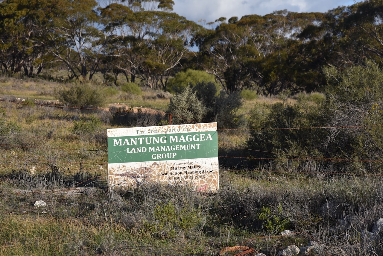
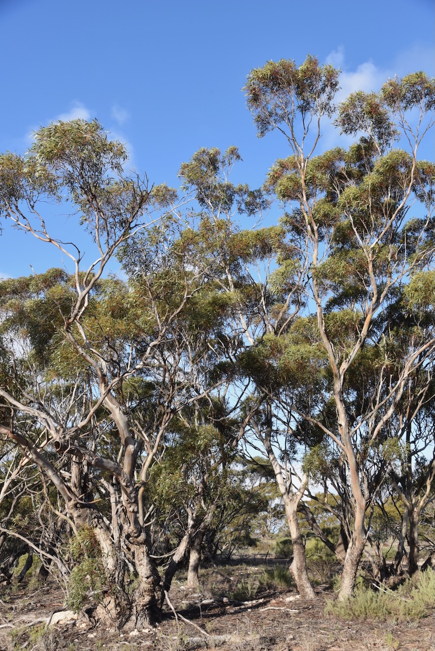
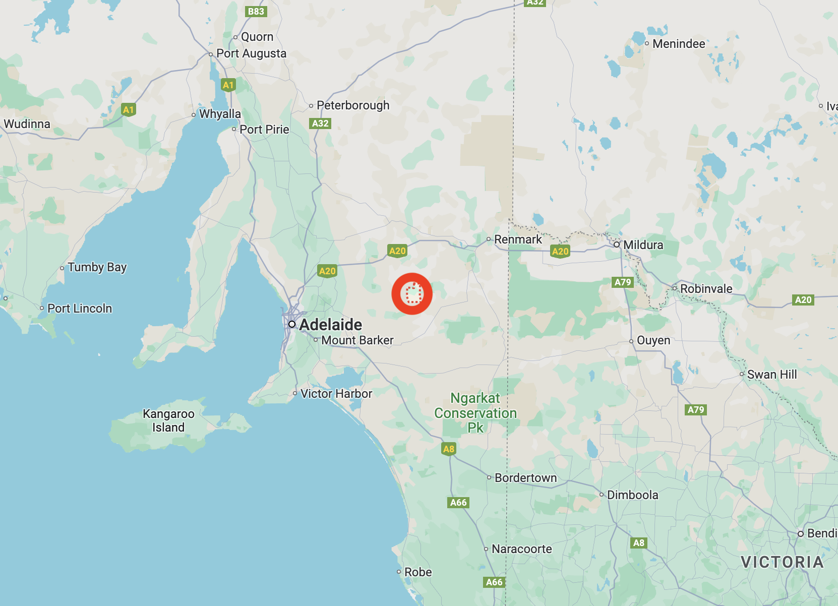
After leaving Galga on Saturday 17th August 2024, I headed to the Mantung Conservation Park VKFF-1055, to activate the park for the World Wide Flora Fauna (WWFF) program.
Prior to activating the park, I stopped to have a look around the little town of Mantung which is located about 140 km east of Adelaide.
Above:- Map showing the location of Mantung. Map c/o Google Maps.
Mantung is an aboriginal word meaning ‘water on a native road’. Nomadic aboriginal people followed sandhills from near Swan Reach via Bakara to Loxton in the Riverland region, obtaining water from mallee trees. The sandhills also contained root foods. When the Hundred of Mantung was proclaimed on the 15th day of June 1893, the name was shown as an Aboriginal waterhole on an 1864 land tenure plan. (Place Names 2012)
The town of Mantung was proclaimed on the 8th day of July 1915. The Post Office was opened as Mantung Railway in September 1915. It became Mantung on the 1st day of September 1966. The Mantung School opened in 1921 and closed in 1944. The school reopened in 1961 and was conducted in the Mantung Hall. (Place Names 2012)
The town was one of several towns along the Waikerie railway line following its opening in 1914. The line branched from the Barmera railway line at Karoonda, which was also the junction for the Peebinga railway line. It extended north, northeast, and north again to Waikerie. (Wikipedia 2024)
Above:- 1914 map of railway lines in South Australia, showing the Waikerie line. Image c/o railmapsa.au
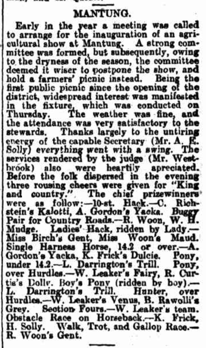
Mantung once had its own Agricultural Show.
Above:- Article from the Observer, Adelaide, Sat 10 Oct 1914. Image c/o Trove.
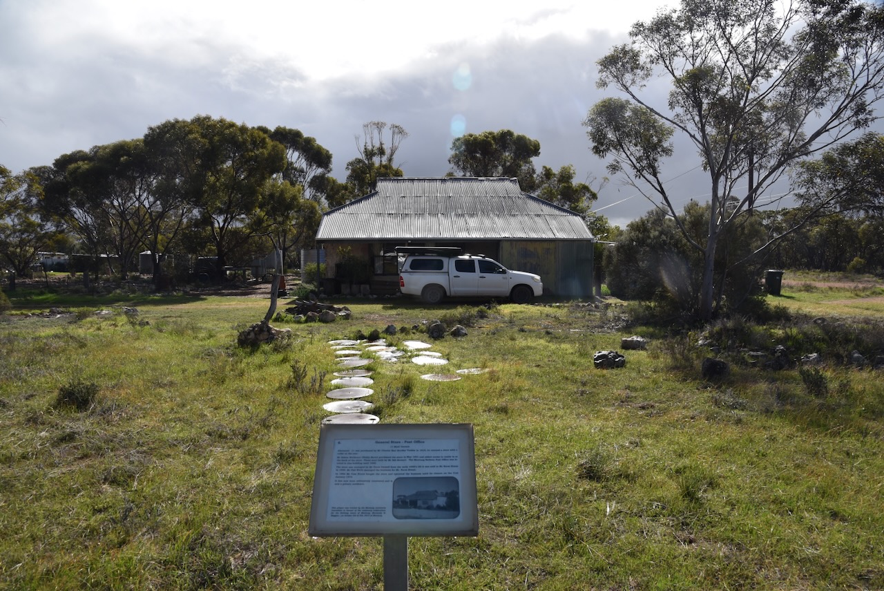
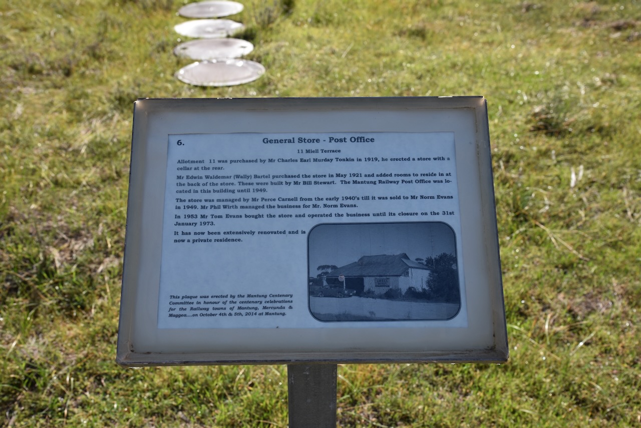
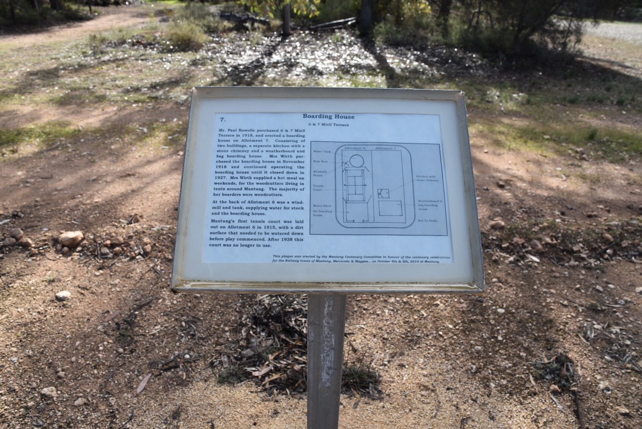
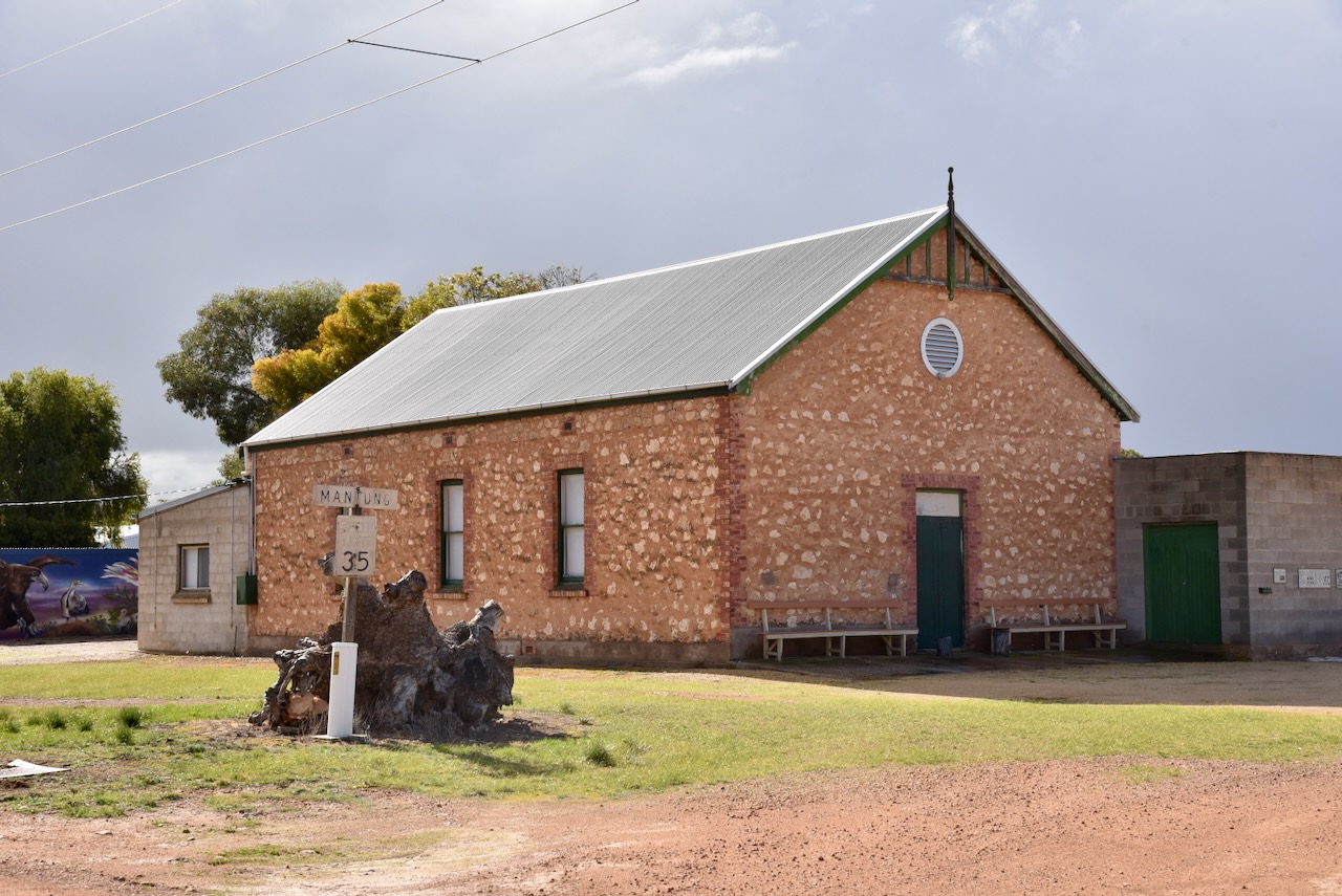
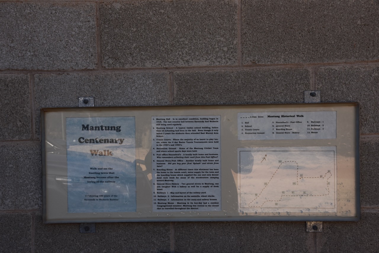
If you are in the district, please take the time to have a look around Mantung. There are several information signs detailing the history of the town and some of the remaining historic buildings.
At the Mantung Hall, you can pick up a ‘Mantung Centenary Walk’ brochure that details a very interesting walk around what was once a bustling town.
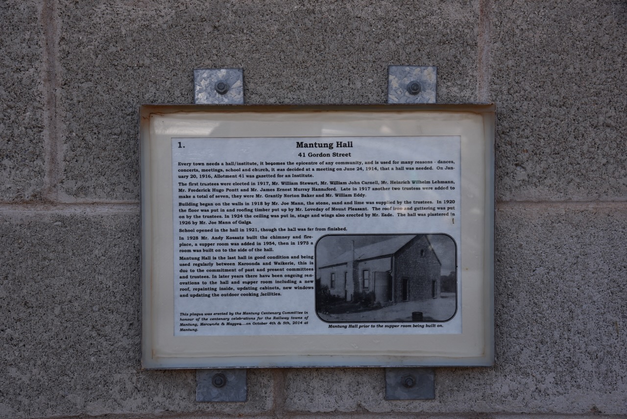
The Mantung Hall was built in 1918. It is the last country hall between Karoonda and Waikerie that is still being used regularly.
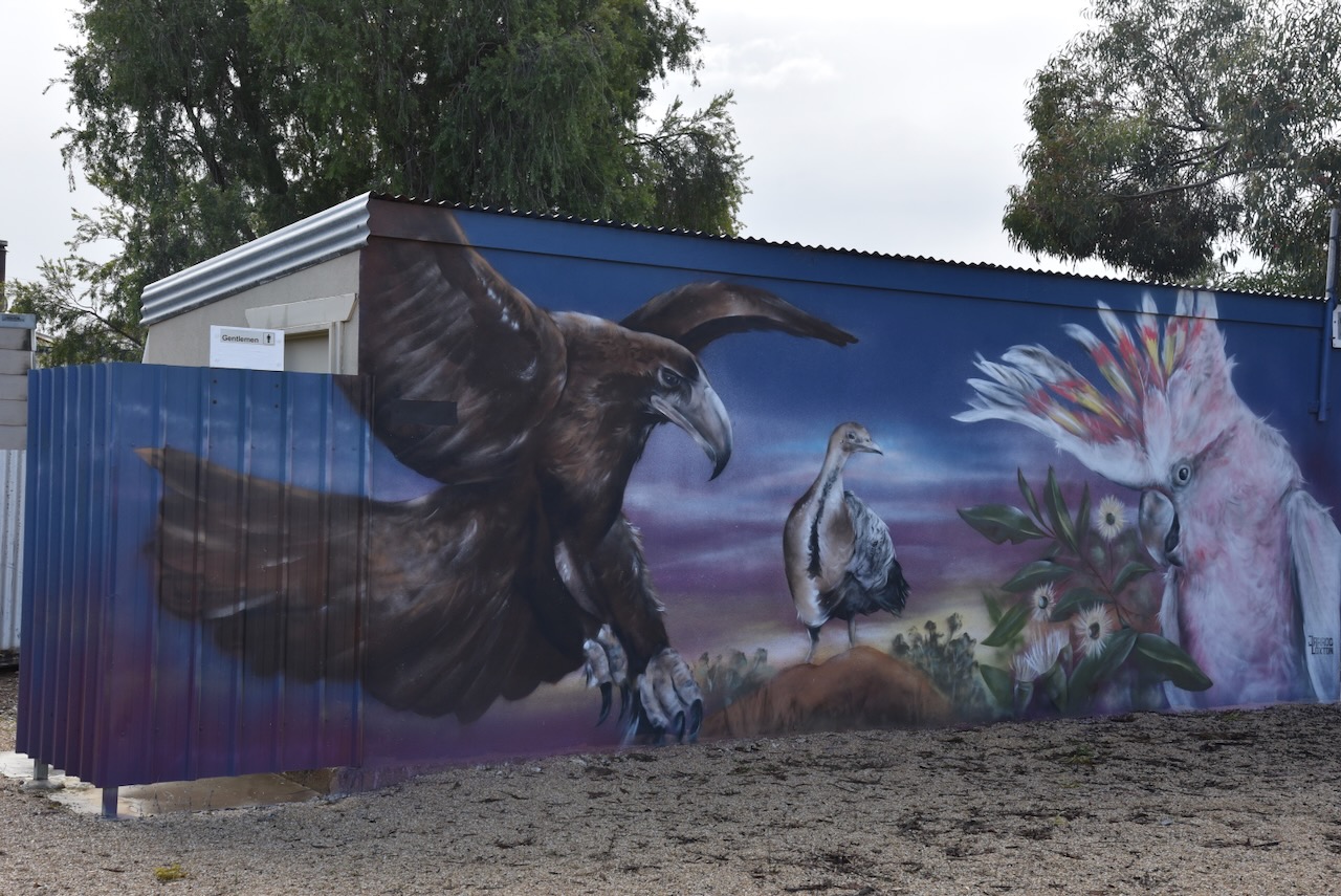
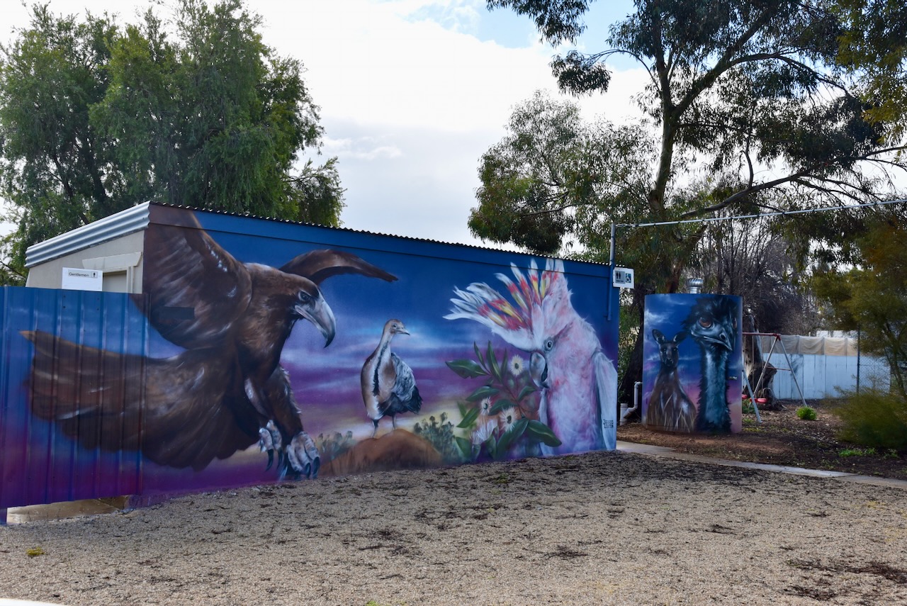
The community hall toilet block at the rear of the hall has been painted by Jarrod Loxton. It features some of the local wildlife including a Wedge Tailed Eagle, Mallee fowl, and a Major Mitchell Cockatoo. (Karoonda 2024)
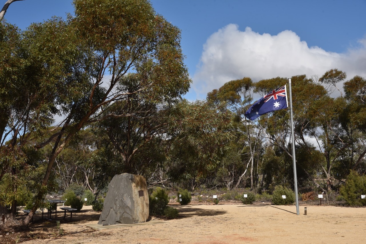
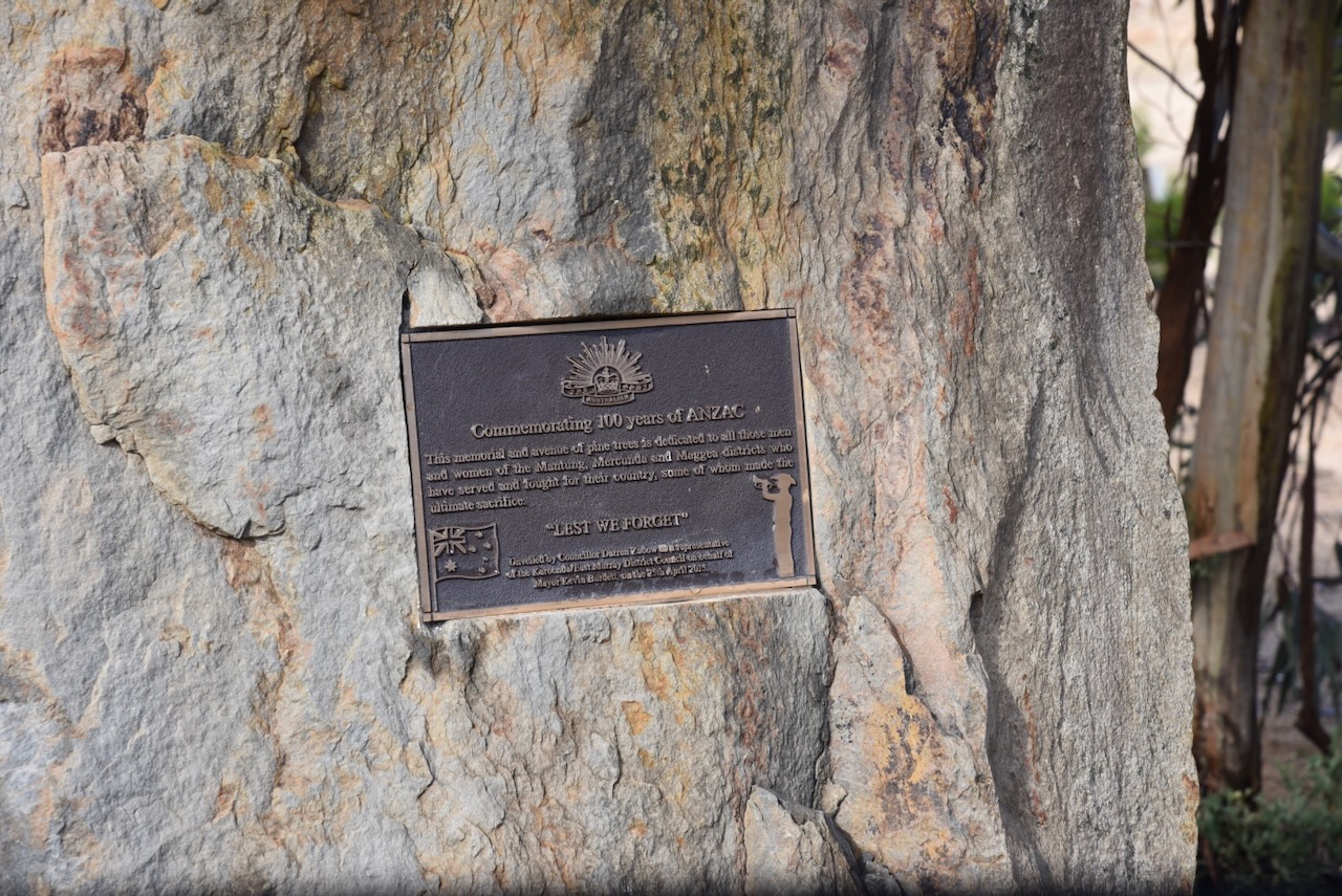
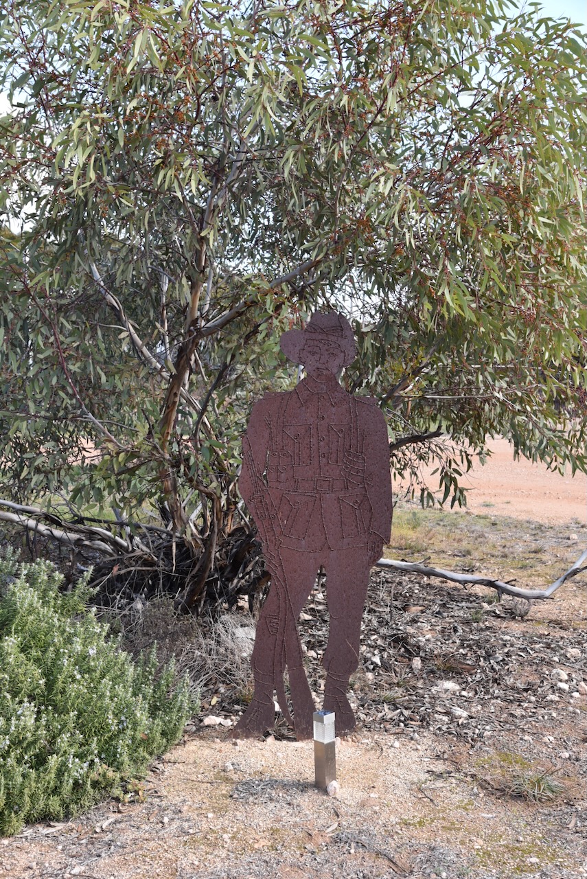
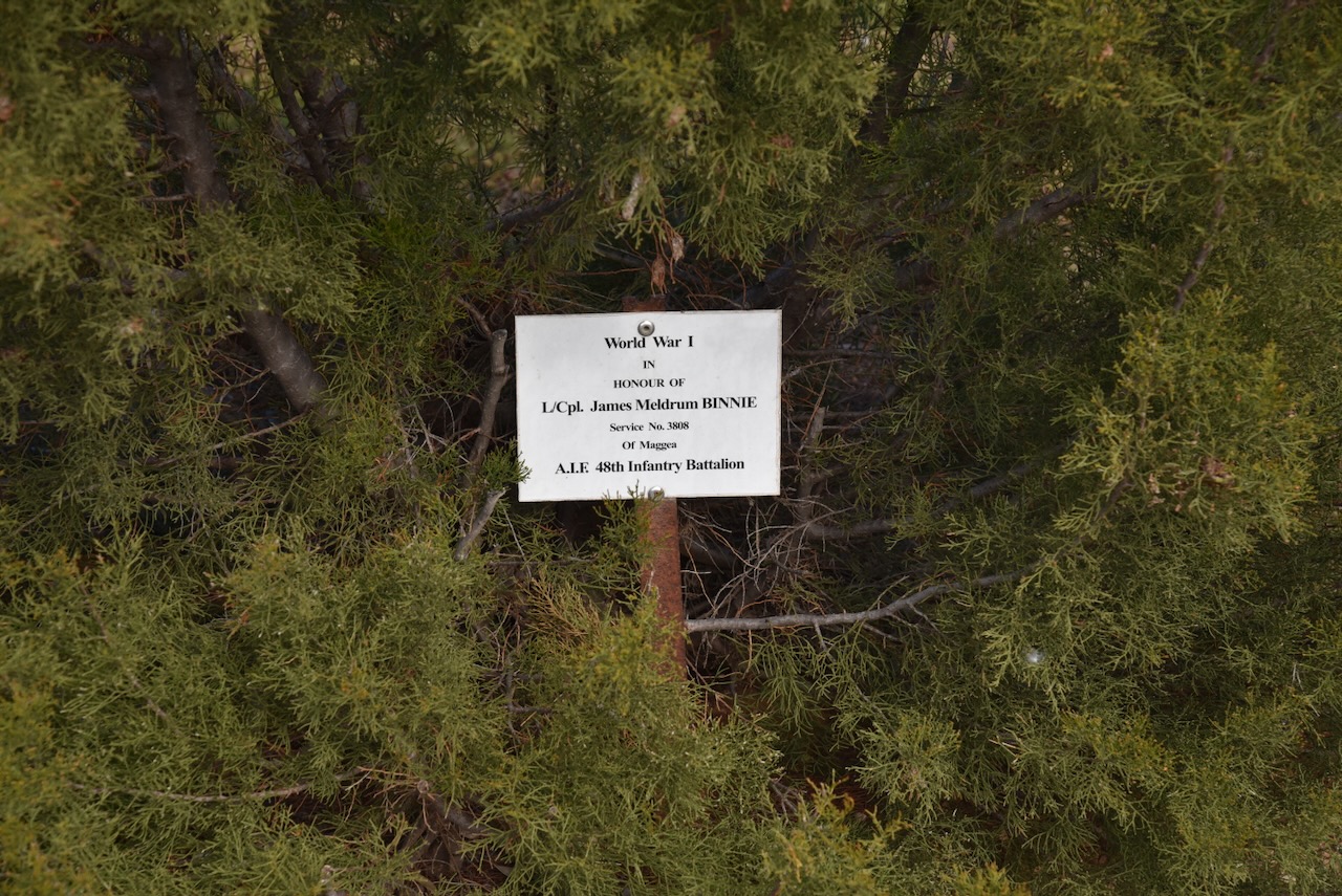
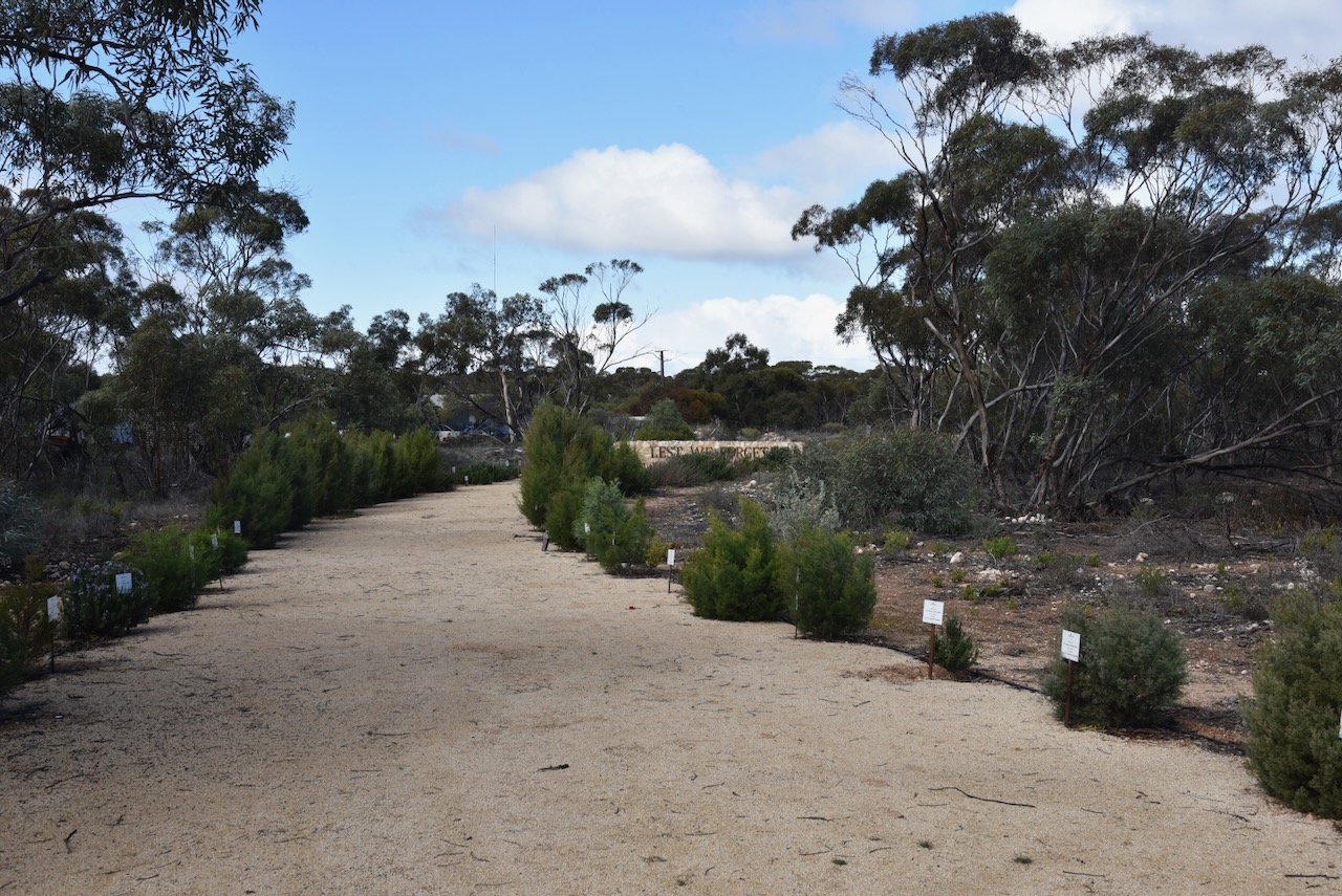
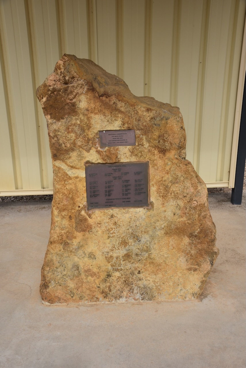
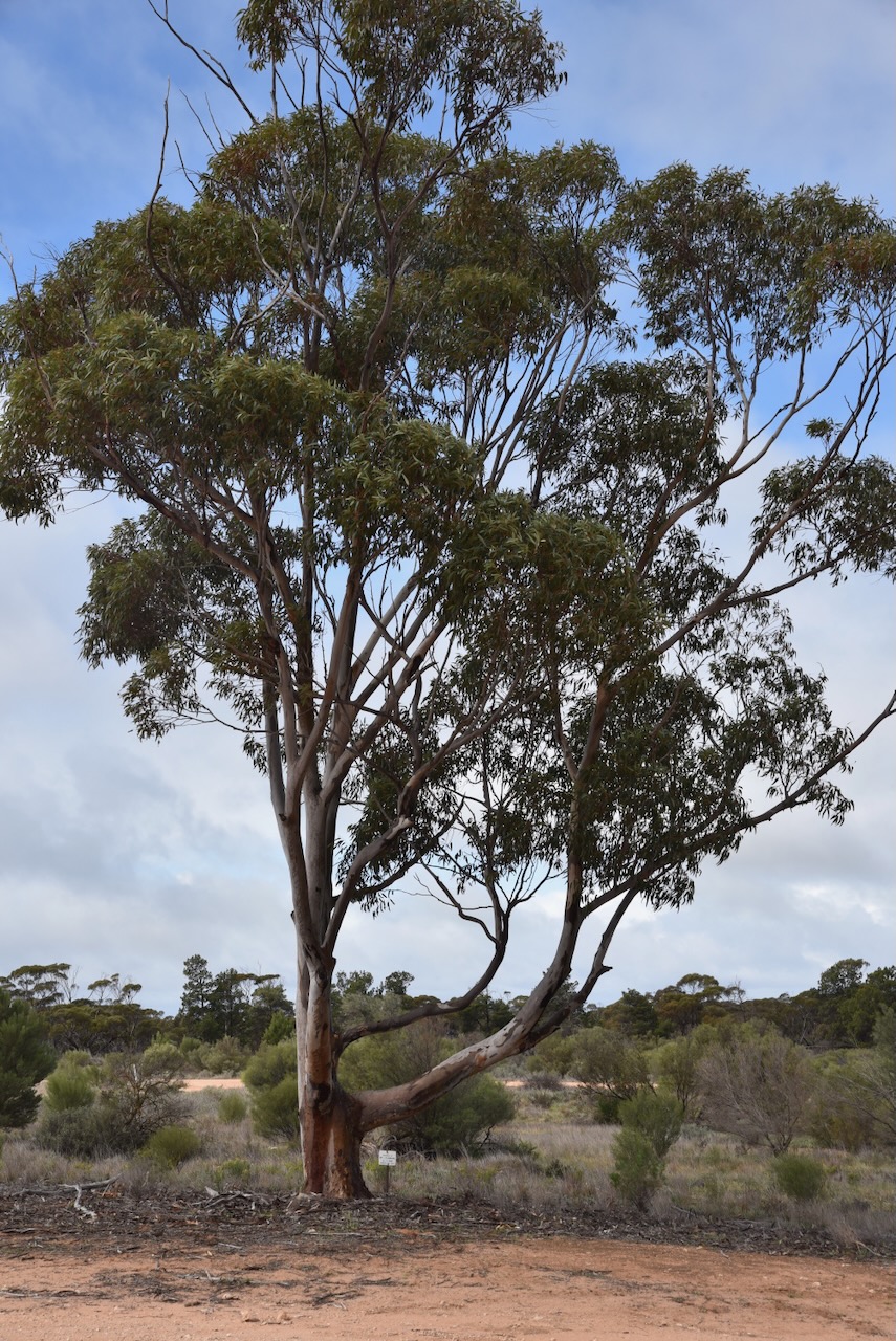
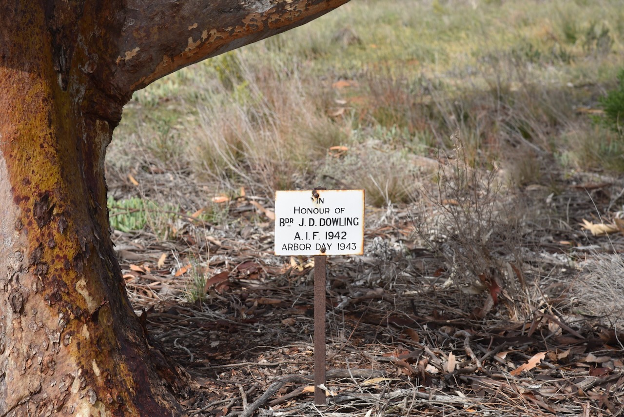
Adjacent to the hall is the Mantung War Memorial. It includes an avenue of pine trees to commemorate the men and women of the district who have served in the various conflicts in which Australia has been involved (Monument Australia 2024)
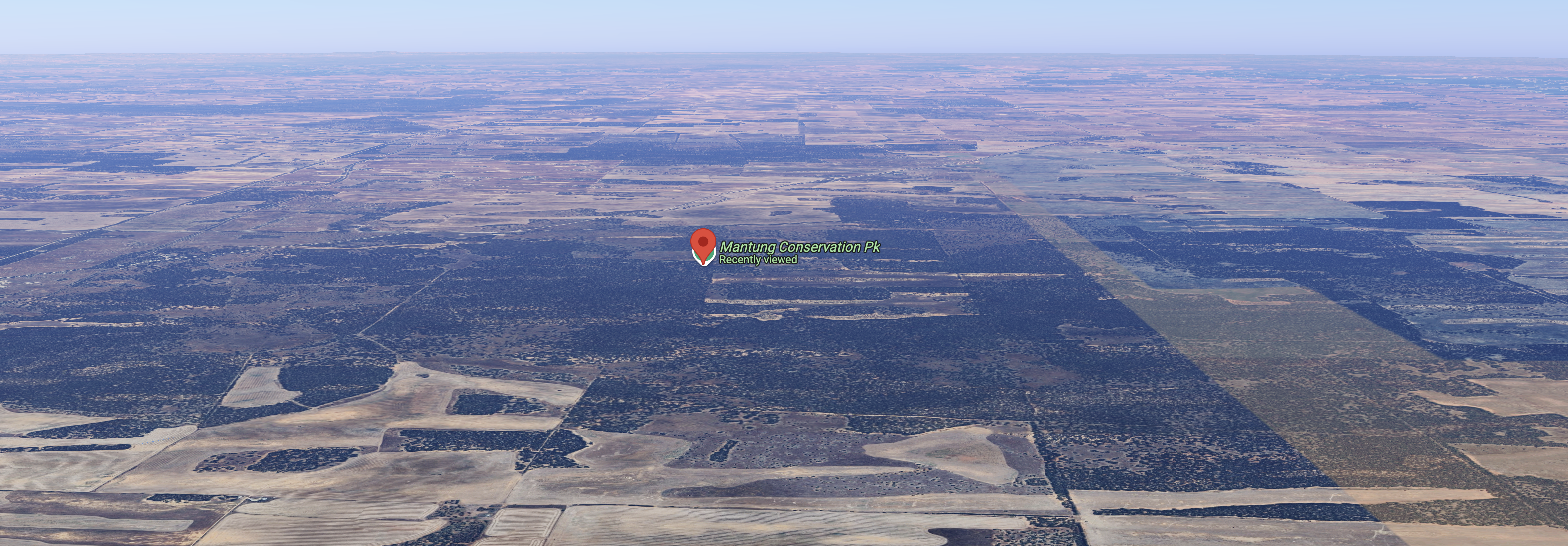
The Mantung Conservation Park is about 1,695 hectares in size and was proclaimed on the 16th day of October 2014. (Wikipedia 2024)
Above:- An aerial view of the park looking north. Image c/o Google Maps.
The park contains the largest intact remnant of deep sand habitat in the Northern Murray Mallee. It supports several rare plant species including the rasp daisy bush. It is also contains significant habitat for several endangered bird species including malleefowl, southern scrub-robin, shy heathwren, inland thornbill, white-browed babbler and purple-gaped honeyeater. (Nat Resources 2014)
I set up in a cleared area of the scrub and ran the Yaesu FT857, 40 watts, and the 20/40/80m linked dipole for this activation.
I ended up logging a total of 91 QSOs including 9 Park to Park contacts.
I worked the following stations on 40m SSB:-
VK3VIN
Vk3ACZ
VK3FAR
VK2SLB
VK2BRN
VK2KBT
VK5FD
VK5HS
VK3PWG
VK2R/p (Sydney Harbour National Park VKFF-0473 & lighthouse AU-0041)
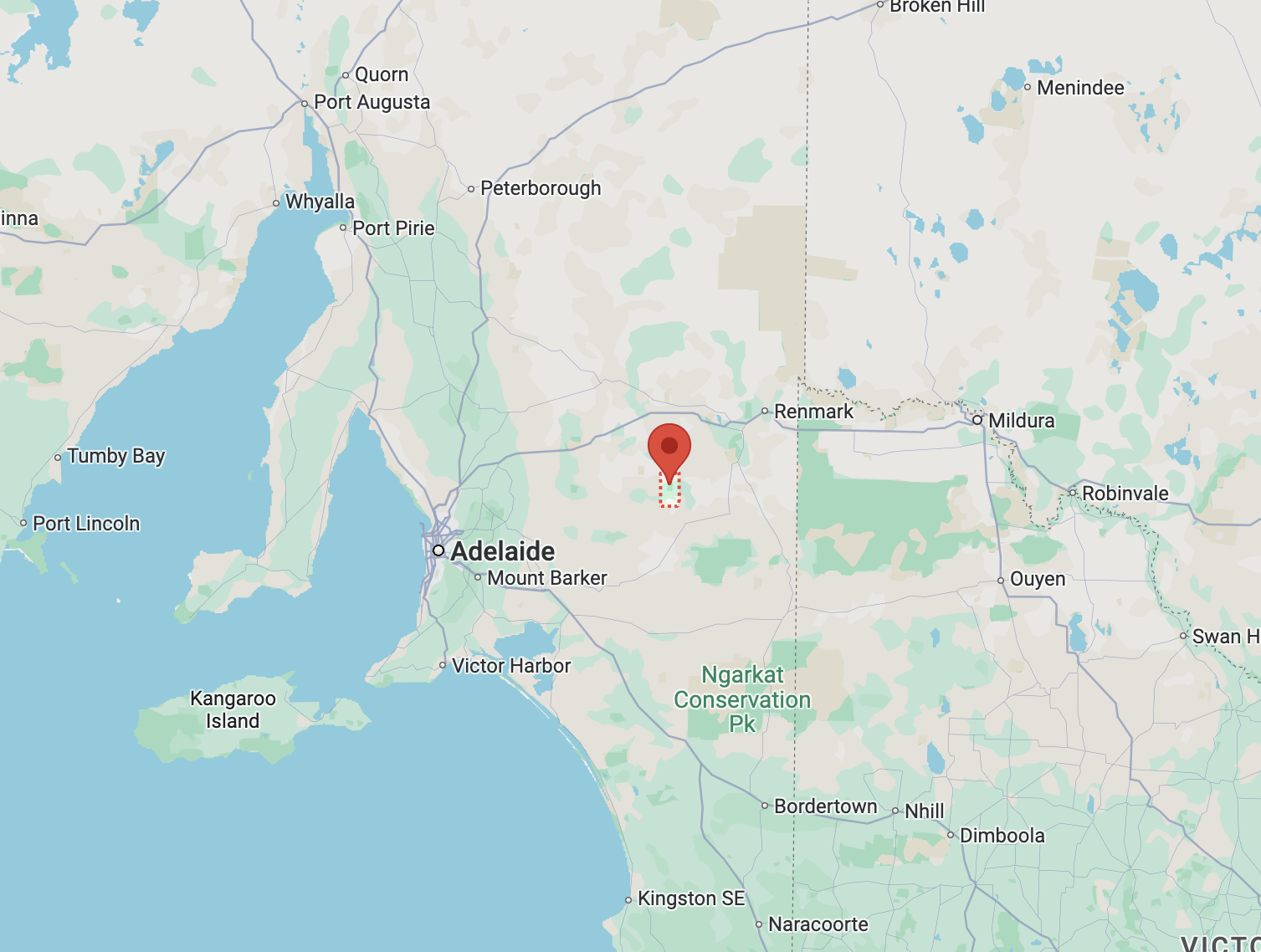
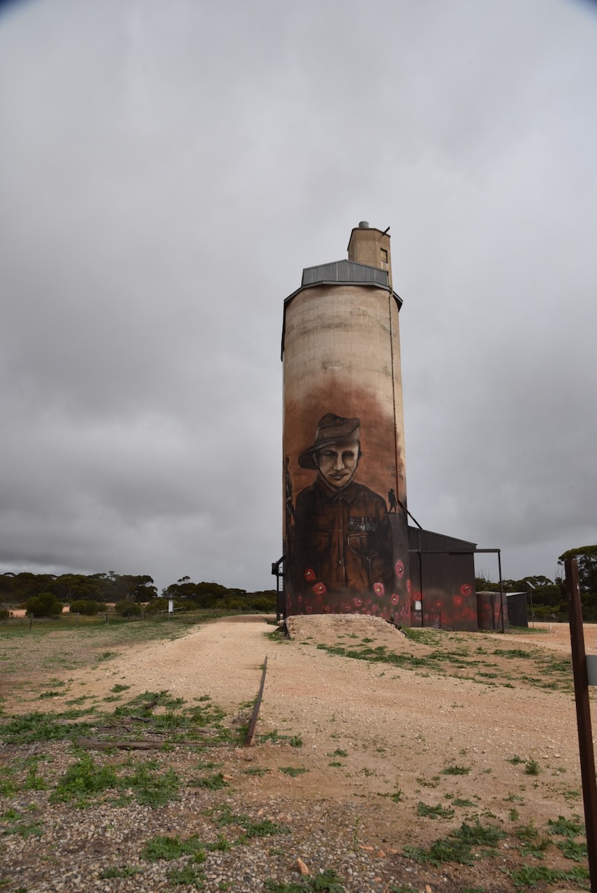
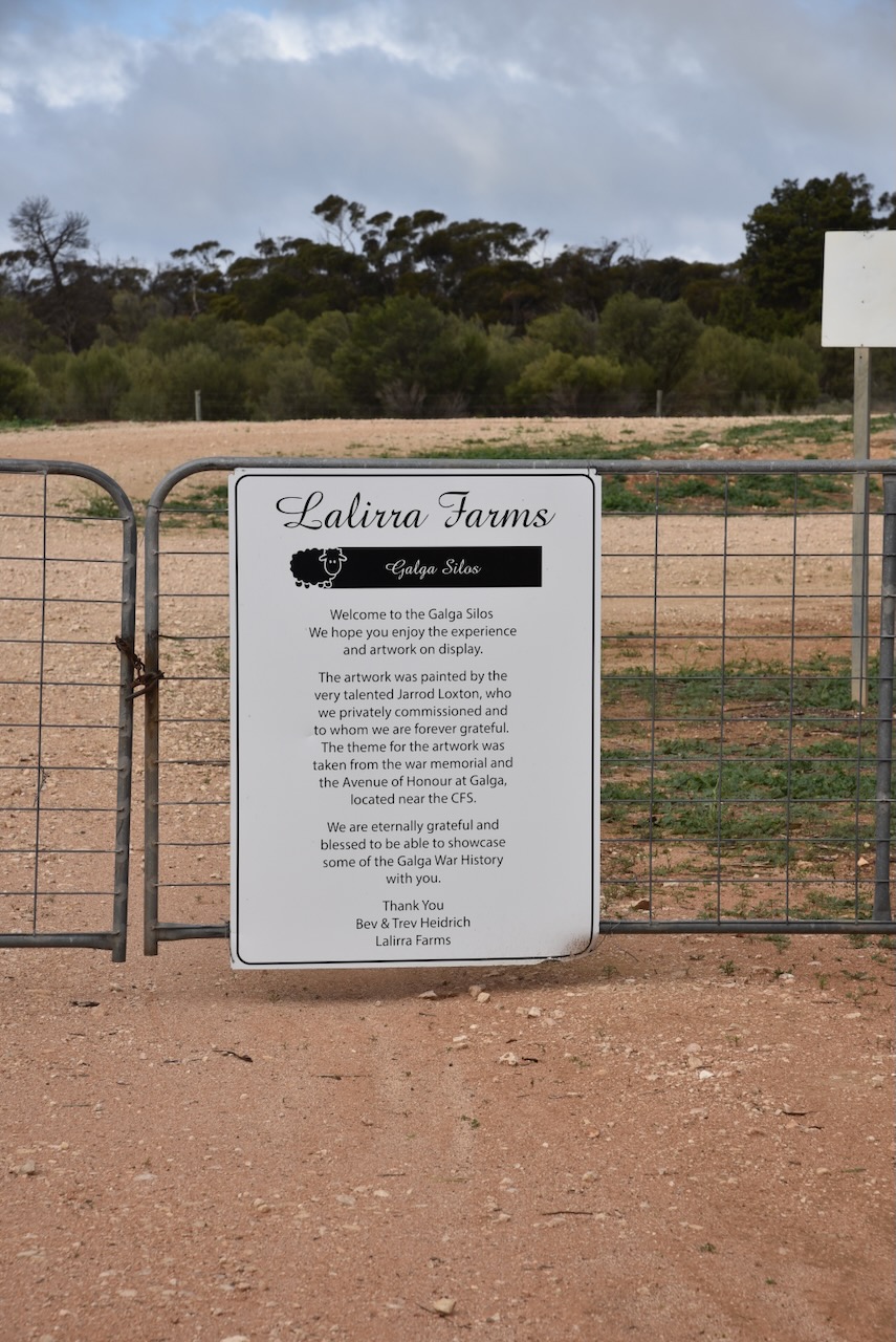
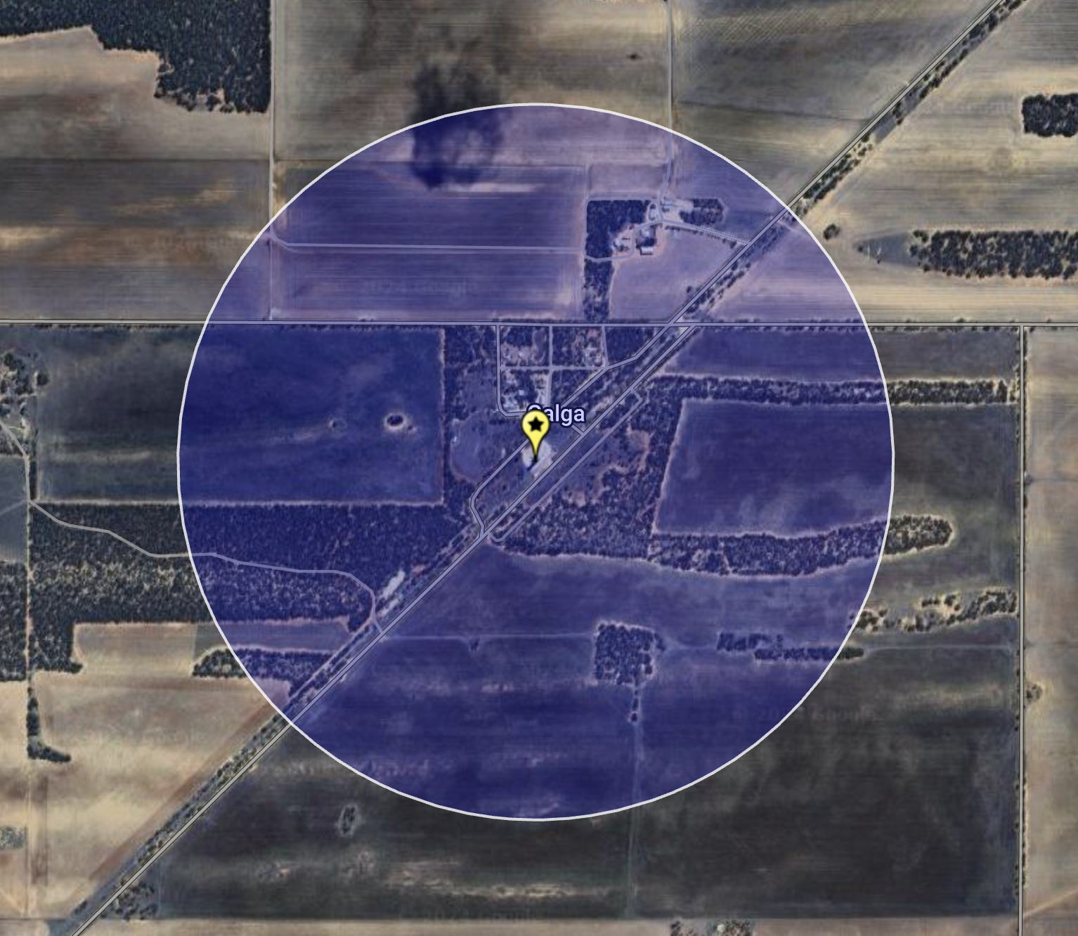
My next activation for Saturday 17th August 2024 was the Galga silo VK-GLA5 for the Silos On The AIr (SiOTA) program. Galga is about 173 km (by road) northeast of the city of Adelaide. It was just a short 16km drive northeast from Copeville.
Above:- Map showing the location of Galga. Map c/o Google Maps.
The first European to settle in the district was William Selby Douglas who took up land in 1868. Galga is an aboriginal word meaning ‘hungry.’ The town was named by the Railway Commissioner who intended the railway station to be a place where refreshments would be provided. (Place Names 2012)
The town lies on the northern boundary of the Hundred of Bandon which adjoins the Hundred of Bakara. The Hundred was declared in 1898. However, it was not until 1904 that the first leasehold land was taken up by Alfred and Ludwig Kuehn. Between 1909 to 1910 freehold land was taken up. In 1915 the Kuehn brothers relinquished 40 acres of their land for the surveing of the town of Galga. (flickr 2024)
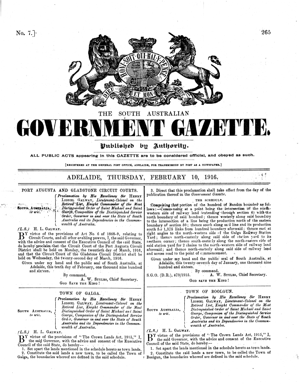
In October 1915, Mr. A. Thomas surveyed the township of Galga. A total of 54 town blocks were alotted. The town was proclaimed on the 10th day of February 1916. (flickr 2024)
Above:- SA Govt Gazette, Thur Feb 10 1916.
In 1915 the Post Office opened. In 1921 it was moved into the general store that had opened. Alfred Kuehn donated two town blocks for a hall to be used as a school. In 1921 the limestone and red brick Galga Hall was built. However, it was not used as a school until 1925. At its opening, the school had 16 pupils. Its greatest enrollment period was during the late 1950s to early 1960s when 39 students were enrolled, with 2 teachers being employed. The school closed in 1966 when the East Murray Area School was planned to be opened in 1967. (flickr 2024)
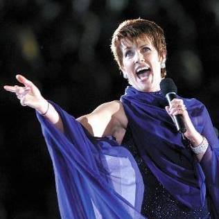
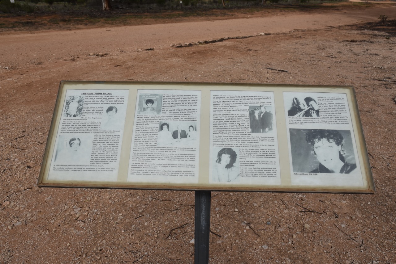
One of Galga’s famous students was Julie Lush, now Julie Anthony. She attended the school from 1959 onwards. As a child, she excelled in sport and singing. Anthony was awarded an OBE in 1980 by Britain and in 2007 was made a Member of the Order of Australia. She sang the National Anthem at the opening of the Sydney Olympic Games. (flickr 2024)
Above:- Julie Anthony. Image c/o Facebook.
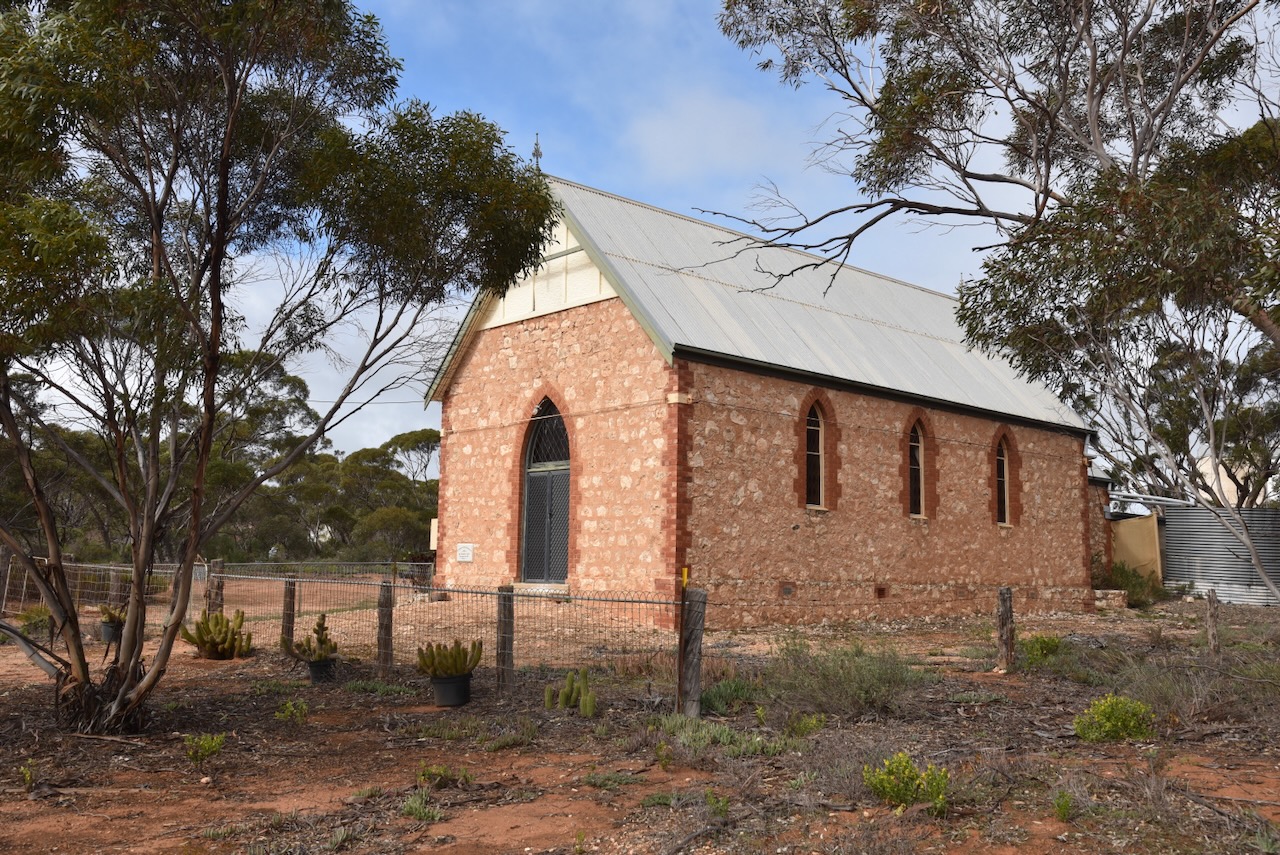
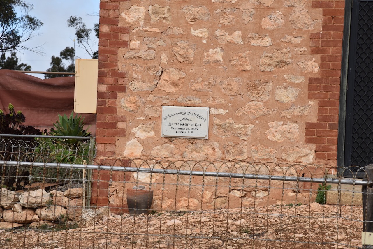
In 1923 a ten-acre grant from the government was issued for an oval and sports field at Galga. In 1924 the Gothic-style St Pauls Lutheran Church was opened. (flickr 2024)
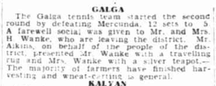
In Its heyday, Galga had a tennis club and a football club.
Above:- Article from The Advertiser, Wed 16 Feb 1938. Image c/o Trove.
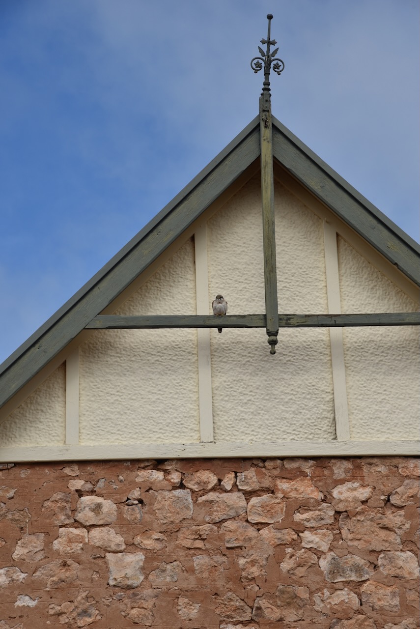
Today, Galga is an interesting little town to visit. The beautiful Gothic style St Paul’s Church remains.
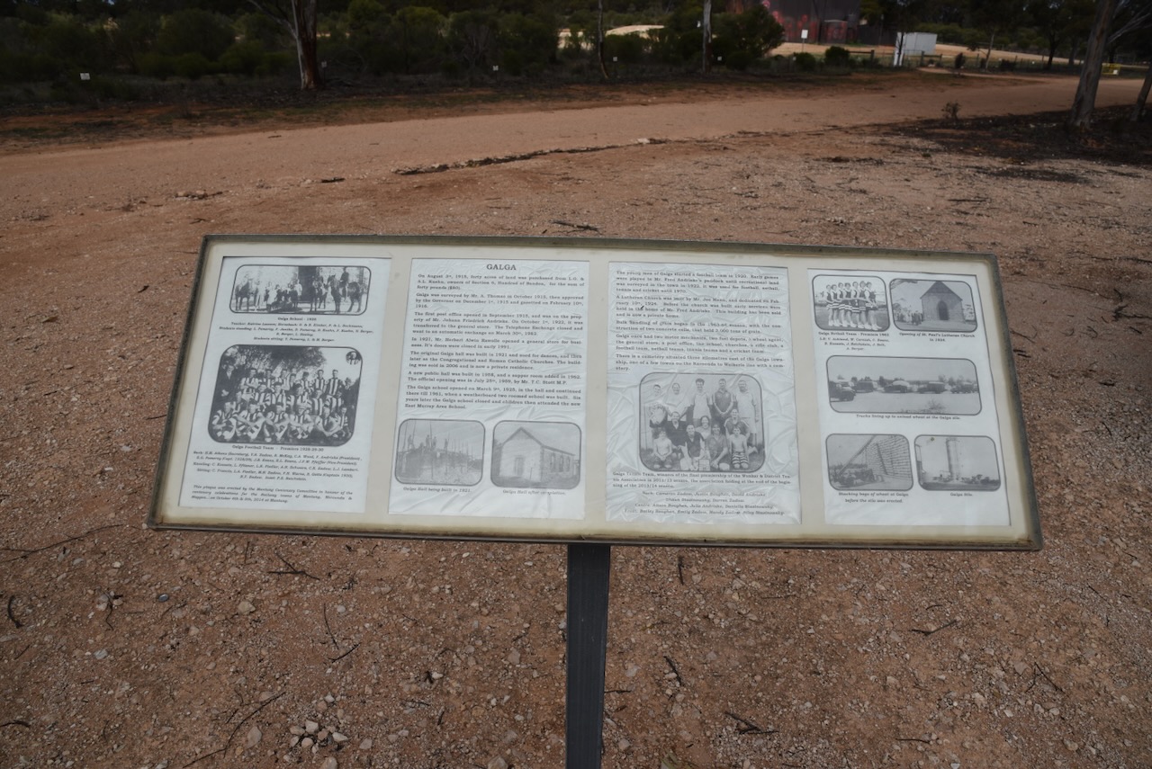
There are also some excellent information boards detailing the history of Galga.
In 1963 bulk handling of grain commenced in Galga. The railway line closed in 1994 with passenger services ceasing during the 1970s. (flickr 2024)
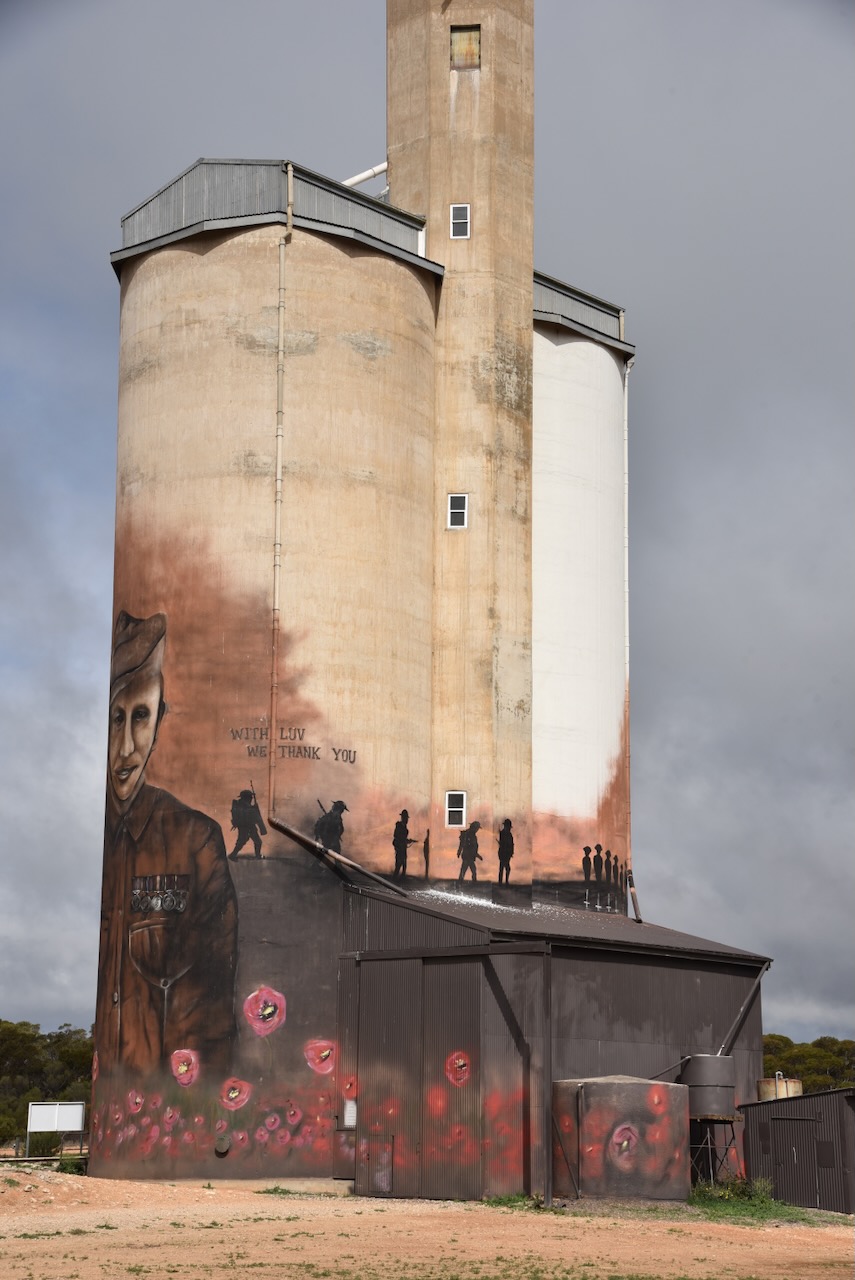
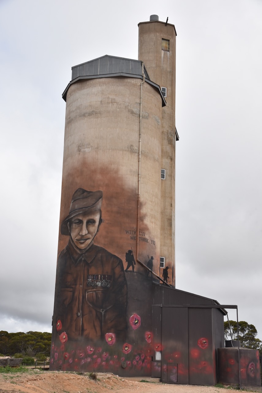
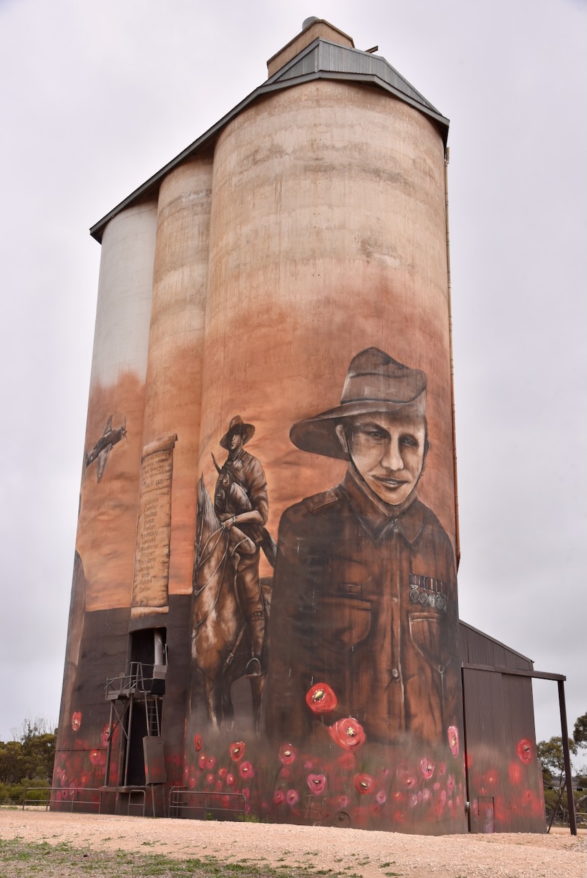
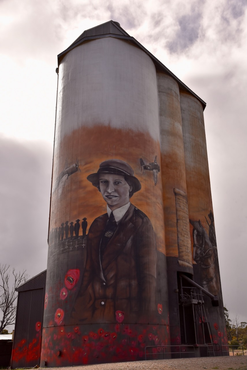
The Galga Silo Art completed in April 2023 and was painted by Jarrod Loxton. The Galga silo features local soldiers and also honours nurses, including Vivian Bullwinkel. (Australian SIlo Art 2024)
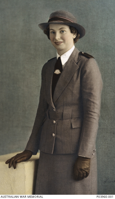
One of those featured on the silo is Vivian Bullwinkel. She was born in December 1915 at Kapunda. She trained as a midwife and dnurse at Broken Hill, prior to commencing her career in nursing at Hamilton, Victoria and then Melbourne, Victoria. In 1941 Bullwinkerl volunteered for service with the RAAF, but was rejected for having flat feet. She did however, join the Australian Army Nursing Service. (AWM 2024)
Above:- Lt Col Vivian Bulwinkel. Image c/o Aust War Memorial.
Following the invasion of Malaya in December 1941, Bullwinkel and 65 other nurses boarded the SS Vyner Brooke to escape the island. Two days into their voyage, the shop was sunk by Japanese aircraft. Bullwinkel, along with 21 other nurses and a group of men, women and children made it ashore on Banka Island. (AWM 2024)
The following day they were joined by about 100 British soldiers. The group surrendered to the Japanese. The men were murdered by the Japanese, while the female nurses were ordered to walk into the sea. They were then machine gunned from behind. Bullwinkel was struck by a bullet but survived.
She pretended to be dead until the Japanese left the beach. For 12 days she hid on the island with a wounded British soldier and again surrendered to the Japanese. Bullwinkel spent 3 & 1/2 years in Japanese captivity. She was just 24 of the 65 nurses were aboard the SS Vyner Brooke that survived the war. (AWM 2024)
Below is a trailer to an ABC doumentary on Vivian Bullwinkel.
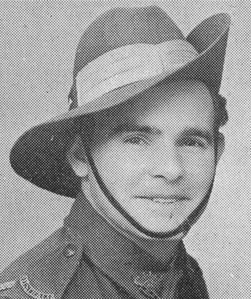
Another person featuring the silo is Hurtle Murdoch “Tom” Zilm. He was born in September 1917 at Hamley Bridge. He enlisted for service on the 2nd day of December 1942. He is the step grandfather to the owner of the silo. (Facebook 2024) (vwma 2024)
Australian War Memorial (2016). Lieutenant Colonel Vivian Bullwinkel. [online] Awm.gov.au. Available at: https://www.awm.gov.au/collection/P10676383. [Accessed 28 Aug. 2024].
Flickr. (2024). Galga. In the Murray Mallee. St Pauls Lutheran Church. Foundation stone laid 1923 and church opened 1924. Now a private residence. [online] Available at: https://www.flickr.com/photos/82134796@N03/40821872680 [Accessed 28 Aug. 2024].