After our activation of the Investigator Marine Park, Adam VK2YK and I headed back to the homestead on Flinders Island and had some lunch. We then jumped into the operator chairs of VK5FIL.
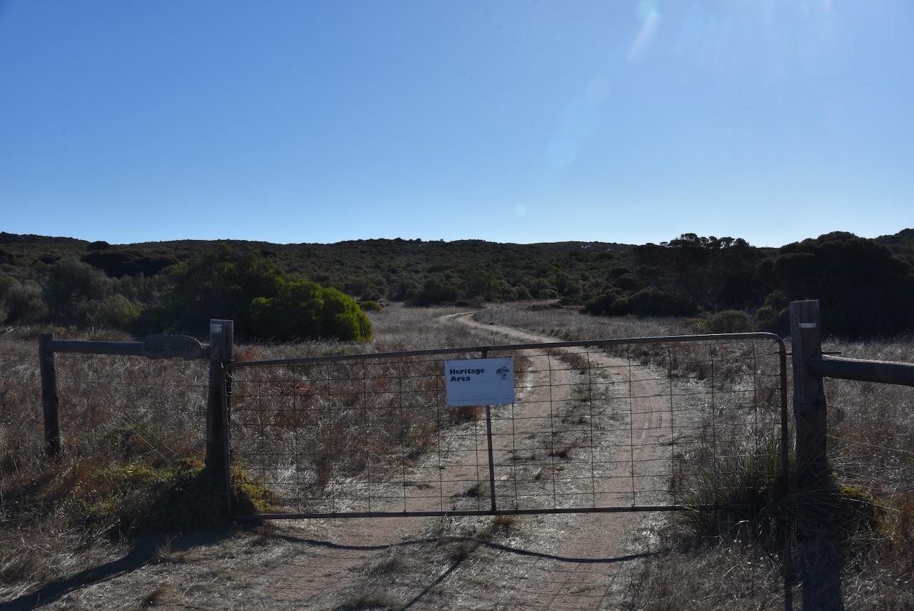
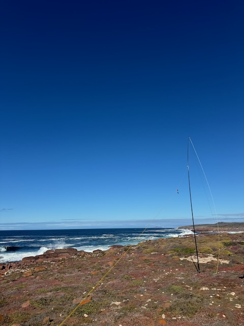
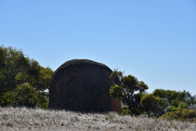
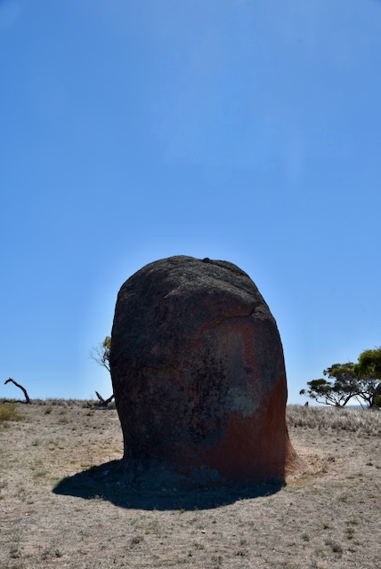
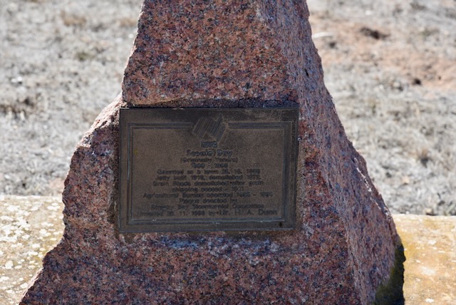
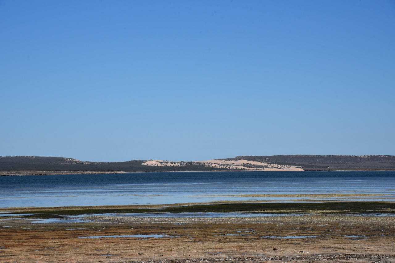
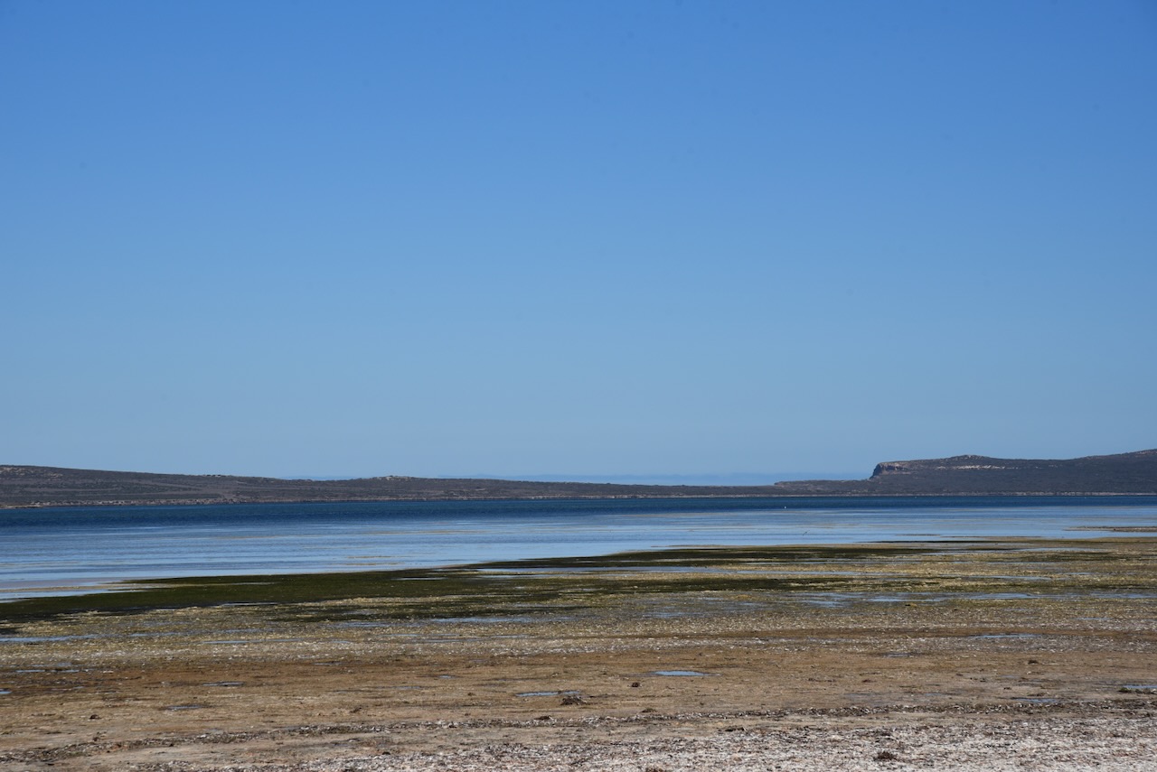
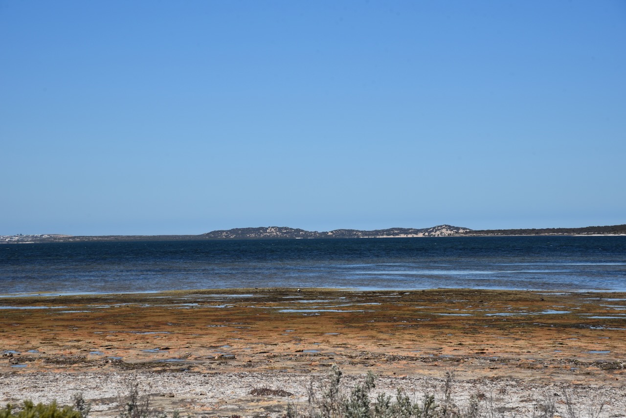
Later that afternoon Adam and I headed out to activate Heritage Agreement VKFF-4307 located on the northwestern side of Flinders Island.
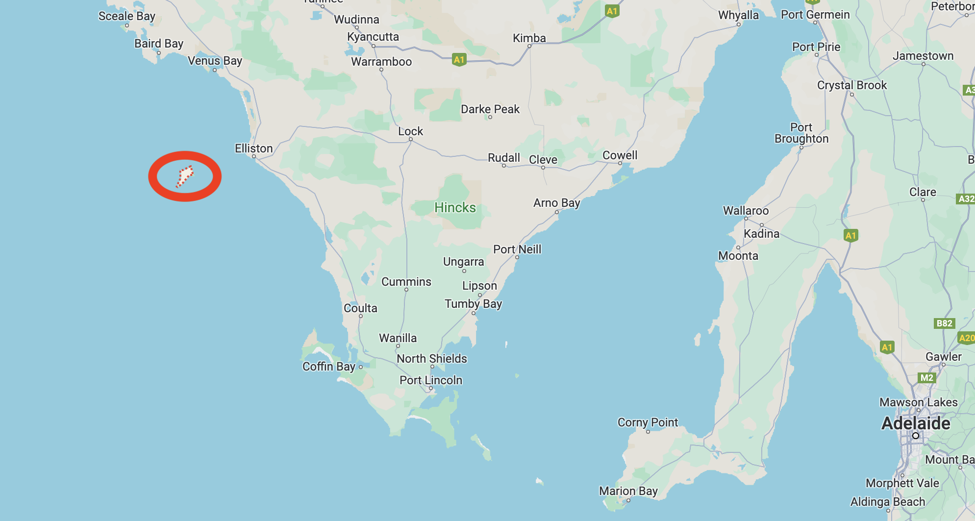
Above:- Map showing the location of Flinders Island. Map c/o Google Maps.
To access the park we headed northwest on one of the dirt tracks on the island. We soon reached a gate that had a ‘Heritage Area’ sign. We followed that 4WD track down to Gem Beach.
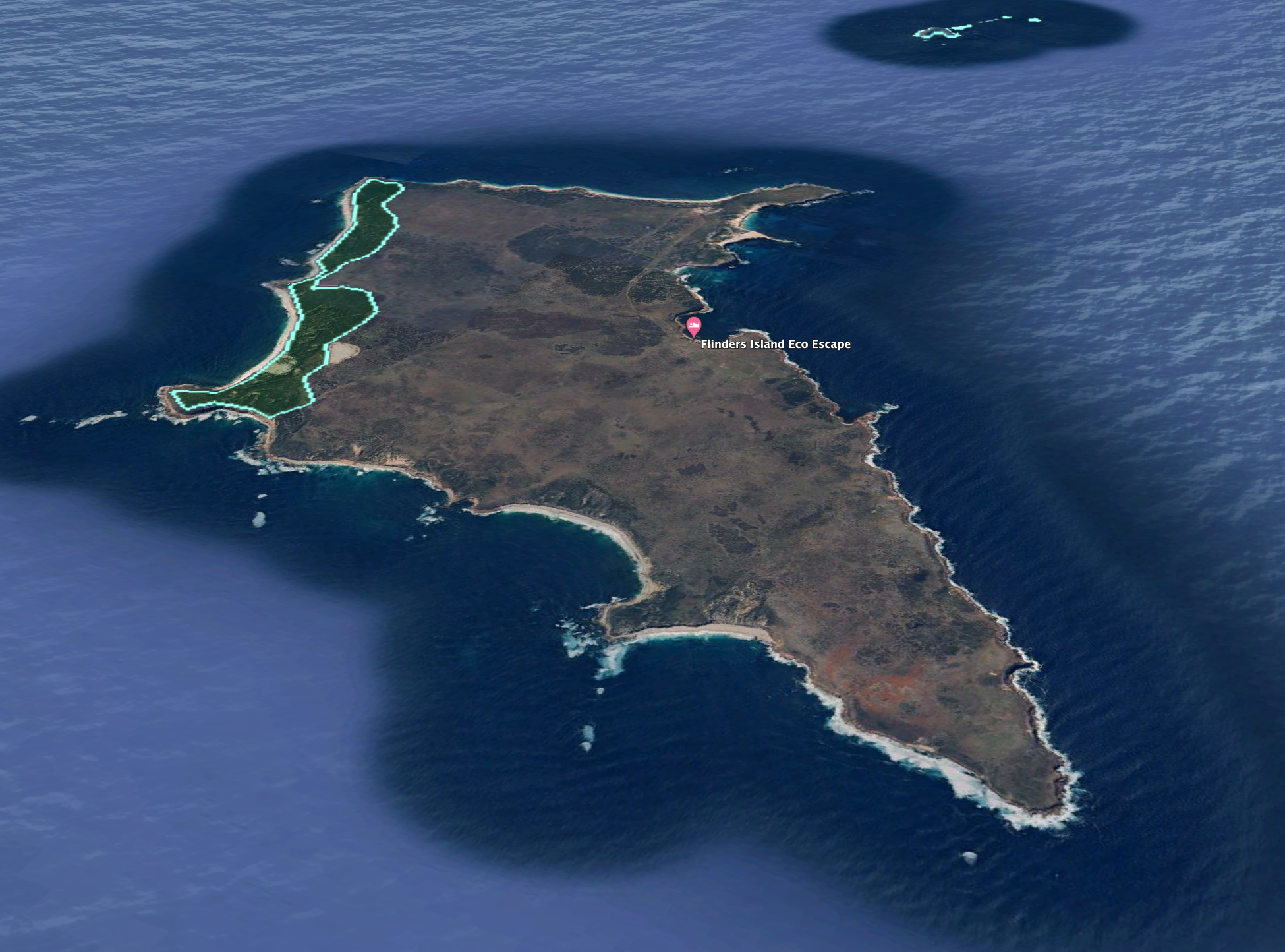
The Heritage Agreement extends from Gem Point to Pont Malcom.
Above:- An aerial view showing the Heritage Agreement. Image c/o Google Earth.
The park is about 280 hectares in size and was established on the 29th day of August 1995. (CAPAD 2022)
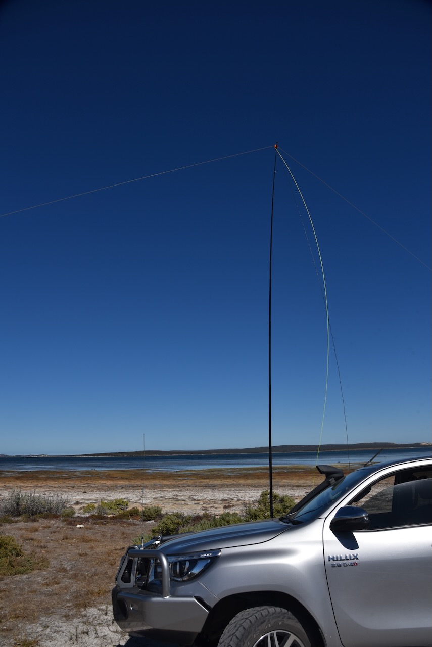
I ran the Yaesu FT857, 40 watts and the 20/40/80m linked dipole for this activation.
I logged a total of 152 stations on 20m SSB & 40m SSB. This included a large amount of DX on 20m.
We had now spent 2 nights on Flinders Island in the Great Australian Bight, and it was Tuesday 16th April 2024. Adam VK2YK and I decided to head out to activate the Investigator Marine Park VKFF-1717.
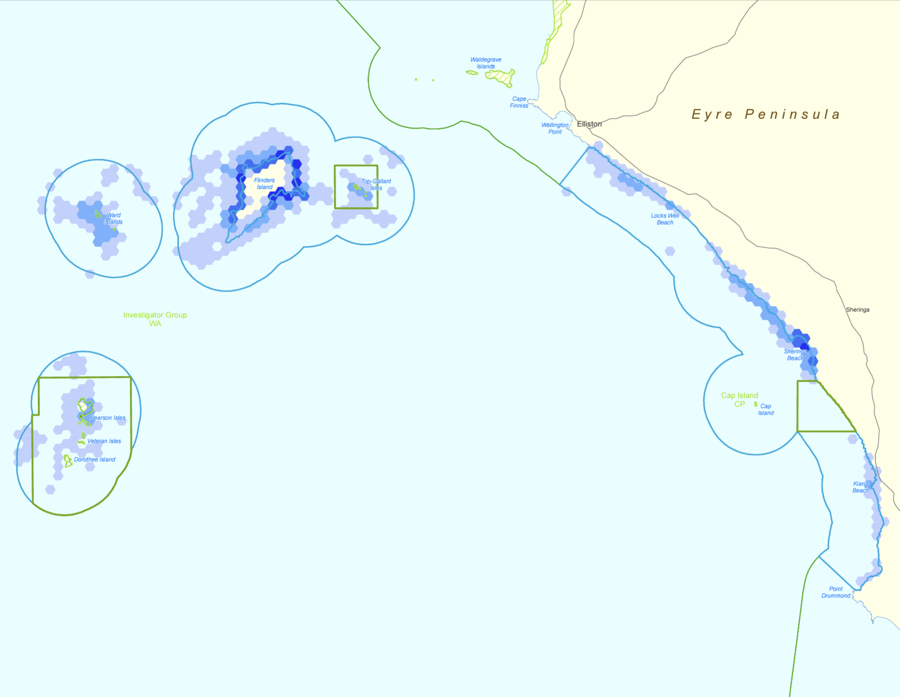
Above:- The Investigator Marine Park. Image c/o Parks SA.
The park is about 1,185 square kilometres in size and was established on the 29th day of January 2009. The park consists of four parts. The first section extends along the coastland of the Eyre Peninsula from Point Dummond to just south of Elliston. The second part surrounds Flinders Island the the Topgallant Islands. The third and fourth parts respectively surround the Ward Islands and the Pearson Isles. (Wikipedia 2024)
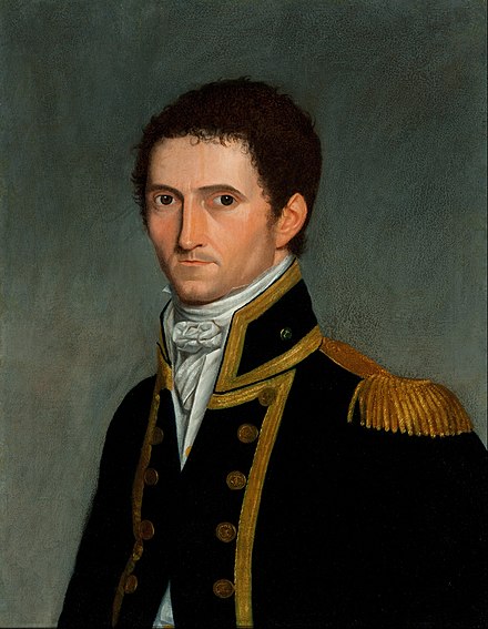
The park takes its name from the HMS Investigator which was under the command of Captain Matthew Flinders (b. 1774. d. 1814). He led the first inshore circumnavigation of mainland Australia. (Wikipedia 2024)
Above:- Captain Matthew Flinders. Image c/o Wikipedia.
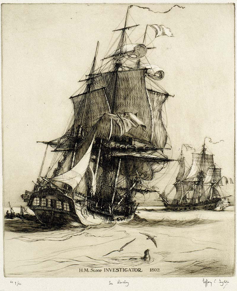
The HMS Investigator commenced her life as the mercantile Fram. She was built in Sunderland, England and was launched in 1795. In 1798 the British Royal Navy purchased the Fram and renamed her HMS Xenophon. In 1801 the name was changed to HMS Investigator. She as the first ship to circumnavigate Australia in 1802. The HMS Investigator was sold in 1810 and she returned to mercantile service under the name Xenophon. It is believed the ship was broken up c. 1872. (Wikipedia 2024)
Above:- The HMS Investigator. Image c/o Wikipedia.
Below is an excellent video on the life of Captain Matthew Flinders.
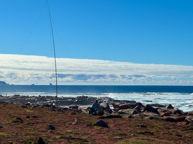
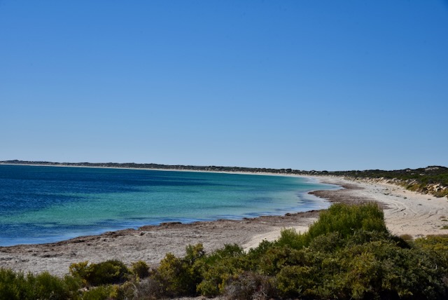
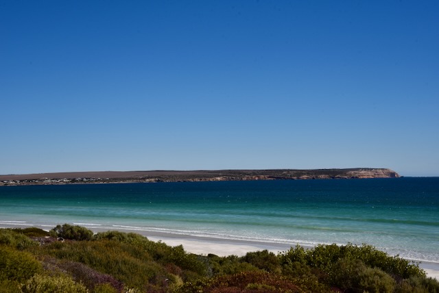
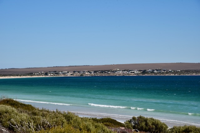
Adam and I drove south from our accommodation and set up on the eastern side of Flinders Island. It was a beautiful sunny day and we enjoyed some absolutely magnificent views during our activation.
Adam set up his station and I set up my station which comprised my Yaesu FT857, 40 watts, and the 20/40/80m linked dipoel.
I logged a total of 105 QSOs on 20 & 40m SSB.
I worked the following stations on 40m SSB before the UTC rollover:-
VK3HJV
VK5KLD
VK5AAF
Vk5GY
Vk3CEO
VK3VIN
VK3MCK
VK7JFD
VK3BBB
VK2CCP
VK3APJ
VK5HS
VK5LA
VK5KAW
VK5FIL
VK1AO
VK2MET
VK5ADB
VK3IFR
VK3PF
VK3KAI
VK3MTT
VK5HYZ
VK3ANL
VK3BEL
VK2KYO
VK5ZTJ
VK3CTM
VK6LK
I worked the following stations on 40m SSB after the UTC rollover:-
VK3PF
VK3KAO
VK3APJ
VK2SLB
VKk3CEO
VK2USH/p (Peggs Beach Conservation Area VKFF-2913)
VK3VIN
VK3HJW
VK2KYO
VK3IFR
VK3ANL
VK6LMJ
VK5KVA
VK7EE
VK5ADP
VK3YV
VK3TNL
VK5KFB
VK5QA
VK3CLD
VK3BVW
VK2EXA
VK2VAR
VK2GOM
I worked the following stations on 20m SSB:-
VK1AD
VK1NAM
KG5CIK
VK1AO
VK2MET
VK3IF
VK2VW
VK2HFI
VK2AKA
VK2BUG
VK3MCK
VK3YV
VK3TNL
VK2USH/p (Peggs Beach Conservation Area VKFF-2913)
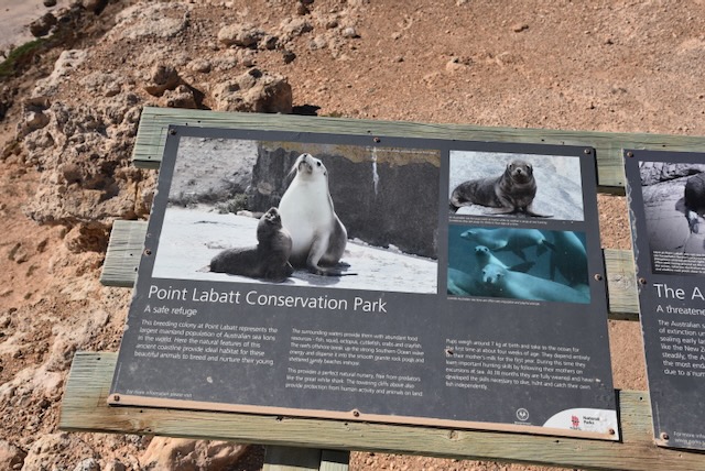
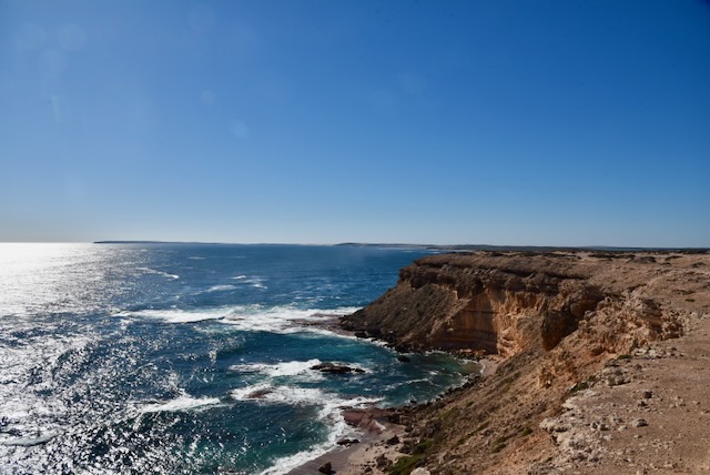
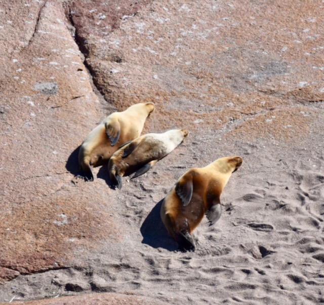
My final activation for Saturday the 13th day of April 2024 was the Point Labatt Conservation Park VKFF-1081.
The park is located about 47 km south of Streaky Bay on the far west coast of South Australia.
Above:- Map showing the location of the Point Labatt Conservation Park. Map c/o Google Maps.
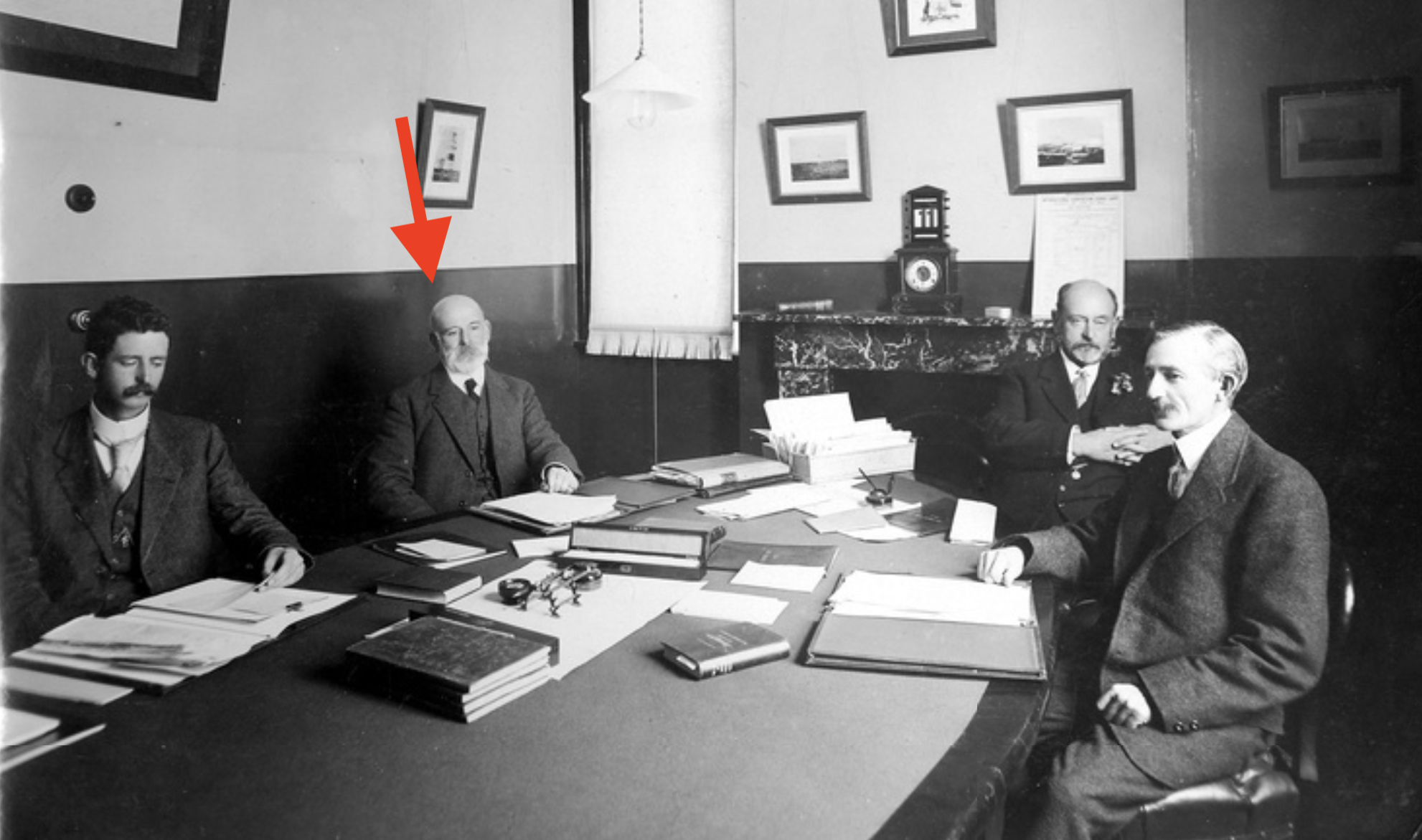
The park is named in honour of John Bagot Labatt, a former Deputy Chairman of the South Australian Harbour’s Board. He was born on the 9th day of January 1861 in North Adelaide, South Australia. Labatt was educated at St Peter’s College where he specialised in science. In August 1877 he commenced work in the dockyard at Glanville where he carried out practical engineering work. He was then transferred to the Engineer-in-Chief’s office and commenced work in harbour surveys. In March 1906 he was appointed Assistant Engineer for Harbours. When the Harbours Board was established in APril 1914 he was appointed one of the three Commissioners and was given the title of Deputy Chairman. He held that position until his retirement in 1927. His hobbies included gardening, carpentry and reading. He died on the 12th day of May 1928 in North Adelaide, South Australia, aged 68 years. (ancestry.com.au) (DEATH OF MR. J. B. LABATT., 1928)
Above:- Members of the South Australian Harbor’s Board sitting around a conference table, 1914. J.B. Labatt is second from the left. Image c/o State Library South Australia.
Point Labatt is located in the locality of Sceale Bay on the west side of the Calca Peninsula, also known as Freeman Peninsula. The name Calca is derived from an aboriginal word meaning stars. Its variant, the Freeman Peninsula, takes its name from the Freeman family who held land on the peninsula until the early 1980s. (Wikipedia 2024)
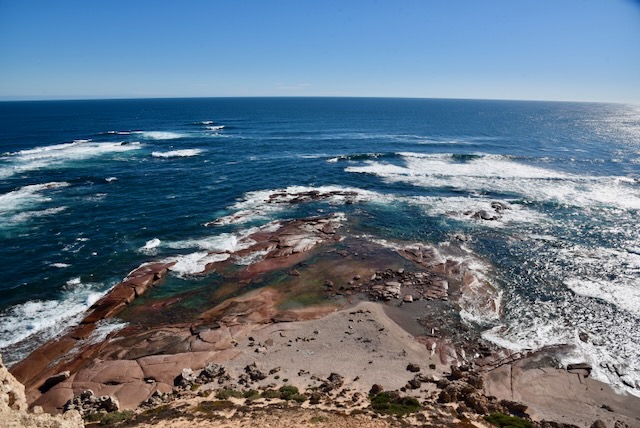
Above:- An aerial view of Point Labatt. Image c/o Google Earth.
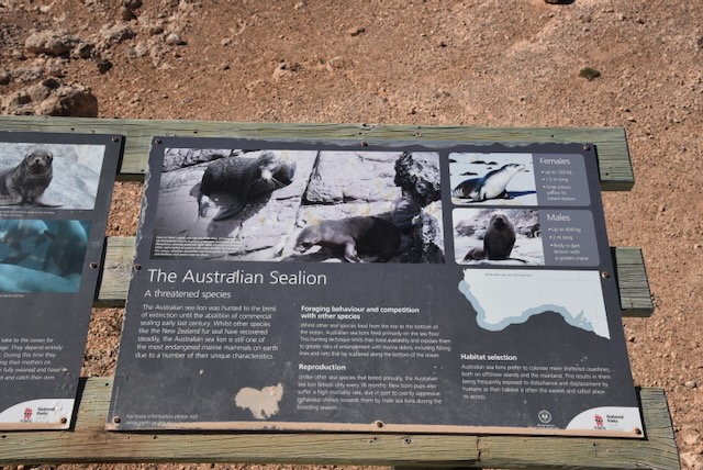
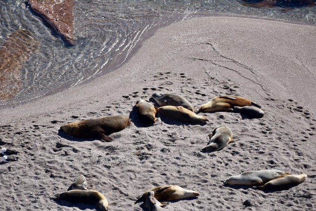
The Point Labatt Conservation Park is about 51 hectares (130 acres) in size and was established on the 12th day of July 1973. It was established to protect the ‘largest colony of Australian sea lions on mainland Australia. The land was donated in 1972 by Ron, Myra, and Ellen Freeman who was concerned about illegal shooting. (Management Plan 1995)
Other than the Australian Sea Lion population, the park is also home to Southern Right Whales, Western Grey kangaroos, and numerous bird species including Cormorants, Terns, Gulls, Ospreys and Kestrels. (Management Plan 1995)
I ran the Yaesu FT857, 40 watts, and the 20/40/80m linked dipole for this activation.
At the conclusion of the activation, I commenced to make my way back to Elliston, about 129 km to the south.
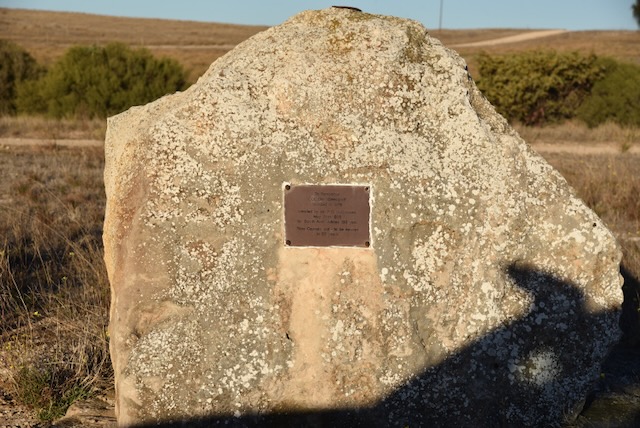
Along the way, I stopped briefly at the monument on the Flinders Highway to commemorate the township of Colton.
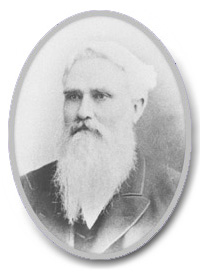
The town was named in honour of Sir John Blackler Colton (b. 1823. d. 1902). He was an Australian politician, the Premier of South Australia, and a philanthropist.
Above:- Sir John Blackler Colton. Image c/o Wikipedia.
Michael Stephen White Kenny was born in 1811 in County Clare, Ireland. In 1842 he emigrated to Australia aboard the Braken Moor with his sister and her husband. They arrived in Van Diemen’s Land (Tasmania) with Kenny later moving to South Australia. In 1848 he married Brigid Purtle at Morphett Vale, South Australia. He initially owned land at Shea-oak Log. By the 1870s he had moved to the Yorke Peninsula where he secured farms for his sons. In 1876 he boarded the Selector and sailed from Oyster Bay (Stansbury) to Port Lincoln. He then trekked overland to the Hundred of Colton where he established ‘Balla McKenny’ a property of about 9,000 acres. He died in May 1892 at Colton. (ancestry.com.au) (Place Names 2012)
Above:- Michael Kenny. Image c/o ancestry.com.au
On the 21st day of December 1880, Michael’s eldest son Daniel Thomas Kenny (b. 1849. d. 1934), entered into an agreement with the Department of Lands and purchased 371 acres of land in the Hundred of Colton. This included land that adjoined a junction of five roads and this was an ideal position for a hotel which opened in 1884. A school was opened in 1885 and closed in 1956. The town also had a general store, churches, and a blacksmith shop. (Place Names 2012)
Above:- Kenny’s Hotel at Colton. Image c/o ancestry.com.au
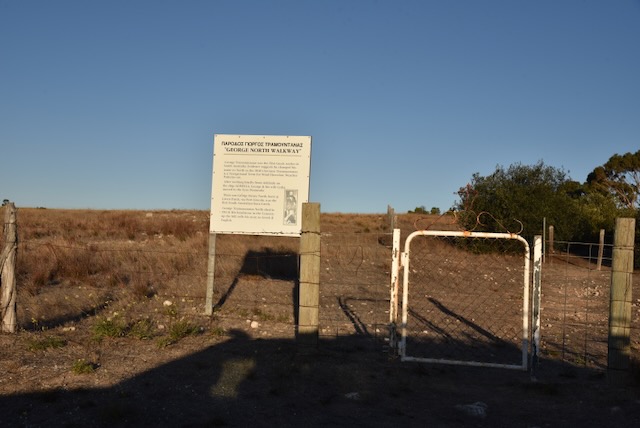
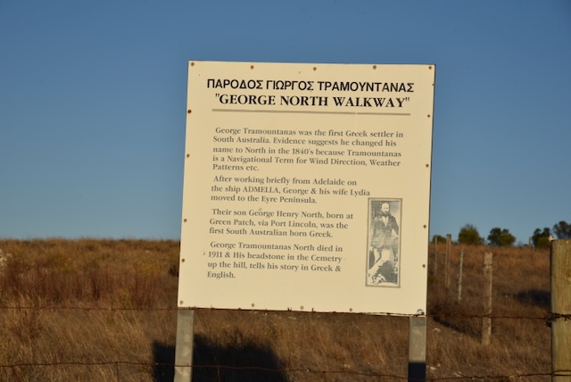
Nearby is the George North Walkway in honour of George Tramountanas, the first Greek settler in South Australia. He changed his name to George North during the 1840s. He initially lived in Adelaide before moving to the Eyre Peninsula. His son, George Henry North, who was born at Port Lincoln, was the first South Australian born Greek.
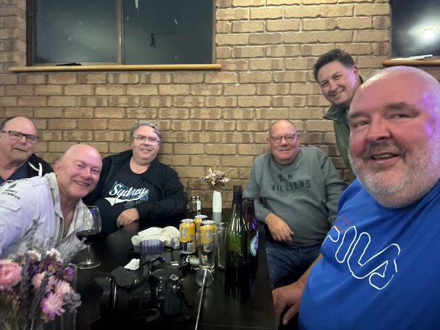
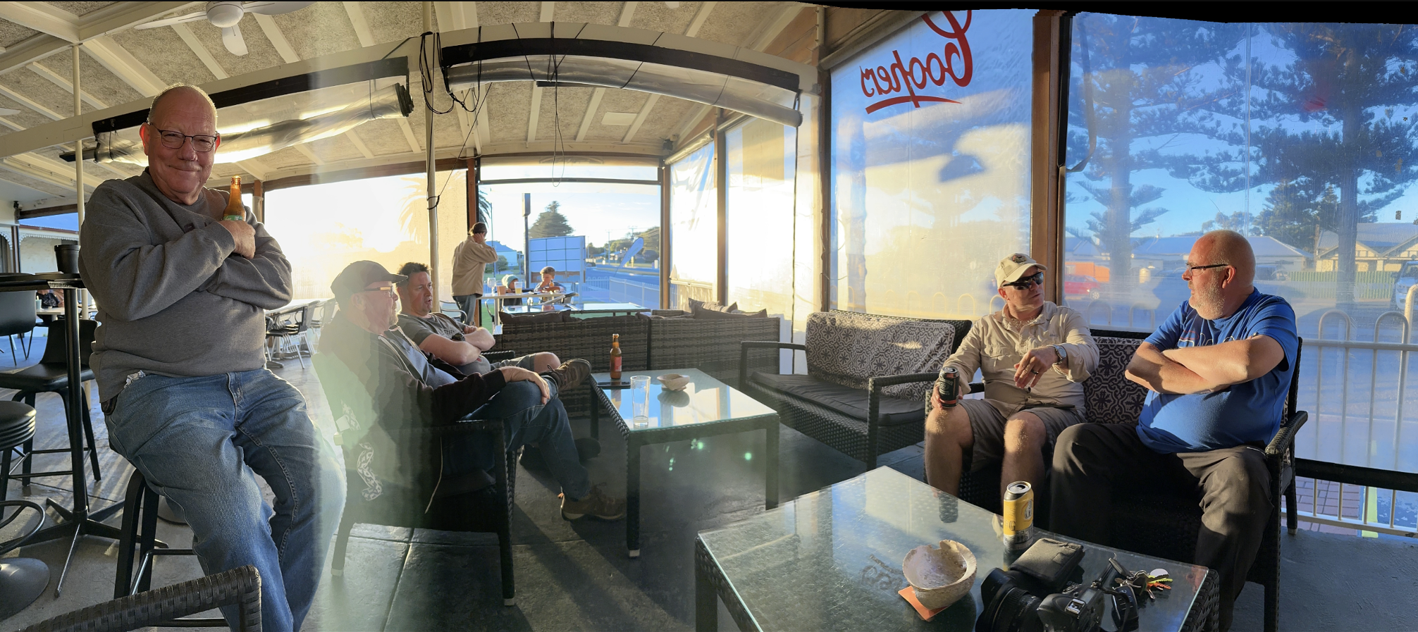
Once arriving in Elliston I headed to the local hotel where I caught up with the rest of the VK5FIL Flinders Island Team: Grant VK5GR, Andy VK5LA, Chris VK5FR, Ivan VK5HS, and Adam VK2YK.
We enjoyed some great laughs, a nice meal and of course a few beverages.
References.
Ancestry.com.au. (2016). Ancestry® | Genealogy, Family Trees & Family History Records. [online] Available at: https://www.ancestry.com.au/ [Accessed 23 Jun. 2024].
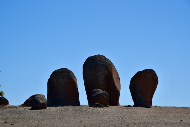
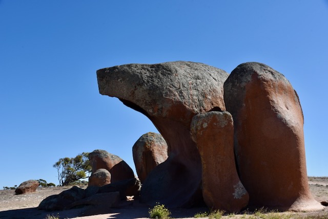
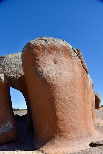
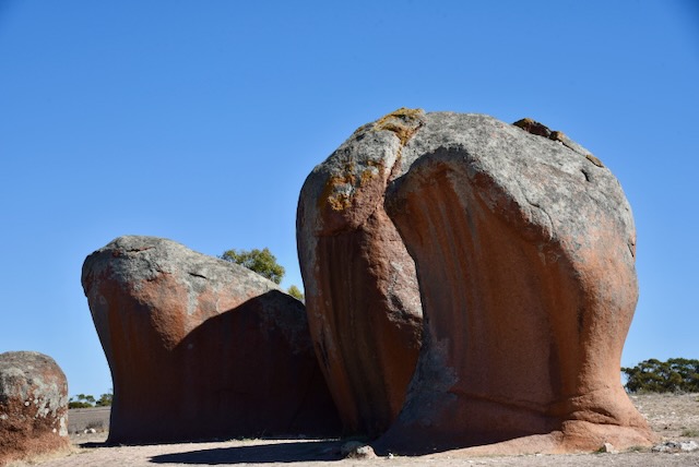
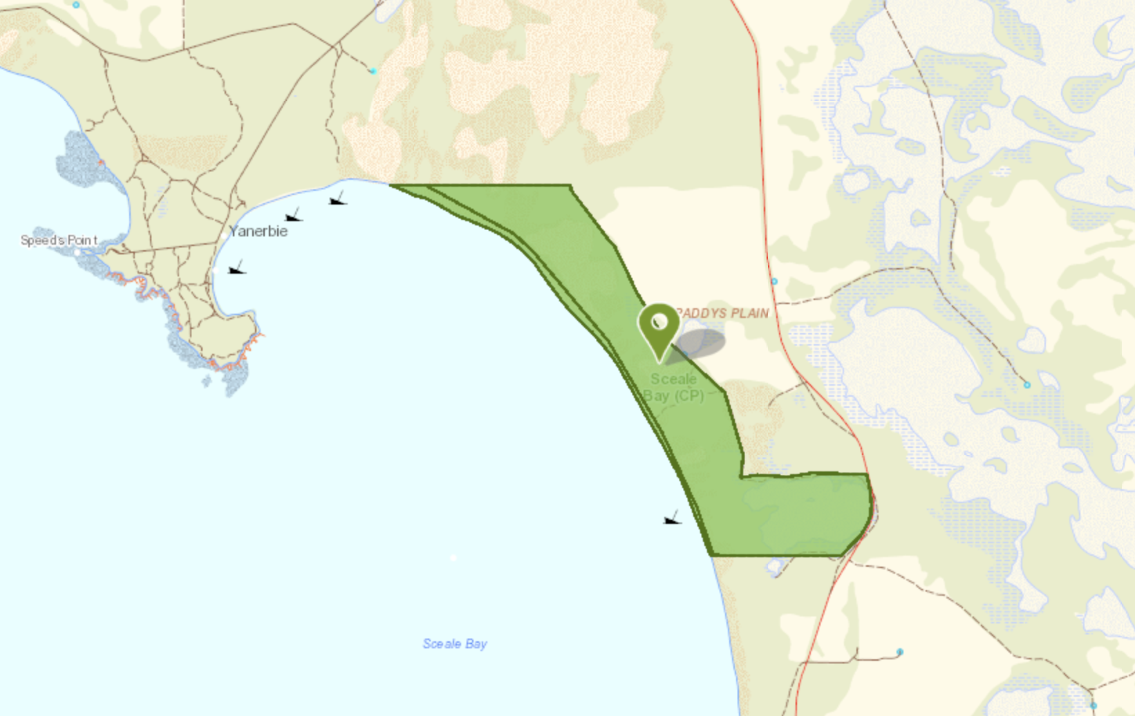
Next on the park activation agenda for Saturday 13th day of April 2024 was the Sceale Bay Conservation Park VKFF-1093. But before I activated the park I stopped off to have a look at Murphy’s Haystacks, an outcrop of pink granite boulders. They are located on the northern side of Benbarbar Road at Mortana between Streaky Bay and Port Kenny. They are known as Inselbergs, derived from the German word Insel meaning island, and berg meaning mountain.
These unusual rock formations were named after Denis Murphy, a farmer on the Eyre Peninsula who owned the land on which the rocks are located. Denis Drinan Murphy was born in March 1858 in Limerick, Ireland. He emigrated to South Australia in 1882 aboard the ‘Nebo‘. He spent his first years in Australia in the mid-north of South Australia before taking up the first farming land at Calca. He named the property ‘Oakfront’ after Oakfront in Country Cork where his mother originated. He was the first man to cart and ship wheat from Port Kenny which was then known as Murphy’s Landing. (Exploroz 2024) (JEREMIAH D. MURPHY, FORESTVILLE., 1938)
It is recorded that a Scottish agricultural expert travelling by on a local mail coach saw the rocks on Denis Murphy’s property and commented that the farmer must harrow and remarked about all of the hay he had saved. The rocks became known as Murphy’s Haystacks. (Australian Traveller 2017)
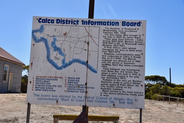
After leaving Murphy’s Haystacks I continued west on Calca Road and soon reached the little settlement of Calca.
Calca is a derivative of Kolka, an aboriginal word meaning ‘stars.’ The Calca pastoral lease No. 554 was held by Adam Borthwick from 10th February 1856. The land was originally held in the late 1840s by James Baird (also known as Henry Baird and Beard) who called it ‘Kolka’. Baird Bay is named in his honour. The Calca school opened in 1892 and closed in 1939. (Monument Australia 2024) (Place Names 2012)
I found the story of James or Henry Baird to be very interesting. Here is what I found out, predominantly bey reading newspaper articles on the Trove website.
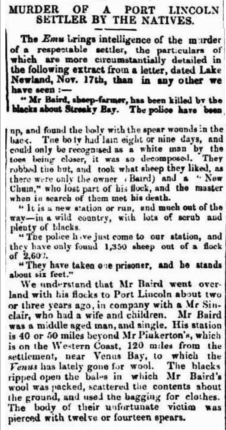
On Thursday the 31st day of October 1850, local aboriginal people attempted to separate Baird’s flock of sheep under the control of his shepherd Mr. William Townsend. They were unsuccessful, however, they attempted the same the following day on Friday 1st day of November 1850, and this time captured about 800 sheep. Townsend returned to Baird’s hut that evening and reported what had occurred. Baird set out to locate the sheep that evening but was not successful. (Port Lincoln Times 1940)
The following day, on Saturday the 2nd day of November 1850, Baird left at daybreak to locate the sheep. Townsend reported that he did not see Baird again. Over the following days Townsend reported that he watched aboriginal people unpacking the woolpacks and carrying away the wool sacks on Baird’s property. They also ‘rifled’ the hut. Townsend wounded one aboriginal man called Korbally after firing upon him. He sustained a wound to his arm. Townsend was reduced to just tea and sugar, and was forced to head to the nearest station owned by William Pinkerton. (Port Lincoln Times 1940) (SA Register 1851)
Townsend then penned a letter for Police Constable Dewson advising him of what had taken place. Upon receiving the letter, Police Constable Dewson and Police Constable Smith headed for Beard’s hut, arriving there on Saturday the 9th day of November 1850. (Port Lincoln Times 1940)
PC’s Dewson and Smith, accompanied by Pinkerton and his overseer a man called Stewart commenced a search for Baird’s sheep. They followed the sheep tracks for seven miles before locating a large group of aboriginal people with about 700 sheep on Tuesday the 12th day of November 1850. It is reported that as the police approached, the aboriginal people raised their spears. The police called on them to lay down their spears which they did not. PC Dewsen then ordered the party to fire. It was reported that Pinkerton fired two shots from a double-barrelled firearm. Stewart also fired his pistol which was loaded with small shot. One aboriginal person was shot dead. The sheep were recovered and an aboriginal person was taken prisoner. Property belonging to Baird was found at the camp. (Adelaide Times 1851) (Port Lincoln Times 1940) (SA Register 1851)
On Wednesday the 13th day of November 1850, tracks of Baird were found and followed. His body was found on the edge of a salt lagoon about eight miles from his hut. Baird was lying face down with spears in his back. The body was decomposing. It was reported in the South Australian newspaper that “pierced with twelve or fourteen spears.” It was ascertained by the police by track marks that Baird had located his sheep and taken them back from the aborigines and had commenced to return them to his property when he was attacked. His body was buried the following day by Police Constables Dewson and Smith. (Port Lincoln Times 1940) (SA Register 1851)
Above:- Article from the South Australian, Thu 28 Nov 1850. Image c/o Trove.
Police Constable Dewsen then travelled to Port Lincoln where he reported the murder to Corporal James Geharty on Thursday the 21st day of November 1850. On Friday the 22nd day of November 1850, Corporal Geharty then dispatched Police Constable Wilson to the Salt Creek Police Station to bring in Police Constables Moran and Kennings to form a party to search for those responsible for the murder of Baird. They arrived at the Port Lincoln Police Station the following day, and then on Sunday 24th November 1850, Geharty, Dewsen, Kennings and Wilson and a local Port Lincoln aboriginal man to be utilised as an interpreter, left Port Lincoln for Baird’s property. They arrived there on Friday the 29th day of November 1850. (Port Lincoln Times 1940) (SA Register 1851)
Through an aboriginal man called Poolulta, Corporal Geharty established that Baird’s sheep had been driven towards Streaky Bay by those responsible for Baird’s death. Poolulta also provided 11 names of those responsible for Baird’s murder including Kullgulta @ John Murray. Geharty and his party headed north and soon found tracks and other evidence of some of the sheep being slaughtered. (Port Lincoln Times 1940) (SA Register 1851)
By Tuesday the 3rd day of December, Geharty’s party had been reduced to about 10 lbs of flour and this had to last for their return back to Pinkerton’s station. (SA Register 1851)
The Port Lincoln Police Station Journal recorded the following:
“The scrub got so dense that we could not proceed more than about three miles per hour, or could have seen a native if one had been within five yards of us. The Port Lincoln native who was tracking, gave it up, having been informed by the native prisoner that the natives could subsist for many days, inland on the scrub root as a substitute for water“. (SA Register 1851)
Realising that there was no chance of apprehending those responsible for the murder of Baird, Geharty and his party headed south and returned to Baird’s property and then to Pinkerton’s property. (SA Register 1851)
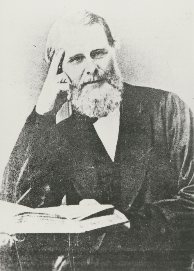
Due to the ‘resort of firearms’ and ‘the number of wounded’, the Lieutenant Governor ‘deemed it expedient that particular enquiries should be made into these circumstances’. On the Friday 6th day of December 1850, George Dashwood, the Commissioner of Police, Matthew Moorhouse (b. 1813. d. 1876), the Protector of Aborigines, two police constables, and four horses, departed Port Adelaide aboard the Yatala, on an expedition to Port Lincoln to investigate the murder of Baird. (Port Lincoln Times 1940) (SA Register 1851)
Above:- George Dashwood (left) and Matthew Moorhouse (right). Images c/o State Library SA & Wikipedia.
They arrived at Port Lincoln 2 days later on Sunday the 8th day of December 1850 and were joined by Mr Clamor Schurman and two Aboriginal interpreters. Schurman was a Lutheran missionary and pastor. (Aust Dict Biography 2024) (SA Register 1851)
Dashwood and Moorhouse and their party visited the site of the shooting. There they unearthed the body of an aboriginal male and located what appeared to be a bullet hole in the skull. (SA Register 1851)
Dashwood, Moorhouse and Geharty, and the interpreters then sailed from Venus Bay to Streaky Bay arriving there on Thursday the 19th day of December 1850. They gained the confidence of the aboriginal people with the supply of provisions. No person would admit to Baird’s murder, however some of the aboriginal people admitted to eating some of Baird’s sheep. (Port Lincoln Times 1940)
A full report was put before the Lieutenant Governor by the Dashwood and Moorhouse. They stated that the party was ‘justified in firing on the natives in defence of their own persons, being then and there engaged in a lawful pursuit’. (SA Register 1851)
Dashwood and Moorhouse also stated: “at the same time it may be questionable to what extent they, by heedlessly galloping up to the natives in the first instance, brought themselves into a position of danger, and whether the arrest of the prisoner could not have been effected by a more cautious mode of proceeding……It seems hardly fair, in the quietness of domestic life, to judge too harshly the acts of persons who, in a state of excitement, and engaged in a just cause, may have lacked judgement, but who, in point of fact, have not transgressed the law” (SA Register 1851)
They commented on the actions of Corporal Geharty stating “we feel it incumbent upon us to bring His Excellency’s notice the untiring zeal, activity, and perseverance of Corporal Geharty, who appears to have left no stone unturned to discover the murderers of the late Mr Baird.” (SA Register 1851)
Dashwood and Moorhouse also reported that “Mr Baird lost his life in very rashly attempting to recover single-handed the sheep which had been lost through Townsend’s neglect.” (SA Register 1851)
Following Baird’s death the Commissioner of Police suggested that flour and blankets be periodically distributed from Three Lakes Station to enable the police ‘to become acquainted with the natives’. (Port Lincoln Times 1940)
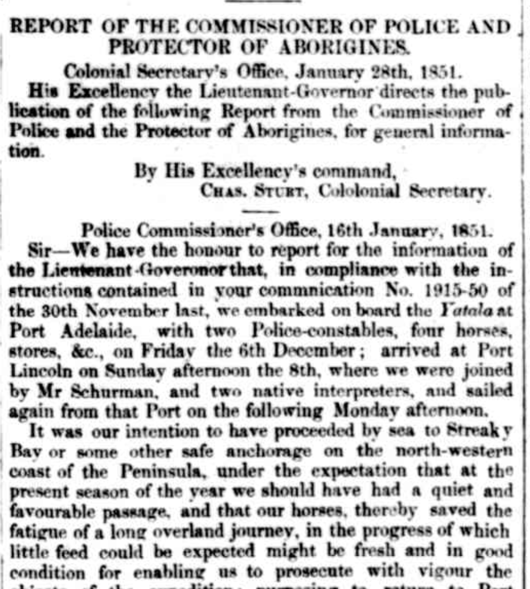
Above:- Part of the lengthy Report of The Commissioner of Police and the Protector of Aborigines, which appeared in the South Australian Register, Sat 1 Feb 1851. Image c/o Trove.
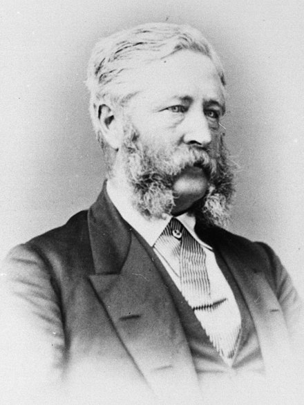
Sceale Bay is pronounced ‘Scale’ Bay. The bay after which it is named was named by Captain William Bloomfield Douglas (b. 1822. d. 1906) of the South Australian Marine Board in 1858. He named it in honour of a former Royal Navy companion. (Place Names 2012)
Above:- William Bloomfield Douglas. Image c/o Wikipedia.
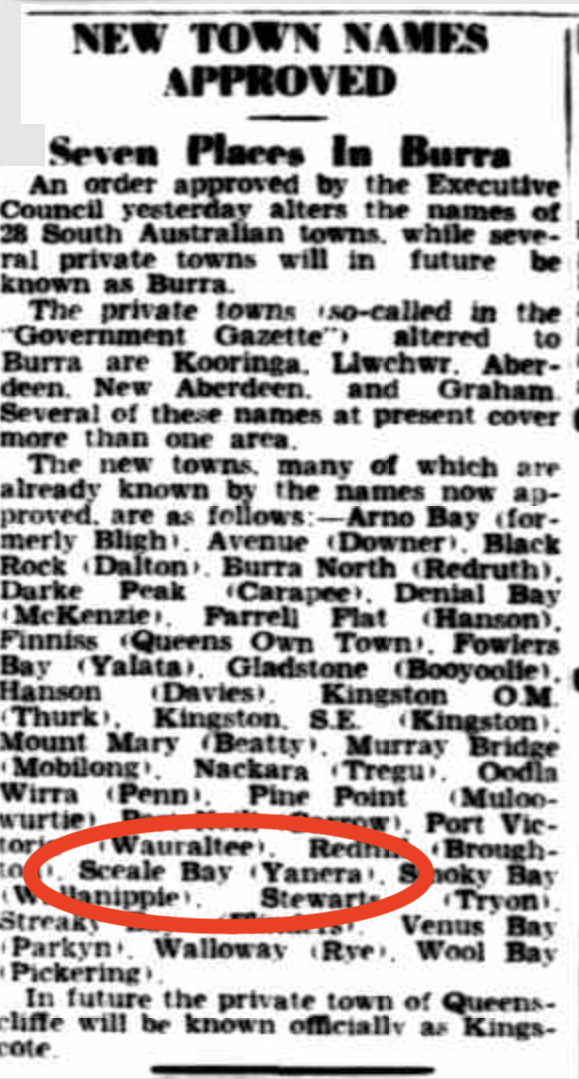
The town, originally called Yanera was proclaimed on the 25th day of October 1888. It was renamed Sceale Bay in 1940.
Above:- newspaper article from The Advertiser, Fri 26 Jul 1940. Image c/o Trove.
Today Sceale Bay is a quiet little coast town on the Eyre Peninsula with a population of about 30 people.
The Sceale Bay Conservation Park is about 532 hectares in size and was established on the 20th day of April 1995. (Wikipedia 2024)
Above:- The Sceale Bay Conservation Park. Image c/o Location SA Map Viewer.
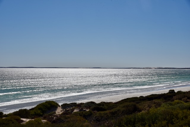
I set up on a dirt rack off Sceale Bay Road. I ran the Yaesu FT857, 40 watts, and the 20/40/80m linked dipole for this activation.
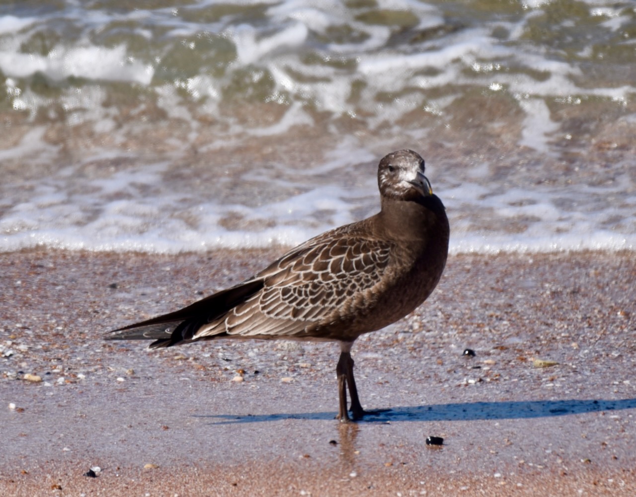
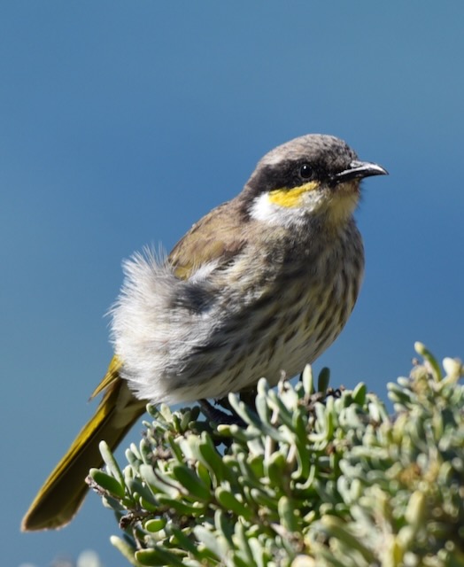
During my activation, I had the following little onlooker very close to my operating spot. It is a Singing Honeyeater.
I worked the following stations on 40m SSB:-
VK5TUX
VK5MAZ
VK5FB
VK2YW
VK5LA/m
VK5KAW/m
VK5HS/m
VK3YV
VK3TNL
VK3PF
VK3KAI
VK3MTT
I worked the following stations on 20m SSB:-
VK2IO/p (Tallaganda State Conservation Area VKFF-1375)
VK3APJ
VK3VIN
VK7XX
VK4NH
VK4DXA
VK3PF
VK3KAI
VK1AO
VK2mET
VK3GJG
VK2USH/p (Mole Creek Karst National Park VKFF-0322)
Trove. (2014). MURDER Of BAIRD AND BAIRDS BAY – Port Lincoln Times (SA : 1927 – 1986; 1992 – 2002) – 7 Nov 1940. [online] Available at: https://trove.nla.gov.au/newspaper/article/96748117 [Accessed 12 Jun. 2024].
My next park activation for Saturday 13th April 2024 was the West Coast Bays Marine Park VKFF-1758.
Above:- Map showing the location of the West Coast Bays Marine Park. Map c/o Google Maps.
The West Coast Bays Marine Park spans waters from Point Westall to Venus Bay. It is located in the Chain of Bays region of South Australia’s rugged west coast. The park has a backdrop of spectacular surf beaches, cliffs, rocky headlands and large shallow estuaries. It is one of 19 marine parks in South Australia. At 789 km2, it represents 3% of South Australia’s marine parks network. (Marine Parks 2024) (West Coast Bays Man Plan 2012)
Above:- Map showing the West Coast Bays Marine Park boundary. Image c/o Parks SA.
The Wirangu and Nauo-Barngarla Aboriginal people have traditional associations with areas of the marine park. A historic whaling station and several shipwrecks lie within the Marine Park. The park provides a perfect habitat for several species fish including King George whiting, flounder, snapper, southern sea garfish and flathead. The world’s smallest live-bearing starfish known locally as ‘Little Patty’ can be found in the park. The park is also home to Australian sea lions, seabirds and migratory shorebirds. (Marine Parks 2024) (West Coast Bays Man Plan 2012)
I ran the Yaesu FT857, 40 watts and the 20/40/80m linked dipole for this activation. I logged a total of 60 stations on 20 & 40m SSB.
I worked the following stations on 40m SSB:-
VK5LA/m
VK5KAW/m
VK5KBJ
VK5MAZ
VK5HS/m
VK3PF
VK3KAI
VK5GY
VK3DL
VK5TUX
VK5DW
VK5FR/p (Kellidie Bay Conservation Park VKFF-1042)
VK3APJ
VK3OAK
VK5MOS/p
VK5QA
VK3CLD
VK7ALH
I worked the following stations on 20m SSB:-
VK7XX
VK2IO/p (VKFF-1375 & SOTA VK2/ ST-009)
VK7HBR
VK1AO
VK2MET
VK4EMP
VK4TI
VK5MAZ
VK4HAY
VK3PWG
VK5QA
VK3CLD
ZL3RIK
VK3APJ
VK4CZ
VK4NH
VK4DXA
VK2EXA
VK3DL
VK3CEO
VK4DNO
VK3PF
VK3KAI
VK7EE
VK2EIR
VK2COS
VK7MAD
Zl4NVW
VK3ZSC
VK6HAF
ZL1TM
VK3SQ
VK2BD
VK3EJ
VK3ZK/p (Tocumwal Regional Park VKFF-0978)
VK1DI
VK7DW
VK2VW
VK2HFI
VK2AKA
VK2BUG
ZL3MR
References.
Department of Environment Water and Natural Resources, 2012, West Coast Bays Marine Park Management Plan.
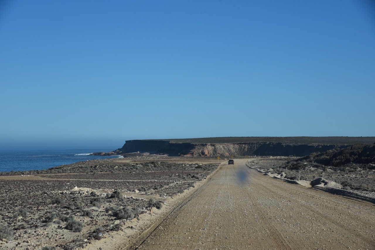
It was now Saturday 13th April 2024, and my plans for the day were to activate some parks north of Elliston. After breakfast, I headed north on Flinders Highway.
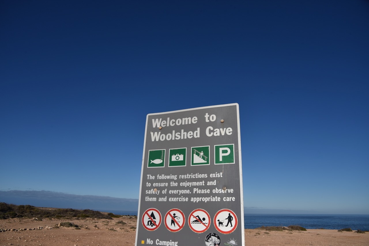
My first stop was Woolshed Cave, part of the Talia Caves. Talia is an aboriginal word meaning ‘near water.’ The ‘Talia Run’ was named by John Harris Browne (b. 1817. d. 1904) under pastoral lease no. 1596 on land held, originally, by J.T. Symes from 2 January 1856 at Wedge Hill.
Above:- John Harris Browne. Image c/o Wikipedia.
The Talia Post Office was opened c. 1862. The Hundred of Talia was proclaimed on the 22nd day of September 1881. The town of Talia was proclaimed on the 17th day of May 1883. The Talia School opened in 1889 and closed in 1941. (Place Names 2012)
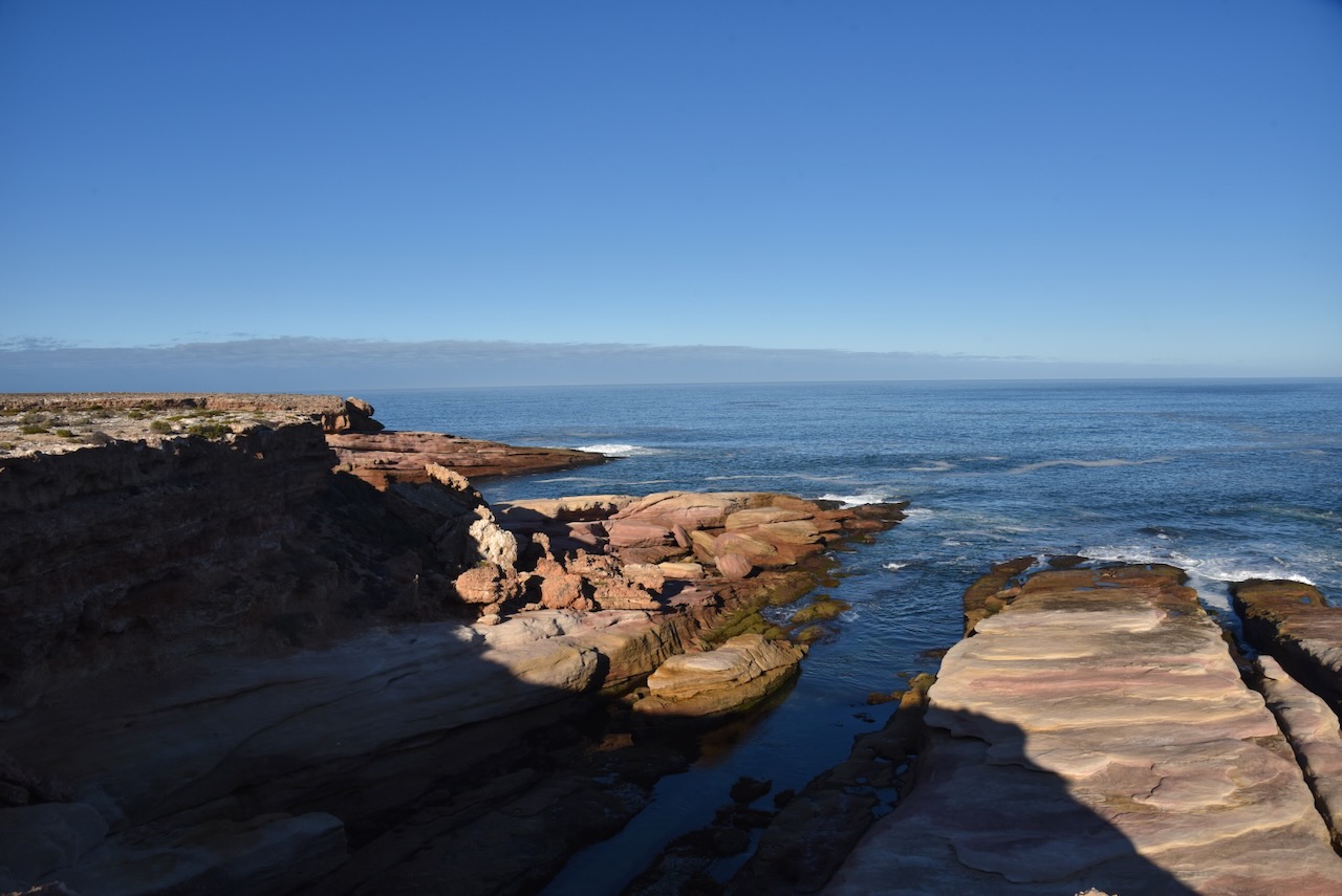
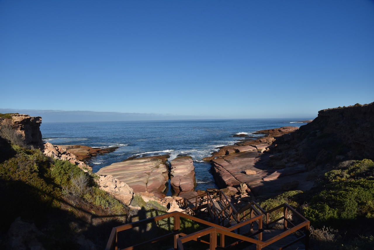
Woolshed Cave is a large cavern that is carved into the granite cliff by wave action. There are some wooden steps that lead down to the rocks. Woolshed Cave is located on Talia Caves Road off the Flinders Highway. Woolshed Cave is part of the Talia Caves. (South Australia 2023)
Below is a video I found on YouTube showing Woolshed Cave.
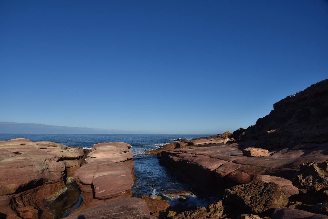
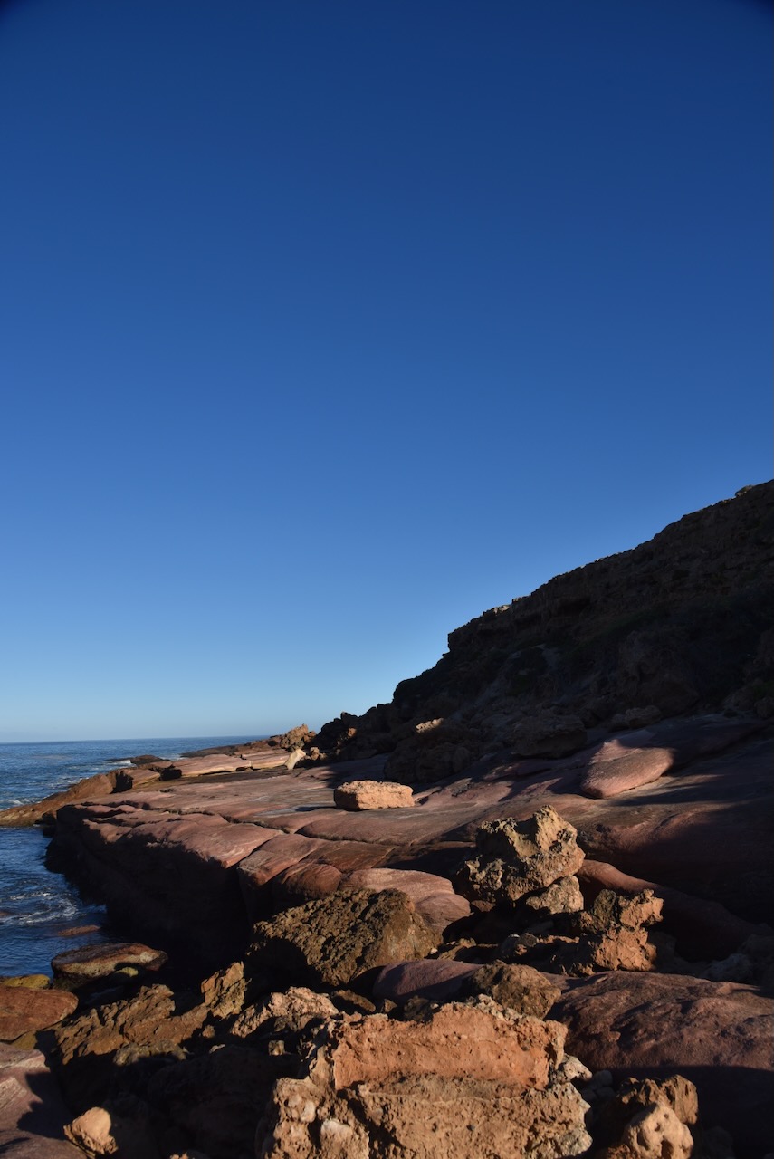
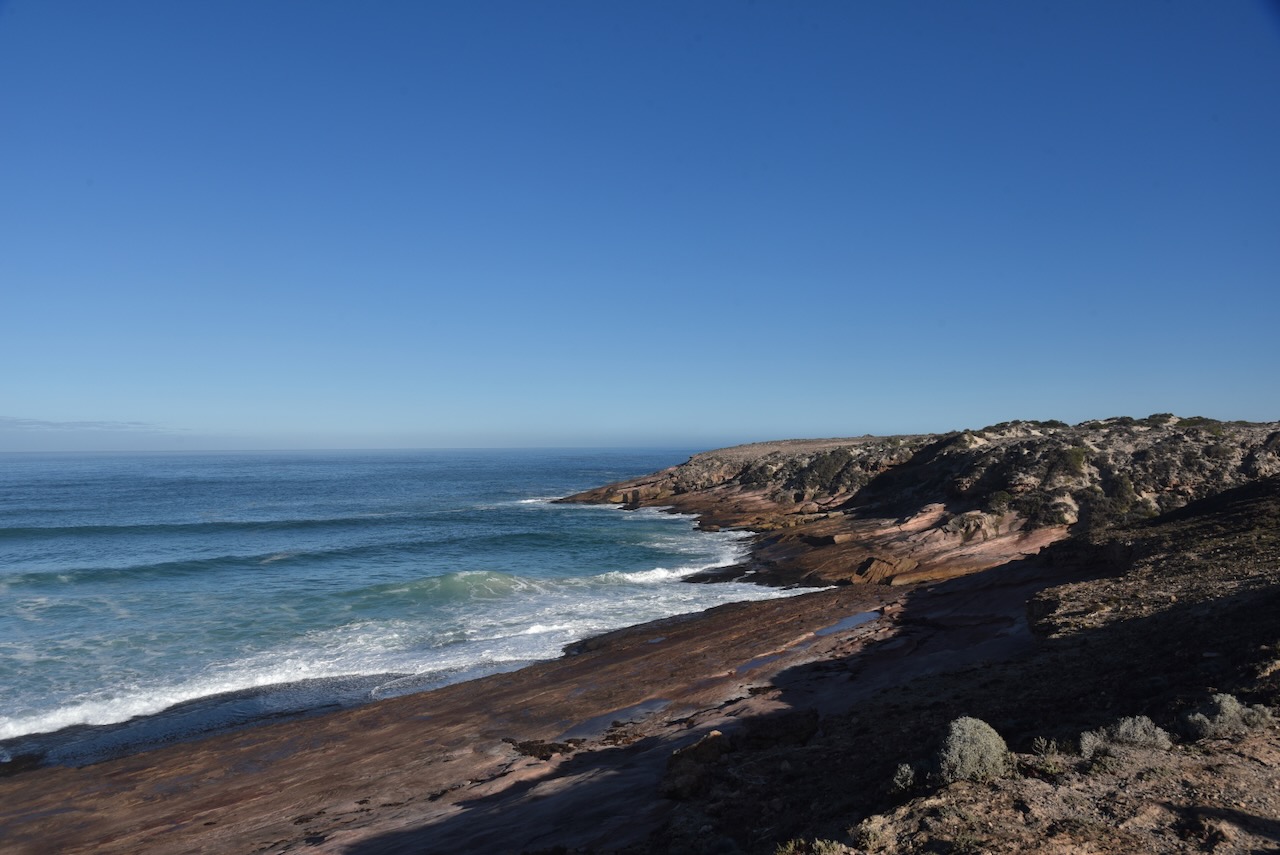
The western side of the Eyre Peninsula is absolutely spectacular. It rivals and exceeds other famous Australian coastlines. But it is a long way from Adelaide. Despite that there were numerous people travelling around the area in their caravans and motorhomes which was great to see.
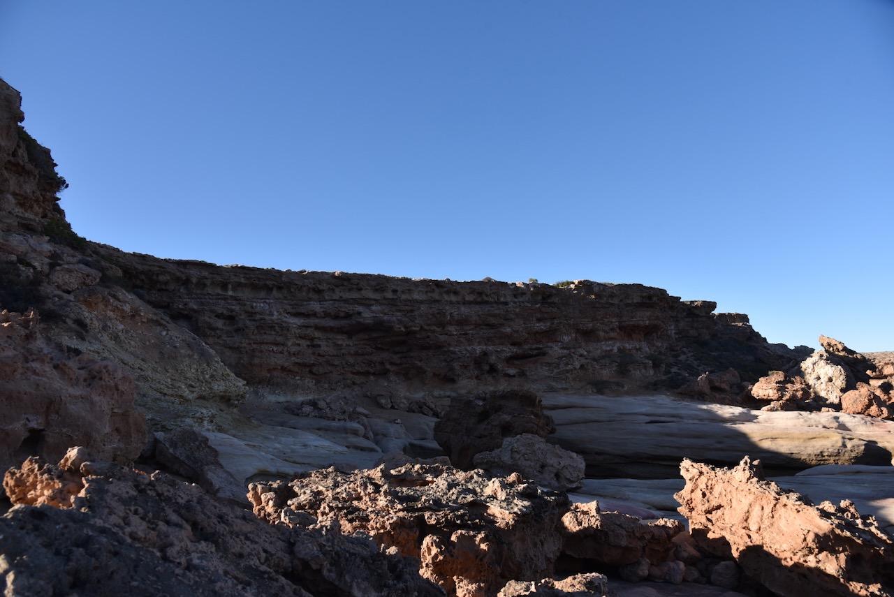
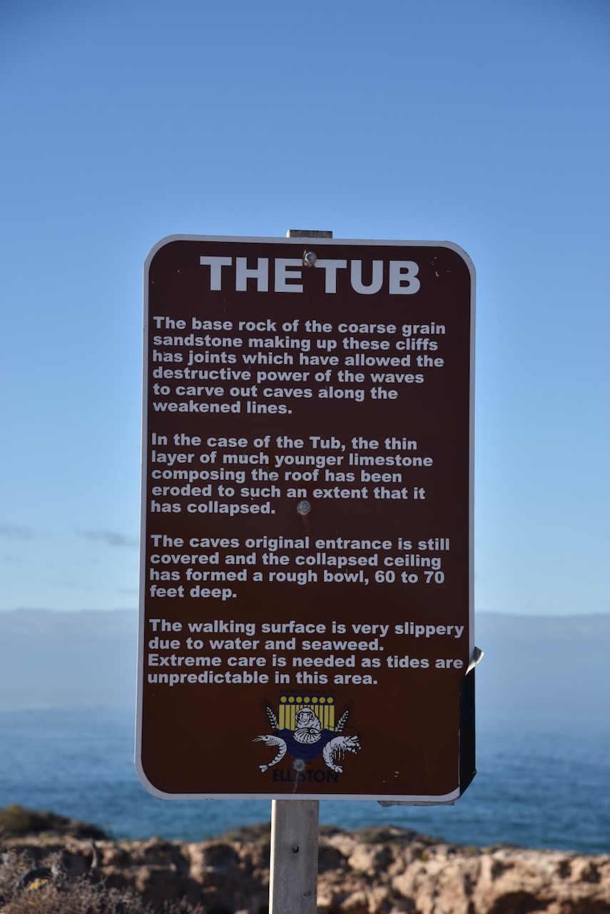
I followed the dirt road along the coast and soon reached The Tub. a large crater in the cliff with a tunnel connection to the ocean. The Tub is 10 to 30 metres deep and 50 metres across with a granite base. (South Australia 2023)
A little further along is a parking area on a cliff face offering magnificent views of Talia Beach.
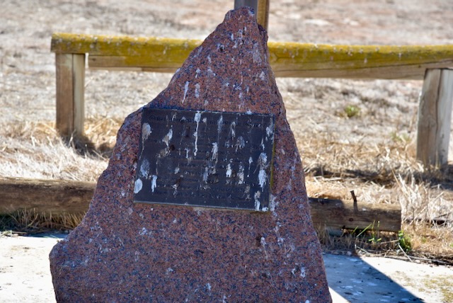
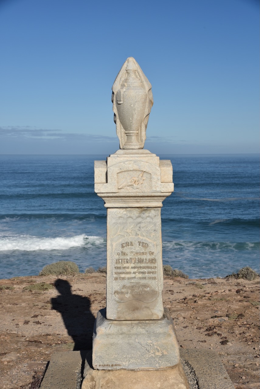
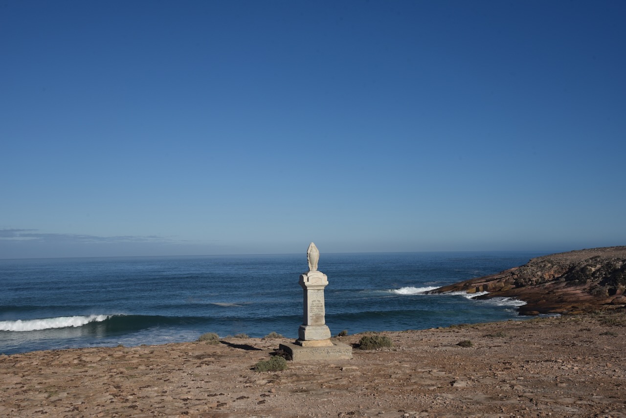
Along this dirt road, you will also find a monument for Sister D.B. Millard who was accidentally drowned on the 24th day of June 1948.
Doris Belle Millard was born in 1895 at Broadford, Victoria. As a child she lived at Broken Hill and received training as a nurse at the Broken Hill Hospital. In about 1923 she left Broken Hill and moved to the Eyre Peninsula. (Barrier Mail 1928)
On the 24th June 1928, Sister Millard came with friends to Talia for a picnic. The ‘motoring party’ consisted of Sister Millard, Mr & Mrs J.B. Hastings and Mr. & Mrs. W.H. Brownrigg. The day prior she had resigned from her position at Murat Bay (Ceduna) Hospital the day prior. Sister Millard walked to the cliff edge to take a photograph. Without any warning, the cliff beneath her collapsed and she fell into a blowhole fissure. Sadly her companions were unable to assist and watched her struggle in the ocean and finally drown. Her body was never recovered. (Monument Australia 2024) (Terrible Drowning Fatality 1928)
Above:- Article from the Barrier Miner, Broken Hill, Tue 10 Jul 1928. Image c/o Trove.
It was a beautiful sunny day and I continued to enjoy some magnificent views of the coastline of the western Eyre Peninsula.
I then drove back along Talia Caves Road to the Flinders Highway.
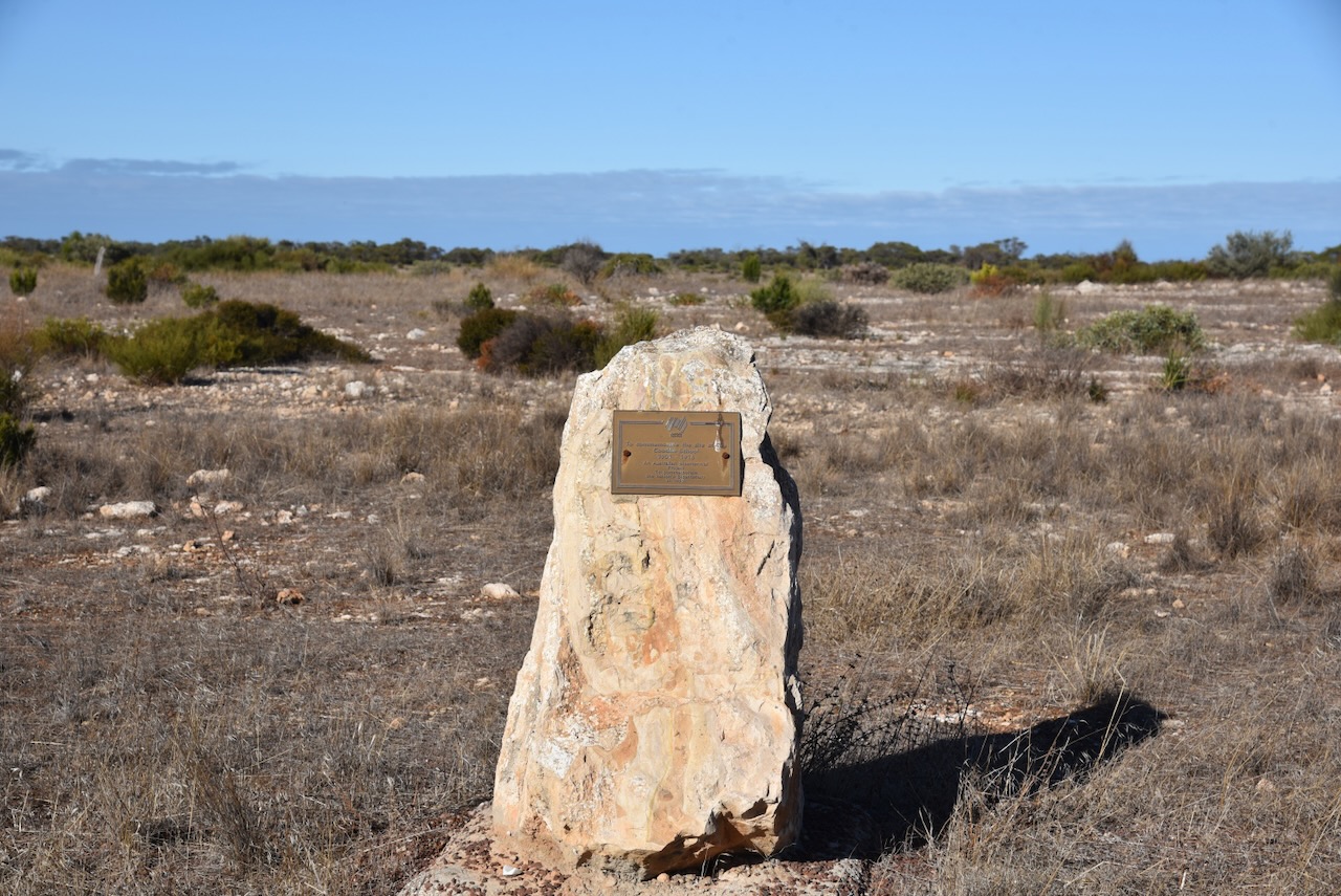
I continued north along the Flinders Highway and then stopped at the monument for the Coodie School which operated from 1901-1916.
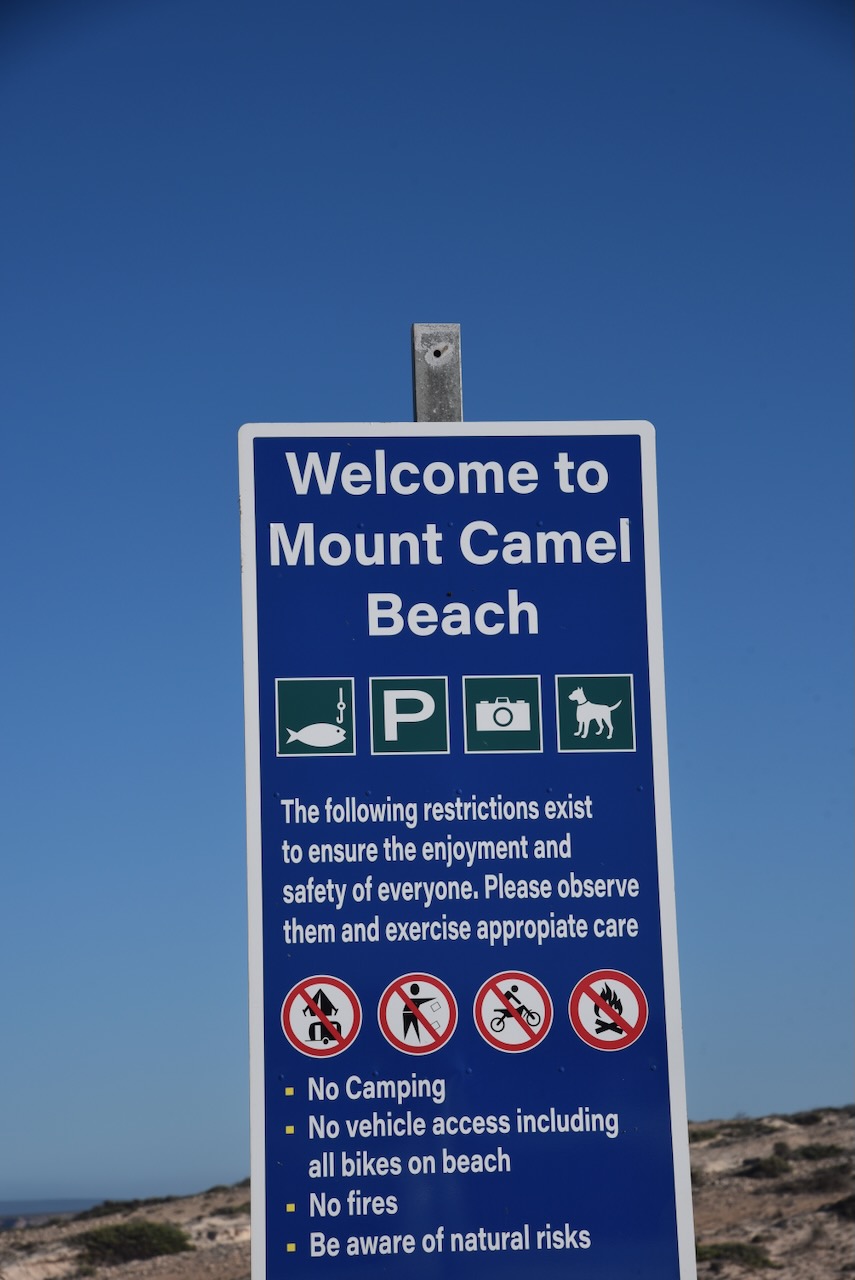
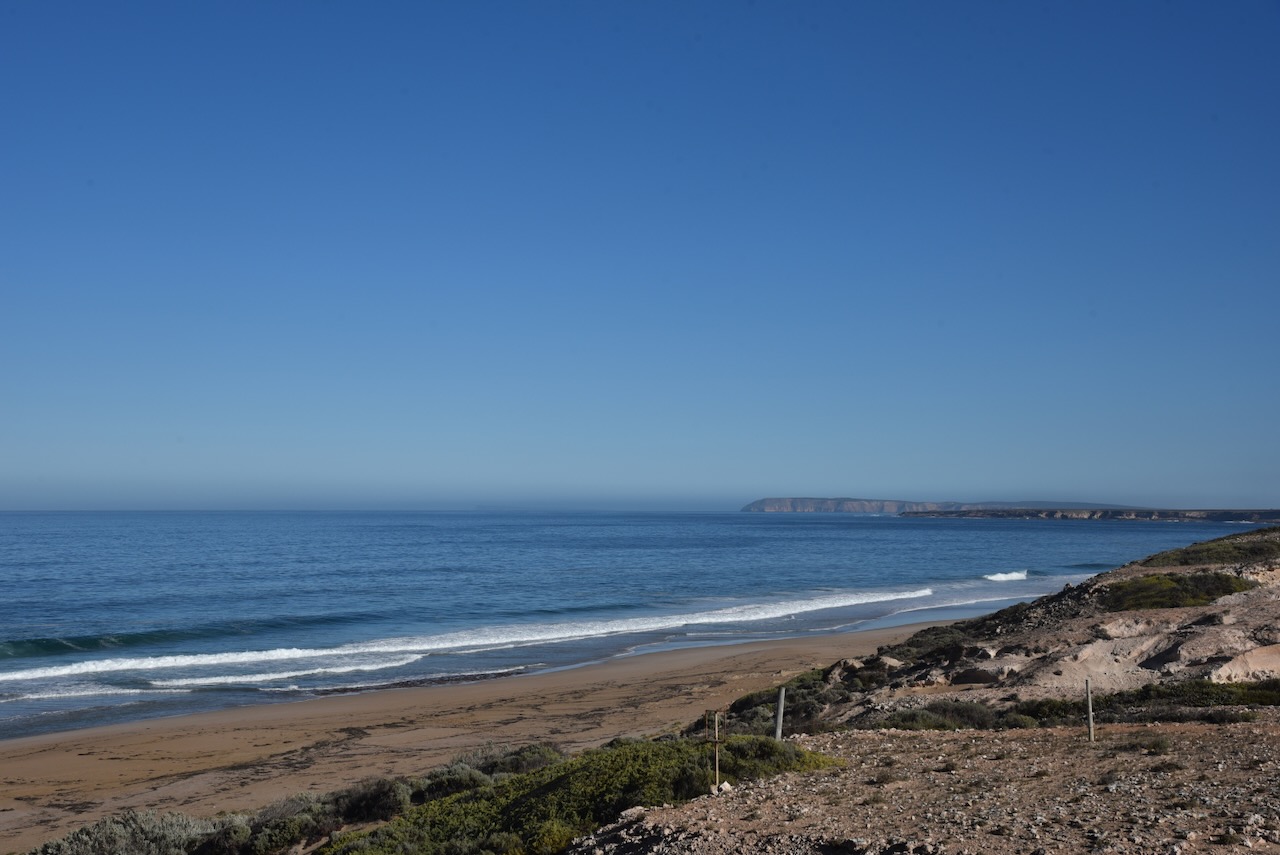
I then visited Mount Camel Beach, a pristine beach that is well known for surf fishing.
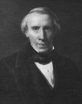
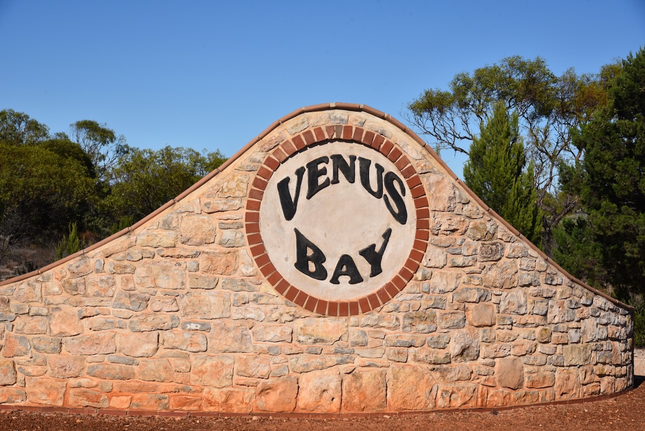
After leaving Mount Camel Beach I headed into the town of Venus Bay. Venus Harbor, now known as Venus Bay was chartered by explorer Matthew Flinders in 1802. (Wikipedia 2024)
Above:- Matthew Flinders. Image c/o Wikipedia.
In March 1839, an exploratory party aboard the brig Nerus landed in the bay. The party comprised Captain F.R. Lees, David McLaren, and Samuel Stephens. McLaren and Stephens were the current and former Colonial Managers of the South Australian Company who were examining the west coast of South Australia for potential special surveys. (Wikipedia 2024)
Above:- David McLaren. Image c/o Wikipedia.
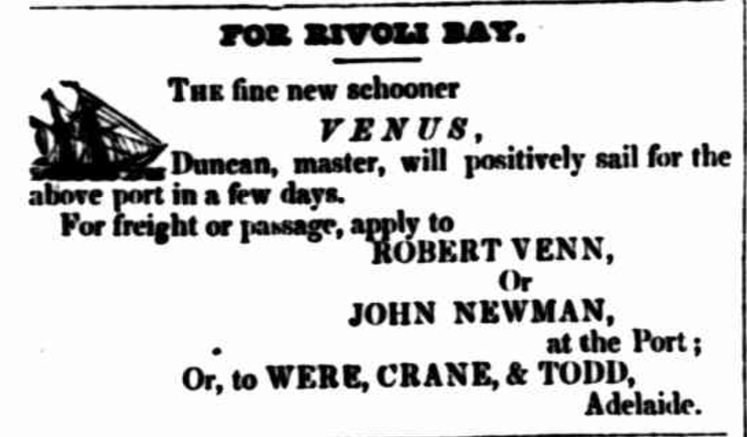
During the 1850s sheep pastoralists settled in the area. IN 1850 in order to load wool, the bay was first entered by the 60 ton schooner Venus captained by Robert Venn. The bay took its name after this vessel. The Venus traded along the Australian coast before she was wrecked at Cronulla in 1852. (Wikipedia 2024)
Above:- Advertisement from the South Australian Register, Sat 20 Nov 1847. Image c/o Trove
A whaling station was established in the area in the 1850s. A small settlement sprung up which consisted of a shop, a hotel and a police station. The Police Commissioners Report which appeared in the South Australian Register on Saturday 2nd February 1856 recored that there were eleven aboriginal mounted constables of the Native Police Force stationed at Venus Bay under the command of Sergeant Eyre. (SA Register 1855) (Wikipedia 2024)
Above:- Item from the South Australian Register, Sat 2 Feb 1856.
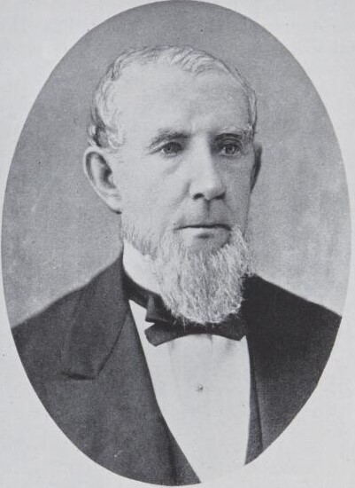
The town of Venus Bay was surveyed in August 1864 as ‘Parkin’. It was named in honour of William Parkin (b. 1801. d. 1889), a notable businessman, politician, and philanthropist. It was offered for sale on the 22nd day of June 1865. (Aust Dict Biography 2024) (Place Names 2012) (Wikipedia 2024)
Above:- William Parkin. Image c/o Wikipedia.
The name of the town was changed on the 19th day of September 1940 to align with the name of the bay, Venus Bay. (Wikipedia 2024)
Above:- Article from the Port Lincoln Times, Thu 1 Aug 1940. Image c/o Trove.
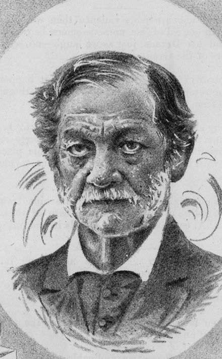
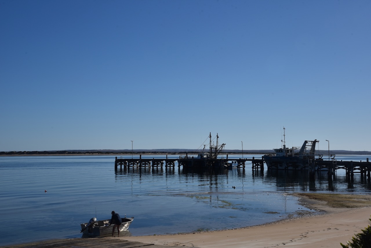
In 1880 a jetty was constructed following the presentation of a petition to the government in August 1877 by Mr. Patrick Boyce Coglin (b. 1815. d. 1892). Coglin was a businessman and politician. He was known as “Polysyllabic Coglin” for his love and frequent use of long and obscure words (Place Names 2012) (Wikipedia 2024)
Above:- Patrick Boyce Coglin. Image c/o Wikipedia.
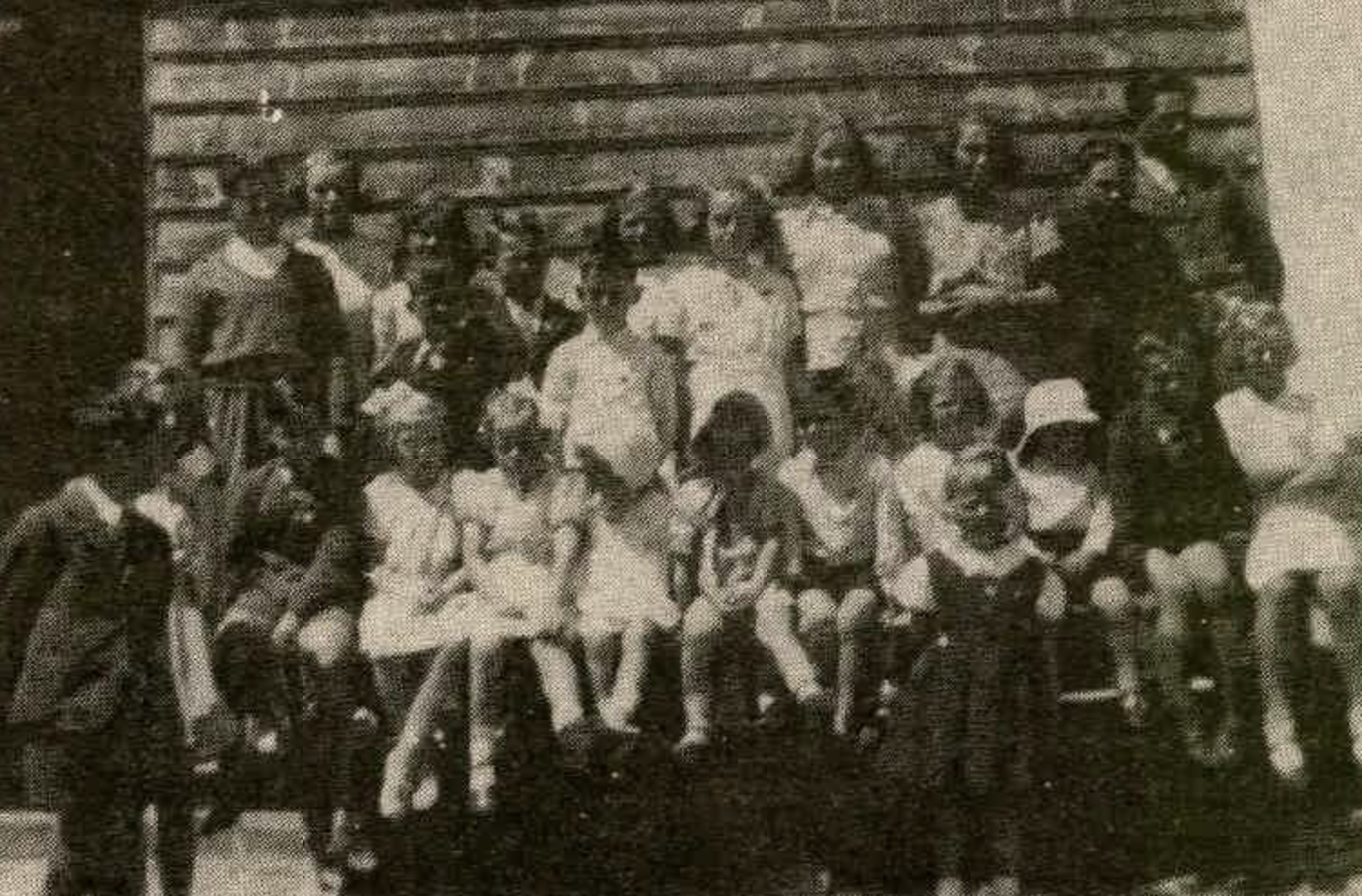
The Venus Bay School was opened in 1939 and was closed in 1955. (Place Names 2012)
Above:- Students at the Venus Bay School in 1941. Image c/o Port Lincoln Times, Fri 31 Aug 1984
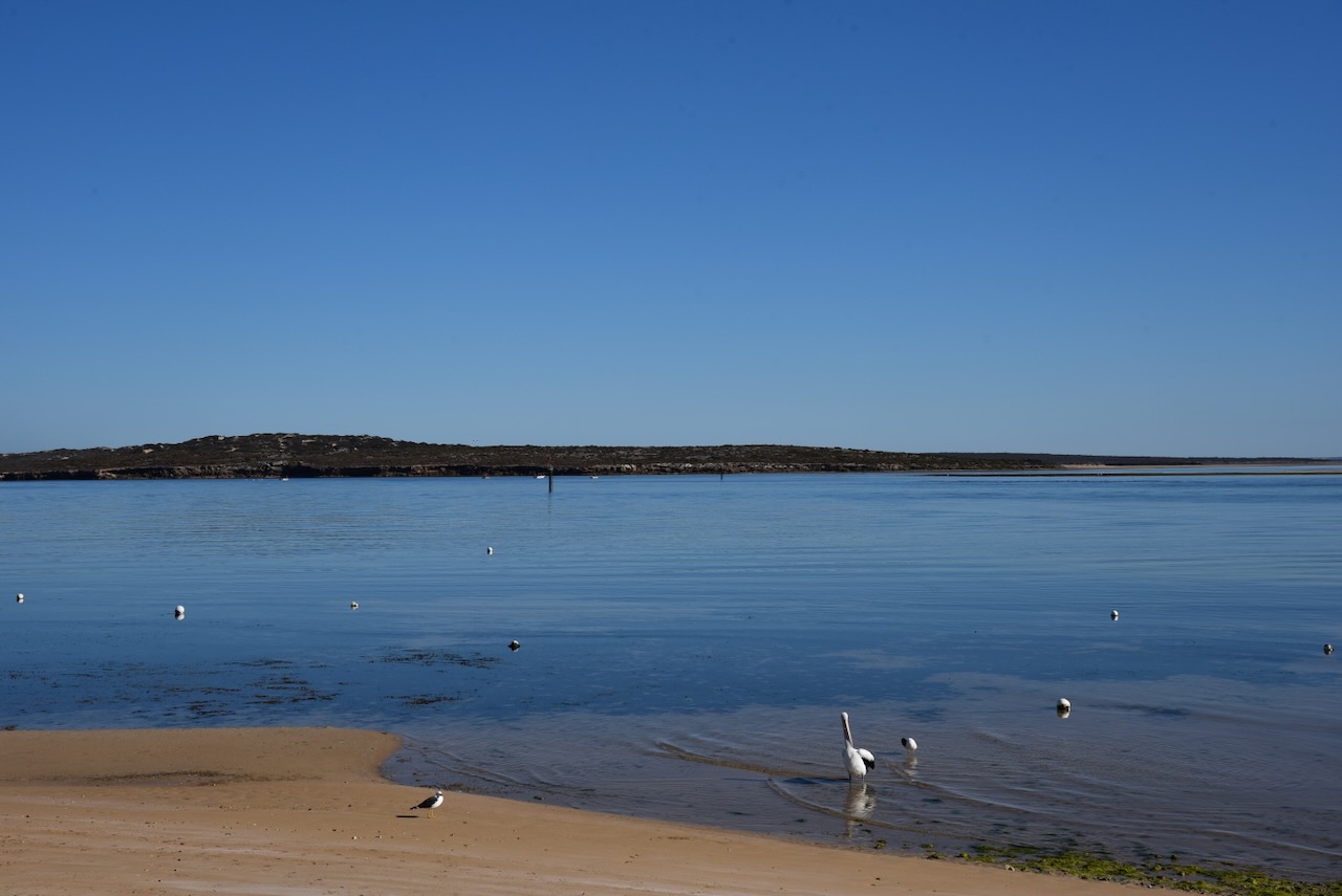
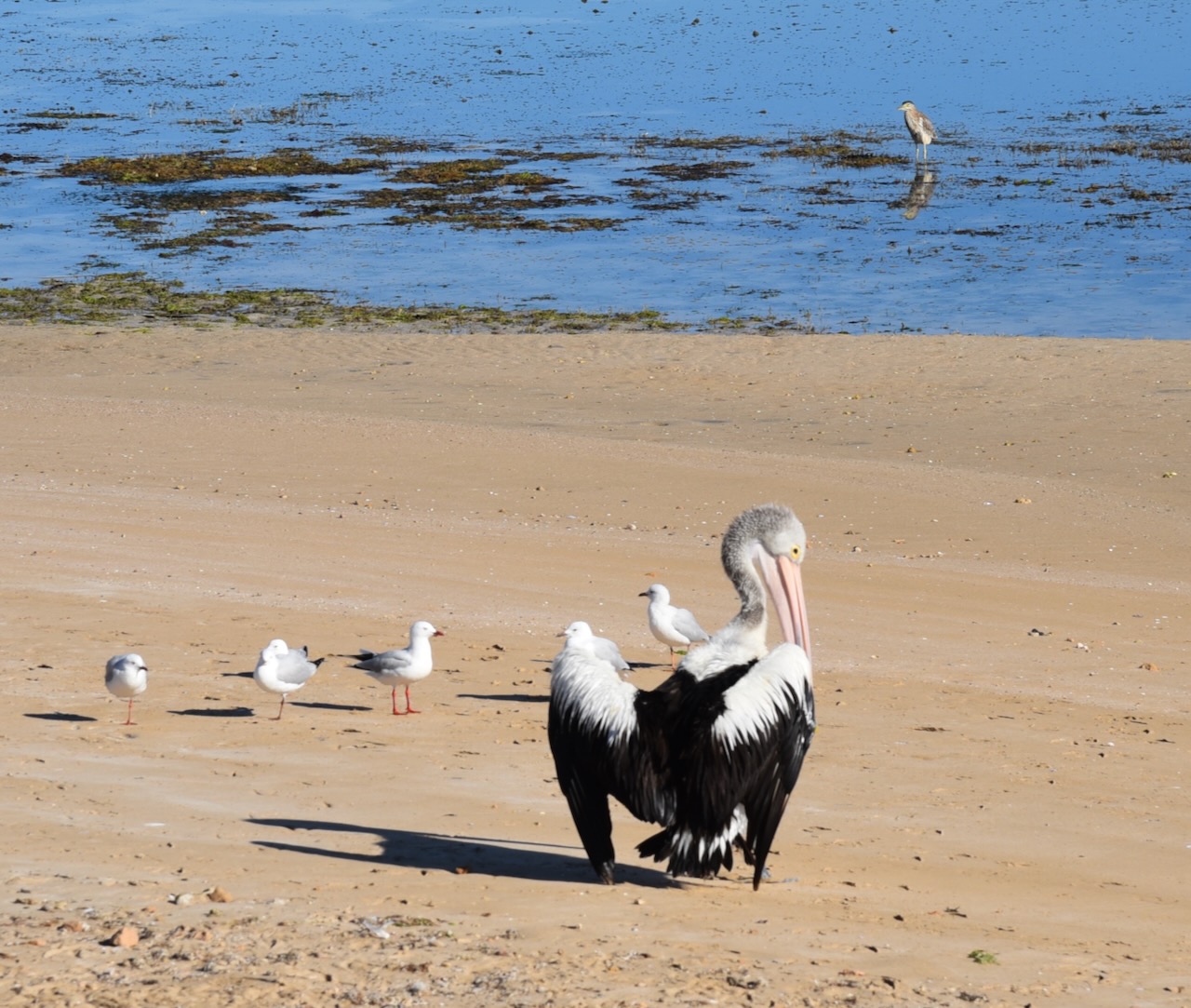
Today Venus Bay is a popular but small tourist and fishing town.
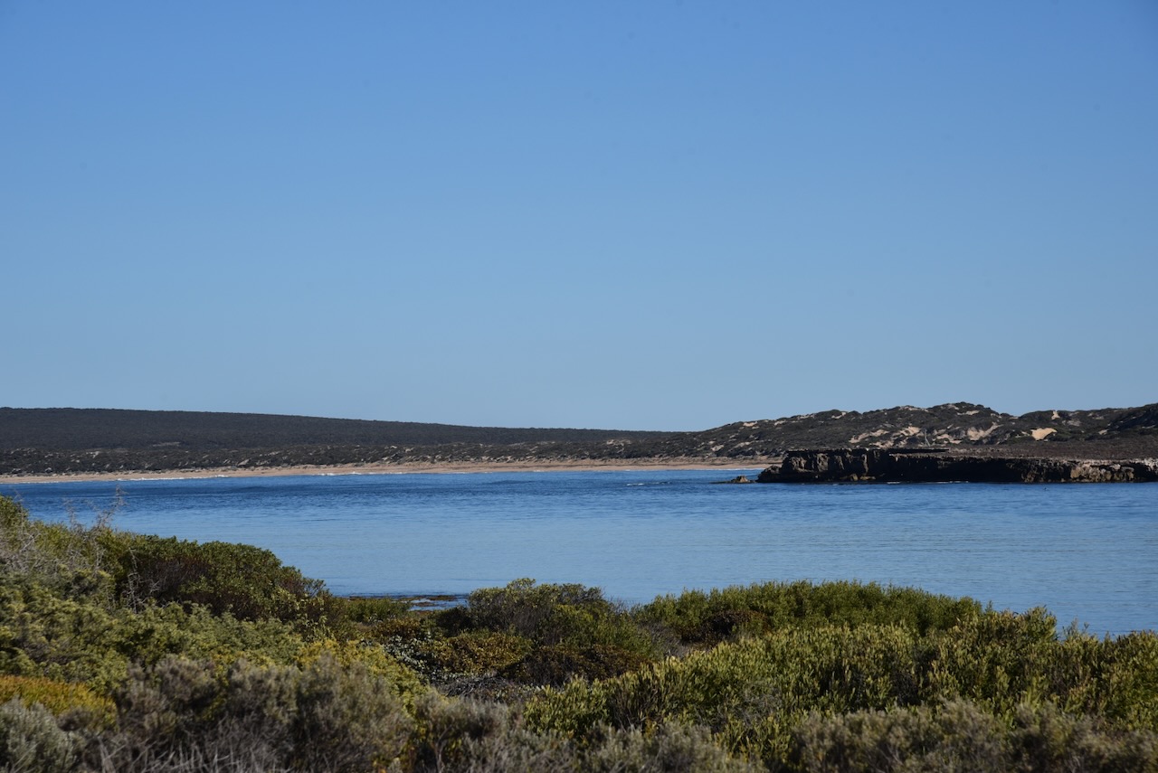
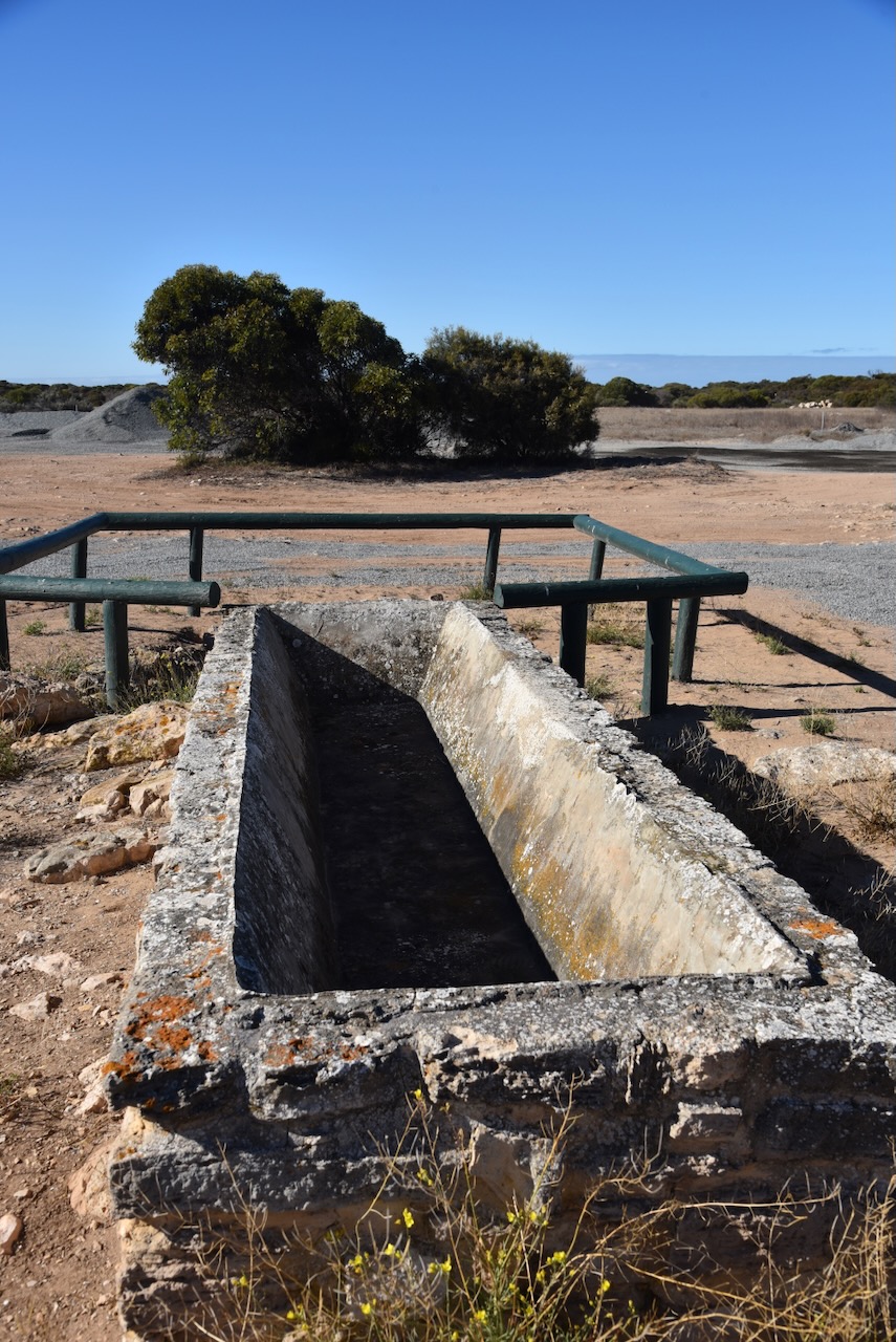
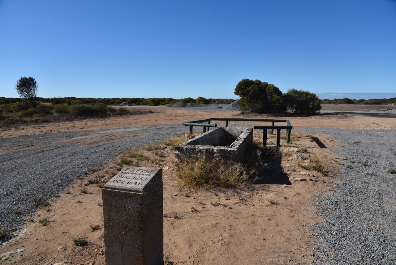
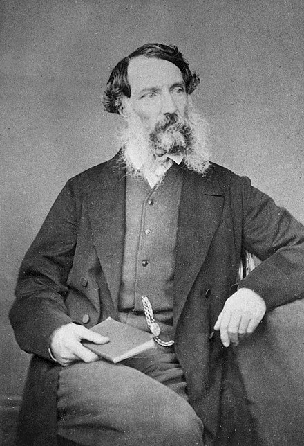
Before heading to my park activation I stopped at the monument for the explorer Edward John Eyre who stopped at thus point to use the water at the well.
Edward John Eyre (5 August 1815 – 30 November 1901) was an English land explorer of the Australian continent, colonial administrator
Above:- Edward John Eyre. Image c/o Wikipedia.
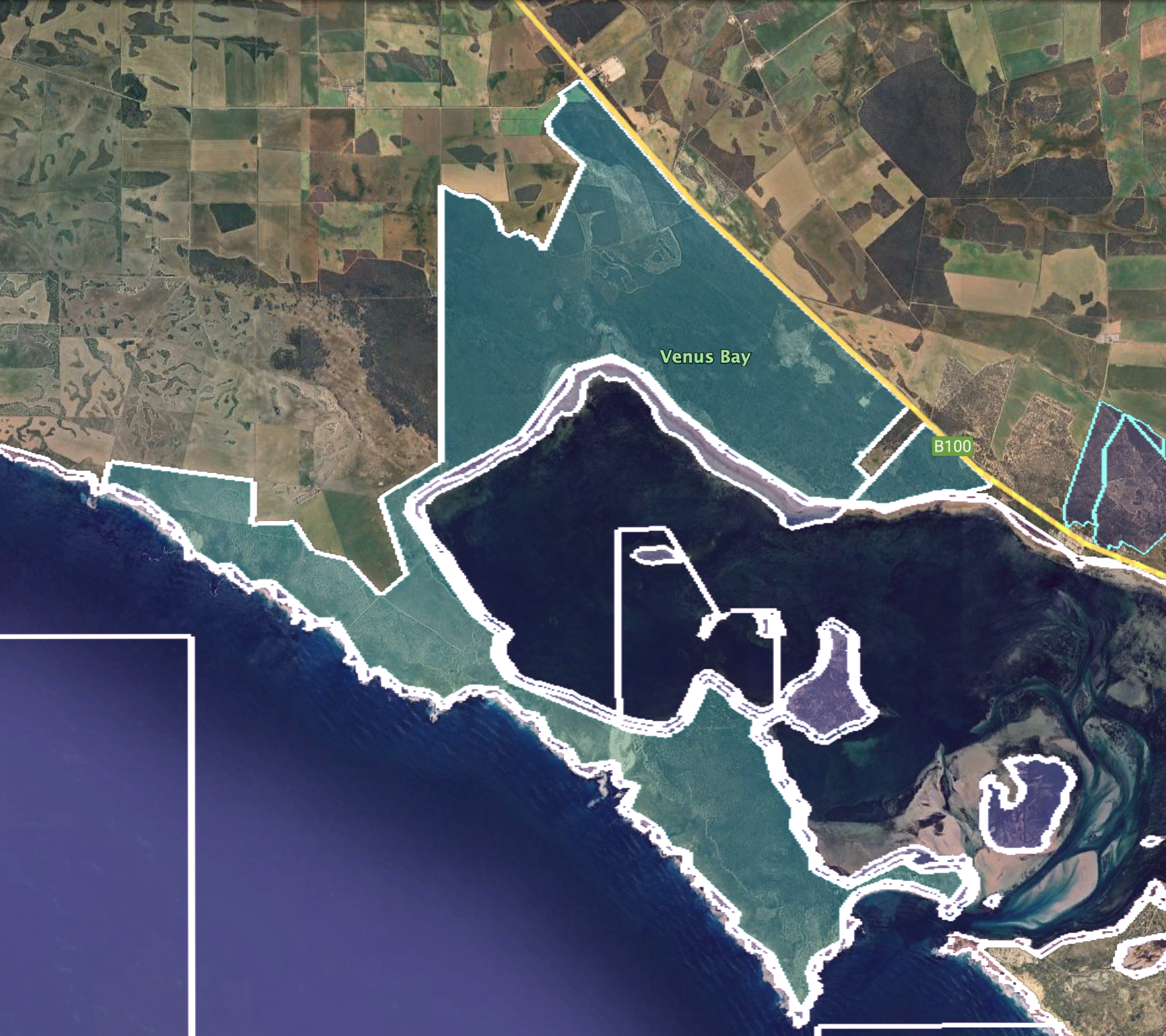
Venus Bay Conservation Park comprises land on the Weyland Peninsula on the south side of Venus Bay, land on the north west side of the bay to the west of the town of Port Kenny and the seven islands located within the bay. (Wikipedia 2024)
Above:- The park boundaries of the Venus Bay Conservation Park. Image c/o Google Earth.
Venus Bay Conservation Park is about 1,460 hectares in size. The park was proclaimed on the 12th day of February 1976 and was originally proclaimed to protect ‘important feeding and breeding grounds for many native birds’. This includes oyster catchers, terns, rock parrots, pacific gulls, and quali. (Venus Bay Man Plan 2006) (Wikipedia 2024)
Venus Bay consists of seven island including Germein Island, Garden Island, Tank Island. In 1975 these islands were withdrawn from the control of the Minister of Marine and were proclaimed as a Conservation Park in 1976. In 1977 an eastern area of the Weyland Peninsula was added to the park. In 1993 further sections of land were added. (Venus Bay Man Plan 2006)
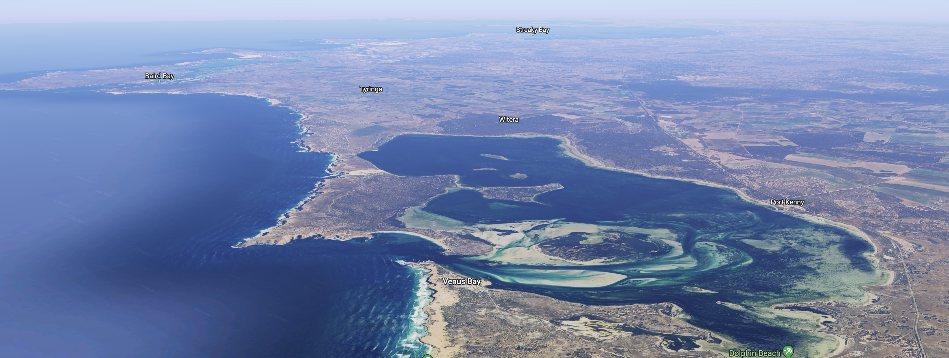
Above:- An aerial view of Venus Bay. Image c/o Google Maps.
I ran the Yaesu FT857, 40 watts, and the 20/40/80m linked dipole for this activation.
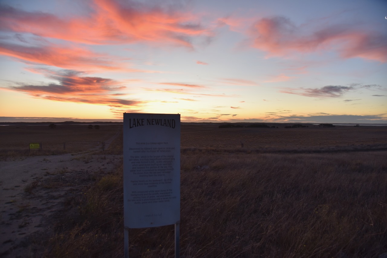
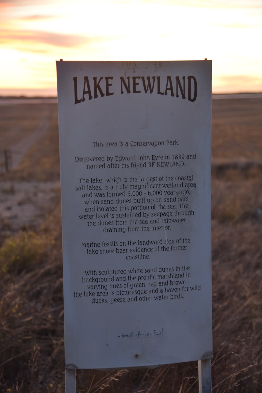
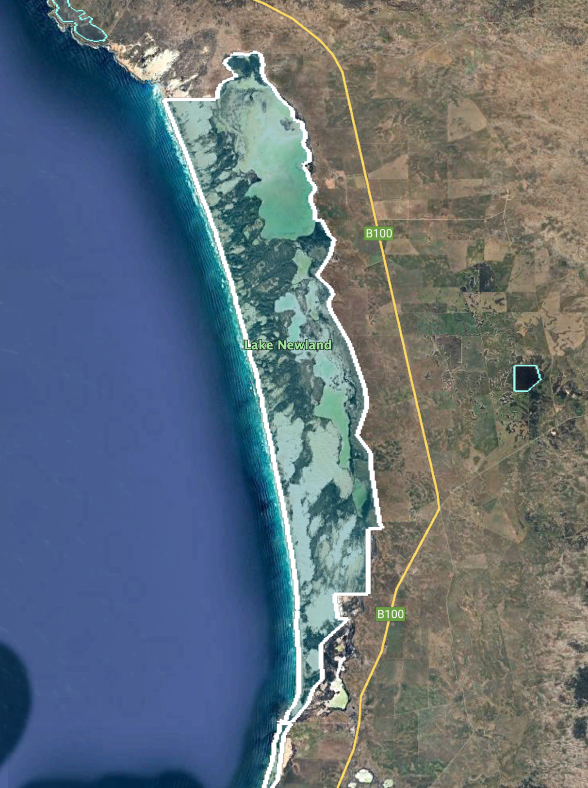
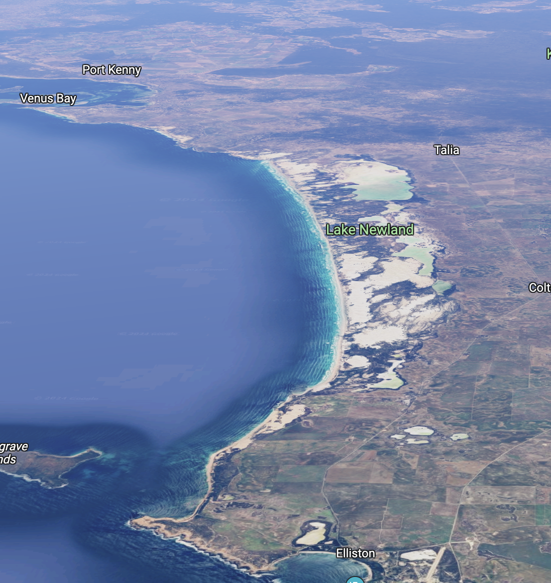
My final activation for Friday 12th April 2024, was the Lake Newland Conservation Park VKFF-1046. The park is located about 9 km north of Elliston and about 656 km from Adelaide
Above:- Map showing the location of the Lake Newland Conservation Park. Map c/o Google Maps.
After my dinner, I headed north out of Ellison along the Flinders Highway. This highway connects the towns of Cedun a and Port Lincoln and was named in honour of the famous explorer Captain Matthew Flinders.
Above:- Captain Matthew Flinders. Image c/o Wikipedia.
I was hoping to access the park off the Flinders Highway. I reached a park sign and a gate with a track leading down to the park, but I was unsure if I was allowed access at this particular point. It turned out that this was Lake Newland Road and access was probably allowed. But I erred on the side of caution and headed back south.
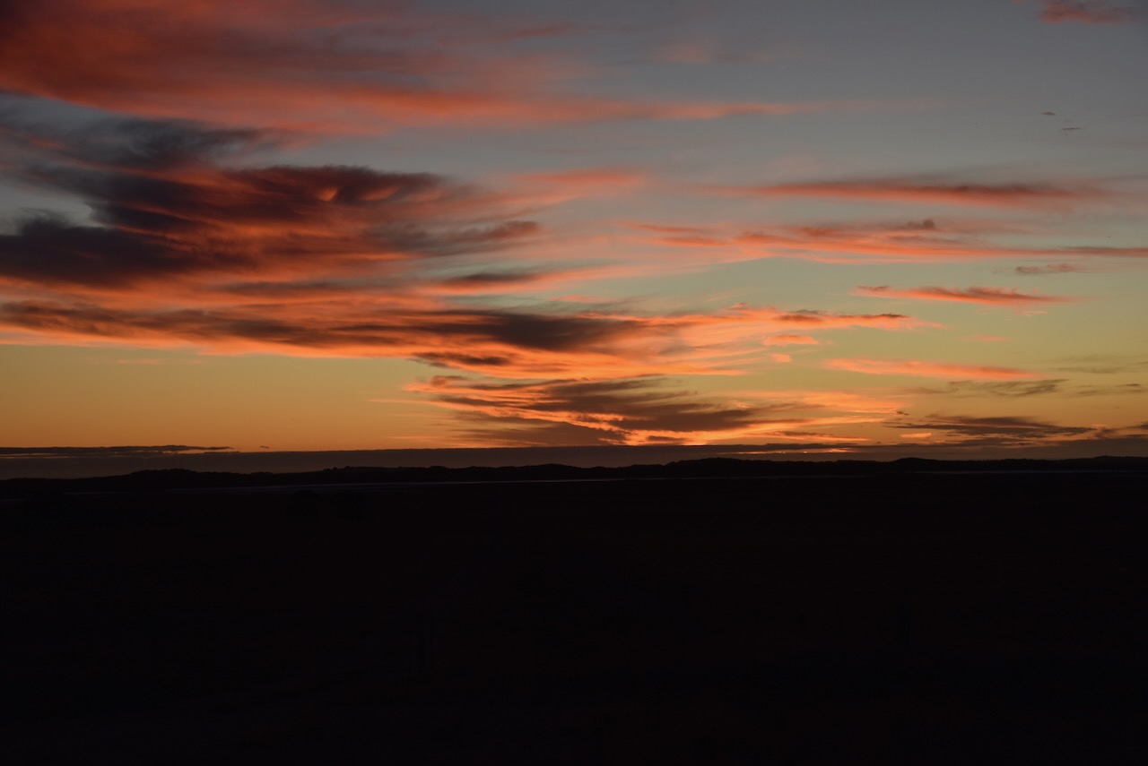
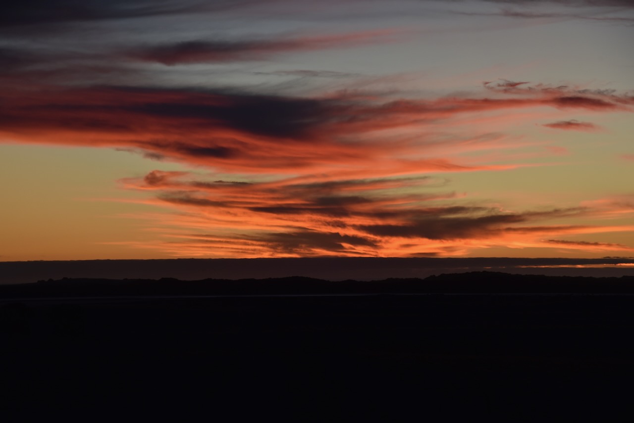
The sun was setting and there was a magnificent sunset to be enjoyed as I travelled down the highway.
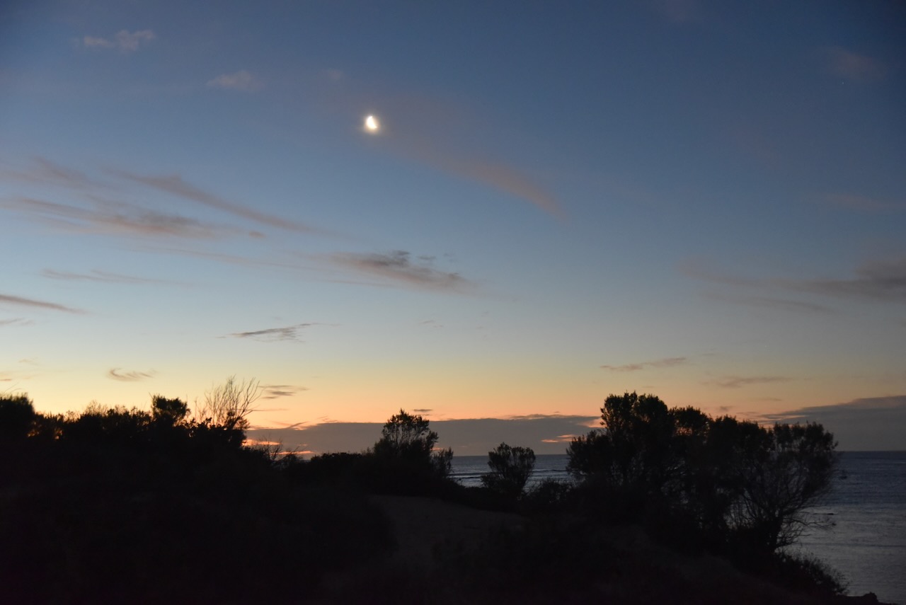
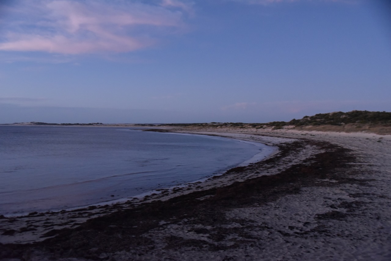
I accessed the park via Walkers Rock Road. Sadly it was almost dark by the time I got into the park so I only managed a couple of quick photographs.
The park stretches along the coastline from near Three Lakes Road in the south to Mount Damper Road at Talia to the north. The park features the most extensive wetland on the Eyre Peninsula. (Parks SA 2024)
Above:- The park boundaries of the Lake Newland Conservation Park. Image c/o Google Earth.
The Lake Newland Conservation Park is about 8,880 hectares in size and was first proclaimed on the 1st day of August 1991 with additional areas added to the park on the 27th day of June 1996 and the 14th day of October 2010. (Birds SA 2024)
Above:- An aerial view of the Lake Newland Conservation Park. Image c/o Google Maps.
The park has three specific vegetation types: Coastal Dune area, Saline Lakes and Flats, and Limestone Plains. (Birds SA 2024)
Birds SA have recorded about 111 native species of bird in the park including Cape Barren Goose, Pied Oystercatcher, Singing Honeyeater, Spiny-cheeked Honeyeater, Willie Wagtail, and Silvereye. (Birds SA 2024)
I drove down to the Walkers Rock campground and set up in one of the empty camp parking areas. I ran the Yaesu FT857, 40 watts, and the 20/40/80m linked dipole supported on the 7-metre heavy-duty squid pole.
I logged a total of 82 contacts on 20, 40 & 80m SSB.
I worked the following stations on 40m SSB:-
VK7IAN
VK5MAZ
VK3SPG
VK2RO
VK2EXA
Vk2YW
Vk1AO
VK2MET
VK3SX
VK3PWG
KD1CT
VK5GY
Vk4DNO
VK3APJ
VK3CEO
KG8P
VK5FANA
VK5TUX
VK6LK
VK6LMK
VK3PF
VK3KAI
VK4NH
VK4DXA
VK3CWF
VK3SO
VK3SFG
VK2IO/p (Tallaganda National Park VKFF-0474)
VK5NM
VK4EMP
VK4TI
VK3EJ
VK2HAK
VK5JBH
VK2DG
VK4NRI
VK3VPM
VK4KD
VK5FR/p (Lincoln National Park VKFF-0286)
VK4SMA
VK5BRU
Vk3GB
Vk3NFS
VK3SQ
VK2BD
JF7RJM
VK5KVA
VK5DW
VK7MAD
VK2LQ
VK2PCT
VK5AMH
VK5PE
VK5AYL
VK4HMI
VK5CX
VK5RU
I worked the following stations on 80m SSB:-
VK5DW
VK3PF
VK3KAI
VK5MAZ
VK2HAK
Vk5NM
Vk3GL/p
VK4NH
VK4DXA
VK5TUX
VK5CZ
Vk3CWF
VK5HAA
VK5KVA
VK5BRU
VK3SMW
I worked the following stations on 20m SSB:-
W1FDY
N3SJL
VK6CB
VE9CF/p
N4HOZ
N4C
VK6ZG
VK6JDW
VK6ZLO
References.
Anon, (n.d.). Newland – Birding – Birdwatching – South Australia – Eyre Peninsula – Birds SA | birdssa.asn.au/location/lake-newland-conservation-park/. [online] Available at: https://birdssa.asn.au/location/lake-newland-conservation-park/ [Accessed 5 Jun. 2024].