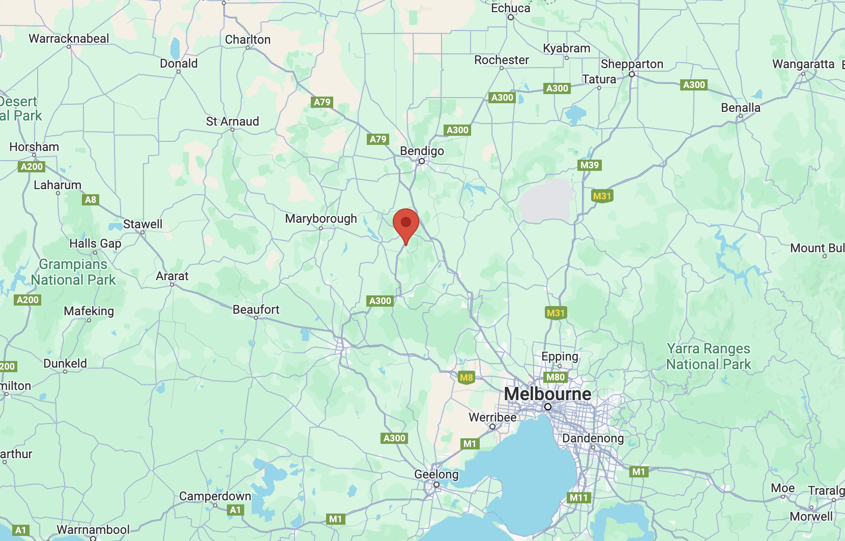
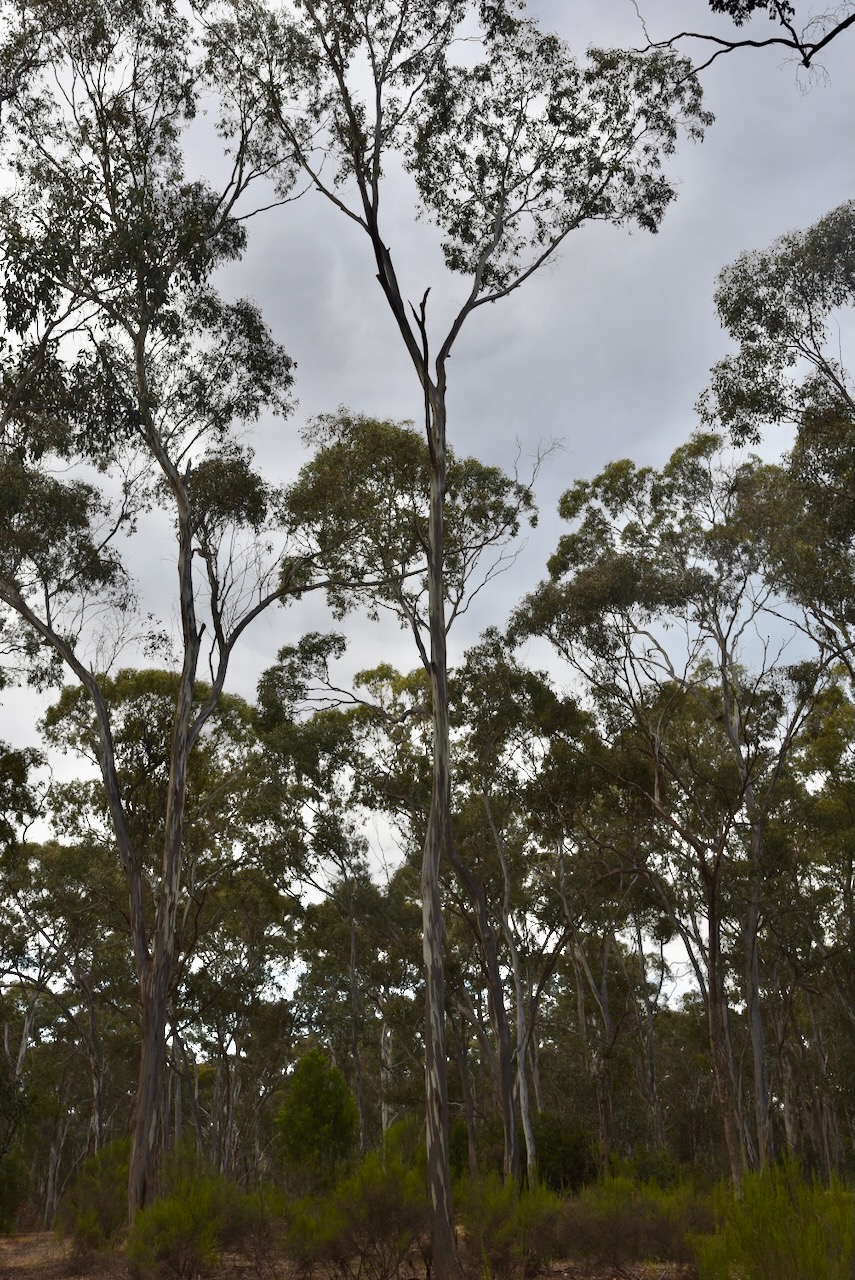
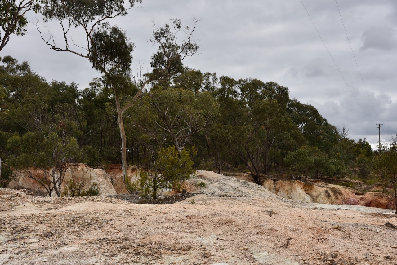
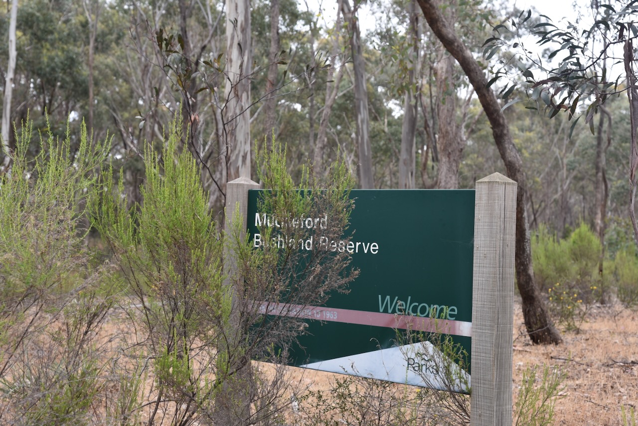
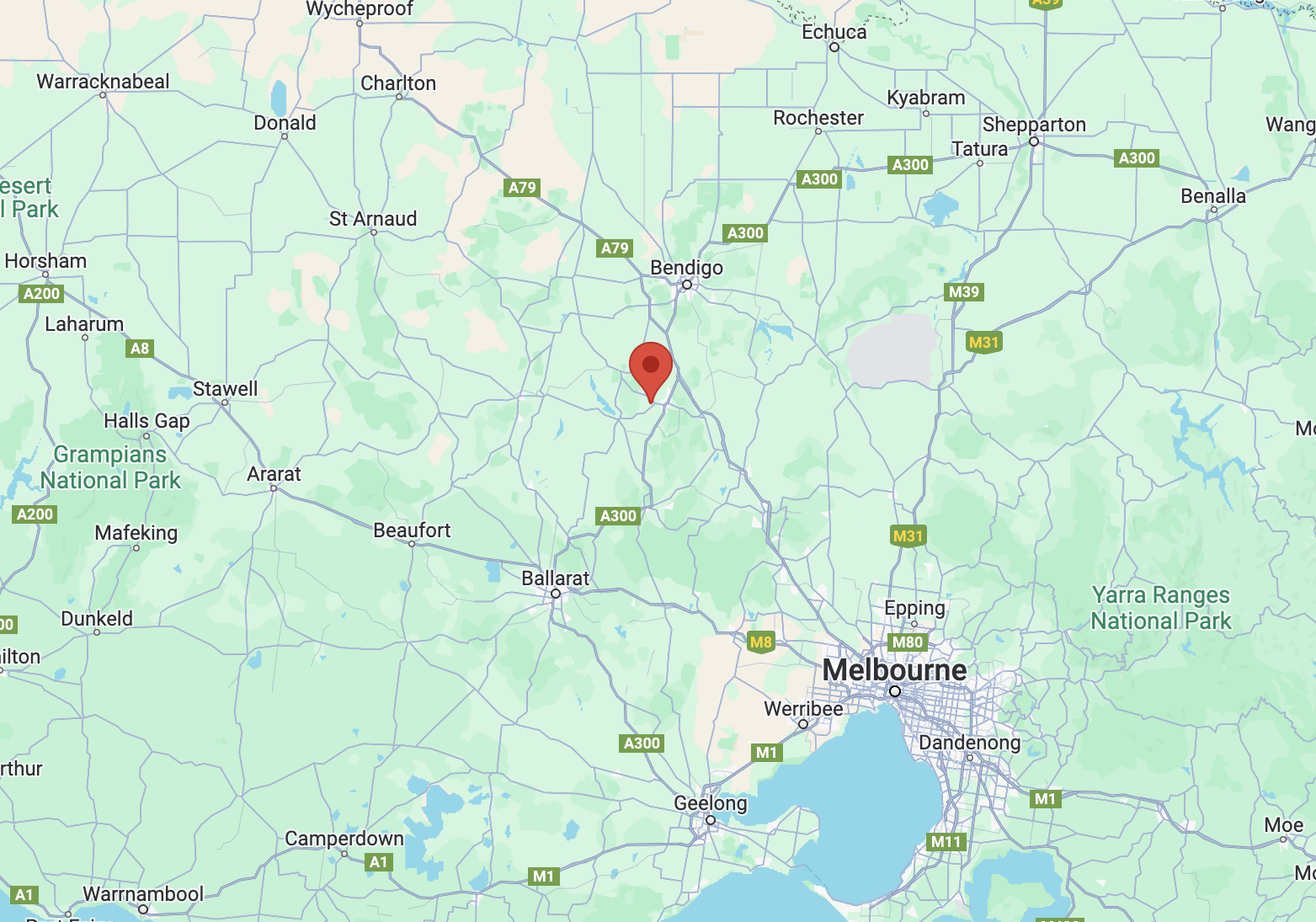
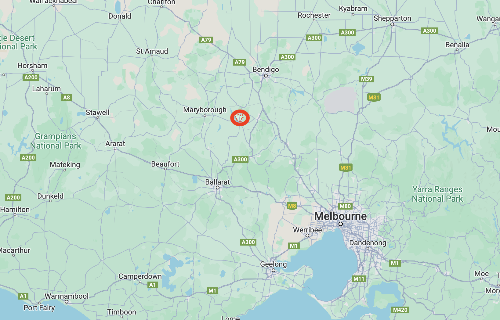
Our seventh and final park for Sunday 26th November 2023 was the Guildford I133 Bushland Reserve VKFF-4286. The park is located about 8 km south of Castlemaine and about 130 km northwest of Melbourne.
Above:- Map showing the location of the Guildford I133 Bushland Reserve. Map c/o Google Maps.
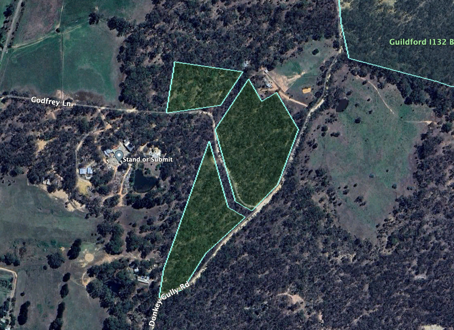
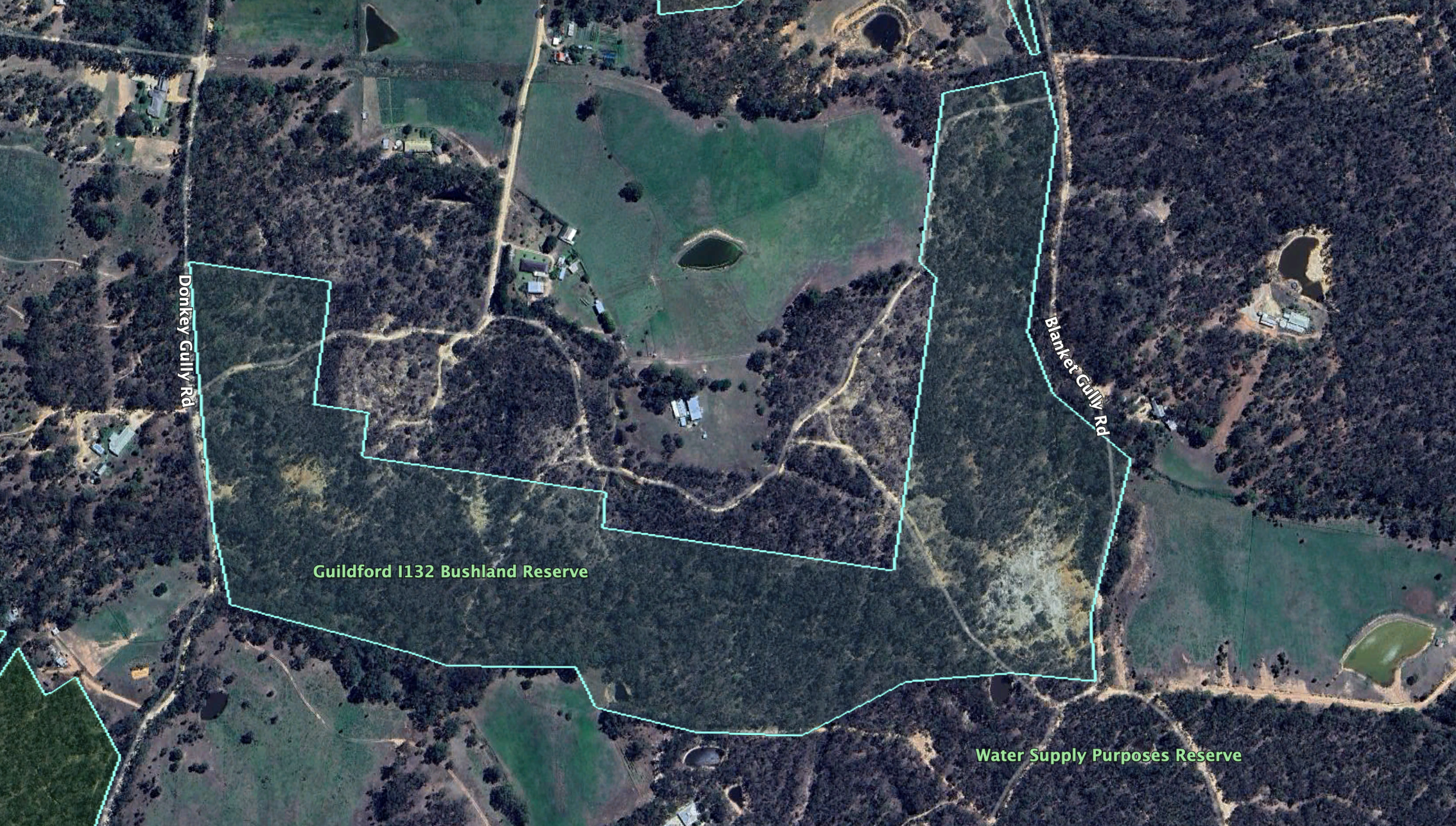
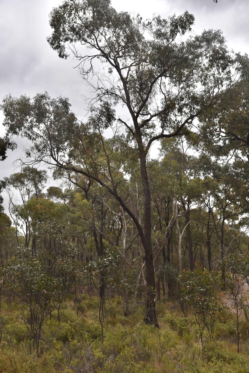
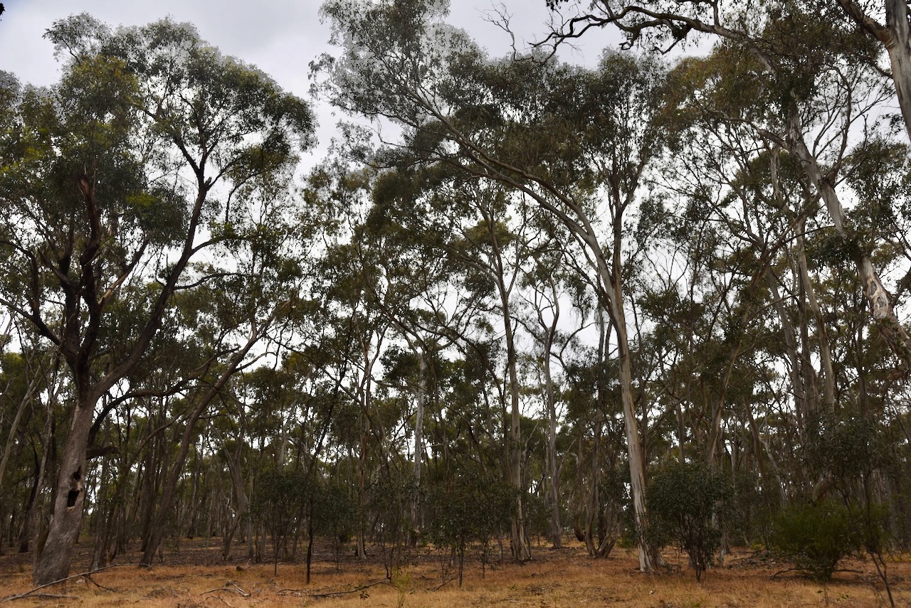
The reserve comprised three separate sections. It is located on the western side of Donkey Gully Road. Godfrey Lane disects the park. It is located just to the southwest of the Guildford I132 Bushland Reserve.
Above:- An aerial view of the Guildford I133 Bushland Reserve. Image c/o Google Earth.
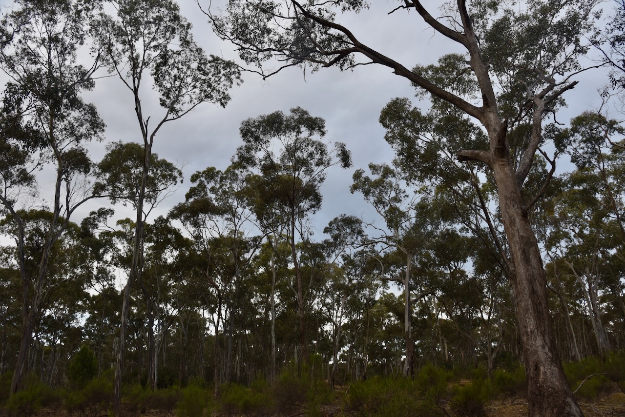
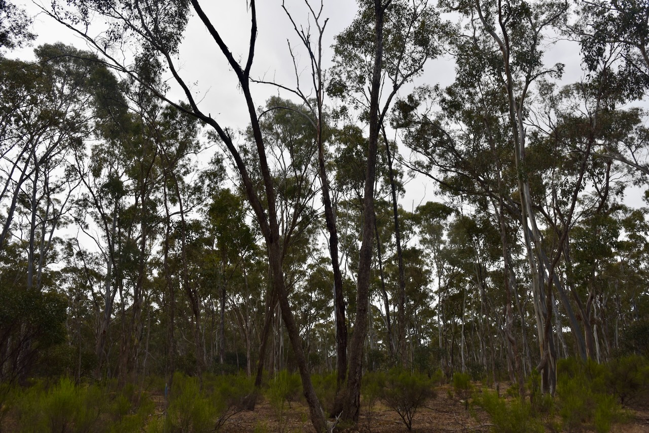
The reserve is about 7 hectares in size and was established on the 24th day of August 1982. (CAPAD 2022)
We ran the Yaesu FT857, 40 watts, and the 20/40/80m linked diupole supported by the 7-metre telescopic squid pole. I used the special call of VI10VKFF.
Marija worked the following stations on 40m SSB:-
VK4SMA
VK2IO/m
VK4NH
VK4DXA
VK5FANA
Marija worked the following stations on 80m SSB:-
VK3PF
VK3KAI
VK3UAO
VK3GJG
Marija worked the following stations on 80m AM:-
VK3PF
VK3KAI
worked the following stations on 40m SSB:-
VK4SMA
VK2IO/m
VK4NH
VK4DXA
VK5FANA
VK2YK
VK5GA
VK3DEM
VK7AN
VK2HAK
VK4HMI
VK4EHI
I worked the following stations on 80m SSB:-
VK3PF
VK3KAI
VK3UAO
VK3GJG
VK3DEM
VK2EXA
Vk3ANL
VK3ZK
VK3ZPF
I worked the following stations on 80m AM:-
VK3PF
VK3KAI
VK3GJG
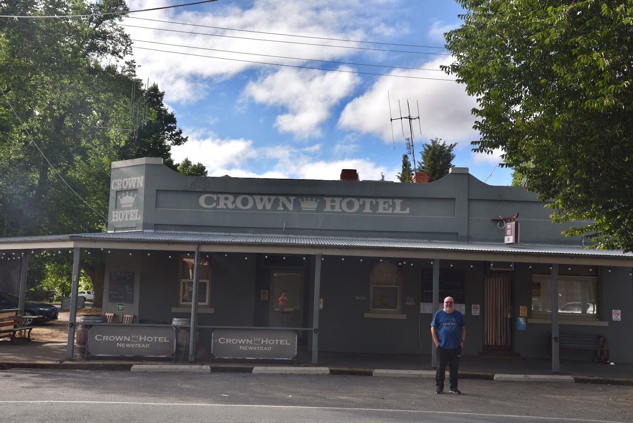
We then headed back to Newstead where we went out for dinner. It had been a great day. Seven parks activated under very trying band conditions, and lots of sightseeing.
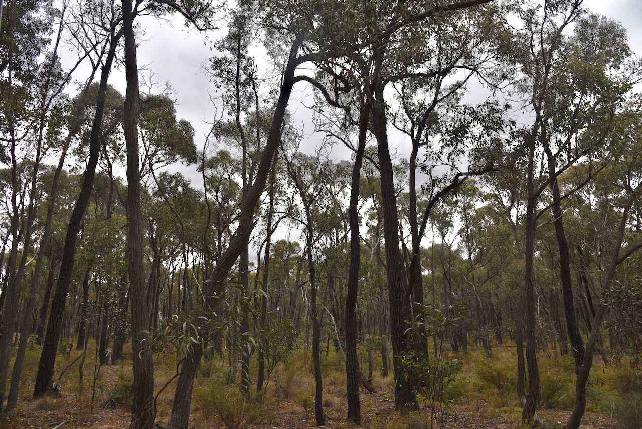
Our next activation for Sunday 26th November 2023 was the Guildford I132 Bushland Reserve VKFF-4287. The park is located about 8 km south of Castlemaine and about 130 km northwest of Melbourne.
Above:- Map showing the location of the Guildford I132 Bushland Reserve. Map c/p Google Maps.
The reserve is located between Donkey Gully Road and Blanket Gully Road. The area is actually Campbells Creek, despite the park name Guildford.
Above:- An aerial view of the Guildford I132 Bushland Reserve. Image c/o Google Earth.
The reserve is about 28 hectares in size and was established on the 24th day of August 1982. (CAPAD 2022)
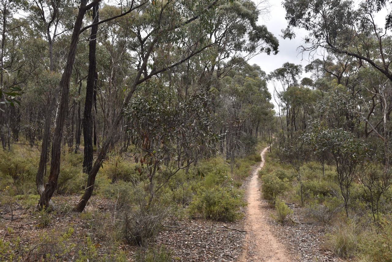
We found a track leading into the park. We ran the Yaesu FT857, 40 watts, and the 20/40/80m linked dipole. I used the special call of VI10VKFF.
History abounds in this area of Victoria, with lots of reminders of life in the area back in the 1800s during the gold rush period.
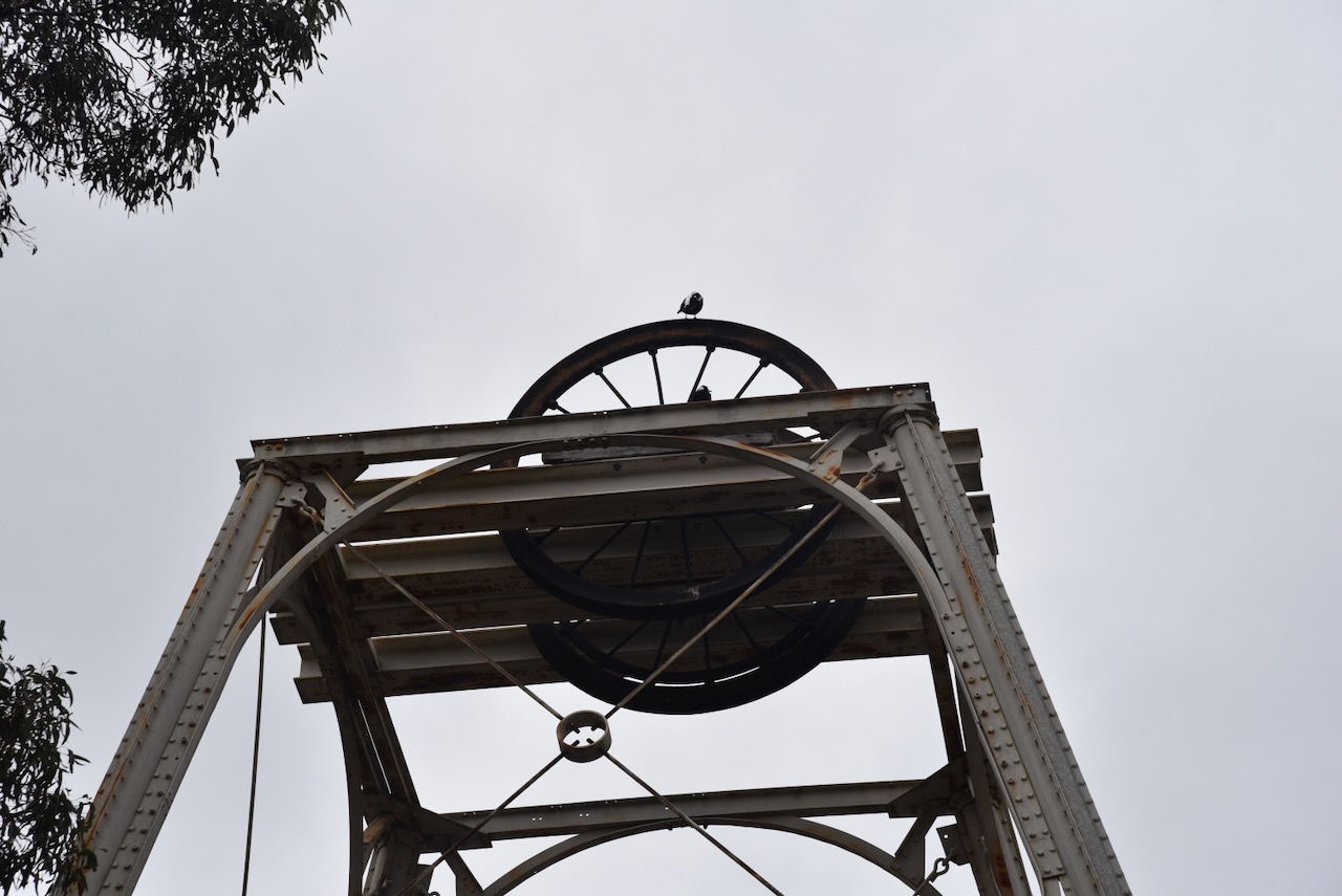
After leaving the park we visited the Mopoke Water Wheel on Blanket Gully Road, Campbells Creek. The water wheel was constructed in 1887, the same year that the Garfield Water Wheel at Chewton was built. The Mopoke Water Wheel was used to drive the ten-head stamp battery of the Bendigo and Fryers Goldmining Company. The wheel had a diameter of 60 feet and the gear had a diameter of 40 feet. It was in operation until c. 1900. (Gold Fields Guide 2024)
We then headed to our next park, the Guildford I133 Bushland Reserve.
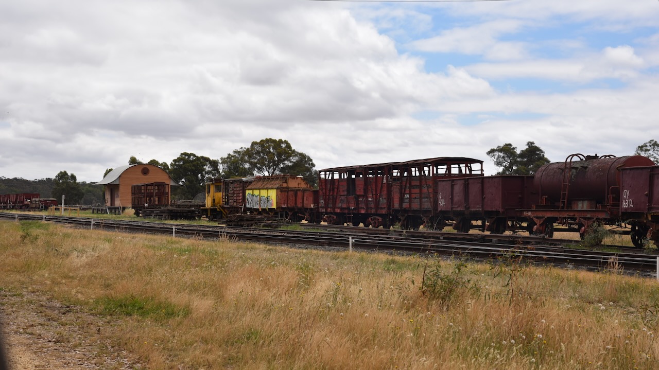
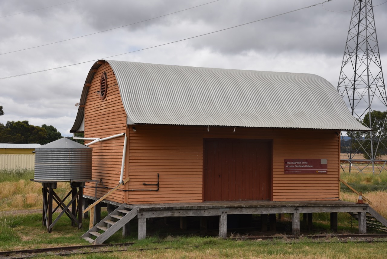
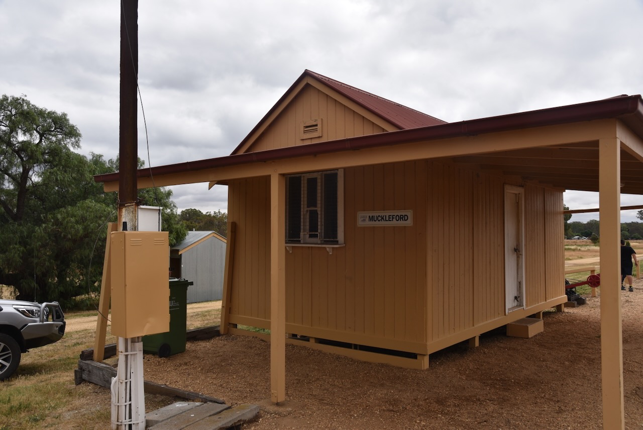
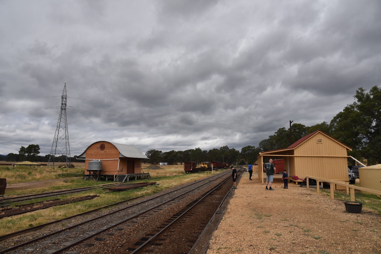
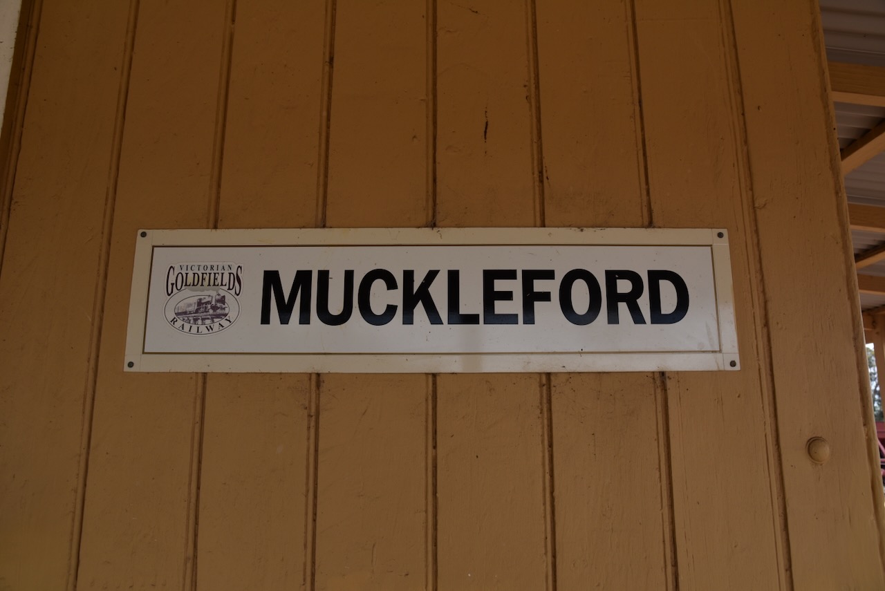
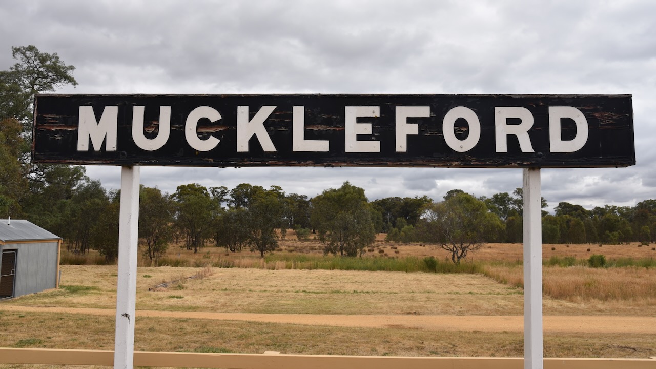
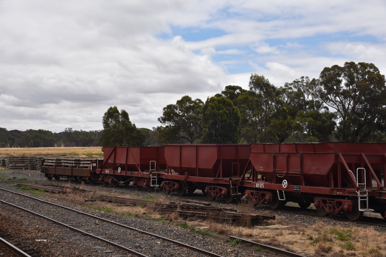
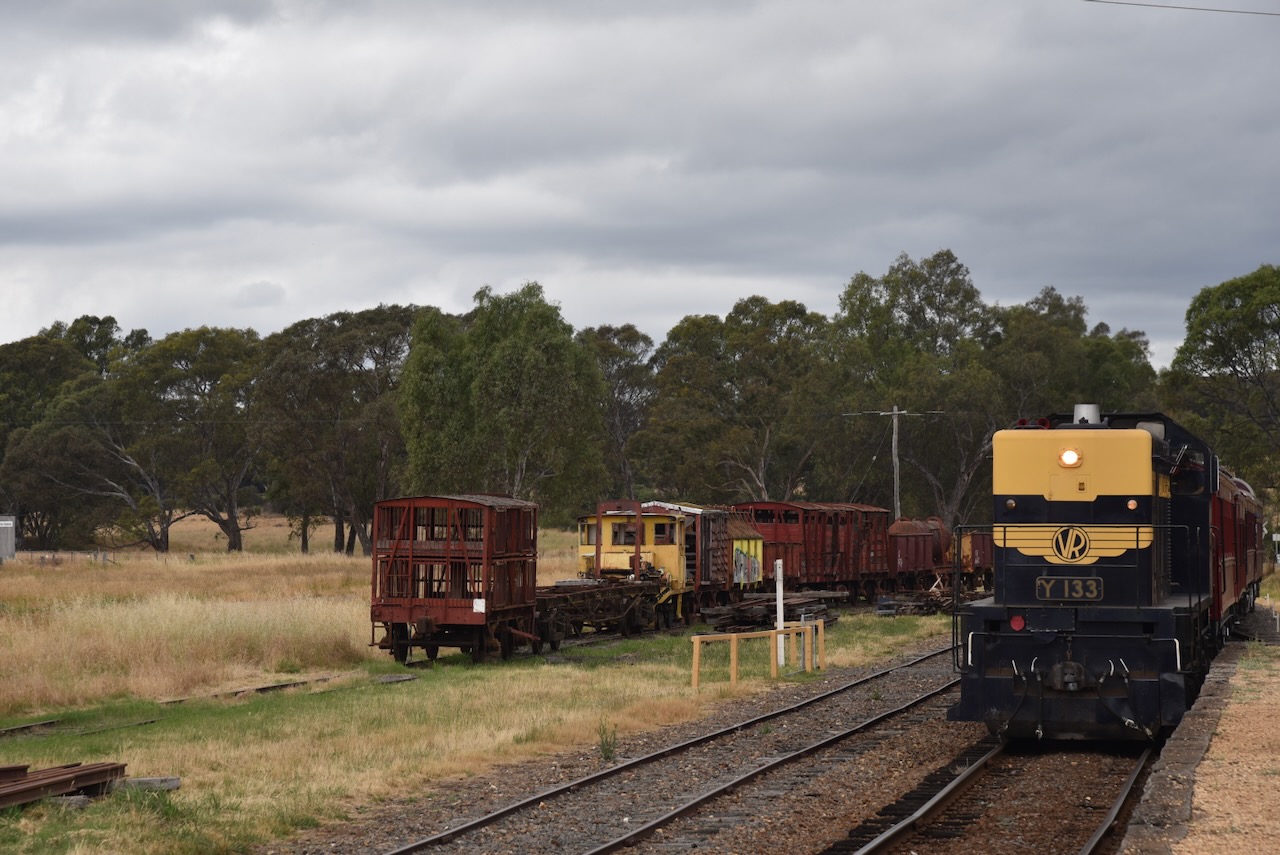
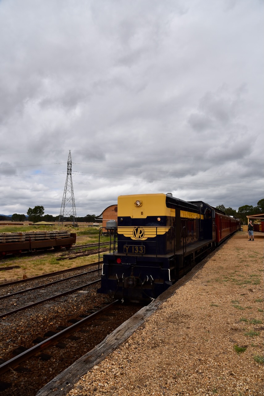
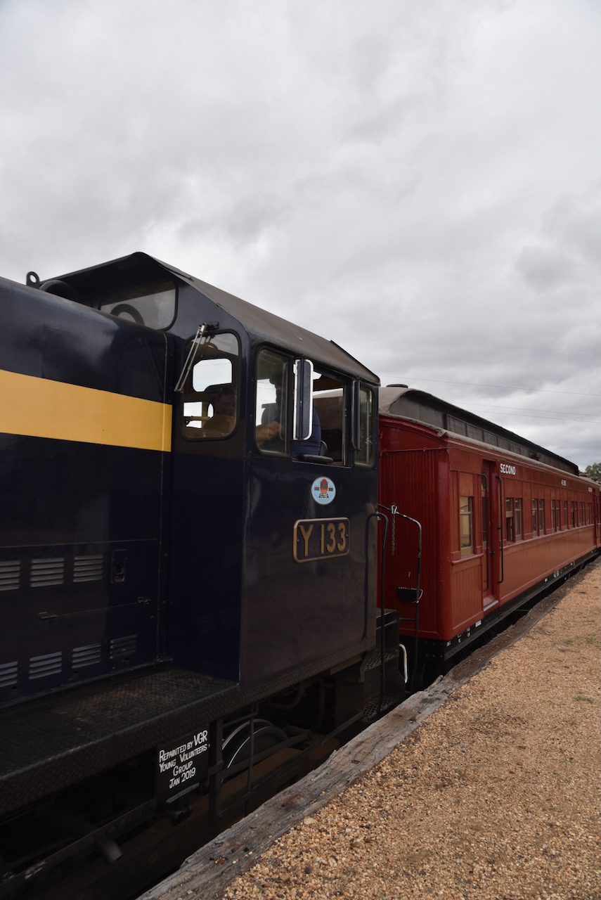
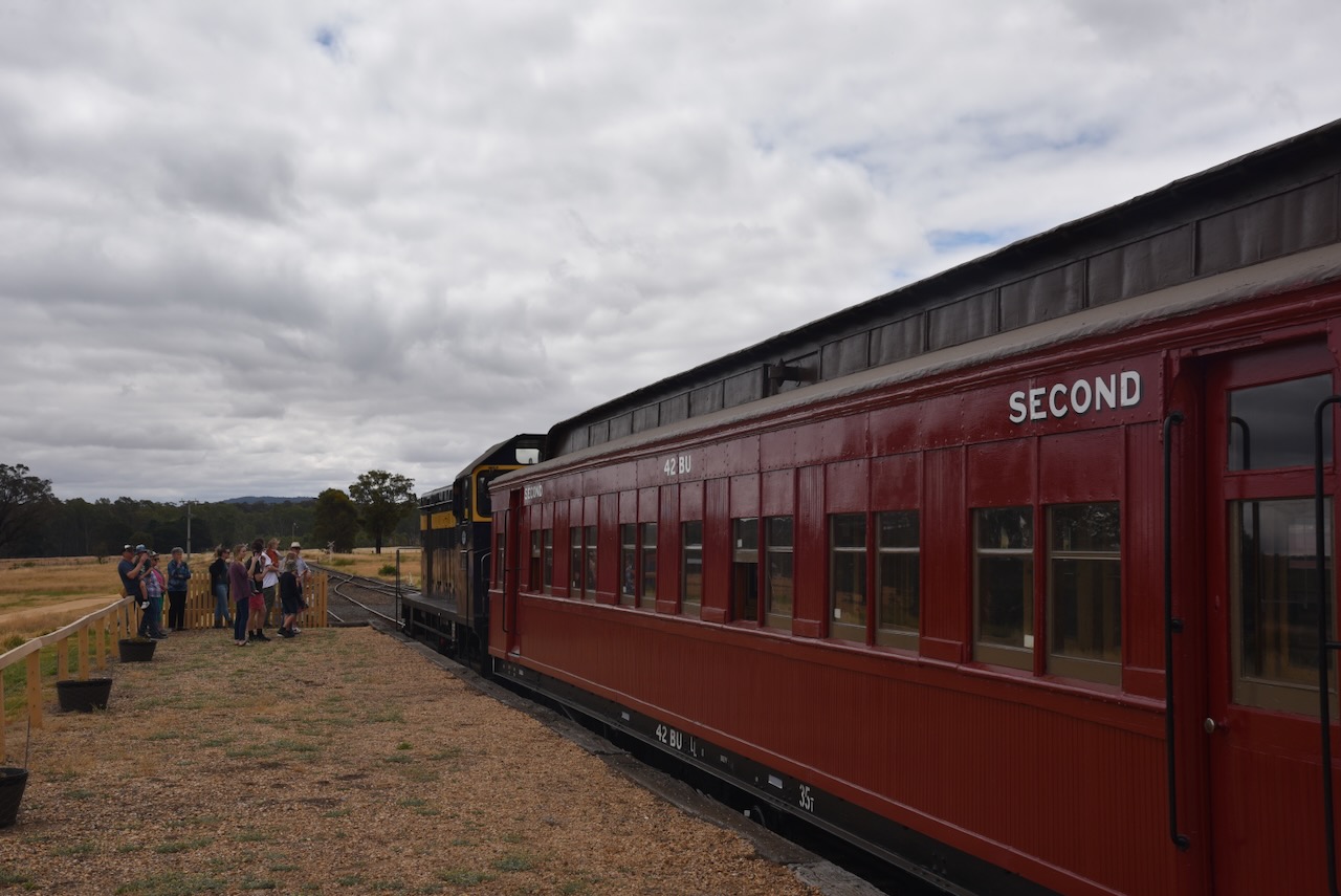
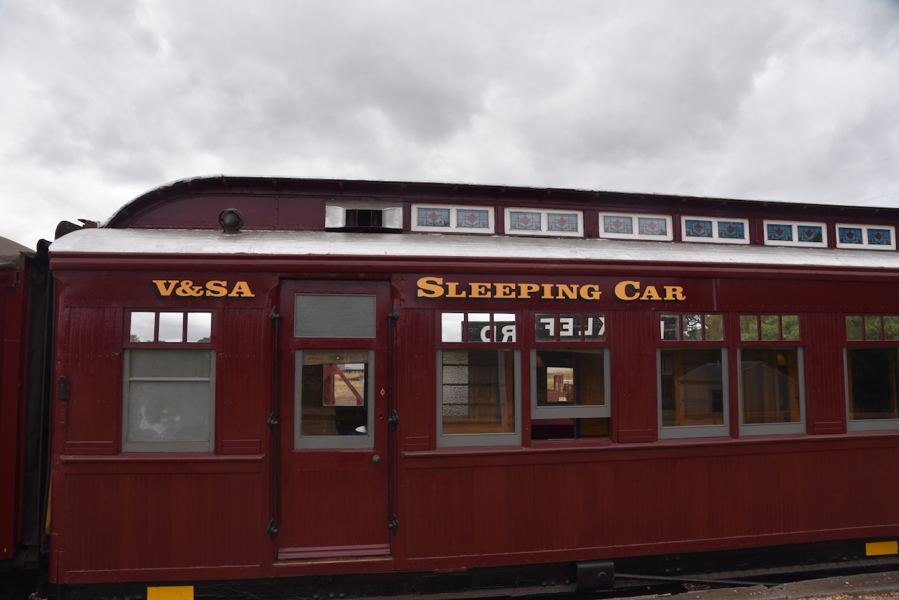
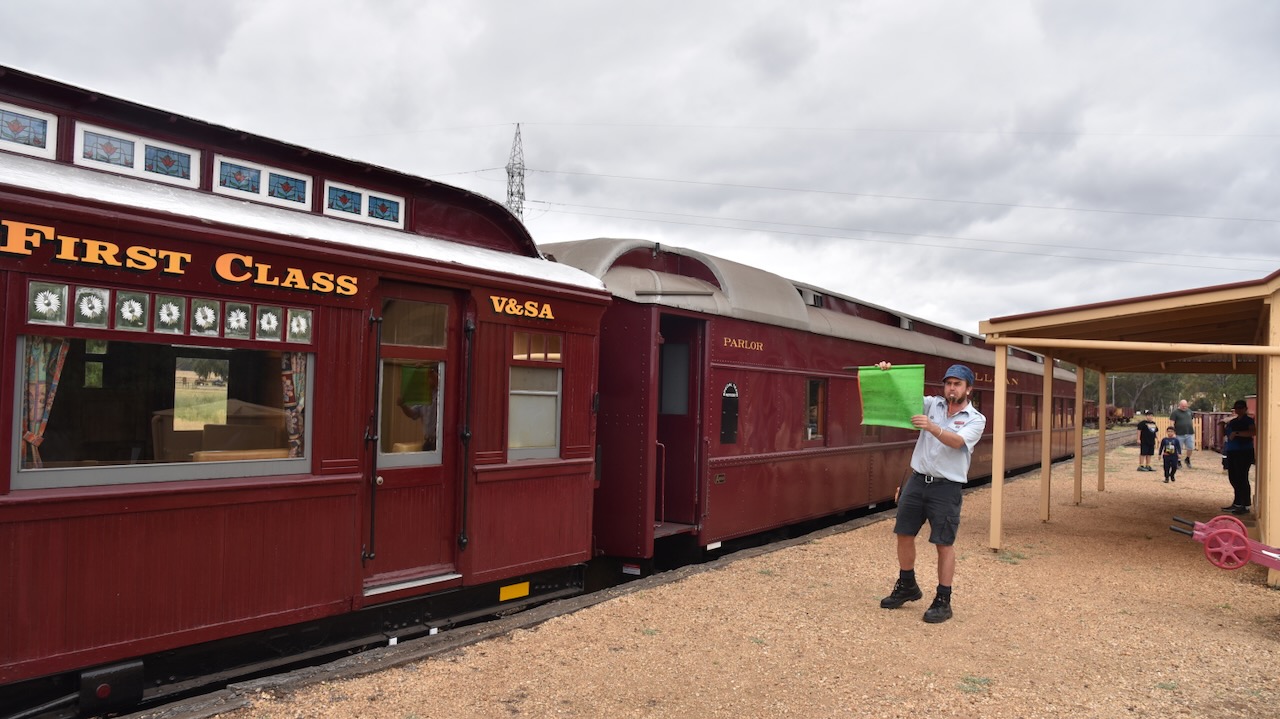
On our way to our next park activation, we noticed quite a crowd of people gathered alongside of the railway line at the Muckleford Railway Station. We decided to have a look. After speaking with some of those in attendance, we discovered that the Victorian Goldfields Railway tourist train was about to come through.
This authentic heritage railway links the historic gold mining towns of Castlemaine and Maldon.
The Muckleford Railway Station is situated on the Maldon branch line that runs off the main Echuca, Swan Hill lines. The station was opened on the 16th day of June 1884 and was closed to passenger services on the 6th day of January 1941. It was used for goods service until its closure on the 3rd day of December 1976. The line opened for tourist services in 1996 following the restoration of the line between Muckleford and Maldon. (Wikipedia 2024)
We waited around for about 10 minutes before the train came through.
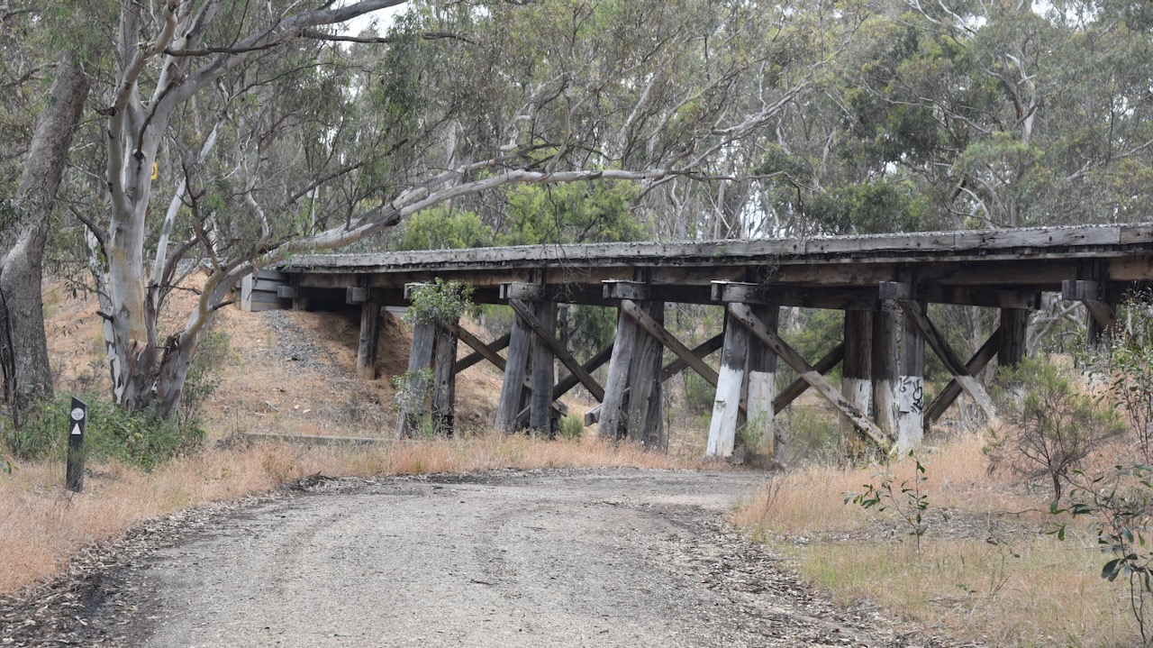
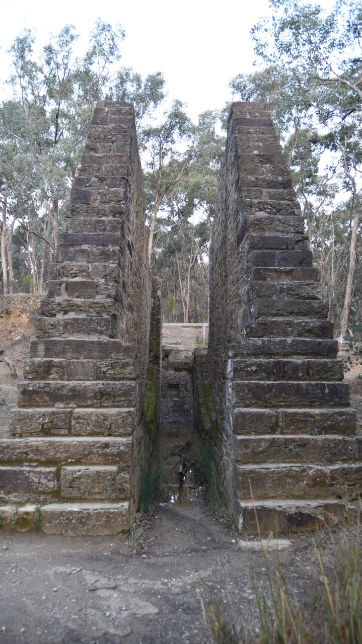
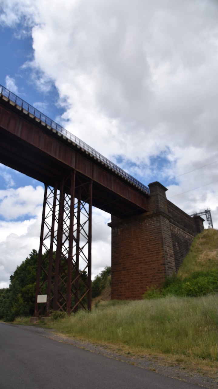
We then stopped to have a look at one of the historic trestle bridges on the Goldfields railway line.
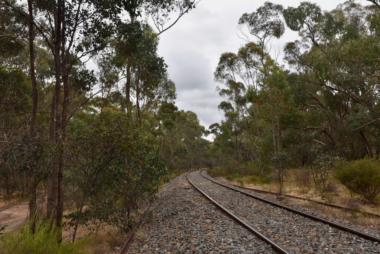
We travelled along Prison Farm Road which followed the Goldfields railway line.
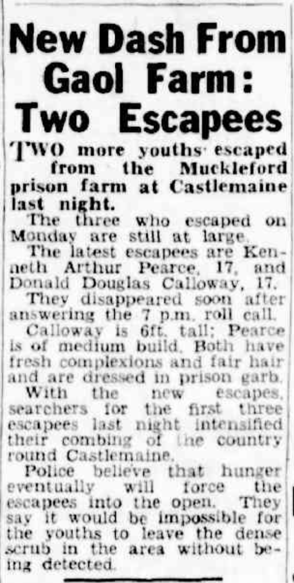
A Prison Farm once operated in the area, and a search on Trove revealed numerous escapes from the institution.
Above:- Article from The Sun, Thu 8 Jan 1948. Image c/o Trove.
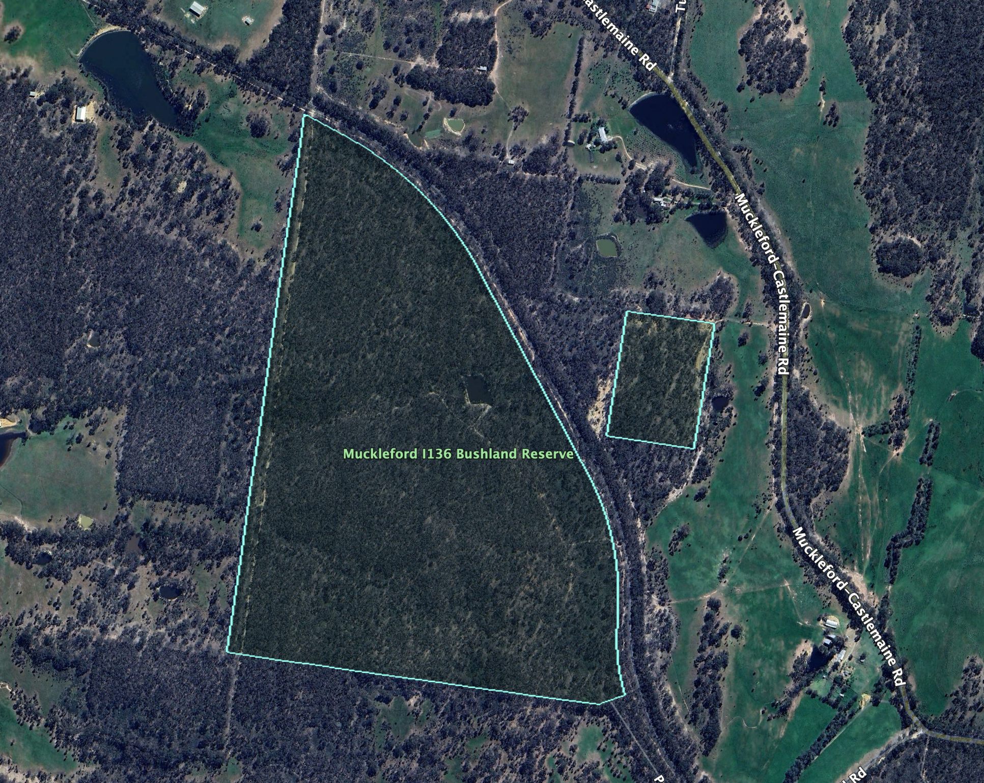
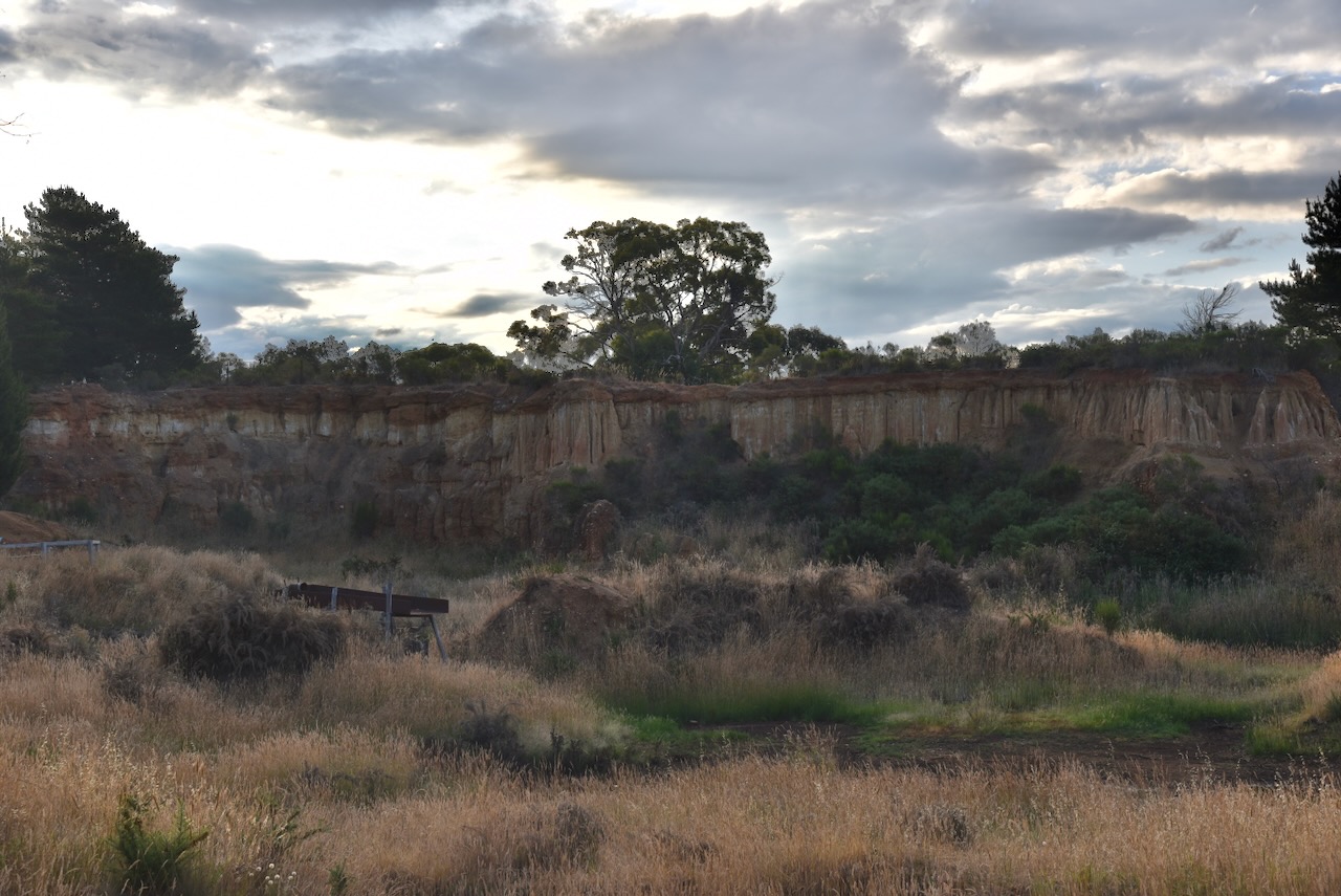
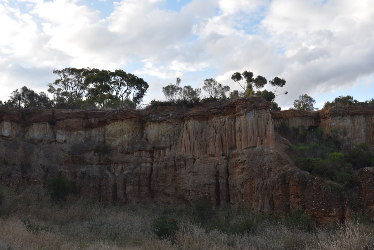
The Muckleford I136 Bushland Reserve comprises two sections, on either side of the Goldfields Railway line.
Above:- An aerial view of the Muckleford I136 Bushland Reserve. Image c/o Google Earth.
The reserve is about 83 hectares in size and was established on the 24th day of August 1982. (CAPAD 2022)
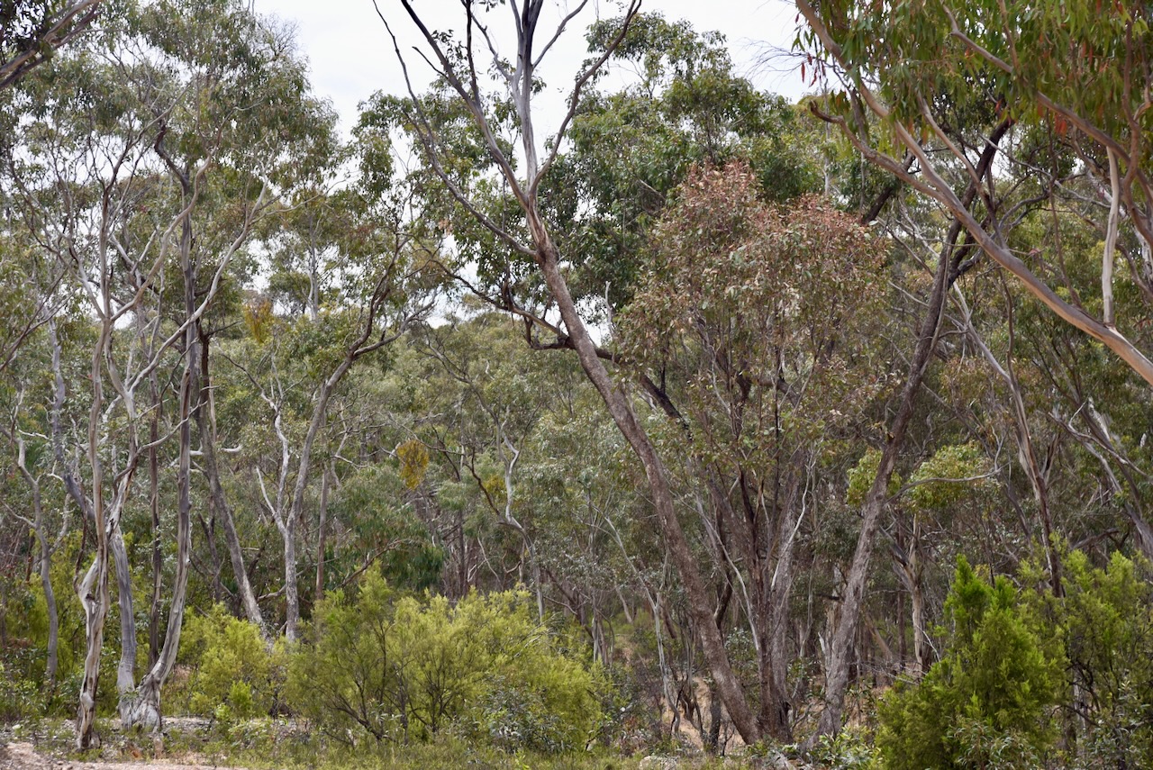
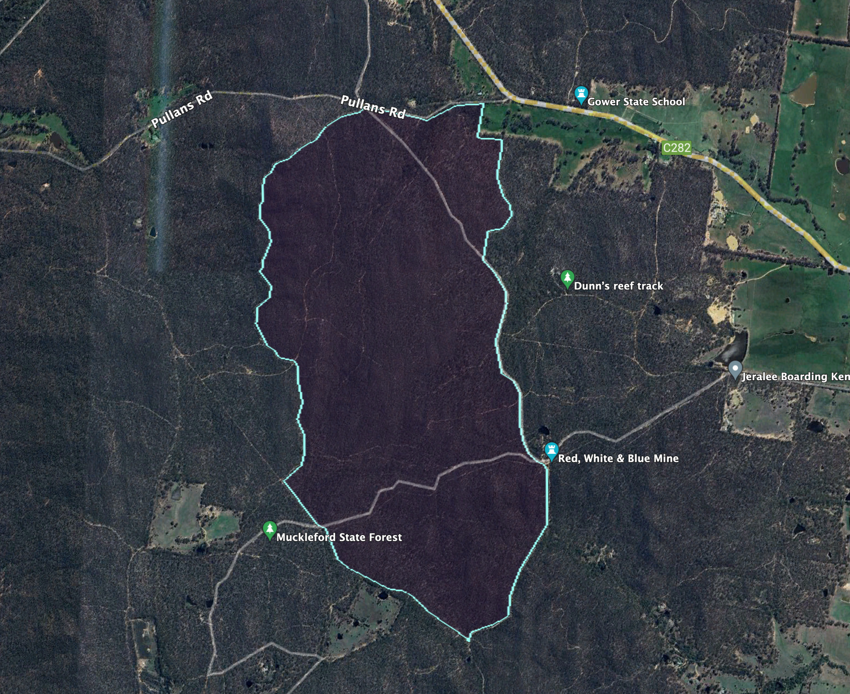
Our fourth park activation for Sunday 26th November 2023 was the Muckleford Nature Conservation Reserve VKFF-2160. The park is about 16 km west of Castlemaine and about 138 km northwest of Melbourne.
Above:- Map showing the location of the Muckleford NCR. Map c/o Google Maps.
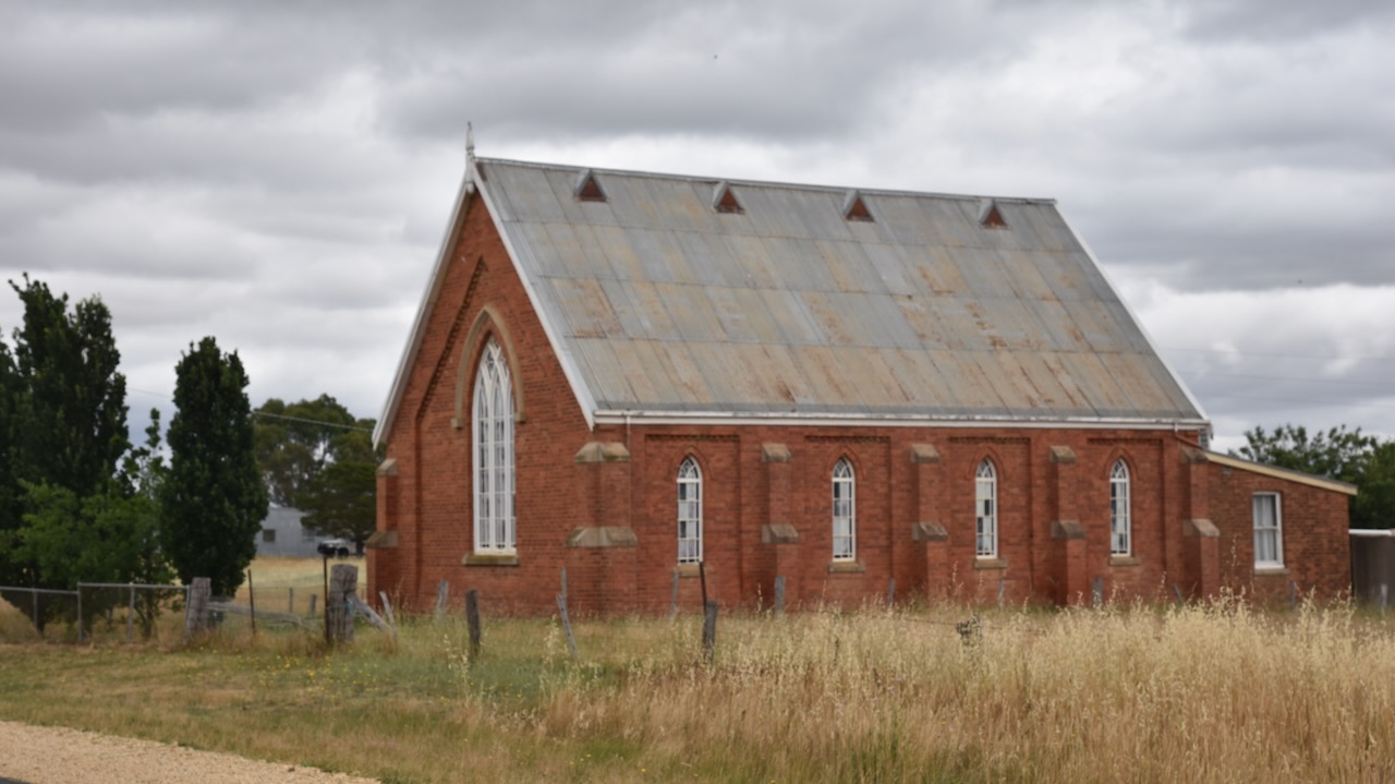
Along the way, we passed the Muckleford Community Centre, designed by architect J. Emery, and built by Mr. T. Heath, both of Castlemaine. The foundation stone was laid on the 6th day of August 1873.
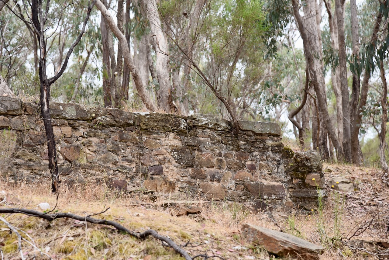
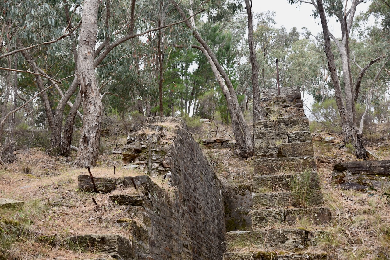
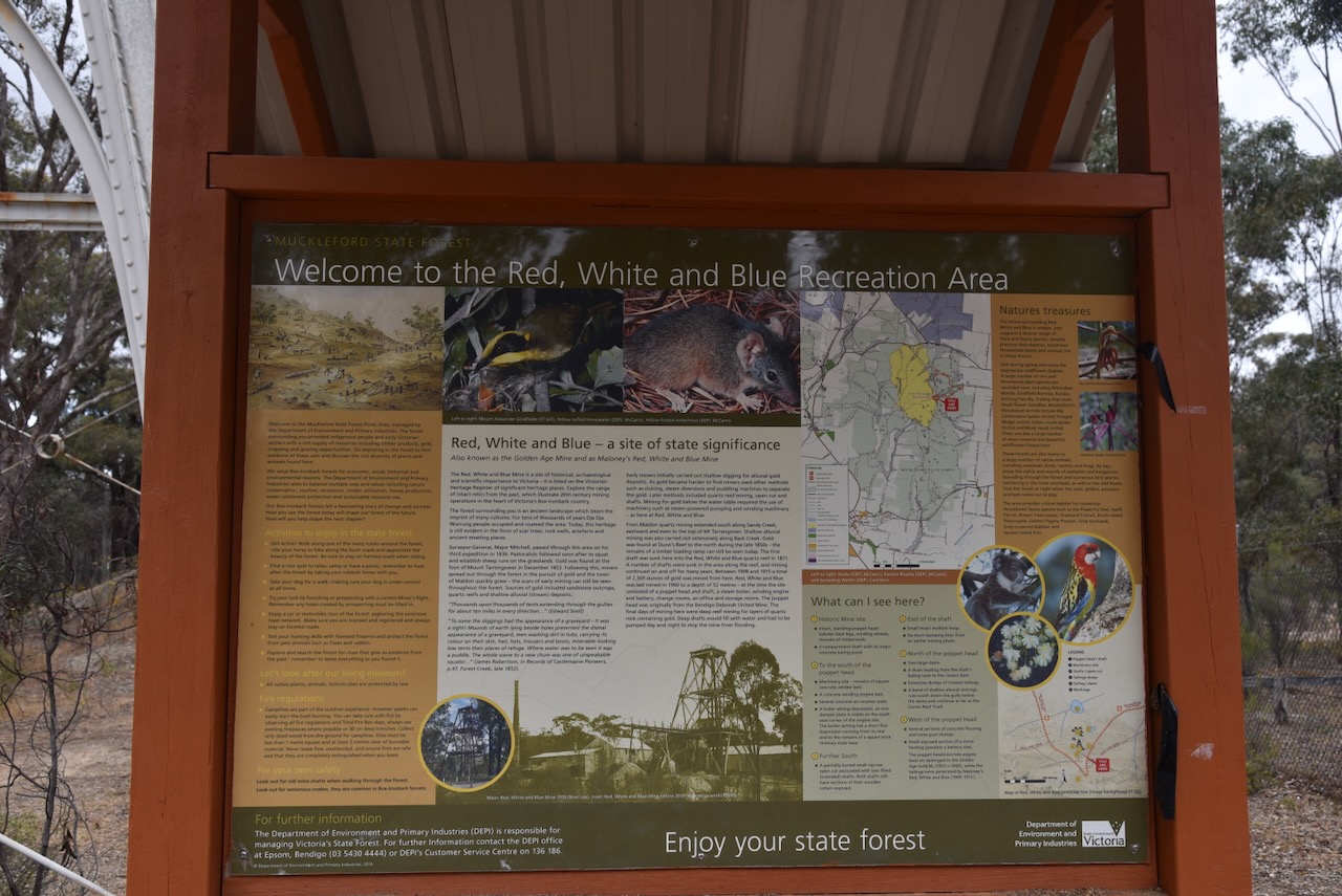
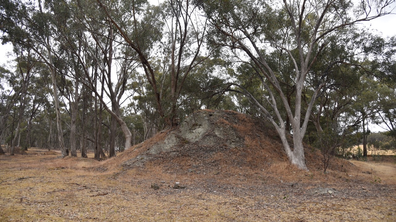
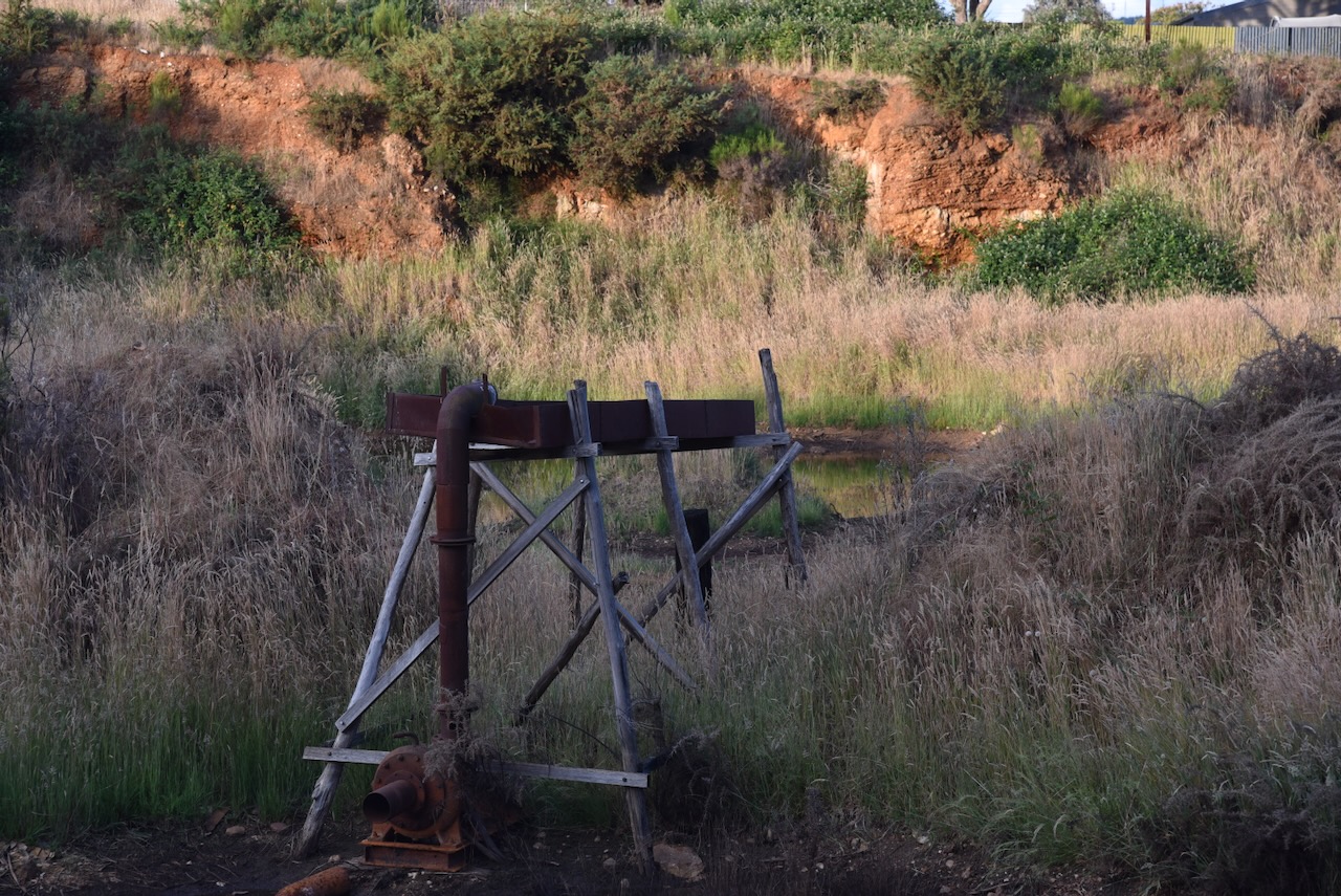
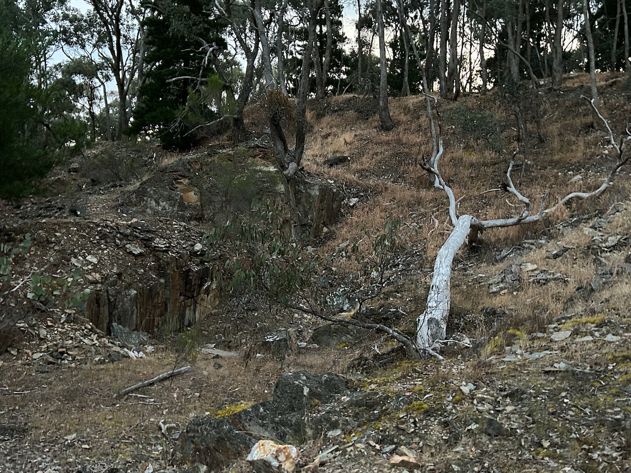
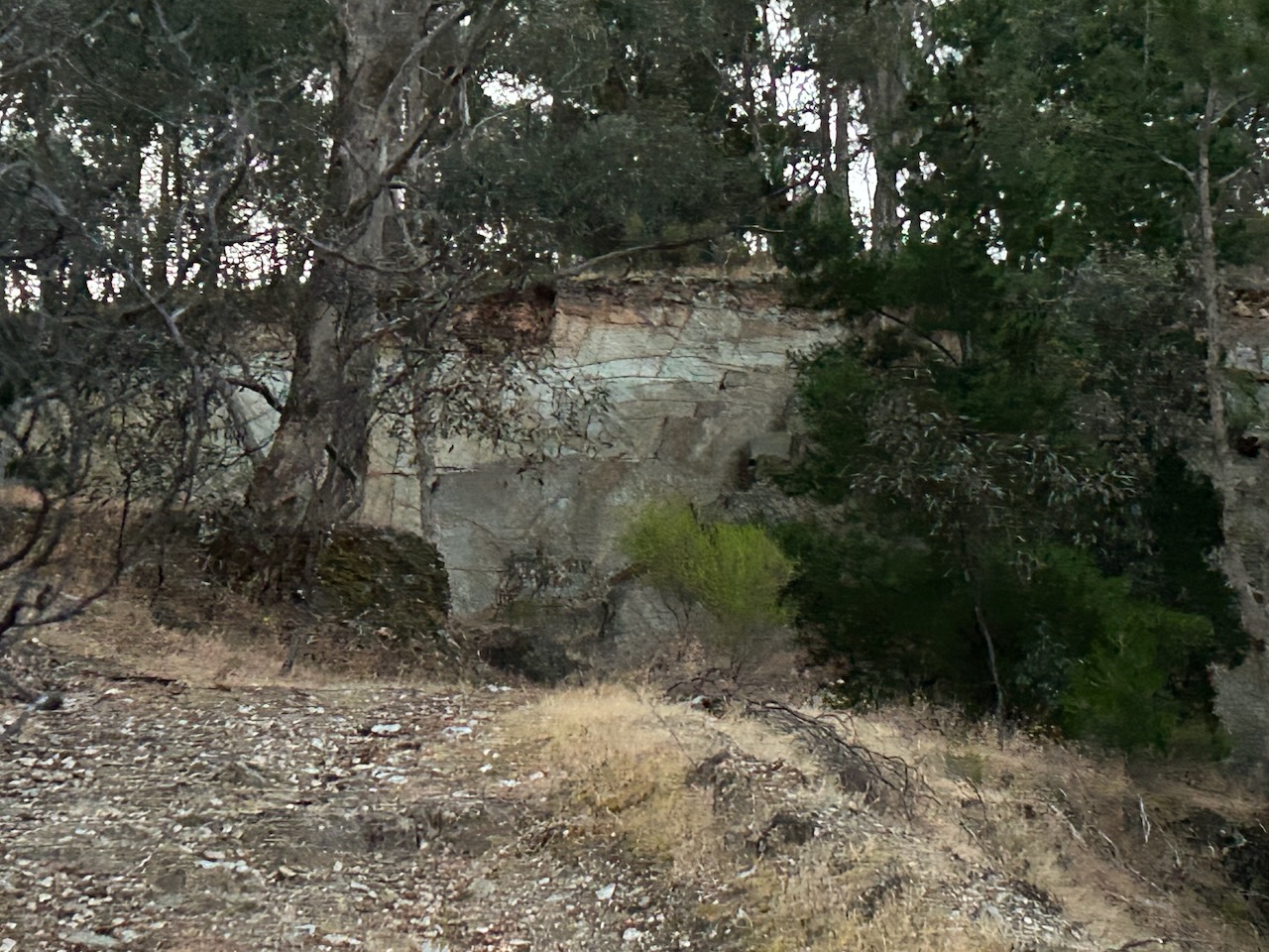
Marija and I then visited the Red, White and Blue mine site at Muckleford. The mine was also known as the Golden Age Mine and Maloney’s Red, White and Blue Mine. The first shaft was sunk here into the Red, White and Blue quartz reef in 1871. Several shafts were sunk in the area along the reef, and mining continued on and off for many years. Between 1909 and 1915 a total of 2,369 ounces of gold was mined here. The Red, White & Blue mine was last mined in 1960 to a depth of 52 metres.
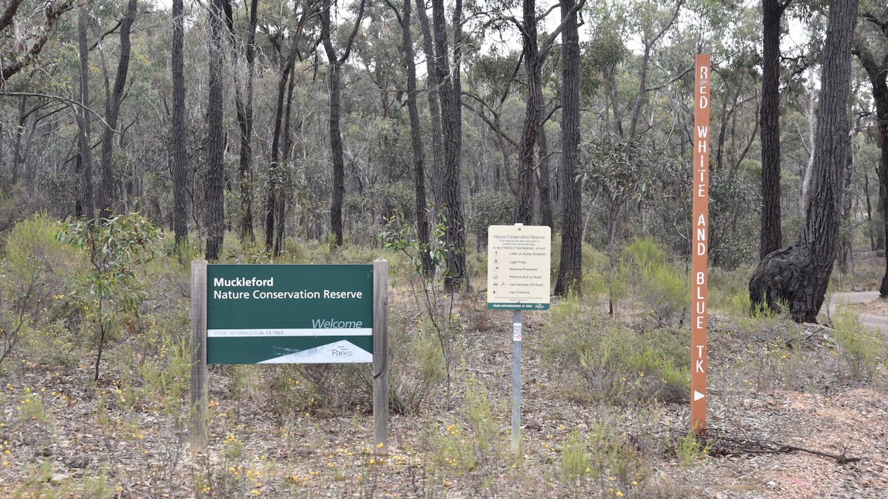
We then drove a short distance to the Muckleford Nature Conservation Reserve. The reserve is surrounded by the Muckleford State Forest.
Above:- An aerial view of the Muckleford NCR. Image c/o Google Earth.
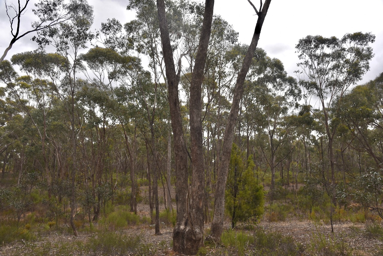
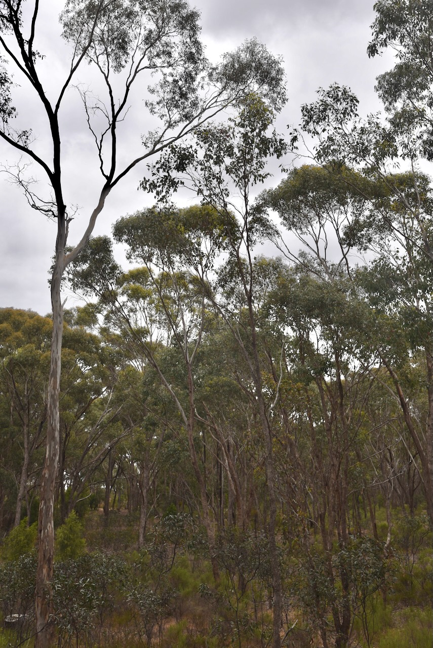
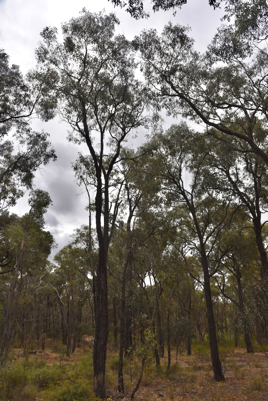
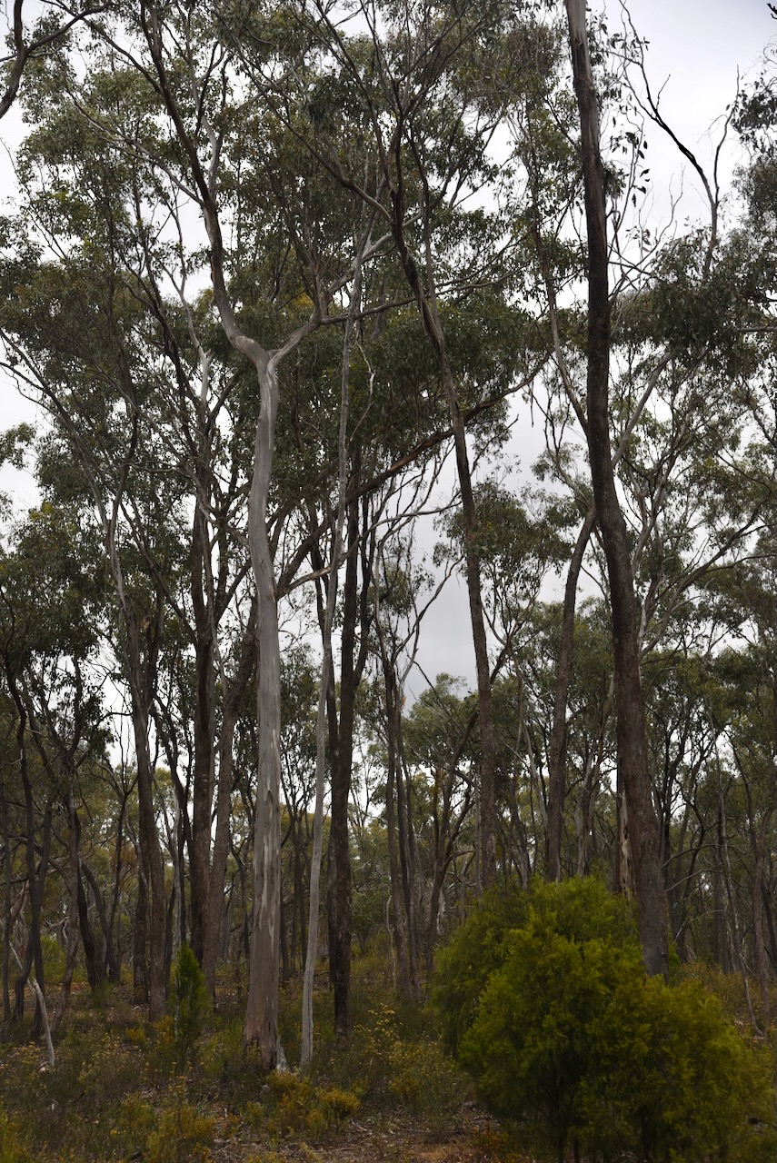
The reserve is about 539 hectares and was established on the 26th day of February 2002. The reserve consists of spectacular Box Ironbark forest. (CAPAD 2022)
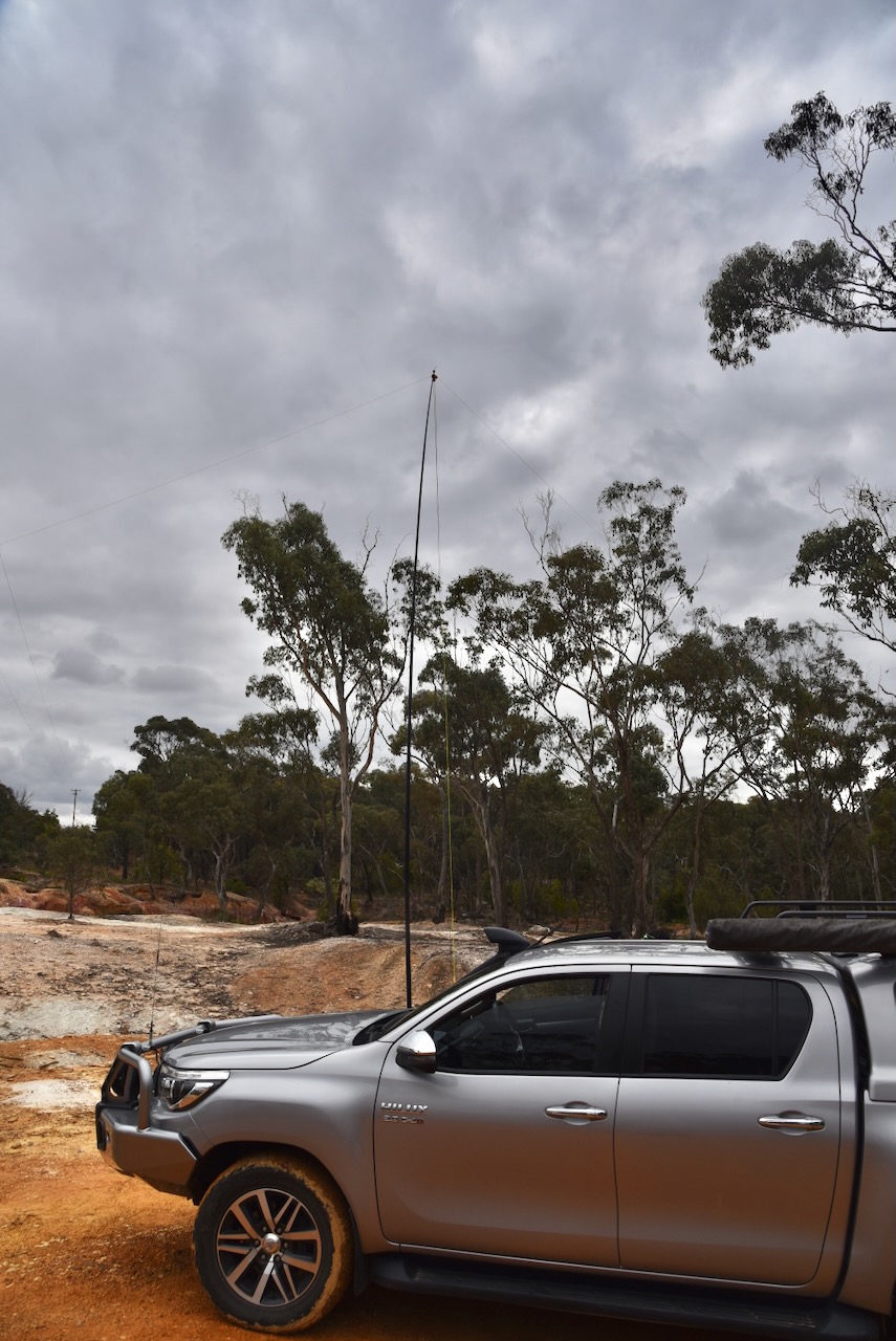
We set up on a walking trail off a 4WD track in the reserve. We ran the Yaesu FT857, 40 watts and the 20/40/80m linked dipole. I used the special call of VI10VKFF.
Again, band conditions were very poor. We spoke with Gerard VK2IO during the activation and we agreed it was the worst band conditions we had ever encountered whilst out portable.
After leaving Castlemaine, Marija and I headed to our next park activation for the World Wide Flora Fauna (WWFF) program, the Muckleford I135 Bushland Reserve VKFF-4281. The park is located about 7 km west of Castlemaine and about 128 km northwest of Melbourne.
Above:- Map showing the location of the Muckleford I135 Bushland Reserve. Map c/o Google Maps.
Along the way, we stopped to look at the ruins of the Orville Hotel on the Castlemaine-Maldon Road, Muckleford. The hotel was built c. 1855 and is a small brick and stone building.
The opening of the hotel was a highly anticipated event and a public announcement appeared in the Mount Alexander Mail. The hotel remained in use until c. 1890.
Above:- Advertisement from the Mount Alexander Mail, Fri 31 Aug 1855. Image c/o Trove.
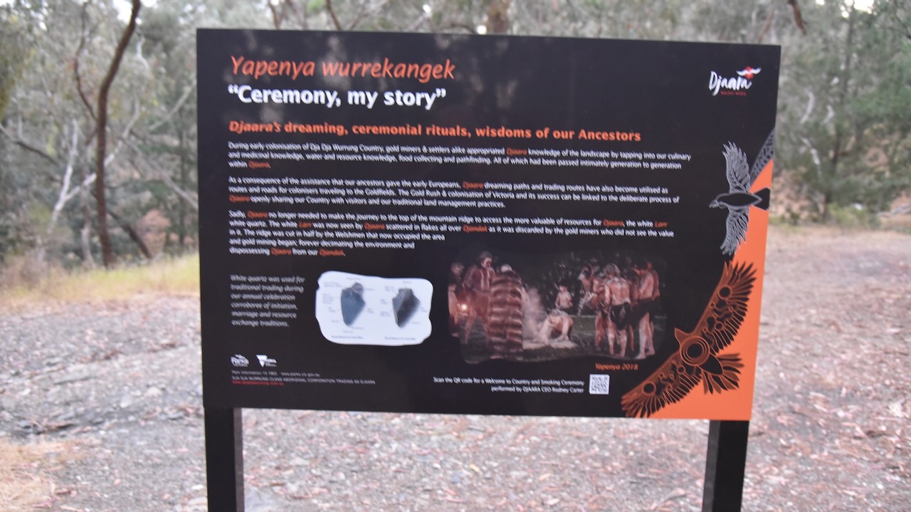
The original inhabitants of the area were the Dja Dja Wurrung aboriginal people. The first European to pass through the area was explorer Major Thomas Mitchell who passed through the area in the spring of 1836 during his Australia Felix journey.
Muckleford was named after a pastoral run taken up in the district in 1840. In 1854 gold was discovered in the Muckleford district and in that same year a speculative township was put up for sale.
Above:- part of an article from the Mount Alexander Mail, Fri 25 May 1855. Image c/o Trove.
In 1855 an Anglican school was opened and remained in use until 1877. A government primary school replaced the Anglican school in 1871. Within a few years, there were several hotels in the district including the Orville Hotel, Monk’s Hotel and Simson’s Hotel. The Muckleford Post Office opened on the 1st day of August 1857 and closed in 1966. The town served the needs of the gold diggers of the area and soon had a population of over 2000 people. (Phoenix 2022) (Victorian Places 2024)
The reserve is located on the southern side of Muckleford School Road.
Above:- An aerial view of the Muckleford I135 Bushland Reserve. Image c/o Google Earth.
The reserve is about 19 hectares in size and was established on the 24th day of August 1982. (CAPAD 2022)
Sadly the band conditions had not improved. Marija and I made the decision that we would try to activate as many parks as we could with 10 QSOs for VKFF qualification, as the 44 QSOs required for the global WWFF program would probably not be achievable.
We ran the Yaesu FT857, 40 watts, and the 20/40/80m linked dipole. I used the special call of VI10VKFF to celebrate the 10-year anniversary of the VKFF program.
It was pleasing to get a few Park to Park contacts in the log, with other activators out and about battling the very poor band conditions.
Marija worked the following stations on 40m SSB:-
VK7XX
VK5LA
VK5KAW
VK3PF
VK3KAI
VK3TKK/p (Organ Pipes National Park VKFF-0627)
VK2EG/p (Watagans National Park VKFF-0522)
VK1AAF
VK5AKB/p (Monarto Conservation Park VKFF-0828)
Marija worked the following stations on 80m SSB:-
VK3PF
VK3KAI
VK3MCA/p (Gallaghers Ford Streamside Reserve VKFF-3693)
I worked the following stations on 40m SSB:-
VK7XX
VK5LA
VK5KAW
VK3PF
VK3KAI
VK3TKK/p (Organ Pipes National Park VKFF-0627)
VK2EG/p (Watagans National Park VKFF-0522)
VK1AAF
VK5AKB/p (Monarto Conservation Park VKFF-0828)
I worked the following stations on 80m SSB:-
VK3PF
VK3KAI
VK3MCA/p (Gallaghers Ford Streamside Reserve VKFF-3693)
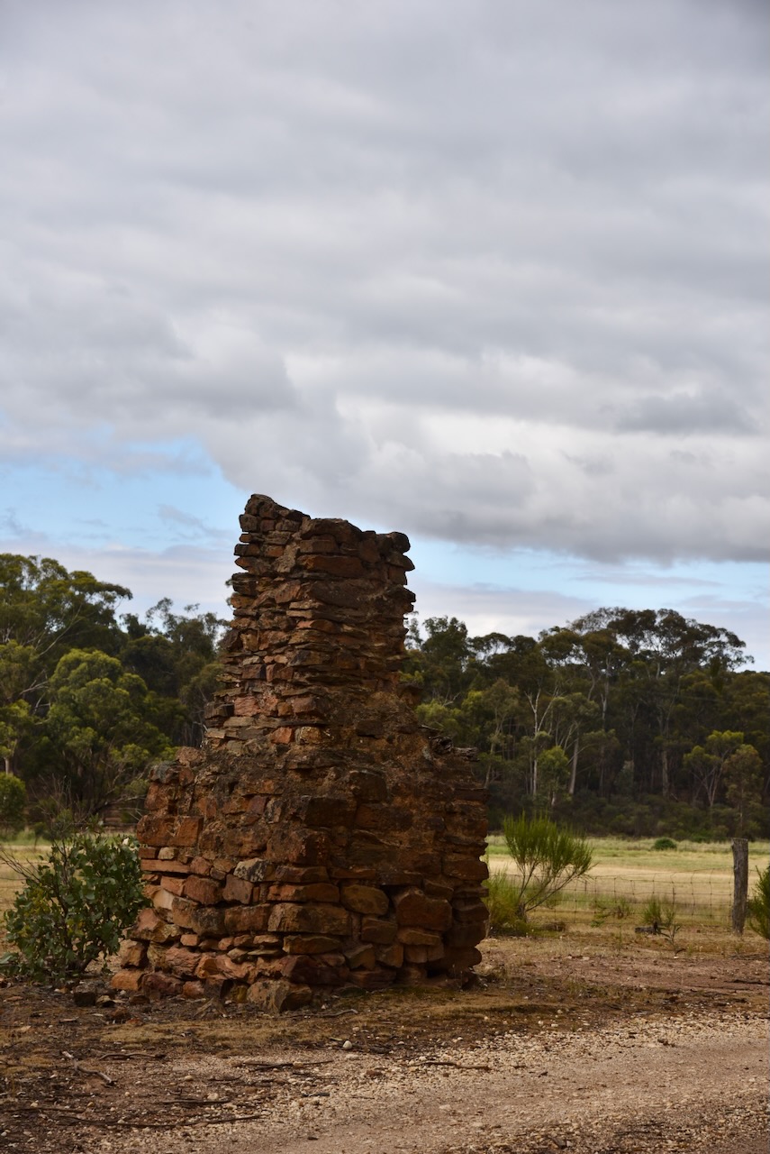
Our second activation for Sunday 26th November 2023, was the Brassey Mine Bushland Reserve VKFF-4293. The reserve is located about 6 km northwest of Newstead and about 144 km northwest of Melbourne.
Above:- Map showing the location of the Brassey Mine Bushland Reserve. Map c/o Google Maps.
The Reserve comprises three sections and is located south of Brassey Lane, south of Fishermans Road and south of Leathbridge Road.
Above:- An aerial view of the Brassey Mine Bushland Reserve. Image c/o Google Earth.
The reserve is about 26 hectares in size and was established on the 24th day of August 1982. (CAPAD 2022)
Band conditions once again were absolutely terrible. We managed to qualify the park for the VKFF program, but were a long way off of the 44 QSOs required for the global World Wide Flora Fauna (WWFF) program.
We started off on 80m for this activation, knowing that the HAP charts suggest 40m would be bad. We ran the Yaesu FT857, 40 watts, and the 20/40/80m linked dipole. I used the special call of VI10VKFF.
Marija worked the following stations on 80m SSB:-
VK3PF
VK3KAI
VK3SQ
VK2BD
VK3GJG
Marija worked the following stations on 40m SSB:-
VK3PF
VK3KAI
VK2LEE
VK5FANA
VK5HW
VK3CLD
I worked the following stations on 80m SSB:-
VK3PF
VK3KAI
VK3SQ
VK2BD
VK3GJG
I worked the following stations on 40m SSB:-
VK3PF
VK3KAI
VK2LEE
VK5FANA
VK5HW
VK3CLD
During our activation, I received a message from Tony VK3KKP from the Bendigo Amateur Radio Electronics Club (BAREC) to advise that they were meeting for coffee at Castlemaine. As the band conditions were so bad, this sounded like a great idea. It was terrific to be able to catch up with the BAREC group.
Our first park for Sunday 26th November 2023 was the Welshmans Reef Bushland Reserve VKFF-4294. The park is located about 5 km north of Newstead and about 143 km northwest of Melbourne.
Above:- Map showing the location of the Welshmans Reef Bushland Reserve. Map c/o Google Maps.
Welshmans Reef is a former gold mining town. The name is believed to originate from a Welshman discovering a gold-bearing reef in the area. There were numerous Welsh and Methodist settlers in the nearby townships of Frysterstown and Vaughan. (Victorian Places 2024)
The park is about 14 hectares in size and was established on the 24th day of August 1982. (CAPAD 2022)
Above:- An aerial view of the Welshmans Reef Bushland Reserve. Image c/o Google Earth.
We found a fence around the park, so we climbed over the fence on the Maldon-Newstead Road and activated the park. We ran the Yaesu FT857, 40 watts, and the 20/40/80m linked dipole. I used the special call of VI10VKFF.
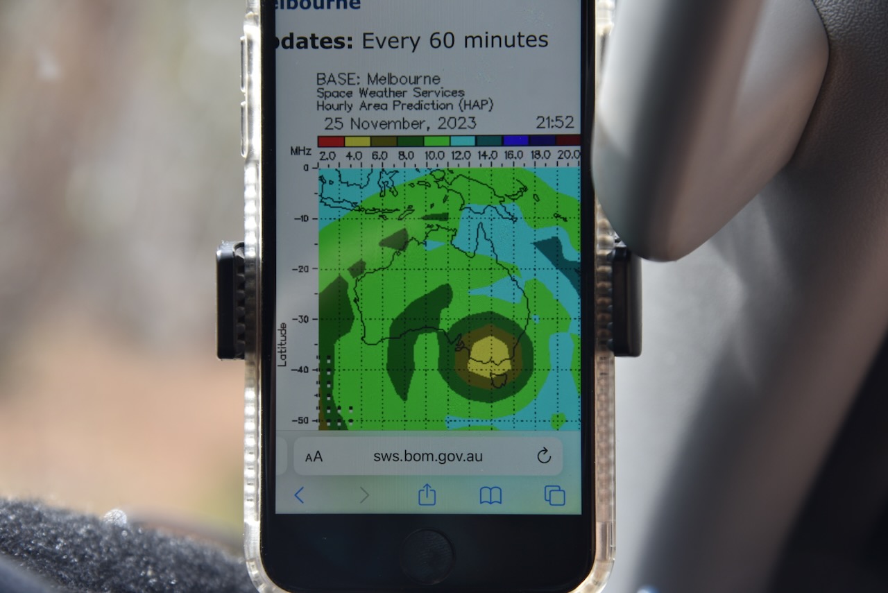
We found that the band conditions were terrible and this was reflected by the Hourly Area Prediction Chart (HAP).
The majority of our contacts were on 40m SSB, with a handful on 80m SSB. We tried calling CQ on 20m but had no takers.
Marija worked the following stations on 40m SSB:-
VK5ST/m
VK2AB
VK2IO/m
VK3PF
VK3KAI
VK3CLD/p
VK7AN/p (Bay of Fires Conservation Area VKFF-1133)
Marija worked the following stations on 80m SSB:-
VK3PF
VK3KAI
VK3SQ
VK2BD
I worked the following stations on 40m SSB:-
VK5ST/m
VK2AB
VK2IO/m
VK3PF
VK3KAI
VK3CLD/p
VK7AN/p (Bay of Fires Conservation Area VKFF-1133)
I worked the following stations on 80m SSB:-
VK3PF
VK3KAI
VK3SQ
VK2BD
Feeling rather disappointed (but the park qualified for the VKFF program), we packed up and headed off to our next park activation.
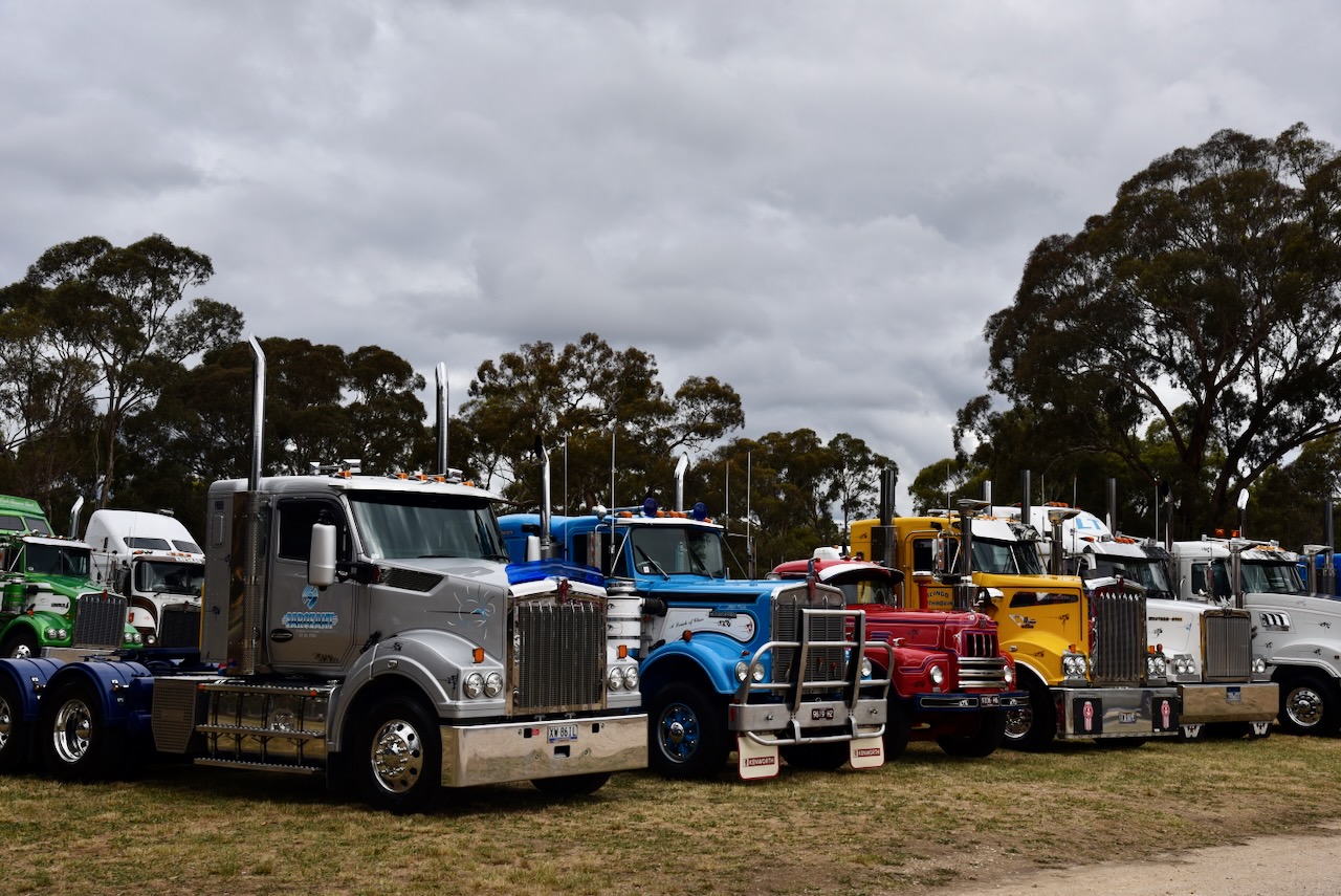
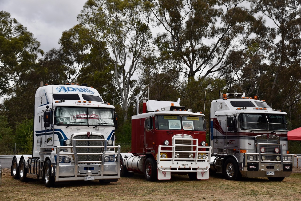
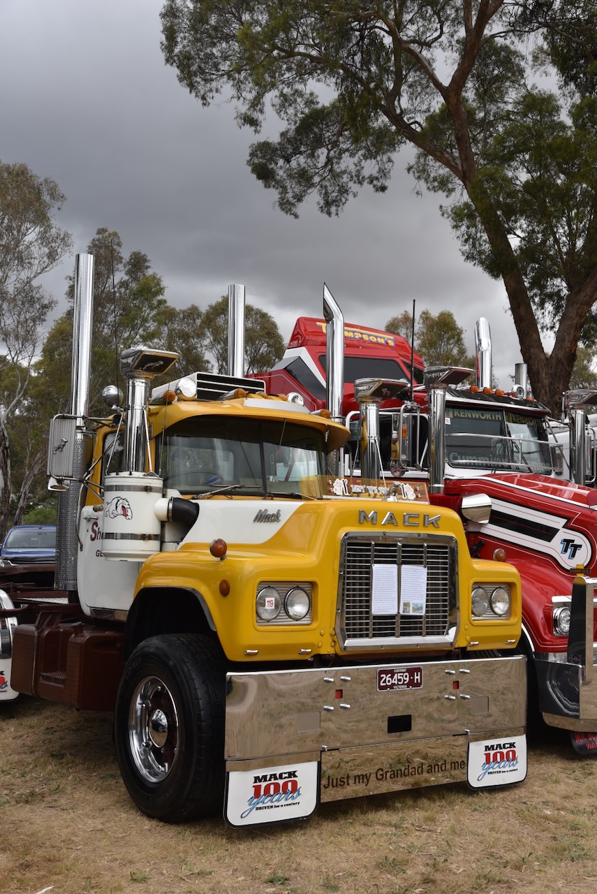
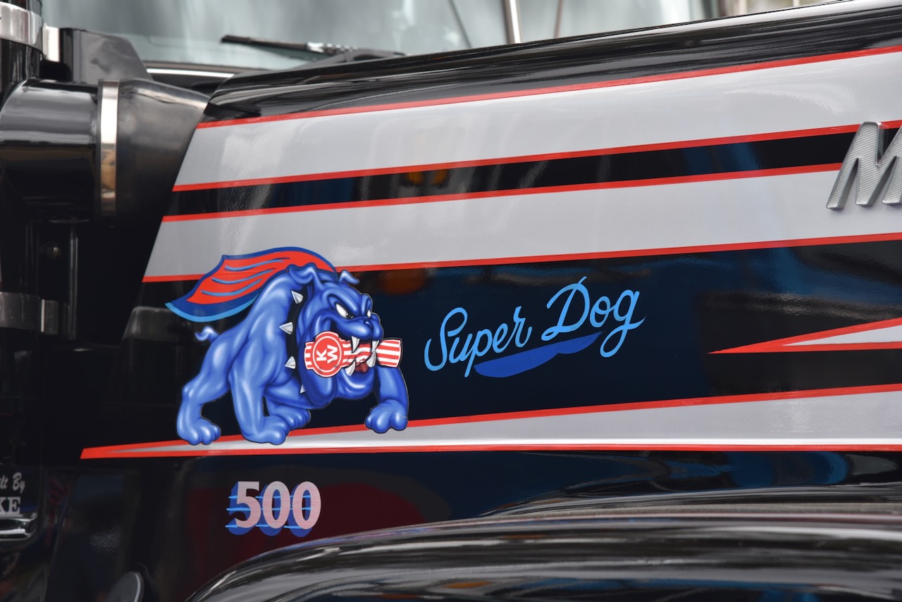
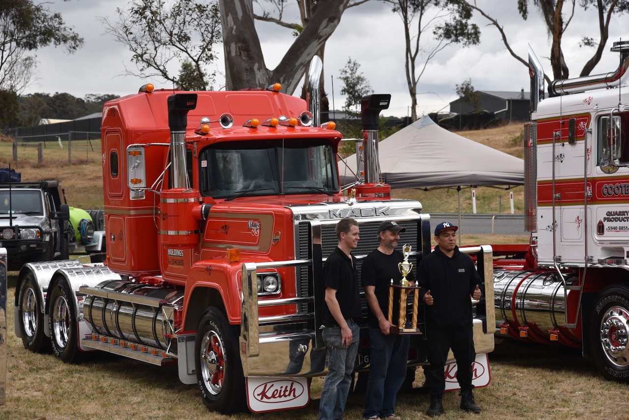
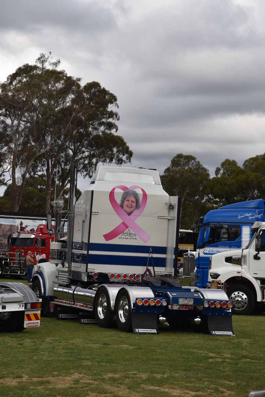
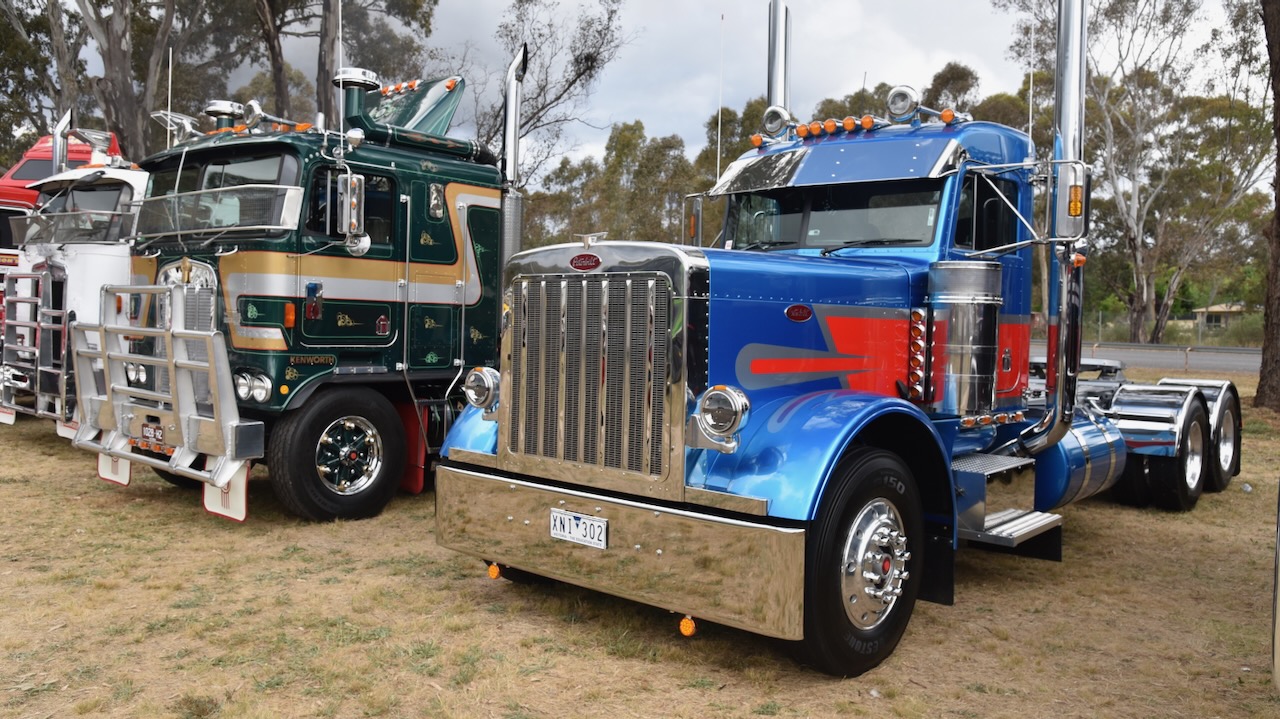
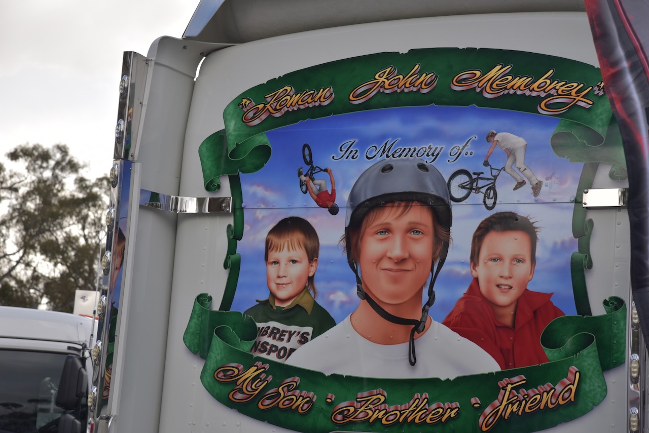
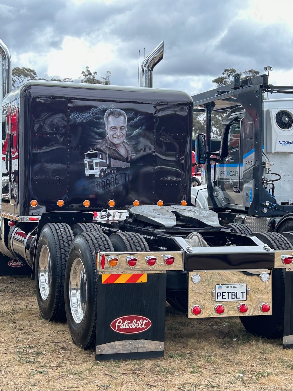
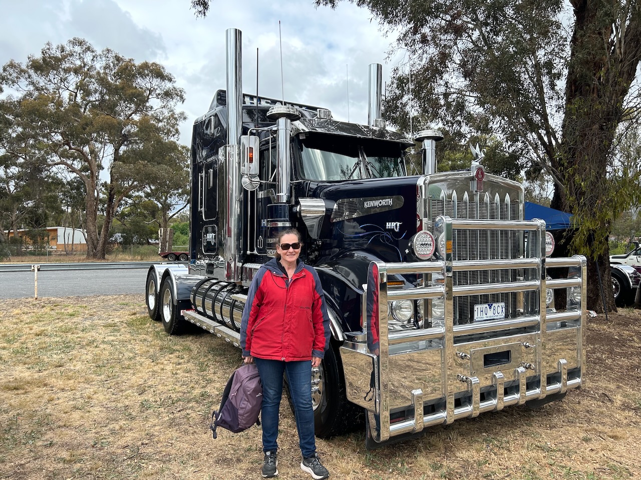
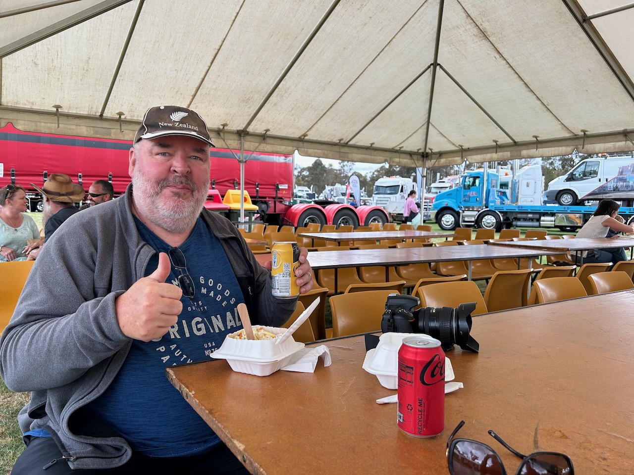
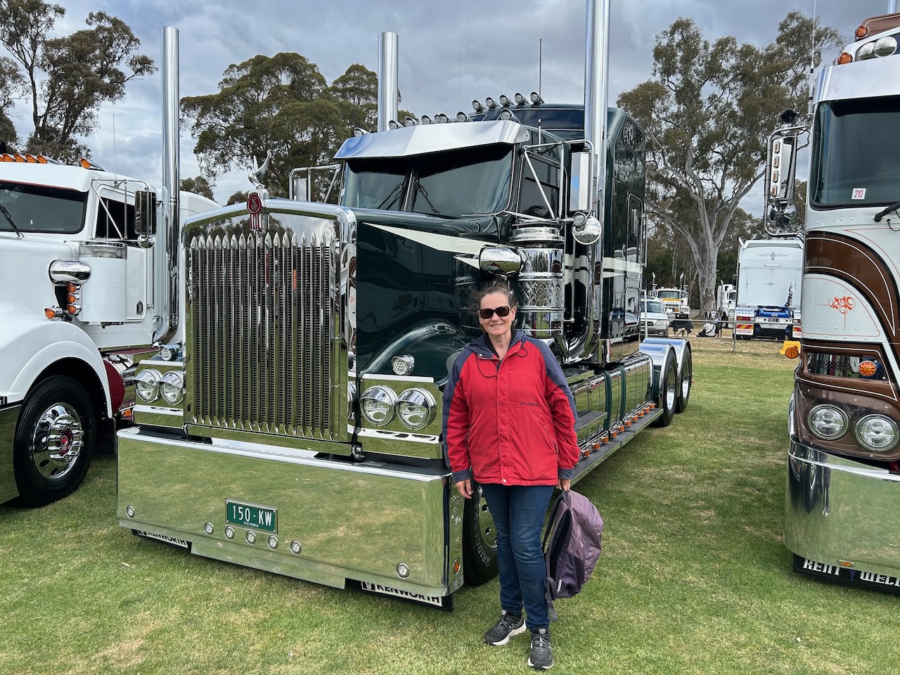
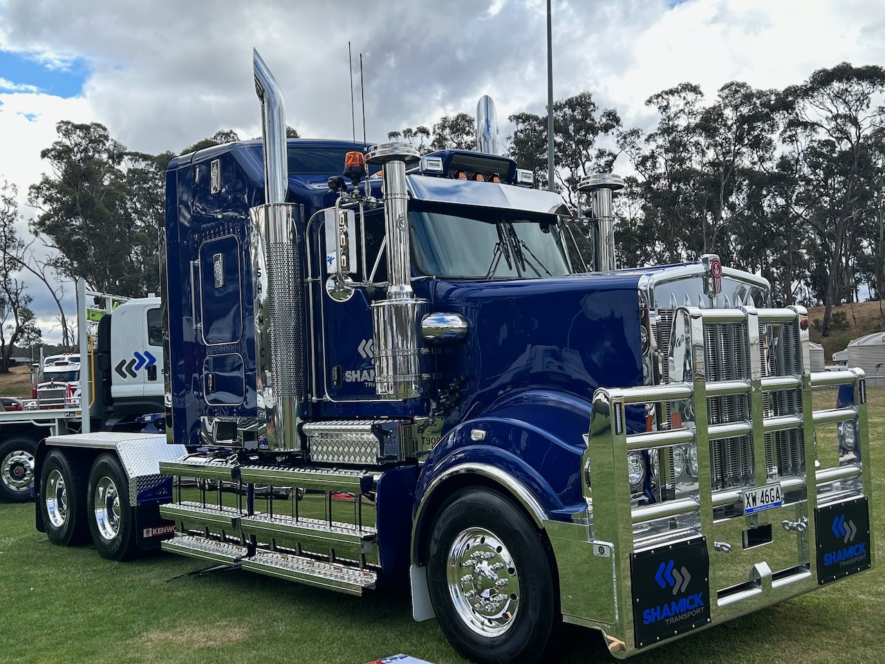
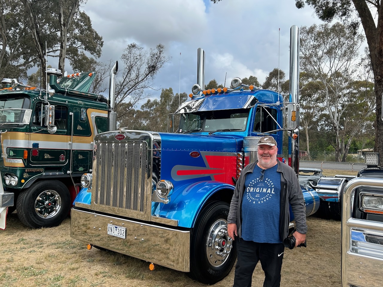
After leaving the Taradale Nature Conservation Reserve on Saturday 25th November 2023, Marija and I headed to the Rotary Castlemaine Truck Show at Campbells Creek. This annual family-friendly event celebrates the trucking industry’s important contribution and raises funds for the community. Being a truck enthusiast since I was a child, this was a brilliant event to attend. Plenty of ‘big rigs’ were on display, including great food and live entertainment.
Although the truck show is called the Castlemaine Truck Show, it is actually held at Campbells Creek, about 4km south of Castlemaine.
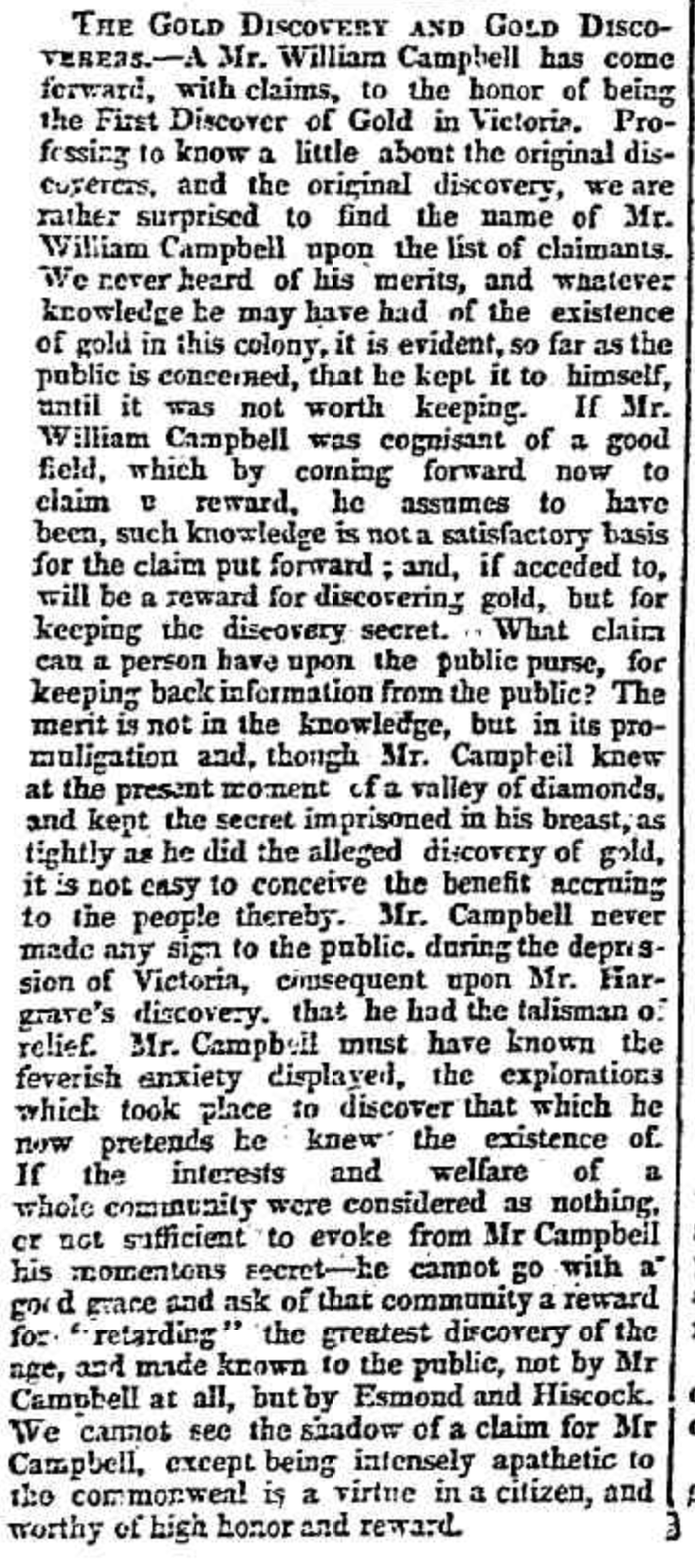
Campbells Creek was named in honour of pastoralist and politician, William Campbell. He was born on the 17th day of July 1810 in Perthshire, Scotland, and emigrated to Australia in 1838. He took up the Tourello pastoral run near Clunes. In 1850 Campbell discovered gold on the adjoining property owned by his brother-in-law Donald Cameron. He showed the gold to Cameron and they made a decision not to make the find public as they feared a gold rush would impact their pastoral activities. Campbell was subsequently issued with a reward as Victoria’s first gold discovery. Campbell did not announce the discovery until July 1851 and made a claim to being the ‘First Discover of Gold in Victoria.’ A select committee of the Legislative Council of 1853-54 voted him a £1000 reward. However, he was paid less than half that amount and gave it all to the men who had helped in his discovery. He also donated a substantial amount of the money to several hospitals and asylums. (Victorian Places 2024)
Above:- Article from the Geelong Advertiser, Thu 20 Oct 1853. Image c/o Trove.
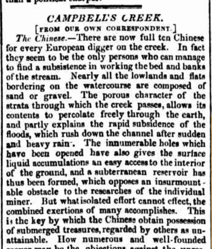
In 1851 gold was discovered at Campbells Creek, part of the Castlemaine-Mount Alexander goldfields. In 1857 Campbell Creek’s official population was 2,459, however, it is believed this is underestimated by at least 500 male Chinese diggers. (eGold 2015) (Victorian Places 2024)
Above: Part of an article from the Mount Alexander Mail, Fri 21 Jul 1857. Image c/o Trove.
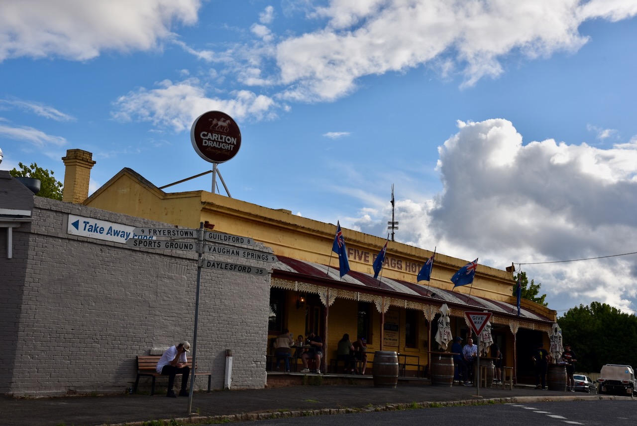
In 1854 a school was opened at Campbells Creek, followed by Wesleyan and Primitive Methodist churches in 1856. Several hotels were opened at Campbells Creek including the Five Flags Hotel built in 1855. The hotel opened on Friday the 1st day of June 1855. (Victorian Places 2024)
On the 26th day of Australia 1875, a fire swept through Campbells Creek. It destroyed the Chinese camp, however the Five Flags Hotel was saved.
Above:- Article from the Weekly TImes, Melbourne, Sat 23 Jan 1875. Image c/o Trove.
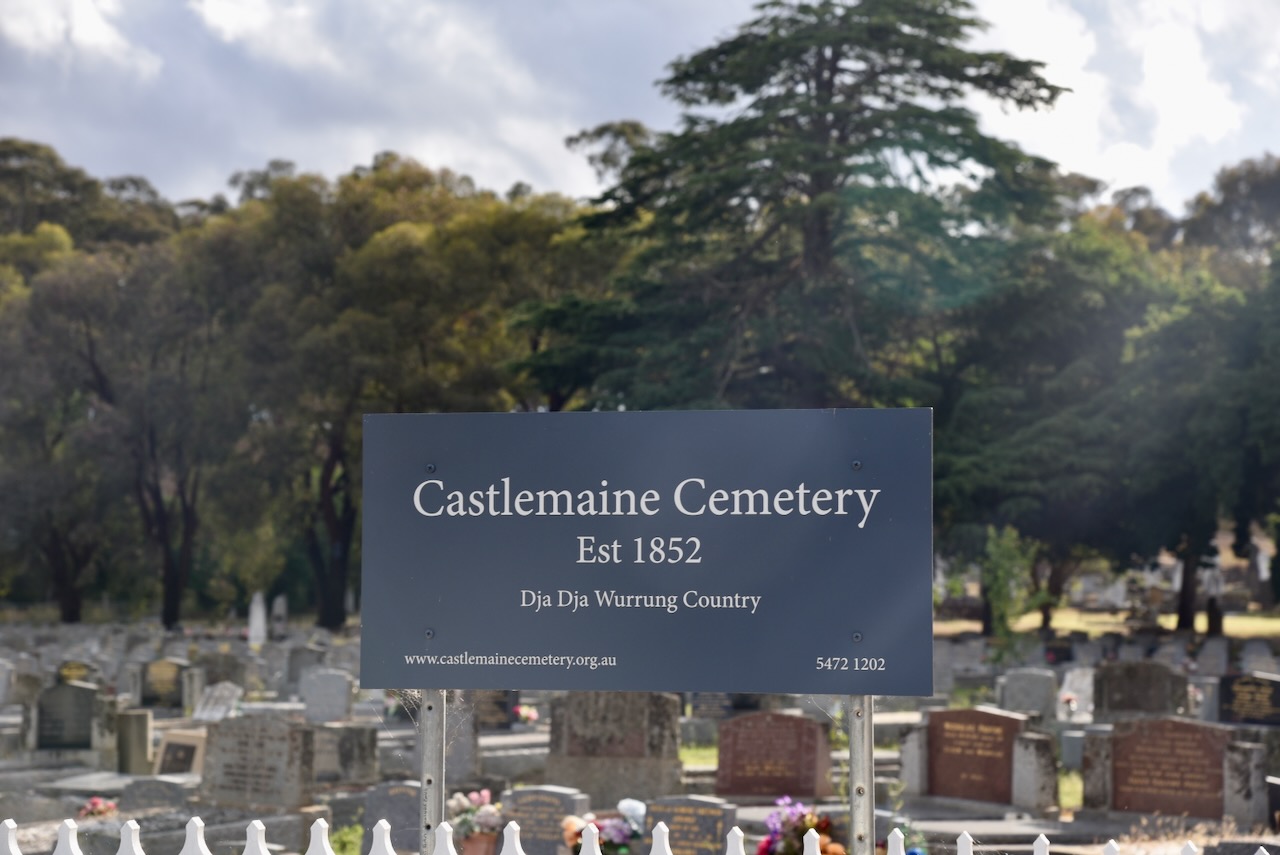
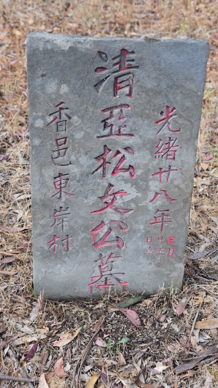
We then stopped in at the Castlemaine cemetery and fortunately checked out as well. This historic cemetery was established in 1852 and contains a wealth of history. The original cemetery was located in Templeton Street and was established in 1851. However, after 13 months of operation, the current cemetery site was established. (Castlemaine Cemetery 2024)
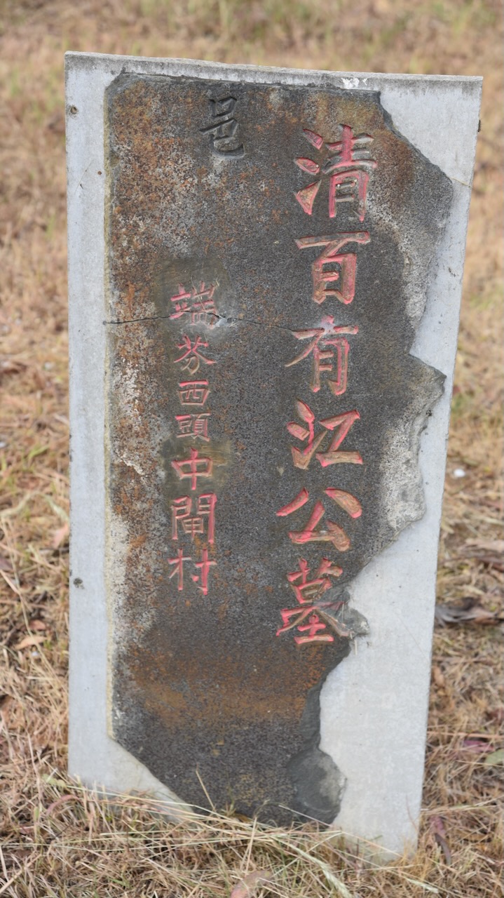
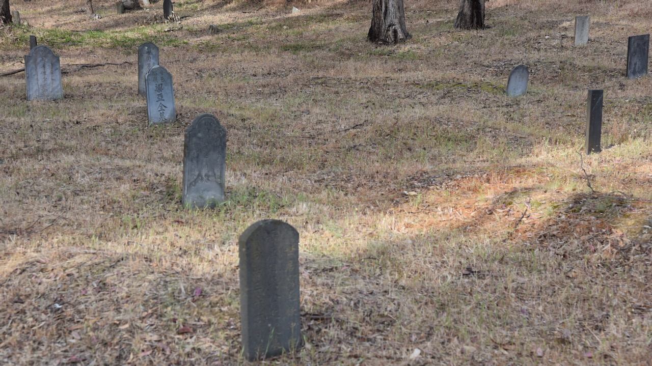
The Castlemaine cemetery contains a large number of Chinese headstones and a Funerary Tower where offerings were burnt for the departed.
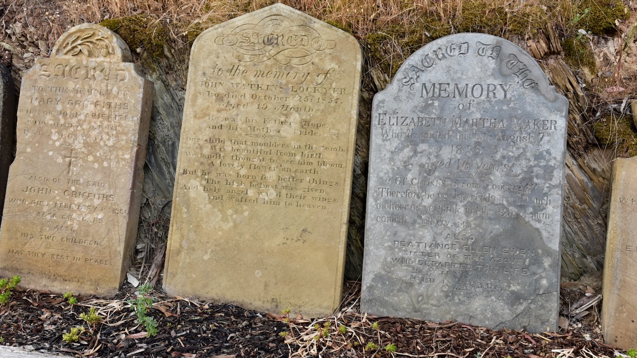
You could easily spend half a day wandering around the cemetery reading the many historic headstones that tell stories about life in Castlemaine during the 1800s.
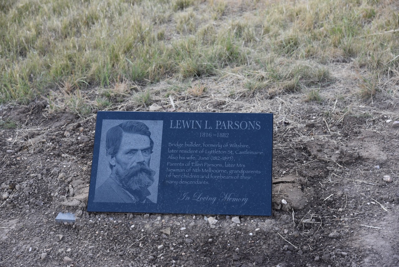
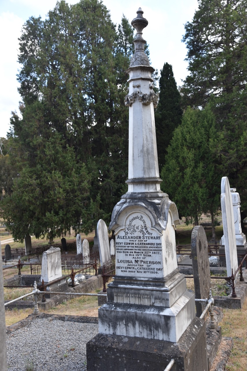
Lewin L. Parsons was born in 1816 in Wiltshire England and died in 1882. He was a bridge builder and resident of Castlemaine.
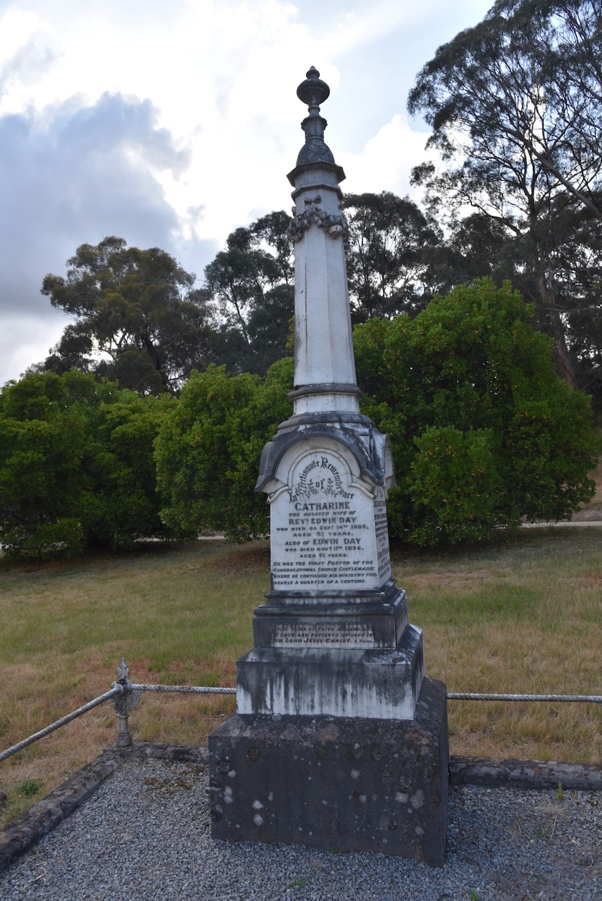
Edwin Day was born in 1814 and died in 1896. He was the first Pastor of the Congregational Church Castlemaine where he continued his ministry for nearly 25 years.
We then drove through Castlemaine quickly, on our way to the Pennyweight Flat cemetery. As we drove through the town we admired several of the historic buildings.
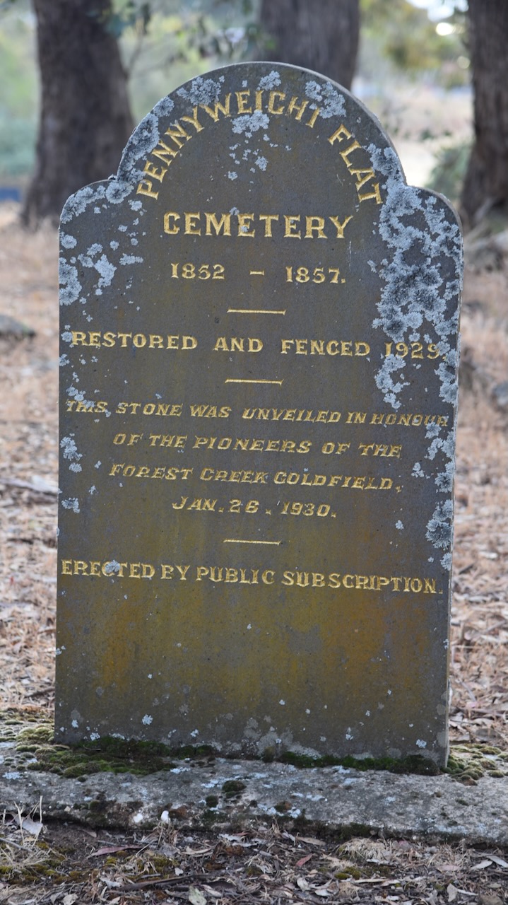
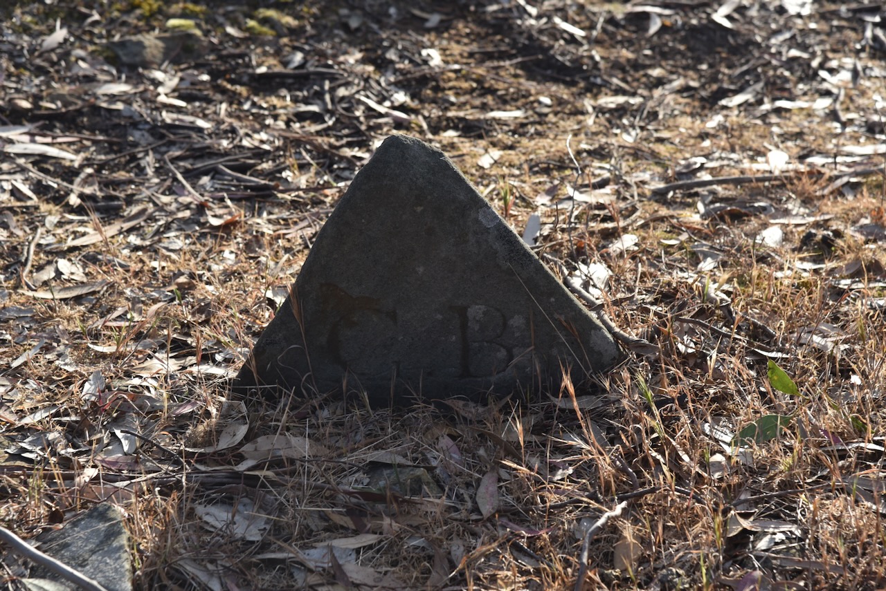
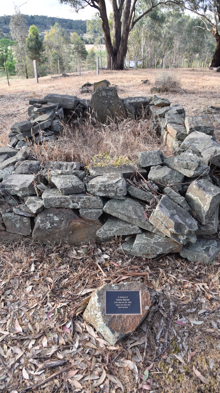
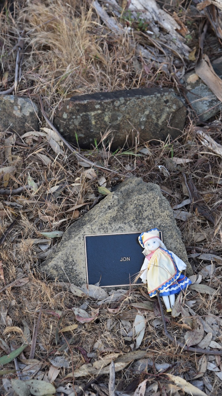
The Pennyweight Flat cemetery was established during the early years of the Mt Alexander gold rush. The cemetery takes its name from the pennyweight, a very small measure of gold. About 200 burials took place between 1852 and 1857. A shortage of water, contaminated water, poor diet and frequent accidents took a heavy toll on those who were living at the gold diggings. Many of these were children, although the cemetery contains the graves of both European and Chinese miners. Many of the graves are simple and consist of built-up loose rock. Many of those buried here were uncoffined and buried in shallow graves. (Heritage Council Victoria 2024)
We then visited the Forest Creek Historic Gold Diggings site. Unfortunately, the information boards were undergoing maintenance/replacement during our visit.
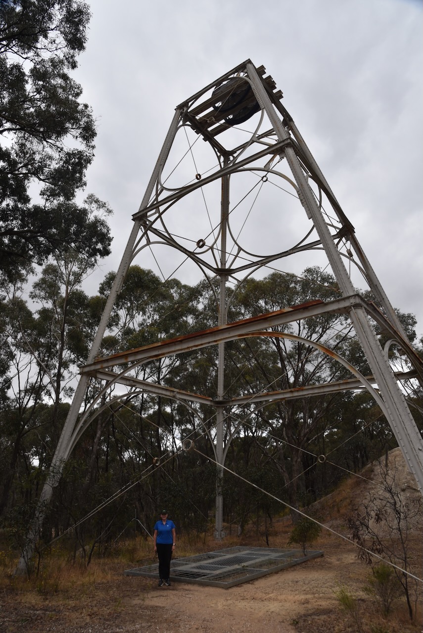
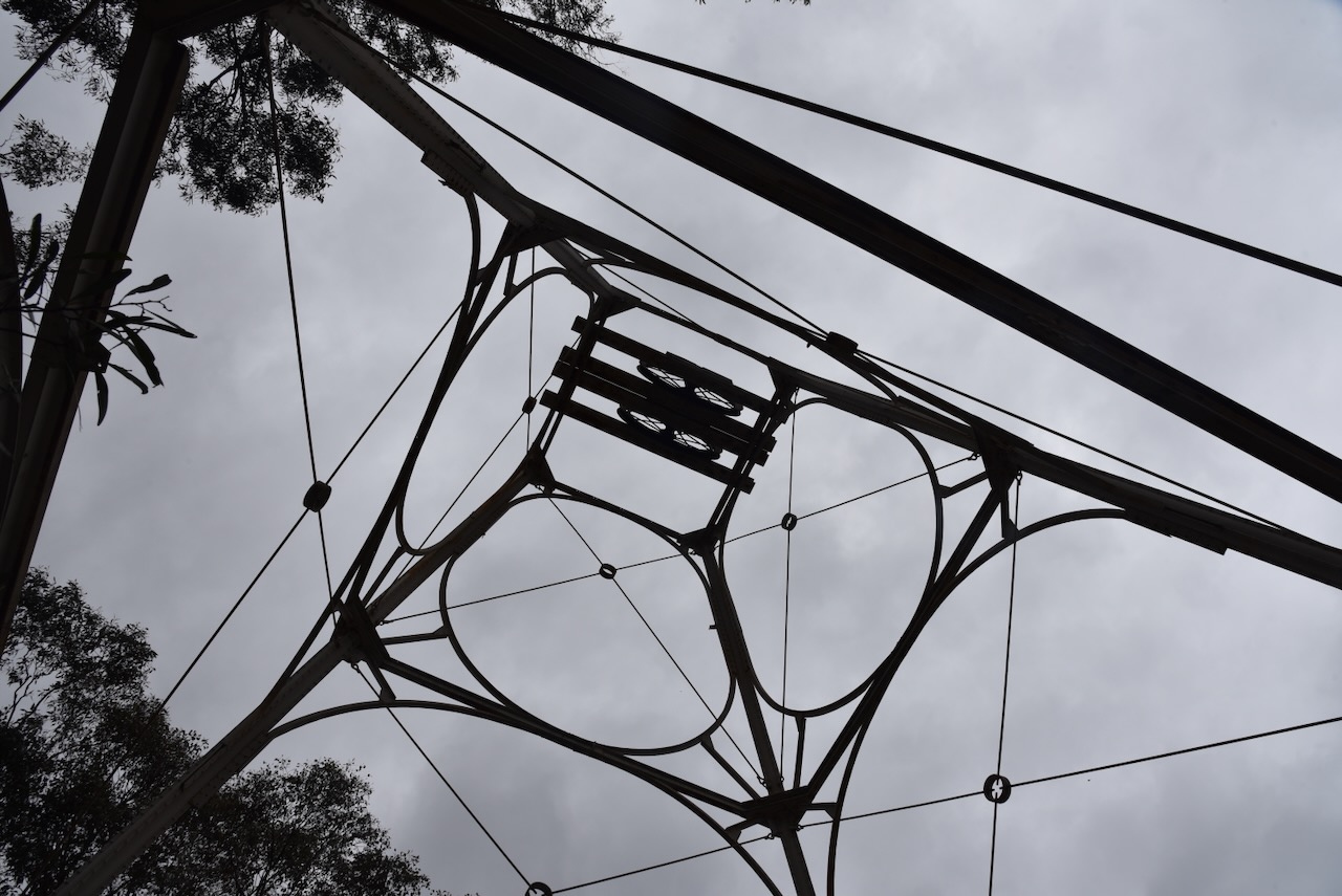
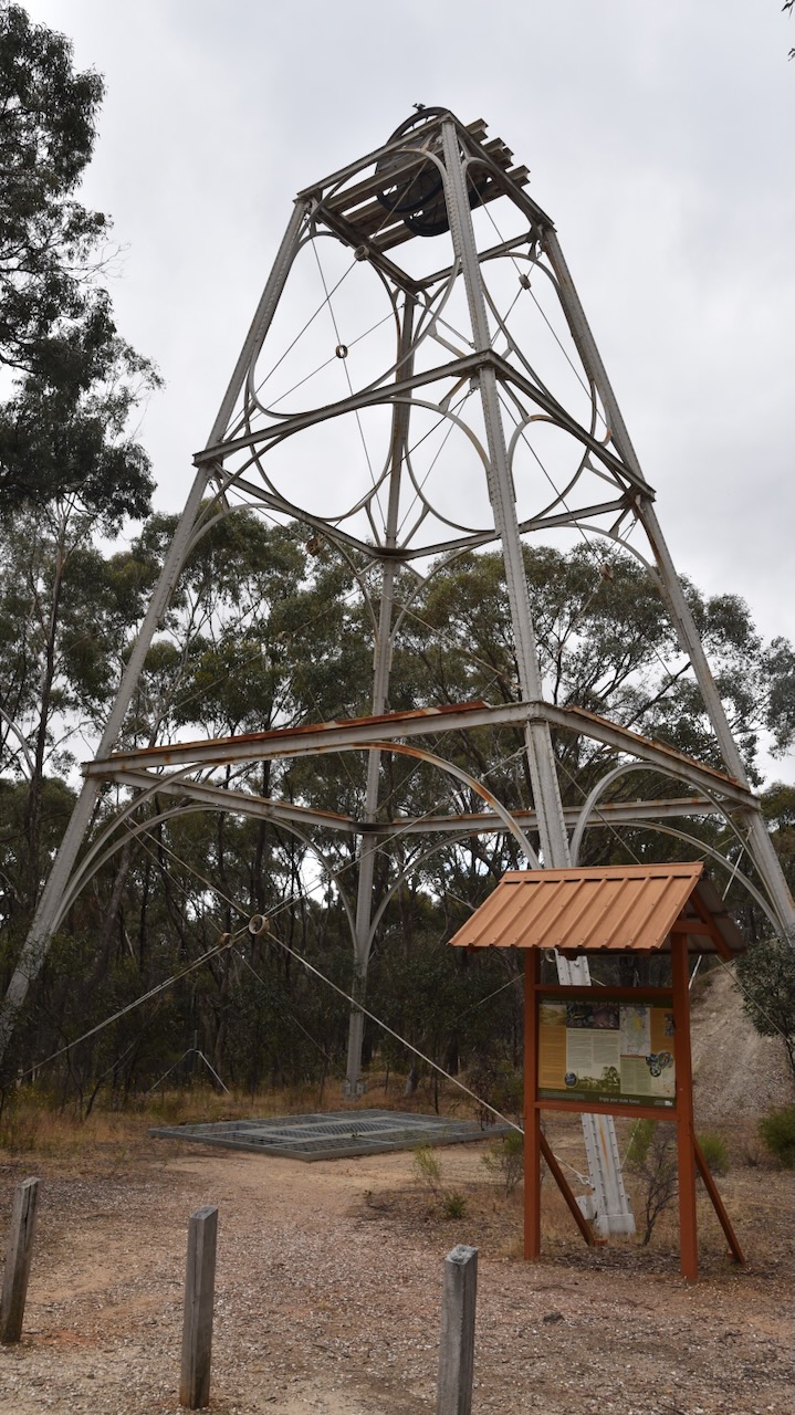
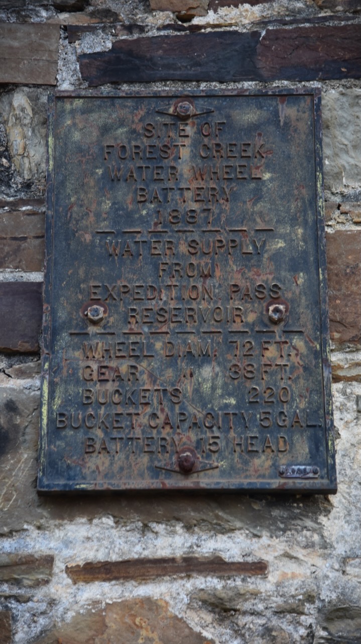
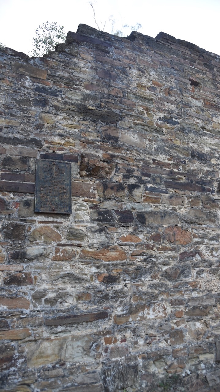
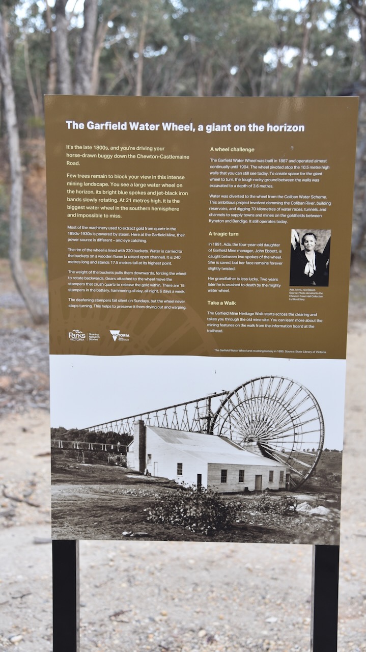
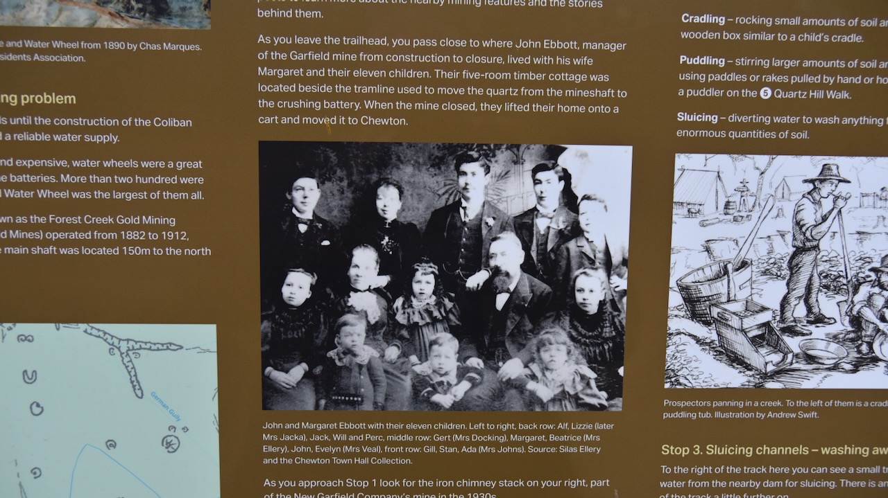
Our next stop was the Garfield Water Wheel at Chewton. The water wheel is believed tot the largest in the southern hemisphere, the wheel having a diameter of 22 metres. It was in operation between 1887 and 1903 to power the stamp battery for the mine. (Gold Fields Guide 2024)
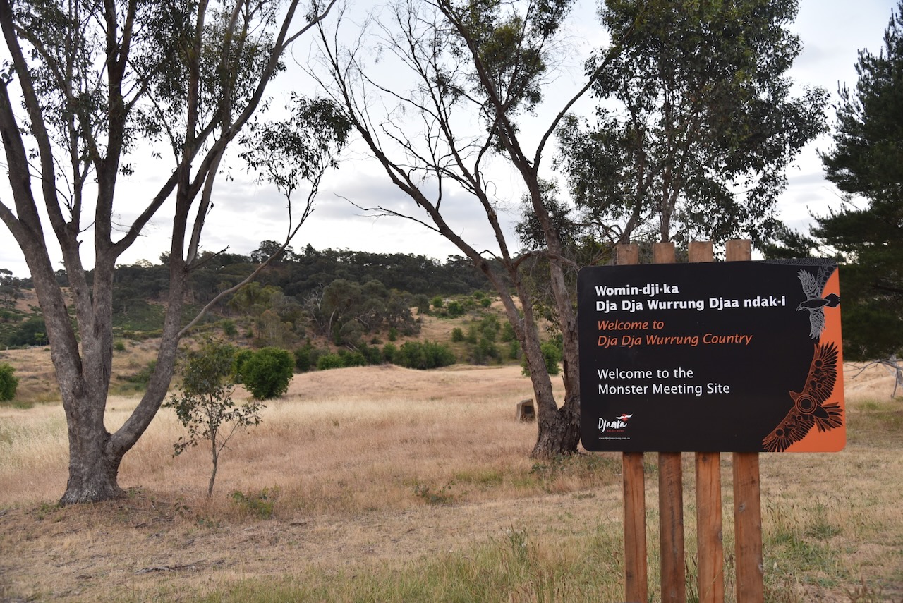
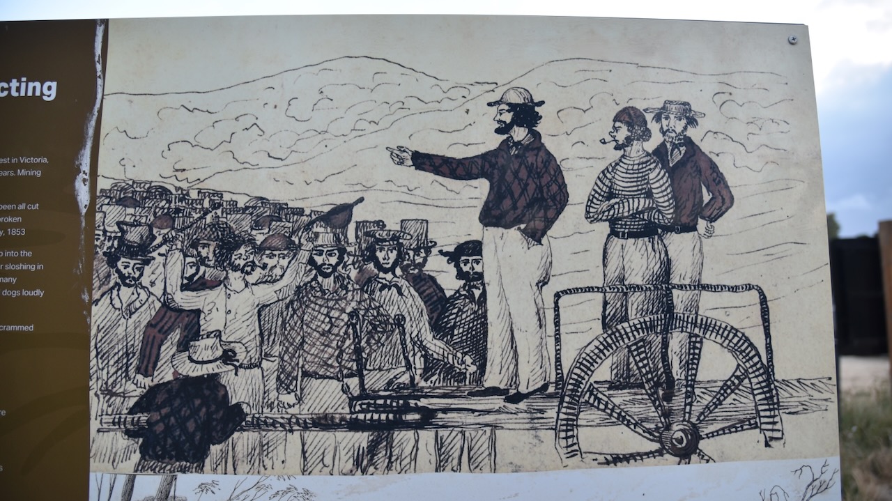
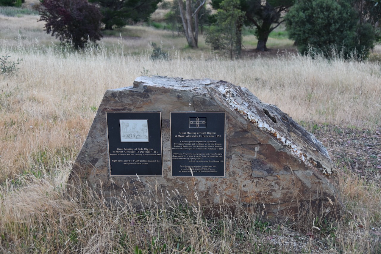
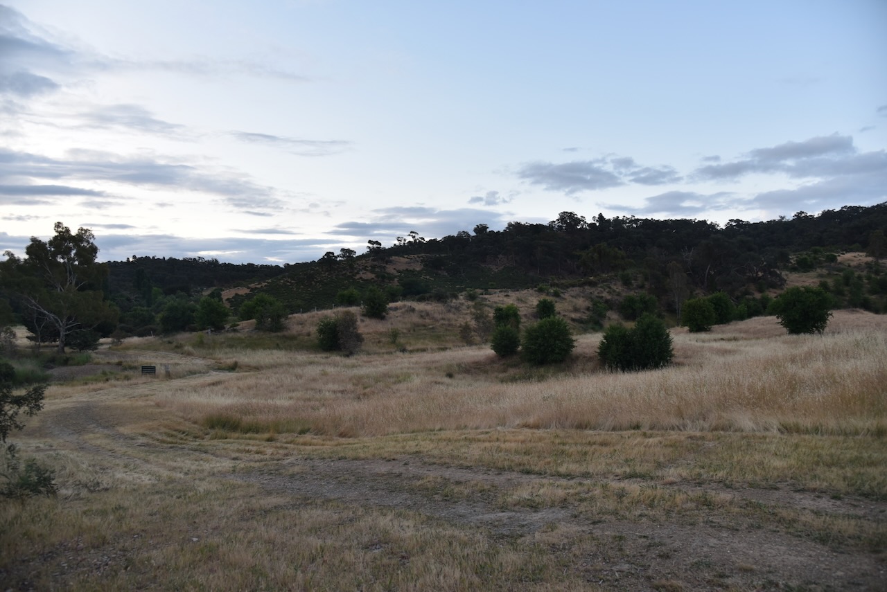
It was then off to the Monster Meeting Site. No, not ghoulish monsters, but the site where thousands of miners gathered to protest the prospecting price.
Below is a short video on the Forest Creek Monster Meeting.
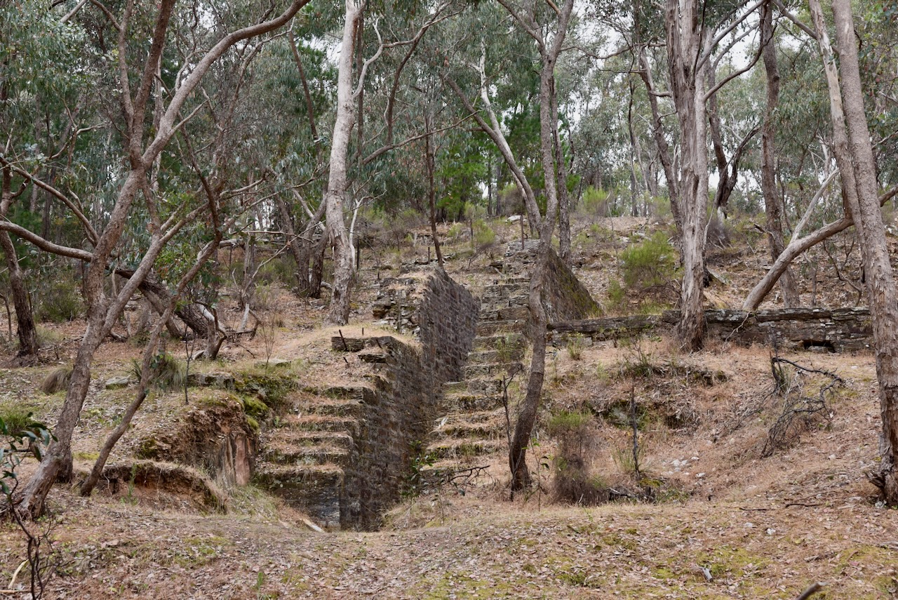
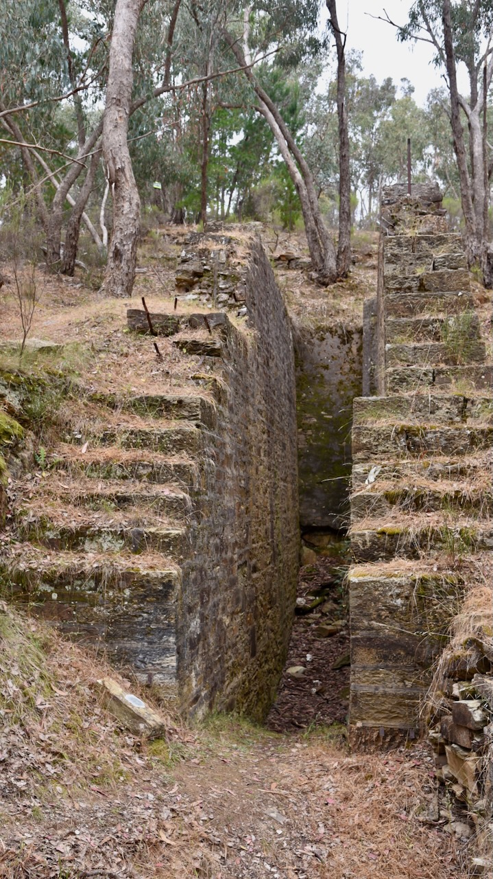
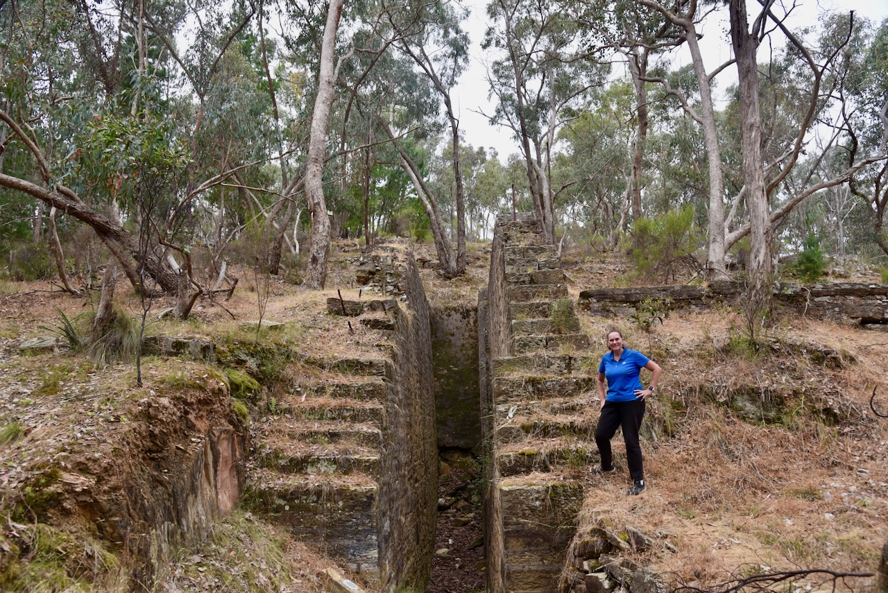
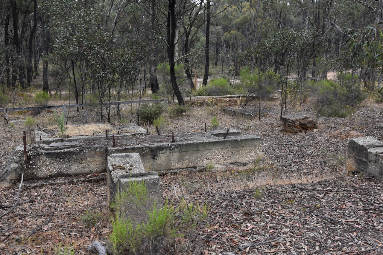
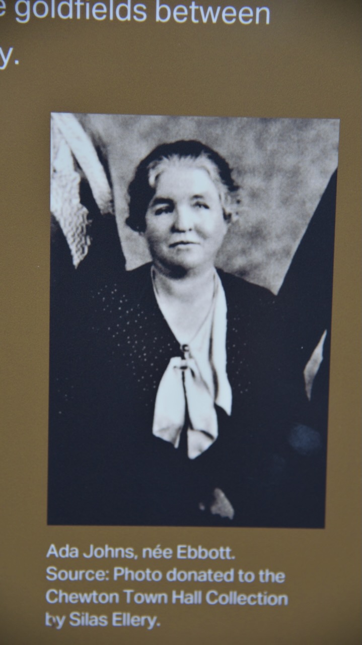
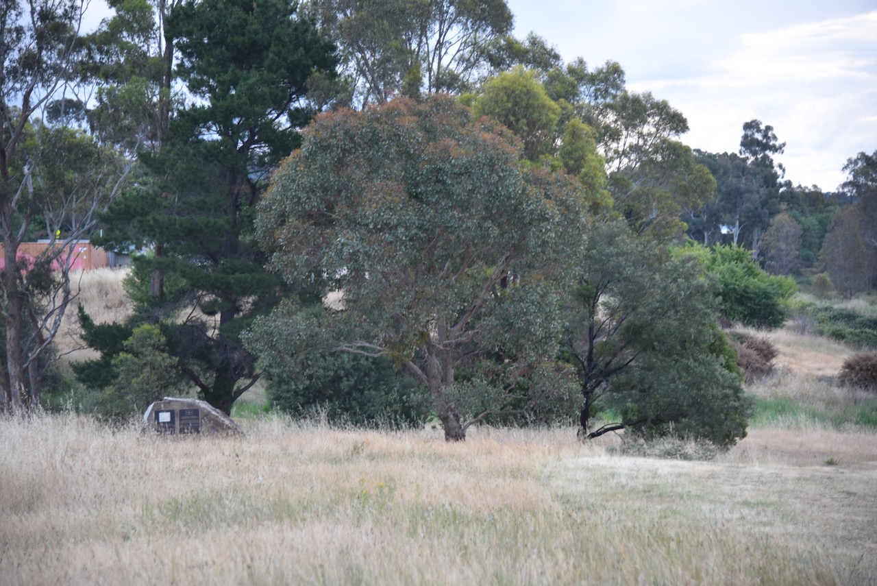
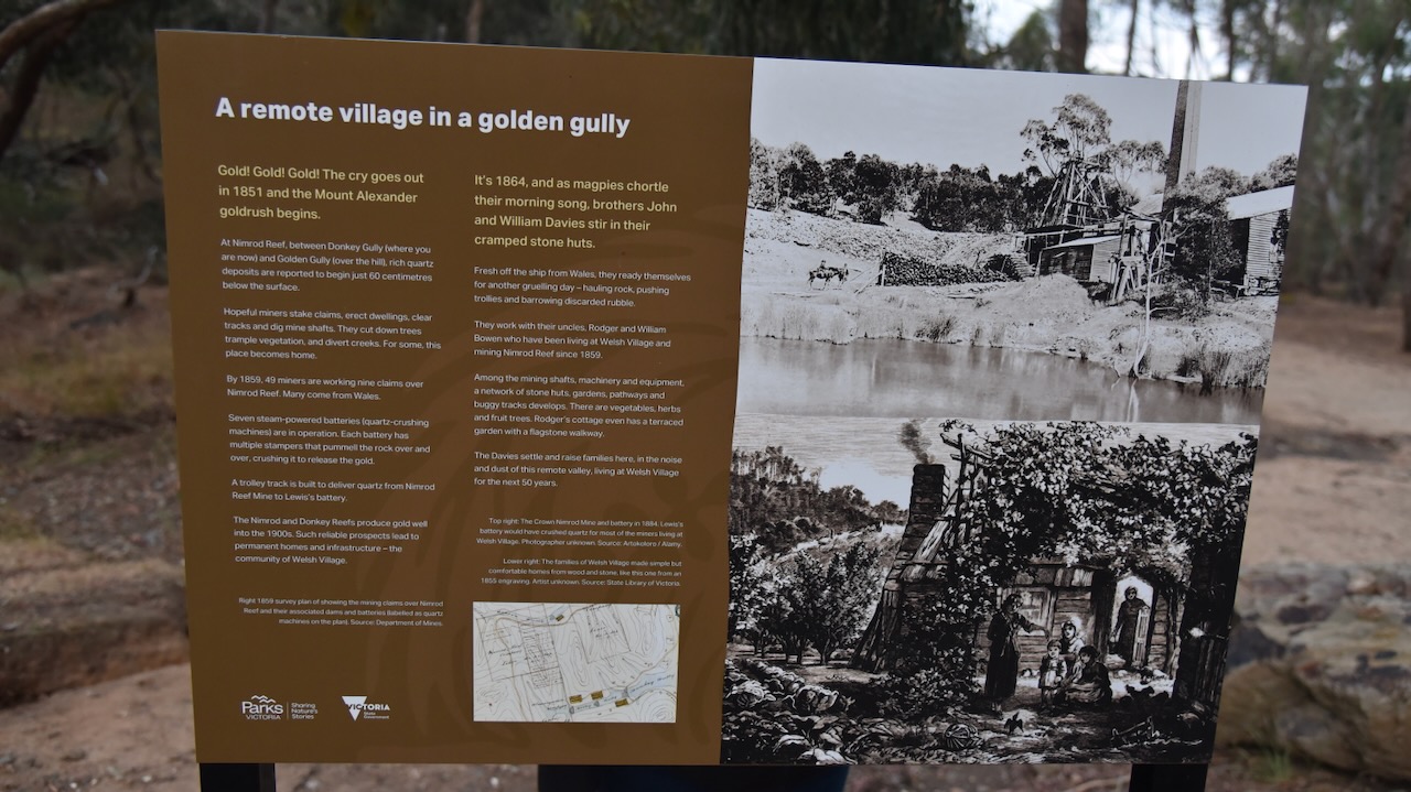
Our next stop was the Nimrod Reef Mine and Welsh Village. By 1859, 49 miners were working 9 claims over Nimrod Reef. Many of these miners had come from Wales. Welsh Village was established. Seven steam-powered batteries were in operation. Each battery had multiple stampers that pummelled the rock over and over, causing it to release the gold. A trolley track was built to deliver quartz from Nimrod Reef Mine to Lewis’ battery. The Nimrod and Donkey Reefs produced gold well into the 1900s.
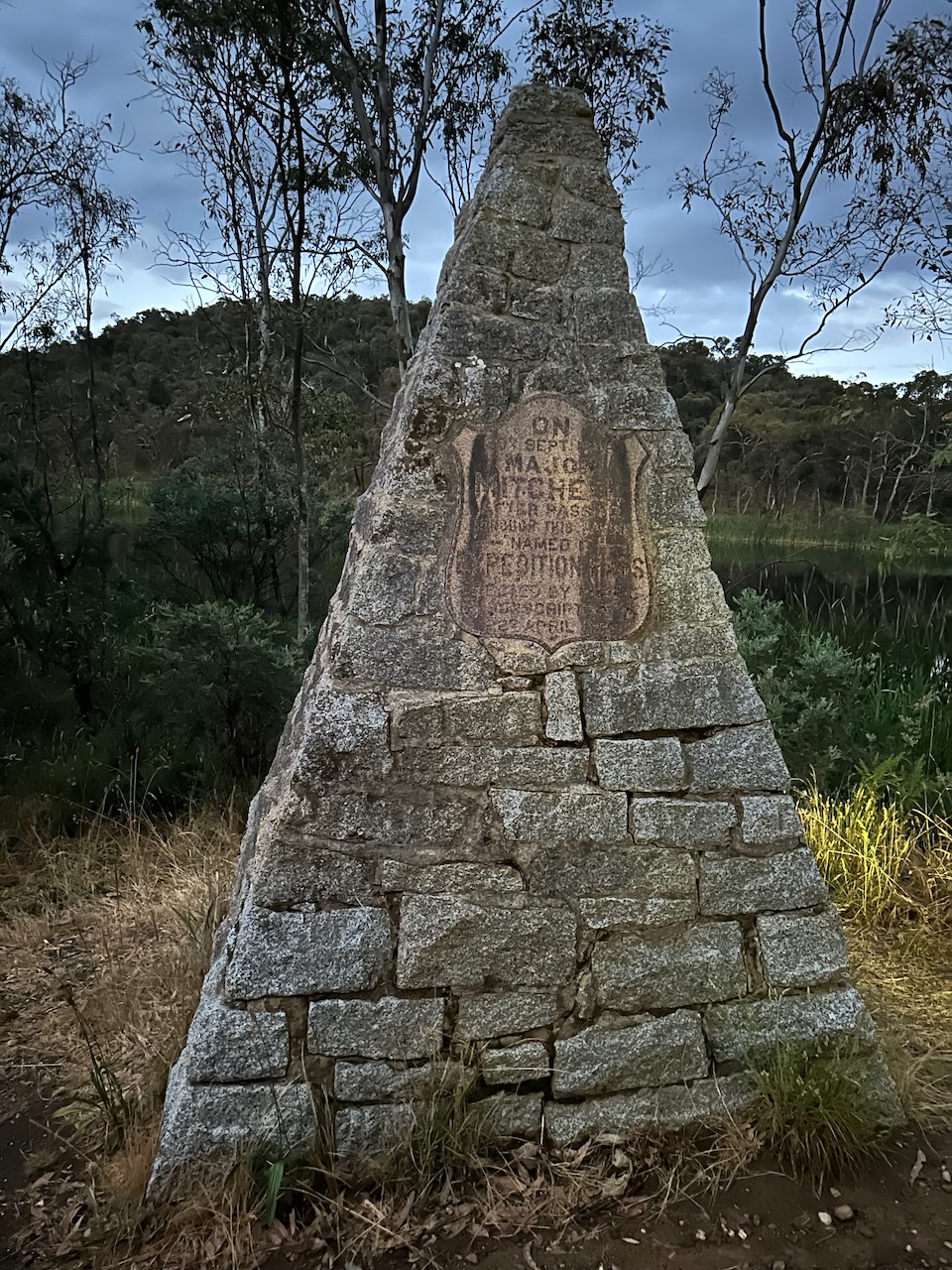
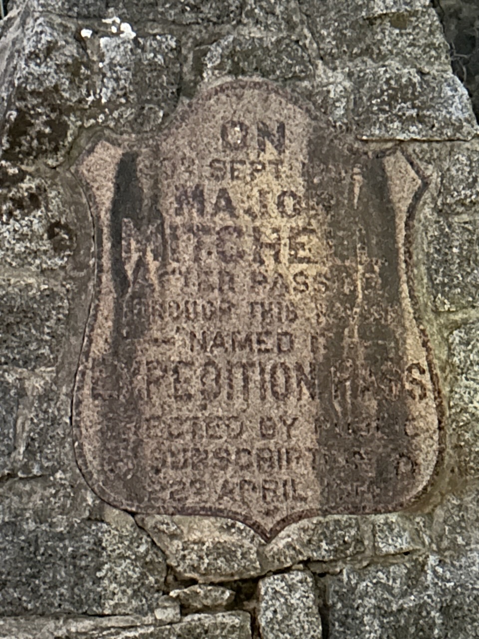
Our last stop before our final park activation of the day was the Major Thomas Mitchell memorial at Golden Point Road, Expedition Pass. It commemorates the explorer Mitchell who passed through Expedition Pass in 1836. The memorial was unveiled in April 1914 and was attended by a large gathering of residents and school children of Chewton, Sutton Grange and nearby areas. Several dignitaries were also present. (Monument Australia 2024)
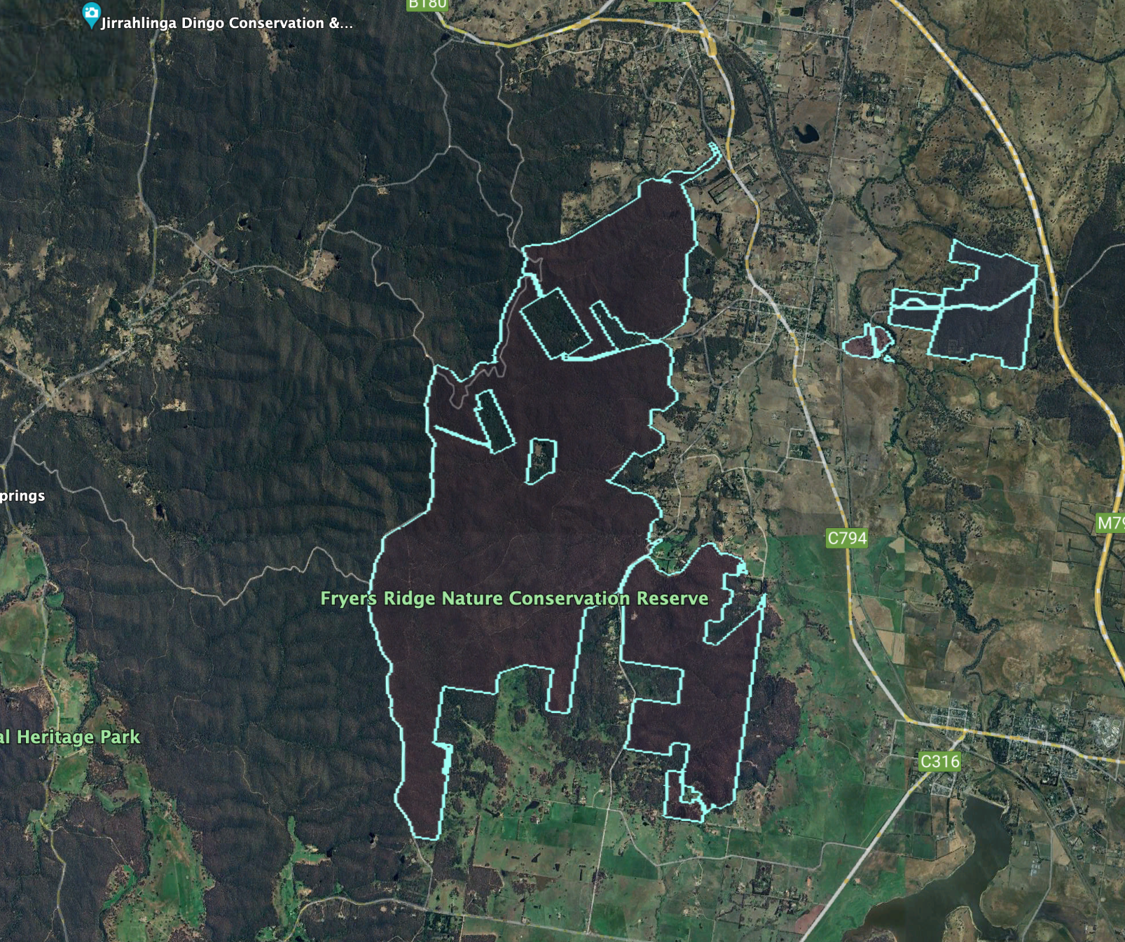
Our final activation for Saturday 25th November 2023, was the Fryers Ridge Nature Conservation Reserve VKFF-2091. It was totally dark by the time we reached the park, so we did not get to experience the park.
The reserve is about 2,142 hectares in size and was established on the 20th day of March 1979. (CAPAD 2022)
Above:- An aerial view of the Fryers Ridge NCR. Image c/o Google Earth.
It was getting quite late, so this was a quick activation from the vehicle. We ran the Icom IC7000, 100 watts, and the Codan 930 antenna with the 1.5 metre stainless steel whip. I used the special call of VI10VKFF. Unfortunately, we experienced the Over the Horizon Radar on 80m.
Marija worked the following stations on 40m SSB:-
VK1AO
VK2MET
VK2EG
VK5LA
VK5KAW
Marija worked the following stations on 40m AM:-
VK5LA
VK5KAW
VK3APJ
VK3PF
VK3KAI
I worked the following stations on 40m SSB:-
VK1AO
VK2MET
VK2EG
VK5LA
VK5KAW
VK4NH
VK4DXA
VK3SO
VK3APJ
VK3ZGA
VK3PF
VK3KAI
VK3UAO
KD1CT
VK5GY
VK3CA
VK4GTX
I worked the following stations on 40m AM:-
VK5LA
VK5KAW
VK3APJ
VK3PF
VK3KAI
VK3CA
VK2EG
I worked the following stations on 80m SSB:-
VK3CA
VK3PF
VK3KAI
VK5FANA
I worked the following station on 80m AM:-
VK3CA
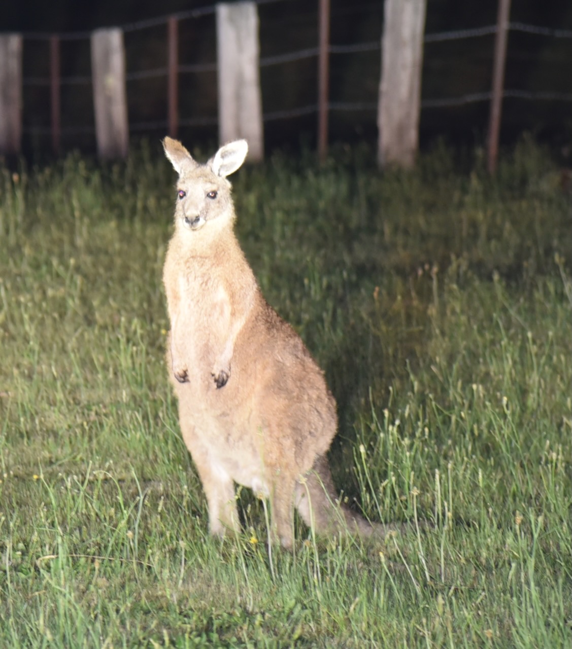
We headed back to our accommodation at Sandon. It was slow going as there were plenty of kangaroos on the roads.
After leaving the Taradale Streamside Reserve on Saturday 25th November 2023, Marija and I drove a short distance to our next park activation at the Taradale Nature Conservation Reserve VKFF-2205.
Above:- Map showing the location of the Taradale NCR. Map c/o Google Maps.
We crossed the famous Todd’s Bridge built in 1870 over the Coliban River. The bridge is listed with the Victorian Heritage Database. The Coliban River is a tributary of the Campaspe River. The river takes its name after Coliban station which was taken up by overlander A.F. Mollison near the river in December 1837. (Blake 1978) (Vict Heritage Database 2024)
The reserve is located on the Metcalfe-Taradale Road.
Above:- An aerial view of the Taradale NCR. Image c/o Google Earth.
The reserve is about 184 hectares in size and was established on the 24th day of August 1982. (CAPAD 2022)
We ran the Yaesu FT857, 40 watts, and the 20/40/80m linked dipole for this activation. I used the special callsign of VI10VKFF.
Marija worked the following stations on 40m SSB:-
VK3PF/p (Traralgon South Flora & Fauna Reserve VKFF-2464)
VK3KAI/p (Traralgon South Flora & Fauna Reserve VKFF-2464)
VK3SQ
VK2BD
VK5AAF/p (Cooltong Conservation Park VKFF-0823)
VK3MCA/p (Kurkuric Creek Streamside Reserve VKFF-3742)
After leaving the Harcourt Bushland Reserve on Saturday 25th November 2023, Marija and I headed south to our 3rd park activation for the day, the Taradale Streamside Reserve VKFF-3877.
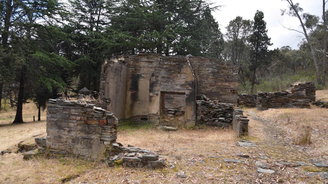
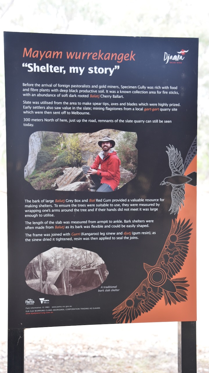
On our way to Taradale, we stopped to look at Specimen Gully, the gully where the Victorian gold rush began. At the site, there is an old hut, a monument, and some information boards. The site is located on Specimen Gully Road, Barker’s Creek, about 8km from Castlemaine via the Midland Highway.
Prior to Mount Alexander, gold had been discovered in Victoria by European settlers at Clunes and Warrandyte. However the gold proved hard to extract and as a result, this did not lead to a large rush of hopeful gold prospectors. (Parks Victoria)
On the 20th day of July 1851, Christopher Peters discovered the first gold from the Mount Alexander goldfields near the site of the monument. The discovery took part on Dr William Barker’s pastoral run, where Peters was working as a shepherd and a hut keeper. He had been secretly panning for gold in ‘Whirleys Gulley’ at the head of Specimen Gully using a small soup tin. He found half-a-dozen pieces of gold about the size of grains of wheat. Upon the gold being shown in the men’s quarters, Peters was ridiculed as finding ‘fool’s gold’ (pyrite) and the gold was thrown away. It is believed that Barker did not want his workers to abandon the sheep on the run in search of gold. However, by August that is exactly what they did. John Worley, George Robinson, and Robert Keen who were also employed by Barker, resigned and told Barker they were heading to the goldfields at Clunes. In reality, they teamed up with Peters and commenced searching for gold in Specimen Gully. (Parks Victoria)
Above:- an engraving of ‘Whirley’s Gulley’ in 1851 by G.F. Sargent.
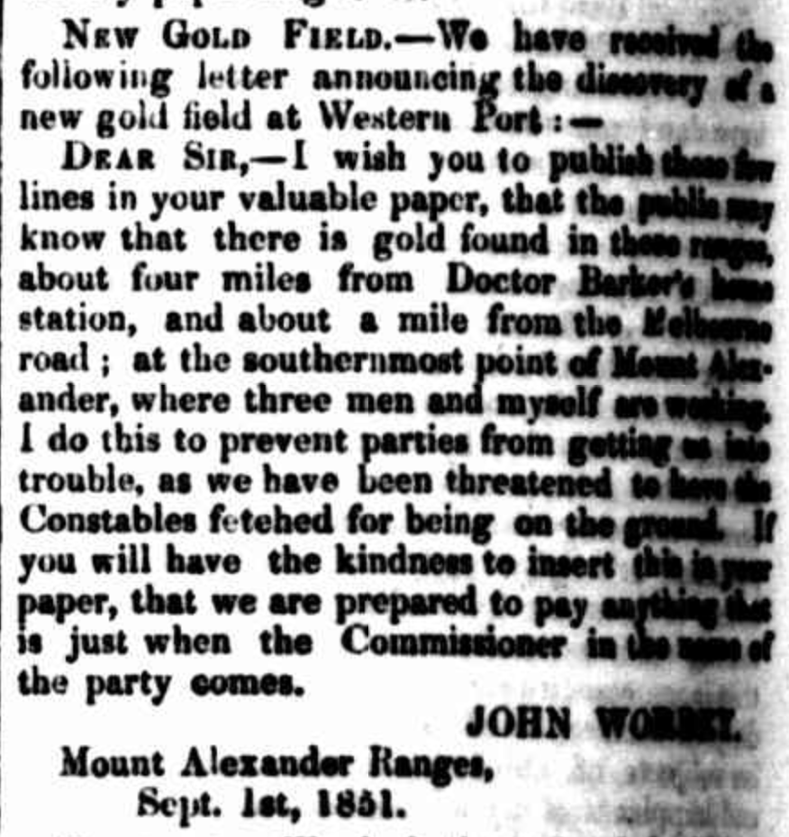
Barker found out what they were up to and was furious. He threatened to have them charged and prosecuted with trespass. As a result, one of the men, John Worley, penned a letter dated the 1st day of September 1851, that appeared in The Argus, Melbourne, on the 8th day of September 1851. The letter read as follows:
“I wish you to publish these four lines in your valuable paper, that the public may know that there is gold found in these ranges, about four miles from Dcotor Barker’s home station, and about a mile from the Melbourne road; at the southernmost point of Mount Alexander, where three men and myself are working. I do this to prevent parties from getting us into trouble, as we have been threatened to have the Constable fetched for being on the ground. If you will have the kindness ti insert this in your paper, that we are prepared to pay anything that is just when the Commissioner in the name of the party comes.” (Parks Victoria)
On the day that Worley’s letter was written, new regulations came into effect in Victoria which prohibited any person from digging without a monthly mining licence which cost thirty shillings (£1 10s) to be paid in advance. Captain Wright, the Chief Goldfields Commissioner, read Worley’s letter. He immediately instructed Commissioner Powlett to travel from Ballarat to issue a fine to the four men of £20 for digging without a licence. He also stipulated that a 10% royalty should be paid on the gold they had obtained. However, this did not occur and the four men continued to mine for gold in Specimen Gully. (Parks Victoria)
Above:- William Wright. Image c/o State Library Victoria.
Soon after the announcement of the finding of gold at Specimen Gully, trickles of people arrived in the area hoping that they too, would find gold. Within a month about 8,000 diggers were working the alluvial beds of the creeks. By the end of 1851 there were about 25,000 diggers on the goldfields. These people came from all across Australia including Van Diemen’s Land (Tasmania), New South Wales, South Australia. Others came from as far away as China, Britain and New Zealand. Charles La Trobe, the Governor of Victoria, described these arrivals as ‘adventurers’. (Parks Victoria)
By the year 1852, more ships had sailed into Melbourne Victoria than any other port in the world. About 88,00 paying passengers departed the British Isles for Australia. Of those, 9 out of 10 came to Victoria in their pursuit of gold. By 1853 another 61,000 gold prospectors had arrived, followed by 83,000 in 1854. By the 1860s, these gold seekers had trebled the population of Australia. About 33% of the world’s gold was being produced in Victoria, with most of it coming from the Mount Alexander Diggings. (Parks Victoria)
In 1864, the Victorian Government awarded the four men, Peters, Worley, Robinson and Keen, a total of £250 each for discovering the Mount Alexander Goldfield. In today’s terms, this would be the equivalent of around $60,000. (Parks Victoria)
Above:- Article from the Mount Alexander Mail, Mon 25 Jul 1864. Image c/o Trove.
What ever happened to the men?
Christopher Peters is referred to as Christopher John Peters on the monument at Specimen Gully. However, during my research, many old newspaper articles referred to him as Christopher Thomas Peters. I have not been able to find any further information on Peters.
William Barker was born in 1818 in Buckinghamshire England and studied medicine at University College Hospital. He emigrated to Australia and in July 1845 he acquired the Mount Alexander run. In 1852 he was appointed a Territorial Magistrate for Castlemaine. In 1862 he returned to medical practice and became the surgeon at the Beechworth Hospital. Between 1865 to 1871 he practised medicine at Echuca. He then moved to Melbourne and practised medicine at Albert Park. He died in June 1899. (Aust Dict of Biography 2024)
John Worley was born in c. 1811 in London, England. He emigrated to Australia. In 1848 he married Bridget Mulvaney. By 1850 he was living in the Mount Alexander district. John and Bridget had seven children. In 1854 John Worley and his wife Bridget were living in a shepherd’s hut only a short distance from the initial gold discovery site. They had initially lived in a tent at the time of the discovery. John initially extracted gold by chipping quartz off an outcrop by hand and pounding it with hammers. By 1858 he had dug a shaft down to the reef. By 1866 he had moved to Lancefield. At some point, he and Bridget separated and she remained at Specimen Gully. John Worley died in Melbourne in January 1889. (ancestry.com.au 2024) (Parks Victoria)
I have not been able to find any information about Robinson and Keen.
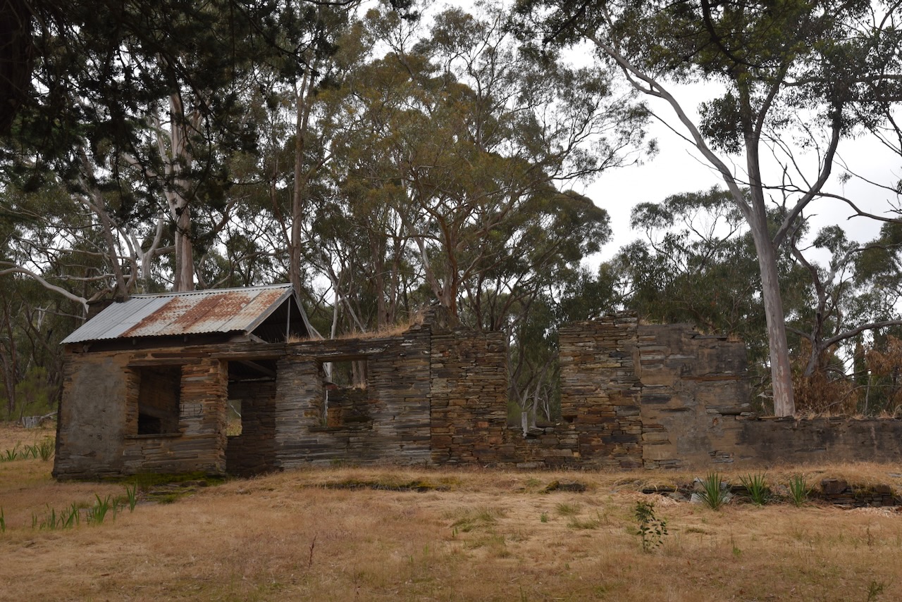
The ruins that are located at the site are the home of Bridget Worley nee Mulvaney, the wife of John Worley.
Above: Bridget Worley, c. 1870s.
The original home is the room with the large fireplace, built by her son Daniel Rielley in c. 1870. Bridget lived at this house until c. 1895. She spent her final years in the Castlemaine Benevolent Asylum, before her death in 1898 at age 78. (Parks Victoria)
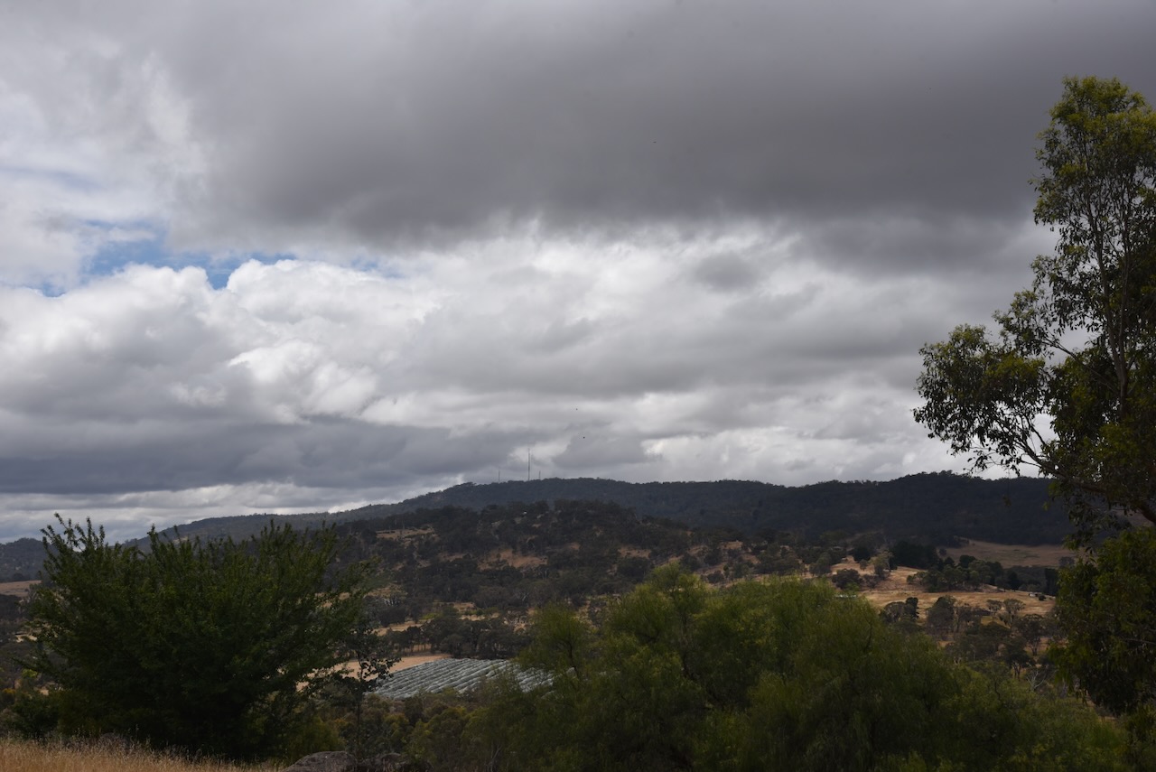
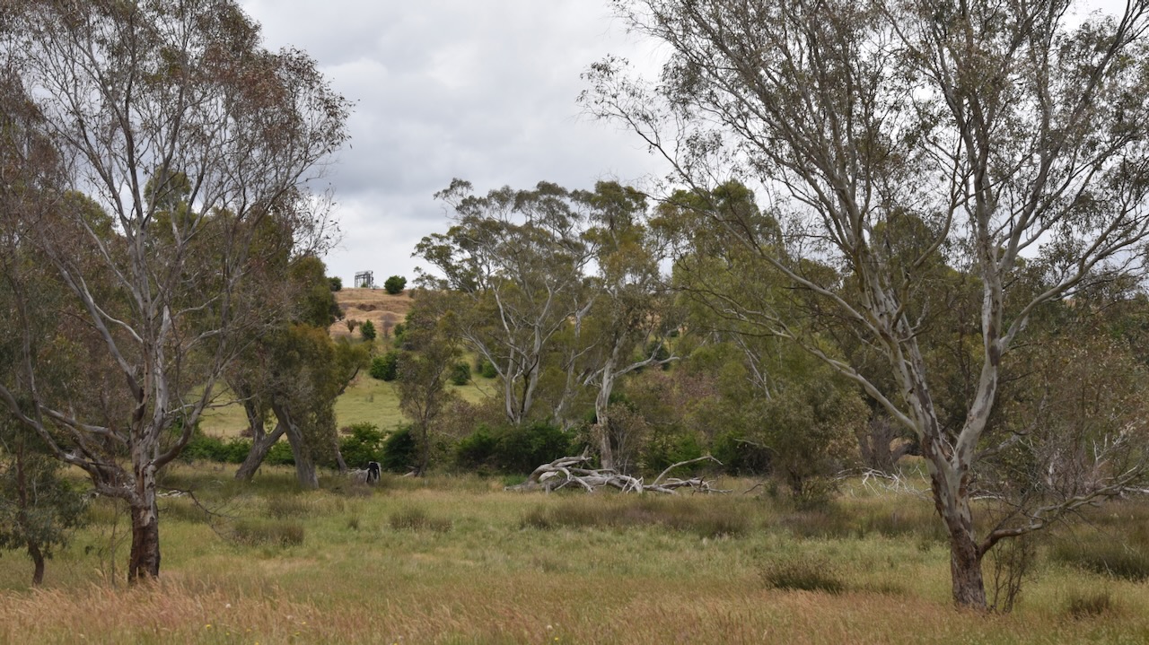
We left Specimen Gully and headed to Taradale. Along the way, we had some nice views of Mount Alexander despite the very threatening black clouds.
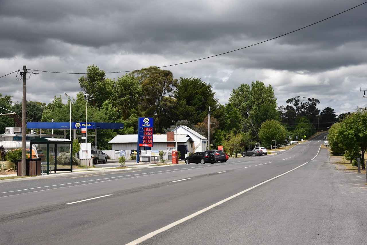
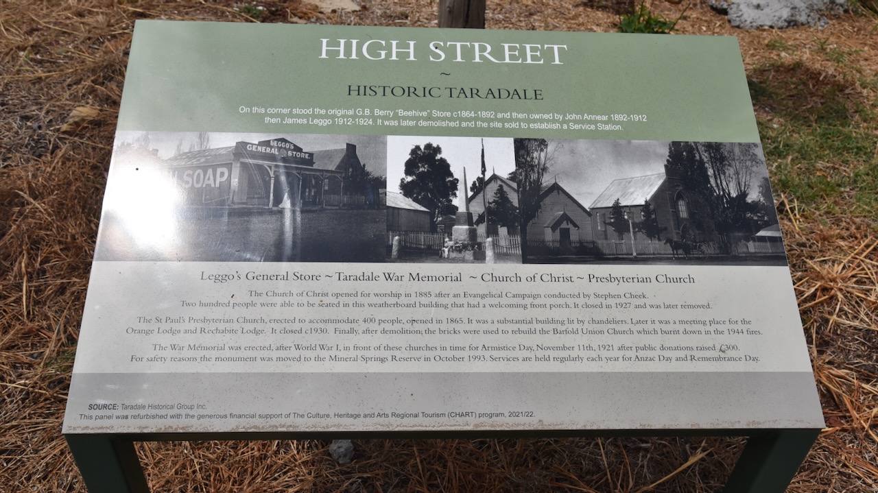
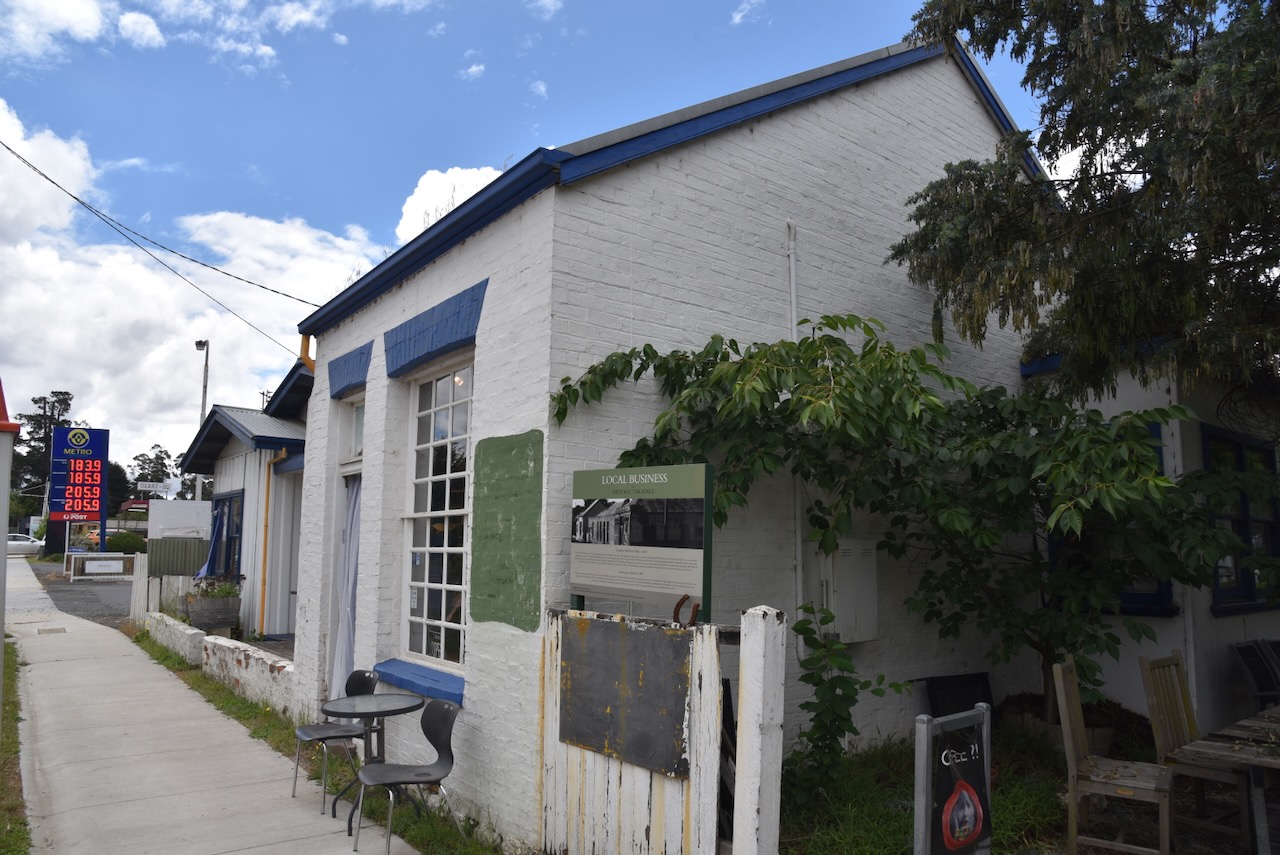
We soon reached the town of Taradale. It took its name from Tarradale House in Scotland, the birthplace of geologist Sir Roderick Murchison.
Above:- Sir Roderick Murchison. Image c/o Wikipedia.
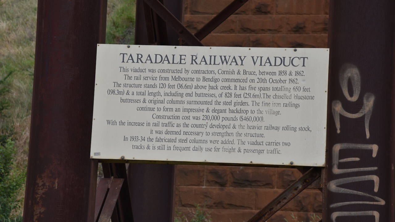
In 1852 gold deposits were found at Taradale. By 1855 a school was opened and in 1856 an Anglican church was opened. The Taradale Post Office was opened on the 1st day of March 1856. Mechanics Institute was opened in 1860. By 1862 the railway line from Kyneton to Bendigo was opened and this involved the construction of a viaduct bridge across Back Creek valley. I will talk about the viaduct a little later in this post. (Victorian Places 2024)
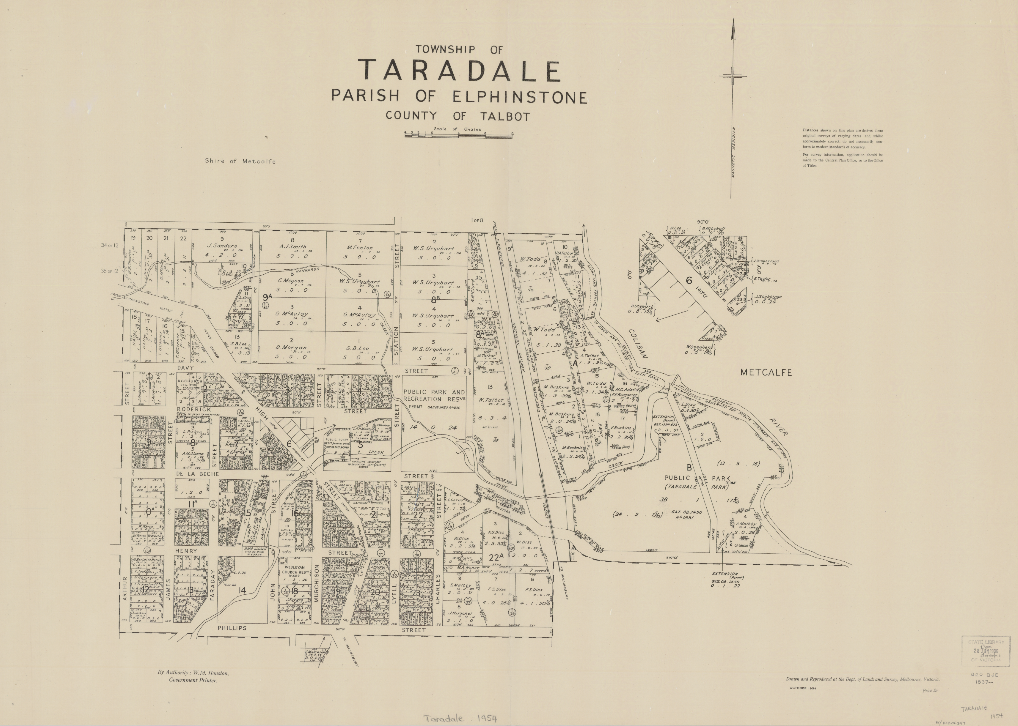
Above:- Map of the township of Taradale. Image c/o State Library Victoria.
Other than the town being named after a famous geologist, several of the town’s streets are named after famous people in the field of science and geology. This includes Charles Lyell, Michael Faraday and Humphry Davy.
The old Taradale Post Office was built c. 1861. It operated jointly as a Post and Telegraph Office, with 39,000 letters and 17,500 newspapers arriving in Taradale each year.
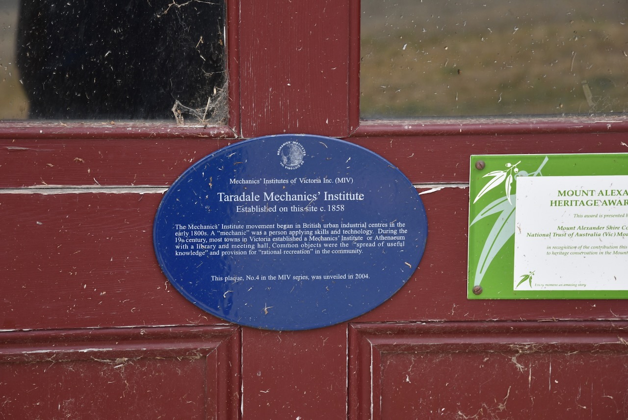
The Taradale Mechanics Institute was established in 1858. The Mechanics Institute movement commenced in British urban industrial centres in the early 1800s. A ‘mechanic’ was a person applying skills and technology. During the 19th century, most towns in Victoria established a Mechanics Institute or Athenaeum with a library and meeting hall.
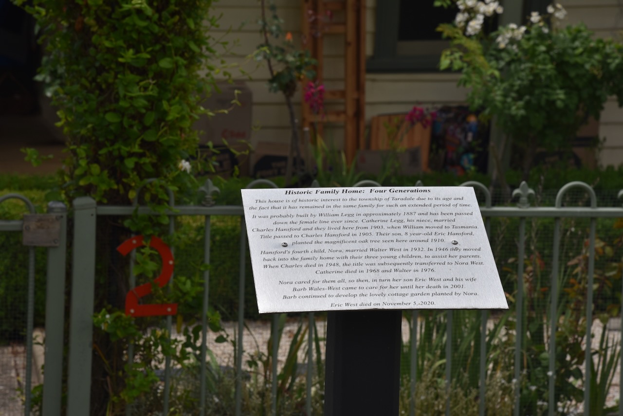
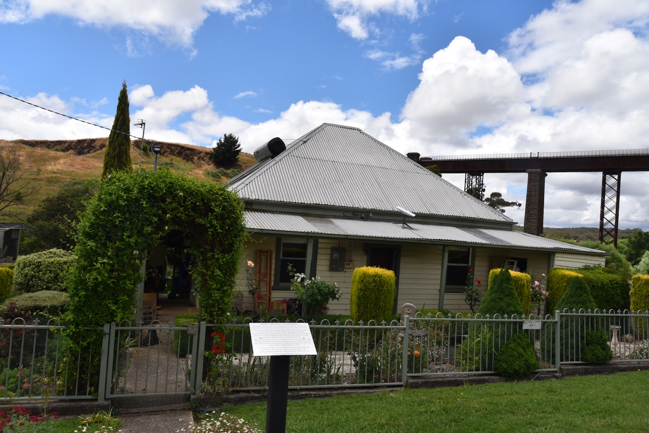
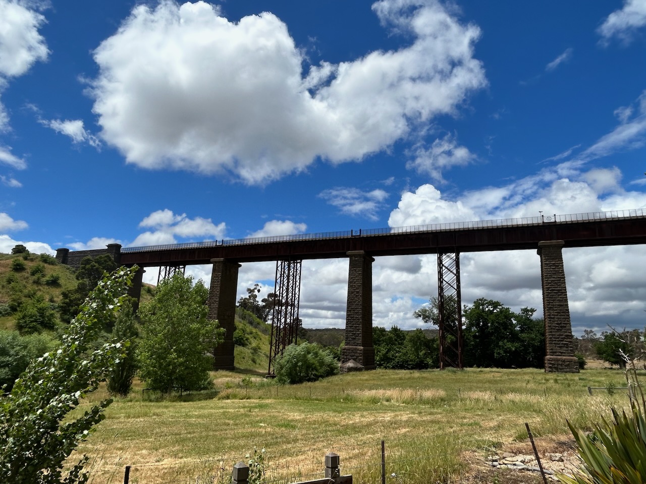
In close proximity to the Taradale viaduct is a historic family home built in c. 1887 by William Legg.
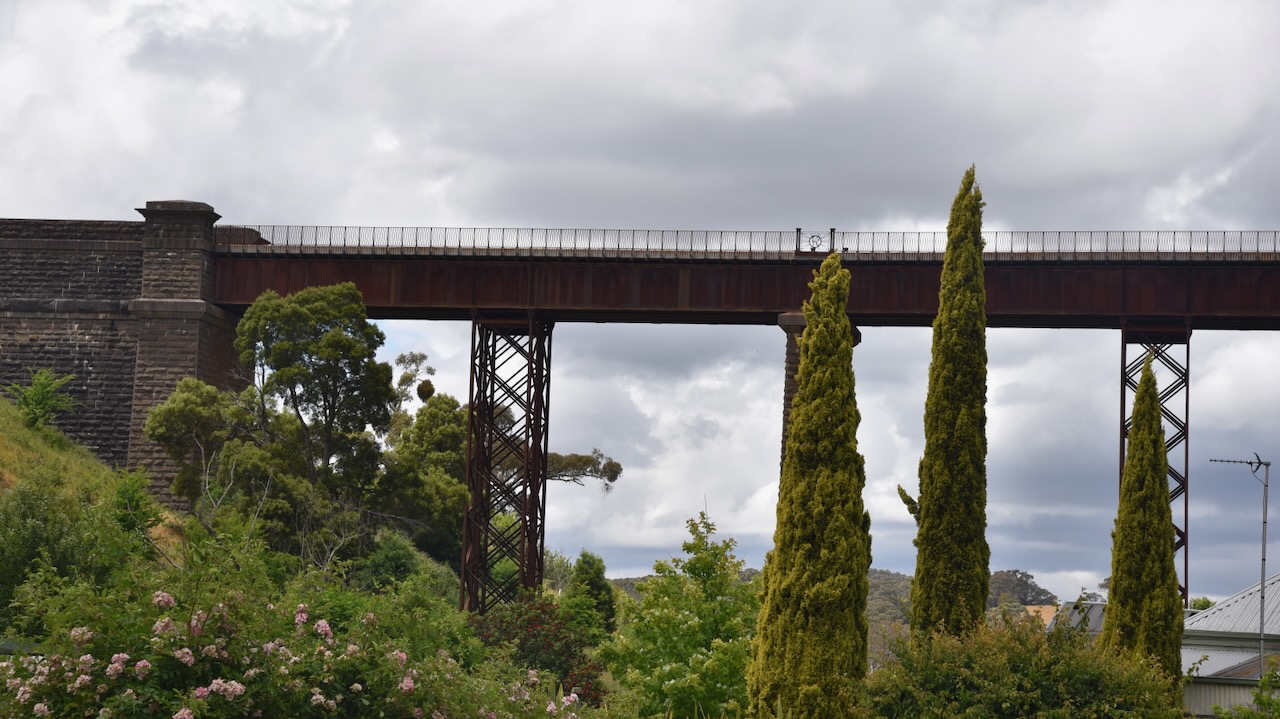
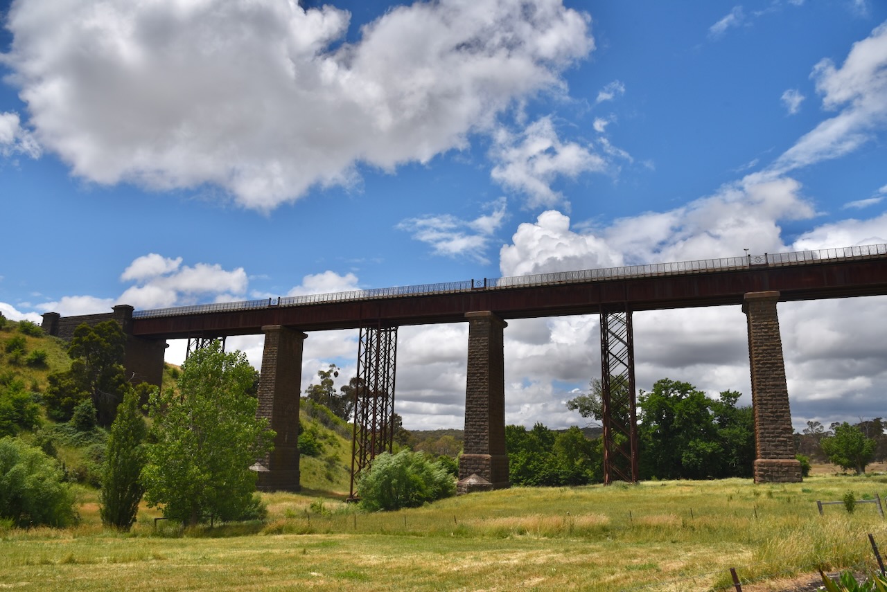
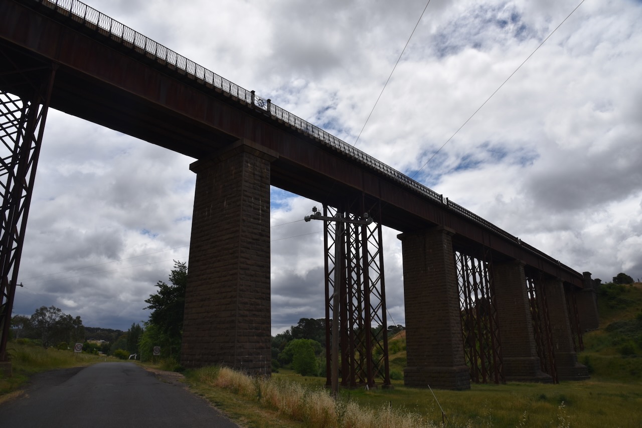
The Taradale Viaduct is something you have to see in person to appreciate. It is an amazing structure. It was designed by William Edward Bryson (b. 1823. d. 1903), a British civil engineer, surveyor and architect. It was built between 1858 and 1862 and is 36 metres in height above Back Creek. (Wikipedia 2024)
Several men have died whilst working on the viaduct. This included the Gatekeeper, Dennis Kennedy in 1863.
Above:- part of an article from The Argus, Mon 15 Jun 1863. Image c/o Trove.
On the 25th day of October 1862, about 1,200 people gathered at the Taradale police paddock to celebrate the opening of the Melbourne & Murray River railway, with a children’s picnic and sports day. Workmen reportedly decorated the viaduct with three flag-festooned triumphal arches through which the official train slowly passed while the dignitaries inside acknowledged the cheers of the spectators.
Above:- Article from the Mount Alexander Mail, Fri 17 Oct 1862. Image c/o Trove.
Near the viaduct, you can find several oak trees that were planted in May 1863 to commemorate the marriage of Queen Victoria’s son, the Prince of Wales (later King Edward 7th) to Princess Alexandra of Denmark, which took place in March 1863.
We then activated the Taradale Streamside Reserve VKFF-3877, located on the Metcalfe-Taradale Road.
Above:- An aerial view of the Taradale Streamside Reserve. Image c/o Google Earth.
The reserve is about 17 hectares in size and was established on the 24th day of August 1982. Back Creek flows through the reserve which in turn runs into the Coliban River. (CAPAD 2022)
We ran the Yaesu FT857, 40 watts, and the 20/40/80m linked dipole. I used the special call of VI10VKFF. The band conditions were quite good apart from loud static crashes on the 40m band.
Marija worked the following stations on 40m SSB:-
VK3APJ
VK1CHW/p (Gossan Hill Nature Reserve VKFF-0842)
VK3DCQ
VK3CLD/2
VK3DAC
VK4FE/3
VK5KKT
VK3CEO
VK3PF/p (Traralgon South Flora & Fauna Reserve VKFF-2464)
VK3KAI/p (Traralgon South Flora & Fauna Reserve VKFF-2464)
VK5AAF/p (Cooltong Conservation Park VKFF-0823)
VK3MCA/p (Molison Creek Streamside Reserve VKFF-3771)
I worked the following stations on 40m SSB:-
VK3APJ
VK1CHW/p (Gossan Hill Nature Reserve VKFF-0842)
VK3DCQ
VK3CLD/2
VK3DAC
VK4FE/3
VK5KKT
VK3CEO
VK3PF/p (Traralgon South Flora & Fauna Reserve VKFF-2464)
VK3KAI/p (Traralgon South Flora & Fauna Reserve VKFF-2464)
VK2EXA
VK5AAF/p (Cooltong Conservation Park VKFF-0823)
VK7MAT
VK7JFD
VK3MCA/p (Molison Creek Streamside Reserve VKFF-3771)
VK3CJN
VK3MTT
VK3HJW
VK3PI
VK3UAO
VK7IAN
VK3YV
VK3TNL
VK3ZZS
VK2MOP
VK1AAF
VK3AWA
VK3ARM/m
VK3SQ
VK2BD
VK3ABQ/p (Mount Wombat-Garden Range Flora & Fauna Reserve VKFF-2403)