Blue Mountain, VK3/ VS-015

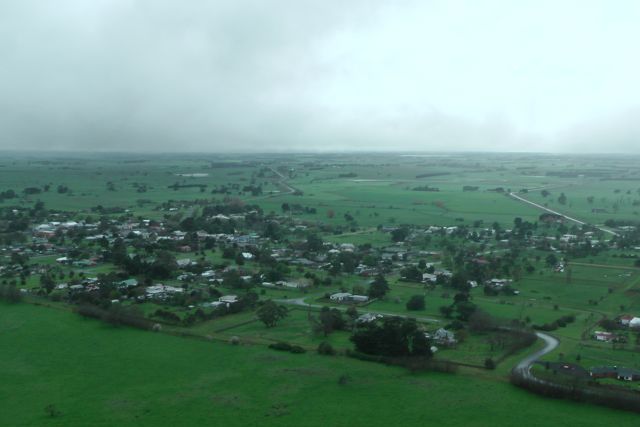
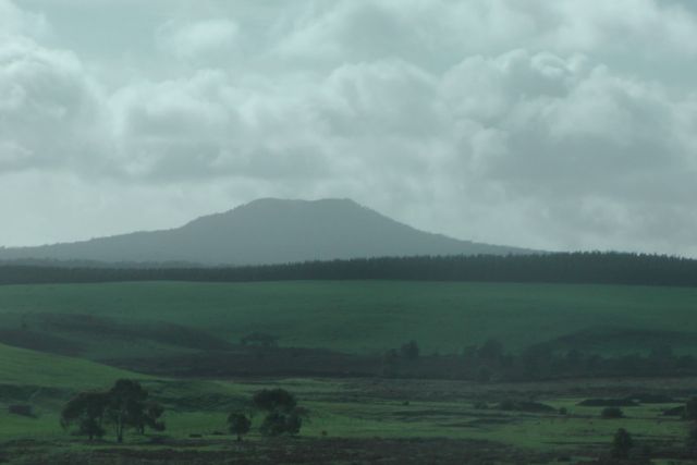
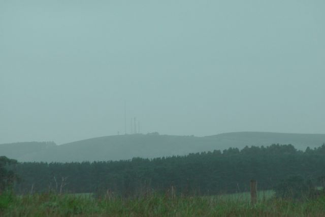
Blue Mountain, VK3/ VS-015 was my first summit for Sunday, 8th September, 2013.  Blue Mountain is located in the Pyrenees Ranges, about 50 km north west of Ararat, and about 212 km north west of Melbourne.  Blue Mountain is 772 metres above sea level, and is worth 1 SOTA point.

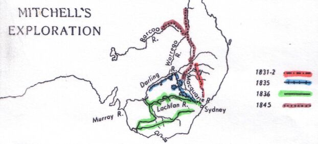
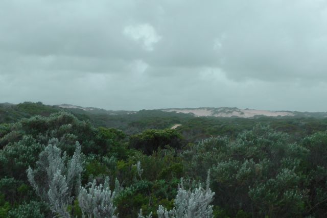
The Pyrenees Ranges are situated between St Arnaud in the north, Beaufort in the south, Maryborough in the east and Stawell in the west.  A number of wineries are located in the area.  The Jajowurrong people were the first to occupy the Pyrenees and called the area ‘Peerick’.  The explorer and surveyor Major Thomas Mitchell was the first European recorded to have traveled through the district during his 1836 journey of exploration.  The ranges reminded him of the Pyrenees mountains in Europe where he had served as an army officer, hence the name he gave them.  Mitchell found the area more temperate in climate and better watered than inland New South Wales, and he encouraged settlers to take up land in the region he described as “Australia Felix”.  The more I travelled around western Victoria, the more I was reminded of the significant contribution that Mitchell made during the early years of Australian exploration.

220px-Thomas_Mitchell

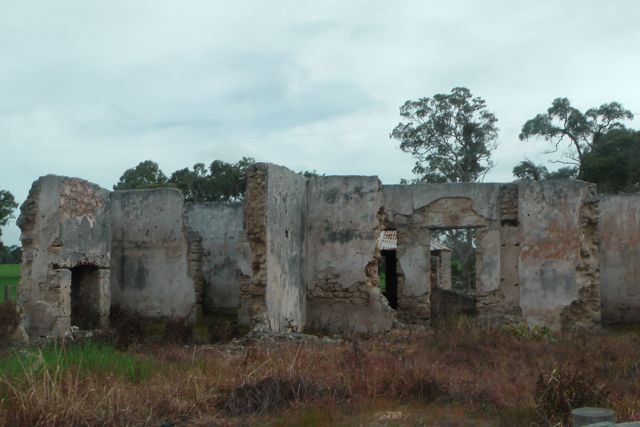
Following Mitchell, came the pastoralists to the Pyrenees, and this was followed by the discovery of gold in 1854.  The foothills of the Pyrenees contain numerous relics from the gold mining era, with mining holes and other relics still visible today.  Slate quarrying also occurred, with material obtained being used to pave the footpaths of Melbourne.  During the 1840’s timber harvesting commenced to supply the growing communities surrounding the forest.

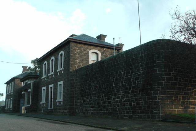
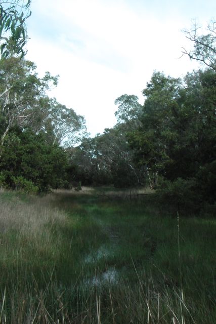
After an early start and a stop at the Ararat bakery, I started driving out of Ararat.  The morning was absolutely freezing cold, and there was a thick blanket of low lying fog.  My drive out of Ararat took me passed the old J Ward, the prison for the criminally insane, which is no longer in use and now serves as a museum.  I have been for a tour through J Ward previously with my wife, and it is very interesting and well worth a visit.  I drove out of Ararat north east along the Pyrenees Highway and then turned left onto the Elmhurst-Landsborough Road to travel north.  There is a large brown sign here saying ‘Pyrenees Ranges’.  After about 9 km, I then turned right onto the Glenlofty-Warrenmang Road, which is a dirt road in good condition.  This road is well signposted and also has ‘Warrenmang 16’ and ‘Moonambel 29’ on it.  This took me passed farming land and eventually into the Pyrenees State Forest.  There were plenty of kangaroos out here, so in some parts it was slow going on the roads.  After travelling about 5 km along this road, you reach a sharp right hand bend, and there is a track off to the left called Blue Mountain Track.

IMGA0018_4     IMGA0023_4

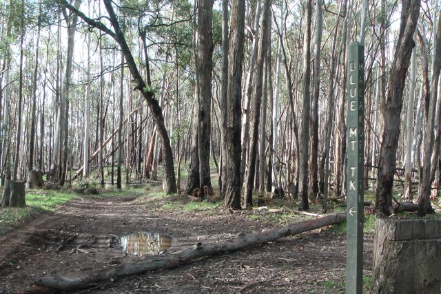
The track is very rough in parts, but it is passable in a 2wd vehicle with care.  It takes you into the Landsborough Flora and Fauna Reserve.  I continued on as far as I could go on the track until it got too rough for my Ford Falcon.  This was near the intersection of the Blue Mountain Track and Malakoff Track.  Take care if you are going to tackle this track in your car as there are large pot holes and wash aways, and there was a significant amount of tree debris and branches over the road.  So I ended up walking about 1 km further along the Blue Mountain Track to the summit.

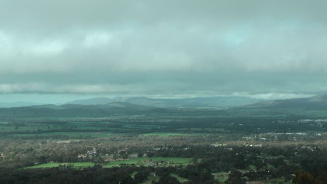
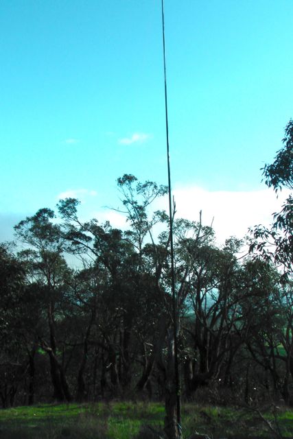
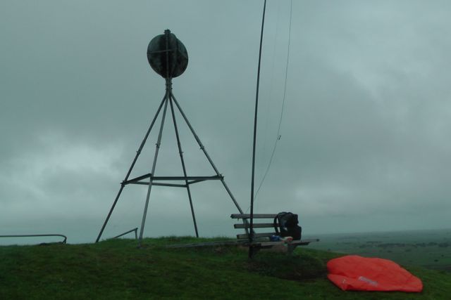
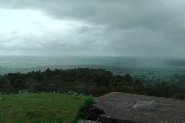
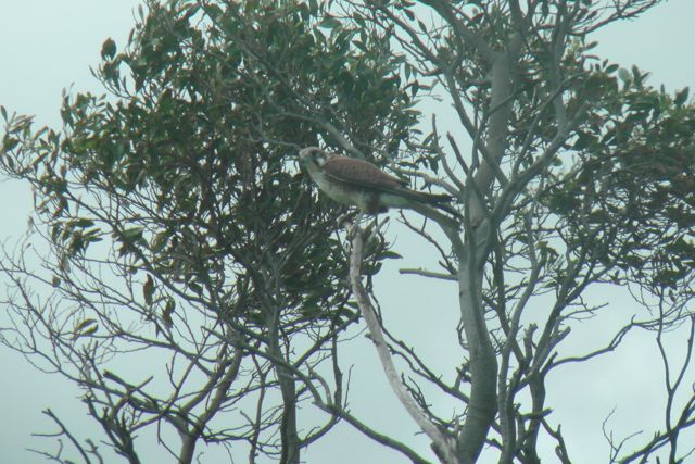
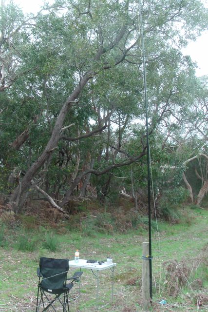
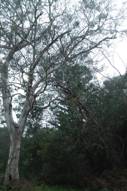
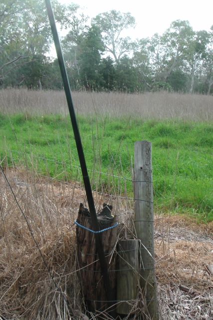
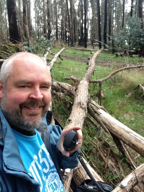
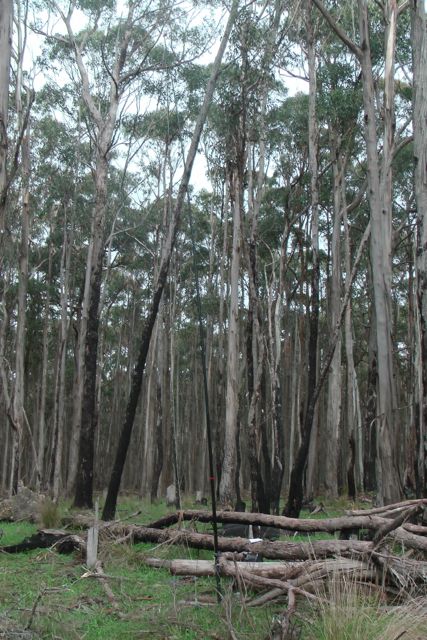
At the summit I found a nice big fallen tree which served as a seat, desk, and support for the 7m squid pole.  The stringybark, blue gum, & messmate forest was alive with birds (of the feathered variety !).  I saw and heard quite a few Kookaburras laughing away in the treetops, along with a large number of very colourful Superb Fairy wrens. In fact about 100 species of birds have been recorded in the Pyrenees.

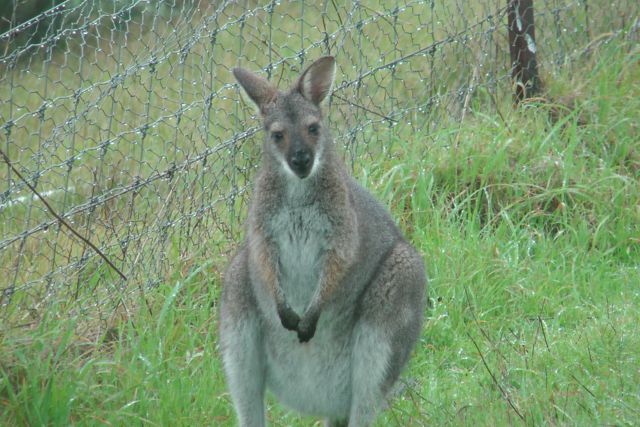
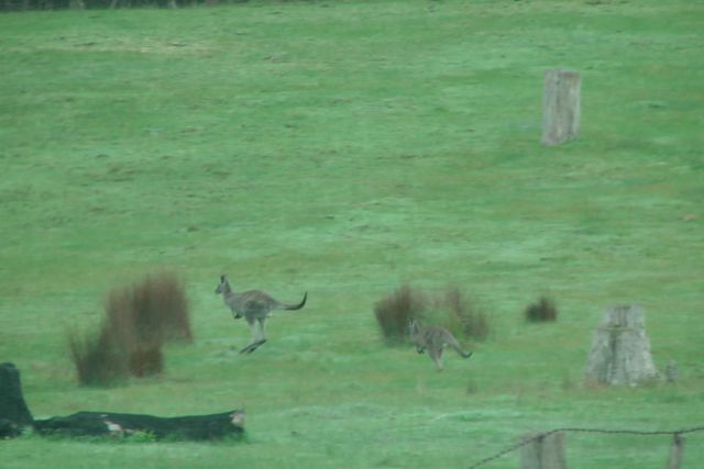
There is also a large amount of wildlife including kangaroos, wallabies, possums, and echidnas, and a variety of reptiles including legless lizards, Bearded Dragons and Goannas.

 IMGA0024_4

IMG_3458     IMGA0025_4

My first three contacts on the mountain, were ‘Summit to Summit’ QSO’s with Andrew VK1DA and Andrew VK1NAM, who were doing a dual activation on Pheasant Hill, VK1/ AC-021.  Signal reports of 5/8 were exchanged both ways.  Next was Ed VK2JI who was on the top of Canoelands Ridge, VK2/ SY-001 with a good strong 5/8 signal.  I then QSY’d to 7.100 and put out a SOTA call, and was swamped by Chasers.  My fourth qualifying contact was with Colin VK3UBY in Mildura who had his normal booming signal.

I had a few QRP callers including Andrew VK3ARR, Brent VK2MEV, and Mitch VK3FMDV.  All of whom had very nice signals.

Prior to the UTC rollover I also spoke with Al VK1RX who was on South Black Range, VK2/ ST-006.  Al had a good strong 5/8 signal, with a 5/9 report received from Al.

My first QSO after the UTC rollover was with Peter VK3YE who was pedestrian mobile on the beach near Melbourne, using his hand held magnetic loop antenna.  Peter was a good 5/5 signal, with 5/6 being received in return.

I then spoke with Marshall VK3MRG who was portable on Bill Head, VK3/ VN-004, and this was followed by Peter VK3PF who was on top of Dijbalara/Asses Ears, VK3/ VW-011, in the Grampians National Park.

A few QSO’s later I managed another ‘Summit to Summit’ QSO, this time with Ed VK2JI, who was portable on VK2/ SY-001, and then Al VK1RX on VK2/ ST-006, and then Andrew VK1DA and VK1NAM who were both portable on VK1/ AC-021.  It was great to bag a few more Summit to Summits.

Again I had a number of good QRP contacts with Tony VK3CAT using just 1 watt, Bernard VK3AMB, John VK5NJ, and Greg VK2FGJW in the Blue Mountains on just 5 watts.  Again, all just as easy to copy as those calling in running 400 watts.

I ended up with a total of 56 QSO’s after about 90 minutes on the summit.

The following stations were worked before the UTC rollover:-

Andrew VK1DA/p; Andrew VK1NAM/p; Ed VK2JI/p; Colin VK3UBY; Ron VK3AFW; David VK5KC; Rhett VK3GHZ; Larry VK5LY, Shaun VK5FAKV; Tim VK5AV; Mark VK1MDC; Tony VK3CAT; Andrew VK3ARR.qrp; Grent VK2MEV/qrp; Matt VK1MA; Glen VK3YY; Peter VK1IRC; Peter VK3FPSR/m’ David VK5LSB; Al VK1RX/p; Tony VK5ZAI; Mark VK3PI; Owen VK7OR; Fred VK3JM; Andy VK5LA; and Mitch VK3FMDV.

The following stations were worked after the UTC rollover:-

Peter VK3YE/pm; Marshall VK3MRG/p; Peter VK3PF; Larry VK5LY; Andy VK5LA; Ron VK3AFW; Rhett VK3GHZ; Ed VK2JI/p; Dale VK5FSCK; Al VK1RX/p; Andrew VK1DA/p; Andrew VK1NAM/p; Michelle VK3FEAT/p; Tony VK3CAT/qrp; Matt VK1MA; Colin VK3UBY; Mark VK1MDC; Fred VK3JM; Mike VK3XL; Bernard VK3AMB/qrp; David VK5LSB; Tim VK5AV; Mark VK3PI; Grant VK3HP; Brian VK3MCD/p; Jeff VK5JK; Ivan VK5HS; Grant VK5VGC; John VK5NJ/qrp; and Greg VK2FGJW/qrp.

I have posted a video on You Tube of this activation.

One Tree Hill, VK3/ VS-036

My final SOTA activation for Saturday 7th September, 2013, was One Tree Hill, VK3/ VS-036, which is situated just to the north west of Ararat in western Victoria, about 205 km west of Melbourne.  It was about a 90 minute drive to Ararat from Mount Rouse.  The summit is 569 metres above sea level and is worth 2 SOTA points.

Ararat is one of favourite towns in western Victoria.  It is a former gold-mining town, situated within a rich pastoral, wine and fruit growing district between Stawell and Beaufort.   Ararat’s main street is a typical wide and attractive country town main street.  A number of elaborate and historical buildings grace the streets of the town, including the Town Hall and Shire Hall in Barkly Street, both built in the late 1800s. Other places of historical interest include the Gum San Chinese Heritage Centre, the Langi Morgala Museum located in the former wool store, and J Ward, which originally served as the Ararat County Gaol until 1887 when it was then turned into an institution for the criminally insane, and Aradale Mental Hospital.

IMGA0107_2      IMGA0108_2

IMGA0114_2      IMGA0007_4

Europeans first settled in the Grampians region in the 1840s after surveyor Thomas Mitchell passed through the area in 1836. In 1841, Horatio Wills, on his way to selecting country further south, wrote in his diary, “like the Ark we rested” and named a nearby hill Mt Ararat.  It is from this entry and the nearby Mount that the town takes its name. The Post Office opened 1 February 1856 although known as Cathcart until 31 August 1857.

In 1857, a party of Chinese miners en route to the Central Victorian gold fields struck gold at the Canton Lead which marked the beginning of great growth in Ararat.

One Tree Hill was an easy summit to access, as there is a bitumen road going all the way to the top, to the Pioneer Lookout.  Surprisingly enough this road is called One Tree Hill Road !  Fancy that !  At the end of the bitumen there is a large parking area for the lookout which overlooks Ararat.  The actual summit is a bit further on from this parking area.  There is a dirt track called One Tree Hill Track, which takes you further to the north and the location of the actual summit, which is amongst the scrub on the western side of the track.  The track is rough in parts but is passable with care in a 2wd.

One Tree Hill

The summit is located within the Ararat Regional Park, which is made up of three separate, easily accessible blocks.  The Ararat Hills block (820 hectares) boasts panoramic views from Pioneer Lookout and a rich gold mining history, the Dunneworthy block (2,670 hectares) is made up of gentle terrain to the north, and Bradys Block (180 hectares) is a rich ironbark forest in the Norval-Cathcart area.

IMGA0082_2

The park can also be easily explored on foot or bicycle on the extensive network of tracks.

The park contains over 200 native plant species including 34 species of delicately flowered orchids.  Eucalypt trees dominate the vegetation, with Red Stringybark and Long-leaf Box predominant in the hilly areas and Yellow Gum and Yellow Box occupying the flats.  On the park’s main ridge at One Tree Hill, a stand of very old, large Messmate Stringybark trees are of botanical interest.  In spring time, flowers of the Golden Wattle swathe the hills in gold.

A large amount of wildlife can be found in the park including Grey Kangaroos, Swamp Wallabies, echidnas, Brush-tailed Possums and Sugar Gliders.

Birdlife includes rowdy flocks of Sulphur-crested Cockatoos, beautiful Rainbow Birds, Long-billed Corellas and Galahs, the majestic Wedge-tailed Eagle and the ground feeding Common Bronzewing and Red-rumped Parrot.

Prior to European settlement, the Ararat region was occupied by Aboriginal people of Parn Balug clan. This was one of over 40 clans comprising the Djab Wurrung language group whose territory covered a large part of south-west Victoria, including portions of the Grampians.

With the arrival of the first squatters and their flocks in the early 1840s, the Parn Balug’s traditional lifestyle, social and cultural structures were affected by disease and conflict and their numbers rapidly declined.  Gold was discovered at Ararat in 1857. The park contains relics of gold mining activity including shallow mine shafts, a mining dam and water races.

From the lookout there are spectacular views to the east over the town of Ararat, and out to the west.  There are great views of the Grampians, Mount Langi Ghiran, and Mount Cole.  This area is cleared of trees which assists with the views.  As you travel down One Tree Hill Track, the view to the east and west is obscured a lot more by trees and scrub.

IMGA0084_2     IMGA0086_2

I parked the car at the lookout and walked down the track to the operating position within the Activation zone.  There are plenty of options for securing the dipole, as there are large gum trees all over the summit.  Not really sure why it is called One Tree Hill, as the summit is completely covered in trees ?

IMGA0087_2     IMGA0088_2

I started off on 40m first, on the usual frequency of 7.090, and it wasn’t long before I had the usual hungry SOTA hunters.  I had a handful of qrp callers again including Andrew VK2ONZ, Andrew VK1NAM, Mark VK5QI/m, and Andrew VK3ARR.  All had very nice signals.  Conditions appeared to be very good on 40m.  The only annoyance was the Over The Horizon Radar which was quite strong.

I was only 5 minute drive from the motel, so I decided to have a ‘play’ on 20m.  I started calling CQ SOTA on 14.170 but was soon drowned out by some Russian stations, so I decided to tune around the band.  I heard my good friend Dick, G4ICP who was portable in the salt marshes with his ‘roach pole’  Dick was not all that strong but I decided to give him a call, and surprisingly enough Dick came back to me.  We were having a good chat until a VK & a G station decided to come up just 2 kc away, and that was the end of that.

I then worked into Spain and England again, and then decided to call CQ again.  Luke KK7XX came back to my call and after an enjoyable QSO with him, Luke offered to put me on the cluster, which resulted in me working another very good mate of mine in the UK, Phil 2E0UDX.  He was a good 5/8 and Phil gave me a 5/4 back with my 5 watts.  This was followed by another good mate of mine calling in, Marnix OP7M in Belgium.  Marnix was an excellent 5/9 signal.  Although Marnix was struggling a bit and reading me just 4/4, we still had a good chat.  This was followed by calls from Tony CT1FFB in Portugal; Jos using a special call of OO4ATK in Belgium; Bert DB6ZU in Germany; Mike GW4XSX in Wales; Curtis KP4EJ in Puerto Rico.  My last two contacts for the afternoon on 20m were with Masa JR5JAQ in Japan; and Steve VK4KUS.

The sun was setting and it was time to pack up my gear and head for the motel, for some dinner and a few beers and some rest before tomorrow’s activations.

IMGA0090_2

After nearly 2 hours on the summit, I had worked 37 stations, including 12 DX stations in Europe, the UK, Puerto Rico, and Japan.

The following stations were worked on 40m SSB:-

Brad VK2HAV; Col VK5HCF; Peter VK3PF/m; Mark VK3DEE; David VK7XT; Rhett VK3GHZ; Bill VK3LY; Peter VK3FPSR; Mark VK3PI; Ed VK2JI; Dale VK5FSCK; Al VK1RX; Darren VK2NNN; Andrew VK2ONZ/qrp; Rod VK5FTTC; Tim VK5AV; Andrew VK1NAM/qrp; Brian VK3MCD; Bernard VK3AMB;  Fred VK3JM; Marshall VK3MRG; Tony VK3CAT; Mark VK5QI/m/qrp; & Andrew VK3ARR/qrp.

The following stations were worked on 20m SSB:-

Dick G4ICP/p; EA2DT; Chris G0UNJ; Luke KK7XX; Phil 2E0UDX; Marnix OP7M; Tony CT1FFB; Jos OO4ATK; DB6ZU; GW4XSX; Curtis KP4EJ; JR5JAQ; and Steve VK4KUS.

I have placed a video on You Tube of this activation.

Mount Rouse, VK3/ VS-048

My second summit of the Saturday was Mount Rouse, VK3/ VS-048, which is situated near the little town of Penshurst, and about 275 km west of Melbourne.  Penshurst is just a small town with a population of about 500 people, and is the centre of a large dairying, agricultural and pastoral district.  The town is situated near the foot of Mount Rouse, which is an extinct volcanoe.  It was about a 35 km drive from my previous activation at Mt Napier.

Mount Rouse was named after the Colonial Under Secretary of New South Wales.  The summit was known as ‘Collorer‘ by the local Nareeb Nareeb and Kolor Aborigines.  The local aboriginal tribes gathered food from the local area and fresh water from nearby natural springs and creeks.  The Kolor aboriginals built substantial huts for their shelter in the winter, preferring the open countryside in the warmer months.

The famous explorer, Major Thomas Mitchell, who sighted Mount Rouse during his ‘Australia Felix‘ expedition of 1837, also encountered two of the aforementioned dwellings which he described as ‘two very substantial huts‘. On a rainy day he expressed a desire to ‘return if possible, to pass the night there, for I began to learn that such huts, with a good fire between them, made comfortable quarters in bad weather.’ From atop Mount Napier he noted: ‘Smoke arose from many parts of the lower country, and showed that the inhabitants were very generally scattered over its surface. We could now look on such fires with indifference, so harmless were these natives, compared with those of the Darling, and the smoke, now ascended in equal abundance from the furthest verge of the horizon.’

220px-Thomas_Mitchell

A man called John Cox was the first settler to take up land at Mount Rouse, and he established a sheep station by 1840.  There were also others that held leases on land in the surrounding district, and the local aboriginals soon found their food sources destroyed or driven out by clearing and the introduction of European stock.  During times of necessity they turned to the Europeans stock for food.  As a result they found themselves subject to retaliatory raids by white landowners and there were numerous episodes of killing and bloodshed.

Due to the decline in the Aboriginal population the New South Wales Government established a number of reservations.  Mount Rouse was chosen as one of those.  As a result John Cox was forced to remove his stock from the land and an Aboriginal Protectorate was opened.  Despite this, conflict continued and diseases introduced into Australia by Europeans ravaged the indigenous peoples. Thus, within a few years, the Aboriginal population was so diminished that the reserve closed.

Mount Rouse is a massive accumulation of scoria rising 100 m above the surrounding volcanic plain.  It is worth 1 SOTA point.  It is built mainly of red and brown scoria with thin interbedded basalt lava flows. The scoria forms an arcuate mound opening towards the south-west and giving the appearance of a breached cone.  To the south of the main scoria cone is a deep circular crater with a small lake and a smaller shallow crater rimmed with basalt.  The scoria is the youngest element of an eruption point that produced the longest lava flows known in the Newer Volcanics Province in Victoria.  The flows followed shallow, gently sloping river courses and eventually united to extend at least 60 km south of Mount Rouse. A thin basalt lava flow contained in the scoria cone has been dated at approximately 1.8 million years, conflicting with dates of only 0.3 to 0.45 million years obtained from the end of the Mount Rouse flows near Port Fairy 60 km to the south. The scoria cone is the highest relief in the area and is an important vantage point to view the lavas and adjacent volcanoes of Mount Eccles and Mount Napier.

Unfortunately quarrying has removed a significant portion of the scoria and has left large pits that visiually detract from the overall beauty of the summit.  Tree planting has obscured some of the geological features, such as the crater within the big scoria cone.

Upon arrival at the summit it was very wet.  The weather was really threatening with regular showers which at times were quite heavy.  But fortunately I did not have to walk far to get to the summit, and retreat back to the car if required.  I put on the back pack and I then walked up the stairs to the summit, and set up my gear in a hurry to try to avoid the weather.

Initially the summit was completely fogged in and I really couldn’t see any views at all.  But the weather slowyl cleared a little bit and was able to see the little town of Penshurst just below the summit.  Whilst I set up the gear I was carefully watched by 2 little euros (wallabies) who appeared to be very tame, and quite often came up within only 5 metres.

IMGA0048_3      IMGA0051_3

There is a communications tower at the summit and also a fire spotting tower.  I was a little concerned with the towers and the possibility of noise, but once I had turned the radio on I was pleasantly surprised.  The noise floor was very low.  There was a strategically placed wooden bench on the summit in close proximity to the trig point and this was obviously the pick of the operating positions.  Not only did I use the bench to sit on, but I also attached the 7m squid pole to the bench using some octopus straps.

IMGA0063_3     IMGA0055_3

My first contact on the summit was with Col VK5HCF who had his usual strong qrp signal, and this was followed by Peter VK3PF who was mobile.  My 3rd contact of the summit was a ‘Summit to Summit’ QSO with Glen VK3YY who was portable on Federation Range.  By contacting Glen I had tipped over the 250 point mark for the Summit to Summit certificate.  My 4th qualifying QSO was with Andy VK5LA in the SA Riverland with a very strong 5/9 signal.

It was about this point that the showers started to get a bit heavier, so I grabbed the bothy bag and climbed inside to stay dry.

IMGA0056_3

Due to the weather I only stayed on the summit for 30 minutes, but in that time I managed 16 QSO’s on 40m SSB into VK1, VK2, VK3, & VK5.  Only 2 qrp stations called in this time around.  Andrew VK3ARR who was becoming a regular qrp caller (5/4 sent and 5/5 received), and Andrew VK2UH who was qrp with just 5 watts (5/8 both ways).

The following stations were worked:-

Col VK5HCF; Peter Vk3PF/m; Glen VK3YY/p; Andy VK5LA; Matt VK1MA/m; Tony VK3CAT; Tim VK5AV; Warren VK3BYD; ANdrew VK3ARR/qrp; Bernard VK3AMB; Peter VK3FPSR; Rhett VK3GHZ; ANdrew VK2UH/qrp; Ron VK3AFW; Brian VK3MCD; and Mark VK7FMPR.

I have posted a video of this activation on You Tube.

Mount Napier, VK3/ VS-046

My first Victorian summit of the trip was Mount Napier, VK3/ VS-046.

After my 2 night stay at Mount Gambier, on Saturday 7th September, 2013, I headed over the Victorian border along the Princes Highway towards Heywood.  I then headed towards MacArthur and north along the Hamilton-Port Fairy Road.  It was about a 2 hour drive from Mount Gambier.

Mount Napier summit is located within the Mount Napier State Park, and is located about 270 km west of Melbourne, and about 17 km south of Hamilton.  Mount Napier is one of the youngest volcanoes in Australia, which erupted about 32,000 years ago.  The Mount Napier State Park consists of about 2,800 hectares, and along with nearby Mt Eccles, is the largest natural area on the volcanic plains of western Victoria.  Mount Napier State Park was first reserved for public purposes in 1921 and covered an area of about 139 hectares, including the summit and part of the Manna gum woodland.  This area together with adjacent public land was reserved as a State Park in 1987.

IMGA0010_3      IMGA0015_3

Mount Napier was climbed and named by explorer, Major Thomas Mitchell in 1836, during his expedition through ‘Australia Felix’.

220px-Thomas_Mitchell

mitchell-map

Mount Napier has a composite lava shield with a superimposed scoria cone.  The cone rises 500 feet (150 m) above the surrounding plains to an elevation of 1,440 feet (440 m), making it the highest point on the Western District Plains of Victoria.  Mount Napier is part of the Newer Volcanics Province, which is the youngest volcanic centre in Australia.  The Newer Volcanics Province covers an area of 6,000 square miles (15,000 square km) and contains over 400 vents.

The Mount Napier Lava Flow followed the Harman Valley west from the volcano, and then south towards nearby Mount Eccles which is 25 km south-west of Mount Napier.   Lava blisters or tumuli occur along the flow, and these are house-sized mounds of basalt rocks.  The blisters are the best developed in Australia and uncommon in the rest of the world.  They are formed by the pressure of liquid lava pushing up against the crust.   Several caves and lava tubes can also be found at nearby Byaduk.

MtNapier_Geol_Map

The native vegetation of Mount Napier State Park, on the western side of the mountain, varies from grassy woodland to tall open forest dominated by Manna Gum, Blackwood, Austral Bracken, and Common Tussock Grass.  This hosts a variety of native fauna, including birds, marsupials and mammals, including bats.

The park’s fauna is diverse, with 27 native mammal and 127 native bird species recorded including kangaroos, koalas, Common Brushtail possums, and the endangered Eastern Barred Bandicoot.

I parked the car at the base of the summit, and walked the remaining 3 km along a very good track to the summit, which took me about 30 minutes.  There are 2 benches along the way should you require a rest, which is exactly what I did.  I sat back and took in the tranquility of the park and admired the views.  The weather was a bit threatening, but at least I had the bothy bag in my backpack.

IMGA0024_3     IMGA0025_3

After reaching the summit I took another breather and admired the views in all directions.  There is a memorial cairn and plaque at the top to commemorate Major Thomas Mitchell who climbed and named the hill, way back in 1836.  There is also a trig point.

IMGA0034_3     IMGA0030_3

The weather was getting worse, and it was quite windy with very light showers, so I attached the 7m squid pole to the trig point and ran the coax over to the concrete and stone cairn and tried to hide behind that from the weather, with some degree of success.  I weighted down the ends of the dipole with some rocks that I found on the summit.  There are no trees.

IMGA0028_3

My first 4 qualifying QSO’s were with Larry VK5LY, Ron VK3AFW, Tony VK3CAT running qrp, and Marshall VK3MRG/p.  This was followed by a constant flow of the regular SOTA chasers.  My 8th contact on the hill was with John VK5BJE who was portable in the Litte Desert National Park in western Victoria, as part of the Keith Roget Memorial National Parks Award.  This was a park I was scheduled to activate the following Tuesday.  John had a terrific strong 5/9 signal.

Whilst on the hill I managed 3 ‘Summit to Summit’ contacts’ with Peter VK3PF who was portable on VK3/ VG-064; Brian VK3MCD who was portable near Boroka Lookout VK3/ VW-007; and Allen VK3HRA who was portable on Galore Hill VK2/ RI-047.  This was my first ever Summit to Summit with a VK2 activator.

I stayed on the summit for about 45 minutes, but the weather was getting worse, with heavier showers, so I decided it was time to head down and back to the warmth of the car.  I ended up with 36 QSO’s on 40m SSB.

The following stations were worked:- Larry VK5LY; Ron VK3AFW; Tony VK3CAT/qrp; Marshall VK3MRG/p; Bernard VK3AMB/qrp; Ian VK5IS/qrp; Peter VK3FPSR; John VK5BJE/p; ANdrew VK2UH/qrp; Peter VK3PF/qrp; Brian VK3MCD/p; John VK5NJ/qrp; Glen VK3YY/m; Andrew VK2ONZ; Rod VK5FTTC; ANdrew VK3ARR/qrp; Mark VK3PI; Matt VK1MA; Colin VK3UBY; Mark VK1MDC; Andy VK5LA; Mark VK3DEE; VK3TKK; Ed VK2JI; Lou VK3ALB; VK3FMPB; Warren VK3BYD; Greg VK2FGJWp//qrp; Andrew VK1NAM; David VK5NQP; Allen VK3HRA/p; Terry VK5ATN; Tim VK5AV; Dave VK2JDS; Dave VK3VCE; and John VK5DJ.

I have added a video to You Tube of this activation.

Talk to South East Radio Group

On Friday evening, 6th September, 2013, I delivered a presentation to the South East Radio Group (SERG) on:-

  • Summits on the Air
  • VK5 National & Conservation Parks Award
  • Keith Roget Memorial National & Conservation Parks Award
  • World Wide Flora & Fauna.

Unknown-1

About 15 guys from SA & Victoria were in attendance at the SERG clubrooms.

Thanks to Col VK5HCF who facilitated my attendance.  It was great to catch up with a lot of the fellas and meet them in person.


Carpenter Rocks Conservation Park

My last activation for Friday was the Carpenter Rocks Conservation Park which is located on the Lower South East coast, approximately 40 kilometres south-west of Mount Gambier, and 452 km SE of Adelaide.  The park conserves unique coastal habitat in the Lower South East and protect important flora and fauna species, including some of national and international significance.

Carpenter Rocks Conservation Park protects 30.5 hectares of coastal habitat, which was purchased with the assistance of the Australian Government’s Natural Heritage Trust.   A number of threatened species and plant communities are conserved within the park.  The park protects part of the only known population of Carpenter Rocks Manna Gum and provides significant roosting habitat for the Orange-bellied Parrot, which is critically endangered at a national level.

IMGA0109     IMGA0103

The land comprising the reserve is significant for the local Aboriginal Boandik people, with one site of significance located in Carpenter Rocks Conservation Park and another two sites within close proximity.

Carpenter Rocks Conservation Park was proclaimed on 6 September 2001 under the National Parks and Wildlife Act 1972 with a section 43 proclamation providing for existing and future rights for exploration and mining under the Petroleum Act 2000.  The South Australian Government purchased the land with the assistance of the Australian Government through the National Reserve System Program of the Natural Heritage Trust and a contribution from the Nature Foundation SA Inc.

IMGA0113     IMGA0115

To access the park you need to travel along Carpenter Rocks Road, into the little seaside township of Carpenter Rocks.  Then turn left onto Pelican Point Road and travel south east.  You will find a small clearance in the scrub a short distance down on the left, and this is where you enter the park.  You will drive into a small clearing and this is where the park sign is located.  There is a track which then follows a dog leg around to the left and follows the power lines through the park.

Carpenter Rocks map

Carpenter Rocks is a small coastal ton which faces the Southern Ocean and is renowned for its rugged coastline which provides exceptional fishing and diving locations.  Carpenter Rocks supports a significant southern rock lobster industry and Bucks Bay provides a safe haven for the many fishing boats moored there.

Lieutenant James Grant, when on board the HMS Lady Nelson, was the first known British person to view land known today as south eastern South Australia.   On 3 December 1800, he sighted what at first he thought was four unconnected islands, but on a closer look realized they were two mountains and two capes.  One of these he named Cape Banks, just west of today’s township, after English Botanist  Joseph Banks.

On 4 April 1802 the French explorer Nicholas Baudin aboard the ship Geographe noticed the area and made the observation:

“Along the beach we could make out a continuos line of rocks which stretched a little way out to sea and over which the breakers pounded with extraordinary force.  This was the cause of the incessant noise which we could hear”.

The origin of the name is not clear.  There is some suggestion that it was named after Dutch explorer, Captain Pierter Carpentier.  It is also suggested that it was originally called ‘Les Carpentiers’ by Baudin, alluding to their indented and serrated nature, which reminded Baudin of a carpenters saw.

I set up a few hundred metres down the track in a clearing.  The scrub in the park is very very thick, and there are not too many positions to put up a dipole.  I set up my fold up table & deck chair and strapped the 7m squid pole to a shrub and stretched out the legs of the dipole, tying them to shrubs.

  IMGA0110      IMGA0112

My first contact from the Carpenter Rocks CP was another ‘park to Park’ contact with Larry VK5LY who was operating from the Danggali Conservation Park.  Larry had a great 5/8 signal.  I also managed a SOTA contact with Allen VK3HRA who was on the top of Mount Ida, VK3/ VU-009 (5/8 signal reports both ways).

After about 40 minutes in the park it was time to pack up, and head back to Mount Gambier for my presentation to the South East Radio Group.

The following stations were worked:-

Larry VK5LY/p; Ian VK5CZ; Col VK5HCF; Colin VK3UBY; Tony VK3CAT; Bernard VK3AMB; John VK5DJ; Tony VK5ZAI; Graham VK5KGP; John VK2FALL; Greg VK3UT; Wayne VK2PDW; Ivan VK5HS/m; and Allen VK3HRA/p.

Canunda National Park

My second activation for Friday 6th September, 2013, was the Canunda National Park, which is situated about 18 km north west of Millicent and about 430 km south east of Adelaide.

Canunda NP which comprises about 9,300 hectares, stretches from Cape Buffon outside the tonwship of Southend, to Cape Banks near the southern end of Lake Bonney.  The park originated from the Cape Buffon Flora and Fauna Reserve, a 22 hectare reserve dedicated in 1959 at the request of local residents to conserve native vegetation and the variety of bird species.  The reserve was extended and renamed Canunda National Park in 1966.  Since then, more land has been added to bring the park to its present size.

The park has a spectacular coastline with cliffs and long stretched of surf beaches.  It features a diversity of coastal habitats, and offers great opportunities to enjoy bushwalking, observe birdlife, fishing, surfing, or snorkelling.  The northern section of the park is characterised by limestone cliffs, sea stacks, offshore reefs and low dense scrub, whereas the southern section is dominated by mobile sand dunes and stretches of beach which are backed by low foredunes.

The 40km coastline offers great fishing opportunities. Depending on the season and ocean conditions, mulloway, salmon, sharks or rays may tempt a bite. Try your luck off the rocks where sweep, abalone and crayfish may be caught.

Four-wheel driving is possible along the full length of the park by following the marker posts through the dunes and along Geltwood Beach.

IMGA0092      IMGA0096

A variety of wildlife can be found in the park including western grey kangaroos, echidnas, wombats and emus.  The park provides an important winter refuge and feeding area for the endangered orange-bellied parrot.  The rare and secretive swamp antechinus also occurs in areas of dense wetland vegetation in the park.

Evidence of the Aboriginal Boandik people, who once lived in temporary camps along the coast, can be seen throughout the park.  Middens or shell heaps are scattered throughout the park.  These were left by members of the Bunganditj (Bo-an-dik) Aboriginal group who once lived in temporary camps along the coast during summer, and for the rest of the year lived near inland swamps in relatively permanent huts (wurlas).

In 1845 Captain Emmanuel Underwood established a store and jetty at the southern end of Rivoli Bay, now called Southbend.  This was to cater for inland settlers and passing ships.  The following year the town was surveyed and named Greytown after the Governor of South Australia, Sir George Grey.  In 1851 a Scotsman named Peter Brigg took out a 104 square km lease on land incorporating most of what is now Canunda National Park.  He named it Canoonda, thought to be the Aboriginal name for the swamp at the northern end of Lake Bonney.  The Canoonda property was divided into three smaller leases in 1864, which changed ownership  number of times up until the area was dedicated a National Park in 1966.  Sheep grazing andf stock movement, wattle bark stripping and the cutting of sheaok for firewood, together with the effects of rabbits after the 1800’s, undoubtedly altered the natural vegetation of the park.   In addition the introduction of foxes and feral cats would have reduced many pop

I accessed the park via Millicent, which is one of three main entry points to the park.  The others being at Southend and Carpenter Rocks.  I travelled west on Canunda Causeway and entered the park.  I drove a little further south of Oil Rig Square to a parking and camping area near Geltwood Beach.  I found a nice wooden table with benches and set up the gear here.  Whilst setting up I had an inquisitive emu watching activities for a very short time, but unfortunately he/she was camera shy and didn’t want to hang around.

IMGA0086

My first contact was with Tony VK5ZAI from Kingston, and this was followed by another south east resident John VK5DJ.  I also managed another SA ‘Park to Park’ QSO with Larry VK5LY who was portable in the Danggali Conservation Park.  I also spoke with Terry VK3UP who was portable in the Greater Bendigo National Park as part of the Keith Roget Memorial National Parks Award.

IMGA0089

Conditions on 40m were very good throughout VK5 and into Victoria.  Weatherwise it was cloudy with the occasional very light shower.

After about 40 minutes, I decided it was time to pack up, and head off to my next activation at the Carpenter Rocks Conservation Park.  But before I did that I went for a walk down to Geltwood Beach and admired the pounding seas which I could hear from my radio operating position.  I noted that despite the day being a little inclement, that spring was in the air.  The gums, wattles, and other native plants were all in flower.

 IMGA0093     IMGA0100

I had 17 QSO’s on 40m SSB into VK1, VK3, VK5, & VK7.

The following stations were worked:-

Tony VK5ZAI; John VK5DJ; Larry VK5LY/p; Geoff VK3AHT; Terry VK3UP/p; Ron VK3AFW; Tony VK3CAT/p; Bernard VK3AMB; Peter VK3TKK; Peter VK3PF/m; Colin VK3UBY; Col VK5HCF; Gary VK5ZK; Matt VK1MA/m; Dave VK3VCE; Mark VK7FMPR; and Peter VK5NAQ.

Mount Burr, VK5/ SE-019

My first summit of the trip was Mount Burr, VK5/ SE-019, which is about 240 metres ASL (787 feet) and is worth 1 SOTA point.

After a hearty cooked breakfast and a strong coffee, I left the motel at Mount Gambier, early on Friday morning, 6th September, 2013, and headed out north west along the Princes Highway, towards Millicent.  I then turned right onto The Springs Road, to head north towards the town of Glencoe.  The summit was clearly visible, shrouded in a bit of fog.

IMGA0005_2

Before reaching the town of Glencoe I turned left onto Diagonal Road and continued west on Mile Hill Road.  I then turned right onto the Glencoe-Mount Burr Road.  There is then a dirt road on the left, with a TV tower sign.  This is the required road to access the summit.  A few kms up this road is the turn off on the left to the summit.  It is well sign posted.

On the way to the summit I stopped off at the historical marker for the old Mount Burr Bush Inn, which is located on the western side of the Glencoe-Mount Burr Road.  This little pub was a licenced hotel on the Overland track, and was built in 1852, and remained standing until 1873.  In days gone by it was a significant watering hole for mail coach drivers and the general public travelling between Robe and Mt Gambier.  It was actually the last stop between Kangaroo Inn and Mt Gambier on the old stock route.  It was very popular during the gold rush years but wasnt frequented by the Chineses on route to the Victorian gold fields as it was a licensed Pub.  Being illegal immigrants they didnt want to risk being caught by Government officials so they built Wells off of the main route.

IMGA0013_2

On the way to the summit I drove passed the Mount Burr Forest Reserve, and saw quite a few emus and kangaroos on the move.  The Mount Burr Forest consists of 8 individual forest reserves with a total area of about 1,323 hectares.  The reserves contain the threatened mammal species, Southern Brown Bandicoot, Suger Glider, and Red-necked Wallaby.

IMGA0015_2

The Mount Burr summit shares its name with the nearby small town of Mount Burr, which is about 12 km east of Millicent, and about 50 km north east of Mount Gambier.  Mount Burr has a small population of about 400 people.  Mount Burr was once a thriving country town, which was home to a large timber mill.  The mill was the first of its kind in the region, built in 1931.  It was considered a turning point for industry on the Limestone Coast.  Unfortunately in late 2000 the timber mill closed leaving many employees unemployed.

IMGA0059_2      IMGA0060_2

Mount Burr summit is one of fifteen extinct volcanoes on the Limestone Coast.  The mountain was named by the Governor of South Australia George Grey (photo below), after George Dominicus Burr, a surveyor and Professor of Mathematics at Sandhurst Military College.  His son, Thomas Burr, a surveyor, accompanied Governor Grey on the expedition in 1844.

Muller Collection - Sir George Grey

Quoted from the account of the expedition published in the Journal of the Royal Geographical Society of London, vol 15, 1845: “Article III.- Account of Governor G Grey’s Exploratory Journey along the South-Eastern Sea-board of South Australia. By Mr Thos. Burr, Dep Surv.-Gen.” “7 May 1844: At about 2pm we made the top of a range, the principal summit of which his Excellency has done me the honour to call after my father. The Mount Burr range is about 1600 feet above the level of the sea…

The summit is home to the SES 8 television transmitter, which is responsible for transmitting WIN, Seven SA, Ten SA, SBS, and ABC to households across the South East of SA and Western Victoria.  When I saw all the towers, the first thing that went through my mine was ….HIGH noise floor.

IMGA0021_2

There is an unlocked gate at the entrance to the summit, with a sign on it reading ‘Mt Burr Forest.  Gate: MB28.  Gri: 542 383″.  It is a very short drive from there to the locked compound containing all of the towers.  There is another unlocked gate which will take you around to the eastern side of the summit.  There were some sheep and alpacas in this paddock, so if you enter here, please shut the gate/s.

There are no real views out to the east due to the pine forest.  The only views are out to the south west, and these are also obscured due to the pine forests.  I set up on the eastern side of the summit near the pine forest.  There was a large amount of metal pieces of tower lying around on the ground, and I used these to attach the 7m squid pole to, and also to secure down the legs of the 40m/20m linked dipole.  And importantly, also as a seat !

IMGA0024_2

I had reached the summit and set up by about 9.10 a.m. so I had about 20 minutes to play before the UTC roll over.  Surprisingly enough after I turned on the radio I found that the noise floor was very low despite all the antennas on the summit.  I was really happy with this !  My first 4 qualifying QSO’s were with Matt VK1MA, Peter VK3PF using qrp, Col VK5HCF also using qrp, and Mitch VK3FMDV.  I worked 23 stations before the UTC rollover.  This included John VK5BJE who was portable in the Mullinger Swamp Conservation Park, north east of Narracoorte.

IMGA0025_2

The new UTC day then clicked over and I worked a further 25 stations.  This included John VK5BJE again in the Mullinger Swamp CP, and Larry VK5LY who was portable in the Danggali Conservation Park.  I also managed two ‘Summit to Summit’ QSO’s with Ian VK5CZ on Lagoon Hill VK5/ SE-008; and Wayne VK3WAM on Mount Matlock VK3/ VC-001.

After about an hour on the hill I had 48 QSO’s on 40m SSB into VK1, VK2, VK3, VK5, & VK7.  Band conditions were very good.   Quite a few fellas called in whilst operating QRP.  They included Peter VK3PF, Col VK5HCF, Andrew VK3ARR, Tony VK3CAT, Rik VK3KAN, Andrew VK2ONZ, Mitch VK3FMDV, Ron VK3AFW, John VK5DJ, and Bernard VK3AMB.  All had good signals, proving that there is no need to use 400 watts when calling a SOTA activator.  If you can hear the Activator, you can almost guarantee they he/she will be able to hear you.

My last contact of the day was Bernard who was qrp with just 4 watts and was a solid 5/9.  My little 5 watts to Bernard returned a strong 5/8 signal report.  Time to head back to the car and off to the Canunda National Park.

The following stations were worked before the UTC rollover:-

Matt VK1MA; Peter VK3PF/qrp; Col VK5HCF/qrp; Mitch VK3FMDV; Tny VK3CAT/m; Rik VK3KAN/m; Greg VK7FGGT; John VK5DJ; Peter VK3FPSR; Robert VK7MGW; Colin VK3UBY; Tony VK5ZAI; Trevor VK5ATW; John VK5BJE/p; Andrew VK3ARR/qrp; Brian VK5FMID; Ed VK2JI; Allen VK3HRA; Andrew VK2ONZ; Mal VK3AZZ; Ron VK3AFW; Peter VK1XP; and Brian VK3MCD/5

The following stations were worked after the UTC roll over:-

Matt VK1MA; Brian VK5FMID; John VK5BJE/p; Tony VK3CAT; Rik VK3KAN; Peter VK3PF; Andrew VK2ONZ/qrp; Mitch VK3FMDV; Ron VK3AFW/qrp; Brian VK3MCD/5; Peter VK3FPSR; Larry VK5LY/p; VK5CZ/p; Mal VK3AZZ; John VK5DJ; Andrew VK3ARR/qrp; Ed VK2JI; VK3DYF; Colin VK3UBY; Wayne VK3WAM/p Rod VK5FTTC; Allen VK3HRA; Gary VK5ZK; Yern VK2KJJ; Bernard VK3AMB/qrp.

I have posted a video on You Tube of this activation.

Furner Conservation Park

My last activation for Friday 5th September, was the Furner Conservation Park, which was located just south of my previous action at the Reedy Creek CP.

Furner CP is situated about 4 km south east of Kangaroo Inn, and about 7 km north west of the township of Furner.  The park and the town was named after Luke Liddiard Furner who was Member for Wallaroo and Commissioner for Public Works.  The park consists of 286 hectares of gently undulating land.  The major vegetation type is messmate stringy bark with the flats in the eastern part of the park near Reedy Creek, supporting a woodland of river red gum and rough barked manna gum.  There are also areas of swamp gum on the flats.  Vegetation on the stony rises with the park includes pink gum open woodland with isolated drooping sheoaks.

The park was previously used by landholders for sheep grazing, and the park was also burnt during the devastating Ash Wednesday bushfires of 1983.

IMGA0075     IMGA0073

I accessed the park via South Eastern Road off the Princes Highway, and then turned left onto a forestry access road which bisects the pine forest and the park.  The track is fine in a 2wd vehicle with care.

As this was my last park of the day, I decided to relax a bit, and I set up my fold up table and deck chair.  The mosquitoes were out in full force and a good dose of Aerogard was required.  There is a wire fence which separates the park and the forest, so I climbed over the fence which is in poor condition and set my gear up on the table on the park border.  I attached the 7m squid pole to one of the fence posts.

IMGA0068       IMGA0074

Whilst in the park I spotted quite a few of the rare Red tailed black cockatoos.  It is estimated that there are only about 1,500 of the South Eastern species remaining in the wild.  They are spectacular birds to watch in flight with their very distinctive bright red tail.

I was hoping that John VK5BJE would pop up, as I had spoken to him on the local repeater just before I entered the park, and was aware he and wife Jenny were heading for the Naracoorte Caves National Park, South Australia’s only World Heritage site.  And sure enough, my 7th contact was with John within the park.  John had been busy travelling over SA & Victoria, activating parks, and it was great to work John in another SA park as part of the VK5 National & Conservation Parks Award.

Conditions seemed to be very good with good signal reports received from as far as Queensland, the ACT, and New South Wales.

I spent about 40 minutes in the park, before packing up and heading off to my accomodation for the night, the Country Comfort Motel, in Mount Gambier.  I ended up working 13 stations in VK1, VK2, VK3, VK4, & VK5 on 40m SSB.  A good spread around Australia.

The following stations were worked:-

Brian VK5FMID; Colin VK3UBY; John VK2FALL; Peter VK3TKK; Larry VK5LY/m; Mick VK5FMMC; John VK5BJE/p; Matt VK1MA; Colin VK4FAAS; Roy VK5NRG; Graham VK5KGP; Ron VK3AFW; and Theo VK3AP/m.

Reedy Creek Conservation Park

After activating Messent CP, I headed off for my 3rd park activation of the day, the Reedy Creek Conservation Park.  I continued south east along the Princes Highway, passing through Kingston and its famous ‘big crayfish’, and then further south east until I reached Claywells Road and then to the little settlement of Kangaroo Inn.  Don’t blink, you will miss it.

I found the southern end of the park which is on the northern side of Claywells Road, but it is pencil thin (only about 3 metres wide) and there is no access.  So I then travelled north on Jorgensons Road which follows the creekline.

Before I talk about the park, I can’t go passed mentioning some of the interesting history of the Kangaroo Inn area.  If you are going to activate Reedy CP, it is very worthwhile stopping off and having a look at the old hotel ruins, which are directly opposite the Kangaroo Inn Area School.  In its heyday during the construction of the early drains in the area, the Inn serviced traffic from every direction, and was an important stopping point along the Mail Route and bullocky Route.  The Inn, although unlicensed had a popular liquor trade, which was accompanied by its fair share of troubles (including an unsolved murder).  The main wooden door was suspended from hinges, so that it could be lowered quickly to protect the occupants in the event of trouble.  The pub closed when a new hotel opened at nearby Furner.

Also nearby is The Post Office Tree a reminder of the mail coach run to Mount Gambier. Mail was placed in a bag, and hung on a hook or branch ready for collection.  Sadly, the tree was burned by bushfires in 1983, but its charred remains still stand.

IMGA0045

IMGA0047

Going back to the Kangaroo Inn….It was built in the 1840’s using stone quarried by pick and shovel from the stony ridges on the site of the present buildings.  Once hewn into bricks with stone chippers, the stone was mortared together with a mixture of lime and sand.  The ceiling consisted of lathe and plaster and the roof slats and iron.  The bar door which was constructed of thick wood, was suspended on hinges at the top, so that it could be quickly lowered to protect the men inside the pub in the event of trouble outside. These old buildings which were built entirely by hand with local labour and none of our present-day machinery, were very strong and have in the main withstood the test of time.

IMGA0048     IMGA0051

The history of the Inn is as varied as it is long.  Originally it was a junction station built prior to the Victorian Gold Rush, and was used as a resting place for mail coach drivers and the general public travelling between Adelaide, Penola and Mt Gambier.  Settlers from Guichen Bay and coaches run by Cobb & Co. would stop at the Kangaroo Inn to refresh, and rest both horses and people.  Back then, it was a 30 mile journey which took about one entire day, before the next inn was reached.  If travelling to Penola, this was Payne’s Inn; Mount Gambier,  the Mt Burr Hotel; or Adelaide, the Telegraph Inn.

Very few Chinese en route for the Victorian Goldfields ever stopped at these inns, as many were illegal immigrants, and frightened of being apprehended by government officials.  Rather, they would build wells, situated well off the worn route.  Some of these are still landmarks in the district today.

Although it was unlicensed, Kangaroo Inn had a popular liquor trade, which in turn brought the district its fair share of troubles.  Once, whilst the Reedy Creek Drain was being excavated by hand, a murder was committed.  After a drunken brawl at the Inn between a Furner resident and a manual labourer working on the drain, the worker was found dead between Kangaroo and “Paynes” Inn.  The case remained unsolved, and even today it is a matter of speculation as to who was the killer — the Furner resident or the local aborigines.

In 1878, the proprietors of the Inn were Mr and Mrs Grant, who later settled in Furner.  During this time railways were taking over the business of mail coaches, so the Inn gradually lost trade.  It was finally closed in 1886, when the Kintore Hotel was opened at Furner by Mr A.H. Bellinger.  Later, the Inn was converted to an overseers cottage for Gillap Station, then owned by Mr N.M. Donald (Senior).  The remains of the shearing shed and old sheep dip can be found nearby.

In the years after this, Kangaroo Inn was mostly deserted, only occasionally being used as a camp by woodcutters.  Nowadays, it has been many years since used, and is in ruins.

Kangaroo Inn is nearly as old as the state of South Australia itself, and has played a large role in the life and decisions of local generations, who toiled with the land to make the district flourish and reach the standard people have today.  “The Inn” has been partially restored thanks to a South Australia Jubilee 150 Youth Grant.

I was running a bit late due to activating the Messent CP (which was unplanned), so after having a quick look at the ruins, I headed north along Jorgensens Road, to access the park, which follows the Reedy Creek Wilmott Drain.

      IMGA0061      IMGA0065

Reedy Creek Conservation Park was established in 1973, and covers an area of about 147 hectares.  It was dedicated due to its fine stand of river red gums, however it was still used for grazing under lease until 1978.  It consists of river red gum, open forest/woodland community, with brown stringy bark woodland along the western boundary.  The southern half of the Park was burnt during the Ash Wednesday fires of 1983.

There were quite a few wattle trees in the park which were out in flower, along with large areas of ferns growing under the forest canopy.

I set up my gear right alongside of the creek using an old wooden fence post to secure the squid pole with some octopus straps.  There was a strategically placed large wooden post nearby which I placed the Yaesu FT-817nd on.  It was very wet and boggy underfoot, with plenty of water in the creek.

IMGA0059     IMGA0055

My first contact in the park was a “Park to Park” QSO with Larry VK5LY who was portable at the Hogwash Bend Conservation Park.  Larry and I exchanged 5/9 signal reports both ways.  My next QSO was another “Park to Park” with John VK5BJE who was portable in the Fairview Conservation Park.  John’s signal was a little weaker (5/6) with a 5/5 signal report in return for me.  It was great to bag another 2 ‘Park to Park’ QSO’s.

I was running late for my planned activation of Furner Conservation Park, so I packed up after only 30 minutes of operating.  I ended up with 10 QSO’s on 40m SSB including a number of the usual Park ‘Hunters’ and a few new calls which was great.  Even managed a good contact into VK2 with John, VK2FALL.

The following stations were worked:-

Larry VK5LY/p; John VK5BJE/p; Col VK5HCF; Brian VK5FMID; Ron VK3AFW; Colin VK3UBY; John VK2FALL; Charles VK5FBAC; VK5FMMC; & Owen VK5HOS.