Day six and Goonmirk Rocks VK3/ VG-048 in the Errinundra National Park VKFF-0158

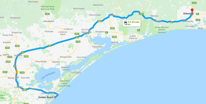
Day six had rolled around (Thursday 9th November 2017) and Marija and I had enjoyed a very comfortable night’s sleep at thee motel at Orbost.  We had a big day planned, with one summit for the Summits on the Air (SOTA) program in the Errinundra National Park, and also the Snowy River National Park.  We had a lot km’s to cover, so we made a bright and early start from Orbost.

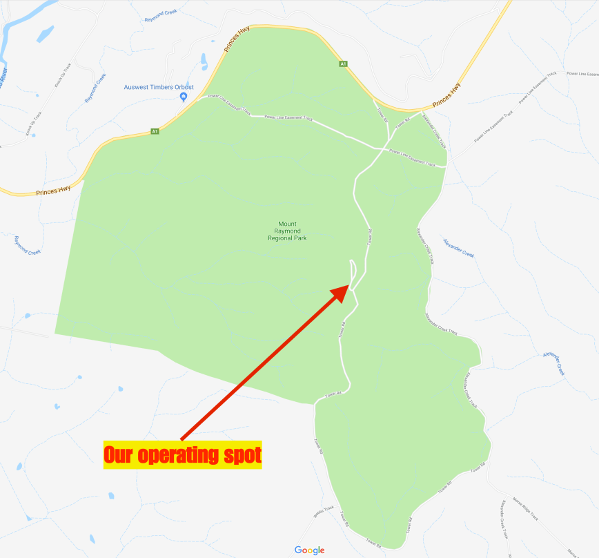
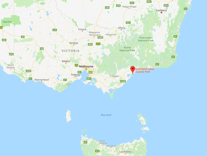
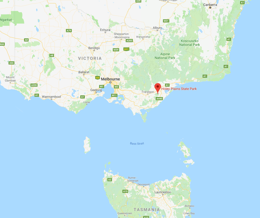
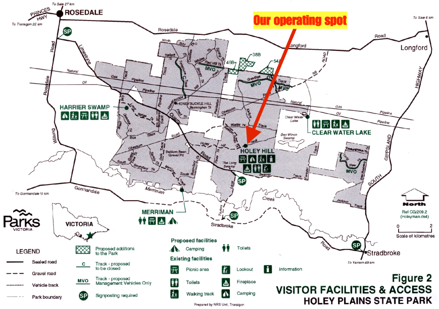
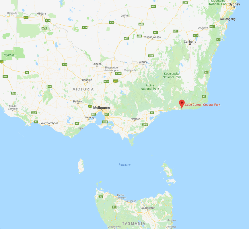
Our first activation for the day was to be Goonmirk Rocks VK3/ VG-048 which is within the Errinundra National Park VKFF-0158 about 373 km east of Melbourne.

Screen Shot 2017-11-27 at 7.45.41 pm.png

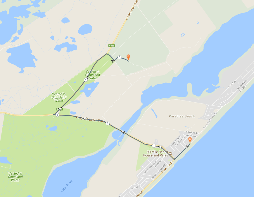
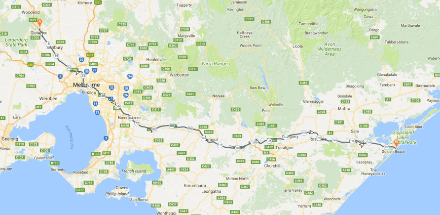
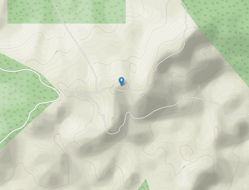
Above:- Map showing the location of Goonmirk Rocks in the Errinundra National Park.  Map courtesy of google maps.

Goonmirk Rocks is 1,208 metres above sea level and is worth 8 points for the Summits on the Air program.  The summit was last activated by Peter VK3PF on the 2nd October 2016, and has been activated a total of 11 times.

Screen Shot 2017-11-27 at 7.48.38 pm

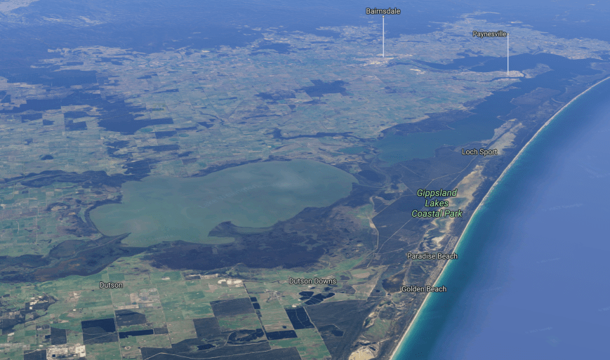
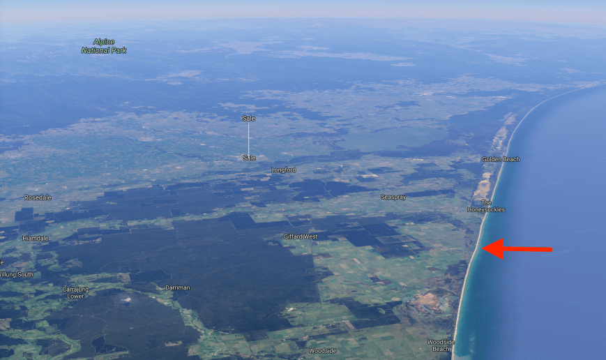
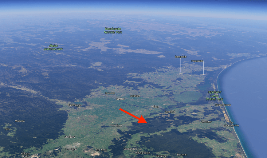
Above:- Aerial view of the Errinundra National Park, also indicating the location of the summit.  Image courtesy of google maps.

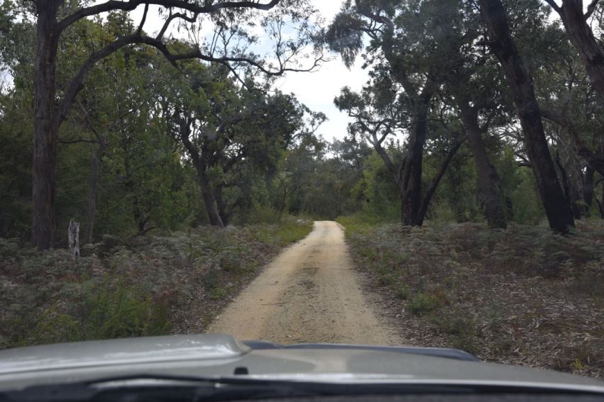
The summit is a short 100 metre walk through the scrub, from Goonmirk Rocks Road, a dirt track, which runs off Gunmark Road.

Screen Shot 2017-11-27 at 7.46.57 pm.png

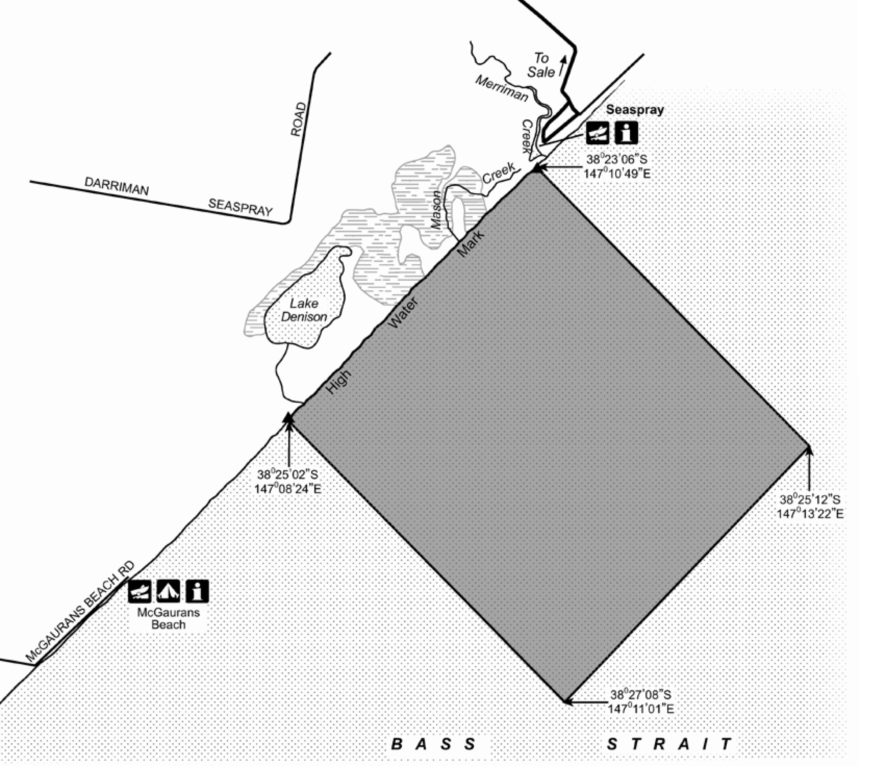
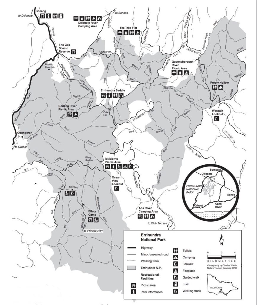
Above:- Goonmirk Rocks VK3/ VG-048.  Courtesy of Open Street Map.

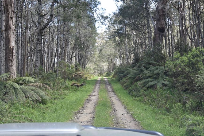
We drove out of Orbost north along Bonang Road to the summit.  This is a very windy road through absolutely beautiful country.  Due to the nature of the road, the 100 km drive took us around 2 hours and 15 minutes to reach our destination.

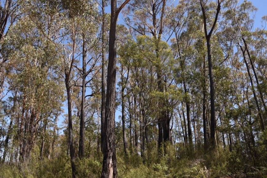
About 75-80 km out of Orbost we reached the western boundary of the Errinundra National Park.  Errinundra is 39,870 hectares in size and was established on the 15th July 1988.  The park is centred on the Errinundra Plateau, a southwards extension of the Monaro Tablelands of New South Wales which rises to more than 1,000 metres above sea level.  The Errinundra National Park preserves the largest remaining cool temperate rainforest in Victoria and supports some of South Eastern Australia’s most spectacular old growth forests.

DSC_9615

Errinundra is unique in that it offers both ancient cool temperate and warm temperate rainforest. It is dominated by Southern Sassafras and Black Olive Berry and features Mountain Plum Pines, some specimens of which are over 400 years old.   The Plateau’s tall, wet eucalypt forests of shining gum and Cut-tail include some giants many hundreds of years old. The park was recently expanded by 12,340 hectares due to the Victorian State Government’s committment to preserving old growth forest for future generations.

The park is the source of seven rivers flowing north, south and east, providing a water source for many of the surrounding communities, before flowing into Bass Strait or becoming part of the Snowy River system.  The Errinundra Plateau contains three granite outcops – Mount Ellery, Mount Morris, and Cobbs Hill, which extend into the rain clouds, causing much of the rain which falls in the catchment areas.

Screen Shot 2017-11-27 at 9.35.35 pm.jpg

The park is home to many rare and threatened species of flora and fauna, including Powerful Owls, Tiger Quolls, and Long-footed Potoroos.

We travelled a little further up the Bonang Road and reached the eastern boundary of the Snowy River National Park, which was to be our activation in the afternoon.  We hadn’t quite made up our mind on where to operate from, but it was clear there were no real activation opportunities on the Bonang Road.

DSC_9618

This really is spectacular country.  Forest as far as the eye can see with beautiful ferns as an understorey.

We then turned right onto the Bendoc-Orbost Road and travelled through the Errinundra National Park for around 6 km until we reached Gunmark Road.  We continued along Gunmark Road for around 11 km until we reached Goonmirk Rocks Road.

DSC_9651

About 1 km down Goonmirk Rocks Road, just after the Aspen Battery Track we reached a small sign which read ‘Goonmirk Rocks 100M’.  It’s not entirely easy to spot, but our GPS directed us to the location.

DSC_9624

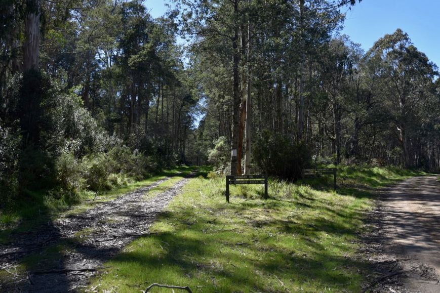
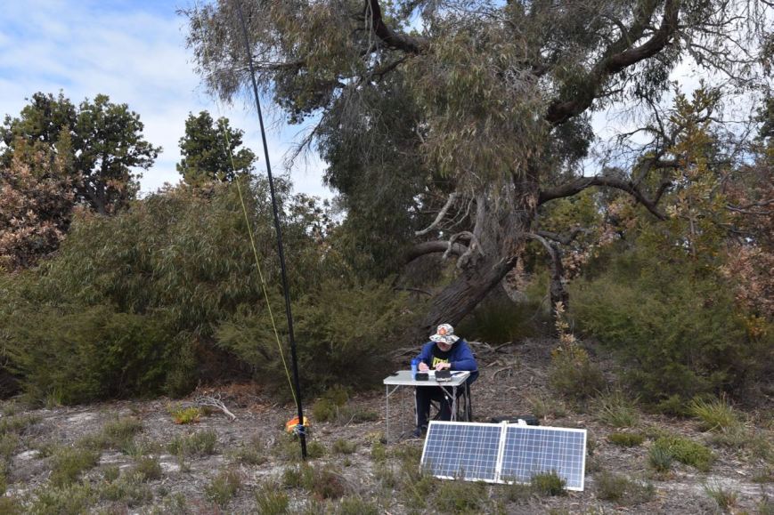
We pulled the Toyota Hi Lux as far off the track as possible and then started packing the gear into our backpacks.  It was around 10.30 a.m. Victorian local time.  We then commenced the short walk along the track to the summit.

The path is quite defined and takes you through spectacular forest.  Marija and I both commented that it was something like out of Jurasic Park.  We expected to see a T-Rex or a Brontosaurus enjoying breakfast.  It was a warm morning so we were ever vigilant and kept an eye out for snakes.  Neither of us are fond of ‘Joe Blakes’.

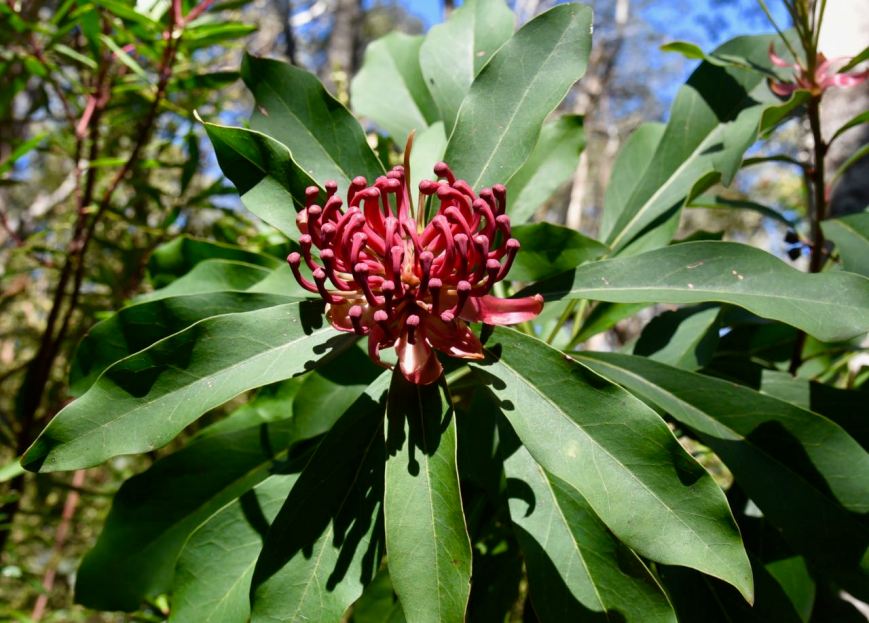
As we walked along the track to the summit we saw a number of Victorian Waratah Telopea oreades in flower.  The Victorian Waratah is a large shrub which produces an abundance of small red flowers during Spring.  And we happened to be in the park just at the right time.

DSC_9630

We had walked around 100 metres along the track when it came to a rather abrupt end with nothing but forest ahead.  In amongst the scrub we located a number of large rocks, Goonmirk Rocks.  Many were completely overgrown by vegetation.  We started to wonder for a while if we were in the right spot, because they are really not that impressive.

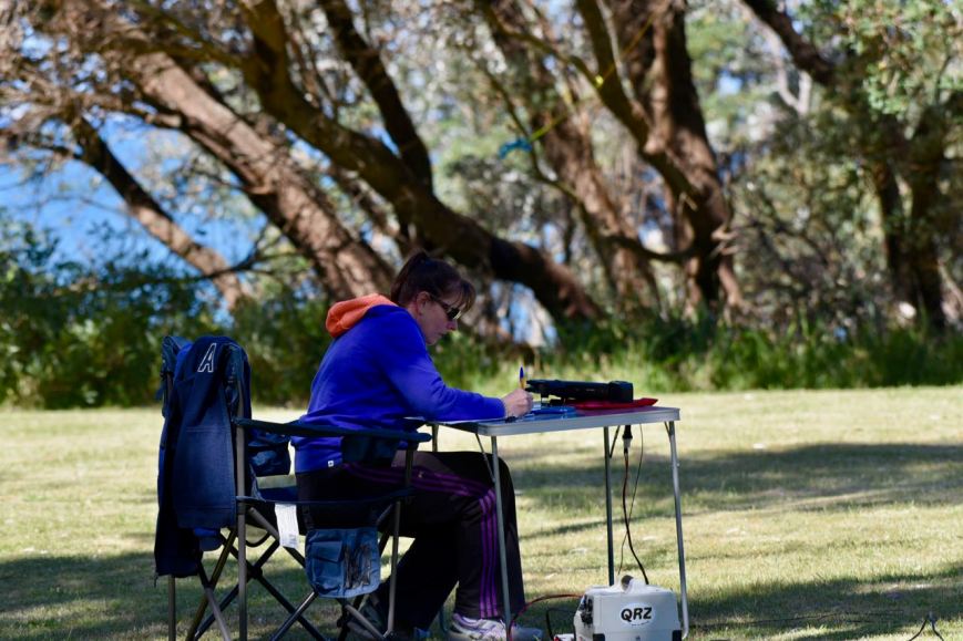
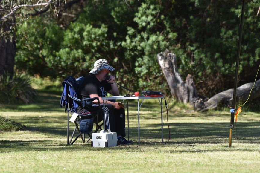
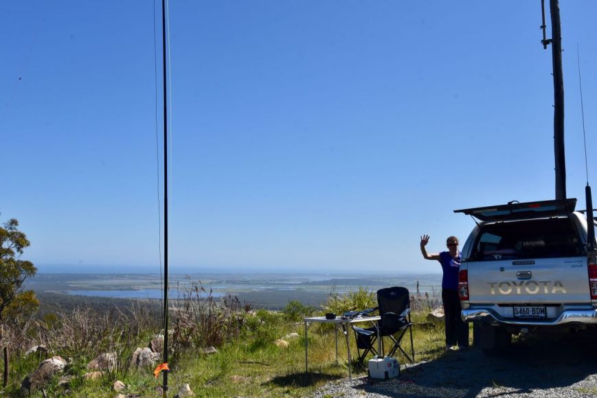
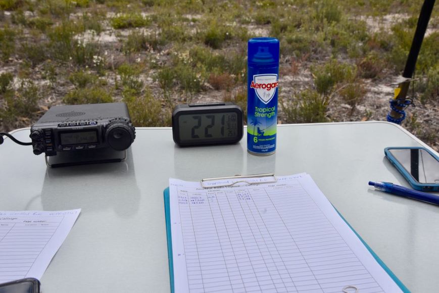
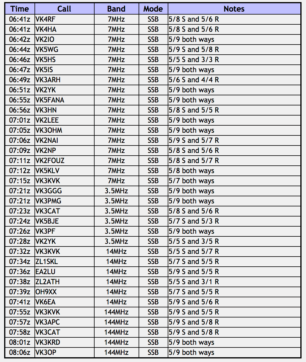
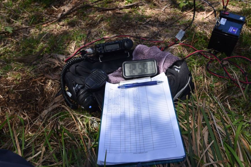
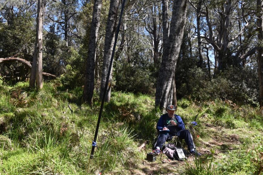
It was quite difficult stretching out the 80/40/20m linked dipole, but we did it, just! We ran the Yaesu FT-857d for this activation and set the power output at 10 watts, allowing for Marija’s Foundation licence.  We again decided to share the mic, and get 4 contacts in the log, thus qualifying the SOTA summit, and then 10 contacts, qualifying the park for the VKFF program.  And then all things going well, I would box on and try to get my 44 to qualify the park for the global WWFF program.

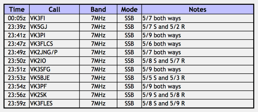
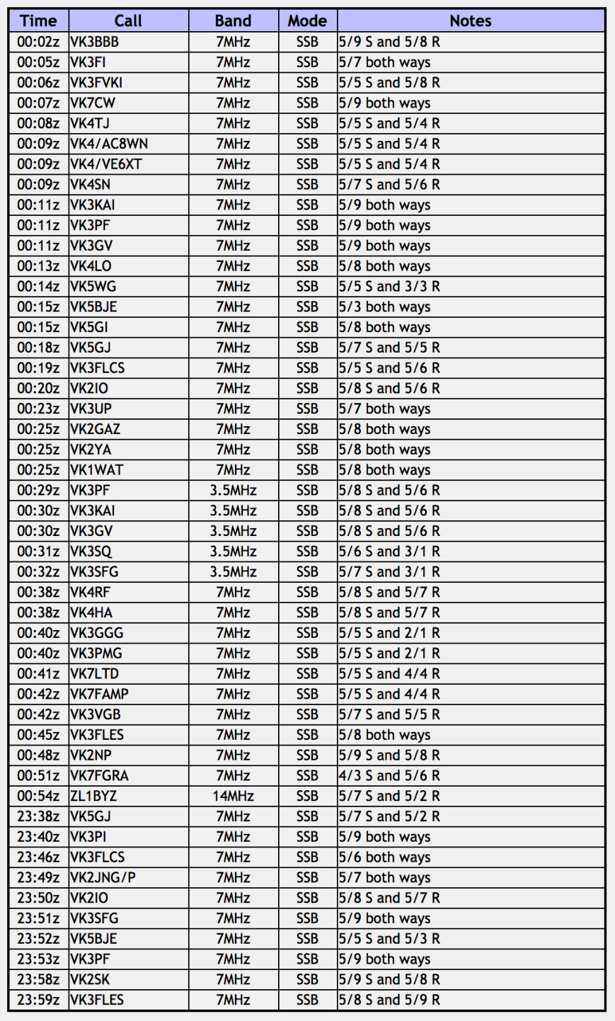
We had very minimal phone coverage and it was difficult to place a self spot.  We called CQ on 7.144 and this was answered by Greg VK5GJ in the Adelaide Hills with a good 5/7 signal.  This was followed by Mark VK3PI, Brett VK3FLCS, and then Gerard VK2JNG/p.  We breathed a sigh of relief as we had qualified the summit.

Contact number ten came 20 minutes into the activation, with a QSO with Les VK3FLES.  We breathed another sigh of relief, with the park now qualified for VKFF.

DSC_9642

Marija then took a break whilst I continued to call CQ, logging stations on 40m from VK1,VK2, VK3, VK4, VK5, and VK7.  Band conditions were not bad, which was very pleasing, as previous days we had experienced quite a bit of fading on signals.  I logged 32 stations on 40m and then lowered the squid pole and inserted the links for 80m, and called CQ on 3.610.  This was answered by Peter VK3PF, followed by Geoff VK3SQ, and Sergio VK3SFG.

I now had 37 contacts in the log and needed a further 7 to qualify the park, so I moved back to 7.144 on 40m.  Rick VK4RF/VK4HA was the first in the log with a strong 5/8 signal, followed by Mick VK3GGG/VK3PMG, and then husband and wife team Tony VK7LTD and Angela VK7FAMP.  Contact number 44 was a QSO with Colin VK3VGB.  I was really pleased once I had got over the line.  It had been a long drive out to the summit/park, and I really wanted to qualify.

DSC_9640

I logged a handful more stations on 40m and then QSY’d to 14.310 on the 20m where I spoke with John ZL1BYZ in New Zealand.

It was time for us to head off to the Snowy River National Park.  Marija and I had both qualified the summit for SOTA, and the park for VKFF and WWFF.

DSC_9635

Marija worked the following stations:-

Screen Shot 2017-11-27 at 7.42.24 pm.png

I worked the following stations:-

Screen Shot 2017-11-27 at 7.37.47 pm.png

Just as we were getting back into the vehicle I caught a glimpse out of the corner of my eye of what I thought was a fox on the road.  It turned out to be a young wild dog.  I was not quick enough with the camera to catch a shot sadly.  I have since found out that wild dogs are common throughout this area.

Before heading to the Snowy River National Park we took a short drive to one of the rainforest walks in the Errinundra National Park, the Errinundra Saddle Rainforest Walk.  If you are visiting Errinundra, this is a must!

This slideshow requires JavaScript.

It is an easy 30 minute walk through the rainforest, with interpretive boards along the way.  We saw many Victorian Warratah in flower.

A number of the signs explain Australia’s ancient forests.  Australia’s geographic isolation has meant that much of its flora and fauna is very different from species in other parts of the world.  Most are found nowhere else.  However, some closely related species are found on the continents which once made up the ancient southern supercontinent Gondwana.  About 50 million years ago Australia was the last continent to leave Gondwana when it broke free from Antarctica and commenced its drift northwards.

Most of the Gondwana forests were replaced by tough leafed open forests of eucalypts and acacias.  Some isolated remnants of the ancient Gondwanan forests remain.  These include the cool and warm temperate rainforests of Tasmania and eastern Australia, and the dry rainforests or scrub forests of northern Australia.  These forests have high conservation values.  Segments of these cool and warm temperate rainforest are found within the Errinundra National Park.

519px-Laurasia-Gondwana.svg.png

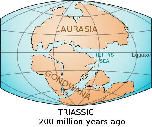
Above:- Gondwana.  Courtesy of wikipedia.


References.

Parks Victoria, ‘Errinundra National Park Visitor Guide’.

Wikipedia, 2017, <https://en.wikipedia.org/wiki/Errinundra_National_Park>, viewed 27th November 2017

Mount Raymond Regional Park VKFF-0975, take two

After having tea on Wednesday night at the Orbost Hotel, I decided to head back out to the Mount Raymond Regional Park VKFF-0975 to see if I could pick up my remaining 16 contacts, to qualify the park for the global WWFF program.

It was just a short 15 minute drive down the Princes Highway from Orbost to the park.  I didn’t bother driving to the top this time.  I pulled into a little track just off Tower Road.  I also didn’t bother running out the dipole for this activation, but rather ran my mobile set up in the Toyota Hi Lux, which consisted of an Icom IC-7000, 100 watts output, and the Codan self tuning 9350 antenna.

I booked in to the 7130 DX Net and was very pleased to hear that conditions on the 40m band were quite good.  I logged a handful of VK’s and two New Zealand stations.   This included Gary ZL3SV, who had a huge signal.  Gary runs a 2,000 foot log, 640 metre centre feed sloper antenna on top of a hill.

I then moved up the band and called CQ and I soon had my 16 required contacts in the log, with a QSO with Lawrence KN7D in Utah, USA (5/5 both ways).

Banner_Design.png

At the end of the net I headed back into Orbost, where I retired to the motel room for a well earnt rest.  It had been another very enjoyable, but long day.

I worked the following stations on 40m SSB:-

  1. VK7ROY
  2. VK5MJ
  3. ZL2ASH
  4. VK7FRJG
  5. VK2HJW
  6. VK7RN
  7. ZL3SV
  8. VK5JDS
  9. VK2SK
  10. VK7VAZ
  11. VK3FMKE
  12. VK2VE
  13. VK4ZD
  14. VK4DI
  15. VK2XXM
  16. KN7D
  17. VK2VOM
  18. VK2NEO
  19. VK5FTCT
  20. VK5VBR

Cape Conran Coastal Park VKFF-0744

After packing up at Mount Raymond, Marija and I headed to our second planned activation for the day, the Cape Conran Coastal Park VKFF-0744.  The park is located about 400 km east of Melbourne, and is not far from the Victoria/New South Wales State border.

Screen Shot 2017-11-27 at 5.32.13 pm.png

Above:- Map showing the location of the Cape Conran Coastal Park.  Map courtesy of google maps

We travelled east along the Princes Highway and then turned right onto the Cabbage Tree-Conran Road and travelled south towards the park.  We soon passed the Cabbage Tree Nature Conservation Reserve and considered popping in there for a quick activation, as it also qualified for the World Wide Flora Fauna (WWFF) program.  But we were running short of time, and there were that many parks that we couldn’t activate everything.

We soon reached the park which abuts the Cabbage Tree-Conran Road.  We turned left onto Cape Conran Road and then East Cape Road.

DSC_9483

The Cape Conran Coastal Park is a coastal reserve and protects 11,700 hectares of East Gippland’s Wilderness Coast.  It was declared in 1997.  Much of the park is covered by heathland and banksia woodland.  Cape Conran Coastal Park, together with Croajinolong National Park and the Nadgee Nature Reserve in New South Wales, and other reserves, form a part of the largest contiguous protected area on the south-east Australia coast.  The park is a popular coastal holiday destination.

During May to October whales may be sighted off the coast and dolphins are often seen surfing the waves.  Over 40 native mammals have been recorded in the park including Long-nose Bandicoots, Long-nose Potoroos, Wombats and Sugar Gliders.  Over 1770 species of native bird can be found in the park including the White-bellied sea eagle, Powerful Owl, and Eastern Ground Parrot.  Below are some of the birds I observed during our activation.  The kookaburra were particularly tame.  I suspect because they are fed, despite the warning signs stating not to do so.

About 14 years ago Cape Conran was chosen as a site to trial a wildlife protection and monitoring program run by the Department of ENvironment Land Water & Planning, with the results being astounding.  By reducing the numbers of introduced foxes, to virtually none, a resurgance of small marsupials and other native naimals commenced.  The program has been so successful that it has been rolled out throughout all of East Gippsland, and is now the largest wildlife management program on the East Coast of Australia.

We set up in the picnic/camping area at East Cape.  It was very quiet, so we had the area almost entirely to ourselves.  There was a nice lawned area here, with wooden tables and benches, making it an ideal spot to operate from.

Screen Shot 2017-11-27 at 5.49.59 pm.png

Screen Shot 2017-11-27 at 5.50.44 pm.png

Above:- Map showing our operating spot.  Map courtesy of Parks Victoria

Screen Shot 2017-11-27 at 5.39.14 pm.png

Above:- Aerial shot of East Cape showing our operating spot.  Image courtesy of google maps

As we had done in previous activations, Marija and I decided to share the mic.  Marija was just keen to get her 10 contacts to qualify the park for VKFF.  I was very keen to get 44 contacts to qualify the park for the global WWFF program, but after the band conditions at Mount Raymond, we were not entirely sure that would happen.

First in the log was Owen VK4FADW with a strong 5/9 signal, followed by John VK5BJE, Mark VK7MPR, and then Gerard VK2IO.  John’s signal was fair (5/5), while Mark was moderately strong (5/7), and Gerard was weak (5/3).  This was not a great sign that we were going to have a rewarding activation.

The ever reliable Rick VK4RF/VK4HA was our tenth contact, after 25 minutes.  It was very slow going.

DSC_9493

I kicked on, and slowly started filling up the log.  But the 40m band was in poor condition with lots of fading (QSB) on most signals.  I logged 17 stations on 40m from VK2, VK3, VK4, VK5 and VK7, before QSYing to the 80m band where I put out a CQ call on 3.610.  That was answered by Paul VK3SS with a strong 5/9 signal, followed by Peter VK3PF (also 5/9) and then Ken VK3UH (again 5/9).  Despite conditions being good on 80m around Victoria, I logged just 2 more VK3 stations.

I then headed to 14.310 on the 20m band, where 5 minutes of CQ calls went unanswered.  I had just 23 stations in the log, and was a long way off the required 44, so I headed back to 7.144 on the 40m band.  The band conditions slowly started to pick up and after a further 40 minutes I had contact number 44 in the log, a QSO with Bill VK5MBD in the Mid North of South Australia.  Tony VK5MRT was contact number 45 and my last for Cape Conran.

It was now 5.30 p.m. Victorian local time and we were getting a bit peckish and were keen to head off for some dinner.

DSC_9544

After packing up we enjoyed a short walk along the beach at East Cape.  It was a beautiful warm late afternoon and the coastline was certainly very picturesque.

On the way back to Orbost we stopped for a little bit of sightseeing.  This included Salmon Rocks.

The photos below show the typical coastline and the park on the road into the town of Marlo.

Our next stop was just outside of Marlo, where we enjoyed a great view of the coast and the mouth of the famous Snowy River.

Marlo is a beautiful little town with a population of around 700 people.  The name “Marlo” is generally accepted to have roots in tribal aboriginal language. “Marloo” meaning white clay is suggestive of the Marlo Bluff, whilst “Murloo” meaning “muddy banks” was reportedly used by the local indigenous people.

After having a bit of a quick look around Marlo, we headed north out of town on the Marlo Road towards Orbost.  We stopped briefly for some photographs of water birds in a wetlands area north of Marlo.

We continued along the Marlo Road, which hugs the Snowy River all the way to Orbost.  There were some nice views of Mount Raymond to be had.  And all the way along the river were people camping and caravaning.

DSC_9604

Once we got back into Orbost, Marija and I headed to the Orbost Club Hotel for a meal and a few ales.  After tea I decided to head back out to the Mount Raymond Regional Park VKFF-0975 to pick up my remaining 16 contacts to qualify the park.

DSC_9605


References.

Cape Conran Coastal Park, 2017, <http://www.conran.net.au/>, viewed 27th November 2017

Parks Victoria, ‘Cape Conran Coastal Park Visitor Guide’.

Parks Victoria, 2013, ‘Cape Conran Coastal Park Master Plan’

Wikipedia, 2017, <https://en.wikipedia.org/wiki/Cape_Conran_Coastal_Park>, viewed 27th November 2017.

Wikipedia, 2017, <https://en.wikipedia.org/wiki/Marlo,_Victoria>, viewed 27th November 2017

Day five and the Mount Raymond Regional Park VKFF-0975

Day five (Wednesday 8th November 2017) of our trip involved a 198 km drive from Golden Beach to Orbost.  This took us out through Sale and on to Stratford and then Bairnsdale.  And then through the beautiful hilly forested country to Orbost.

Screen Shot 2017-11-27 at 2.30.26 pm.png

Above:- Map showing our travels on day five.  Map courtesy of google maps

We had arranged the day before to meet Paul VK3SS in Stratford, which is exactly what we did.  We followed Paul out to his property and enjoyed a cup of coffee, some choccie biscuits and a good chat.  As you would expect I had a look at Paul’s shack and his antenna farm which is extremely impressive.  It was terrific to catch up with Paul in person.

Marija and I then continued our journey east along the Princes Highway and soon reached the town of Bairnsdale.  We then headed out of Bairnsdale along the Great Alpine Road.  This stretches for 339 km and is Australia’s highest year-round accessible road.  The road was given its current name because it was considered the mountain equivalent to Victoria’s world famous Great Ocean Road in the south-west of the state.

DSC_9430

This is spectacular country through this part of Victoria, with forest either side of the road.  We drove into the little town of Bruthen, hoping to stop in at the Bullant Brewery, which turned out to be closed.  It was normally open on a Wednesday, but as the previous day had been the Melbourne Cup horse race, it had opened on Tuesday instead.

DSC_9432

So a little disapointed, we continued along the Bruthen-Nowa Nowa Road until we reached the Boggy Creek Gorge lookout.  It is just a short 100m walk to the lookout, which has spectacular views of the gorge.

We then stopped off at Nowa Nowa for a coffee for Marija, and a milkshake for me.  Nowa Nowa means ‘place of mingling waters’ in the local Kurnai aboriginal language.  Gold was discovered in the area in 1887 which resulted in a rush to the area, however only small deposits were found.  Nowa Nowa was originally a coach stop between Lakes Entrnce and Orbost prior to the railway which commenced in 1912.

The Mingling Waters Cafe is worth a look.  It has a a collection of wood sculptures, a gem collection and a quirky toy collection.  There is also a 130 year old timber jinker with ironbark wheels which was pulled by bullocks, carrying timber to the mills.

We then drove out to the Stony Creek trestle bridge, just outside of Nowa Nowa.  This is truly an amazing sight.  It was built in 1916 by the Victorian Railways and spans the Stony Creek.  The bridge is 27 span, 276 metres long, 18.6 metres high and is constructed of timber.  It supported a single railway track over the creek.  It is one of the longest and highest remaining examples of a timber trestle bridge in Victoria.  The bridge actually remained in operation until a bushfire damaged the structure in 1980.  The railway closed in August 1987.

We then drove back into Nowa Nowa and on to Orbost, crossing the famous Snowy River as we entered town.  The Snowy originates on the slops os Australia’s highest mainland peak, Mount Kosciuszko, draining the eastern slops of the Snowy Mountains in New South Wales, before flowing through the Alpine National Park and the Snowy River National Park in Victoria, and emptying in Bass Strait.  The river has been immortalised in cultural folklore through the poem The Man from Snowy River, written by ‘Banjo’ Paterson in 1890, which formed the basis of many subsequent works in film, TV and music theatre.

Orbost is located about 375 km east of Melbourne and is the service centre for the primary industries of beef, dairy cattle, and sawmilling in the region.  Peter Imlay established the Snowy River Station for grazing in 1842, and his brother the Newmerella run nearby.  In 1845 the land was sold to Norman McLeod, who named the area after Orbost farm in the northwest of Isle of Skye, in Scotland.  Our accomodation in Orbost was the Orbost Motel, which was can highly recommend.

After booking in to the motel, Marija and I headed to our first activation of the day, the Mount Raymond Regional Park, VKFF-0975, which is located about 16 km to the east of Orbost.  The park is about 750 hectares in size.

Screen Shot 2017-11-27 at 2.09.09 pm.png

Above:- Map showing the location of the Mount Raymond Regional Park.  Map courtesy of google maps.

We drove east along the Princes Highway and soon reached the northern boundary of the park.  We then turned right onto Tower Road.

DSC_9456

We followed Tower Road right up to the top.  The road is dirt and quite steep, but is generally in good condition and is easily passable in a conventional vehicle.

Screen Shot 2017-11-27 at 2.08.54 pm.png

We started setting up alongside of the communication towers.  It was a little cramped, but we strung out the 80/40/20m linked dipole.

DSC_9475

There are some terrific views to be enjoyed from the top of Mount Raymond, which surprisingly is not listed as a summit for the Summits on the Air (SOTA) program.  We were a little surprised about that, but clearly it does not have the required prominence for SOTA.

Despite there being communication towers on the top of Mount Raymond, they didn’t provide any interference to us on the bands.

Marija and I decided again to share the mic, until Marija had obtained her 10 contacts, and qualified the park for the VKFF program.  I started calling CQ on 7.144 and this was answered by John VK5BJE in the Adelaide Hills with a strong 5/8 signal.  Gerard VK2IO then came up on the frequency to let us know that Gerard VK2JNG/p was also calling CQ on the same frequency from another park.  Unfortunately we could not hear a peep out of Gerard and nobody had come back to our calls when asking if the frequency was in use.  So Marija and I headed down to 7.139 where we started calling CQ again.

Gerard VK2IO had followed us down and he was logged with a 5/5 signal, followed by Mick VK3GGG/VK3PMG, and then Adrian VK5FANA who was a very low signal (3/1 both ways).  Sadly, the 40m band appeared to be in very poor shape, with huge amounts of fading (QSB).  So much so, that I thought initially it may have been our antenna.

We boxed on under very very trying conditions, and after 20 minutes, Marija had contact number ten in the log, a QSO with Ron VK3VBI.  Marija’s patience with the band had worn thin, and she sat back and enjoyed the view, whilst I continued on, hoping to get 44 contacts in the log for the global WWFF program.  But this was not going to be easy work on this cocasion.

I logged 16 stations on 40m and then headed to 3.610 on the 80m band where the only station logged was Peter VK3PF.  I then headed to 14.310 on the 20m band where I logged John VK4TJ and his other 2 calls of VK4/AC8WN and VK4/VE6XT, and then Rick VK4RF/VK4HA.  But that was the end of that.  No further callers on 20m.  This was not looking good.

I lowered the squid pole and we were inserting the links to go back to 40m, when we saw a spot for Peter VK3TKK/p on 80m from a park.  So the links were changed again, and it was back to 80m and 3.615.  I logged Peter who was in the Gresswell Hill Nature Conservation Reserve VKFF-2104.

I then moved back to 40m where I logged just 5 further stations, from VK2, VK3, VK5 and VK7.  I now had 28 contacts in the log, and was well short of the required 44.  But it was time to pack up and head off to the next park.  We will have to revisit Mount Raymond.

Marija worked the following stations on 40m SSB:-

  1. VK5BJE
  2. VK2IO
  3. VK3GGG
  4. VK3PMG
  5. VK5FANA
  6. VK4TJ
  7. VK4/AC8WN
  8. VK4/VE6XT
  9. VK2IPK
  10. VK3VBI

I worked the following stations on 40m SSB:-

  1. VK5BJE
  2. VK2IO
  3. VK3GGG
  4. VK3PMG
  5. VK5FANA
  6. VK4TJ
  7. VK4/AC8WN
  8. VK4/VE6XT
  9. VK3VBI
  10. VK7FGRA
  11. VK4RF
  12. VK4HA
  13. VK7LTD/p
  14. VK7OTC
  15. VK7WH
  16. VK2IPK
  17. VK5LSB
  18. VK7FAMP
  19. VK7JON
  20. VK2XXM
  21. VK5KBJ

I worked the following stations on 80m SSB:-

  1. VK3PF
  2. VK3TKK/p (Gresswell Hill Nature Conservation Reserve VKFF-2104)

I worked the following stations on 20m SSB:-

  1. VK4TJ
  2. VK4/AC8WN
  3. VK4/VE6XT
  4. VK4RF
  5. VK4HA


References.

Bonzle, 2017, <http://bonzle.com.au/c/a?a=p&p=59244&cmd=sp>, viewed 27th November 2017

Coastal Stays, 2017, <http://www.coastalstays.com/eastgippsland/nowanowa/>, viewed 27th November 2017

Victorian Heritage Council, 2004, ‘Stony Creek Rail Treastle Bridge’

Visit Victoria, 2017, <http://www.visitvictoria.com/Things-to-do/Touring-routes/The-Great-Alpine-Road>, viewed 27th November 2017

Wikipedia, 2017, <https://en.wikipedia.org/wiki/Great_Alpine_Road>, viewed 27th November 2017

Wikipedia, 2017, <https://en.wikipedia.org/wiki/Snowy_River>, viewed 27th November 2017

Wikipedia, 2017, <https://en.wikipedia.org/wiki/Orbost&gt;, viewed 27th November 2017

The Lakes National Park VKFF-0484

Our second activation for day four was The Lakes National Park VKFF-0484, just a short distance down the road from the Gippsland Lakes Coastal Park.  The park is located about 271 km east of Melbourne and about 36 km by road from Golden Beach.  Again, this was to be a unique park for Marija and I as activators, for both the World Wide Flora Fauna (WWFF) program, and the Keith Roget Memorial National Parks Award.

Screen Shot 2017-11-23 at 7.12.37 pm.png

Above:- Map showing the location of The Lakes National Park.  Map courtesy of google maps

The Lakes National Park is 2,390 hectares of low lying woodland and coastal heath, consisting of Sperm Whale Head peninsula, Rotamah and Little Rotamah Islands.

Eucalypt and Banksia woodland are widespread in the sandy soils of the park. Areas of coastal heath are interspersed with swampy, salt marsh vegetation. The park is most spectacular in spring, when wildflowers are on show. Several rare plant species feature, including Ribbed Thryptomene which, apart from this area, is found only in Tasmania and the York and Eyre Peninsulas in South Australia.

Screen Shot 2017-11-23 at 7.07.22 pm.png

More than 190 species of bird have been recorded in the park including the rare White Bellied Sea Eagle and endangered Little Tern.  Numerous native animals can also be found in the park including Eastern Grey Kangaroos, Black Wallabies, Echidnas, Ring-tailed possums, Sugar Gliders, Pygmy Possums, Wombats, and the endangered New Holland Mouse.

Pseudomys_novaehollandiae.jpg

Above:- New Holland Mouse.  Image courtesy of wikipedia.

We  drove through the town of Loch Sport to the southern entrance of the park at the end of National Park Road.  This is the only way to get into the park, other than by boat.

DSC_9326

Above:- Entrance to The Lakes National Park.

We then followed the Lake Reeve Track, stopping occasionally for a few photographs.  The track is dirt, but is in good condition and is easily passable in a conventional vehicle.

We continued along Lake Reeve Track until we reached the Netting Boundary Picnic Area.  There was a wooden table and benches here and it looked like a terrific spot to set up.

DSC_9330

Additionally, there was plenty of room to string out the 80/40/20m linked dipole, and there were no other persons in the campground.

Screen Shot 2017-11-23 at 7.06.28 pm.png

Above:- An aerial view of the park, showing our operating spot.  Image courtesy of google maps.

This was a really pretty spot, and just across the road from where we were operating was Lake Reeve.  Lake Reeve provides important feeding and roosting habitat for a number of waterfowl species, and is one of Victoria’s most important areas for wading birds. The lake is a significant feature of the Gippsland Lakes system and is listed under the Convention on Wetlands of International Importance (RAMSAR).

The lake was alive with Black Swans and various other water birds.

DSC_9351

Marija and I decided on a change of tactics for this activation, with Marija planning on getting her 10 contacts and qualifying the park for VKFF, and then handing the mic for me.  Marija called CQ on 7.144 and this was soon answered by Gerard VK2IO with a strong 5/8 signal, followed by Greg VK5GJ in the Adelaide Hills, Ivan VK5HS in the Riverland region of South Australia, and then John VK5BJE in the Adelaide Hills.  Within 9 minutes, despite the band being in quite poor condition with lots of fading (QSB), Marija had contact number ten in the log, a QSO with Angela VK7FAMP in Tasmania.

I then took control of the mic, logging Angela VK7FAMP as contact number one.  Rod VK7FRJG then called in, followed by John VK5BJE, and then Garry VK2GAZ.  Contact number ten came 6 minutes into being on air, a QSO with Greg VK5GJ.  Marija and I had both qualified the park for VKFF and the Keith Roget parks award.   Now the quest was on for me to get my 44 to qualify the park for the global WWFF program.

I logged a total of 29 stations on 40m before the callers dried up.  Only a handful of Victorian stations were in the log on 40m, so I was hoping that the 80m band would prove to be a little better to log the local stations.  I called CQ on 3.610 and this was answered by Peter VK3PF, followed by Geoff VK3SQ, and then Peter VK3ZPF.  All had 5/9 signals.  I logged a further 7 stations on 80m, all from VK3.

I then headed over to the 20m band and started calling CQ on 14.310.  My call was answered, much to my surprise, by Igor UA5D in Russia who had a strong 5/8 signal (5/6 received).   Paul F2YT in France then called in, with a 5/7 signal (3/3 received).  But sadly, despite a good start on 20m, they were my only callers.  I was now sitting on 43 contacts, needing just one more QSO to qualify the park for WWFF.

It was now 5.30 p.m. and Marija and I really wanted to head off for tea, so I put out a quick call on 7.144 which was answered by David VK5LSB.  My 44th contact…thanks David.  I then logged Hans VK5YX, Peter VK2NEO, and finally John VK2IFT.

So, with the park qualified for VKFF, WWFF, and the KRMNPA it was time to pack up.

Marija worked the following stations on 40m SSB:-

  1. VK2IO
  2. VK5GJ
  3. VK5HS
  4. VK5BJE
  5. VK2WWV
  6. VK2JNG/p
  7. VK7LTD
  8. VK7FRJG
  9. VK2GAZ
  10. VK7FAMP
  11. VK4NH
  12. VK4DXA

I worked the following stations on 40m SSB:-

  1. VK7FMP
  2. VK7FRJG
  3. VK5BJE
  4. VK2GAZ
  5. VK2YA
  6. VK1WAT
  7. VK7LTD
  8. VK2AWJ
  9. VK3SX
  10. VK5GJ
  11. VK3GGG
  12. VK3PMG
  13. VK4NH
  14. VK4DXA
  15. VK2IO
  16. VK5IS
  17. VK7VDL
  18. VK4TJ
  19. VK4/AC8WN
  20. VK4/VE6XT
  21. VK7VAZ
  22. VK2TL
  23. VK5KLV
  24. VK2VW
  25. VK5FMWW
  26. VK5AK/m
  27. VK1TX
  28. VK5HS
  29. VK2VRC
  30. VK5LSB
  31. VK5YX
  32. VK2NEO
  33. VK2IFT

I worked the following stations on 80m SSB:-

  1. VK3PF
  2. VK3KAI
  3. VK3SQ
  4. VK3ZPF
  5. VK3NLK
  6. VK3MRH
  7. VK3SFG
  8. VK3FPSR
  9. VK3UH
  10. VK3FJAE
  11. VK3LMJ

I worked the following stations on 20m SSB:-

  1. UA5D
  2. F2YT

After packing up Marija and I continued along Lake Reeve Track until we reached Point Wilson.  There are some nice views here across the water to Raymond Island and Paynesville.  The water’s edge was alive with Pelicans, Cormorants, Terns and various other birdlife.  There were also a number of yachties out on the water enjoying the later afternoon sunshine.

We then drove along Victoria Track, which is definitely 4WD only, and is marked as such.  This is a really fun 4WD track taking you through some great parts of the park.  We stopped briefly as Trouser Point to enjoy the views and say g’day to some of the local kangaroos.

It was now starting to get a bit late and we decided to stop off at the Marina Tavern at Loch Sport for a meal.  The pub is set on the banks of Lake Victoria.  And we were very pleased we did, as the meal was excellent.  I had a Neptune schnitzel, with fresh prawns and other seaford, and a seafood sauce.  Marija had a Thai Green Curry, which the waitress said had an Italian twist, as it had hot chips and salad as well.  And Marija says it was one of the nicest meals she has had.

DSC_9416


References.

Parks Victoria, 2017, ‘The Lakes National Park Visitor Guide’.


Day four and the Gippsland Lakes Coastal Park VKFF-0747

Day four (Tuesday 7th November 2017) commenced with a cup of coffee and some toast on the balcony of our accomodation at Golden Beach.  It was a warm day and thankfully the wind had dropped somewhat.  Whilst I enjoyed my coffee I enjoyed watching the birdlife (of the feathered kind), including Wattlebirds and Rosellas.

After breakfast Marija and I headed down Shoreline Drive and had a look at the wreck of the Trinculo.  The iron barque Trinculo, built in 1858 was travelling from Albany in Western Australia to Newcastle in New South Wales in May 1879.  On 30th May 1879, the vessel was struck by S/E force 11 winds off WIlsons Promontory and was forced on to a sandbar 15 metres offshore at Stockyard Hill on the 90 Mile Beach.   Fortunately no lives were lost as a result.

Today, very little remains of the wreck.  Looking at photos from even 3-4 years ago, the wreck has diminished significantly due to the elements.

DSC_9148.jpg

I then took some time out for a little bit of birdwatching in the scrub adjacent to the wreck.  This is all part of the Gippsland Lakes Coastal Park VKFF-0747.  Unfortunately my photographic skills were not good enough to catch many of the very small birds in the scrub.

We needed to refuel with diesel and we were warned about filling up at Golden Beach, so we chose to drove to Sale about 41 km away.  And I’m pleased we did.  Because we ended up going on a boat cruise out of Sale on the Rubeena, an old wooden boat first launched in 1912 at Lakes Entrance.

Here is a short video on the Rubeena Heritage cruise.

https://youtu.be/tqh5Kru3mAU

We took a 2 hour cruise along the Sale Canal and the Thomson River.  We were fortunate to see a number of Sacred Kingfishers on the cruise, along with a majestic Wedge Tailed Eagle sitting high atop one of the gum trees above the water, and a variety of other birds.

We also spotted a koala or two, enjoying a morning sleep, a number of people fishing (for carp), and a number of aboriginal canoe trees.

The trip took us to the Sale Swing Bridge, designed by John Grainger and built in 1883 by the Victorian Government.  It was the first moveable bridge built in Victoria.  Its wrought-iron structure, 45 metres long, pivots on cylindrical steel columns

At the conclusion of the cruise, which we highly recommend, we drove down to the Swing bridge for a closer look and take a walk across it.  The bridge is certainly very impressive.

After refuelling we headed back towards Golden Beach and took the Longford-Loch Sport Road towards the Gippsland Lakes Coastal Park VKFF-0747, our first activation for day 4.

Screen Shot 2017-11-23 at 6.34.49 pm.png

Above:- Map showing the location of the Gippsland Lakes Coastal Park.  Map courtesy of google maps

The park is a narrow coastal reserve covering 17,600 hectares along a portion of the Ninety Mile Beach, from Seaspray to Lakes Entrance.   The park consists of a system of coastal lagoons separated from the Tasman Sea by the coastal dunes.

On Friday 22 October 2010 both the Australian Federal and Victorian State governments formally recognised the Gunaikurnai people as the Traditional Owners of over 20 per cent of public land within Gippsland and Eastern Victoria.  The Victorian Government and the Gunaikurnai people formally signed Victoria’s first settlement agreement under the new Traditional Owner Settlement Act 2010.  This agreement involved the transfer of ten parks and reserves to the Gunaikurnai as “Aboriginal Title” which will be jointly managed in conjunction with Parks Victoria. Gippsland Lakes Coastal Park is one of the jointly managed parks within Gippsland.

Screen Shot 2017-08-17 at 7.21.42 pm

Above:- Aerial view of the park.  Image courtesy of google maps

The first European records of the Gippsland Lakes were by Angus McMillan in 1840 and of the seaward entrance to the lakes by John Reeve in 1842.   The entrance to the Gippsland Lakes was constructed in the 1880s.   Before that time, the lakes were generally closed to the sea, with the barrier being breached only on rare occasions.

Angus_McMillan_portrait

Above:- Angus McMillan, c/o wikipedia

Various native animals can be found in the park including Eastern Grey kangaroos, Black Wallabies, Common Brush-tailed Possums, Echidnas, and Ring-tailed Possums.  Numerous native birds call the park home including Fairy Terms, Little Terns, Bar-tailed Godwit, Yellow-tailed Black cockatoo, Eastern Yellow Robin, and Wedge-tailed eagle.

The plants growing in the park can be divided into three main types: coastal, swamp and heathy woodland. These grow mostly on leached sand of low fertility. Coastal vegetation growing along the seaward side of the dunes is adapted to grow in harsh conditions of wind, salt, sun, shifting sand, little water and few nutrients. These plants include Hairy Spinifex, Marram Grass, Cushion Bush, Coast Saltbush, Sea Rocket and Coastal Everlasting.

Behind the dunes conditions are less severe allowing Coastal Tea-tree thickets and Coast Banksia woodlands to grow. Swamp vegetation grows around the lakes and includes rushes, sedges and Swamp Paperbark.

Heath vegetation is also adapted to grow in poor soils. Major species include Shining Peppermint, Yertchuk, Coastal Tea-tree and Saw Banksia.  The more common understorey plants consist of Bracken, Silky Tea-tree, Sweet Wattle and Common Heath.

As we had done in previous activations Marija and I chose to swap the mic until Marija had qualified the park with 10 QSOs.  We started calling CQ on 7.144 and this was soon answered by Greg VK5GJ in the Adelaide Hills, followed by Jonathan VK7JON, Gerard VK2IO and then Brett VK2WWV.  We immediately noted that there was a large amount of QSB (fading) on all signals.  Within around 20 minutes we had contact number ten in the log, with a QSO with Mike VK5FMWW.

It was a very warm morning and the mosquitos were out in force, and despite repeated applications of Aeogard, they kept attacking relentlessly.  So once Marija had 13 contacts in the log she retreated to the safety of the vehicle.

DSC_9318

Despite the band conditions on 40m being average, within 90 minutes I had contact number 44 in the log, a QSO with Mark VK7MPR.  I went on to make a total of 50 QSOs on 40m from VK1, VK2, VK3, VK4, VK5, and VK7.  This included a contact with Daryl VK3AWA at nearby Paradise Beach, and Paul VK3SS who lives at Stratford.  Paul and I made arrangements to catch up the following day on our way through to Orbost.

I then headed to the 80m band and called CQ on 3.610.  This was answered by Paul VK3SS who had followed me down from 40m, followed by Peter VK3ZPF, and then Peter VK3PF.  A further 3 stations from VK3 & VK7 were logged on 80m.

It was now approaching 3.00 p.m. local time, and Marija and I had one more planned activation for the day, The Lakes National Park.  So we packed up and headed off with a total of 69 contacts in the log between the two of us.

DSC_9322

Marija worked the following stations on 40m SSB:-

  1. VK5GJ
  2. VK7JON
  3. VK2IO
  4. VK2WWV
  5. VK7FAMP
  6. VK4TJ
  7. VK4/AC8WN
  8. VK4/VE6XT
  9. VK7LTD
  10. VK5FMWW
  11. VK4RF
  12. VK4HA
  13. VK7FRJG

I worked the following stations on 40m SSB:-

  1. VK5GJ
  2. VK7JON
  3. VK2IO
  4. VK2WWV
  5. VK7FAMP
  6. VK4TJ
  7. VK4/AC8WN
  8. VK4/VE6XT
  9. VK7LTD
  10. VK5FMWW
  11. VK4RF
  12. VK4HA
  13. VK7FRJG
  14. VK2GAZ
  15. VK3IRS
  16. VK2AWJ
  17. VK5BJE
  18. VK7KT
  19. VK7MD/m
  20. VK5HS
  21. VK3JP
  22. VK3CA
  23. VK5KSW
  24. VK2YA
  25. VK1WAT
  26. VK3MDH
  27. VK5TW
  28. VK2ZGH
  29. VK2IPK
  30. VK3FJAE
  31. VK2VV
  32. VK3AXK
  33. VK2QH
  34. VK7GG
  35. VK2TM
  36. VK7FGRA
  37. VK3ARH
  38. VK4VXX/2
  39. VK2VW
  40. VK3AWA
  41. VK2GJC
  42. VK7HCK
  43. VK3SS
  44. VK7MPR
  45. VK3GGG
  46. VK3PMG
  47. VK2FANT
  48. VK3OHM
  49. VK3ZPF
  50. VK5KLV

I worked the following stations on 80m SSB:-

  1. VK3SS
  2. VK3ZPF
  3. VK3PF
  4. VK7MPR
  5. VK3UH
  6. VK3SQ


References.

Central Gippsland, 2017, <http://www.centralgippsland.com.au/golden-beach/attractions/item/90-mile-beach-trinculo-shipwreck>, viewed 23rd November 2017

Lakes Entrance, 2017, <https://www.lakesentrance.com/explore/national-parks/item/gippsland-lakes-coastal-park>, viewed 23rd November 2017

Parks Victoria, 2014, ‘Gippsland Lakes Coastal Park Visitor Guide’.

A quick activation from the mobile of Gippsland Lakes Coastal Park VKFF-0747

After enjoying some very nice fish and chips from one of the local take aways in Golden Beach, I decided to venture out to the Gippsland Lakes Coastal Park VKFF-0747 as it was a Monday night (6th November 2017) and the 7130 DX Net was on.

Our plans were to activate the park on Tuesday morning, but I thought I might be able to sneak in a few contacts to go towards the 44 that are required to qualify the park for the global World Wide Flora Fauna (WWFF) program.

The Gippsland Lakes Coastal Park is just a short drive from Golden Beach.

Screen Shot 2017-11-22 at 10.36.36 pm.png

Above:- Map showing the shot distance from Golden Beach to the Gippsland Lakes Coastal Park.  Map courtesy of Plotaroute

On my way to the park I spoke with Mal VK5MJ who was booming in at 5/9 plus.  However the static crashes were very loud and it didn’t look too promising for the net.

I found a dirt track off the Longford-Loch Sport Road and operated from the vehicle with the Icom IC-7000 and the Codan 9350 self tuning antenna on the back of the Toyota Hi Lux.  But my prediction of the noise getting in the way of a good net came true.  I logged just 4 stations, with many others struggling to hear me through the static crashes.  So after 30 minutes I ‘pulled stumps’ and headed back into Golden Beach.

I worked the following stations on 40m SSB:-

  1. VK5MJ
  2. VK7FRJG
  3. VK2FOUZ
  4. VK7VAZ

Ninety Mile Beach Marine National Park VKFF-0951

After packing up at Holey Plains State Park, Marija and I headed to Golden Beach on the coast.  We had booked in to stay for two nights at Whale Cottage at Golden Beach.  As we drove along the Longford-Loch Sport Road we came across the emu below, feeding in a paddock very close to the roadside.

We soon arrived in Golden Beach and booked in to Whale Cottage.  We were in the upstairs section and had our own little balcony.  Sadly there was not much of a view of the ocean as there are coastal plants running all the way along the coastline, which form part of the Gippsland Lakes Coastal Park.

It was an incredibly windy afternoon, but Marija and I decided to stick to our plan of activating the Ninety Mile Beach Marine National Park VKFF-0951.  Prior to heading there were enjoyed some great views of the coastline and the beach at Golden Beach and Paradise Beach.

We travelled south west out of Golden Beach along Shoreline Drive, towards Seaspray.  It was now about 5.15 p.m. local Victorian time, and it was slow going as there was a lot of wildlife on the road, including kangaroos and echidnas.

DSC_9072

Above:- an echidna crossing the road.

We soon reached the little town of Seaspray.  We stopped to have a look at the carving of dolphins made from a 80 year old Cyprus pine at the Seaspray Caravan Park.  It is the work of John Brady.

We also checked out the beach at Seaspray, with a handful of guys taking advantage of the wind and para sailing.

The Ninety Mile Beach Marine National Park covers about 5 km of coastline which runs alongside the slender strip of sand dunes that protect the Gippsland Lakes.  The park which is 2,750 hectares in size, harbours more animals per square metre than most other marine habitats in the world.  A scientific survey of 10 square metres, revealed some 803 species of life.

Screen Shot 2017-08-17 at 7.08.34 pm.png

The park extends along 5 km of the coastline and offshore approximately for three nauticala miles to the limit of Victorian waters.

One of the more interesting marine life to find in the park is the Common Stargazer, one of the largest fish found near reefs on the underwater sandy plains.  It can be found lying almost buried, motionless, with only it’s eyes and mouth peering out of the sand.  Its cavernous mouth consumes unsuspecting fish and crustaceans in one gulp.

Screen Shot 2017-08-17 at 7.10.34 pm.png

We parked the Toyota Hi Lux in the carpark at the end of Todd Street in Seapsray and started packing the backpacks.  The only way to access the park is to cross the Merriman Creek and then walk about 500 metres down the beach.

Fortunately the mouth of the Merriman Creek was not totally open to the sea, which meant we did not have to wade through the creek.

Despite it being very windy, the beach was very impressive.  Not surprising, we were the only ones on the beach braving the conditions.

This was going to be a very quick activation as conditions on the beach were less than idea.  We stretched out the 20/40/80m linked dipole and it did not take long for a very big flex to develop in the 7m squid pole due to the high winds.

Marija and I called CQ on 7.144 which was answered by Gerard VK2IO with a beautiful 5/9 signal, followed by Les VK5KLV and then Barry VK5KBJ.  Despite band conditions being quite good, we struggled to get out 10 contacts, requiring the help of John VK5BJE and his second call of VK5PF.

Once we had our 10 contacts in the log, and had qualified the park for VKFF, we lowered the squid pole and inserted the 80m legs and headed off to 3.610.  Only one station was logged on 80, that being Peter VK3PF.  I am sure there would have been a lot more, but the wind was really stirring up the sand and it was a struggle to keep the squid pole up, and a struggle to keep the fine sand out of the transceiver.

Thanks to everyone who called us during this quick activation.  The park has only been activated a handful of times previously, so next time were are in the area we will definitely return for another activation.  Hopefully under better weather conditions!

Marija and I worked the following stations on 40m SSB:-

  1. VK2IO
  2. VK5KLV
  3. VK5KBJ
  4. VK2FOUZ
  5. VK5BJE
  6. VK5FAKV
  7. VK5LDM
  8. VK5QI
  9. VK5FANA
  10. VK5PF

We worked the following station on 80m SSB:-

  1. VK3PF


References.

ABC Gippsland, 2017, <http://www.abc.net.au/local/stories/2013/05/17/3761620.htm>, viewed 22nd November 2017

Parks Victoria, 2013, ‘Ninety Mile Beach Marine National Park Visitor Guide’.

Day three and Holey Plains State Park VKFF-0758

Day three (Monday 6th November 2017) of our trip involved a 306 km drive from New Gisborne on the north western side of Melbourne, to Golden Beach on the coast.  This would take us through the Gippsland region of Victoria.  The region was so named by Polish explorer Pawel Edmund Strzelecki, in honour of the New South Wales Governor, George Gipps, his sponsor.

Screen Shot 2017-11-22 at 5.10.03 pm.png

Above:- Map showing our route on day three from New Gisborne to Golden Beach.  Map courtesy of Plotaroute.

We left New Gisborne quite early, very pleased with the accomodation, Lavender Cottage, The Mews.  We can highly recommend it.  Marija and I got onto the M79 Freeway and drove into the hustle and bustle of Melbourne.

DSC_9012.jpg

Above:- View of the city of Melbourne from the passenger seat of our vehicle.

After passing through the Melbourne CBD, we headed to Strictly Ham at Bayswater in the eastern suburbs of Melbourne.  We were at Strictly Ham just as the shop opened up, and dropped off my Yaesu FT-857d to Ross.  A few weeks earlier it had stopped working during an activation at the Coorong National Park.  I have my fingers crossed that it is nothing too sinister.

DSC_9015

On the eastern side of Melbourne, once we had got out into the country, Marija and I stopped briefly at a fruit and veg shop and purchased some apples and cherries.  We also phoned Peter VK3PF and arranged to meet him at a coffee shop in Morwell.  It was great to catch up with Peter and get some advice from him about some of our intended activations.

DSC_9017

Above:- with Peter VK3PF.

After leaving Peter, Marija and I briefly stopped to have a look at Dredger No. 21 in Morwell.  It was originally built for the Morwell open cut in the 1950’s and was the first bucket-wheel excavator used on site to remove the overburden waste.  It service the mine for almost 40 years between 1955 to 1992, and is certainly an impressive sight.  We then travelled out to the Loy Yang Power Station and open cut area.  The Loy Yang Power Station is a brown coal fired thermal power station which was originally constructed in the 1980’s.  Four giant bucket-wheel excavators operate 24 hours a day in the Loy Yang open cut mine.

Marija and I then continued east on the Princes Highway until we reached the little town of Rosedale, where we stopped briefly to have a look at a monument to commemorate the racehorse, Patrobas, who won the 1915 running of the Melbourne Cup.  Patrobas is the only Gippsland horse to win the cup, who also in the same year, won the Caufield Guineas and the Derby.  This feat has not been repeated since.

DSC_9029

We then left Rosedale, travelling south on the Willung Road and then east on the Rosedale-Stradbroke Road, heading to our first intended activation of the day, the Holey Plains State Park VKFF-0758, about 190 km east of Melbourne.

Screen Shot 2017-11-22 at 4.37.58 pm.png

Above:- Map showing the location of the Holey Plains State Park.  Map courtesy of google maps.

The Holey Plains State Park was proclaimed in 1977 and covers an area of 10,460 hectares of mostly Banksia-Eucalpyt open forest and woodlands.  The banksias are certainly very big in size and would be a very impressive sight when in flower.

Screen Shot 2017-08-17 at 7.00.00 pm.png

The park was formerly part of a squatting run taken up in the 1840’s by the Crooke family.  The family homestead, called ‘Holey Plains’ is to the north of the park.  The homestead earnt its name because the alluvial land along the Latrobe River has many crab holes, unlike the sandy country which makes up the park.   Holey Plains was first reserved as a site for a State Park under the Land Act 1958 (Vic.) in May 1977, following earlier recommendations by the Land Conservation Council (LCC 1972).

9a4d99b957fdb671a85790a5e3a8771a.jpg

Above:- Holey Plains Homestead.  Courtesy of pininterst.com.au

Graziers frequently burnt the area which is now the park, to promote grass for sheep and cattle.  Bush grazing continued and minor timber cutting occurred until the 1960’s, when large sections of the Holey Plains bushland were converted to pine plantations or agricultural land.  The park is now a remnant of what was once an extensive area of native vegetation.

The park contains over 530 species of native plants and has one of the widest ranges of vegetation types in the Victorian parks system.  About one-fifth of the total number of species of Victorian native flora recorded in the State can be found in the park.  Common Eucalypts include Stringybarks, Peppermints, and Apple Box.  Other common plants include Saw Banksias, Tea-trees, Bush Peas, Wattles, Heaths and about 25 species of native orchids.

A total of 126 bird species, 18 mammal species and 16 species of reptiles and amphibians call the park home, including several threatened species.  Numerous species of frogs can be heard in the many swamps within the park.  Swamp Wallabies, Emus, Koalas, and Echidnas can often be seen, especially on the edge of tracks and firebreaks.  Night life includes Ringtail Possums, Wombats, Owlet-nightjars and Bats.

DSC_9050

Above:- An echidna we found in the park

We soon reached the north western corner of the park which was well sign posted.

There are a series of sandy tracks within the park. We travelled along Holey Hill Track which was a bit rough in parts.  But generally passable in a conventional vehicle.

DSC_9049

Above:- Holey Hill Track.

We operated from Holey Point, which at 218 metres, is the highest point in the park.

Screen Shot 2017-11-22 at 4.51.02 pm.png

Above:- Map of the park showing our operating spot.  Image courtesy of Parks Victoria

There was a wooden table and benches at Holey Hill, but it was so windy that Marija and I decided to choose a slightly more sheltered location.  It was quite a warm day, but there were some very dark clouds in the sky, and there was the threat of rain.

There is a trig point at this location, along with a fire spotting tower.  Vandals had cut the padlock on the fire spotting tower, to no doubt climb to the top.  I decided against climbing the tower as it was clearly marked that climbing the tower was prohibited.

As we had done in previous activations, Marija and I decided to swap the mic until Marija had her 10 QSOs in the log, thus qualifying the park for the VKFF program.  We headed to 7.144 and found Peter VK3TKK/p there, calling CQ from the Lower Glenelg National Park VKFF-0296, with a good 5/7 signal.  Both Marija and I logged Peter, Park to Park, and then headed down to 7.139 where Marija called CQ.  This was answered by Robert VK7VZ/2, followed by Gerard VK2IO, and then John VKJ5BJE.

Next up we were called by Peter VK3TKK/p and both Marija and I were a little confused, as we had already worked Peter.  But as it turned out, Peter had crossed from one side of a track to the other, to now be in the Cobboboonee National Park VKFF-0728.

Within about 20 minutes, Marija and I had 10 contacts in the log.  Our tenth contact being with Les VK5KLV at Port Augusta, about 310 km north of Adelaide.  We had both successfully qualified the park for VKFF.

The 40m band was in quite poor condition, with signals being significantly lower than normal.  I logged a total of 25 stations on 40m before things dried up.  I lowered the squid pole and inserted the 80m links and headed to 3.610 on the 80m band.  I called CQ and this was answered by Mick VK3GGG/VK3PMG, followed by Peter VK3PF, and then Geoff VK3SQ.  I logged a further 3 stations on 80m from Victoria and Tasmania, and then started to experience some small drops of rain.

I then moved to 14.310 on the 20m band where I put out about 5 minutes of CQ calls with no takers at all.  I had 32 contacts in the log, and needed a further 12 to qualify the park for the global WWFF program, so I headed back to 7.139.  I called CQ and this was answered by Karl VK2GKA, followed by Greg VK7FGRA, and then Ron VK3VBI.

Band conditions on 40m were quite poor, but I boxed on and soon had my 44th contact in the log, a QSO with Wayne VK2VRC.  I also spoke with Allen VK3ARH who was activating SOTA peak (un-named summit) VK3/ VT-034.

After 90 minutes in the park it was time to pack up and head off to Golden Beach.  I had 47 contacts in the log, while Marija had 11 contacts logged.

Marija worked the following stations on 40m SSB:-

  1. VK3TKK/p (Lower Glenelg National Park VKFF-0296)
  2. VK7VZ/2
  3. VK2IO
  4. VK5BJE
  5. VK3TKK/p (Cobboboonee National Park VKFF-0728)
  6. VK5PL
  7. VK3FSMT
  8. VK2XXM
  9. VK2GAZ
  10. VK5KLV
  11. VK3ARH (SOTA VK3/ VT-034)

I worked the following stations on 40m SSB:-

  1. VK3TKK/p (Lower Glenelg National Park VKFF-0296)
  2. VK7VZ/2
  3. VK2IO
  4. VK5BJE
  5. VK3TKK/p (Cobboboonee National Park VKFF-0728)
  6. VK5PL
  7. VK3FSMT
  8. VK2XXM
  9. VK2GAZ
  10. VK5KLV
  11. VK7LTD
  12. VK7WH
  13. VK4TJ
  14. VK4/AC8WN
  15. VK4/VE6XT
  16. VK7FAMP
  17. VK4RF
  18. VK4HA
  19. VK3PF
  20. VK2TL
  21. VK2VW
  22. VK3GGG
  23. VK3PMG
  24. VK4NH
  25. VK4DXA
  26. VK2GKA
  27. VK7FGRA
  28. VK3VBI
  29. VK5LSB
  30. VK5HS
  31. VK2AWJ
  32. VK2NEO
  33. VK7MPR
  34. VK1NK
  35. VK3ARH/p (SOTA VK3/ VT-034)
  36. VK3ARL
  37. VK2VRC
  38. VK2TPM
  39. VK3QD
  40. VK2FANT

I worked the following stations on 80m SSB:-

  1. VK3GGG
  2. VK3PMG
  3. VK3PF
  4. VK3SQ
  5. VK7MPR
  6. VK7WH
  7. VK3UH


References.

Latrobe Valley Express, 2017, <http://www.latrobevalleyexpress.com.au/story/4875911/dredger-needs-helping-hand/>, viewed 22nd November 2017

Monument Australia, 2017, <http://monumentaustralia.org.au/themes/culture/animals/display/106227-patrobas>, viewed 22nd November 2017

Parks Victoria, 2000, ‘Holey Plains State Park Visitor Guide’.

Parks Victoria, 1998, ‘Holey Plains State Park Management Plan’.

Wikipedia, 2017, <https://en.wikipedia.org/wiki/Loy_Yang_Power_Station>, viewed 22nd November 2017

Wikipedia, 2017, <https://en.wikipedia.org/wiki/Gippsland>, viewed 22nd November 2017

Our last activation for day two, Mount Macedon VK3/ VC-007 and Macedon Regional Park VKFF-0972

After leaving Mount Moliagul, Marija and I continued south east on the Wimmera Highway towards New Gisborne where we had booked in to stay for one night.  Our next planned activation was the SOTA summit Mount Macedon VK3/ VC-007 which is located within the Macedon Regional Park VKFF-0972.  I will have to return to the Moliagul area some time soon as I’d love to have a beer at the Mount Moliagul Hotel and I’d like to visit the John Flynn memorial, which I wasn’t aware was there until after leaving the area.

A little further down the Highway we stopped off at the little town of Tarnagulla. We had a look at the monument to commemorate the Poverty Reef which yielded an incredible 13 ton of gold in just 13 months.  Just to the east of Tarnagulla is the Poseidon Lead which according to official records, yielded the greatest concentration of large gold nuggets ever taken from one small area anywhere in the world.  It is estimated that the Tarnagulla Goldfields yielded 420,000 oz. of gold in the 19th century.

DSC_8941

Above:- the Poverty Mine monument.

Tarnagulla contains a number of very beautiful historic buildings including the Victoria Hotel and Theatre which dates back to 1861.

We continued along the Wimmera Highway and crossed the Loddon River, and were amazed at the number of people who were camping on the riverbank.  As it was a hot day, people were swimming in the river and fishing.

We then travelled south on the Bridgewater-Maldon Road, and a few kms down the road we couldn’t help but stop and get a photograph of Simmonds Road.

DSC_8949

Our next stop was the little town of Maldon which is notable for its 19th century appearance, maintained since the 1850 gold rush days.  It really is a beaut town with a lot to explore.

DSC_8959 (1).jpg

Above:- the main street of Maldon.

And during our visit to Maldon, the Maldon Folk Festival was in full swing.  I wasn’t aware that this was on until we arrived in town, otherwise we would have changed our itinerary.  Both Marija and I agreed that they will definitely being coming back to Maldon for perhaps next year’s Folk Festival.  There was a lot of activity in the town and we spent an hour or so wandering the streets taking in the atmosphere.

We passed through Castlemaine and were stopped at an RBT and had a poor encounter with an extremely rude Sergeant who took exception to my IC-7000 mounted on the windscreen claiming that it was obstructing my view.  After my blood pressure had calmed somewhat, we took the M79 Freeway and headed into New Gisborne, where we booked in to our accomodation.

After offloading our bags, Marija and I headed out of New Gisborne on the Mount Macedon Road heading for our SOTA/Park activation.  It was a short 15 km drive.

Screen Shot 2017-11-21 at 5.03.06 pm.png

Above:- Map showing the location of Mount Macedon.  Map courtesy of google maps.

Mount Macedon VK3/ VC-007 is 1,005 metres above sea level and is worth 6 points for the Summits on the Air (SOTA) program.  It is quite a popular summit, having been activated 86 times prior to our visit.

Screen Shot 2017-11-21 at 5.07.20 pm.png

Above:- Aerial view of Mount Macedon VK3/ VC-007.  Image courtesy of google maps

The summit is located in the Macedon Regional Park VKFF-0972 which is about 2,379 hectares in size.  The Macedon Ranges form the southern end of Victoria’s Great Dividing Range, with Mount Macedon being one of the highest peaks in the range.

Screen Shot 2017-11-21 at 6.33.43 pm.png

Above:- Map showing the Macedon Regional Park.  Map courtesy of google maps

In 1983, the Ash Wednesday bushfires swept through this area.  Most of Macedon and much of historic Mount Macedon to the north west of Melbourne was razed, including many heritage listed 19th century mansions and famed gardens.

The summit of Mount Macedon was originally sighted by explorers Hamilton Hume and William Hovell on their 1824 expedition to Port Phillip from New South Wales.  They named the mountain, Mount Wenworth.  It was renamed Mount Macedon by explorer Major Thomas Mitchell who ascended the mountain in 1836.  He named it after Philip of Macedon in honour of the fact that he was able to view Port Philip from the summit.

On the summit there is a historic trigonmetry survey cairn.  It is 8 metres in height and was built in the 1860’s as a reference point for land surveys.  It is one of only three mortared stone Geodetic Traingulation Cairns in Victoria.

We drove along Cameron Drive and parked near the Top of the Range Tea Rooms.  It was now 5.40 p.m. local time and the temperature had dramatically dropped.  We were quite high above sea level and the temperature was now a chilly 12 deg C.  As there were not too many people on Mount Macedon, we set up in the Harbison Picnic Ground area.  We had a choice of a few wooden tables and benches.

As it was getting late, Marija and I again decided to swap the mic, until Marija had her 10 QSOs to qualify the park for the VKFF program.  We started calling CQ on 7.090 and this was answered by Rick VK4RF/VK4HA, followed by Gerard VK2IO, and then Nev VK5WG.  We had both qualified the summit and had cleared the first hurdle for the activation.  Contact number 10, qualifying the park for us for VKFF, was Paul VK3HN.

I then took control of the mic while Marija went for a walk and taking a few photographs.  Sadly, conditions were very poor and I only logged a further 7 stations on 40m.  Within 30 minutes of setting up the temperature had dropped from 12 deg C to 10 deg C.  Numerous CQ calls on 7.090 went unanswered, so I headed to 3.610 on the 80m band, hoping to pick up some more VK3 stations.  First in the log on 80m was Mick VK3GGG/VK3PMG who was an excellent 5/9 from western Victoria, followed by Tony VK3CAT, and then John VK5BJE in the Adelaide Hills.  I logged just 2 more stations on 80m and after spending about 10 minutes on 80m, the temperature had dropped to a very chilly 8 deg C.

I then lowered the squid pole and removed the links and headed to the 20m band, where I called CQ on 14.310.  This was answered by Richard VK3KVK who had followed me from 40m.  Soren ZL1SKL then called from New Zealand, followed by Jorge EA2LU in Spain, Wynne ZL2ATH in New Zealand, Marko OH9XX in Finland, and finally Ian VK6EA.

Marija and I then wandered up to the War Memorial Cross and made 5 contacts on 2m FM using our Yaesu VX-6R handheld.  Contacts were with Richard VK3VKV, Tony VK3CAT/VK3APC, Robert VK3KRD, and Frank VK3OP.

It was now very very cold, with the temperature down to about 5 deg C, so we had a quick look around the summit before heading back to the vehicle.

One of the major attractions of Mount Macedon is the 21-metre (69 ft) high memorial cross which was established by early resident William Cameron in 1935 as a memorial to those who died in World War I.  After the Shrine of Remembrance, Mount Macedon Memorial Cross is considered to be the most significant war memorial in Victoria.

There is also a small memorial garden and a number of interpretive boards with respect to the memorial cross.

There is also a small memorial plaque to honour Major Thomas Mitchell who was the first European to ascend Mount Macedon.  Additionally there is the Kurana Memorial.  The Kurana, a DC-3, VH-UZK, took off from the Essendon Airport on the 8th November 1948 on its way to Deniliquin in New South Wales.  The aircraft clipped trees in misty conditions and light rain, and crashed into a firebreak in a pine plantation on the southern slopes of Mount Macedon.  The Captain and First Officer were fatally injured in the crash.

There are some nice views to be enjoyed from some of the lookouts at Mount Macedon.

Marija worked the following stations:-

Screen Shot 2017-11-21 at 2.25.13 pm.png

I worked the following stations:-

Screen Shot 2017-11-21 at 2.19.54 pm.png

That night we drove into Gisborne and got a take away pizza from the local pizza shop and enjoyed a quiet night in at the bed and breakfast accomodation.


References.

Macedon and Mount Macedon Region, 2017, <http://www.mountmacedon.org.au/places/kurana-memorial>, viewed 21st November 2017

Parks Victoria, 2017, <http://parkweb.vic.gov.au/explore/parks/macedon-r.p.>, viewed 21st November 2017

Tarnagulla and Surrounds, 2017, <http://www.tarnagulla.com.au/>, viewed 21st November 2017

Top of the Range, 2017, <http://topoftherange.net/macedon-regional-park-survey-cairn.asp>, viewed 21st November 2017

Wikipedia, 2017, <https://en.wikipedia.org/wiki/Ash_Wednesday_bushfires>, viewed 21st November 2017

Wikipedia, 2017, <https://en.wikipedia.org/wiki/Mount_Macedon,_Victoria>, viewed 21st November 2017