Little Dip Conservation Park 5CP-120 and VKFF-0904

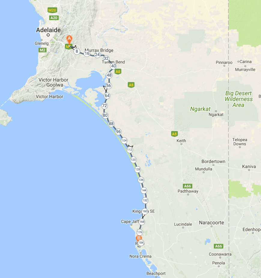
It was now day two of our trip (Saturday 10th March 2018).  We had two planned activations for the day, with the first being the Little Dip Conservation Park 5CP-120 & VKFF-0904.  The park is located about 5 km south of Robe.

Screen Shot 2018-02-24 at 11.42.53 am.png

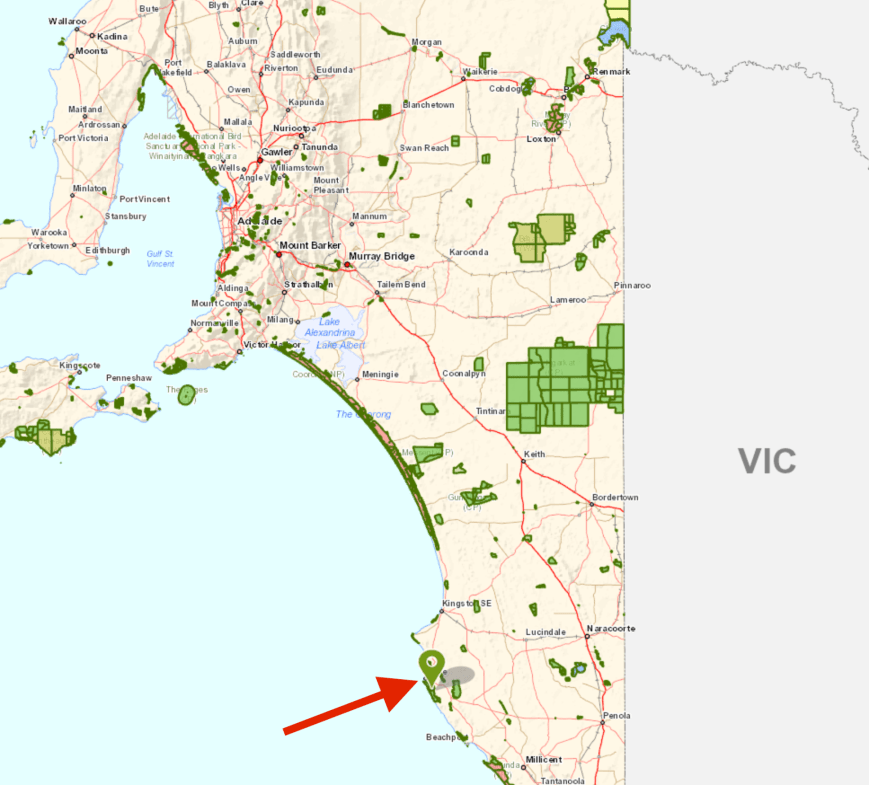
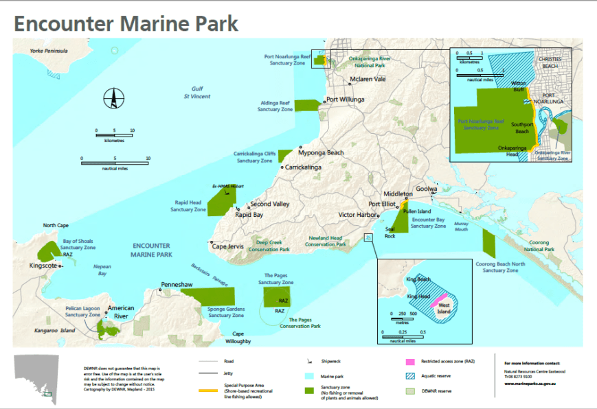
Above:- Map showing the location of the Little Dip Conservation Park.  Map courtesy of Location SA Map Viewer.

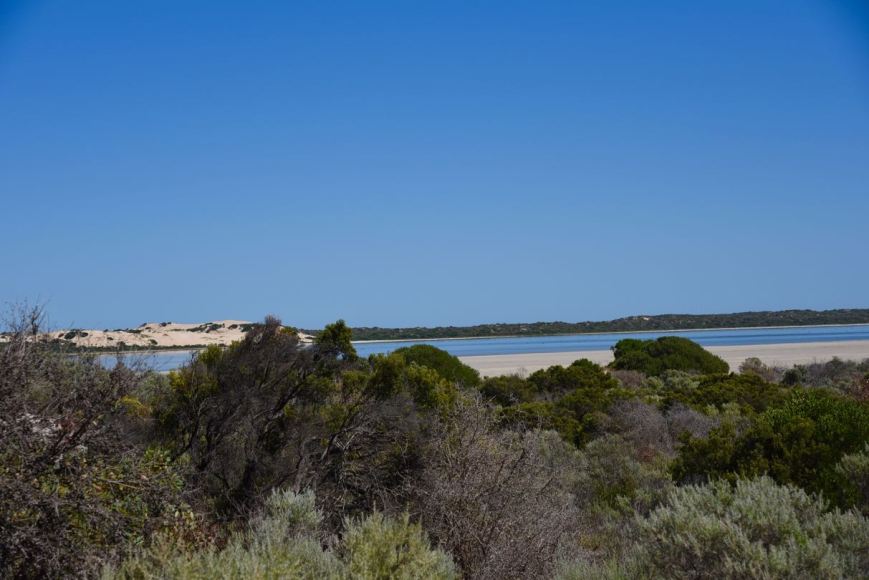
Little Dip Conservation Park is 21.5 km2 in size and was established on the 21st August 1975.  The park comprises two distinct landscapes.  Firstly a coastal strip containing sand dunes, cliffs, shore platforms, reefs and islets.  The coastal strip is about 11 km long.  The park also conserves a number of small lakes, with each lake having its own unique character, ranging from the open, marshy and shallow Lake Eliza to the very salty Big Dip Lake, and the deep Fresh Water Lake.

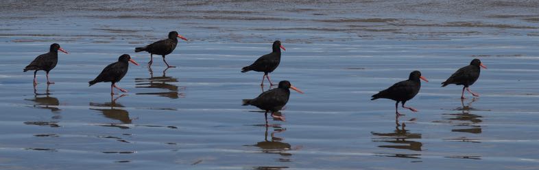
The area features a ruggedly beautiful coastline including a large area of coastal sand dunes.  The coastal scrub that gives way to thick groves of melaleuca, dense rushes and samphire flats surrounding the lakes is a haven for birdwatchers. The beaches provide good opportunities for beachcombing and surf fishing.

The foreshore of Lake Eliza was home to the Boandik aboriginal people some 10,000 years ago.  Large numbers of middens (shellfish remains) can still be seen in the park today.

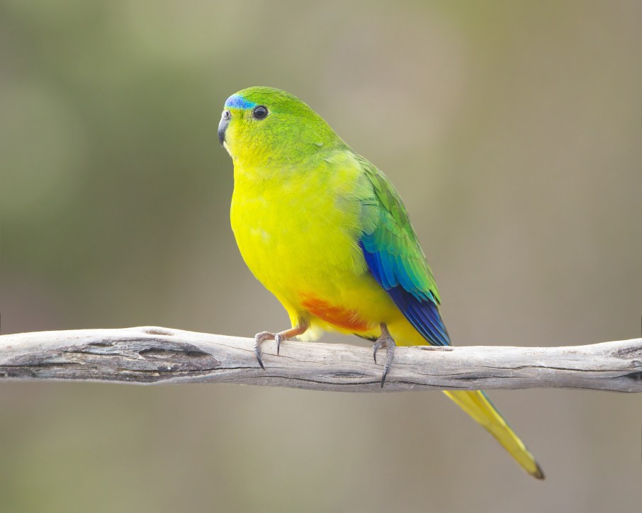
Several species of native animals can be found in the park, which were once wide spread in the South East area.  They include the Swamp Antechinus and the Swamp Rat.  The rare and endangered Orange-bellied Parrot frequents the park as it migrates along the Victorian and South Australian coast during winter.  The vulnerable Rufous Bristlebird can also be found in the park.

Rufous_Bristlebird_(Dasyornis_broadbenti)_(8079652394).jpg

Above:- Rufous Bristlebird.  Image courtesy of wikipedia.

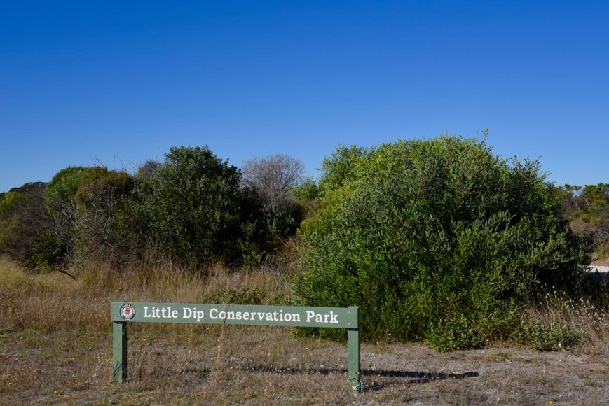
We travelled south out or Robe along the Nora Creina Road and soon came across the park sign.

DSC_0340

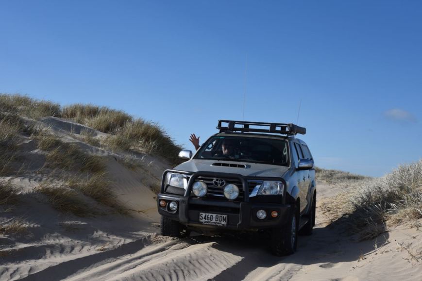
We tried a number of tracks but there didn’t appear to be too much opportunity of stretching out the dipole.  This included the track down to Little Dip Beach.

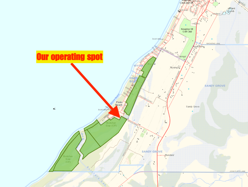
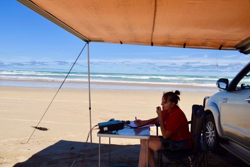
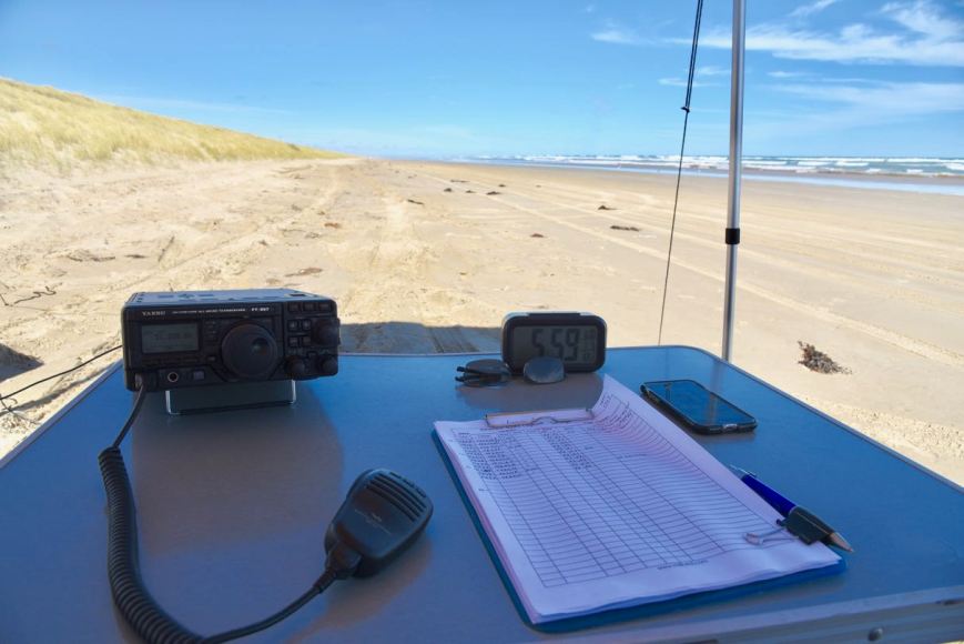
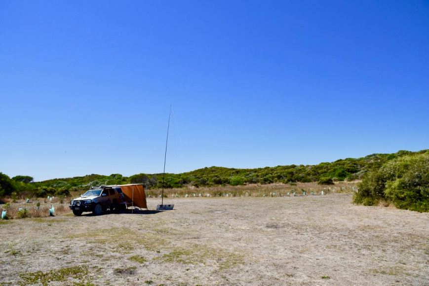
We ended up going to the Long Gully campground area and this was ideal.  There was only one caravan in the campground, and plenty of room for us to set up.

Screen Shot 2018-03-13 at 5.25.58 pm.png

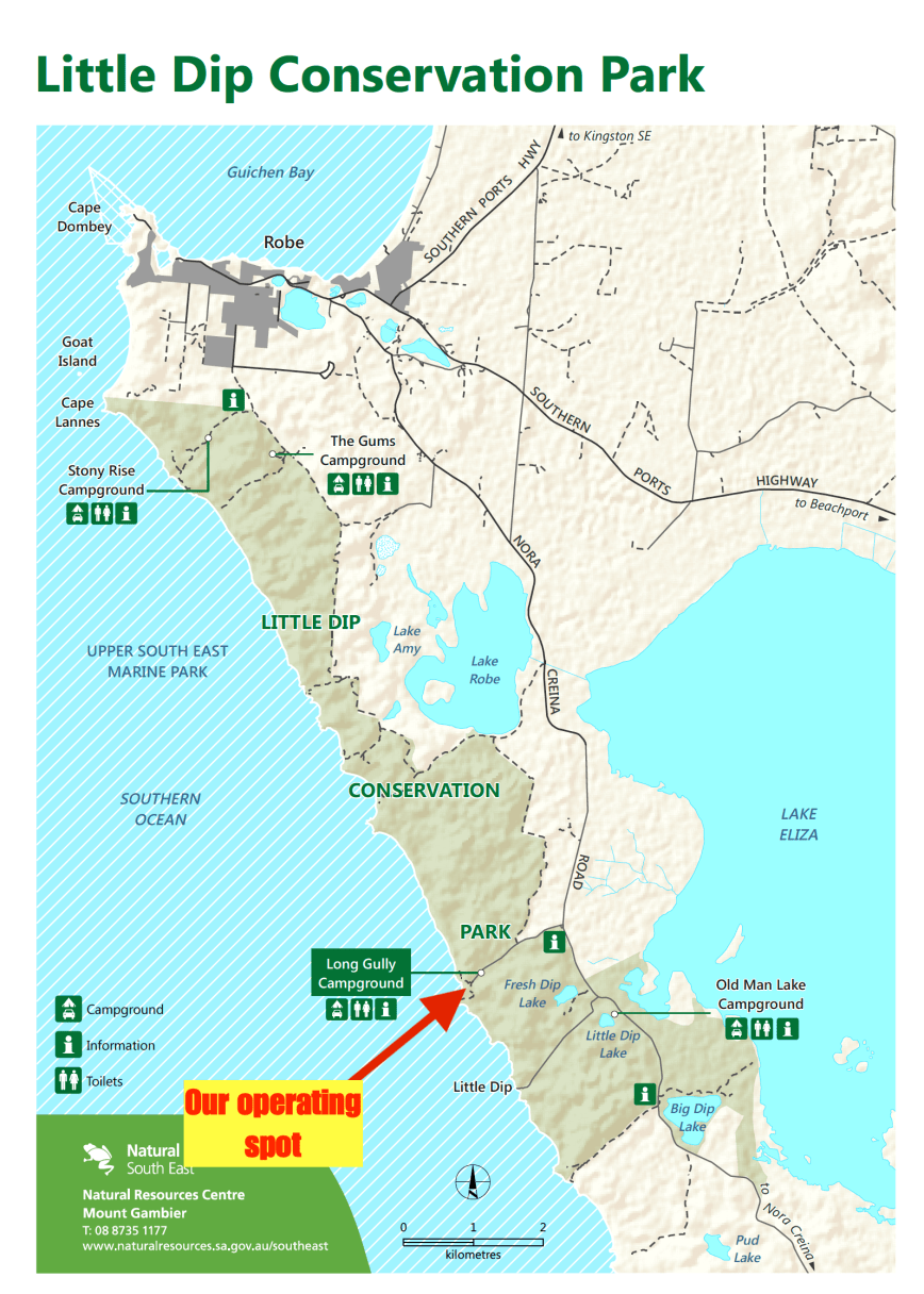
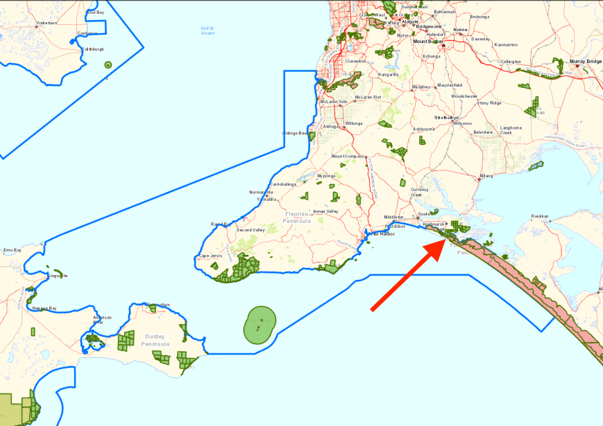
Above:- Map of the Little Dip Conservation Park, showing our operating spot at Long Gully campground.  Image courtesy of National Parks SA.

Long Gully is essentially a paddock in amongst the scrub and the sand dunes.  The camp ground has toilet facilities, but very little shade.

Screen Shot 2018-03-13 at 5.30.30 pm.png

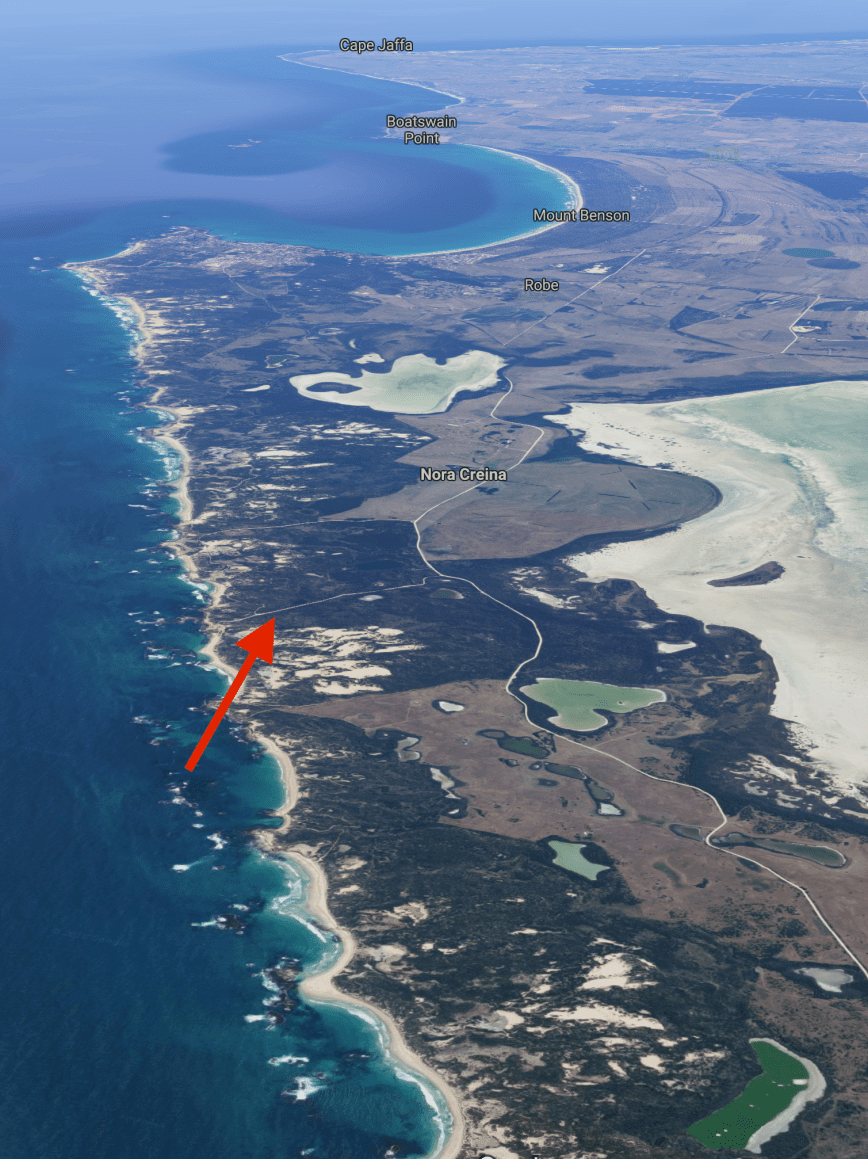
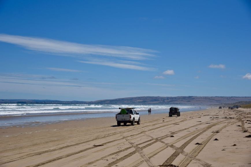
Above:- Aerial shot of the park showing our operating spot.  Image courtesy of google maps.

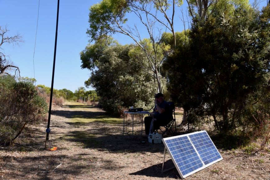
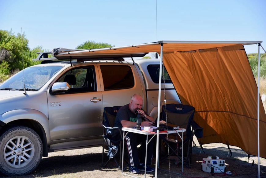
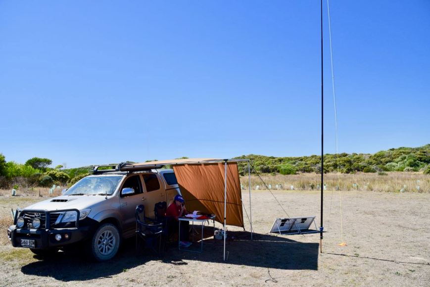
As there wasn’t much shade we rolled out the awning on the Toyota Hi Lux and made ourselves comfortable in the deck chairs.  It was already a warm morning, with the top temperature expected to be around 34 deg C.

DSC_0347

After setting up we tuned across the 40m band hoping to get some Park to Park contacts in the log.  It didn’t take us long, finding the Riverland Radio Club boys on 7.150 activating an island on the Murray River.  We logged Peter VK5PE/p, Danny VK5DW/p, Ivan VK5HS/p, and Andy VK5LA/p on Media Island Conservation Park 5CP-132 & VKFF-1058.  They were booming in to Little Dip with S9 plus signals.

We then found Tony VK3XV/5 on 7.139 portable in the Grass Tree Conservation Park 5CP-080 & VKFF-0885.  As Tony was quite close to us, signals were low down, but we made it comfortably exchanging 5/1 signal reports.

I then found a clear frequency and started calling CQ on 7.155.  This was answered by Eric VK7EV mobile, with an excellent 5/7 signal.  This was followed by Les VK5KLV/p who was activating the Clements Gap Conservation Park 5CP-043 & VKFF-0812.  Each time a park activator popped up, Marija and I would swap the mic so she could log the Park to Park contact.

I had a steady flow of callers from across Australia, but it was noticeable that there were not as many VK5 park activators out this year.  I’m not sure of the definitive reason why?  However it was pleasing to see a number of interstate park activators out and about taking advantage of the Park to Park opportunities.

DSC_0353

I logged a total of 39 stations on 40m including the following further Park to Park contacts:

  • VK5WAT/3 (Langwarrin Flora & Fauna Reserve VKFF-2031)
  • VK1DI/p (Crace Grassland Nature Reserve VKFF-0838)
  • VK3ANL/p (Gresswell Forest Nature Conservation Reserve VKFF-2103)
  • VK3FMPB/p (Kinglake National Park VKFF-2103)
  • VK5HSX/3 (Creswick Regional Park VKFF-0964)
  • VK5PET/p (Monarto Woodlands Conservation Park 5CP-276 & VKFF-1763)
  • VK4AAC/2 (Tarlo River National Park VKFF-0478)

We then lowered the squid pole and inserted the links for the 80m section of the dipole.  Marija had seen quite a few spots pop up on parksnpeaks for VK5 activators who we were unable to hear on the 40m band.  We were hopeful they would see our spot on 80m on parksnpeaks and follow us down for a contact.  But sadly that didn’t happen, except for Adrian VK5FANA/p who was in the Bird Islands Conservation Park 5CP-021 & VKFF-0871.  Our only other contacts on 80m were with Peter VK3PF with a good 5/6 signal, and John VK5BJE who was a strong 5/8.

I now needed just 2 more contacts to get my 44 QSOs, required to qualify the park for the global WWFF program.  So I headed back to 40m where I (we) logged the Riverland boys again, who this time were in the Rilli Island Conservation Park 5CP-198 & VKFF-1087.  This time around the signal of Andy VK5LA, Peter VK5PE, Ivan VK5HS, and Danny VK5DW was down quite low.  But we were able to comfortably exchange signal reports, and it was great to get another brand new park in the log.  Even better, Park to Park.

After working the boys I headed to 7.135 and called CQ where I logged Adrian VK5FANA/p in the Bird Islands Conservation Park 5CP-021 & VKFF-0871, followed by Bob VK3SX.

DSC_0345

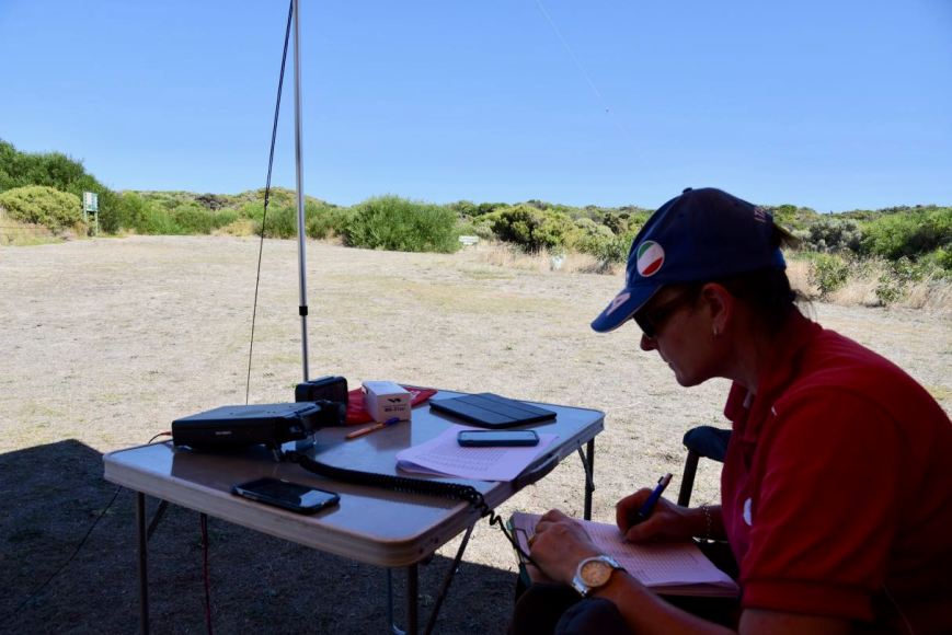
Marija had already qualified the park for the VKFF program, but I encouraged her to get back on air and see if she could get 44 contacts to qualify the park for the global WWFF program.  So it was back into the menu and lowering the power back down to 10 watts PEP.  Marija quickly had a little pile up going and within 30 minutes had 44 contacts in the log.  Contact number 44 was with Martin VK7GN, the husband of Linda VK7QP, who has become a keen park activator and hunter in recent times.

Whilst Marija was on air we were visited by two of the local DEWNR rangers, who were very friendly and talkative and were aware of the parks program.

We then had a tune across the 40m band and logged Tony VK3XV/5 who was activating the Mullinger Swamp Conservation Park 5CP-153 & VKFF-1065.  This was another new park for both Marija and I.

I then tried my luck on the 20m band, but the only caller there was Gerard VK2JNG/p, who was not in a park on this occasion.  A very rare event indeed, as Gerard has become a very very active park activator.

I then moved back to 40m where I logged a further 29 stations from VK2, VK3, VK4, VK5, and VK7, including another Park to Park contact, this time with Gerard VK2IO/p who was in the Heathcote National Park VKFF-0232.

DSC_0348

It was now 1.45 p.m. and time to pack up and head off to our second park, the Lake St Clair Conservation Park.  Together we had 128 contacts in the log, and 44 Park to Park contacts.

Marija worked the following stations on 40m SSB:-

  1. VK5PE/p (Media Island Conservation Park 5CP-132 & VKFF-1058)
  2. VK5DW/p (Media Island Conservation Park 5CP-132 & VKFF-1058)
  3. VK5HS/p (Media Island Conservation Park 5CP-132 & VKFF-1058)
  4. VK5LA/p (Media Island Conservation Park 5CP-132 & VKFF-1058)
  5. VK3XV/5 (Grass Tree Conservation Park 5CP-080 & VKFF-0885)
  6. VK5KLV/p (Clements Gap Conservation Park 5CP-043 & VKFF-0812)
  7. VK5WAT/3 (Langwarrin Flora & Fauna Reserve VKFF-2031)
  8. VK1DI/p (Crace Grassland Nature Reserve VKFF-0838)
  9. VK3ANL/p (Gresswell Forest Nature Conservation Reserve VKFF-2103)
  10. VK3FMPB/p (Kinglake National Park VKFF-0264)
  11. VK5HSX/3 (Creswick Regional Park VKFF-0964)
  12. VK5PET/p (Monarto Woodlands Conservation Park 5CP-276 & VKFF-1763)
  13. VK4AAC/2 (Tarlo River National Park VKFF-0478)
  14. VK5LA/p (Rilli Island Conservation Park 5CP-198 & VKFF-1087)
  15. VK5PE/p (Rilli Island Conservation Park 5CP-198 & VKFF-1087)
  16. VK5HS/p (Rilli Island Conservation Park 5CP-198 & VKFF-1087)
  17. VK5DW/p (Rilli Island Conservation Park 5CP-198 & VKFF-1087)
  18. VK5FANA/p (Bird Islands Conservation Park 5CP-021 & VKFF-0871)
  19. VK3SX
  20. VK3AHR
  21. VK1RZ
  22. VK3BBB
  23. VK5ZPG
  24. VK3MRG/p
  25. VK3PF
  26. VK4TJ
  27. VK4NH
  28. VK4DXA
  29. ZL4TY/VK4
  30. VK3TJC
  31. VK2AB
  32. VK3UH
  33. VK7QP
  34. VK2KYO
  35. VK2GKA
  36. VK3SQ
  37. VK2JNG/p
  38. VK1FCLU
  39. VK2FABE
  40. VK3FSPG
  41. VK3MPR
  42. VK7GN
  43. VK4FDJL
  44. VK3KAI
  45. VK3DRH
  46. VK3XV/5 (Mullinger Swamp Conservation Park 5CP-153 & VKFF-1065)
  47. VK2IO/p (Heathcote National Park VKFF-0232)

Marija worked the following stations on 80m SSB:-

  1. VK5BJE
  2. VK5FANA/p (Bird Islands Conservation Park 5CP-021 & VKFF-0871)

I worked the following stations on 40m SSB:-

  1. VK5PE/p (Media Island Conservation Park 5CP-132 & VKFF-1058)
  2. VK5DW/p (Media Island Conservation Park 5CP-132 & VKFF-1058)
  3. VK5HS/p (Media Island Conservation Park 5CP-132 & VKFF-1058)
  4. VK5LA/p (Media Island Conservation Park 5CP-132 & VKFF-1058)
  5. VK3XV/5 (Grass Tree Conservation Park 5CP-080 & VKFF-0885)
  6. VK7EV/m
  7. VK5KLV/p (Clements Gap Conservation Park 5CP-043 & VKFF-0812)
  8. VK3SQ
  9. VK2LEE
  10. VK5WAT/3 (Langwarrin Flora & Fauna Reserve VKFF-2031)
  11. VK3BBB
  12. VK2EXA
  13. VK1DI/p (Crace Grassland Nature Reserve VKFF-0838)
  14. VK2PKT
  15. VK3ANL/p (Gresswell Forest Nature Conservation Reserve VKFF-2103)
  16. VK3FMPB/p (Kinglake National Park VKFF-0264)
  17. VK2HHA
  18. VK3MRG/p
  19. VK5HSX/3 (Creswick Regional Park VKFF-0964)
  20. VK4FDJL
  21. VK5PET/p (Monarto Woodlands Conservation Park 5CP-276 & VKFF-1763)
  22. VK3FLCS
  23. VK3FSPG
  24. VK3MPR
  25. VK2KYO
  26. VK7JON/m
  27. VK7FOLK/m
  28. VK7QP
  29. VK3UH
  30. VK2KMI
  31. VK2IO
  32. VK2NP
  33. VK3FMKE
  34. VK3PF
  35. VK4TJ
  36. VK2USH
  37. VK4AAC/2 (Tarlo River National Park VKFF-0478)
  38. VK3MWD
  39. VK3GMC
  40. VK5LA/p (Rilli Island Conservation Park 5CP-198 & VKFF-1087)
  41. VK5PE/p (Rilli Island Conservation Park 5CP-198 & VKFF-1087)
  42. VK5HS/p (Rilli Island Conservation Park 5CP-198 & VKFF-1087)
  43. VK5DW/p (Rilli Island Conservation Park 5CP-198 & VKFF-1087)
  44. VK5FANA/p (Bird Islands Conservation Park 5CP-021 & VKFF-0871)
  45. VK3SX
  46. VK3XV/5 (Mullinger Swamp Conservation Park 5CP-153 & VKFF-1065)
  47. VK3PAT/p
  48. VK5MRT
  49. VK2LX
  50. VK2VW
  51. VK5BMC
  52. VK5ZPG
  53. VK3FRJD
  54. VK7EK
  55. VK5PL
  56. VK5YX/2 (Kosciuszko National Park VKFF-0269)
  57. VK5LOL/2 (Kosciuszko National Park VKFF-0269)
  58. VK3VAR
  59. VK5FANA/m
  60. VK3FXBR
  61. VK3HOT
  62. VK3TKK/m
  63. VK3DQ
  64. VK7VZ/p
  65. VK3BF
  66. VK5KFB
  67. VK7NWT
  68. VK3DAC
  69. VK3TP
  70. VK4NH
  71. VK4DXA
  72. ZL4TY/VK4
  73. VK5VBR
  74. VK3FHCT
  75. VK2IO/p (Heathcote National Park VKFF-0232)

I worked the following stations on 80m SSB:-

  1. VK3PF
  2. VK5BJE
  3. VK5FANA/p (Bird Islands Conservation Park 5CP-021 & VKFF-0871)

I worked the following stations on 20m SSB:-

  1. VK2JNG/p


References.

National Parks and Wildlife Service, Department of Environment and Planning, ‘Little Dip Conservation Park Management Plan’.

National Parks South Australia, 2018, <https://www.environment.sa.gov.au/parks/find-a-park/Browse_by_region/Limestone_Coast/little-dip-conservation-park>, viewed 13th March 2018

Wikipedia, 2018, <https://en.wikipedia.org/wiki/Little_Dip_Conservation_Park>, viewed 13th March 2018

Butcher Gap Conservation Park 5CP-027 and VKFF-0793

The weekend just gone (Saturday 10th & Sunday 11th March 2018) saw the special activation weekend for the 5th anniversary of the VK5 National & Conservation Parks Award.  The Award which commenced in April, 2013, promotes portable activity from South Australia’s National & Conservation Parks.  And every year in March or April a special activation weekend is held to celebrate the anniversary of the award.

On Friday 9th March 2018, my wife Marija VK5FMAZ and I headed down to the South East region of South Australia to activate some parks, and spend 3 nights in the beautiful seaside town of Robe.  It is about a 300 km drive from our home in the Adelaide Hills to Robe.  We decided to take the Princes Highway from Tailem Bend down to Meningie, and then onwards to Robe following the coastline and the Coorong National Park.

Screen Shot 2018-03-13 at 9.15.56 am.png

Above:- Our journey from the Adelaide Hills to Robe in the South East of South Australia.  Map courtesy of plotaroute.com.

Between Tailem Bend and Meningie we had a tune across the band and found Rob VK4AAC/2 calling CQ from the Bungonia National Park VKFF-1163.  Rob had a good 5/7 signal and gave us a 5/5 signal report from the mobile.  Soon after we worked Tony VK3XV/5 who was activating the Desert Camp Conservation Reserve VKFF-1705.  Tony had come over with his wife Sheryl from Victoria to take part in the 5th year anniversary event.  Many thanks Tony and Sheryl.

Our first stop of the morning was at Salt Creek, a small settlement about 61 km south east of Meningie.  We stopped briefly to have a look at the Oil rig monument.  In 1892, a group of entrepreneurs, who believed there was oil located in the Coorong, drilled Australia’s first oil well.  They were unsuccessful, as it was later discovered that the ‘oil’ was in fact a flammable, compacted vegetable substance known as ‘coorongite’.

DSC_0248

Above:- Marija at the Oil rig monument at Salt Creek.

Marija and I decided to venture off the Princes Highway and take the Coorong Loop Road through the Coorong National Park 5NP-005 & VKFF-0115.  The loop road commences at Salt Creek and travels about 13 km through the park before joining up again with the Princes Highway.  Whilst on the Loop Road we stopped briefly to make a Park to Park contact with Tony VK3XV/5 in the Desert Camp Conservation Reserve.

DSC_0250

Above:- Our view of the Coorong during our contact with Tony VK3XV.

Our next stop was just a little further down the road at Chinaman’s Well which is located in the  Coorong National Park.  The area is so named due to a freshwater well which was constructed in the 1850’s.

During the 1850’s thousands of Chinese people landed in South Australia with the prospect of making their wealth on the Victorian goldfields at Ballarat, Bendigo, Castlemaine, and Beechworth.  Those that did arrive in South Australia walked the 800 km to the goldfields across wetlands, desert, hills and plains.

Why walk from South Australia?  Why not land in the Port of Melbourne?  In an attempt to limit the number of Chinese on the Victorian goldfields, a law was passed which stated that any Chinese person entering the Colony of Victoria would pay a ten pound tax and one pound protection fee, for the right to mine and live in the colony.  As a result ships arriving from overseas would drop the Chinese arrivals off in Sydney or Adelaide.

static1.squarespace.jpg

Above:- A Chinese emigrant on the journey to the Victorian Goldfields..  Image courtesy of http://www.kidcyber.com.au/gold-rush-in-australia/

Between 1857 and 1863 it is estimated that over 17,000 Chinese walked from South Australia to the Victorian goldfields.  In 1859, at the peak of the Victorian gold rush, the Chinese population in Victoria reached 46,000.  The Chinese made up about 1/5th of the total male population in the mining towns in Victoria in this period.

You can do a 45 minutes walk here and view the sandstone and limestone quarries and the well itself.  Although there are interpretive signs, sadly the walk is not well signposted.  But it is well worth doing and gives you a very good impression of the oppressive journey that the Chinese undertook in the hope of finding gold.

This slideshow requires JavaScript.

Marija and I continued south on the Princes Highway towards Kingston SE.  Along the way we logged Tony VK3XV/5 who was now in the Padthaway Conservation Park 5CP-169 & VKFF-0924.

We stopped briefly at the town of Kingston SE.  The town was named after Sir George Strickland Kingston, a South Australian politician, surveyor and architect.  The town was established in 1861 and was originally known as Kingston.  The extension on its name is to distinguish Kingston in the South East (of South Australia) from another ‘Kingston’ in the state which is now officially named “Kingston On Murray” was added in July 1940.

One of the famous attractions in the town is the Big Lobster, known as ‘Larry’ by the people of Kingston.   ‘Larry’ is a sculpture of a spiny lobster, and stands around 17 metres tall.  It can be located outside of a former visitor centre and restaurant, which sadly is no longer in operation.

DSC_0262

‘Larry’ the Lobster

Another attraction in the town is the Cape Jaffa Lighthouse, which is a decommissioned lighthouse formerly located on Margaret Brock Reef near Cape Jaffa on the south east coast of South Australia.  The tower has been located in the town of Kingston SE since 1976.

We stopped off at a local cafe and picked up some lunch and headed down to the foreshore and enjoyed lunch whilst watching the ocean.

It was around 2.30 in the afternoon and we were quite close to Robe, so we decided to do a quick park activation at the Butcher Gap Conservation Park 5CP-027 & VKFF-0793.  This was to be a new park for both Marija and I, for both the VK5 Parks Award and the World Wide Flora Fauna (WWFF) program.

The park is located about 6 km south of the town of Kingston and about 294 km (by road) south east of Adelaide.

Screen Shot 2018-03-12 at 8.41.19 pm.png

Above:- Map showing the location of the Butcher Gap Conservation Park in the South East region of South Australia.  Map courtesy of Location SA Map Viewer.

Butcher Gap Conservation Park is 180 hectares in size and was first proclaimed on 29th March 1990.  It is one of the last remaining significant coastal scrubs between the Coorong and Robe.  The park encompasses Salt Lake and Butcher Lake, and is separated by the Butcher Gap Drain which brings large amounts of fresh water from the farmlands, through the park and out to sea.

The park’s wetland area supports an association of dense South Australian Swamp Paperbark over marine meadow, while the remainder of the Park is a coastal scrub association.  Salt Lake usually holds water between June and January.

The park attracts an array of wildlife throughout the year. Seasonal waterbirds such as swans and white-faced herons frequent the lakes, while small bush birds may be seen along the park’s scenic walking trails.  During the months of spring and summer, the area is visited by Japanese snipe and other wading birds.  In winter the park provides an important refuge for the endangered orange-bellied parrot.

The following birds have been recorded in the park: Superb Fairywren, Spiny-cheeked Honeyeater, Singing Honeyeater, Brown Thornbill, Silvereye, Beautiful Firetail, Latham’s Snipe, Common Bronzewing, Rufous Bristlebird, Yellow-rumped Thornbill, White-browed Babbler, Orange bellied parrot, and Red-browed Finch.

Neophema_chrysogaster_male_-_Melaleuca.jpg

Above: Orange bellied parrot.  Image courtesy of wikipedia

To get to the park we travelled along Pinks Beach Road which runs off the Southern Ports Highway.  As you enter the 50 kph area of Pinks Beach you will see a small brown sign on the southern side of the road which reads ‘Butchers Gap Conservation Park’.  There is a driveway here which leads to a small parking area.

We parked the vehicle and then walked about 50 metres down the wide track and set up our station which consisted of the Yaesu FT-897 and the 20/40/80m linked dipole.

Screen Shot 2018-03-12 at 8.43.42 pm.png

Map showing our operating spot in the park.  Map courtesy of Location SA Map Viewer.

Our intention was just to get 10 contacts and qualify the park for the VKFF program, so Marija and I decided to swap the mic during the activation.  This meant that we could only run 10 watts PEP due to Marija’s Foundation licence conditions.

Prior to calling CQ we tuned across the 40m band and worked Tony VK3XV/5 who was activating the Padthaway Conservation Park 5CP-169 & VKFF-0924.  Padthaway was only about 96 km away by road, so due to us being close to each other, signals were well down.  However due to the lack of man made noise on the band from each park, we were able to easily log each other.

We then moved down to 7.139 and started calling CQ.  This was answered by Peter VK3PF, followed by Peter VK5ZPG, and then Deryck VK4FDJL.  But it was really hard going, with very few takers.  Peter VK3PF came back to us and kindly gave us another one of his calls VK3KAI.  We were quite concerned that we weren’t going to get our 10 contacts to qualify the park for VKFF.

With 8 contacts in the log, I decided to take a few photos, and Marija kept persevering.  Finally, after 23 minutes, Marija had contact number 10 in the log, a QSO with Ross VK7ALH.

Marija logged a total of 24 stations and we then swapped the mic.  Marija took a break and I jumped into the ‘drivers seat’.  I logged a total of 24 stations on 40m from VK1, VK2, VK3, VK4, VK5 and VK7, before deciding to try the 20m band.

I headed to 14.310 and started calling CQ, but soon had to put up with the Over the Horizon Radar.  Ross VK7ALH was my first caller, who had followed me up from 40m.  This was followed by Dale VK4NBX and then Ray VK4NH.

I was now just 5 short of the required 44 QSOs to qualify the park for WWFF.  As I hadn’t logged many South Australian stations I decided to try the 80m band.  Greg VK5GJ was first in the log there, followed by Ivan VK5HS and then Norm VK5GI.  Marija also logged Greg, Ivan, and Norm.  Sadly, they were our only takers on 80m.

So with just 2 QSOs needed, I headed back to 40m and called CQ again on 7.139.  Ivan VK5HS had followed me back to 40m and he was my 43rd contact, followed by Mick VK3DDZ who was the magical 44th contact.

DSC_0275

It was now around 4.30 p.m. and time to pack up, with a 40km trip ahead of us down to Robe.  Marija and I had both qualified the park for the VK5 Parks Award, and VKFF.  And despite hard work, I had also qualified the park for the global WWFF program.

Marija worked the following stations on 40m SSB:-

  1. VK3XV/5 (Padthaway Conservation Park 5CP-169 & VKFF-0924)
  2. VK3PF
  3. VK5ZPG
  4. VK4FDJL
  5. VK3KAI
  6. VK2HHA
  7. VK5FANA
  8. VK3SQ
  9. VK2EXA
  10. VK7ALH
  11. VK2RP/m
  12. VK2PKT
  13. VK2KYO
  14. VK3UH
  15. VK3MIJ
  16. VK7FRJG
  17. VK5KLV
  18. VK3WAR
  19. VK3ZD
  20. VK2AKB
  21. VK3FSPG
  22. VK3MPR
  23. VK7QP
  24. VK3SIM
  25. VK5GJ
  26. VK5HS
  27. VK5GI

I worked the following stations on 40m SSB:-

  1. VK3XV/5 (Padthaway Conservation Park 5CP-169 & VKFF-0924)
  2. VK3PF
  3. VK5ZPG
  4. VK4FDJL
  5. VK3KAI
  6. VK2HHA
  7. VK5FANA
  8. VK3SQ
  9. VK3SIM
  10. VK5KLV
  11. VK2EXA
  12. VK7ALH
  13. VK2PKT
  14. VK3FSPG
  15. VK3MPR
  16. VK2NP
  17. VK2BDR/m
  18. VK2RP/m
  19. VK7VZ/p
  20. VK7FRJG
  21. VK3WAR
  22. VK1MIC
  23. VK7DIK
  24. VK3FLCS
  25. VK2USH
  26. VK3ZVX
  27. VK3UH
  28. VK4FARR
  29. VK2IO
  30. VK3BU
  31. VK3VGB
  32. VK7LH
  33. VK2YK
  34. VK3TKK/m
  35. VK5HS
  36. VK2DDZ

I worked the following stations on 20m SSB:-

  1. VK7ALH
  2. VK4NBX
  3. VK4NH
  4. VK4DXA
  5. ZL4TY/VK4

I worked the following stations on 80m SSB:-

  1. VK5GJ
  2. VK5HS
  3. VK5GI

Once we had pack up Marija and I drove to the end of Pinks Beach Road to have a look at the beach on the Lacapede Bay.  There were plenty of fishermen there enjoying the late afternoon sun.

We soon reached the town of Robe, where we had booked in for 3 nights at the Robe Harbour View Motel.  After checking in and offloading some of our bags, we ventured out to explore Robe.  The town was named in 1846 after Governor Frederick Holt Robe who was apparently one of South Australia’s most unpopular Governors.  An editor of a particular newspaper at the time wrote of Robe: ‘never a man who worked so hard to make himself unpopular‘.  Whatever the origins of the town, this is a truly beautiful spot.

Our first stop was the Lake Butler Marina at Robe which was very busy.  A total of 32 commercial fishing boats and about 30 recreational boats moor in the marina.

We then had a look at the remains of the old Robe Gaol.  It was operational between 1860 to 1870 when it was closed.  It reopened in 1872 but was again closed in 1881.  The walls were reinforced with steel boiler plates from the wreck of the SS Admella in an effort to contain potential escapes.

We continued down Obelisk Road and checked out the Robe obelisk which is located on Cape Combey.  It was built in 1855 by local builder George Shivas at the cost of about 230 pounds.  It is 40 feet high and stands about 100 feet above sea level.  It was carried to its site by a 32 bullock wagon team.  There is also a nice walk here to the top of a hill which offers some great views of Robe.

Robe is full of historic buildings, and one of the most iconic is the Robe Customs House which was built in 1863 and used for about 25 years as a Customs House and office of Harbour Master & Receiver of Wrecks.  It later became a local council office.  It is now a National Trust Museum and sits on the top of a hill on Royal Circus, Robe.

DSC_0331

Just across the road is the monument for explorers Matthew Flinders and Nicolas Baudin.  It features portrait busts of the explorers.  In 1801 Matthew Flinders set out from England aboard the Investigator.  A few months earlier Nicholas Baudin set sail from France aboard the Le Geographe.  Both men were charged with the tasks of scientific and geographical exploration and had intentions to map the Southern Contintent.  As it would happen, their voyages overlapped and they met in South Australia.

Another interesting memorial to have a look at is the Chinese Memorial.  During the years 1856-1858 around 16,500 Chinese landed at Robe and walked the 321 km (200 miles) to the Victorian Goldfields in search of gold.

DSC_0332

We then headed off to the Robe Hotel for a meal and some nice cold beverages.  The meal was very nice and the service was good.  This was reflected by the number of people that were there – it was a struggle to get a table.

Following our meal we drove down to the cliffs at Adam Lindsay Drive and enjoyed the sunset.  We then headed back to the motel room where Marija called it a night earlier, whilst I sat back in bed and watched Arnie Schwarzenegger in Predator.

DSC_0338


References.

Birds SA, 2018, <https://birdssa.asn.au/location/butcher-gap-conservation-park/>, viewed 13th March 2018

Culture Victoria, 2018, <https://cv.vic.gov.au/stories/immigrants-and-emigrants/many-roads-chinese-on-the-goldfields/walking-to-the-diggings/different-routes/>, viewed 13th March 2018

Department of Environment and Natural Resources, 1994, ‘Small Coastal Parks of the South East Management Plan’.

District Council of Robe, 2018, <http://www.council.robe.sa.gov.au/>, viewed 13th March 2018

kidcyber, 2018, <http://www.kidcyber.com.au/gold-rush-in-australia/>, viewed 13th March 2018

Monuments Australia, 2018, <http://monumentaustralia.org.au/themes/landscape/exploration/display/102986-matthew-flinders-and-nicholas-baudin->, viewed 13th March 2018

National Parks SA, 2018, <https://www.environment.sa.gov.au/parks/find-a-park/Browse_by_region/Limestone_Coast/butcher-gap-conservation-park>, viewed 13th March 2018

Wikipedia, 2018, <https://en.wikipedia.org/wiki/Salt_Creek,_South_Australia>, viewed 13th March 2018

Wikipedia, 2018, <https://en.wikipedia.org/wiki/Kingston_SE>, viewed 13th March 2018

Encounter Marine Park VKFF-1707

Yesterday afternoon (Saturday 3rd March 2018), Marija VK5FMAZ and I went for a drive down to the Fleurieu Peninsula to undertake a beach activation from the Encounter Marine Park VKFF-1707.  It was a beautiful 26 degree C day so we decided sitting on the beach playing a bit of radio was a nice way to spend the afternoon.

The Encounter Marine Park is a large marine park which extends from near Port Noarlunga south of Adelaide, down to the north eastern coast of Kangaroo Island, and around to the Coorong National Park.  We decided on activating the park from Goolwa Beach, not far from the mouth of the Murray River.

Screen Shot 2018-03-04 at 3.45.39 pm.png

Map showing the location of the Encounter Marine Park.  Map courtesy of National Parks SA.

Marija and I left home early afternoon and drove down to the historic town of Strathalbyn and then down through the wine growing region of Currency Creek and on to the historic port town of Goolwa which is located on the Fleurieu Peninsula.

The Fleurieu was named after Charles Pierre Claret de Fleurieu, the French explorer and hydrographer, by the French explorer Nicolas Baudin as he explored the south coast of Australia in 1802.  It is a great part of South Australia, where I lived and worked back in the mid 1980’s.  The video below gives you a great snapshot of the Fleurieu….

After reaching the town of Goolwa, we drove to the end of Beach Road.  There is beach access here, but don’t attempt it in a conventional vehicle.  Unlike some other beaches which permit vehicular access in South Australia, Goolwa is only suitable for 4WD vehicles.  I’d recommend that if you do intend driving down onto the beach, that you lower your tyre pressure.  Once on the beach it is generally ok, but there is deep sand at the entry point.  And if you intend to go all the way to the mouth of the Murray River, you will definitely need low pressure in your tyres and will probably need to use low 4WD.

Screen Shot 2018-03-04 at 4.03.55 pm.png

Above:- Map of the park showing our operating spot.  Map courtesy of Location SA Map Viewer.

The Encounter Marine Park encompasses the waters off southern metropolitan Adelaide and the Fleurieu Peninsula.  It extends past the Murray Mouth to the Coorong coast.  At its western boundary, the park includes all waters of Backstairs Passage and the eastern shores of Kangaroo Island.  The park is 3,119 km2 in size and represents 12% of the marine park network in South Australia.

The park contains some of Australia’s best preserved ocean wilderness, including amazing dive sites and spectacular reefs which provide refuge for vitally important fish breeding and shelter areas.  Fishing is very popular within the park, along with diving, and surfing.  Leafy Sea Dragons are found in the park, along with Sea Lions, and Southern Right Whales.

As it was a nice sunny day, there was quite a bit of activity on the beach.  There were lots of swimmers to the west of the Beach Road entrance where I suspect there were Surf Lifesavers on duty.  The waters here can be quite treacherous.  This is one of the most hazardous beaches in South Australia for swimming.

DSC_0189

The beach is part of Encounter Bay, which was named by explorer Matthew Flinders after his encounter on 8 April 1802 with Nicolas Baudin, the commander of the French Baudin expedition of 1800-03.

As we drove along the beach we saw a large amount of birdlife including Sooty Oystercatchers and Gulls.  Sooty Oystercatchers eat molluscs, and invertebrates such as crustaceans and worms and are common on Goolwa Beach.

DSC_0231

Marija and I travelled a few km along the beach and found a nice quite spot and started setting up our station.  We rolled out the awning on the 4WD and set up the fold up table and deck chairs.  For this activation we used the Yaesu FT-857d and the 80/40/20m linked dipole supported on the 7m squid pole, and the 15m 1/2 wave dipole.  Whilst Marija was on air we ran 10 watts as Marija is limited to that amount of power with her Foundation licence.  Whilst I was on air, I ramped up the output power to 40 watts.

As I have activated and qualified this park previously, Marija kicked off the activation, seeking 10 contacts to qualify the park for the VKFF program.  Marija’s first contact was Gerard VK2JNG/p who was activating the Werakata State Conservation Area VKFF-1391.  I also wrestled the mic from Marija and also logged Gerard Park to Park.  Within 12 minutes of being on air, Marija had 10 contacts in the log.  Her 10th contact was with Chris VK3PAT.

Marija continued on and logged a total of 20 stations from VK2 and VK3, including one further Park to Park contact, with Stef VK5HSX/3 in the Cobboboonee National Park VKFF-0728 in the south west of Victoria.

DSC_0188

Marija then handed over the mic to me and I logged a total of 34 stations on 40m from VK2, VK3, VK5, and VK7.  It was interesting that no VK4 (Queensland) stations were logged on 40m, and just two VK5’s: Les at Port Augusta some 350 km to the north, and Ron VK5MRE in the Riverland, about 250 km to the north east.

I then tuned across the band and found Liz VK2XSE/p on 7.155 who was in the Murrumbidgee Valley Regional Park VKFF-1786.  Liz sounded like she had an idealic spot as well, sitting on the banks of the Murrumbidgee River near Hay.  Marija also logged Liz Park to Park.

I then headed off to the 80m band hoping to log some more South Australian stations, but sadly, despite band conditions being quite good there, I only logged 2 stations: the ever reliable Adrian VK5FANA on the Yorke Peninsula, and Michael VK5FMLO in the southern suburbs of Adelaide.

I then moved to the 20m band and called CQ on 14.310 where I logged 7 stations including Hans VK6XN in Western Australia, Stuie VK8NSB in Darwin, and Greg VK8GM in Alice Springs.  Although no overseas DX appeared in my log on 20m, it is always nice to work the VK6 and VK8 ops.

  • Goolwa – Perth : 2,500 km
  • Goolwa – Alice Springs: 1,500 km
  • Goolwa – Darwin: 3,000 km

In some parts of the world those contacts would be classed as DX, across multiple countries.  Here in Oz, they are ‘local’ contacts.

To wrap up the activation I put a few calls out on 15m on 21.244.  Sadly just after starting to call CQ, the Over the Horizon Radar started, and made it hard to pick up a few weak stations that were calling.  I logged Cliff VK2NP and then Greg VK8GM, and decided to move down the band to 21.220 where my only taker was John VK4TJ.

DSC_0205

With a total of 68 stations in the log between the 2 of us, and 7 Park to Park contacts, it was time to pack up and make the 45 minute drive back home to the Adelaide Hills.

Marija worked the following stations on 40m SSB:-

  1. VK2JNG/p (Werakata State Conservation Area VKFF-1391)
  2. VK3PF
  3. VK3FSPG
  4. VK2EXA
  5. VK2HHA
  6. VK3SQ
  7. VK4AAC/2
  8. VK2IO
  9. VK3ANL
  10. VK3PAT
  11. VK3MPR
  12. VK3ARH
  13. VK3OHM/p
  14. VK2PKT
  15. VK3STU/p
  16. VK2NP
  17. VK2ZK
  18. VK3NBI
  19. VK3TKK/m
  20. VK5HSX/3 (Cobboboonee National Park VKFF-0728)
  21. VK2XSE/p (Murrumbidgee Valley Regional Park VKFF-1786)

I worked the following stations on 40m SSB:-

  1. VK2JNG/p (Werakata State Conservation Area VKFF-1391)
  2. VK3VLY/p
  3. VK3PAT
  4. VK2EXA
  5. VK5HSX/3 (Cobboboonee National Park VKFF-0728)
  6. VK2GKA/p
  7. VK3SQ
  8. VK5KLV
  9. VK2PKT
  10. VK2KYO
  11. VK3AHR
  12. VK3CM
  13. VK4AAC/2
  14. VK3STU/p
  15. VK3RU
  16. VK3IC
  17. VK2YK
  18. VK3VIN
  19. VK2IO
  20. VK1DI
  21. VK3MPR
  22. VK3FSPG
  23. VK3UH
  24. VK3ZMD
  25. VK5MRE
  26. VK7NWT
  27. VK3KWB
  28. VK3ANL
  29. VK3PF
  30. VK2GPT
  31. VK2VX
  32. VK3YXC
  33. VK3FMPB/p (Kinglake National Park VKFF-0264)
  34. VK2USH
  35. VK2XSE/p (Murrumbidgee Valley Regional Park VKFF-1786)

I worked the following stations on 80m SSB:-

  1. VK5FANA
  2. VK5FMLO

I worked the following stations on 20m SSB:-

  1. VK2NP
  2. VK6XN
  3. VK4TJ
  4. VK4SYD
  5. VK1LAJ
  6. VK8NSB
  7. VK8GM

I worked the following stations on 15m SSB:-

  1. VK2NP
  2. VK8GM
  3. VK4TJ

At the end of the activation Marija and I took a drive down to the mouth of the Murray.  It was a few km further down the beach from where we had been activating.  This is definitely low 4WD country.  Marija and I regularly see people bogged here, and this time was no different, with a vehicle bogged near the mouth.  Fortunately they had good help, with people digging them out with spades, and snatch straps at hand.

DSC_0244

The mouth of the Murray River is an opening in the coastal dune system  which separates the river system from the Southern Ocean and which extends from near in a south-easterly direction along the continental coastline for about 145 kilometres.  This is known as the Coorong, which is a National Park.

The Murray mouth divides the dune system into two peninsulas. The peninsula on the west side is known as Sir Richard Peninsula,  which terminates at the mouth with a point named Pullen Spit.  While the peninsula on the east side is known as Younghusband Peninsula,  which terminates at the mouth with a point known in some sources as Sleepy Hollow.

Water flows throughout the mouth from two directions. Firstly, the flow from the west passes along a passage known as the Goolwa Channel which is bounded by Hindmarsh  Island to its north side and secondly, the flow from the east passes along a passage known as the Coorong Channel.

The Murray Mouth is influenced by the flow of River Murray water through the barrages and tidal movement from the Southern Ocean.  When river flows to South Australia are low, barrage releases are low and sand deposits occur inside the mouth causing restrictions and increasing the risk of closure.  As a result, dredging machines are stationed at the Murray Mouth.

The camping area at the mouth was very busy, with lots of 4WDers and fishermen.


References.

Birdlife Australia, 2017, <http://birdlife.org.au/bird-profile/sooty-oystercatcher&gt;, viewed 16th January 2017

National Parks South Australia, 2016, ‘Marine Park 15 Encounter Marine Park’

Wikipedia, 2017, <https://en.wikipedia.org/wiki/Murray_Mouth&gt;, viewed 16th January 2017

Wikipedia, 2018, <https://en.wikipedia.org/wiki/Fleurieu_Peninsula>, viewed 4th March 2018