After leaving the Little Dip Conservation Park and reinflating our tyres, we headed back towards Robe to refuel, before continuing on our way home.
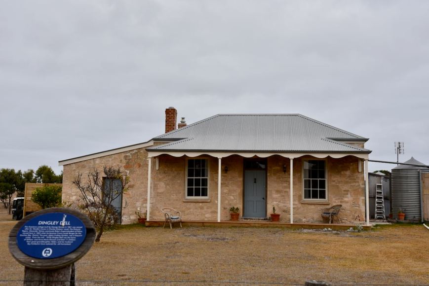
As we travelled north on the Nora Creina Road we stopped briefly to have a look at ‘Dingley Dell’, a little freestone cottage which was built by George Kendle in 1861. It was named after Mr. Wardle’s home in Charles Dickens’ novel, ‘The Pickwick Papers’. Alexander Tolmer, previously Robe’s Superintendent of Police, moved here in 1865 when he became Crown Lands Ranger for the Guichen Bay district. The poet Adam Lindsay Gordon, was a frequent visitor. From the mid 1870’s Dingley Dell was the home of William and Anna Maria Dawson and their eleven children. Their great grand daughter Helen, and her husbamd Ray Fulbohm have restored the old homestead.
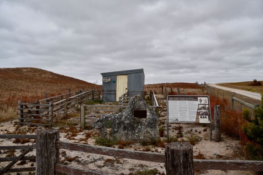
A little further up the road we stopped to have a look at the old CSIRO Field Station and Research Farm which operated between 1935 and 1976, was the site of research on pasture trace minerals deficiency in the diet of local sheep.
We headed back into Robe and refuelled. As we left Rove we stopped to have a look at the old Bush Inn, which was built in 1852 and licensed in 1855. It was also known as Mac’s Hotel and Carrier’s Arms to 1871.
We left Robe, travelling north on the Southern Ports Highway, and took a detour to Cape Jaffa to have a look at the new marina which is in development. Whilst there we decided to do a quick activation of the Bernouilli Conservation Reserve VKFF-1684, from the vehicle.
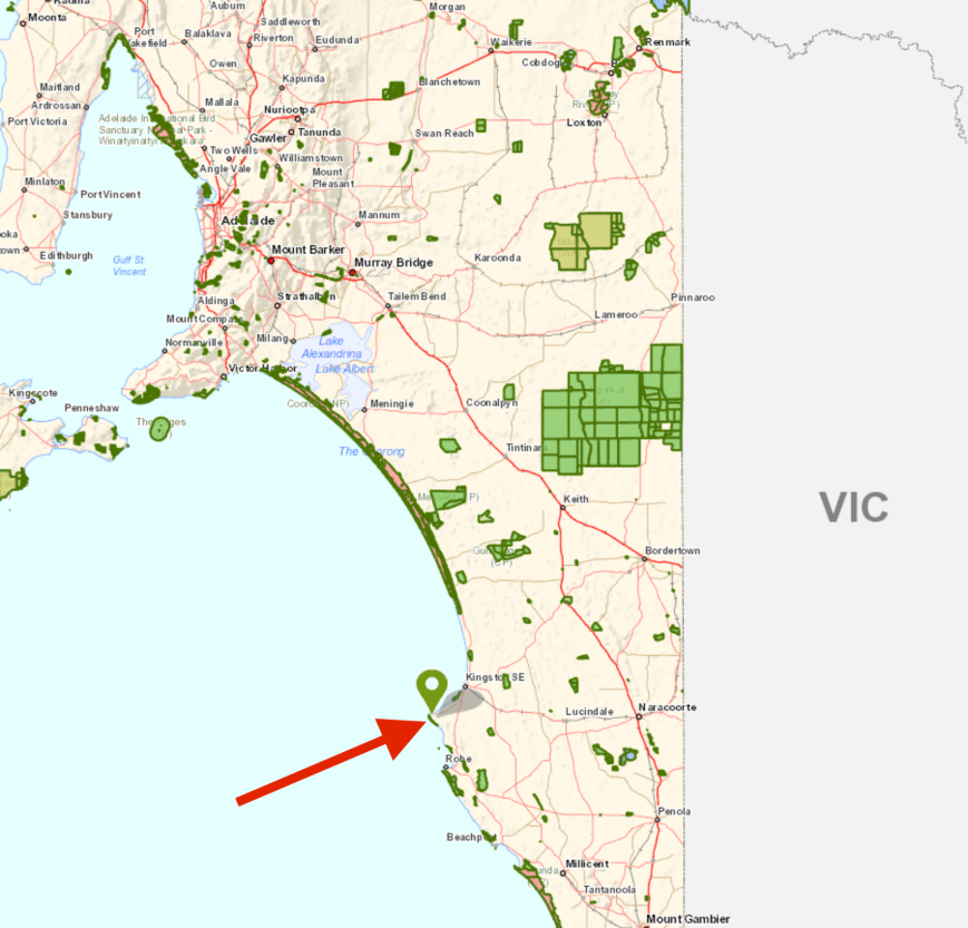
Above:- Map showing the location of the Bernouilli Conservation Park. Map courtesy of Location SA Map Viewer.
Bernouilli Conservation Park is located just south of Cape Jaffa and extends south and south-east for just over 7km. The park is about 266 hectares in size and was proclaimed on the 11th November 1993. The park consists of a coastal dune system. It is dominated by Tall Shrubland with Coast Beard-heath), Coast Wattle and Coast Daisy-bush.
The name of the park is derived from Cape Bernouilli, the former name of the headland of Cape Jaffa.
Over 40 species of bird have been recorded in the park including Musk Duck, Hooded Plover, Superb Fairywren, Singing Honeyeater, Rufous Bristlebird, Orange-bellied Parrot, Red-capped Plover, Spiny-cheeked Honeyeater, Striated Fieldwren, and White-browed Babbler.
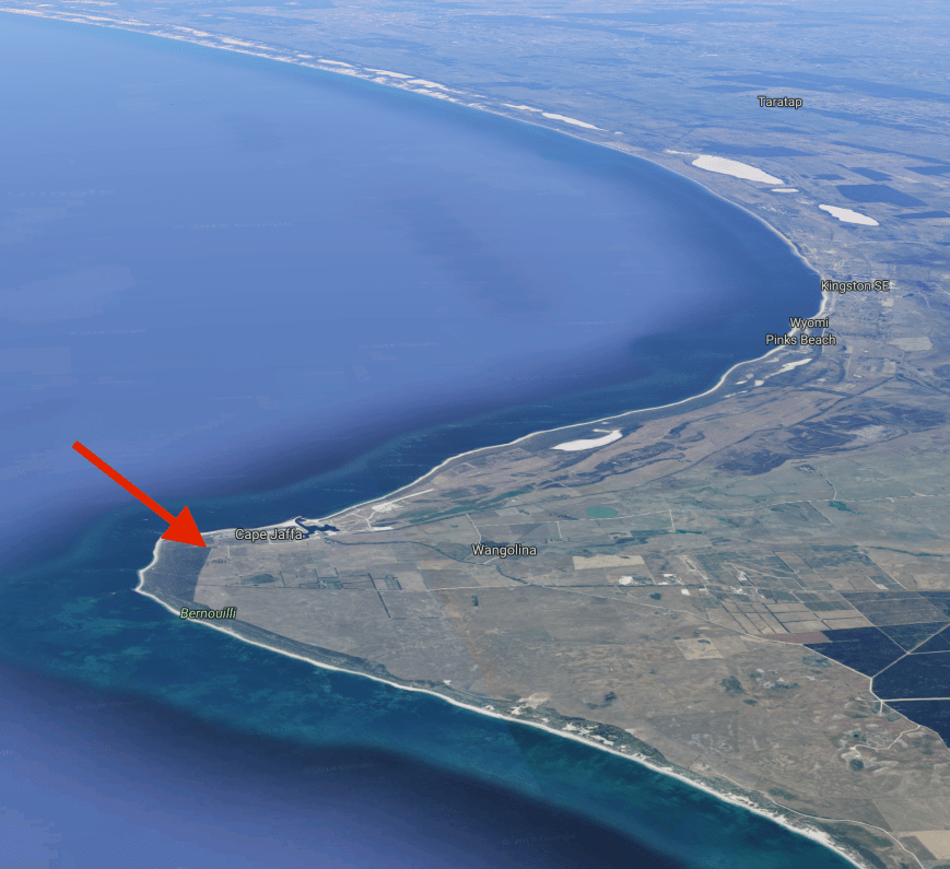
Above:- Aerial shot of the Bernouilli Conservation Park. Image courtesy of google maps.
We travelled to the end of Rothalls Road and soon found a park sign at the north eastern corner of the park.


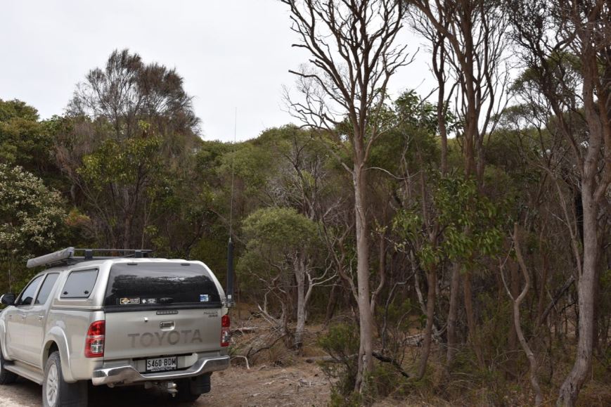
Depending on what maps you look at, you may or may not see a road which follows the eastern boundary of the park. We followed that road until we found a gap in the scrub and pulled the vehicle into the clearing. We operated from the vehicle using the Icom IC-7000 and the Codan 9350 self tuning antenna mounted on the rear of the Toyota Hi Lux.
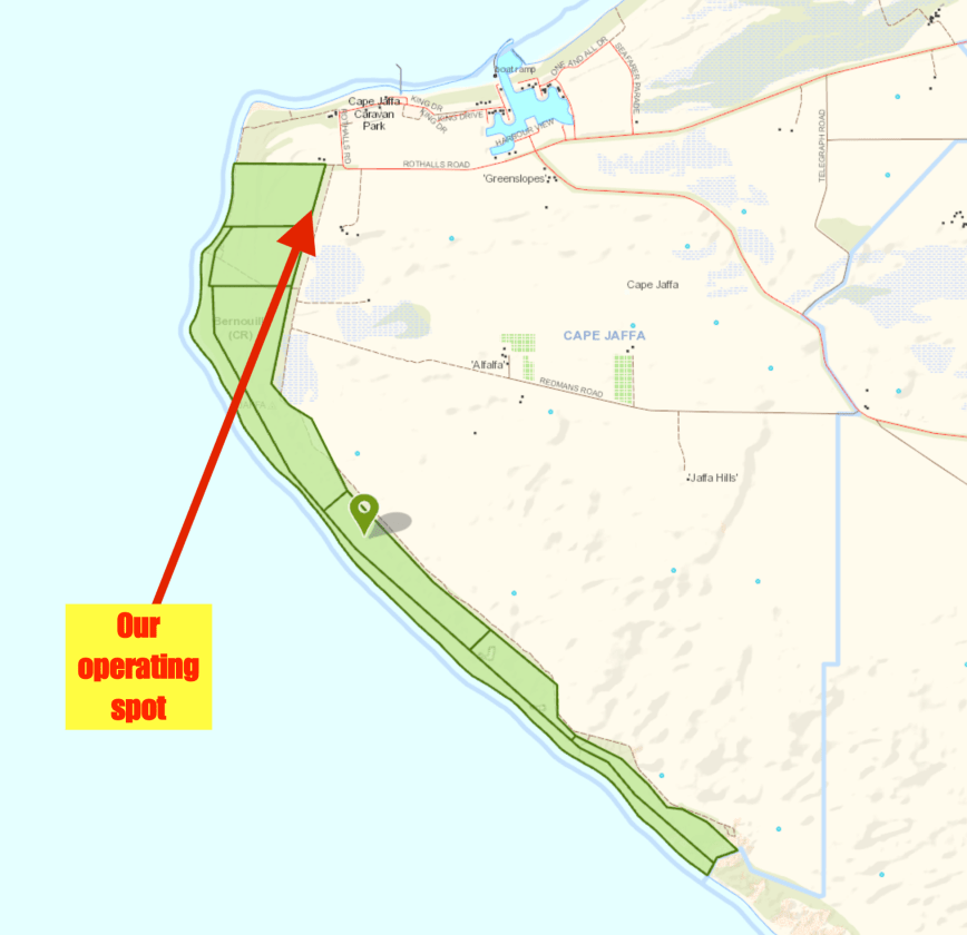
Above:- Map of the park showing our operating spot. Map courtesy of Location SA Map Viewer.
Upon turning on the transceiver we found Liz VK2XSE/p on 7.144 calling CQ from Barren Grounds Nature Reserve VKFF-1885. Both Marija and I logged Liz, Park to Park.
We then moved down to 7.139 and I started calling CQ whilst Marija spotted me on parksnpeaks. My first caller was Ron VK3AHR, followed by Peter VK3PF, and then Brian VK3BBB. Contact number 10, qualifying the park for VKFF, was with Allen VK3ARH, about 10 minutes into the activation. I logged just one more station, Geoff VK3SQ, before we decided we had better pack up and hit the road again.
This is a park that Marija and I will need to go back to, so that Marija can qualify the park, and I can get my remaining contacts towards the 44 required to qualify the park for the WWFF global award.
Marija worked the following station on 40m SSB:-
- VK2XSE/p (Barren Grounds Nature Reserve VKFF-1885)
I worked the following stations on 40m SSB:-
- VK2XSE/p (Barren Grounds Nature Reserve VKFF-1885)
- VK3AHR
- VK3PF
- VK3BBB
- VK3OAK
- VK2QR
- VK3FT
- VK3UH
- VK2IO
- VK3ARH
- VK3SQ
After leaving the park we drove down to the foreshore area of Cape Jaffa. We stopped briefly to have a look at the seafarers memorial. This recognises lighthouse keepers, seafarers, and fisherman who have lost their lives in the Cape Jaffa area.


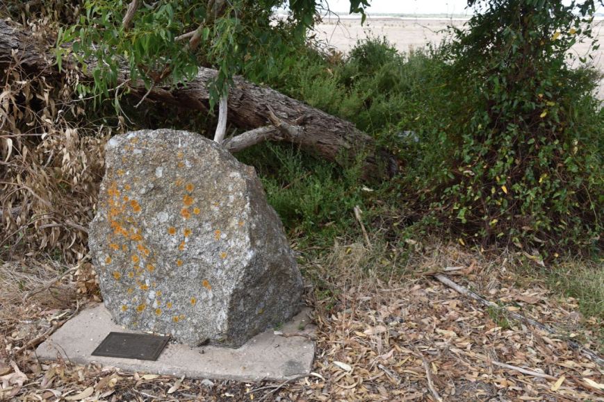
We took the Cape Jaffa Road out of town and soon reached the Southern Ports Highway and headed north. At Reedy Creek we stopped to have a look at the police memorial re the murder of Trooper Harry Edmonds Pearce way back in 1881.
In 1881 Trooper Pearce who was stationed at Kingston was ordered to escort a Robert Johnson alias William Nugent to court to appear on charges of having sold liquor to aborigines, and also for having been in possession of a stolen horse. Trooper Pearce had escorted his prisoner for about 2 miles when Johnson dismounted from his horse and refused to go any further. Johnson then tackled the trooper with a long knife and during the struggle Pearce’s hands were cut and he was unable to use his revolver. Johnson proceeded to strike Pearce a number of times and attempted to cut his throat as the two wrestled together. Upon being slashed to the abodomen Pearce became faint and then collapsed. Johnson then turned the trooper’s horse adrift and left him to die. Pearce was found the next morning but died from his wounds on the 18th May 1881. Many years ago I worked in the Police Force with the gt gt gt grand daughter of Pearce.
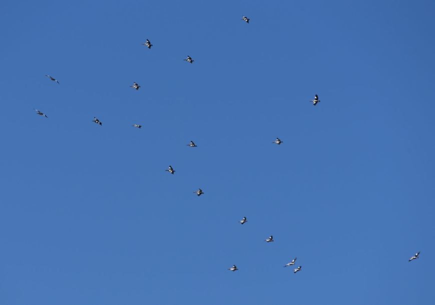
We continued on to Kingston, where we stopped for a bite to eat and then continued on the Princes Highway, passing the Coorong. Our next stop was at Jack Point where there is a Pelican Observatory Walk. The bird hide overlooks a cluster of small islands where pelicans, terns, seagulls have established large permanent breeding colonies. Sadly we didn’t see any pelicans. We did observe some other waterbirds.


We had noticed during our trip that the Coorong was incredibly dry. We have only had 10mm of rain this Summer and no doubt that has had a big impact.


But we did see dozens of Singing Honeyeaters. And they were not easy to photograph. They were very quick and just as I was about to take a shot, they would dart off to another shrub. But I did manage to capture a few shots.


Once we got back onto the Princes Highway we did see a large flock of pelicans soaring in the breeze. Perhaps they were heading to Jack Point?
We arrived home around tea time on Monday night and commenced unpacking. It had been a terrific 4 days away. We had activated 8 South Australian parks and had made 531 contacts, which included about 124 Park to Park contacts.
THANKYOU to everyone who called us during our activations.
References.
Birds SA, 2018, <https://birdssa.asn.au/location/bernouilli-conservation-reserve/>, viewed 16th March 2018
Coorong Country, 2018, <https://coorongcountry.com.au/coorong-walking-trails/>, viewed 16th March 2018
National Trust, 2018, <https://www.nationaltrust.org.au/places/robe-csiro-research-station/>, viewed 16th March 2018
Wikipedia, 2018, <https://en.wikipedia.org/wiki/Bernouilli_Conservation_Reserve>, viewed 16th March 2018