
Yesterday (Monday 22nd October 2018) was the commencement of National Bird Week in Australia. This coincides with the Aussie Backyard Bird Count. So being on 2 days off, after working 7 straight, I packed the radio gear and headed down to the Coorong National Park 5NP-005 & VKFF-0115.
The VKFF program had a special National Bird Week certificate on offer for any park activation in Australia during the week. As a result I qualified for the special activator certificate. I had activated and qualified the Coorong previously for WWFF/VKFF/VK5 Parks Award, so my main reason for heading down there was for some bird photography.
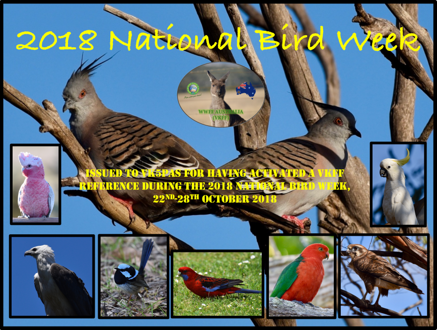
Above:- the special activator certificate for National Bird Week, on offer by the VKFF program.
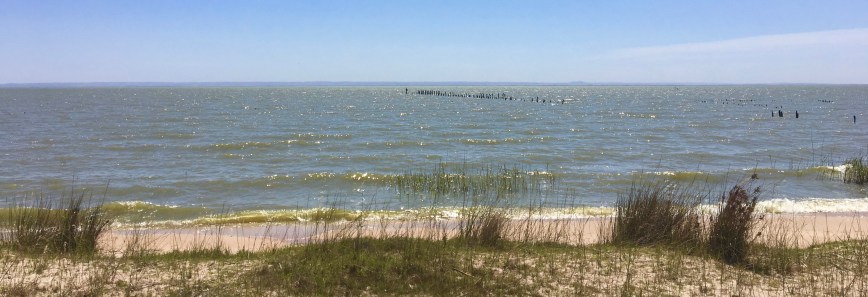
The Coorong National Park covers a lagoon ecosystem officially known as the Coorong and the Younghusband Peninsula on the Coorong’s southern side. The western end of the Coorong lagoon is at the Murray Mouth near Hindmarsh Island and the Sir Richard Peninsula, and it extends about 130 kilometres (81 mi) southeast. The national park area includes the Coorong itself, and Younghusband Peninsula which separates the Coorong from Encounter Bay in the Southern Ocean. The park was made famous in Colin Thiele’s book ‘Storm Boy’.
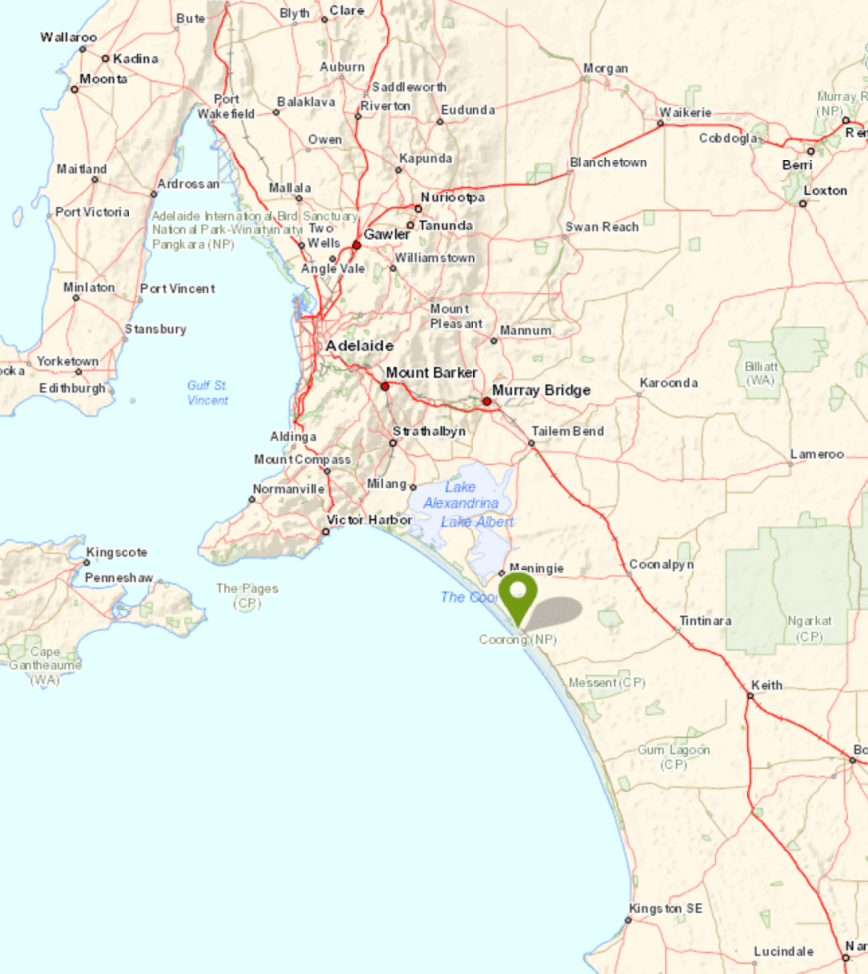
Above:- Map showing the location of the Coorong National Park. Map courtesy of Location SA Map Viewer.
To get to the park I travelled down the South Eastern Freeway, passing the town of Murray Bridge, and over the mighty Murray River, and on to Tailem Bend. I then turned off at the Princes Highway and travelled south. Rather than continuing on to the town of Meningie, I decided to turn off and head to Narung, and follow the Coorong Birdwatchers Trail, hoping to get some good bird photographs along the way.
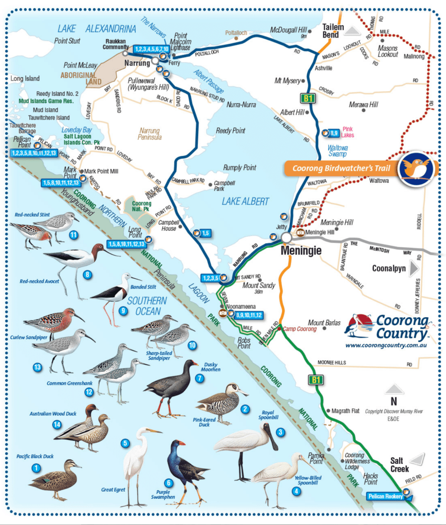
Above:- The Coorong Birdwatchers Trail. This is the route I took during the day. Image courtesy of Coorong Country
The Potalloch Road which runs off Princes Highway follows the south eastern boundary of Lake Alexandrina, and there are a number of wetland areas between the roadway and lake. Unfortunately these are contained on private property. As a result I was unable to get close to the birds, and had to rely on the zoom lens.


I wasn’t keen on venturing too far off road, as it was a warm day, with an expected temperature of 30 deg C. As a result, there were plenty of snakes about.
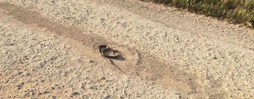
Above:- one of a number of snakes I observed on the roads
I continued along Potalloch Road and soon the Point Malcom lighthouse came into view. The Point Malcolm lighthouse, also known as Mundoo Light, is Australia’s only inland light station. It is also Australia’s smallest lighthouse. It operated between 1878 to 1931 to mark the narrow passage between Lake Albert and Lake Alexandrina.
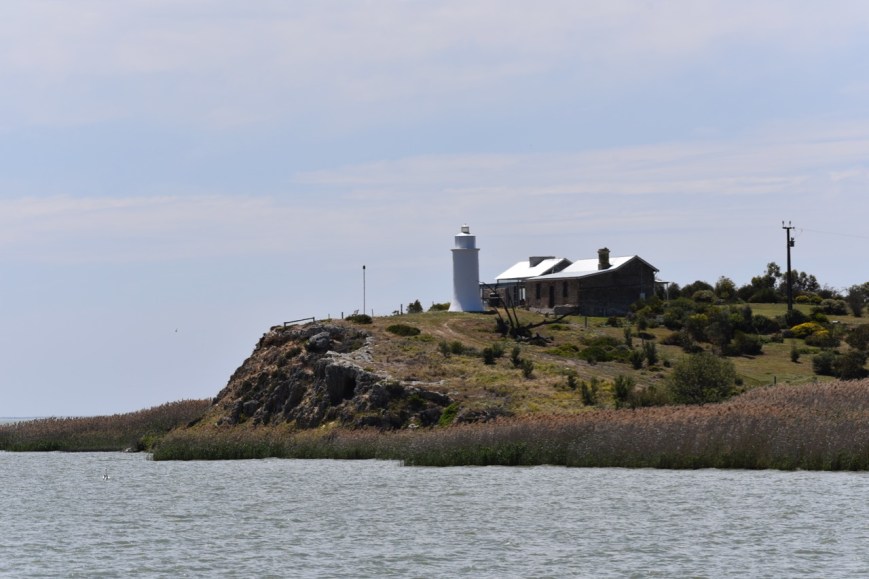
Above:- the Point Malcolm lighthouse
The Narrows is a small channel which links Lake Alexandrina and Lake Albert. In its day, this was a very busy location. By the early 1900’s numerous paddle steamers, including the Judith, the Milang, and the Murray, were carrying passengers, goods, and mail up to 3 times a week between Milang, Narrung, and Meningie. This was also a point for the Royal Mail which travelled by stage coach from Adelaide.
Above:- The Narrows
I boarded the ferry and took the short ride from one side of The Narrows to the other. This is a free service which operates 24/7.
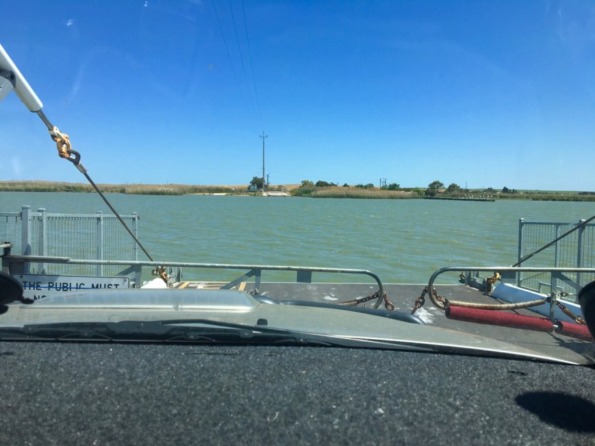
Above:- Crossing the ferry at The Narrows
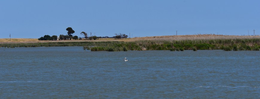
Once off the ferry I stopped briefly at the Narrung Jetty Reserve, where there were a number of caravaners enjoying the spectacular scenery. It was an opportunity for me to take a few more bird shots.


I then continued on to the small town of Narrung. In the local aborignal language Narrung means ‘place of large sheoaks’.
I then drove along Alexandrina Drive and into the little town of Raukkan, which is a small aboriginal community situated on the south eastern shore of Lake Alexandrina. Raukkan in the Ngarrindjeri language means ‘meeting place’ and is considered to be the home and heartland of the aboriginal Ngarringjeri aboriginal people.
In 1860 the Aborigines’ Friends’ Association was granted 107 hectares in the area and established a mission at Raukkan, which had been named “Point McLeay” by T. B. Strangways in 1837. George Taplin had selected the site, and with others such as the Rev. F. W. Cox helped build the school, church and mission station to care for the local Aboriginals. It was intended by the Aborigines’ Friends’ Association to help the Ngarrindjeri people, but could never be self-sufficient farming due to the poor quality of the soil in the area. Land clearing by farmers nearby also limited the ability for hunting, and other crafts and industries also met with difficulties due to changing environment and competition from nearby towns. In 1916, responsibility for Raukkan moved to South Australia’s Chief Protector of Aborigines, and since 1974 it has been administered by the Ngarrindjeri people themselves and renamed Raukkan in 1982.


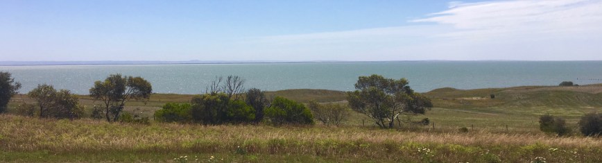
There are some nice views here to be enjoyed of Lake Alexandrina, which was was named after Princess Alexandrina, niece and successor of King William IV of Great Britain and Ireland. It adjoins the smaller Lake Albert, named after Prince Albert, the Consort of Queen Victoria, by George Gawler, the Governor of South Australia.
Raukkan was home to James Unaipon and his son David. James Unaipon was the first Australian Aboriginal deacon and co-authored writings on the Ngarrindjeri language. His son David was a writer and inventor, who along with the Raukkan Church, is featured on the Australian fifty-dollar note.


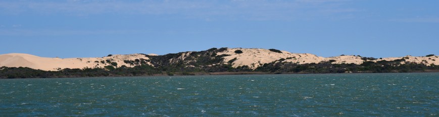
After leaving Raukkan, I returned back to Narrung and then travelled south on the Loveday Bay Road. The sand dunes of the Younghusband Peninsula at the Coorong soon came into view.
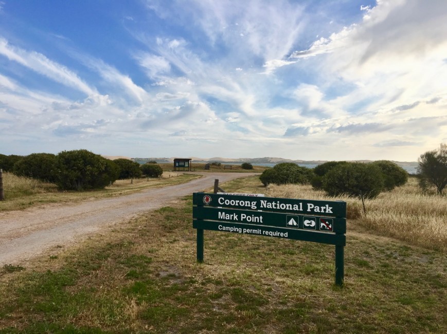
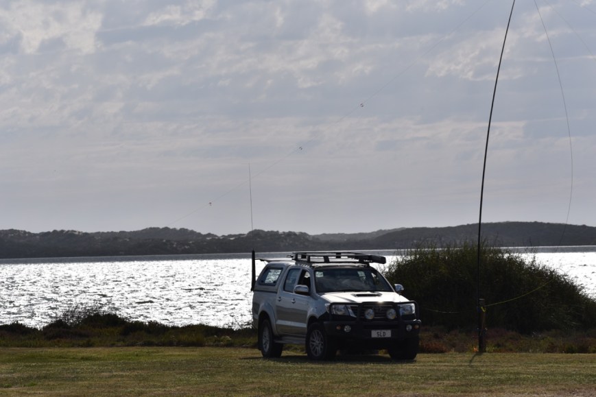
I headed to Mark Point which is located in the National Park. There is a nice campground here, with plenty of room to stretch out the dipole. And I had the entire campground all to myself.
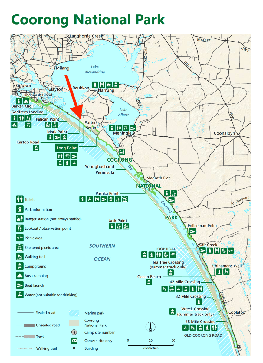
Above:- Map of the Coorong. The red arrow indicates ny operating spot at Mark Point. Image courtesy of DEWNR,
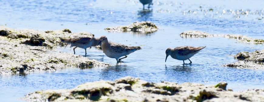
Prior to getting on air I took a few photos of the local birds, including dozens of Sandpipers who were busy looking for food in the shallows.
To kick off the activation I made a Park to Park contact with Rob VK4AAC/2 who was activating the Warrumbungle National Park VKFF-0520. I then moved down the band to 7.139 and started calling CQ after spotting myself on parksnpeaks. Rod VK7FRJG was the first to call me, followed by another Park to Park, with Geoff VK3SQ/p who was doing his first ever park activation in the Chiltern-Mount Pilot National Park VKFF-0620.
Despite it being a week day, there was a steady flow of callers at the start of the activation, but this tapered off quite quickly. I logged a total of 21 stations on 40m from VK2, VK3, VK4, VK5, and VK7.
I then moved to the 20m band and called CQ on 14.310 for around 5 minutes with no takers. I was competing with the Over the Horizon Radar which was at strength 8, making it veery difficult. So with no takers, I headed down to the ANZA DX Net and checked in. I worked 3 stations on the net, Mike VK4LMB, Greg VK8KMD in Alice Springs, and Ted VK6NTE over in Western Australia.
I saw a comment on Facebook from Andrew VK6AS that he was listening on 14.310 so I headed back there, and comfortably logged Andrew wi was a 5/5 signal. I then lowered the squid pole and inserted the 80m links and moved to 3.610. I asked if the frequency was in use, and John VK5BJE came back to advise me that the frequency was all mine. John was an excellent 5/9 plus signal. I also logged Trevor VK5TW and Ivan VK5HS in the Riverland, both being 5/9 plus signals. But despite a call out on the Crafers repeater (I was surprised to be able to key the repeater from where I was), and a spot on parksnpeaks, I had no further callers.
With 29 stations in the log, it was time to pack up and start the journey home.
I worked the following stations on 40m SSB:-
- VK4AAC/2 (Warrumbungle National Park VKFF-0520)
- VK7FRJG
- VK3SQ/p (Chiltern-Mount Pilot National Park VKFF-0620)
- VK2HHA
- VK7QP
- VK4FDJL
- VK3PF
- VK3ANL
- VK3CM
- VK4HNS
- VK3WAR
- VK3FBKS
- VK4TJ
- VK4/AC8WN
- VK4/VE6XT
- VK2IO
- VK2EXA
- VK4CPS
- VK2KYO
- VK5MR
- VK3PAT
- FK4QX
I worked the following stations on 20m SSB:-
- VK4LMB
- VK8KMD
- VK6NTE
- VK6AS
I worked the following stations on 80m SSB:-
- VK5BJE
- VK5YW
- VK5HS
At the conclusion of the activation I made a small detour down to the Mark Point Well which is located in the park. This is one of four wind operated pumps originally built on the Yalkuri property around 1880. Stock to and from Victoria, and the south-east of South Australia travelled along the Coorong which contained many freshwater springs. Crossings were made at the Murray Mouth and at Pelican Point, a few km north west from Mark Point Well.
Here, cattle and horses were driven from the mainland to the Younghusband Peninsula and back again. Tanks and troughs were made from local limestone with mortar from locally burnt lime. The length of the Mark Point trough was originally 28 metres, but shortened in 1959 to 15 metres.


I then drove out along Pelican Point Road until I reached the end of the Narrung Peninsula. This is as far as you can go by road, and the start of the Tauwitchere Barrages, near the Mouth of the Murray River. The main purpose of the barrages at the Murray mouth is to maintain the freshness of the River Murray as far downstream as the town of Wellington. There was plenty of birdlife here with lots of photo opportunities.


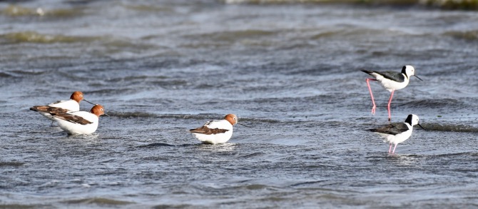
Above:- Red necked Avocets and Black winged Stilts.
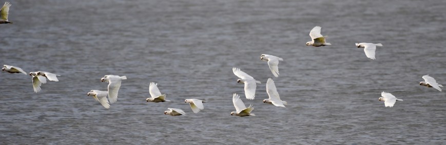
Above:- Corellas.
I then drove back along Mark Point Road, to Loveday Bay Road and the Narrung Road, and into the town of Meningie. Just as you enter Meningie there is an area where there is always a lot of Pelican activity, so I stopped off briefly to take some photos.


I then hit the road again, travelling home via Tailem Bend and Murray Bridge.
References.
Coorong Country, 2018, <https://coorongcountry.com.au/point-malcolm-lighthouse/>, viewed 23rd October 2018
Wikipedia, 2018, <https://en.wikipedia.org/wiki/Raukkan,_South_Australia>, viewed 23rd October 2018
Wikipedia, 2018, <https://en.wikipedia.org/wiki/Coorong_National_Park>, viewed 23rd October 2018
Wikipedia, 2018, <https://en.wikipedia.org/wiki/Lake_Alexandrina_(South_Australia)>, viewed 23rd October 2018

Hi Paul
The Coorong National Park is fantastic. I just love going down there. We have camped and stayed at Gemini Downs (no accommodation there now) as well as stay at Kingston SE and Meningie (our last visit). Your bird photos are great. I am glad to be in your log and pleased you have two other VK5s as well from your excursion onto 80 metres. A memorable start to bird week for you!
73
John D
VK5BJE/VK5PF
G’day John,
The Coorong Birdwatchers Trail is a great drive. This is a top part of South Australia.
Cheers,
Paul.