Brunswick silo VK-BRC3

Our final silo activation for Wednesday 29th November 2023 was the Brunswick silo VK-BRC3. The silo is located alongside the railway line at Tinning Street, Brunswick.

Above:- Map showing the location of the Brunswick silo. Map c/o Google Maps.

Brunswick is an inner city suburb in Melbourne, about 5 km north of the Melbourne CBD. It is traditionally a working-class area. It takes its name from George IV and the city of Brunswick, Germany, which lay within his ancestral Kingdom of Hanover.

The silo is part of the Australian Silo Art Trail. It features an image of the former New Zealand Prime Minister Jacinda Ardern embracing a Muslim woman following the Christchurch mosque attacks in 2019. The mural was painted in May 2019 by Loretta Lizzio. (Silo Art 2024)

We parked in Colebrook Street and suffered from strength 5 noise on both the 40m band and the 20m band.

Marija worked the following stations on 40m SSB:-

  1. VK3UAO
  2. VK7ZA
  3. VK7JFD
  4. VK3PF

Marija worked the following station on 20m SSB:-

  1. VK3UAO

I worked the following stations on 40m SSB:-

  1. VK3UAO
  2. VK7ZA
  3. VK7JFD
  4. VK3PF

I worked the following station on 20m SSB:-

  1. VK3UAO

Marija and I then visited the Victoria Police Museum located at Police Headquarters in Spencer Street, Docklands. It opened just 2 months earlier in September 2023. We visited the museum at its old location many years ago.

The museum features more than 300 historical police objects including Australia’s largest collection of Kelly Gang armour. (Victoria Police Museum 2024)

We then walked to Spencer Street Railway Station and caught the train back to our friends Jackie and Des’s house in Kensington.

That evening we attended the Jackson Browne concert at Margaret Court Arena. Each time Jackson visits Australia, I have attended his concerts, and he never disappoints. This was take two for us. We had been to Melbourne earlier in the year, but sadly the concert was cancelled due to illness. What a brilliant evening with front row seats. I even got to catch up with my mate Greg VK3MTV who was at the concert.

References.

  1. http://www.australiansiloarttrail.com. (n.d.). Brunswick Silo Art. [online] Available at: https://www.australiansiloarttrail.com/brunswick [Accessed 1 May 2024].‌
  2. http://www.police.vic.gov.au. (2023). Victoria Police Museum. [online] Available at: https://www.police.vic.gov.au/victoria-police-museum [Accessed 1 May 2024].‌

Is Don Is Good silo VK-ISD3

Our next silo activation for Wednesday 29th November 2023 was the Is Don Is Good silo VK-ISD3. The silo is located in Laurens Street, North Melbourne.

Above:- Map showing the location of the Is Don Is Good silo at North Melbourne. Map c/o Google Maps.

The silo features the famous Is Don logo of the DON Smallgoods company.

The story of DON Smallgoods dates back to 1947 when R.J. Gilbertson, a butcher who had a small store at Essendon, commenced production of a range of processed meats. His business became one of the biggest names in Australian food, DON. (DON 2024)

During the 1990s DON ran a series of famous commercials featuring Scotisch-born Australian actor Thomas Gibson ‘Tommy’ Dysart (b. 1935. d. 2022), an amusing butcher.

Marija and I parked in Foggerty Street next to the North Melbourne Recreation Reserve, in the activation zone for the silo.

Above:- the activation zone at the Is Don Is Good silo. Image c/o SiOTA website.

We operated from the 4WD, running the Icom IC7000, 100 watts and the Codan 9350 with the 1.5-metre stainless steel whip. Unfortunately, we had strength 5-6 noise on the 40m band and we only made limited contacts.

Marija worked the following stations on 40m SSB:-

  1. VK5HS
  2. VK7ZA
  3. VK3UAO

I worked the following stations on 40m SSB:-

  1. VK5HS
  2. VK7ZA
  3. VK3UAO

I worked the following stations on 20m SSB:-

  1. VK4NH
  2. VK4DXA

References.

  1. Anon, (n.d.). Our Story – Don. [online] Available at: https://isdonisgood.com.au/our-story/ [viewed 1st May 2024]‌

Uncle Toby’s silo VK-UNS3

Our first activation for Wednesday 29th day of November 2023, was the Uncle Toby’s silo VK-UNS3 for the Silos On The Air (SiOTA) program.

The silos are located at the site of the old Uncle Tobys factory on Sunshine Road, West Footscray.

Uncle Tobys is an Australian food manufacturing company that was established in 1861. It specialises in breakfast oat products. It is currently operated as a wholly owned subsidiary of Nestlé, with its main factory being located in Wahgunyah, Victoria. (Leth 2019)

During the 1850s gold rush in Victoria, brothers Leonard Frederick Parsons (b. 1846. d. 1917) and George Sidney Parsons (b. 1844. d. 1886) left England and commenced manufacturing John Bull Oats in Melbourne. In 1861 they established Parsons Brothers which later became Uncle Tobys. (Uncle Tobys 2024)

Above:- Article from The Sydney Morning Herald, Wed 18 July 1917. Image c/o Trove.

Marija and I parked in Hansen Reserve in the activation zone and operated from the 4WD for this activation. We ran the Icom Ic-7000, 100 watts and the Codan 9350 with the 1/5 metre stainless steel whip. Surprisingly the noise floor was only strength 3 on the 40m band.

Above:- the activation zone at the Uncle Toby’s silo. Image c/o SiOTA website.

Marija worked the following stations on 40m SSB:-

  1. VK3PF
  2. VK3CLD
  3. VK3UAO
  4. VK2EXA

I worked the following stations on 40m SSB:-

  1. VK3PF
  2. VK3CLD
  3. VK3UAO
  4. VK2EXA
  5. VK5HS
  6. VK7ZA

I worked the following stations on 20m SSB:-

  1. VK2IO
  2. VK3UAO

References.

  1. Leth, Melinda (2019). “Sustainable Oat Production in Australia”
  2. Uncle Toby’s (2023). Our story. [online] Uncle Tobys. Available at: https://www.uncletobys.com.au/our-story. [viewed 1st May 2024]‌

Mount Charlie Flora Reserve VKFF-2396

On our way into Melbourne (28th November 2023), Marija and I decided to activate the Mount Charlie Flora Reserve VKFF-2396.

Above:- Map showing the location of the Mount Charlie Flora Reserve. Map c/o Google Maps.

To get to the park Marija and I drove through the beautiful Macedon Ranges which is well known for its thriving food and wine industry, native forests and other natural attractions.

Mount Macedon which is contained within the Ranges was named by the explorer, Sir Thomas Livingstone Mitchell (b. 1792. d. 1855), in 1836. On the 30th day of September 1836, he climbed the mountain and named it after Philip II of Macedon (359 BC-336 BC), the father of Alexander the Great. (Aussie Towns 2024) (Monuments Australia 2024)

Above:- Major Thomas Mitchell. Image c/o Wikipedia.

The Mount Charlie Flora Reserve is bordered to the south and the west by Mount Charlie Road.

Above:- An aerial view of the Mount Charlie Flora Reserve. Image c/o Google Maps.

The reserve is about 318 hectares in size and was established on the 20th day of March 1979. (CAPAD 2022)

An aerial view of the park showing its boundaries. Image c/o Google Earth.

Marija and I parked on Mount Charlie Road and we found a clearing in the scrub and set up our station comprising the Yaesu FT857, 40 watts and the 20/40/80m linked dipole. I used the special call of VI10VKFF.

Marija worked the following stations on 40m SSB:-

  1. VK3PF
  2. VK3KAI
  3. VK2EXA
  4. VK3ZSC
  5. VK3UAO
  6. VK3ZMD

Marija worked the following stations on 40m AM:-

  1. VK3PF
  2. VK3KAI
  3. VK2EXA
  4. VK2HAK

I worked the following stations on 40m SSB:-

  1. VK3PF
  2. VK3KAI
  3. VK2EXA
  4. VK3ZSC
  5. VK3UAO
  6. VK3ZMD
  7. VK3KRL
  8. Vk3ZZS/p
  9. VK3VIN
  10. VK1RF
  11. VK2MK
  12. VK4CEE
  13. VK5CZ
  14. VK3MAP
  15. VK7ALB
  16. VK3HJW
  17. VK3TKK/m
  18. VK3DAC
  19. VK4FE/3
  20. VK1AO
  21. VK2MET

I worked the following stations on 40m AM:-

  1. VK3PF
  2. VK3KAI
  3. VK2EXA
  4. VK2HAK

I worked the following stations on 20m SSB:-

  1. VK1AO
  2. V K2MET
  3. VK2IO
  4. ZL4NVW
  5. VK4EW
  6. KG5CIK

I worked the following station on 20m AM:-

  1. VK4EW

References.

  1. Dcceew.gov.au. (2023). Collaborative Australian Protected Areas Database (CAPAD) 2022 – DCCEEW. [online] Available at: https://www.dcceew.gov.au/environment/land/nrs/science/capad/2022 [Accessed 1st May 2024].‌
  2. monumentaustralia.org.au. (n.d.). Major Thomas Mitchell | Monument Australia. [online] Available at: https://monumentaustralia.org.au/themes/people/exploration/display/32766-major-thomas-mitchell- [Accessed 1 May 2024].‌
  3. Verheyen, M. (n.d.). Mount Macedon, VIC. [online] Aussie Towns. Available at: https://www.aussietowns.com.au/town/mount-macedon-vic. [viewed 1st May 2024]‌

Maldon Bushland Reserve VKFF-4292

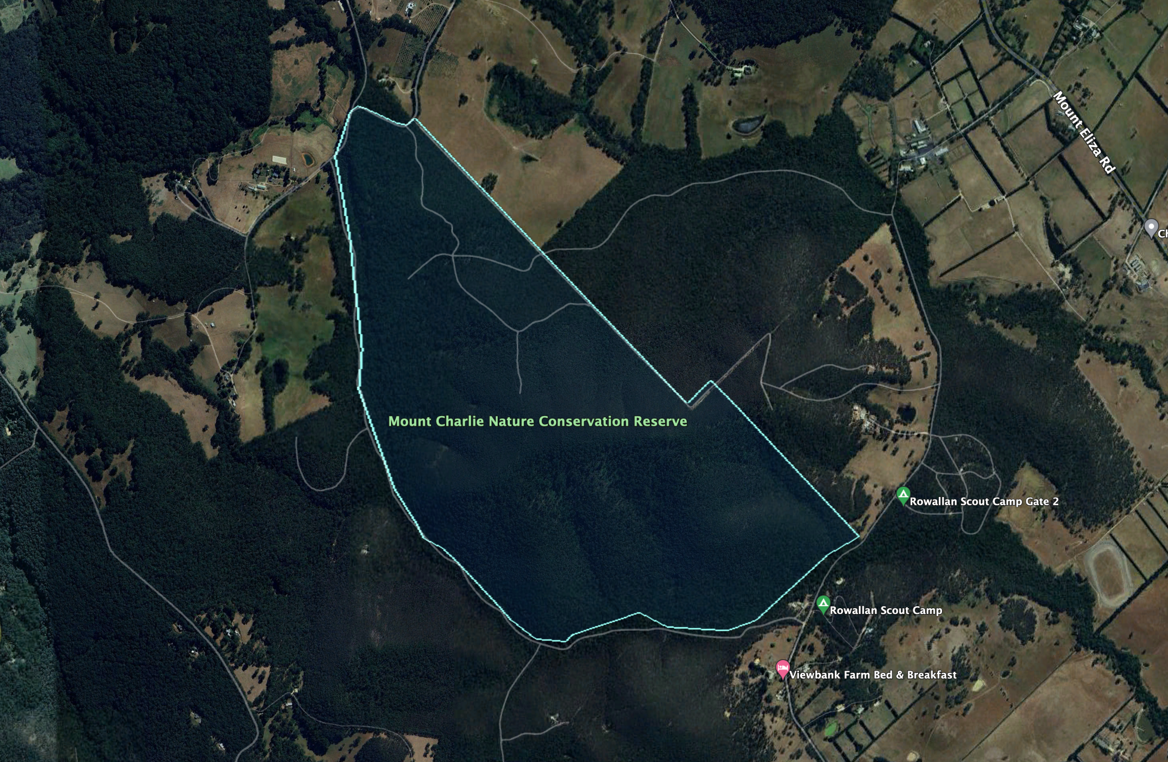
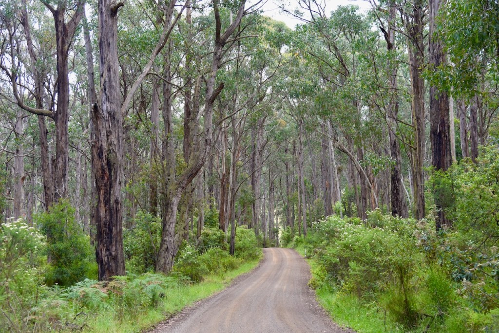
Our first activation for Tuesday 28th November 2023 was the Maldon Bushland Reserve VKFF-4292. The reserve is located about 7 km south of the town of Maldon and about 139 km northwest of the city of Melbourne.

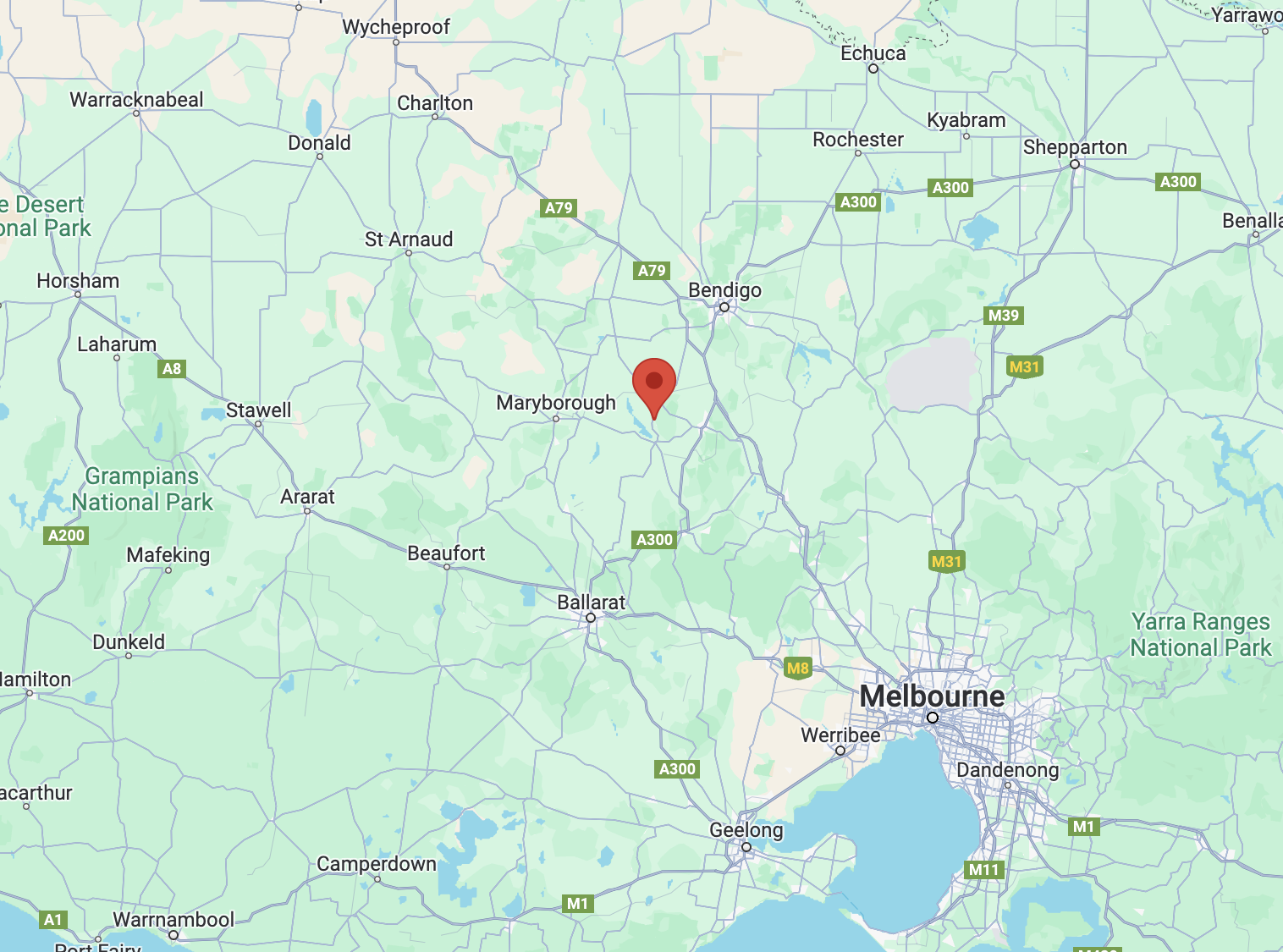
Above:- Map showing the location of the Maldon Bushland Reserve. Map c/o Google Maps.

The reserve is located on the southern side of Cemetery Road at Welshman’s Reef. However, the park is known as the Maldon Bushland Reserve.

Above:- An aerial view of the Maldon Bushland Reserve. Image c/o Google Earth.

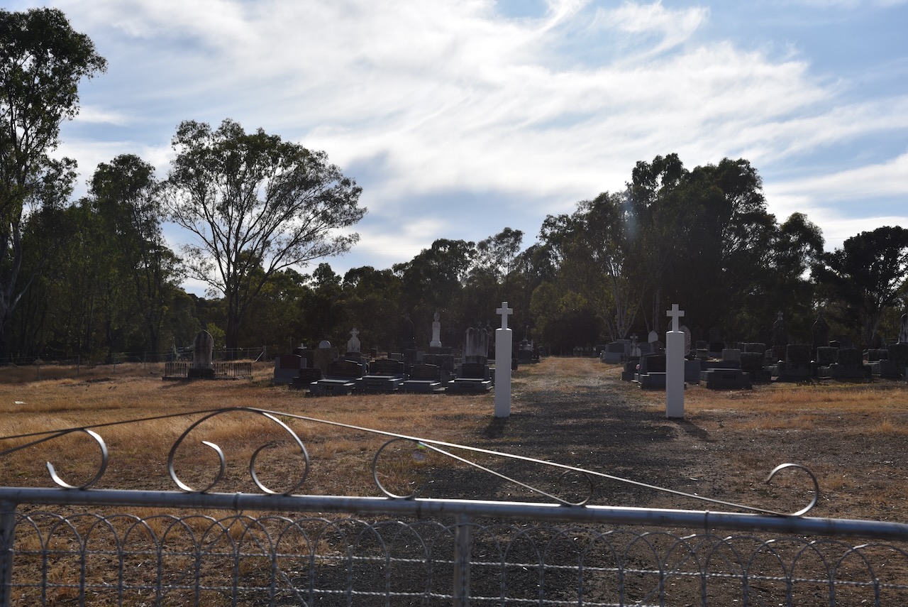
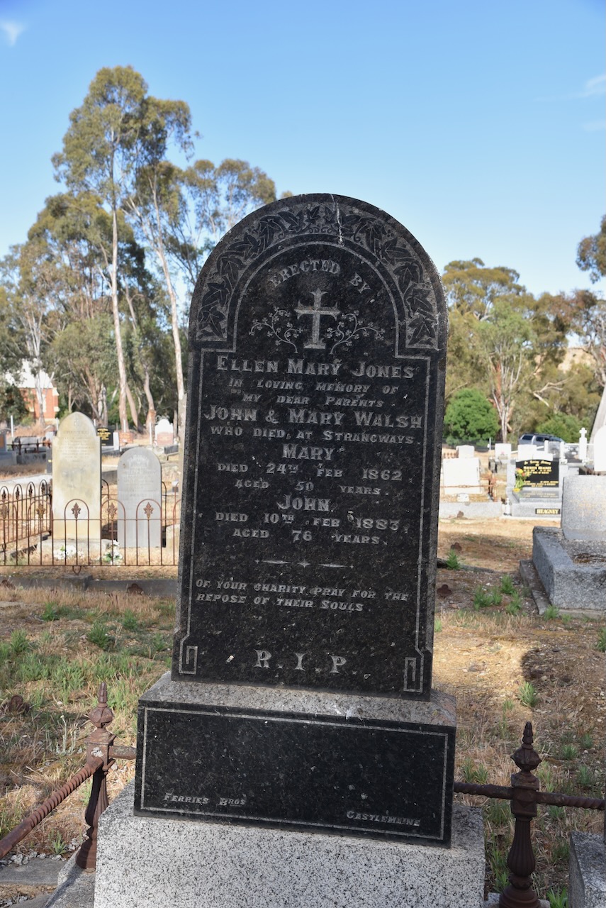
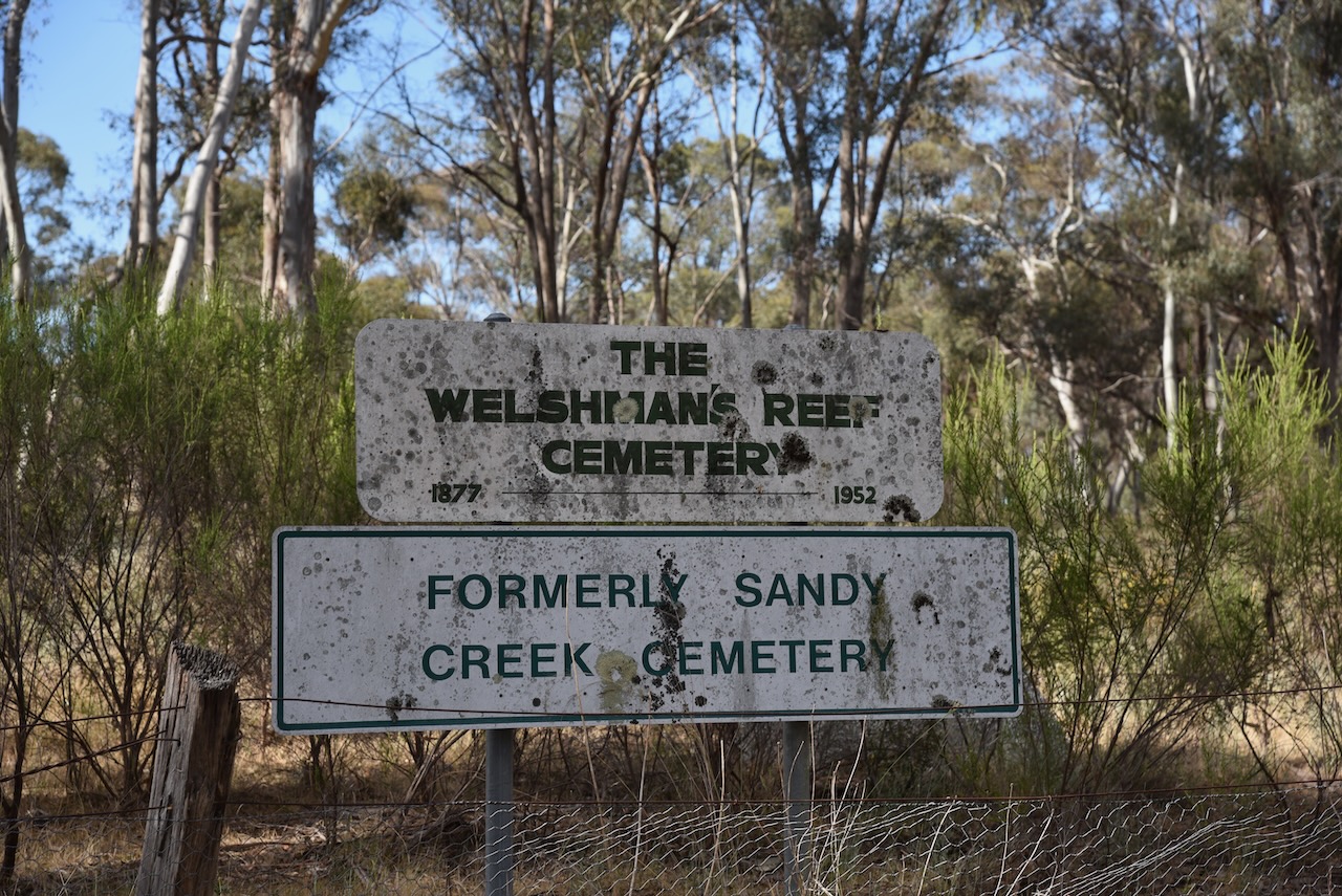
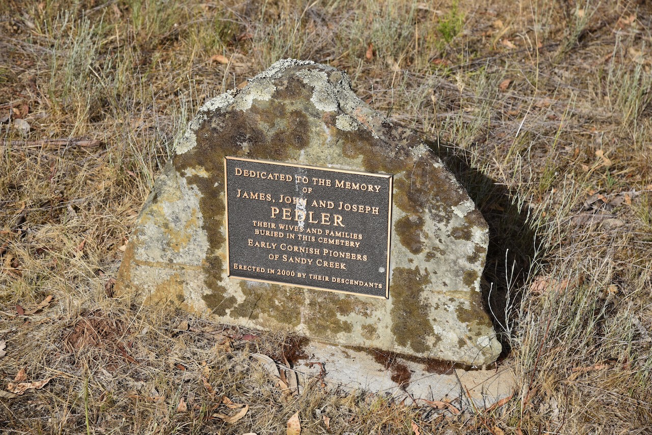
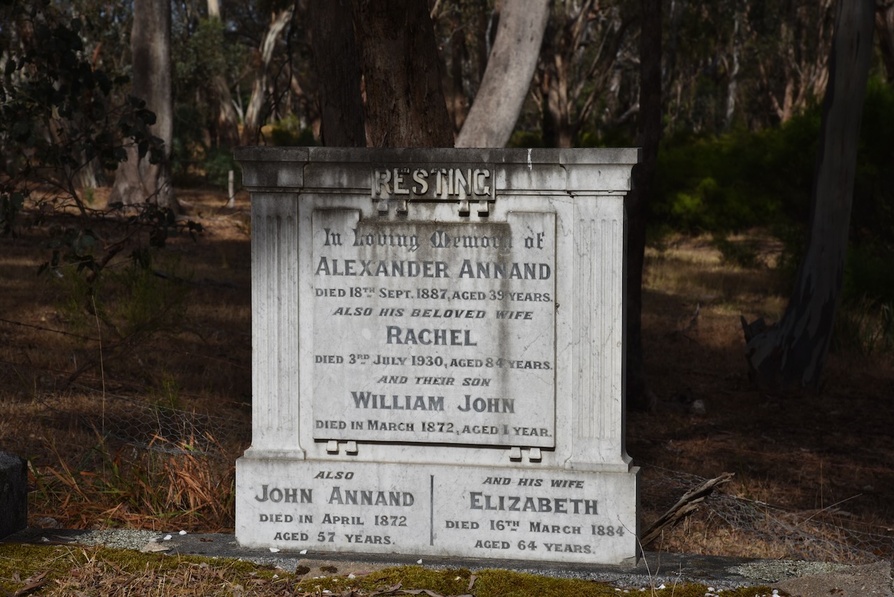
Prior to the activation we visited the Welshmans Reef cemetery which adjoins the reserve. The cemetery was previously known as the Sandy Creek Cemetery and was in use from 1870 to 1956. It features a pioneer memorial and numerous historic headstones, along with many simple graves marked with wooden posts. (Goldfields Guide 2024) 

Nearby is the old church.

The Maldon Bushland Reserve is about 1.6 hectares in size and was established on the 26th day of February 2002. (CAPAD 2022)

Marija and I ran the Yaesu FT857, 40 watts output, and the 20/40/80m dipole for this activation. I used the special call of VI10VKFF.

Marija worked the following stations on 40m SSB:-

  1. VK3PF
  2. VK3KAI
  3. VK3VIN
  4. VK2HRX/p (SOTA VK1/ AC-039)
  5. VK3CLD
  6. VK2LOC/m
  7. VK1AO
  8. VK2MET
  9. VK2IO

Marija worked the following stations on 40m AM:-

  1. VK3PF
  2. VK3KAI
  3. VK3SQ
  4. VK2BD

I worked the following stations on 40m SSB:-

  1. VK3PF
  2. VK3KAI
  3. VK2HRX/p (SOTA VK1/ AC-039)
  4. VK3CLD
  5. VK3LOC/m
  6. VK1AO
  7. VK2MET
  8. VK2IO
  9. VK3SQ
  10. VK2BD
  11. VK3PWG
  12. VK3EJ
  13. VK3VIN
  14. VK3MCK
  15. VK3UAO
  16. VK2MOP
  17. VK1AD
  18. VK1NAM
  19. VK3DX
  20. VK3AP/m
  21. VK7AAE
  22. VK2SLB
  23. VK3CEO
  24. VK2VAR
  25. VK2GOM
  26. VK1AAF
  27. VK3UCD
  28. VK3BBB
  29. VK2CCP
  30. VK3MTT
  31. VK3UT
  32. VK7ZA
  33. VK3ZSC
  34. VK3BEL

I worked the following stations on 40m AM:-

  1. VK3PF
  2. VK3KAI
  3. VK3SQ
  4. VK2BD
  5. VK3UCD
  6. VK3CEO
  7. VK3BBB
  8. VK2CCP
  9. VK3BEL

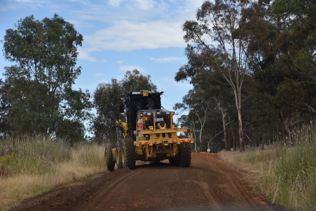
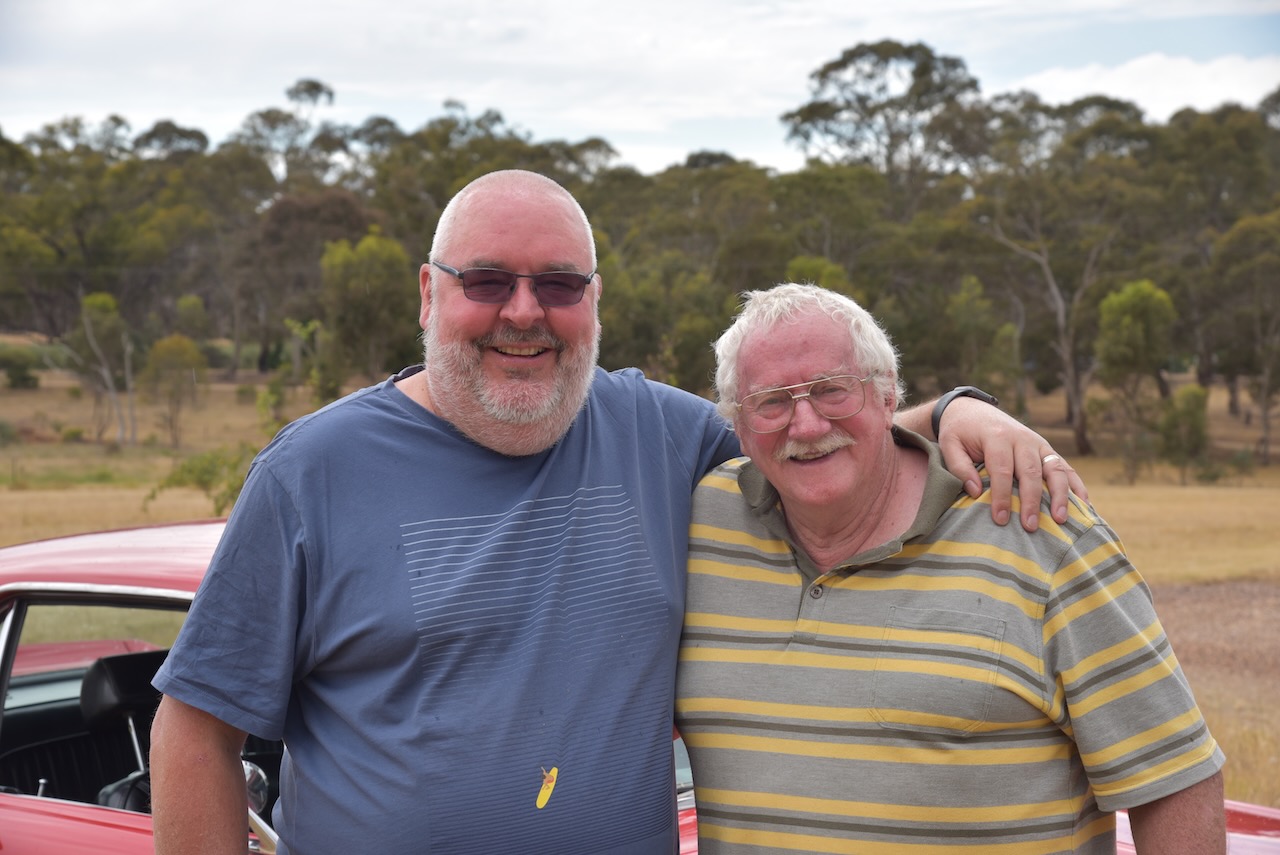
We packed up and headed off to visit Rod VK3RH. Rod is one of the Net Controllers on the Australia New Zealand Africa (ANZA) DX Net with me. Although I had spoken with Rod dozens of times on air, we had never met in person. It was quite slow going to Rod’s house due to graders undertaking repairs on some of the surrounding roads.

Marija and I spent a very enjoyable couple of hours at Rod’s house, enjoying a cup of coffee and some other goodies. I also admired Rod’s collection of Mustangs and of course, had a look at Rod’s shack.

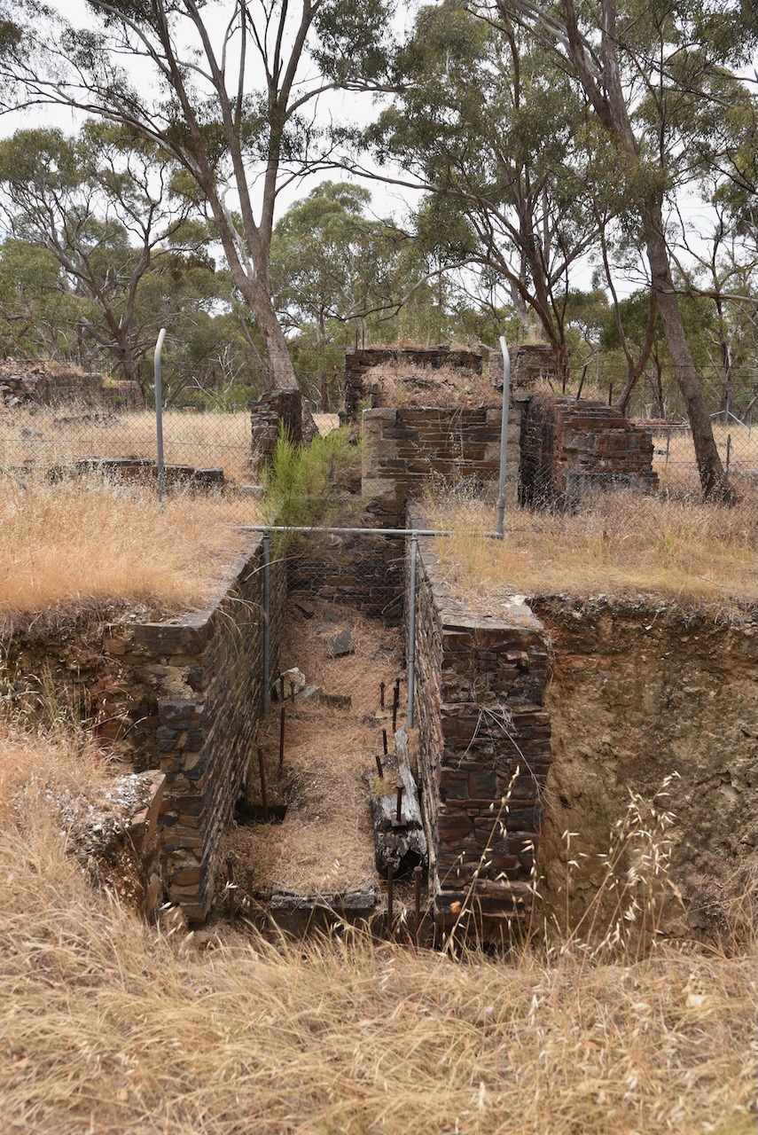
After leaving Rod’s home, Marija and I visited the ruins of the mining venture at Lisles Reef. It was operated by Dr. Lisle and his partner who discovered gold there in 1856 when searching for his horse. It is reputed that Lisle and his partner took about £34,000 worth of gold (about 8,500 ounces) from their claim (Historic Mining Sites 1993).

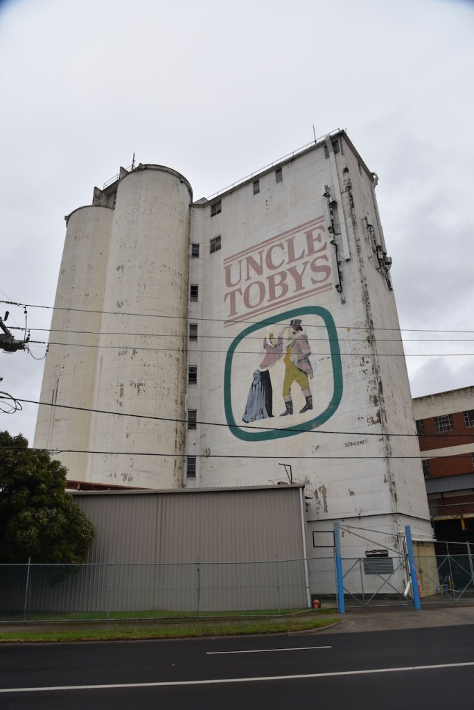
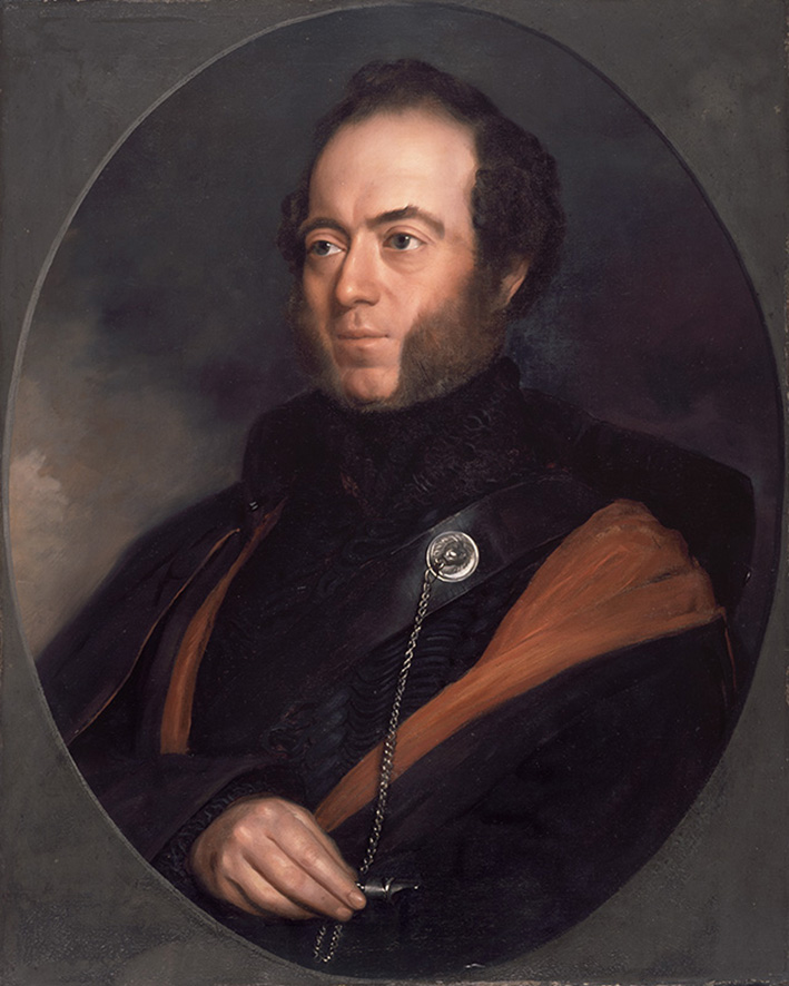
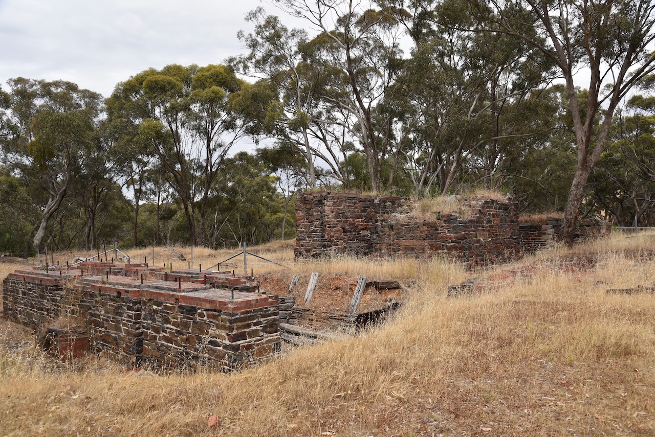
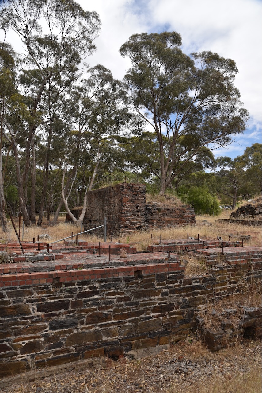
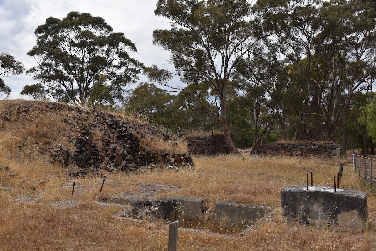
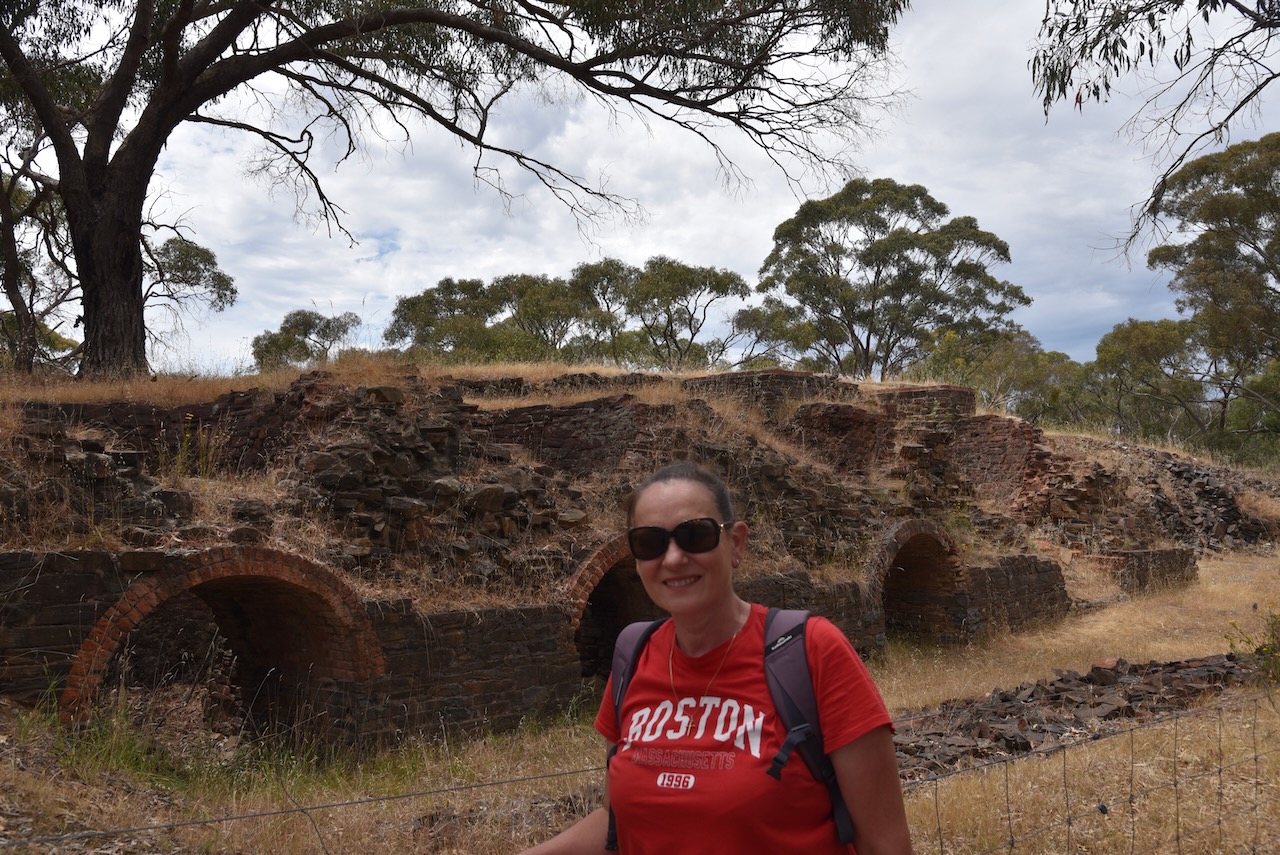
We then visited the ruins of the North British Mine at Maldon. During the 1880s the North British Mine was one of the richest mines in the world. It was owned by Robert Dent Oswald who employed more than 100 men. Oswald was born in 1830 in Lauriston, Stirling, Scotland and emigrated to Australia in 1854. As a young man, he joined other miners on the Maldon goldfields. He soon found himself the sole owner of The Caledonian, a large crushing works, and the North British Mine He became one of the colony’s most wealthy men and a ‘quartz king’.

Above:- Robert Dent Oswald. Image c/o Maldon Museum & Archives Assoc Inc Facebook page.

There are extensive ruins to be viewed along the walking trails and kilns which are some of the best-surviving quartz kilns in Victoria. 

Our next stop was the old dredge and dragline at Porcupine Flat northeast of Maldon. This was once part of the flourishing Maldon goldfields. The Porcupine Inn was opened here in 1846. In 1958 George Heywood commenced working the site at Porcupine Flat and purchased the dredge soon after. In 1974 mining operations ceased. The dragline was brought to Porcupine Flat from the Yallourn Coal Mine to assist in creating the initial dam, however, it was of little assistance and abandoned in its current position. (Blake 1977) (Goldfields Guide 2024)

Marija and I then headed towards Melbourne, along the Calder Freeway, detouring into Kyneton for some lunch.

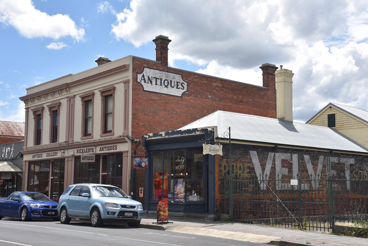
Kyneton is a small rural town about 75 km northwest of Melbourne. The area was once part of the Carlsruhe pastoral run which by 1839 had been split. The area around current-day Kyneton was called St Agnes, and by 1839 a small slab homestead had been built on the river flat by Charles Wedge, one of the owners of St Agnes Run. The area became a teamster’s camping area and by 1848 a courthouse had been built. By this time, Henry Jeffreys and Lieutenant-Governor Charles La Trobe owned the run. La Trobe decided to make the area a township and named it Kyneton after Mrs Jeffrey’s birthplace of Kineton in Warwickshire. By 1850 it was gazetted as Kyneton. (Victorian Places 2024)

Above:- Lt Gvnr La Trobe. Image c/o Wikipedia.

Kyneton became a stopping place and supply point for those travelling between Melbourne and the Bendigo goldfields. Several buildings were constructed including the Anglican church in 1852, the Congregational church in 1853, the Mechanics Institute in 1854, a Catholic church in 1855, and a hospital in 1857. In 1857 Degraves mill was constructed, and in 1863 a railway station was built. (Victorian Places 2024)

It was then down to Melbourne where we planned to stay with friends for a few nights.

References.

  1. Bannear; D, 1993, Historic Mining Sites in the Maldon Mining Division.
  2. Dcceew.gov.au. (2023). Collaborative Australian Protected Areas Database (CAPAD) 2022 – DCCEEW. [online] Available at: https://www.dcceew.gov.au/environment/land/nrs/science/capad/2022 [Accessed 9 Apr. 2024].‌
  3. https. (n.d.). Welshmans Reef Cemetery. [online] Available at: https://www.goldfieldsguide.com.au/explore-location/502/welshmans-reef-cemetery/ [Accessed 9 Apr. 2024].‌
  4. https. (n.d.). North British Mine and Quartz Kilns. [online] Available at: https://www.goldfieldsguide.com.au/explore-location/109/north-british-mine-and-quartz-kilns/ [Accessed 9 Apr. 2024].‌
  5. https. (n.d.). Porcupine Flat Gold Dredge and Dragline. [online] Available at: https://www.goldfieldsguide.com.au/explore-location/19/porcupine-flat-gold-dredge-and-dragline/#google_vignette [Accessed 1 May 2024].‌
  6. Leslie James Blake (n.d.). Place Names of Victoria.‌
  7. Maldon Inc. (n.d.). Gold Dredge and Dragline. [online] Available at: https://www.maldon.org.au/explore/gold-dredge-and-dragline [Accessed 9 Apr. 2024].‌
  8. http://www.victorianplaces.com.au. (n.d.). Kyneton | Victorian Places. [online] Available at: https://www.victorianplaces.com.au/kyneton [Accessed 9 Apr. 2024].‌