Kiamal Bushland Reserve VKFF-4232 and Kiamal silo VK-KML3

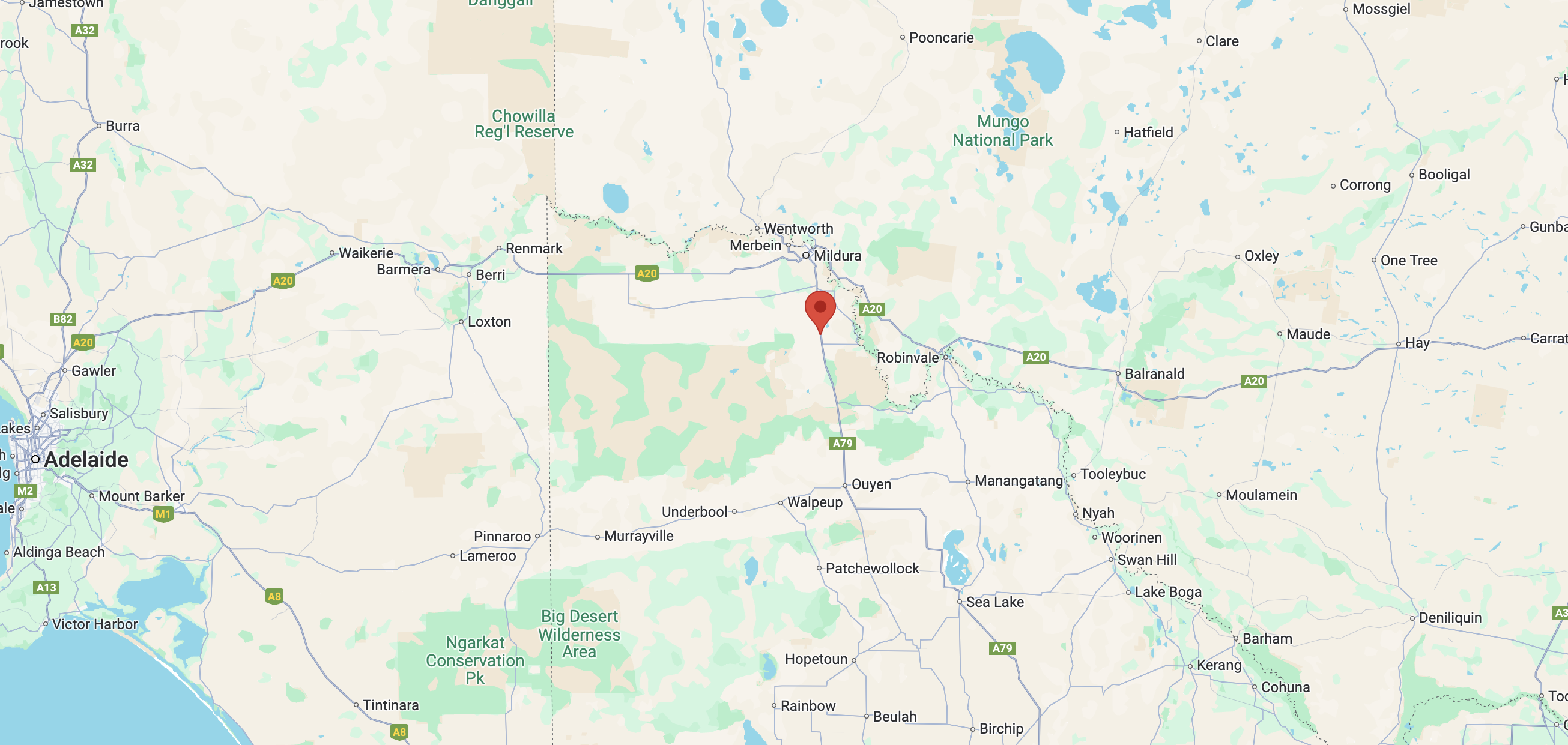
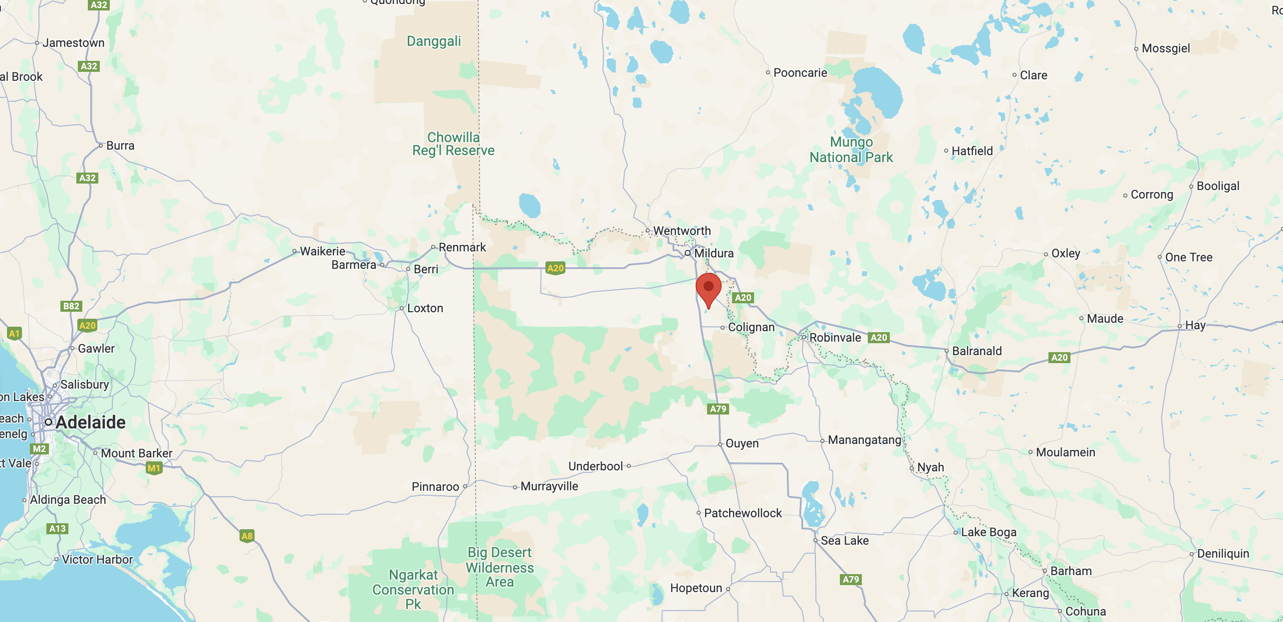
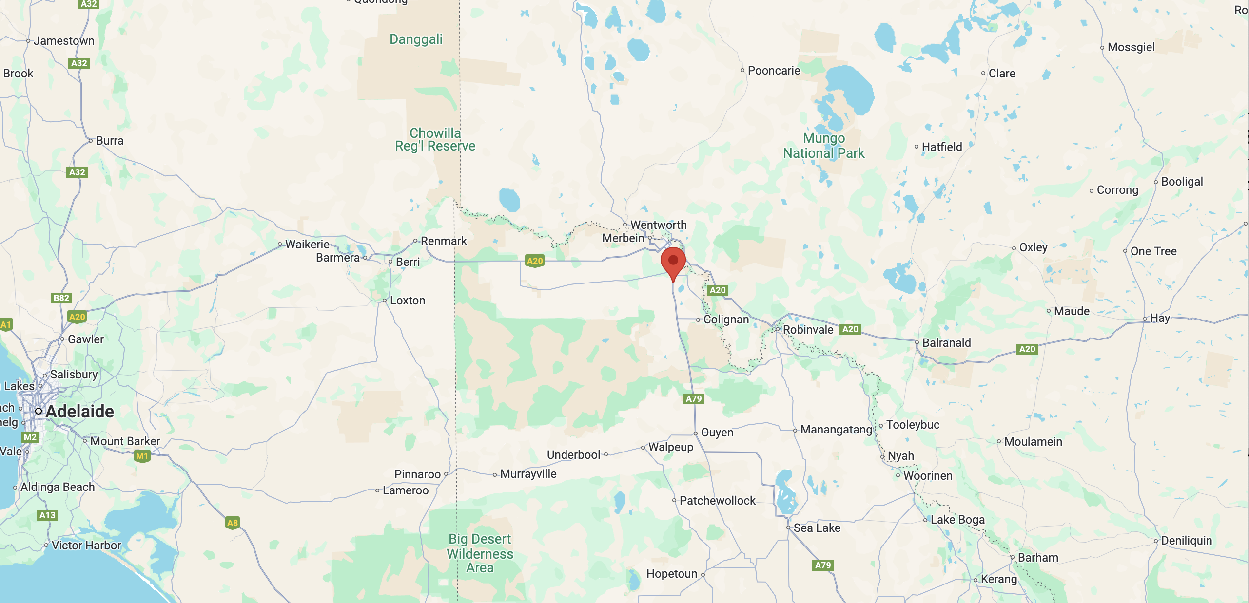
After packing up at Carwarp West I9 Bushland Reserve on Monday 19th August 2024, I headed south on Calder Highway for 65 km until I reached the town of Ouyen. I had booked accommodation here for a few nights. I booked into my motel room, offloaded some of my gear, and then headed out to activate another park.

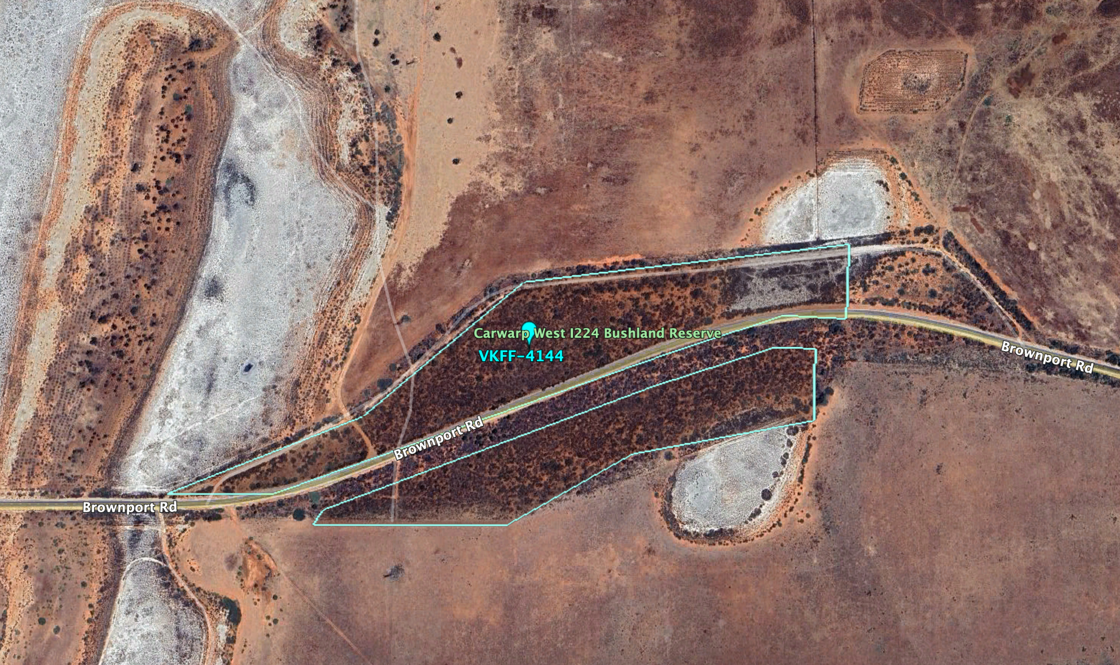
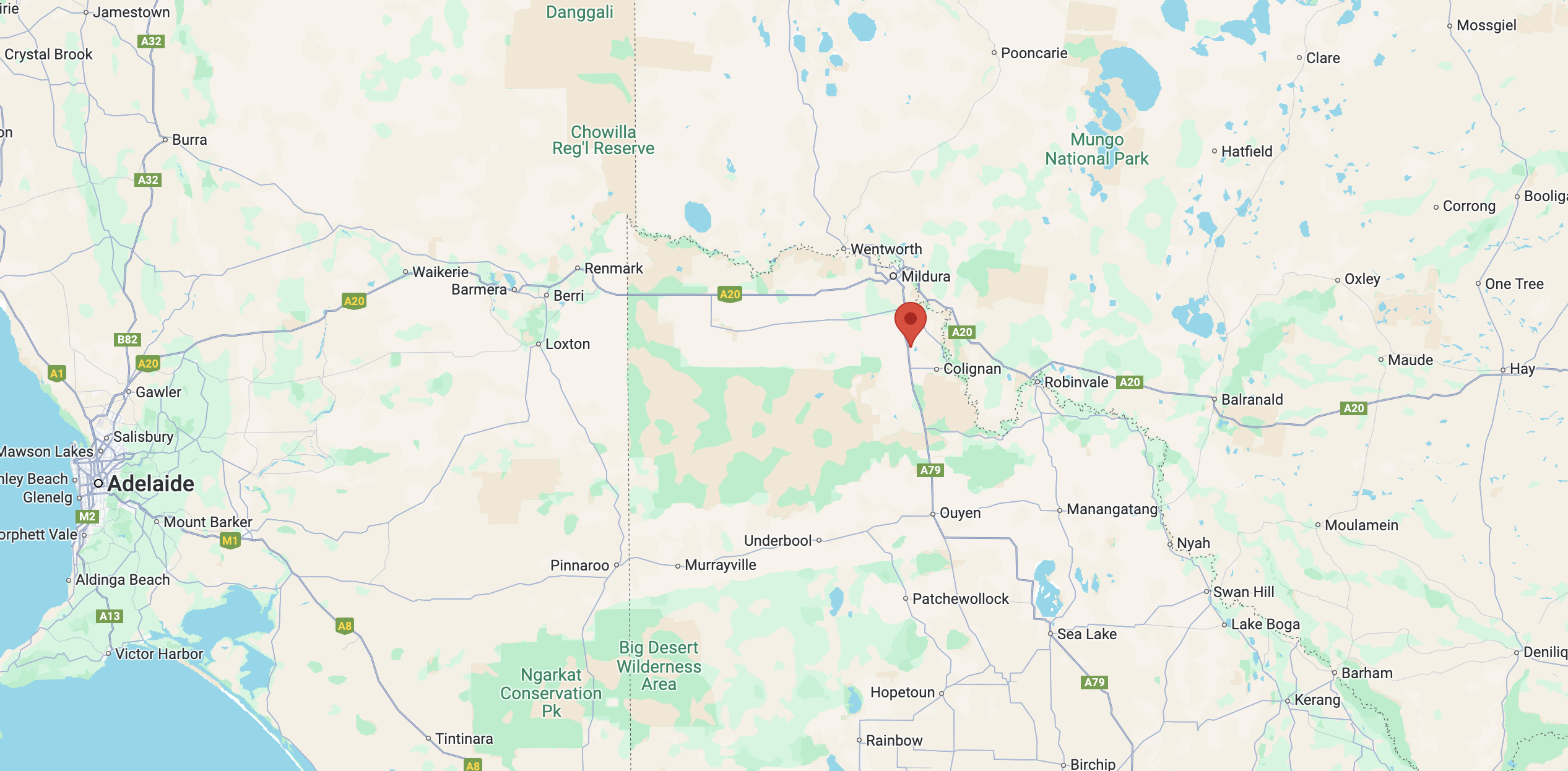
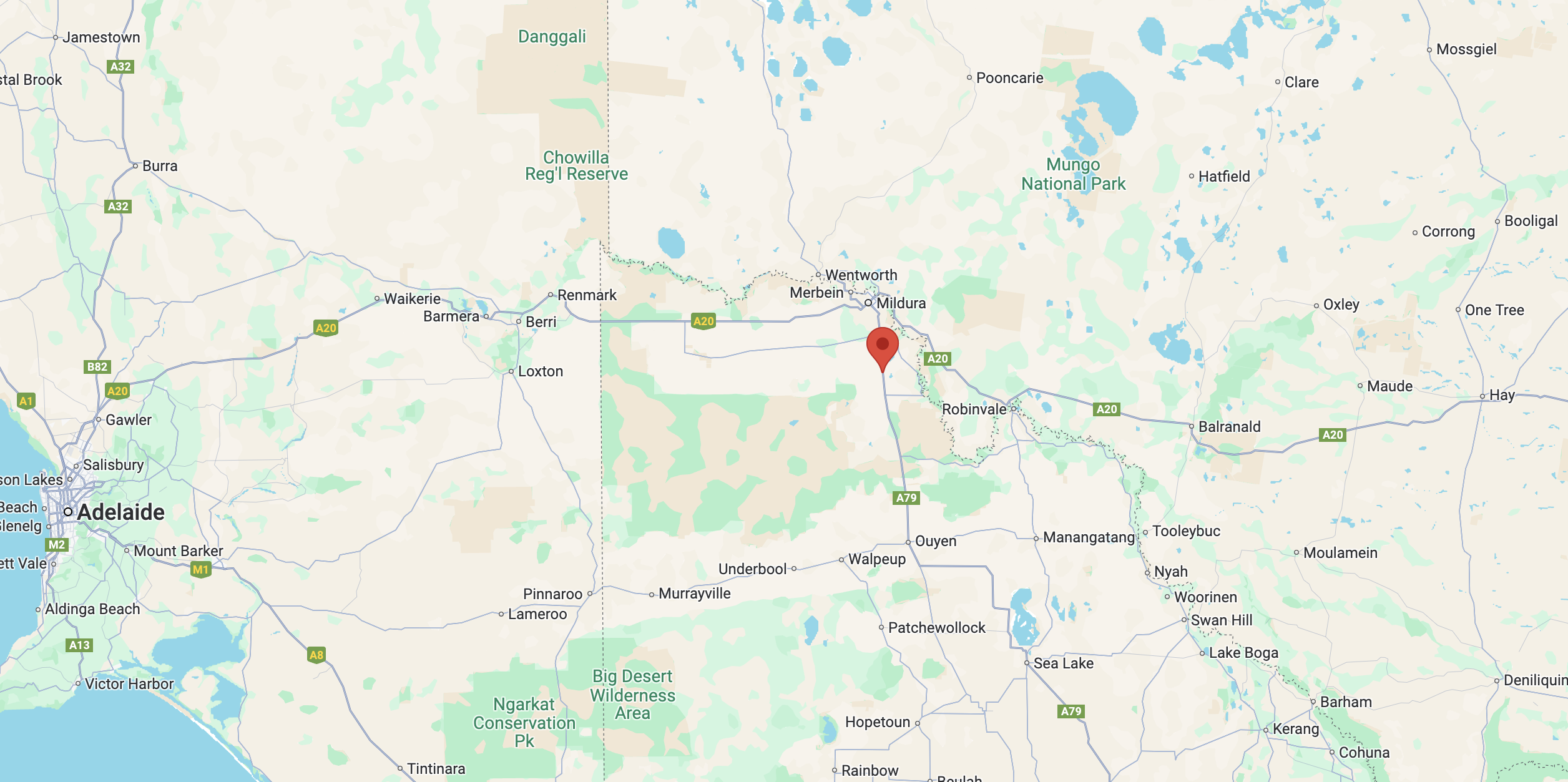
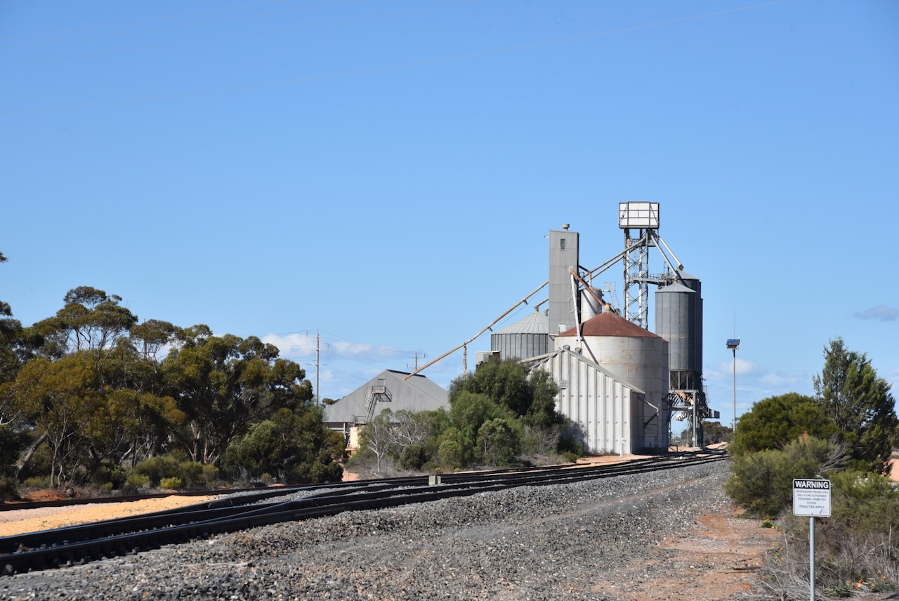
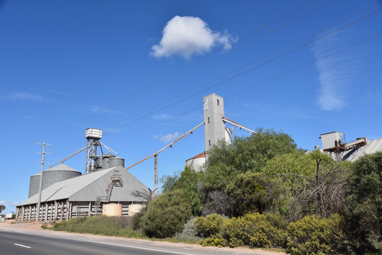
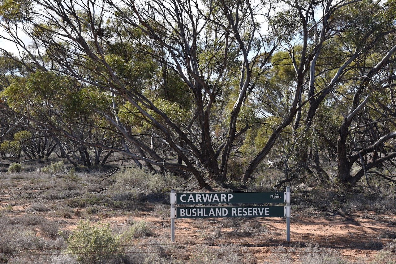
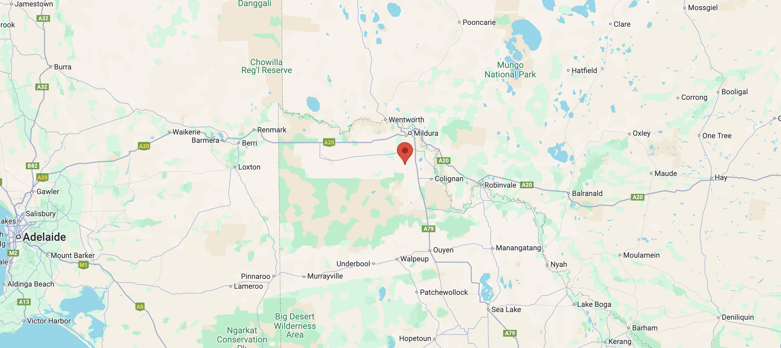
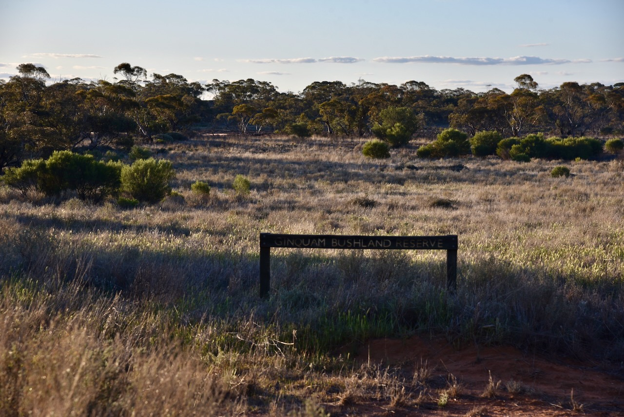
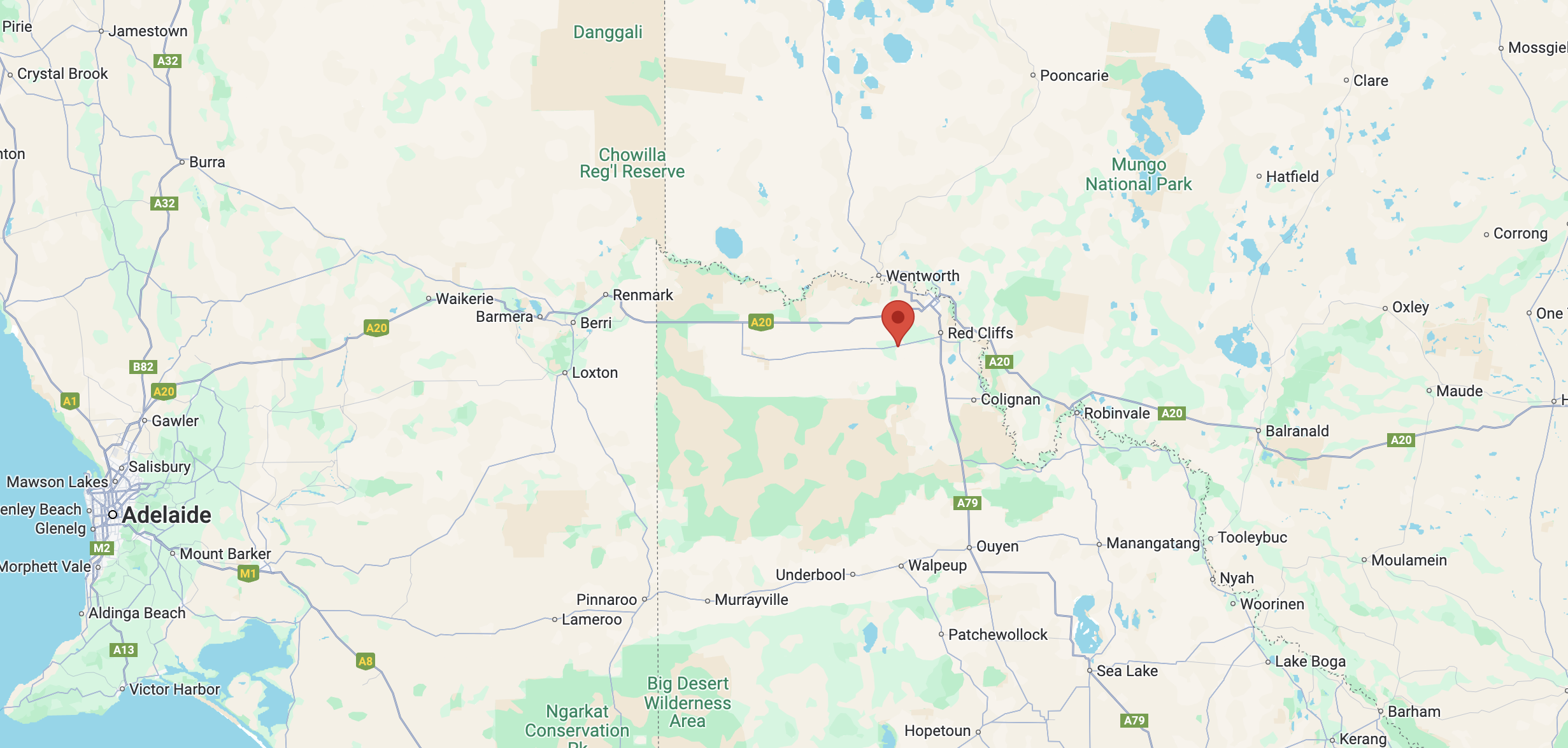
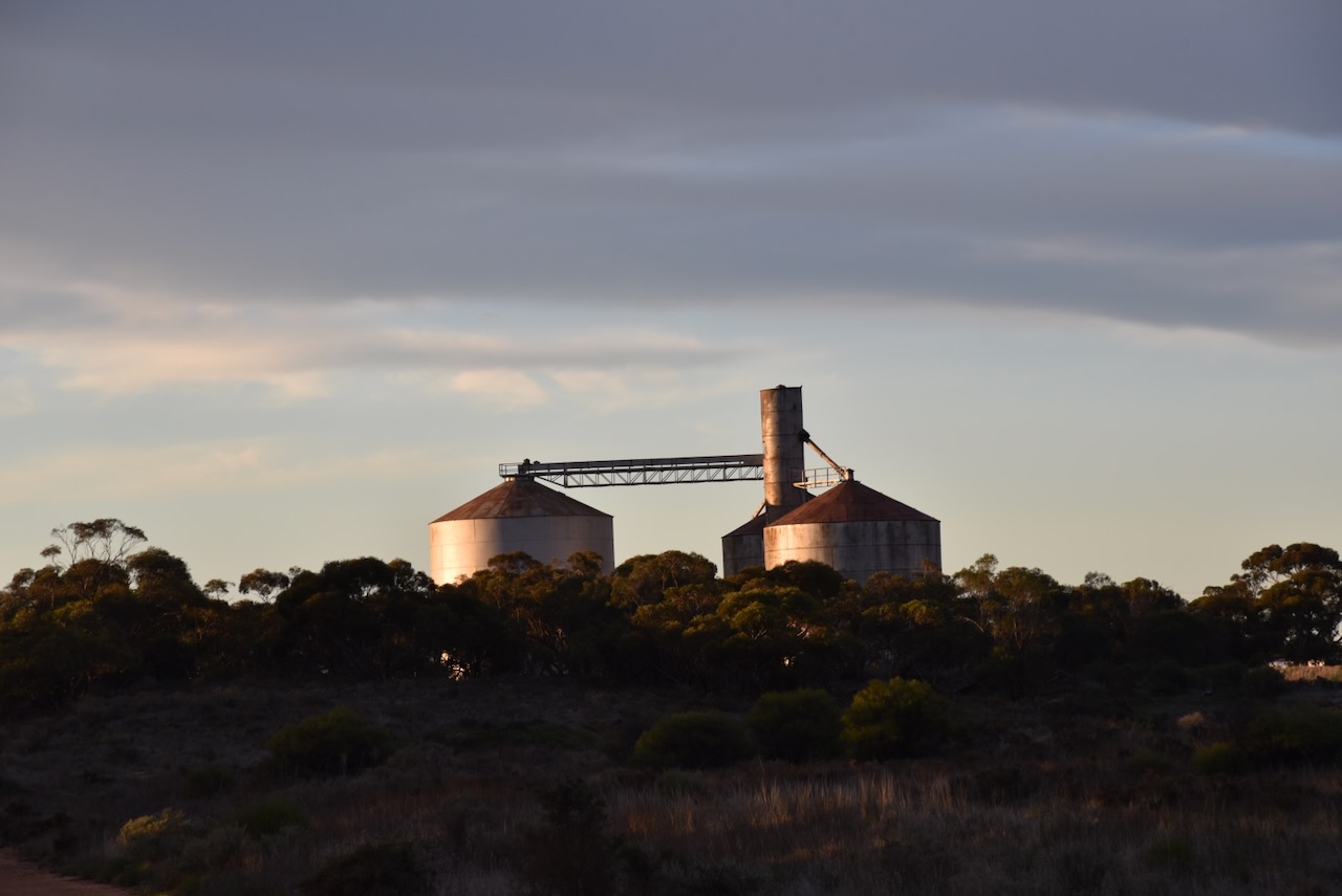
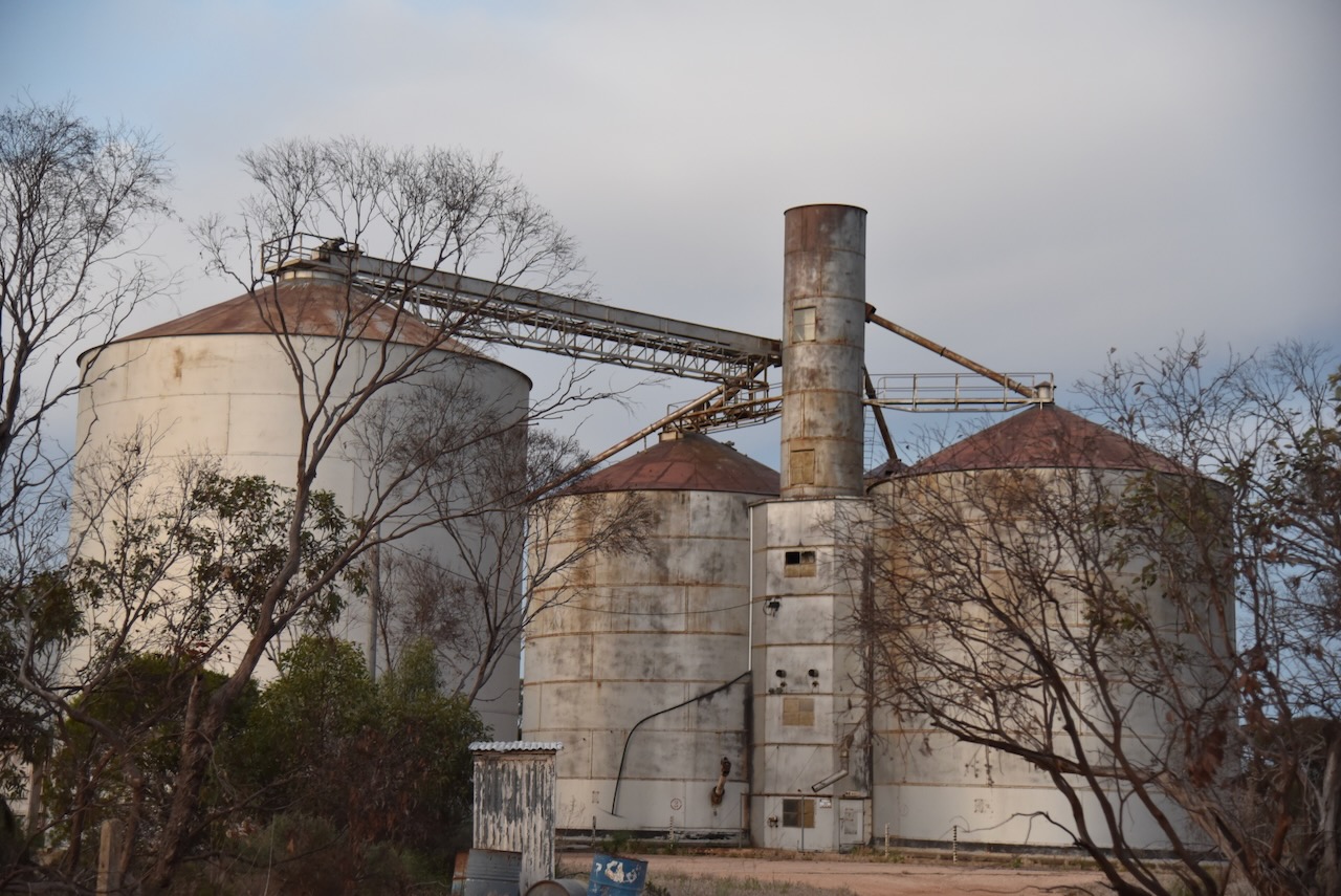
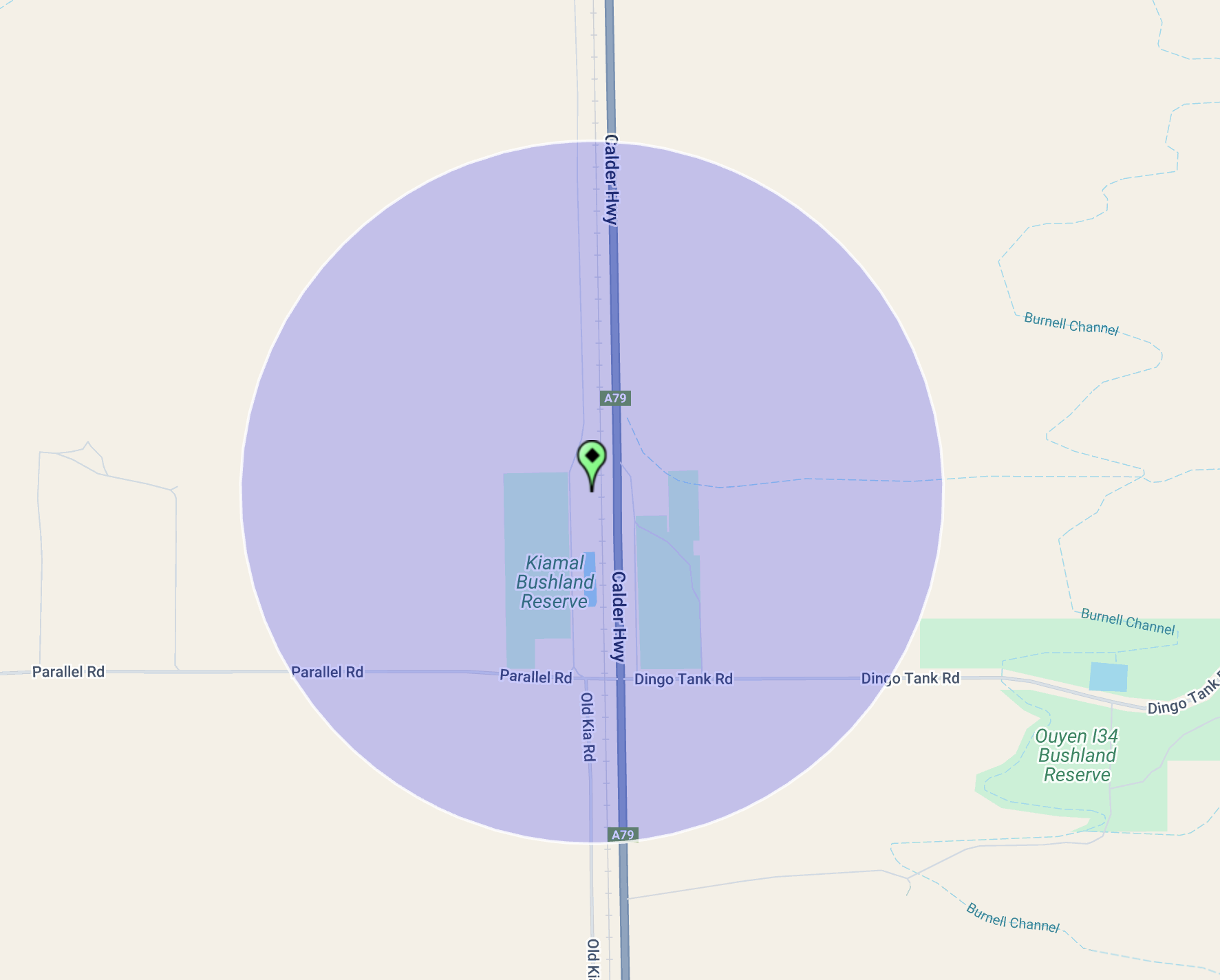
I drove to Kiamal Bushland Reserve VKFF-4232, just 8 km north of Ouyen. The park is also within the activation zone of the Kiamal silo VK-KML3.

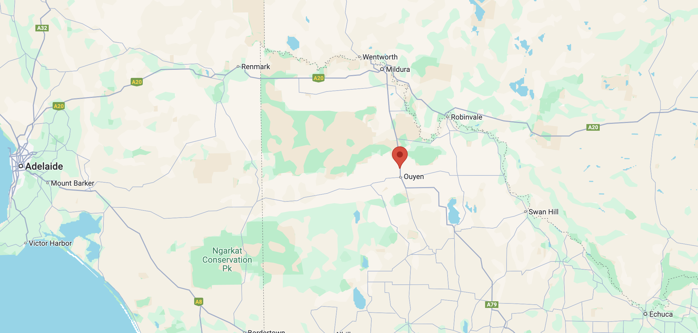
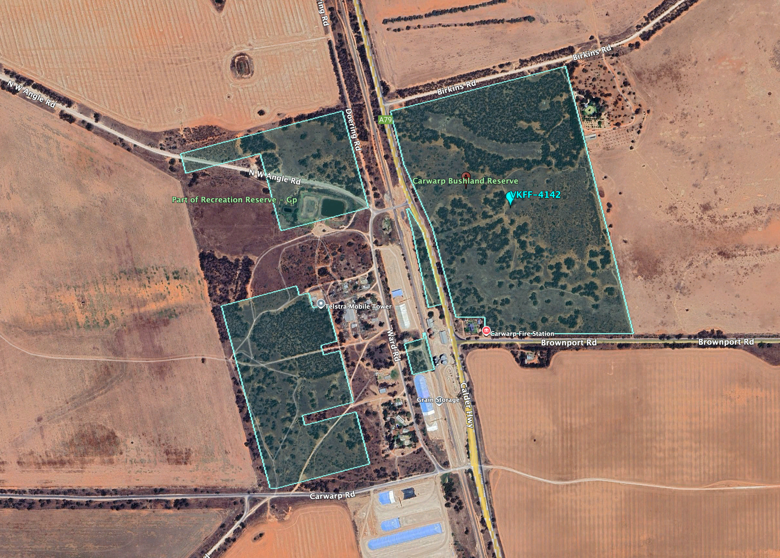
Above:- Map showing the location of the Kiamal Bushland Reserve. Map c/o Google Maps.

Kiamal was formerly known as Kia. It is an aboriginal word with various meanings including to squat, emu, war spear, and fibrous tree). (Victorian Places)

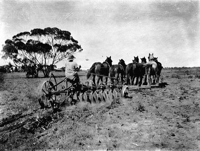
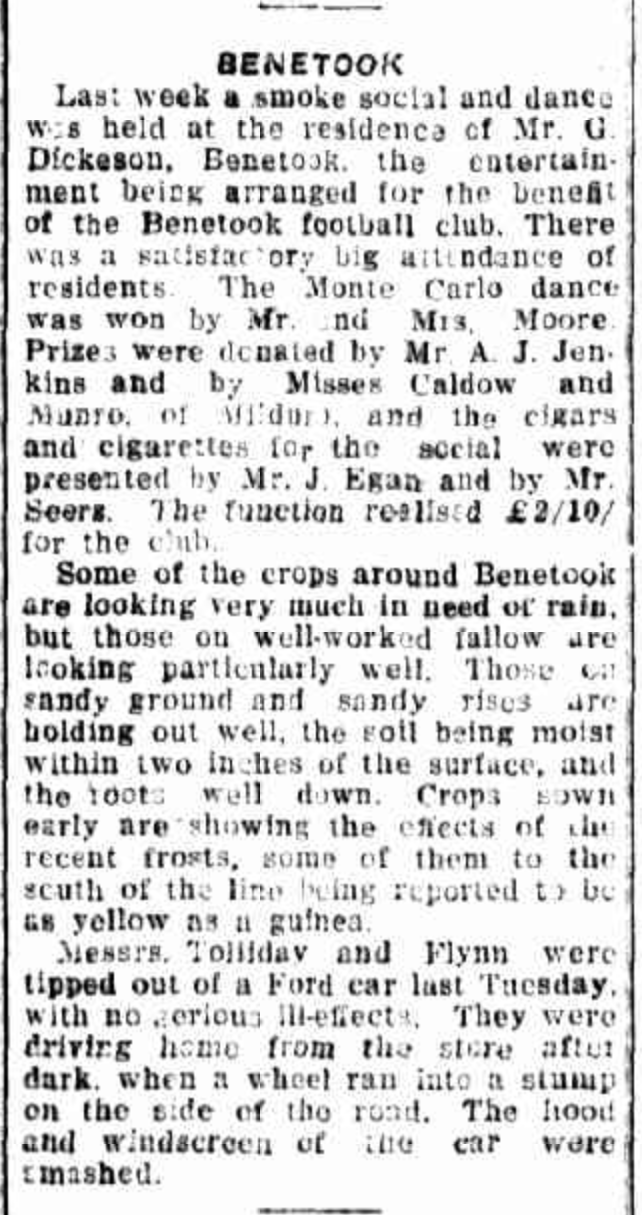
In its day Kiamal was a thriving town with dances and other social events being held at the local hall. Kiamal also had its own cricket club.

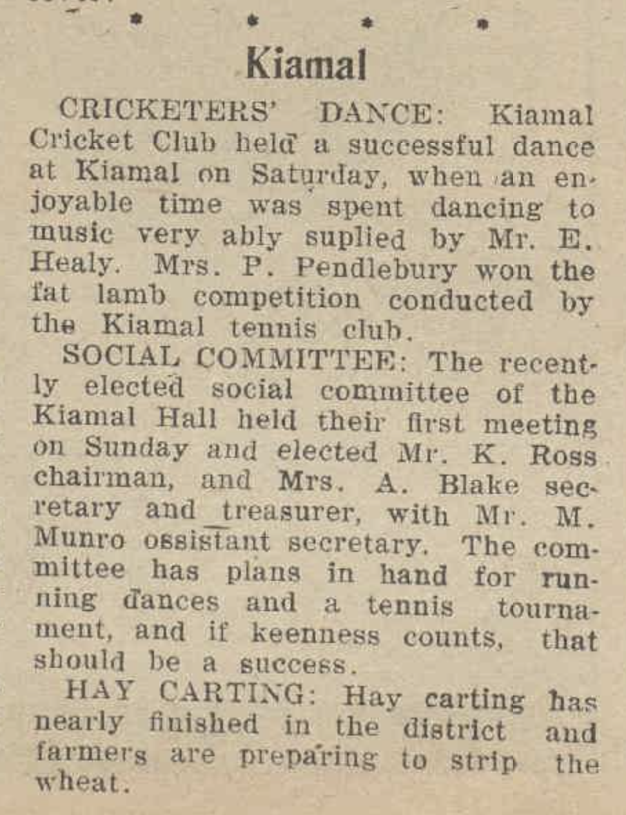
Above:- Article from the Ouyen Mail, Wed 15 Nov 1939. Image c/o Trove.

The Kiamal railway station opened on the 6th day of May 1913 and was originally known as Kia Siding. It was renamed Kiamal on the 19th day of February 1917. The siding consisted of a goods loop siding that was completed in late April 1913. By January 1919 a passenger platform had been constructed. There were no goods platform or shed on the siding. Kiamal was closed to passenger traffic on the 14th day of April 1970. In January 1992 the Kiamal platform was removed. (Mildura Railway History)

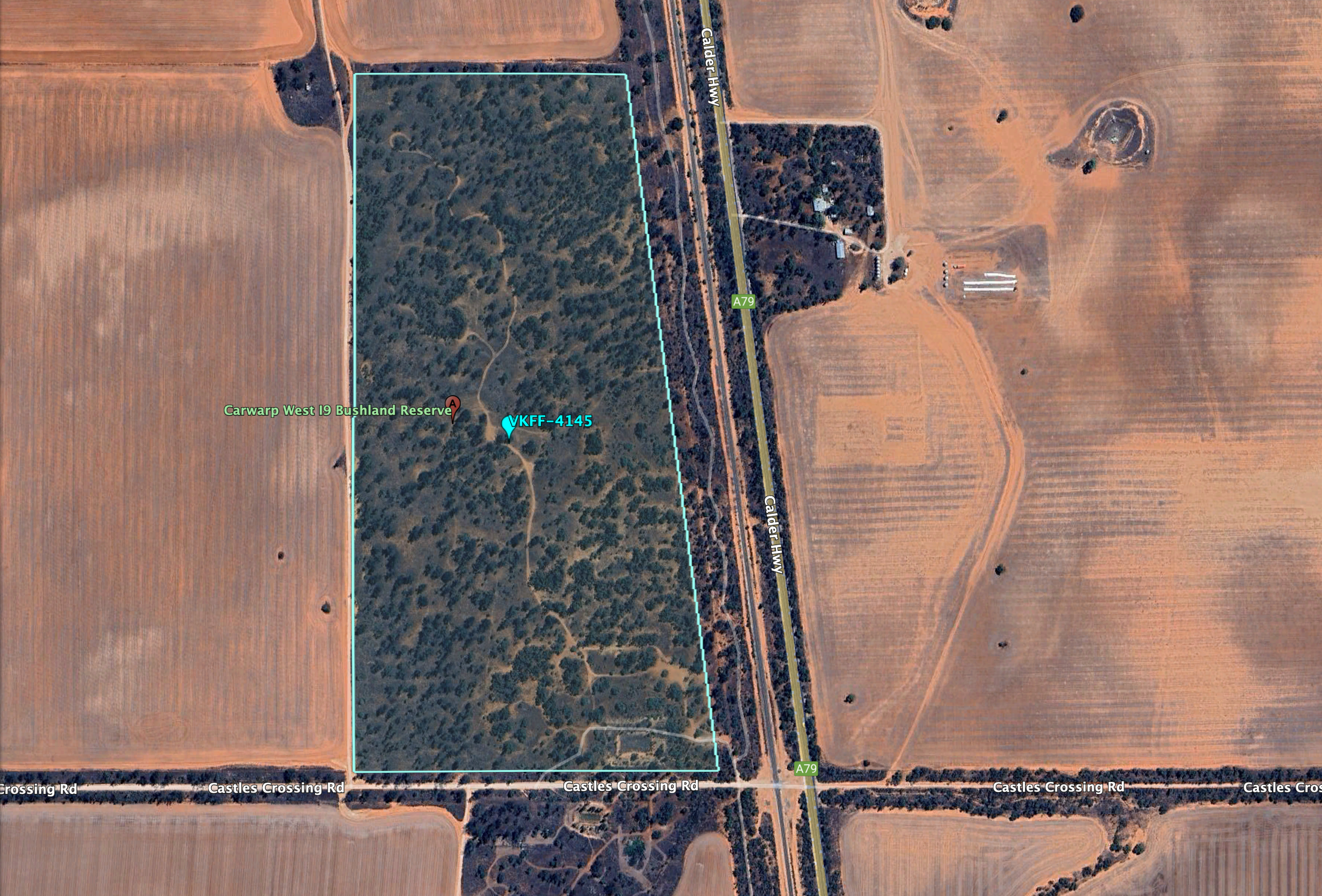
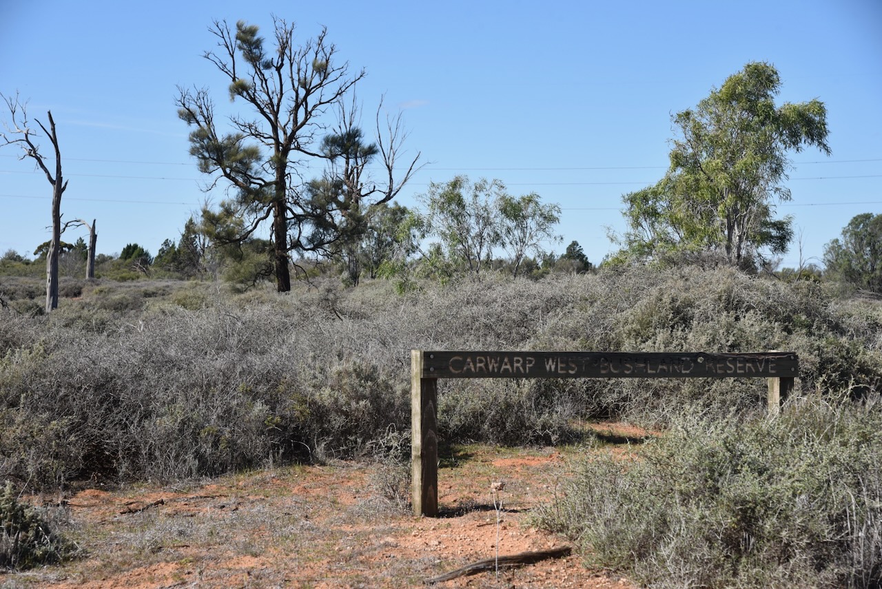
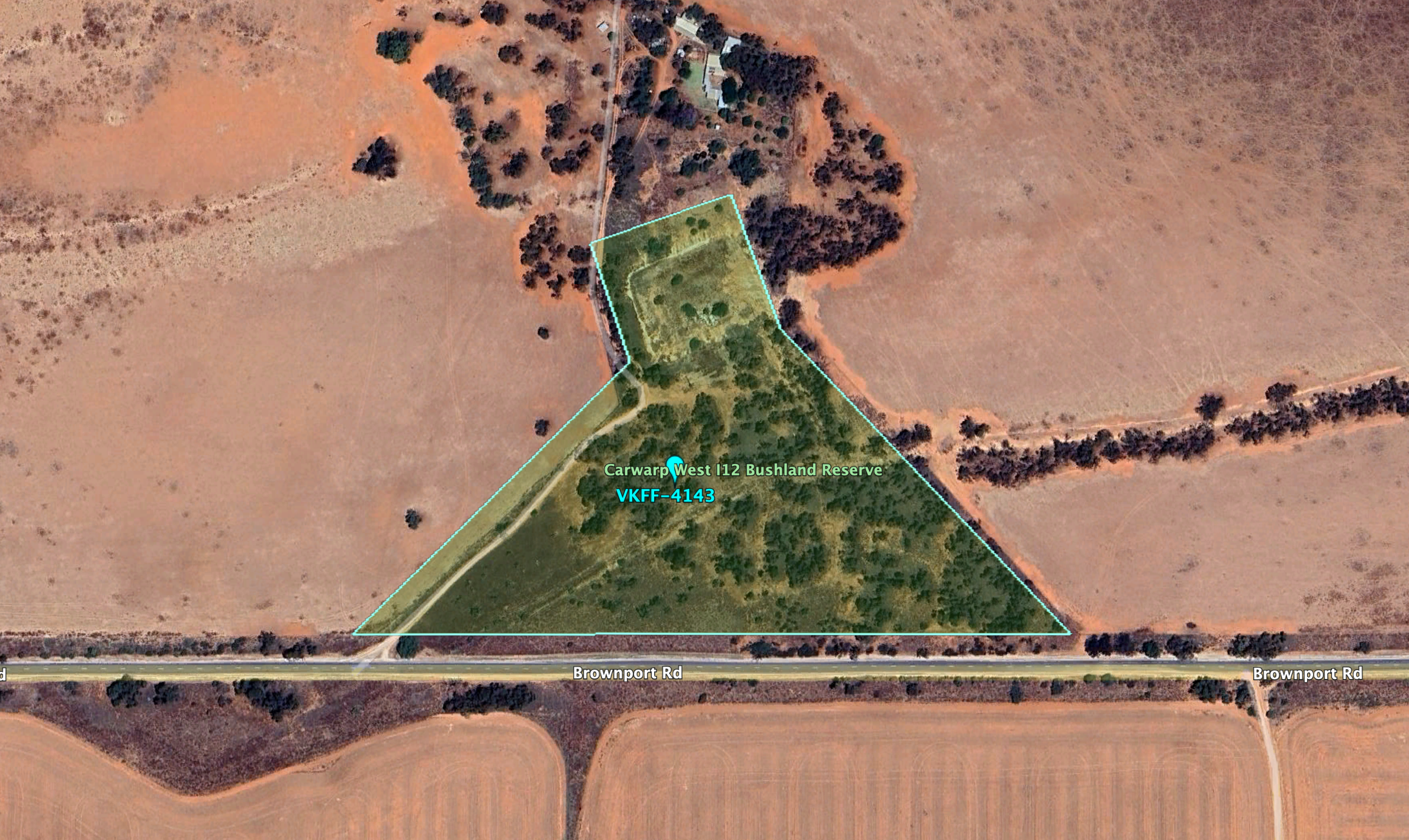
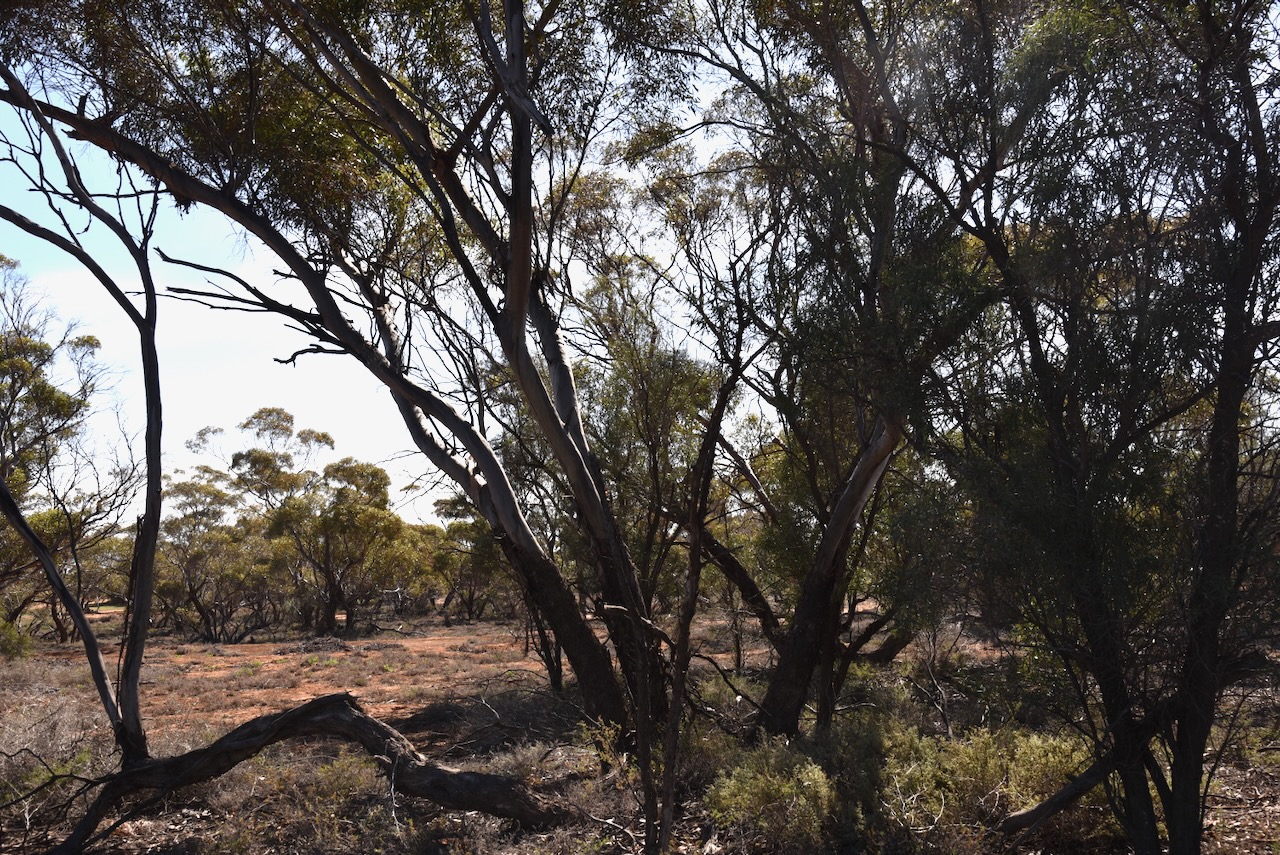
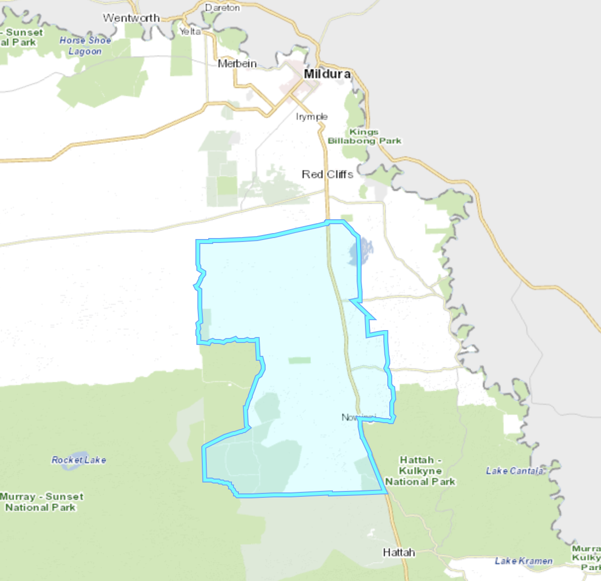
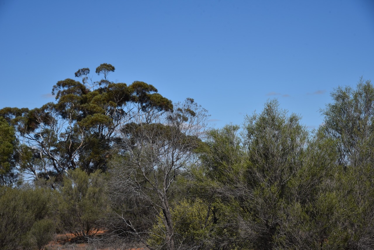
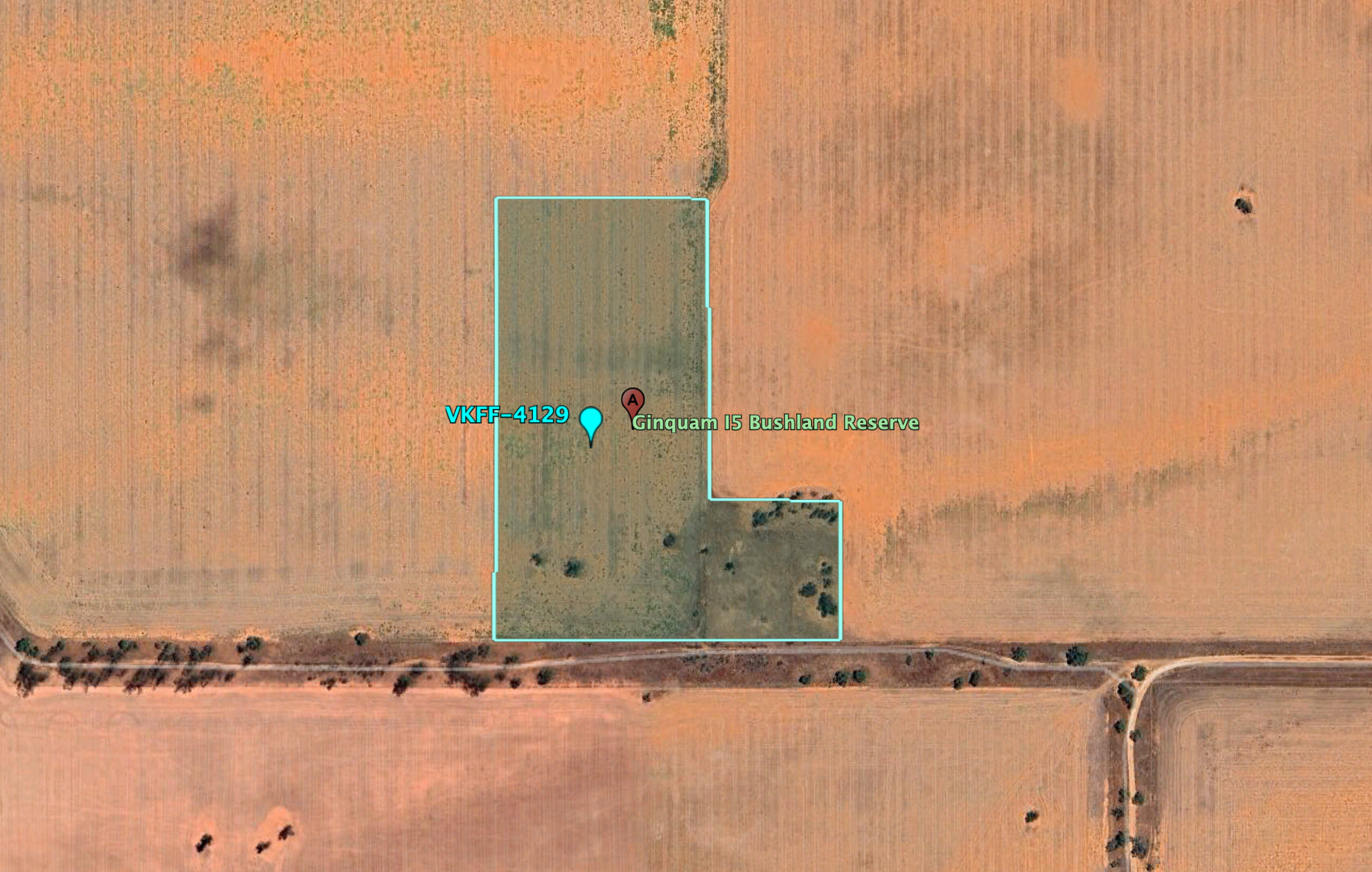
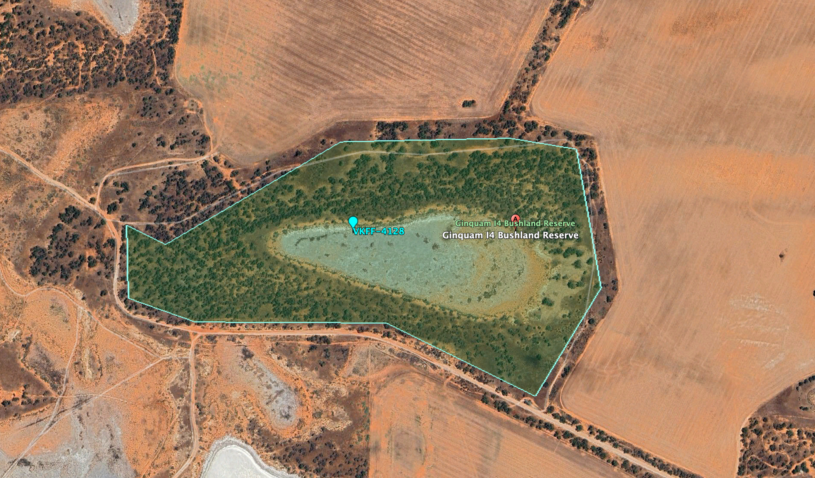
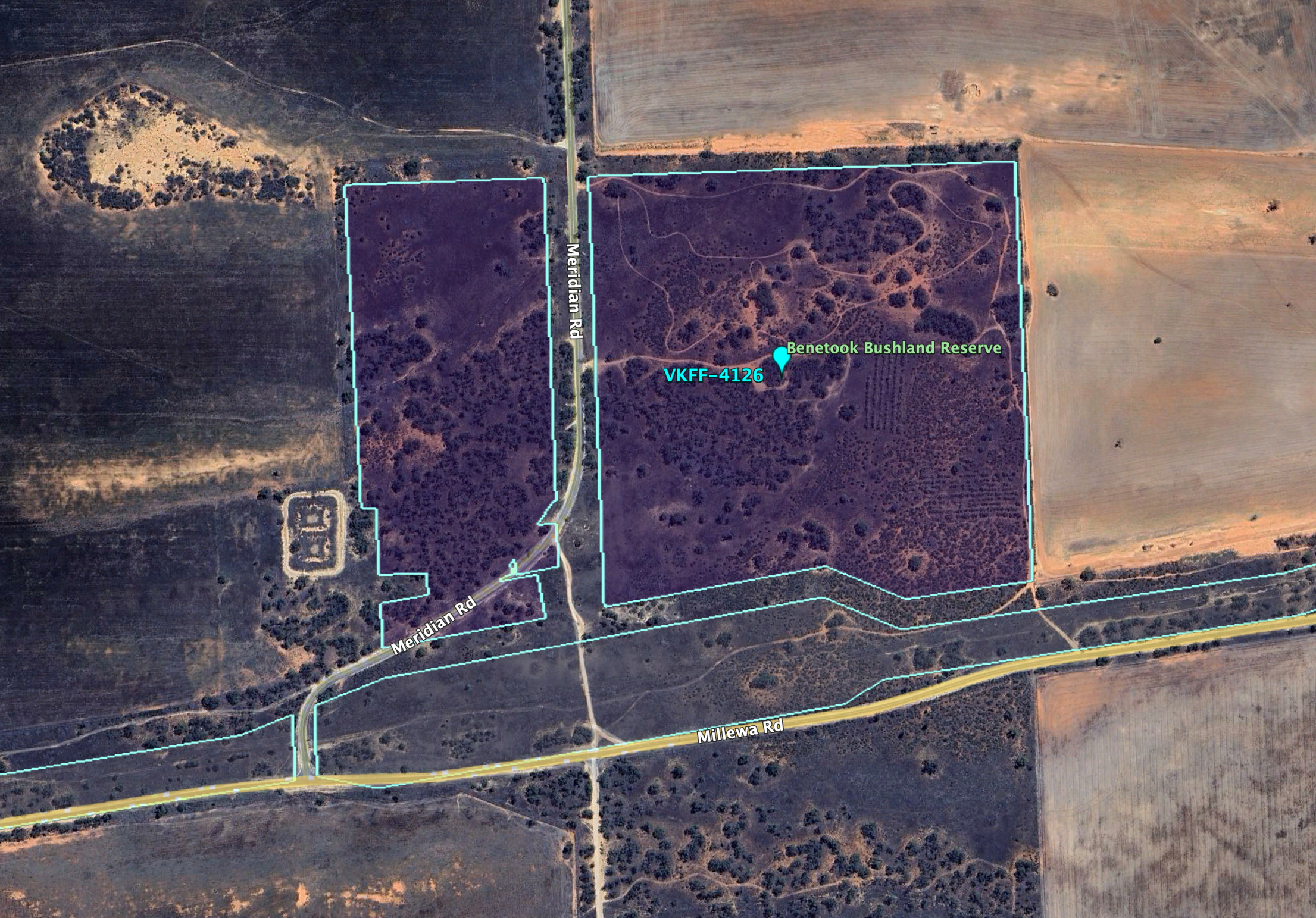
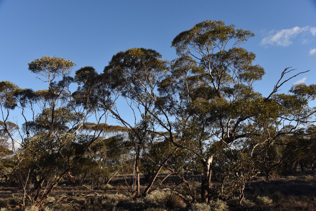
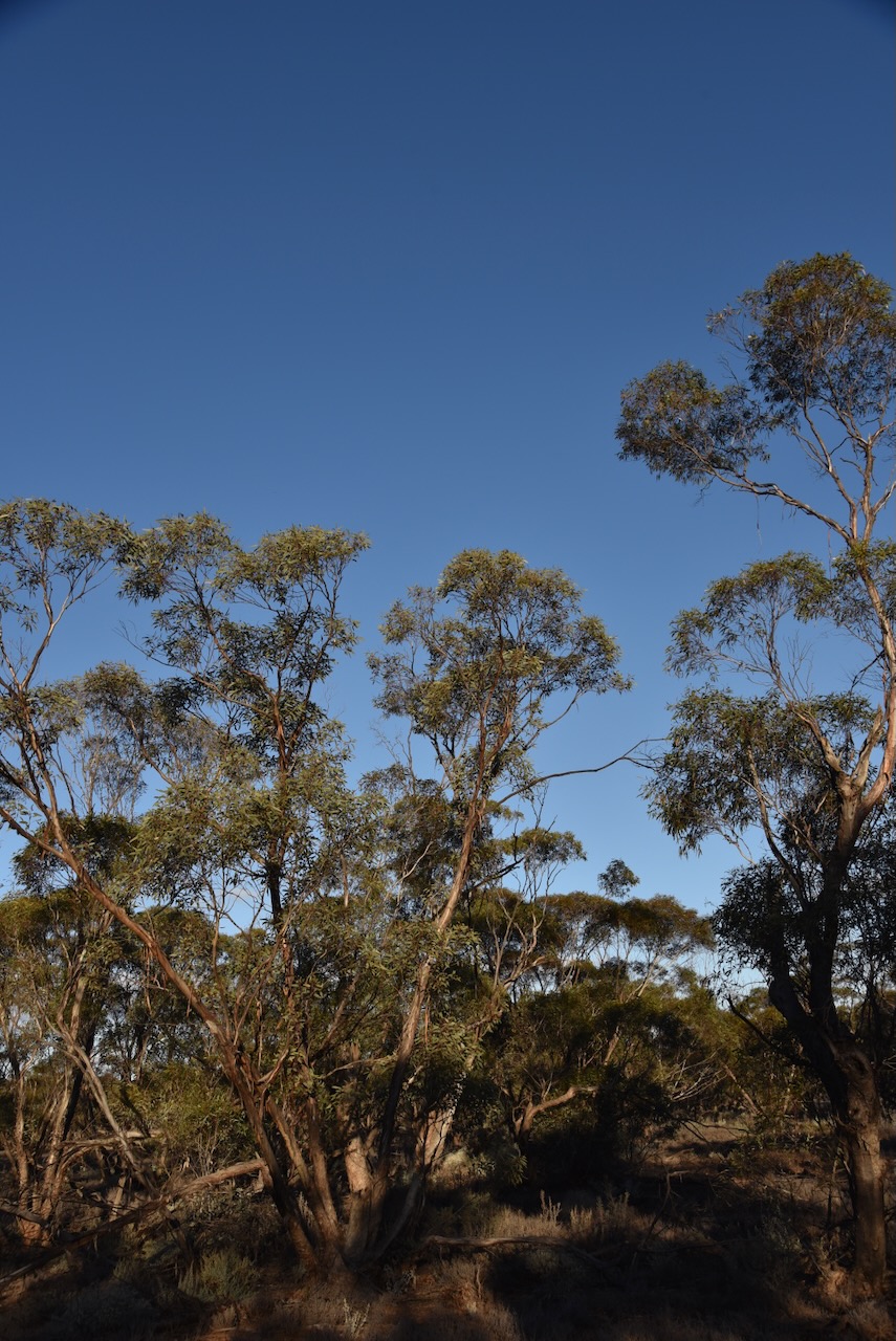
The Kiamal Bushland Reserve is located on both the eastern and western side of Calder Highway at the intersection with Parallel Road and Dingo Tank Road.

Above:- An aerial view of the Kiamal Bushland Reserve. Image c/o Google Earth.

The reserve is about 18 hectares in size and was established on the 8th day of May 1990. (CAPAD 2022)

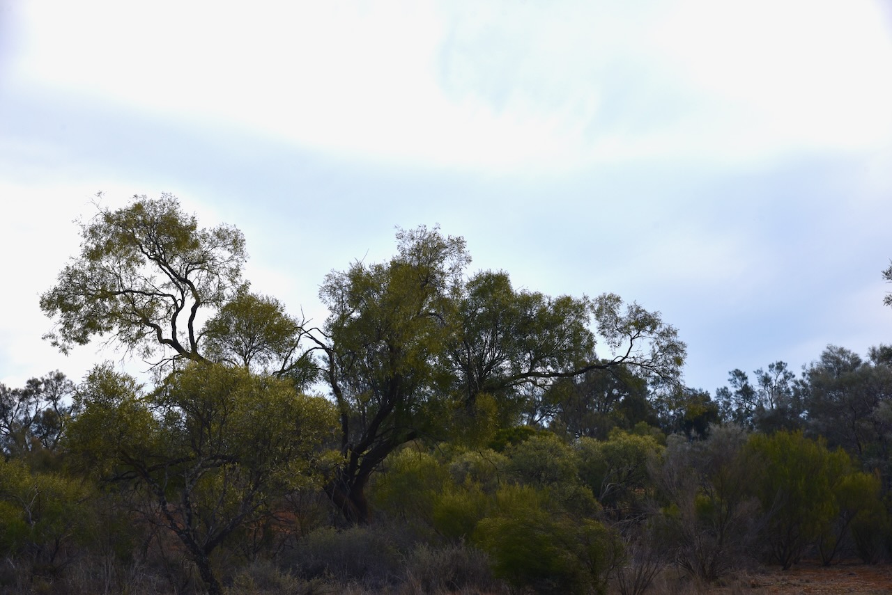
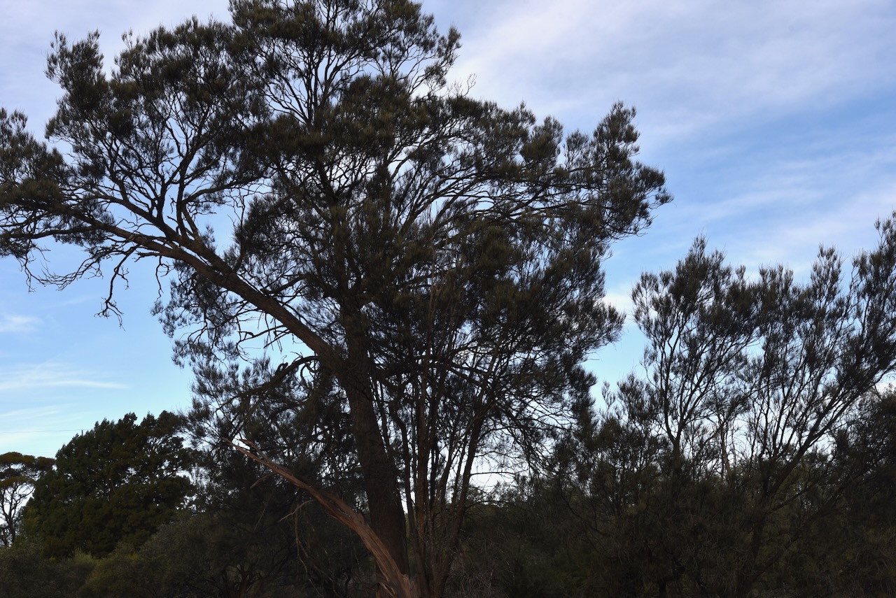
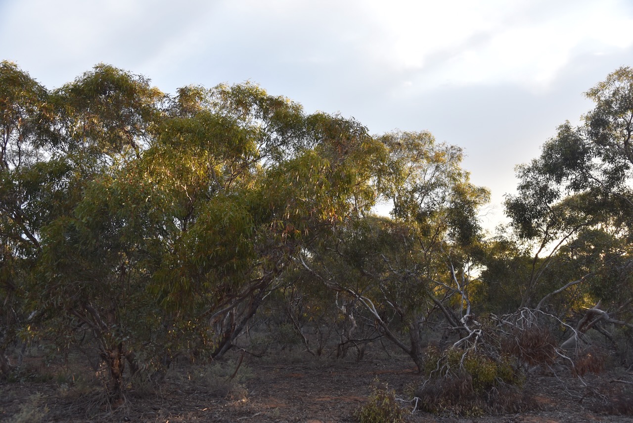
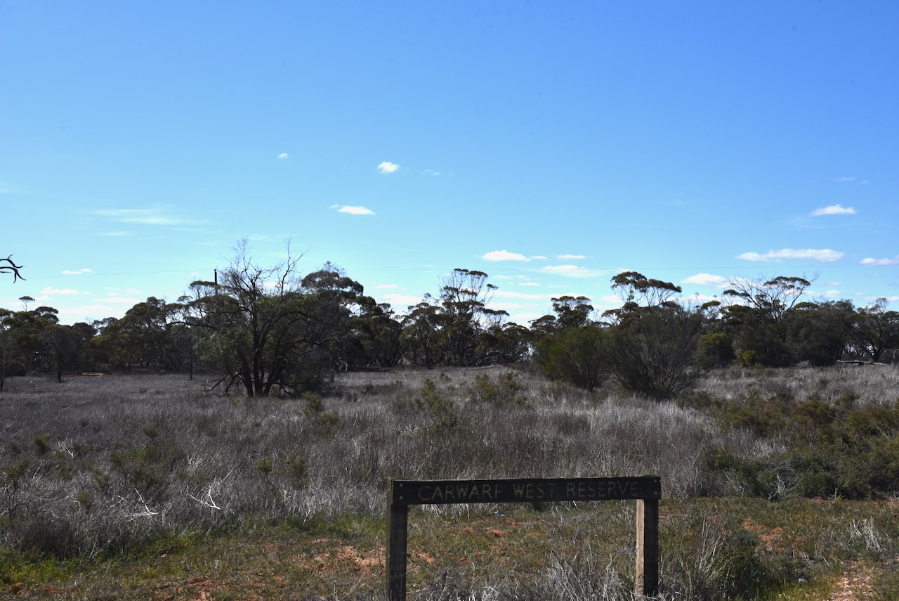
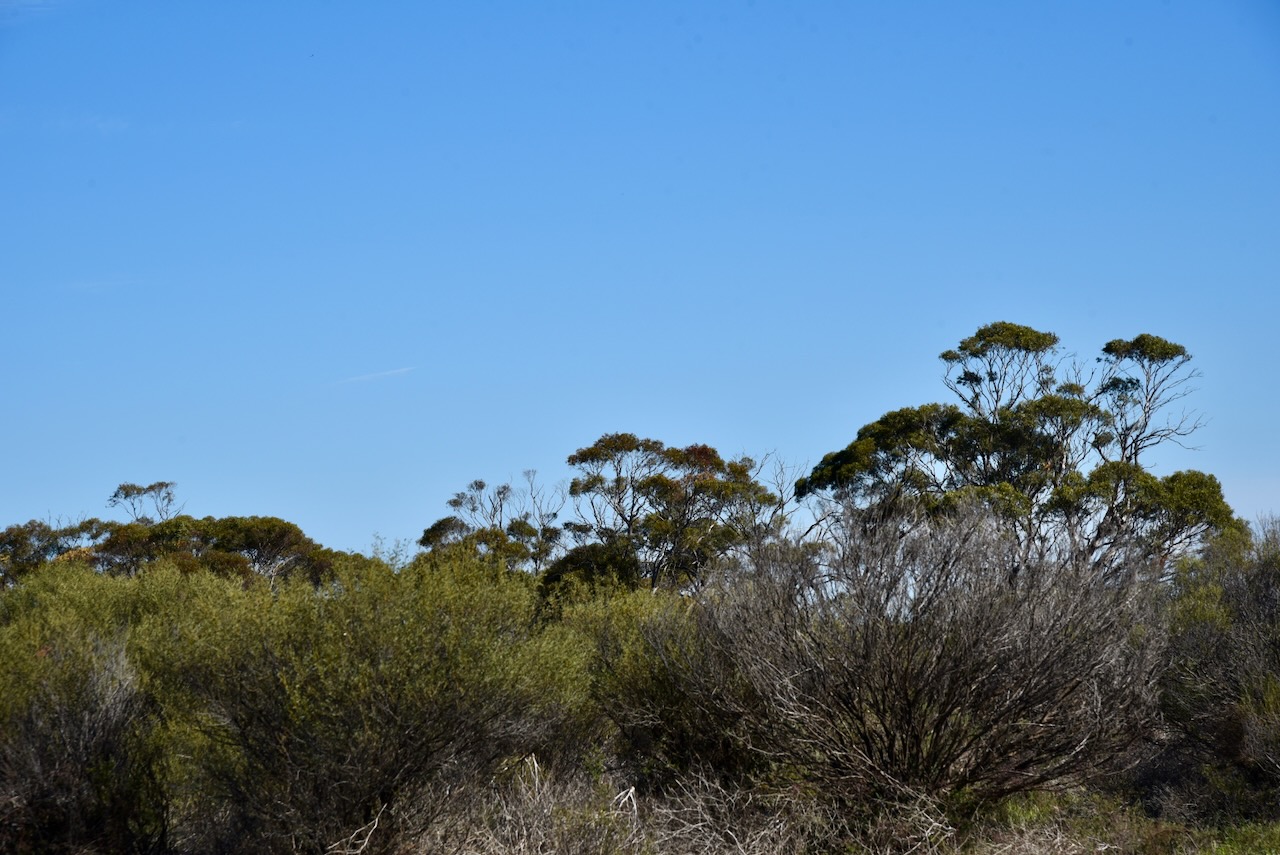
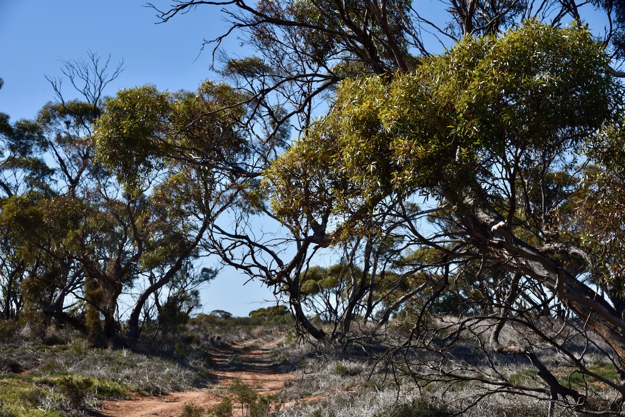
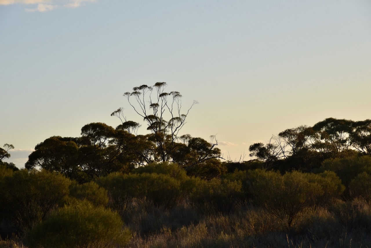
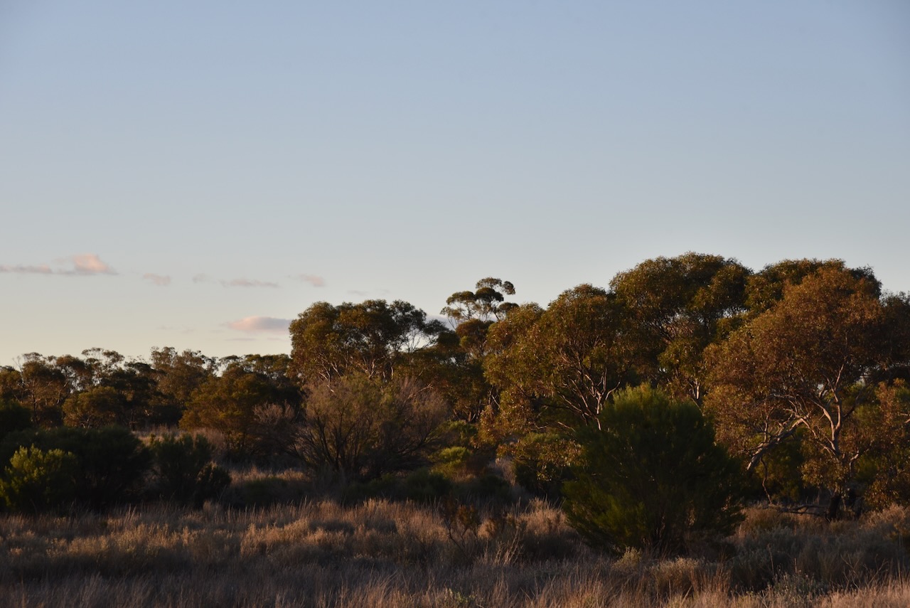
I accessed the reserve via Old Kia Road. I ran the Yaesu FT857, 40 watts, and the 20/40/80m linked dipole for this activation.

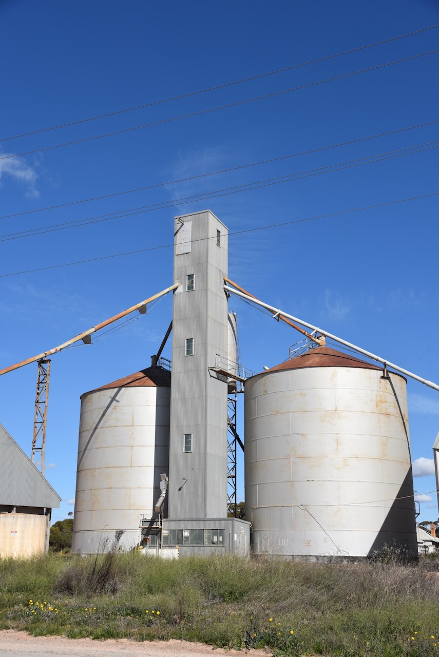
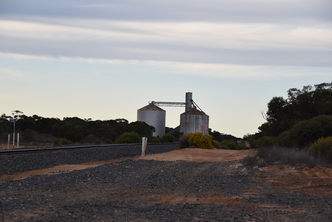
Above:- the activation zone at the Kiamal silo. Image co SiOTA website.

I worked the following stations on 20m SSB:-

  1. ZL3MR
  2. VK2VW
  3. VK2HFI
  4. VK2AKA
  5. VK2BUG
  6. VK2IO
  7. VK2GEZ
  8. KG5CIK
  9. VK2EG/p
  10. VK5QA/4
  11. VK3CLD/4
  12. OH1XT
  13. ON4BB
  14. VK5PL
  15. SP7MW
  16. VK4SMA
  17. F5NZO
  18. IK1GPG
  19. OH1MM
  20. SP9RXP
  21. EW6MP
  22. ON4ON
  23. GI0BDX
  24. ZL1TM
  25. OH5EP
  26. M6KFI/p
  27. PA5WK
  28. UT5PI
  29. OM5TX
  30. VK6NU
  31. EA3MP
  32. IS0CZG
  33. M1TES/m
  34. G4AKC/p (bicycle mobile)
  35. DL2ND
  36. VK4HNS
  37. F4HZR
  38. VK4TJ
  39. OM3CND
  40. VK4EMP
  41. VK4TI
  42. VK4GKO
  43. S58AL
  44. RX9WN
  45. SP5HRX
  46. IK4JPK
  47. VK5AYL
  48. LA7TN

I worked the following stations on 40m SSB:-

  1. VK5LA
  2. VK5KAW
  3. VK3APJ
  4. VK2EXA
  5. VK7PSJ
  6. VK5FB
  7. VK7PJM
  8. VK1DI
  9. VK3CEO
  10. VK4FSC
  11. VK3ADS
  12. KG5CIK
  13. VK3ALF
  14. VK7JU
  15. VK5AC
  16. VK3PF/p (Yea Streamside Reserve VKFF-3928)
  17. VK5WU
  18. VK4FDJL
  19. VK4WAB
  20. VK4EMP
  21. VK4TI
  22. VK4GKO
  23. VK3SQ
  24. VK2BD
  25. VK2KEV/3
  26. VK4XRC
  27. VK3ZK
  28. VK2TGH
  29. VK5GY
  30. VK5FANA
  31. VK4DTS
  32. VK2IO
  33. VK2GEZ

References.

  1. Dcceew.gov.au. (2023). Collaborative Australian Protected Areas Database (CAPAD) 2022 – DCCEEW. [online] Available at: https://www.dcceew.gov.au/environment/land/nrs/science/capad/2022 [Accessed 17 Oct. 2024].‌
  2. Leslie James Blake, 1978, Place Names of Victoria.
  3. Vmrs.net. (2024). Kiamal. [online] Available at: https://vmrs.net/mildura/section1/Kiamal.htm [Accessed 17 Oct. 2024].‌

Carwarp West I9 (Castle Crossing) Bushland Reserve VKFF-4145

My next activation for Monday 19th August 2024 was the Carwarp West I9 (Castle Crossing) Bushland Reserve VKFF-4145. This was the first time that I had activated the park.

The reserve is located about 36 km south of Mildura in northwest Victoria.

Above:- Map showing the location of the Carwarp West I9 Bushland Reserve. Map c/o Google Maps.

The park is located on the western side of Calder Highway at the intersection with Castles Crossing Road.

Above:- An aerial view of the Carwarp West I9 Bushland Reserve. Image c/o Google Earth.

The reserve is about 39 hectares in size and was established on the 1st day of May 1979. (CAPAD 2022)

I drove into the park and set up in the carpark area. There was plenty of room to string out the 20/40/80m linked dipole. I ran the Yaesu FT857 and 40 watts. I worked the following stations on 40m SSB:-

  1. VK3PF/m
  2. VK3CEO
  3. VK3CJN
  4. VK3QHU
  5. VK3ACZ
  6. VK3MIJ
  7. VK3EJ
  8. VK2SLB
  9. VK2BRN
  10. VK2KBT
  11. VK3PWG
  12. VK3TTK
  13. VK5WU
  14. VK2IO
  15. VK2GEZ
  16. VK3CA
  17. VK3BEL
  18. VK3QH
  19. VK1AD
  20. VK1NAM
  21. VK3YE/p (Mt Martha Nature Conservation Reserve VKFF-2152)
  22. VK3APJ
  23. VK3HJW
  24. VK2VW
  25. VK2HFI
  26. VK2AKA
  27. VK2BUG
  28. VK4FDJL
  29. VK3MKE
  30. VK2EXA
  31. VK7ALB

I worked the following stations on 40m AM:-

  1. VK3CA
  2. VK3QH
  3. VK3BEL
  4. VK3APJ

I worked the following stations on 40m FM:-

  1. VK3CA
  2. VK3QH
  3. VK3BEL
  4. VK3APJ

I worked the following stations on 20m SSB:-

  1. VK2USH/p (Lake Broadwater Resources Reserve VKFF-3539)
  2. VK6AB
  3. KG5CIK
  4. VK2VW
  5. VK2HFI
  6. VK2AKA
  7. VK2BUG
  8. VK4EMP
  9. VK4TI
  10. VK4GKO
  11. VK2IO
  12. VK2GEZ
  13. VK6JK
  14. VK2MJW
  15. OM5TX
  16. DL2ND
  17. DL1EBR
  18. VK4SMA
  19. VK5QA/4
  20. VK3CLD/4
  21. OH1XT
  22. F5PYI
  23. OH1MM

References.

  1. Dcceew.gov.au. (2023). Collaborative Australian Protected Areas Database (CAPAD) 2022 – DCCEEW. [online] Available at: https://www.dcceew.gov.au/environment/land/nrs/science/capad/2022 [Accessed 14 Oct. 2024].‌

Carwarp West I224 Bushland Reserve VKFF-4144

After leaving Carwarp West I12 Bushland Reserve on Monday 19th August 2024, I drove a little further along Bronwport Road until I reached my next park activation, the Carwarp West I224 Bushland Reserve VKFF-4144.

The reserve is about 35 km south of Mildura in northwest Victoria.

Above:- Map showing the location of the Carwarp West I224 Bushland Reserve. Map c/o Google Maps.

The reserve is located on the northern side of Brownport Road and is about 5 km east of Calder Highway.

Above:- An aerial view of the Carwarp West I224 Bushland Reserve. Image c/o Google Earth.

The reserve is about 13.5 hectares in size and was established on the 8th day of May 1990. (CAPAD 2022)

I ran the Yaesu FT857, 40 watts, and the 20/40/80m linked dipole for this activation.

I worked the following stations on 40m SSB:-

  1. VK2USH/p (Lake Broadwater Resources Reserve VKFF-3539)
  2. VK3APJ
  3. VK3MTT
  4. VK2TER/p (SOTA VK1/ AC-042 & Black Mountain Nature Reserve VKFF-0834)
  5. VK3CA
  6. VK3CEO
  7. VK3ZGA
  8. VK3SX
  9. VK2EXA
  10. VK2KYO
  11. VK5PL
  12. VK3HJW
  13. VK2VW
  14. VK2HFI
  15. VK2AKA
  16. VK2BUG
  17. VK3IK/m
  18. VK2IO
  19. VK2GEZ
  20. VK2HAK
  21. VK3EJ
  22. VK5FTOM
  23. VK3YE/p (Mount Martha Nature Conservation Reserve VKFF-2152)
  24. VK2SLB
  25. VK2BRN
  26. VK2KBT
  27. VK3SO
  28. VK3SFG
  29. VK3KYF

I worked the following stations on 40m AM:-

  1. VK3CA
  2. VK3CEO
  3. VK3ZGA
  4. VK2KYO
  5. VK3PF/p (Tooborac Nature Conservation Reserve VKFF-2212)

I worked the following stations on 40m FM:-

  1. VK3CA
  2. VK3HM
  3. VK3ZGA
  4. VK3CEO
  5. VK3APJ
  6. VK3AMO
  7. VK3PF/p (Tooborac Nature Conservation Reserve VKFF-2212)

I worked the following stations on 20m SSB:-

  1. VK4HNS
  2. VK6DS
  3. VK2VW
  4. VK2HFI
  5. VK2AKA
  6. VK2BUG
  7. VK2SLB
  8. VK2BRN
  9. VK2KBT
  10. VK7EE
  11. VK5CZ
  12. VK4SMA
  13. VK4EMP
  14. VK4TI
  15. VK4GKO
  16. KG5CIK
  17. VK2IO
  18. VK2GEZ
  19. VK7JFD
  20. ZL3MR
  21. VK6JK
  22. DL2ND
  23. OH1XT
  24. VK2ZRD
  25. F5PYI
  26. VK2EG
  27. VK2SOL
  28. SQ9CWO

Reference.

  1. Dcceew.gov.au. (2023). Collaborative Australian Protected Areas Database (CAPAD) 2022 – DCCEEW. [online] Available at: https://www.dcceew.gov.au/environment/land/nrs/science/capad/2022 [Accessed 14 Oct. 2024].‌

Carwarp West I12 Bushland Reserve VKFF-4143

My next park for Monday 19th August 2024 was the Carwarp West I12 Bushland Reserve VKFF-4143. This was to be the first time I had activated the park for the World Wide Flora Fauna (WWFF) program, and only the third time that the park had been activated.

The reserve is about 32 km south of Mildura in northwest Victoria.

Above:- Map showing the location of the Carwarp West I12 Bushland Reserve. Map c/o Google Maps.

The reserve is located on the northern side of Brownport Road, just 1 km east of Calder Highway.

Above:- An aerial view of the Carwarp West I12 Bushland Reserve. Image c/o Google Earth.

The reserve is quite small at just 5.5 hectares. It was established on the 1st day of May 1979. (CAPAD 2022)

I ran the Yaesu FT857, 40 watts, and the 20/40/80m linked dipole for this activation. There was plenty of cleared area to string out the linked dipole.

I worked the following stations on 40m SSB:-

  1. VK3OB/2
  2. VK3PF/m
  3. VK2SLB
  4. VIK2BRN
  5. VK2KBT
  6. VK5DC
  7. VK3CWF
  8. VK1AD
  9. VK1NAM
  10. VK3CA
  11. VK3APJ
  12. Vk3EJ
  13. VK3QH
  14. VK3MTT
  15. VK3GJG
  16. VK3HJW
  17. VK4HNS
  18. VK5GY
  19. VK3PWG
  20. VK3TTK
  21. Vk3CEO
  22. VK3ZPF
  23. VK3JW
  24. VK2VW
  25. VK2HFI
  26. VK2AKA
  27. VK2BUG
  28. VK5KVA
  29. VK3PF/p (Tooborac Nature Conservation Reserve VKFF-2212)
  30. Vk5FB
  31. VK5PL
  32. VK3PXS

I worked the following stations on 40m AM:-

  1. VK3CA
  2. VK3APJ
  3. VK3GJG
  4. VK5GY
  5. VK3PWG
  6. VK3TTK
  7. VK3CEO

I worked the following station on 40m FM:-

  1. VK3GJG

I worked the following stations on 20m SSB:-

  1. VK2IO
  2. VK2GEZ
  3. VK4HNS
  4. VK2VW
  5. VK2HFI
  6. VK2AKA
  7. VK2BUG
  8. VK7WN
  9. VK5QA/4
  10. VK3CLD/4
  11. ZL4LC

References.

  1. Dcceew.gov.au. (2023). Collaborative Australian Protected Areas Database (CAPAD) 2022 – DCCEEW. [online] Available at: https://www.dcceew.gov.au/environment/land/nrs/science/capad/2022 [Accessed 14 Oct. 2024].‌

Carwarp Bushland Reserve VKFF-4142 and Carwarp silo VK-CRP3

My second activation for Monday 19th August 2024 was the Carwarp Bushland Reserve VKFF-4142 and the Carwarp silo VK-CRP3.

The reserve is about 30 km south of Mildura in northwest Victoria.

Above:- Map showing the location of the Carwarp Bushland Reserve. Map c/o Google Maps.

Carwarp is a rural locality in northwest Victoria, located on the Calder Highway. (Victorian Places)

Above:- Map of the locality of Carwarp. Map c/o MapShare Victoria.

There are various theories on the origin of the name Carwarp. Some suggest that Carwarp is derived from an aboriginal word describing a crow or the call of a crow. Others suggest that it is an aboriginal word for bend in the Murray River. (Place Names Victoria) (Victorian Places)

The first known European settlers in the area were John Kidd and James Brown who took up Carwarp station in 1847. The station was also known as Kidds Station and was 64,000 acres in size. It was sold during the 1850s to James McGrath (b. 1827. d. 1898). In 1861 it was sold to John Crozier, and in 1864 the station was sold to Hugh Jamieson who was the owner of Mildura station. The station had several more owners until the expiration of the lease in 1911. (Nangiloc 2024) (Swvic.ai 2024)

By 1903 the railway to Mildura had opened. By 1911 the Carwarp area was surveyed for closer-settlement farms. Carwarp was beyond the area supplied by irrigation water. The land around Carwarp was cleared by mallee roller and burning and was then sown with wheat. (Victorian Places)

Cultivating in the Carwarp district, 1922. Image c/o Museums Victoria.

The Carwarp Post Office opened on the 17th day of November 1913 and closed in 1992. In 1917 a progress association in Carwarp constructed a hall in which a school was opened. In 1919 a store opened at Carwarp. (Victorian Places) (Wikipedia)

Above:- Plan of the township of Carwarp. Image c/o State Library Victoria.

Carwarp was the hometown of Percy Gerald Stewart (b. 1885. d. 1931), a founding member of the Victorian Farmers Union, from which the Country Party (now National Party of Australia) emerged. (Wikipedia)

Above:- Percy Stewart. Image c/o Wikipedia.

In 1988 modern silos were built at the railway, making Carwarp a major wheat-receiving depot for the Millewa region. (Victorian Places)

The Carwarp Bushland Reserve is located on both the western and eastern sides of the Calder Highway.

Above:- An aerial view of the Carwarp Bushland Reserve. Image c/o Google Earth.

The Carwarp Bushland Reserve is about 66 hectares in size and was established on the 1st day of May 1979. (CAPAD 2022)

I accessed the park off Brownport Road. I ran the Yaesu FT857, 40 watts, and the 20/40/80m linked dipole for this activation.

I worked the following stations on 40m SSB:-

  1. VK5HS/m
  2. VK2VW
  3. VK2HFI
  4. VK2AKA
  5. VK2BUG
  6. VK5FB
  7. VK5PL
  8. VK3APJ
  9. VK2VAR
  10. VK2GOM
  11. VK3CEO
  12. VK3GP/m
  13. VK3PFp (Pink Cliffs Geological Reserve VKFF-3833)
  14. VK5DC
  15. VK1AD
  16. VK1NAM
  17. VK3HJW
  18. VK3ENI
  19. VK3MKE
  20. VK5IS
  21. VK3CA
  22. VK3CJN
  23. VK2SLB
  24. VK2BRN
  25. VK2KBT
  26. VK2IO
  27. VK2GEZ
  28. VK1DI
  29. VK5MOS/m
  30. VK7DIK
  31. VK3PWG
  32. VK3TKK

I worked the following stations on 40m AM:-

  1. VK3CA
  2. VK3HM
  3. VK3MKE

I worked the following stations on 20m SSB:-

  1. VK2IO
  2. VK2GEZ
  3. VK2SLB
  4. VK2BRN
  5. VK2KBT
  6. VK5HS/m
  7. VK2VW
  8. VK2HFI
  9. VK2AKA
  10. VK2BUG
  11. VK5QA/4
  12. VK3CLD/4
  13. VK4SMA
  14. VK4EMP
  15. VK4TI
  16. VK4GKO
  17. VK7WN
  18. VK6JK

References.

  1. Dcceew.gov.au. (2023). Collaborative Australian Protected Areas Database (CAPAD) 2022 – DCCEEW. [online] Available at: https://www.dcceew.gov.au/environment/land/nrs/science/capad/2022 [Accessed 10 Oct. 2024].‌
  2. Leslie James Blake, 1978, Place Names of Victoria.Victorianplaces.com.au. (2014). Carwarp | Victorian Places. [online] Available at: https://www.victorianplaces.com.au/carwarp [Accessed 10 Oct. 2024].
  3. ‌Nangiloc (2024). https://nangiloc.vic.au/history/history-surrounding-stations/ [Accessed 10 Oct 2024]
  4. Swvic.au. (2024). James McGRATH 1827-1898 & Johanna MULCAHY ~1840-1918, Ireland; ‘Carwarp’ Murray River, Vic.; Corowa, NSW; Kyneton; ‘Muntham’ Carapook; Bahgallah & Strathdownie, S-W Victoria, Australia. [online] Available at: https://www.swvic.au/carapook/names/mcgrath-james.htm [Accessed 10 Oct. 2024].
  5. ‌Wikipedia Contributors (2023). Percy Stewart. [online] Wikipedia. Available at: https://en.wikipedia.org/wiki/Percy_Stewart [Accessed 10 Oct. 2024].
  6. ‌Wikipedia Contributors (2023). Carwarp, Victoria. [online] Wikipedia. Available at: https://en.wikipedia.org/wiki/Carwarp [Accessed 10 Oct. 2024].‌

Ginquam I5 Bushland Reserve VKFF-4129

My first park activation for Monday 19th August 2024 was the Ginquam I5 Bushland Reserve VKFF-4129. This was to be the first time that I had activated the park for the World Wide Flora Fauna (WWFF) program, and only the second time the park had been activated for WWFF.

The reserve is located about 36 km (by road) south of Mildura in northwest Victoria.

Above:- Map showing the location of the Ginquam I5 Bushland Reserve. Map c/o Google Maps.

It was a beautiful morning and before leaving the caravan park I enjoyed a coffee overlooking Lake Cullulleraine. Lake Cullulleraine is a natural billabong of the River Murray. Cullulleraine is derived from the aboriginal word kallalla meaning neat. The lake is popular for swimming, canoeing, kayaking, sailing, water skiing and jet-skiing. (Victorian Fisheries) (Victorian Place Names)

I then headed down to the roadhouse to fill up the 4WD with diesel and a bacon & egg roll for breakfast. I is always a sign of a good meal when you see trucks parked outside of a roaadhouse.

As I drove along the Sturt Highway I passed many commercial almond orchards.

The reserve is located on the northern side of Ginquam W Road, just to the west of the junction with Scott Lane.

Above:- An aerial view of the Ginquam I5 Bushland Reserve. Image c/o Google Earth.

The reserve is about 9 hectares in size and was established on the 1st day of May 1979. Ginquam is derived from the aboriginal word gam gam meaning horse. (CAPAD 2022) (Victorian Places Names)

i ran the Yaesu FT857, 40 watts, and the 20/40/80m linked dipole for this activation.

I worked the following station on 40m SSB before the UTC rollover:-

  1. VK3PF (Pink Cliffs Geological Reserve VKFF-3833)

I worked the following stations on 40m SSB after the UTC rollover:-

  1. VK3PF/p (Pink Cliffs Geological Reserve VKFF-3833)
  2. VK3APJ
  3. VK3CA
  4. VK1AD
  5. VK1NAM
  6. VK2KYO
  7. VK3UAO
  8. VK2VW
  9. VK2HFI
  10. VK2AKA
  11. VK2BUG
  12. VK3VIN
  13. VK3HM
  14. VK5GY
  15. VK2IO
  16. VK2GEZ
  17. VK5IS
  18. VK3BCM
  19. VK3AMO
  20. VK3GJG
  21. VK5AAF
  22. VK5MOS

I worked the following stations on 40m AM:-

  1. VK3CA
  2. VK3HM
  3. VK5GY
  4. VK5IS
  5. VK3GJG

I worked the following station on 40m FM:-

  1. VK3GJG

I worked the following stations on 20m SSB:-

  1. VK7WN
  2. VK2VW
  3. VK2HFI
  4. VK2AKA
  5. VK2BUG
  6. VK2IO
  7. VK2GEZ
  8. VK5QA/4
  9. VK3CLD/4
  10. VK1AD
  11. VK1NAM
  12. VK3GJG
  13. VK2ISM
  14. VK4CXY
  15. VK2VOM
  16. VK4SMA

References.

  1. Dcceew.gov.au. (2023). Collaborative Australian Protected Areas Database (CAPAD) 2022 – DCCEEW. [online] Available at: https://www.dcceew.gov.au/environment/land/nrs/science/capad/2022 [Accessed 10 Oct. 2024].‌
  2. Leslie James Blake, 1978, Place Names of Victoria.
  3. VFA. (2019). Lake Cullulleraine. [online] Available at: https://vfa.vic.gov.au/recreational-fishing/victorias-top-fishing-destinations/sunset-country/where-to-fish-sunset-country/lake-cullulleraine [Accessed 10 Oct. 2024].

Yatpool Tank Bushland Reserve VKFF-4130

My final park for Sunday 18th August 2024 was the Yatpool Tank Bushland Reserve VKFF-4130. This was to be another brand new park for me for the World Wide Flora Fauna (WWFF) program.

The park is located about 21 km south of Mildura in northwest Victoria.

Above:- Map showing the location of the Yatpool Tank Bushland Reserve. Map c/o Google Maps.

The reserve is located on the eastern side of the Calder Highway at the junction with Treviso Way.

Above:- An aerial view of the Yatpool Tank Bushland Reserve. Image c/o Google Earth.

Yatpool is an aboriginal word meaning plain with waterholes. Yatpool once had a State School and its own Australian Rules football team. (Victorian Place Names)

Above:- The Yatpool Football Club, 1920. Image c/o Museums Victoria.

The Yatpool Tank Bushland Reserve is about 58 hectares in size and was established on the 1st day of May 1979. (CAPAD 2022)

I ran the Yaesu FT857, 40 watts, and the 20/40/80m linked dipole for this activation.

I worked the following stations on 40m SSB:-

  1. VK2LQ
  2. VK2IO
  3. VK2GEZ
  4. VK2VAR
  5. VK2GOM
  6. VK2EXA
  7. VK3NI
  8. VK3APJ
  9. VK3PF/p (Crosby Nature Conservation Reserve VKFF-2073)
  10. VK2XXM
  11. VK3CWF
  12. VK6ACA
  13. VK6JK
  14. VK4SMA
  15. VK6TWJ
  16. VK7PJM
  17. VK3CEO
  18. VK3SPG
  19. VK5LA
  20. VK5KAW
  21. VK6HC
  22. VK3PWG
  23. VK3TKK
  24. VK4HMI

I worked the following stations on 40m AM:-

  1. VK5LA
  2. VK5KAW

I worked the following stations on 80m SSB:-

  1. VK5LA
  2. VK5KAW
  3. VK3FABS
  4. VK2IO
  5. VK2GEZ
  6. VK3PWG
  7. VK3TKK
  8. VK4YT
  9. VK4SMA
  10. VK4EMP
  11. VK4TI
  12. VK4GKO
  13. VK3PF/p (Crosby Nature Conservation Reserve VKFF-2073)
  14. VK2WA
  15. VK3NRB
  16. VK3FREB
  17. VK3ILH
  18. VK2EXA

I worked the following stations on 80m AM:-

  1. VK5LA
  2. VK5KAW
  3. VK4SMA

References.

  1. Dcceew.gov.au. (2023). Collaborative Australian Protected Areas Database (CAPAD) 2022 – DCCEEW. [online] Available at: https://www.dcceew.gov.au/environment/land/nrs/science/capad/2022 [Accessed 9 Oct. 2024].‌
  2. Leslie James Blake, 1978, Place Names of Victoria.

Ginquam I4 Bushland Reserve VKFF-4128

My next activation for Sunday 18th August 2024 was the Ginquam I4 Bushland Reserve VKFF-4128. This was the first time that I had activated this park and only the second time that the park had been activated for the World Wide Flora Fauna (WWFF) program.

The reserve is located about 35 km (by road) south of Mildura in northwestern Victoria.

Above:- Map showing the location of the Ginquam I4 Bushland Reserve. Map c/o Google Maps.

The reserve is located on the northern side of NW Angle Road, west of Austin Road.

Above:- An aerial view of the Ginquam I4 Bushland Reserve. Image c/o Google Earth.

Ginquam is derived from the aboriginal word gam gam meaning horse. The reserve is about 40 hectares in size and was established on the 1st day of May 1979. (CAPAD 2022) (Place Names)

I ran the Yaesu FT857, 40 watts, and the 20/40/80m linked dipole for this activation.

I worked the following stations on 40m SSB:-

  1. VK5LA
  2. VK5KAW
  3. VK3VIN
  4. VK3HJW
  5. VK3KGW
  6. VK3CA
  7. VK3SPG
  8. VK5PL
  9. VK2EXA
  10. VK3EJ
  11. VK2USH/p (Lake Broadwater Conservation Park VKFF-1577)
  12. VK2IO
  13. VK2GEZ
  14. VK7DW
  15. VK7ADW
  16. VK3ACZ
  17. VK4SMA
  18. VK4HNS
  19. VK3AMO
  20. VK5FANA
  21. VK1DI
  22. VK7PJM
  23. L3MR
  24. VK1MA
  25. VK4MPB
  26. VK3RU
  27. VK2VE
  28. VK3SKS
  29. VK4EMP
  30. VK4TI
  31. VK4GKO
  32. VK5AAF
  33. VK3CEO
  34. VK2MFW
  35. VK2DWD
  36. VK4KBA
  37. VK2HMV
  38. VK5AYL
  39. VK3APJ
  40. VK4PDX
  41. VK4IKZ
  42. VK3ZK
  43. VK3CWF
  44. VK4DTS
  45. VK2XXM
  46. VK3VPM
  47. VK5VGC
  48. VK6LK

As I packed up I enjoyed a magnificent sunset.

I headed into Red Cliffs after this activation for a bite to eat. I enjoyed a magnificent steak sandwich from one of the take away stores.

References.

  1. Dcceew.gov.au. (2023). Collaborative Australian Protected Areas Database (CAPAD) 2022 – DCCEEW. [online] Available at: https://www.dcceew.gov.au/environment/land/nrs/science/capad/2022 [Accessed 8 Oct. 2024].‌
  2. Leslie James Blake, 1978, Place Names of Victoria.

Benetook Flora Reserve VKFF-4126

After booking into my accommodation at Lake Cullulleraine on 18th August 2024, I headed out to activate the Benetook Flora Reserve VKFF-4126. This was the first time that I had activated this park for the World Wide Flora Fauna (WWFF) program.

The reserve is located about 29 km (by road) southwest of Mildura in northwestern Victoria.

Above:- Map showing the location of Benetook Flora Reserve. Map c/o Google Maps.

The Benetook Flora Reserve, also known as the Benetook Bushland Reserve is located on the northern side of Millewa Road and is divided by Meridian Road.

Above:- An aerial view of the Benetook Flora Reserve. Image c/o Google Earth.

The Benetook Post Office opened c. 1925. In 1929 the building was destroyed by fire. The office was closed in 1946. Benetook was located on the Morkala railway line. In 1924 the station opened with the first section of line. It had facilities for passengers, goods, and grain. It closed in 1970. At one stage Benetook had its own Australian Rules football team. (Wikipedia)

Above:- Article from the Sunraysia Daily, Mildura, Tue 21 Aug 1928. Image c/o Trove.

The Benetook Flora Reserve is about 48 hectares in size and was established on the 8th day of May 1990. Benetook is derived from the aboriginal word barnetuk meaning ankle. (CAPAD 2022) (Place Names 1978).

I ran the Yaesu FT857, 40 watts, and the 20/40/80m linked dipole for this activation.

This was a great activation, with a total of 97 contacts logged.

I worked the following stations on 40m SSB:-

  1. VK2IO
  2. VK2GEZ
  3. VK5QA/4
  4. VK3CLD/4
  5. OH1MM
  6. VK4SMA
  7. OH1XT
  8. VK6JK
  9. LZ3TY
  10. VK2XXM
  11. EC4AT
  12. OH1CM
  13. SQ9CWO
  14. VK4HNS
  15. F1BLL
  16. EA3MP
  17. DL2ND
  18. F6PYI
  19. IZ2LVY
  20. VK2VW
  21. VK2HFI
  22. VK2AKA
  23. VK2BUG
  24. DK4RM
  25. VK1RF
  26. VK2MK
  27. VK4CEE
  28. DH1BAS
  29. VK7HCK
  30. SP7MW
  31. VK1AO/p (Fogg Dam Conservation Reserve VKFF-1237)
  32. VK2MET/p (Fogg Dam Conservation Reserve VKFF-1237)
  33. VK8DNT/p (Fogg Dam Conservation Reserve VKFF-1237)
  34. F4ISZ
  35. 9A2CD
  36. SP6BYC
  37. LY4L
  38. VK3APJ
  39. DH4PSG
  40. SQ2LKY
  41. S58AL
  42. VK8NSB
  43. DK9HN
  44. ON3VPA
  45. VK2BNG
  46. OP7M
  47. PD5S
  48. ON4VT
  49. F4HZR
  50. VK2EIR/m
  51. K5RX
  52. LZ1DM
  53. VK6ADF/p (Leeuwin-Naturaliste National Park VKFF-0283)

I worked the following stations on 40m SSB:-

  1. VK3HJW
  2. VK3UAO
  3. VK5PE/m
  4. VK3APJ
  5. VK7DW
  6. VK1DI
  7. VK3CJN
  8. VK3QHU
  9. VK2BAI
  10. VK3CEO
  11. VK1MA
  12. VK5PL
  13. VK3NRB
  14. VK2MOE
  15. VK1MO
  16. VK4SMA
  17. VK2HAK
  18. VK2IO
  19. VK2GEZ
  20. VK3LF
  21. VK5PCM
  22. VK3PF/p (SOTA VK3/ VU-014)
  23. VK3EJ
  24. VK2TM
  25. VK3NL
  26. Vk2NCS/p (Lighthouse AU-0033)
  27. VK5FB
  28. VK2PBC
  29. VK5BRU/p (Onkaparinga River National Park VKFF-0402)
  30. VK4FDJL
  31. VK4WAB
  32. VK3MGM
  33. VK7PJM
  34. VK2USH/p (Lake Broadwater Conservation Park VKFF-1577)
  35. VK3VIN
  36. VK3HBG
  37. VK5LKJ
  38. VK2MFW
  39. VK3ZK
  40. VK3AMOP
  41. VK3ERW
  42. VK4MQ
  43. VK2EXA
  44. VK3KGW

References.

  1. Dcceew.gov.au. (2023). Collaborative Australian Protected Areas Database (CAPAD) 2022 – DCCEEW. [online] Available at: https://www.dcceew.gov.au/environment/land/nrs/science/capad/2022 [Accessed 8 Oct. 2024].‌
  2. Leslie James Blake, 1978, Place Names of Victoria.
  3. Wikipedia Contributors (2021). Benetook, Victoria. [online] Wikipedia. Available at: https://en.wikipedia.org/wiki/Benetook [Accessed 8 Oct. 2024].‌