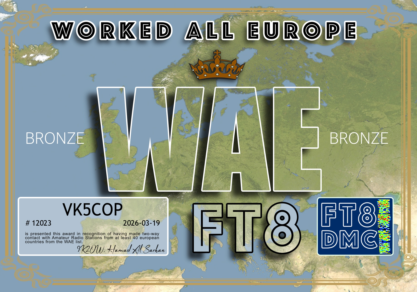
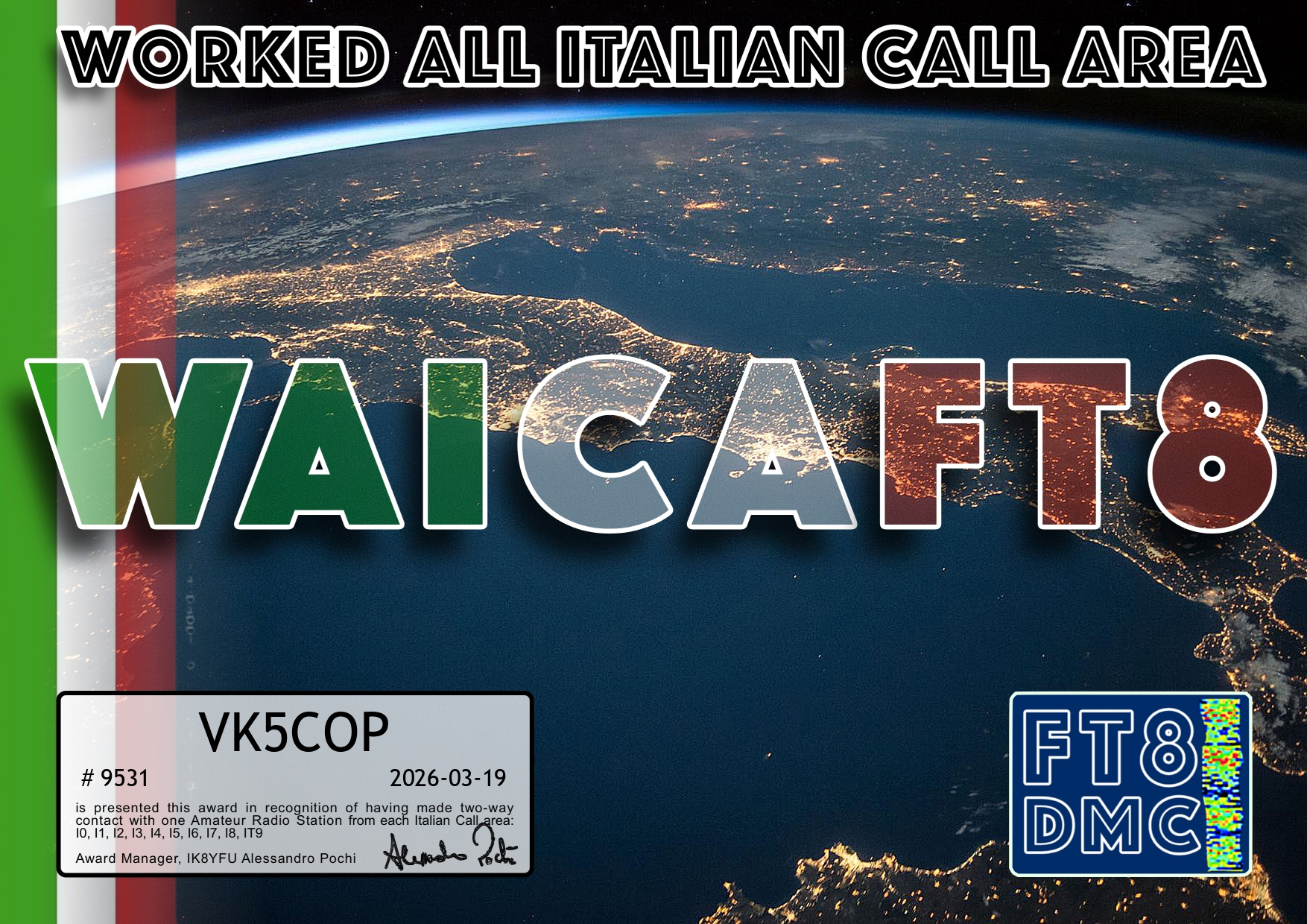
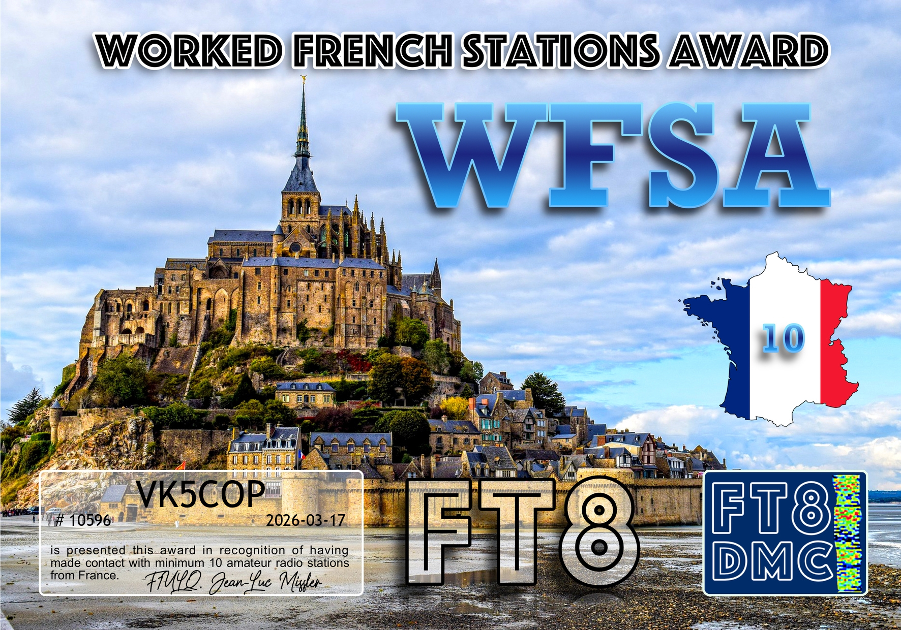
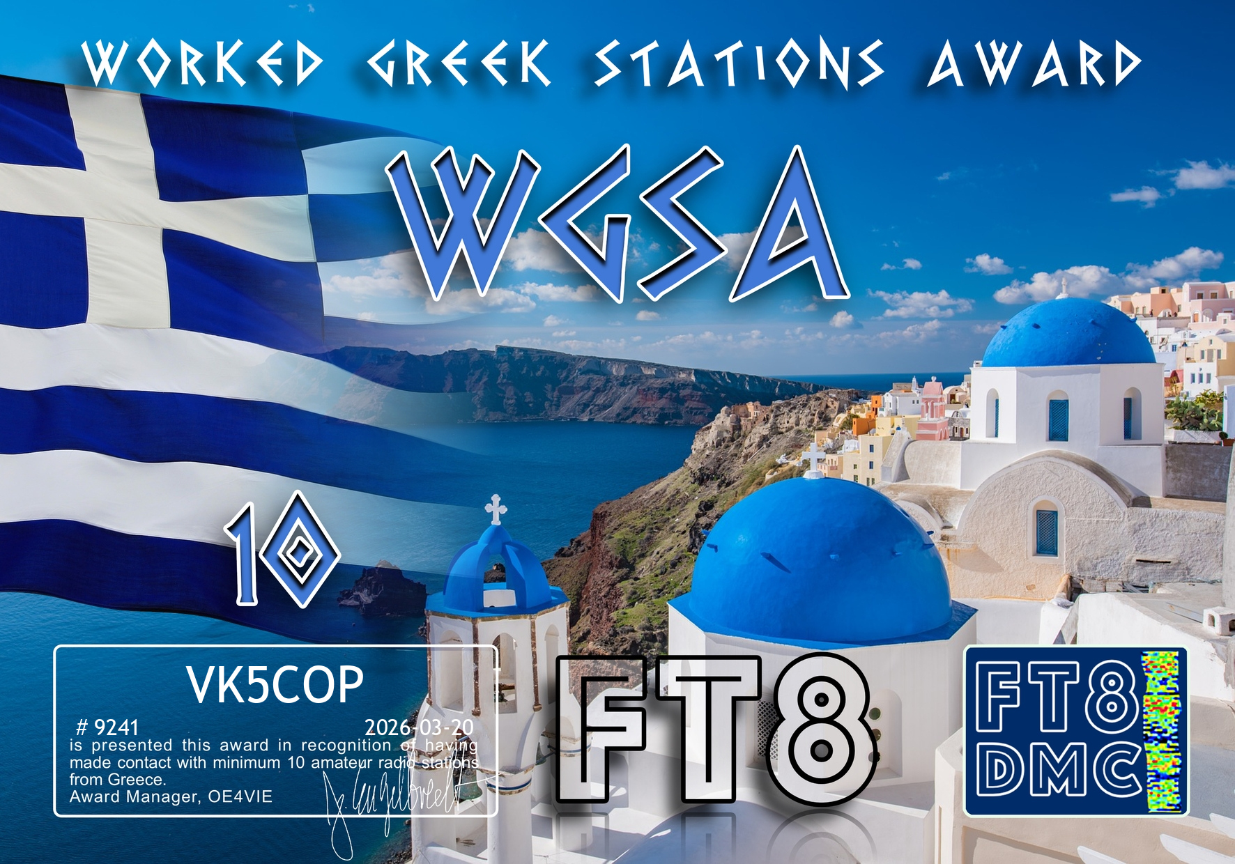
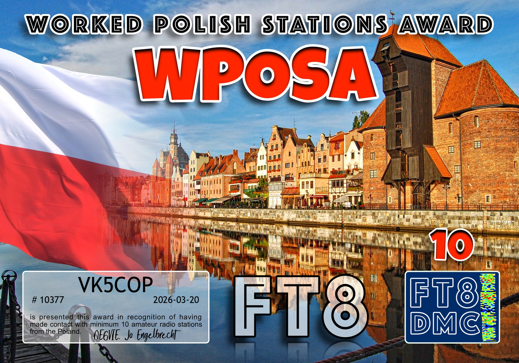
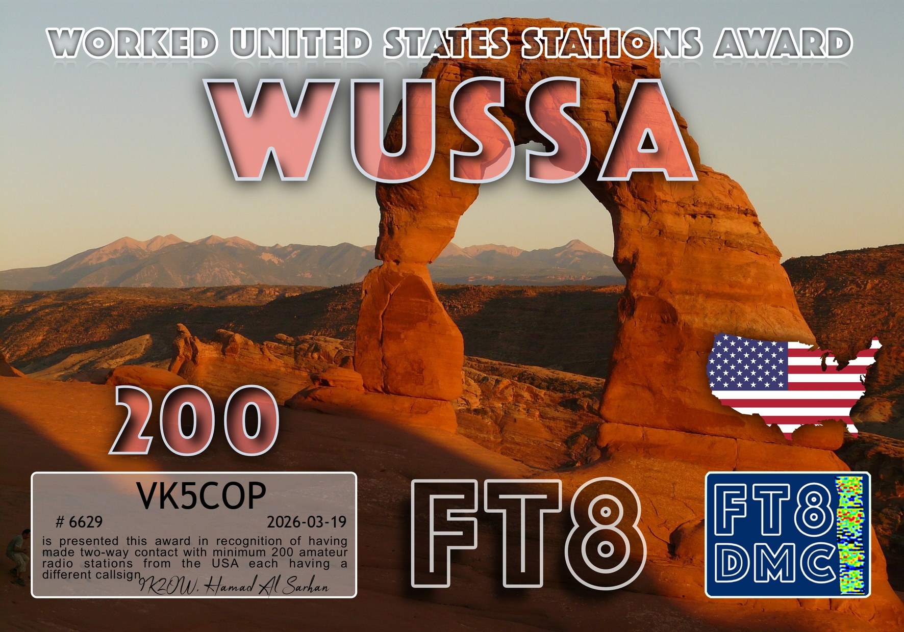
Here are my latest FT8 award certificates for VK5COP.
Thank you to all the FT8 operators and to the various FT8 award managers.


Here are my latest FT8 award certificates for VK5COP.
Thank you to all the FT8 operators and to the various FT8 award managers.
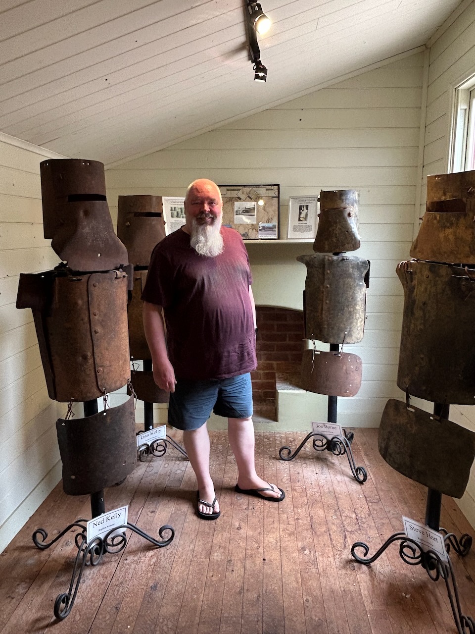
After activating the two silos at Jerilderie on Monday, 3rd November 2025, Marija and I went to the bakery at Jerilderie for some lunch. After a very nice lunch, we visited the Bolt exhibition in the old printery building.
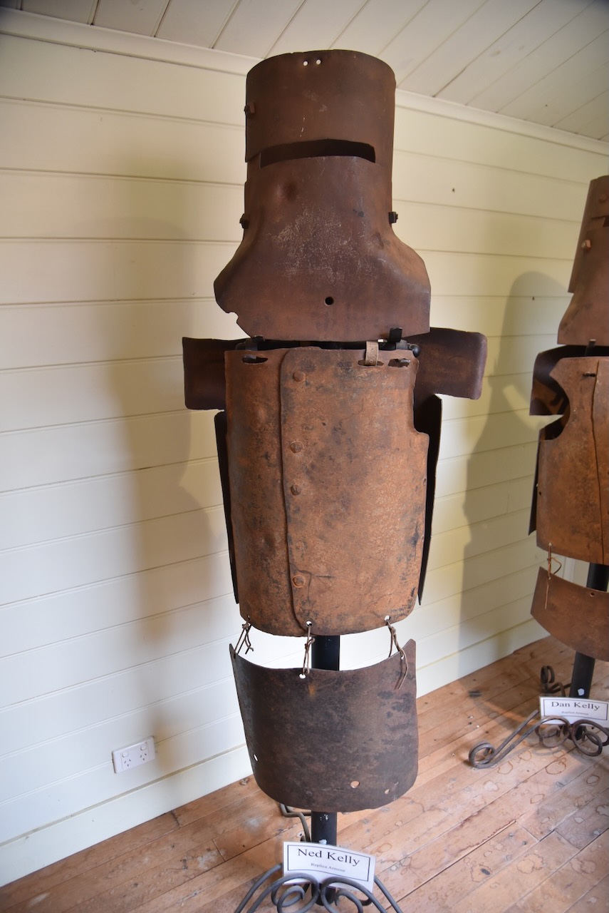
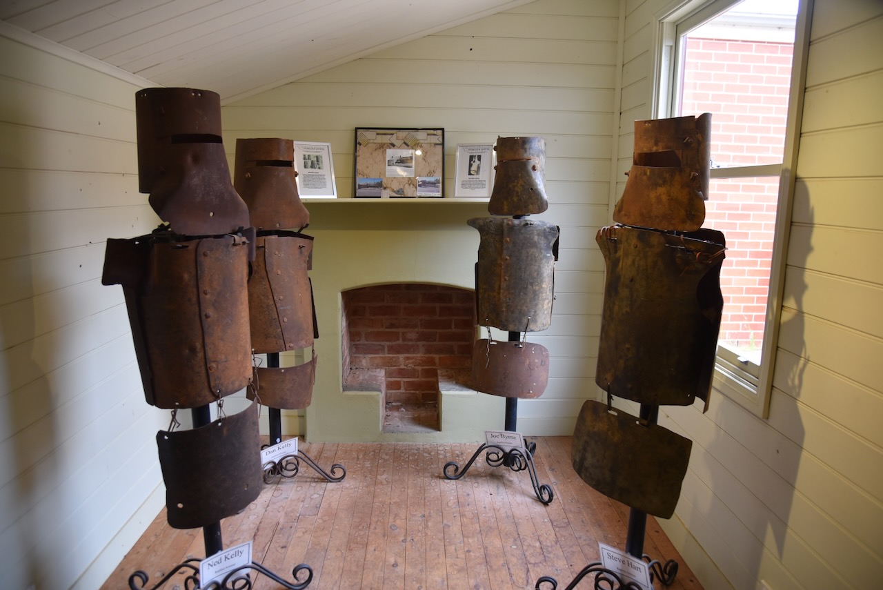
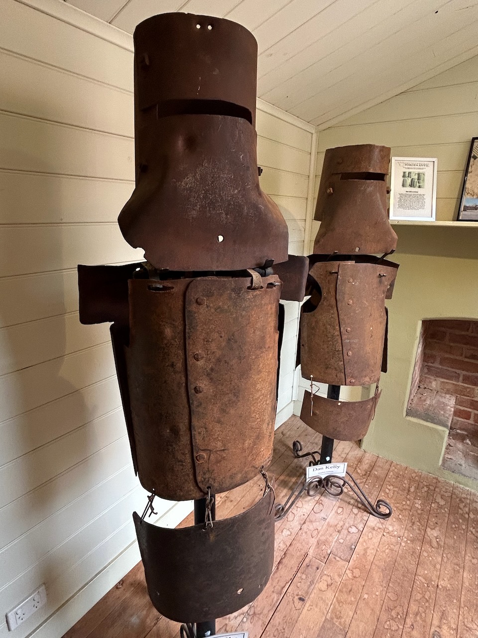
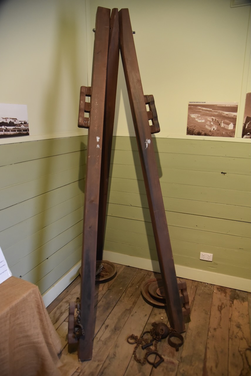
The display includes replicas of the armour worn by the Kelly gang. In 1870, the gang constructed 4 suits of bulletproof iron armour, which they wore during their final confrontation with the police at the siege at Glenrowan.
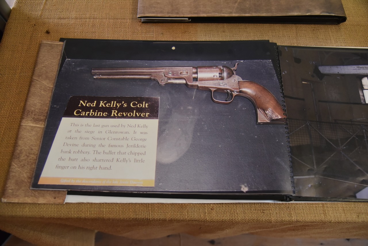
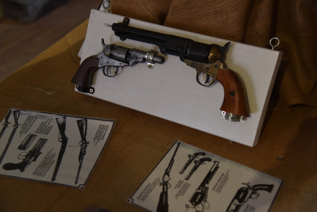
On display is Ned Kelly’s Colt carbine revolver, which was his last gun used during the siege at Glenrowan. It was taken from Senior Constable George Devne during the Jerilderie raid. The chip on the revolver’s butt is from the bullet that also shattered Ned Kelly’s little finger on his right hand.
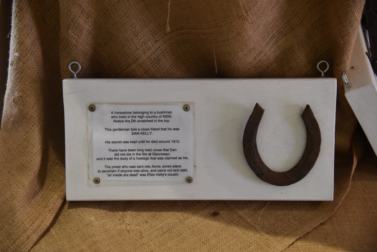
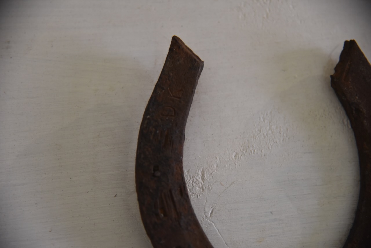
There is a horseshoe that has ‘DK’ marked in it. It was owned by a bushman who lived in the high country of New South Wales, who, in 1912, just before his death, told a close friend that DK was Dan Kelly.
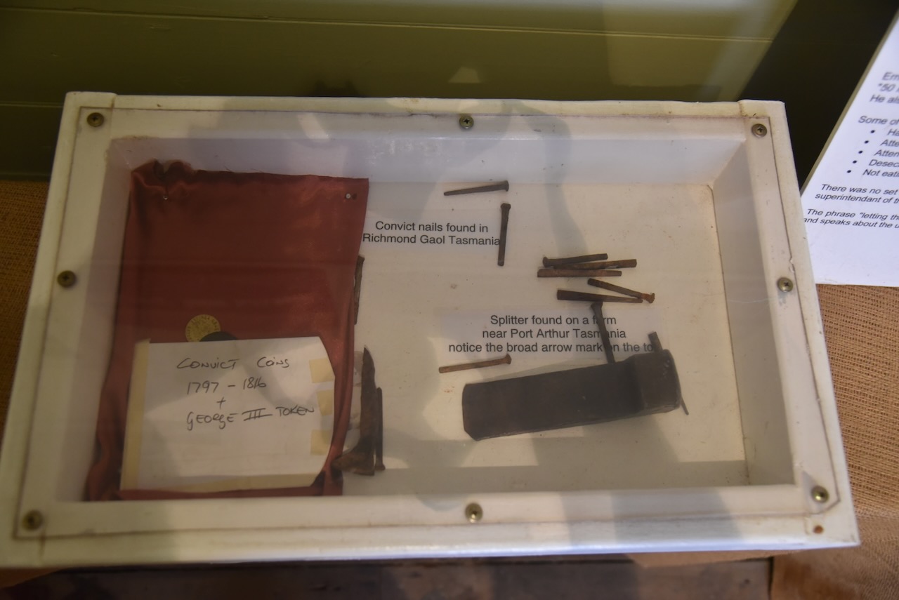
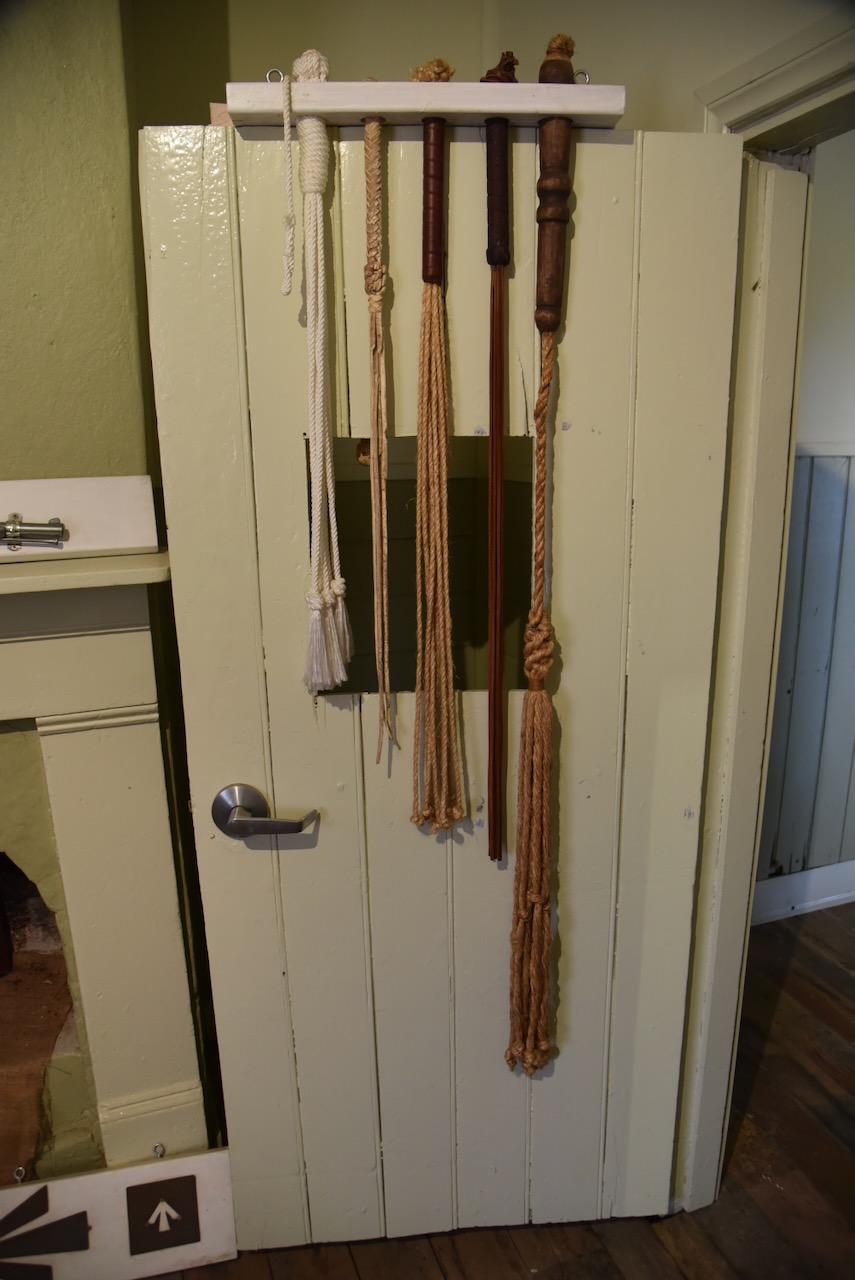
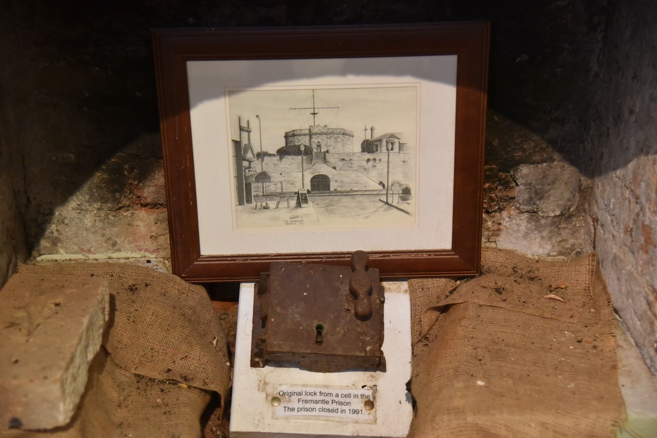
There are various other items on display, including an original lock from a cell in Fremantle Prison, and convict nails that were found in Richmond Gaol in Tasmania.
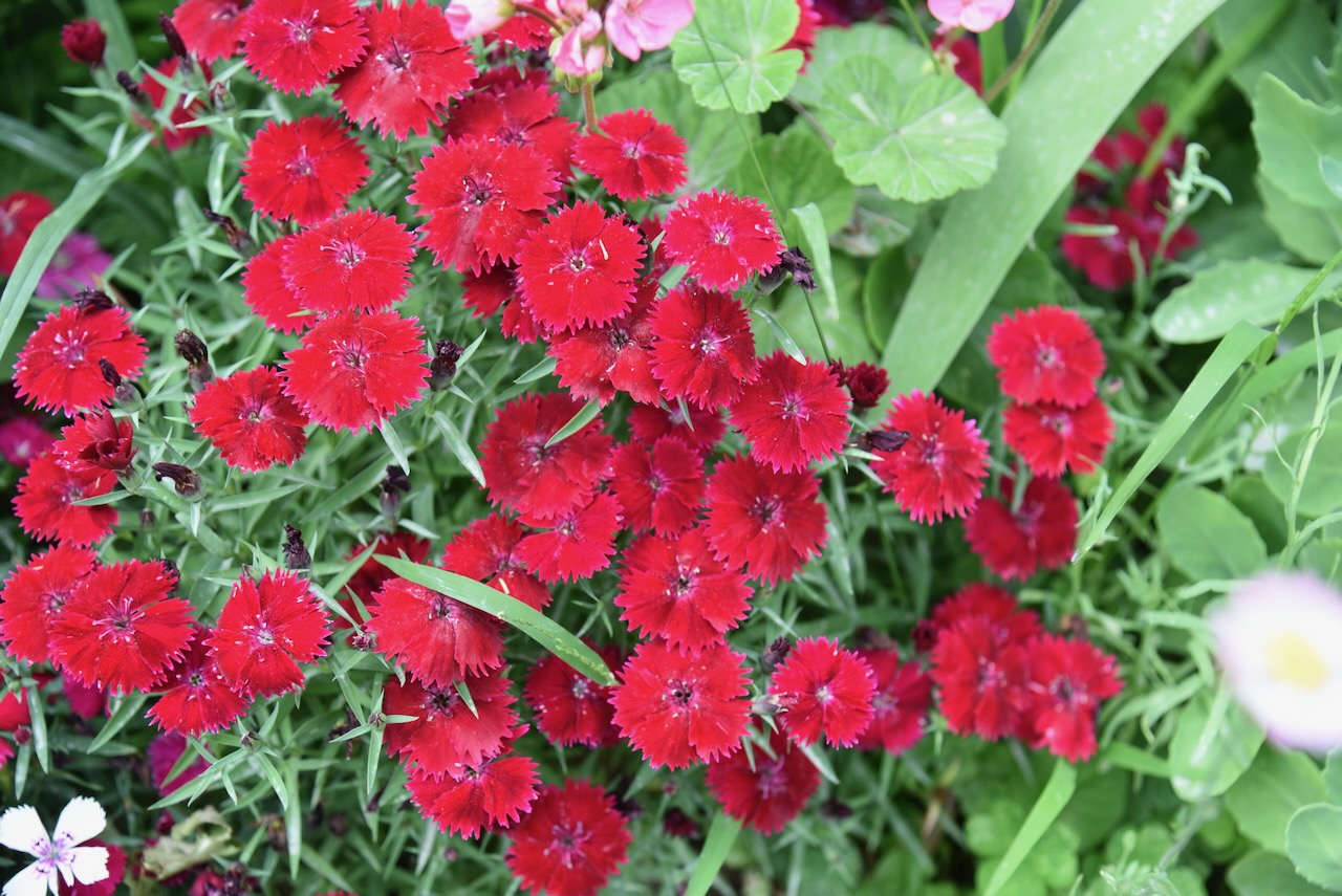
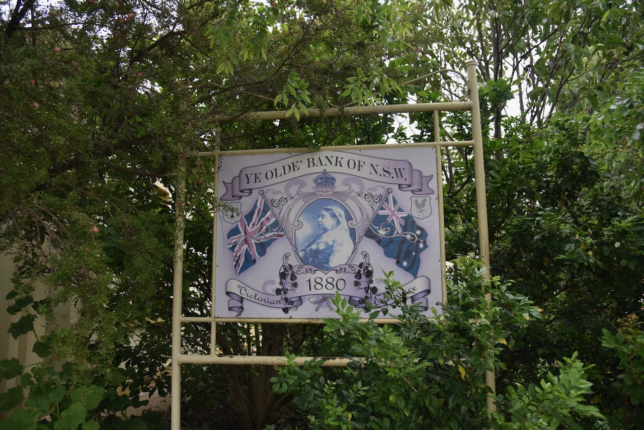
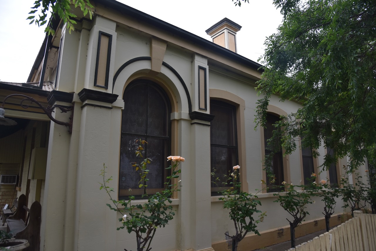
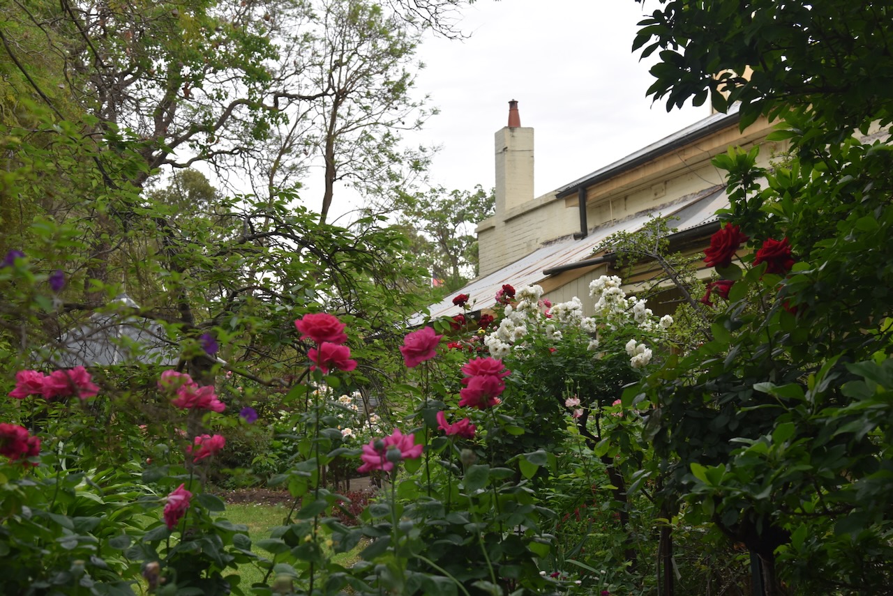
We then visited Flora Bank, previously known as Ye Olde Bank. The Bank of New South Wales building was constructed in 1880, one year after the raid at Jerilderie by the Kelly gang.
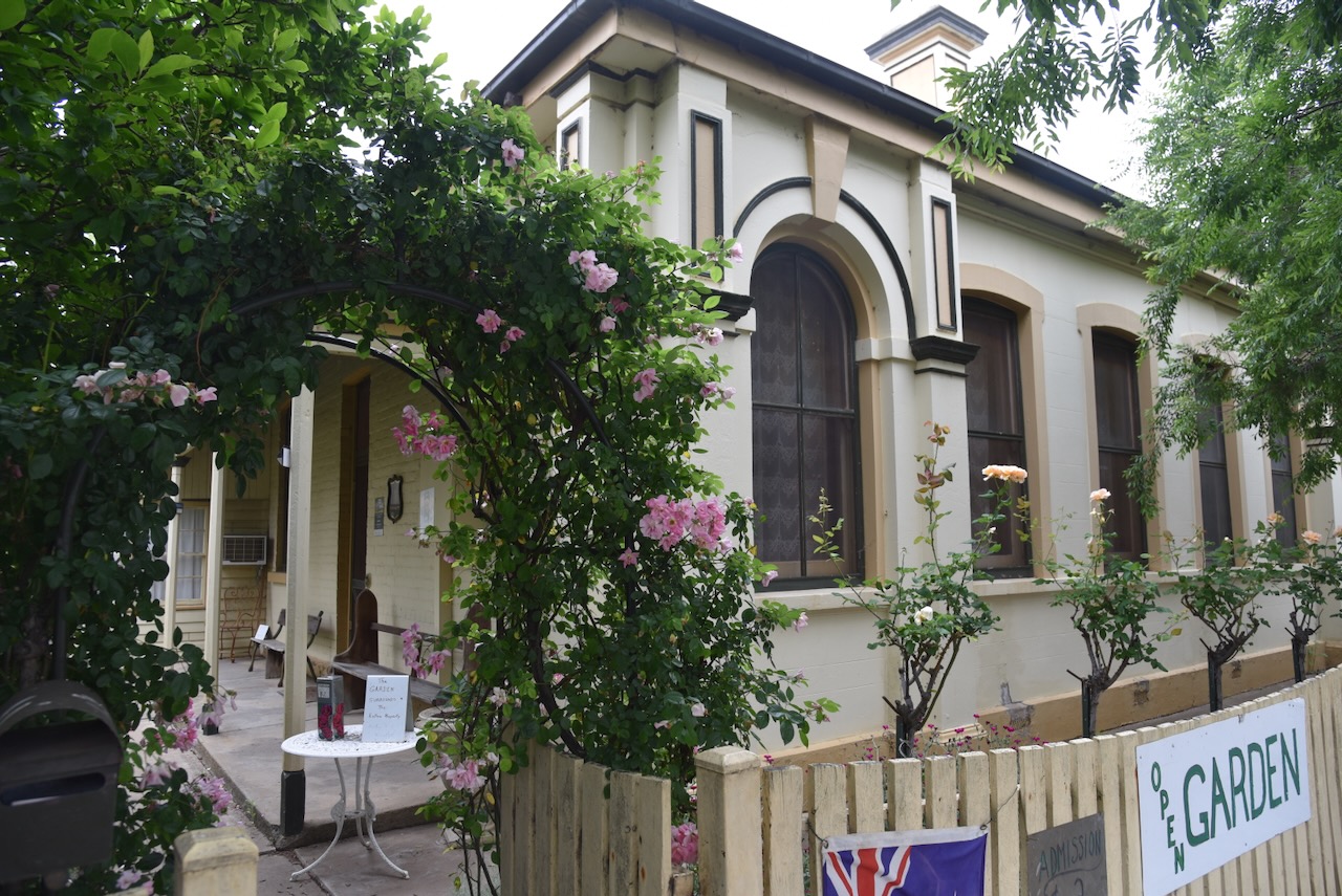
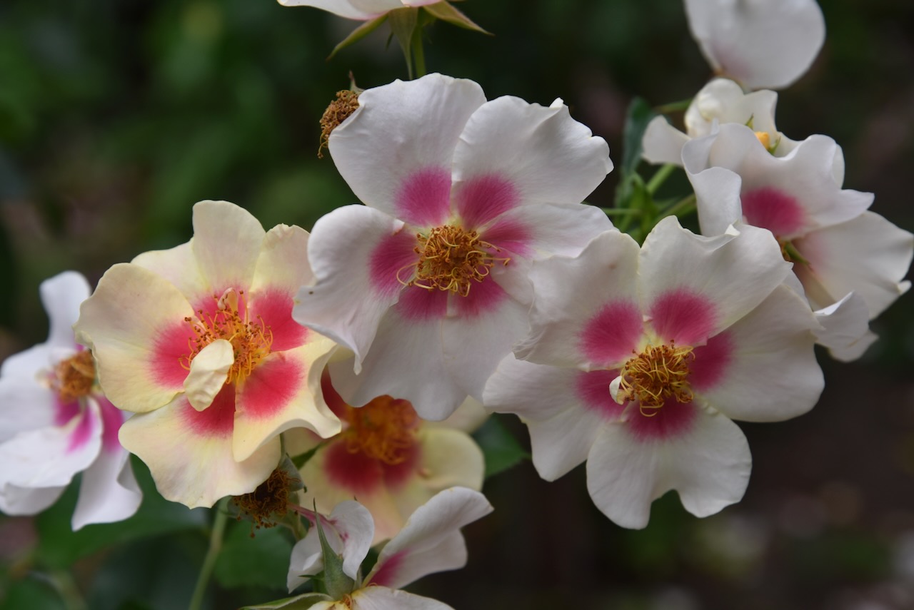
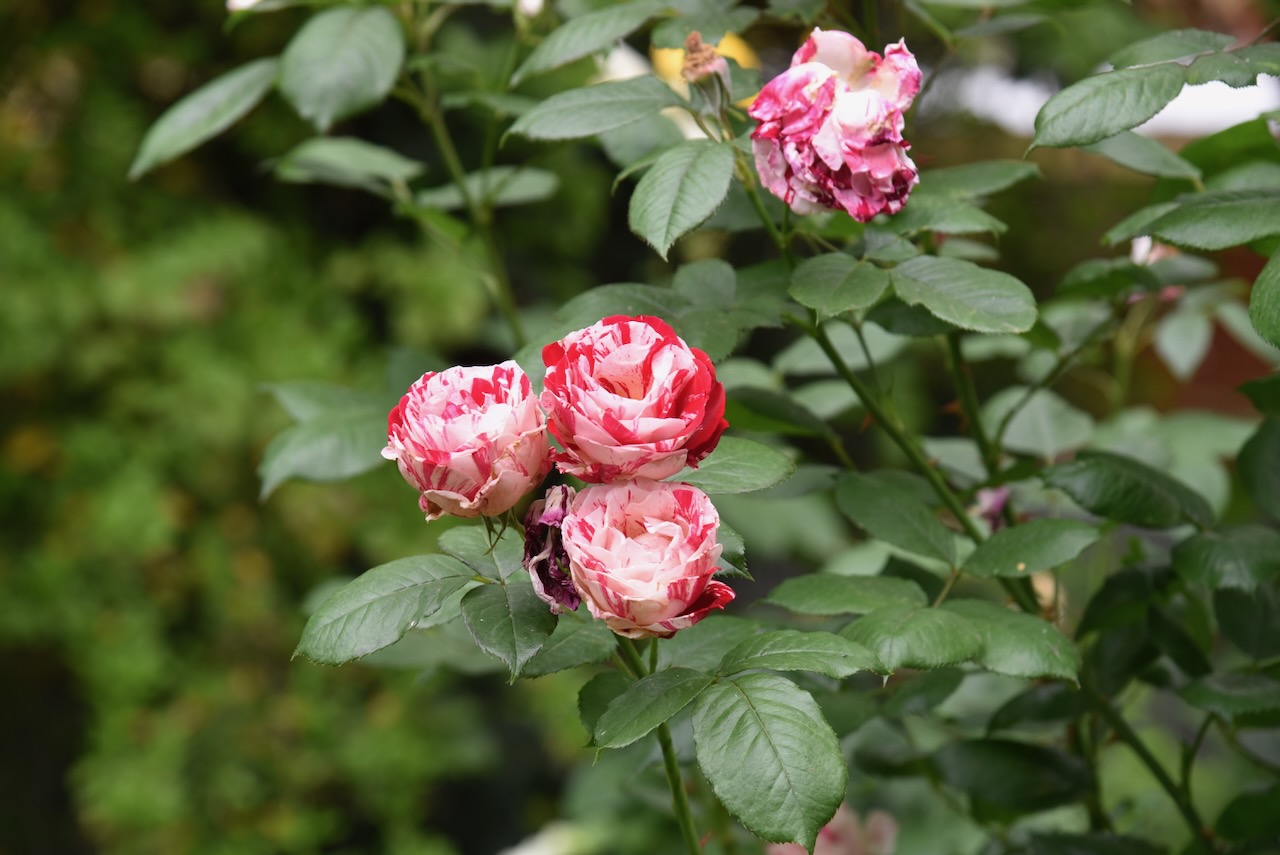
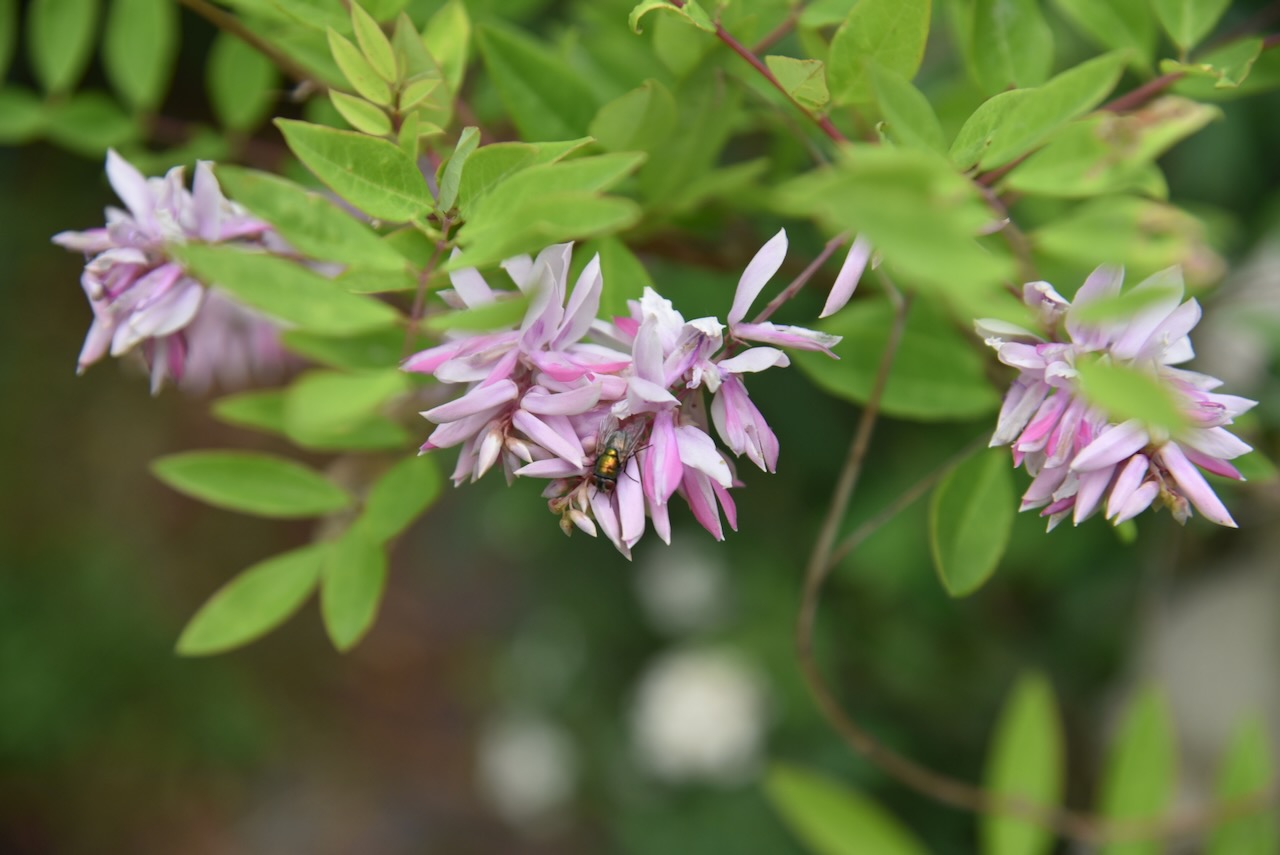
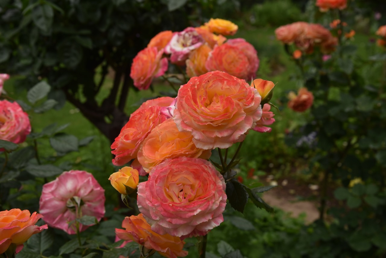
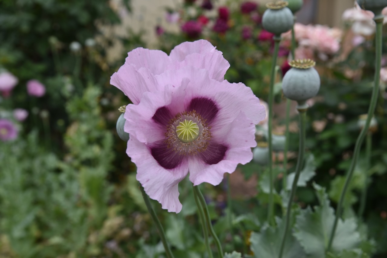
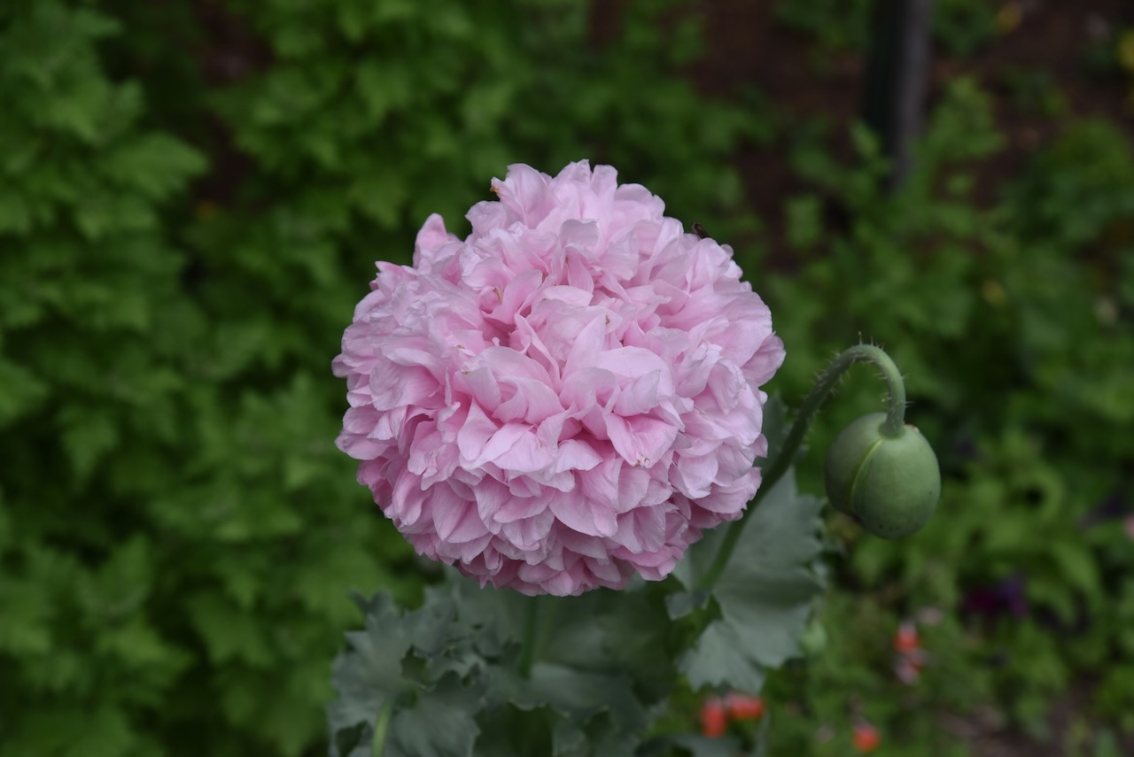
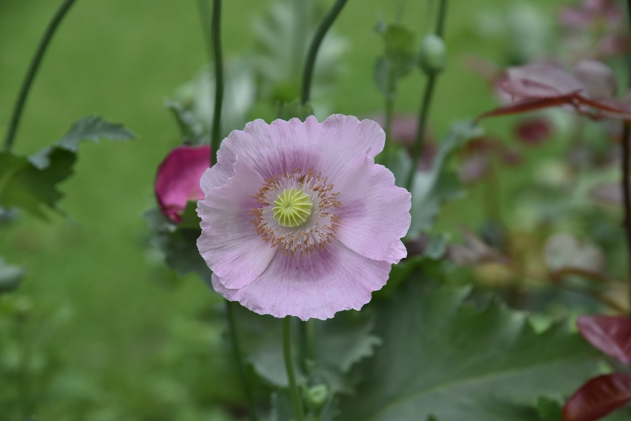
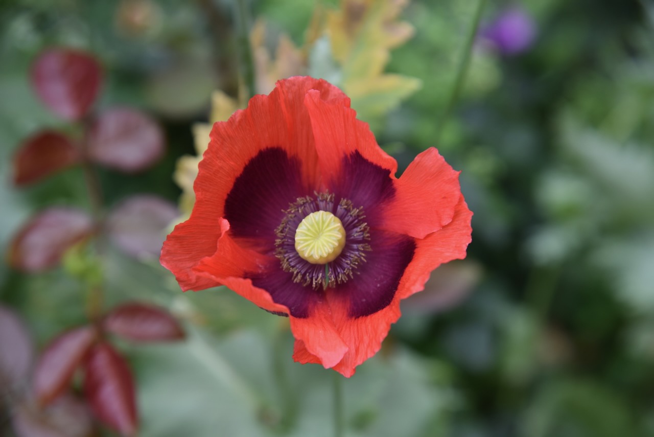
For a small fee, you can stroll around the spectacular gardens.
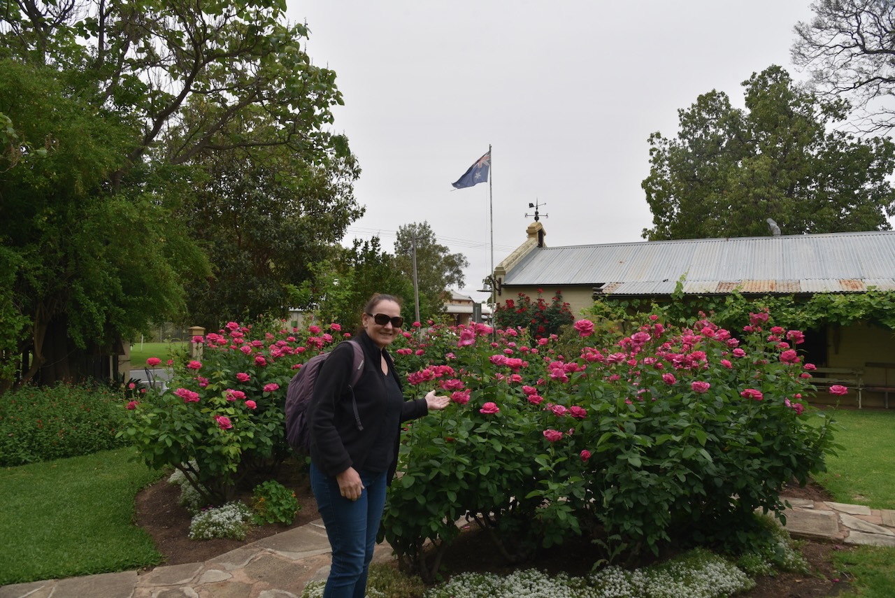
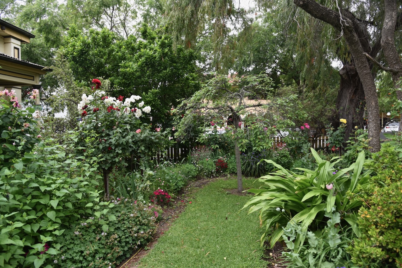
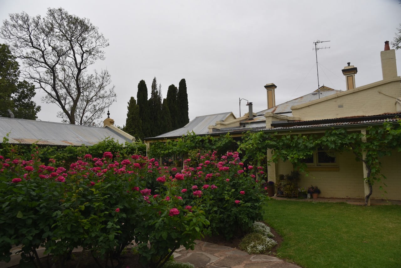
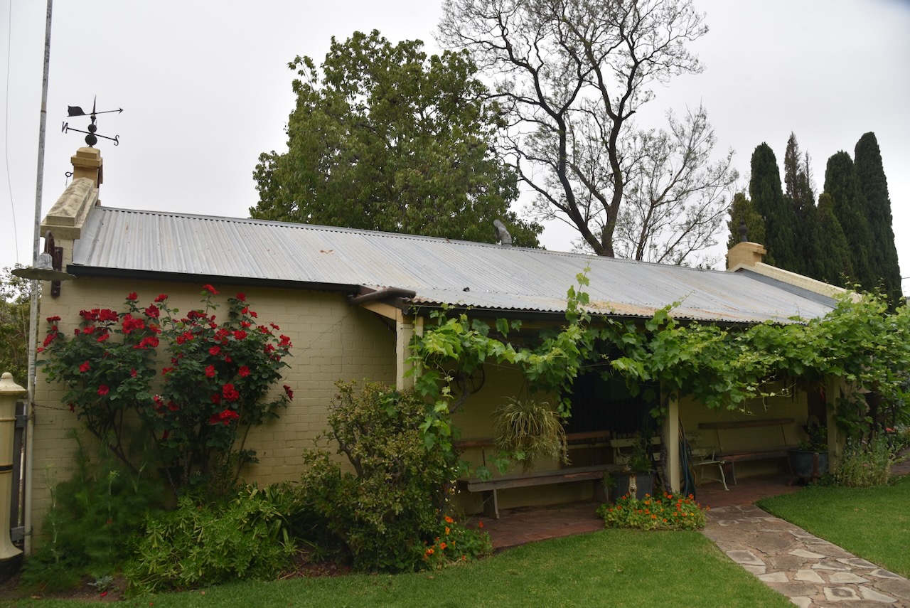
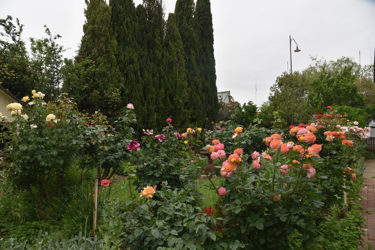
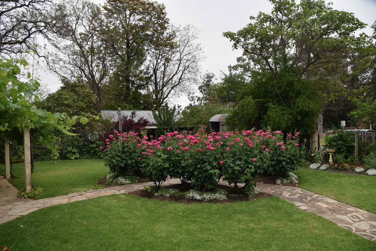
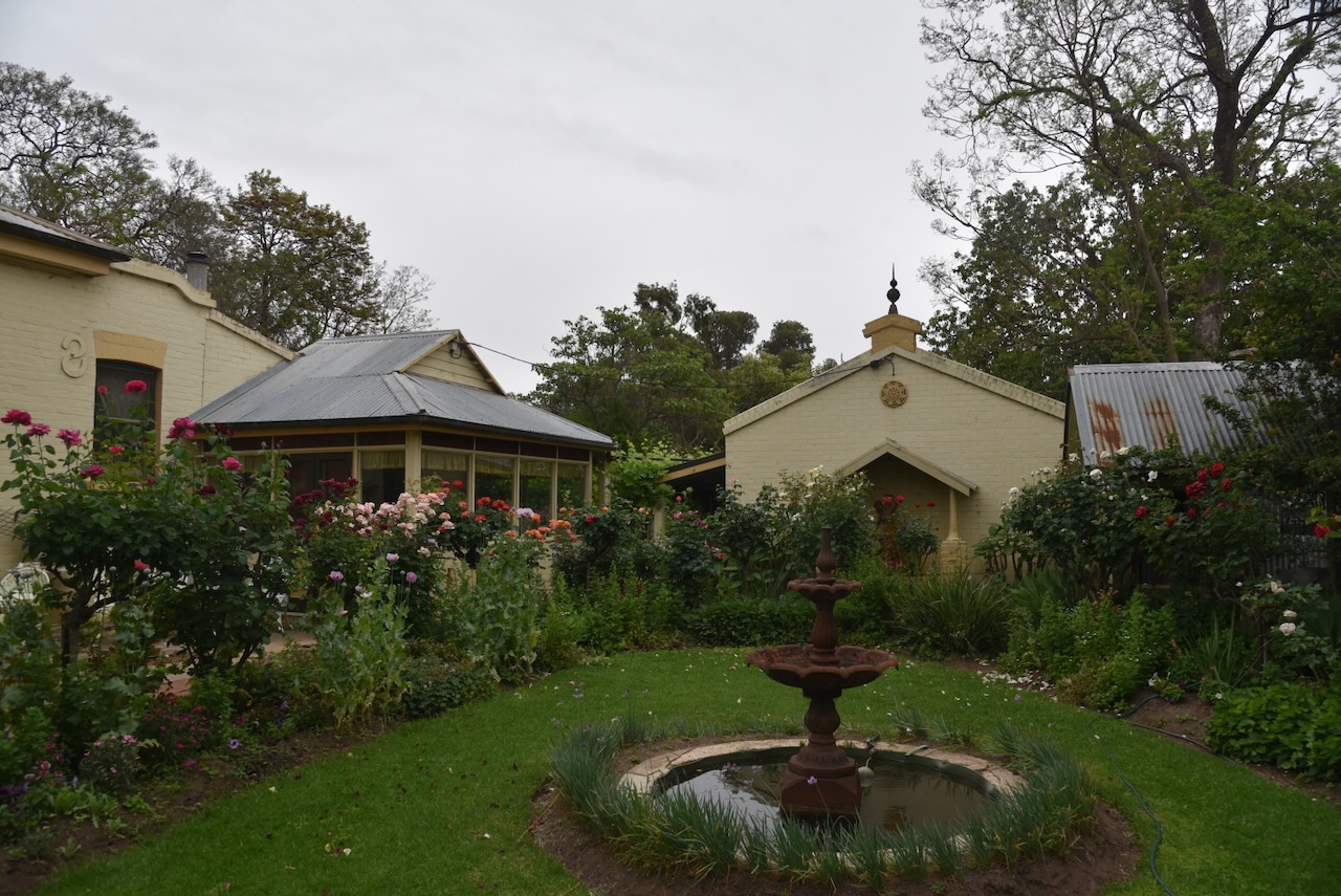
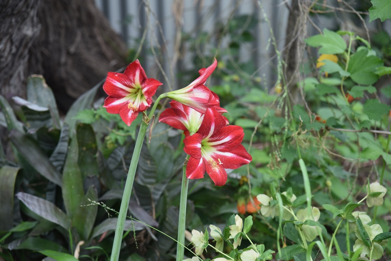
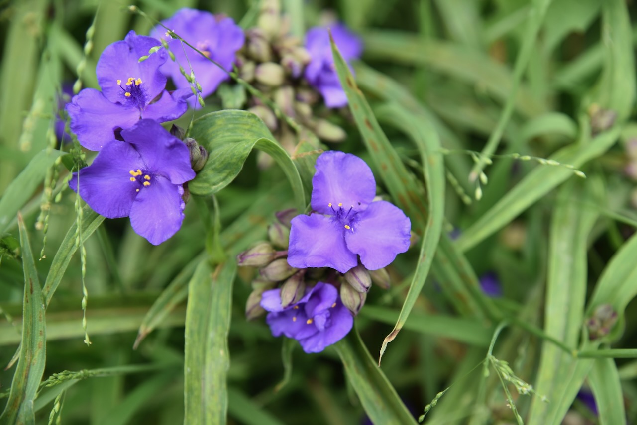
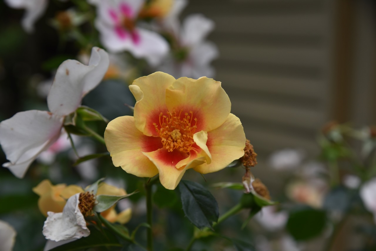
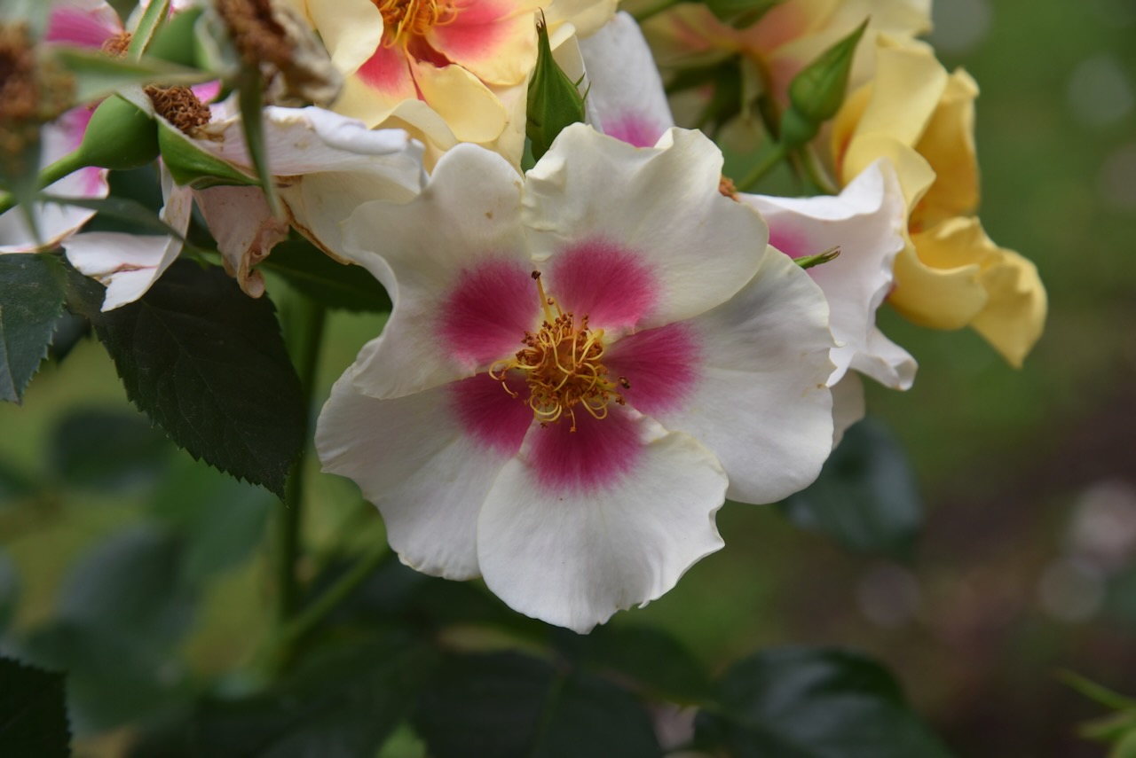
During our visit, the garden was alive with colour.
Marija and I then drove past the Jerilderie Police Station. The cells are made in the image of Ned Kelly.
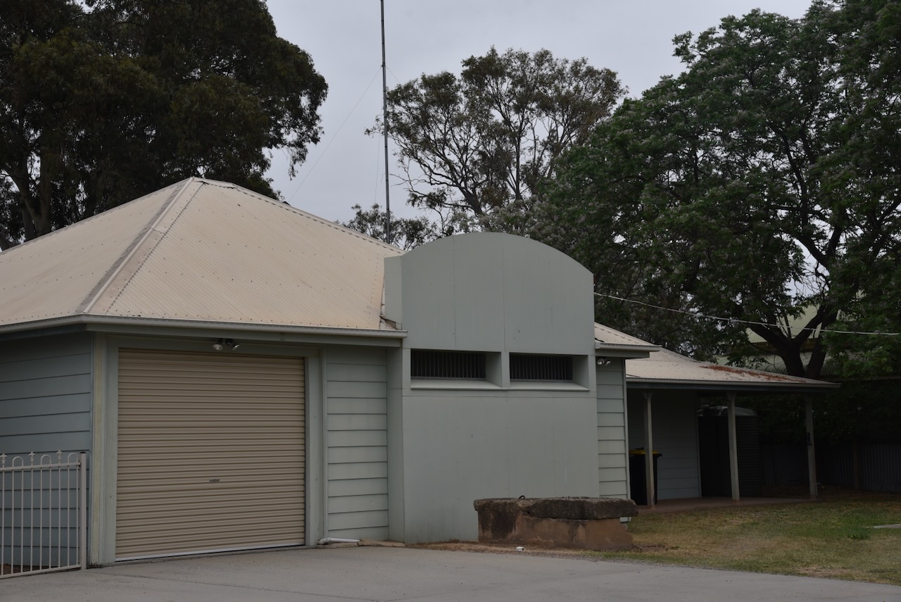
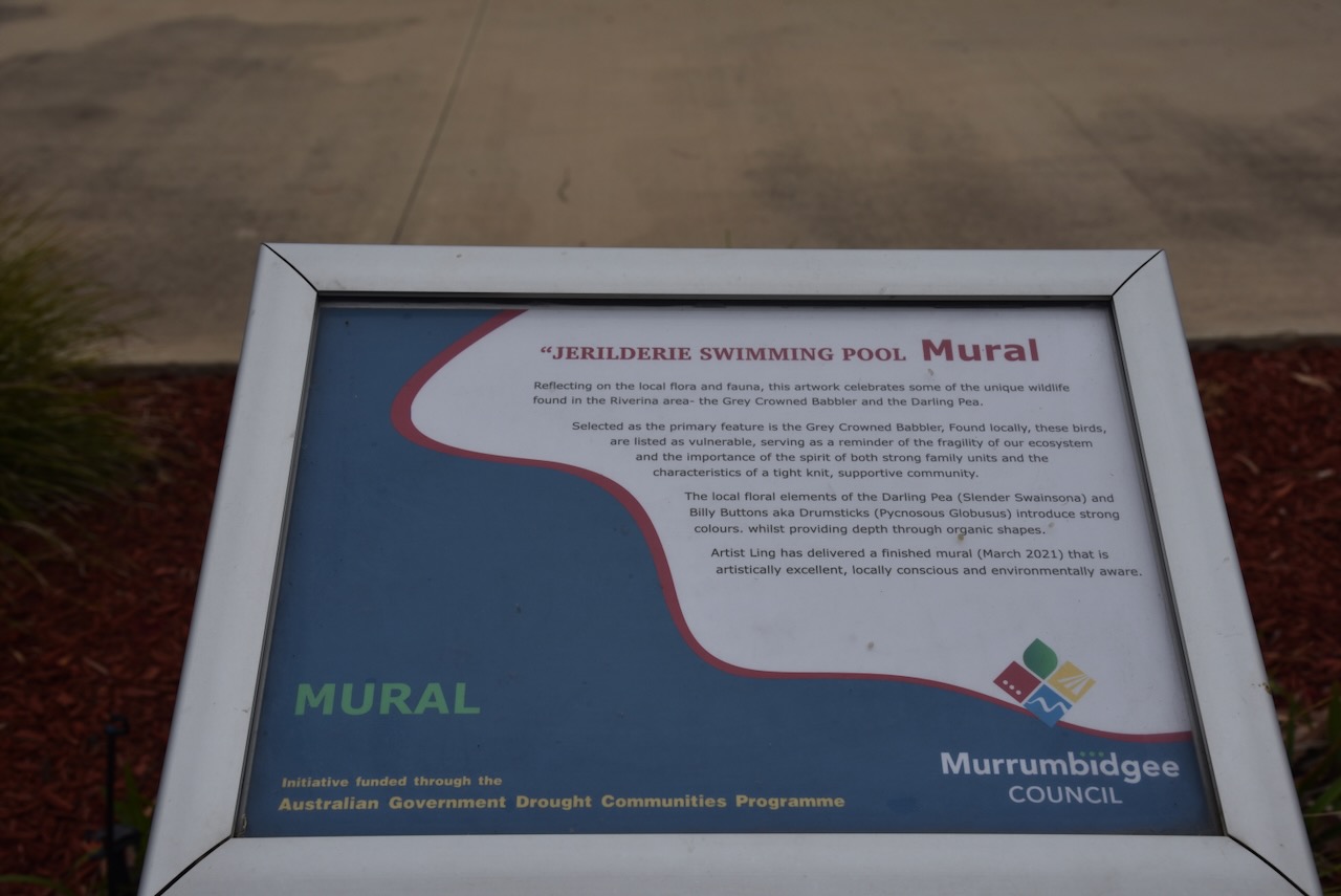
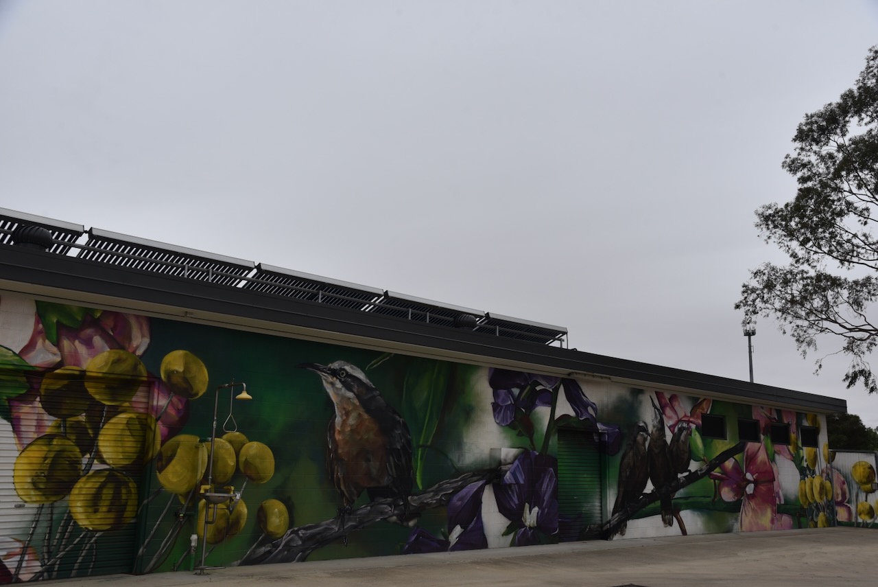
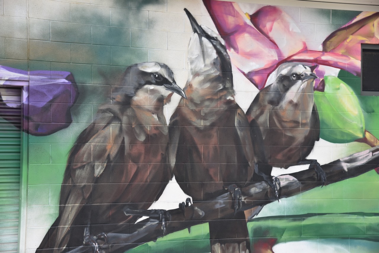
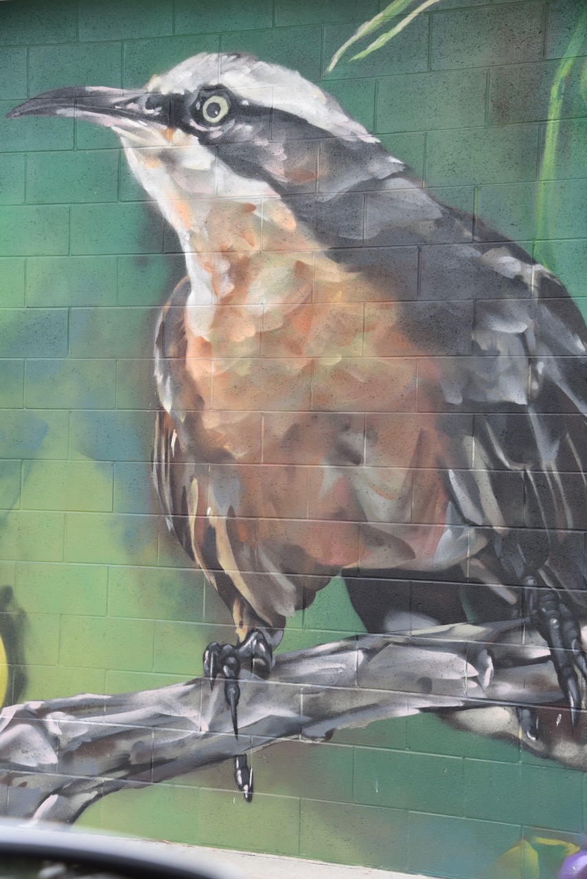
Our next stop was the mural at the Jerilderie swimming pool. The artwork features the local flora and fauna, including the Grey-Crowned Babbler and the Darling Pea.
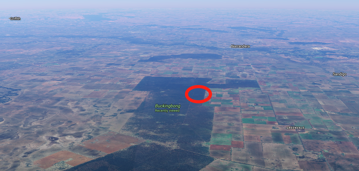
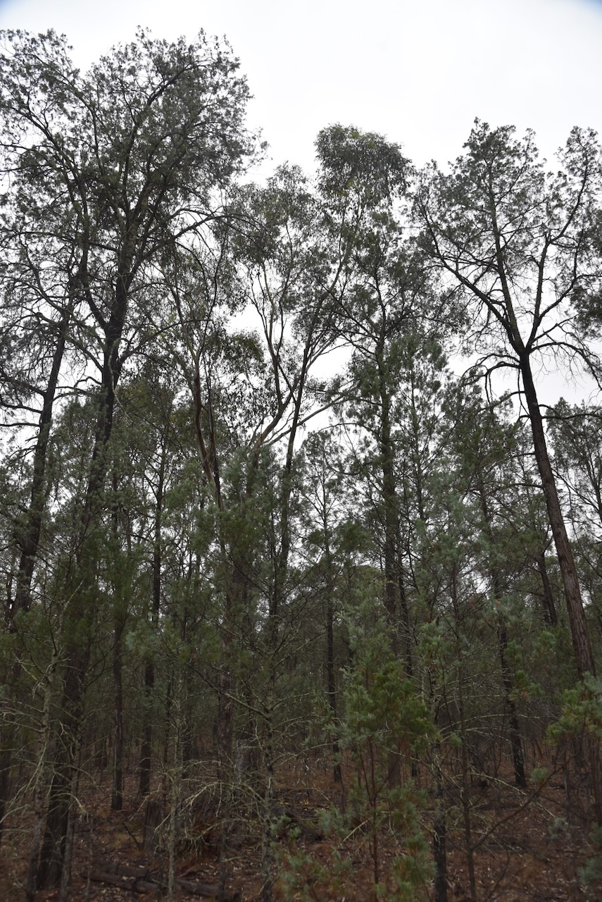
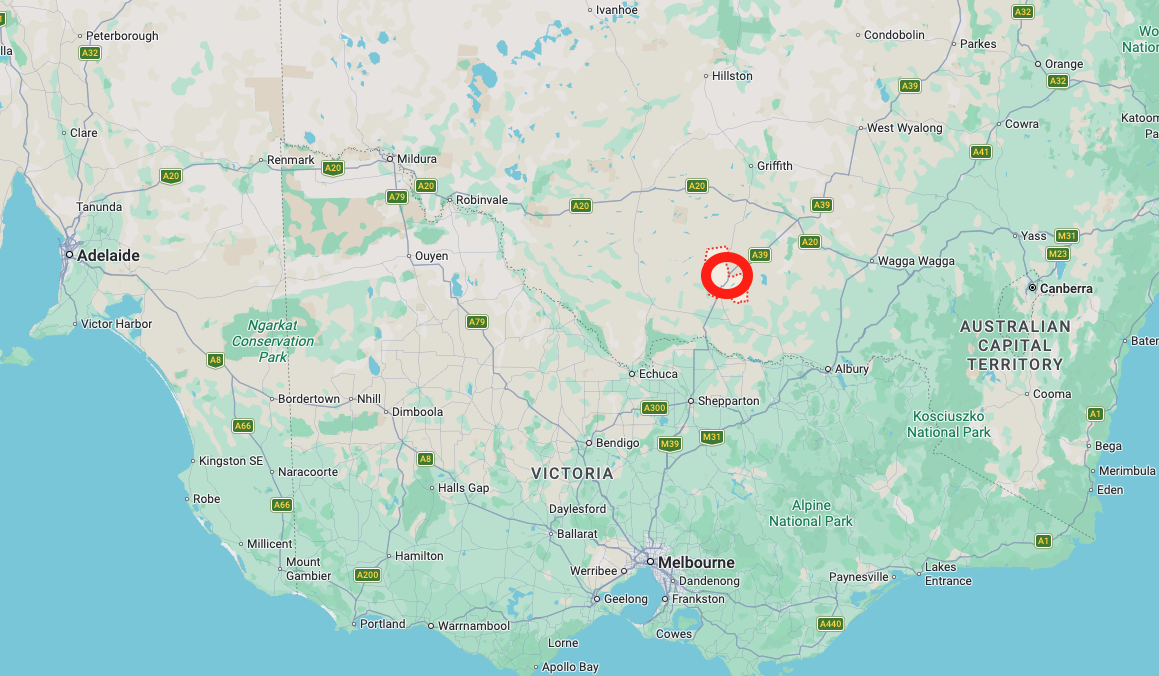
We then left Jerilderie and headed north to activate a park for the World Wide Flora Fauna (WWFF) program, the Buckingbong Flora Reserve VKFF-3049.
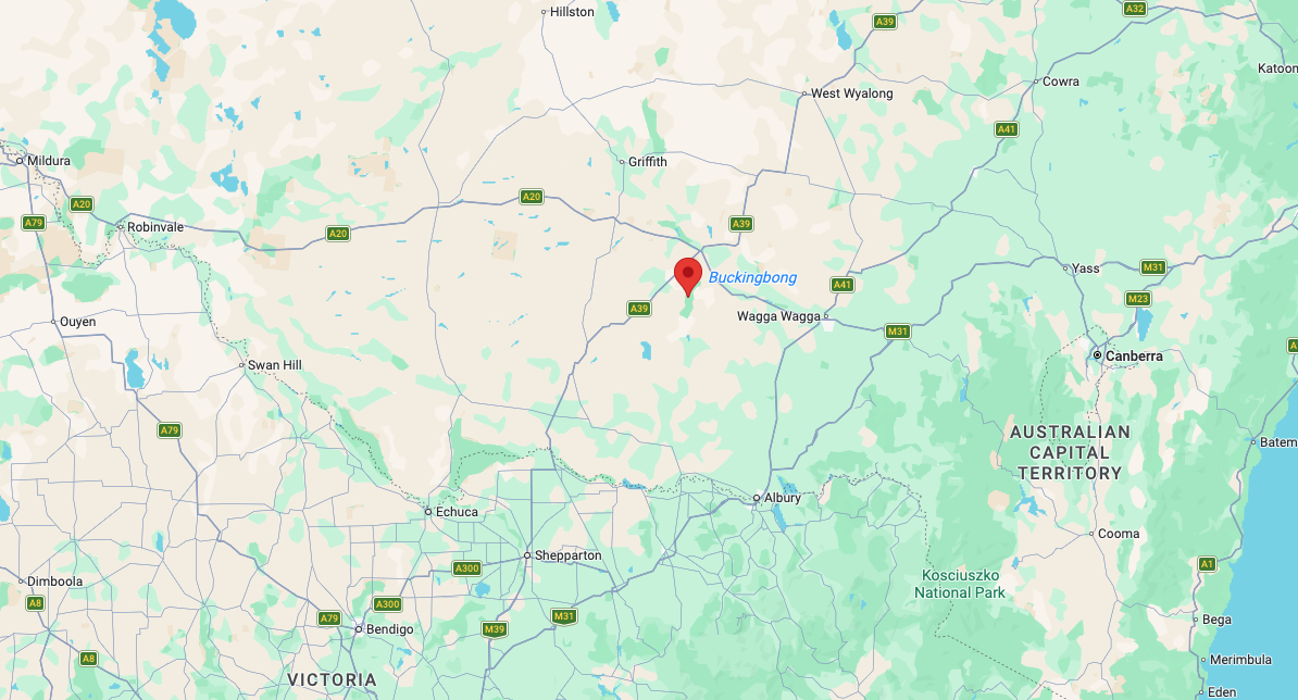
Above: Map showing the location of Buckingbong Flora Reserve. Map c/o Google Maps
Marija and I drove north out of Jerilderie on the Newell Highway, which is the longest highway in New South Wales. It spans 1,058 km from the Victorian border at Tocumwal to the Queensland border at Goondiwindi. The highway is named in honour of H.H. Newell, the first Commissioner for Main Roads in New South Wales. (Wikipedia 2026)
We then reached the junction with the Kidman Way. It is 643 km long and runs from Jerilderie to Barringun.
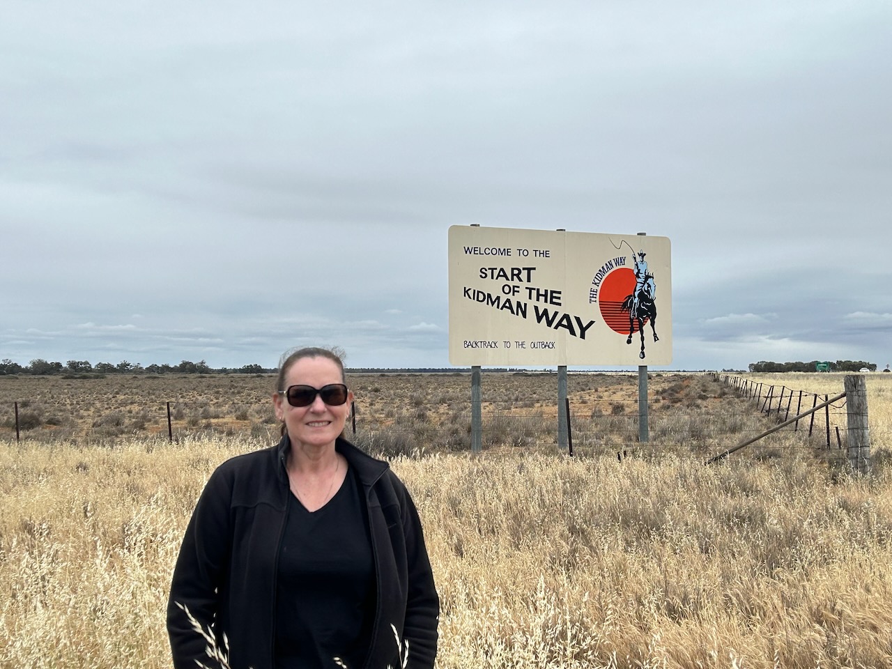
The Kidman Way is named in honour of Sir Sidney Kidman, an Australian pastoralist and entrepreneur. He owned vast areas of land in Australia and was known as ‘the Cattle King’. At his peak, he owned about 3.5 % of Australia.
Below is an excellent video on the life of Sir Sidney Kidman.
The reserve is located south of Narrandera in the district of Boree Creek. Boree is believed to originate from Corroboree, a ceremonial gathering of Aboriginal people.
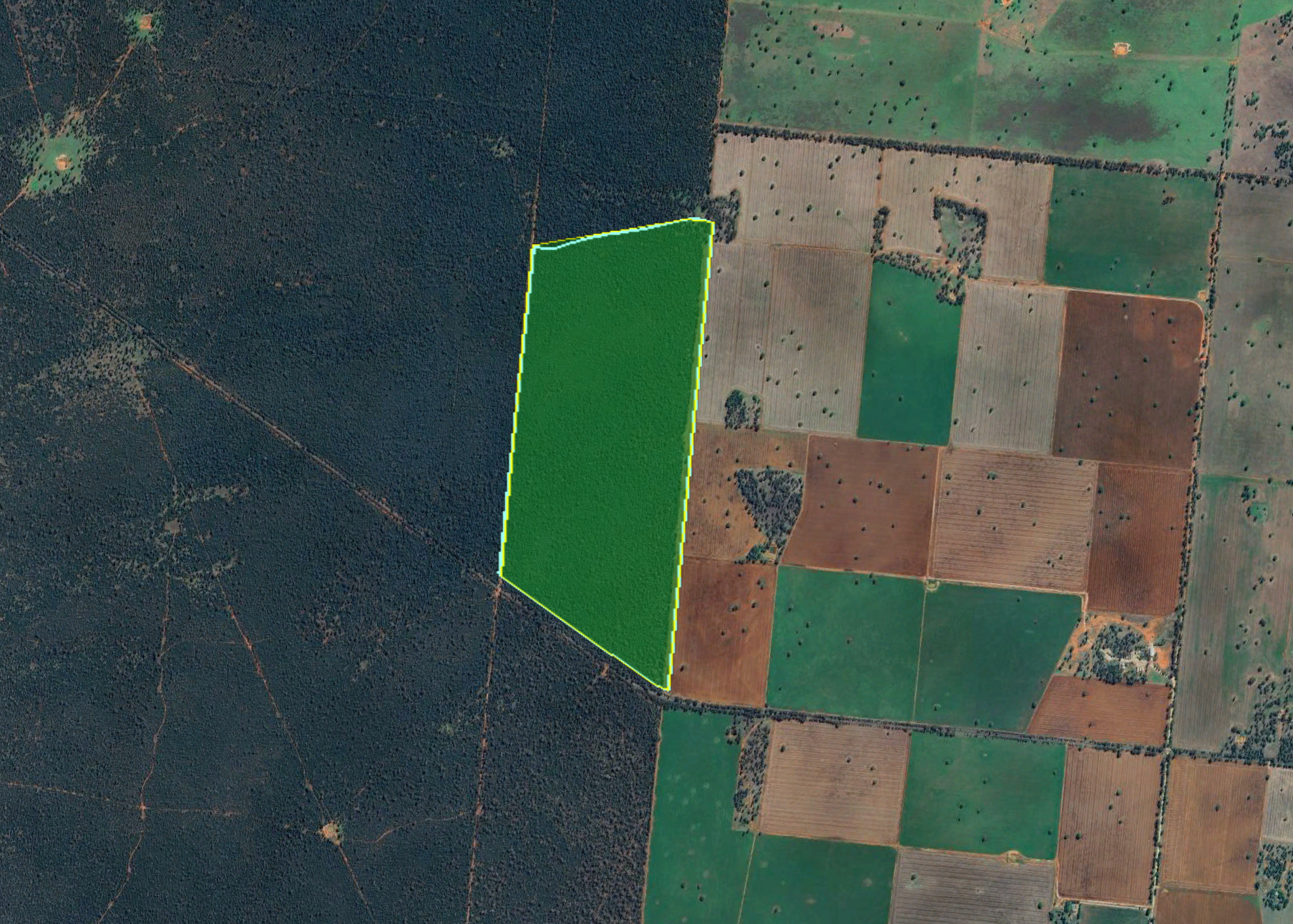
Above: the boundaries of Buckingbong Flora Reserve. Image c/o Google Earth
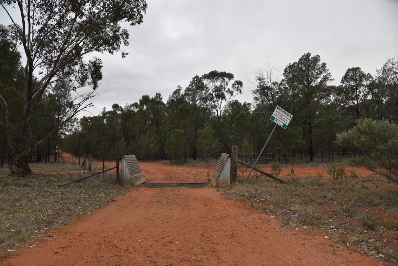
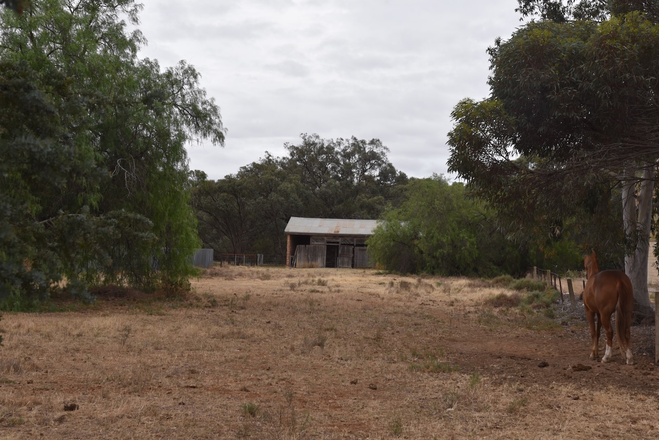
We drove along Greenvale Road and found a gate with a cattle grid on the northern side of the road. This was the southwestern corner of the park.
This little reserve is not to be confused with Buckingbong Reserve, which is located further to the northeast on Buckingbong Road, Sandigo.
Above: an aerial view of the reserve. Image c/o Google Maps
Buckingbong Flora Reserve is about 155 hectares in size and was established on the 17th day of June 1994. The reserve is surrounded by the much larger Buckingbong State Forest, so you need to ensure that you are in the correct spot before operating. (Dcceew.gov.au 2025)
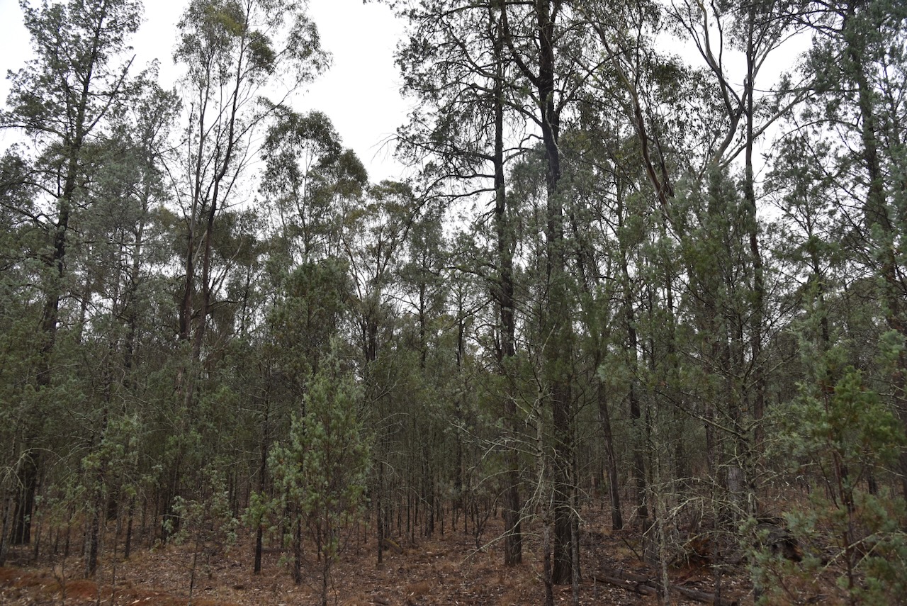
We found a clearing in the scrub and ran out the 20/40/80m linked dipole. We ran the Yaesu FT857 and 40 watts.
Unfortunately, it started raining during our activation, and we had to hurriedly pack up the gear. But we did manage to qualify the park.
Marija worked the following stations on 40m SSB:-
I worked the following stations on 40m SSB:-
I worked the following stations on 20m SSB:-
References.
It was now Monday, 3rd November 2025, and our first full day in Jerilderie in the central Riverina region of New South Wales. Jerilderie is located about 623 km southwest of Sydney and about 333 km north of Melbourne.
Above: Map showing the location of Jerilderie. Map c/o Google Maps
The Jeithi Aboriginal people occupied the land surrounding Jerilderie prior to European settlement. Jerilderie is believed to be an Aboriginal word meaning ‘reedy place.’ Their land was between the Murray River and south-southwest of Wagga Wagga. It ranged from R+Tocumwal to Near Howlong, and then north to Lake Urana, Jerilderie, and Lockhart. (Trove 2026) (Wikipedia 2025) (Wikipedia 2026)
During the 1850s, James Kennedy established Mary’s Creek Run, which surrounded the current-day town of Jerilderie. It is believed that he named the run after Mary, the wife of his brother Robert. The run, which was 80,000 acres in size, had a grazing capability of 8,000 sheep. It was situated on both sides of Billybong Creek. The family also owned Wunnamurra, Gum Swamp, Bundure, Berrigan, Thurrowa, and Tongaboo. (Trove 2026) (Wikipedia 2025)
Above: mention of Mary’s Creek Run in the NSW Govt Gazette, Sat 30 Sept 1848. Image c/o Trove
James Thomas Kennedy was born in August 1821 in Appin, New South Wales. His parents were John Kennedy (b. 1780 Kent, England) and Caroline Catapodi (b. 1797 London, England). In 1841, he became the father to James from a relationship with an Aboriginal woman, Dorothy ‘Dolly’ Downs. She died in 1846 in Appin, NSW. In May 1851, he married Anne Hume at Dapto, New South Wales. They had 11 children. James died on the 15th day of February 1881 at Buckhurst, N.S.W. Ann died in 1915 at Burwood, NSW. (ancestry 2016)
In 1852, the Mary’s Creek Run was divided to form two stations: Jerildery South and Jerildery North, with Billabong as the dividing line. Kennedy retained Jerildery North which was 47,760 acres in size. Jerildery South which was 33,190 acres in size, was taken up by W.R. Virgoe. (Trove 2026)
In that same year, 1852, a Government survey was undertaken, with an area of 640 acres on Virgoe’s run being touted as a likely place for a village. This was called the ‘Cape’ area. (Trove 2026)
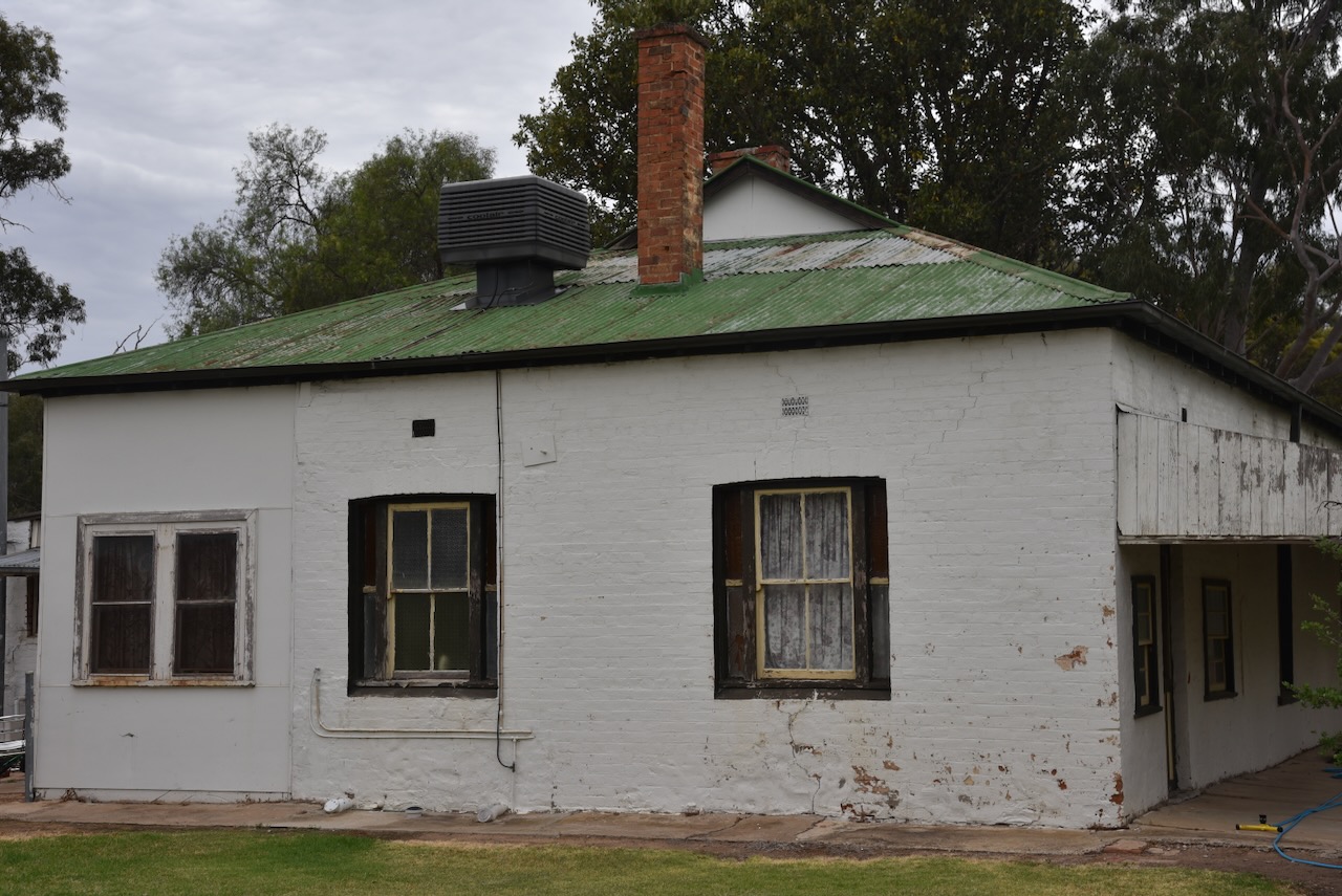
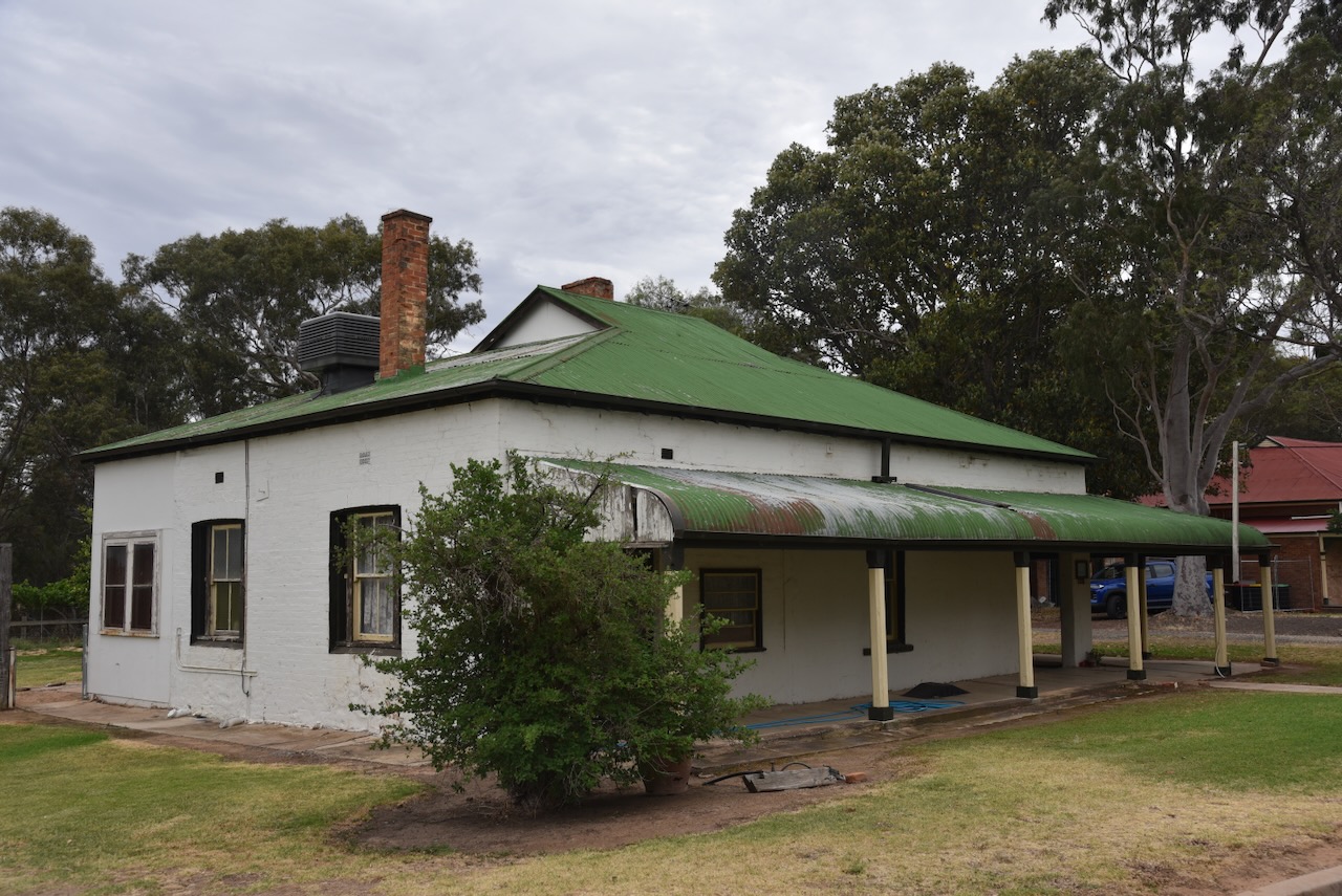
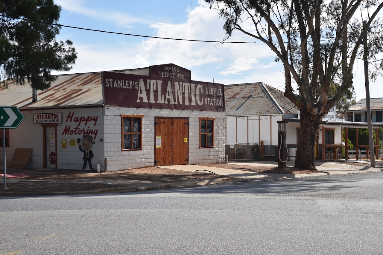
In 1858, John Carractacus Powell, a travelling drapery dealer, built a hotel called the Travellers Rest (later renamed the Albion), and a store in what is now Powell Street, Jerilderie. He also built a rough bridge over the creek and charged a toll for those crossing it. I will talk about the hotel and the connection to the Kelly Gang, a little later in this post. Powell was encouraged and assisted by the Kennedy family. Powell was born in February 1828 in Shropshire, England. He emigrated to Australia in 1852. In 1856, he married Fanny Leek. Powell died in November 1901 at Jerilderie, aged 74 years. He was often referred to as the ‘Father of Jerilderie.’ (ancestry 2016) (Trove 2026)
In 1859, William Davidson arrived in the Jerilderie district, and he chose the site of the official village to settle on, being the “Cape” region. Davidson constructed a brick kiln and used the bricks to build a house, a hotel, and a blacksmith shop. The hotel was known as The Woolshed Inn, which I will talk about a little later in this post. Davidson was born in 1829 in Scotland. He emigrated to Australia, and in 1859, he married Margaret Moir in Tumut, N.S.W. He died in 1875 in Jerilderie. (ancestry 2016) (Wikipedia 2025)
As a result, Jerilderie had two establishments that were about 3 kilometres apart. The business rivalry between Powell and Davidson was keen, with each of the gentlemen eager to secure trade from the travelling public. And to increase competition, in 1860, Francis Cadell chose a site for his store, which was opposite the existing Police Station. (Trove 2026) (Wikipedia 2025)
Above: Francis Cadell. Image c/o ancestry.com.au
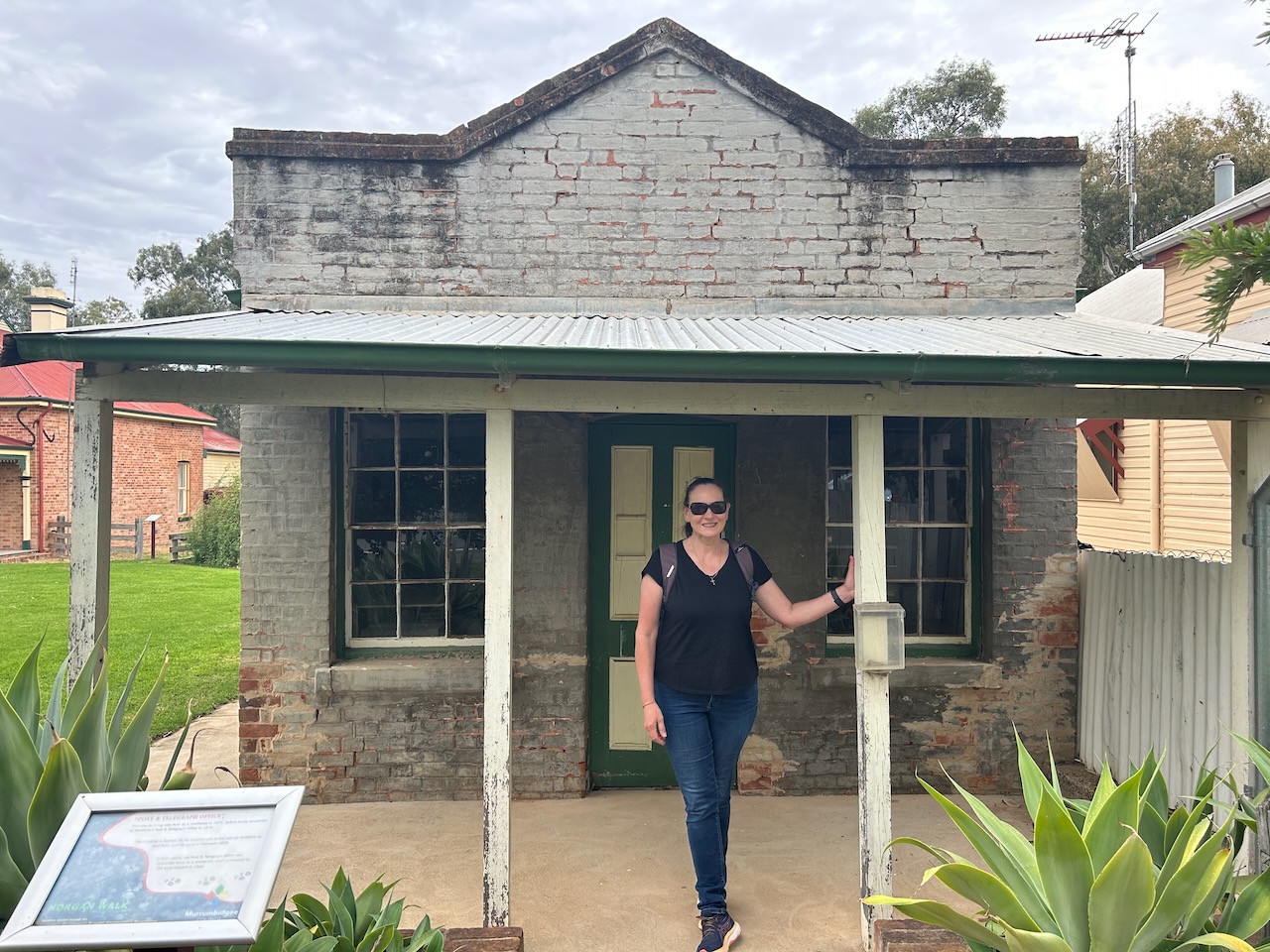
On the 1st day of October 1862, the Post Office was opened and was called Jereelderie. This spelling continued until 1890. John Powell was responsible for the establishment of the post and telegraph office. He subsided the officers out of his own pocket. (Trove 2026) (Wikipedia 2025)
In 1863, Mr Powell lodged an application which resulted in Surveyor James Wood being instructed to survey and report on the Jerilderie village site. A report was prepared, and as a result, the village of Jerilderie was gazetted on the 14th day of March 1865. It consisted of an area of 195 acres (79 hectares), which was bounded generally by West, Coonong, East and Jerilderie Streets. (Trove 2026) (Wikipedia 2025)
In May 1864, Surveyor John McCulloch surveyed the first allotments for sale. The first Crown Land sale was held at Deniliquin on the 26th day of April 1865. (Trove 2026)
In 1874, John Powell was instrumental in raising 2/3rd of the cost of the Public School building, which was erected the following year in 1875. Powell became the chairman of the Local School Board. (Trove 2026)
In September 1884, the railway arrived in Jerilderie following the New South Wales Government Railways’ opening of a branch line from Narrandera. Until 1896, Jerilderie was the terminus of the line. In 1896, it was extended south to Berrigan, Finley in 1898, and eventually to Tocumwal in 1914. (Wikipedia 2025)
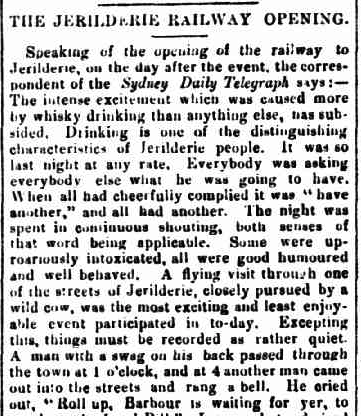
The Pastoral Times in September 1884 reported:
“The intense excitement which was caused more by whisky drinking than anything else, has subsided. Drinking is one of the distinguishing characteristics of Jerilderie people…..” (Trove 2026)
Above: part of an article from The Pastoral Times, Sat 27 Sept 1884. Image c/o Trove
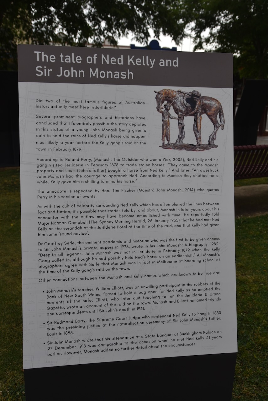
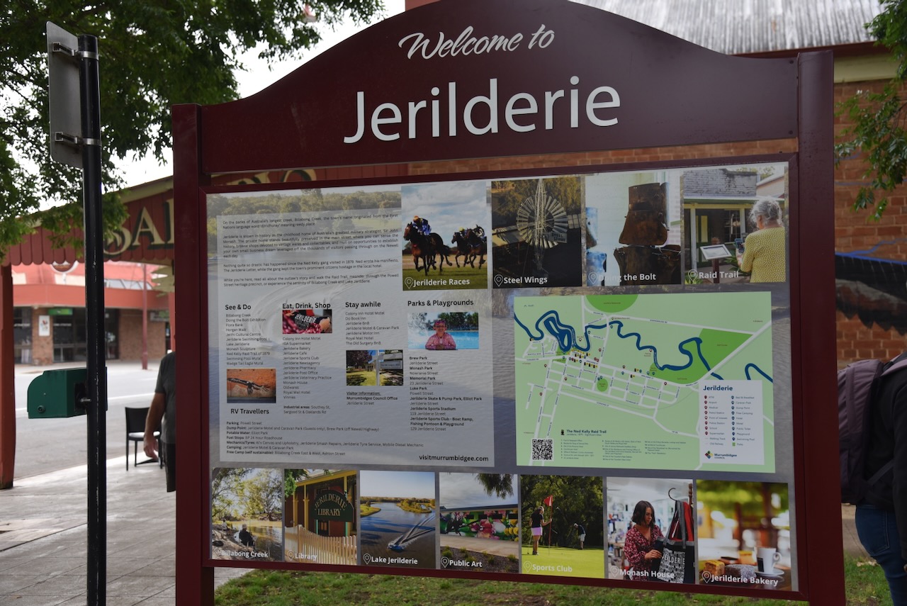
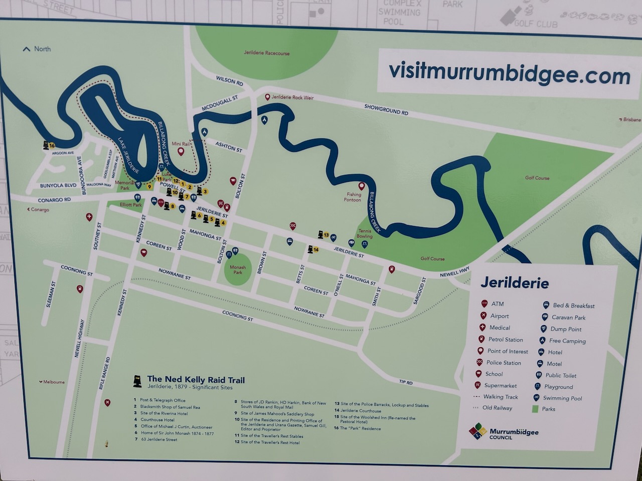
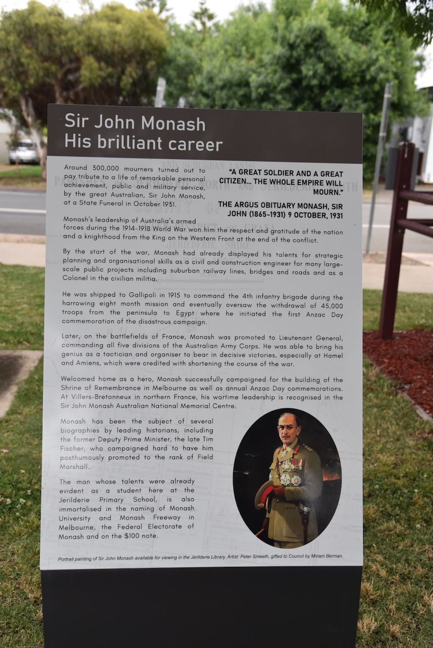
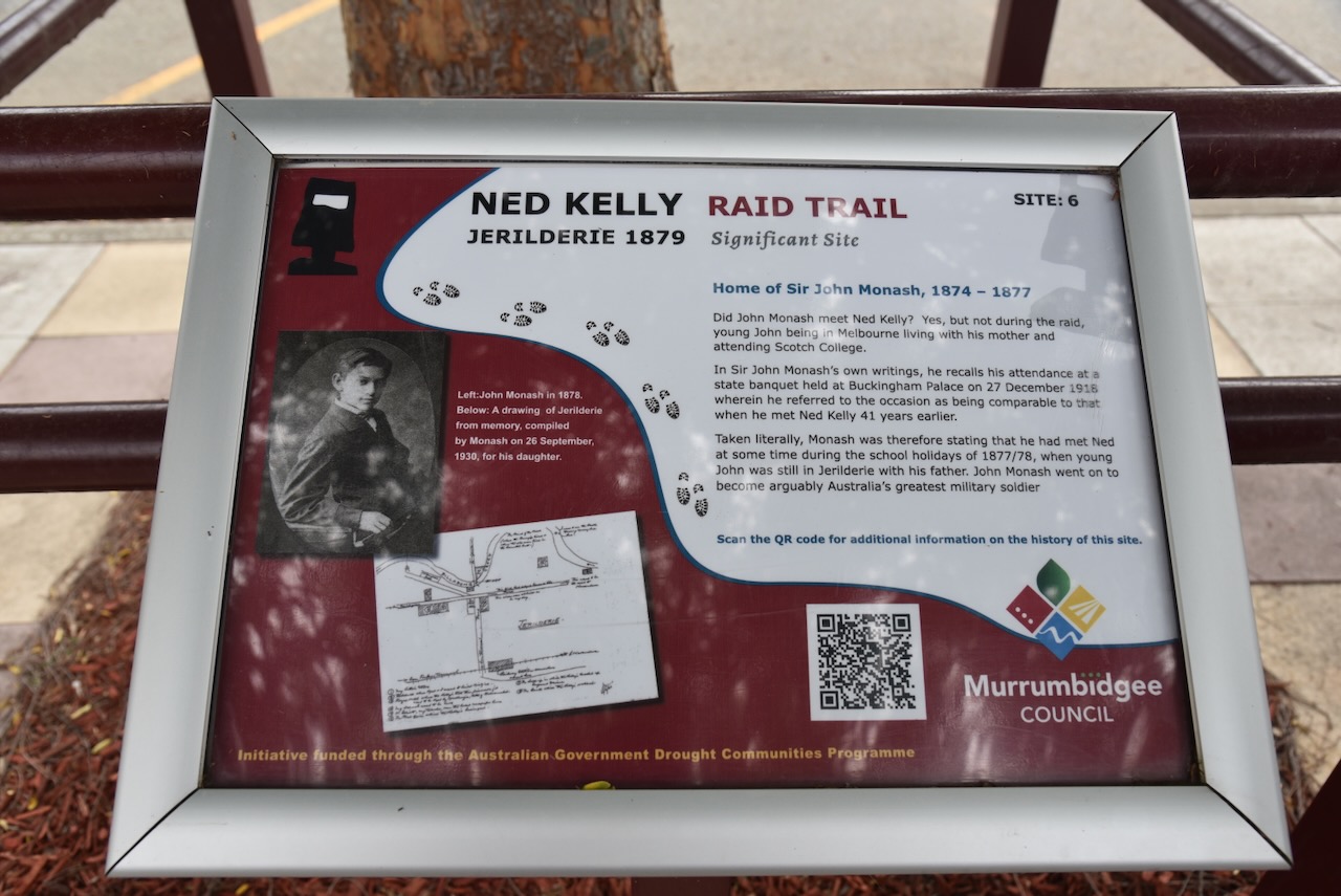
On the corner of Jerilderie Street and Powell Street, you can find a monument for Sir John Monash. I will talk about Monash shortly.
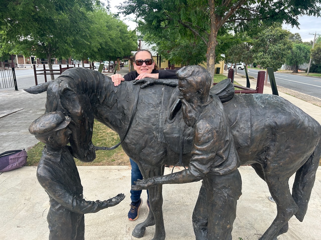
Nearby there are excellent information boards detailing all of the interesting places to see in this very historic town.
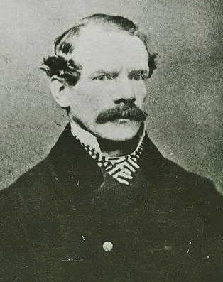
General Sir John Monash was born on the 27th day of June 1865 in Melbourne to Jewish parents from Krotoschin, Posen, Kingdom of Prussia (now current day Poland). In 1874, the Monash family moved to Jerilderie, where his John’s father ran a store. Monash attended the State School and he claimed to have met the bushranger Ned Kelly during the gang’s raids in the town in 1879. He went on to become an Australian military commander during the First World War. (Wikipedia 2019)
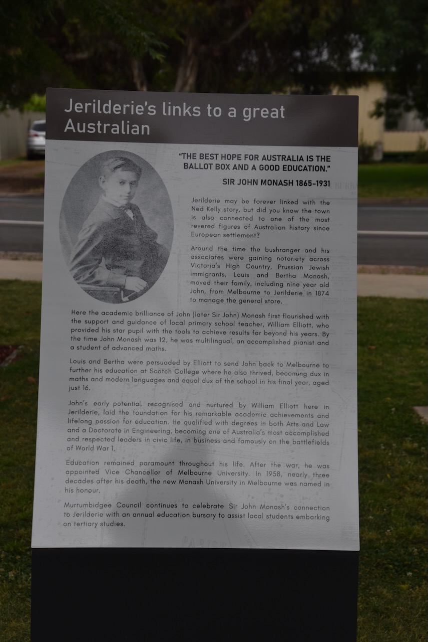
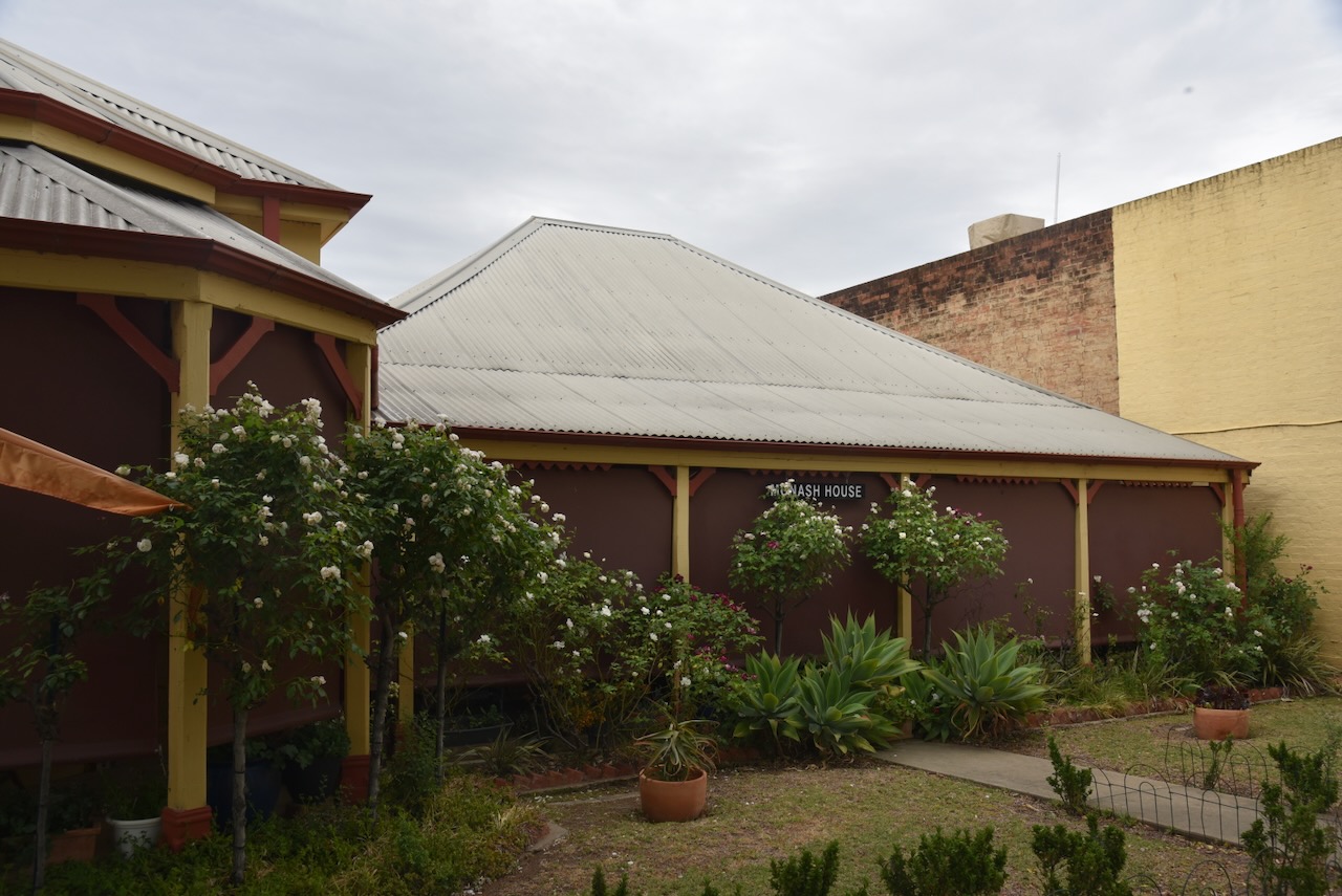
The home of Sir John Monash can be found in Jerilderie’s main street.
For more information on Sir John Monash, please have a look at the short video below.
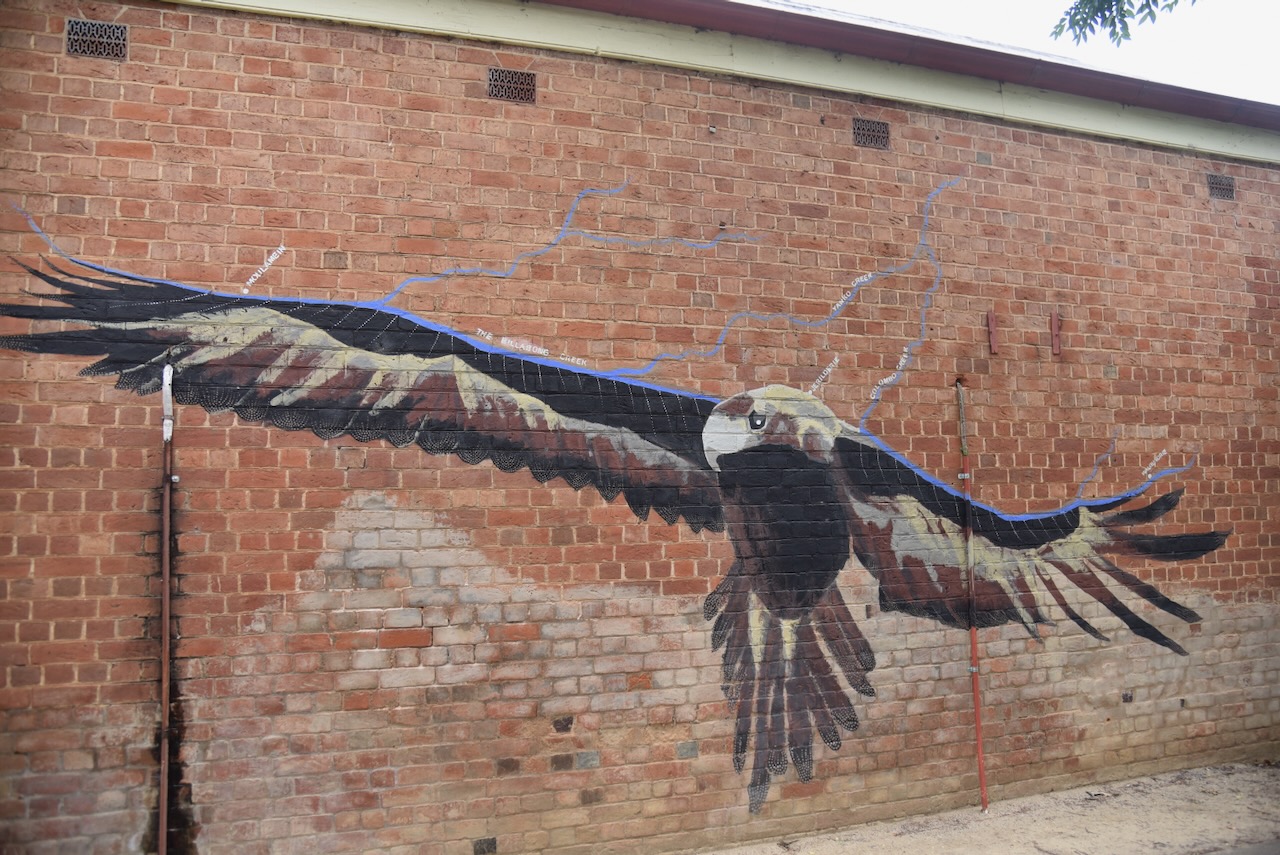
On the side of the bakery building at 57 Jerilderie Street is a magnificent mural of a Wedge-Tailed Eagle. It is the work of local Jerilderie artists. The eagle carries the line of the Billabong Creek and its tributaries along its wings. (Visitnsw.com 2016)
Edward ‘Ned’ Kelly was born in 1854 at Beveridge in the Colony of Victoria. He was one of Australia’s last bushrangers and became well known for the bulletproof armour that he and his gang wore during their final shootout with the police. Kelly’s gang included his younger brother Dan Kelly, Joe Byrne, and Steve Hart. Kelly was tried in Beechworth Court in August 1880. He was executed by hanging at the Melbourne Gaol on the 11th day of November 1880. (Wikipedia 2019)
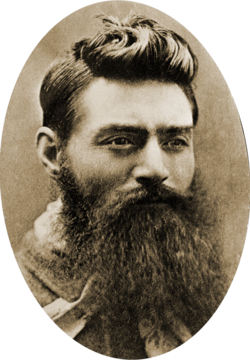
Above: Ned Kelly. Image c/o Wikipedia
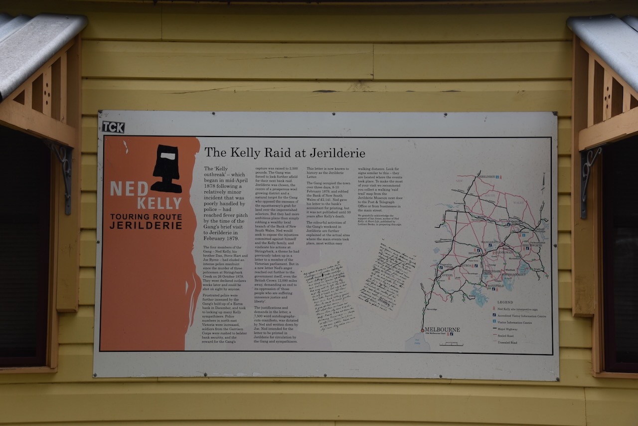
In February 1879, Ned Kelly and his gang famously held up the NSW Riverina town of Jerilderie. They locked up police, robbed over £2,000 from the bank, and held residents hostage for three days. During this time, Kelly dictated his 56-page “Jerilderie Letter,” a manifesto justifying his actions and attacking police oppression.
Below is an excellent video on the Kelly Gang’s activities at Jerilderie and the famous ‘Jerilderie Letter’.
Marija and I decided to walk the self-guided Ned Kelly Raid Trail at Jerilderie. The walk takes you around various historic sites in Jerilderies related to the Kelly Gang raid in 1879.
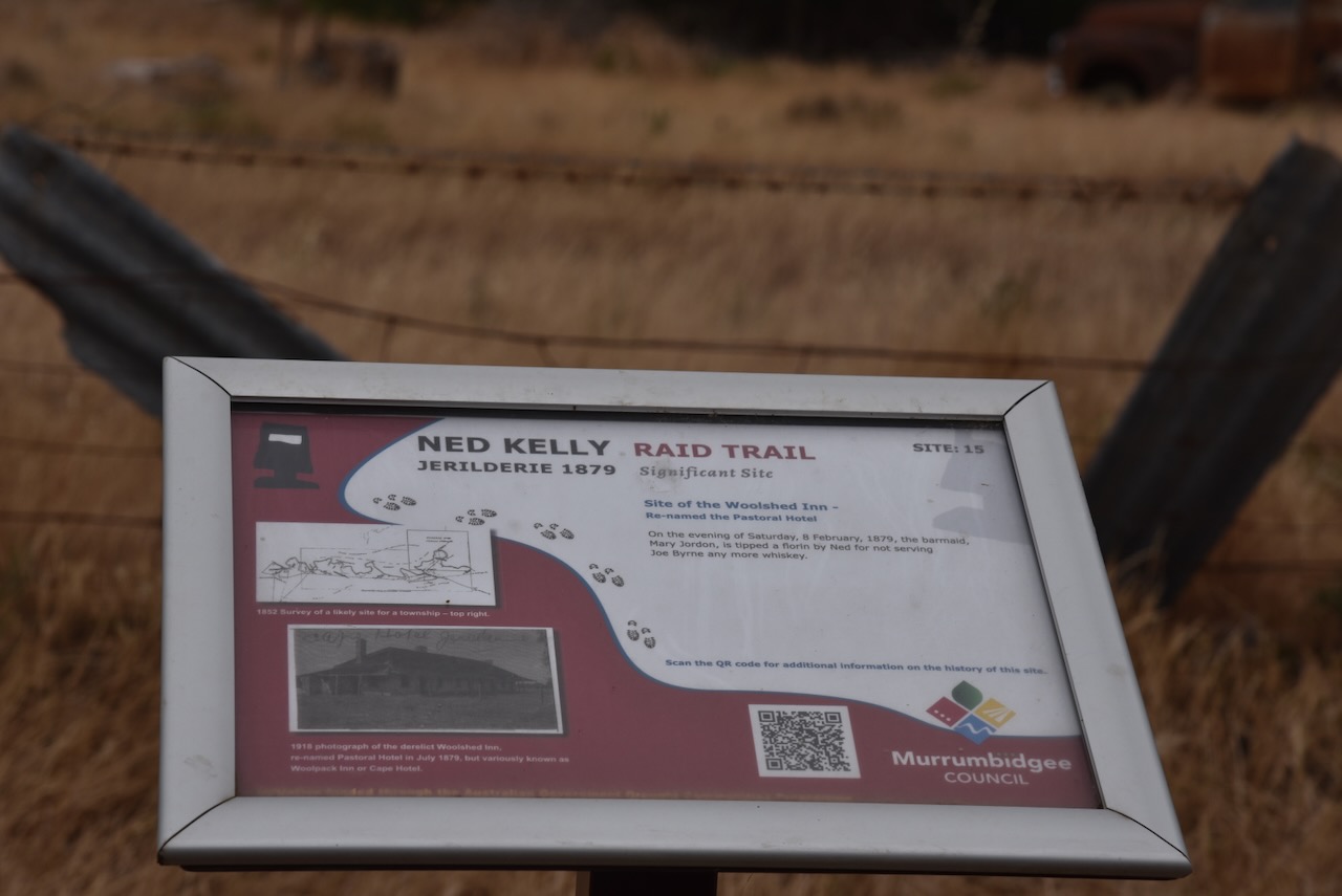
As I mentioned earlier, The Woolshed Inn was established in 1859 by William Davidson. The hotel was also known as the Cape Hotel. The hotel’s name was changed to the Pastoral Hotel on the 12th day of September 1879. It continued to operate under a wine licence until its closure in 1889. The cancellation of the licence was due to the condition of the structure. (Murrumbidgee Council 2023)
At sunset, at about 8.00 p.m. on Saturday, the 8th day of February 1879, Ned Kelly and his gang stopped at The Woolshed Inn near Jerilderie and remained there drinking until about midnight. The barmaid, Mary Jordan, affectionately known as Mary the Larrikin, was tipped a florin by Ned Kelly for answering the gang’s questions about police presence in Jerilderie. And for allegedly not serving Joe Byrne any more whiskey. (Murrumbidgee Council 2023) (Visitmurrumbidgee.com 2026)
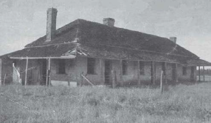
Above: The Woolshed Inn, c. 1918. Image c/o Ned Kelly Raid Trail brochure
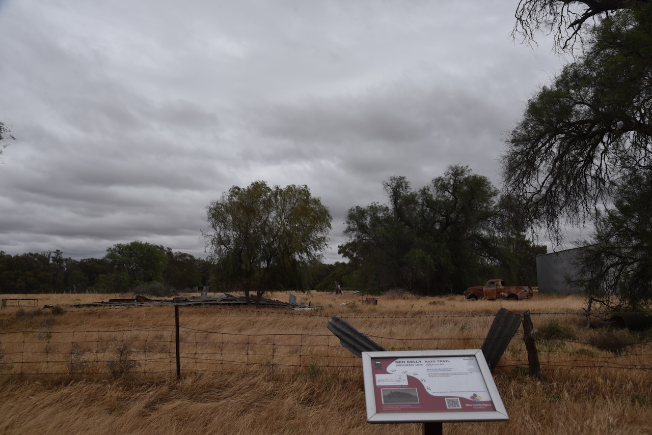
Today, nothing remains of the hotel, which was demolished during the 1950s. There is an interpretive sign at its location on Cape Road on the eastern side of Jerilderie. (Visitmurrumbidgee.com 2026)
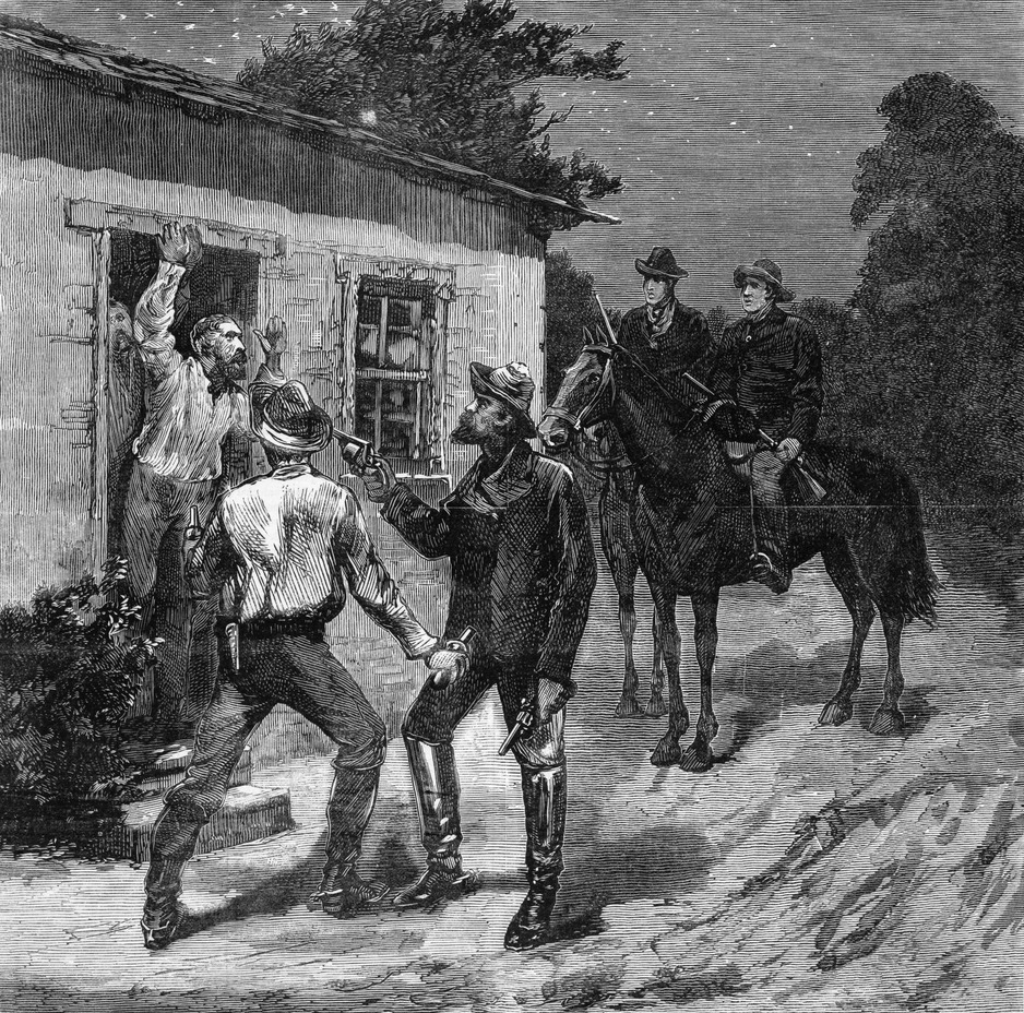
At about 11.00 p.m. the gang rode into Jerilderie to the police barracks. The gang took up positions around the barracks, and Ned Kelly called out to Senior Constable George Devine that there was a disturbance at Davidson’s hotel. The two police officers walked out of the barracks and were confronted by the armed gang, who then locked Devine and Trooper Henry Richards in the ‘logs.’ The wife of Senior Constable Devine was also taken hostage. (Murrumbidgee Council 2023) (Visitmurrumbidgee.com 2026)
Above: the Kelly Gang bailing up the Jerilderie Police barracks. Image c/o Wikipedia
All that remains today at the old police barracks are the old stables.
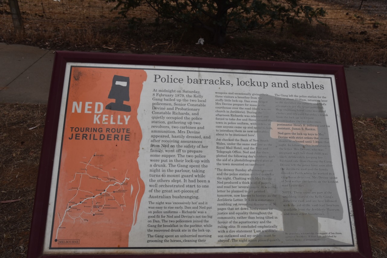
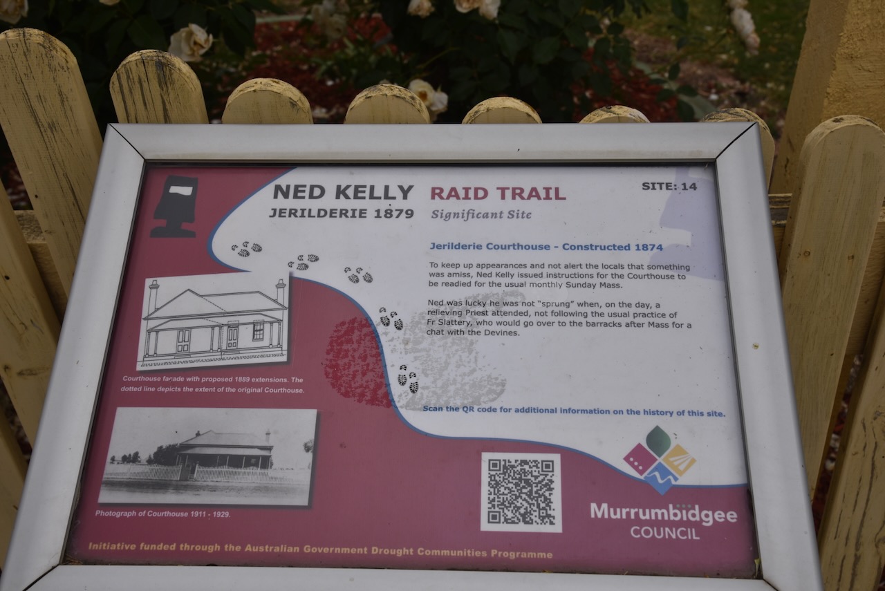
On Sunday morning, the gang dressed themselves in police uniforms. However, they had one problem. Once a month, the Catholic Church held its service in the courthouse, opposite the police barracks. Until the erection of the Roman Catholic Church in 1882, the congregation held their services in the courthouse. At about 10.00 a.m. on Sunday, the 9th day of February 1879, Mrs Devine advised Ned Kelly that she needed to prepare the altar in the courthouse for the church service that morning at 11.00 a.m. Ned Kelly came to the conclusion that if Mrs Devine did not attend, it would upset their plans to rob the bank. As a result, dressed in police uniform, Dan Kelly escorted Mrs Devine across the road to the courthouse. (Murrumbidgee Council 2023) (Visitmurrumbidgee.com 2026)
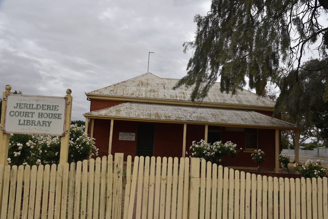
In July 1869, Jerilderie appeared in the NSW Government Gazette as a place for holding the Court of Petty Sessions. The Jerilderie Courthouse was built in 1874. Extensions were made to the courthouse in 1889 and the 1920s. Prior to the courthouse being built, court was held in privately owned buildings in Jerilderie, and from 1872 in the Courthouse Hotel. The Jerilderie courthouse was closed on the 1st day of August 1988. Between 1989 and 2009, it served as Jerilderie’s public library. (Murrumbidgee Council 2023) (Visitmurrumbidgee.com 2026)
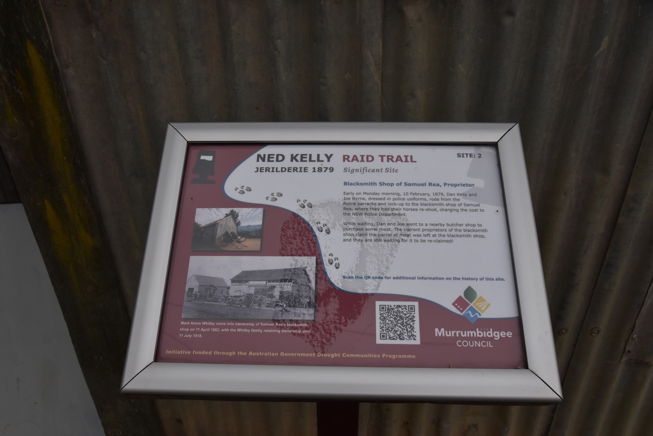
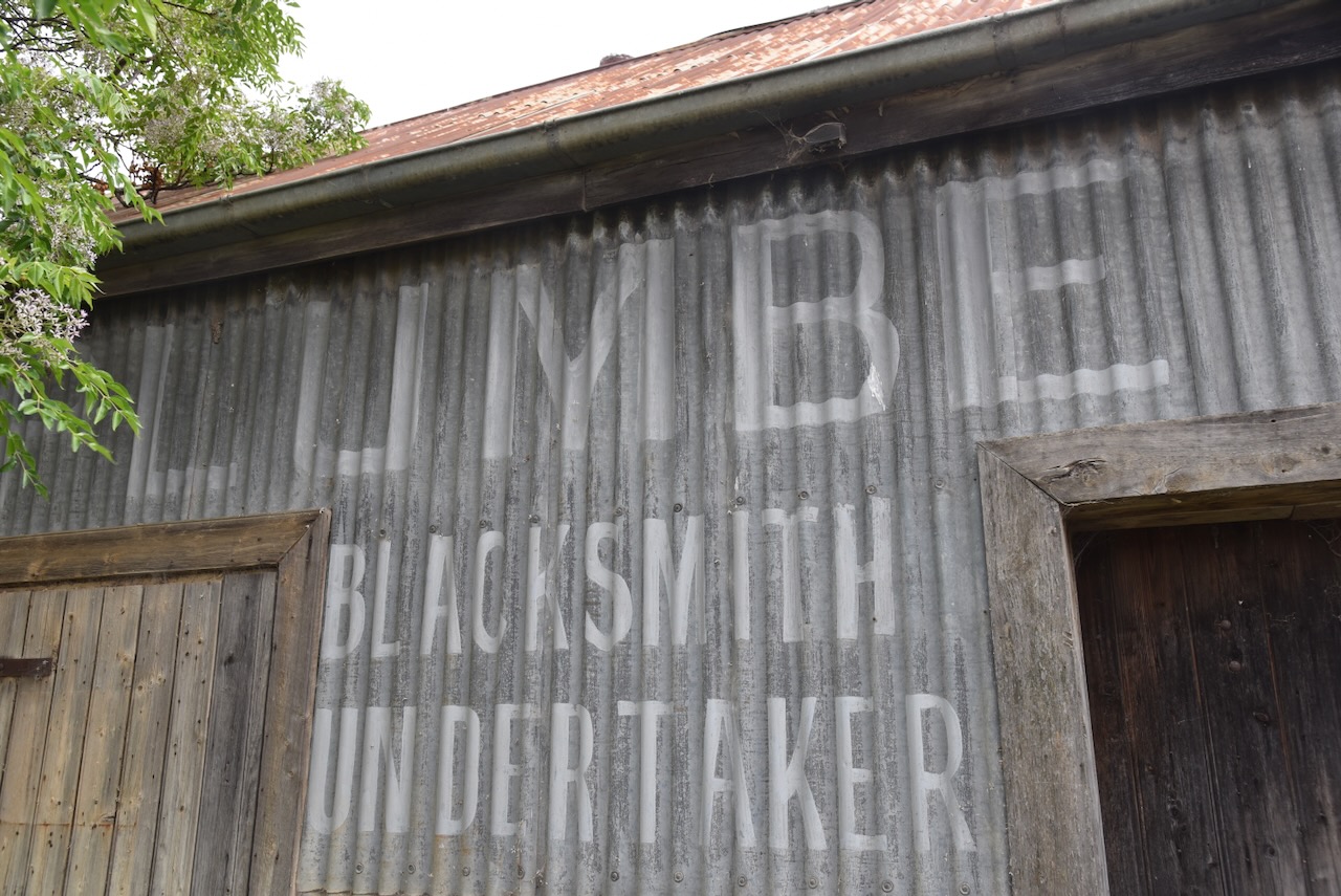
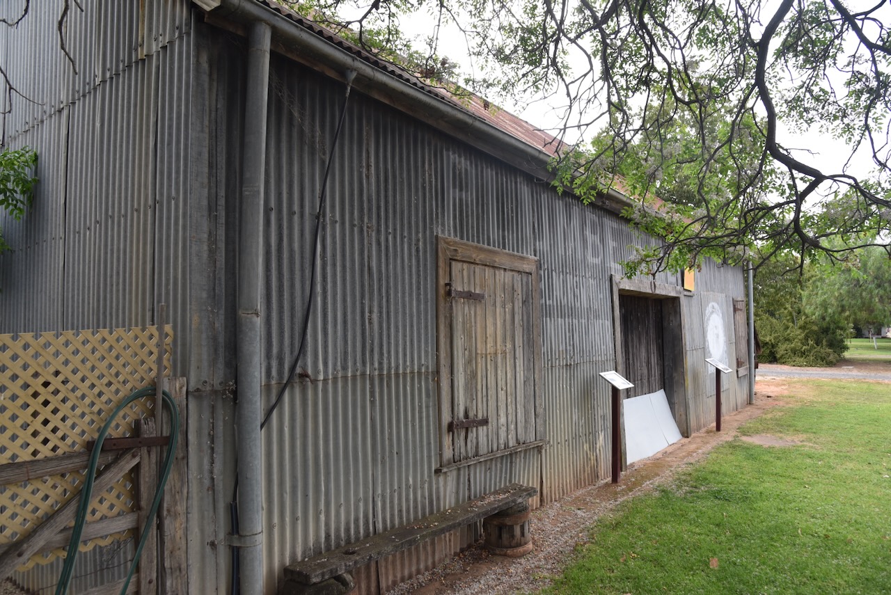
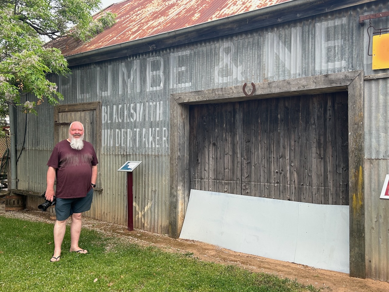
At about 7.45 a.m. on the morning of Monday, the 10th day of February, Joe Byrne and Dan Kelly attended the blacksmith shop of Samuel Rea and had their horses re-shod. Byrne and Kelly were dressed in police uniforms. They booked the cost to the New South Wales Police. (Murrumbidgee Council 2023)
Samuel Rea was born in 1846 in Worcestershire, England. He emigrated to Australia, and in 1871, he married Catherine O’Brien at Yackandandah, Victoria. They had one child. Three years after the Kelly incident, he married Ellen Walsh and they had 5 children. Rea died in 1905 in Geelong, Victoria, aged 59 years. (ancestry 2016)
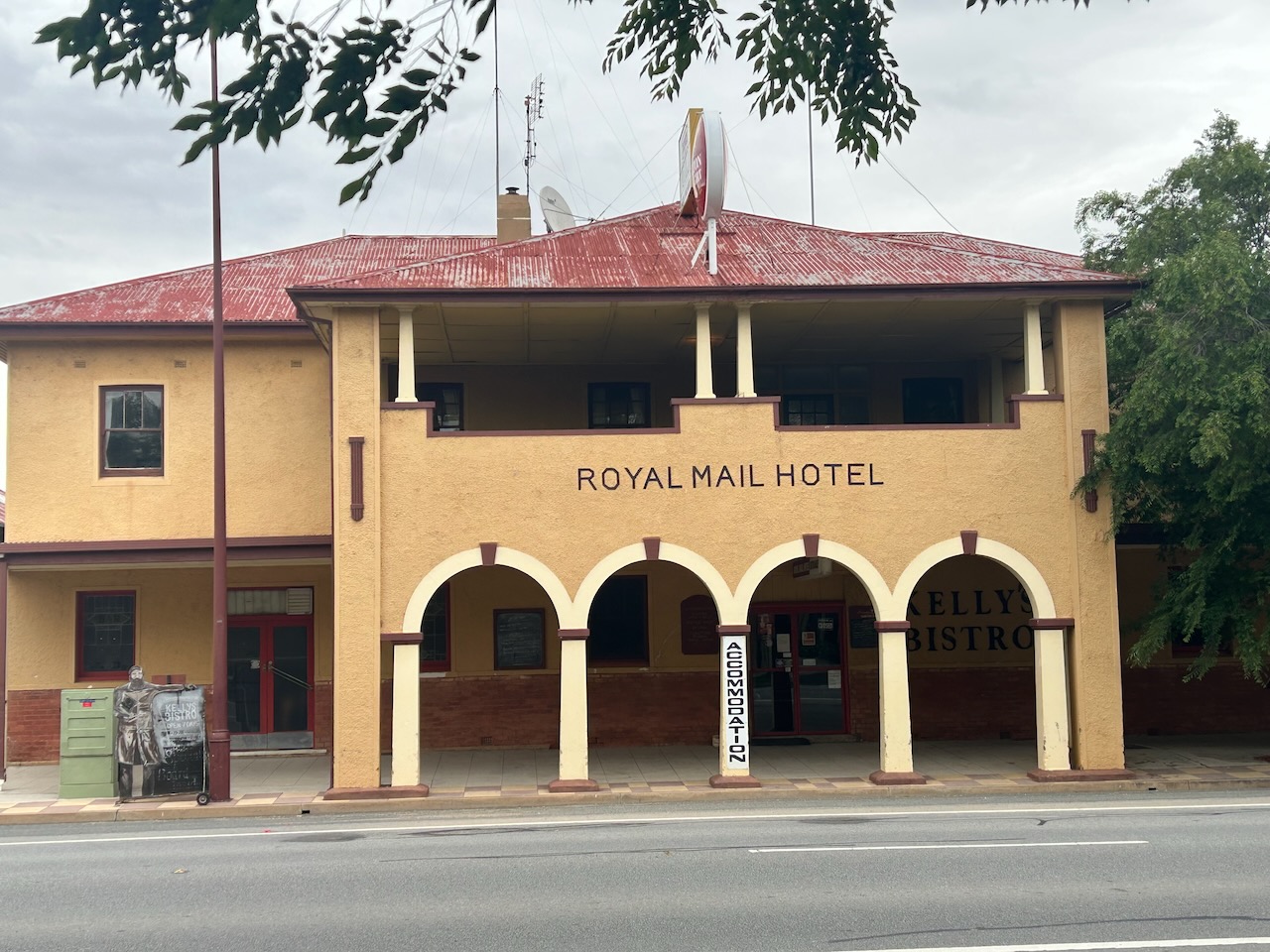
At about 10.30 a.m. on Monday morning, the 10th day of February 1879, Ned Kelly, Joe Byrne, and Trooper Richards walked towards the Royal Mail Hotel. It was the intention of the Kelly Gang to rob the Bank of New South Wales. They were followed on horseback by Dan Kelly and Steve Hart. Ned Kelly informed the hotel owner, Mr Charles Cox, that he came to the hotel ‘to stick up and rob the Bank today’. Dan Kelly and Steve Hart gathered the employees at gunpoint and placed them in the back parlour. Ned Kelly and Joe Byrne then entered the bank and robbed it of over £2,000. (Murrumbidgee Council 2023) (Visitmurrumbidgee.com 2026)
Ned Kelly and Joe Byrne then took the teller Edwin Living, the junior teller James Mackie, and the bank manager John Tarleton hostage. (Murrumbidgee Council 2023)
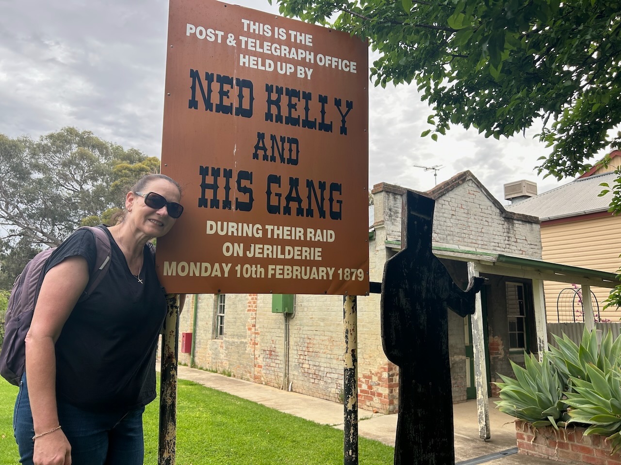
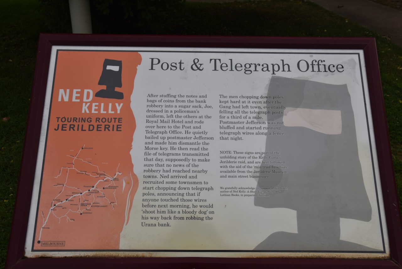
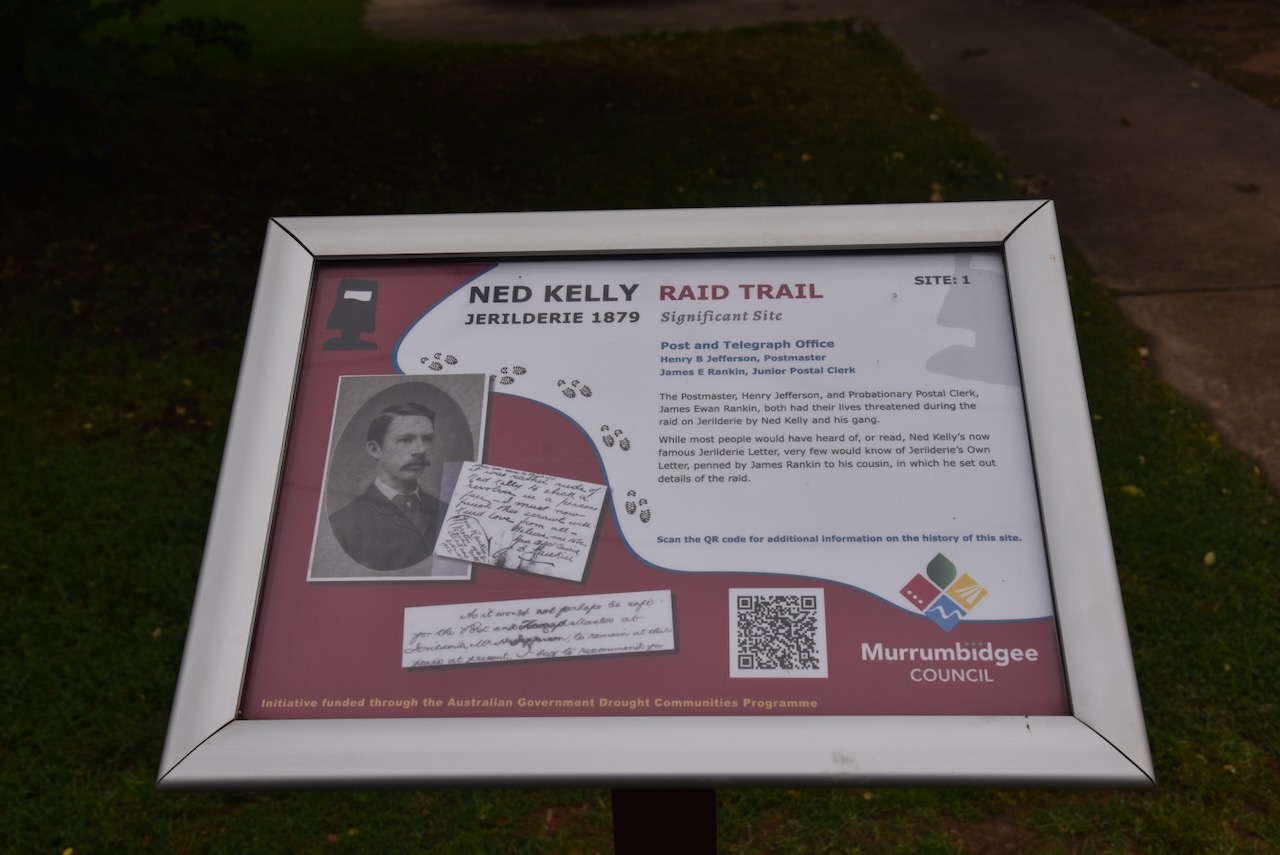
Joe Byrne went out to the rear of the Hotel and mounting his horse rode over to the Post and Telegraph Office. (Murrumbidgee Council 2023)
Henry Jefferson was the Post and Telegraph Master at Jerilderie. Henry Betteley Jefferson was born in 1856 in Cheshire, England. Jefferson was stationed at several Riverina post offices during his career, including Jerilderie. He retired in 1919 after 45 years’ service. He died in 1926 in Sydney at the age of 70 years. (ancestry 2016) (Anu.edu.au 2026)
At about 1.00 p.m., Jefferson left the Post and Telegraph Office and headed to the Traveller’s Rest for lunch. He returned at about 2.00 p.m. and was confronted by Joe Byrne dressed in a police uniform. Byrne, armed with a revolver, ordered Jefferson to shut down the telegraphic machine. Jefferson was held hostage until the arrival of Ned Kelly, who went next door to Mr J Roe, the bootmaker, and ordered him to chop down the telegraph poles with his axe. (Murrumbidgee Council 2023)
Two other unsuspecting Jerilderie residents, Mr Thomas Brown, Mr Charles Naw arrived at the Post Office and were ordered to cut down the telegraph poles with a newly acquired axe. (Murrumbidgee Council 2023)
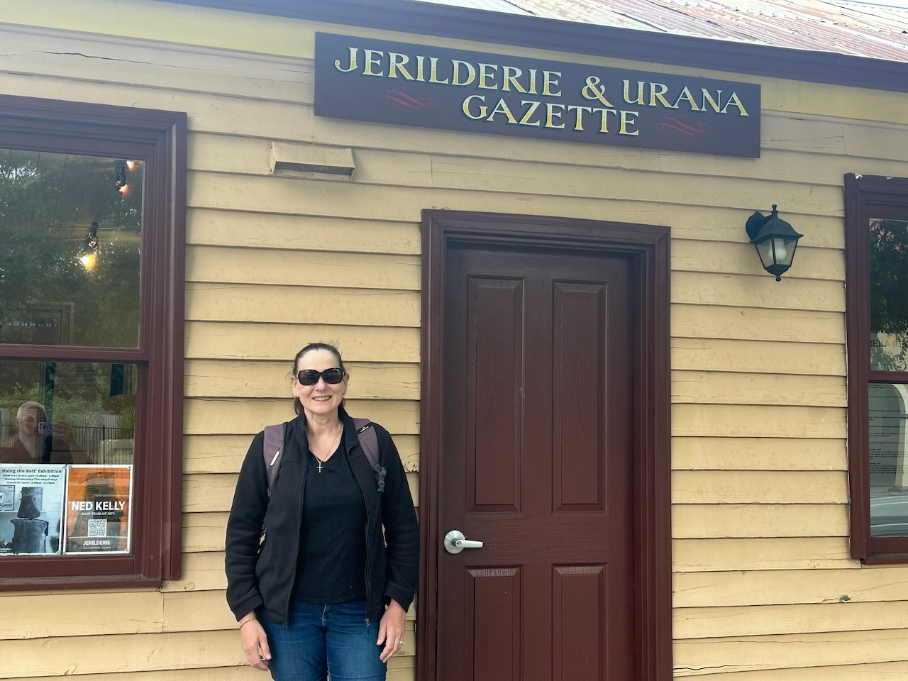
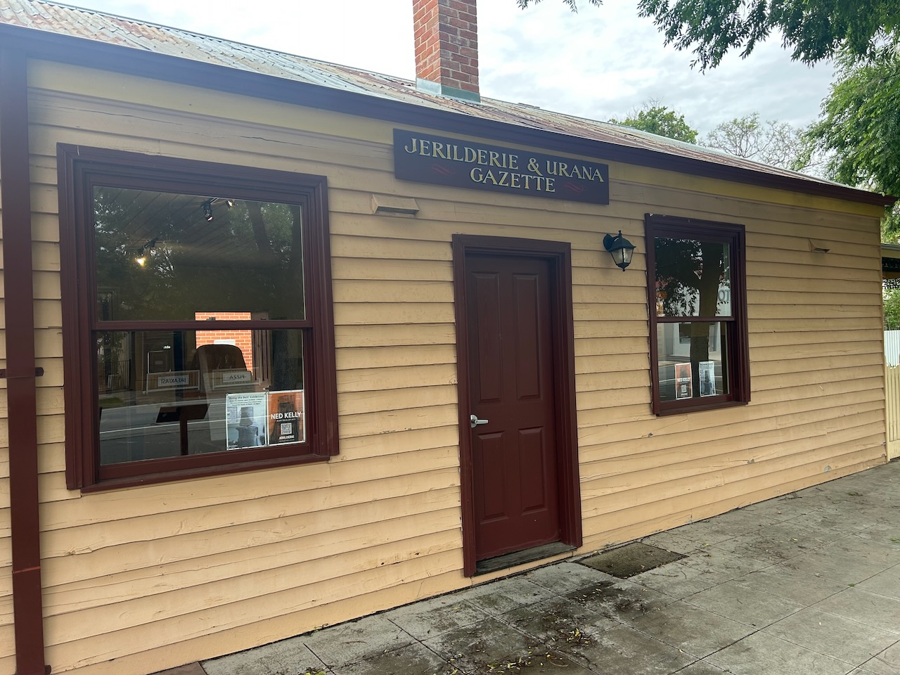
Ned Kelly, Trooper Richards, and Edwin Living went in search of the Editor and proprietor of the Jerilderie & Urana Gazette, Samuel Gill. They called at his home and the office situated opposite the hotel. It was Ned Kelly’s intention to print a 7,500-word 58-page letter that Kelly had written. The letter has become known as the ‘Jerilderie Letter’. In the letter, Kelly justifies his murder of police officers and describes cases of alleged police corruption. They did not find Gill at his home, but Ned Kelly did speak with his wife, who refused to accept the letter. Gill had, in fact, earlier entered the bank with two local shopkeepers, James Rankin Snr and Hugh Harkin. Ned Kelly bailed up the three men and took Rankin and Harkin hostage. Gill managed to flee and rode to ‘Carrah Homestead’, where a message could be sent to ‘Coree Homestead’ and then to the police at Deniliquin. (Murrumbidgee Council 2023) (Visitmurrumbidgee.com 2026)
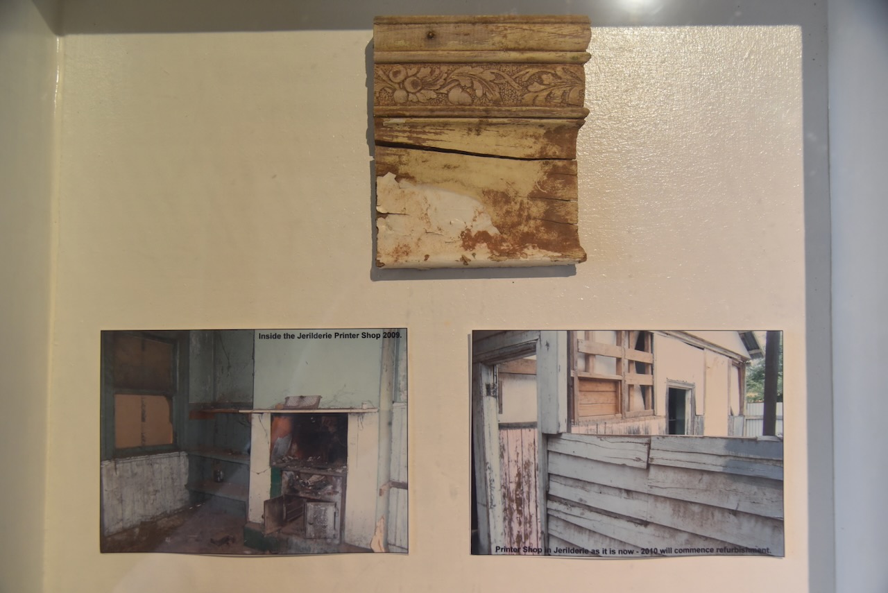
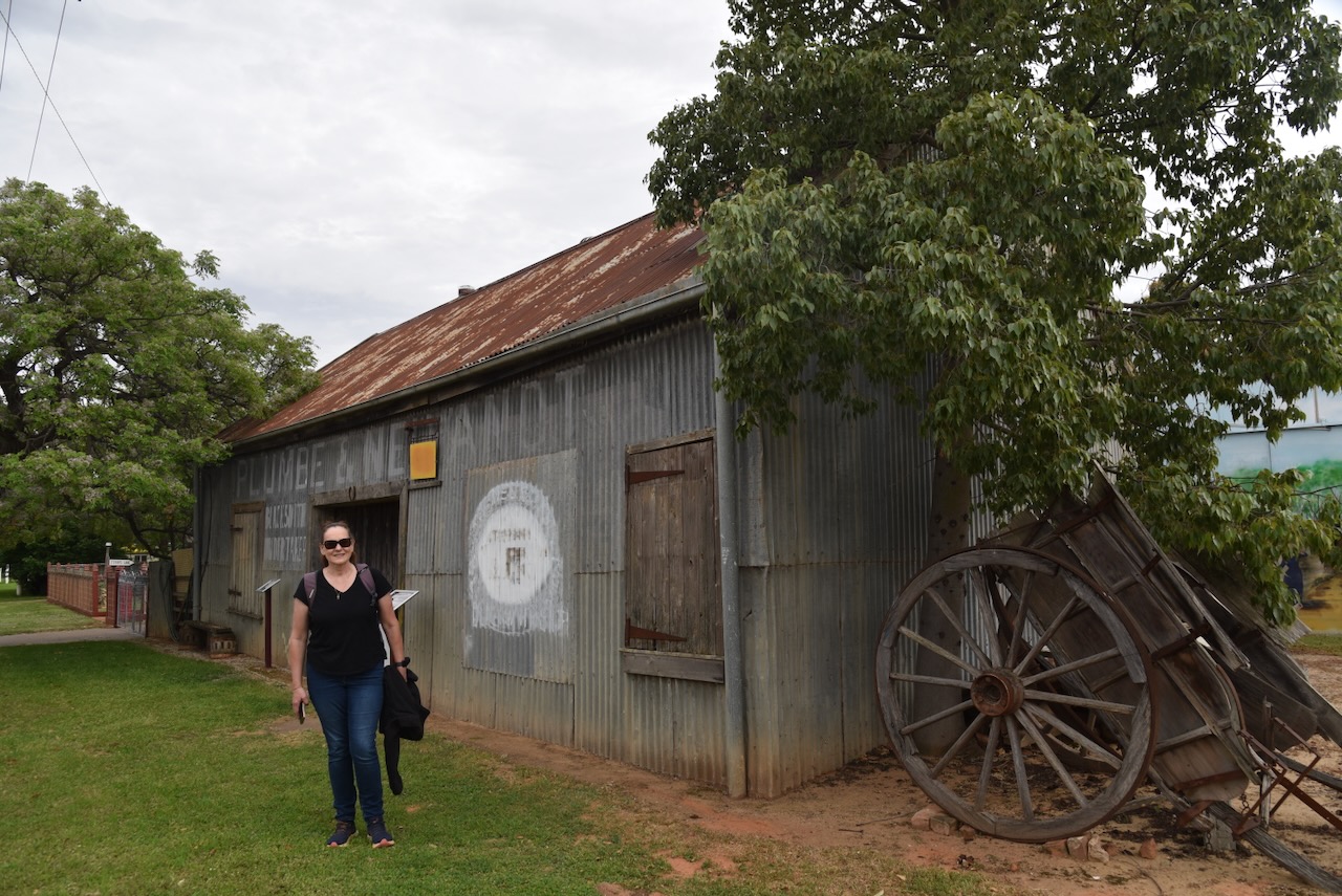
The Jerilderie & Urana Gazette building is situated at 45 Jerilderie Street. It contains the Bolt Exhibition, which we visited later that day. The ‘Doing the Bolt’ exhibition showcases an exhibition of convicts and bushrangers, including the Kelly Gang. (Murrumbidgee Council 2023)
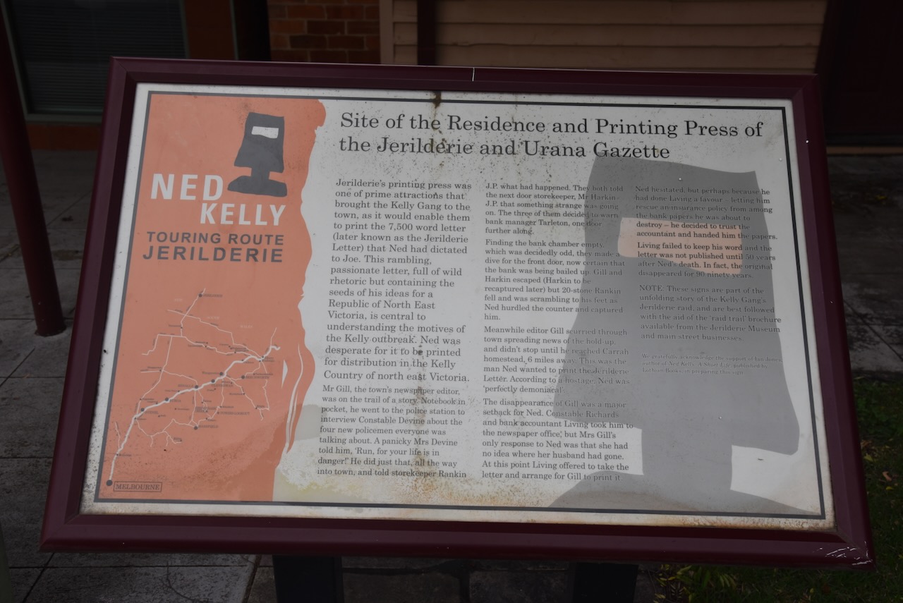
Upon Mrs Gill refusing the letter, Edwin Living offered to take the letter until Mrs Gill’s return, when the letter could be published. Ned Kelly agreed. But, Living never handed the letter to Gill and retained it himself. The letter would not surface for more than 100 years. (Visitmurrumbidgee.com 2026)
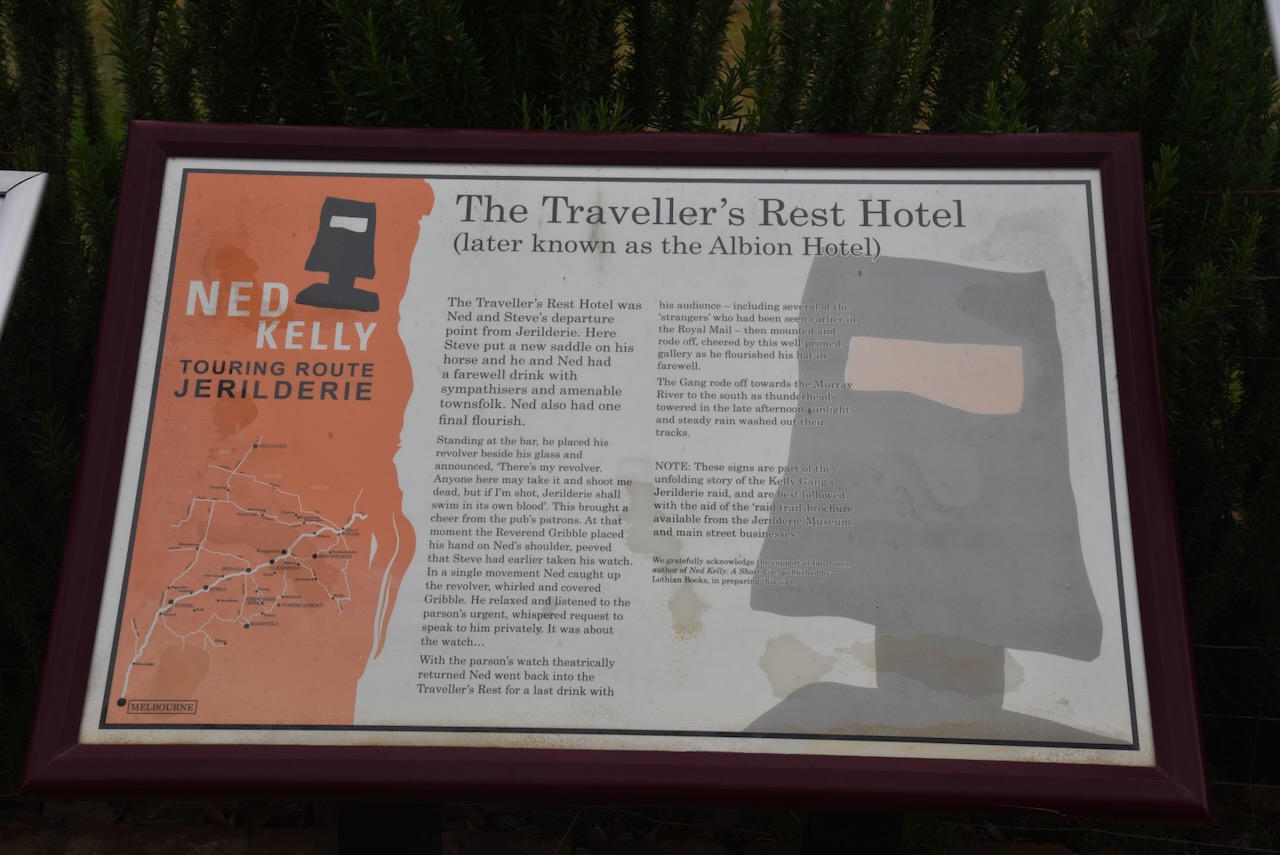
The Traveller’s Rest Hotel was from where Ned Kelly and Steve Hart had a farewell drink with sympathisers before leaving Jerilderie. It is reported that Kelly placed his revolver on the car alongside his glass and stated:
“There’s my revolver. Anyone here may take it and shoot me dead, but if I’m shot, Jerilderie shall swim in its own blood.” (Murrumbidgee Council 2023)
Earlier in the day, Ned Kelly had inspected a racehorse called Minnie at the Traveller’s Rest Stables, expressing his interest in wanting the mare. The horse belonged to Mary McDougall, the daughter of the hotel proprietor. That afternoon Steve Hart attended the stables with a saddle belonging to Edwin Living. (Murrumbidgee Council 2023)
At the hotel, Edwin Living pleaded for the return of his saddle, to which Ned Kelly agreed. There was then a plea that the racehorse not be taken. Again, this was agreed upon, much to the displeasure of Steve Hart. (Murrumbidgee Council 2023)
In the main street, you can find Flora Bank, previously known as Ye Olde Bank. It was established in 1880. We visited the bank and gardens later in the day. I will go into more detail about the history in another post.
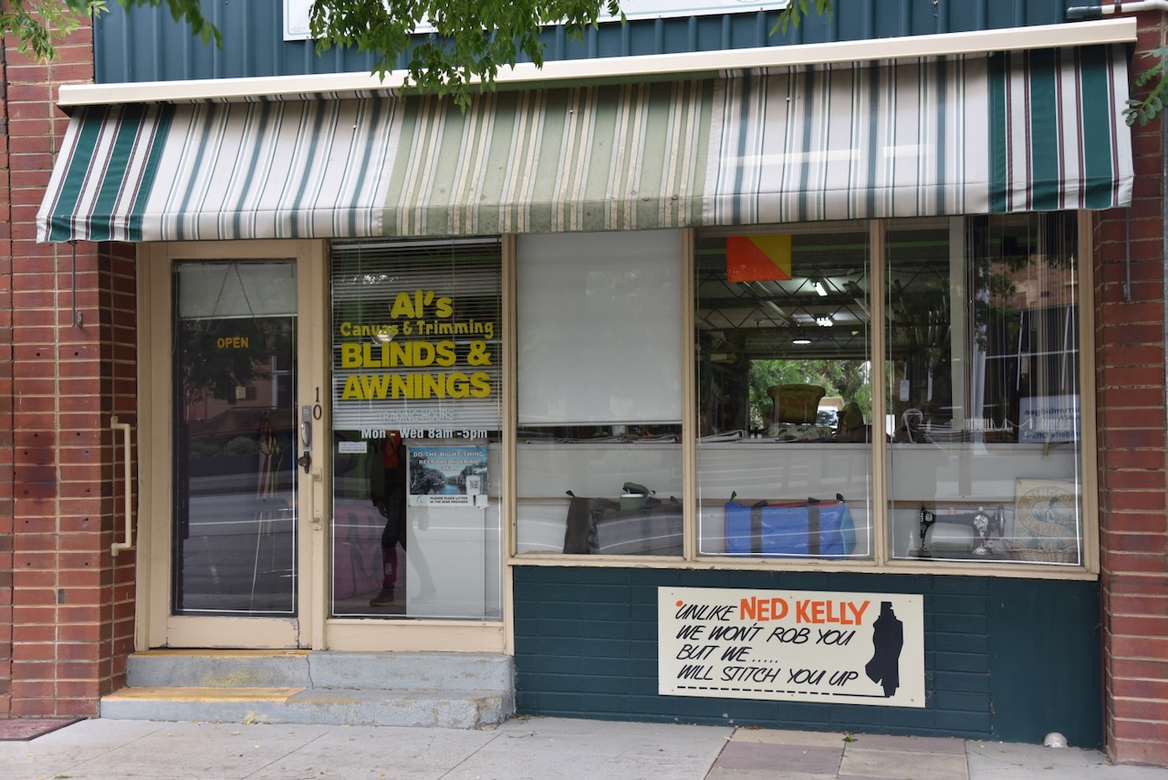
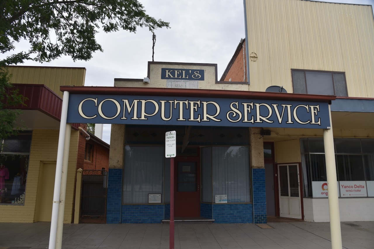
We found this very interesting and quirky sign on the front of a local business.
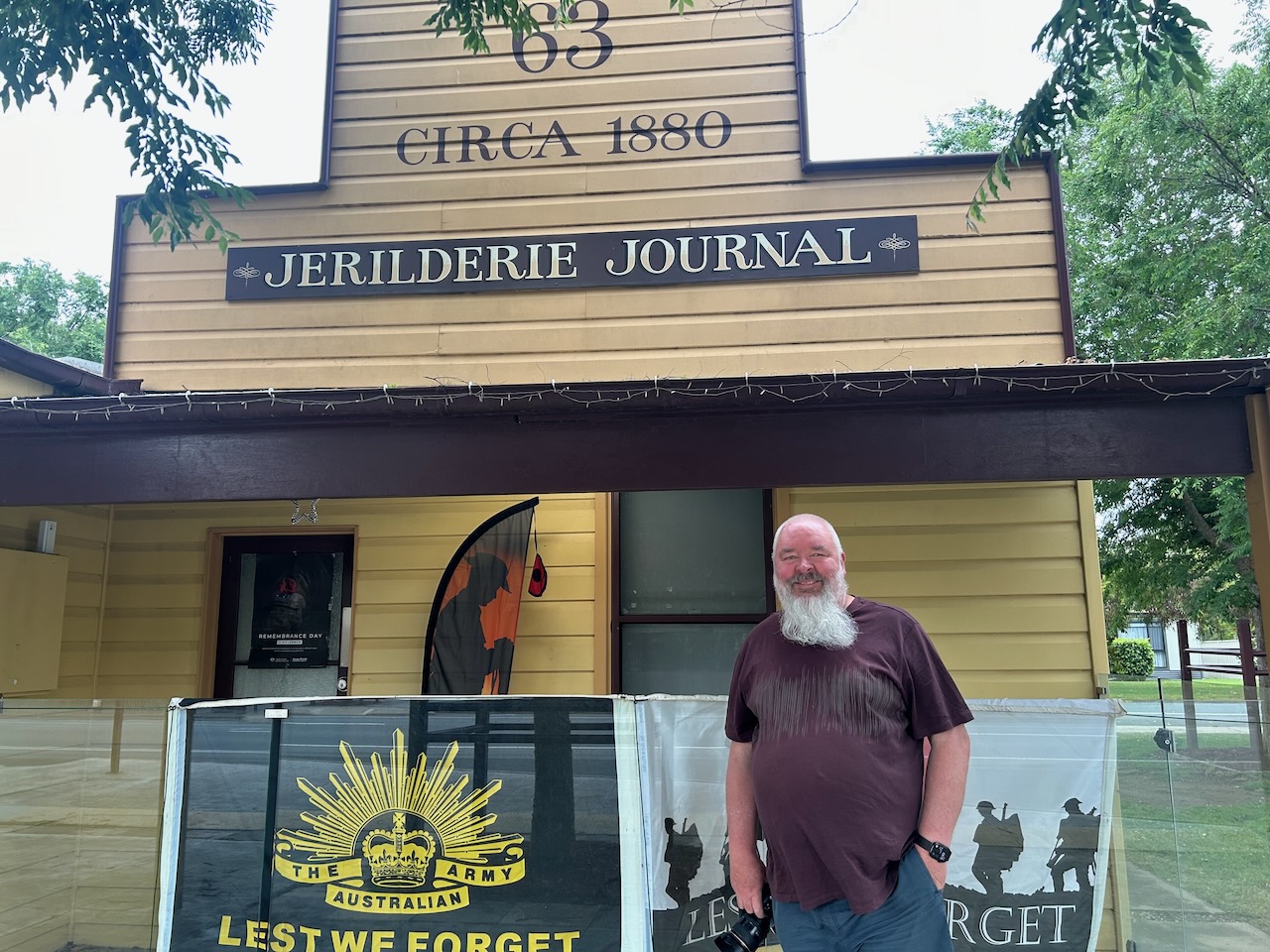
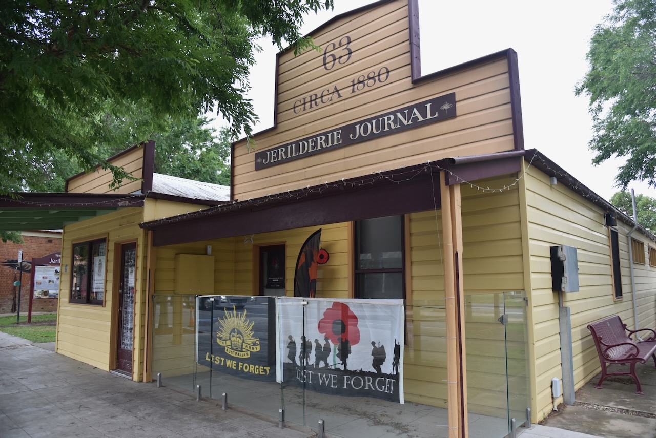
The Jerilderie Journal was established in c. 1880. It is now the Jerilderie Returned Services League (RSL)
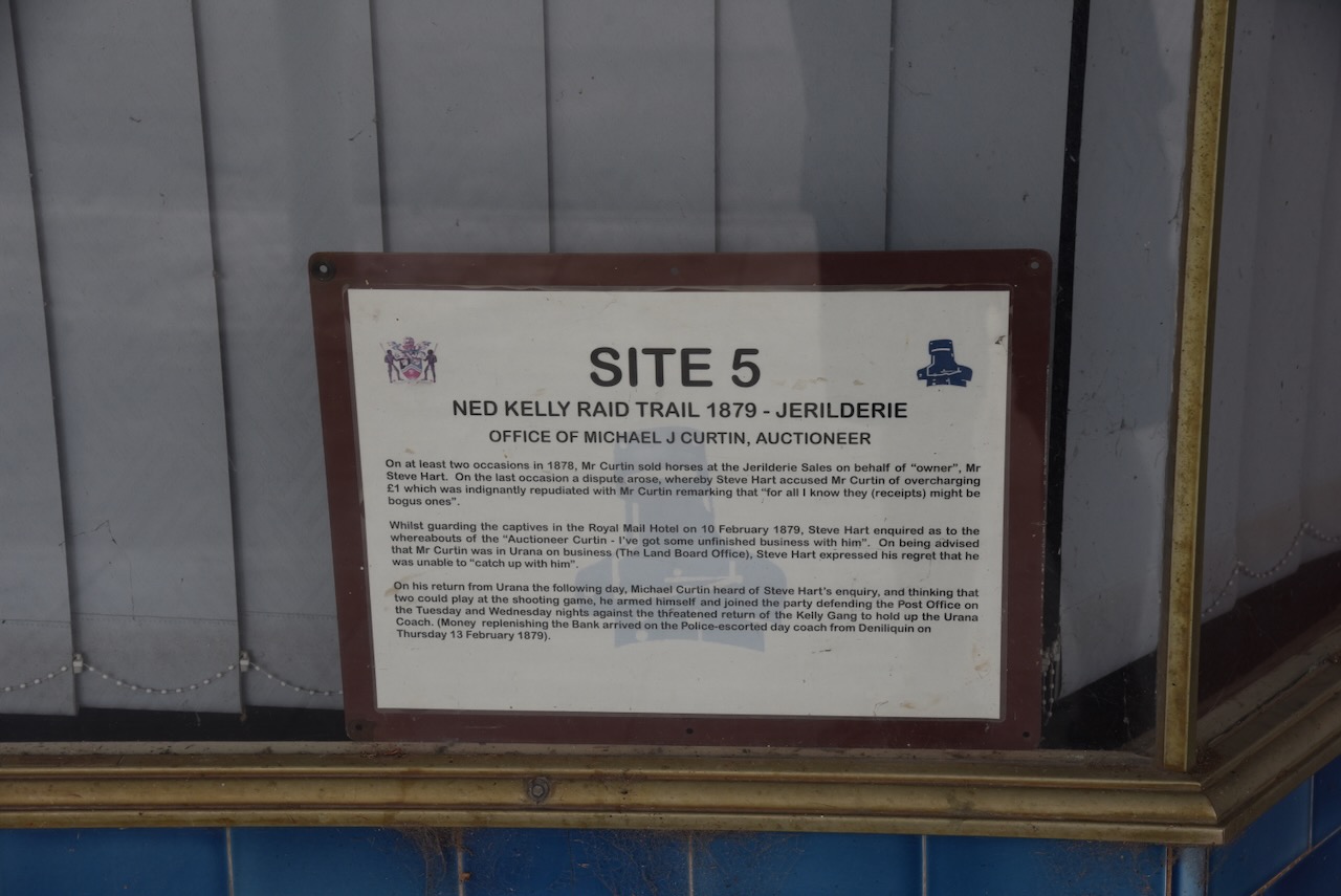
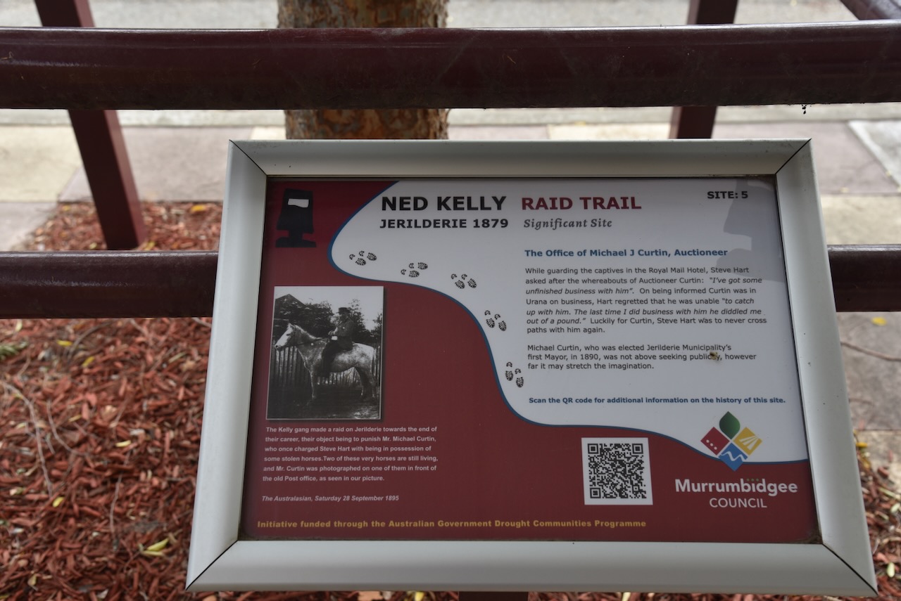
The former office of auctioneer, Michael J Curtin, can be located on the trail. He conducted business with Steve Hart on at least 2 occasions in 1878, where he sold horses at the Jerilderie Sales on behalf of Hart. During the Jerilderie incident, Hart came looking for Curtain due to ‘some unfinished business’. Fortunately for Curtin, he was away in Urana at the time.
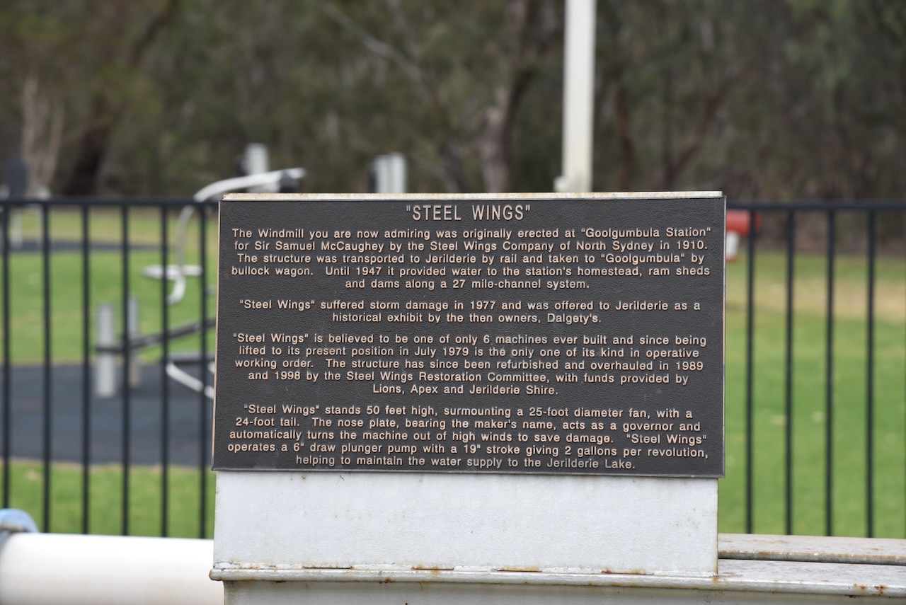
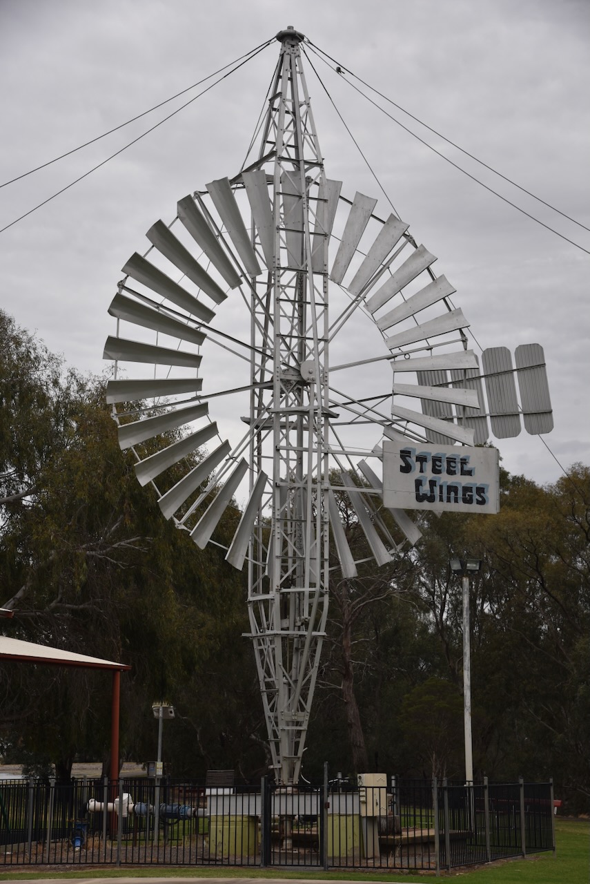
Another attraction in Jerilderie is ‘Steel Wings’. This very large windmill was erected at Goolgumbla Station in 1910. It was transported to Jerilderie by rail and then taken to the station by bullock wagon. Until 1947, it provided water to the station’s homestead, ram sheds and dams. In 1977, it suffered damage and was offered to Jerilderie as a historical exhibit. ‘Steel Wings’ stands 50 feet high, surmounting a 25-foot diameter fan, with a 24-foot tail.
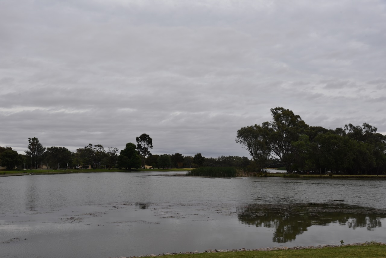
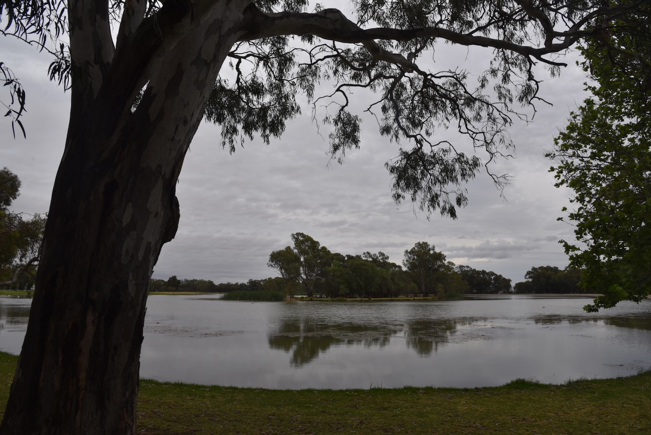
We sat for a while to admire the man-made Lake Jerilderie.
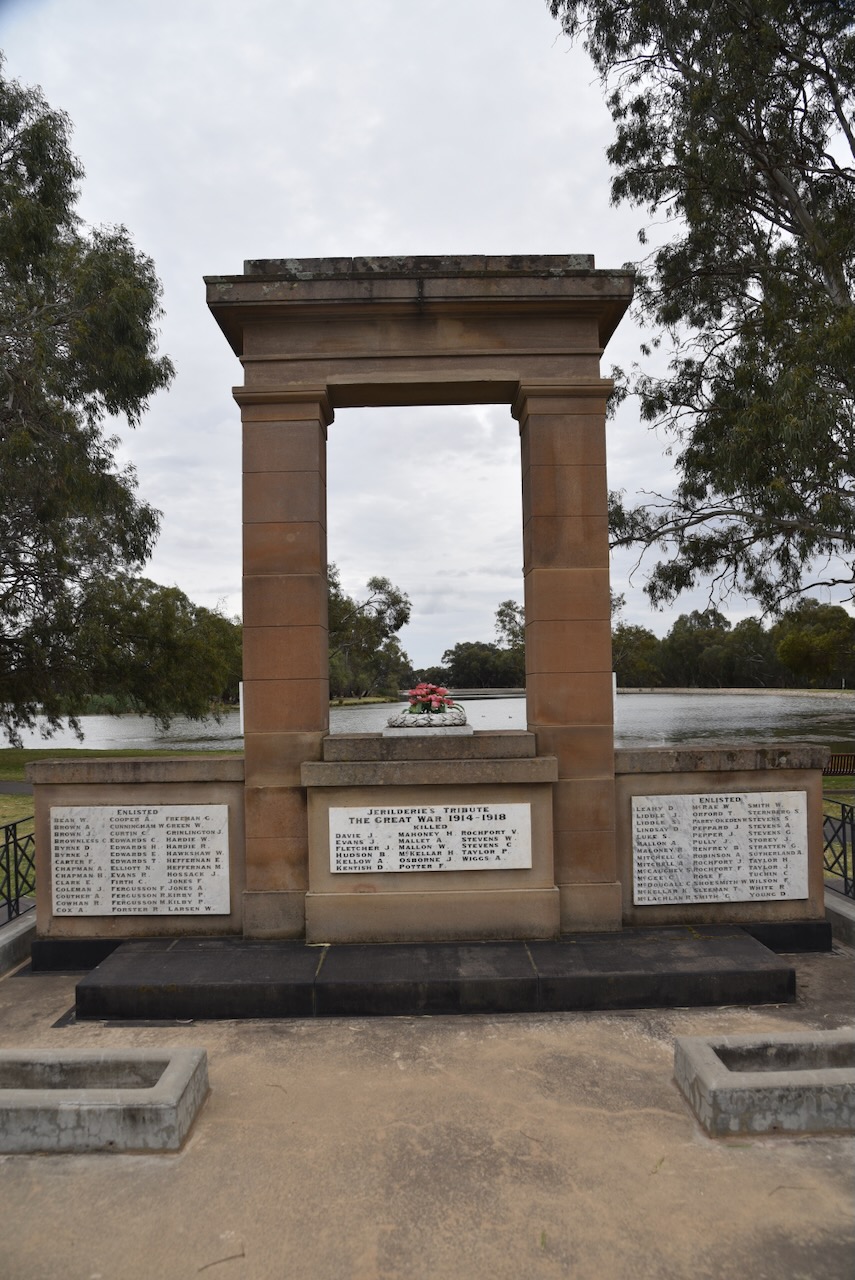
Marija and I then visited the Jerilderie Cenotaph, which is located at Memorial Park on the corner of Newell Highway and Powell Street. The Centopah is a large stone monument that is in the shape of an arch. It was originally located on a traffic island beside the Newell Highway. and in 2010 was relocated to its current position. It was initially unveiled on the 25th day of April 1923, which was the 8th anniversary of the ANZAC landing at Gallipoli. It is believed that the Centopath is one of the oldest in Australia. (Nsw.gov.au 2024)
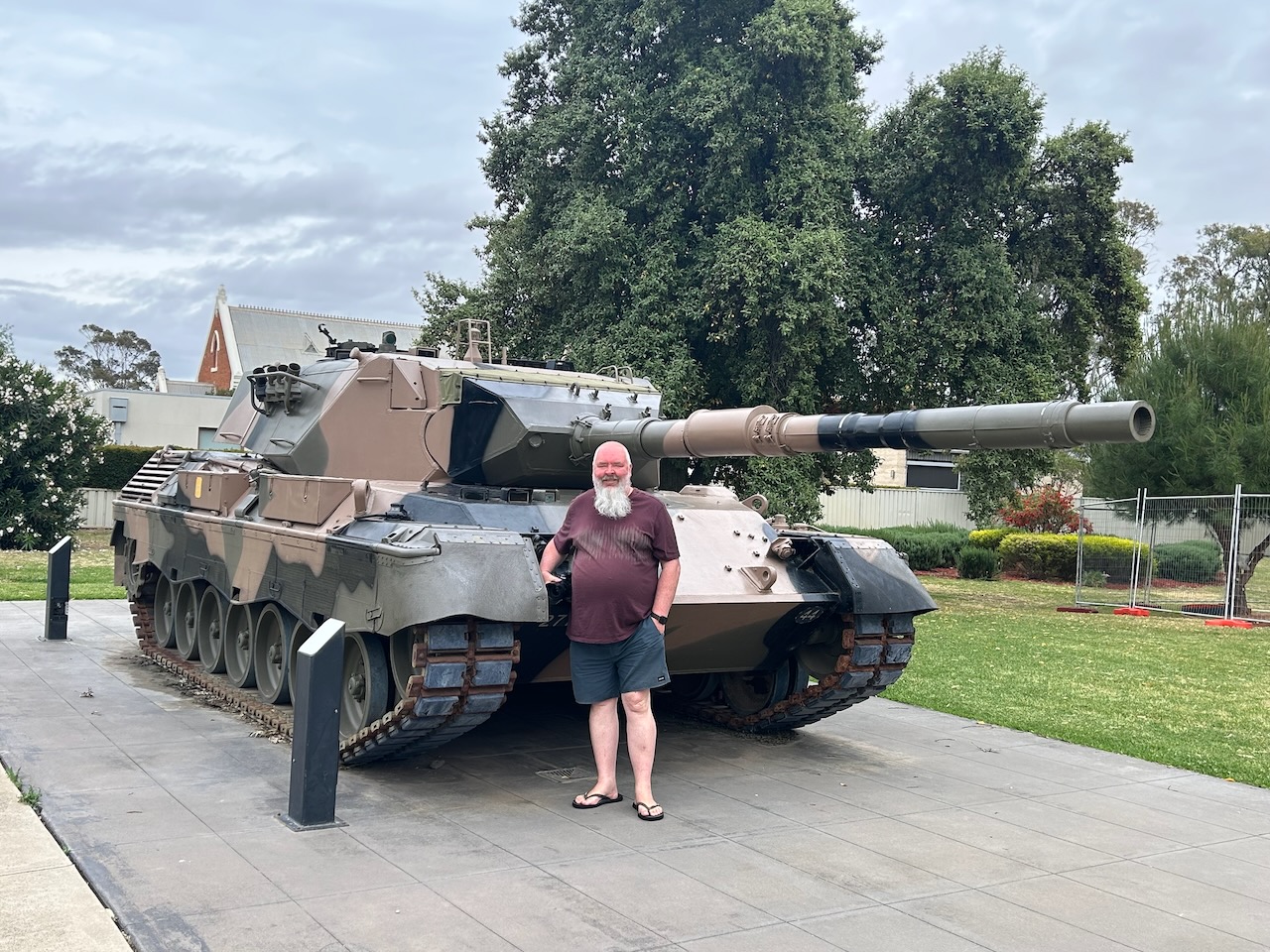
Also in Memorial Park is a decommissioned Leopard tank that was donated to the Jerilderie community.
Marija and I then headed towards our silo activations.
Along the way, we stopped to admire the majestic old Jerilderie Railway Station. It is a heritage-listed building on the now-closed Tocumwal line.
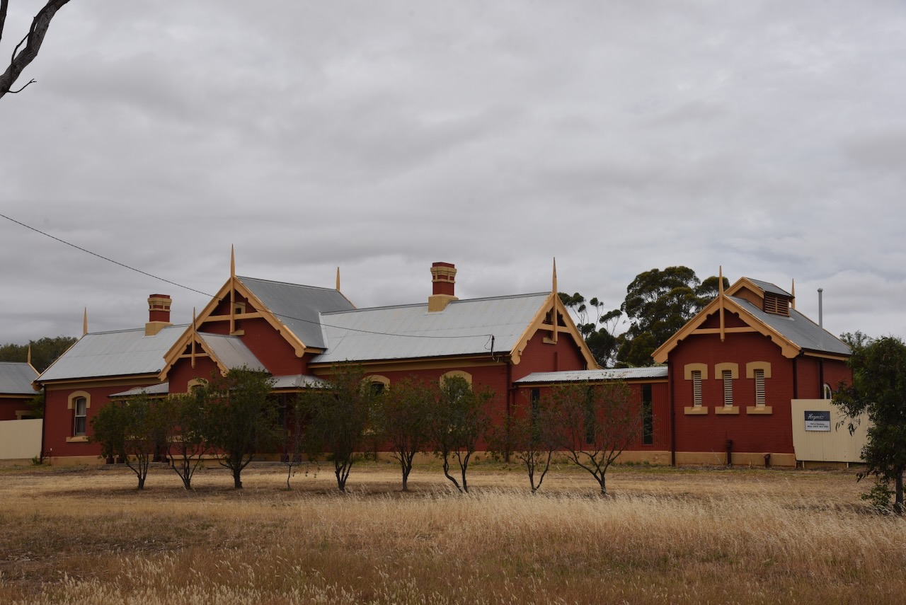
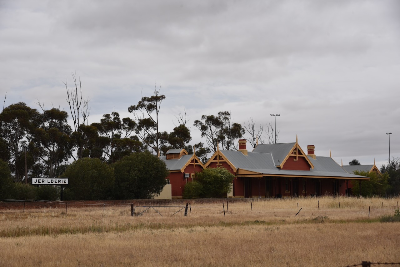
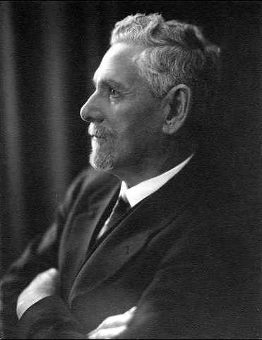
John Whitton was the designer of the station buildings. He was the Engineer-in-Charge for the New South Wales Government Railways and is considered the ‘Father of New South Wales Railways.’ They were constructed by Charles Hardy between 1884 and 1885. (Wikipedia 2024) (Wikipedia 2026)
Above: John Whitton. Image c/o Wikipedia
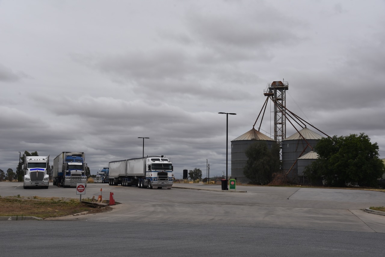
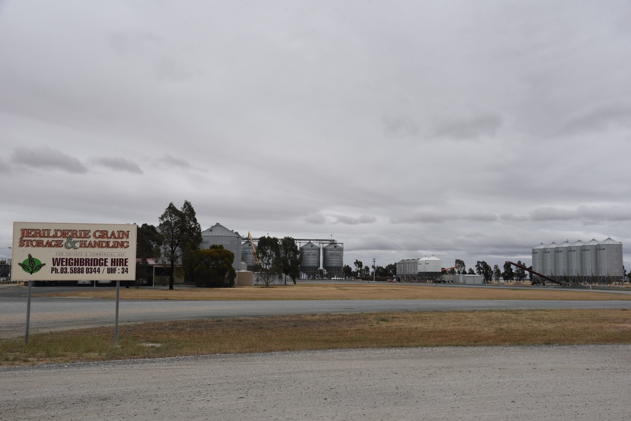
Interestingly, Marija and I did find some other silos in Jerilderie, which for whatever reason, are not currently in the Silos On The Air (SiOTA) program. They are located alongside the BP Truckstop on Southey Street.
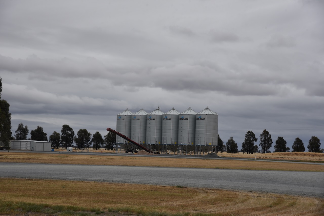
The Jerilderie silo VK-JRE2 is located on Cape Road. The site consists of 4 galvanised iron silos. They are located diagonally opposite the site of the Old Woolshed Inn.
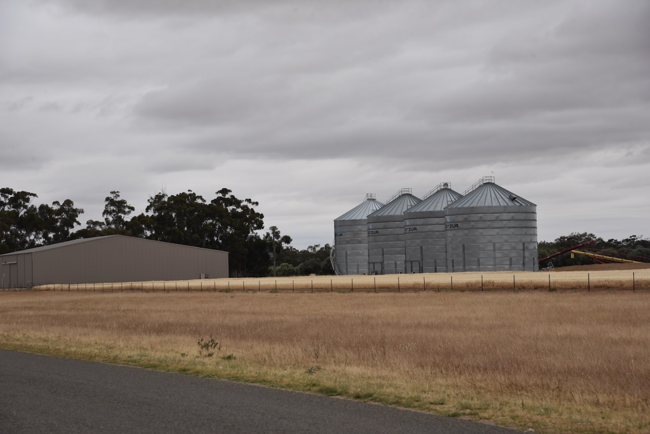
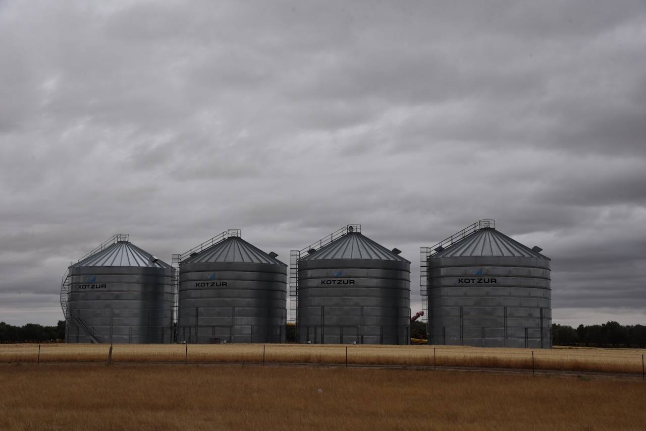
The Jerilderie North silo VK-JRH2 is located on the Newell Highway near the junction of Stock Route Road. It is run by Jerilderie Grain Storage & Handling. The business was established in 1990 as a farming enterprise. The rain storage and handling site was developed in 2000. (Jerilderie Grain Storage & Handling, 2017)
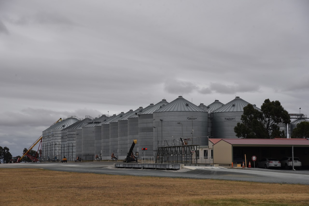
Marija and I found a spot just off the Newell Highway, which was in the activation zone of both silos. We operated from the 4WD, running the Icom IC-7000, 100 watts, and the Codan 930 antenna with the 1.5 metre stainless steel whip.
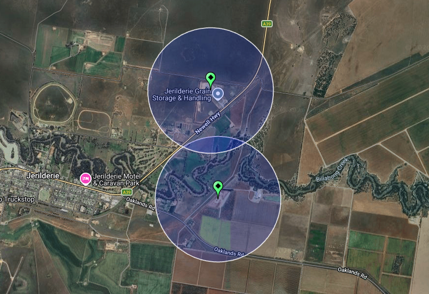
Above: the activation zones at the two silos at Jerilderie. Image c/o SiOTA website
Marija worked the following stations on 40m SSB:-
I worked the following stations on 40m SSB:-
References.
Today on a DX Net, the net control station in Australia came up to ask if the frequency was in use prior to commencing the net. His query was immediately responded to by an overseas station, which replied “the frequency is all yours……”. The particular VK in question and the DX station were about 2,700 kms apart. That is a big distance. At that distance, the DX station would potentially be hearing less or more on the frequency than the VK.
I have heard this practice regularly on this particular net, and also during recent park activations. I believe it is not a good practice to adopt.

Firstly…….listen, listen, listen. Before transmitting, listen on the frequency and above and below the frequency you intend to transmit on.

If you hear a station/s on the frequency, move either up or down the band and repeat the process…..listen, listen, listen. If you hear a station/s on a nearby frequency, move frequency and listen again. If you don’t hear anybody on the frequency, ask if the frequency is in use. If you get no response, ask again.
Even if you do not hear anything on the frequency, you should be asking if the frequency is in use. What you are hearing may be very different to amateurs in other parts of Australia or the world. There are occasions when you will hear all participants of a QSO on a frequency, and there are other times you will not. You may hear just one station. You might not even hear any of the stations using that particular frequency. It all depends on propagation and noise floors.
What is next after your query if the frequency is in use? If someone comes back and advises that the frequency is in use, then say thank you and find another frequency. But what might happen is that those in QSO on the frequency might not hear you, and you commence calling CQ. Then a third-party station listening in on the frequency tells you the frequency is in use. Sometimes this may be a friendly comment, other times not. Again, say thank you, and move on.

And while on the subject of nets. Nobody ‘owns’ a frequency. Comments such as ‘we have been on this frequency for 20 years’ and ‘they should know about our net’ are not relevant. I have heard such comments being made by net controllers or net participants to those who have dared to be on a frequency prior to a net starting up.

I am a Net Controller on the Australia New Zealand Africa (ANZA) DX Net, and if I hear a station on the nominated frequency of the net, I will ALWAYS move the net away from that frequency. I might try contacting the station and politely asking them if they would be prepared to move. It all depends on how busy the station is, how strong they are, etc. Sadly, the same cannot be said for some other net controllers of various nets, particularly down on the 80m band. Even if they hear a station on the net frequency or close by, they start the net up anyway.
On one particular evening, when on the 80m band, whilst activating a park, I was asked to move a total of 3 times. The first request to move was a very polite one as their net was about to commence. As a result of the very polite request, I moved up the band. On the second frequency, I was asked again to vacate the frequency as a net was about to commence. This request was less cordial, but not wanting a conflict, I moved frequency. I commenced calling CQ on the third frequency, and I was asked if I could move as their net was about to start. When asked when the net commenced, I was told ‘in about 35 minutes’.
Amateurs are not expected to know the time and frequency of the hundreds of nets that are on the amateur radio bands.
In summary, listening and asking if the frequency is in use is a courteous practice to adopt. I am amazed at how many amateurs do not do this, and just come up on a frequency and start causing QRM. And a reminder that when I last checked, Australian nets do not lease particular frequencies from the ACMA. If you are a net controller, be prepared to either use diplomacy or move the net.
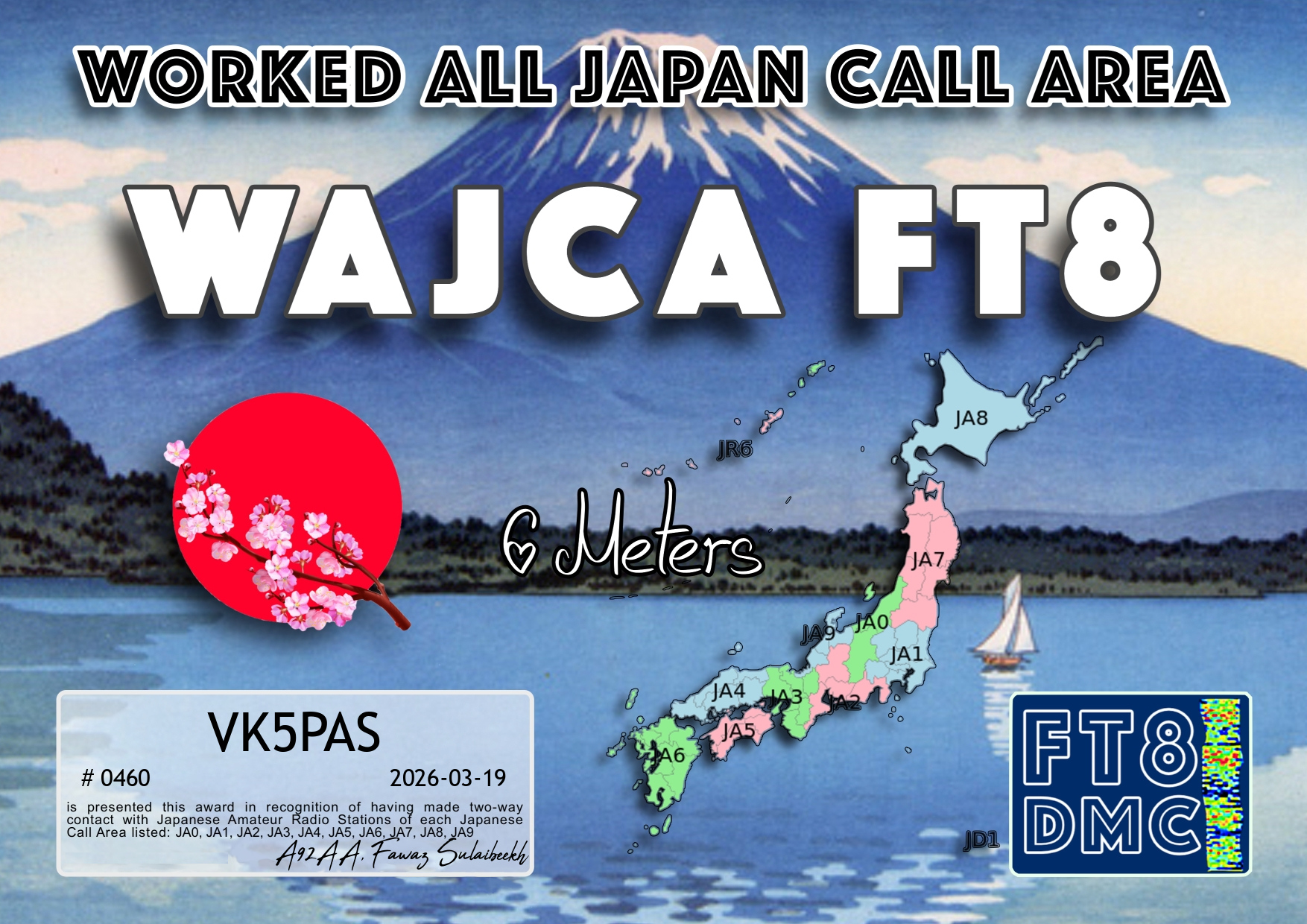
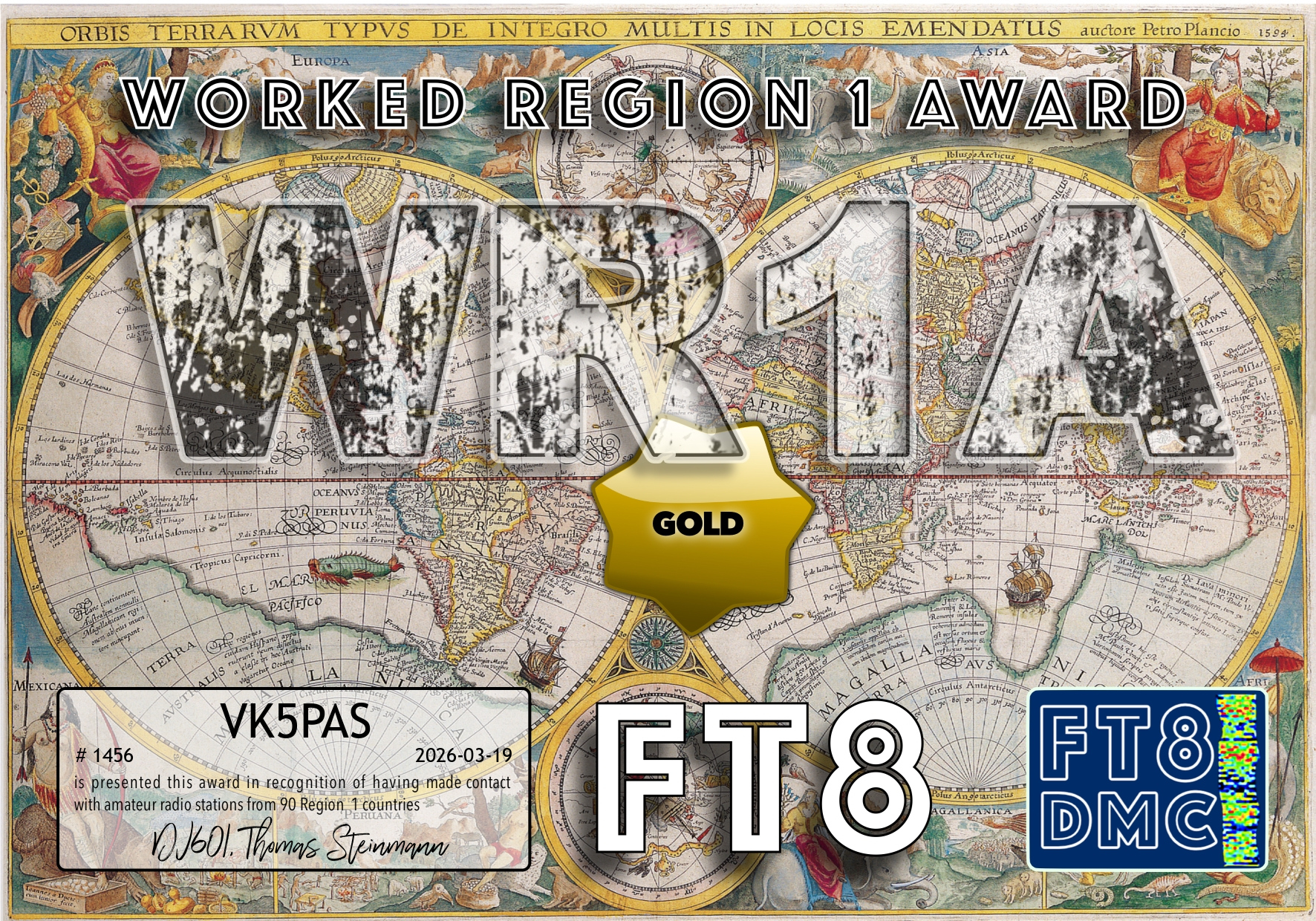
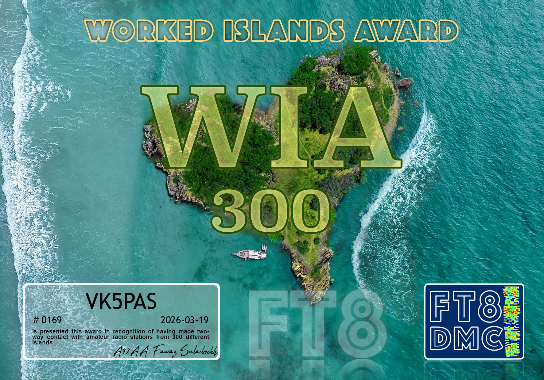
Here are my latest FT8 award certificates for VK5PAS.
Thank you to all of the FT8 operators and thank you to the various FT8 Award Managers.


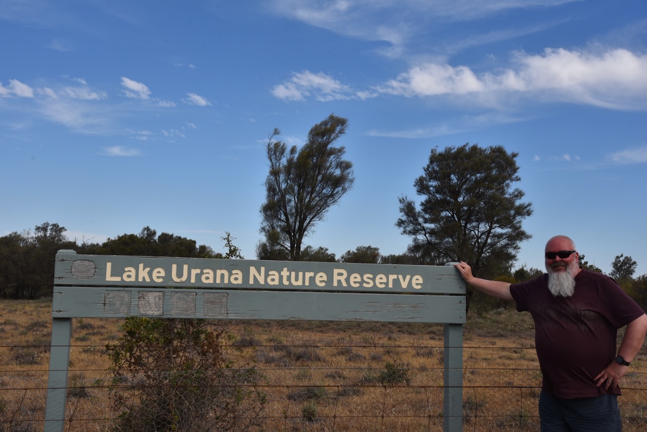
Our final activation for Sunday, 2nd November 2025, was Lake Urana Nature Reserve VKFF-1956. The reserve is located just to the northwest of the town of Urana, and about 45 km east of Jerilderie.
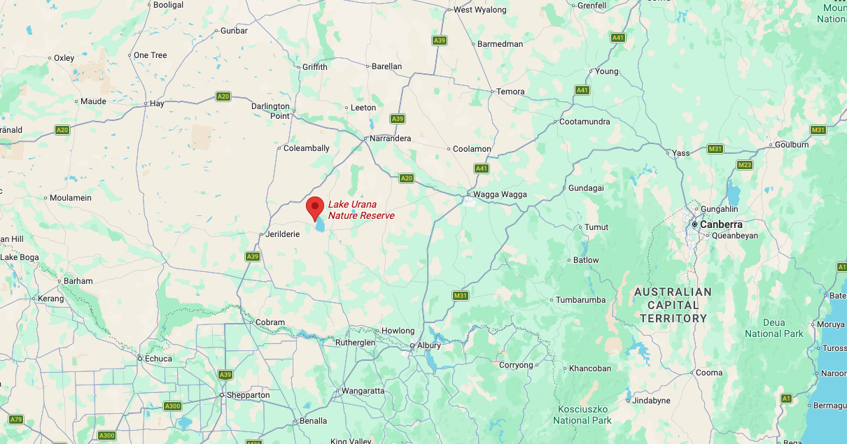
Above: Map showing the location of Lake Urana Nature Reserve. Map c/o Google Maps
We headed west out of Urana on Cocketgedong Road. What a name! We turned onto Dunraven Road and commenced travelling towards the reserve.
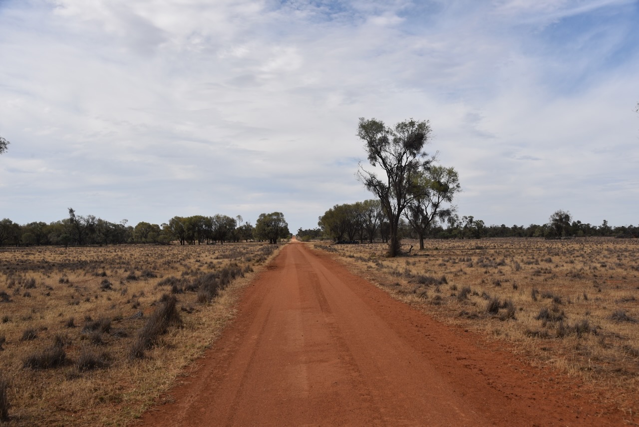
A little way along the dirt road, we reached the park sign.
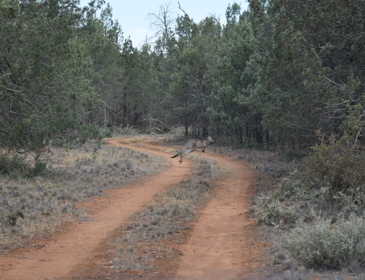
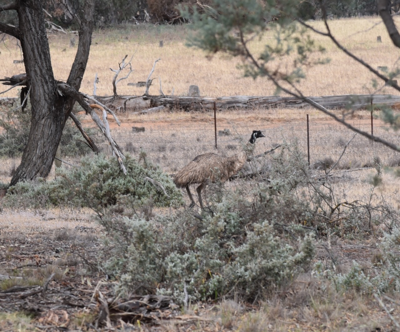
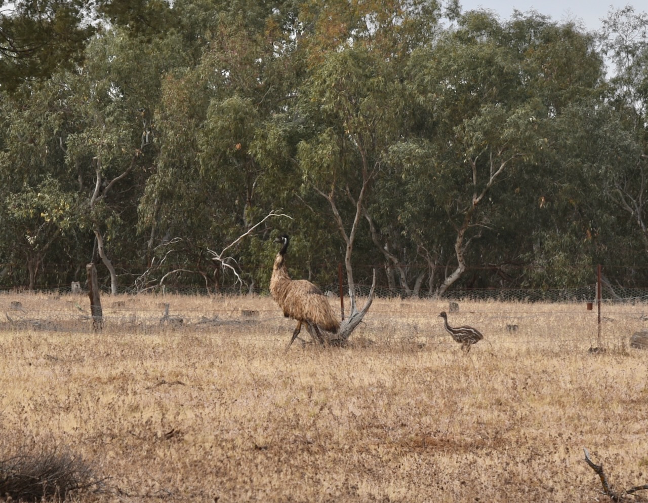
We entered the reserve and drove along a dirt track, trying to find a clearing in the scrub to set up in. it was slow going as the reserve was full of emus and Eastern grey kangaroos. It was a great sight.
Lake Urana Nature Reserve is located on the western shore of Lake Urana. A section of South West Woodland Nature Reserve VKFF-2724 can be found on the eastern side of the lake.
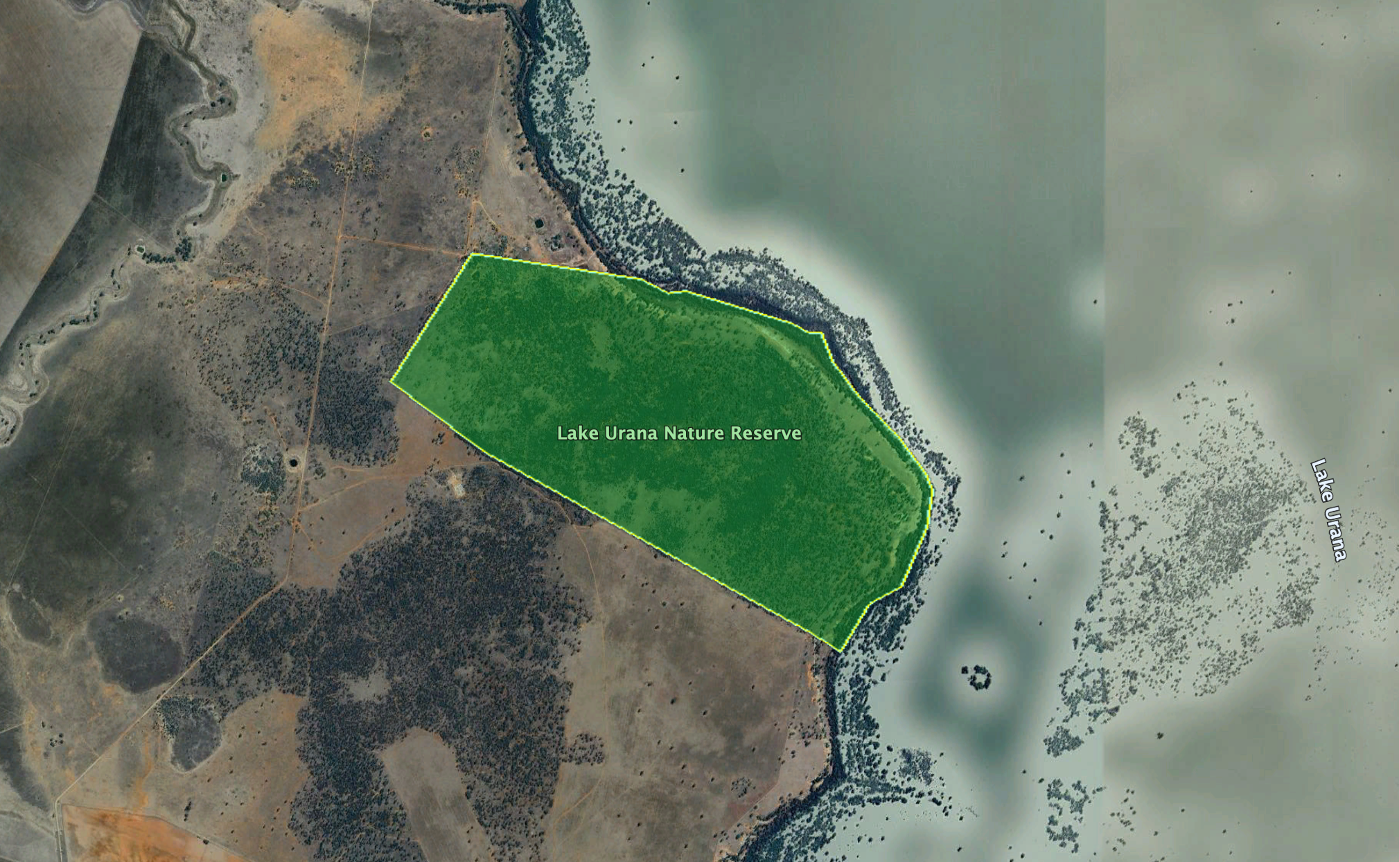
Above: the reserve’s boundaries. Image c/o Google Earth
The reserve is about 302 hectares in size and was established on the 4th day of April 1996. (CAPAD 2024)
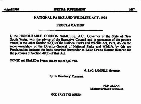
Above: Gazettal of the reserve, NSW Govt Gazette, Thu 4 Apr 1996. Image c/o Trove
Lake Urana is a large shallow, intermittent lake in a depression at the end of the drainage basin of Billabong, Coonong and Urangeline creeks. It fills every ten to 20 years and retains water for several years. The lake is kidney-shaped and has a surface area of about 61.43 km2. (NSW NPWS n.d.) (Wikipedia 2024)
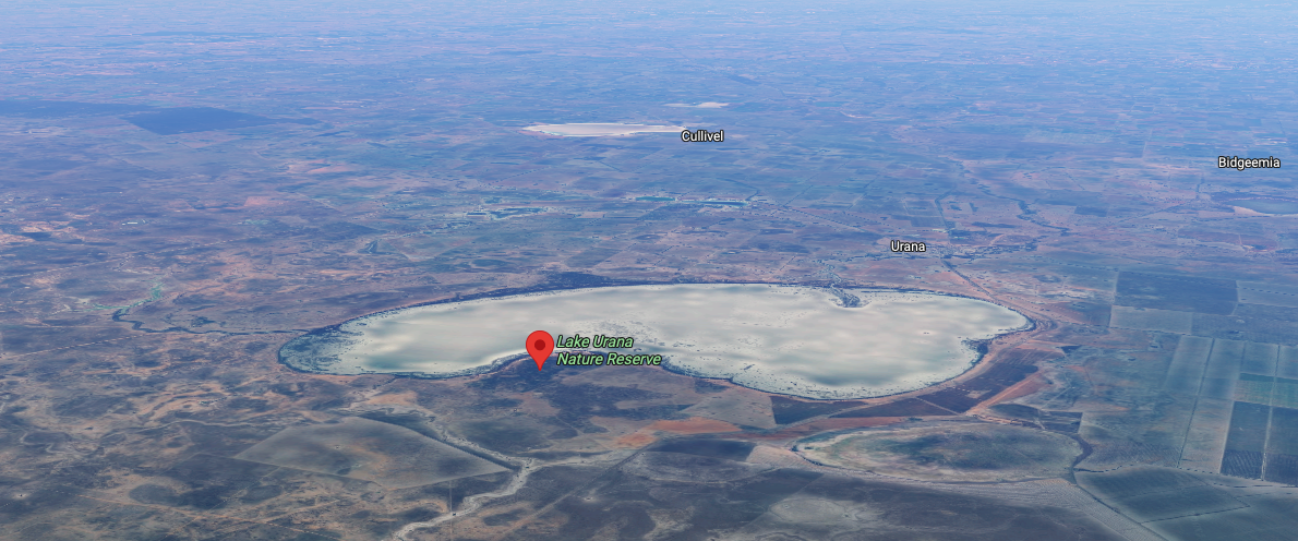
Above: an aerial view of the reserve. Image c/o Google Maps
It appears that prior to the National Parks & Wildlife Service acquiring the property, duck hunting occurred at Lake Urana. I found several newspaper articles about this.
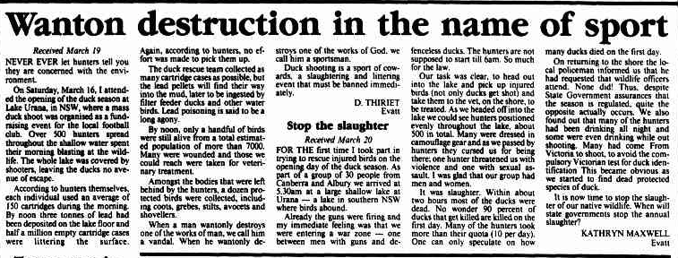
Above: article from The Canberra Times, Thu 21 Mar 1991. Image c/o Trove
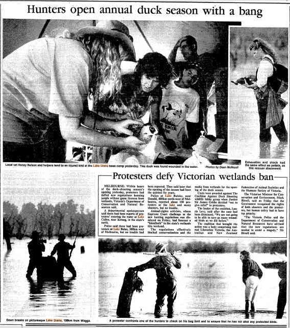
Above: article from The Canberra Times, Sun 21 Mar 1993. Image c/o Trove
Aboriginal burial sites, grinding dishes and ovens have been discovered in the lunette on the eastern side of Lake Urana. The skeletal remains at this site have been dated between 25,000 and 30,000 years old. (NSW NPWS 2001)
Lake Urana Nature Reserve was formerly a sheep grazing property. In 1966, the CSIRO purchased the property. In 1992, the New South Wales National Parks & Wildlife Service purchased the property with the intention of creating the reserve. (NSW NPWS 2001)
A total of 37 bird species have been recorded, including red-rumped parrot, brown treecreeper, striated pardalote, spiny-cheeked honeyeater, striped honeyeater and grey-crowned babbler. When Lake Urana contains water, various waterbirds frequent the reserve, including wood ducks, Pacific black duck, Australian grey teal, yellow-billed spoonbill, black-fronted dotterel and magpie-lark. (NSW NPWS n.d.)
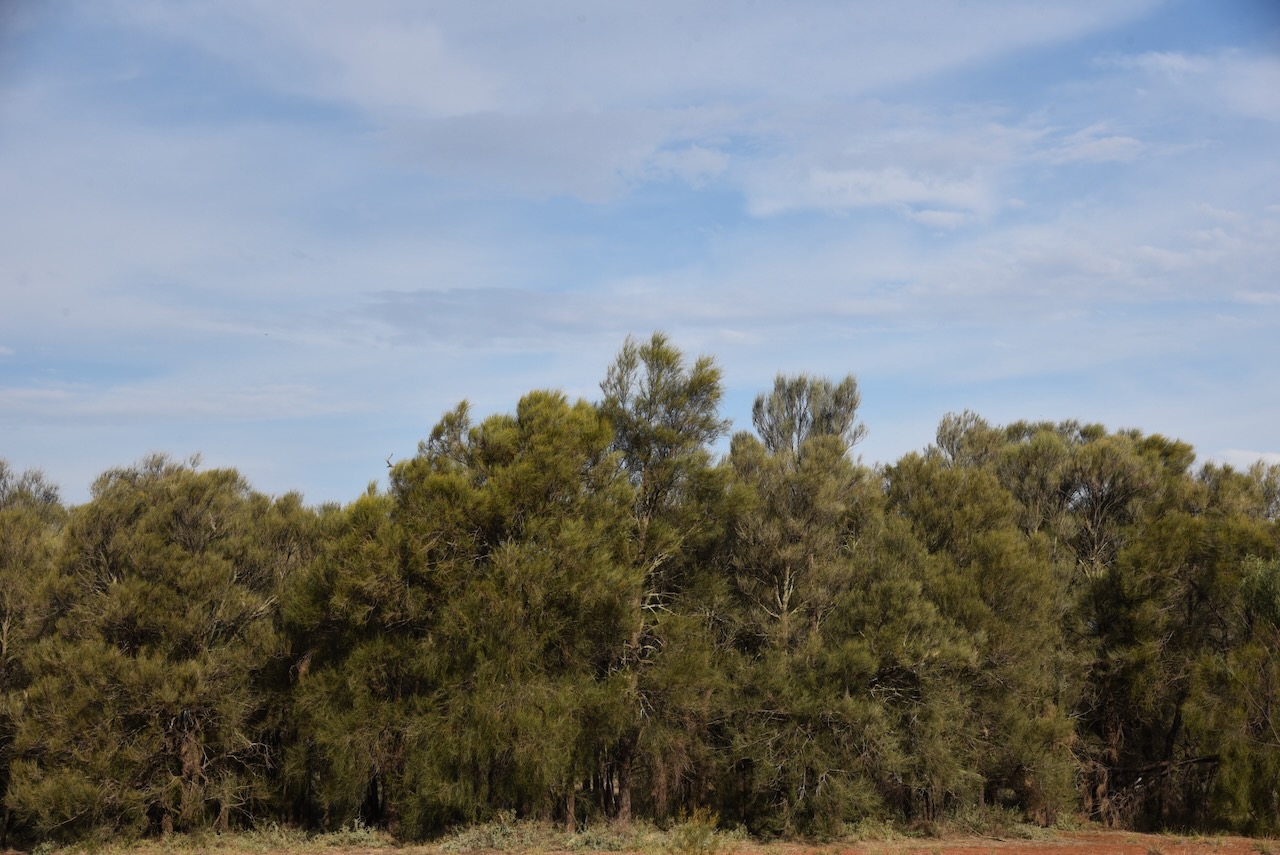
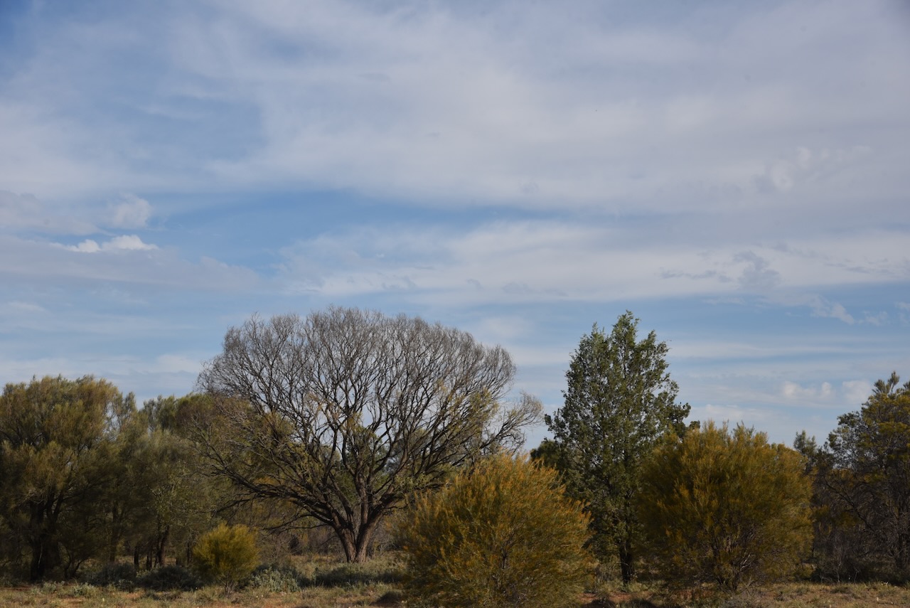
The reserve contains woodland of yellow box and white cypress pine. Shrubs that can be found in Lake Urana Nature Reserve include thorny saltbush, ruby saltbush, western golden wattle, emu bush and black cottonbush. Over 70 species of ground cover have been recorded in the park, including wiregrass, speargrass and several lilies, including nodding chocolate-lily. A narrow woodland of river red gum can be located on the shore of the lake. (NSW NPWS n.d.)
We ran the Yaesu FT857, 40 watts, and the 20/40/80m linked dipole for this activation.
The flies were absolutely relentless, so we both had to wear our fly netting hats.
Marija worked the following stations on 40m SSB:-
Marija worked the following stations on 20m SSB:-
I worked the following stations on 40m SSB:-
I worked the following stations on 20m SSB:-
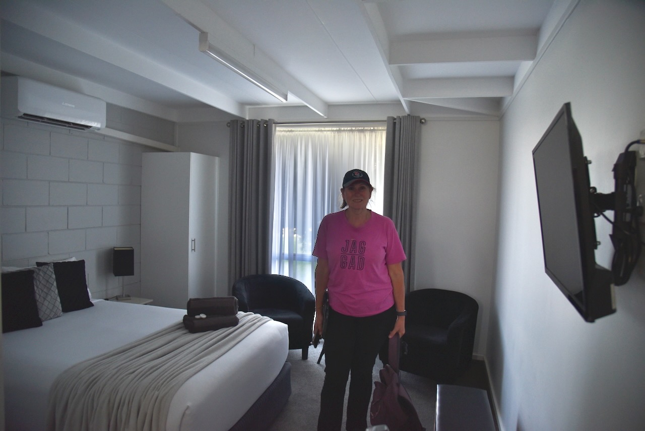
After qualifying the park, Marija and I packed up and headed into Jerilderie, where we booked into our accommodation at the Jerilderie Motel.
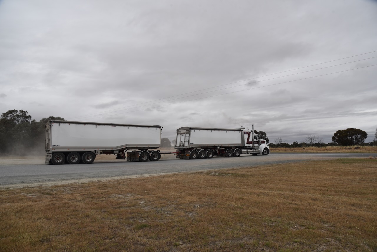
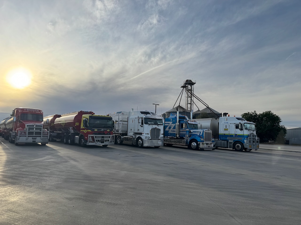
We then drove to the BP truckstop at the western end of town and filled up with diesel. I took some photos of the trucks lined up for our grandson Flynn, who is truck mad.
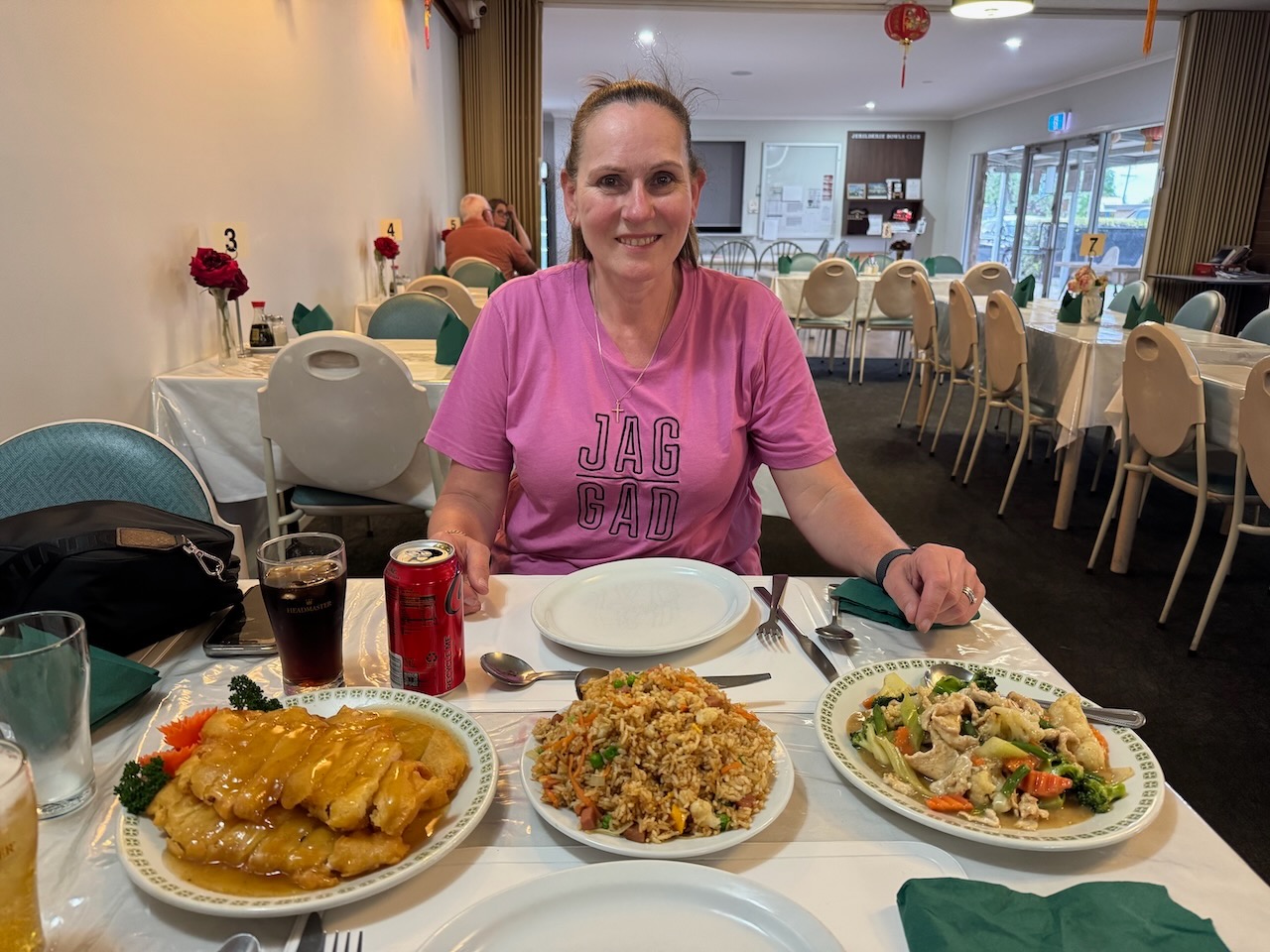
We then went out for dinner at the Jerilderie Sports Club. They have a Chinese restaurant there, and wow, what a meal. There was so much that we had to get some ‘doggy bags’ to take away our leftovers. It was one of the best Chinese meals that Marija and I have had.
With a very full belly, it was time to head back to our motel room for a good night’s sleep.
References.
Our next silo activation for Sunday, 2nd November 2025, was the Urana silo VK-URA2.
Above: Map showing the location of Urana, NSW. Map c/o Google Maps
It is believed that Urana is derived from the Wiradjuri Aboriginal word ‘airana’ which is used to describe a temporary shelter. Others suggest ot comes from ‘aurana’ meaning camping ground.
Prior to European occupation, the area was inhabited by the Wiradjuri Aboriginal people. During the 1850s, European settlers commenced taking up land in the district. In 1859, Surveyor Hayes approved a design for the town of Urana.
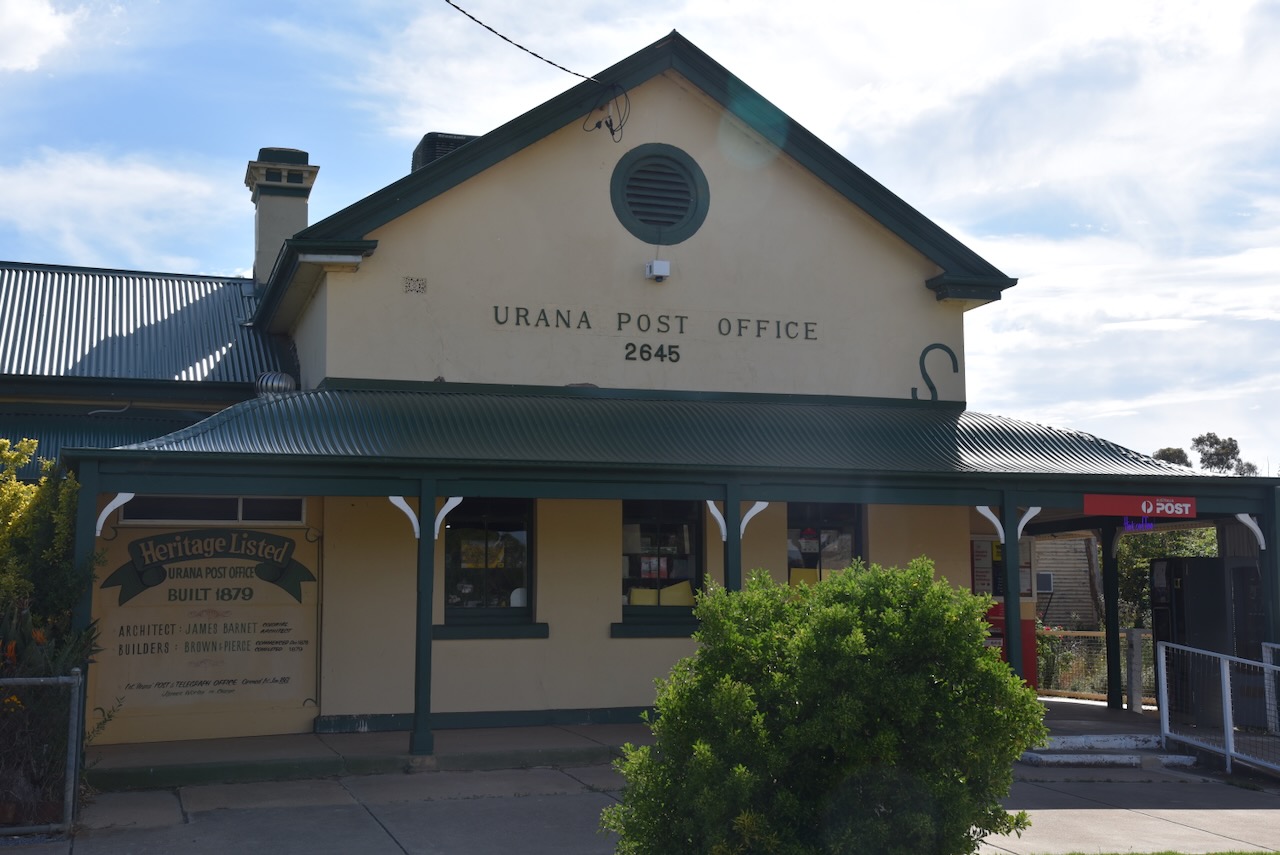
On the 1st day of January 1861, the Urana Post Office was opened.
In 1866, the Urana township comprised two public houses, a post office, two large stores, a police station and lock-up, the Urana Hotel and the Royal Hotel. (Wikipedia 2026)

Urana has seen bushranger activity, including that of John Fuller, alias Daniel Morgan and ‘Mad Dog Morgan’. He was born on the 30th day of April 1830, at Appin, New South Wales.
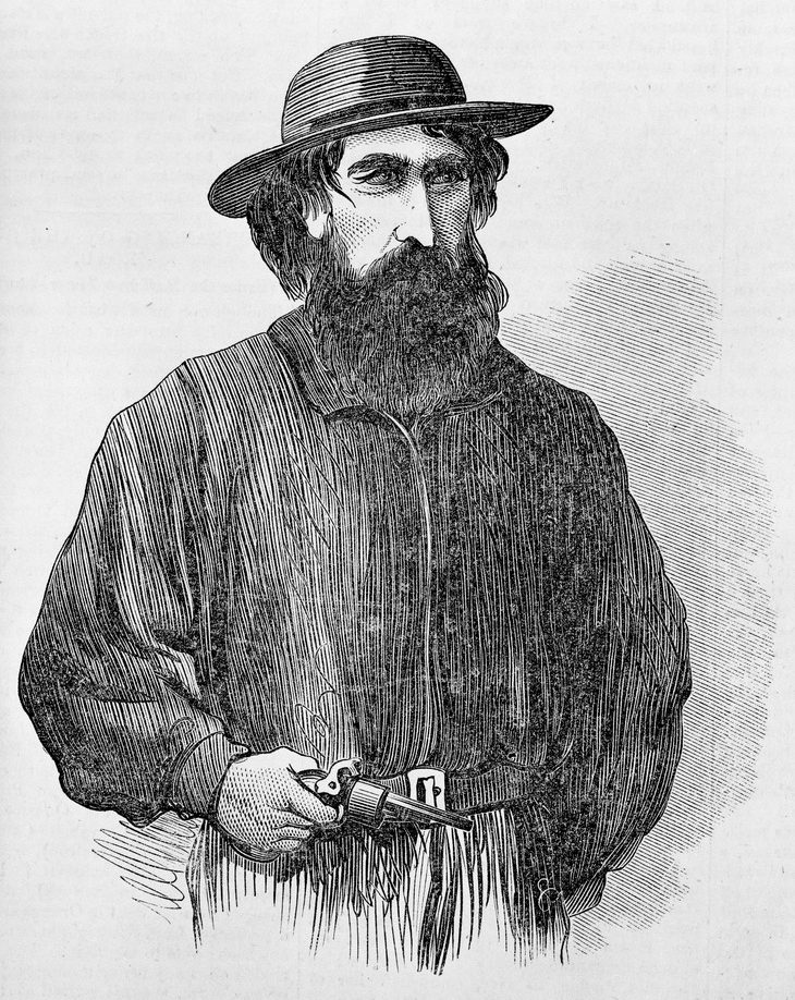
Above: the bushranger Daniel Morgan. Image c/o Wikipedia
Morgan teamed up with a man known as ‘Flash Clarke’ and ‘German Bill’. His true identity was never discovered. (A Guide to Australian Bushranging 2019) (Wikipedia 2023)
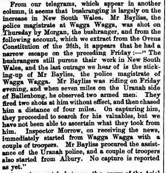
On Thursday, the 20th day of August 1863, Henry Bayliss, the Police Magistrate from Wagga Wagga, was riding along the road from Bullenbong to Brookong Station en route to Urana to attend court. He encountered Morgan and Clarke who attempted to rob Bayliss. They were armed with pistols and shotguns. (A Guide to Australian Bushranging 2019) (Wikipedia 2023)
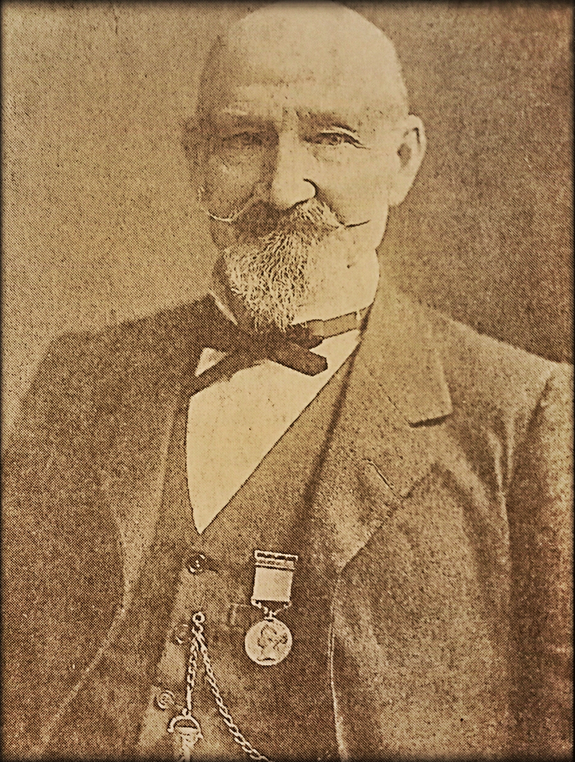
Above: Henry Bayliss. Image c/o Wikipedia
Bayliss galloped away on his horse but was pursued and fired upon. He was eventually apprehended by the bushrangers who demanded his valuables. Bayliss refused and threats were made that he would be shot. Bayliss handed over his watch and £4. Upon learning the identity of their victim, Morgan returned the money and watch that he had taken from Bayliss. Morgan and Clarke cut down a telegraph pole, which cut off all communication between Urana and Wagga Wagga, and they rode off. (A Guide to Australian Bushranging 2019) (Wikipedia 2023)
Above: article from the Leader, Melbourne, Sat 5 Sep 1863. Image c/o Trove
Bayliss rode to Urana and telegraphed Wagga Wagga via Melbourne. Headed by Sub-Inspector Morrow, a team of police headed to Urana. The party also included Constable Brown and Constable Charlton. Bayliss then led the party of police in search of Morgan and Clarke. £4 (Wikipedia 2023)
On Wednesday, the 26th day of August, Bayliss and the police discovered a camp in dense scrub about ‘seven miles’ from Urangaline Creek only a short distance from Urana. Items belonging to the bushrangers, including Morgan’s distinctive poncho and a bible were located. Morgan and Clarke were not present. Sub-Inspector Morrow, Trooper Brown and Baylis remained at the camp awaiting the return of Morgan and Clarke. (Wikipedia 2023)
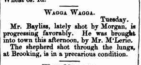
Late that evening, Constable Brown heard noises in the scrub. It was reported that Bayliss scoffed and stated the noise was due to a possum. Bayliss and his team heard a noise near the camp. They advanced and shots rang out. Bayliss was shot in the right chest and fell to the ground. The police fired upon the camp, however Morgan and Clarke decamped. Constable Brown rode to Wagga Wagga and alerted others to what had occurred. (Wikipedia 2023)
On Thursday, the 27th day of August, a shepherd named Haley was confronted and shot by two men suspected to be Morgan and Clarke. It was reported that this was retribution for the shepherd providing information to the police regarding the location of Morgan and Clarke’s camp at Urangaline Creek. (A Guide to Australian Bushranging 2019) (Wikipedia 2023)
Above: article from The Kiama Indpendent, Tue 8 Sept 1863. Image c/o Trove
Clarke had been severely wounded in the shootout with the police. Morgan took him to Mahonga Station, southeast of Urana. I have a connection with Mahonga Station myself. My great-great-great-grandfather William Slade, was a boundary rider at Mahonga. My great-great-grandfather, Matthew Slade was raised there as a child. (A Guide to Australian Bushranging 2019) (Wikipedia 2023)
Clarke died at Mahonga Station due to his gunshot wounds. He was taken to a remote location on the station, and MLorgan then rode off. Several years later a decomposed body was located on the run. The body was wearing the black coat that Clarke was wearing on the night of the shootout. (A Guide to Australian Bushranging 2019) (Wikipedia 2023)
Following the shootout, Baylis offered a reward of £200 for “any person who shall give such information as will lead to the apprehension of the offender”. (A Guide to Australian Bushranging 2019) (Wikipedia 2023)
Morgan continued his bushranging activities, which included several murders, arson, and armed robbery. In April 1865, Morgan was shot and killed near Wangaratta, Victoria. He was 34 years old. (A Guide to Australian Bushranging 2019) (Wikipedia 2023)
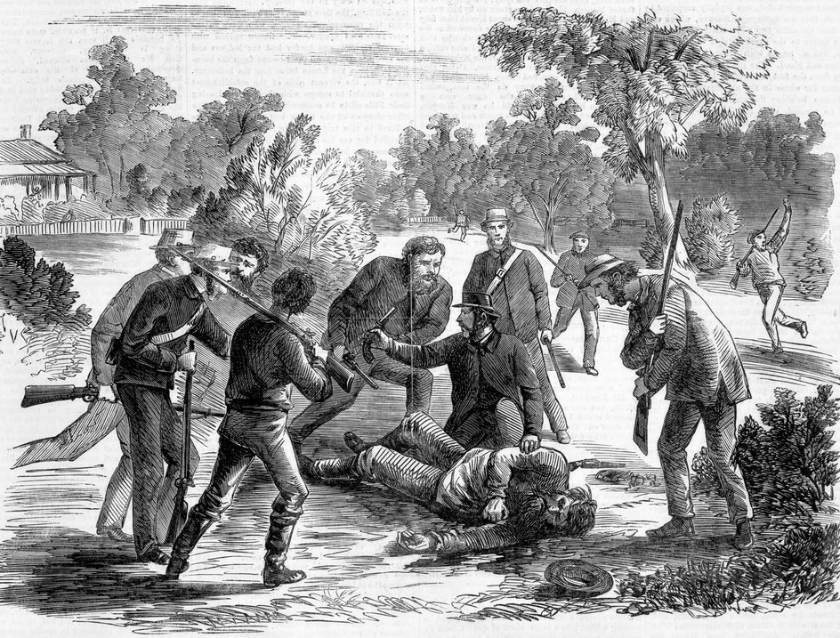
Above: the capture of Morgan. Image c/o Wikipedia
Bayliss was paid £1500 in compensation, but this was subsequently reduced to £300. The authorities did this to discourage others injured in the line of duty from seeking a payout. Bayliss was presented with a bravery medal. Upon his retirement, Bayliss was presented by his fellow Magistrates with the bullet which had struck him. It was enclosed in a gold casket suspended to a watch chain. (A Guide to Australian Bushranging 2019) (Trove 2026)
Above: article from the Ovens and Murray Advertiser, Sat 18 Dec 1875. Image c/o Trove
Below is a very good video on the life of the bushranger Morgan.
The Urana silos are located on Stephen Street on the eastern side of the town.
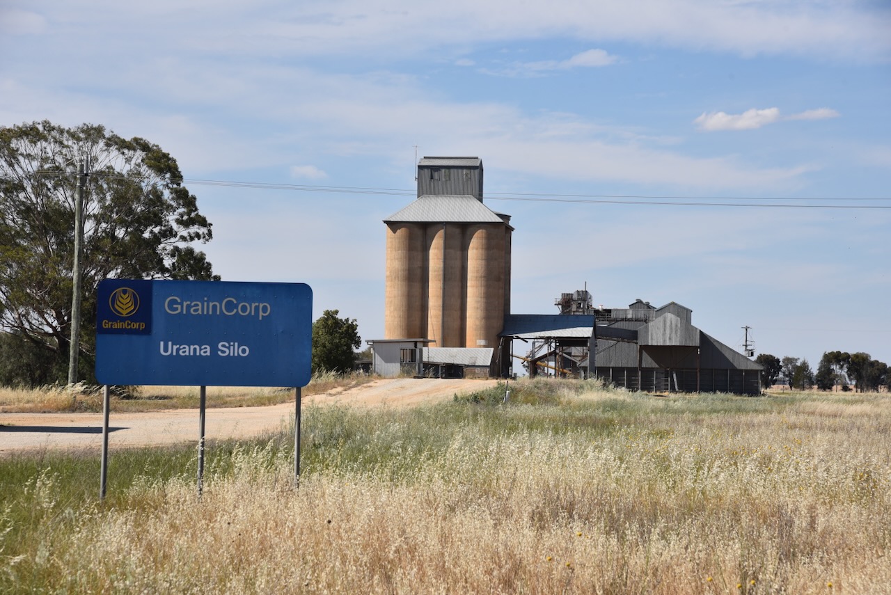
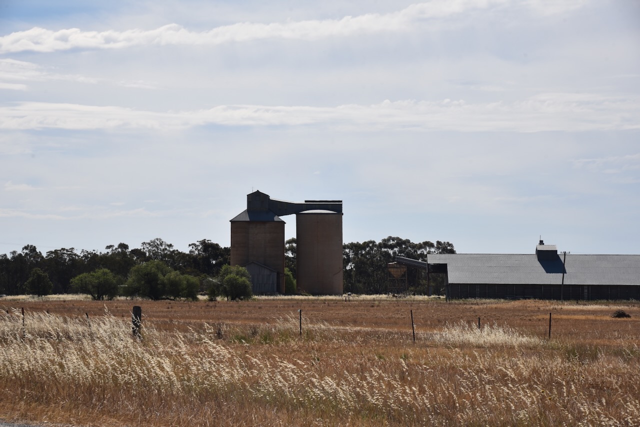
Marija and I parked the 4WD on Stephen Street opposite the silos. We ran the Icom IC-7000, 100 watts, and the Codan 9350 antenna with the 1.5 metres stainless steel whip.
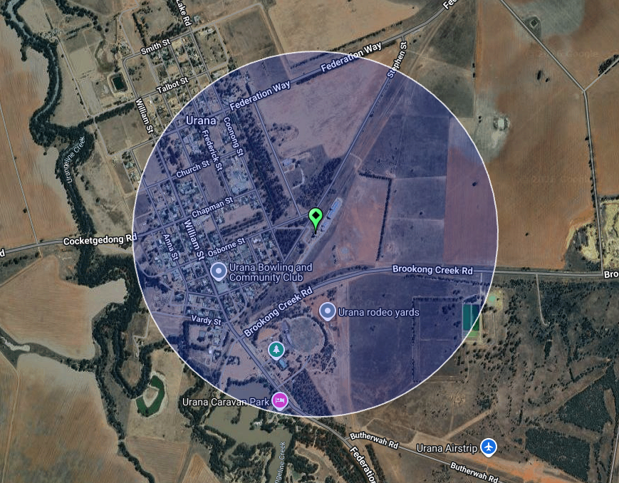
Above: the activation zone at the Urana silo. Image c/o SiOTA website
Marija worked the following stations on 40m SSB:-
I worked the following stations on 40m SSB:-
References.
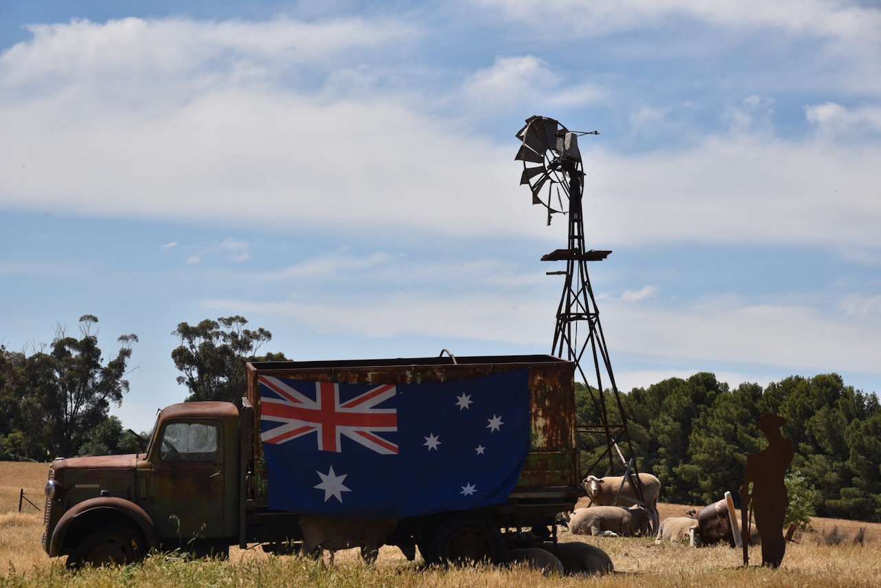
On Sunday, 2nd November 2025, Marija and I left Mibrulong and drove west on the Lockhart-The Rock Road. We drove past this farmer’s obvious tribute to the military.
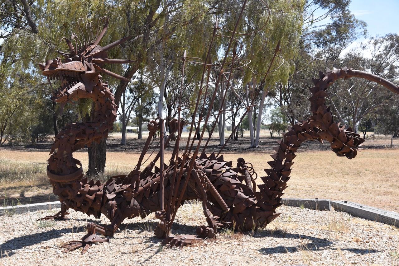
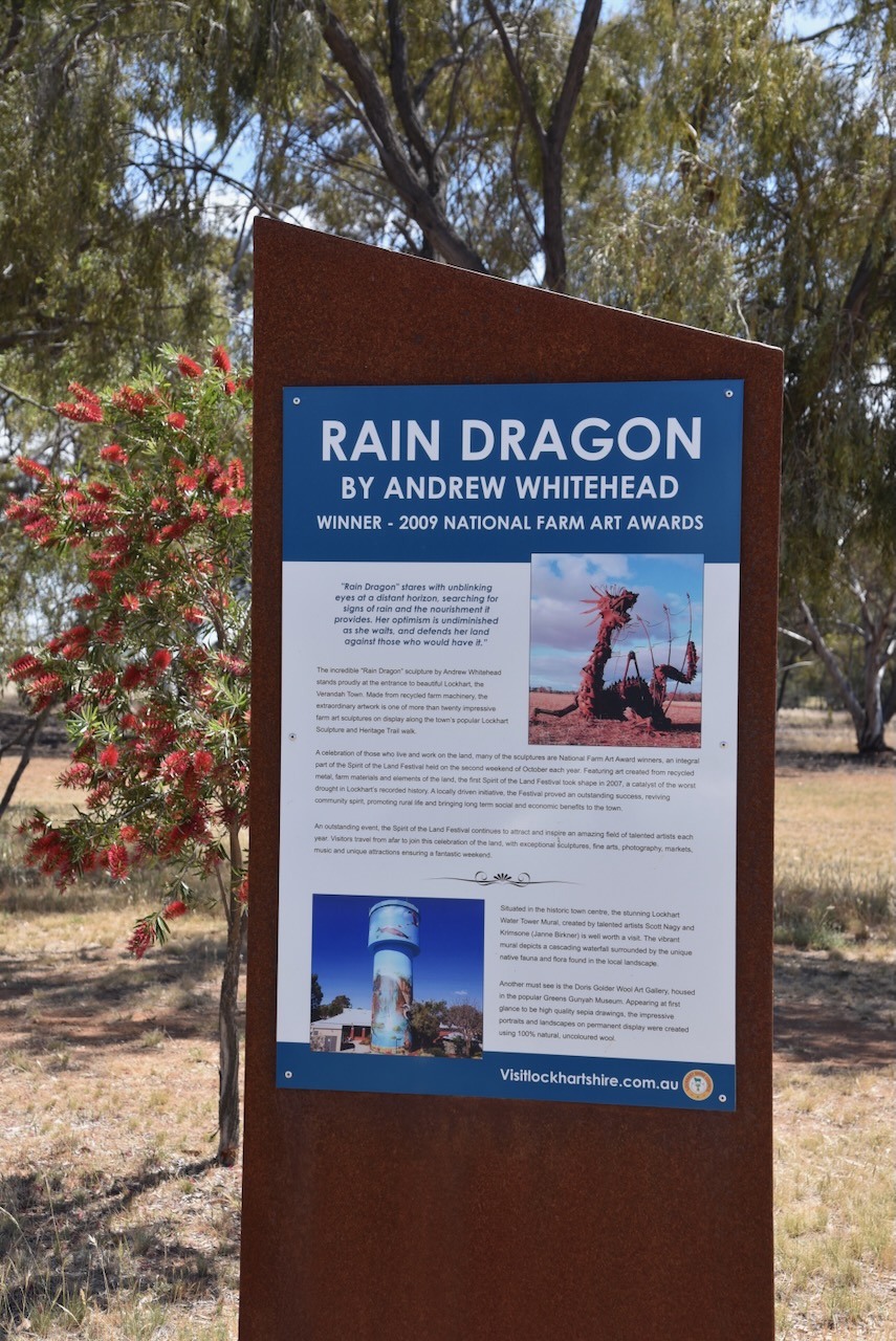
At the entrance to Lockhart is the ‘Rain Dragon’ sculpture. It is the work of Andrew Whitehead and is made from recycled farm machinery. It is one of 20 farm art sculptures on Lockhart’s Sculpture and Heritage Trail walk.
The town was originally called Greens Gunyah, named after an early settler, Mr Green. He was a stockman who ran a grog shop on the Urana – Wagga Wagga stagecoach route. (Wikipedia 2021)
On the 16th day of May 1882, the Ferriers Post Office opened and was later renamed Lockhart in November 189). (Wikipedia 2021)
In 1897, the town was renamed Lockhart, in honour of Charles Gordon Norman Lockhart, who was a Commissioner for Crown Lands in the Murrumbidgee River district during the 1850s. Lockhart was born in July 1808 in Lanarkshire, Scotland. He emigrated to Australia, and in August 1850, he married Frances Caroline Fartier. He died in February 1893 in London. (ancestry 2016) (Wikipedia 2021)
In 1897, the Wagga Wagga Advertiser reported the following:
“Lockhart, formerly called Green’s Gunyah……is in the centre of a large agricultural district, the soil of which is stated to be equal to any in the colony for wheat growing purposes.” (Trove 2026)
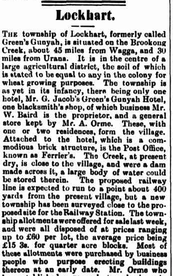
Above: part of an article from the Wagga Wagga Advertiser, Tue 27 Apr 1897. Image c/o Trove
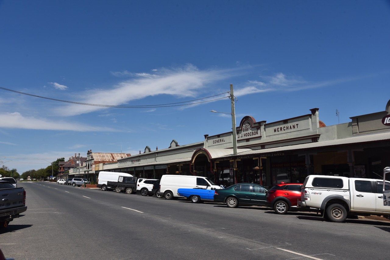
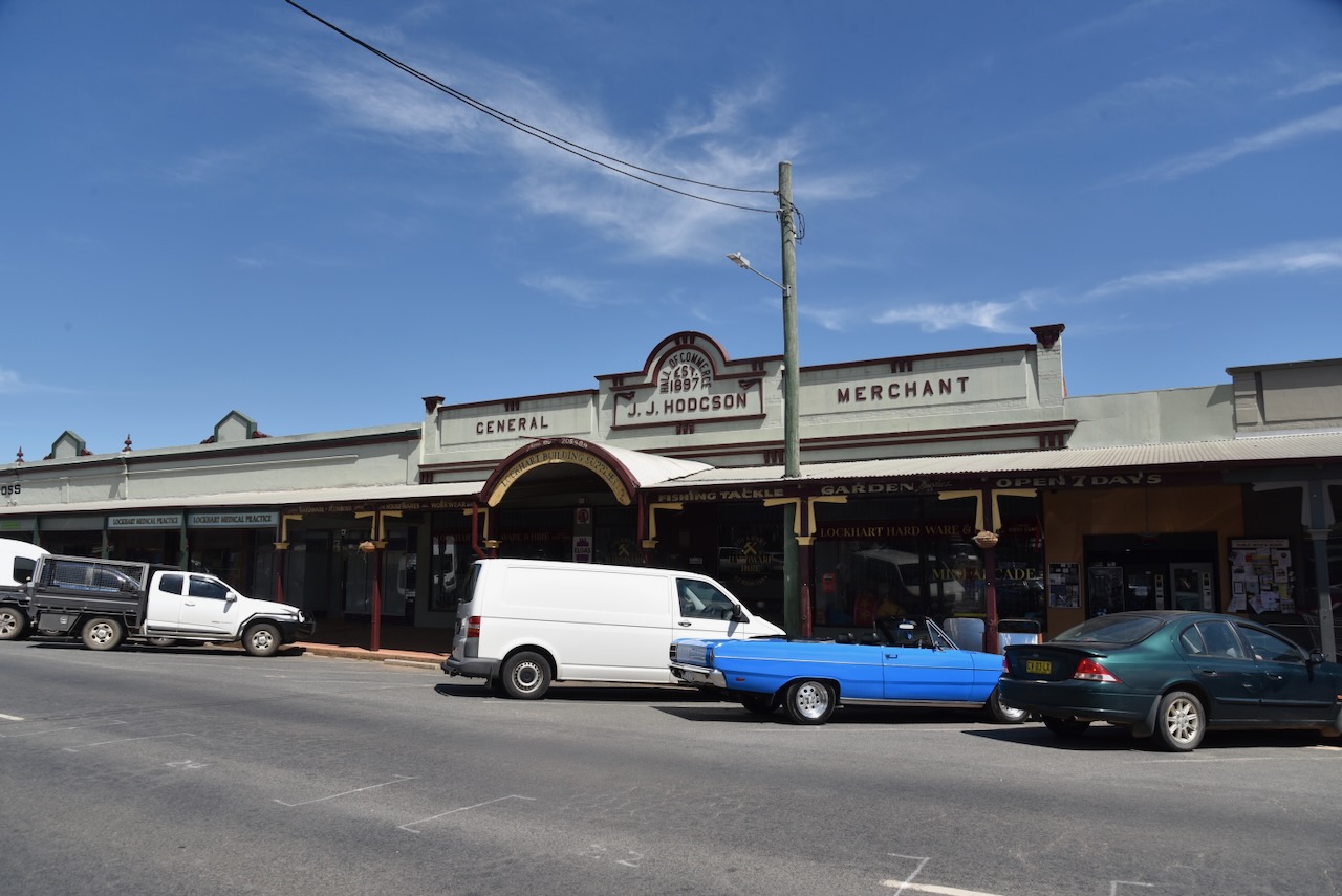
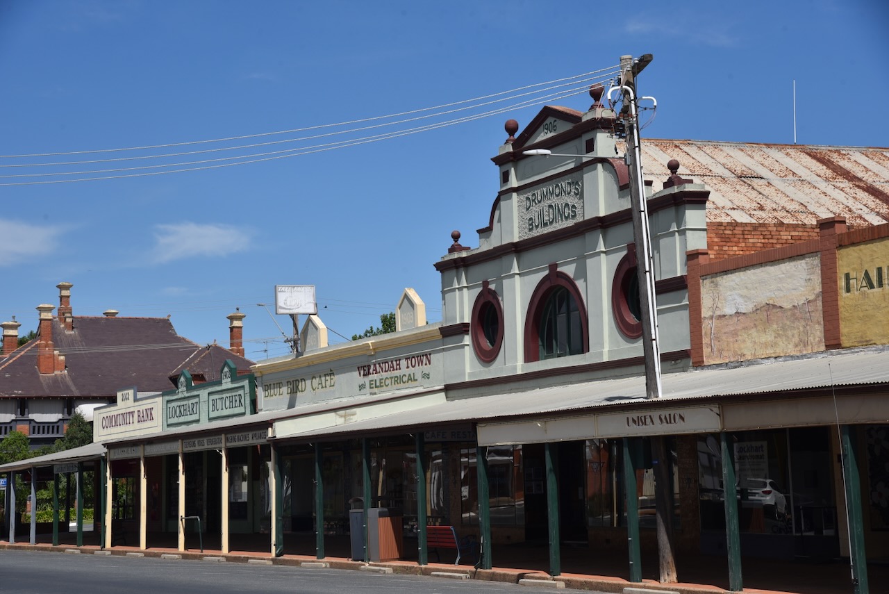
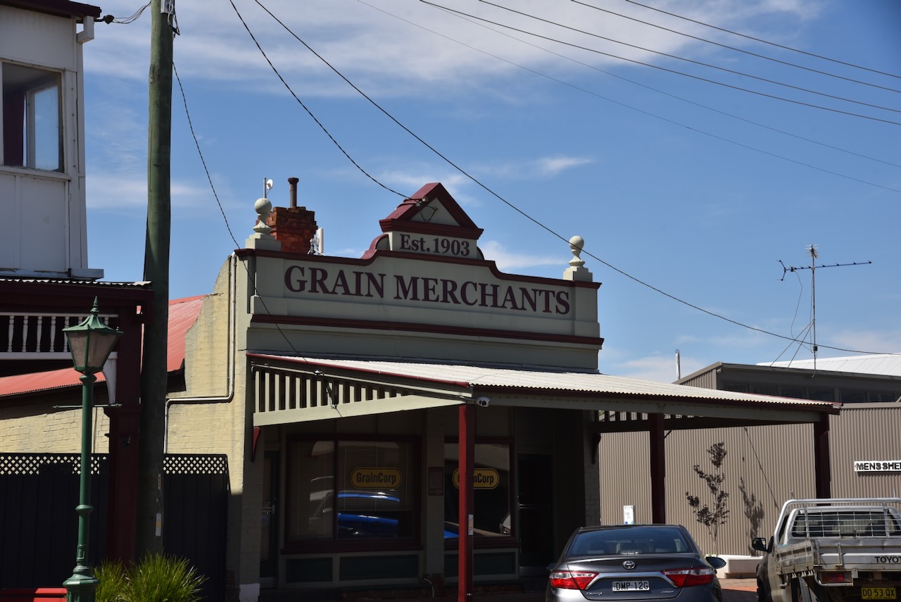
Lockhart is known as the Verandah town due to its heritage-listed buildings in the main street, which feature grand verandahs.
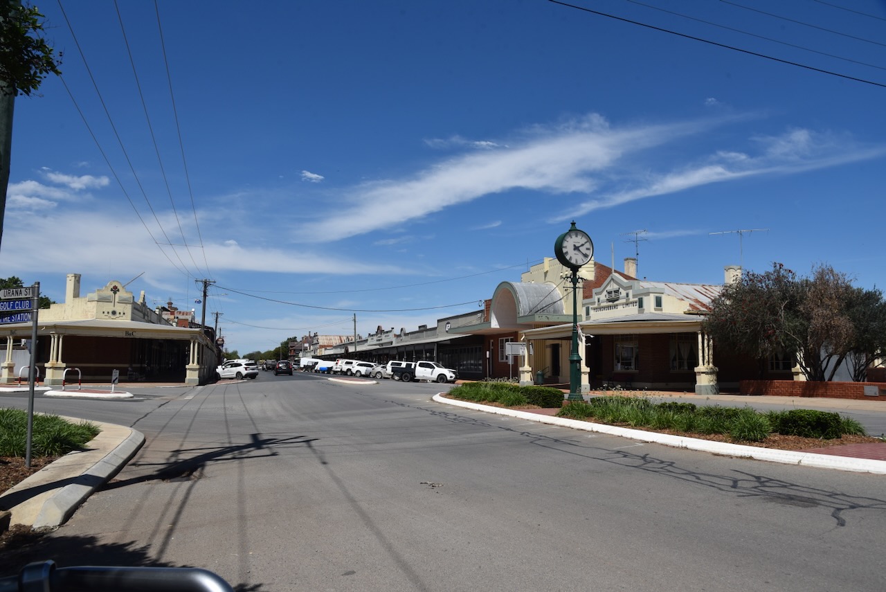
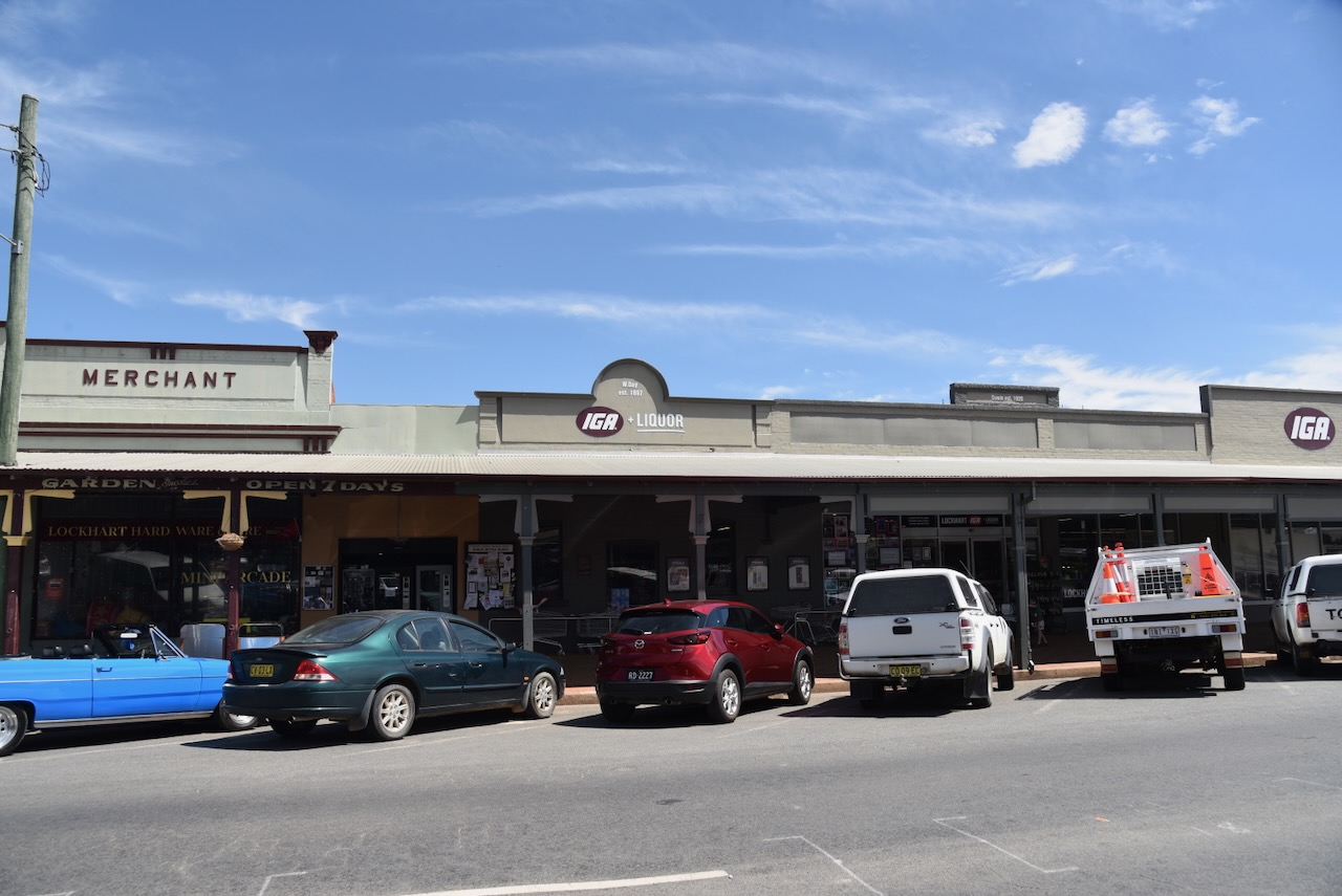
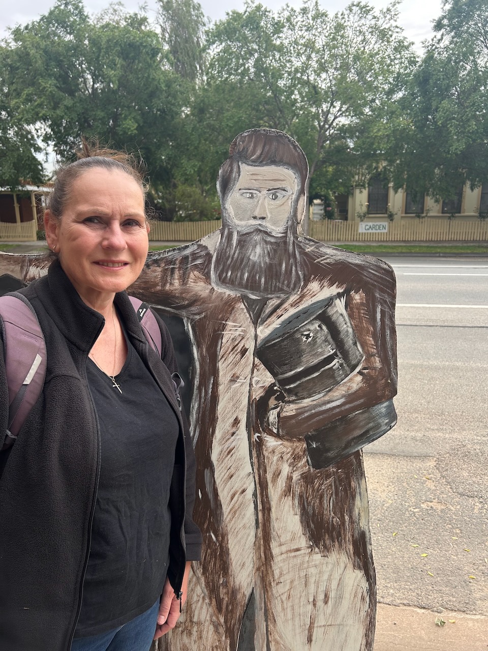
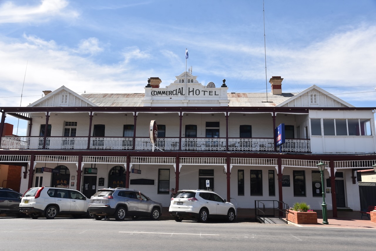
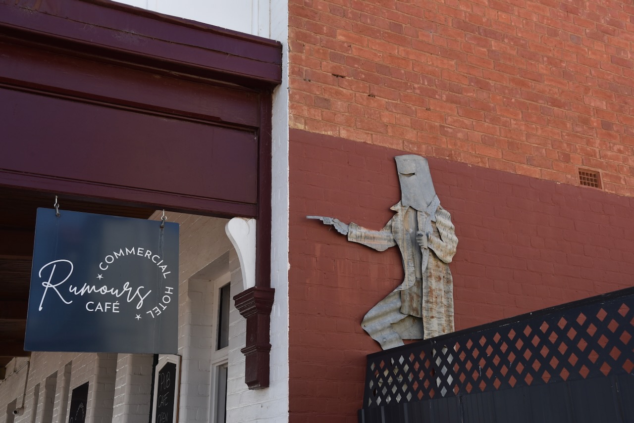
The Commercial Hotel was built in 1906. On the side of the hotel is a life sized corrugated iron cut out of the bushranger Ned Kelly
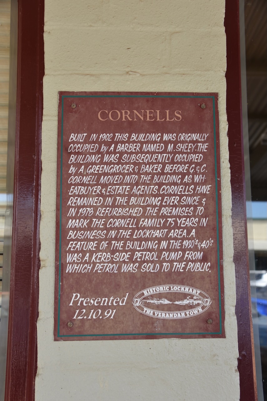
Cornell’s building was built c. 1902/1903. It was originally occupied by a barber called M. Sheey. It was then occupied by a greengrocer and baker, before G & C Cornell moved into the building as wheat buyer and estate agents. During the 1930s and 1940s a kerb side petrol pump existed out the front of the building.
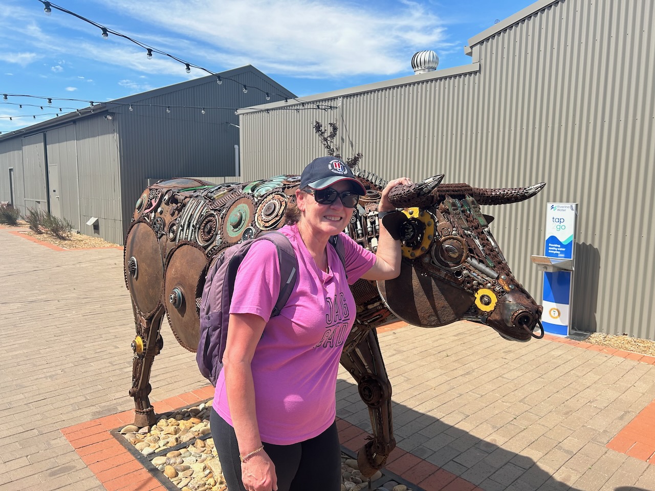
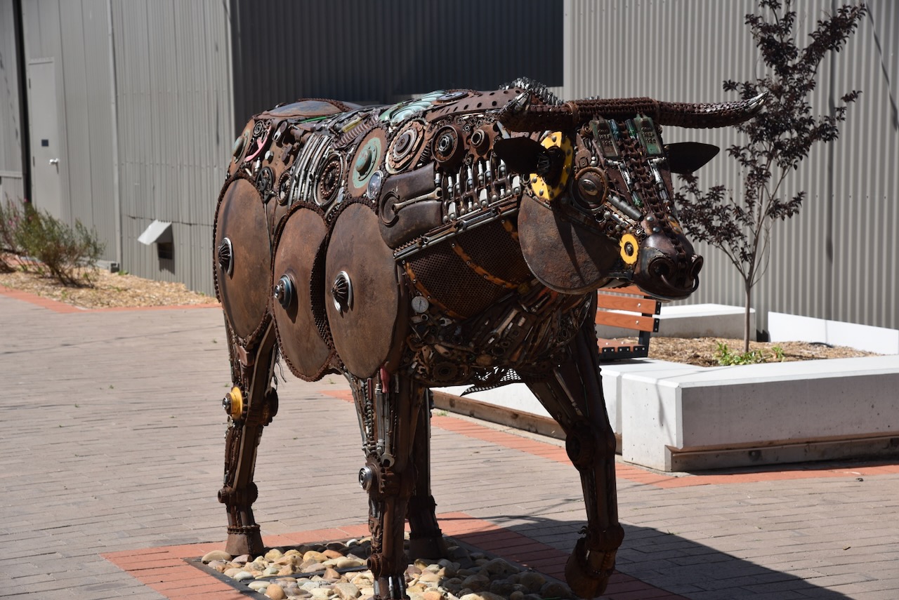
In the main street, you can find the sculpture George the Fresian Bull. It is the work of Andrew McGill. (Region Riverina n.d.)
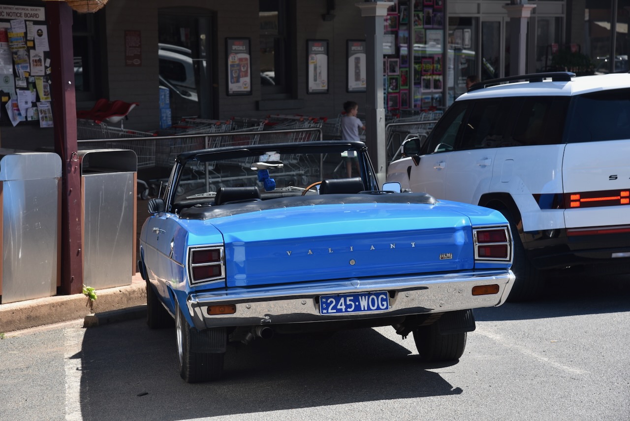
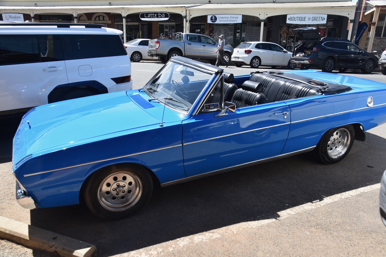
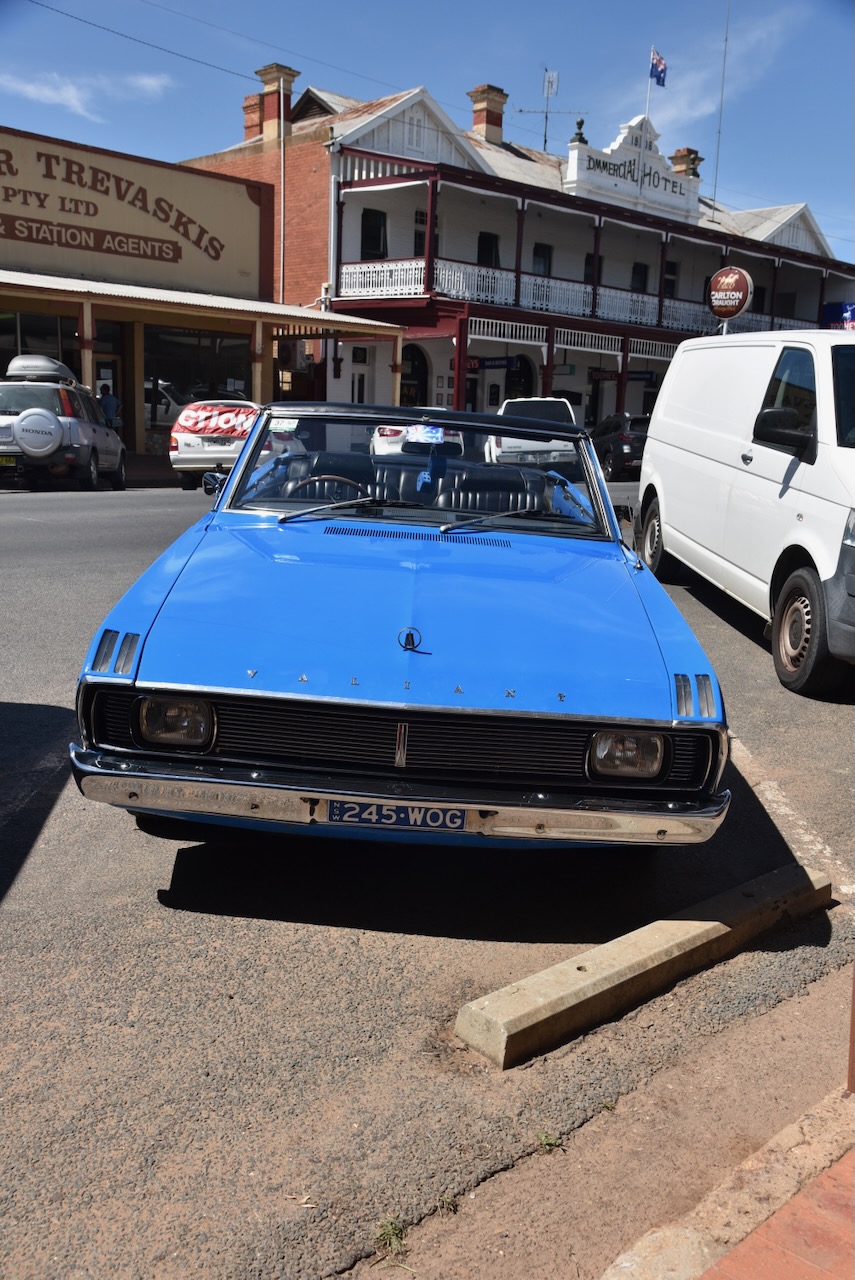
While we were on the main street, I saw the magnificent Valiant below. While we were admiring the vehicle, the owner came along and we had a long chat about his vehicle and my Valiant.
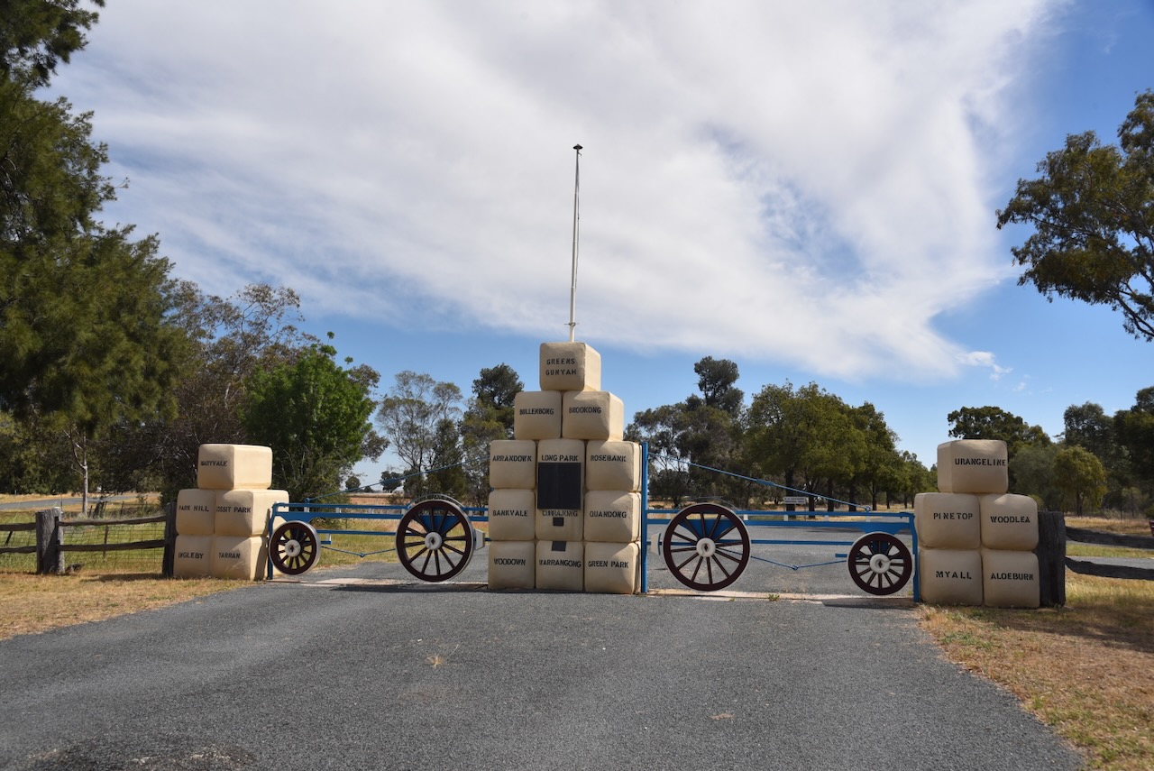
The Lockhart Showgrounds are located on Treasure Street on the southwestern side of town. The gate at the entrance to the Showgrounds commemorates the early settlers of the district. The columns of the entrance gates feature 22 replica wool bales which have stencils of the district’s original sheep stations. (UBC Web Design 2026)
The plaque is inscribed:
‘They came with faith alone – Drought hindered but nothing daunted them – Green fields rose from the wilderness God has blessed us with the fruits of their toil.”
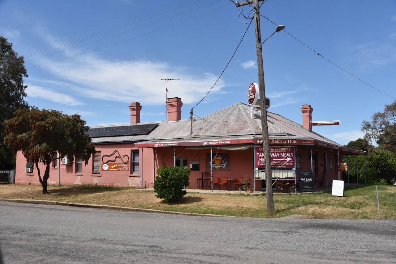
Just down from the silos is the Railway Hotel, located at Brookong Street. The hotel was the first official business in the town and was opened in 1878. It was situated on the Cobb & Co route between Wagga Wagga and Urana. (Facebook 2026)
The Lockhart railway station is located on the Oaklands railway line. The original station was demolished and in 1987 was replaced with the station building from Gerogery.
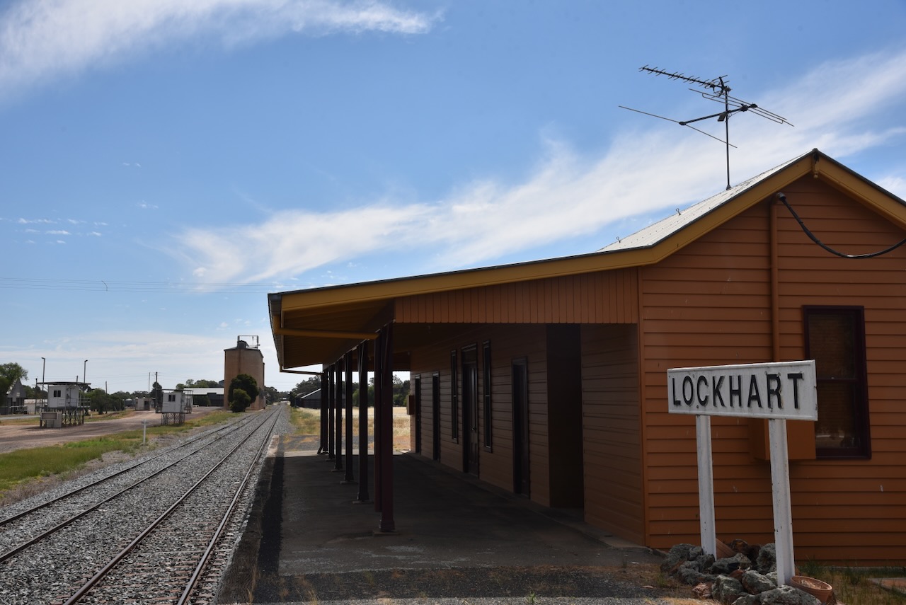
In 1920, the railway station was destroyed by fire. (Trove 2026)
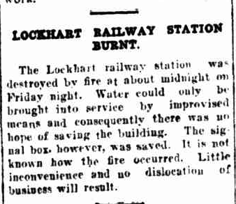
Above: article from the Daily Advertiser Wagga Wagga, Mon 26 Apr 1920. Image c/o Trove
And then in 1944, another fire occurred at the railway station. The refreshment room and the waiting room were completely destroyed. The ticket office and parcel room were saved.
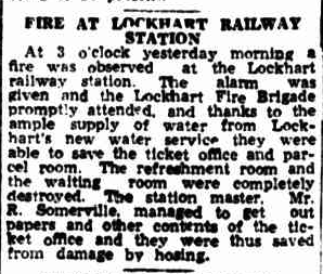
Above: article from the Daily Advertiser Wagga Wagga, Mon 13 Mar 1944. Image c/o Trove
The Lockhart silos are located on the northern side of Osborne Street and the southern side of the railway line.
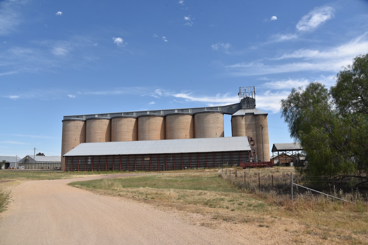
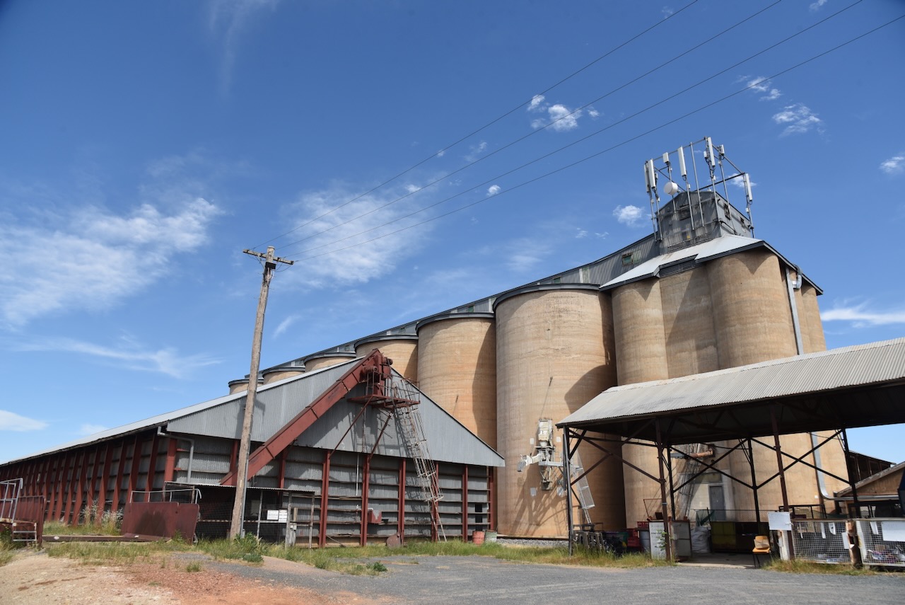
Marija and I parked near the railway station and operated from the 4WD. We ran the Icom IC7000, 100 watts, and the Codan 9350 antenna with the 1.5 metre stainless steel whip.
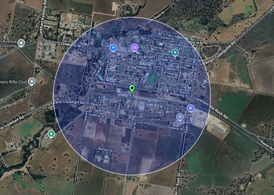
Above: the activation zone at the Lockhart silo. Image c/o SiOTA website.
Marija worked the following stations on 40m SSB:-
I worked the following stations on 40m SSB:-
References.
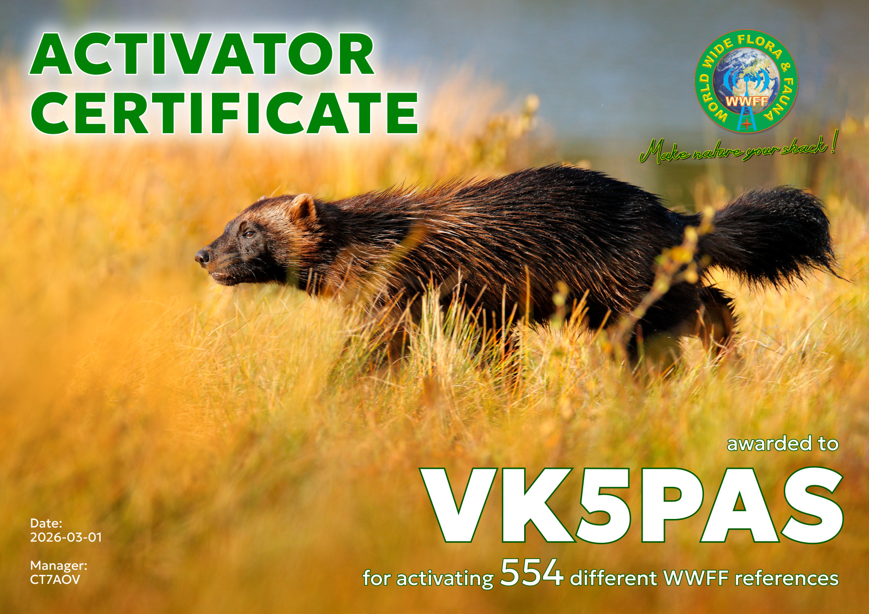
Earlier this month I received the WWFF Activator 554 certificate. It is issued for having activated a total of 554 WWFF references and obtaining 44 QSOs.
Thanks to all of the WWFF hunters, and thank you to Hugo CT7AOV, the Awards Manager.
A few days ago, I received the certificate below for my participation in the 2025 All Asian DX Contest. I came first in Australia in the Single Operator All Band Low Power category.
Thank you to everyone who called me, and thank you to the organisers of the contest.

Amateur Radio, Short Wave Listening, travel and history
Amateur radio experiences with VK1DA
Brisbane - Australia
german amateur radio station
Summits On The Air
SOTA on the peaks, wilderness QRP and some bushwalking
A fine WordPress.com site
Amateur Radio Adventures
Summits on the Ai
Amateur radio station from Belgium
Radio craft, homebrew, QRP/SOTA, AM
Ego loqui ad viros super montes
My adventures with Amateur Radio and Geocaching!
The rantings of VK2GAZ on his SOTA experiences in Australia
A survivor, with minor cuts and abrasions.
The Art and Craft of Blogging
The latest news on WordPress.com and the WordPress community.
Blog of Justin Giles-Clark VK7TW's SOTA and amateur radio adventures.
Occasional SOTA & Microwave operation
