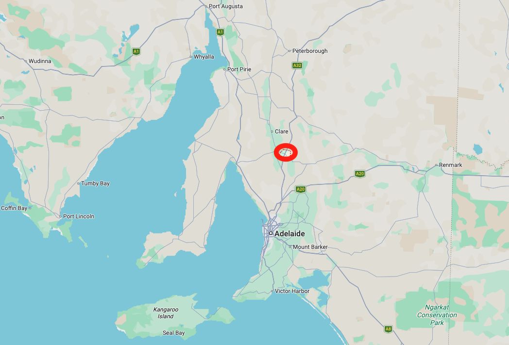
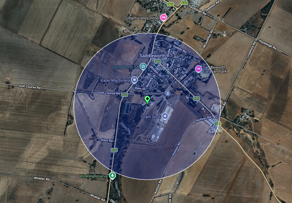
After leaving Clare on Thursday, the 18th day of December 2025, I decided to head to Saddleworth for a quick silo activation. Saddleworth is located about 112 km north of Adelaide.
Above: Map showing the location of Saddleworth, S.A. Map c/o Google Maps
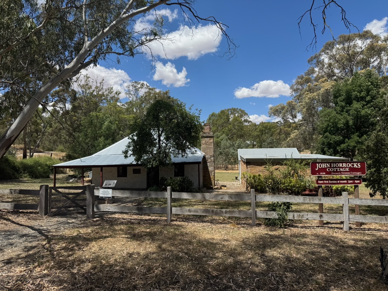
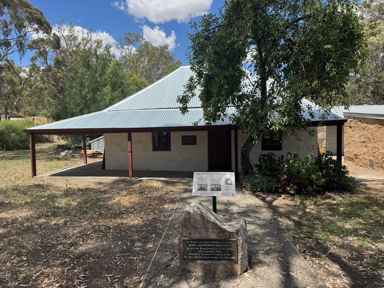
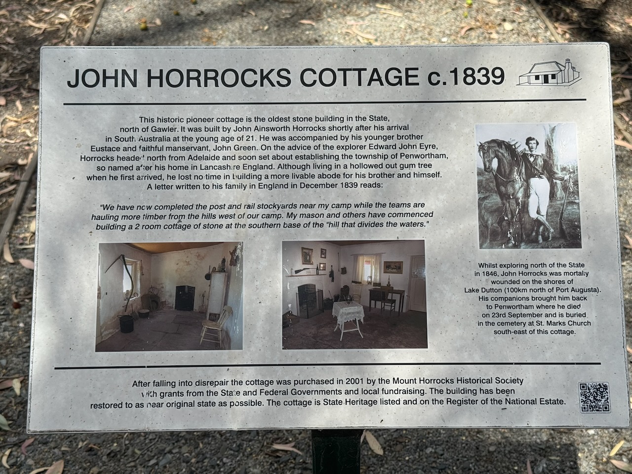
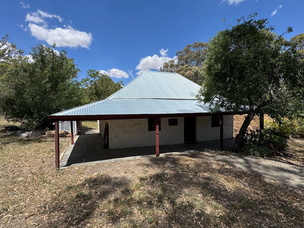
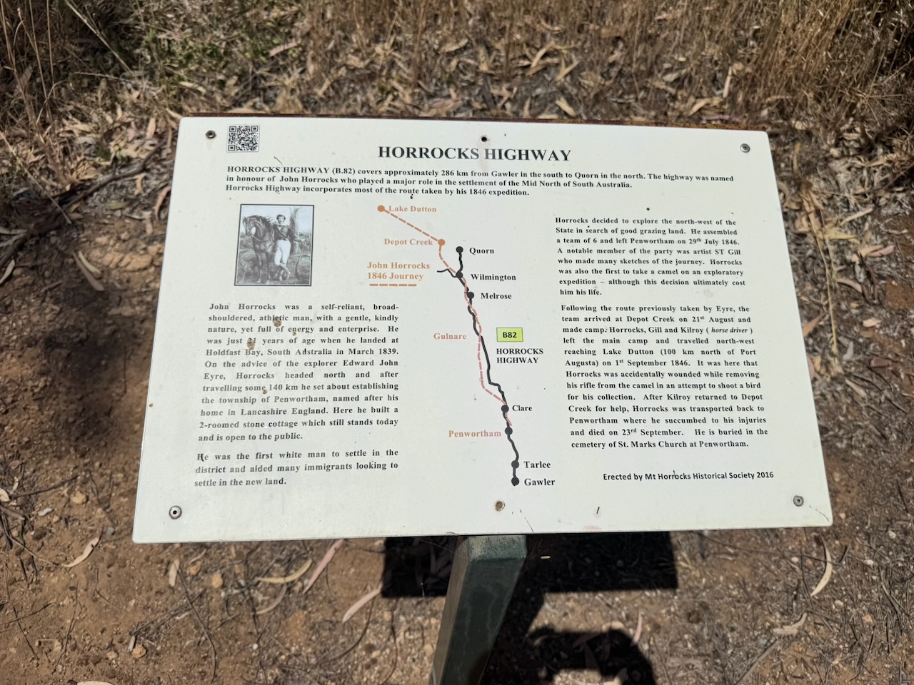
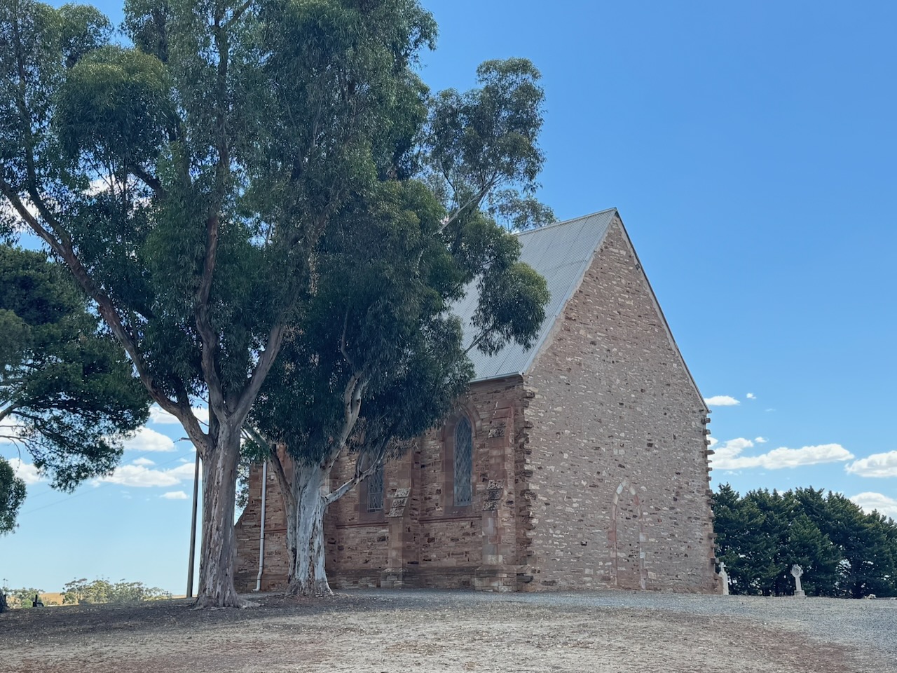
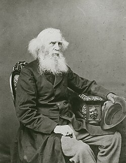
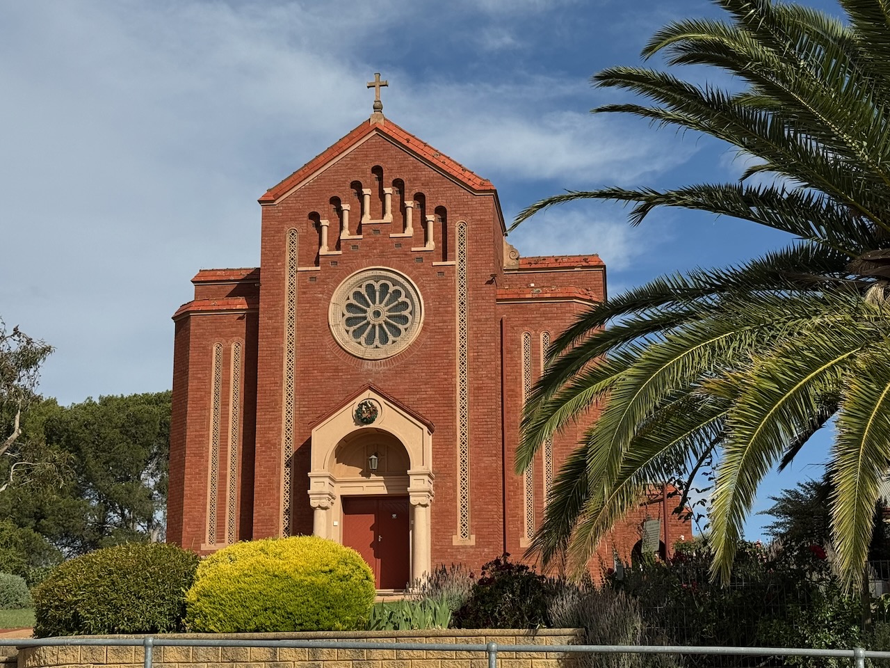
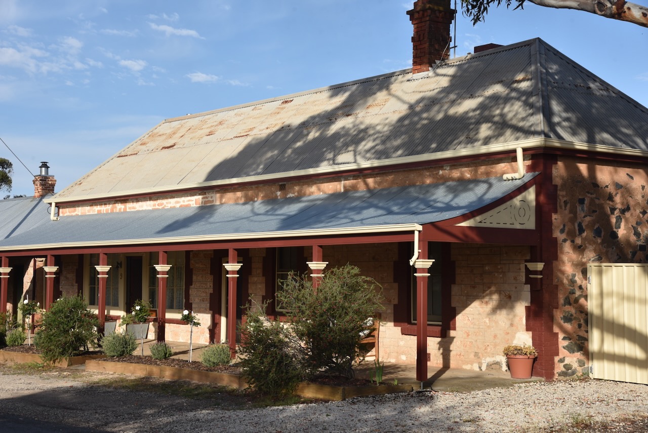
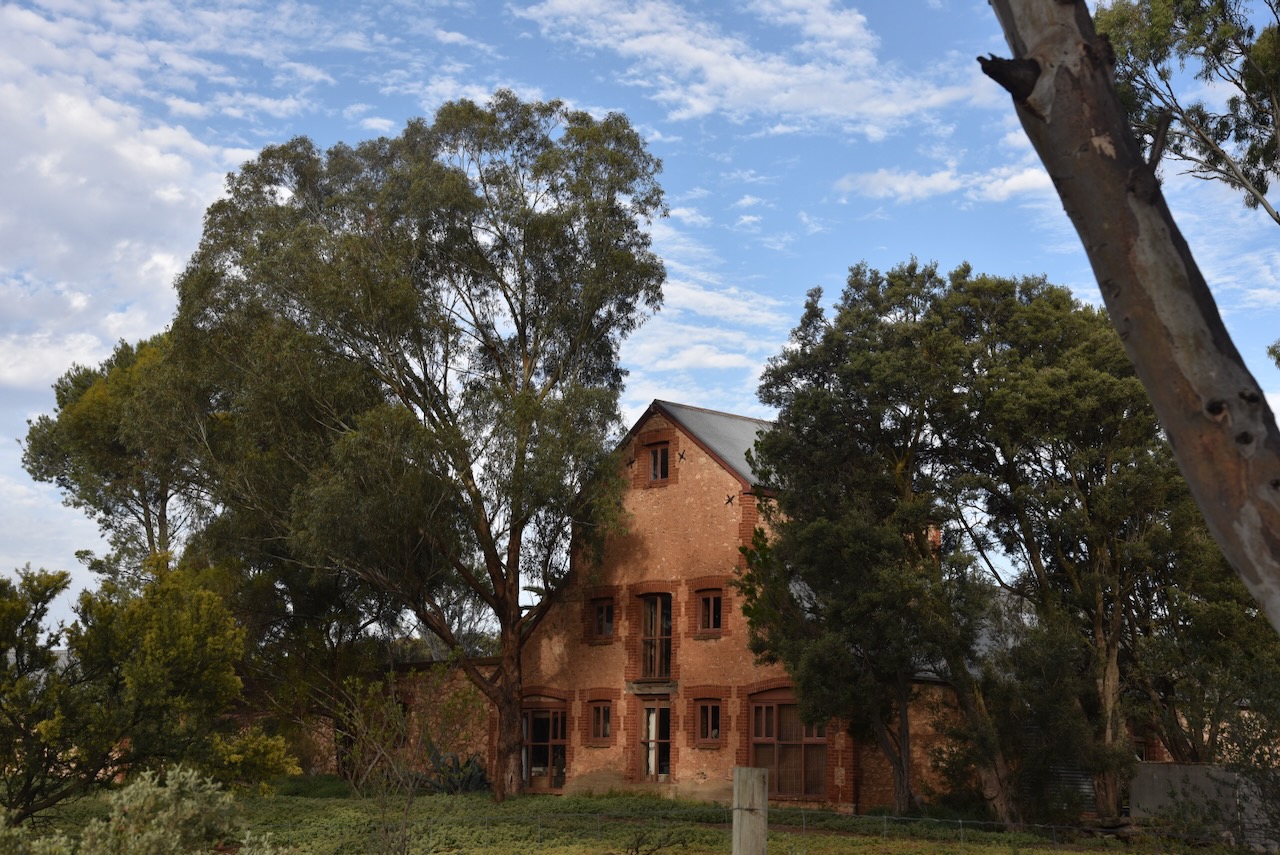
I headed south out of Clare on the Horrocks Highway and stopped at John Horrocks’ cottage at Penwortham, south of Clare. The Pioneer Cottage is the oldest stone building in South Australia, north of Gawler. It was built by the pastoralist and explorer John Ainsworth Horrocks shortly after he arrived in South Australia at the age of 21.
John Ainsworth Horrocks was born on the 22nd day of March 1818 at Penwortham Lodge, near Preston, Lancashire, England. In 1839, aged 21, he arrived with his 16-year-old brother Eustace in the new colony of South Australia. They established the village of Penwortham, south of Clare. John Horrocks returned to England in 1842 following his father’s death. and returned to Australia in 1844. (Wikipedia 2025)
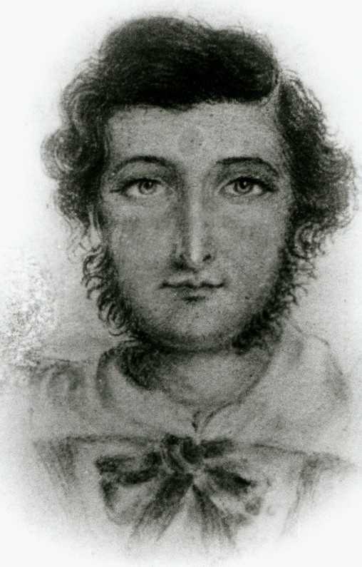
Above: John Ainsworth Horrocks. Image c/o Wikipedia
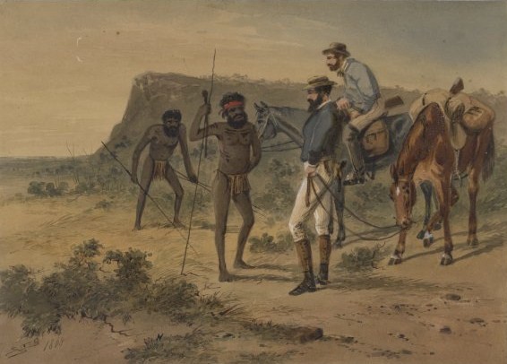
On the 29th day of July 1846, Horrocks led an exploratory expedition into the far north-west of South Australia. His 2nd in charge was John Henry Theakston. Artist and botanist, Samuel Thomas Gill was an unpaid volunteer. There were also several hired men, including Bernard Kilcoy as a cook and driver, a goatherd, Jimmy Moorhouse, who was a young Aboriginal man employed at Penwortham Station. (Wikipedia 2025)
Above: Horrocks’ encounter with Aboriginals during the expedition. Image c/o Wikipedia
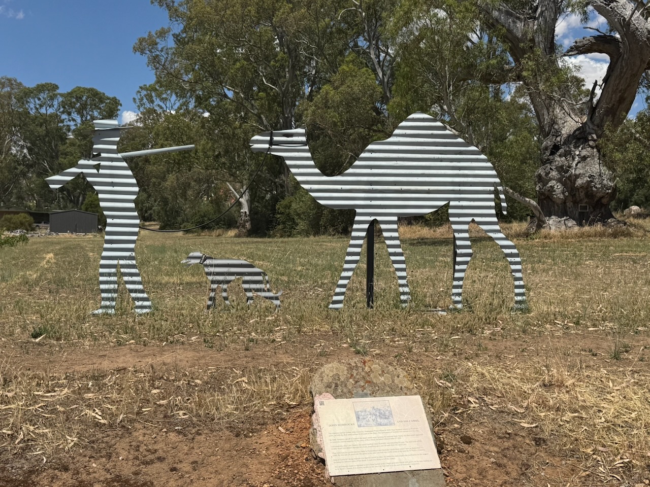
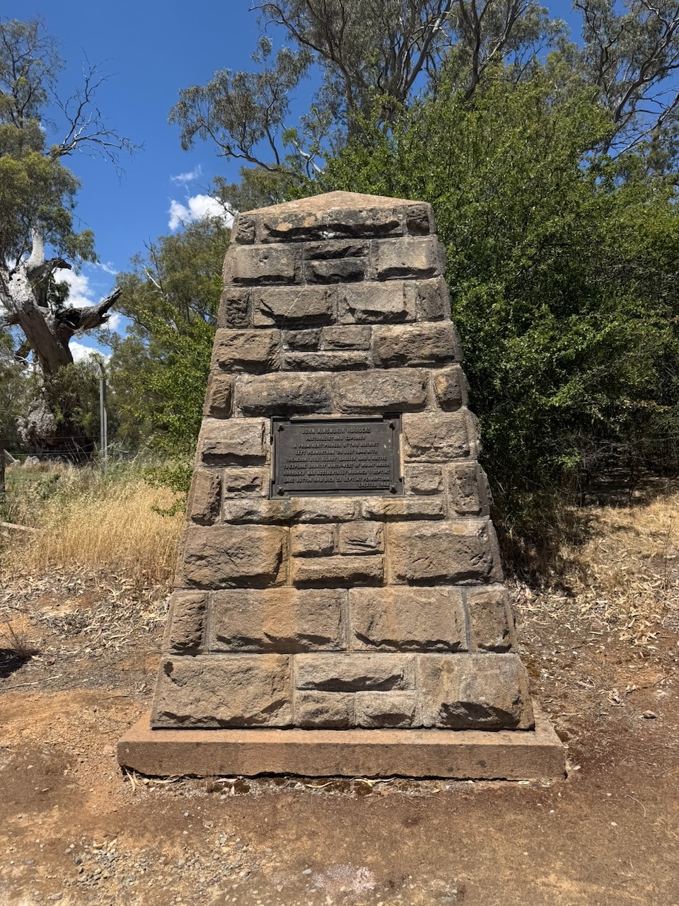
On the 1st day of September 1846, on the shores of Lake Dutton, about 100 km north of Port Augusta, Horrocks was accidentally shot whilst reloading his firearm. One barrel of the gun was tripped by the packload of a camel known as Harry whilst it was kneeling. Harry was the first camel to arrive in Australia. Horrocks was severely wounded, losing the middle finger of his right hand and a row of teeth from his upper right jaw. The expedition was cancelled, and the party returned to Penwortham, where Horrocks died from his wounds on the 23rd day of September 1846. (Wikipedia 2025)
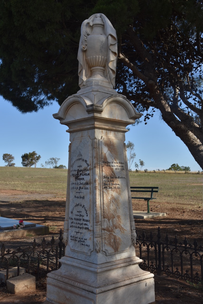
A little further south is a monument to Horrocks.
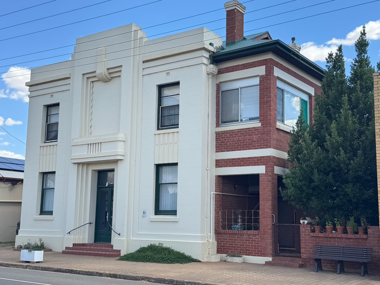
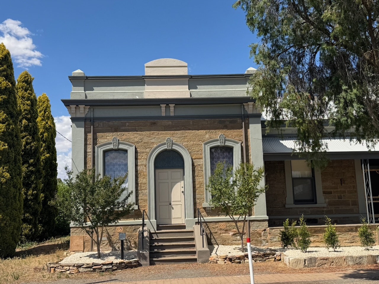
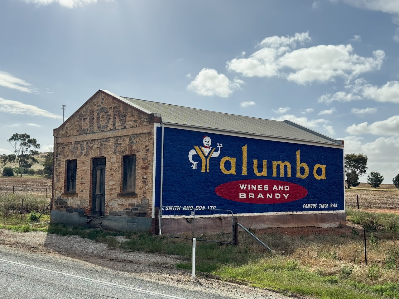
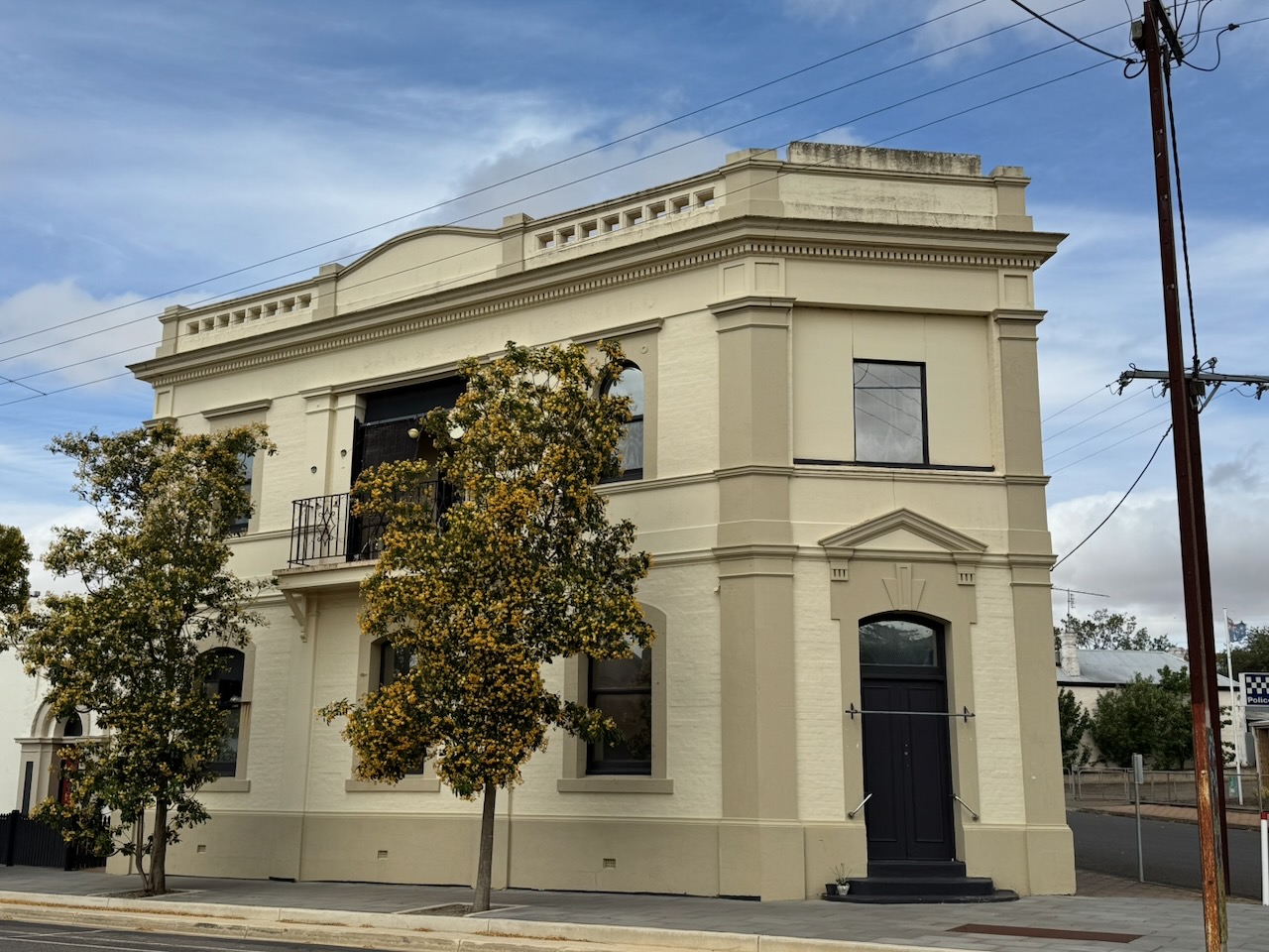
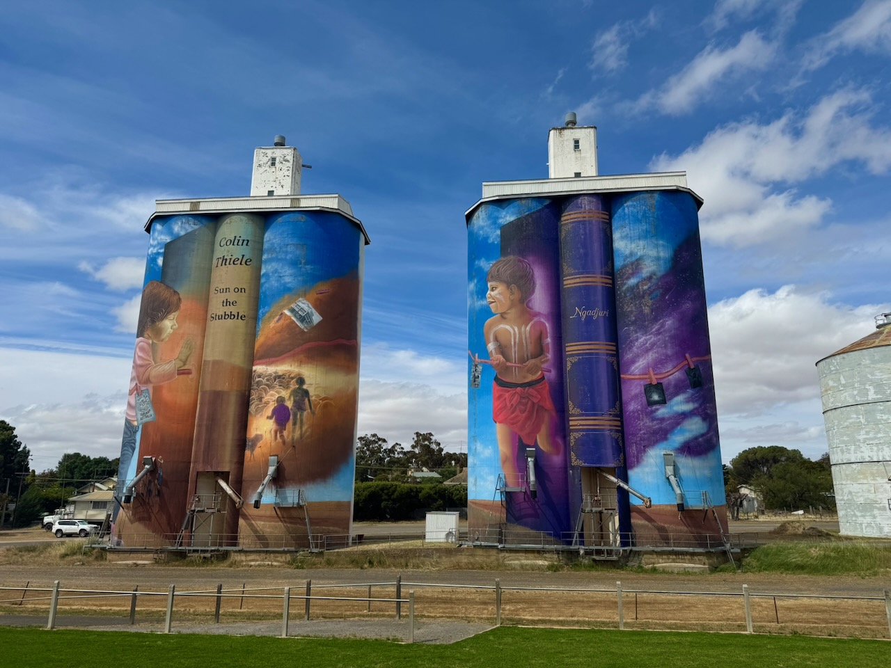
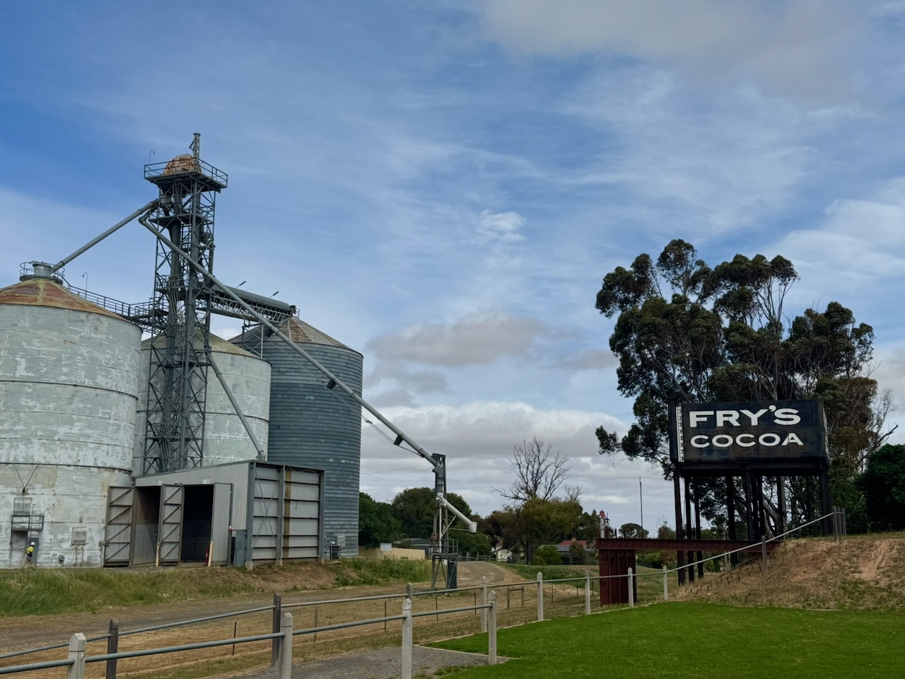
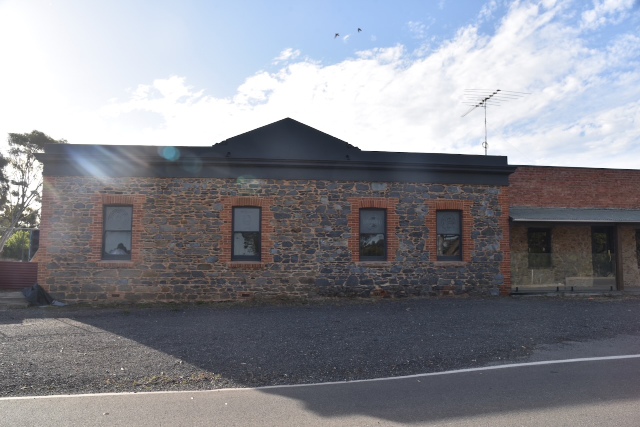
Saddleworth was named after Saddleworth Lodge pastoral station, which was named after a civil parish in Yorkshire, England. The town of Saddleworth was established as one of several settlements on the road to the mining town of Burra. (Wikipedia 2021)
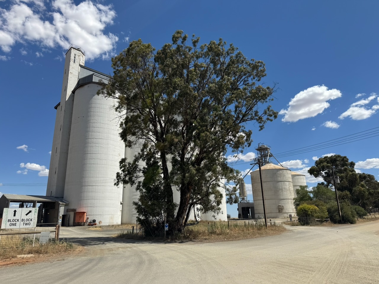
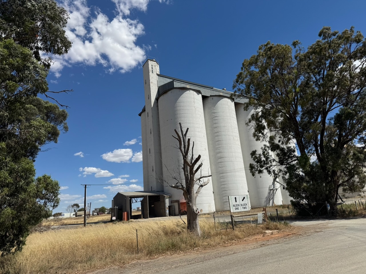
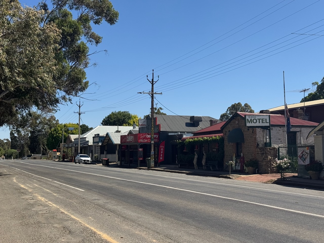
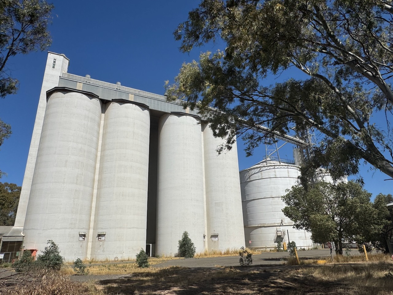
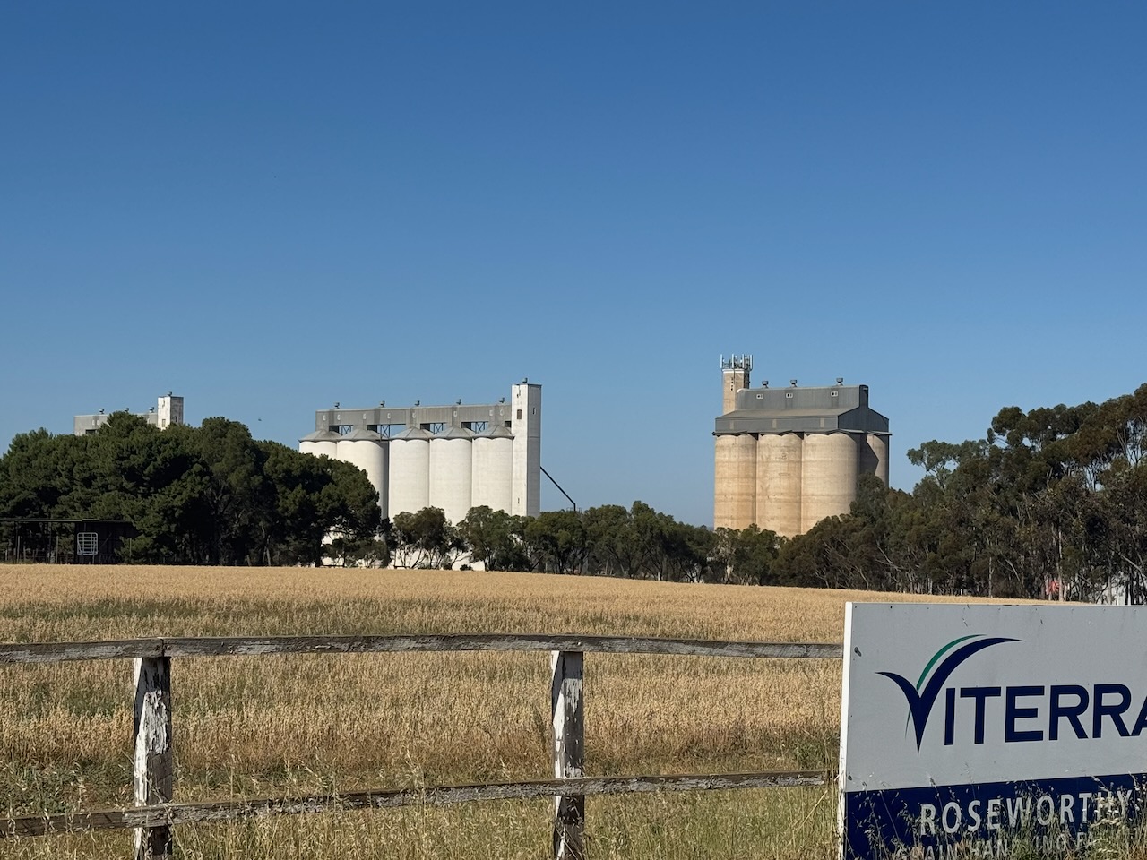
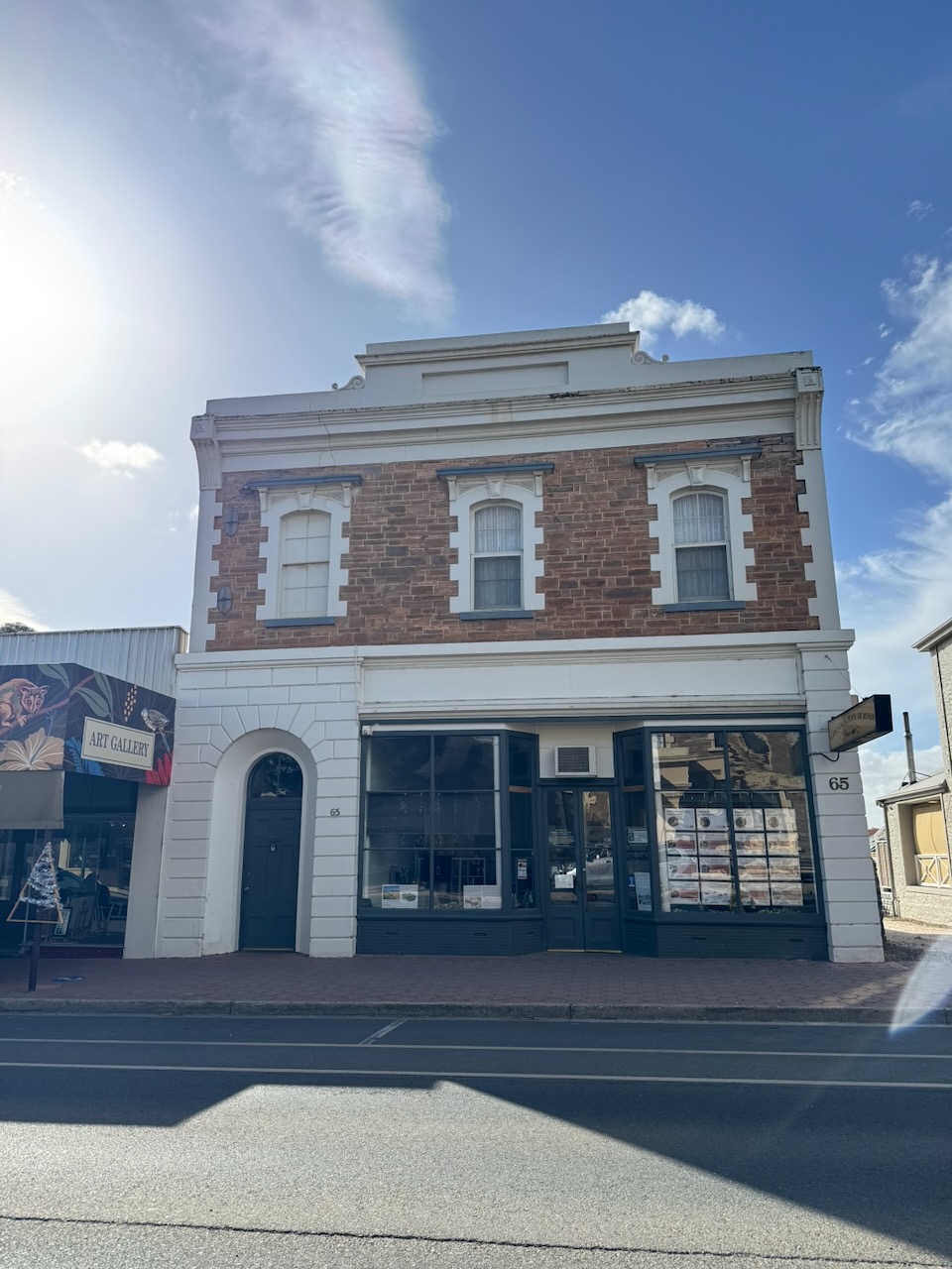
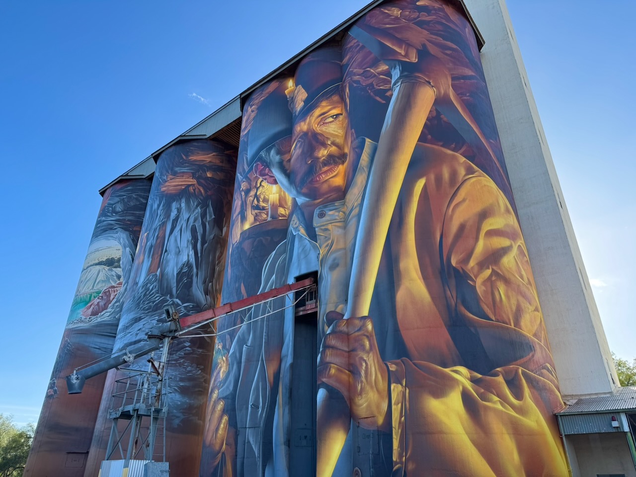
The Saddleworth silos are located on Girth Street and are operated by Viterra.
I parked on Girth Street and operated from the 4WD, running the Icom IC-7000, 100 watts, and the Codan 9350 antenna with the 1.5 metre stainless steel whip.
Above: the activation zone at Saddleworth silo. Image c/o SiOTA website
I worked the following stations on 40m SSB:-
VK5MAZ
VK3PF
VK3FTOM
VK3CLD
VK5WU
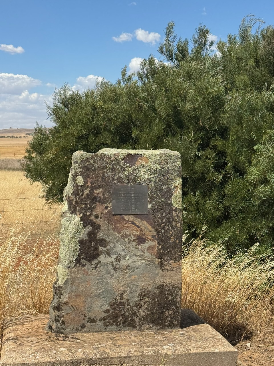
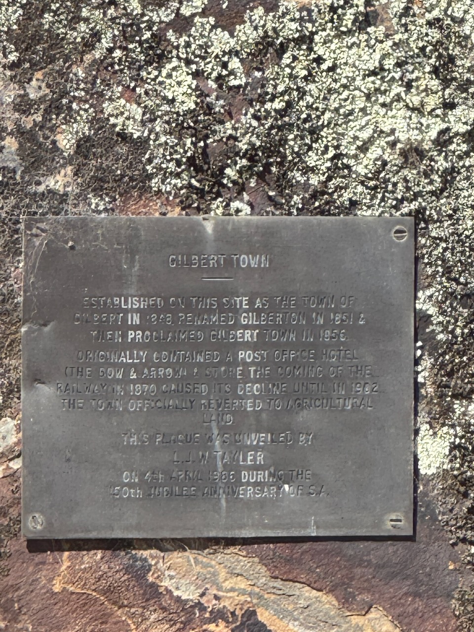
After the activation, I continued south on the Horrocks Highway, stopping at the monument for the former site of Gilbert Town, just north of Tarlee. The town was established in 1848 and was originally known as Gilbert. It was renamed Gilberton in 1851, and then in 1856 was proclaimed Gilber Town. The town once had a Post Office, the Bow & Arrow Hotel, and a store. The coming of the railway in 1870 caused the town’s decline, until 1902, when the town was officially reverted to agricultural land.
I continued on to home on the Fleurie Peninsula. It had been a very enjoyable day out and about.
References.
Wikipedia Contributors (2025). John Ainsworth Horrocks. Wikipedia.
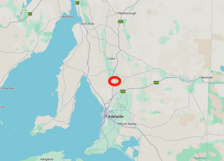
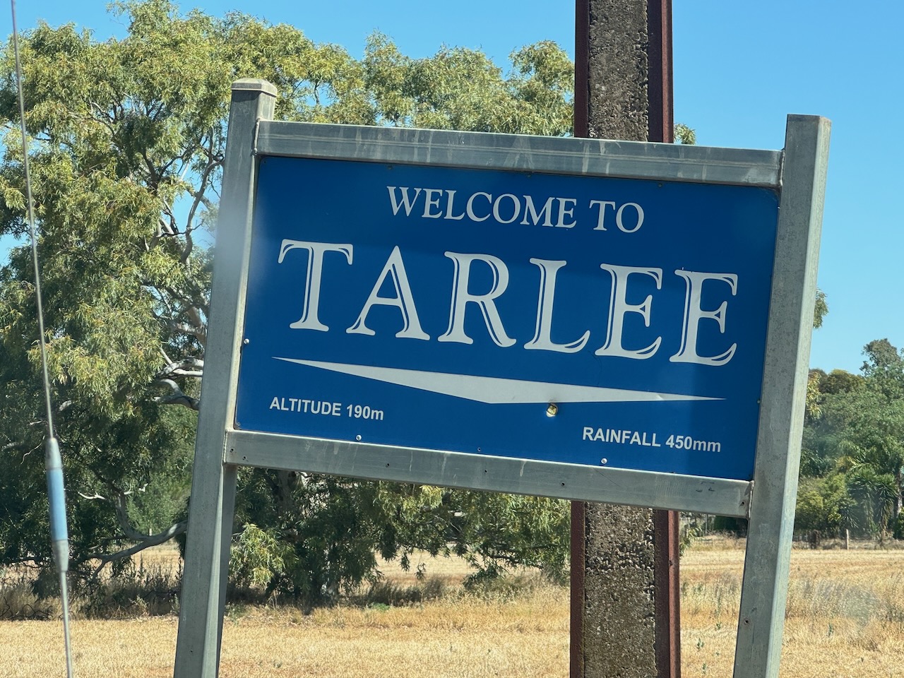
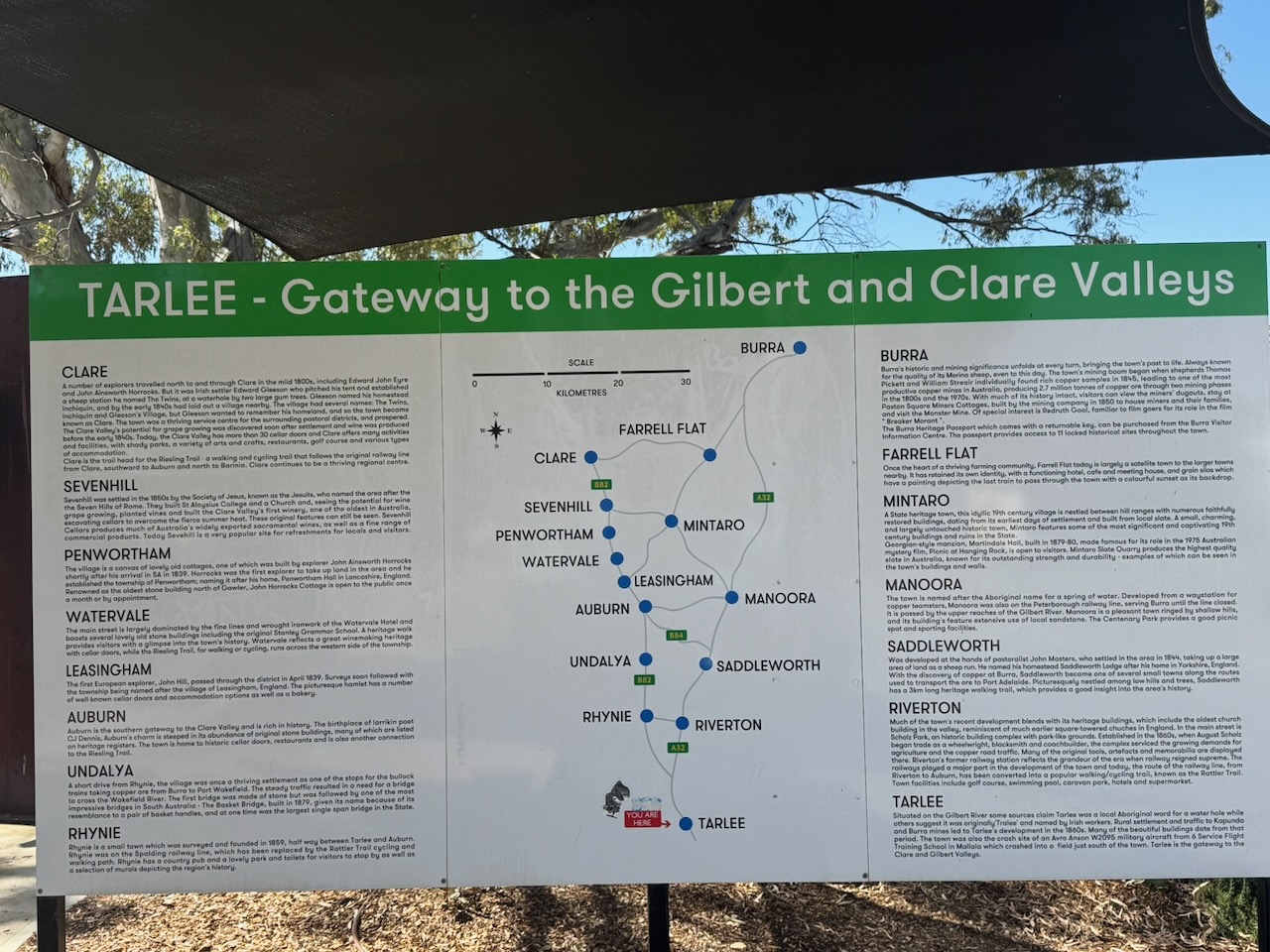
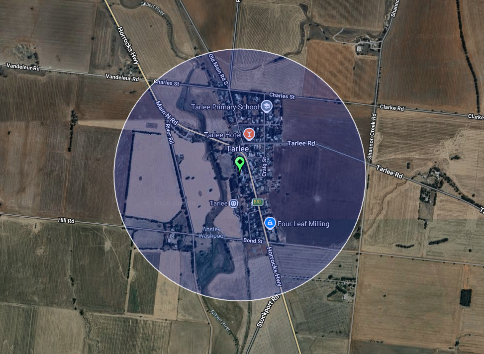
My second silo activation for Thursday, the 18th day of December 2025, was the Tarlee silo VK-TRE5. Tarlee is about 88 km north of Adelaide in the lower Mid North of South Australia.
Above: Map showing the location of Tarlee. Map c/o Google Maps
Tarlee is believed to derive from Tralee in Ireland. The town is located about 8km south of Giles Corner, where the Barrier Highway to Broken Hill diverges from the Horrocks Highway to the beautiful Clare Valley. (Wikipedia 2025)
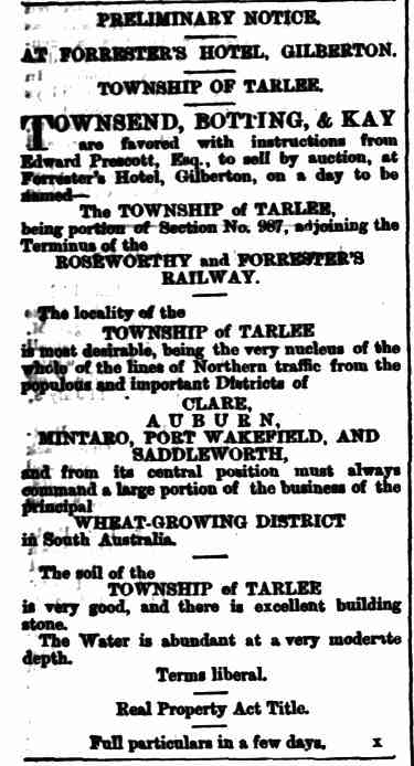
In June 1867, it was announced that the town of Tarlee was ready for sale by auction. It was to occur at Forrester’s Hotel at Gilberton. The locality was described as ‘most desirable, being the very nucleus of the whole of the lines of Northern traffic from the populous and important districts of Clare, Auburn, Mintaro, Port Wakefield and Saddleworth.‘ (Trove 2026) (Wikipedia 2025)
Above: article from the South Australian Weekly Chronicle, Sat 15 Jun 1867. Image c/o Trove
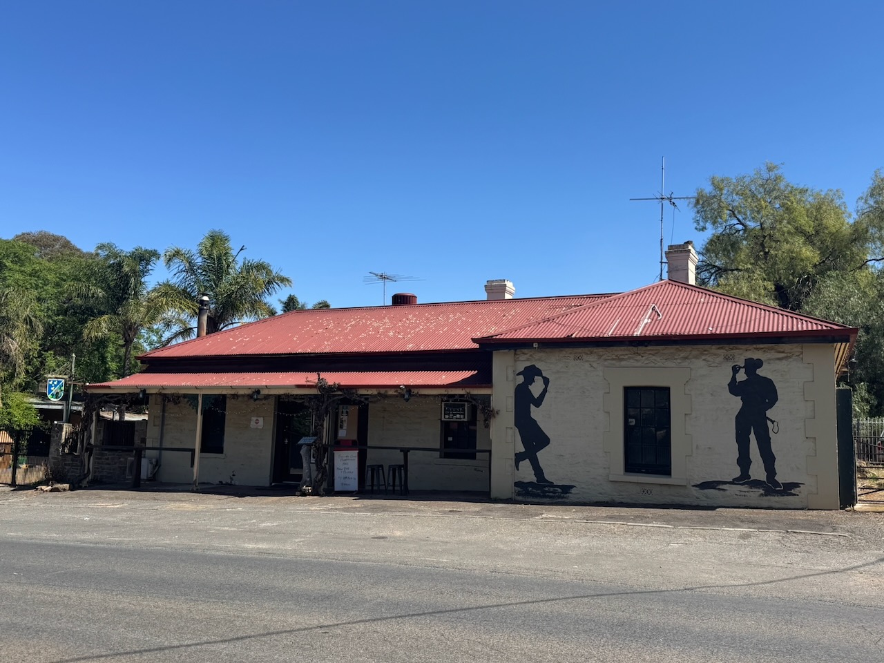
There is an excellent visitor information bay adjacent to the silos with a detailed history of the district. The info bay is named in honour of Frank Gorey, who worked at the Tarlee silos for 15 years. (UBC 2023)
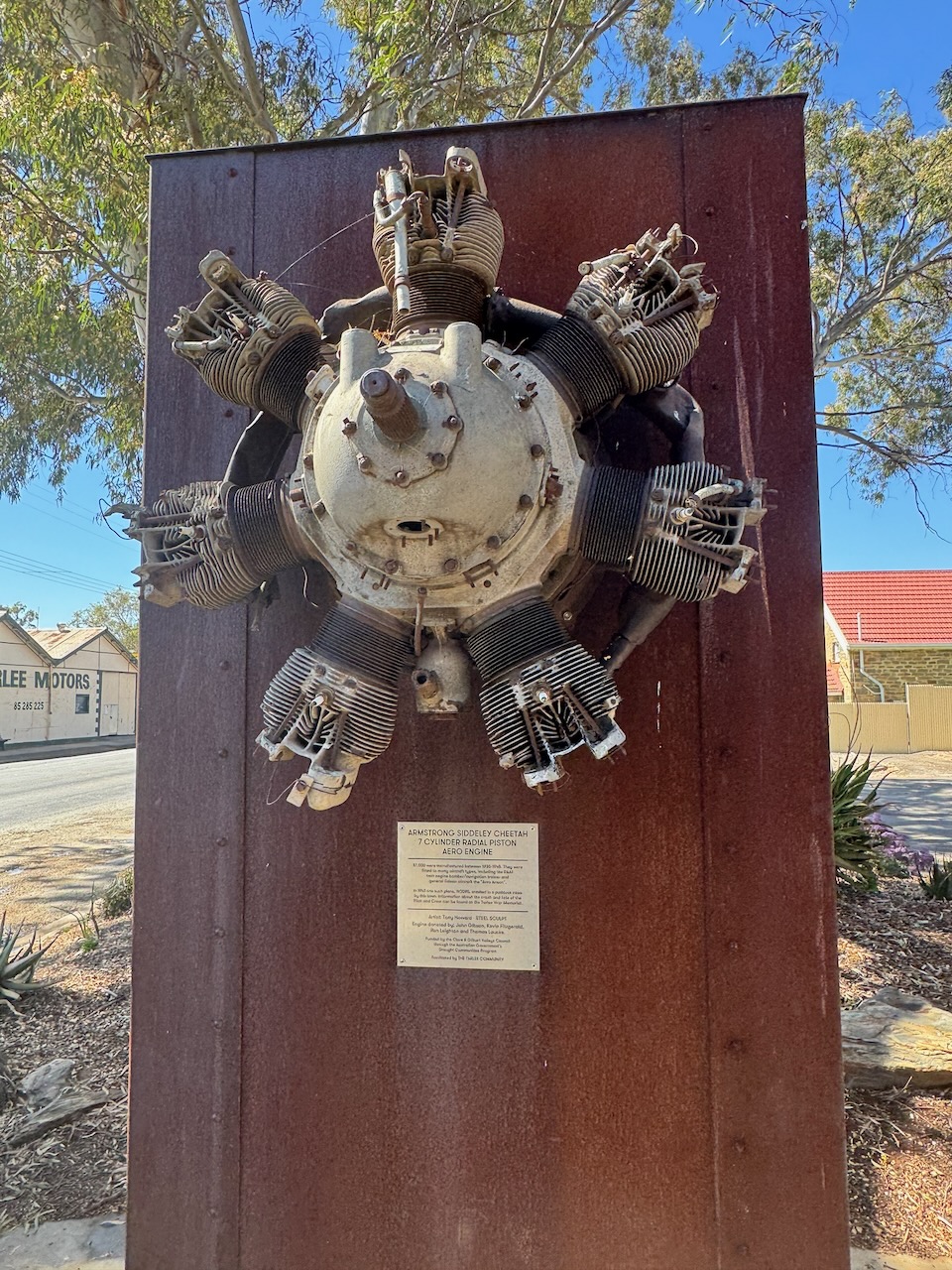
On display at the info bay is a sculpture which includes an Armstrong Siddeley Cheetah aero engine from an Avro Anson aircraft. Such an aircraft crashed in a field near Tarlee in 1943.
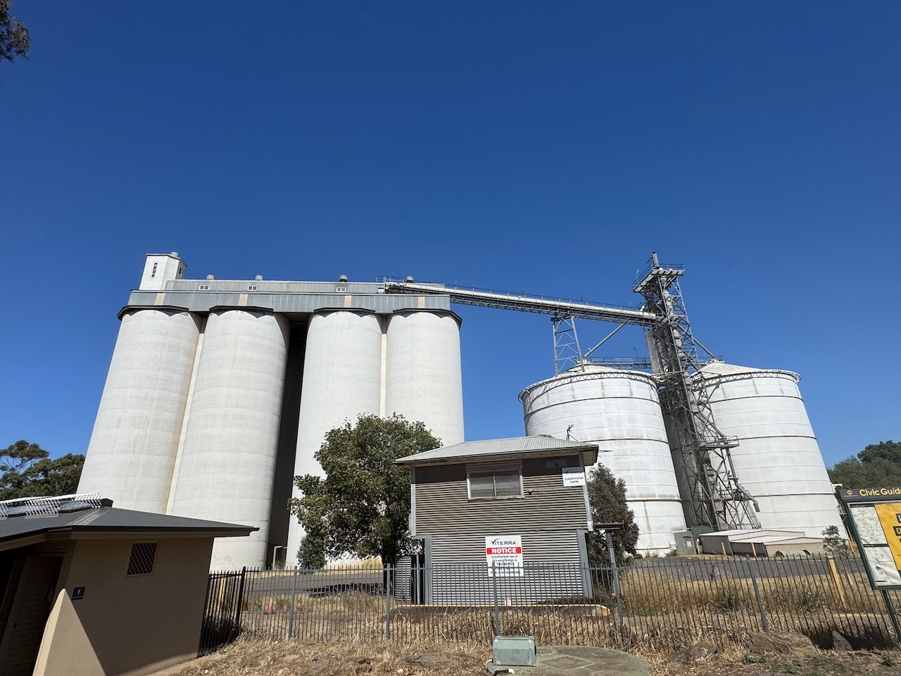
The Tarlee silos are located on the western side of the Horrocks Highway opposite the visitor info bay.
I parked the 4WD in the visitor bay and operated from the vehicle, running the Icom IC-7000, 100 watts, and the Codan 9350 antenna with the 1.5 metre stainless steel whip.
Above: the activation zone at the Tarlee silos. Image c/o SiOTA website
I made just 3 contacts, which was a combination of poor band conditions and being short of time.
I worked the following stations on 40m SSB:-
VK5MAZ
VK5WU
VK3PF
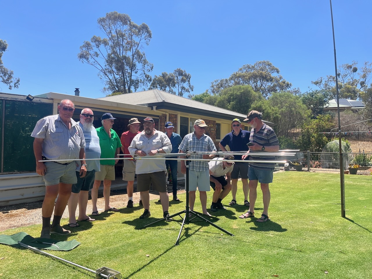
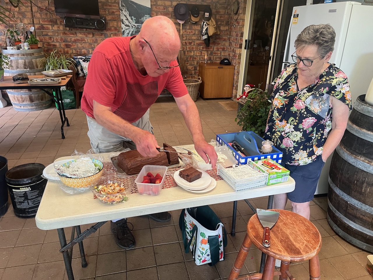
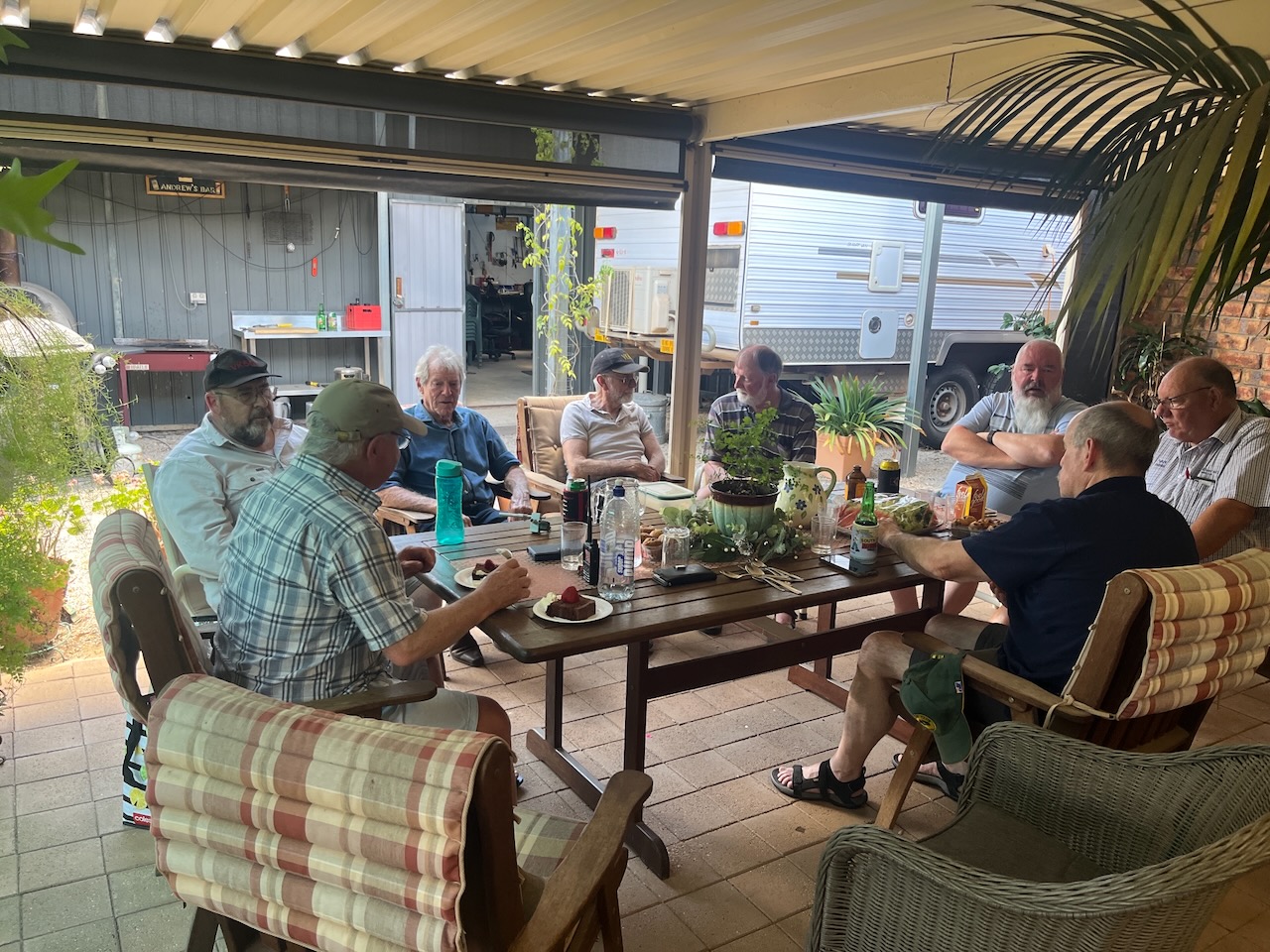
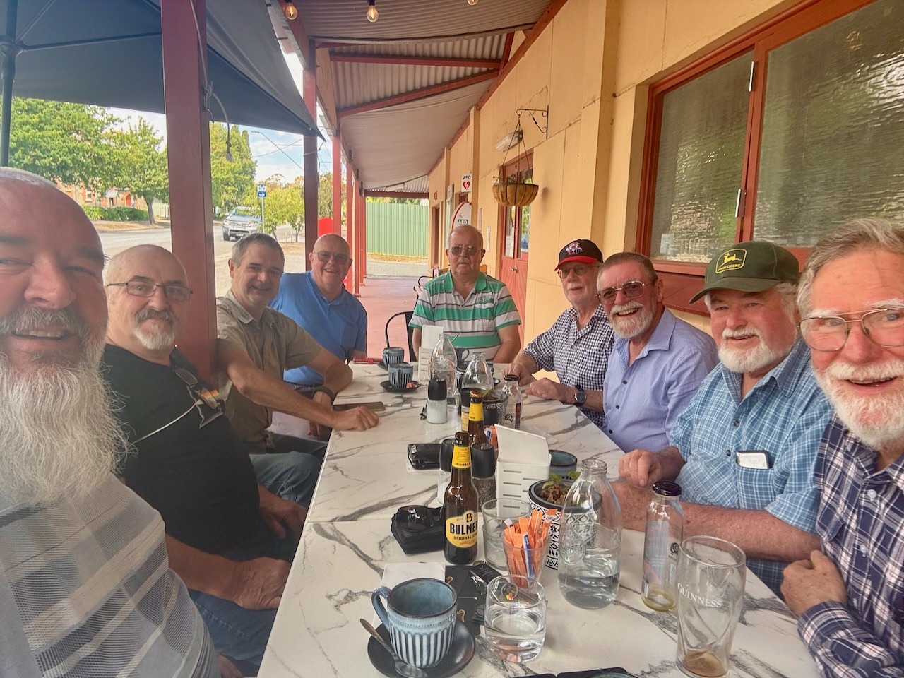
I then headed off to Clare and enjoyed a very enjoyable BBQ lunch with the boys from the Mid North, the Clare Valley, and the Riverland.
On Thursday, the 18th day of December 2025, I headed up to Clare to the home of Andrew VK5BL, for a Christmas lunch with a group of amateurs from the Clare Valley and the Mid North.
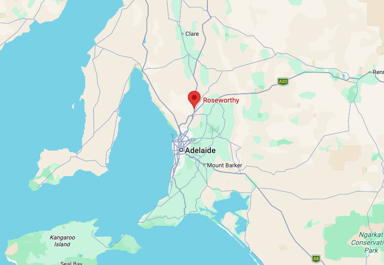
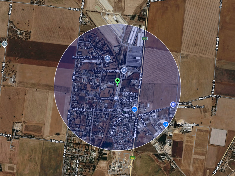
On the way, I activated two silos for the Silos On The Air (SiOTA) program. The first was Roseworthy silo VK-RSY5. Roseworthy is about 58 km north of Adelaide, and about 10 km north of Gawler.
Above: Map showing the location of Roseworthy. Map c/o Google Maps
The first known European to visit the area was in December 1837, when the Surveyor General travelled through the district. In 1855, William and Grace Gartrell purchased land in the Hundred of Mudla Wirra. Mudla Wirra are Aboriginal words meaning ‘implement’ and ‘forest.’ Following William’s death in 1863, Grace subdivided the land and named it Roseworthy after a village in Cornwall. Roseworthy is derived from Roswartha, meaning Meadow Heath. (Light Country n.d.) (Wikipedia 2015)
In 1881, the South Australian Government purchased land to establish an experimental farm in the Roseworthy district. Two years later, in 1883, the Roseworthy Agricultural College was established. It was the first of its kind in Australia and continues to operate to this day. (Light Country n.d.)
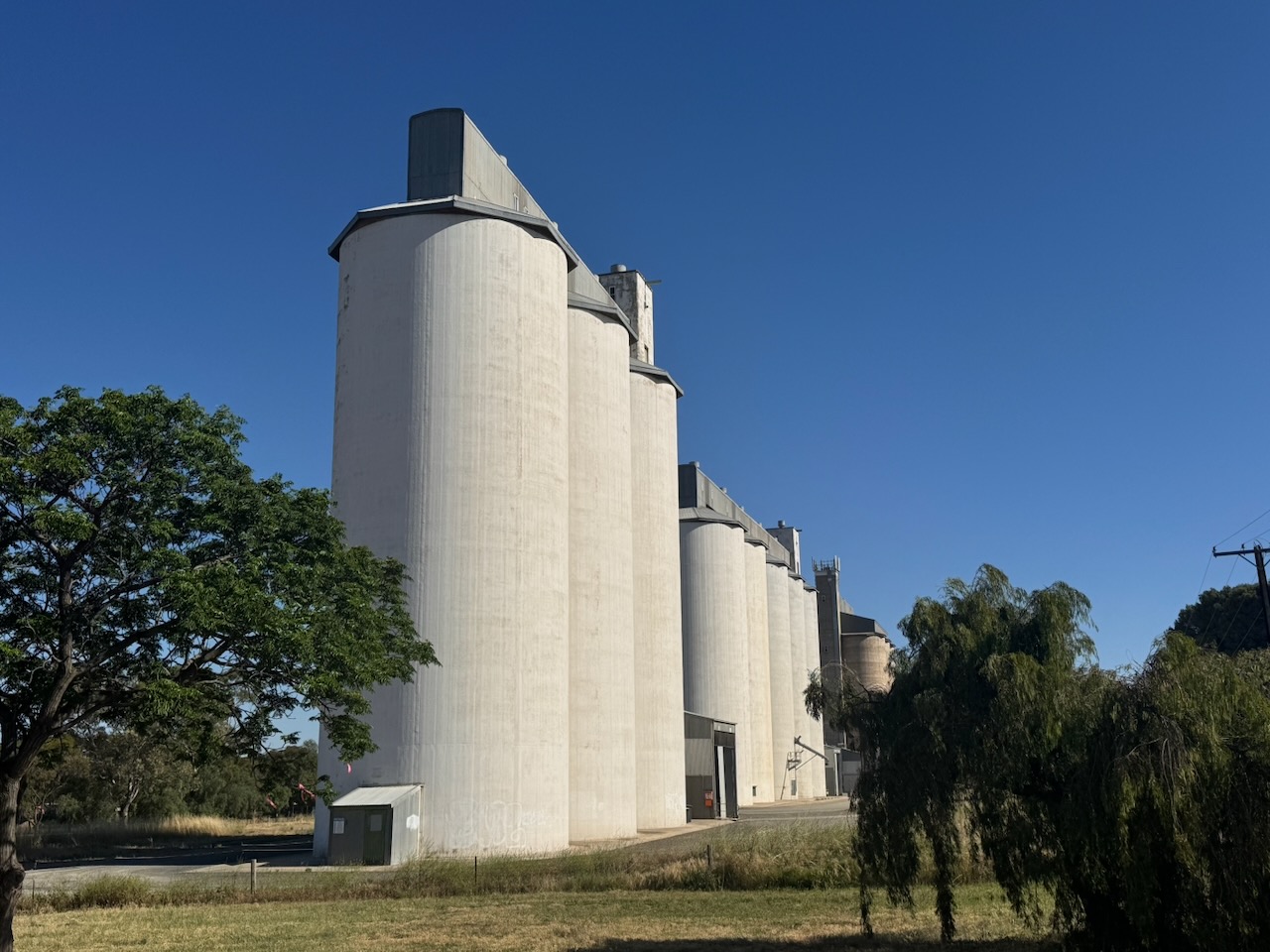
The Roseworthy silos are located on Railway Terrace. They are operated by Viterra and are part of a large grain facility of both storage silos and bunkers for grain that is grown in the region, and then conveyed to Port Adelaide. (Wikipedia 2015)
I parked on Cliff Road and operated from the 4WD, running the Icom IC-7000, 100 watts, and the Codan 9350 antenna with the 1.5 metre stainless steel whip.
Above: the activation zone at the Roseworthy silos. Image c/o SiOTA website
On the 10th day of December 2025, I attended the Christmas lunch for the Strathalbyn Amateur Radio Group. Nine of us enjoyed a very fine meal at The Plough at Echunga.
Above: L to R: Paul VK5PAS, Rick VK5RI, Stef VK5IE, Peter VK5PET, Michael VK5MTR, Phil VK5ABD, Bill VK5WMK, Robbie VK5MRS, and Det VK5DET
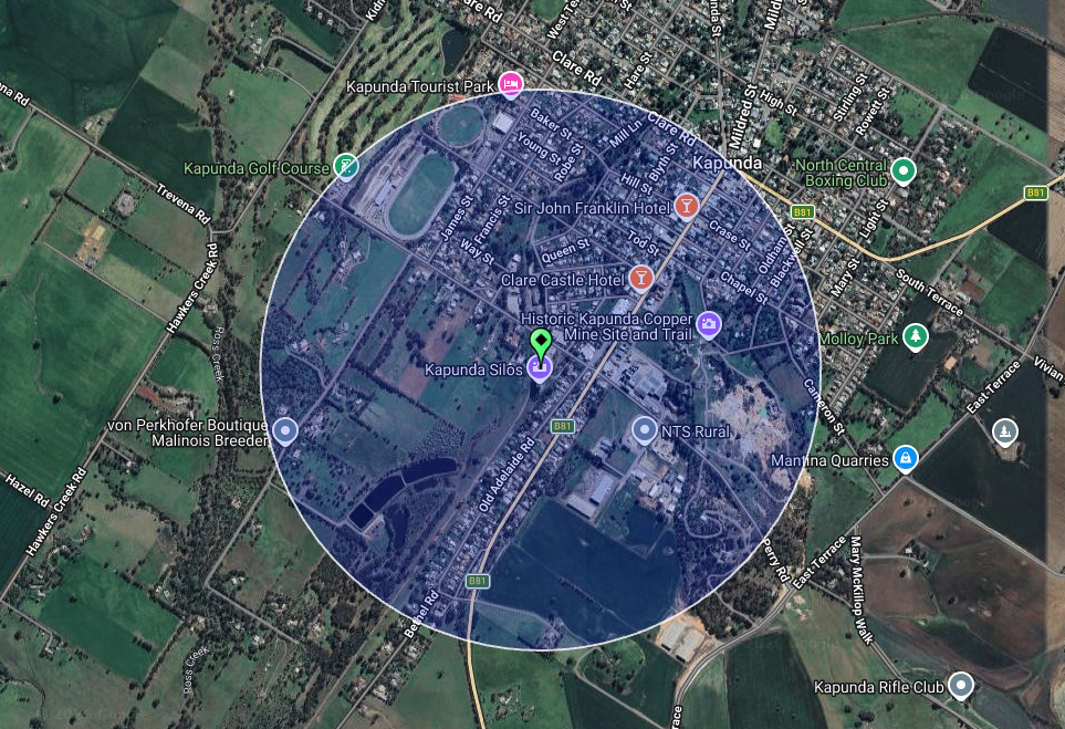
Our second and final silo activation for Saturday, the 6th day of December 2025, was the Kapunda silo VK-KPA5. Kapunda is about 87 km north of Adelaide.
Above: Map showing the location of Kapunda. Map c/o Google Maps
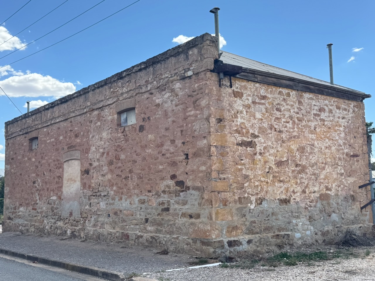
Marija and I drove south on Thiele Highway, and as we approached the town of Kapunda, we stopped to view the magnificent old building below. It is the old stone store built in 1854 by David & James Fowler.
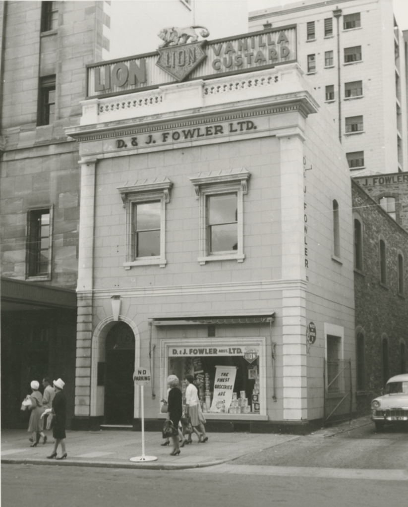
James Alexander Fowler was born in 1831 in Fife, Scotland. He emigrated to South Australia with his sister Margaret aboard the Anna Maria in 1850. He opened a grocery store in Rundle Street, Adelaide. He was joined by his elder brother David, who arrived in South Australia in 1854 aboard the Fop Smit. David was born in January 1827 in Fife, Scotland. The two brothers traded under the name D. & J. Fowler. (Wikipedia 2023)
In February 1858, James Fowler died after a long battle with illness. He was just 27 years old. Another brother, George Swan Fowler, emigrated in 1860 and became a partner in the business. In 1868, they purchased premises in King William Street, Adelaide and by 1865 they had opened a branch office in London. By 1873, they had acquired premises at Port Adelaide. Branches were opened in Fremantle, Broken Hill, and Kalgoorlie. They acquired a dealership for Shell products and set up a shipping agency. (Wikipedia 2023)
Above:- The Lions building in King William Street during the early 1960s. Image c/o State Library SA.
In 1881, David Fowler died, leaving George as the senior partner in the business. In c. 1882, they contracted farmers in the south-east of South Australia to grow chicory. This was used to make “Lion” brand coffee and chicory essence. The brothers built the “Paou Chung Factory” on King William Road. By 1883, their “Paou Chung” brand was the first packaged tea marketed in South Australia. They took over Barnfield & Turner’s “London Condiment Company” at Maylands and H. B. Hanton’s in Fullarton and renamed it the “Lion Preserving Company”. (Wikipedia 2023)
The brothers expanded their range of canned fruits, jams and pickles. A new factory for “Lion” canned fruit was set up at Nuriootpa. They took over the factory of Henry Harford in Mill Street, Adelaide, and this became the Lion Confectionery Works. In 1895, they took control of the bankrupt Adelaide Milling Company’s flour mill, the Adelaide Bottle Company in 1912, and the Robur Tea Company in 1928. (Wikipedia 2024)
We continued on to the town of Kapunda, reputed to be the most haunted town in Australia. Copper ore outcrops were discovered in the district in 1842 by Charles Bagot, who ran sheep in the Kapunda area.
Above: Charles Bagot. Images c/o Wikipedia
Although Kapunda is well known for its copper, there were also marble mines which provided fine quality marble ranging in colour from dark blue to white. Marble from Kapunda was used at Parliament House in Adelaide, and the pedestal of the statue of Venus on North Terrace. (Wikipedia 2024)
The Chronicle in May 1913 reported:
“No better proof of the quality of Kapunda marble should be needed than an inspection of the Parliament Buildings on North-terrace…” (Trove 2026)
Kapunda is a very historic town and contains dozens of historical buildings. Below is some information on just a few of the buildings that we viewed.
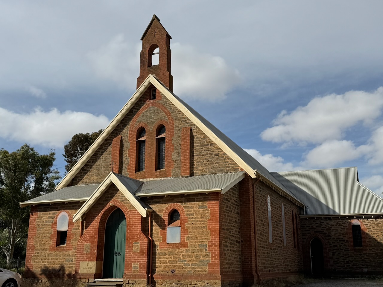
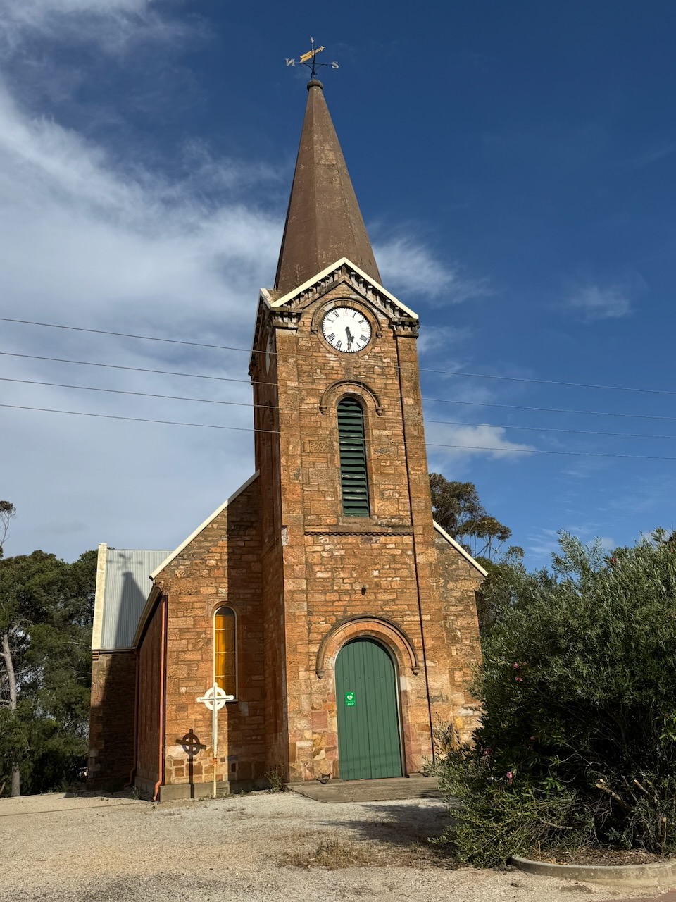
Christ Church Anglican church was built in 1857 and was extended in 1868. It was designed by the renowned South Australian architect Edmund William Wright. This was his second church and is the most intact of the remaining churches designed by Wright. The church contains a pipe organ from 1885. (Sa.gov.au 2026)
The foundation stone of the Kapunda Congregational Church was laid on the 21st day of June 1858. The church was opened on the 14th day of November 1858. (Flickr 2026)
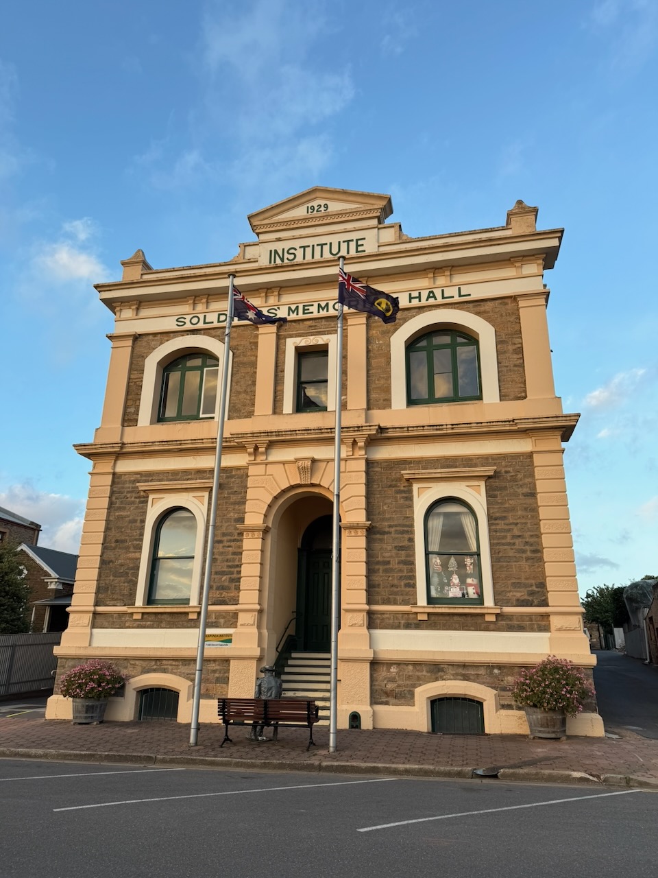
The Kapunda Institute Soldiers Memorial Hall is located on Hill Street. It was built in 1871.
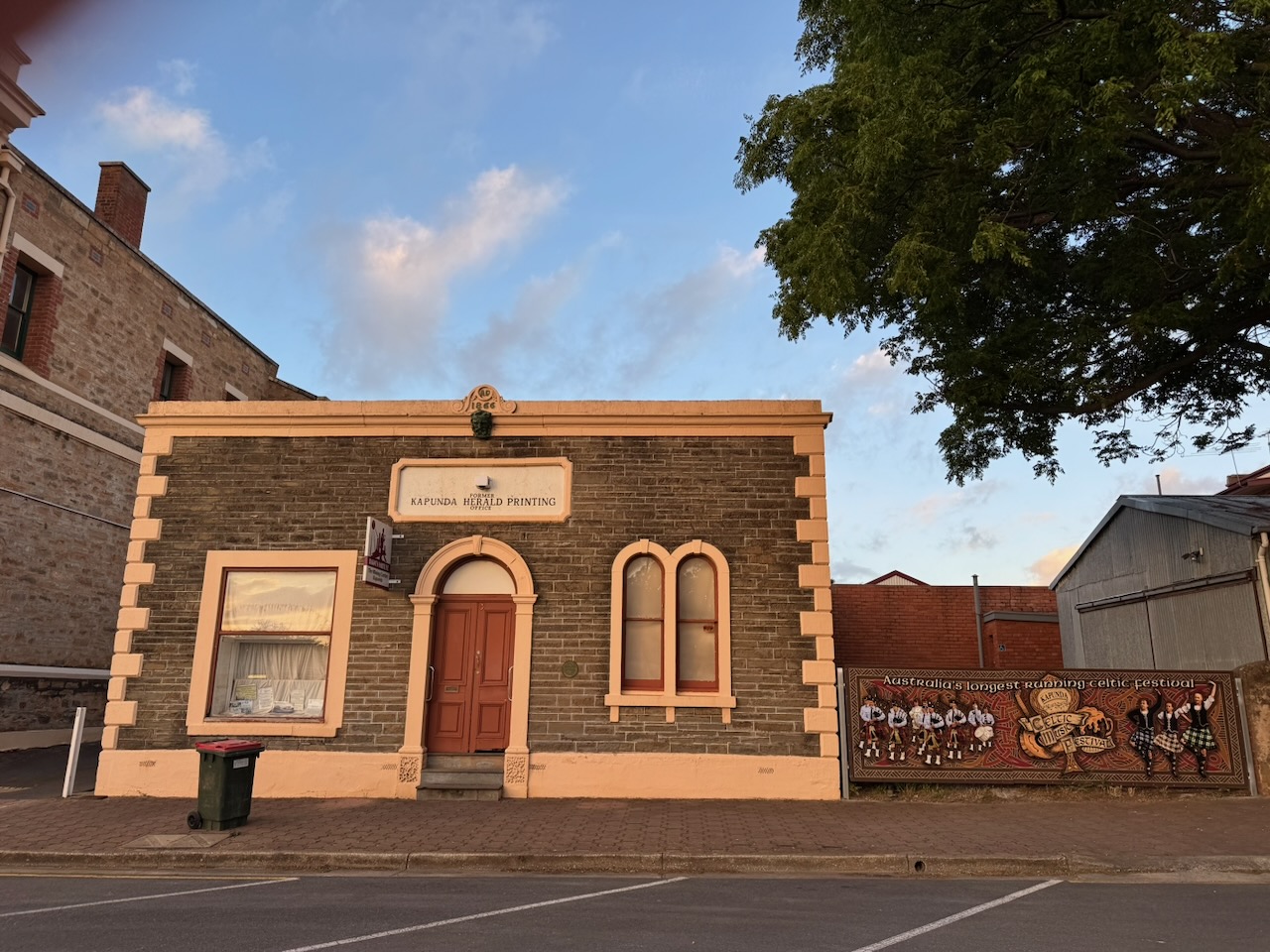
The Kapunda Herald Printing Office was built in 1866.
The Kapunda Herald was published in Kapunda between 1864 and 1951, and was founded by Charles Barton and Deutsche Zeitung. (State Libray SA 2026)
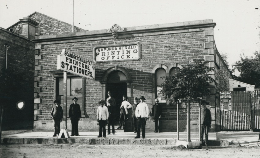
Above: The Kapunda Herald printing office, c. 1900. Image c/o State Library South Australia
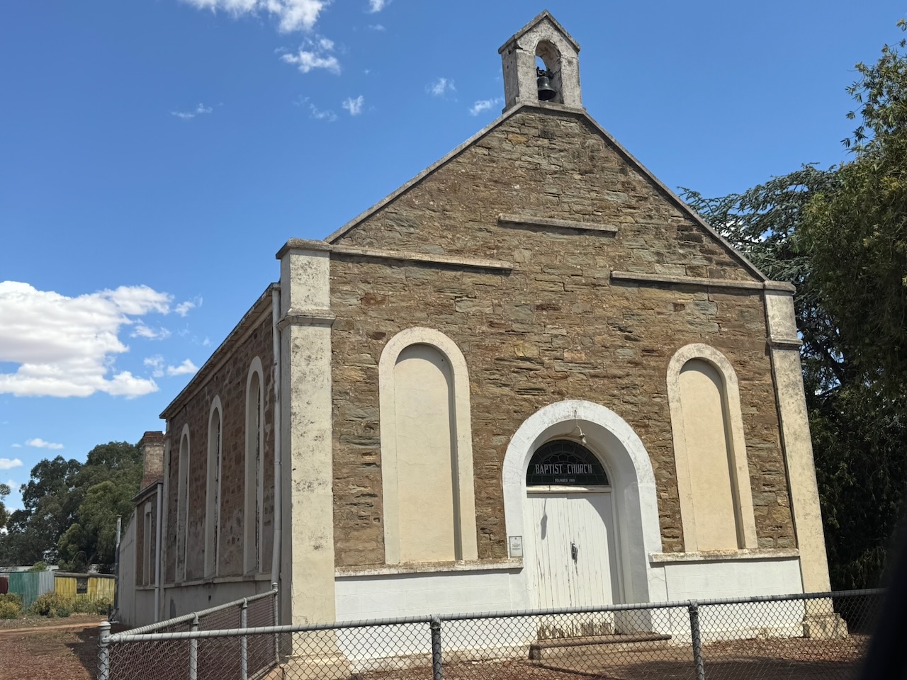
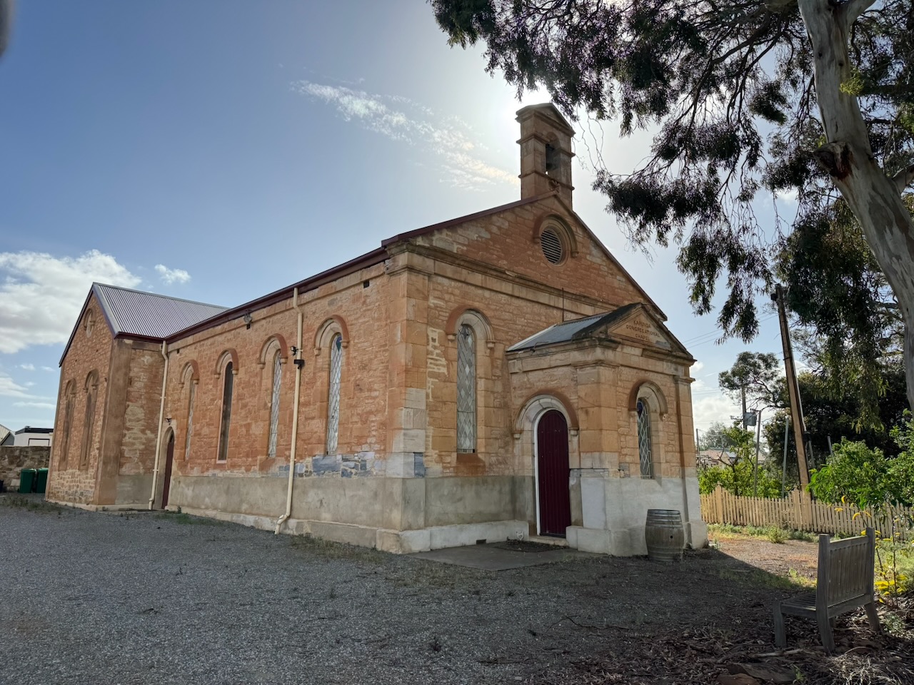
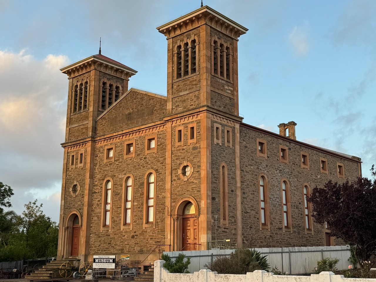
The very impressive Baptist church was built in 1866. It was used as a technical school from 1948 until the 1960s. It now houses the Kapunda Historical Society’s museum. (Sa.gov.au 2018)
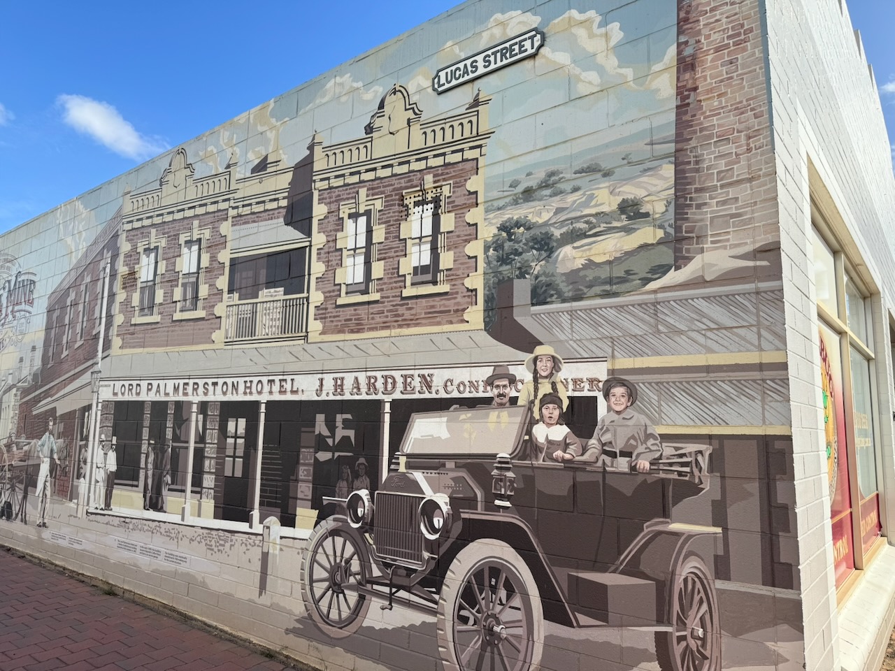
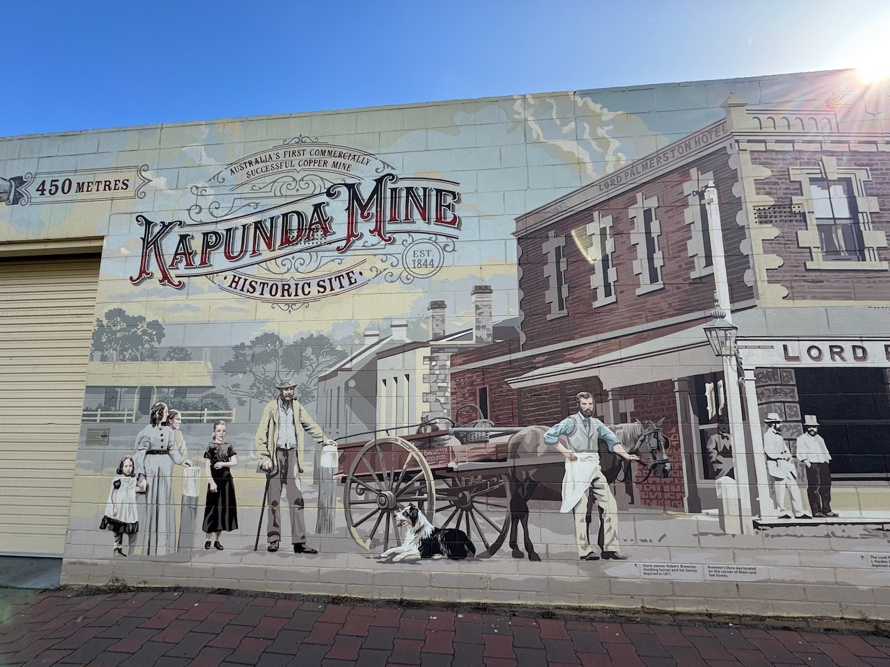
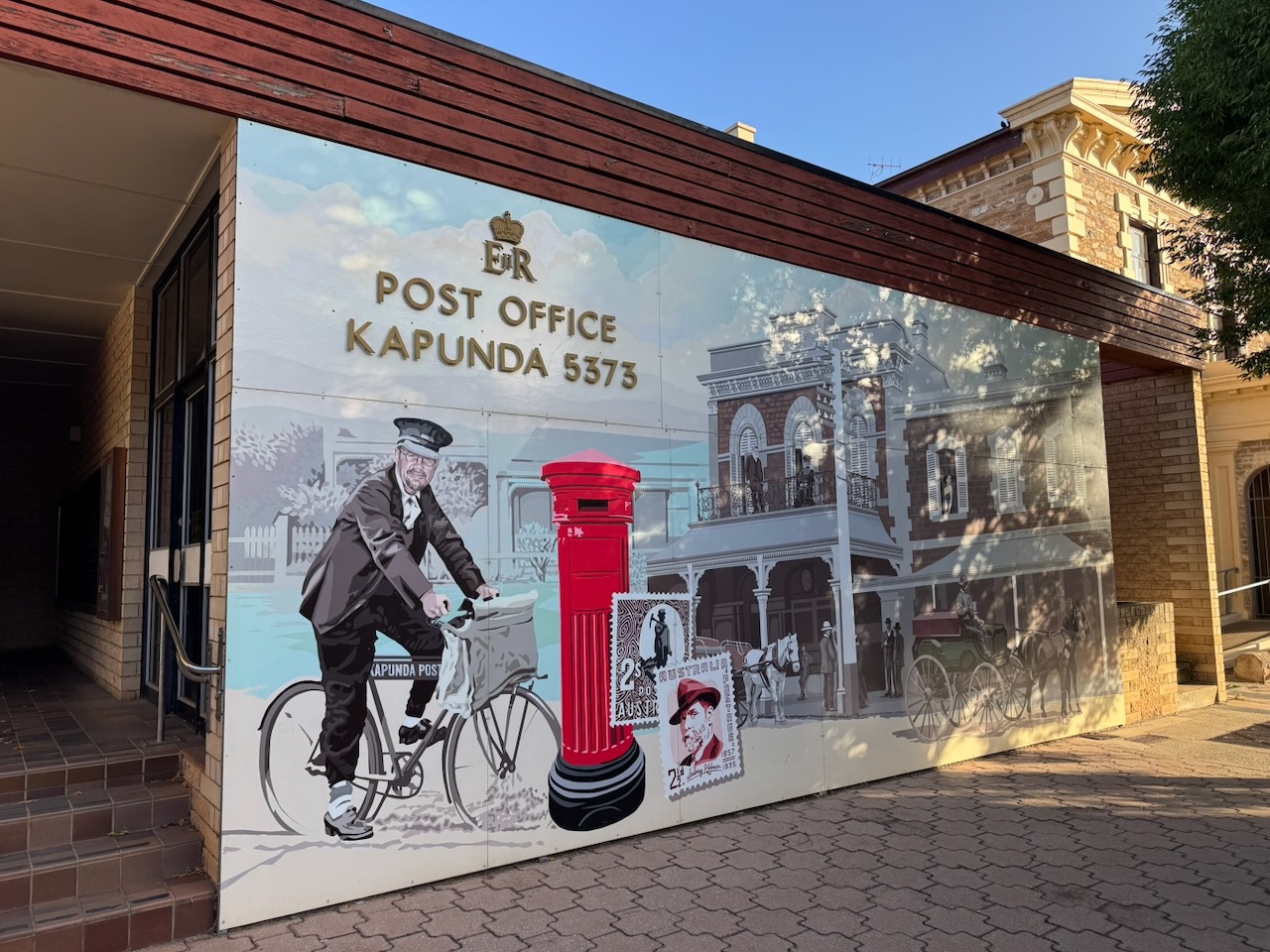
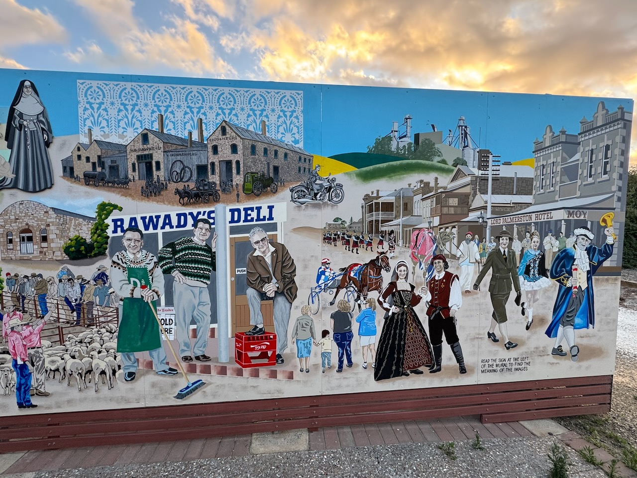
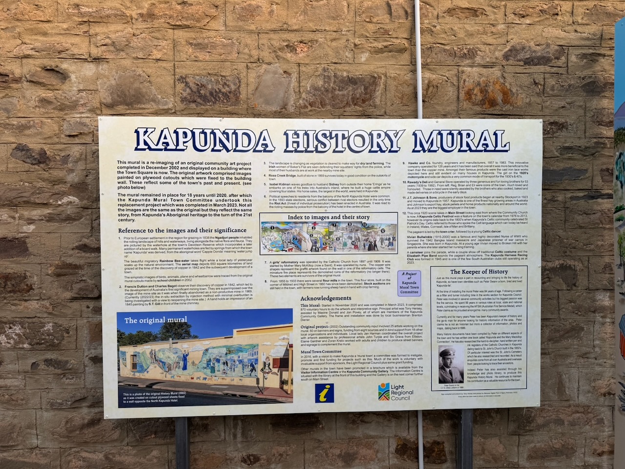
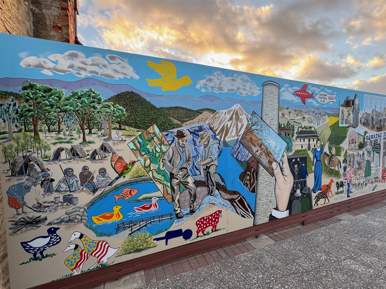
In Lucas Street, you can find a very impressive mural. It is one of 13 murals in Kapunda, part of the Kapunda Mural Town Project. (ABC 2024)
The mural on the Kapunda Post Office was nominated for a national art award. It depicts the original Post Office of 1910 and features a postman on a bicycle and a bright red heritage post box. (ABC 2024)
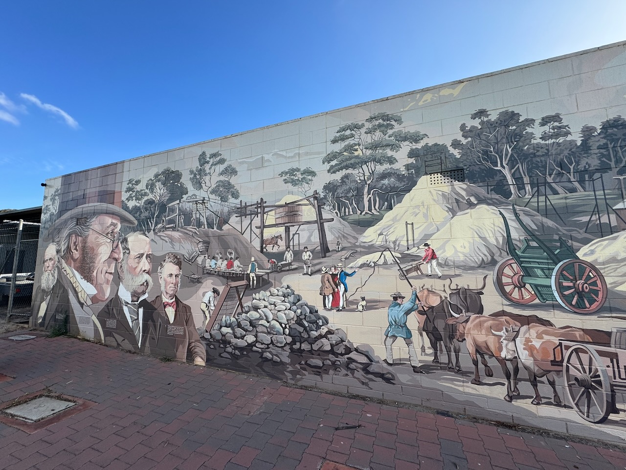
The Kapunda History Mural features Kapunda’s history, dating back to Aboriginal times to the turn of the 21st century.
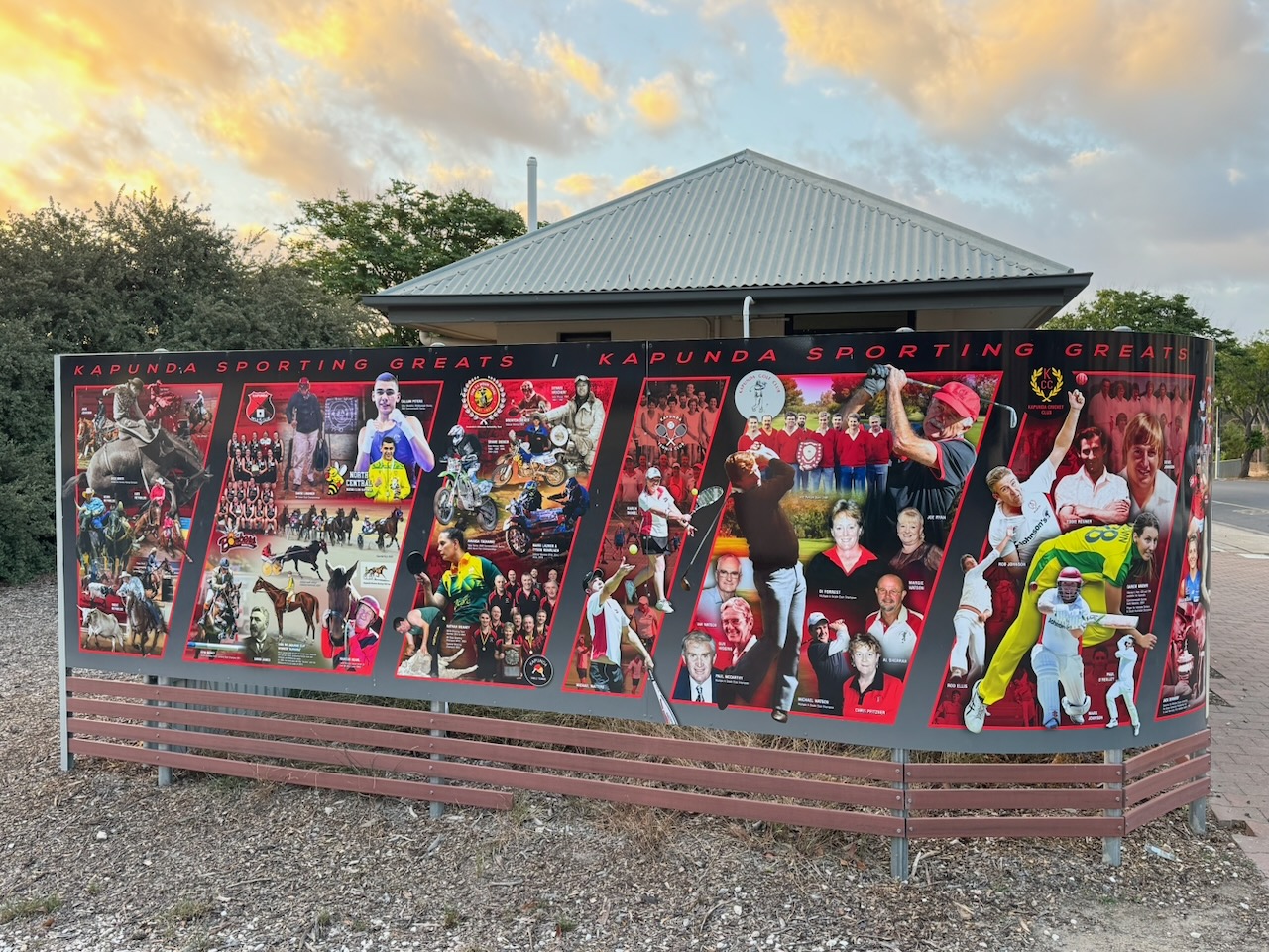
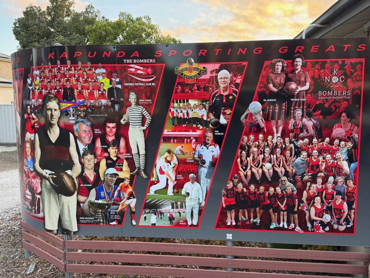
Adjacent, you can view a mural of Kapunda’s sporting greats.
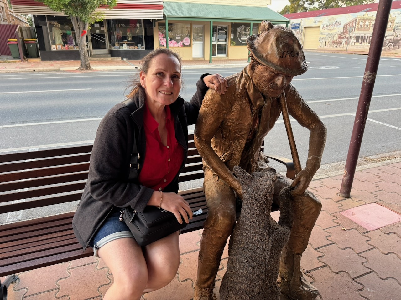
On the main street, we found this statue of a miner, taking a rest on a bench.
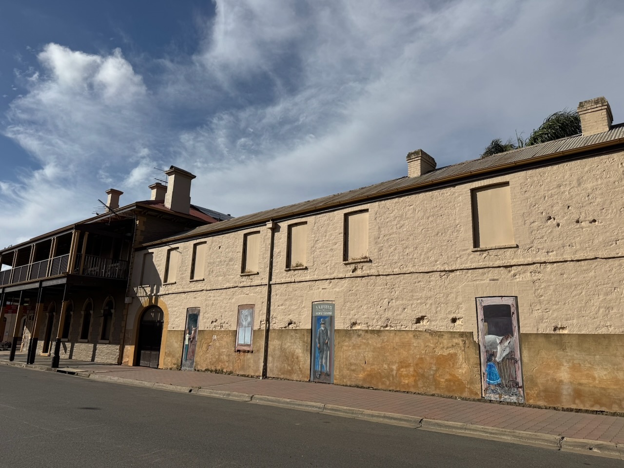
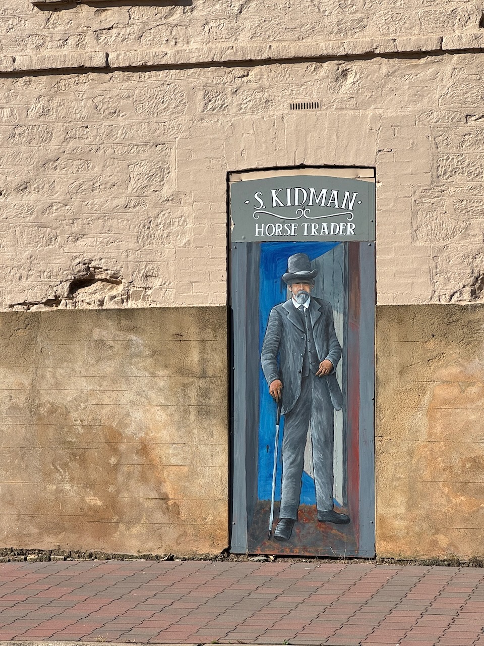
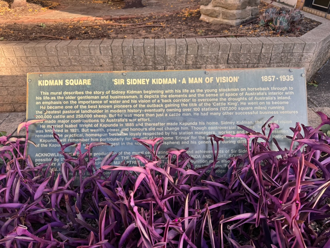
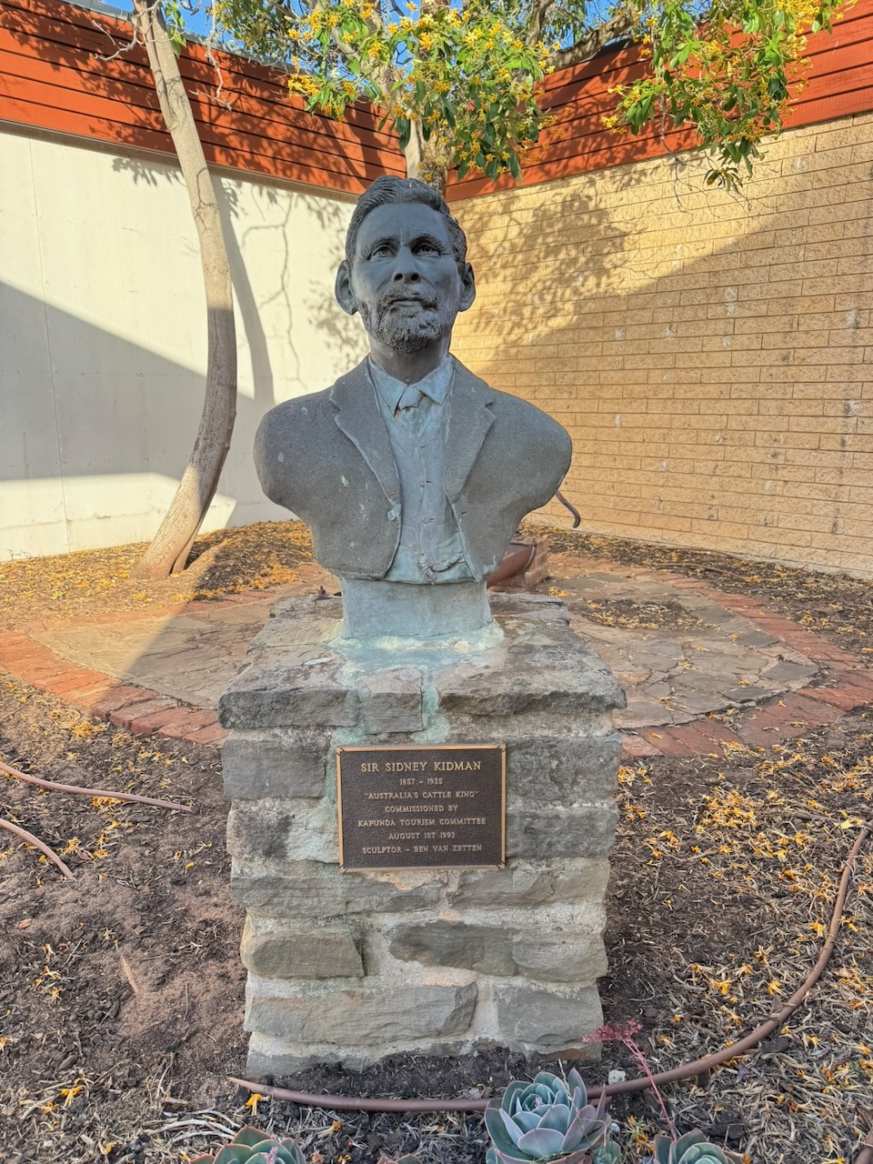
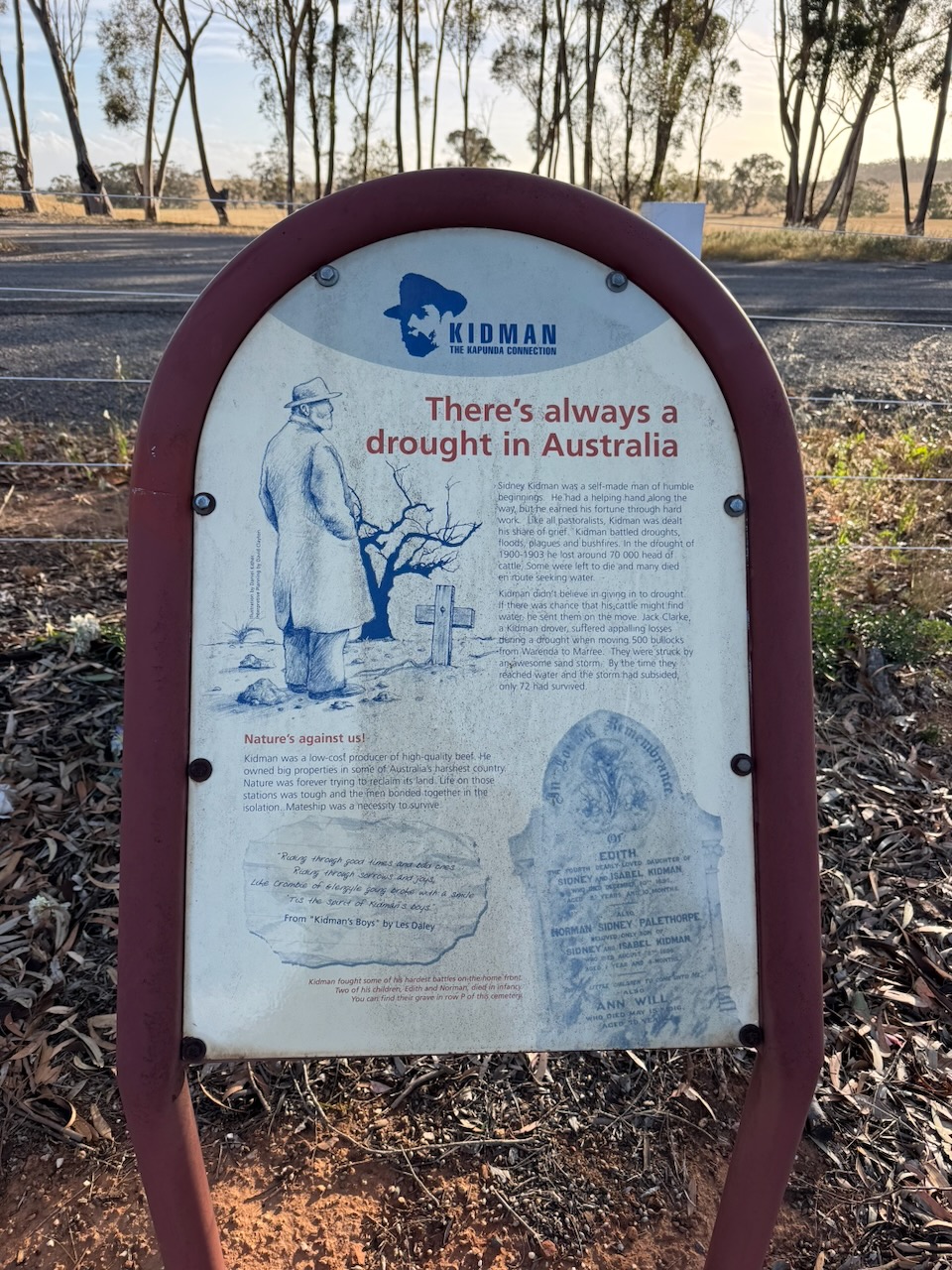
In Kidman Square is a monument for Sir Sidney Kidman, an Australian pastoralist and entrepreneur who was known as ‘the Cattle King’. He either owned or co-owned large tracts of land in Australia. (Wikipedia 2025)
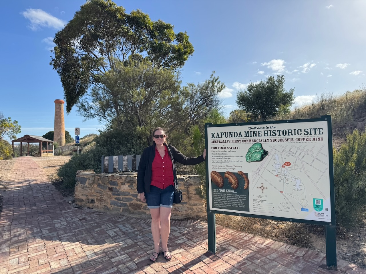
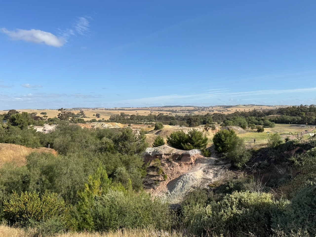
Marija and I then visited the Kapunda Mine Historic Site.
The Kapunda Mine was opened in 1833, following the discovery of copper in the district two years earlier in 1842. It was the first metal mine in South Australia to operate on a commercial level. South Australia had suffered a depression during the 1840s, and the Kapunda Mine assisted with the economic recovery of the colony of South Australia. The mine was also the first in South Australia to use large open-cut mining methods. The Kapunda mine closed in 1878. (SA.gov.au 2026)
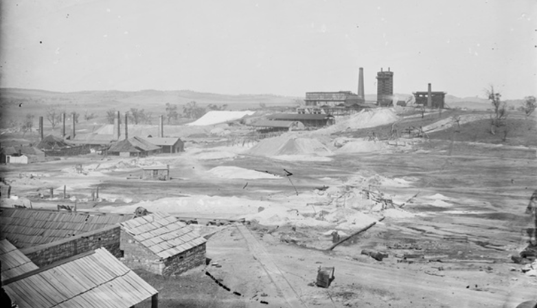
The photograph below shows the mine in the 1860s.
Above: the Kapunda Mine, c. 1860s. Image c/o State Library South Australia
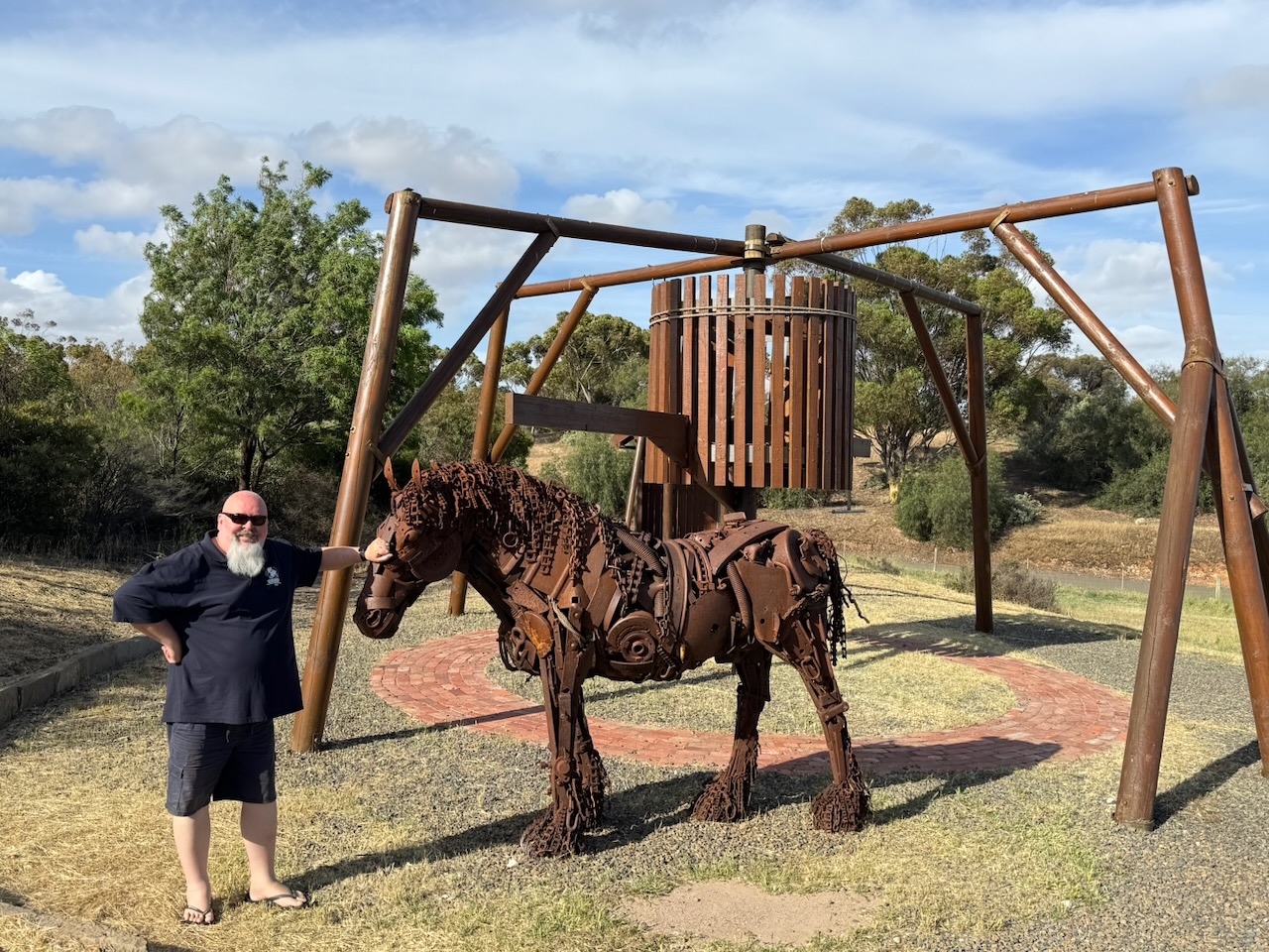
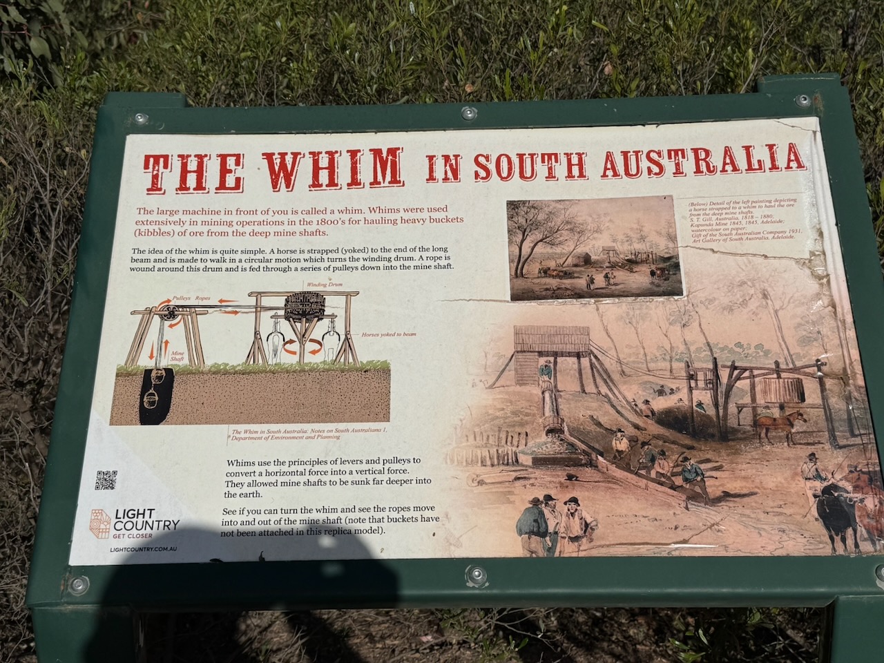
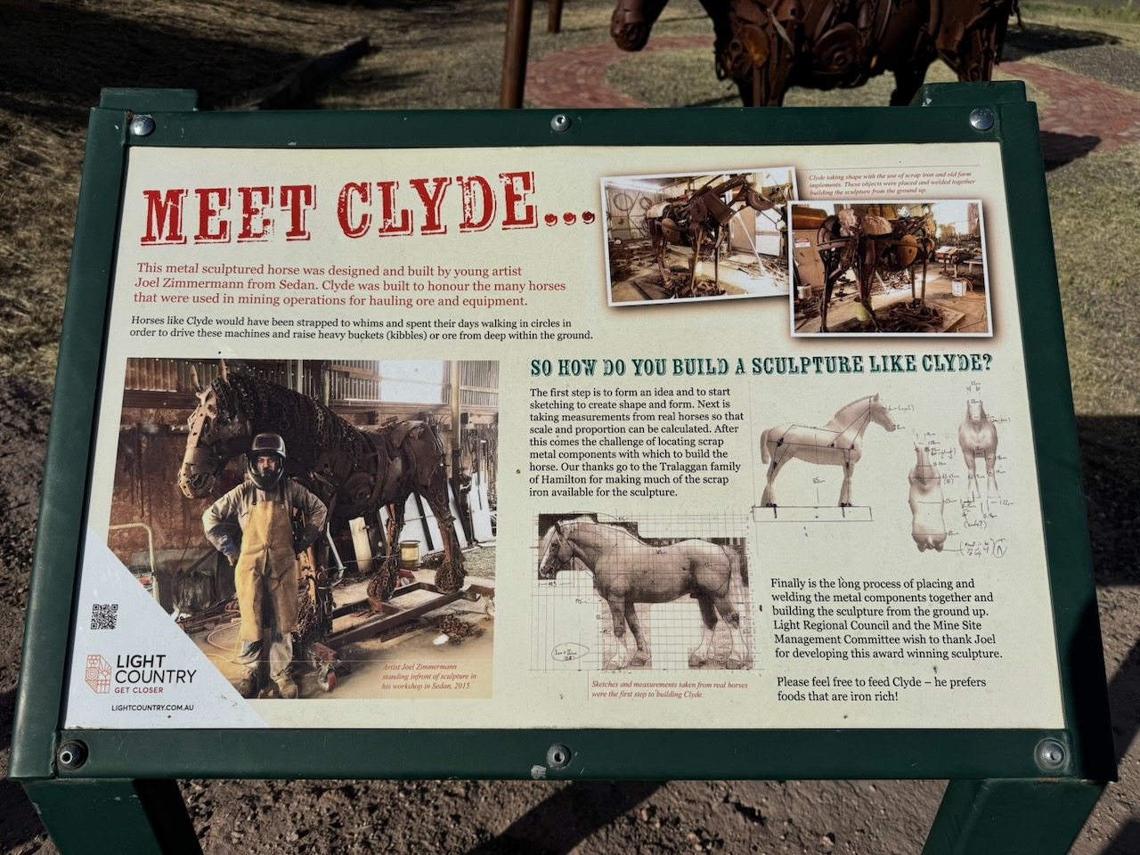
There is a replica of the first horse whim used at the mine site. Whims were used extensively in mining operations in the 1800s for hauling heavy buckets called kibbles of ore from the deep mine shafts. The horse sculpture is Clyde, designed and built by Joel Zimmermann from Sedan, to honour the numerous horses that were used in mining operations to haul ore and mining equipment.
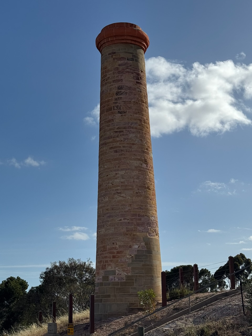
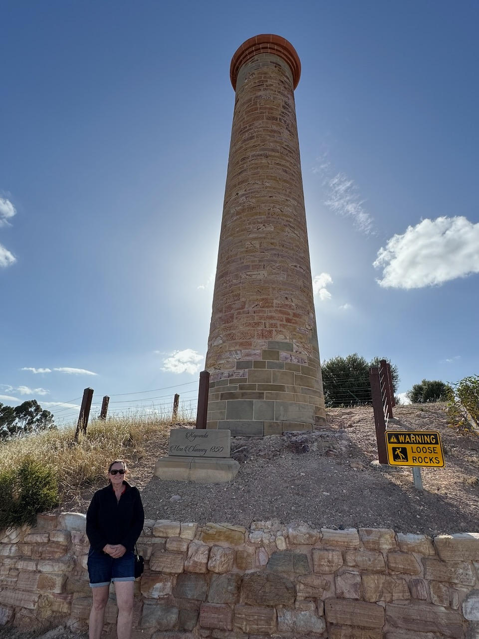
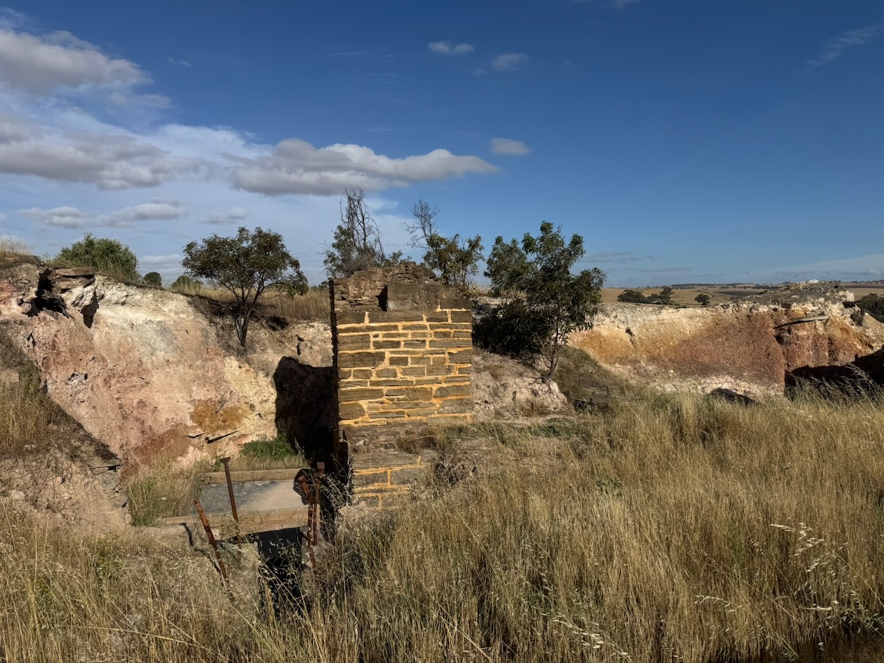
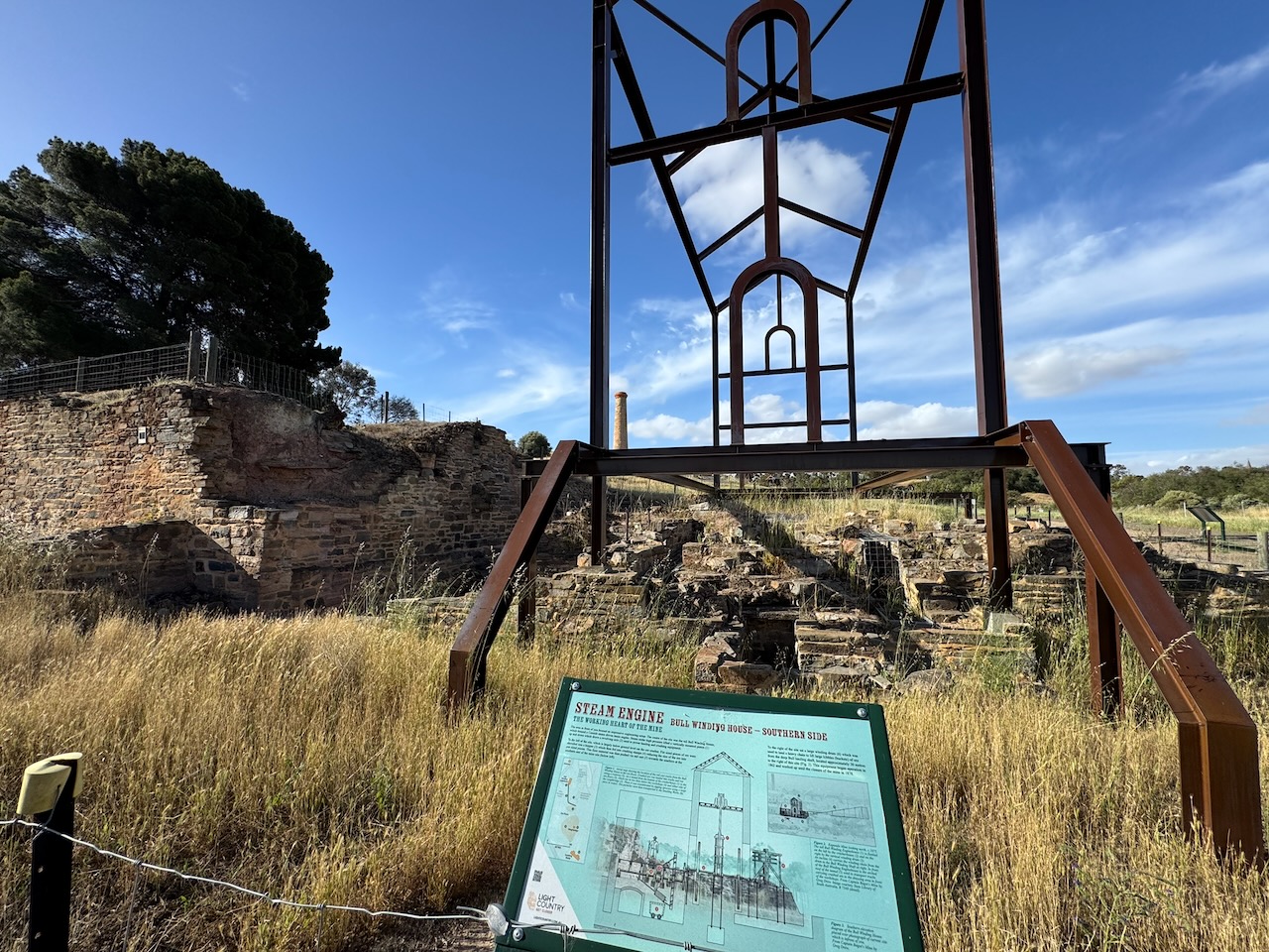
Certainly, the most impressive feature at the site is the mine chimney which was constructed in 1850.
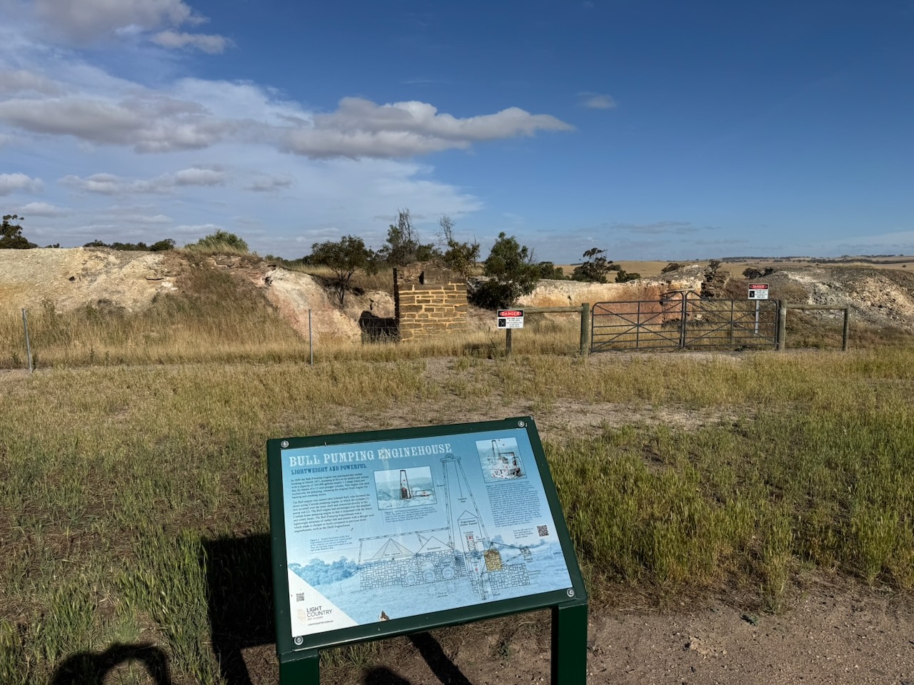
The ruins of the Bull Pumping enginehouse can also be viewed. In 1850, the Bull Pumping Engine was purchased and commenced operation in March 1851. The Bull engine was named after Edward Bull, who invented the direct-acting Cornish pumping engine
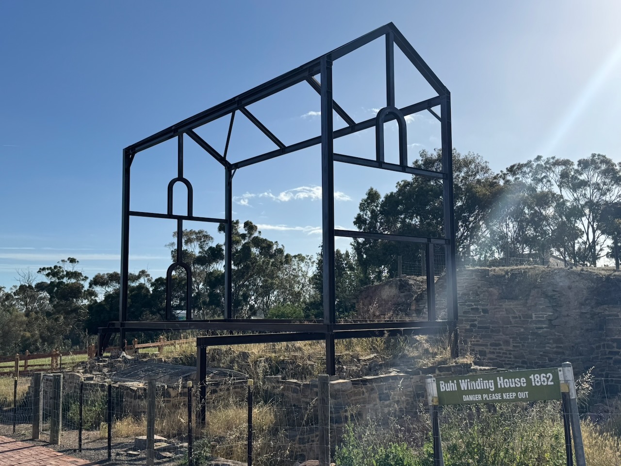
The ruins of the Bull Winding House can also be viewed.
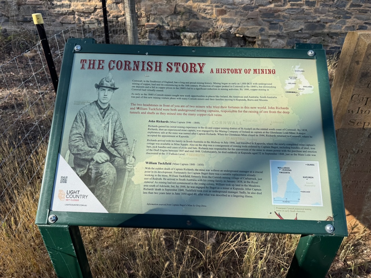
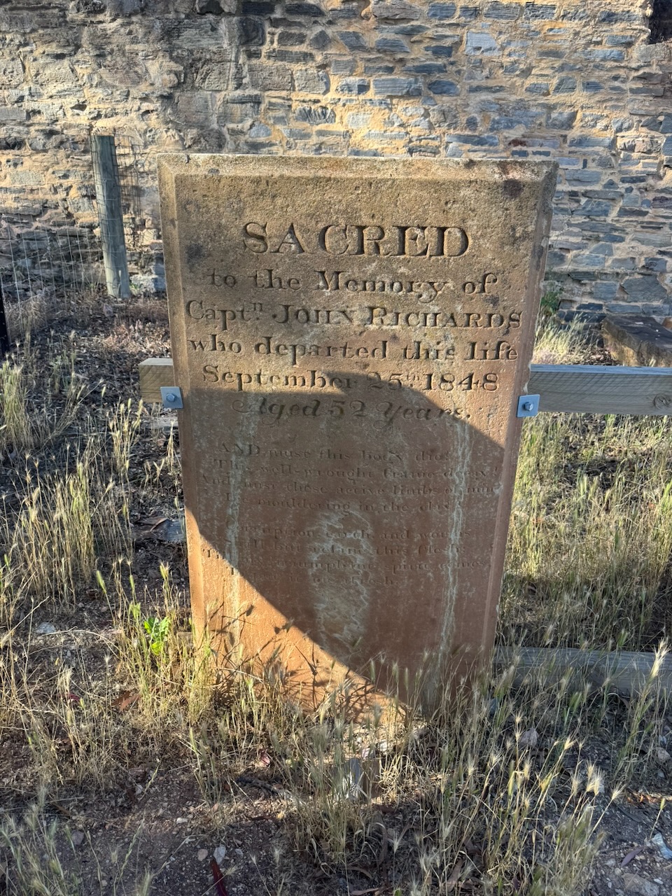
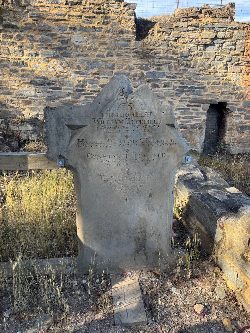
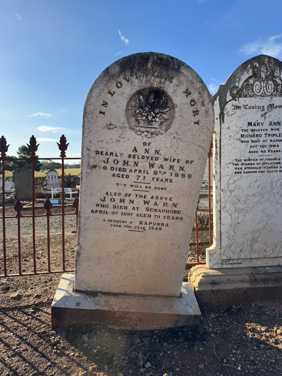
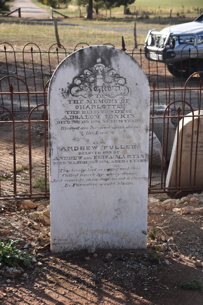
At the site are two headstones. One is for Captain John Richards. The other is for William Tuckfield, Harriet Tuckfield, and Constance Tuckfield.
John Richards was born in 1796 in Gwinear, Cornwall, England. In 1821, he married Amy Eddy in Cornwall. He gained his mining experience by working in the tin and copper mining district of St Austell in Cornwall. By 1838, he was employed as the mine captain at the Glendasan Lead mine. He arrived in South Australia with his family in July 1846 aboard the Medway. They settled in Kapunda and lived in the newly completed mine captain’s cottage in Mine Square. Captain Richards died in September 1848, aged 52 years.
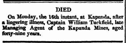
Following the sudden death of Captain Richards, the Kapunda mine was without an underground manager. Following his death, William Tuckfield commenced as the underground manager. William Tuckfield was born on the 22nd day of November 1801 in Gwennap, Cornwall, England. In April 1828, he married Constance Gillard in Cornwall. Along with their three children, they emigrated to Australia, arriving in January 1838 aboard the Royal Admiral. They initially settled in Meadows in the Adelaide Hills, before moving to Kapunda, where William worked as a miner. He died on the 17th day of June 1850, aged 52 years, following what was described as a ‘lingering illness.’ (ancestry 2016) (Trove 2026)
Above: article from the Adelaide Times, Fri 21 Jun 1850. Image c/o Trove
Just 2 months before William’s death, his daughter, Harriet Williams Tuckfield, was born in April 1850 at Kapunda. Sadly, she died on the 10th day of January 1851, aged 9 months. William’s wife, Constance Tuckfield, died on the 27th day of October 1852, aged 48 years. I wonder who took on the role of looking after their surviving children? (ancestry 2016)
Marija and I also visited the historic Kapunda Cemetery. The first recorded burial in the cemetery was in November 1851 for Christopher Biggs, who drowned at Light Bridge, Kapunda. (Light Regional Council 2023)
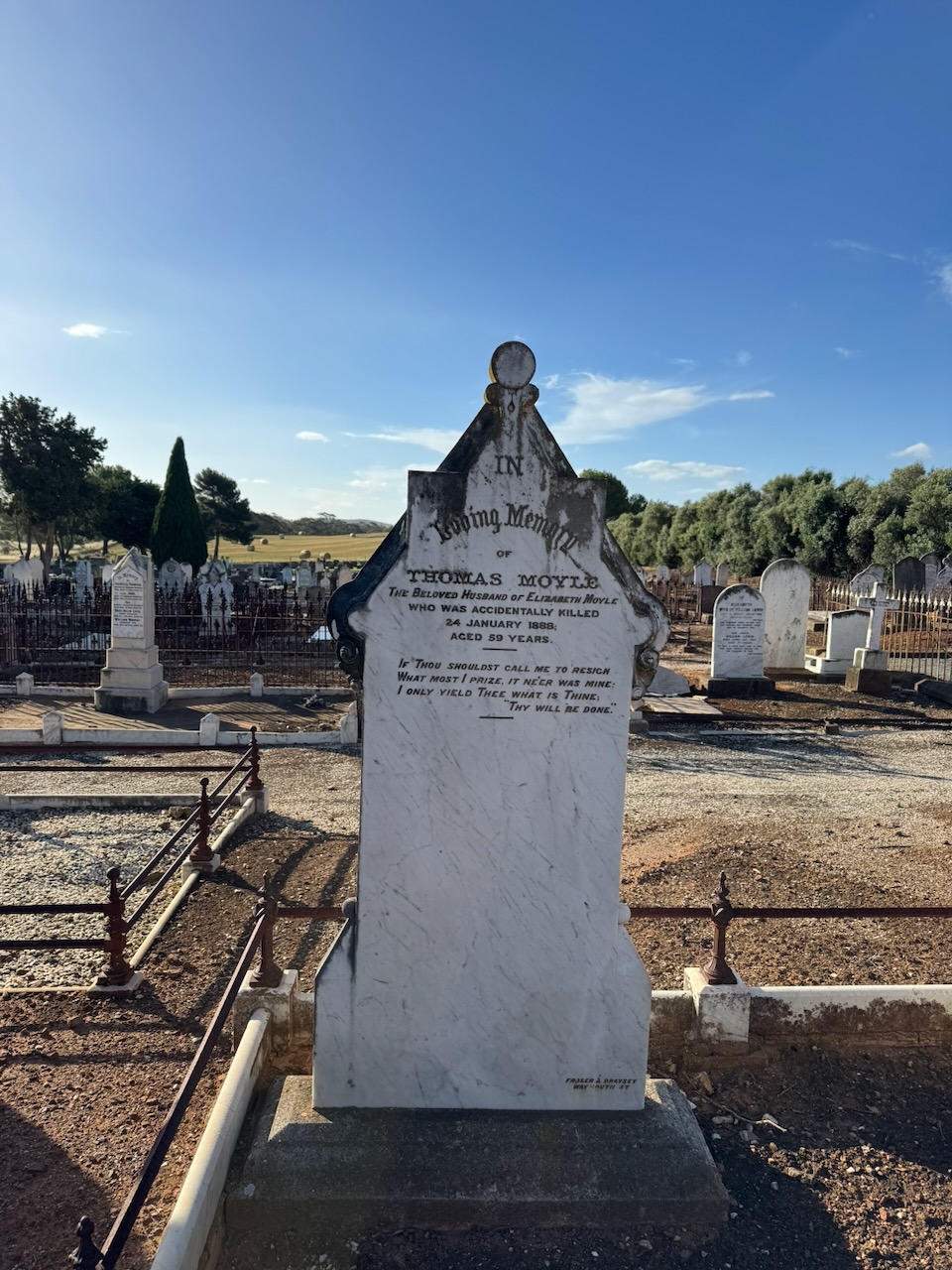
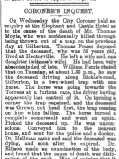
Thomas Vivian Moyle was born in Cornwall, England in c. 1828. He emigrated to Australia in 1852 aboard the Phoebe Dunbar. In 1854, he married Elizabeth James. (ancestry 2016)
Thomas was a publican of the Hamilton Hotel at River Light from 1855 to 1860. In 1861, he became the manager/licensee of the Kadina Exchange Hotel. In 1867, he became ‘Mine Host’ of the Strathmore Hotel. In 1871, he became the licensee of the Rising Sun Hotel in Auburn. (wikitree 2022)
Thomas died on the 24th day of January 1888, at Gilberton, South Australia, aged 59 years, as a result of injuries he sustained in an accident while driving a 2-wheel trap. An inquest was held by the City Coroner at the Elephant and Castle Hotel on the 26th day of January 1888. It was reported that he was seen travelling on Bickles Road, Gilberton, at a ‘furious rate’. He lost control and was thrown headfirst out of the trap. He was conveyed whilst unconscious to a residence, and the police and doctor were called, but he died from his injuries. (ancestry 2016) (Trove 2026) (wikitree 2022)
The South Australian Register recorded that ‘The Jury were of opinion that deceased came to his death from dislocation of the neck caused by being thrown out of a trap, and that no blame attached to any one.” (Trove 2026)
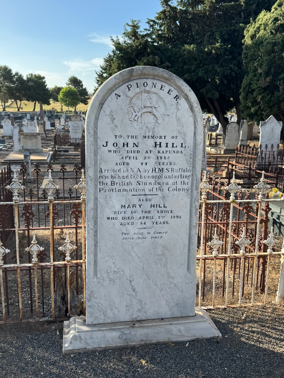
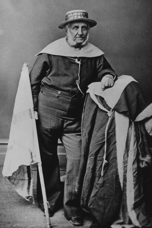
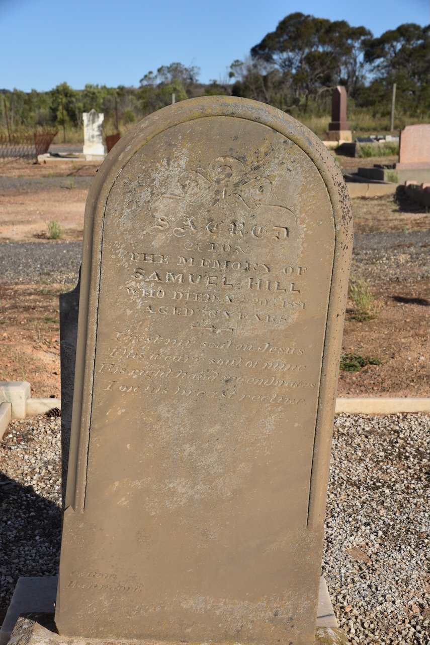
John William Hill was born in 1808 in Hertfordshire, England. John emigrated to South Australia aboard the HMS Buffalo in 1836. He died on the 2nd day of April 1885, aged 77 years. (ancestry 2016)
His headstone records that John had the honour of unfurling the British standard at the Proclamation of the Colony.
Above: John Hill. Image c/o ancestry.com.au
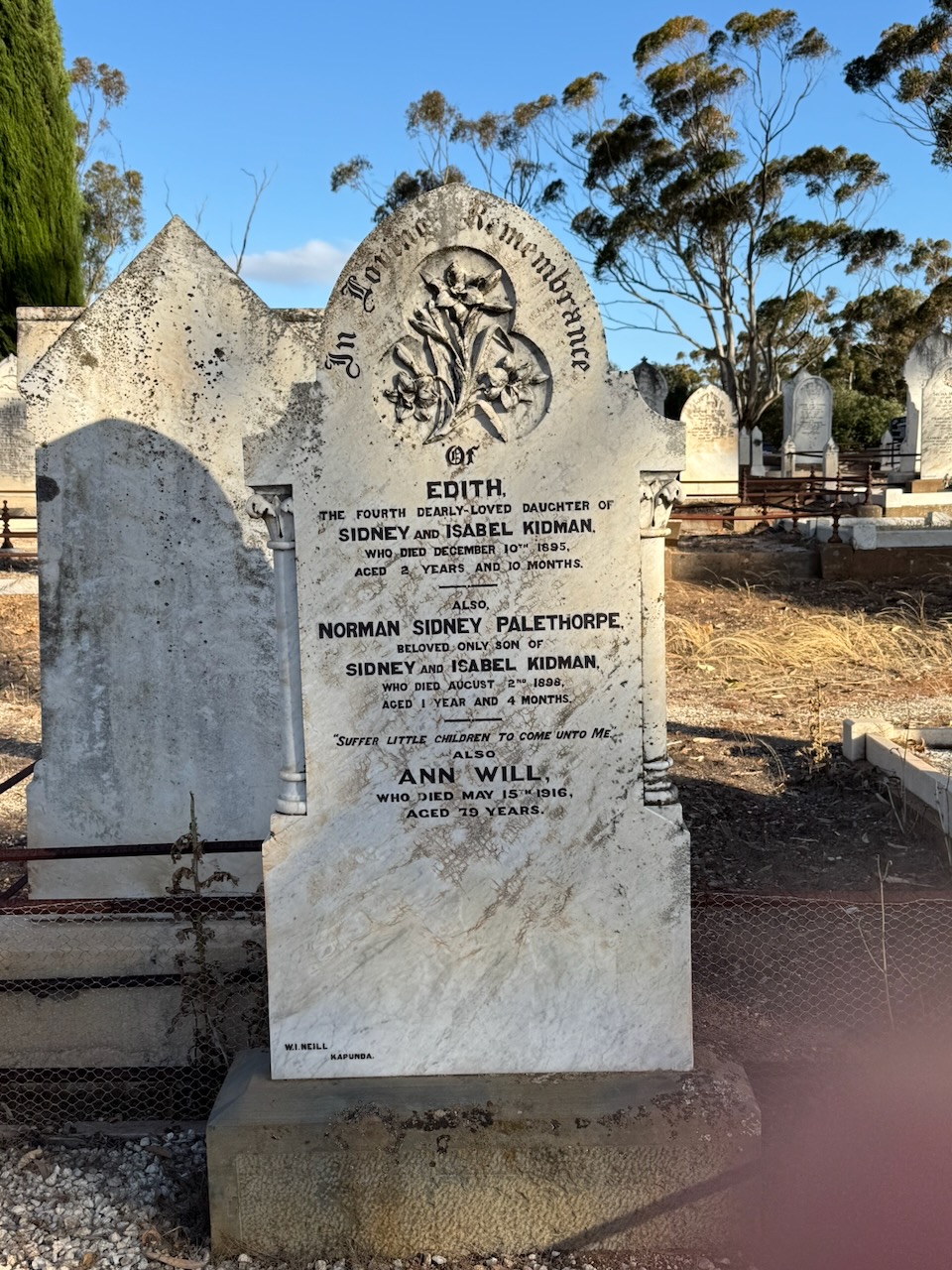
A headstone that caught our attention was the one below, for Edith Kidman and Norman Sidney Palethorpe Kidman. They were the children of Sidney Herbert Kidman and Isabel Brown Kidman, nee Wright. I spoke about Sir Sidney Kidman earlier in this post.
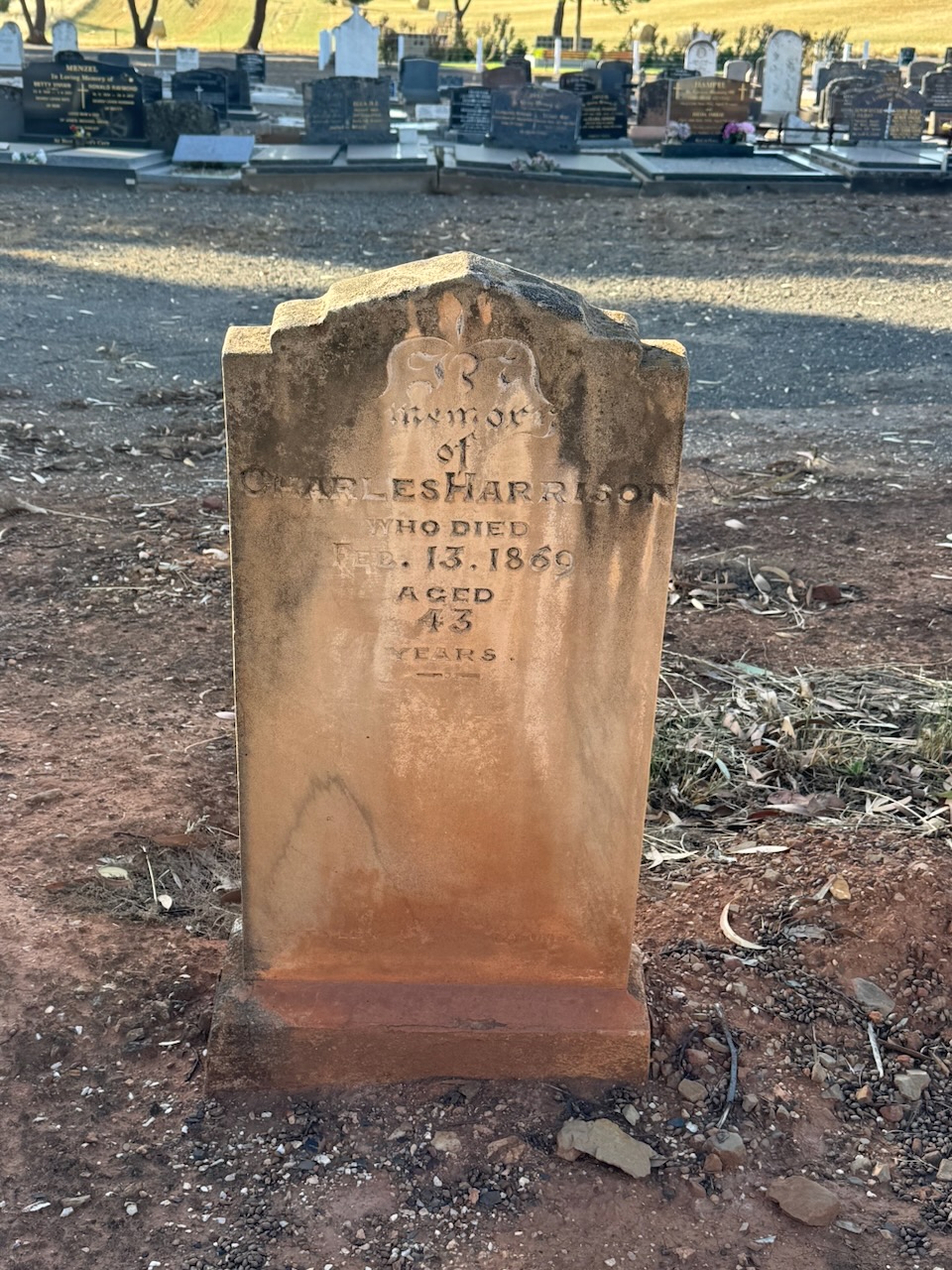
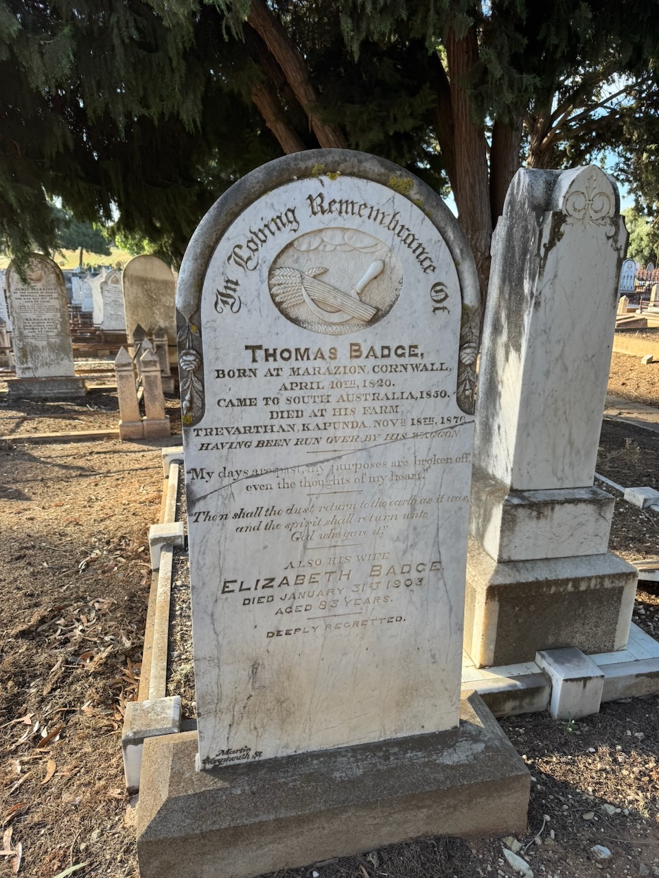
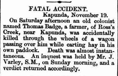
Thomas Badge was born in 1820 in Marazion, Cornwall. He emigrated to Australia in 1850.
Thomas died on the 18th day of November 1876 on his farm, Trevarthan, at Kapunda, after he was run over by his wagon while carting hay. (Trove 2026)
Above: article from the Evening Journal, Adelaide, Mon 20 Nov 1876. Image c/o Trove
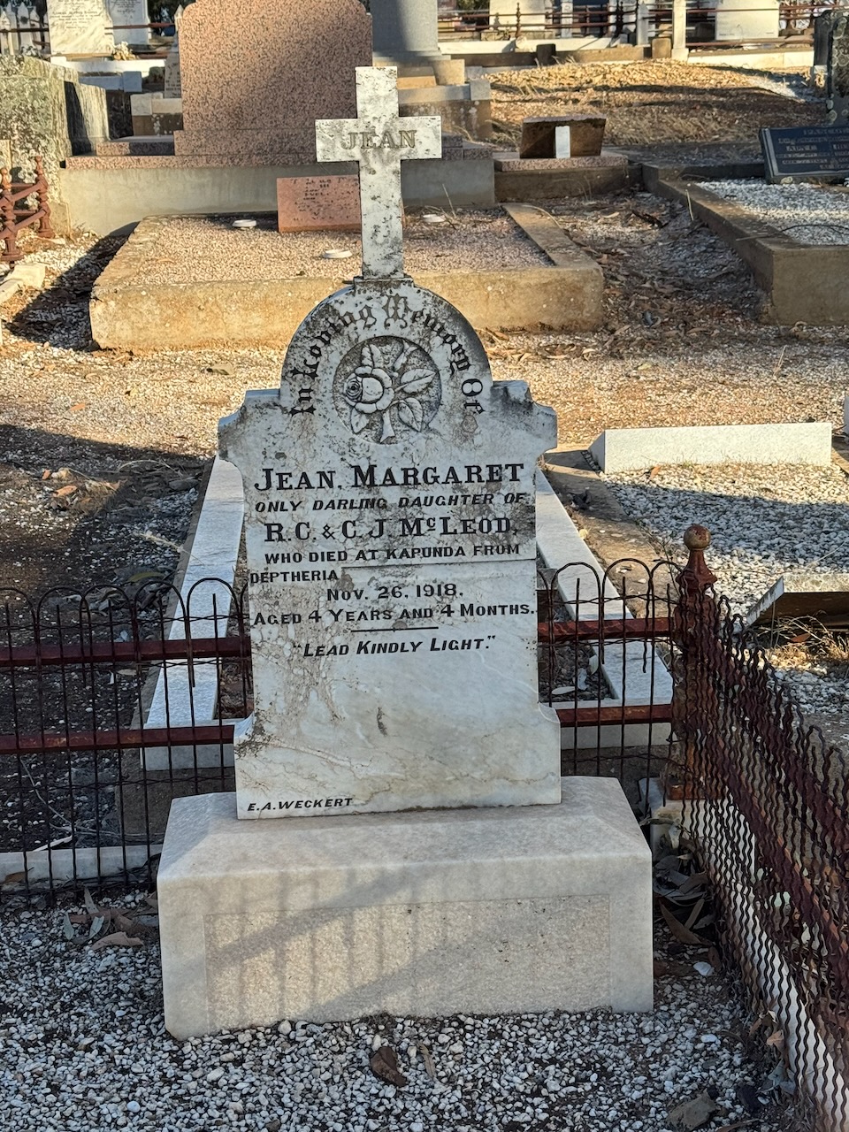
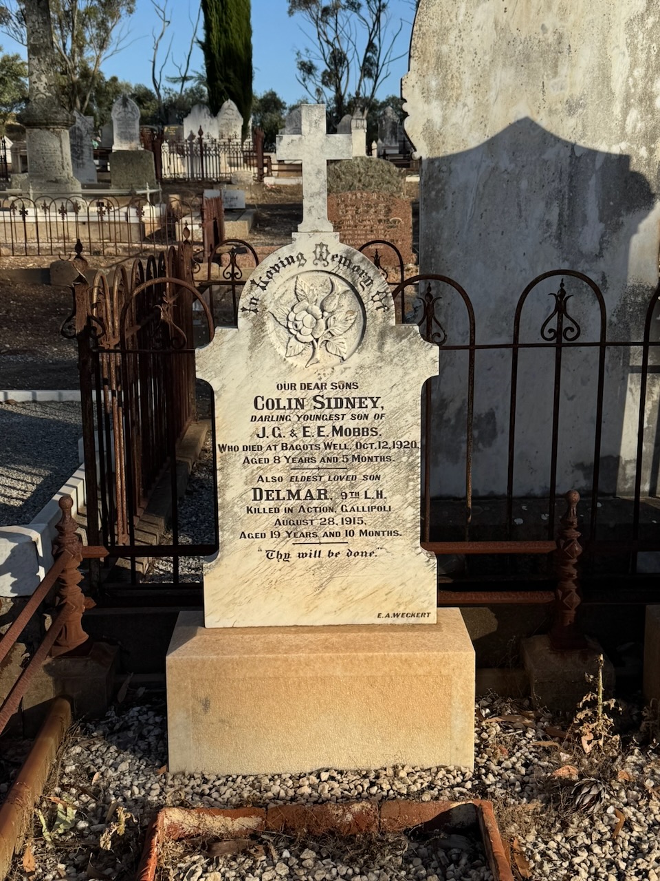
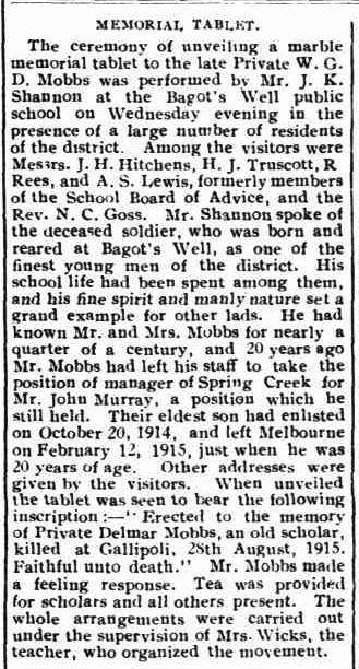
William George Delmar Mobbs was born on the 11th day of October 1895 in Bagots Well near Kapunda. His parents were John George Mobbs and Elizabeth Esther Mobbs, nee Hughes. (ancestry 2016)
Delmar, as he was known, enlisted for service during the First World War and served with the 9th Australian Light Horse. He was killed on the 28th day of August 1915 at Gallipoli, Turkey. He was just 19 years old. Delmar is buried at Hill 60 Cemetery, Turkey. (ancestry 2016)
In February 2016, a ceremony was held at the Bagots Well Public School, where a marble memorial tablet was unveiled to Delmar. He had attended school there and was described as “his fine spirit and manly nature set a grand example for other lads.” (Trove 2026)
Above: article from the Kapounda Herald, Fri 25 Feb 1916. Image c/o Trove
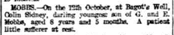
Three years before Delmar’s death, his younger brother Colin Sidney Mobbs was born in May 1912. He died on the 12th day of October 1920 at Bagots Well, aged 8 years. (ancestry 2016)
Above: article from The Register, Wed 13 Oct 1920. Image c/o Trove
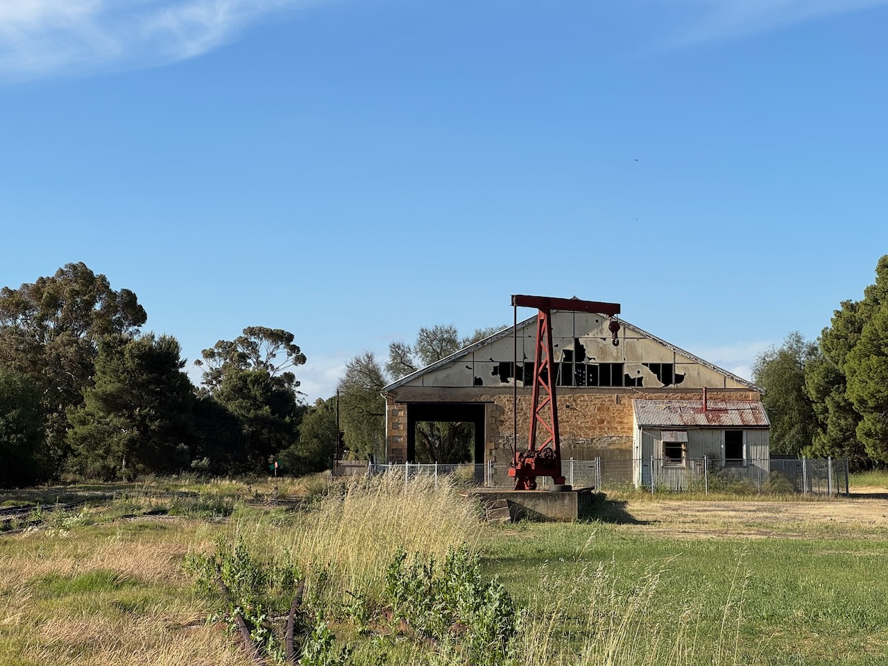
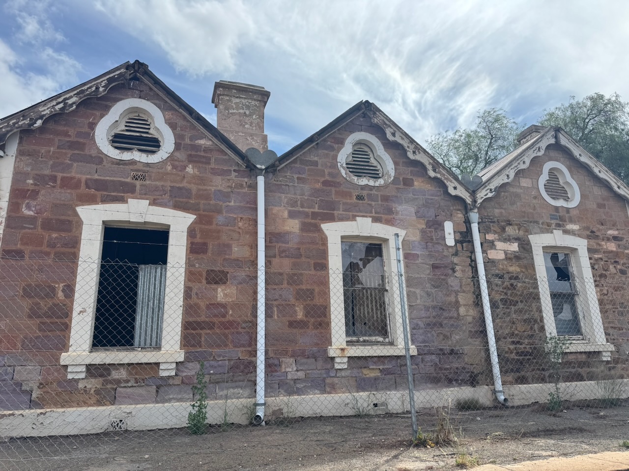
On our way to the silo, we drove past one of the old railway sheds on Hancock Road, which is in a very poor state of repair.
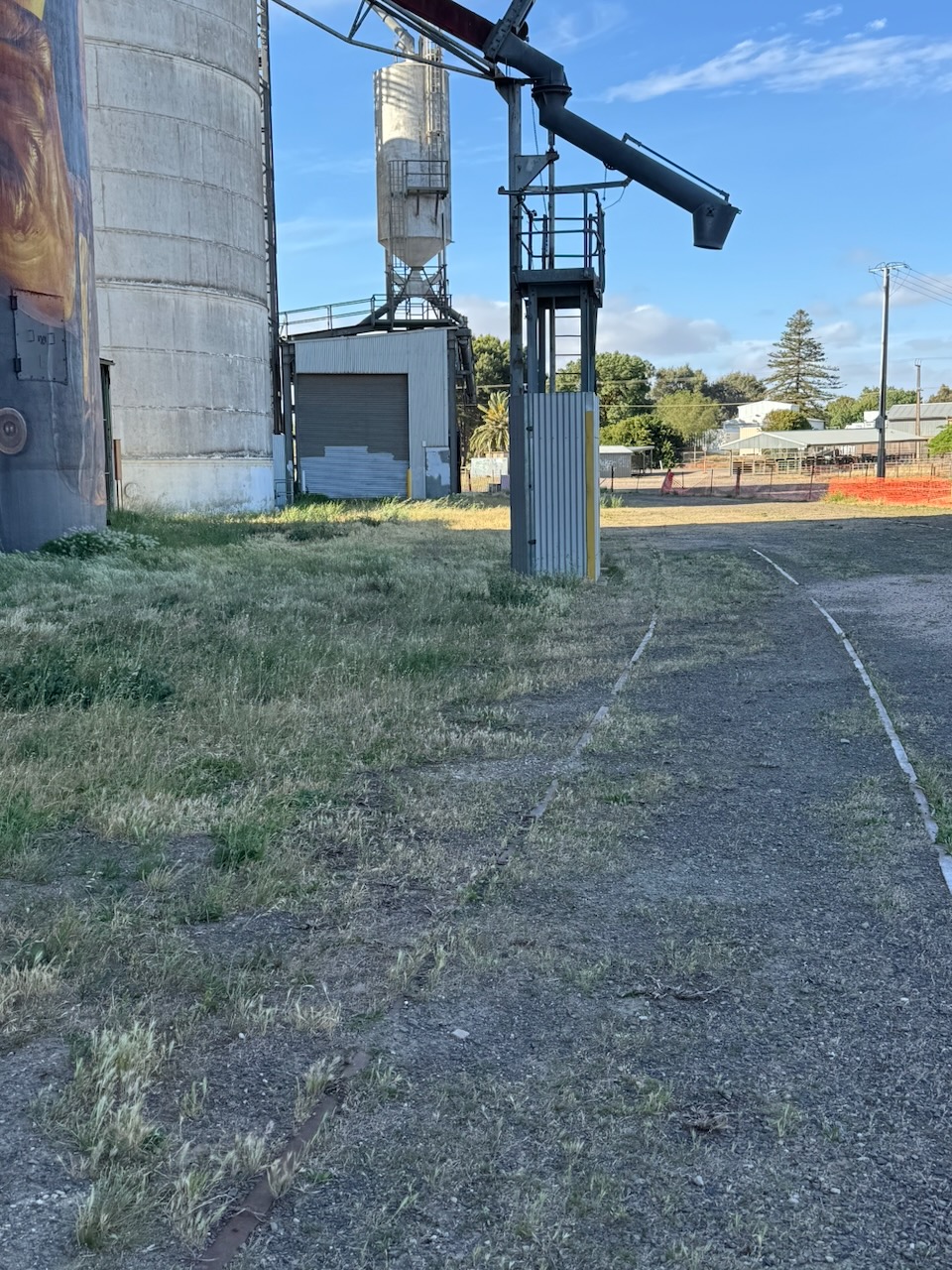
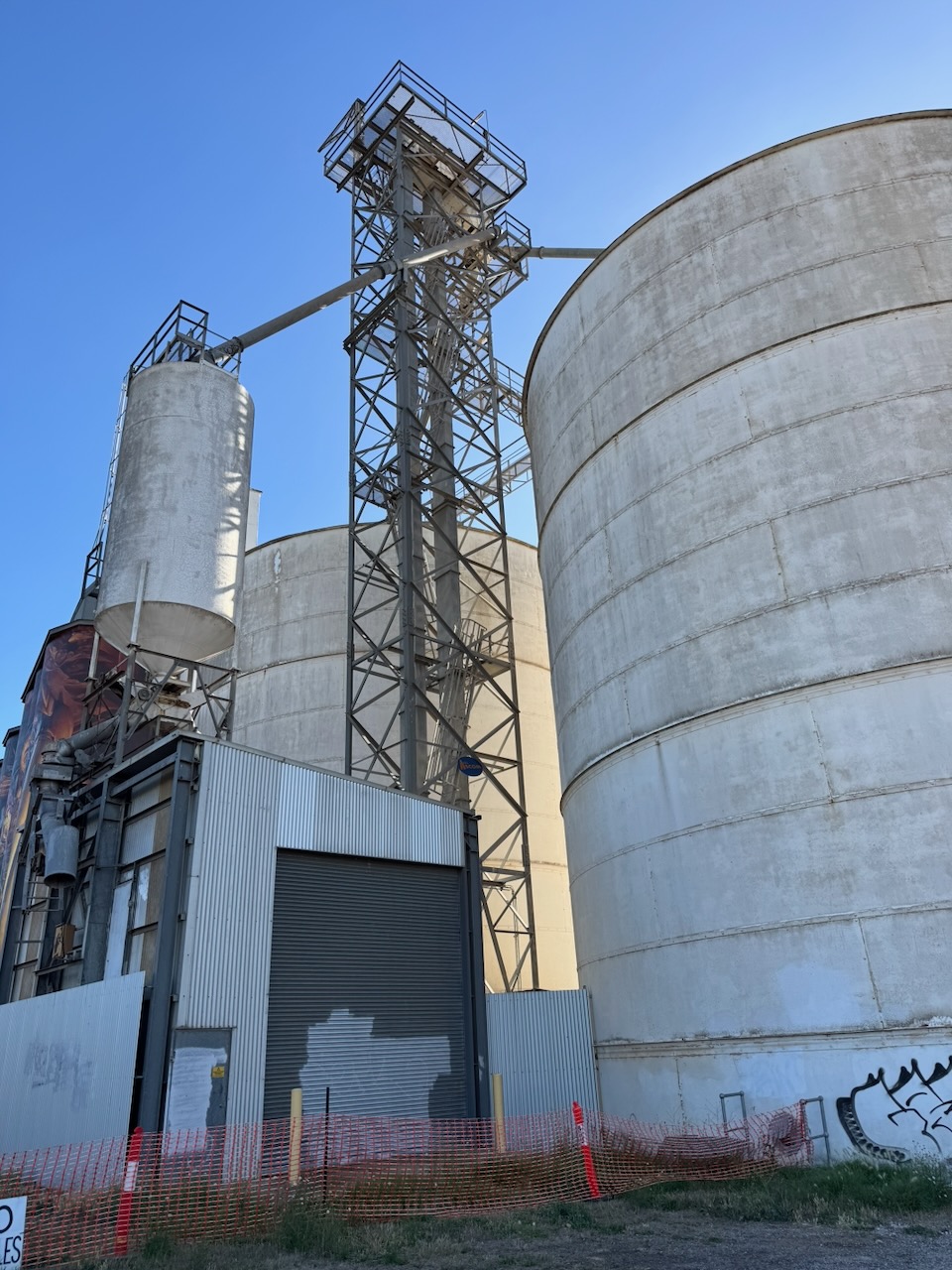
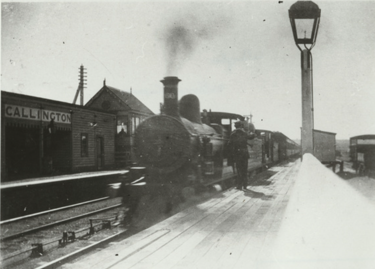
The silos are located alongside the old Morgan railway line. The railway station at Kapunda was opened in August 1860 when the railway line was opened from Gawler to serve the copper mining industry at Kapunda. It was closed in December 1968. (Wikipedia 2025)
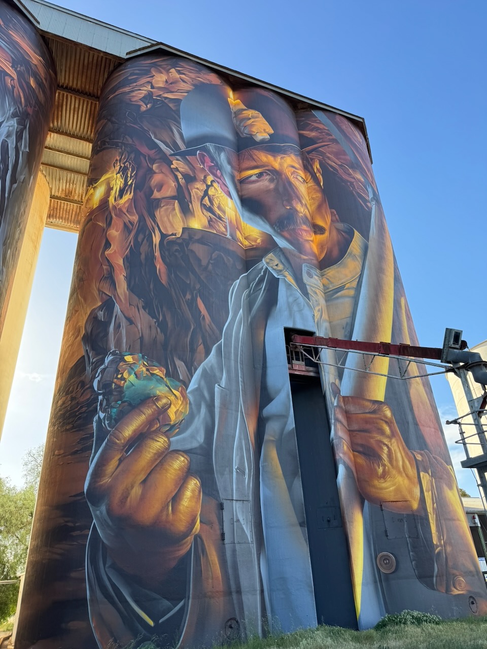
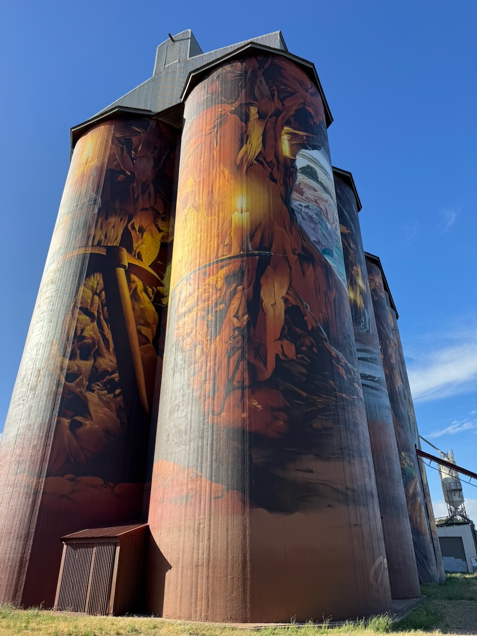
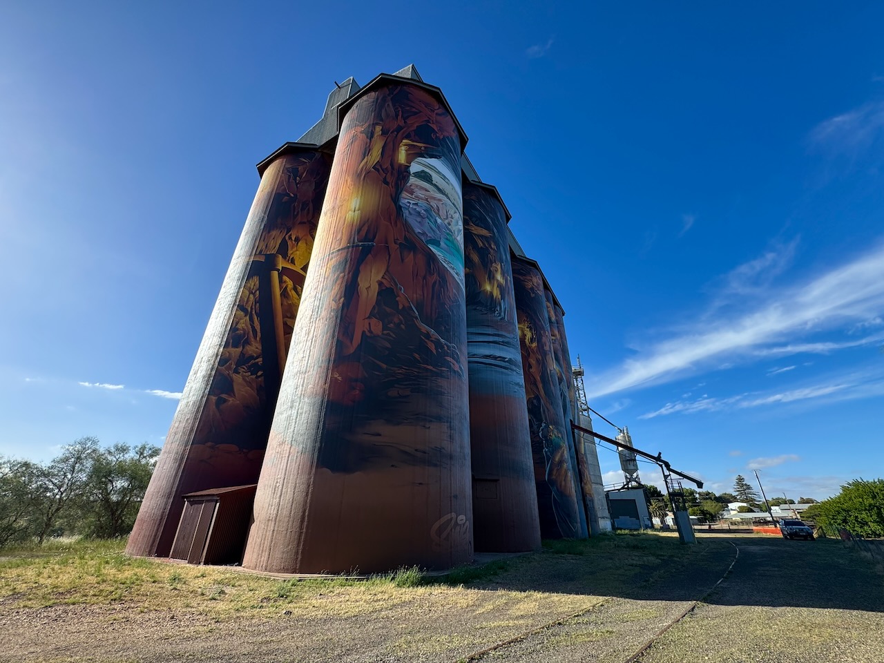
The Kapunda silos are part of the Australian Silo Art Trail. They were completed in October 2025 after 32 days of painting by the world-renowned street artist, Smug. They feature a copper miner underground. (Australiansiloarttrail.com 2026)
Marija and I parked alongside the silo and operated from the 4WD. We ran the Icom IC-7000, 100 watts, and the Codan 9350 antenna with the 1.5 metre stainless steel ship.
Above: the activation zone at the Kapunda silo. Image c/o SiOTA website
Marija worked the following stations on 40m SSB:-
VK3MDC
VK5LA
VK5KAW
VK1AO
VK2MET
I worked the following sttaions on 40m SSB:-
VK3MDC
VK5LA
VK5KAW
VK1AO
VK2MET
VK2HLM
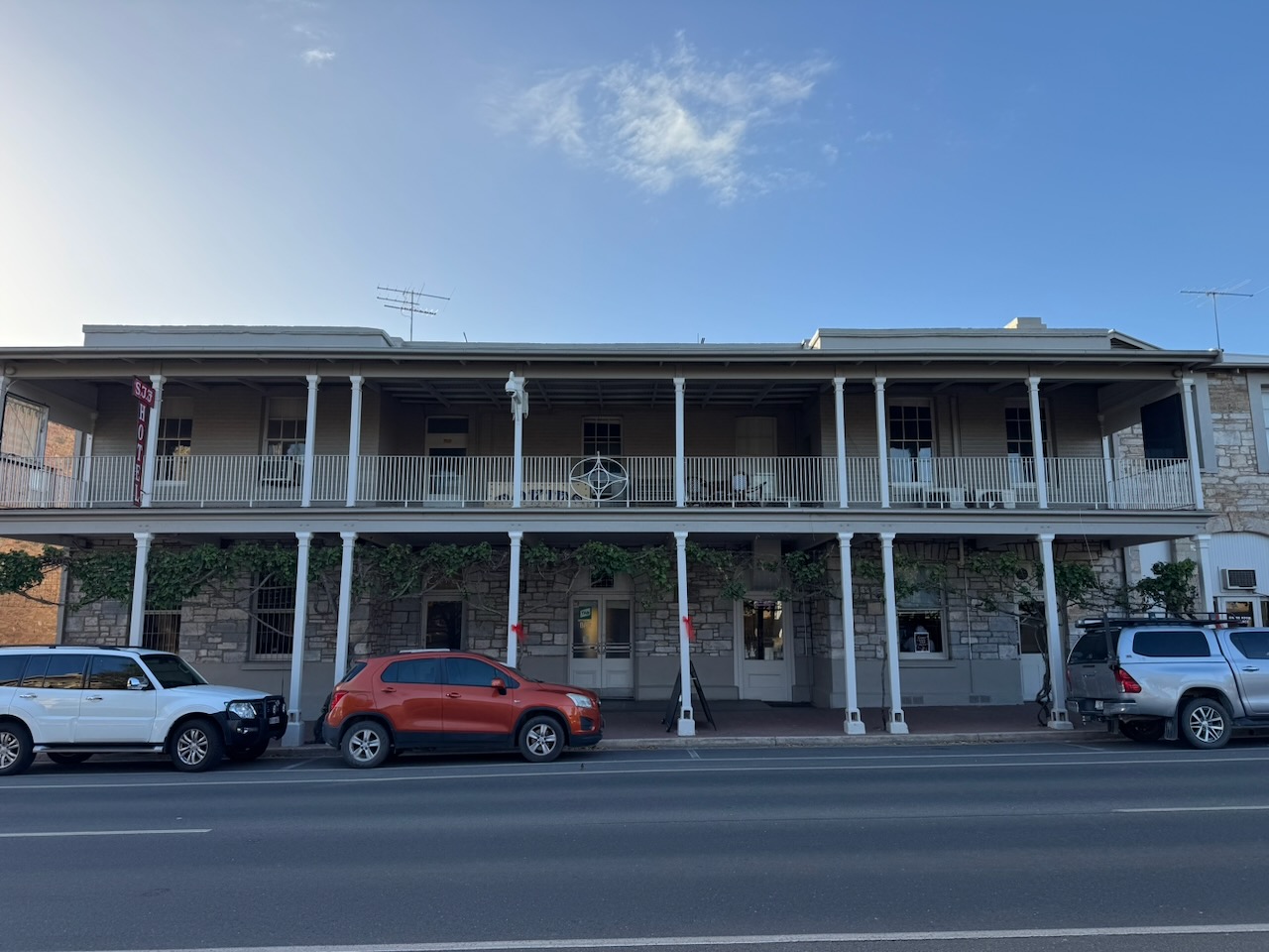
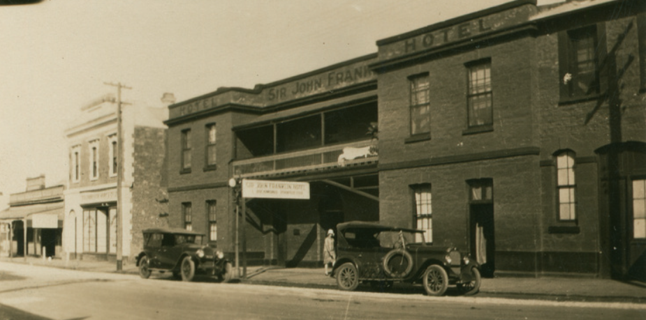
After the activation, Marija and I headed to the Sir John Franklin Hotel at Kapunda for dinner.
The hotel was built in 1949 by James Whittaker and was named after the Arctic explorer and Tasmanian Governor, Sir John Franklin. In its day, it was the leading hotel in Kapunda. (Sir John Franklin Kapunda, 2025)
Above: the Sir John Franklin Hotel, c. 1926. Image c/o State Library South Australia.
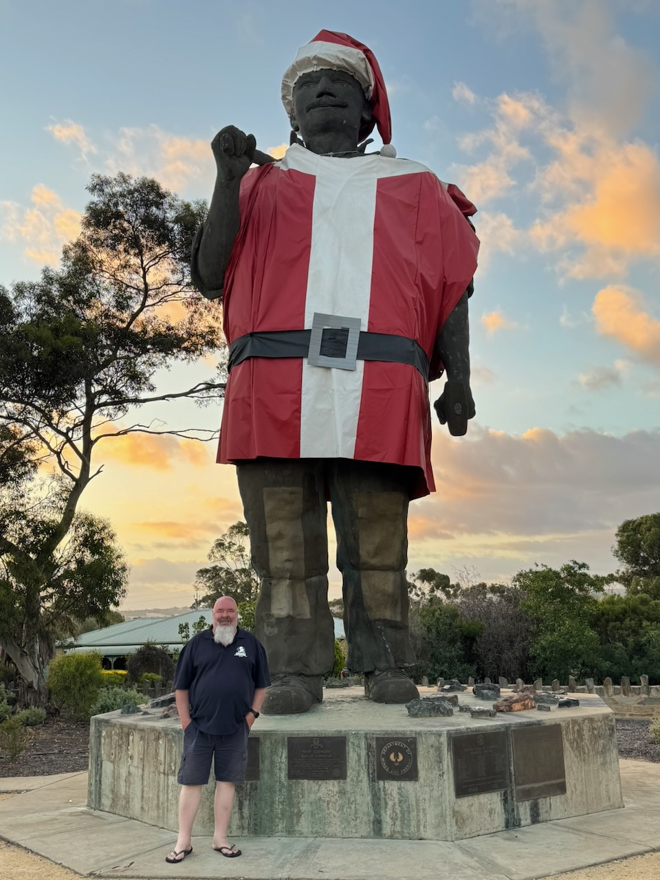
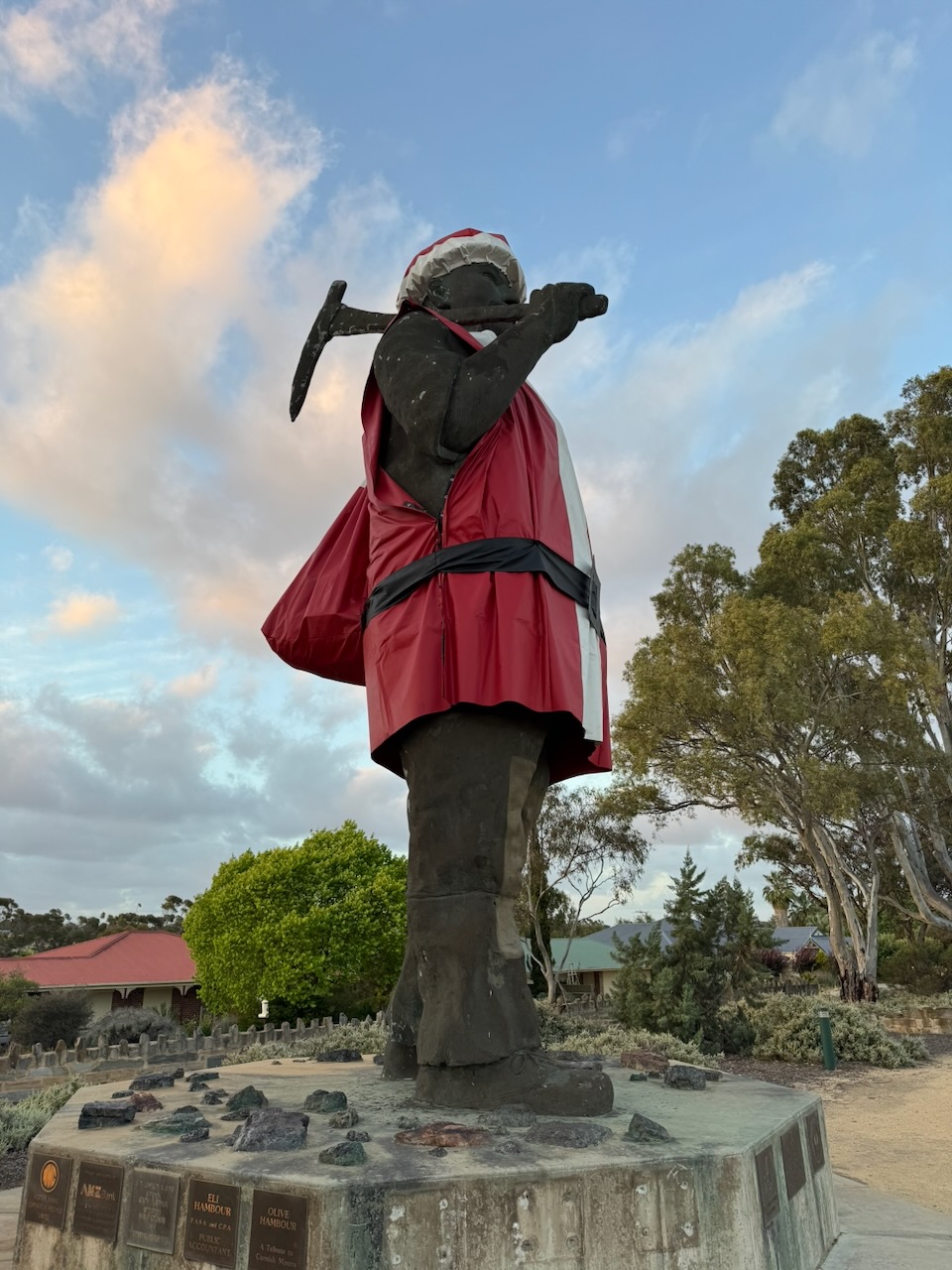
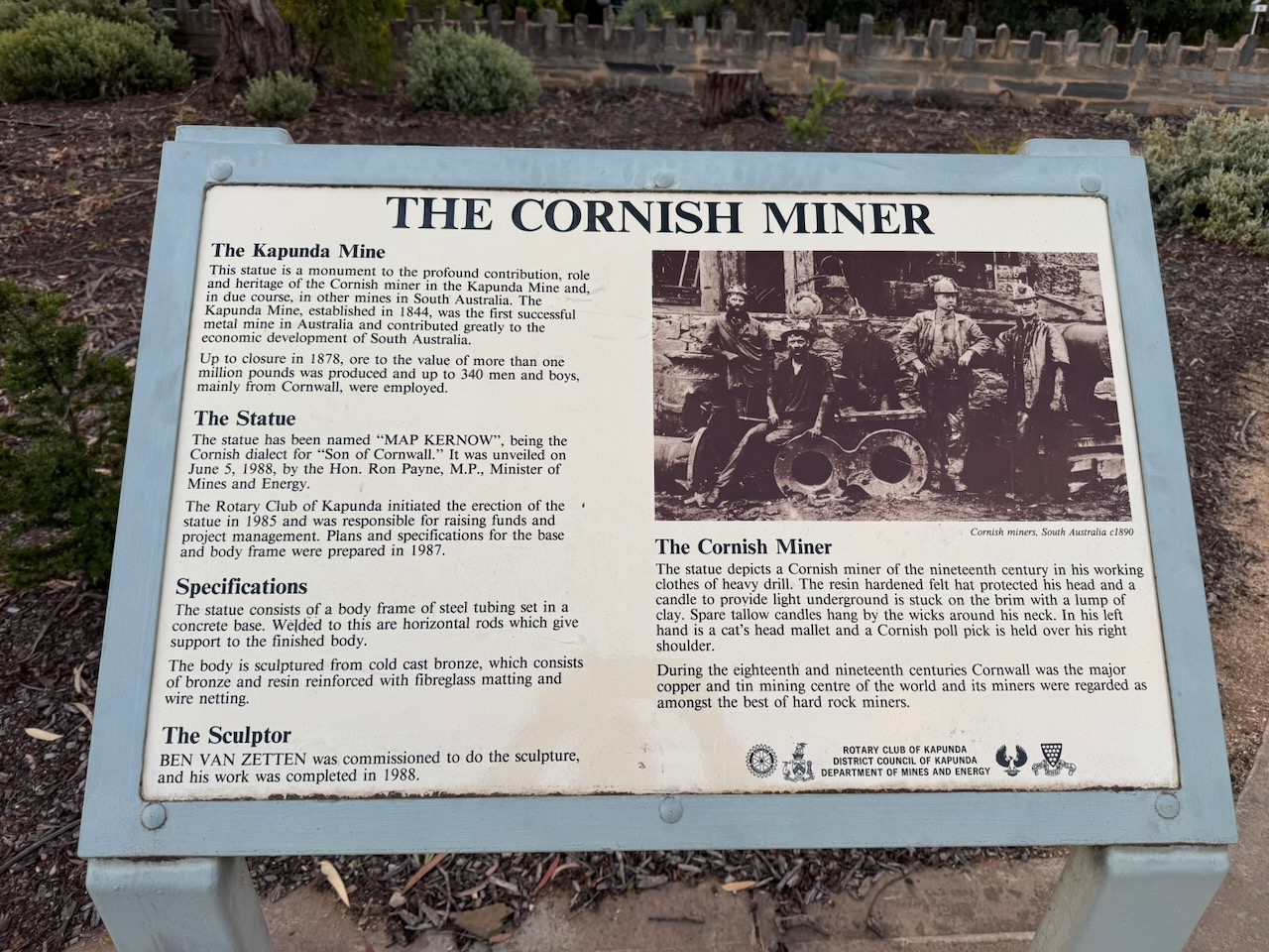
After a very nice evening meal, we visited Map the Miner, also known as Map Kernow or the Son of Cornwall. It is a 7 metre statue that commemorates the Cornish mining history of Kapunda. (Wikipedia 2020)
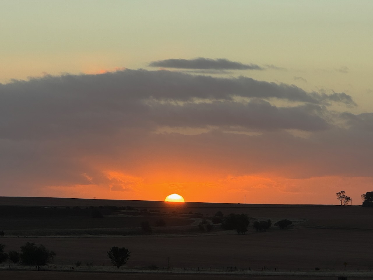
We drove south on Thiele Highway towards home on the Fleurieu Peninsula, admiring a magnificent sunset.
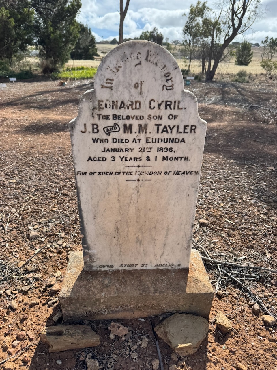
On Saturday, the 6th day of December 2025, Marija and I headed out to lunch at Dutton at a friend’s house.
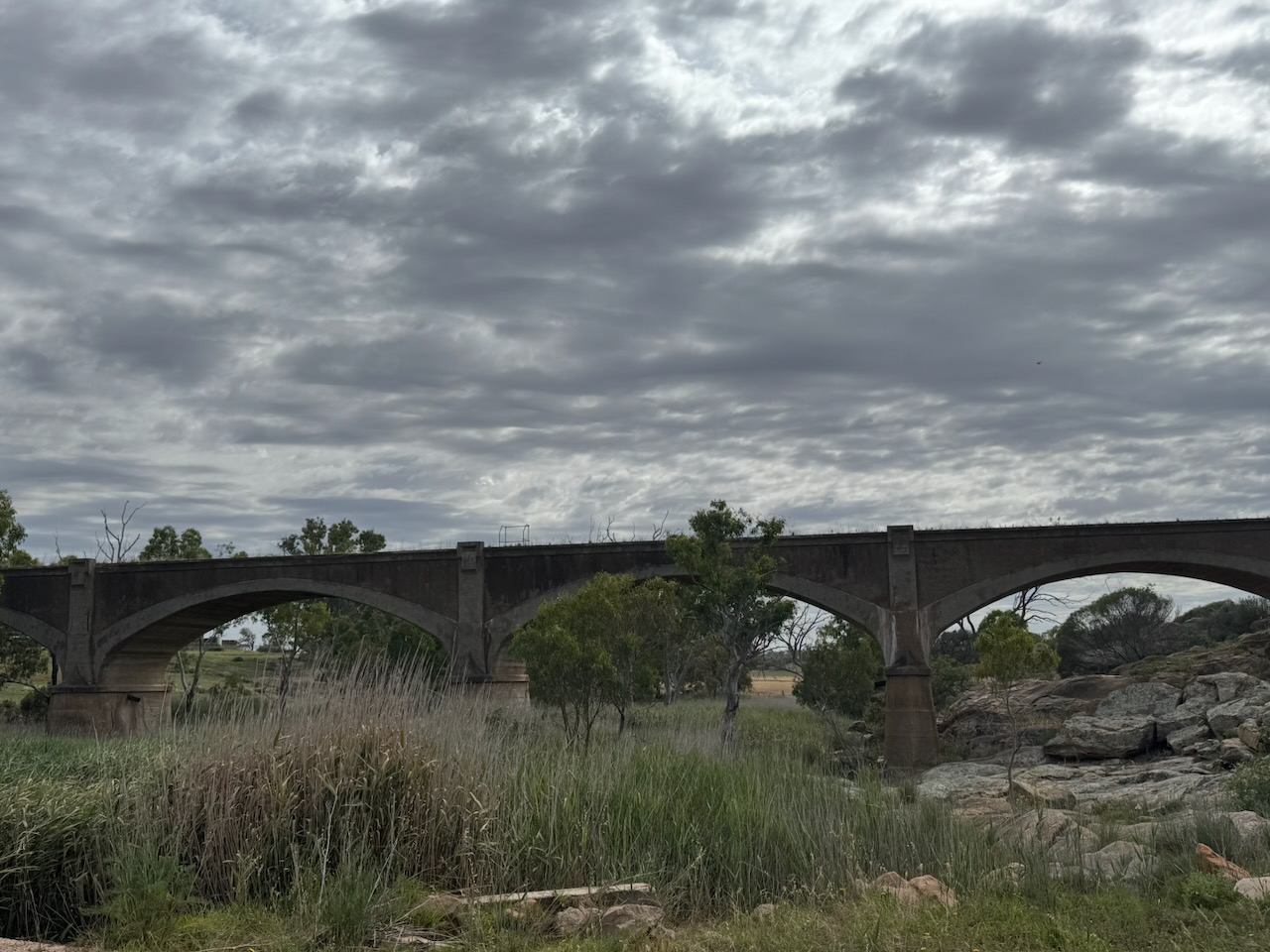
Our first stop along the way was the old Reedy Creek railway bridge near Palmer. This five-span bridge was built in 1919 on the railway line between Monarto South and Sedan.
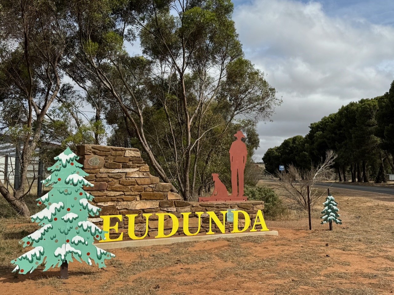
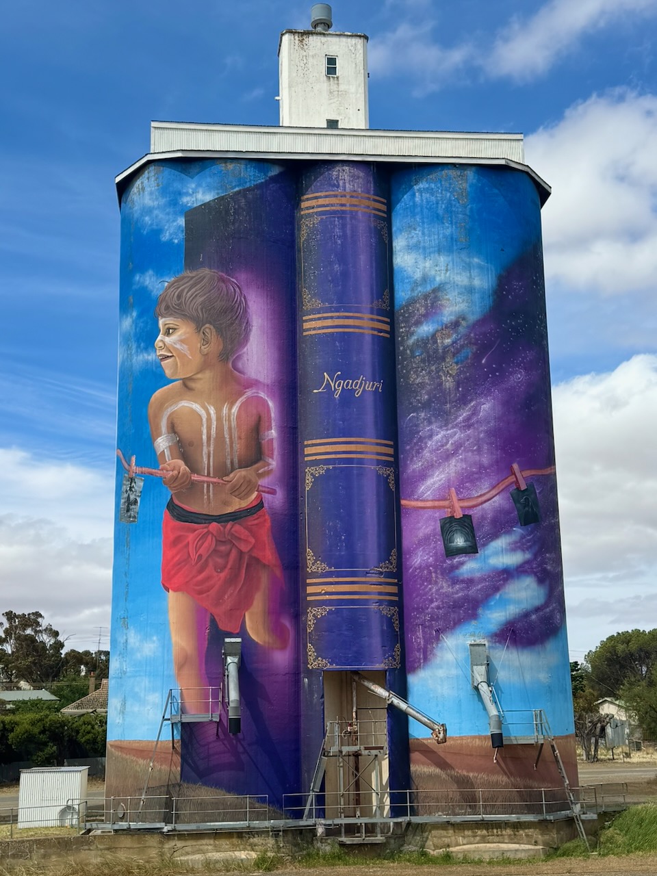
After a very enjoyable lunch, Marija and I drove to the town of Eudunda. The town’s name originates from the name of the spring to the west of Eudunda, which was known by the local Aboriginal people as judandakawi, meaning “sheltered water”. The Ngadjuri Aboriginal people are the traditional owners of the land around Eudunda. (Wikipedia 2025)
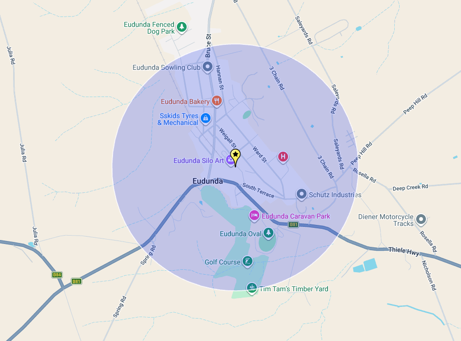
Above: Map showing the location of Eudunda. Map c/o Google Maps
The first Europeans in the district were those travelling to markets in Adelaide from New South Wales and Queensland during the 1830s. In 1838, four livestock importers from the eastern states set out overland from New South Wales to South Australia, bringing livestock overland. They were John Hill, William Wood, Charles Willis and John Oakden. They followed the Murray River and named various landmarks during their journey. (Wikipedia 2025)
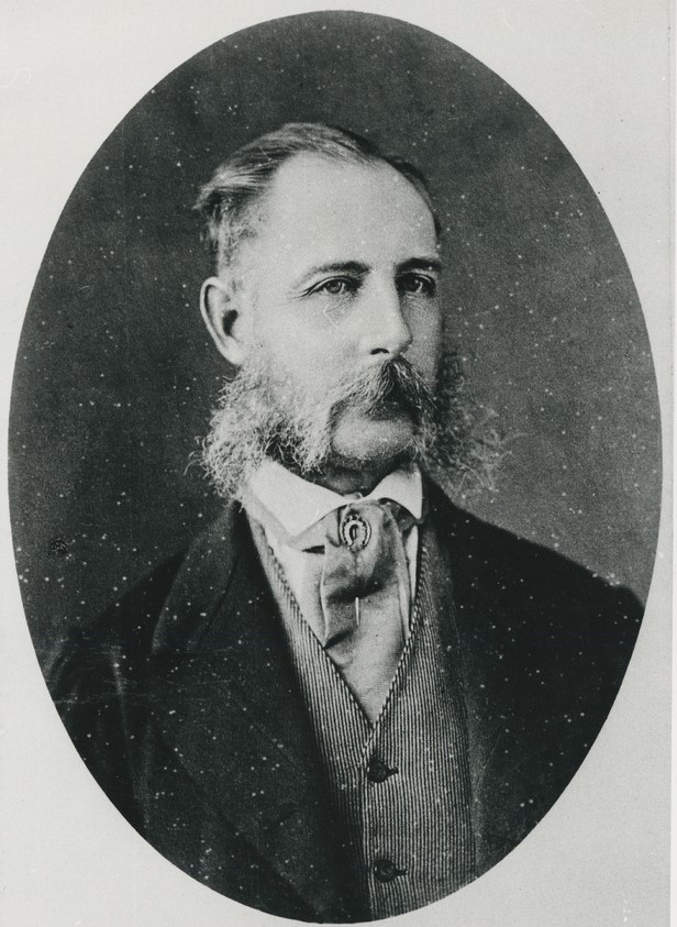
During the 1840s, pastoralists commenced establishing grazing runs in the district. This included Frederick Dutton, who was born in April 1812 in Lancashire, England. He emigrated to Australia in 1830 aboard the Lady Blackwood. Dutton owned substantial land holdings in South Australia. He sat in the South Australian Legislative Council from 1852 to 1853. He died in London in 1890 with assets valued at £800,000, which equates to about AUD150,00,000 today.
Above: Frederick Dutton. Image c/o Wikipedia
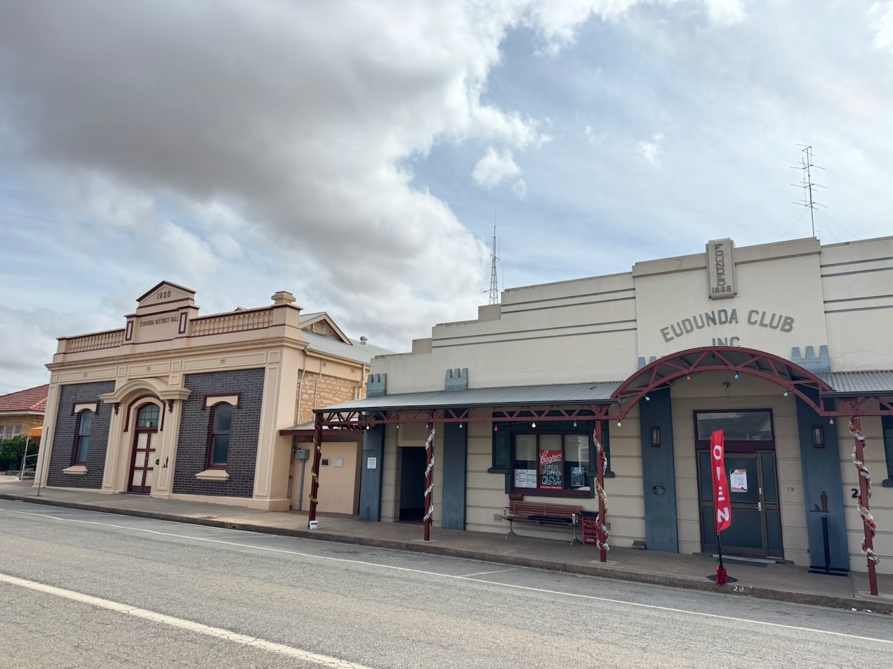
In 1870, the town of Eudunda was established by John Henry Hannan. He owned the land that was surveyed and then divided for sale. The first settlers were Lutherans from the Kingdom of Prussia. Friedrich Gotthilf Ernst Appelt opened Appelt’s General Store in 1874. The building remains and is listed on the South Australian Heritage Register. (Wikipedia 2025)
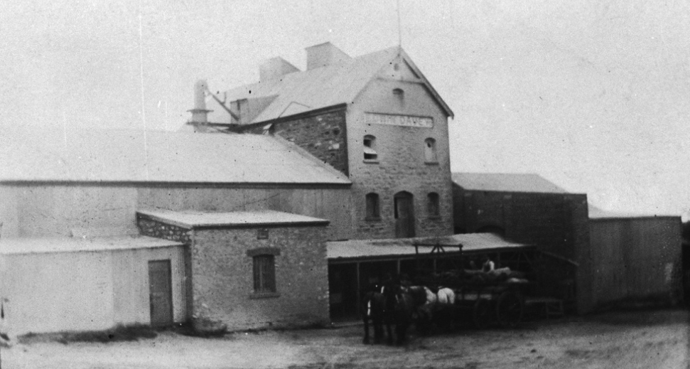
In 1879, Edwin Davey, a flour miller from Angaston in the Barossa Valley, built a chaff mill at Eudunda. Laucke Flour Mills operated the mill from 1951 to 1990. (Wikipedia 2025)
Above: the Eudunda mill, c. 1906. Image c/o State Library South Australia
The impressive stone structure still stands today.
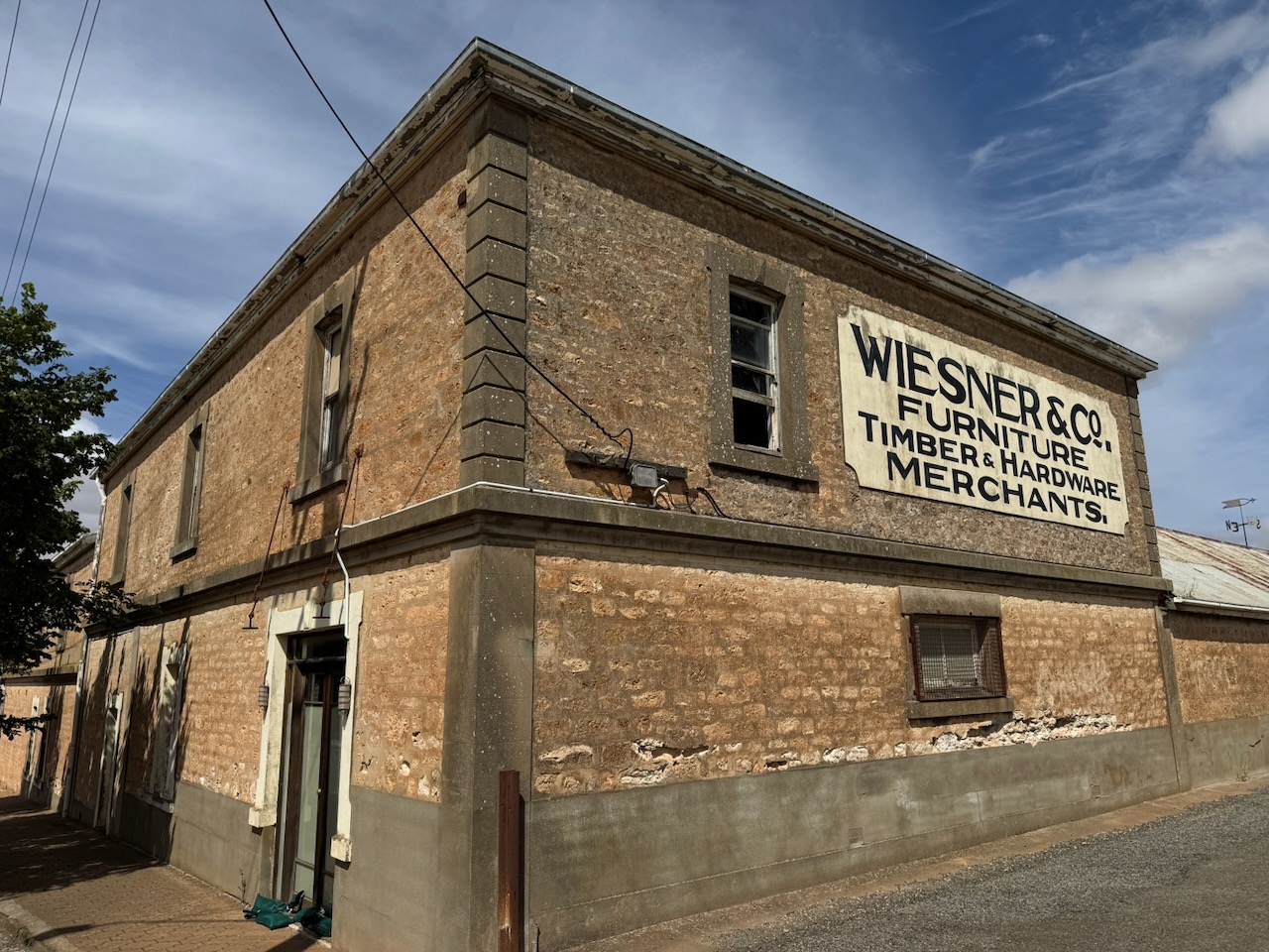
In 1884, Johannes Wiesner and Gustav Hilbig established the Eudunda Machine Factory which was known for its forges and its production of plough and scarifier shares. (Wikipedia 2025)
In 1896, the Eudunda Farmers Co-operative Society was established. It was formed by a group of firewood traders. The venture became very successful, owning 62 general stores around South Australia. During the 1990s, the Co-operative merged with United Supermarkets, and their stores became Foodland and IGA supermarkets. (Wikipedia 2025)
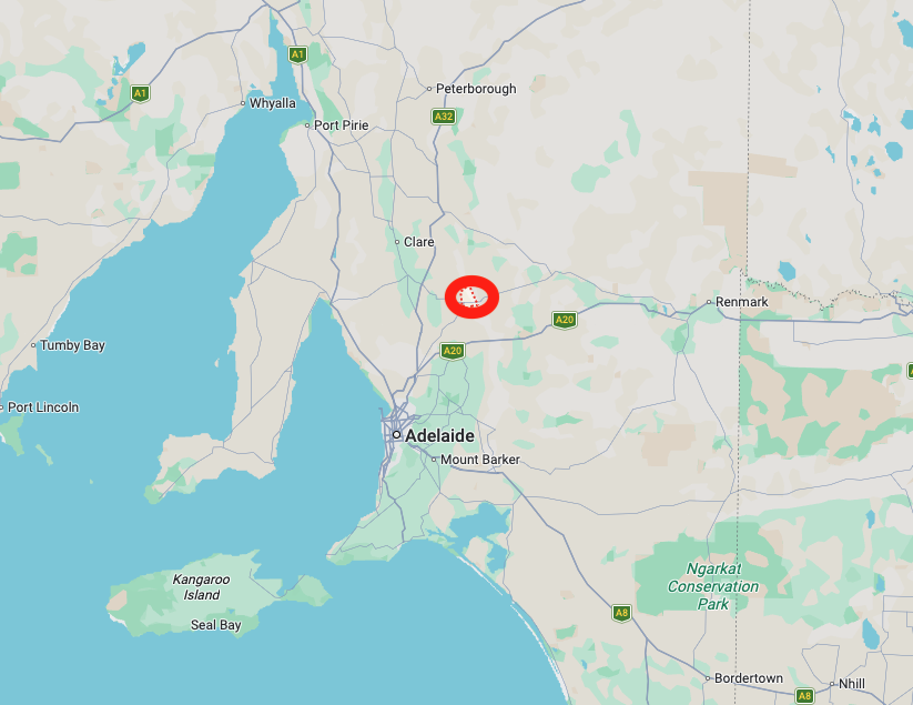
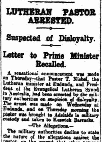
During WWI, there was significant anti-German sentiment in Australia. Eudunda had a significant German population and experienced a number of incidents. This included the arrest of Theodor Nickel, a Lutheran pastor in January 1915, who communicated with Hermann Homburg, the Attorney-General of South Australia, regarding naturalisation issues. He was accused of disloyalty. (Trove 2026) (Wikipedia 2025)
Above: part of an article from The Register, Adelaide, Fri 15 Jan 1915. Image c/o Trove
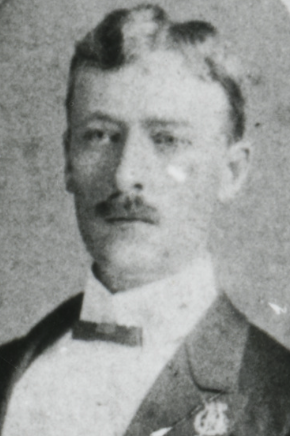
Hermann Homburg was born in March 1874 in Norwood, South Australia. His father was Robert Homburg, who was born in the Kingdom of Prussia (to become Germany). His father was a prominent South Australian politician and lawyer. Robert Homburg served as the Attorney-General on three separate occasions and later as a Justice of the Supreme Court of South Australia. Despite his standing, in 1914, his government office in Adelaide was raised by soldiers with fixed bayonets. He resigned in early 1915 to avoid embarrassing the government in the upcoming election. He cited a ‘campaign of lies and calumnies against me…because I am not of British lineage.’ (Wikipedia 2026)
Above: Herman Homburg. Image c/o Wikipedia
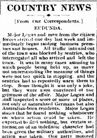
In February 1915, Major M.W. Logan from the 4th Military District and men from the Citizens’ Forces conducted raids on several homes and businesses of both German-born and Australian-born residents in Eudunda. The Citizens Forces was the name given at the time to what is now known as the Australian Army Reserve. Sentries were placed around Eudunda, and all travel in and out of the town was restricted. Nothing untoward was found, but it sent a message to all those in South Australia that the authorities were determined to suppress any disloyalty. (Torrensisland 2026) (Trove 2026) (Wikipedia 2020) (Wikipedia 2025)
Above: part of an article from the Kapunda Herald, Fri 12 Feb 1915. Image c/o Trove
Eudunda contains several historic buildings. Although we have been to Eudunda previously, we took some time admiring some of the town’s history.
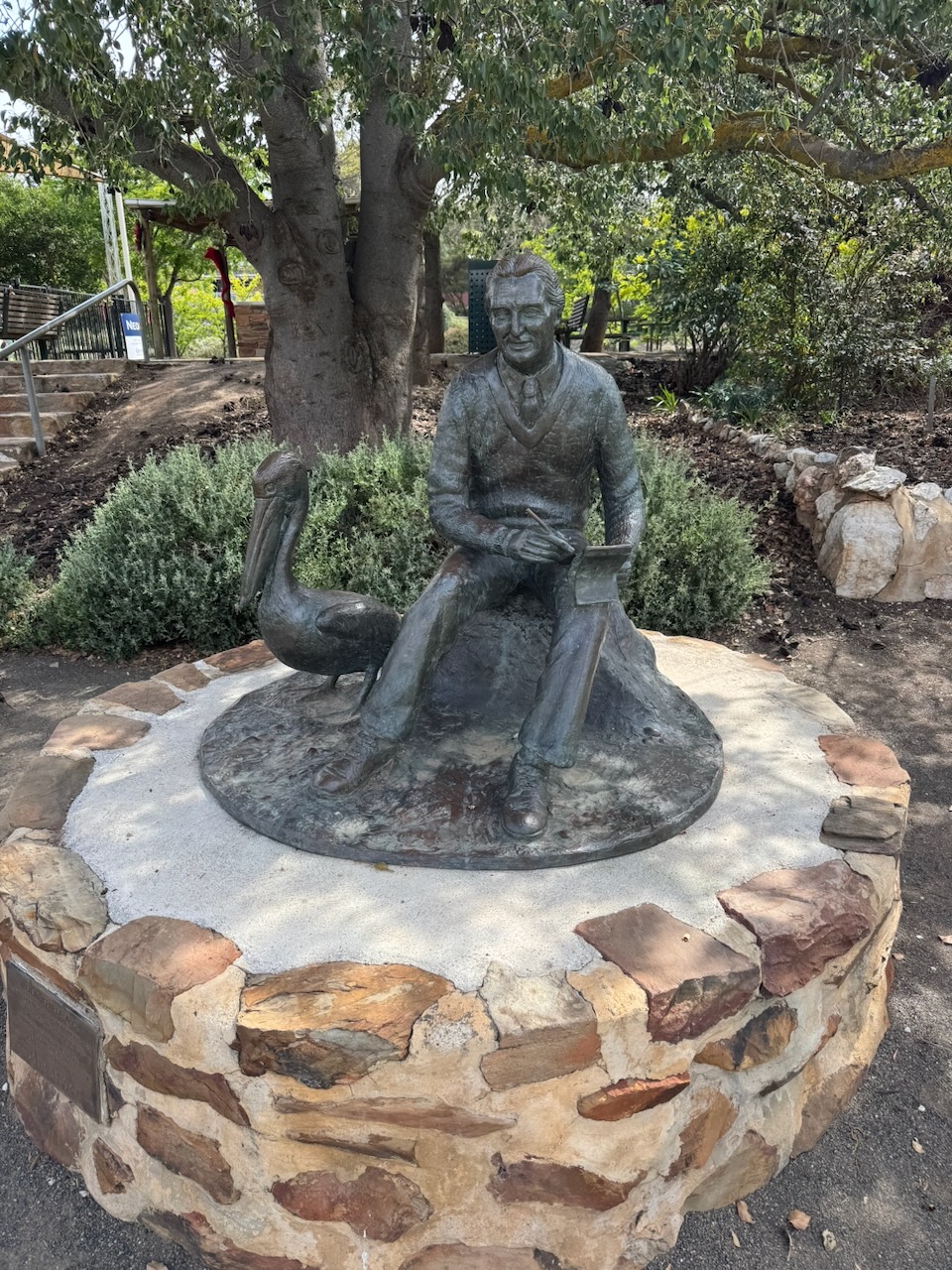
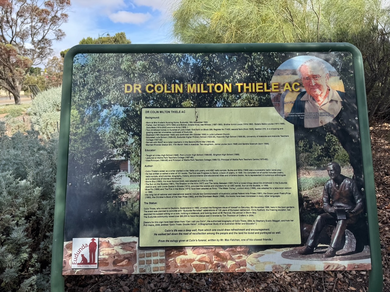
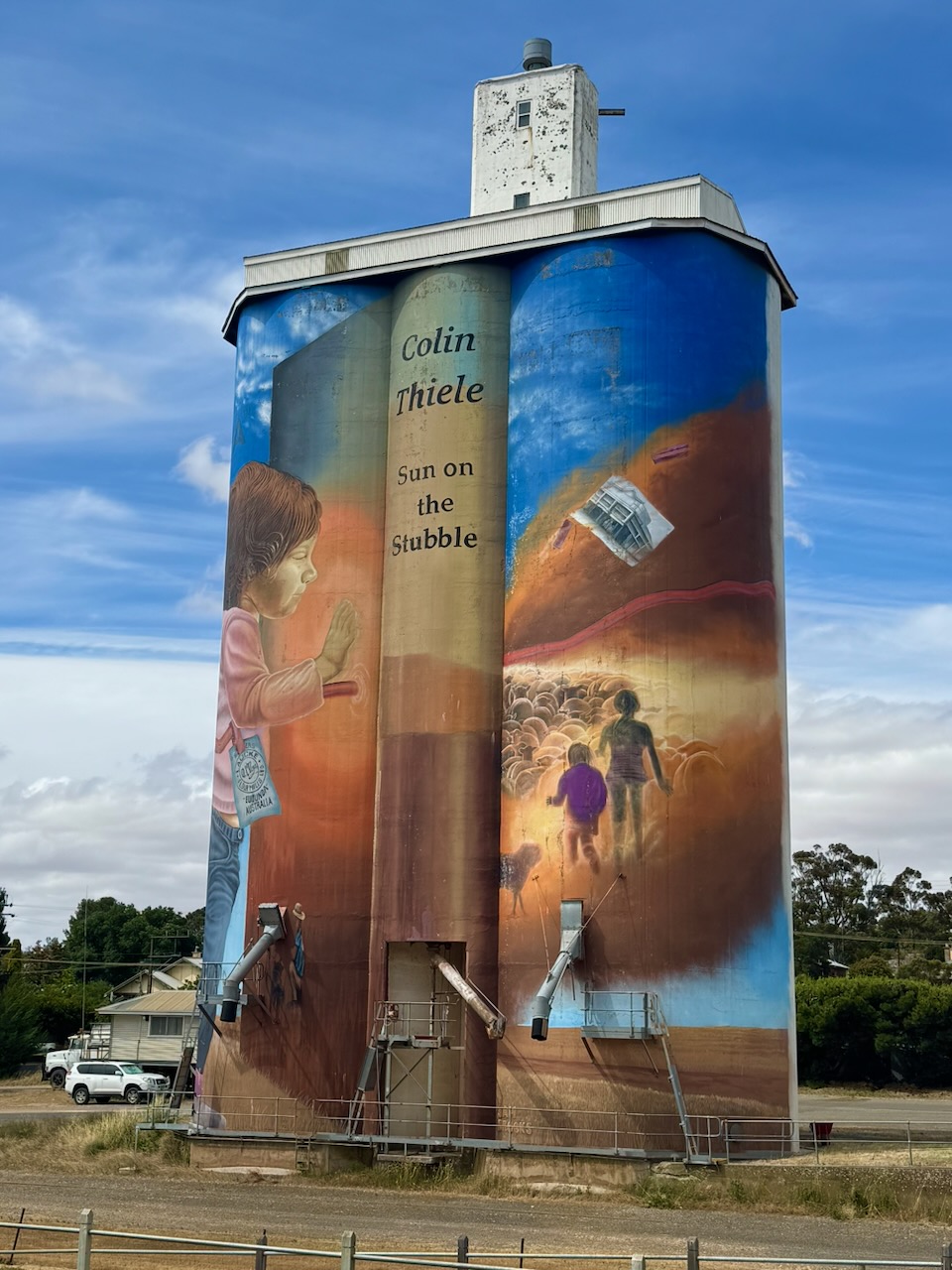
We visited the Eudunda Centenary Gardens at the corner of Worlds End Highway and Gunn Street. In the gardens is a statue of the Australian author Colin Thiele, who is well known for his works, including Storm Boy, Blue Fin and the Sun on the Stubble series. He was born at Eudunda in November 1920. (Wikipedia 2025) (Wikipedia 2026)
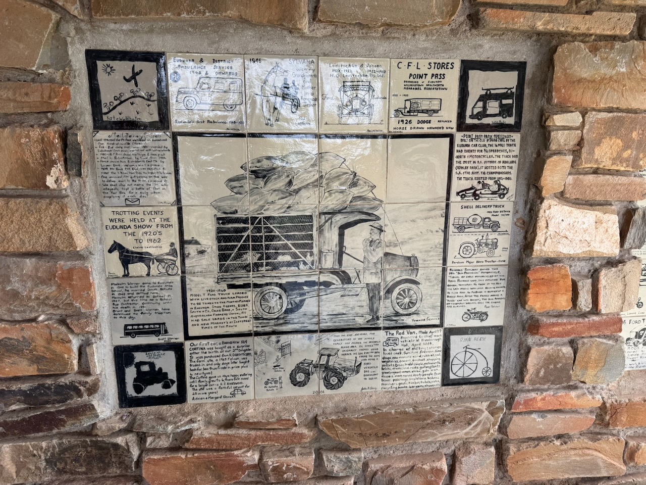
Another feature of the gardens is the shelter and walls with tiles that tell the story of Eudunda’s transport history.
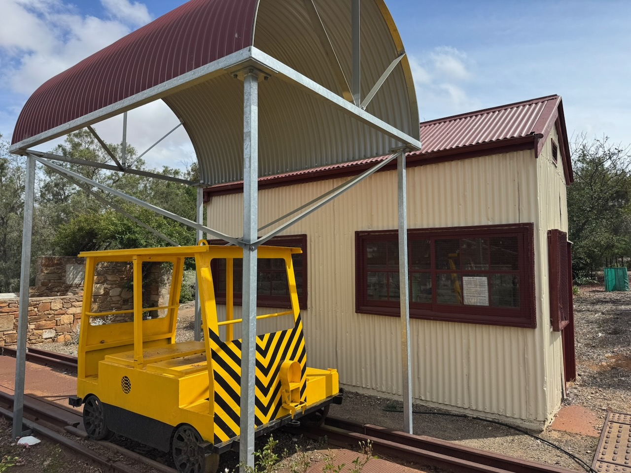
You can also find a piece of Eudunda’s railway history.
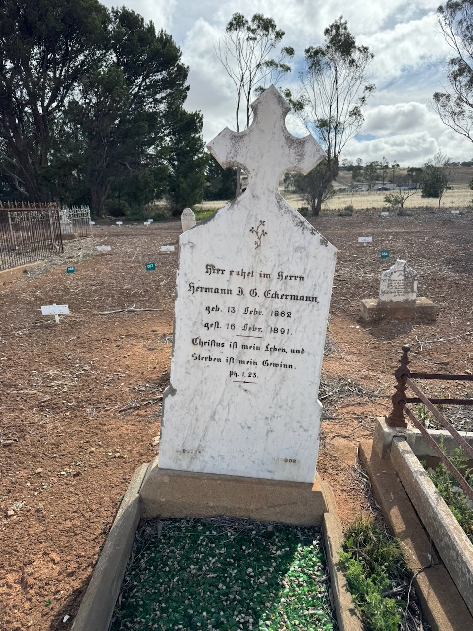
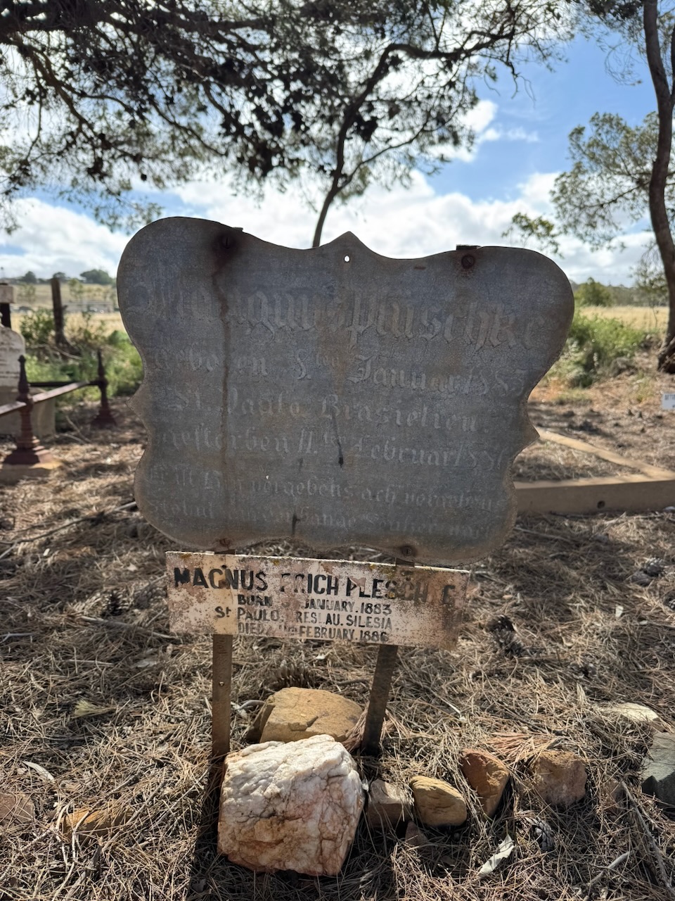
Marija and I also visited the Eudunda Cemetery. We were expecting to find more historical headstones than we found, so we were a little disappointed.
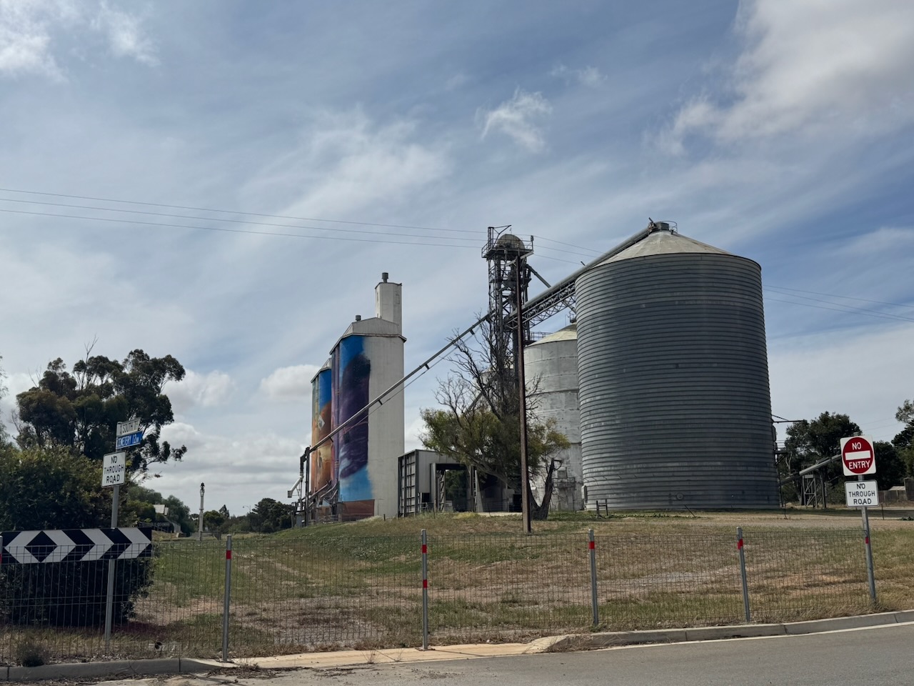
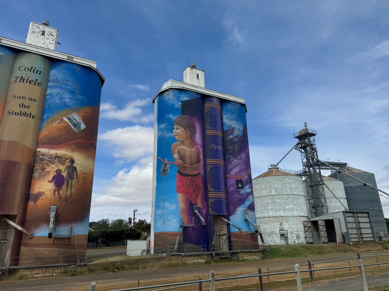
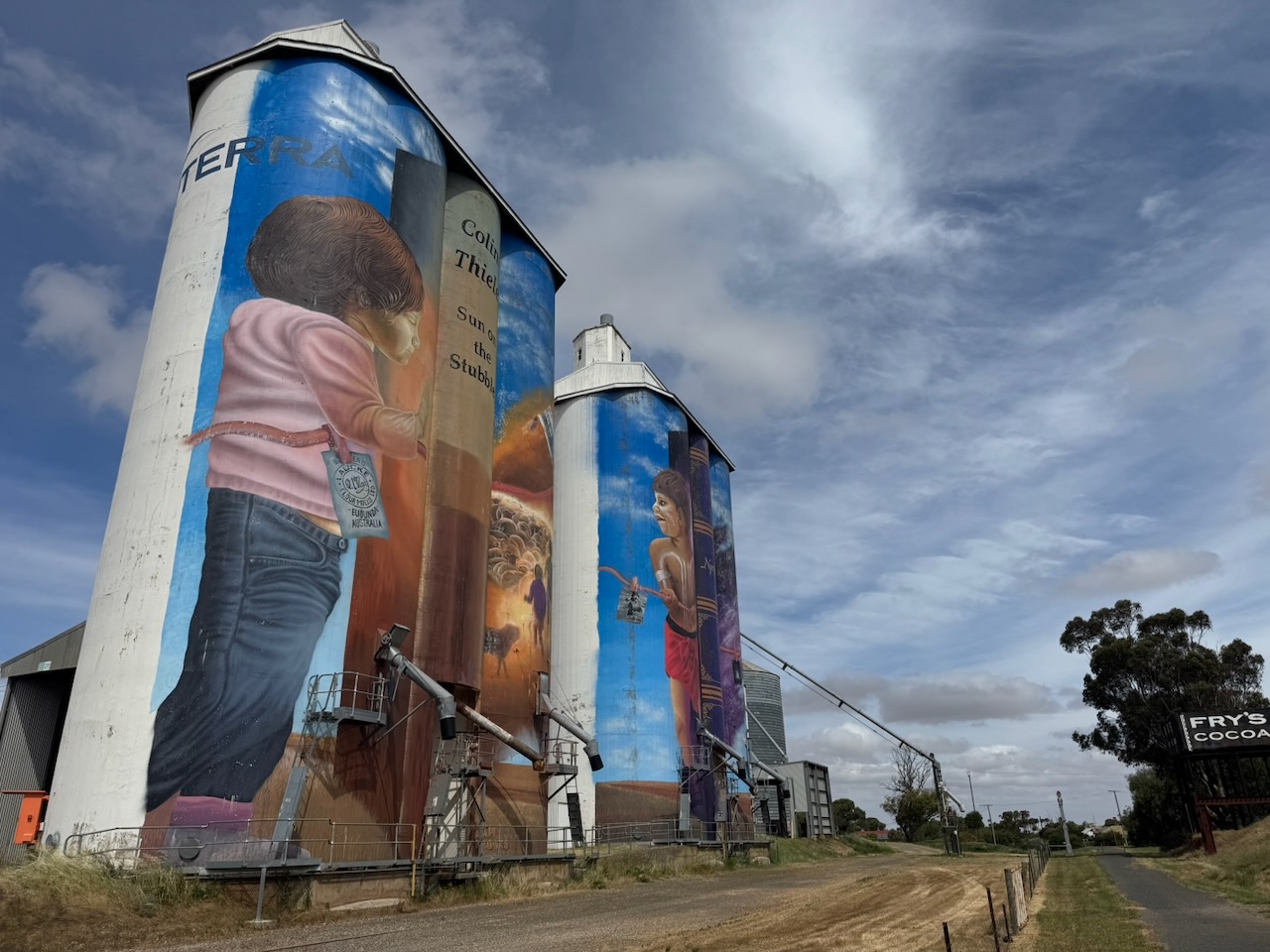
The Eudunda silos are part of the Australian Silo Art Trail. The art is the work of Sam Brooks and was completed in 2021. The artwork features two children and Colin Thiel’s novel, The Sun on the Stubble. (www.australiansiloarttrail.com, n.d.)
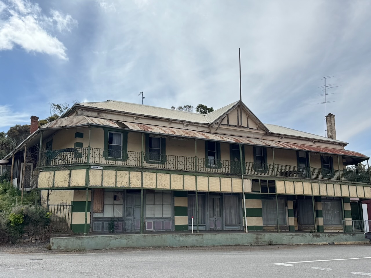
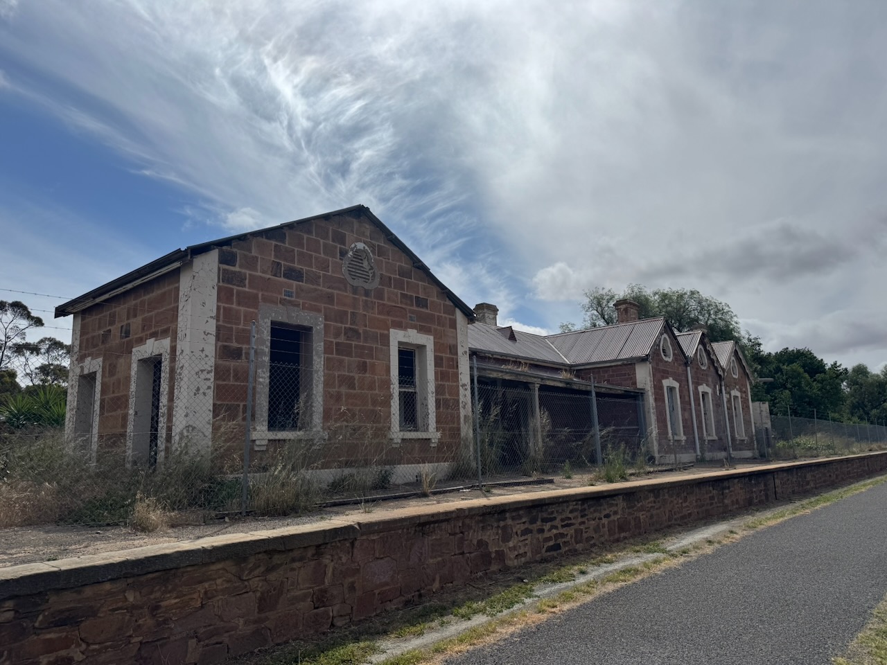
Adjacent to the silos is the historic Eudunda Railway Station, which, sadly, is in a very bad state. The station lies at the junction of the former Morgan railway line and the Robertstown railway line. The station was opened on the 23rd day of September 1878. The station closed for regular passenger traffic in December 1968. The last passenger train to visit the station was in May 1989, with a special train on a tour to Robertstown. (Wikipedia 2026)
Marija and I parked alongside the silos and operated from the 4WD, running the Icom IC7000, 100 watts, and the Codan 930 antenna with the 1.5 metre stainless steel whip.
Above: the activation zone at the Eudunda silo. Image c/o SiOTA website
Marija worked the following stations on 40m SSB:-
VK3JG
VK3WSG
VK2DA
VK5FANA
VK5LA
VK5KAW
I worked the following stations on 40m SSB:-
VK3JG
VK3WSG
VK2DA
VK5FANA
VK5LA
VK5KAW
VK3COE
VK5TN
VK5DMO
I worked the following sttaions on 20m SSB:-
VK1AO
VK2MET
VK2VW
VK2HFI
VK2AKA
VK2BUG
VK4SMA
VK6DEV
References.
Torrensislandinternmentcamp.com.au. (2026). A FUTURE UNLIVED. A history of the internment of German Enemy Aliens on Torrens Island. [online] Available at: https://torrensislandinternmentcamp.com.au/sources60.html [Accessed 24 Apr. 2026].
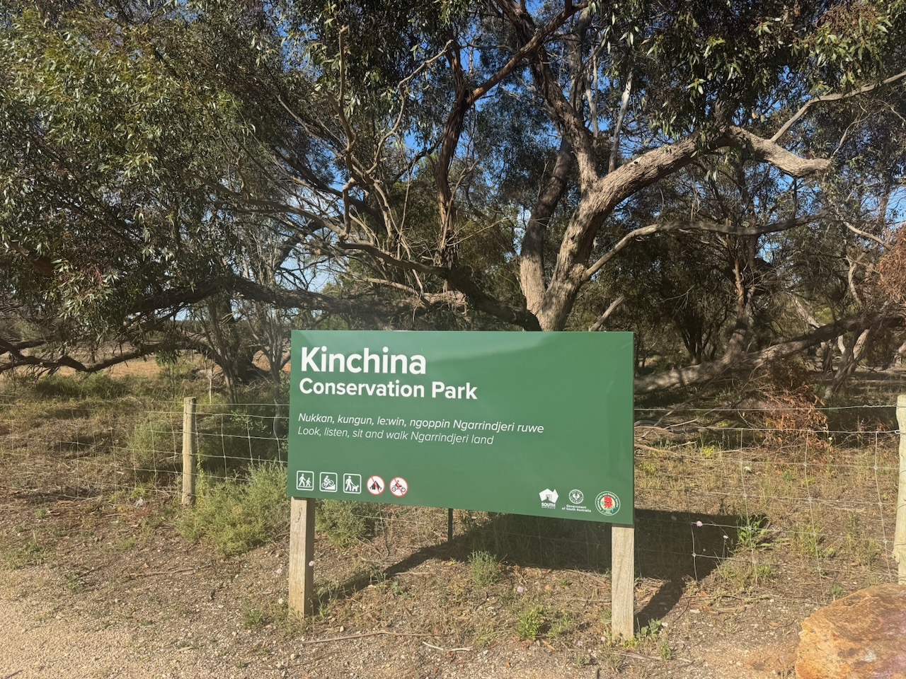
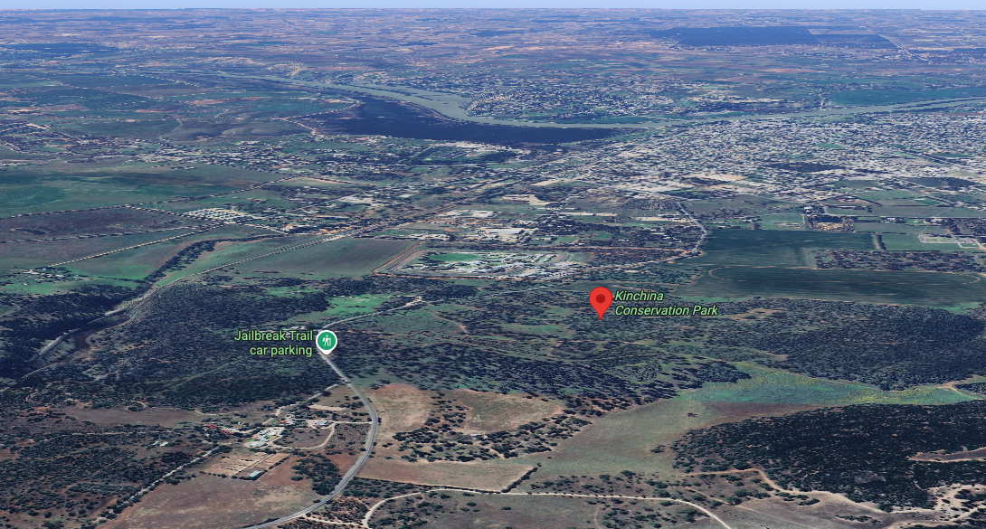
Our second and final park for Sunday, the 23rd day of November 2025, and day two of the 2025 VKFF Activation Weekend, was the Kinchina Conservation Park VKFF-1764. The park is about 57 km southeast of Adelaide in the north of the Gifford Hill Range and on the eastern flanks of Rocky Gully and White Hill. (Wikipedia 2026)
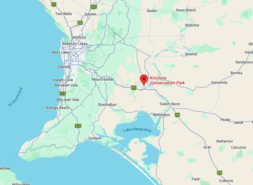
Above: Map showing the location of Kinchina CP. Map c/o Google Maps
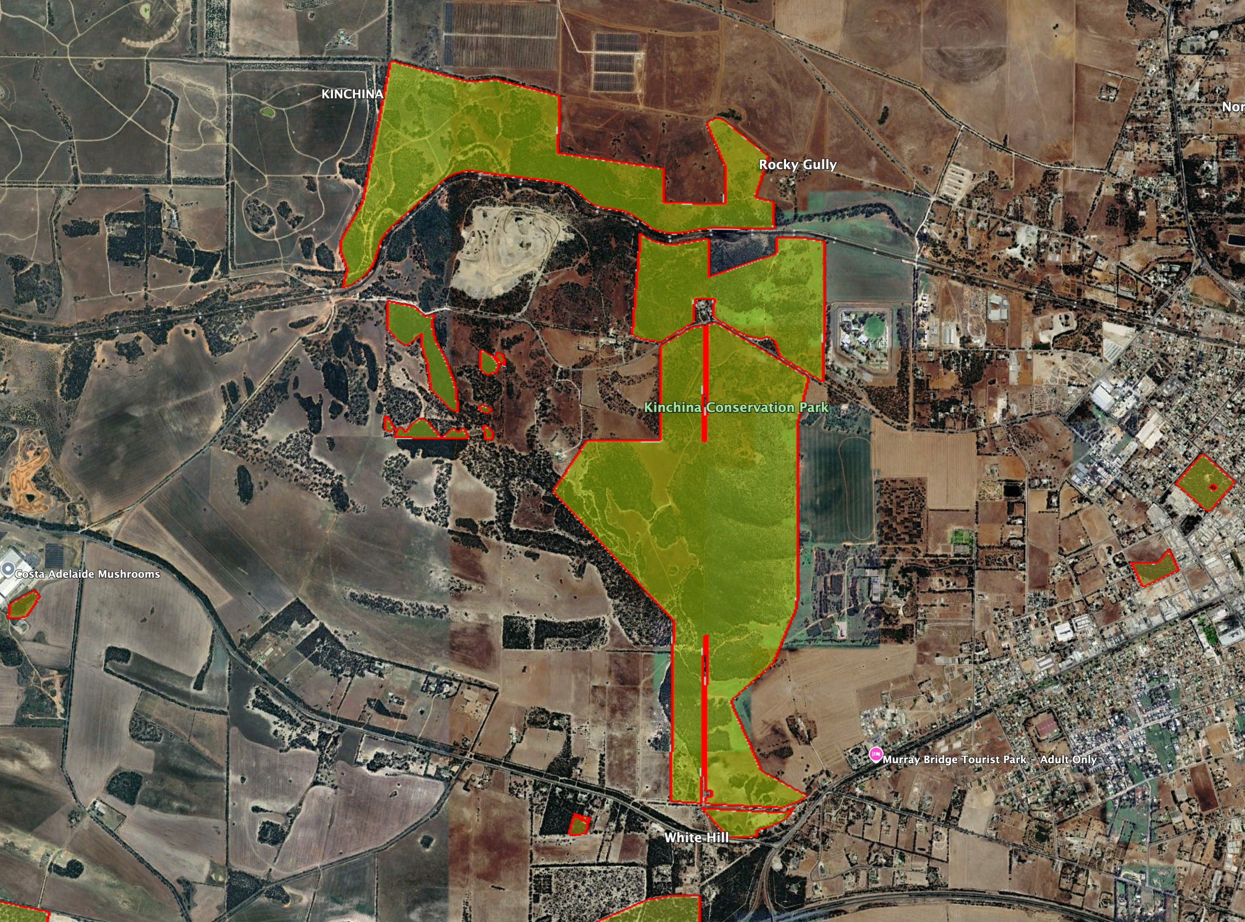
The southern boundary of Kinchina Conservation Park is Old Princes Highway. Maurice Road passes through the northern section of the park. The Monarto Safari Park is located to the west of the park. To the east of the park is Murray Bridge.
Above: the boundaries of Kinchina Conservation Park. Image c/o Google Earth
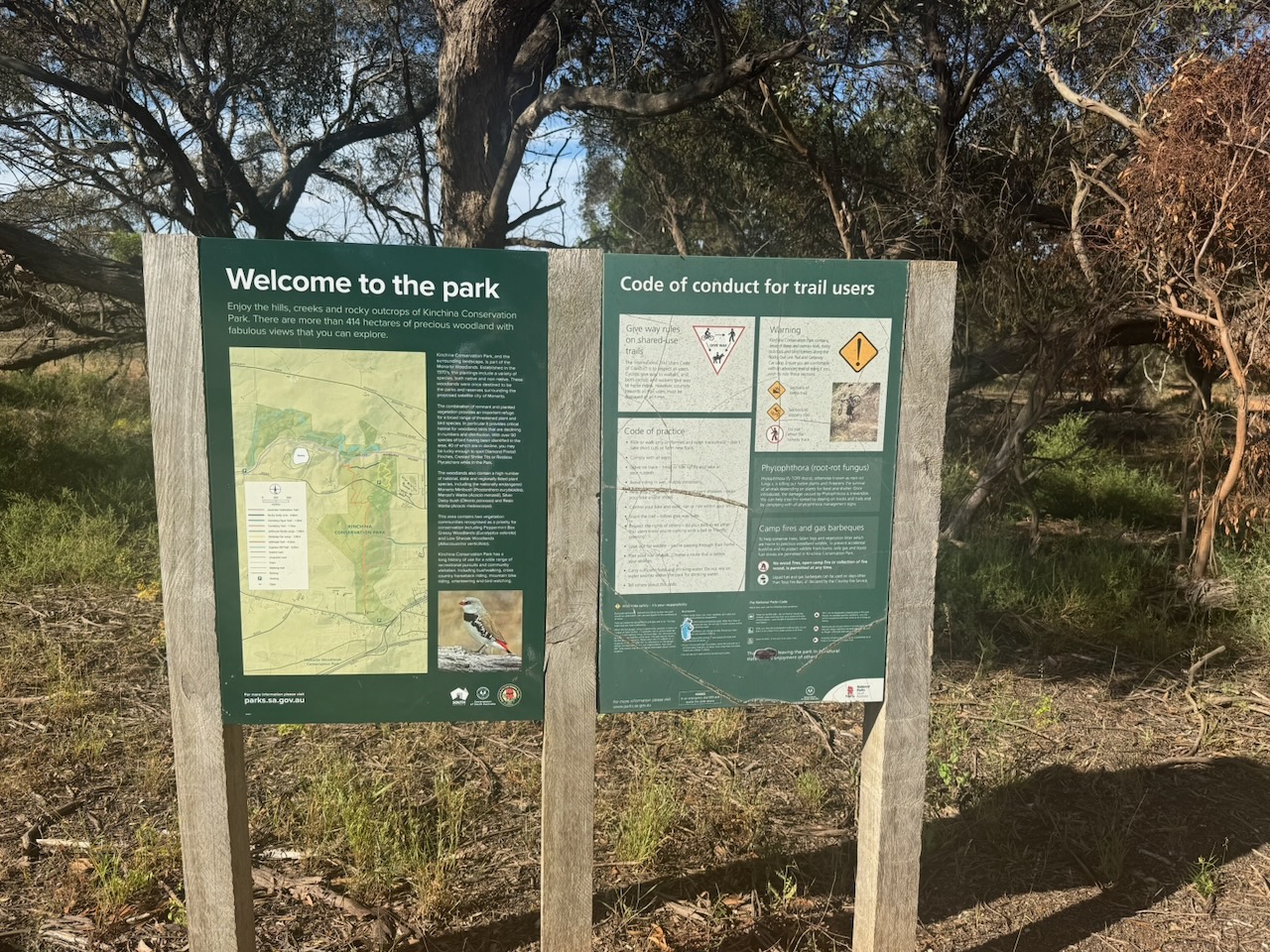
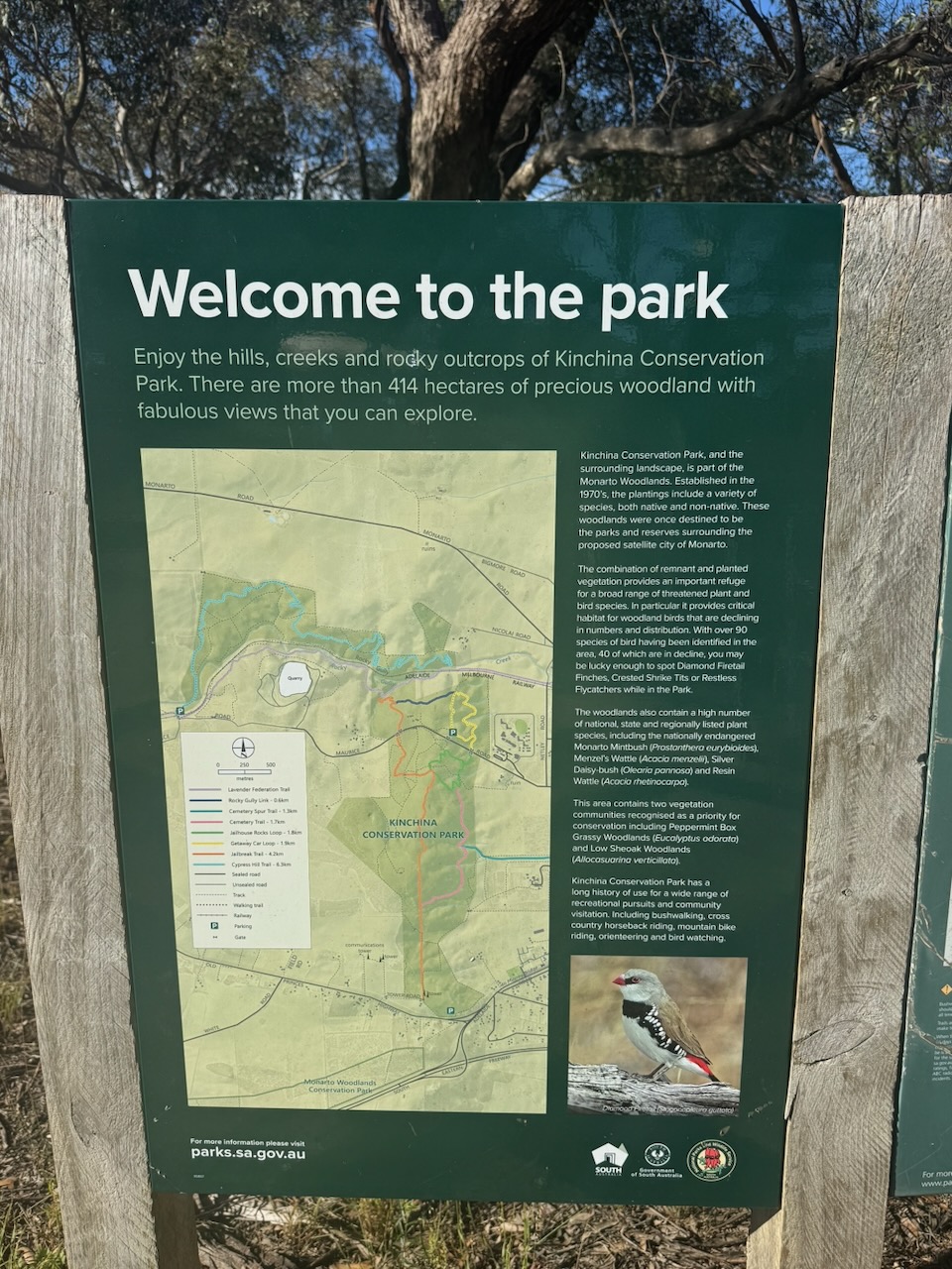
Kinchina Conservation Park is about 414 hectares in size and was established on the 22nd day of September 2016. The park is part of the Monarto Woodlands, which was established in the 1970s with plantings of native and non native species, which were to form parks and reserves surrounding the proposed satellite city of Monarto. (Dcceew.gov.au 2025)
The park takes its name from the railway siding where local Monarto granite was loaded to be freighted to Adelaide. This was commenced in 1879 by Jessie and Charles Duncan. The granite was used in the construction of several buildings and monuments, including Colonel Light’s statue, St Peter’s Cathedral steps, Electra House on King William Street and for kerbing in the city of Adelaide. In turn, Kinchina is an Aboriginal word meaning rocky place. (NPWS n.d.) (Trove 2026)
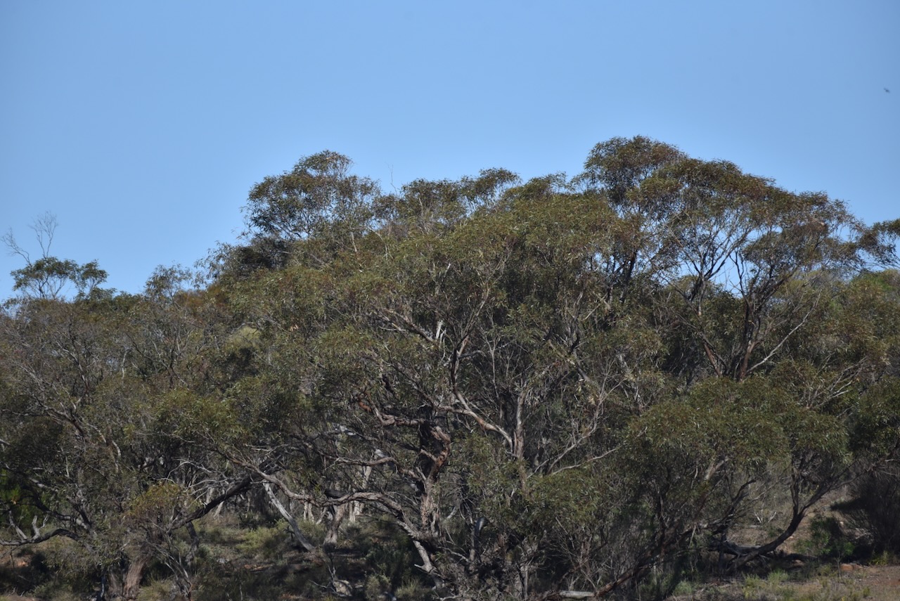
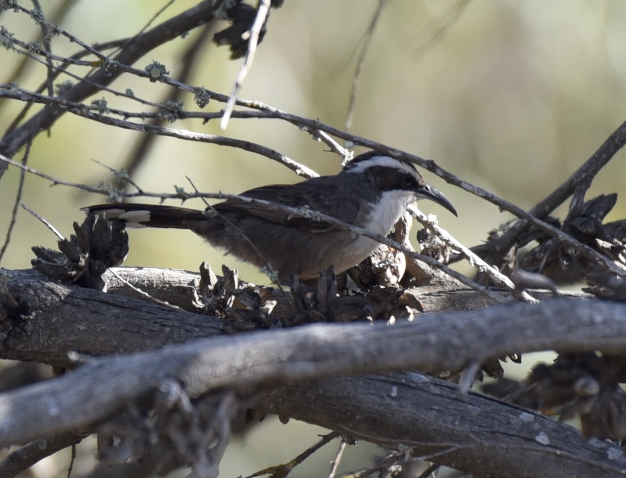
Over 90 species of birds have been recorded in the park, including Diamond Firetail, Crested Shrike Tit, and Restless Flycatcher. Kinchina contains a significant number of nationally, state, and regionally listed plant species, including the nationally endangered Monarto Mintbush.
The Lavender Federation Trail passes through the park. The trail is 325 km in length and extends from Murray Bridge to Clare. It is named after Terry Lavender OAM and was developed in 1999. (Wikipedia 2026)
Above: an aerial view of the park. Image c/o Google Maps
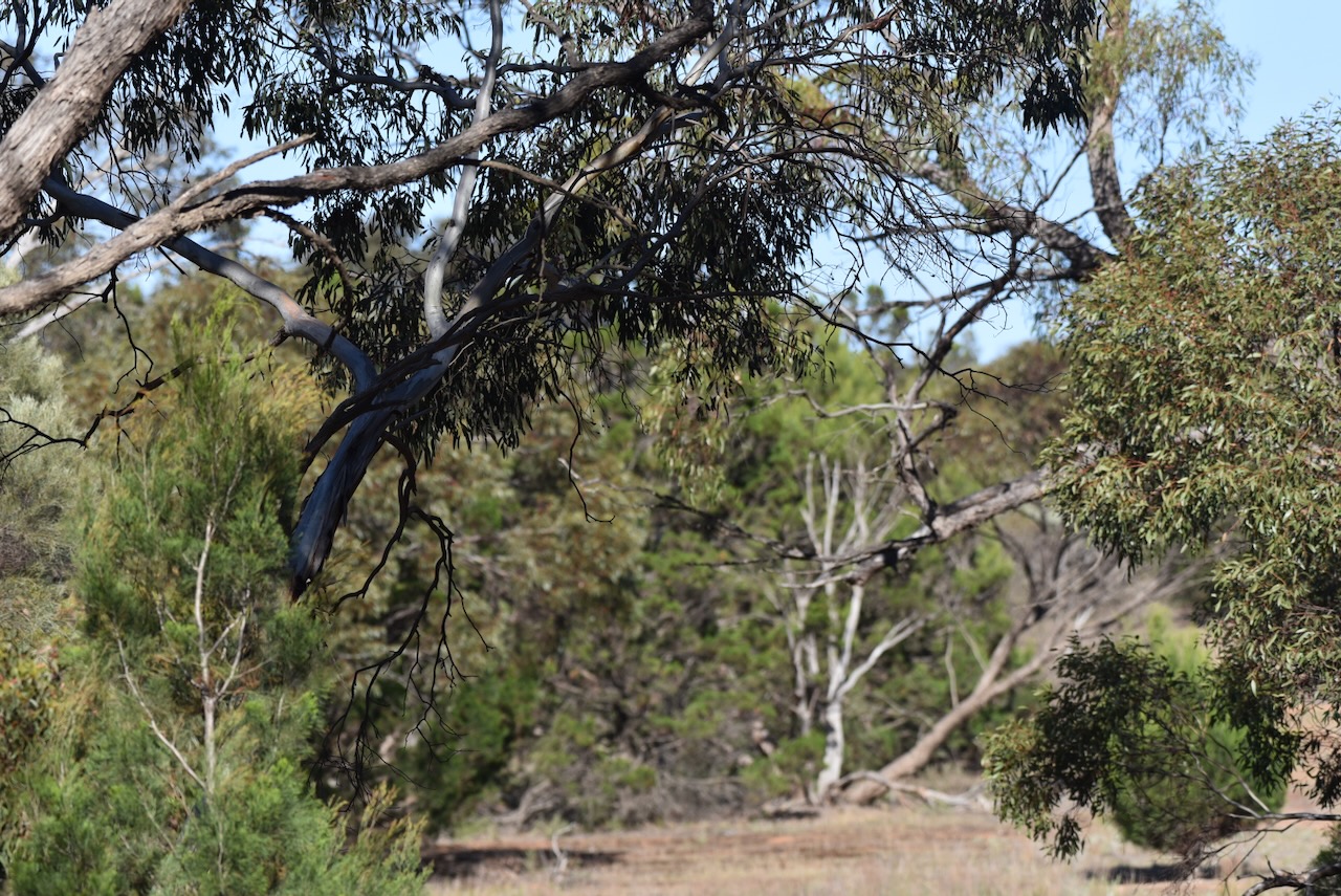
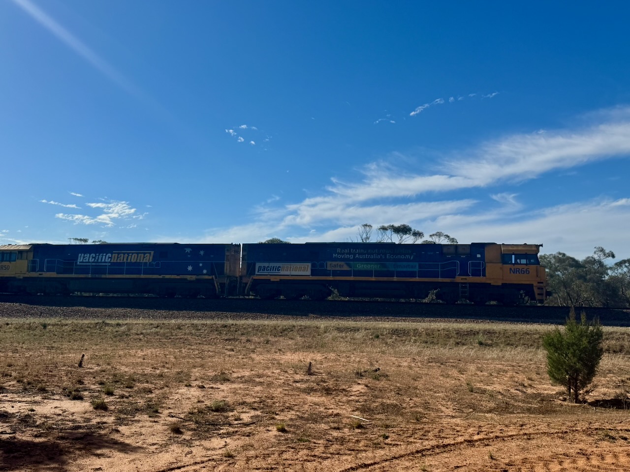
The Melbourne-Adelaide railway line passes through the park, and at one point, we had to stop transmitting as a large freight train passed by.
Marija and I set up underneath the shade of a tree and ran the Yaesu FT857, 40 watts, and the 20/40/80m linked dipole.
Marija worked the following stations on 40m SSB:-
VK3PF (VKFF-5823)
VK5EDY
VK3WSG
VK2IO/P (VKFF-6421)
VK2GEZ/P (VKFF-6421)
VK3BWS/P
VK2LEE
VK7JZ/3
VK5NM
VK5WU
Marija worked the following stations on 20m SSB:-
VK2IO/P (VKFF-6421)
VK2GEZ/P (VKFF-6421)
ZL1GA
I worked the following stations on 40m SSB:-
VK3PF (VKFF-5823)
VK5EDY
VK3WSG
VK2IO/P (VKFF-6421)
VK2GEZ/P (VKFF-6421)
VK3BWS/P
VK2LEE
VK7JZ/3
VK5NM
VK5WU
VK3TDX
VK3OAK
VK2EXA
VK6ASK/M
VK5BL
V K3GCD
VK2VW
VK2HFI
VK2AKA
VK2BUG
VK5KPR
VK3MGM
VK3MLT
VK5YP
VK3SO
VK3SFG
VK3JAC/M
VK3DIY
VK5AYL
VK5ACC
VK3HHE
VK3UAO
VK3PTR
VK5IS
VK3SX
I worked the following stations on 20m SSB:-
VK4SMA
VK3ACZ
VK2MG
VK4BW
VK4QRZ
JF7RJM
VK4EW
VK1O
VK2MET
VK7UK
VK4NH
VK4DXA
VK6NT
VK2IO/P (VKFF-6421)
VK2GEZ/P (VKFF-6421)
ZL1GA
VK3CLD
VK2DBF
VK5QA
Thank you to everyone who called us, and thank you to everyone who took part in the 2025 VKFF Activation Weekend.
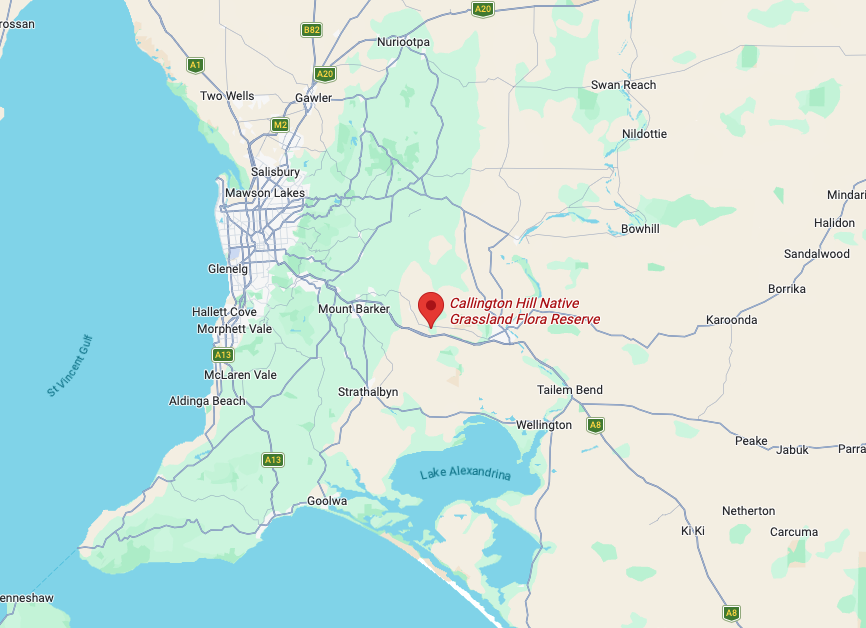
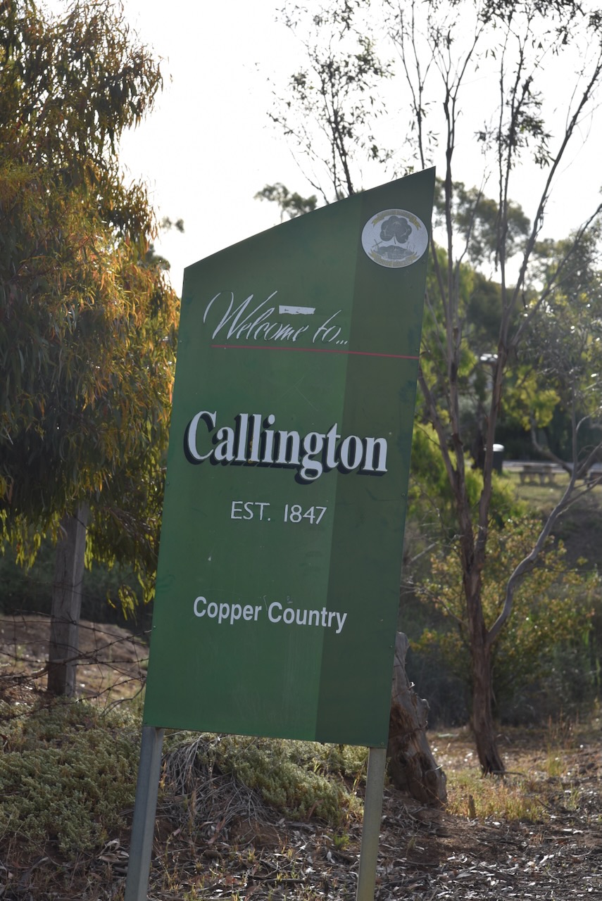
Our first park for Sunday, the 23rd day of November 2025, and day two of the 2025 VKFF Activation Weekend, was the Callington Hill Native Grassland Reserve VKFF-4031. The park is about 57 km southeast of Adelaide.
Above: Map showing the location of Callington Hill Native Grassland Reserve. Map c/o Google Maps
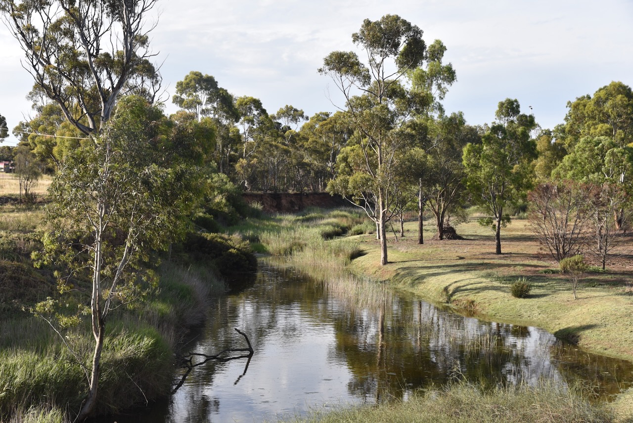
Callington is located on the Bremer River and is located on the eastern slopes of the Mount Loft Ranges ‘Adelaide Hills.’ It has a population of about 478 people. (Wikipedia 2026)
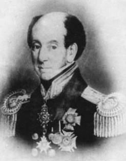
Prior to the town of Callington being established, the area was referred to as Bremer. The Bremer region was named in honour of Sir James Bremer, the founder of the Post Essington settlement in the Northern Territory. (Callington 2021) (Flickr 2026)
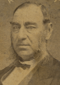
Above: Sir James Bremer. Image c/o Trove
By the late 1840s, several farmers had settled in the Bremer district, while others worked small mineral lodes. They lived in temporary structures along the Bremer River. Many of these settlers had established small farms as tenant farmers of the South Australian Company and proprietors of the Paringa Mining Company who had taken up 20,000 acres of land under a Special Survey following the discovery of copper at nearby Kanmantoo. Nearly 100 people are estimated to have been living in the district in the late 1840s. (Callington 2021) (Southaustralianhistory.com.au, 2026)
The South Australian Company was established in 1835 in England and was responsible for the establishment of the new colony of South Australia. It was founded by George Fife Angas and several other wealthy British merchants. (May n.d.)
In c. 1848, a local, John Kiernan, was travelling in the area in his horse and dray. His dray broke upon a rock to reveal the distinctive colour of copper. Kiernan received a £50 reward from the Mining Claims Office, which equated to about 6 months of wages. (Callington 2021) (Flickr 2026) (Grokipedia 2026) (Wikipedia 2026)
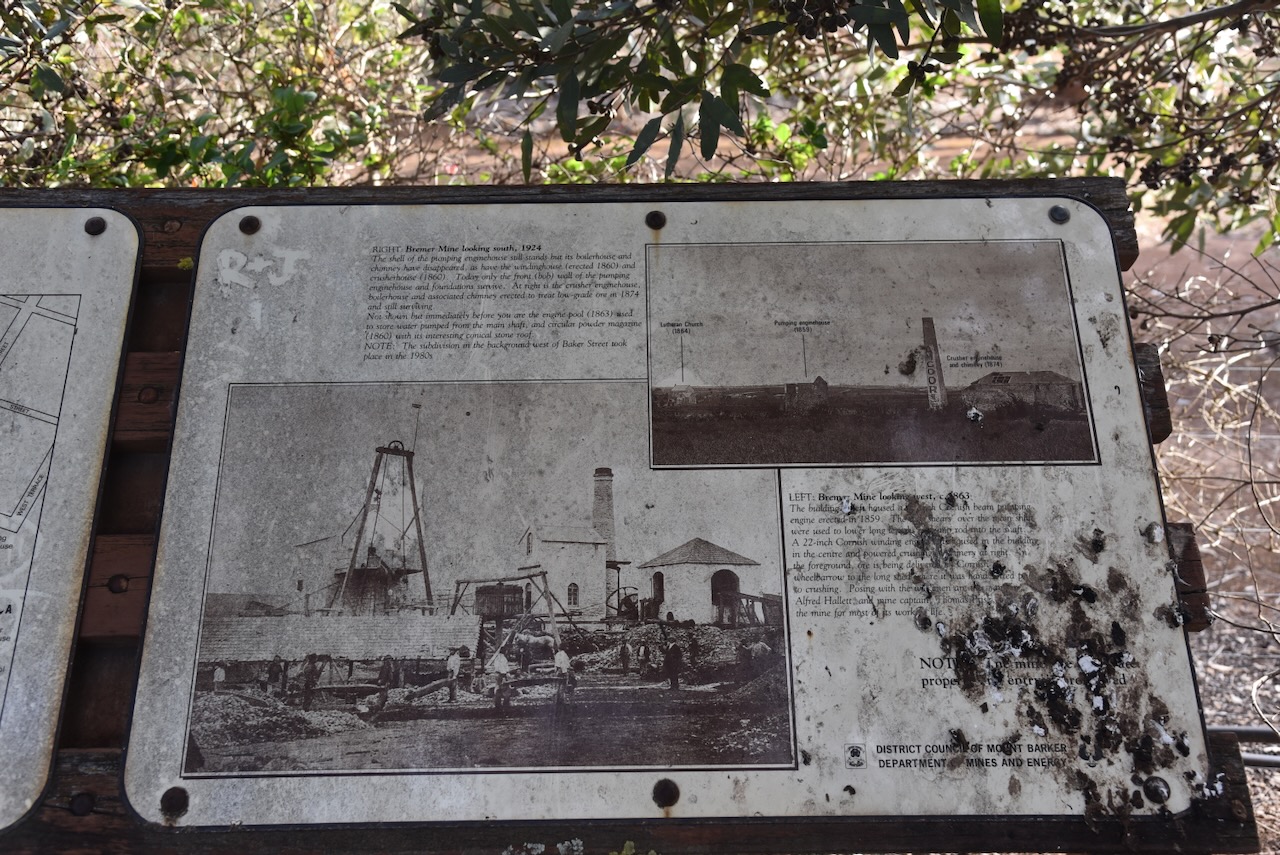
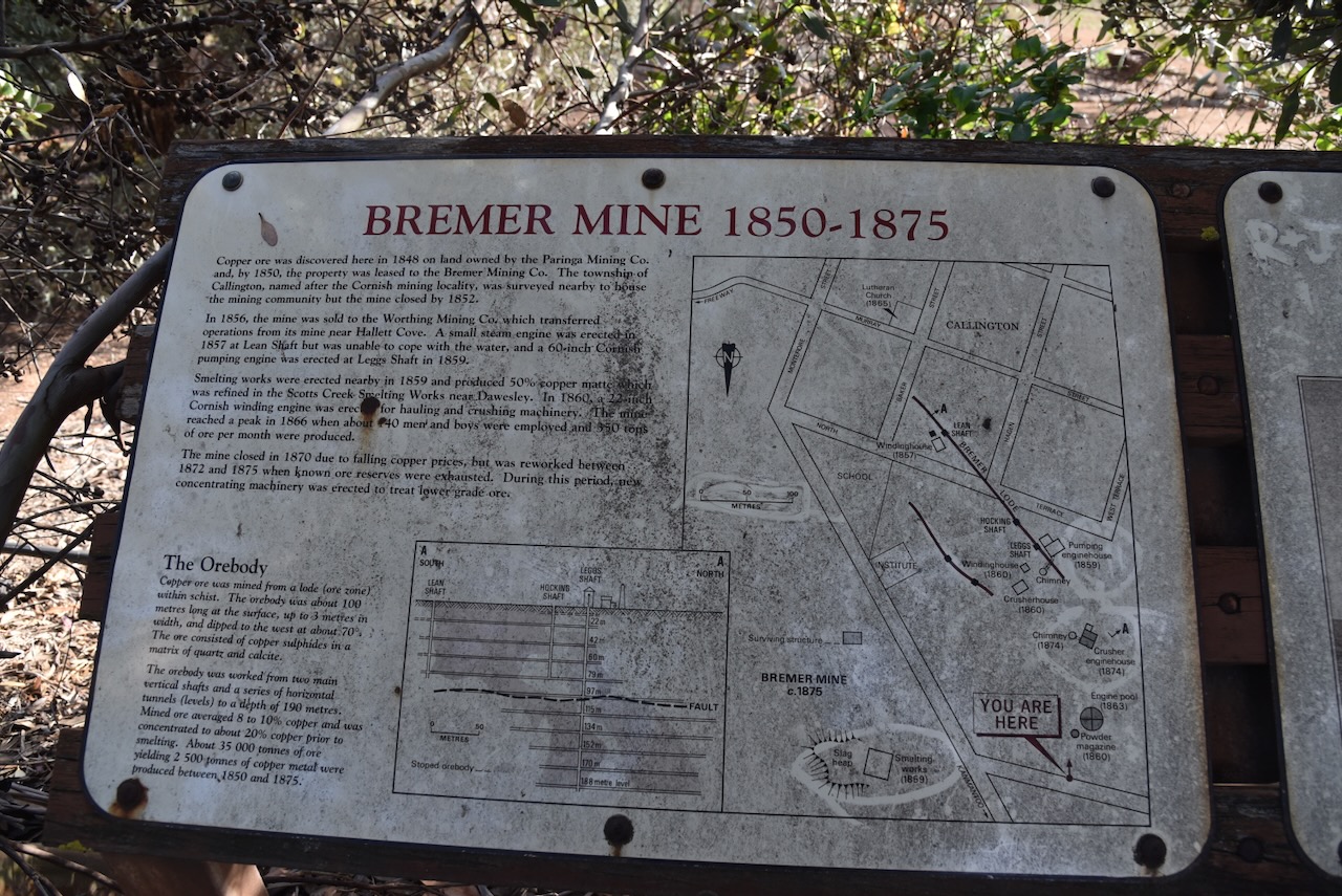
In 1848, the Bremer Smelting Works, trading as the Bremer Smelting Company, was established north of Callington on the Bremer River by two brothers from Cornwall, John and Mauris Thomas. They initially focused on low-grade ore from the Kanmantoo mines (Callington 2021) (SA Heritage Council 2022)
Mauris Thomas was born c. 1804 in Illogan, Cornwall, England. In 1825, he married Mary Ann Perkins. His younger brother, John Thomas, was born in c. 1810, also in Illogen. In 1838 he married Ann Lee Curnow. Mauris and John emigrated to South Australia in January 1848 aboard the Success. John died in July 1857 in Sandhurst, Victoria. In 1859, Mauris and his family left Australia and travelled to Chile, where he died in 1882. (ancestry 2016)
In 1849, the South Australian Government commenced a survey of a new road direct from Balhannah to Wellington on the Murray River. The road passed through the site of a planned township being surveyed on the Paringa property located on the Bremer River. (Callington 2021) (Flickr 2026) (Wikipedia 2026)
The town of Callington was surveyed and laid out between 1849 and 1852. Its design was influenced by Colonel William Light, South Australia’s first Surveyor-General. The township of Callington was established to serve the mining community. It took its name from the copper mining town of Callington in Cornwall, England. In addition to the Cornish settlers, Callington also had people of German and Irish origin. (Grokipedia 2026) (Wikipedia 2026)
By 1850, the Bremer Mining Company was leasing the land where the copper was discovered. The following year, in 1852, the mine closed. This was due to insufficient capital required for mining and the exodus of miners to the goldfields in Victoria. (Grokipedia 2026) (Wikipedia 2026)
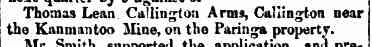
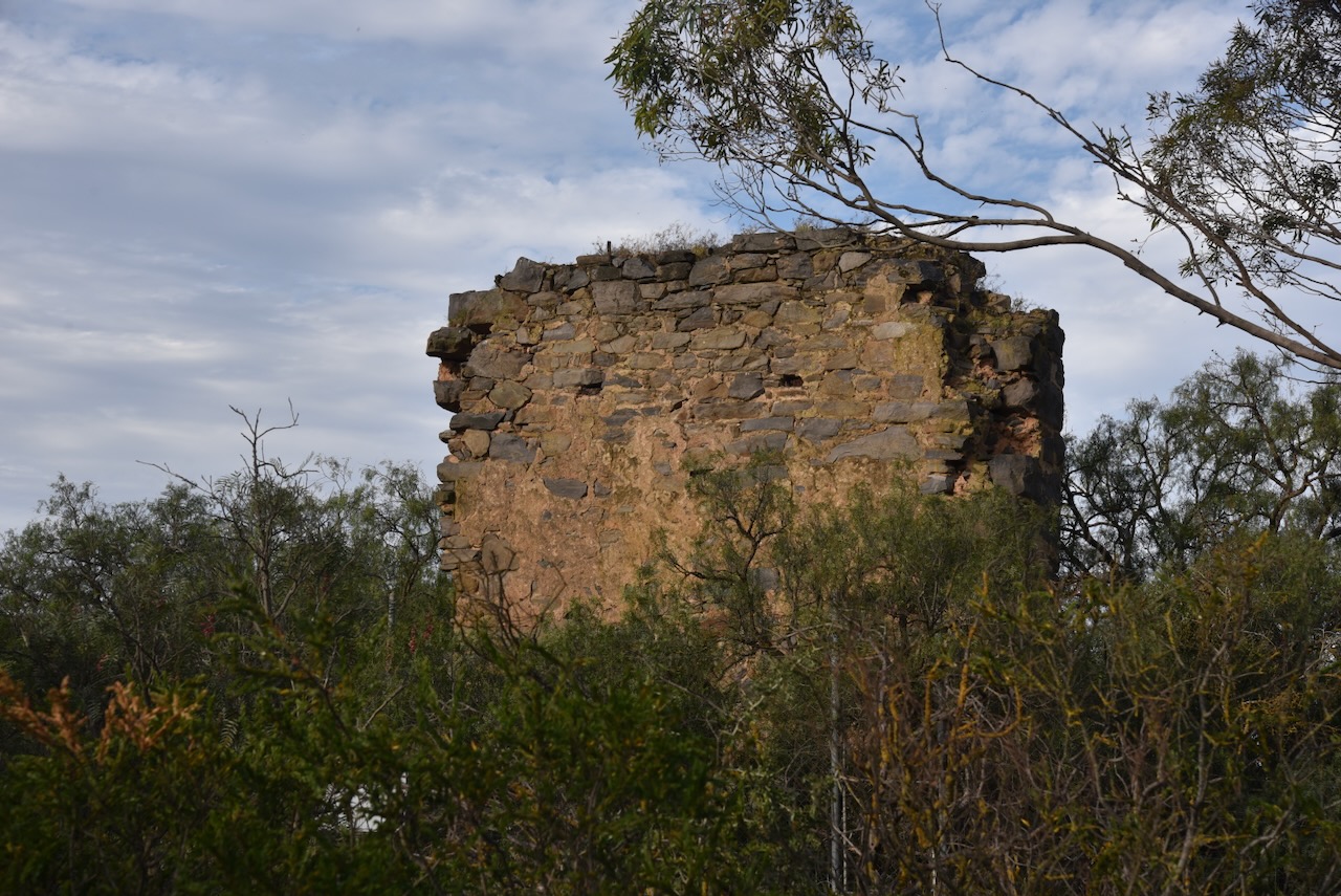
In 1850, a general licence was issued to Thomas Lean for the Callington Arms. (Trove 2026)
Above: item from the South Australian, Tue 19 Mar 1850. Image c/o Trove
In 1856, the mine was sold to the Worthing Mining Company. They transferred their operations from the mine near Hallett Cove. Copper had been discovered on Worthing farm along the Field River which was owned by John Hallett. In 1857, a small steam engine was erected at Lean Shaft to pump out 500,000 litres of water per day. However, it was unable to cope with the water, and a 60-inch Cornish pumping engine was erected at Leggs Shaft in 1859. Smelting works were also erected nearby in 1859. It was refined in the Scotts Creek Smelting Works near Dawesley. In 1860, a 22-inch Cornish winding engine was erected for hauling, crushing, and ore dressing. (Callington 2021) (Council 2021) (Flickr 2026) (Grokipedia 2026) (Wikipedia 2026)
At this time, the mine was managed by Alfred Hallett. He transformed the Callington mine into South Australia’s model copper mine for efficiency. Hallett was born in 1814 in London and emigrated to South Australia in 1838. The southern Adelaide suburb of Hallett Cove is named after his brother John. Hallett Avenue in Tranmere is named in honour of Alfred. Alfred died in November 1877 at Medindie, South Australia. (Council 2021) (Grokipedia 2026)
Above: Alfred Hallett. Image c/o State Library South Australia
In 1859, the Tavistock Hotel opened in Murray Street. It closed in 1881. Unfortunately, the hotel no longer exists. (Beeradelaide.com 2022) (Callington 2021)
In June 1859 a mining fete was held in Callington and The South Australian Advertiser reported:
“…and the tw hotels, the Callington Inn and the Tavistock Hotel, kept respectively by Mr McLean and Mr Charles Kingston, had very fortunately provided plenteously for all the comforts, as well as the requirements of the inner man.” (Trove 2026)
The township of East Callington was established in 1865, with stores and hotels being opened. A swing bridge for pedestrian traffic was constructed over the Bremer River, which consolidated the two towns. (Callington 2021)
Above: article from the Adelaide Observer, Sat 7 Oct 1865. Image c/o Trove
The mine reached its peak operation in 1866 when up to 140 men and boys were employed at the mine. About 350 tons of ore were produced each month. (Grokipedia 2026)
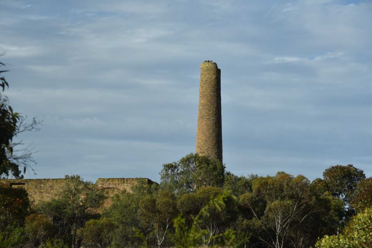
The mine closed in 1870 due to falling copper prices and the Worthing Mining Company falling into liquidation owing over £100,000. In 1872, the Bremer Mine Company took over operation of the mine once again. The Cornish chimney stack and the stone engine house were built in 1874. The mine was reworked between 1872 and 1875 when known ore reserves were exhausted. (Flickr 2026) (Grokipedia 2026) (Wikipedia 2026)
In 1872, Callington had six stores, including a blacksmith’s shop, a bank, and several churches. (Callington 2021)
Callington had its own German Rifle Club, with various competitions being held. (Callington 2021) (Trove 2026)
Above: article from The Express & Telegraph, Adelaide, Thu 24 Oct 1872. Image c/o Trove
At the time of the mine’s closure in 1875, Callington’s population was 235 people. By 1881, this had dropped to 148. (Flickr 2026)
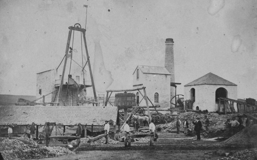
Above: the Bremer mine, 1875. Image c/o State Library South Australia
Several buildings in Callington are listed on the South Australia State Heritage Register. An area encompassing the entire town of Callington and the Bremer Mine site was added in 1980 to the Register of the National Estate. Due to Callington’s heritage feel, several movies have been filmed in the town, including Golden Fiddles (1990), The Battlers (1994), and Rain Shadow (2007). (Callington 2021)
The Callington Railway Station was situated on the Adelaide-Wolseley line, which was opened in stages between 1883 and 1887. The section between Adelaide and Nairne was opened in 1881, but it would take a further 3 years before the line reached Callington. At the time, it was considered to be the most expensive stretch of railway line in Australia. The Callington station consisted of a ticket office, a large shelter, and a platform. (Callington 2021) (Wikipedia 2025)
Above: the Callington Railway Station, 1909. Image c/o State Library South Australia
All that is left of the Callington railway precinct is the old station master’s house and the old water tower. The station was closed in November 1982. In 1991, the National Railway Museum removed the station and the station sign and installed them at the museum. Following the conversion of the Adelaide-Wolseley line to standard gauge, the station platforms were demolished. (Wikipedia 2025)
The old Primitive Methodist Church in Murray Street was built in 1862 to serve the Cornish miners who lived in the district. (Callington 2021)
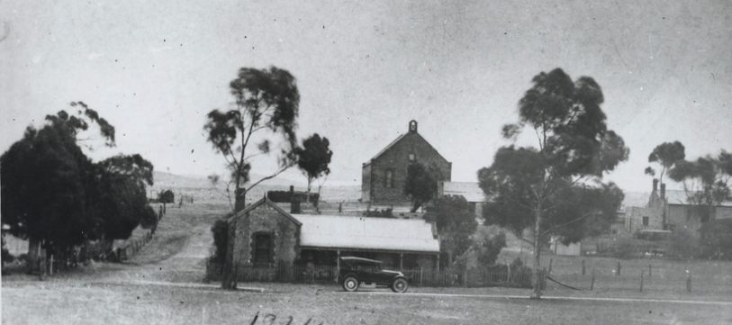
The photo below, taken in 1924, shows how much Callington has changed over the years.
Above: The Primitive Methodist Church, c. 1924. Photo c/o State Library South Australia
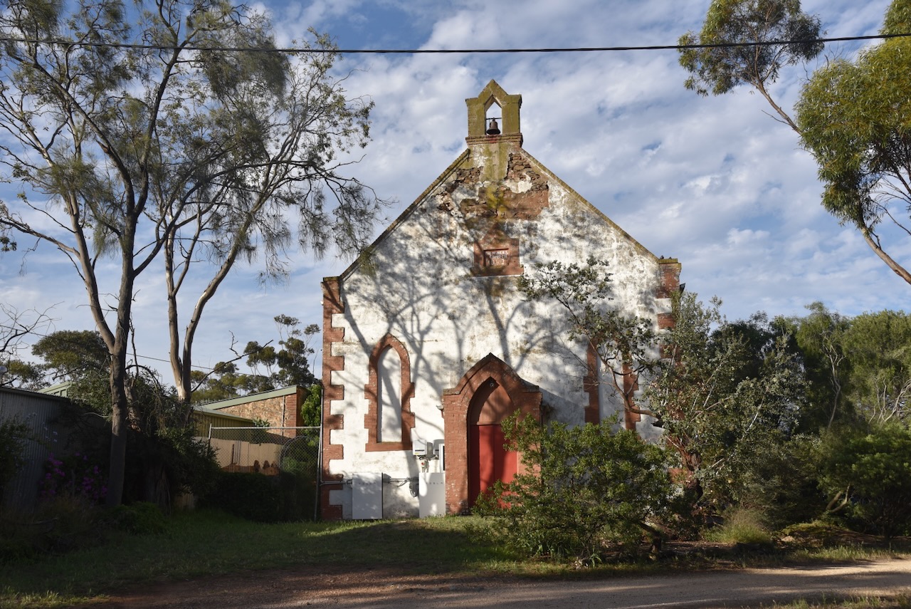
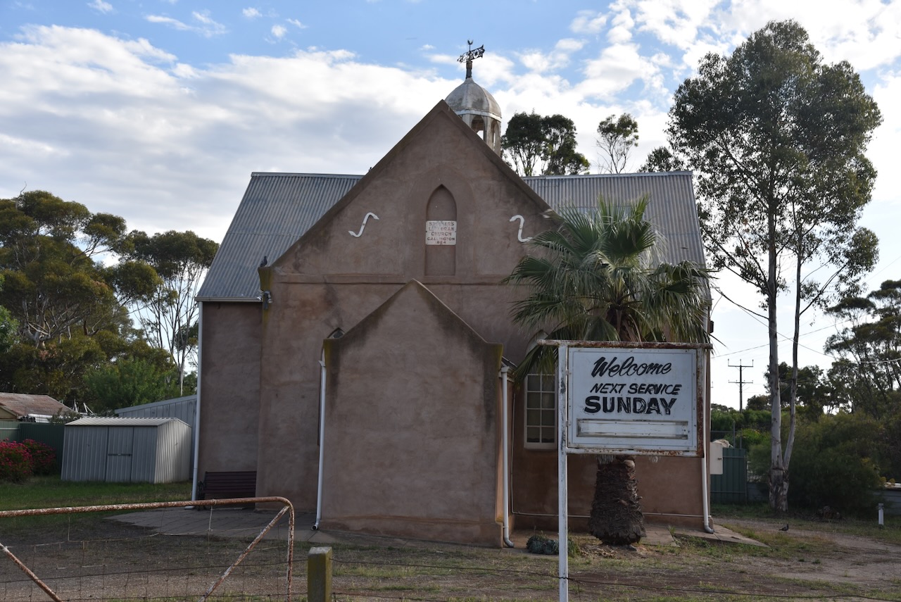
The old St Peter’s Lutheran Church is located on Murray Street. It was built in 1864. The church held its final service on Sunday, the 25th day of May 2025. (Webster 2025)
Unfortunately, the walls of this beautiful stone church have been rendered.
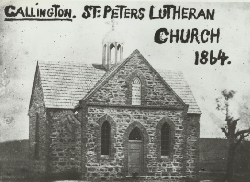
Above: St Peter’s Lutheran church. Image c/o State Library South Australia
The old Callington Flour Mill is located on Bridge Street near the Bremer River. It was built in 1857.
The Callington Hotel is located on Montefiore Street. The hotel is currently permanently closed and has been the subject of controversy regarding renovations.
It was opened in 1850 and was originally called the Callington Arms. In 1854, its name changed to the Callington Inn. It continued to operate under that name until 1876, when it became the Callington Hotel. In 1886, its name changed to the Miner’s Arms Hotel and operated under that name until 1889, when the name was changed to the Callington Hotel. (Beeradelaide.com 2022)
Above: The Callington Hotel in 1936. Image c/o State Library South Australia
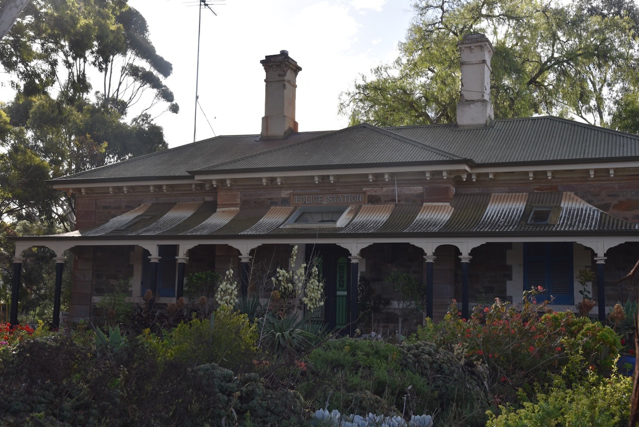
The old Callington Police Station is located at the southern end of Montefiore Street.
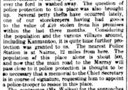
Initially, the responsibility of policing law and order in Callington rested with the mining companies and Mounted Police who were based at Nairne. As a result of increased crime activity, Callington residents petitioned the Chief Secretary, Henry Ayers, for a police station at Callington. In September 1865, the South Australian Register reported:
“Several petty thefts have occurred lately, one of our storekeepers having had goods to the value of £10 stolen from his premises within the last three months. Considering the population and the various villages around, including Kanmantoo, it is quite time further protection was granted to us. The nearest Police Station is at Nairne, 12 miles from here…” (Trove 2026)
Above: part of an article from the South Australian Register, Wed 13 Sept 1865. Image c/o Trove
Their appeal was successful, with a police trooper stationed at Callington in 1866 and approval for the construction of a police station at Callington. The tender was accepted by Messrs. Wells & Dickin. In July 1867, the South Australian Weekly Chronicle reported that when the police station was complete, ‘it will be an ornament to our township.’ The police station was constructed in late 1867 at a cost of £1,145. (Callington 2021) (Trove 2026)
Sadly, not much of the Bremer Mine is visible to the public. The chimney and much of the old mine are located on private property. The information boards are located on Back Callington Road and are not well signposted. They are also filthy and overgrown by shrubs, and very difficult to see.
The Callington Cemetery contains several historic headstones.
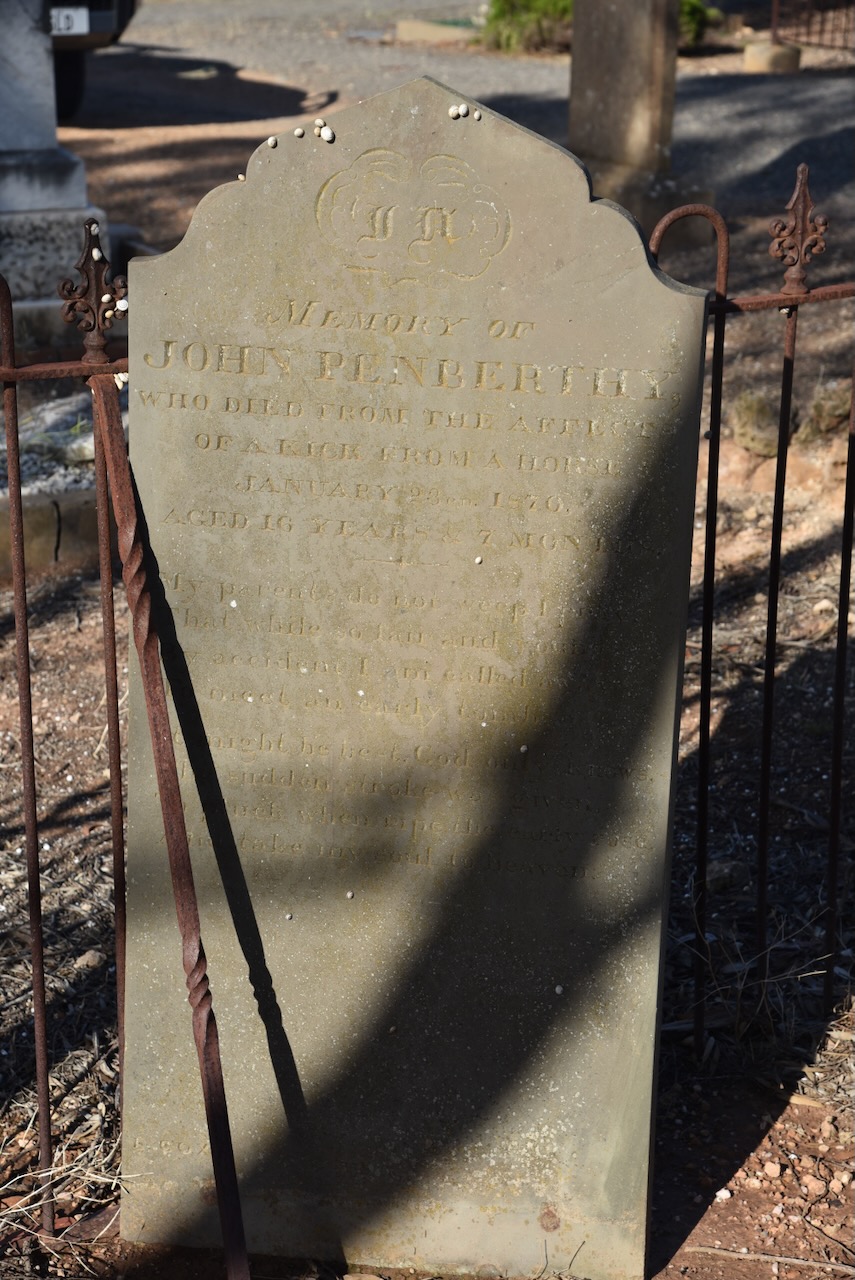
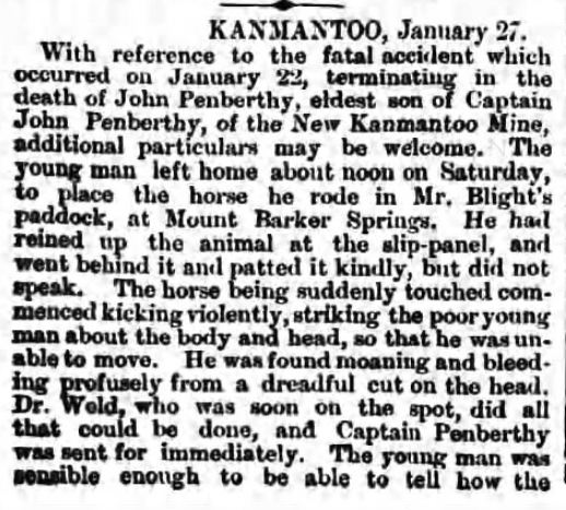
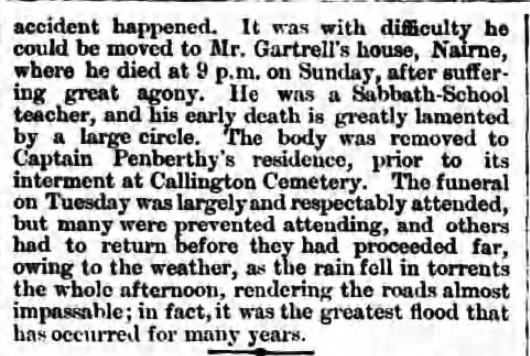
John Penberthy died in January 1870, aged 16 years. He died as a result of injuries after receiving a kick from a horse at Nairne. He was the son of Captain John Pemberthy, the manager at the Aclare Mine at St Ives near Callington.
John was taking a horse to Mount Barker Springs when he was kicked in the head. He was taken to Nairne, where he died of his injuries. It was reported that he suffered ‘great agony.’ (newspapers.com 2019)
Above: article from The Observeer, Sat 29 Jan 1870. Image c/o newspapers.com
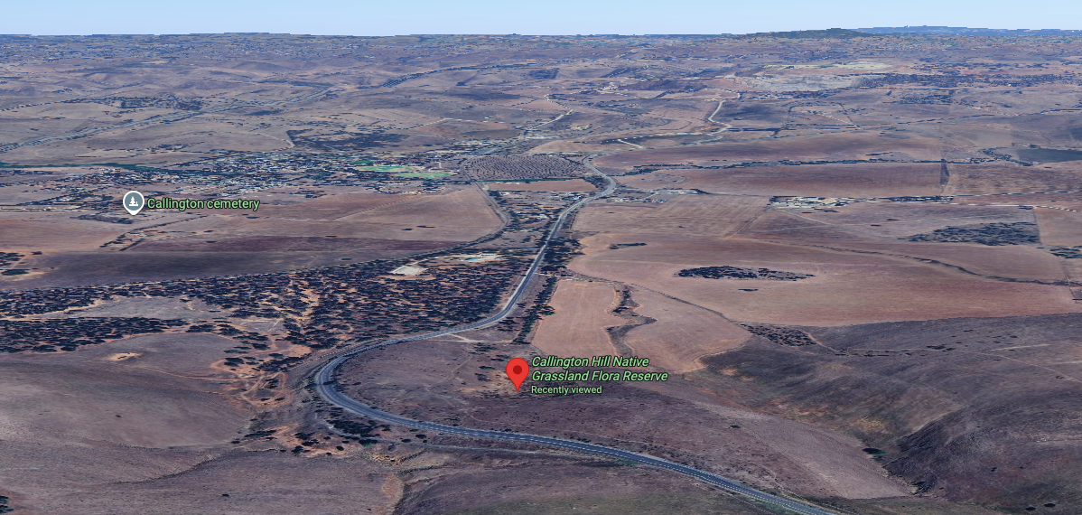
The reserve is on the northern side of Old Princes Highway when travelling up the hill out of Callington.
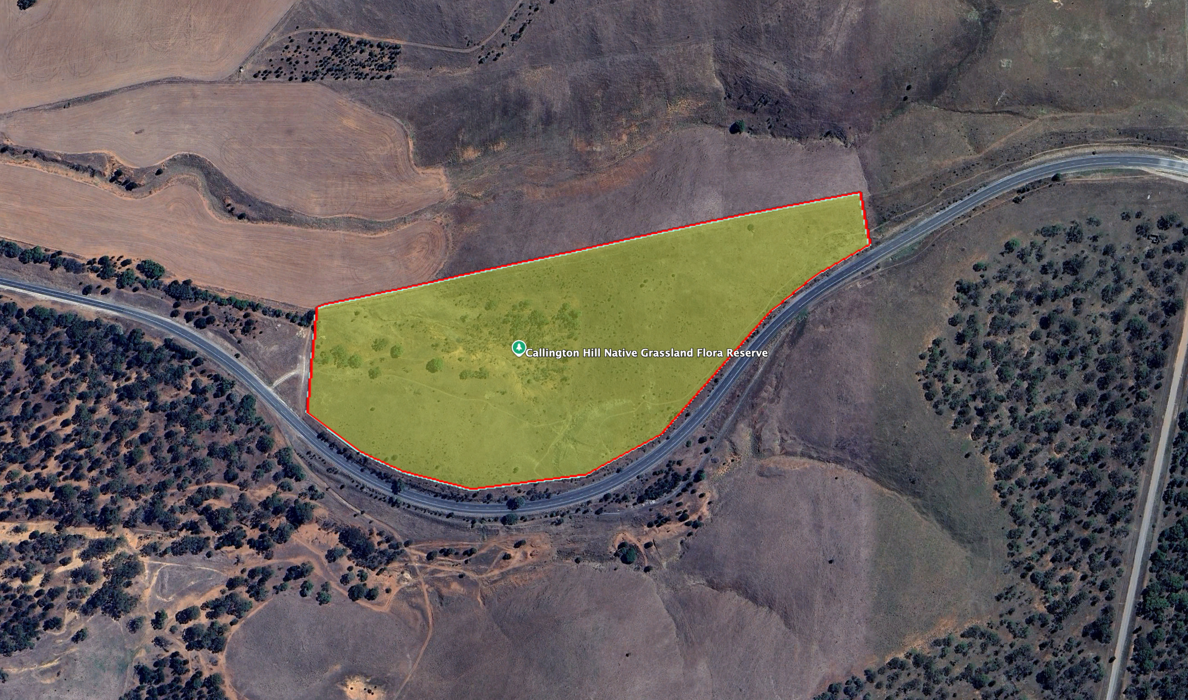
Above: the boundaries of the park. Image c/o Google Earth
Unfortunately, the information board at the reserve has been totally neglected and has faded due to exposure to the elements. It is impossible to read the information contained.
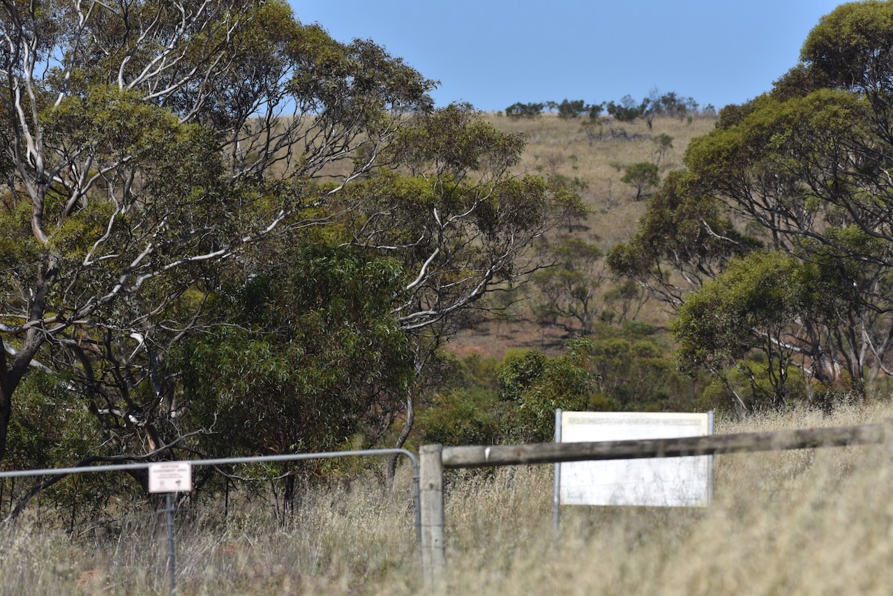
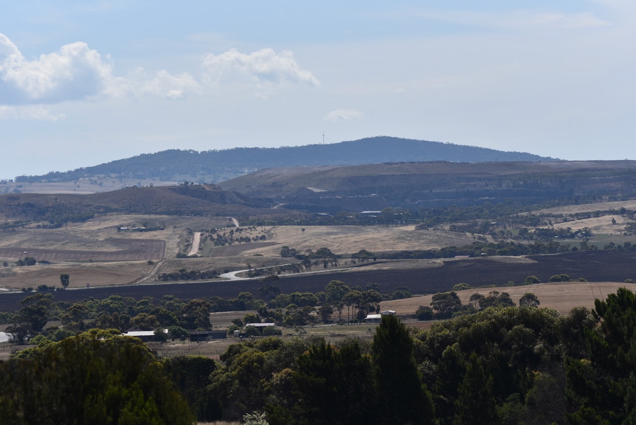
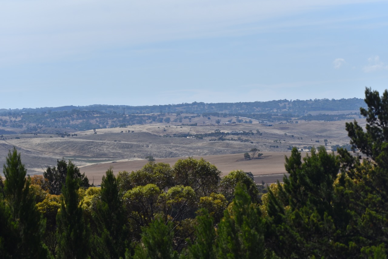
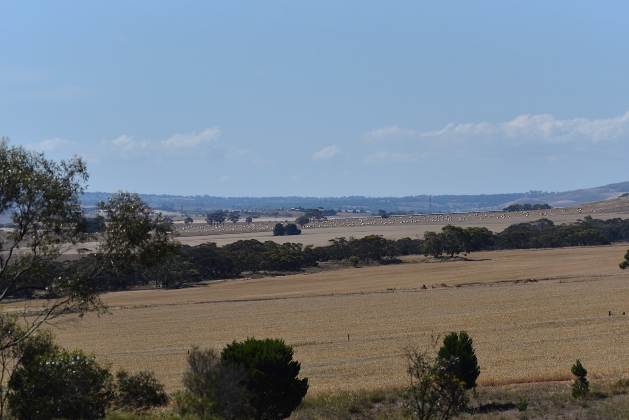
There are excellent views of the Bremer Valley and Mount Lofty from the reserve.
The reserve is about 12 hectares in size and was established on the 30th day of March 2011. The reserve contains critically endangered Iron-grass Natural Temperate Grassland. (Dcceew.gov.au 2025) (Vic.edu.au 2024)
Above: an aerial view of the reserve looking west. Image c/o Google Maps
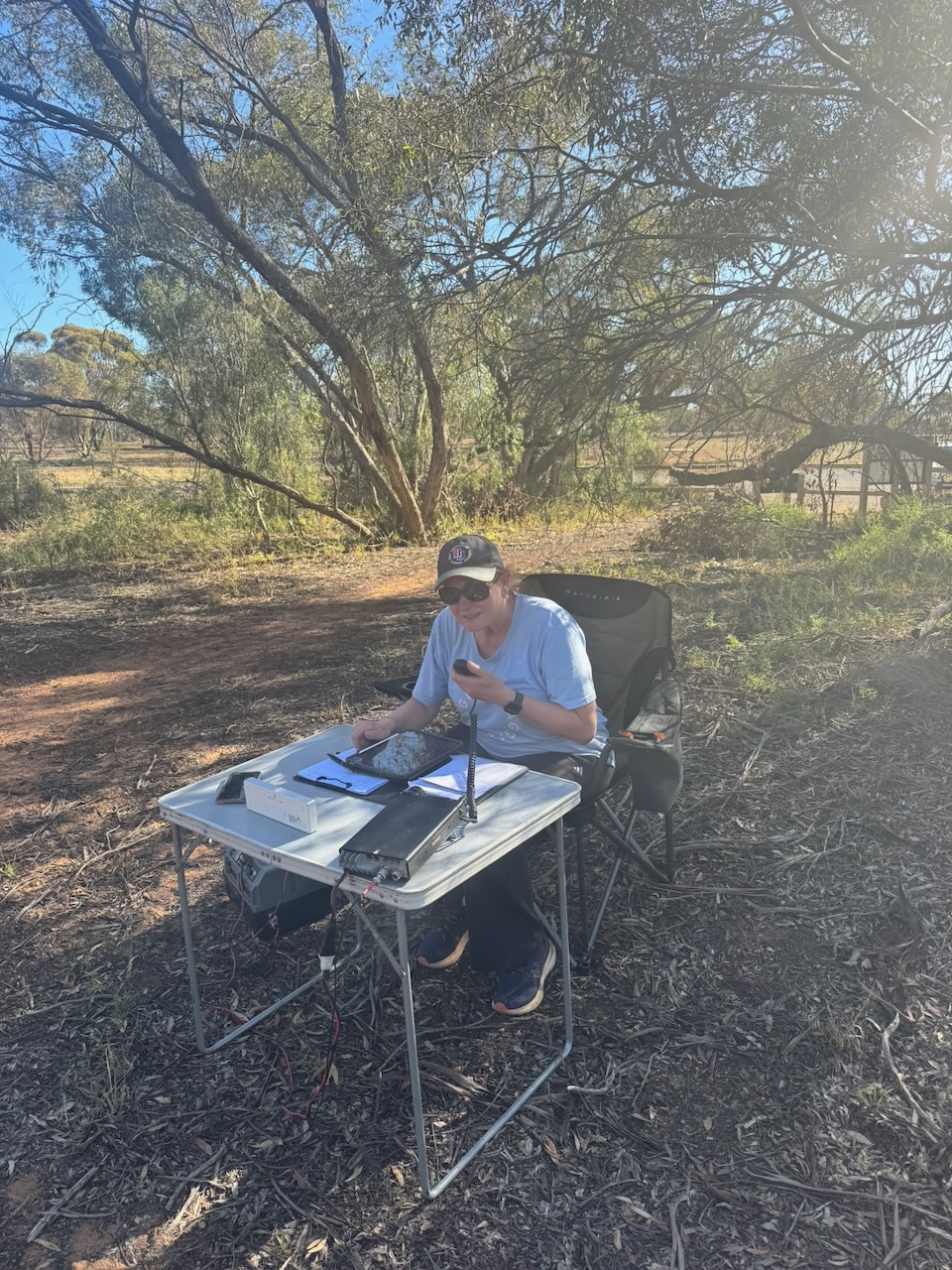
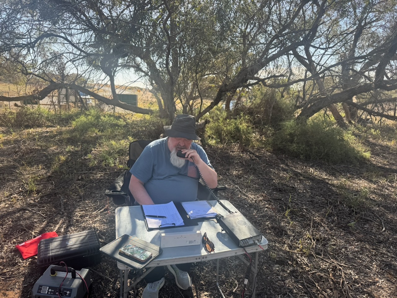
Marija and I walked in about 50 metres from the gate at the western end of the park. We set up our station under the shade of a tree as it was quite a warm day. Fortunately, we didn’t experience any flies. We ran the Yaesu FT857, 40 watts, and the 20/40/80m linked dipole.
We logged a total of 196 QSOs, including 19 Park to Park contacts.
Flickr. (2026). Callington. Establishd 1849 and copper mining from 1850. This Cornish chimney stack was built in 1874 and the stone engine house was erected in 1874. Mining ceased 1870. Restarted 1872 and closed permanently 1875. [online] Available at: https://www.flickr.com/photos/82134796@N03/48342169342 [Accessed 23 Apr. 2026].
Trove. (2026). MINING FETE AT CALLINGTON. – The South Australian Advertiser (Adelaide, SA : 1858 – 1889) – 27 Jun 1859. [online] Available at: https://trove.nla.gov.au/newspaper/article/794622 [Accessed 23 Apr. 2026].
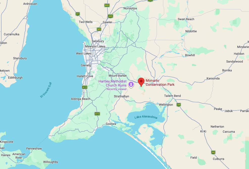
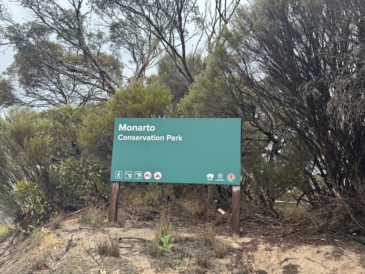
Our second park for Saturday, the 22nd day of November 2025, and the 2025 VKFF Activation Weekend, was the Monarto Conservation Park VKFF-0828. Monarto is about 64 km southeast of Adelaide.
This is another park that Marija and I have visited several times previously and have activated it for the WWFF program.
Above: Map showing the location of Monarto Conservation Park. Map c/o Google Maps
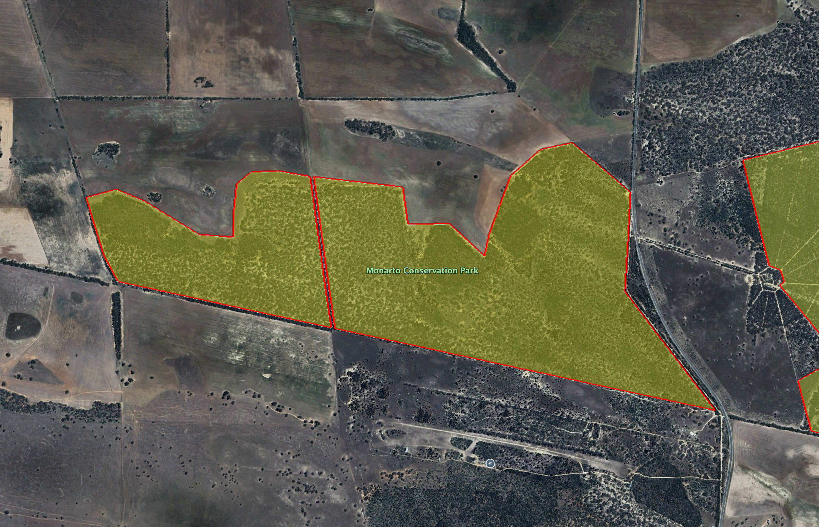
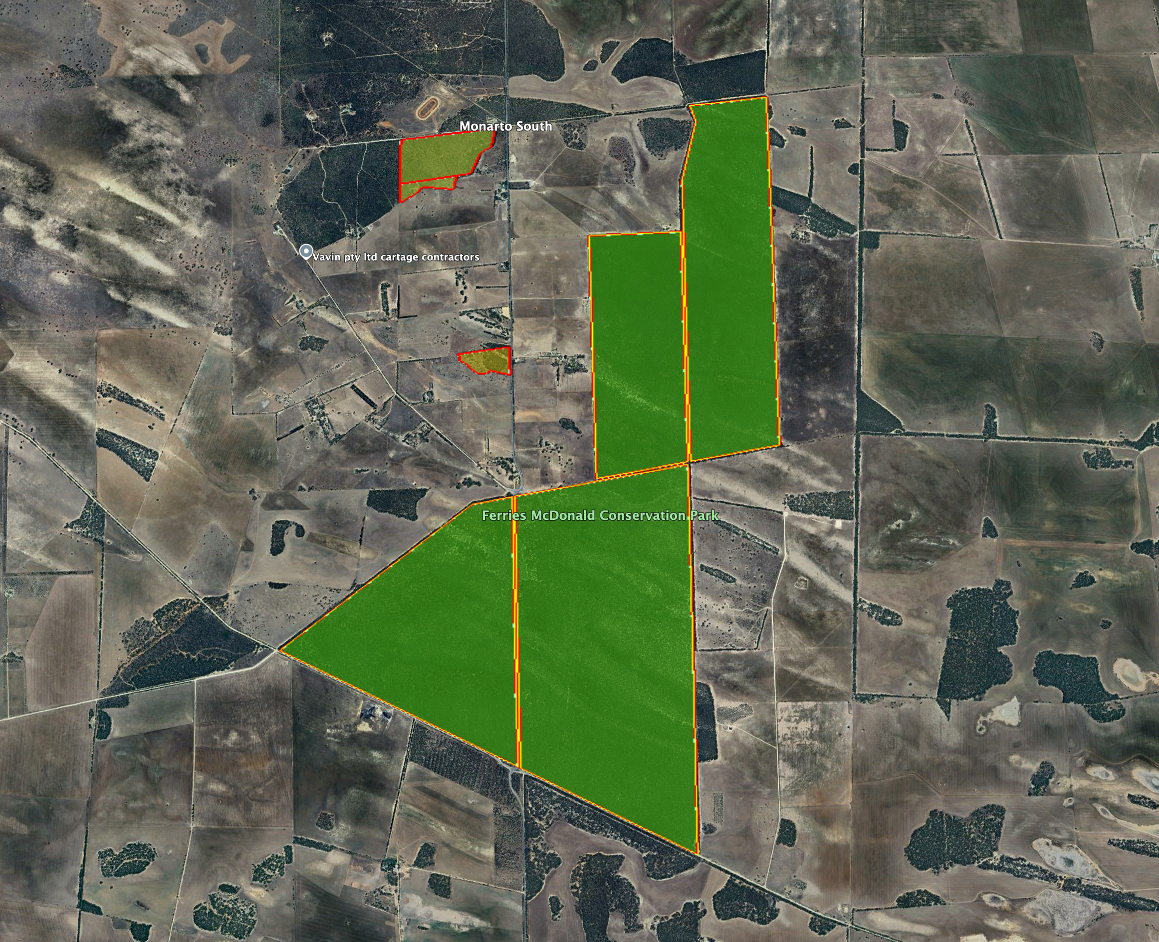
Monarto Conservation Park is located on the western side of Ferries McDonald Road.
Above: the boundaries of Monarto CP. Image c/o Google Earth
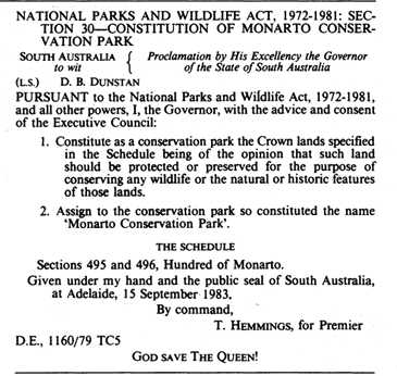
The Monarto Conservation Park is about 240 hectares in size and was established on the 15th day of September 1983. It was previously known as Braendler’s Scrub. (Dcceew.gov.au 2025) (Wikipedia 2026)
Above: Declaration of the park, SA Govt Gazette, 15 September 1983
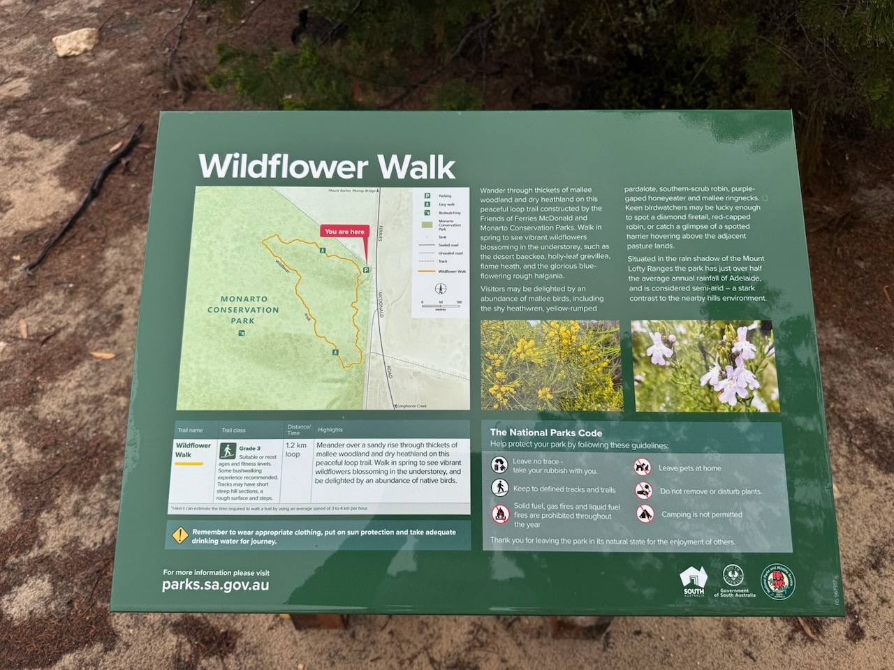
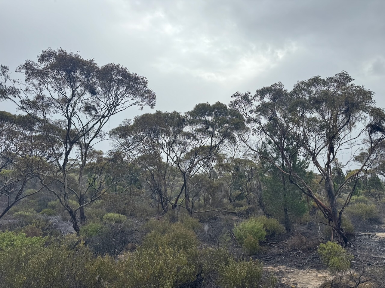
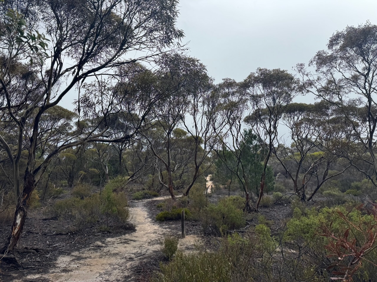
The park consists of thickets of mallee woodland and dry heathland. About 50 species of native plants have been recorded in the park. The park is located in the ‘rain shadow’ of the Southern Mount Lofty Ranges to its west. Monarto has just over half of the average rainfall of Adelaide, and is considered to be semi-arid. (NPWS 2024) (Wikipedia 2026)
The park is home to the Western grey kangaroo and the native marsupial mouse. Birds SA has recorded 108 bird species in the park, including Red-rumped parrot, Mallee Ringneck, Purple-crowned Lorikeet, Grey Fantail, and White-browned Babbler. (Birdssa.au 2026) (NPWS 2024)
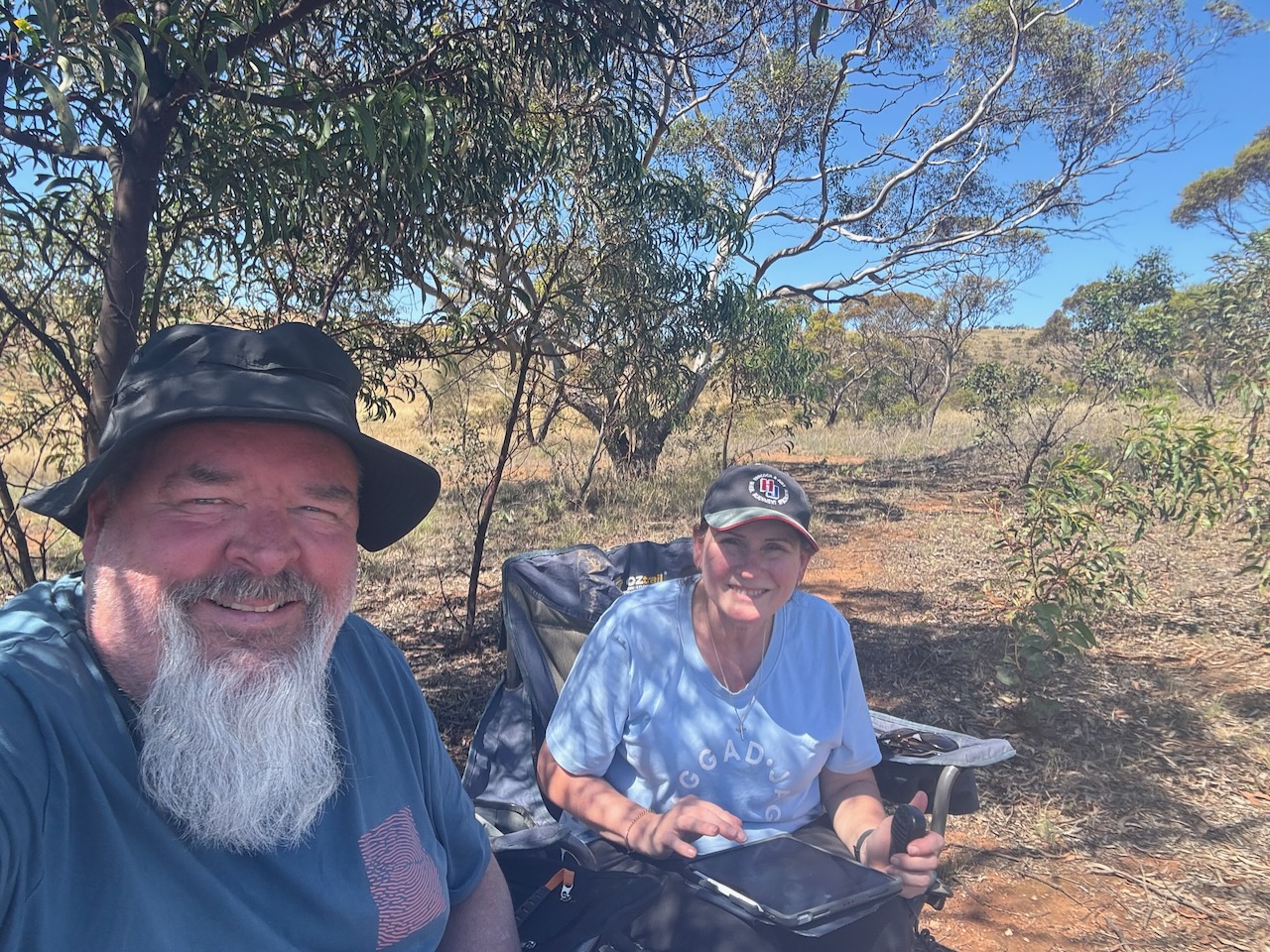
Marija and I set up in our normal spot, in the carpark on the eastern side of the park. We ran the Yaesu FT857, 40 watts, and the 20/40/80m linked dipole.
Unfortunately, we had to compete with mosquitoes and drizzling rain during this activation.
Each year in November, the VKFF chapter of the World Wide Flora Fauna (WWFF) program holds its annual VKFF Activation Weekend. This is a weekend where VKFF park activators all around Australia head out into the field to activate VKFF parks.
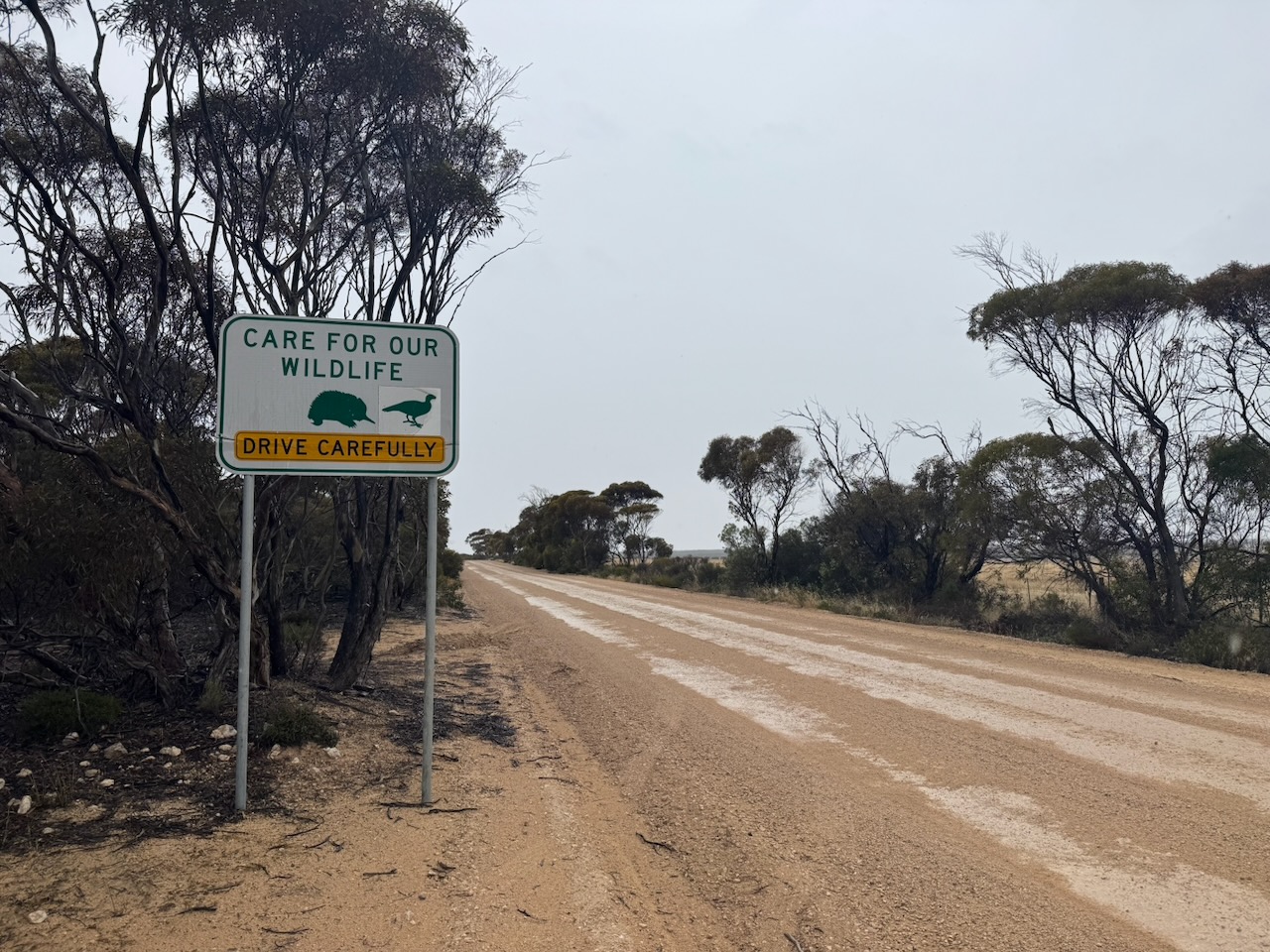
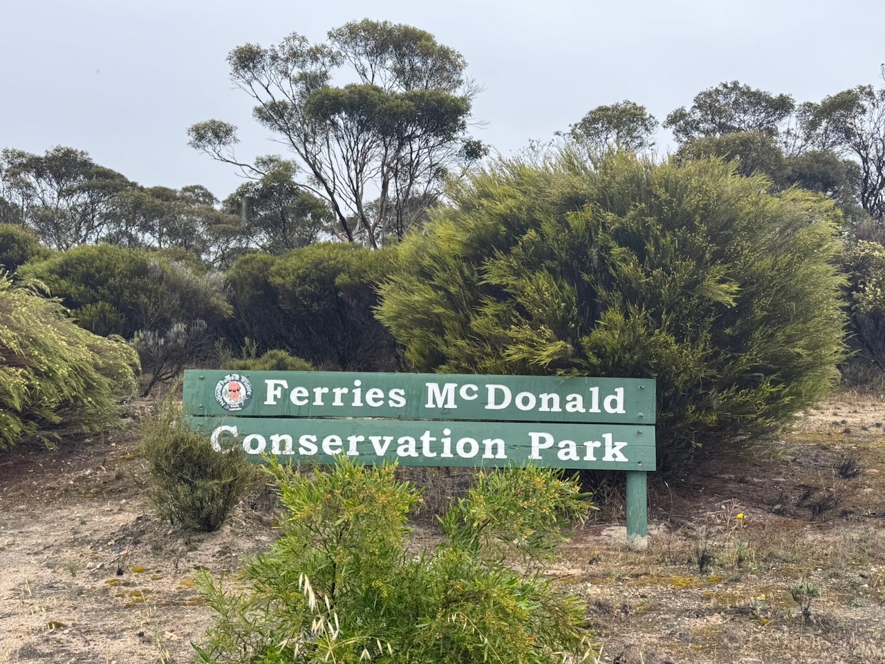
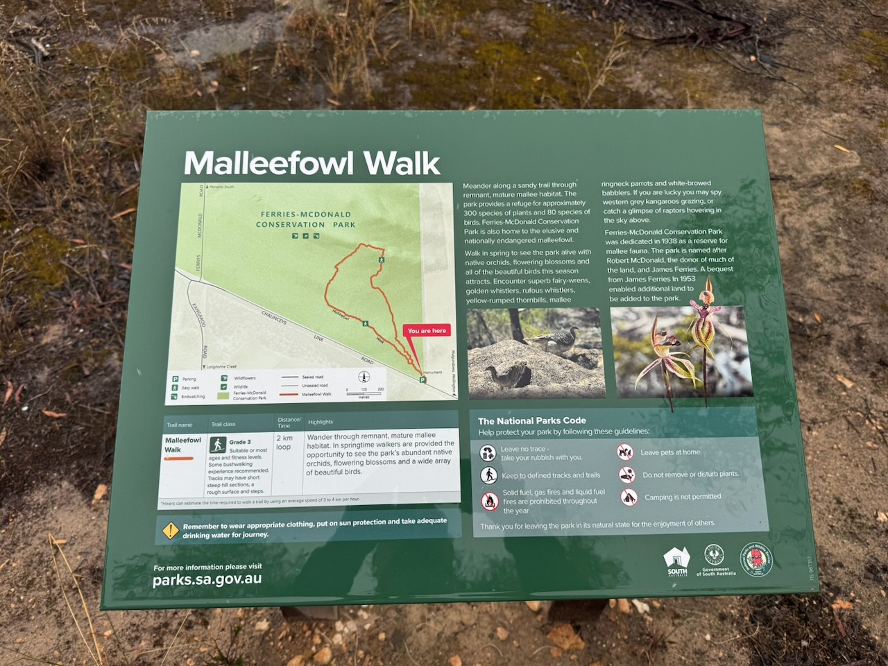
Today was the first day of the event, Saturday, the 22nd day of November 2025. Our first park was the Ferries McDonald Conservation Park VKFF-0881. Marija and I have activated this park several times previously. The park is located about 65 km southeast of Adelaide.
Above: Map showing the location of the Ferries McDonald Conservation Park. Map c/o Google Maps
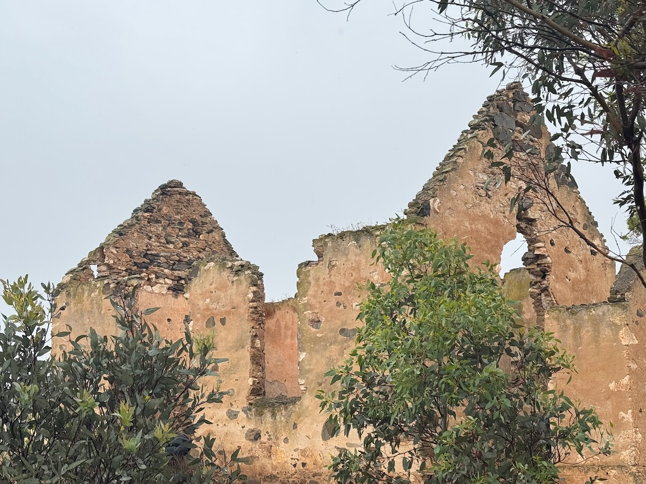
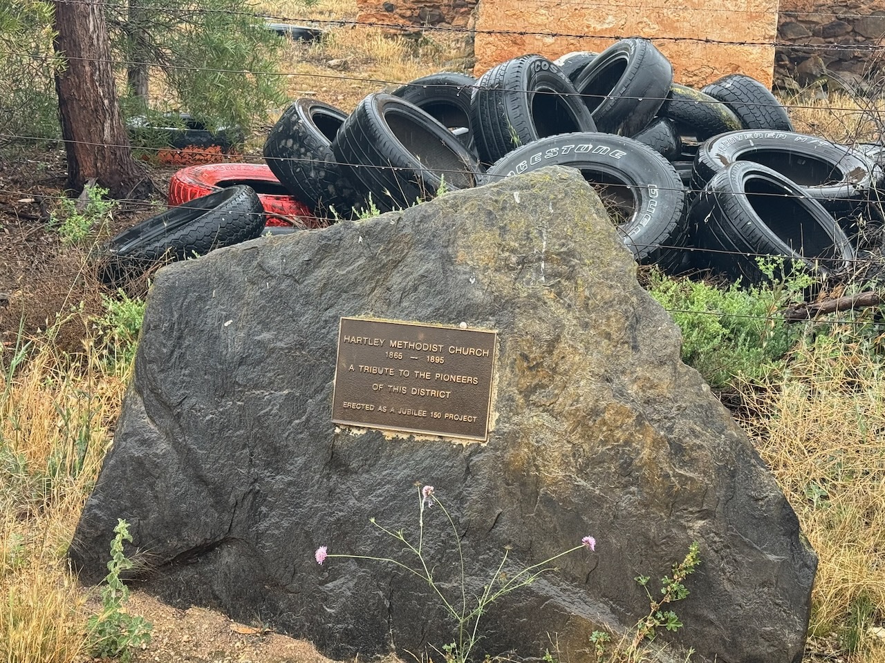
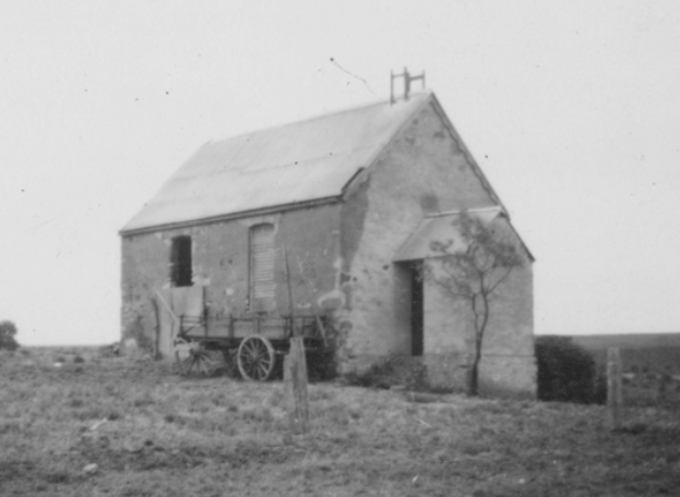
We left home late morning and travelled through Strathalbyn and Woodchester. Our first stop for the day was at the old Hartley Methodist Church, located on the corner of Callington Road and Chauncey’s Line Road. The church operated from 1865 to 1895. The church is in a crumbling state of disrepair, and since our last visit, a pile of old tyres has also been dumped at the site. It is such a shame, a disgrace really, that there is not more attention paid to South Australia’s history.
The town of Hartley was founded in 1853. During its heyday it had a school, a church, a post office, a creamery, and several dwellings. When first settled, the Hartley district was referred to as ‘The Bremer”. It was later named Hartley by the Cross family after their farm in Devon, England. (WIkipedia 2024)
William Cross was born in 1793 in Devon, England. In 1891, he married Sarah ‘Sally’ Milford in Petrockstow, Devon, England. They emigrated with their 5 children to Australia in 1850 aboard the Andromache. They arrived at Port Adelaide on the 11th day of September 1850. They settled at Hartley and were the first settlers in the area. William died on the 28th day of February 1856, aged 63 years. He was buried in an unmarked grave on the flats of the Bremer River. (ancestry 2016) (Findagrave.com 2025)
His wife, Sarah, released land on Section 1275 for a place of worship and cemetery. On the 24th day of August 1857, the acre of land was purchased by thirteen members of the Mount Barker Methodist Society for £5. The church opened in 1856; it was closed in 1895. The church was sold privately in 1901. During WWII, a period when building materials were scarce, the tin roof of the church was removed and sold for scrap. (Findagrave.com 2025)
Sarah ‘Sally’ Cross died on the 25th day of July 1865, aged 67 years. She was buried in the cemetery, located between the church and the road. Her cause of death was dropsy. (ancestry 2016) (Findagrave.com 2025)
Above: The Hartley Methodist Church, c. 1941. Image c/o State Library South Australia
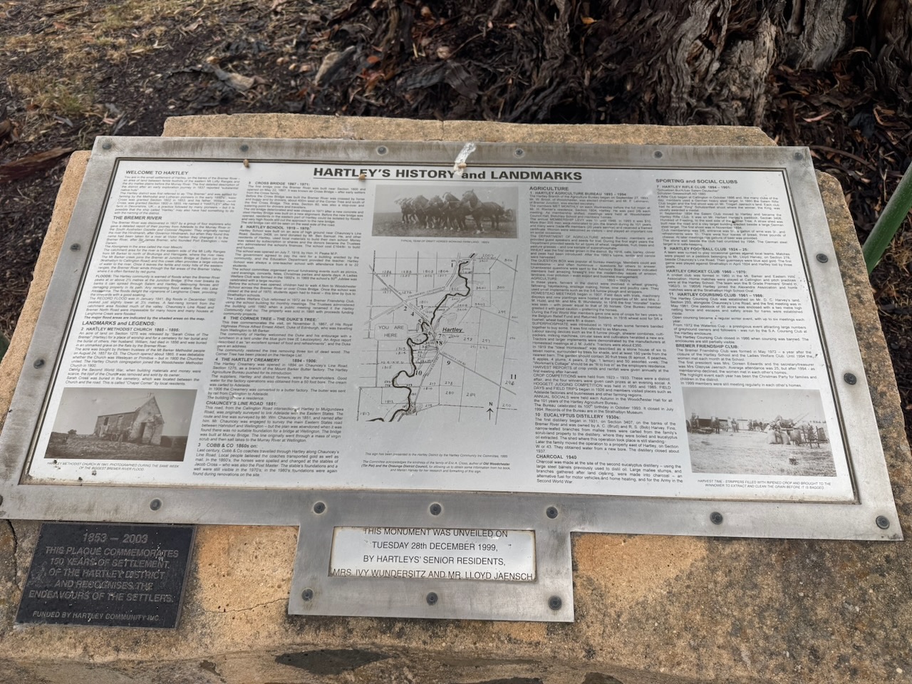
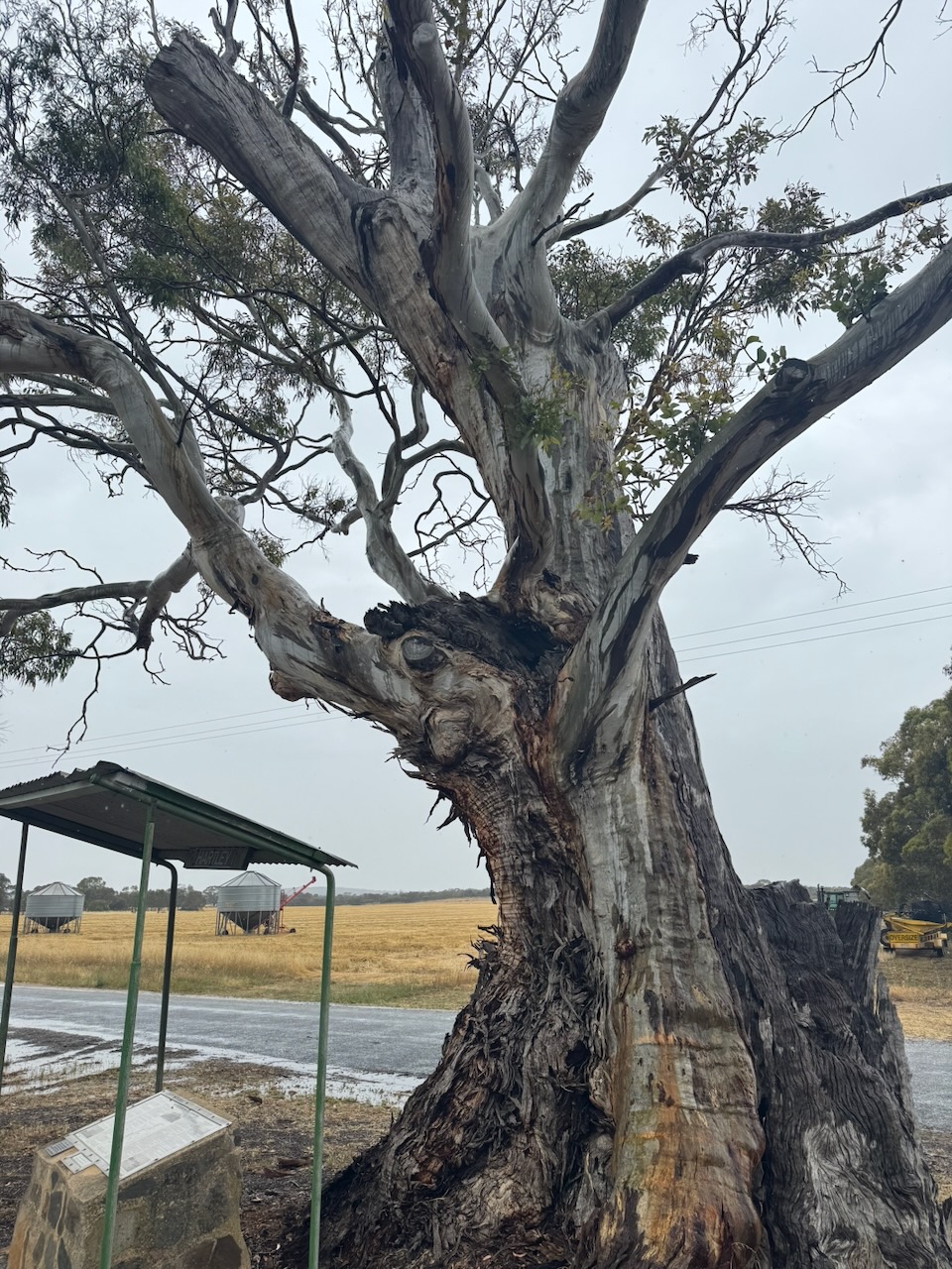
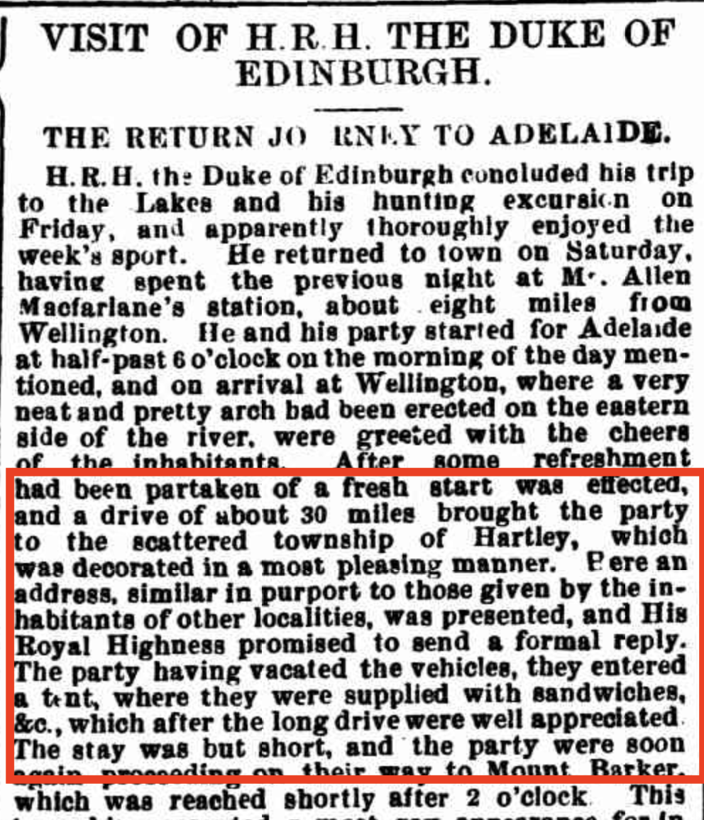
On the corner of Chaunceys Line Road and North Bremer Road is a monument that details Hartley’s history and landmarks. It is located alongside ‘The Duke’s Tree’. The tree commemorates the visit, on the 5th day of November 1867, of His Royal Highness Prince Alfred Ernest Albert, Duke of Edinburgh, who was travelling from Wellington to Mount Barker.
The community of Hartley welcomed the Duke and his entourage with a luncheon in a tent under the blue gum tree. The Duke delivered an address at the gathering.
Above: part of an article from The Express & Telegraph, Adelaide, Mon 18 Nov 1867. Image c/o Trove
Marija and I continued along Chaunceys Line Road towards the park. Chaunceys Line was a road planned in 1854 to link the village of Hahndorf with the ferry at Wellington on the River Murray. It was named after surveyor W.S. Chauncey and was officially called ‘The South Eastern Road.’ (Sa.gov.au 2026)
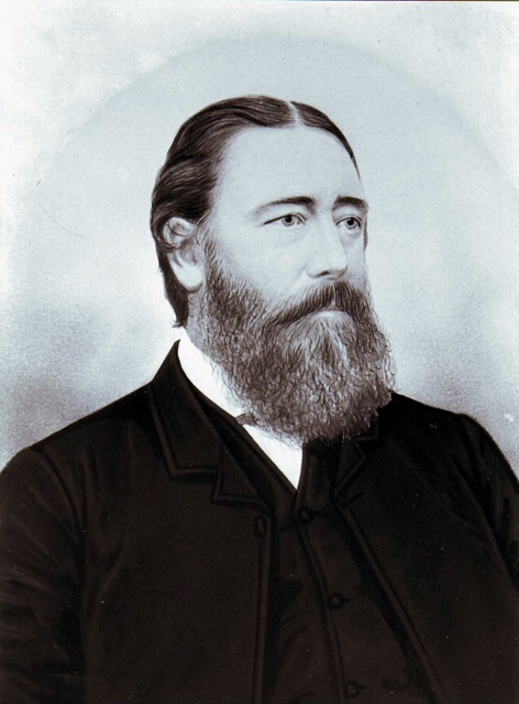
William Snell Chauncey was born in August 1820 in Surrey, England. In July 1840, he married Anna Cox in Sinnighill, Berkshire. They emigrated that year to Australia aboard the Appoline, arriving at Port Adelaide on the 22nd day of November 1840. In 1849, he returned to Australia aboard the Duke of Wellington. He was commissioned by the South Australian Railway Committee to report on a possible railway line from Adelaide to Burra. He also surveyed the Adelaide to Port Adelaide railway line, and the South Eastern Road. In 1851, he moved to Melbourne and became the chief engineer of the Hobsons Bay Railway Company. By 1856, he had moved to New South Wales and was appointed the district surveyor in Belvoir, and later, the road superintendent at Goulburn. Chauncey died in 1878 from gastric fever.
Above: William Snell Chauncy. Image c/o Wikipedia
The Ferries McDonald Conservation Park’s southern boundary is Chaunceys Line Road. Its northern and eastern boundary is farmland. Ferries McDonald Road passes through the park.
Above: the boundaries of Ferries McDonald Conservation Park. Image c/o Google Earth
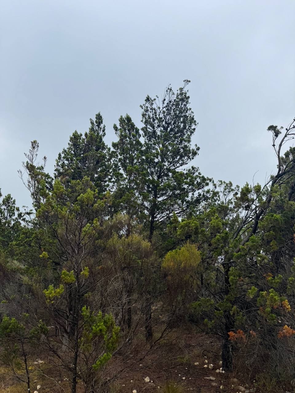
The park is about 845 hectares in size and was established on the 28th day of July 1938. The park is a remnant of mallee bushland in an area where most of it has been cleared for farming. The park is home to Red Kangaroo, Western Grey Kangaroo, and Euro. Birds in the park include the vulnerable Malleefowl, Emu, Mallee Ringneck, Yellow-plumed honeyeater, and Fairy wrens. Birds SA have recorded 89 bird species in the park. (Birdssa.au 2026) (Wikipedia 2026)
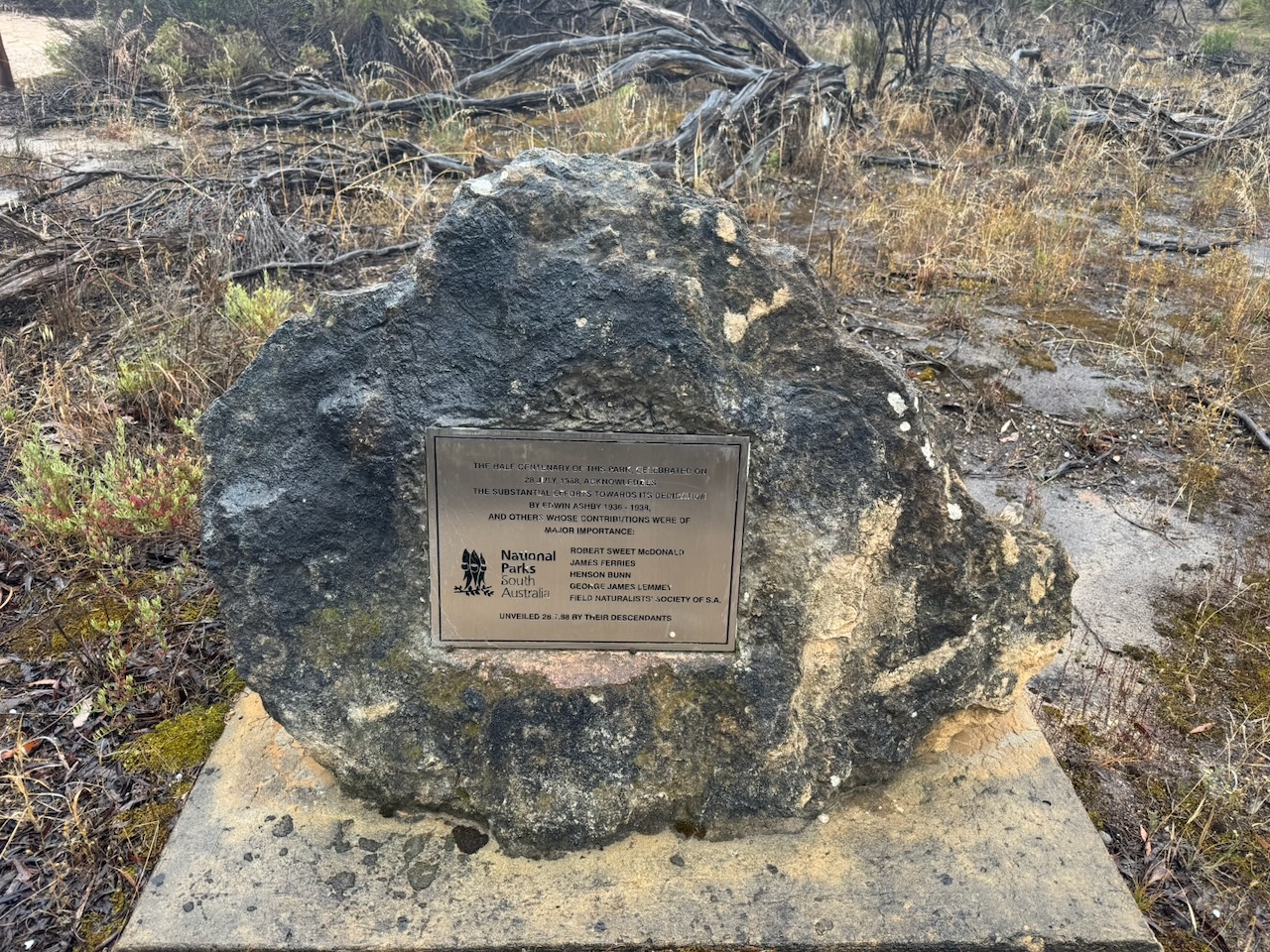
In the park, you can find a plaque commemorating the contributions of Edwin Ashby, Robert Sweet McDonald, James Ferries, Henson Bunn, and George James Lemmey toward the establishment of the Ferries McDonald Conservation Park. The plaque was unveiled in 1988 on the 50th anniversary of the park.
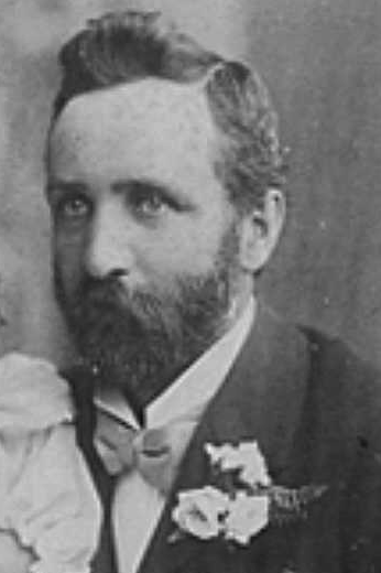
Edwin Ashby was born on the 2nd day of November 1861, in Surrey, England. He emigrated to Australia in 1881. In 1890, he married Esther Maria Coleman at Mount Barker, South Australia. They had four children. Ashby collected plants, birds and shells. He contributed to scientific and botanical publications on a regular basis. He was a chair of the Royal Society`s Flora and Fauna Protection Committee. Ashby was a world authority on the small sea mollusc, chitons. He died in January 1951 at Blackwood, South Australia, aged 79 years. (ancestry 2016) (Australia Yearly Meeting, 2017)
Ashby was instrumental in the creation of the Ferries McDonald Conservation Park. During the 1920s, he commenced a campaign for a reserve of mallee scrub in the Murray region. Ashby was concerned with the loss of mallee scrub and the loss of habitat for the mallee fowl. He was aware of the lack of interest in ecological issues by the South Australian State Government, and even proposed the domestication and commercialisation of the mallee fowl. However, his main aim was the creation of a picnic spot and recreational area in the mallee. (Grokipedia 2026) (UBC Web Design 2026)
Above: Edwin Ashby. Image c/o ancestry.com.au
Ashby’s children would acquire his passion for the environment. In 1965, Keith Ashby donated Wittunga house and gardens to the Adelaide Botanic Gardens. In 1957, Alison Ashby donated Waitparinga Reserve to the National Trust. She was also responsible for the planting and distribution of thousands of native Australian plants during her life. (Australia Yearly Meeting, 2017)
In 1936, Robert Sweet McDonald donated 223 acres of land to the State Government as an example of the mallee scrub in the district. The reserve was gazetted as a Closed Area for Birds and Animals in July 1938. It was the first reserve specifically for mallee fauna. It was known as Chauncey’s Line Scrub. Mr. G Lemmey of Two Wells donated a further 588 acres, and in 1953, Mr James Ferries donated a further 279 acres of adjoining land. (Grokipedia 2026) (NPWS 2026) (Sweet 2020) (Wikipedia 2026)
Above: declaration of the reserve, S AGovt Gazette, 28th July 1938.
Robert Sweet McDonald was born in June 1866 at Woodchester, South Australia. In 1892, he married Marion Greenwood at North Adelaide. They had 6 children. They purchased a large tract of land near Monarto, which they called Preamimma. He also had a quarter share in land that contained Aclare Mine near Callington. Robert was chairman of Monarto District Council in 1905, while Marion was active in the community, raising funds for local charities. Robert died on the 28th day of June 1941, aged 75 years. Marion died in July 1943 at Premimma, Monarto, aged 76 years. (ancestry 2016) (Sweet 2020)
James Ferries was born on the 31st day of July 1875 at Red Creek, South Australia. He initially was involved in farming, but later went to London and joined the Slade School of Art. He also studied in Scotland. He returned to Australia and held exhibitions of his work in the South Australia Society of Arts Gallery. When his eyesight failed, he took up field naturalist work. He cultivated Australian native orchids and also collected cacti. He died on the 15th day of August 1951 in Adelaide, aged 76 years. (ancestry 2016)
Above: James Ferries. Image c/o ancestry.com.au
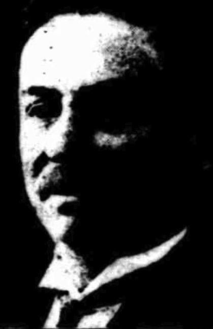
George James Lemmey was born on the 10th day of March 1874 in South Australia. He died on the 16th day of April 1950, in Adelaide, aged 76 years. He is buried at the Murray Bridge Cemetery. (ancestry 2016) (Trove 2026)
I have not been able to find the direct connection between Henson Bunn and the park. He was born in September 1887 in Mannanarie, South Australia, and died in August 1963 in Glenelg, South Australia. (ancestry 2016)
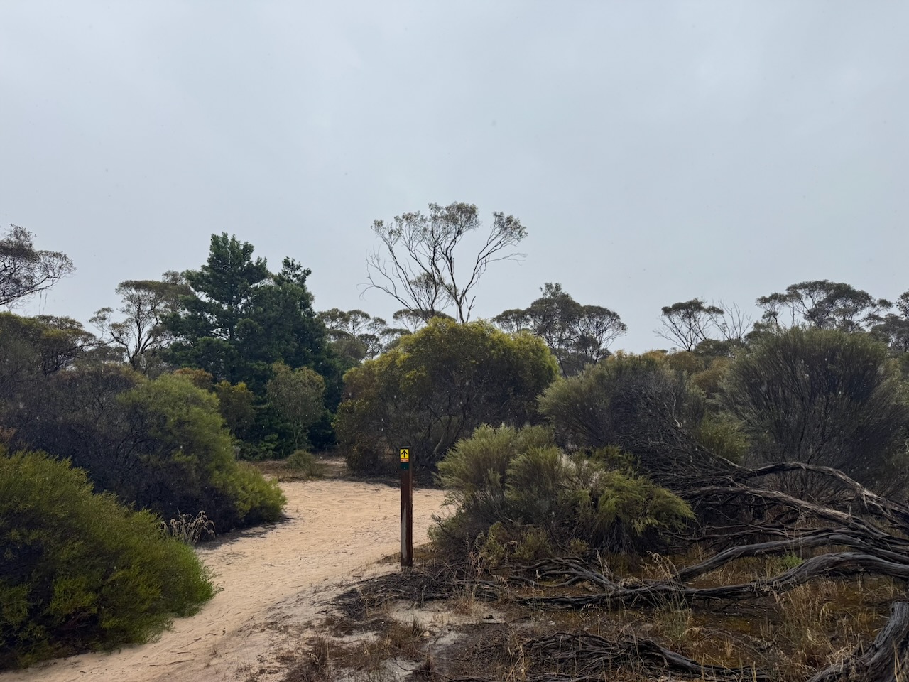
Marija and I set up in the car park in the southeast corner of the park. We ran the Yaesu FT857, 40 watts, and the 20/40/80m linked dipole.
Band conditions were good, bu we were plagued by mosquitos and the occasional drizzle of rain which forced us to get the bothy bag out.
Marija worked the following stations on 40m SSB:-
VK3PF/P (VKFF-4606)
VK3APJ/M
VK3SQ
VK2BD
VK3JT
VK3ZSC/P (VKFF-0971)
VK5UV/P (VKFF-0322)
VK5LA
VK5KAW
VK5AAF
VK5DW
VK5AV
VK3FTOM
VK3HX
VK3AAV
VK3VGQ
VK3WMF
VK2LDJ/P (VKFF-0860)
VK1GAB/P (VKFF-0860)
VK2CBC/P (VKFF-0860)
VK3GJG
VK3WSG
VK3GRX
VK3ZK/P (VKFF-0747)
Marija worked the following stations on 20m SSB:-
VK4SMA
VK2COS
VK2IO/P (VKFF-0383)
VK2GEZ/P (VKFF-0383)
ZL3ASN
VK2VW
VK2HFI
VK2AKA
VK2BUG
VK3PF
ZL1GA
VK2LEE
ZL2BB
VK6XL
VK4NXD
VK2ISO
VK3ZK/P (VKFF-0747)
ZL1CZ
VK2ATX
VK2PBC
I worked the following stations on 40m SSB:-
VK3PF/P (VKFF-4606)
VK3APJ/M
VK3SQ
VK2BD
VK3JT
VK3ZSC/P (VKFF-0971)
VK5UV/P (VKFF-0322)
VK5LA
VK5KAW
VK5AAF
VK5DW
VK5AV
VK3FTOM
VK3HX
VK3AAV
VK3VGQ
VK3WMF
VK2LDJ/P (VKFF-0860)
VK1GAB/P (VKFF-0860)
VK2CBC/P (VKFF-0860)
VK3GJG
VK3WSG
VK3GRX
VK3CLD
VK5QA
VK2DBF
VK3JE
VK3VIN
VK3PWG
VK3TTK
VK3KBC
VK5FANA
VK5MSA
VK3TDX
VK3KRL
VK5EDY
VK3OAK
VK3GUM
VK5BL
VK2VW
VK2HFI
VK2AKA
VK2BUG
VK5KLD
VK3ZK/P (VKFF-0747)
VK5DW/M
I worked the following stations on 20m SSB:-
VK4SMA
VK2COS
VK2IO/P (VKFF-0383)
VK2GEZ/P (VKFF-0383)
ZL3ASN
VK2VW
VK2HFI
VK2AKA
VK2BUG
VK3PF
ZL1GA
VK2LEE
ZL2BB
VK6XL
VK3ZK/P (VKFF-0747)
References.
ancestry (2016). Ancestry® | Genealogy, Family Trees & Family History Records. [online] Ancestry.com.au. Available at: https://www.ancestry.com.au/. [Accessed 21 Apr. 2026]