On Saturday morning (22nd April 2017) Marija and I headed out to the historic Overland Corner Hotel for the 2017 BRL Gathering, hosted by the Riverland Radio Club. This was the third year that the club had held the event. And this year was special as the Amateur Radio Experimenters Group (AREG) were going to conduct a High Altitude Balloon launch at the gathering.
So after breakfast at the motel, Marija and I made the 30 minute journey from Renmark out to the Overland Corner Hotel.
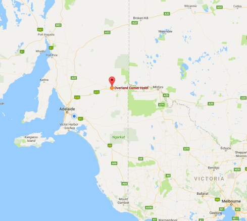
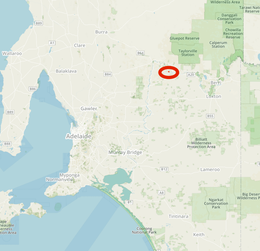
Map showing the location of the Overland Corner Hotel in the Riverland region of South Australia. Map courtesy of google maps.
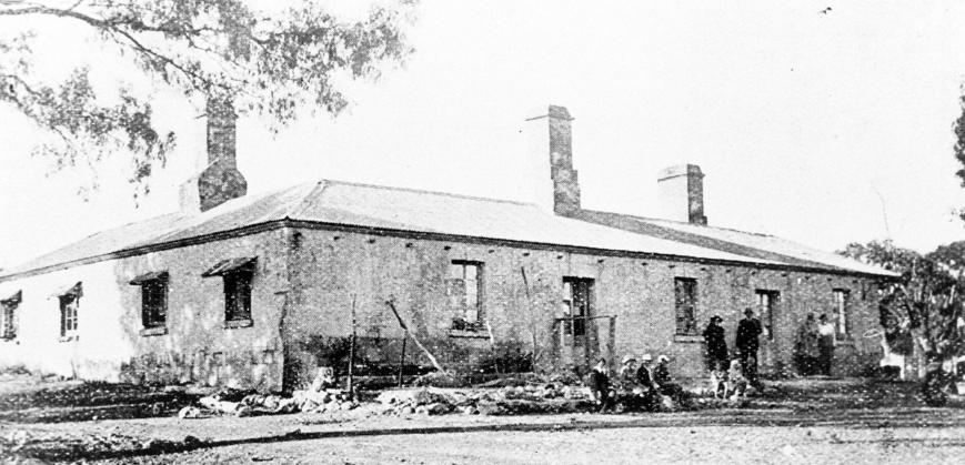
The Overland Corner Hotel is located about 21 km from Barmera, and is situated off the Goyder Highway. The hotel was originally established as a watering hole for drovers and overlanders operating between New South Wales and Adelaide in the colony of South Australia. It also served as a temporary camping ground for steamers passing through the area along the mighty Murray River, about 600 feet from the hotel. The hotel was erected in 1859 and since that time has served as a staging point, a general store, a police station and a local Post Office.
The Overland Corner Hotel, c. 1910. Courtesy of Trove.
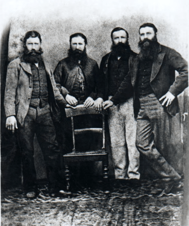
The Brand brothers, Henry, William, George and James who migrated to Australia from Kent, England in 1851 were commissioned by John Chambers, the enterprising pastoralist to build the Overland Corner Hotel in 1859. The hotel’s original construction was almost entirely of locally available materials, including limestone, red gum and native pine timbers, a dirt floor, and thatched roof of river reeds. A nearby quarry provided the stone for the hotel. The rock is composed almost entirely of fossils. Corals, shellfish and the occasional shark’s tooth give evidence that this area was once covered by warm, shallow seas, long before man walked on the earth, some fifteen million years ago. That the building remains is a tribute to these pioneer builders and their skills of construction.
The Brand brothers. Courtesy of Barmera Visitor Information Centre
The National Trust purchased the building in 1965 and the fossilised limestone building was completely restored. It is the oldest structure remaining in the area.
There is a small museum in the hotel displaying various relics, even an old morse key.
It is reputed that the bushranger Henry Arthur ‘Harry’ Readford, visited the hotel. Readford was imortalised in the 1882-83 novel ‘Robbery Under Arms’. The character ‘Captain Starlight’ in the book was a composite of several bushrangers including Readford created by the author Rolf Boldrewood. It is reported that Readford and his gang came to Overland Corner, and after stopping in at the nearby police station, where they locked the police in the cells, retired to the Overland Corner for a drink. Stories abound that Readford even rode his horse into the bar and before leaving he carved his name onto the hotel’s wall. Sadly no trace of this remains today.
Harry Readford. Image courtesy of Wikipedia.
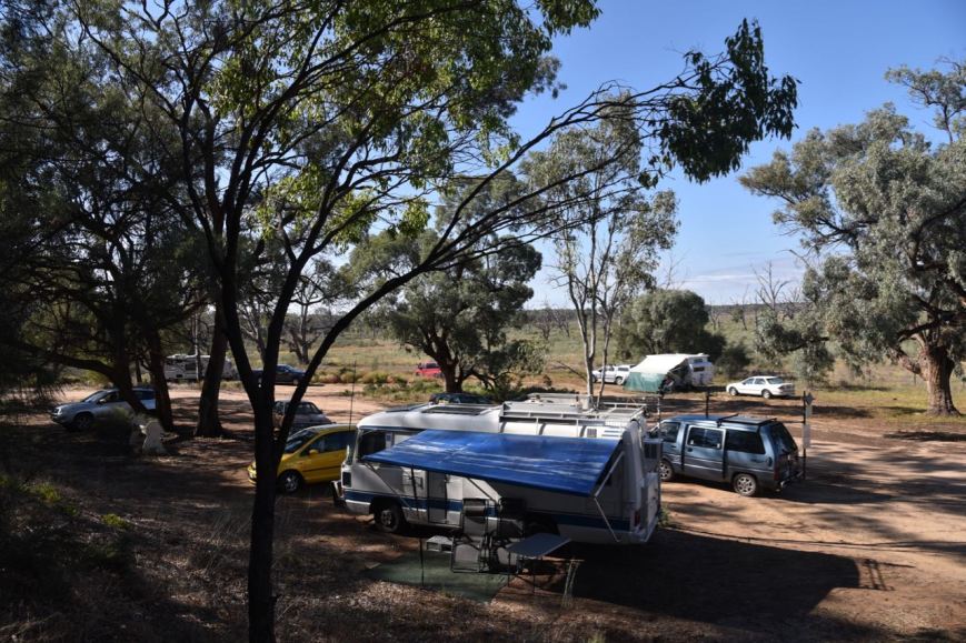
The carpark at the rear of the hotel offered plenty of room for those staying for a few nights at Overland Corner for the BRL Gathering.
The BRL Gathering is a terrific social function, and if you have never attended, I highly recommend that you do. It is a great day of catching up with old mates and sitting around in the pub’s gardens enjoying a frothy or two and a great pub meal.
This slideshow requires JavaScript.
Without a doubt the highlight of this years BRL Gathering was a High Altitude Balloon launch by the Amateur Radio Experimenters Group (AREG).
Below is a short video of the balloon launch…….
This was the first test flight of a new experimental cross band voice repeater: Input- 147.500 MHz, Output- 438.850 MHz. A number of contacts were logged on the repeater, with the special call of VK5WOW being used. Marija and I were lucky enough to make contact via HT.
Ivan VK5HS logging contacts via the repeater
Marija VK5FMAZ making contact with VK5WOW via the repeater
Frank VK3VEF was awarded the BRL Net Award, while Dennis VK2HHA was issued with a special award certificate for assisting as a relay station on the Riverland Radio Group Net.
A great day had by all. Marija and I will certainly be there again next year.
After leaving we popped in just up the road to have a look at a historic BlackBox tree dating back to 1780. The species has fibrous roots that were chewed by Aboriginal women to make a tough fibre. The fibre was used to make netting to trap birds, animals and fish. Nets were up to 50 metres long and could take a year or more to make.
We then stopped in to have a look at the Overland Corner cemetery, which is the largest cemetery in the area and is still used today. Members of the Brand family and other residents of the early European settlement lie here.
We also visited the lookout from where you can enjoy panoramic views of the flats, river cliffs and the hotel.
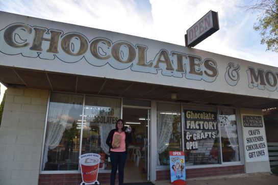
We then stopped off at Chocolates and More at Monash which is located opposite the Monash Adventure Park. Plenty of calories here to be enjoyed.
We had a little bit of time before dinner, so we also visited the small lookout tower on the outskirts of Renmark, and enjoyed the sunset.
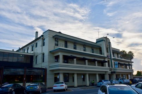
That evening, a number of us, including Ivan VK5HS and his wife Cheryl, Peter VK5PE and his wife Nat, and Mick VK3GGG and his wife Anne, had dinner at the Renmark Hotel. Plenty of laughs were had.
References.
Barmera Visitor Centre, 2009, ‘Historic Overland Corner Hotel’
Bright and early on Good Friday morning (21st April 2017) my wife Marija VK5FMAZ and I, left home headed for the Riverland region of South Australia. We had booked in to stay three nights at Renmark, with our main reason for heading to the Riverland, to attend the BRL Gathering at the historic Overland Corner Hotel. The BRL Gathering is held each year and is organised by the Riverland Radio Club.
Marija and I had planned to activate one park on our way up on Friday, the Ramco Point Conservation Park 5CP-193 and VKFF-0930. The park is situated about 180 km north east of Adelaide, and is located just to the north west of the town of Waikerie.
Map showing the location of the Ramco Point Conservation Park in the Riverland region of South Australia. Map courtesy of Protected Planet.
It is a 2 hour drive from our home in the Adelaide Hills to Waikerie. Our drive took us out through Woodside and Birdwood and on to Mount Pleasant. We then travelled along the Angas Valley Road, admiring the view of the surrounding countryside as we left the hills and down to the eastern flats of the Mallee. We then travelled north on Ridley Road, passing through the towns of Cambrai and Sedan until we reached the Sturt Highway. We then travelled east towards Waikerie, passing the Brookfield Conservation Park, and crossing the mighty Murray River at Blanchetown.
The Ramco Point Conservation Park was proclaimed in June 2006 and is located just to the north of Ramco Lagoon, on the southern side of the Murray River. The little town of Ramco is located nearby. Today the town has a population of about 200 people and just a Post office, Lutheran church, a total hall and a school. The current town of Ramco waas surveyed in 1940, however there was an earlier Ramco village which was founded in July 1894 by 18 disgruntled settlers from the Waikerie village settlement.
Ramco originates from the aboriginal word ‘Bogorampko’. The word ‘bogo’ means dead, a spirit or a giant from mythology and ‘rampk’ means going towards or referring to the route used by mythical creatures to get to the river for water at night. It was an aboriginal belief that there was a class of beings, Bogo, who lived at Bogorampko. They were considered large and human-like and had the power of invisibility. The Bogo were thought to come to the Murray River at night from the inland scrubby country to get water and inflict sorcery.
This slideshow requires JavaScript.
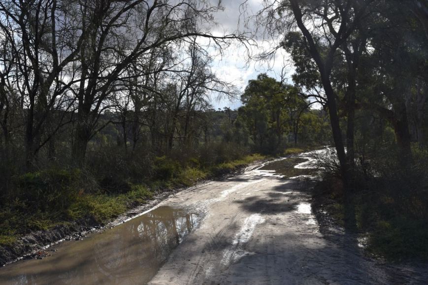
The road into the park, Ramco Point Road is initially bitumen, but then becomes dirt. Last time we were here at Ramco back in 2015, there had been a lot of rain, making the track very boggy. And on this occasion it was no different. There had been quite a bit of rain overnight, and the track was very slippery and boggy in parts.
The first section of Ramco Point Road. It was wet but was easily passable.
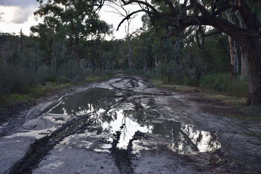
There were a number of caravaners alongside the Murray River who had obviously been there prior to the rain. By the time we had passed Ramco Lagoon, the track had become extremely slippery and boggy. Although it didn’t look bad, the soil here alongside the river, once wet, becomes quite treacherous. Fortunately we had been able to get inside the park boundary.
The section close to the park boundary. A little more tricky.
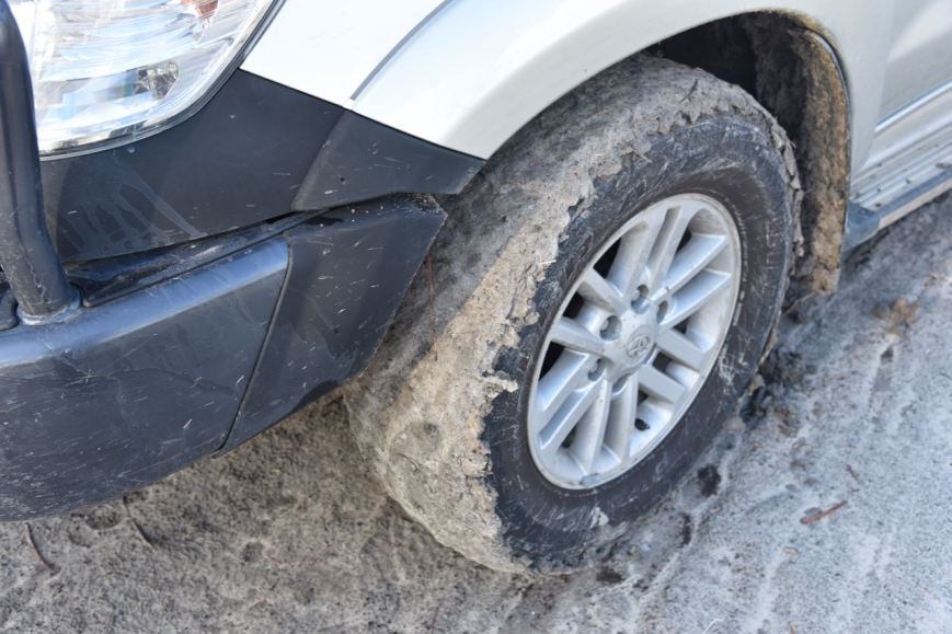
As you can see from the photo below, even though we have light truck tyres on the Toyota Hi Lux, the mud was not being dispersed from the tread. It was very sticky.
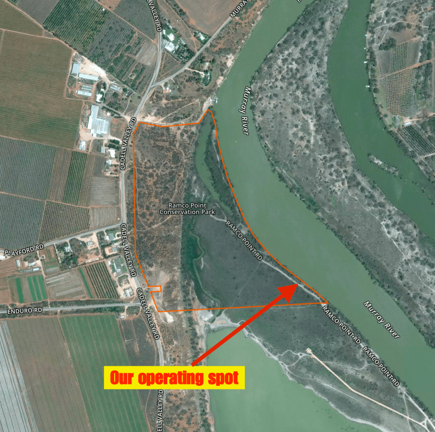
Marija and I found a small clearing on the western side of Ramco Point Road, right alongside the Murray River. We set up the deck chairs, the fold up table, and ran the Yaesu FT-857d at 10 watts PEP, and the 80/40/20m linked dipole, supported on the 7m telescopic squid pole. We had the shade of a large gum tree, which was welcome as it was a warm 26 deg C and very humid.
Aerial shot of the Ramco Point Conservation Park showing our operating spot. Image courtesy of Protected Planet.
Marija started off on air first, calling CQ on 7.140. The first station in the log was Greg VK4VXX/2 with a very strong 5/9 plus signal. Les VK5KLV in Port Augusta followed, with an equally strong signal, then Ken VK2KYO, followed by Bill VK4FW. Marija had contact number 10 in the log after being on air for 14 minutes. The honour of the 10th contact and thus qualifying the park for Marija for VKFF, went to Les VK3FLES.
As we were pushed a little for time, Marija handed over the mic to me after making a total of 11 contacts into VK2, VK3, VK5 and VK7. Marija was happy that she had qualified the park for VKFF, and I was hoping to pick up my 44 contacts to qualify the park for the global WWFF awards.
Whilst operating, we were kept company by literally dozens and dozens of Welcome Swallows who were flying around the gum tree alongside of us. It was quite a sight (as you can see in the video at the end of this post).
We almost had to get the vehicles snatch straps into action, as a couple in their Mazda BT50 decided to go a little further along the track and very nearly got bogged. Fortunately they made their own way out safely.
Welcome Swallows by the dozens
The antenna with the swallows in the background
I called CQ on 7.140 and this was answered by Les VK5KLV, followed by Ken VK2KYO and then Fred VK3JM. All had very strong 5/9 + signals. Sadly I soon started to experience QRM from a ZL station on 7.138 who was chatting to friends in the UK. The bleedover was extremely bad, so I apologise to those who may have been calling that I could not hear.
Contact number 10, qualifying the park for me for VKFF, was with regular park hunter Rick VK4HA. Soon after I was called by Ken ZL4KD/p who was portable in the Okarito Conservation Area ZLFF-0034 on the South Island of New Zealand. Ken was quite low down, and copy was made worse by the QRM from 7.138. I moved up to 7.142 and away from the QRM, where I comfortably worked Ken and his wife Margaret ZL3YF/p, Park to Park (P2P). Unfortunately Marija had gone for a walk to take some photos so she missed out on the New Zealand Park to Park opportunity with Ken and Margaret.
Fortunately I had a steady flow of callers and I soon reached 20 contacts, and then 30. Although by contact number 39, callers had slowed down. Band conditions on 40m were very good, with QSOs being logged into New Zealand, VK2, VK3, VK4, VK6 and VK7. Other than Les VK5KLV, there were no South Australians logged by me, with close in propagation not working on 40m SSB. Additional to the P2P contact with Ken and Margaret, I also logged a P2P contact on 40m with Hans VK6XN/p who was in the Bramley National Park VKFF-0636 in the south western region of Western Australia. Hans was a good 5/5 and reciprocated with a 5/7 for me.
I then headed to 14.310 on the 20m band and called CQ. This was answered by John VK6NU in Western Australia. Signals from VK6 on 20m have been quite low of late. And today was no different, with John’s signal being 5/4 (5/3 received). Steve VK4QQ then called in with a strong 5/8 signal, followed by Phil VK6ADF and then Mark VK4SMA. But despite 5 minutes of further CQ calls, I had no further callers on 20m, leaving me on 43 contacts. Just 1 QSO short of qualifying the park.
I then moved to 3.610 on the 80m band and called CQ which was answered by Laurie VK2GZ, my 44th contact, qualifying the park for WWFF. I then worked Jim VK3UFO who was out gold prospecting near Bendigo, followed by Hans VK5KHZ/p who was at Thiele Flat near Mannum.
I had a total of 46 contacts in the log and a new park qualified for WWFF.
After packing up, we stopped off briefly at Ramco Lagoon to take some photographs of the waterbirds including Herons, Spoonbills, and Plovers.
We also enjoyed a quite spectacular sunset. On our way back to the motel we both worked Hans VK6XN, from the mobile. Hans was in the Bramley National Park VKFF-0636.
Marija worked the following stations on 40m SSB:-
VK4VXX/2
VK5KLV
VK2KYO
VK4FW
VK5QI/m
VK3SQ
VK3XL
VK2HOT
VK5PL
VK3FLES
VK7
I worked the following stations on 40m SSB:-
VK5KLV
VK2KYO
VK3JM
VK4VXX/2
VK7JON
VK3XL
VK2GPT
VK2LDN
VK4RF
VK4HA
VK2HOT
VK1AT/3
ZL4KD/p (Okarito Conservation Area ZLFF-0034)
ZL3YF/p (Okarito Conservation Area ZLFF-0034)
VK3MCK
VK2IO
VK3HSB
VK7DIK
VK2NEO
VK3SOT
VK4PDX
VK3SFG
VK3ADM/m
VK4FW
VK2NP
VK4QQ
VK2MOR/m
VK3UT
VK3VEK
VK6XN/p (Bramley National Park VKFF-0636)
VK3FSPG
VK3MPR
VK4SMA
VK2JXA/p
VK2ND
VK3FLJD
VK3AXF
VK2HPN/m
VK2HEY/m
I worked the following stations on 20m SSB:-
VK6NU
VK4QQ
VK6ADF
VK4SMA
I worked the following stations on 80m SSB:-
VK2GZ
VK3UFO/p
VK5KHZ/p
Below is a short video of the activation, showing the Welcome Swallow activity…..
References.
Jennings, John T, 2009, ‘Natural History of the Riverland and Murraylands’
On Easter Sunday (16th April 2017), Marija VK5FMAZ and I activated the Scott Creek Conservation Park 5CP-207 & VKFF-0788. This was to be a unique park for Marija for both the VK5 National & Conservation Parks Award, and the World Wide Flora Fauna (WWFF) program. I have been to Scott Creek a number of times previously and I have qualified the park for WWFF. But for this occasion I had been given permission to use the special call of VK5WOW. The call has been issued to help celebrate the upcoming Wireless Institute of Australia (WIA) AGM & Convention in Hahndorf South Australia. A special award is on offer for working VK5WOW and/or VI5WOW.
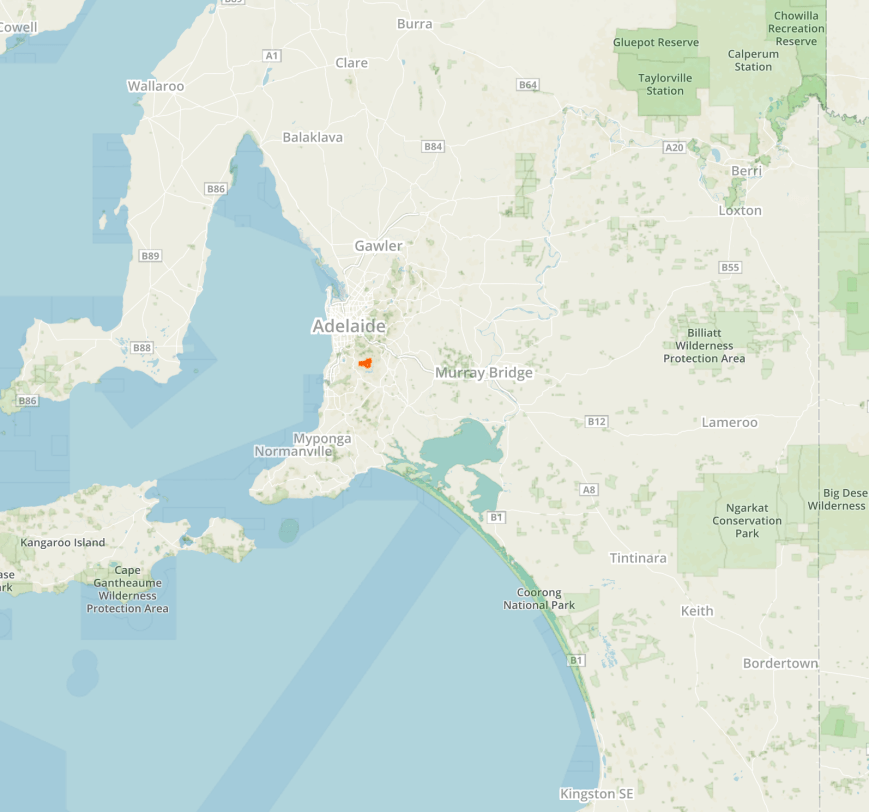
The Scott Creek Conservation Park is located about 20 km south east of Adelaide, and around 24 km west of my home in the Adelaide Hills.
Map showing the location of the Scott Creek Conservation Park, south east of Adelaide. Map courtesy of Protected Planet.
On our way to the park, from the mobile, both Marija and I logged Bob VK5AFZ/p who was activating the Lawari Conservation Park VKFF-1767. Bob had a strong 5/8 into the mobile. This was whilst we were doing 110 kph on the South Eastern Freeway at Hahndorf.
Prior to activating the park Marija and I visited the Alamanda mine ruins on Dorset Vale Road. During the early 1840’s the Scott Creek area was settled by the Hill and Mackareth families. They cut timber to be used in buildings in Adelaide, and cleared the land for the cultivation of onions and potatoes. They used bullock drays to haul the produce to Adelaide via Coromandel Valley. In 1850, the wheels of a dray broke off pieces of rock which were recognised to contain copper. Soon after a shaft was sunk to 9 metres, and was named Wheal Maria. The shaft was soon abandoned after a small quantity of ore was removed.
During 1862, new leases were acquired and a new shaft, named Wheal Mary Anne, was sunk to a depth of 27 metres. A few dray loads of ore were produced but again the mine was abandoned by 1865.
In 1868, a German assayer, William Ey, noticed abandoned copper ore from Wheal Mary Anne at Port Adelaide. He recognised that the ore contained silver. As a result he and James Gawen acquired leases at Scott Creek in June 1868, with the Alamanda Silver Mining Association being formed in July 1868. A trial crushing of ore produced two ingots of silver weighing 131 ounces (4 kg). A rush for claims at Scott Creek followed the announcement of rich silver ore at the Alamanda mine.
A treatment mill comprising a battery and mill were erected. However, operations proved uneconomic and by early 1870, work was suspended. The mine was reworked in 1877, 1881, and 1887. Total production was 10,000 ounces (310kg) from 2,000 tones of ore.
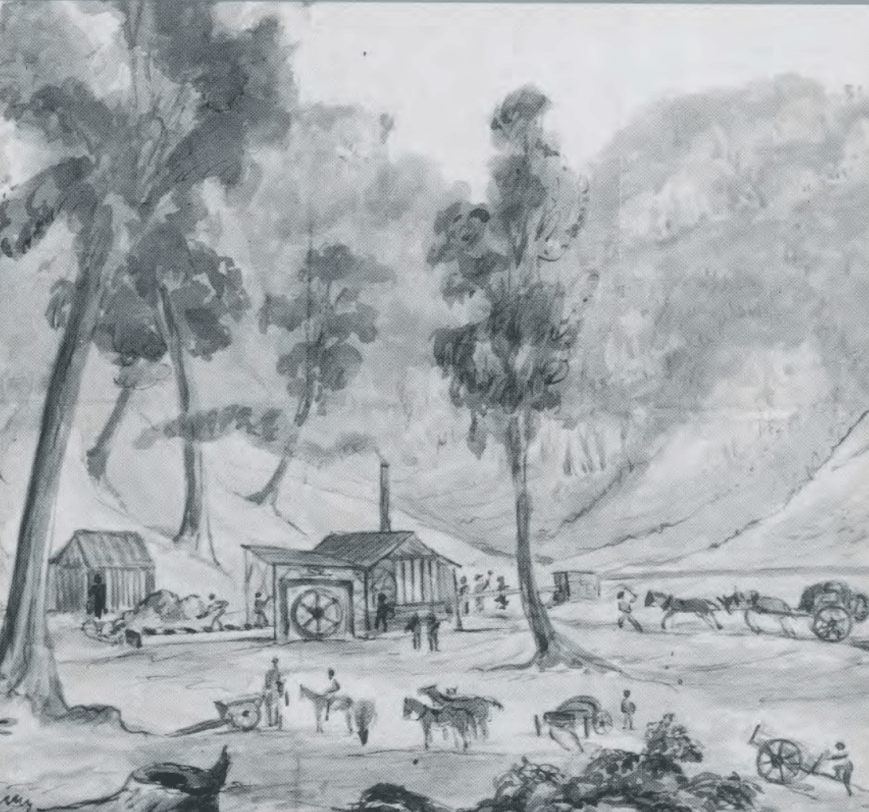
The Alamanda mine, c. 1868. A drawing by W.A. Cawthorne. Courtesy of Department of Mines and Energy.
Today, little remains, although there are a number of intepretive signs. Sadly, many of the buildings have come under attack by vandals.
Marija in front of the old dairy
Enginehouse ruins. Erected 1869.
Despite the site being severely vandalised, it was pleasing to see a number of people visiting the old Alamanda mine during our visit.
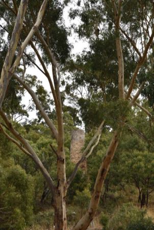
Stone chimney, erected 1869. Was connected by an underground stone-lined flue to the boilerhouse.
We then crossed over Dorset Vale Road to have a look at Ey’s Workings and Tunnel. The tunnel was previously open for people to visit with a torch, but it is now fenced off.
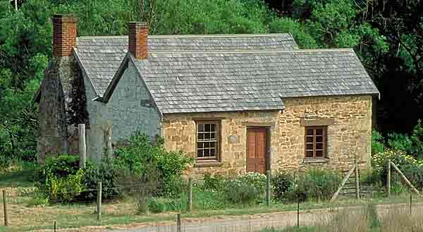
We then visited Mackareth cottage on Matthew Road. I had been here years previous and was very saddened to see the state it was in, considering its historical significance. The cottage is located on SA Water land, who I contacted a number of years ago about the state of disrepair the cottage was in. They seemed totally disinterested.
The cottage dates back to 1839/1840, just 3-4 years after the proclamation of South Australia. So it is a very historical buidling. It was built by George Mackareth who had emigrated to South Australia in 1838 from England. The cottage was continually lived in between 1840-1976, when the National Trust took control of the property.
For many years it housed a museum and on occasions provided Devonshire teas on weekend openings to visitors. In 1984 the National Trust relinquished its interests and the cottage was closed. It has since fallen into the disgraceful condition it is in today, covered in grafitti.
Mackareth cottage in better days.
The Scott Creek Conservation Park itself is 706 hectares in size and was established in November 1985. The land at Scott Creek was purchased by the South Australian State Government in the early 1970’s by the State Planning Authority and in 1985 the area was recognised as an important part of the southern Mount Lofty Ranges, and adopted as a Conservation Park.
The park contains one of the most diverse areas of native vegetation near Adelaide. It contains steep sloped valleys, lush creeklines and rounded ridgetops.The main upper canopy species is Messmate Stringy bark, South Australian Blue Gum, Pink Gum, Cup Gum, River Red Gum, and Manna Gum. Other native plants include Silky Tea-tree, Swamp wattle, Golden wattle, and Silver Banksia. A considerable number of the 108 plant species in the park are classified as rare, vulnerable or endangered.
About 15 species of native mammals call the park home, including the Western Grey kangaroo, Yellow footed antechinus, echidna, Brush-tailed possum, Ringtail possum, and Koala. The endangered Southern Brown Bandicoot has been recorded in the park.
Over 125 species of birds have been recorded in the park including New Holland Honeyeater, White-naped honeyeater, Crimson Rosella, Purple-crowned lorikeet, Kookaburra, and Rainbow lorikeet. The park is also home to the endangered Beautiful Firetail and the vulnerable Bassian Thrush.
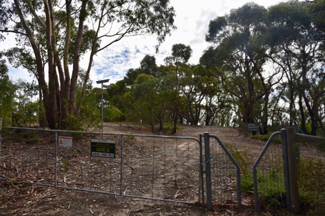
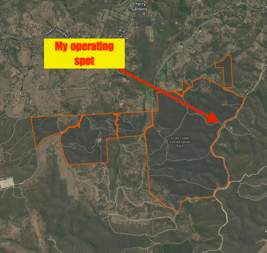
Marija and I parked at gate number 8 and operated from a clearing about 20 metres in from the gate. I have operated from her previously, including with John VK5BJE who lives closeby. His wife Jenny is involved in the active ‘Friends of Scott Creek Conservation Park’ group. They have an excellent website.
There is plenty of room here to string out a dipole. We used the Yaesu FT-857d for this activation, along with the 80/40/20m linked dipole, @ 6 metres, inverted vee. We initially ran 10 watts PEP for Marija with her Foundation licence, and when I operated as VK5WOW I ran 40 watts output.
Prior to calling CQ we tuned across the 40m band and worked Marc VK3OHM who was on 7.140, activating the Lower Goulburn National Park VKFF-0741.
Marija then headed up to 7.145 and called CQ. It didn’t take long, and Marija had a mini pile up going, which she handled exceedingly well. I assisted her with logging and prompting her with the names of the callers. Within 8 minutes Marija had the required 10 contacts in the log to qualify the park for the VKFF program, and within 45 minutes, she had the required 44 contacts to qualify the park for the global WWFF program. Contact number 10 was with Bill VK4FW. Contact number 44 was with Keith VK5OQ who was portable at Mount Bryan.
Marija made a total of 53 contacts which included 7 Park to Park contacts.
Marc VK3OHM/p (Lower Goulburn National Park VKFF-0741)
Mike VK3XL/p (Gippsland Lakes Coastal Park VKFF-0747)
VK1DI/p (Woodstock Nature Reserve VKFF-0988)
John VK5BJE/3 (Kinglake National Park VKFF-0264)
Phil VK6ADF/p (Hilliger National Park VKFF-0646)
Margaret ZL3YF/p (Lake Pearson Conservation Area ZLFF-0029)
Ken ZL4KD/p (Lake Pearson Conservation Area ZLFF-0029)
Another interesting contact Marija made was with Craig VK3CRG who was streaming Marija’s QSOs through VK3RTV, amateur TV repeater.
Marija worked the following stations on 40m SSB:-
VK3OHM (Lower Goulburn National Park VKFF-0741)
VK3GGG
VK3PMG
VK3FRAB
VK5HCF
VK2HHA
VK3SFG
VK3SQ
VK3PF
VK4FW
VK3FQSO
VK5HS
VK2KYO
VK2NP
VK7EV
VK3FOTO/m
VK5KC/p
VK3FJAE
VK3TKK/m
VK5NFT/m
VK2GAZ
VK3FSPG
VK3MPR
VK3XL/p (Gippsland Lakes Coastal Park VKFF-0747)
VK4ARW
VK1DI/p (Woodstock Nature Reserve VKFF-0988)
VK5IS/3
VK3NCR
VK3CRG
VK5KLV
VK3FCMC
VK2EXA
VK7QP
VK4RF
VK4HA
VK3ARH
VK6MAC
VK3SL/p
VK3MNZ
VK2FGJW/3
VK3ELH
VK3RU
VK3HN
VK5OQ/p
VK5PE
VK3BFR
VK5YX
VK5GY/m
VK3FHCT
VK5BJE/3 (Kinglake National Park VKFF-0264)
VK6ADF/p (Hilliger National Park VKFF-0646)
ZL3YF/p (Lake Pearson Conservation Area ZLFF-0029)
ZL4KD/p (Lake Pearson Conservation Area ZLFF-0029)
I occasionally picked up the mic to log a few of the park activators. I worked the following stations on 40m SSB under VK5PAS:-
VK3OHM/p (Lower Goulburn National Park VKFF-0741)
VK1DI/p (Woodstock Nature Reserve VKFF-0988)
VK5BJE/3 (Kinglake National Park VKFF-0264)
VK6ADF/p (Hilliger National Park VKFF-0646)
ZL4KD (Lake Pearson Conservation Area ZLFF-0029)
ZL3YF/p (Lake Pearson Conservation Area ZLFF-0029)
I worked the following stations on 20m SSB:-
VK6ADF/p (Hilliger National Park VKFF-0646)
Just after 0535 UTC (2.05 p.m. South Australian local time) I took over as VK5WOW. Contact number one in the log was with John VK5BJE who was portable in the Kinglake National Park VKFF-0264. Rather appropriate, as John lives very close to the Scott Creek Conservation Park.
I ended up with a total of 157 contacts as VK5WOW, on the 20, 40 and 80m bands, including 11 Park to Park contacts. A small amount of DX was logged from New Zealand, Croatia, Finland, Italy, France, Germany, Japan, and Belgium
In the Scott Creek CP
I worked the following stations as VK5WOW on 40m SSB:-
VK5BJE/3 (Kinglake National Park VKFF-0264)
VK6ADF/p (Hilliger National Park VKFF-0646)
VK3KRH
VK3CRG
VK3RU
VK3TKK/m
VK5KLV
VK7QP
VK5HS
VK2EXA
VK3SFG
VK5HCF
VK3NCR
VK4HNS/p (Kwiambi National Park VKFF-0274)
VK3OHM/p (Lower Goulburn National Park VKFF-0741)
VK3FRAB
VK3ANL
VK1AD
VK3FHCT
VK5MLB/p
VK4FW
VK4RF
VK4HA
VK1DI/p (Woodstock Nature Reserve VKFF-0988)
VK4FFAB
VK3SQ
VK3HN
VK3BQ/m
VK3FCEK/m
VK3PF
VK3FNQS
VK5YX
VK2EJW
VK2NP
VK5IS
VK3GGG
VK3PMG
VK5GJ
VK3KMH
VK3FOTO
VK4FADW
VK2VW
VK3BFR
VK4ARW
VK4SMA
VK4PDX
VK4FEMO
VK3FORD
VK7CW
VK7JON
VK5NFT/m
VK2HHA
VK2NEO
VK3FQSO
VK3VEK
VK3FCMC
VK3FSPG
VK3MPR
VK3TEZ
VK5PL
VK7KW
VK7FOLK
VK5ALR/p (Morgan Conservation Park VKFF-0911)
VK7MHZ/p
VK7VEK
VK3DQ
VK2LAD
VK3HAK
VK3FVKI
VK3YW
VK2HJW
VK3PI
VK3HSB
VK3TJS
VK2QK
VK4QQ
VK3MRG
VK4FAAJ
ZL4KD (Lake Pearson Conservation Area ZLFF-0029)
ZL3YF/p (Lake Pearson Conservation Area ZLFF-0029)
VK3FMJP
VK3MNZ
VK4BX
VK2WOW
VK2ARA
VK4ZD
VK4DI
VK4FARR
VK5NJ
VK2RL
VK2MT/p
VK2FOUZ
VK2VVV
VK3UH
VK2HPN
VK2CCR
ZL1XS
VK2IO/m
VK5HH
VK2SK
VK4MWB
VK5FTCT
VK7PRN
VK6BEC
VK7FPRN
VK2UMA
VK6FFAR
VK4TJ
I worked the following stations on 20m SSB under VK5WOW:-
VK6ADF/p (Hilliger National Park VKFF-0646)
VK4FW
VK4QQ
VK4RF
VK4HA
VK6MAC/m
VK4HNS/p (Kwiambi National Park VKFF-0274)
9A3NM
OH2BAD
9A7W
IW3IBK
I5FLN
F2YT
VK4NSA
VK4SMA
VK7JON
VK6SN
IZ4RCQ
DL2ND
IU5HIV
JH7WER
ON4VT
VK6NU
JA1VRY
VK6XL
JG4AKL
JH7CVM
I worked the following stations on 80m SSB under VK5WOW:-
VK5HS
VK3XL/p
VK3PF
VK2GGA
VK2YW
VK5NJ
VK3GGG
VK3PMG
VK5BW
VK5FANA
VK1AT
VK3XBC/p (Murray Sunset National Park VKFF-0373)
VK3SQ
VK3PI
VK5DC
VK5NFT/m
VK2QM
VK3ZE
VK3RW
VK5HYZ
VK2MT/p
Whilst I was operating Marija went for a walk along Cup Gum Track. There are some great views to be had along this track out across the Mount Lofty Ranges.
We packed up just after 6.30 p.m. local time. It had been a very succesful and enjoyable afternoon in the park. Marija had qualified a new park, and VK5WOW had been put on air promoting the upcoming AGM/Convention and the VK5 Parks Award.
Below is a short video of me operating as VK5WOW……
References.
Department of Mines and Energy, 1991, ‘Alamanda Silver Mine. A guide to the walking trail’
The weather on Easter Saturday (15th April 2017) was warm and sunny, so I decided in the afternoon to undertake a park activation. I had a look at the list of parks I have previously activated, and chose the Anstey Hill Recreation Park VKFF-1683. This was to be a unique park for me as an activator. Anstey Hill is located about 16 km to the north east of Adelaide.
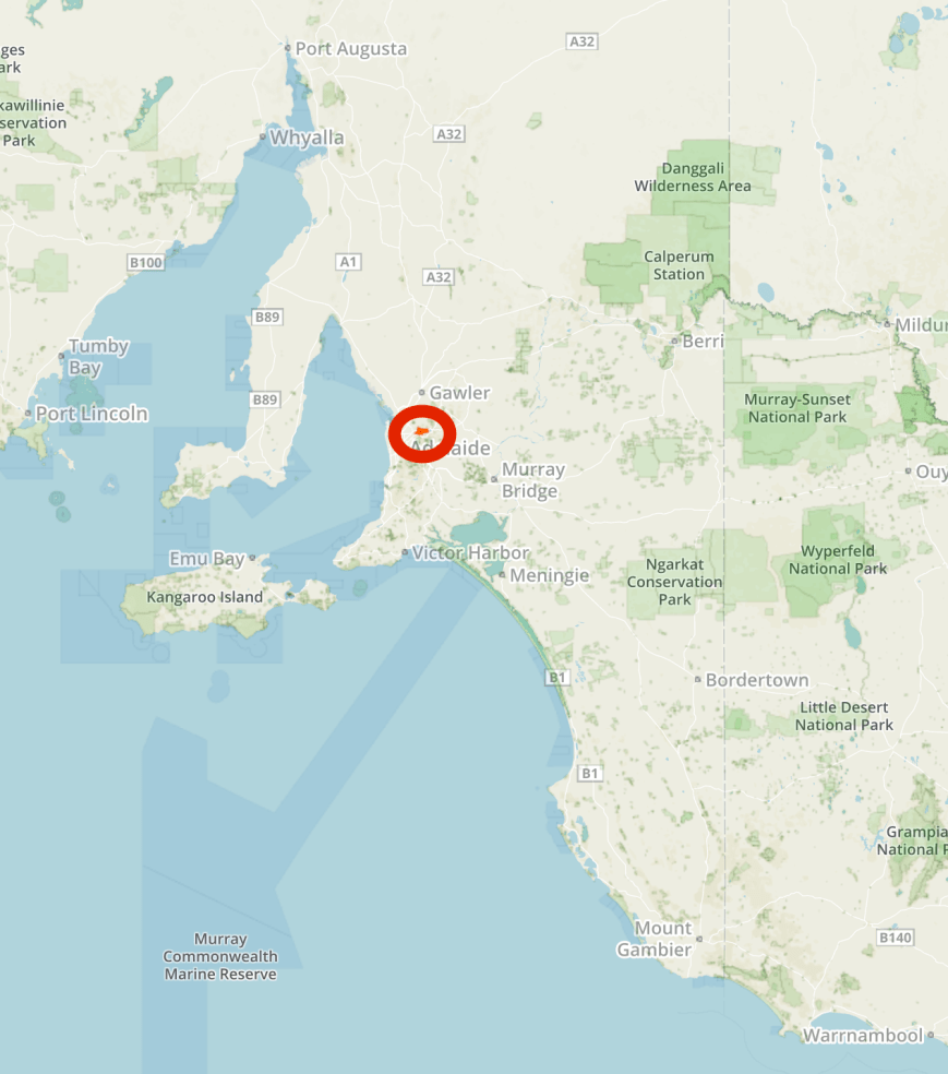
Map showing the location of the Anstey Hill Recreation Park, north east of Adelaide. Map courtesy of Protected Planet.
To get to the park it was a 48 km drive for me, through the towns of Lobethal and Cudlee Creek and then along Gorge Road, Paracombe Roaad and onto Range Road South.
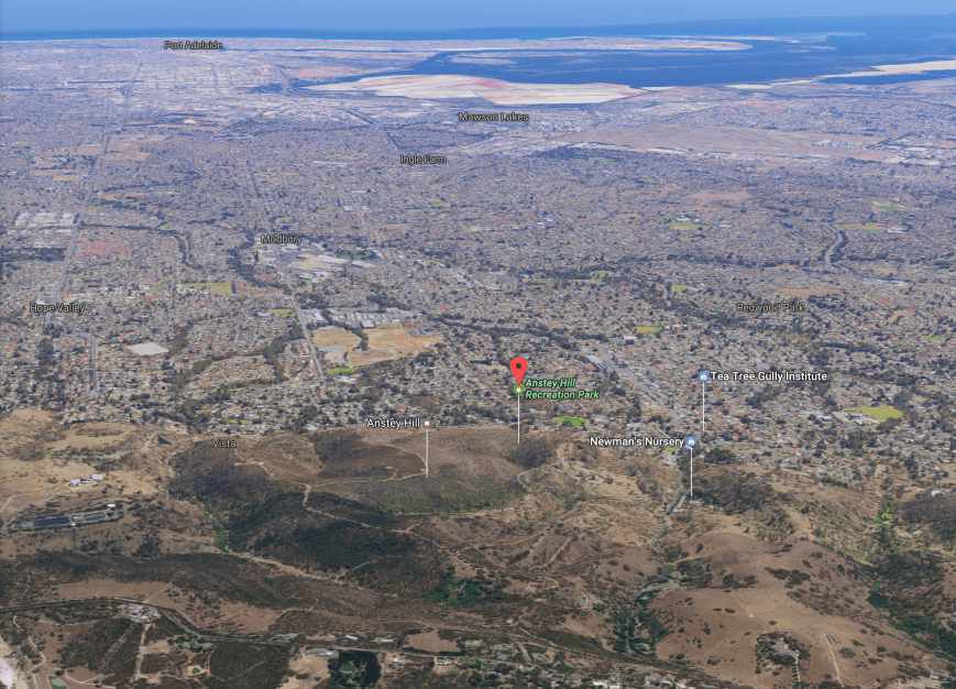
Aerial shot of the park, looking to the west out towards Gulf St Vincent and across the north-eastern and northern suburbs of Adelaide. Image courtesy of Google maps.
Anstey Hill Recreation Park was established in 1989 and comprises 362 hectares of steep gullies, creek lines with some terrific views of the city of Adelaide. It was dedicated as park in response to public demand that the State Government protect the land from development. The Anstey Hill summit which is located within the park is 371 metres above sea level.
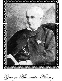
Anstey Hill was named after George Alexander Anstey (1814-1895), a South Australian pastoral and horticultural pioneer. He was born in London and emigrated to Australia in 1827 at age 13. In 1840 Anstey purchased two sections of land at Highercombe and commenced to establish his estate which he named after his father’s birthplace in Somerset England. His property which contained vineyards, orchards and extensive botanical gardens, was in the vicinity of the current Highercombe Gold Club which is located just over the crest of the range east of the Anstey Hill Recreation Park.
George Alexander Anstey
About 290 native flora species have been recorded in Anstey Hill. The western end of the park is dominated by Pink Gums, while the eastern end is dominated by the Box Tree, a species which has rarely been rpeserved in Adelaide. A number of plants which are now rare on the Adelaide plains are found in the park. This includes Leamon beauty-heads, Pussy-tails, Dwarf Hakea, Silky guinea-flower and Black Rapier sedge. The steep areas of the park support native pine, Drooping Sheaok and Pink Gums. Understorey species include Kangaroo thorn, Rock Grass-tree, Sticky Hop-bush, and Heath Tea-tree. Manna Gums which are found mostly in the east of the park are home to koalas. Over 39 species of native orchids have been recorded in Anstey Hill, including the King Spider-orchid and Wax-lip orchid.
Over 145 species of native birds have been recorded in the park, including the Superb Fairy Wren.
Native animals found in the park include Western Grey kangaroos, echidnas, koalas, and Brush-tailed possums. Up to 35 species of reptiles and amphibians call the park home including Brown Tree frogs, Bearded Dragons, and the rarely seen Cunninghams Skink.
Prior to activating, I parked at gate 13 and went for a 1 km walk to the old Newmans nursery ruins. The walk is downhill all the way. As it was a warm day, the climb back up to the carpark was not as easy.
The Newmans Nursery was established in 1854 by Carl and Margaretha Neumann and was once the largest nursery in the southern hemisphere. In 1912, the nursery waas devastated by floods and as a result never really recovered. It was used as a dairy from 1932 and from 1935 assets from the buildings were salvaged and the property was used for sheep grazing. The 1983 Ash Wednesday bushfire destroyed the remaining buildings. Some of the Newman family established the current day Newmans Nursery on North East Road.
The nursery, c. 1880
Inside a greenhouse at the nursery, c. 1912
Today, only ruins of the nursery remain. It is well worth a visit. For more information on the nursery please see….
I set up just to the south of gate 16 on Range Road South.
Aerial shot of the park showing my operating spot. Image courtesy of Protected Planet.
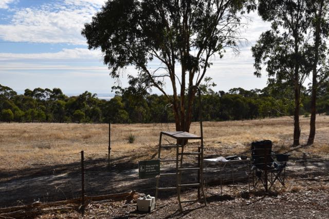
There was a ladder here allowing access to the park over the barbed wire fence.
It was a warm day, around 26 deg C, so I set up underneath the shade of a gum tree. I ran my normal set up for this activation comprising the Yaesu FT-857d, 40 watts, and the 80/40/20m linked dipole. It was only up at 6 metres inverted vee, as the first section of my squid pole had split during my recent visit to Victoria. I asked if the frequency was in use and Dennis VK2HHA came back to advise that the frequency was clear. Dennis was number one in the log. My fourth contact was with Gerard VK2IO who was activating SOTA peak Mount Banks VK2/ CT-032 which is located within the Blue Mountains National Park VKFF-0041.
Sadly, during my sixth QSO, I started to experience deliberate QRM. It consisted of replaying a recorded message from VK3FVKI re his experimental antenna tests. I strongly suspect I know where this is coming from and I made a recording of the interference which I have provided to ACMA. This is the same interference which the 7130 DX Net has been experiencing of late. And I heard the same culprit deliberately QRMing a VK/USA contact later in the evening.
Fortunately the culprit only stuck around for about 6 contacts and it was back to a completely quiet frequency, with no man made noise. Contact number 12 was another Park to Park, with Rob VK4FFAB who was activating the Great Sandy National Park VKFF- 0216. About 12 contacts later I was called by Phil VK6ADF/p who was activating the Beedelup National Park VKFF-0021 in Western Australia. Phil was quite low down, only 3/1, but we managed to exchange signal reports.
Two QSOs later I logged John VK5BJE/3 who was activating SOTA peak West of England Fire tower VK3/ VW-16 located in the Kara Kara National Park VKFF-0269. John had a beautiful strong 5/9 signal.
I continued to log a steady flow of callers. About 12 contacts later I logged Rob VK4FFAB who had now moved into the Tuchekoi Conservation Park VKFF-1667, and shortly after Anthony VK3VAK/p who was in the Gunbower National Park VKFF-0740. Then later in the activation I was called by John VK6NU who was portable on SOTA peak Mount Randall in the Monadnocks Conservation Park VKFF-1459.
I logged a total of 83 contacts on 40m from VK1, VK2, VK3, VK4, VK5, VK6, and VK7. I was pleased to log Adrian VK2FNAD. I was Adrian’s first contact on HF since he gained his Foundation call.
I then moved to 14.310 on the 20m band where my first contact was with Phil VK6ADF who was portable in the Beedelup National Park VKFF-0021, and then John VK6NU/p on SOTA peak Mount Randall VK6/ SW-039 &Monadnocks Conservation Park VKFF-1459. I logged 11 stations on 20m from VK5, VK6, and Croatia. Just 2 DX stations worked: Ozren 9A7W and Sasa 9A3NM.
I then headed to 3.610 on the 40m band. It was now approaching 5.30 p.m. and the sun was starting to set. My first contact on 80m was with Ivan VK5HS in the Riverland who was booming in, 5/9 plus. I logged a total of 13 stations on 80m from VK2, VK3, VK4, and VK5. This included Toby VK3PNF who was portable in the Murray Sunset National Park VKFF-0373, Keith VK5OQ who was portable at Mount Bryan East, and Rob VK5TS who was mobile on Googs Track near Ceduna on the far West Coast.
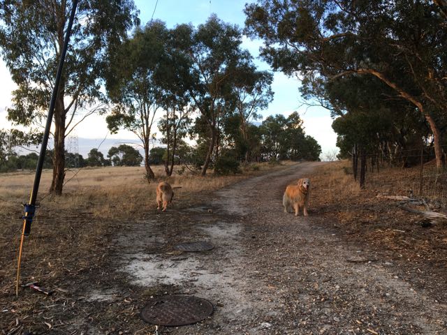
Although there are signs that dogs must be on a leash, there were numerous people walking their dogs in the park off leash, during my activation. One of the two Golden Retrievers in the photo below, jumped up on me almost knocking my table over, while the other grabbed hold of the fallen limb that was holding down one of the ends of the dipole, almost bringing the squid pole crashing down. Not surprising though, as in all the activations I have done over the years, I have hardly seen a park ranger.
It was now almost dark and headed back to 40m for one last hooray. The band was very busy with lots of North American and South East Asian stations. I eventually found 7.136 clear and called CQ which was immediately answered by Hauke VK1HW with a massive 5/9 plus signal. I logged just a further 10 stations on 40m, with the deliberate QRM culprit returning to make a nuisance of himself. Yes, it’s a he. Identity withheld at this time.
I had a total of 107 contacts in the log. An amazing afternoon/evening in the park.
I worked the following stations on 40m SSB:-
VK2HHA
VK7AN
VK3HOT
VK2IO/p (SOTA Mount Banks VK2/ CT-032 & Blue Mountains National Park VKFF-0041)
VK7CW
VK3KMH
VK3RU
VK3CWF
VK3SFG
VK3MRG/p
VK3PAT
VK4FFAB/p (Great Sandy National Park VKFF-0216)
VK5HYZ
VK3SQ
VK2SVN
VK2NP
VK1AT
VK2FGJW/3
VK2BGL
VK5FMWW/3
VK3STU
VK3HPG
VK3PF
VK6ADF/p (Beedelup National Park VKFF-0021)
VK2KYO
VK5BJE/3 (SOTA VK3/ VW-016 & Kara Kara National Park VKFF-0269)
VK3FHCT
VK1RZ
VK1MTS
VK2JDR
VK5FMAZ
VK3ZMD
VK4NH
VK7FPLT/8
VK3TKK/m
VK2YW
VK2VW
VK4FFAB/p (Tuchekoi Conservation Park VKFF-1667)
VK2XSE/p
VK2QK
VK4HNS/p
VK2WOW
VK3VAK/p (Gunbower National Park VKFF-0740)
VK5FDWB
VK1DI
VK2FNAD
VK5YX
VK7ALB
VK3MBW
VK3TZE/m
VK3GGG
VK3PMG
VK5BB
VK3FOTO/m
VK4ATH
VK3VIN
VK4PDX
VK3FSPG
VK3MPR
VK3ANL
VK3VEF
VK3FRAB
VK3VFR
VK2FRKO
VK3CBP
VK3ELH
VK2ARL
VK4FARR
VK6FSEA
VK6NU/p (SOTA Mount Randall VK6/ SW-039 &Monadnocks Conservation Park VKFF-1459)
VK6AY
VK3PI
VK1HW
VK6MAC/m
VK4SMA
VK6LGF
VK4TJ
VK5KLD
VK4FW
VK6NTE
VK6BEC
VK5FPAC
VK2EIR
I worked the following stations on 20m SSB:-
VK6ADF/p (Beedelup National Park VKFF-0021)
VK6NU/p (SOTA Mount Randall VK6/ SW-039 &Monadnocks Conservation Park VKFF-1459)
VK6MSC/p
9A7W
VK4SMA
9A3NM
VK6AY
VK6XN
VK6NTE
VK5GR
VK6RZ
I worked the following stations on 80m SSB:-
VK5HS
VK2EME/p
VK3PNF/p (Murray Sunset National Park VKFF-0373)
VK4FW
VK5FANA
VK5OQ
VK3ANL
VK5TS/m
VK3CAH
VK5FDEC
VK3FSLG
VK3SQ
VK4SMA
References.
National Parks South Australia, ‘Anstey Hill Recreation Park’ brochure
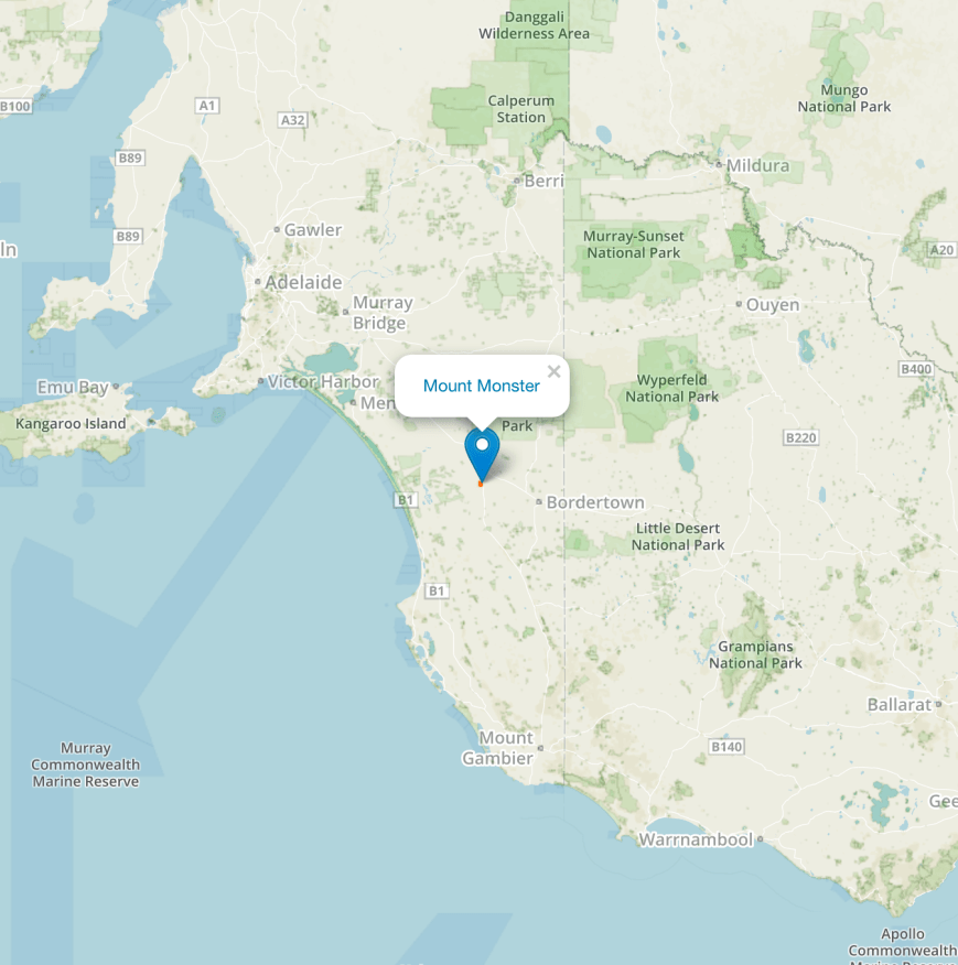
After packing up at Mount Buangor I headed in to Stawell and caught up with Mick VK3GGG at his home. Mick served me up a nice pastie and a very welcome hot cup of coffee. We chatted for about 45 minutes and I had a look at Mick’s shack. I then hit the road and started heading west towards the Victorian/South Australian State border. After speaking on the phone with my wife Marija, I decided to call in to the Mount Monster Conservation Park 5CP-149 & VKFF-0800. Mount Monster is situated about 240 km south east of Adelaide, and about 13 km south of the town of Keith.
Map showing the location of the Mount Monster Conservation Park to the south east of Adelaide. Map courtesy of Protected Planet.
I last activated Mount Monster in October 2016, with Andrew VK6AS, on our road trip to VK3. On that occasion I made a total of 18 contacts, falling well short of the required 44 QSOs to qualify the park for the global World Wide Flora Fauna (WWFF) program.
For more information on that activation, please have a look at my previous post…..
I also activated Mount Monster back in November 2014, but this was prior to the park being placed in the WWFF Directory. That particular activation was for the VK5 National & Conservation Parks Award.
The park is well signposted from the Riddoch Highway.
I accessed the park via Mount Monster Road and set up in the main carpark area, where the walking trail leads to the Mount Monster summit.
Aerial shot of the park showing my operating spot. Image courtesy of Protected Planet.
Mount Monster Conservation Park is about 93 hectares in size and was dedicated as a Conservation Park in September 1976 as a gift from three surrounding land owners, including the Buddle and Ellis families in memory of pioneers Malcolm and Mercy Crooks of ‘Maroona’. The park is dominated by steep rocky outcrops separated by narrow, deep gullies, producing a wide range of gradients and a number of sheer cliff faces. These rocky outcrops are dominated by an unusual granite, found in only one other location in South Australia. The park includes the Mount Monster summit, known as Joyce’s Plateau, named in honour of Joyce Buddle. Although only having a low profile, the summit dominates the countryside for many kilometres.
Prior to European settlement the area around Keith was part of the lands occupied by the Ngarranjeri aboriginal people. Within the park is the old Gold Escort Route. This is the famous route which brought gold into South Australia from the Victorian goldfields during the 1850’s. In fact, between March 1852 and December 1853, a total of 528 509 ounces of gold were brought into South Australia from the Victorian gold fields.
About 176 different plant species have been identified in the park, 30 of those are orchids. Some of these, including the Cradle of Incense, and the Monarto Mint Bush, are considered endangered nationally. Numerous mammals can be located in the park including kangaroos and echidnas. The park is also home to a large variety of birdlife, including red rumped parrots (I saw numerous) and honeyeaters (again I saw numerous feeding on the flowering natives).
The agricultural land surrounding Mount Monster is recognised as one of the major Lucerne seed producing areas in Australia. During the summer period, the fields are stocked with beehives for the pollination of the crops.
Aerial shot showing the park and the surround countryside, with the town of Keith in the background. Image courtesy of Google maps.
Prior to getting into the park I had contacted Adrian VK5FANA who had kindly spotted me. It was fitting then, that Adrian was my first contact at Mount Monster, with an excellent 5/9 signal. Park regular Rick VK4RF then called in, also 5/9, followed by another park regular Peter VK3PF who was also 5/9. The 40m band appeared to be in excellent condition.
I was keen to qualify the park and get back on the road, so I was pleased to have a steady flow of callers. Propagation around South Australia was brief. Contact number ten qualifying the park for VKFF was with Nev, followed soon after by my lovely wife Marija VK5FMAZ. Contact number 14 was with Charlie VK5KDK who started off at 5/9, but within a few minutes had almost vanished. This was followed by a call from Peter VK5KX who was also initially strong, but also faded with the QSB.
I worked a total of 30 stations on 40m and then QSYd to 14.310 on the 20m band. There I worked Gavin VK3MLU, followed by Steve VK3MPR and then Phil VK2HPN. I then logged my first DX for the activation, with Tadashi JA1VRY. I logged a further 5 stations on 20m including Hideto JO7RLF and Minoru JH1BXR.
I then moved to 3.610 on the 80m band where I logged a total of 11 stations from VK2, VK3, VK4, and VK5.
With 50 contacts in the log, it was time to get back on the road, as I still had a 2 hour drive to get home.
I worked the following stations on 40m SSB:-
VK5FANA
VK4RF
VK4HA
VK3PF
VK3TKK/m
VK4SMA
VK2SVN
VK4FFAB
VK3FSLG
VK5WG
VK7JON
VK5FMAZ
VK3EY/2
VK5KDK
VK5KX
VK3TFD
VK3MCD
VK3OHM
VK6LGF
VK2QA
VK3KRH
VK7ZGK
VK2XZ
VK3FSPG
VK3MPR
VK3ALA/7
VK3MLU
VK4TJ
VK4/AC8WN
VK4/VE6XT
I worked the following stations on 20m SSB:-
VK3MLU
VK3MPR
VK2HPN
JA1VRY
VK2IO
JO7RLF
JH1BXR
VK6ZDJ
VK3HSB
I worked the following stations on 90m SSB:-
VK3GGG
VK3PMG
VK4HNS
VK3SQ
VK2IO
VK4FW
VK5HS/m
VK5FANA
VK4ARW
VK5PE/m
VK3MAB
I stopped off at the roadhouse at Tintinara for a steak sandwich. You always know you are going to have a good meal when you see a lot of trucks parked outside.
References.
Department of Environment and Natural Resources, `997, ‘Aberdour and Mount Monster Conservation Parks, Desert Camp Conservation Reserve and Poocher Swamp Game Reserve Management Plans’.
Friends of Scott Creek Conservation Park, 2014, <www.users.on.net.au> viewed 24th November 2014.
Friends of the Upper South East Parks Volunteers Working for Conservation, ‘The Gwen Ellis Walking Trail, Mount Monster Conservation Park’.
On Monday morning (10th April 2017) I left a very cold Ballarat….6 degrees C and drizzle…..and headed west on the Western Highway. I had one planned activation for the day, that being the Mount Buangor State Park, VKFF-0766, which is located about 192 km west of Melbourne, and 30 km east of the town of Ararat.
Map showing the location of Mount Buangor State Park. Map courtesy of Protected Planet.
On the way I stopped off at the historic town of Beaufort for a sausage roll and a nice hot cup of coffee from the bakery. Beaufort has a rich history, as gold was discovered here in 1852, and again in 1854 at nearby Fiery Creek. The population of the gold fields reportedly reached about 100,000 people at its height in the late 1850’s and produced about 450,000 ounces of gold over a 2 year period. Today, Beaufort’s population is around 1,1100 people. There are many historic buildings in the town.
I continued on westward bound, until I reached the turn off for the Mount Buangor State Park, which is well signposted on the Western Highway. The summit itself was shrouded in cloud. I have climbed the summit back in 2013. For information on that activation, please see my previous post at…..
Although I have activated the summit, this was before the park came onto the list for the World Wide Flora Fauna (WWFF) program, so this was to be a unique park for me. I was hoping to get 44 contacts to qualify the park.
I travelled out along Ferntree Gully Road and stopped to have a look at a memorial plaque in a paddock on the western side of the road. It commemorates the Jess family from Ireland who settled in the area in the 1860’s.
I soon reached the entrance to the park and continued on until I reached the Middle Creek camp ground area.
Mount Buangor State Park was established in October 1989 and covers an area of 2,400 hectares. The local Beeripmo balug (Aboriginal people) belonged to the larger Djab Wurrung language speaking community and they knew the forest as ‘Beereep-Beereep’ meaning ‘wild mount’.
The park and nearby forest protect diverse ecosystems alive with more than 130 species of birds, mammals, reptiles, amphibians and insects. Of the 324 known plant species there are 119 species that are of significance. Spring wildflowers abound.
A range of animals and birds can be found during daylight such as Eastern Grek kangaroos, koalas, echidnas, Swamp wallabies, Red-necked wallabies, gliders, bats, Wedge-tailed Eagles, Crimson Rosellas and kookaburra’s.
The Middle Creek camping area is set in a eucalyptus forest with creek flats, waterfalls and spectacular views of the surrounding countryside including the summit, Mount Buangor which rises to 987 metres above sea level. The summit was formally known as Flagstaff Hill which originated from a rock cairn and flagpole that is reported to have been erected by Major Thomas Mitchell during his exploration of the area in the 1830’s.
Map showing my operating spot in the park. Map courtesy of Protected Planet.
As it was a bleak morning I set up in ‘Charlie’s Hut’ which is dedicated to Charles ‘Charlie’ Whittaker. He was born in Warnambool in 1921 and grew up in the Ararat district. He passed away in 2008. His love of the Middle Creek area is honoured, with the shelter named after him.
The Middle Creek campground area
I was set up and ready to go just after 2355 UTC (10.00 a.m. Victorian local time). It was a chilly morning, with the temperature being 8 deg C. There was an open fireplace in the shelter, which I was very tempted to light. I called CQ on 7.144 and this was answered by Rod VK7FRJG who had a terrific signal with his home brew Moxon beam. I was pleasantly surprised to log Greg VK5ZGY next, who was portable in the Mount Remarkable National Park VKFF-0360. Greg also had a strong 5/9 signal. Next up was Ivan VK5HS who has become quite a regular park hunter, followed by Adrian VK5FANA on the Yorke Peninsula.
Contact number 10, qualifying the park for VKFF, was with VK4WID in Queensland, being operated by John VK4TJ. During contact number 13, with Rick VK4RF, KA1PM from the USA came onto the frequency and started calling CQ. He was about 5/5 to me, but sadly he could not hear my signal, and I suspect could not hear the VK’s calling me, who were running much higher power than me.
After a relatively slow start, callers started to pick up and I reached contact number 44, wit Paul VK5FUZZ, just under 90 minutes into the activation. I went on to work a total of 59 stations on 40m from VK1, VK2, VK3, VK4, VK5, and VK7. This included Damien VK5FDEC who was running QRP 2.5 watts (5/5 sent and 5/8 received), and Lou VK3AQZ who was running QRP 5 watts with a home brew transceiver (5/8 sent and 5/9 received).
I then moved off to 3.610 on the 80m band where I logged a total of 8 stations. All VK3’s bar Greg VK5GJ: VK3SQ, VK3GGG, VK3PMG, VK3FLAK, VK5GJ, VK3KAI, & VK3FSLG. Despite it being late morning, Greg VK5GJ was coming in very well, 5/7, from the Adelaide Hills.
I then tried my luck on 14.310 on the 20m band, calling CQ. This was answered by John ZL1BYZ in New Zealand who was a good 5/9 signal. Mike VK4MY and Alex VK4TE followed.
I was freezing, I had a total of 70 contacts in the log, and another park qualified. Mick VK3GGG had dinner in the oven for me and a hot cup of coffee waiting at Stawell.
I worked the following stations on 40m SSB:-
VK7FRJG
VK5ZGY/p (Mount Remarkable National Park VKFF-0360)
VK5HS
VK5FANA
VK2GKA
VK2IO
VK4TJ
VK4/ AC8WN
VK4/VE6XT
VK4WID
VK2VW
VK5MRT
VK4RF
VK4HA
VK5BJE
VK3PF
VK4AAC/p
VK2DSG
VK7PRN
VK5HCF
VK2NZ
VK5NFT/m
VK2DLF
VK3QB
VK5FDEC
VK2NWB
VK5WA
VK2EXA
VK1AT
VK2CJC
VK5DJ
VK3HBG
VK5WG
VK5KLV
VK5FCLK
VK3OHM
VK3IF
VK3SQ
VK2EME
VK7PAL
VK4HNS/p
VK3FLJD
VK3VIN
VK5FUZZ
VK2HHA
VK5GI
VK3GGG
VK3PMG
VK2SK
VK5FCHM
References.
Parks Victoria, 2017, ‘Mount Buangor State Park’ brochure.
Sunday morning (9th April 2017) I was awoken by a huge clap of thunder. And I mean huge. It shook the house. It was also pouring with rain. As I lay in the warm bed in the spare room at the home of Chris VK3QB, I thought of the poor souls who were camping out at Antennapalooza on the property next door. Particularly Marshall VK3MRG who I knew was sleeping in a swag.
After a shower and some breakfast Chris and I headed down to the campsite. The rain had cleared a little and we were surprised to see a lot of activity under the marquee and the campfire was still burning with a few brave souls standing around it.
After everyone had arisen from their slumber, Joe VK3YSP gave a very interesting presentation on operating portable. This was followed by a presentation by Ian VK3BUF on auxillary power for your vehicle.
L-R: Tony VK3XV, Joe VK3YSP, Paul VK5PAS & Marshall VK3MRG
Chris VK3QB with his antenna catapult
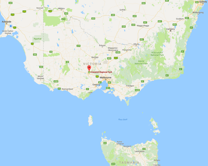
Just after midday local time I left Foster and headed for Ballarat. I had enjoyed two terrific nights at Foster and I will certainly be doing my best to return to Antennapalooza next year. I had one planned park activation for the day, the Creswick Regional Park VKFF-0964. I had activated the park back in February 2017 during outr trip to Ballarat, but I hadn’t reached the required 44 QSOs to qualify the park for the World Wide Flora Fauna (WWFF) program. I had fallen short with 32 contacts.
Above:- Map showing the location of the Creswick Regional Park, north west of Melbourne. Map courtesy of google maps
After leaving Foster I stopped briefly at the Foster North lookout on the South Gippsland Highway and enjoyed some terrific views of the surrounding countryside, all the way down to Wilsons Promontory.
I then negotiated my way through Melbourne. Even though it was a Sunday, it was incredibly slow going on the M1 Highway. I finally got out of Melbourne and continued west through Melton, Bachus Marsh and on to Ballarat. I arrived in Ballarat at around 4.00 p.m. local time and it was raining consistently and was 7 deg C. A miserable afternoon. After booking in to the motel I pondered on whether I should head out to Creswick. In the end I decided I had come a long way and after all I only needed 12 contacts.
The little town of Creswick is about 18 km north of Ballarat. It has a population of around 3,500 people. The pioneer European settlers in this area were brothers Henry, Charles, and John Creswick, who established a large sheep station in 1842. The town itself, was established in the 1850’s due to the gold rush in the area. It was originally known as Creswick Creek until about 1857. At the peak of the gold rush, the population was around 25,000. The town has a number of historic buildings.
Creswick was the site of the New Australasian Mine disaster on the 12th day of December 1882. This was Australia’s worst mining disaster in which 22 men drowned. It was 4.45 a.m. when 29 miners became trapped underground by flood waters which came from the flooded parallel sunk Number 1 mine shaft. Of those, only 5 survived and made it to the surface. Many of the trapped mens crawled last notes to their loved ones on billy cans before they perished.
The school of Foresstry was established in 1910 by the Department of Forestry to train and acredit young foresters. It is now part of the University of Melbourne.
I made my way out to St Georges Lake in the park, with the rain not easing at all. It was a very cold, bleak, and wet day.
Creswick Regional Park was established in November 1983 and comprises 1,275 hectares of native scrub including Messmate, Manna Gum, Scent-bark, Broad-leaved Peppermint and Narrow-leaved Peppermint. Candlebarks also grow in the gullies in the park. The Common Heath, Victoria’s floral emblem is frequently found growing under eucalpyts.
Numerous birds can be seen in the park including Grey Currawongs, Crimson Rosellas, White-throated Tree-creepers, Grey Fantails, Thornbills, Robins, and honeyeaters. Two migratory species found in the park ar the Rufous Fantail and Satin Flycatcher. The only birds I saw during the activation were ducks. Not surprising!
Various native mammals call the park home, including Koals, kangaroos and Black Wallabies.
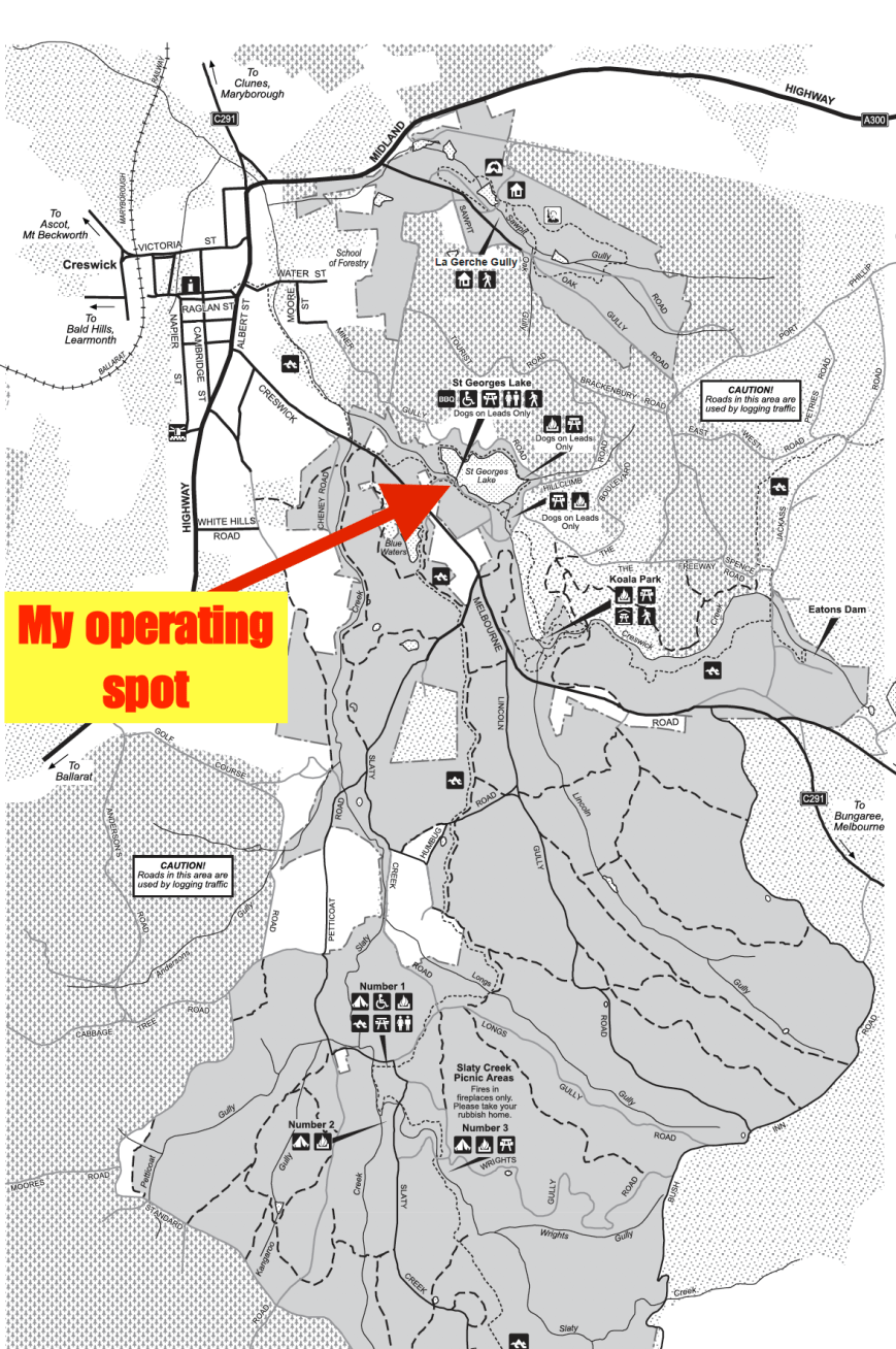
I found a spot on the southern side of St Georges Lake and as it was too wet, I was forced to operate from the vehicle. I braved the elements and erected the 7 metre squid pole, attaching it to a fence post with an octopus strap, and ran out the 80/40/20m linked dipole. Getting very very wet in the process.
Map of the Creswick Regioanl Park showing my operating spot. Map courtesy of Parks Victoria
The static crashes on the band were S9 plus. This along with the miserable weather conditions, made this activation one of the less memorable ones IO have undertaken. I called CQ on 7.144 and this was answered by Ivan VK5HS in the Riverland with a strong 5/9 signal. I then spoke with Peter VK5PE with his newly upgraded call, followed by my good wife Marija VK5FMAZ, and then Adrian VK5FANA. I soon reached 10 contacts with Jim VK2LC in the log. The required 12th contact was Jason VK2FAVL/p.
I had a steady flow of callers, and as most were aware of the weather conditions, most stations kept their contacts short. I worked a total of 39 stations from VK1, VK2, VK3, VK4, VK5, VK6, and VK7. This included a Park to Park contact with Jarrad VK6FFAR who was portable in Leschenault Peninsula Conservation Park VKFF-1430.
Bill VK4FW came up to let me know that I was being heard in Europe, but sadly due to the extremely strong static crashes, I was unable to pull any Europeans out of the noise.
I jumped out of the vehicle and removed the links for 20m and then called CQ on 14.310. This was answered by Ted VK6NTE/m who had followed me up from 40m. Ted was quite low down compared to the signal he normally puts in. I made about 5 minutes of CQ calls, however Ted was my only caller.
I then braved the weather again, and inserted the links for 80m. I called CQ on 3.610 and was called by Mick VK3GGG/VK3PMG, followed by Peter VK3PF. I worked a further 5 stations on 80m from VK4, VK5, and VK7.
After a little over one hour in the park I had a total of 48 stations in the log and I had well and truly qualified the park for WWFF. It was time to head back into Ballarat. I ordered a pizza and made my way back to the motel room.
I worked the following stations on 40m SSB:-
VK5HS
VK5PE
VK5FMAZ
VK5FANA
VK5KX
VK4PDX
VK4FW
VK2YW
VK2EJW
VK2LC
VK5FKYM
VK2FAVL/p
VK5PET
VK2HOT
VK4QQ
VK2FOUZ
VK5TW
VK1AT
VK2SK
VK1DI
VK7QP
VK4SMA
VK2NCS
VK7ZGK
VK2VKB
VK5AFZ
VK4NH
VK6FFAR/p (Leschenault Peninsula Conservation Park VKFF-1430)
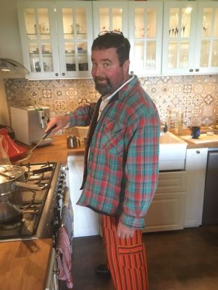
After a good night sleep at the home of Chris VK3QB at Foster, I was spoilt by Chris cooking me breakfast on Saturday morning (8th April 2017). Although I did have to put up with his techicolour morning attire as you can see from the photo below.
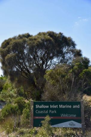
We had decided the night before to activate the Shallow Inlet Marine Coastal Park VKFF-0749 that morning. Chris VK3PAT also organised to meet us out at the park. The Shallow Inlet Marine Park is located about 190 km south east of Melbourne, and about 22 km south of Foster.
Above:- Map showing the location of the Shallow Inlet Marine Park. Map courtesy of Protected Planet.
We decided to take two vehicles out to the park so that Chris could leave at any time required to head to the Antennapalooza event. We drove south out of Foster along the Foster-Promontory Road and then took Soldiers Road and continued to the little town of Sandy Point. We soon reached the park at the end of Sandy Point Road and drove onto the beach.
The Shallow Inlet Marine Coastal Park which was established in April 1986 is 2,377 hectares in size. The park is nestled between Warratah Bay and the peaks of Wilson Promontory. Shallow Inlet is popular for a range of water based activities including fishing, swimming, boating and sail boating. And as it was a glorious day, there were numerous people on the beach, swimming, and riding horses.
The Brataualung Aboriginal clan once occupied the area of Wilsons Promontory and Waratah Bay. A large number of coastal middens containing charcoal, stones and the remains of shellfish are located along the coast and around Shallow Inlet and are up to 6000 years old. Earlier sites have been covered by rising sea levels. The Aboriginal population of the area declined from the 1850s after European occupation of their tribal territory, leading to disease, forced evictions and murders.
Settlers established pastoral runs around Shallow Inlet in the 1850s. Land in the catchment of Shallow Inlet was then extensively cleared and drained from the turn of the century. The Shallow Inlet Marine and Coastal Park was declared in 1986 in recognition of the area’s habitat values for migratory wading birds and shorebirds.
This slideshow requires JavaScript.
The park protects a diverse range of vegetation including foredunes of Spinifex, heathy woodlands of Messmate and Coastal Banksia, Paperbark swamps and saltmarsh communities. Extensive mudflats and intertidal areas are exposed at low tide. These areas provide important feeding grounds for a range of migratory wading birds. Below the waves are extensive seagrass meadows.
Shallow Inlet and the adjacent ocean beaches are significant areas for breeding shorebirds. Over 180 species of birds have been recorded in the park. Many wading birds make spectacular migrations, breeding in the arctic during the northern hemisphere summer and migrating southwards to arrive in Australia in late August and September. Pied Oystercatchers and Red Capped Plovers nest in the dunes and on the spit. A diverse range of mammals including the Koala, Common Ringtail Possum, Common Wombat, Swamp Wallaby and Echidna can be found in the woodlands and heathlands along the shoreline of Shallow Inlet.
Chris and I set up about 30 feet from the water’s edge and as it was quite a warm day we set up underneath the awning of my Toyota Hi Lux. For this activation we ran the Yaesu FT-857d, 40 watts output, and the 80/40/20m linked dipole.
Aerial shot showing our operating spot in the park. Image courtesy of Protected Planet.
Our first contact was with John VK2YW, followed by Cliff VK2NP, Bill VK4FW, and then Peter VK5PE. Chris and I swapped the mic to log the contacts. Contact number 17 in the log was Grant VK4JAZ who was activating the Denmark Hill Conservation Park VKFF-1529. Grant was a very difficult copy to us, but after a number of attempts, we were able to successfully exchange callsigns and signal reports. Thanks to the patience of Grant. For information on Grant’s activation, you can view his blog at….
Chris VK3PAT soon joined us and we continued our mic sharing experience, logging a total of 21 contacts on 40m from VK1, VK2, VK3, VK4, and VK5. We then headed to 3.610 on the 80m band where we logged 3 stations: Mike VK3NMK, Geoff VK3SQ, and Nick VK3ANL.
We then tried our luck on 14.310 on the 20m band, where our first caller was the ever reliable Rick VK4RF/VK4HA, followed by Neil VK4HNS, and then Rob VK4AAC.
With 28 stations in the log we headed back to 7.144 on the 40m band where our first contact was with Norm VK2FANT, followed by Owen VK2AEJ who was operating from the Cape Don lightship in Sydney. We also logged Peter VK3PF/p and Sergio VK3SFG/p who were activating SOTA peak Mount Square Top VK3/ VT-071. A number of the hams at Antennapalooza gave us a shout, including Joe VK3YSP/p, Julie VK3FOWL/p, Tony VK3XV/p, and Jamie VK3TZE/p. We also logged Ian VK1DI who was activating SOTA peak Mount Tumanang VK2/ SM-049 which is located within the Tallaganda National Park VKFF-0474.
Chris VK3PAT had headed off for lunch with his wife, and Chris VK3QB and I had 45 contacts in the log, and it was time to head off to Antennapalooza. I think I may have inspired Chris VK3QB into activating. He was very happy qualifying his first park with 44 contacts +. It was a beaut morning. Great weather, good propagation, and good company.
I worked the following stations on 40m SSB:-
VK2YW
VK2NP
VK4FW
VK5PE
VK2NEO
VK1AT
VK5FANA
CK2GKA
VK2AN
VK2ZK
VK2JDC
VK4TJ
VK2FADV
VK4RF
VK4HA
VK3KTO/p
VK4JAZ/p (Denmark Hill Conservation Park VKFF-1529)
VK4AAC/p
VK4KX
VK2IO
VK3ARH
VK2FANT
VK2AEJ
VK5FMAZ
VK5HCF
VK3PF/p (SOTAMount Square Top VK3/ VT-071)
VK3CM
VK3SFG/p (Mount Square Top SOTA VK3/ VT-071)
VK3YSP/p
VK3FOWL/p
VK3XV/p
VK3KYF
VK1DI/p (SOTA Mount Tumanang VK2/ SM-049 &Tallaganda National Park VKFF-0474)
VK5VBR
VK7VDL
VK3XMF
VK3FCLK
VK3TZE/p
I worked the following stations on 80m SSB:-
VK3NMK
VK3SQ
VK3ANL
I worked the following stations on 20m SSB:-
VK4RF
VK4HA
VK4HNS/p
VK4AAC/p
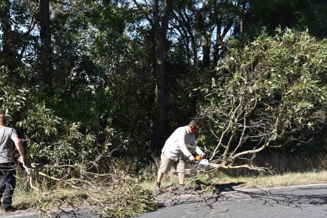
On the way back to Foster we came across a small tree which had fallen across the road. Fortunately Chris had a chainsaw in the back of his vehicle.
Once back at Antennapalooza I caught up with all those present. It was terrific to meet Tony VK3XV for the very first time. I had spoken with Tony many times previously both on air and on the telephone. But this was the first time we had met in person. The presentations commenced mid afternoon, with 3 presentations delivered by myself on 1. General tips whilst operating portable; 2. WWFF; and 3. the VK5 Parks Award. Tony VK3XV spoke about the Keith Roget Memorial National Parks Award, whilst Peter VK3PF spoke about the Summits on the Air (SOTA) program. We settled in for the night, enjoying a nice meal and a few reds, and plenty of chat around the campfire. A great night.
This slideshow requires JavaScript.
References.
Parks Victoria, 2012, ‘Shallow Inlet Marine Coastal Park’.
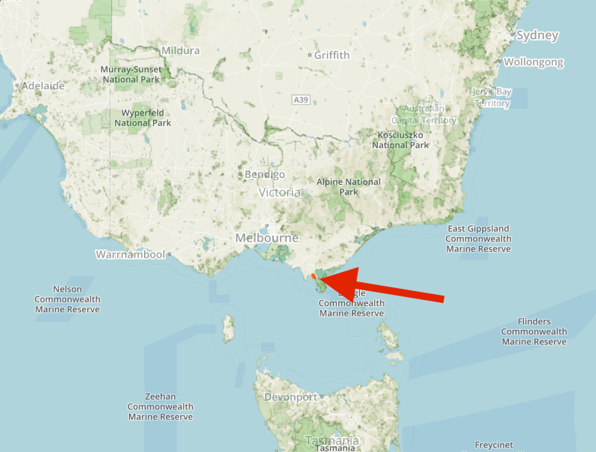
Above:- Map showing the location of the Wilsons Promontory National Park. Map courtesy of Protected Planet.
The drive took me down through Foster, where I would be staying for the next 2 nights, and then to the little town of Yanakie. Along the way I stopped to have a look at the Foster Poison post. It was erected in the late 1800’s to mark where poison was laid to eradicate wild dogs and dingoes. On the original stock route linking Western Port with East Gippsland, it defined the corner of Wonga Wonga, Waratah and Yanakie Parishes. Poison Post became quite a significant landmark to the early residents and was used until 1960.
I continued along the Meeniyan-Promontory Road until I reached the park entrance.
The Wilsons Promontory National Park is commonly known as Wilsons Prom or The Prom. It is located at the southernmost tip of mainland Australia in the Gippsland region, and offers spectacular scenery of huge granite mountains, open forest, rainforest, sweeping beaches and coastlines. The park is 50,500 hectares (125,000 acres) in size and was established in July 1898.
The park is home to a large amount of native wildlife including kangaroos, wallabies, wombats, and echidnas. Marine creatures that can be sighted include Southern Right whales, Humpback whales, Killer whales, dolphins, seals, and Sea Lions.
The first Europeans to sight Wilsons Promontory are believed to be George Bass and Matthew Flinders in 1798. Prior to this the area was inhabited by aboriginals for at least 6,500 years. During the 1800’s extensive sealing took place at Sealer’s Cove. Such was the extent of the sealing, that seals are no longer found there. During the late 1800’s extensive lobbying of the Government of Australia by the Field Naturalists Club of Victoria and the Royal Society of Victoria led to Government temporarily reserving the area in 1898 as a National Park. This was made permanent in 1908.
George Bass
Matthew Flinders
In April 2015 a large section of the park was burnt out as a result of a bushfire which originally started as a controlled burn which breached containment lines. And during the Black Saturday Bushfires of February 2009, numerous trees within the park were struck by lightning which led to the loss of up to 50% of the National Park through fire.
As I pulled in to the carpark at the end of Five Mile Road, the slippery creature below was crossing the carpark in front of me. The carpark was full of cars and quite a few people, all about to head off on a bush walk. And all oblivious to the snake’s presence. Which was not such a band thing, because I suggest there would have been a lot of screaming by the women present.
Red Bellied black snakes are one of Australia’s best known snakes and are found throughout eastern Australia. Its venom is capabale of causing significant morbidity, however a bite from a Red Belly is not generally fatal, and is less venomous than many other Australian venomous snakes.
Red-bellied black snake
I set up in the carpark, trying to make as much noise as possible to scare away any other snakes. I am not a snake fan by any stretch. However, I have never killed any of the snakes I have sighted. Snakes are generally a protected species and hefty fines can be imposed on those found killing them. In South Australia, the maximum penalty is a $10,000 fine and 2 years imprisonment. The only exception is if a venomous snake is posing a genuine threat to life and safety.
I ran the Yaesu FT-857d, at 40 watts output, and the 20/40/80 m linked dipole, on the top of the 7 metre telescopic squid pole. There was just enough room to stretch out the dipole.
It was quite a warm day, around 29 deg C, so I tried to find a little bit of shade.
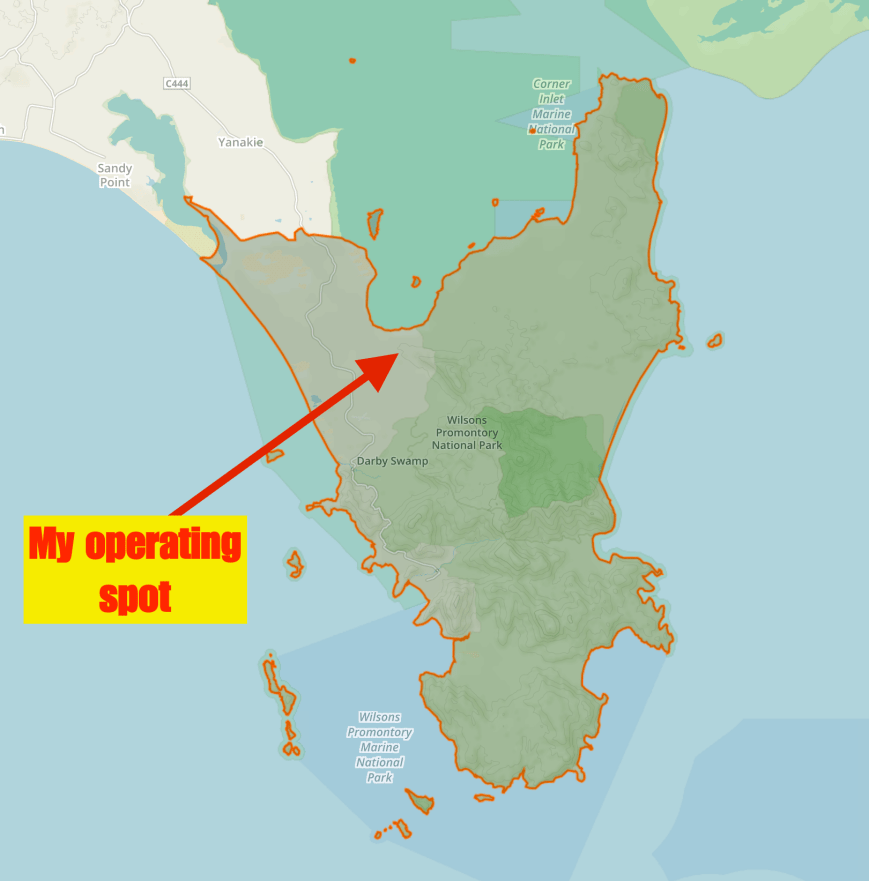
Above:- Map of the park showing my operating spot. Map courtesy of Protected Planet
The 40m band was quite busy, and I found 7.130 and asked if the frequency was in use. Brenton VK3CM came back to me and was number one in the log from Wilsons Prom. This was followed by Adrian VK5FANA on the Yorke Peninsula with a good 5/6 signal, then Ivan VK5HS in the Riverland region with a strong 5/8 signal. Contact number ten, qualifying the park for VKFF, was Mick VK3GGG/VK3PMG.
I was very pleased with the steady flow of callers, as I was keen to leave the park as soon as possible and head off to Antennapalooza at Foster. In just a little over an hour I had contact number 44 in the log, VK3ER portable at Antennapalooza.
I logged a total of 46 stations on 40m from VK1, VK2, VK3, VK4, VK5, and VK7. This included a Park to Park contact with Jim VK1AT who was activating the Namadgi National Park VKFF-0377. I also logged a number of amateurs who were portable at Antennapalooza, including Julie VK3FOWL, Chris VK3QB, and Ian VK3BUF. Another good contact was with Rick VE3MM/VK5 who was holidaying on Kangaroo Island OC-139. Rick had a good signal with his KX3, 10 watts and end fed 1/2 wave antenna.
I then headed to 14.310 on the 20m band where I logged a total of 10 stations. Australian stations logged there were Rob VK4AAC/p, Steve VK4KUS, Sergio VK3SFG, and Rick VK4RF/VK4HA. There was a small opening into Europe on the long path, with five Italian stations logged.
I then lowered the squid pole and inserted the 80m links and called CQ on 3.610 on the 80m band. First caller was Peter VK3PF with a strong 5/9 signal, followed by Mick VK3GGG/VK3PMG who was 5/8. But despite 5 minutes of CQ calls, they were my only takers on 80m.
I had a total of 59 contacts in the log and another unique park activated. It was approaching 5.00 p.m. local time and I wanted to have a quick look around the park before heading off to Foster.
I worked the following stations on the 40m band:-
VK3CM
VK5FANA
VK5HS
VK3AXH
VK3SQ
VK7DD
VK3DMD
VK5TR
VK3GGG
VK3PMG
VK3YSP
VK4RF
VK4HA
VK2LX
VK5KX
VK3VIN
VK5EMI
VK3LSD
VK2NP
VK5NFB
VK2EXA
VK7VDL
VK4AAC/p
VK3VBI
VK2STO
VK5KLV
VK5FRSM
VK1AT/p (Namadgi National Park VKFF-0377)
VK4VXX/2
VK2FOUZ
VK4HNS/p
VK2SMS/p
VK2FADV
VK5YX
VE3MM/VK5
VK2GQR
VK2IO/m
VK4CPS
VK3FOWL/p
VK1FWBK
VK3QB/p
VK3BJA/p
VK3BUF/p
VK3ER/p
VK2QA
VK5WG
I worked the following stations on 20m SSB:-
VK4AAC/p
IK2ZJN
IK8FIQ
VK4KUS
VK3SFG
I5FLN
IW2NXI
VK4RF
VK4HA
IU5HIV
I worked the following stations on 80m SSB:-
VK3PF
VK3GGG
VK3PMG
I drove down to Tidal River, the main campground in the park, enjoying some of the amazing coastline views along the way. The campground was extremely busy as it was school holidays. There were hundreds of people enjoying the park. The campground even has a general store and take away food shop.
This slideshow requires JavaScript.
I then headed off to Foster and caught up with Chris VK3QB on the road. We dropped off my bags at his home and then drove to the campsite next door, where I enjoyed a few ales and good company with those present.
My first planned activation for Friday 7th April 2017 was Mount Fatigue VK3/ VT-057. I made an early start from the motel in Ballarat and headed east. The first part of my drive was quite pleasant, along the Western Freeway through Ballan and Bachus Marsh. But I then hit the outskirts of Melbourne and the drive certainly slowed down. It took me some time to get through the western suburbs and across the Westgate Bridge.
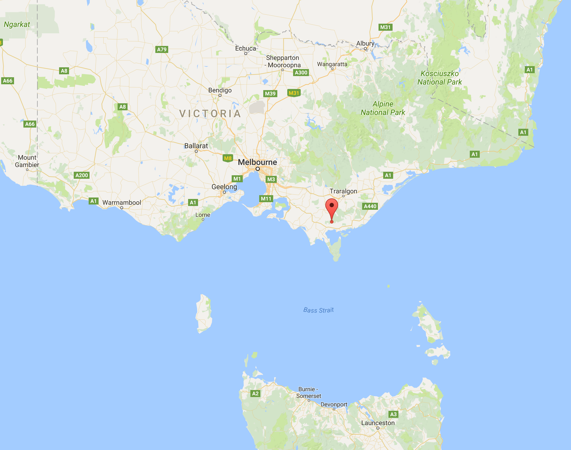
Above:- Map showing the location of Mount Fatigue VK3/ VT-057, south east of Melbourne. Map courtesy of google maps.
Once I got out of the Burnley Tunnel and onto the M1, the traffic flowed a little smoother. I continued on to Koo Wee Rup and then Korumburra and then Leongatha. I then headed up the Foster-Mount Best Road
I soon entered the Wonjip plantation area which was truly spectacular, with dense forest and beautiful green tree ferns
After some weaving up Toora-Gunyah Road I reached the junction with the Mount Fatigue Road and headed up to the summit.
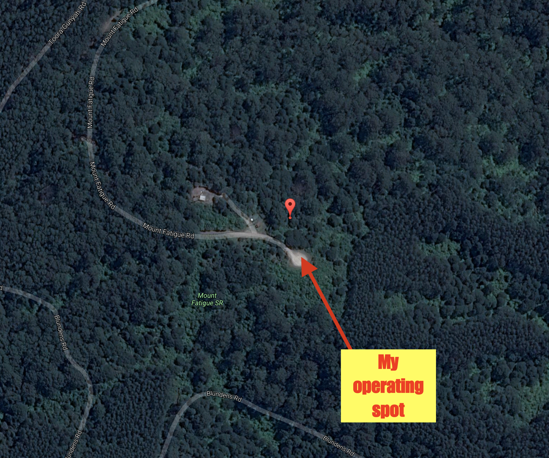
I set up in the carpark at the end of Mount Fatigue Road. There were no other vehicles in the carpark, so I had plenty of room to stretch out the 80/40/20 m linked dipole. Due to the 7m squid pole splitting the night before, I could only get the antenna up at 6 metres for this activation. As it was a nice easy drive up summit I had the luxury of the fold up table and deck chair. I ran the Yaesu FT-857d and 40 watts for this activation.
Above:- Aerial shot of the summit, showing my operating spot. Image courtesy of google maps
Prior to calling CQ I enjoyed some of the views to be had from the top of Mount Fatigue. Views can be enjoyed of the surrounding countryside all the way down to the Wilsons Promontory National Park.
Mount Fatigue is 595 metres above sea level and is worth 2 SOTA points. The summit has been activated a total of 7 times. It was first activated by Peter VK3PF back in July 2013. Mount Fatigue is situated in the Strzelecki Ranges, also known as the Strzelecki Hills, part of the Great Dividing Range. The summit is located within the Mount Fatigue Scenic Reserve which is 12.9 hectares in size and was established in June 1984.
Mount Fatigue was named by Captain John Lort Stokes (1812-1885) in 1846 when he and his party made their way through the thick scrub to the top of the summit. There is a memorial plaque at the top of the summit to commemorate this fact.
The following is from Stokes’ book ‘Discoveries in Australia during the Voyage of H.M.S. Beagle’:
“When we sailed out of Alberton – to commemorate my friend Count Strzelecki’s discovery of this important and valuable district, which he named in honour of His Excellency the Governor. I called the summit of a woody range 2110 feet high, over the north shore of Corner Inlet, Mount Fatigue. The only vegetation this part of the promontory supports is a wiry grass, stunted gums and banksias in the valleys, and a few grass-trees near the crests of the hills which are generally bare masses of granite”
Captain John Lort Stokes
Sir Paweł Edmund Strzelecki
At the end of the 19th century, the largest tin mines in Victoria were in close proximity of Mount Fatigue. Gold was also discovered on the slopes of Mount Fatigue by William Turton in 1856.
There is a trig point at the summit which is hidden behind the trees and a small tower.
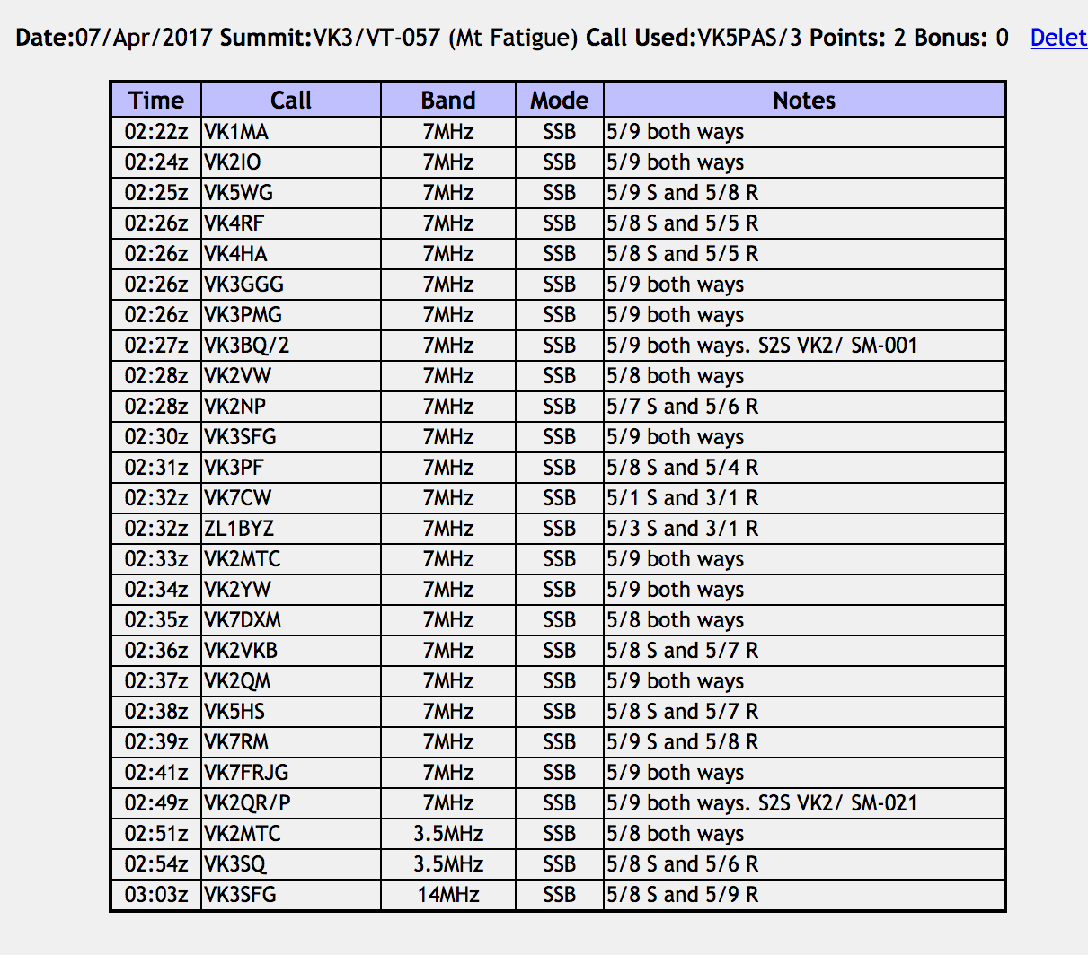
I was set up and ready to go just after 0220 UTC (12.20 p.m. Victorian local time). I started calling CQ on 7.095 and this was answered by Matt VK1MA whi a beautiful 5/9 signal. This was followed by Gerard VK2IO, Nev VK5WG, and then Rick VK4RF/VK4HA. All had good strong signals. I had qualified the summit.
Contact number eight in the log was a Summit to Summit contact with Andrew VK3BQ/2 who was activating Australia’s highest peak, Mt Kosciuszko VK2/ SM-001. Andrew was running QRP 5 watts and was a strong 5/9.
I went on to work a total of 23 contacts from VK1, VK2, VK3, VK4, VK5, VK7, and New Zealand. This included John ZL1BYZ in New Zealand.
My final contact on 40m was another Summit to Summit, with Rob VK2QR/p who was activating the SOTA peak Mount Hudson VK2/ SM-021.
I then called CQ on 3.610 on 80m and this was answered by Greg VK2MTC who was a good 5/8 signal. Geoff VK3SQ then called in from Beechworth with a good 5/8 signal. Sadly Greg and Geoff were my only takers on 80m.
I then moved up to 14.310 on the 20m band and called CQ. This was answered by Sergio VK3SFG at nearby Mirboo North. Sergio had a good 5/8 signal and reciprocated with a 5/9 signal for me. I put out around another 12 CQ calls, but I had no takers.
It was time to pack up and head off to the Wilsons Promontory National Park. I had a total of 26 stations in the log and a unique SOTA summit to add to my SOTA activator list.
I worked the following stations:-
As I left the summit, I had some nice views back to Mount Fatigue.
I also enjoyed some nice views of the surrounding countryside including the Toora Wind Farm. Toora has 12 wind turbines, each of 1.75 MW rated capacity, with a total generating capacity of 21 MW of electricity. The power station was completed in 2002.