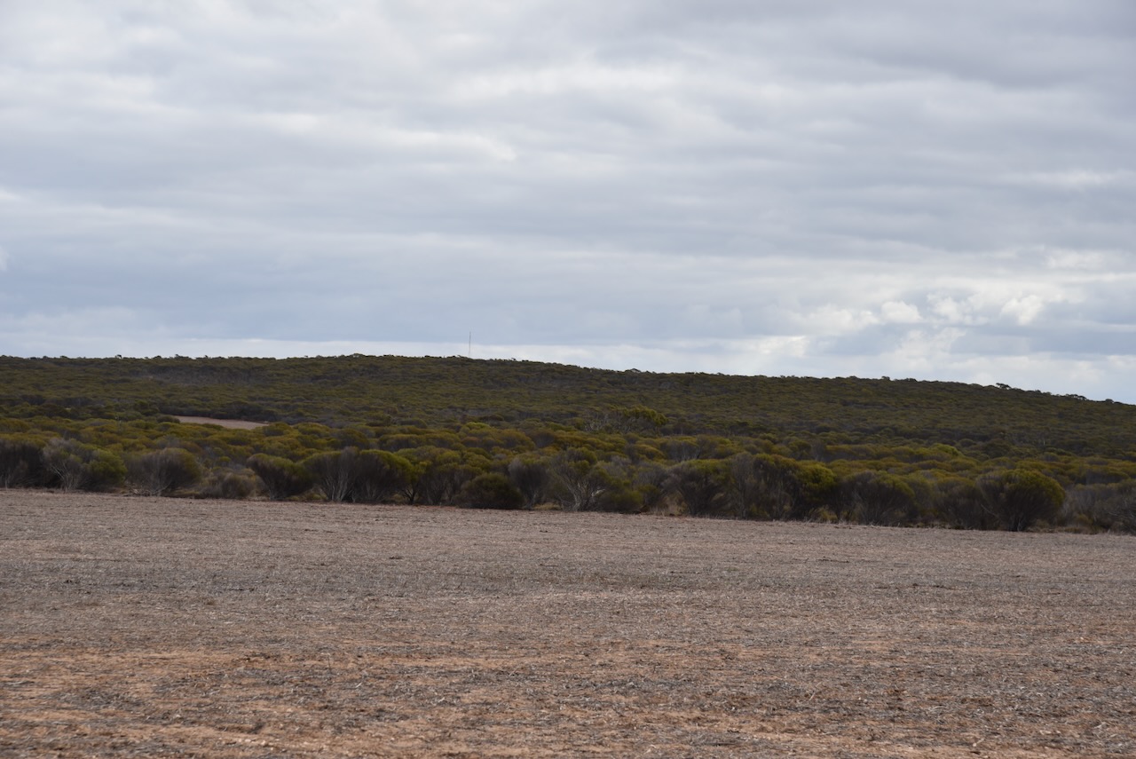
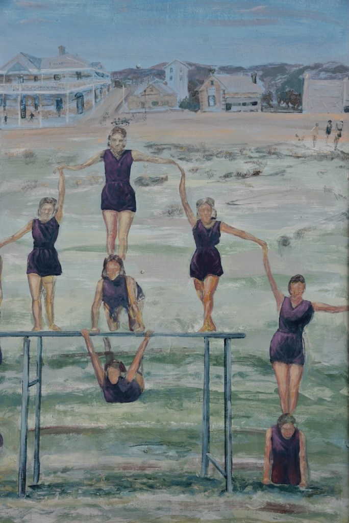
My next activation for 25th April 2024 was the Verran Tanks Conservation Park VKFF-1112. The park is located about 35 km west of Arno Bay on the Eyre Peninsula.
Above:- Map showing the location of the Verran Tanks Conservation Park. Map c/o Google Maps.
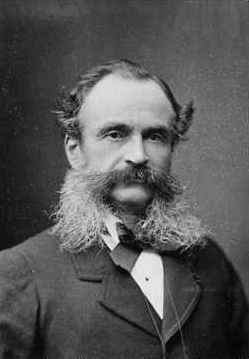
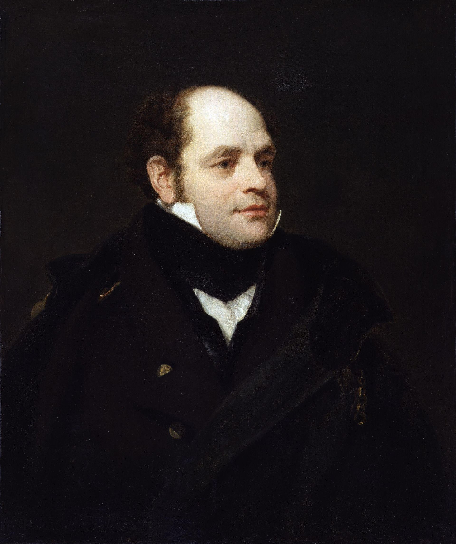
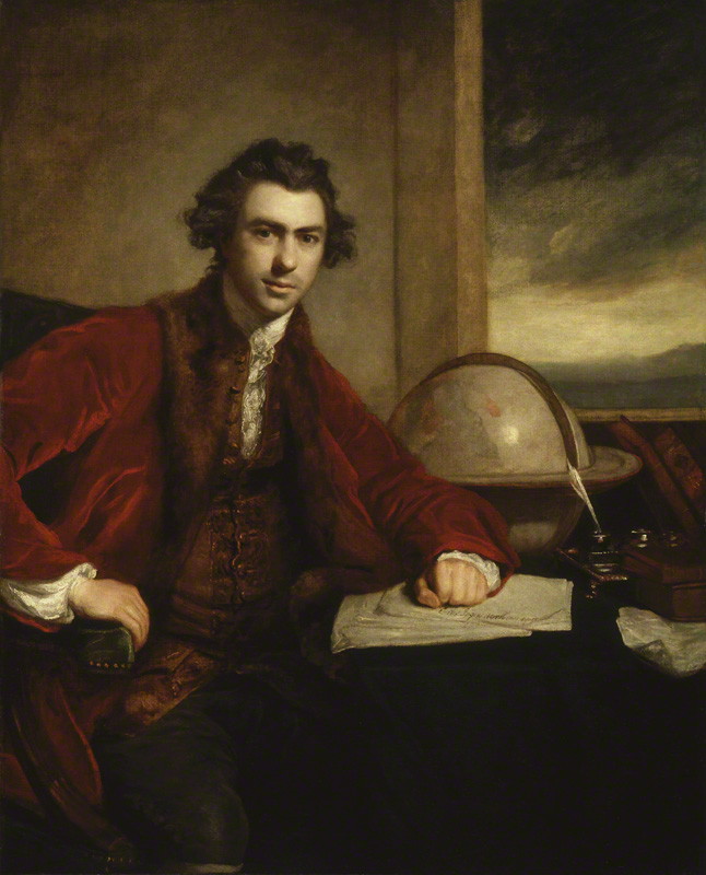
I headed south from Rudall and soon reached the little town of Verran. The town takes its name from the Hundred of Verran which in turn was named in honour of John Verran, an Australian politician and trade unionist. He served as Premier of South Australia from 1910 to 1912. (Cleve 2020) (Wikipedia 2024)
Above:- John Verran. Image c/o Wikipedia.
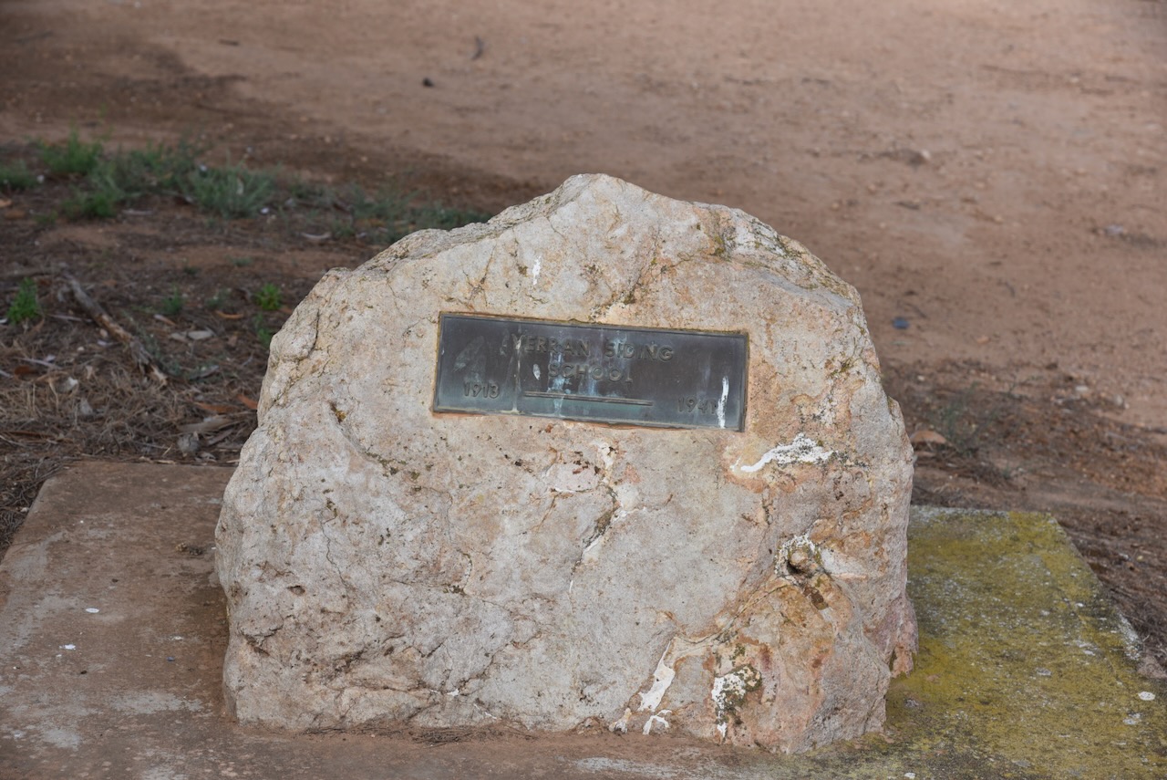
Verran has the Driver River Uniting Church and a monument to mark the site of the Verran SIding School which operated from 1913 to 1941. (Cleve 2020)
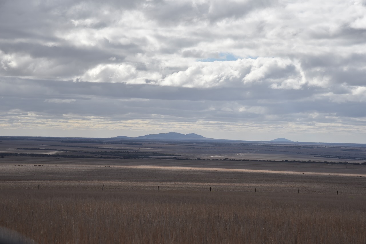
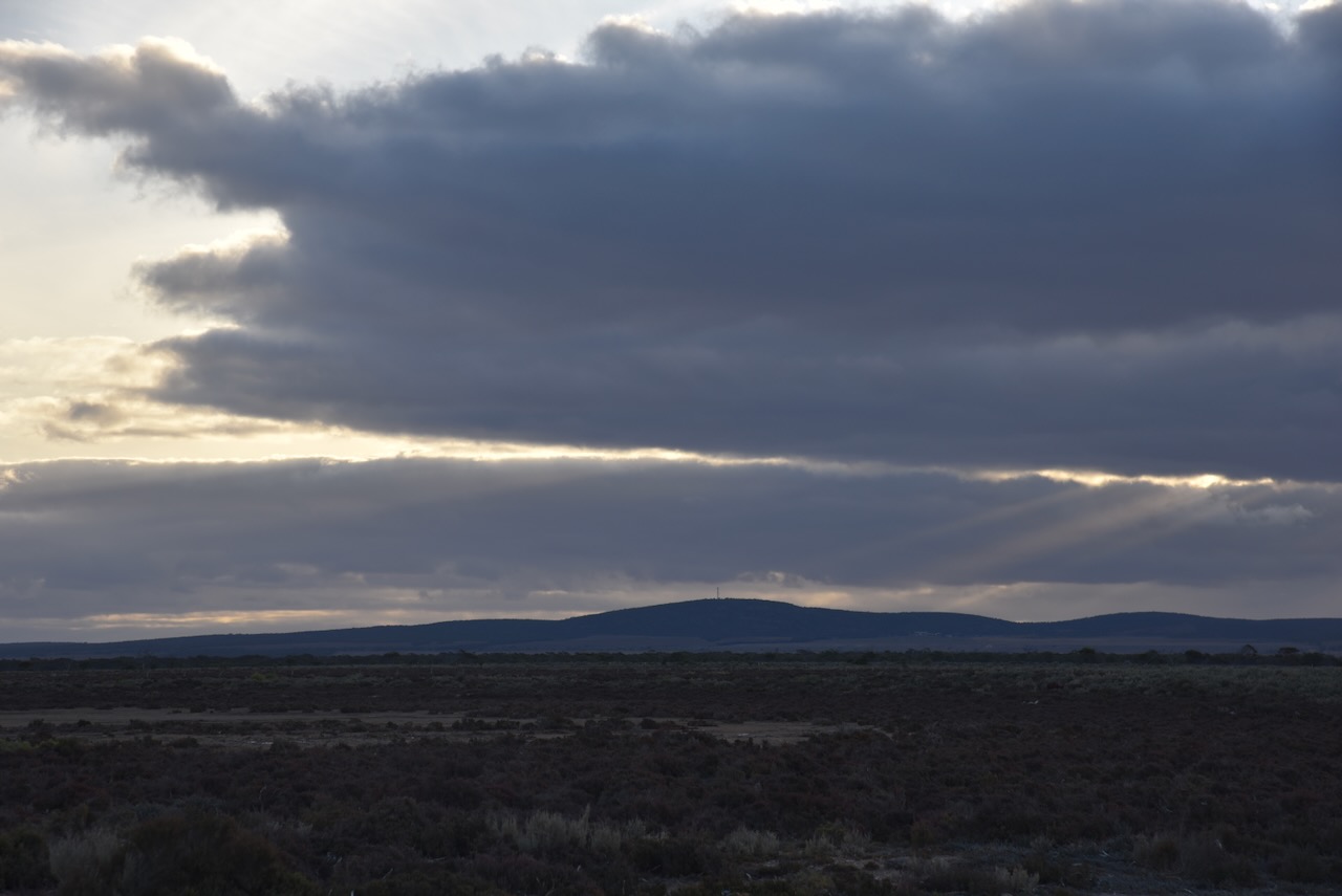
As I travelled to the park I could see some of the summits that qualify for Summits On The Air (SOTA) in the distance. Unfortunately, I did not have the time to activate them.
The park is about 294 acres in size and was 28th July 1983. The park was originally a water reserve. It takes its name from a water storage facility known as the “Verran Tank.” (Wikipedia 2024)
The park is on the northwestern side of Pahls Hill Road.
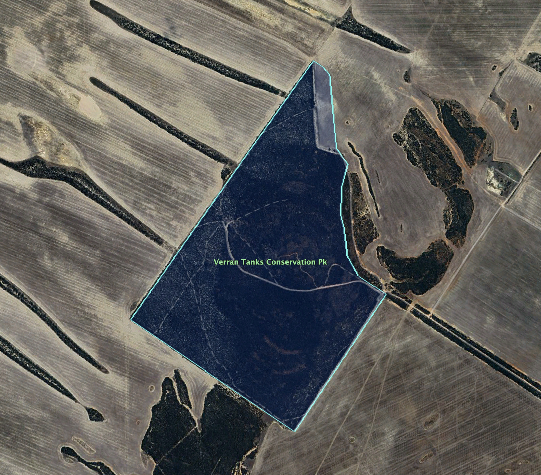
Above:- An aerial view of the Verran Tanks Conservation Park. Image c/o Google Earth.
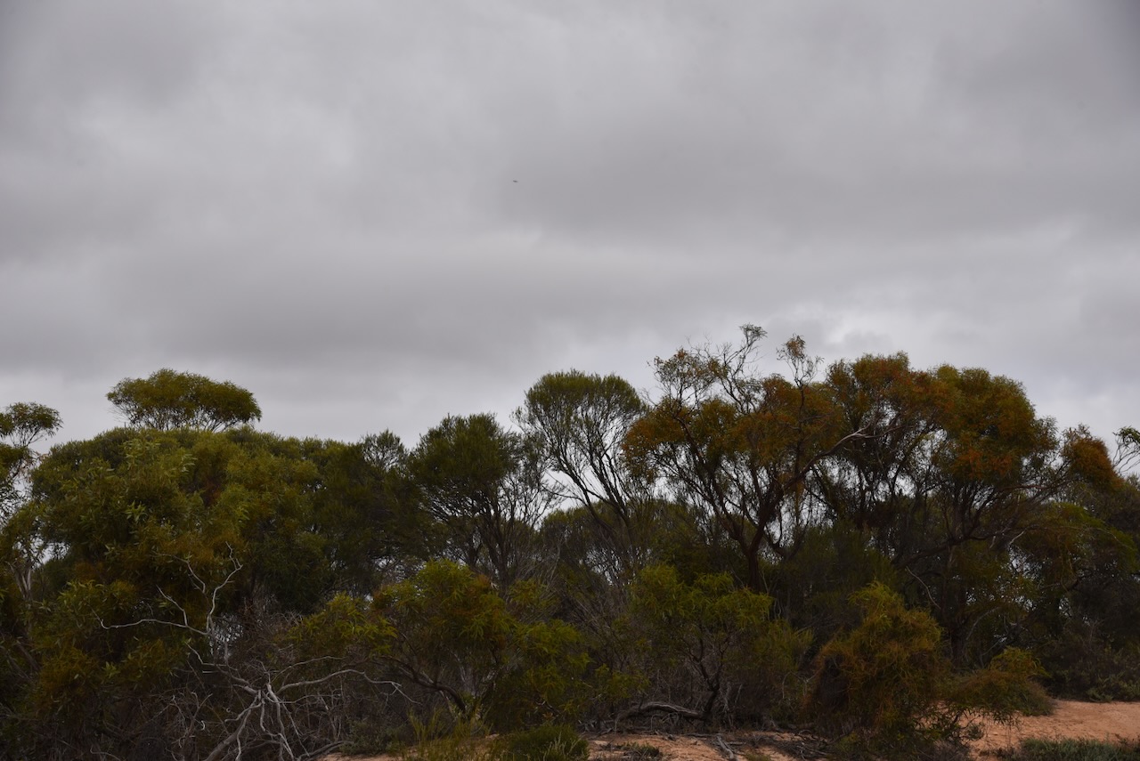
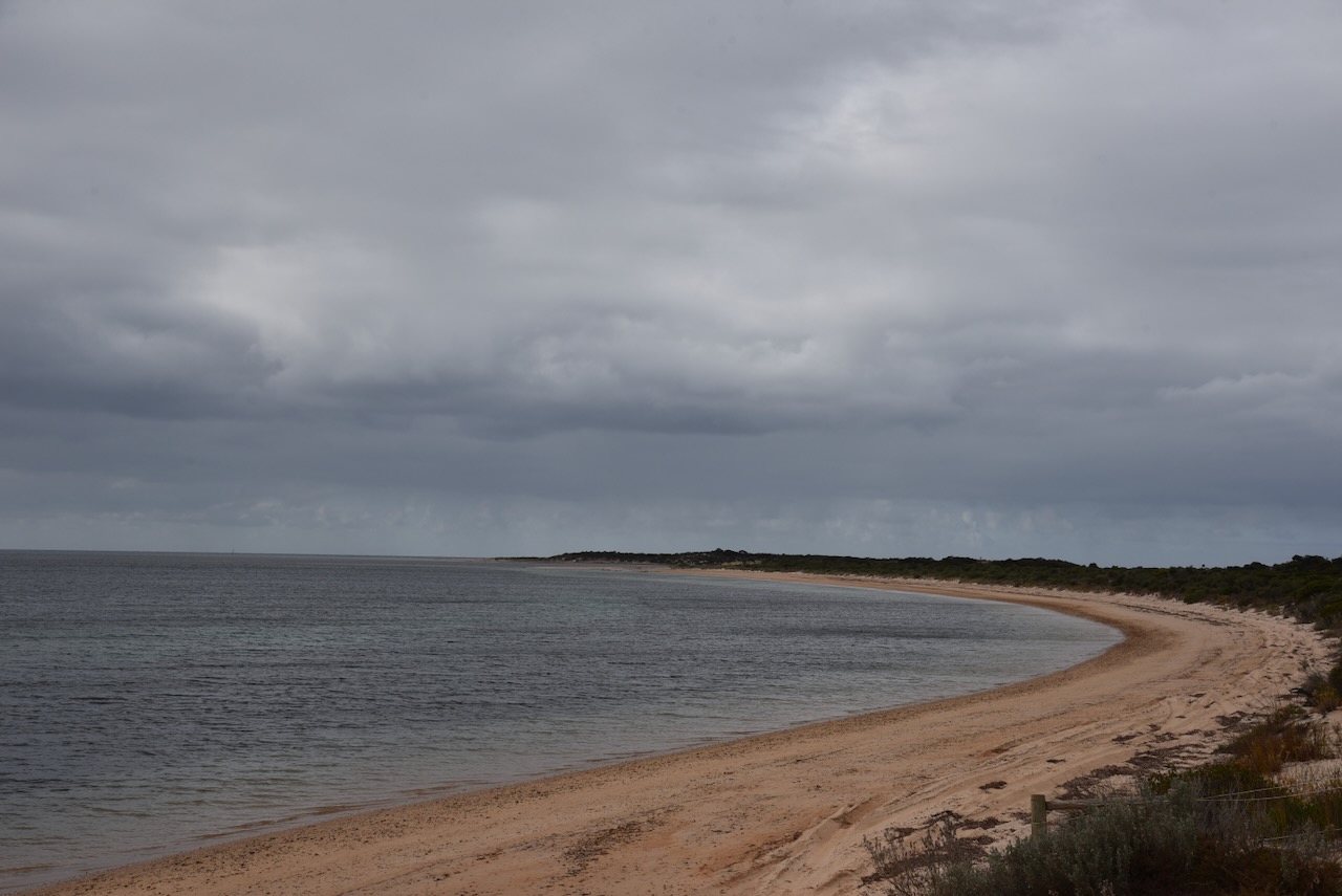
Verran Tanks Conservation Park consists of mallee scrub.
I ran the Yaesu FT857, 40 watts, and the 20/40/80 m linked dipole.
I worked the following stations on 20m SSB:-
VK7XX
ZL2GLG
VK2HDT
AX5QA
AX4DXA
AX4NH
VK4NH
VK4DXA
AX4EI
VK4PDX
I4RHP
IW2NXI
M7CBI
OH1MM
VK5MAZ
AX3PF/p (Traralgon South Flora & Fauna Reserve VKFF-2464)
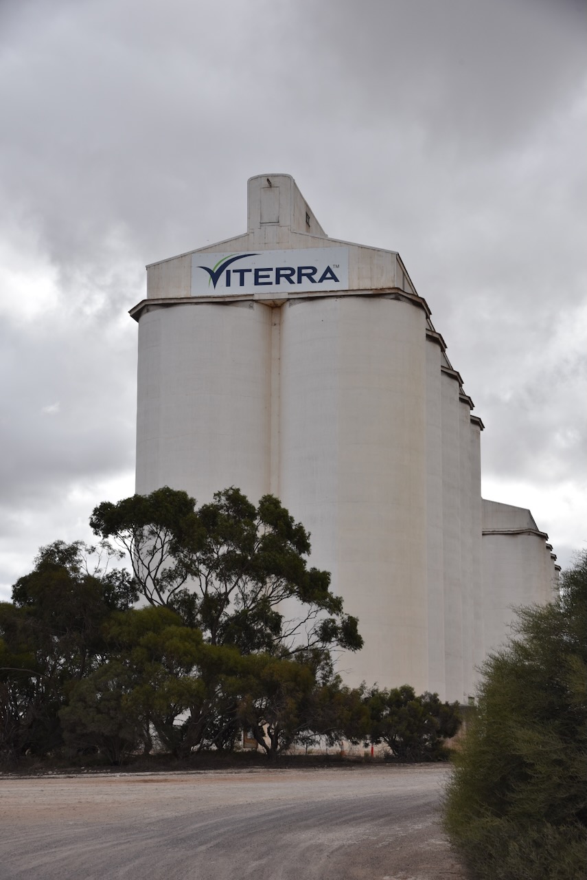
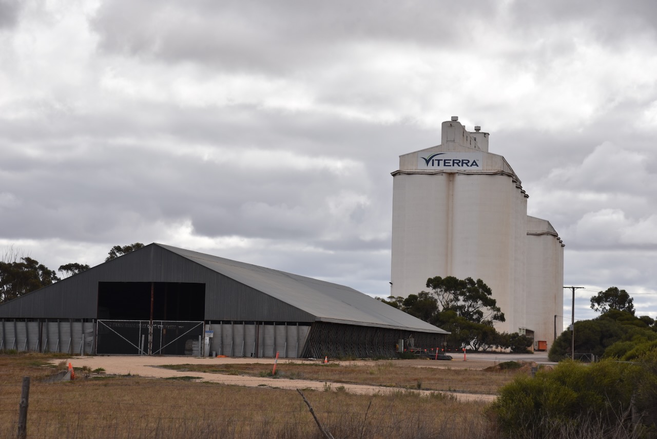
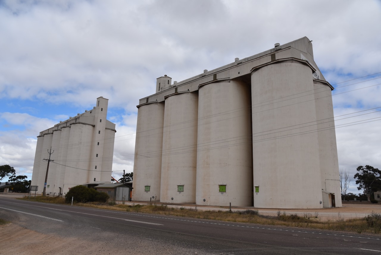
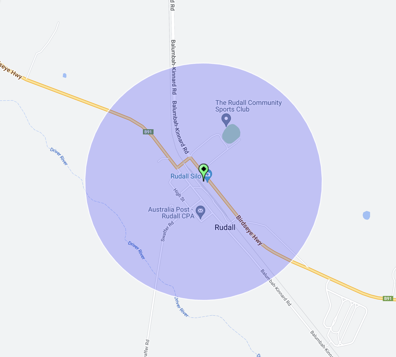
After packing up at the Rudall Conservation Park (25th April 2024), I headed into the little town of Rudall to activate the Rudall silo VK-RDA5.
Above:- Map showing the location of Rudall. Map c/o Google Maps.
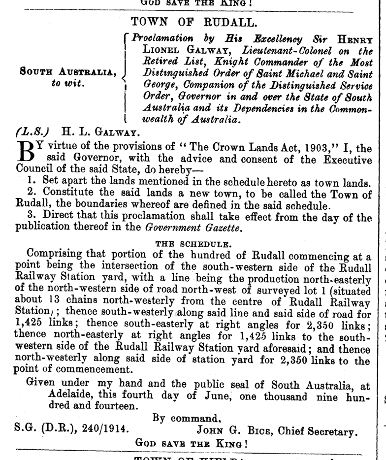
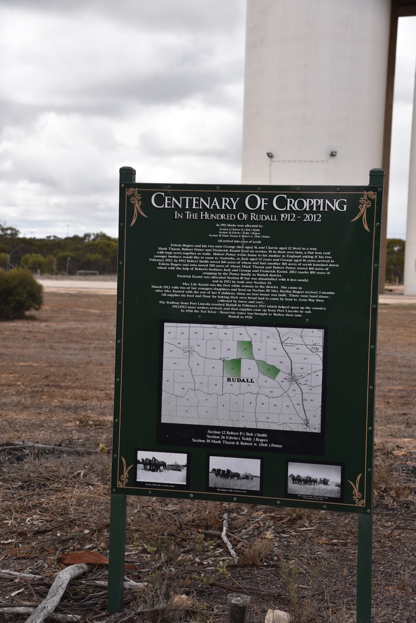
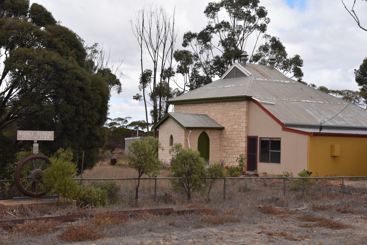
The Hundred of Rudall, County of Jervois, was proclaimed on the 3rd day of February 1910. The town of Rudall was proclaimed on the 4th day of June 1914. The Hundred of Rudall School opened in 1917 and closed in 1949. In 1921 the Rudall Centre School opened and closed in 1946. (Place Names 2012)
Above:- Proclamation of the town of Rudall in the SA Govt Gazette, 4 Jun 1914.
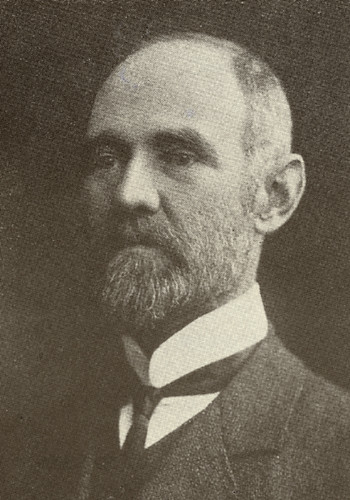
The town is named in honour of Samuel Bruce Rudall, a lawyer and politician. Samuel was the elder surviving son of John Rudall, the first town clerk of Gawler, and the first solicitor to practise there. (Wikipedia 2024)
Above:- Samuel Bruce Rudall. Image c/o gawlerhistory.com
Today Rudall is a tiny little town with a population of about 70 people (Wikipedia 2024)
The Rudall silo is located on the southwestern side of Birdseye Highway.
I set up on the side of Birdseye Highway and ran the Icom IC-7000, 100 watts, and the Codan 9350 antenna with the 1.5-metre stainless steel whip.
Above:- The activation zone at the Rudall silo. Image c/o SiOTA website.
I worked the following stations on 40m SSB:-
VK5MAZ
AX5MAZ
AX3UCD
VK3BEL
I worked the following stations on 20m SSB:-
VK7XX
AX3TKK/p (Wyberjong Streamside Reserve VKFF-3924)
VK3PWG
AX3UCD
VK2IO
VK4NH
VK4DXA
AX4NH
AX4DXA
VK1AO
VK2MET
AX1AO
AX2MET
VK7HBR
AX3JBL/p (SOTA VK3/ VC-037)
VK3APT
VK4SMA
VK3OAK
VK7PAL
VK3DCQ
AX3PF/p (Traralgon South Flora & Fauna Reserve VKFF-2464)
Wikipedia Contributors (2024). Rudall, South Australia. [online] Wikipedia. Available at: https://en.wikipedia.org/wiki/Rudall [Accessed 15 Aug. 2024].
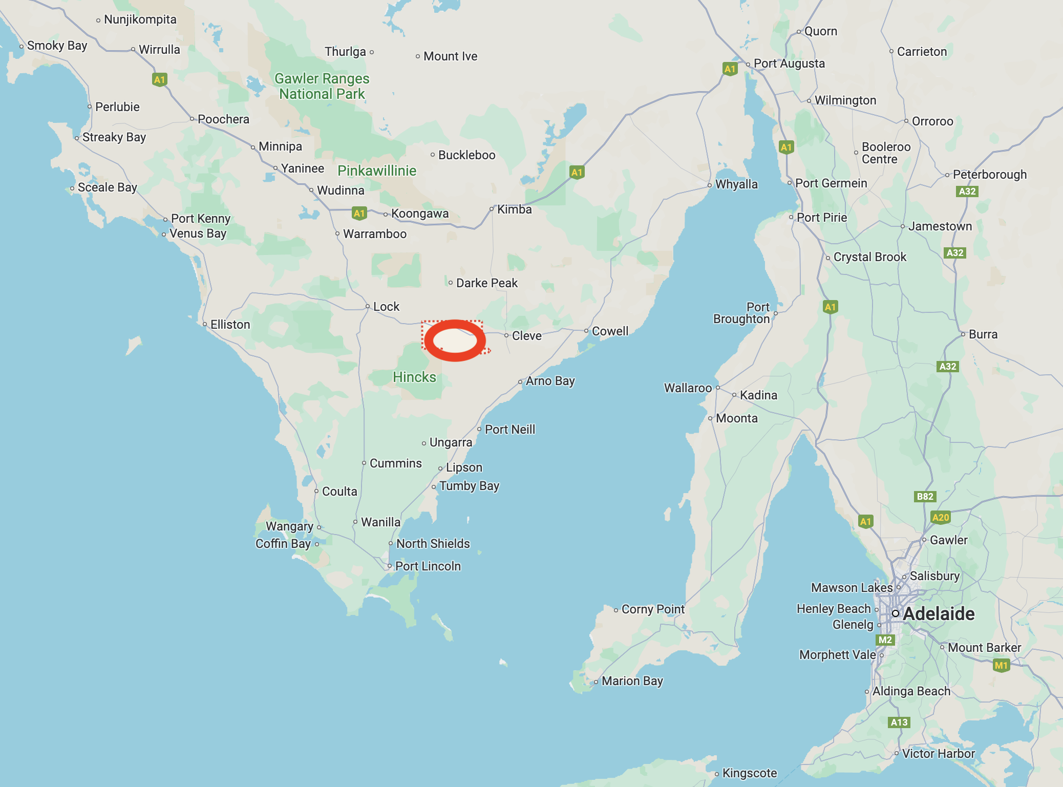
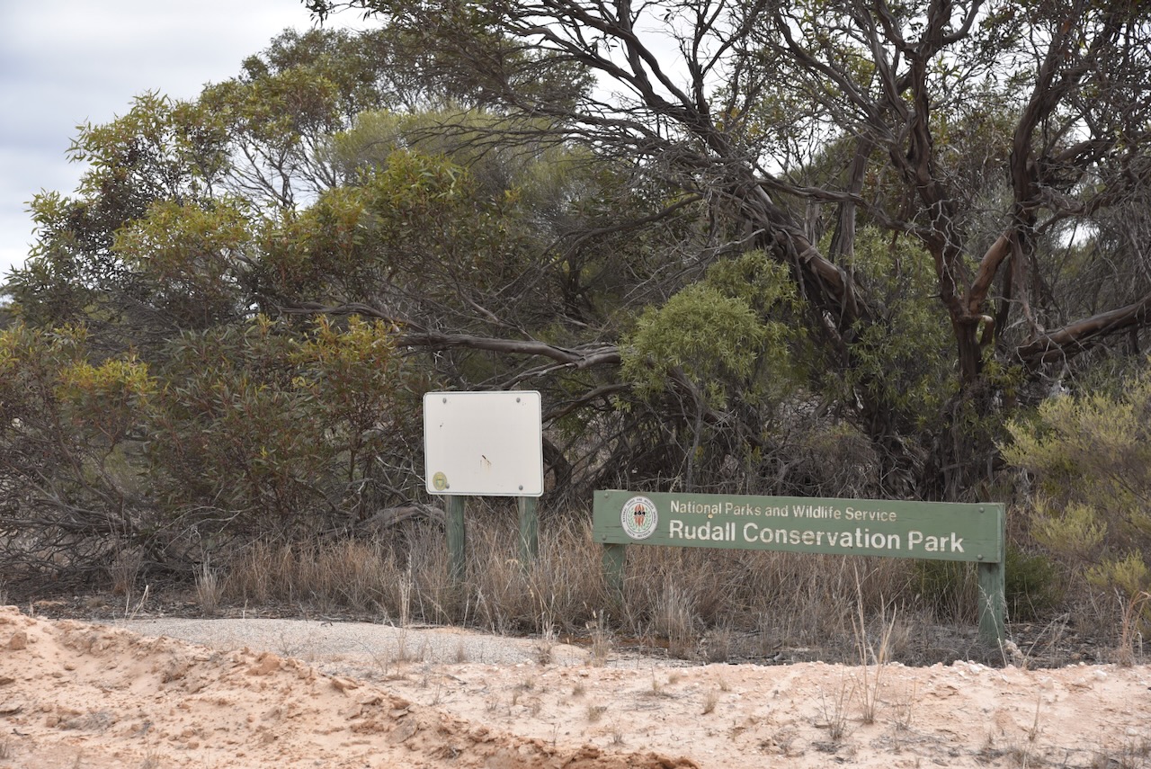
My next activation for ANZAC Day 25th April 2024, was the Rudall Conservation Park VKFF-1091. The park is located on the Eyre Peninsula, about 23 km (by road) northwest of Cleve.
Above:- Map showing the location of the Rudall Conservation Park. Map c/o Google Maps.
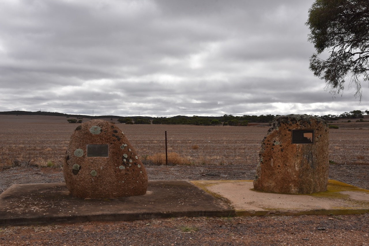
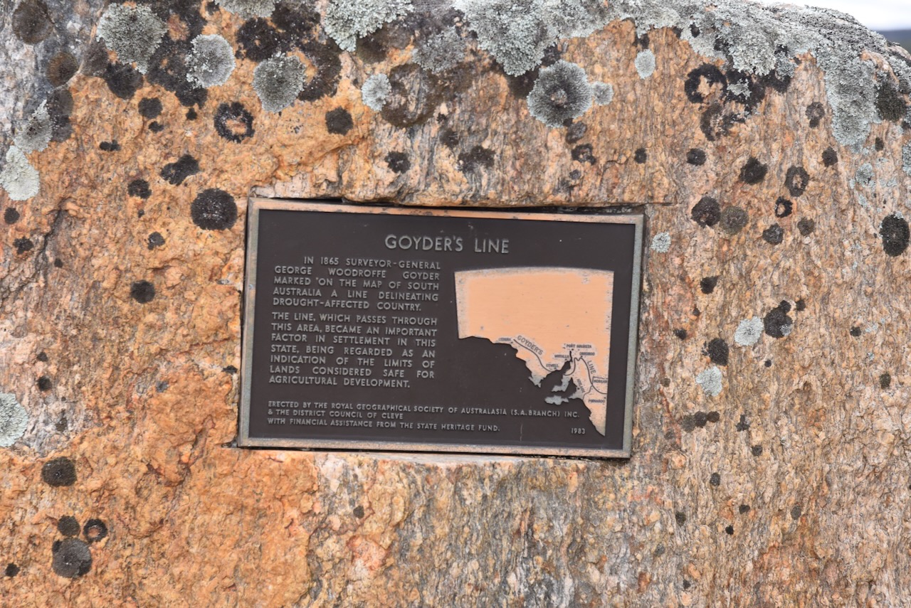
On the way to the park, I stopped at the Goyders Line Monument and the Wheat Crop monument.
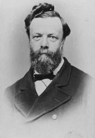
In 1865 Surveyor General George Woodroofe Goyder, marked on a map of South Australia, a line delineating drought-affected country. The line which passes through this area became an important factor in settlement in the state of South Australia. The line was regarded as an indication of the limits of lands considered safe for agricultural development.
Above:- George Goyder. Image c/o Wikipedia.
The wheat crop monument commemorates the first wheat crop grown on Section 65 Hundred Yadnarie by E. Bradley in 1879.
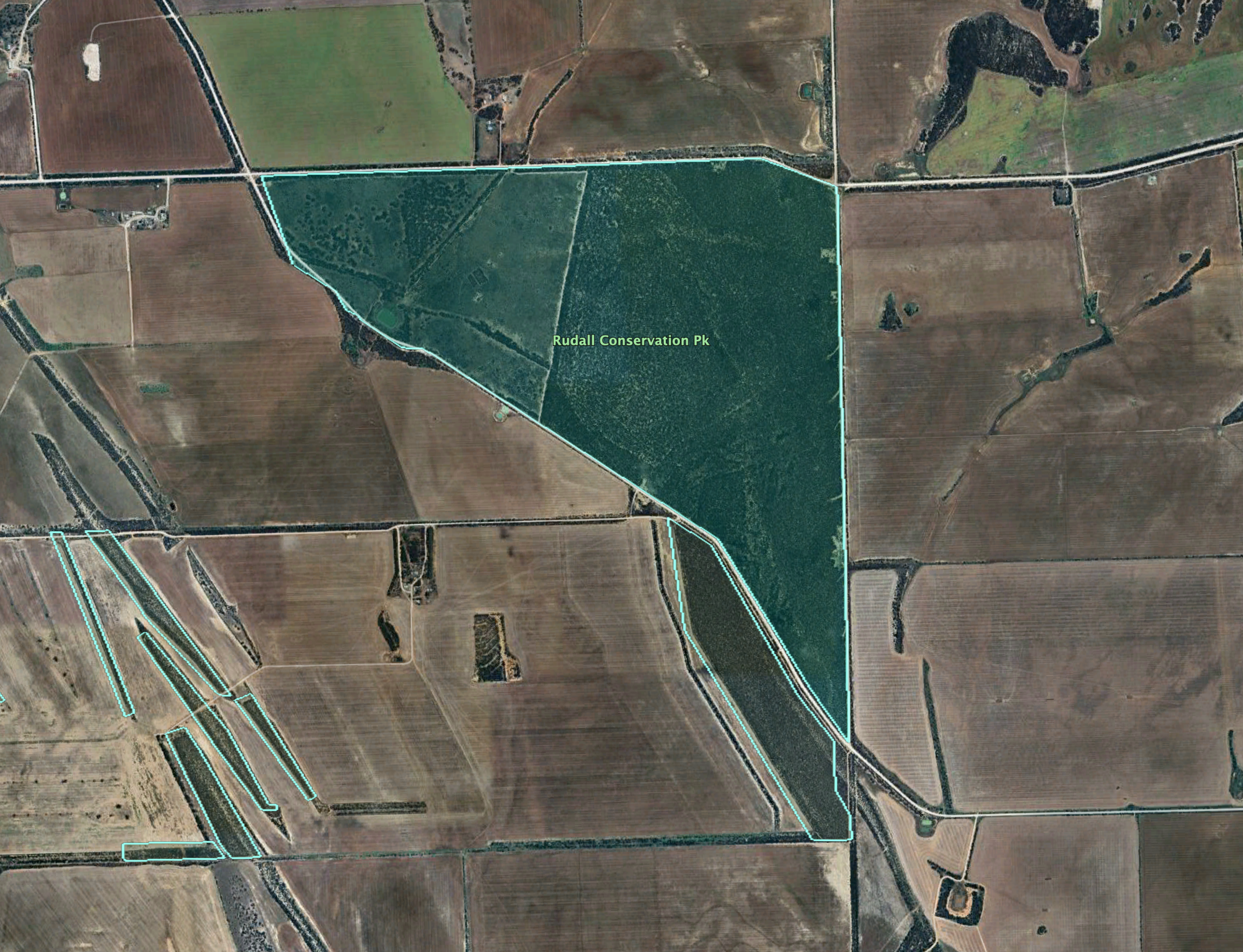
The park is located at the southeastern corner of the intersection of Old Darke Peake Roaad and Syvertsen Road.
Above:- An aerial view of the park showing its boundaries. Image c/o Google Earth.
The park is about 882 acres in size and was proclaimed on the 16th day of August 1973.
Above:- An aerial view of the park looking east. Image c/o Google Maps.
I ran the Yaesu FT857, 40 watts, and the 20/40/80m linked dipole for this activation.
I was getting towards the end of my trip and it was now ANZAC Day, the 25th day of April 2024.ANZAC stands for Australian and New Zealand Army Corps. It is one of Australia’s most important national occasions. It is Australia’s national Day of Remembrance.
After breakfast, I headed out towards Cleve. I had planned on activating several parks and silos during the day.
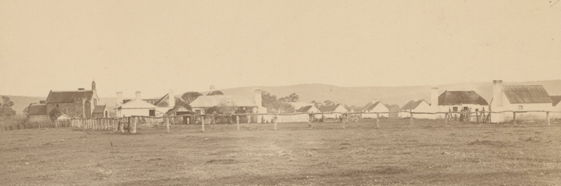
My first stop was the site of the old Mindrow Creek School on Birdeye Highway. The school opened in 1913 and closed in 1938.
During its life, the school had a total of 13 teachers.
Above:- The Mindorw Creek school, c. 1916. Image c/o State Library SA.
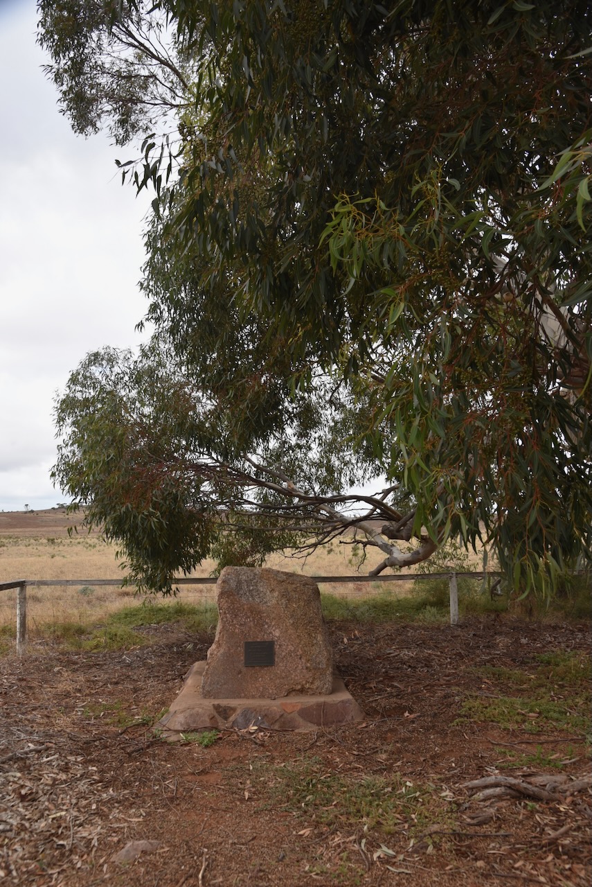
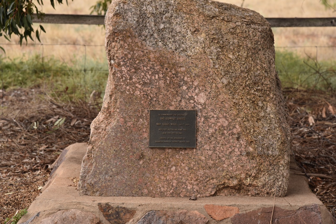
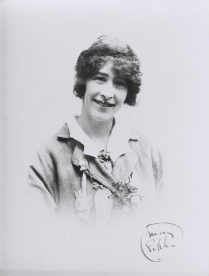
I continued on to the May Gibbs monument.
Cecilia May Gibbs MBE (b. 1877. d. 1969) was an Australian children’s author, illustrator, and cartoonist. She is best known for her Gumnut babies and the book Snugglepot and Cuddlepie. Her first Australian home was near the site in 1881. (Wikipedia 2024)
Above:- May Gibbs. IMage c/o Wikipedia.
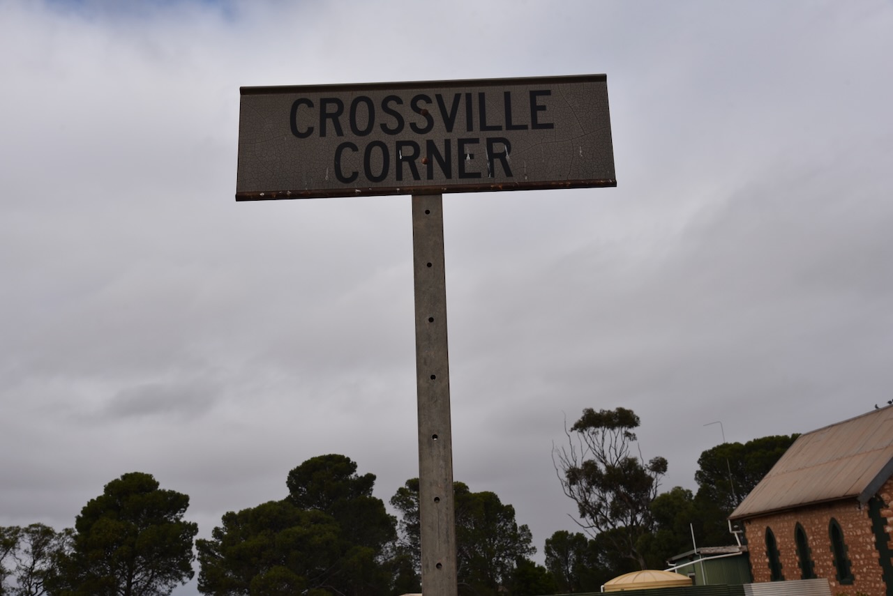
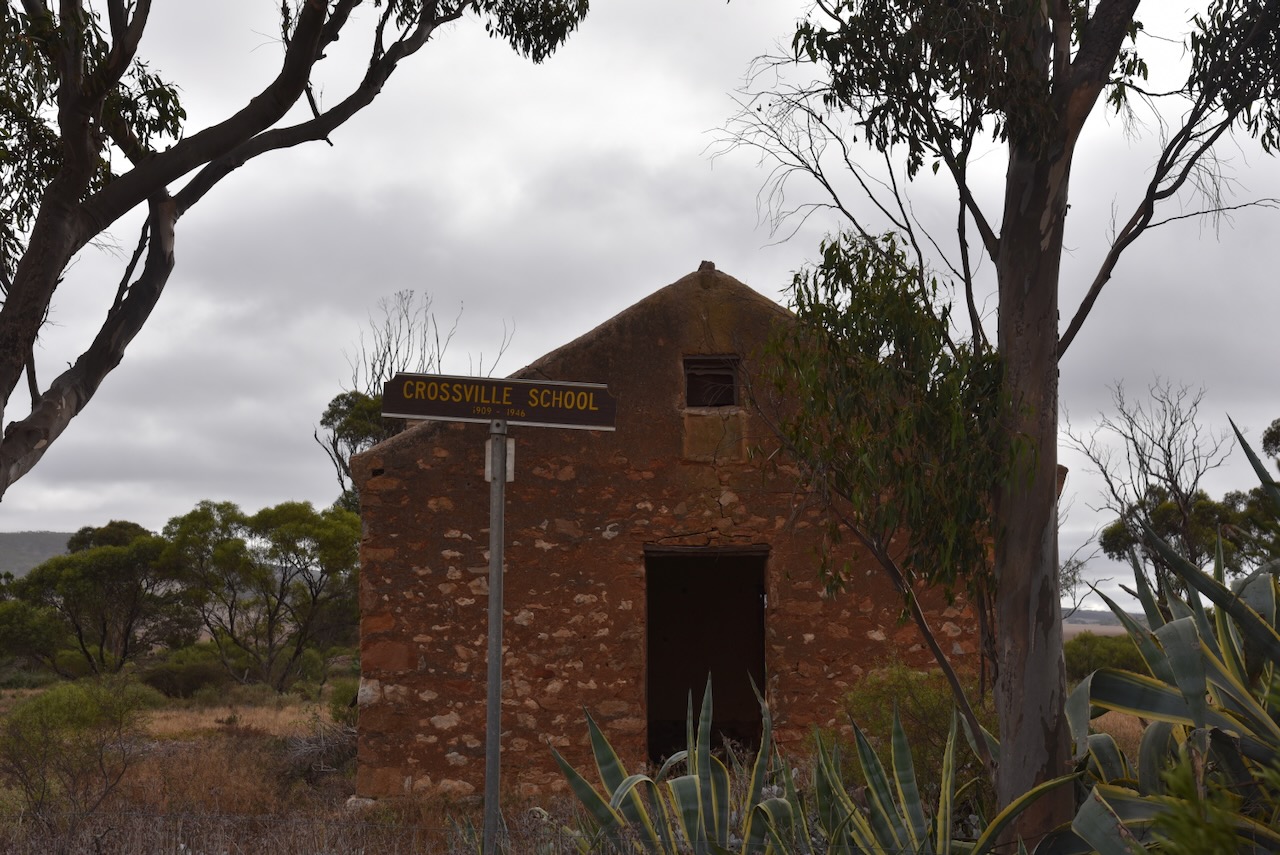
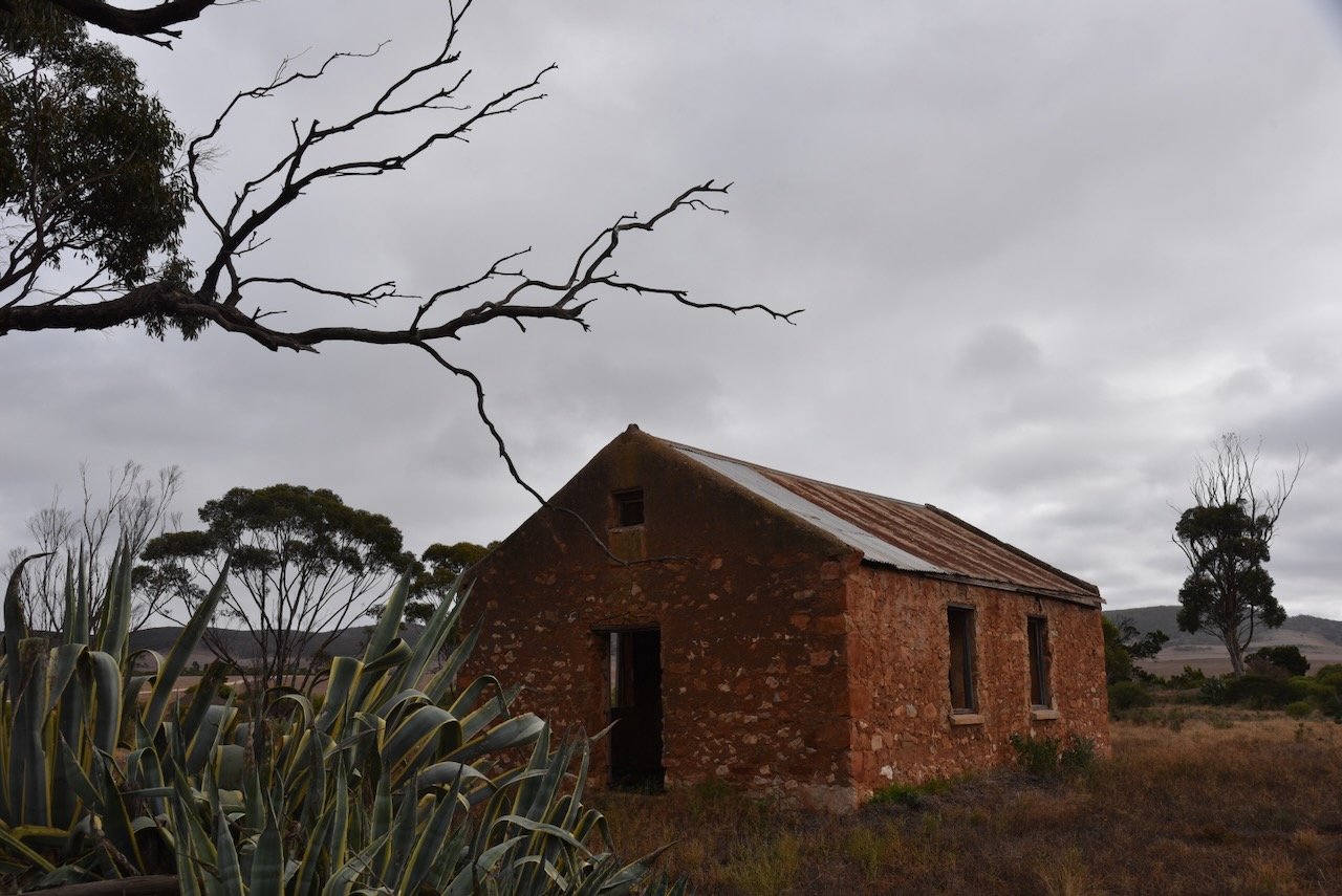
My next brief stop was at Crossville Corner. about 11 km east of Cleve. A school was opened here in 1909 and closed in 1947. It was named after a local homestead. The former St Pauls Lutheran church was built in 1927 and closed in 1960. (Flickr 2024) (Place Names 2012)
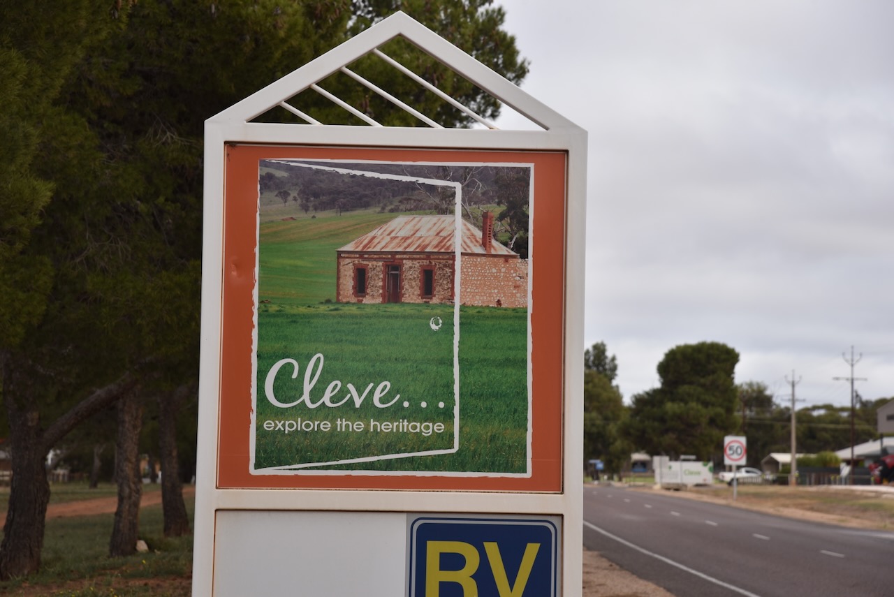
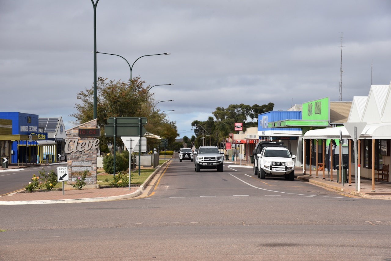
I continued on to the town of Cleve. European occupation of the Cleve district commenced in about 1855 with Dr James McKechnie (b. 1810. d. 1869) and his two brothers Donald and Peter, holding pastoral lease no. 401. In 1877 much of the land in the district had been resumed by the government.
The town of Cleve was proclaimed on the 6th day of March 1879. It was named by Governor William Jervois after a property in Devonshire, England, held by the Snow family who were related to the Governor.
Above:- Governor WIlliam Jervois. Image c/o Wikipedia.
Today Cleve is located in sheep and wheat growing country and services the surrounding farmers. I stopped off at a local cafe to get a bite to eat and a coffee.
Below is a short video on Cleve and its surroundings.
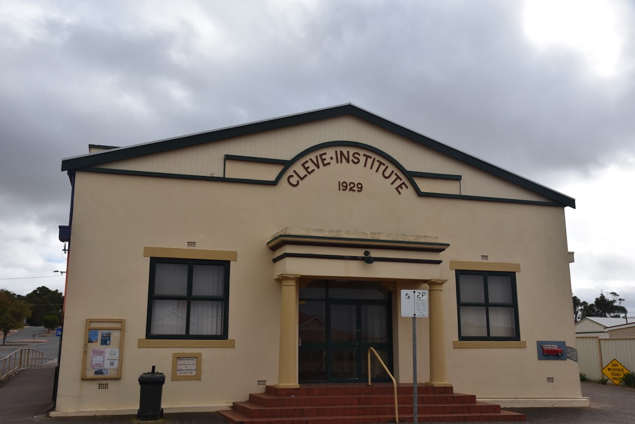
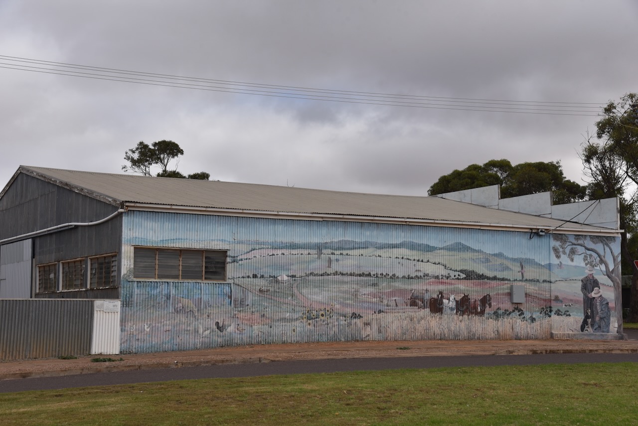
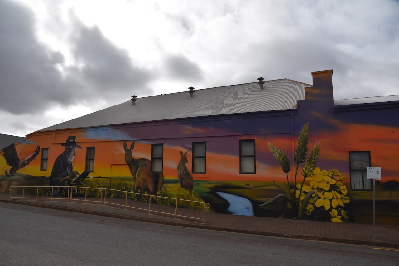
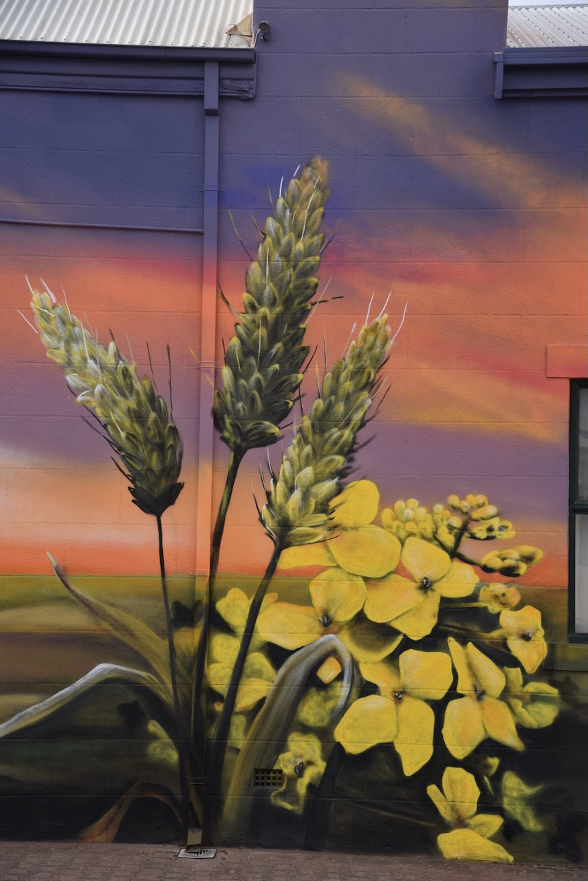
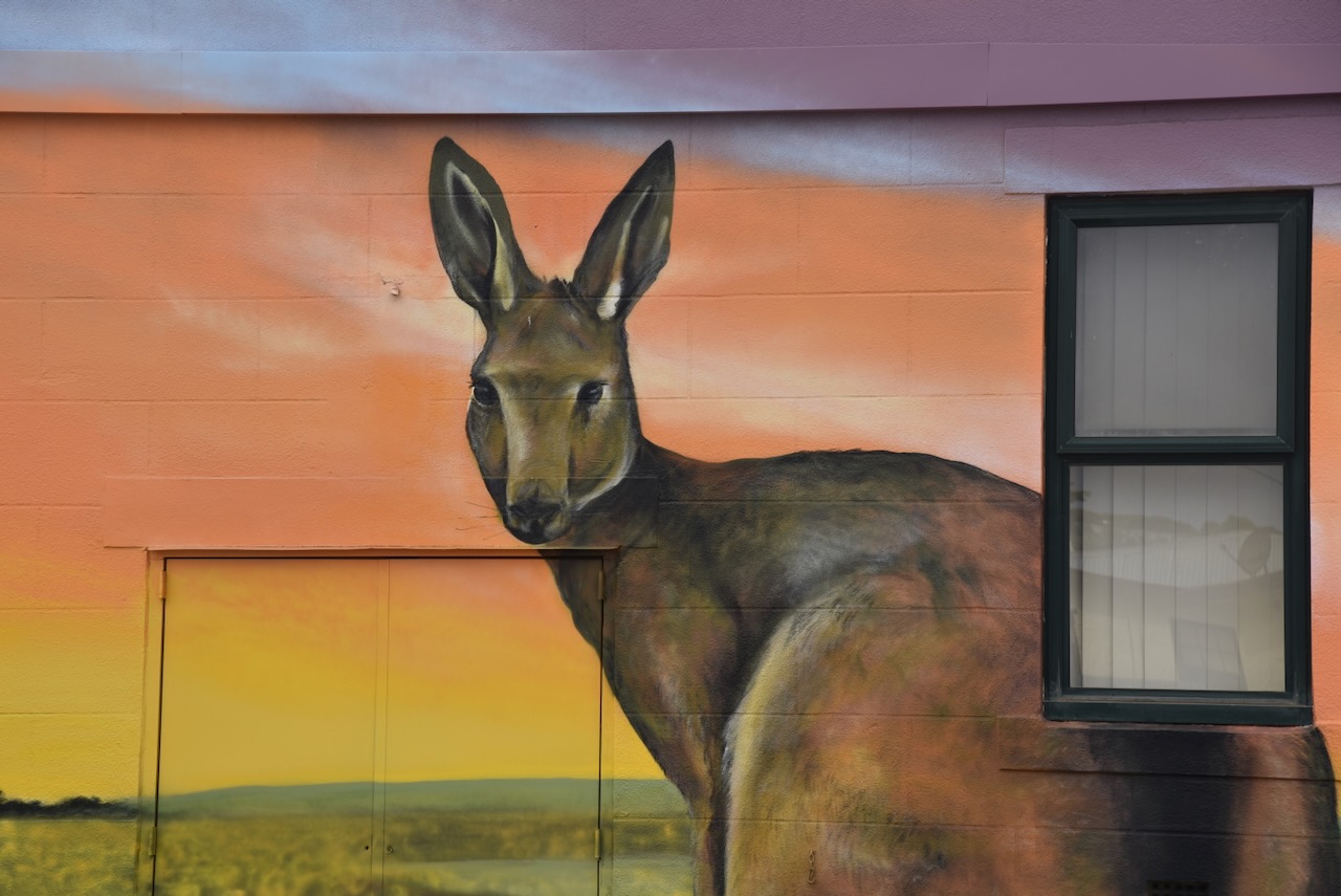
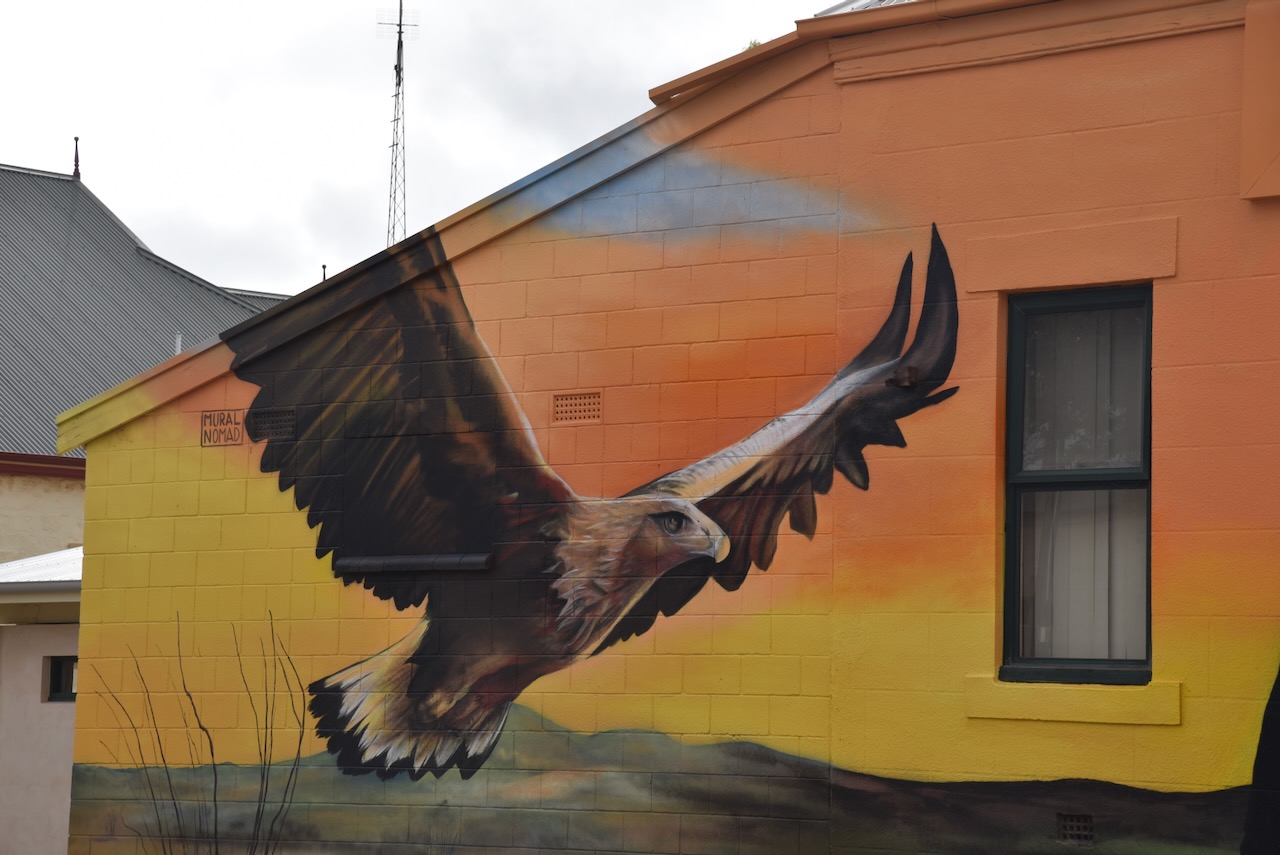
An interesting attraction in Cleve is the brilliant mural painted on the side of the Cleve Institute building. It is the work of artist Patrycja Hannagan, @ Mural Nomad. The mural was part of Hannigan’s mission to paint 100 murals around Australia, with $100.00 from each commission committed to the Black Dog Institute. (5cc 2024)
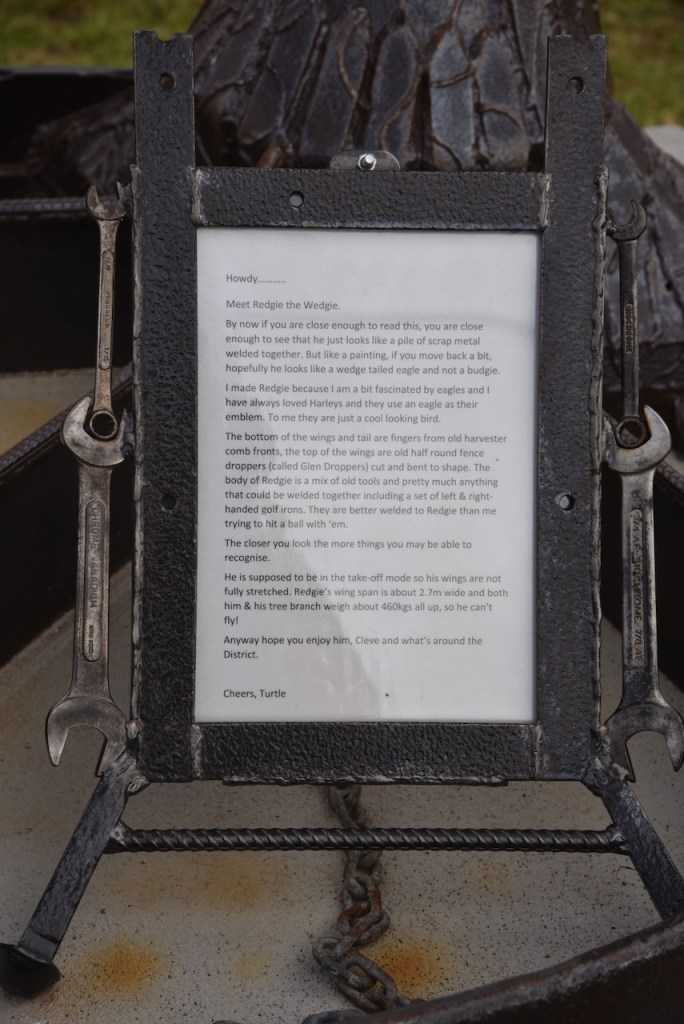
Another interesting attraction is Redgie the Wedgie, a sculpture of a Wedge Tailed Eagle. It is the work of Peter Crosby.
And there is Bonnie the Clydesdale.
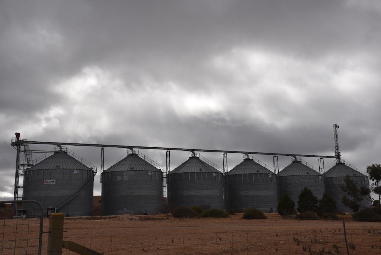
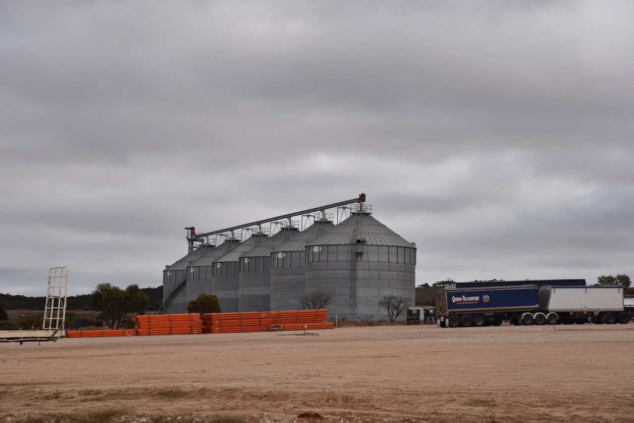
The Cleve silo is located on the northern side of Birdseye Highway on the western side of Cleve.
I parked on the side of Birdseye Highway and operated from the 4WD. I ran the Icom IC-7000, 100 watts, and the Codan 9350 antenna with the 1.5-metre stainless steel whip. As this was ANZA Day, I was permitted to use the special AX prefix.
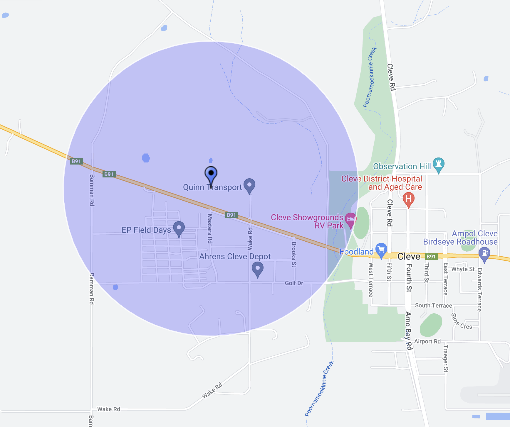
Above:- Map showing the activation zone at the Cleve silo. Image c/o SiOTA website.
I worked the following stations on 40m SSB:-
AX5AAF/p (Pike River Conservation Park VKFF-0831)
AX5HS/p (Chowilla Regional Reserve VKFF-1698)
VK5LA
VK5KAW
VK3PF
VK5AYL
VK5MAZ
AX5MAZ
AX5QA
AX3CLD
AX5AV
VK5KVA
AX3SPG
I worked the following stations on 20m SSB:-
VK7XX
VK1AO
VK2MET
AX1AO
AX2MET
VK3PF
VK3DCQ
VK5MAZ
VK4NH
VK4DXA
VK2IO
AX5QA
AX3CLD
AX3SPG
AX7MAD
AX3IFR/am
VK3MCK
VK3APT
AX3VIN
VK2ZRD
VK2VW
VK2HFI
AX4MWL
VK5LRB
ZL1XS
AX3UCD
AX1AD
References.
Flickr. (2024). Crossville Corner South Australia. The former St Pauls Lutheran Church built 1927. Closed 1960 Now a private residence. [online] Available at: https://www.flickr.com/photos/82134796@N03/31899908188 [Accessed 15 Aug. 2024].
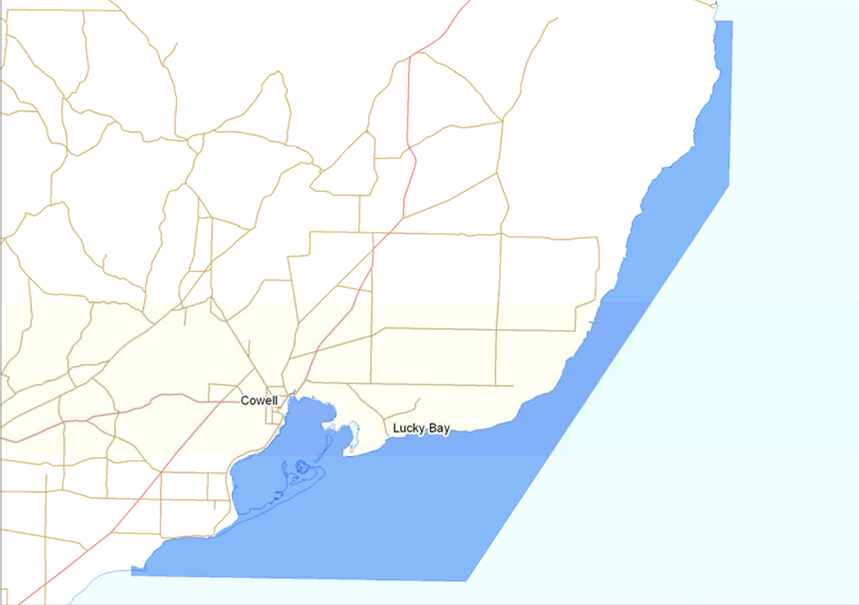
After leaving Arno Bay I headed to Cowell where I booked into my accomodation, a cabin at the Cowell Foreshore Caravan Park. I then headed next door for a meal at the Cowell Hotel.
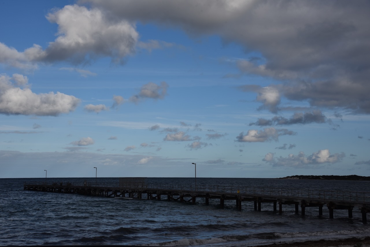
After dinner I decided to head out to activate a park rather than spend the evening in the cabin watching television. I drove out to the Franklin Harbour Marine Park VKFF-1709.
The Franklin Harbor Marine Park covers 636 km2 and is located on the central western side of Spencer Gulf, between Gibbon Point and Munyaroo Conservation Park. The park supports a variety of marine and coastal species, including several commercial fish species such as King George whiting, southern sea garfish, mullet, blue crabs and western king prawns. (Man. Plan 2012)
Above:- Map showing the location of the Franklin Harbour Marine Park. Image c/o DEWNR.
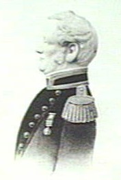
Franklin Harbor is named in honour of Sir John Franklin, Governor of Tasmania (1837-1843). He was previously a midshipman on the Investigator. (Place Names 2012)
Above:- Sir John Franklin. Image c/o Wikipedia.
It was almost dark by the time I had reached the park. I drove along Beach Road and took a 4WD running off the eastern side of the road. I ran the Yaesu FT857, 40 watts, and the 20/40/80m linked dipole for this activation.
I worked the following stations on 20m SSB:-
VK4EMP
VK4TI
VK5MAZ
VK2VW
VK2HFI
VK2AKA
VK2BUG
VK1AO
VK2MET
VK5LA
VK5KAW
IK1GPG
VK4NH
VK4DXA
VK3CWF
OH1MM
VK2IO
VK3PF
VK3KAI
VK3APJ
DL1EBR
IW2BNA
VK2USH/p
IK4IDF
VK6NU
ZL3MR
VK4KK/m
OH1XF
UT5PI
VK4SYD
OH5EP
SQ9FMC
PD4US
VK1ARQ
ON3YB
VK6XL
VK2HBO
DK4RM
OM5TX
VK3EJ
ZL1TM
DL1ASF
JF7RJM
VK4SMA
I worked the following stations on 20m FT8:-
JA1NLX
JF7RJM
VK3PF
CT1GFK
VK5LA
VK5KAW
VK3CEO
VK3KAI
7M4HOA
EA3EDU
LU2BA
VK3APJ
JH6XOD
LW2DLY
N9IBM
I worked the following stations on 40m SSB:-
VK5MAZ
VK2IO
VK1AO
VK2MET
VK3CEO
VK4SMA
VK2FALL
VK5WU
VK8CWR
VK3SO
VK3SFG
References.
Department of Environment Water and Natural Resources, 2012, Franklin Harbour Marine Park Managaement Plan.
My next planned stop was Arno Bay to activate the Arno Bay silo VK-ARY5 for the Silos On The Air (SiOTA) program. Arno Bay is about 535 km (by road) from Adelaide.
Above:- Map showing the location of Arno Bay. Map c/o Google Maps.
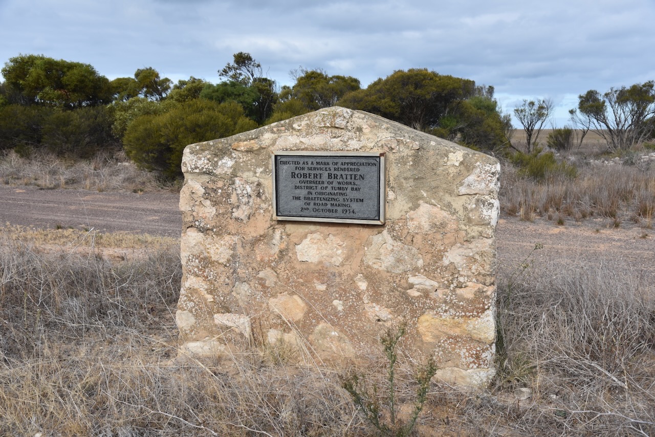
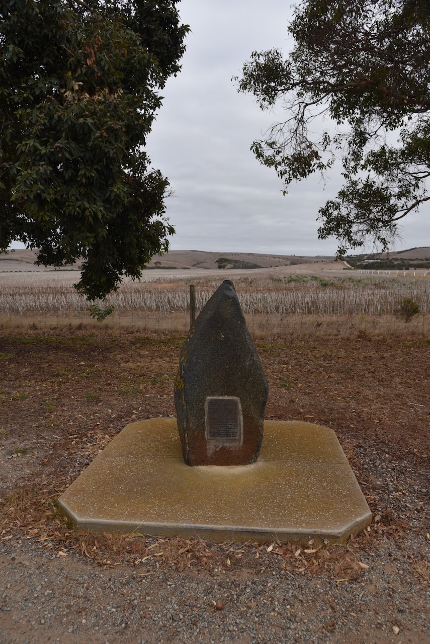
As I left Port Neill I stopped on the Lincoln Highway to view the Robert Bratten monument. It commemorates Robert Bratten, the Overseer of Workds for the District Council of Tumby Bay. (Monument Australia 2024)
Robert Bratten was born in January 1862 in Ireland. In 1882 at the age of 20, he emigrated to Australia. In 1906 he was appointed to the position of Overseer at a time when the council received many petitions for new roads to be opened. The first roads on the Eyre Peninsula were manually cleared through scrub. The roads were macadamised, a process where big stones were broken with a hammer until they were small enough to pass through a 2.5 inch ring. (Monument Australia 2024)
This initially sufficed until motor vehicles required a stronger surface for speed and weight. Large sheet limestone was a major problem so a special plough was designed to plough the stones to the surface. The larger stones were disposed of, while the smaller ones were crushed and used. The road was formed by a grader and the roller with a heavy roller. This method was called Brattenising. (Monument Australia 2024)
Above:- Robert Bratten. Image c/o ancestry.com.au
Prior to European occupation, the Arno Bay district was the home of the Banggarla aboriginal people. (Aussie Towns 2024)
The Arno Bay district was opened up by pastoralists in 1863. The area was named ‘Salt Creek Cove’. The town was initially proclaimed in 1882 by G.H. Ayliffe under the name ‘Bligh’, after Vice Admiral William Bligh who is best known for the mutiny on HMS Bounty. Locals resisted the name change and referred to the town as Arno Bay until its official name change. (Wikipedia 2024)
Above:- Rear Admiral Bligh. Image c/o Wikipedia.
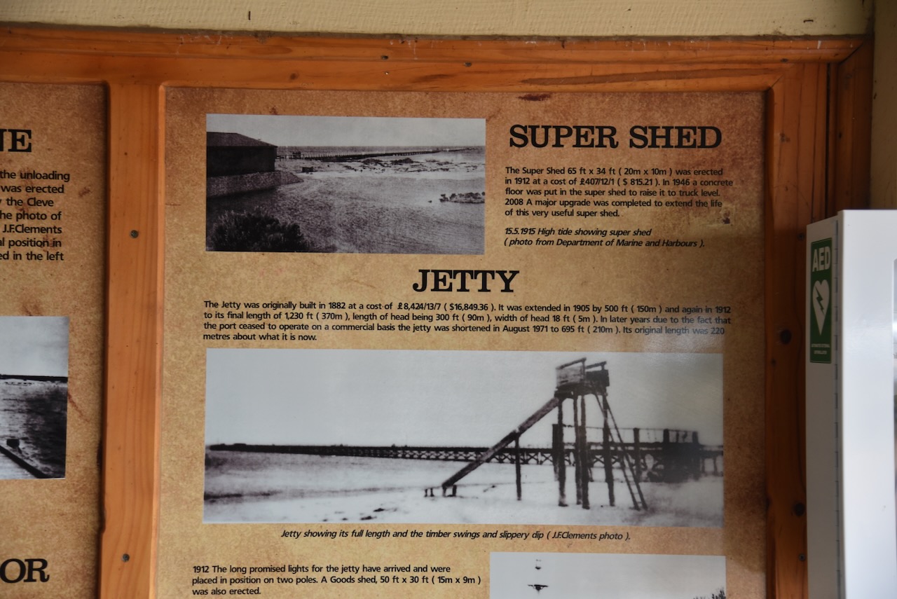
It was expected that the town would become a port, and as a result, a jetty was constructed in 1880. Although not large, the port of Arno Bay imported fertilisers and exported cereal crops grown in the district. By 1911 the town had a school, post office, hotel and a hall. (Wikipedia 2024)
By 1940, the port was exporting 11,000 tonnes of grain. It was in that year that the decision was made to officially change the town’s name to Arno Bay. There are two theories on the origin of the name. Some claim the town was named after the Arno River in Italy. While others claim it took its name from Sandhill Well and that the aboriginal name for that place was ‘arno’. (Aussie Towns 2024) (Wikipedia 2024)
In 1963 the storage silos were constructed and this saw ocean shipping becoming redundant. It spelt the end of Arno Bay as a port. (Wikipedia 2024)
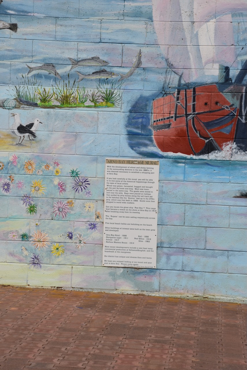
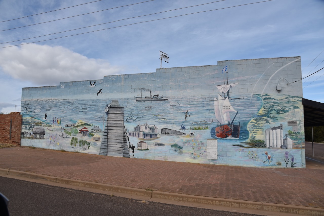
One of the must-sees in the town is the Arno Bay Heritage Mural, painted on the side of a building.
The Arno Bay Super Shed was built in 1912. It ceased being used for bagged grain/super in 1964. It now contains various tourist information and a large amount of history about Arno Bay and the district.
The Super Shed also features some artwork by artist Monique Van Eyk, and was completed in 1995.
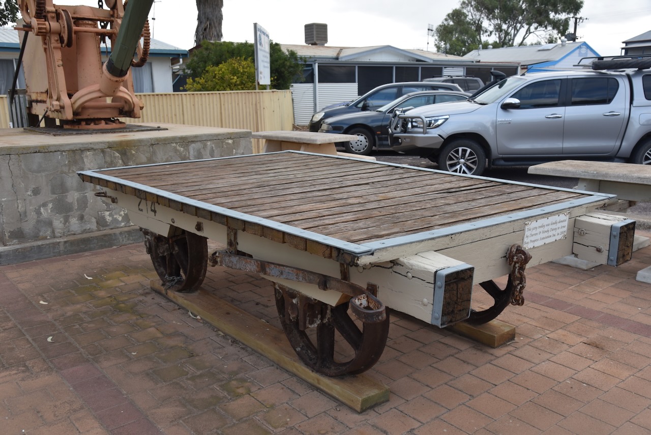
Alongside the Super Shed is a jetty trolley.
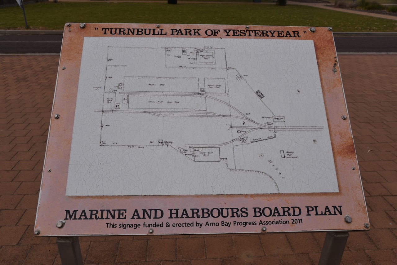
There is also an old crane and an information board for the Marine and Harbours Board.
The Arno Bay silo is located on the eastern side of Lincoln Highway, opposite Schmitt Road. It is an operational silo, operated by Viterra.
I parked on Schmitt Road and operated from the 4WD, running the Icom IC-7000, 100 watts, and the Codan 9350 antenna with the 1.5-metre stainless steel whip.
Above:- Map showing the activation zone of the Arno Bay silo. Map c/o SiOTA website.
Wikipedia Contributors (2024). Arno Bay, South Australia. [online] Wikipedia. Available at: https://en.wikipedia.org/wiki/Arno_Bay [Accessed 14 Aug. 2024].
I left Tumby Bay on Wednesday 24th April 2024 and continued north along the Lincoln Highway towards my next planned stop at Port Neill.
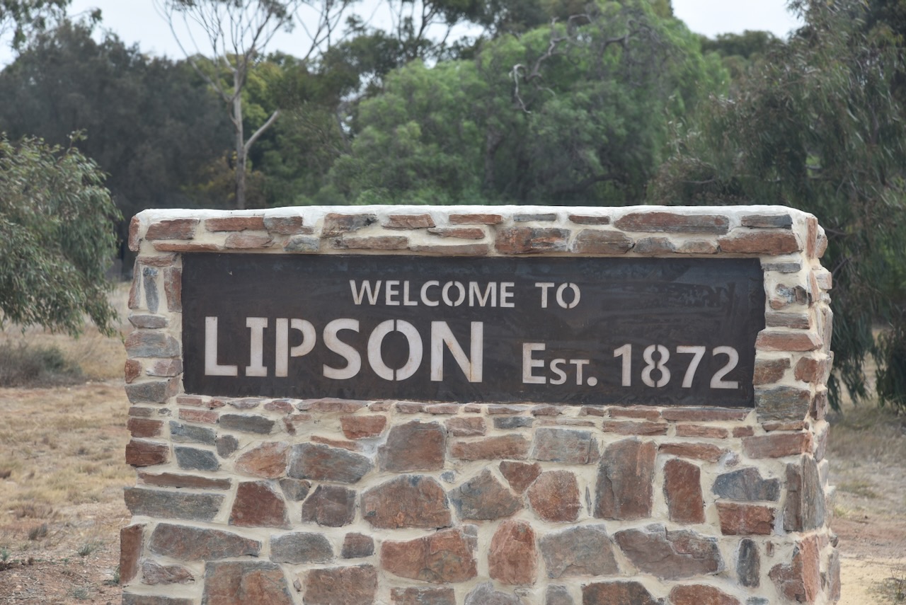
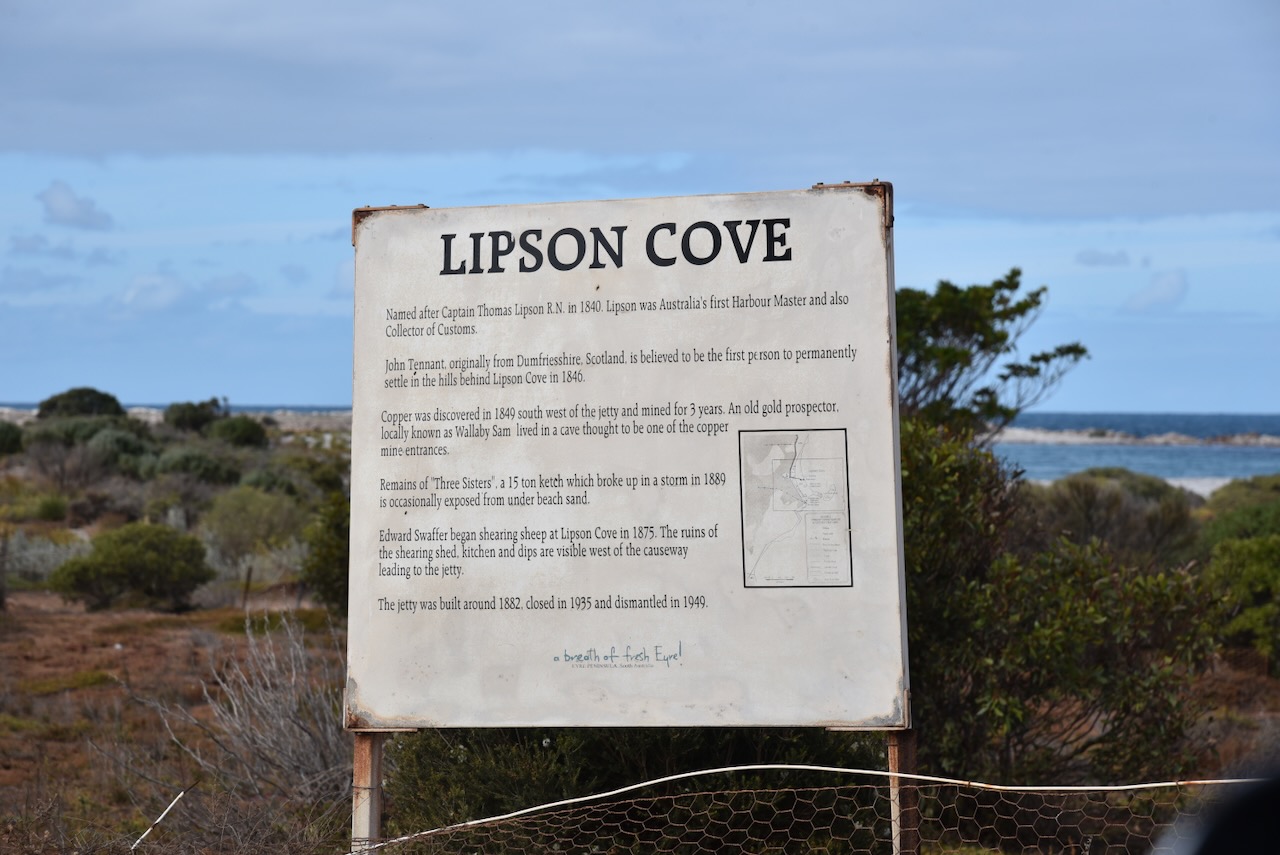
Along the way, I stopped at Lipson, about 11 km north of Tumby Bay.
Lipson was named in honour of Captain Thomas Lipson, an officer in the Royal Navy and the first Harbour Master in South Australia. Lipson was born in c. 1784 in Dartmouth, England. He entered the Royal Navy in 1794 at only 9-10 years old. In 1836 he emigrated to the colony of South Australia as a Naval Officer. Not long after his arrival, he was appointed Collector of Customs and Harbour Master at Port Adelaide. Over the following 20 years, Lipson made several coastal surveys. Upon his retirement in 1855, he was presented with a silver tea service by the residents of Port Adelaide. (Place Names 2012) (Wikipedia 2024)
Above:- Thomas Lipson. Image c/o Wikipedia.
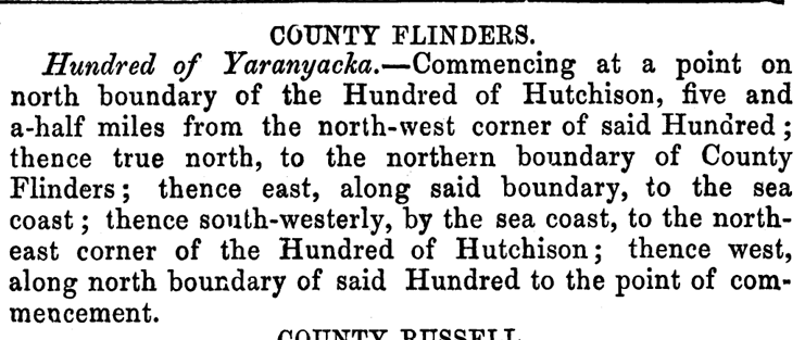
The Hundred of Yaranyacka, in which Lipson is contained, was proclaimed on the 20th day of June 1872. Yaranyacka is from the Narranga aboriginal word ‘yakkara’ (or jakara) meaning plain or level country.
Above:- Proclamation of the Hundred of Yaranyacka in the SA Govt Gazette, 20 Jun 1872.
A Post Office opened in November 1873 as ‘Yarandale’ on section 219 Hundred of Yaranyacka. It closed in 1909 becoming Lipson. In March 1875 the town of Lipson was surveyed by Thomas Evan. In 1881 a school was opened as ‘Yaranyacka’ and closed in 1950. (Place Names 2012)
Above:- Article from the Adelaide Observer, Sat 25 Jul 1885. Image c/o Trove.
Mines close to Lipson produced some of the finest talc in the world. Lipson was also the centre of the copper mining industry on the Eyre Peninsula. Many of the miners were of Cornish origin and had headed to the Eyre Peninsula following the closure of the Burra mines. Following the closure of the mines, the town of Lipson went into decline. (Port Lincoln Times 1973) (Wikipedia 2024)
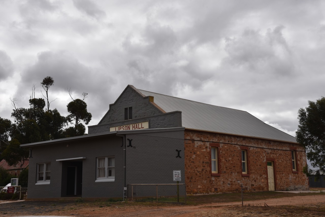
Several historic buildings remain in Lipson. They include the second Lipson Hall, built in 1910 and officially opened by the Premier the Hon John Verran MP on the 22nd day of February 1911.
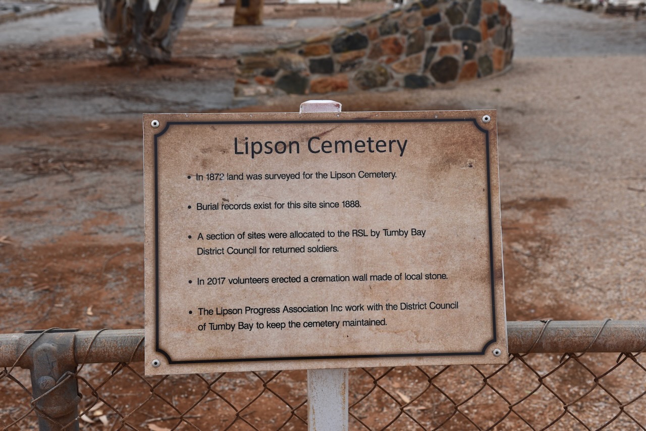
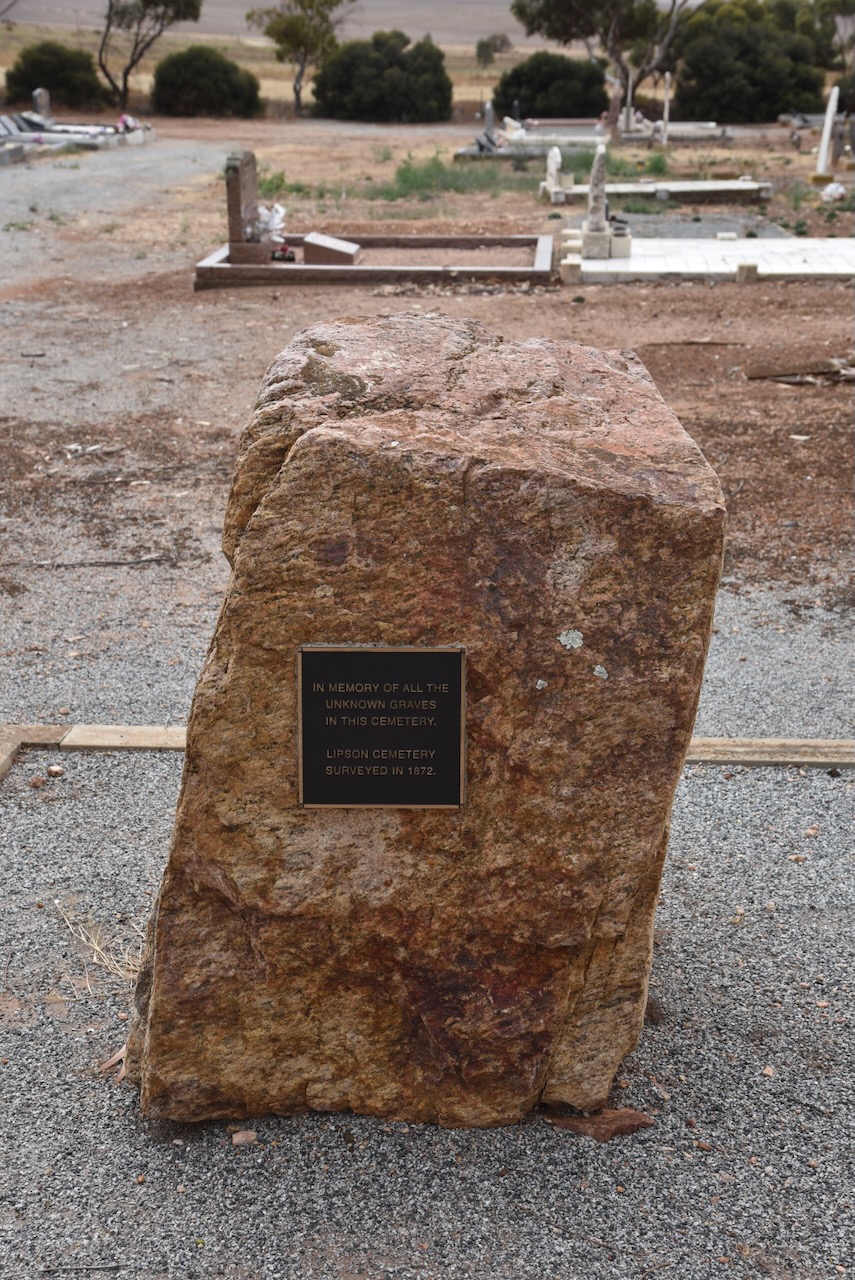
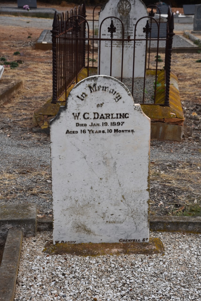
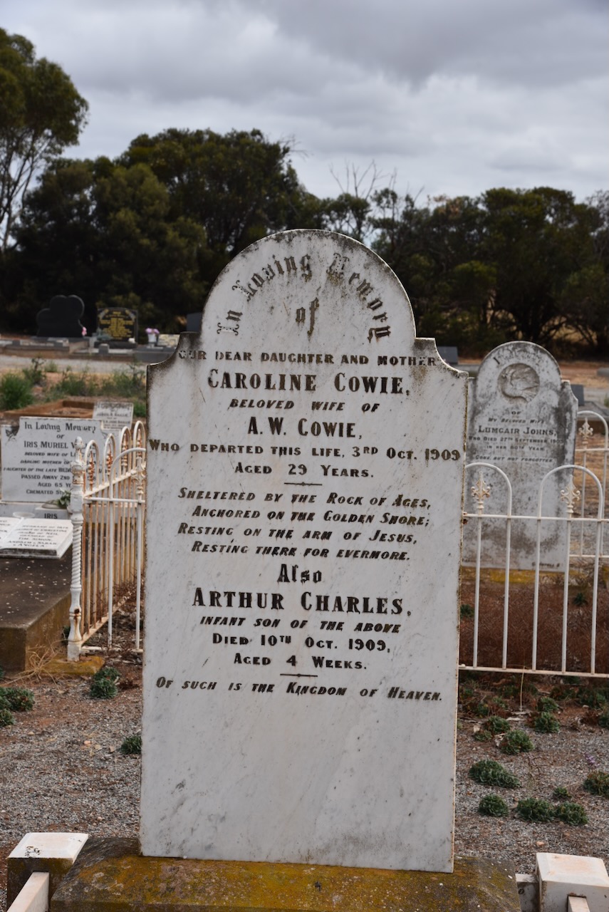
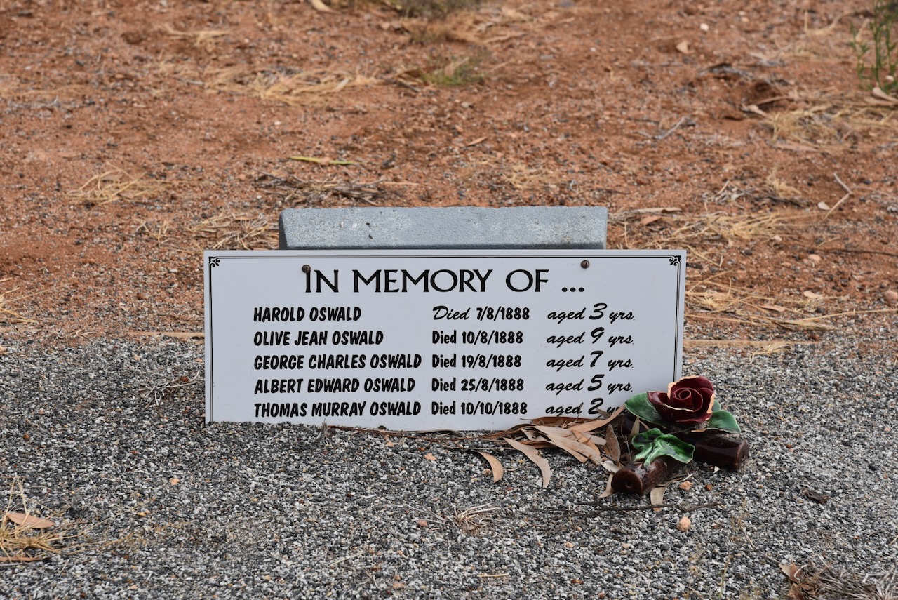
I then visited the historic Lipson cemetery that was established in the early 1870s. Until the 1900s, the nearest doctor was in Port Lincoln, and many families lost loved ones to diphtheria, whooping cough and women died during childbirth.
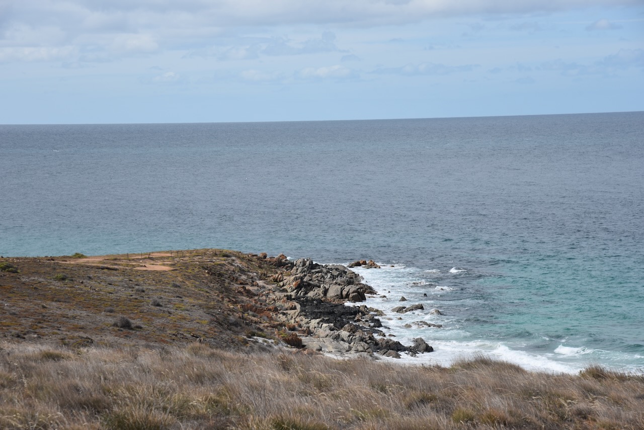
I then drove down to Lipson Cove. This is a beautiful tranquil sandy bay. It has been featured in the book ‘Best Australian Beaches’. Lipson Island lies about 150 metres out from the Lipson Cove beach. It can be accessed when the tide is low. The island is declared as the Lipson Island Conservation Park. It was proclaimed in 1967 as it is an important rookery for roosting sea birds including colonies of Black-faced Cormorant, Crested Tern and Little Penguin. The park is also home to Sooty oystercatchers and New Zealand Fur Seals. (Wikipedia 2024)
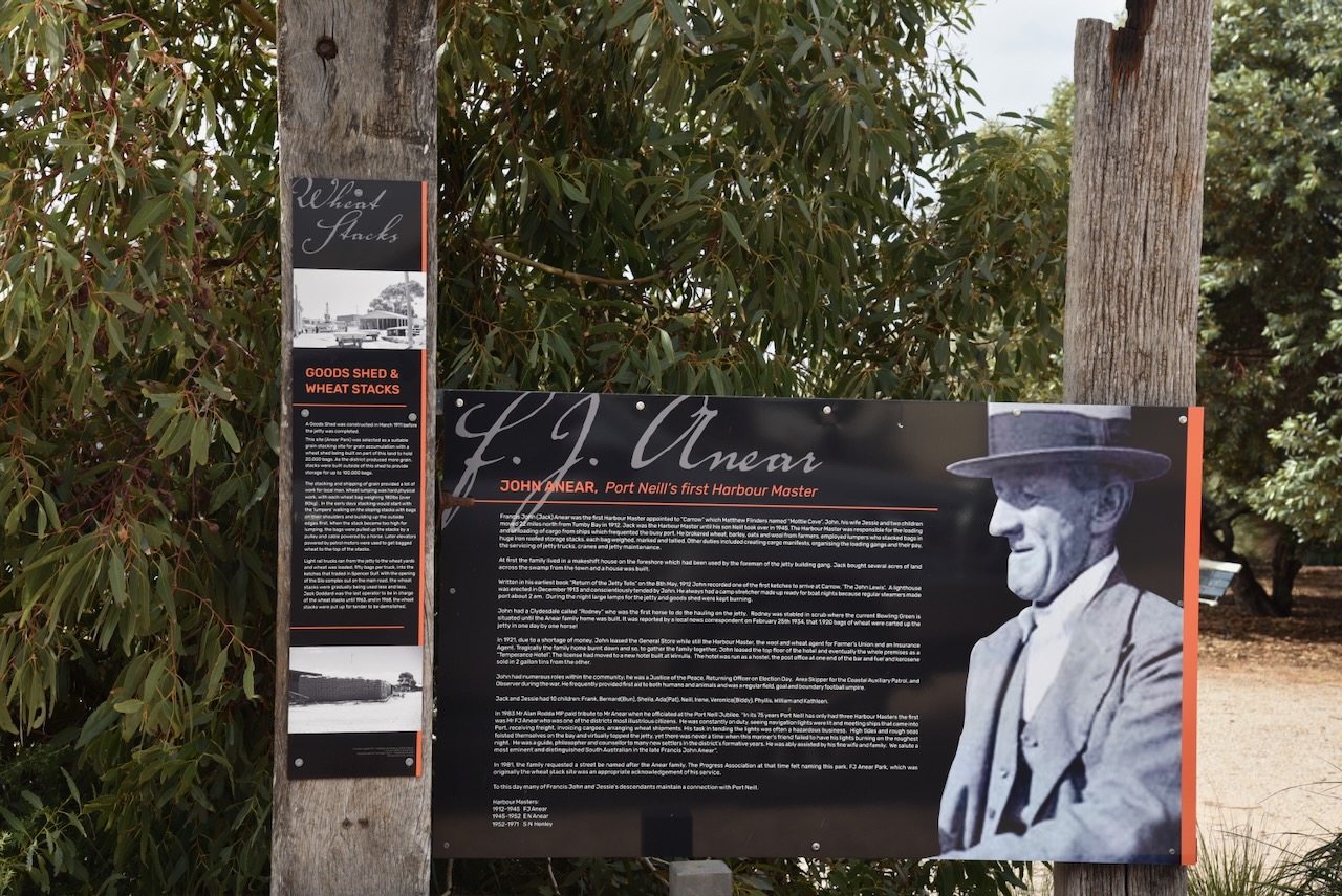
I left Lipson Cove and drove to Port Neill. The town is named in honour of Andrew Sinclair Neill, Warden of the Marine Board, South Australia. Neill was born in June 1837 in Kilmarnock, Ayreshire Scotland. Until 1888 he was manager of Elder Smith and Co. He was then appointed Railway Commissioner for South Australia. Neil then commenced his own accounting business. From 1897 he was the consul for Sweden. He was the Warden of the Marine Board of South Australia from 1895. He died in 1915 at his residence in North Adelaide. (ancestry.com.au) (flickr 2024)
Above:- Mr. A.S. Neill. Image c/o State Library SA.
Port Neill is a popular coastal holiday town and is renowned for its incredibly white sandy beaches. (Aussie Towns 2024)
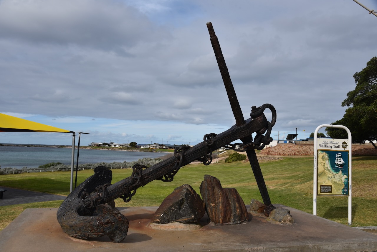
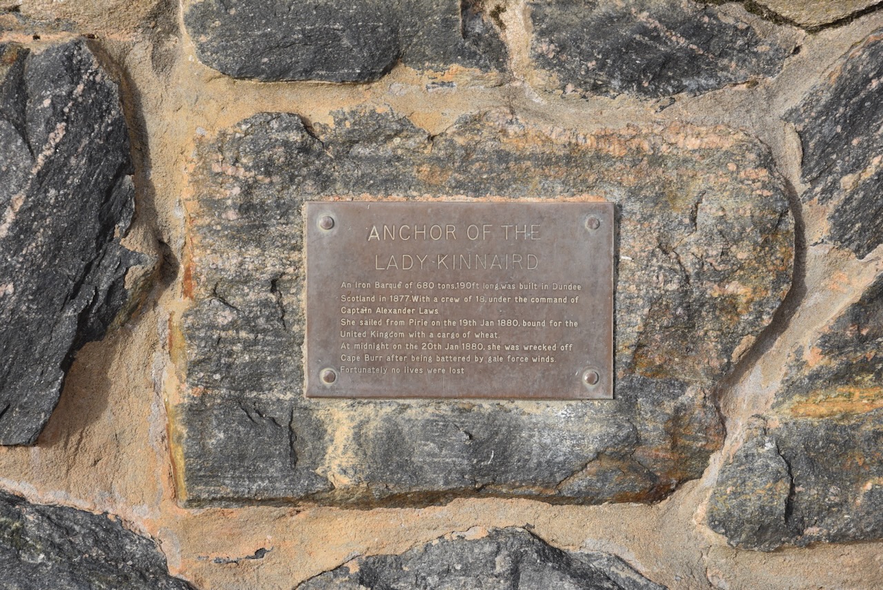
On the foreshore, you can find a monument for the Lady Kinnaird, a three-masted iron barque of 680 tones and 190 feet long. She was built in Dundee Scotland in 1877 by Brown & Simpson for W.B. Ritchie. She operated between the United Kingdom and the Australian colonies. (Wikipedia 2024)
Above:- The Lady Kinnaird.
With a crew of 18, under the command of Captain Alexander Laws, she sailed from Port Pirie on the 19th day of January 1880, bound for the United Kingdom with a cargo of about 8,400 bags of wheat. At midnight on the 20th day of January 1880, she was wrecked off Cape Burr, after being battered by gale-force winds. The Captain and crew abandoned the ship in lifeboats and made it to shore. Fortunately, no lives were lost. (Wikipedia 2024)
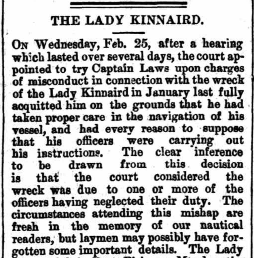
Captain Laws was charged with misconduct in connection with the wreck of the Lady Kinnaird. In January 1880 he was acquitted on the grounds that he had taken proper care in the navigation of his vessel. (SA Chronicle 1880)
Above:- Part of an article from the SA Chronicle, Sat 6 Mar 1880. Image c/o Trove.
In March 1979 the main anchor was lifted from the wreck site. In June 1979, it was towed ashore and lifted by a mobile crane into a tank made of concrete. The tank was built into the ground and was specifically designed for the purpose of conserving the anchor. On the 20th day of January 1980, the conserved anchor was unveiled on the Port Neill foreshore in front of a crowd of about 800 people. (Wikipedia 2024)
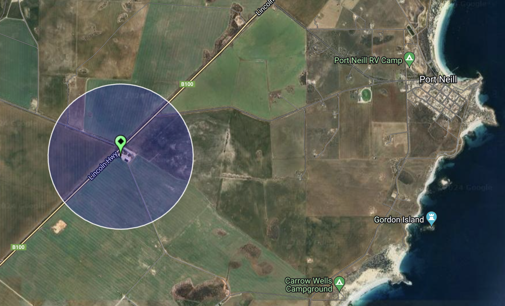
The Port Neill silo is located on the eastern side of Lincoln Highway adjacent to Brooker Road. It is an operational silo run by Viterra.
I parked on Brooker Road and activated the silo from the 4WD. I ran the Yaesu FT857, 40 watts, and the Codan 9350 antenna with the 1/5 metre stainless steel whip.
Above:- An aerial view showing the activation zone of the Port Neill silo. Image c/o SiOTA website.
I worked the following stations on 40m SSB:-
VK5MAZ
VK3PF
VK3KAI
VK5FB
VK3APJ
VK5LEX
VK5GY
VK3UCD
VK5CZ
VK5WE
I worked the following stations on 20m SSB:-
VK7XX
VK3UCD
VK1AO
VK2MET
VK3VIN
VK3CEO
VK2IO
VK3APJ
VK3PF
VK3KAI
VK4NH
VK4DXA
VK3DCQ
I4RHP
VK2HRX
VK3ZSC
VK2VW
VK2HFI
VK2XD
Following the activation of the silo I headed to the Port Neill lookout. It was erected in 1990 to honour the late Roger Cox who had a vision for constructing a lookout in the area.
References.
Ancestry.com.au. (2016). Ancestry® | Genealogy, Family Trees & Family History Records. [online] Available at: https://www.ancestry.com.au/. [Accessed 14 Aug. 2024].
Trove. (2014). MINING LEFT ITS MARK ON EYRE PENINSULA – Port Lincoln Times (SA : 1927 – 1988; 1992 – 2002) – 14 Jun 1973. [online] Available at: https://trove.nla.gov.au/newspaper/article/270065512 [Accessed 14 Aug. 2024].
My next activation for Wednesday 24th April 2024 was the Tumby Bay silo VK-TMY5. Tumby Bay is located on the eastern side of the Eyre Peninsula, about 604 km (by road) from Adelaide.
Above:- Map showing the location of Tumby Bay. Map c/o Google Maps.
Tumby Bay was named in 1802 by explorer and navigator Captain Matthew Flinders, in honour of a Lincolnshire village close to the Parish of Revesby. ‘Tumby’ is an Old English word meaning ‘fenced village’.
Above:- Map showing the location of Tumby, England. Map c/o Google Maps.
It was named ‘Harvey’s Bay’ by Governor Gawler in 1840. Fourteen years later in 1854, Joseph Provis took up land in the district and built a home near the current day rifle range. By 1856 a small farming community had developed with some of the early settlers being Joseph Provis, John Harvey, Charles Johns and Charles Thorpe. By 1874 a jetty had been constructed. By the late 1890s, the settlement had a blacksmith, a coach-building business, and a general store. (Place Names 2012) (Pt Lincoln Times 1982)
The town was surveyed, and the first 16 allotments were offered at auction in 1900. Only 2 of these were sold. Mr. W.T. Mortlock purchased the blocks and paired 10 pounds five shillings for allotment 1 and five pounds five shillings for allotment 9. (Pt Lincoln Times 1982)
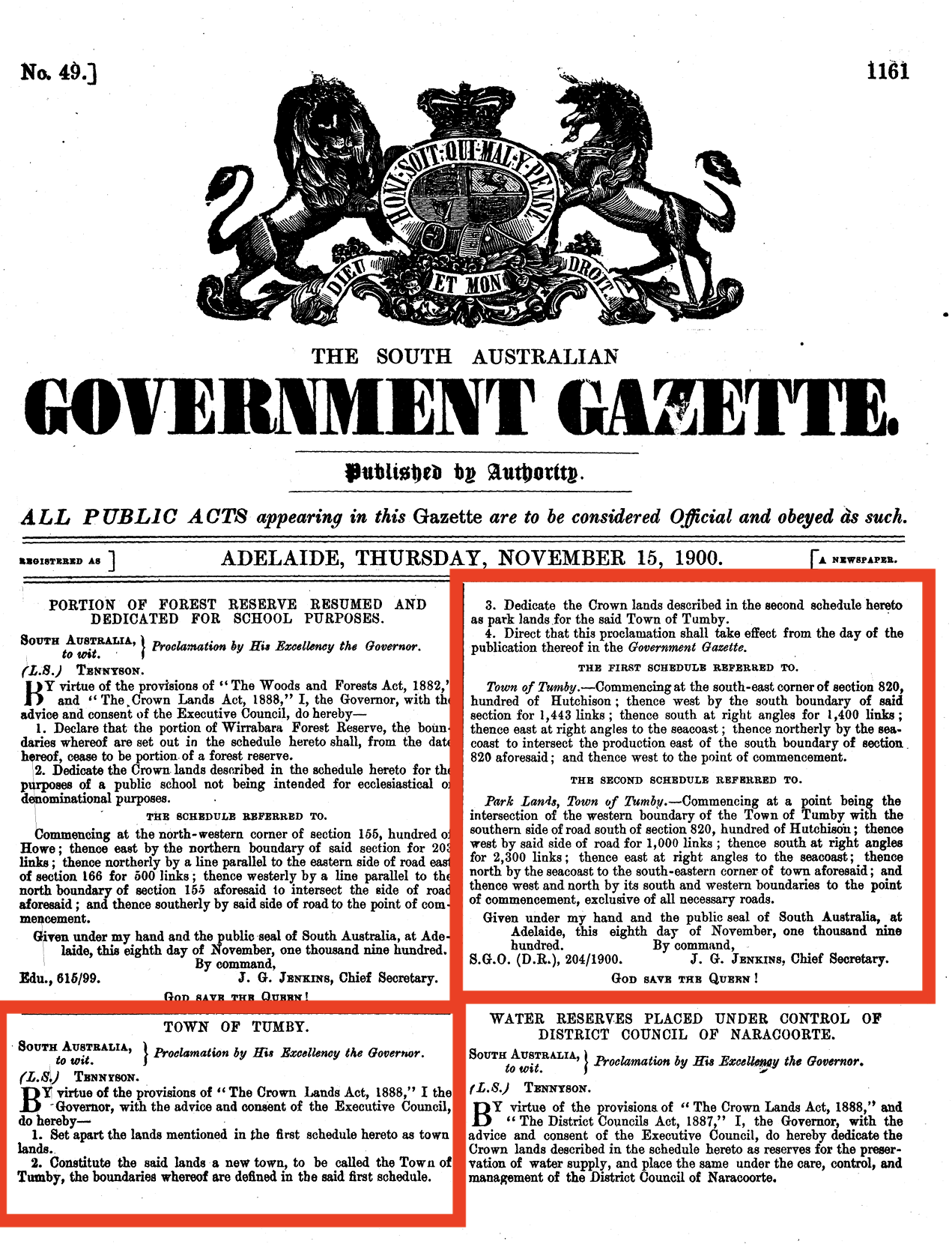
Governor Tennyson renamed the area Tumby Bay during his term of office from 1899-1902. The town of Tumby was proclaimed on the 15th day of November 1900.
Above:- The proclamation of the town of Tumby in the SA Govt Gazette, Thu Nov 15, 1900.
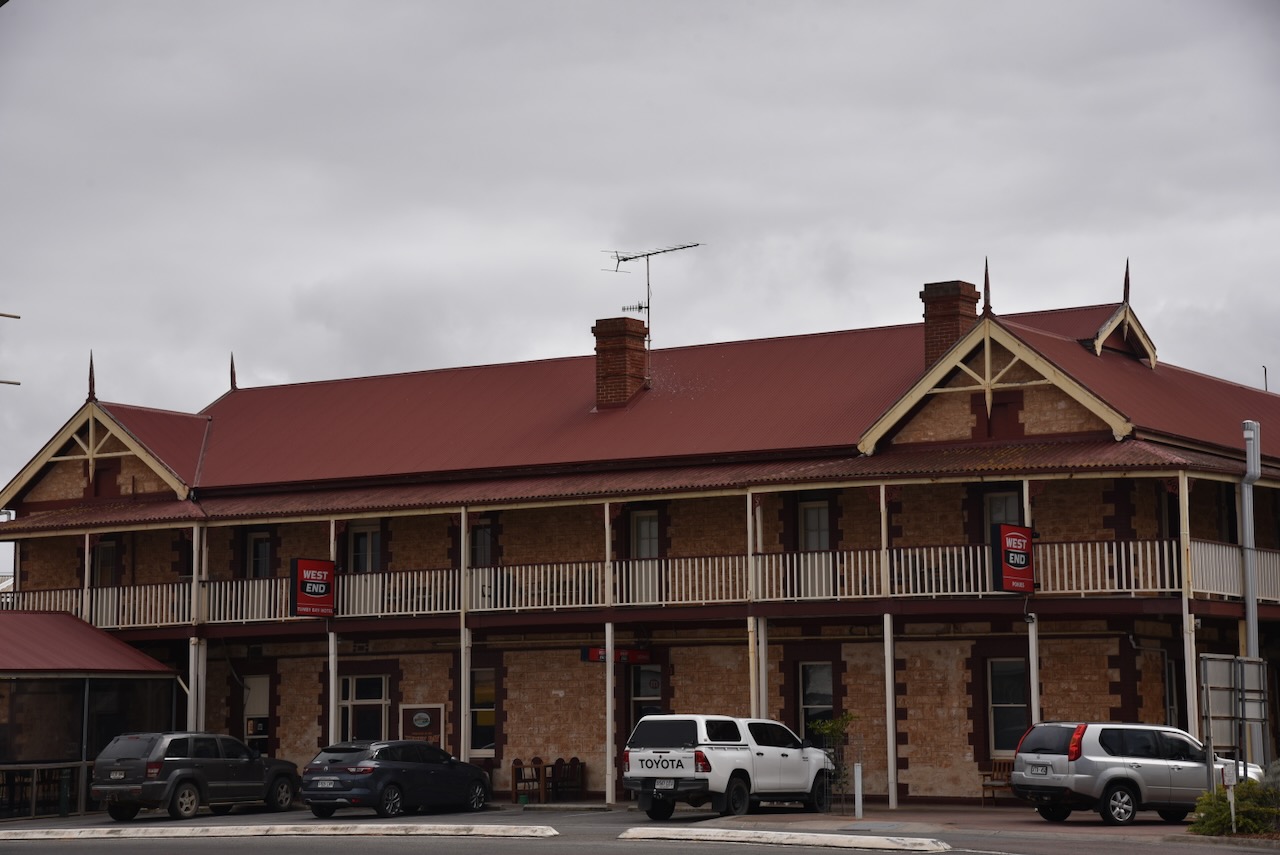
In 1901, 14 allotments were offered for sale, with 11 of those being sold. In 1902 a bakery commenced and in 1904 a builder and carpenters business was established. A butcher shop was also opened in 1904 along with the Tumby Bay Hotel. In 1905 the Bank of Adelaide commenced business. In 1906 a flour mill commenced operation. On the 14th day of June 1984, it officially became known as Tumby Bay. (Place Names 2012) (Pt Lincoln Times 1982)
Above:- The Tumby Bay Hotel, c. 1912. Image c/o State Library SA.
Today, Tumby Bay is the centre of an agricultural district for cereal crops and sheep. It is a popular holiday destination during the summer months. It is a very popular fishing location with King George Whiting and Snapper being some fish species caught. (Wikipedia 2024)
The short video below gives you a good feel about this beautiful little town.
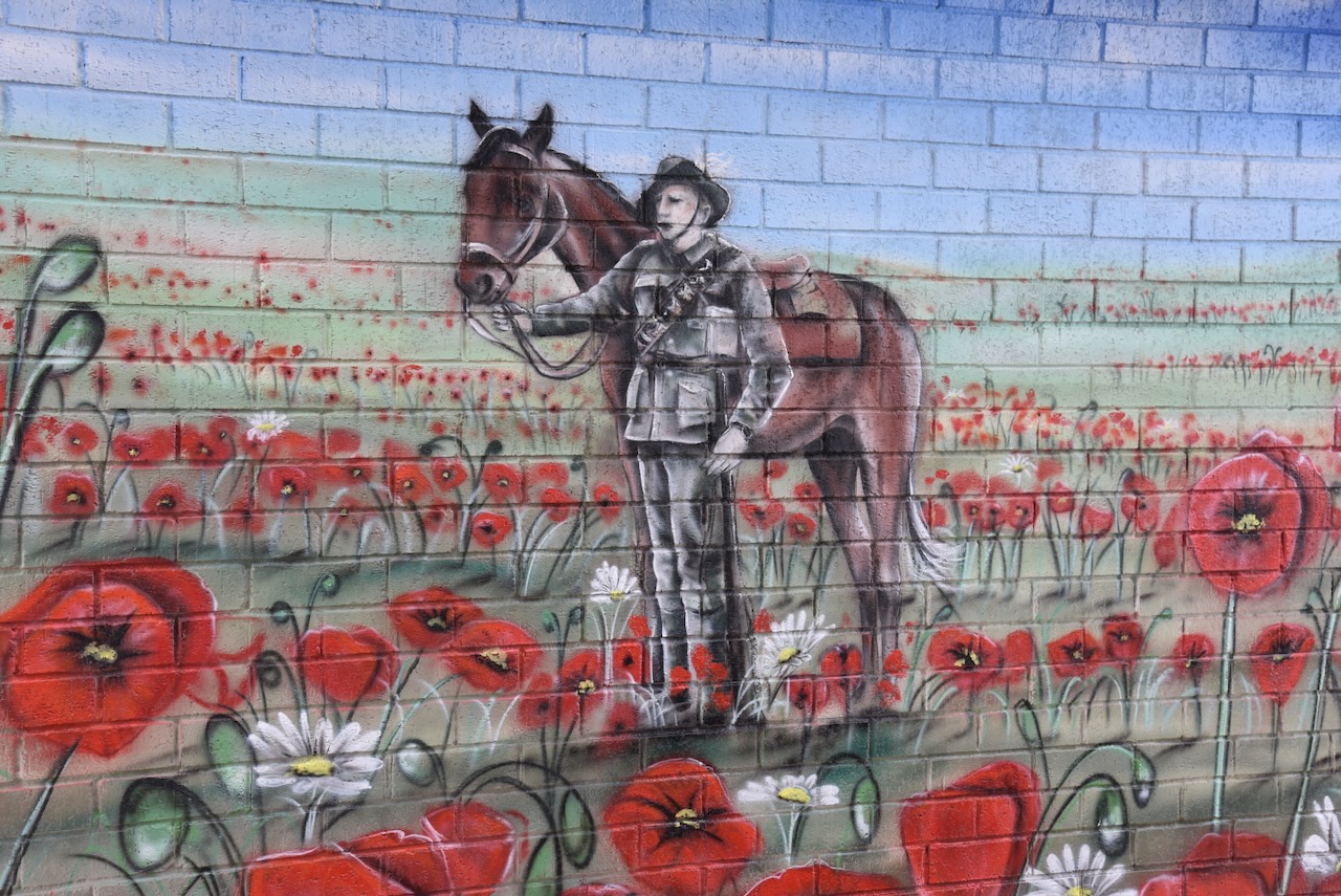
On a building on the foreshore, you can find a magnificent mural to honour servicemen and servicewomen. It is the work of artist Simon White and depicts the red poppies of Flanders Fields battlegrounds in the First World War. (ABC 2024)
On Tumby Terrace you can find a monument that commemorates the pioneers of the Tumby Bay district.
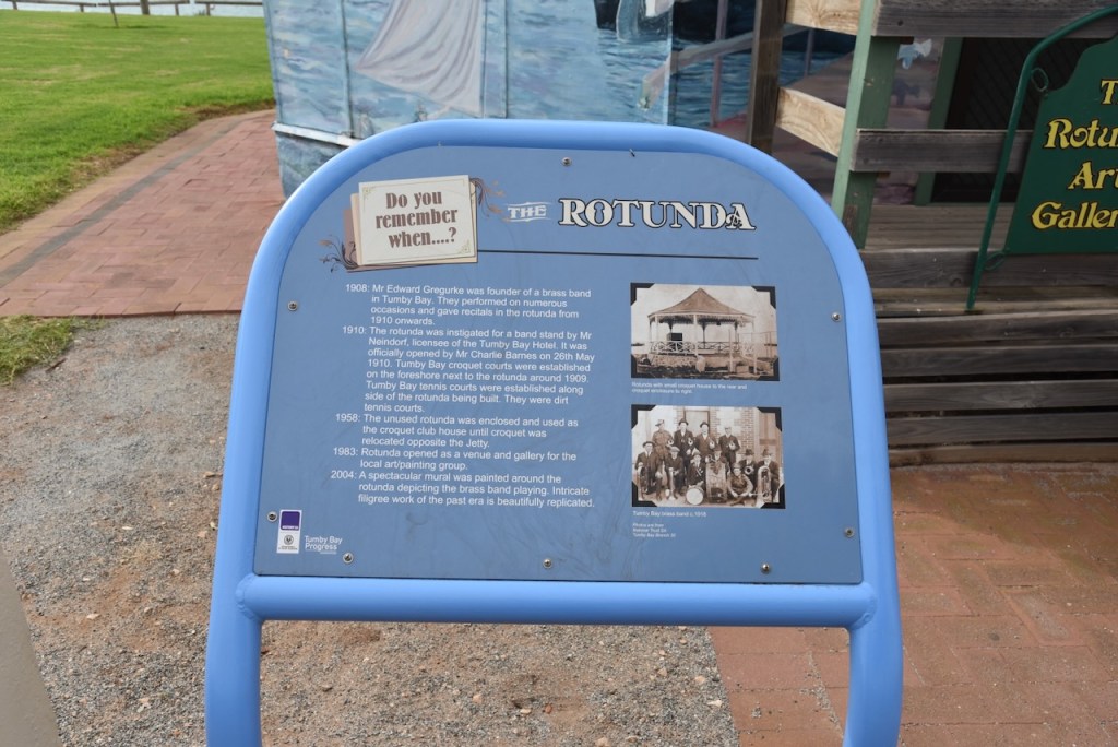
A Brass Band was formed at Tumby Bay in 1908 by Edward Gregurke. By 1910 a band rotunda had been built by the Tumby Bay Hotel publican. In 1983 it was turned into an art gallery. In 2004 a mural was painted on the outside walls. (Aussie Towns 2024)
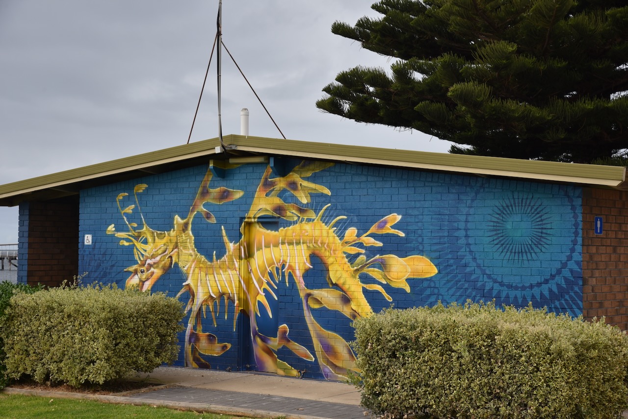
Another mural to be found is that of the Leafy Sea-dragon. It was painted by Masher Designs in 2023. (ABC 2024)
On Tumby Terrace you can find a monument with a miniature plough. The monument is to honour Robert Bratton, Overseer of Works at Tumby Bay. Bratton used this version of the plough which had been invented by a local tractor driver called Ferguson. It was used to build roads through the harsh mallee of the Eyre Peninsula. It became known as the Brattonising system of road making. (Aussie Towns 2024)
Along the Tumby Bay foreshore, there is also a dolphin sculpture.
On Lipson Road, you can find a monument located at the cemetery that commemorates the pioneers of Tumby Bay.
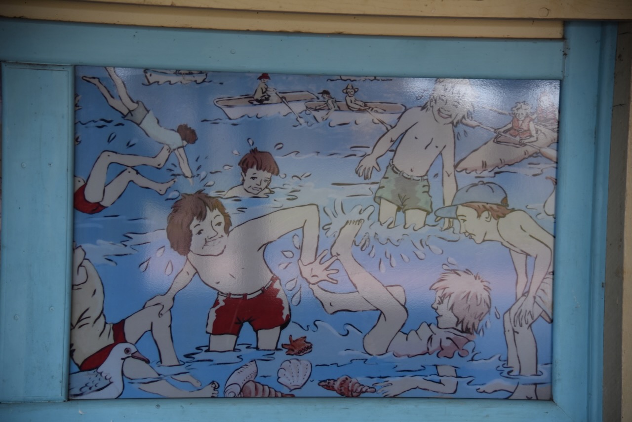
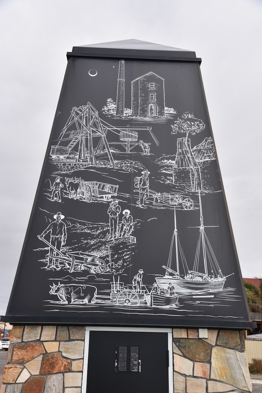
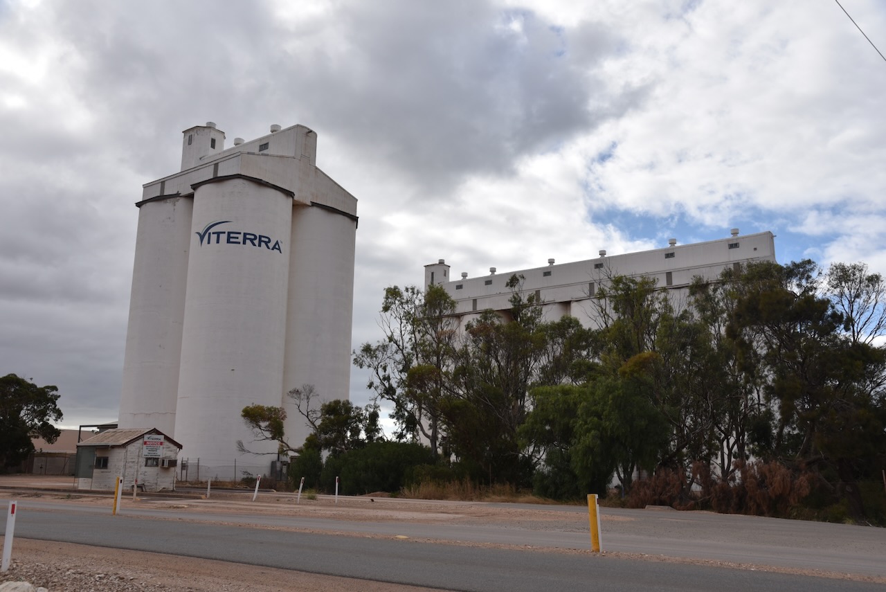
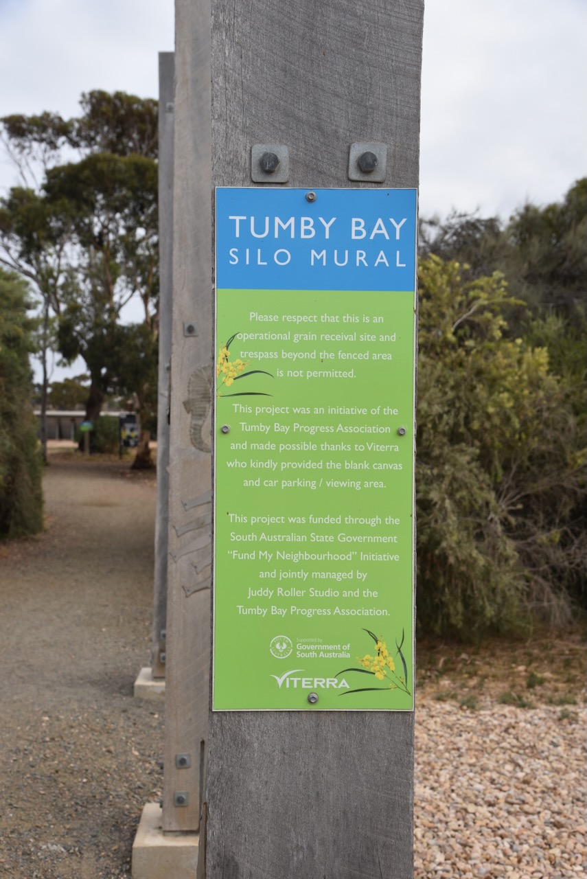
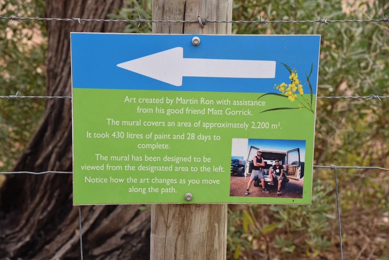
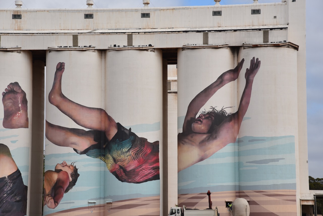
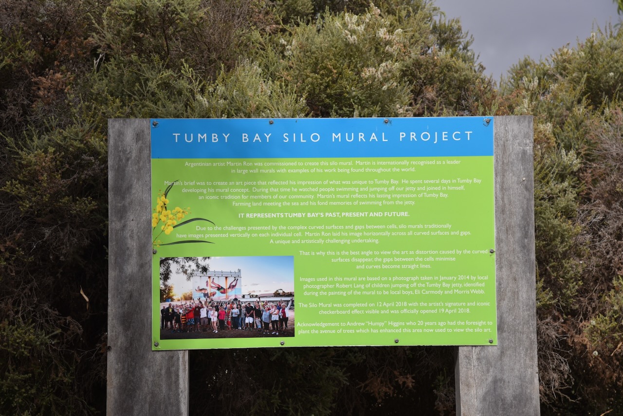
The Tumby Bay silos are part of the Australian SIlo Art Trail. They were their third silos to be painted in South Australia and were completed on the 13th day of April 1908. The silo art depicts two boys jumping off the Tumby Bay jetty. The silo art is the work of Argentinian-born artist Martin Ron and his assistant Matt Gorrick whose inspiration came from seeing people dive off the jetty into the ocean. (Australian Silo Art 2024) (YouTube 2024)
The video below is a timelapse of the Tumby Bay silo.
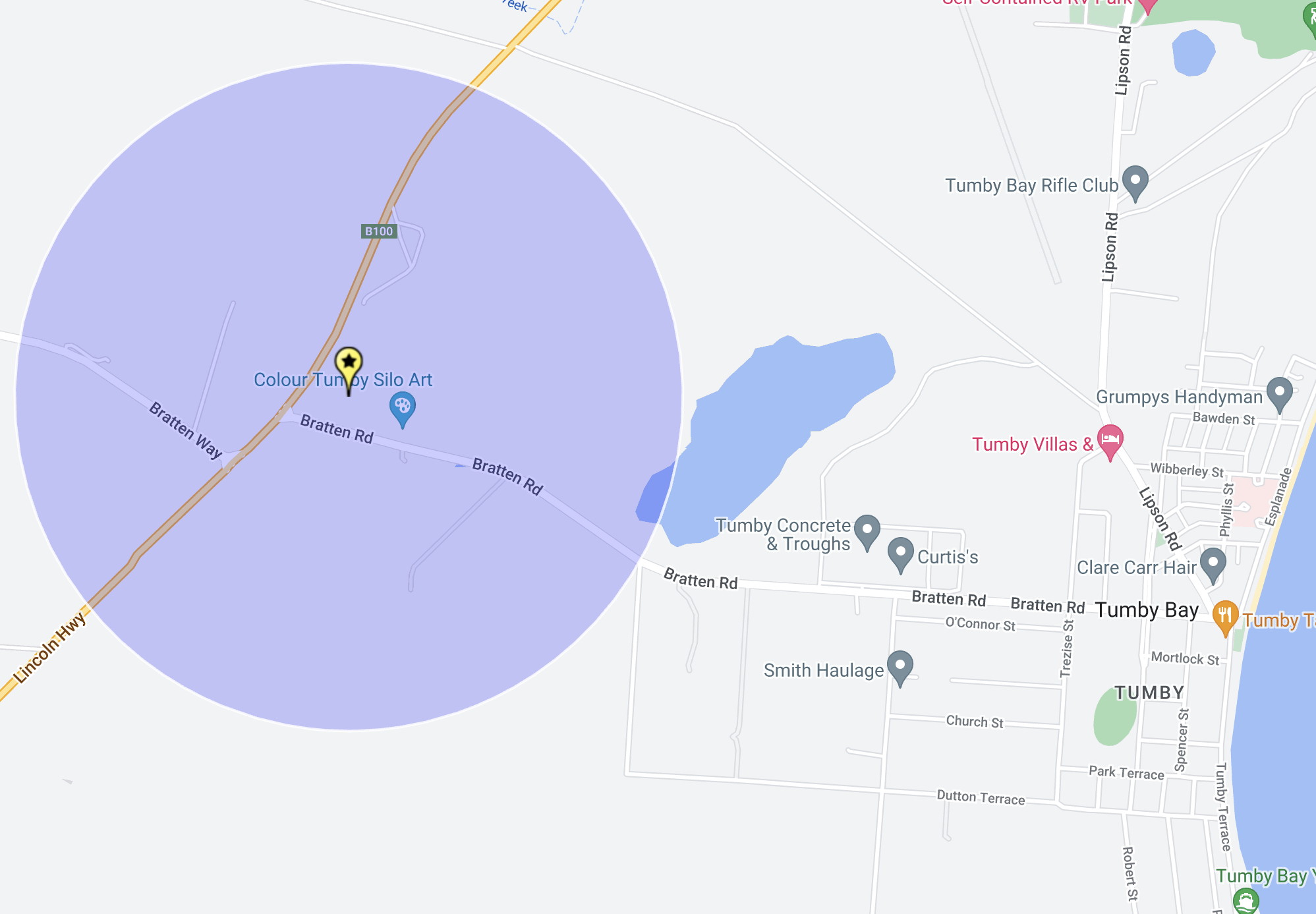
I parked in the silo car park off Bratten Roaad and operated from the 4WD. I ran the Icom IC7000, 100 watts, and the Codan 9350 antenna with the 1.5-metre stainless steel whip.
Above:- The activation zone at the Tumby Bay silo. Map c/o SiOTA website.
Trove. (2014). Tumby Bay: 180 years since Capt. Flinders – Port Lincoln Times (SA : 1927 – 1988; 1992 – 2002) – 5 Mar 1982. [online] Available at: https://trove.nla.gov.au/newspaper/article/276039438 [Accessed 13 Aug. 2024].
Wikipedia Contributors (2024). Tumby Bay, South Australia. [online] Wikipedia. Available at: https://en.wikipedia.org/wiki/Tumby_Bay [Accessed 13 Aug. 2024].
After leaving Port Lincoln on Wednesday 24th April 2024, I headed north along the Lincoln Highway to my first park activation of the day, the Sir Joseph Banks Group Marine Park VKFF-1746.
Above:- Map showing the location of the Sir Joseph Banks Group Marine Park. Map c/o Google Maps.
Prior to reaching Tumby Bay, I had a quick look at North Shields, about 11 km north of Port Lincoln.
North Shields was a 1907 subdivision of sections 189 and 387, Hundred of Louth, By George D. Dorward. He was born in 1842 and arrived in Australia in 1863 aboard the Seashell. (Place Names 2012)
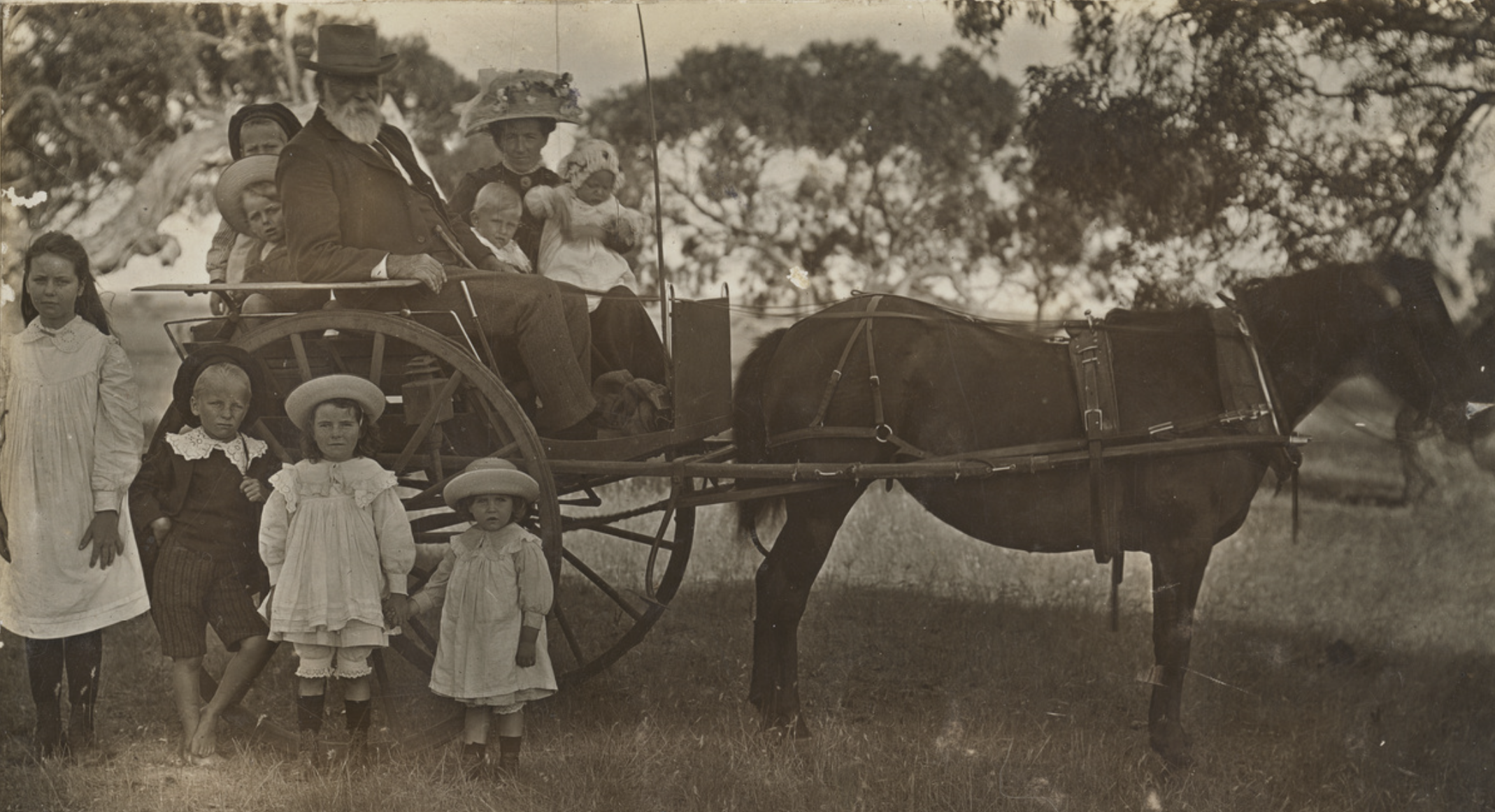
Above:- Mr George Dorward of “Clifton”, North Shields, and his daughter Mrs Hage with her children in a dog cart. Image co State Library South Australia.
The North Shields Post Office opened in 1908 and this was followed by North Shields School in 1911. The school closed in 1970. The town’s jetty opened on the 12th day of November 1906. Two historic buildings that remain are the Wheatsheaf Hotel and the Soldiers Memorial Hall. (Place Names 2012)
I then stopped at The Black Stump monument. It marks the lands of the former Poonindie Mission Station that operated from 1850-1896. It stands as a tribute to the pioneers of the district. The former ‘Black Stump’ was damaged by the bushfire in January 2005 and was replaced by a piece of fireproof black rock in 2006.
Poonindie was established in 1850 by Adelaide Archdeacon Matthew Hale. It was used as a ‘training institution’ for young Aboriginal families. They were expected to live a Christian lifestyle and learn domestic and agricultural skills. (Aboriginal Missions 2024)
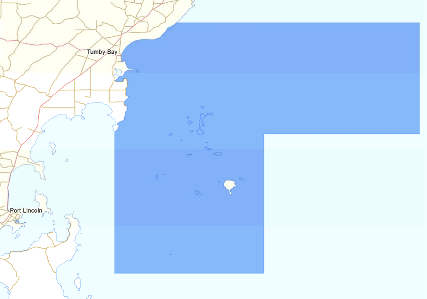
The Sir Joseph Banks Group Marine Park spans waters from just north of Bergs Beach to Point Bolingbroke and includes the islands of the Sir Joseph Banks Group and Dangerous Reef. (Management Plan 2012)
Above:- Map showing the boundaries of the Marine Park. Map c/o WEWNR.
The park takes its name from Sir Joseph Banks. He was born in 1743 in London England. Banks was an English naturalist, botanist and patron of the natural sciences. (Wikipedia 2024)
Above:- Sir Joseph Banks. Image c/o Wikipedia.
Below is an excellent short video on the life of Sir Joseph Banks narrated by Sir David Attenborough.
The park is 2,627 km2 and is adjacent to Tumby Bay. It overlays two other protected areas, the Tumby Island Conservation Park and the Sir Joseph Banks Group Conservation Park. Dangerous Reef hosts one of the largest breeding colonies of Australian sea lions in the world. Pregnant female White Pointer sharks are often found in these waters, most likely due to the high sea lion population. (Management Plan 2012)
I drove down to the end of Harvey Drive and set up on a 4WD track leading to the beach. I ran the Yaesu FT857, 40 watts and the 20/40/80m linked dipole for this activation.
I worked the following stations on 40m SSB:-
VK5MAZ
VK5GY
VK5HS
VK5IS
VK3BEL
VK5AAF
VK3PF
VK3KAI
VK5WE
VK5MK
VK5LA
VK5KAW
I worked the following stations on 40m FT8:-
VK3PF
VK5LA
VK5KAW
VK3KAI
VK3APJ
VK2IO
VK7XX
VK3UAO
VK5MK
I worked the following stations on 20m FT8:-
VK3PF
VK3CEO
VK1AO
VK7XX
VK3KAI
VK5MK
VK3APJ
VK2MET
VK5LA
VK5KAW
VK4EMP
VK4MUD
VK4TI
VK2IO
I worked the following stations on 20m SSB:-
VK1AO
VK2MET
VK4NH
VK4DXA
VK5MAZ
VK3PF
VK3KAI
VK3TX
VK2VW
VK2HFI
VK2AKA
Vk2BUG
VK2IO
VK5DW
VK7ZA
VK3APJ
VK3MAP
VK3CEO
VK7EE
VK3SO
VK3SFG
UT5PI
References.
Department of Environment Water & Natural Resources, 2012, Sir Joseph Banks Group Marine Park Management Plan
It was now Wednesday 24th April 2024. Today I would leave Port Lincoln and head down to Cowell.
Above:- Map showing the location of Porrt Lincoln. Map c/o Google Maps.
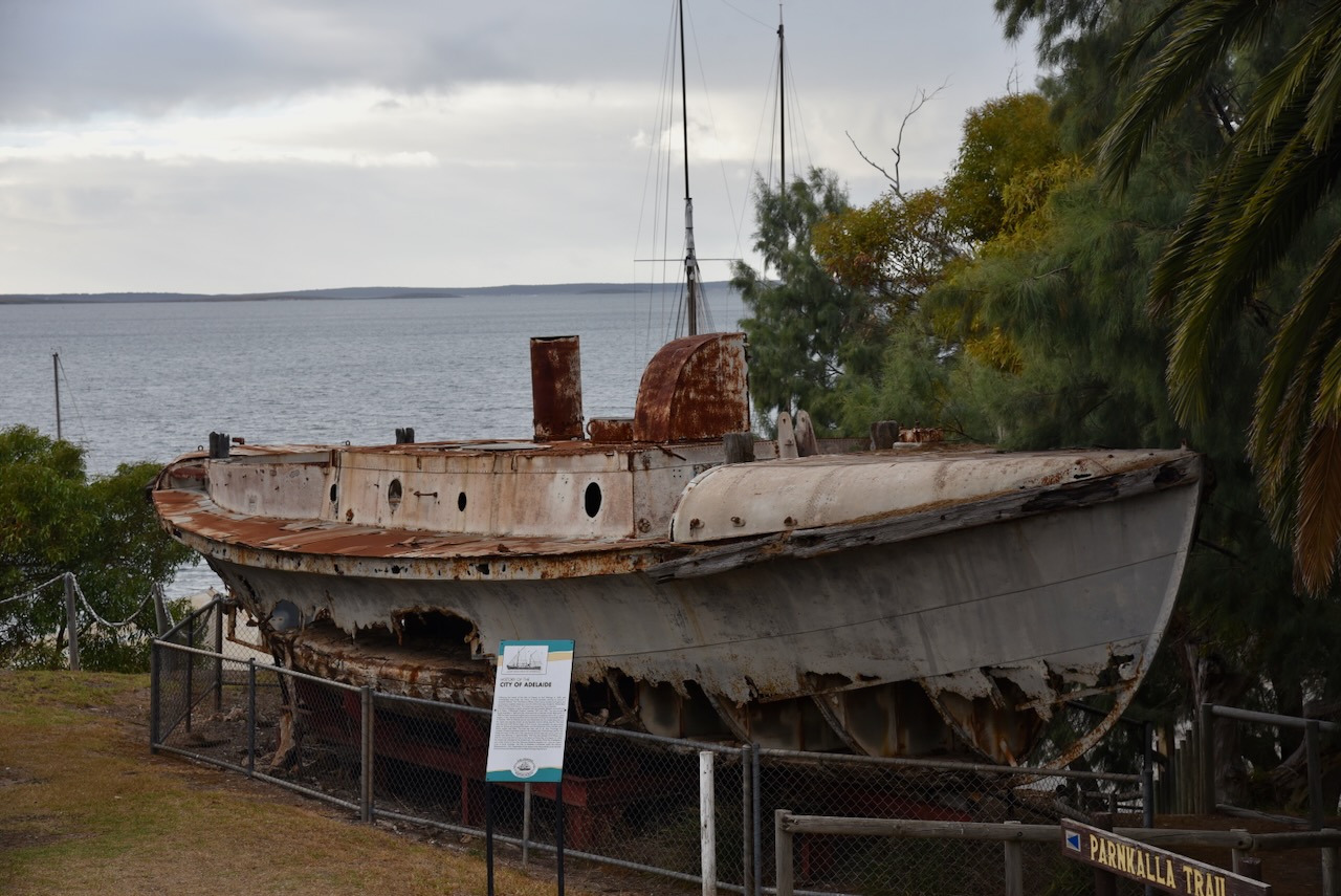
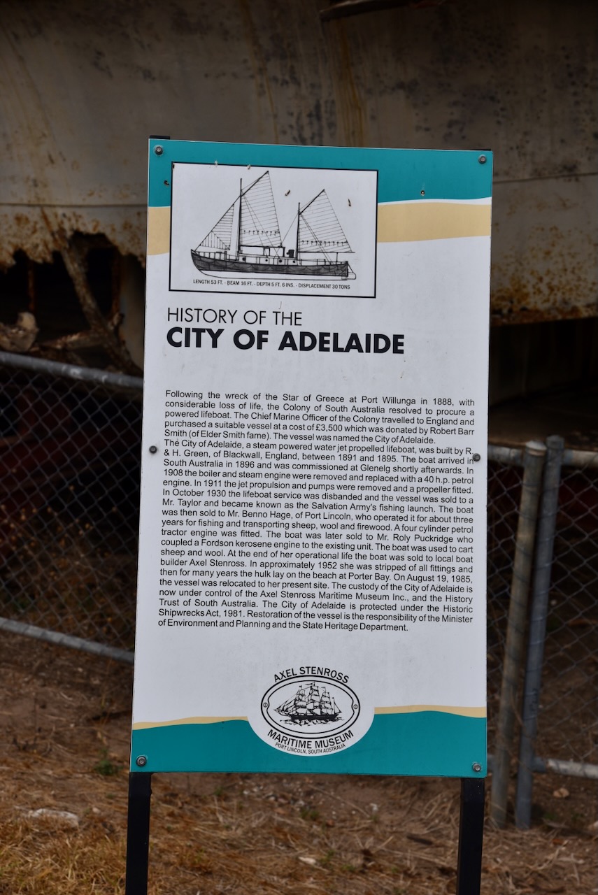
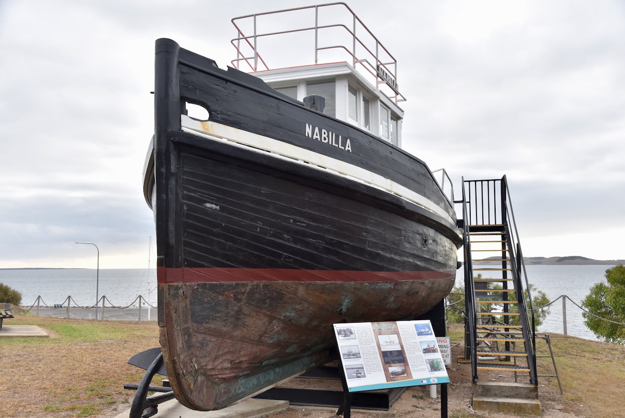
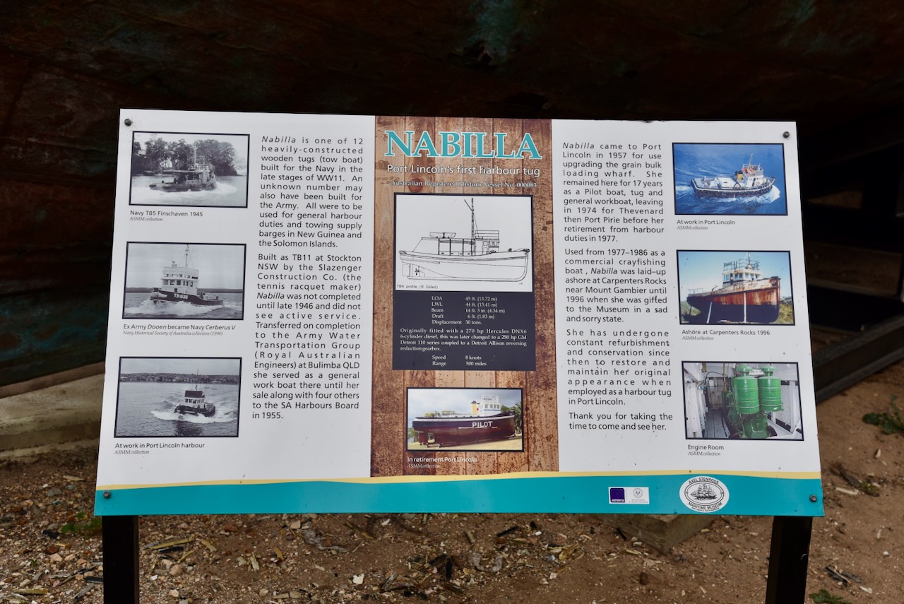
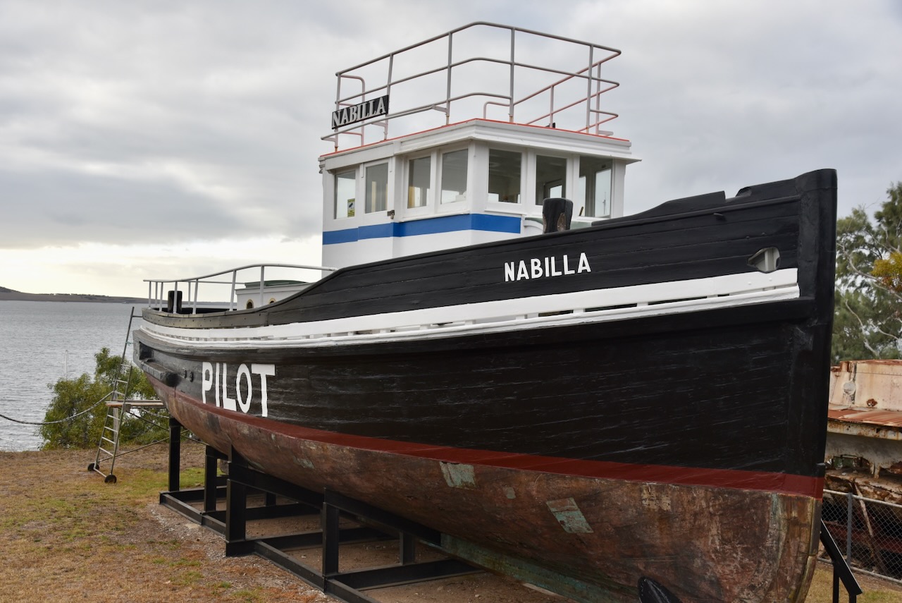
Although I had been to Port Lincoln several times previously, I decided to have a quick look around. My first stop was the Axel Stenross Maritime Museum. The museum celebrates the life of Finnish boat builders Axel Stenross and Frank Laakso who lived in Port Lincoln. I have visited this museum previously and it is well worth a visit if you are in Port Lincoln. But I was running a bit short of time, so this time I just wandered around some of the boats on the outside of the museum. (Axel Strenross 2024)
I then visited the Makybe Diva statue on the Port Lincoln foreshore. Makybe Diva is a champion Australian Thoroughbred racehorse who is the only horse to win three Melbourne Cups and the only mare to win it more than once. (Wikipedia 2024)
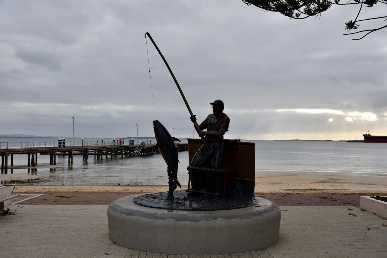
Also on the Port Lincoln foreshore is The Tuna Poler monument. It commemorates all who took part in the pioneering form of fishing for tuna. By the late 1970’s the tuna fishing industry had transitioned from poling tune to purse seine fishing which allowed the tune fleet to catch more tuna. (Monuments Australia 2024)
Another interesting monument in Port Lincoln is that of Captain Matthew Flinders and Trim the cat who accompanied Flinders on his voyages to circumnavigate and map the coastline of Australia in 1801–1803.(Monuments Australia 2024)
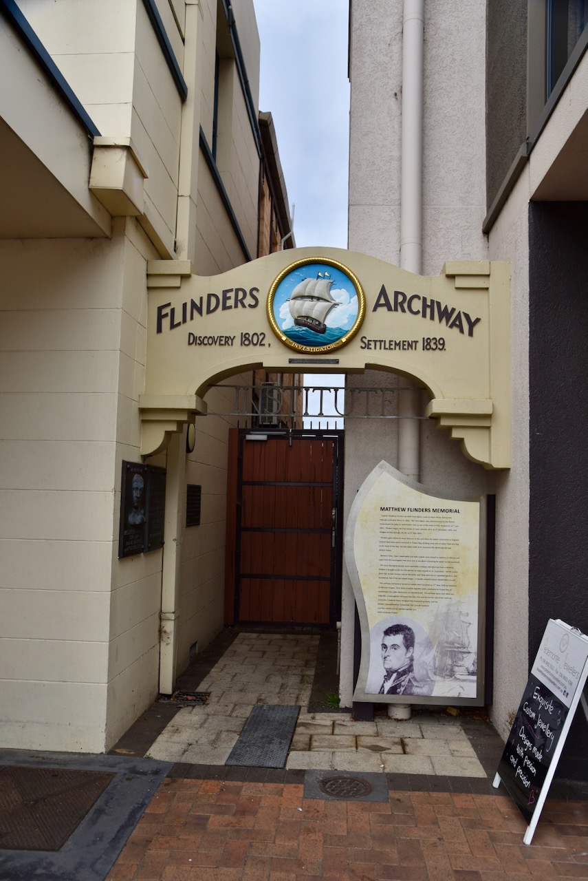
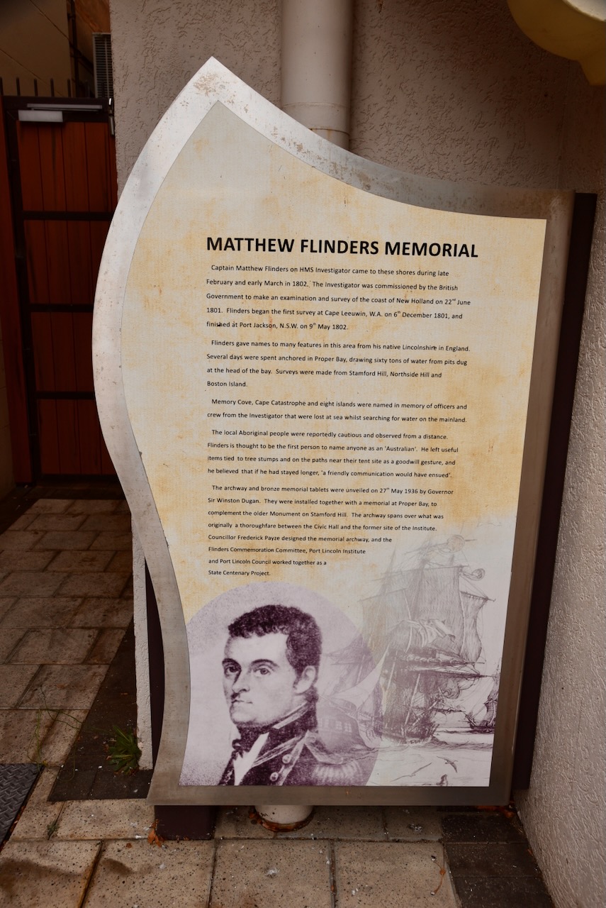
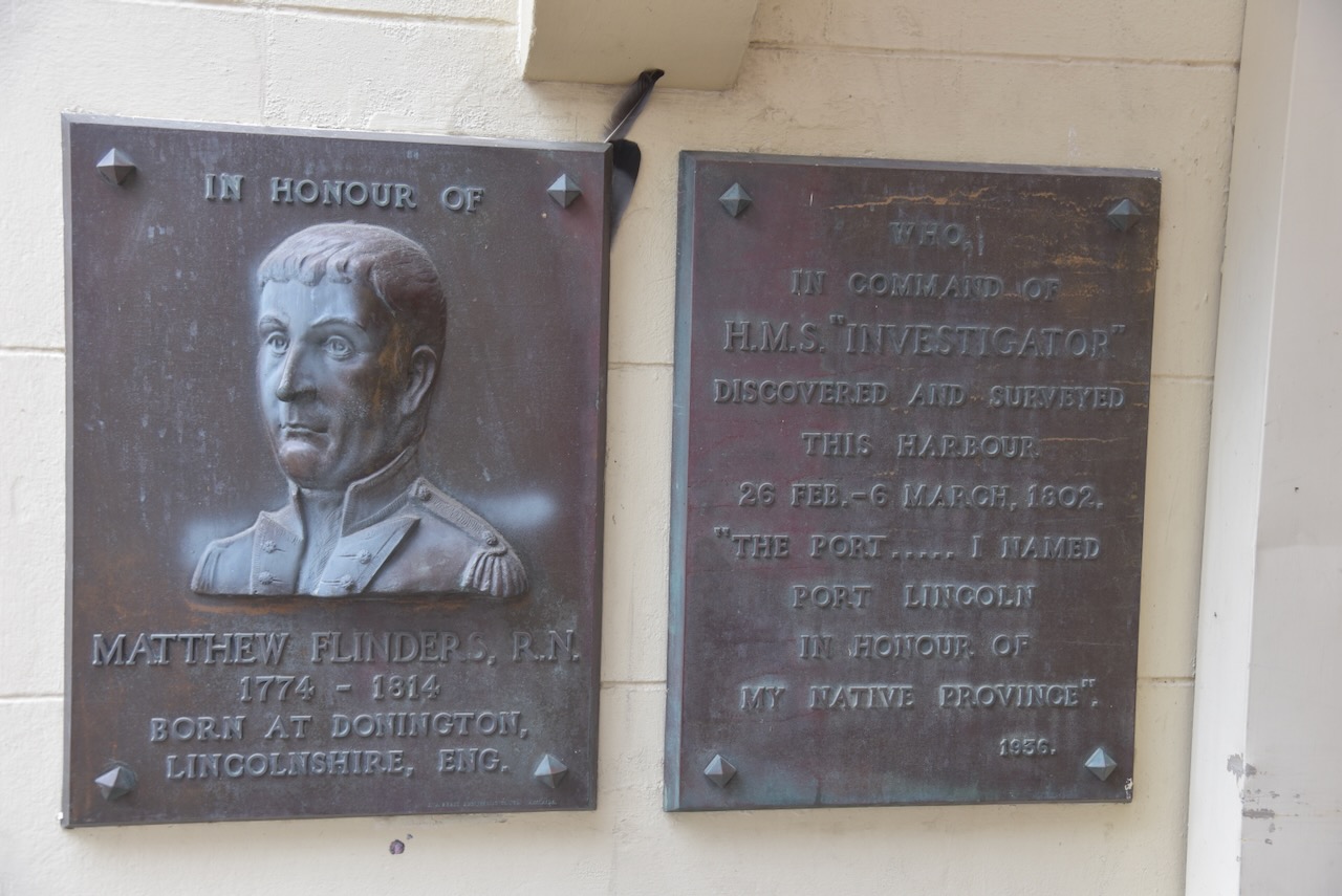
Adjacent is Flinders Archway which commemorates Matthew Flinders.
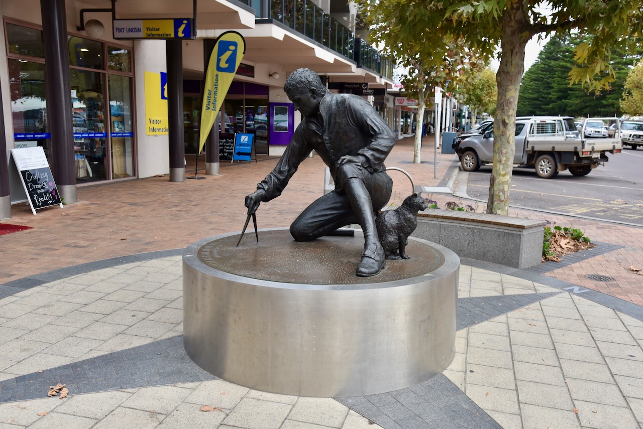
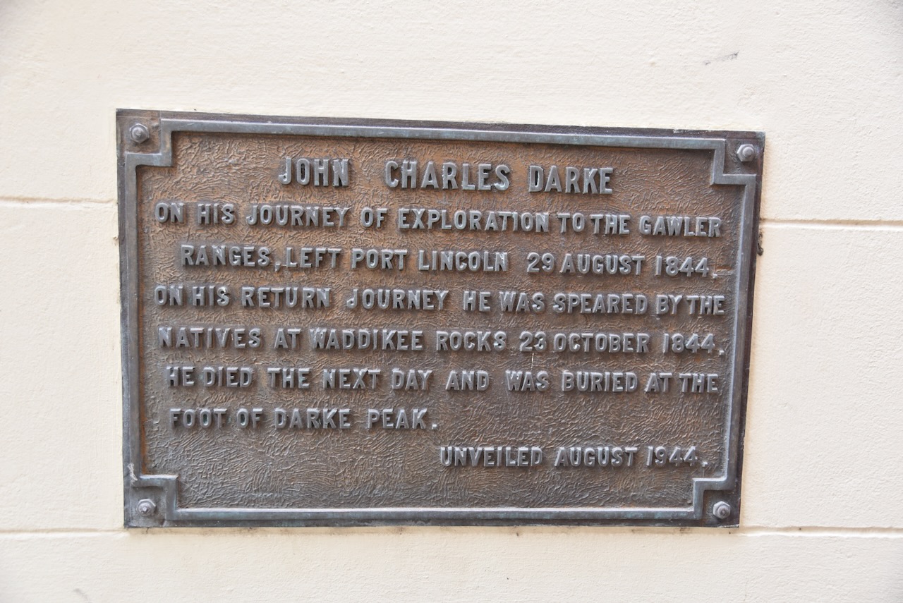
There is also a plaque to commemorate John Charles Darke and his journey of exploration to the Gawler Ranges. Please have a look at my previous post on Darke Peake silo for more information.
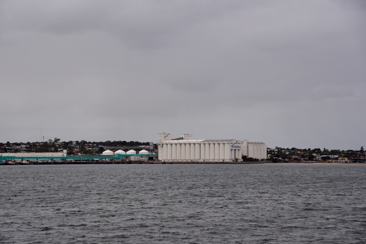
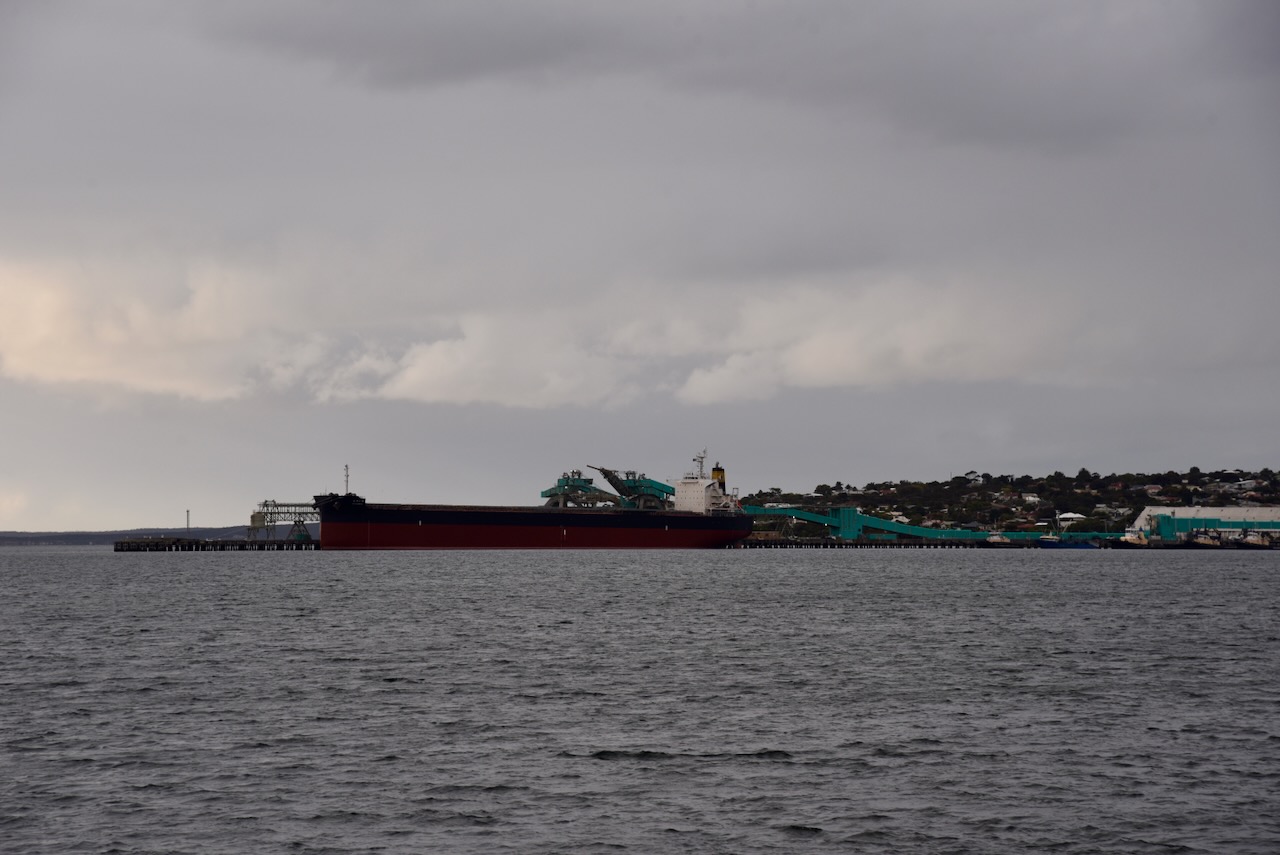
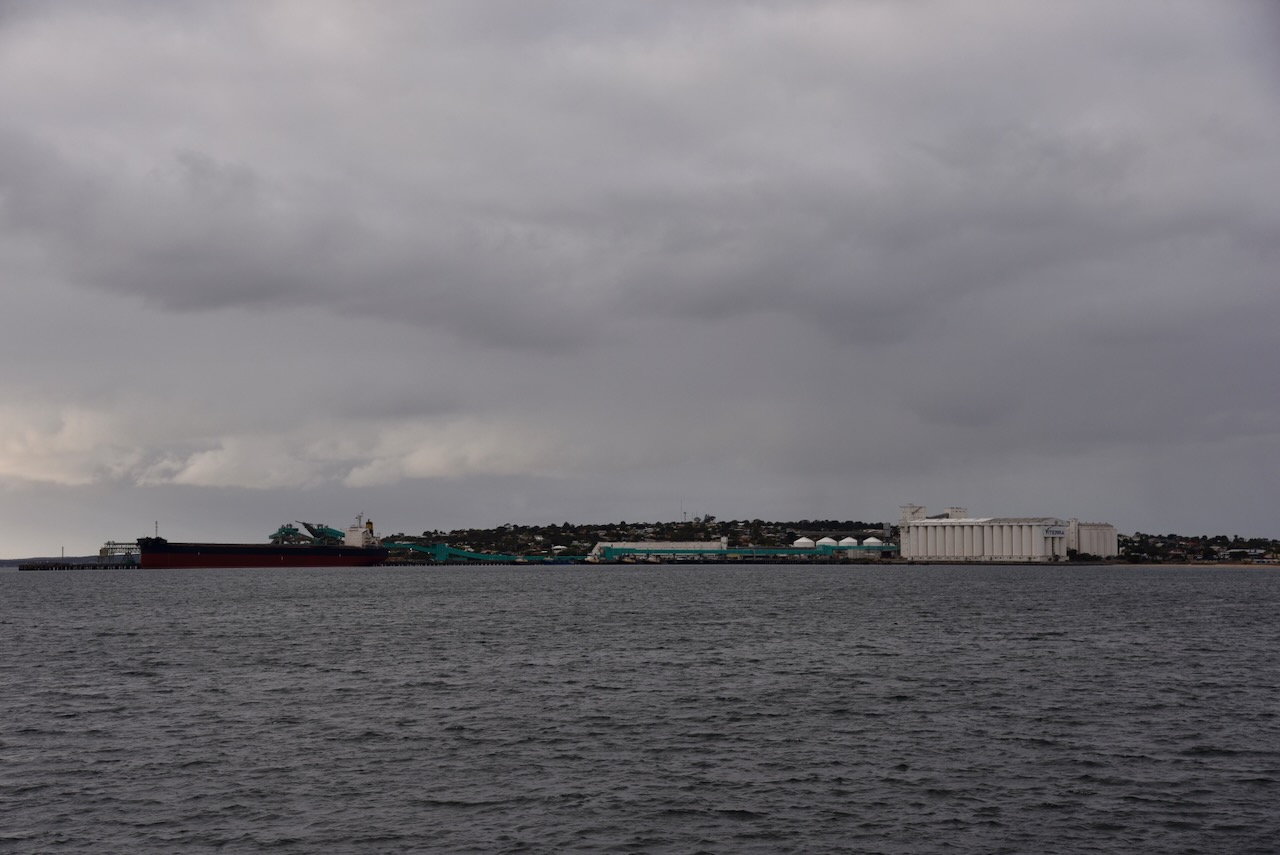
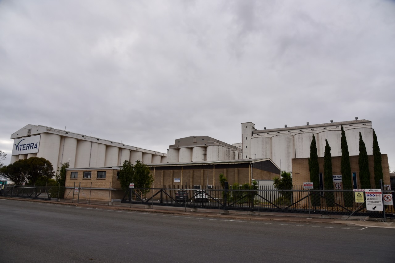
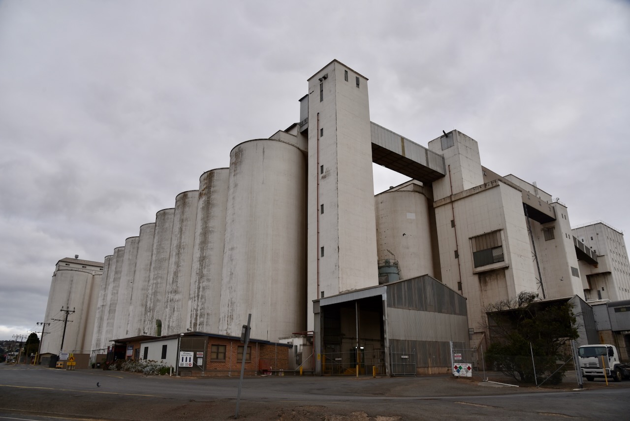
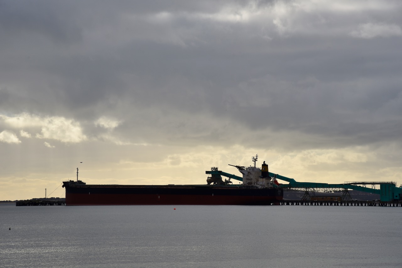
I then undertook a quick activation of Port Lincoln silos VK-PRN5.
The silos were built in 1959 and are 47 metres tall. They store wheat and Barley from Eyre Peninsula’s harvest until being loaded onto bulk grain carriers. (flickr 2024)
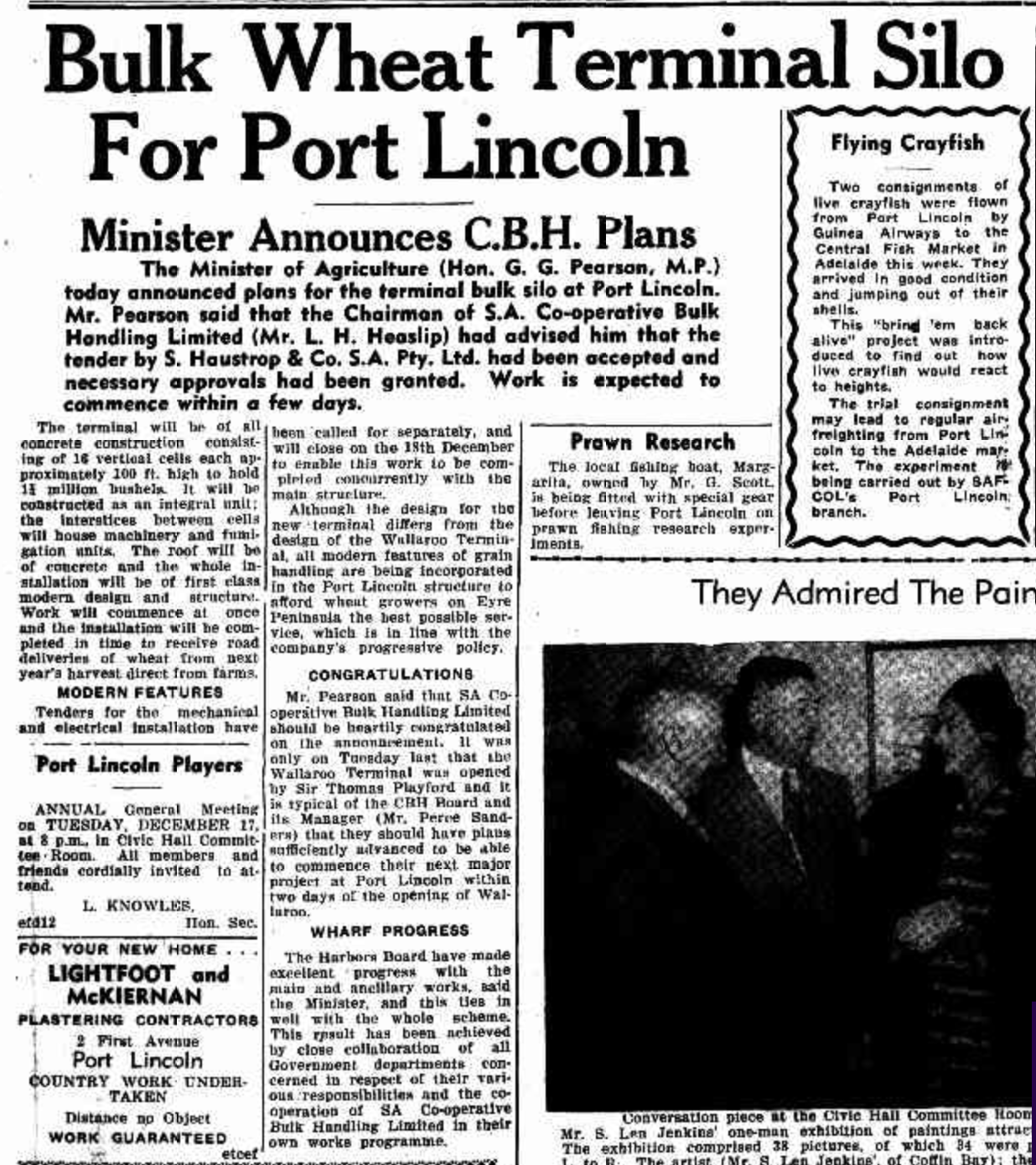
Above:- Article from the Port Lincoln Times Thu 5 Dec 1957. Image c/o Trove.
I parked in the Kirton Point jetty car park and operated from the 4WD. I ran the Icom IC-7000, 100 watts and the Codan 9350 with the 1.5-metre stainless steel whip.
Above:- The activation zone at the Port Lincoln silos. Map c/o SiOTA website.
I worked the following stations on 40m SSB:-
VK5MAZ
VK3PF
VK3VIN
VK5AAF
VK3HBG
VK5LEX
VK3CJN
VK5HS
VK4NH
VK4DXA
VK3APJ
VK3KTT
VK3MEG
VK3FABS
I worked the following stations on 20m SSB:-
VK3PF
VK4NH
VK4DXA
VK7XX
VK2VIN
References.
Axel Stenross. (2018). Axel Stenross. [online] Available at: https://axelstenross.com.au/ [Accessed 12 Aug. 2024].