Parks devastated by fire

Following the recent fires in South Australia, a number of South Australian National Parks and Conservation Parks have been severely impacted.

An estimated 450 bushfires engulfed parts of South Australia during the January heatwave, burning more than 445,000 hectares, as well as destroying livestock, and at least 15 homes and about 24 sheds.  About 200 farms were affected which included lost machinery and fencing.  More than 1,700 livestock perished during the fires.  The total damage bill is estimated to be about $10 million.  And the loss to flora and fauna is unmeasurable.

Billiatt Conservation Park has been totally decimated.  It is literally ‘gone’.  The status of the Billiatt fire is listed on the CFS website as ‘Controlled’.  It is reported that the fire ‘continues to burn with control lines’.  The fire has been burning since Wednesday 15th January, 2014.  The park is closed until further notice.  Two homes have been destroyed in this fire.

Billiatt CP has gone from this (photo taken during my activation at the park in September, 2013)……………

IMGA0107

To this……………….

IMG_7223

Below is a CFS map of the Billiatt fire.  I have placed a red line indicating the Billiatt CP boundaries.  As you can see the park is no more !

Billiatt fire110

Map courtesy of the CFS.

The nearby Ngarkat Conservation Park has also been significantly affected by fire.  The fire which was started after a light strike, has burnt out an area of more than 90,000 hectares.  The park is closed until further notice.

BeJLVD7CMAA4yO9.jpg-large

Photo courtesy of 7 News Adelaide

Below is a CFS map of the Ngarkat fire (dated 18/1/2014 – cannot get a more recent one).  I have placed a red line roughly indicating the Ngarkat CP boundaries.  As you can see, more than 1/3 of the park has been destroyed.

58909_759463077414932_1679398190_n

Map courtesy of the CFS.

Both Billiatt and Ngarkat Conservation Parks have been identified by BirdLife International due to their importance for the conservation of numerous rare and endangered species of mallee birds.  They are also the home of various endangered animals including the Western Pygmy possum.  Not too sure how many are left after these fires ?  Trees for Life are reporting ‘shelter for fauna is gone, shade and food now elusive, fauna losses extensive’.

I activated both Billiatt and Ngarkat in September last year, and it is incredibly sad to see the state that they are in at the moment.

The following parks have also been affected by the recent fires…..

  • Gawler Ranges National Park
  • Mount Remarkable National Park
  • The Katarapko section of the Murray River National Park
  • Telowie Gorge Conservation Park
  • Yellabinna Conservation Park
  • Yumbarra Conservation Park
  • Gum Lagoon Conservation Park.

In conjunction with Ivan VK5HS, I am currently working on a possible fund raiser / raffle, where money raised would go to Trees for Life.  Once I finalise this, I will let everyone know.  There will also be future tree planting days, which amateurs may want to get involved in.

1810_trees-for-life

Click on the link below to have a listen to local farmers Chris Bullen and Robyn Verrall who have a farm on the border of the Ngarkat Conservation Park.

http://www.abc.net.au/news/2014-01-22/ngarkat-fire-fighting/5212236

Resources

Country Fire Service website, viewed 1st February 2014, http://www.cfs.sa.gov.au

DEWNR website, viewed 1st February 2014, http://www.environment.sa.gov.au/Home

ABC, viewed 1st February, 2014, http://www.abc.net.au

Port Gawler Conservation Park

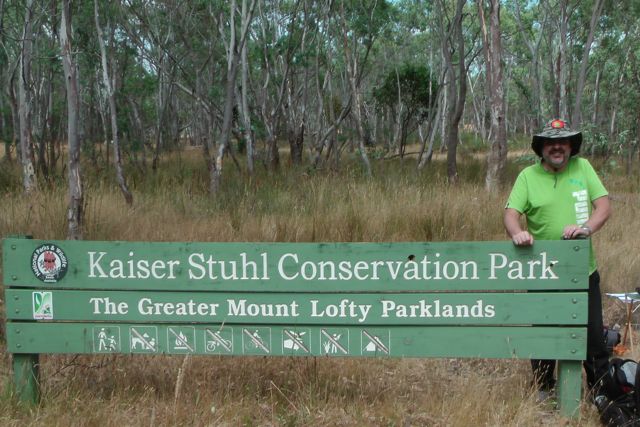
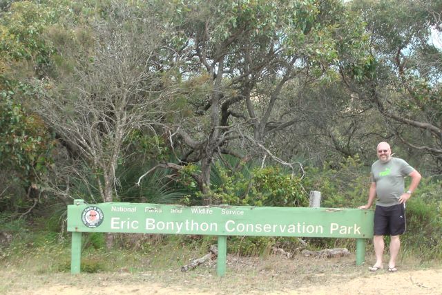
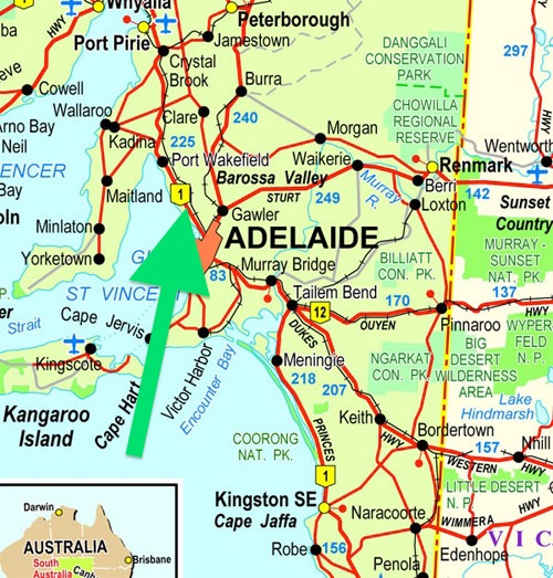
My second activation for the day was a confirmed Conservation Park, the Port Gawler Conservation Park.

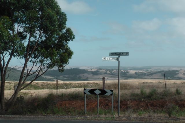
Marija and I headed off the LeFevre Peninsula and along the Port River Expressway, and then north on Port Wakefield Road.  We then turned left onto Port Gawler Road, and headed west towards the coast of Spencer Gulf.  As we were travelling towards the park, it brought back a lot of fond memories.  When I was a child, I often went to Port Gawler with my grandfather and went ‘raking’ for Blue Swimmer crabs.  Grandpa came to live with us when I was just a young boy, following the death of my Grandma.  And Grandpa was a keen crabber and he & I would often drive to Port Gawler beach in his old Hillman Hunter to go crabbing.

murray-river

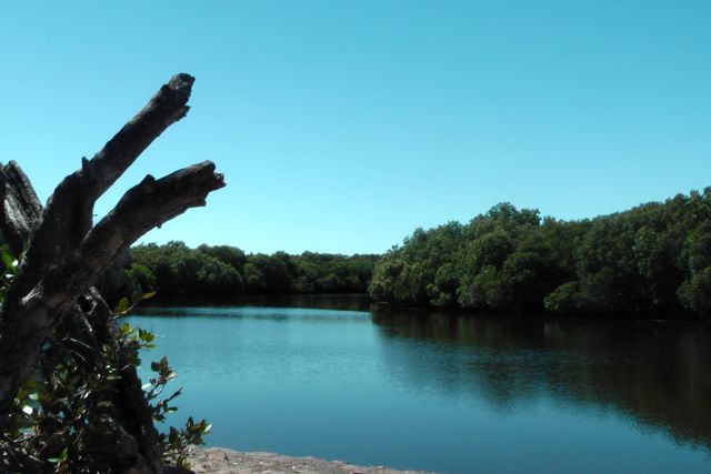
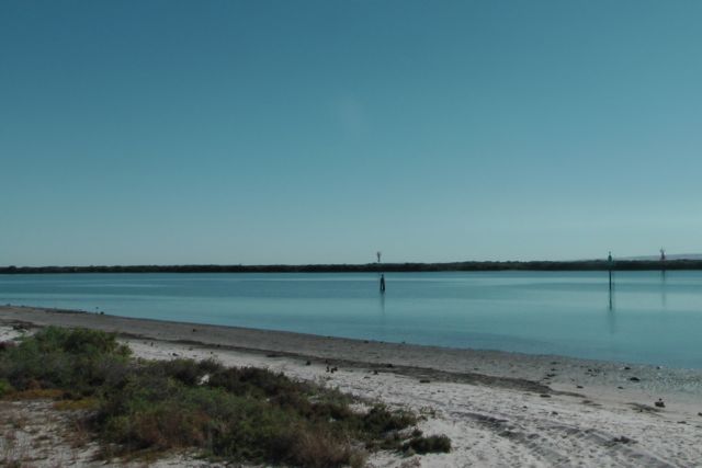
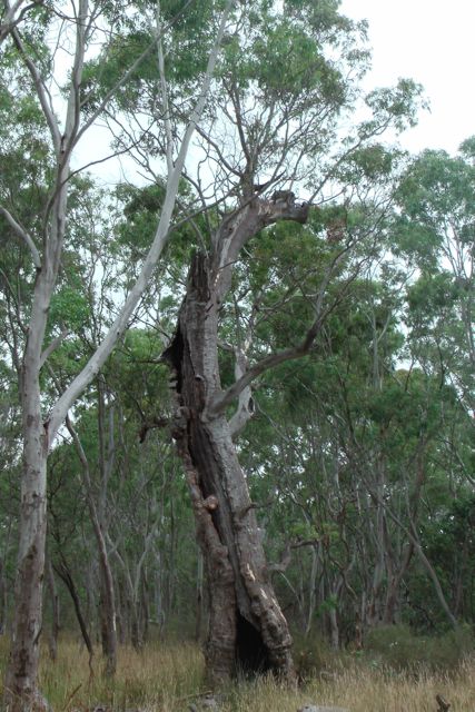
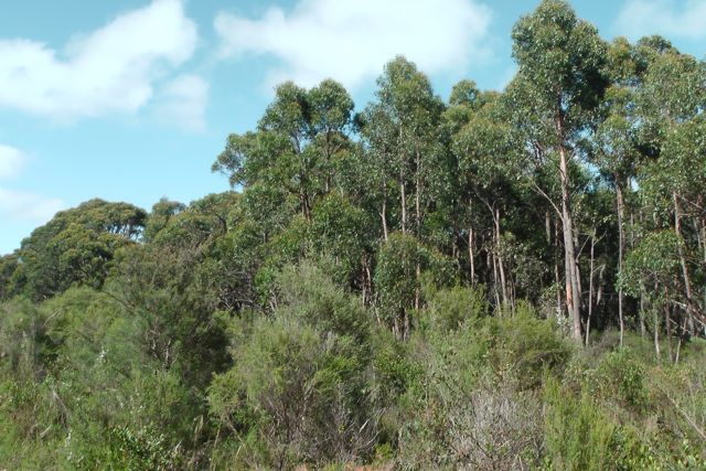
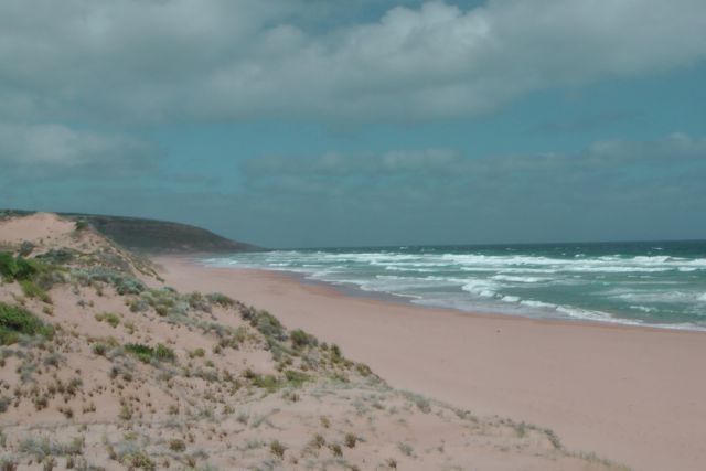
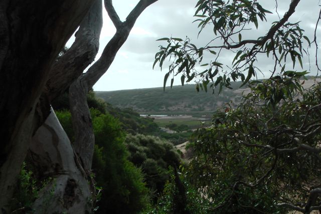
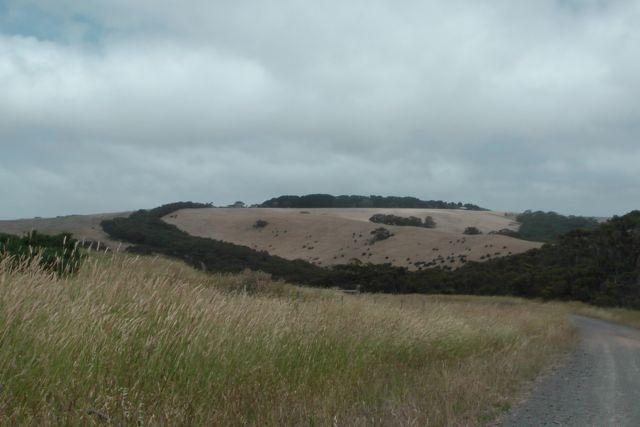
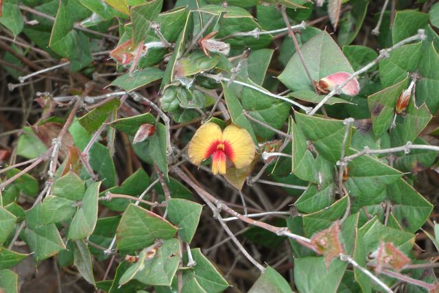
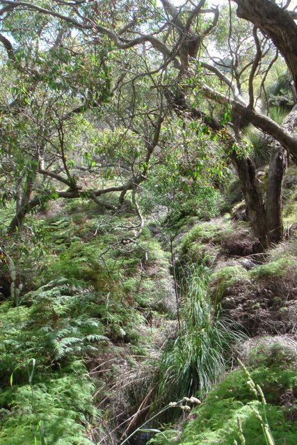
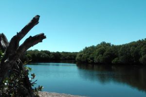
Port Gawler Conservation Park consists of vast tidal flats and fringing mangrove forests that are crossed by a multitude of tidal channels.  Shell-grit ridges occur along a well-defined belt within the mangrove forest.  I remember well, that each time we visited the park all those years ago, we would always bring back a bucket of shell grit and cuttlefish.  A that time my Dad was a breeder of finches and parrots.  The birds loved the shell grit and cuttlefish, which were also a source of calcium.

The Gawler River, which has its source over 40 km to the east, flows through the park and forms a long, narrow estuary at Port Gawler.  Fish can be caught in the River, including Bream & Mullett.

      IMGA0028

As we drove along Port Gawler Road, the sounds of off road vehicles and motorcycles became louder and louder.  There are a few Off Road Parks in the area, and sadly the area is also used as a bit of a dumping ground for rubbish.  I found the following article in the local newspaper which shows that this is an ongoing problem…..

http://www.plainsproducer.com.au/?p=513

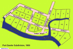
Plans to build a settlement at Port Gawler at the mouth of the Gawler River estuary, commenced in 1869.  Below is a map dated 23rd March, 1869 from the South Australian Lands Department.  It is signed on behalf of the surveyor-general, Mr George W. Goyder  and his Excellency Sir James Fergusson, Governor of South Australia.  It shows that Port Gawler was subdivided into various allotments with the street names, named after the Spanish campaign of General Wellington (of Waterloo fame).

3874152548_ef56f83d2b_m

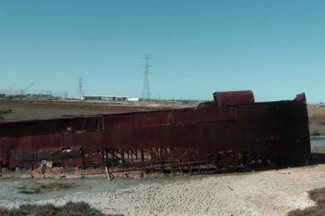
In 1869, the ‘Lisbon’ wharf and Waterloo Road were constructed with a grant of £6,000 made to the District Council of Port Gawler.  In its heyday, Port Gawler was an extremely busy place.  Cargoes of grain and various other produce were loaded onto ketches that were able to sail into the wharf across the sand bar at the mouth of the creek at high tide.  It is reported that between December 1874 to November 1875, about 295 boats were loaded at Port Gawler.

The final cargo to leave the port was a shipment of strainer posts to the Peninsula in 1920.  However the arrival of the railway made the use of the port obsolete.  Following this, the blocks within the township were sold to prospective speculators, and the majority of those were reverted to the Crown due to unpaid taxes.  The final ‘freehold’ blocks were held until 1960.  Very little now remains of what was once a very important port.

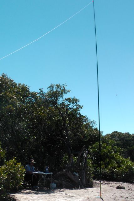
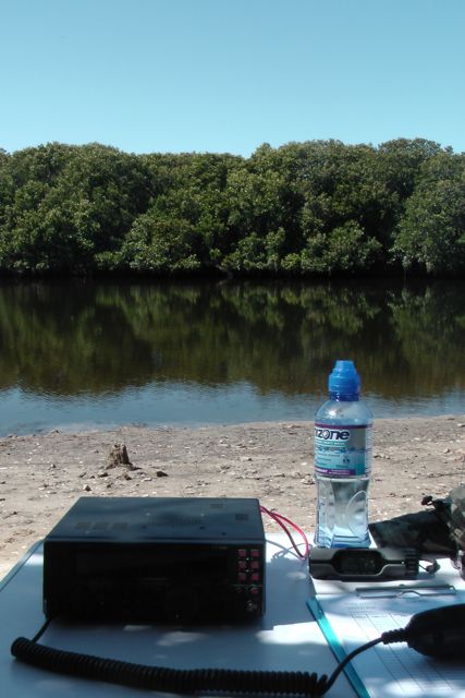
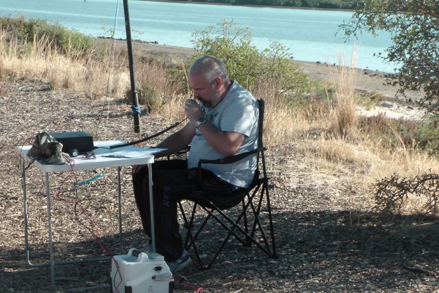
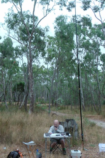
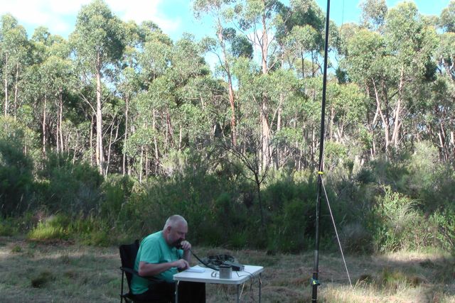
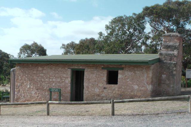
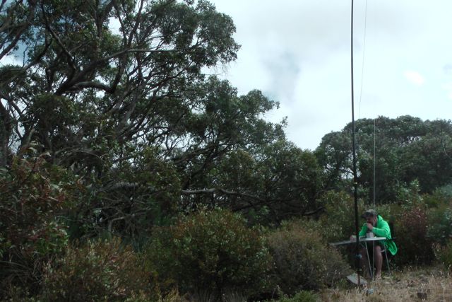
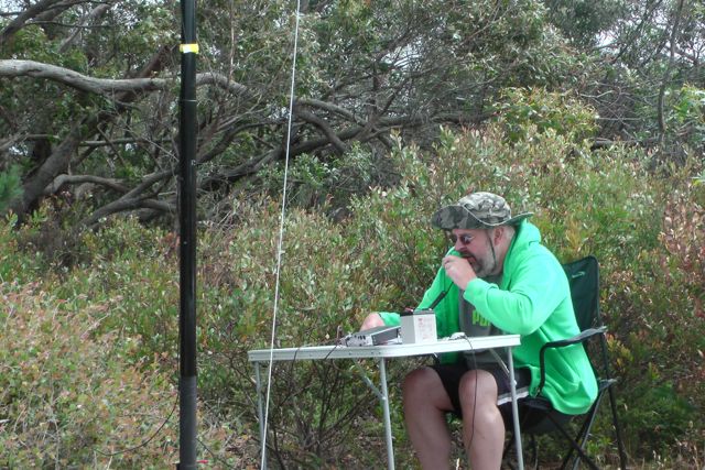
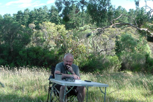
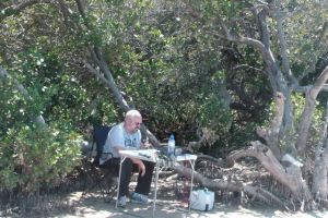
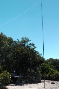
Marija and I drove to the very bottom of Port Gawler Road, where there is a parking area and a small shelter.  The shelter was a welcome sight, as the weather had really warmed up.  At least there was a spot that we could park the car, and Marija could remain in some shade while I activated the park.

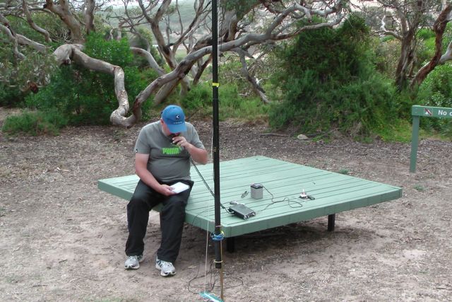
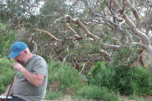
The carpark was really busy, so this was out of the question to erect the antenna.  We set up the gear just to the south of the carpark, where I found some shade under some mangrove vegetation on the shore of the Gawler River.  I was only about 10 feet from the water.  I brought along the Yaesu FT-450 for this action, and ran about 30 watts, into the 40m/20m linked dipole.  The squid pole holder for the 7m squid pole, was easy to push into the tidal sand.

IMGA0037

My first contact in the park was with Ian VK1DI who was portable on SOTA peak, Pheasant Hill, VK1/ AC-021.  Ian’s signal was quite low down, only 5/2.  However, because the noise floor at Port Gawler was so low, I was able to hear Ian perfectly.  Not a bad start…a SOTA contact.

Following my QSO with Ian I went up to 7.100 and put out a CQ call.  First taker was the ever reliable John VK5BJE from the Adelaide Hills.  John’s signal was not as loud as I expected.  A good 5/8, but I expected louder.  I received a 5/4 from John.  My VSWR was up a little high for this activation, for whatever reason.  But it wasn’t that high that it should affect my signal that much.

 IMGA0038     IMGA0029

Col VK5HCF then called in from Mount Gambier and gave me a 4/3 signal report.  And this was followed by Brian VK5FMID, also from Mount Gambier, who also gave me a rather poor report of 4/4.  This prompted me to look at the antenna quickly before the next QSO.  The alligator clip links appears okay.  Marija had accidentally stepped on the coax at Mutton Cove, and I started to wonder whether some damage had been done, and that was the reason why the VSWR was up a bit, and why signals were down a bit ?

But then Larry VK5LY from Renmark in the Riverland gave me a call, with a beautiful 5/9 signal.  And I received 5/8 back from Larry.  Larry advised that he couldn’t even hear me when I was in Mutton Cove.  Now I started to think that it was just propagation conditions.  They had been so good 90 minutes earlier at Mutton Cove, and had obviously taken a real step backwards.

John VK2AWJ from Gol Gol in New South Wales, came up to say hello.  John’s signal was a solid 5/8 with no QSB.  Obviously the propagation gods on 40m were playing with the band.

And to prove this, I had some interesting VK3 contacts.  I spoke with Phil VK3BHR from Bendigo who was 5/5 and I received a 5/8.  But just 15 minutes later I received a call from Ron who was stronger at 5/7 but I only received a 3/3 report back from Ron.  Ron reported that there was a lot of QSB on my signal.  A further 9 mintes later I received a call from Tony VK3KKP from Castlemaine.  Tony was running just 15 watts.  Tony’s signal was a constant 5/7 and I received a 5/9 signal report from Tony.

I also spoke with Bill VK5MBD from Red Hill in the mid north of South Australia, with his normal beautiful 5/9 plus signal.  I don’t think I have ever spoken with Bill when his signal has been below 5/9 +.

John VK5DJ from Millicent in the south east also called.  John’s signal was an excellent 5/9 plus and I received a 5/9 from John.  And yet 30 minutes earlier I was receiving 4/3 and 4/4 signal reports from the same geographical area.

Another good contact was with Frank VK5KV who was mobile between Port Augusta and Port Pirie, on his way to a trap shooting meeting.

My final QSO from Port Gawler was with Ian VK5CZ from Clare who had an excellent constant 5/9 signal.  I received a 5/9 signal report from Ian.

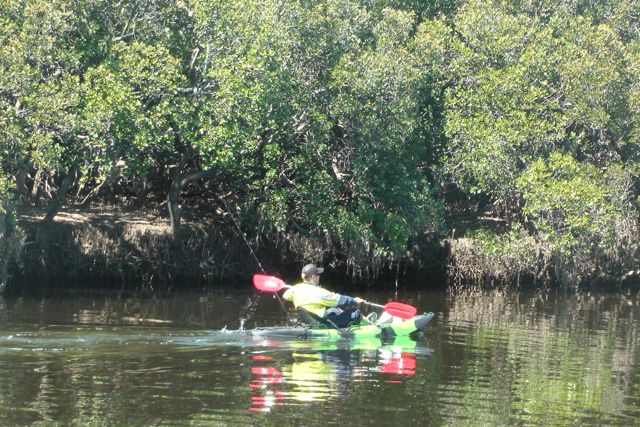
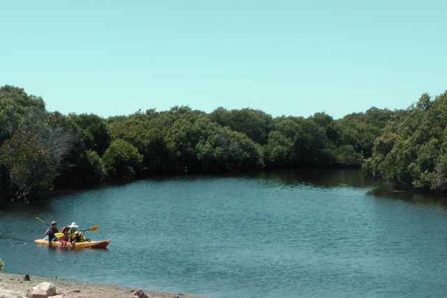
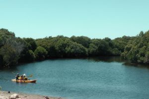
Whilst I was sitting back enjoying the day, quite a few kayakers paddled passed me.  One of those was a young lad who had his fishing gear on board.  He paddled up to me and asked if I was an amateur.  Apparently one of his mates has a licence, so he recognised that my squid pole wasn’t for fishing.  Backing up my earlier comments about the state of the area, he advised that there was now very little fish in the area due to pollution.  He stated that car bodies and general dumping of rubbish in the area, had significantly degraded the area.

IMGA0030     IMGA0040

From what Marija and I saw of the area, it certainly does need a good clean up.  I find it very sad how some people have a total disregard for their environment.  There were quite a few 4WD enthusiasts in the area at the time.  Some of those we witnessed speeding along the sandy flats with total disregard for their safety and that of others.

I found a post on the internet that probably sums up the park and the area…..

“Today, the main activities seen in the area are fishing, vandalism and burning of stolen cars……..there is a boat ramp and access for kayaking, I am not sure how much of your car would still be there upon your return. Given the funding cuts to the Department for Environment and Heritage I don’t expect this to improve.”

The following stations were worked:-

Ian VK1DI/p; John VK5BJE; Col VK5HCF; Brian VK5FMID; Roy VK5NRG; Larry VK5LY; John VK2AWJ; Phil VK3BHR; Tim VK5AV; David VK5KC; Nev VK5WG; Andrew VK5KET; Ron VK3AFW; Bill VK5MBD; John VK5DJ; Tony VK3KKP; Frank VK5KV/m; and Ian VK5CZ.

This was a very enjoyable activation under some unusual propagation conditions.  It wasn’t until I got home and started to read some of the posts on the SOTA Yahoo group, that I saw that the band was in rather port shape.

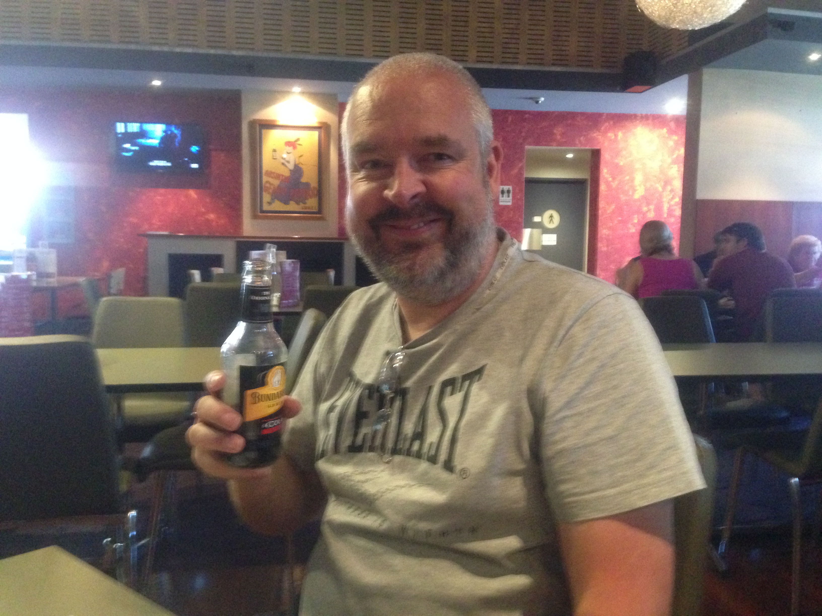
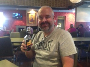
The day was finished off with a nice meal & a few Bundies and coke, at the Southern Hotel at Gawler.

IMG_1287

References.

http://www.environment.gov.au

http://mallala.nowandthen.net.au/index.php?title=Port_Gawler

Mutton Cove Conservation Park

This morning I headed out early with Marija and headed down to Osborne to activate what I believed was Mutton Cove Conservation Park.  Everything was going smooth sailing until I found out during the activation, that Mutton Cove was not a Conservation Park, and was actually a Conservation Reserve.

Mutton Cove Conservation Reserve is located in the industrial/residential suburb of Osborne, about 19 km north west of the Adelaide CBD.  It is located on the Lefevre Peninsula, which was named by Governor John Hindmarsh in 1837, after Sir John George Shaw-Lefevre, who was one of South Australia’s Colonisation Commissioners.

location map

On driving down Mersey Road North passed the Adelaide Submarine Corporation, we found a small parking area on the eastern side of the road, which appeared quite new, and which had a ‘Mutton Cove’ sign.  We stopped here briefly to have a look at the park.  There was a break in the fence line and a walking track, but in the distance to the north, we could see a car parked at the end of a dirt road, close to the Port River.  So we decided to try to head in that direction.

We continued north along Mersey Road North, and found a dirt road just to the north of the Australian Submarine Corporation installation and Archie Badenoch Ct.  We travelled to the end of the road, where there was a parking area on the shores of Light Passage, a section of the Port River.

There was a sign which read ‘Mutton Cove Conservation Reserve’.  This should have set off the alarm bells for me.  However I had checked the internet the night before.  Google Maps showed Mutton Cove as a Conservation Park.  However from past experience I have learned not to rely on Google Maps.  I have found that numerous South Australian Conservation Parks are not even recorded on Google maps.  But what really threw me, was Mapcarta.  I have found this to be an excellent resource.  Mapcarta showed Mutton Cove to be a Conservation Park.  And even ‘Weekend Notes’ which is also an excellent resource, referred to Mutton Cove as a Conservation park.

It wasn’t until just after my first QSO with Col VK5HCF, who tried to spot me on the parksnpeaks site but couldn’t find Mutton Cove, that I thought to myself “Oh Oh !“.  I immediately jumped on the trusty i-phone to check the parks list, and sure enough, Mutton Cove was not on the list.

Lesson learned…..check the ‘official’ parks list.  Don’t rely on the internet !

IMGA0009     IMGA0017

Netherless, this was an interesting place to visit.  Although it is not the most aesthetically pleasing place, it does have a very good walking track around it, with interpretive signs.

Sadly, the Mutton Cove area has been significantly degraded since European settlement in the area.  Industrial development and dumping of rubbish has impacted on the area.  During our visit, it was evident that many people have absolutely no concern whatsoever for the environment.  Mutton Cove is the last remaining area of samphire and mangrove woodland remaining on the Le Fevre Peninsula.  Three branches of Mutton Cove Creek weave their way through the park.  However, during our visit, these were mostly dry.

The history of the Le Fevre Peninsula itself is very interesting.  The peninsula was considerably smaller when Europeans first settled the area back in the 1800’s.  A large amount of fill has been placed on the peninsula between the early 1940’s and 1992 when dumping ceased.  The Mutton Cove area is one of the few areas on the edges of the Peninsula that remains at natural surface level.

Mutton Cove takes its name from Mutton Cove in Devonport in Devon, England.  That being an area that looks very similar to the South Australian Mutton Cove.  Captain Collet Barker, is the earliest recorded European to see the Port River and the Mutton Cove area.  He had been sent by Governor Darling of New South Wales to locate the Murray Mouth.  In 1831, from the top of Mount Lofty he spotted the Port River and believed that it was make a good harbour.

IMGA0015                                                  IMGA0016

I set up on the northern side of the park, under the shade of some mangrove vegetation. It was already very warm, despite being early in the morning.  The expected temperature was to be 38 degrees C.  After putting out a’is the frequency in use’ call on 7.095, I was greeted by the dulcet tones of Col VK5HCF from Mount Gambier with a beautiful 5/9 signal.  This was followed by Ivan VK5HAS who was initially 5/5, but suddenly crept up to 5/9.  It was like somebody had turned on a switch.  David VK5KC, John VK5BJE, Brian VK5FMID, and Tim VK5AV followed, all of whom had very good signals.

IMGA0013

After packing up, Marija and I decided to go for a walk around the park.  There are some interesting shipwrecks within the park including the ‘Excelsior‘ and the ‘Jupiter‘.  Looking around at the park, and the relatively dry Mutton Cove inlet, I wondered how the ships even got to where they were ?  The original Mutton Cove Creek was quite deep.

The first wreck is that of the ‘Excelsior’ which initially worked in New South Wales and Tahiti before arriving in South Australia during the early 1900’s.  The Excelsior was originally owned by flour millers John Darling and Sons, and later the SA Farmers Union Co-operative.  By 1933, she had been purchased by the SA Harbors Board and had been converted to a coal hulk to service the steamer dredges working in the Port Adelaide region.  However when diesel powered ships replaced coal fired vessels, the Excelsior was laid up, and abandoned at Mutton Cove.  She was floated right up the Cove to her current resting position on the spring tides.

IMGA0019     IMGA0020

There is also the wreck of the ‘Jupiter’ but we did not find this.  Apparently it is located mostly buried in the mud in the southern section of the park.

I worked a total of 6 stations, before deciding to pack up and head off to Port Gawler.  I decided it wasn’t worth the effort of explaining that Mutton Cove was not a Conservation Park to all the ‘hungry’ Park Hunters.  Sad really, because conditions on 40m SSB at this time appeared to be very good.

I worked the following stations:-

Col VK5HCF; Ivan VK5HS; David VK5KC; John VK5BJE; Brian VK5FMID; and Tim VK5AV.

There are some very interesting sites on the internet regarding this park, and the associated shipwrecks that can be found within it.

The park also has a Management Plan, which has some very interesting information on the park.  It can be found at…..

Click to access Mutton_Cove_web.pdf

References.

Wikipedia, http://en.wikipedia.org/wiki/Lefevre_Peninsula

Weekend Notes, http://www.weekendnotes.com/mutton-cove-shipwrecks/

Click to access Mutton_Cove_web.pdf

Kaiserstuhl Conservation Park

On Saturday morning, 18th January, 2014, my wife Marija, and I headed off to the Barossa Valley, for Marija to get her hair done by a friend.  So I tagged along with the intention of activating a new park, the Kaiserstuhl Conservation Park.

Kaiserstuhl CP is located about 12 km south-east of Tanunda in the Barossa Valley.  It is 390 hectares in size and was dedicated in 1978 to protect one of the last remnants of native vegetation in the Barosa Valley region.  It also protects important seasonal creek and wetland habitats.

IMGA0021_2

The park is located about 15 km from the devastating bush fires from last week that swept through the Eden Valley destroying about 5 homes.  On Saturday morning before leaving home, I mulled over whether I should activate the park.  Based on info from people in the area, I decided that it was safe to activate the park.  The fire threat had significantly reduced the night before, and we were going to be sufficiently far enough away from any fire activity.

The area where the park was located was discovered in the mid 19th century by the prominent naturalists, H.H. Behr, F.J.H Von Muller, J.G.O. Tepper, and J. Menge.  The Tanunda Creek Bullock Track originally crossed the creek several times within the park but was closed around 1885 in favour of the more direct route along Tanunda Creek Road.  I accessed the park via Tanunda Creek Road.

A plaque within the park records the bequest to the Field Naturalists’ Society of South Australia by Mr Leo Wakem Nicholls (1894-1971).  Nicholls was a keen bushwalker whose bequest to the Field Naturalists Society of S.A. enabled that organisation to contribute $30,000 towards the purchase in 1978 of the park.  The official dedication ceremony took place in December, 1983.

IMGA0006

The park includes granite features such as Horse Head Rock.   Weathering and erosion have produced this rock formation which, as the name suggests, resembles a horse’s head.  Capped Rock, a horizontal rock slab perched on a vertical outcrop, is another interesting feature within the park.

The park is home to native birds such as blue wrens, parrots, honeyeaters, finches and thornbills.  In the late afternoon or early morning, western grey kangaroos can be seen in the open grassland areas of the park, while Euros can occasionally be seen on the rocky ridges of the higher sections of the park.  Other animals to be found in the park include echidnas, possums, bats, and a variety of snakes and lizards.

About 400 plant species are supported within the park.  The park was principally established to preserve the most northerly occurrence of the brown stringybark, Eucalyptus baxteri. Their multi-stemmed, mallee-like appearance is the result of earlier, regular trimming to provide wood for the Nuriootpa brick kilns.

IMGA0011     IMGA0014_2

Large blue gums, river red gums, native pines and sheoaks provide shady cover for the diverse understorey of yaccas, wattles, tea-trees and silver banksias.   Many of the banksias were out in flower during my visit to the park.  Many plants, such as lavender grevilleas and fringe myrtles flower in spring. The green flowered hairy correa is an unusual plant that grows in the shelter of the large granite outcrops. The rare prickly tree violet also occurs in the park and is often mistaken for the African boxthorn. This native plant provides protected nesting sites for small birds.

IMGA0028     IMGA0010

You may see mistletoe growing on the eucalypts, acacias and casuarinas in the park. These are parasitic native plants, which provide food and shelter for many bird species. The lichens growing on the rocks are also an important part of the ecosystem helping to weather the rocks to form soil.

I ran a little late in getting to the park and setting up.  Mostly because we travelled all the way along Rifle Range Road, on the western side of the park, only to find that the road fell short of the park.  So we then drove all the way back and around to Bethany, and then up Menglers Hill Road, and access the park on the eastern side of Tanunda Creek Road.

There is a gate at this point to enter the park, and I set up the station just inside the park boundary near the gate.  There is a walking track from here which leads to an interpretative sign and some walking tracks through the park.  Soon after setting up David arrived, and Marija headed off for her hairdressing appointment.

I was running behind schedule and I knew the Hunters would be getting hungry, so I quickly jumped onto 40m, only to realise a little later that I had not secured the ends of the dipole.  Nether mind.  It still worked.  My first QSO was with Brian VK5FMID at Mount Gambier, followed by Col VK5HCF also in Mount Gambier, and then Dave VK3VCE near Echuca.  After working 6 stations, I handed over the mic to David, who made contact with 8 stations in VK3 & VK5.  Despite the fact that wee were not on a summit, David had his little fluffy goat as his mascot.  I then took over the reigns again & spoke with Larry VK5LY and Ian VK5CZ prior to the UTC roll over.

IMGA0002     IMGA0016_2

After the UTC rollover I worked a further 7 stations before again handing the mic over to David, whilst I went for a walk through the park.  David worked a further 6 stations in VK3 & VK5, including Mark VK5QI who was portable in Deep Creek Conservation Park.  The VK5 Parks award allows ‘Hunters’ to work activators for points every UTC day.  So a few operators called us back for a second bite at the cherry.

IMGA0020_2

The weather was starting to warm up, band conditions were fading, and Marija had arrived to pick me up.  So it was time to pack up the gear and head home.  This was a beautiful park and a good fun activation with David.

A total of 29 QSO’s were made on 40m SSB.

The following stations were worked by me, VK5PAS:-

Before UTC roll over:- Brian VK5FMID; Col VK5HCF; Dave VK3VCE; Paul VK5FUZZ; Andrew VK5KET; Bill VK5MBD; Larry VK5LY; & Ian VK5CZ.

And after UTC roll over:- Larry VK5LY; Basil VK5BK; Dale VK5DC; Mike VK5MCB; Mal VK3AZZ; & Ian VK3VIN.

The following stations were worked by David, VK5NQP:-

Before UTC roll over:- Kevin VK3VEK; Brian VK5FMID; Bill VK5MBD; Joe VK3YSP; Julie VK3FOWL; Larry VK5LY, Dennis VK5LDM; Graham VK5KGP

And after UTC roll over:- Larry VK5LY; Maitland VK5AO; Ian VK5CZ; Nev VK5WG; Bob VK5AK; Frank VK3GFS; & Mark VK5QI/p.

Mount Lofty summit VK5/SE-005 and Cleland Conservation Park

Yesterday was my 49th birthday, so after a Sunday morning sleep in, and then watching the V8 Supercars in bed, I surfaced from the bedroom and had a magnificent roast lamb lunch with the family.  This was followed by a few beers on the couch watching the Aussies smash the English in the cricket.  This was a bloke’s heaven !

My wife Marija then asked what i would like to do for the afternoon !  Bad move.  Never give a bloke an option.  Especially when he is a keen portable amateur radio operator.  I told Marija that I would like to do my first SOTA activation for 2014.  Fortunately my son Jake was at lunch and he offered to drive me over to Mount Lofty, a short 15 minute drive from home.

I have operated from Mount Lofty Summit a number of times previously because of its close proximity to home.  But because it was a new year, this meant some more SOTA activator points for me.  And the added bonus is that the summit is located within the Cleland Conservation Park, so it qualifies for the VK5 National and Conservation Parks Award.

Jake dropped me off at Mount Lofty, and I headed to my favourite operating spot on the eastern side of the summit and the obelisk, away from the tourists.

IMG_1250     IMG_1255

I started off on 40m first with a contact with John VK5BJE who was portable in the Mount Richmond National Park in Victoria.

I then QSY’d down to 7.090 to call CQ, but when I asked if the frequency was in use I was greeted by John VK2YW, who advised Bernard VK2IB/3, was on the frequency on a peak in Victoria, but he was fixing his antenna which had blown down.  So I placed John in the log and went a bit lower to 7.085 where the pile up started.  This included 2 Summit to Summit contacts.  The first with Greg VK2FGJW who was on One Tree Hill VK1/ AC-035, and then Bernard VK2IB/3 who had followed me down.  Bernard was on VK3/ VE-189.

QRP callers included Col VK5HCF, Peter VK3PF, Nigel VK5NIG, Andrew VK3ARR, Nev VK5WG, and Peter VK3NAD.

After working 21 stations on 40m SSB, I headed up to 20m, hoping to get the two hungry VK6 SOTA Chasers in the log, Mike VK6MB and John VK6NU.

My first caller on 20m was Andrew VK4OZY and this was followed by Matt VK2DAG, Rod VK5VRB, and then Gerard VK2IO.  And then came to the two VK6 boys.  Firstly John, followed by Mike.  It was hard work with John but we got there (5/3 S and 4/1 R).  It was a bit easier with Mike (5/3 S and 5/1 R).

Things slowed down after this on 20m, so I tuned across the 20m band to find very little activity.  I did hear Stuey VK8NSB calling CQ and I tried calling him, but I just couldn’t quite make it.  So I decided to check into the ANZA DX Net on 14.183.  And this was a good move, because I had 3 great DX contacts.

I am trying to get DXCC on QRP 5 watts and portable, and I am currently sitting on about 30 countries since March last year.  So I was very excited when on the net I was able to make contact with Andy E51AND from the Cook Islands, who had a booming signal.  I then received a call from Dom 3Z9DX in Poland, who was running qrp as well, just 5 watts (5/3 sent and 5/0 received).  And finally Maurice FK8HZ from New Caledonia gave me a call (5/8 sent and 5/5 received).

I then went back to 40m to hopefully get some more of the regular VK SOTA Chasers in the log.  I worked a further 18 stations in VK1, VK2, VK3, & VK5.

QRP callers included Nick VK3ANL and Ron VK3MRH.

I then went back to 20m to have a quick listen before Marija arrived.  I managed to sneak in another QSO with John VK6NU.  Conditions had improved between the two of us.  John was up to a 5/7.  The 20m band was not all that busy as far as DX is concerned.  But there was a lot of activity from a Russian contest ? which made finding a clear spot very difficult.

Thanks to Rod VK5VRB for passing the message onto my wife to come and pick me up, after my mobile phone went flat.

The following stations were worked on 40m SSB:-

John VK5BJE/3; John VK2YW; Brian VK5FMID; Tom VK5FTRG; Col VK5HCF; Ron VK3AFW; Greg VK2FGJW/p; Peter VK2NEO; Bernard VK2IB/3; Peter VK3FPSR; Phil VK3BHR; Peter VK3PF; Nigel VK5NIG; Andrew VK3ARR; Nev VK5WG; Ian VK5CZ; Keith VK5OQ/3; Marc VK3OHM; Allen VK3HRA; Peter VK5KPR; Peter VK3NAD; Tom VK5EE; Terry VK5ATN; Kevin VK3VEK; VK3XY; Bernard VK3AMB; Nick VK3ANL; Len VK3FB; Ron VK3MRH; Joe VK3YSP; Peter VK5PET; Ian VK1DI; Matt VK1MA; Julie VK3FOWL; Steve VK3VM/5; Mark VK3YN; Mark VK3PI; Rod VK5VRB; and Paul VK2KTT.

The following stations were worked on 20m SSB:-

Andrew VK4OZY; Matt VK2DAG; Rod VK5VRB; Gerard VK2IO; John VK6NU; Mike VK6MB; Andy E51AND; Col VK4CC; John VK4LJ; Dom 3Z9DX; Lynne VK4SWE; Maurice FK8HZ; and Terry VK4HQ.

Thanks to everyone that called.  It was a good fun activation.  And thanks to everyone who passed on birthday wishes.  I think next year for my 50th I will probably be tied up with a bigger celebration….so no SOTA or Parks.  Maybe ???

Mount Billy Conservation Park

Mount Billy Conservation Park was my last activation for the 3 days away.  It is just a few km south east of the Spring Mount Conservation Park, off the Hindmarsh Tiers Road.

IMGA0004

Courtesy of: http://www.mapcarta.com

Mount Billy Conservation Park is 199 hectares in size and represents some of the best preserved mallee and forest within the southern Mount Lofty Ranges.  The Hindmarsh Valley Reservoir can be located on the southern side of the park.  The Mount Billy summit is also located in the southern section of the park (sadly not a SOTA summit).  I have not been able to find a reference as to how the park/summit was named. The thick under storey of the park and the many creek lines provide habitat for numerous bird and animal species including the endangered Bassian Thrush, Chestnut-rumped Heathwren and the rare Southern Brown Bandicoot.  The Heath Goanna can also often be spotted, basking in the sun.

  IMGA0051_3

The scrub within the park is very thick, but there are two trails which takes you around the park: Banksia Hike (2.6 km), and the Mount Billy Hike (4.7 km).  Many of the native plants were out in flower whilst we were in the park, including a number of the Banksia species.  The park is full of Pink Gum, Blue Gum, Cup Gum, and Woodland Sheoak.  During spring, flowering orchids are found on the forest floor.

 IMGA0057_3

Just down the road from the park is the old Hindmarsh Valley school building which was established in 1867.  It is a beautiful old building and well worth stopping to have a look.

IMGA0058_3

We found a nice operating spot, just inside the park gate on the Hindmarsh Tiers Road.  There was plenty of room to set up the table and chair, and extend the legs of the dipole.  The only down side were the large sand ants.  They pack a bite with a lingering sting, as I found out.

IMGA0035_4

My first contact in the park was with Graham VK5KGP at nearby Victor Harbor, followed by Larry VK5LY in the Riverland, and Col VK5HCF operating qrp 5 watts, and Tim VK5AV from the south east.  Ian VK5CZ who was portable in Wirrabra Forest on his Elecraft KX3, came up to say goodmorning. Greg VK2FGJW/1 called in again from SOTA peak, Black Mountain, VK1/ AC-042.  I think Greg may have been infected by the deadly SOTA bug. Because the noise floor in the majority of the parks is non existent, you can work the weakest of stations.  So it is always pleasing to get some calls from QRP stations.  In Mount Billy I worked Col VK5HCF, Luke VK3HJ, and Ian VK5IS, all of whom were using QRP 5 watts or less. I managed a few more interesting QSO’s including Kevin VK3KAB who was portable on SOTA peak Trapyard Hill,VK3/ VT-005, Andrew VK3BQ who was in Mount Kosziusko National Park, and Steve VK3JY who was operating QRP with his Elecrat KX3, from his holiday home at Lake Eildon.  Unfortunately Steve was just outside the boundary of the National Park. I felt a bit guilty that I had run our of time to try 20m from the previous park (for some of the further afield VK’s who chase Parks), so I headed over to the 20m band hoping to get some further afield VK’s.  I called CQ for a while but there were no takers.  So I tuned across the band which was virtually empty, except for Peter VK3ZPF who was calling CQ from SOTA peak, Mount Matlock, VK3/ VC-001. After speaking with Peter, I was called by Dennis VK4SX, and Stu VK4SDD, both of who had great 5/9 signals coming in from Queensland.

IMGA0042_4

Well it was time to pack up and the end of 3 days of parks activating.  I had a total of 24 stations in the log for this park on 40m SSB and 20m SSB.  It seemed the VK5 National & Conservation Parks Award was quite popular and was attracting some attention, which was great. I worked the following stations:- Graham VK5KGP/p; Larry VK5LY; Col VK5HCF; Tim VK5AV; Brian VK5FMID; John VK5DJ; Ian VK5CZ/p; Nev VK5WG; Tom VK5EE; Shaun VK5FAKV; Luke VK3HJ; Barry VK5BW; Greg VK2FGJW/p; Ian VK5IS; Kevin VK3KAB/p; Bernard VK3AMB; VK3BQ/2; Dave VK3VCE; Steve VK3JY/p; Phil VK3BHR; Peter VK3PF/m; Peter VK3ZPF/p; Dennis VK4SX; and Stu VK4SDD. References. Department for Environment and Heritage, 2011, Parks of the Fleurieu Peninsula Mapcarta, 2013, viewed 30th December, 2013, <http://mapcarta.com&gt;

Spring Mount Conservation Park

My first activation for Sunday 29th December, 2013, was the Spring Mount Conservation Park, which is situated about 24 km north west of Victor Harbor, and about 71 km south of Adelaide.

IMGA0005

Marija and I headed out relatively early again after breakfast in the motel room.  This was our departure day and back to ‘reality’.  We had both really enjoyed our stay down at Victor Harbor, and the Comfort Inn is recommended.  Marija and I headed north out of Victor Harbor and then turned left onto the Hindmarsh Tiers Road, through the beautiful dairy country of the Hindmarsh Valley.  We then turned left into Spring Mount Road which offered spectacular views out to the ocean.

IMGA0001_6     IMGA0002_5

On the western side of Springmount Road there is a cleared area between the fence line and the scrub.  It was the ideal spot to set up the station.  We set up the foldable table & deck chair and erected the 40m/20m dipole with use of the 7m squid pole.

My first contact of the morning was with Parks stalwart, Larry VK5LY, followed by Col VK5HCF running QRP 5 watts, Brian VK5FMID, and Nev VK5WG who was also running QRP.  This was followed by a steady flow of callers from VK1, VK2, VK3 & VK5.

Spring Mount CP     IMGA0018_5

The band seemed to be in very good shape.  One of my QRP to QRP contacts was with Richard VK5ZRY who was operating with just 1/2 watt from Port Vincent on the Yorke Peninsula of South Australia.

Greg VK2FGJW/1 called in to say hi.  He was portable on Black Mountain in the ACT, using QRP 5 watts from his Elecraft KX3, and a dipole.  After some discussion with Greg about the Summits on the Air program, it was confirmed that Greg had indeed qualified for SOTA from his portable location.  I believe this was Greg’s first ever SOTA activation.

My last contacts of the day were with Joe VK3YSP and Julie VK3FOWL who were on the Christmas trip and were portable in the Little Desert National Park in western Victoria.

Whilst I was operating, I had some regular visitors.  But not humans !  They were little Superb Blue Wrens.  The male of the species has a really striking bright blue plumage on its head, neck, and tail.  They are an active and gregarious little bird.

IMGA0029_4     IMGA0031_4

Conditions on 40m SSB were really good, but I was already behind schedule, so we packed and headed off to the final park, the Mount Billy Conservation Park.

I worked the following stations:-

Larry VK5LY; Col VK5HCF; Brian VK5FMID; Nev VK5WG; Graham VK5KC/p; Tom VK5EE; Tim VK5AV; Graham VK5KGP; Chuck VK2SS/p; John VK5NJ; Len VK3FB; Rick VK5FIVE; Tom VK5FTRG; Ian VK5IS; Shaun VK5FAKV; Allen VK3HRA; Richard VK5ZRY; Tony VK3CTM; Ian VK5CZ/p; Greg VK2FGJW/1; Joe VK3YSP/p; and Julie VK3FOWL/p.


References.

Department for Environment and Heritage, 2011, Parks of the Fleurieu Peninsula

Mapcarta, 2013, viewed 30th December, 2013, <http://mapcarta.com&gt;

Newland Head Conservation Park

My final activation of the day was the Newland Head Conservation Park, which is situated on the southern coast of the Fleurieu Peninsula, about 7 km south west of Victor Harbor, and about 91 km south of Adelaide.

IMGA0003

Courtesy of http://www.mapcarta.com

Newland Head CP is a large park and consists of 1,036 hectares.  It takes its name from the rugged headlands that shelter the associated two long beaches, Waitpinga Beach, and Parsons Beach, which are a popular destination for surfers and fishers.  In fact my son Jake surfs here, as did I back in my ‘glory days’.  Now if I ventured onto the beach, Greenpeace would be trying to roll me back into the water.  Fishing is very popular as the wave action and gutters near the shore create ideal conditions for salmon, mulloway and mullet fishing.  Part of the famous Heysen Trail, which extends for 1,200 km, runs through the park.

The park is home to a large amount of birdlife including the Beautiful Firetail finch, Purple-crowned Lorikeet, Wedge tailed wage, Sining honeyeater, and White-capped Albatross.

Southern Right Whales are frequently seen behind the surf zone or swimming towards the west.  After breeding in the warmer waters of southern Australia they return to the main feeding grounds of the subantarctic where they feed in preparation for the return journey.

IMGA0120_2     IMGA0122_2

Marija and I initially checked Waitpinga Beach with a view to erecting the vertical antenna in the sand, but it was extremely windy and too exposed.  So we headed back into the Waitpinga campground and put up the gear alongside Dennis Hut, which was is an old stone hut built in 1890 by the Dennis family who lived in the area.

  IMGA0126_2

The Waitpinga camp ground is the only campground in the Park.  It is only about 750 metres inland from Waitpinga Beach, but is well protected from the wind off the Southern Ocean.  The local aboriginal word for Waitpinga is ironically, ‘windy place’.  There are several walking trails which commence from the eastern end of the Waitpinga campground, which was full of campers, who became interested onlookers.

IMGA0135_2      IMGA0138_2

Right alongside of the hut is a wooden table which was the ideal place to place the radio on and initiate as the ‘shack’.  My first contact was again with Larry VK5LY from the Riverland, and this was followed by Tim VK5AV in the south east of S.A., and then Nev VK5WG from Crystal Brook, followed by Ian VK5IS.  I even snuck in a Victorian National Park, with Marshall VK3MRG operating portable from the Lake Eildon National Park.

IMGA0148     IMGA0155

After working a total of 15 stations on 40m it went very quiet.  So I tuned across 40m and other than Urey VK3ATA calling CQ DX, there was not a single VK station on the band.  I could also hear some Europeans coming through, but their signals were very low down.  So I decided to head over to 20m to try my hand.  And my first QSO was with Renzo P29FR.

I am trying my luck at QRP DXCC, and Papua New Guinea was a new QRP country for me.  So I was really happy to get Renzo in the log (5/8 sent and 5/4 received).  My next DX QSO was with Tom DJ7ZZ.  Unfortunately QRM made it very difficult for Tom (5/8 sent and 5/4 received).  And my 3rd DX contact was with Franc F5PAU who had a very strong signal (5/9 sent & 5/2 received).

But I think the highlight was my last QSO of the day, and that was with Anthony VK3YSA/ZL.  Anthony was operating QRP with just 3 watts from an FT-817 and an end fed vertical.  And he was in a Conservation Park, south of Dunedin. Signal reports of 5/3 both ways were exchanged.

Whilst I was operating I had quite a few interested onlookers.  In fact about one dozen people came up, curious as to what I was up to.  This included 3 young guys (one was a pilot) who were involved with UHF radio.

IMGA0161

After a few enjoyable hours of radio, chatting, and a bit of bushwalking in Newland Head CP, I had a total of 24 contacts in the log on 40m SSB and 20m SSB.  This was a really enjoyable activation with quite a few highlights for me.

I worked the following stations:-

Larry VK5LY; Tim VK5AV; Nev VK5WG; Ian VK5IS; Graham VK5KGP; Tom VK5EE; Barry VK5BW; Marshall VK3MRG/p; Peter VK2NEO; Allen VK3HRA; Col VK5HCF; John VK5DJ; Rod VK5VRB; Hans VK5YX; Don VK2HUH; Renzo P29FR; Tom DJ7ZZ; Roy VK7ROY; Don VK7DON; VK6LCK; VK2HAS; Mark VK6AR; Frank F5PAU; & Anthony VK3YSA/ZL (qrp).

Eric Bonython Conservation Park

Following our activation of Waitpinga Conservation Park, Marija and I continued south on the Tunkalilla Road and then turned left into Rymill Road, until we reached our next destination….the Eric Bonython Conservation Park.

Again, as is the case with Waitpinga CP, this is a small park and consists of just 6 hectares.  Although small it is an excellent example of what the vegetation was like on the Fleurieu Peninsula prior to the arrival of the Europeans and the destruction of the bush.  I was not able to find a lot of information on this park on the internet.  I presume it was named after Eric Bonython, the author ?

IMGA0050_2     IMGA0053_2

The scrub in the park was very thick.  There were no visible cleared areas of land at all.  A large number of the native plants were out in flower.

IMGA0048_2     IMGA0047_2

We set up the gear just off the side of the road as it was physically impossible to get into the scrub, and just too risky with the ‘Joe Blakes’ (snakes).  We stretched out the legs of the dipole and ran them along in the direction of the dirt road, and secured the squid pole with the squid pole holder and an octopus strap.

IMGA0033_3       IMGA0035_3

My first contact was with Col VK5HCF who was up at the South East Radio Club clubrooms, Mount Gambier, using his normal QRP 5 watts.  Col had a great 5/9 signal.  This was followed by Tim VK5AV, also from the south east of South Australia, Graham VK5KGP from Victor Harbor, and Nigel VK5NIG in the north eastern suburbs of Adelaide.

I had a steady flow of callers after this, but sadly the weather had really deteriorated. The cloud cover had moved in, the sun had disappeared, and the wind was extremely strong.  In fact it was so strong that the 7m telescopic squid pole, de telescoped twice during the activation.

I managed another contact with Marshall VK3MRG in the Lake Eildon National Park, and one SOTA contact with Brian VK3MCD who was portable on SOTA peak VK3/ VU-011.

The weather was just that lousy that it was not enjoyable sitting out there, so it was time to pack up.  I had qualified the park and had a total of 17 QSO’s from VK3 & VK5 in the log.

I worked the following stations:-

Col VK5HCF; Tim VK5AV; Graham VK5KGP; Nigel VK5NIG; Marshall VK3MRG/p; Tom VK5EE; Norm VK5GI; Tom VK5FTRG; Nev VK5WG; Brian VK3MCD/p; Barry VK5BW; Barry VK5BAR; Allen VK3HRA; Ian VK5IS; Bernard VK3AMB; Ian VK5CZ; Nick VK3ANL.

Waitpinga Conservation Park

My first park activation for Saturday 28th December, 2013, was Waitpinga Conservation Park, which is about 40 km west of Victor Harbor, on the Fleurieu Peninsula, and about 113 km south of Adelaide.

IMGA0001

Courtesy of: wwww.mapcarta.com

Marija and I had another early start from Victor Harbor and headed out west along Range Road, through the beautiful dairying district of Parawa.  There are sensational views out to both the north and the south from Range Road.  Out to the north are the rolling hills and valleys of the Fleurieu and out to the south is the Southern Ocean.  We then turned left onto Tunkalilla Road and headed towards the coast and Tunkalilla Beach, before turning left onto Illawong Road.  We reached a point on Illawong Road, where we just could not go any further in Marija’s Mitsubishi Lancer.  The road was quite steep and was severely washed away in significant places.  It just wasn’t worth risking getting stuck.

IMGA0002_4

The Waitpinga Conservation Park is only a small park, which is about 3 hectares in size and is dedicated to the conservation of the rare Coral Fern.  The park consists of low open forest of stringy bark and Pink Gum, over an under storey of bracken, tea-tree, sedges and grasses.

IMGA0001_5     IMGA0020_4

The vegetation within the park is very thick.  Many of the native plants were out in flower during our visit.  The park is located on the northern side of Illawong Road, and backs onto a pine plantation.  It is quite some distance away from the beach known as Waitpinga Beach.  Waitpinga in the local aboriginal language means ‘windy place’.  And it was windy where we decided to set up.  Despite it being a warm start to the day, a cool change was coming in quickly and the wind off the Southern Ocean was really starting to pick up.

IMGA0021_4     IMGA0017_4

We set up on the edge of the park in a cleared area and erected the 7m squid pole and the 40m/20m linked dipole.  I tuned to 7.095 and asked if the frequency was in use, only to be greeted by Larry VK5LY with a great signal.  And this was followed by Graham VK5KGP, Col VK5HCF (qrp 5 watts), Tim VK5AV, and a steady flow of callers following that from VK3 & VK5.

I managed a few Victorian park contacts & SOTA contacts whilst in Waitpinga CP.  The first Victorian National Parks contact was with Marshall VK3MRG who was portable in Lake Eildon National Park, camping with the family.

I also spoke with Glenn VK3YY was portable on SOTA peak, Trapyard Hill, VK3/ VT-005, which is located within the Alpine National Park.

And then I was fortunate enough to stumble across Joe VK3YSP and Julie VK3FOWL who were portable in Cobbobonee National Park, on their extended Christmas adventure of Victorian National Parks.

My final contact in Waitpinga CP, was with Tony VK3CAT who was portable on SOTA peak, King Billy No. 1, VK3/ VE-016.

  IMGA0004_4

I worked a total of 29 stations on 40m SSB.  The following stations are in the log:-

Larry VK5LY; Graham VK5KGP; Col VK5HCF; Tim VK5AV; Brian VK5FMID; Marshall VK3MRG/p; Allen VK3HRA; Tom VK5EE; John VK5TD; Nev VK5WG; Andy VK5AKH; Frank VK3GFS; John VK5FMJC; Nick VK3ANL; Shaun VK5FAKV; Bill VK5MBD; Glenn VK3YY/p; Ron VK5BRL; Dennis VK5LDM; Mal VK5MJ; Steve VK5ST; Grant VK5VGC; Craig VK3NCR/m; Joe VK3YSP/p; Julie VK3FOWL/p; Dave VK3VCE; Tom VK5FTRG; David VK5KC/p; Tony VK3CAT/p.

References.

Parks of the Fleurieu Peninsula, 2011, Department of Environment and Natural Resources, Adelaide, South Australia