Cudlee Creek Conservation Park

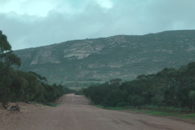
This morning (Thursday 17th July, 2013), I headed out to the Cudlee Creek Conservation Park, which is about 33 kms north from my home in the Mount Lofty Ranges ‘Adelaide Hills’.

The weather was supposed to be turning really bad during the afternoon, but the morning appeared really good.  In fact at home it was bathed in sunshine.  But I could see the weather coming in from the west and the rain radar showed that there was some really heavy rain activity over on the Yorke Peninsula.

So I quickly made an entry on the VK5 Parks Yahoo site, packed up the gear and headed north.

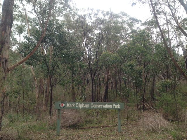
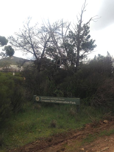
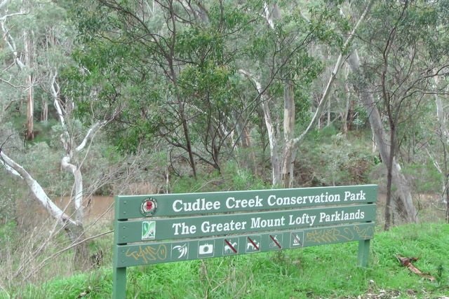
The Cudlee Creek Conservation Park was established in 1971.  It is located on Gorge Road, about 3 kms beyond the Cudlee Creek Caravan Park and Restaurant, and about 1 km passed the Country Fire Service (CFS) station.

The little town of Cudlee Creek, which was established in 1838, is a picturesque little settlement next to the Cudlee Creek on the scenic route between Lobethal, Lenswood and Gumeracha.   One of the attractions in the town is the Gorge Wildlife Park which is among one of the most comprehensive collections of privately owned animals and birds in Australia.

The Aboriginal meaning for “Cudlee” is believed to be “wild dog crossing”.

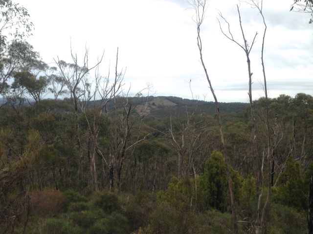
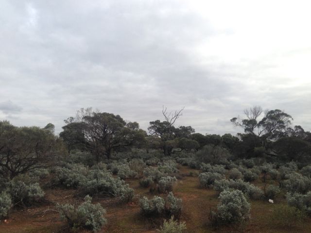
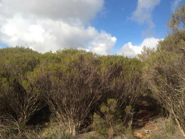
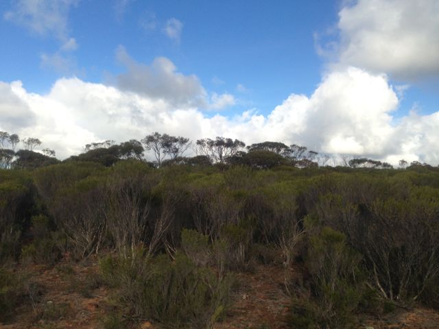
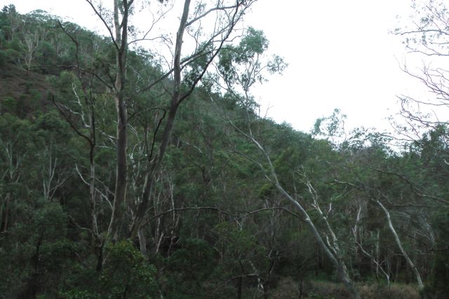
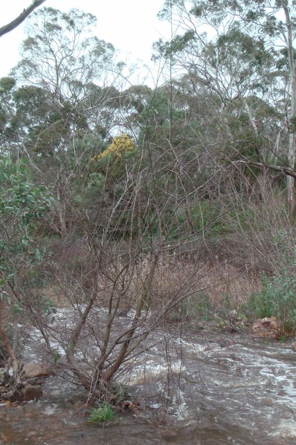
The Cudlee Creek Conservation Park is home to a variety of birds and native animals who live in the woodlands on the steep hillsides.  The park contains no visitor facilities or amenities.  Adelaide’s main river, the River Torrens, passes through the park.  Red Gum woodland along the river valley and Blue Gum with Manna Gum open forests are conserved in the park.

IMGA0001

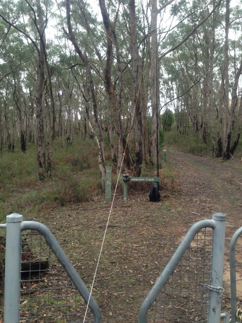
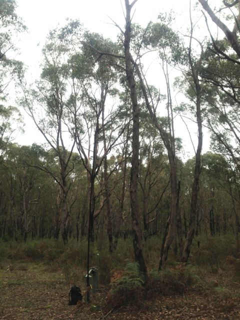
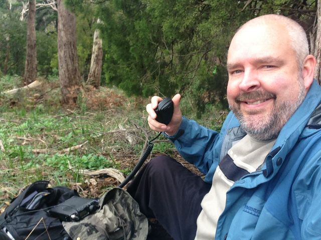
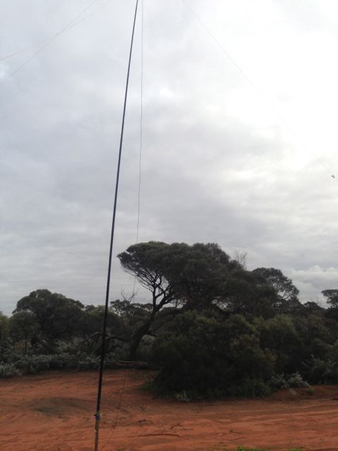
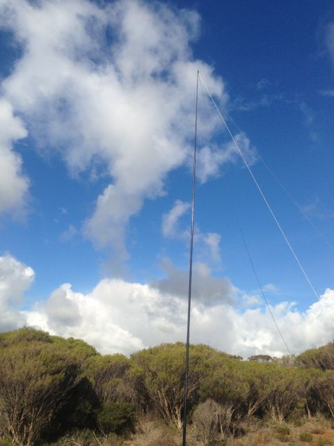
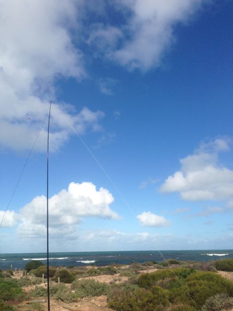
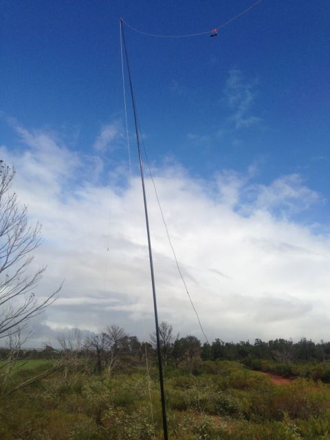
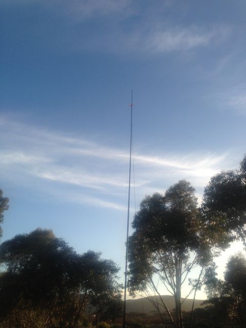
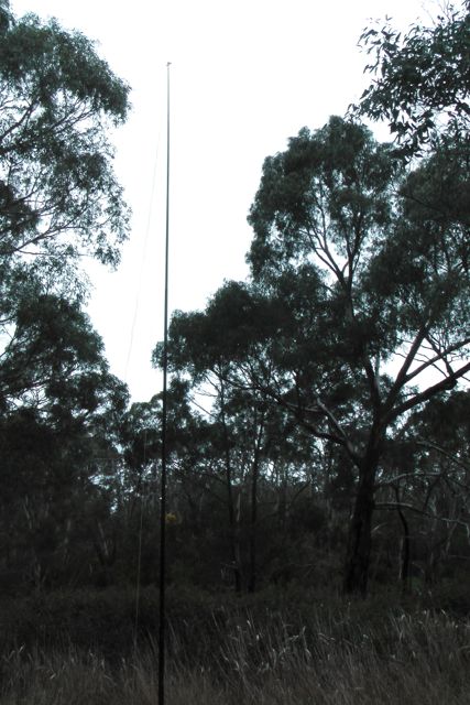
I set up my gear, a Yaesu FT-817 and my 40m dipole supported by a 7m squid pole, and put out a call on 7.100 on 40m.  My first QSO of the day was with Larry VK5LY, who had a booming signal from the Riverland.

IMGA0002      IMGA0003

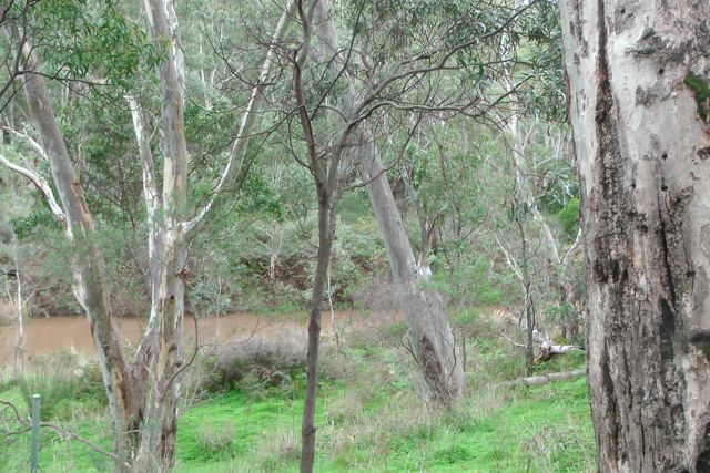
The river was flowing well after last night’s heavy rainfall up here in the Mount Lofty Ranges.  But the good thing was that there was no rain, and although the weather was coming in rapidly from the west, I was in a fairly sheltered area down by the river, so the wind was a lot less.

IMGA0006     IMGA0008

I ended up with 8 QSO’s on 40m SSB into VK3 & VK5.

The following stations were worked:- Larry VK5LY; Ron VK3AFW; Robin VK5TN; John VK5DJ; Andy VK5LA; Grant VK5VGC; Albert VK3KLB; and Tim VK5ML.

Mark Oliphant Conservation Park

My second activation of the day (Friday 12th July 2013) was the Mark Oliphant Conservation Park.  The park which consists of about 189 hectares, is situated about 22 kms south east of Adelaide in the Mount Lofty Ranges ‘Adelaide Hills’.

The park was first used for recreation in the 1930’s, and in 1945 it was purchased by the Young Mens Christian Association (YMCA).  In 1953, the park was acquired by the State Government and was proclaimed the Loftia Recreation Park in 1972.  The park was expanded in 1992 and 1995, and renamed in 1996 in recognition of its conservation values and to honour physicist and humanitarian Sir Mark Oliphant’s contribution to conservation.

IMG_3238     IMG_3242

Sir Marcus ‘Mark’ Laurence Elwin Oliphant who was an Australian physicist and humanitarian who played an important role in the first experimental demonstration of nuclear fusion and also the development of nuclear weapons.  He was a former State Governor here in South Australia, and also has other places and things named in his honour including the Oliphant Building at the Australian National University; a South Australian high schools science competition; the Oliphant Wing of the Physics Building at the University of Adelaide; and a new high school located in northern Adelaide.

Messmate stringybark and brown stringybark dominate the forest canopy, and there is a small stand of candlebark gums near the Loftia oval. This tall eucalypt with white bark is rare and only found in the higher rainfall areas of the Adelaide Hills.  Tiny patches of pink gum, manna gum and blue gum also occur in the park.  In the forest understorey there are many spring-flowering shrubs, including myrtle- leaved wattle, beaked hakea and large-leaved bush-pea.  The park’s flora was affected by bushfires in February 1980 and January 1995, but weeds are the main threat to native plants.

There is a variety of wildlife located in the park, including the rare southern brown bandicoot and yellow- footed antechinus, along with several lizard, snake and frog species.  Numerous bird species are also found in the park including the superb fairy-wren, scarlet robin, golden whistler, Adelaide rosella and honeyeater species.

I accessed the park via Evans Drive which runs off Scott Creek Road, and I set up on the Honeyeater walking track.  I used the permapine walking track sign as an anchor point for the squid pole which I secured with an octopus strap.

IMG_3245     IMG_3248

I placed the Yaesu FT-817nd on the sign and put a call out on 7.100 to be called by regular ‘Hunter’ Col VK5HCF, and then followed by another regular ‘Hunter’, Brian VK5FMID.  Both had good strong signals coming in from Mount Gambier in the south east of South Australia.  Larry VK5LY was my next contact who was using just 3 watts QRP and had a great signal.  Also spoke with Nick VK3ANL who is a regular interstate ‘Hunter’ and is a recipient of the Bronze Hunter certificate.

IMG_3246

Fortunately the weather held off, and I worked a total of 9 stations in VK3 & VK5 on 40m SSB.

Stations worked were:- Col VK5HCF; Brian VK5FMID; Larry VK5LY/qrp; Paul VK5FUZZ; Don VK5NFB; Garry VK3FWGR; Nick VK3ANL; Terry VK3UP; and Steve VK5AIM.

The Knoll Conservation Park

The weather forecast for today (Friday 12th July, 2013) and the weekend was lousy, so sadly it put a halt to any plans of activating any SOTA summits.  I was getting itchy feet after my trip to the Eyre Peninsula last month, but the forecast showed that we were expecting heavy rain.

But whilst enjoying my Friday morning coffee I kept looking out the window and the weather seemed okay, so I packed the car with my radio gear and headed to The Knoll Conservation Park, which is about a 15 minute drive from home.

The Knoll Conservation Park is located at Crafers West, about 20 kms south east of Adelaide, in the Mount Lofty Ranges ‘Adelaide Hills’.  Access to the park is via Upper Sturt Road, slighty south of Sheaok Road.  I have driven passed this park probably hundreds of times, but I had never visited it.  In fact if you blinked you would probably miss it.  It is well signposted but is only a very small park.

IMG_3220     IMG_3226

There is a smalI dirt area just off Upper Sturt Road at the entrance to the park, so I parked the car there, and walked up the dirt track for about 100 metres.  There is a large tower and associated buildings at the top, but I found after setting up my gear that it had no affect on the noise floor.

There are plenty of options here to string up a dipole, with lots of large gum trees.  I set up the dipole on the southern side of the tower as there were a few more options there and room for the dipole to run north – south.  Whilst setting up the antenna I had a friendly group of kookaburras who must have found something funny.

The view out to the east is really quite impressive.  Although the weather was pretty average and there was quite a bit of low cloud, there were still good views out across the Sturt Valley, towards Victoria and New South Wales.  There is quite a significant drop in terrain out to the east.  The park is about 571 metres ASL.

I found a comfy spot under a large gum tree and started calling CQ on 7.100 but after 5 minutes of calling I had no takers.  I knew that there were going to be a few SOTA activators out this morning, so I moved down to 7.090 and heard Brian VK5FMID who is a regular ‘Hunter’ of the VK5 Parks Award.

IMG_3229     IMG_3233

I gave Brian a call after he finished his QSO, and he was a very good signal from Mt Gambier.  This was followed by Ron VK3AFW who was mobile.  Marshall VK3MRG who was operating portable in a park in Kew, also called in. He also had a good strong 5/8 signal.

I then moved back up to 7.100 to leave 7.090 for the SOTA fellas, only to be followed up by Allen VK3HRA who was portable on SOTA peak Mount Torbreck VK3/ VN-001.  Allen had a very good strong signal (5/8 both ways).

I then had a QSO with Col who was using just 10 watts and was a very good strong 5/8.  Goes to show as Andrew VK1NAM has pointed out, is that in most cases SOTA ‘Chasers’ or Park ‘Hunters’ don’t need to use high power.

My i-phone bleated from the SOTA Goat application, so I slid down to 7.085 and spoke with Andrew VK1NAM and Al VK1RX, who were operating portable from SOTA summit Mount Ainslee VK1/ AC-040.

This was followed by a contact with Rick VK3KAN who was mobile.  Rick had a great signal coming out of his mobile station.

My last contact of the day was with Andrew VK1DA/3 who was portable on SOTA summit Mount Delegate VK3/ VG-034.

Stations worked were:- Brian VK5FMID; Ron VK3AFW/m; Matt VK1MA; Nick VK3ANL; Marshall VK3MRG/p (in Kew); John VK5FTCT; Allen VK3HRA/p (SOTA); Col VK5HCF; Dave VK3VCE; Brenton VK3CM; Andrew VK1NAM/p (SOTA); Al VK1RX/p (SOTA); Rick VK3KAN/m; Bernard VK3AMB; Mal VK3AZZ; Andrew VK1DA/3 (SOTA).

Whyalla Conservation Park

Our last radio stop of our 7 day trip to the Eyre Peninsula, was the Whyalla Conservation Park.  This was on Sunday morning, 16th June, 2013, on our way back to the Adelaide Hills.  I had driven passed this park many many times, as we frequently travel to Whyalla to visit family & friends.  But I had never visited the park before.

Whyalla is situated about 383 kms north of Adelaide.  Whyalla was founded in 1901 and was originally known as Hummock’s Hill.  It was founded by the Broken Hill Proprietary Company (BHP) as the end of a tramway bringing iron ore from the Middleback Ranges.  It is the 3rd largest city in South Australia.

Whyalla CP map

The Whyalla Conservation Park is situated about 10 kms north of Whyalla on the Lincoln Highway, just south of the Port Bonython turn off.  It covers an area of about 2,020 hectares, and was proclaimed in 1971.  It conserves a good example of the native flora and fauna of this semi-arid area.  The land surrounding the park is pastoral lease used for sheep grazing.  In fact the park was originally used for sheep grazing.

parkmap

The park predominantly consists of low woodland comprising Western Myall and Acacia Papyrocarpa, with under storey of Bladder Saltbush and Bluebush.  There are also Native Apricots, Quandongs, and Black Oaks.  During spring, there are numerous wildflowers. The lichens on rocks, trees and covering the ground within the Park are some of the best examples in the world.

IMG_3204

The most prominent topographical feature of the park is Wild Dog Hill, which rised sharply to a height of 90 metres.  Its rugged features and imposing profile make it a popular picnic location for local residents.

Red and Western Grey kangaroos are found in the park, while euro can sometimes be seen on the slopes of Wild Dog Hill at sunset.  At least three species of Dunnart (small carnivorous marsupial) are found in the park.  More than 80 species of birds have been observed, including Wedge-tailed eagles and Australian Kestrels.  About 30 species of reptile have been found in the park including the deadly Western Brown snake and the Bearded Dragon.

IMG_3201

I set up the gear just inside the park boundary.  I used my little Yaesu FT-817nd and 5 watts output, and my 40m/20m linked dipole on the 7m squid pole.

My first contact within the park was with Ian VK1DI who was portable near Wilpena Pound in the Flinders Ranges National Park.  Ian had a nice strong signal, and we had a good chat with 5/8 both ways.  Ian was intending to activate Binya Peak but this didn’t eventuate.

I also managed four SOTA contacts.  The first was with Glen VK3YY on Mt St Leonards VK3/ VC-006, who had a nice signal (5/7 both ways).  Then I spoke with Marshall VK3MRG on Mt Despair VK3/ VN-013.  Marshall was perfectly readable but his signal was well down.  Sadly just 4/2 to me.  I then spoke with Ray VK3YAR on Mt Tarrengower VK3/ VN-023.  Then I spoke to Allen VK3HRA who was portable on Mt Ritchie, VK3/ VC-003.  Allen had a strong signal (5/8 both ways).   My last SOTA contact was with Kevin VK3KAB who was portable on Mt St Phillack, VK3/ VT-006.IMG_3202

I also had an interesting QSO with Andrew VK2UH, who lowered his power down to .5 watt and was still very easy copy.

After a quick stop to the park, I had 14 QSO’s in the log, including the 4 SOTA contacts.

The following stations were worked:- Ian VK1DI/p; Col VK5HCF; Andy VK5AKH; Glen VK3YY/p (SOTA); Marshall VK3MRG/p (SOTA); Ray VK3YAR/p (SOTA); Jim VK5KOB; David VK5KC; Brian VK5FMID; Allen VK3HRA/p (SOTA); Andrew VK2UH; Greg VK2FGJW/p; Andy VK5LA; & Kevin VK3KAB/p (SOTA).

Wharminda Conservation Park

On Saturday afternoon, 15th June, 2013, on my way back to Whyalla I stopped in at the Wharminda Conservation Park.  I had intended to activate my 11th SOTA summit that afternoon, but the weather on the southern Eyre Peninsula was very poor, so unfortunately I had to cancel the hike.

Wharminda Conservation Park is situated on the Eyre Peninsula, a few kms from the little railway siding of Wharminda.  It is about 42 kms south west of the seaside town of Arno Bay.

IMG_3199

I travelled north out of Wharminda and access the park on its northern side.  The roads throughout the area here are all dirt.  And they were in quite poor condition after all the rain we had received over the week.  So at times it was a bit of a challenge with the Falcon XR6.

The park is located in close proximity to the much larger Hincks Conservation Park, but I could not get there because of the road conditions.  Wharminda CP which was proclaimed in 1985, consists of about 269 hectares of mallee and shrubland.

IMG_3192     IMG_3193

The park supports a large variety of fauna including Western Grey kangaroos, Hopping Mice, and Dunnarts.  Numerous bird species are also found including emus, Fairy wrens, mallee fowl, and a variety of parrots.

I set up the dipole and unfolded my deck chair and enjoyed the sunshine.  My first contact within the park was with Ian VK5CZ who was portable on Mount Nadjuri, VK5/ NE-058.  I then spoke with Ernie VK3DET who was portable on VK3/ VS-050.

I then set up on 7.099 and called CQ and was ‘Hunted’ by some of the usual suspects including John VK5FTCT, John VK5BJE, Roy VK5NRG, Btriran VK5FMID, Col VK5HCF, and Peter VK3PF.  Peter VK3PF advised that by working me, he had just tipped over the 20 point mark, qualifying him for the Silver Award for the VK5 Parks Award.

I also spoke with Steve VK5AIM who was portable in the Sandy Creek Conservation Park, as part of the VK5 National & Conservation Parks Award.  Steve had a very nice signal (5/8 both ways).

IMG_3191

After placing the unlucky number of 13 QSO’s in the log, I packed up the gear and headed north to Whyalla, which was still about 200 kms away.

The following stations were worked:- Ian VK5CZ/p (SOTA); Ernie VK3DET/p (SOTA); John VK5FTCT; John VK5BJE; Steve VK5AIM/p (Sandy Ck CP); Roy VK5NRG; Brian VK5FMID; Col VK5HCF; Peter VK3PF; John VK5FMJC; David VK5LSB; David VK5UG; and Mal VK5MJ/m.

Franklin Harbour Conservation Park

On the way down to Port Lincoln on Thursday 13th June, 2013, I stopped off at the Franklin Harbour Conservation Park, just outside of Cowell.

Cowell is a beautiful little coastal town on the Franklin Harbour on the east coast of the Eyre Peninsula.  It is about 111 kms south of Whyalla, and about 493 kms from Adelaide.  Cowell is the centre of an agricultural district, farming, wheat, and sheep.  Fishing and oyster farming are also important industries of the area.

IMG_2889

I set up very close to the salt water of Spencer Gulf on the road to Point Gibbon.  The weather was quite pleasant.  Plenty of blue sky, with a strong breeze off the ocean.  I nestled up behind some low lying bushes to get a break from the wind.

IMG_2887

I worked a total of 7 stations on 40m SSB.

The following stations were worked:- David VK5UG; Bill VK5MBD; John VK5FTCT; Col VK5HCF; Ron VK3AFW/m; Brian VK5FMID; & Nev VK5WG.

Carappee Hill Conservation Park

I had intended on activating Carapee Hill, VK5/ -001 during the afternoon of Wednesday, 12th June, 2013.  But the weather was not kind, so I wasn’t keen on climbing to the top and getting rained out.  So I did activate the Carapee Hill Conservation Park.

IMGA0011_2

The park was established in 1973, and covers an area of about 920 hectares.  Carappee Hill, which rises to a height of 495 metres above sea level, covers 63 % of the Conservation Park.  The hill is the highest point on the Eyre Peninsula and comprises of pre Cambrian rock.  The park had been a Water Conservation Reserve since 1955, and prior to this was leased for grazing purposes.

IMG_2864     IMG_2869

I worked a total of 9 stations on 40m SSB.

The following stations were worked:- VK3FDJT; Craig VK5LI; John VK5FMJC; Trevor VK5ATW; Nev VK5WG; Ian VK5CZ; Bill VK5MBD; David VK5KC; and Brian VK5ALZ.

I will be back here on my next trip to the Eyre Peninsula, to activate the summit.

Darke Range Conservation Park

After activating the Darke Peak summit, I drove around the corner to the Darke Range Conservation Park, and activated the park as part of the VK5 National & Conservation Parks Award.

The Darke Peak summit is located within the Darke Range, but not within the Darke Range Conservation Park.  The mountain range, summit, town, and Conservation Park take their name from the exploirer John Charles Darke, who was injured in a spear attack by Aborigines in the vicinity of the summit on the 24th October, 1844.  He died the next day and was buried at the foot of the large peak.

IMGA0008

The Conservation Park is contained within the central section of the Darke Range, a few kms from the town of Darke Peak.  The hotel here is well worth popping in and having a feed or a beer.

IMG_2829

I set up for about half an hour and worked 8 stations in VK2, VK3, & VK5, on 40m SSB.

The following stations were worked:- Peter VK2NEO; David VK5KC; Roy VK5NRG; Matt VK3FORD/m; Andrew VK3FABE; John VK5BJE; Ted VK5KBM; and Bill VK5MBD.

Lake Gilles Conservation Park

My first activation for Tuesday 11th June, 2013, was the Lake Gilles Conservation Park.

IMG_2765

Lake Gilles was first discovered in 1839 by explorer Edward John EYRE, and was named after Osmond GILLES, who was the Colonial General at the time.

Lake Gilles Conservation Park was established in 1973, and protects a sample of original vegetation growing in the transition zone between pastoral leases and established agricultural lands.  The lake was added in 1993, increasing the total area to 68,584 hectares.  The southern section of the park was surveyed in 1925 for farming.  Some sections were allocated to early settlers but only used for grazing.

Due to drought and the Great Depression, the Government decided against farming and reverted the area to pastoral leases.  Although timber cutting by the early settlers was prevalent, the native vegetation in this area was saved from clearing for farms and remains in its original state.

IMG_2773      IMG_2776

I turned the Yaesu FT-817nd to 40m and called CQ for about 5 minutes but had no takers at all.  So I QSY’d down the band a bit and heard Gary VK5ZK talking about my Eyre Peninsula trip.  So at the end of his over I jumped in and had a really enjoyable conversation with Gary VK5ZK; John VK5BJE; Trevor VK5ZTJ/m; and John VK5NJ.

After about 30 minutes of chatting, I decided it was time to take the antenna down and head further west towards Caralue Bluff.

Clinton Conservation Park

On Sunday morning, 9th June, 2013, my wife Marija and I headed up to Whyalla, which is about 400 kms north of our home in the Adelaide Hills.  Our plan was to stay there a week and catch up with family and friends in both Whyalla and down in Port Lincoln at the bottom of the Eyre Peninsula.  Marija’s mum, & Marija’s brother and his family live in Whyalla, which is a big mining city (iron ore).  Marija’s mum was recovering from knee replacement surgery, so whilst Marija was looking after her during the day, I got permission to go out and play radio during the day.

The first radio stop of the trip was the Clinton Conservation Park.  The park follows the coastline at the top of Gulf St Vincent.  The park commences near the town of Port Wakefield which is about 100 kms north of Adelaide and follows the gulf around in a boomerang shape to the little town of Port Clinton on the Yorke Peninsula.  It was gazetted back in 1972.

YORKE

We had a bit of difficulty accessing the park near Port Wakefield, so we “drove around the corner” onto the Copper Coast Highway, and then onto the Yorke Highway and accessed the park from here, on the western side of the gulf.  We followed a short dirt track down off the Copper Coast Highway, but could not get down to the water’s edge due to a no entry sign.

IMG_2590

There’s not a huge amount to see here, if you are not into low coastal shrub and saltbush.  There are large areas of swampy, marshy ground, and tidal mud flats, which support  a large variety of birdlife.  The park is large and covers an area of about 1,900 hectares.  The nearby Wakefield River flows out into the gulf here which provides a haven for migratory wading birds and acts as a fish nursery.

We did spot an Australian Kestrel in a nearby tree, very close to a nest.  He/she kept soaring around us and keeping a watchful eye.

IMGA0003 IMGA0004

The goat was bleating on my i-phone from the SOTA Goat application, so with the help of Marija I quickly set up the gear and my 1st QSO was with Andy VK5LA who was operating portable from the top of Mount Lofty, VK5/ SE-005.  Andy had a terrific strong signal.  Mount Lofty is located only about 20 kms west of my home qth.  This was Andy’s first ever SOTA activation.  Congratulations Andy.

I then moved up the band a bit and called CQ, and a few of the regular ‘Hunters’ came back to me including John VK5BJE, Bill VK5MBD, Brian VK5FMID, and Andrew VK2UH.

I then went chasing some of the SOTA fellas again, as the goat kept bleating on my i-phone, and I worked Allen VK3HRA/p on Mount Mitchell VK3/ VN-012, and Marshall VK3MRG/p on Mount Dom Dom VK3/ VN-017,  just before the UTC rollover.

Then on the new UTC day, I spoke again with Marshall, and Andy.  Also managed to speak with Ron VK3AFW/p who was on the top of Mount Burr VK5/ SE-019, in the south east of South Australia, and also Rick VK3KAN/p who was on the top of Mount Bogong VK3/ VE-001.

IMG_2592     IMG_2597

I then worked a few more of the regular Park ‘Hunters’ including Roy VK5NRG, and Ernie VK3DET.

From where we set up I could clearly see South Hummocks, VK5/ SE-017, to the north of me.  I have operated previously from the top of that summit, and there are great views of the Gulf St Vincent and the Yorke Peninsula from the top.

IMGA0005

Conditions on 40m seemed quite good both locally in VK5, and into the eastern states.  I ended up with a total of 19 QSO’s which included 7 SOTA contacts, which edged me ever closer to ‘Shack Sloth’.  But it was time to pack up and head off to Whyalla.

Stations worked were:- Andy VK5LA/p (SOTA – Mount Lofty); John VK5BJE; Peter VK2TQ; Bill VK5MRD; Brian VK5FMID; David VK5UG; Rick VK4KRX/p; Andrew VK2UH; Peter VK5KX; Allen VK3HRA/p (SOTA – VK3/VN-012); Marshall VK3MRG/p; Chris VK5LTD/p; Roy VK5NRG; Ernie VK3DET; John VK5EMI; Ron VK3AFW/p; and Rick VK3KAN/p.