This weekend is the annual activation weekend for the Keith Roget Memorial National Parks Award (KRMNPA). As it turns out there is also a VK Spring Summits on the Air (SOTA) Party being held this weekend as well.
So this is a fantastic opportunity to work a stack of parks that qualify for KRMNPA and the World Wide Flora Fauna (WWFF) program, and SOTA summits.
I will be heading off to Victoria tomorrow morning and here is my itinerary…..
Friday 14th November, 2014
4 x South Australian Conservation Parks.
Poonthie Ruwe Conservation Park (2100 UTC Thursday, 7.30 a.m. SA local time Friday morning)
Kelvin Powrie Conservation Park (2330 UTC Thursday, 10.00 a.m. local time)
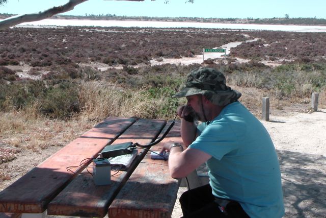
Desert Camp Conservation Park (0100 UTC)
Lower Glenelg River Conservation Park (0430 UTC)
Saturday 15th November 2014
2 x Victorian National Parks (qualify for both KRMNPA & WWFF) & 1 x VK3 SOTA peak
Lower Glenelg National Park, VKFF-296 (2200 UTC Sunday, 9.00 a.m. Victorian local time Saturday morning)
Cobbobonee National Park, VKFF-728 (0200 UTC)
Mount Clay, VK3/ VS-051(0700 UTC). Concides with the proposed VK/Europe SOTA activation day
Sunday 16th November 2014
1 x VK3 SOTA peak, & 2 x Victorian National Parks (qualify for both KRMNPA & WWFF)
Mount Napier, VK3/ VS-046 (2300 hrs UTC Saturday, 10.00 a.m. Victorian local time)
Mount Eccles National Park, VKFF-345 (0200 UTC)
Mount Richmond National Park, VKFF-361 (0700 UTC)
Monday 17th November 2014
2 x VK3 SOTA peaks & 2 x Victorian National Parks (both qualify for KRMNPA & WWFF)
Mount Rouse, VK3/ VS-048 (2100 UTC Sunday, 8.00 a.m. Victorian local time Monday morning)
The 2013 KRMNPA weekend was held between Friday 15th – Sunday 17th November, 2013. My wife Marija and I headed to Pinnaroo (near the Victorian border) for a 2 night stay and activated the Murray Sunset National Park on Saturday, and Wyperfeld National Park on Sunday. I have added separate blogs for those activations.
I worked a total of 63 stations in both parks. In Murray Sunset NP I had 26 QSO’s into VK1, VK2, VK3, & VK5, whilst in Wyperfeld NP I managed 37 QSO’s into VK2, VK3, & VK5.
I worked a total of 16 different Victorian National Parks, as follows…..
Great Otway National Park
Port Campbell National Park
Terrick Terrick National Park
Churchill National Park
Hatte Kulkyne National Park
Mount Eccles National Park
Grampians National Park
Organ Pipes National Park
Mornington Peninsula National Park
Kara Kara National Park
Wyperfeld National Park
Morwell National Park
Lower Glenelg National Park
Murray Sunset National Park
Dandenong Ranges National Park
Heathcote-Graytown National Park
And I added 4 x new parks to my KRMNPA list, bring me to a total of 33 Victorian Parks worked. The new Parks worked were…..
Hatte-Kulkyne National Park
Morwell National Park
Dandenong Ranges National Park
Heathcote-Graytown National Park.
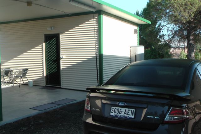
Our accommodation at the Pinnaroo cabins was excellent. They were very friendly and although basic, the accommodation was very clean & tidy. Recommended !
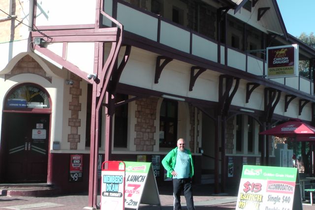
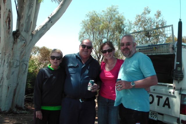
It was great to catch up with Larry VK5LY and his wife Di, on the Saturday night. We had a nice feed at the Golden Grain Hotel at Pinnaroo.
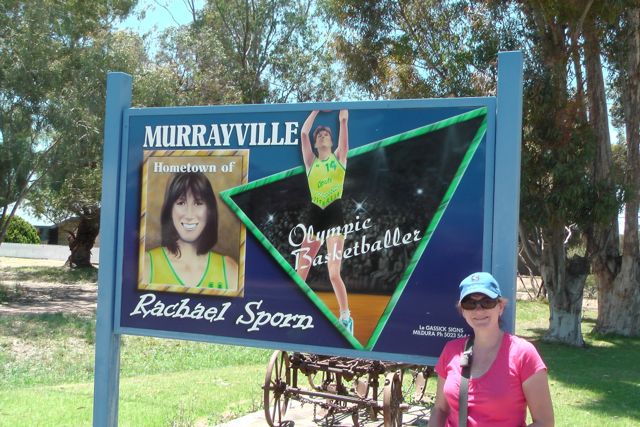
We can also recommend the Cobb and Co Cafe at Murrayville. After our activation at Wyperfeld NP, we stopped off there and had a coffee and some really delicious home made cake.
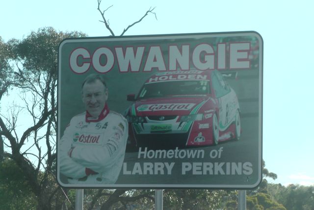
And Marija and I had an enjoyable trip back home to the Adelaide Hills, stopping off on the way back, and looking at a few of the sights on the Mallee Highway. The Kow Plains homestead just outside of the little town of Cowangie, is well worth having a look at. There are a number of restored buildings here that date back to the 1860’s.
Thanks to Tony VK3VTH for co-ordinating a really enjoyable weekend, and everyone else involved in the organisation including Peter VK3ZPF. Thanks to all the activators. And thanks to everyone that called me during my 2 activations. It was a lot of fun.
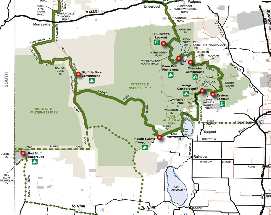
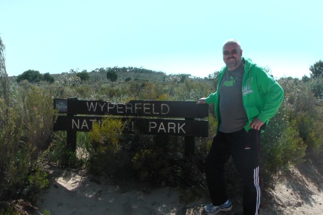
On Sunday morning, 17th November, 2013, Marija and I left the Pinnaroo cabins, and again headed across the border into north western Victoria. We drove into the little town of Murrayville, and then travelled about 30 km along the Murrayville Track, until we reached the Wyperfeld National Park.
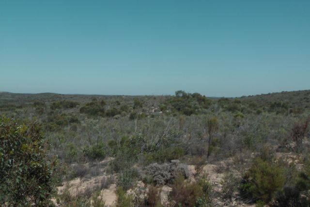
Wyperfeld National Park is the third largest National Park in Victoria and covers an area of 3,570.17 km². It was declared in 1921, and has been significantly expanded since that time to protect a huge area of mallee, woodland, and heartland in the north west of Victoria.
Wyperfeld contains numerous sand dunes and these are estimated to be between 40,000 and 15,000 year old. Wyperfeld was once a shallow sea from about 25 million years ago. As the seas slowly retreated, the westerly winds blew sand over the exposed inland areas, which resulted in the rolling sand dunes that you see today.
Wyperfeld was originally home to the local aboriginal people, the Wotjobaluk, who regularly travelled up and down Outlet Creek, visiting the lakes and swamps in their quest for water and food. They called Outlet Creek, ‘Tyakil-ba’Tyakil’. Outlet Creek snakes its way through the centre of the park. The first European to venture along Outlet Creek was James Clow, who in 1847, established the first pastoral run.
By the early 1900’s, the mallee of Victoria was a fast disappearing habitat. And luckily, by 1909, a number of naturalists persuaded the Victorian Government to temporarily reserve 3,900 hectares. By 1921, the park was declared. The name, Wyperfeld, is of Germanic origin, and was most likely given by the Germanic settlers who came to the Wimmera and Mallee regions from South Australia.
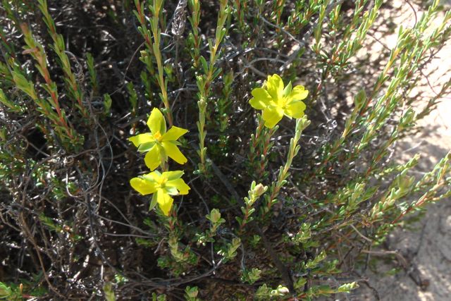
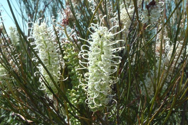
Fortunately Spring is the best time to see the wildflowers in the park. And there were quite a few plants out in flower that we saw. About 520 species of native plants occur in the park. River Red Gum and Black Box woodlands cover the floodplains of Outlet Creek and the lakes within the park. Cypress-pine woodlands grow on the dunes near the lakes. On the eastern side of the park, mallee is the predominant flora. In the western section of the park, heathland covers the rolling sand plains.
A variety of native animals call the park home including Mitchell’s Hopping Mouse, Desert Silky Mouse, and Western Grey kangaroos
More than 200 species of birds have been recorded in the park, including the Sulphur Crested Cockatoo, Emus, Mallee Ringneck Parrot, Red-rumped Parrot, Galah, Variegated Fairy-wren, & Red-capped Robin. Wyperfeld is part of the Wyperfeld, Big Desert and Ngarkat Importand Bird Area, which has been identified as such by BirdLife International, due to its importance for the conservation of the rare Malleefowl and various other mallee bird species.
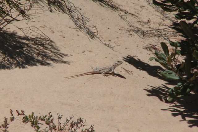
A large variety of reptiles can be found within the park. They include the Sand Goanna, dragons, skinks, and geckos. We saw literally hundreds of lizards sunning themselves on the Murrayville Track. Surprisingly, snakes are rarely seen in Wyperfeld NP.
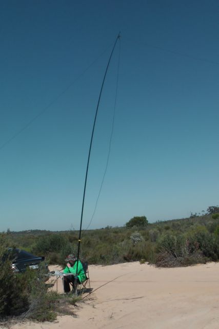
Marija and I pulled up at the Milmed Rock 4WD track, and set up the gear here. It was already very warm, and safely there was no shade. I could see some small gum trees about 2 km into the bush, but I didn’t fancy trying my luck along Milmed Rock Track, as it was very very sandy and suitable for 4wd only.
Fortunately the track ran north – south, so I set up the 40m dipole using my 7 m squid pole, and tied off the ends to some of the small native shrubs. We set up the folding table and deck chair, and away I went. My first contact from within Wyperfeld was with Peter VK3YE who was sitting on the end of a concrete pier at Chelsea Beach in Melbourne. Peter had a great signal as always from his QRP pedestrian mobile set up (5/8 both ways). This was followed by a steady flow of callers from VK3 & VK5, including Tim VK3MTB who was operating portable from Morwell National Park, and Tony VK3VTH who was operating portable from the Lower Glenelg National Park.
I then decided to tune around the band to see if I could pick up a few more park activators, and was fortunate enough to speak with Ben VK3FTRV who was portable north of Halls Gap, in the Grampians National Park, using his full wave loop antenna. I then spoke with Larry VK5LY who was portable in the Murray Sunset National Park, and then stumbled across Andy VK5AKH who was operating portable from the Morialta Conservation Park, as part of the VK5 National and Conservation Parks Award.
The 40m band was in quite good condition and was very busy. The Ballarat Amateur Radio Club were also holding their annual Field Day and I propped on 7.085 and I worked a number of their members, operating portable in the field. Joe VK3YSP, who was operating portable from the Dandenong Ranges National Park, with his wife Julie VK3FOWL, called in to say hi.
After working a number of stations I decided to tune across the band again, and I spoke with Peter VK3ZPF who was active again on a SOTA peak. This time, Mount Ida, VK3/ VU-009, which is also within the Heathcote-Graytown National Park. I was really happy to find Peter, because this was a new Victorian park for me. Peter was kind enough to leave me his frequency, and again I worked a steady flow of park Hunters. This included Andy VK3CAH who was portable in the Kara Kara National Park, and Andrew VK1DA/2 who was portable on SOTA peak, Spring Hill VK2/ ST-036.
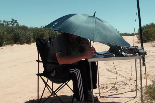
As the day progressed, it was getting hotter and hotter, so I improvised and used an umbrella from the boot of the car to offer me some shade.
I had heard a few guys tell me that the south east fellas were around, so I tuned up to 7.110, where I spoke with Col VK5HCF/p, Tom VK5EE/p, and Greg VK5ZGY/p, who were all portable in the Lower Glenelg Conservation Park. They had gained access to the park via boat, and were using 5 watts from an IC-703 and a linked dipole. A great effort fellas.
After working Col, Tom, & Greg, I found Glenn VK3YY, who was portable on SOTA peak, Spion Kopje, VK3/ VT-040 (5/6 both ways).
My last 2 contacts of the day were with Stu VK5STU/p, and Nigel VK5NIG/p. Stu and Nigel were portable at One Tree Hill trying out their new Yaesu FT-817nd’s (which they had bought from the AHARS Buy & Sell, a few weeks earlier) and experimenting with portable antennas (linked dipole & 40m inv fee dipole).
Time was getting away, & I had pushed my luck with Marija sitting in the car watching DVD’s, so it was time to pack up. I had a total of 37 QSO’s in the log.
I worked the following stations:-
Peter VK3YE/pm; Ron VK3AFW; Ivan VK5HS; Tim VK5AV; Tim VK3MTB/p; Tony VK3VTH/p; Frank VK3GFS;Ben VK3FTRV/p; Larry VK5LY/p; Andy VK5AKH/p; Ian VK3AXH/p; John VK5EMI; Brian VK5FMID; Harry VK3KGL/p; Tom VK5FTRG; Bob VK3NBV/p; Mal VK5MJ; Joe VK3YSP/p; Julie VK3FOWL/p; Peter Vk3TKK; Tony VK3VTH/p; Peter VK3ZPF/p; Bob VK3BNC/p; Andy VK5LA; Craig VK3KG/p; Andy VK3CAH/p; IAndrew VK1DA/2; Dave VK3VCE; Col VK5HCF/p; Tom VK5EE/p; Greg VK5ZGY/p; Glenn VK3YY; Nev VK5WG; Kevin VK3VEK; Stu VK5STU/p; and Nigel VK5NIG/p.
Just wanted to say thank you to Tony VK3VTH for organising the KRMNPA weekend. It was a lot of fun, and we will definitely be participating again next year.
I have posted a video on You Tube of this activation…..
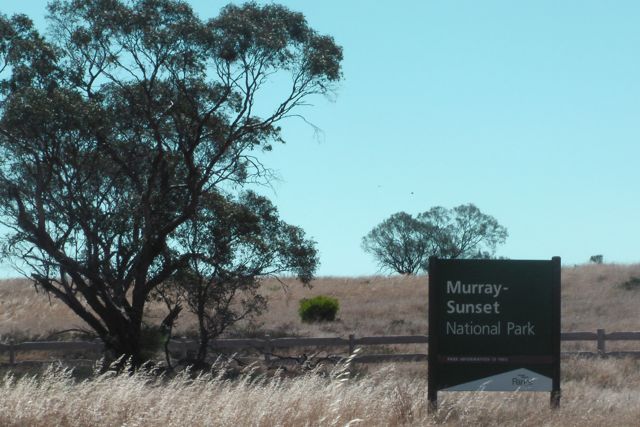
My third and final activation for Saturday was the Murray Sunset National Park. This was my first of two Victorian park activations for the 2013 KRMNPA weekend.
Prior to activating the park, Marija and I headed to the town of Underbool, where we met up with Larry VK5LY and his wife Di. After a nice cold beer, Larry loaned me one of his home brew 40m dipoles. The VSWR on my linked dipole had been very high, so I was very appreciative of Larry’s offer of a spare antenna.
Murray Sunset National Park is 6,330 km2 in size and is the second largest National Park in Victoria. It is about 438 km northwest of Melbourne and is situated in the northwestern corner of Victoria, bordering South Australia to the west and the Murray River to the north. The Sturt Highway passes through the northern part of the park, but most of the park is in the remote area between the Sturt Highway and the Mallee Highway, west of the Calder Highway.
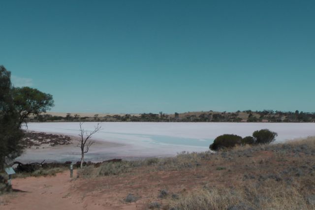
Murray Sunset NP was created in 1991, and in 1999, the park was expanded to encompass Pink Lakes State Park. This is the area of the park that Marija and I activated. The lakes are dubbed “pink” after the beta-carotene pigment that colours it in late summer, caused by the algae Dunaliella salina. Beta-carotene is a red-orange pigment found in plants and fruits, especially carrots and colourful vegetables.Between 1916, through until 1975, this area was the site of a major salt industry. At its peak, 10,000 tons of salt was harvested and railed from Lake Crosbie, Lake Becking, and Lake Keynyon to the nearby town of Linga. Marija and I drove through Linga, and sadly it is a shadow of what it previously was at its boom.
Over 600 species of plants have been recorded in the Murray Sunset National Park. Some of the more notable plants include the Murray Lily, Silvery Emu bush, porcupine grass, and Blue leaved Mallee. During springtime, there are numerous wildflowers including spider orchids, Azure Sun orchids, Desert Heath myrtles, and the interestingly named Poached egg daisies.
The park is home to many Australian native birds. In fact over 300 species of birds have been documented. The majority of the Murray Sunset NP lies within the Murray Sunset, Hattah, and Annuello Important Bird Area (IBA), identified by BirdLife International. This is due to the fact that the agra contains mallee habitats which support numerous threatened mallee bird species, including the Malleefowl, Black eared Miner, and the Mallee Emu wren.
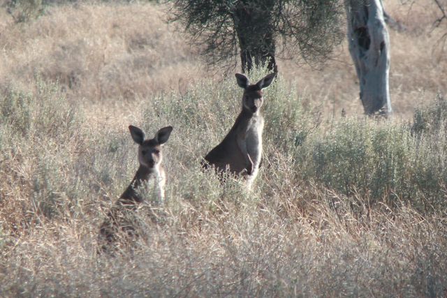
The park also supports a large amount of wildlife including both Western Grey and Red Kangaroos. When we were leaving we saw a group of Western Grey’s grazing in some of the grassy area.
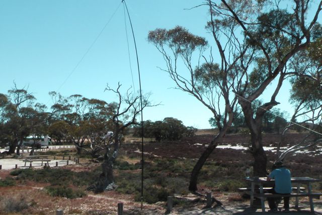
Marija and I pulled into the Lake Crosbie campground which was buzzing with activity. There were numerous campers and caravaners here. But we did manage to find a parking spot, very close to the shores of Lake Crosbie, and set up the gear here at a table with benches, and conveniently placed under the shaded of a nearby gum tree.
The 40m band appeared to have ‘repaired itself’ a bit since the morning. Of course, it was a much better time of the day for the band as well. Signals appeared much stronger. My first contact within the park was with Peter VK3ZPF who was portable on SOTA peak, West of England Range, VK3/ VW-013, which is contained within the Kara Kara National Park (formerly known as St Arnaud Range National Park). Peter had a beautiful strong 5/8 signal and I received 5/8 back. Things were looking promising. This was followed by a QSO with Joe VK3YSP and his wife Julie VK3FOWL, who were both portable in the Churchill National Park (5/9 both ways).
I then worked into VK1, VK3, & VK5. Larry VK5LY then called in to say g’day. He was with his wife Di, portable in Wyperfeld National Park, which I planned on activating on Sunday (5/7 both ways). Following this I had a steady flow of callers from VK2 & VK3.
My final contact of the day was with the same station I had started off with. That being Peter VK3ZPF who had moved, and now was portable on top of SOTA peak West if England Fire Tower, VK3/ VW-016, which was still within the Kara Kara National Park.
After 2 very enjoyable and pleasant hours in Murray Sunset NP, it was time to pack up, and head back to Pinnaroo, and catch up with Larry & Di. I had a total of 26 QSO’s on 40m SSB.
I worked the following stations:-
Peter VK3ZPF/p; Joe VK3YSP/p; Julie VK3FOWL/p; Matt VK1MA; Ron VK3AFW; Kevin VK3EC; Tim VK5AV; Ivan VK5HS; Ian VK5CZ; Larry VK5LY/p; Brian Vk3MCD/p; Ernie VK3DET; Clive VK3FCMR; Kev VK3AKT; Bob VK3XP; Frank VK3GFS; Joe VK3YSP/p; Mal VK3AZZ; Colin VK3LO; Laurie VK3AW; Peter VK2NEO; Tim VK3MTB; Peter VK3TKK, Lloyd VK2KNS; and Peter VK3ZPF/p.
I have uploaded a video of this activation to You Tube. It can be found at…..
Little Desert National Park in Victoria, was my last intended activation for Tuesday 10th September, but unfortunately I ran out of time, as I had spent longer on Mount Langi Ghiran than expected. Ed VK2JI had told me that Andrew VK2ONZ was going to be up on air on a summit shortly. Sure enough I checked SOTA Goat and saw that they had posted an alert. So I patiently waited for an hour but sadly they did not appear. So off the summit I headed, a little later than planned.
So after activating Mount Arapiles, I drove back along the Western Highway into Horsham, and after picking up some Subway for lunch, I continued back along the Highway to Dimboola. From there I headed out along Horeshoe Bend Road, south of Dimboola.
The Little Desert NP which covers an area of about 32,000 hectares, is renowned for its unmodified ‘desert’ landscapes and its conservation values. Features of special note in the park include the presence of endangered Mallefowl, the Wimmera River, and colourful wildflower displays during spring.
The park’s beginnings started in 1955 when 217 hectares were reserved as the Kiata Lowan Sanctuary, primarily for the protection of Malleefowl. In 1968, plans were announced to develop the area for agriculture. There was enormous public outcry over this, and as a result the area was increased to 945 hectares. By 1969 the Park was expanded to 35,300 hectares with the addition of the majority of the block between the Wimmera River and the Nhill Harrow Road. In 1991, further land was added to the park.
There are numerous native animals to be found in the park including Western Grey Kangaroos, Western Pygmy-possum, Swamp wallaby, & Silky mouse. There have also been some sightings of the platypus in the Wimmera River. A total of 229 native bird species have been recorded in the park. Of these, five are endangered, three vulnerable, and nine rare.
I entered into the Little Desert National Park and set up at Horeshoe Bend near the banks of the Wimmera River. This was a really idealic setting. The weather was beautiful and the view from my fold up table & deck chair was fantastic. I had noted when I arrived that there was a school bus parked nearby, and sure enough, after about 10 minutes on air, the silence was broken by a group of high school kids walking along the banks of the Wimmera, returning to the bus. I certainly got a few strange looks from the children and their teacher as they walked by.
I operated for about 30 minutes and then decided that it was time to head off over the border into South Australia. I still had a 2 hour drive ahead of me before reaching my final activation, the Ngarkat Conservation Park. But I was happy. The park was activated, and 11 stations were in the log on 40m SSB from VK3, VK5 & VK7.
The following stations were worked:-
Tony VK5ZAI; Ron VK3AFW; John VK5BJE; Dale VK5FSCK; Albert VK3KLB; Ivan VK5HS; Col VK5HCF/qrp; Brian VK5FMID; Larry VK5LY/m; Greg VK3UT; and Eric VK7EK.
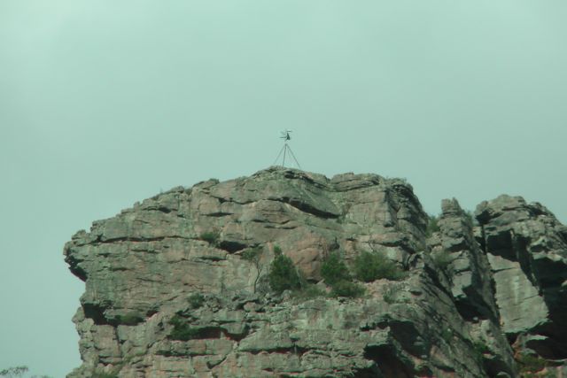
Mount Zero, VK3/ VW-020 was my 2nd summit activation for Tuesday 10th September, 2013. Mount Zero is 391 metres above sea level, and is worth 1 SOTA point. It is also located within the Grampians National Park, so it qualifies for the Keith Roget Memorial National Parks Award (KRMNPA).
I accessed the summit after turning left from the Western Highway onto the Wonwondah-Dadswell Bridge Road, and then left into Winfields Road. I then turned left into the Halls Gap-Mount Zero Road. There is a carpark on the eastern side of the road. I parked the car there and then commenced the 2.8 km walk to the Mt Zero summit, which requires you to cross back over the Halls Gap-Mt Zero Road. The information board shows the walk to be 2.8 km, but the sign shows it to be 1 km. After doing the walk, it is definitely 2.8 km and not 1 km !
There is an excellent track leading all the way to the summit which is clearly marked with yellow arrows. A little bit of rock climbing is required, but nothing too taxing. This was a really enjoyable walk. The native plants were all out in flower including grevillias & other native flowers.
I kept up the pace during the hike to the summit, following an Irish tourist & her English companion. Once we got to the summit we had a good chat, only to find that they were in training for a trip to the Himalayas. They were curious as to why I was carrying a squid pole, so I explained to them my reason for being on the summit, and they were very interested.
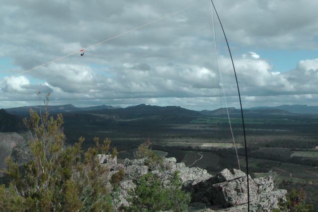
There is a trig point on the summit, along with a memorial cairn to the explorer, Major Thomas Mitchell who discovered and climbed the summit on the 20th July, 1836. The cairn also shows directions & distances for various other peaks in the area. The views from the top are spectacular in all directions with the Victoria Range & The Asses Ears to the south, Black Range & Mount Bepture to the SW, Mt Difficult to the SE, the Pyrenees Range to the east, and Mount Jeffcott to the NE.
There wasn’t a huge amount of room to move up the top, so I used a small shrub to secure the squid pole, utilising 2 octopus straps. And I then ran the legs of the dipoles out, wedging the wire winders between rocks. Although it was overcast, there was no rain in sight, and even better, there was no wind on the top of the summit. You need to be a bit careful on the summit as there are sheer cliff faces and gaps between the rocks on the summit which you can fall between.
I remained on 40m SSB for the entire activation working a total of 23 stations in VK2, VK3, VK4, & VK5.
The following stations were worked:-
Larry VK5LY; Peter VK3FPSR; Brian VK3MCD; Alex VK3AMX; Mark VK3YN; Peter VK3PF/m; Col VK5HCF; Barry VK5BW; Ed VK2JI; Tony VK3CAT/m; Ron VK3AFW; Colin VK3UBY; Roy VK5NRG/qrp; Brian VK5FMID; Glen VK4FSCC; Bernard VK3AMB/m; John VK2FALL; Andt VK5LA/p; Charles VK5FBAC; Ivan VK5HS; Laurie VK3AW; Colin VK3LO; & Wolf VK5WF.
I have added a video to You Tube of the activation…..