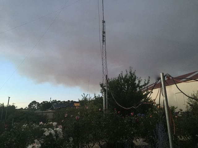
Most would know that there is a very large fire burning out of control in the Mount Lofty Ranges ‘Adelaide Hills’. The fire is currently threatening a number of homes. Below is a view of the fire from my backyard.

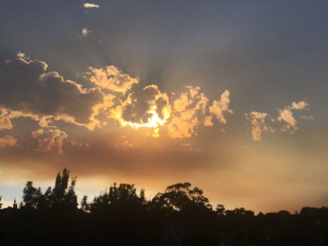
And this is the sunrise at home this morning, with the sun trying to break through the smoke.

Currently, the CFS urges anyone within the Mount Pleasant, Kersbrook, Gumeracha, Mount Torrens, Woodside, Lobethal, Inglewood, Upper Hermitage, Breakneck Hill, One Tree Hill township, Little Para Reservoir, Chain of Ponds, Houghton, Cudlee Creek, Lower Hermitage, Charleston, Birdwood, Lenswood, and Williamstown to LEAVE THE AREA NOW, AS THERE IS A HEIGHTENED RISK TO LIVES AND HOMES.
Fortunately I live about 20 km south of the southern boundary of the fire, and there is a lot of countryside between me and the fire. Earlier today the fire was heading south towards us, and one of the towns just 12 km from me, was issued with a warning to either leave or immediately enact their bushfire survival plan. The wind direction changed and the fire has moved off in different directions.
The Country Fire Service estimate that the fire has burnt about 10,000 hectares (about 24,700 acres) of farming land and bushland.
Below is a map showing the burnt area as of 1230 hours local time today. Six hours later, it is now even bigger.

image courtesy of http://www.cfs.sa.gov.au
I have tried contacting Noel, who is the property owner where the SOTA summit Mount Gawler VK5/ SE-013 is located. Sadly I have not been able to get through to Noel, so I am hoping that Noel and his property are okay. Mount Gawler is smack bang in the middle of the blackened area.
At this stage, it has only officially been recorded that 5 homes have been destroyed. However, unofficially, the authorities are saying that it is likely to be much higher…perhaps 3 dozen homes. Certainly from listening to the scanner today, firefighters and police reported multiple properties on fire and not saveable.
The towns of Gumeracha and Kersbrook have been spared, but only just (see the eastern side of the map above).
The fire has impacted on the Cudlee Creek Conservation Park. This park has apparently been destroyed. I have activated this park previously, and it is (was) a very beautiful park, home to many native animals and birds.
A number of other Conservation Parks are threatened including the Montacute Conservation Park, Black Hill Conservation Park, Warren Conservation Park, Cromer Conservation Park, and Porter Scrub Conservation Park. The beautiful Mount Gawler Native Forest Reserve has also been destroyed. I have activated park portable in all of these areas.
No matter what your religious persuasion may be…..say a prayer tonight for those that have lost their homes. It is certainly not a good situation. I can only imagine what it must be like to loose all of your possessions.
Fortunately the wind has signficantly dropped here, as has the temperature. Tomorrow we are expecting 31 c, Monday 34 c, 36 c on Tuesday, and then 37 c on Wednesday.
Updates on the fire can be found on the Country Fire Service (CFS) website at…..
http://www.cfs.sa.gov.au/