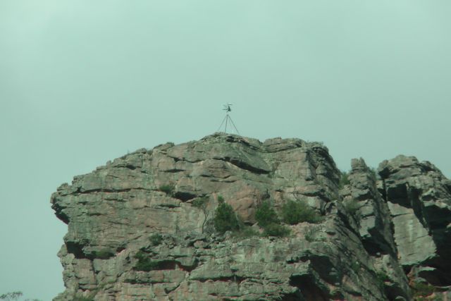
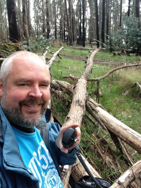
Mount Zero, VK3/ VW-020 was my 2nd summit activation for Tuesday 10th September, 2013. Mount Zero is 391 metres above sea level, and is worth 1 SOTA point. It is also located within the Grampians National Park, so it qualifies for the Keith Roget Memorial National Parks Award (KRMNPA).
I accessed the summit after turning left from the Western Highway onto the Wonwondah-Dadswell Bridge Road, and then left into Winfields Road. I then turned left into the Halls Gap-Mount Zero Road. There is a carpark on the eastern side of the road. I parked the car there and then commenced the 2.8 km walk to the Mt Zero summit, which requires you to cross back over the Halls Gap-Mt Zero Road. The information board shows the walk to be 2.8 km, but the sign shows it to be 1 km. After doing the walk, it is definitely 2.8 km and not 1 km !
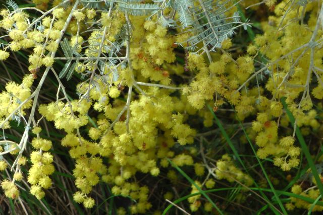
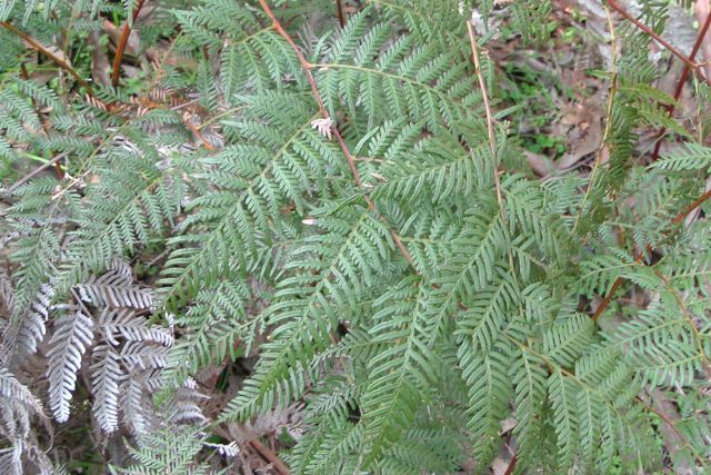
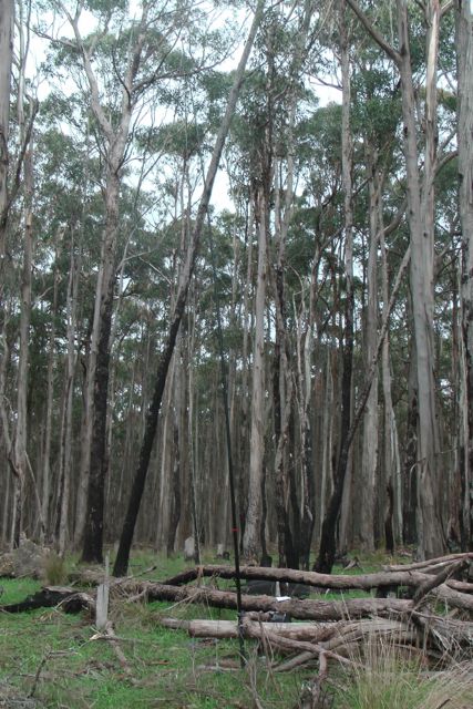
There is an excellent track leading all the way to the summit which is clearly marked with yellow arrows. A little bit of rock climbing is required, but nothing too taxing. This was a really enjoyable walk. The native plants were all out in flower including grevillias & other native flowers.
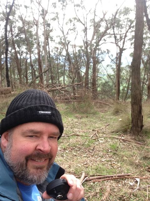
I kept up the pace during the hike to the summit, following an Irish tourist & her English companion. Once we got to the summit we had a good chat, only to find that they were in training for a trip to the Himalayas. They were curious as to why I was carrying a squid pole, so I explained to them my reason for being on the summit, and they were very interested.
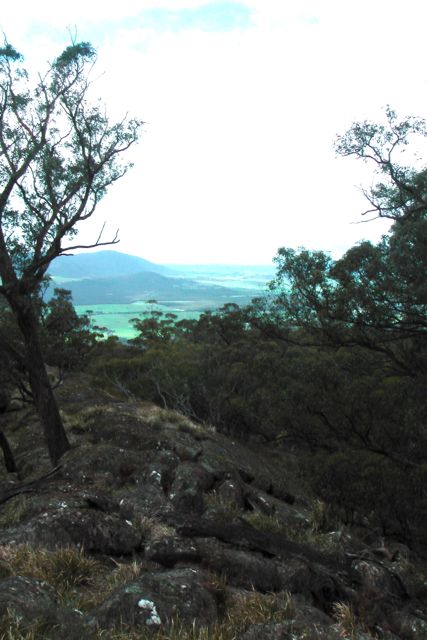
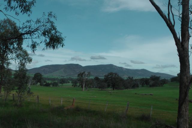
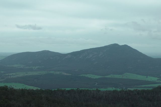
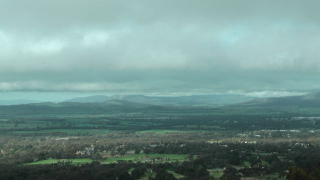
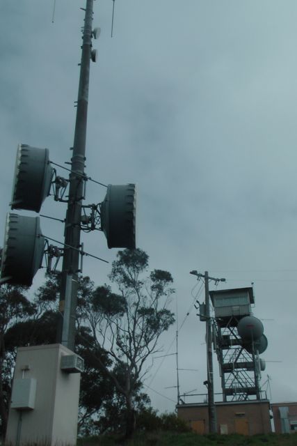
There is a trig point on the summit, along with a memorial cairn to the explorer, Major Thomas Mitchell who discovered and climbed the summit on the 20th July, 1836. The cairn also shows directions & distances for various other peaks in the area. The views from the top are spectacular in all directions with the Victoria Range & The Asses Ears to the south, Black Range & Mount Bepture to the SW, Mt Difficult to the SE, the Pyrenees Range to the east, and Mount Jeffcott to the NE.
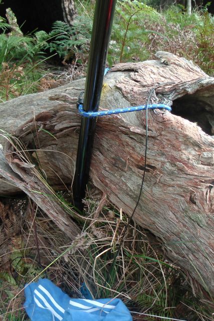
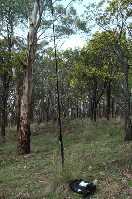
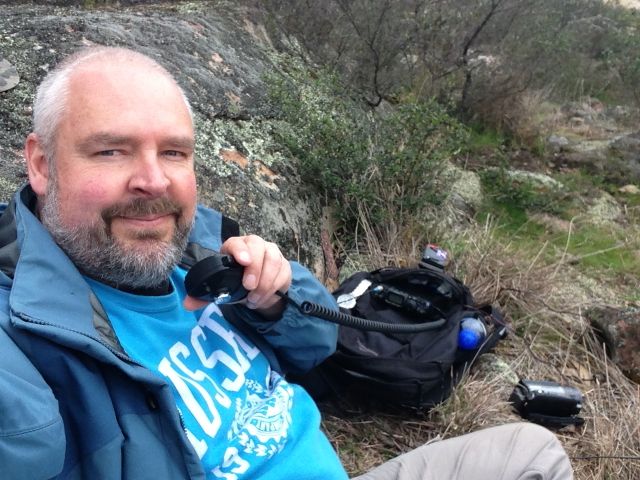
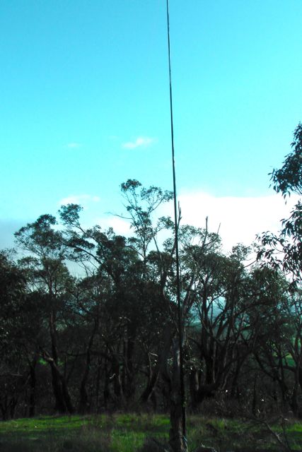
There wasn’t a huge amount of room to move up the top, so I used a small shrub to secure the squid pole, utilising 2 octopus straps. And I then ran the legs of the dipoles out, wedging the wire winders between rocks. Although it was overcast, there was no rain in sight, and even better, there was no wind on the top of the summit. You need to be a bit careful on the summit as there are sheer cliff faces and gaps between the rocks on the summit which you can fall between.
I remained on 40m SSB for the entire activation working a total of 23 stations in VK2, VK3, VK4, & VK5.
The following stations were worked:-
Larry VK5LY; Peter VK3FPSR; Brian VK3MCD; Alex VK3AMX; Mark VK3YN; Peter VK3PF/m; Col VK5HCF; Barry VK5BW; Ed VK2JI; Tony VK3CAT/m; Ron VK3AFW; Colin VK3UBY; Roy VK5NRG/qrp; Brian VK5FMID; Glen VK4FSCC; Bernard VK3AMB/m; John VK2FALL; Andt VK5LA/p; Charles VK5FBAC; Ivan VK5HS; Laurie VK3AW; Colin VK3LO; & Wolf VK5WF.
I have added a video to You Tube of the activation…..
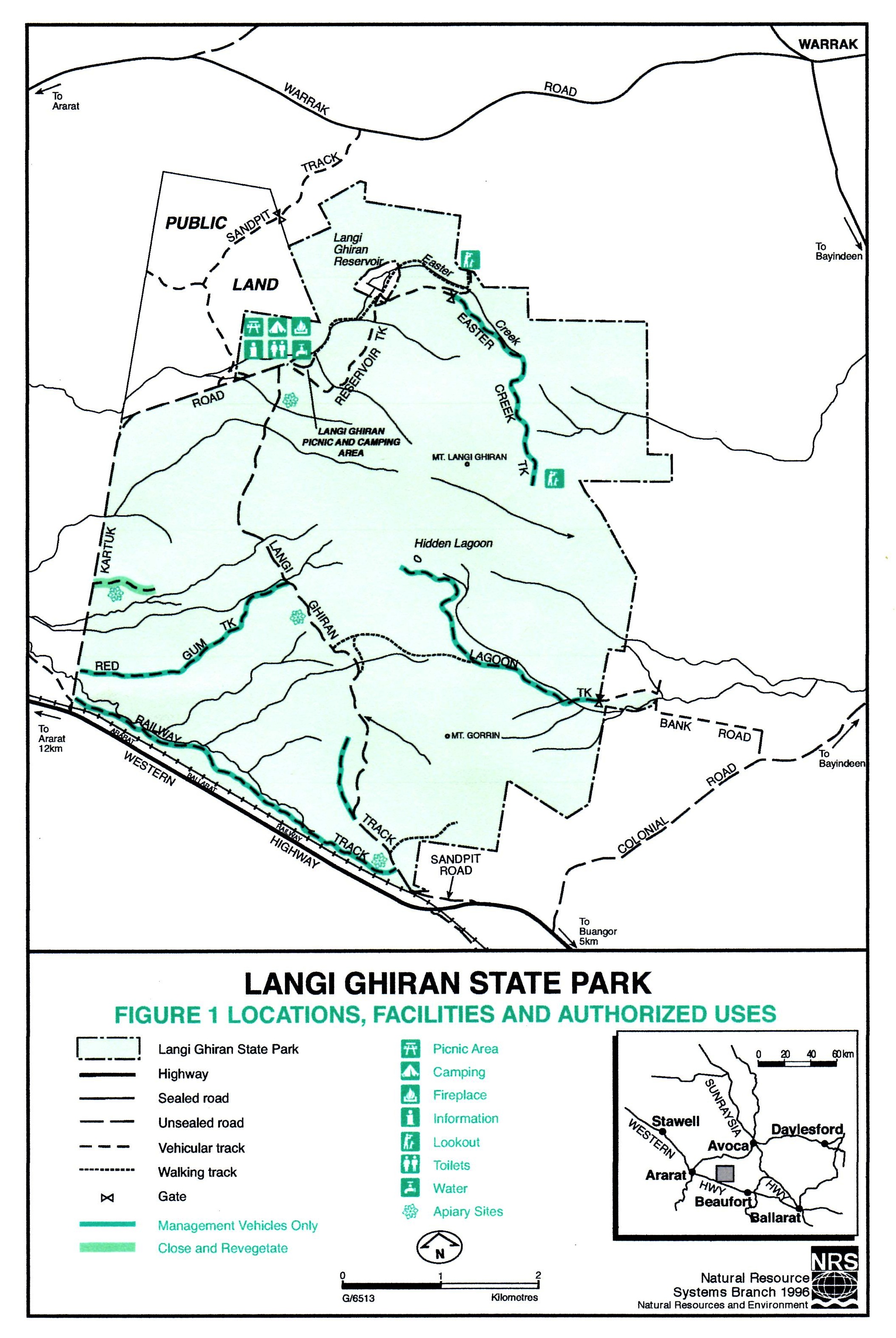
Mount Langi Ghiran, VK3/ VS-004 was my first summit activation for Tuesday 10th September, 2013. Mt Langi Ghiran is 950 metres ASL and is worth 6 SOTA points. It is situated within the Langi Ghiran State Park, about 15 km east of Ararat, and about 220 km west of Melbourne.
The Langi Ghiran State Park is 2,695 hectares in size and takes in Mount Langi Ghiran in the north, Mount Gorrin in the south, and a River Red Gum-Yellow Box open woodland in the west. The park, which was proclaimed in June 1987, has a rich Aboriginal cultural heritage and contains a wide range of significant Aboriginal archaelogical sites. Within the park is the historic Langi Ghiran Reservoir, which is still used as a supplementary water supply for Ararat. The park contains a variety of vegetation once typical of the area, including a number of significant species. The park has rugged granite peaks and attractive landscapes.
The park supports a large amount of wildlife, including the rare Squirrel Glider, and Brush-tailed Phascogale. The introduced Sambar deer are also found in the park. Over 105 species of birds have been recorded in the park, including the rare species Painted Honeyeater, Powerful Owl, and Black Falcon. There are also numerous reptiles including the Marbled Gecko, Large Striped Skink, Bougainville’s Skink, and Shingeback.
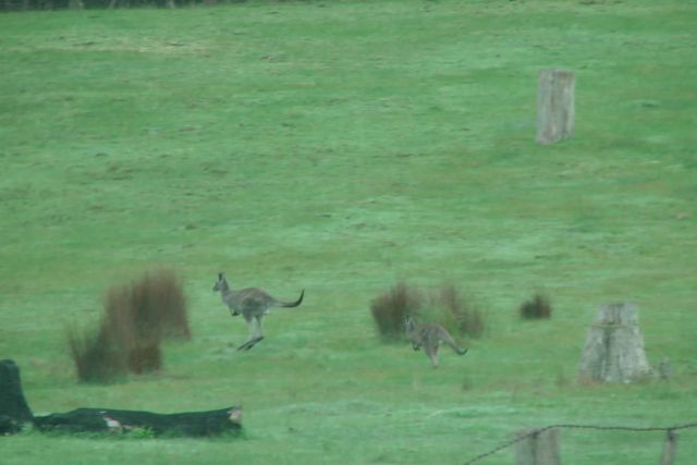
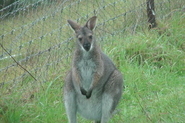
I entered the park via the Western Highway and drove along Kartuk Road, which is on the western border of the park. I had only driven a very short distance and I saw the first group of Western Grey kangaroos. Travelling down the track took a bit of time because there were kangaroos everywhere, and they were not adverse to jumping out in front of the car.
Kartuk Road leads to the Langi Ghiran camping & picnic ground. Just before you enter the picnic ground area, there is a track running off to the right called Reservoir Track, which is a dirt track that leads to the Langi Ghiran Reservoir. I drove out along Reservoir Track and stopped at the historic reservoir for a quick look. I then continued on towards the summit, driving along Easter Track. After a short distance I reached a locked gate with two signs which read ‘Management Vehicles Only” and “And Walkers only”. I parked the car here and commenced walking up Easter Track towards the summit. It is about a 3km walk from here.
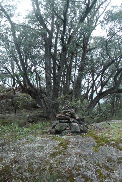
Easter Track starts off with a gentle gradient and good surface. But as you get closer to the summit, the track roughens up and the gradient gets much steeper. Eventually I reached a small cairn built of moss rocks on the left hand side of the track. From here I saw a small track on the right, which was quite grown over. It led off into the scrub on the western side of the track and heads off to the summit.
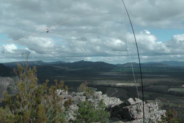
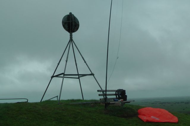
The track soon disappeared amongst the scrub and I had to trek through thick scrub and scramble over large moss rocks, until I reached the summit. I set up my 40m/20m linked pole in an inverted vee configuration, using my 7 m squid pole, which I secured with octopus straps to a small shrub growing amongst the rocks.
I tuned to 40m and put out a call. Things started off extremely slow. My first 4 qualifying QSO’s with Peter VK3PF, Charles VK5FBAC, Brian VK5FMID, and Peter VK3FPSR mobile, took a long time to achieve. But following that, things really picked up, and conditions seemed very good on 40m.
After about half an hour on the summit, I spoke with Ed VK2JI who advised that Andrew VK2ONZ was due to come up on a summit within the next 30 minutes. Sure enough I checked the iphone and the SOTA Goat application, and I saw that Andrew was due to be on a VK2 summit by 0100 UTC. So I decided to stay on the summit longer than planned, hoping that I could get a ‘Summit to Summit’ into New South Wales. But unfortunately Andrew didn’t come up, so I decided it was time to head down. I had a 3km walk back to the car and I still had another SOTA activation planned, along with a National Park.
After a very slow start I had 42 QSO’s in the notebook on 40m SSB.
The following stations were worked prior to the UTC rollover:-
Peter VK3PF; Charles VK5FBAC; Brian VK5FMID; Peter VK3FPSR/m; Jim VK5JW; Ed VK2JI; Rhett VK3GHZ/m; Ivan VK5HS; John VK5BJE/p; Larry VK5LY; Bruce VK3FBNG; John VK5PO; Colin VK3UBY; Ron VK3AFW; Peter VK1XP; Andrew VK3ARR/qrp; Brian VK3MCD/qrp; John VK5SIX; and VK3EMU.
The following stations were worked after the UTC rollover:-
VK3EMU; Peter VK3PF/qrp; Fred VK3JM/qrp; Brian VK3MCD/qrp; Andrew VK3ARR/qrp; Dale VK5FSCK; Peter VK3FPSR; Brian VK5FMID; Larry VK5LY; Peter VK1XP; Colin VK3UBY; Ed VK2JI; John VK5BJE/p; Phil VK2CPO/qrp; Ron VK3AFW/m; Tony VK3CAT; Bernard VK3AMB; Ron VK3MRH; John VK5BJE/p; Tony VK5ZAI; Graham VK5KGP; Michelle VK3FEAT/p; and David VK5KC.
I have posted a video of the activation on You Tube…..
On Monday night, 9th September, 2013, I decided to head back up to One Tree Hill, VK3/ VS-036, just out of Ararat, and book into the 7130 DX Net. Why I decided to do this in reflection, I do not know. It was absolutely blowing a gale outside and it was freezing cold.
And setting up the equipment was certainly very interesting. It took a long time to erect the antenna in the dark. The only aid being my head lamp. I used a fencepost to secure the squid pole and stretched out the legs of the dipole. How the squid pole did not snap in the very blustery wind, I do not know. The wind was gusting up to 80 kph.
The net was being held on 7.135 due to the Over The Horizon Radar, but I could still hear the OTHR choofing away on 7.135. I could only just hear Roy VK7ROY who was Net Control, and unfortunately he had no copy on me at all. So with the assistance of Rick VK2HFP I booked into the net. Other than poor propagation to Tasmania, conditions appeared to be very good on 40m. I was able to work into New South Wales and Queensland with good 5/8-9 signal reports being given for my little 5 watt signal. I even worked into New Zealand with no problems at all receiving 5/5 & 5/6 signal reports from Caleb ZL2TCR and Brian ZL2ASH.
But sadly, there were very few checkins on the net. The only DX was William FO5JV. William gave me a call, but we were just not quite able to make the QSO.
Considering the lack of checkins and the attrocious weather conditions, I decided that the warmth of the motel room was a bit more appealing to the cold and windy summit. So I packed up and headed back to the motel in Ararat.
My 2nd night time activation had not really gone to plan. I only managed to work 5 stations as follows:-
Rick VK2HFP; Caleb ZL2TCR; Brian ZL2ASH; Brian VK4FXAC; & John VK2FALL/qrp (8 watts).
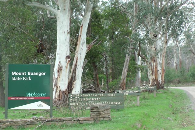
Mount Buangor, VK3/ VS-003 was my second summit for Monday. And I am very pleased to say that it was my last, as I certainly found this the most difficult and challenging summit.
Mount Buangor is 987 metres above sea level and is worth 6 SOTA points. It was formally known as Flagstaff Hill which originated from a rock cairn and flagpole that is reported to have been erected by Major Thomas Mitchell during his exploration of the area in the 1830’s.
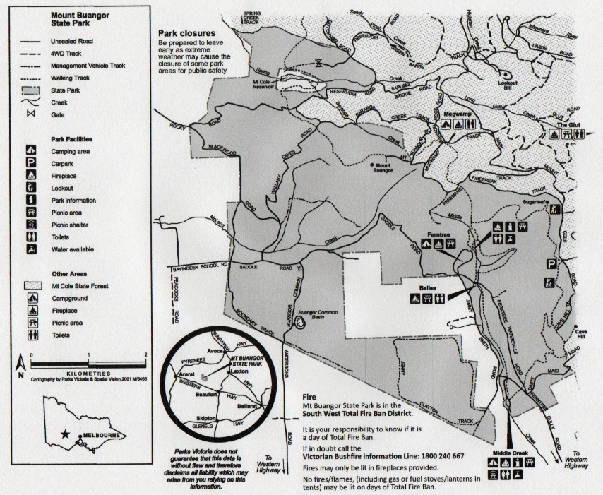
The summit is situated within the 2,4000 hectare Mount Buangor State Park. There are a variety of landscapes within the park including eucalypt forest, creek flats, waterfalls and steep escarpments. Within the park there is a 15 km network of walking tracks. The park contains a variety of eucalypts including Yarra Gums and Manna Gums, which grow along the creek flats and Blue Gums and Messmates, which prefer the south-facing escarpment or the elevated plateau. Narrow-leaf Peppermint can be found on the dry ridges. Snow Gums grow on the higher peaks and Red Stringybarks colour the western area of the park. Magnificent tree ferns grow in wet gullies where the lush vegetation creates a cool retreat in summer. Mount Cole Grevillea and Shiny Tea-tree are found on the elevated slopes.
More than 130 species of birds have been recorded in the park and adjoining Mount Cole State Forest. Echidnas, Eastern Grey Kangaroos, Swamp Wallabies and Red-necked Wallabies, possums, gliders, bats, are all resident within the park.
The local Aboriginal people who frequented the Mount Buangor area were the Beeripmo Balug clan of the Dwab Wurrung tribe. There were a number of 19th century sawmills in the park. Kosminski’s and Emery’s mills feature sawpits and a log chute for sliding sawlogs downhill from the plateau.
I entered the Mount Buangor State Park via the Western Highway and Ferntree Gully Road, and then Ferntree Waterfalls Road. I parked the car at the Ferntree camping area, and walked to the summit from there which took me two hours. I think I made a rod for my own back. In reflection I have looked at a map of the park, and it looks like the much shorter route is via Wallaby Caves Road. Nethermind, too late now.
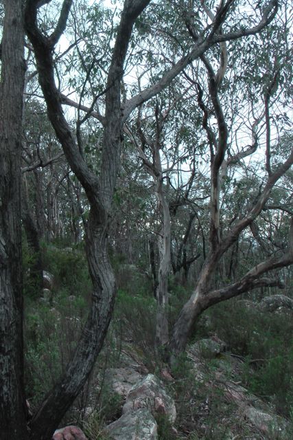
I found the walk very taxing, although very scenic. I followed the track uphill, which follows Middle Creek, to a firebreak track, and then back into the scrub again to the summit. There are no views from the summit due to the trees. However there is a lookout on the way to the summit. There is a small rock cairn at the summit.
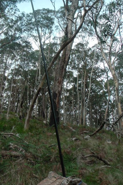
I set up the 40m/20m linked dipole, supporting it on the 7m squid pole. I used a fallen log to secure the squid pole to, with the aid of some octopus straps. The log also served as a backrest. The weather was slowly coming in from the west, and sure enough after only 10 minutes on air, I was forced to get out the bothy bag. I spent the remainder of the activation, both in and out of the bohty bag to stay out of the showers.
My first four contacts were with Albert VK3KLB, Peter VK3FPSR, Ivan VK5HS, and Colin VK3UBY. This was followed by a steady flow of Chasers.
Again I had a handful of stations call me using just qrp. They included Philip VK2CPO who was portable on a cattle station near Cobar in NSW. He was using just 10 watts. I also spoke with Gary VK5PCM who was using just 1.5 watts and a squid pole from the Belair National Park. And also Perrin who was running 5 watts from his little Yaesu FT-817 and a magnetic loop antenna.
Another good contact was with Tony VK3VTH, who was portable in the Big Desert National Park in Victoria, as part of the Keith Roget Memorial National Parks Award.
I also tried 20m for the benefit of Ed VK2JI, who was struggling with me on 40m SSB, but to no avail. I did not hear Ed. In fact I didn’t hear any VK’s. After about 20 CQ calls I decided to pull stumps, and head back down the hill to the car. After nearly one hour on the summit I had worked 28 stations in VK1, VK2, VK3, & VK5 on 40m SSB.
By the time I got down the bottom, I stopped off at waterfalls. I was so hot and worn out, that I felt like jumping into the beautiful flowing water. Good thing I didn’t, because after about 5 minutes of admiring the falls, along came 2 young girls in their 20’s walking through the park.
The following stations were worked:-
Albert VK3KLB; Peter VK3FPSR; Ivan VK5HS; Colin VK3UBY; Graeme VK3PGK; Bernard VK3AMB; Larry VK5LY; Peter VK3PF/m; Rhett VK3GHZ; John VK5DJ; Tony VK3CAT/m; Andrew VK2UH; Phillip VK2CPO/qrp; Brian VK5FMID; Terry VK5ATN; Gary VK5PCM/qrp; Glen VK3GMC; Ed VK2JI; Charles VK5FBAC; Paul VK5FUZZ; Geoff VK3AHT; Dallas VK3EB; Marshall VK3MRG; Greg VK3UT; Barry VK5CB; Tony VK3VTH/p; Perrin VK3XPT/qrp; and Rod VK5FTTC.
I have added a video to You Tube of the activation…..
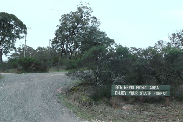
I had planned to activate two summits on Monday, 9th September, 2013. The first was Mount Lonarch, VK3/ VS-013 which is 788 metres above sea level and is worth 4 SOTA points. It is located in the Mt Cole State Forest (for more info, please see the blog re Ben Nevis).
Mount Lonarch is very easy to access, as there is a road straight to the top. I travelled out of Ararat, heading east along the Western Highway. As I did I drove passed both Mount Buangor and Mount Langi Ghiran. Mount Buangor was my afternoon climb, and Mt Lang Ghiran was my first climb tomorrow morning.
I stopped off for a quick look at a few sights near the little town of Buangor. Located on the bank of Billy Billy Creek, Buangor is nestled between Mount Buangor, Mount Cole and Mount Langi Ghiran. The area is the location of the Challicum Hills Wind Farm, Australia’s largest windfarm at time of completion in August 2003. The focal point in the township of Buangor is the heritage-listed Cobb & Co building formerly used as staging stables.
I turned left off the Highway onto Eurambeen-Raglan Road, and into the little township of Raglan, which was named after FitzRoy Somerset, 1st Baron Reaglan, who was a Field Marshal during the Crimean War. Many of the residents of Raglan are descendants of the first European settlers of the area, with various roads and lanes bearing the family names of those settlers. The main industry of Raglan is sheep grazing with sundry support business such as live stock transport also exist in the town.
After travelling through Raglan, I continued north on the Raglan-Elmhurst Road, and then turned right onto the Mount Lonarch Road, and up through the Mount Lonarch Forest. I then turned left onto Tower Road and headed north to the summit.
To your east at this point there are magnificent views out towards Ben Major, VK3/ VS-028 and Ben More, VK3/ VS-027, the surrounding valley and the town of Lexton.
After travelling about 3 km along Tower Road, I encountered trouble ! There in front of me completely blocking the dirt road was a tip truck and trailer, and no one at all in sight. I still had at least 4 km to go to the summit. Fortunately I was able to navigate the Ford Falcon around the truck and back onto the dirt road. As I drove further down the road I saw a guy working on a Bobcat and apparently cutting some fire breaks in the scrub and the forest.
I continued on up Tower Road and parked about 1 km from the actual summit, and walked the remainder of the way. On the way up I bumped into a worker who apologised for the road being blocked. He and another guy were up on the summit clearing fire breaks.
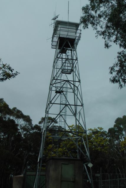
Once you reach the summit, there is a little bit of disapointment, as the view is obscured by all the trees. There is a fire spotting tower at the summit and I would imagine that the view from there above the tree canopy would be extra special.
I found a stump of a dead sapling and this looked like the perfect thing to strap my 7m squid pole to, which is exactly what I did. I then stretched out the legs of the dipole and tied them off to nearby trees. There are no shortage of options up here when it comes to trees.
I only had about 8 minutes before the UTC rollover, so I immediately went to 7.090 and put a call out, and was greeted by all the regular SOTA chasers. The 4 qualifying contacts being with Tony VK3CAT who was mobile, Peter Vk3FPSR, Bernard VK3AMB, and Peter VK3PF who was operating QRP. I managed 9 QSO’s before the UTC rollover.
After the new day I worked a further 23 stations on 40m SSB.
I worked quite a few QRP stations which was good to see as always. They included Peter VK3PF, Andrew VK3ARR, Andrew VK2ONZ, Warren VK3BYD who was portable near Violet Town, and George VK4GSF who was using just 12 watts. It was great to get a QRP to QRP contact all the way to Queensland.
I was also lucky enough to work John VK5BJE who was portable in the Wyperfield National Park in Victoria, as part of the Keith Roget Memorial National Parks Award.
After an hour on the summit, I had 32 contacts in the log and it was time to head off to Mount Buangor, which I knew was going to be much more challenging to get to the top that here at Mount Lonarch.
The following stations were worked before the UTC rollover:-
Tony VK3CAT/m; Peter VK3FPSR; Bernard VK3AMB; Peter VK3PF/qrp; Andrew VK3ARR/qrp; Larry VK5LY; Brian VK3MCD; Andrew VK2ONZ/qrp; & Brian VK5FMID.
The following stations were worked after the UTC rollover:-
Ron VK3AFW; Larry VK5LY; Tony VK3CAT/m; Peter VK3FPSR; Warren VK3BYD/p; Bernard VK3AMB; Andrew VK3ARR/qrp; Peter VK3PF; Fred Vk3JM; Brian VK3MCD; Ron VK3JP; Terry VK5ATN; Brian VK5FMID; John VK5BJE/p; Andrew VK2ONZ/qrp; Vin VK3FMOL; Bill VK5MBD; John VK5FMJC; George VK4GSF; Dale VK5FSCK; Tony VK5ZAI; Ivan VK5HS; and Colin VK3UBY.
I have posted a video on You Tube of this activation…..
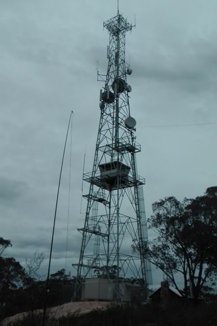
My third and final summit of the Sunday was Ben Nevis, VK3/ VS-009, which is about 193 km west of Melbourne, and about 25 km from the township of Beaufort.
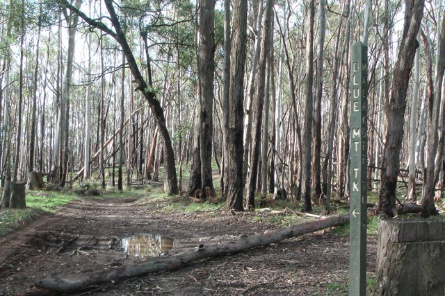
After activating Point 756 in the Pyrenees I travelled back down the Landsborough-Elmhurst Road and then turned right onto the Pyrenees Highway and travelled west. I then turned left onto the Buangor-Ben Nevis Road and travelled south. I then turned left onto Mount Cole Road, and then left onto Ben Nevis Road, which takes you straight up to the Ben Nevis summit. Ben Nevis Road is a dirt road but is in very good condition and is easily passable in a 2wd vehicle.
Ben Nevis is 870 metres above sea level, and is worth 4 SOTA points. It is located within the Mount Cole State Forest, and marks the gateway to the Grampians and the Pyrenees wine district. Ben Nevis is popular with rock climbers and offers three distinct cliff faces: Red Rocks, North Cliff, & Centre Cliff. It is also used by hang glider pilots.
Mount Cole State Forest consists of large native trees including Messmate, Manna Gum, and Blue Gums on the wetter southern half, while on the northern side woodland species such as Yellow box and Red Stringybark grow. The rare Mt Cole Grevillia can also be found in the park, along with native orchids and a large number of wildflower species.
More than 130 species of birds have been sighted in the forest, along with kangaroos, wallabies, echidna, koalas, and possums.
The area was originally home to the Beeripmo balug aboriginal tribe, who formed part of the larger Djab Wurrung language speaking people. They called the area ‘Bereep-bereep’ meaning ‘wild’ Beeripmo translates to ‘wild mount’. Following the 1836 expedition of Major Thomas Mitchell, settlers soon moved into the area. During the 1840’s timber harvesting with axe and cross cut saw commenced. By 1856, steam powered mills commenced in the area. By 1889, the demand from the towns on the Victorian goldfields fr building materials, firewood, and railway sleepers led to over thirty mills operating within the region, right up until 1904. In 1981, the Victorian Forests Commission was established, and soon after Mt Cole State Forest was closed for timber harvesting. By 1947, timber harvesting was reopened.
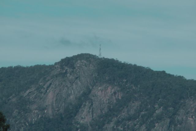
I parked the car just down from the carpark, packed up the gear into the back pack, and walked a short distance up to the summit. There are two large communication towers on the summit, but as I was to find out they did not cause too many problems with the noise floor.
There are fantastic views on the top of the summit. Out to the south is the imposing feature of Mount Buangor, which I was to climb the following day. Out to the east you can see Mount Lonarch which was also on my list to climb.
I set up the equipment on the eastern side of the summit, not far from the main communications tower. I sheltered behind a large moss rock which acted as a back rest. There were no problems with securing the ends of the dipole, as there are lots of trees and shrubs on the top of Ben Nevis.
My first contact was with Andrew VK1NAM who was portable on Mt Tennant, VK1/ AC-026. My 2nd QSO was with Andrew VK1DA who was also portable on VK1/ AC-026. This was followed by the regular crowd of SOTA Chasers.
QRP stations to call in were Andrew VK2ONZ, Andrew VK3ARR, and Brent VK2MEV. All of whom had very nice signals.
I also spoke with Tony VK3VTH who was portable in the Little Desert National Park as part of the Keith Roget Memorial National Parks Award.
Another interesting contact was with Freddo VK3FDI/mm who called in again from his maritime mobile set up on board his sloop ‘Four Winds’ on the Port Phillip Bay. It was quite a nice day on top of the summit weather wise, and it was
From about 0615 UTC, the Over The Horizon Radar on 40m kicked in and was very strong, and despite the noise floor being low, it was proving difficult to work any weak stations.
After 37 QSO’s on 40m SSB, I decided to have a listen on 20m to see whether I could work some DX with my QRP set up. The band was very busy with the All Asian Contest. In particular I heard about half a dozen Hawaiin stations calling CQ Contest. They were very strong, but unfortunately were participating in the contest, so sadly they weren’t looking to work VK stations.
After 2 hours, I ended up with 43 QSO’s on 40m SSB & 20m SSB, and it was time to pack up and head back to Ararat.
The following stations were worked:-
Andrew VK1NAM/p; Andrew VK1DA/p; Matt VK1MA; Tony VK3CAT; Brian VK3MCD; Mark VK3DEE; Ron VK3AFW; Fred VK3JM; Bernard VK3AMB; Mark VK1MDC; Tim VK5AV; Andrew VK2ONZ/qrp; Andrew VK3ARR/qrp; Peter VK3PF/p; Andy VK5LA; Nick VK3ANL; Warren VK3BYD; Roy VK5NRG; Dale VK5FSCK; Gavin VK3HY; Peter VK3FPSR; Greg VK3HBM; Rhett VK4GHZ; Brent VK2MEV/qrp; Ed VK2JI; Dean VK1DW; Brad VK3LOX; Graham VK7ZGK; Colin VK3UBY; Ian VK3TCX/m; John VK2YW; Glen VK3YY; Tony VK3VTH/p; Freddo VK3FDI/mm; Darrel VK5JDS; Don VK3HDX; Rod VK5FTTC; Roger DL5RBW; 5Q1A/p; Phil ZL2RVW; Peter VK4AAV; EA2KC; Ian VK3FD/4.
I have posted a video of the activation on You Tube.
After my activation at Blue Mountain, I drove a few km to my next activation which was Point 756 / Pyrenees, VK3/ VS-018. This was the second planned summit for Sunday 8th September, 2013. It is 756 metres above sea level and is worth 4 points.
I exited Blue Mountain Track, and drove a short distance south east on the Glenlofty-Warrenmang Road, and then turned right onto Main Break Track and travelled south until I reached the summit point, which is just on the north eastern side of the track. There was quite a bit of debris on the road and there was quite a bit of tree felling in progress.
Again I found a nice fallen log and used this as a seat, bench, and securing point for the 7m squid pole. Because the area is heavily forested, there were plenty of options with regards to securing the legs of the 20m/40m linked dipole.
The summit is located within the Pyrenees Range. For more information on the Pyrenees Range, have a look at my previous post for Blue Mountain summit. This is certainly a very attractive part of Victoria. All of the native plants were out in flower including the wattle and some of the small native orchids.
My first contact was with Ernie VK3DET who was portable on Stokes Hill VK5/ NE-050 on his Flinders Ranges holiday. It was great to work Ernie, as we had been corresponding via e-mail before Ernie’s trip, sharing our experiences between Vk3 summits I could activate & VK5 summits that Ernie could activate whilst in the Flinders Ranges. Ernie was not all that strong (5/5) but he was still very readable, as the noise floor was virtually non existant.
I then moved to 7.095 and called CQ SOTA and was soon swamped by many of the regular SOTA Chasers. My fifth contact on the summit was with Ian VK1DI who was portable in New South Wales on Mt Lowden, VK2/ ST-002. A few guys called in whilst operating QRp again. They included Brent VK2MEV, and Andrew VK3ARR. Another interesting contact was with Freddo VK3FDI who was maritime mobile on Port Phillip Bay.
After an hour of operating it was time to pack up and head off to Ben Nevis. I had worked 29 stations on 40m SSB.
The following stations were worked:-
Ernie VK3DET/p; Matt Vk1MA; Tim VK5AV; Terry VK5ATN; Brent VK2MEV/qrp; Ian VK1DI/2; Andrew VK3ARR; Dale VK5FSCK; Nick VK3ANL; Glen VK3YY; Tony VK3CAT; Brian VK3MCD/m; Bernard VK3AMB; Terry VK3YX; Mark VK1MDC; Mark VK3DEE; Ron VK3AFW; Grant VK3HP; Paul VK5FUZZ; Rod VK5FTTC; Paul VK3DAI; David VK5KC; John VK2YW; Andy VK5LA; Mark VK3PI; Freddo VK3FDI/mm; Peter VK2XP/p; Peter VK3PF/m; and Andy VK3FCOE.
I have posted a video on You Tube of the activation….
Blue Mountain, VK3/ VS-015 was my first summit for Sunday, 8th September, 2013. Blue Mountain is located in the Pyrenees Ranges, about 50 km north west of Ararat, and about 212 km north west of Melbourne. Blue Mountain is 772 metres above sea level, and is worth 1 SOTA point.
The Pyrenees Ranges are situated between St Arnaud in the north, Beaufort in the south, Maryborough in the east and Stawell in the west. A number of wineries are located in the area. The Jajowurrong people were the first to occupy the Pyrenees and called the area ‘Peerick’. The explorer and surveyor Major Thomas Mitchell was the first European recorded to have traveled through the district during his 1836 journey of exploration. The ranges reminded him of the Pyrenees mountains in Europe where he had served as an army officer, hence the name he gave them. Mitchell found the area more temperate in climate and better watered than inland New South Wales, and he encouraged settlers to take up land in the region he described as “Australia Felix”. The more I travelled around western Victoria, the more I was reminded of the significant contribution that Mitchell made during the early years of Australian exploration.
Following Mitchell, came the pastoralists to the Pyrenees, and this was followed by the discovery of gold in 1854. The foothills of the Pyrenees contain numerous relics from the gold mining era, with mining holes and other relics still visible today. Slate quarrying also occurred, with material obtained being used to pave the footpaths of Melbourne. During the 1840’s timber harvesting commenced to supply the growing communities surrounding the forest.
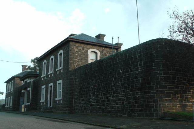
After an early start and a stop at the Ararat bakery, I started driving out of Ararat. The morning was absolutely freezing cold, and there was a thick blanket of low lying fog. My drive out of Ararat took me passed the old J Ward, the prison for the criminally insane, which is no longer in use and now serves as a museum. I have been for a tour through J Ward previously with my wife, and it is very interesting and well worth a visit. I drove out of Ararat north east along the Pyrenees Highway and then turned left onto the Elmhurst-Landsborough Road to travel north. There is a large brown sign here saying ‘Pyrenees Ranges’. After about 9 km, I then turned right onto the Glenlofty-Warrenmang Road, which is a dirt road in good condition. This road is well signposted and also has ‘Warrenmang 16’ and ‘Moonambel 29’ on it. This took me passed farming land and eventually into the Pyrenees State Forest. There were plenty of kangaroos out here, so in some parts it was slow going on the roads. After travelling about 5 km along this road, you reach a sharp right hand bend, and there is a track off to the left called Blue Mountain Track.
The track is very rough in parts, but it is passable in a 2wd vehicle with care. It takes you into the Landsborough Flora and Fauna Reserve. I continued on as far as I could go on the track until it got too rough for my Ford Falcon. This was near the intersection of the Blue Mountain Track and Malakoff Track. Take care if you are going to tackle this track in your car as there are large pot holes and wash aways, and there was a significant amount of tree debris and branches over the road. So I ended up walking about 1 km further along the Blue Mountain Track to the summit.
At the summit I found a nice big fallen tree which served as a seat, desk, and support for the 7m squid pole. The stringybark, blue gum, & messmate forest was alive with birds (of the feathered variety !). I saw and heard quite a few Kookaburras laughing away in the treetops, along with a large number of very colourful Superb Fairy wrens. In fact about 100 species of birds have been recorded in the Pyrenees.
There is also a large amount of wildlife including kangaroos, wallabies, possums, and echidnas, and a variety of reptiles including legless lizards, Bearded Dragons and Goannas.
My first three contacts on the mountain, were ‘Summit to Summit’ QSO’s with Andrew VK1DA and Andrew VK1NAM, who were doing a dual activation on Pheasant Hill, VK1/ AC-021. Signal reports of 5/8 were exchanged both ways. Next was Ed VK2JI who was on the top of Canoelands Ridge, VK2/ SY-001 with a good strong 5/8 signal. I then QSY’d to 7.100 and put out a SOTA call, and was swamped by Chasers. My fourth qualifying contact was with Colin VK3UBY in Mildura who had his normal booming signal.
I had a few QRP callers including Andrew VK3ARR, Brent VK2MEV, and Mitch VK3FMDV. All of whom had very nice signals.
Prior to the UTC rollover I also spoke with Al VK1RX who was on South Black Range, VK2/ ST-006. Al had a good strong 5/8 signal, with a 5/9 report received from Al.
My first QSO after the UTC rollover was with Peter VK3YE who was pedestrian mobile on the beach near Melbourne, using his hand held magnetic loop antenna. Peter was a good 5/5 signal, with 5/6 being received in return.
I then spoke with Marshall VK3MRG who was portable on Bill Head, VK3/ VN-004, and this was followed by Peter VK3PF who was on top of Dijbalara/Asses Ears, VK3/ VW-011, in the Grampians National Park.
A few QSO’s later I managed another ‘Summit to Summit’ QSO, this time with Ed VK2JI, who was portable on VK2/ SY-001, and then Al VK1RX on VK2/ ST-006, and then Andrew VK1DA and VK1NAM who were both portable on VK1/ AC-021. It was great to bag a few more Summit to Summits.
Again I had a number of good QRP contacts with Tony VK3CAT using just 1 watt, Bernard VK3AMB, John VK5NJ, and Greg VK2FGJW in the Blue Mountains on just 5 watts. Again, all just as easy to copy as those calling in running 400 watts.
I ended up with a total of 56 QSO’s after about 90 minutes on the summit.
The following stations were worked before the UTC rollover:-
Andrew VK1DA/p; Andrew VK1NAM/p; Ed VK2JI/p; Colin VK3UBY; Ron VK3AFW; David VK5KC; Rhett VK3GHZ; Larry VK5LY, Shaun VK5FAKV; Tim VK5AV; Mark VK1MDC; Tony VK3CAT; Andrew VK3ARR.qrp; Grent VK2MEV/qrp; Matt VK1MA; Glen VK3YY; Peter VK1IRC; Peter VK3FPSR/m’ David VK5LSB; Al VK1RX/p; Tony VK5ZAI; Mark VK3PI; Owen VK7OR; Fred VK3JM; Andy VK5LA; and Mitch VK3FMDV.
The following stations were worked after the UTC rollover:-
Peter VK3YE/pm; Marshall VK3MRG/p; Peter VK3PF; Larry VK5LY; Andy VK5LA; Ron VK3AFW; Rhett VK3GHZ; Ed VK2JI/p; Dale VK5FSCK; Al VK1RX/p; Andrew VK1DA/p; Andrew VK1NAM/p; Michelle VK3FEAT/p; Tony VK3CAT/qrp; Matt VK1MA; Colin VK3UBY; Mark VK1MDC; Fred VK3JM; Mike VK3XL; Bernard VK3AMB/qrp; David VK5LSB; Tim VK5AV; Mark VK3PI; Grant VK3HP; Brian VK3MCD/p; Jeff VK5JK; Ivan VK5HS; Grant VK5VGC; John VK5NJ/qrp; and Greg VK2FGJW/qrp.
I have posted a video on You Tube of this activation.
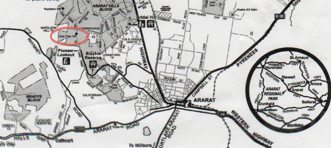
My final SOTA activation for Saturday 7th September, 2013, was One Tree Hill, VK3/ VS-036, which is situated just to the north west of Ararat in western Victoria, about 205 km west of Melbourne. It was about a 90 minute drive to Ararat from Mount Rouse. The summit is 569 metres above sea level and is worth 2 SOTA points.
Ararat is one of favourite towns in western Victoria. It is a former gold-mining town, situated within a rich pastoral, wine and fruit growing district between Stawell and Beaufort. Ararat’s main street is a typical wide and attractive country town main street. A number of elaborate and historical buildings grace the streets of the town, including the Town Hall and Shire Hall in Barkly Street, both built in the late 1800s. Other places of historical interest include the Gum San Chinese Heritage Centre, the Langi Morgala Museum located in the former wool store, and J Ward, which originally served as the Ararat County Gaol until 1887 when it was then turned into an institution for the criminally insane, and Aradale Mental Hospital.
Europeans first settled in the Grampians region in the 1840s after surveyor Thomas Mitchell passed through the area in 1836. In 1841, Horatio Wills, on his way to selecting country further south, wrote in his diary, “like the Ark we rested” and named a nearby hill Mt Ararat. It is from this entry and the nearby Mount that the town takes its name. The Post Office opened 1 February 1856 although known as Cathcart until 31 August 1857.
In 1857, a party of Chinese miners en route to the Central Victorian gold fields struck gold at the Canton Lead which marked the beginning of great growth in Ararat.
One Tree Hill was an easy summit to access, as there is a bitumen road going all the way to the top, to the Pioneer Lookout. Surprisingly enough this road is called One Tree Hill Road ! Fancy that ! At the end of the bitumen there is a large parking area for the lookout which overlooks Ararat. The actual summit is a bit further on from this parking area. There is a dirt track called One Tree Hill Track, which takes you further to the north and the location of the actual summit, which is amongst the scrub on the western side of the track. The track is rough in parts but is passable with care in a 2wd.
The summit is located within the Ararat Regional Park, which is made up of three separate, easily accessible blocks. The Ararat Hills block (820 hectares) boasts panoramic views from Pioneer Lookout and a rich gold mining history, the Dunneworthy block (2,670 hectares) is made up of gentle terrain to the north, and Bradys Block (180 hectares) is a rich ironbark forest in the Norval-Cathcart area.
The park can also be easily explored on foot or bicycle on the extensive network of tracks.
The park contains over 200 native plant species including 34 species of delicately flowered orchids. Eucalypt trees dominate the vegetation, with Red Stringybark and Long-leaf Box predominant in the hilly areas and Yellow Gum and Yellow Box occupying the flats. On the park’s main ridge at One Tree Hill, a stand of very old, large Messmate Stringybark trees are of botanical interest. In spring time, flowers of the Golden Wattle swathe the hills in gold.
A large amount of wildlife can be found in the park including Grey Kangaroos, Swamp Wallabies, echidnas, Brush-tailed Possums and Sugar Gliders.
Birdlife includes rowdy flocks of Sulphur-crested Cockatoos, beautiful Rainbow Birds, Long-billed Corellas and Galahs, the majestic Wedge-tailed Eagle and the ground feeding Common Bronzewing and Red-rumped Parrot.
Prior to European settlement, the Ararat region was occupied by Aboriginal people of Parn Balug clan. This was one of over 40 clans comprising the Djab Wurrung language group whose territory covered a large part of south-west Victoria, including portions of the Grampians.
With the arrival of the first squatters and their flocks in the early 1840s, the Parn Balug’s traditional lifestyle, social and cultural structures were affected by disease and conflict and their numbers rapidly declined. Gold was discovered at Ararat in 1857. The park contains relics of gold mining activity including shallow mine shafts, a mining dam and water races.
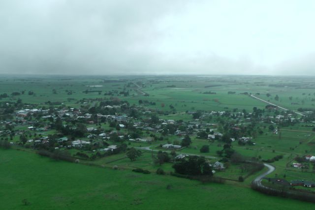
From the lookout there are spectacular views to the east over the town of Ararat, and out to the west. There are great views of the Grampians, Mount Langi Ghiran, and Mount Cole. This area is cleared of trees which assists with the views. As you travel down One Tree Hill Track, the view to the east and west is obscured a lot more by trees and scrub.
I parked the car at the lookout and walked down the track to the operating position within the Activation zone. There are plenty of options for securing the dipole, as there are large gum trees all over the summit. Not really sure why it is called One Tree Hill, as the summit is completely covered in trees ?
I started off on 40m first, on the usual frequency of 7.090, and it wasn’t long before I had the usual hungry SOTA hunters. I had a handful of qrp callers again including Andrew VK2ONZ, Andrew VK1NAM, Mark VK5QI/m, and Andrew VK3ARR. All had very nice signals. Conditions appeared to be very good on 40m. The only annoyance was the Over The Horizon Radar which was quite strong.
I was only 5 minute drive from the motel, so I decided to have a ‘play’ on 20m. I started calling CQ SOTA on 14.170 but was soon drowned out by some Russian stations, so I decided to tune around the band. I heard my good friend Dick, G4ICP who was portable in the salt marshes with his ‘roach pole’ Dick was not all that strong but I decided to give him a call, and surprisingly enough Dick came back to me. We were having a good chat until a VK & a G station decided to come up just 2 kc away, and that was the end of that.
I then worked into Spain and England again, and then decided to call CQ again. Luke KK7XX came back to my call and after an enjoyable QSO with him, Luke offered to put me on the cluster, which resulted in me working another very good mate of mine in the UK, Phil 2E0UDX. He was a good 5/8 and Phil gave me a 5/4 back with my 5 watts. This was followed by another good mate of mine calling in, Marnix OP7M in Belgium. Marnix was an excellent 5/9 signal. Although Marnix was struggling a bit and reading me just 4/4, we still had a good chat. This was followed by calls from Tony CT1FFB in Portugal; Jos using a special call of OO4ATK in Belgium; Bert DB6ZU in Germany; Mike GW4XSX in Wales; Curtis KP4EJ in Puerto Rico. My last two contacts for the afternoon on 20m were with Masa JR5JAQ in Japan; and Steve VK4KUS.
The sun was setting and it was time to pack up my gear and head for the motel, for some dinner and a few beers and some rest before tomorrow’s activations.
After nearly 2 hours on the summit, I had worked 37 stations, including 12 DX stations in Europe, the UK, Puerto Rico, and Japan.
The following stations were worked on 40m SSB:-
Brad VK2HAV; Col VK5HCF; Peter VK3PF/m; Mark VK3DEE; David VK7XT; Rhett VK3GHZ; Bill VK3LY; Peter VK3FPSR; Mark VK3PI; Ed VK2JI; Dale VK5FSCK; Al VK1RX; Darren VK2NNN; Andrew VK2ONZ/qrp; Rod VK5FTTC; Tim VK5AV; Andrew VK1NAM/qrp; Brian VK3MCD; Bernard VK3AMB; Fred VK3JM; Marshall VK3MRG; Tony VK3CAT; Mark VK5QI/m/qrp; & Andrew VK3ARR/qrp.
The following stations were worked on 20m SSB:-
Dick G4ICP/p; EA2DT; Chris G0UNJ; Luke KK7XX; Phil 2E0UDX; Marnix OP7M; Tony CT1FFB; Jos OO4ATK; DB6ZU; GW4XSX; Curtis KP4EJ; JR5JAQ; and Steve VK4KUS.
I have placed a video on You Tube of this activation.
My second summit of the Saturday was Mount Rouse, VK3/ VS-048, which is situated near the little town of Penshurst, and about 275 km west of Melbourne. Penshurst is just a small town with a population of about 500 people, and is the centre of a large dairying, agricultural and pastoral district. The town is situated near the foot of Mount Rouse, which is an extinct volcanoe. It was about a 35 km drive from my previous activation at Mt Napier.
Mount Rouse was named after the Colonial Under Secretary of New South Wales. The summit was known as ‘Collorer‘ by the local Nareeb Nareeb and Kolor Aborigines. The local aboriginal tribes gathered food from the local area and fresh water from nearby natural springs and creeks. The Kolor aboriginals built substantial huts for their shelter in the winter, preferring the open countryside in the warmer months.
The famous explorer, Major Thomas Mitchell, who sighted Mount Rouse during his ‘Australia Felix‘ expedition of 1837, also encountered two of the aforementioned dwellings which he described as ‘two very substantial huts‘. On a rainy day he expressed a desire to ‘return if possible, to pass the night there, for I began to learn that such huts, with a good fire between them, made comfortable quarters in bad weather.’ From atop Mount Napier he noted: ‘Smoke arose from many parts of the lower country, and showed that the inhabitants were very generally scattered over its surface. We could now look on such fires with indifference, so harmless were these natives, compared with those of the Darling, and the smoke, now ascended in equal abundance from the furthest verge of the horizon.’
A man called John Cox was the first settler to take up land at Mount Rouse, and he established a sheep station by 1840. There were also others that held leases on land in the surrounding district, and the local aboriginals soon found their food sources destroyed or driven out by clearing and the introduction of European stock. During times of necessity they turned to the Europeans stock for food. As a result they found themselves subject to retaliatory raids by white landowners and there were numerous episodes of killing and bloodshed.
Due to the decline in the Aboriginal population the New South Wales Government established a number of reservations. Mount Rouse was chosen as one of those. As a result John Cox was forced to remove his stock from the land and an Aboriginal Protectorate was opened. Despite this, conflict continued and diseases introduced into Australia by Europeans ravaged the indigenous peoples. Thus, within a few years, the Aboriginal population was so diminished that the reserve closed.
Mount Rouse is a massive accumulation of scoria rising 100 m above the surrounding volcanic plain. It is worth 1 SOTA point. It is built mainly of red and brown scoria with thin interbedded basalt lava flows. The scoria forms an arcuate mound opening towards the south-west and giving the appearance of a breached cone. To the south of the main scoria cone is a deep circular crater with a small lake and a smaller shallow crater rimmed with basalt. The scoria is the youngest element of an eruption point that produced the longest lava flows known in the Newer Volcanics Province in Victoria. The flows followed shallow, gently sloping river courses and eventually united to extend at least 60 km south of Mount Rouse. A thin basalt lava flow contained in the scoria cone has been dated at approximately 1.8 million years, conflicting with dates of only 0.3 to 0.45 million years obtained from the end of the Mount Rouse flows near Port Fairy 60 km to the south. The scoria cone is the highest relief in the area and is an important vantage point to view the lavas and adjacent volcanoes of Mount Eccles and Mount Napier.
Unfortunately quarrying has removed a significant portion of the scoria and has left large pits that visiually detract from the overall beauty of the summit. Tree planting has obscured some of the geological features, such as the crater within the big scoria cone.
Upon arrival at the summit it was very wet. The weather was really threatening with regular showers which at times were quite heavy. But fortunately I did not have to walk far to get to the summit, and retreat back to the car if required. I put on the back pack and I then walked up the stairs to the summit, and set up my gear in a hurry to try to avoid the weather.
Initially the summit was completely fogged in and I really couldn’t see any views at all. But the weather slowyl cleared a little bit and was able to see the little town of Penshurst just below the summit. Whilst I set up the gear I was carefully watched by 2 little euros (wallabies) who appeared to be very tame, and quite often came up within only 5 metres.
There is a communications tower at the summit and also a fire spotting tower. I was a little concerned with the towers and the possibility of noise, but once I had turned the radio on I was pleasantly surprised. The noise floor was very low. There was a strategically placed wooden bench on the summit in close proximity to the trig point and this was obviously the pick of the operating positions. Not only did I use the bench to sit on, but I also attached the 7m squid pole to the bench using some octopus straps.
My first contact on the summit was with Col VK5HCF who had his usual strong qrp signal, and this was followed by Peter VK3PF who was mobile. My 3rd contact of the summit was a ‘Summit to Summit’ QSO with Glen VK3YY who was portable on Federation Range. By contacting Glen I had tipped over the 250 point mark for the Summit to Summit certificate. My 4th qualifying QSO was with Andy VK5LA in the SA Riverland with a very strong 5/9 signal.
It was about this point that the showers started to get a bit heavier, so I grabbed the bothy bag and climbed inside to stay dry.
Due to the weather I only stayed on the summit for 30 minutes, but in that time I managed 16 QSO’s on 40m SSB into VK1, VK2, VK3, & VK5. Only 2 qrp stations called in this time around. Andrew VK3ARR who was becoming a regular qrp caller (5/4 sent and 5/5 received), and Andrew VK2UH who was qrp with just 5 watts (5/8 both ways).
The following stations were worked:-
Col VK5HCF; Peter Vk3PF/m; Glen VK3YY/p; Andy VK5LA; Matt VK1MA/m; Tony VK3CAT; Tim VK5AV; Warren VK3BYD; ANdrew VK3ARR/qrp; Bernard VK3AMB; Peter VK3FPSR; Rhett VK3GHZ; ANdrew VK2UH/qrp; Ron VK3AFW; Brian VK3MCD; and Mark VK7FMPR.
I have posted a video of this activation on You Tube.