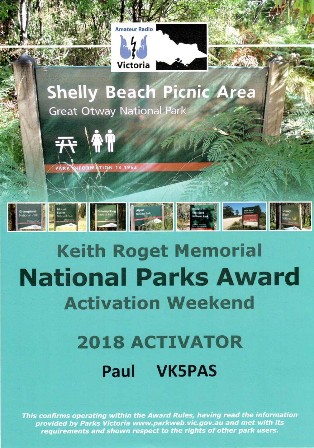
My latest VKFF certificate, the participation certificate for the 2018 VKFF Activation Weekend.
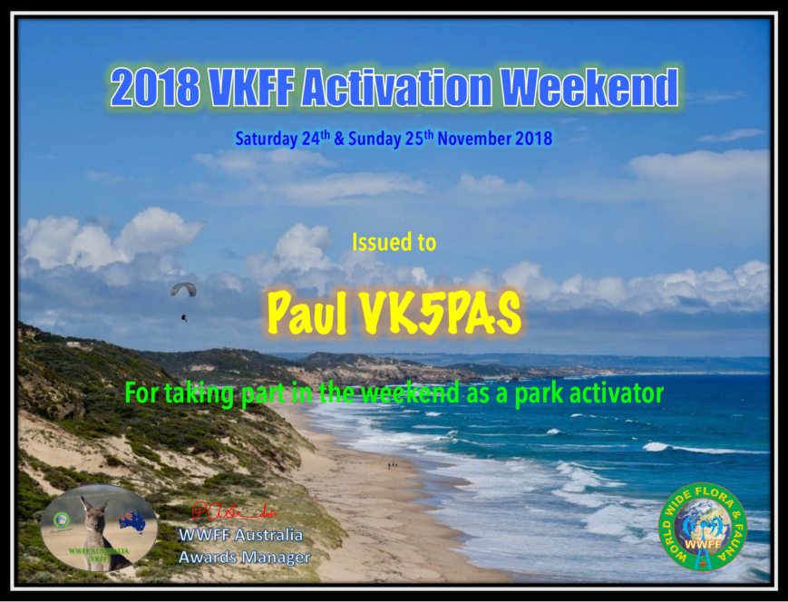

My latest VKFF certificate, the participation certificate for the 2018 VKFF Activation Weekend.
HAPPY NEW YEAR to all.
Today being the 1st day of January 2019, means another New Years Day SOTA event. It has become custom now in VK & ZL to head out to activate a summit on New Years Day, and take advantage of activator points either side of the UTC rollover for the two calendar years. And also plenty of Summit to Summit opportunities.
A few times now Marija and I have headed north to activate Mount Bryan in the Mid North of South Australia. We have stayed overnight in Burra on New Years Eve, and activated the summit bright and early on New Years Day. But this year we were not sure what time Marija would get off work on New Years Eve, so travelling to a summit we had not activated in 2018 was not going to be an option this year.
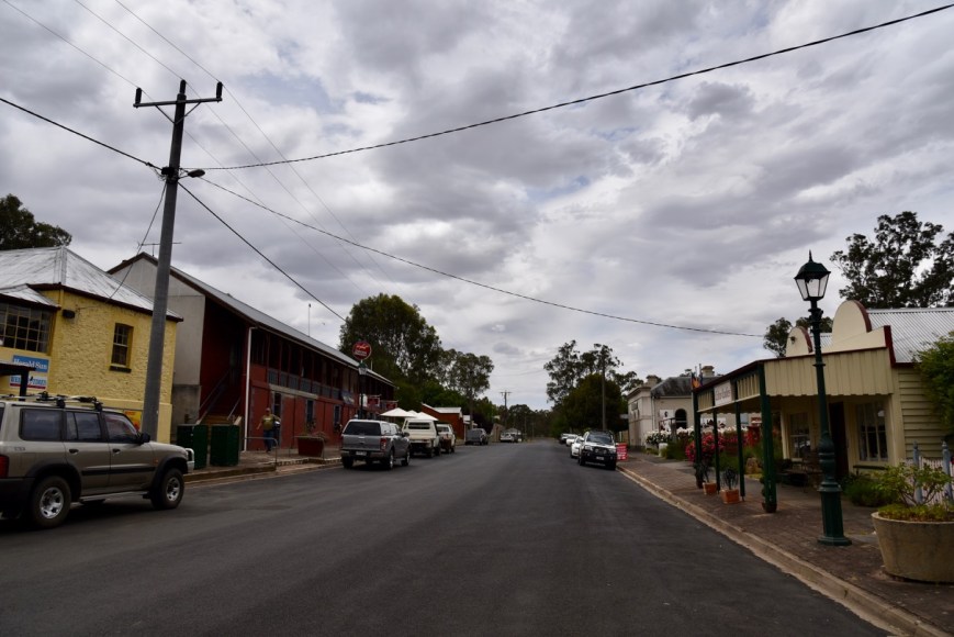
So at about 8.45 a.m. on New Years Day, with no hangover, we headed to our closest summit, Mount Lofty VK5/ SE-005. Marija and I had both activated Mount Lofty during 2018, so we wouldn’t pick up the 4 SOTA points until after the UTC rollover.
Mount Lofty is just a short 15 minute drive down the road from home. The summit is located about 17 km (by road) south east of the city of Adelaide, and is located within the Cleland Conservation Park VKFF-0778. It is in the Mount Lofty Ranges ‘ Adelaide Hills’.
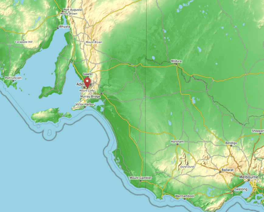
Above:- Map showing the location of Mount Lofty. Map courtesy of Open Topo map.
Mount Lofty is worth 4 SOTA points and has been activated a total of 82 times. Not surprising that it is so popular, as it is in very close proximity to the city of Adelaide, and is very easily accessible. It was first activated by Andy VK5AKH in November 2012.
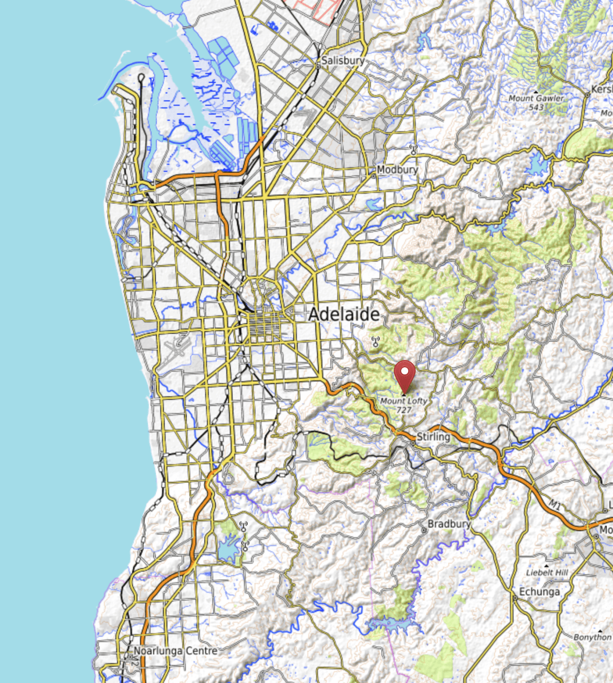
Above:- Map showing Mount Lofty, in close proximity to the city of Adelaide. Map courtesy of Open Topo map.
Mount Lofty is the highest point in the southern Mount Lofty Ranges. Its elevation is 727 metres above sea level. Mount Lofty was named by the explorer Matthew Flinders on the 23rd March 1802 during his circumnavigation of the Australian continent. But the summit was not climbed until 29 years later in April 1831, when the explorer Collet Barker climbed to the top. This was six years prior to the settlement of Adelaide. Barker was speared to death later that year after swimming across the Murray Mouth.
In 1855 an obelisk replaced the old stone cairn at the summit, which was originally used to mark the trig point. In 1902 the obelisk was named the ‘Flinders Column’.
A cafe-restaurant and gift shop can be located at the summit, which is incredibly popular with tourists as it offers spectacular views of Adelaide and across Gulf St Vincent to the Yorke Peninsula.
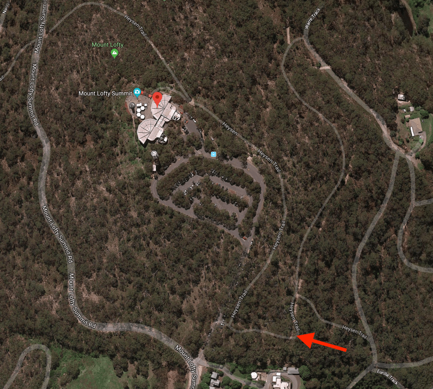
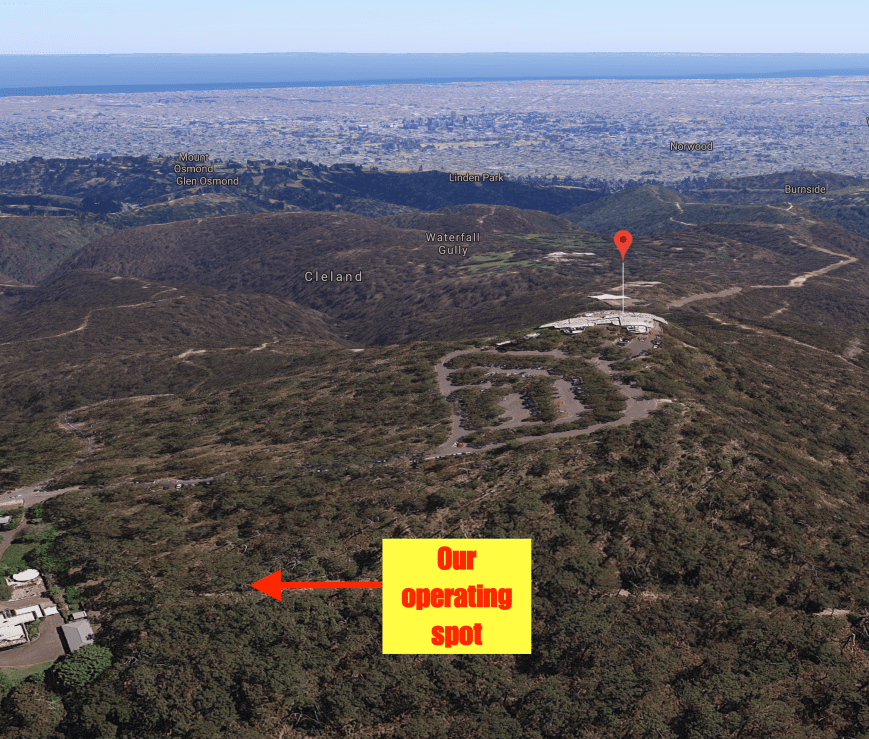
Above:- An aerial view of Mount Lofty summit. The arrow indicates our operating spot. Image courtesy of google maps
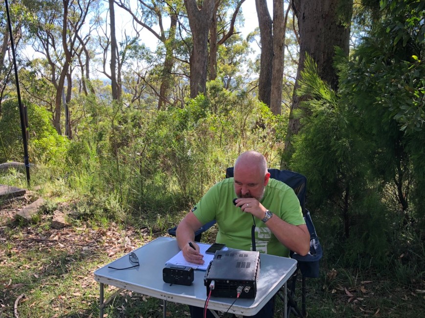
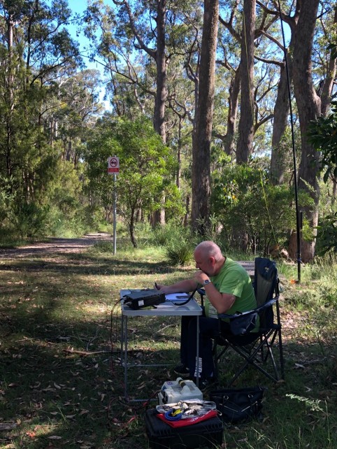
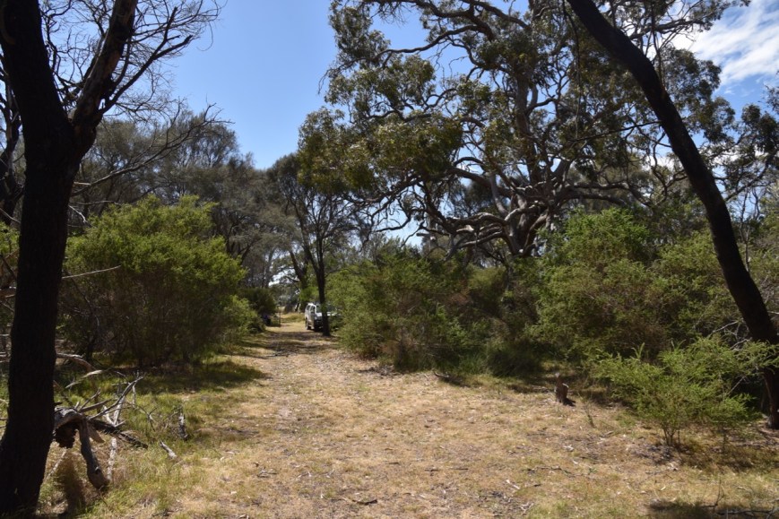
We parked just inside the gates leading to the summit and walked about 500 metres down the Heysen Trail and set up in our normal spot. This is within the activation zone, but away from the hoards of tourists.
Above:- Aerial shot of the summit, showing our operating spot. Image courtesy of google maps
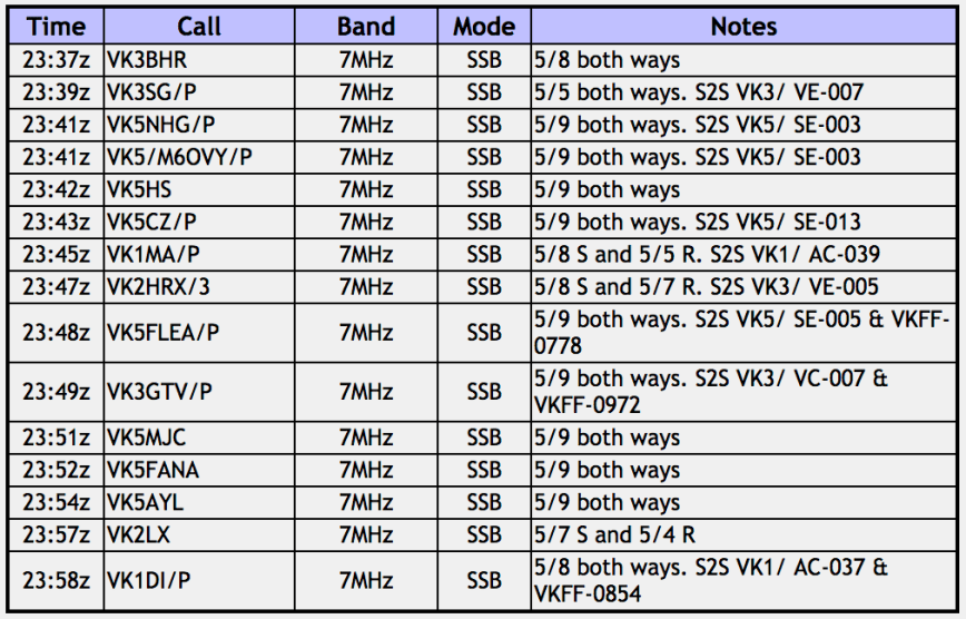
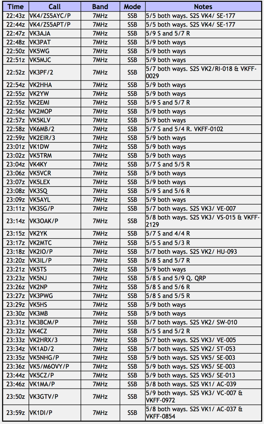
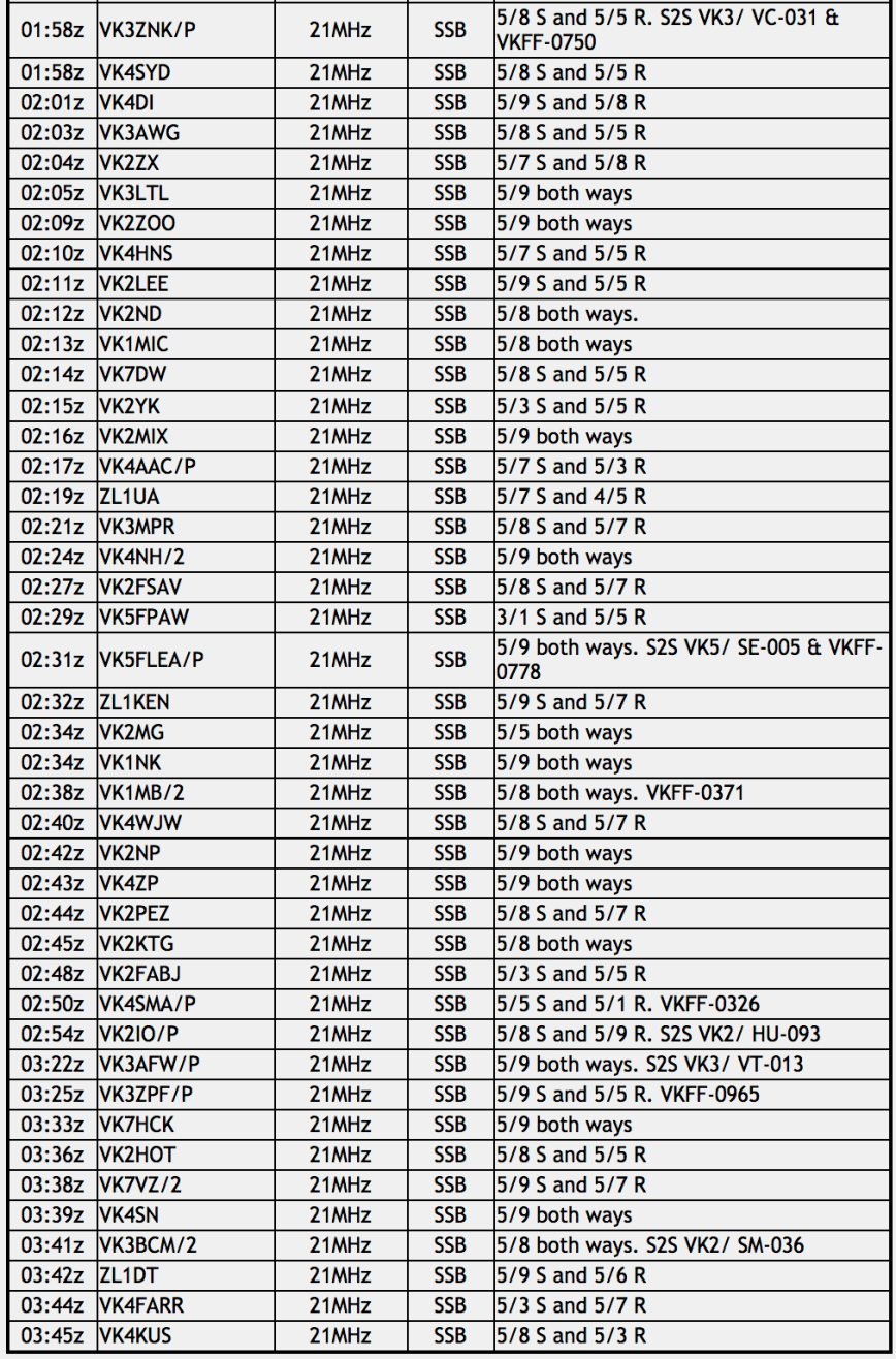
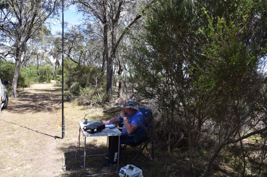
We were set up and ready to go just before 9.15 a.m. local time (2245 UTC). I called CQ on 7.100 and first in the log was Sid VK4/ZS5AYC and Adele VK4/ZS5APT who were activating Tennison Woods Mountain VK4/ SE-177. It was a great way to start the activation with a couple of Summit to Summit contacts. Next was Andy VK3AJA, Chris VK3PAT, and Nev VK5WG. It was soon evident that the 40m band was in good shape, with good strong signals. And absolutely no man made noise on the band. One of the many reasons I enjoy working portable.
A little pile up soon ensued which I was very pleased with. I logged a total of 39 stations from VK1, VK2, VK3, VK4, and VK5, before swapping the mic with Marija. Summit to Summit contacts logged were as follows:-
Park to Park contacts logged were as follows:-
It was pleasing to log a number of South Australian stations. Close in propagation has been pretty patchy for quite some time now, so I was very pleased to hear 5/9 plus signals from Nev VK5WG, John VK5MJC, & Hugh VK5NHG/p in the Mid North, Les Vk5KLV at Port Augusta, Rob VK5TRM, Rob VK5TS & Ivan VK5HS in the Riverland , Rick VK5VCR & Dave VK5LEX south of Adelaide, Sue VK5AYL on the Fleurieu Peninsula, and John VK5NJ in Mount Gambier who was QRP with around 4 watts.
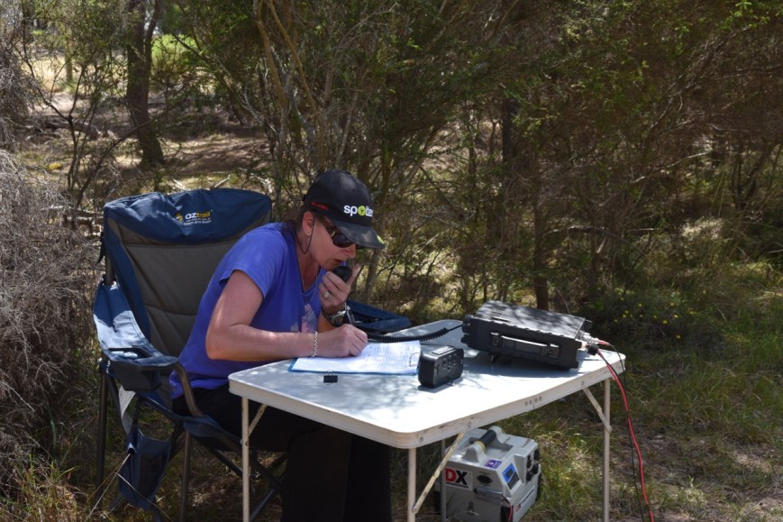
With about 25 minutes before the UTC rollover, Marija started calling CQ on 7.100, after we had lowered the power down from 40 watts to 10 watts PEP, to abide by Marija’s licencing conditions. First in the log for Marija was Phil VK3BHR, followed by Leigh VK3SG/p on Mount McKay VK3/ VE-007, and then Hugh VK5NHG/p on Hallett Hill VK5/ SE-003.
Marija logged a total of 15 stations before the UTC rollover, including the following Summit to Summit contacts:-
And the following Park to Park contacts:-
I also logged some of the above stations who I did not already have in the log.
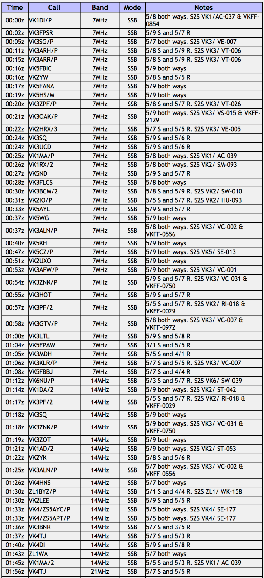
Marija continued after the UTC rollover and logged a further 8 stations including the following Summit to Summit contacts:-
And the following Park to Park contacts:-
I also logged these stations.


I then jumped back on the mic and logged a further 31 stations, including the following Summit to Summit contacts:-
And the following Park to Park contacts:-
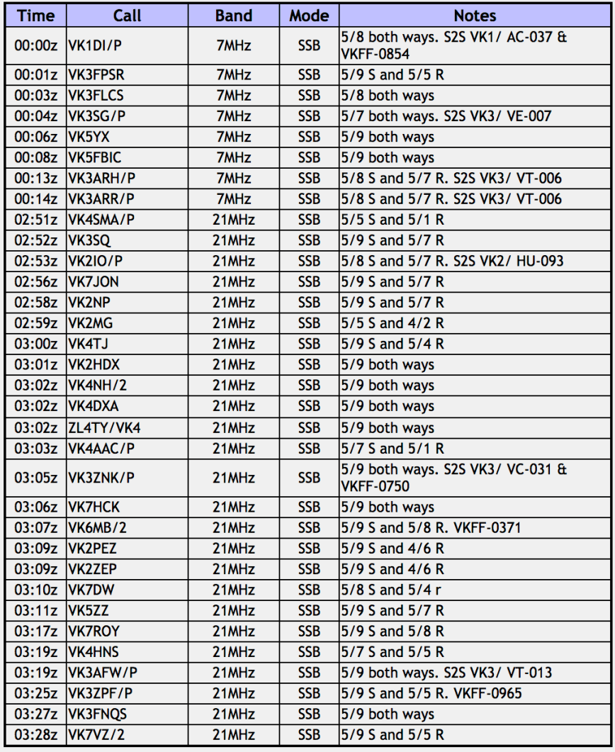
I then decided it was time to try the 20m band. I changed bands on the transceiver and was monitoring 14.310 as I was lowering the squid pole and removing the 40m links. I could hear Andrew VK1AD/2 calling CQ, so I hoisted the squid pole up with haste, but found that Andrew had gone. I had however, heard John VK6NU/p trying to get through (unsuccessfully) to Andrew. So I logged John who was activating SOTA peak VK6/ SW-039.
I then moved up to 14.315 and logged a total of 18 stations from VK2, VK3, VK4, and New Zealand. This included the following Summit to Summit contacts:-
And the following Park to Park contacts:-
John ZL1BYZ was my first New Zealand Summit to Summit for this activation, so I was very pleased to get him in the log, albeit a little bit of a struggle. I also logged John’s wife, Jacky ZL1WA, who was operating from home.
A few stations had mentioned that 15m was open, so Marija and I lowered the squid pole, and replaced the linked dipole with the 15m 1/2 wave dipole. I called CQ on 21.250 and it wasn’t long before I had my first 15m caller, John VK4TJ. What followed really surprised me. A steady flow of callers from VK1, VK2, VK3, VK4, VK7, and New Zealand. I logged a total of 36 stations including the following Summit to Summit contacts:-
And the following Park to Park contacts:-
Some of the signals on 15m were exceptionally good. It was so great to see this band open.
I encouraged Marija to get up on 15m and I think she was pleased I did, as she does not normally make a lot of contacts on that band. Marija ended up logging 25 including the following Summit to Summit contacts:-
And the following Park to Park contacts:-
To complete the activation I put out a few final CQ calls on 21.250 and logged a further 8 stations from VK2, VK4, VK7 and New Zealand.
Our final tally for the day:-
Paul VK5PAS
Marija VK5FMAZ
TOTAL QSOS – 190
TOTAL SUMMIT TO SUMMIT – 62
TOTAL PARK to PARK – 25
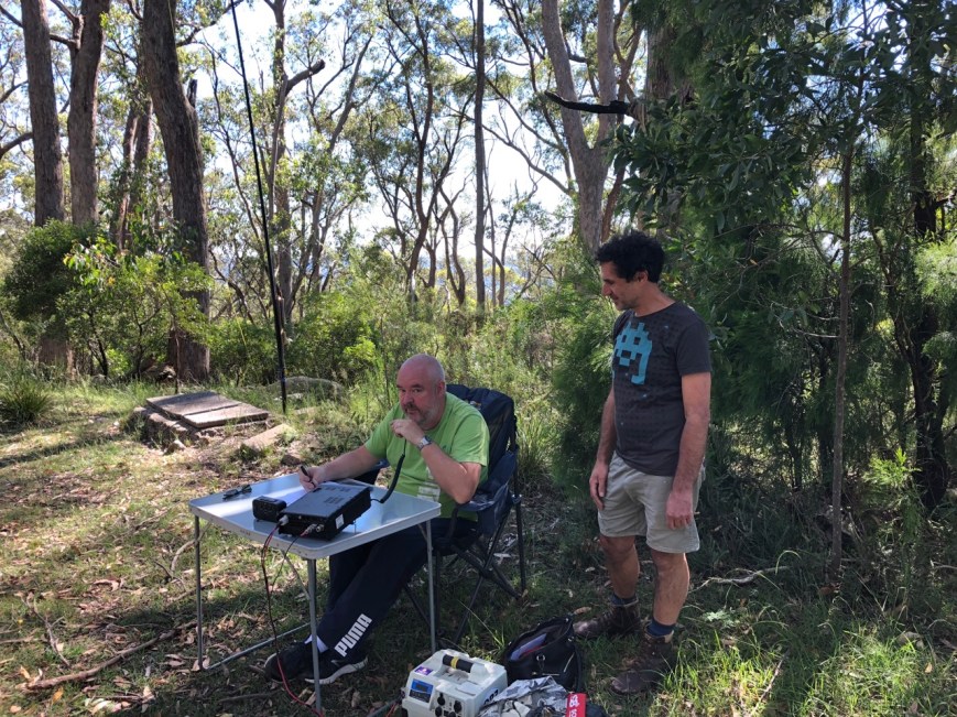
During the activation we were also visited by John VK5FLEA. John, who is a new ham, has become a very enthusiastic parks activator. He also activated Mount Lofty, and this was his first ever SOTA activation.
Marija worked the following stations before the UTC rollover:-
Marija worked the following stations after the UTC rollover:-
I worked the following stations before the UTC rollover:-
I worked the following stations after the UTC rollover:-
References.
Wikipedia, 2018, <https://en.wikipedia.org/wiki/Mount_Lofty>, viewed 1st January 2019
A few weeks ago I heard John VK5FLEA activating a nearby park, The Knoll Conservation Park. John is a newly licenced amateur and has taken to park activating like a duck to water. I decided to pay John a visit, as we had been promising to try to catch up for the first time.
On the way there, another mate Greg VK8GM gave me a call. Greg and his wife were in town. So I met Greg briefly at Mount Barker, and then headed to The Knoll, arranging to met Greg there as well after he had got a bite to eat.
It was terrific to catch up with both John and Greg.


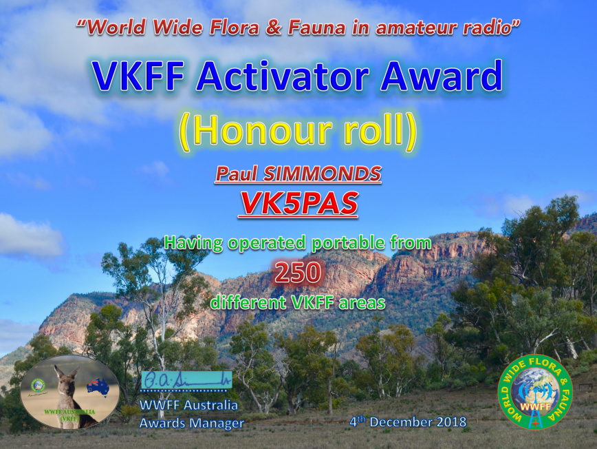
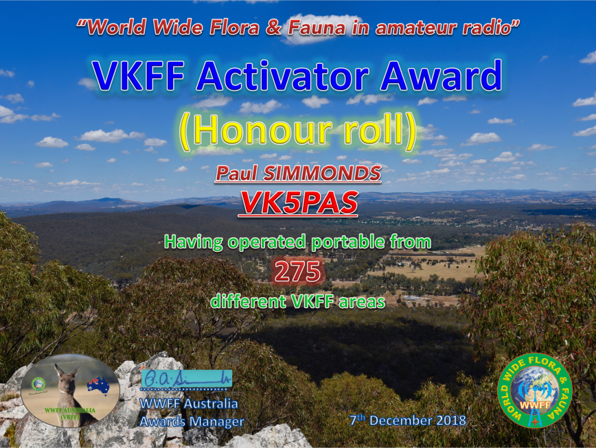
After our recent trip to Victoria, I have qualified a few more parks for the VKFF program, and as a result have reached the next couple of levels in the VKFF program as an activator. The certificates are issued for having activated a total of 250 different VKFF references, and 275 different VKFF references.
Many thanks to all of the hunters.
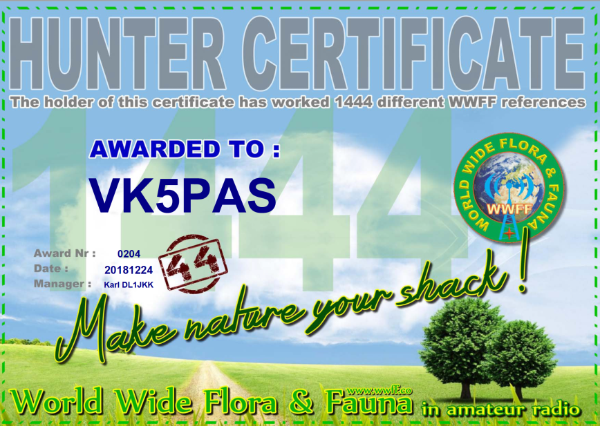
A nice Christmas present arrived this morning…..my latest WWFF certificate. Issued for having worked a total of 1,444 different WWFF references.
Thankyou to the awards manager Karl DL1JKK.
In the past few days, Marija and I received our certificates in the mail for taking part in the 2018 Activation Weekend for the Keith Roget Memorial National Parks Award (KRMNPA).
Many thanks to Tony VK3XV and Amateur Radio Victoria.
A few nights ago I spoke with Tim 2E0TWG on the 20m band on the short path.
I was his FIRST EVER VK contact, and on all days his birthday.
Tim was running 50 watts and a hamstick antenna on the roof of his car.
Below is a video that Tim put together of the QSO……
And here is a video of our contact the following night…….
Our final activation for the trip was the Edenhope Flora Reserve VKFF-2311, located at Edenhope, about 384 km north west of Melbourne.
Above:- Map showing the location of the Edenhope Flora Reserve. Map courtesy of Protected Planet.
The Edenhope Flora Reserve is about 111 acres. Do not get this park confused with the adjacent Edenhope Natural Features Reserve.


To get into the park we travelled along Charles Street and through a gate and then followed a sandy track with the golf course to our right. The track was very sandy and I would not recommend it in a comventional vehicle, as it is highly likely you will get bogged.


We set up in the northern section of the park on the side of a sandy track. There was plenty of room here to string out the 20/40/80m linked dipole.

It was quite late in the afternoon, 4.30 p.m. local time, and we were aware that we still had quite a distance to get home. Marija placed a spot up on parksnpeaks and I called CQ on 7.144. This was answered by Ray VK4NH who used his other 2 calls, and then John VK4TJ who also used his other 2 calls. So in the space of 2 minutes I had 6 contacts in the log.
A few minutes later I had the park qualified for VKFF, with a contact with Scott VK7NWT. I then logged Gerard Vk2IO mobile, before swapping the operators chair with Marija.
First in the log for Marija was Scott VK7NWT, followed by Ray VK4NH and then John VK4TJ. Within 5 minutes Marija had qualified the park for VKFF with 10 contacts. her tenth QSO being with Andrew VK2AR.
I then put out a few CQ calls on 3.610 on the 80m band and logged 4 stations there, David VK5PL, Adrian VK5FANA, Andy Vk5LA, and Kevin VK3VEK. To complete the activation I logged 3 stations on 20m.
We then went QRT from the park. Our apologies to those that may have needed this park, but we had a big drive ahead of us. We will be back to get our 44 contacts from this park.

Marija worked the following stations on 40m SSB:-
I worked the following stations on 40m SSB:-
I worked the following stations on 80m SSB:-
I worked the following stations on 20m SSB:-
After packing up we had a look at the Aboriginal Cricket Team mural at the Edenhope College. The aboriginal crickets practised where the college now stands before they toured England in 1868. Local artists Win Forster and Ella McLaren are responsible for the artwork.


There is also a monument here commemorating the 1868 Aboriginal Cricket Team.


We also paid a quick visit to the Edenhope Visitor Info Centre which is houses in the former Edenhope Court House. The old lockup building can also be found here.


Lake Wallace was our next stop. It is located in Edenhope. An annual fishing competition is held here.


We headed out of Edenhope along the Wimmera Highway and soon reached the little town of Apsley, named after Apsley House in London. We visited the local cemetery where Murrumgunerrimin (Jimmy Tarpot) is buried. He was one of the Aboriginal cricket team who toured England. He is also the World Record holder, running backwards 100 yars in 14 seconds at the MCG on 28th December 1866.


Whilst in Apsley we also looked at the large Red-flowering Gum on Wallace Street which is listed on the National Trust of Australia’s Significant Tree Register for Victoria. It is reputed to be the largest flowering gum in Australia. There is also a c. 1870 wooden wagon. It was used for hauling heavy loads around a farming property in the Kaniva district.


It was 6.00 p.m. local time and we decided to stop at the Border Inn Hotel at Apsley for a meal. And I am very pleased we did. I enjoyed some very nice crumbed lamb cutlets.


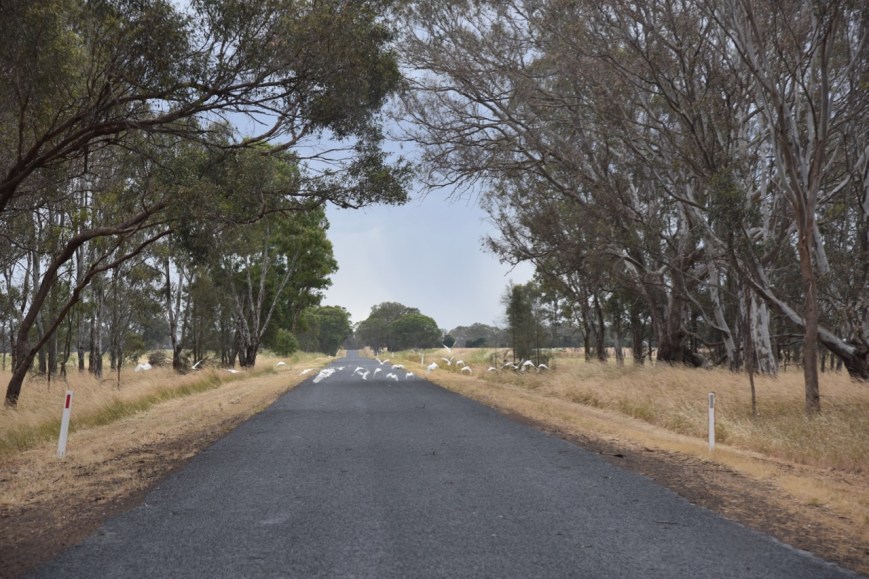
We then headed out of Apsley on the Benayeo Road and soon crossed the South Australia/Victoria State border. The weather had now set in, with a big storm rolling in. As a result, there were flocks of corellas, galahs and cockatoos on the road seeking out the pools of water for a drink.
As we approached Bordertown, the heavens had really opened up. But it soon cleared and we rewarded with a rainbow.

Our final stop was Wiese’s Horse Dip. It was built in 1931 by local landholders using timber from nearby bulloak trees. Its main function was to control a parasitic itch in working Clydesdale horses. This malady caused great discomfort to the Clydesdale’s manes and tails, so much so that they used to rub constantly against fences and so cause damage to many fence lines. Horses were walked into the dip, and due to the horses size, the operators bucketed and sponged the solution over the horses to complete the task.


We continued along the Dukes Highway through the towns of Keith, Tintinara, Coonalpyn, Coomandook, and Tailem Bend. And then onto the South eastern Freeway, passing Murray Bridge. We arrived hom at about 9.45 p.m. local time, unpacked and went off to bed. It was the conclusion of a very enjoyable trip.
THANKYOU to everyone who called us during our PARK and SOTA activations over the 2 week period.
References.
Wikipedia, 2018, <https://en.wikipedia.org/wiki/Apsley,_Victoria>, viewed 22nd December 2018
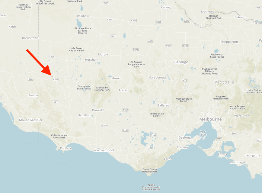
Our next intended activation was the Peter Francis Points Flora Reserve VKFF-2421 which is located at Coleraine, about 329 km west of Melbourne. This was to be the first time that the park had been activated for the World Wide Flora Fauna (WWFF) program.
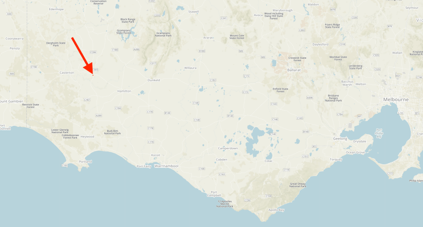
Above:- Map showing the location of he Peter Francis Points Flora Reserve at Coleraine. Map courtesy of Protected Planet.
As we drove into Coleraine, we stopped briefly to have a look at the Adam Lindsay Gordon monument on the edge of town. It commemorates the 19th century poet, who developed a reputation as a distinguished horse rider in the town’s Great Western Steeplechase. Poems related to the race are “The Fields of Coleraine” and “Banker`s Dream”.


We then stopped for a drinks and toilet break at the Coleraine Visitor Info Centre which is et in the old Coleraine Railway Station.


We then headed to the Peter Francis Points Flora Reserve, also known as the Peter Francis Points Arboretum Nature Conservation Reserve. We travelled south on the Coleraine-Merino Road and then turned right into Top Hilgay Road, and then Points Road and entered the park.


There were some very nice views of the town of Coleraine as we travelled along Top Hilgay Road.


The Peter Francis Points Arboretum is 37 hectares in size and is a collection of native Australian plants. There are more than 10,000 recorded Australian native plants in the reserve, including several threatened species. ‘The Points’ gets its name from two peaks of land on the site.
The Points Arboretum was started in 1966 by Mr. Joe Wright, Shire Engineer, Mrs. Mary Hope and Mr. Peter Francis.


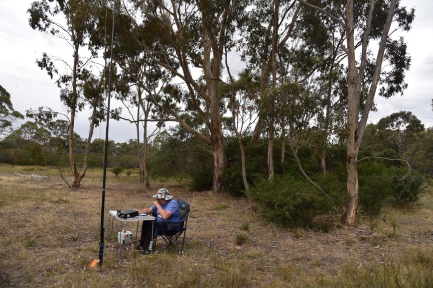
We travelled to the lookout which overlooked the town of Coleraine. As we were running a bit short of time, this was to be a very quick activation from the vehicle, using the Icom IC-7000 and the Codan 9350 self tuning antenna mounted on the rear of the Toyota Hi Lux.
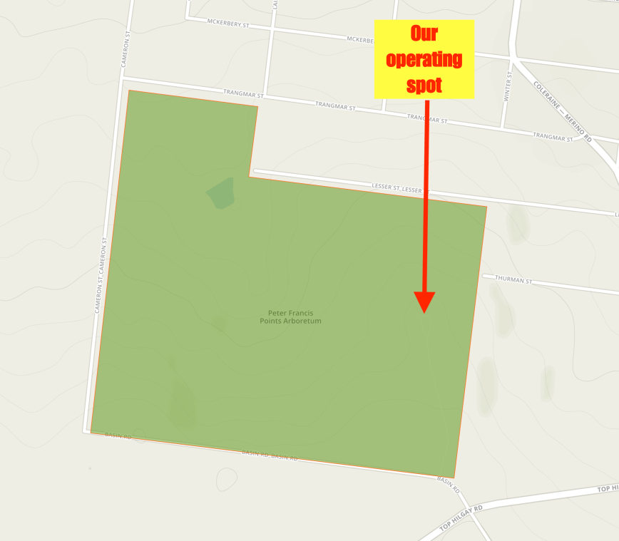
Above:- Map of the Peter Francis Points Flora Reserve, showing our operating spot. Map courtesy of Protected Planet
There were some nice views of Coleraine through the trees from the lookout.


First in the log for this activation was a Park to Park contact, with Gerard VK2IO/p who was activating the Rouse Hill Regional Park VKFF-2784. Both Marija and I logged Gerard. We then found Mark VK4SMA on 7.140, activating the Freshwater National Park VKFF-0187.
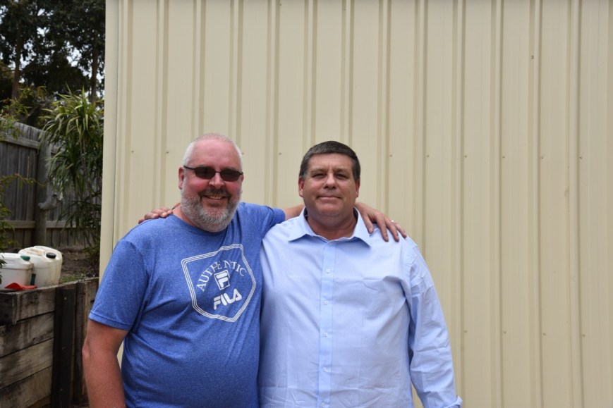
After both logging Mark I moved down to 7.135 and started calling CQ. The IC-7000 was then just about rattled off the windscreen, as I was called Steve VK3NSC who lives at Coleraine. I logged Steve and arranged to pop in to see him quickly following the activation.
I made my 10 contacts and then handed the mic to Marija. We were keen to qualify the park for VKFF and then get down to say hi to Steve and then continue on our journey, as we still had a few things we wanted to see, and a long way before we got home.

Marija worked the following stations on 40m SSB:-
I worked the following stations on 40m SSB:-
After Marija had qualified the park we headed down the road to Steve’s home, where he showed us his radio shack. Unfortunately we were a bit pressed for time and after a 20 minute chat, we hit the road once again. It was great to catch up with Steve, who I have spoken to a number of times on air, but had never met.
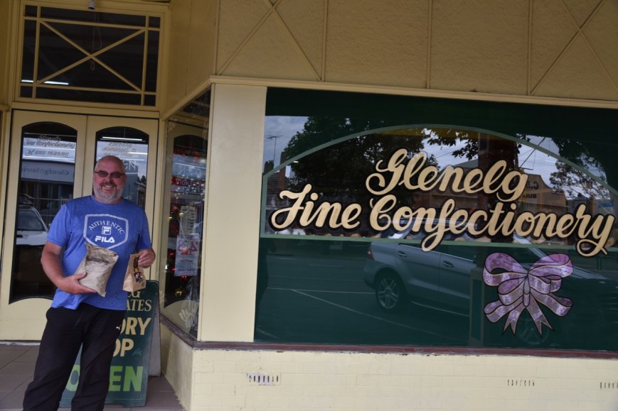
Our next stop was Glenelg Fine Confectionary, a specialist chocolate shop in Coleraine. We ended up walking out with a number of bags of chocolates.
We then headed north out of Coleraine on the Coleraine-Edenhope Road, with out next intended stop being the town of Harrow. We soon reached the outskirts of Harrow where there is a monument to commemorate the 1836 expedition of the explorer Major Thomas Mitchell. We also stopped at the Glenelg River at Harrow where there is another monument recognising that Major Mitchell camped at the location on 31st July 1836. This part of the Major Mitchell Trail, and there is an information board here with a number of interesting facts.


We then drove into Harrow, a little town which was originally known as Upper Glenelg. The name of the town changed to Harrow in 1854. There are claims that Harrow is the oldest inland town in Victoria.
We stopped to have a look at the old log gaol, which was built in 1858 from locally sawn logs. It was used by police up until 1869.


There is also a stone wall here which is the remains of a stable which is believed to have been used by Cobb & Co coaches in the early days of Harrow.
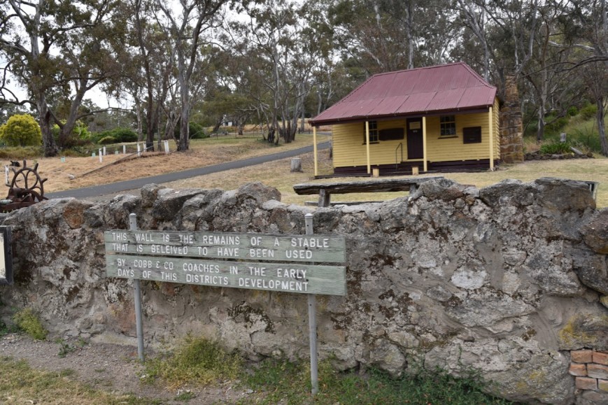
Also nearby is Kalang Cottage, a settlers cottage built in 1876. It was shifted into the town of Harrow and restored. The cottage contains pit sawn boards and a single roof under the iron.


We then visited The Johnny Mullagh/Harrow Discovery Centre. The museum features numerous exhibits relating to the Australian aboriginal cricket team which toured England in 1868. I suspect not many Australians would know that this was the first Australian cricket team to tour England, and was comprised of aboriginals. Johnny Mullagh was a member of that team, and is buried in Harrow.
")

The museum also features the largest Sir Donald Bradman collection in Australia. If you are a cricket fan, you could spend hours here. We highly recommend a visit here.
We also visited the Harrow Bone Yard which contains a number of funny headstones.


Harrow is a town which both Marija and I confirmed we want to revisit and spend some time in. It is an incredibly historic town and the caravan park/camping area on the Glenelg River looked idealic.
References.
Monuments Australia, 2018, <http://monumentaustralia.org.au/themes/people/arts/display/30870-adam-lindsay-gordon->, viewed 22nd December 2018
Peter Francis Point Arboretum, 2018, <http://www.thepoints.org.au/>, viewed 22nd December 2018
Victorian Heritage Database Report, 2018, ‘Peter Francis Points Arboretum’
Wikipedia, 2018, <https://en.wikipedia.org/wiki/Harrow,_Victoria>, viewed 22nd December 2018
After leaving Nigretta Falls we drove the short distance to the Wannon Flora Reserve VKFF-2476, which is about 316 km west of Melbourne.
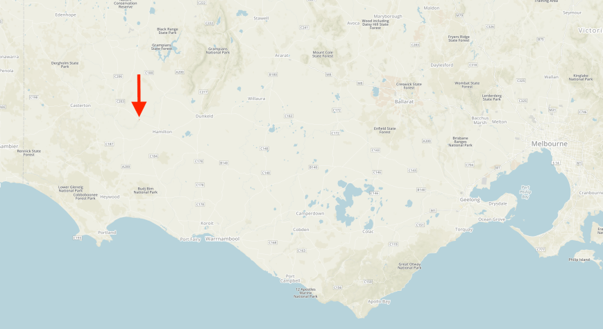
Above:- Map showing the location of the Wannon Flora Reserve. Map courtesy of Protected Planet.
Again, this is another park which is subject to some possible confusion. Do not get it confused with the Wannon Falls State Reserve, which at this time does not qualify for VKFF/WWFF. The Wannon Flora Reserve is located on the north western corner of the Wannon-Nigretta Road and the Glenelg Highway.
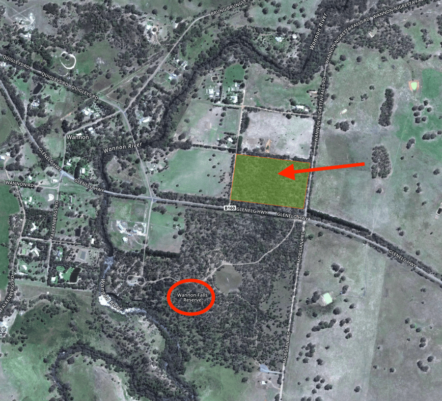
Above:- Map showing the location of the Wannon Flora Reserve (indicated by the arrow), and the nearby Wannon Falls Reserve (which is not VKFF). Image courtesy of Protected Planet
The Wannon Flora Reserve is about 20 acres in size and takes its name from the Wannon River. The The name ‘Wannon’ is believed to have been obtained by Major Mitchell from the local Jardwadjali people. The park does not contain the falls. They are located in the Wannon Falls Reserve, about 1 km to the south.


We found a narrow track off the Wannon-Nigretta Road, which followed the northern boundary of the park. We pulled slightly off the track and set up our station.
Once again I commenced the activation, calling CQ on 7.144. Gerard VK2IO was first in the log, followed by Linda VK7QP, Adrian VK5FANA, and Dennis VK2HHA. It took around 6 minutes for contact number 10. That being a QSO with Ray VK4DXA. I then logged Keith VK2PKT, and as I had qualified the park for VKFF, I got Marija into the operators chair.
Marija’s first contact was with Ray VK4NH, then Greg VK2EXA, Adrian VK5FANA, and then Dennis VK2HHA. It did not take Marija long to qualify the park for VKFF. She had contact number 10 in the log after 9 minutes, a QSO with Peter VK2KNV mobile. Marija logged a further 4 QSOs, and happy with having qualified the park for VKFF, handed me back the mic.
I called CQ again on 7.144 and logged a further 7 stations, before callers dried up. I then moved to 3.610 on the 80m band where I logged Peter VK3PF mobile, Hans VK5YX, and then John VK5FBBJ.
It did not look as through I was going to get my 44 from this park, as despite it being the first time the park had been activated, hunter traffic was fairly slow. I moved to the 20m band and called CQ on 14.310 where I logged 6 stations. John VK4TJ had mentioned that the 10m band was open, so I put out a few calls on 28.490 from the vehicle to finish off the activation. And as luck would have it I logged John, who was quite low down but very workable.
Marija worked the following stations on 40m SSB:-
I worked the following stations on 40m SSB:-
I worked the following stations on 80m SSB:-
I worked the following stations on 20m SSB:-
I worked the following stations on 10m SSB:-
We packed up and headed off to the Wannon Falls which is located in the Wannon Falls State Reserve.
The Wannon Falls are a punchbowl style waterfall, meaning that water descends in a constricted form and then spreads out in a wider pool. The falls are fed by the Wannon River. They plunge over a basalt lava cliff dropping into a large plunge pool 30 metres below.


There are a number of information boards here detailing both the aboriginal and European history of the area.


We then headed off towards Coleraine along the Glenelg Highway.
References.
Australian Electoral Commission, 2018, <https://www.aec.gov.au/profiles/vic/wannon.htm>, viewed 22nd December 2018
Wikipedia, 2018, <https://en.wikipedia.org/wiki/Wannon_Falls>, viewed 22nd December 2018
Amateur Radio, Short Wave Listening, travel and history
Amateur radio experiences with VK1DA
Brisbane - Australia
german amateur radio station
Summits On The Air
SOTA on the peaks, wilderness QRP and some bushwalking
A fine WordPress.com site
Amateur Radio Adventures
Summits on the Ai
Amateur radio station from Belgium
Radio craft, homebrew, QRP/SOTA, AM
Ego loqui ad viros super montes
My adventures with Amateur Radio and Geocaching!
The rantings of VK2GAZ on his SOTA experiences in Australia
A survivor, with minor cuts and abrasions.
The Art and Craft of Blogging
The latest news on WordPress.com and the WordPress community.
Blog of Justin Giles-Clark VK7TW's SOTA and amateur radio adventures.
Occasional SOTA & Microwave operation
