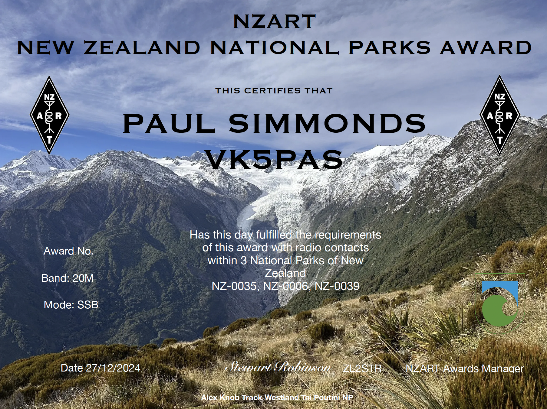
Yesterday I received via email the NZART New Zealand National Parks Award.
Thank you to the NZ park activators and Stewart ZL2STR, the NZART Awards Manager.

Yesterday I received via email the NZART New Zealand National Parks Award.
Thank you to the NZ park activators and Stewart ZL2STR, the NZART Awards Manager.
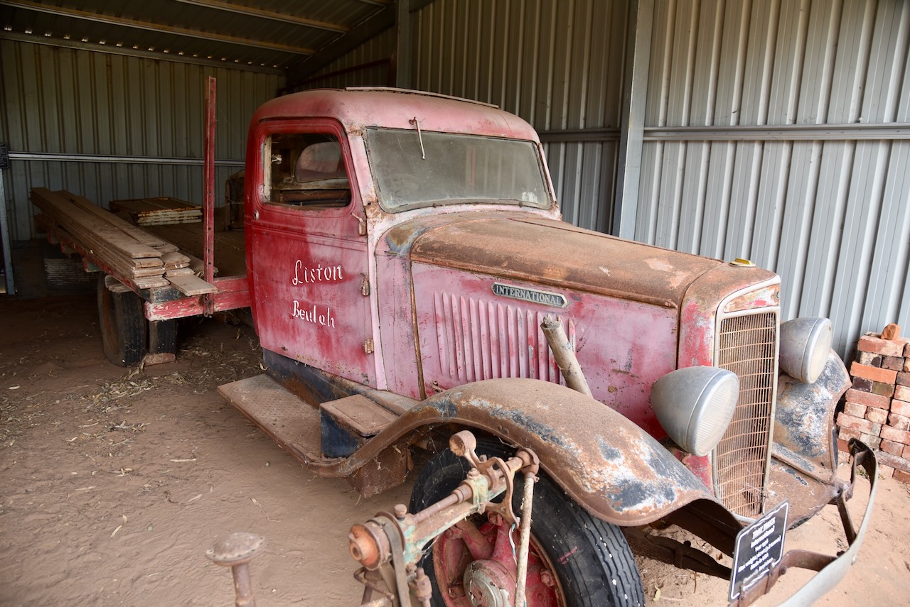
After leaving Rosebery on 20th October 2024, Marija and I headed south along the Henty Highway, with our next stop being the little town of Beulah.
Beaulah is located about 360 km northwest of Melbourne in northwest Victoria.
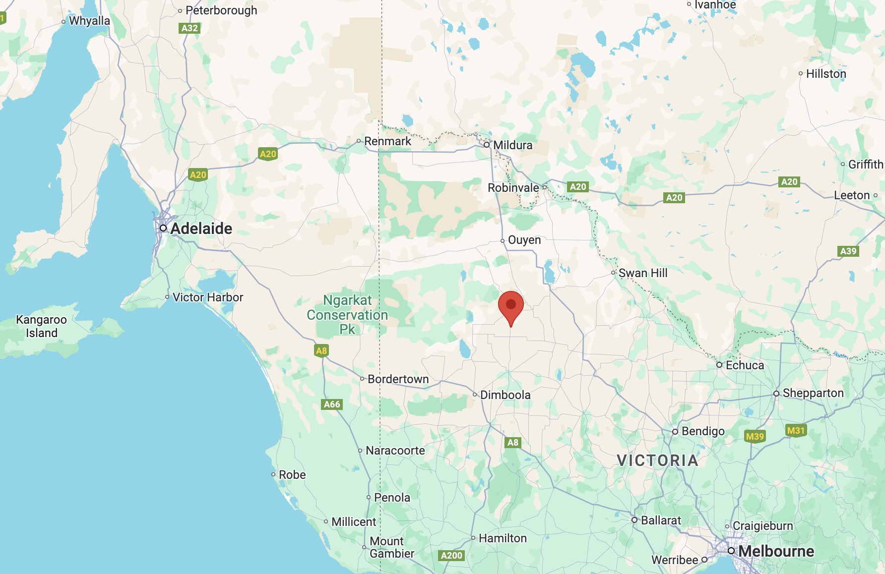
Above:- Map showing the location of Beaulah, Victoria. Map c/o Google Maps.
The origin of the name of this town is very interesting. The McKenzie family from Scotland subdivided land in the district in 1890. A survey was conducted and the town of Beulah was officially proclaimed in 1891. The McKenzie family were devout Presbyterians and Isaiah 62:4 was their inspiration in gaming the town:
“Thou shalt no more be termed Forsaken; neither shall thy land any more be termed Desolate: but thou shalt be called Hephzibah, and thy land Beulah: for the Lord delighteth in thee, and thy land shall be married.” (Aussie Towns 2024)
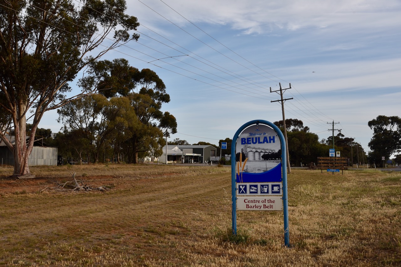
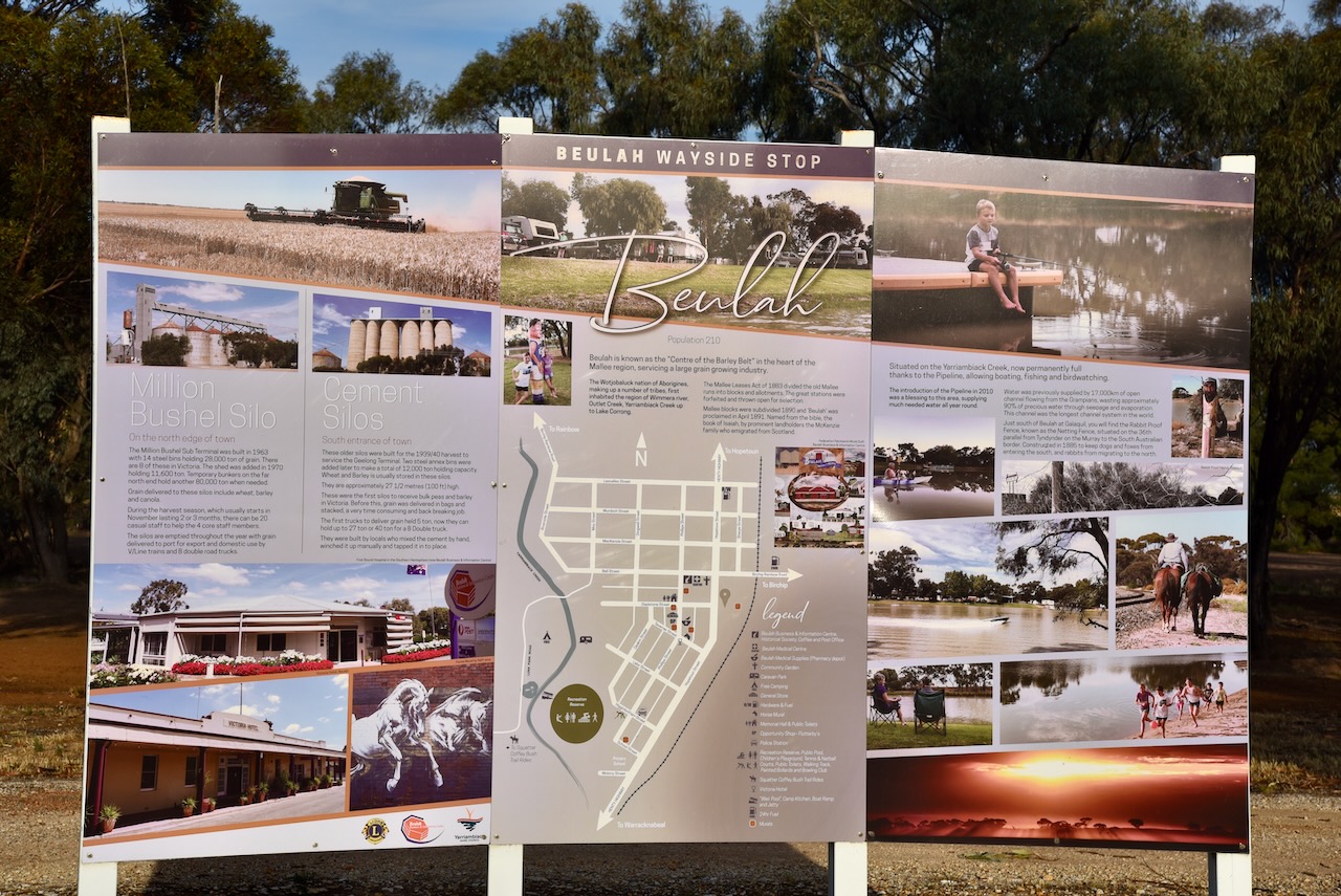
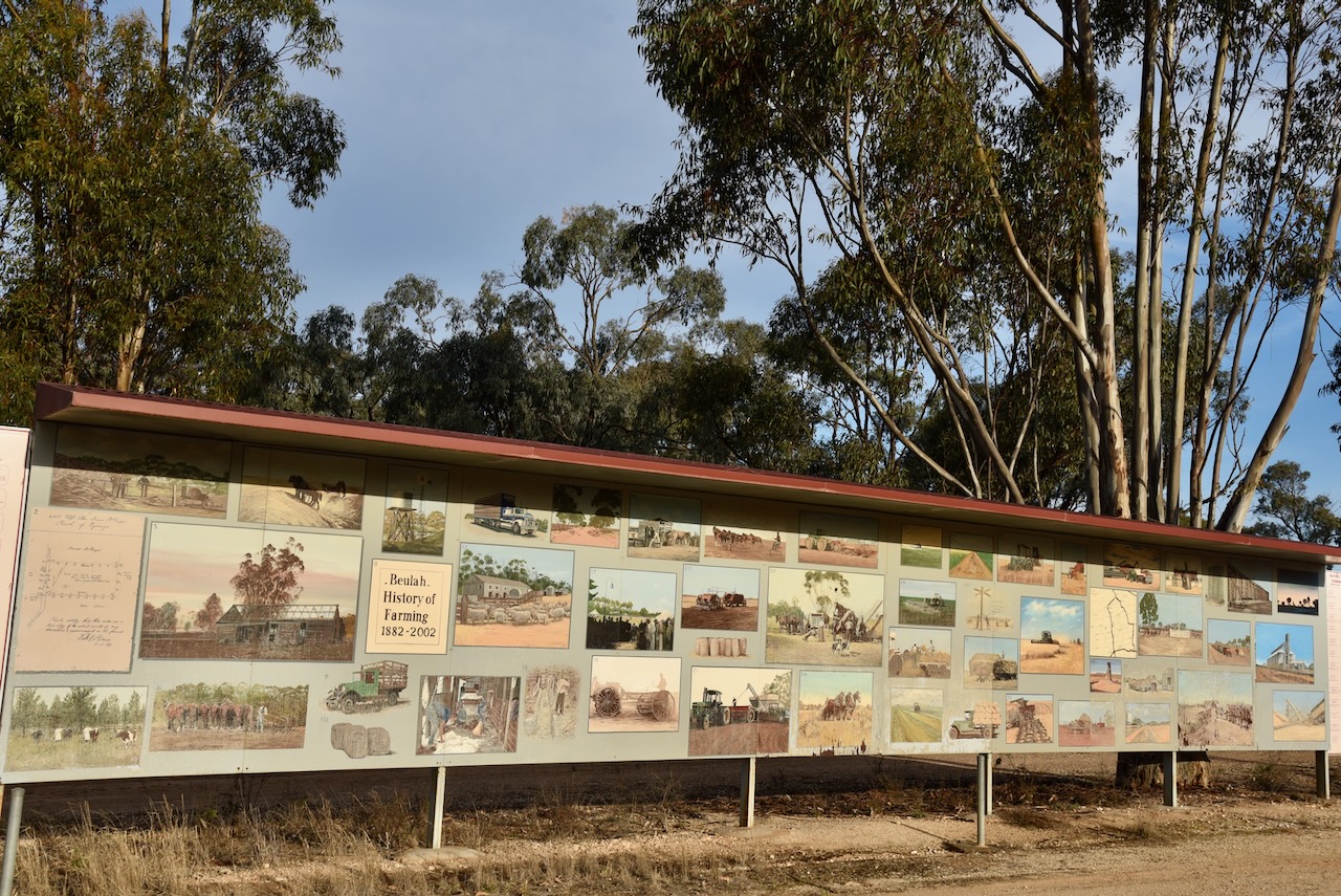
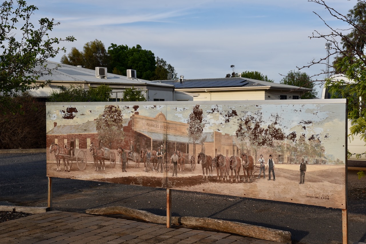
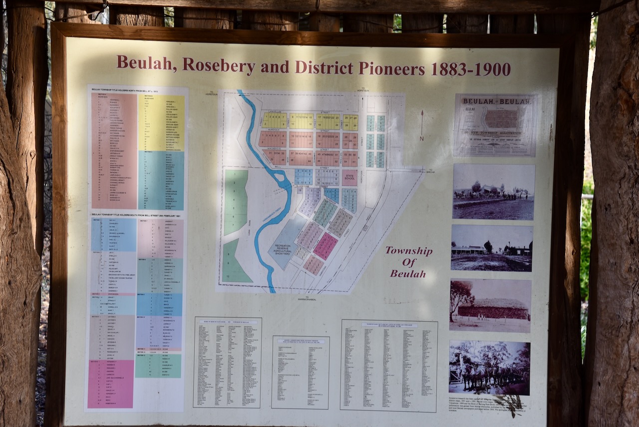
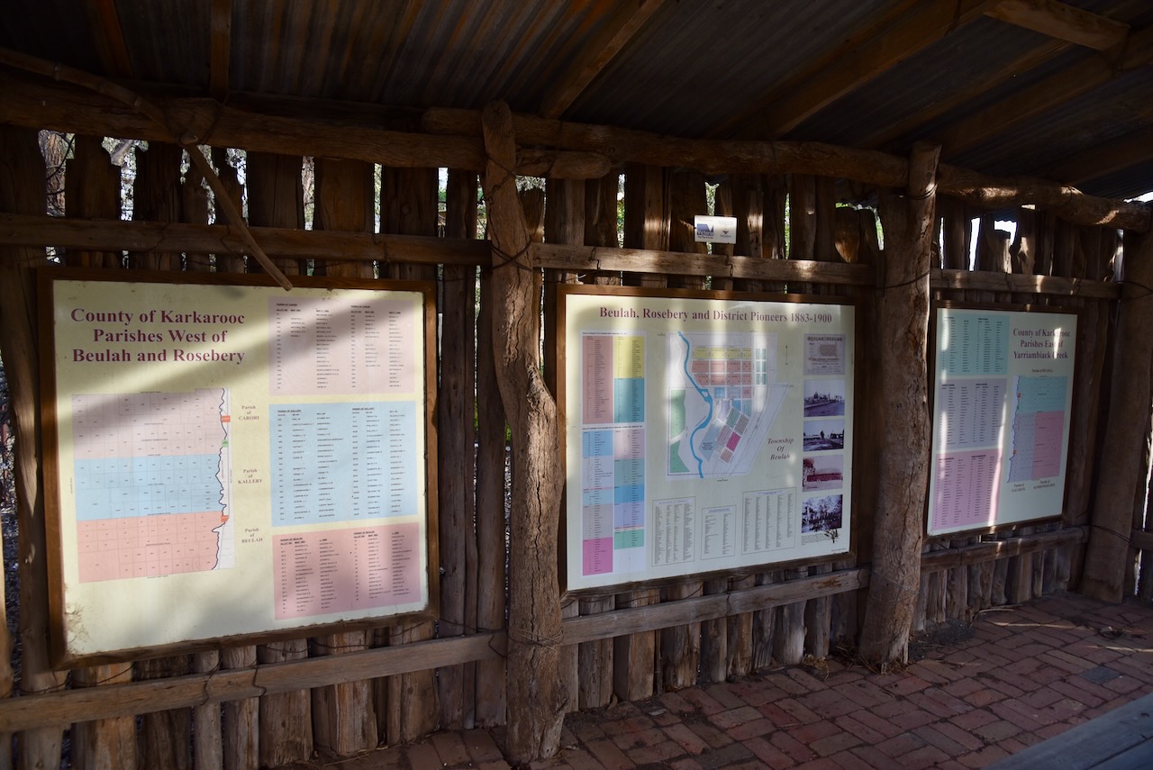
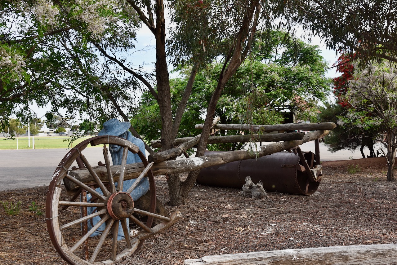
Today Beulah is known as the ‘Centre of the Barley Belt.’ As you enter the town there is an excellent information board and also a pictorial board of the history of farming in the Beulah district from 1882-2002.
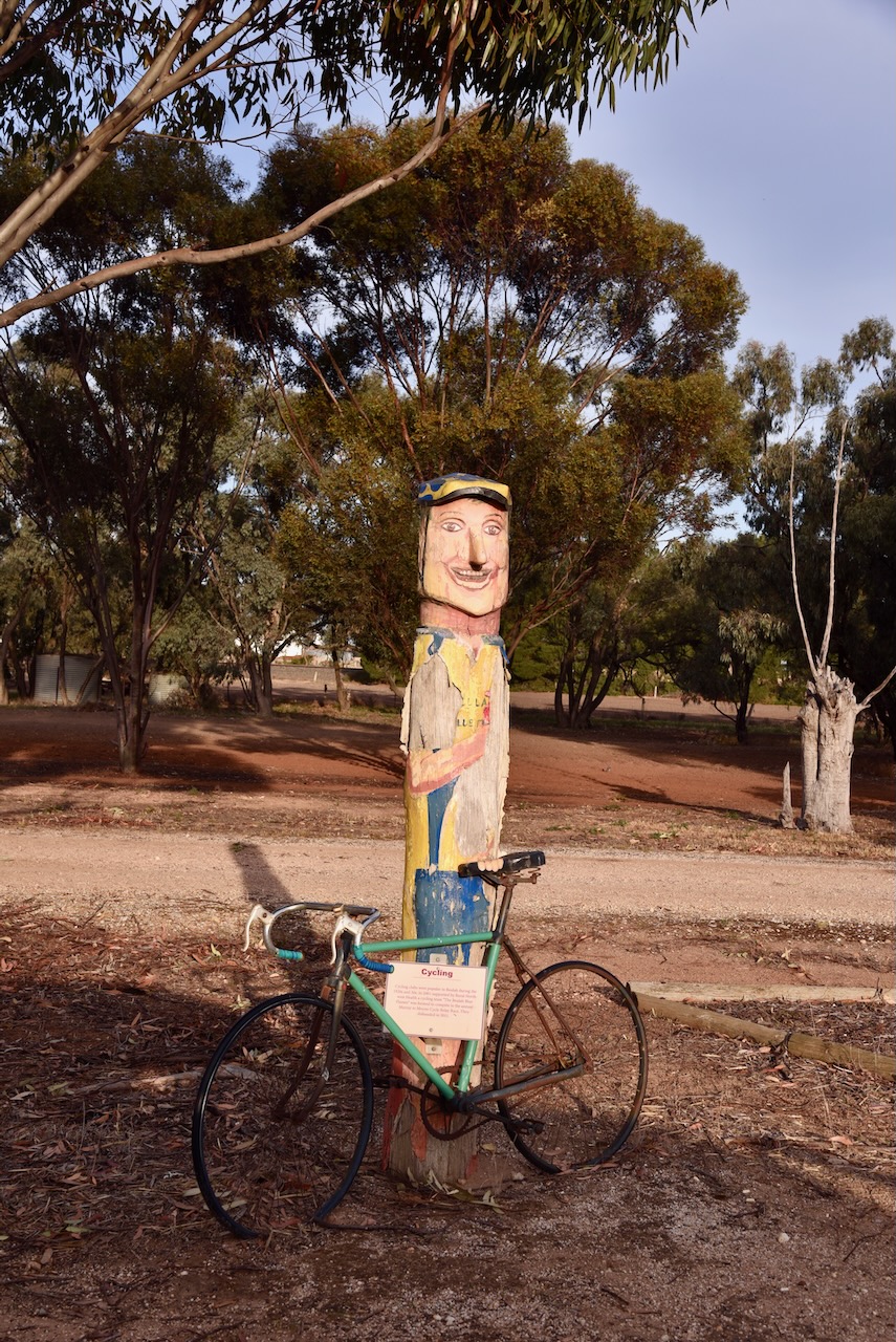
Close by is a wooden engraving of a cyclist and a bicycle. Cycling clubs were popular in Beulah during the 1920s and 1930s. In 2001 a cycling team called ‘The Beulah Blue Flames’ was formed to compete in the annual Murray to Moyne Cycle Relay Race. Sadly they disbanded in 2011.
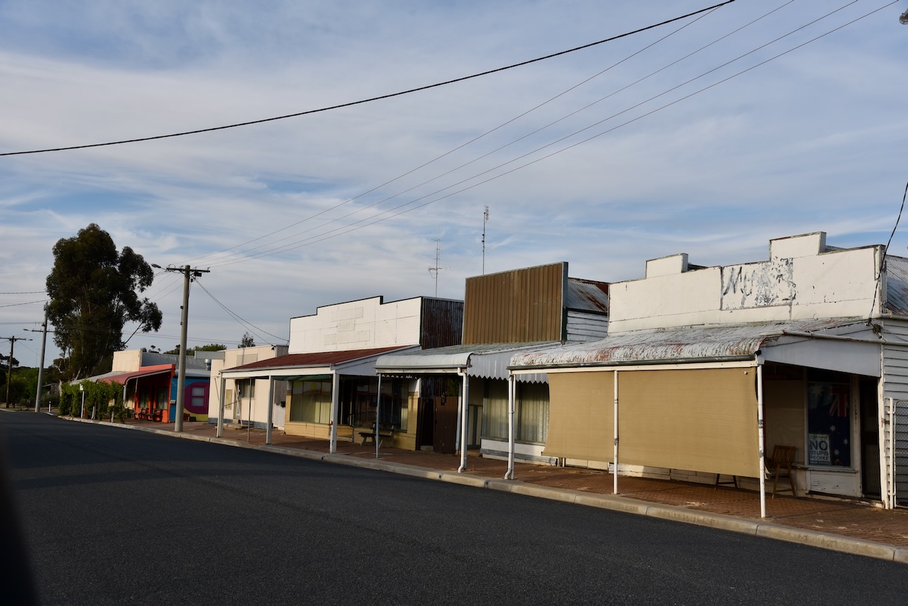
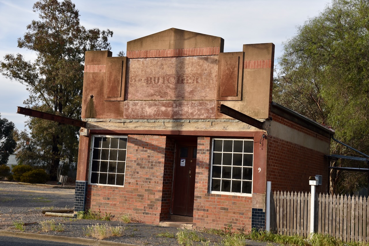
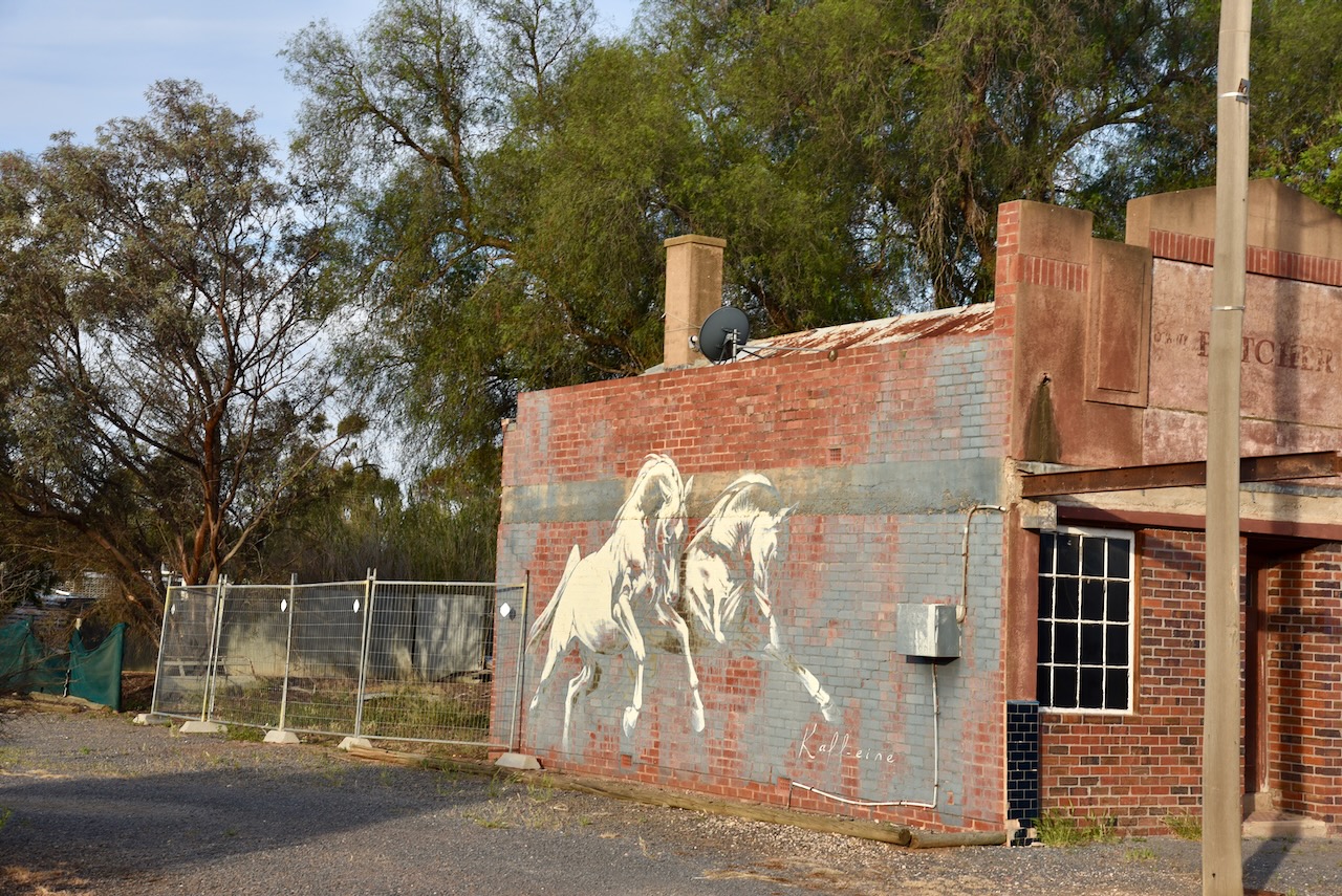
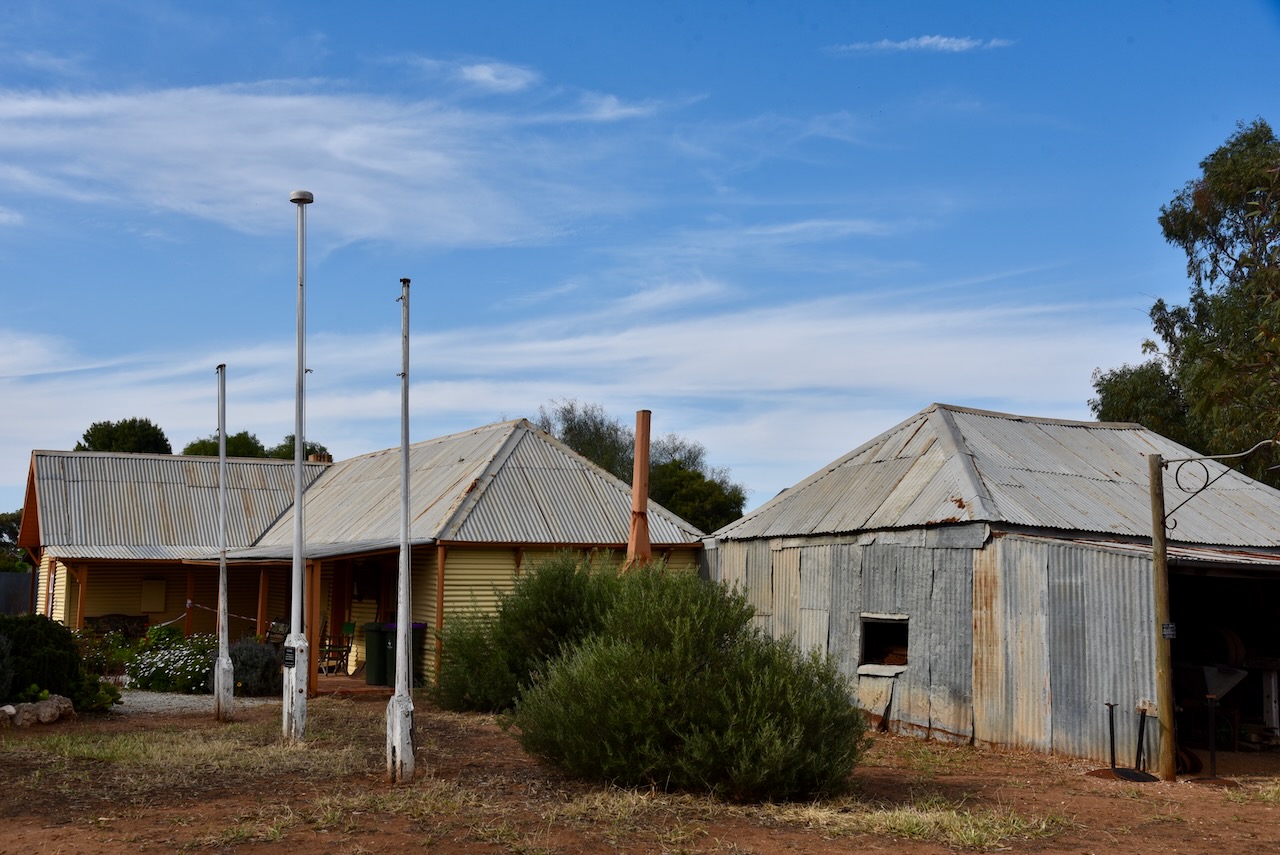
The main street of Beulah contains a number of historic buildings and sadly many empty shops.
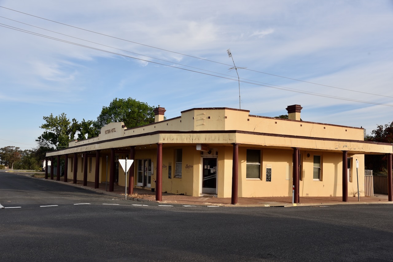
On the side of the old butcher shop is a mural of two horses. The mural was pained by Kaff-eine, the same artist who painted the Rosebey silo. (White 2024)
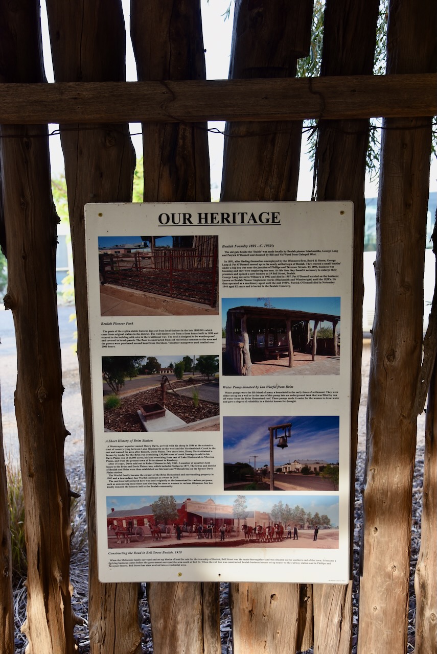
Pioneer Park in Beulah is well worth a visit. It is dedicated to the Beulah district pioneers.
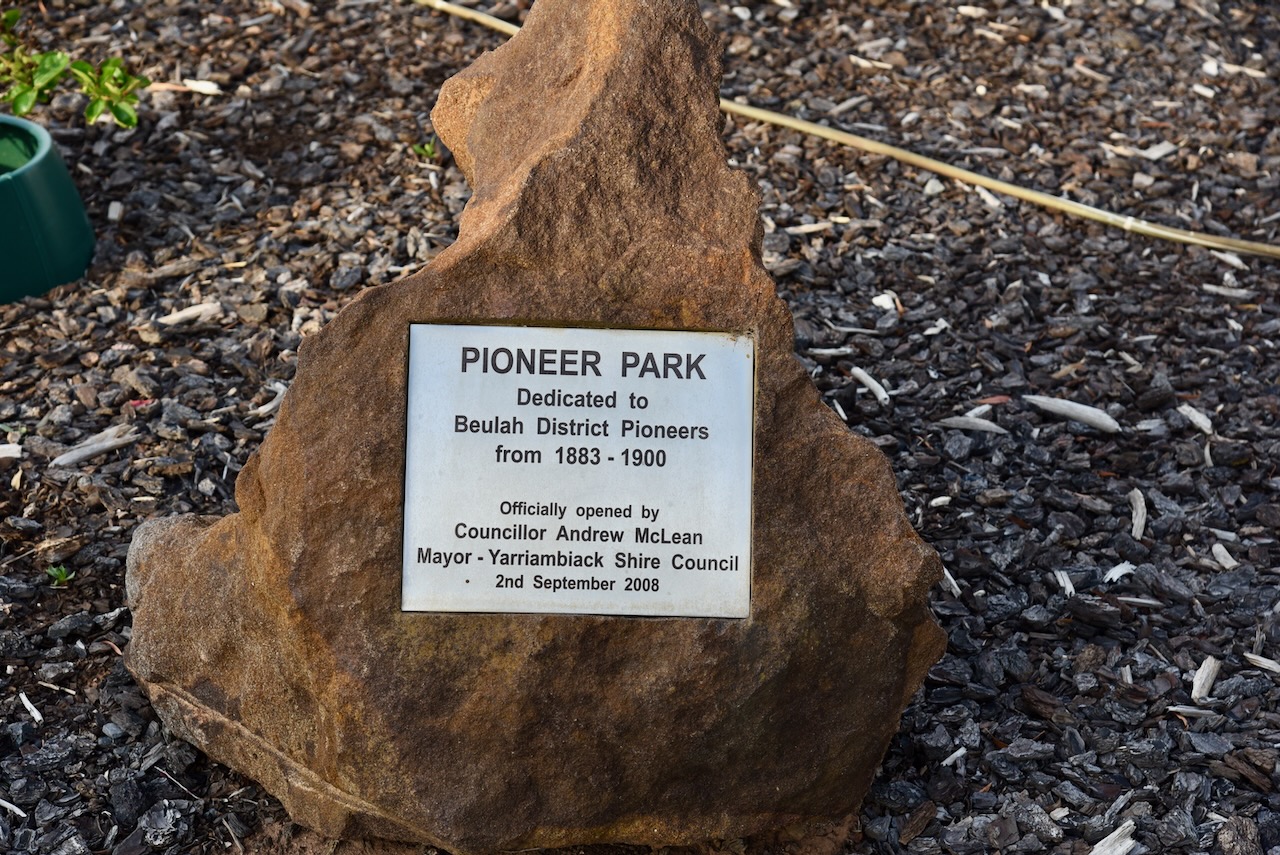
There are information boards that detail the history of the district including a list of the original pioneers.
During 2019 Beaulah was one of 17 regional Victorian locations where ‘The Dry’ was filmed. The movie is a screen adaptation of Jane Harper’s best-selling novel. (ABC 2021)
Below is the official trailer for The Dry.
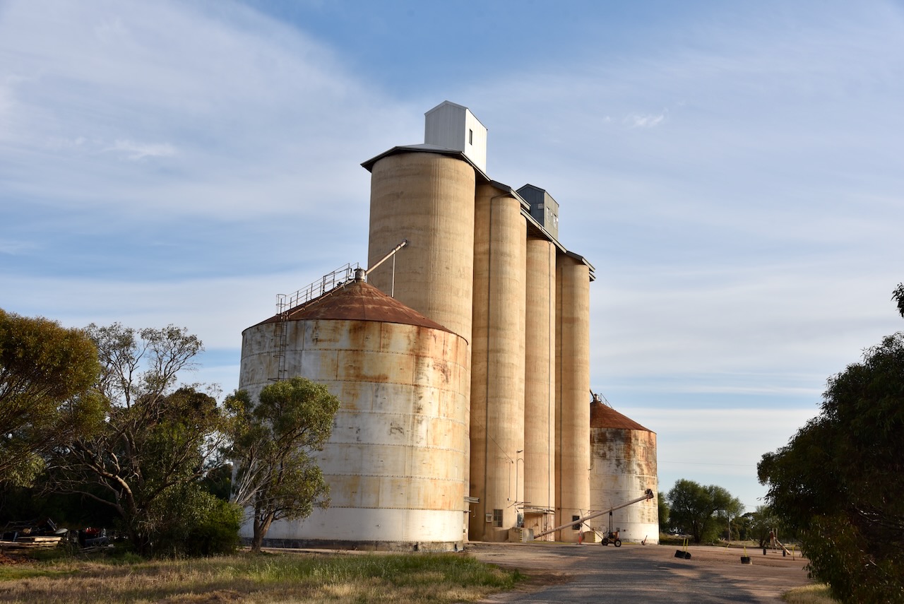
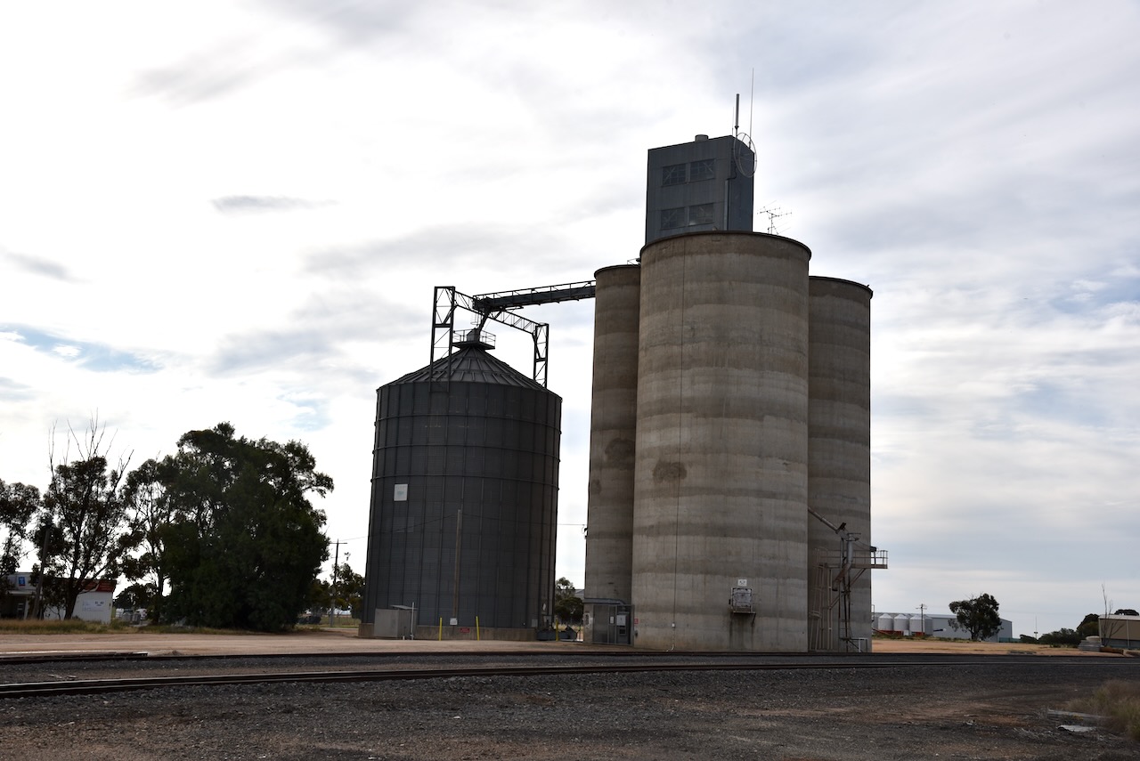
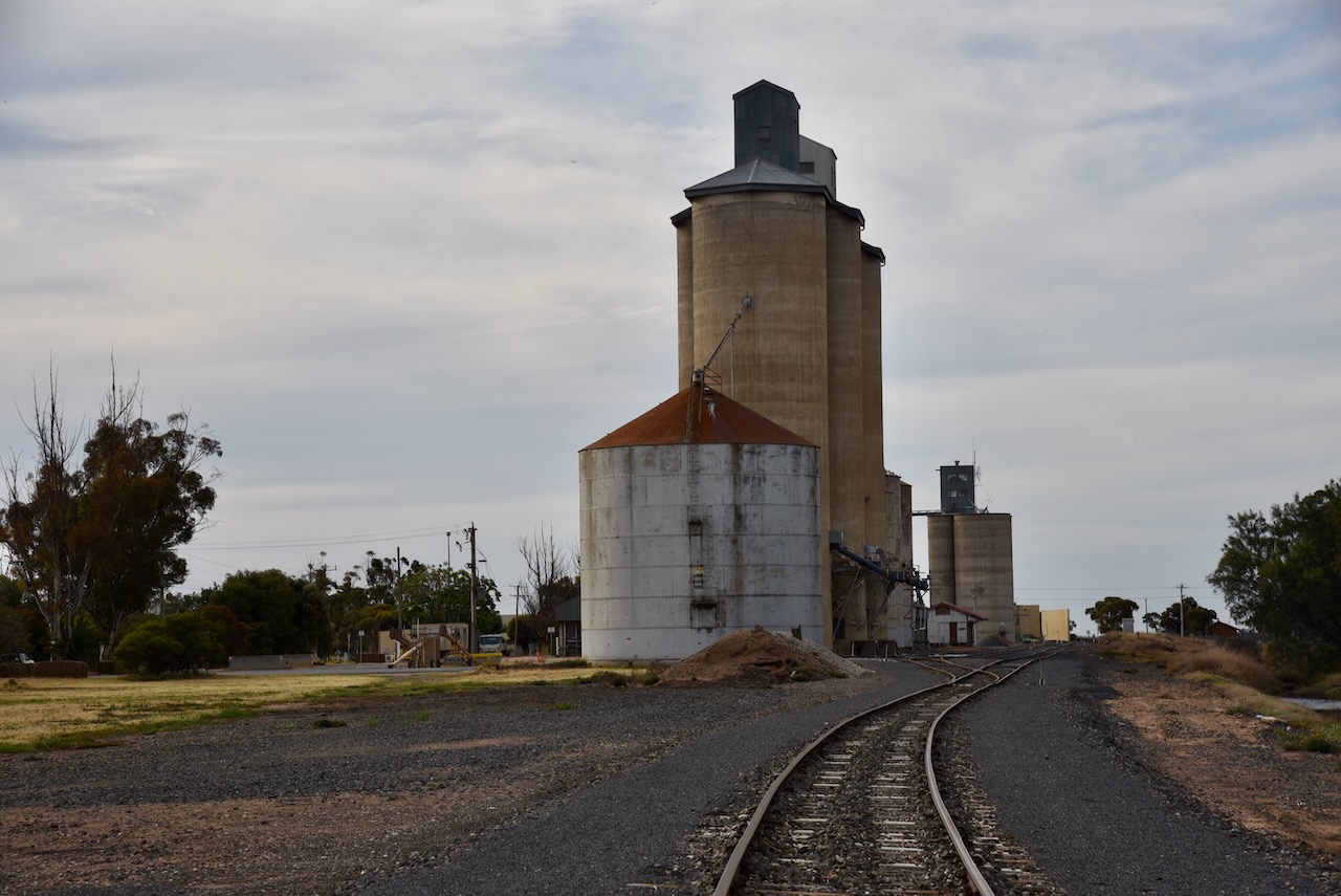
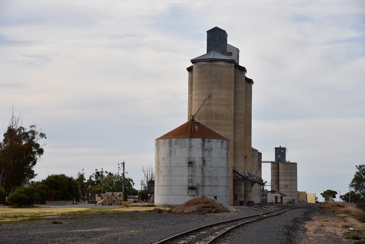
Beaulah has two sets of silos. On the northern edge of town you can find the Million Bushel Silo that was built in 1963. It has 14 steel bins holding 28,000 ton of grain. There are 8 of these in Victoria. The shed was added in 1970 holding 11,600 ton. Temporary bunkers on the far north end hold another 80,000 ton when needed. Grain delivered to these silos include wheat, barley and canola.
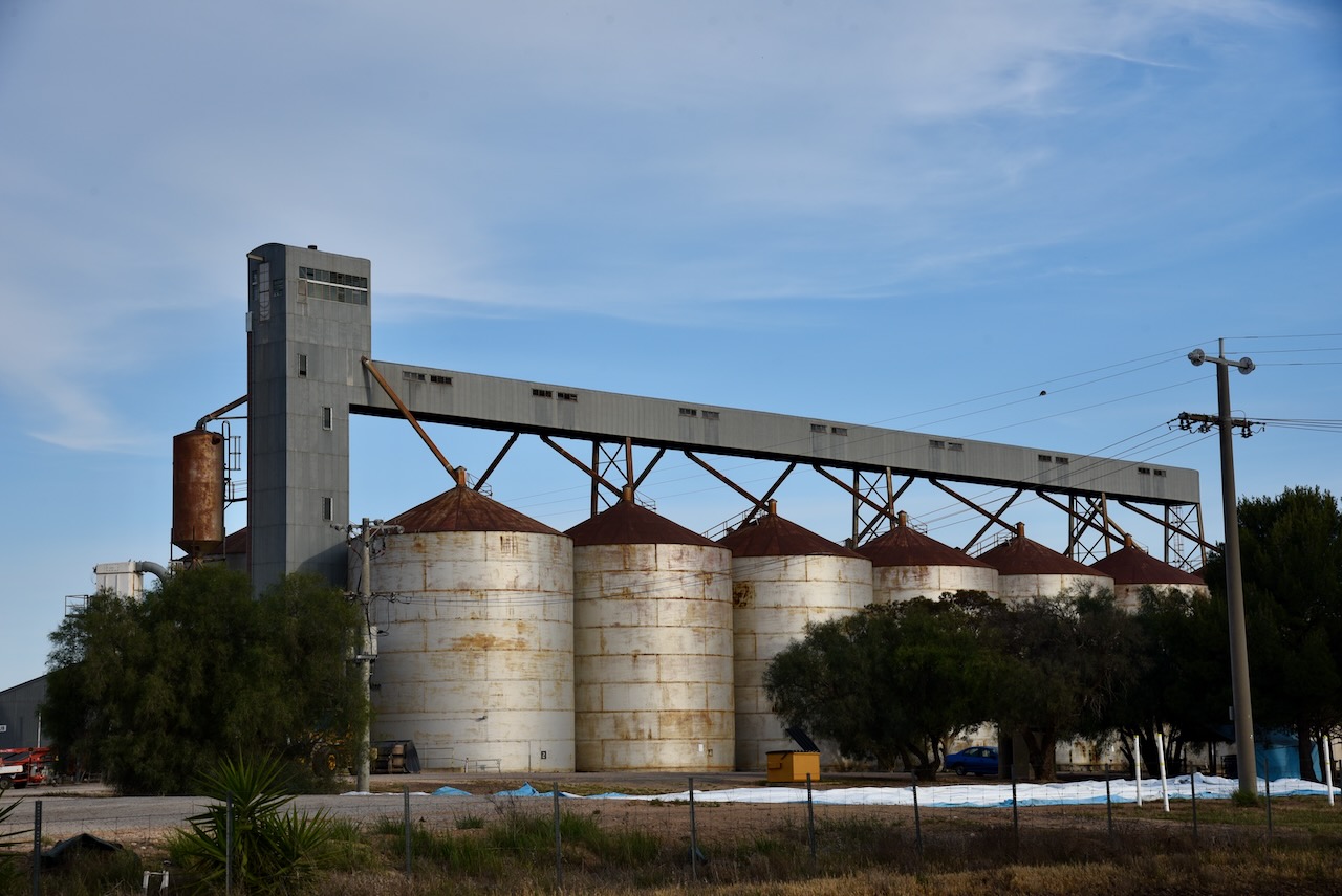
On the south entrance of the town are the older cement silos that were built for the 1839/1940 harvest to service the Geelong Terminal. Two steel annex bins were added later to make a total of 12,000-ton holding capacity. Wheat and barley is usually stored in these silos. These were the first silos to receive bulk peas and barley in Victoria. Before this, grain was delivered in bags and stacked, a very time- consuming and back-breaking job.
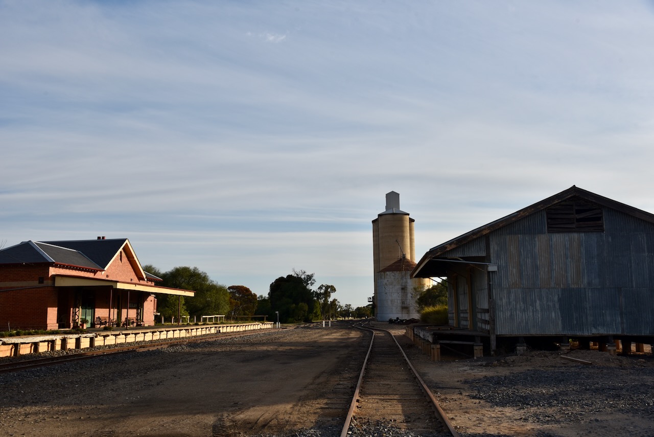
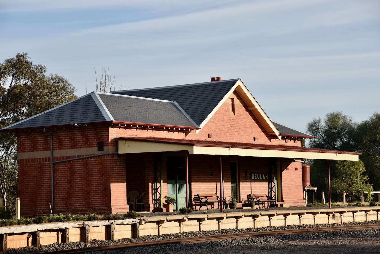
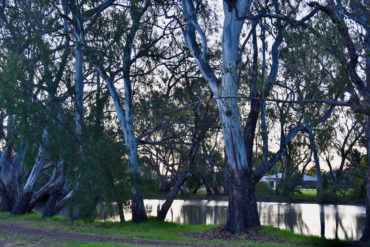
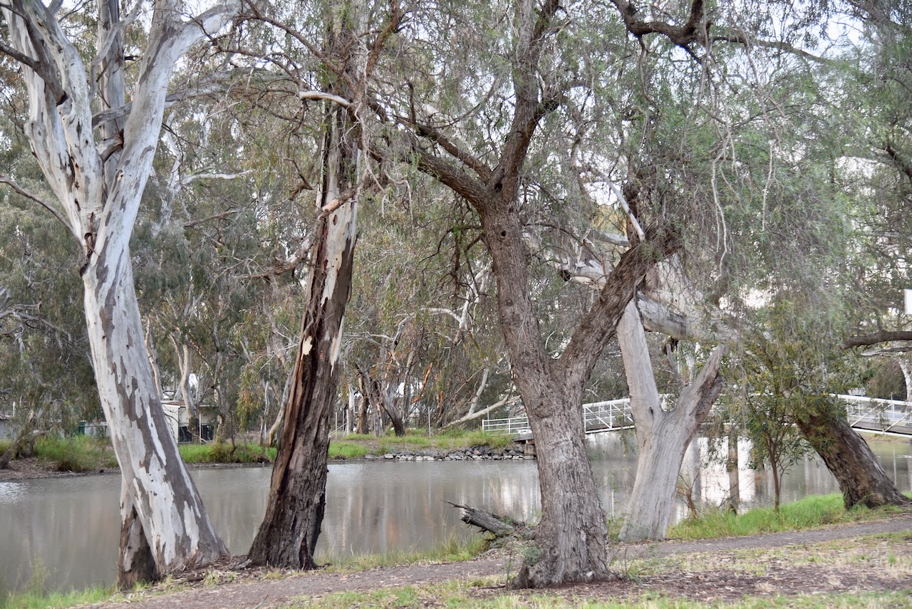
Adjacent to the cement silos is the old Beulah railway station. The railway line from Warracknabeal reached here in 1893.
We parked on the Henty Highway and operated from the 4WD for this activation. We ran the Icom IC-7000, 100 watts, and the Codan 930 antenna with the 1/5 metre stainless steel whip.
Above:- the activation zone at the two silos at Beulah. Image c/o SiOTA website.
Marija worked the following stations on 40m SSB:-
I worked the following stations on 40m SSB:-
Marija and I left Beulah and stopped at the Netting Fence monument. The fence was erected in 1885 from Tyntynder in Victorian to the South Australian border to prevent dingoes and rabbits over running and devastating pastoral and agricultural land to the south.
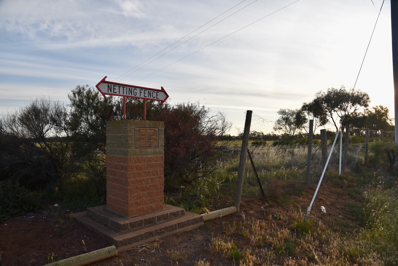
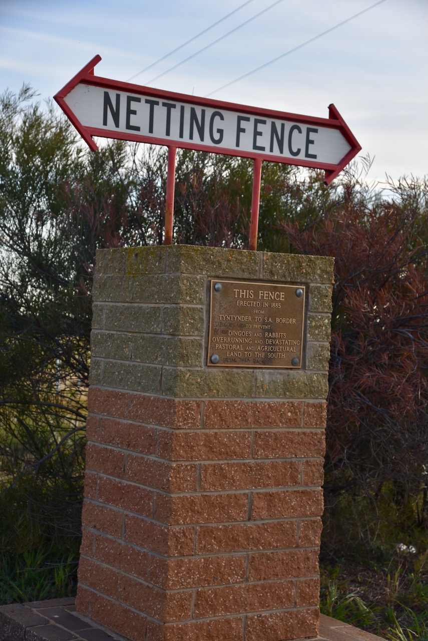
The cost of erection of the fence was 70 pounds ($140.00) per mile (1.6 km). The fence was generally known as the Wimmera Wild Dog Fence. In 1959 all Government funding towards the maintenance of the fence was cased as it was considered the fence had outlasted its purpose. The wild dogs had been poisoned and trapped.
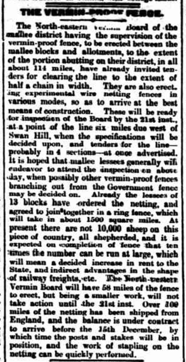
Above:- Article from the Kerang Times & Swan Hill Gazette, Tues 11 Aug 1885. Image c/o Trove
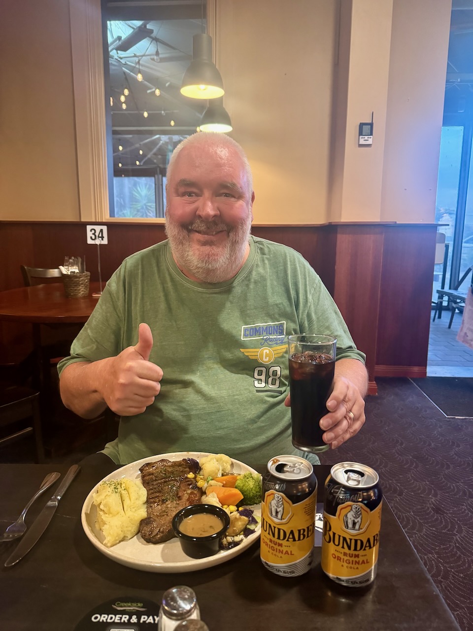
We soon reached Warracknabeal and headed to one of the local hotels, The Creekside Hotel, where we enjoyed a very nice meal.
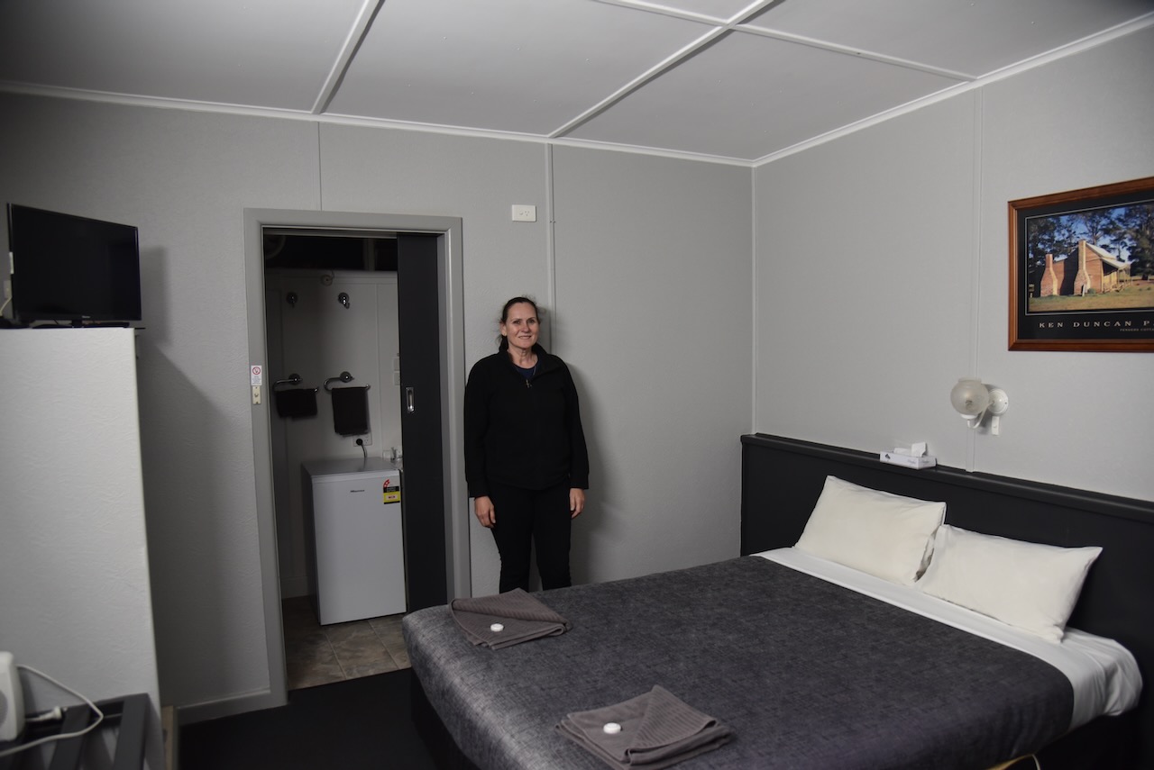
Marija and I then headed to our accommodation at the Warrack Motel.
References.
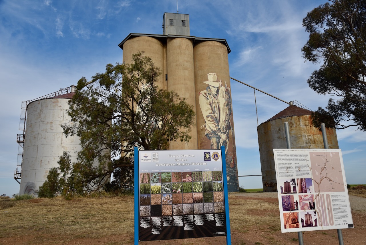
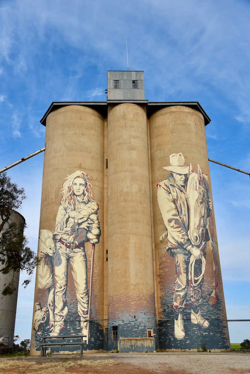
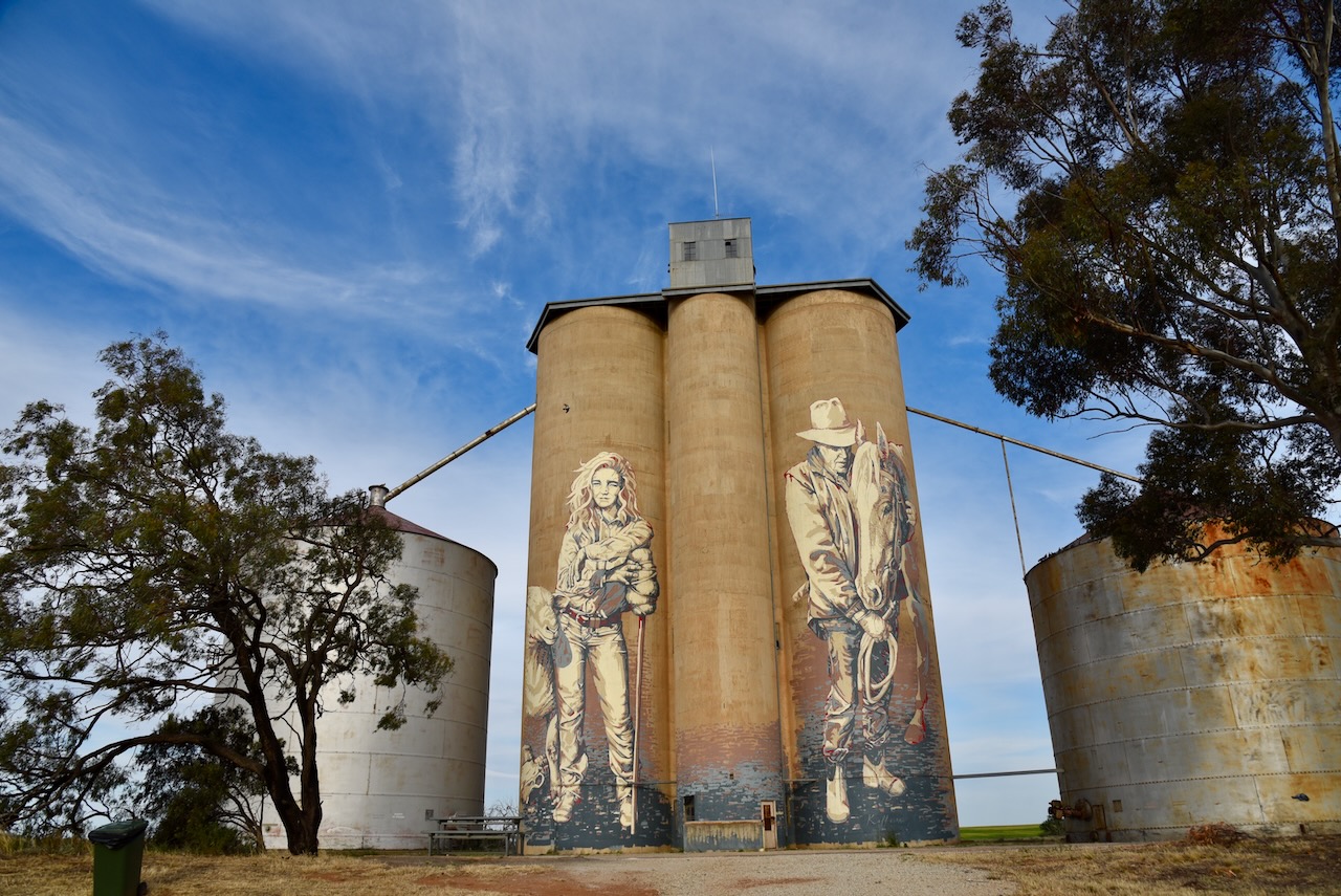
Our next activation was the Rosebery silo VK-RSY3.
Rosebery is located about 371 km northwest of Melbourne in northwest Victoria.
Above:- Map showing the location of Rosebery. Map c/o Google Maps.
The town of Rosebery was named after Archibald Philip Primrose, 5th Earl of Rosebery. Between September 1883 to January 1884 he toured Australia. He later became the British Prime Minister from 1894 to 1895. (Aussie Towns 2024)
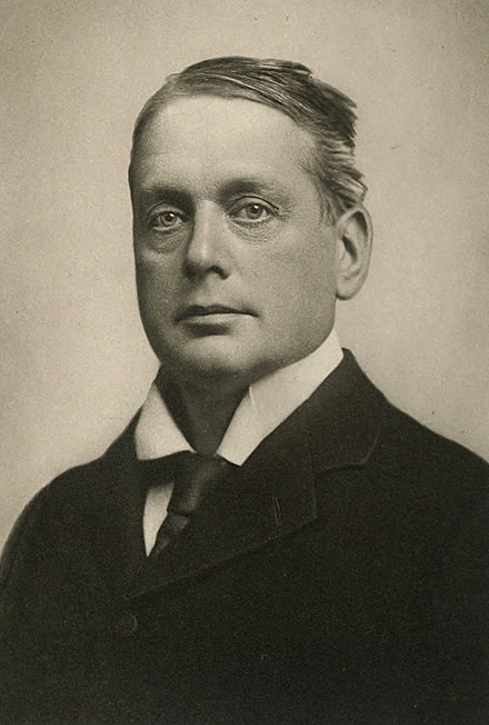
Above:- Archibald Philip Primrose. Image c/o Wikipedia.
European settlement in the Rosebery area commenced in the 1870s. It had a hotel and a general store. By 1887 a school had opened. By 1894 the railway had reached Rosebery. It was also in this year that the local football club was formed. It remained in existence until 1970. By 1900 Rosebery had a general store, a blacksmith, a public hall, a hotel, and a Presbyterian church. Three years later in 1903, Rosebery’s population was 100 people. (Aussie Towns 2024)
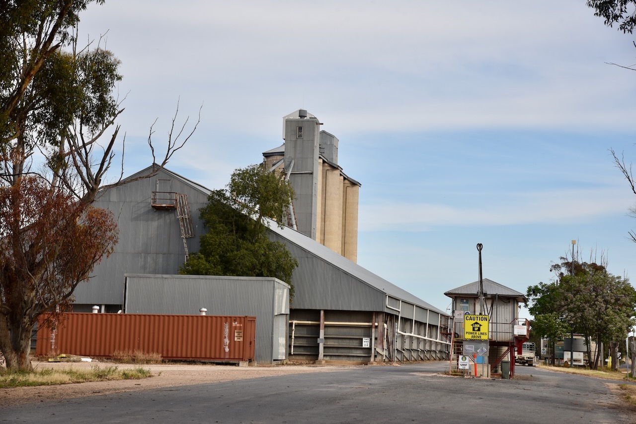
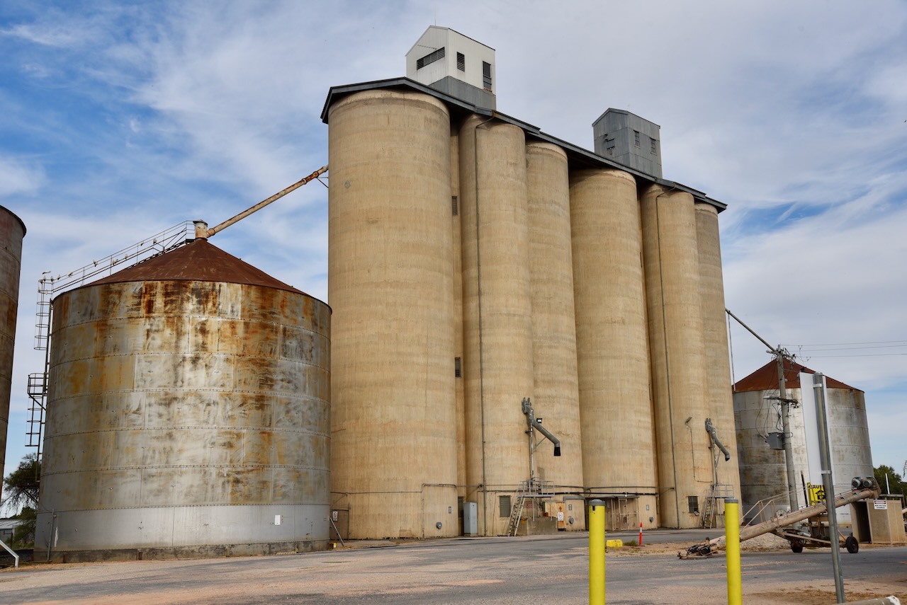
The grain silos at Rosebery were built in 1939. (Aussie Towns 2024)
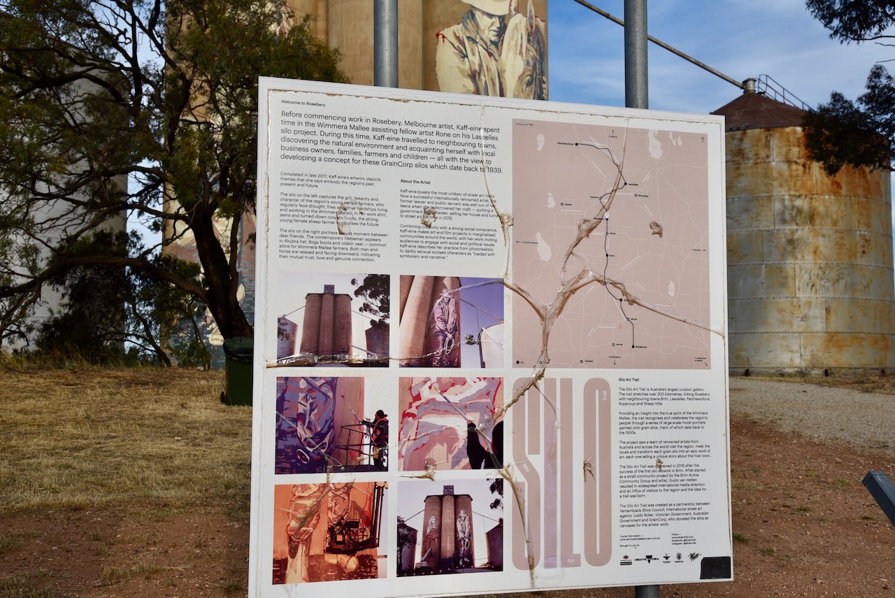
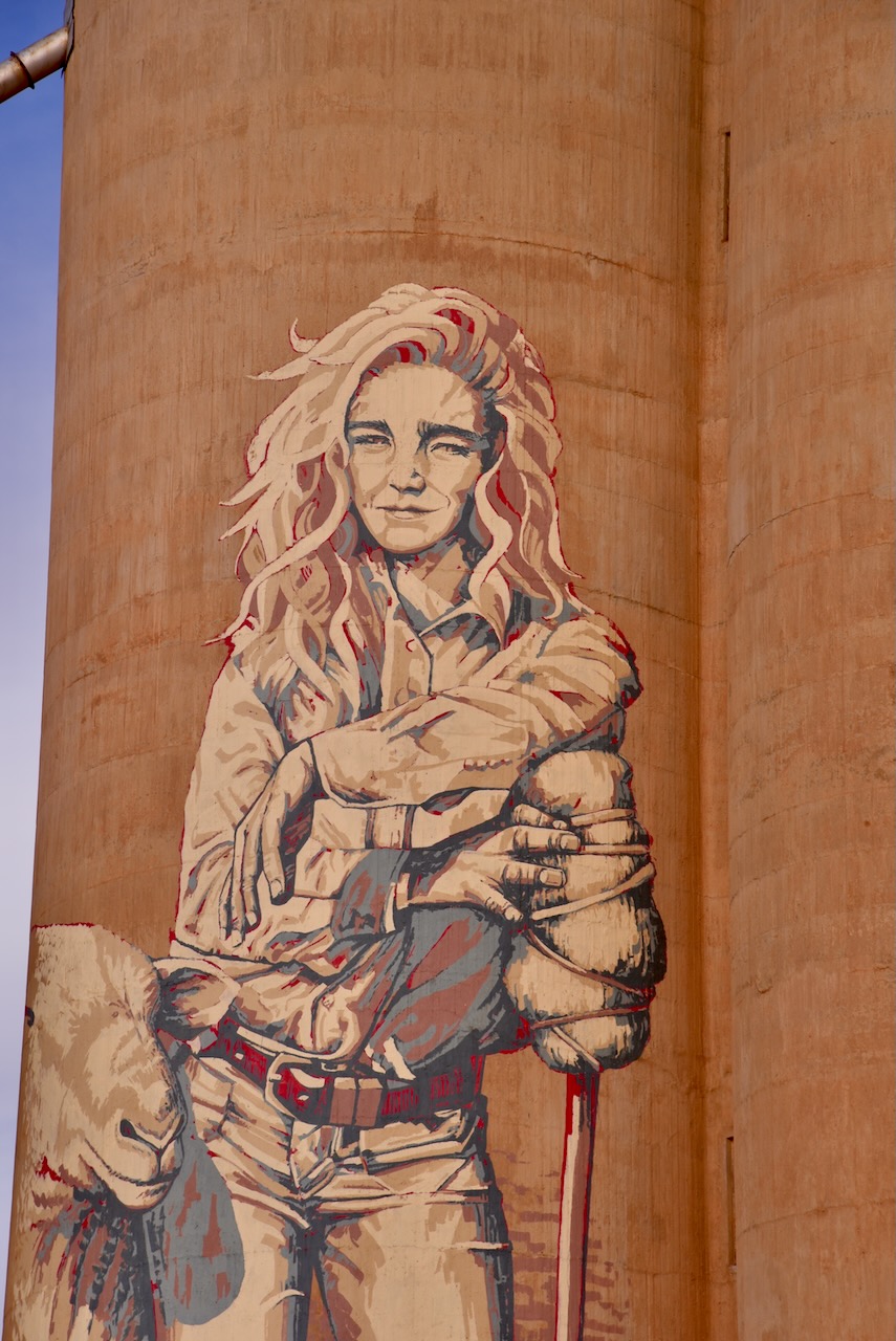
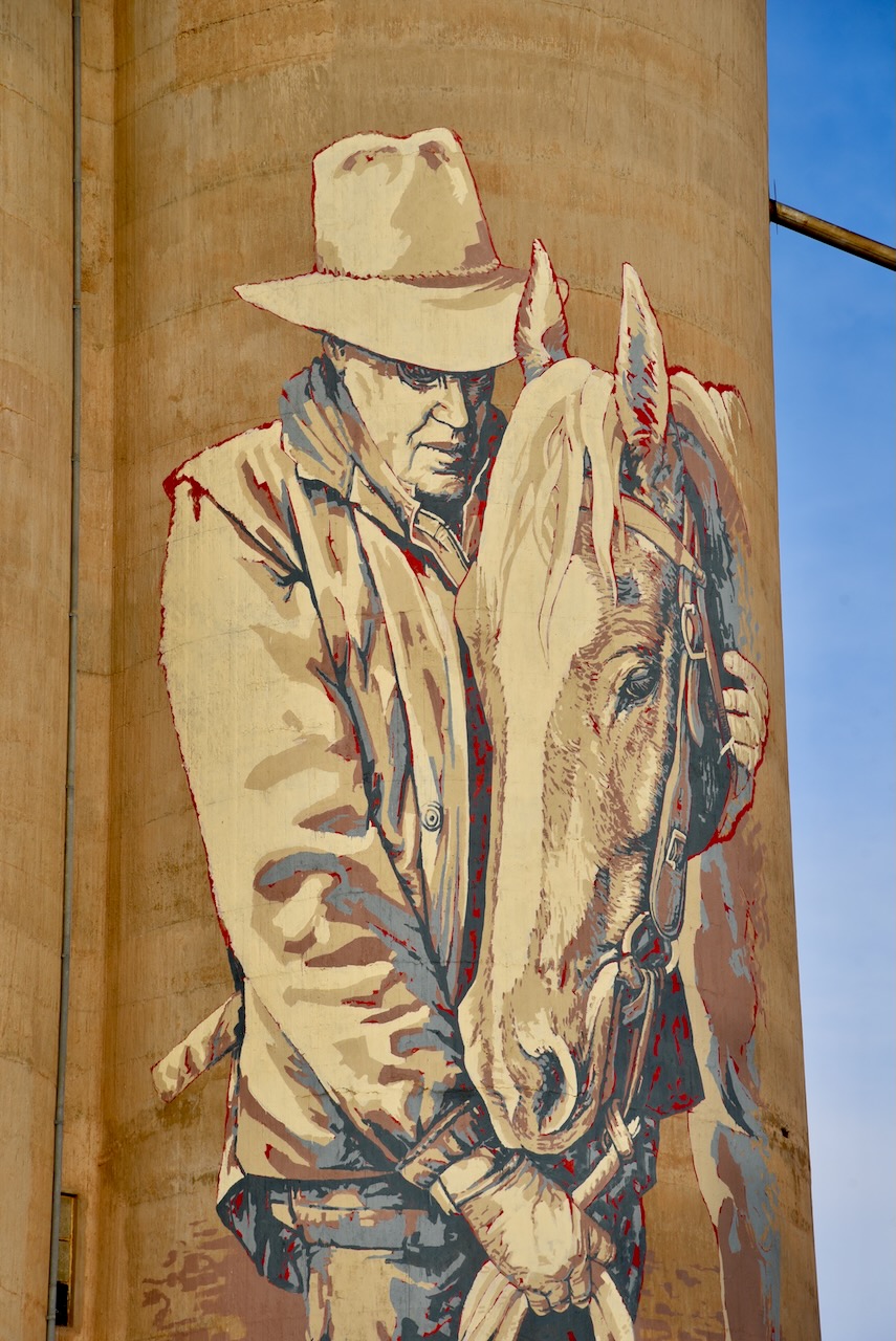
In late 2017 the Rosebery silos became part of the Australian silo art trail. Arist Kaff-eine painted the image of a young female farmer. On the adjacent silo, Kaff-eine painted a stockman and his horse. (Australiansiloarttrail.com, 2024)
Below is a great video on Rosebery and the Rosebery silo.
I worked the following stations on 40m SSB:-
I worked the following stations on 20m SSB:-
References.
After leaving the Patchewollock North Bushland Reserve on Thursday 20th October 2024, Marija and I headed south to our next stop, the little town of Hopetoun. We had planned on activating the two silos there for the Silos On The Air (SiOTA) program.
Hopetoun is located about 385 km northwest of Melbourne in the Mallee region of northwest Victoria.
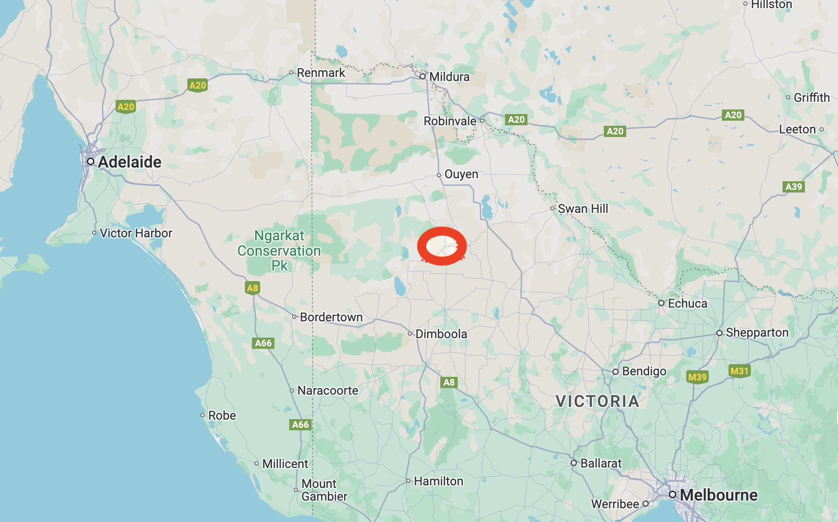
Above:- Map showing the location of Hopetoun in northwest Victoria. Map c/o Google Maps.
Prior to European settlement, the area was inhabited by the Yarrikaluk aboriginal people. The Wotjobaluk and Wergaia aboriginal people were also in the area. (Aussie Towns 2024)
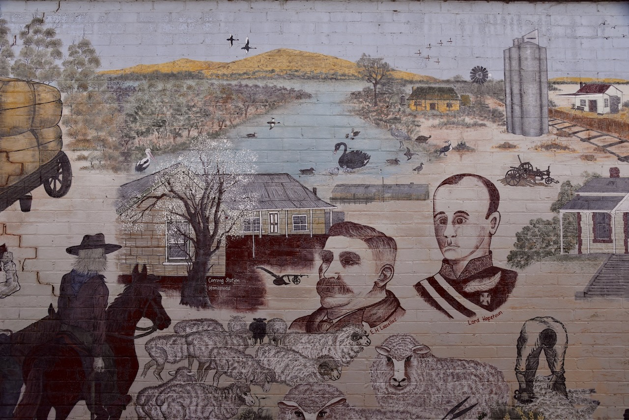
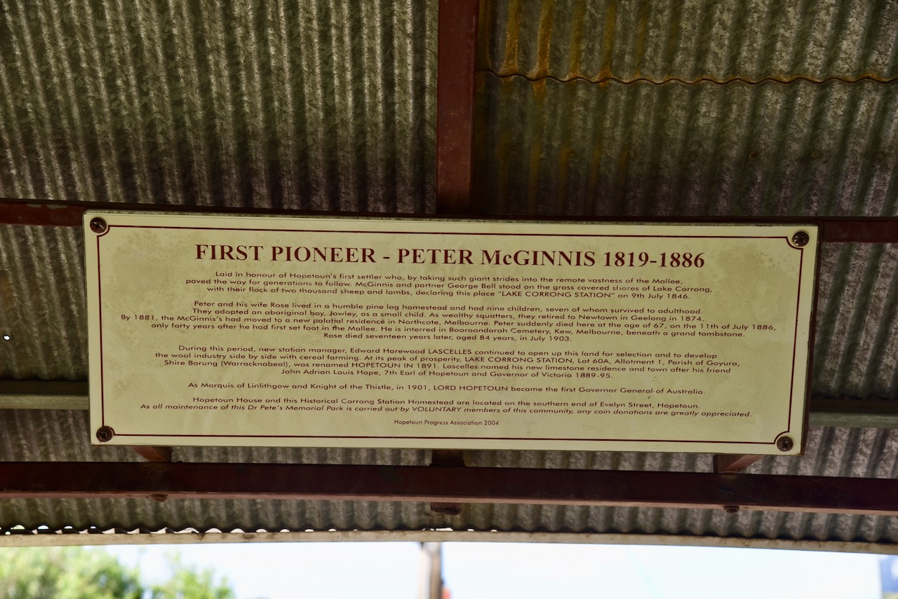
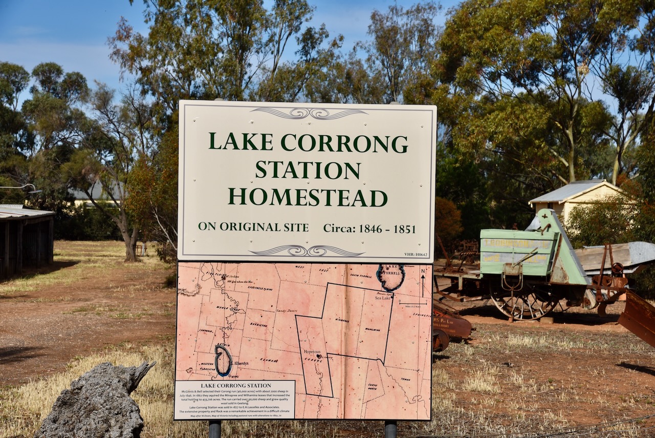
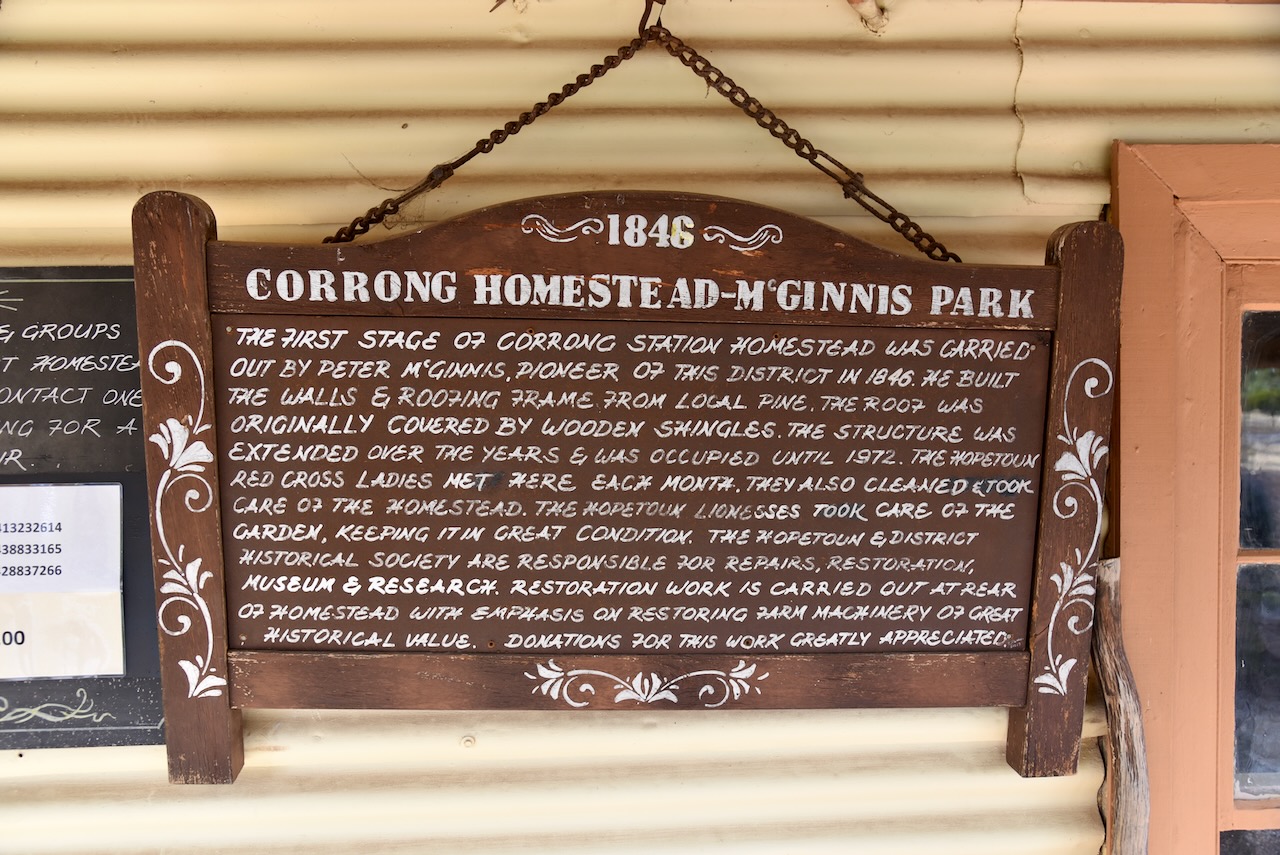
The first European to call the area home was Peter McGinnis (b. 1819. d. 1886). He was born in 1819 in Country Armagh, Ireland. He married Rose Lappin. Peter and Rose emigrated to Australia in 1841. In July 1846 he established a sheep run called ‘Lake Corrong.’ They lived in a humble pine log homestead and had nine children. They also adopted an aboriginal boy, Jowley. McGinnis became a wealthy squatter and in 1874 retired to Newtown in Geelong. By 1881 they had moved to Northcote, Melbourne. Peter died in 1886, aged just 67 years of age. (ancestry.com.au) (Aussie Towns 2024)
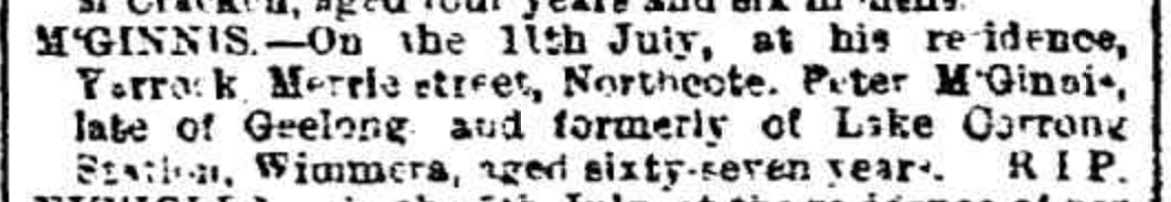
Above:- Article from the Weekly TImes Melbourne, Sat 17 Jul 1886. Image c/o Trove.
The town of Hopetoun was named by Edward Harewood Lascelles (b. 1847. d. 1917) who was a pastoralist and businessman and was known as the ‘Father of the Mallee’. He purchased ‘Lae Corrong’ from McGinnis. He named his house Hopetoun and subsequently the town. Hopetoun was the name of the seventh Earl of Hopetoun, Lord Hopetoun. He was the Governor of Victoria from 1889-1895 and the first Governor General of Australia from 1901-1903. Hoeptoun was a friend of Lascelles and visited Lascelles’ house frequently. (Aussie Towns 2024) (Wessels 1974)
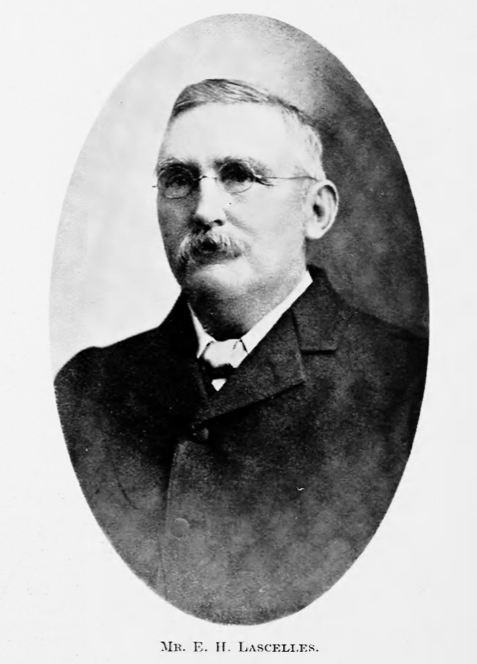
Above:- Edward Harewood Lascelles. Image c/o The Pastoral Review, 15 Mar 1915.
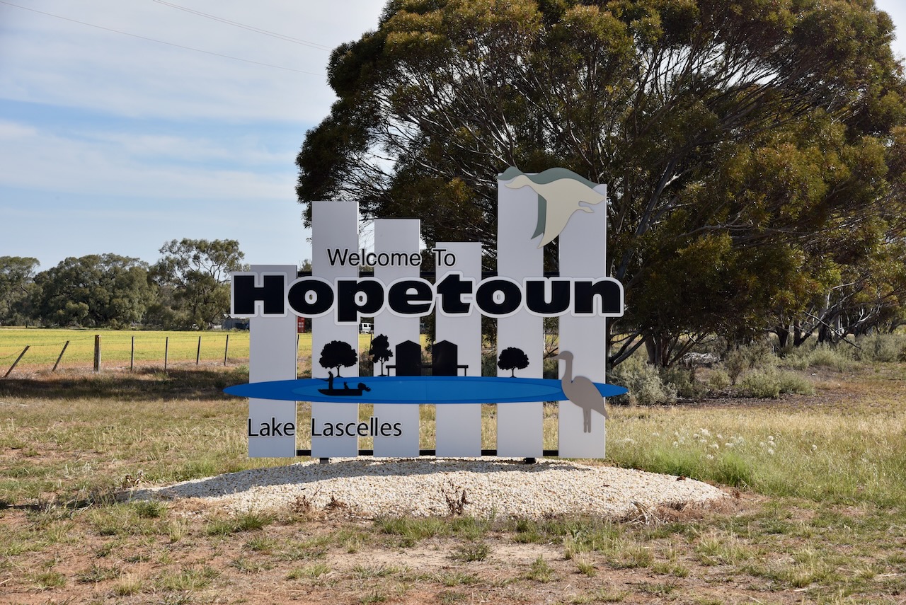
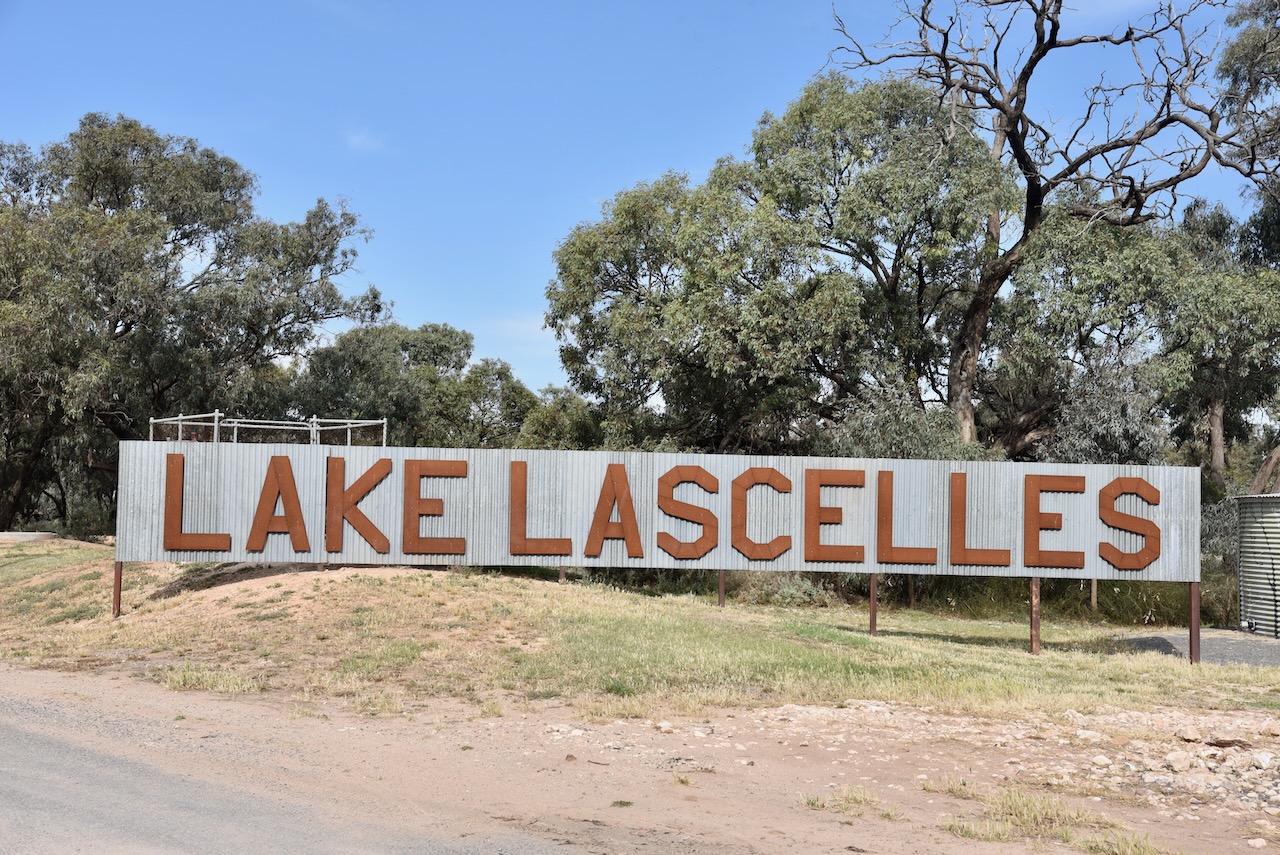
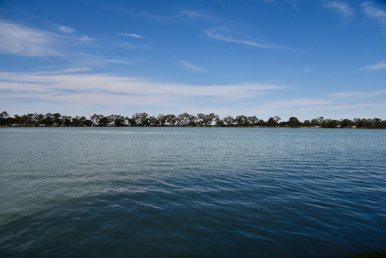
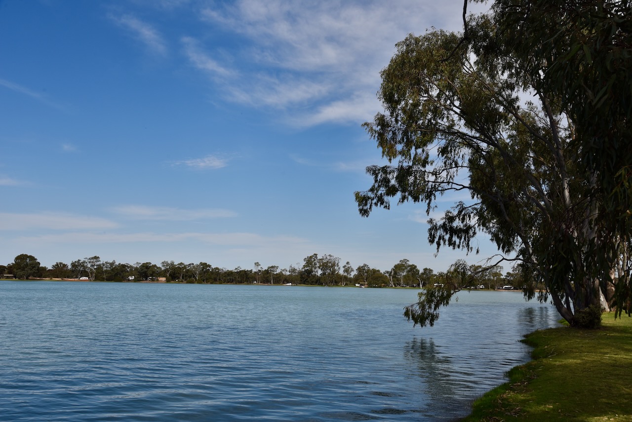
Hopetoun is located on Yarriambiac Creek and the beautiful Lake Lascelles.
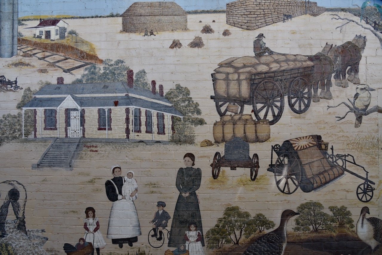
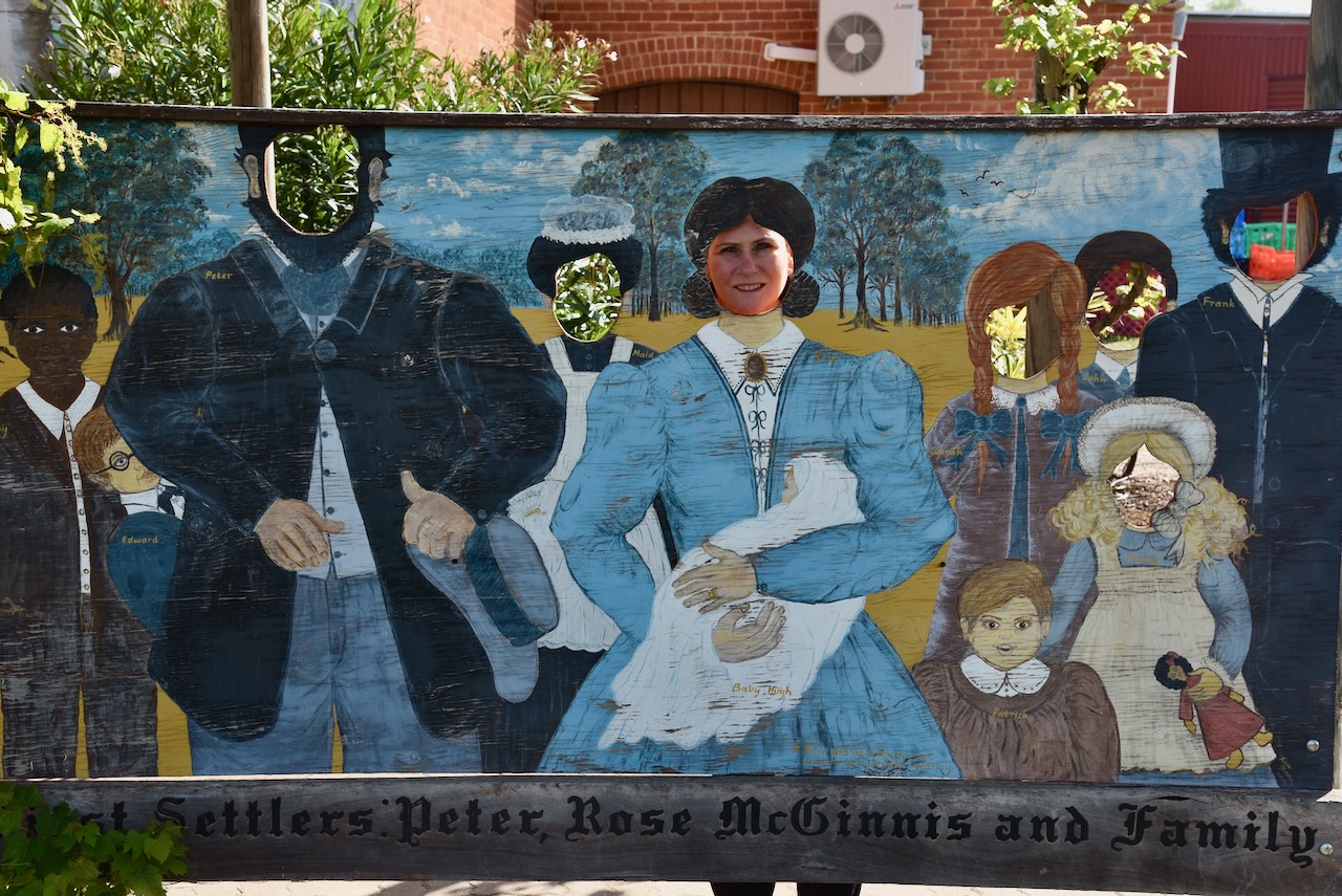
The town has a very impressive mural that depicts all aspects of local history in the area. The mural features a stump jump lough, wool bales, drovers, the Mallee roller, local birds and wildflowers. It was completed by local artists Shirley Decker and Trish Hogan.
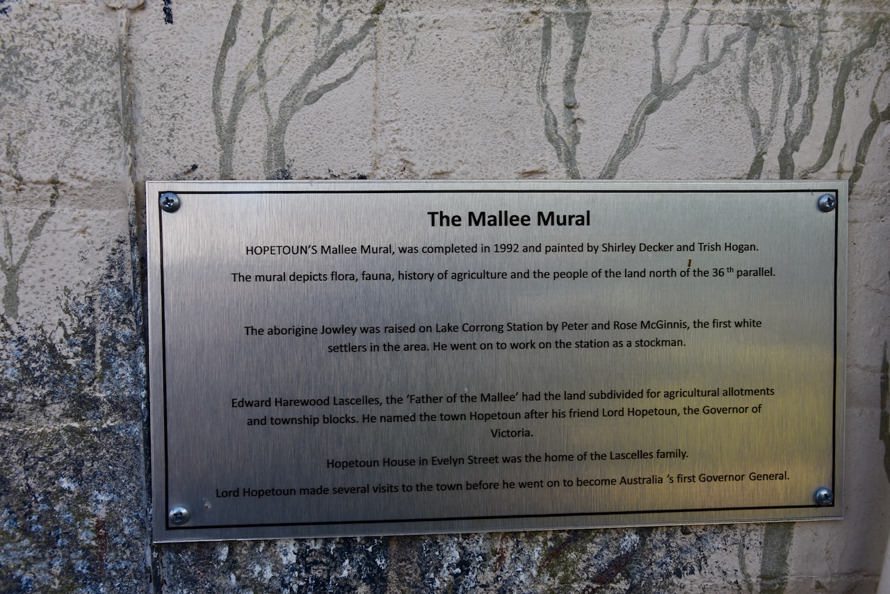
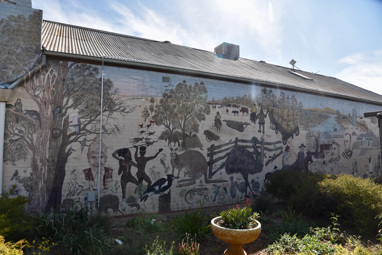
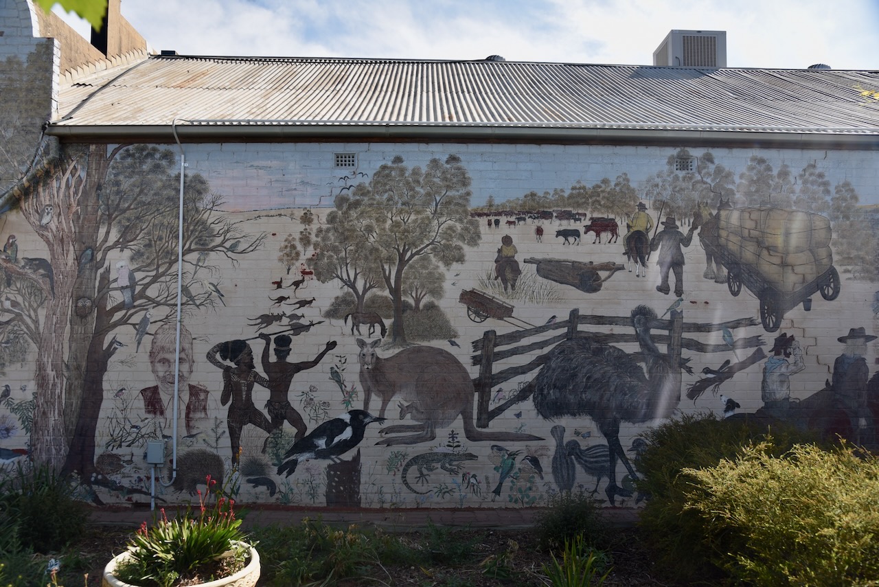
Adjacent to the mural is an information board that tells the story of Peter McGinnis (b. 1819. d. 1886)
Marija posed for a photograph at the McGinnis mural.
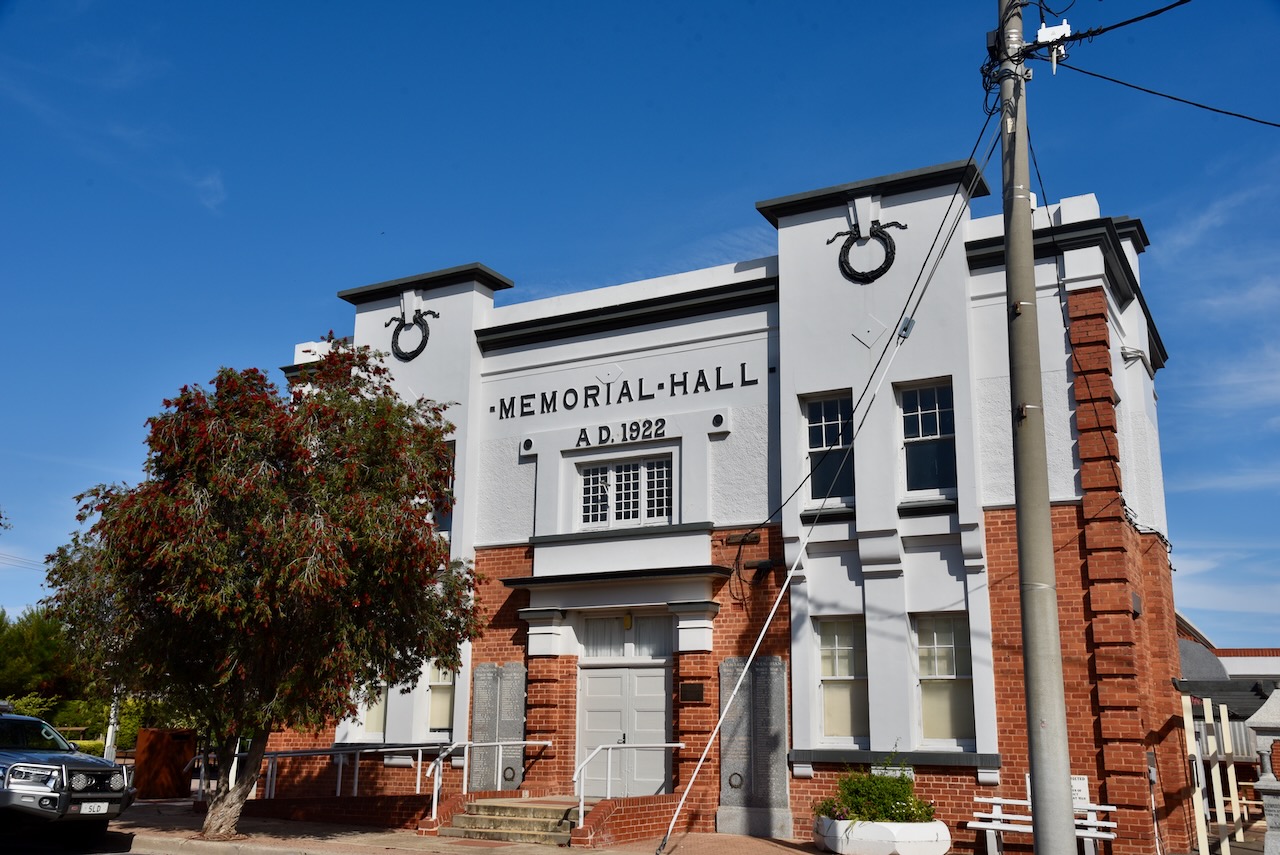
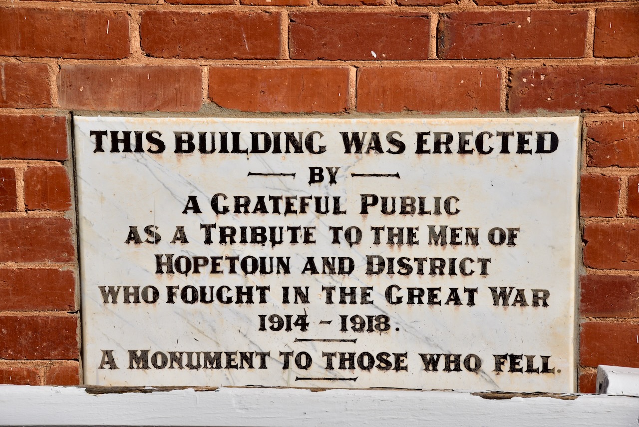
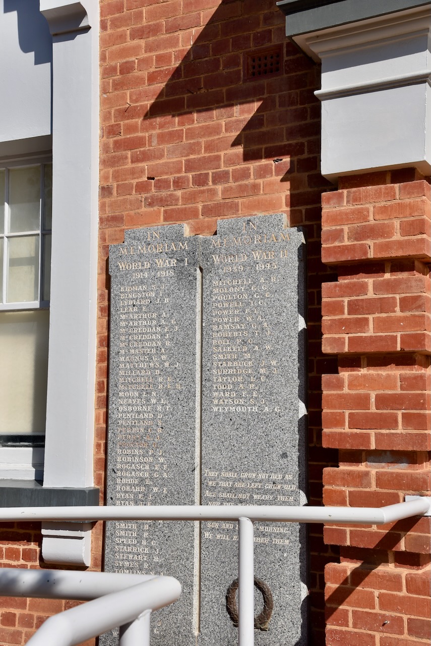
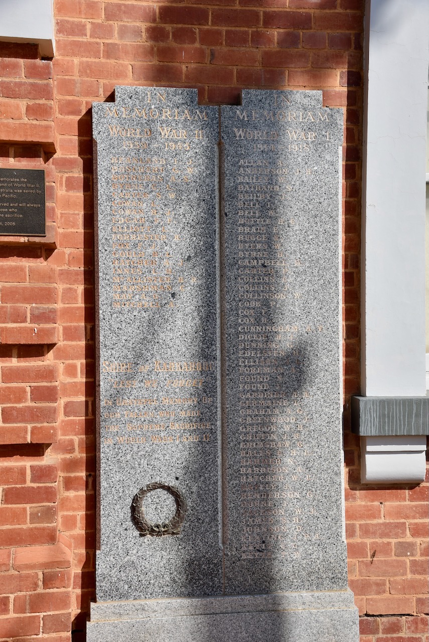
We then took a short walk around this historic town. Our first stop was the Hopetoun Memorial Hall which was erected as a tribute to the men of Hopetoun and the district who fought during World War One.
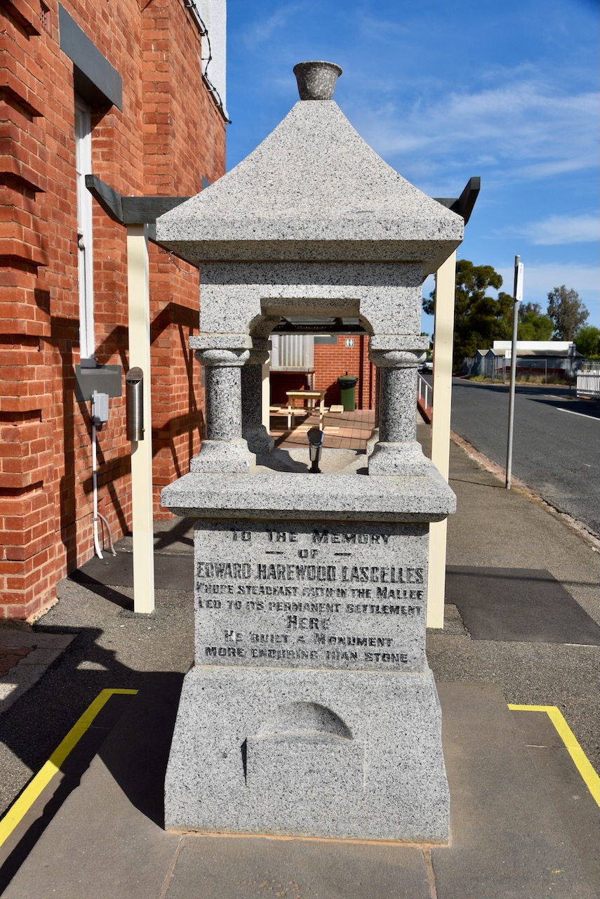
Nearby is the memorial fountain, erected in 1929 as a tribute to Lascelles.
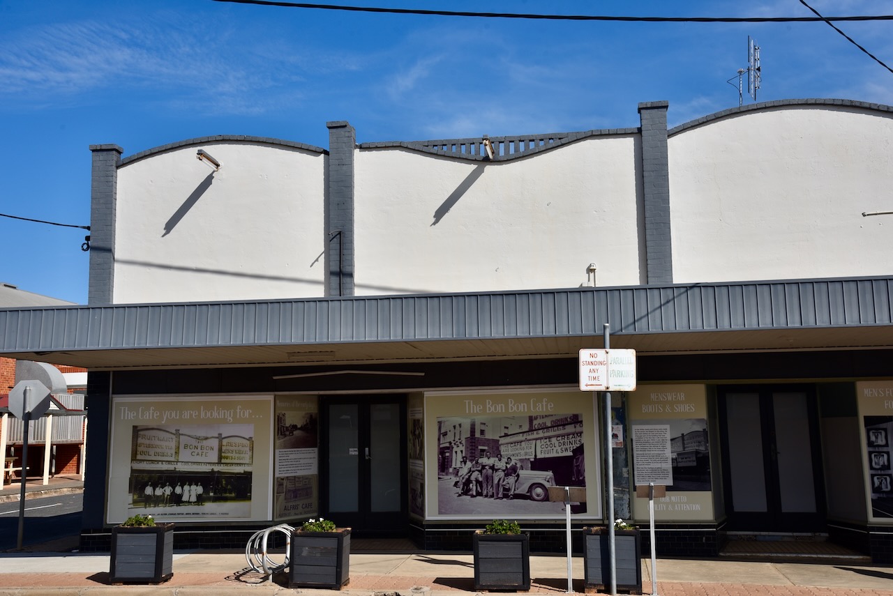
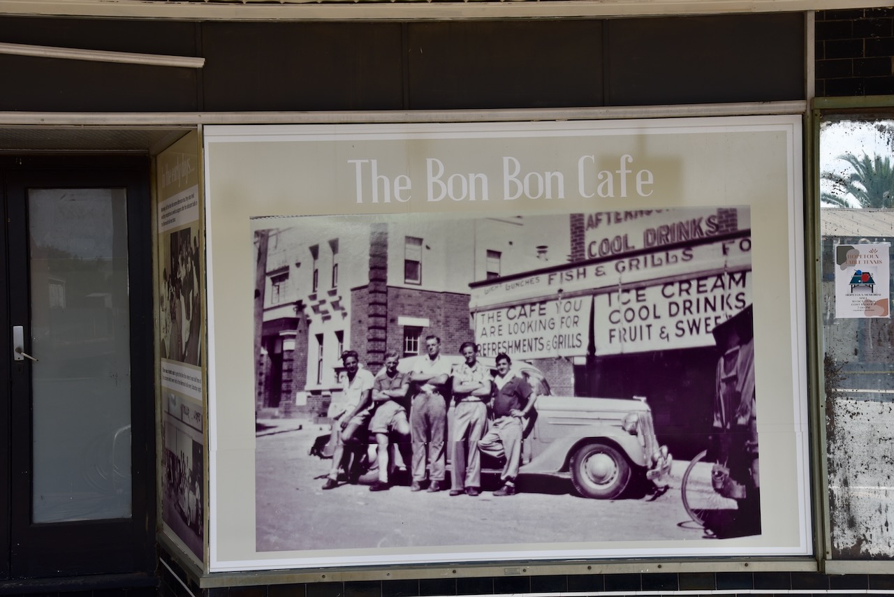
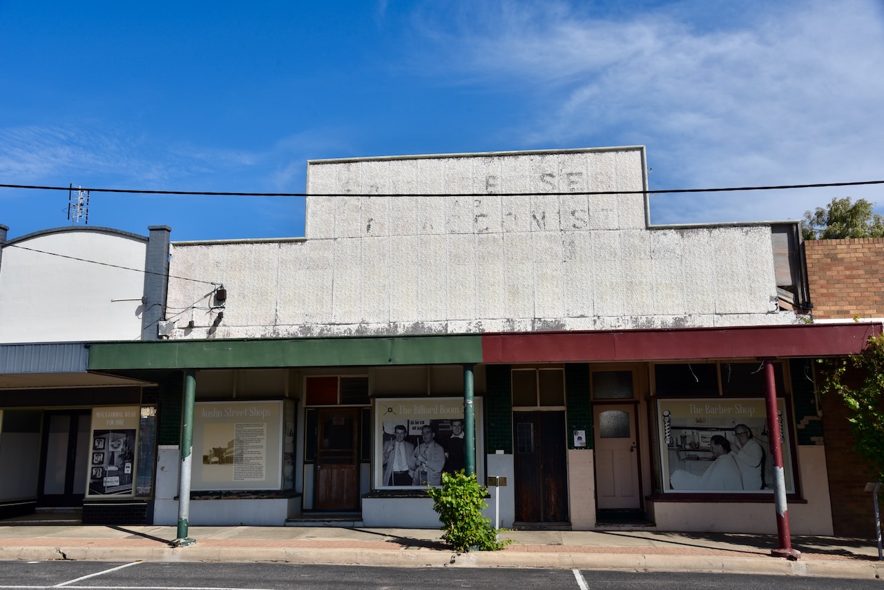
Hopetoun is clearly a town that takes pride in its history. There are several information boards on the old shops in the main street, detailing the history of the shops.
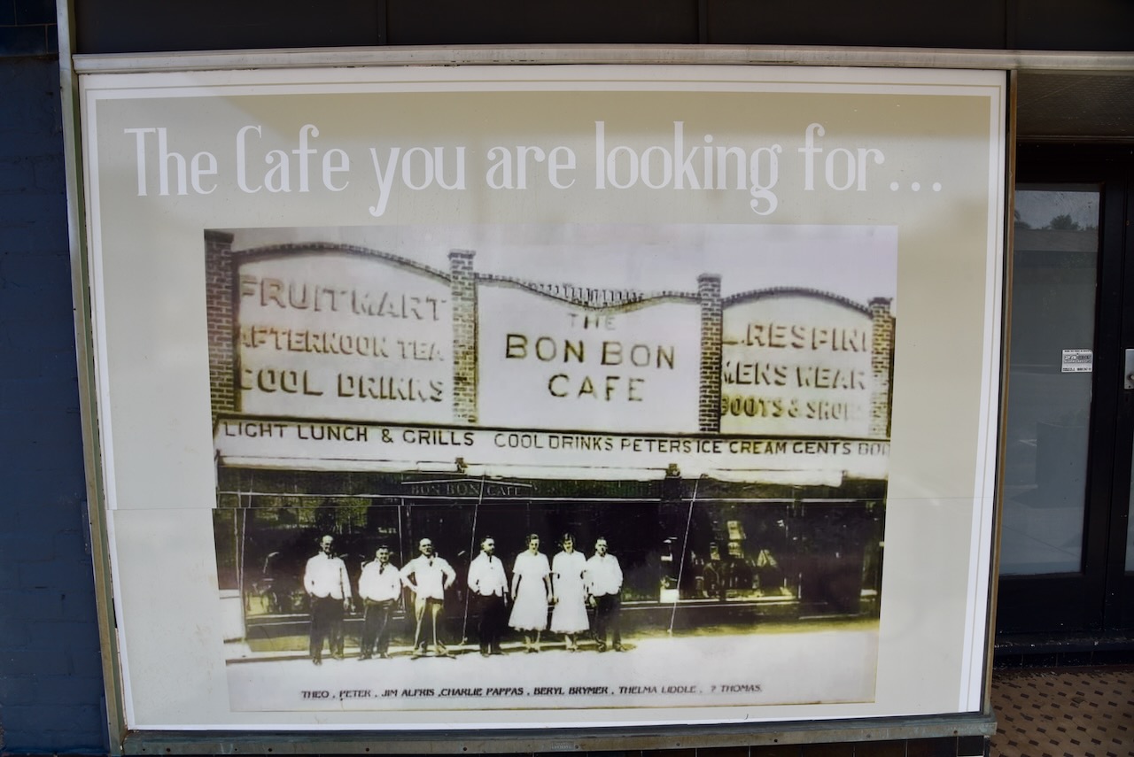
The Bon Bon Cafe closed in 2017. The ice cream for the Bon Bon cafe would arrive by rail in a Peter’s ice cream shipper made of stiff waterproof canvas that was packed in dry ice. Stables once existed at the rear of the shop where visitors to the town could tie up their horses. (Werner 2017)
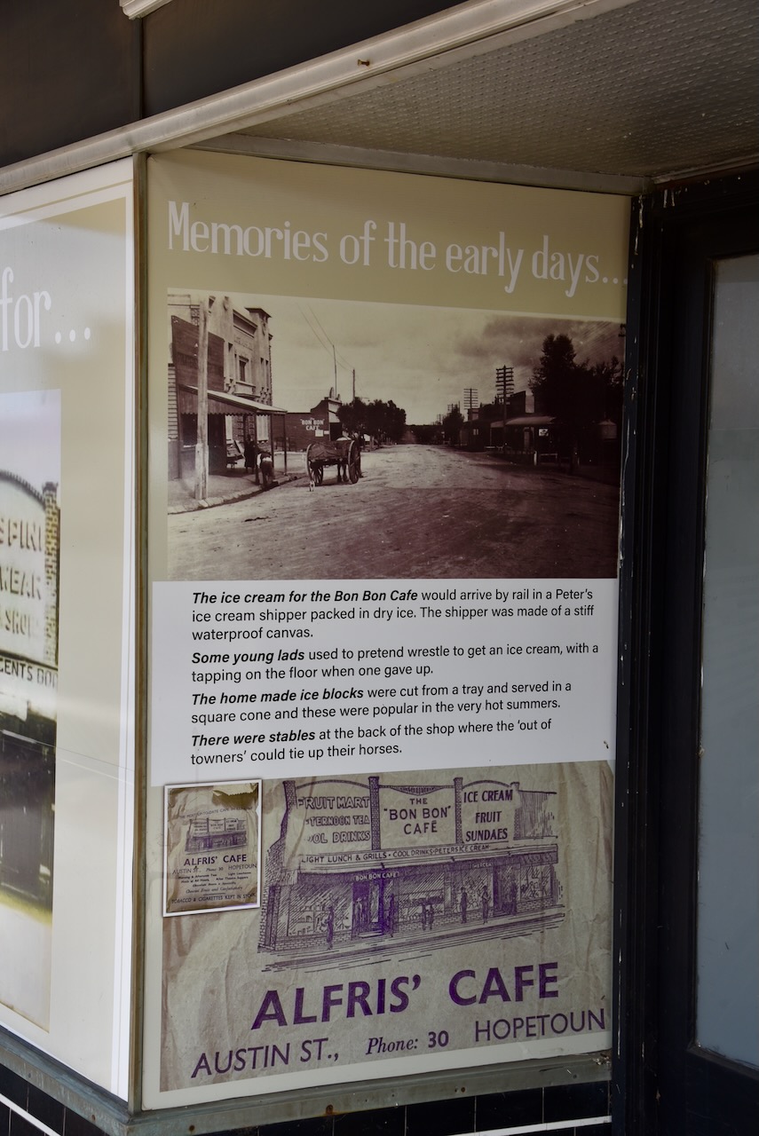
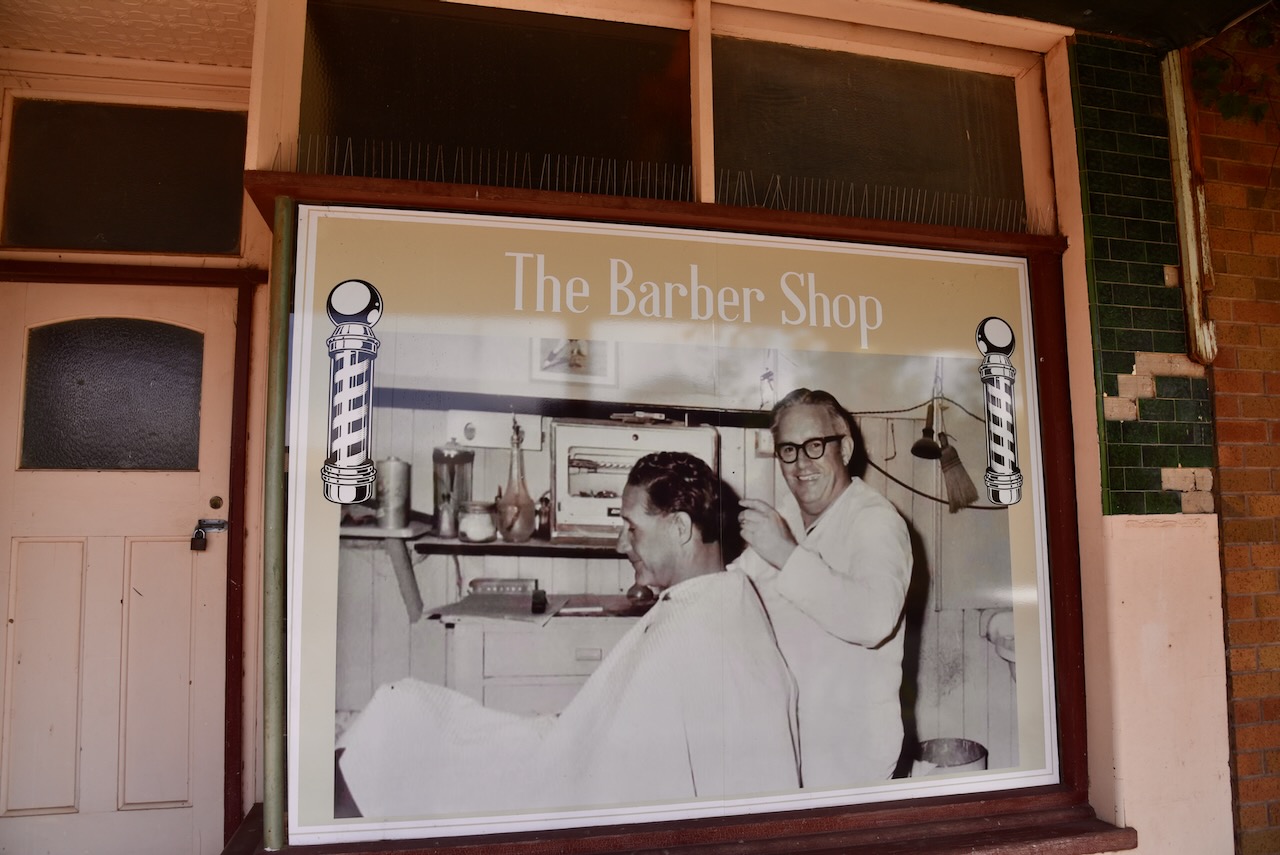
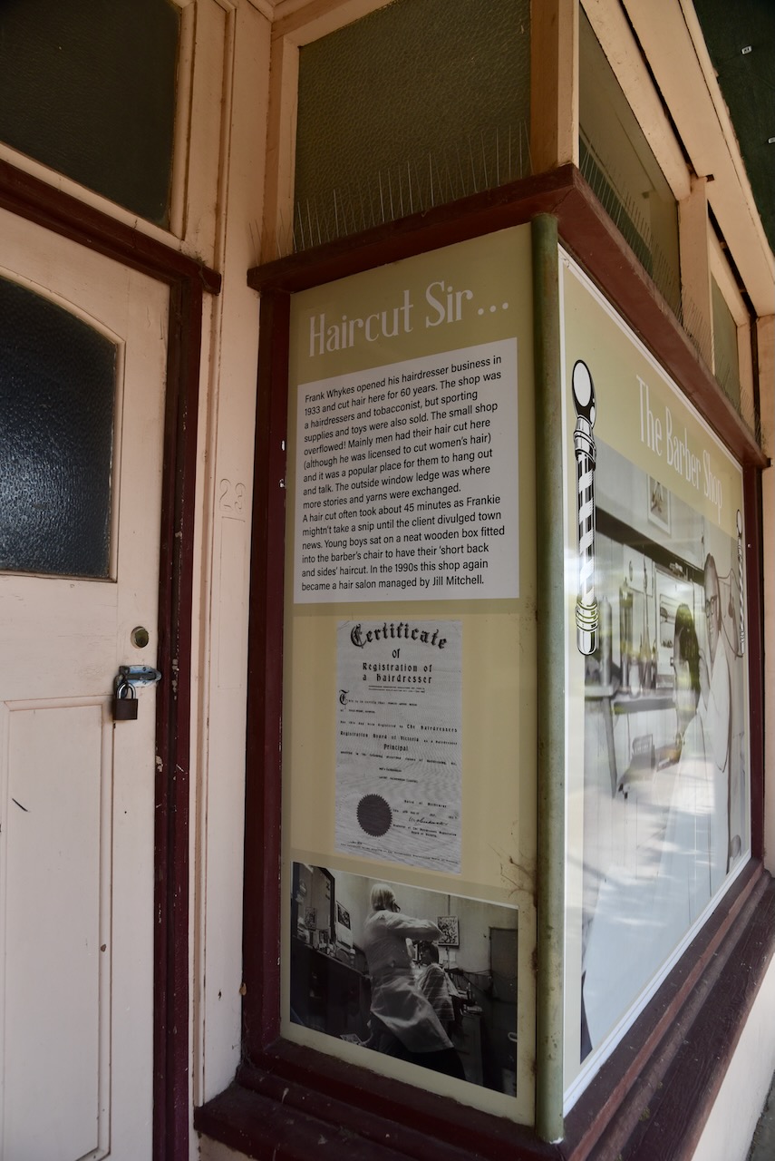
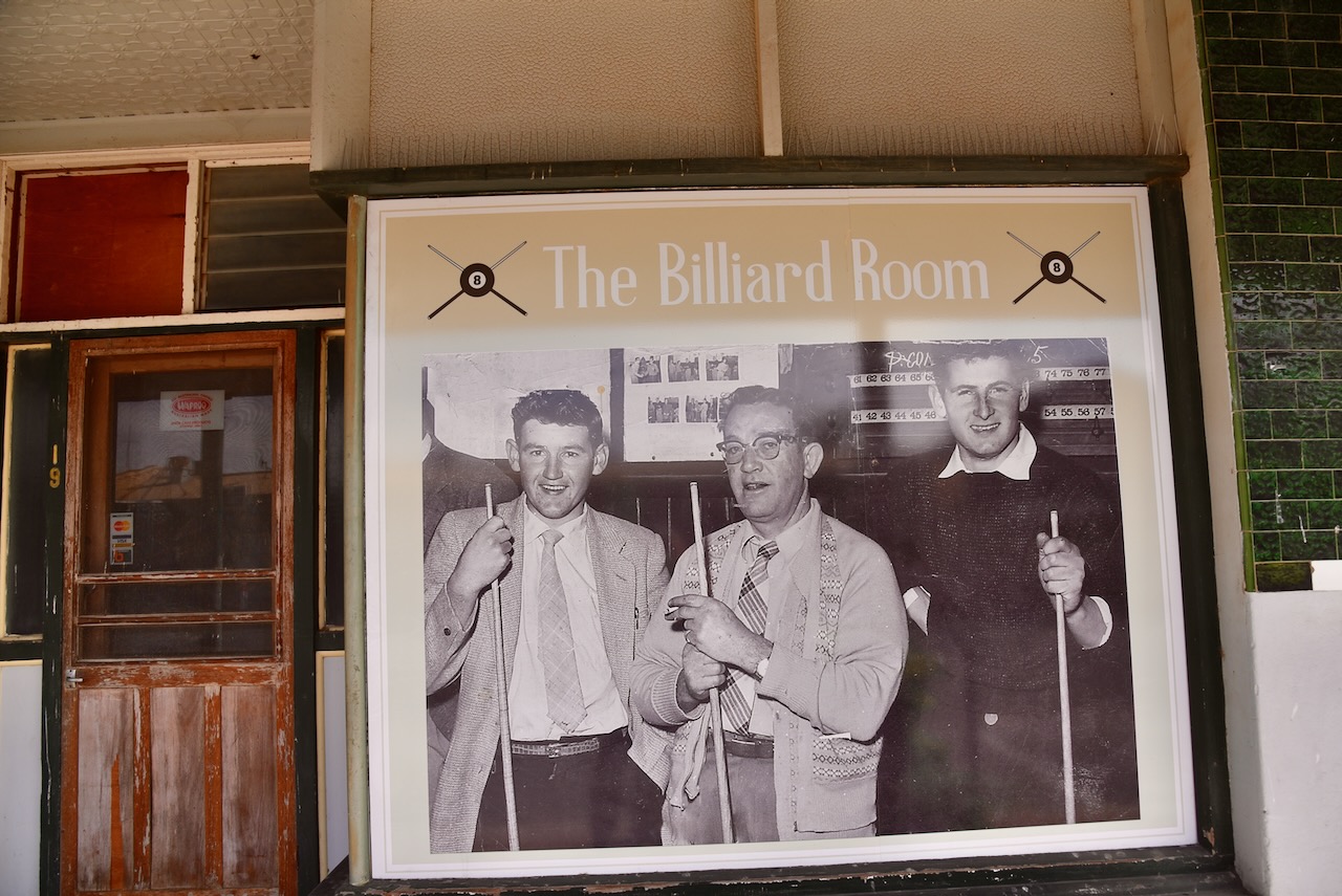
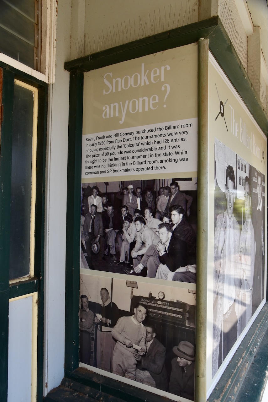
Next door is the billiard room and barber shop. In 1950 Kevin, Frank and Bill Conway purchased the billiard room from Rae Dart. Billiard tournaments were held including the ‘Calcutta’ which had 128 entries and a prize of 80 pounds. Frank Whykes opened his hairdresser business in 1933. It operated for 60 years. The shop was also a tobacconist and sporting supplies and toys were also sold.
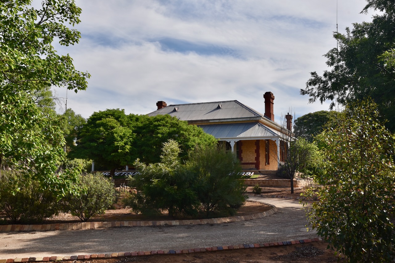
We then drove to Hopetoun House on Evelyn Street. It was built in 1891 by Edward Lascelles. Unfortunately, there was not much of a view to the trees and shrubs in the front yard. (Aussie Towns 2024)
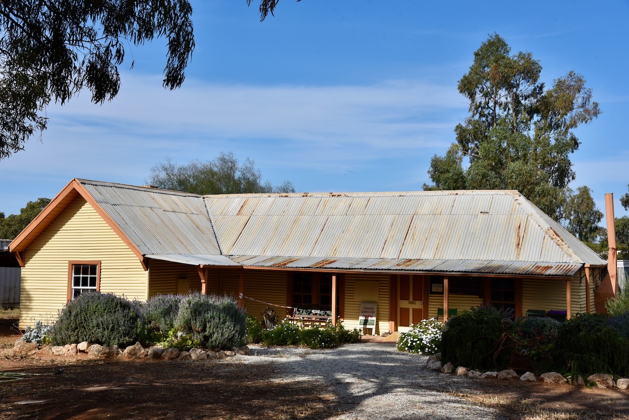
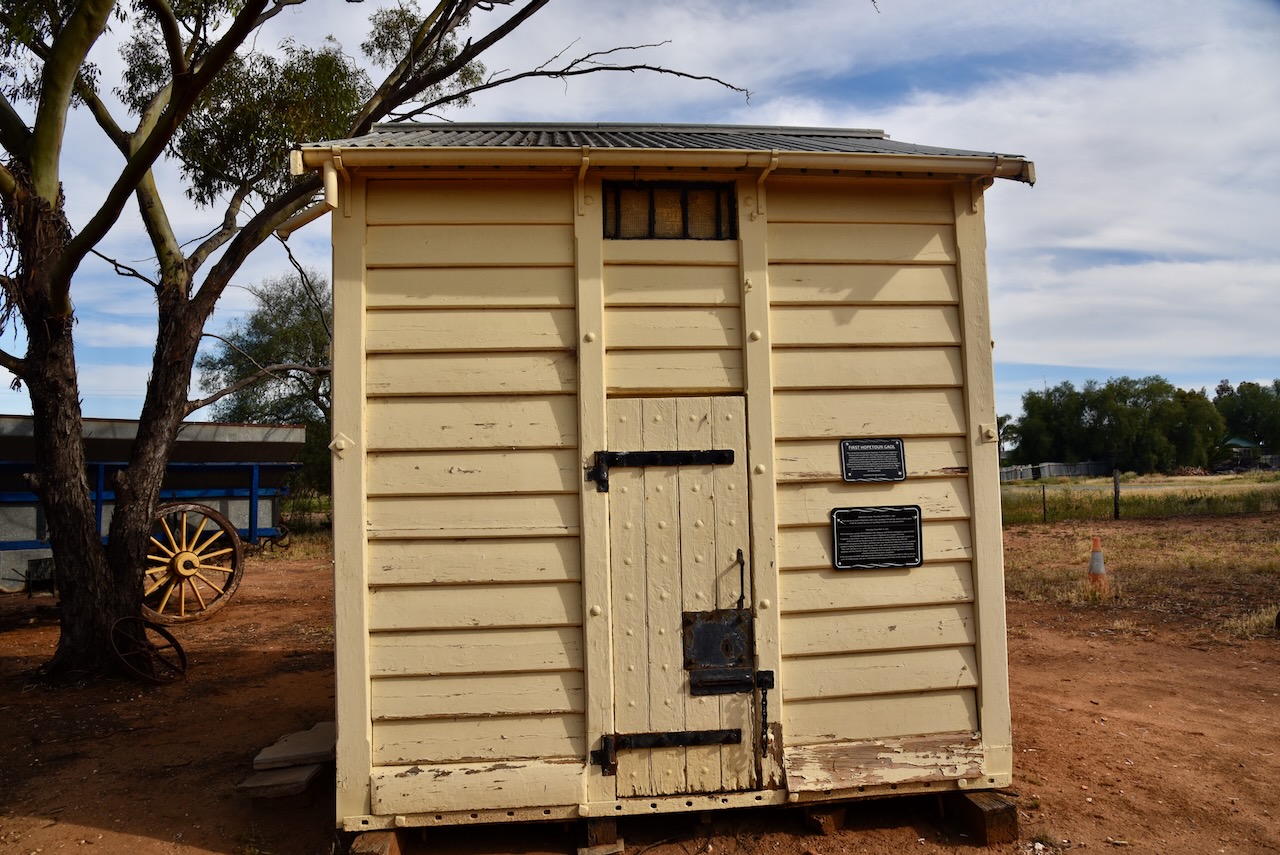
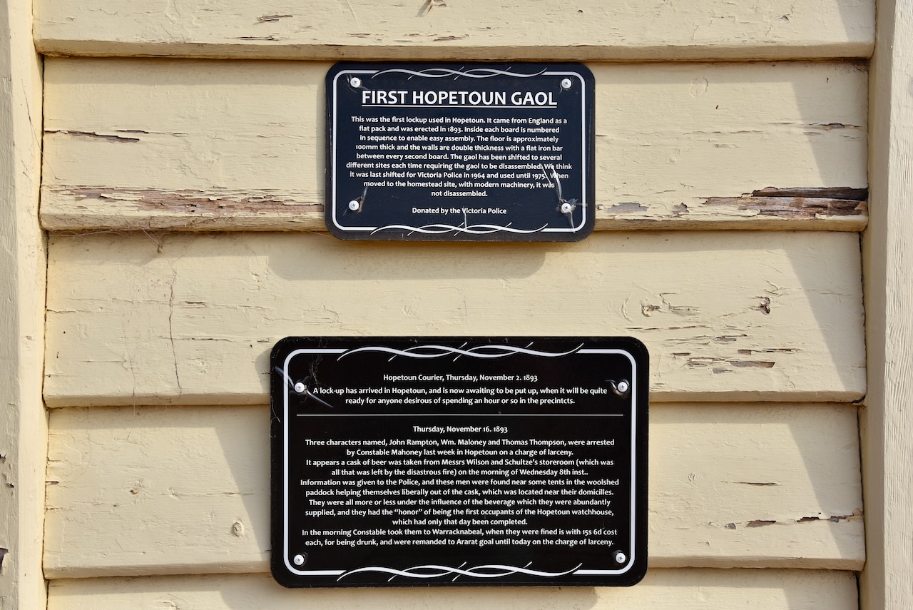
Although we had been there previously, Marija and I stopped over to have a look at Corrong Station Homestead. This is well worth visiting and is just a gold coin donation. The pine and corrugated iron hut was built in 1846 by Peter McGinnis. McGinnis lived in the hut with his wife, seven children, and their adopted aboriginal child, Joweley who was also known as ‘Black Peter’. The grounds also contain historic farm machinery and the old local police lockup. (Aussie Towns 2024)
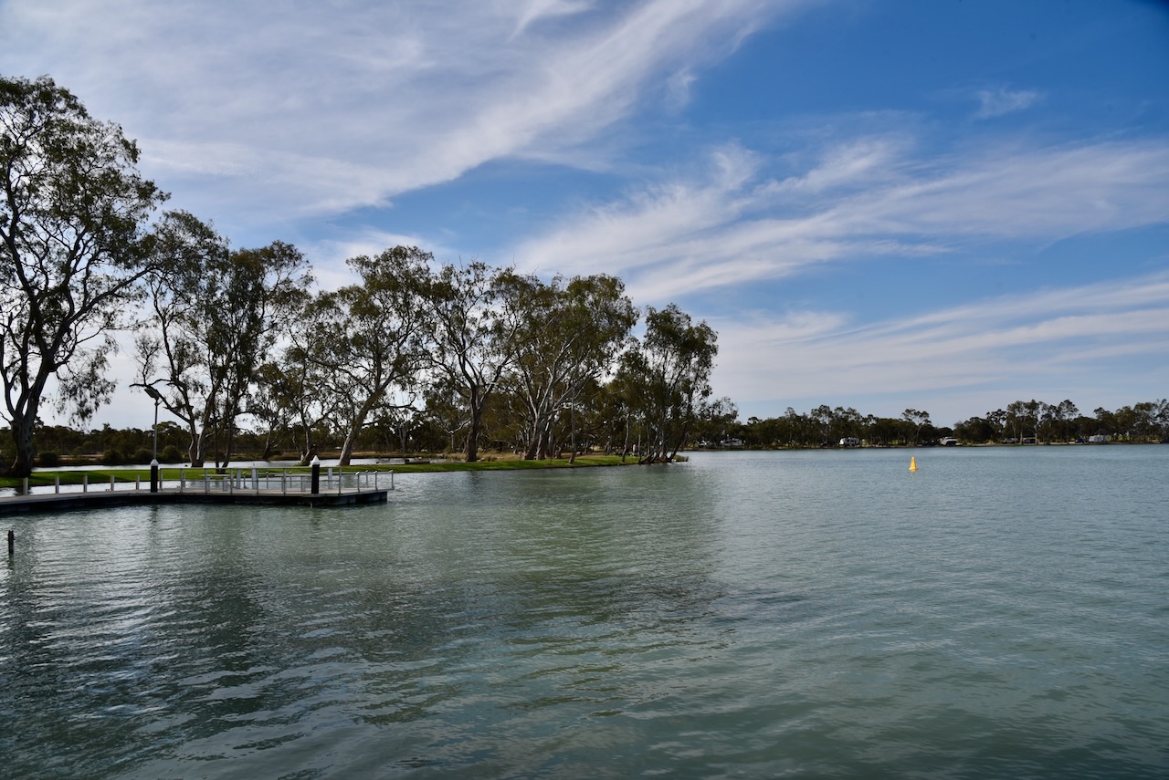
Marija and I then drove down to nearby Lakes Lascelles. The lake is popular with walkers, swimmers, fishermen, boating enthusiasts and bird watchers.
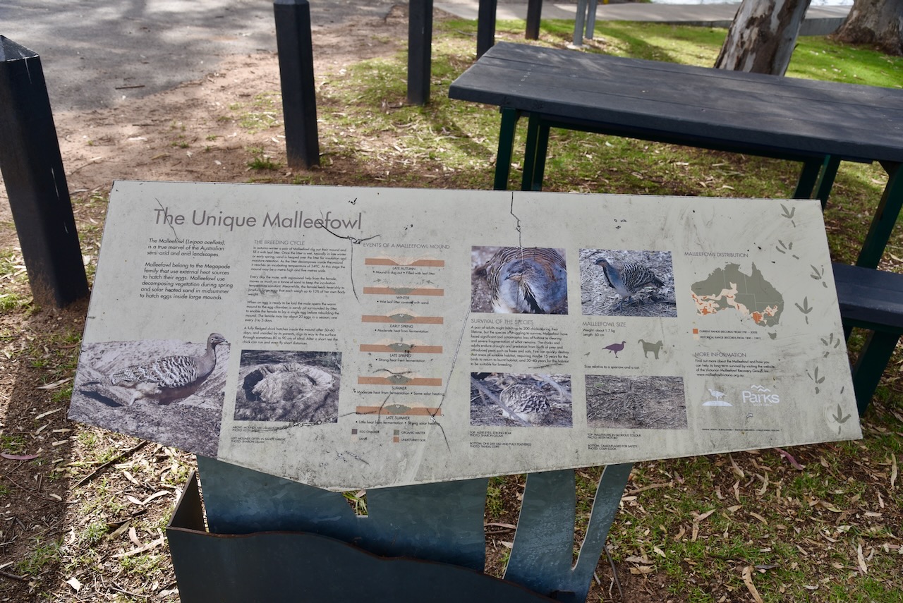
At the lake, there is an information board about the nationally vulnerable Malleefowl.
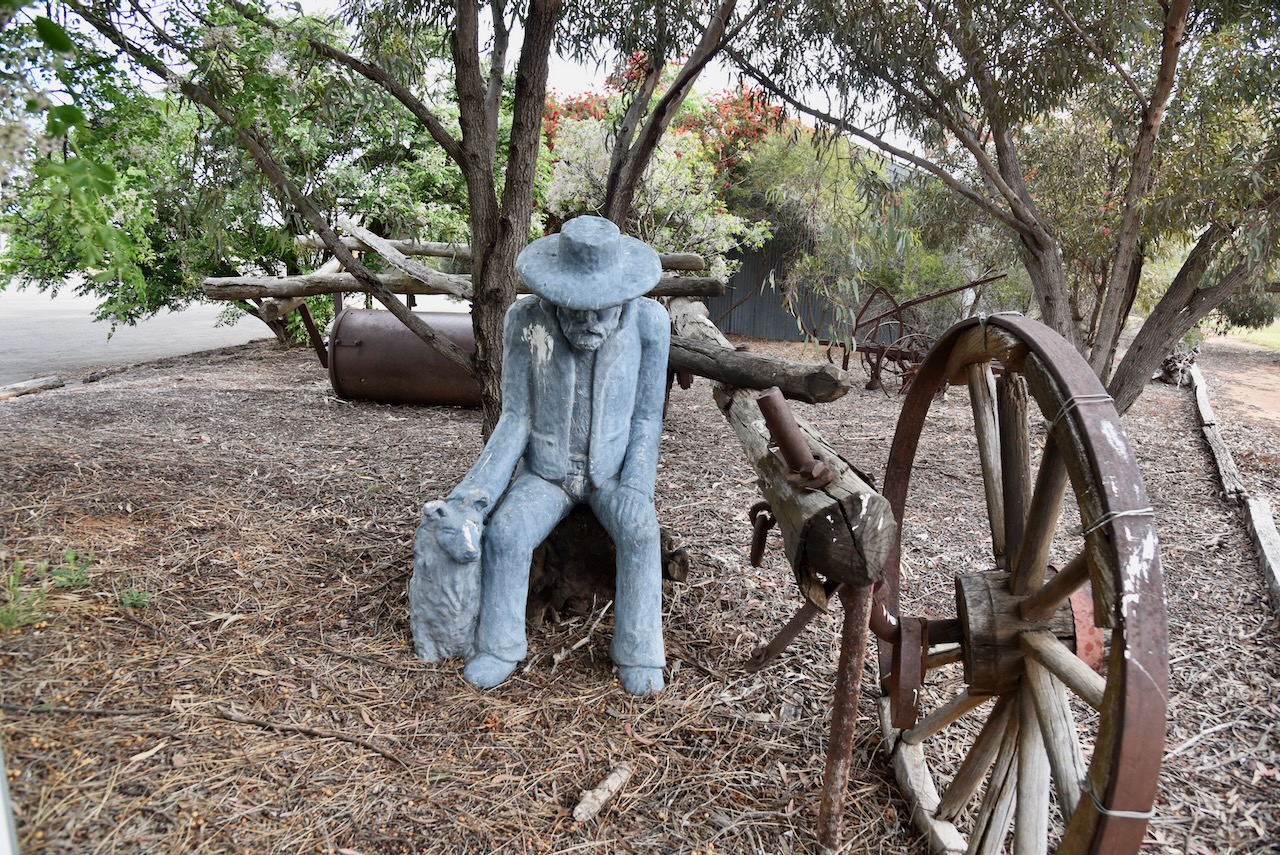
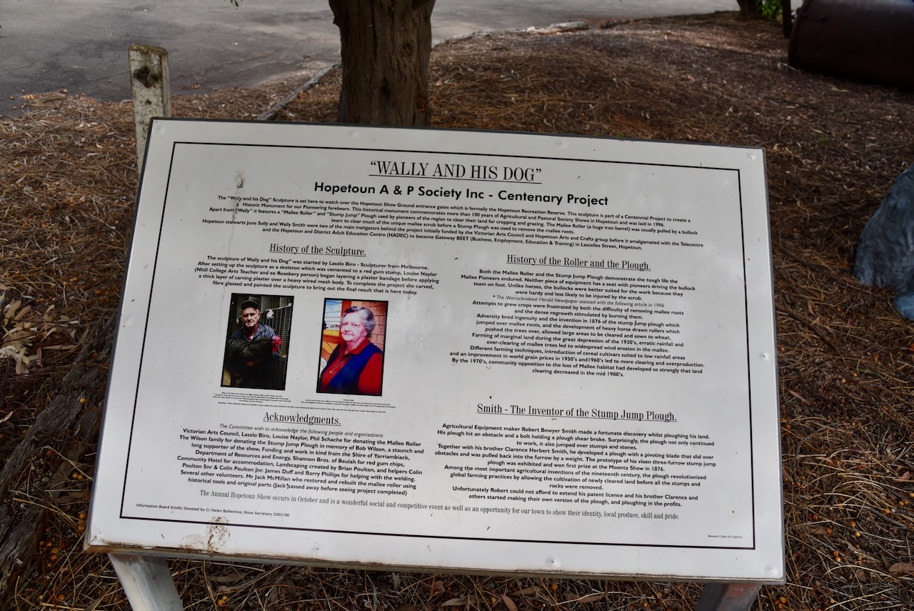
Another point of interest is ‘Wally and His Dog’ located at the entrance gates of the Hopetoun Showground.
The Hopetoun silo is located along the railway on the northeastern side of Hopetoun W Road. The Hopetoun 2 silo is located further south along the railway line on the northeastern side of Garrard Street.
Marija and I parked on Hopetoun-Yaapeet Road in the activation zone of both silos. We operated from the 4WD running the Icom IC-7000, 100 watts, and the Codan 9350 antenna with the 1.5 metre stainless steel whip.
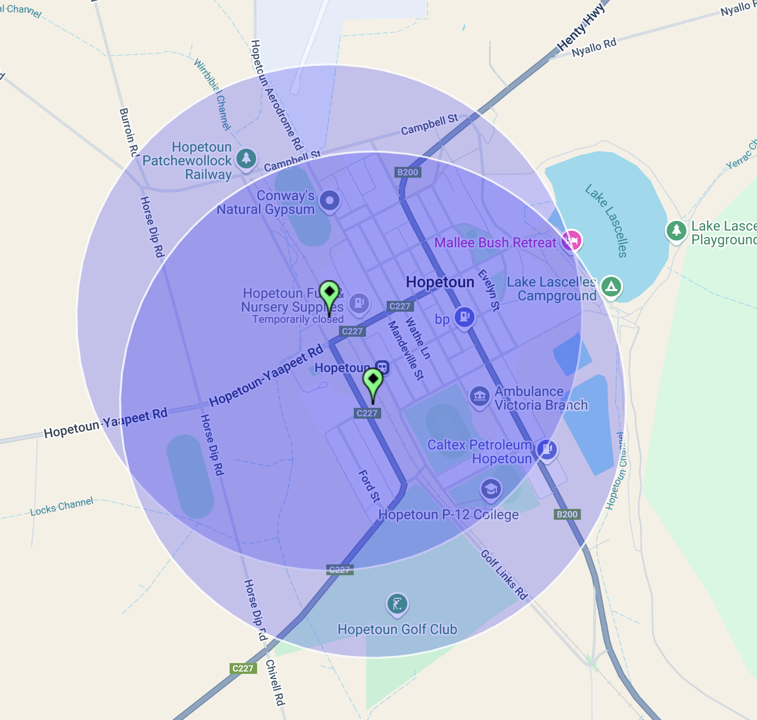
Above:- the activation zones at the two silos at Hopetoun. Image c/o SiOTA website.
Marija worked the following stations on 40m SSB:-
I worked the following stations on 40m SSB:-
References.
Our next planned activation for the trip on Thursday 20th October 2024 was the Patchewollock North Bushland Reserve VKFF-4244.
The park is located between Walpeup and Patchewollock in northwest Victoria. It is about 436 km northwest of Melbourne.

Above:- Map showing the location of the Ptachewollock North Bushland Reserve. Map c/o Google Maps.
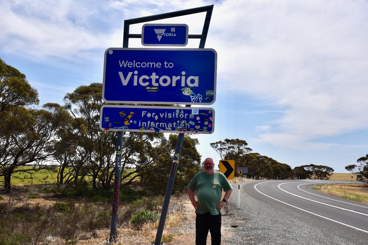
Marija and I drove down to Pinnaroo where we stopped briefly for something to eat and a coffee. We then travelled east and crossed over the State border into Victoria.
We continued east along the Mallee Highway, which we had driven along dozens of times previously. Many people would probably find this drive boring, but there is a lot of history to be seen along the way. At Walpeup we turned right onto the Hopetoun-Walpeup Road and headed south.
Along the way, there were signs warning drivers to take care of Malleefowl. The Malleefowl, also known as Gnow, Lowan and Mallee Hen, is a ground-dwelling bird that is seldom seen and is shy. They are listed as Vulnerable nationally. And we were lucky enough to see one on the side of the road as we approached the park. (Bush Heritage 2024)
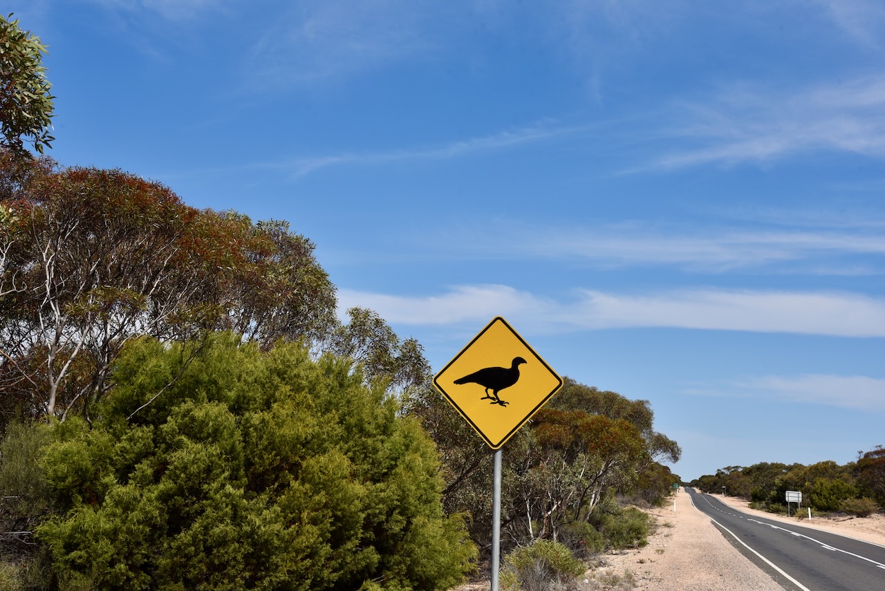
Unfortunately by the time we had pulled over and turned around, a truck came by and scared the Mallefowl into the scrub. Despite being unable to get a photograph, Marija and I were very excited. It was the first time that Marija had seen a Malleefowl and only my second time. (Bush Heritage 2024)
Below is an excellent video on the Malleefowl.
Marija and I had been to the town of Patchewollock previously and we were running short of time, so this time around we did not visit the town.
Patchewollock is believed to be the corruption of two aboriginal words, ‘putje’ meaning ‘plenty’ and ‘wallah’ meaning ‘porcupine grass’. Thus ‘the place of plenty porcupine grass’. Prior to European settlement of the district, the land was occupied by the Wegaia aboriginal people. By 1747 European settlers had commenced grazing on the land. In 1914 the town of Patchewollock was established as a town surrounded by soldier settlement farms. (Aussie Towns 2024)
The Patchewollock North Bushland Reserve is located on the eastern side of the Hopetoun-Walpeup Road at the junction of the Ouyen-Patchewollock Road. Crane Road also divides the park into two sections, the northern section and the southern section.
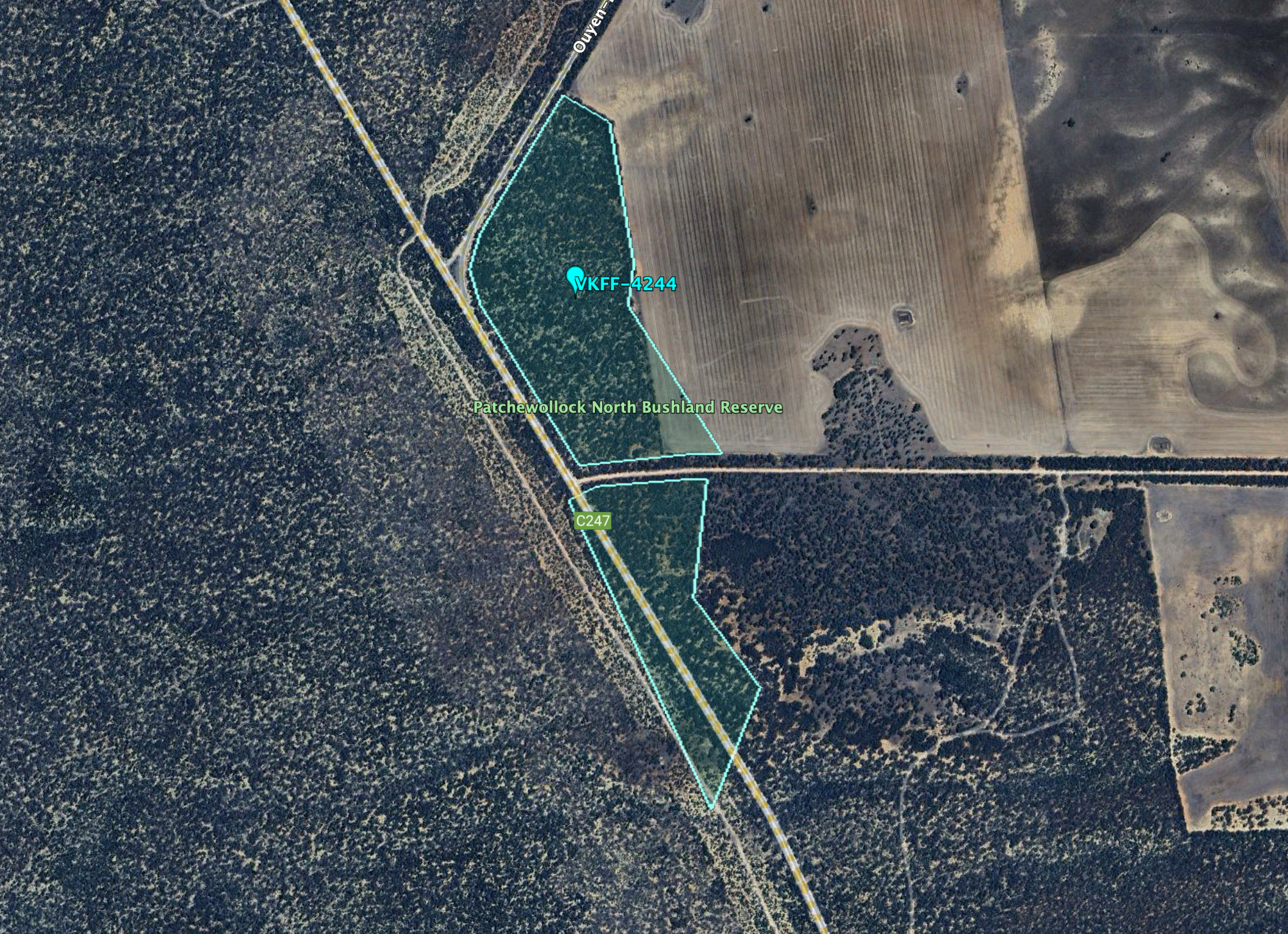
Above:- An aerial view of the reserve. Image c/o Google Earth.
The reserve is about 40 hectares in size and was established on the 1st day of May 1979. (CAPAD 2022)
We were running a bit short of time, so we both qualified the park for VKFF with at least 10 QSOs, and then headed off. This is a park we will need to return to with the aim of getting 44 QSOs to qualify the park for the WWFF global program.
Marija worked the following stations on 40m SSB:-
I worked the following station on 40m SSB:-
I worked the following stations on 20m SSB:-
References.
Between the 26th day of July 2024 and the 11th day of August 2024, the Summer Olympic Games took place in France.
During this time the Federatia Romana de Radioamatorism ran a special event station of YO0OOO. They offered a special QSL card and certificates.
QSL card.

Certificates.


On Saturday 19th October 2024, Marija VK5MAZ and I drove up to Renmark on the first leg of our trip to Bendigo for the 2024 VKFF National Get-Together. The reason for us heading to Rthe Riverland first was to pick up a raffle prize from my good mate Danny VK5DW who owns RivComm Radio Solutions. And secondly to get my other great mate Ivan VK5HS to have a look at my Icom IC-7000 in the 4WD which was intermittently cutting out.
Marija and I called in to see Danny VK5DW at Loxton and enjoyed a coffee and a chat. We also picked up a UHF CB starter kit that Danny had donated. This was the second year that Danny had kindly donated a prize for the raffle at the VKFF National Get-Together. Thanks so much for your generosity Danny.
We then headed off to Renmark and caught up with Ivan VK5HS. After some problem-solving, it turned out that the voltage on my secondary battery in the 4WD was low and this was the cause of the intermittent drop outs on the IC-7000. Thanks for your time Ivan.
That evening Marija and I stayed in Renmark at our regular overnight spot, the Citrus Valley Motel.
The next day, Sunday 20th October 2024, Marija and I made our way to Warracknabeal where we planned to stay for three nights. It was a drive of about 394 km to get to Warracknabeal.
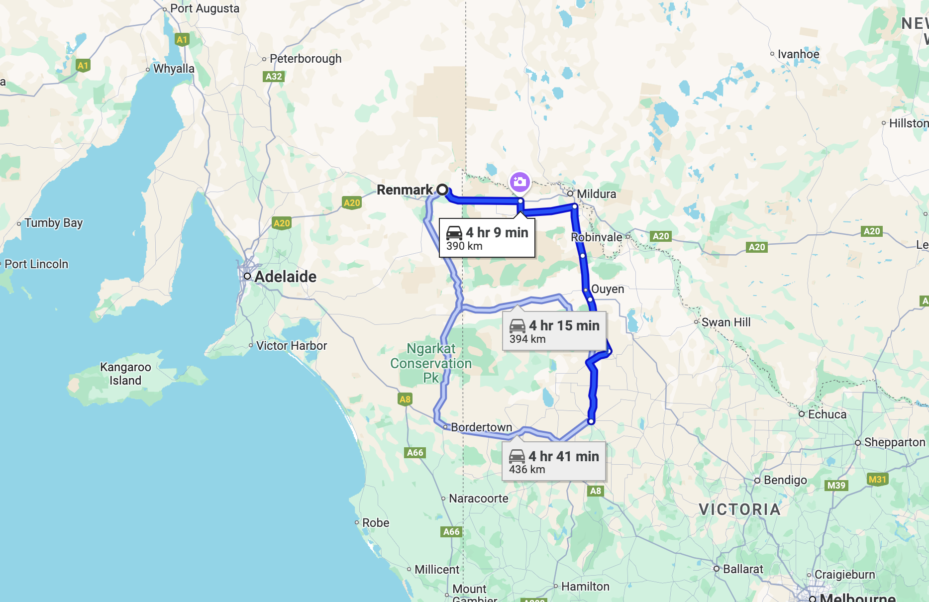
Above:- Map showing our route from Renmark to Warracknabeal. Map c/o Google Maps.
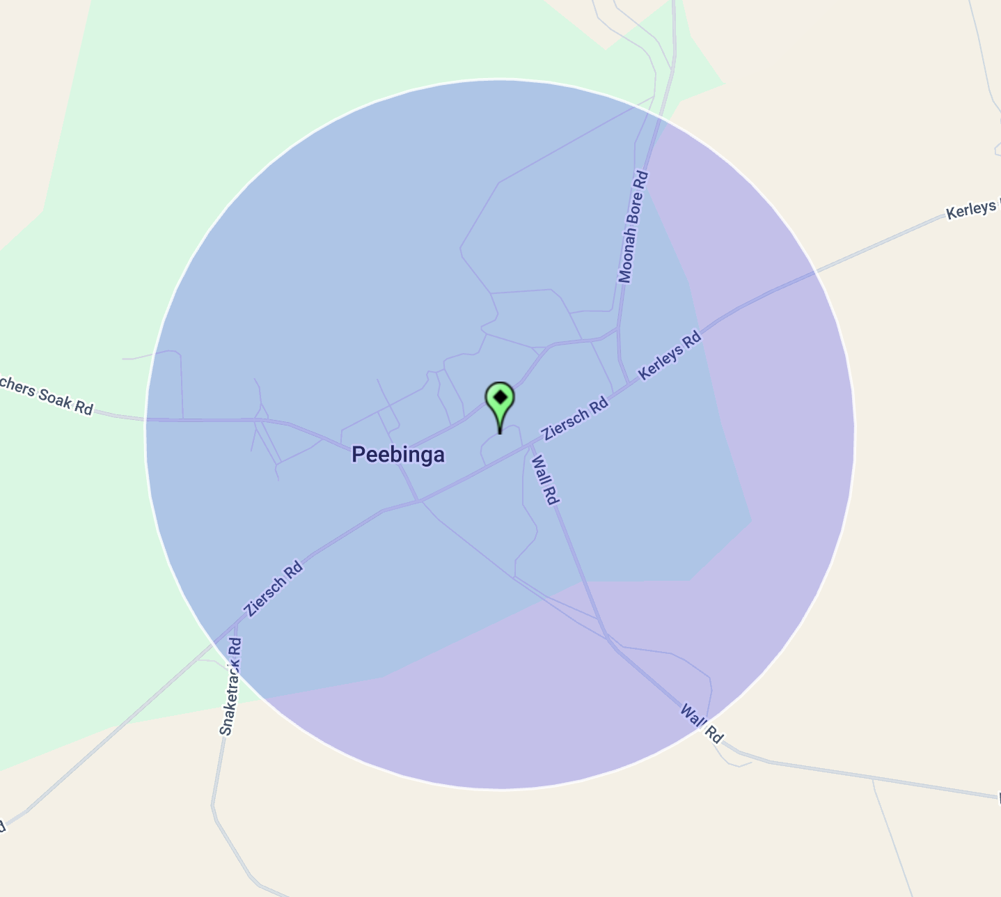
Along the way, Marija and I decided to activate the Peebinga silo VK-PBA5 for the Silos On The Air (SiOTA) program. Peebinga is located about 273 km east of Adelaide and just 5 km from the South Australia/Victoria state border.
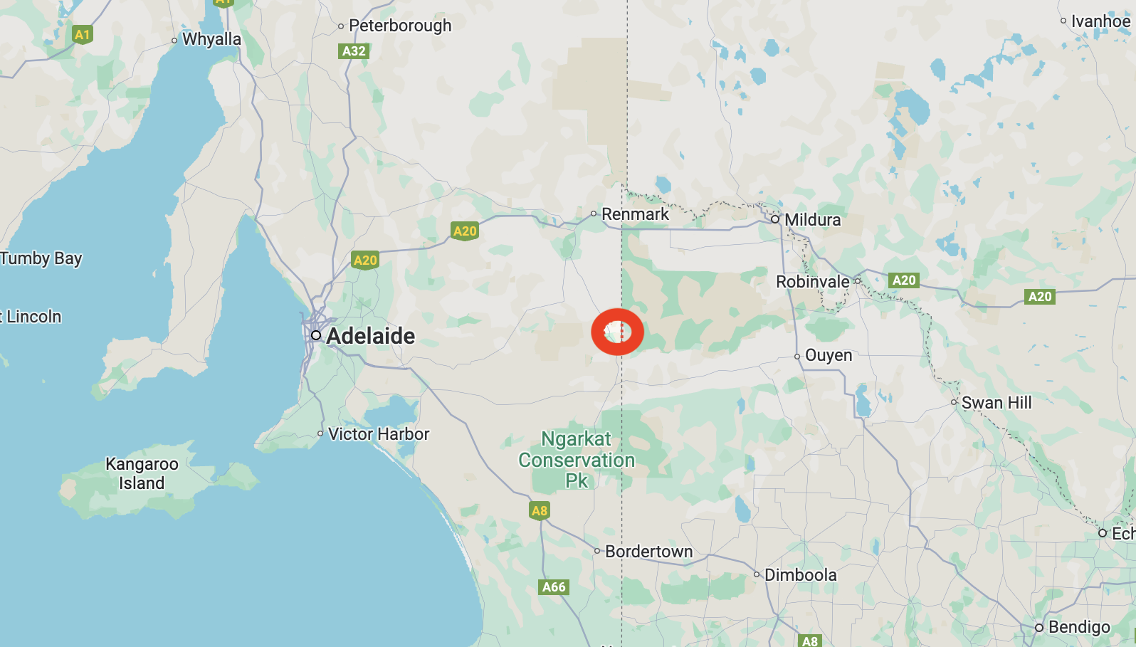
Above:- Map showing the location of Peebinga. Map c/o Google Maps.
Before European settlement, the Peebinga area was home to the Ngarkat (pronounced Narr-kat) aboriginal people. (Tracks of the Mallee)
Pichinga is the aboriginal name for a rock hole in the area. Pinchinga means ‘place of pines’. It is believed that Peebinga is a corruption of the aboriginal word pichinga. Peebinga was formerly known as Butcher Soak, Butcher Rockhole and Butcher Springs. It is reported that you can dig 5 feet and find water below the sand. Butcher’s Spring was named after a local early pastoralist. It is one of only two permanent water supplies in the Murray Mallee region. (Sa.gov.au, 2024) (Trove 2024)
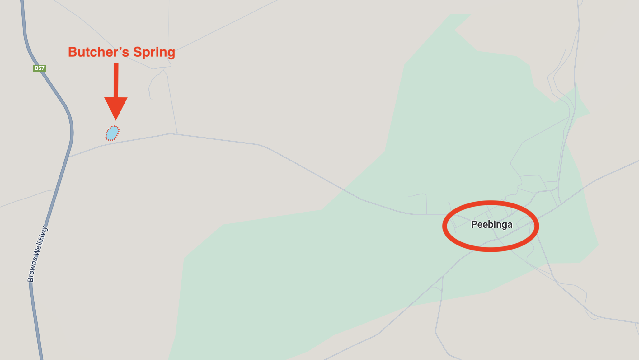
Above:- Map showing the location of Butcher’s Spring and Peebinga. Map c/o Google Maps.
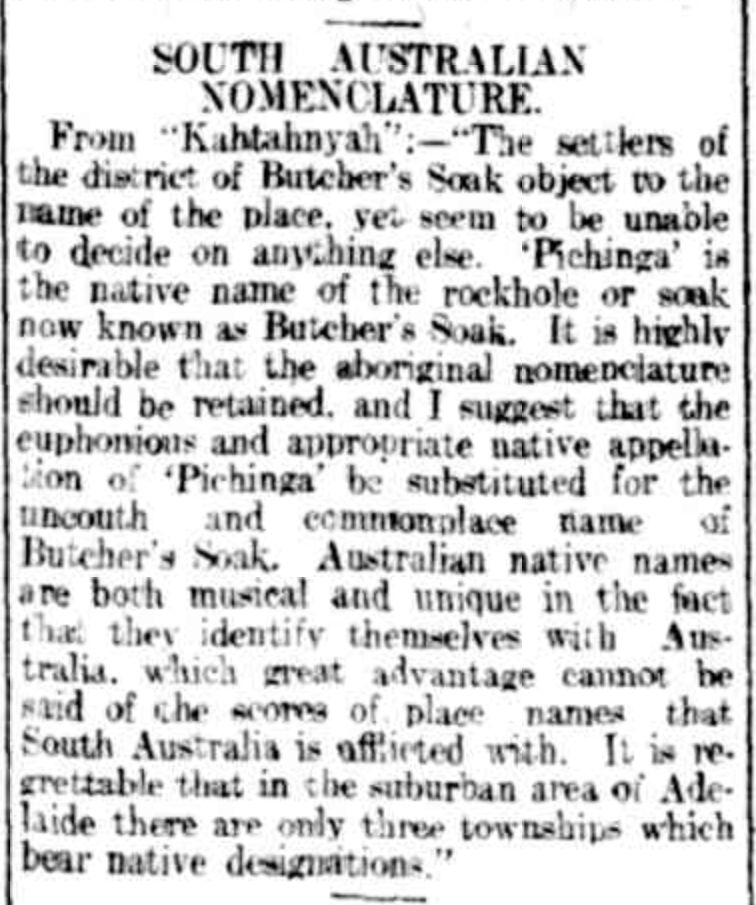
In 1912 an article appeared in The Register which referred to “The settlers of the district of Butcher’s Soak object to the name of the place…..’Pichinga’ is the native name of the rockhole or soak known as Butcher’s Soak. It is highly desirable that the aboriginal nomenclature should be retained, and I suggest that the euphonious and appropriate native appellation of ‘Pichinga’ be substituted for the uncouth and commonplace name of Butcher’s Soak.” (Trove 2024)
Above:- Article from The Register, Wed 31 Jul 1912. Image c/o Trove
The Hundred of Peebinga was declared in 1912 by Governor Sir Day Hort Bosanquet (b. 1843. d. 1923). (Howell 1979)

Above:- Admiral Sir Day Hort Bosanquet. Image c/o Wikipedia.
The town of Peebinga was surveyed in 1924. It was named by Tom Bridges, the Governor of South Australia. The town was designed by Charles Compton Read (b. 1880. d. 1933). He had designed Colonel Light Gardens and Barmera. Read used the ‘garden city’ principle. He was active in the Garden Cities and Town Planning Association of Great Britain. (Flickr 2024)
Above:- Charles Read. Image c/o Wikipedia
Read produced a magnificent plan for the township of Peebinga, with curved streets and parks and shrubbery borders. Right-angle corners were avoided. Read included a small semi-circular village green as the focal point of the township. Read’s plan catered for several hundred town blocks, however only 14 were purchased in 1924 and few were built upon. (Flickr 2024)
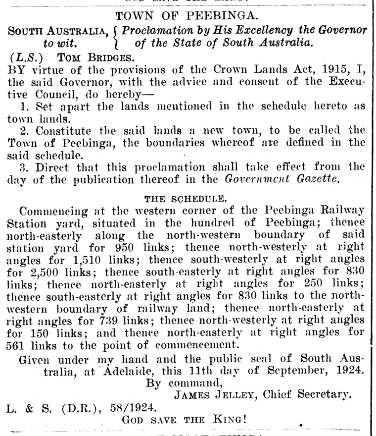
Above:- Proclamation of the town of Peebinga, SA Govt Gazette, 25 Sep 1924.
The Peebinga Post Office opened in 1926 and closed in 1986.
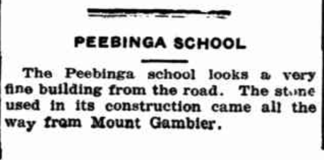
The Peebinga school opened in 1925 and closed in 1965. From 1925, the government school operated in the Peebinga Hall. In 1927 the Mount Gambier limestone schoolroom was constructed. Mr. WIlliam Wilshire was the last teacher who taught at Peebinga from 1946 to 1965. There was also a government school a short distance away at Butcher’s Soak which opened in 1922 and closed in 1926 when the new stone school at Peebinga opened in February 1927. (Flickr 2024)
Above:- Article from the Murray Pioneer, Fri 17 May 1929. Image c/o Trove
During the 1920, Peebinga was serviced by a Methodist minister who visited the town once a fortnight. He conducted church services in a house. Following the opening of the Peebinga Hall in 1925, Lutheran, Catholic, Methodist, and Anglican church services were held in the hall. In 1968 the Peebinga Hall was demolished and replaced with a galvanised iron hall. This hall closed in 2002 and is now a private residence. Peebinga only ever had one church building. That was a transportable building used by the Methodist faith. (Flickr 2024)
By the 1920’s Peebinga had two general stores. One of these continued to operate until the 1980s. (Flickr 2024)
Peebinga was the terminus of the Peebinga railway line that was constructed in 1914. The line opened on the 18th day of December 1914. It originated from a junction with the Barmera line at Karoonda and extended through the Murray Mallee region ending at Peebinga. (Wikipedia 2024)
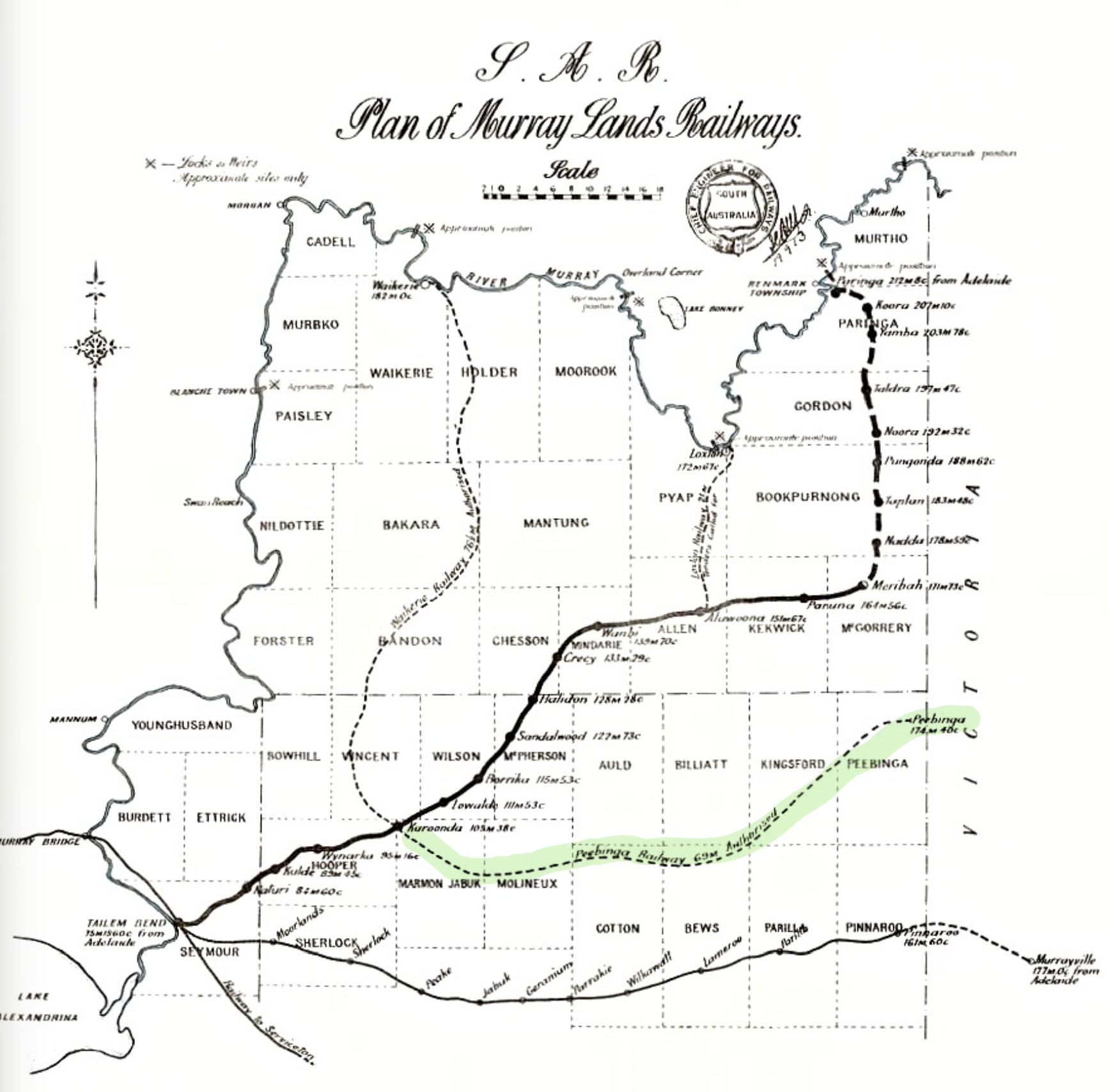
Above:- A 1913 map of Murrayland railway lines in South Australia. Image c/o Wikipedia.
The railway was officially closed on the 7th day of December 1990. (Wikipedia 2024)
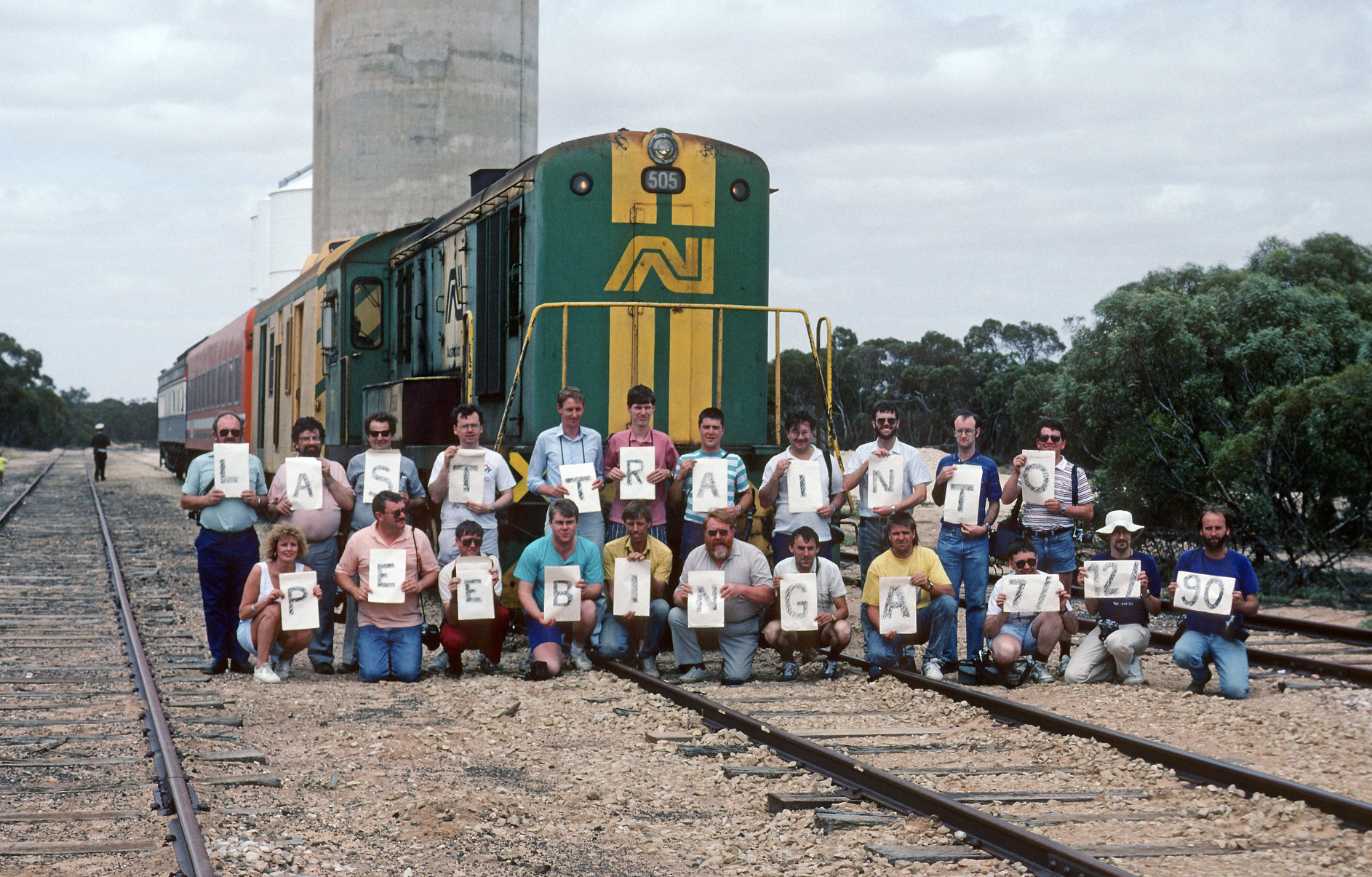
Above:- An Railway Tourist Association group with the last passenger train to Peebinga, South Australia, 7 Dec. 1990. Image c/o Flickr
Below is an excellent video on the old railway lines in the Murray Mallee.
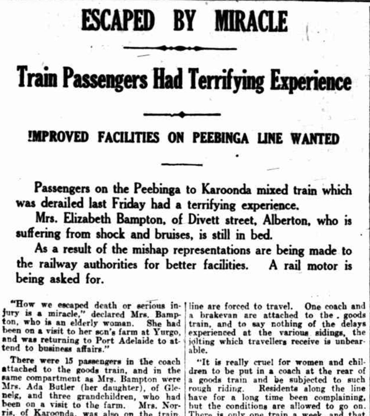
During the early-1920s, Peebinga locals complained about the line. This culminated in a derailment in 1924.
The mixed goods/passenger train was replaced with a motorised Brill car of Bullwell Bull car. This operated for passengers until 1940. Passenger train services to Peebinga ceased in the 1960s. (Flickr 2024)
Above:- Part of an article from The News Adelaide, Thu 18 Sep 1924. Image c/o Trove.
During the Great Depression of the 1920s, many farmers left the Peebinga district. However, Peebinga still had football, netball, and tennis teams. (Flickr 2024)
Above:- Article from the Pinnaroo and Border Times, Fri 8 Jul 1932. Image c/o Trove.
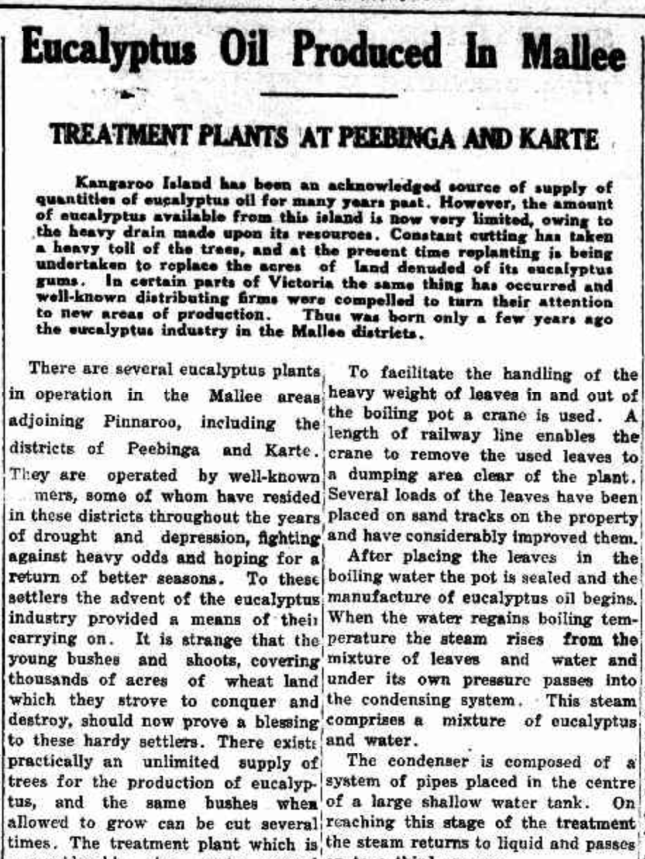
Between the 1930s and the early 1970s, several farmers in the Peebinga district had eucalyptus distilleries on their properties. The local eucalypts that grew in the area were high in oil content. The eucalyptus oil was sold to Faulding and Co. (Flickr 2024)
Above:- Part of an article from the Pinnaroo & Border Times, Thu 27 Nov 1941. Image c/o Trove
Today, not much remains at Peebinga, other than the hall, the old Post Office, the silos, and some houses.

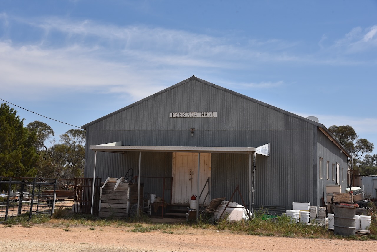
The silos at Peebinga were erected in 1964 and are still used by Viterra. Rail services ceased from the Peebinga silos in 1990. (Flickr 2024)

Marija and I parked on Kerleys Road within the activation zone and operated from the 4WD. We ran the Icom IC-7000, 100 watts, and the Coadn 9350 antenna with the 1.5 metres stainless steel whip.
Above:- The activation zone at the Peebinga silo. Map c/o SiOTA website.
We found band conditions to be absolutely terrible. And combined with the fact that we had no internet coverage, this was a hard activation.
Marija worked the following stations on 40m SSB:-
I worked the following stations on 40m SSB:-
References.
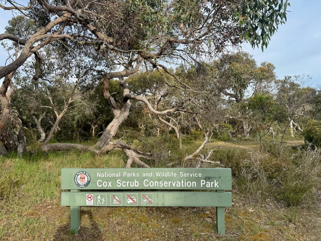
Our third and final park for the 2024 VKFF Team Championship on Saturday 12th October 2024, was the Cox Scrub Conservation Park VKFF-0824.
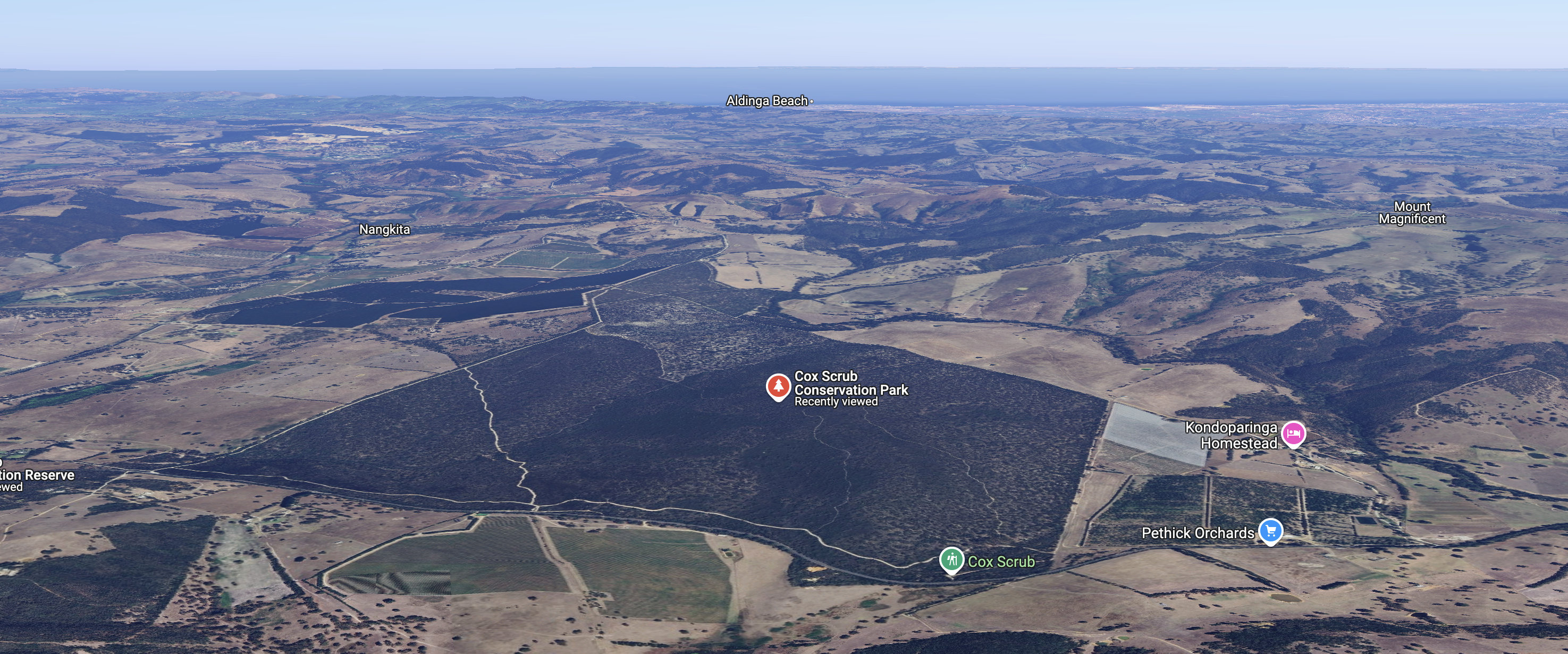
Above:- Map showing the location of the Cox Scrub Conservation Park. Map c/o Google Maps.
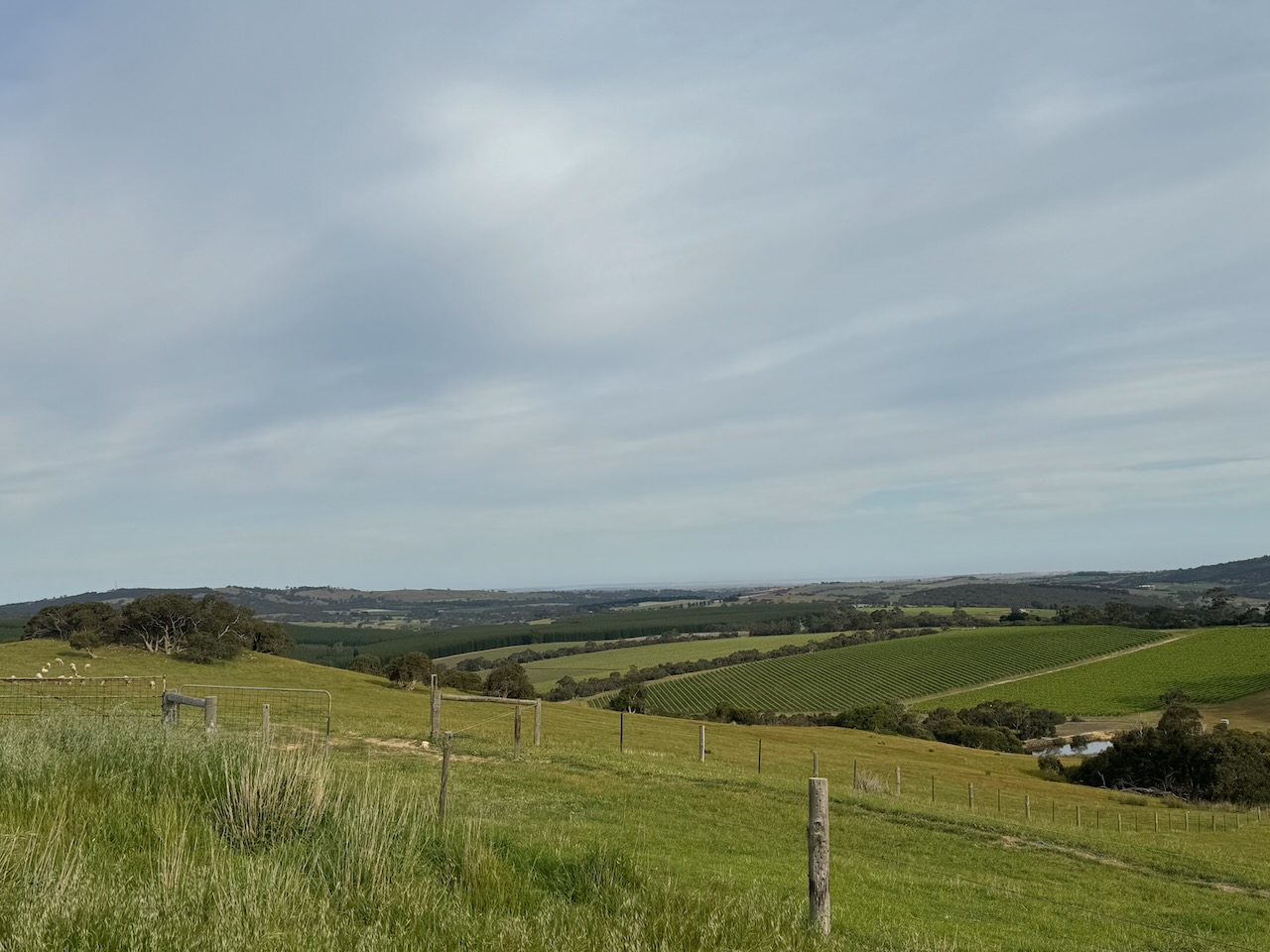
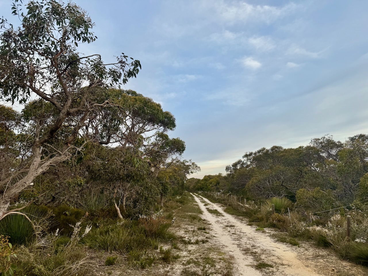
Due to a previous poor encounter with a park ranger at this park, Marija and I decided to activate the park on its western side. To get there we travelled along Ridge Road and were rewarded with some very nice views of the surrounding countryside.

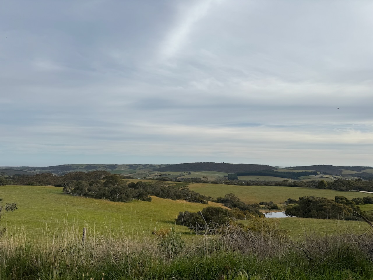
Cox Scrub Conservation Park is about 563 hectares in size and was established on the 5th day of March 1970. It is one of the larger parks that are located on the Fleurieu Peninsula, south of Adelaide. (CAPAD 2022) (NPWS 2024)
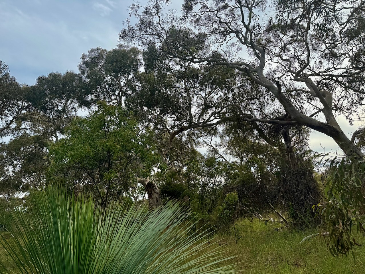
The park contains open stands of stringybark with banksia understory. The park consists of gently undulating land. It also includes a short section of the Finniss River. There is also a steep-sided valley in the southeastern corner of the park that contains a spring-fed creek. (Friends of Cox Scrub) (NPWS 2024)
Above:- An aerial view of the Cox Scrub Conservation Park. Image c/o Google Maps.
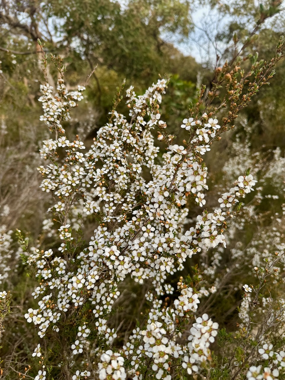
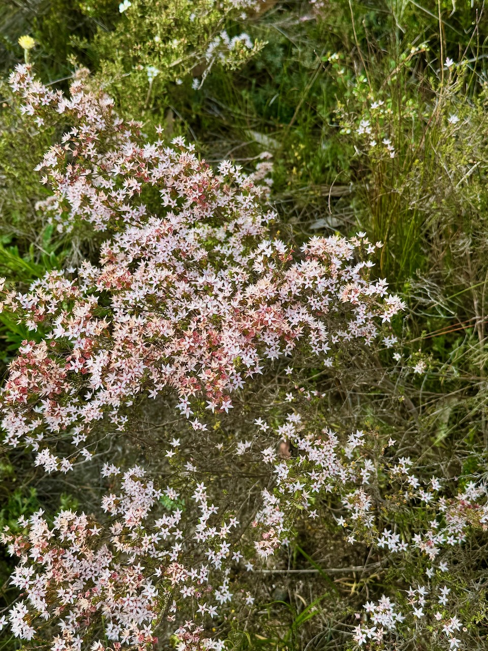
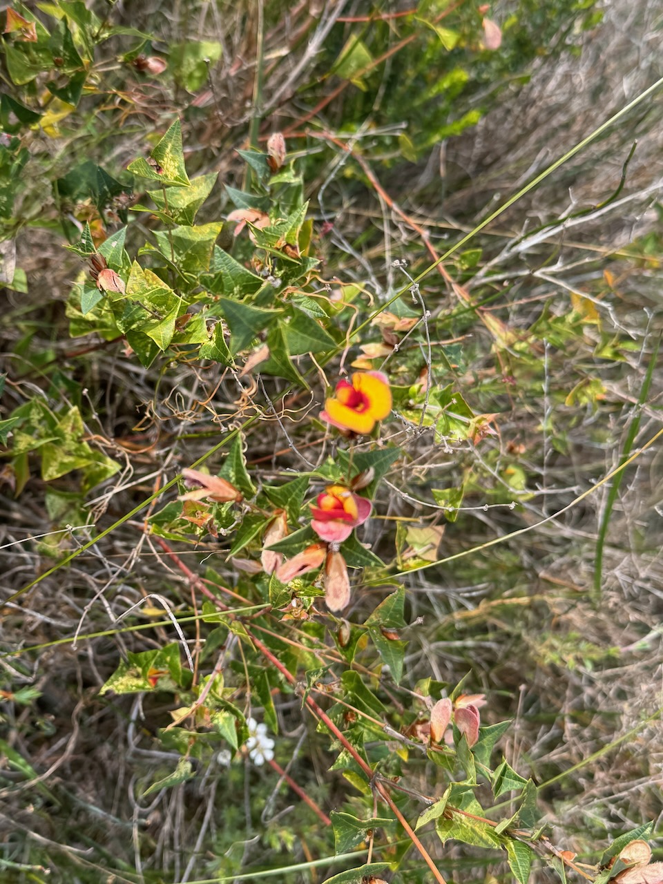
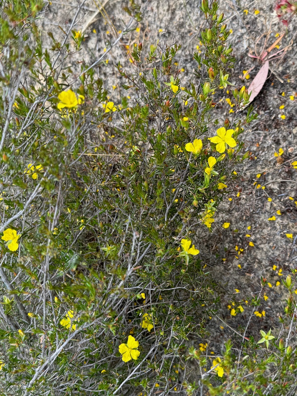
Over 80 species of birds, 15 species of mammals, 11 species of reptiles, and 6 species of frog can be found in the park. Over 350 plant species have been recorded in the park including the vulnerable Marsh Gum. (Friends of Cox Scrub)
The park is home to some vulnerable and endangered species. These include Southern-brown Bandicoot, Rosenberg’s Goanna, and Southern Emu-wren. (Friends of Cox Scrub)


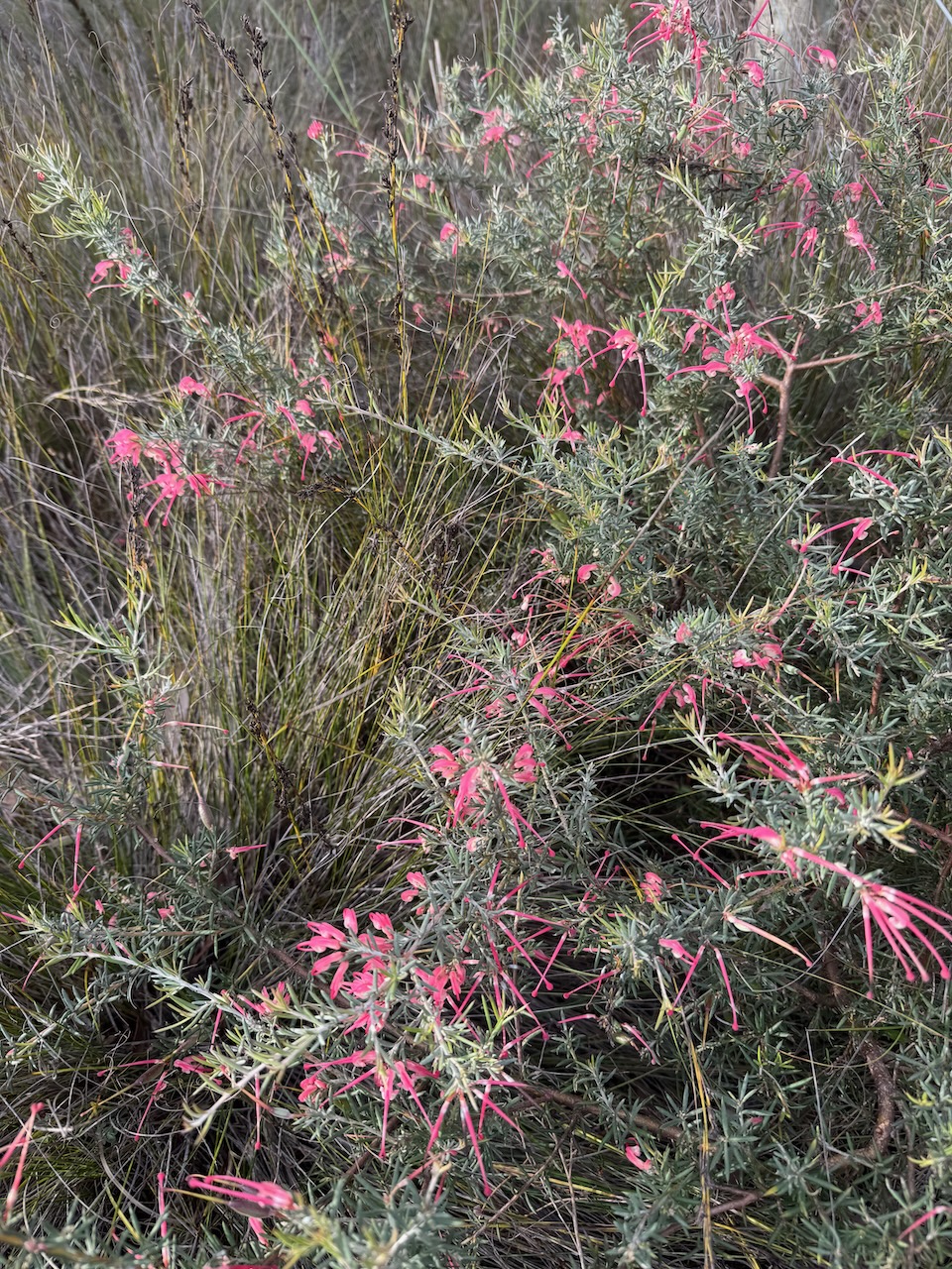
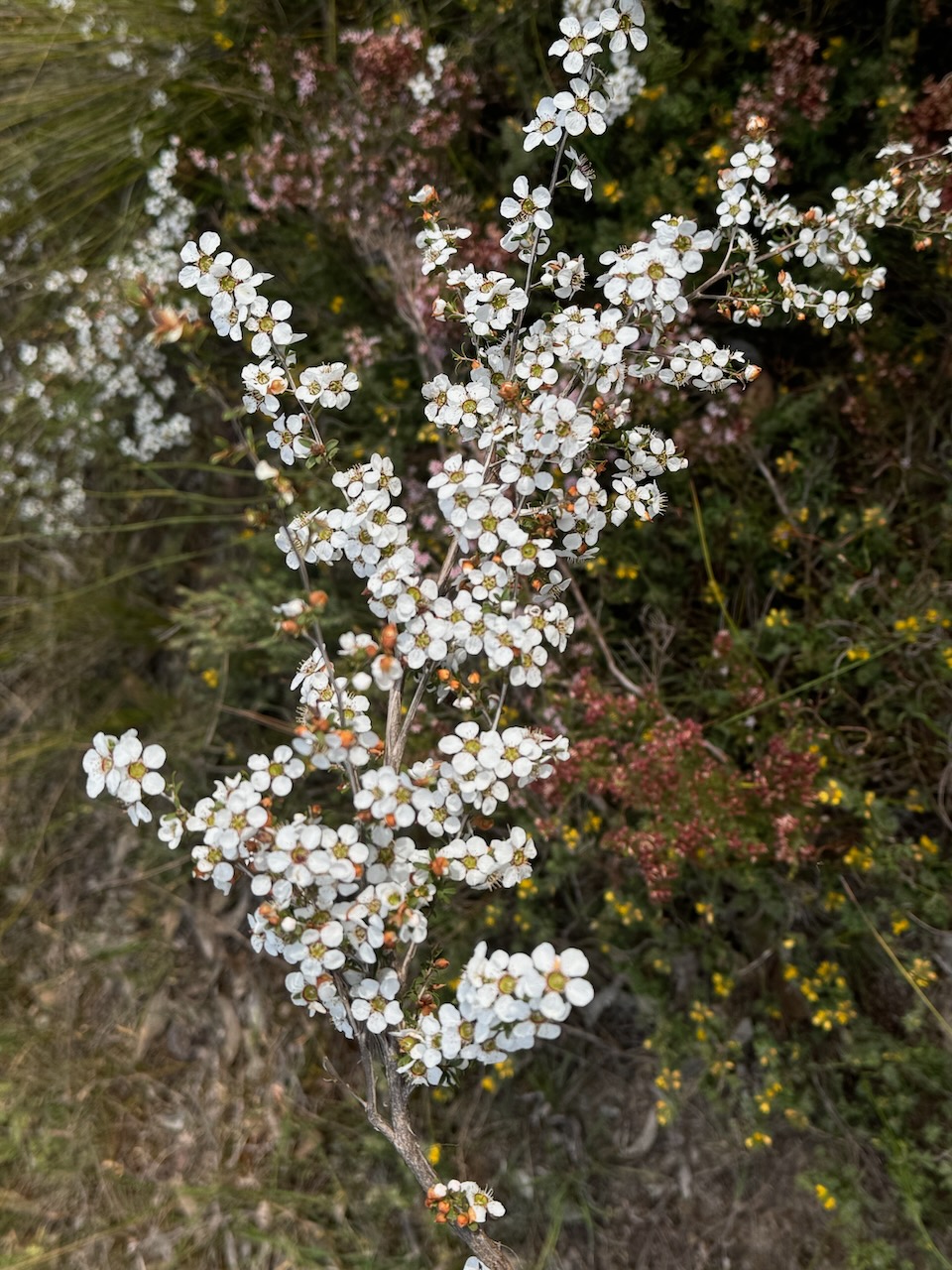
A number of the native plants in the park were flowering during our visit.
Most of the Cox Scrub Conservation Park was previously owned by the late Mr Victor Cox of Ashbourne. He preserved the area in a natural state for overwintering his honey bees. In 1969 the land was purchased from Mr Cox, on the condition that he was permitted to keep bees in the park for as long as he required. This agreement was upheld until his passing. (NPWS 2024)
Victor Haines Cox was born on the 27th day of October 1987 at Strathalbyn. In 1935 he married Jessie Evelyn Moore at Victor Harbour, South Australia. They had two children. Victor died on the 2nd day of April 1973 at Giles Flat, South Australia. He is buried at the Ashbourne cemetery, South Australia. (ancestry.com.au)
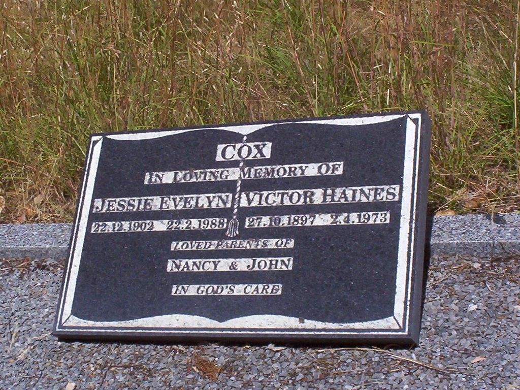
Above: the headstone of Victor Haines Cox at the Ashbourne cemetery. Image c/o Find a Grave
The park was proclaimed on the 5th day of March 1970 as Cox’s Scrub National Park. On the 27th day of April 1972, the park was reconstituted as Cox Scrub Conservation Park. In 1977, and then again in 1982, further smaller additions were added to the park. (NPWS 2024) (Wikipedia)
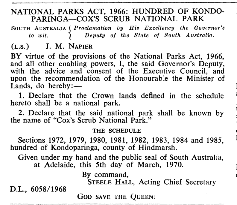
Above:- Proclamation of the Cox Scrub National Park, SA Govt Gazette, 5 March 1970
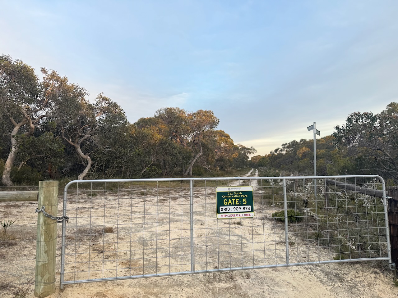
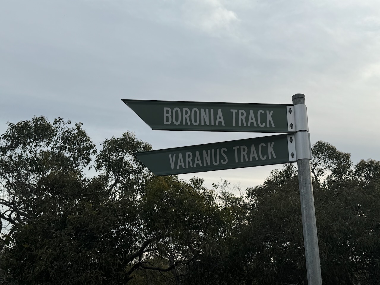
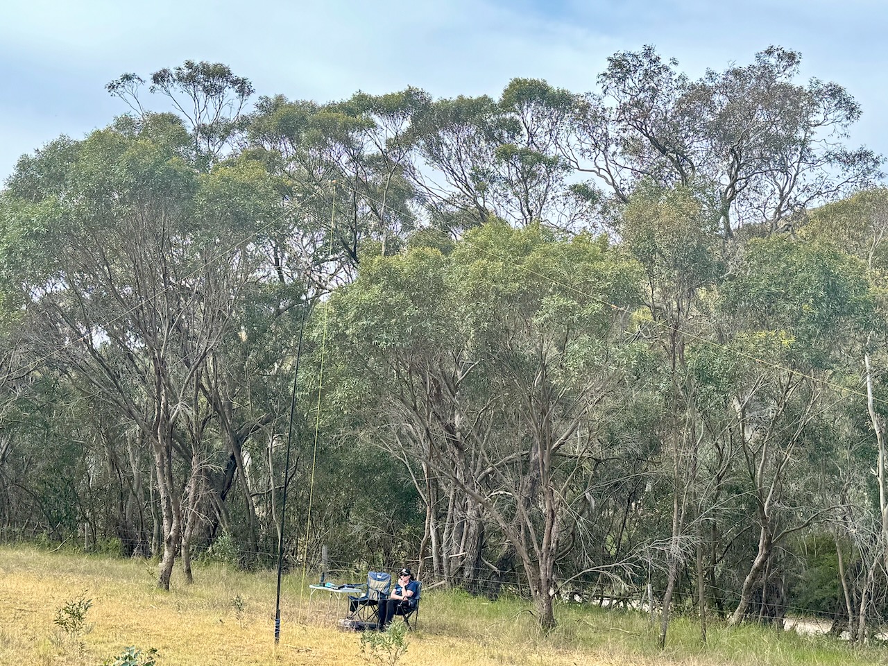
Marija and I set up just inside the gate at gate 5 on Boronia Track. We ran the Yaesu FT857, 40 watts, and the 20/40/80m linked dipole.
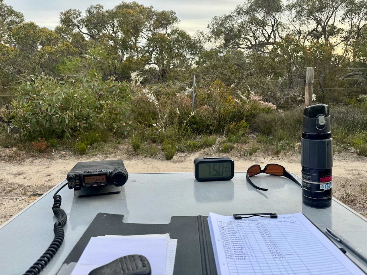
We logged a total of 72 stations before packing up and heading off for dinner at the Greenman Inn at Ashbourne.
Marija worked the following stations on 40m SSB:-
Marija worked the following stations on 80m SSB:-
I worked the following stations on 40m SSB:-
I worked the following stations on 80m SSB:-
References.
Our second park for Saturday 12th October 2024, and the 2024 VKFF Team Championship, was the Cox Scrub Conservation Reserve VKFF-1701.
The park is located about 66 km south of Adelaide on the Fleurieu Peninsula.
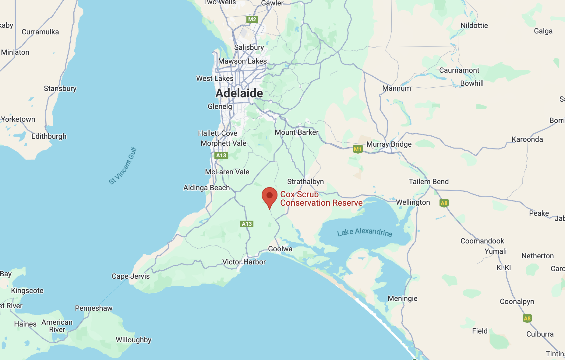
Above:- Map showing the location of the Cox Scrub Conservation Reserve. Map c/o Google Maps.
If you did not know this little park was here, you would drive straight past it. It is located on the western side of Bull Creek Road, adjacent to the much larger Cox Scrub Conservation Park. There are no signs.
The reserve is just 1 hectare in size and was established on the 11th day of November 1993. (CAPAD 2022)
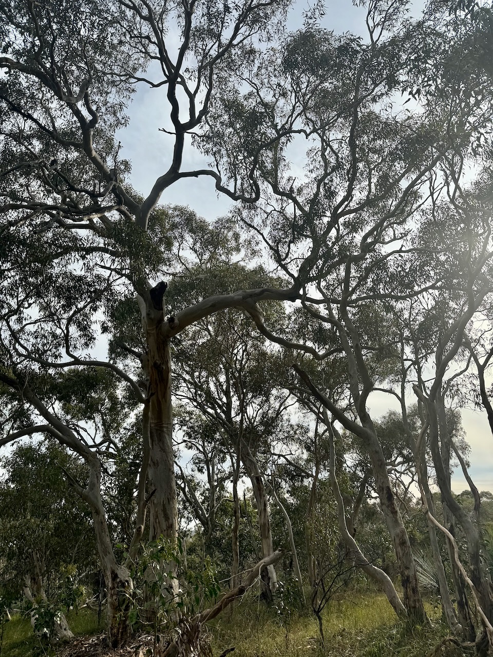
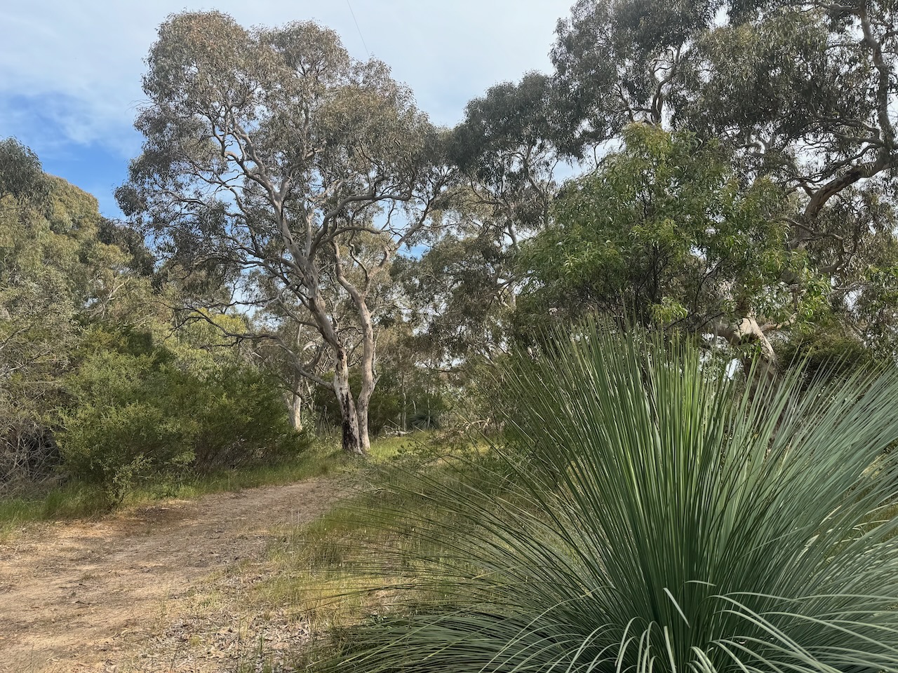
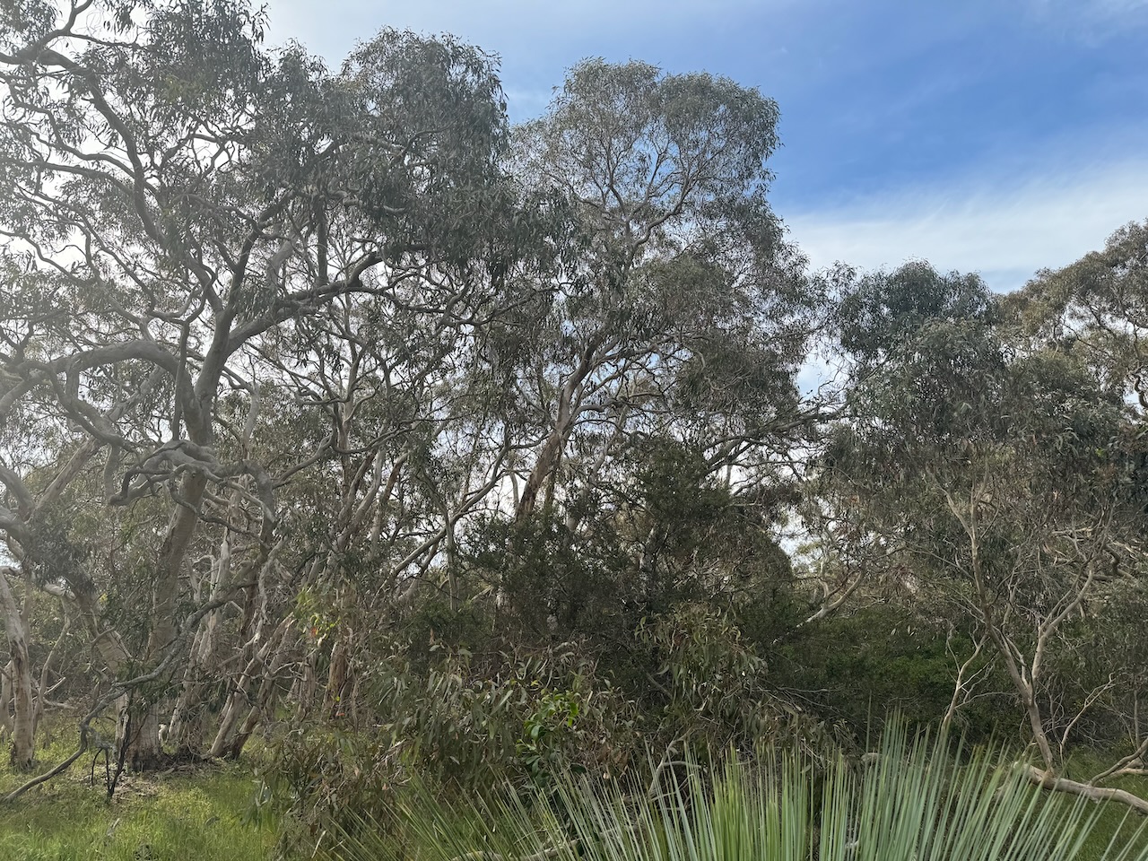
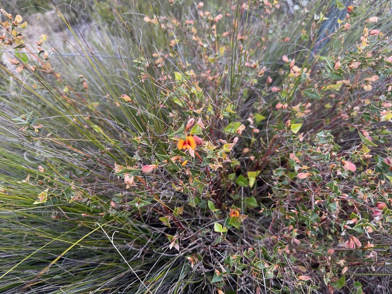
There were several native plants in flower during our visit.
We set up in a clearing amongst the scrub and ran the Yaesu FT857, 40 watts, and the 20/40/80m linked dipole.

We found the 40m band had improved a little since our first activation at Bullock Hill. We made a total of 104 QSOs on 40m SSB & 80m SSB.
Marija worked the following contacts on 40m SSB:-
Marija worked the following stations on 80m SSB:-
I made the following contacts on 40m SSB:-
I worked the following stations on 80m SSB:-
References.
The 2024 VKFF Team Championship was held on Saturday 12th October 2024. This is a fun event that is held each year in October for the World Wide Flora Fauna (WWFF) program.
Marija VK5MAZ and I headed out to activate three local parks for the Championship. Our team name was ‘The Walky Talkies’.
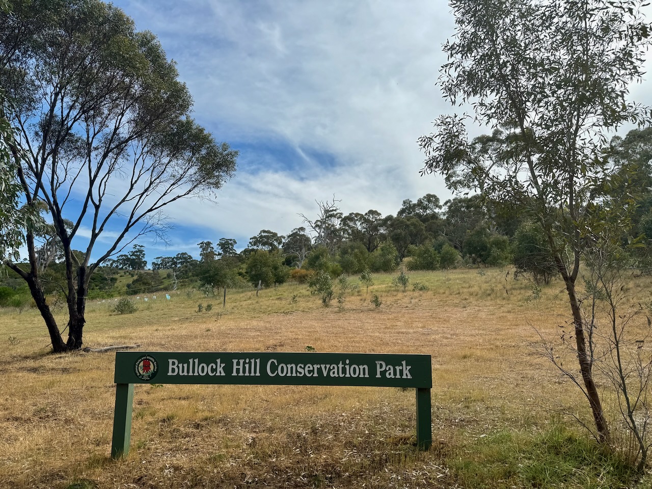
The first was the Bullock Hill Conservation Park VKFF-0873. Marija and I have activated this park several times previously. The park is located about 65 km southeast of Adelaide on the Fleurieu Peninsula.
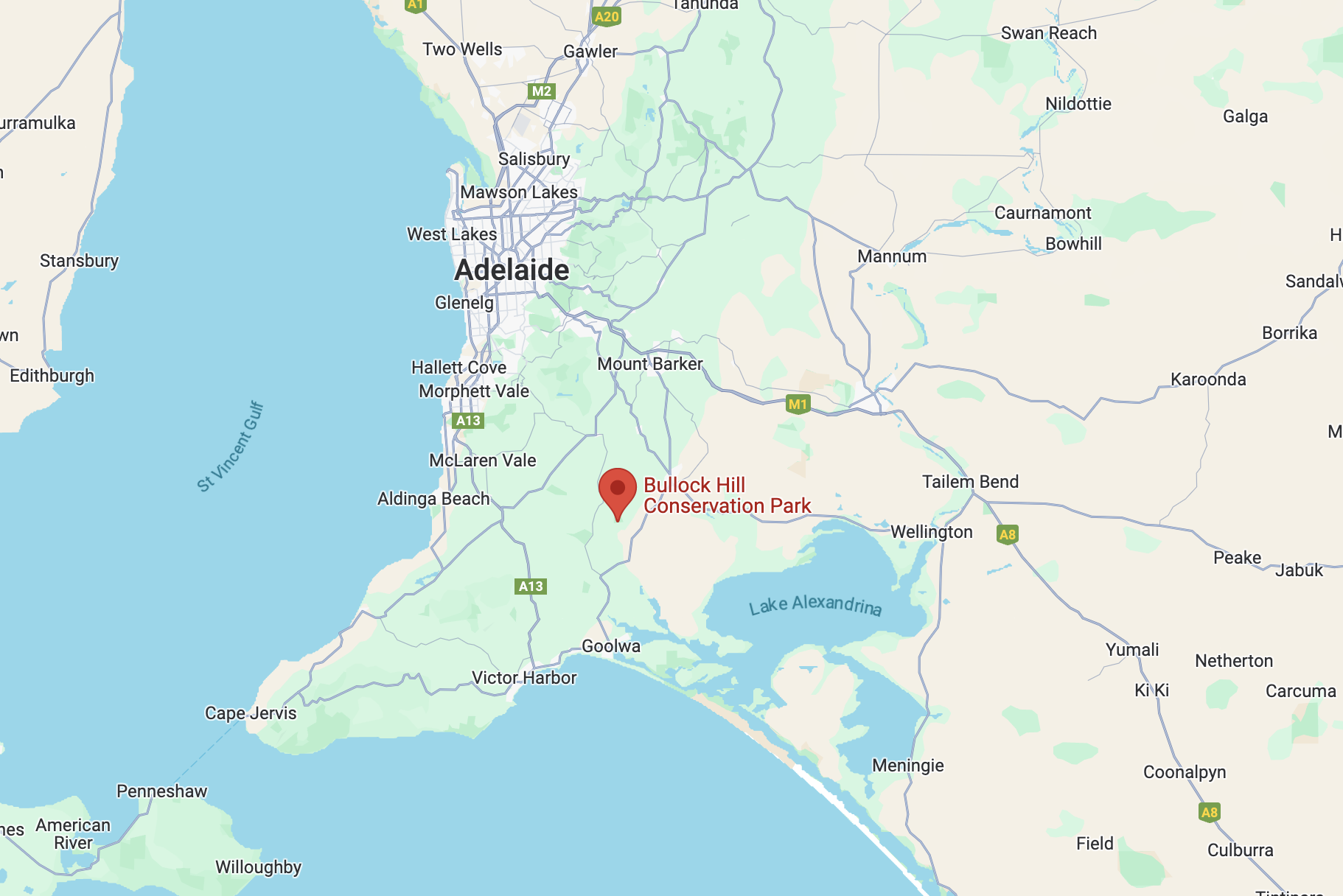
Above:- Map showing the location of the Bullock Hill Conservation Park. Map c/o Google Maps.
The park’s eastern boundary is Wattle Flat Road. Its southern boundary is Haines Road. A heritage agreement exists on the western side of the park. It takes its name from Bullock Hill, a hill rising 188 metres above sea level.
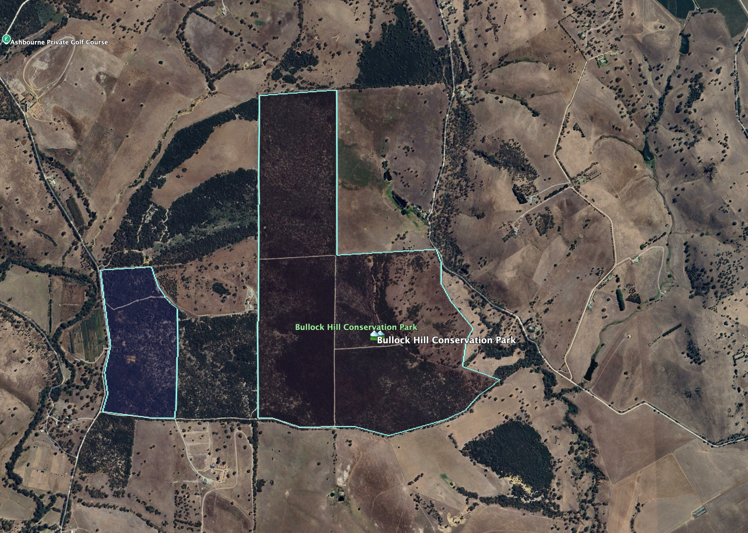
Above:- An aerial view of the Bullock Hill Conservation Park. Image c/o Google Earth.
The park is about 221 hectares in size and was established on the 30th day of January 2014. Bullock Hill is an undulating park with several vegetation types including tall stands of eucalyptus, including pink gum and cup gum through to native grasslands in the east. Eucalypt woodlands can be found on the western side of the park which have a dense understory of acacia and mixed heath. (CAPAD 2022) (NPWS 2024)

Above:- An aerial view of the park looking west. Image c/o Google Maps.
There are three hikes in the park and these are covered well on the Walking SA website. National Parks SA also has a map (show below) which shows the three hikes.
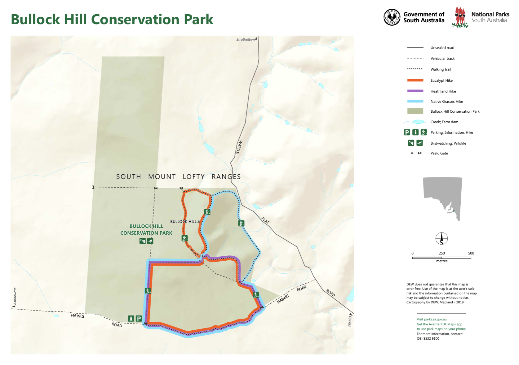
Above:- Map showing the three hikes in the park. Map c/o National Parks SA.
Birds SA have recorded a total of 95 native birds in the park. Common species include Common Bronzewing, Superb Fairywren, Brown-headed Honeyeater, Red Wattlebird, Brown Thornbill, Grey Shrikethrush. Rainbow Bee-eaters have also been sighted. (Birds SA)
The park is also home to Western Grey kangaroos. These can be sighted regularly at dawn and dusk in the park’s eastern grassland area. (NPWS 2024)
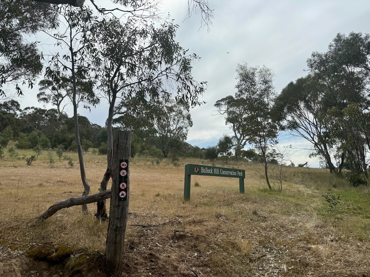

Marija and I set up on the Wattle Flat Road side of the park. We ran the Yaesu FT857, 40 watts, and the 20/40/80m linked dipole.
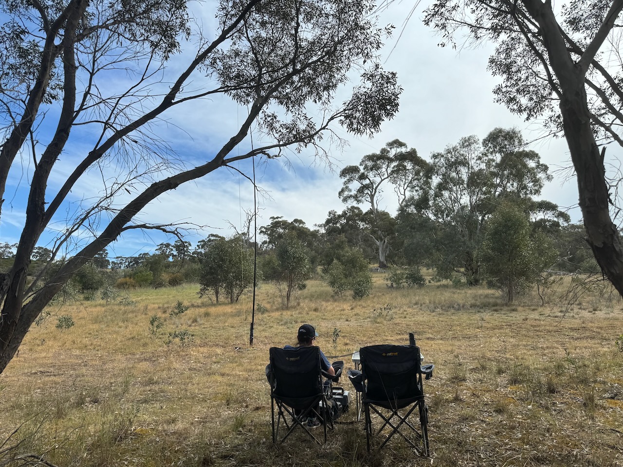
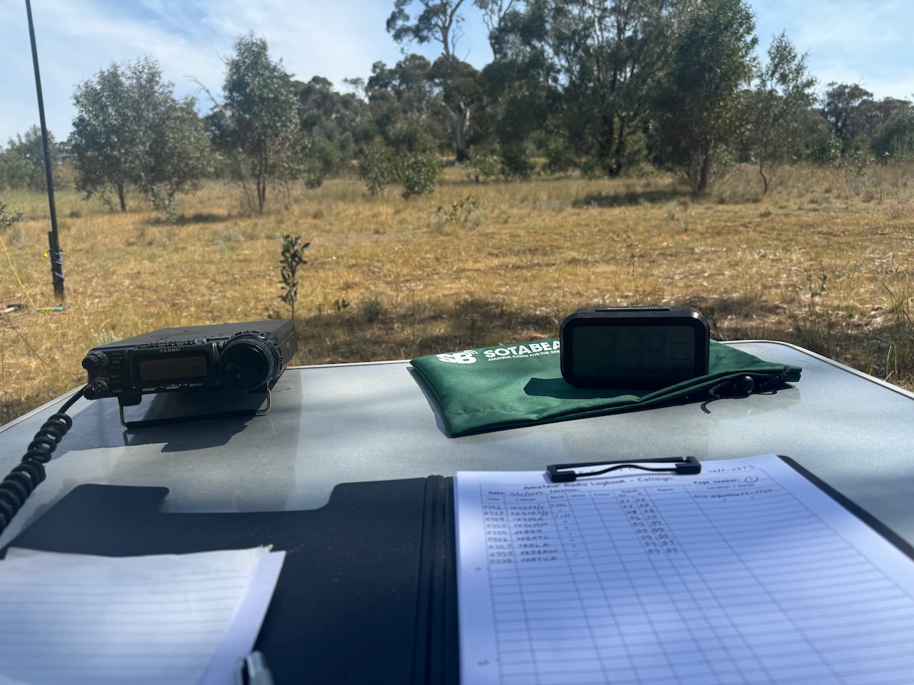
We found the band conditions to be poor. We managed 72 contacts. All of those excluding 2, were made on 40m SSB. We did not try 20m as we were entered in the 40/80m section for the Team Championship.
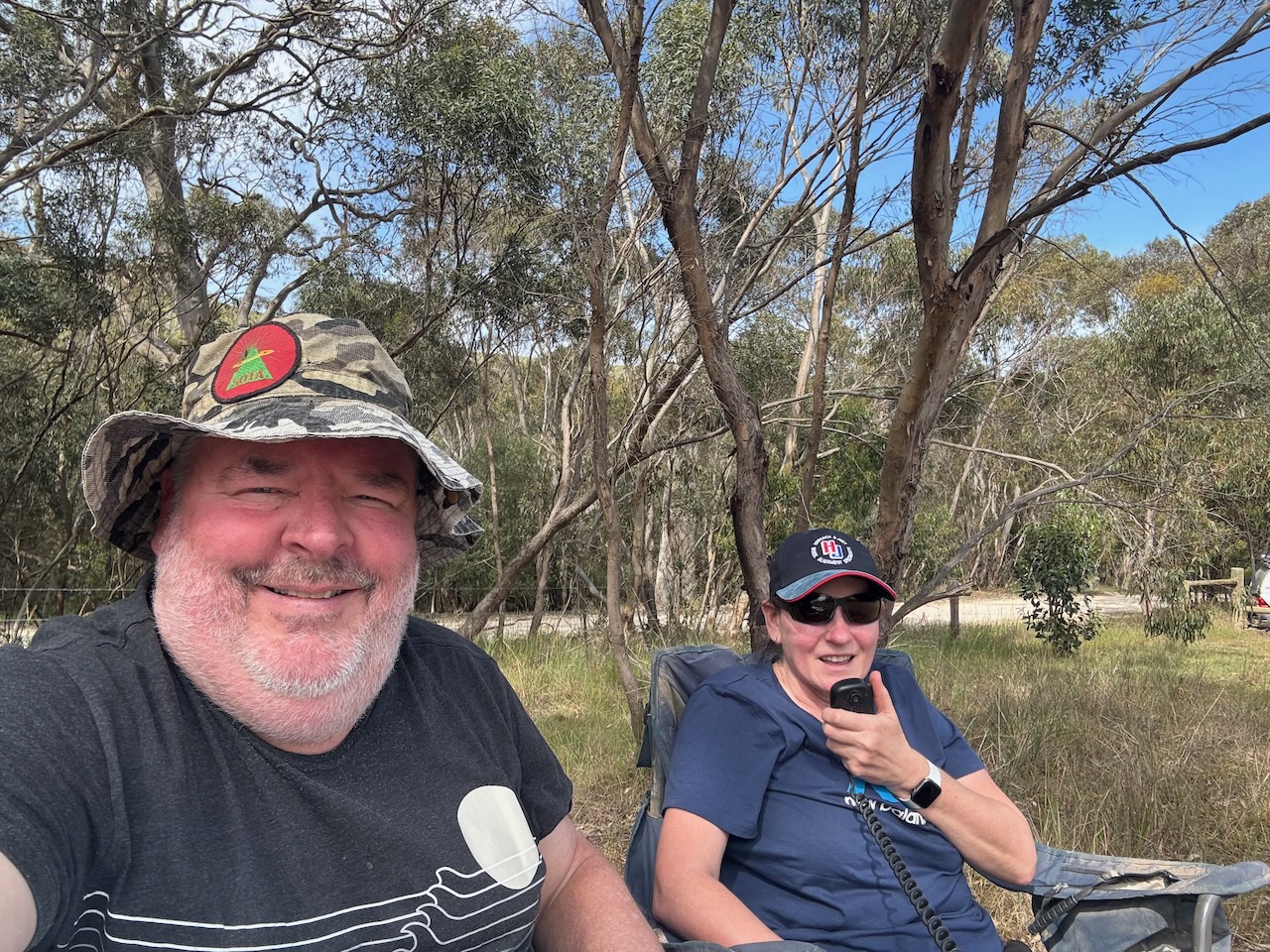
It was nice to log Ian Vk5CZ & Gordon VK5GY who were taking part as ‘No flies on us’, and Chris VK1CHW & Jared VK2LDJ who were taking part as the ‘Bandwidth Bandits’.
Marija worked the following stations on 40m SSB:-
Marija worked the following station on 80m SSB:-
I worked the following stations on 40m SSB:-
I worked the following station on 80m SSB:-
References.
Amateur Radio, Short Wave Listening, travel and history
Amateur radio experiences with VK1DA
Brisbane - Australia
german amateur radio station
Summits On The Air
SOTA on the peaks, wilderness QRP and some bushwalking
A fine WordPress.com site
Amateur Radio Adventures
Summits on the Ai
Radio craft, homebrew, QRP/SOTA, AM
Ego loqui ad viros super montes
My adventures with Amateur Radio and Geocaching!
The rantings of VK2GAZ on his SOTA experiences in Australia
A survivor, with minor cuts and abrasions.
The Art and Craft of Blogging
The latest news on WordPress.com and the WordPress community.
Blog of Justin Giles-Clark VK7TW's SOTA and amateur radio adventures.
Occasional SOTA & Microwave operation
Some accounts of SOTA and other radio outings
