I have also received in recent weeks, two more WWFF Activator Points Award certificates.
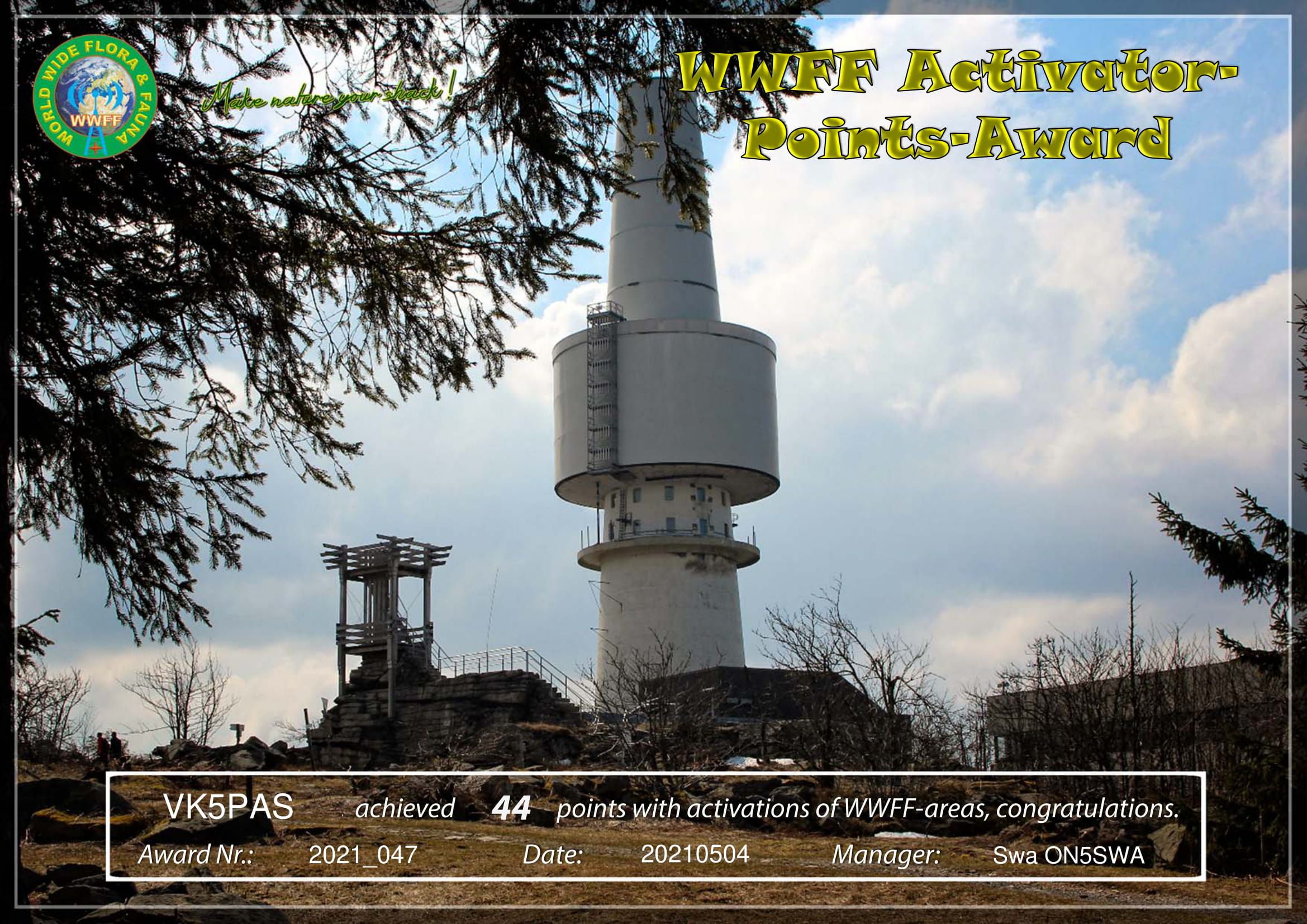
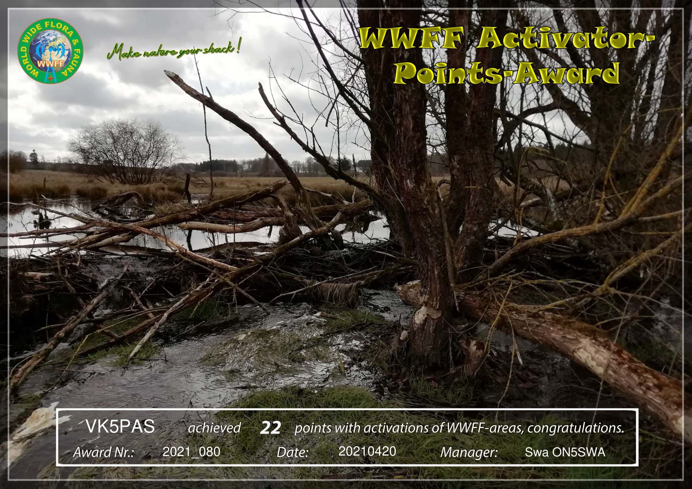

I have also received in recent weeks, two more WWFF Activator Points Award certificates.
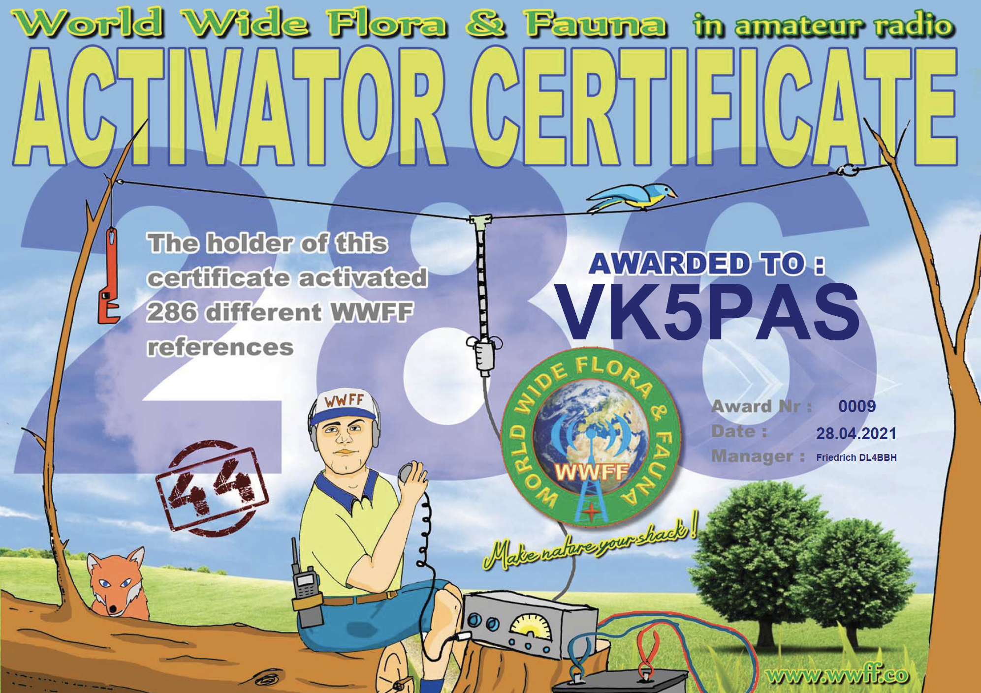
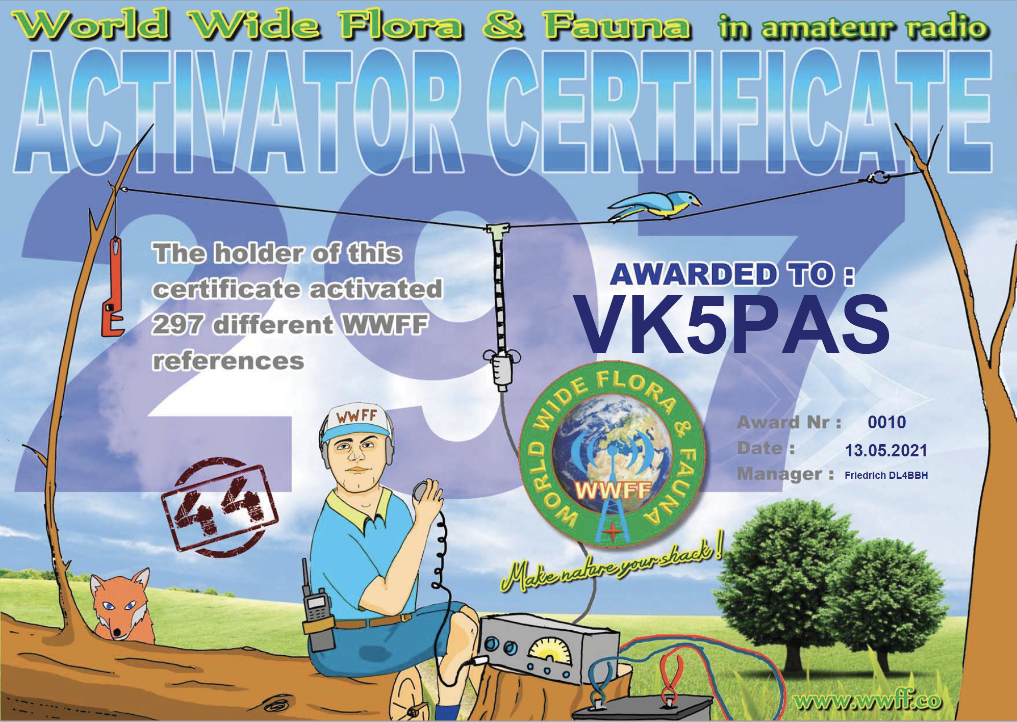
I have also qualified for a couple of new WWFF Global Activator certificates. Issued for having activated 286 and then 297 WWFF references. Each of those activations have a minimum of 44 QSOs.
Thanks to all of the WWFF hunters and thanks to Friedrich DL4BBH.
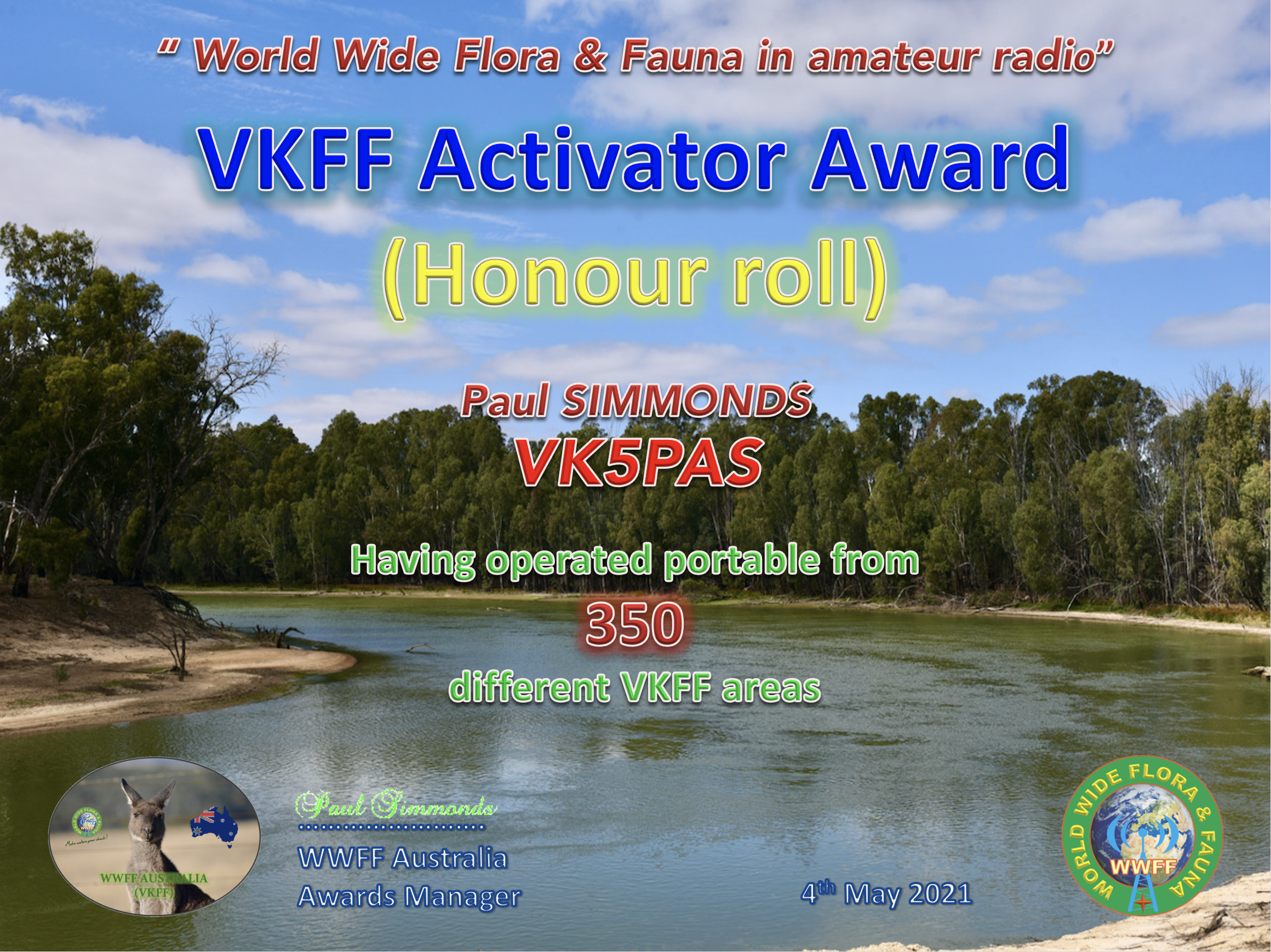
After my recent trip to the Riverland region of VK5, VK3, and VK2, and a number of new park activations, I have qualified for another VKFF award.
It is the VKFF Activator Honour Roll 350 award, issued for having activated a total of 350 different VKFF reference areas.
Thanks to all of the VKFF Hunters.
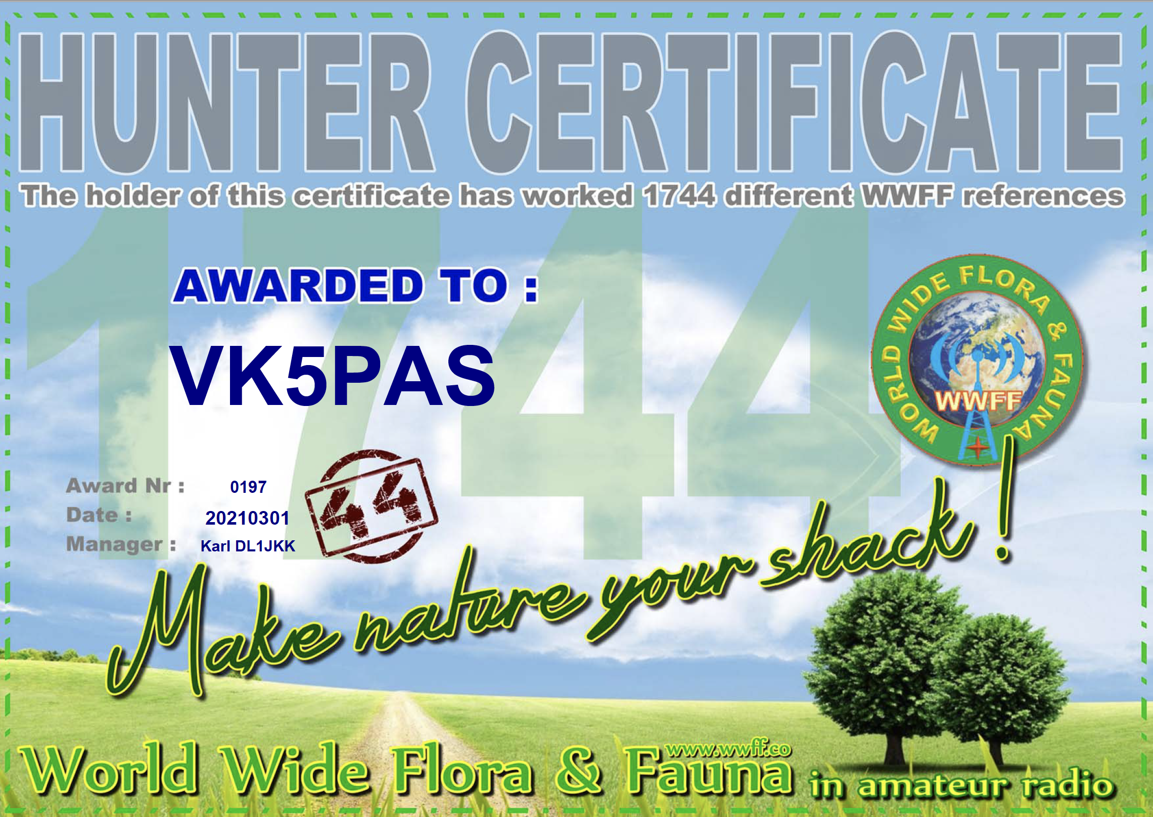
Back in March I received my latest global World Wide Flora Fauna (WWFF) certificate, the 1,744 WWFF Hunter certificate. It is issued for having worked 1,744 different WWFF references.
Thanks to all of the WWFF activators and thanks to Karl DL1JKK the Awards Manager.
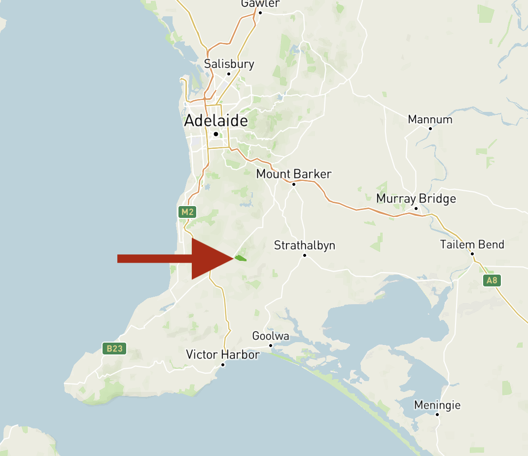
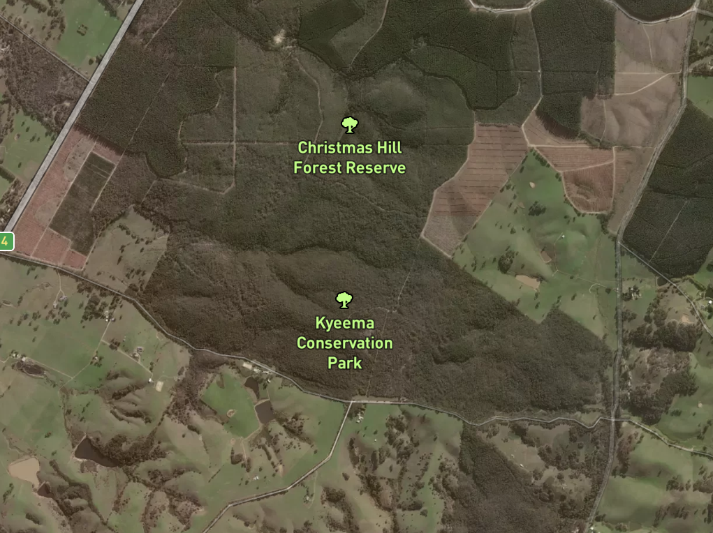
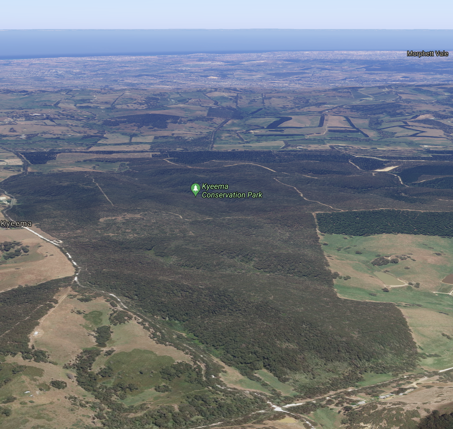
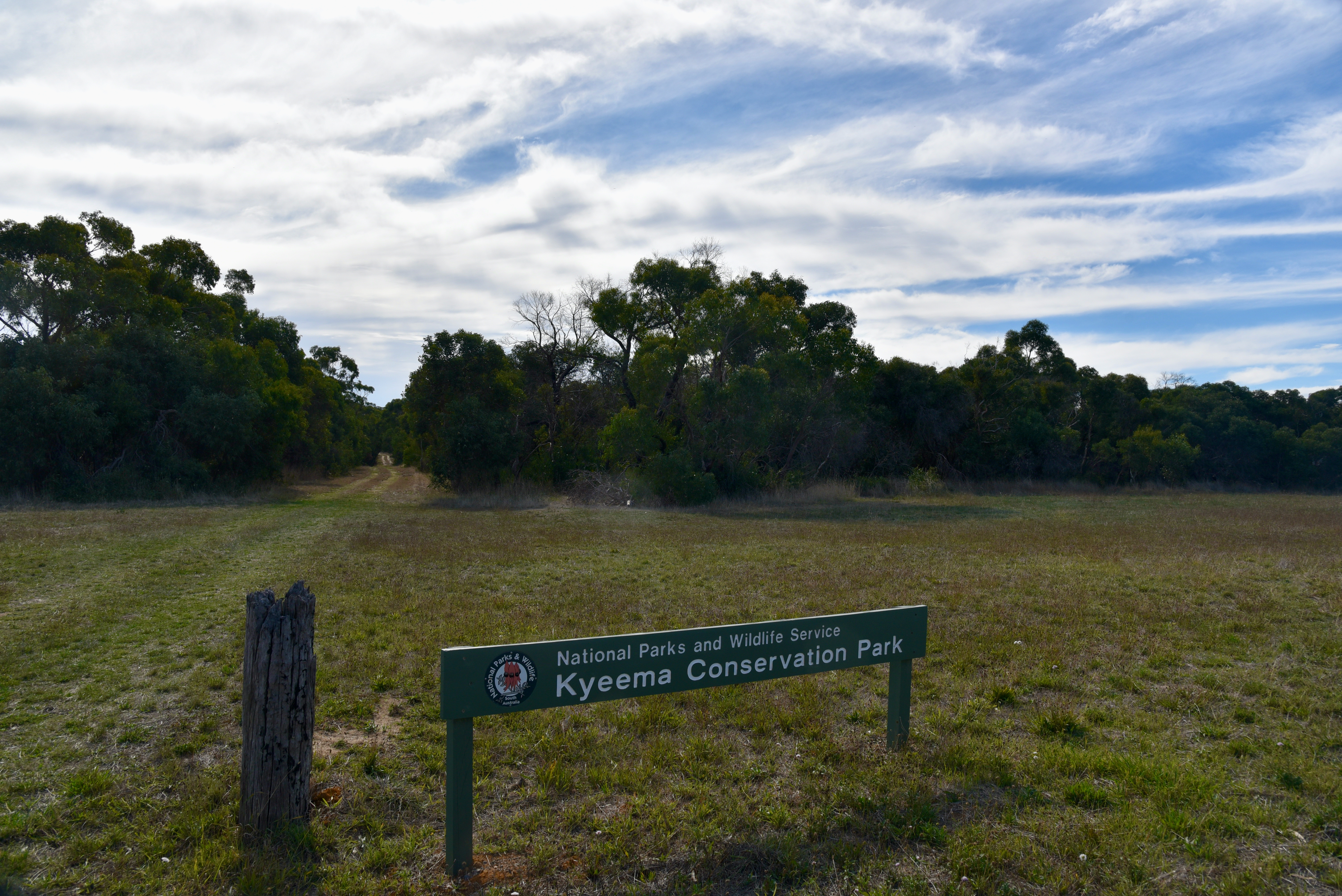
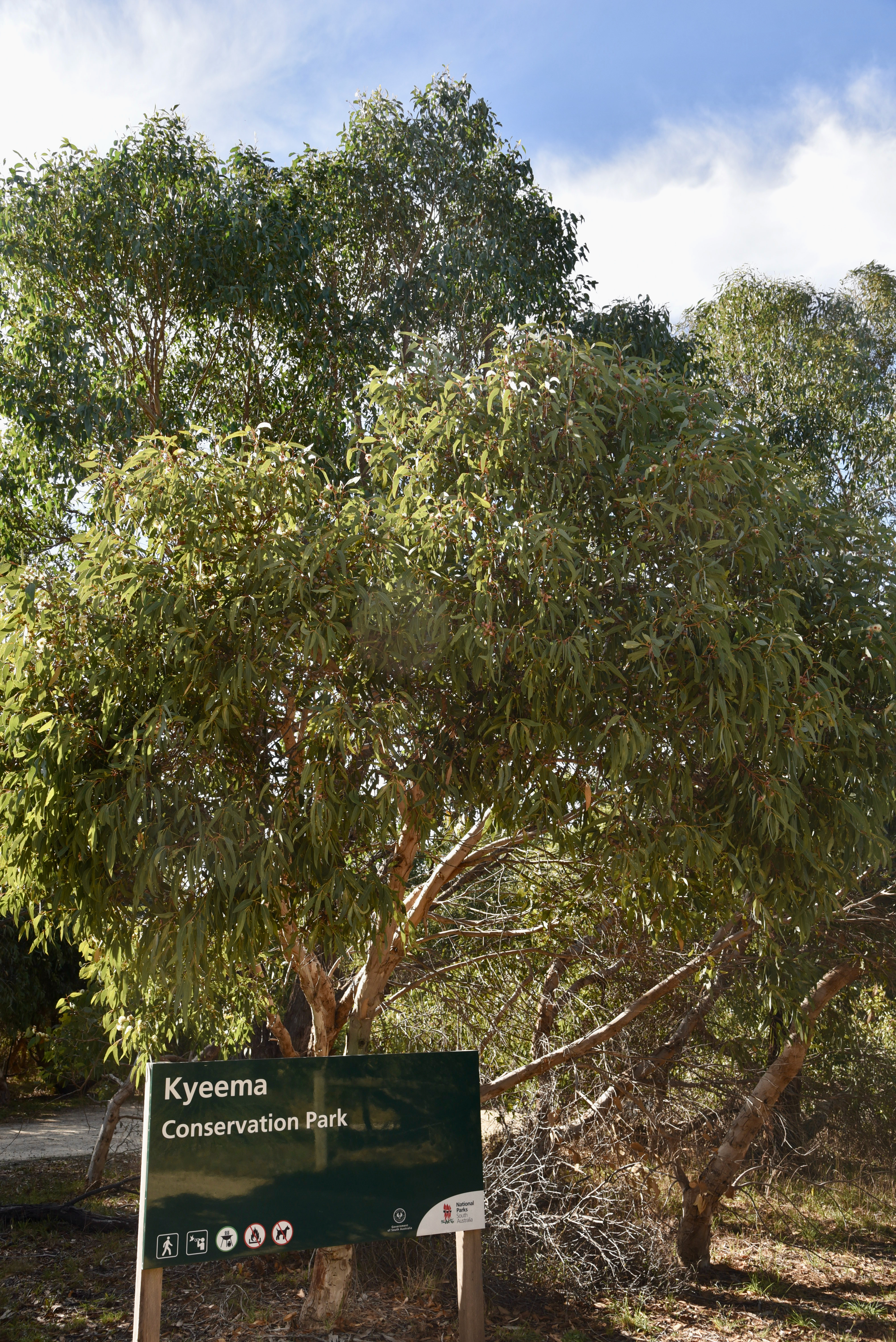
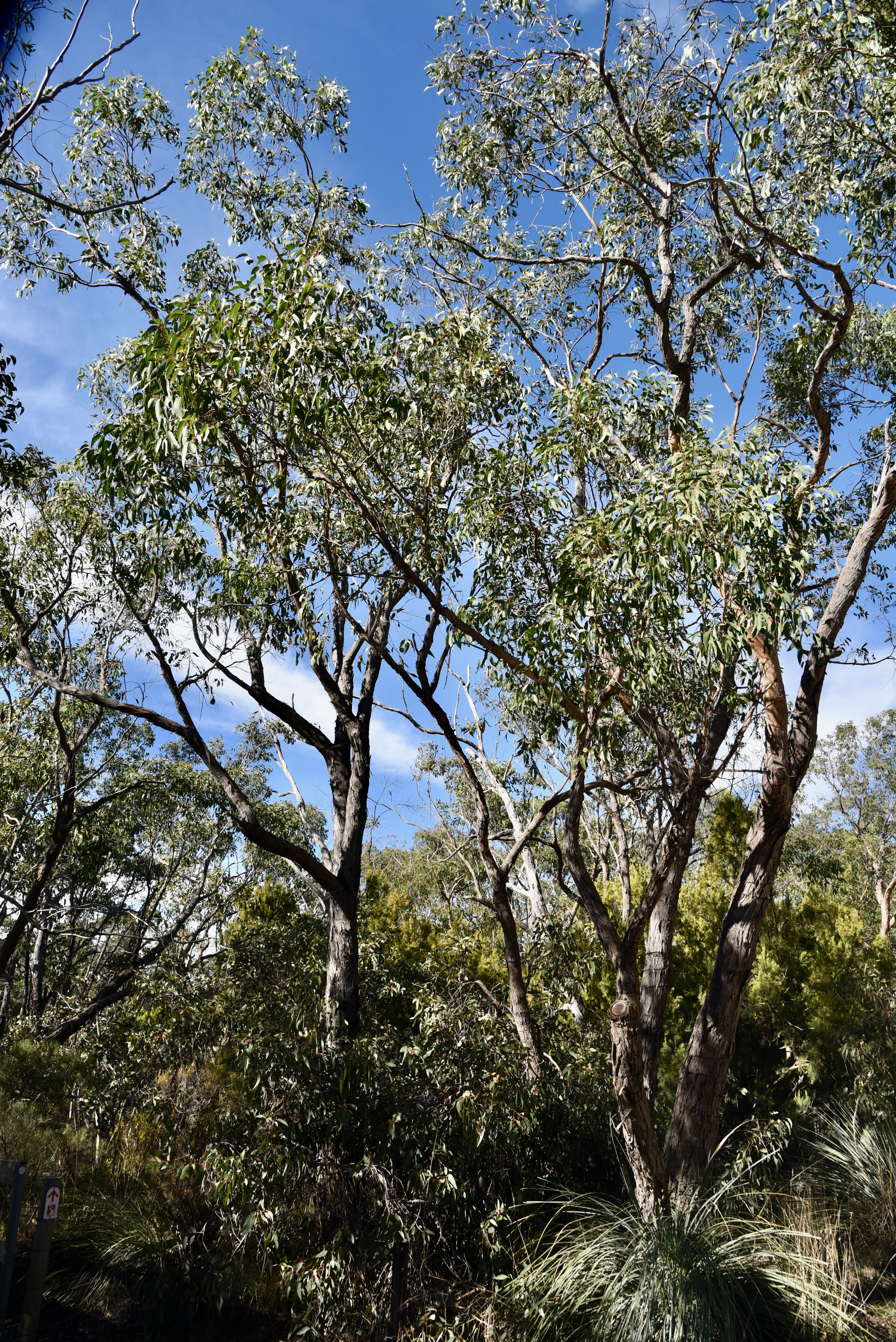
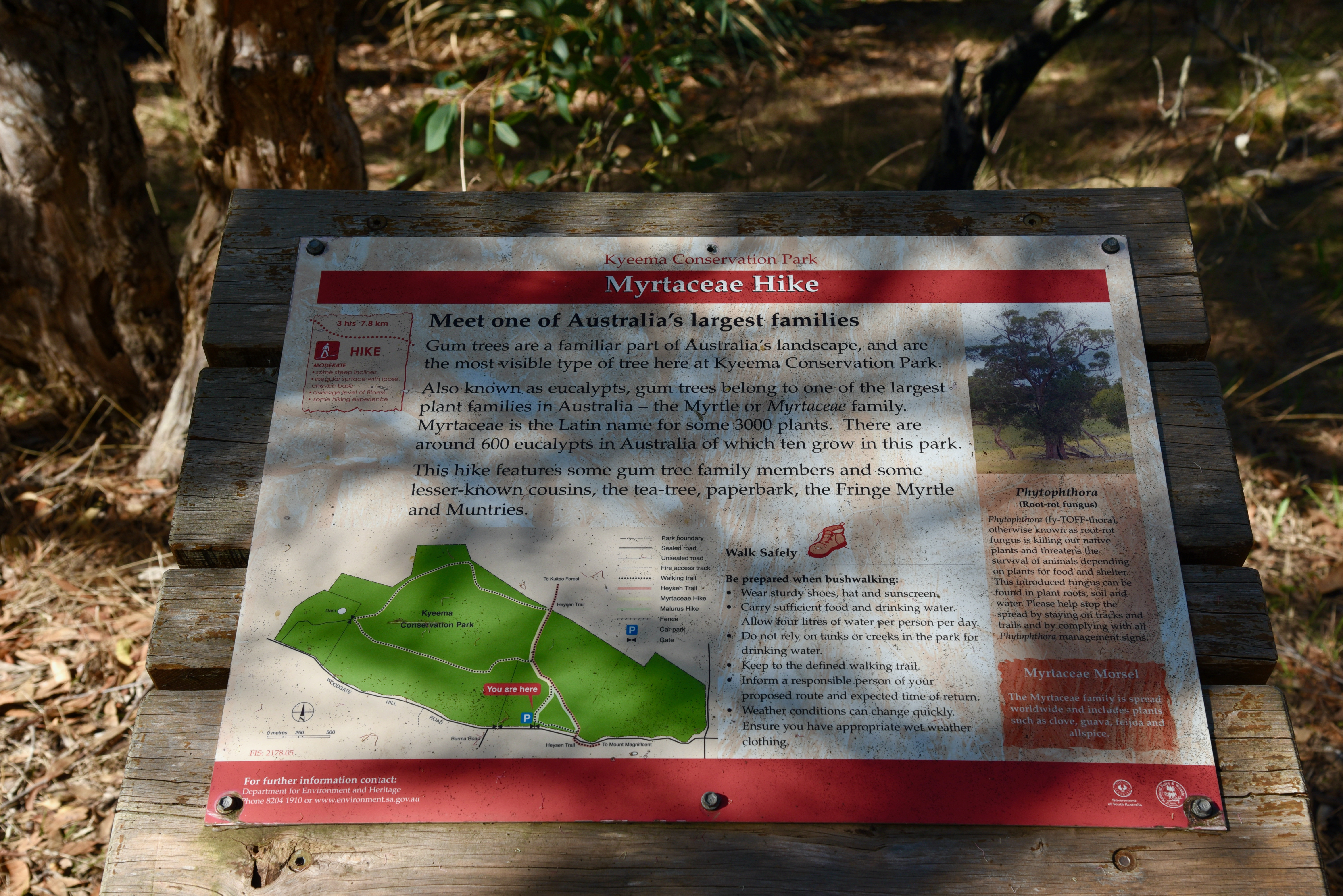
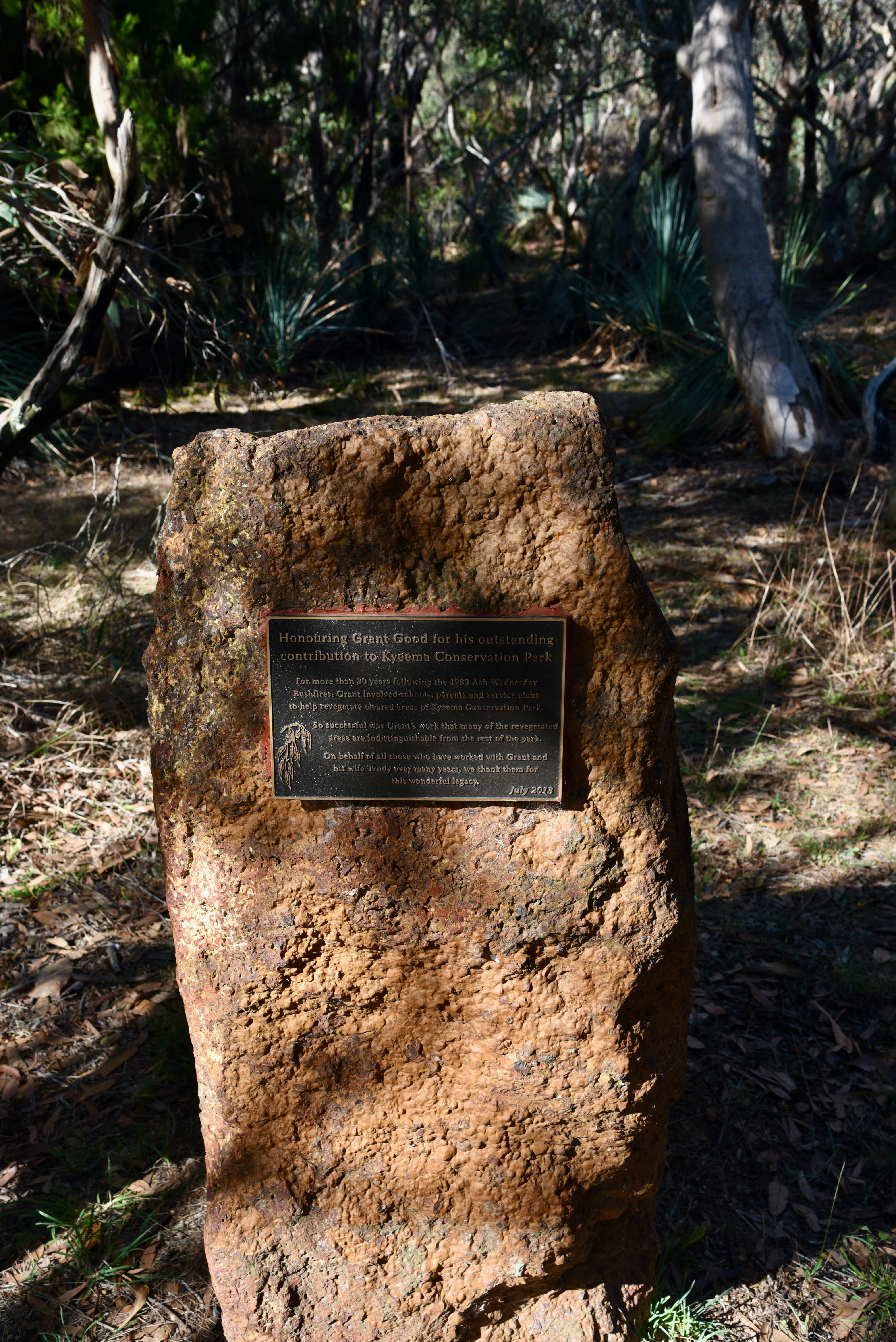
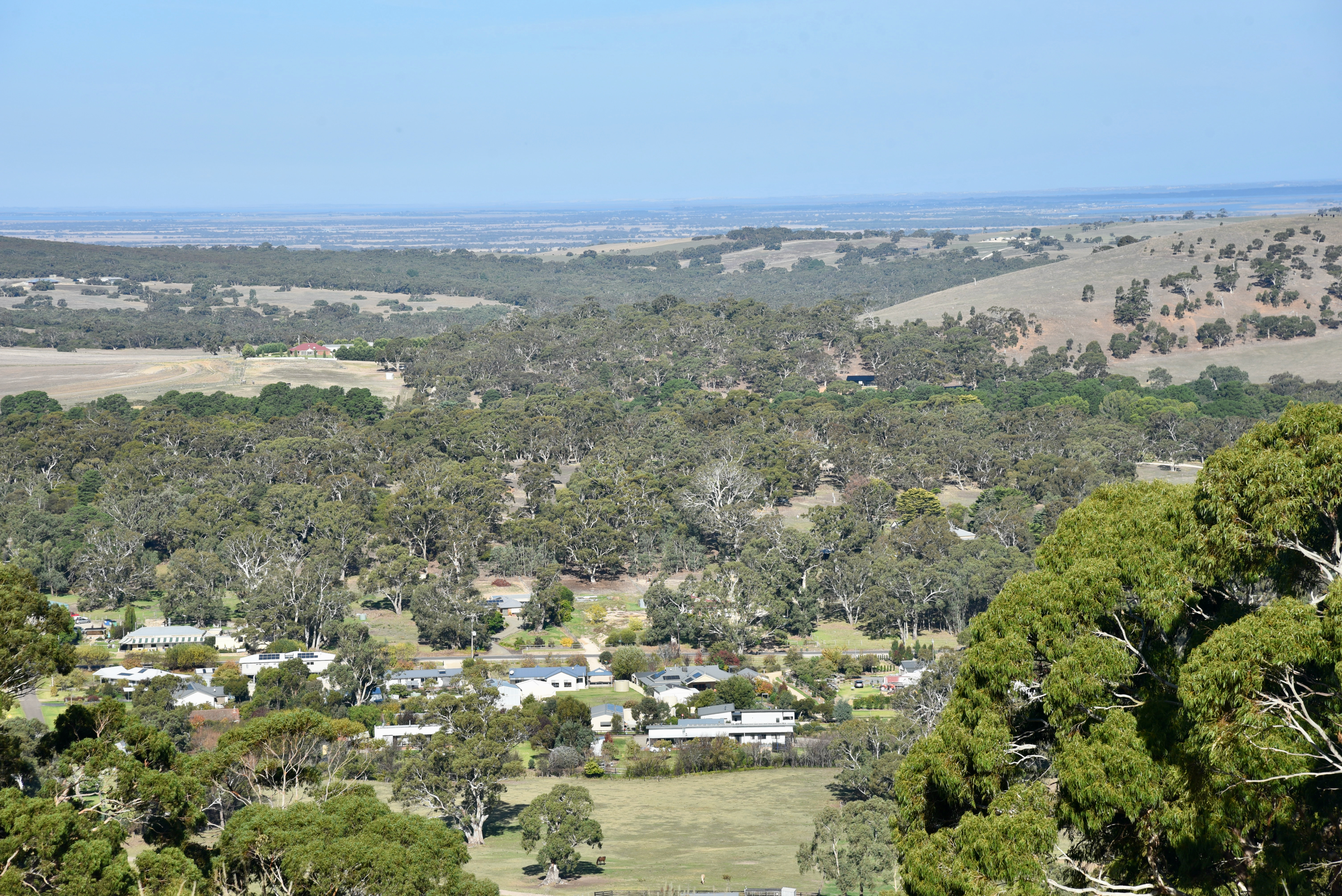
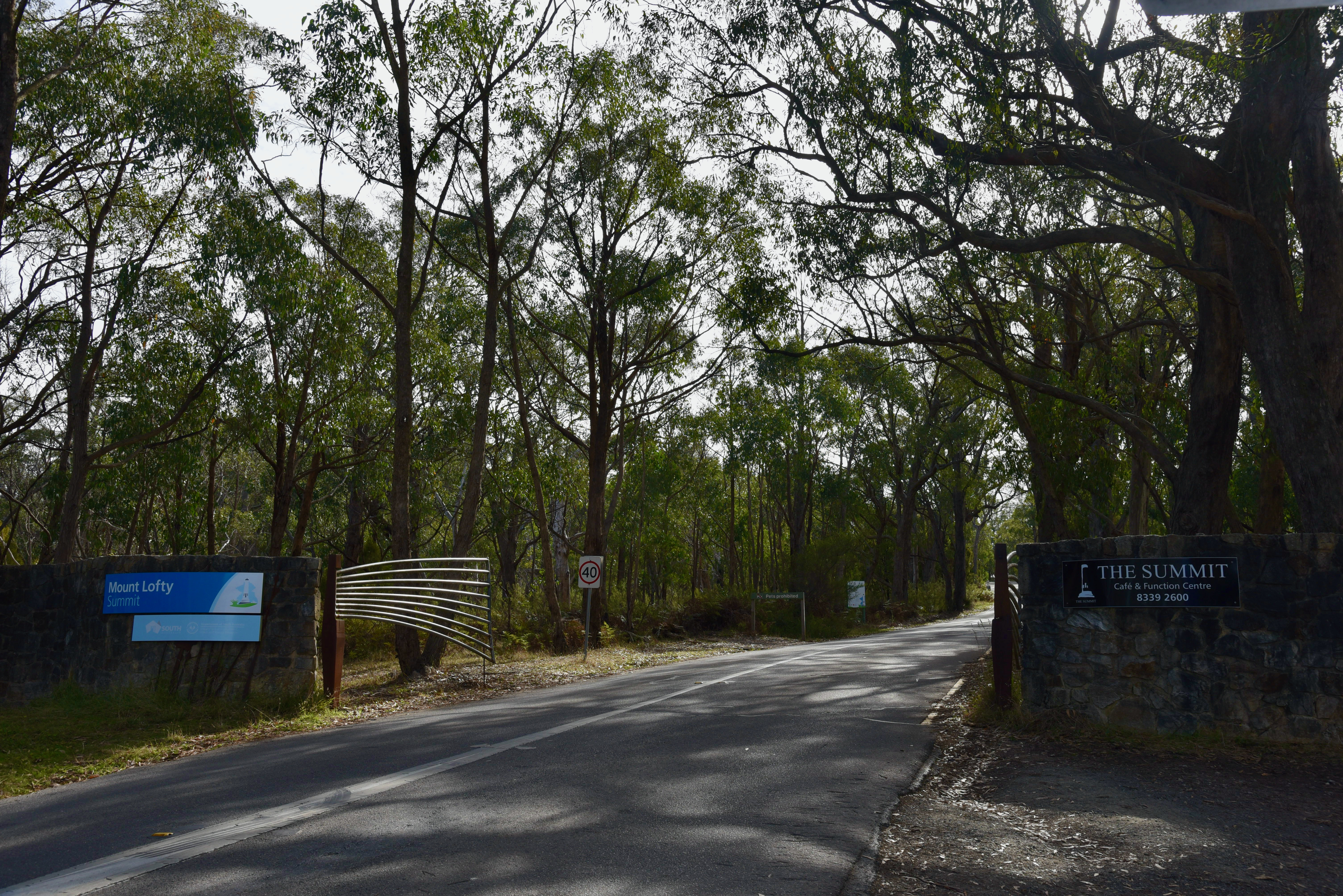
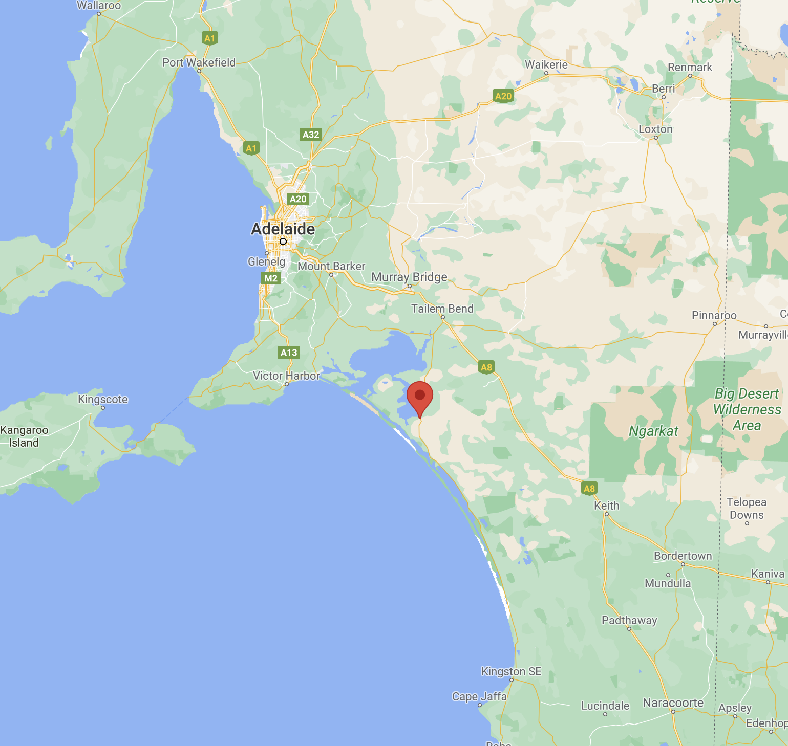
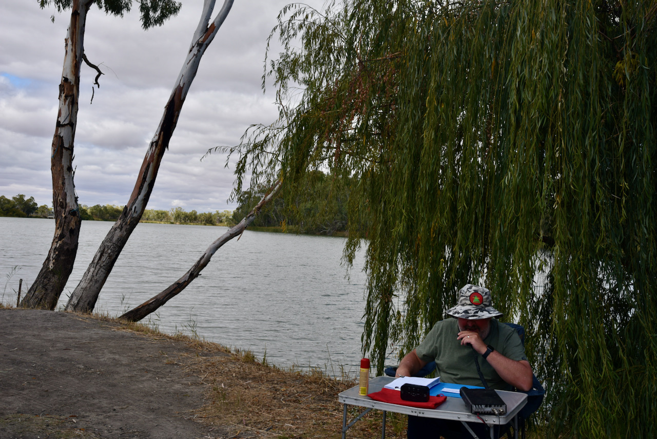
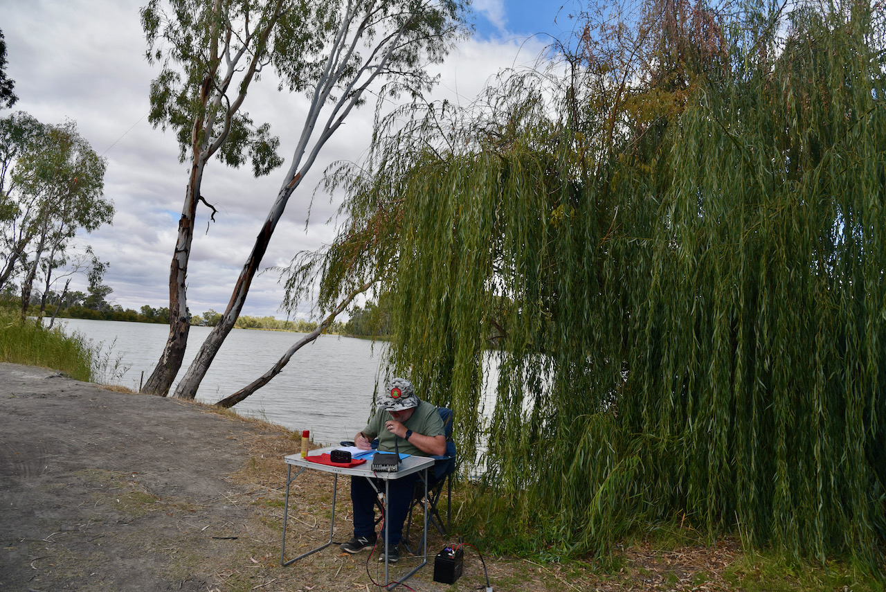
After packing up at Mount Lofty I headed to the Kyeema Conservation Park 5CP-107 & VKFF-0826. The park is located about 62 km south of Adelaide
The Kyeema Conservation Park is about 346 hectares (850 acres) in size and was established on the 12th day of November 1964. In those days it was a wildlife reserve proclaimed under the National Park & Wildlife Reserves Act. On the 2rd day of August 1967 the wildlife reserve and another section of land were proclaimed as the Kyeema National Park. On the 27th day of April 1972 the park was reconstituted as the Kyeema Conservation Park. On the 4th day of April 1974 further sections were added to the park.
The name Kyeema is believed to be local Kaurna aboriginal language meaning ‘dawn’.
The park is bounded in the south by Woodgate Hill Road, in the east by Blackfellows Creek Road, and the park’s boundary with the locality of Kuitpo in the west and in part to the north.
Prior uses of the land included the use of part of the current day park as a labour prison reserve, the Kyeema Afforestation Camp, which was opened on the 22nd day of March 1932. This was South Australia’s first prison camp. On the 27th day of October 1932 it was gazetted as the Kyeema Prison Camp. It operated until 1959 when it was replaced by the current Cadell Training Centre in the Riverland region of South Australia.
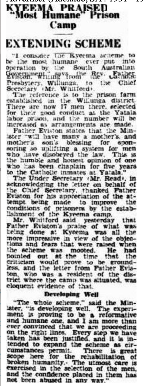
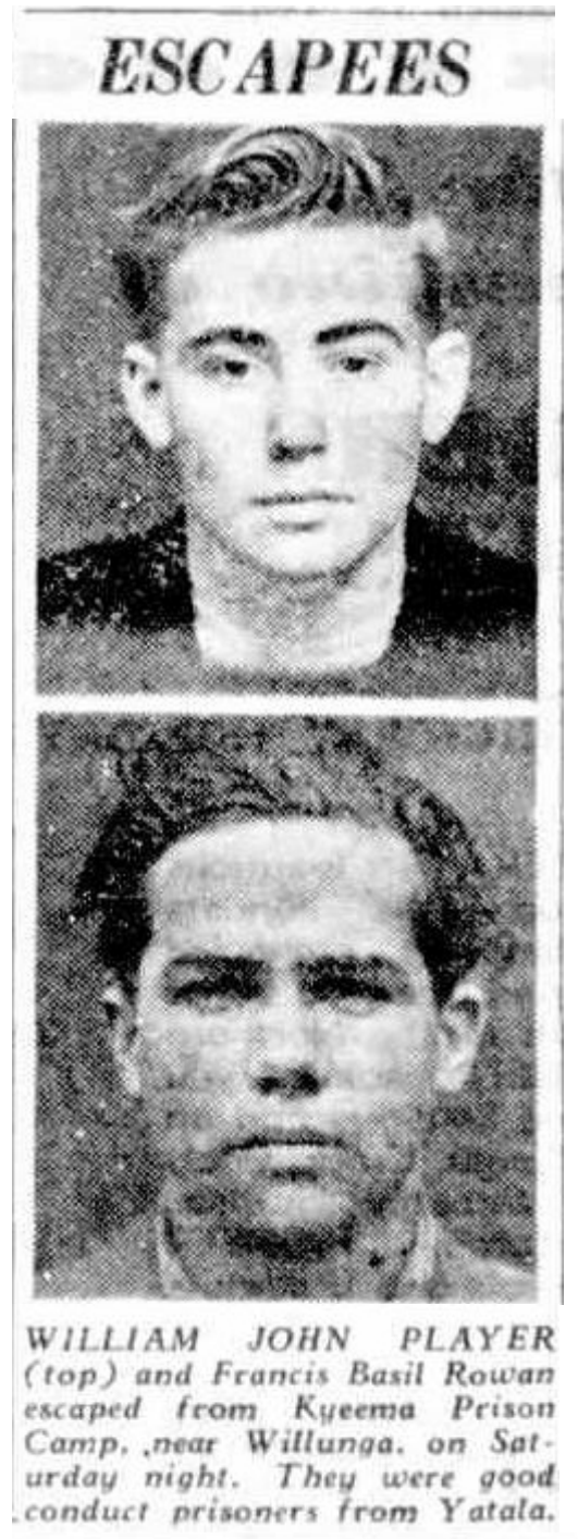
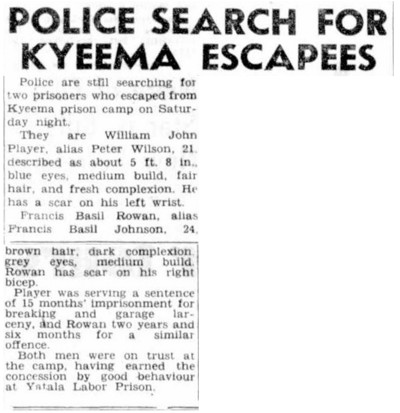
Above:- News article re escapees from Kyeema, The News Adelaide, 15 March 1948. Image c/o Trove
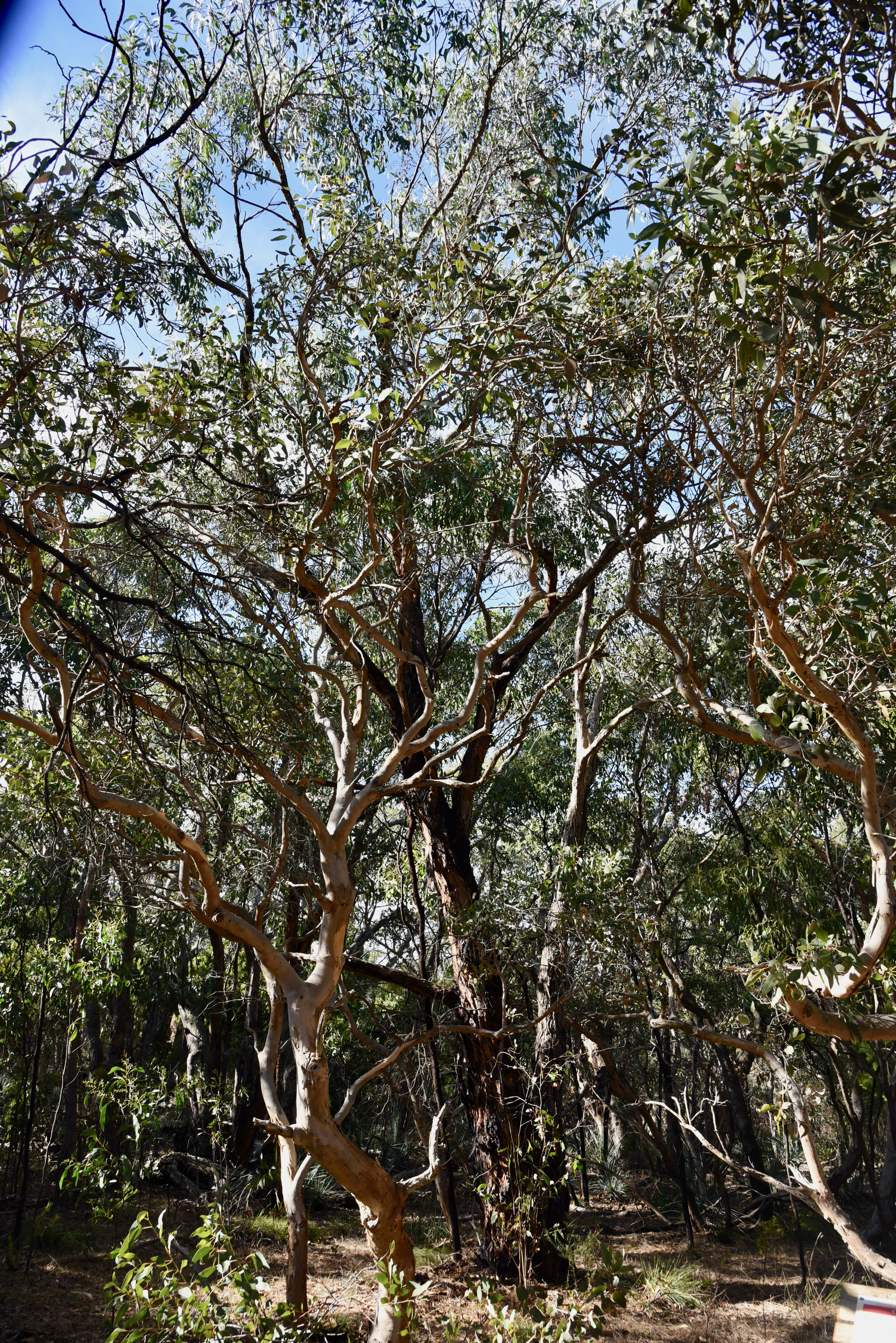
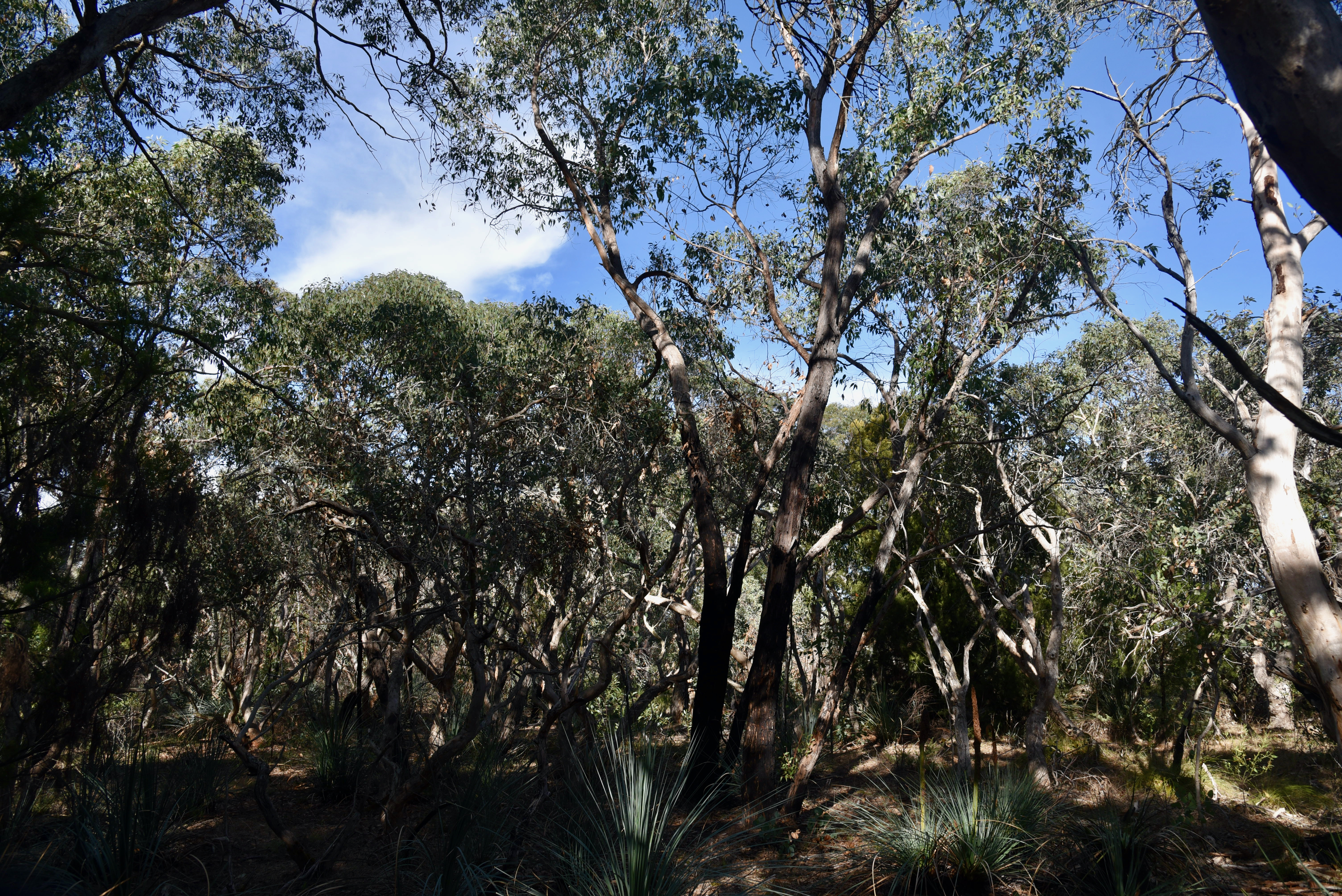
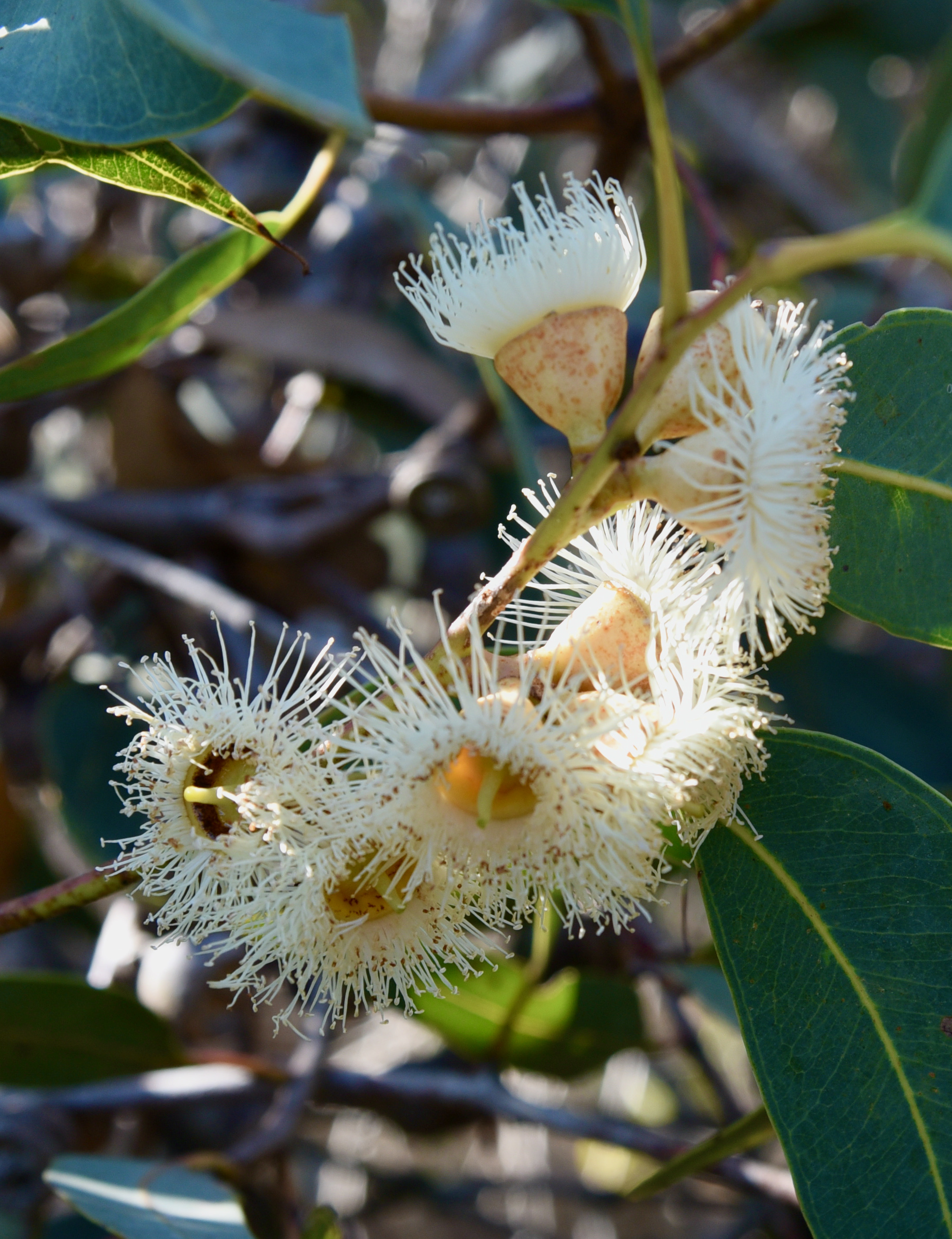
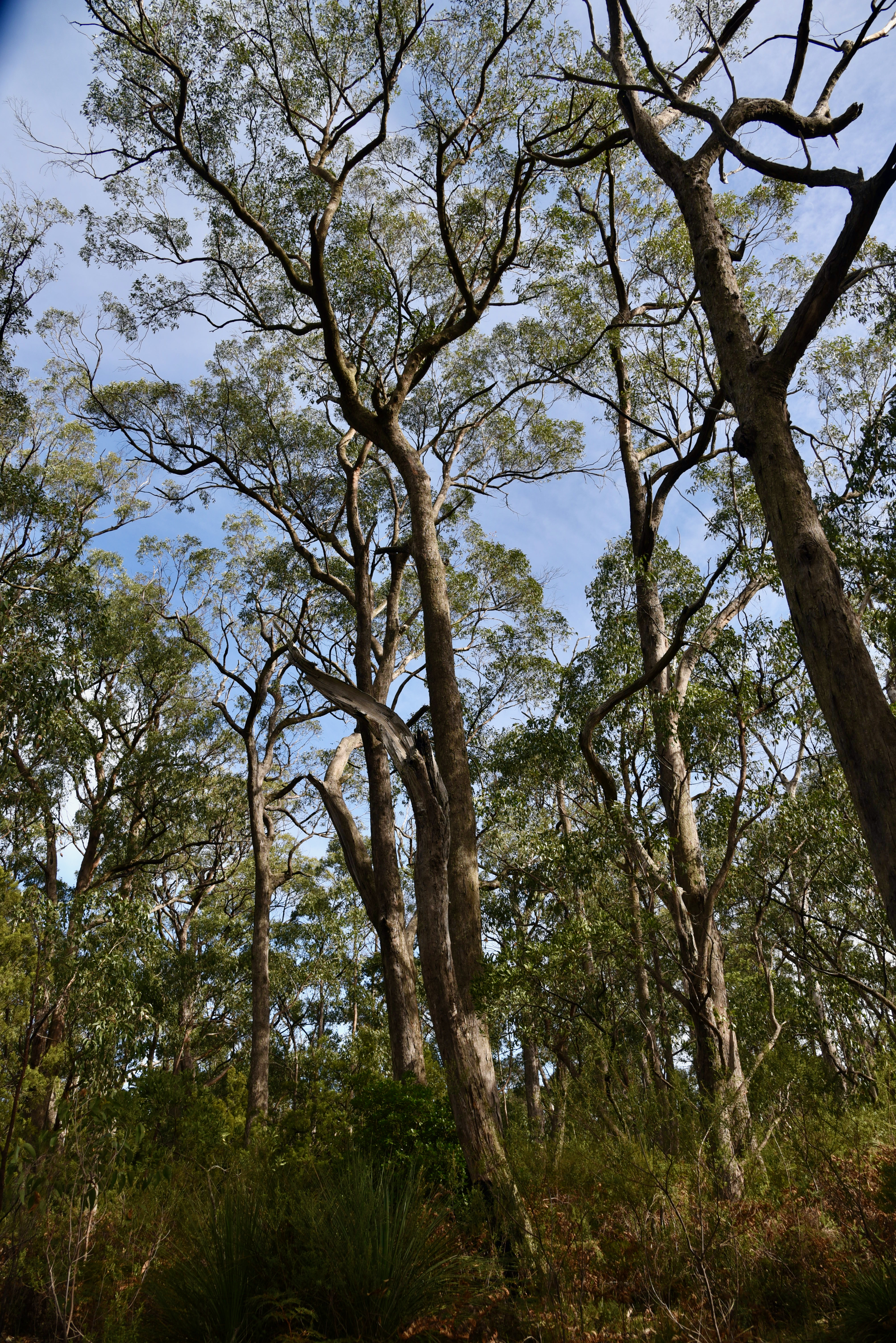
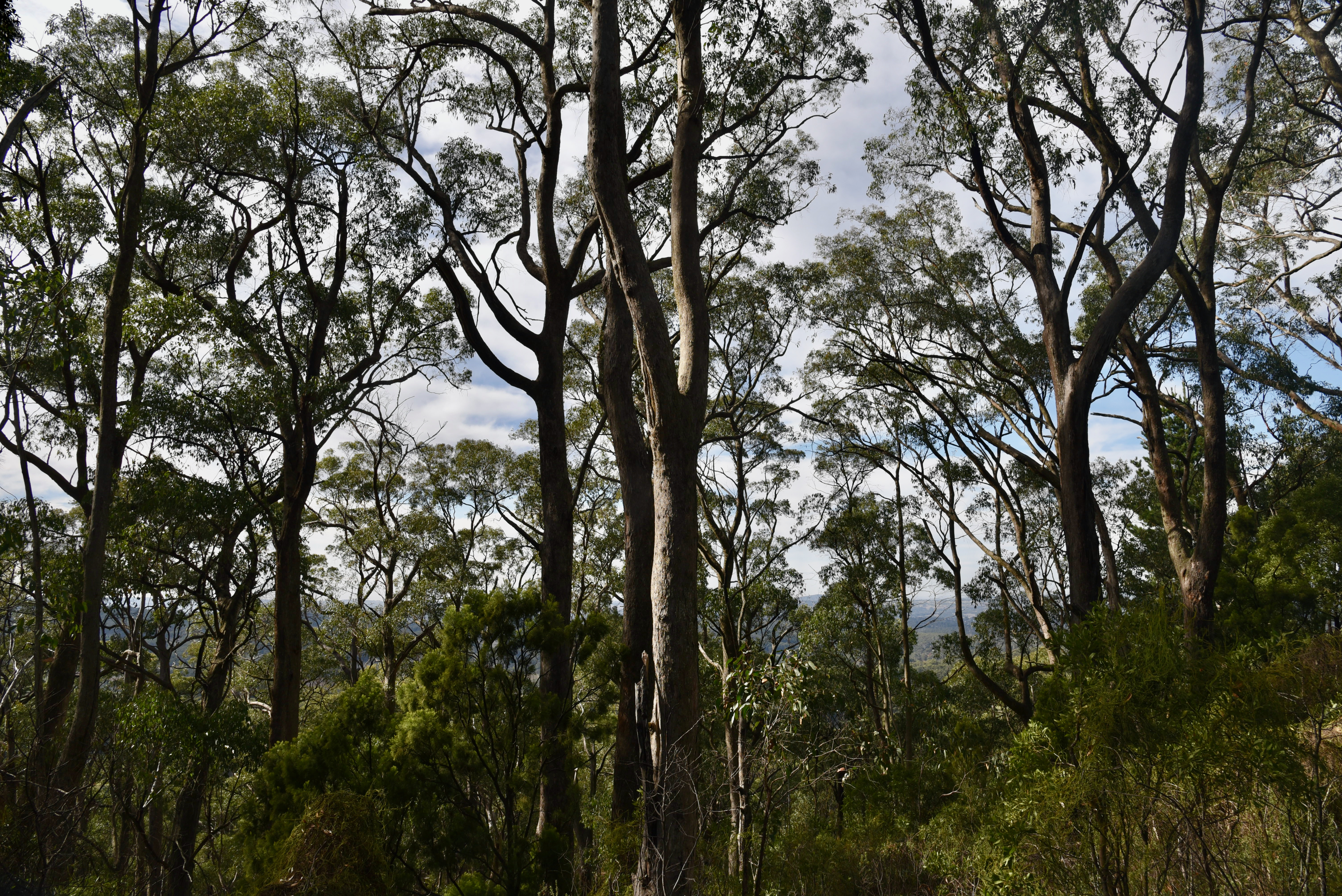
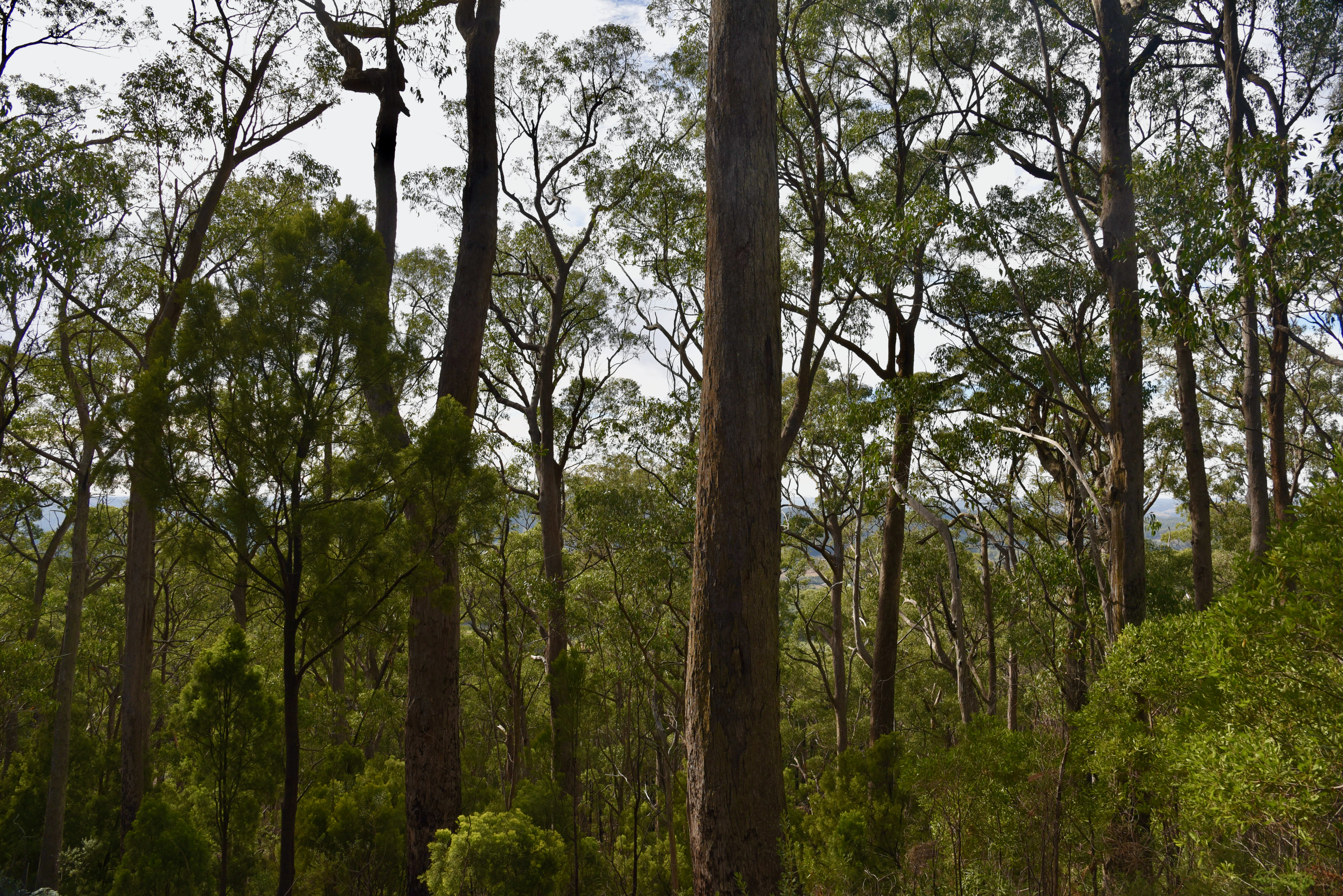
The overstorey in the park is predominantly messmate stringy bark (Eucalyptus obliqua), with some pink gum (E. fasciculosa) and cup gum (E. cosmophylla) and a diverse under storey.
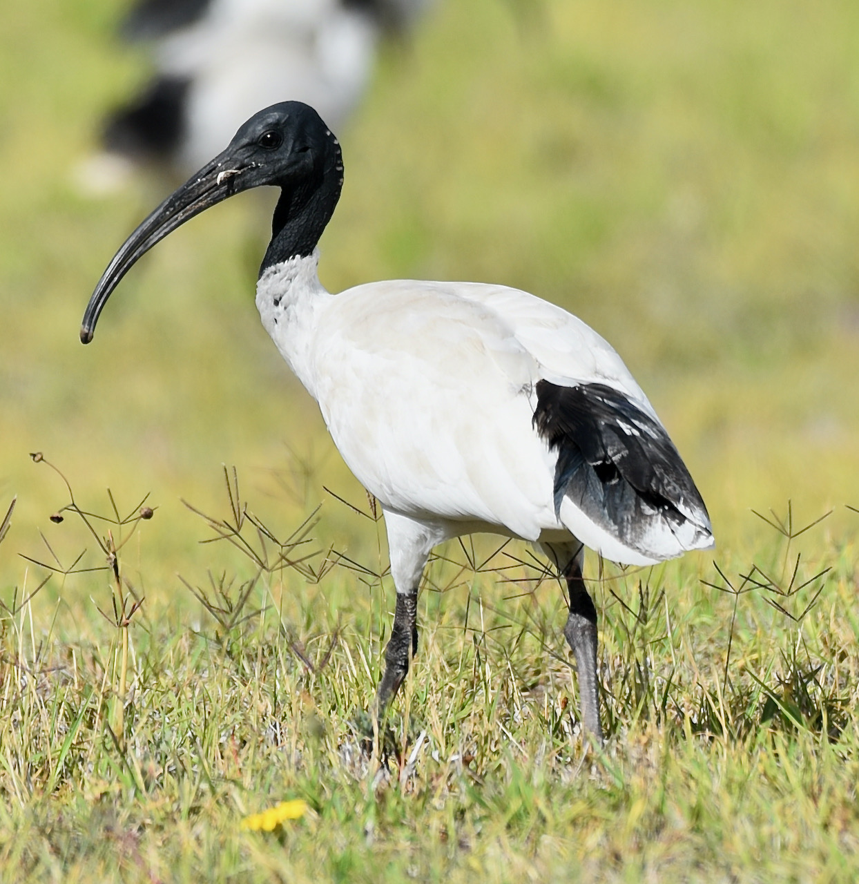
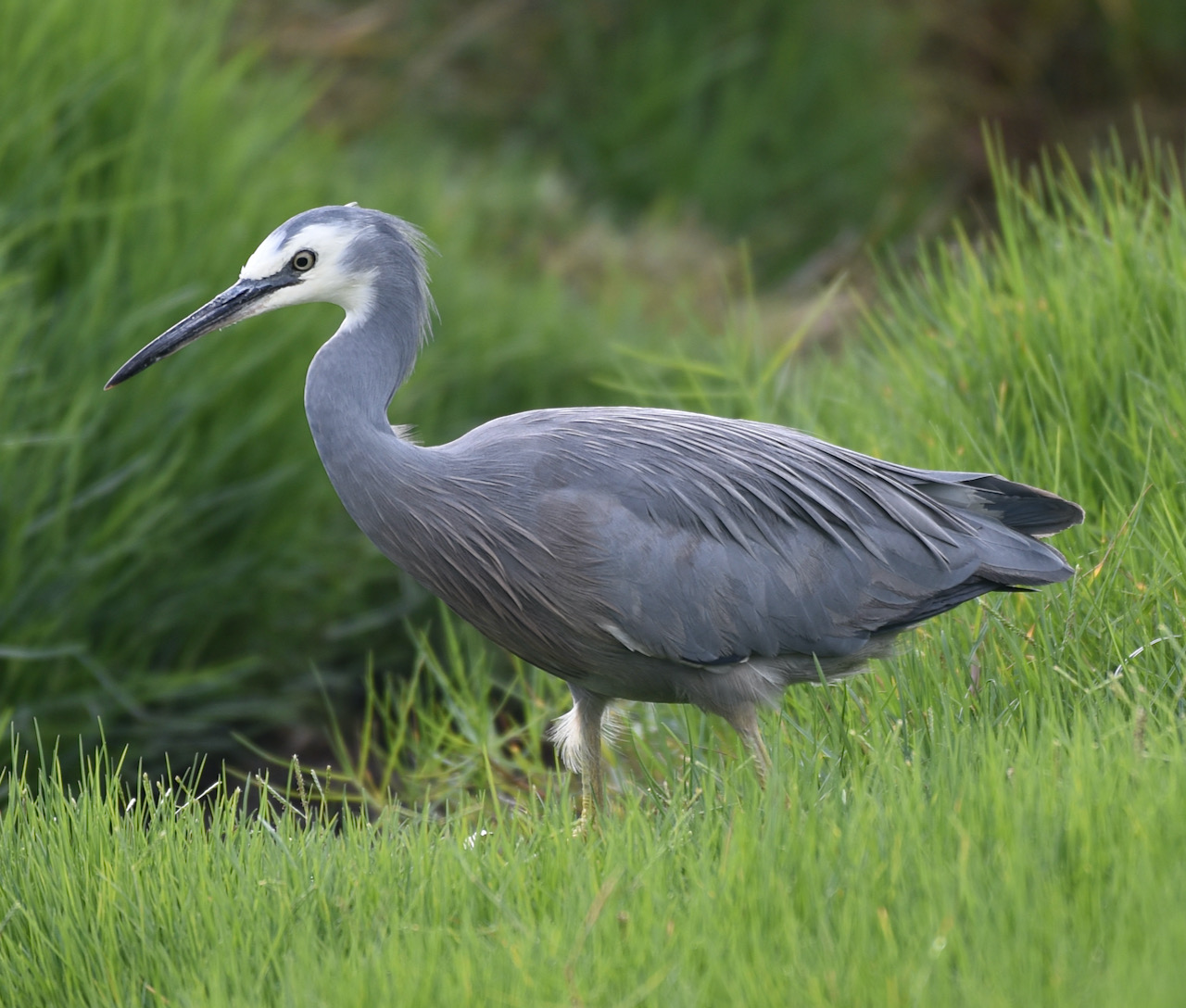
Birds Sa have recorded about 84 native species of bird in the park including Superb Fairywren, Striated Thornbill, Brown Thornbill, White-browed Scrubwren, Crescent Honeyeater, Yellow-faced Honeyeater, and Grey Shrikethrush.

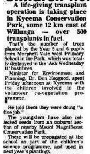
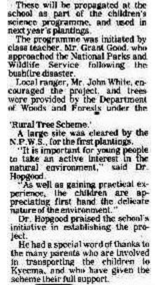
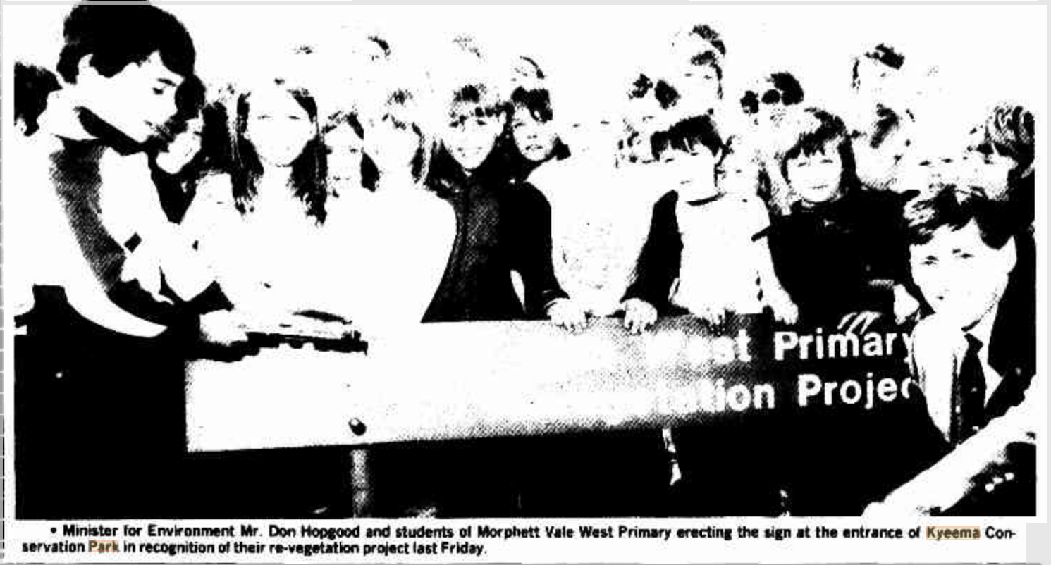
The park was significantly damaged during the devastating Ash Wednesday bushfires in February 1983. Following the fires, the park became the focus of a large revegetation project involving local school students. About 20,000 seedlings were planted in the first three years after commencement of the project. This area is now known as ‘The Childrens Forest’.
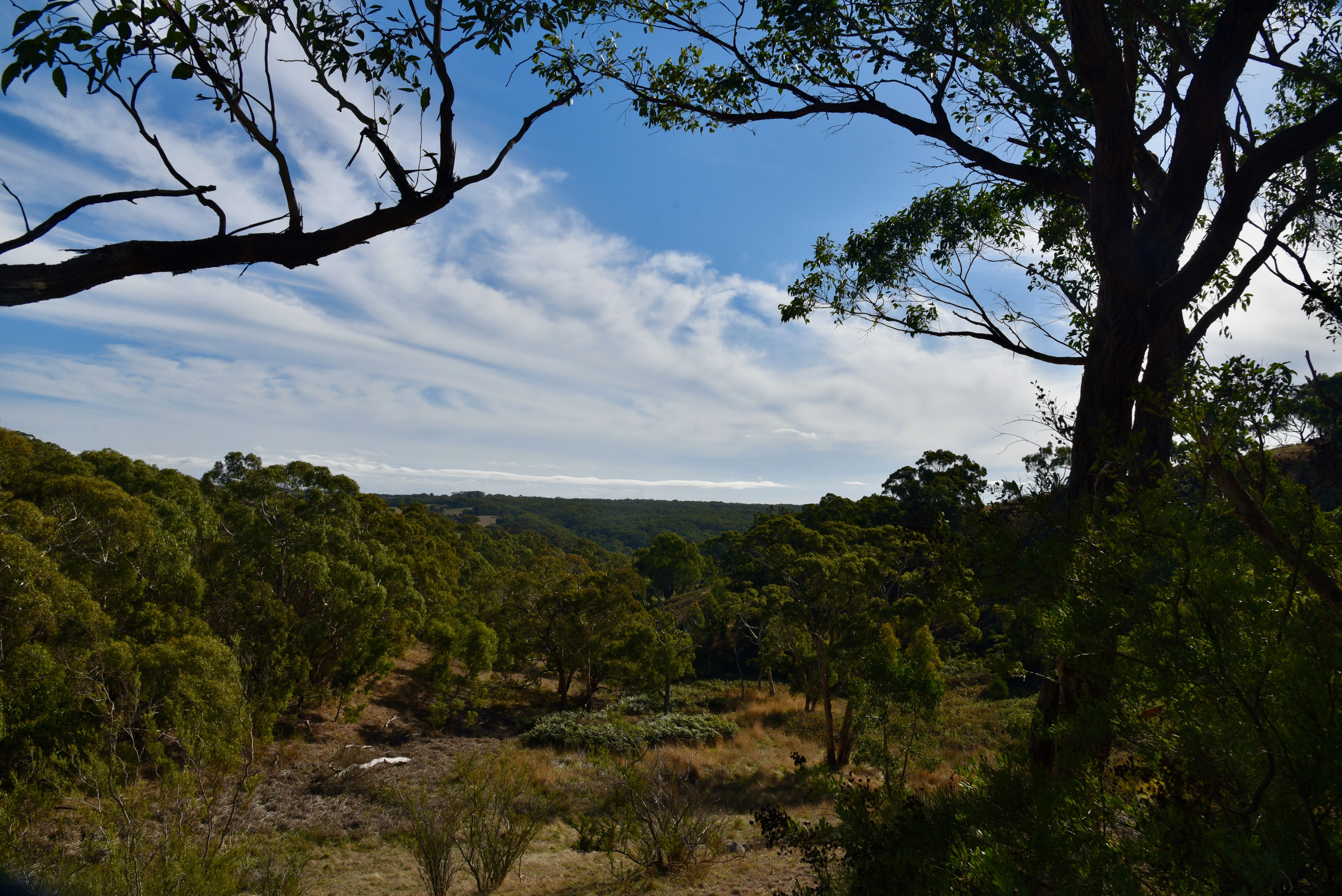
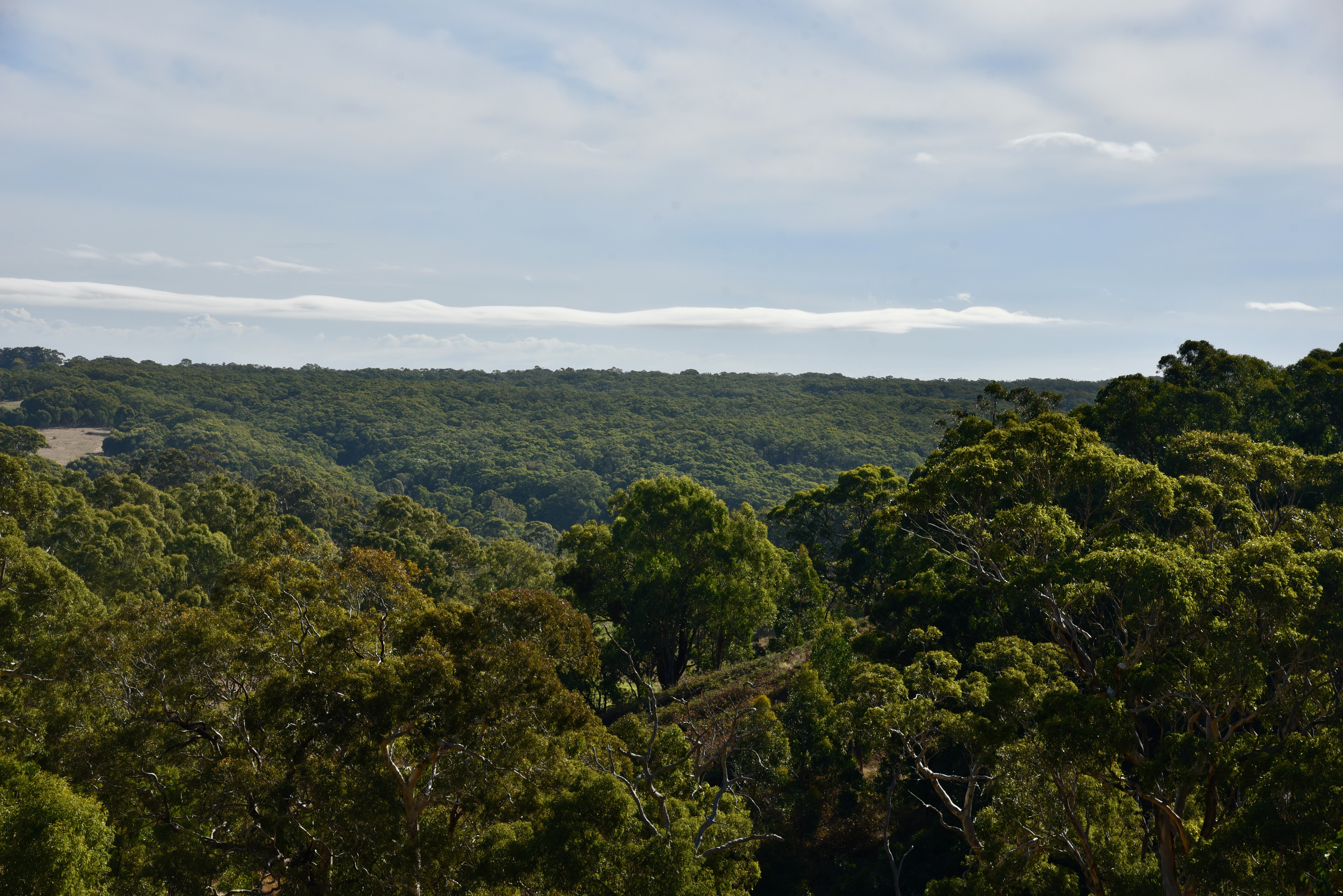
There are some nice walks in the park, including the famous Heysen Trail walking track passes through the park.


After setting up I called CQ on 7.144 on the 40m band and this was answered by Peter VK3PF. It was very slow going however, and it took me about 14 minutes before I had contact number ten in the log, a QSO with none other than my wife Marija VK5MAZ.
I logged a total of 28 stations on 40m before callers dried up. Contacts were logged into VK2, VK3, VK4, VK5, and VK7. This included two Park to Park contacts, with Bob VK2BYF/p and Gerald VK2HBG who were activating the Brundee Swamp Nature Reserve VKFF-2547.
I then moved down to 7.090 and logged David VK3IL, Glen VK3YY, and Andrew VK3JBL who were activating SOTA summit VK3/ VT-011.
After logging the SOTA contacts I moved back to 7.144 where I logged a further 5 stations from VK3, VK5, and VK7. Unfortunately callers dried up very quickly, so I headed to the 80m band. I logged 6 stations on 80m, all from VK5.
It was then off to 20m where I logged 6 stations from Indonesia, VK4, VK5, and VK6.
To conclude the activation I went back to 80m and logged Adrian VK5FANA who had missed me during my first go on 80m.
I worked the following stations on 40m SSB:-
I worked the following stations on 80m SSB:-
I worked the following stations on 20m SSB:-
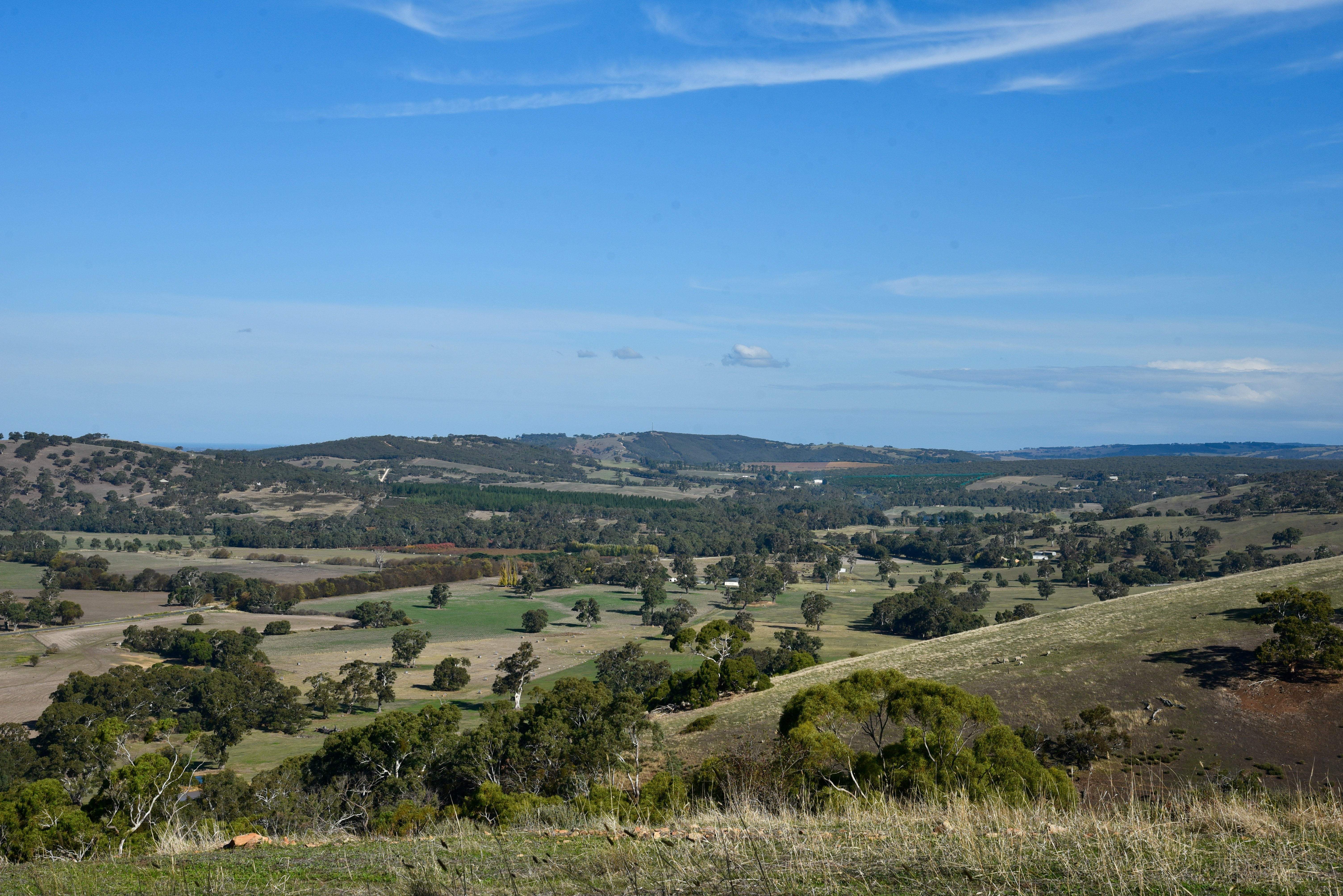
I packed up and made the short drive back to my home at Ashbourne, travelling down Kirkham Road, enjoying the fabulous views of Ashbourne and surrounds.
References.
Birds SA, 2021, <https://birdssa.asn.au/location/kyeema-conservation-park/>, viewed 17th May 2021.
Wikipedia, 2021, <https://en.wikipedia.org/wiki/Kyeema_Conservation_Park>, viewed 17th May 2021.
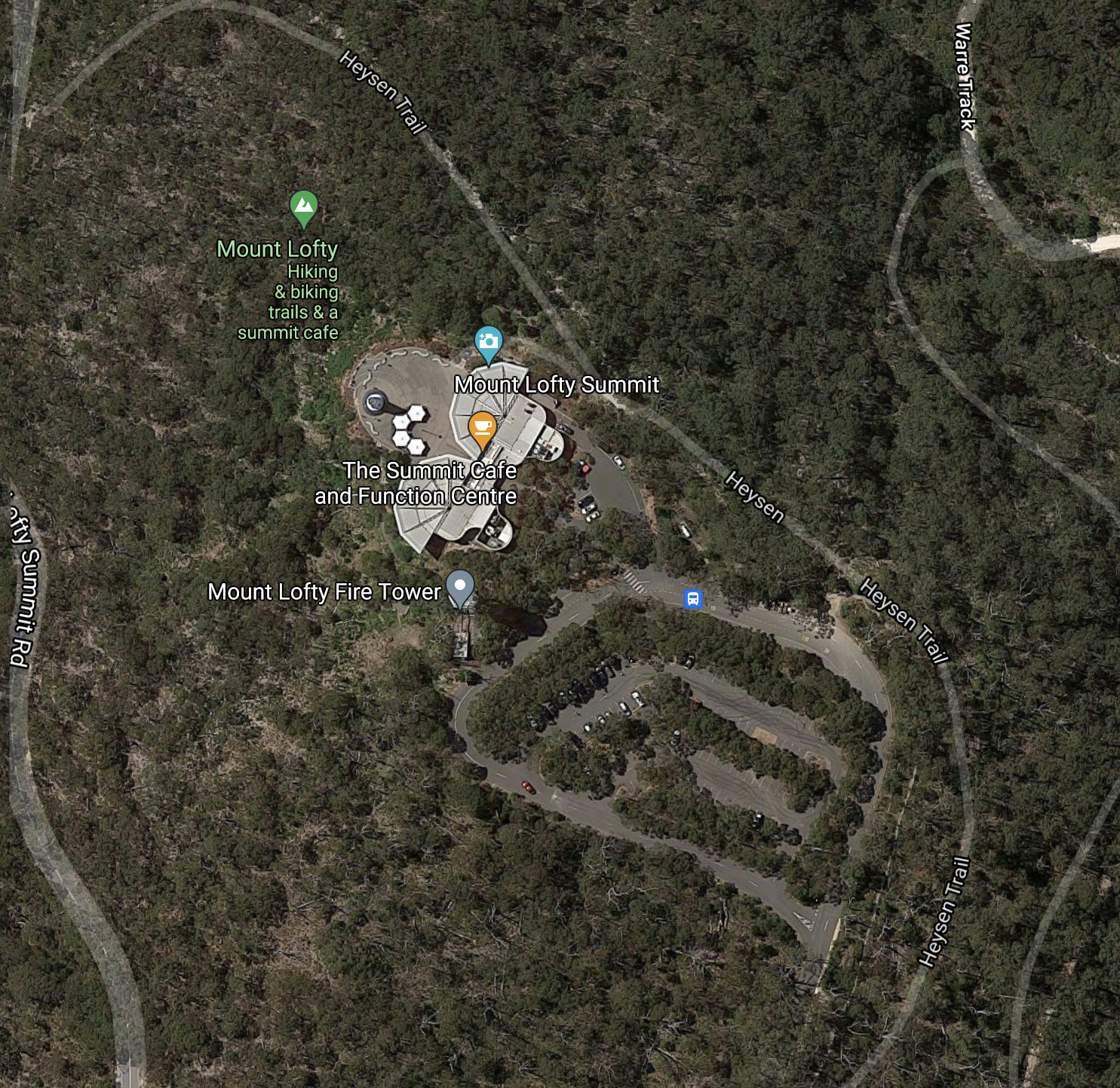
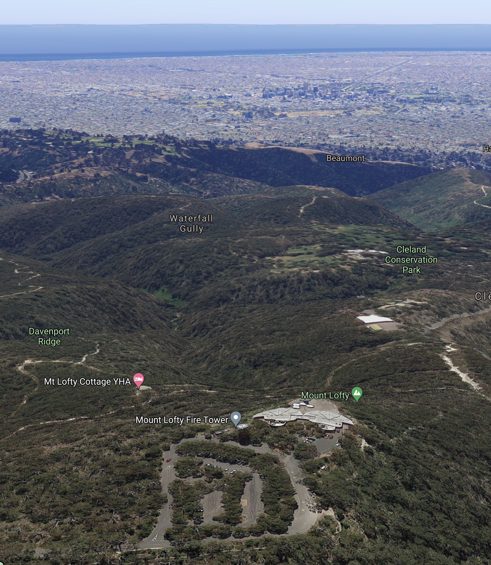
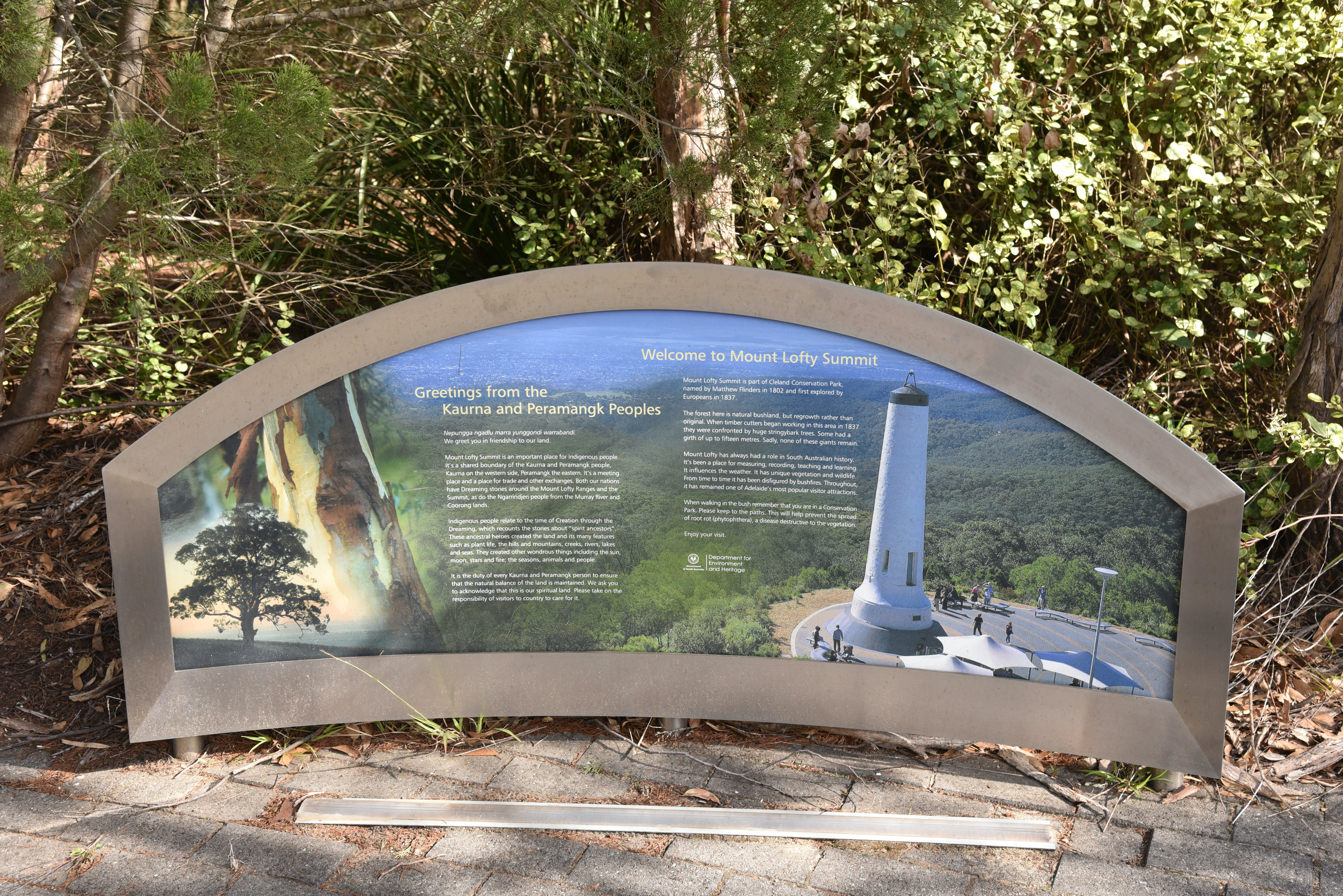
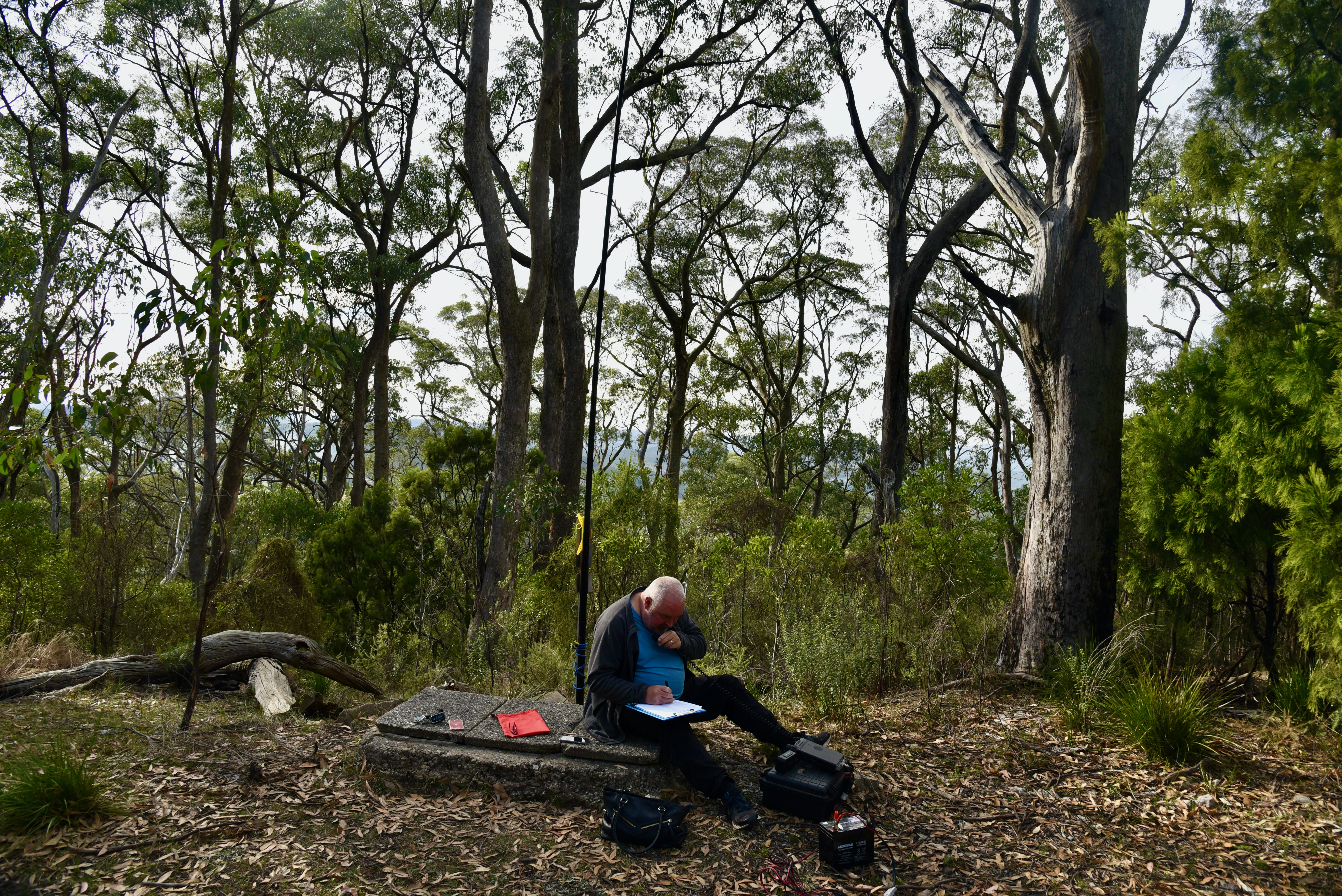
On Friday 7th May 2021, I activated Mount Lofty summit VK5/ SE-005 which is within the Cleland Conservation Park 5CP-042 & VKFF-0778, using the special callsign of VK100AF. The activation qualified for the Summits on the Air (SOTA) program, World Wide Flora Fauna (WWFF), and the VK5 National & Conservation Parks Award.
VK100AF is a special event callsign for the 100 year anniversary of the Royal Australian Air Force (RAAF).

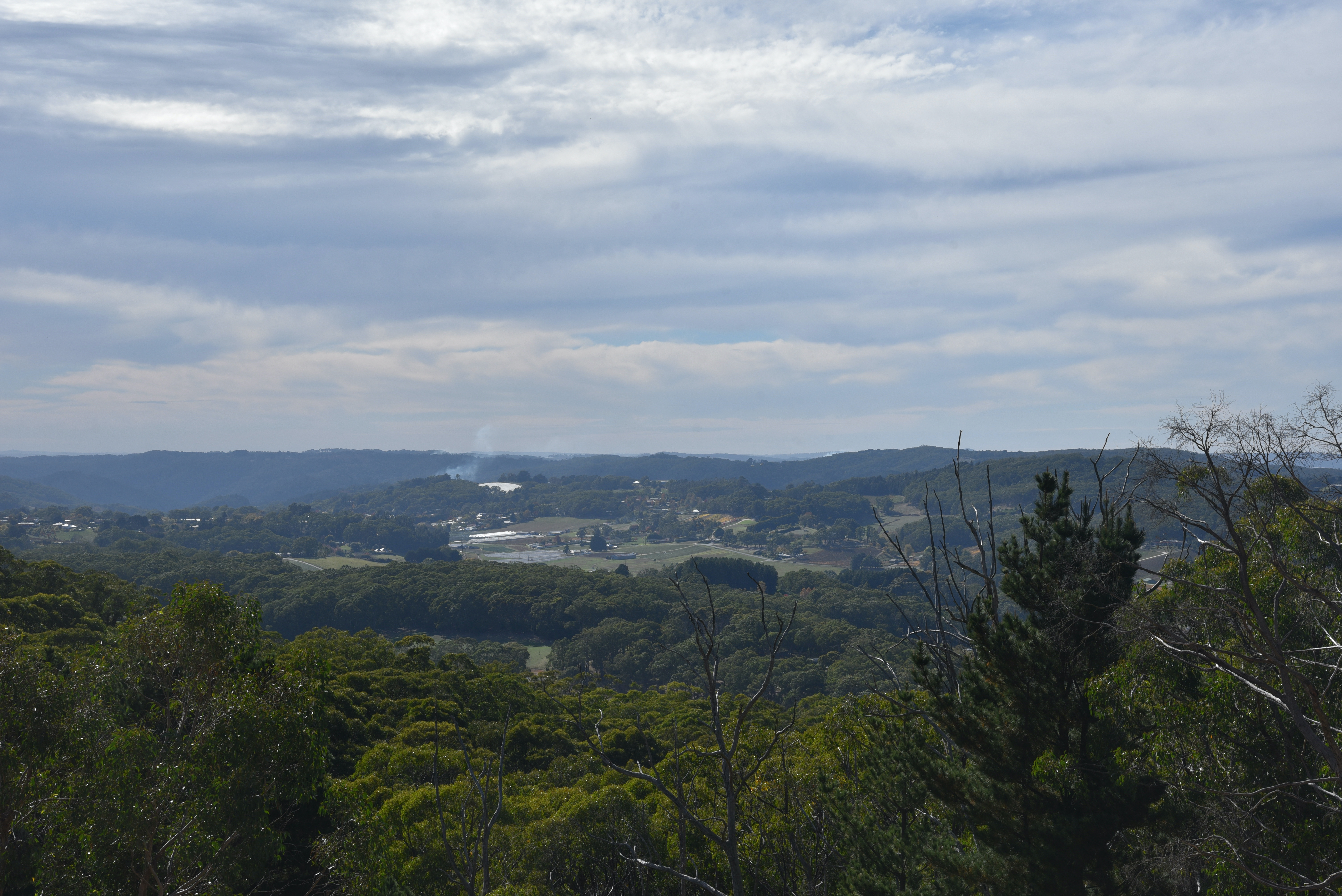
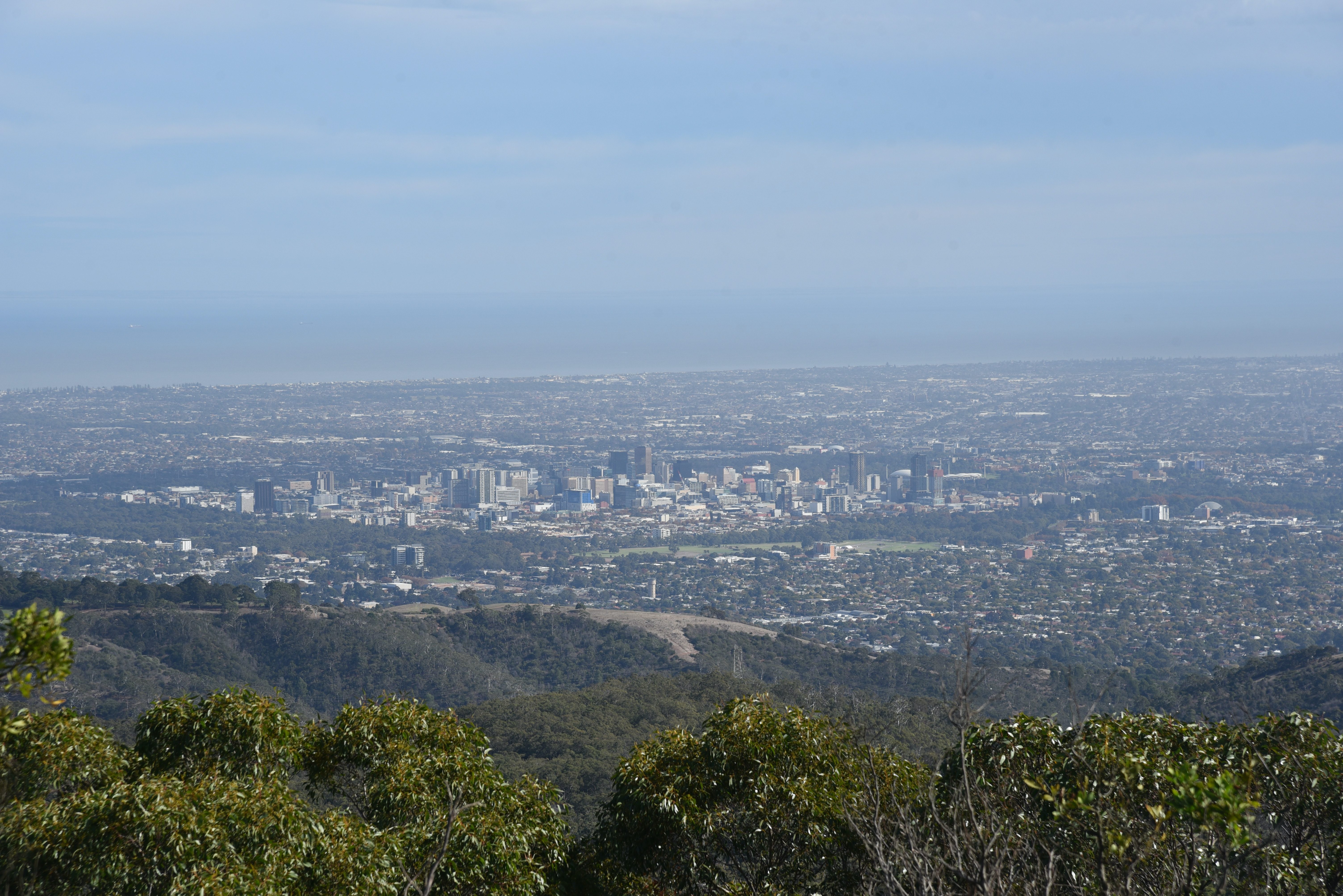
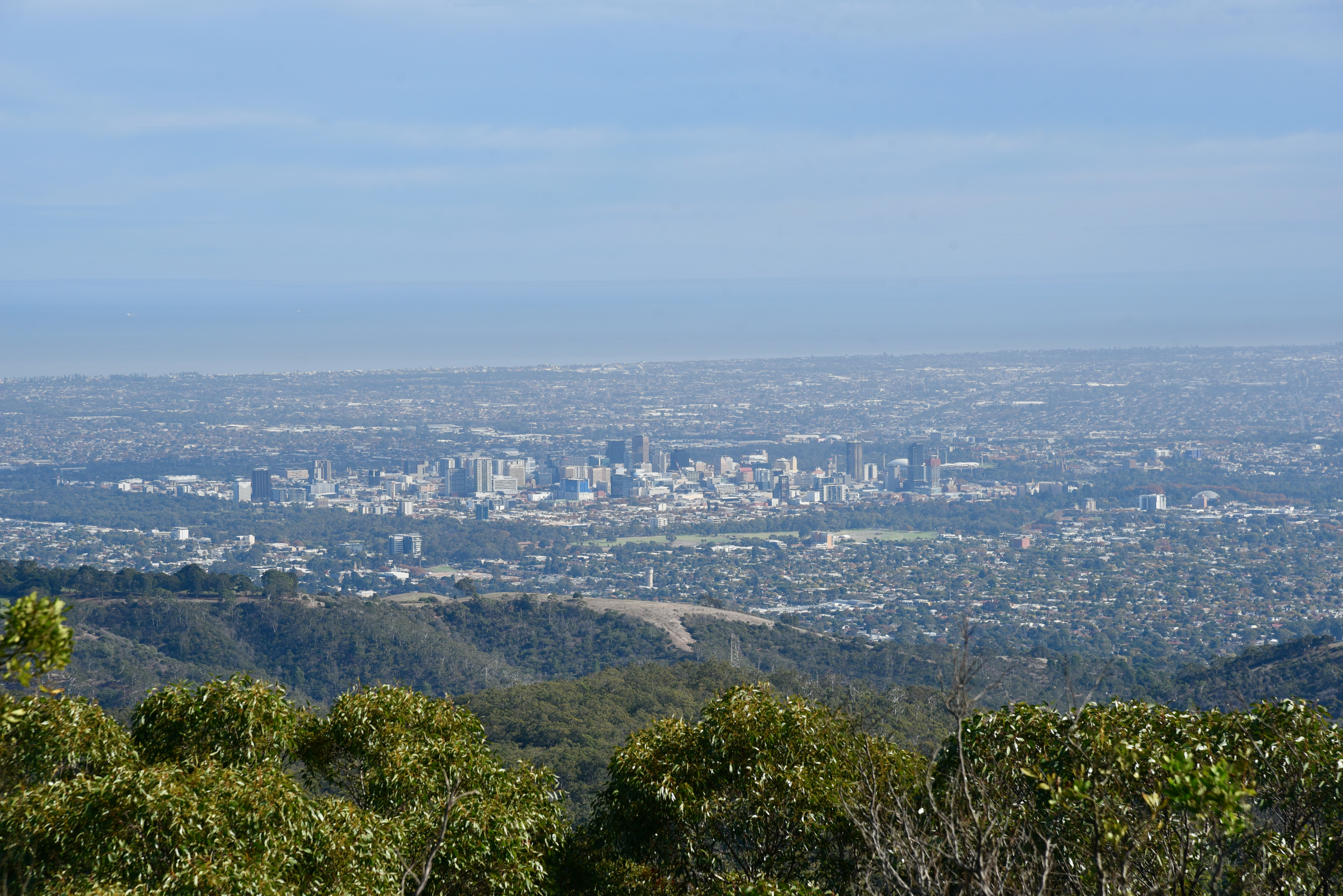
Mount Lofty summit is 727 metres above sea level and is the highest peak in the southern Mount Lofty Ranges ‘Adelaide Hills’. It is located about 15 km east of the city of Adelaide.
The summit is worth 4 points for the SOTA program. It has been activated 96 times for SOTA. This includes a number of activations by myself and Marija.
The summit is accessed via Summit Road from the South Eastern Freeway at Crafers, or from the eastern suburbs of Adelaide via Greenhill Road and the Mount Lofty Scenic Route. For those who are keen, you can walk up the gully to the summit from Waterfall Gully. It is a challenging walk.
Mount Lofty was named by Matthew Flinders on the 23rd day of March 1802, during his circumnavigation of the Australian continent. The summit was first climbed in 1831 by Collet Barker (1784-1831) a British military officer and explorer. This was about 6 years before Adelaide was settled.

The road from Crafers to Mount Lofty summit was originally known as Ridge Road. The route of the present day Summit Road varies in places from the original. Numerous stately homes were built along the road during the 1800’s, as summer retreats for families of the so-called ‘Adelaide Establishment’, a group of wealthy landowners and industrialists.
The first was ‘Mount Lofty House’. Frequently, extensive grounds complemented the grand houses on Ridge (Summit) Road. The houses gave employment to local families as servants and gardeners.

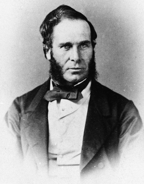
Construction commenced of Mount Lofty House in the mid 1850s by Arthur Hardy (1817-1909), the patriarch of the famous South Australian Hardy family. Hardy arrived in South Australia in 1839 from England, aboard the Platina. He had received doctor’s advice to seek a warmer climate, and as a result he emigrated to Australia.
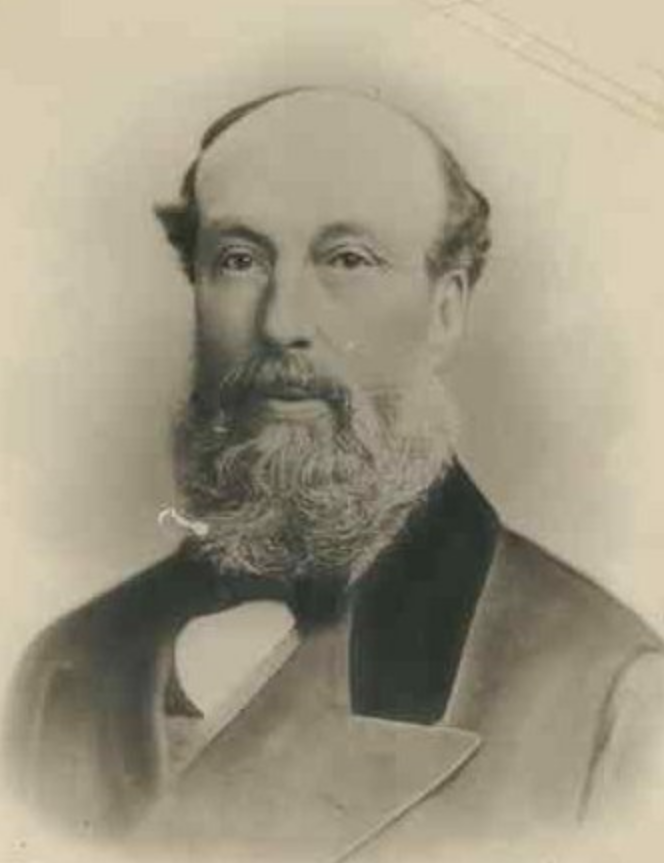
While building Mount Lofty House he planted three Californian Redwood Sequoias and through further plantings on the grounds of Mount Lofty House, he set the foundations for what would become the current day 97 hectare Mount Lofty Botanic Gardens.
In Australia, Hardy went on to be a pastoralist, barrister, quarry owners, business and politician.


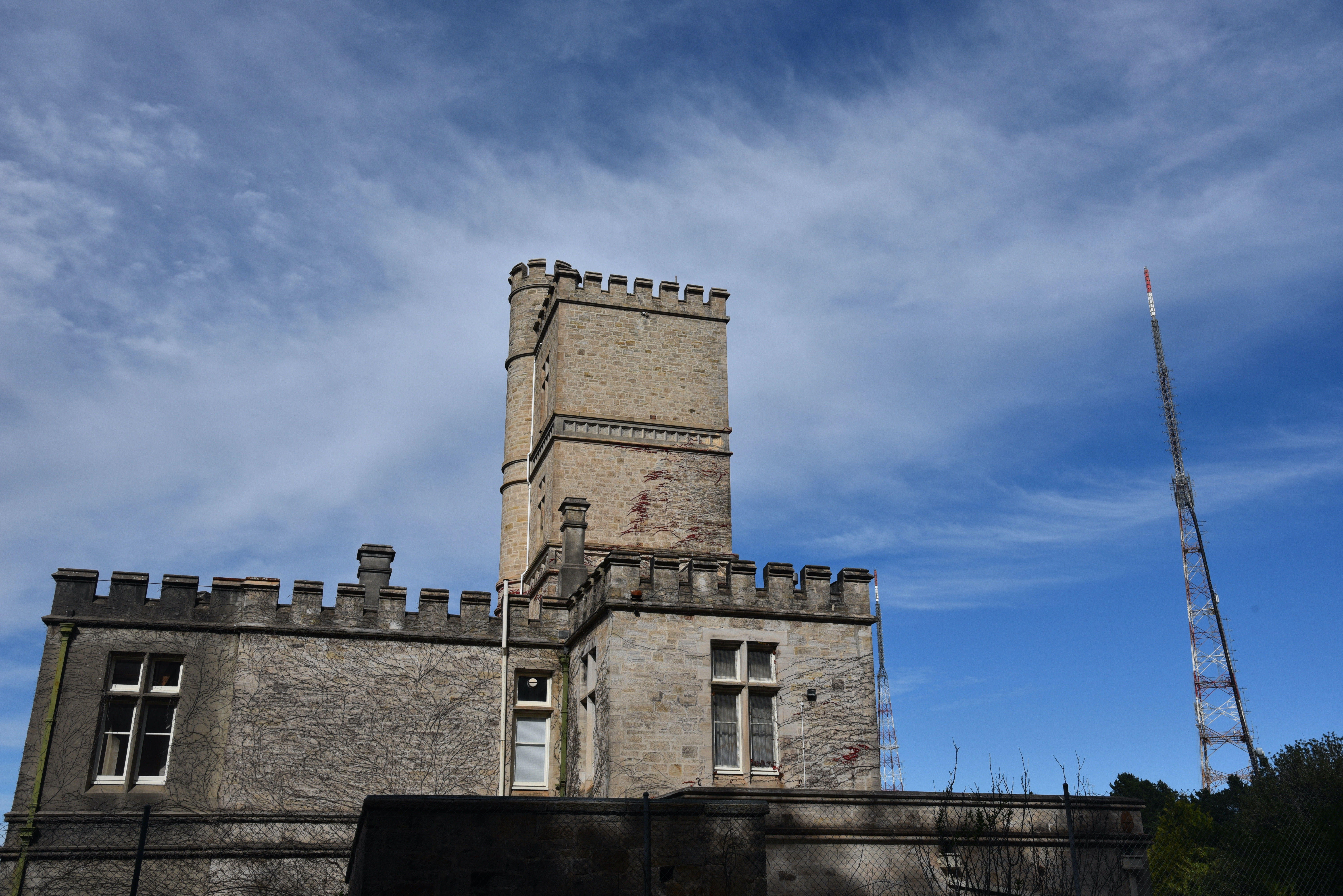
On the ridge-line near Mount Lofty summit are three television transmission towers for Adelaide television.
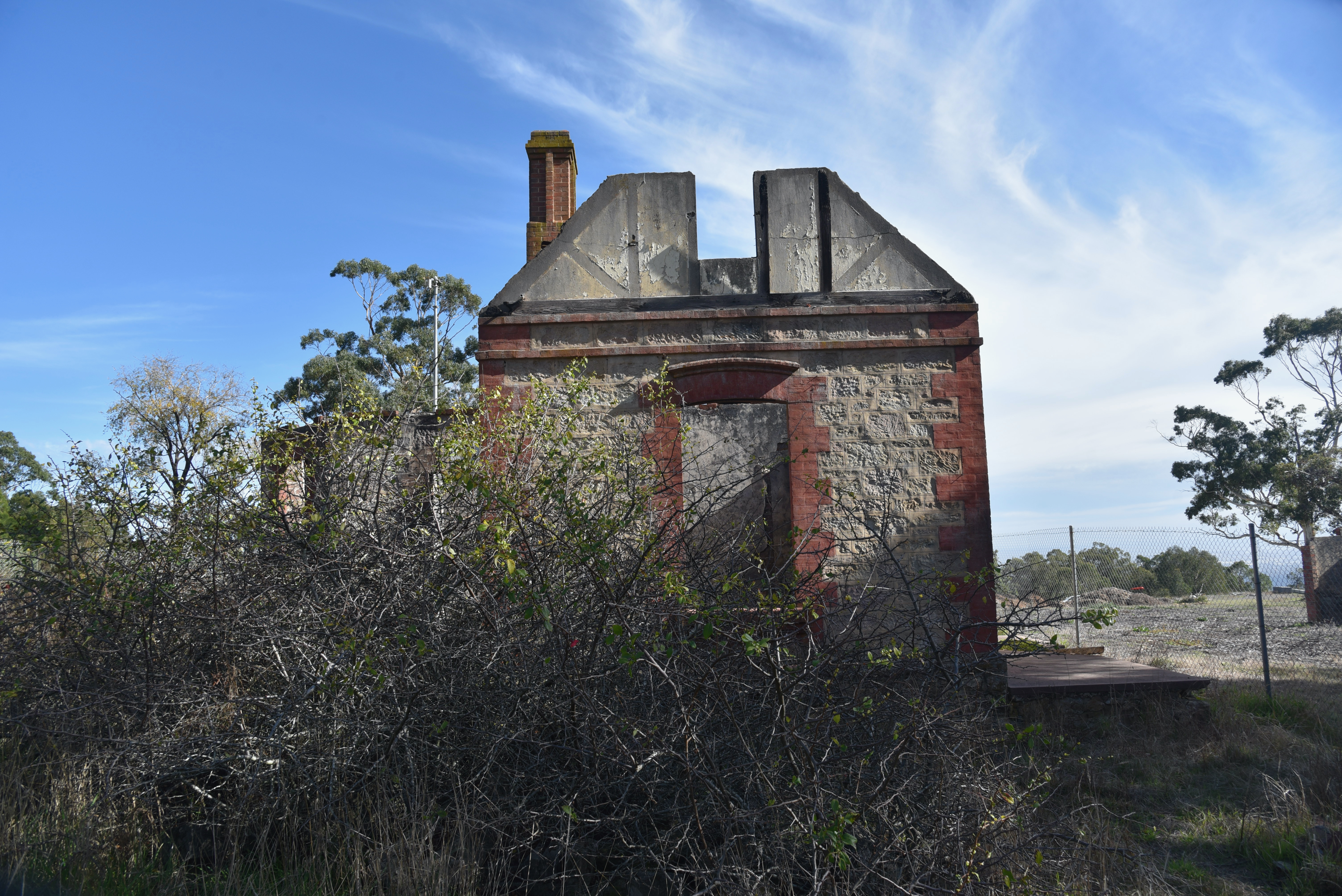
There is also the ruin of St Michael’s House. The property was originally called Koralla and was left to the Anglican Diocese of Adelaide in 1943 by Mrs. Audine G. O’Leary, the widow of Dr. Arthur Pryce Evelyn O’Leary. Soon after this, Bryan Percival Robin, the Bishop of Adelaide, invited the Society of the Sacred Mission to establish themselves in Adelaide at the property which was to become their monastery and theological college. The building was destroyed during the devastating Ash Wednesday Bushfires in February 1983.

The summit is located in the Cleland Conservation Park
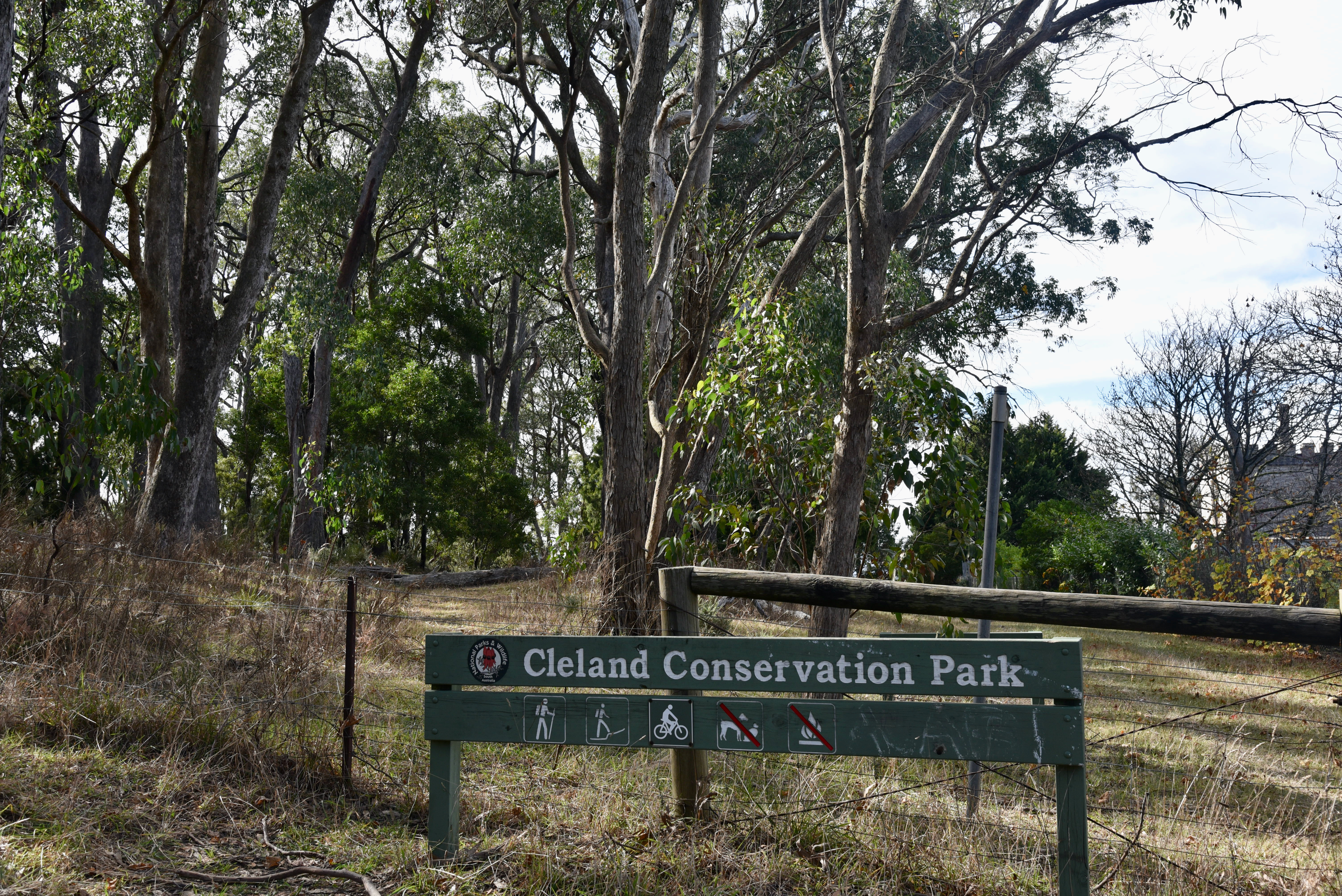
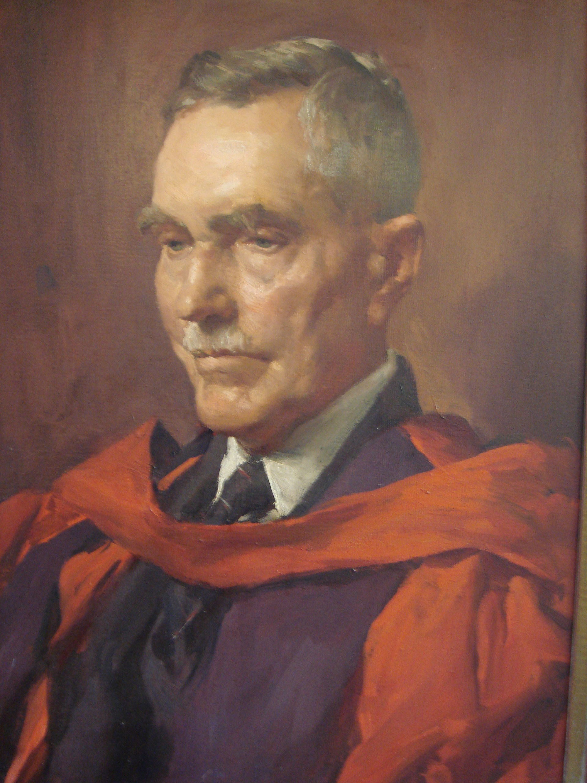
The park is named in honour of Sir. John Burton Cleland CBE (1878-1971) who was a renowned Australian naturalist, microbiologist, mycologist, and ornithologist. Following a successful career in medicine and pathology, Cleland became keenly interested in wildlife conservation.
Cleland Conservation Park is about 11.25 km2 in size and was established on the 1st day of January 1945.
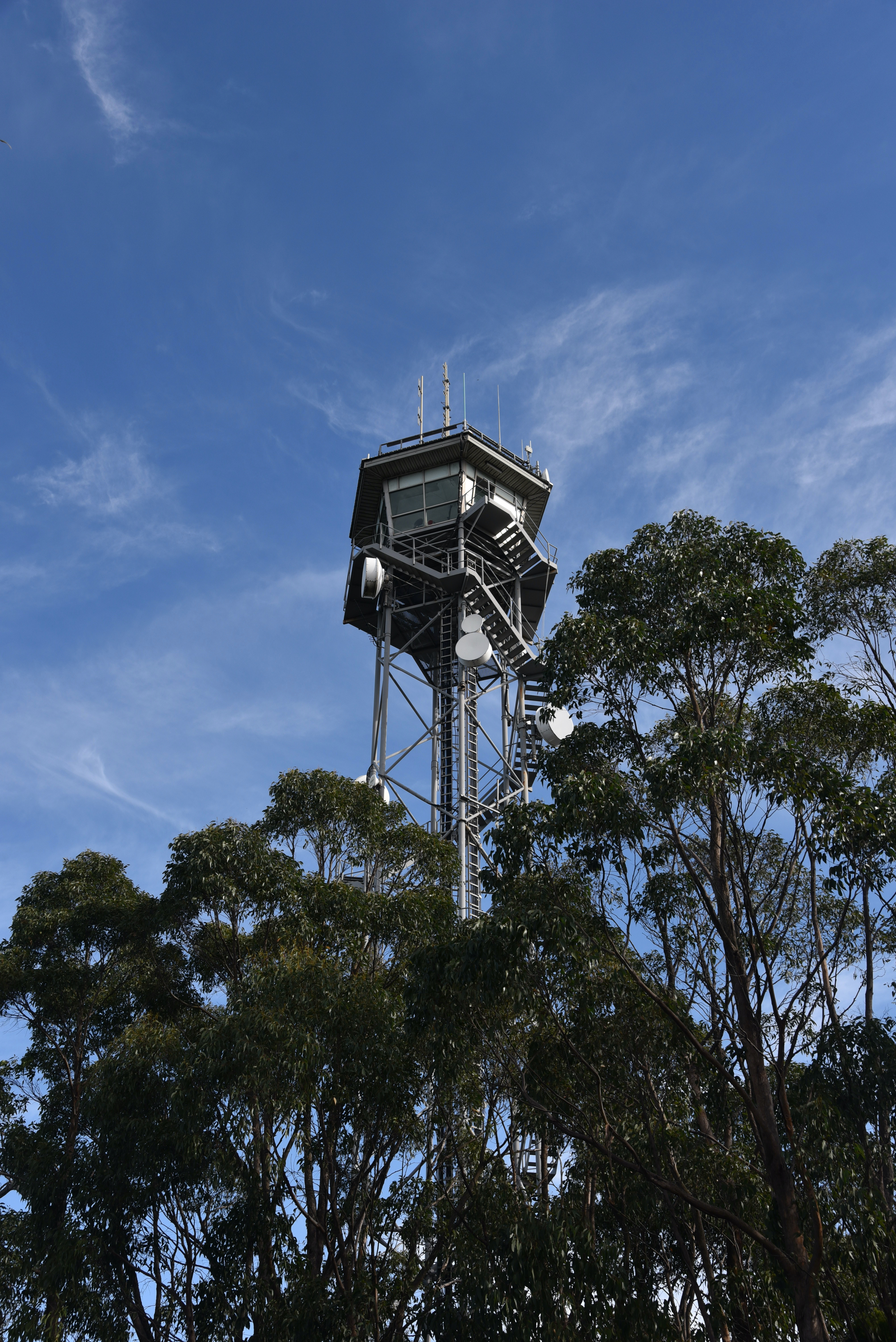
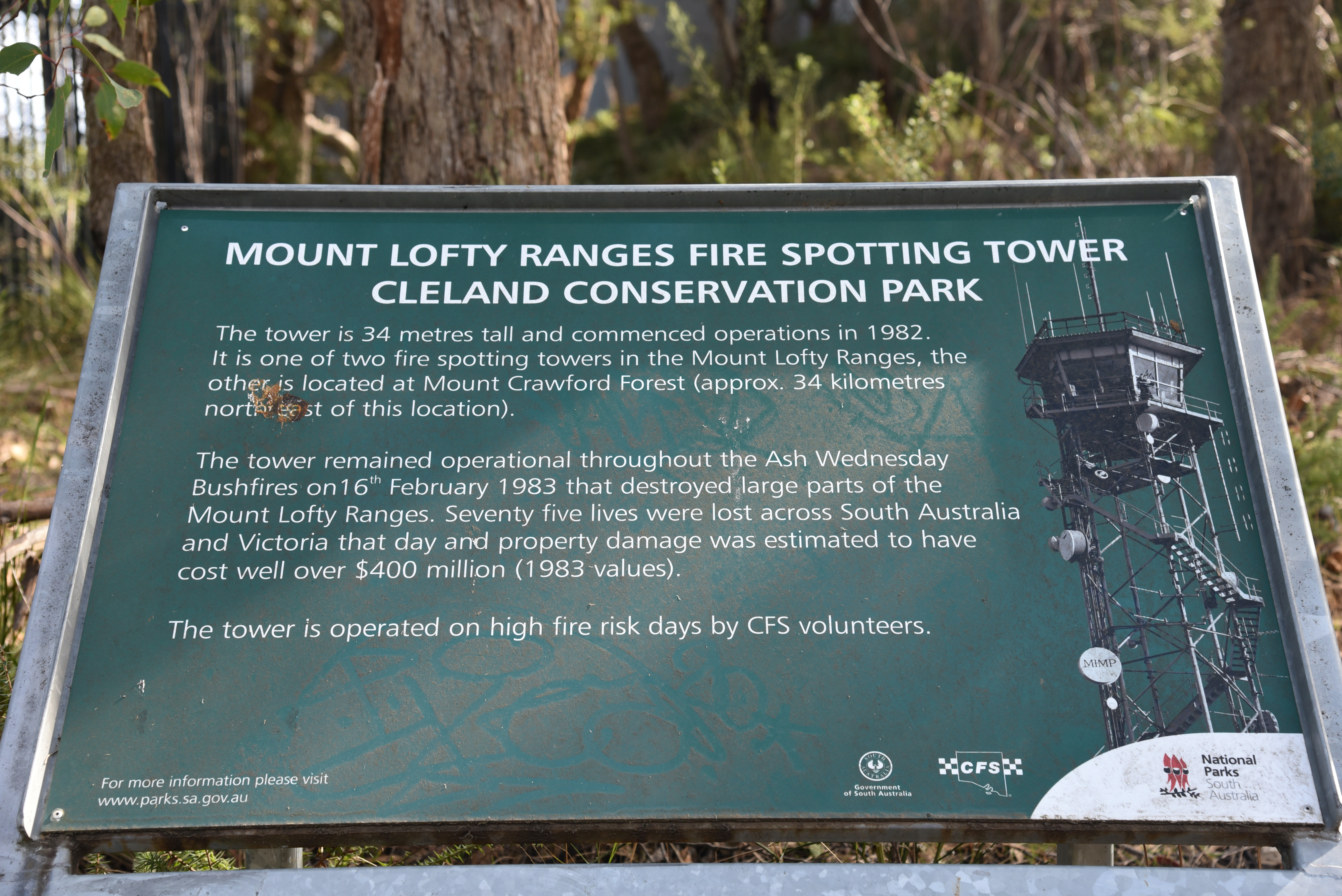
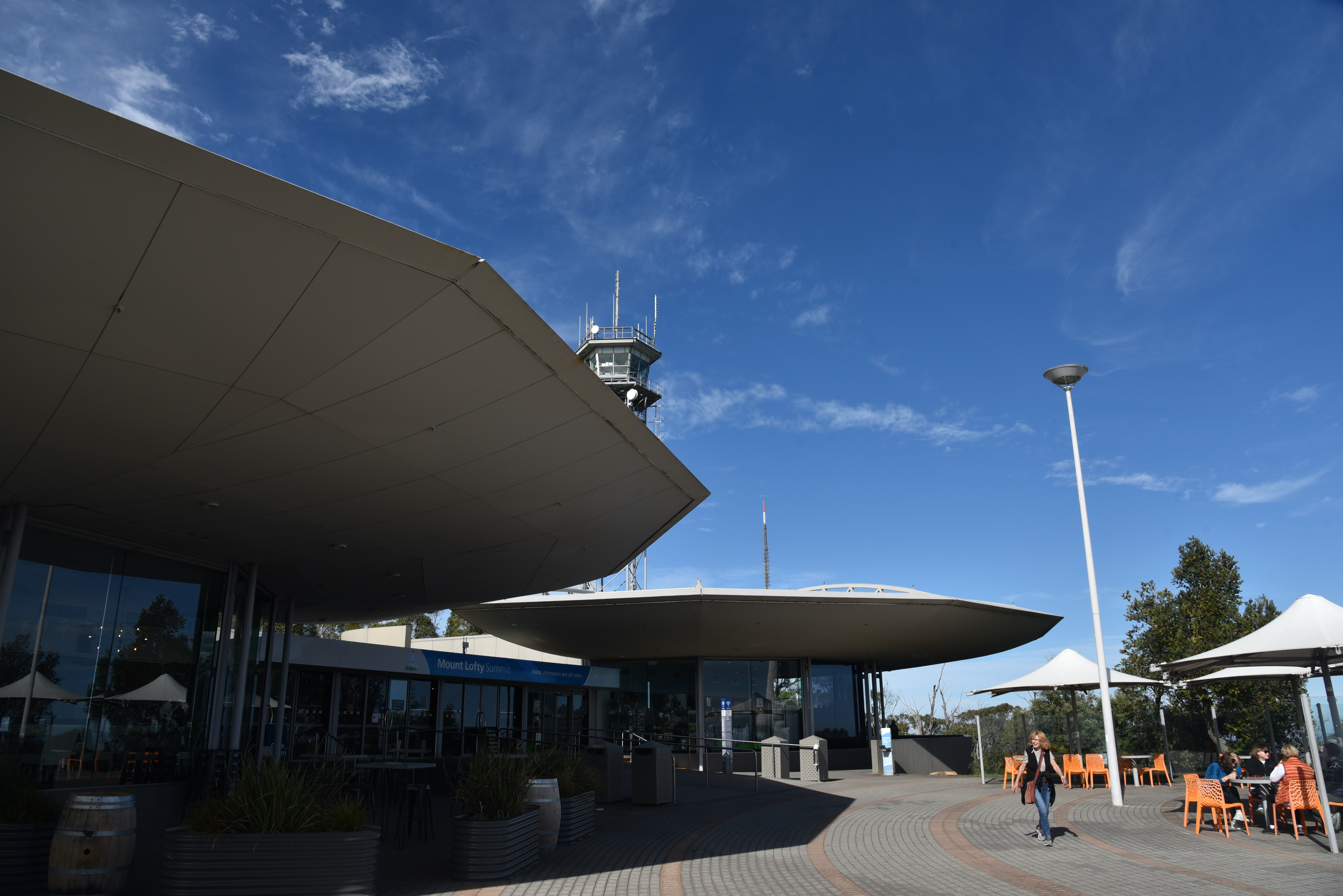
At Mount Lofty summit you can find the fire spotting tower which is 34 metres tall and commenced operation in 1982. It is one of two fire spotting towers in the Mount Lofty Ranges.
Mount Lofty summit also has a visitor information centre, cafe and restaurant. The old 1958 built tearooms at the summit were replaced with the new summit restaurant in 1997.
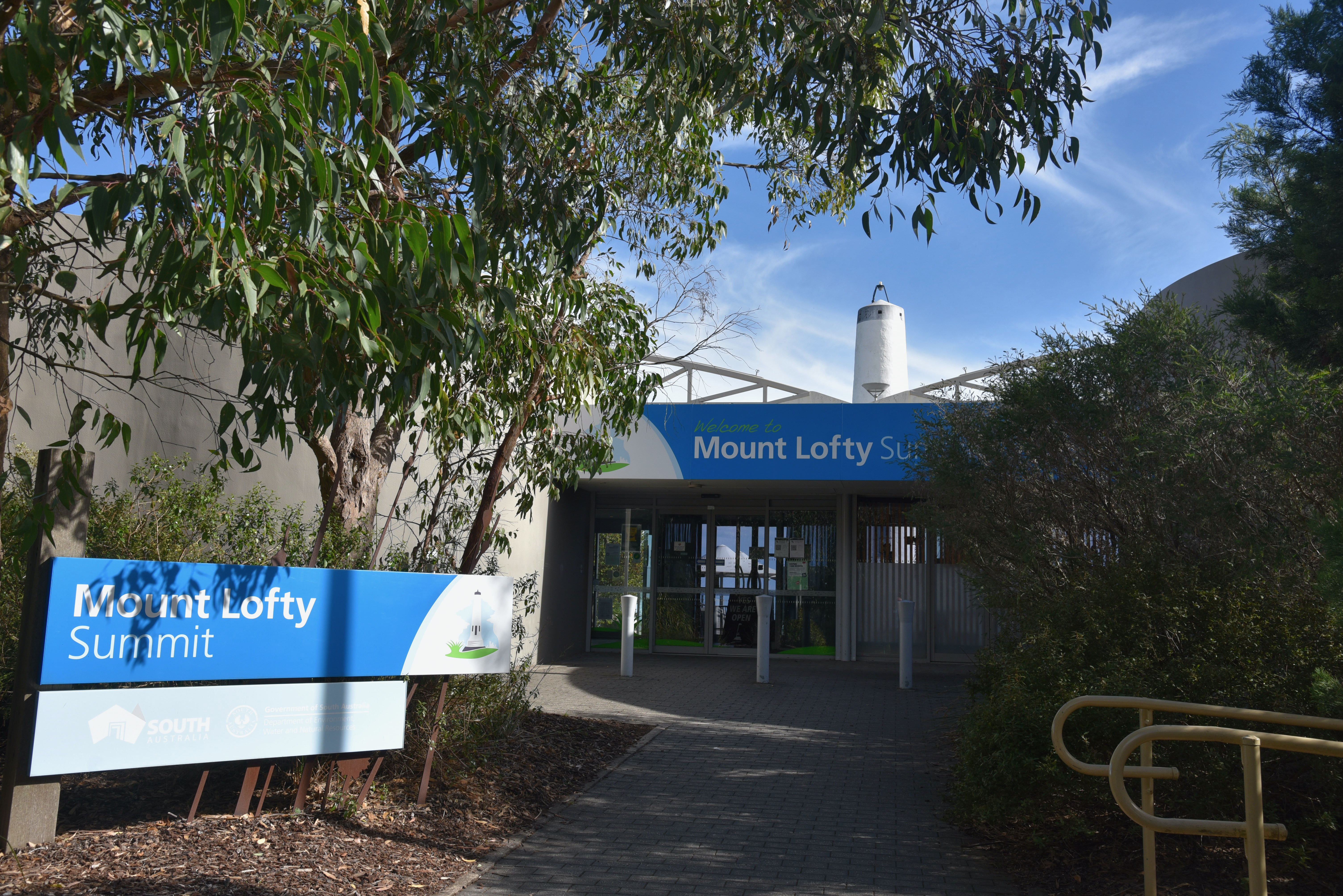
Just outside of the building is a paved outdoor area, with a number of spots under cover to enjoy a coffee or a meal.

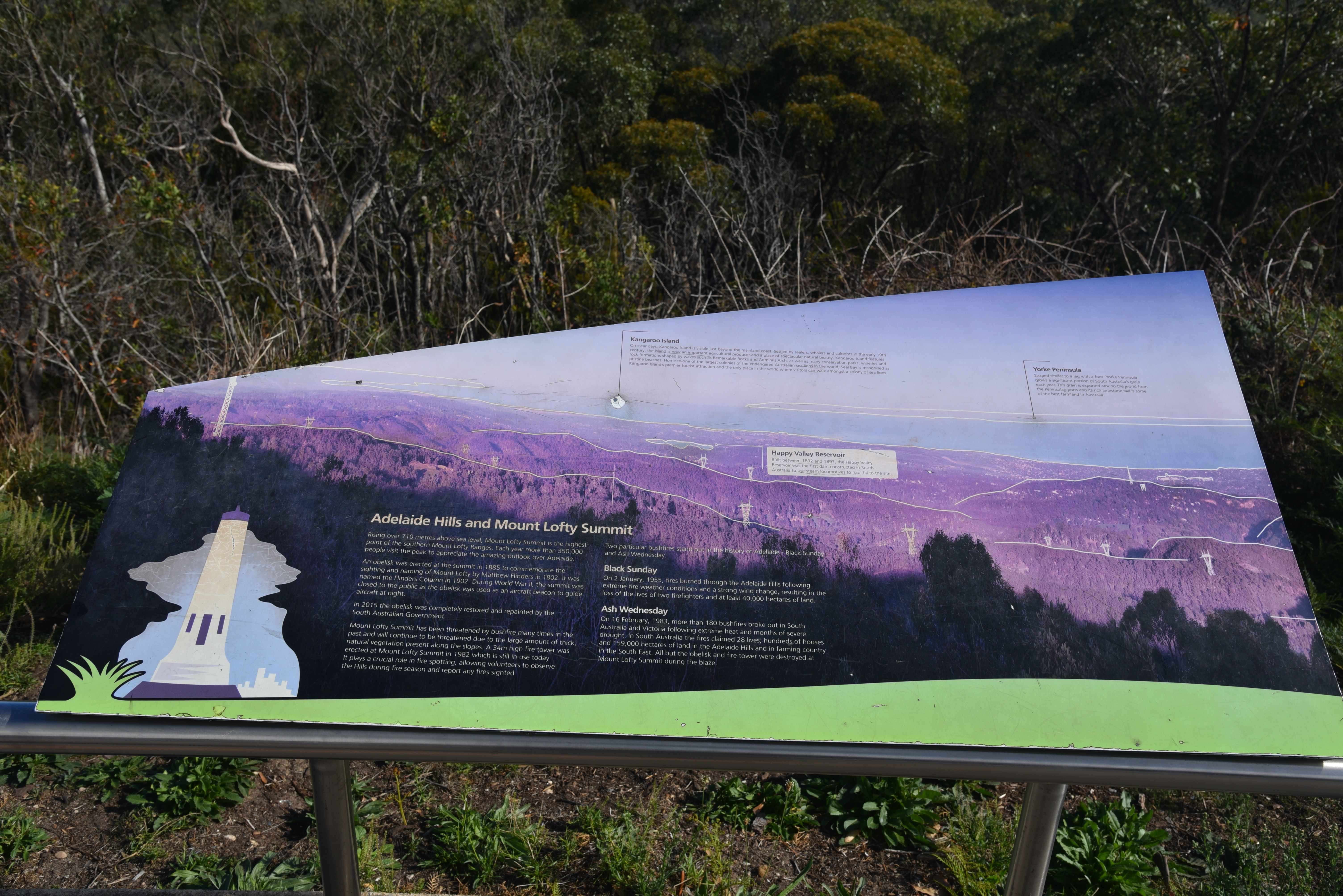
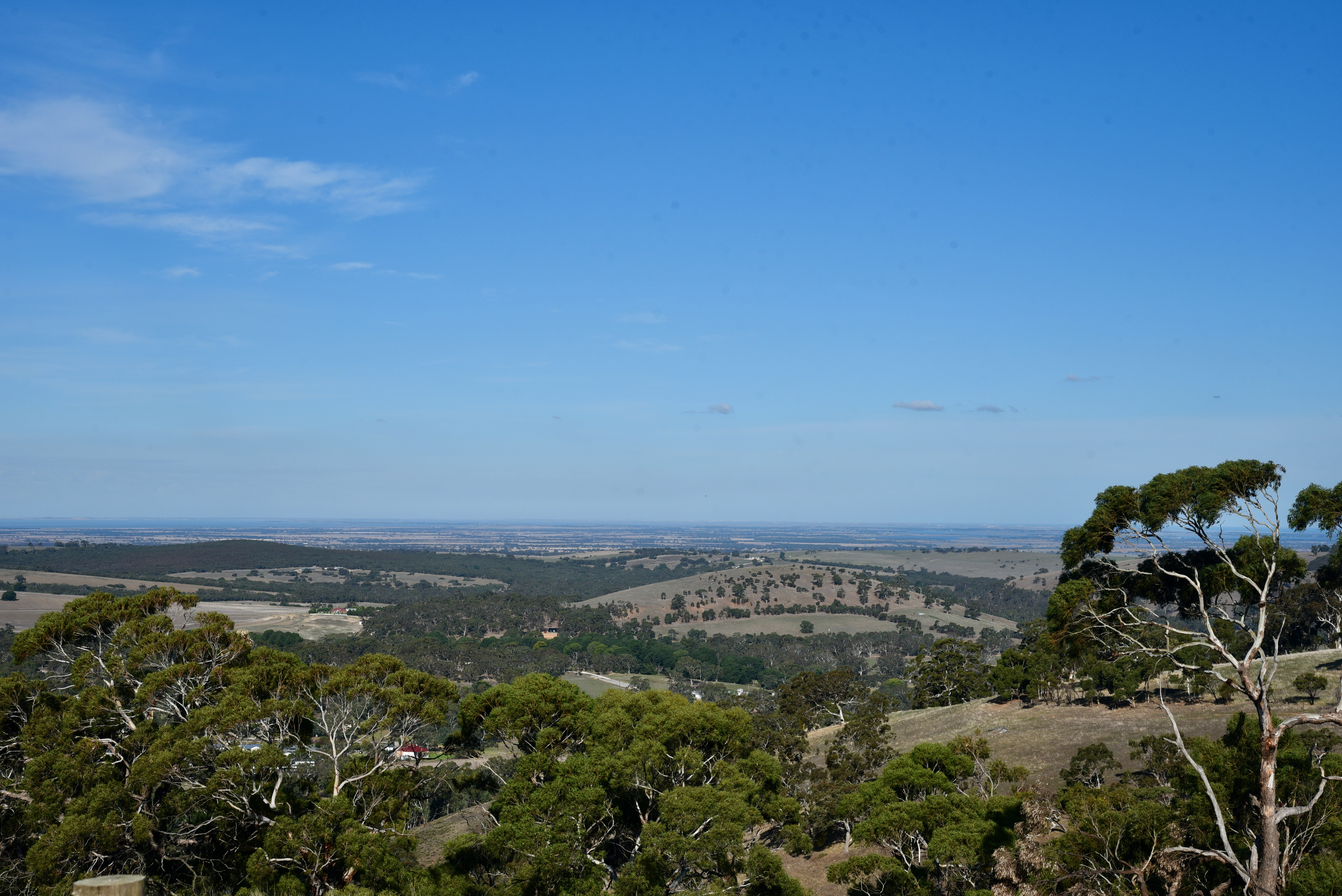
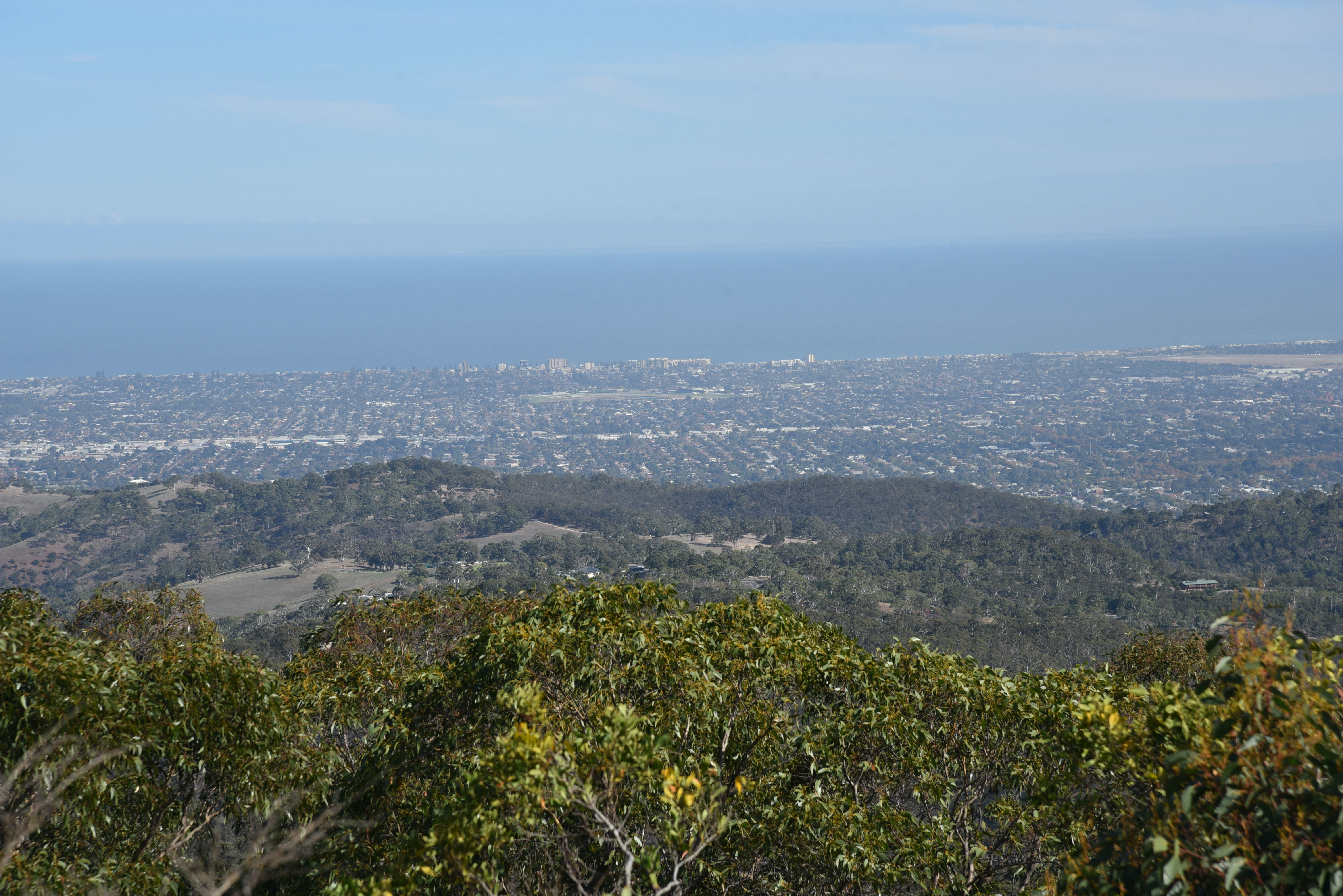
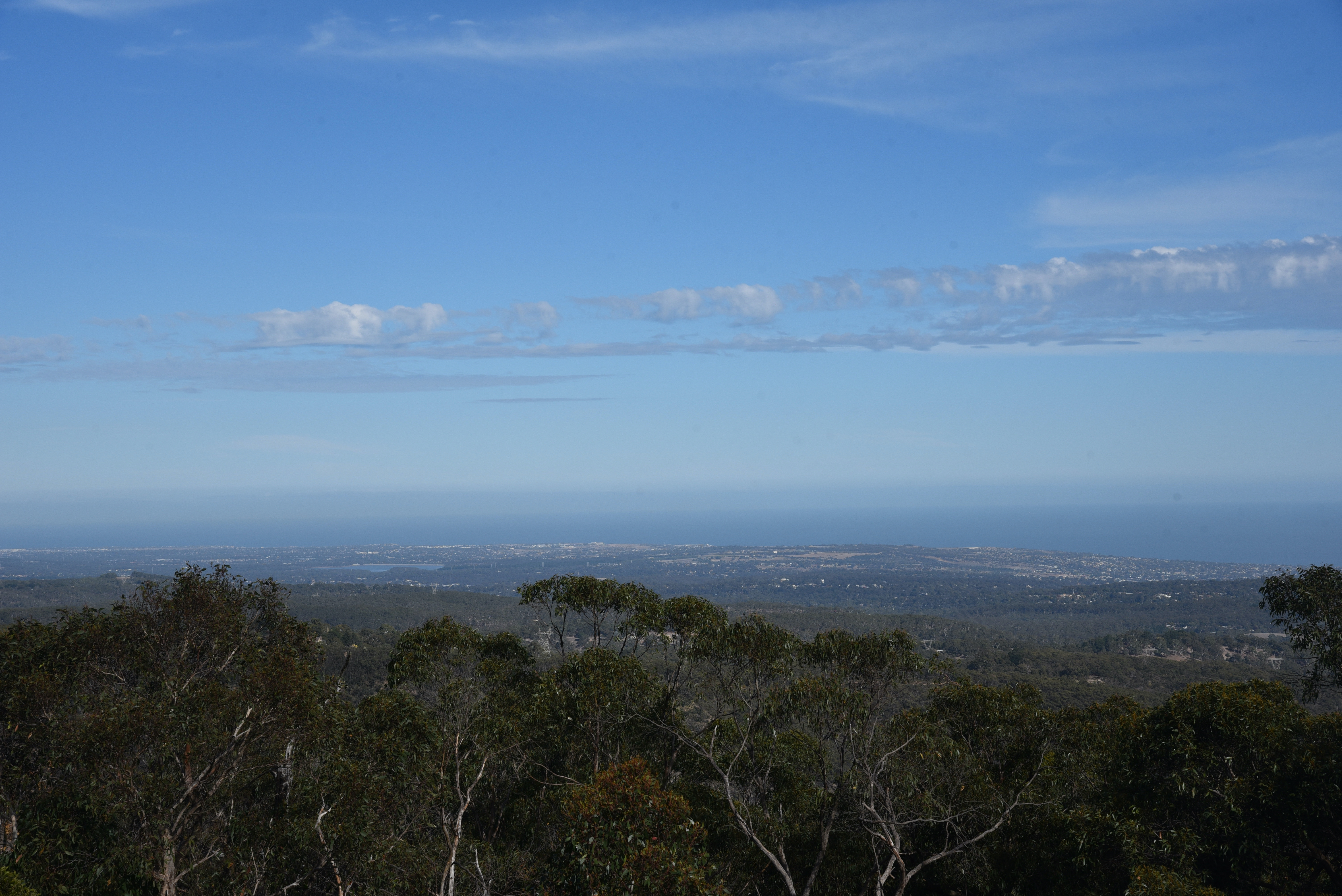
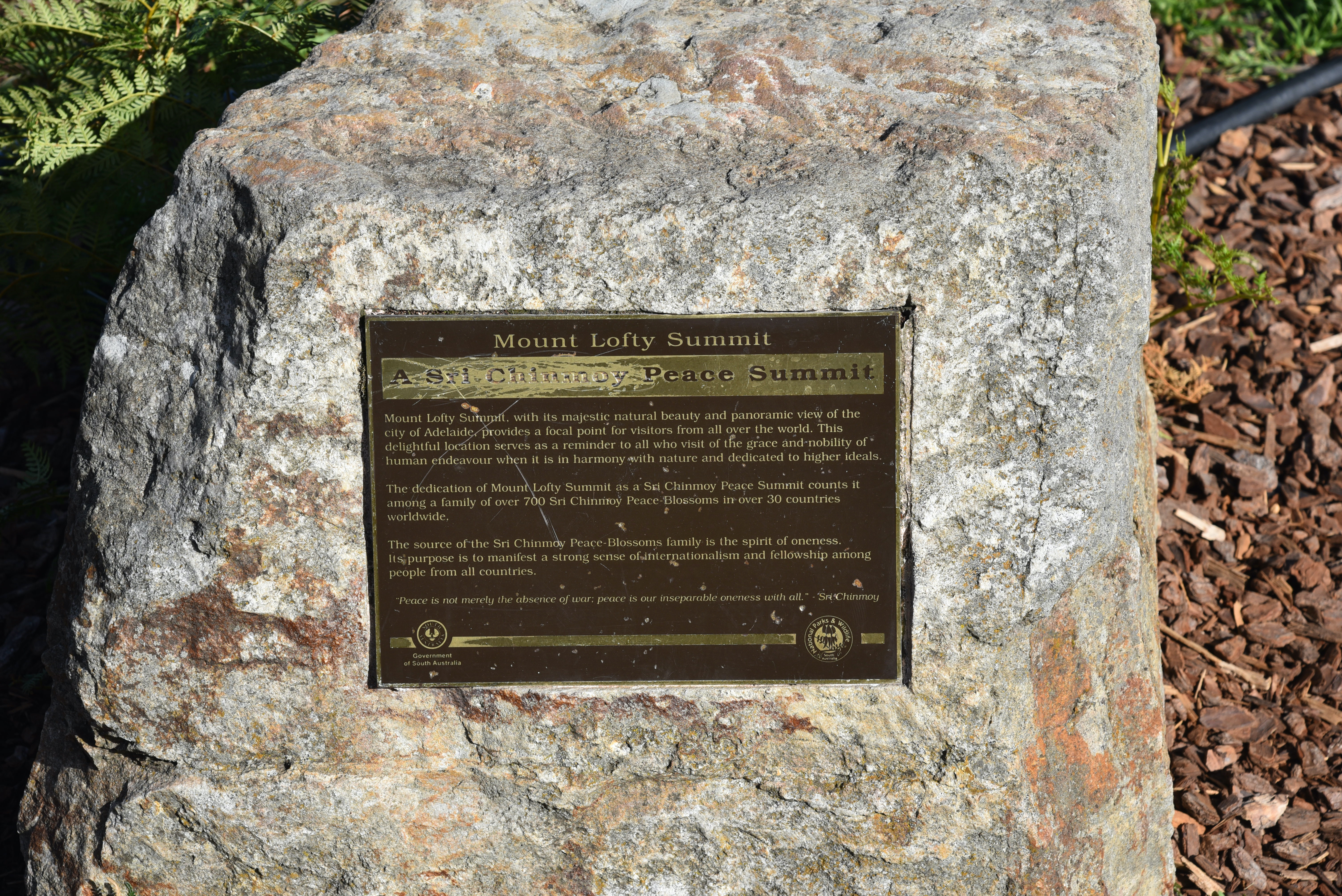
Some sensational panoramic views of the city of Adelaide and its suburbs can be enjoyed from Mount Lofty summit.
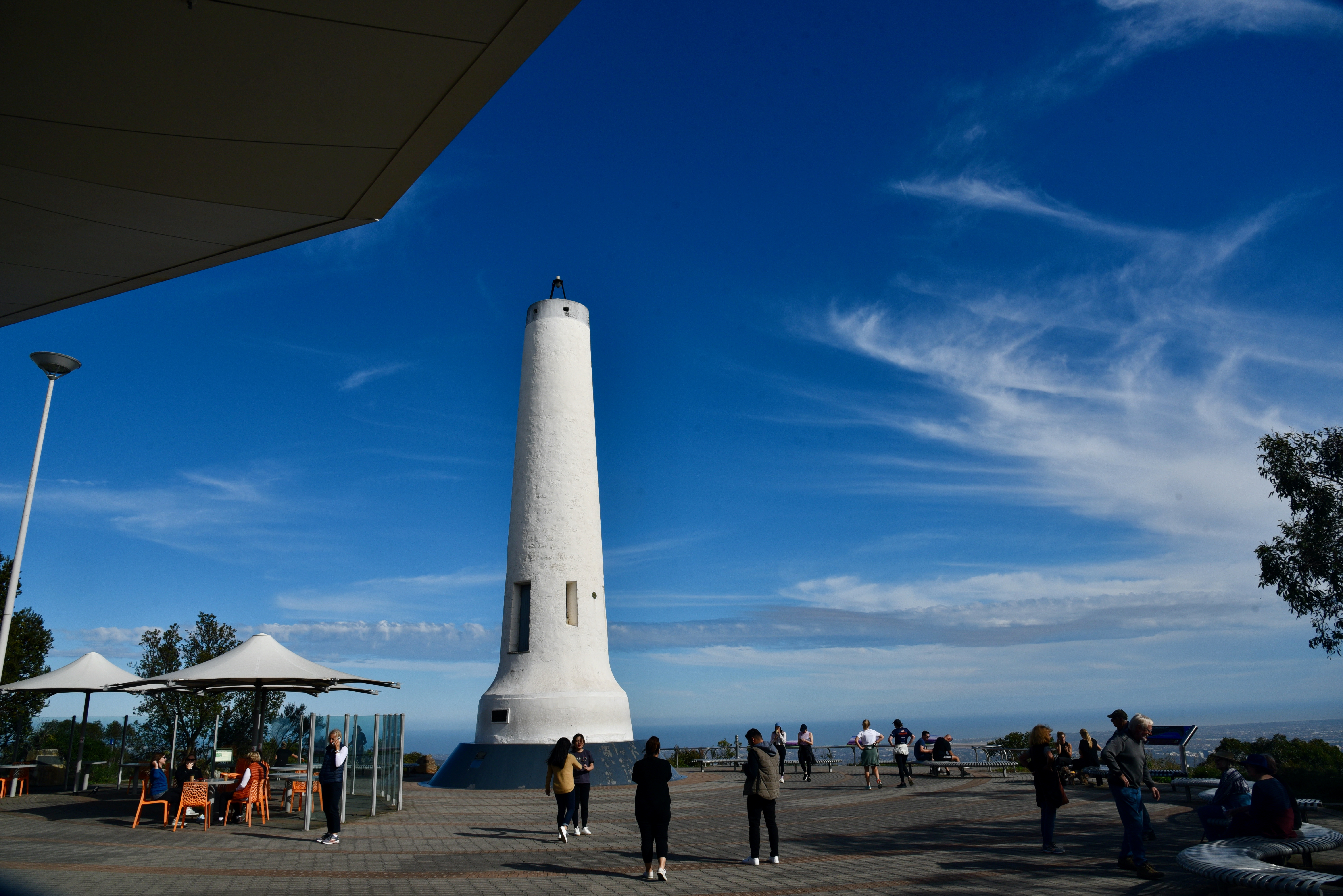
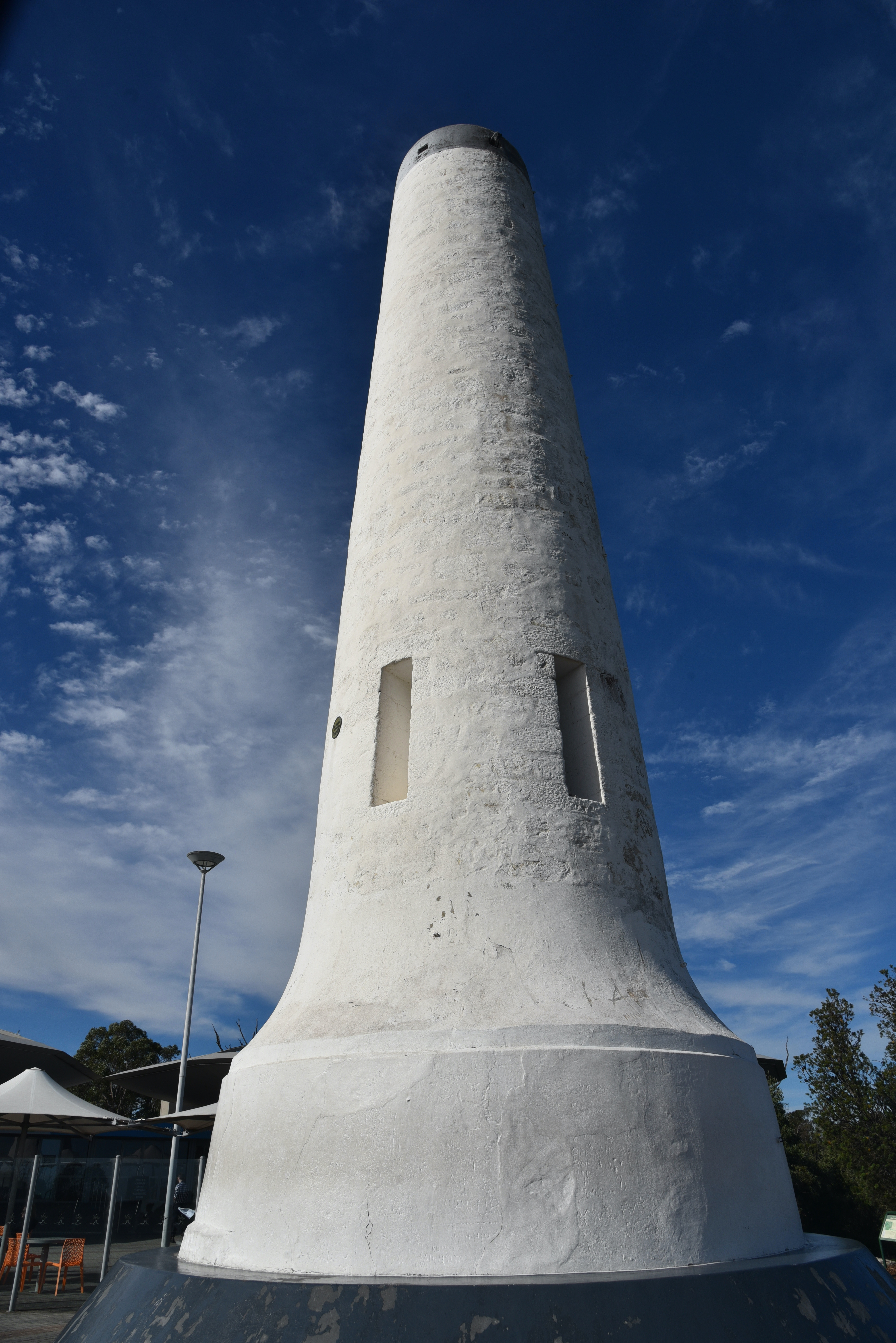
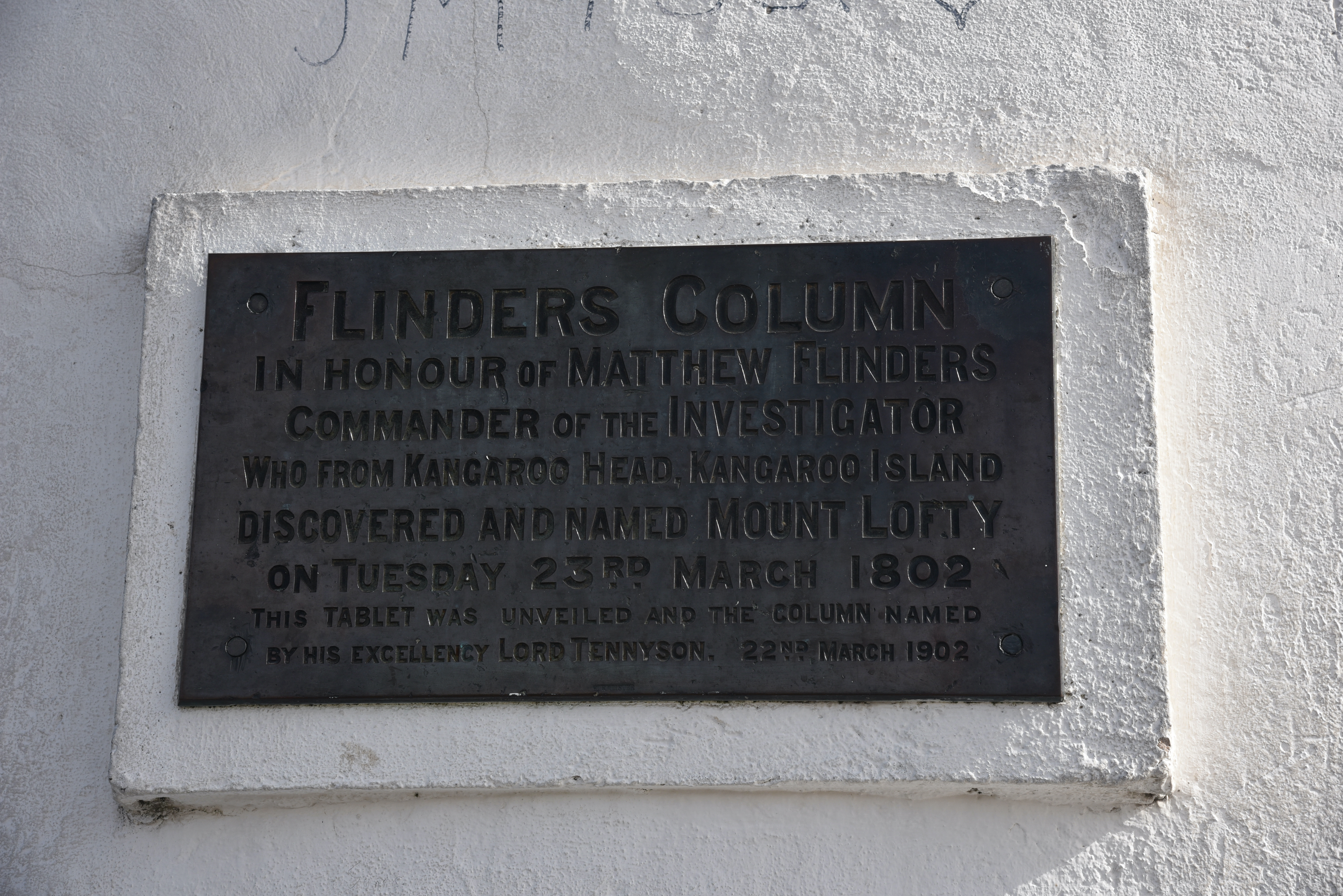
You can also find the obelisk known as Flinders Column. It was named in honour of the famous explorer Captain Matthew Flinders, who in 1802 from Kangaroo Island, discovered and named Mount Lofty. The obelisk was originally erected as a trig station in 1885.
A cairn of stones was erected on the summit in 1865, along with a table & chairs and a wooden flagstaff. The wooden flagstaff was replaced in 1885 when the stone tower was built.
At the summit you can also find a number of memorials, including one which honours the firefighters who fought the Ash Wednesday fires in 1983. The fires commenced on the 16th February 1983 on a day when the temperature reached 40 deg C with a strong, hot northerly wind. The fires resulted in the death of 28 people including 3 Country Fire Service volunteer firefighters. A total of 363 homes and 200 other buildings were destroyed and 160,000 hectares were burnt.
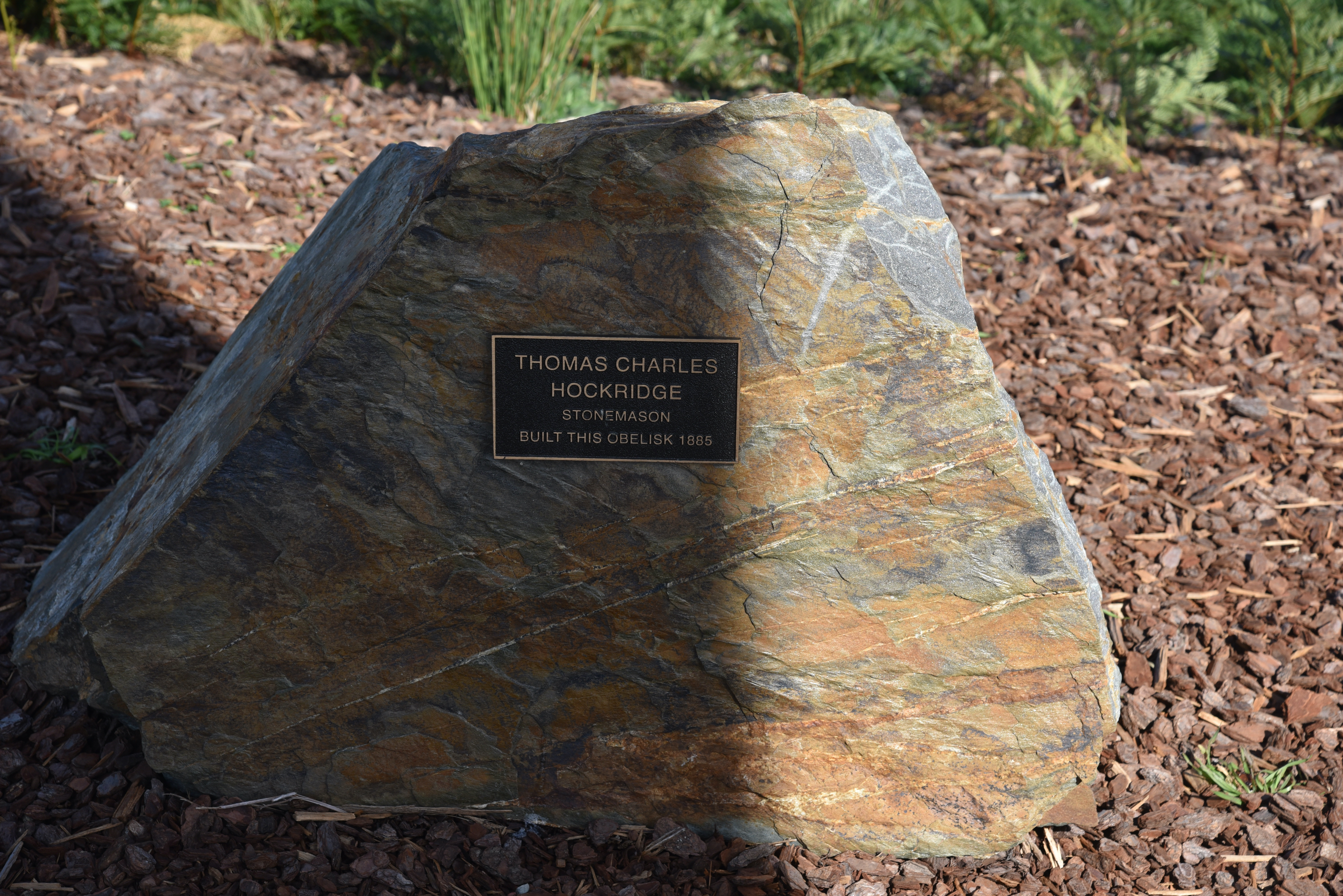
Another one acknowledges Thomas Charles Hockridge, the stonemason who erected the obelisk in 1885.

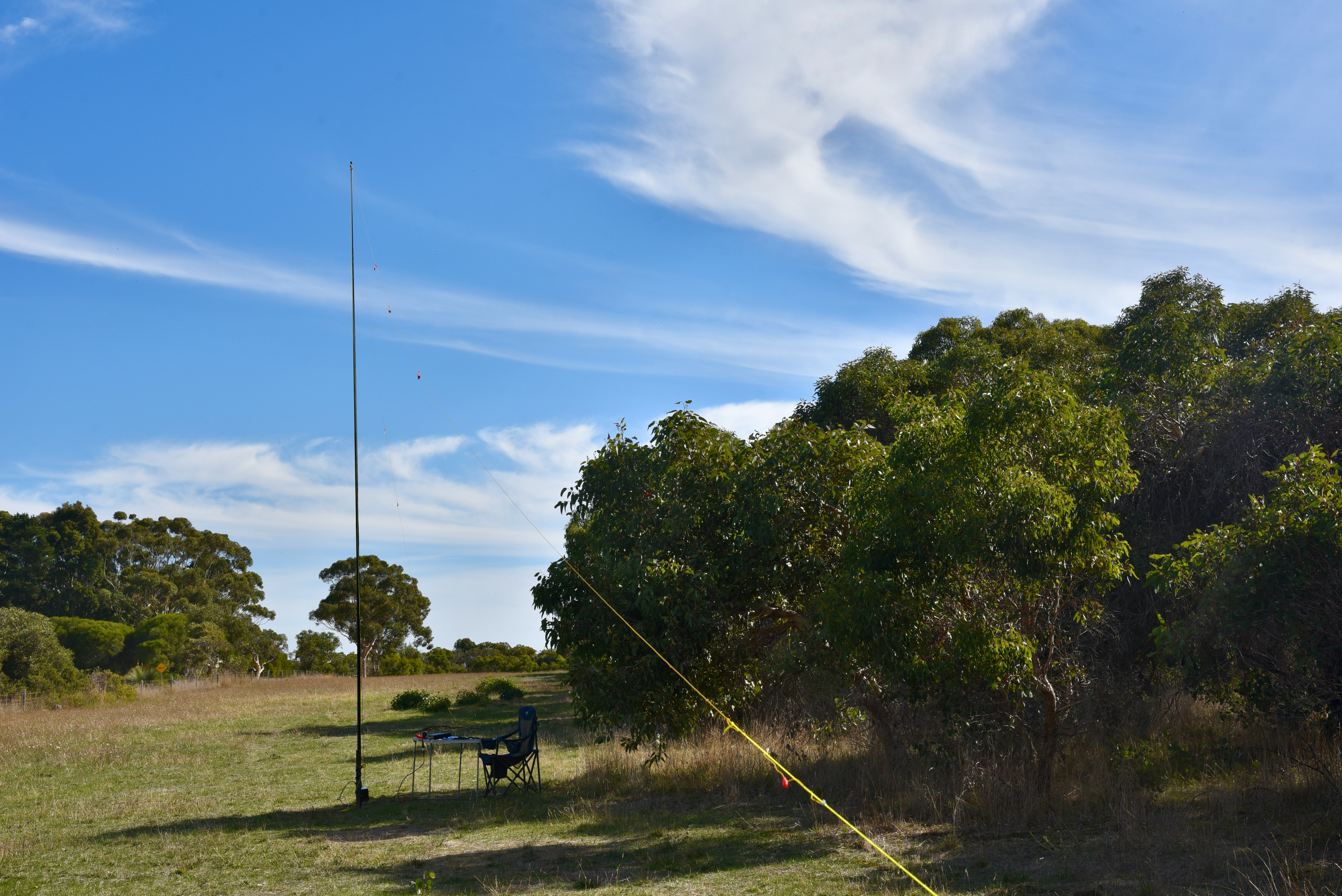
For this activation I ran the Yaesu FT857d, 40 watts, and the 20/40/80m linked dipole.
First in the log for the activation was Peter VK3PF, followed by Alan VK2MET, Neil VK4HNS, and Gerard VK2IO. With 4 contacts in the log, the summit has been qualified.
Callers were a bit thin, but I boxed on and logged a total of 23 stations on 40m before the UTC rollover at 9.30 a.m. South Australian local time. Contacts were made into VK1, VK2, VK3, VK4, VK5, VK6, and New Zealand.
After the UTC rollover I logged 12 from VK2, VK3, VK7, and New Zealand.
I then moved to the 80m band where I logged just 3 stations, all VK5’s.
I then headed to 20m and lgoged three stations from VK2 and New Zealand.
To conclude the activation I moved back to 40m and put out a few final CQ calls on 7.144, logging a total of 7 stations from VK2, VK3, VK4, VK6, and VK7.
Adjacent to where I was operating was Carminow Castle which was built in 1885 in Scottish baronial style as a summer house by the Scottish migrant Sir. Thomas Elder (1818-1897). Elder was a highly successful businessman, philanthropist, politician, race-horse owner and breeder, and public figure.
His main house was called Birksgate and was located at Urbrae. His summer house was Carminow.
It was later owned from 1902 by Sir. Langdon Bonython, a proprietor of the Advertiser newspaper. The castle was inherited by his grandson Kym Bonython (1920-2011). During the Second World War it was used to house up to 120 troops at a time.
With 48 QSOs in the log, it was time to pack up and head off to the Kyeema Conservation Park for a park activation using VK100AF.
I worked the following stations before the UTC rollover on 40m SSB:-
I worked the following stations after the UTC rollover on 40m SSB:-
I worked the following stations on 80m SSB:-
I worked the following stations on 20m SSB:-
References.
Australian Institute for Disaster Resiliance, 2021, <https://knowledge.aidr.org.au/resources/bushfire-ash-wednesday-victoria-and-south-australia-1983/>, viewed 17th May 2021.
flickr, 2021, <https://www.flickr.com/photos/82134796@N03/49944624172>, viewed 17th May 2021.
Medievalism in Australian Cultural History, 2021, <https://ausmed.arts.uwa.edu.au/items/show/536>, viewed 17th May 2021.
Monument Australia, 2021, <https://monumentaustralia.org.au/themes/landscape/exploration/display/51271-matthew-flinders>, viewed 17th May 2021.
Mount Lofty House, 2021, <https://www.mtloftyhouse.com.au/about/#mtloftyhistory>, viewed 17th May 2021.
SOTA, 2021, <https://summits.sota.org.uk/summit/VK5/SE-005>, viewed 16th May 2021.
Wikipedia, 2021, <https://en.wikipedia.org/wiki/Mount_Lofty>, viewed 16th May 2021.
Wikipedia, 2021, <https://en.wikipedia.org/wiki/Arthur_Hardy_(businessman)>, viewed 17th May 2021.
Wikipedia, 2021, <https://en.wikipedia.org/wiki/Mount_Lofty_Botanic_Garden>, viewed 17th May 2021.
Wikipedia, 2021, <https://en.wikipedia.org/wiki/Adelaide_Establishment>, viewed 17th May 2021.
Wikipedia, 2021, <https://en.wikipedia.org/wiki/St_Michael%27s_House>, viewed 17th May 2021.
Wikipedia, 2021, <https://en.wikipedia.org/wiki/Cleland_Conservation_Park>, viewed 17th May 2021.
Wikipedia, 2021, <https://en.wikipedia.org/wiki/Thomas_Elder>, viewed 17th May 2021.
Wikipedia, 2021, <https://en.wikipedia.org/wiki/Collet_Barker>, viewed 17th May 2021.
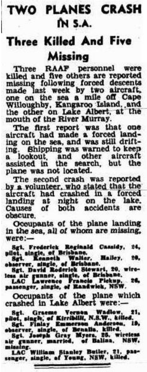
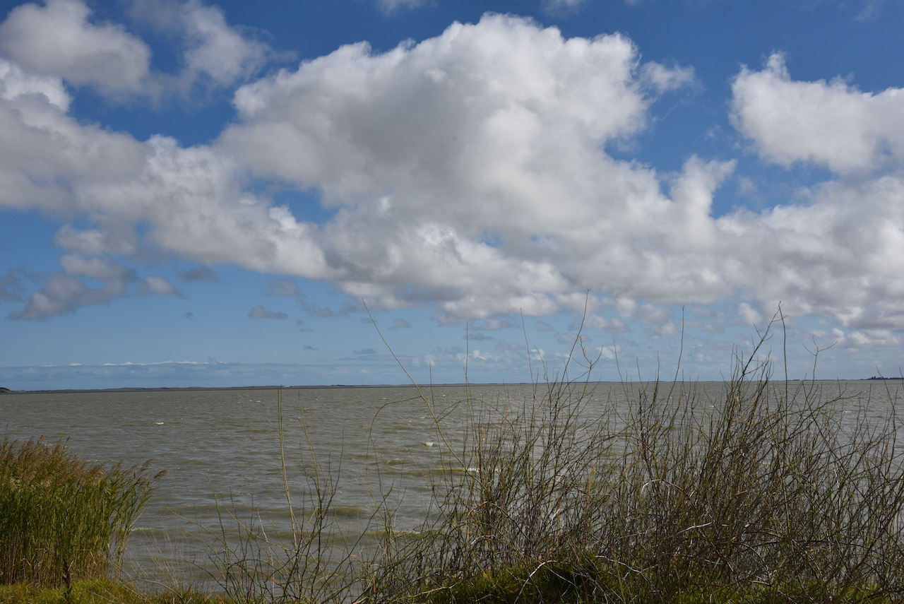
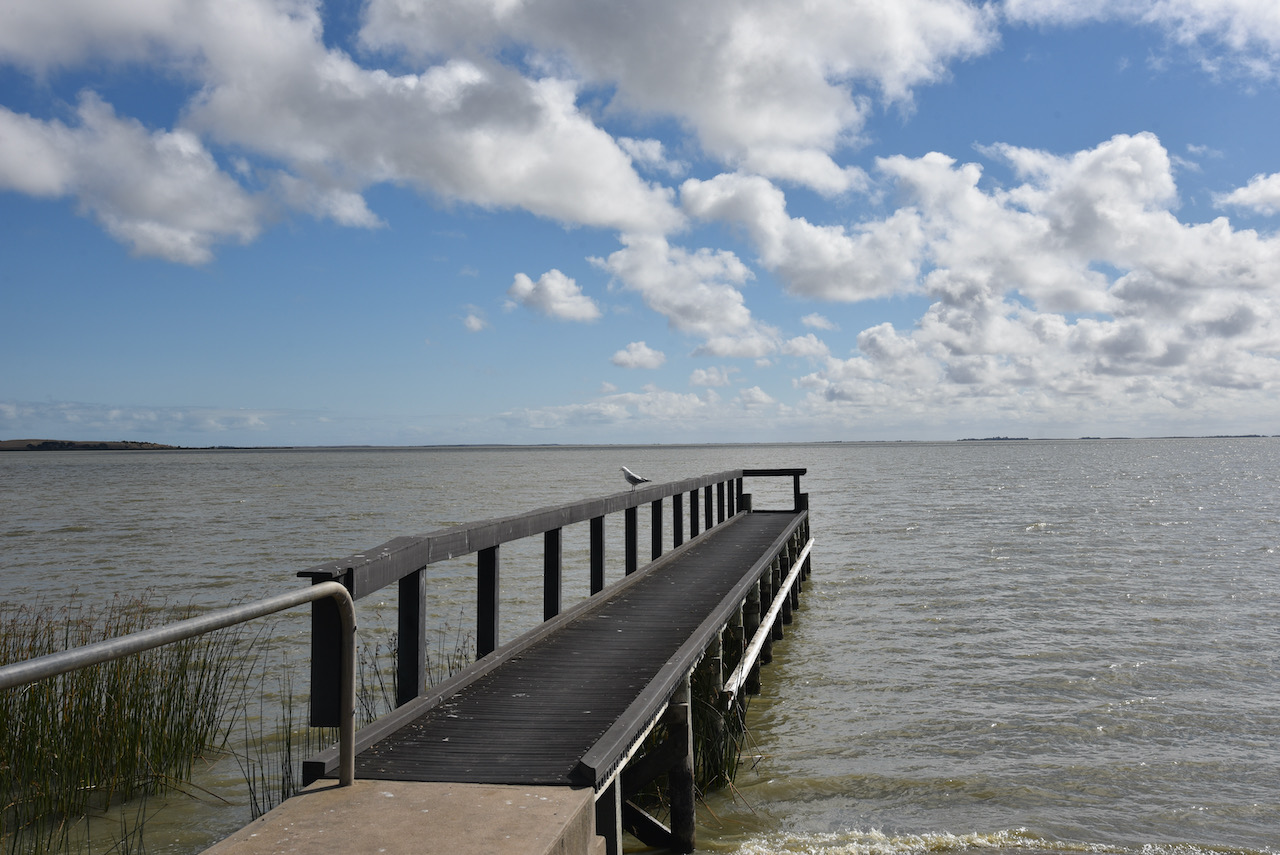
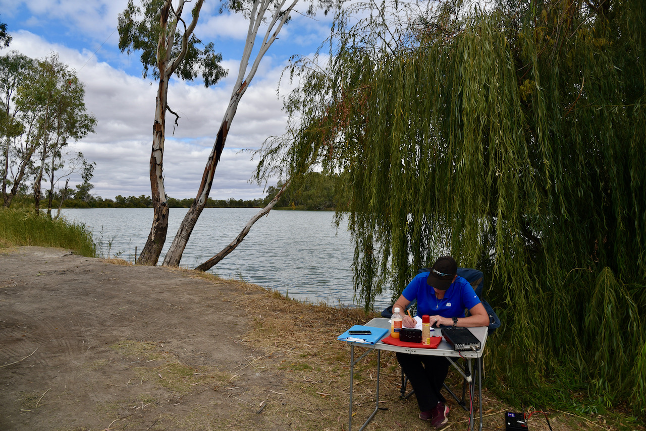
On Saturday 24th April 2021, myself and Marija VK5MAZ headed to Lake Albert at Meningie, about 149km south-east of Adelaide. We intended to operate with the special event callsign of VK100AF to commemorate 4 Royal Australian Air Force (RAAF) personnel who were killed in 1942 at Lake Albert.
VK100AF and VI100AF are two special event callsigns which have been on air since 1st March 2021, to celebrate the 100 year anniversary of the Royal Australian Air Force. Marija and I have been very lucky to take part in the event using both of the callsigns.
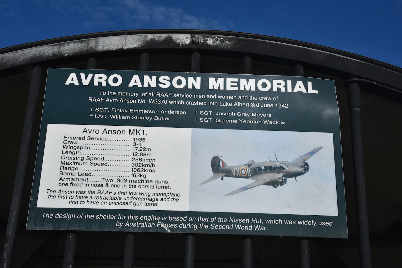
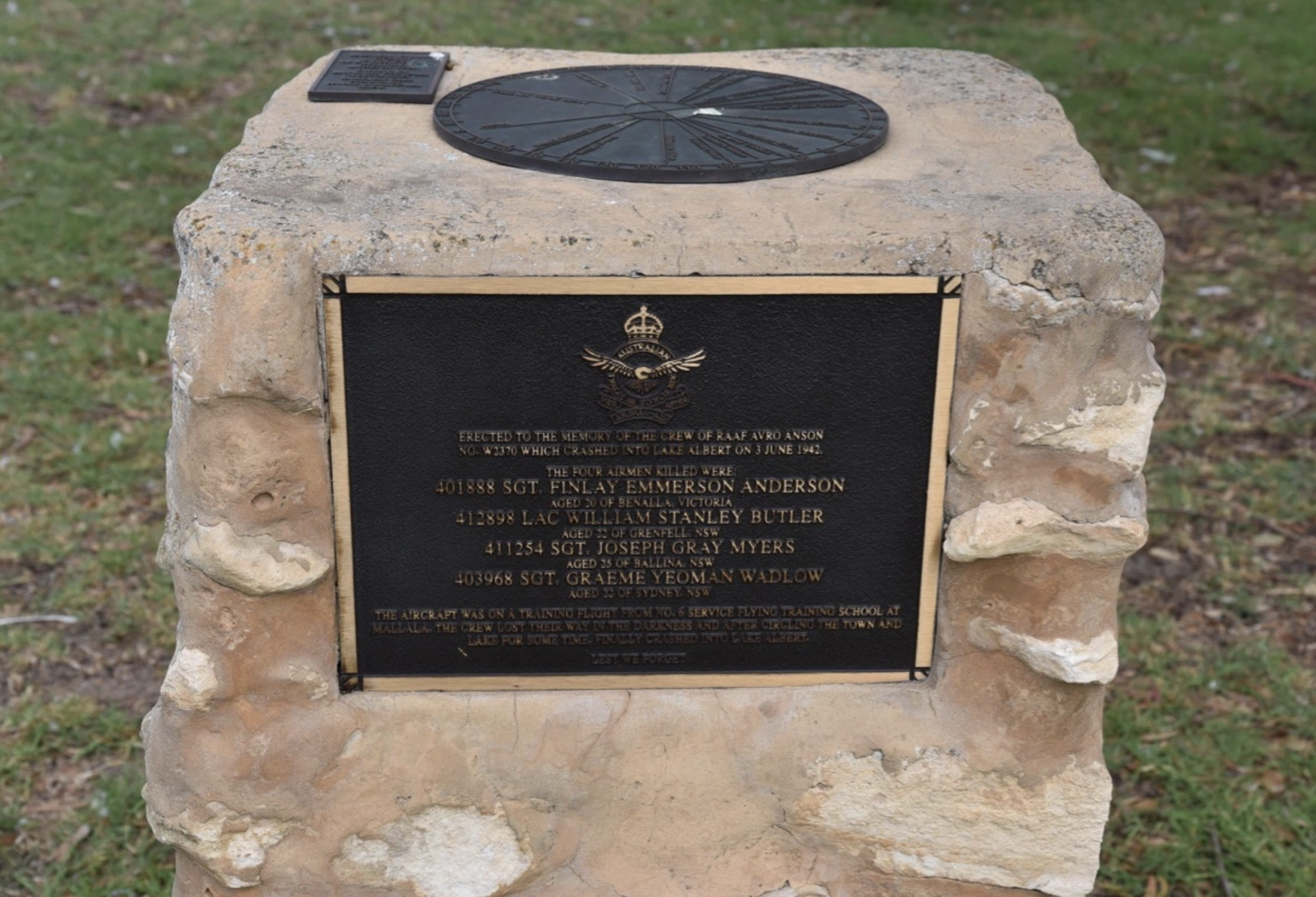
On the 3rd day of June 1942, an Avro Anson, No. W2370, was on a training flight from No. 6 Service Flying Training School at Mallalla. The crew on board lost their way in the darkness and after circling the town of Meningie and Lake Albert for some time, the aircraft finally crashed into Lake Albert.
The Avro Anson was a British twin-engined, multi role aircraft, which was manufactured by British aircraft manufacturer Avro (1910-1963).

A total of 6,688 MK1 Avro Anson aircraft were built. They were powered by two 350hp (261 kW) Armstrong Siddeley Cheetah 1X or 395 hp (295 kW) engines. Large numbers of the Avro Anson served in various roles for the Royal Air Force (RAF) in Britain, the Royal Australian Air Force (RAAF), the Canadian Air Force and numerous other air forces before, during, and after World War Two.
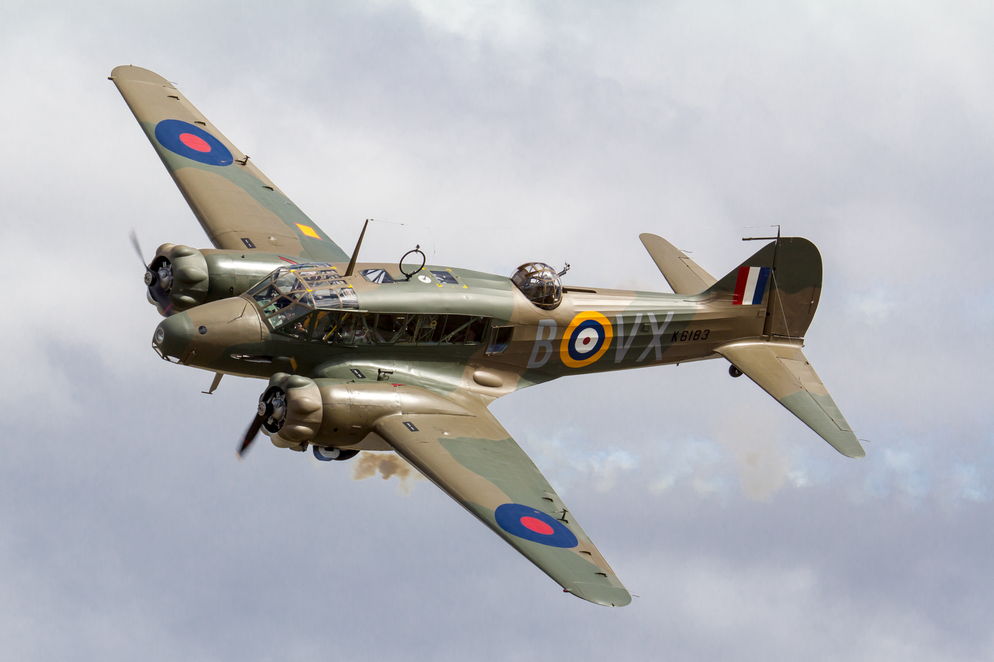
A total of 1,028 Ansons were operated by the Royal Australian Air Force, with the majority being MK1’s. The RAAF initially ordered 33 Ansons in November 1935 to fill the maritime reconnaissance role. The first were delivered in 1936 and 48 were in service before the start of the war. These aircraft continued to operate until 1955.
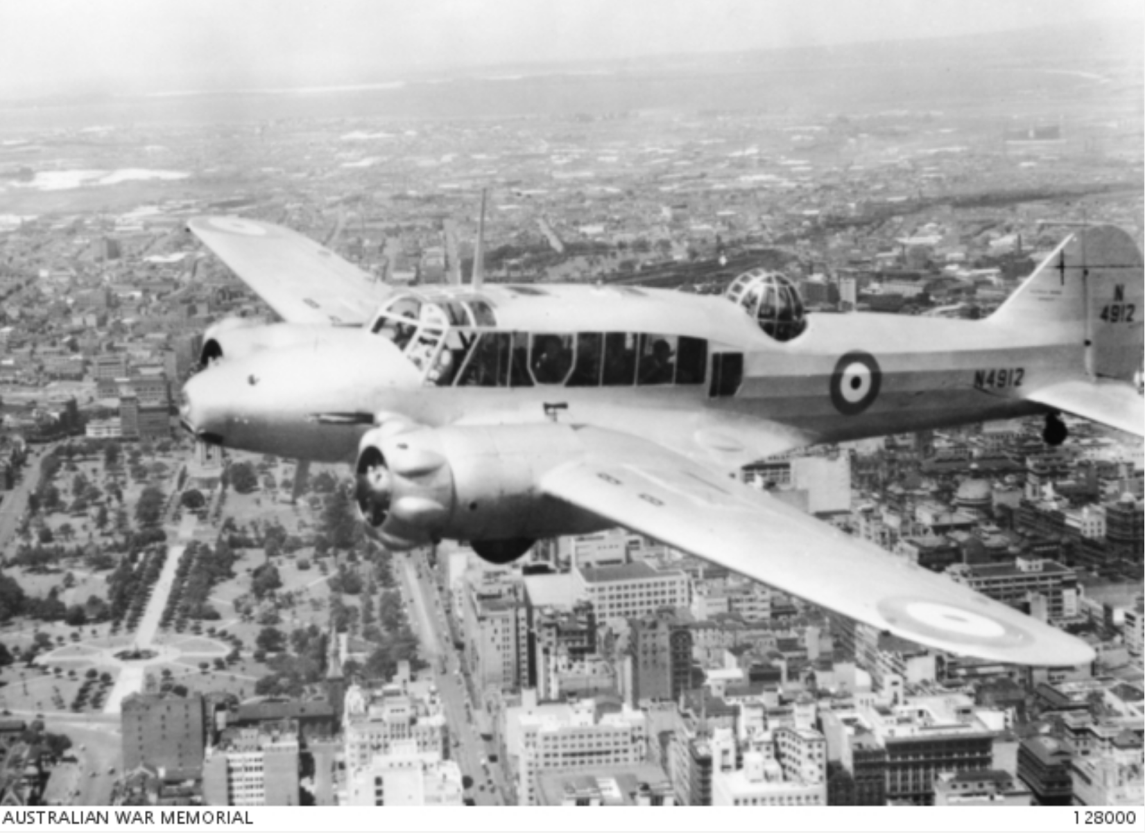
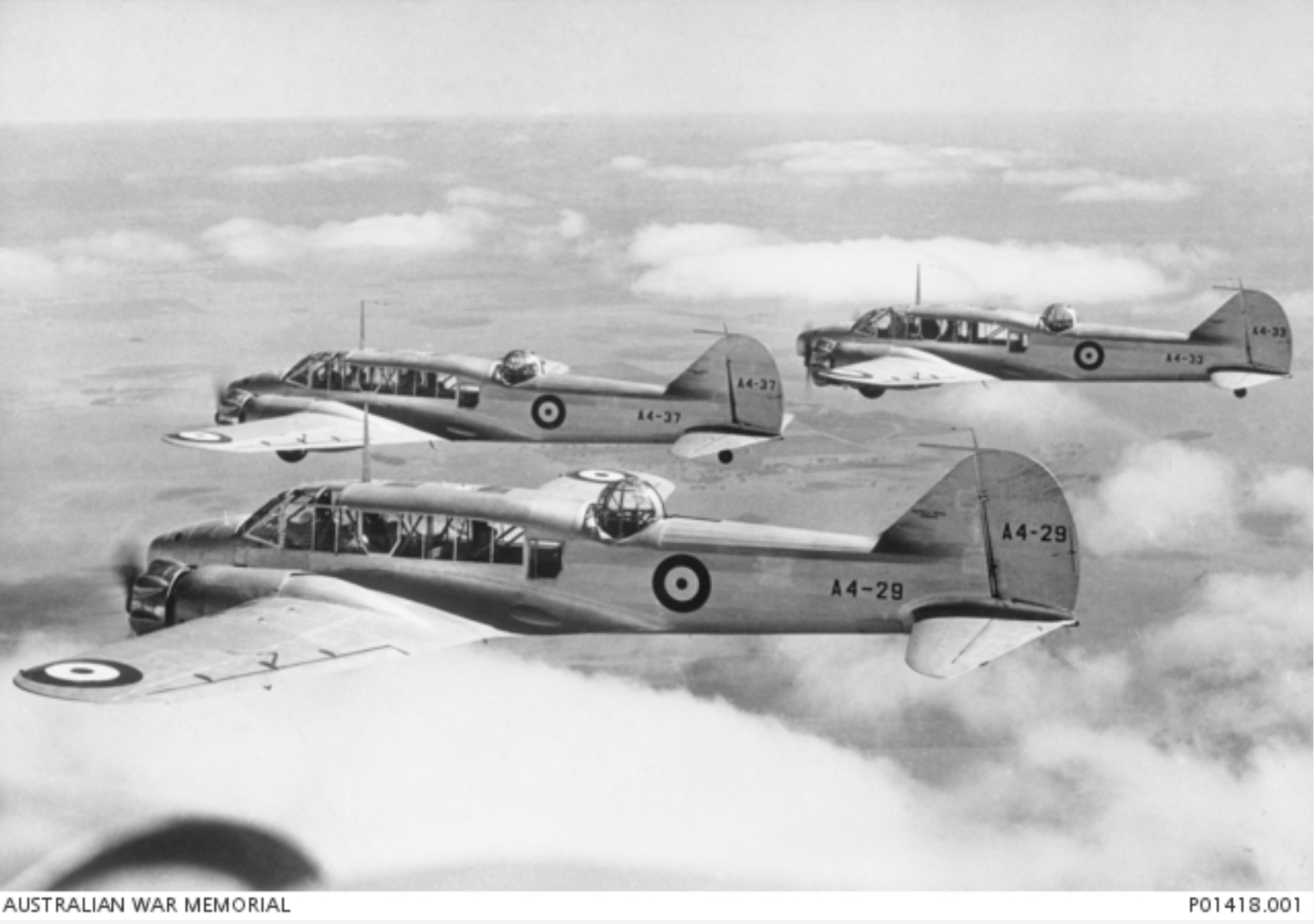
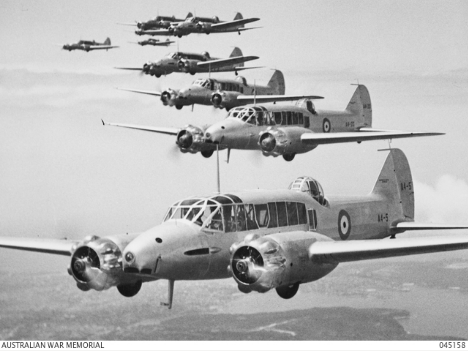
Above:- Avro Anson RAAF aircraft. Images c/o Australian War Memorial.
Here are a couple of videos on the Avro Anson……
Those killed on board the aircraft were:-
401888 Sgt. Finlay Emmerson Anderson
Aged 20 of Benalla, Victoria
412898 LAC William Stanley Butler
Aged 22 of Grenfell, NSW
4122254 Sgt. Joseph Gray Myers
Aged 25 of Ballina, NSW
403968 Sgt. Graeme Yeoman Wadlow
Aged 22 of Sydney NSW.
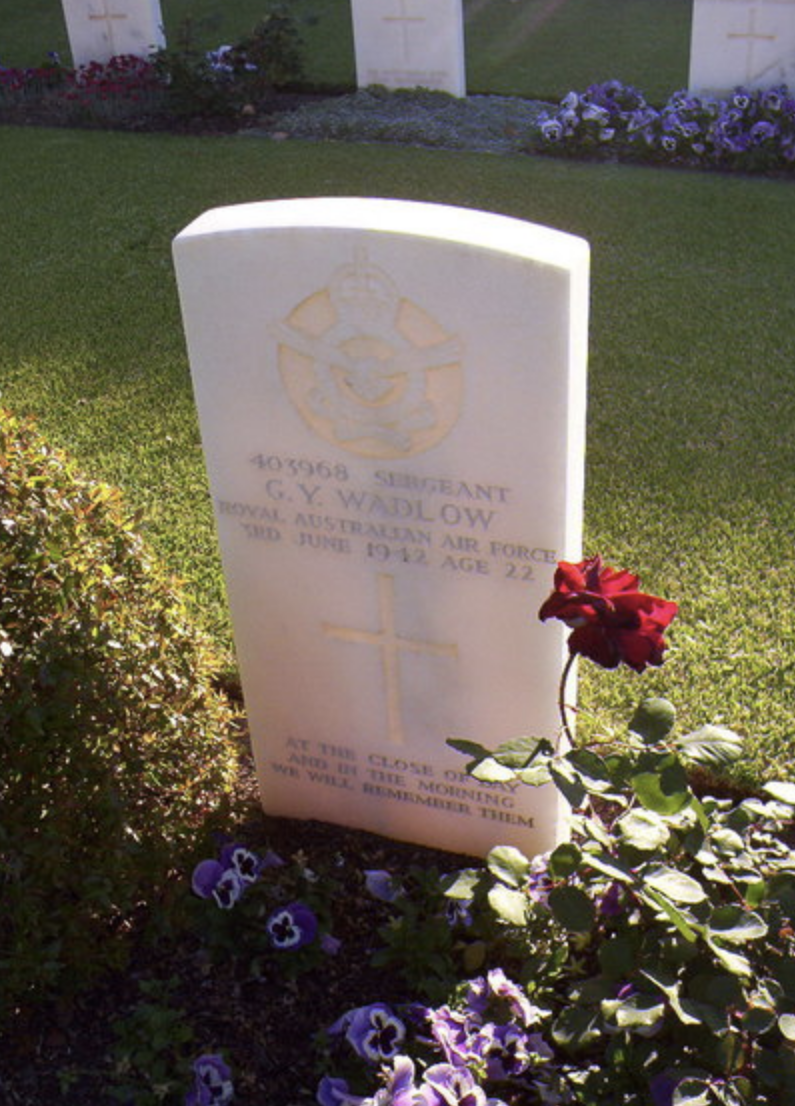
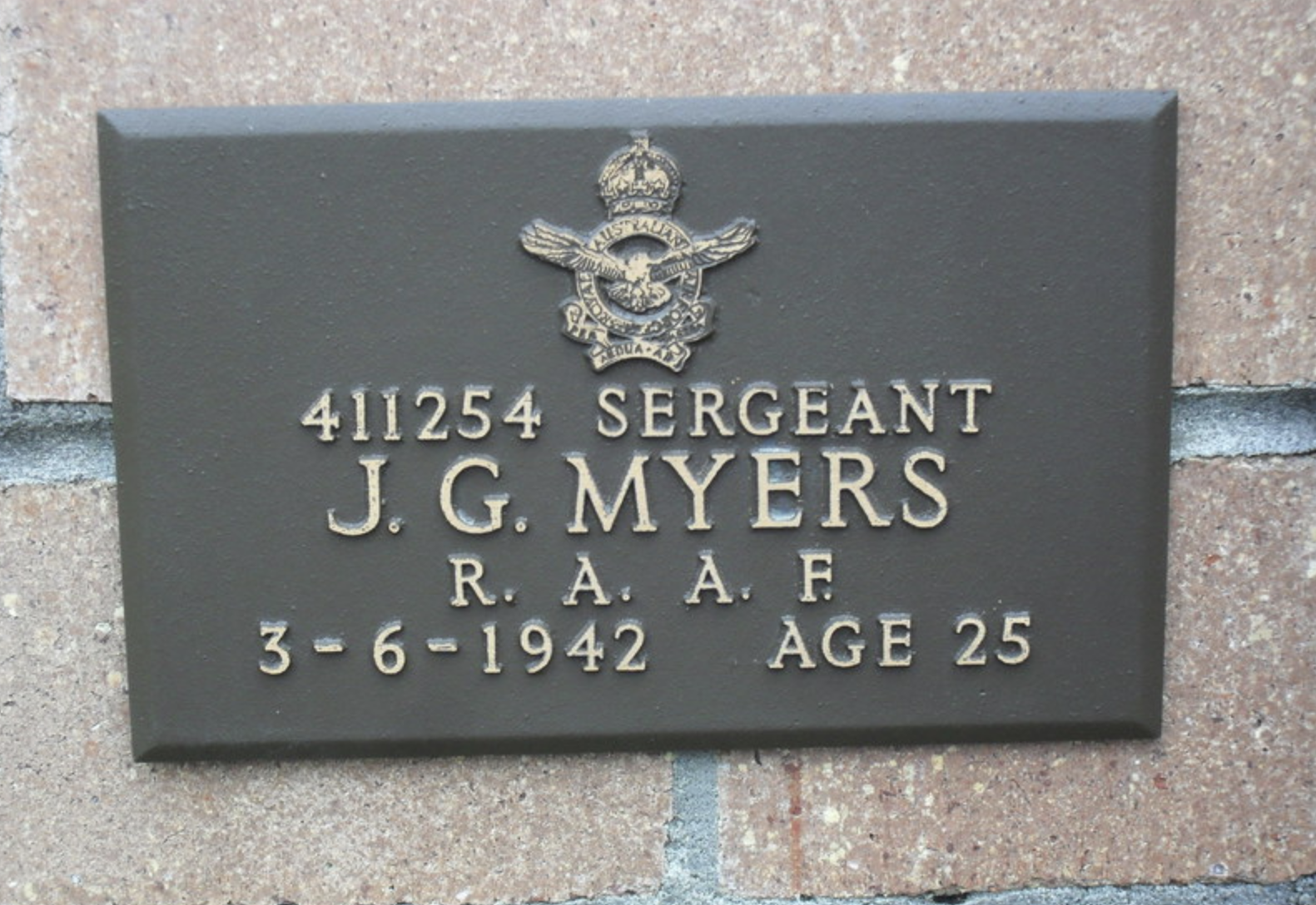
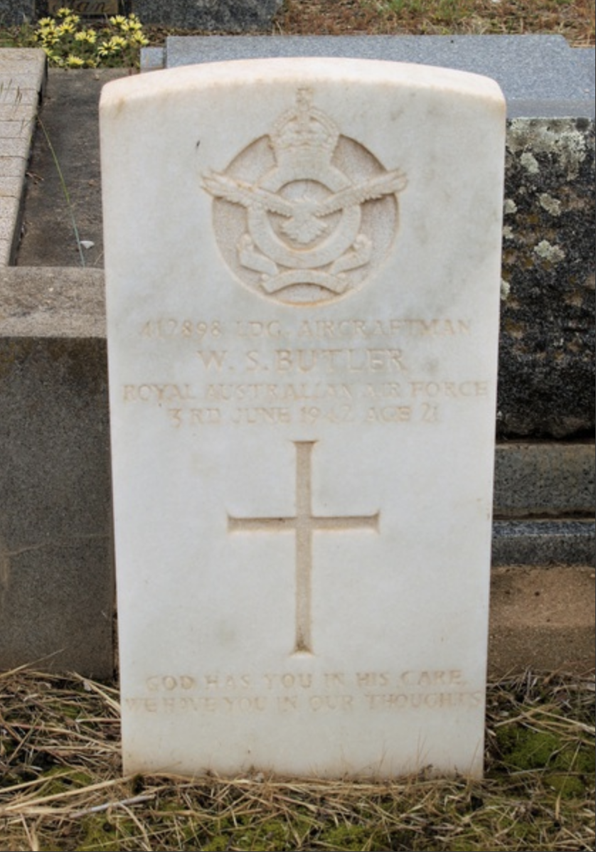
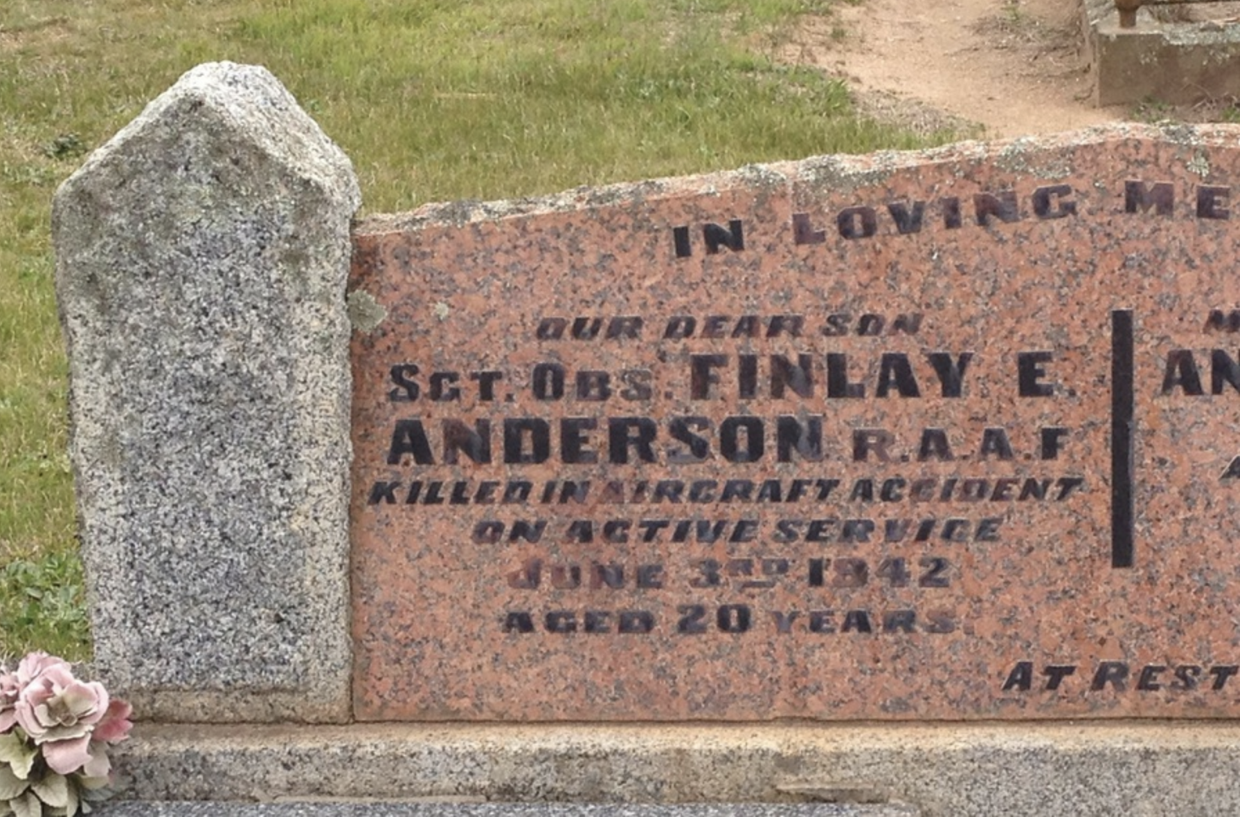
Above:- Headstones of the killed RAAF servicemen. Images c/o vwma.org.au
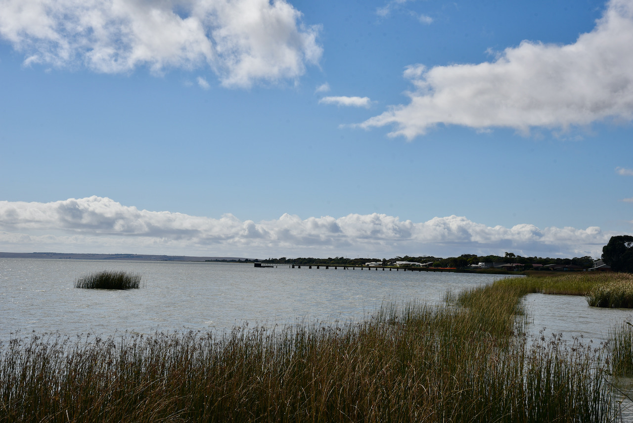
Meningie is a small town on the banks of Lake Albert. The word Meningie is derived from an aboriginal word ‘meningeng’ meaning ‘place of mud’. The town of Meningie was surveyed between March and June 1866, with land being offered for sale in August 1866.
In 1867 a jetty was erected, with paddle steamers operating between Meningie and other ports on Lake Albert and Lake Alexandrina. Meningie ceased to operate as a port in December 1936.

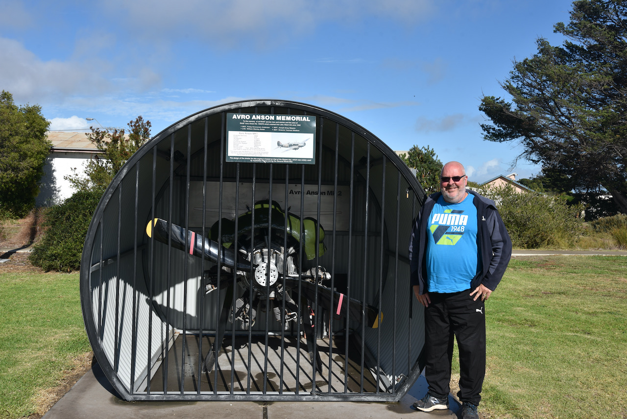
In the Soldiers Memorial Park on the lakefront you can find the Avro Anson Memorial. It features a replica Avro Anson engine which is protected in an encasement which reflects the shape of a Nissen hut.
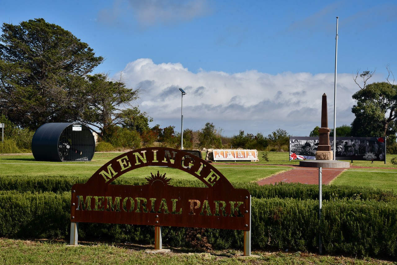
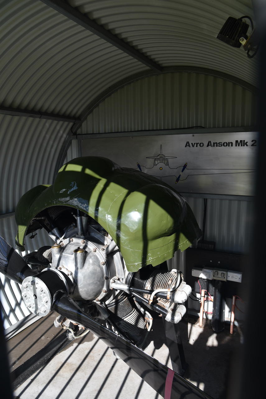
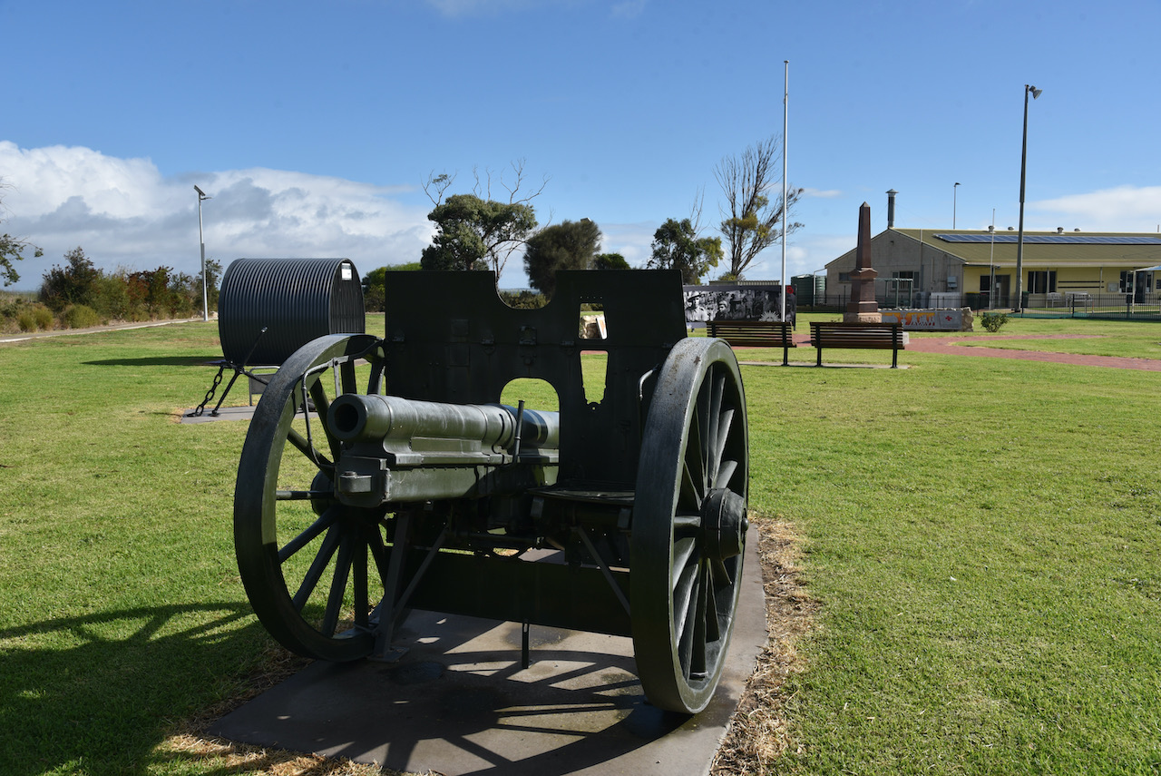
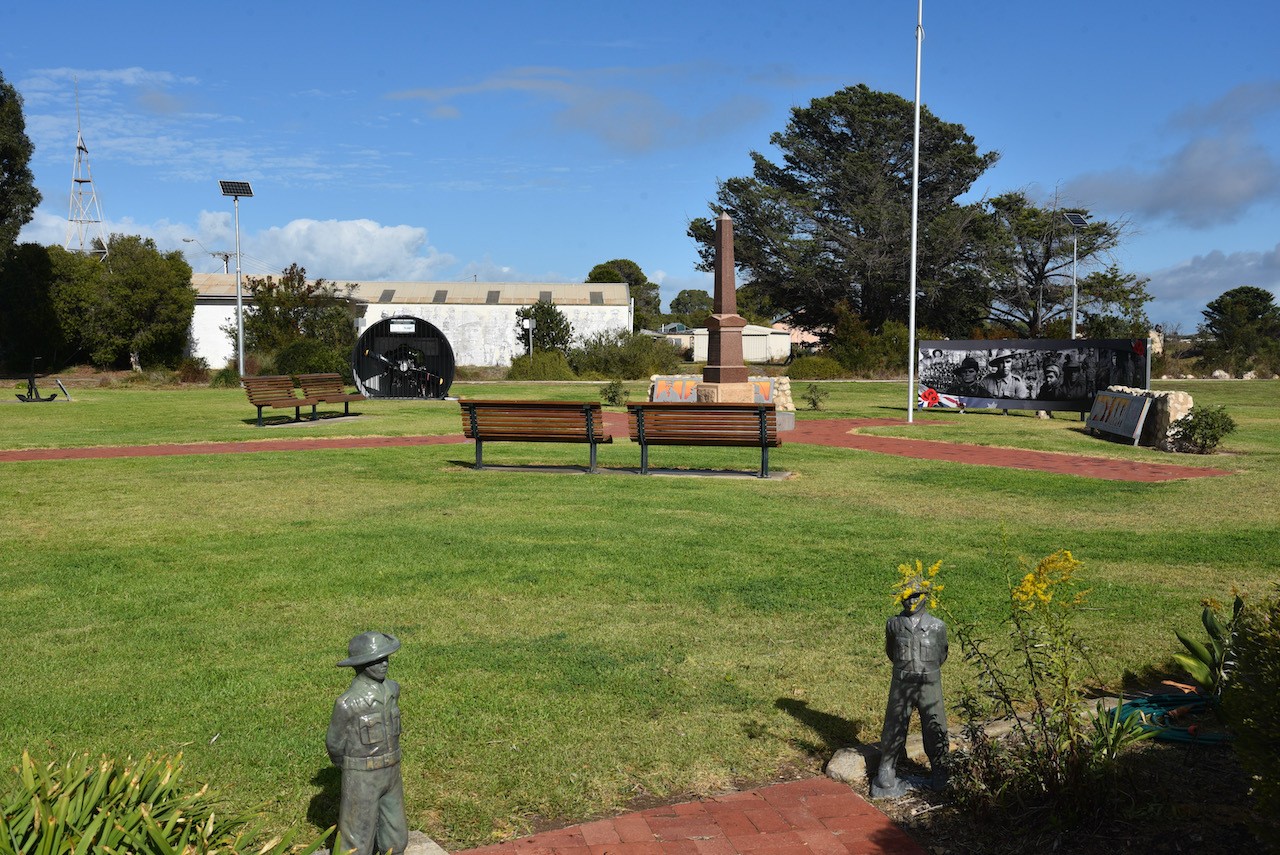
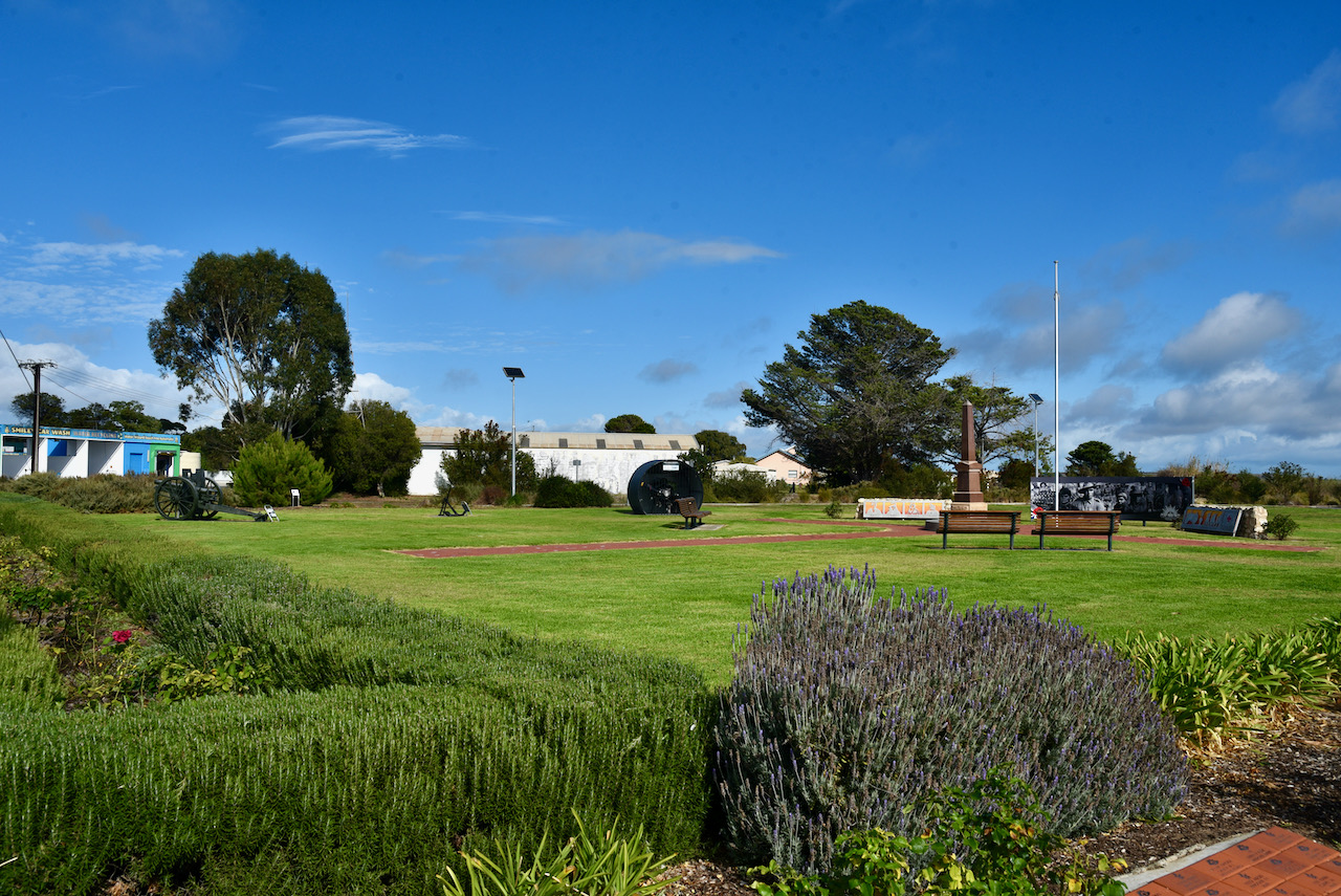
A little further to the north is a Monument re the crash of the Avron Anson.
It was an overcast day with patches of blue, with a slight breeze coming off Lake Albert, a fresh water lake which was named after Prince Albert, the Consort of Queen Victoria.
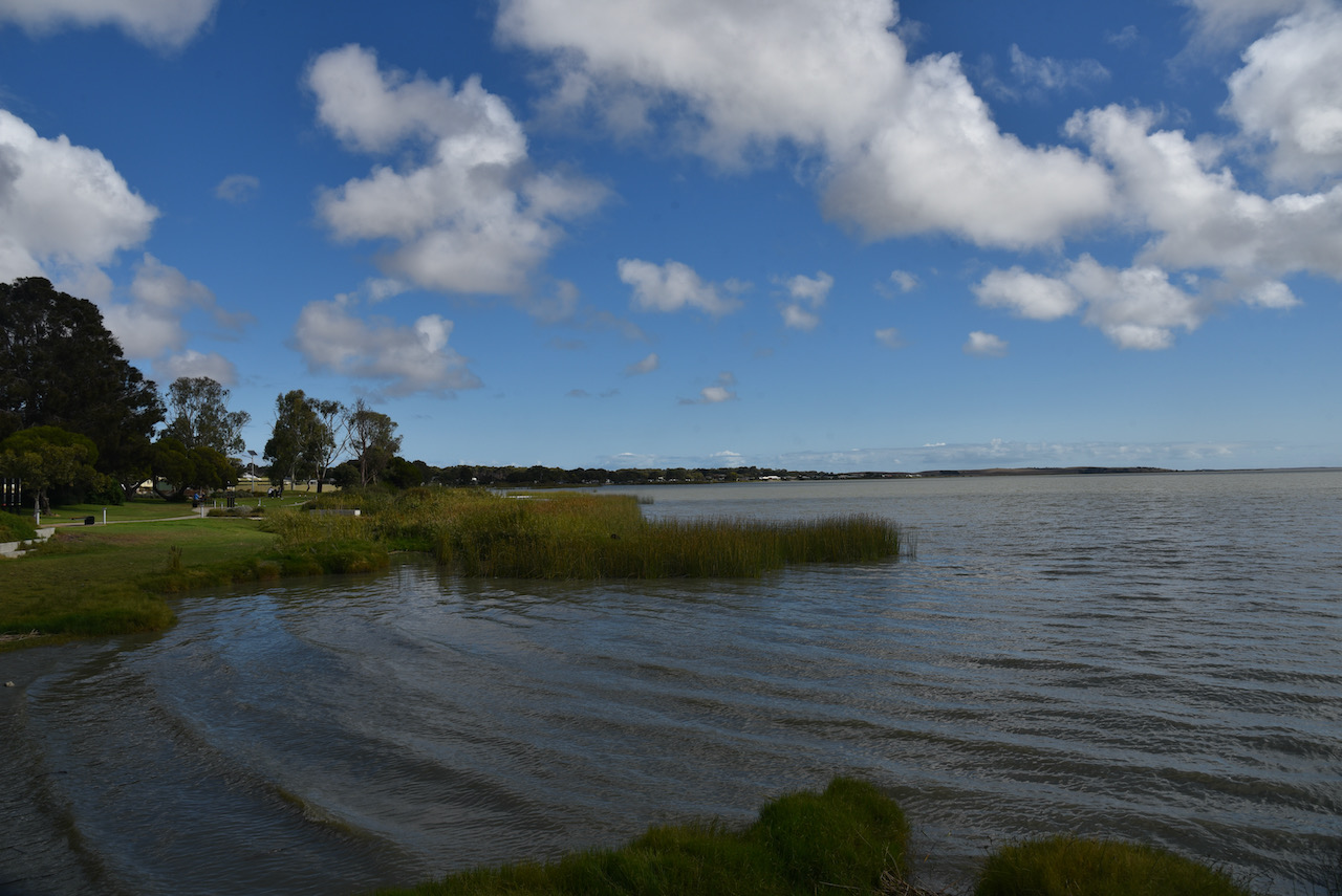
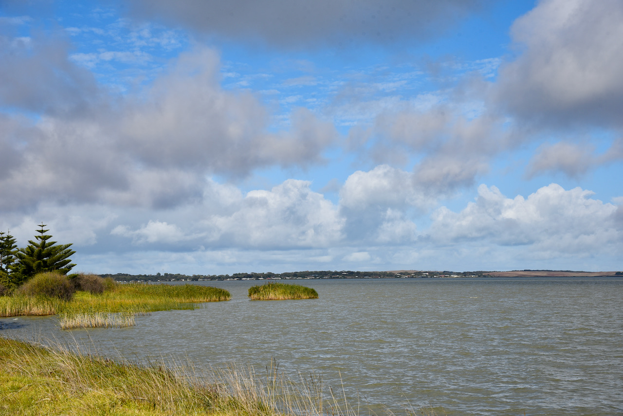
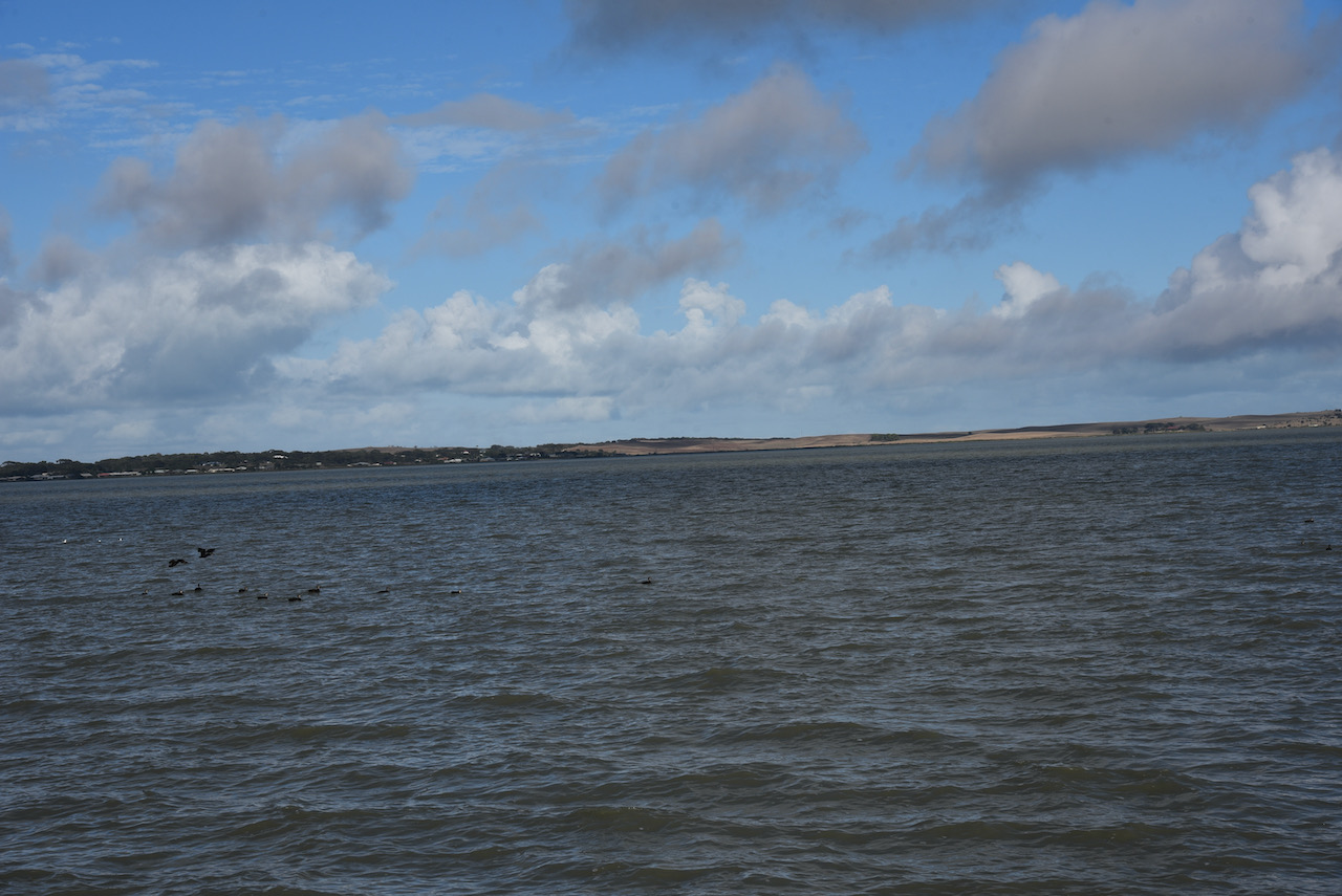
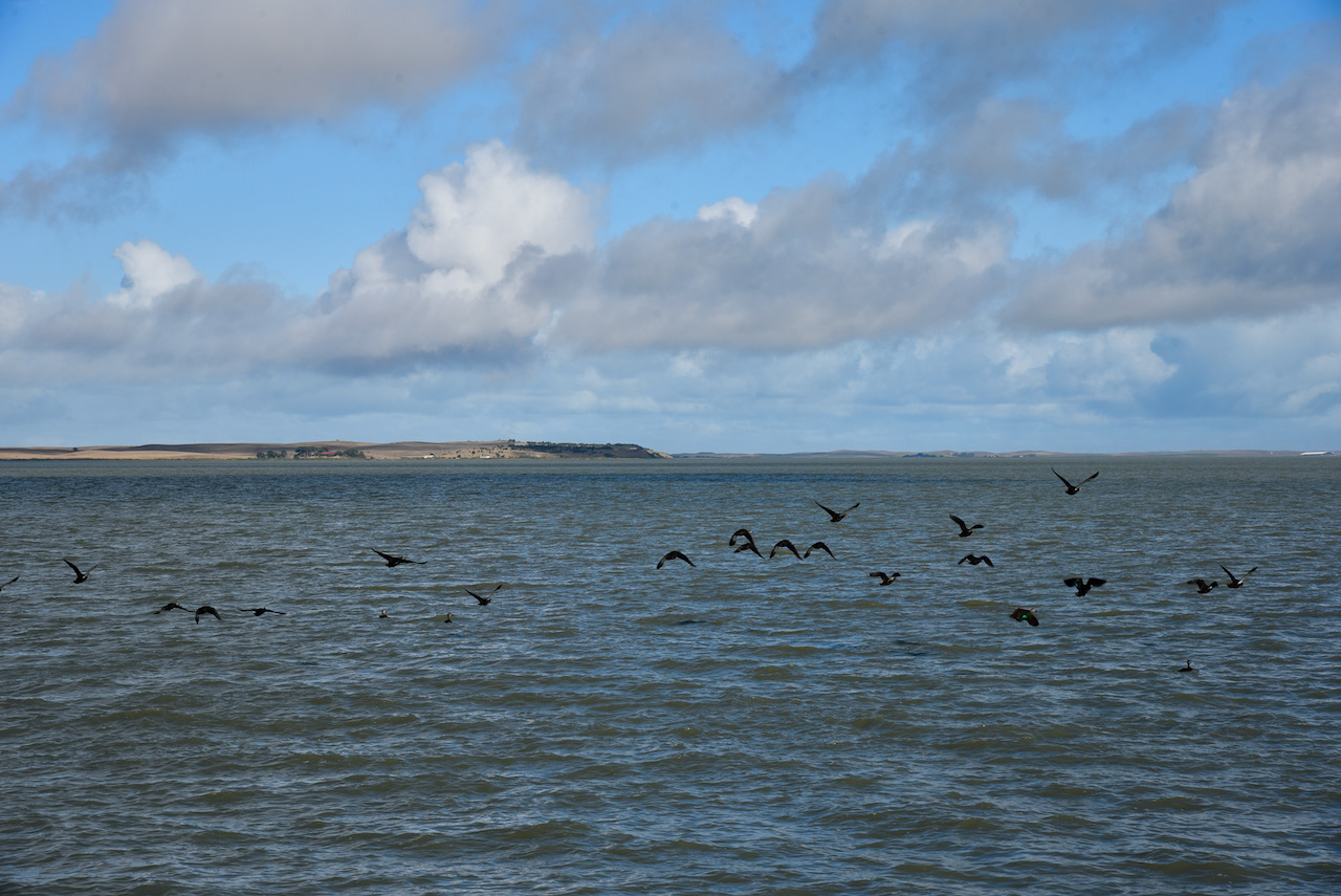
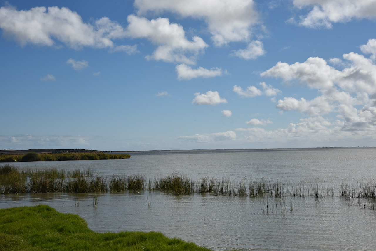
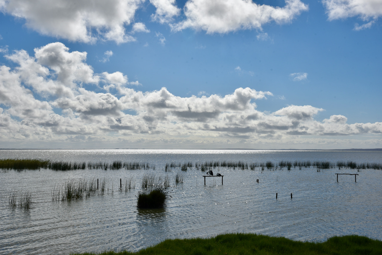
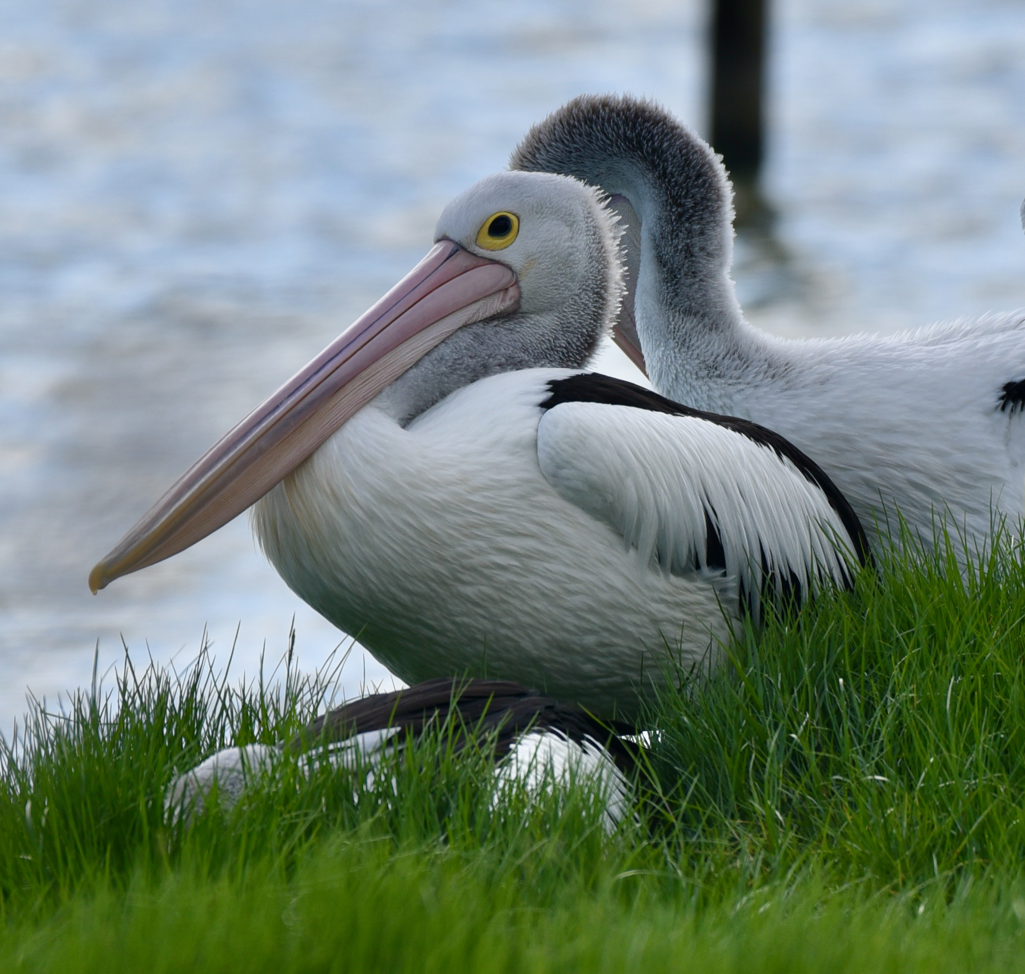
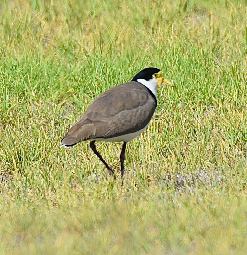
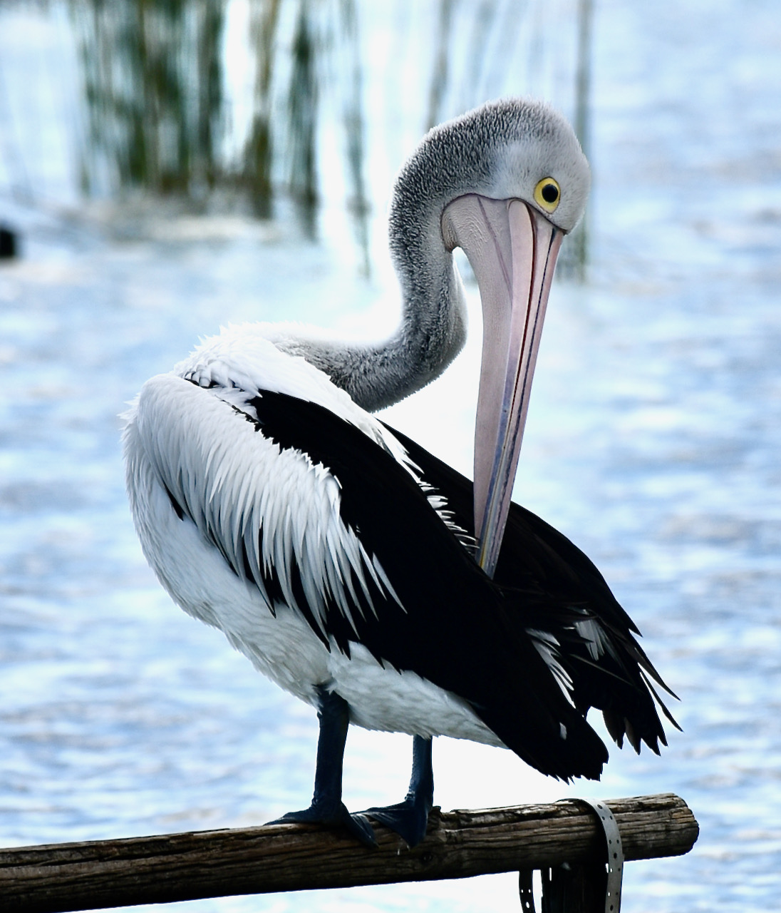
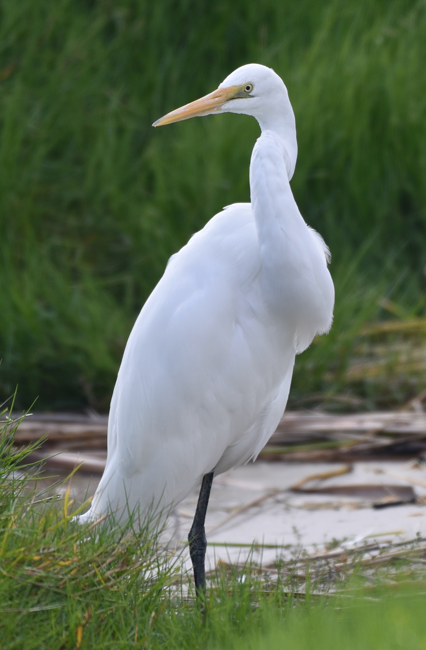
The area is well known for its variety of birdlife, and during our visit to Meningie we were not disappointed.
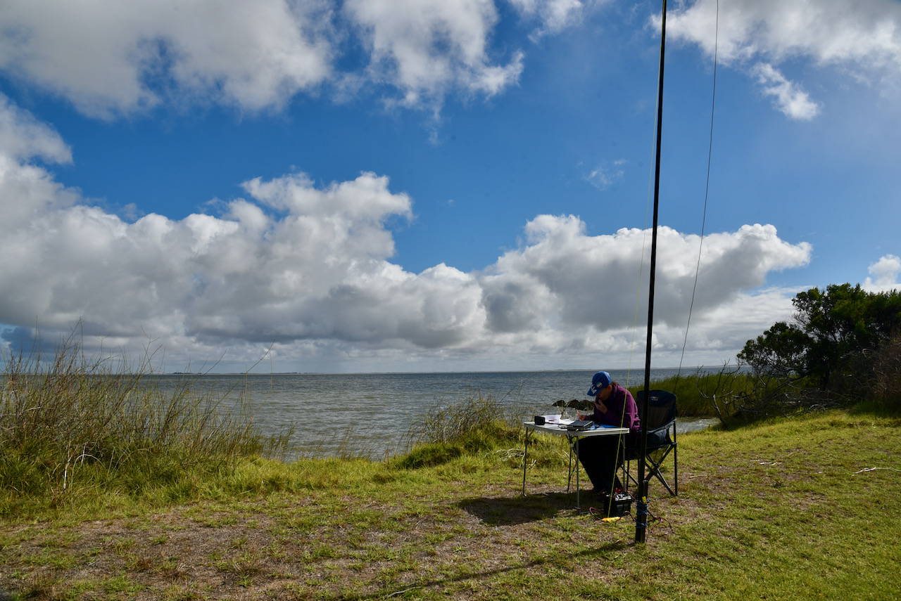
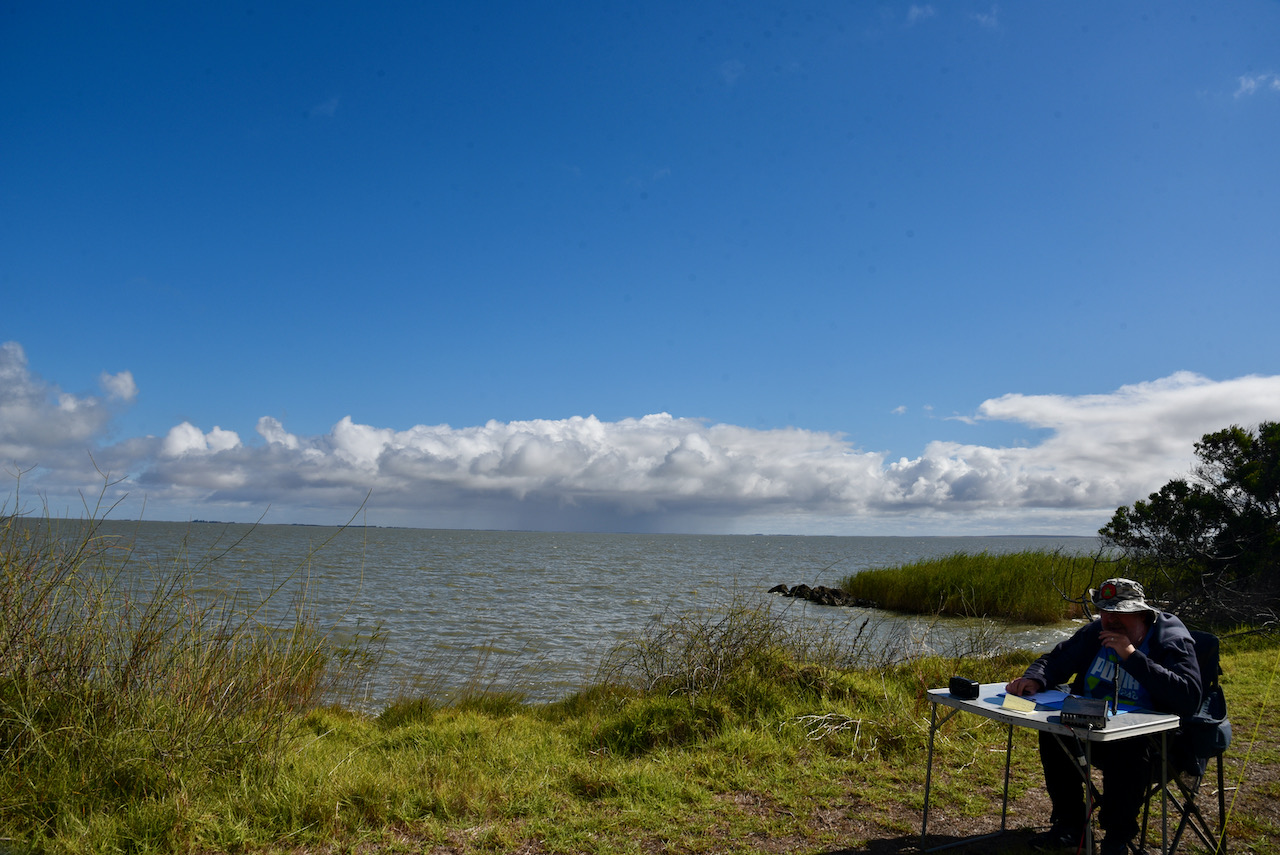
We ran the Yaesu FT857d, 40 watts and the 20/40/80m linked dipole for this activation. The antenna was inverted vee configuration and was supported by a 7 metre telescopic squid pole.
First in the log was Ken VK3DQW, followed by Peter VK3PF, and then John VK3CU.
Marija and I logged a total of 52 stations on 40m from VK2, VK3, VK4, VK5, VK6, VK7, and VK8. This included two park activators: John VK5HAA in the Kenneth Stirling Conservation Park VKFF-0781, and Peter VK3TKK/p in the North Western Port Nature Conservation Reserve VKFF-2166.
We then moved to 80m where we logged 10 stations from VK5, including John VK5HAA in the Kenneth Stirling Conservation Park.
To conclude the activation we called CQ on 14.310 on the 20m band where we logged 11 stations from VK2, VK4, VK6, VK7, and VK8.
After a little over 2 hours at Lake Albert we had 73 contacts in the log.
We worked the following stations on 40m SSB:-
We worked the following stations on 80m SSB:-
We worked the following stations on 20m SSB:-
References.
Monument Australia, 2021, <https://monumentaustralia.org.au/themes/conflict/ww2/display/51174-lake-albert-air-crash-memorial>, viewed 15th May 2021.
Wikipedia, 2021, <https://en.wikipedia.org/wiki/Meningie,_South_Australia>, viewed 15th May 2021.
Wikipedia, 2021, <https://en.wikipedia.org/wiki/Avro_Anson>, viewed 15th May 2021.
Wikipedia, 2021, <https://en.wikipedia.org/wiki/Lake_Albert_(South_Australia)>, viewed 15th May 2021.
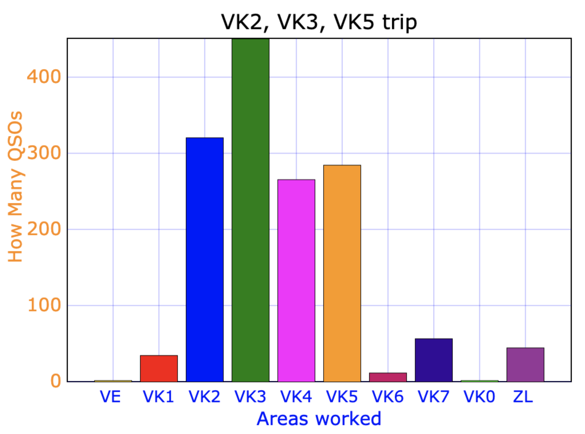
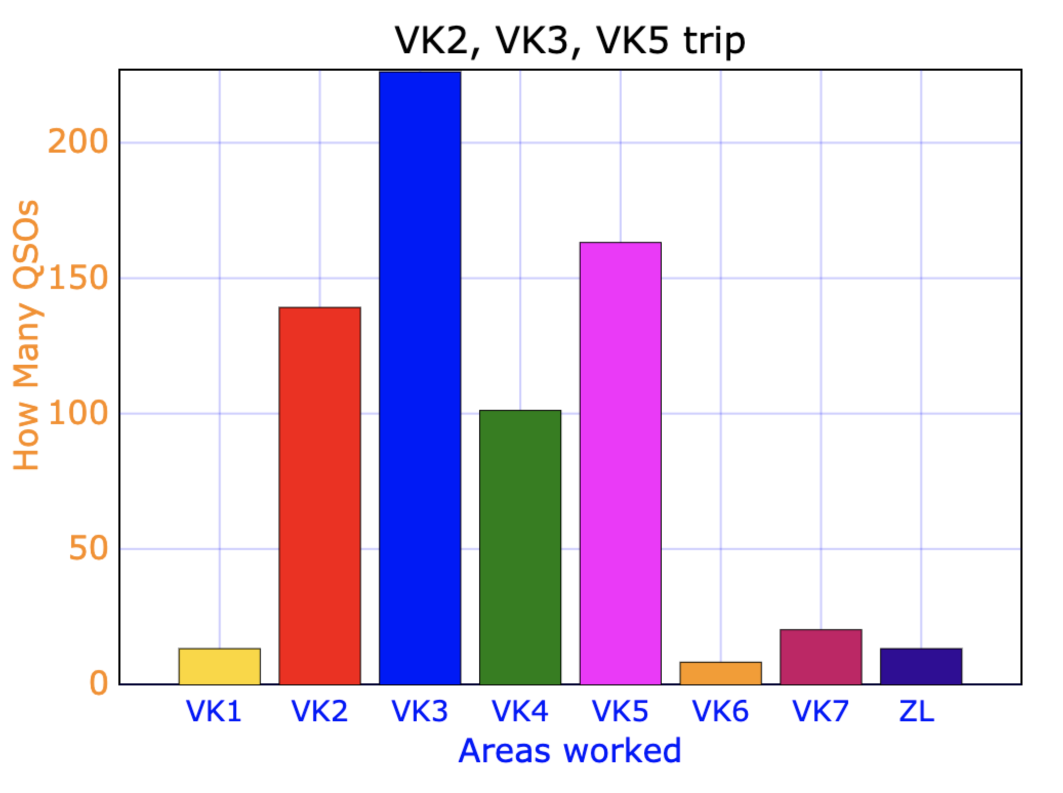
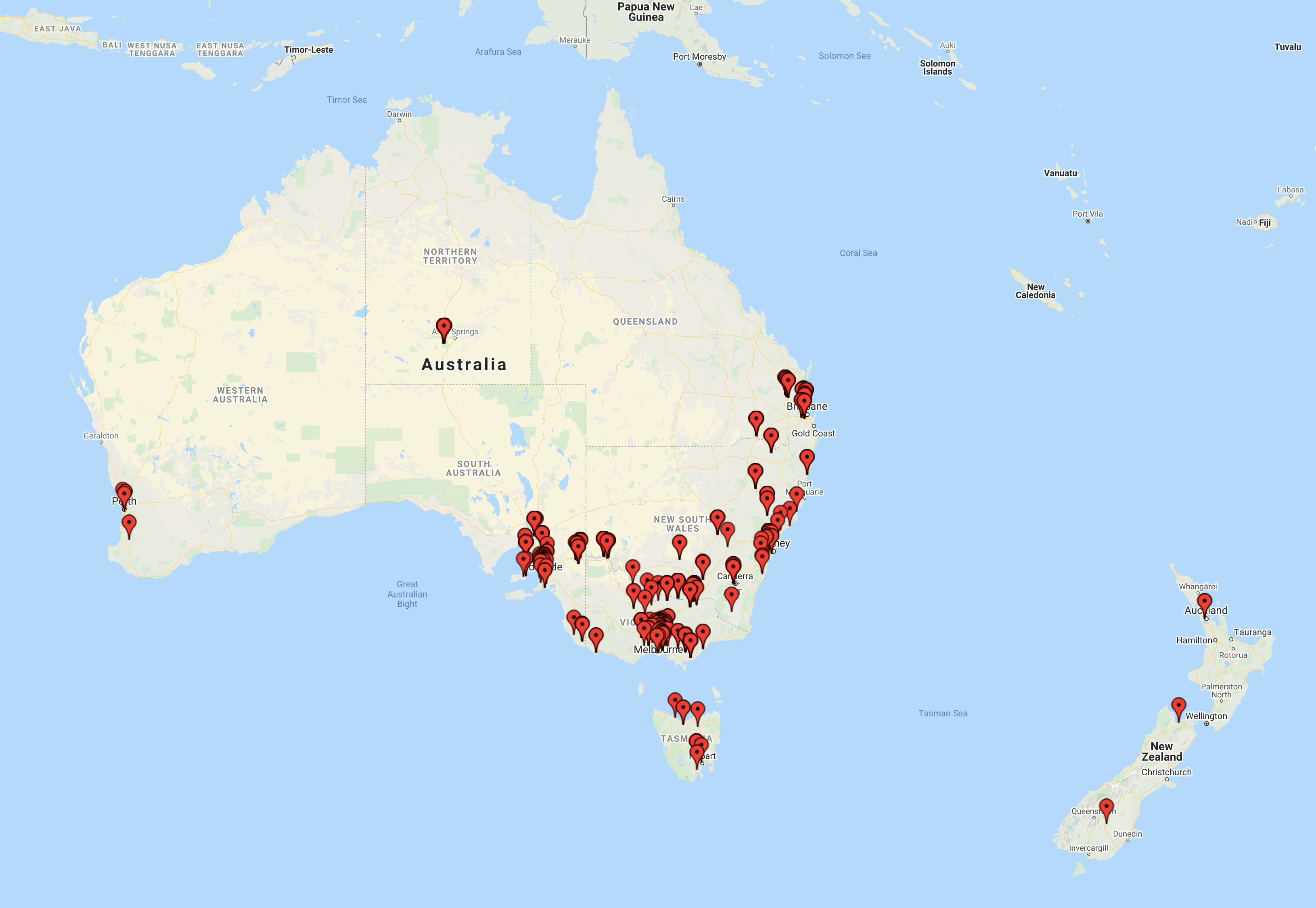
Here are some results from our recent trip to VK2, VK3, and VK5 by myself and Marija.
We activated 22 parks in VK2, VK3, and VK5.
We made a total of 2,149 QSOs.
My stats:-
Total of 1,466 QSOs.
The graph below shows my contacts. The majority were to VK3, followed by VK2. VK4 and Vk5 were very close.
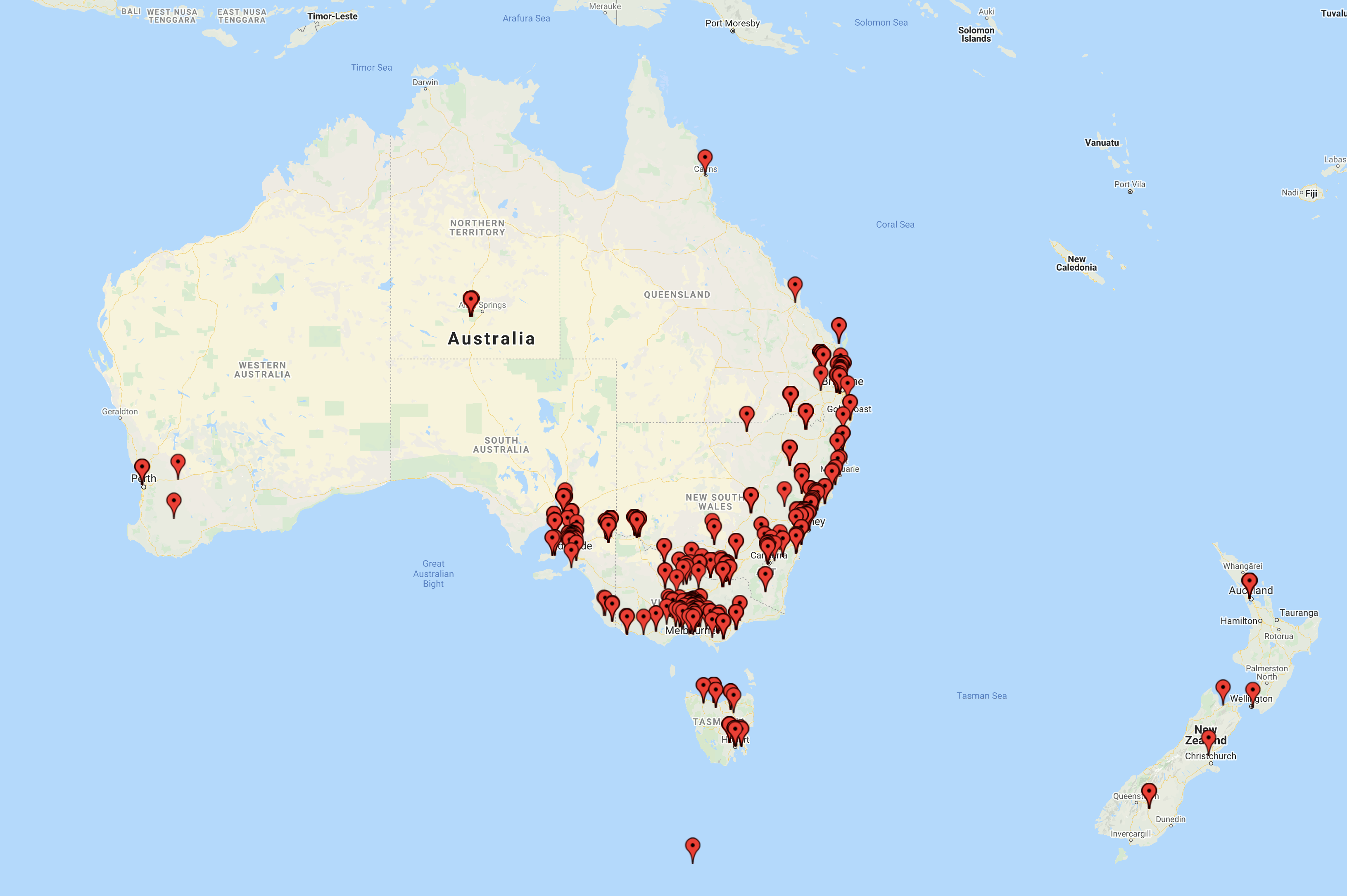
The map below shows my contacts.
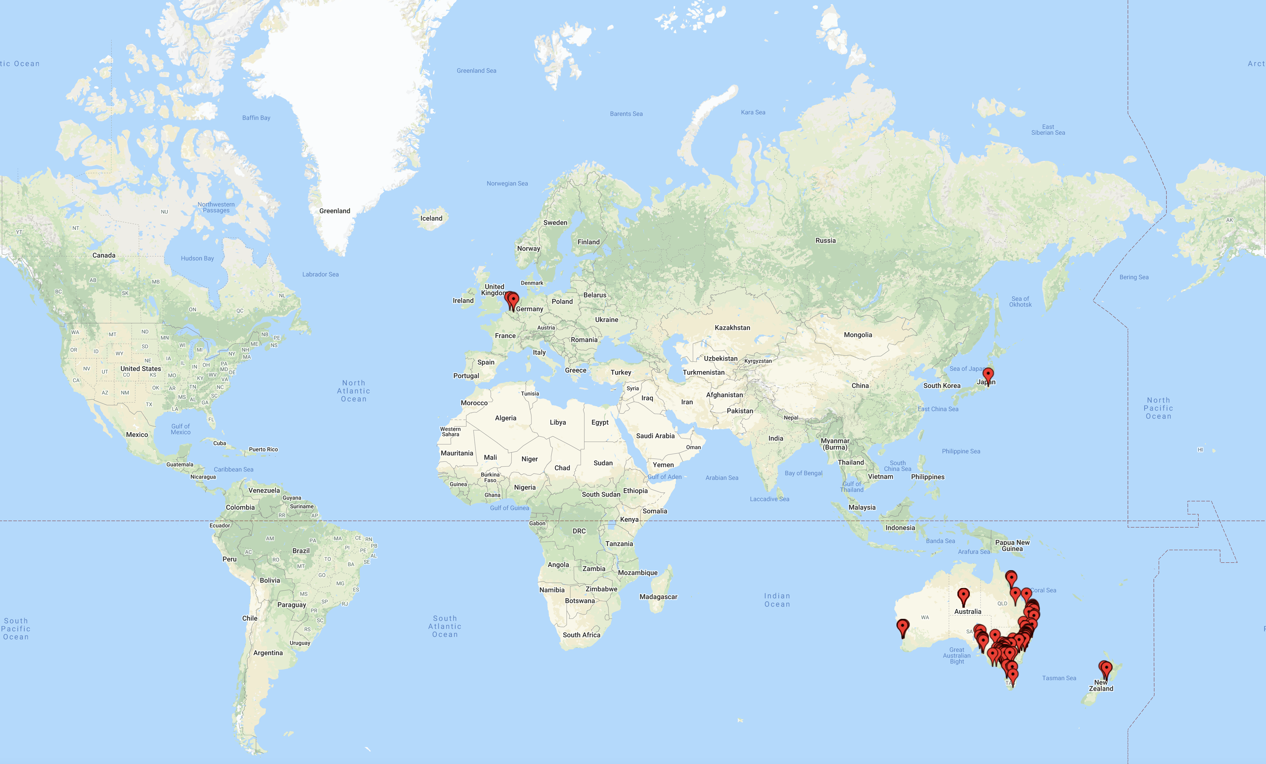
The map below shows my contacts around Australia and New Zealand.
Marija’s stats:-
Total of 683 QSOs.
The graph below shows Marija’s contacts. The majority were to VK3, followed by VK5.
The map below shows Marija’s contacts.
THANK YOU to everyone who called us.
Today (Sunday 18th April 2021) was World Amateur Radio Day. Marija and I planned on activating a park on the way home, but we hadn’t decided which one.
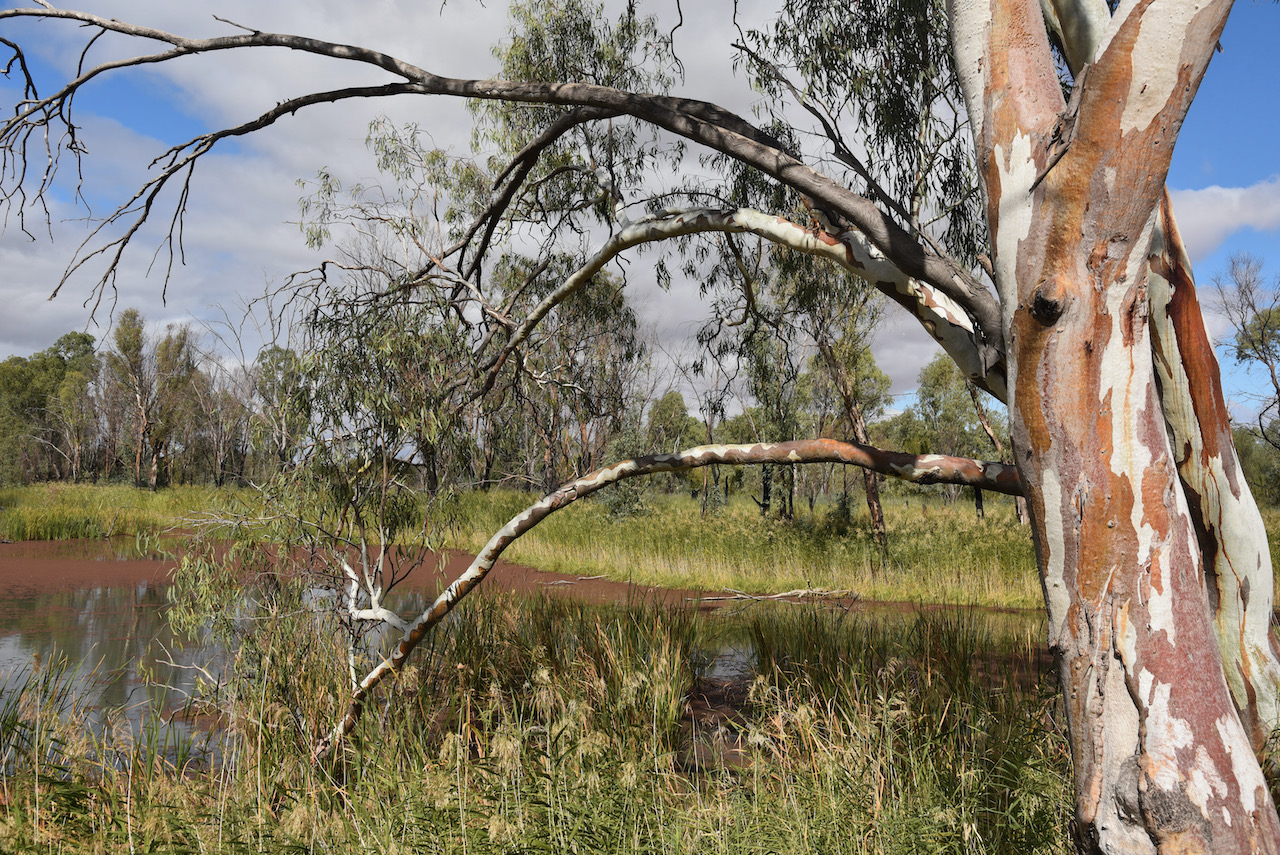
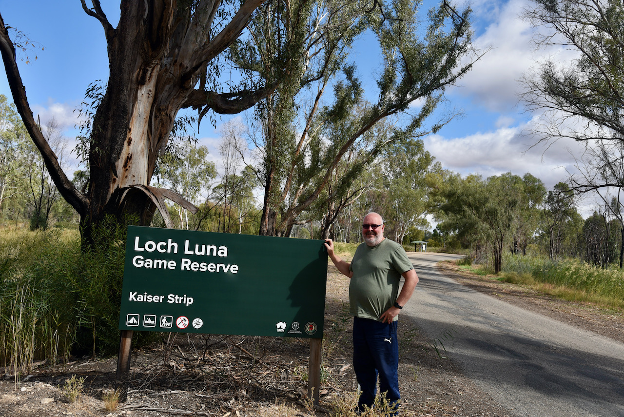
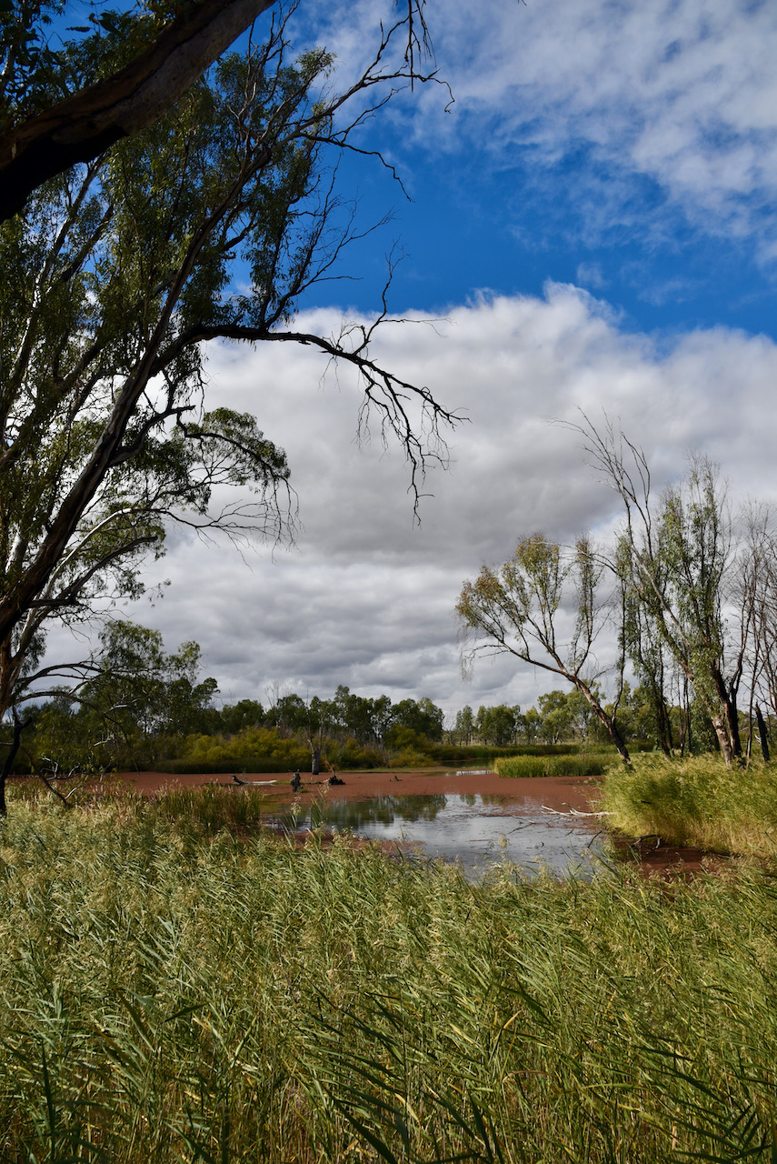
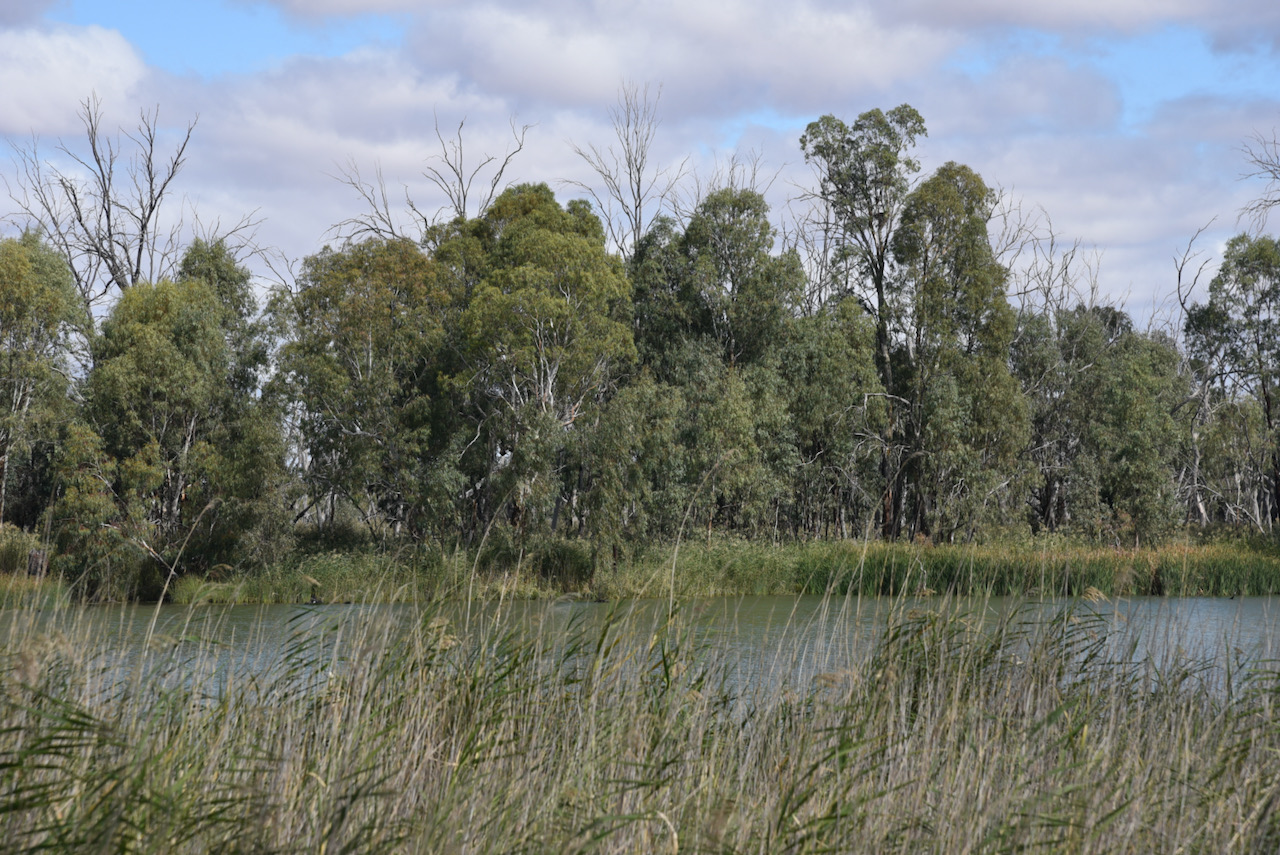
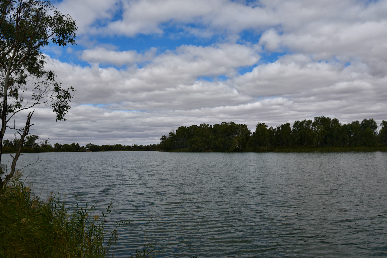
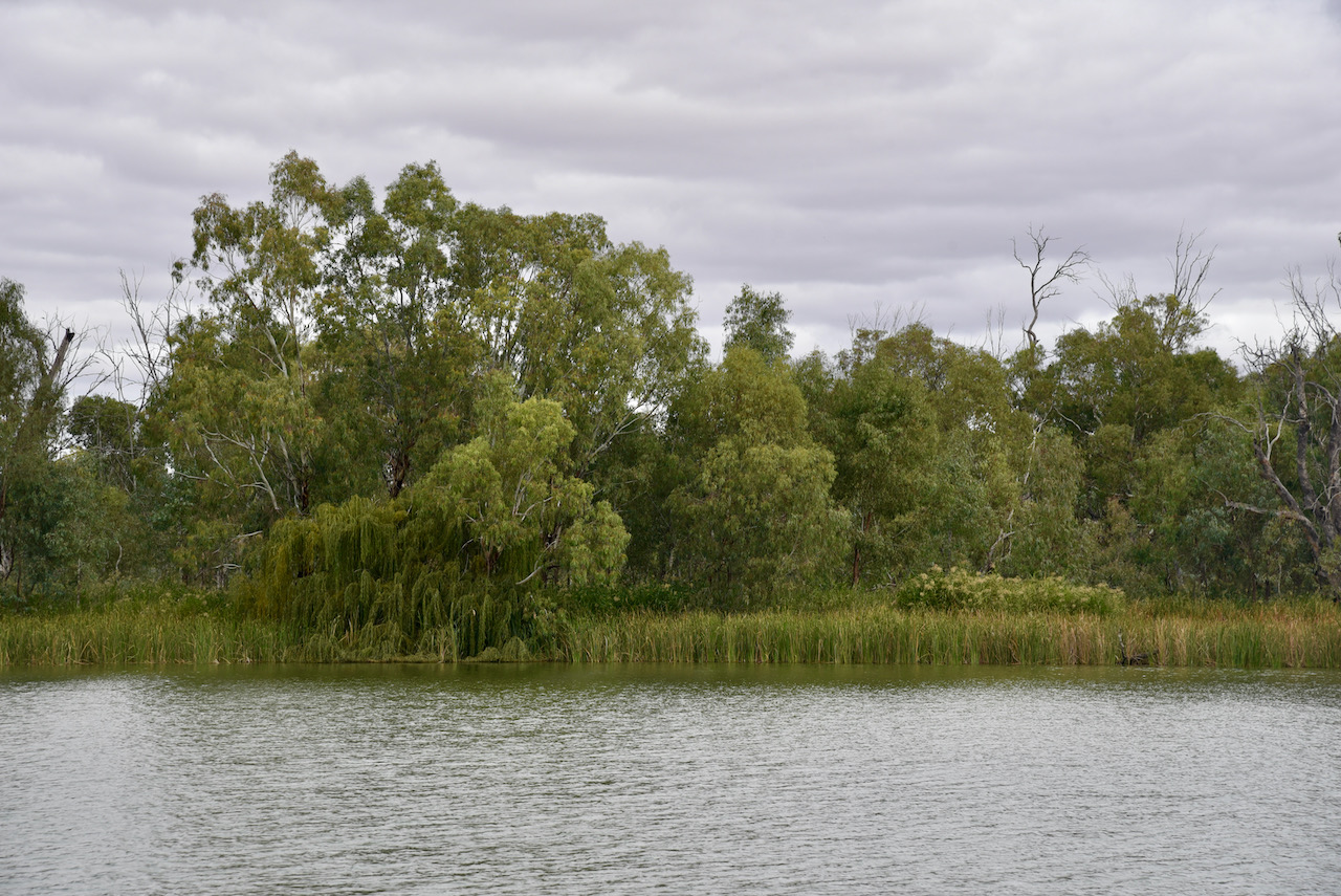
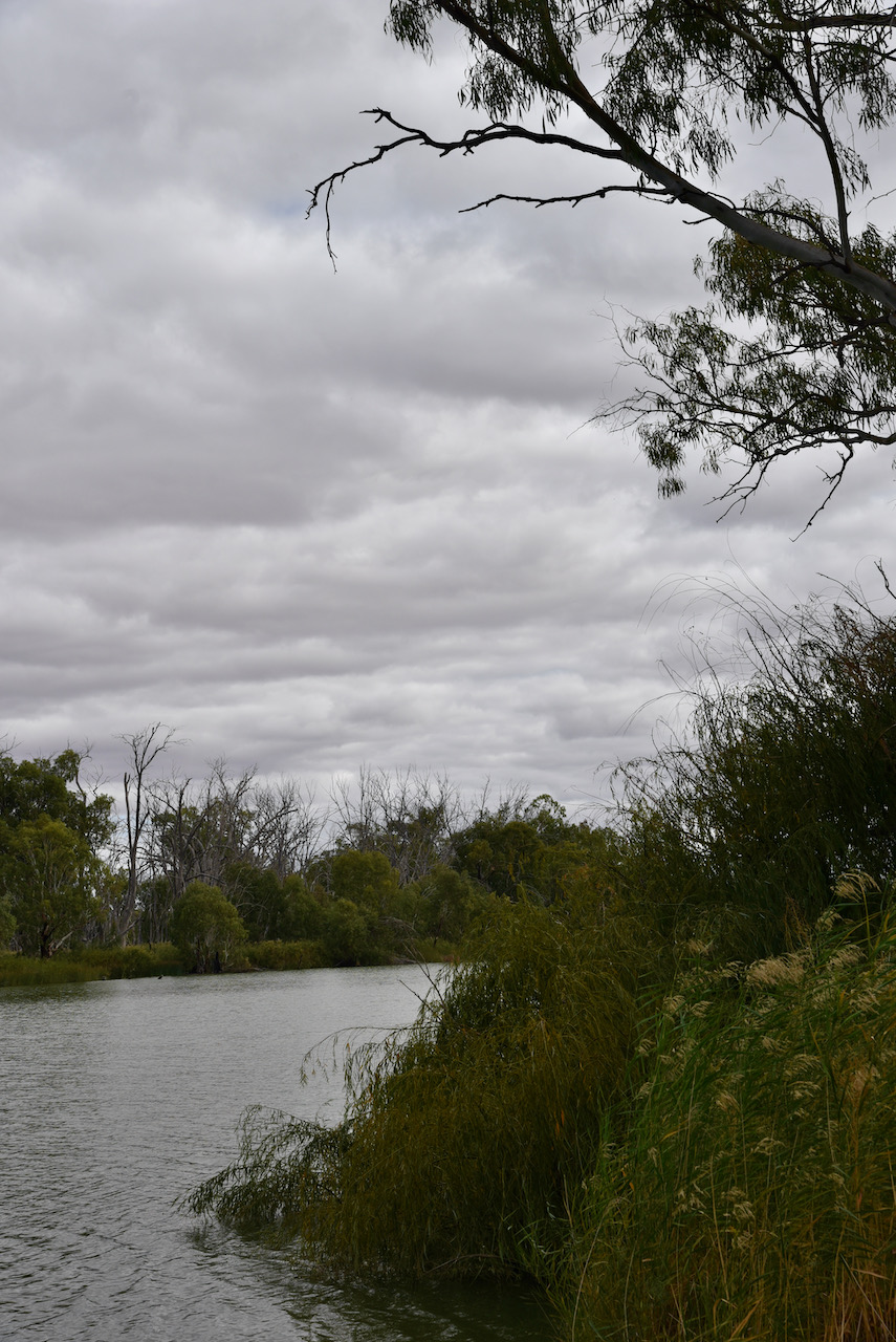
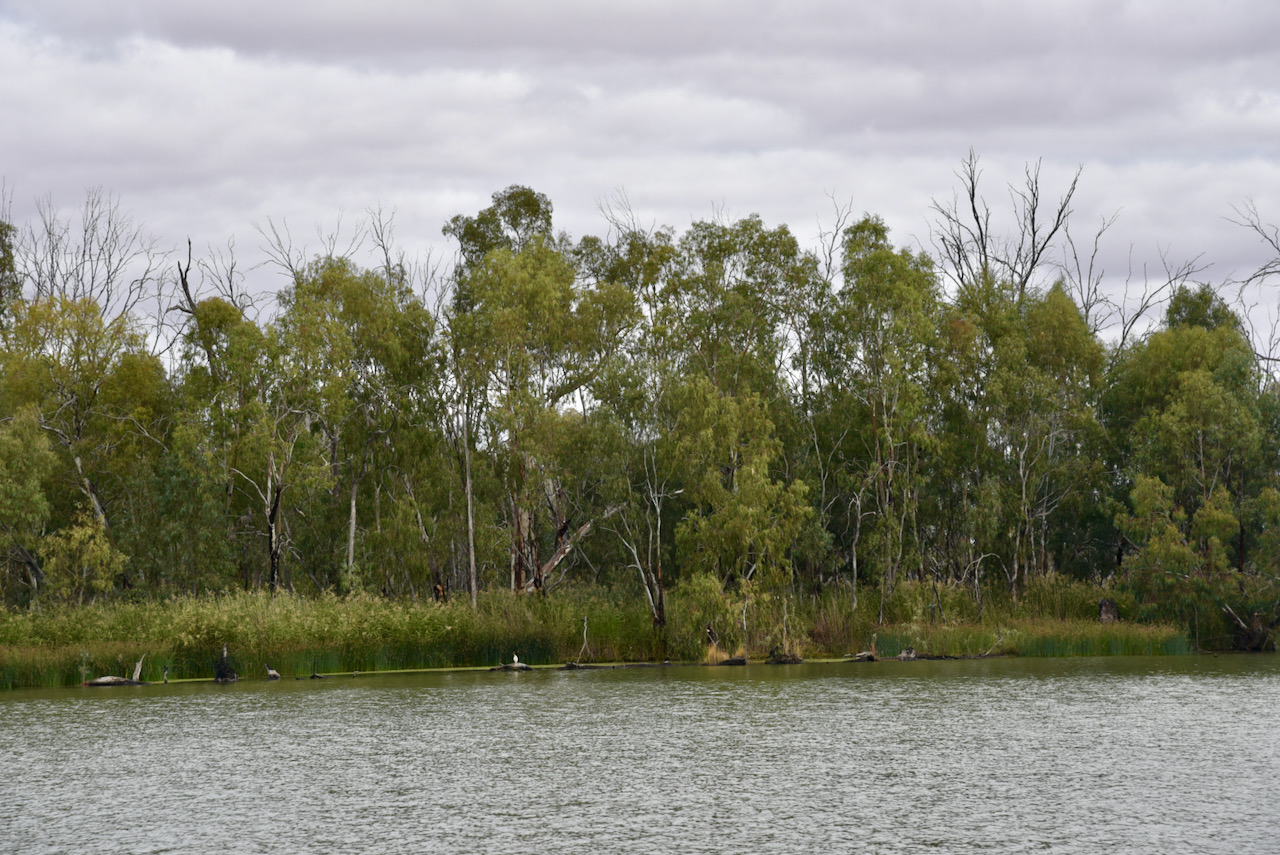
To kick off the day we headed around to the home of Ivan VK5HS and Sheryl who made a beautiful cooked brekfast for us. We then hit the road and decided to activate the Loch Luna Game Reserve VKFF-1723. Loch Luna is about 10 km north-west of Barmera.
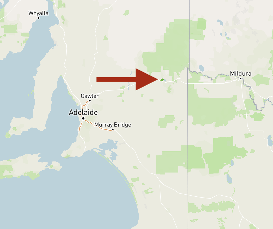
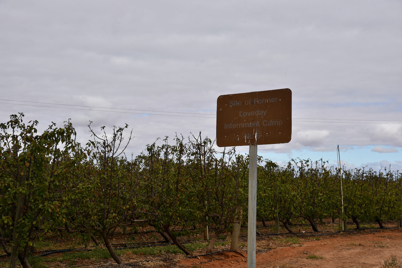
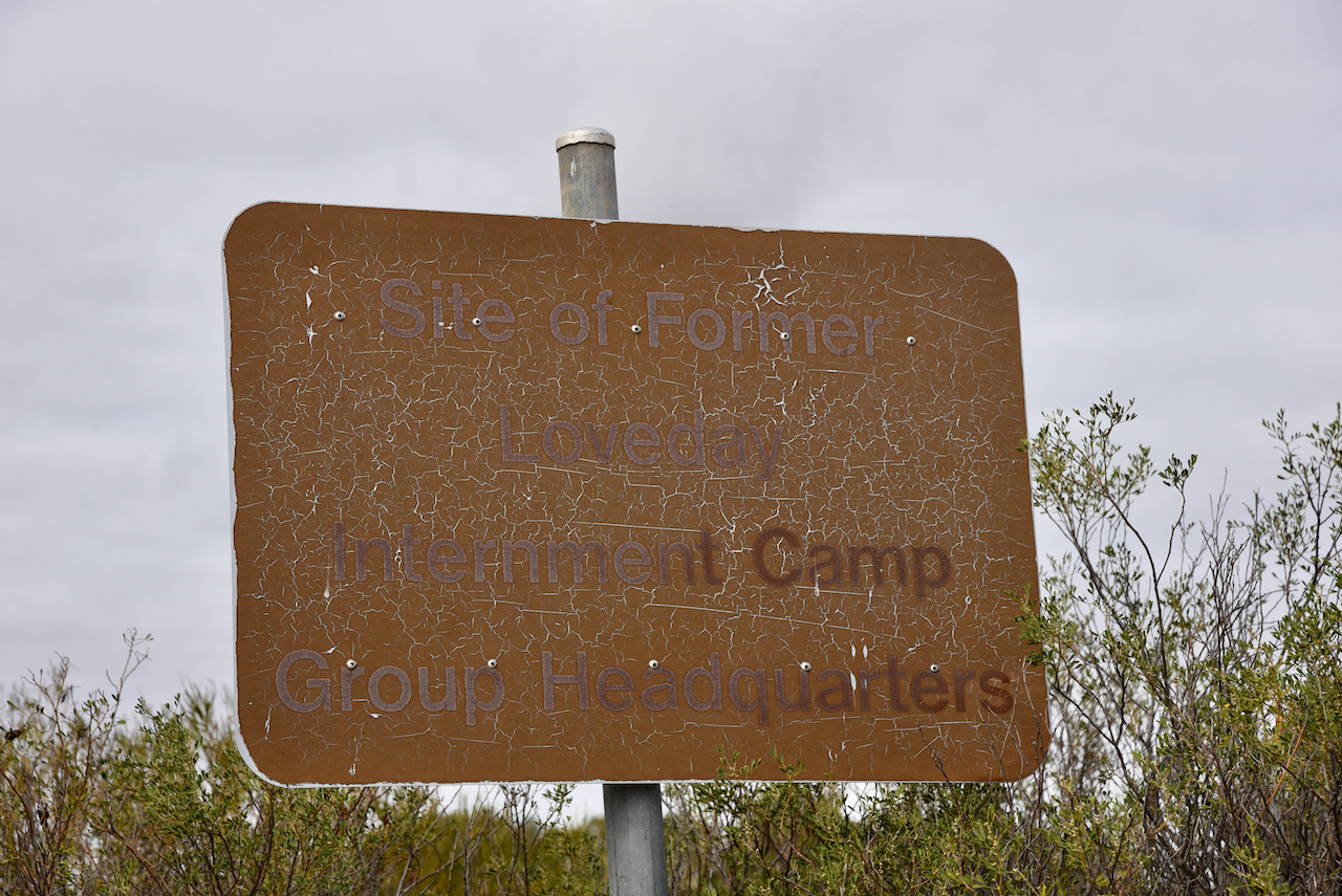
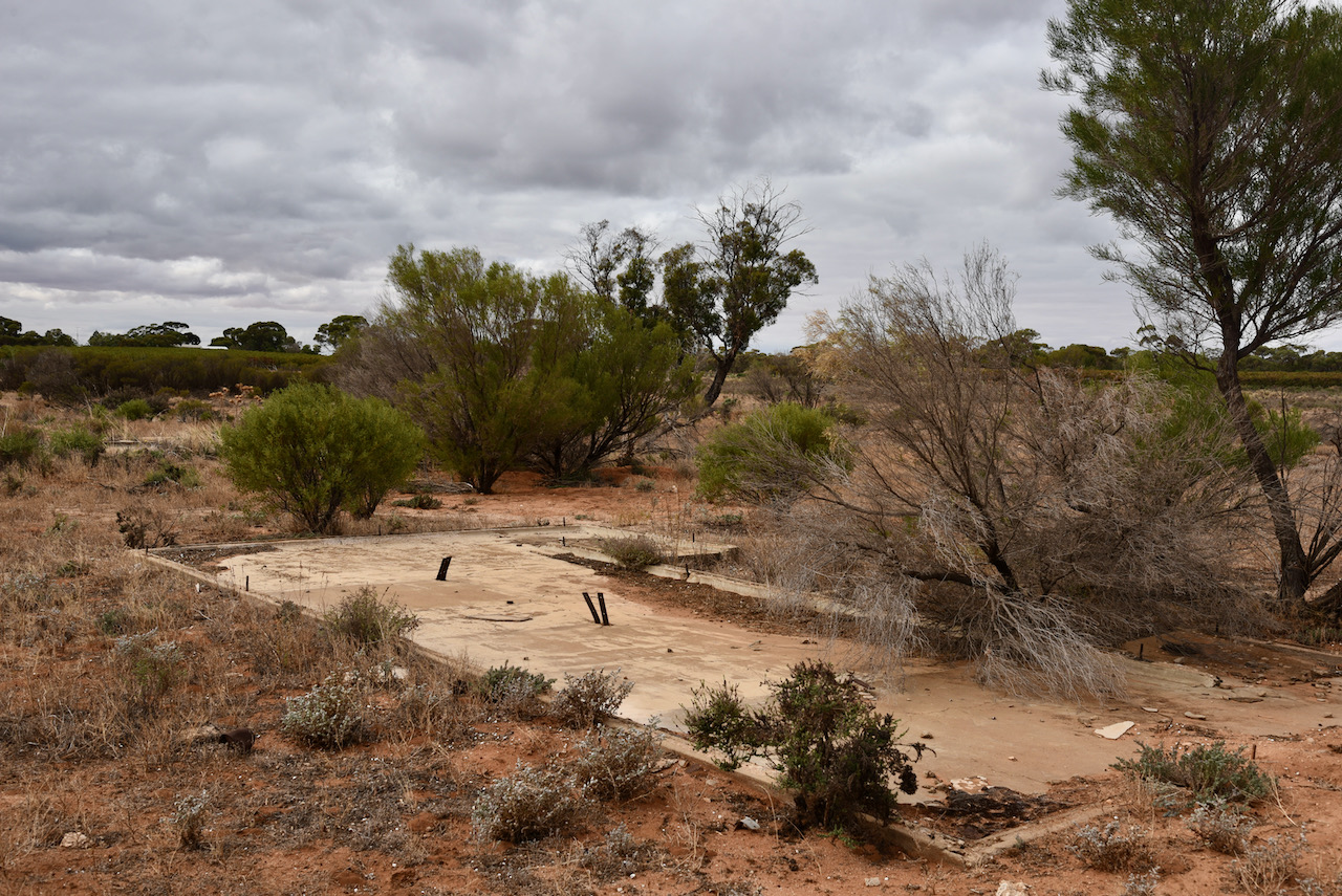
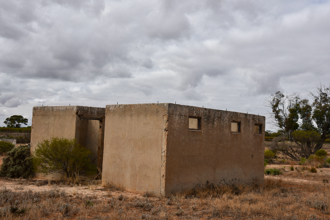
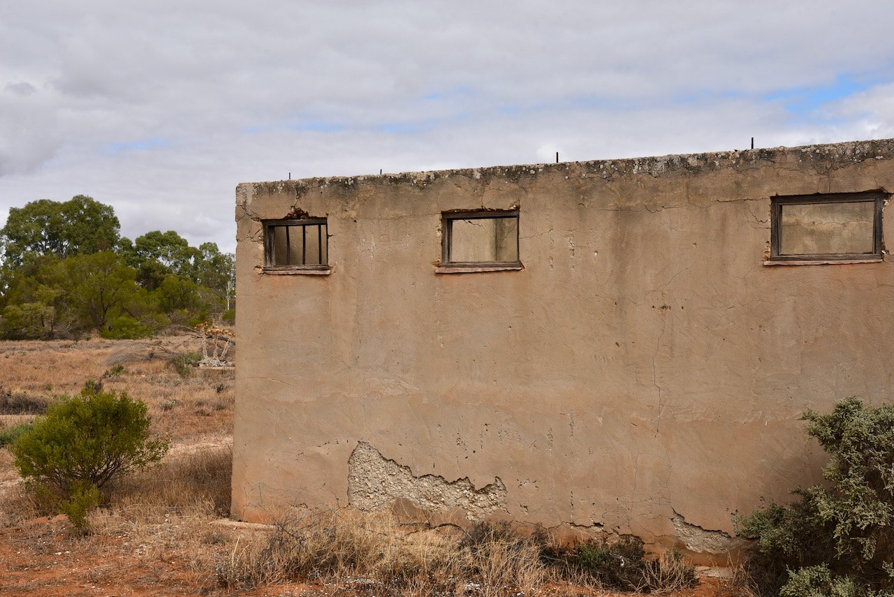
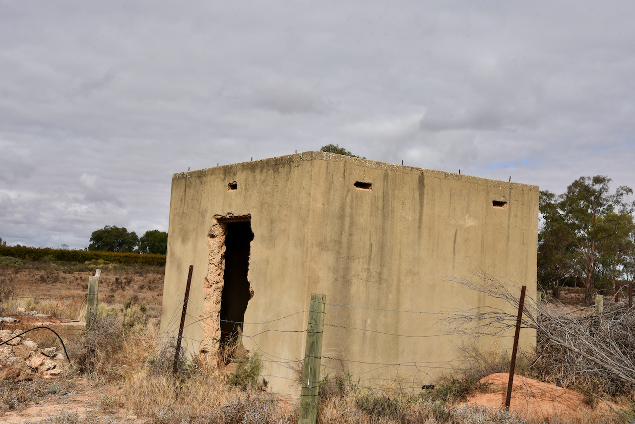
Prior to activating the park we had a look at the old Loveday World War Two (Camp 9) internment camp. It was also known as the Italian Internment Camp. It was one of three main prisoner or war and internee camps located at Loveday in the Riverland. The camp commenced operations in August 1940 and could hold up to 1,000 people, including Italian civillan internees, and Italian prisoners of war.
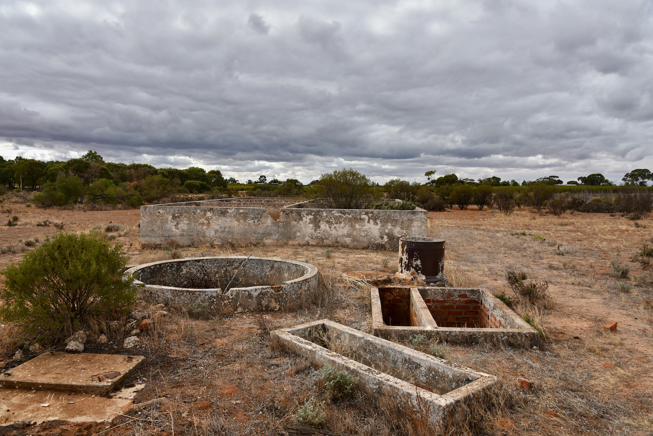
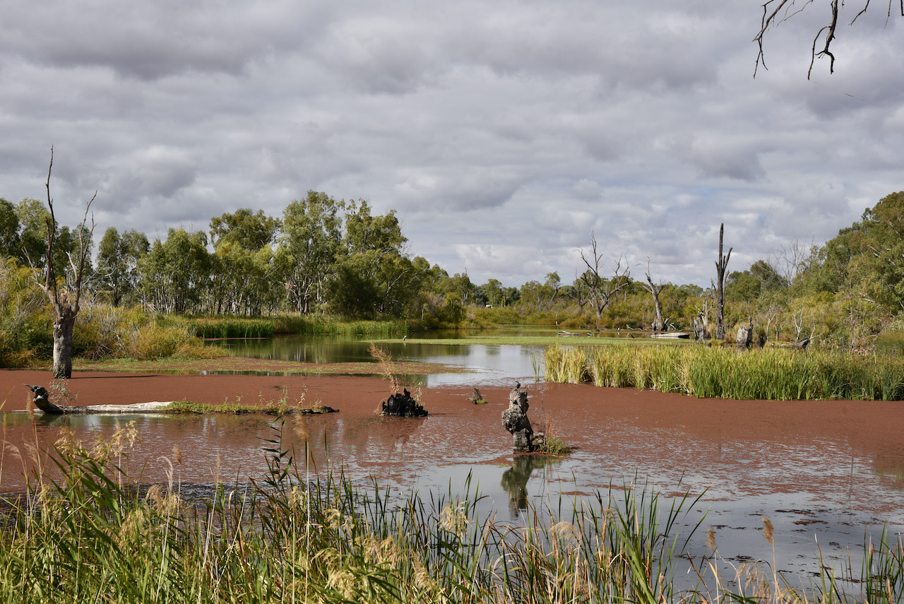
We then headed to Loch Luna Game Reserve. The reserve is about 20.63 km2 in size and was proclaimed on the 7th day of November 1985. As you can see in the aerial shot below there is a parcel of land within the reserve which is not gazetted. It is known as Sugarloaf Hill and has been excluded from protection for the purpose of mining activity.
The Moorok Game Reserve can be located adjacent to Loch Luna.
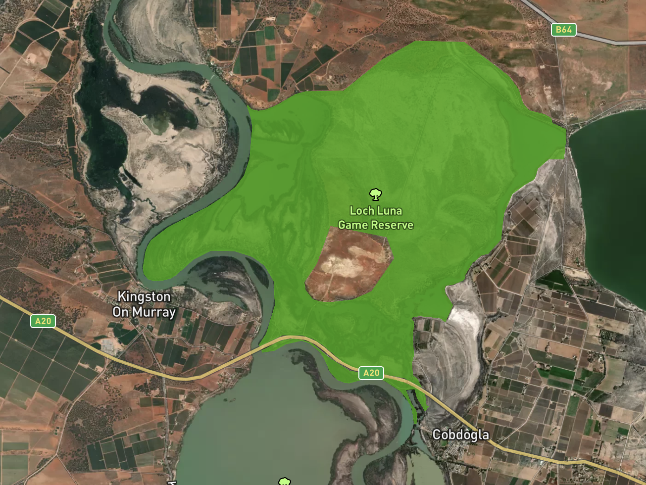
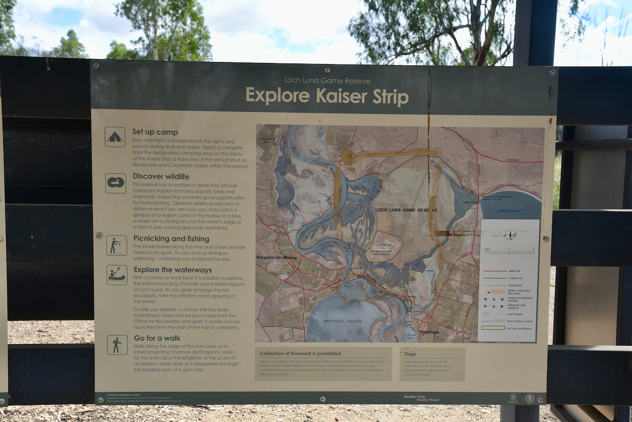
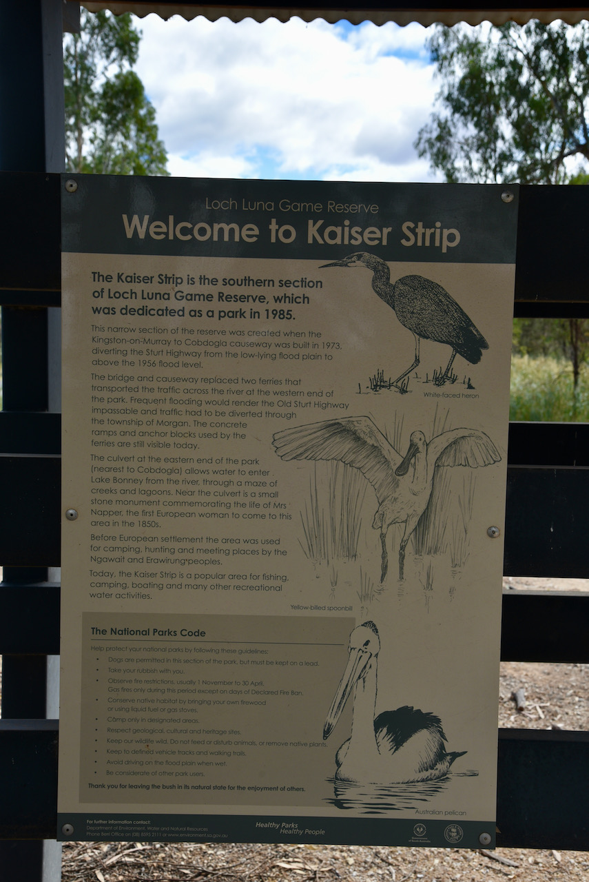
We activated the Kaiser strip in the southern section of the Reserve. This narrow section of the reserve was created when the Kingston-on-Murray to Cobdogla causeway was built in 1973, diverting the Sturt Highway from the low lying flood plain to above the 1956 flood level.
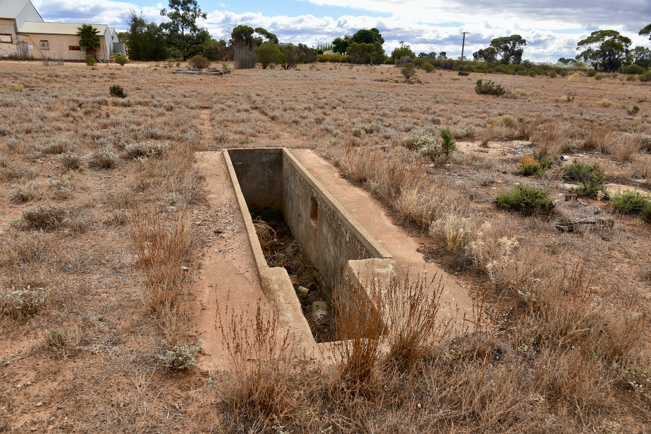
The bridge and causeway replaced two ferries that transported the traffic across the river at the western end of the park. Frequent flooding would render the Old Sturt Highway impassable and traffic had to be diverted through the township of Morgan. The concrete ramps and anchor blocks used by the ferries are still visible today.
The culvert at the eastern end of the park, nearest of Cobdogla, allows water to enter Lake Bonney from the river, through a maze of creeks and lagoons. Near the culvert is a small stone monument commemorating the life of Mrs. Napper, the first European woman to come to this area in the 1850s.
Before European settlement the area was used for camping, hunting and meeting places by the Ngawait and Erawirung peoples.
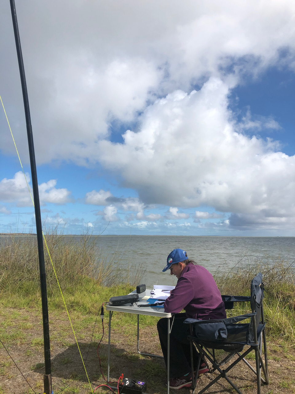
After setting up I called CQ on 7.144 and within 6 minutes I had contact number ten in the log, a QSO with Adam VK2YK. Band conditions on 40m were very good and a mini pile up soon developed. I logged 55 contacts on 40m from VK2, VK3, VK4, VK5, and VK7. This included three Park to Park contacts with Peter VK5PET/p in the Cox Scrub Conservation Park VKFF-1701, James VK2TER/p in the Cockle Bay Nature Reserve VKFF-1908, and Peter VK3TKK/p in the Holden Flora Reserve VKFF-2333. We also logged Gerard VK2IO who was on SOTA summit VK2/ HU-093.
Marija then jumped into the operator’s chair and logged 22 stations on 40m from VK2, VK3, and VK5.
I then took charge of the mic again and logged a further 12 stations on 40m. To conclude the activation I moved to the 20m band where I logged 3 stations from VK3, VK4, and New Zealand.
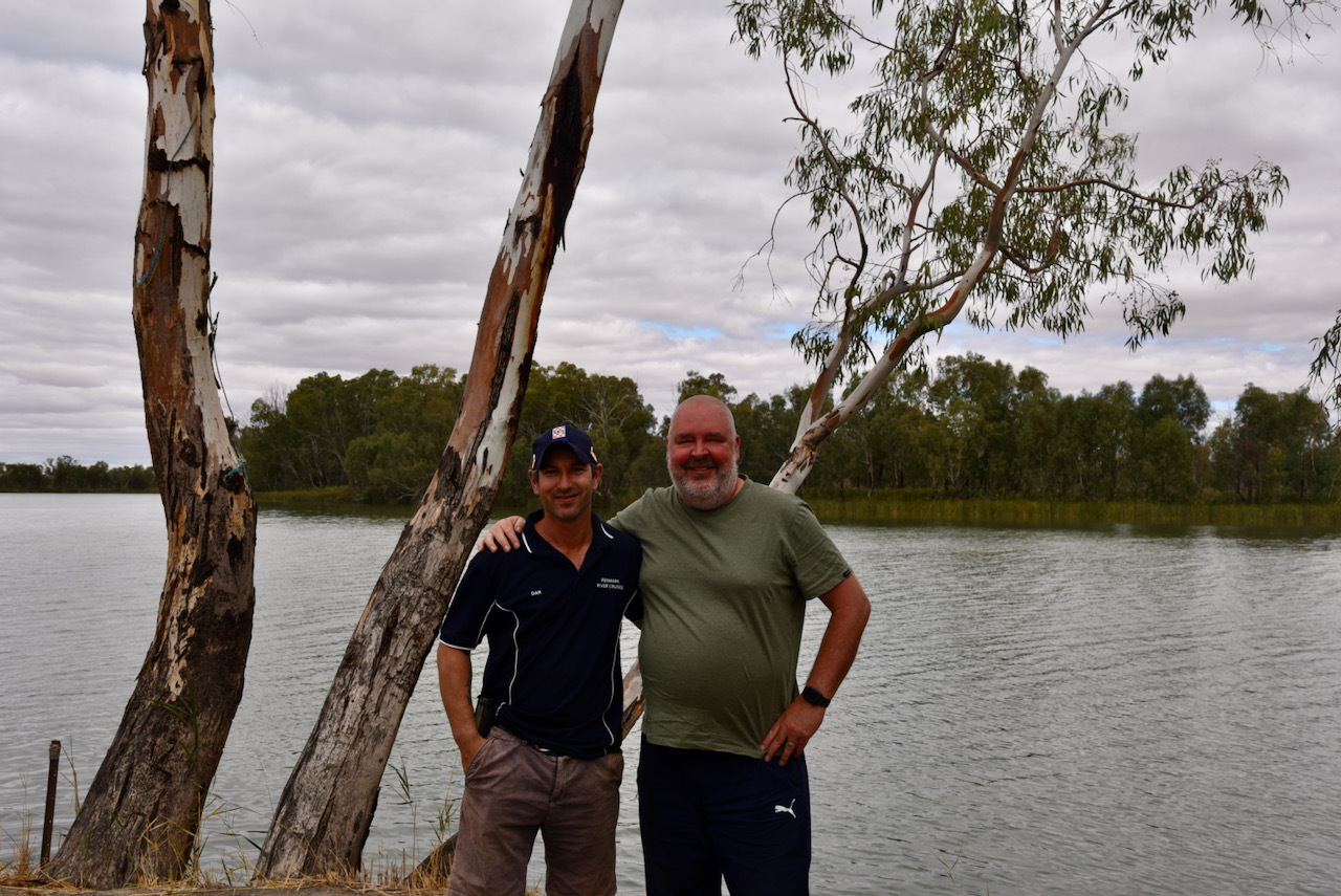
During the activation we were visited by Dan VK5FDMG from Loxton.
Marija worked the following stations on 40m SSB:-
I worked the following stations on 40m SSB:-
I worked the following stations on 20m SSB:-
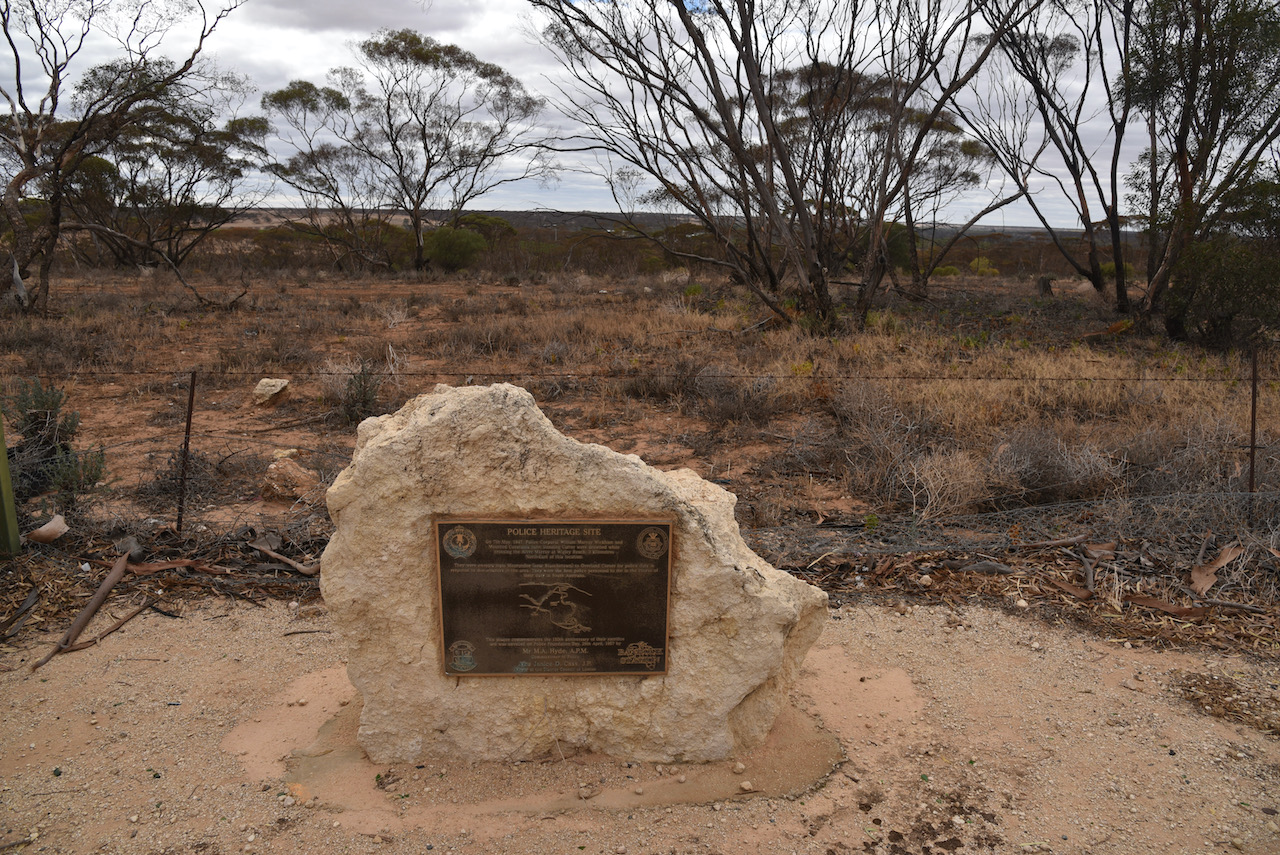
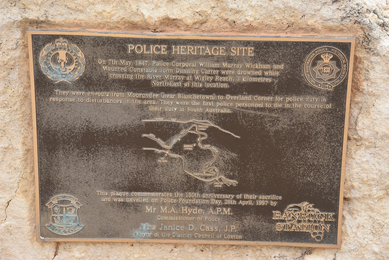
After packing up we continued west on the Sturt Highway and stopped to have a look at the Police Heritage site. The memorial cairn commemorates police officers, Corporal William Murray Wickham and Mounted Constable John Dunning Carter, who drowned on the 7th day of May 1847. They were enroute from Mourundee, near Blanchetown, to Overland Corner for police duty in response to disturbances in the area. They were the first police to die in the line of duty in South Australia.
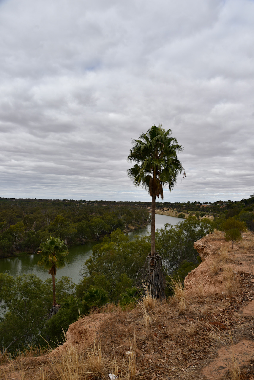
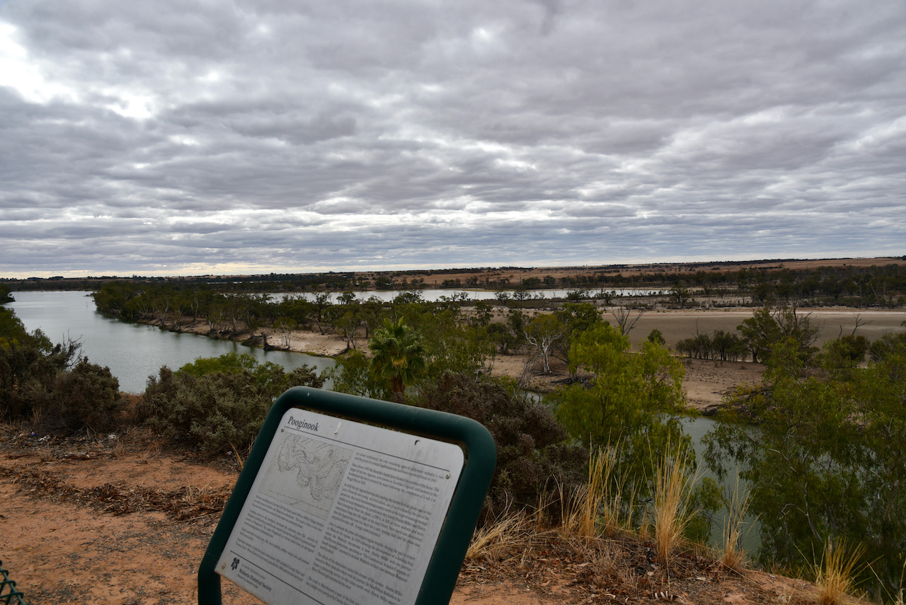
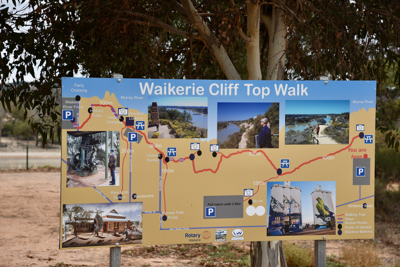
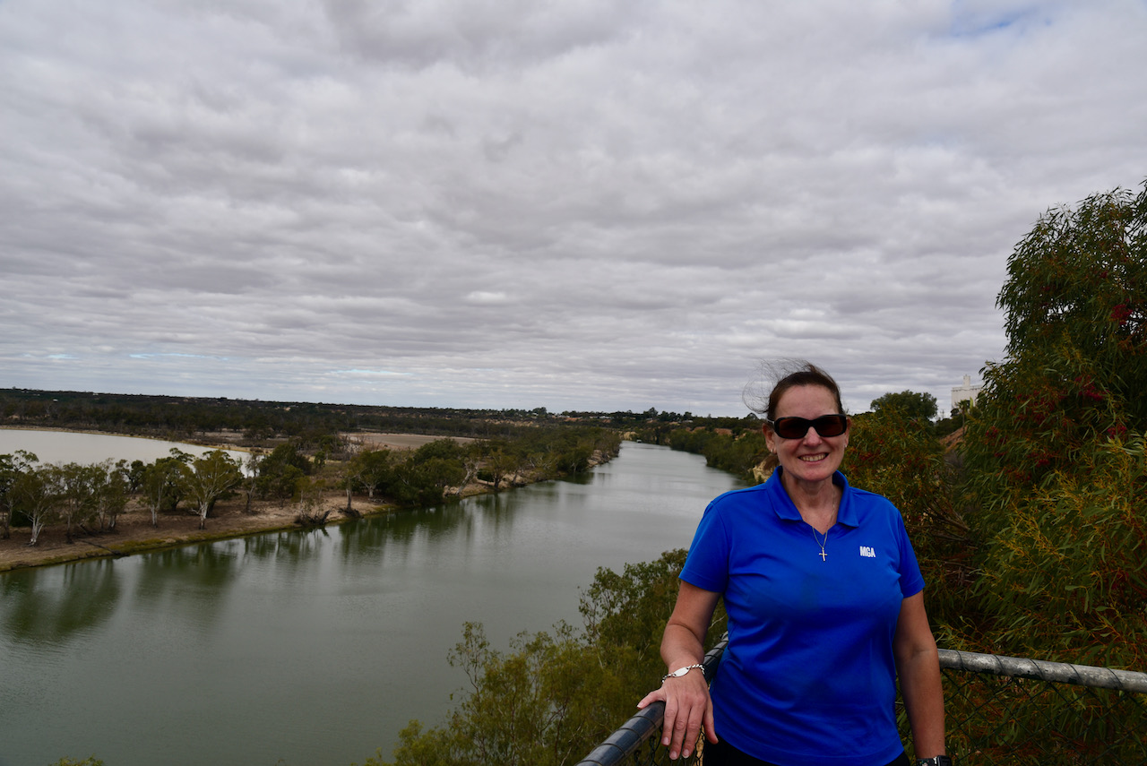
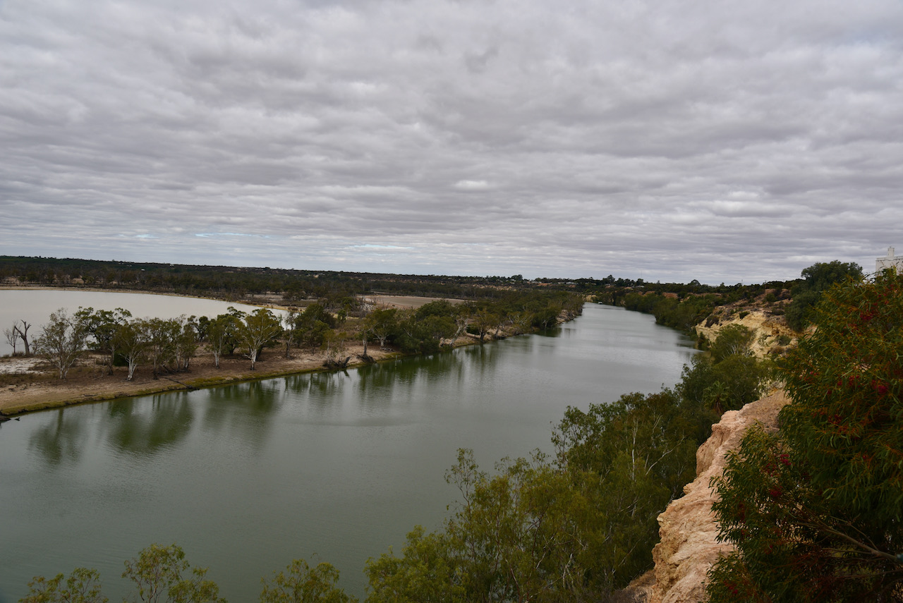
We then stopped at Waikerie to have a look at the Waikerie Cliff Top Walk.
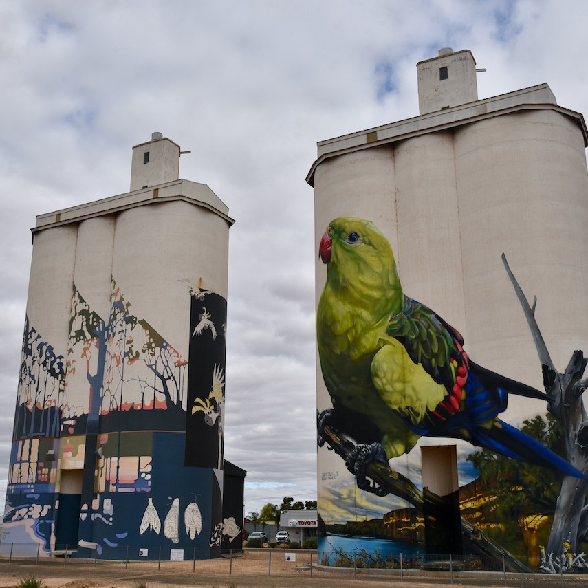
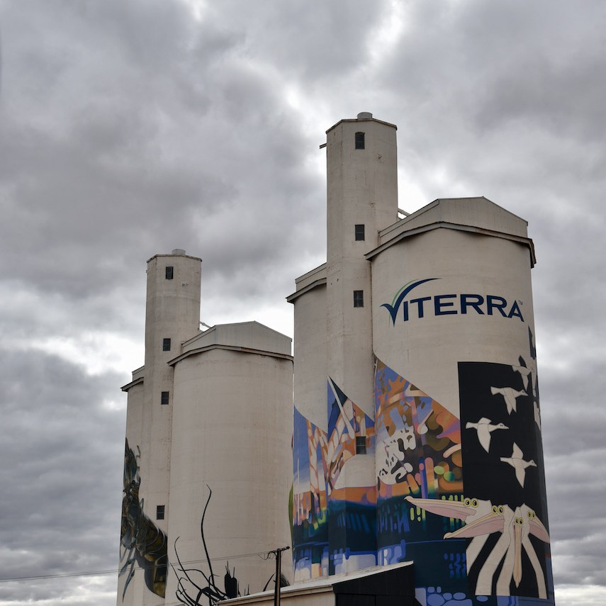
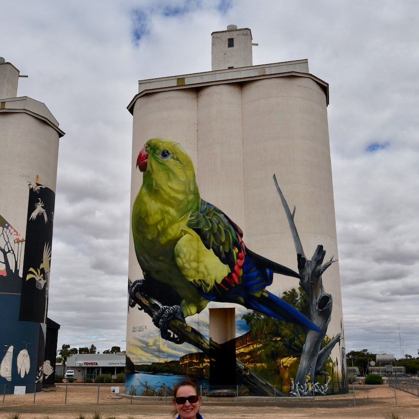
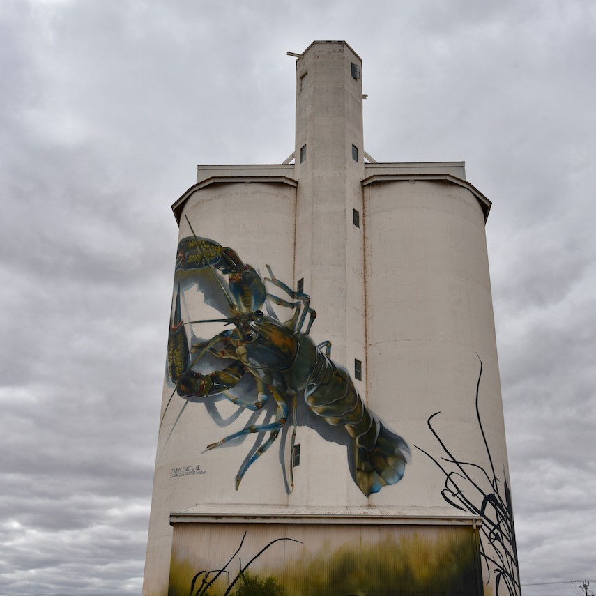
Also the Waikerie silos which are now part of Australia’s very popular silo art project. The non working Viterra Australia grain silos were painted by artists Garry Duncan and Jimmy Dvate in 2018. They were the 25th silo to be included in the Australian Silo Art Trail Collection.
Featured on the silos is a giant Yabby, the endangered Regent Parrot, Murray Hardyhead and the Spiny Daisy.
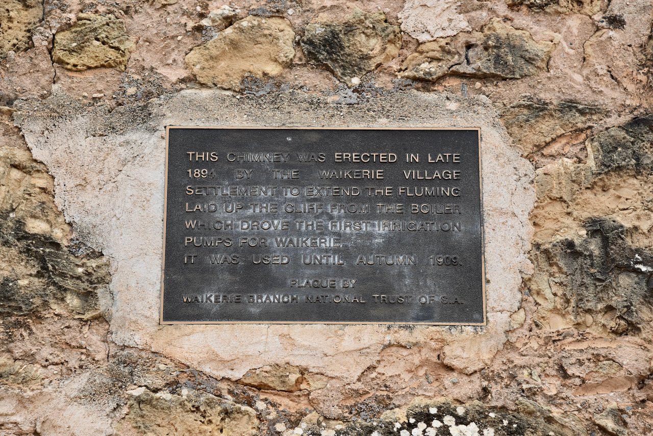
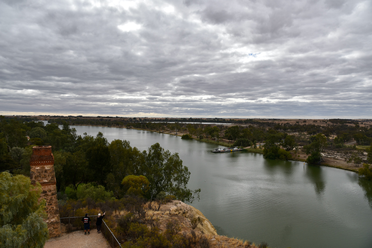
We then had a look at a historic old stone chimney at Waikerie overlooking the Murray River. The chimney was erected in late 1894 by the Waikerie village settlement to extend the fluming laid up the cliff from the boiler which drove the first irrigation pumps for Waikerie. It was used until Autumn 1909.
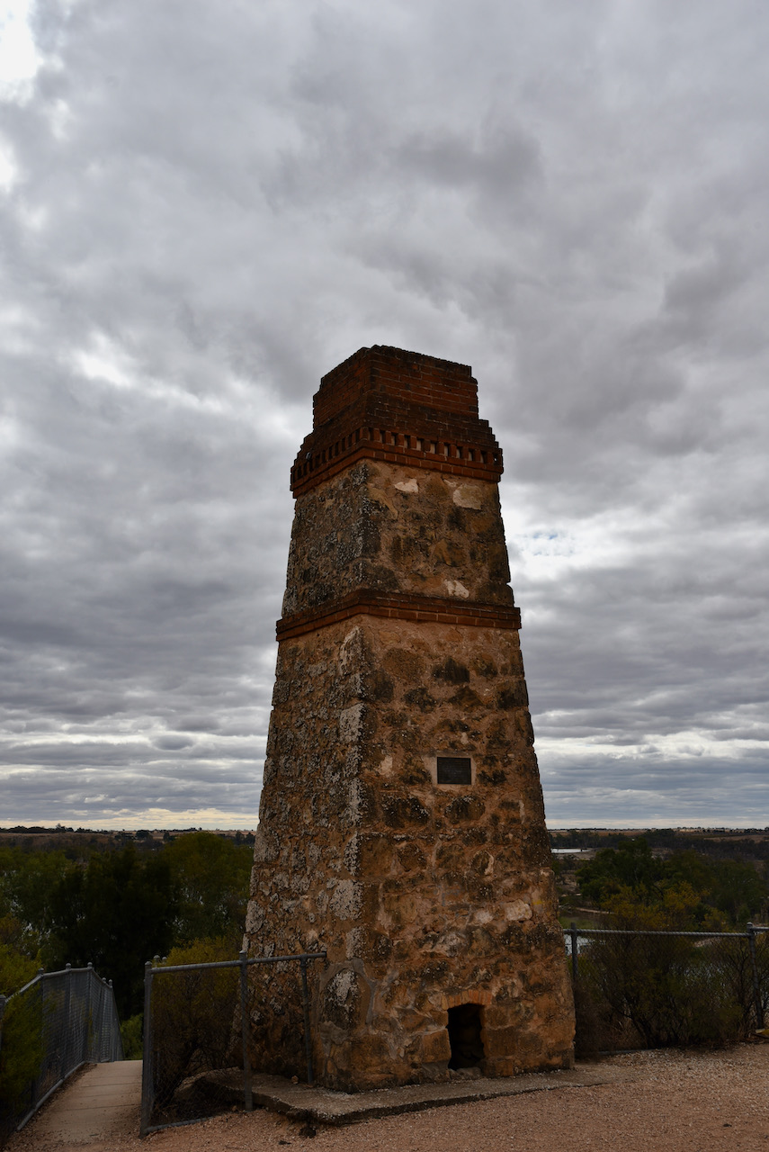
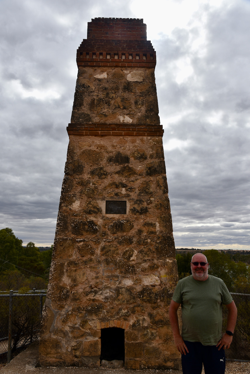
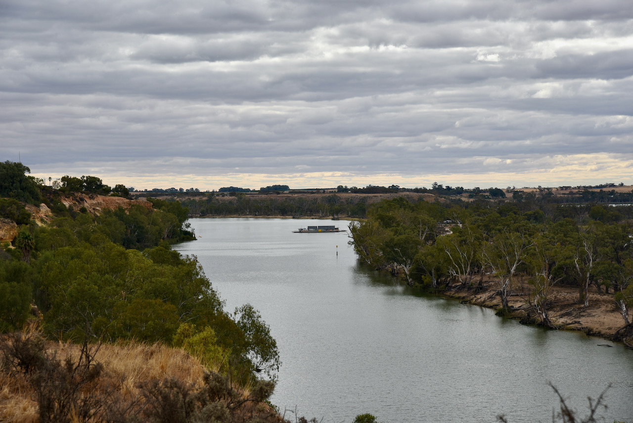
There is an excellent viewing platform at this spot where you can enjoy magnificent views of the Murray River and Jaeschke Lagoon.
We left Waikerie and continued west on the Sturt Highway, passing over the Murray River at Blanchetown and travelling passed the Brookfield Conservation Park.
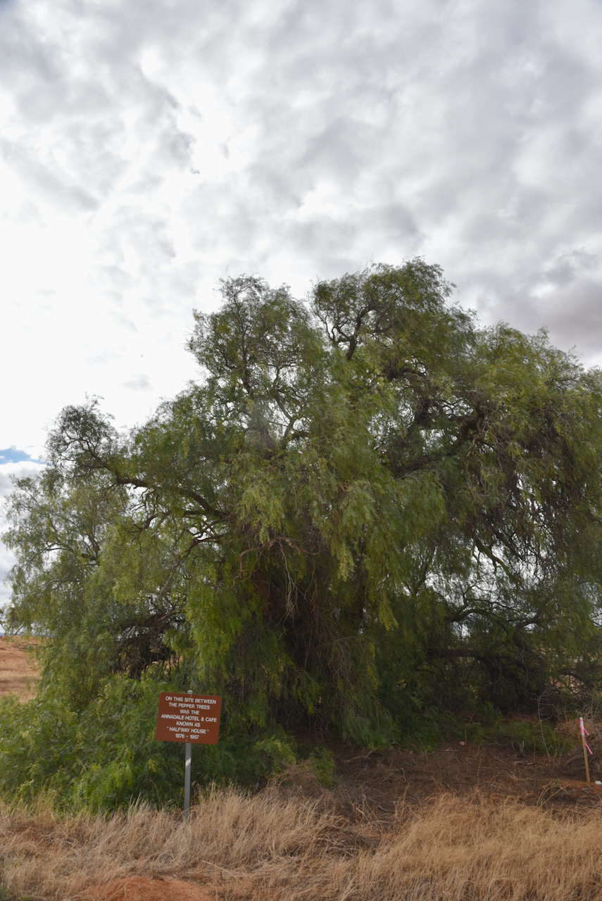
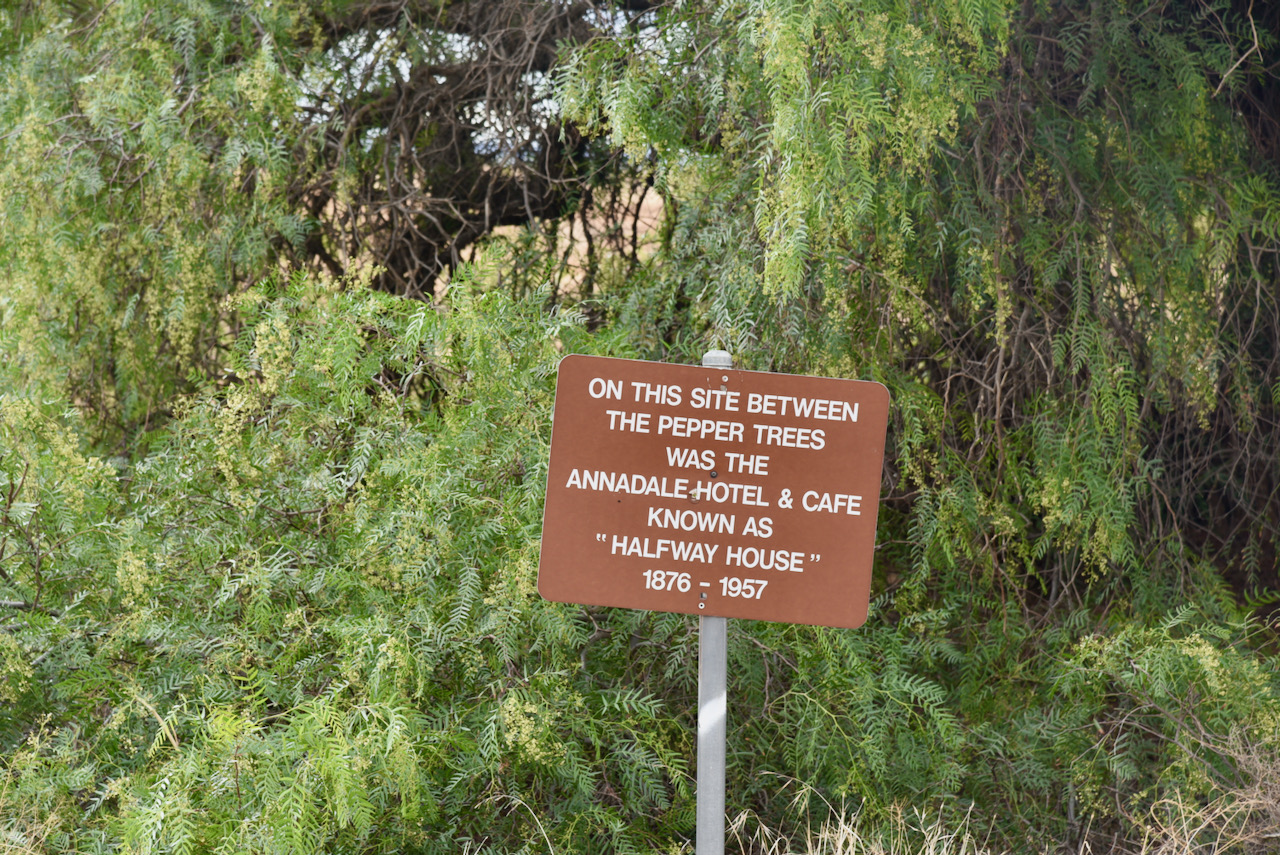
Our final quick stop before reaching home was the site of the olf Annandale Hotel and Cafe at the intersection of the Sturt Highway, Halfway House Road, and Bower Boundary Road. The Annandale Hotel operated between 1876 to 1957.
References.
Australian Silo Art Trail, 2021, <https://www.australiansiloarttrail.com/waikerie>, viewed 14th May 2021.
Wikipedia, 2021, <https://en.wikipedia.org/wiki/Loveday_Camp_9>, viewed 14th May 2021.
Wikipedia, 2021, <https://en.wikipedia.org/wiki/Loch_Luna_Game_Reserve>, viewed 14th May 2021.
Our fourth and final park for day twelve (Saturday 17th April 2021) was the Moss Tank Flora & Fauna Reserve VKFF-2394. The park is located about 31 km south of Robinvale.

This was to be our first activation of this park. Moss Tank has also been activated once before, by Mike VK6MB back in 2019.
We found the park without any problems. It was well signposted on the Annuello-Wemen Road.
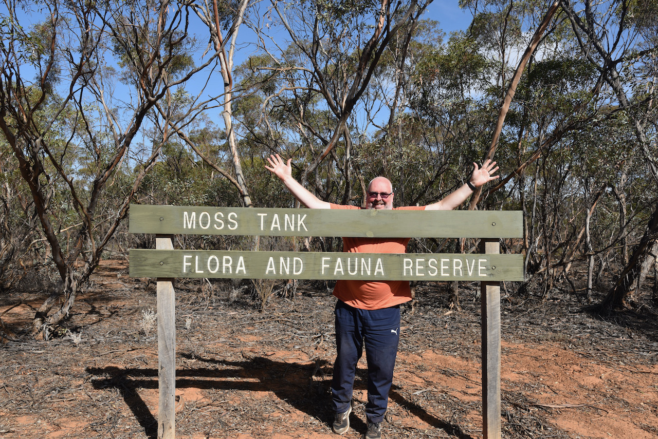
Moss Tank Flora and Fauna Reserve is about 3.26 km² in size and was established in 1988.
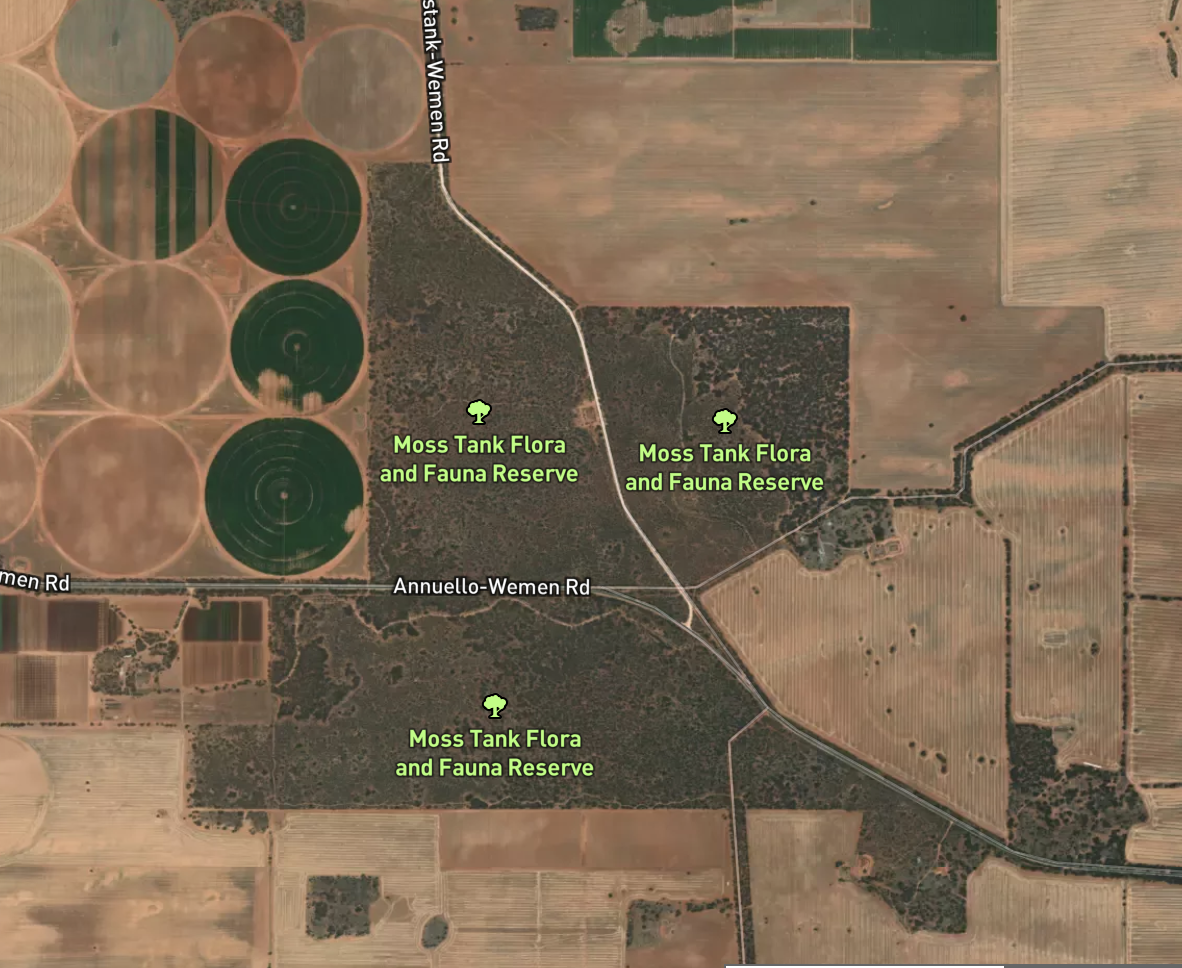
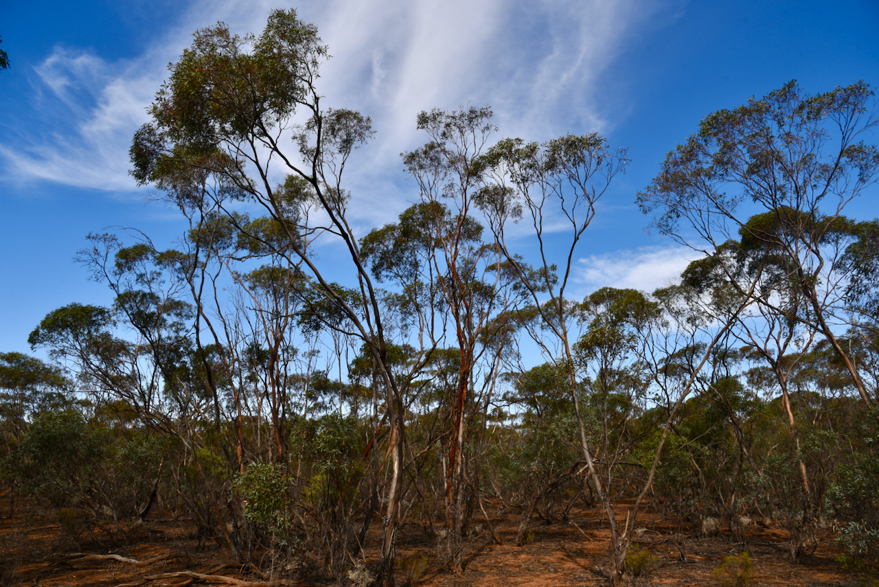
The park is a piece of remnant mallee scrub which is surrounded by cleared farming land. It is located near the town/locality of Annuello which is believed to be an aboriginal word for ‘a camp of bearded men’. During the early 1920’s the Annuello district was subdivided into blocks for Soldier Settlement following the First World War. The railway line to Annuello was opened in 1921, followed by a school in 1924. The Annuello Post Office opened in April 1921.
A wheat variety ‘annuello’ adapted for low and medium rainfall areas was released in 2003, and is suitable for the domestic flour milling industry.


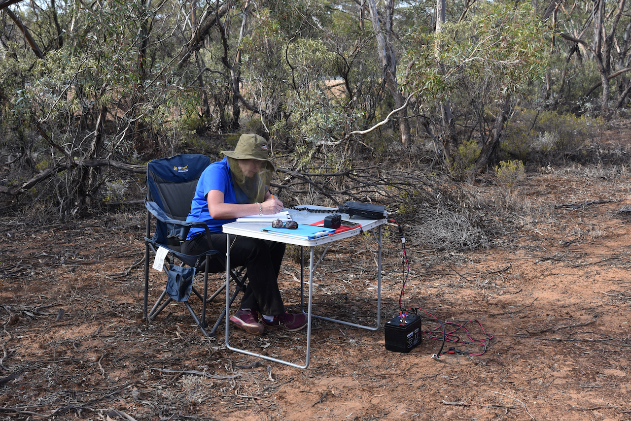
We found a little direct track running off the bitumen and pulled in there off the road. It made an ideal spot to stretch out the 20/40/80m linked dipole.
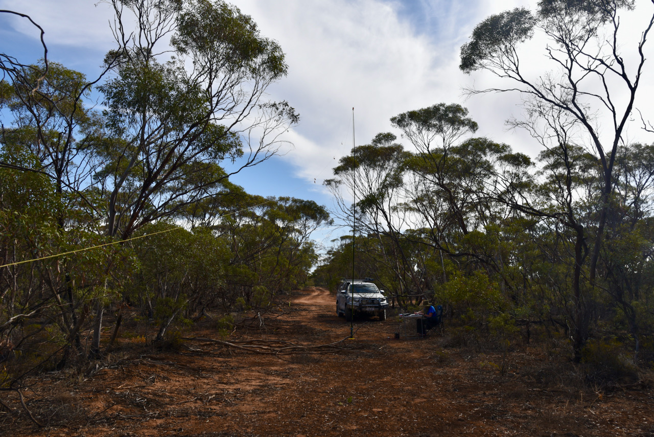
Within eight minutes I had qualified the park for VKFF, with 11 contacts in the log. Contact number ten was with Alan VK2MET. I then swapped over with Marija and she too qualified the park in quick time, with contact number ten being a QSO with the same park hunter Alan VK2MET.

I then jumped back into the operator’s chair and logged a further 30 contacts on 40m from VK1, VK2, VK3, VK4, VK5, VK7, and New Zealand.
I now had 41 contacts in the log and required just 3 more QSOs to qualify the park for the global WWFF program.
I moved to the 20m band where I logged 6 stations from VK2, VK4, and much to my surprise Canada. It was a terrific way to finish the activation with a contact with Karl VE6KDX in Alberta, Canada.
Marija worked the following stations on 40m SSB:-
I worked the following stations on 40m SSB:-
I worked the following stations on 20m SSB:-
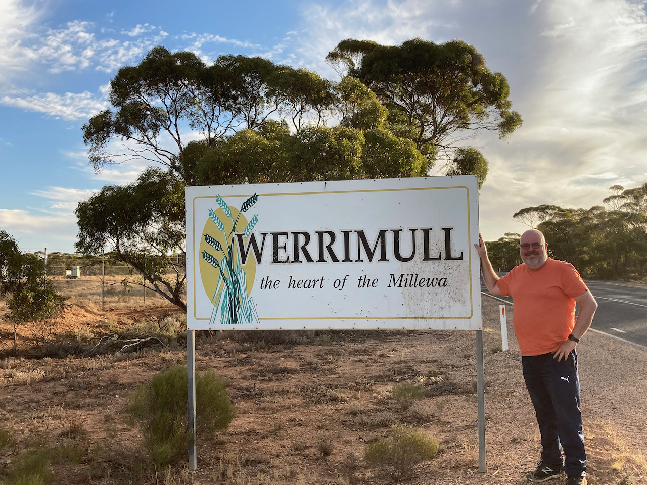
Marija and I had a 245 km drive ahead of us to get to Renmark. We drove back along the Hattah-Robinvale Road and then north on the Calder Highway. We then turned left onto the Millewa Road and through Werrimul.
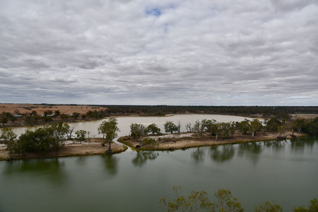
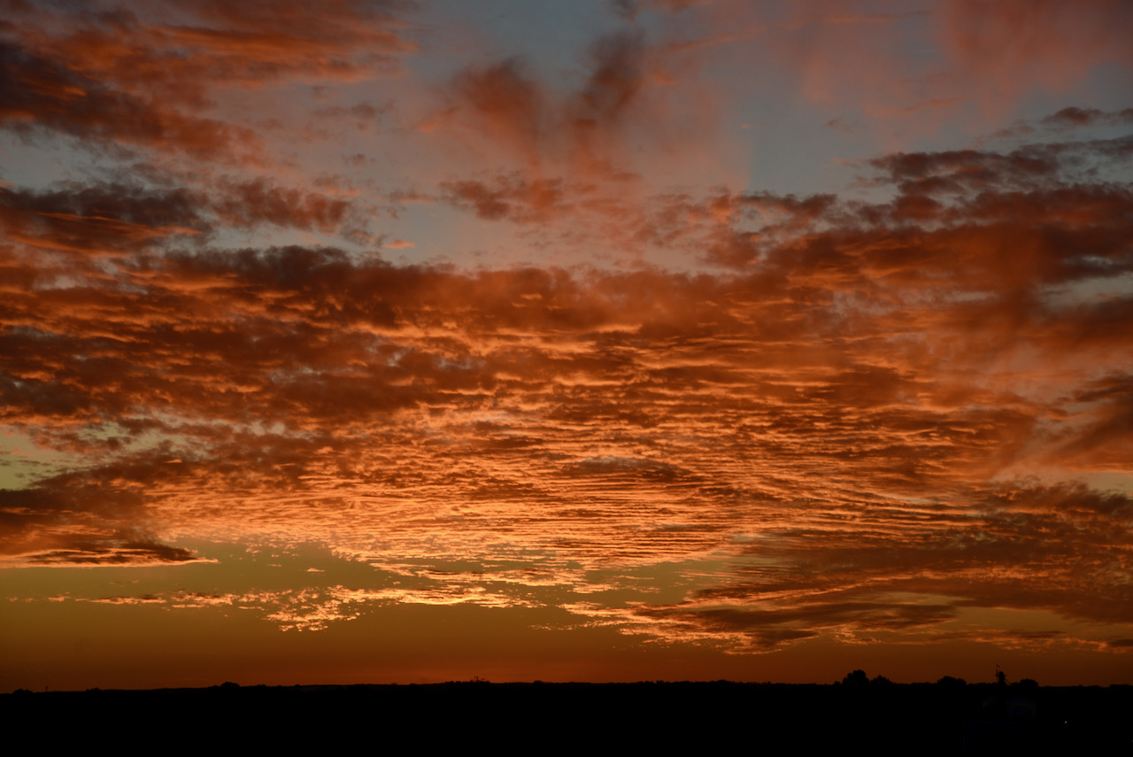
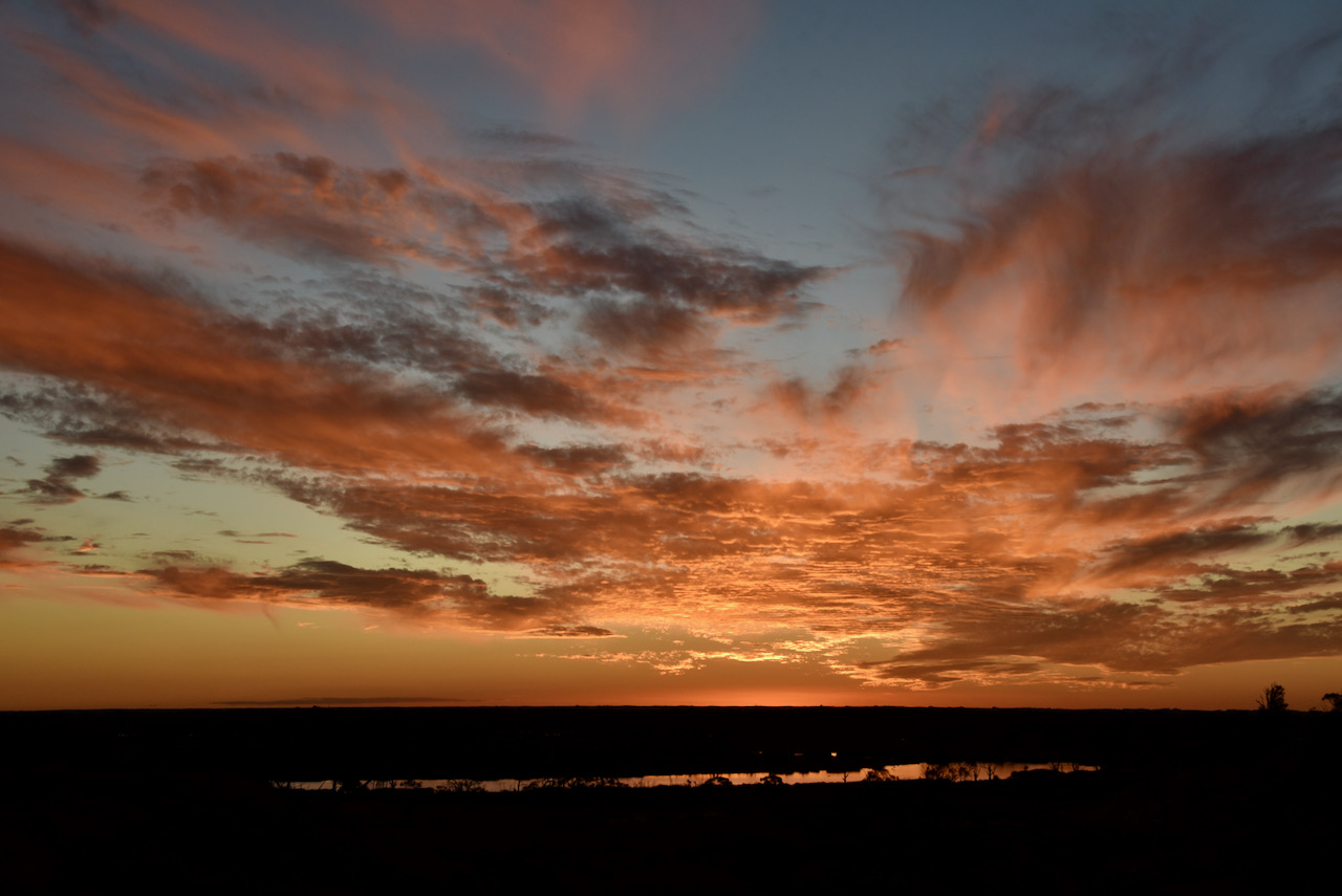
We crossed the Victorian/South Australian border and back into South Australia. The sun was starting to set and we stopped briefly to get some shots of the amazing sunset. The photos below were taken looking over the Pike River Conservation Park just outside of Renmark.

That evening after checking into our accomodation, we grabbed some pizza and beer and headed around to the home of Ivan VK5HS and his wife Sheryl, and had a terrific night there.
Tomorrow we would head home, a journey of around 285 km ahead of us.
References.
Protected Planet, 2021, <https://www.protectedplanet.net/314747>, viewed 13th May 2021.
Victorian Place Names, 2021, <https://www.victorianplaces.com.au/annuello>, viewed 13th May 2021.
Amateur Radio, Short Wave Listening, travel and history
Amateur radio experiences with VK1DA
Brisbane - Australia
german amateur radio station
Summits On The Air
SOTA on the peaks, wilderness QRP and some bushwalking
A fine WordPress.com site
Amateur Radio Adventures
Summits on the Ai
Amateur radio station from Belgium
Radio craft, homebrew, QRP/SOTA, AM
Ego loqui ad viros super montes
My adventures with Amateur Radio and Geocaching!
The rantings of VK2GAZ on his SOTA experiences in Australia
A survivor, with minor cuts and abrasions.
The Art and Craft of Blogging
The latest news on WordPress.com and the WordPress community.
Blog of Justin Giles-Clark VK7TW's SOTA and amateur radio adventures.
Occasional SOTA & Microwave operation
