Tutye Bushland Reserve VKFF-4162 and Tutye silo VK-TTE3

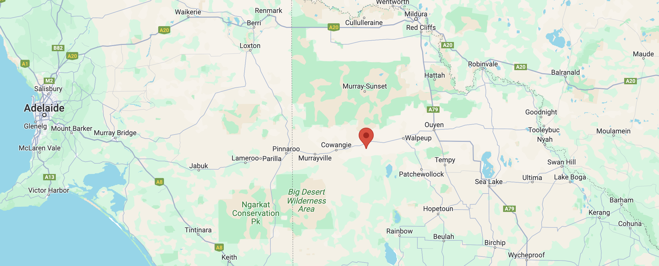
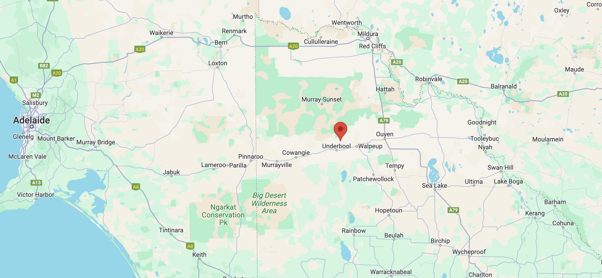
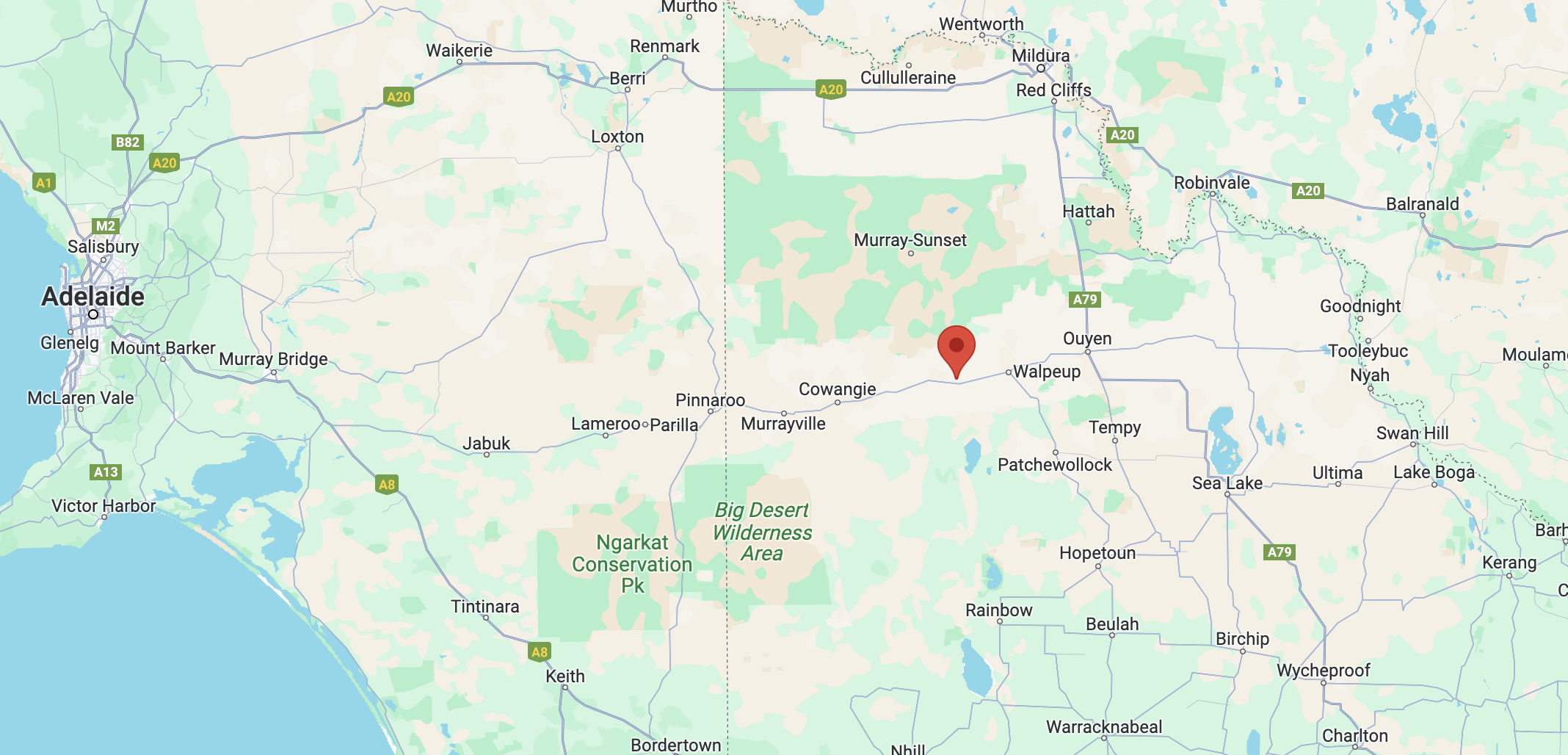
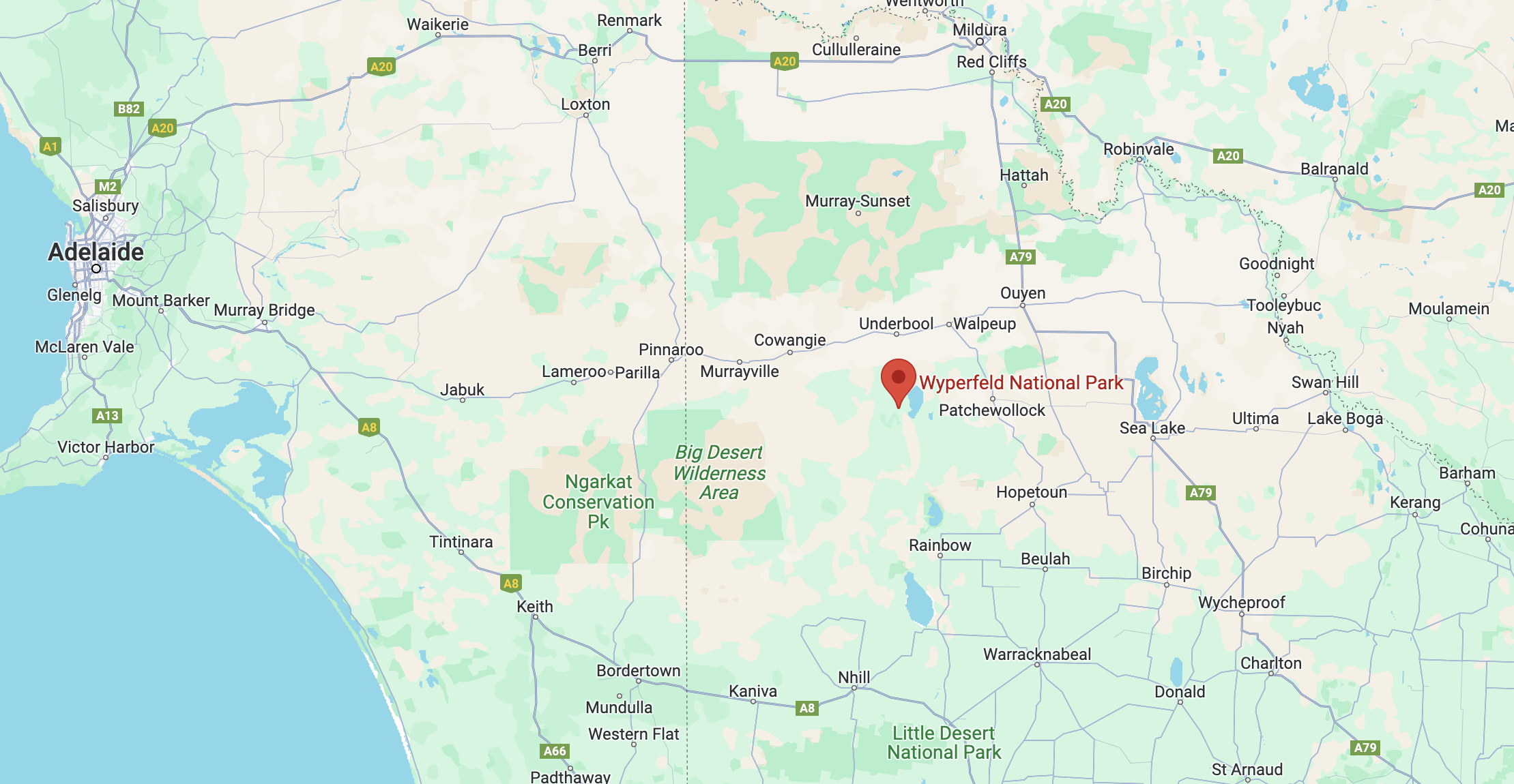
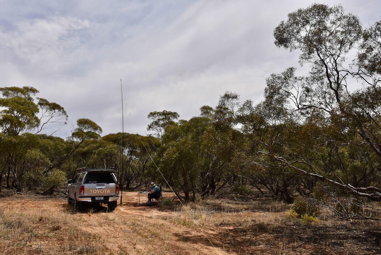
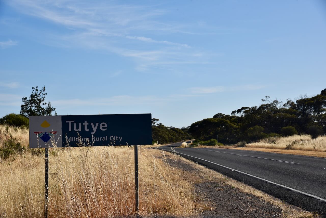
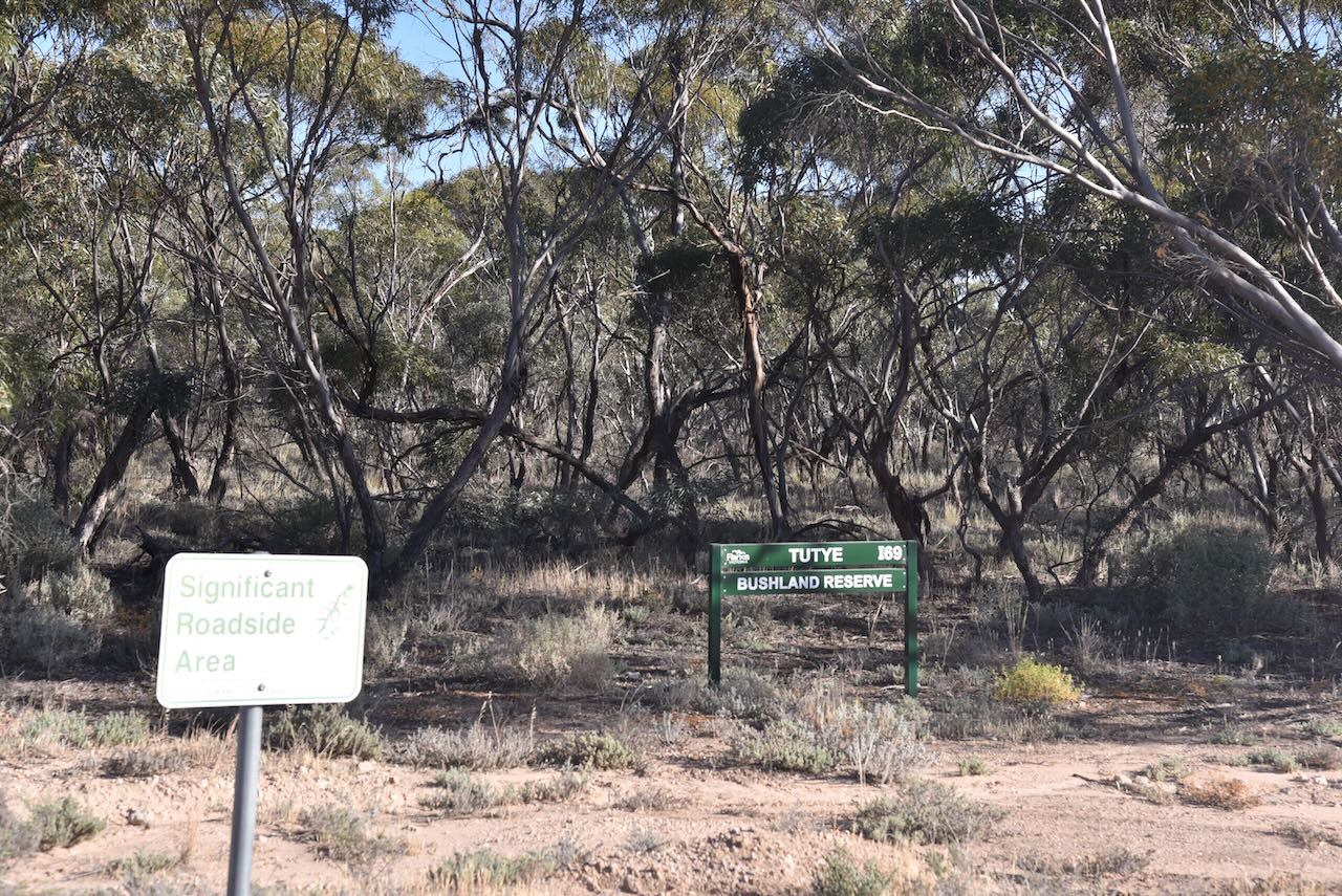
Our first activation for Monday 13th November 2023 was the Tutye Bushland Reserve VKFF-4162 and the Tutye silo VK-TTE3. Tutye is located halfway between Murrayville and Underbool in northwestern Victoria.

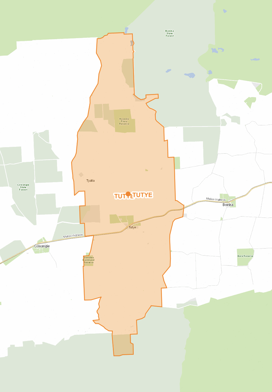
Tutye is a former town and locality in north-western Victoria. The old town is located on the Mallee Highway, about 12 km northwest of Cowangie and about 9 km southeast of Boinka.

Above:- the locality of Tutye. Image c/o maps.land.vic.gov.au

Tutye is an aboriginal word meaning rest. (Blake 1977)

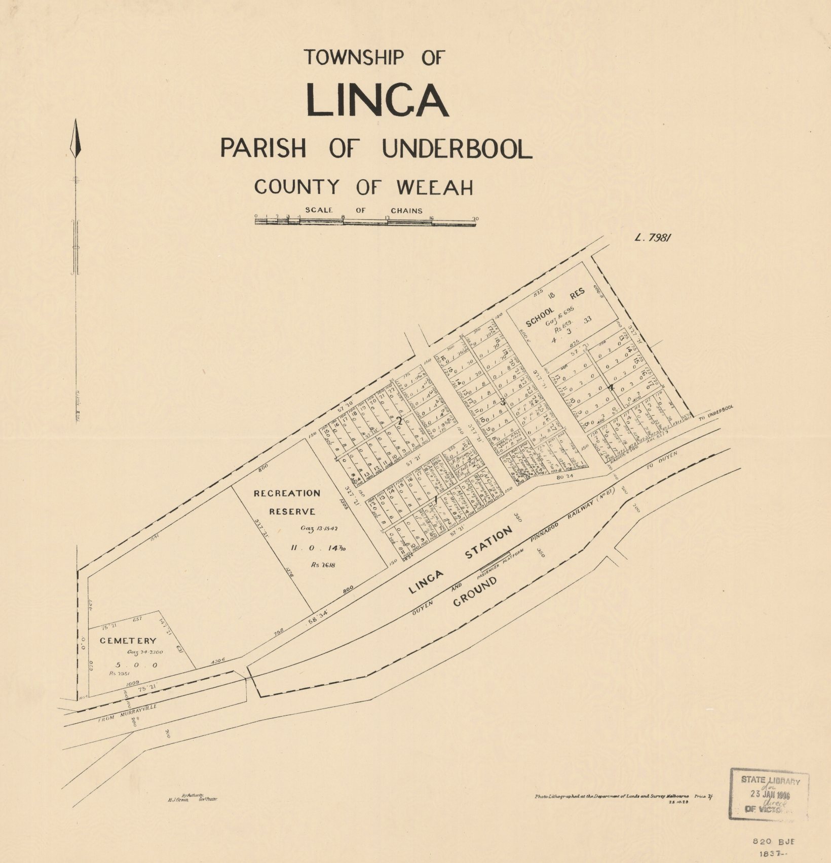
Tutye was proclaimed a township in 1920 with the proclamation appearing in the Victorian Government Gazette on the 1st day of December 1920. The proclamation was partly rescinded on two occasions in November and December 1922, to exclude areas on the edge of the township as it was established that the town would be smaller than first thought. (Context 2013)

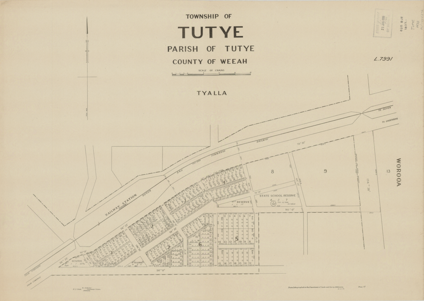
Above: Plan of the township of Tutye. Image c/o Trove.

Settlement in the area however dated before 1920. The area was first settled in about 1912. (Context 2013) The Tutye Post office was opened on the 15th day of July 1912. A regular mail service was provided by the opening of the railway line from Ouyen to Murrayville in June 1912. It was closed in 1980. (Phoenix 2024) The Tutye General Store opened in 1912, and the Tutye Hall was built in 1913. (Context 2013)

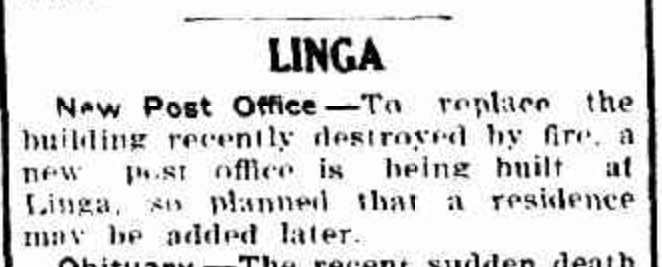
In 1920 a bore was sunk at Tutye. (Context 2013) In that same year, the Tutye State School was also opened. (1920 Tutye State School)

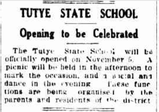
Above: Article from the Sunraysia Daily, Mildura, Fri 29 Oct 1920. Image c/o Trove

x

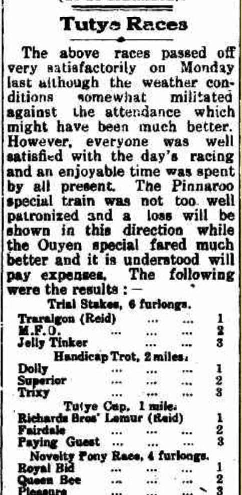
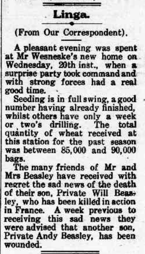
Above:- part of an article from the Pinnaroo and Border Times, Fri 11 Jun 1920. Image c/o Trove.

In 1954 the Tutye Gypsum Factory commenced trading as Australian Plaster Industries. Gypsum was brought through Tutye by rail in 1953-1956. A minor industrial boom was planned. However, only two of the anticipated 50 houses were constructed. The factory’s main product was Plaster of Paris. A cookhouse was constructed near the factory which operated for three years. (Context 2013)

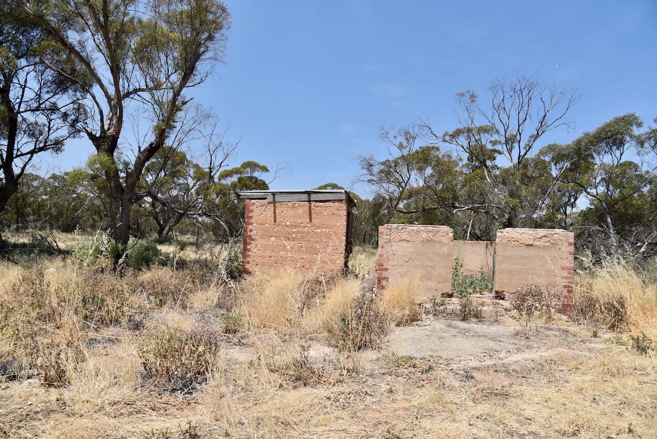
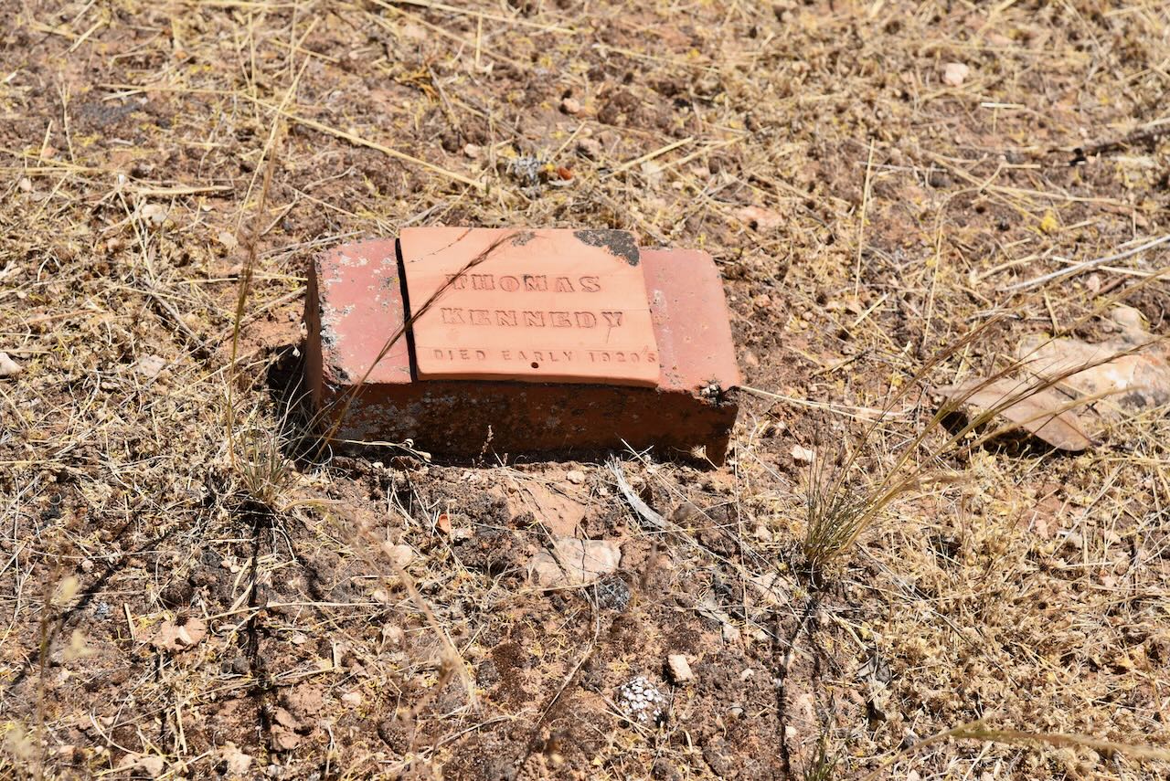
The only remaining structure from the township of Tutye is the remains of a house on Stock Route Road

The row of sugar gums on Stock Route Road marks the township site. They were planted in honour of those who served in World War One. (Context 2013)

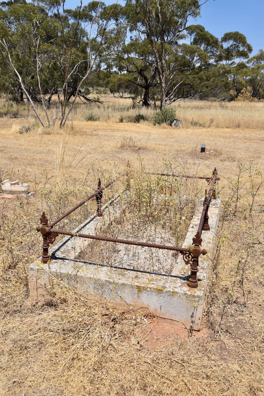
The Tutye cemetery is located on Tyalla Road. The first recorded burial at the cemetery was in 1915. One of the earliest burials was that of Roland Hendy who died in 1915, aged just 16 years. Unfortunately, a fire in 1934 destroyed all of the Tutye cemetery records. (Context 2013)

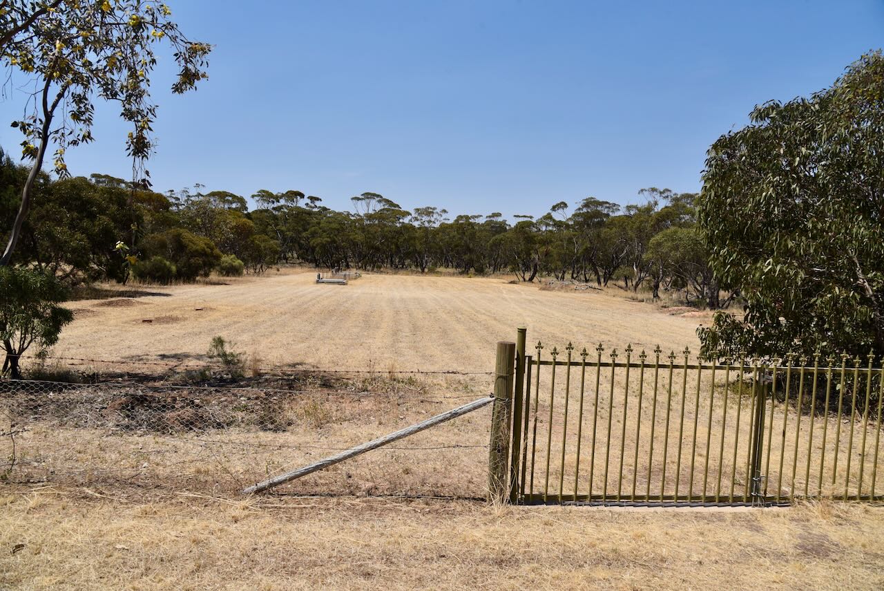
Sadly very little remains today of what was once a thriving settlement.

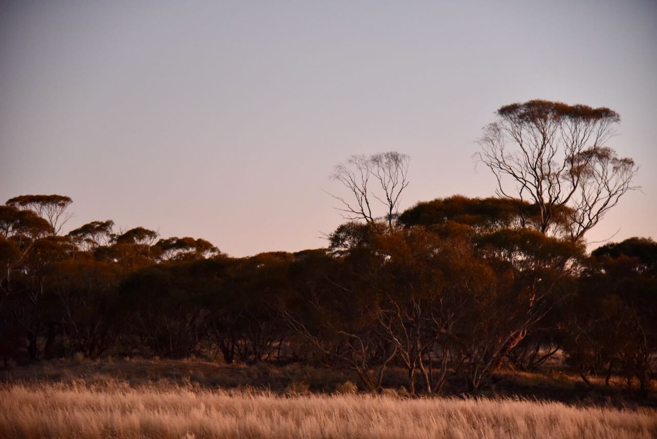
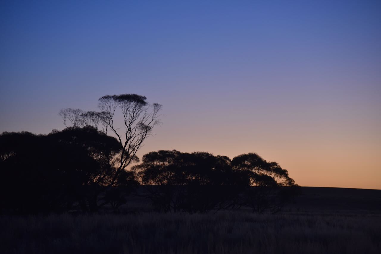
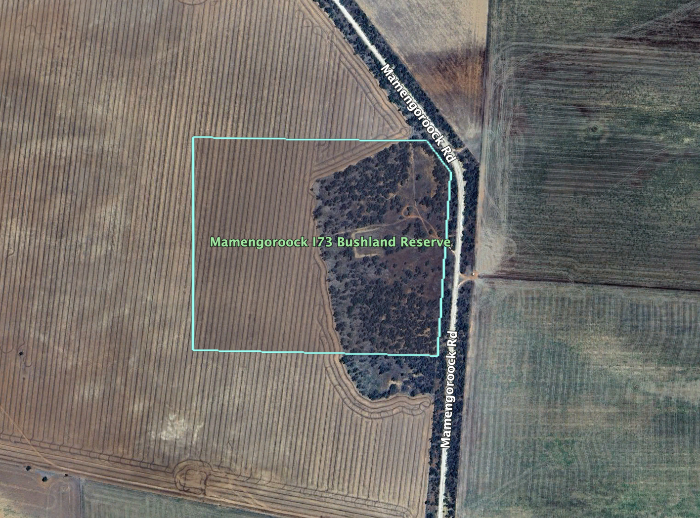
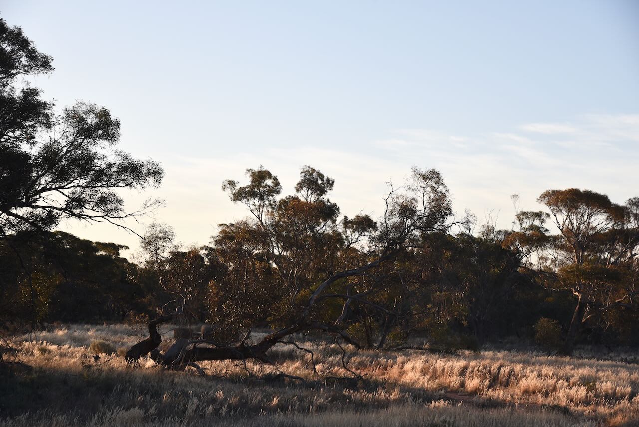
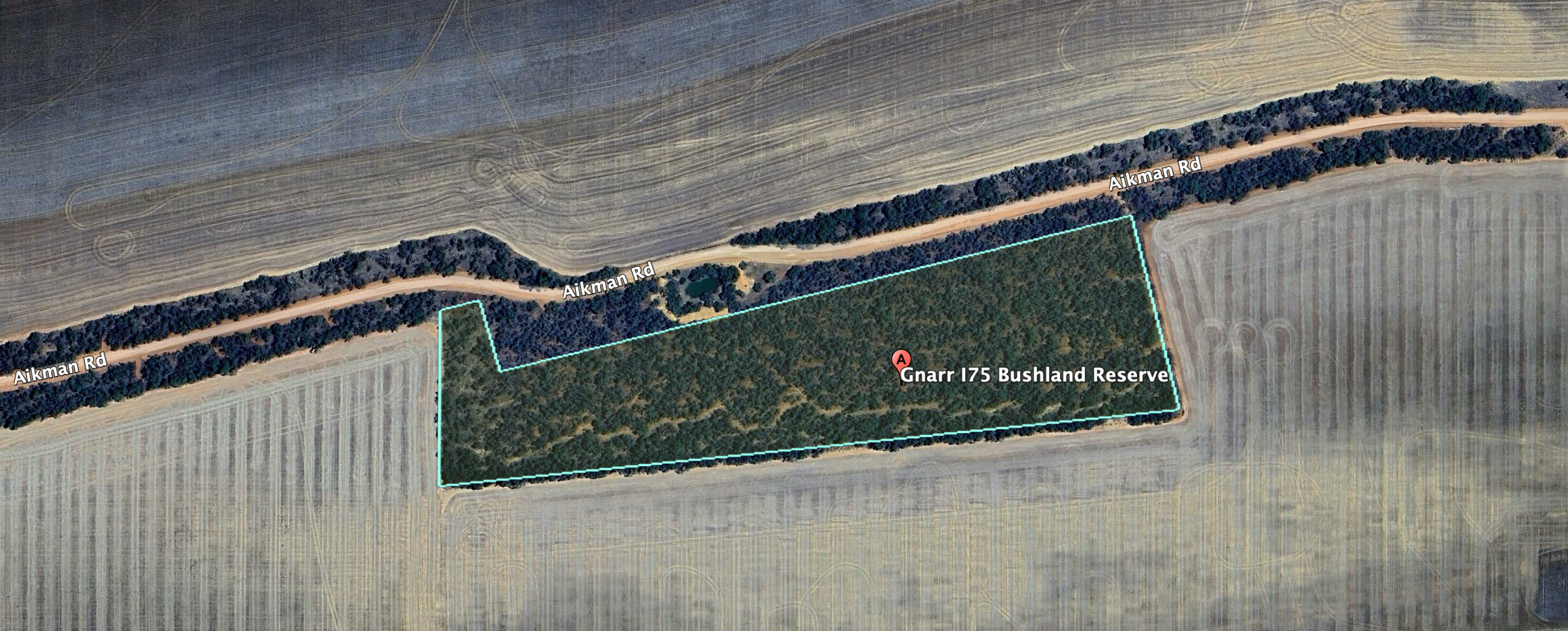
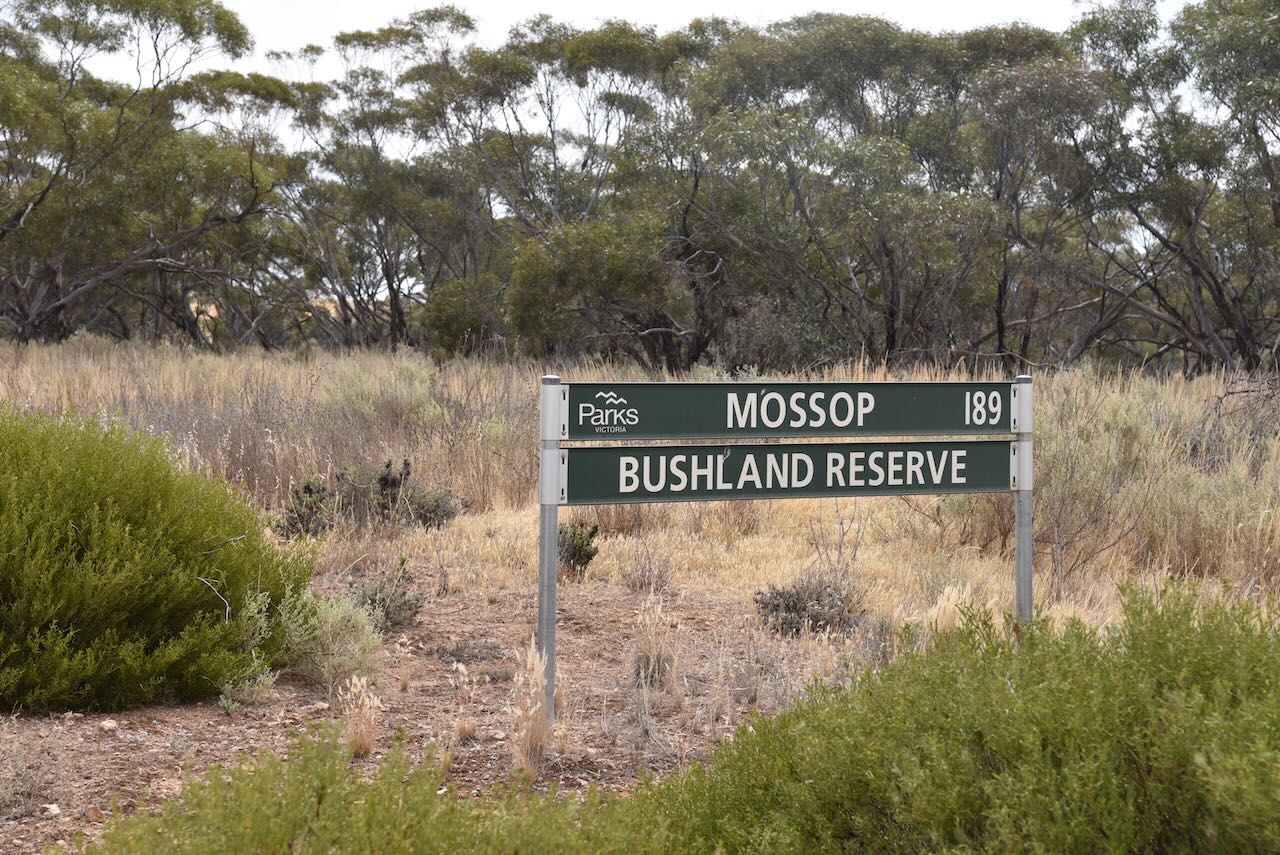
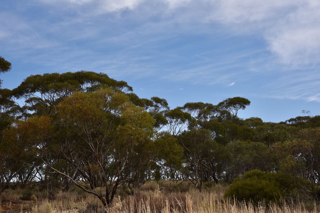
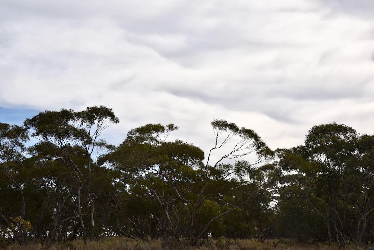
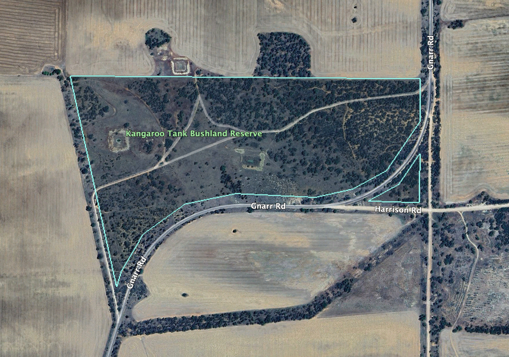
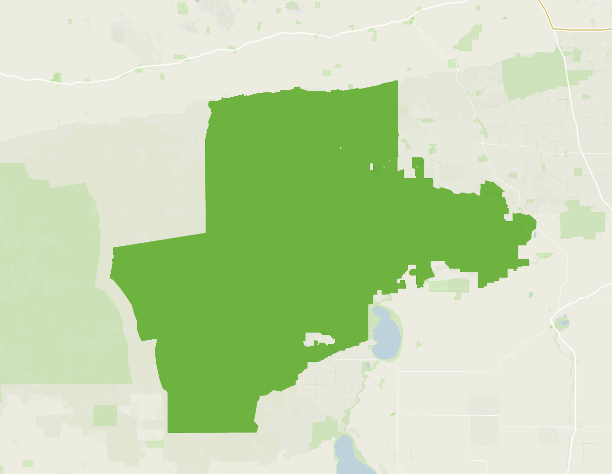
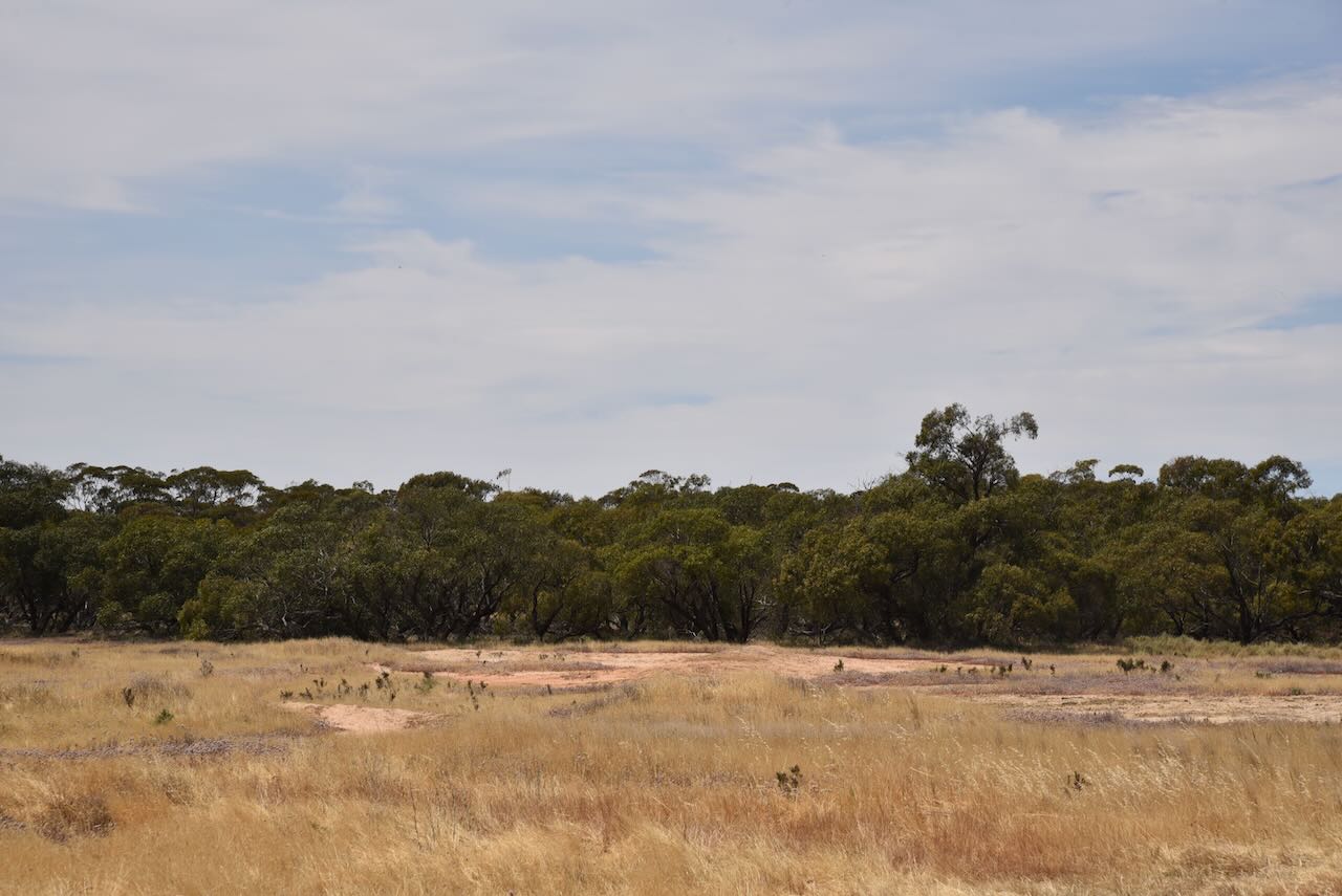
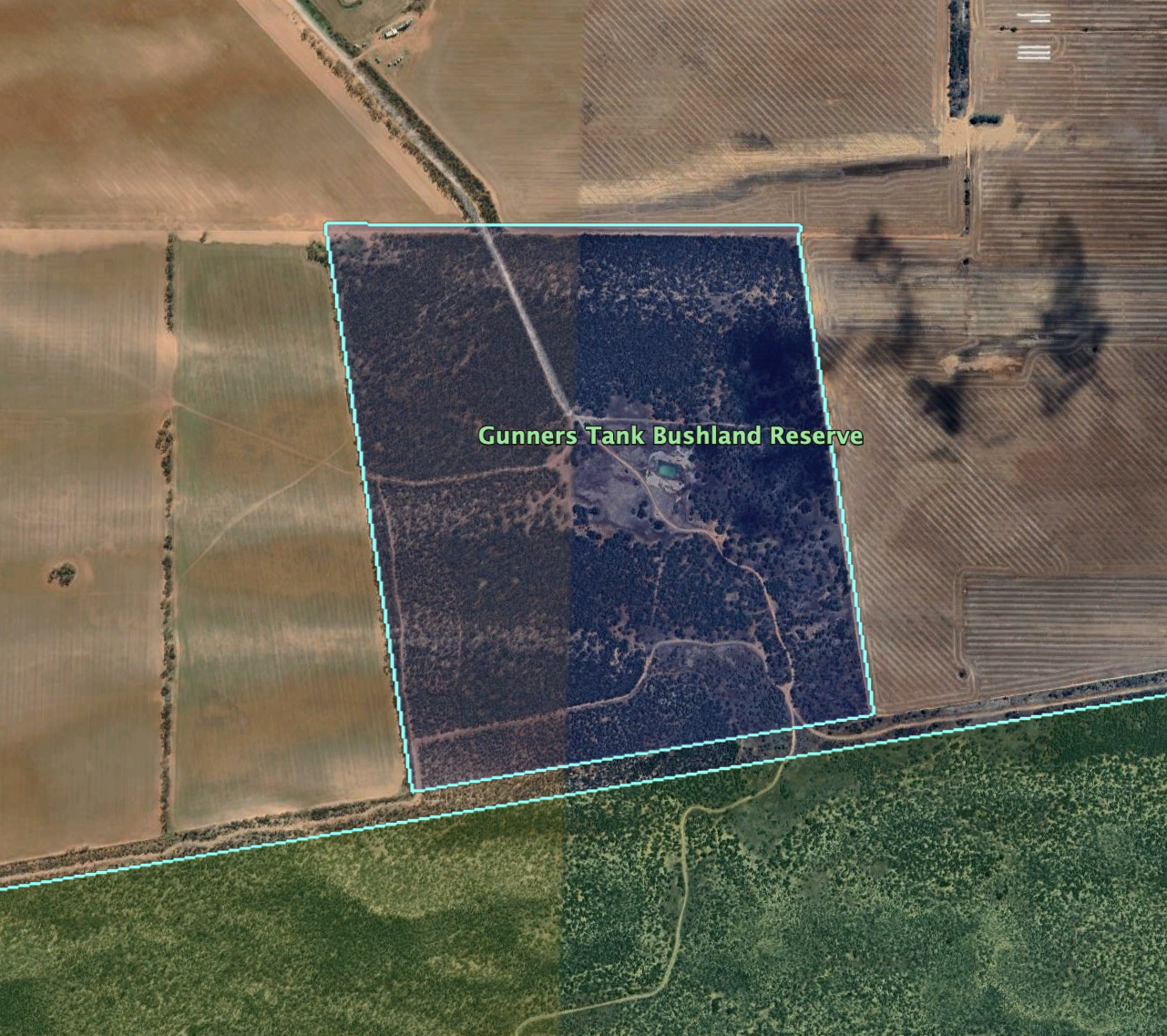
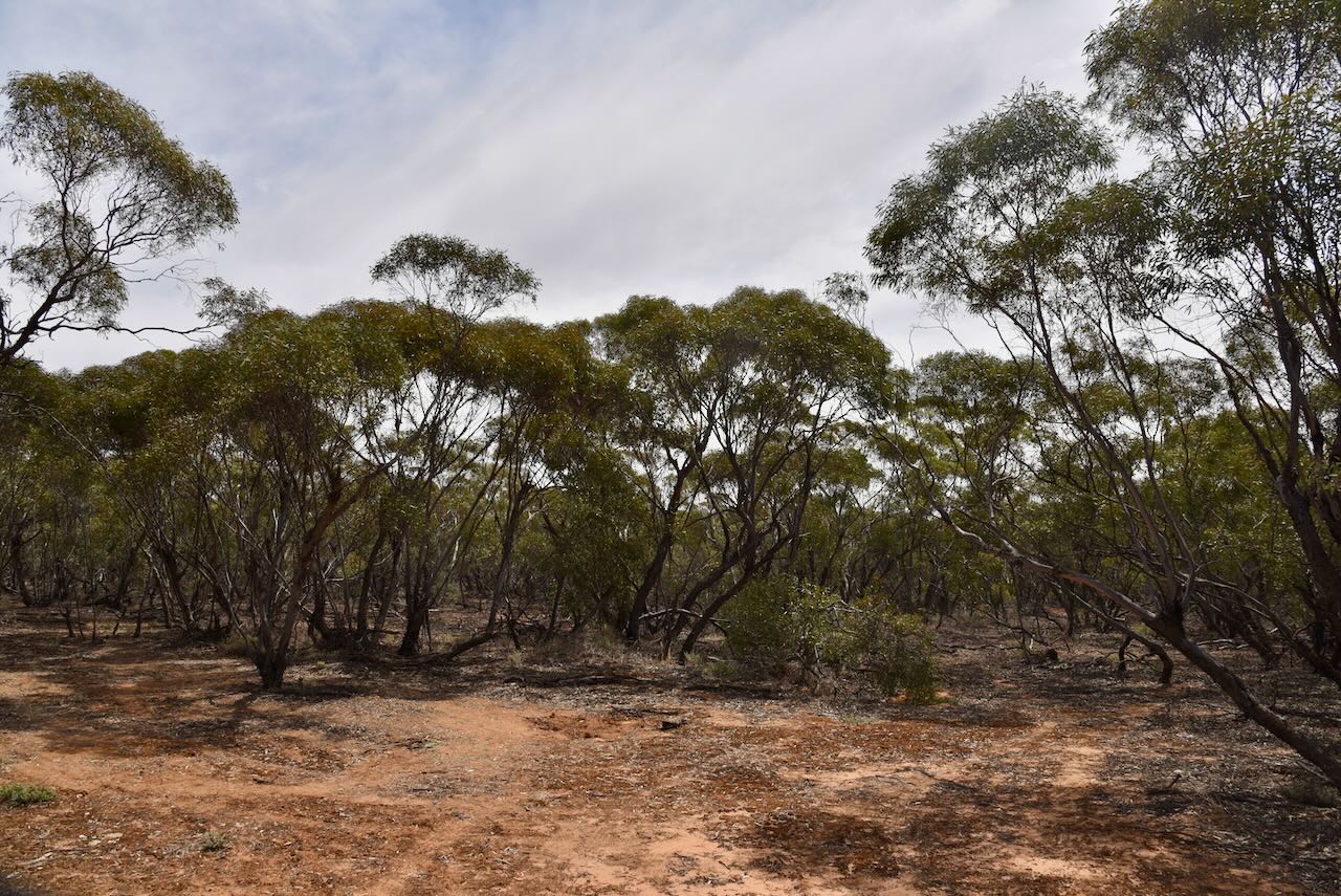
The Tutye Bushland Reserve is about 232 hectares in size and was declared on the 1st day of May 1979. It comprises 22 different sections of land located on the northern and southern sides of the Mallee Highway. (CAPAD 2022)

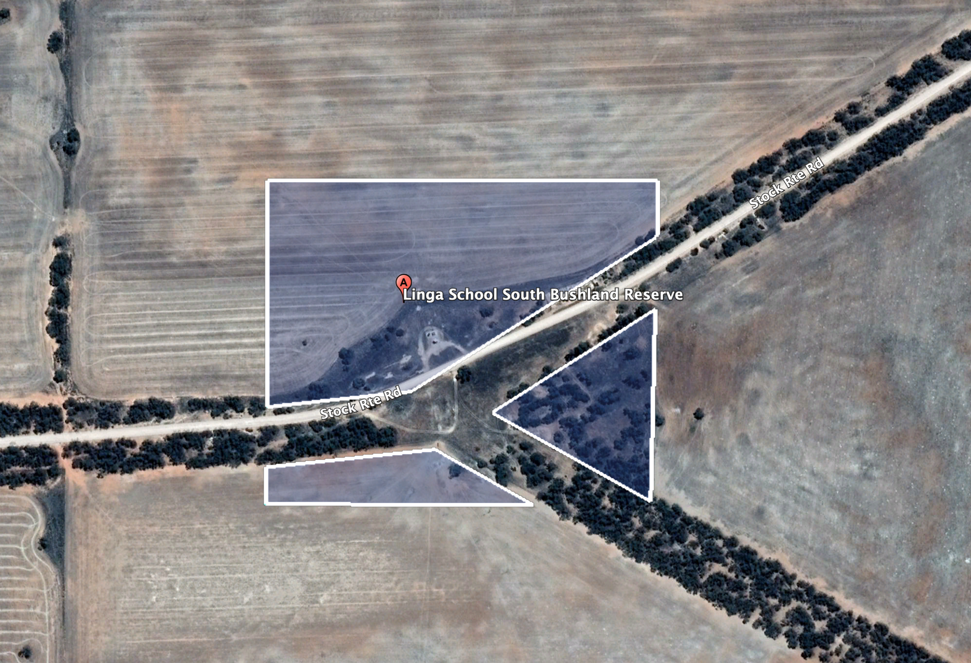
The Parks Victoria website has a page for the reserve but contains no information other than a boundary map of the reserve.

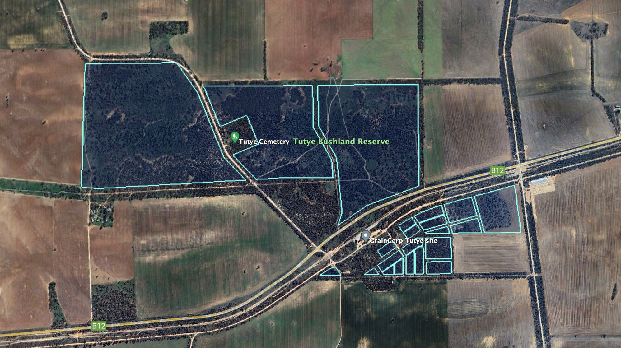
Above:- The Tutye Bushland Reserve. Image c/o Google Earth.

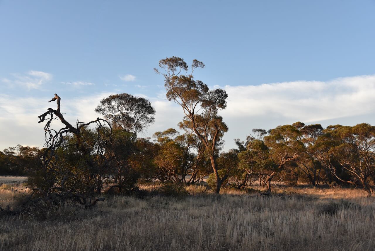
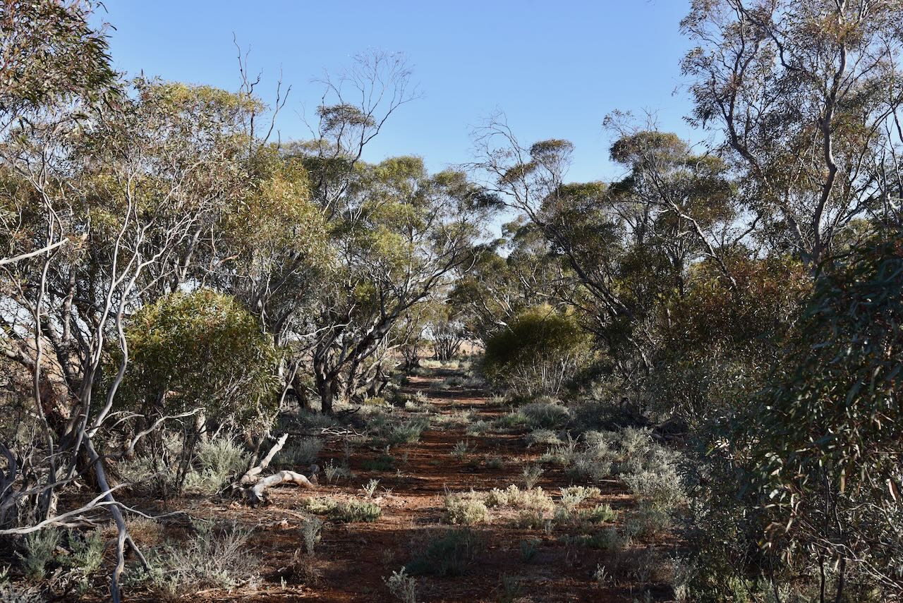
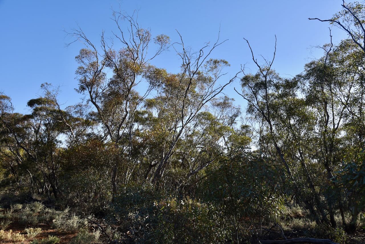
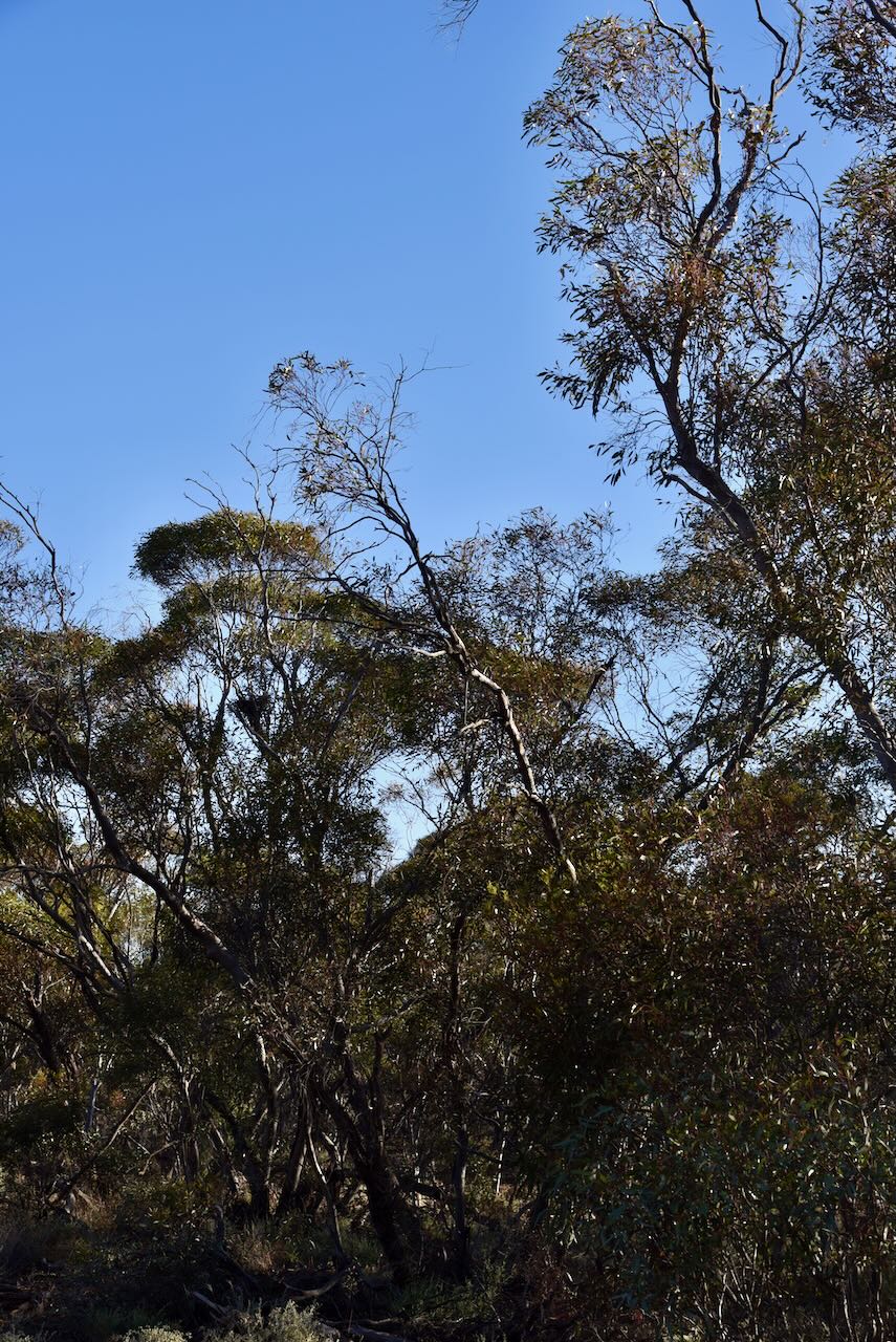
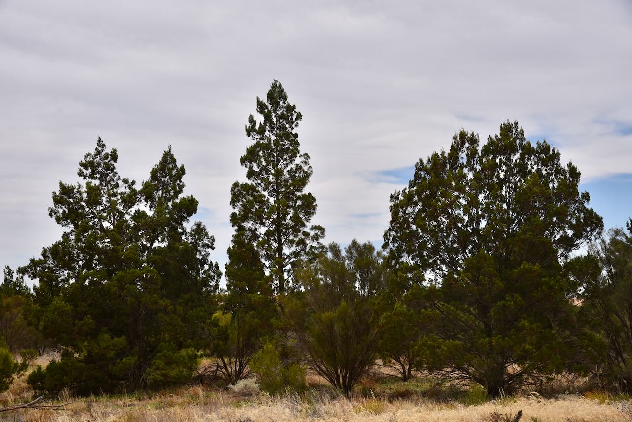
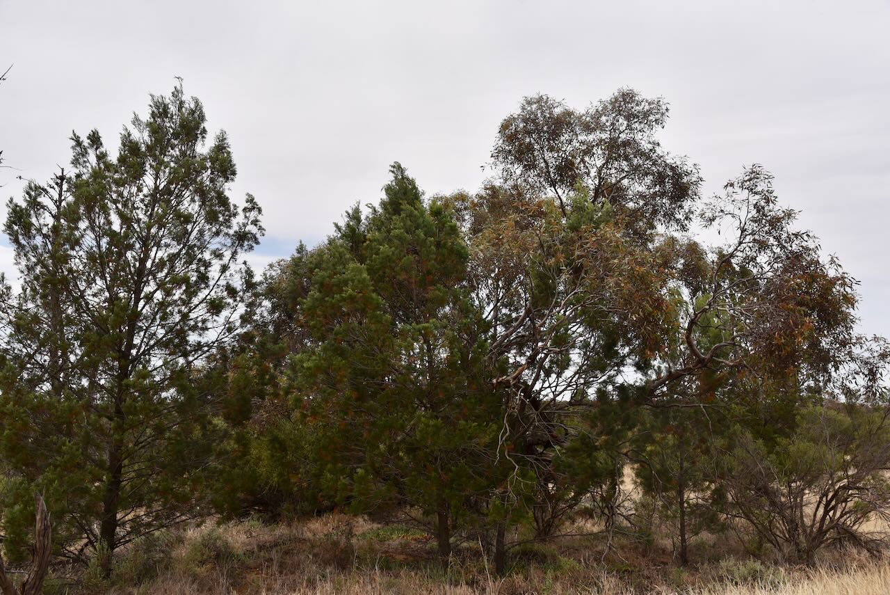
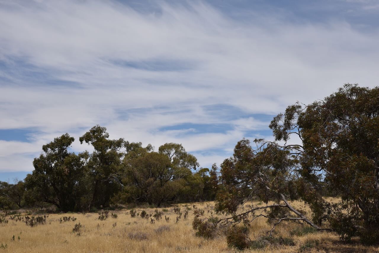
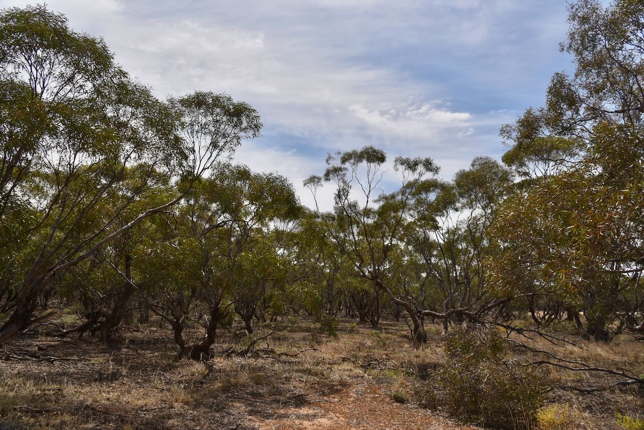
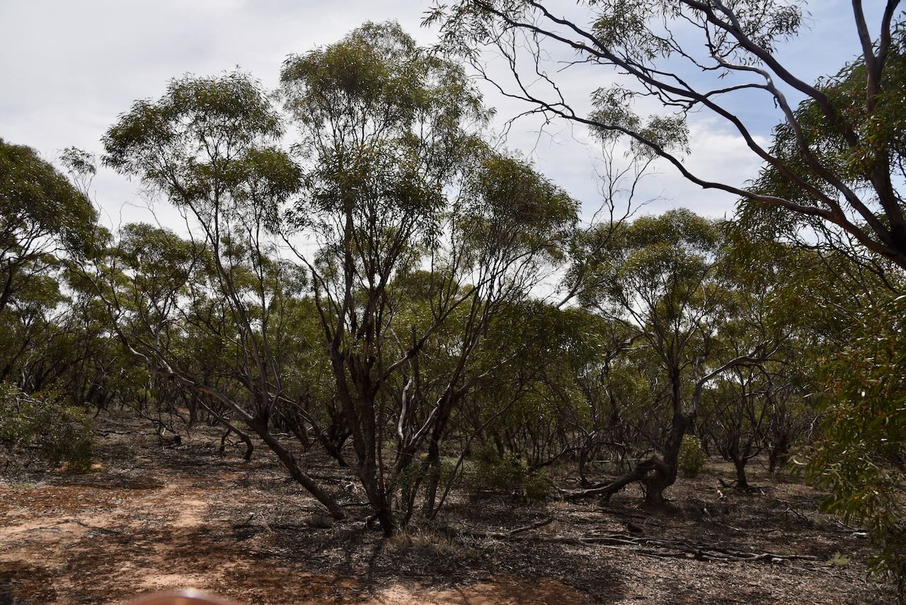
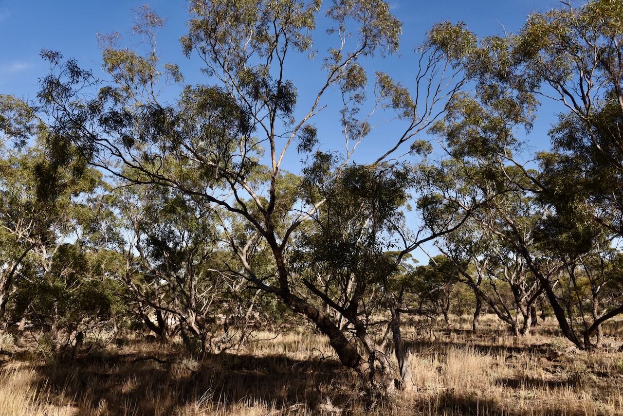
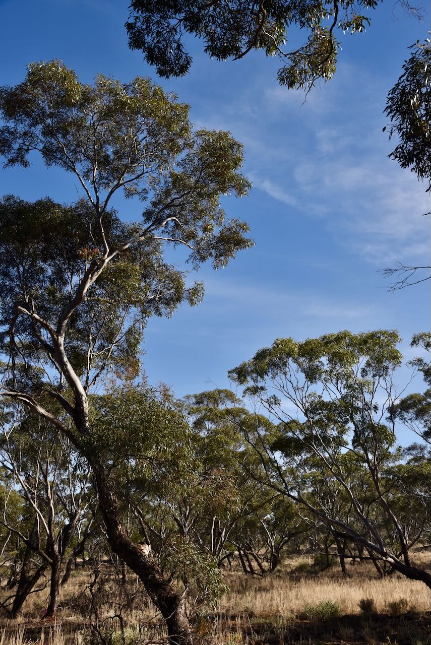
The bushland reserve is a good example of remnant mallee scrub in northwestern Victoria. The reserve is surrounded by cleared farming land.

The Tutye silos were built in 1968. (Context 2013)

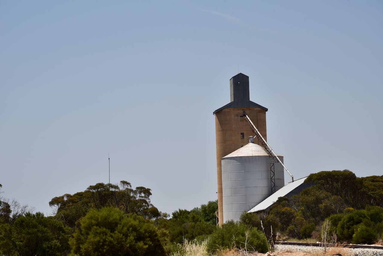
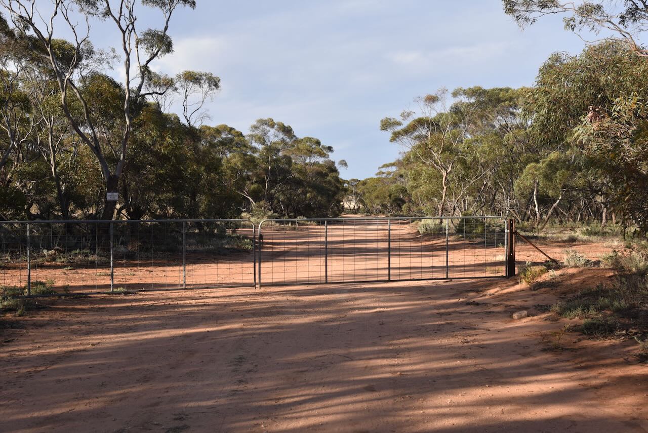
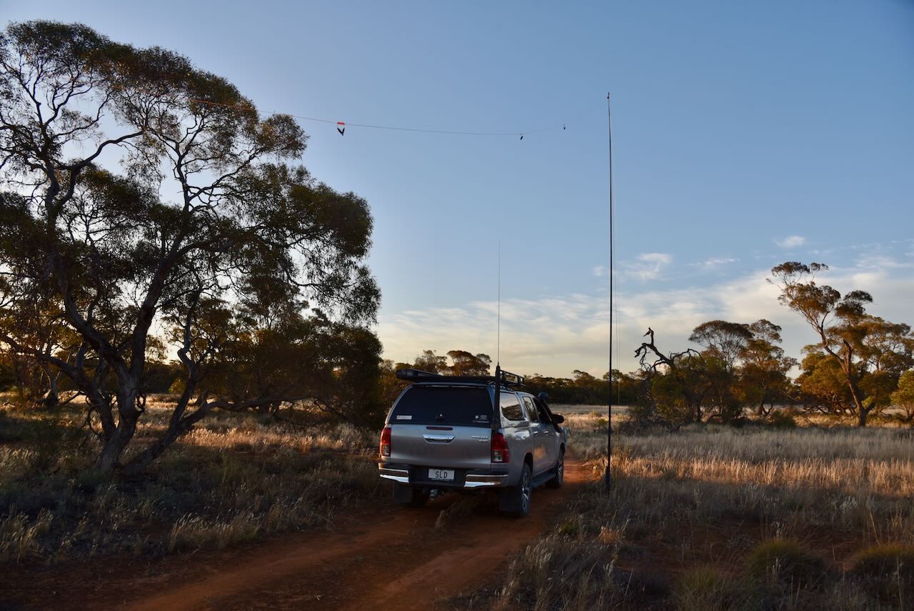
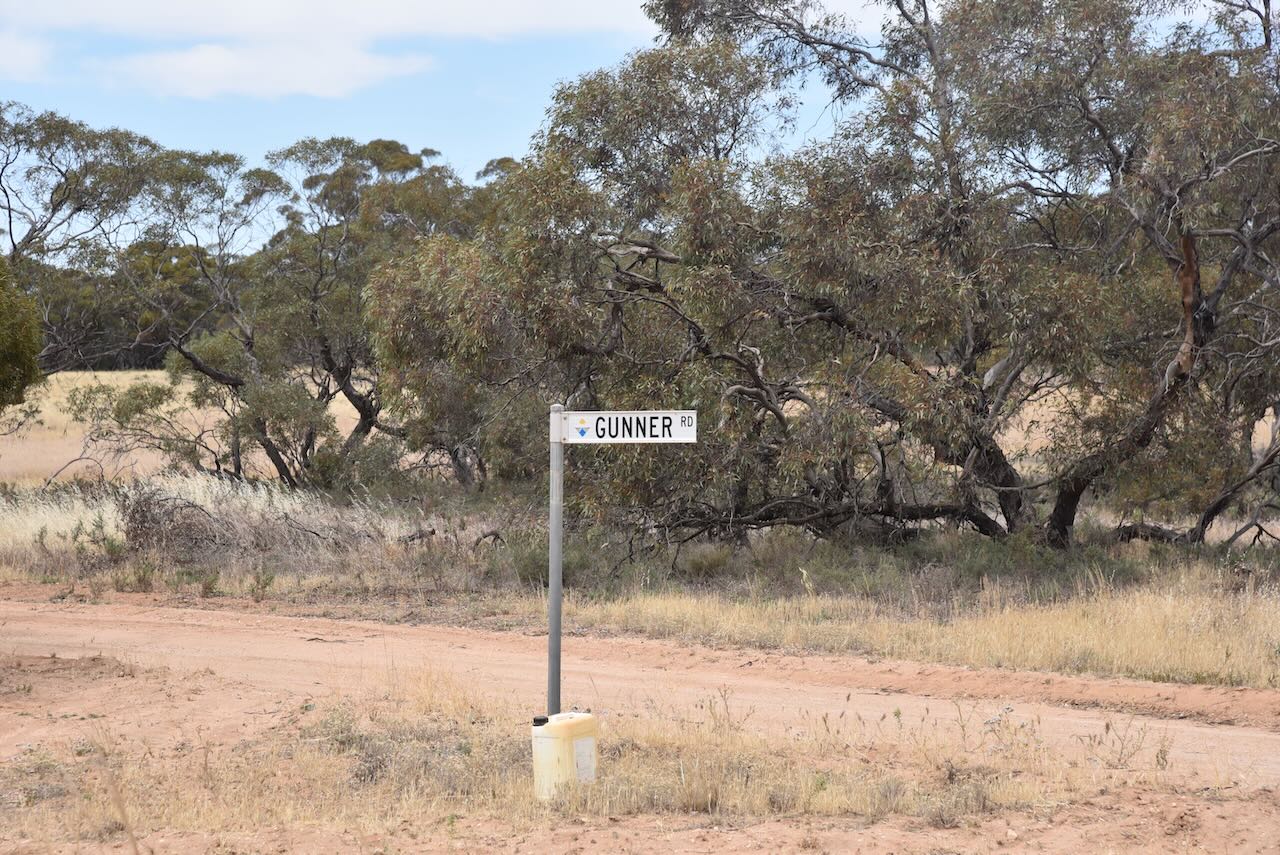
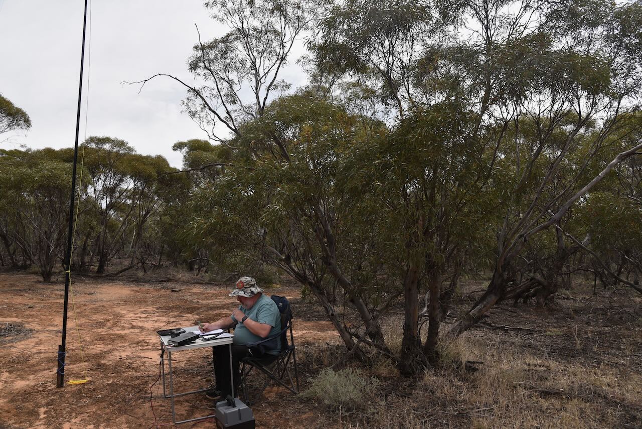
We operated on Old Stock Route Road within the silo activation zone.

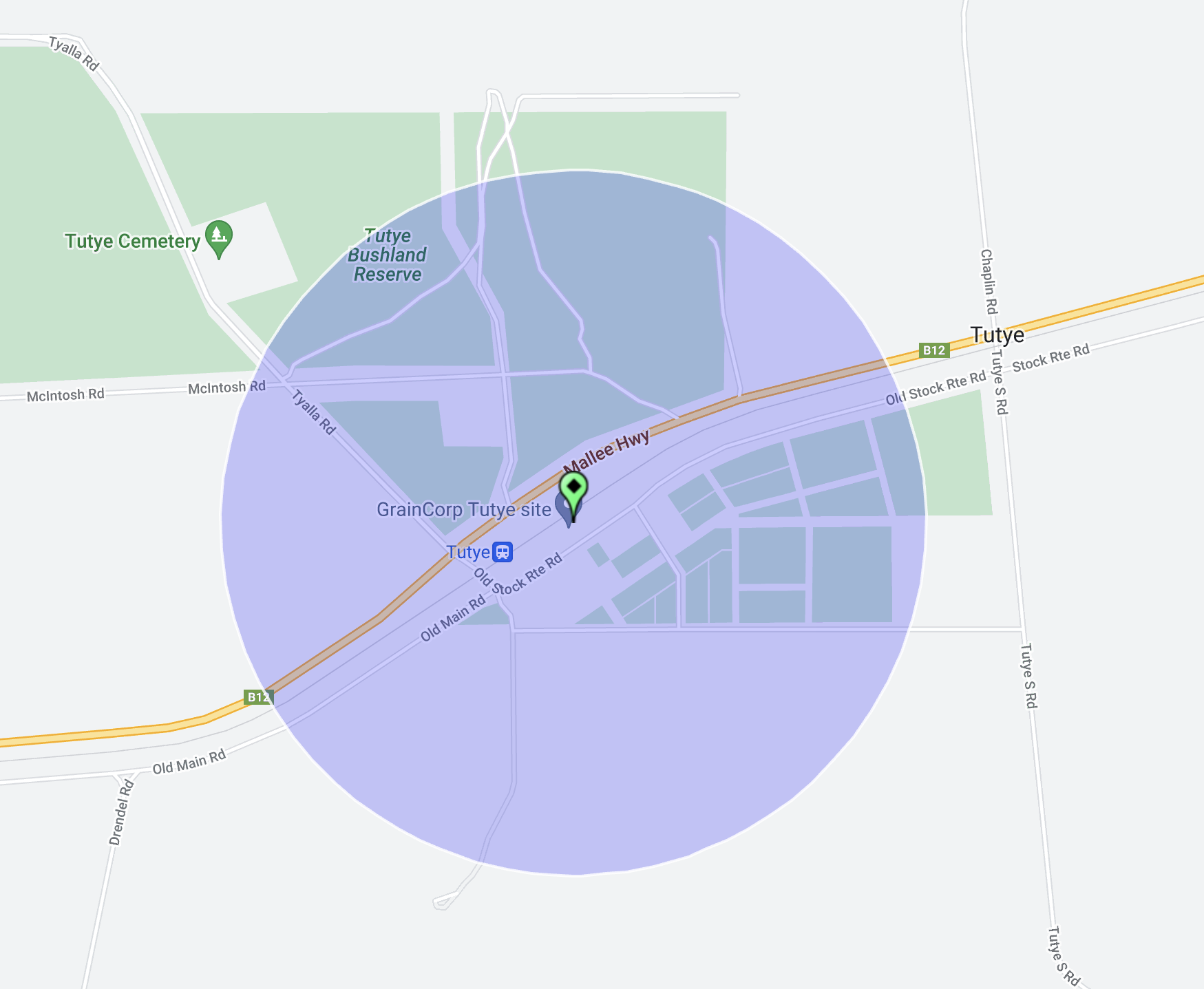
Above:- the activation zone at the Tutye silo. Image c/o SiOTA website.

Marija made the following QSOs on 80m SSB:-

  1. VK5WE
  2. VK5IS
  3. VK5FANA

Marija made the following QSOs on 40m SSB:-

  1. VK3SQ
  2. VK2BD
  3. VK3MCK
  4. VK2HHA
  5. VK2NP
  6. VK3PF
  7. VK3KAI
  8. VK1AO
  9. VK2MET
  10. VK2IO/p (Green Lake Regional Park VKFF-0967)

I made the following QSOs on 80m SSB:-

  1. VK5WE
  2. VK5IS
  3. VK5FANA

I made the following QSOs on 40m SSB:-

  1. VK3SQ
  2. VK2BD
  3. VK3MCK
  4. VK2HHA
  5. VK2NP
  6. VK3PF
  7. VK3KAI
  8. VK1AO
  9. VK2MET
  10. VK3DAC
  11. VK6HDY/2
  12. VK2HRX
  13. VK4EHI
  14. VK2RK
  15. VK2ACR
  16. VK2CAR
  17. VK2GOM
  18. VK3FABS/p (Alpine National Park VKFF-0618)
  19. VK3VIN
  20. VK3CEO
  21. VK2EXA
  22. VK1AD
  23. VK1NAM
  24. VK1DI
  25. VK5KLV
  26. VK4EMP
  27. VK4TI
  28. VK3MIJ
  29. VK3AMO
  30. VK2SLB
  31. VK3QH
  32. VK2IO/p (Green Lake Regional Park VKFF-0967)
  33. VK7AN
  34. VK5GY
  35. VK1RF
  36. VK2MK
  37. VK4CEE
  38. VK7JFD
  39. VK2KEV/m

I worked the following stations on 20m SSB:-

  1. VK1AO
  2. VK2MET
  3. VK2NP

References.

  1. Australian Government, 2024, CAPAD 2022, viewed 19th January 2024, <https://www.dcceew.gov.au/environment/land/nrs/science/capad>
  2. Blake, L, 1977, Place Names of Victoria, Rigby Limited, Melbourne.
  3. Context Pty Ltd, 2013, Mildura (Former Shire of Walpeup) Heritage Study
  4. 1920 ‘TUTYE STATE SCHOOL’, Sunraysia Daily (Mildura, Vic. : 1920 – 1950), 29 October, p. 2. , viewed 19 Jan 2024, <http://nla.gov.au/nla.news-article258568705>
  5. Phoenix Actions, 2024, Post Office List, viewed 19th January 2024, <https://www.phoenixauctions.com.au/cgi-bin/wsPhoenix.sh/Viewpocdwrapper.p?SortBy=VIC&filter=*Tutye*>

Linga School South Bushland Reserve VKFF-4167

Our final activation for Sunday 12th November 2023 was the Linga School South Bushland Reserve VKFF-4167. The reserve is located about halfway in between the towns of Cowangie and Underbool in northwest Victoria.

Above:- Map showing the location of the Linga School South Bushland Reserve. Map c/o Google Maps.

This was the first time that the park had been activated for the World Wide Flora Fauna (WWFF) program.

Linga is an aboriginal word meaning home or camp. (Blake 1977) Linga once once a thriving township. It had a Farmers Association, a cricket team, a tennis club, and a football team (1917 Linga). The Linga Hall even hosted dance evenings for the ‘Underbool Queen.’ (1923 Linga)

Above:- Plan of the township of Linga. Image c/o State Library Victoria.

The Linga South State School (No. 4460) opened on 30 January 1930 and closed in 1949. (1930 Mallee School News)

Above:- Article from the Ouyen Mail, Wed 9 Apr 1930. Image c/o Trove.

The Post Office opened in 1913 and was originally known as Manpy. In 1939 it was destroyed by fire and was rebuilt. It closed in 1975. (Phoenix 2024) (1939 Linga)

Above:- Article from the Sunraysia Daily, Mildura, Wed 1 Feb 1939. Image c/o Trove

Sadly as was the case with many small towns, the First World War took its toll and many young men were lost.

Above:- Article from the Pinnaroo and Border Times, Fri 29 Jun 1917. Image c/o Trove.

By the time we reached the park, it was almost dark. But it was a beautiful warm evening and we enjoyed the sunset as we set up our gear comprising the Yaesy FT857, 40 watts, and the 20/40/80m linked dipole.

The park is about 9 hectares in size and was established on the 8th day of May 1990 (CAPAD 2022). The Parks Victoria website has a page regarding the reserve, but it contains no information other than a park boundary map. The park is divided into three sections, on the northern and southern sides of Stock Route Road. The park did not appear to be signposted. It is just a very small piece of remnant mallee scrub surrounded by cleared farming land. There were no visible signs of the school.

We worked a total of 64 stations on 40m SSB before packing up and heading back to our accommodation at Murrayville. It had been a great day with lots of park activations.

Marija worked the following stations on 40m SSB:-

  1. VK4SMA
  2. VK5LA
  3. VK5KAW
  4. VK3PF
  5. VK3KAI
  6. VK5FANA
  7. VK5GY
  8. VK2HHA
  9. VK3BEL
  10. VK1AO
  11. VK2MET
  12. VK2IO/p (Turriff Flora & Fauna Reserve VKFF-2466)

I worked the following stations on 40m SSB:-

  1. VK4SMA
  2. VK5LA
  3. VK5KAW
  4. VK3PF
  5. VK3KAI
  6. VK5FANA
  7. VK5GY
  8. VK2HHA
  9. VK3BEL
  10. VK1AO
  11. VK2MET
  12. VK2IO/p (Turriff Flora & Fauna Reserve VKFF-2466)
  13. VK3BBB
  14. VK2CCP
  15. VK2EXA
  16. VK3MTT
  17. VK3UH
  18. VK2YAK
  19. VK4YAK
  20. VK2WE
  21. VK2LWK
  22. VK3APJ
  23. VK3EJ
  24. VK5KLV
  25. VK3YV
  26. VK3OF
  27. VK3AMO
  28. VK2NP
  29. VK3CEO
  30. VK2KET
  31. VK2ADF
  32. VK2YK
  33. VK5GA
  34. VK5HW
  35. VK2LAG
  36. VK3DWL
  37. ZL3ASN
  38. VK4ABK
  39. VK5ZX
  40. VK3ACZ
  41. VK1CHW
  42. VK4HMI
  43. VK6XN
  44. VK2HRX
  45. VK4EMP
  46. VK4TI
  47. VY2JC
  48. VK4HG
  49. VK4BR
  50. VK3VY
  51. VK5VK
  52. VK5DW

References.

  1. 1917 ‘LINGA.’, Farmers’ Advocate (Melbourne, Vic. : 1917 – 1924), 22 June, p. 2. , viewed 18 Jan 2024, <http://nla.gov.au/nla.news-article223599664>
  2. 1923 ‘LINGA.’, Advocate (Melbourne, Vic. : 1868 – 1954), 8 February, p. 32. , viewed 18 Jan 2024, <http://nla.gov.au/nla.news-article171246092>
  3. 1930 ‘MALLEE SCHOOL NEWS’, Ouyen Mail (Vic. : 1915 – 1941), 9 April, p. 2. , viewed 18 Jan 2024, <http://nla.gov.au/nla.news-article269647309>
  4. 1939 ‘LINGA’, Sunraysia Daily (Mildura, Vic. : 1920 – 1949), 1 February, p. 6. , viewed 18 Jan 2024, <http://nla.gov.au/nla.news-article268410035>
  5. Blake; L, 1977, Place Names of Victoria, Rigby Limited, Melbourne
  6. Australian Government, 2024, CAPAD 2022, viewed 18th January 2024, <https://www.dcceew.gov.au/environment/land/nrs/science/capad>
  7. Phoenix Auctions, 2024, Post Office List, viewed 18th January 2024, <https://www.phoenixauctions.com.au/cgi-bin/wsPhoenix.sh/Viewpocdwrapper.p?SortBy=VIC&filter=*Linga*>
  8. Wikipedia, 2024, Linga, viewed 18th January 2024, <https://en.wikipedia.org/wiki/Linga,_Victoria>, viewed

Mamengoroock I73 Bushland Reserve VKFF-4173

After leaving the Gnarr I75 Bushland Reserve (on Sunday 12th November 2023), Marija and I headed to the Gnarr I237 Bushland Reserve. Unfortunately, we found a locked gate on the road leading to the park, so we could not activate that reserve.

Our next option was the Mamengoroock I73 Bushland Reserve VKFF-4173, just a short drive away. The reserve is located about 9km north of Underbool in northwestern Victoria.

Above:- Map showing the location of the reserve. Map c/o Google Maps.

It is interesting to note that there is a nearby park with a slightly different spelling: Mamengorook.

Mamengorook is an aboriginal word regarding their belief in a good and superior being (Mamen: father, and gorook: our).

The Mamengorook area was opened up for farming in the early 1900s.

Above:- Article from the Pinaroo and Border Times, Fri 27th Oct 1911. Image c/o Trove.

Above:- Map of Mamengorook. Image c/o Libraries Victoria.

The reserve is located on the western side of Mamengorook Road, about 1km south of Aikman Road.

The reserve is about 23 hectares in size and was established on the 1st day of May 1979. It is a small piece of remnant mallee bushland, surrounded by cleared farming land.

We found a dirt track leading into the park and set up the 20/40/80m linked dipole, supported by the 7-metre heavy-duty squid pole. We ran the Yaesu FT857 and 40 watts. I used the special call of VI10VKFF for this activation.

Whilst we were activating we were visited by two of the local farmers. They were curious as to what we were up to. We took the time out to have a long chat and explain the hobby.

Marija worked the following stations on 40m SSB:-

  1. VK3CEO
  2. VK3VIN
  3. VK3OAK
  4. VK3BBB
  5. VK2CCP
  6. VK2HHA
  7. VK3MTT
  8. VK3PF
  9. VK3KAI
  10. VK2IO/p (Wathe Flora & Fauna Reserve VKFF-2480)
  11. VK3ZPF/p (Yarra Ranges National Park VKFF-0556)
  12. VK3JW/p (Yarra Ranges National Park VKFF-0556)
  13. VK2IO/p (Turriff Flora & Fauna Reserve VKFF-2466)

I worked the following stations on 40m SSB:-

  1. VK3CEO
  2. VK3VIN
  3. VK3OAK
  4. VK3BBB
  5. VK2CCP
  6. VK2HHA
  7. VK3MTT
  8. VK3PF
  9. VK3KAI
  10. VK2IO/p (Wathe Flora & Fauna Reserve VKFF-2480)
  11. VK2YK
  12. VK5GA
  13. VK3OF
  14. VK3ZPF/p (Yarra Ranges National Park VKFF-0556)
  15. VK5HS
  16. VK3APJ
  17. VK3PI
  18. VK2LEE
  19. VK2PBC
  20. VK5FANA
  21. VK3MIJ
  22. VK3HQZ/p
  23. VK2XB/m
  24. VK3BSB/m
  25. VK2EXA
  26. VK3SQ
  27. VK2BD
  28. VK3DAC
  29. VK4FE/3
  30. VK2NP
  31. VK2YAK
  32. VK4YAK
  33. VK1AO
  34. VK2MET
  35. VK3RU
  36. VK3SMW
  37. VK4MUD
  38. VK1CHW
  39. VK3EJ
  40. VK5LA
  41. VK5KLA
  42. VK4SMA
  43. VK3CWF
  44. VK3BWS
  45. VK3UH
  46. ZL3ASn
  47. VK3BSF
  48. VK5NK
  49. VK3VMM
  50. VK5FBIC
  51. VK3MLU
  52. VK3ZK
  53. VK4FOX
  54. VK3BEL
  55. VK7JDZ
  56. VK7KAM
  57. VK4KGY
  58. VK7IAN
  59. VK2IO/p (Turriff Flora & Fauna Reserve VKFF-2466)

I worked the following stations on 80m SSB:-

  1. VK3SQ
  2. VK2BD
  3. VK3PF
  4. VK3KAI
  5. VK1AO
  6. VK2MET
  7. VK5LA
  8. VK5KAW
  9. VK3BEL
  10. VK3DAC
  11. VK4FE/3
  12. VK3APJ
  13. VK5GY
  14. VK2YAK
  15. VK4YAK
  16. VK3JGH/m
  17. VK7IAN
  18. VK3MTT
  19. VK3CEO
  20. VK1CHW

References.

  1. Blake, L, 1977, Place Names of Victoria.
  2. Wikisource, 2024, <https://en.wikisource.org/wiki/The_Aborigines_of_Victoria/Volume_1/Chapter_20>, viewed 13th January 2024.

Gnarr I75 Bushland Reserve VKFF-4181

After leaving Mossop Bushland Reserve, Marija and I travelled north along Campbell Road and then east of Aikman Road, and we soon reached our next park activation, the Gnarr I75 Bushland Reserve VKFF-4181. This would be another first-time activation for the World Wide Flora Fauna (WWFF) program.

The reserve is located about 13km north of Underbool in northwestern Victoria.

The reserve is located on the southern side of Aikman Road, between Campbell Road and Gnarr Road.

Above:- An aerial view of the Gnarr I75 Bushland Reserve. Image c/o Google Earth.

Gnarr I75 Bushland Reserve is only a small park. It is 7 hectares in size and was established on the 1st day of May 1979. I have been unable to find the origin of the name Gnarr. There is a Mount Gnarr located to the northwest of the park, and two other parks with the name Gnarr: Gnarr Flora & Fauna Reserve and Gnarr I237 Bushland Reserve.

I used the special call of VI10VKFF to celebrate 10 years of the VKFF program. We ran the Yaesu FT857, 40 watts, and the 20/40/80m linked dipole. We operated from a narrow track in the park.

Marija worked the following stations on 40m SSB:-

  1. VK3SG
  2. VK2IO/p (Turrif West School Bushland Reserve VKFF-4248)
  3. VK3SQ
  4. VK2BD
  5. VK3APJ
  6. VK3BBB
  7. VK2CCP
  8. VK5MK
  9. VK3VIN
  10. VK3PI
  11. VK7MAT/p (Punchbowl Conservation Area VKFF-3389)
  12. VK3ZPF/p (Yarra Ranges National Park VKFF-0556)
  13. VK3JW/p (Yarra Ranges National Park VKFF-0556)
  14. VK2FRBQ/p (Yanununbeyan National Park VKFF-0555)
  15. VK2IO/p (Wathe Flora & Fauna Reserve VKFF-2480)

I worked the following stations on 40m SSB:-

  1. VK3SG
  2. VK2IO/p (Turrif West School Bushland Reserve VKFF-4248)
  3. VK3SQ
  4. VK2BD
  5. VK3APJ
  6. VK3BBB
  7. VK2CCP
  8. VK5MK
  9. VK3VIN
  10. VK3PI
  11. VK5FANA
  12. VK3DAC
  13. VK3PF
  14. VK3KAI
  15. VK1AO
  16. VK2MET
  17. VK3GJG
  18. VK2PKT
  19. VK3MTT
  20. VK3EJ
  21. VK3SO
  22. VK3CEO
  23. VK3YV
  24. VK2NP
  25. VK3JK
  26. VK3UH
  27. VK7MAT/p (Punchbowl Conservation Area VKFF-3389)
  28. VK2EXA
  29. VK2HHA
  30. VK3CWF
  31. VK4SYD
  32. VK3AN
  33. VK3ZPF/p (Yarra Ranges National Park VKFF-0556)
  34. VK3JW/p (Yarra Ranges National Park VKFF-0556)
  35. VK7JFD
  36. VK5YX
  37. VK5LA
  38. VK5KAW
  39. VK2FRBQ/p (Yanununbeyan National Park VKFF-0555)
  40. VK3OAK
  41. VK7EE
  42. VK5KPR
  43. VK2RO
  44. VK7AAE
  45. VK5TR
  46. VK2IO/p (Wathe Flora & Fauna Reserve VKFF-2480)

I worked the following stations on 20m SSB:-

  1. VK4MUD
  2. VK4EMP
  3. VK4TI
  4. IK1GPG
  5. ZL3ASN
  6. VK4SMA
  7. F1BLL
  8. IW2NXI
  9. ZL2STR
  10. OH6GAZ
  11. VK6JK
  12. VK6LMK
  13. VK4PDX
  14. ON4VT
  15. ZL2GLG
  16. ON2CB
  17. UT5PI
  18. SQ9CWO
  19. ZL4NVW

References.

  1. CAPAD 2022.

Mossop Bushland Reserve VKFF-4176

Our seventh park activation for Sunday 12th November 2023 was the Mossop Bushland Reserve VKFF-4176. The reserve is located about 6km north of Underbool in northwestern Victoria. This was the first time the reserve had been activated for the World Wide Flora Fauna (WWFF) program.

Above:- Map showing the location of the Mossop Bushland Reserve. Map c/o Google Maps.

The reserve is located on the southwestern corner of Gnarr Road and Campbell Road.

Above:- An aerial view of the reserve. Image c/o Google Earth.

The reserve is about 12 hectares in size and was established on the 1st day of May 1979. It is a small piece of remnant mallee surrounded by cleared farming land. I have been unable to find the origin of the name Mossop.

I used the special call of VI10VKFF for this activation. We ran the Yaesu FT857, 40 watts, and the 20/40/80m linked dipole.

Marija worked the following stations on 40m SSB:-

  1. VK2YK/p (Kaiserstuhl Conservation ParkVKFF-0897)
  2. VK3GP/p (Grampians National Park VKFF-0213)
  3. VK1DI/p (Majors Creek State Conservation Area VKFF-1346)
  4. VK2VH
  5. VK4AAC
  6. VK2IO/p (Speed Bushland Reserve VKFF-4246)
  7. VK3APJ
  8. VK5DG/3 (Kaweka Nature Conservation Reserve VKFF-2124)
  9. VK5HYZ/p (Deep Creek National Park VKFF-3186)

Marija worked the following stations on 40m AM:-

  1. VK2VH
  2. VK4AAC
  3. VK2IO/p (Speed Bushland Reserve VKFF-4246)

I worked the following stations on 40m SSB:-

  1. VK2YK/p (Kaiserstuhl Conservation Park VKFF-0897)
  2. VK3GP/p (Grampians National Park VKFF-0213)
  3. VK1DI/p (Majors Creek State Conservation Area VKFF-1346)
  4. VK2VH
  5. VK4AAC
  6. VK2IO/p (Speed Bushland Reserve VKFF-4246)
  7. VK5TN
  8. VK3APJ
  9. VK5TR
  10. VK3VIN
  11. VK3PF
  12. VK3KAI
  13. VK5FANA
  14. VK5DW
  15. VK3GJG
  16. VK3SQ
  17. VK2BD
  18. VK1AD
  19. VK1NAM
  20. VK3CEO
  21. VK2EXA
  22. VK3PWG
  23. VK3ZSC
  24. VK2OKR/p (Hunter Wetlands National Park VKFF-0595)
  25. VK2AUS/p (Hunter Wetlands National Park VKFF-0595)
  26. VK3BBB
  27. VK2CCP
  28. VK3MIJ
  29. VK3DW
  30. VK1CHW
  31. VK3TDX
  32. VK3ZMD
  33. VK3ATC
  34. VK5KLV
  35. VK3MTT
  36. VK5VST
  37. VK5WF
  38. VK3PI
  39. VK3CLD
  40. VK1KAZ
  41. VK5MK
  42. VK3DCQ
  43. VK3CAT/m
  44. VK1RF
  45. VK2MK
  46. VK4CEE
  47. VK3DAC
  48. VK5GY
  49. VK3UH
  50. VK5DG/3 (Kaweka Nature Conservation ReserveVKFF-2124)
  51. VK5HYZ/p (Deep Creek National Park VKFF-3186)

I worked the following stations on 40m AM:-

  1. VK2VH
  2. VK4AAC
  3. VK2IO/p (Speed Bushland Reserve VKFF-4246)

I worked the following stations on 20m SSB:-

  1. VK4JT
  2. ZL2BAQ
  3. VK4SWE
  4. ZL2GLG
  5. VK4TM
  6. VK6NTE
  7. VK4PDX
  8. VK6UG
  9. VK2HDT
  10. VK4LMB
  11. VK8TM
  12. VK6LMK
  13. VK4FOX
  14. ZL1HIM
  15. VK4MUD
  16. F1BLL
  17. VK6XN
  18. VK1AO
  19. VK2MET

References.

  1. CAPAD 2022

VK3IFR aeronautical mobile

On Thursday 28th December 2023 I was the Net Control on the Australia New Zealand Africa (ANZA) DX Net. And I was very pleased to have Tim VK3IFR join us.

Tim was in the cockpit of a Qantas Boeing 737 aircraft.

Tim was flying from Perth to Melbourne and was flying across Kangaroo Island in South Australia at the time.

He was a 20/9 signal to me at Ashbourne and made a lot of people very happy who got Tim in the log.

Thanks for joining the Net Tim. You are always welcome.

Kangaroo Tank Bushland Reserve VKFF-4175

After leaving Wyperfeld, Marija and I headed north to the Kangaroo Tank Bushland Reserve VKFF-4175. The reserve is located about 3km north of Underbool in northwestern Victoria.

Above:- Map showing the location of the Kangaroo Tank Bushland Reserve. Map c/p Google Maps.

The reserve is located on the northern side of Gnarr Road, near the junction with Harrison Road. THere is a small section on the southern side of Gnarr Road.

Above:- The Kangaroo Tank Bushland Reserve. Image c/o Google Earth.

The reserve is about 48 hectares in size and was established on the 1st day of May 1979. The park is surrounded by cleared farming land.

I used the special event call of VI10VKFF for this activation. We ran the Yaesu FT857, 40 watts, and the 20/40/80m linked dipole.

Marija worked the following stations on 40m SSB:-

  1. VK5LA
  2. VK5KAW
  3. VK2IO/p (Speed Bushland Reserve VKFF-4246)
  4. VK3GQ/p (Innes National Park VKFF-0243)
  5. VK3TUN/p (Greater Bendigo National Park VKFF-0623)
  6. VK3GP/p (Grampians National Park VKFF-0213)
  7. VK5BRU/p (Springs Road Native Forest Reserve VKFF-2895)
  8. VK2YK/p (Kaiserstuhl Conservation Park VKFF-0897)

Marija worked the following stations on 40m AM:-

  1. VK5LA
  2. VK5KAW
  3. VK5HS
  4. VK5DW
  5. VK3YV
  6. VK3BEL
  7. VK5TN
  8. VK5BRU/p (Springs Road Native Forest Reserve VKFF-2895)

I worked the following stations on 40m SSB:-

  1. VK5LA
  2. VK5KAW
  3. VK3VIN
  4. VK2HHA
  5. VK5HS
  6. VK3MTT
  7. VK5CZ
  8. Vk2EXA
  9. VK3PF
  10. VK5IS
  11. VK5FANA
  12. VK3SQ
  13. VK2BD
  14. VK3OB
  15. VK2IO/p (Speed Bushland Reserve VKFF-4246)
  16. VK3YV
  17. VK3GQ/p (Innes National Park VKFF-0243)
  18. VK3BEL
  19. VK1AO
  20. VK2MET
  21. VK3DJC
  22. VK5ADP
  23. VK3TUN/p (Greater Bendigo National Park VKFF-0623)
  24. VK3ZSC
  25. VK2GQR
  26. VK3APJ
  27. VK3CEO
  28. VK5KLV
  29. VK3DWL
  30. VK3GP/p (Grampians National Park VKFF-0213)
  31. VK3UH
  32. VK3PI
  33. VK5MK
  34. VK5AAF
  35. VK5FB
  36. VK3ARM
  37. VK3ZMD
  38. VK5BRU/p
  39. VK2YK/p (Kaiserstuhl Conservation Park VKFF-0897)

I worked the following stations on 40m AM:-

  1. VK5LA
  2. VK5KAW
  3. VK5HS
  4. VK5DW
  5. VK3YV
  6. VK3BEL
  7. VK5TN
  8. VK5BRU/p (Springs Road Native Forest Reserve VKFF-2895)
  9. VK5CZ
  10. VK3OAK
  11. VK5IS

I worked the following stations on 20m SSB:-

  1. ZL1HIM
  2. VK1AO
  3. VK2MET
  4. VK4SMA
  5. VK4EMP
  6. VK4TI
  7. ZL4NVW
  8. VK4JT

References.

  1. CAPAD 2022.

Wyperfeld National Park VKFF-0549

It was now time to activate the Wyperfeld National Park VKFF-0549 as part of the Keith Roget Memorial National Parks Award (KRMNPA) Activation Weekend. The park is located about 450 km northwest of Melbourne.

Above:- Map showing the location of the Wyperfeld National Park. Map c/o Google Maps.

The Wyperfeld National Park was established in 1921. It is about 357,017 hectares in size and it is the third largest National Park in Victoria.

Above:- Boundary map of the Wyperfeld National Park. Image c/o Protected Planet.

The name Wyperfeld is of Germanic origin: Wyper meaning tributary of Rhine River, and feld meaning field.  It is believed to have been made by the Prussian settler who came to the Wimmera-Mallee region from South Australia. 

Before European settlement of the area, the land was occupied by the Wotjobaluk aboriginal people. They regularly travelled along Outlet Creek Tyakil‐ba‐Tyakil visiting the various lakes and swamps.  

Wypefeld was originally divided into pastoral leases during the 1860s. 

In 1898 naturalist Archibald James Campbell (b. 1853. d. 1929) and Charles McLennan (later appointed as the first ranger at Wilsons Promontory National Park) visited the area which was to become Wypefeld National Park. In the Victorian Naturalist he stated ‘for dinner we had scrambled Mallee Hen eggs; and they proved first-class diet.

Above:- Archibald James Campbell. Image c/o Wikipedia.

In September 1907, a prominent ornithologist Arthur Herbert Evelyn Mattingley (b. 1870. d. 1950) and two associates Jack Ross and Frank Howe, visited the Wyperfeld area. Mattingly insisted that it should be made a reserve for nature lovers. He described it as a ‘paradise for nature lovers.’ In 1909 he was successful in having about 9,000 acres of land temporarily set aside around the Wonga Basin. At the time Victoria had only three National Parks: Tower Hill, Wilsons Promontory, and Mount Buffalo.

Above:- Arthur Mattingley. Image c/o Wikipedia.

Mattingley continued to visit the Wyperfeld National Park, often leading parties of field naturalists.

Above:- Article from The Argus, Melbourne, Mon 14 Nov 1932. Image c/o Trove.

Sir James William Barrett (b. 1862. d. 1945) was the Chairman of the National Parks Association, and he was instrumental in having the Wyperfeld National Park declared in 1921.

Above:- Sir James WIlliam Barrett. Image c/o Wikipedia.

Wyperfeld was once a shallow sea, from about 25 million years ago until fairly recent times. Wyperfeld’s current landforms are a result of the sea gradually retreating, leaving a vast expanse of sandy sediment. These formed into sand dunes about 40,000 to 15,000 years ago.

Wyperfeld contains a series of ephemeral lakes. Ephemeral lakes remain flooded annually for short periods, but may not hold water for several years due to rainfall. Before European settlement of the area, the Wyperfeld ephemeral lakes filled and emptied, on average about every 20 years. Due to agricultural irrigation and drainage projects in the district, much of Wyperfeld’s water supply has been cut off.

During years of good rainfall, the Wimmera River fills Lake Hindmarsh, which then overflows along Outlet Creek and into Lake Albacutya.

The park is part of the Wyperfeld, Big Desert and Ngarkat Important Bird Area, identified by BirdLife International due to its importance for the conservation of the vulnerable Malleefowl and other Mallee birds.

About 450 species of native plants can be found in Wyperfeld. Various Australian mammals call the park home, including Western Grey Kangaroo, Red Kangaroo, Black Wallaby, Fat-tailed Dunnart, and Western pygmy possum.

We only had a short drive from Gunners Tank to be inside the Wyperfeld National Park. I used the special event call of VI10VKFF for this activation. We ran the Yaesu FT857, 40 watts, and the 20/40/80m linked dipole supported on the 7-metre heavy- duty telescopic squid pole.

Marija worked the following stations on 20m SSB:-

  1. VK6LMK
  2. VK2IO/p (Bronzewing Flora & Fauna Reserve VKFF-2280)
  3. VK4JJ
  4. VK2NP
  5. ZL2HIM
  6. VK4MUD
  7. VK1RF
  8. VK2MK
  9. VK4CEE
  10. VK4FOX
  11. VK4OWL

Marija worked the following stations on 40m SSB:-

  1. VK3XCI/p (Terrick Terrick National Park VKFF-0630)
  2. VK5AV/p (Mornington Peninsula National Park VKFF-0333)

I worked the following stations on 20m SSB:-

  1. VK6LMK
  2. VK2IO/p (Bronzewing Flora & Fauna Reserve VKFF-2280)
  3. VK4JJ
  4. VK2NP
  5. ZL2HIM
  6. VK4MUD
  7. VK1RF
  8. VK2MK
  9. VK4CEE
  10. VK4FOX
  11. VK4OWL
  12. VK1AO
  13. VK2MET
  14. VK2EME
  15. VK4JT
  16. Vk4ABF
  17. VK2BYO
  18. VK4EMP
  19. VK4TI
  20. VK7HCK
  21. VK4EW

I worked the following stations on 40m SSB:-

  1. VK3XCI/p (Terrick Terrick National Park VKFF-0630)
  2. VK3UH
  3. VK2KYO
  4. VK3PF
  5. VK3KAI
  6. VK3OAK
  7. VK3APJ
  8. VK3CEO
  9. VK5FANA
  10. VK1AD
  11. VK1NAM
  12. VK5LA
  13. VK5KAW
  14. VK5AV/p (Mornington Peninsula National Park VKFF-0333)
  15. VK3YV
  16. VK5TN
  17. VK3VIN
  18. VK3SG
  19. VK3DAC
  20. VK3AEK/m
  21. VK3EJ

I worked the following stations on 40m AM:-

  1. VK3PF
  2. VK3KAI

References.

  1. Blake, L, 1977, Place Names of Victoria.
  2. Durham, G, 2001, Wyperfeld Australia’s first Mallee park
  3. Nickolls, J, Angel, A, 2002, Mallee Tracks.
  4. Parks Victoria, 2024, <https://www.parks.vic.gov.au/places-to-see/parks/wyperfeld-national-park>, viewed 8th January 2024.
  5. Parks Victoria, 2024, Wyperfeld National Park Visitor Guide
  6. Science Direct, 2024, <https://www.sciencedirect.com/topics/earth-and-planetary-sciences/ephemeral-lake>, viewed 8th January 2024.
  7. Wikipedia, 2024, <https://en.wikipedia.org/wiki/Wyperfeld_National_Park>, viewed 8th January 2024.

Gunners Tank Bushland Reserve VKFF-4178

Our next activation for Sunday 12th November 2023 was the Gunners Tank Bushland Reserve VKFF-4178. The reserve is about 14km south of Underbool in northwestern Victoria.

Above:- Map showing the location of Gunners Tank Bushland Reserve. Map c/o Google Maps.

We accessed the reserve Gunner Road which runs off the Underbool-Patchewollock Road, south of Underbool.

The reserve is located at the end of Gunner Road. It adjoins the Wyperfeld National Park.

Parks Victoria has a webpage regarding the park but it contains no information of value other than a boundary image of the reserve. 

The reserve is about 112 hectares in size and was established on the 1st day of May 1979.

It was a warm afternoon, so we found the shade of a small tree and set up the station comprising the Yaesu FT857, 40 watts output, and the 20/40/80m linked dipole.

I used the special event call sign of VI10VKFF for this activation.

Marija worked the following stations on 40m SSB:-

  1. VK3MCA/p (Little Desert National Park VKFF-0291)
  2. VK2IO/p (Watseys Bushland Reserve VKFF-4250)
  3. VK3PF
  4. VK3KAI
  5. VK5KLV
  6. VK5LA
  7. VK5KAW
  8. VK3MTT
  9. VK5IS
  10. VK3ARM

Marija worked the following station on 20m SSB:-

  1. VK2EG/p (Macquarie Nature Reserve VKFF-1958)

I worked the following stations on 40m SSB:-

  1. VK3MCA/p (Little Desert National Park VKFF-0291)
  2. VK2IO/p (Watseys Bushland Reserve VKFF-4250)
  3. VK3PF
  4. VK3KAI
  5. VK5KLV
  6. VK5LA
  7. VK5KAW
  8. VK3MTT
  9. VK5IS
  10. VK3ARM
  11. VK3GDM/m
  12. VK5NK
  13. VK5DW
  14. VK3BBB
  15. VK2CCP
  16. VK5FANA
  17. VK3SQ
  18. VK2BD
  19. VK3APJ
  20. VK3SG
  21. VK3NBL
  22. VK3GRX
  23. VK3WMD
  24. VK3AHR
  25. VK3UH
  26. VK3PKT
  27. VK5AAF
  28. VK3CEO
  29. VK5DU
  30. VK3EI
  31. VK2EXA
  32. VK3OAK
  33. VK3CLD
  34. VK2VAR
  35. VK2GOM
  36. VK3ACZ
  37. VK3BFX
  38. VK1AD
  39. VK1NAM
  40. VK5NM
  41. VK7AN

I worked the following stations on 20m SSB:-

  1. VK1AO
  2. VK2MET
  3. VK2EG/p (Macquarie Nature Reserve VKFF-1958)
  4. VK4JT
  5. VK4MUD
  6. VK6LMK
  7. ZL1HIM
  8. VK2NP

References.

  1. CAPAD 2022.