Piccanninie Ponds Conservation Park 5CP-178 and VKFF-0927

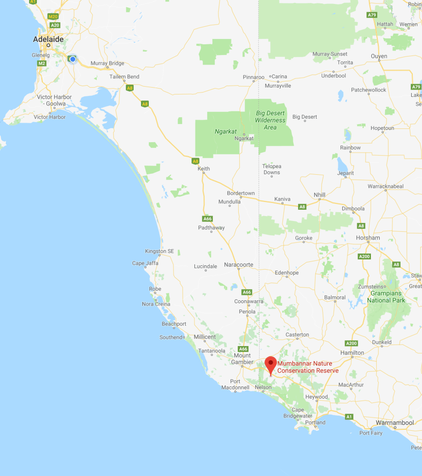
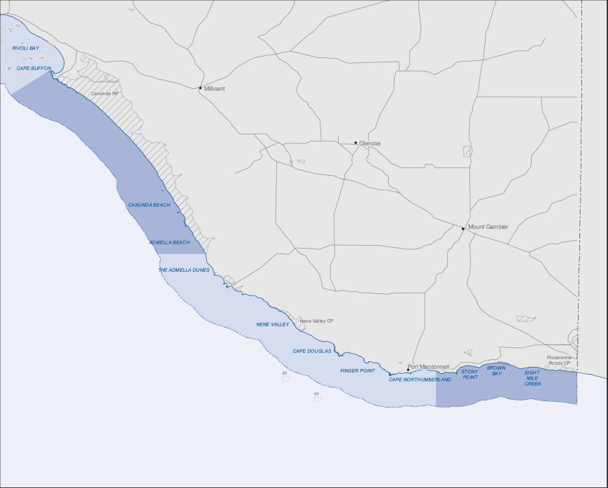
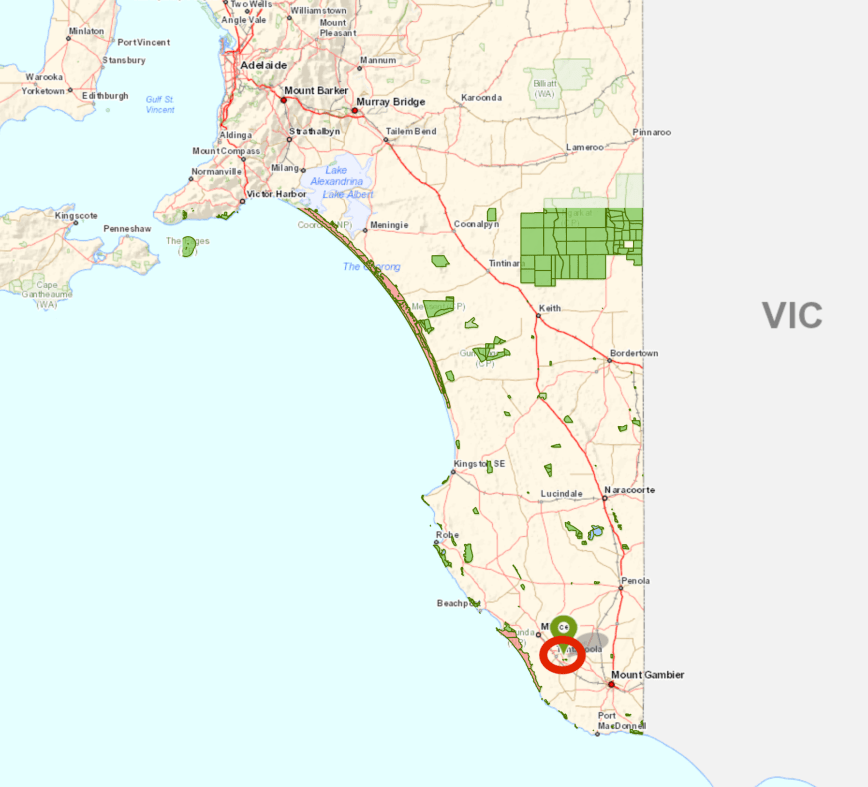
After packing up at Mumbunnar Conservation Park, Marija and I headed to our second park activation for the day, the Piccanninie Ponds Conservation Park 5CP-178 & VKFF-0927.  The park is located about 30 km south east of Mount Gambier.

Screen Shot 2018-06-18 at 8.54.36 pm

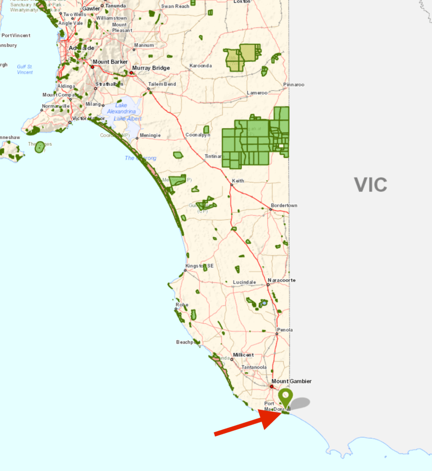
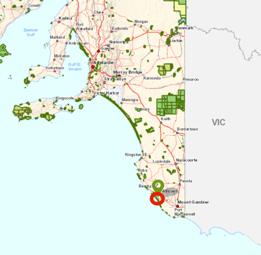
Above:- Map showing the location of the Piccanninie Ponds Conservation Park in the lower south east of South Australia.  Map courtesy of Location SA Map Viewer.

The Piccanninie Ponds Conservation Park is  862 hectares (2,130 acres) in size and was established on the 16th October 1969.  It is located in the locality of Wye and overlooks Discovery Bay, which was named by explorer Thomas Mitchell in August 1836.

The park is located in close proximity to the State border with Victoria and is part of the Discovery Bay to Piccaninnie Ponds Important Bird Area, identified by BirdLife International as being of global significance for several bird species.  It is a listed Ramsar site.  The Ramsar Convention on Wetlands of International Importance especially as Waterfowl Habitat is an international treaty for the conservation and sustainable use of wetlands.

Screen Shot 2018-06-18 at 8.51.52 pm

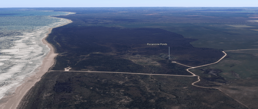
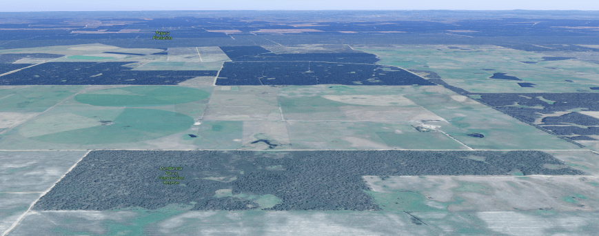
Above:- An aerial view of the Piccanninie Ponds Conservation Park.  Image courtesy of google maps.

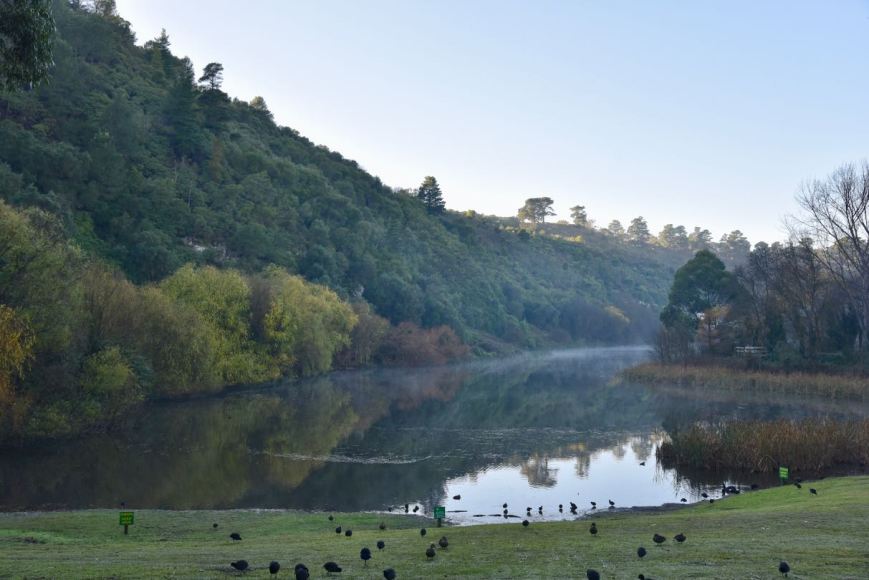
Piccanninie Ponds is a very popular site for snorkelling and cave diving.  In 1964–1965, prior to its proclamation as a conservation park, underwater explorer Valerie Taylor described the ponds as “one of the most beautiful sights in Australia”.

The park contains three main features of interest to cave divers. The ‘First Pond’ is an open depression about 10 metres (33 ft) deep with a silt floor and vegetated fringe supporting much aquatic life. The ‘Chasm’ is a sinkhole with a depth of over 100 metres (330 ft), and the ‘Cathedral’ is an enclosed area with limestone formations and a depth of about 35 metres (115 ft).  Underwater visibility is excellent and may exceed 40 metres (130 ft). Snorkelling and cave diving at Piccaninnie Ponds is by permit only.  Several divers have died whilst exploring the caves.


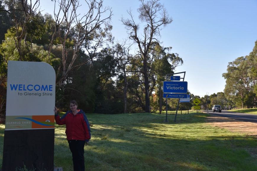
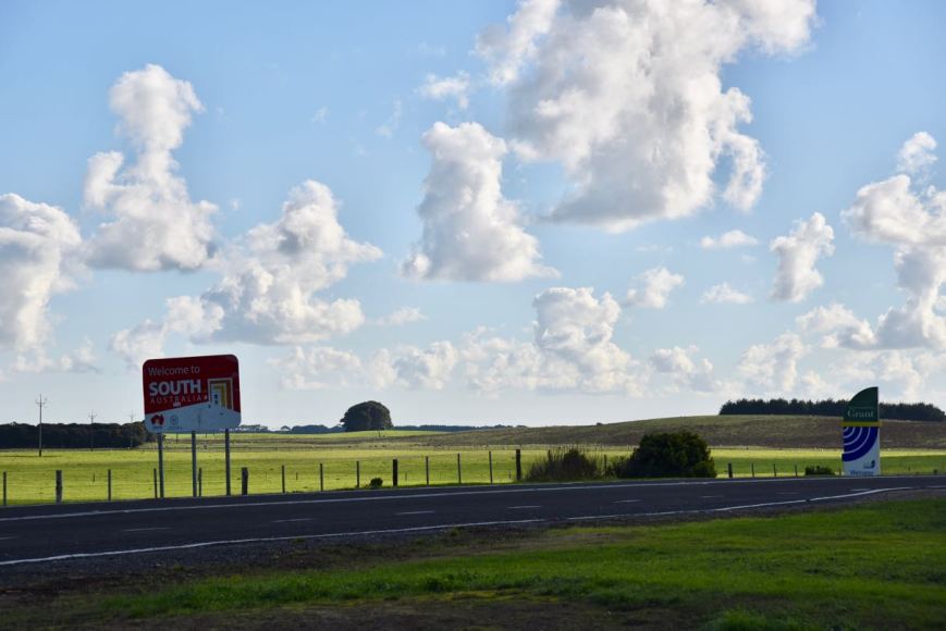
After leaving Mumbannar we travelled back into South Australia via the Princes Highway and then travelled south along Dry Creek Road following the State border.  We soon reached the town of Donovans, where there are some nice views (through the trees) of the Glenelg River.

We then crossed the State border and continued along the Glenelg River Road and then on to the Piccanninie Ponds Road.

DSC_1635

It wasn’t long before we reached the park, which is clearly signposted, and has a number of information boards.

Before setting up, Marija and I stopped off to have a look at the ponds themselves.  They were absolutely crystal clear and were very inviting.  There was a young couple in the carpark putting on their wetsuits, getting ready for a dive.

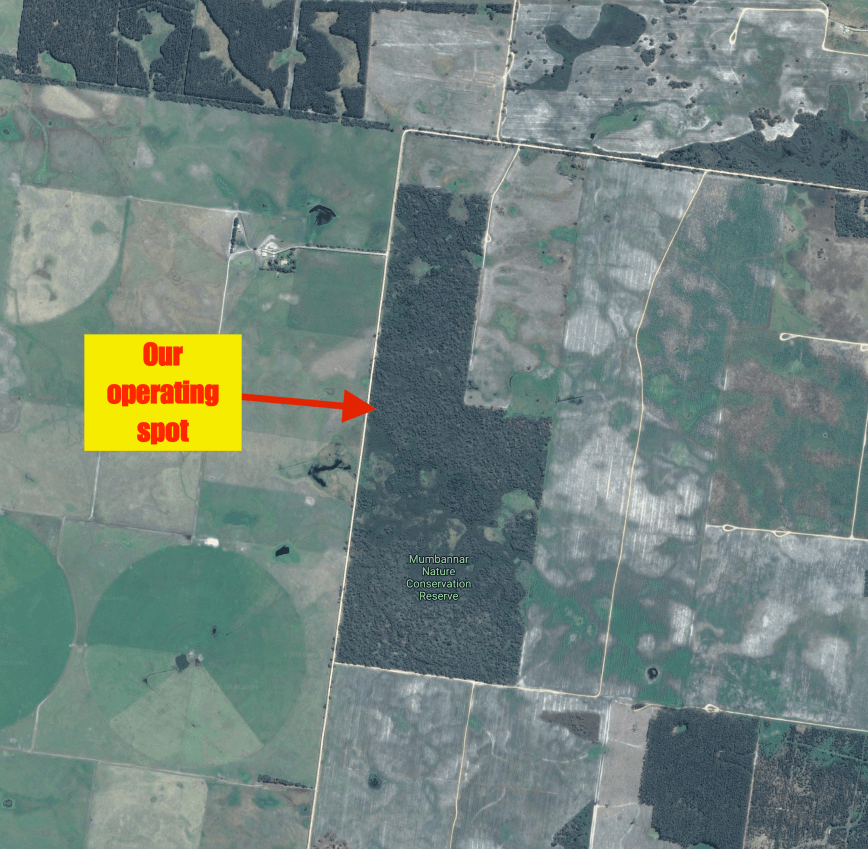
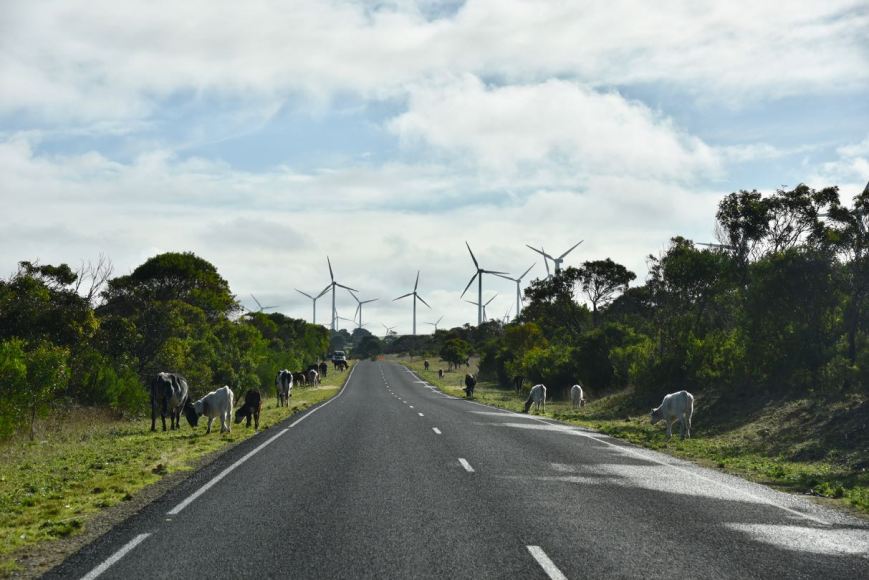
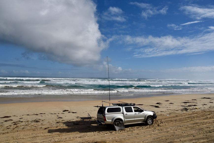
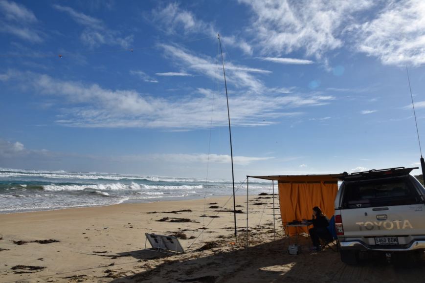
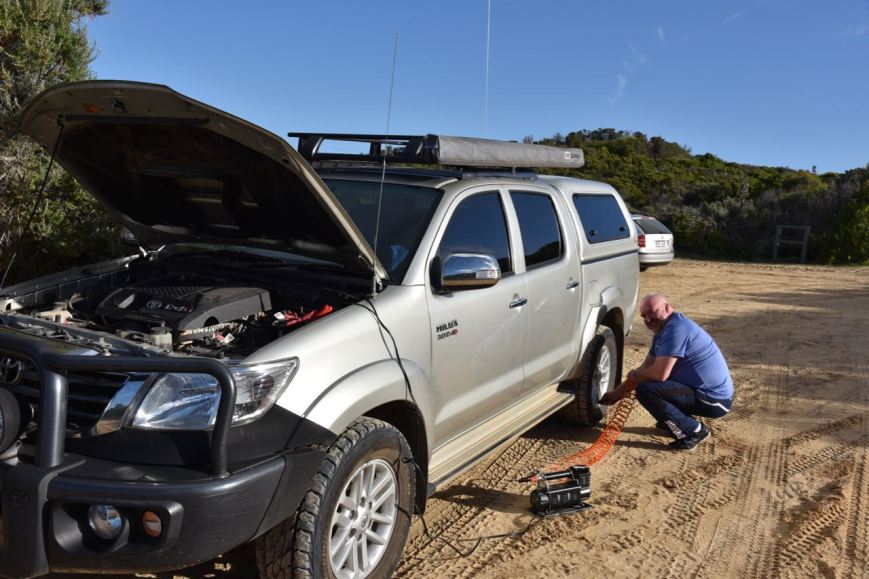
We drove further along Piccanninie Ponds Road until we reached the section which takes you down onto the beach.  As we were running short a little of time, we decided not to lower our tyre pressure and drive down onto the sand.

Instead, we parked the vehicle and set up along a walking trail which cut its way through the scrub.  There was plenty of room to string out the 20/40/80m linked dipole.

Screen Shot 2018-06-18 at 8.53.54 pm.png

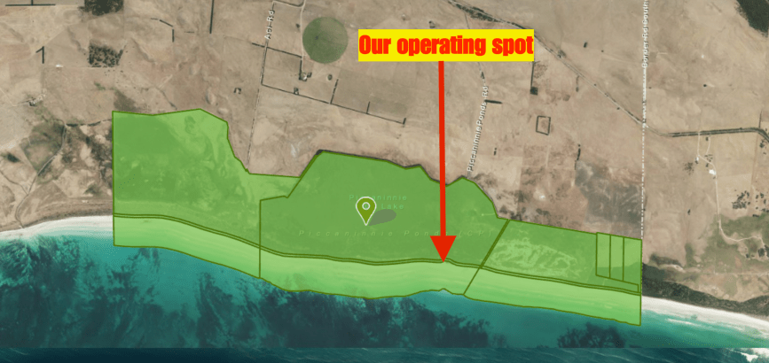
Above:- Aerial view of the Piccanninie Ponds Conservation Park, showing our operating spot.  Image courtesy of Location SA Map Viewer.

We were set up a little after 0500 UTC and had around 1 hour of the VK Shires Contest remaining.  I kicked off the activation, calling CQ on 7.133.  This was answered by Ian VK5IS in the Mid North of South Australia, followed by Andrew VK3AB/p, and then Andrew VK3MUD/p.  Contact number ten, qualifying the park for me for VKFF, was with Sam VK5ASK/m.

DSC_1658

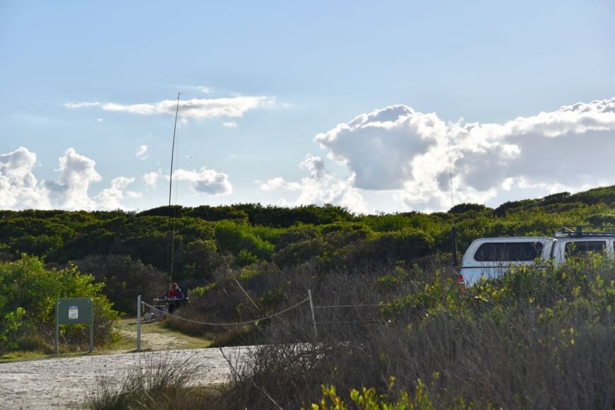
Above:- Our operating spot down along the walking track.

After I had qualified the park for VKFF, Marija jumped on the mic and called CQ on 7.133.  This was answered by Adrian VK5FANA, followed by Cliff VK2NP, and then Adam VK2YK.  Marija’s 10th contact was with Geoff VK3SQ in Beechworth.  Marija was very pleased to log Greg VK8GM in Alice Springs, and Greg VK4VXX/8 near the South Australian/Northern Territory border.

With Marija having qualified the park for VKFF, I jumped back on the mic.  I logged a total of 34 stations before the VK Shires Contest concluded at 0600 UTC, and a further 11 stations after the contest.  This included a Park to Park contact with Marc VK3OHM/p in the Greater Bendigo National Park VKFF-0623.

I then moved to 3.610 on the 80m band where I logged 6 stations from VK3, VK5, and VK7.  This included a Park to Park with Duncan VK3XBC/p in the Wyperfeld National Park VKFF-0549.  Whilst I was on 80m two park rangers arrived on the scene.  One of the rangers I had met earlier in the year during an activation at the Little Dip Conservation Park.

Time was marching on and Marija and I needed to pack up and head back into Mount Gambier.  That evening we were to attend the SERG Convention dinner.  Between us we had 63 contacts in the log.

Marija worked the following stations on 40m SSB:-

  1. VK1DI/2 (Livingstone National Park VKFF-0292)
  2. VK5FANA
  3. VK2NO
  4. VK2YK
  5. VK3VCE/4
  6. VK2LEE
  7. VK4VXX/8
  8. VK8GM/p
  9. VK2VW
  10. VK3SQ
  11. VK3ABP
  12. VK4TJ

I worked the following stations on 40m SSB:-

  1. VK5IS
  2. VK3AB/p
  3. VK3MUD/p
  4. VK7QP
  5. VK4VXX/8
  6. VK6QM
  7. VK2HPN
  8. VK2DEK
  9. VK1DI/2 (Livingstone National Park VKFF-0292)
  10. VK5ASK/m
  11. VK5FANA
  12. VK4TJ
  13. VK4/AC8WN
  14. VK4/VE6XT
  15. VK2NP
  16. ZL2AYZ
  17. VK3SQ
  18. VK2VW
  19. VK8GM/p
  20. VK3GK
  21. ZL1TM
  22. VK2YK
  23. VK7KR
  24. VK3PF
  25. VK2HHA
  26. VK5KLV
  27. VK2NEO
  28. VK2TTL
  29. VK2KTG
  30. VK2JDR
  31. VK3ELH
  32. VK7FMAC
  33. VK4FDJL
  34. VK2WA
  35. VK2ZVG
  36. VK2FJMM
  37. VK7AN
  38. VK2QM
  39. VK5NAW
  40. VK5MK
  41. VK2QK
  42. VK2QE
  43. VK6MN
  44. VK5PL
  45. VK3OHM/p (Greater Bendigo National Park VKFF-0623)

I worked the following stations on 80m SSB:-

  1. VK7AN
  2. VK3XBC/p (Wyperfeld National Park VKFF-0549)
  3. VK5BJE
  4. VK3AWG
  5. VK3PF
  6. VK5RM

We returned to Mount Gambier and freshened up and headed to the Scout Hall where we listened to Joe VK3YSP and Julie VK3FOWL deliver a presentation on youth in our hobby.  This was followed by a presentation on aerial photography and drones.

We then enjoyed a great evening at the SERG Dinner.


References.

Wikipedia, 2018, <https://en.wikipedia.org/wiki/Ramsar_Convention>, viewed 18th June 2018

Wikipedia, 2018, <https://en.wikipedia.org/wiki/Piccaninnie_Ponds_Conservation_Park>, viewed 18th June 2018

Mumbannar Nature Conservation Reserve VKFF-2161

It was now day three (Sunday 10th June 2018) of our trip.  We had one planned park activation for the day, over the border in Victoria.  After a warm shower Marija and I headed to Subway again for breakfast, comprising a coffee and an egg & bacon roll.  We then drove around the Valley Lake in Mount Gambier.  It was a sunny but very chilly morning, with lots of mist still hovering around the surface of the lake.

DSC_1578.jpg

Above:- Valley Lake

We then decided to take a walk up to the top of the Centennary Tower which commemorates the naming and the European discovery of Mount Gambier by Lieutenant James Grant in December 1800.  The tower sits 190 metres above sea level.

DSC_1579

This is not an easy walk.  It is a very steep walk.  However, I need the exercise, and the walk would burn off some of the red wine consumed the night before.  Along the way, the track was alive with Superb Fairy Wrens.

DSC_1588

And once you have got to the top, and have taken a number of breaths and regained your composure, you are rewarded with the best views of Mount Gambier and the surrounding countryside.

We had read on the internet that the tower was open at times, selling refreshments and souvenirs.  However it was not open during our visit.

We then walked back to the vehicle and took a drive around the famous Blue Lake at Mount Gambier.  The Blue Lake is a crater lake which between December to March turns to a vibrant cobalt blue colour.

Marija and I then attended the scout hall in Mount Gambier, the venue for the South East Radio Group’s annual convention.  We caught up with Col VK5HCF and a number of other SERG members.  We also said g’day to Joe VK3YSP and Julie VK3FOWL who were busy with some students , undertaking some activities including soldering.  Joe and Julie do magnificent work with children through the School Amateur Radio Club Network.

Marija and I then headed to our first park activation for the day, the Mumbannar Nature Conservation Reserve VKFF-2161.  The park is located about 40 km east of Mount Gambier, and 12 km (by road) west of the town of Mumbannar in south western Victoria.

Screen Shot 2018-06-18 at 4.56.57 pm

Above:- Map showing the location of Mumbannar Nature Conservation Reserve.  Map courtesy of google maps

We headed out of Mount Gambier on the Princes Highway and soon reached the State border of South Australia and Victoria.  We stopped briefly for a photograph and then continued on to the park.

DSC_1607

Above:- Marija at the State border.

We turned off the Princes Highway onto Faheys Settlement Road.  We soon reached the park on the eastern side of the road.  The park was well signposted.  There were no gates into the park, so we pulled over to the side of the road and then climbed the fence with our gear and set up.

Screen Shot 2018-06-18 at 4.58.38 pm

Above:- Aerial view of the park showing our operating spot.  Image courtesy of google maps

I have not been able to find out information on this park on the internet.  It is recorded on the Parks Victoria website, but there is no associated information.

The park is a piece of remnant scrub which is surrounded by cleared land for farming, and also pine plantations.

Screen Shot 2018-06-18 at 8.25.26 pm.png

Above:- Aerial shot of the Mumbannar NRC, looking west back towards the SA/Vic border.  Image courtesy of google maps

This was the weekend of the VK Shires Contest, so Marija and I intended on handing out some exchanges for the contest, as well as activating the park.  The objectives of this contest are for amateurs around the world to contact as many VK shires as possible in the contest period.  Our shire for this park was Glenelg Shire (GL3).

Mumbannar was to be a unique park for both Marija and I in the World Wide Flora Fauna (WWFF) program.

After setting up we headed to 7.144 and found Tony VK3XV/p activating the Kara Kara National Park VKFF-0629 in western Victoria.  After logging Tony we tuned across the band and found Marc VK3OHM/p in the Terrrick Terrick National Park VKFF-0630.  Next was another Park to Park contact, this time with Gerard VK2JNG/p in the Beni State Conservation Area VKFF-1277.

I then propped on 7.160 and called CQ.  First in the log following my CQ call was Les VK5KLV, followed by Garry VK7JGD and then Mark VK7ME.  I logged a total of 33 stations on 40m including some more Park to Park contacts as follows….

  • Ian VK1DI/2 – The Rock Nature Reserve VKFF-2002
  • Rob VK4AAC/5 – Telford Scrub Conservation Park VKFF-0805
  • VK4HNS/p – Archer National Park VKFF-0336
  • Brian VK3BCM/p – Alpine National Park VKFF-0619

With 33 contacts in the log I headed off to 3.610 on the 80m band.  John VK5BJE was first in the log, followed by Rob VK4AAC/5, and then Sue, both in the Telford Scrub Conservation Park.  Adrian VK5FANA then gave me a shout, followed by Peter VK3PF.  Despite band conditions on 80m being quite good, they were my only 5 contacts on that band.

I then moved back to 40m and called CQ on 7.140.  This was answered by Ivan VK5HS mobile.  My 44th contact, qualifying the log for the global WWFF program was with Nick VK3ANL/p in the Gresswell Forest part b Nature Conservation Reserve VKFF-2103.  I logged a further 2 stations, and with 46 contacts in the log, it was time to swap the mic with Marija.

Marija then called CQ on 7.140 and logged Nick VK3ANL/p in the Gresswell Forest part b Nature Conservation Reserve VKFF-2103, followed by John VK2YW/p, and then Greg VK4VXX/8.  Marija’s 10th contact, qualifying the park for VKFF was a QSO with Bill ZL2AYZ in New Zealand.  Bill was a strong 5/8 and gave Marija a 5/6 signal report.

Marija logged a further 6 stations on 40m from VK2, VK3, VK4, VK5, & VK8.  This included a contact with our friend Greg VK8GM in Alice Springs.  Marija and I decided to give 80m a go again.  Marija called CQ on 3.610 and logged Ivan VK5HS/m, Adrian VK5FANA, and then Nick VK3ANL/p in the Gresswell Forest part b Nature Conservation Reserve.

To complete the activation we moved back to 40m where we logged another Park to Park contact, with Gerard VK2JNG/p in the Sappa Bulga National Park VKFF-1180.

Marija had qualified the park, with a total of 19 contacts.  I had qualified the park for both VKFF and WWFF with 48 conatcts.  Between us we had 16 Park to Park contacts.

Marija worked the following stations on 40m SSB:-

  1. VK3XV/p (Kara Kara National Park VKFF-0629)
  2. VK3OHM/p (Terrrick Terrick National Park VKFF-0630)
  3. VK2JNG/p (Beni State Conservation Area VKFF-1277)
  4. VK3ANL/p (Gresswell Forest part b Nature Conservation Reserve VKFF-2103)
  5. VK2YW/p
  6. VK4VXX/8
  7. VK5LA/m
  8. VK7QP/p
  9. VK5HS
  10. ZL2AYZ
  11. VK5KLV
  12. VK3AHR
  13. VK2KJJ
  14. VK2MT
  15. VK8GM/p
  16. VK4FDJL

Marija worked the following stations on 80m SSB:-

  1. VK5HS/m
  2. VK5FANA
  3. VK3ANL

I worked the following stations on 40m SSB:-

  1. VK3XV/p (Kara Kara National Park VKFF-0629)
  2. VK3OHM/p (Terrick Terrick National Park VKFF-0630)
  3. VK2JNG/p (Beni State Conservation Area VKFF-1277)
  4. VK5KLV
  5. VK7JGD
  6. VK7ME
  7. VK1DI/2 (The Rock Nature Reserve VKFF-2002)
  8. ZL2AYZ
  9. VK3AHR
  10. VK2AB
  11. VK5LA/p
  12. VK5FANA/m
  13. VK2VEX
  14. VK2MTM
  15. VK4AAC/5 (Telford Scrub Conservation Park VKFF-0805)
  16. VK3ZD/p
  17. VK2FSAV
  18. VK4HNS/p (Archer National Park VKFF-0336)
  19. VK3BCM/p (Alpine National Park VKFF-0619)
  20. VK6MN
  21. VK2LKW
  22. VK3FXBR
  23. VK2KJJ
  24. VK2YE
  25. VK2VW
  26. VK5FANA
  27. VK2NP
  28. VK4TJ
  29. VK4/AC8WN
  30. VK4/VE6XT
  31. VK2AZ
  32. VK3SG
  33. VK5KFB
  34. VK5HS/m
  35. VK2BBQ
  36. VK2MT
  37. VK7EK
  38. VK8GM
  39. VK3ANL/p (Gresswell Forest part b Nature Conservation Reserve VKFF-2103)
  40. VK2YW/p
  41. VK4VXX/8
  42. VK2JNG/p (Sappa Bulga National Park VKFF-1180)

I worked the following stations on 80m SSB:-

  1. VK5BJE
  2. VK4AAC/5 (Telford Scrub Conservation Park VKFF-0805)
  3. VK5AYL/p (Telford Scrub Conservation Park VKFF-0805)
  4. VK5FANA
  5. VK3PF
  6. VK3ANL/p (Gresswell Forest part b Nature Conservation Reserve VKFF-2103)


References.

Monument Australia, 2018, <http://monumentaustralia.org.au/themes/landscape/exploration/display/51260-centenary-tower>, viewed 18th June 2018

Wireless Institute of Australia, 2018, <http://www.wia.org.au/members/contests/wavks/>, viewed 18th June 2018

Wikipedia, 2018, <https://en.wikipedia.org/wiki/Blue_Lake_(South_Australia)>, viewed 18th June 2018

Canunda National Park 5NP-002 and VKFF-0075; and the Lower South East Marine Park VKFF-1725

After leaving the Tantanoola Caves Conservation Park we headed to the nearby town of Tantanoola, intending to visit the historic Tantanoola Pub.  But we were a little too early for lunch as it was only 11.30 a.m.  In fact as we pulled up in Tantanoola, they were only just opening up the hotel.  So we decided to do the Woakwine Range WInd Farm tourist drive.

We travelled out of town along the Poonada Road and then onto the Canunda Frontage Road.  We were soon amongst the wind turbines in the largest wind farm in the Southern Hemisphere.  When fully operational, the 123 spectacular turbines at Canunda and Lake Bonney wind farm development will generate almost 300 megawatts which represents the equivalent of one eighth of South Australia’s energy needs.  The turbines are about 100 metres tall.

DSC_1457

Above:- Marija standing in front of the wind turbines, giving you a good idea of just how big they are.

As we headed out along the Canunda Frontage Road we encountered some other road users (see below).

DSC_1458

Above:- Some of the other road users

A little further along we spotted a flock of Yellow Tailed Black Cockatoos.  They are a large cockatoo which has a yellow cheek patch and yellow panels on the tail.  In South Australia they are listed as being vulnerable.

As we drove along Canunda Frontage Road we enjoyed some great views of Lake Bonney S.E.  This is not to be confused with Lake Bonney in the Riverland region of South Australia.  Lake Bonney S.E. is a coastal freshwater lake. With a surface area of 5,056 square kilometres, Lake Bonney S.E. is one of the largest freshwater lakes in Australia.

As we drove along the Canunda Frontage Road we decided to activate the Canunda National Park 5NP-002 & VKFF-0075.  I had activated and qualified this park previously, so our intention was to get the park qualified for Marija and then head back into Tantanoola to the hotel.

Screen Shot 2018-06-18 at 1.19.01 pm.png

Above:- Map showing the location of the Canunda National Park.  Map courtesy of Location SA Map Viewer.

We turned off the Canunda Frontage Road and onto the Canunda Causeway and soon reached the park boundary.  We continued through the park along the Oil Rig Square Road.  A short distance later we reached the coastline.

It was here that we made the decision to head down onto the beach as it was quite a nice afternoon.  We lowered the tyre pressure down to around 12 psi and then drove through the dunes down onto the beach.

We drove about 1km along the beach and pulled off the trail made by other 4WDers and rolled out the awning of the Toyota Hi Lux.  Once down on the beach I realised that we were also within the Lower South East Marine Park.

DSC_1515

Above:- Our operating spot.  A beautiful view.

Unfortunately I had no internet coverage so I was unable to self spot on parksnpeaks and/or Facebook, and I was unable to look up the VKFF number for the Marine Park.  So Marija put out some CQ calls on 7.135 and these were answered by Adrian VK5FANA.  Adrian kindly looked up the VKFF reference for us for the Marine Park and also spotted us.  I cannot encourage enough, that hunters spot activators.  Not only does it greatly assist the activators, but it also helps your fellow park hunters.

As a result of Adrian’s spot, Marija soon had a number of amateurs giving her a shout.  Within 9 minutes Marija had qualified the park for the VKFF program, with 10 contacts in the log.  QSO number 10 was with Charlie VK3FCIA.

Marija logged a total of 23 stations including three Park to Park QSOS:

  • Stef VK5HSX/3 – Croajingolong National Park VKFF-0119
  • Andrew VK7DW/p – Trevallyn Nature Recreation Area VKFF-1156
  • Mark Vk4SMA/p – Samford Conservation Park VKFF-1639

It was an amazing day for this time of the year down in the South East.  It is normally cold and raining.  But today we were blessed with quite a bit of sunshine.  It was a beautiful spot, with the sound of the waves rolling in.  Occasionally we had some trailbikes and other 4WDers travelling passed us.

Other than that the only onlookers were some of the local birds (of the feathered variety).

Marija worked the following stations on 40m SSB:-

  1. VK5FANA
  2. VK3AZN
  3. VK4VXX/5
  4. VK3HOT
  5. VK2HHA
  6. VK3MIJ
  7. VK3SQ
  8. VK3ER
  9. VK5HSX/3 (Croajingolong National Park VKFF-0119)
  10. VK7FCIA
  11. Vk2RP/m
  12. VK2BDR/m
  13. VK5TT
  14. VK3ELH
  15. VK2NP
  16. VK3UH
  17. VK3ANL
  18. VK2VW
  19. VK3PF
  20. VK3IRS
  21. VK2LEE
  22. VK7DW/p (Trevallyn Nature Recreation Area VKFF-1156)
  23. VK4SMA/p (Samford Conservation Park VKFF-1639)

After Marija had qualified Canunda for the VKFF program, I jumped on the mic to activate the Lower South East Marine Park VKFF-1725.  The Lower South East Marine Park is divided into two sections: the first adjacent to Canunda National Park and the second from MacDonnell Bay just west of French Point to the Victorian border.  At 360 km2, it represents 1% of South Australia’s marine parks network.

Screen Shot 2018-06-18 at 2.13.06 pm.png

Above:- Map showing the two sections of the Lower South East Marine Park.  Image courtesy of DEWNR.

First in the log for me were two Park to Park contacts, with Mark VK4SMA/p and Ade VK4SOE/p who were activating the Samford Conservation Park VKFF-1639.  As this was a new park there was quite a flurry of activity at the commencement of the activation.  But this slowed down quite quickly, and with 37 contacts in the log on 40m, callers dried up.  I was 7 short of qualifying the park for the global WWFF program.

The 37 contacts were spread across VK2, VK3, VK4, VK5 and VK7.  Other than the Park to Park contacts with Mark and Ade, I had made the following Park to Park QSOS.

  • Alan VK2MG/p -Wyrrabalong National Park VKFF-0550
  • Andrew VK7DW/p – Trevallyn Nature Recreation Area VKFF-1156

I also logged Graham VK3SOL/p operating portable at the Echuca Moama Steam Rally.

DSC_1516

I then headed to 3.610 on the 80m band where I called CQ.  This was answered by Adrian VK5FANA, followed by Ivan VK5HS/mobile and then Andy VK5LA/mobile.  I logged a further 5 stations, all from Victoria.  Peter VK3ZPF was contact number 44.

To complete the activation I QSY’d to the 20m band where I found Mike VK6MB/8 in the Uluru-Kata Tjuta National Park VKFF-0505.  Mike had a brilliant 5/9 signal down to the beach from his iconic location in the Northern Territory.  I then moved up to 14.315 and worked Hans VK6XN.  Sadly Hans was my only caller.

I worked the following stations on 40m SSB:-

  1. VK4SMA/p (Samford Conservation Park VKFF-1639)
  2. VK4SOE/p (Samford Conservation Park VKFF-1639)
  3. VK5FANA
  4. VK2RP/m
  5. VK2BDR/m
  6. VK5LA/m
  7. VK5HS/m
  8. VK2HPN/1
  9. VK3ELH
  10. VK2MG/p (Wyrrabalong National Park VKFF-0550)
  11. VK3SOL/p
  12. VK2LEE
  13. VK3NXT
  14. VK2NP
  15. VK2HHA
  16. VK3SQ
  17. VK3PF
  18. VK3ZPF
  19. VK4TJ
  20. VK4CPS
  21. VK2IO/m
  22. VK3TKK/m
  23. VK7DW/p (Trevallyn Nature Recreation Area VKFF-1156)
  24. VK7FGRA
  25. VK3MAB
  26. VK5TT
  27. VK4VXX/5
  28. VK3ER
  29. VK2QK
  30. VK5PL
  31. VK3ARH
  32. VK3AHR
  33. VK7CC
  34. VK3ANL
  35. VK2VW
  36. VK7ME
  37. VK3KAI

I worked the following stations on 80m SSB:-

  1. VK5FANA
  2. VK5HS/m
  3. VK5LA/m
  4. VK3PF
  5. VK3KAI
  6. VK3ARH
  7. VK3ZPF
  8. VK3SQ

I worked the following stations on 20m SSB:-

  1. VK6MB/8 (Uluru-Kata Tjuta National Park VKFF-0505)
  2. VK6XN

It was now coming up to 2.15 p.m. and time for us to pack up.  Marija had qualified Canunda for VKFF and I had qualified the Marine park for VKFF and WWFF.  We drove back down the beach and up the sand dunes, where we got the air pressure generator out and put the tyres back up to their correct psi.

DSC_1556

We drove back into Tantanoola and called into the Tantanoola Pub for a few drinks.  The hotel is well known for having the ‘Tantanoola Tiger’ on display.  During the late 1800’s it is reported that a Bengal tiger escaped from a travelling circus.  Soon after, locals started reporting missing sheep and cattle, but despite extensive searches, no animal was found.  And then in August 1895, a local man, Thomas Donovan shot an animal believed to the the tiger.  However it appears that it was not the tiger, but most likely a Eurasian wolf.

We drove back to Mount Gambier and had a shower and then headed to Jens Hotel for dinner.  We had an arranged dinner with a group incuding Rob VK4AAC and his wife Doris, John VK5NJ and his wife Tanina, Joe VK3YSP and his wife Julie VK3FOWL, Ross from Strictly Ham and his son.  This was a great night with lots of laughs.


References.

Attractions online directory, 2018, <http://www.attractions.net.au/attractions/sa/tantanoola/woakwine-range-wind-farm-tourist-drive/21341/>, viewed 18th June 2018

Govt of South Australia, ‘Marine Park 19 Lower South East Marine Park’

Mount Gambier Point, 2018, <https://www.mountgambierpoint.com.au/attractions/tantanoola-tiger/>, viewed 18th June 2018

Wikipedia, 2018, <https://en.wikipedia.org/wiki/Lake_Bonney_SE>, viewed 18th June 2018

Tantanoola Caves Conservation Park 5CP-225 and VKFF-0804

It was now day two (Saturday 9th June 2018) of our trip to the south east of South Australia.  Despite it being a very chilly morning, Marija and I were very pleased to see some blue sky outside.  The weather forecasters had predicted some wet weather, but there appeared to be no sign of that at Mount Gambier.

We hit the road quite early and headed Subway in Mount Gambier for a coffee and an egg and bacon roll.  We then headed out to the historic Glencoe Woolshed, about 25 km north west of Mount Gambier.

We picked up the key and paid a small fee at the local Glencoe General Store.

The Glencoe district was first settled in 1844, just 8 years after the colonisation of South Australia.  Edward and Robert Leake established a sheep shearing station and had named the property after Glen Coe in Scotland.  The Leake holdings comprised about 90,000 acres stretching from Mount Muirhead near Millicent encompassing the Mount Gambier region to the Penola Road.

The Leake brothers were originally from Rosedale in Tasmania and then moved to South Australia, bringing with them Saxon Merino sheep.  In around 1857 they built a two storey home, calling it Frontier House.  Sadly this building has now been demolished.  However the two storied coach house, stables, and groom’s quarters are still standing.

One of the brothers, Robert, died in 1860.  This left Edward to manage the property on his own.  When his flock of sheep reached 50,000, he decided that a good shearing shed was required.  In 1863 the Glencoe Woolshed was constructed.

The shearing shed has hand adzed, cathedral like arched blackwood beams with supporting posts of pit sawn blackwood.  The roof timbers were laid on the ground and marked with Roman numerals to assist in their assembly.  The roman numerals are still clearly visible today.

Glencoe is unique in that it was never converted to a mechanised shearing.  At its peak there were about 38 shearers at Glencoe, as well as roust-a-bouts, wool classers and shed hands.  The most sheep shorn in one year at Glencoe is 53,000.  A total of 2,000 sheep were shorn in that year, with an extra 100 men employed.

We then left Glencoe and headed to the Tantanoola Caves Conservation Park 5CP-225 & VKFF-0804.  The park is situated about 36 km north west of Mount Gambier and about 434 km south east of Adelaide.

Screen Shot 2018-06-18 at 10.39.58 am.png

Above:- Map showing the location of the Tantanoola Caves Conservation Park.  Image courtesy of Location SA Map Viewer.

The Tantanoola Caves Conservation Park is about 14 hectares in size and features the Tantanoola Cave, a dolomite cavern which contains spectacular stalactites and helictites.  The park is one of South Australia’s oldest reserves.  It was first dedicated in 1930 and was the first in Australia to provide wheelchair access to a show cave.  The park also contains the Up-and-Down Rocks, a stranded marine cliff which towers over the Princes Highway which runs passed the park.

The park was discovered in 1930 by Boyce Lane, a 16 year old boy who was out rabbit hunting with his pet ferret in an area known as Hanging Rocks.  Boyce’s ferret disappeared down a small hole in the cliffs whilst chasing a rabbit and would not come back out of the hole.  Boyce returned to his nearby home to collect a torch and notify his brother.  They returned and climbed through the small hole and then shined their torches around to discover the cave.

6979594-3x4-700x933.jpg

Above:- Boyce Lane, aged 21.  Image courtesy of ABC

The two boys shared their discovery with their father George Lane, and later that day a group of men returned later that day to investigate.  It did not take long for news of the discovery of the cabe to spread throughout the local community.  The Lane family then opened up the cave to the public.  The entrance to the cave was only.  The Lane family later increased the size of the opening and hand rails and electric lighting were used to make the cave more accessible for visitors.

Screen Shot 2018-06-18 at 12.32.15 pm.png

Above:- Article from The Mail, Adelaide, Sat 12 April 1930.  Courtesy of Trove

Sadly, by the 1980’s, Occupational Health and Safety had taken hold and due to safety issues the cave was declared as unsafe and was closed.  The cave was subsequently taken over by Parks Australia and was reopened in 1983.

Screen Shot 2018-06-18 at 10.44.06 am.png

Above:- Aerial view of the Tantanoola Caves Conservation Park and the surrounding countryside.  Image courtesy of google maps

The name Tantanoola is derived from the aboriginal word ‘tentunola’ which means boxwood/brushwood hill of camp.  The town of Tantanoola is situated a few kms to the north west of the park.  Tantanoola was originally named ‘Lucieton’ by Governor Jervois after his daughter Lucy Caroline, on 10th July 1879.  It was changed by Governor Robinson to ‘Tantanoola’ on 4th October 1888.

Screen Shot 2018-06-18 at 12.45.20 pm.png

Above:- Aerial view showing the location of the park to the east of the town of Tantanoola.  Image courtesy of Location SA Map Viewer.


We had arrived at the caves just at the start of a tour, so we had a look through the small but very interesting visitor centre.

We then did the Clifftop Look walk which offers some terrific views of the surrounding countryside, including the nearby Lake Bonney and Woakwine Range wind farms.

The original entrance to cave is visible above the current day entrance.

After our walk we joined the tour guide who explained the history of the park and then took us inside the cave which is truly quite spectacular.  The cave measures 25 metres by 18 metres and is 8 metres in height.  It is believed the age of the cave is more than 300,000 years.

Numerous fossil remains have been located in the park including bryozoa, brachopods,  molluscs, shark teeth and extinct megafauna Zygomaturus trilobus and sthenurine kangaroos, and fossils of an unidentified seal.

Once we completed the tour we returned back to the vehicle where Marija quickly activated the park for the World Wide Flora Fauna (WWFF) program.  As we were activating from the car, the activation would not count for the VK5 National & Conservation Parks Award.

I spotted Marija on parksnpeaks whilst she called CQ on 7.139.  First in the log was Adrian VK5FANA on the Yorke Peninsula.  Within 10 minutes Marija had contact number 10 in the log, with a QSO with Rod VK7FRJG in Tasmania.  Marija had qualified the park for VKFF and it was time for us to hit the road for our next stop for the day.

Marija worked the following stations on 40m SSB:-

  1. VK5FANA
  2. VK2IO/p (Dooragan National Park VKFF-0143)
  3. VK5NJ
  4. VK2VW
  5. VK5KX/3
  6. VK4VXX/5
  7. VK3PF
  8. VK2MKE
  9. VK4TJ
  10. VK7FRJG

I worked the following station on 40m SSB:-

  1. VK2IO/p (Dooragan National Park VKFF-0143)


References.

ABC, 2018, <http://www.abc.net.au/news/2015-11-27/boy-loses-ferret-finds-tantanoola-caves/6979856>, viewed 18th June 2018

Department for Environment and Heritage, 2008, Tantanoola Caves Conservation Park Management Plan.

National Trust, 2018, <https://www.nationaltrust.org.au/places/glencoe-woolshed/>, viewed 18th June 2018

National Trust South Australia, ‘Visitor Guide to the Glencoe Woolshed’

Wikipedia, 2018, <https://en.wikipedia.org/wiki/Tantanoola,_South_Australia>, viewed 18th June 2018