Desert Camp Conservation Reserve VKFF-1705

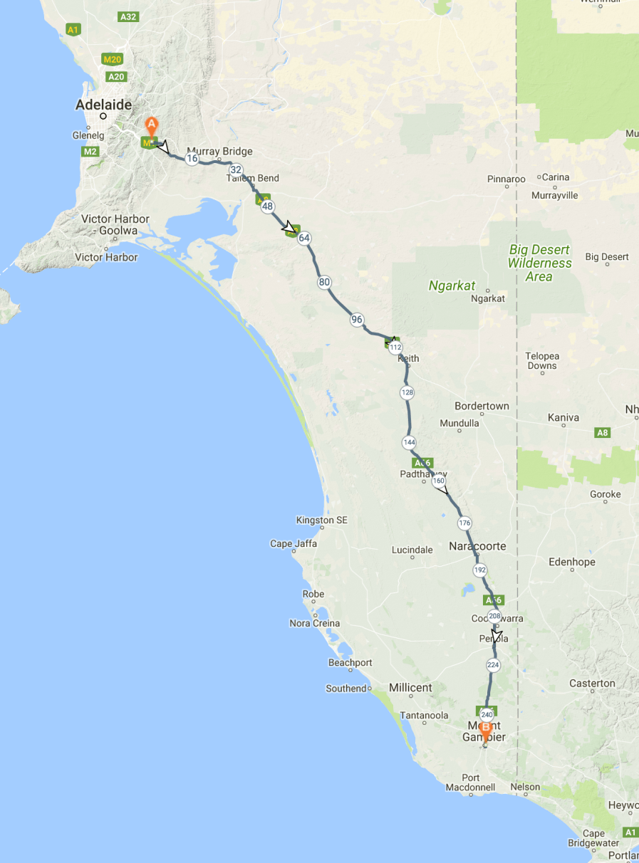
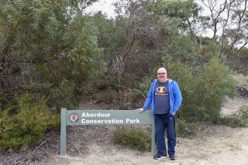
After packing up at the Aberdour Conservation Park, Marija and I continued south on the Riddoch Highway.  As it was only just after lunch, and the weather was holding up nicely, we decided to activate the Desert Camp Conservation Reserve VKFF-1705.  The park is located about 235 km south east of Adelaide and about 17 km north west of the town of Padthaway.

This was to be a unique park for both Marija and I as activators in the WWFF program.

Screen Shot 2018-06-14 at 9.26.50 pm.png

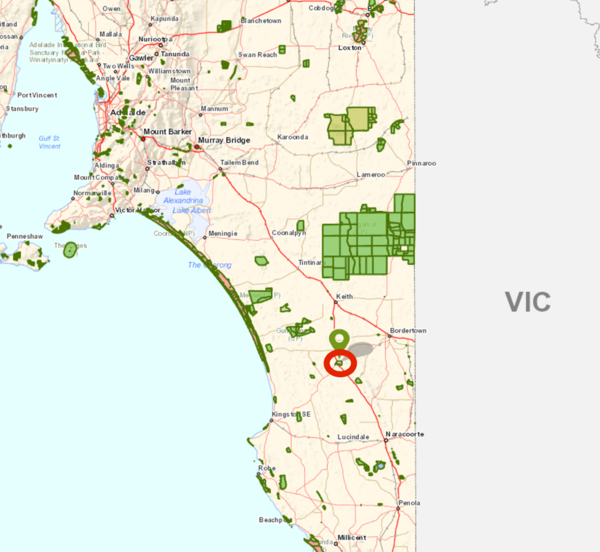
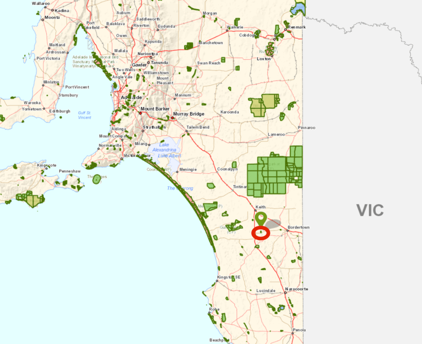
Above:- Map showing the location of the Desert Camp Conservation Reserve in the south east region of South Australia.  Map courtesy of Location SA Map Viewer.

The Desert Camp Conservation Reserve is not to be confused the with Desert Camp Conservation Park.  The reserve is the much larger piece of scrub located on the eastern side of the Riddoch Highway.  The Desert Camp Conservation Park is a small section of Scrub to the east of the Riddoch Highway, on the Rowney Road West.

Desert Camp Conservation Reserve is 882 hectares in size and was proclaimed on the 11th November 1993.  I have not been able to find out the origin of the park name, as there is certainly no desert here.

Screen Shot 2018-06-14 at 9.31.25 pm.png

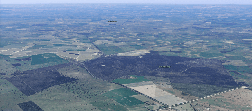
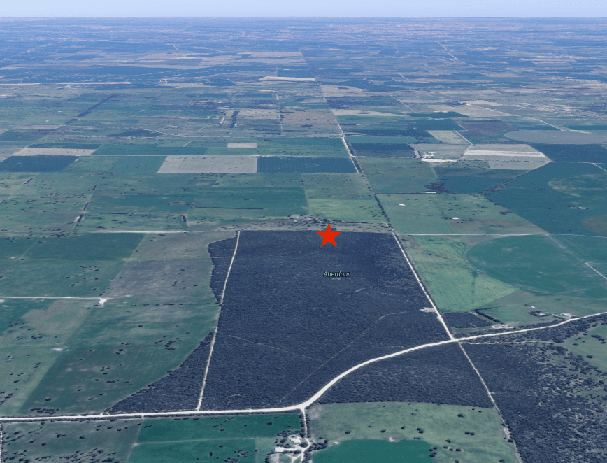
Above:- Aerial view of the Desert Camp Conservation Reserve.  Image courtesy of google maps

About 248 species of native plants have been recorded in the park.  Of these, 17 are considered rare or threatened in the south east, and 10 are either threatened or rare in South Australia.  One species, the Metalic sun-orchid is considered endangered nationally.

The park comprises Brown stringybark Low Woodland; Pink gum Woodland over a Mixed Heath; Pink gum Low Woodland over a desert banksia, heath yacca and heath tree; Open South Australian Blue Gum; Dwarf hakea, dwarf sheoak, honey myrtle; Coastal white mallee; Broombush, silver broombush Open Heath; and Mixed Herbland.

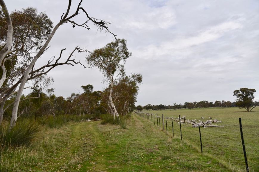
The reserve is recorded as being “the largest block of remnant vegetation in the Hundred of Marcollat” and which “accounts for over half of the remaining native vegetation in blocks greater than 25 hectares in that Hundred.”  It is surrounded by cleared farming land.

DSC_1389

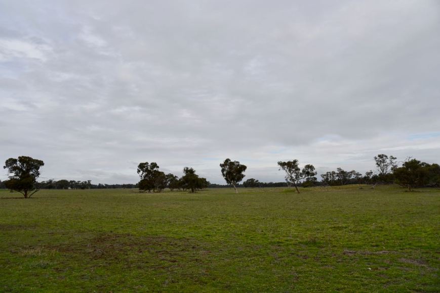
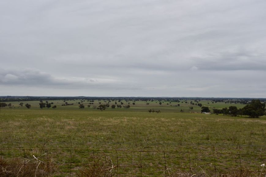
Above:- Cleared farming land to the east of the park.

Birds SA have recorded a total of 93 native birds in the park including Peaceful Dove, Galah, Australian Magpie, Superb Fairywren, New Holland Honeyeater, Red Wattlebird, Buff-rumped Thornbill, Southern Emuwren, Grey Butcherbird, White-winged Triller, and Eastern Yellow Robin.

I snapped the photo below of a Whistling Kite, which was perched up high in a tree in the park.  He/she kindly sat there allowing me to snap off some shots.

DSC_1376

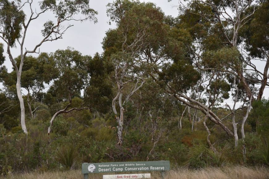
The park is easily located, just to the south of the intersection of the Riddoch Highway and Rowney Road.  The park is well signposted.

DSC_1377

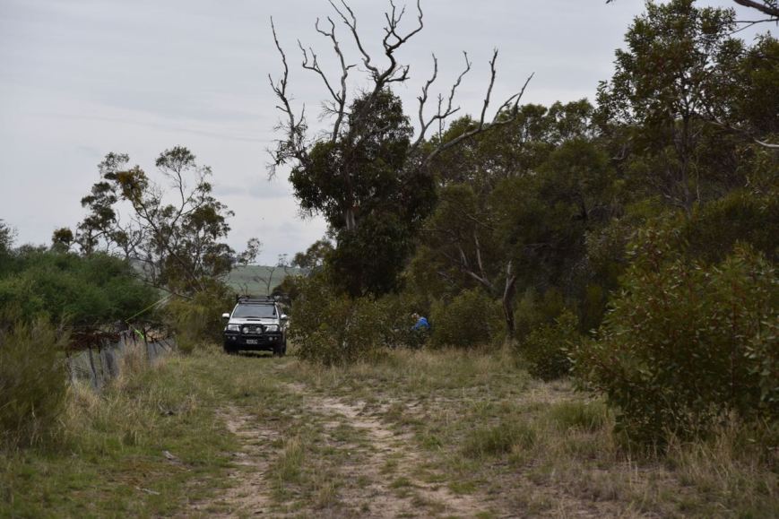
We continued south on Riddoch Highway, passing Rowney Road and followed a 4WD track into the park, which followed a fenceline.

DSC_1388

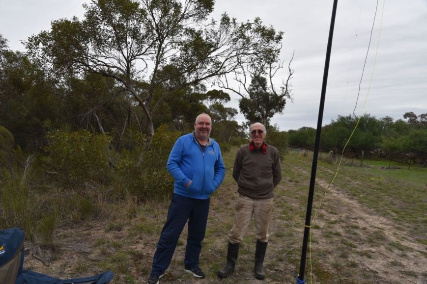
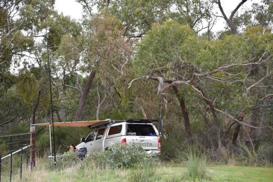
We drove a few hundred metres along the track and found a clearing which allowed us to set up the 20/40/80m linked dipole.  As the weather was a little inclement, we rolled out the awning on the Toyota Hi Lux and sat underneath that in the deck chairs.

Screen Shot 2018-06-14 at 9.27.44 pm.png

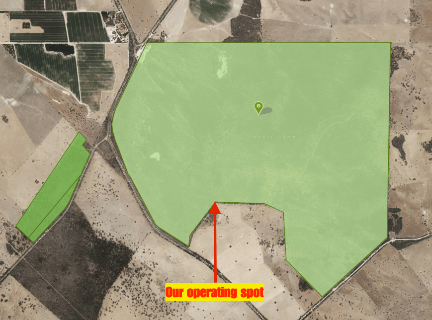
Above:- Aerial view showing the Desert Camp Conservaiton Reserve, showing our operating spot.  The dark green area is the adjacent Desert Camp Conservation Park.  Image courtesy of Location SA Map Viewer.

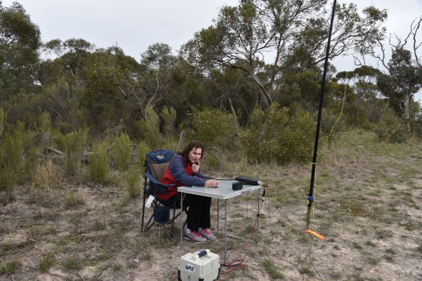
Marija started off the activation, calling CQ on 7.139 after I had placed a spot up on the WWFF Australia Facebook page and on parksnpeaks.  Gerard VK2IO/p was first in the log, with a Park to Park contact into the Booti Booti National Park VKFF-0046.  Next in the log was Brett VK2VW, followed by John VK4TJ.  Within 10 minutes Marija had qualified the park for VKFF, with 10 contacts in the log.  Contact number 10 was with Greg VK4VXX/5.

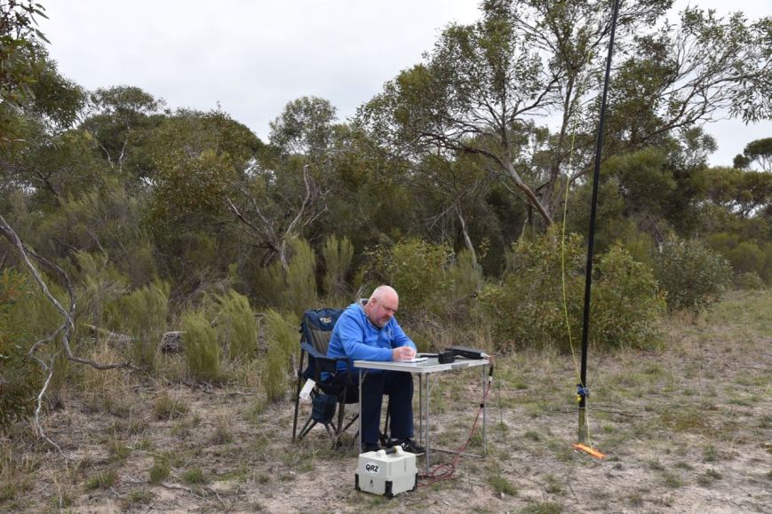
We then swapped the mic and I called CQ on 7.139.  Peter VK3PF was first in the log, followed by Cliff VK2NP and then Andrew VK7DW.  Six minutes later I had contact number 10 in the log, with a QSO with Glenn VK4FARR.  After working Glenn, both Marija and I logged Neil VK4HNS/p who was activating the Conway National Park VKFF-0110.  This was followed by another Park to Park contact, this time with David VK5HYZ/p in the Ikara-Flinders Ranges National Park VKFF-0176.

I kept calling CQ on 7.139 and had a steady flow of callers from all across Australia.  This included another Park to Park, this time with Bill VK4FW/p in the Goat Island Conservation Park VKFF-1549.  I ended up logging a total of 52 stations on 40m from VK1, VK2, VK3, VK4, VK5, VK7 and New Zealand.  It was nice as always to log Andre ZL1TM who has become a regular VKFF Hunter.  I was also pleased to work Geoff VK3MCM who had only been on air for around 2 weeks and I was his 4th contact.  Welcome to the hobby Geoff.

We then lowered the squid pole and inserted the 80m links and headed to 3.610.   I called CQ and this was answered by Rob VK3FKL who had followed me down from 40m.  Conditions on 80m were brilliant, with absolutely no noise.  I logged 11 stations on 80m from VK2, VK3, VK5 and VK7.

To complete the activation I called CQ on 14.310 on the 20m band, but sadly only logged 1 station there, Cliff VK2NP.

DSC_1390

It was time to pack up and head off to Mount Gambier.  Desert Camp was another successful activation, with a total of 76 contacts between the 2 of us, including 7 Park to Park contacts.

Marija worked the following stations on 40m SSB:-

  1. VK2IO/p (Booti Booti National Park VKFF-0046)
  2. VK2VW
  3. VK4TJ
  4. VK3SQ
  5. VK3HOT
  6. VK4CZ
  7. VK3PF
  8. VK7DW
  9. VK2KYO
  10. VK4VXX/5
  11. VK4HNS/p (Conway National Park VKFF-0110)
  12. VK5HYZ/p (VKFF-0176)

I worked the following stations on 40m SSB:-

  1. VK2IO/p (Booti Booti National Park VKFF-0046)
  2. VK3PF
  3. VK2NP
  4. VK7DW
  5. VK4CZ
  6. VK2KYO
  7. VK4VXX/5
  8. VK7ME
  9. VK3SQ
  10. VK4FARR
  11. VK4HNS/p (Conway National Park VKFF-0110)
  12. VK5HYZ/p (Ikara-Flinders Ranges National Park VKFF-0176)
  13. VK2FOUZ
  14. VK3GGG/p
  15. VK3PMG/p
  16. VK3ANL
  17. VK2HHA
  18. VK2STO/p
  19. VK2SMS/p
  20. VK3OHM
  21. VK2GKA
  22. VK3FKAR
  23. VK3FNQS
  24. VK3VHF
  25. VK3VFO
  26. VK4FE
  27. VK3MCM
  28. VK3ZZS/7
  29. VK2QK
  30. VK4FW/p (Goat Island Conservation Park VKFF-1549)
  31. VK4FDJL
  32. VK2ARL
  33. VK2VOO
  34. VK5WG
  35. VK2WE
  36. VK3ANP
  37. VK3ATO
  38. VK5KLV
  39. VK1AT
  40. VK3ZIG/m
  41. VK7FRJG
  42. VK3FLJD
  43. VK2LEE
  44. VK3ZMD
  45. VK5CZ
  46. VK4TJ
  47. VK2WR
  48. VK2KDP/m
  49. VK3FKL
  50. VK7TZ
  51. ZL1TM

I worked the following stations on 80m SSB:-

  1. VK3FKL
  2. VK5MRE
  3. VK5PL
  4. VK4AAC/5
  5. VK3SQ
  6. VK3PF
  7. VK5CZ
  8. VK7TZ
  9. VK3PAT
  10. VK2HHA
  11. VK5BJE

I worked the following station on 20m SSB:-

  1. VK2NP

We had missed the predicted wet weather, but that did not last.  We had timed our activations well, as not long after getting mobile, the heavens really opened up.  We arrived at Mount Gambier at around 5.00 p.m. and booked into our accomodation, the Motel Mount Gambier.  After freshening up we headed out for tea at the Mount Gambier Hotel.


References.

Birds SA, 2018, <https://birdssa.asn.au/location/desert-camp-conservation-reserve/>, viewed 14th June 2018.

Department of Environment and Natural Resources, 1997, ‘Desert Camp Conservation Reserve Management Plan’.

Aberdour Conservation Park 5CP-001 and VKFF-0994

Last Friday (8th June 2018) Marija VK5FMAZ and I had an early start from home, heading to the south east of South Australia.  Our intended destination was Mount Gambier, to attend the South East Radio Group’s annual convention.

Marija and I had hoped to activate some parks over the weekend, but had not made any firm plans and had not added any alerts on parksnpeaks, as we were not sure what the weather was going to do.

We left home at around 8.30 a.m. and had a 400 km drive ahead of us, taking us through the Murray Mallee and on to the beautiful Coonawarra wine growing region.

Screen Shot 2018-06-14 at 9.01.49 pm.png

Above:- Map showing our route to Mount Gambier.  Map courtesy of Plot a route.

Our first stop was the little town of Cookes Plains.  Don’t blink as you will miss it.  There isn’t much here, but I had never detoured off the highway into Cookes Plains previously, so we decided to have a sneak peak.  It was named after pastoralists James and Archie Cooke and was originally a private subdivision.  Cooke Plains boundaries now also include the former government town of Bedford which was surveyed in August 1871 and declared ceased to exist on 28 April 1960.

There is a beautiful old hall in Cookes Plains, along with a monument to commemorate the construction of the first patented concrete filled railway wheel stone roller, used to break down rough limestone ground into arable cropping land.

We then stopped off at our usual coffee stop, the Coonalpyn Silo Cafe.  I enjoyed a hot cup of coffee and an egg and bacon roll.  We were soon on the road again, travelling through Culburra, Tintinara and on to Keith.  We then turned off the Dukes Highway, onto the Riddoch Highway.  The highway is named after John Riddoch, the first white settler landholder and vigneron in Coonawarra.

As we drove south we decided to activate the Aberdour Conservation Park VKFF-0994 which is situated about 35 km south of Keith, on the corner of Cannawigara Road and Nankivell Road.

Screen Shot 2018-06-12 at 6.33.42 pm

Above:- Map showing the location of the Aberdour Conservation Park.  Map courtesy of Location SA Map Viewer.

I had activated the Aberdour Conservation Park back in June 2016 but had to cut the activation short because of poor weather, and had only got 28 contacts in the log.  So although having qualified the park for VKFF, I was 16 QSOs short of the required 44 to qualify the park for the global WWFF program.  So I was hoping to pick up those during this activation to qualify the park.

Aberdour Conservation Park is about 145 hectares in size and comprised Hundred of Willalooka, Sections 7 and 80.  Section 7 comprises 131 hectares of native bush.  While the southern section of the park, Section 80 comprises 14 hectares of native bush.

The park name is derived from Aberdour Homestead which is located to the west of the conservation park on the east side of the Riddoch Highway.

The park is dominated by three main landforms: Coastal Mallee; Yellow Mallee; and Pink Gum.  The endangered Jumping Jack Wattle can be found in the park.

The Nankivell family made a gift of 131 hectares and this was proclaimed as a park on the 28th February 1991.   The remaining 14 hectares was added on 16th February 2006. This smaller section was previously a Stone Reserve under the control of the Tatiara District Council.

There has been extensive clearing of the land surrounding the park for farming purposes.  The park preserves an area of remnant vegetation typical of undulating dune and limestone country.

DSC_1343

Above:- Cleared farming land on the western side of the park.

Birds SA have recorded a total of 7 native species of bird in the park including Galah, Red-rumped Parrot, Superb Fairywren, New Holland Honeyeater, Red Wattlebird, Purple-gaped Honeyeater, Cockatiel, Purple-backed Fairywren, Yellow-faced Honeyeater, Striated Thornbill, and Black-faced Cuckooshrike.

Screen Shot 2018-06-12 at 6.37.06 pm.png

Above:- Aerial shot showing the Aberdour Conservation Park.  The red star indicates our operating spot.  Image courtesy of google maps

Marija and I drove down Cannawigara Road from the Riddoch Highway and we soon reached the south western corner of the park.  There is a park sign at this location and a 4WD track which travels south-north, following the western boundary of the park.

DSC_1324

Above:- at the south western corner of the park.

We continued along Cannawigara Road and then turned left onto Nankivell Road following the eastern boundary of the park.  We then turned left onto the 4WD track which follows the northern boundary of the park, and found a clearing and set up there.  We ran the Yaesu FT-857d and the 20/40/80m linked dipole for this activation.

Screen Shot 2018-06-12 at 6.33.14 pm

Above:- Aerial shot of the park showing our operating spot in the northern section of the park.  Image courtesy of Location SA Map Viewer.

I kicked off the activation by calling CQ on 7.144 which was answered by Brett VK2VW who kindly spotted me on parksnpeaks.  Within 13 minutes I had 10 contacts in the log, with contact number 10 being Peter VK3PF.

DSC_1332

I logged a total of 28 contacts on 40m before Marija and I decided to try 80m.  Band conditions on 40m had been quite good, with contacts logged from VK1, VK2, VK3, VK4, and VK7.  Clearly there was no close in propagation, with no South Australian stations logged.

I logged 4 stations on 3.610 on 80m, from VK2 and VK3.  This included a Park to Park contact with Gerard VK2IO/p on SOTA peak VK2/ MN-216 in the Booti Booti National Park VKFF-0046.

DSC_1325

Marija then jumped into the operators seat and logged 5 stations on 80m including a Park to Park with Gerard VK2IO/p.  Despite conditions being quite good on 80m and some self spots on parksnpeaks we had no further callers on 80m.

We then headed back to 40m where Marija called CQ on 7.144, logging 5 stations from VK2, VK3, VK5 & VK7.  Marija had now qualified the park for the VKFF program, with contact number 10 being with Jonathan VK7JON.

I then put out some calls on 14.310 on the 20m band, which was answered by Scott VK4CZ, and then Gerard VK2IO/p for another Park to Park.  But they were my only 2 callers.

It was now approaching 12.15 p.m. and we still had a way to go to get to Mount Gambier, so we packed up and hit the road once again.

DSC_1335

We had a little surprise during the activation, with a visit from Alan VK5ZLT, who it turns out owns the land on the northern side of the park.  Alan had said he had heard someone calling CQ and had followed our voices from his property to our operating spot.

DSC_1342

Above:- with Alan VK5ZLT

Marija worked the following stations on 40m SSB:-

  1. VK3UH
  2. VK2VW
  3. VK5FANA
  4. VK2HHA
  5. VK7JON

Marija worked the following stations on 80m SSB:-

  1. VK2IO/p (SOTA VK2/ MN-216 & Booti Booti National Park VKFF-0046)
  2. VK3GGG/p
  3. VK3PMG/p
  4. VK5GJ
  5. VK3SQ

I worked the following stations on 40m SSB:-

  1. VK2VW
  2. VK4CZ
  3. VK2XSE/m
  4. VK2KNV/m
  5. VK7JON
  6. VK2LEE
  7. VK2HHA
  8. VK7OT
  9. VK1AT
  10. VK3PF
  11. VK2PKT
  12. VK3ANL
  13. VK1FTRK
  14. VK4TJ
  15. VK4/AC8WN
  16. VK4/VE6XT
  17. VK3ARH
  18. VK7FGRA
  19. VK4FE
  20. Vk2VK
  21. VK2ZVG
  22. VK4KX
  23. VK4UMS
  24. VK3SQ
  25. VK2MTC
  26. VK3CM
  27. VK2RP/m
  28. VK2BDR/m

I worked the following stations on 80m SSB:-

  1. VK3GGG/p
  2. VK3PMG/p
  3. VK3SQ
  4. VK2IO/p (SOTA VK2/ MN-216 & Booti Booti National Park VKFF-0046)

I worked the following stations on 20m SSB:-

  1. VK4CZ
  2. VK2IO/p (SOTA VK2/ MN-216 & Booti Booti National Park VKFF-0046)


References.

Birds SA, 2018, <https://birdssa.asn.au/location/aberdour-conservation-park/>, viewed 12th June 2018

Department of Environment and Natural Resources, 1997, ‘Aberouder Conservation Park Management Plan’

Wikipedia, 2018, <https://en.wikipedia.org/wiki/Aberdour_Conservation_Park>, viewed 12th June 2018

Wikipedia, 2018, <https://en.wikipedia.org/wiki/Cooke_Plains,_South_Australia>, viewed 13th June 2018