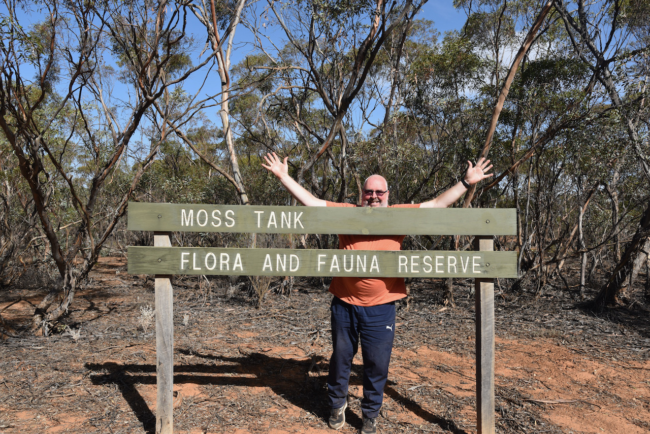
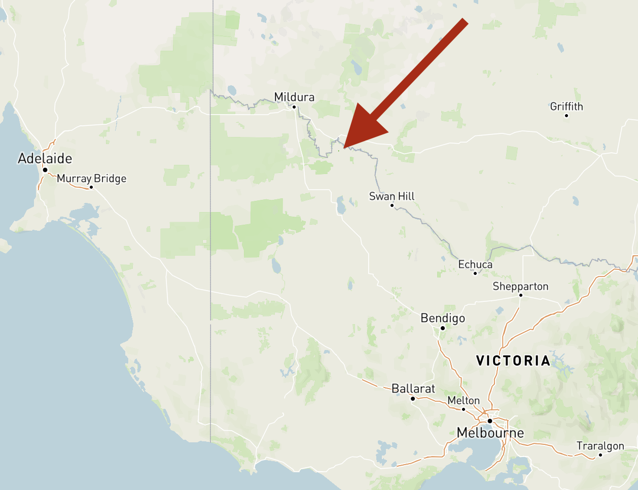
Our fourth and final park for day twelve (Saturday 17th April 2021) was the Moss Tank Flora & Fauna Reserve VKFF-2394. The park is located about 31 km south of Robinvale.
Above:- Map showing the location of the Moss Tank Flora and Fauna Reserve. Map c/o Protected Planet.
This was to be our first activation of this park. Moss Tank has also been activated once before, by Mike VK6MB back in 2019.
We found the park without any problems. It was well signposted on the Annuello-Wemen Road.
Moss Tank Flora and Fauna Reserve is about 3.26 km² in size and was established in 1988.
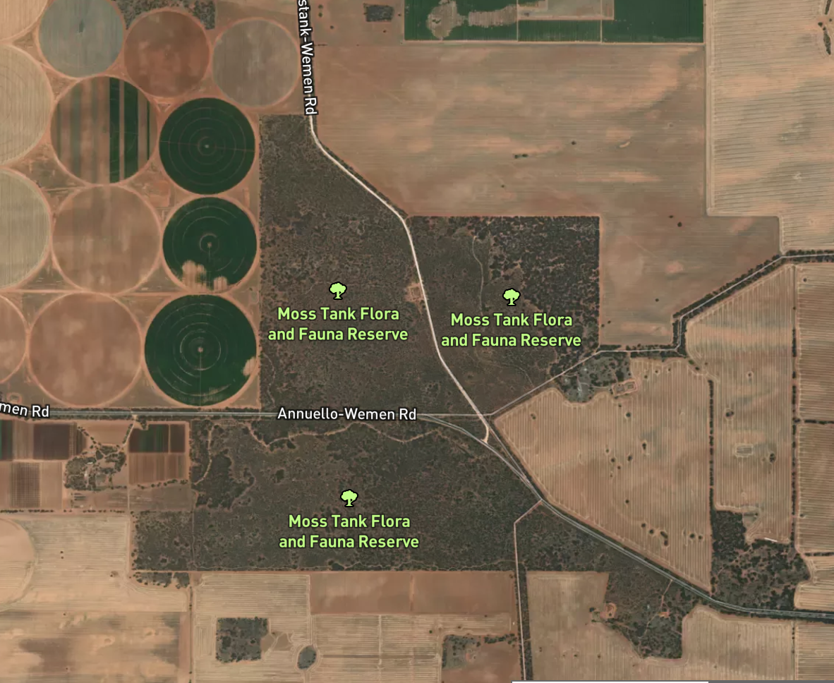
Above:- An aerial view of the Moss Tank Flora & Fauna Reserve. Image c/o Protected Planet.
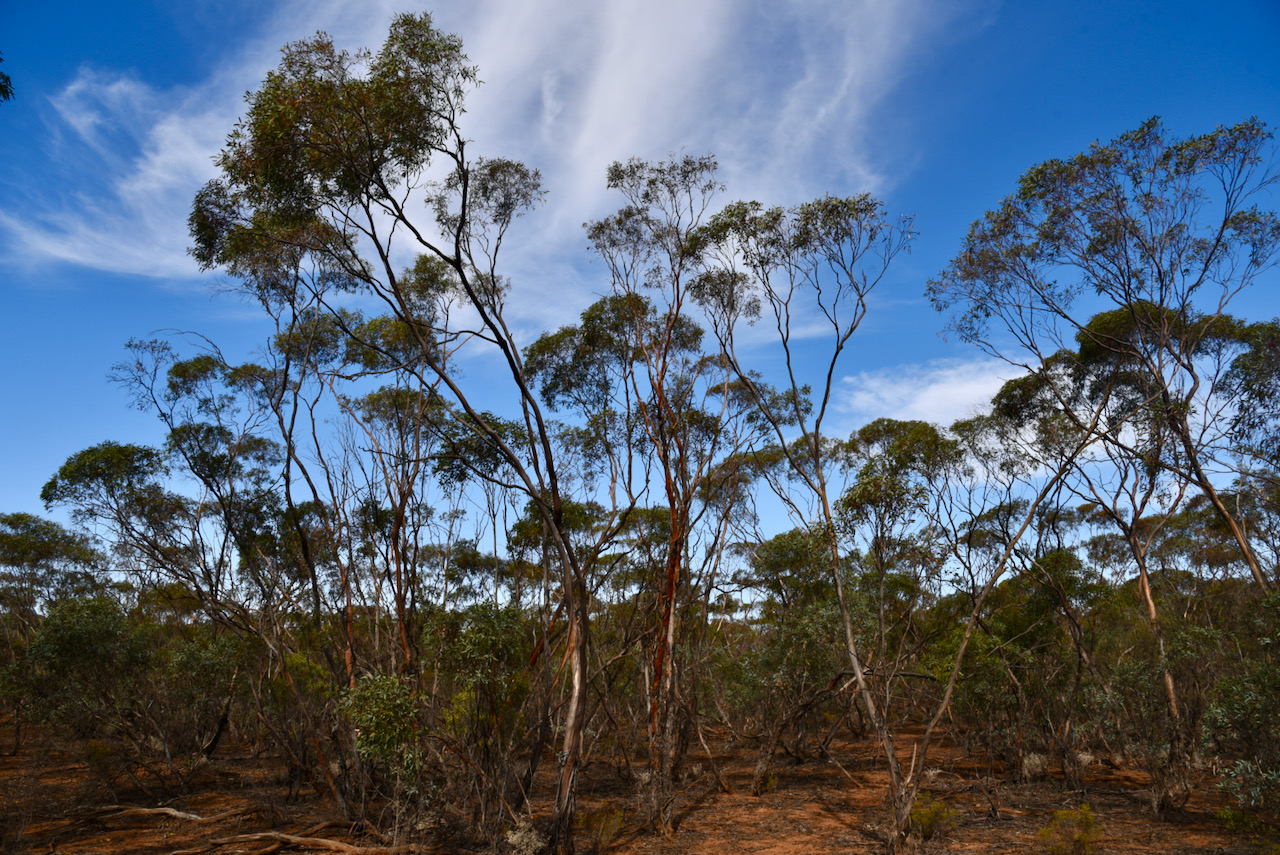
The park is a piece of remnant mallee scrub which is surrounded by cleared farming land. It is located near the town/locality of Annuello which is believed to be an aboriginal word for ‘a camp of bearded men’. During the early 1920’s the Annuello district was subdivided into blocks for Soldier Settlement following the First World War. The railway line to Annuello was opened in 1921, followed by a school in 1924. The Annuello Post Office opened in April 1921.
A wheat variety ‘annuello’ adapted for low and medium rainfall areas was released in 2003, and is suitable for the domestic flour milling industry.
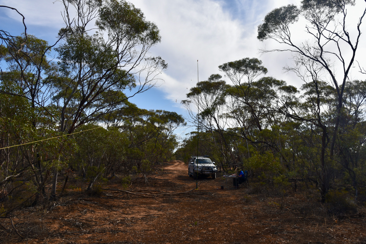
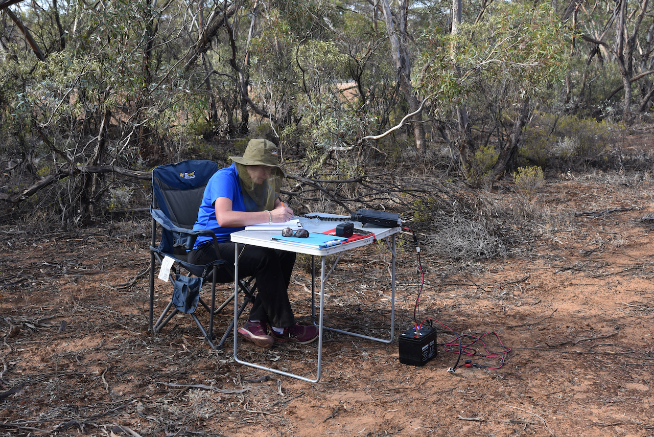
We found a little direct track running off the bitumen and pulled in there off the road. It made an ideal spot to stretch out the 20/40/80m linked dipole.
Within eight minutes I had qualified the park for VKFF, with 11 contacts in the log. Contact number ten was with Alan VK2MET. I then swapped over with Marija and she too qualified the park in quick time, with contact number ten being a QSO with the same park hunter Alan VK2MET.
I then jumped back into the operator’s chair and logged a further 30 contacts on 40m from VK1, VK2, VK3, VK4, VK5, VK7, and New Zealand.
I now had 41 contacts in the log and required just 3 more QSOs to qualify the park for the global WWFF program.
I moved to the 20m band where I logged 6 stations from VK2, VK4, and much to my surprise Canada. It was a terrific way to finish the activation with a contact with Karl VE6KDX in Alberta, Canada.
Marija worked the following stations on 40m SSB:-
VK3KV/m
VK2VOO
VK3UH
VK2FA/m
VK2IO/m
VK4HNS
VK5FANA
VK5KLV
VK2LAX
VK2MET
I worked the following stations on 40m SSB:-
VK5GY
VK4HMI
VK2BHO
VK5CZ/m
VK4SMA
VK4WTN
VK3PF
VK2VOO
VK5KLV
VK2MET
VK3UH
ZL1TM
VK2LAX
VK4HNS
VK4FDJL
VK4VCE
VK2KMI
VK3SS
VK2VW
VK2HFI
VK5IS
VK2NJP
VK2LWK
VK7QP
VK1DI
VK4GCR
VK2IO/m
VK2BYF
VK2VAR
VK2CDS
VK2TM
VK2DJP
VK2YW
VK3KV/m
VK2HAO
VK4IDK
VK2NCL
VK4PHD
VK2SRA
VK2TMC
VK3SQ
I worked the following stations on 20m SSB:-
VK2IJS
VK4KC
VK4MAD
VK4DOG
VK4PHD
VE6KDX
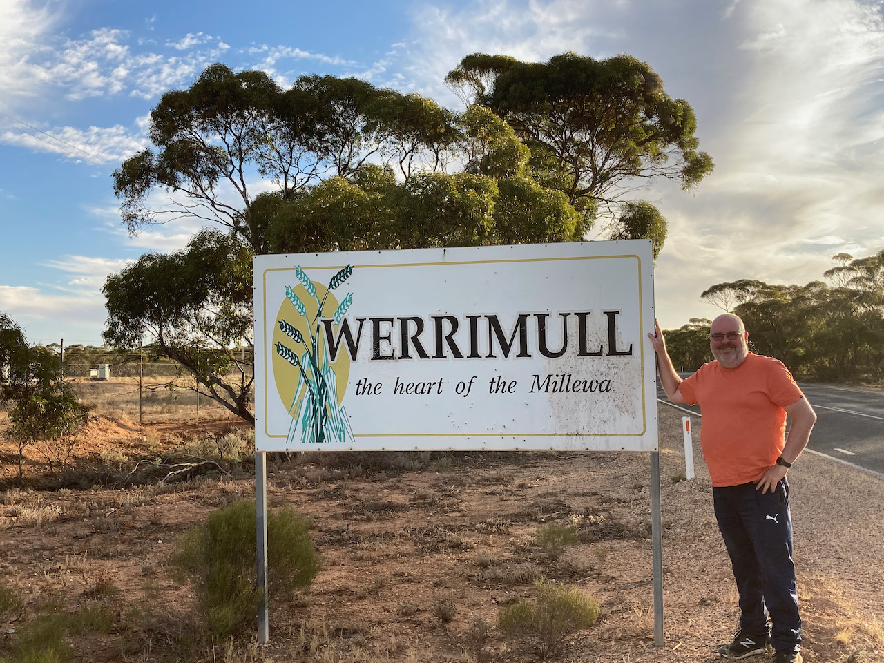
Marija and I had a 245 km drive ahead of us to get to Renmark. We drove back along the Hattah-Robinvale Road and then north on the Calder Highway. We then turned left onto the Millewa Road and through Werrimul.
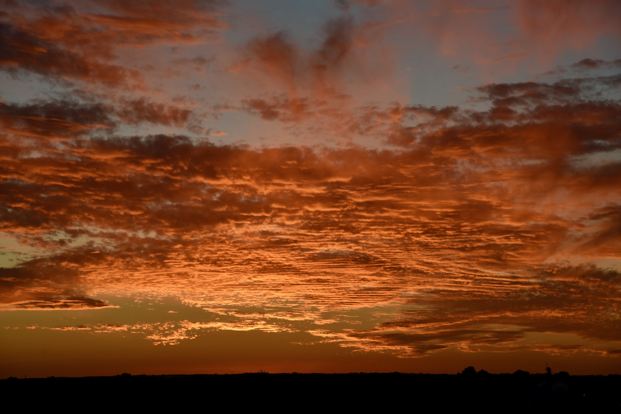
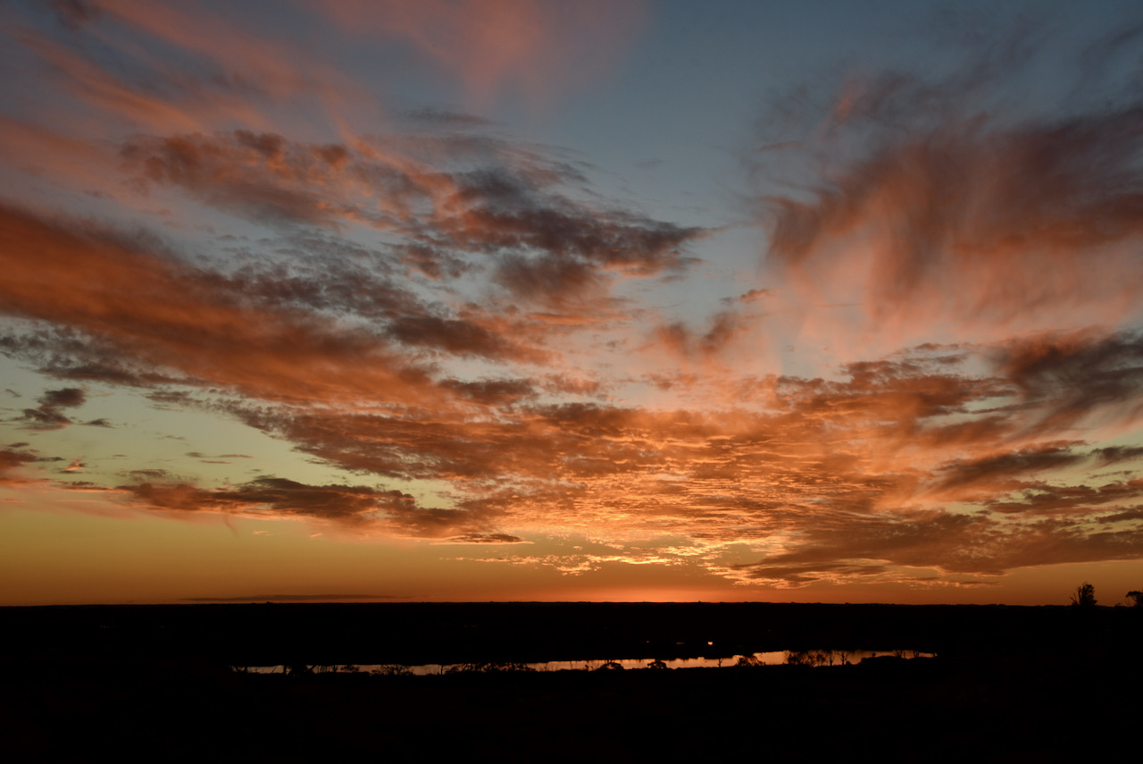
We crossed the Victorian/South Australian border and back into South Australia. The sun was starting to set and we stopped briefly to get some shots of the amazing sunset. The photos below were taken looking over the Pike River Conservation Park just outside of Renmark.
That evening after checking into our accomodation, we grabbed some pizza and beer and headed around to the home of Ivan VK5HS and his wife Sheryl, and had a terrific night there.
Tomorrow we would head home, a journey of around 285 km ahead of us.
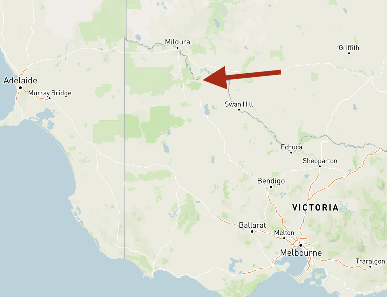
We then continued south-west on the Hattah-Robinvale Road and soon reached our third park for the day, the Wemen Flora & Fauna Reserve VKFF-2483. The park is located about 31 km south-west of Robinvale.
Again this was to be another unique park for myself and Marija, with Mike VK6MB previously activating Wemen back in 2019.
Above:- Map showing the location of the Wemen Flora & Fauna Reserve. Map c/o Protected Planet.
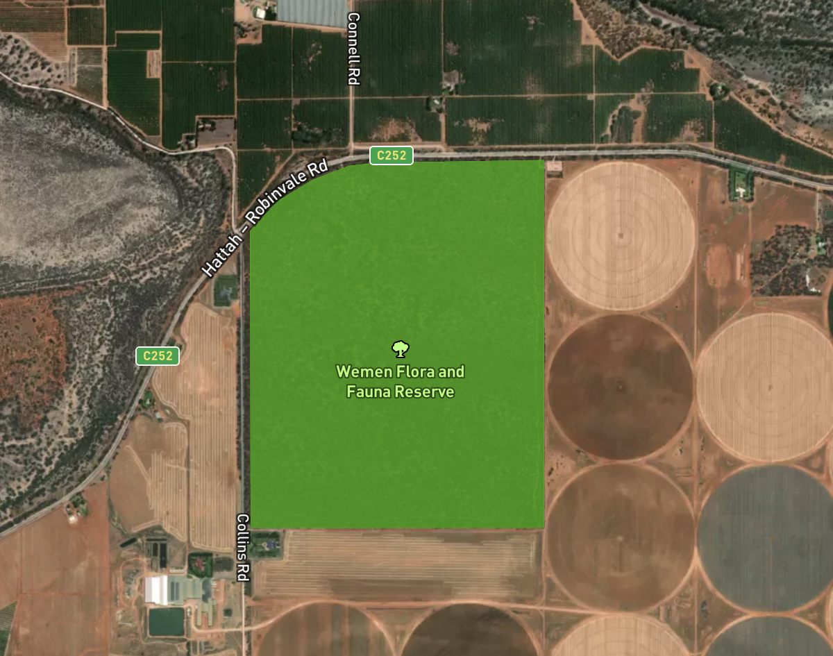
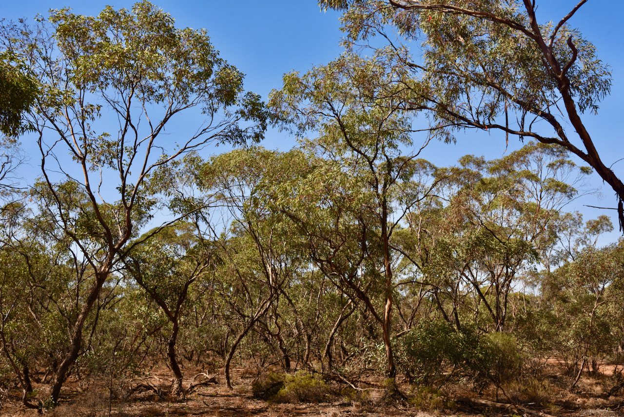
The Wemen Flora & Fauna Reserve is about 2.02 km² in size and was established in 1983. The area around the park has been cleared for agricultural purposes including almond and olive plantations.
Above:- the park boundaries of Wemen Flora & Fauna Reserve. Image c/o Protected Planet.
The park takes its name from the locality of Wemen (pronounced Wee-Man). Wemen was established as a Soldier Settlement after the First World War. The Wemen Post office opened on the 24th day of November 1924 and closed in 1974. There were once three schools in the district.
The little town of Wemen can be located a bit further to the south on the Hattah-Robinvale Road. It is located on the banks of the Murray River. This part of the river was the closest river access for some aboriginal tribes.
Wemen is reportedly a great spot for Murray River Cray when in season.
We accessed the park via a 4WD off Collins Road. We found a small clearing in amongst the scrub and set up our portable station.
I called CQ on 7.144 following a spot on parksnpeaks by Marija. First in the log was Les VK5KLV. Contact number ten followed soon afterwards, with a QSO with Adrian VK5FANA.
Once I had ten contacts in the log and I had qualified the park for VKFF, I swapped the mic with Marija, who also soon qualified the park with 12 contacts. Contact number ten was with Adam VK2YK.
I then jumped back into the operator’s chair and pushed on to hopefully get 44 contacts. The 40m band had certainly improved since our first activation, and I logged a total of 40 stations on 40m before callers dried up.
To conclude the activation I called CQ on 14.310 on the 20m band where I logged 6 stations from VK2, VK4, and VK6. Contact number 44 was with Brett VK2HFI.
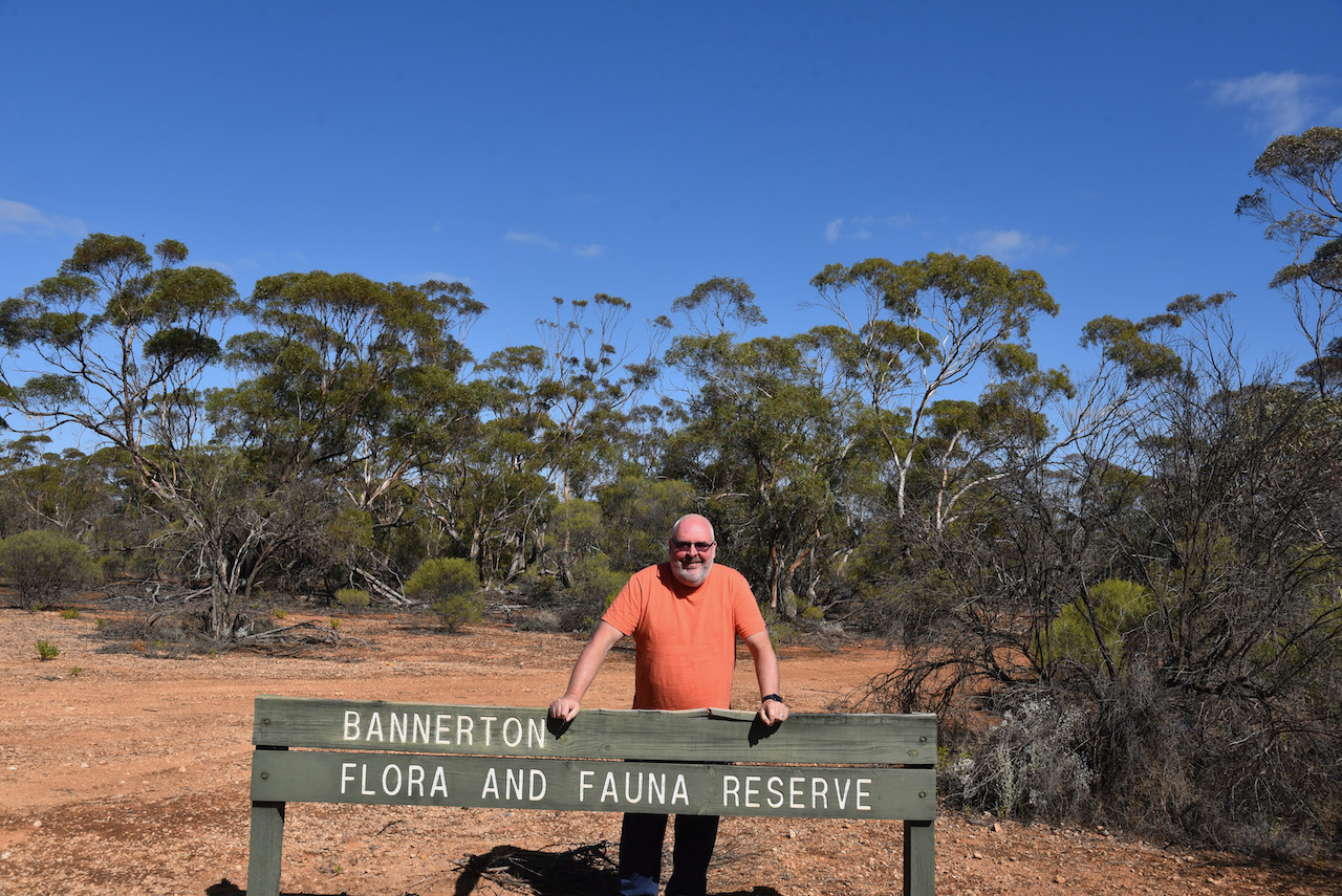
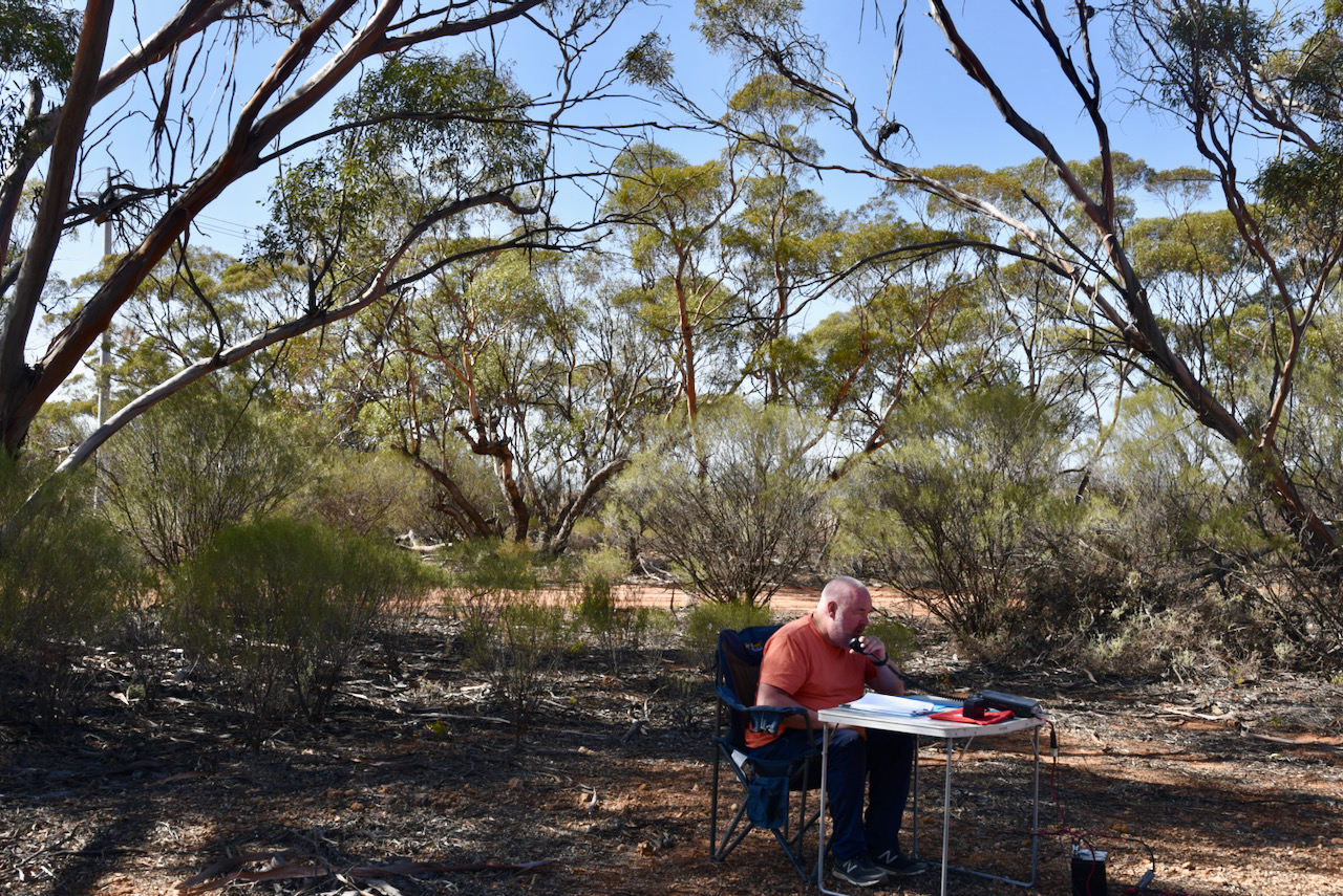
After packing up at Lakes Powell & Carpul, we drove a short distance west along the Hattah-Robinvale Road and reached our next park, the Bannerton Flora & Fauna Reserve VKFF-2261. The park is located about 14 km south of Robinvale.
Above:- Map showing the location of the Bannerton Flora & Fauna Reserve. Map c/o Protected Planet.
We found that the park was well signposted on the Hattah-Robinvale Road. This was to be a first time activation of the park by myself and Marija, and only the second time the park had been activated for the World Wide Flora Fauna program (Mike VK6MB in 2019).
Bannerton Flora & Fauna Reserve is a relatively small park, comprising about 2.0 km² of mallee scrub. It is located on the southern side of the Hattah-Robinvale Road and on the eastern and western side of the Robinvale-Sea Lake Road.
Above:- The boundaries of the Bannerton Flora & Fauna Reserve. Image c/o Protected Planet.
The park takes its name from the locality of Bannerton. The Post office at Bannerton was opened in February 1924 as Banner. It was renamed Tol Tol in 1924 and then Bannerton in 1926. It closed in 1974.
To our great pleasure, band conditions on 40m were much better during this activation compared to our earlier park activation. First in the log was Ron VK3AHR, followed by Geoff VK3SQ, and then Greg VK4BXX. It took just7 minutes for contact number 10, a QSO with Nigel VK5NIG who was portable at the Buy and Sell in Adelaide for the North East Radio Club.
I logged 28 contacts before swapping operator positions with Marija. Marija’s first contact was with Peter Vk3PF. Contact number ten was with Steve VK5KSW on the Yorke Peninsula.
Marija logged a total of 30 stations and was satisfied that she had qualified the park for VKFF, so we swapped chairs once again.
I logged a further 23 stations on 40m. Contact number 44 was with Rob VK4AAC/2.
We decided at this point to pack up and try to squeeze in another 2 parks, and stay one night at Renmark on the way home.
It was now day twelve (Saturday 17th April 2021) and our planned final day of the trip. We planned on doing two park activations on the way home, and had a list of possible parks, but hadn’t decided on which ones.
After breakfast at one of the local cafes consisting of a bacon & egg roll and coffee, we had a bit of a drive around Robinvale.
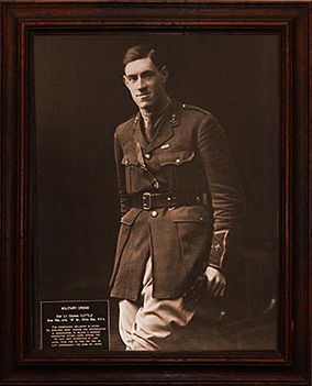
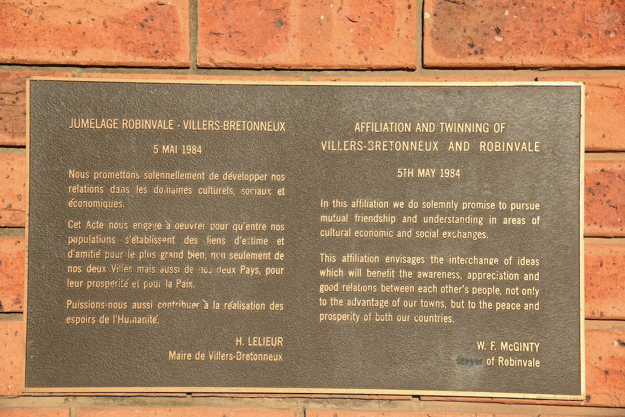
Robinvale is the sister town with Villers-Bretonneux in France. This proud link dates back to the First World War when Lieutenant George Robin Cuttle was killed in air combat over Caix, near the village of Villers-Bretonneux in France. Cuttle was the son of Robinvale’s founding family, Herbert and Margaret Cuttle. In memory of their son, the Cuttle’s renamed their new settlement on the Murray, Robinvale (vale Robin).
Above:- Lt George Robin Cuttle. Image c/o robinvalewarmemorial.com.au
The town of Robinvale and Villers-Bretonneux are of similar size and they both rely on horticulture as their principle ecomonic income.
In the main square/park of Robinvale you can find Caix Square and the Robinvale Memorial Arch and the Villers Bretonneux Walk. The arch was opened in 1985 by Madame Huguette Pillon. The bell which can be found at the top of the arch is from the Victoria College at Villers-Bretonneaux. It was presented to the people of Robinvale at the ‘twinning’ ceremony in Villers-Bretonneaux on the 5th May 1984.
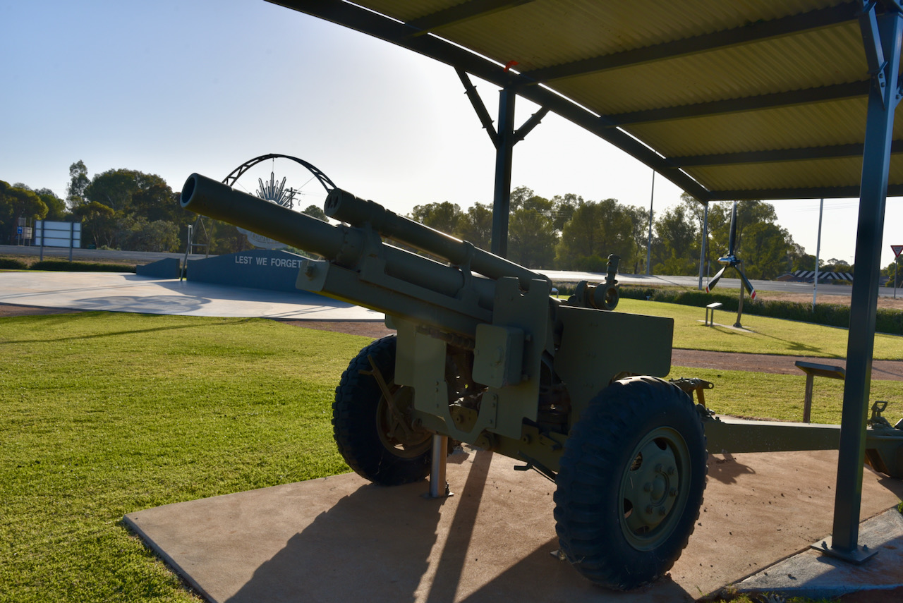
We then visited the Robinvale Regional War Memorial. What an amazing spot for such a little town. The park features a magnificent ‘Rising Sun’, various information boards, a Howitzer, and the propellor from a de Havilland A4 DHC Caribou.
There is an excellent website which contains numerous photos and video on the creation of the War Memorial. It can be found at…..
We then visited the Big Windmill, which is reported to be the largest windmill in the southern hemisphere. It was originally owned by the State Rivers & Water Supply Commission and was used to supply water to Robinvale. In 1961 it was purchased by William ‘Bill’ McGinty when no longer required by the Water Supply Commission. McGinty intended constructing a motel on the site, however approval was not gained. He donated the windmill to the Robinvale and District Lions Club in 1989.
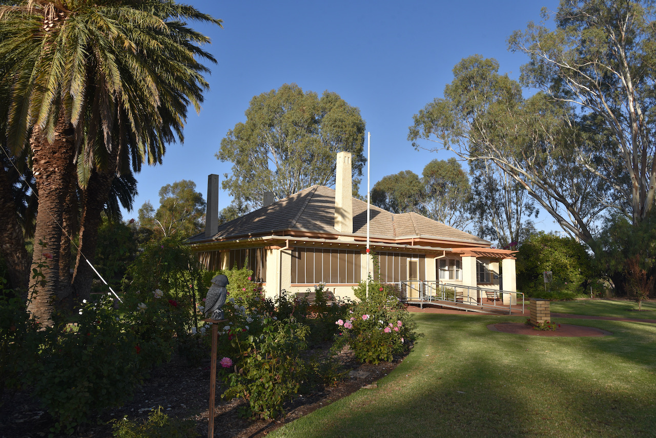
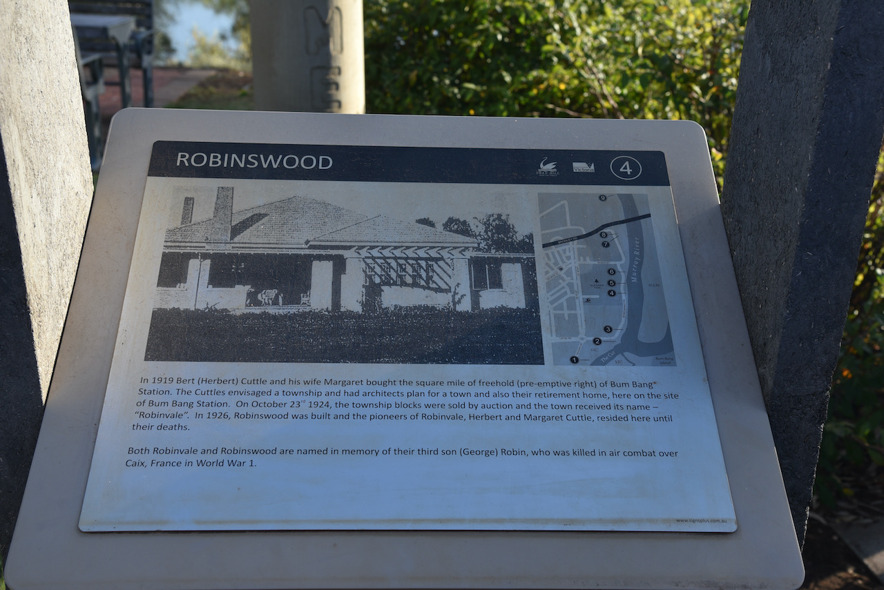
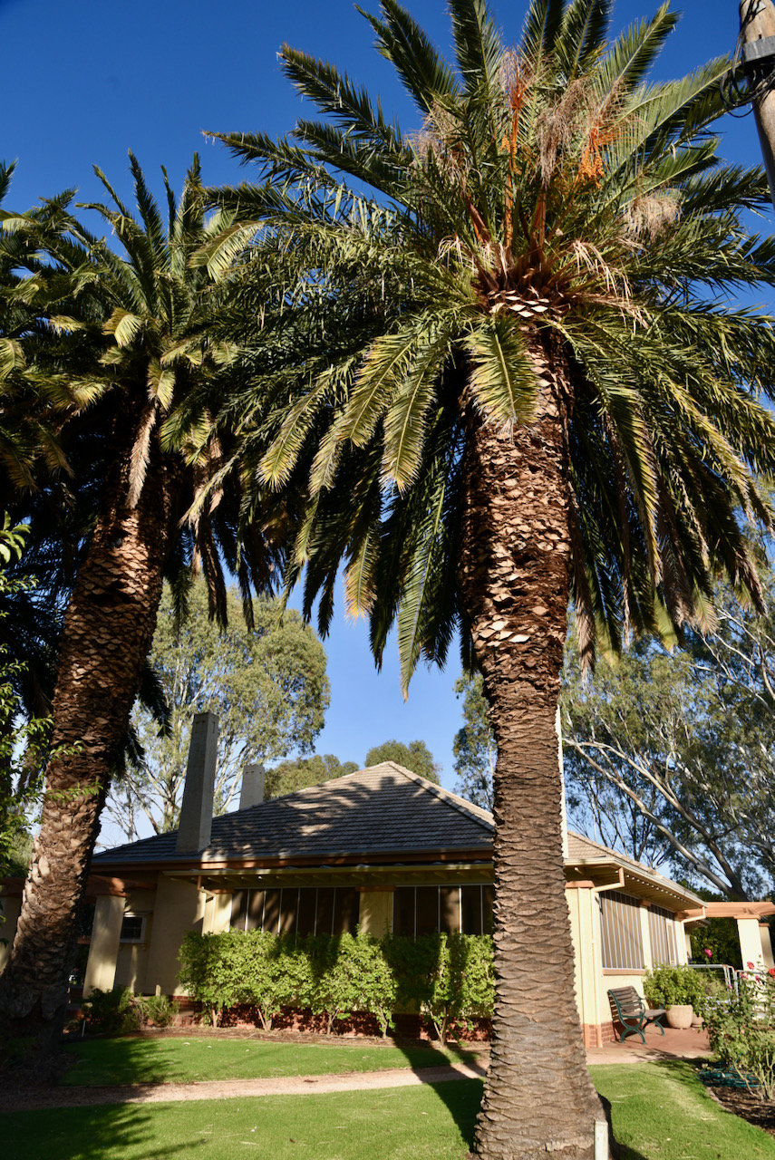
Our next stop was the historic ‘Robinswood’ homestead at Robinvale. In 1919 Herbert ‘Bert’ Cuttle and his wife Margaret brought the square mile of freehold of Bum Bang Station. The Cuttles envisages a township and had architects plan for a town and also their retirement home, here on the site of Bum Bang Station. On the 23rd day of October 1924, the township blocks were sold by auction and the town of Robinvale received its name. In 1926, Robinswood was built and the pioneers of Robinvale, Herbert and Margate Cuttle, resided here until their deaths.
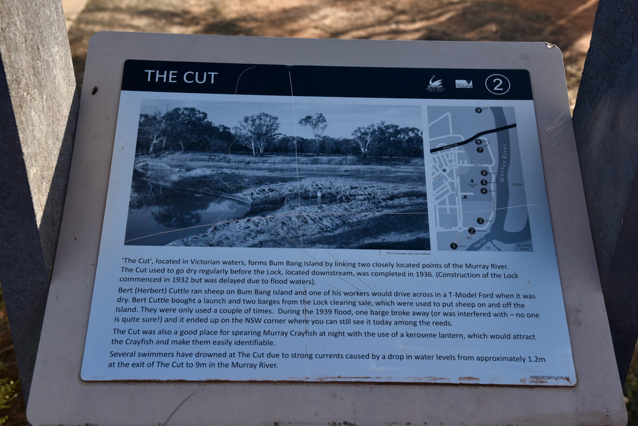
We then drove a short distance to have a look at ‘The Cut’. It is located in Victorian waters and forms Bum Bang Island by linking two closely located points of the Murray River. The Cut used to go dry regularly before the Lock, located downstream was completed in 1936.
Bert Cuttle ran sheep on Bum Bang Island and one of his workers would drive across in a T-model Ford when it was dry. Cuttle bought a launch and two barges from the Lock clearing sale, which were used to put sheep on and off the island. During the 1939 flood, one barge broke away and it ended up on the New South Wales corner.
The Cut was also a good place for spearing Murray Crayfish at night with the use of a kerosene lantern, which would attract the Crayfish and make them easily identifiable.
Several swimmers have drowned at The Cut due to strong currents caused by a drop in water levels from about 1.2 metres at the exit of The Cut to 9 metres in the Murray River.
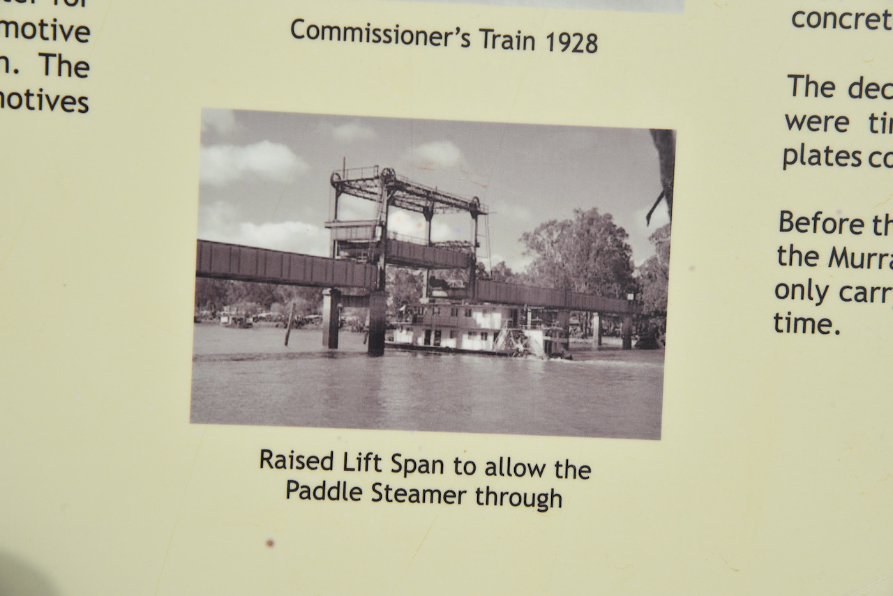
Our next little stop was the old Span Life bridge at Robinvale. The bridge was part of the complex of bridges for the crossing of the Murray River and the flood plains between Robinvale and east of Euston.
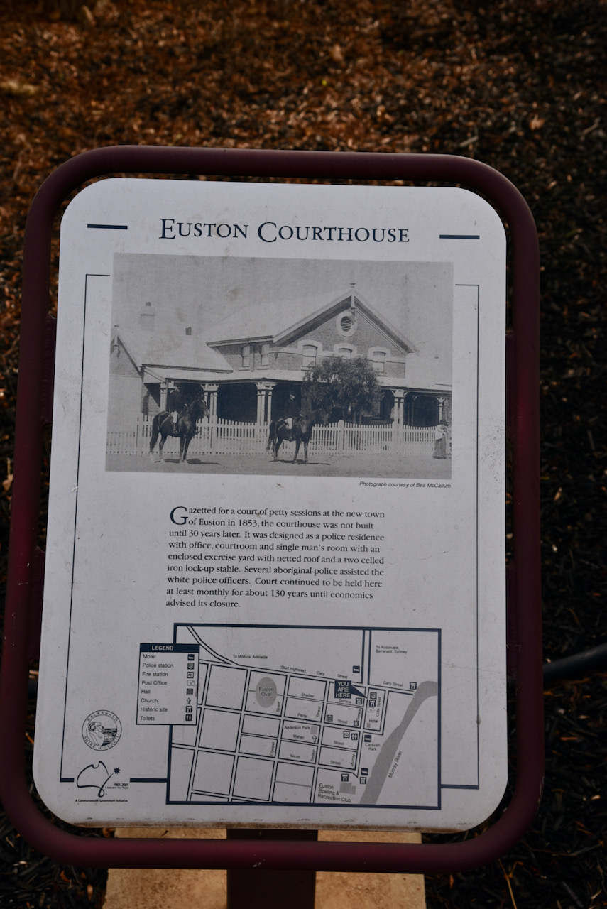
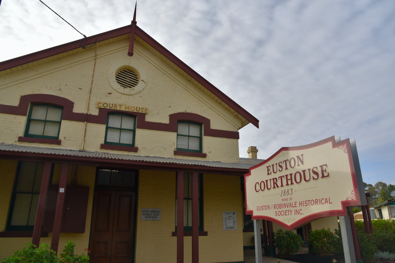
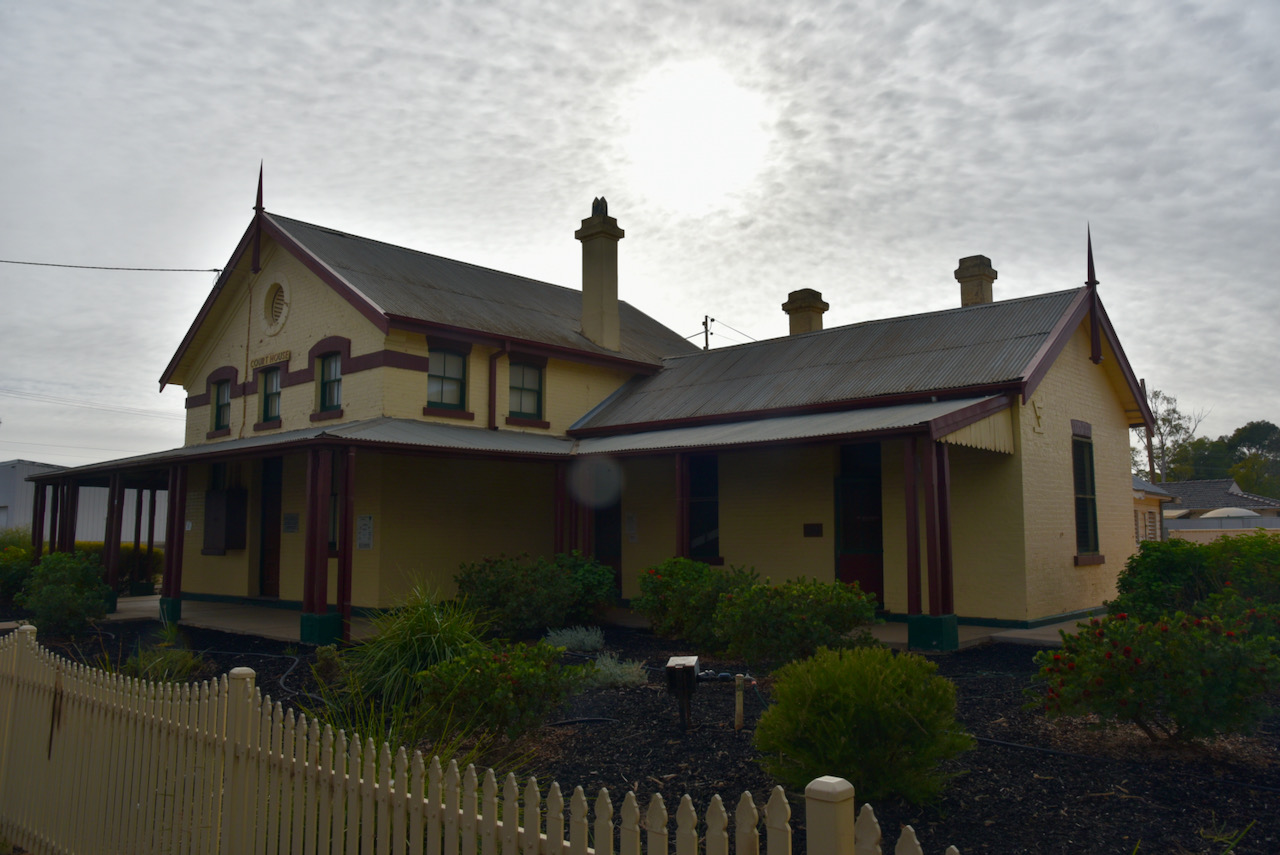
We then drove over the river and into New South Wales to have a look at the historic Euston courthouse. Gazetted for a court of petty sessions at the new town of Euston in 1853, the courthouse was not built until 30 years later. It was designed as a police residence with office, courtroom and single man’s room with an enclosed exercise yard with netted roof and a two celled iron lock up stable. Several aboriginal people assisted the white police officers. Court continued to be held here at least monthly for about 130 years until economics advised its closure.
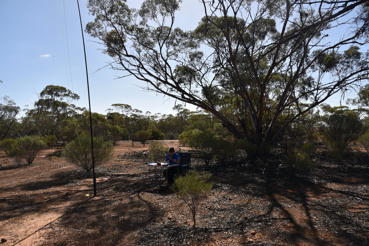
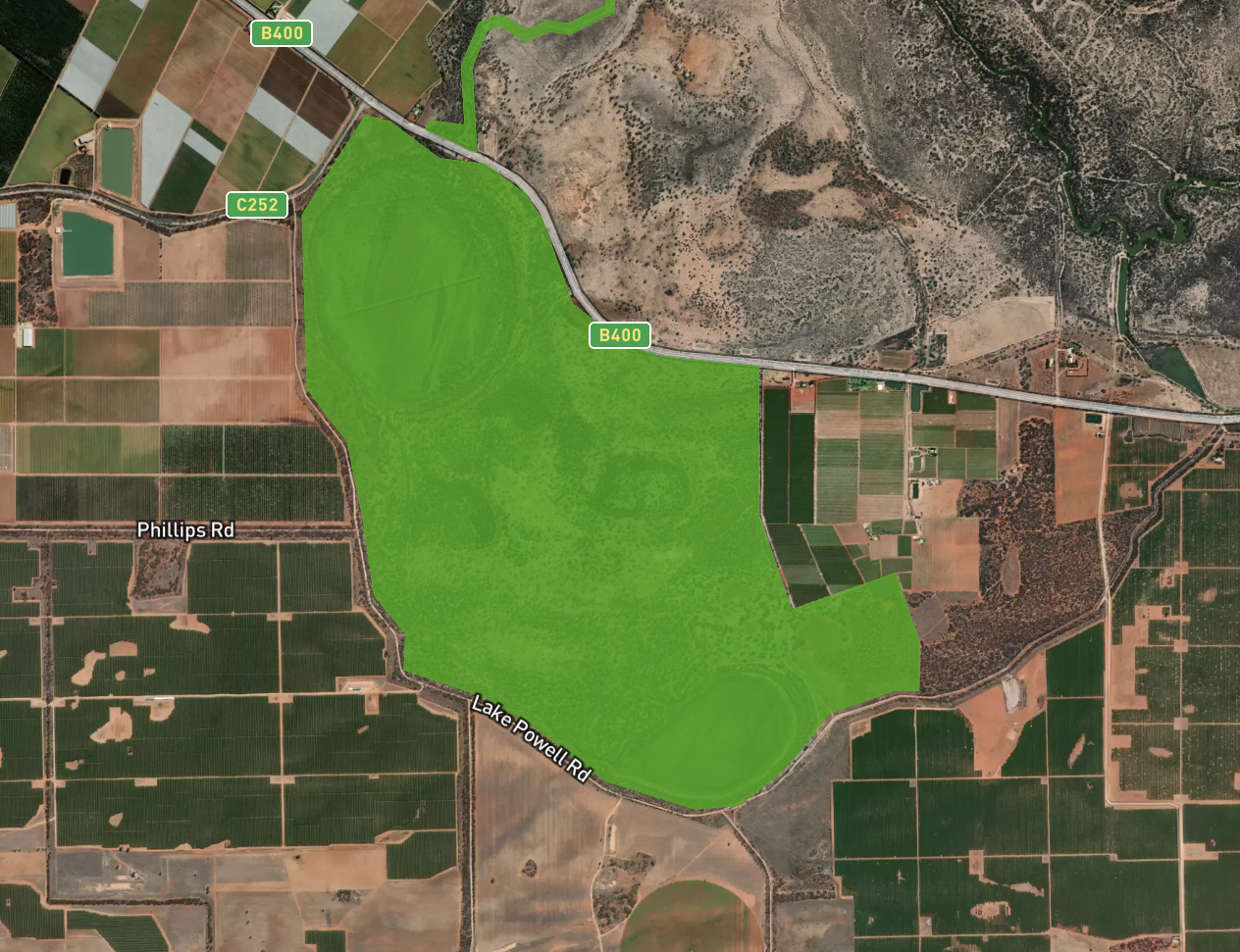
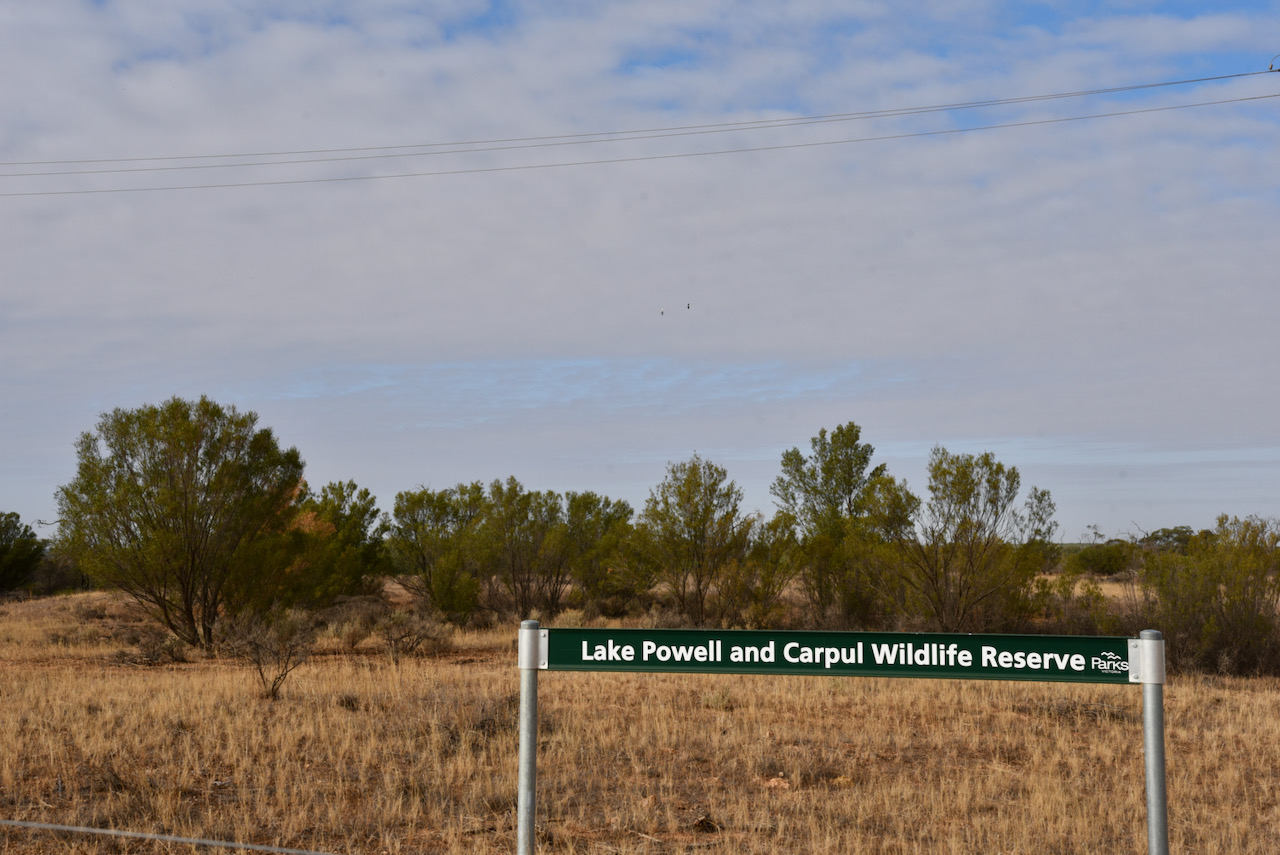
We then drove to our first park activation of the day, the Lakes Powell and Carpul Wildlife Reserve VKFF-2365. The park is located about 18km south-east of Robinvale.
This was to be a first time activation of the park by myself and Marija. Mike VK6MB activated the park previously in 2019.
Above:- Map showing the location of the Lakes Powell & Carpul Wildlife Reserve. Map c/o Protected Planet.
The park is about in 7.24 km² size and was established in 2002.
Above:- The borders of the Lakes Powell and Carpul Wildlife Reserve. Image c/o Protected Planet.
As the name suggests, the park contains two lakes, Lake Powell and Lake Carpul. They were both dry as a bone during our visit. When the lakes are full, over 60 species of native birds can be found at the park including Black Swans and Rainbow Bee Eaters.
During our visit to the park we had a Pied Butcherbird who propped himself/herself in a nearby branch and sang for most of our activation.
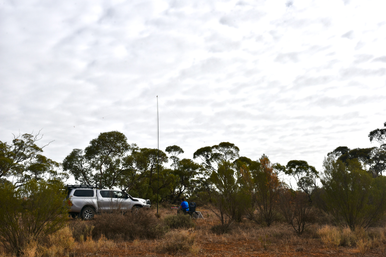
We drove a short distance into the park and set up in a clearing in amongst the scrub. As this was a relatively warm morning with a bit of sunshine through the clouds, we put out the solar panel to top up the battery.
We were set up at about 2330 UTC so we could take advantage of 30 minutes before the UTC rollover. Marija put a spot up for me on parksnpeaks and I called CQ on 7.144. First in the log was Peter VK3PF, with lots of QSB. This was followed by Deryck VK4FDJL who was activating the Millstream Falls National Park VKFF-0315.
Unfortunately callers were very few and far between and after many minutes of calling CQ and with just 5 contacts in the log, I swapped the mic with Marija. This was not looking like it was going to be a memorable park activation.
Marija then called CQ on 7.144 and this was answered by Peter VK3PF, followed by Andrei ZL1TM in New Zealand, and then Kimberly VK2KMI.
Marija logged just 5 stations on 40m as well and callers completely dried up, so we lowered the squid pole hoping that the 80m band might prove a little more fruitful.
Marija logged 6 stations on 80m from VK3 and VK5, with her 10th contact being a QSO with Adam VK5GA. I logged 12 contacts on 80m, with my 10th QSO being with Peter VK3KAI.
I then headed to 20m and called CQ on 14.310 for about 5 minutes but had absolutely no takers. So feeling a little disappointed, I headed back to 7.144 on the 80m band, not really expecting to get many callers.
To my surprise, the number of park hunters picked up and I started to feel it was possible to push on and get 44 contacts.
It took me about 70 minutes, but contact number 44 finally came, a contact with Peter VK3KAI. Thanks Peter for your second callsign, it was greatly appreciated in what was a difficult activation.
Marija worked the following stations on 40m SSB:-
VK4FDJL (Millstream Falls National Park VKFF-0315)
VK3PF
ZL1TM
VK2KMI
VK3UH
Marija worked the following stations on 80m SSB:-
VK3PF
VK3KAI
VK5HS
VK2YK/5
VK5GA
VK5IS
I worked the following stations on 40m SSB before the UTC rollover:-
VK3PF
VK4FDJL/p (Millstream Falls National Park VKFF-0315)
VK2MET
VK2iO
VK7ZGK
I worked the following stations on 80m SSB before the UTC rollover:-
VK5IS
VK2YK/5
VK5GA
VK3PF
VK3KAI
VK5HS
VK5FANA
I worked the following stations on 80m after the UTC rollover:-
VK3PF
VK3KAI
VK5BJE
VK3PI
VK3MCK
I worked the following stations on 40m after the UTC rollover:-
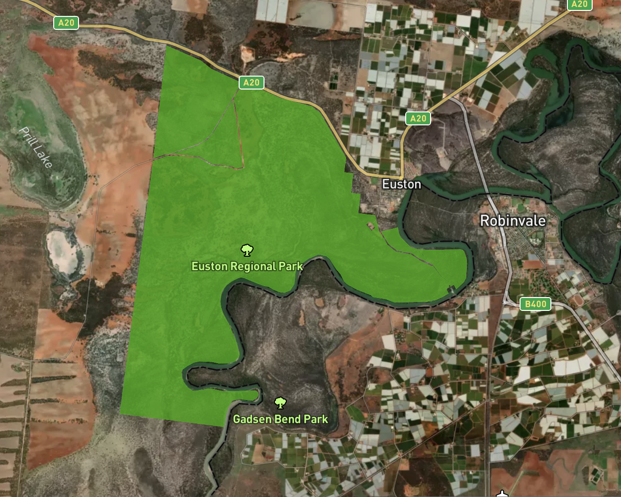
After leaving Mungo National Park Marija and I drove back into the little town of Euston. It was about 5.00 p.m. New South Wales local time and we decided to do a quick activation of the Euston Regional Park VKFF-1782.
The park is located adjacent to the town of Euston in the far west of New South Wales. It is about 80 kilometres east of Buronga and about 80 kilometres west of Balranald.
Above: – Map showing the location of the Euston Regional Park. Map c/o Protected Planet.
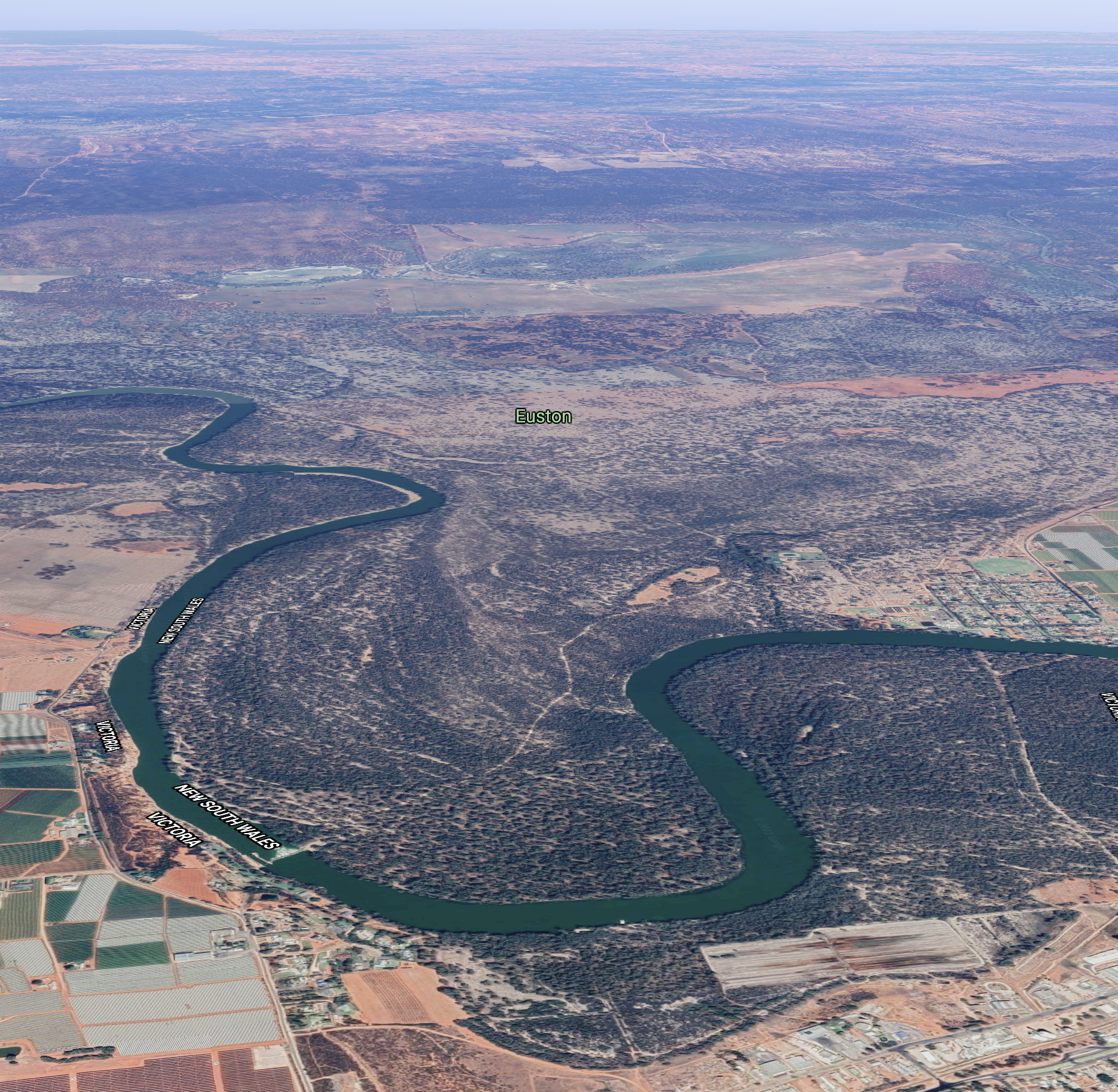
Euston is a beautiful little town situated on the banks of the Murray River. It is the twin town of Robinvale on the Victorian side of the river. Prior to the irrigation development at Robinvale, Euston was the main town in the area.
Below is a short video showing the Euston and Robinvale area.
The Euston Regional Park is about 32.45 km² in size and was established on the 1st day of July 2010. The eastern side of the park abuts the Murray River (the State border between New South Wales and Victoria).
Above:- An aerial view of the Euston Regional Park on the border between Victoria and New South Wales. Image c/o Protected Planet
Before becoming the Euston Regional Park, the park was known as the Euston State Forest and was dedicated in 1959 for the purposes of timber production and other permitted uses including beekeeping, grazing, and sand quarrying.
In 2009 the Riverina Bioregion Regional Forest Assessment for River Red Gums and Woodland Forest, conducted by the Natural Resources Commission in 2009 (NRC 2009), recommended the area be managed for conservation and recreation.
The park consists of river red gum forest and includes plant communities that are poorly represented at a national level in the reserve system which include River Red Gum – Black BoxWoodlands and Chenopod – Mallee Shrublands.
The park provides habitat for a range of native animal species including several that are dependent on mature river red gum trees and associated hollows. Threatened species recorded in the park include the southern bell frog and the eastern subspecies of the Regent Parrot.
Above:- An aerial view of the Euston Regional Park. Image c/o Google maps
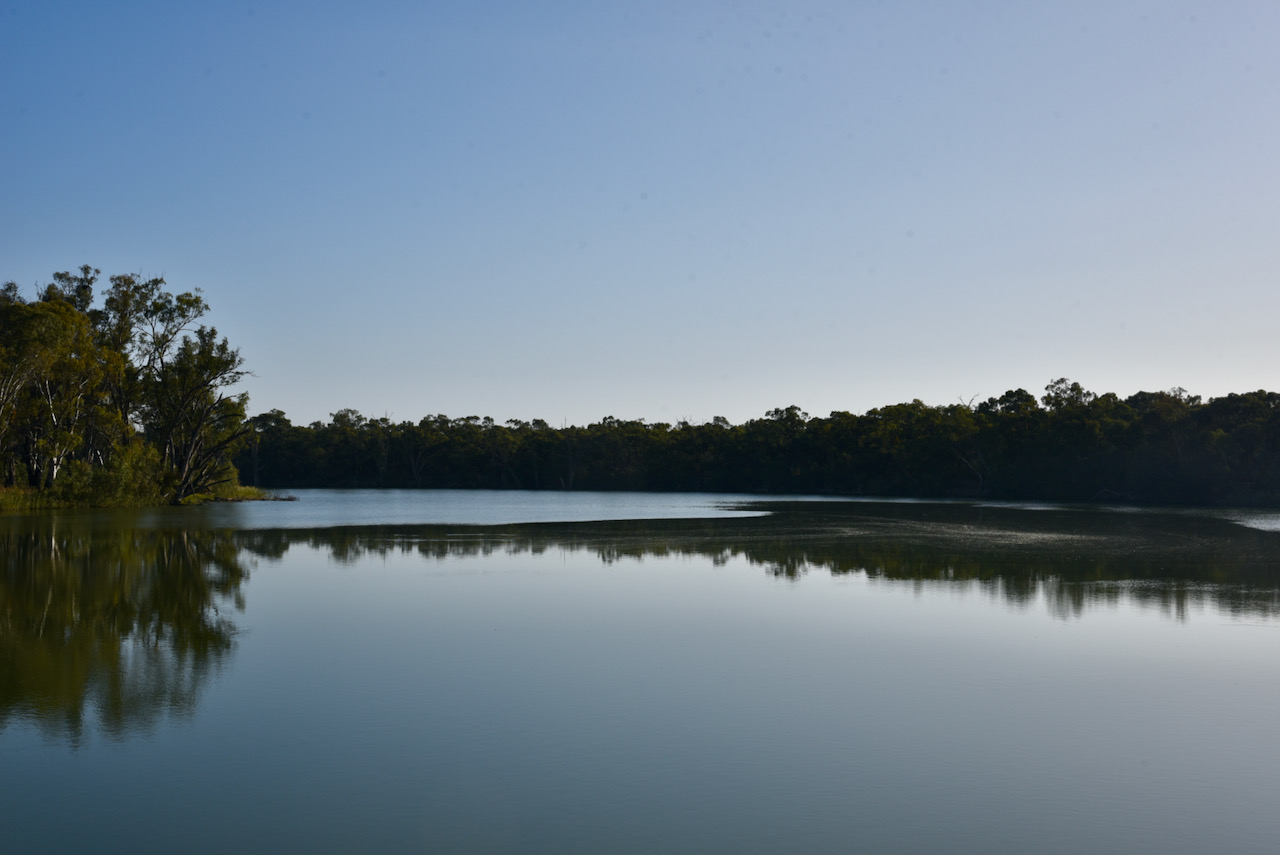
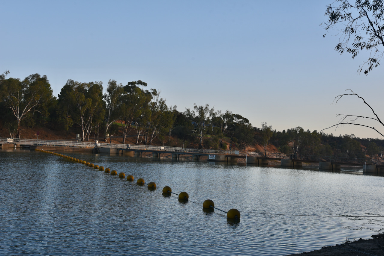
We set up near the Euston Robinvale Lock and Weir 15 which was constructed between 1932 and 1936. The weir pool stretches back 60 km to Meilman East. About 32,000 mega lites of water flows through this system daily. It was the last lock to be built on the Murray River system.
After setting up, Marija popped up a spot for me on parksnpeaks, and I started calling CQ on 7.105. First in the log was Gerard VK2IO, followed by Bill VK3CWF, and then Andrei ZL1TM in New Zealand.
Contact number ten came just 6 minutes into the activation, with a contact with Ian VK5IS in the mid north of South Australia.
I logged a total of 53 stations on 40m from VK1, VK2, VK3, VK4, VK5, VK6, and VK7, and New Zealand.
It was time for Marija to qualify the park and Marija soon had a little pile up going. Contact number ten was just 5 minutes into the activation, with a QSO with Adrian VK5FANA.
Marija logged a total of 40 stations on 40m before callers quickly dried up, so we headed to the 80m band. We were pushed a bit for time as we needed to get back to Robinvale for an evening meal.
On 80m we logged a total of 17 stations from VK1, VK2, VK3, and VK5. Marija’s 44th contact was with Adam VK2YK on 80m.