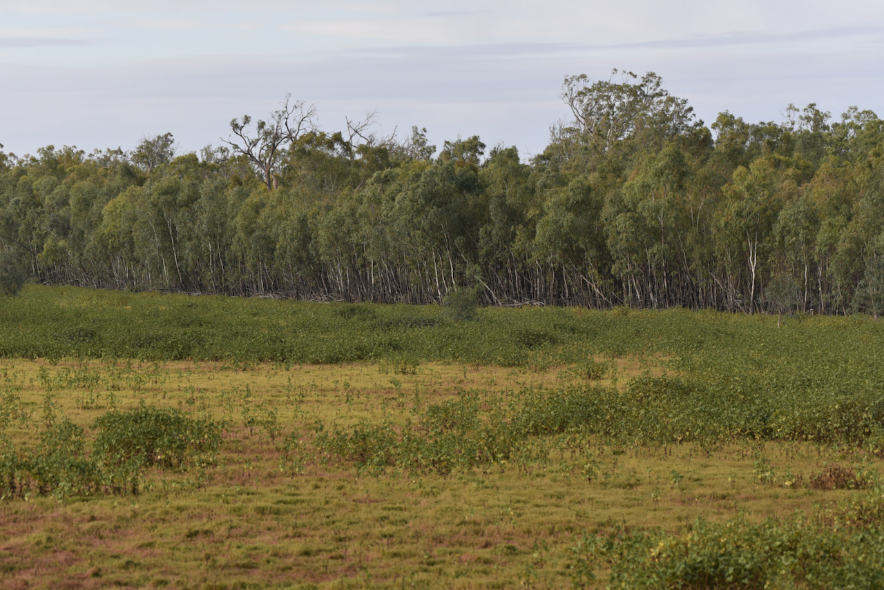
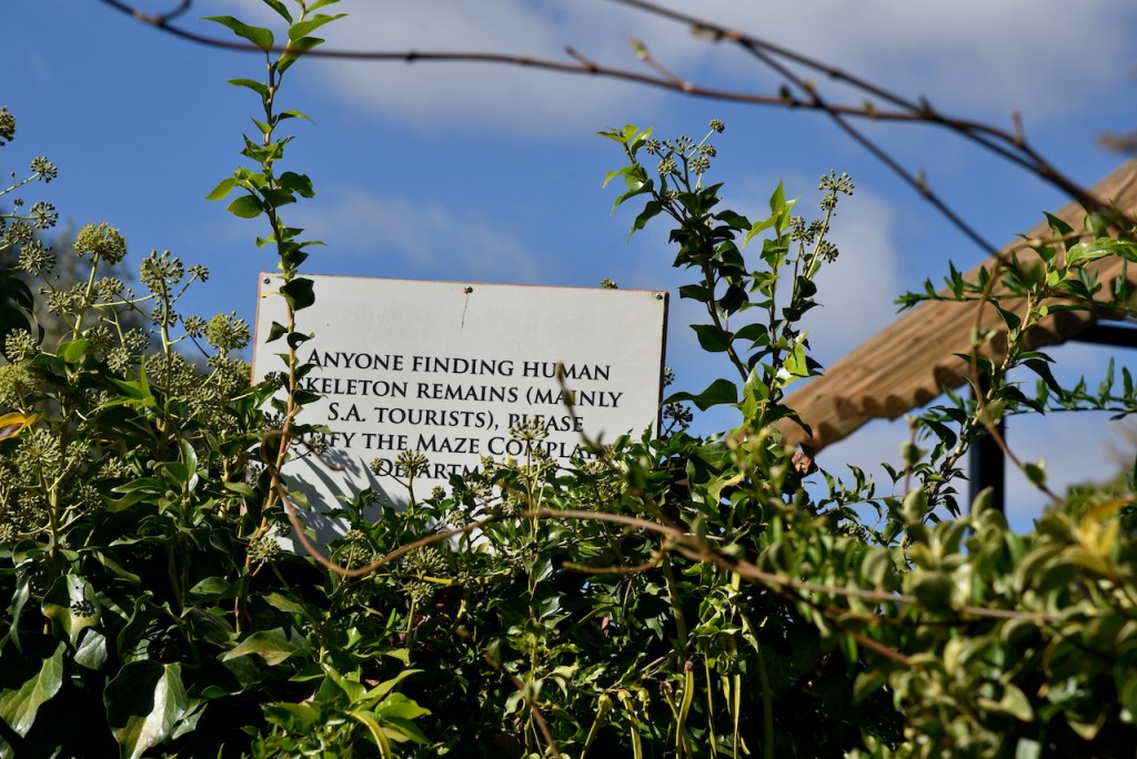
It was now day nine (Wednesday 14th April 2021). Our plans today were a revisit to the Merbein South Flora Reserve, a visit to Trentham EstateWinery, and an afternoon activation of the Kemendok National Park.
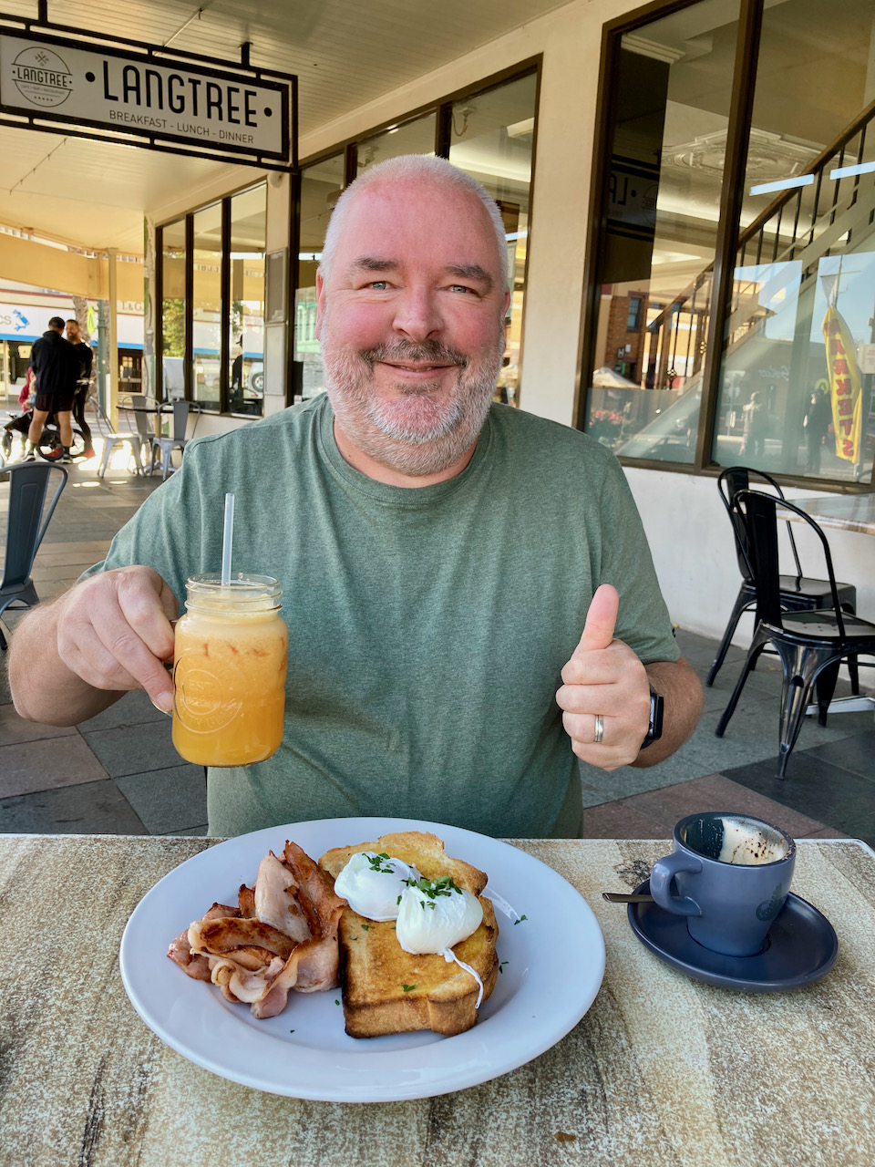
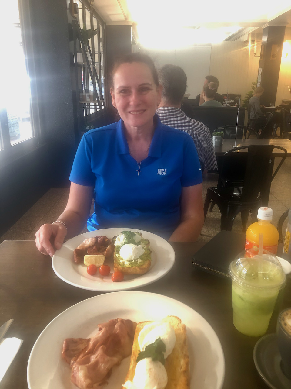
We started the day with breakfast again at the Langtree cafe for breakfast.
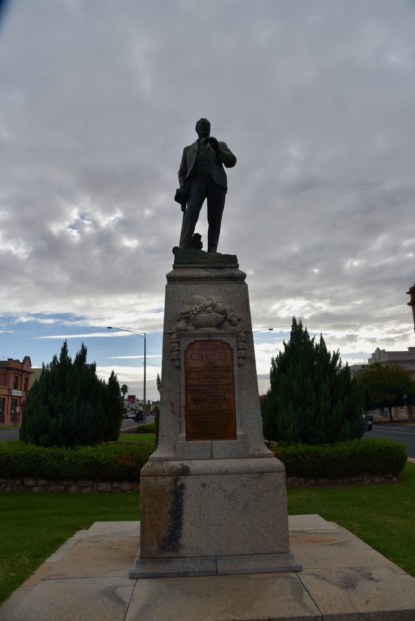
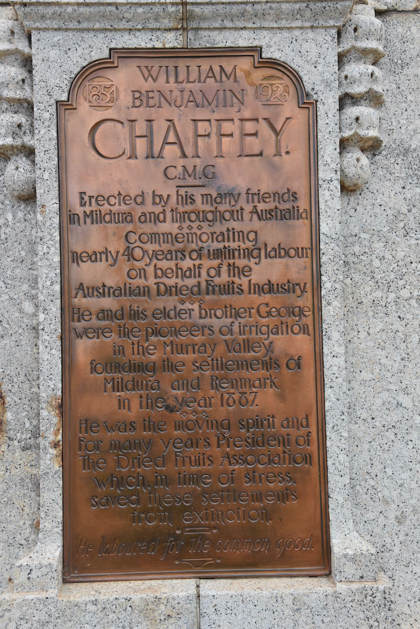
We also visited the W.B. Chaffey statue in Mildura. It was erected by his many friends in Mildura and throughout Australia.
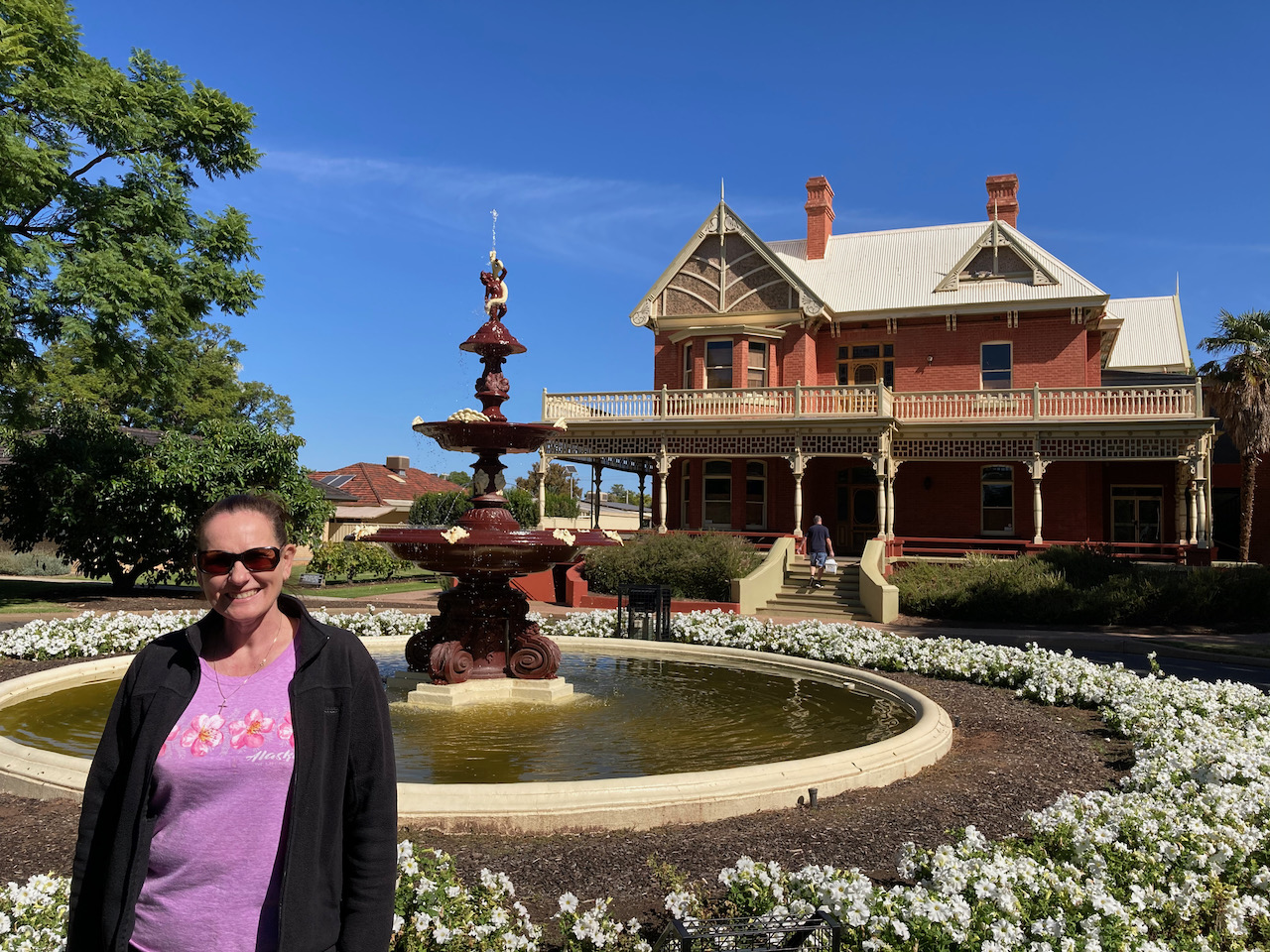
We also had a look at the Chaffey fountain in Mildura. This is the original fountain. A replica is located in front of Rio Vista House. The fountain was turned off and remained idle following the tragic drowning of one of the Chaffey children in 1897. The fountain was later donated to the people of Mildura in 1936.
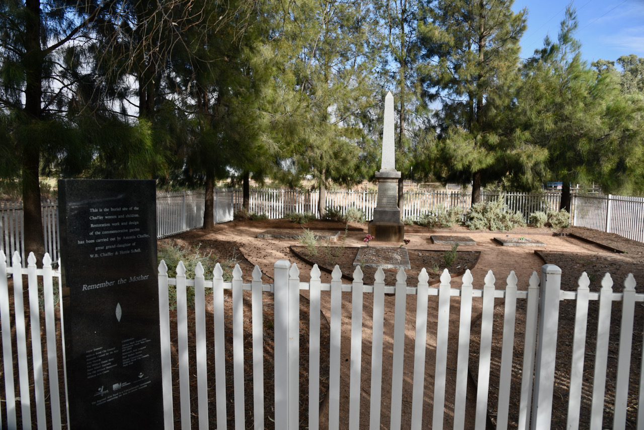
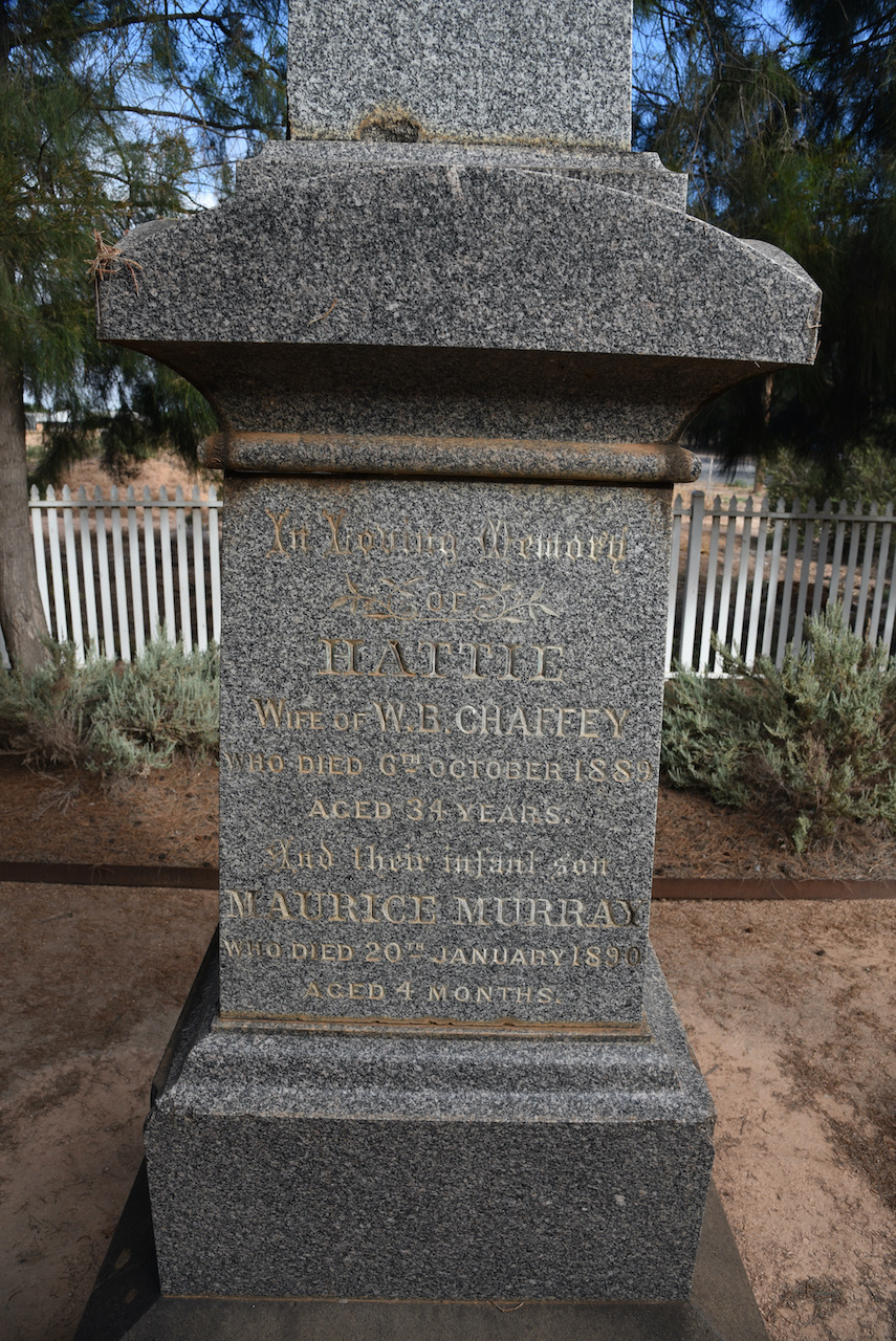
Our next stop was the Mildura Homestead cemetery which consists of two adjacent graveyards. The earliest contains the graves of Joseph Hawdon and the other where the Chaffey women are buried. One solitary grave stood in the Homestead cemetery, the first cemetery in Mildura, for nearly 40 years. In 1848, John Hawdon, a former employee at Kulnine Station, fell from his horse. He later died in a tent on the riverbank. John was the son of Joseph Hawdon who, with MC Bonney, drove 340 cattle from Melbourne to Adelaide along the Murray, passing Mildura early in 1838.
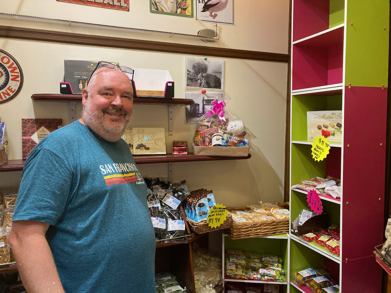
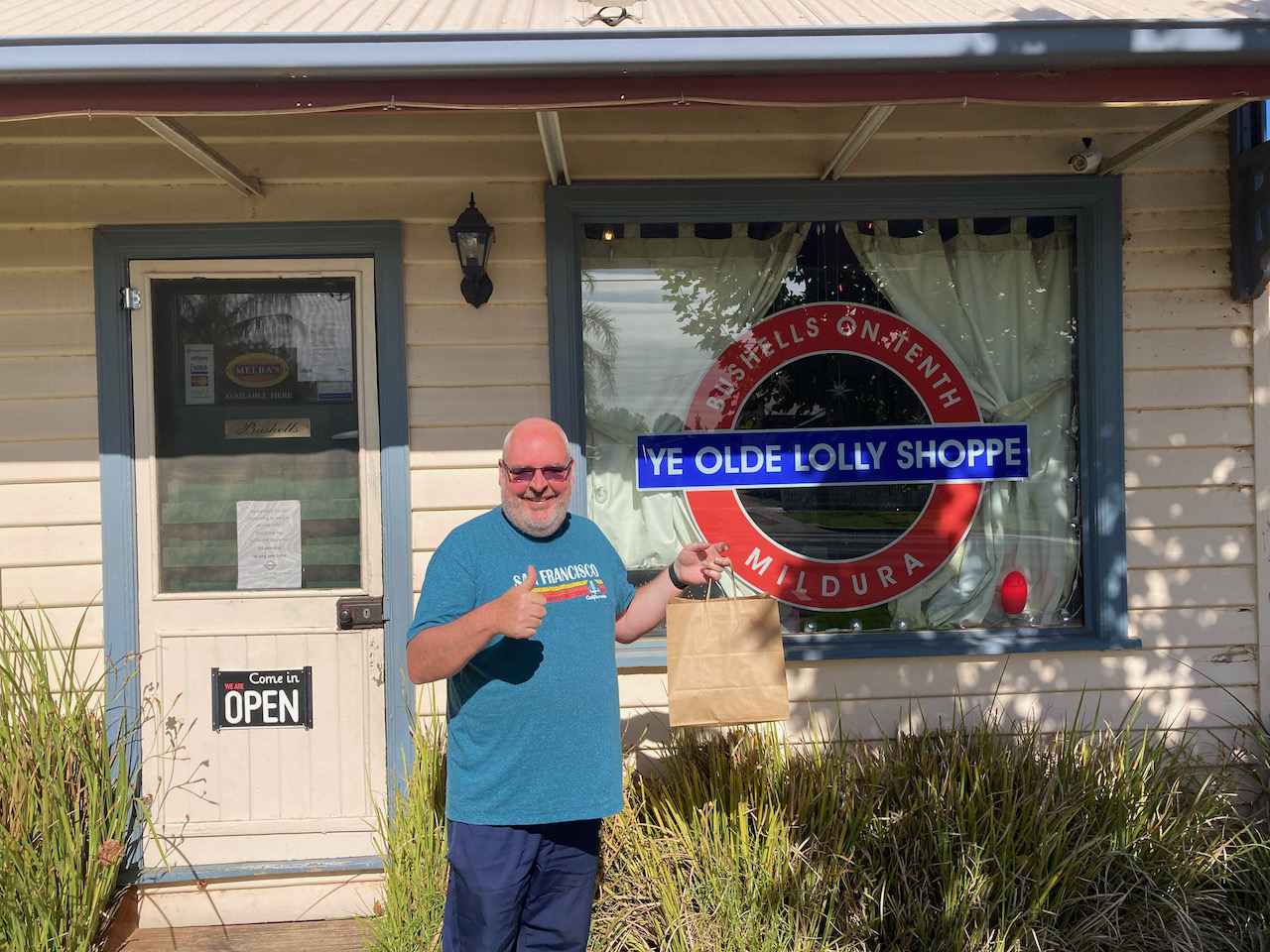
We then indulged our sweet tooth propensity and visited the Ye Olde Lolly Shoppe in Mildura. It was like stepping back in time with all different sorts of lollies and chocolates. The shop was Mildura’s original lolly shop and was first opened in 1938. The shop continues to operate with all the original fittings and magic of old fashioned stores providing over 4000 lines of confectionery from all over the world.
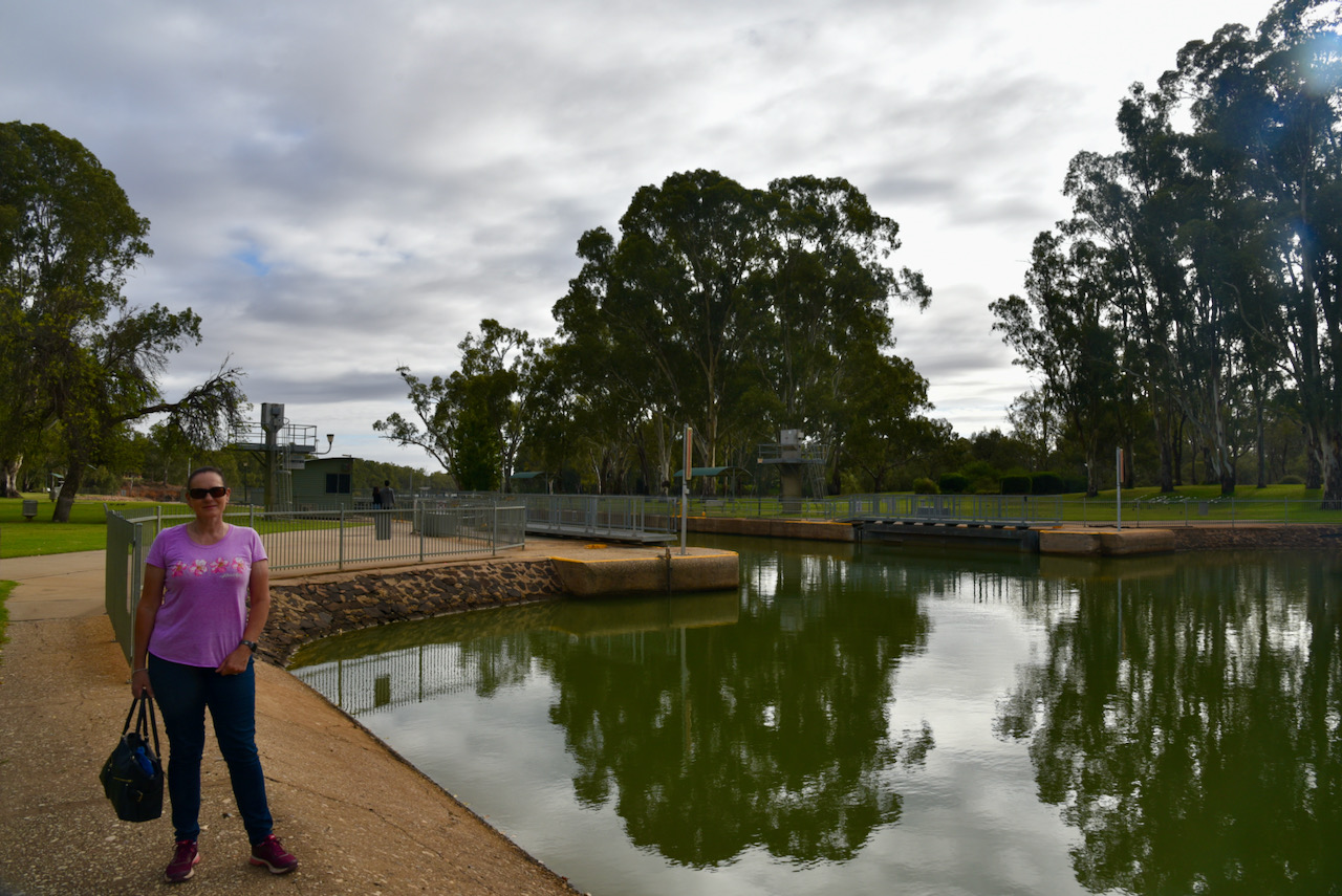
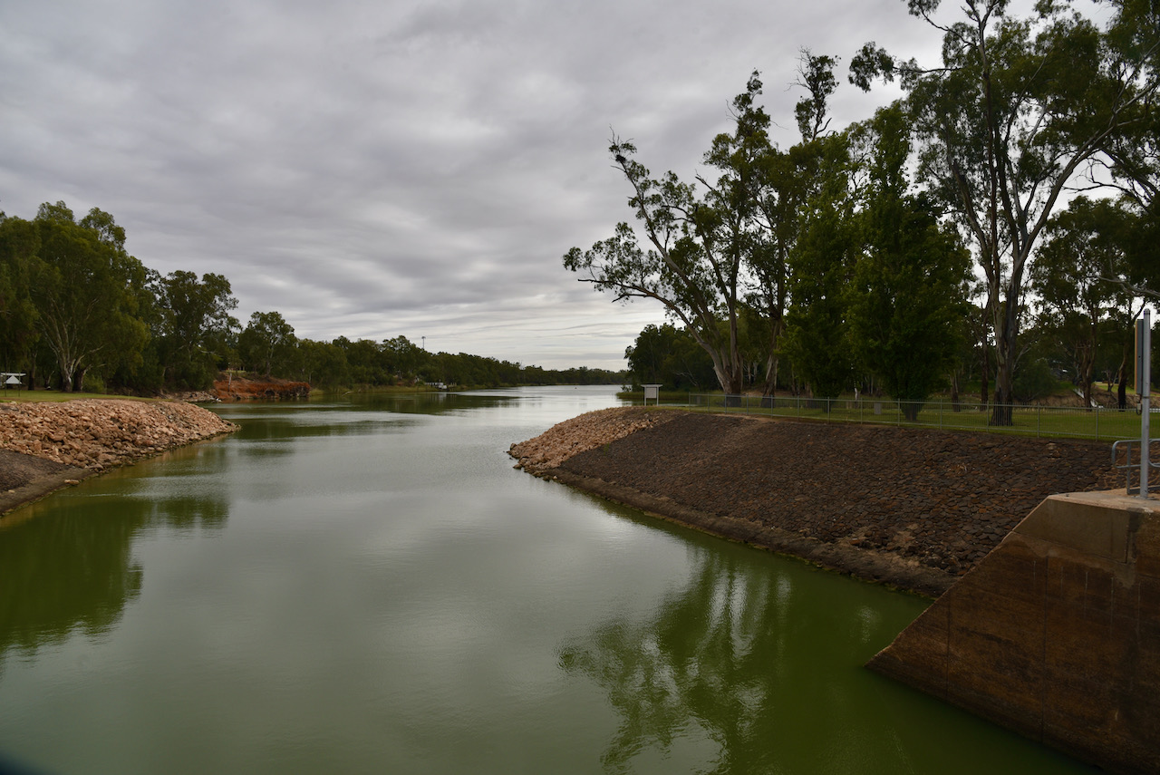
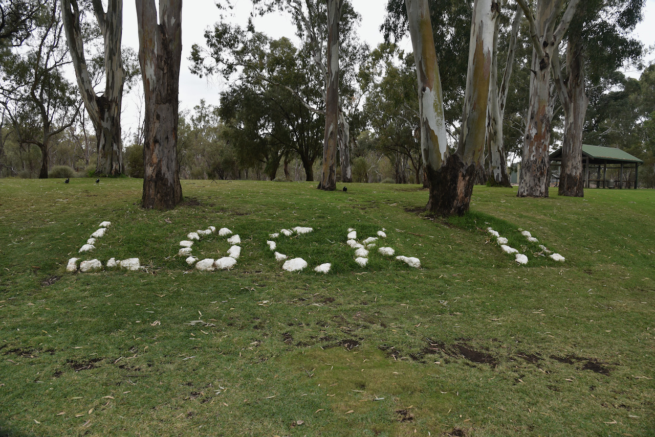
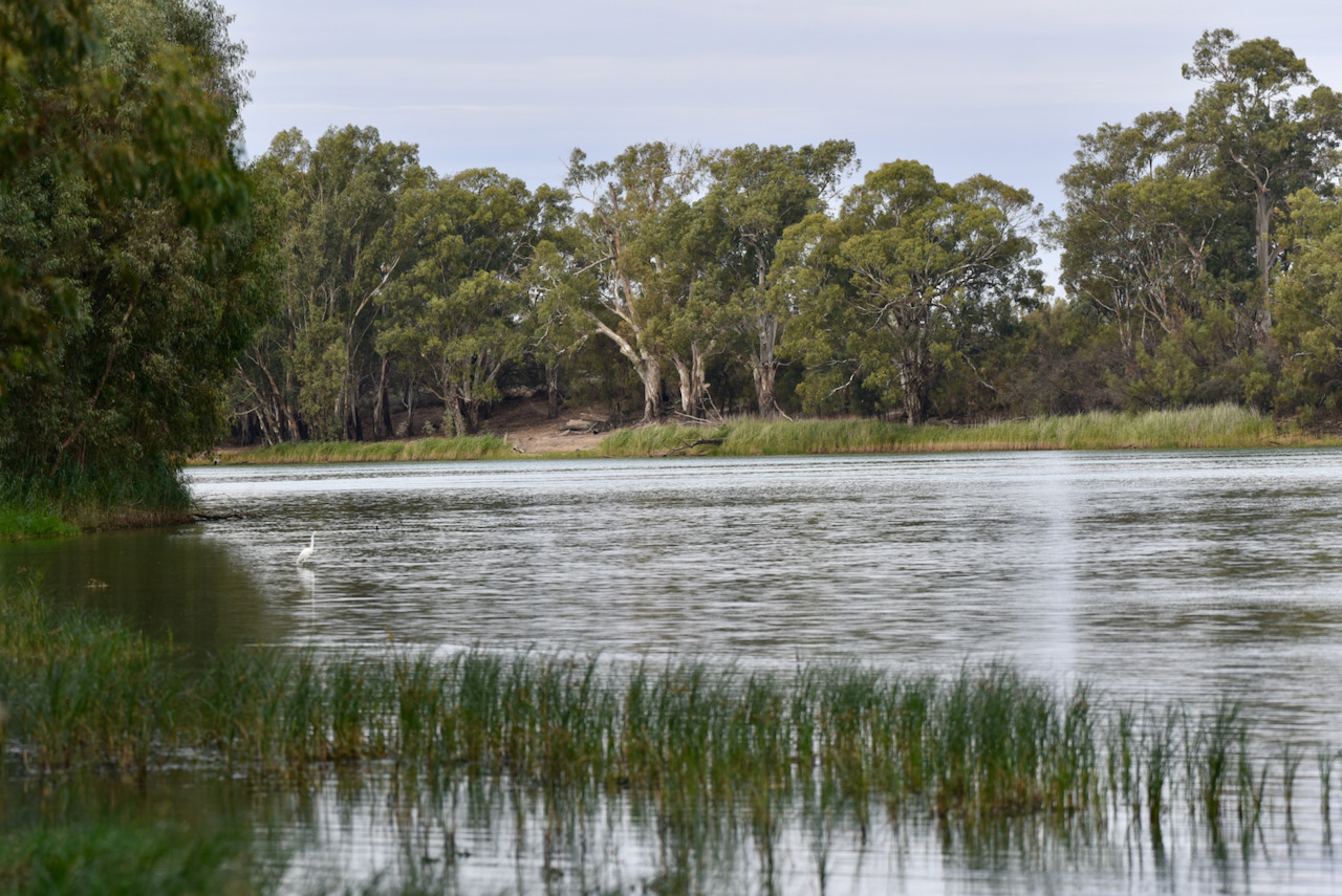
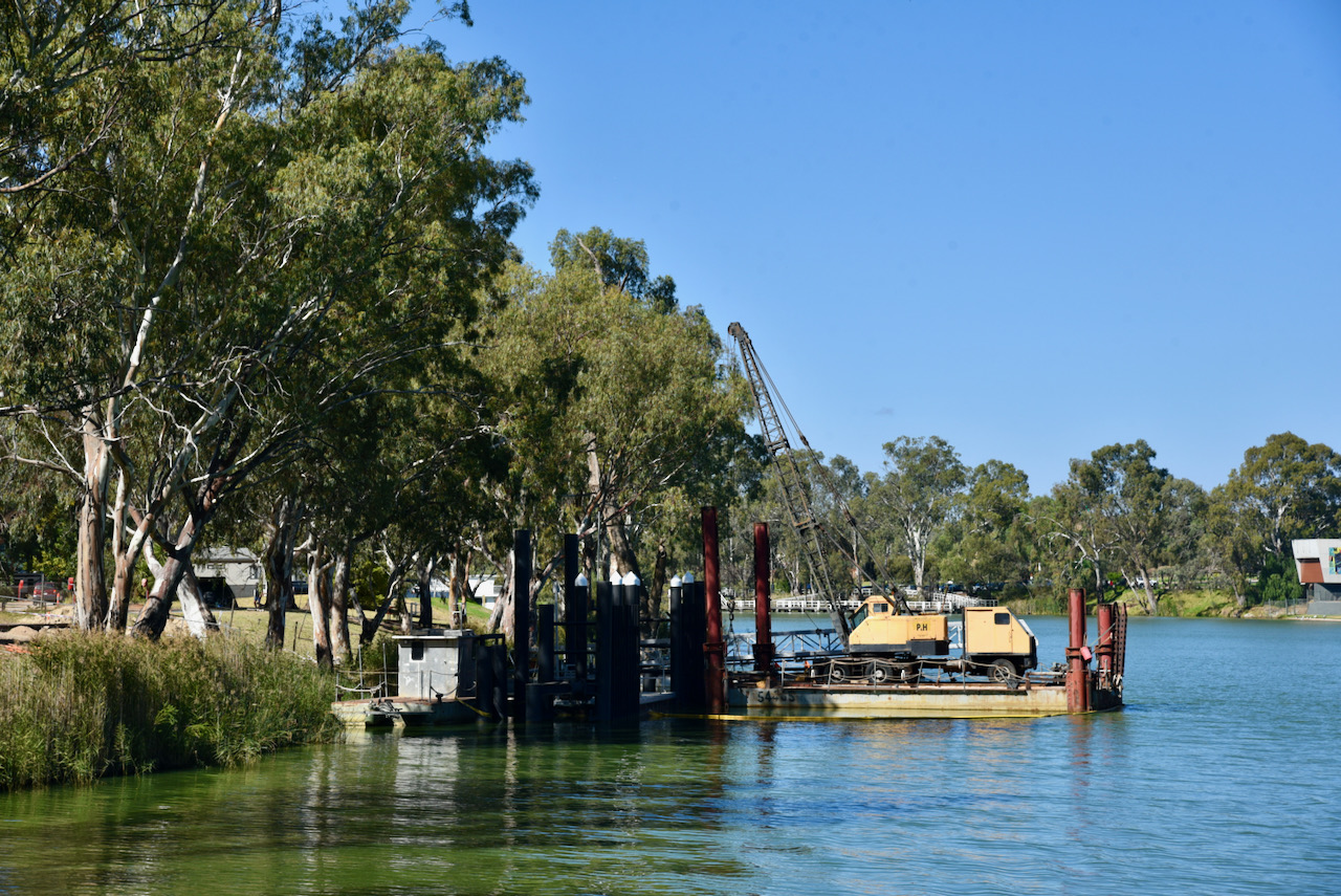
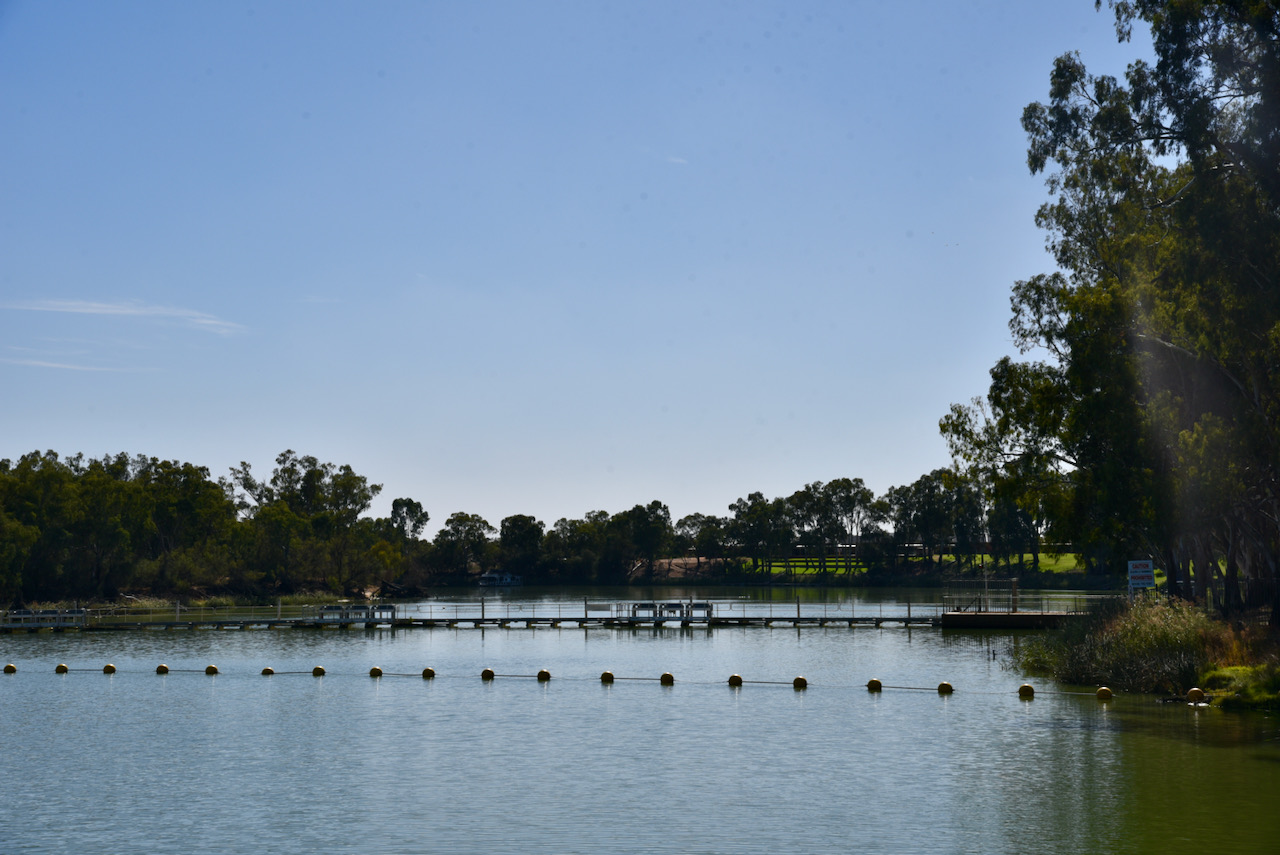
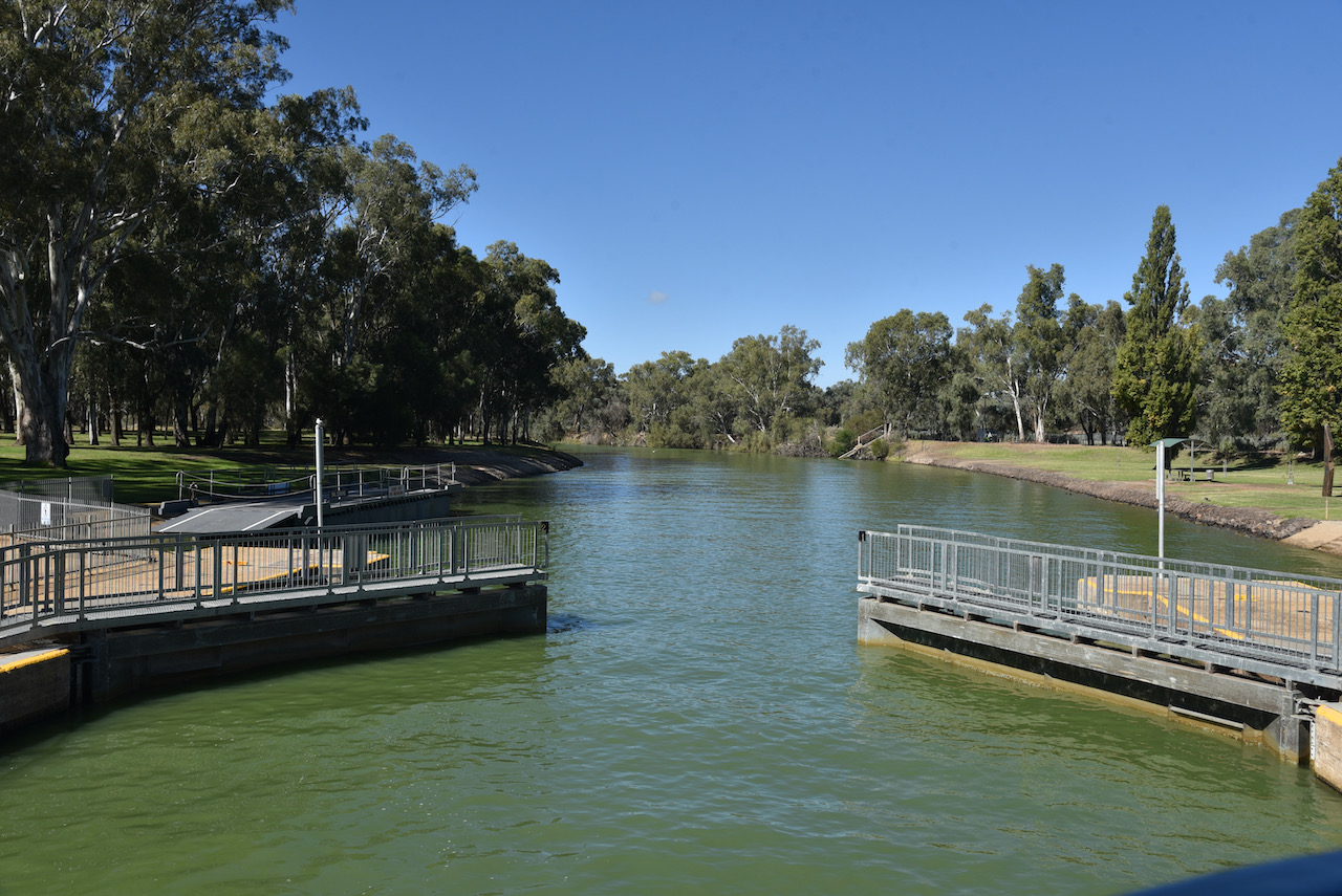
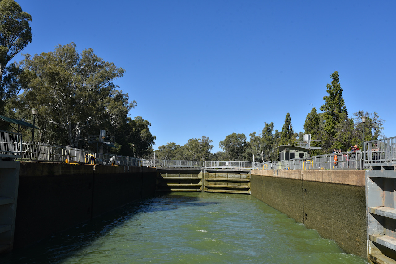
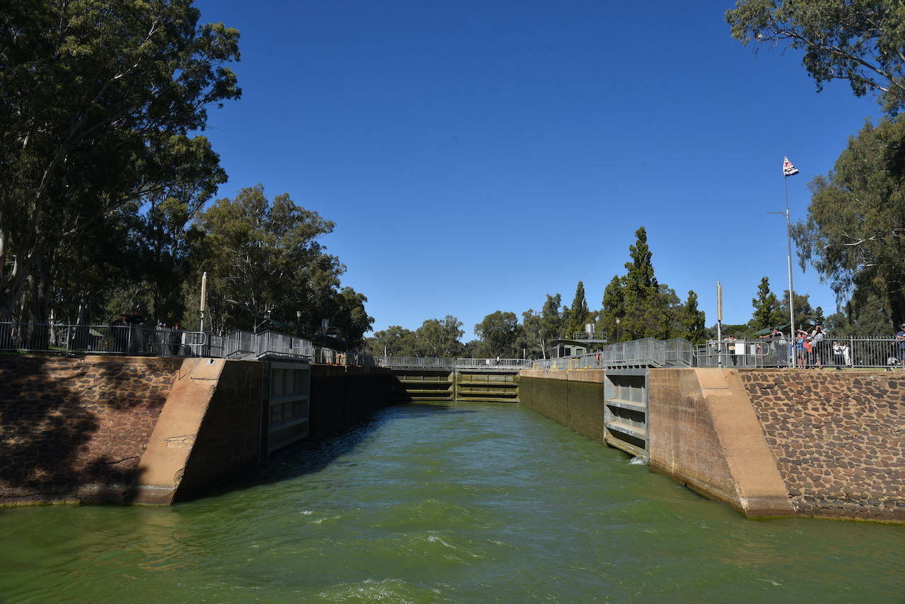
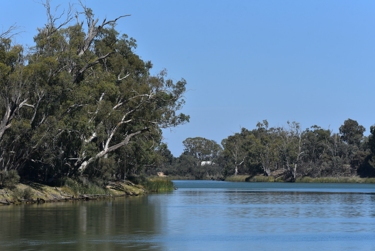
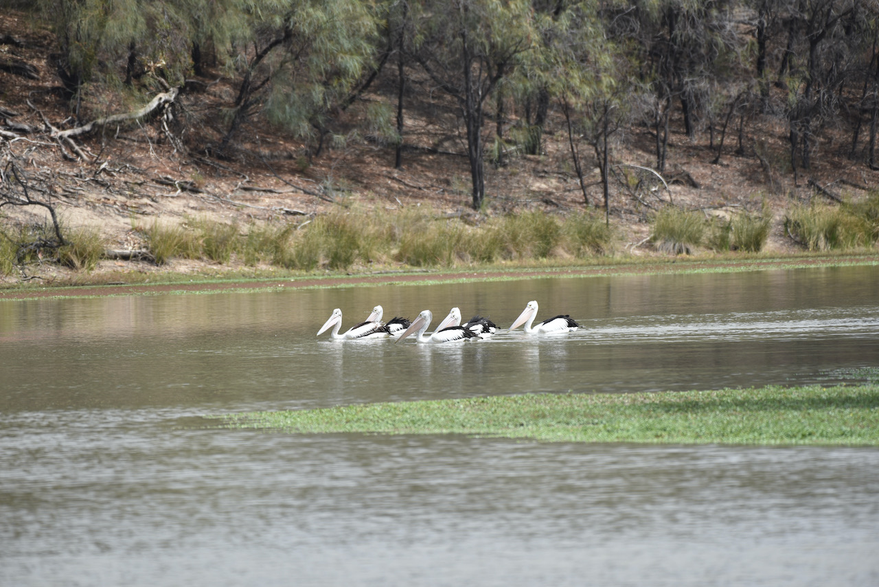
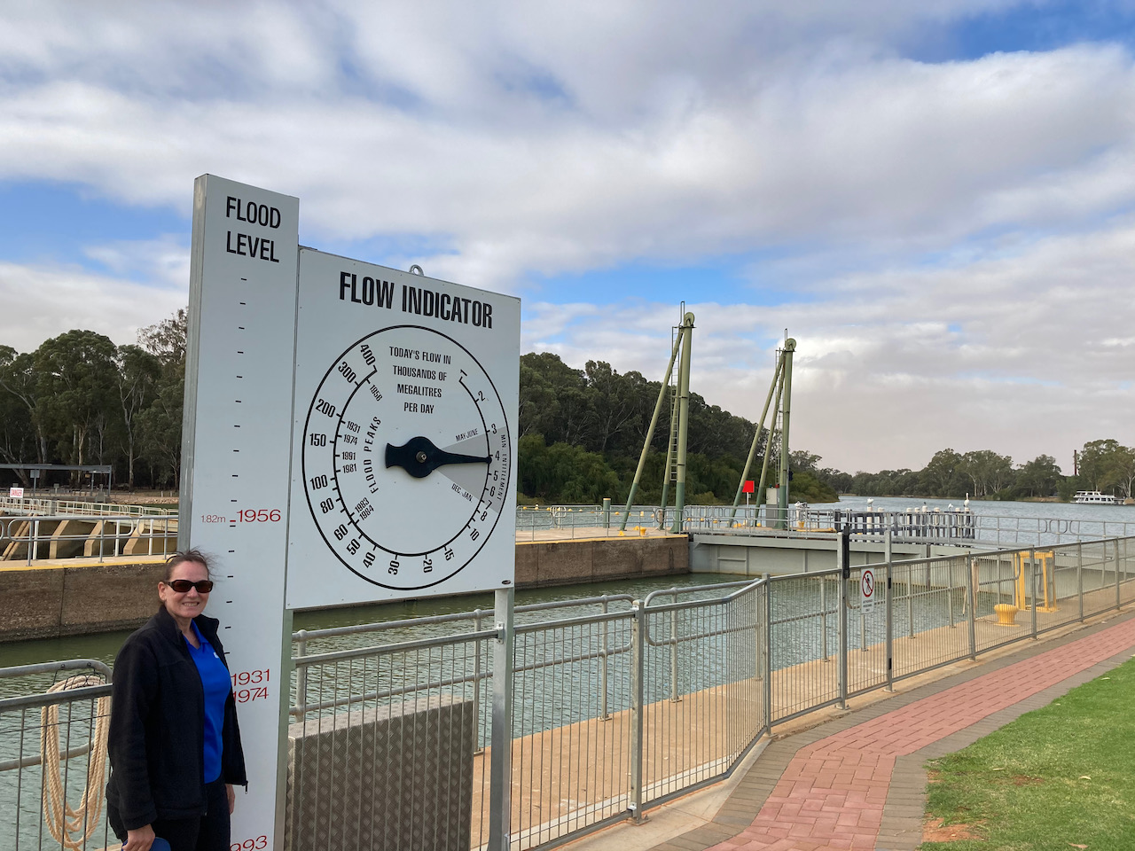
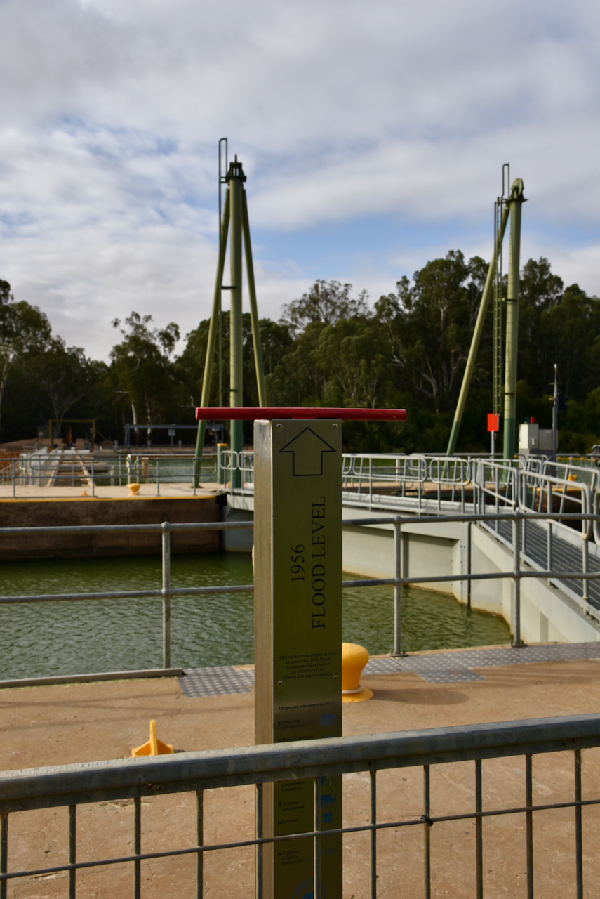
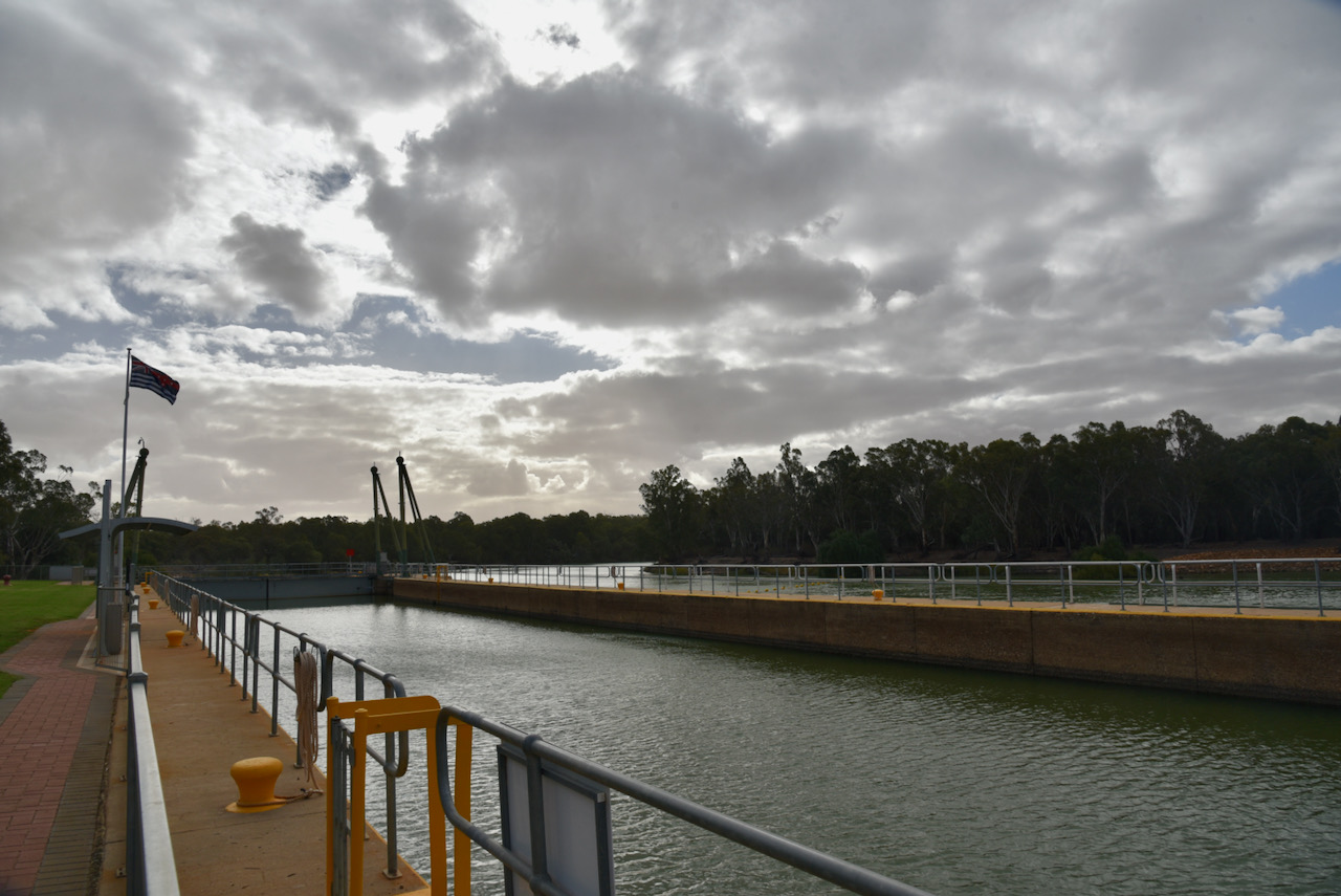
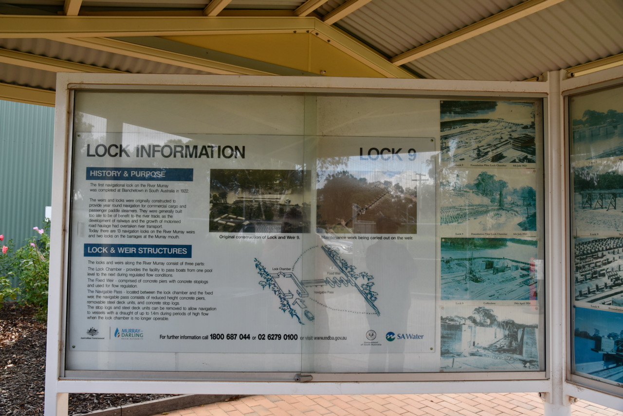
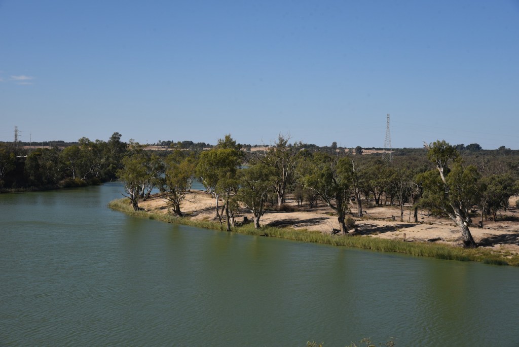
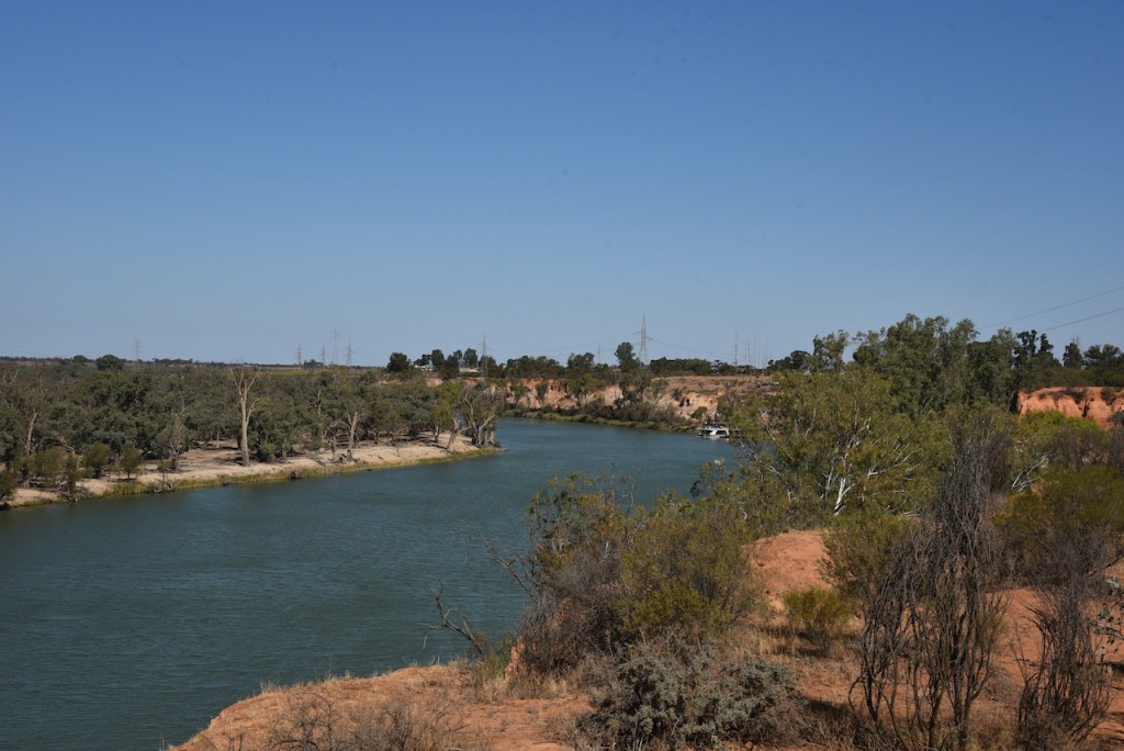
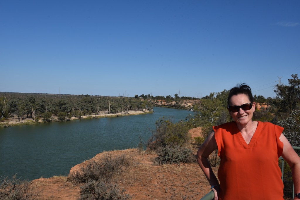
We then headed to Lock 11 and the Mildura Weir. The Mildura Weir was constructed between 1923 and 1927. It is a Dethridge type weir comprising 24 steel trestles, each weighing about 11 tonnes. Lock 11 is unique in that the lock was built inside a bend of the river, with the weir in the bend itself. A channel was dug to the lock, creating an island between it and the weir.
Lock 11 is a concrete chamber 61.54m long, 17.1 m wide and 7.6, deep. Each of the four steel lock gates is 9.4m, 6.9m high, and is made of 12mm steel plate and weighs 18 tonnes.
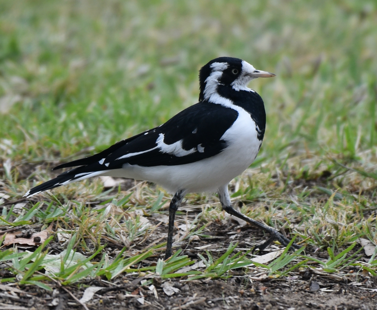
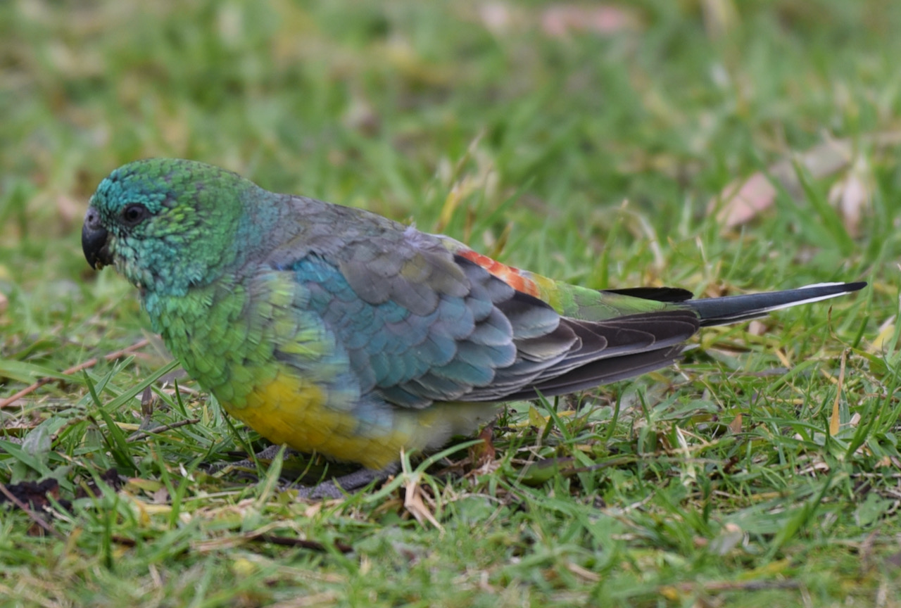
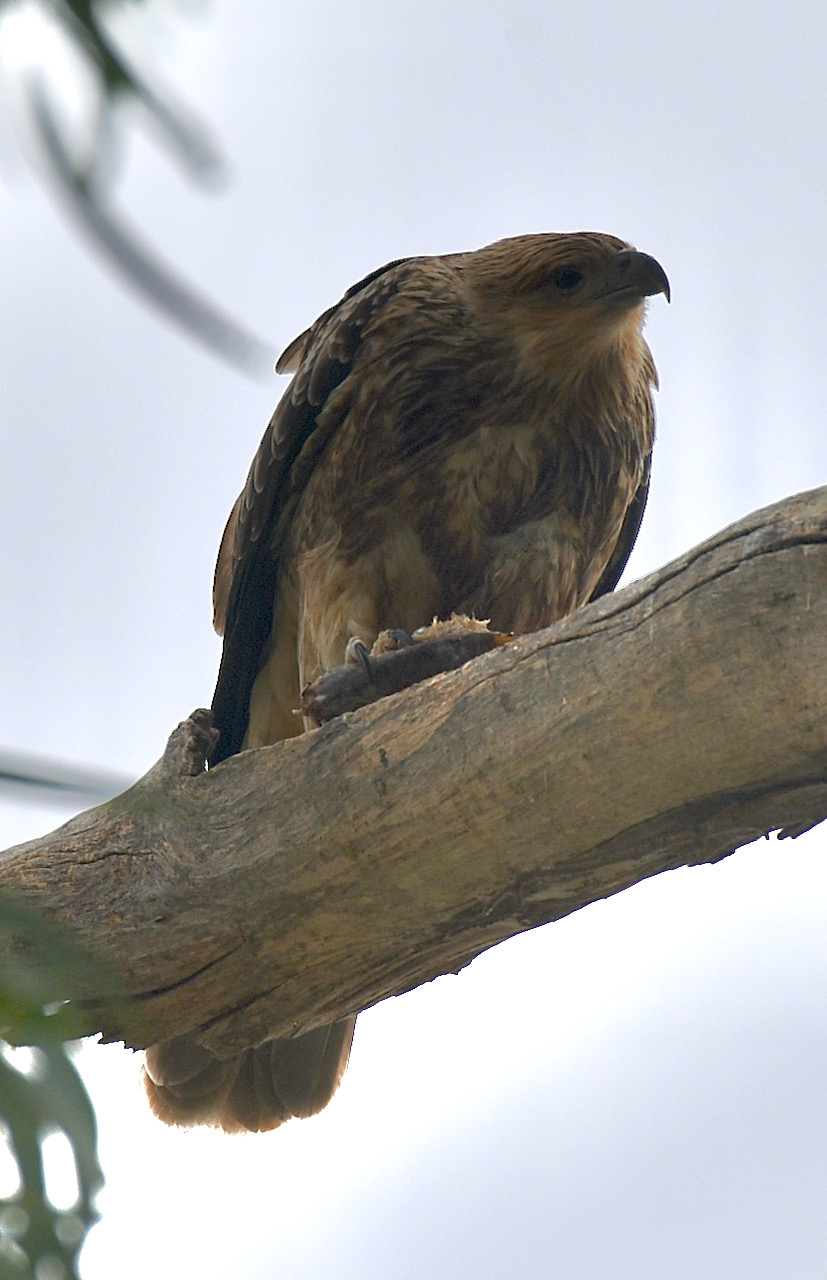
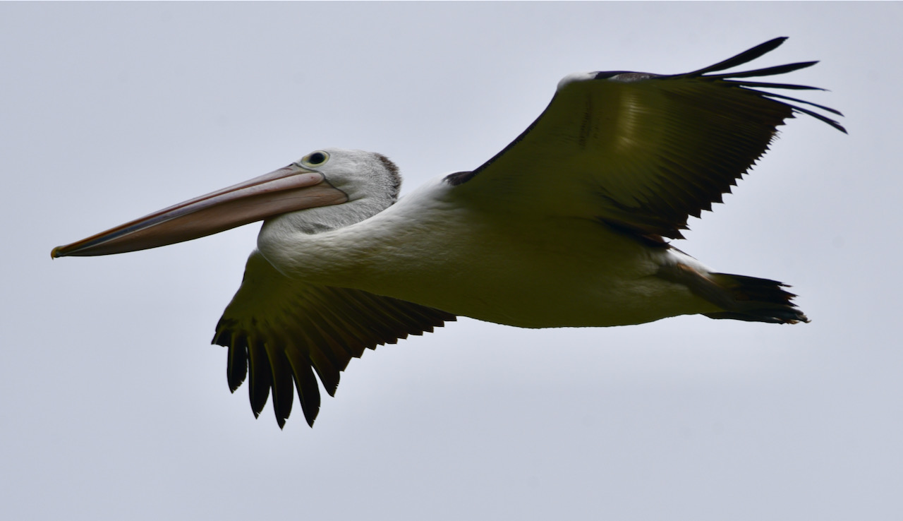
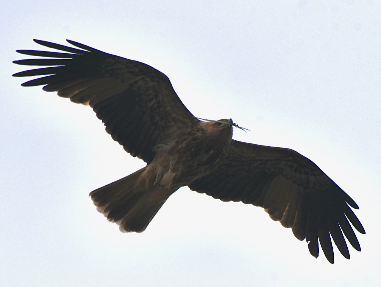
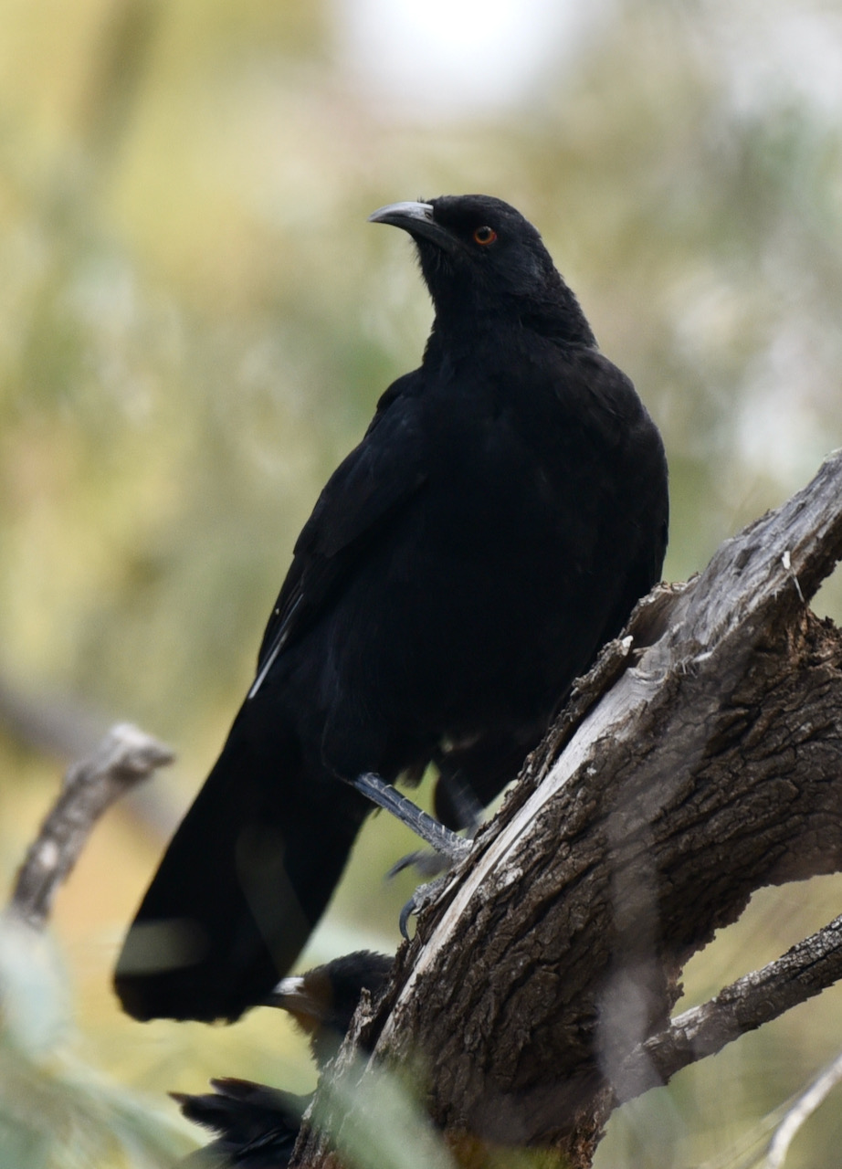
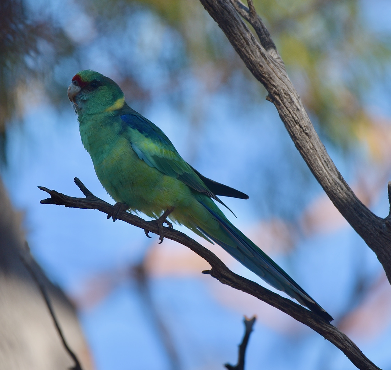
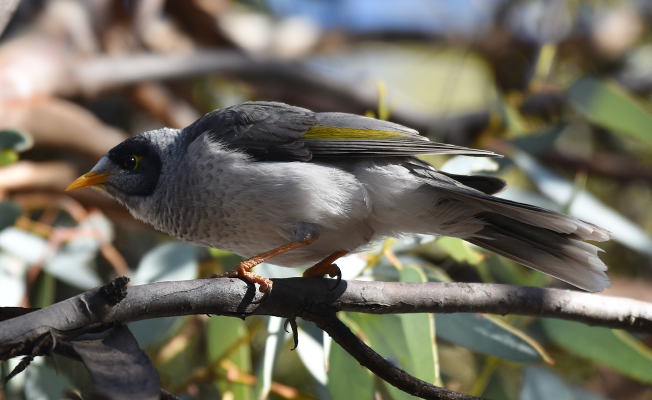
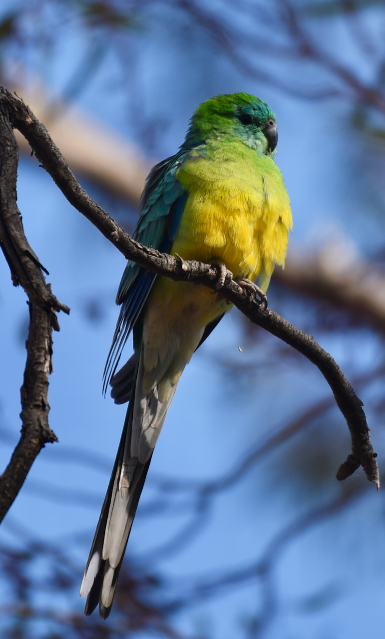
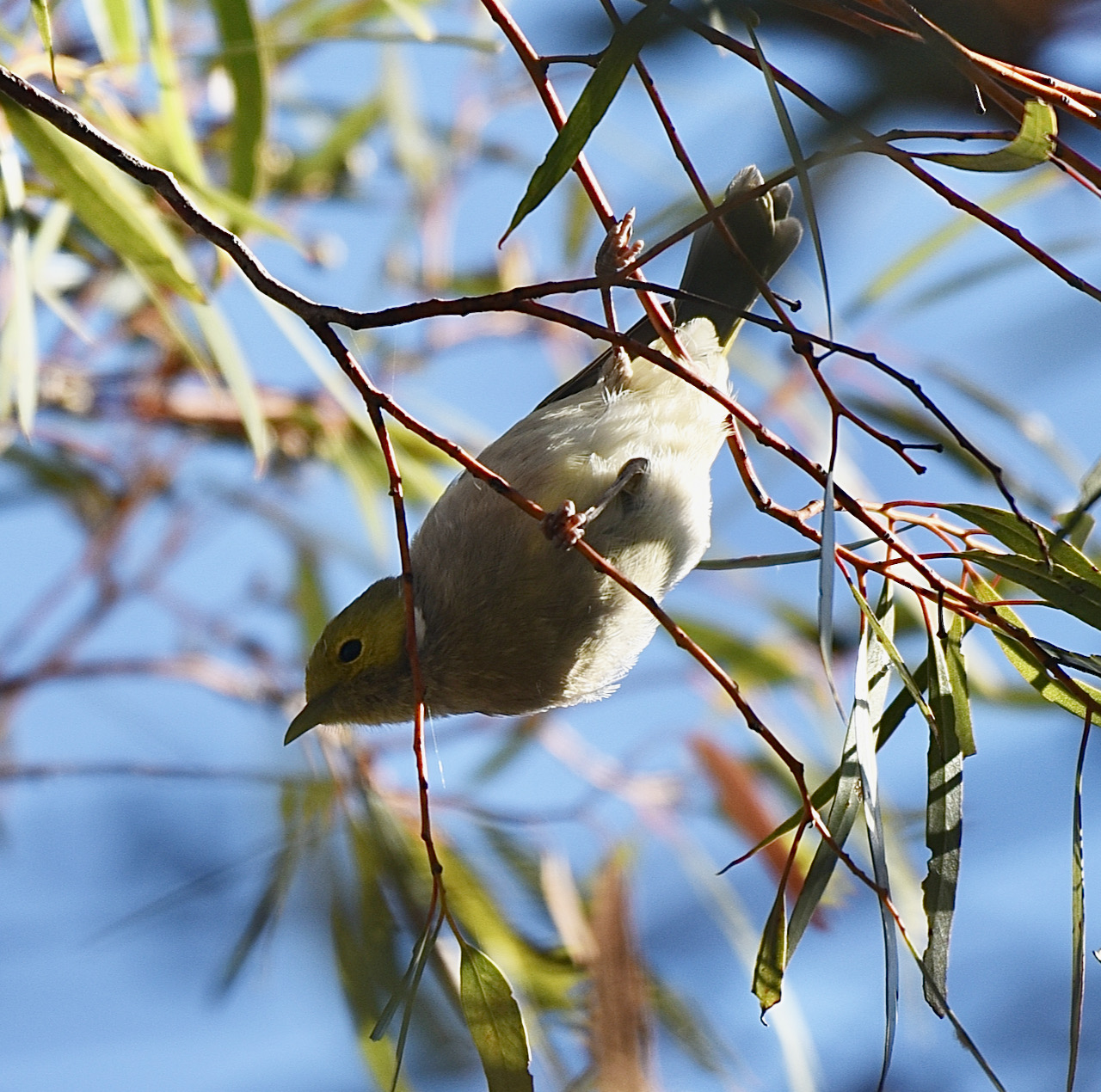
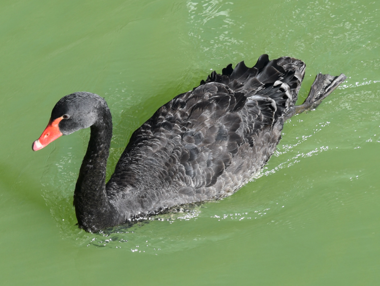
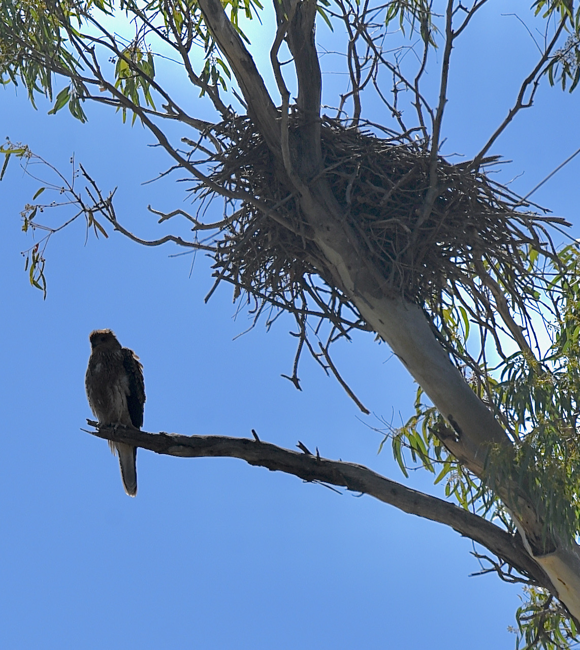
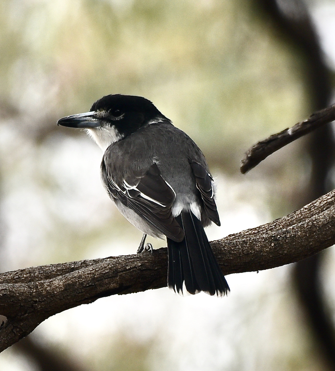
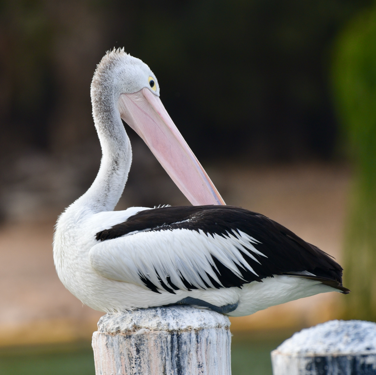
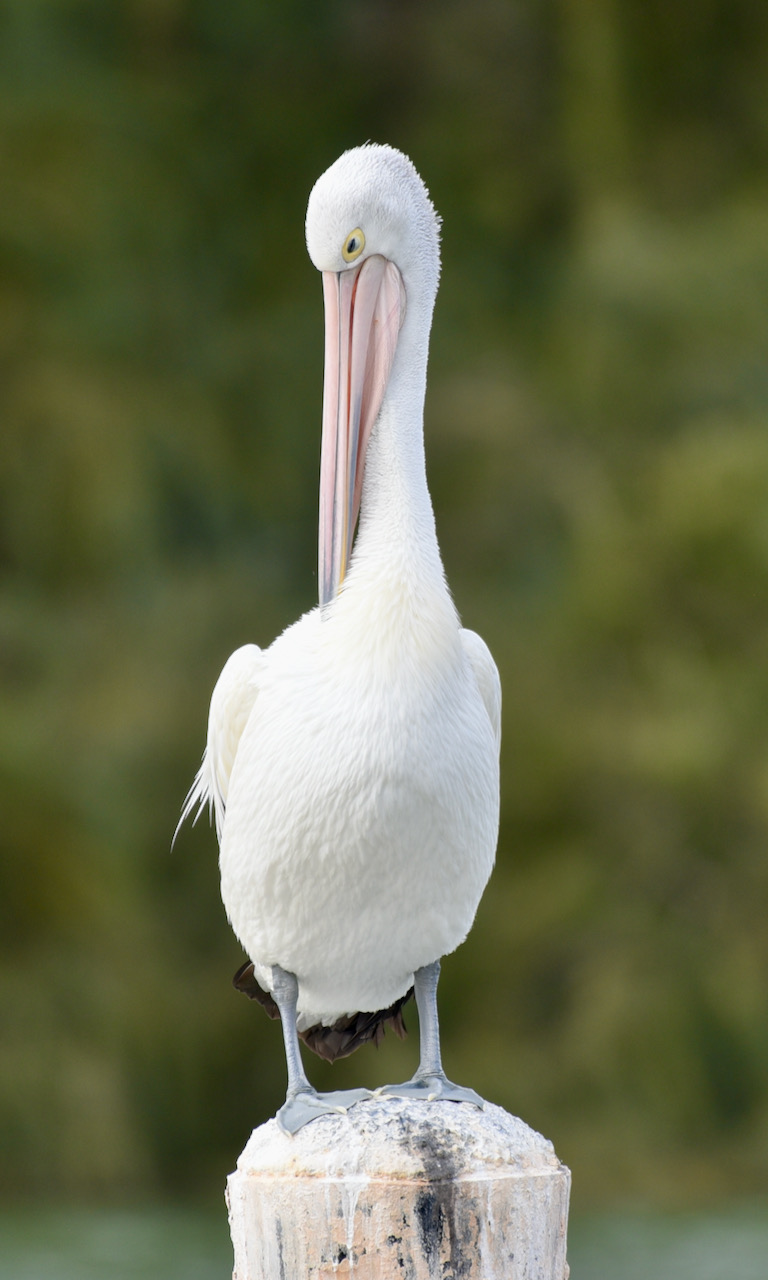
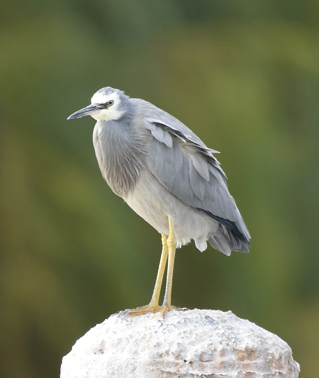
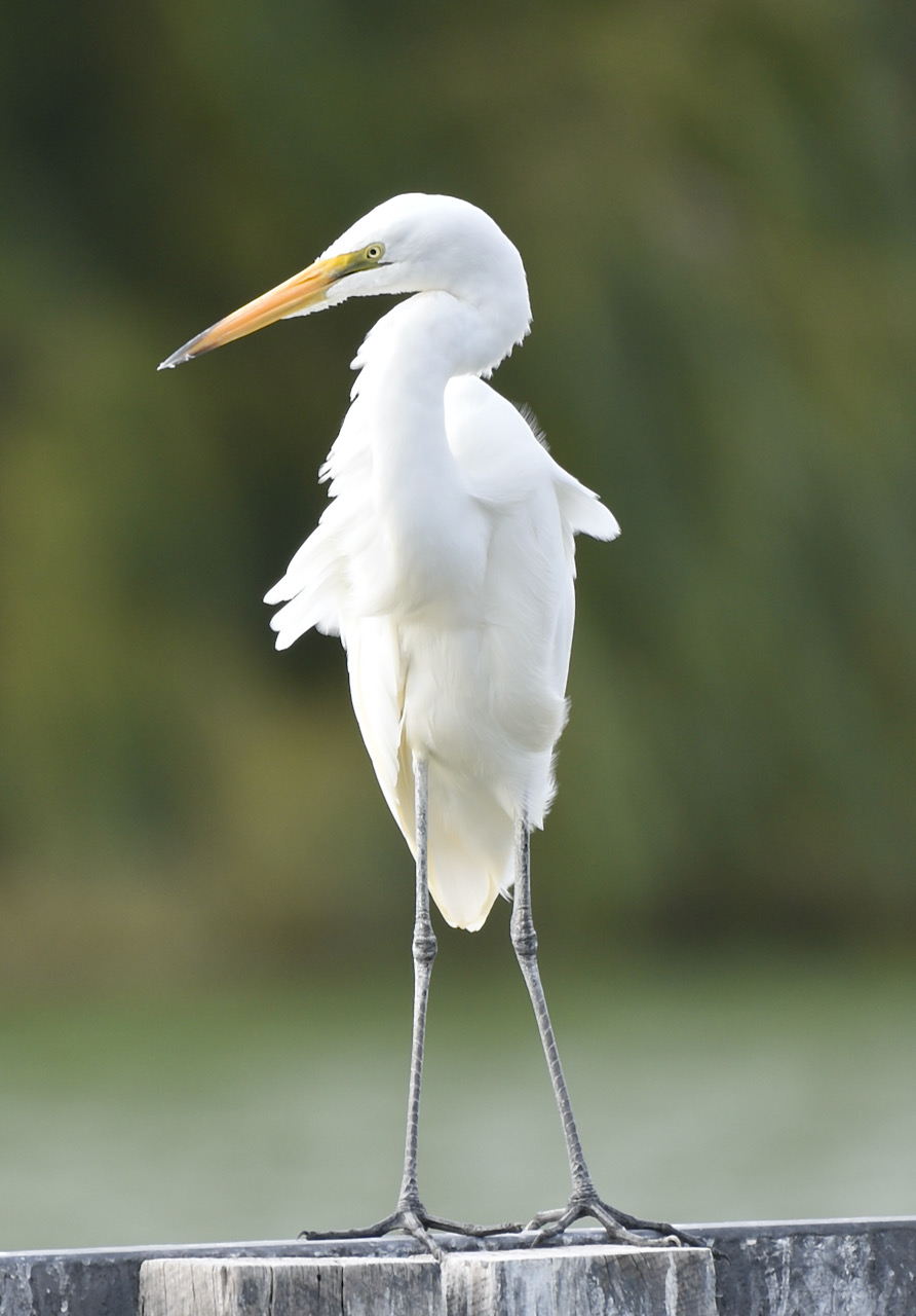
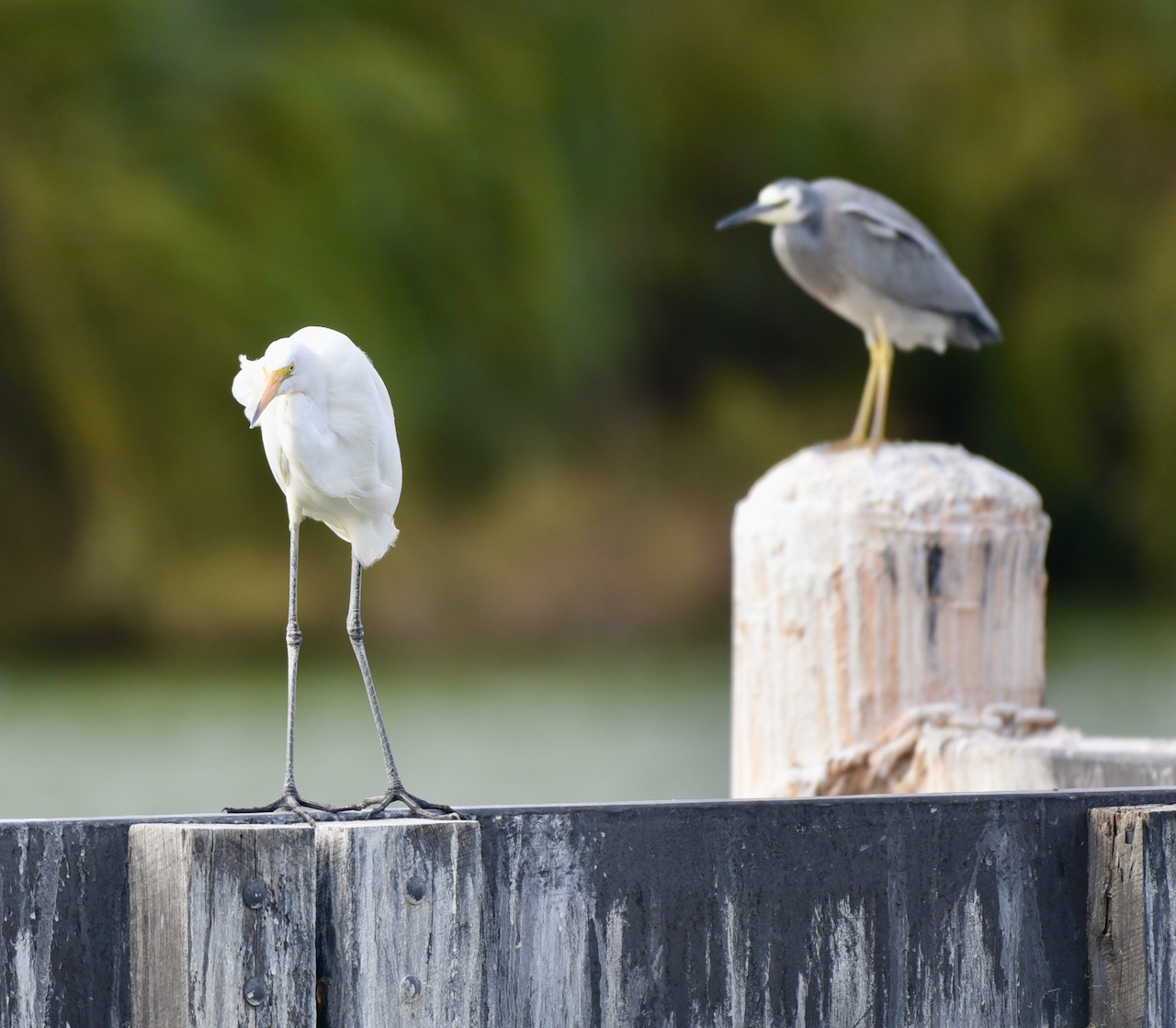
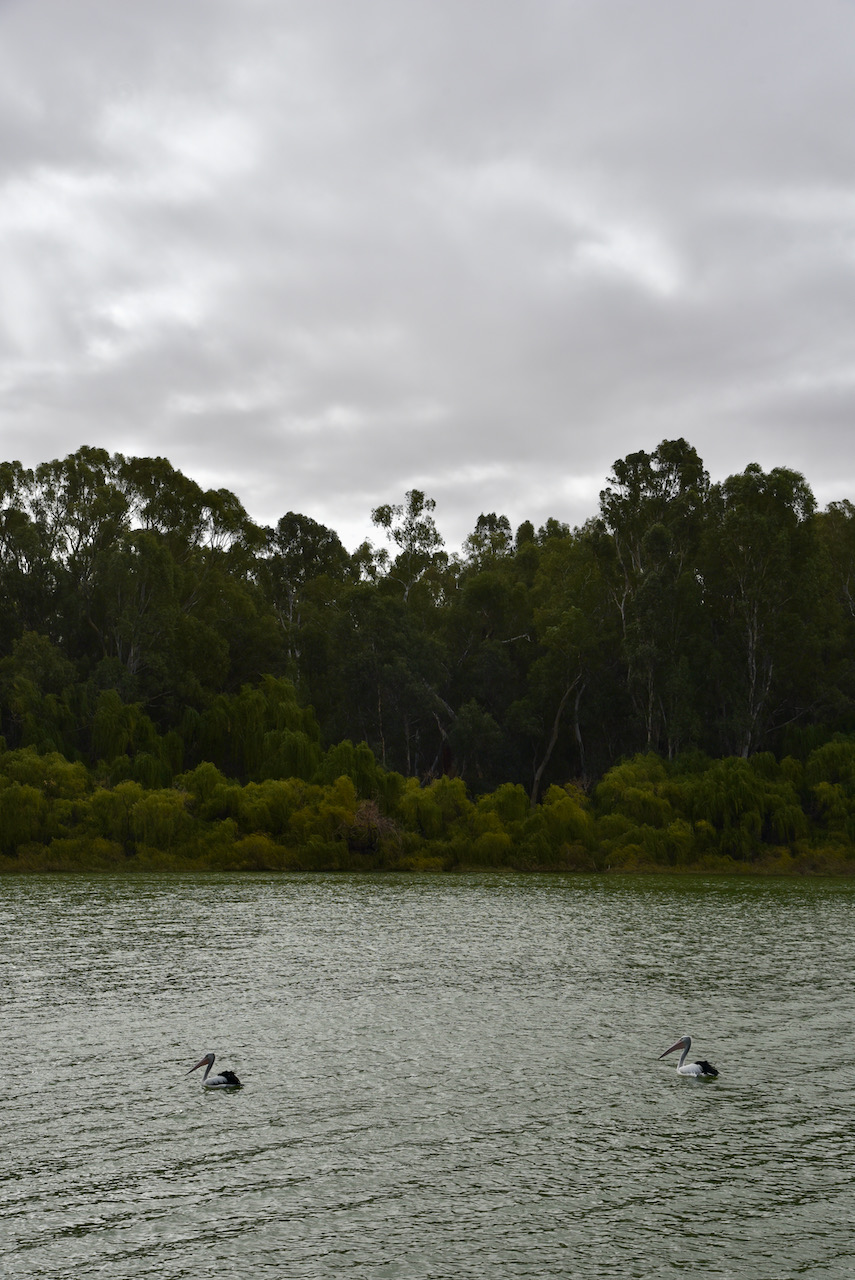
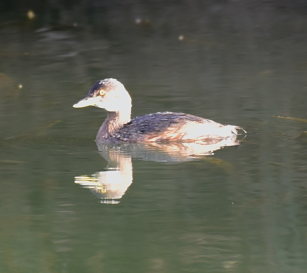
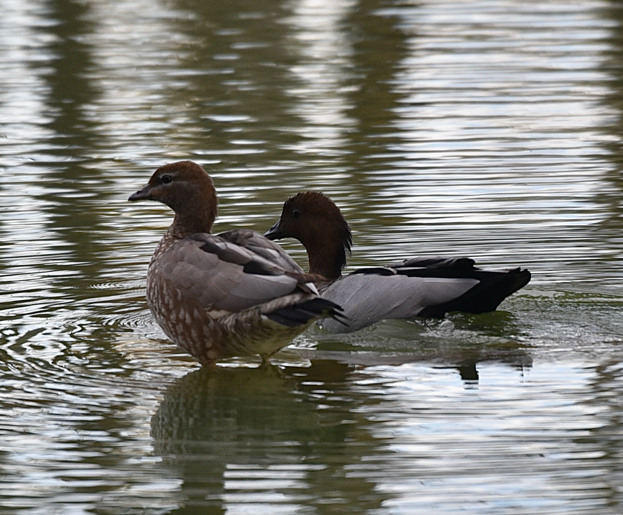
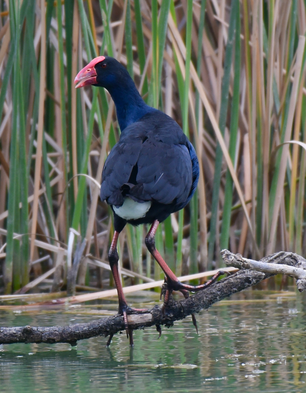
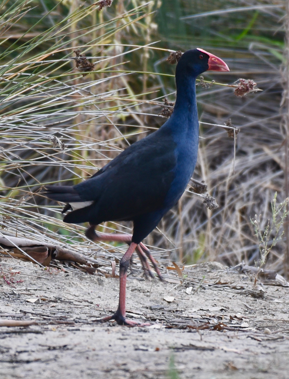
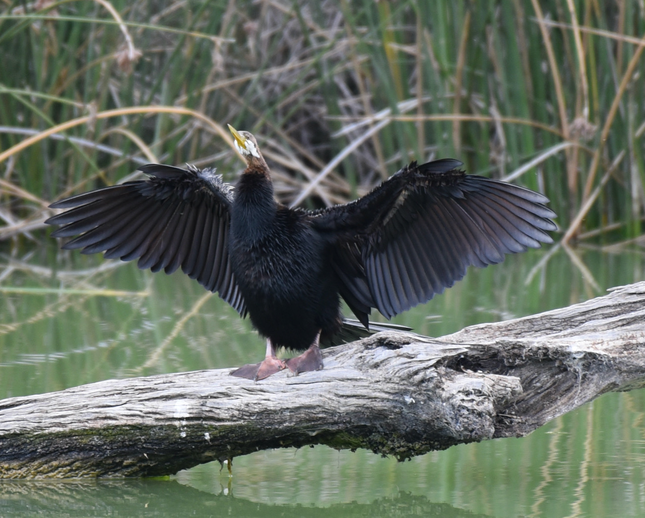
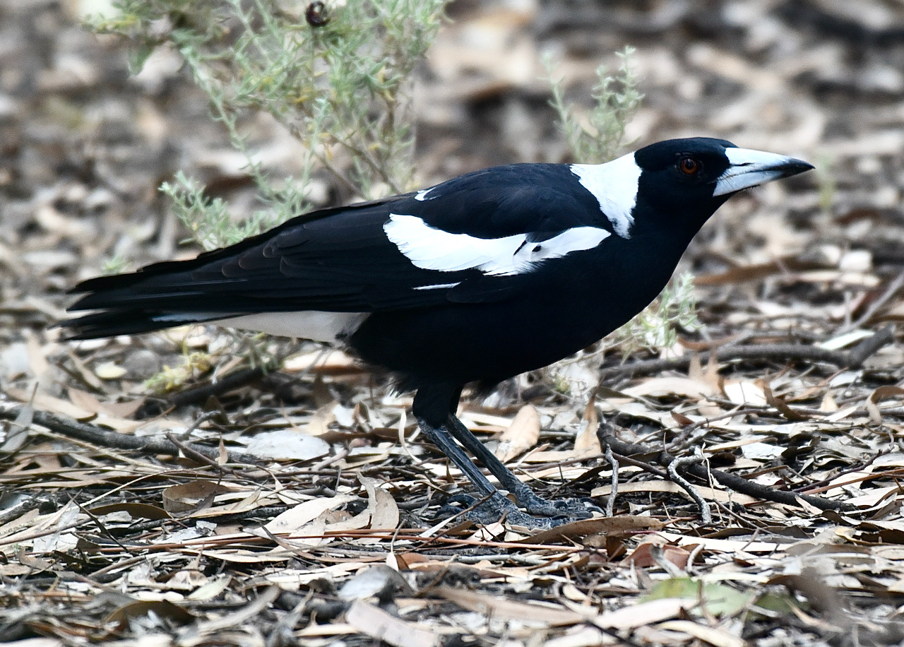
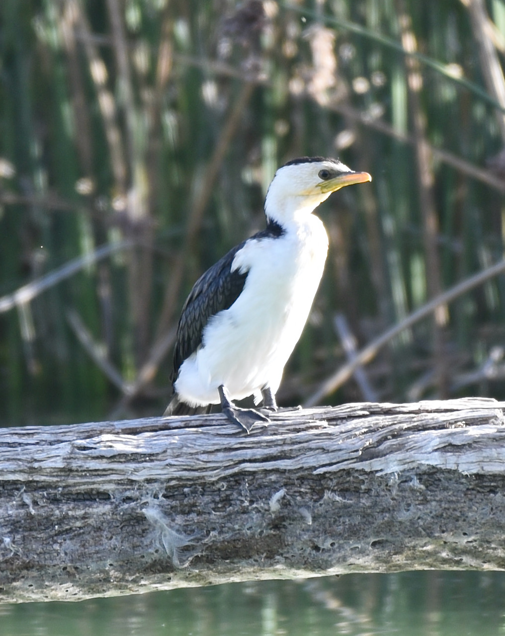
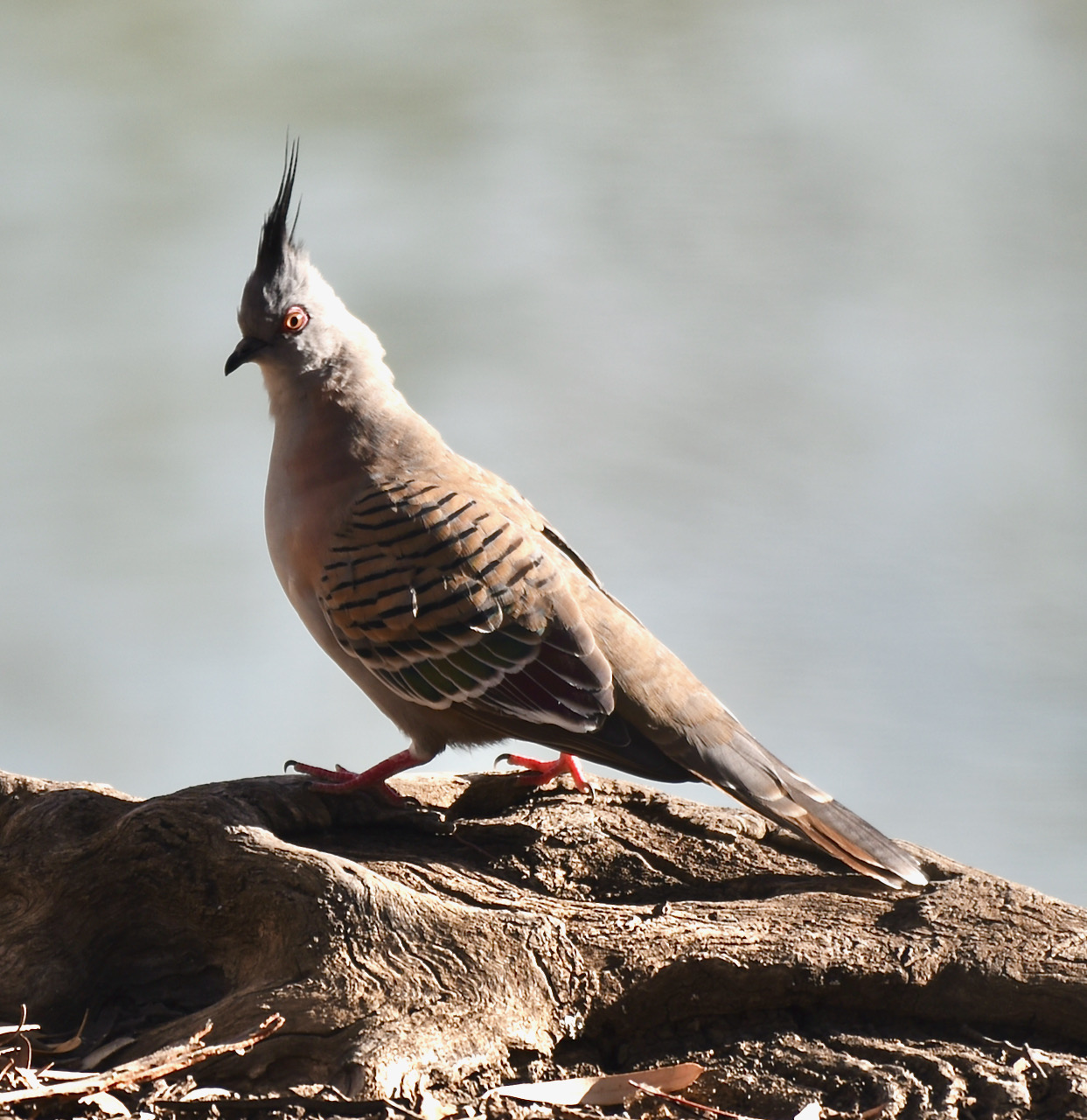
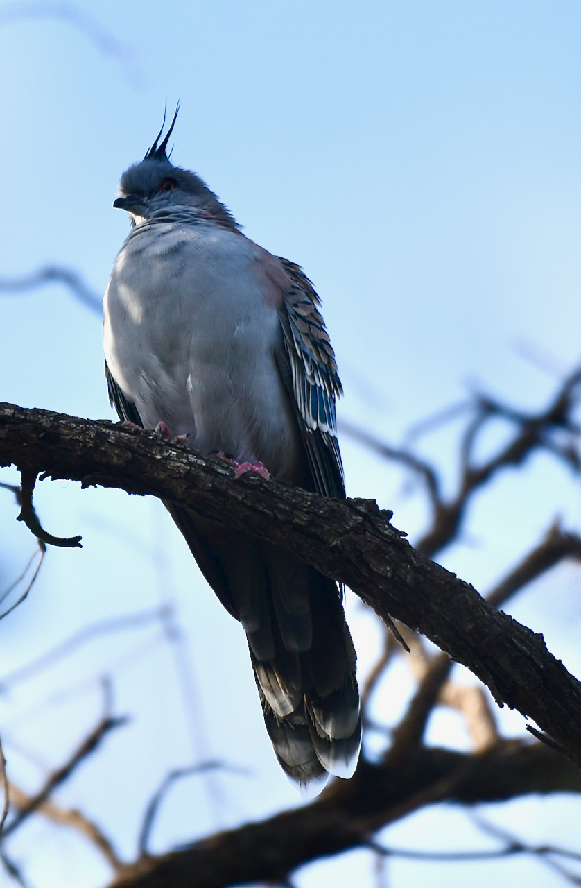
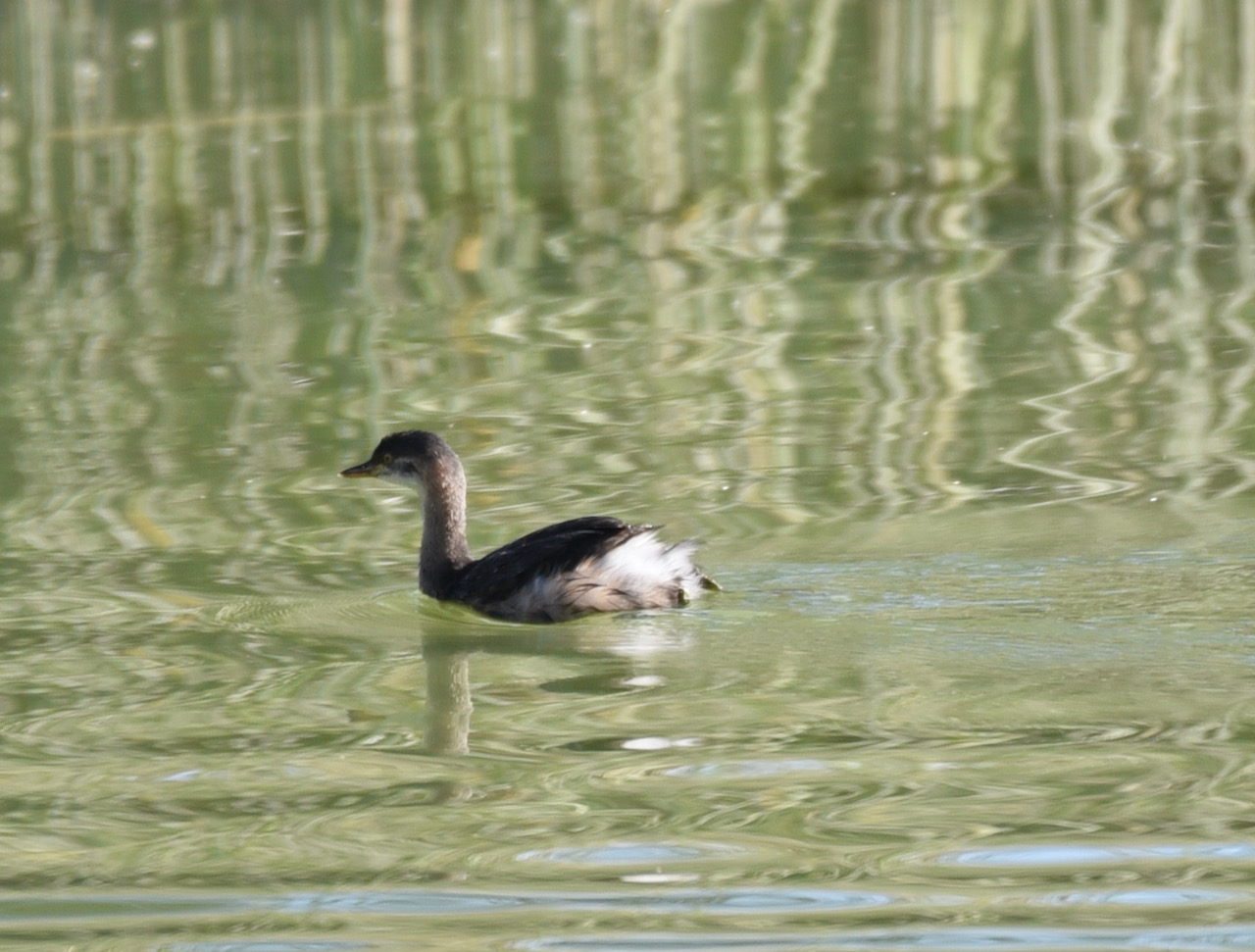
I spent quite a bit of time here birdwatching and taking some snaps. Some of my shots can be seen below, including some of Whistling Kites.
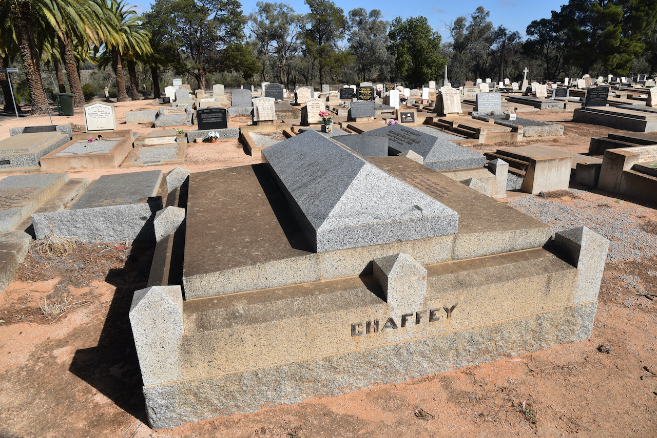
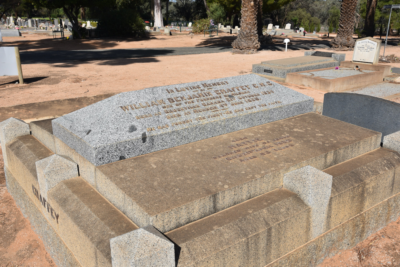
We then drove out to the Mildura cemetery to view the headstone of W.B. Chaffey, the founder of Mildura.
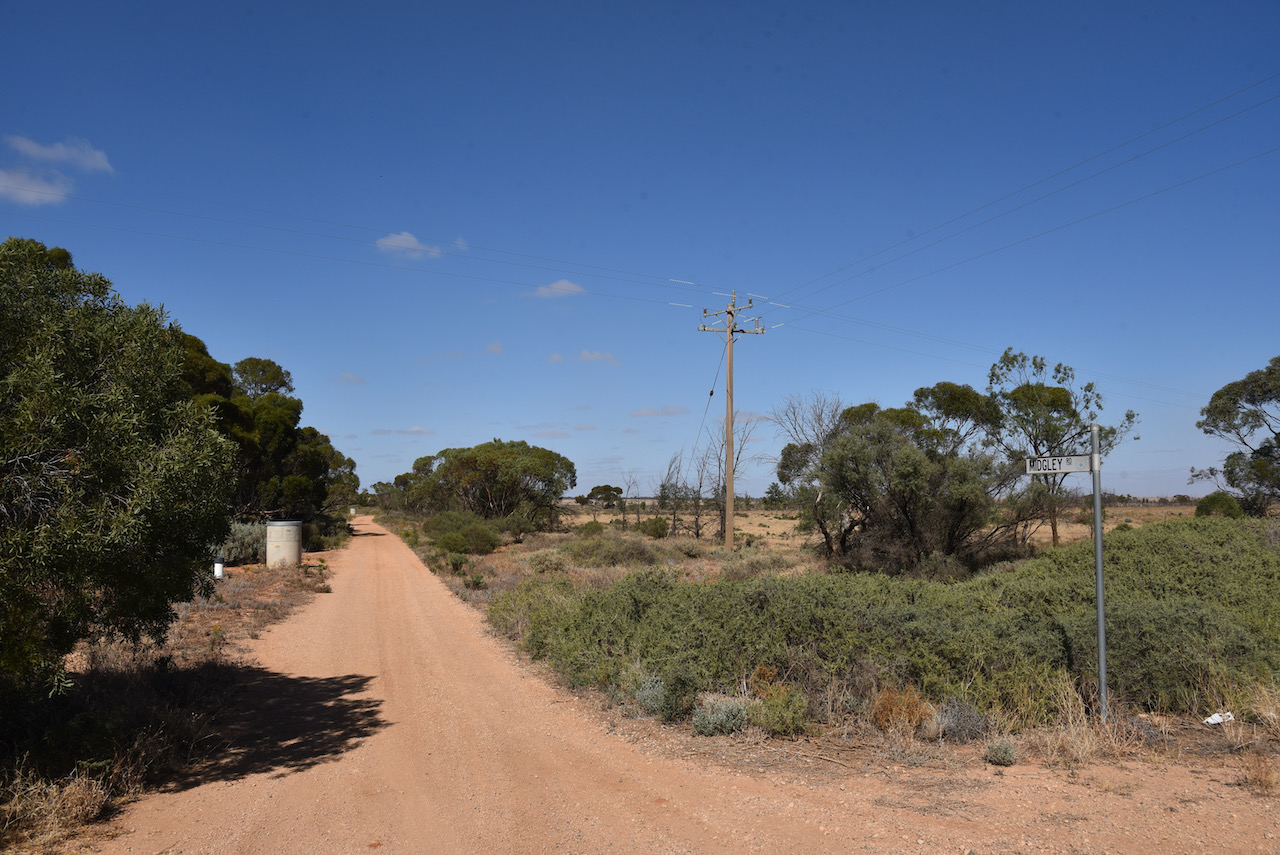
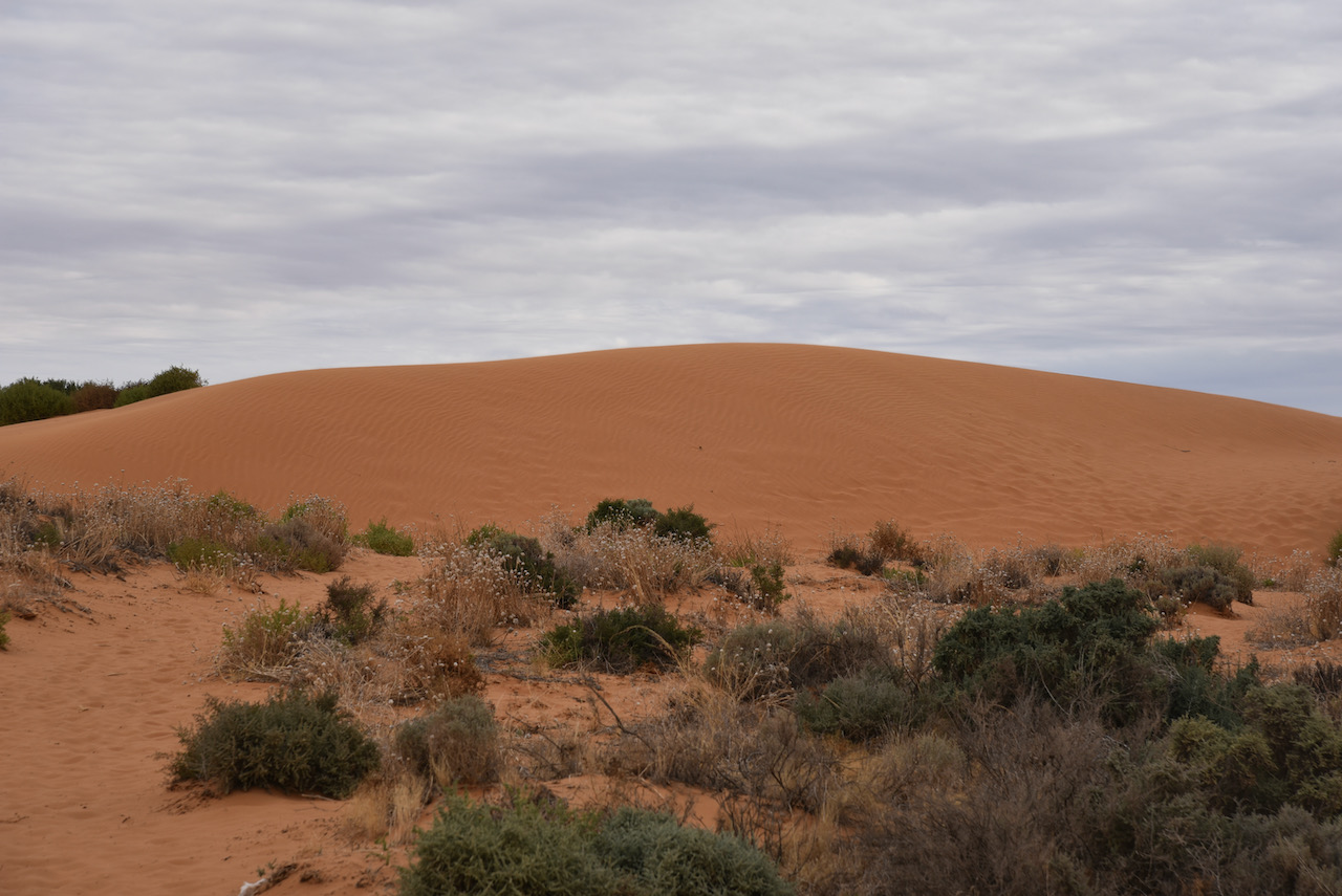
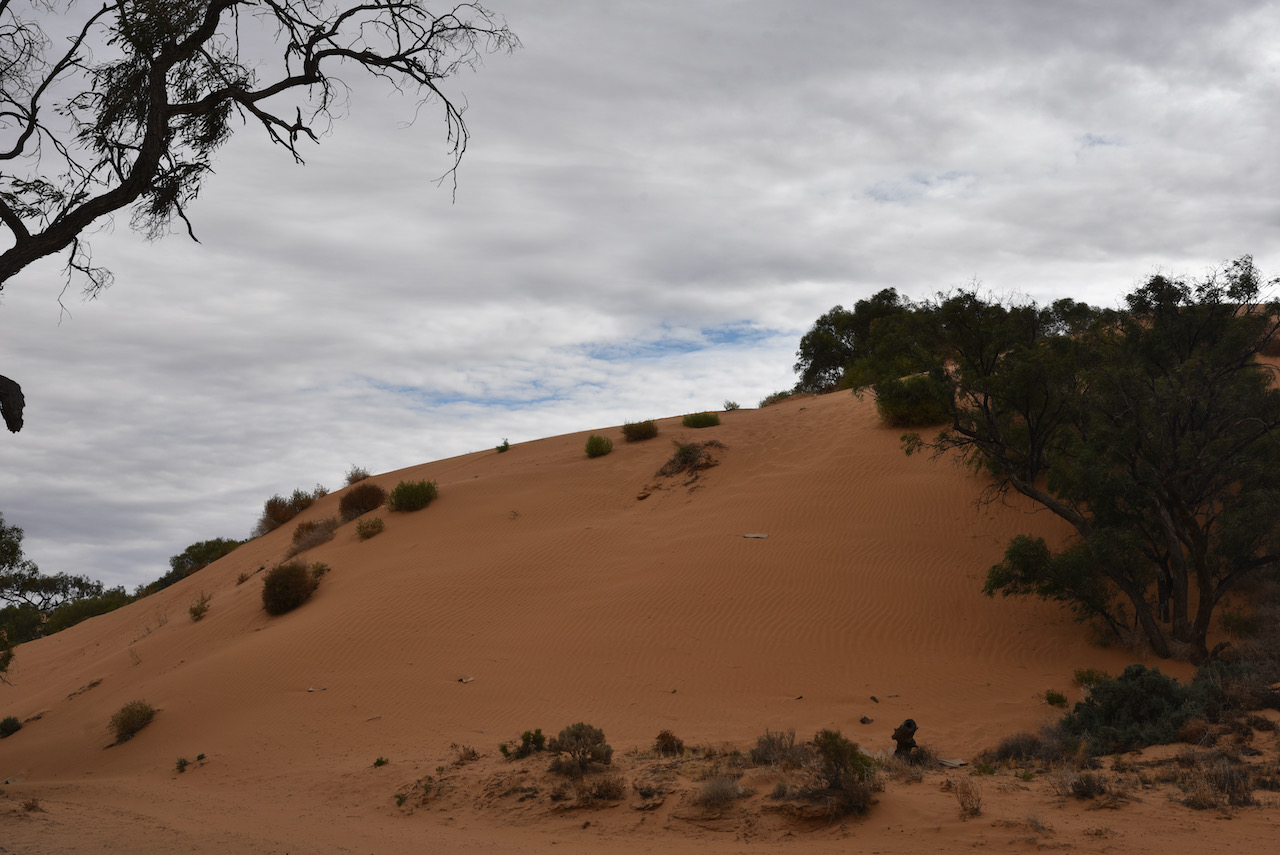
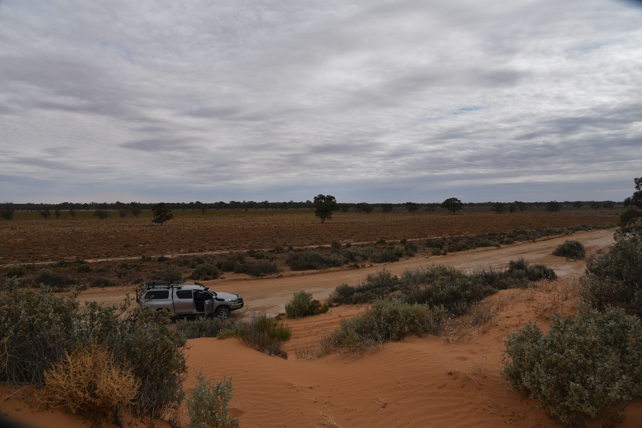
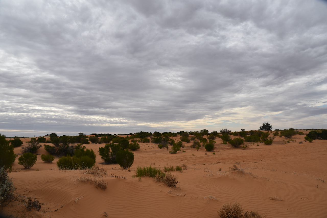
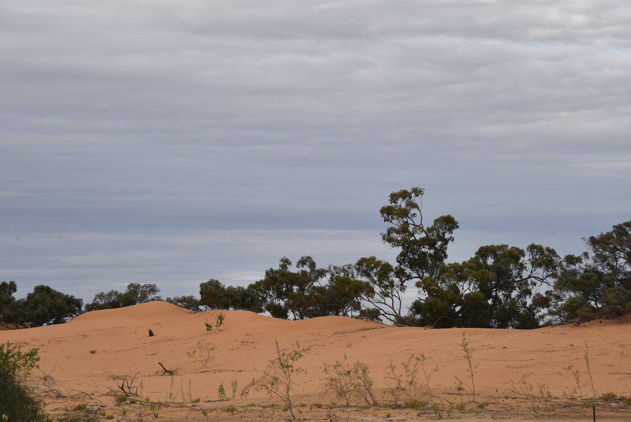
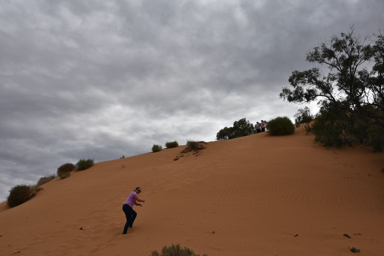
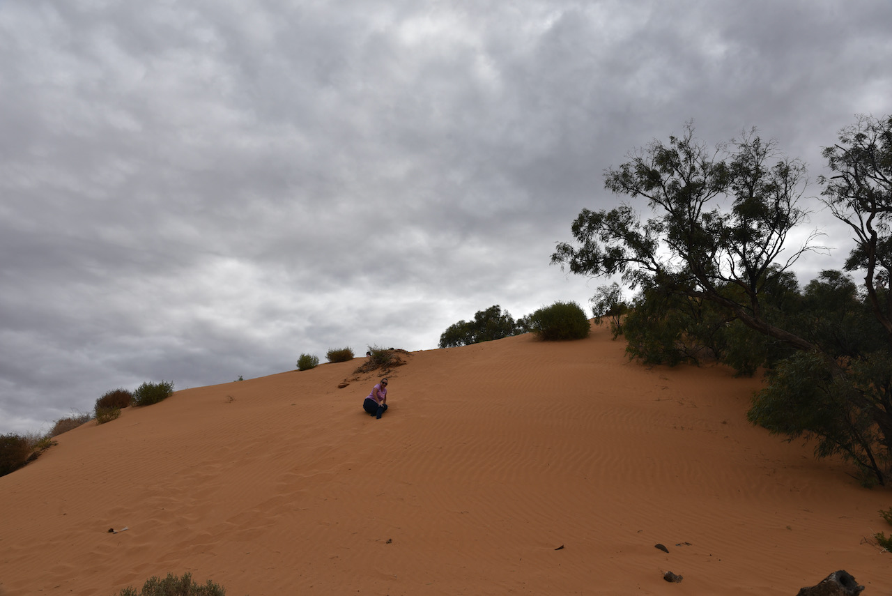
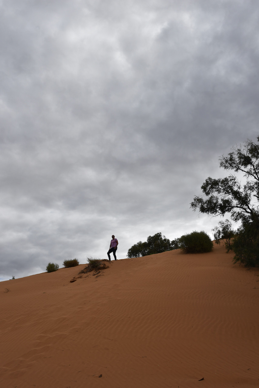
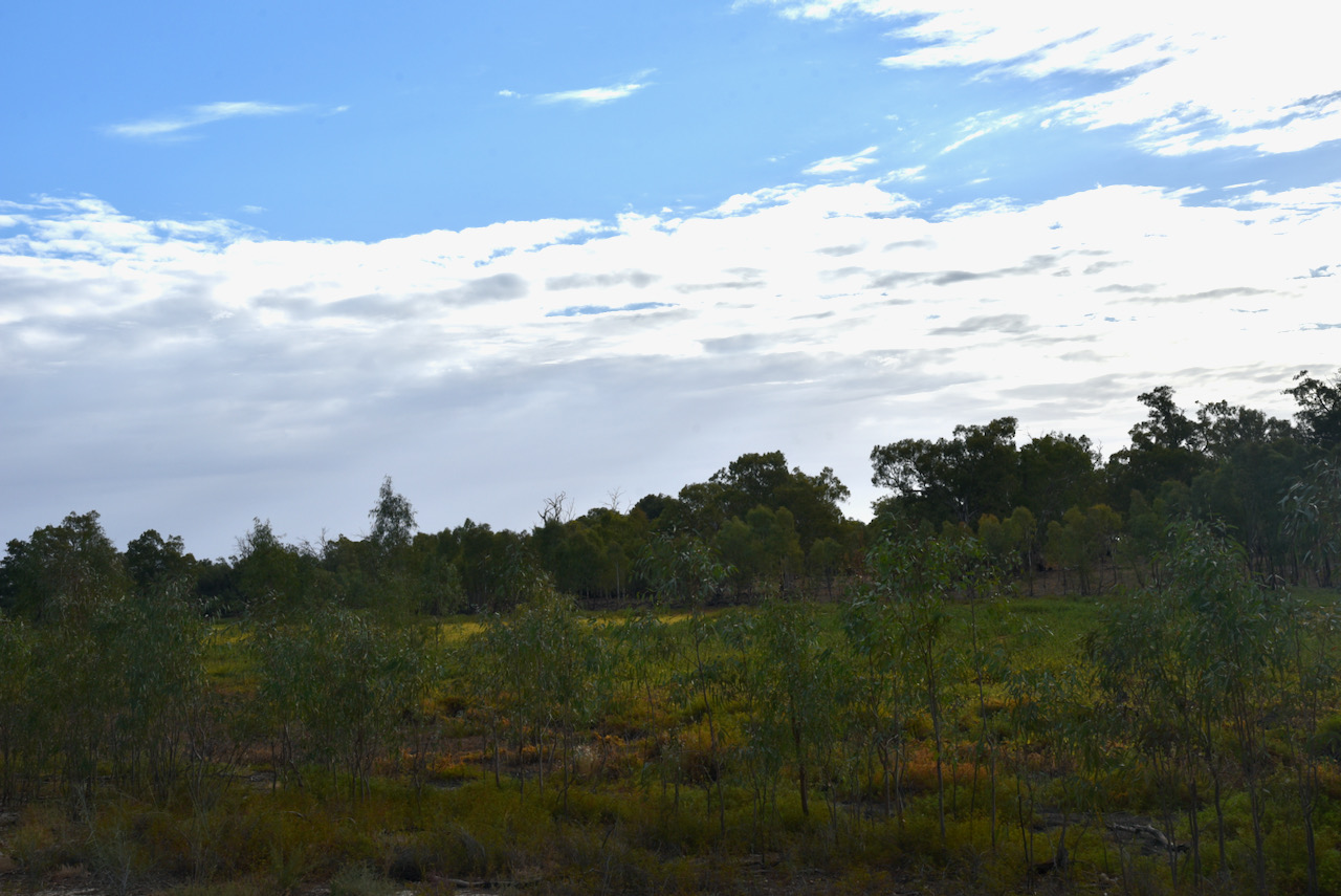
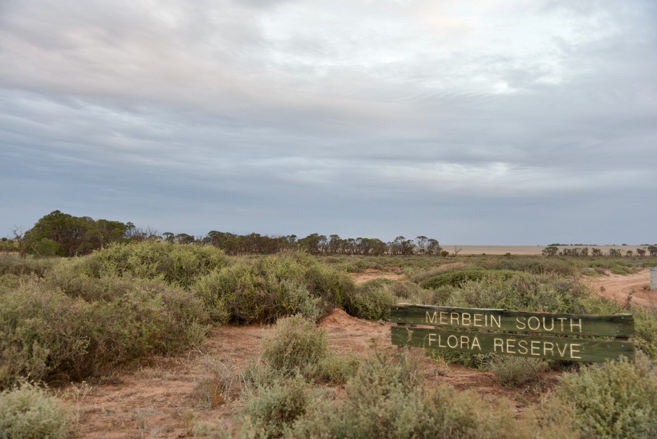
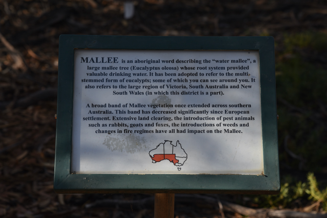
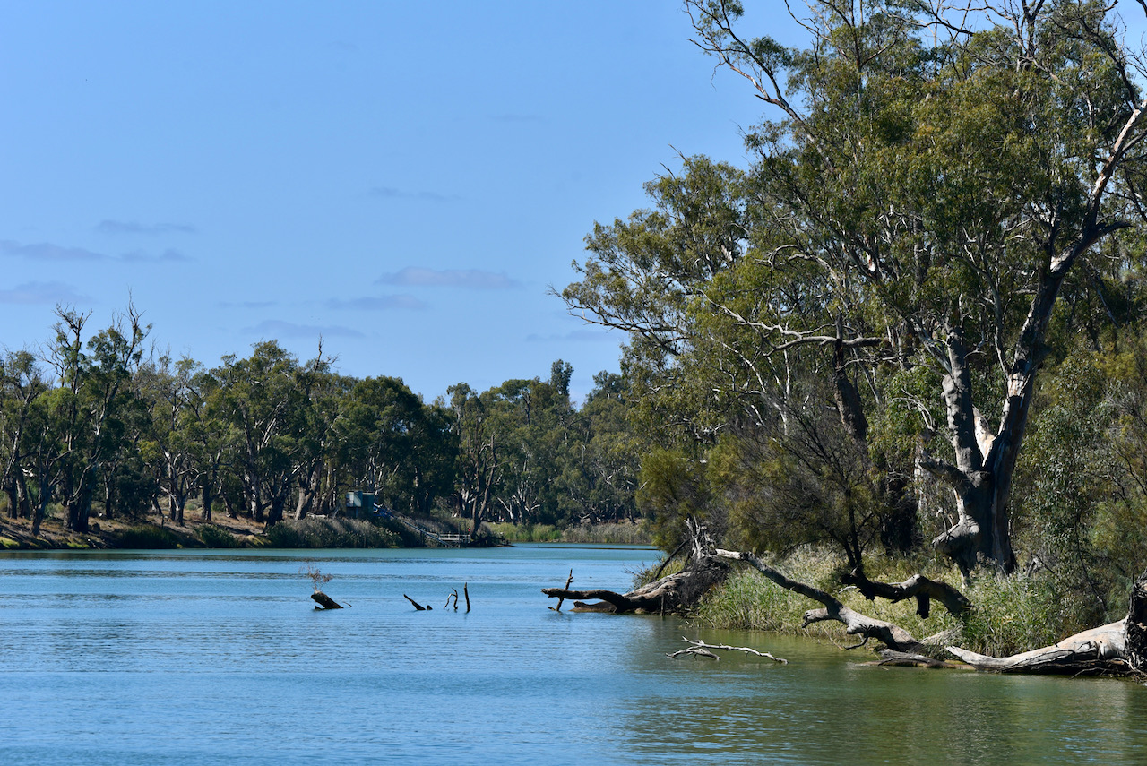
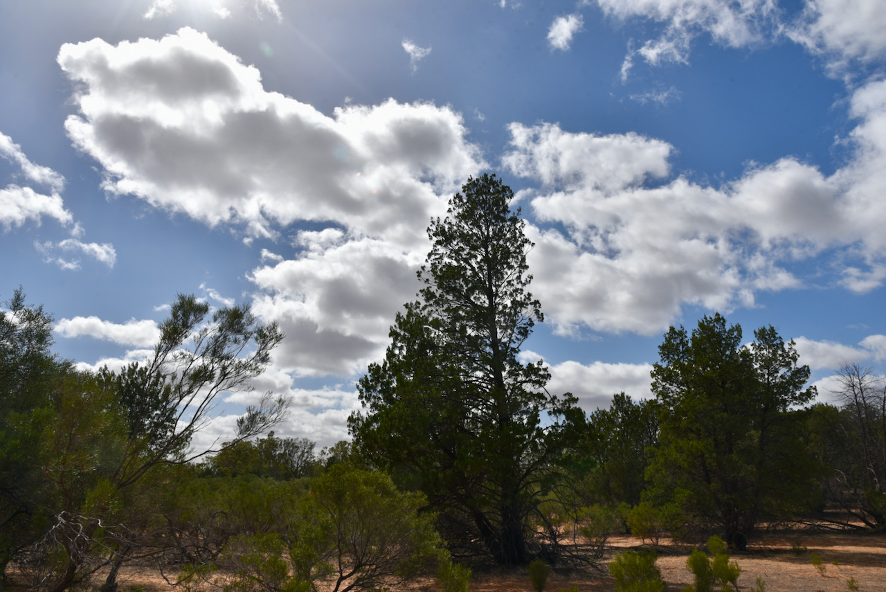
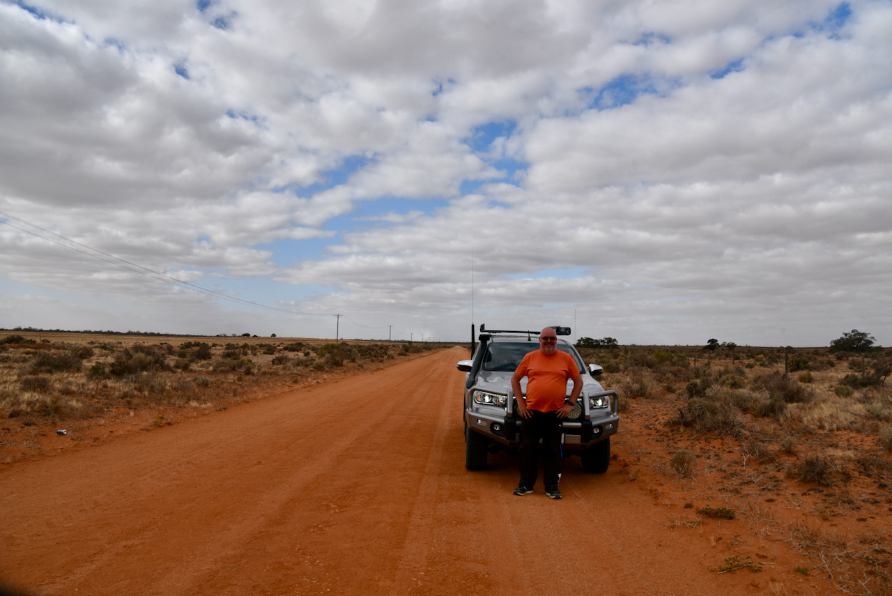
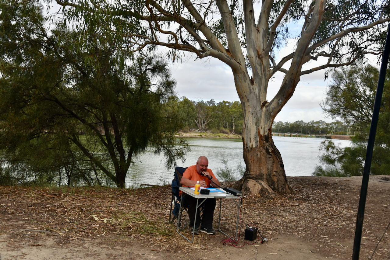
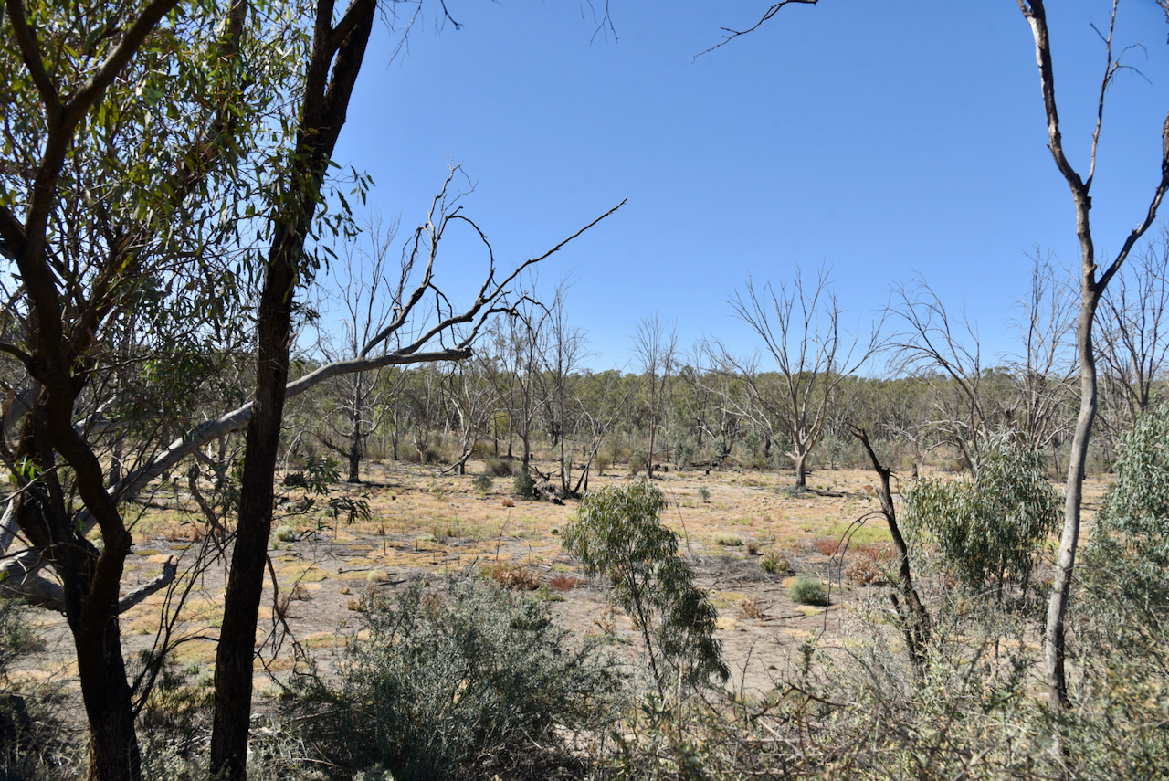
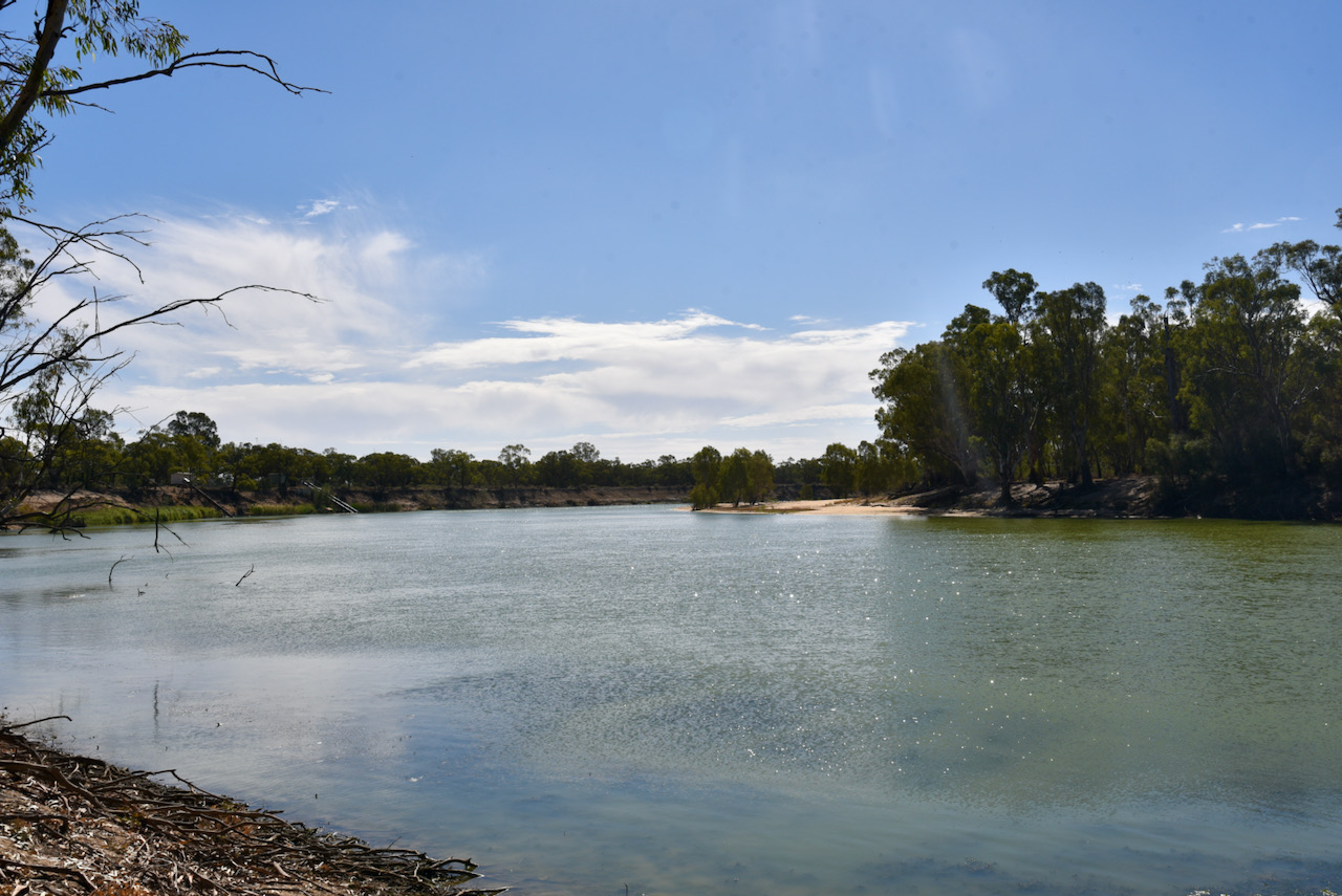
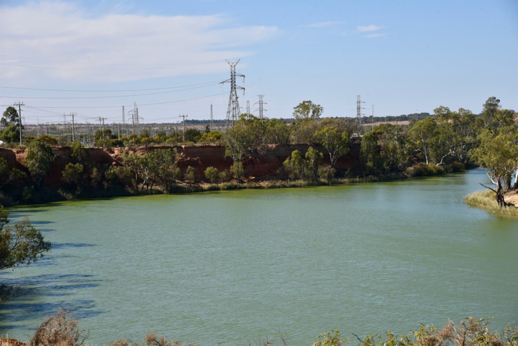
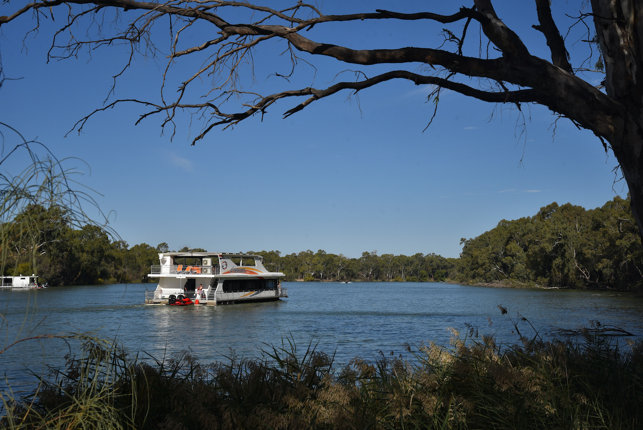
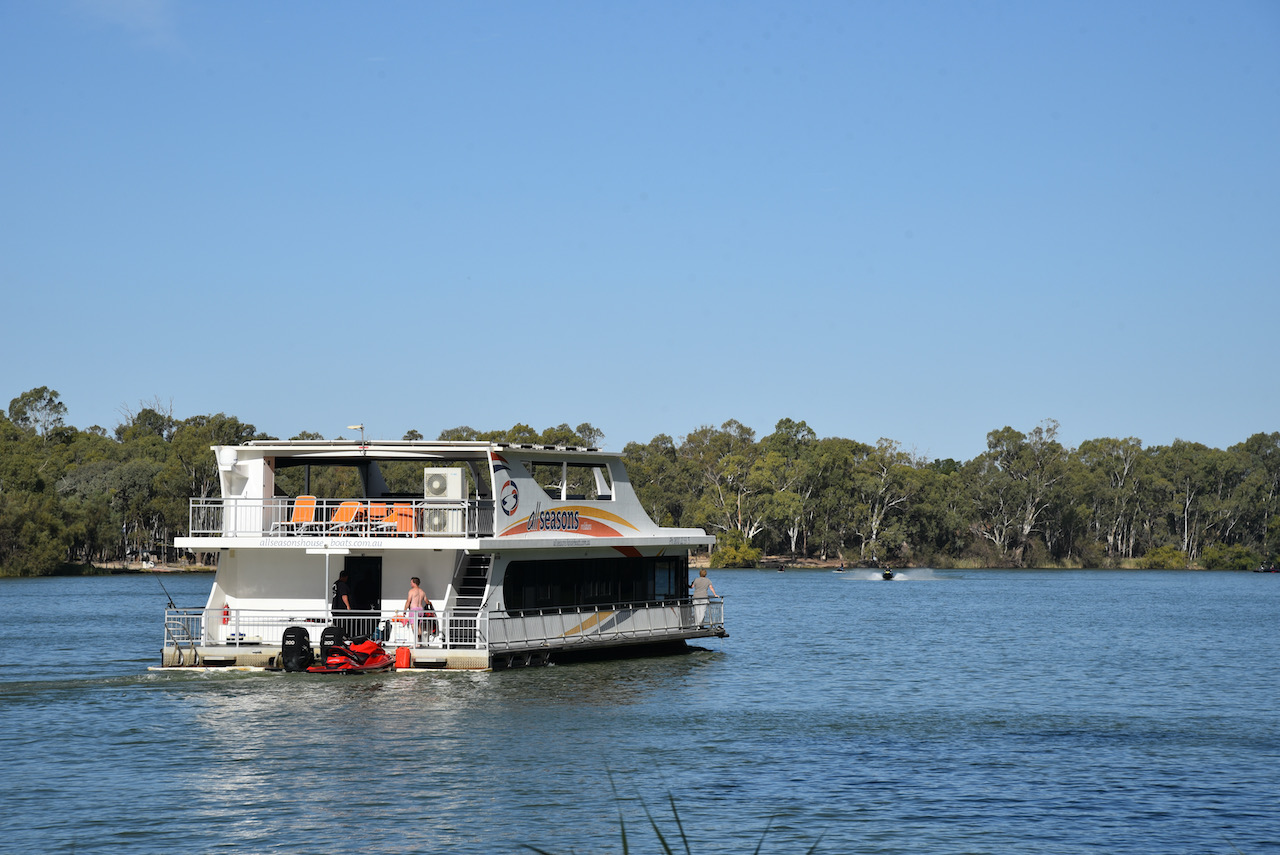
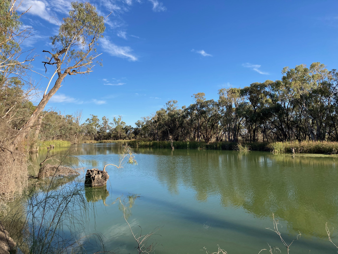
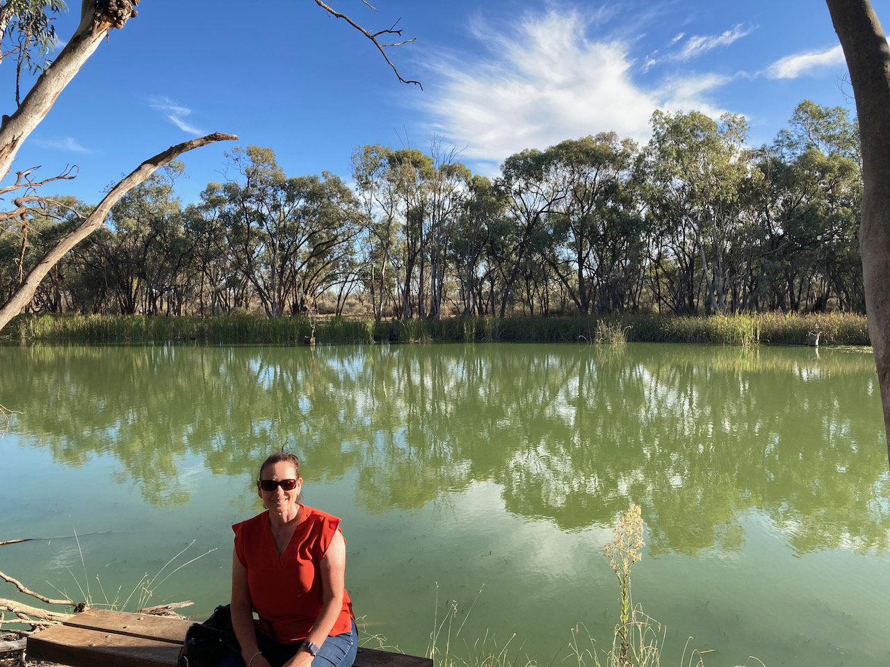
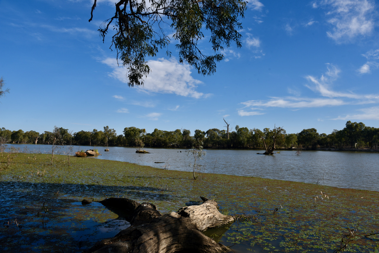
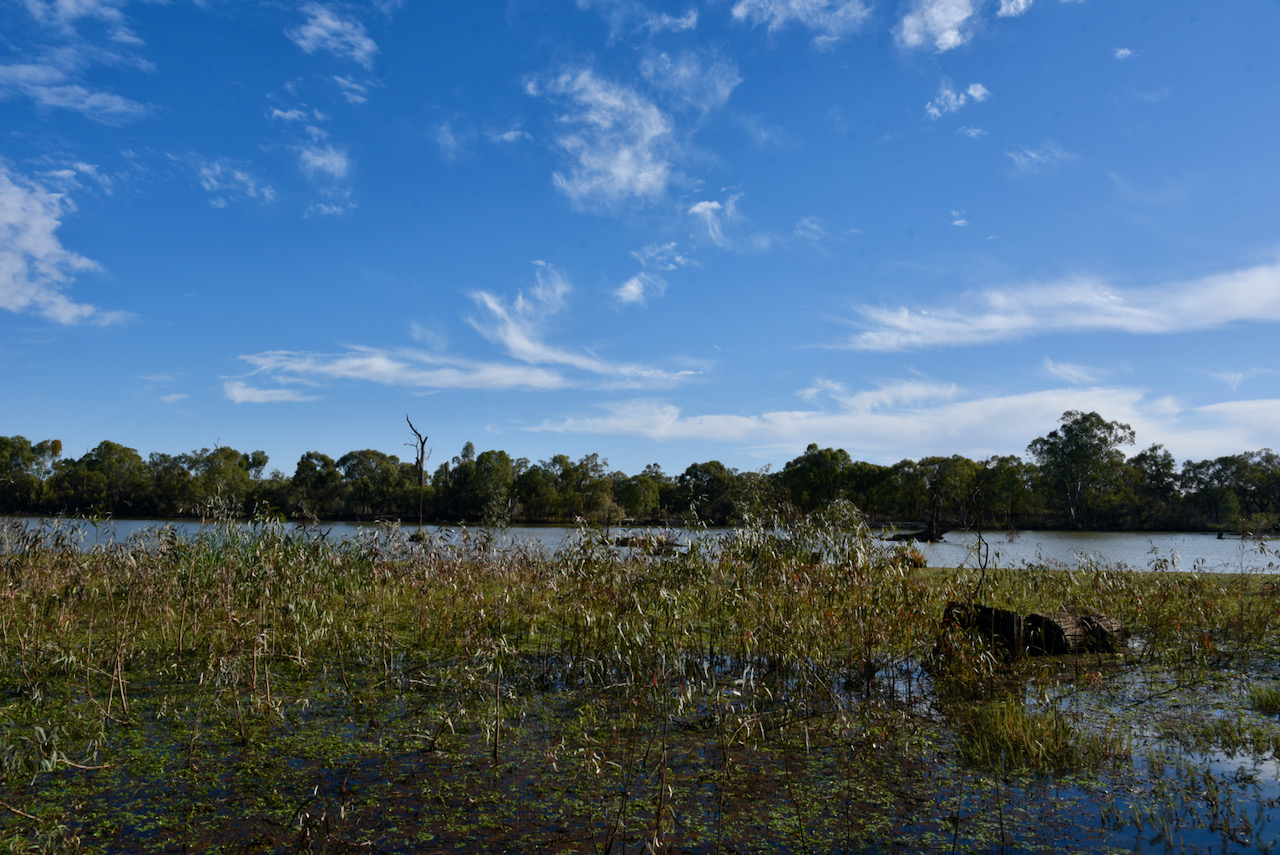
It was then time for us to head back to the Merbein South Flora Reserve VKFF-2383. Access was via Midgey Road.
Above:- View of Midgey Road
As I only need 13 contacts from this park (31 in the log from yesterday), we operated from the vehicle. First in the log was Rob VK2VH. Ray VK4NH was my 13th caller and 44th in total.
I ended up logging a total of 23 stations on 40m from VK1, VK2, VK3, VK4, and VK5. This included a Park to Park contact with Stuart VK3UAO/p who was activating the The Spit Wildlife Reserve VKFF-2452.
To conclude the activation I put out a few quick calls on 20m and logged just the one station, Linda Vk7QP in Tasmania.
Today, day eight (Tuesday 13th April 2021) we planned on an entire day of sightseeing, and no park activating. As it turned out, we did slip in one quick park activation which you can read about a little later in this blog.
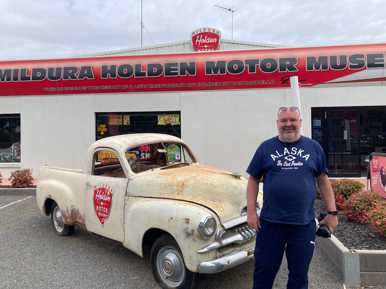
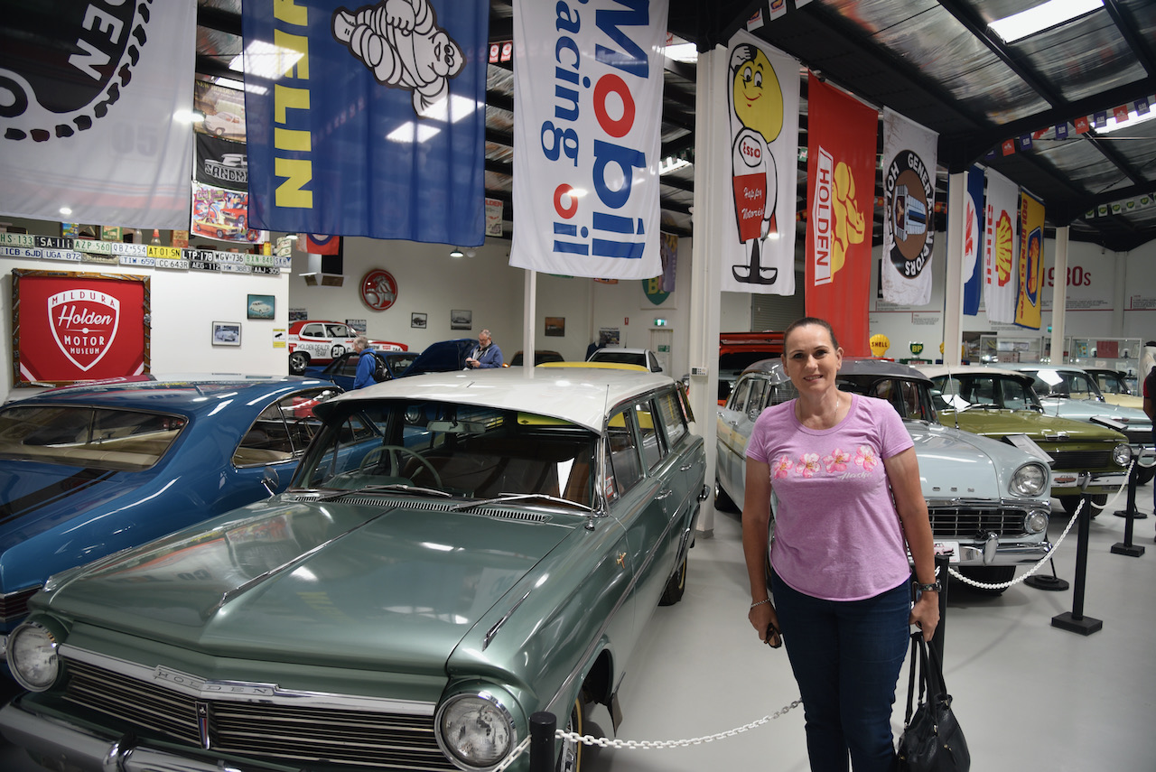
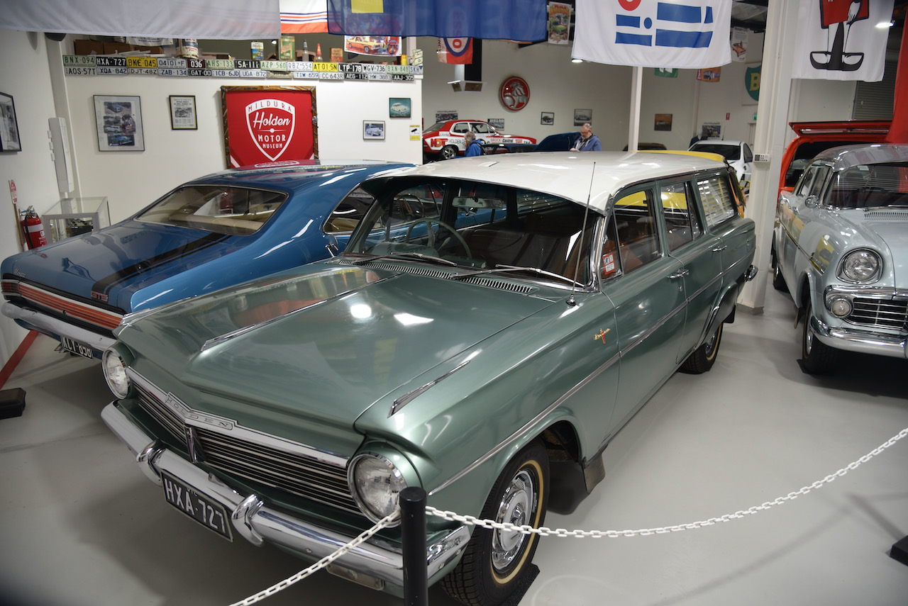
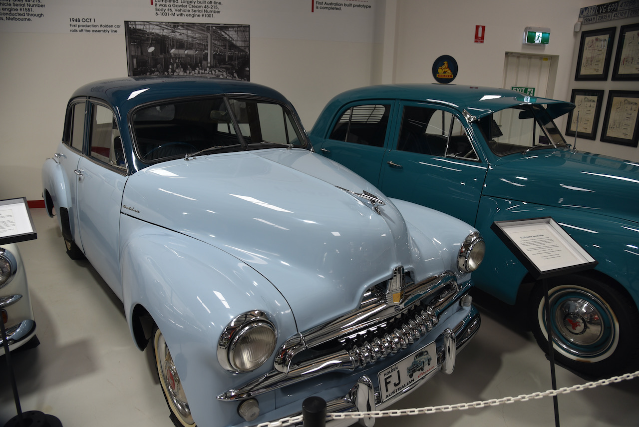
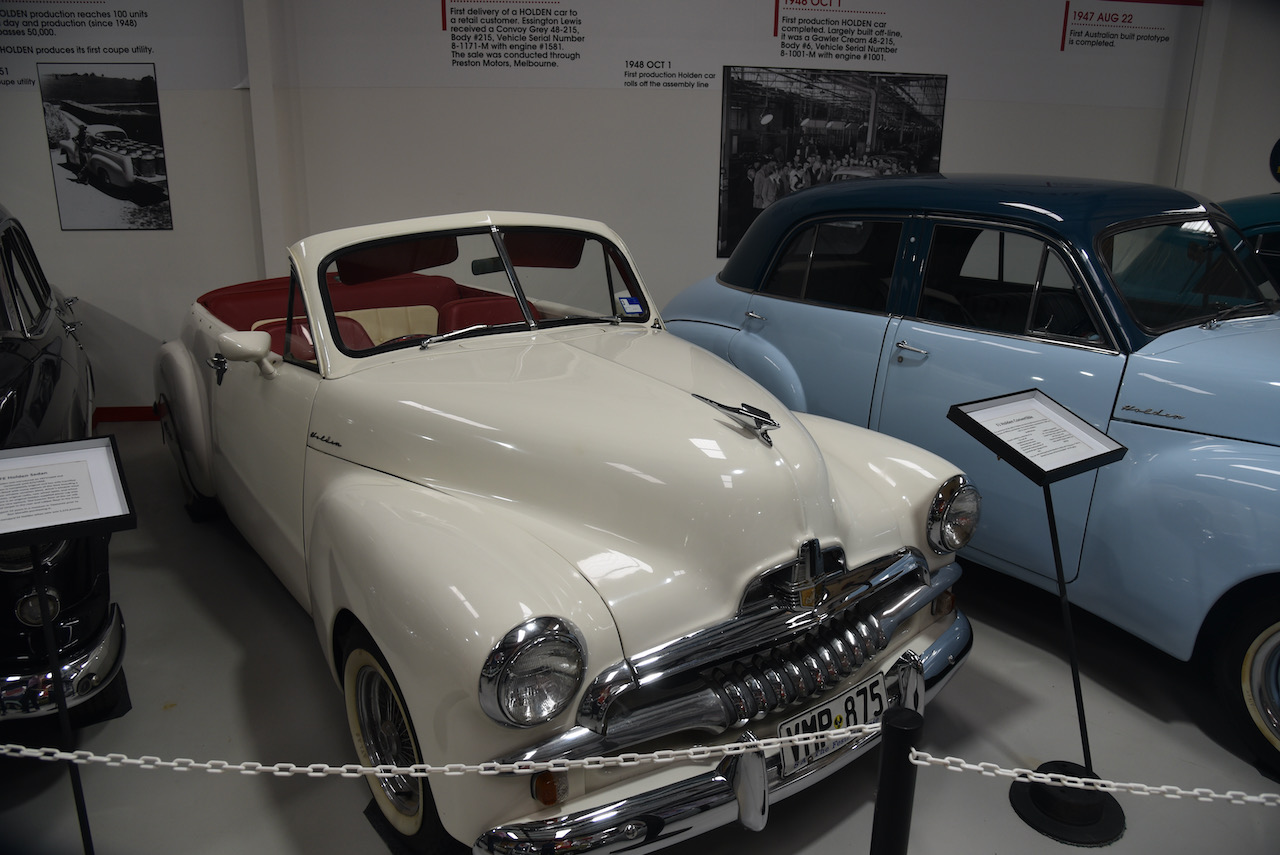
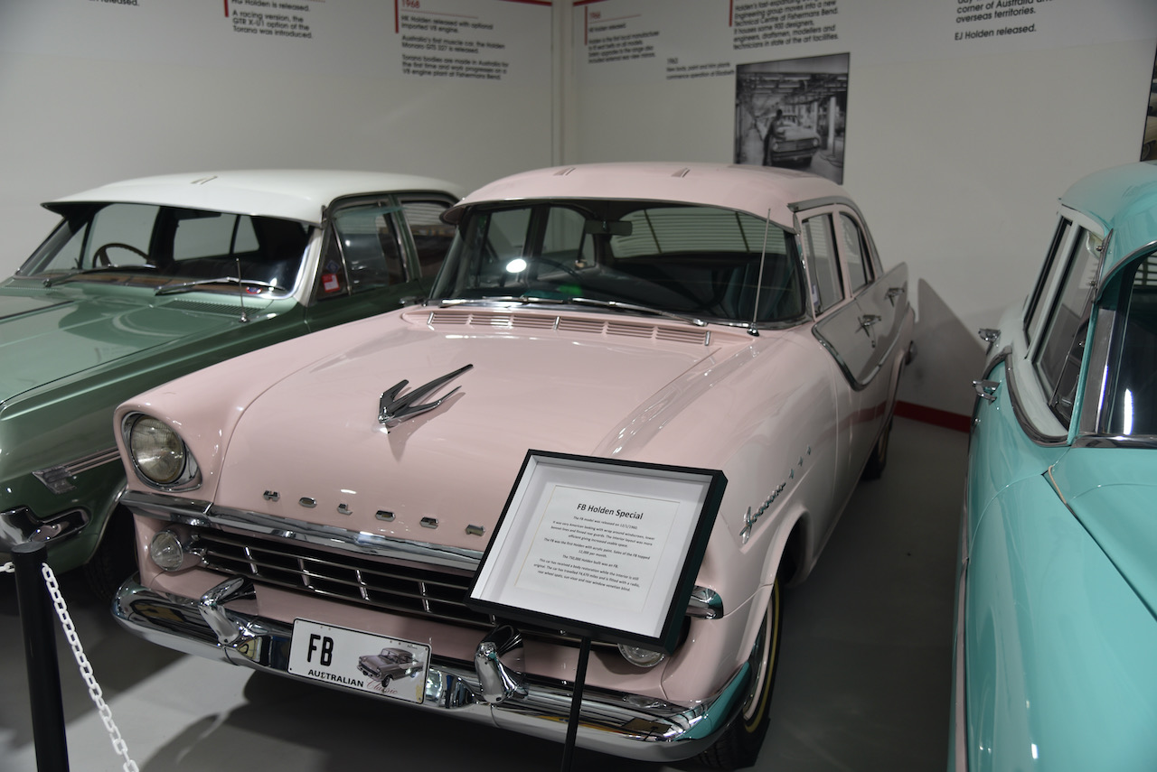
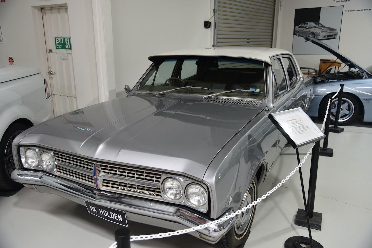
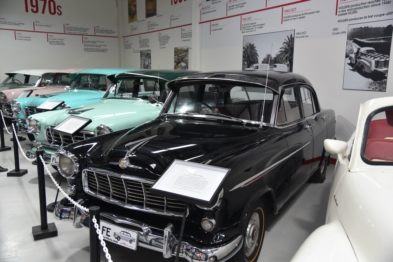
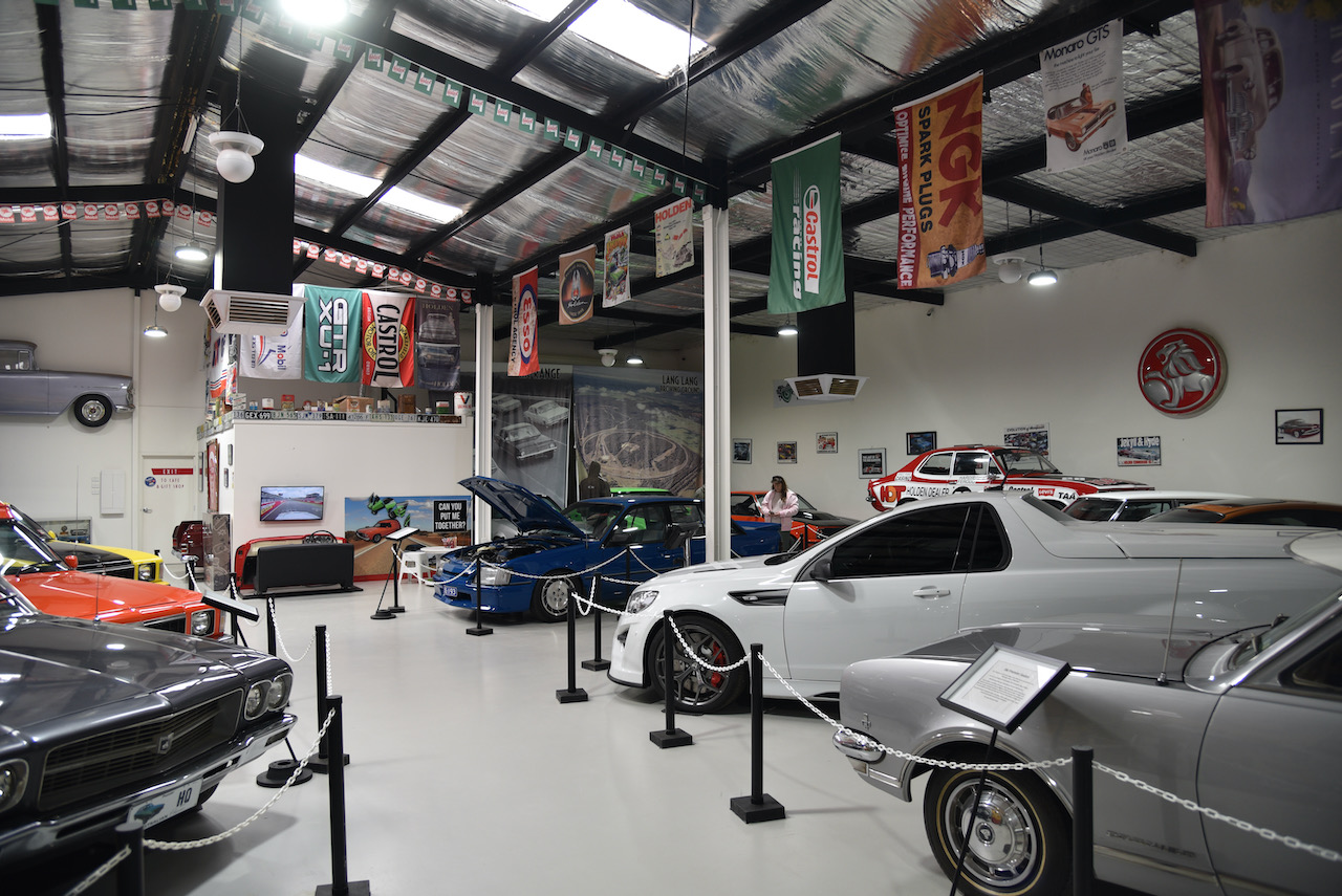
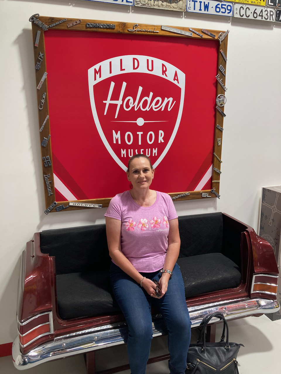
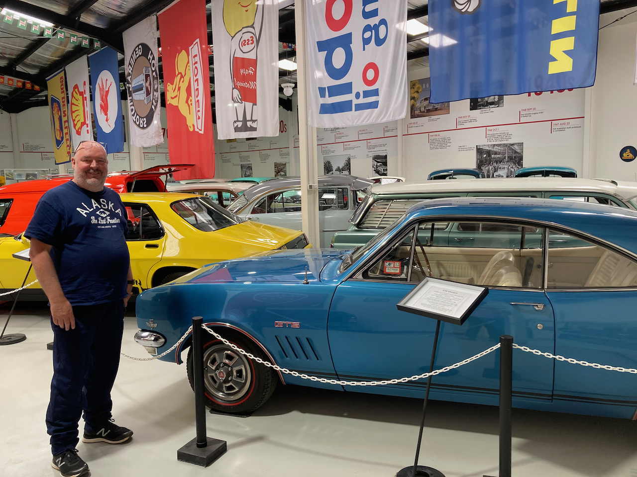
After breakfast we headed across the Murray River into New South Wales and visited the Mildura Holden Motor Museum at Buronga. We spent quite some time here admiring all of the magnificent Holden motor vehicles. It brought back a lot of memories. The museum houses a private collection of Holdens dating way back to the very first 48-215 (FJ) to the recent model Monaro and Statesman.
The museum’s website tells the very interesting story behind the collection. About 35 years ago, the owner of the now Mildura Holden Motor Museum, Ron Morello, ran an earthmoving business. He was called upon to clear his neighbour’s land and prepare the land for construction. He was ordered that ‘everything must go’. A storage shelter was crushed which contained a ‘pristine’ FX Holden.
In 1975, after realising what he had done, Ron started looking for an FX to buy. In January 1981 he purchased an original FX Holden with only 42,000 miles on the clock.
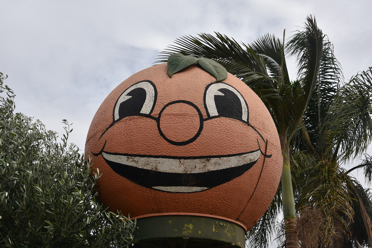
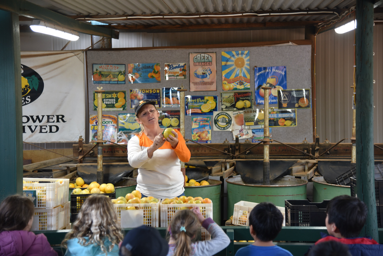
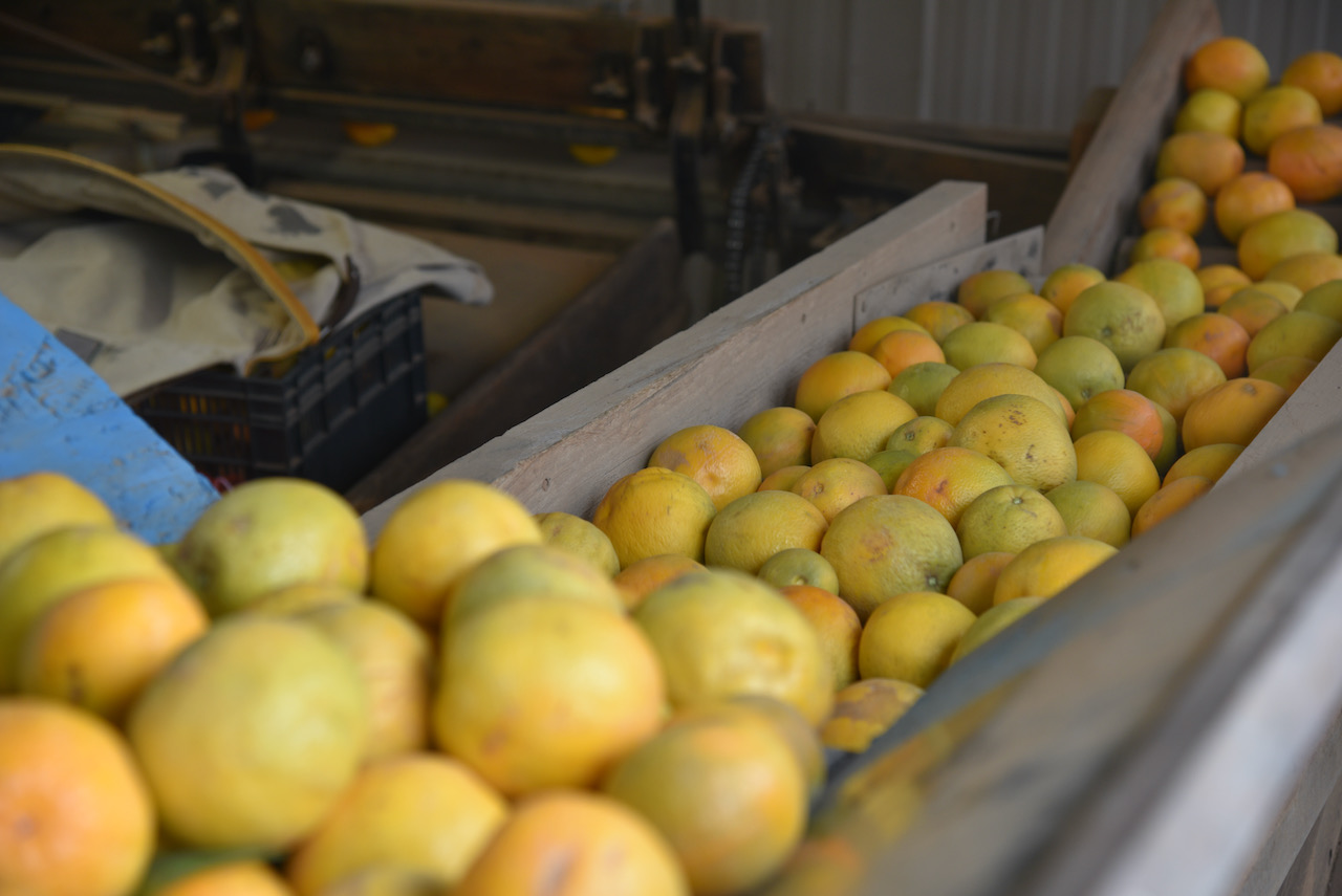
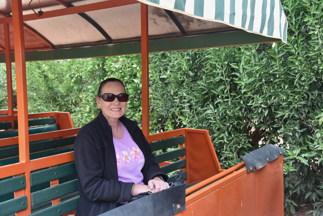
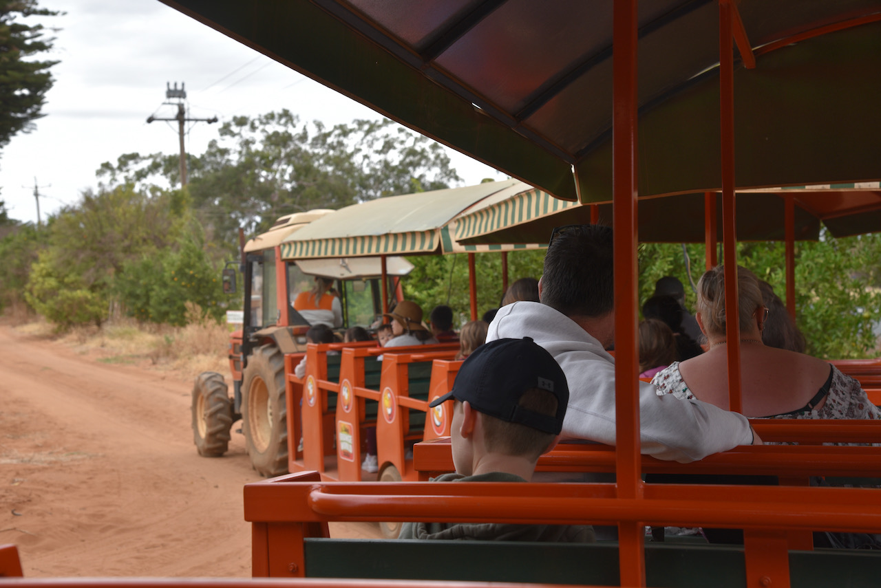
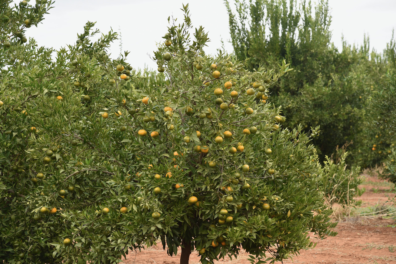
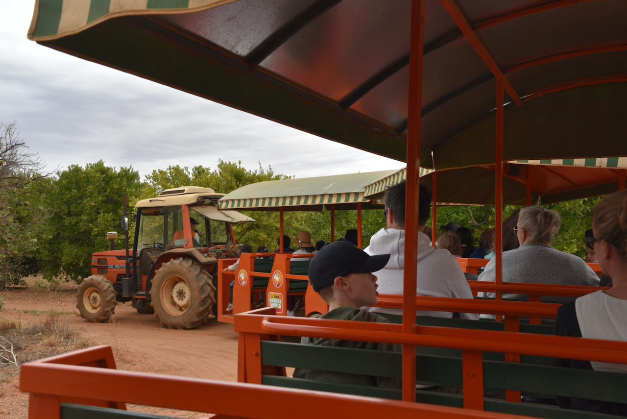
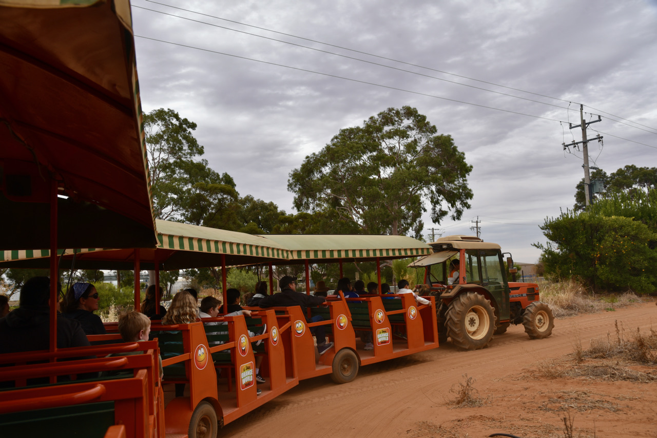
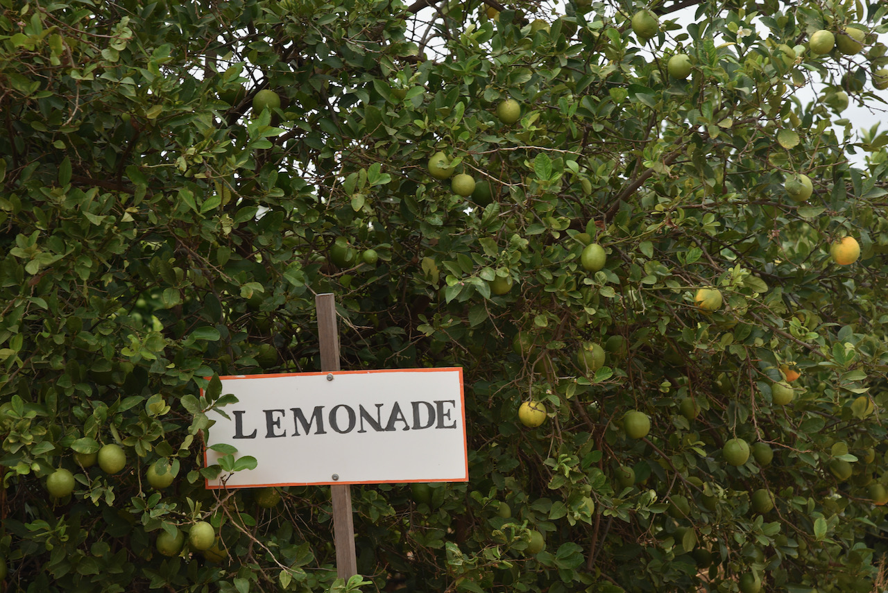
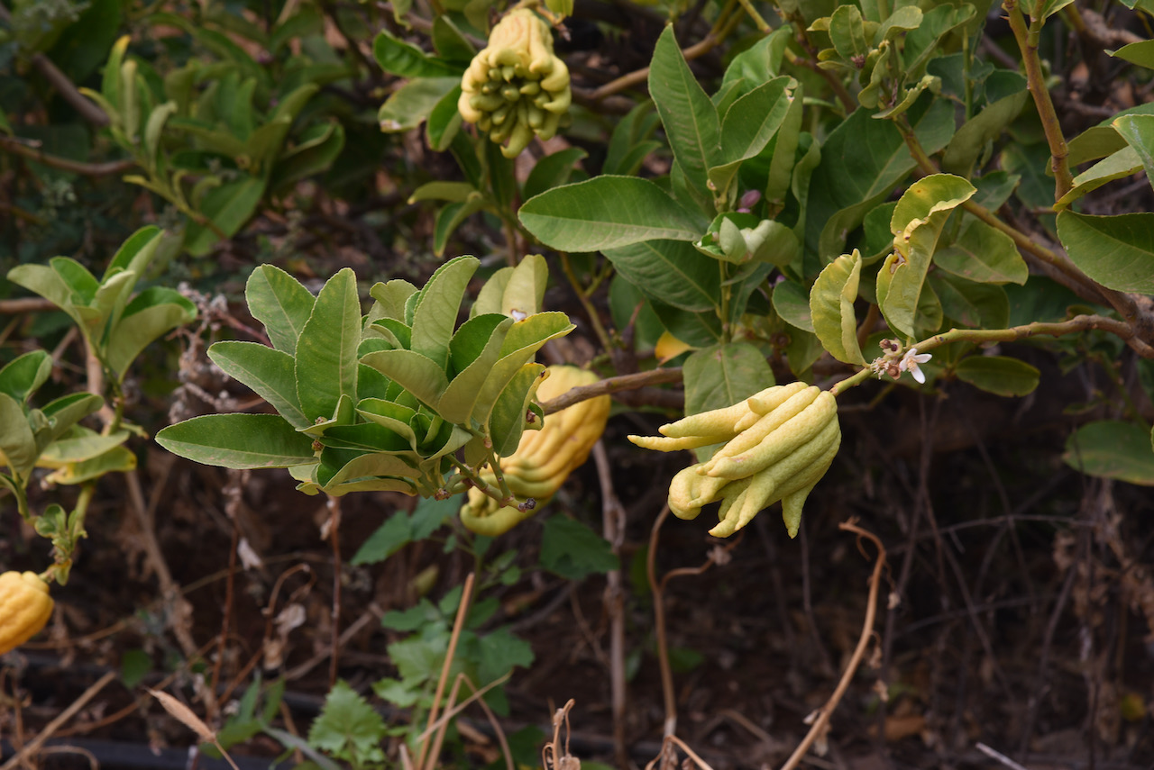
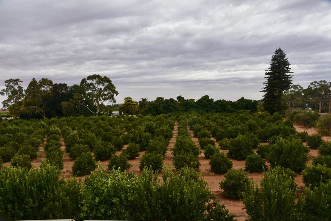
We then visited Orange World at Buronga which is a working 50 acre citrus property. We took a tractor train tour of the orchards and a commentary on the citrus industry. Fruit grown at Orange World includes various types of oranges, mandarin, grapefruit and avocados.
Orange World makes its own gourmet products including Murray marmalade which we purchased and can highly recommend.
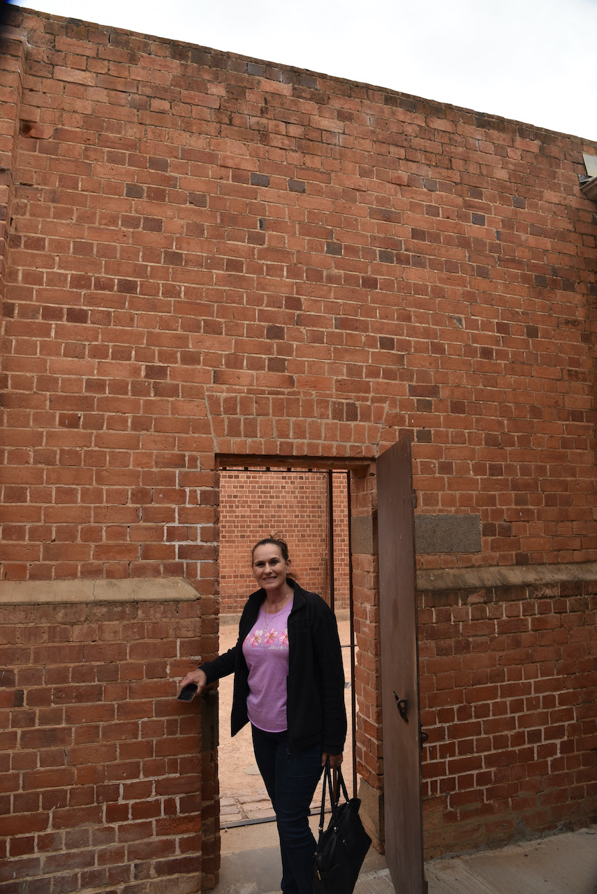
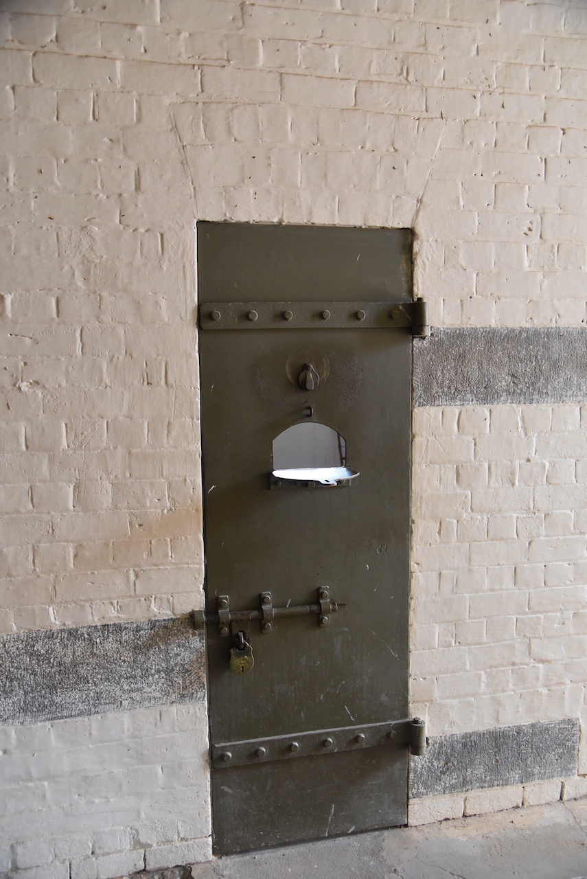
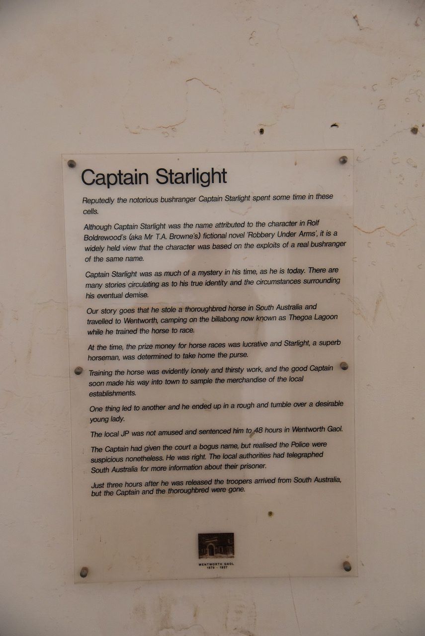
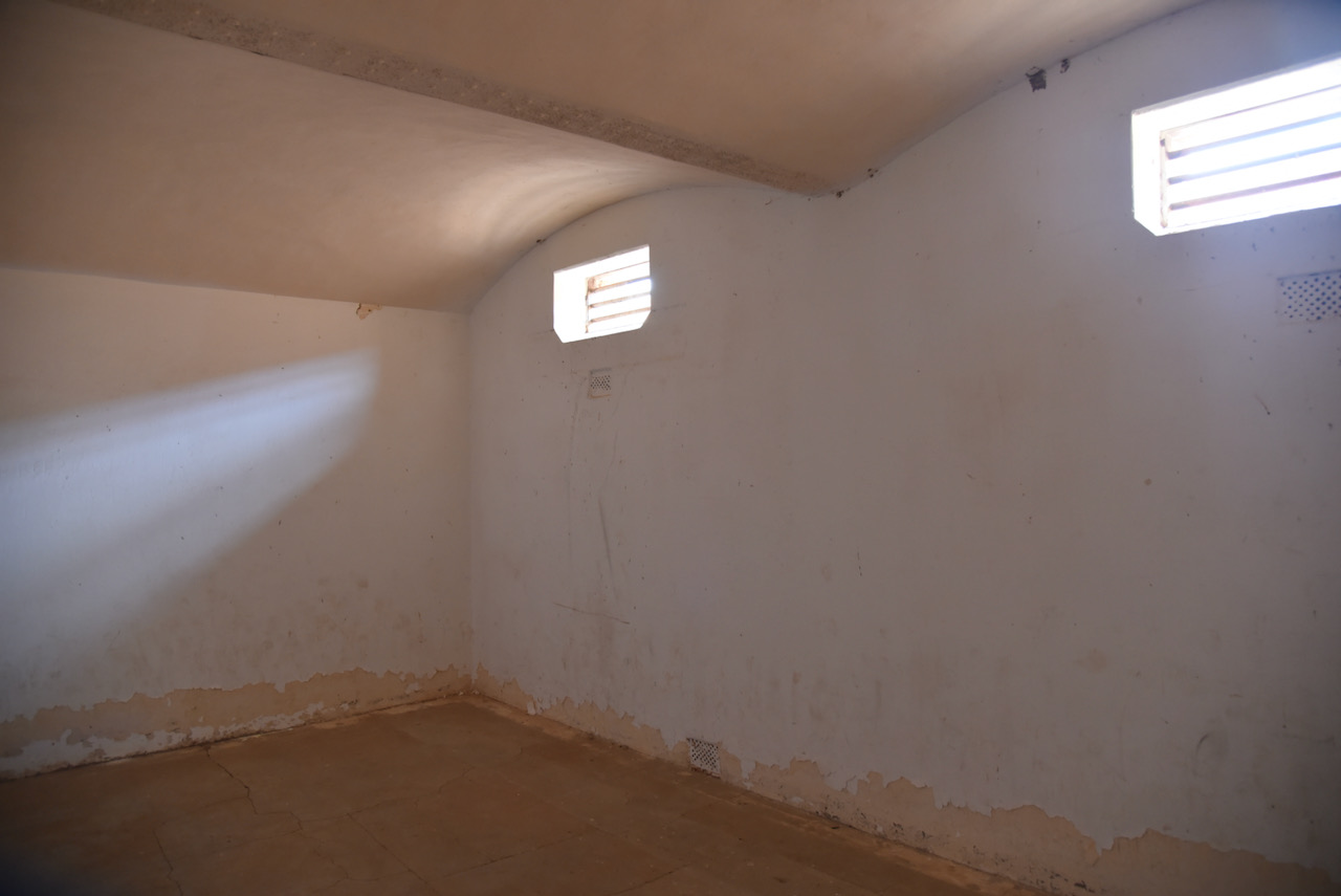
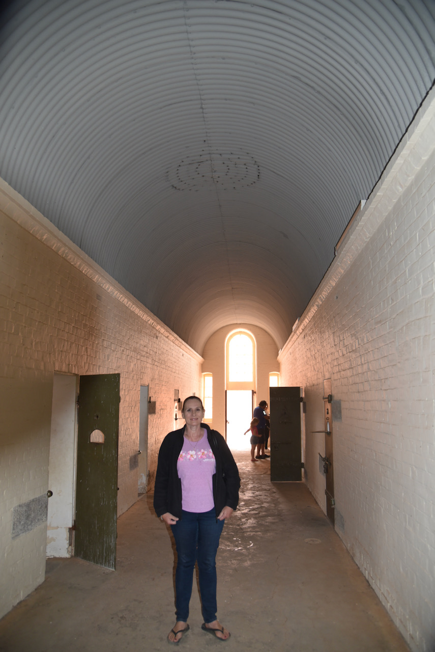
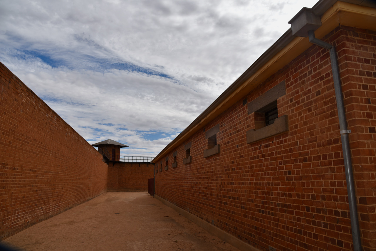
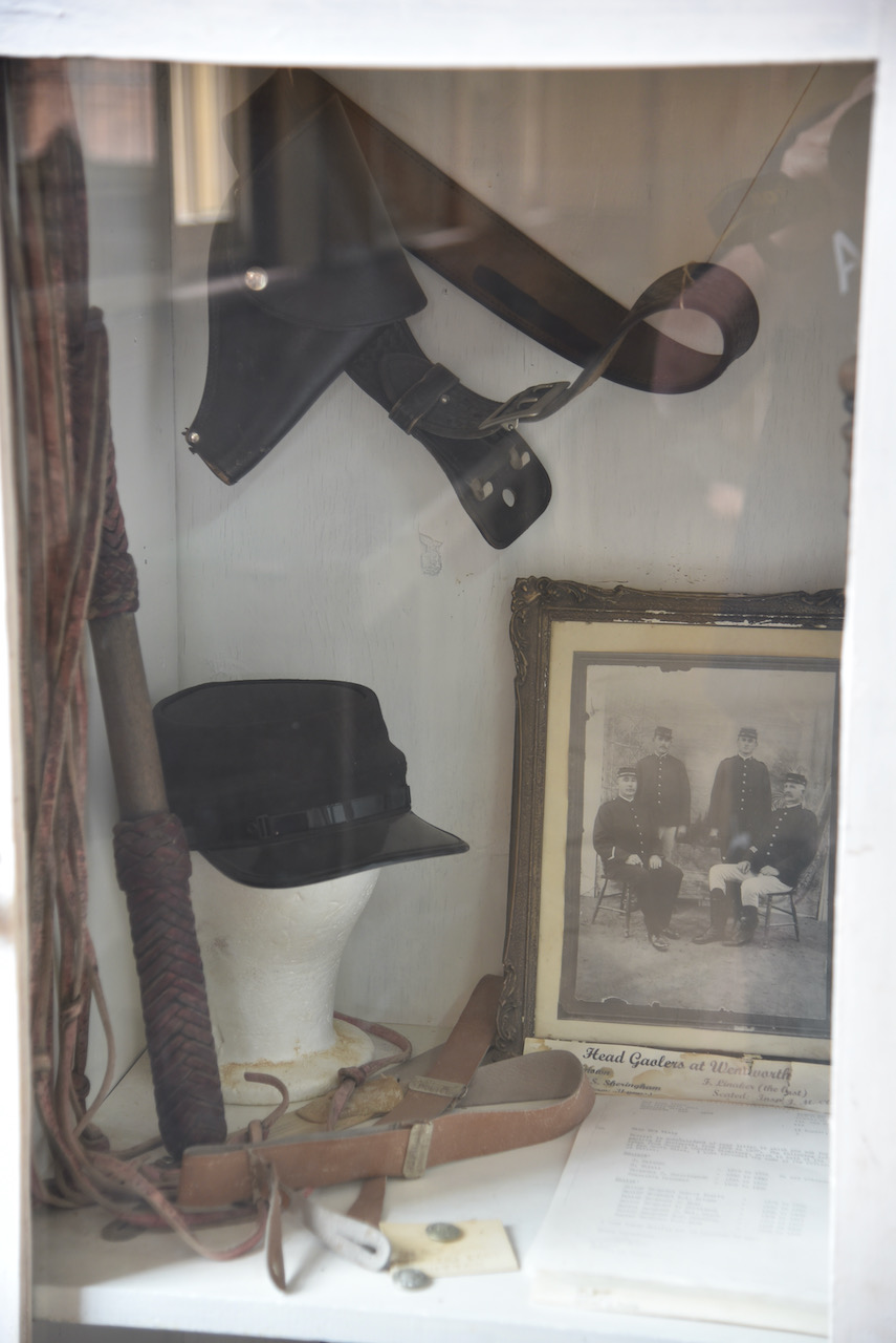
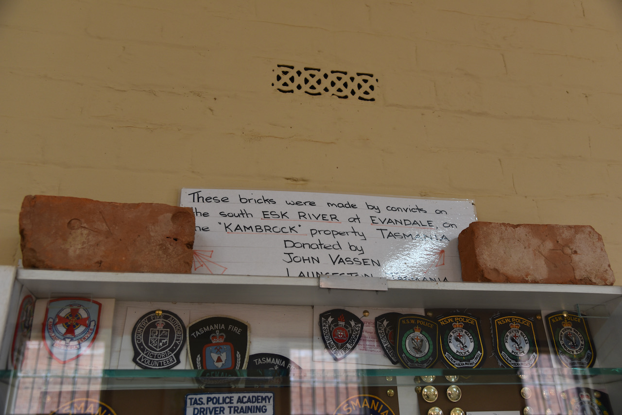
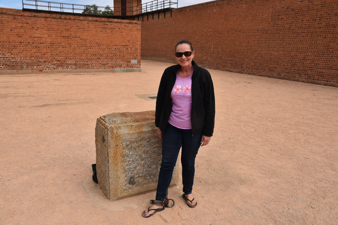
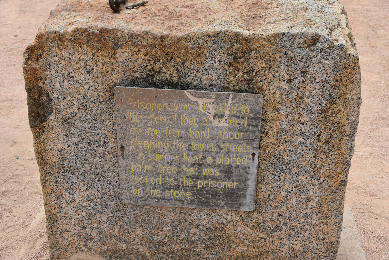
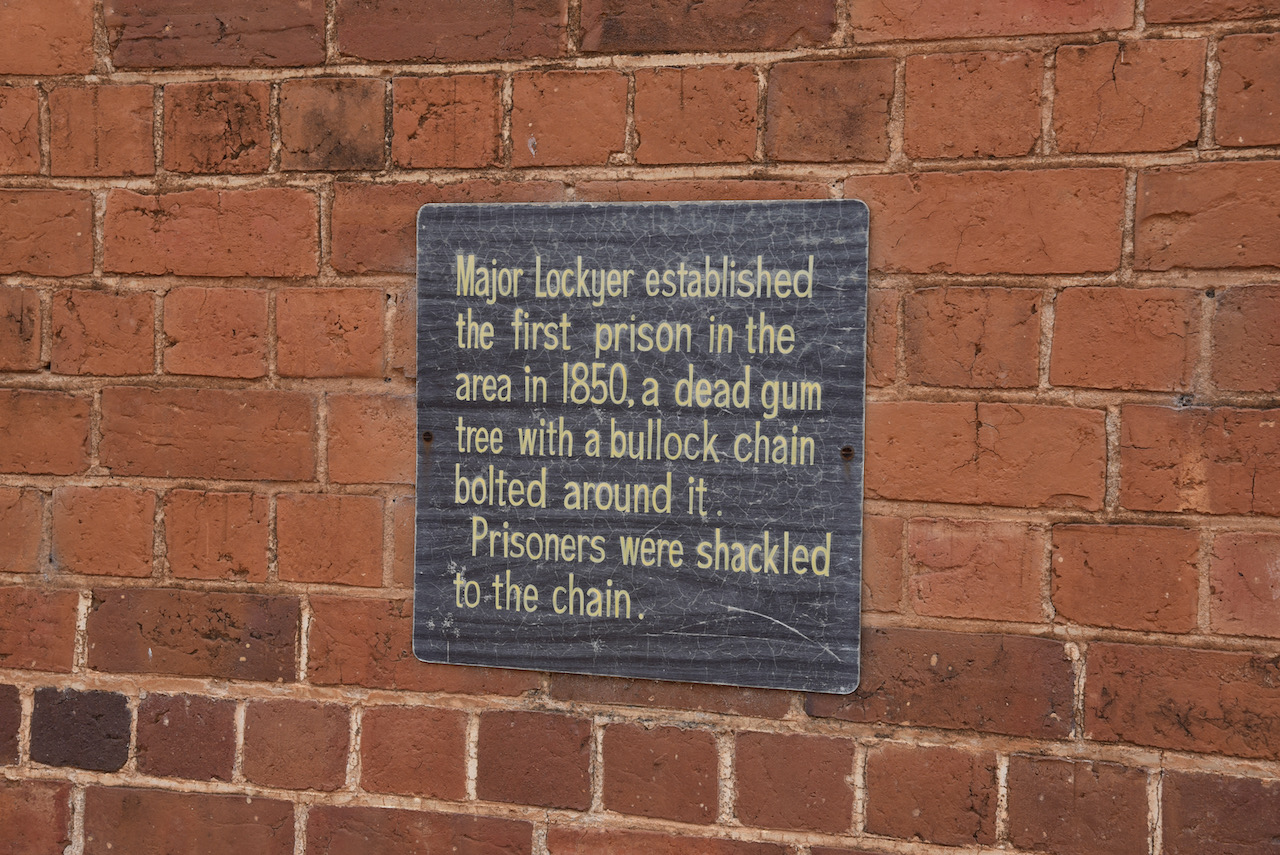
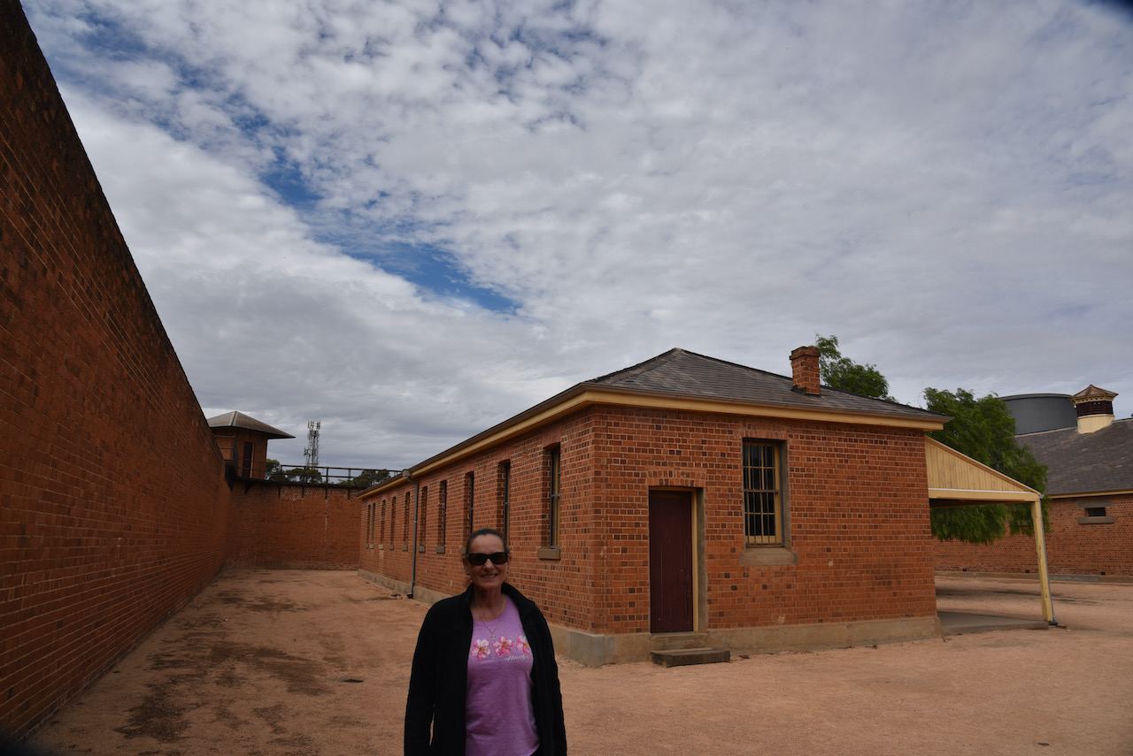
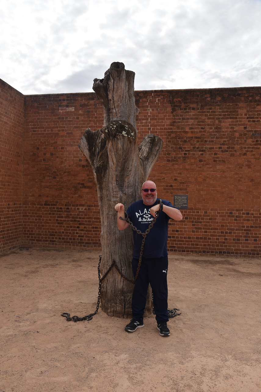
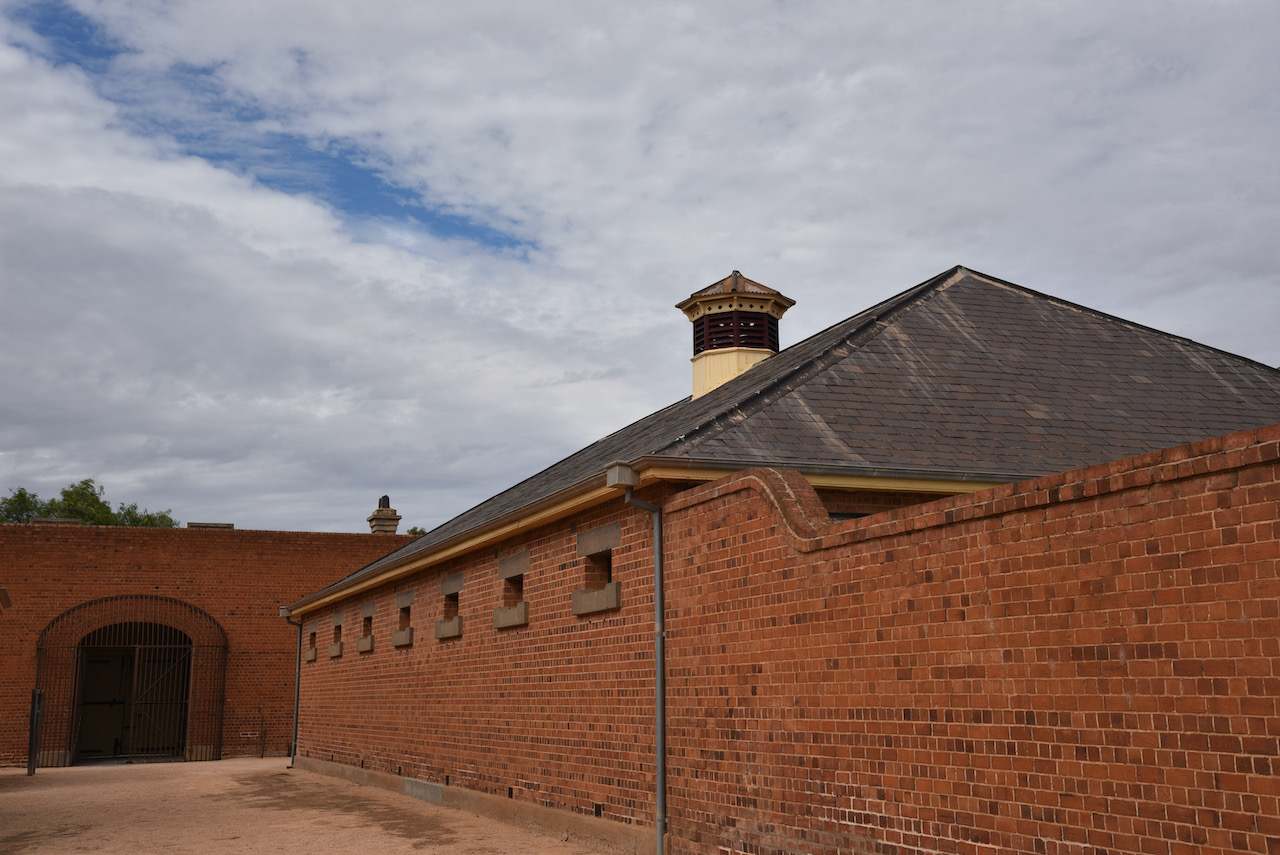
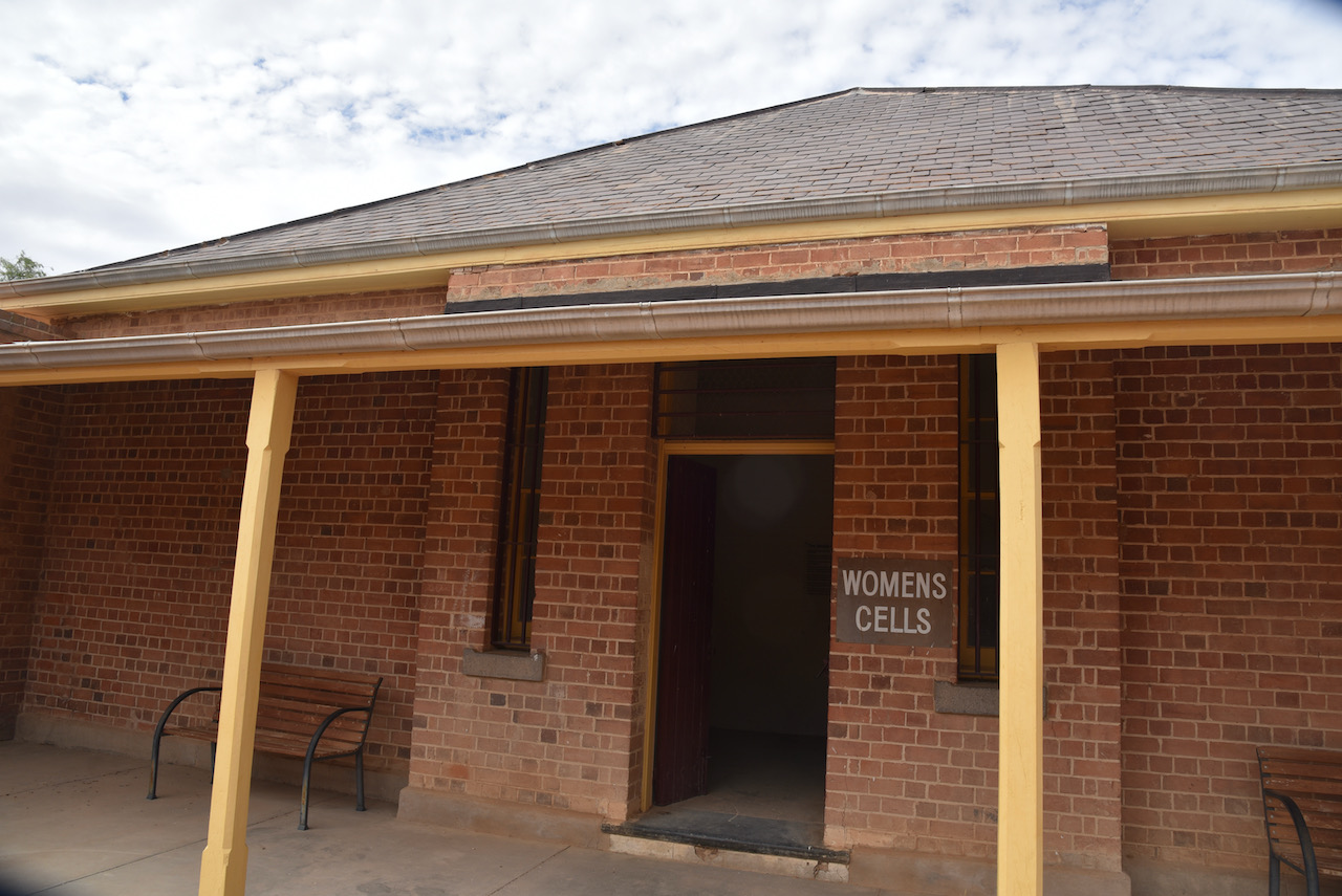
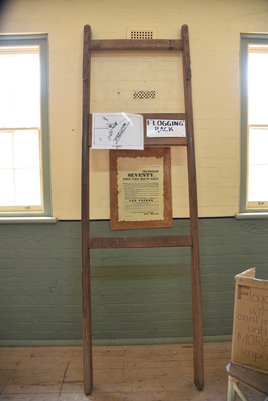
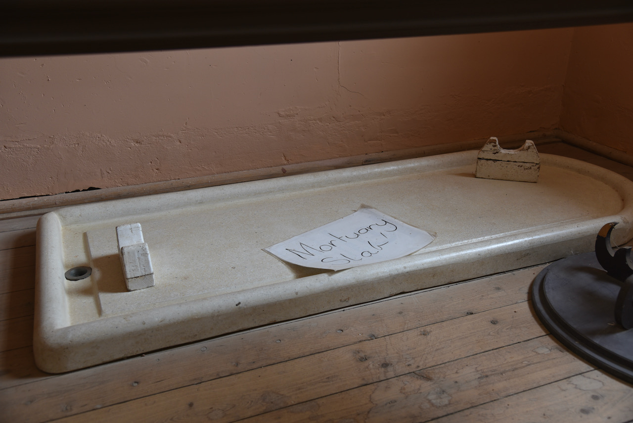
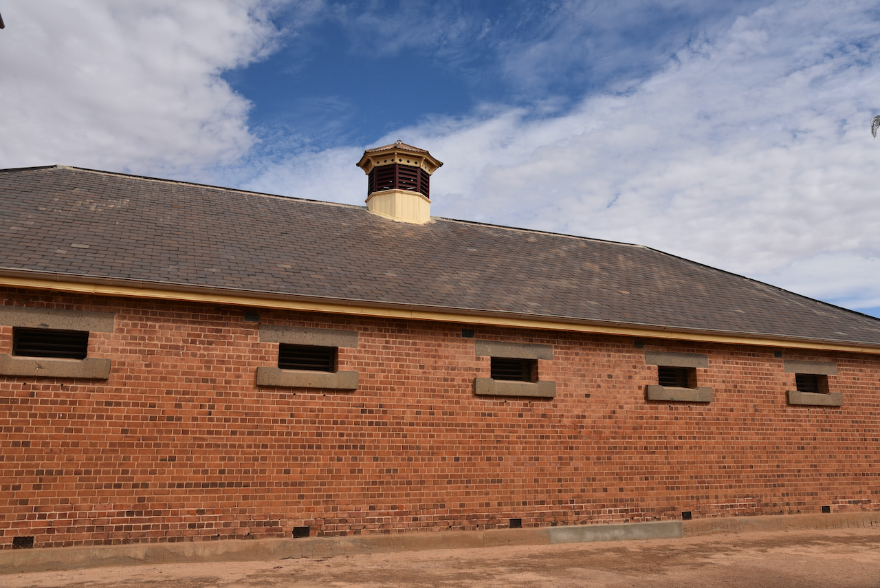
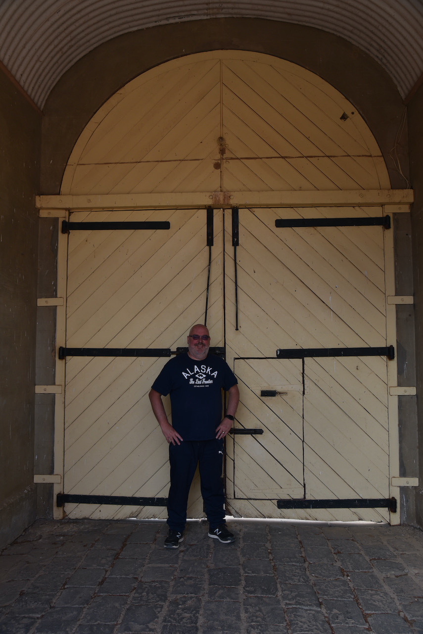
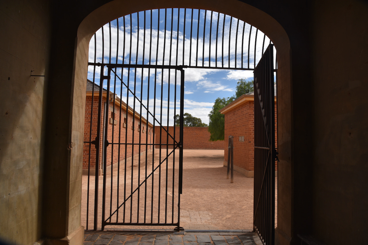
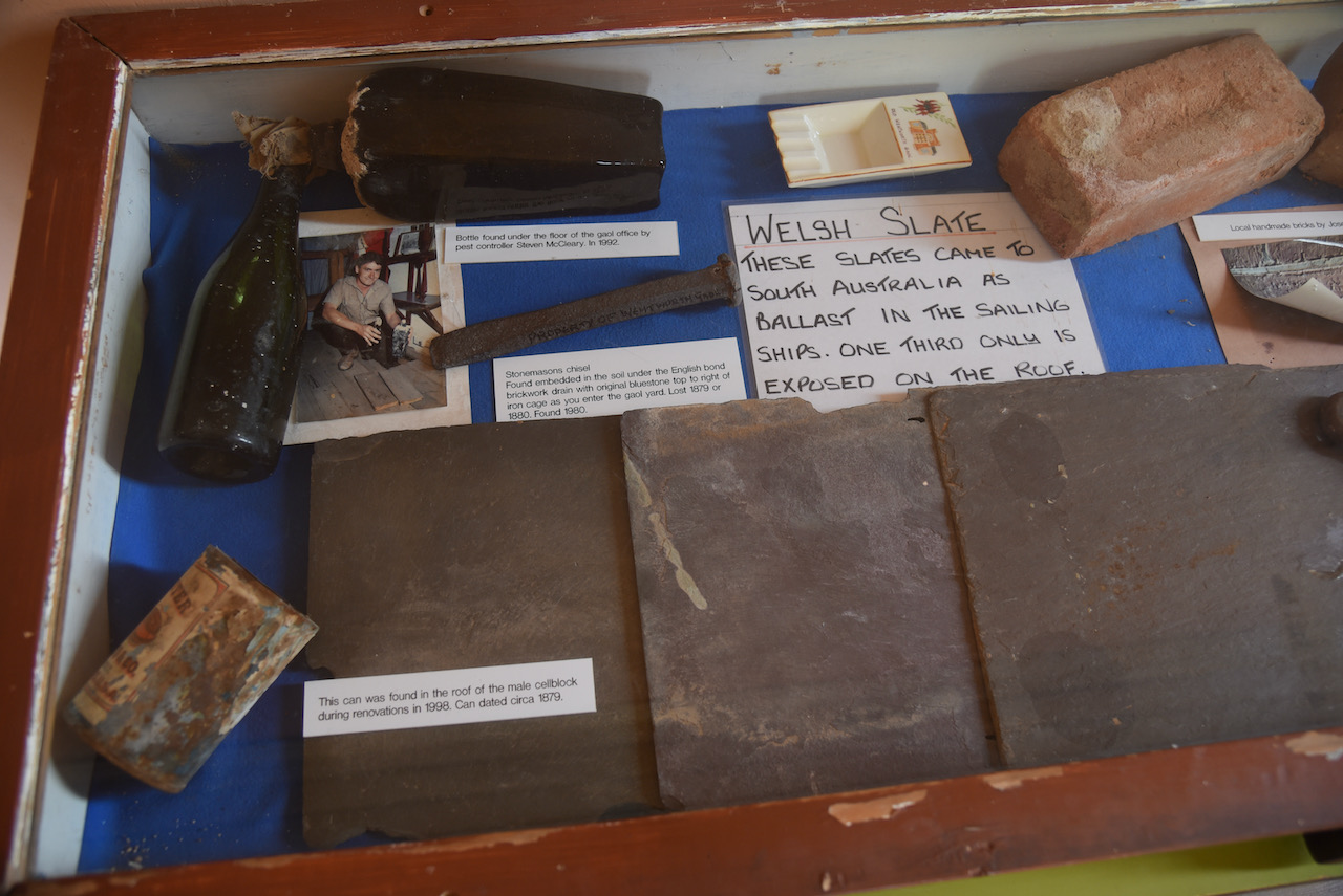
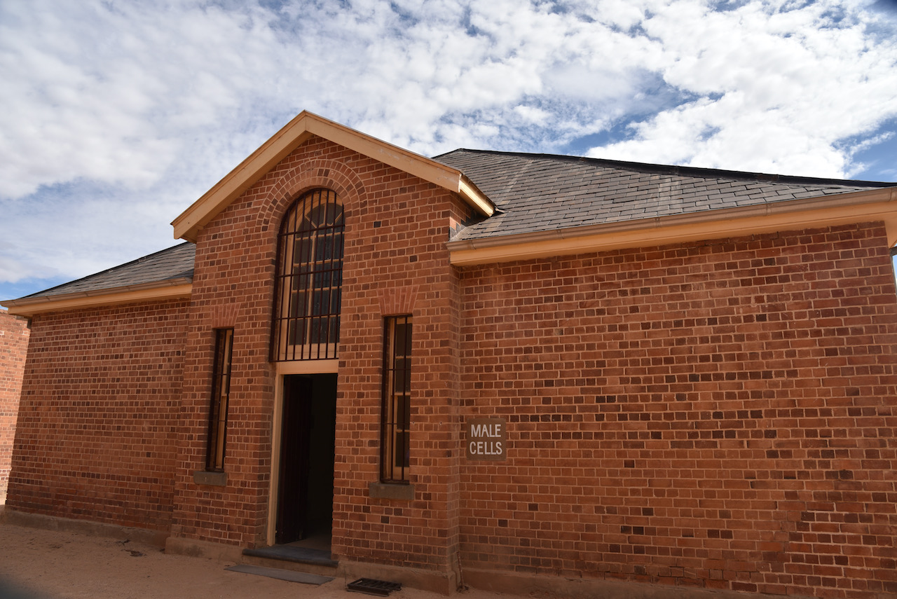
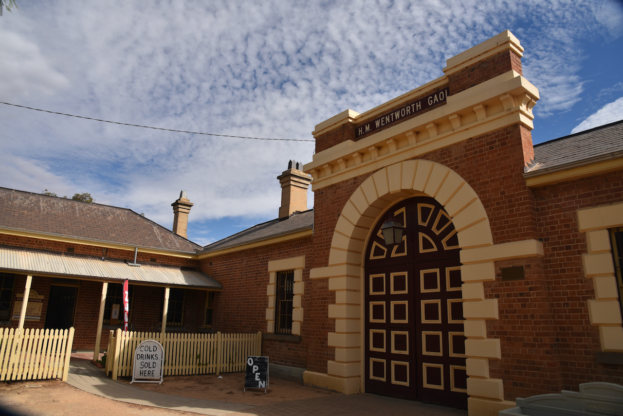
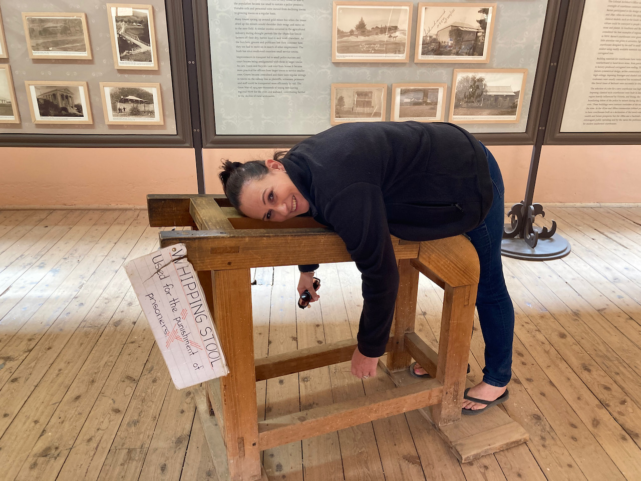
We then headed to the town of Wentworth in New South Wales and visited the old Wenworth Gaol which is a heritage listed former gaol and school building. The gaol was designed by colonial architect James Barnet and was constructed from 1879 to 1881 by Whitcombe Brothers, Hay. It was the first of the Australian designed gaols, followed by Hay and Dubbo.
The gaol operated until 1927. Following its closure as a gaol, the building was utilised as extra classrooms for the Wentworth Central School until 1963.
There is a lot to see here, with many excellent displays, and we spent a number of hours wandering through the old gaol buildings.
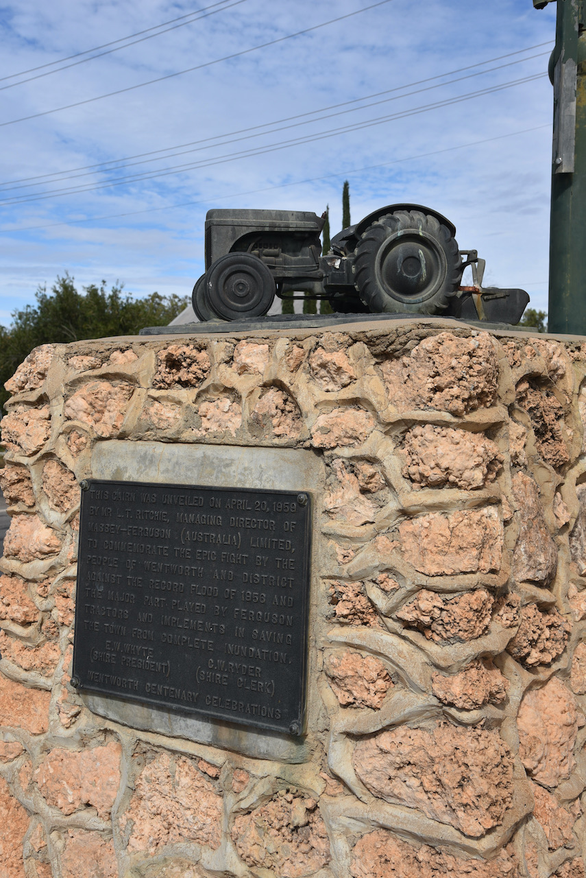
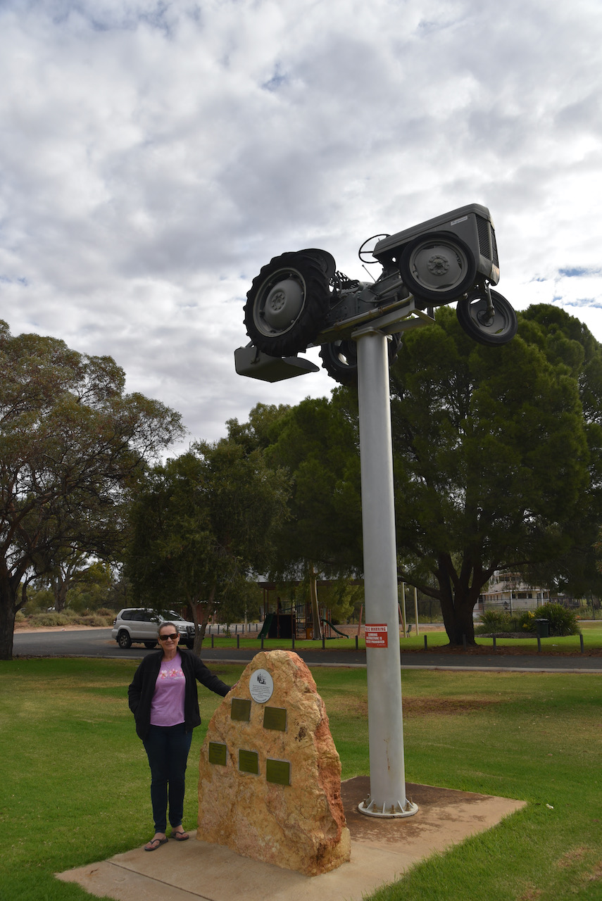
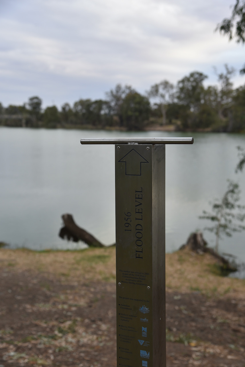
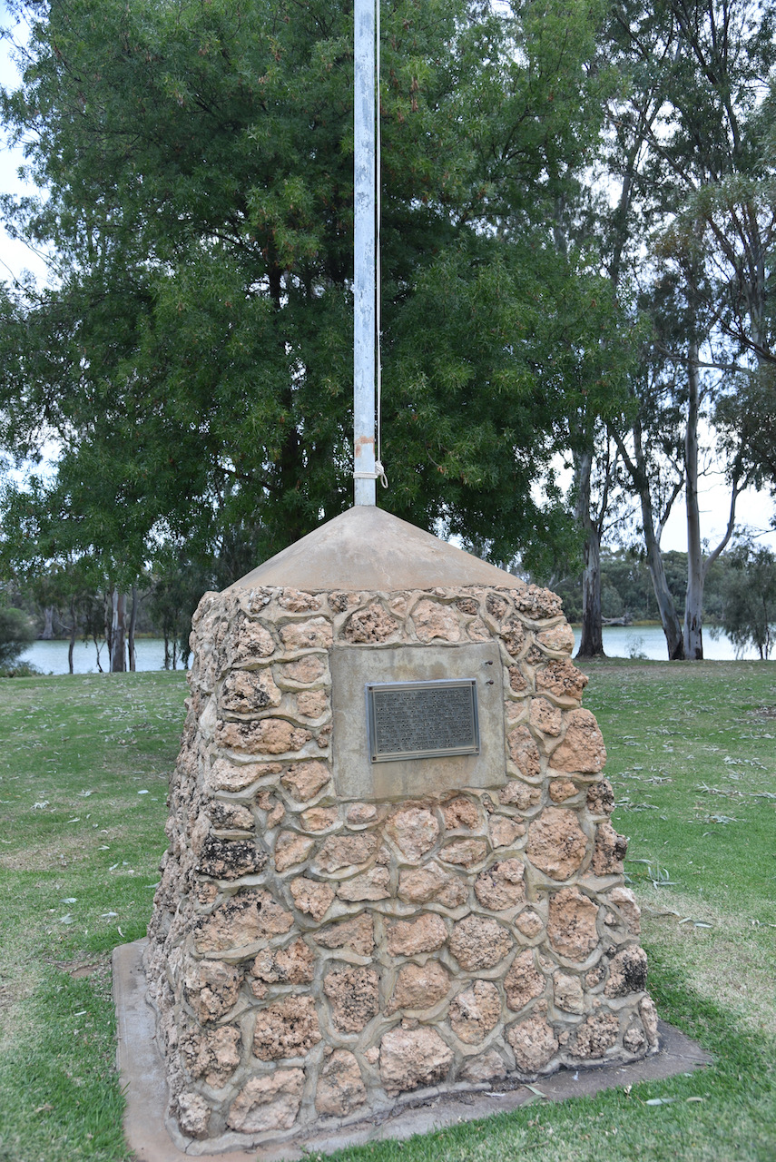
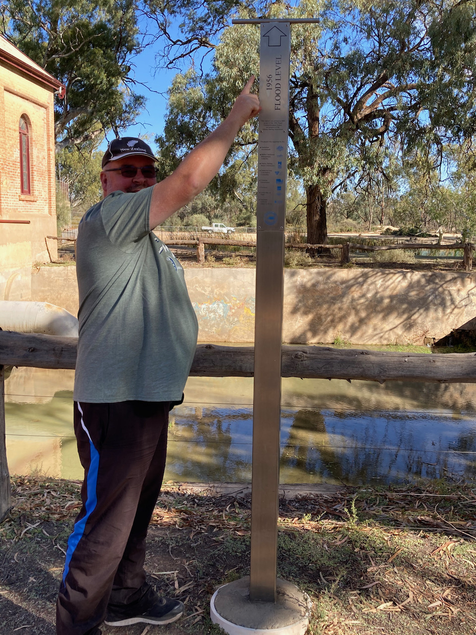
We then had a look at the Ferguson Tractor Monument in Wentworth. The monument was erected by the people of Wentworth in honour of the TEA20 Harry Ferguson tractors’ part in the construction of the massive levee banks that protected the town of Wentworth against the devastating 1956 Murray River floods.
The stone cairn sits at the height which the water from the floods would have reached had it not been for the clay levee banks put in place with the use of the Ferguson tractors.
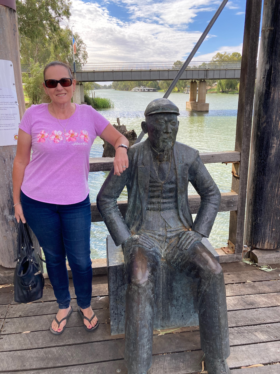
Next up we visited the Wentworth wharf and the Captain John Egge statue. Captain Egge was a Wentworth river captain and pioneer who lived from 1830 to 1901. He had arrived in Australia as a boy from China. He worked as a baker in Wentworth from 1857 for over three decades as a baker, river trader and riverboat owner.
In the early days Wentworth was the busiest inland port in New South Wales. During 1890 it was reported that some 425 paddle boats checked in at the Wentworth Customs Office. The record being 31 in just one wek. So prominent did the town become, that Wentworth was one of the last three places considered for the ‘capital’ of Australia at the time of Federation in 1901.
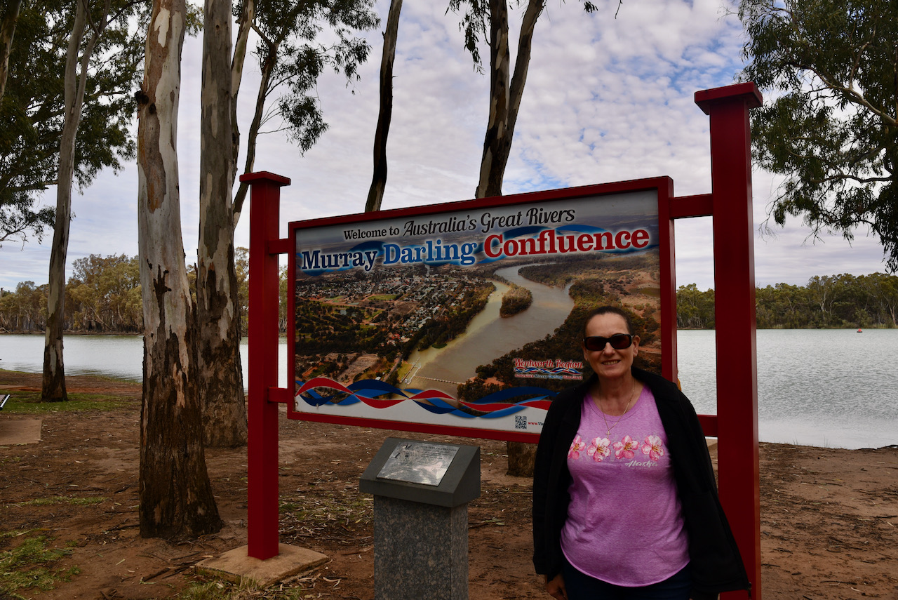
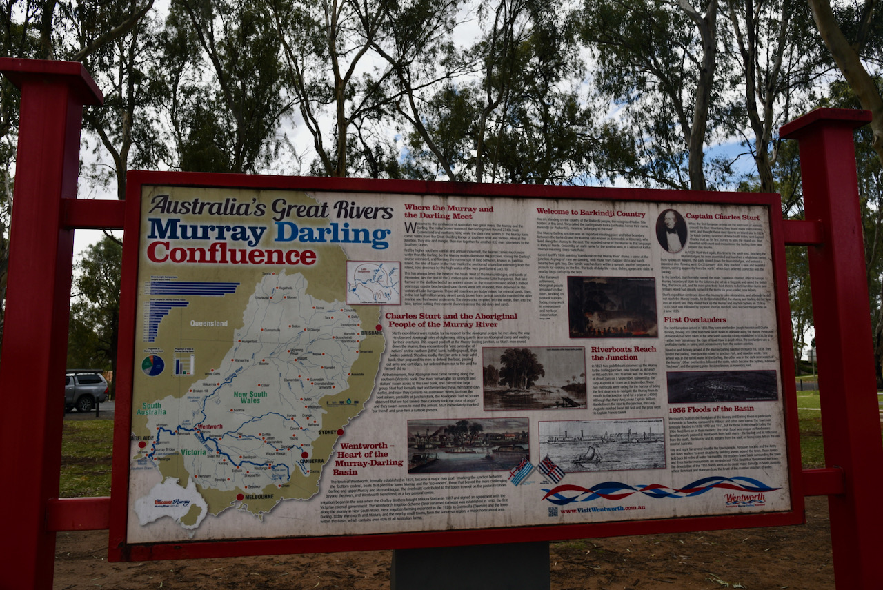
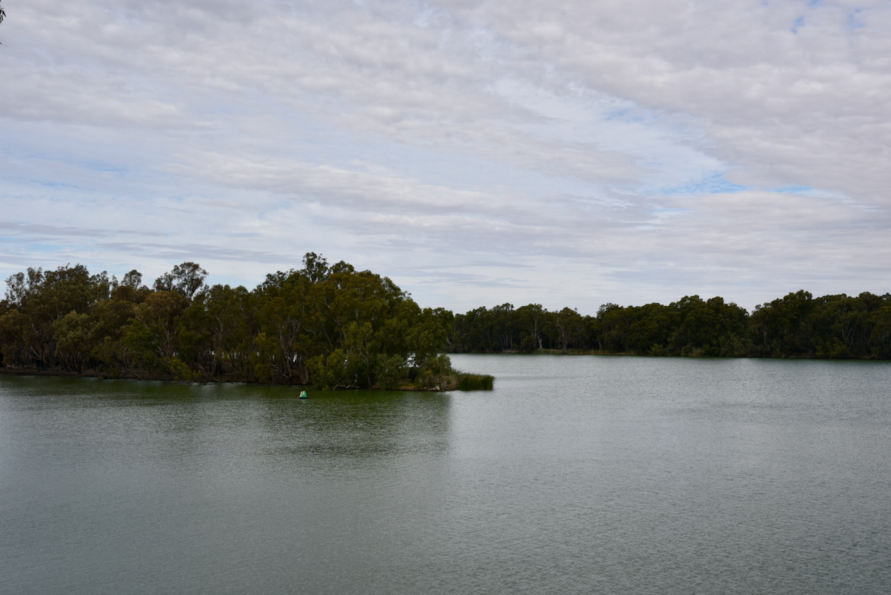
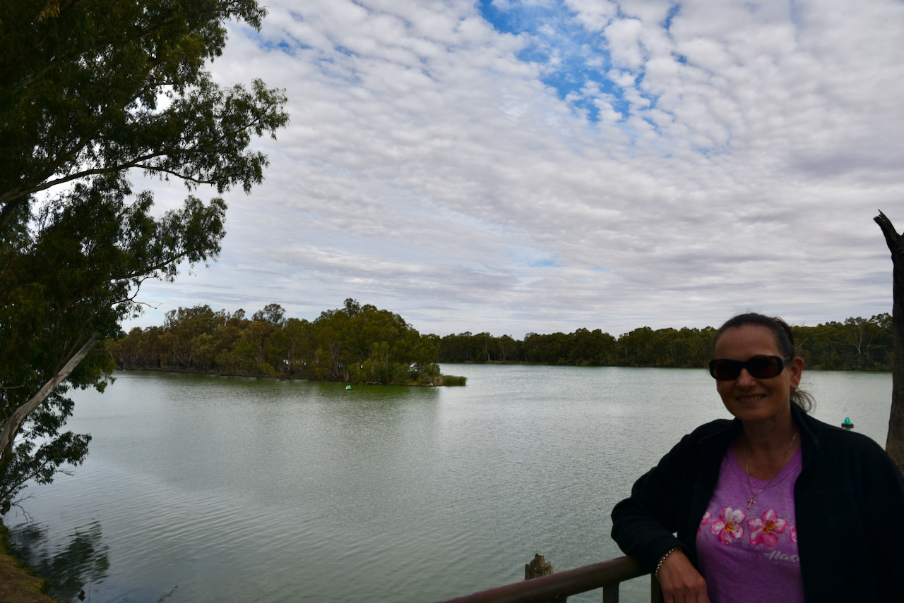
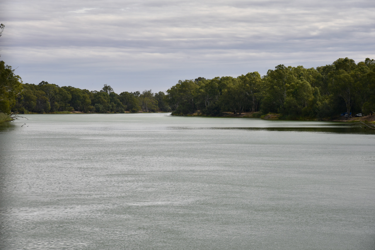
We then drove to the Murray River and Darling River junction and viewing tower. We climbed the tower and admired the view of the confluence of the Murray and Darling, which combined is the fourth largest river system in the world.
We then drove a short distance to have a look at Lock and Weir number 10 at Wentworth. The lock is 830 km from the river mouth and is 30.8 metres above sea level. Construction of the lock was completed in 1929.
We then drove out to Perry Sandhills, a very distinctive landmark in the flat floodplain behind the junction of the Murray and Darling Rivers. The sands originated in the river beds at a time when the rivers were much deeper and faster, and carried a sandy bedload rather than suspended clay as today. When the river flows dropped, sand from the exposed riverbeds was blown into river-side dunes, known as source-bordering dunes. The lunettes a Lake Mungo are also source-bordering dunes.
The dunes have not been directly dated, but they are at least 50,000 years old given the presence of fossils of giant extinct animals, the megafauna. The older layers could be over 100,000 years, dating back prior to the last ice age.
We headed back into Wentworth and had a look at McClymont House, a Murray Pine ‘drop log construction’ building which was built as Wentworth’s first court house in 1863. In 1879 it was replaced by the present structure. Later it became part of the Andrew McClymont home which was moved to this site in 1972 to enhance is preservation.
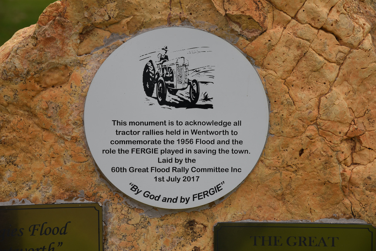
Nearby we also viewed the Tractor monument, which is to acknowledge all tractor rallies held in Wentworth to commemorate the 1956 Murray River flood and the role the Massey Ferguson tractor ‘Fergie’ plated in saving the town.
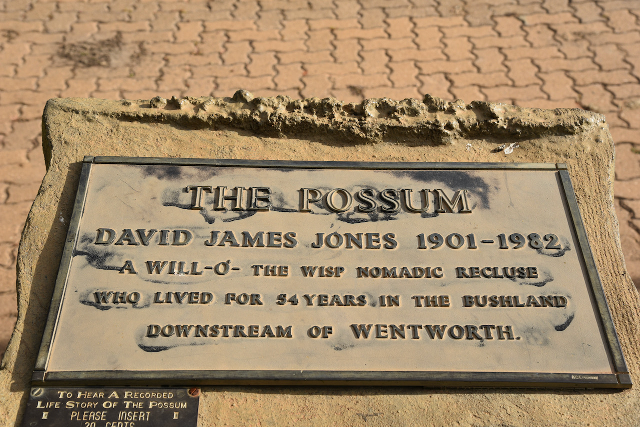
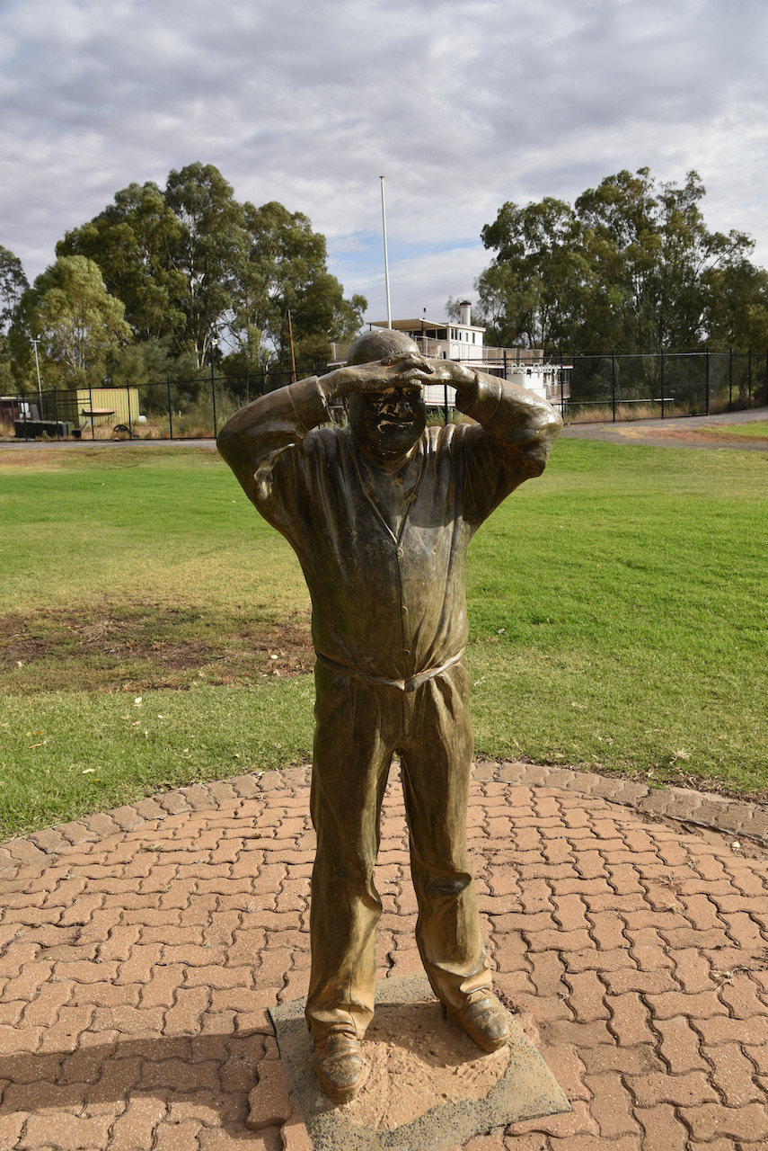
In the same park is a statue of ‘The Possum’. David James Jones (1901-1982) was a bush recluse who was born in New Zealand. He was shunned while attempting to get work around the Wentworth area as a shearer. As a result he shunned his back on society and headed for the bush and became a recluse. He was only ever seen by members of the public a few times in the next 52 years before his death.
The Possum’s body was found in 1982 at one of his camp sites on Ned’s Corner Station, about 70km west of Mildura. He was 81 years old.
We also had a look at the P.S. Ruby, which is a historic Paddle Steamer built at Morgan in South Australia by David Milne in 1907 for use by Captain Hugh King. The Ruby carried 30 passengers in style and comfort with three decks.
During the early 1930’s Ruby was taken off the run and was tied up at her home port of Morgan. In 1938 she was purchased and brought to Mildura and used as a houseboat. By 1968 the Ruby had deteriorated substantially and was purchased by the Wentworth Rotary Club and was towed to Wentworth.
In 1996 the Wentworth Rotary Club placed the Ruby into the trusteeship of the Wentworth Shire Council. Restoration then commenced and in July 2004 the Ruby was re-commissioned.
Nearby there is also an excellent display of old tractors, machinery, and various other old equipment.
Our next stop was Junction Island Nature Reserve near the junction of the Murray and the Darling. We had hoped to do some birdwatching here, but the small pedestrian bridge to the island was closed. We viewed the old Canoe tree which was made many ??? years ago by local aboriginals.
To make the canoe, the first step the aborigines took was to make an outline of the shape of the canoe they required with cutting stones or stone tools. Once this was marked, they cut deeply into the tree to what is known as the heartwood or xylem, prying the bark off in one piece with a stick or rocks.
Feeling very disappointed that the Junction Island Nature Refuge was closed, we headed to the second option, the Thegoa Lagoon & Reserve drive. This is 4WD only with a number of marked features including canoe trees. Thegoa Lagoon was a great source of ‘bush tucker’ for aboriginals including plants like nardoo, cumbungi, and ruby salt bush, as well as kangaroos, lizards, yabbies, mussels and fish.
Unfortunately the Thegoa Lagoon was dry and bird watching opportunities were very limited. Thegoa Lagoon is an ephemeral (non-permanent) freshwater wetland having wet and dry cycles. Thegoa is believed to be an aboriginal word. The area was surveyed by Government Surveyor Francis McCabe and he first recorded the name Thegoa in 1850. He employed aboriginal people in order to follow the instructions of Surveyor-General Thomas Mitchell to record aboriginal place names wherever possible.
The only birds that we saw which were prevalent were White winged Choughs.
We then left Thegoa Lagoon and took some 4WD tracks which followed the Murray River, stopping every now and again to enjoy the views.
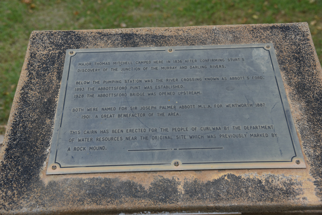
We then took the Silver City Highway and stopped briefly in the little town of Curlwaa. The town takes its name from an aboriginal word meaning native peach, the Quandong tree which is indigenous to the area.
There is a small monument here to commemorate the famous explorer Major Mitchell who camped in the area in 1836 after confirming Captain Charles Sturt’s discovery of the junction of the Murray and Darling Rivers.
There is also a monument re the 1956 floods. It reads:-
“Erected by the Water Conservation and Irrigation Commission to commemorate the epic struggle of local residents, volunteers from surrounding districts, detachments of the armed forces and Police Department, supported by Ladies organizations against the waters of the record floos of July and August 1956. By their efforts the Curlwaa irrigation area was saved from complete inundation by the flood waters which reached and held for six consecutive days a height of 30 feet on the Curlwaa gauge’.
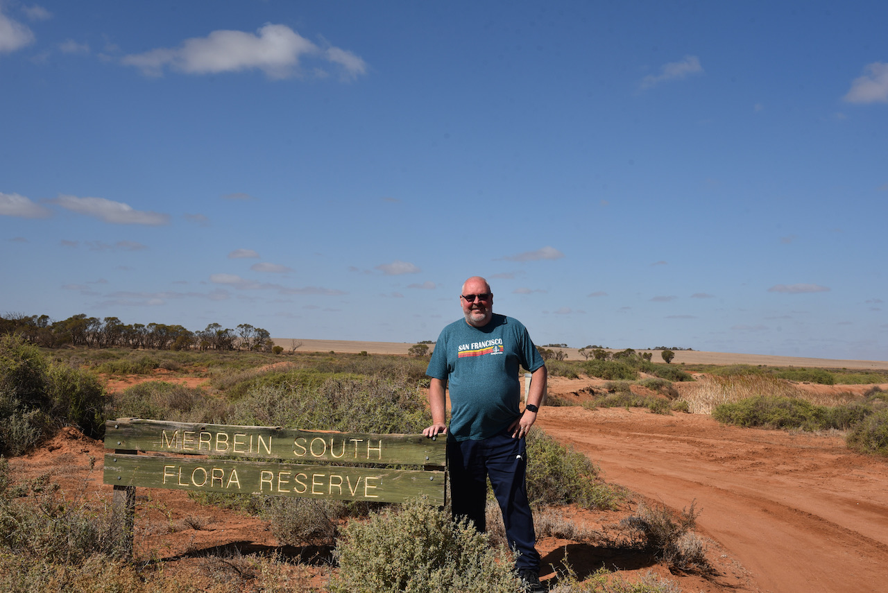
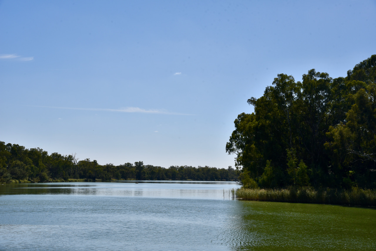
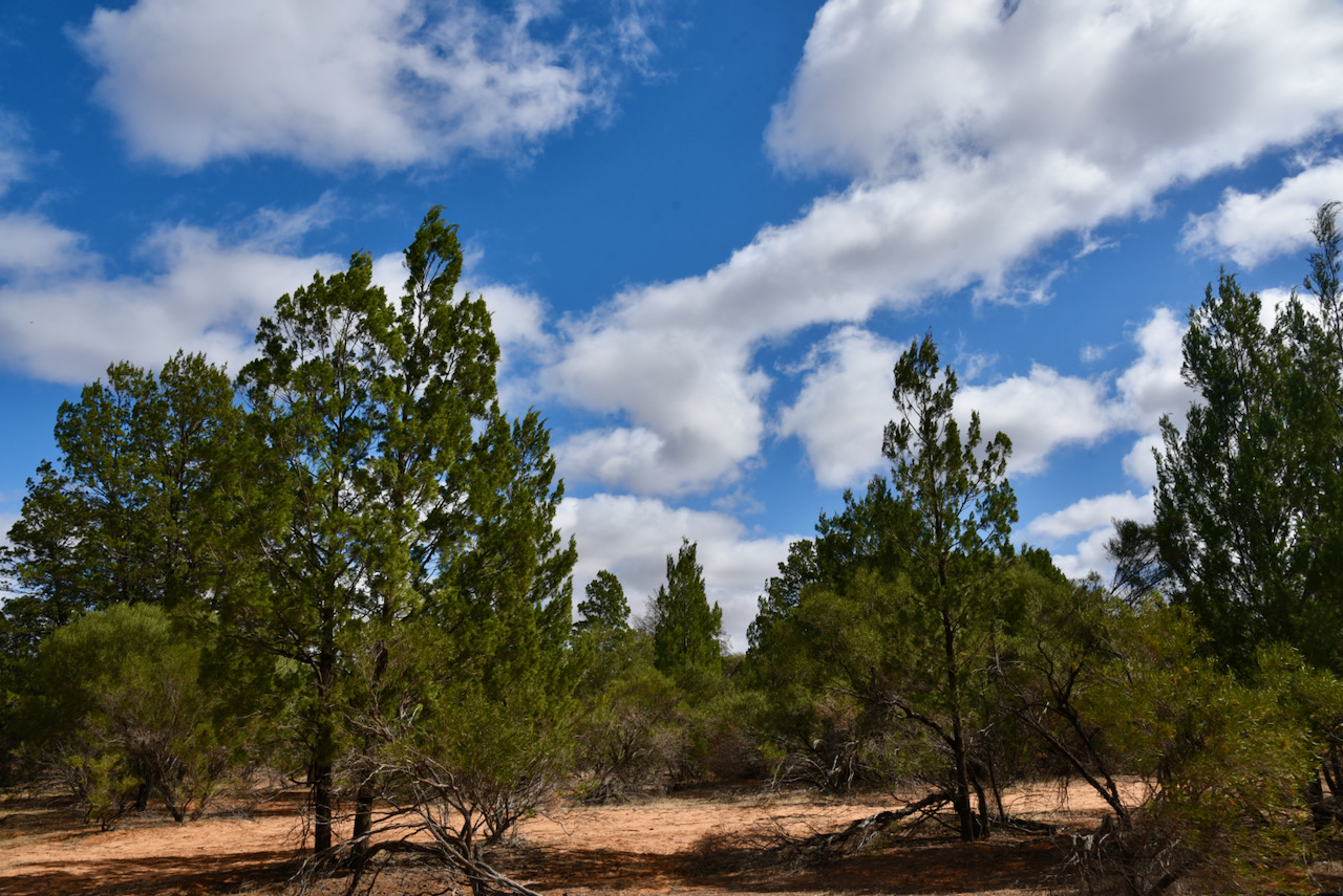
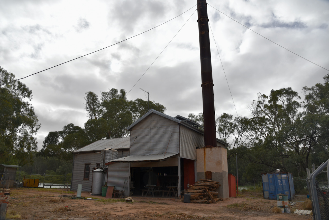
We then crossed over Abbortsford Bridge, over the mighty Murray River and back into the State of Victoria. We decided to do a quick activation of the Merbein South Flora Reserve VKFF-2382, from the vehicle.
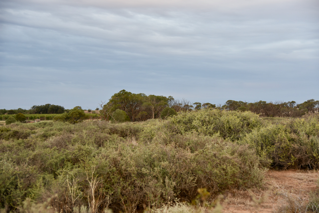
We had been ‘warned’ about this little flora reserve which apparently was not the prettiest of parks.
Above:- Map showing the location of the Merbein South Flora Reserve. Map c/o Protected Planet.
Merbein South Flora Reserve is a tiny park, just 0.02 km² in size. It was established in 1990. It can be reached via Midgey Road which runs off McCarthy’s Road.
Above:- Aerial view of the Merbein South Flora Reserve. Image c/o Protected Planet.
The park is signposted and was quite easy to find once we consulted a map. The park takes its name from the town of Merbein. The settlement in the area was originally known as White Cliffs due to the white cliffs of the nearby Murray River. It was intended to be renamed “Merebin”, reputedly an Aboriginal name of a local sandhill, but it was mistakenly registered as “Merbein” instead.
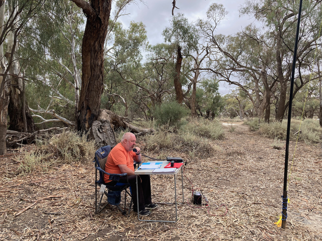
It was late by the time we reached the park and we did not set up the portable gear, but rather, operated from the vehicle.
First in the log was Hans VK6XN who was activating the Blackwood River National Park VKFF-2949. Marija and I both logged Hans for a Park to Park contact.
We then moved down to 7.160 and I called CQ. This was answered by Brett VK2BDS, followed by Mark VK4SMA, and then Brian VK3BBB. After 5 minutes I had contact number 10 in the log, a QSO with Greg VK4/NN3Z.
I then swapped the mic with Marija and she soon had 10 contacts in the log, qualifying the park for VKFF. Contact number 10 was with Daryl VK3AWA.
Marija then handed me back the mic to see how many contacts I could log before we had to head back into Mildura. We did not want to miss out on a meal. I logged a total of 30 stations on 40m from VK2, VK3, VK4, VK5, VK6, and New Zealand. This included a Park to Park QSO with Tony VK3XV/p who was activating the Bass River Mouth Nature Conservation Reserve VKFF-2949.
To complete the activation we quickly ducked down to the 80m band to log our good friend Ivan VK5HS who was unable to hear us on the 40m band.
With 31 contacts in the log for me, and 11 for Marija, we headed off for our evening meal.
Marija worked the following stations on 40m SSB:-
VK6XN/p (Blackwood River National Park VKFF-2949)
VK4BXX
VK4/NN3Z
VK2PBC
VK3PF
VK4FDJL
VK4SMA
VK2ABS
VK2PKT
VK3AWA
VK3YV/p (Bass River Mouth Nature Conservation Reserve VKFF-2181)
I worked the following stations on 40m SSB:-
VK6XN/p (Blackwood River National Park VKFF-2949)
VK2BDS
VK4SMA
VK3BBB
VK2CCP
VK4KC
VK4MAD
VK4DOG
VK4BXX
VK4/NN3Z
VK3AWA
VK3YV/p (Bass River Mouth Nature Conservation Reserve VKFF-2181)
ZL4NVW
ZL1THH
VK2PBC
VK2YK
VK5GA
VK4HNS
VK2PKT
VK2QM
VK3NCR
VK2IO
VK5SCR
VK2GMC
VK3ZK
VK3ANL
VK3MPR
VK3ARH
VK3ZPF
VK6JK
I worked the following station on 80m SSB:-
VK5HS
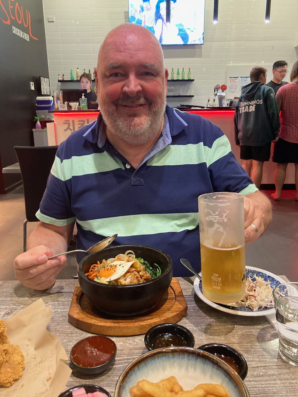
We headed back to our apartment and freshened up and headed out for dinner at the Seoul Korean restaurant in Mildura. What a sensational meal!
Today was day seven of our trip (12th April 2021) and after 2 days of lots of radio we decided to spend most of the day sightseeing in and around Mildura in north-western Victoria. We also had a commitment in the evening at the home of Cam VK2DG.
We again headed down the street to get breakfast and then drove across the Murray River into New South Wales and visited the Australian Inland Botanic Gardens at Mourquong. This is the southern hemisphere’s first semi-arid botanical gardens and was established in 1989.
We could have spent hours here, but we needed to be back in Mildura at about 10.00 a.m. for a cruise along the Murray River. There is a lot to see at the Botanicl Gardens.
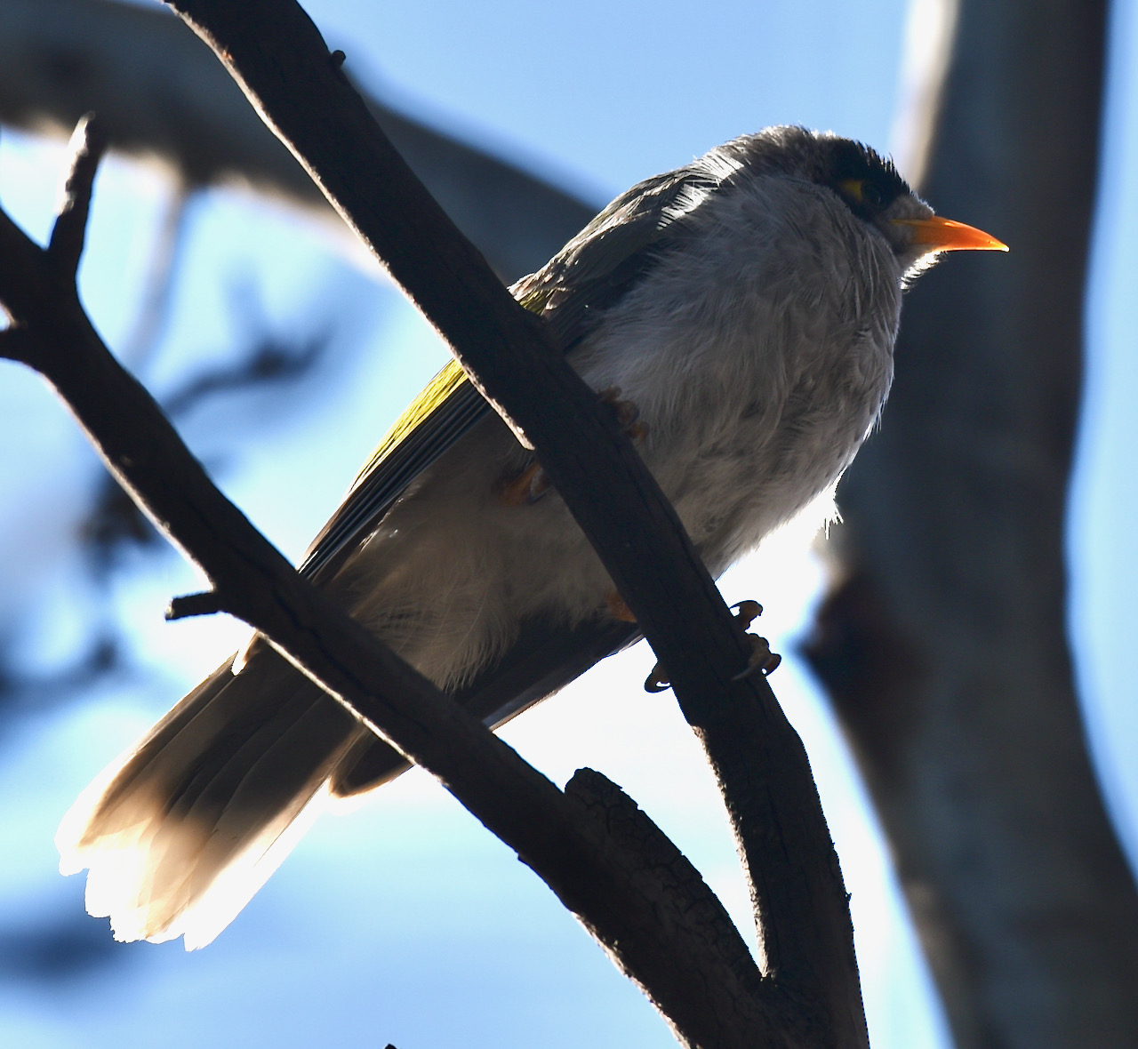
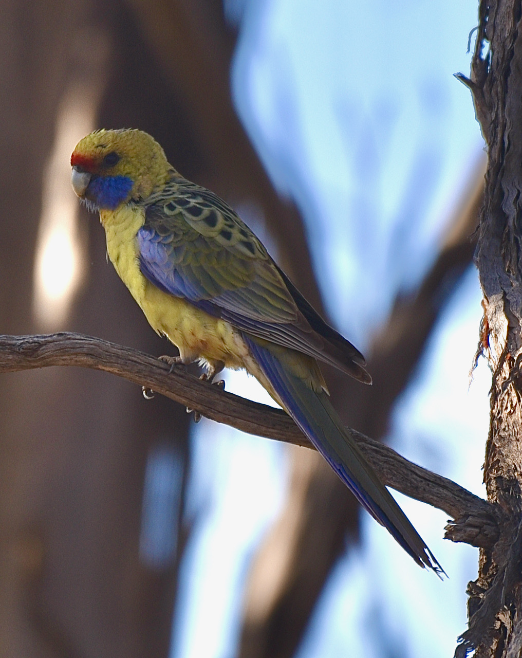
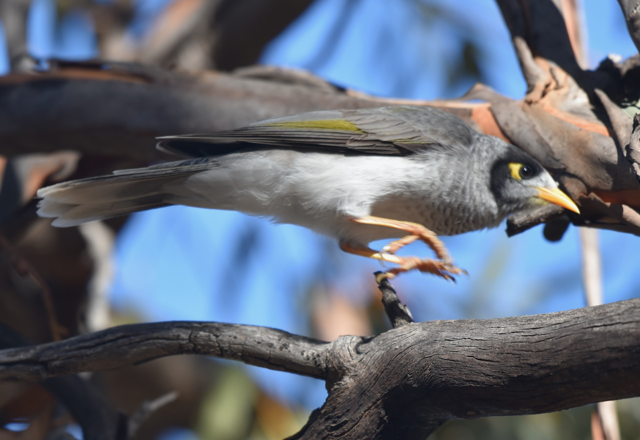
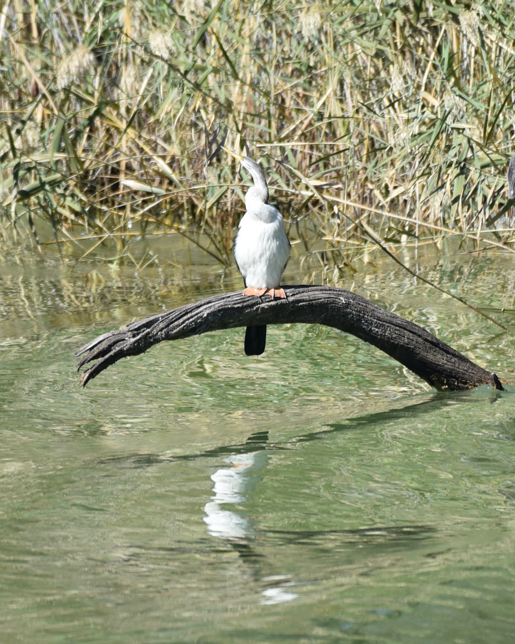
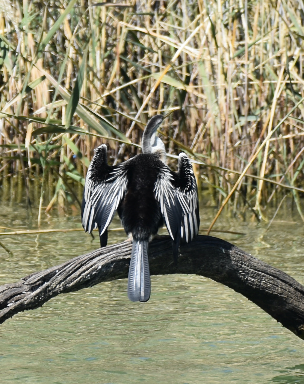
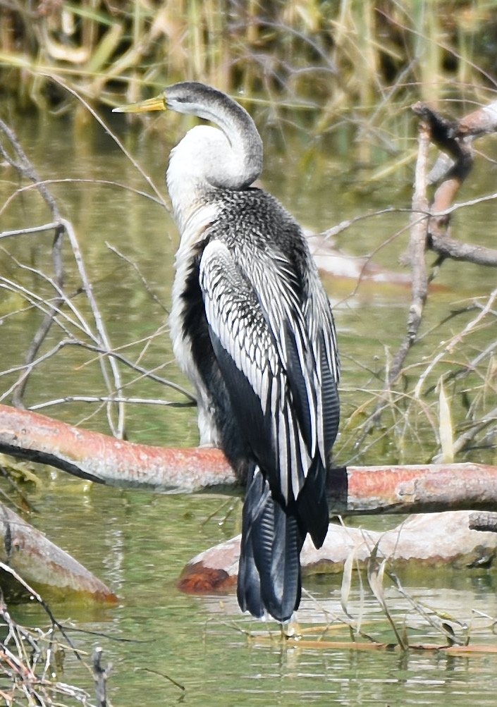
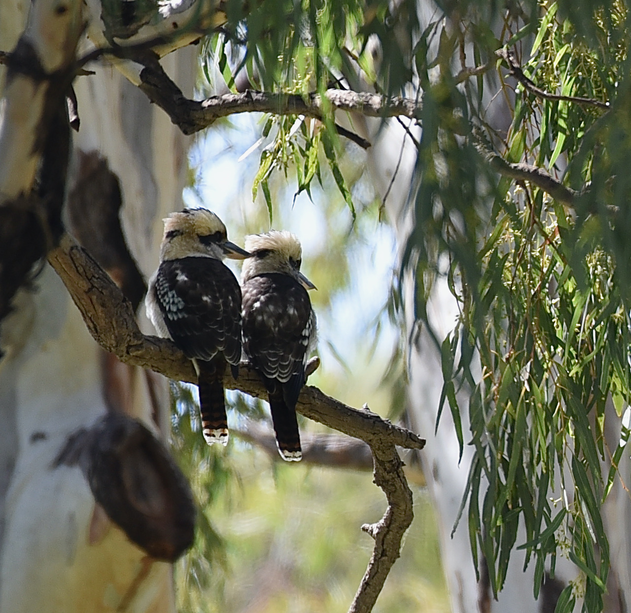
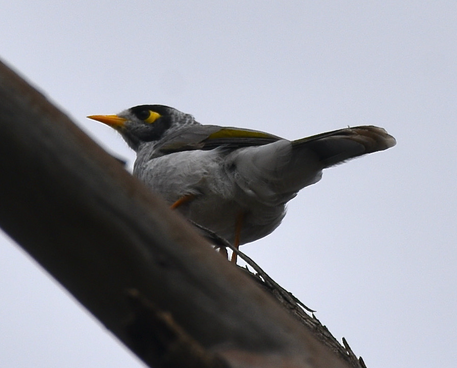
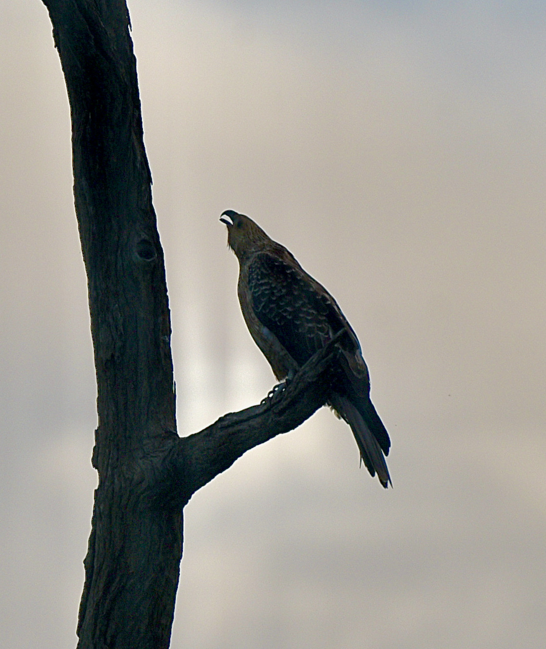
We undertook one walk in the park, The Nature Trail. This little area of native shrubs, bushes, and trees was absolutely alive with birdlife. I spent quite a bit of time here taking snaps, some of which can be seen below.
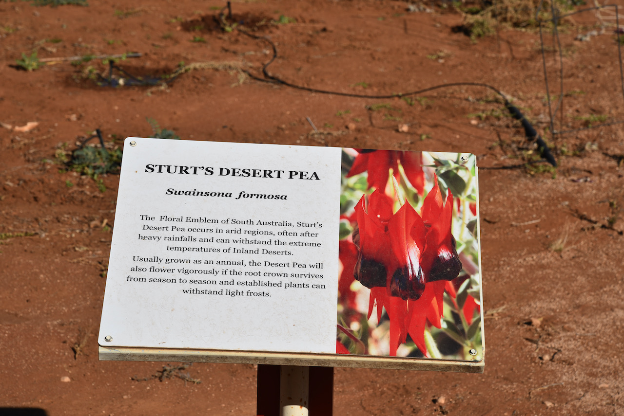
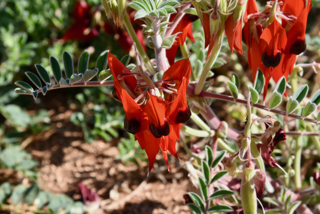
Another interesting spot in the park which looked at was the Sturt Desert Pea bed. Swainsona formosa, or the Sturt Desert Pea is South Australia’s floral emblem. It is famous for its distinctive blood-red leaf-like flowers. The common name of the plant is named in honour of explorer Charles Sturt who recorded seeing large quantities of the flowers while exploring central Australia during 1844. The scientific name honours the naturalist Isaac Swainson
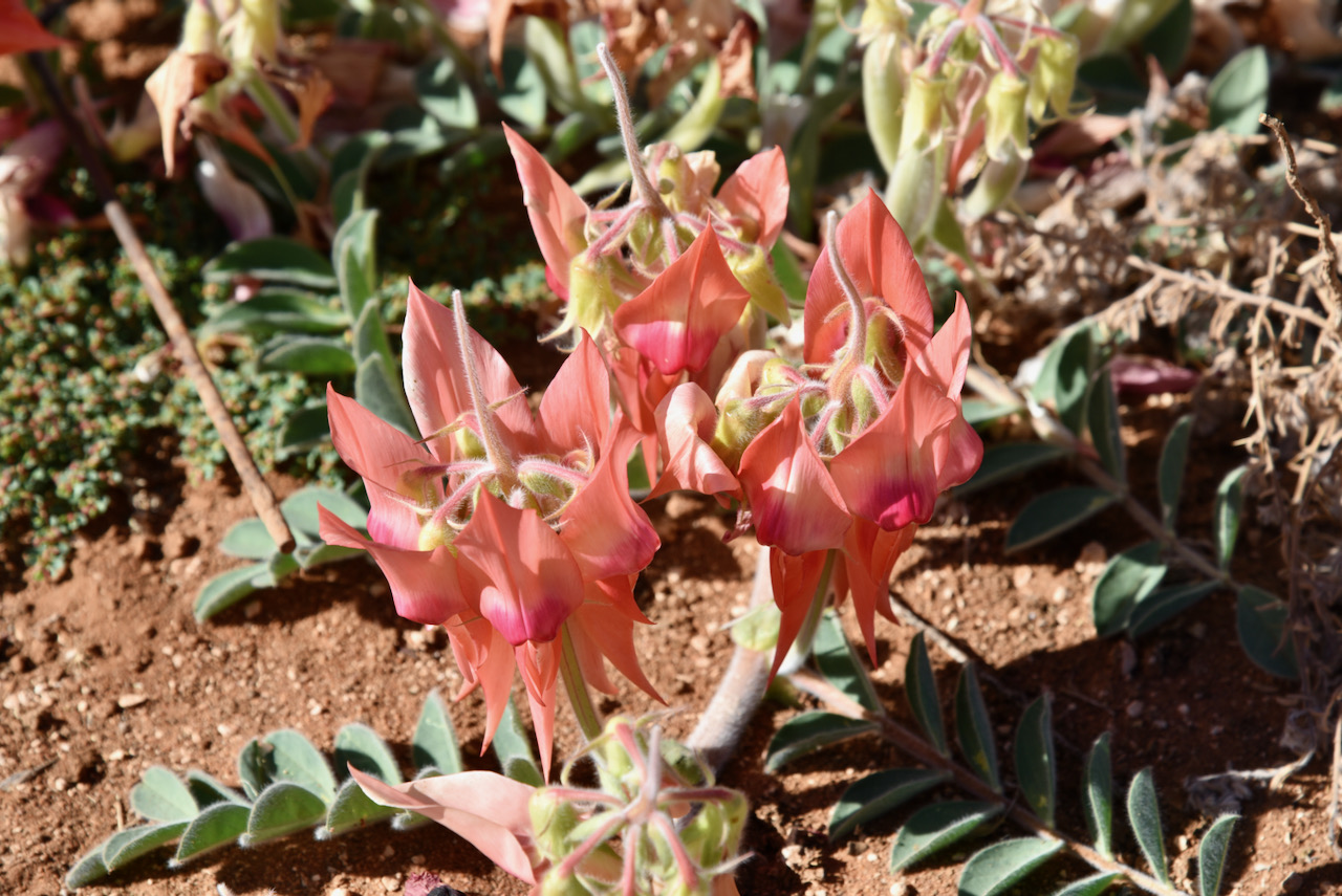
One of the Botanic Garden staff pointed us to an area behind a large bush where there were pink Sturt Desert Pea growing.
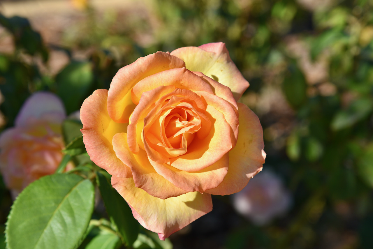
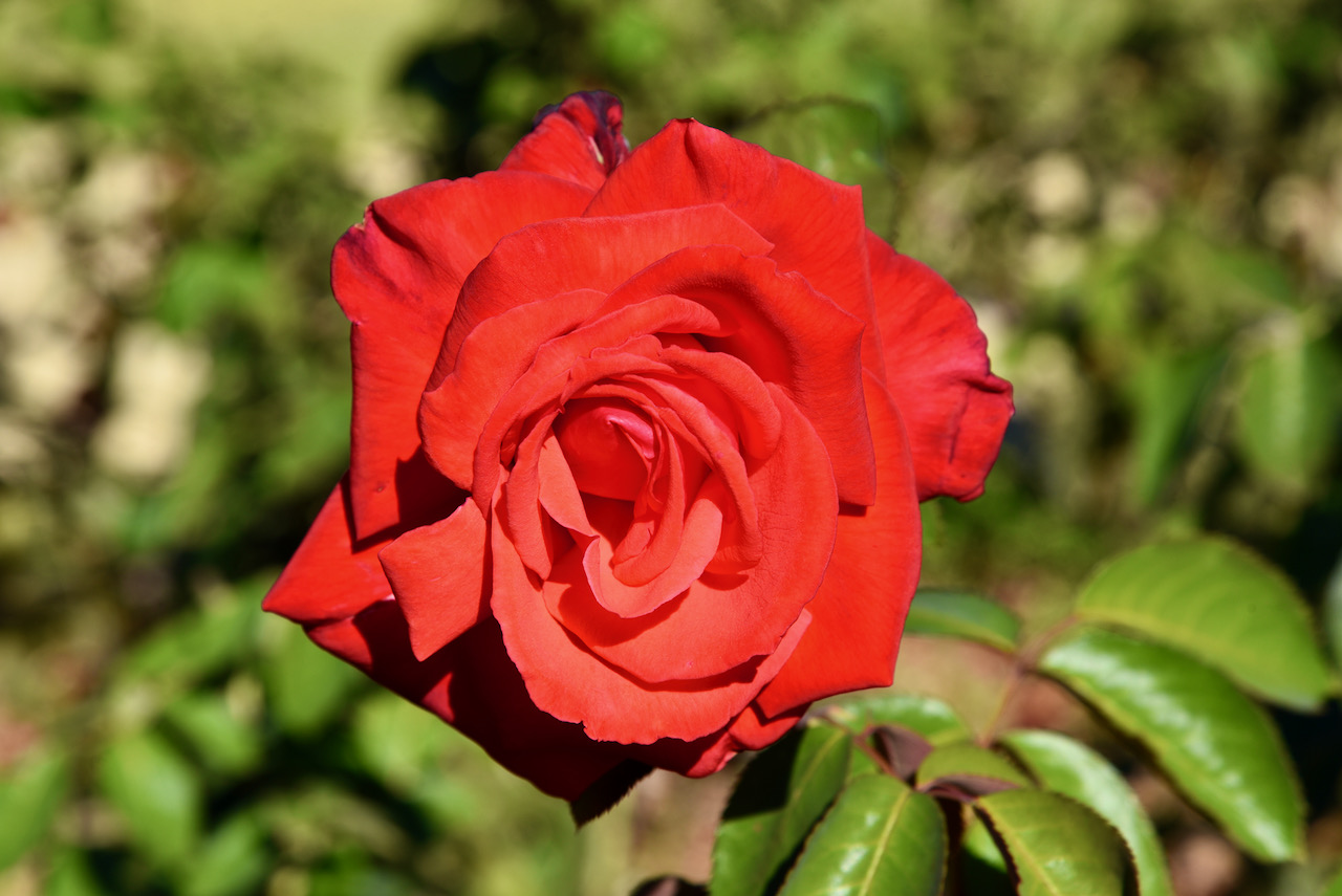
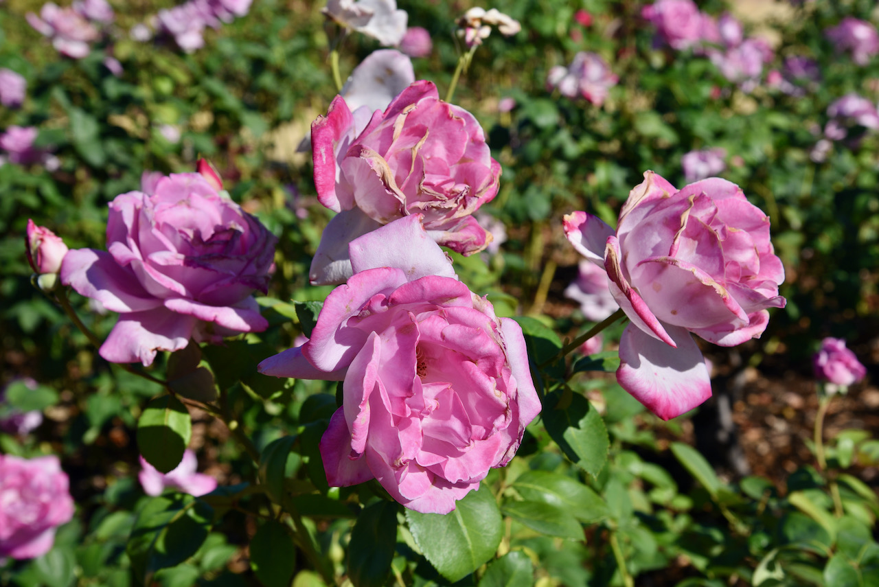
We also visited the rose garden which contains over 1,600 rose bushes.
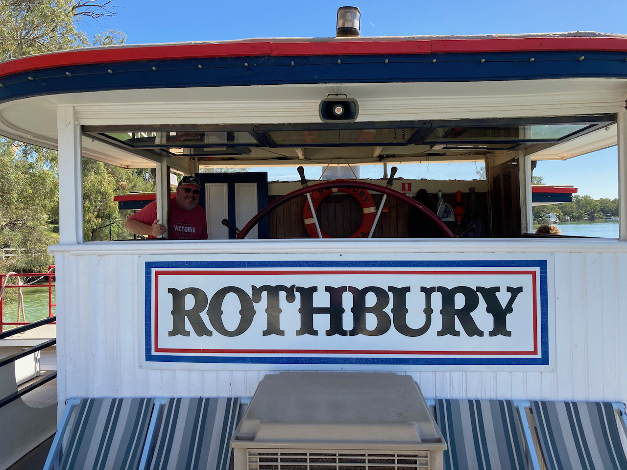
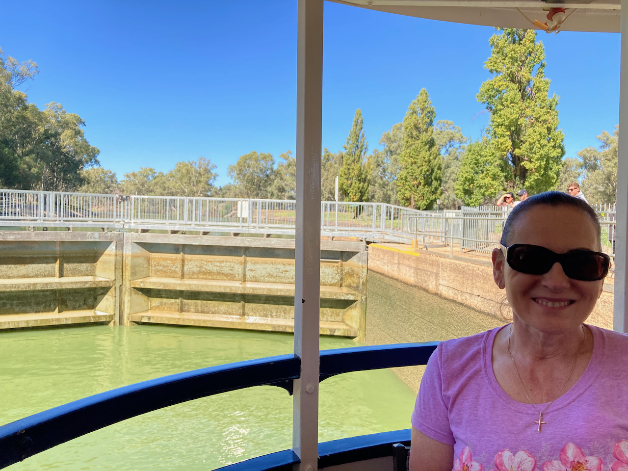
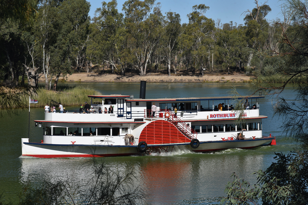
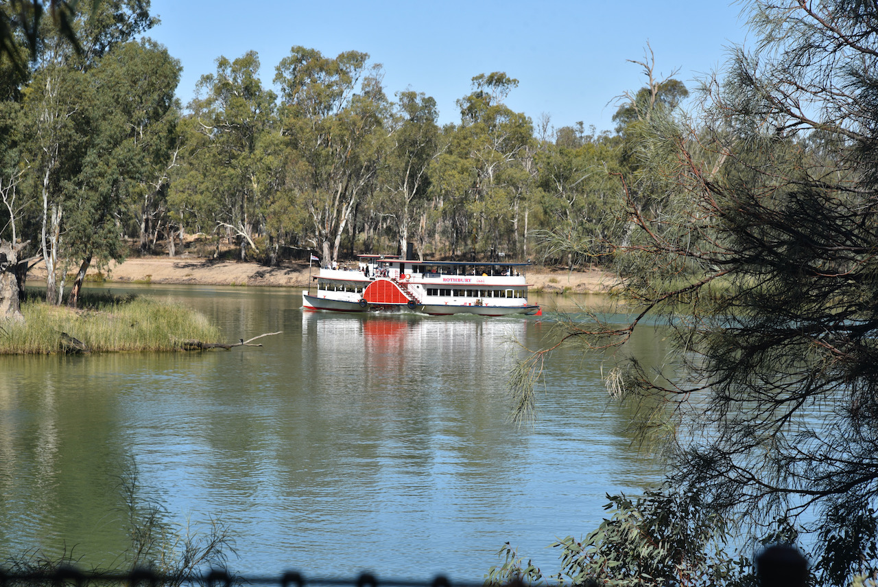
It was then back across the Murray and back into the State of Victoria. We had a Murray River cruise booked aboard the historic PS Rothbury which was built in 1881 at Gunbower in Victoria. It was constructed as a large and powerful two boat and was used to tow barges for the wool and logging trade.
More information on the Rothbury can be found at ……
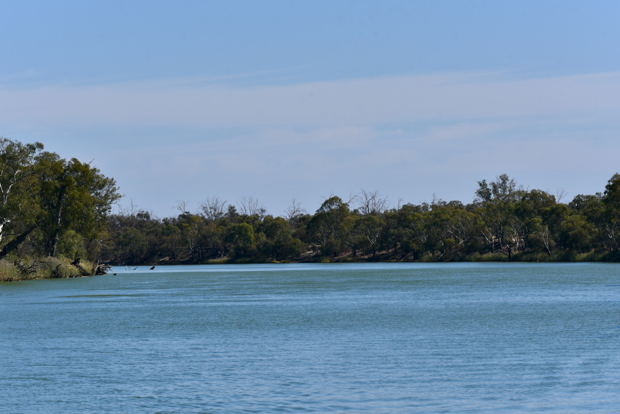
It was an absolutely glorious sunny day and an excellent way to spend 2 hours, cruising downstream long the Murray.
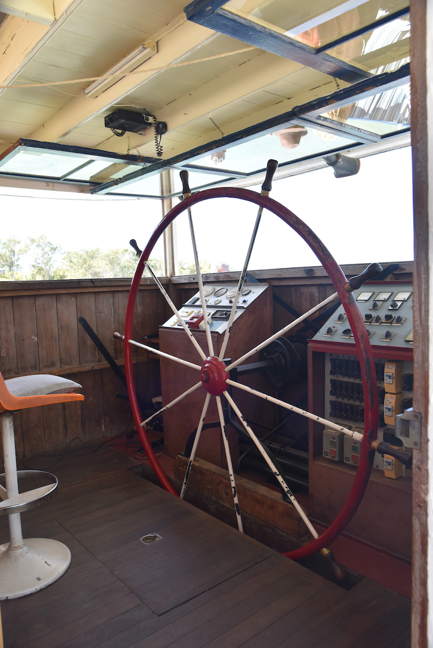
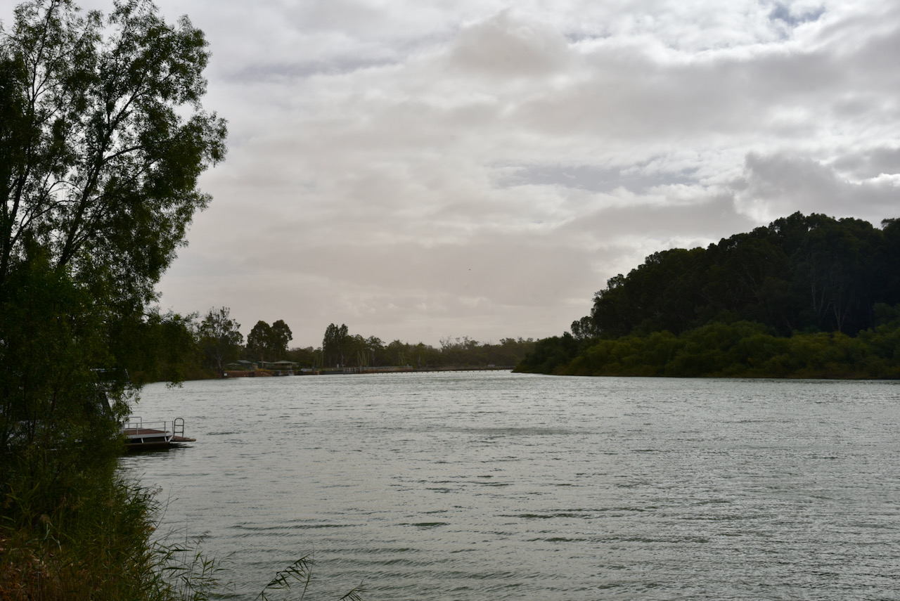
Part of the cruise took us through Lock 11. We had seen a number of the locks along the Murray during our trip, but it was incredibly interesting to pass through one and see how they work.
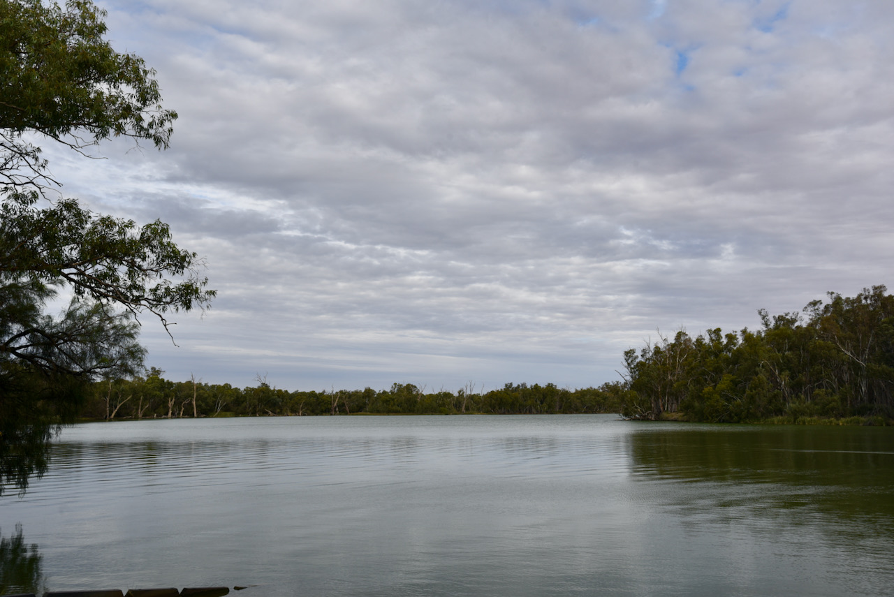
The Murray River is Australia’s longest river at 2,508 km. The Murray rises in the Australian Alps and meanders northwest across Australia’s inland plains and forms the State Border between New South Wales and Victoria. It then flows into South Australia before emptying into the Great Australian Bight near Goolwa South.
The cruise along the river took us passed some pretty impressive homes.
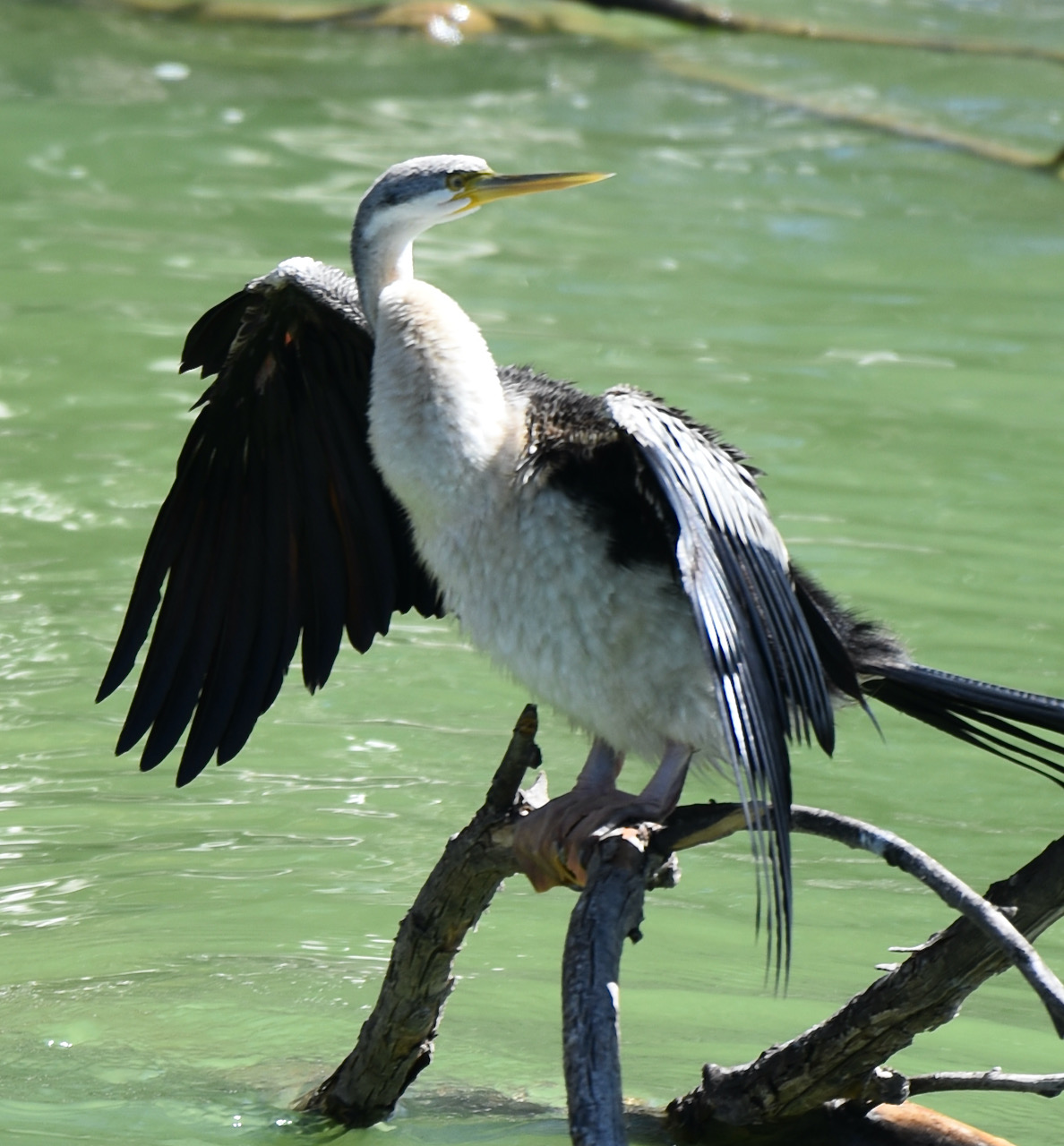
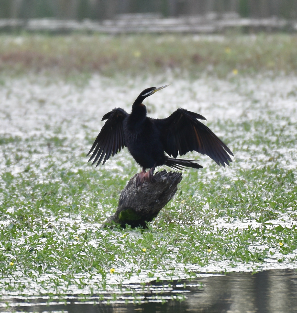
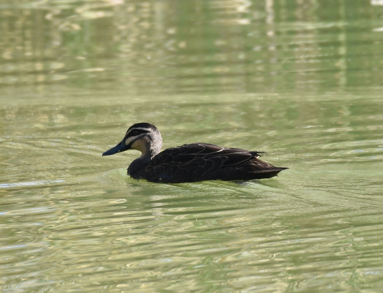
And there was plenty of birdlife.
Once we arrived back on dry land we headed into Mildura city central and grabbed a bite to eat. I could not get through all of my meal.
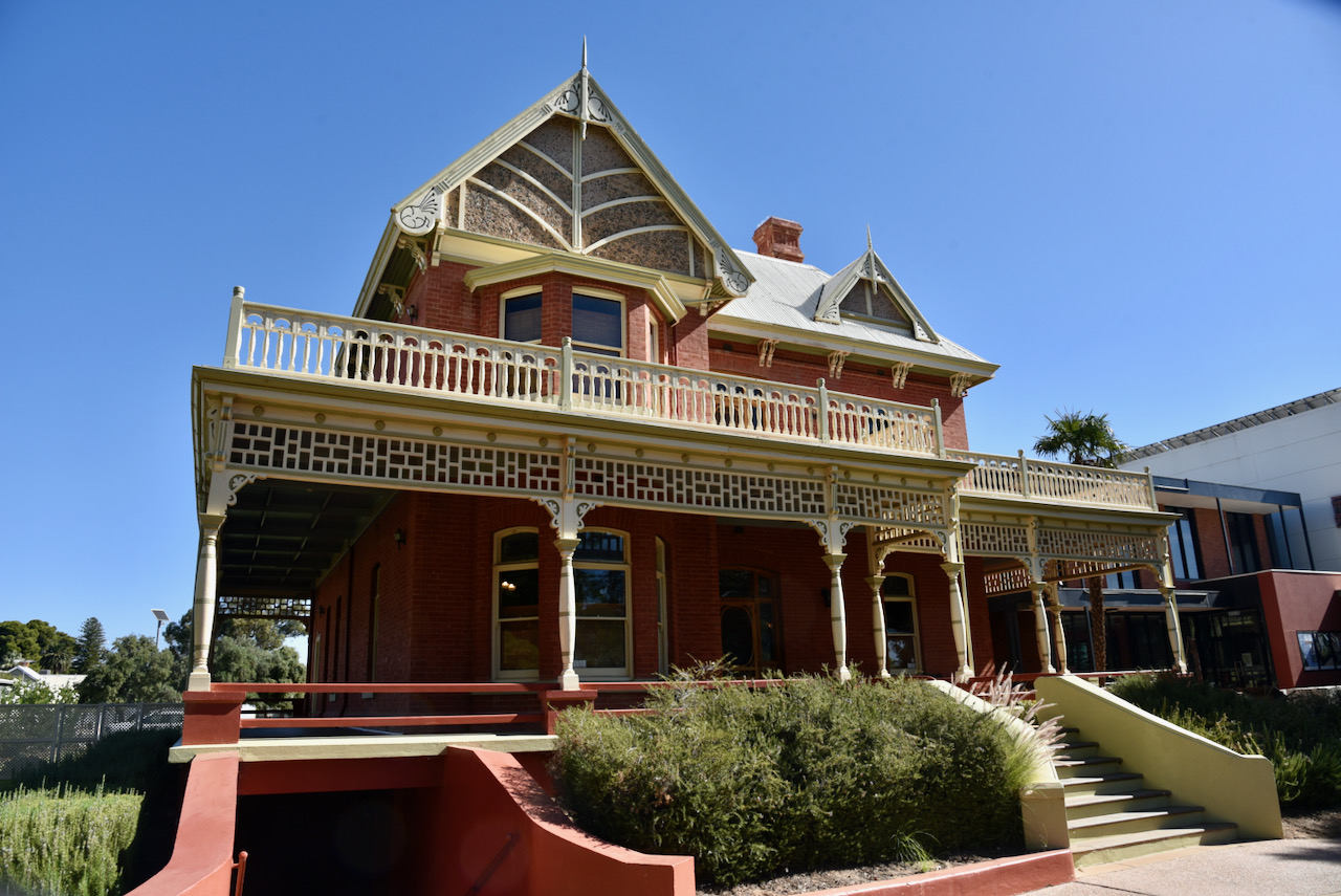
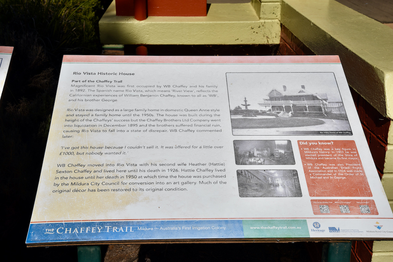
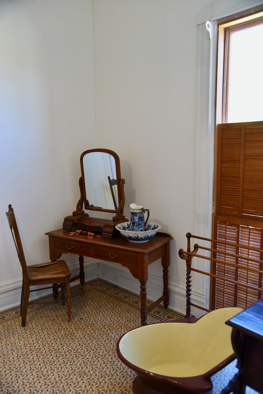
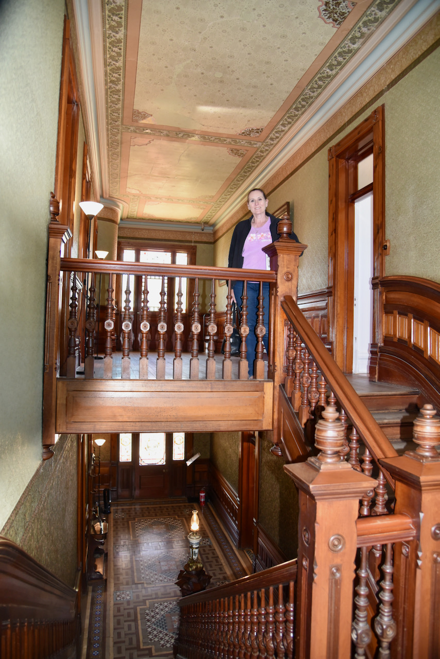
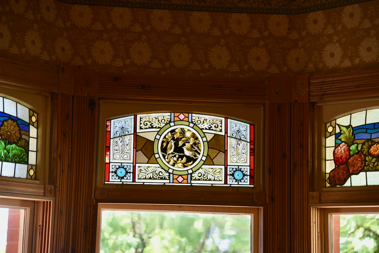
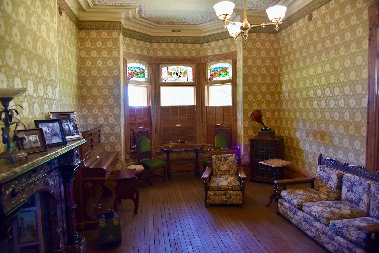
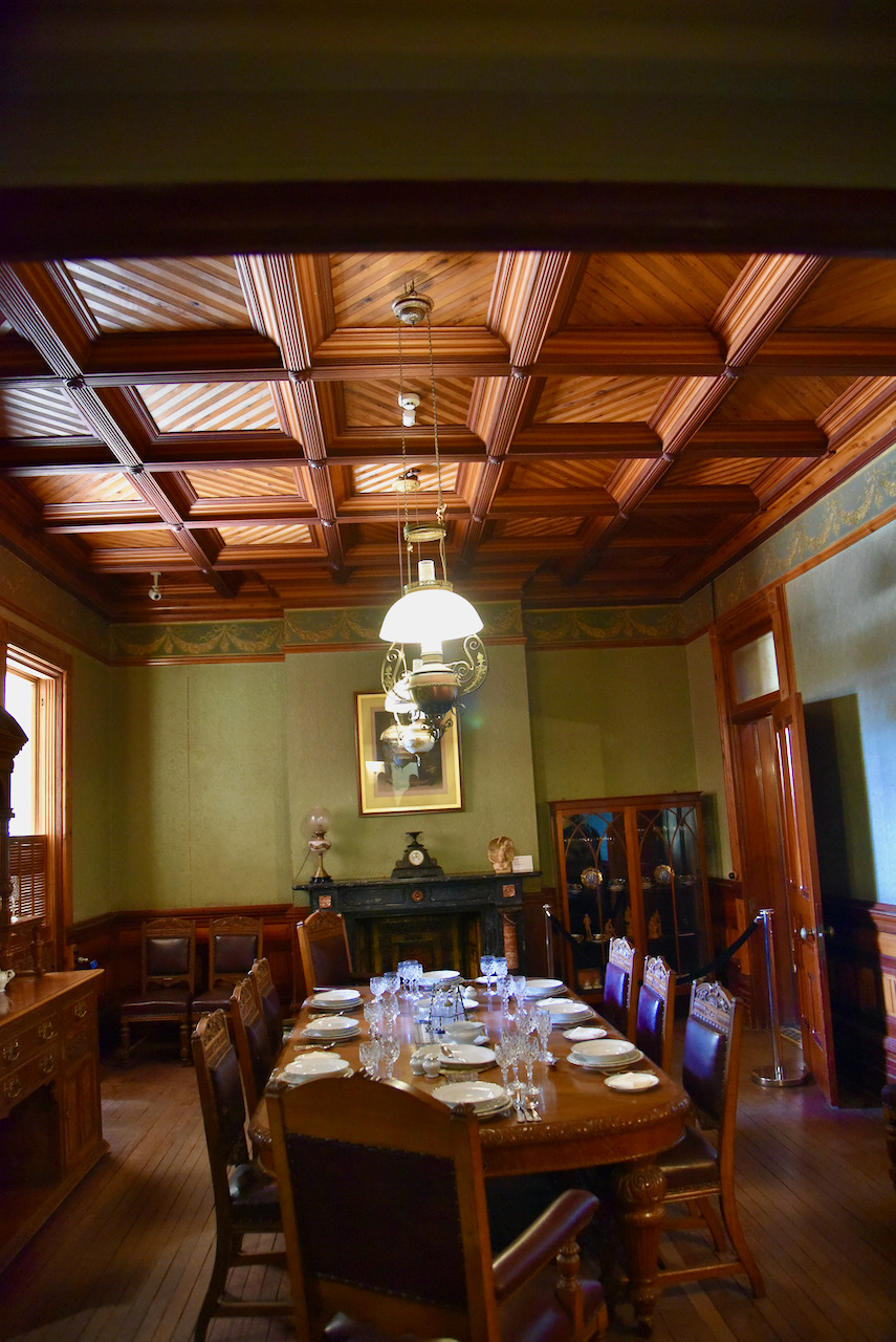
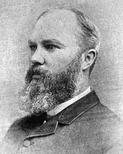
After lunch we visited the magnificent Rio Vista historic house which was first occupied by William Benjamin (W.B.) Chaffey and his family in 1892. W.B. Chaffey was a Canadian engineer and irrigiation planner who with his older brother George Chaffey developed the town of Mildura.
The name of the house Rio Vista is Spanish meaning ‘River View’. The house was designed as a large family home in domestic Queen Anne style and remained a family home until the 1950s. It was built during the height of the Chaffey’s success, however the Chaffey Brothers Ltd Company went into liquidation in December 1895. The Chaffeys suffered financial ruin and this resulted in Rio Vista falling into a state of disrepair.
W.B. Chaffey lived in the house until his death in 1926. His second wife Heather ‘Hattie’ lived in the house until her death in 1950 at which time the house was purchased by the Mildura City Council for conversion into an art gallery.
Much of the original decor has been restored to its original condition.
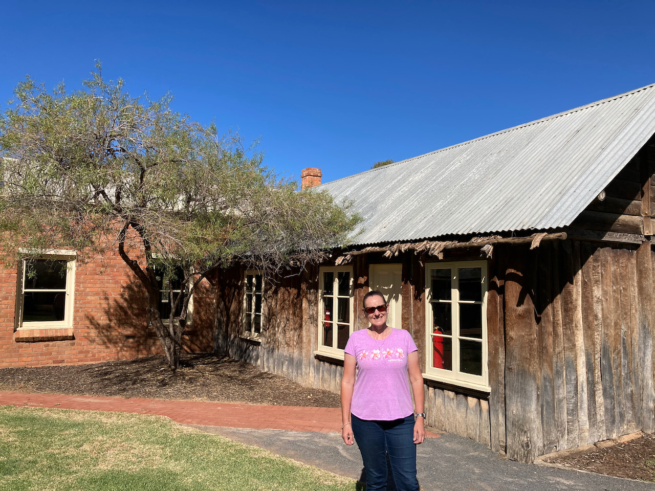
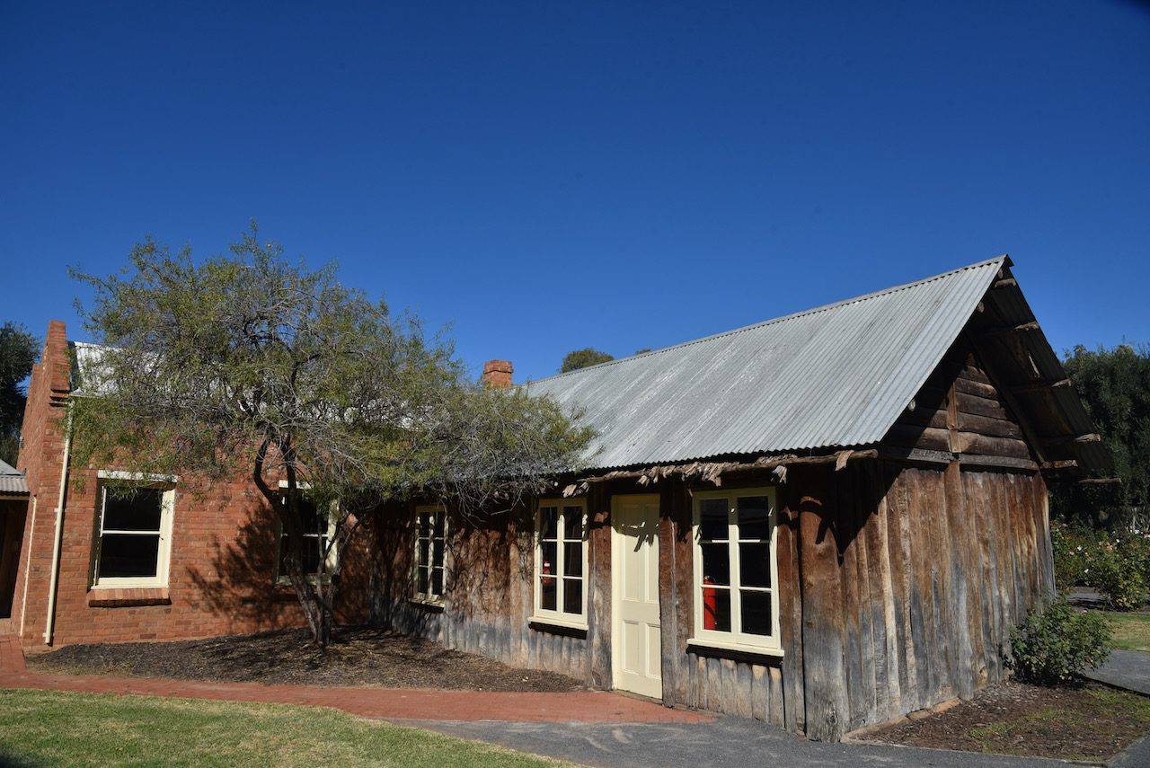
We then visited the Mildura Station Homestead. The building on the site is a recreation of the Mildura Homestead which was constructed by brothers Hugh and Bushby Jamieson about 1850.
The area now known as Mildura was first settled on the 1st day of March 1847 when Francis Jenkins swam 900 cattle and 10 horses across the Murray River from New South Wales to the site of the Mildura Station Homestead. Jenkins believed he had settled in South Australia and he travelled to Adelaide ro register his selection. Meanwhile the Jamiesons obtained Departuring Licence for leasehold from Melbourne and named the property ‘Yerre Yerre. In 1858 the name was changed to Mildura.
There were some great views of the Murray River from the Homestead and we were able to see the Rothbury cruise passed on her afternoon journey down the river.
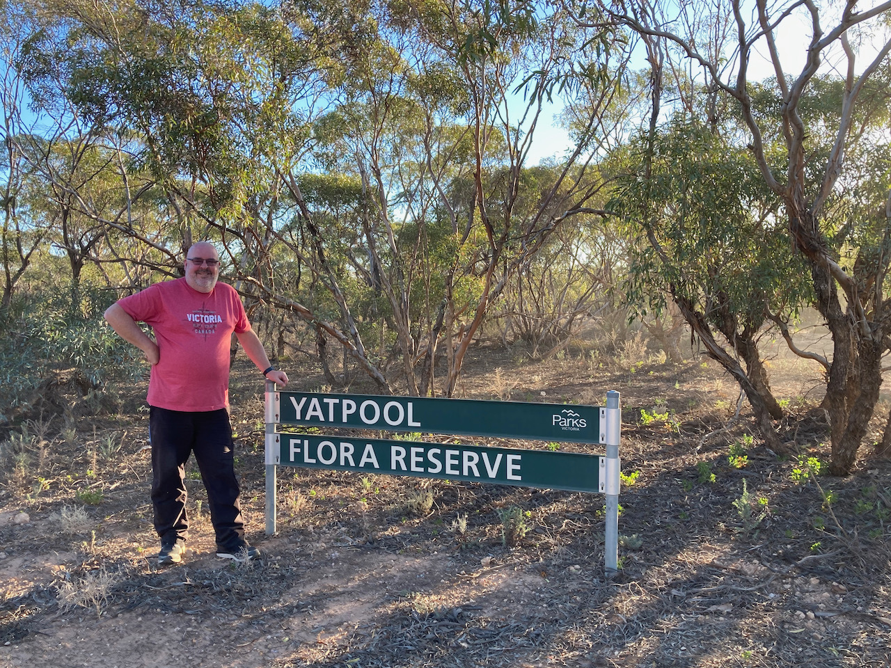
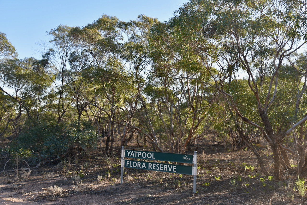
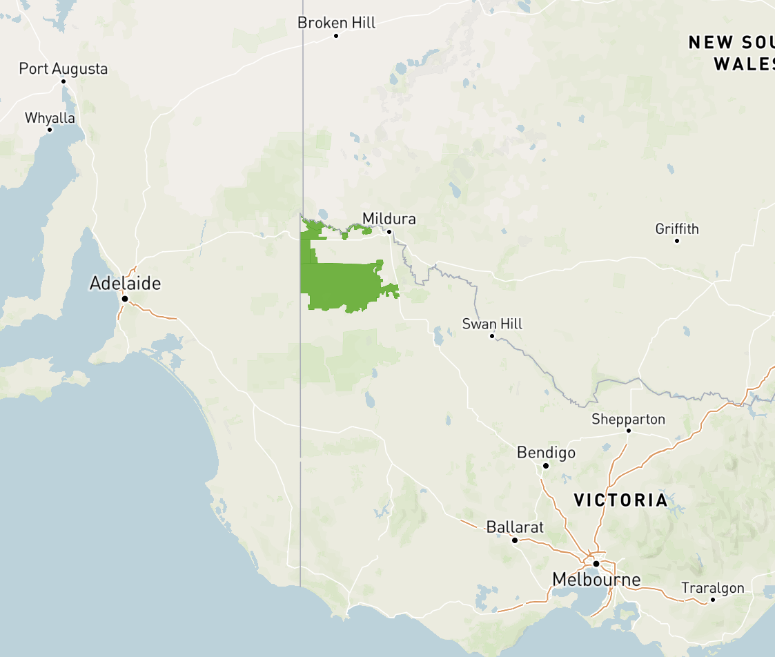
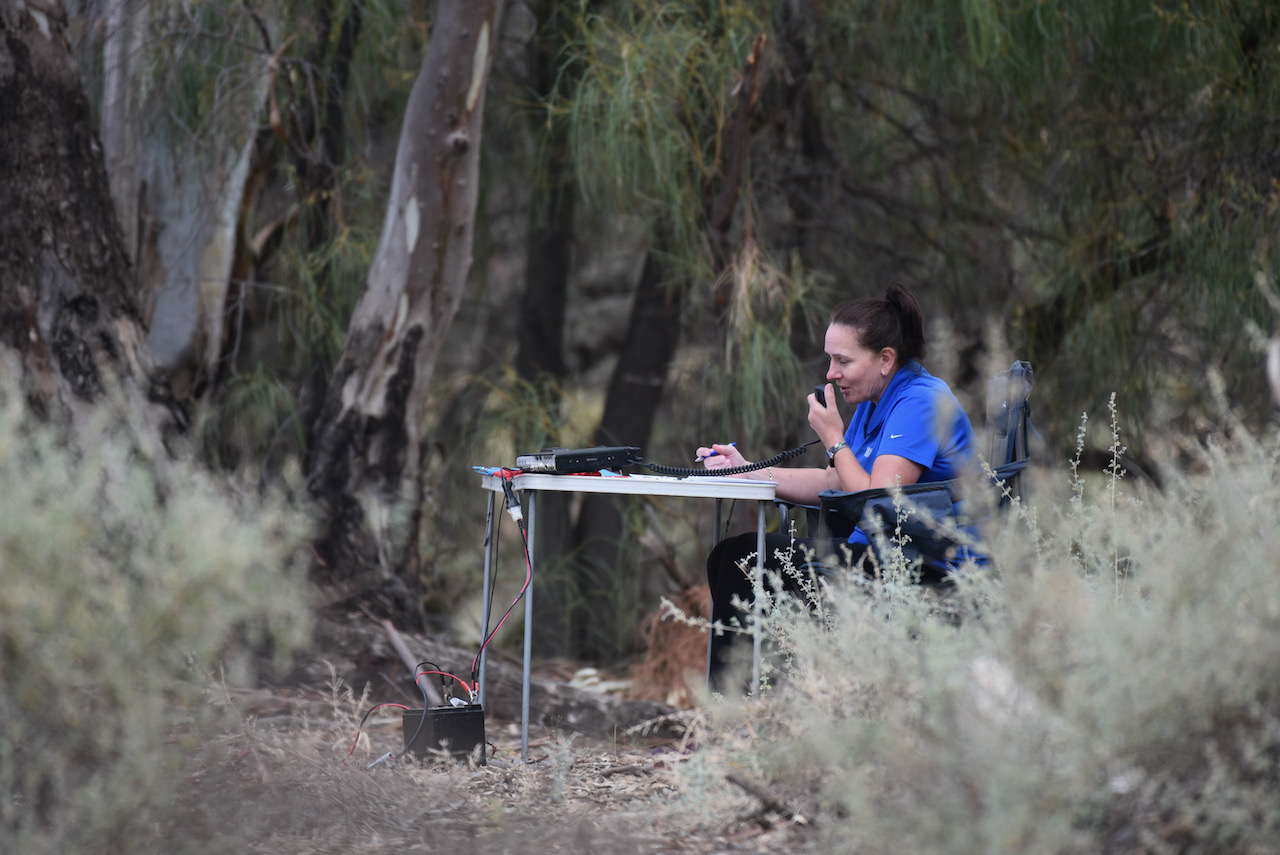
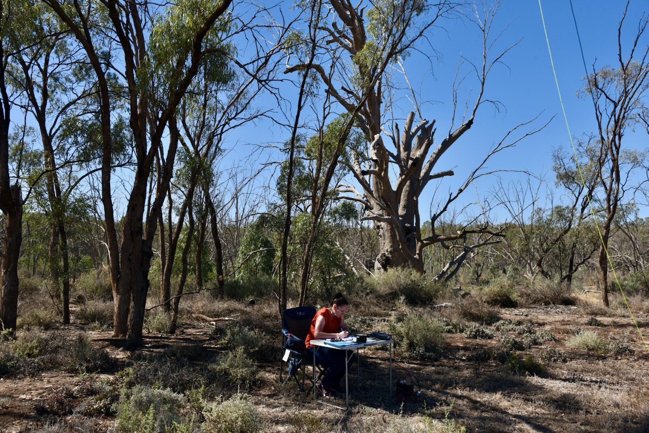
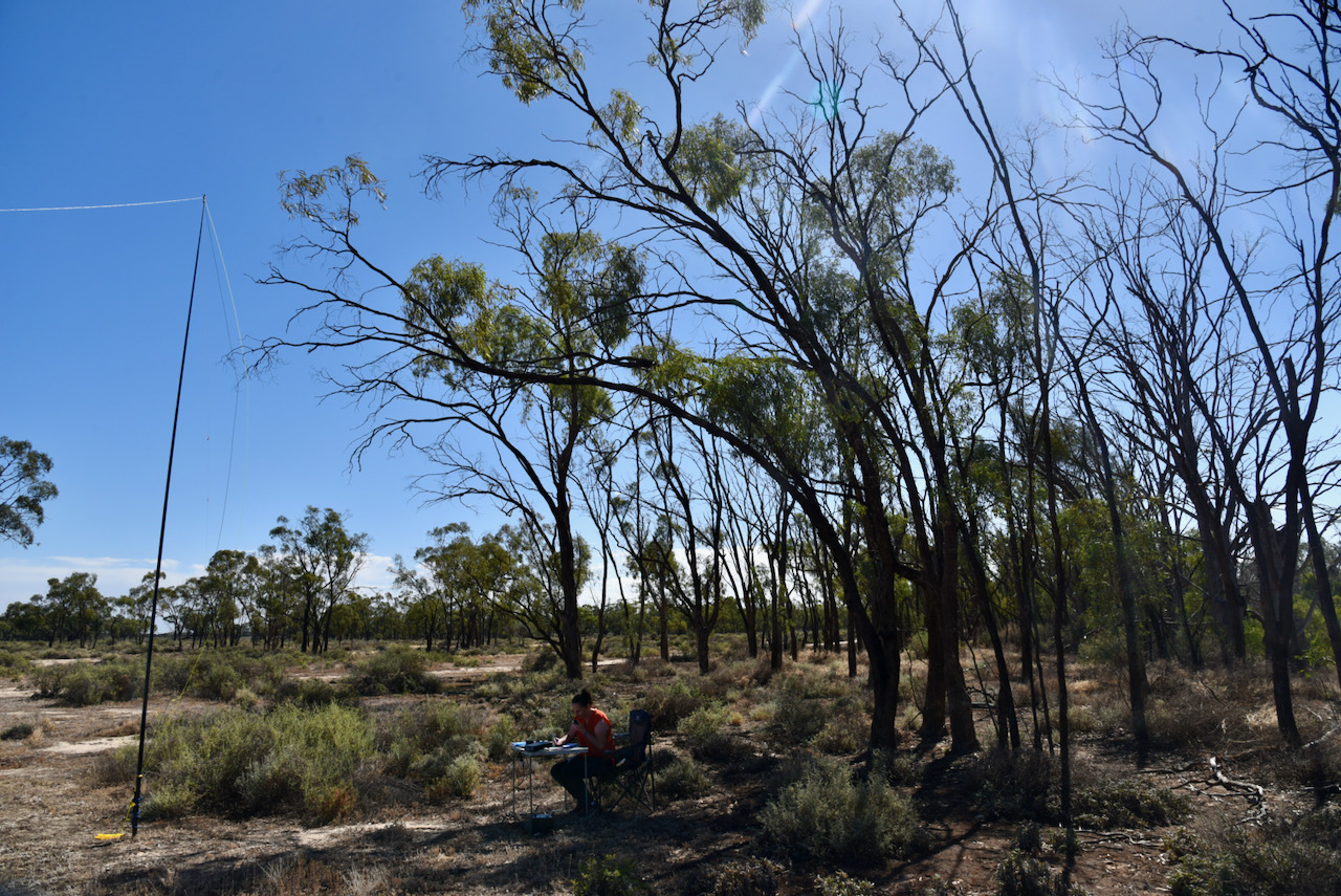
We then travelled south out of Mildura on the Calder Highway and headed to the Yatpool Flora Reserve VKFF-2501 for our one and only park activation of the day.
Yatpool is located about 19 km south of Mildura and about 523 km north-west of the city of Melbourne.
Above:- Map showing the location of the Yatpool Flora Reserve in north-western Victoria. Map c/o Protected Planet
The Yatpool Flora Reserve is about 0.33 km² in size and was established in 2006. The park is located on the eastern side of the Calder Highway and either side of Yatpool West Road.
Above:- The Yatpool Flora Reserve, just off the Calder Highway. Map c/o Protected Planet.
The park was well signposted and found without any difficulty. Make sure you are in the correct section of scrub. The Yatpool Tank Bushland Reserve is located opposite on the eastern side of the Calder Highway.
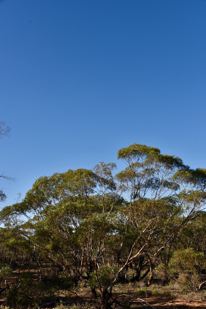
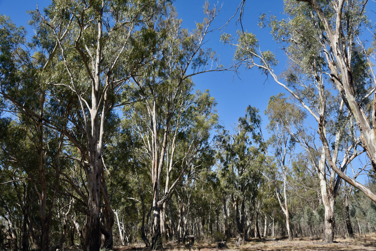
Yatpool is a piece of remnant mallee scrub. The land surrounding the park has been cleared for agricultural purposes.
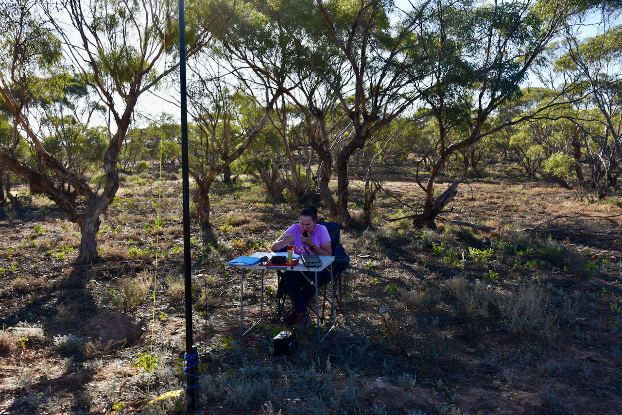
This was to be a first time activation of this park by myself and Marija. The park had been previously activated on four occasions by Nick VK3ANL, Mike VK6MB, Liz VK2XSE, and Peter VK2KNV.
Once we had set up we headed to 7.144 and found Nik VK3ZK/p calling CQ from the Cape Liptrap Coastal Park VKFF-0745. We each logged Nik for a Park to Park contact and then moved up the band to 7.152 where I called CQ. Adrian VK5FANA was the first to respond with an excellent 5/9 signal. Contact number 10 was with Marty VK4KC in Queensland.
I pushed on and logged a total of 54 stations. Contact number 44 was with Glen VK4HMI. Contacts were made to VK1, VK2, VK3, VK4, VK5, VK7, and New Zealand. This included two Park to Park QSOs: Ben VK2AGB/p in the Brisbane Waters National Park VKFF-0056; and Stuart VK3UAO/p in the Lerderderg State Park VKFF-0763.
I had qualified the park for both VKFF and the global WWF program, so it was Marija’s turn to jump into the operator’s chair. Marija soon had 10 contacts in the log, with QSO number 10 being with Greg VK4BXX.
Marija soon developed a mini pile-up and within quick time she had 44 contacts in the log, qualifying the park for the global WWFF program. Contact number 44 was with Colin VK3ZLT.
We finished off the activation with some quick calls on 3.610 on the 80m band. Just one contact was logged there, but an excellent one, a Park to Park with John VK5HAA/p in the Simpson Conservation Park VKFF-1098 on Kangaroo Island.
We were pushing a bit for time, so we packed up and headed back to Mildura. We had a total of 101 QSOs in the log, including 9 Park to Park contacts.
Marija worked the following stations on 40m SSB:-
VK3ZK/p (Cape Liptrap Coastal Park VKFF-0745)
VK3UAO/p (Lerderderg State Park VKFF-0763)
VK4KC
VK4MAD
VK4DOG
VK3PF
VK5FANA
VK3MCK
VK4BXX
VK4/NN3Z
VK7QP
VK2PET/5
VK5CZ/m
VK3LF
VK4HNS
VK3EJ
VK3FI
VK5FDMG
VK4KLA
VK4FDJL
VK5HAA/p (SImpson Conservation Park VKFF-1098)
VK5VGC
VK3MPR
VK2VOO
VK3CWF
VK2VH
VK4AAC/2
VK3MTT
VK5WG
VK5YX
ZL4NVW
VK2AGB/p (Brisbane Waters National Park VKFF-0056)
VK3BBB
VK2CCP
VK5IS
VK5HMB
VK7JFD
VK5KLV
VK3ACZ
VK5PTL
VK7MFI
VK5NRG
VK3TKK/m
VK3ZLT
Marija worked the following station on 80m SSB:-
VK5HAA/p (Simpson Conservation Park VKFF-1098)
I worked the following stations on 40m SSB:-
VK3ZK/p (Cape Liptrap Coastal Park VKFF-0745)
VK5FANA
VK7QP
VK3CWF
VK2VH
VK4AAC/2
VK3EJ
VK3BBB
VK2CCP
VK4KC
VK4MAD
VK4DOG
VK2QK
VK4HAT
VK2IO/m
VK3PF
VK3DEM
VK3SRC
VK4FDJL
VK5FDMG
VK3AWA
VK2AGB/p (Brisbane Waters National Park VKFF-0056)
VK2DG
VK7DM
VK5LA
VK3UAO/p (Lerderderg State Park VKFF-0763)
ZL1TM
VK3ANL
VK3AHR
VK2HMV
VK3MPR
VK3LF
VK5BW
VK4KLA
VK2PKT
VK1MIC
VK2PET/5
VK5HRZ
VK5CZ/m
VK3LK
VK5VST
VK2LEE
VK5JP
VK4HMI
VK2PBC
VK100AF
VK4BXX
VK4/NN3Z
VK1DI
VK2AIF
VK2XXL
VK2HRX
VK7ZGK
VK2ABS
VK5HAA/p (Simpson Conservation Park VKFF-1098)
I worked the following station on 80m SSB:-
VK5HAA/p (Simpson Conservation Park VKFF-1098)
We freshened up at our apartment and then headed out to the home of Cam VK2DG and enjoyed a really enjoyable evening with Cam and his wife, also Greg VK3MTV and his partner. This was a really great catch up. Cam even convinced Marija into buying a Yaesu FTDX101MP. Well done Cam!
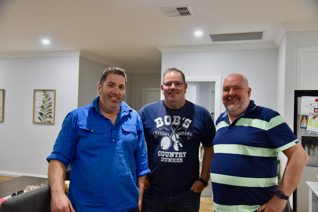
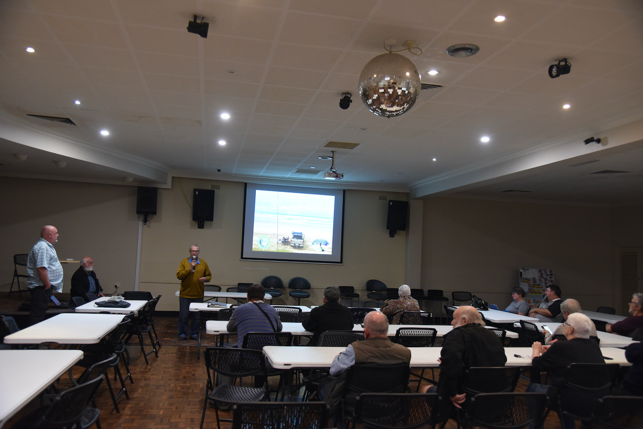
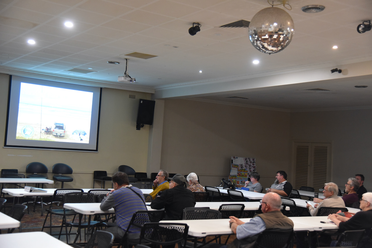
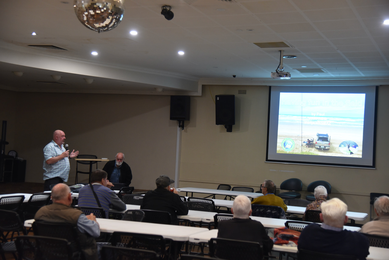
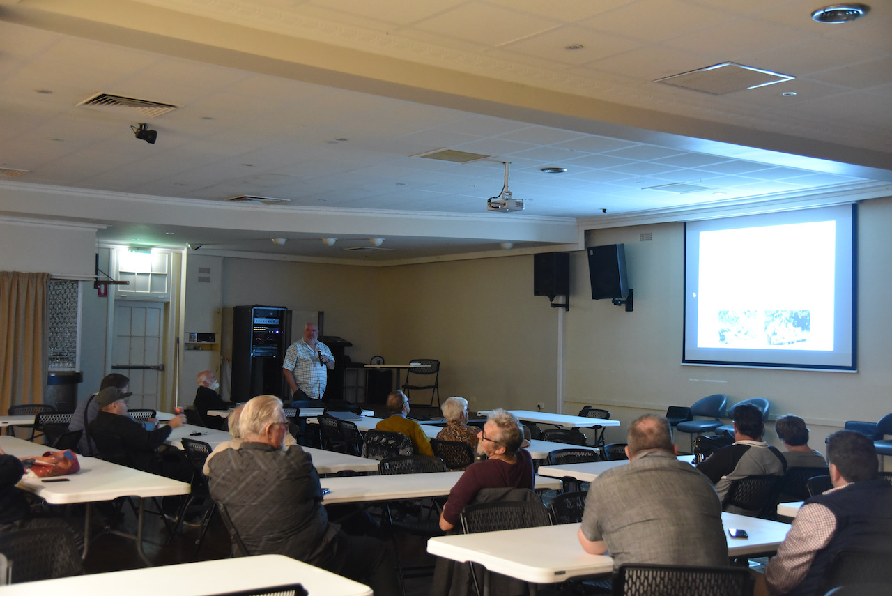
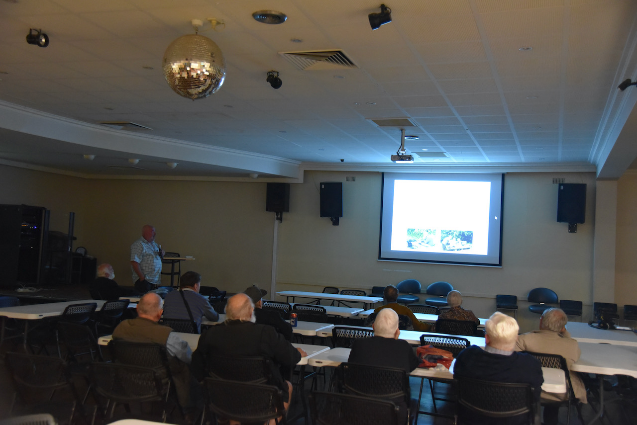
On Sunday evening (11th April 2021) Marija and attended the Mildura Working Mans Club and enjoyed a very nice meal with members of the Sunraysia Radio Group.
At the conclusion of dinner we headed upstairs where I delivered a presentation entitled ‘Having Fun in the Field’. I discussed the World Wide Flora Fauna program, portable equipment, and some tips for both Activators and Hunters.
Thanks to Brian VK3BBB and other members of the club for the invitation.
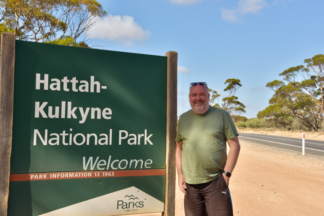
Day six of our trip (Sunday 11th April 2021) had rolled around very quickly. Today we planned to activate the Hattah Kulkyne National Park VKFF-0231 for day two of the Activation Weekend for the Keith Roget Memorial National Parks Award (KRMNPA).
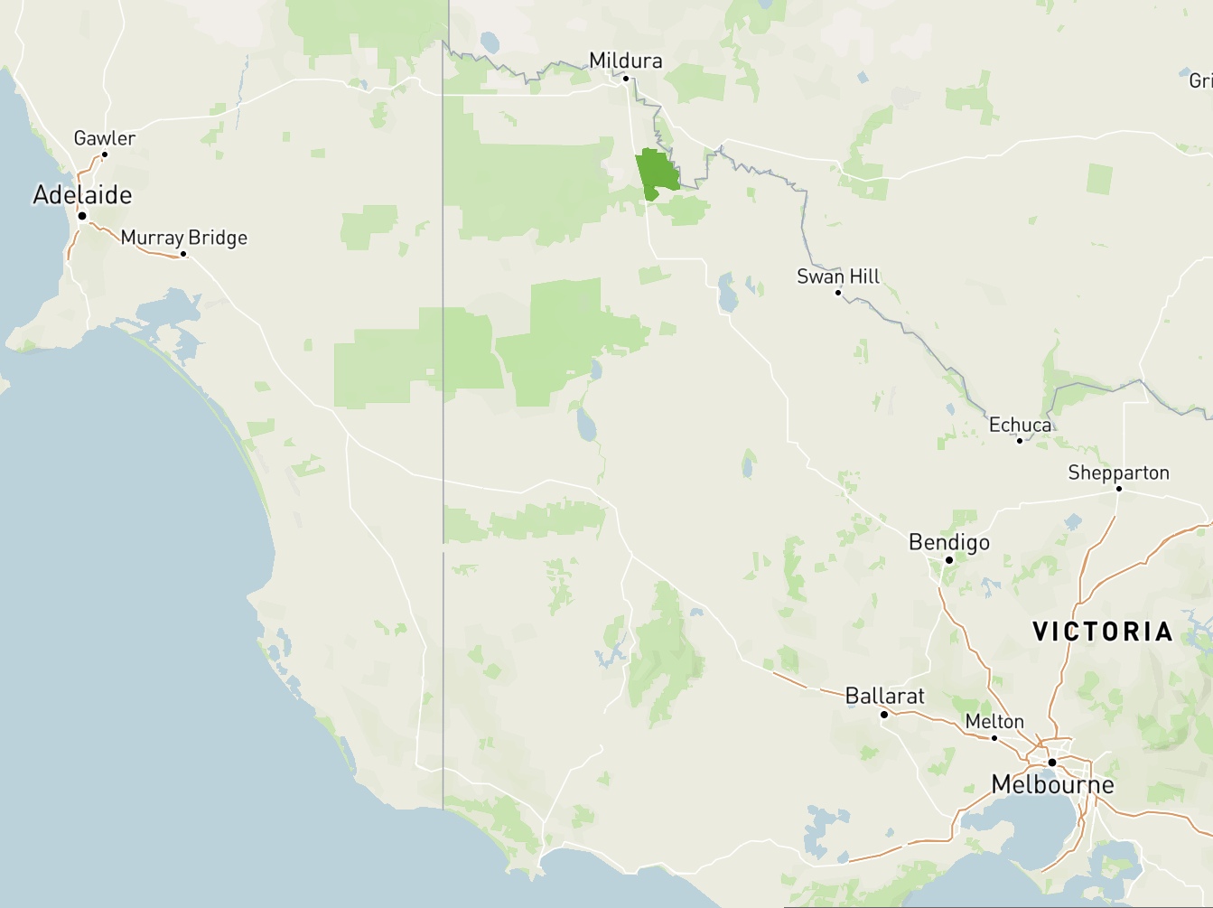
We have activated Hattah Kulkyne previously for both KRMNPA and the World Wide Flora Fauna (WWFF) program. The park is located about 50 km south of Mildura and about 493 km north-west of the city of Melbourne.
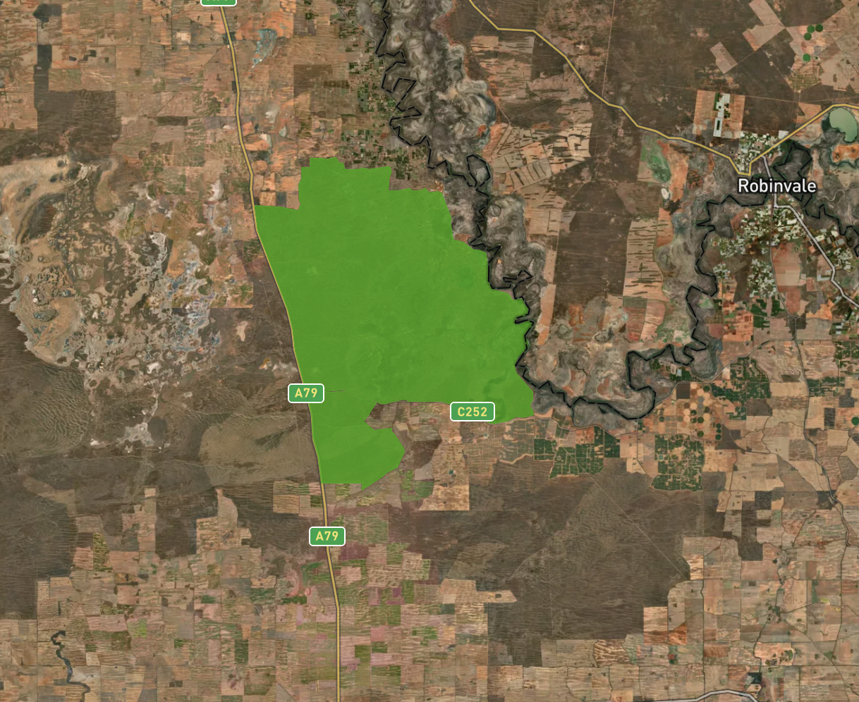
Above:- Map showing the location of the Hattah Kulkyne National Park in north-western Victoria. Map c/o Protected Planet.
Before heading out to the park, we visited the Langtree Cafe in Mildura once again for a terrific cooked meal. We can highly recommend this cafe. Good service, prompt delivery of your meal, and well priced good tucker.
We then headed south out of Mildura on the Calder Highway which was named after William Calder, who was the Chairman of the Country Roads Board (now VicRoads) from 1913 to 1928. We then turned left onto the Hattah-Robinvale Road and entered the park via the main entrance. The park was well signposted.
The Hattah-Kulkyne National Park is 48,000-hectare (120,000-acre) in size and was proclaimed on the 7th day of June 1960. It is the oldest National Park in the region.
Above:- An aerial view showing the boundaries of the Hattah Kulkyne National Park. Image c/o Protected Planet.
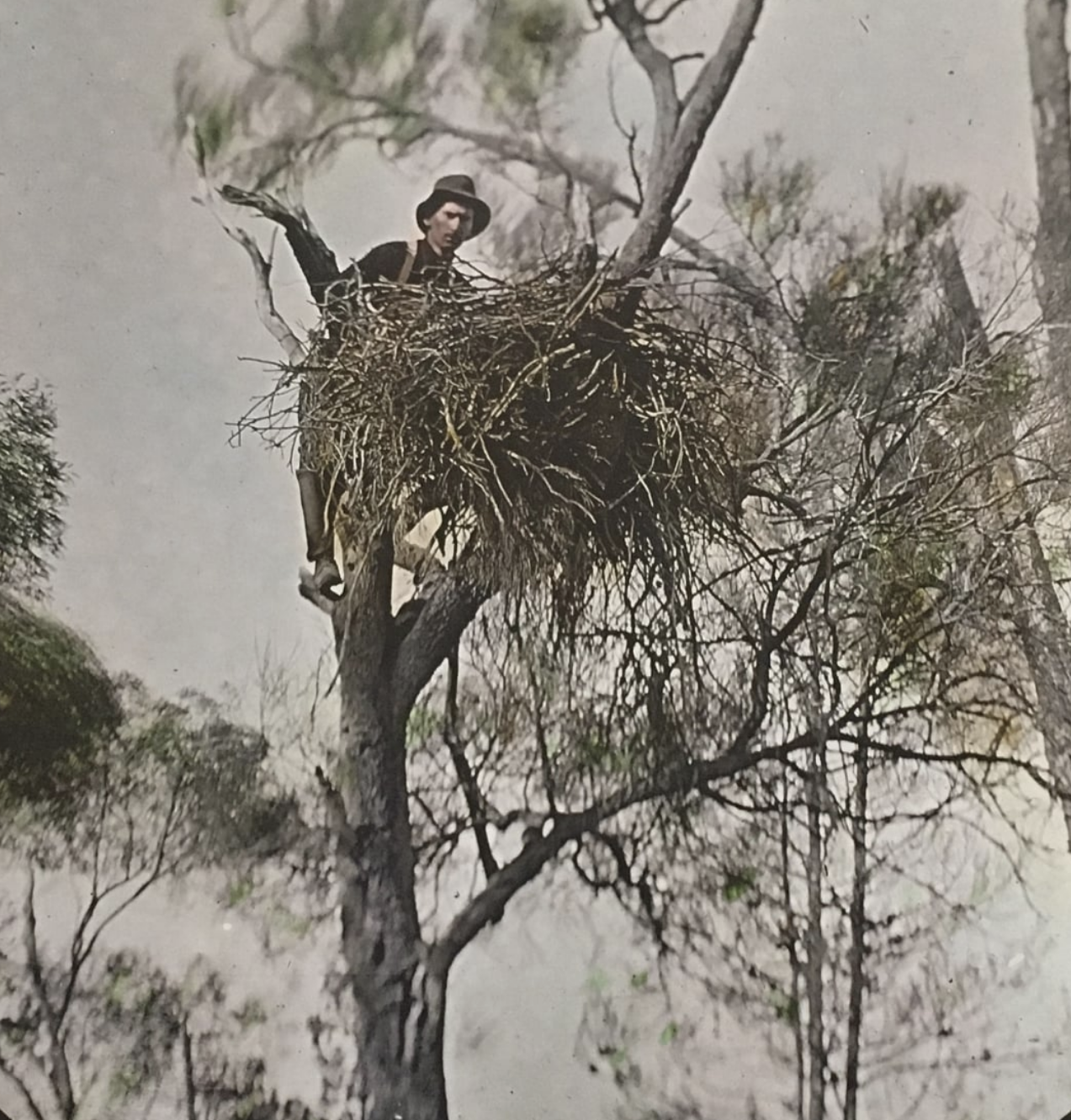
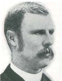
The area was once part of the Kulkyne Station, a 3,000,000 acre squatter run. It subsequently became a State Forest and was logged heavily. During the 1930s Mildura resident Les Chandler initiated campaigns which subsequently led to the creation of the Hattah Kulkyne National Park.
Leslie Gordon Chandler (1888-1980) was an ornitholgist and photographer. He attended school in the Dandenong Ranges and used the walk to school to observe nature. At age 18 he commenced to give talks to schools and by 1907 he became one of Australia’s earliest photographers or birds. In that same year he joined the Bird Observer’s Club, the Royal Australasian Ornithologists’ Union in 1910, and then in 1914 he joined the Field Naturalists Club of Victoria. In 1912 he took part in Australia’s first bird-banding scheme. From 1909 he published more than 100 articles on nature.
More information on this very interesting man can be found at……
Above:- Les Chandler atop a tree fixing a camera to take photos of Wedge-tailed eagles. Image c/o Mildura Arts Centre Facebook page
Hattah Kulkyne National Park and the adjoining Murray Kulkyne Park were declared a biosphere reserve in 1981 under UNESCO’s Mand and the Biosphere program which aims to establish a scientific basis for the improvement of relationships between people and their environments.
Above:- An aerial view of the park looking north towards Mildura and Wentworth. The Murray River can be seen on the right of the image. Image c/o Google maps
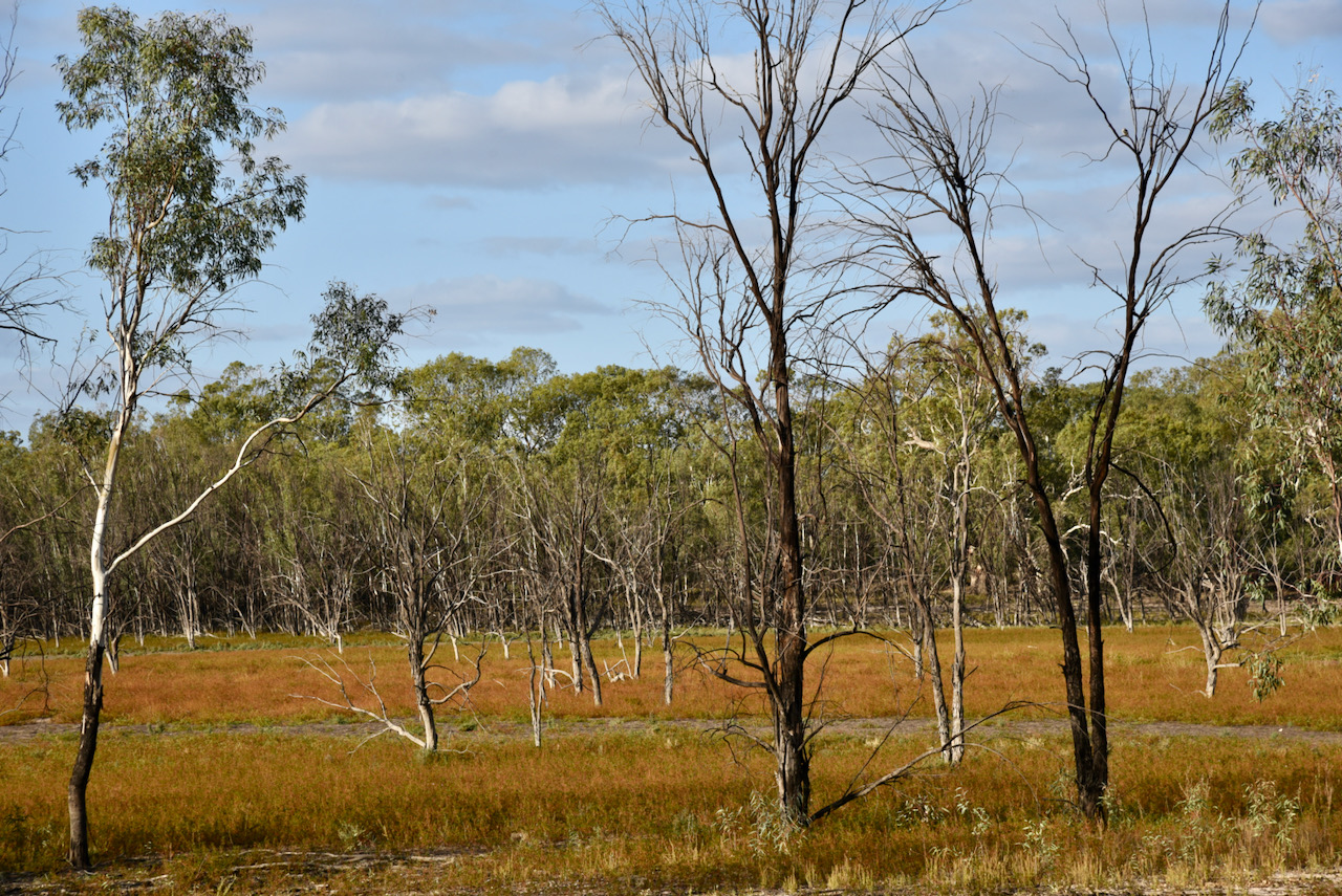
The park lies in lies in typical mallee country with extensive low scrub and open native pine woodland. The lakes within the park and the surrounding floodplain contain 10 different vegetation communities with 115 significant flora species. The area supports about 308 different native fauna species, of which 57 are considered threatened in Victoria or nationally.
Over 1,000 aboriginal cultural sites have been recorded.
During the Second World War an internment camp for Italian Prisoners of War was located at Hattah Kulkyne. Some of the foundation posts of the two main buildings remain, along with the remains of fireplaces. ‘1942’ is inscribed in one of the bricks. There is no documentary evidence of prisoners here, however local sources indicate that there was a camp and that they possibly worked for the Forestry Commission.
There are eighteen lakes in the park, the largest being Lake Hattah. Others include Lake Bulla, Lake Arawak, Marramook Lake, Lake Brockie, Lake Roonki, and Lake Brockie. Most of these lakes and their streams are completely empty during the dry season. They are seasonally filled and support food and shelter for various waterbirds and fish.
The Hattah Kulkyne Lakes are listed under the Ramsar Convention. The signing of the convention took place in 1971 at the small Iranian town of Ramsar and is the first modern treaty between nations aimed at conserving natural resources.
Native mammals found in the park include Western Grey Kangaroos, Red Kangaroos, Eastern Grey kangaroos and Koalas. Over 200 bird species have been recorded in the Hattah Kulyne National Park, which is overlapped by the Murray-Sunset, Hattah and Annuello Important Bird Area (IBA). It was identified by BirdLife International as an IBA as it contains mallee habitat which supports numerous threatened mallee birds including the Malleefowl, the Black-eared Miner, and the Mallee emu-wren.
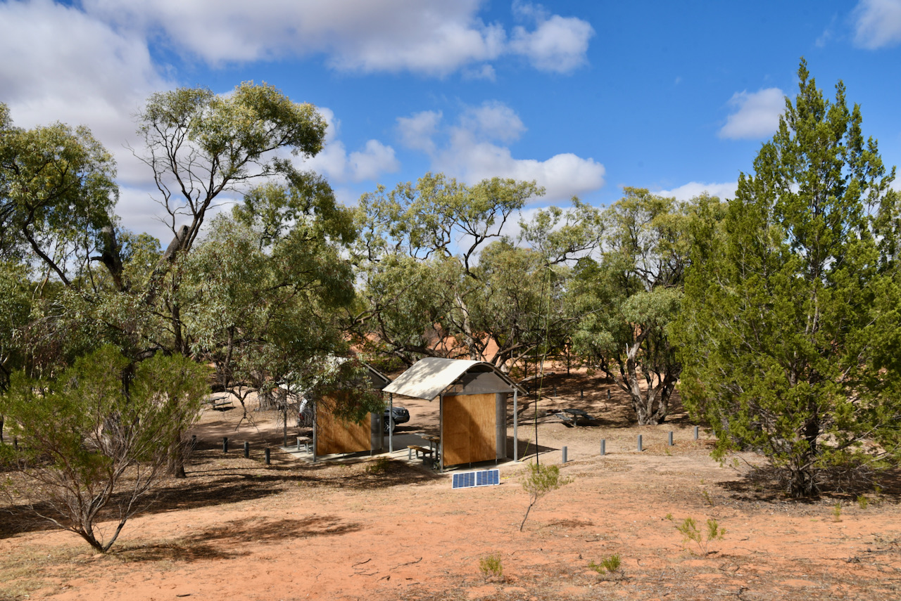
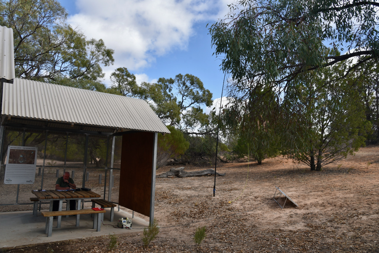
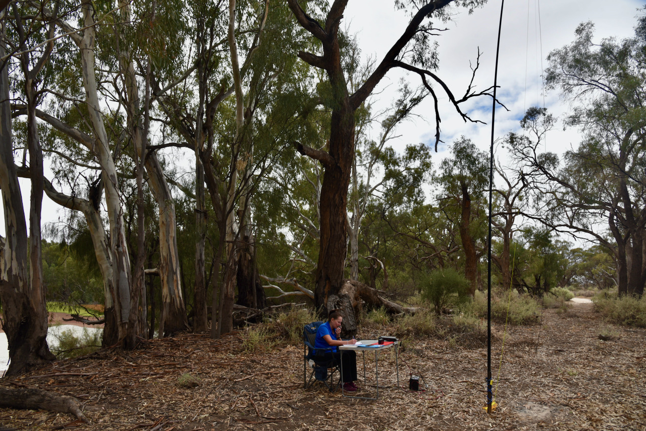
We headed to the main campground area and to our pleasure we found it almost empty. There were just two caravans, so we had plenty of places to choose from to shade ourselves from the sun and string out the linked dipole.
I kicked off the activation. Our first contact was with Chris VK3MCO/p, followed by a Park to Park contact with Bryan VK3LF/p who was activating the Morwell National Park VKFF-0626.
I did not get the rush of callers I expected and after logging 22 stations on 40m we decided to try our luck on the 80m band. Contacts on 40m were logged from VK2, VK3, VK4, VK5, and VK5. This included the following Park to Park QSOs:-
Bryan VK3LF/p – Morwell National Park VKFF-0626
Joe VK3SRC/p – Mornington Peninsula National Park VKFF-0333
Gerard VK2IO/p – Bouddi National Park VKFF-0049
Peter VK3PF/p – Organ Pipes National Park VKFF-0627
On 80m between the two of us we logged a total of 21 stations from VK2, VK3, VK5, and VK7. That included the following Park to Park QSOs:-
Allen VK3ARH/p – Barmah National Park VKFF-0739
Peter VK3PF/p – Organ Pipes National Park VKFF-0627
We moved back to the 40m band where we logged a total of 95 QSOs from VK1, VK3, and VK7. It included the following Park to Park contacts:-
Tony VK3YV/p – Wilsons Promontory National Park VKFF-0539
Tim VK5AV/3 – Cobboboonee National Park VKFF-0728
Peter VK2FPAR/p – William Howe Regional Park VKFF-2786
Joe VK3SRC/p – Churchill National Park VKFF-0621
Julie VK3FOWL – Churchill National Park VKFF-0621
Joe VK3YSP/p – Churchill National Park VKFF-0621
Adam VK2YK/5 – Shepherds Hill Recreation Park VKFF-1744
Tim VK5AV/3 – Budj Bim (formerly Mount Eccles) National Park VKFF-0345
Brett VK3MCA – Kara Kara National Park VKFF-0629
Gerard VK2IO/p – Cockle Bay Nature Reserve VKFF-1908
I then moved to the 20m band where I logged 5 stations, all from Queensland.
It was then back to the 40m band where a further 38 stations were logged including the following Park to Park QSOs:-
Tony VK3XV/p – Chiltern Mount Pilot National Park VKFF-0620
Adam VK2YK/5 – Onkaparinga River Recreation Park VKFF-1738
Alan VK2MG – Wyrrabalong National Park VKFF-0550
James VK3JBM/p – Grampians National Park VKFF-0213
David VK3GP/p – Grampians National Park VKFF-0213
John VK5HAA/p – Pelican Lagoon Conservation Park VKFF-0926
Peter VK3PF/p – Dandenong Ranges National Park VKFF-0132
We were told by a couple of the park hunters that Paul VK0PD at Casey Station Antarctica VKFF-0571 was on 20m, so we quickly lowered the squid pole and removed the links for the 20m section of the antenna and headed to 14.235.
I was extremely pleased to get the Park to Park with Paul with 5/8 sent and 5/7 received.
I then moved up to 14.310 and called CQ and logged four stations, Neil VK4HNS Lew VK4KLA, John VK6NU, and Linda VK7QP.
To conclude the activation we moved back to the 40m band and called CQ on 7.100 where a further 22 stations including the following Park to Park contacts were logged:-
Allen VK3ARH/p – Hepburn Regional Park VKFF-0968
Gerard VK2IO/p – Saratoga Island Nature Reserve VKFF-2713
Adam VK2YK/5 – Onkaparinga River National Park VKFF-0402
Tim VK5AV/3 – Mount Richmond National Park VKFF-0361
It was getting a little late in the afternoon and as we had a dinner commitment and a lecture that night, we packed up, feeling very pleased with a total of 217 QSOs in the log. This included 53 Park to Park contacts.
Marija worked the following stations on 40m SSB:-
VK3LF/p (Morwell National Park VKFF-0626)
VK3SRC (Mornington Peninsula National Park VKFF-0333)
VK2IO/p (Bouddi National Park VKFF-0049)
VK3PF/p (Organ Pipes National Park VKFF-0627)
VK3YV/p (Wilsons Promontory National Park VKFF-0539)
VK5AV/3 (Cobboboonee National Park VKFF-0728)
VK2FPAR/p (William Howe Regional Park VKFF-2786)
VK5DJ
VK5BMC
VK5FANA
VK1RB
VK7QP
VK5MAS
VK7EE
VK3BOT
VK2XSE
VK2HHA
VK3SRC/p (Churchill National Park VKFF-0621)
VK3FOWL/p (Churchill National Park VKFF-0621)
VK3PF/p (Churchill National Park VKFF-0621)
VK5CZ
VK3HSB
VK5GY
VK7ME
VK3CWF
VK3PMC
VK4HNS
VK2IO/p (Cockle Bay Nature Reserve VKFF-1908)
VK3BT
VK2QK
VK5WG
VK5FUSE
VK3FXBR
VK4KC
VK4MAD
VK4DOG
VK8PLT/5
VK5NMG
VK2OQ
VK3MLD
VK7LG
VK2YK/5 (Shepherds Hill Recreation Park VKFF-1744)
VK1DA
VK3SQ
VK3AG/p
VK4SMA
VK5AV/3 (Budj Bim (formerly Mount Eccles) National Park VKFF-0345)
VK3XV/p (Chiltern Mount Pilot National Park VKFF-0620)
VK2YK/5 (Onkaparinga River Recreation Park VKFF-1738)
VK2MG/p (Wyrrabalong National Park VKFF-0550)
VK3GP/p (Grampians National Park VKFF-0213)
VK3JBM/p (Grampians National Park VKFF-0213)
VK5HAA/p (Pelican Lagoon Conservation Park VKFF-0926)
VK3PF/p (Dandenong Ranges National Park VKFF-0132)
VK3ARH/p (Hepburn Regional Park VKFF-0968)
VK2IO/p (Saratoga Island Nature Reserve VKFF-2713)
VK2YK/5 (Onkaparinga River National Park VKFF-0402)
VK5AV/p (Mount Richmond National Park VKFF-0361)
Marija worked the following stations on 80m SSB:-
VK2VH
VK4AAC/2
VK3SQ
VK3ARH/p (Barmah National Park VKFF-0739)
VK2YK
VK5GA
VK2DG
VK3PF/p (Organ Pipes National Park VKFF-0627)
VK3OHM
VK3BBB
VK2CCP
VK7QP
I worked the following stations on 40m SSB:-
VK3MCO/m
VK3LF/p (Morwell National Park VKFF-0626)
VK2PKT
VK2LEE
VK3SRC/p (Mornington Peninsula National Park VKFF-0333)
VK4SMA
VK4SYD
VK4NH
VK4DXA
ZL4TY/VK4
VK2YES
VK4KC
VK4MAD
VK4DOG
VK4HNS
VK4FDJL
VK5IS
VK6YTS
VK3OHM
VK2IO/p (Bouddi National Park VKFF-0049)
VK3ZPF
VK3PF/p (Organ Pipes National Park VKFF-0627)
VK3YV/p (Wilsons Promontory National Park VKFF-0539)
VK1CT
VK7QP
VK5AV/3 (Cobboboonee National Park VKFF-0728)
VK2FADV
VK5FANA
VK2FPAR/p (William Howe Regional Park VKFF-2786)
VK3SQ
VK3MPR
VK3CAT
VK3EJ
Vk4CZ
VK3DAC
VK3CWF
VK3NCR
VK2NZ
VK5PL
VK7FAMP
VK7LTD
VK5PET
VK3TKK/m
VK5WG
VK7AN
VK5KLV
VK1DI
VK3ZL/m
VK3SRC/m
VK2JNA/m
VK2XSE
VK3ALF
VK7EE
VK3BVQ
VK3VKT
VK3HJV
VK5BMC
VK5DJ
VK5TT
VK2UXO
VK3SRC/p (Churchill National Park VKFF-0621)
VK3FOWL/p (Churchill National Park VKFF-0621)
VK3PF/p (Churchill National Park VKFF-0621)
VK2YK/5 (Shepherds Hill Recreation Park VKFF-1744)
VK2HHA
VK3PT
VK3AXH
VK3BT
VK5GY
VK7FCIA
VK5AV/3 (Budj Bim (formerly Mount Eccles) National Park VKFF-0345)
VK5IS/m
VK2DG
VK3MCA/p (Kara Kara National Park VKFF-0629)
VK3ACZ
VK5CZ
VK3HBG
VK8PLT/5
VK3HSB
VK3XV/p (Chiltern Mount Pilot National Park VKFF-0620)
VK4EPS/m
VK4ACX
VK3ZMD
VK2YK/5 (Onkaparinga River Recreation Park VKFF-1738)
VK2MG/p (Wyrrabalong National Park VKFF-0550)
VK3JBM/p (Grampians National Park VKFF-0213)
VK3GP/p (Grampians National Park VKFF-0213)
VK3MKE
VK2HRX
ZL1TM
VK3AWA
VK3ZM
VK5NPP
VK3GOW
VK3AHR
VK3PWG
VK3VRA
VK5PE
VK5ZTS
VK7DON
VK5HAA/p (Pelican Lagoon Conservation Park VKFF-0926)
VK3PF/p (Dandenong Ranges National Park VKFF-0132)
VK3DA
VK5TOM
VK5FR
VK3CRG
VK5UW
VK5BW
VK5JP
VK3HAL
VK2FF
VK3ALA
VK5AYL
VK3ARH/p (Hepburn Regional Park VKFF-0968)
ZL1TM
VK2IO/p (Saratoga Island Nature Reserve VKFF-2713)
VK5LA
VK7HOB
VK2ZG
VK2YK/5 (Onkaparinga River National Park VKFF-0402)
Day five of our trip was Saturday 10th April 2021. This was to be day one of the Keith Roget Memorial National Parks Award (KRMNPA) 2021 Activation Weekend. This weekend was the main reason Marija and I had travelled to Victoria. Marija and I always try to take part in the KRMNPA Weekend as it is a lot of fun. The Activation Weekend is normally held in November each year, but was cancelled last year due to COVID and rescheduled for April 2021.
We had planned to activate the Murray Sunset National Park VKFF-0373 on Saturday, and then Hattah Kulkyne National Park VKFF-0231 on Sunday. We have activated both parks previously.
We started the day with a beautiful cooked breakfast at the Langtree Cafe in Mildura.
In the past we have activated the Murray Sunset National Park from the Pink Lakes section of the park. This time we decided to activate the Wallpola Island section of the park along the Murray River and the State border of Victoria and new South Wales.
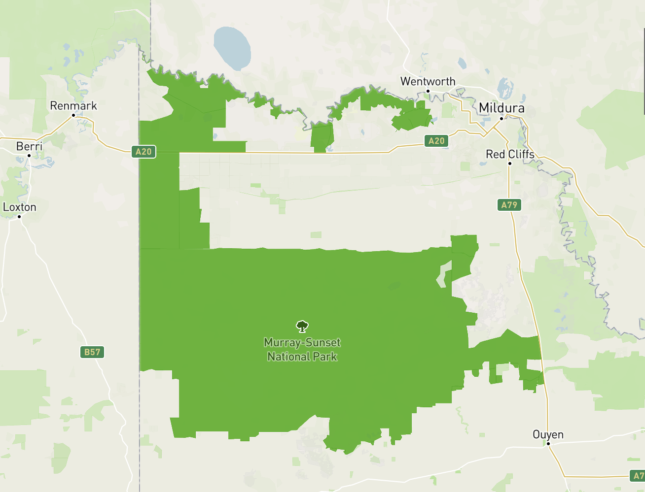
Above:- Map showing the location of the Murray Sunset National Park in north-western Victoria. Map c/o Protected Planet
Murray Sunset has four distinct areas:- Pink Lakes; Wallpolla Island, Mulcra Island, and Lindsay Island.
Above:- Map showing the various sections of the Murray Sunset National Park. Map c/o Protected Planet
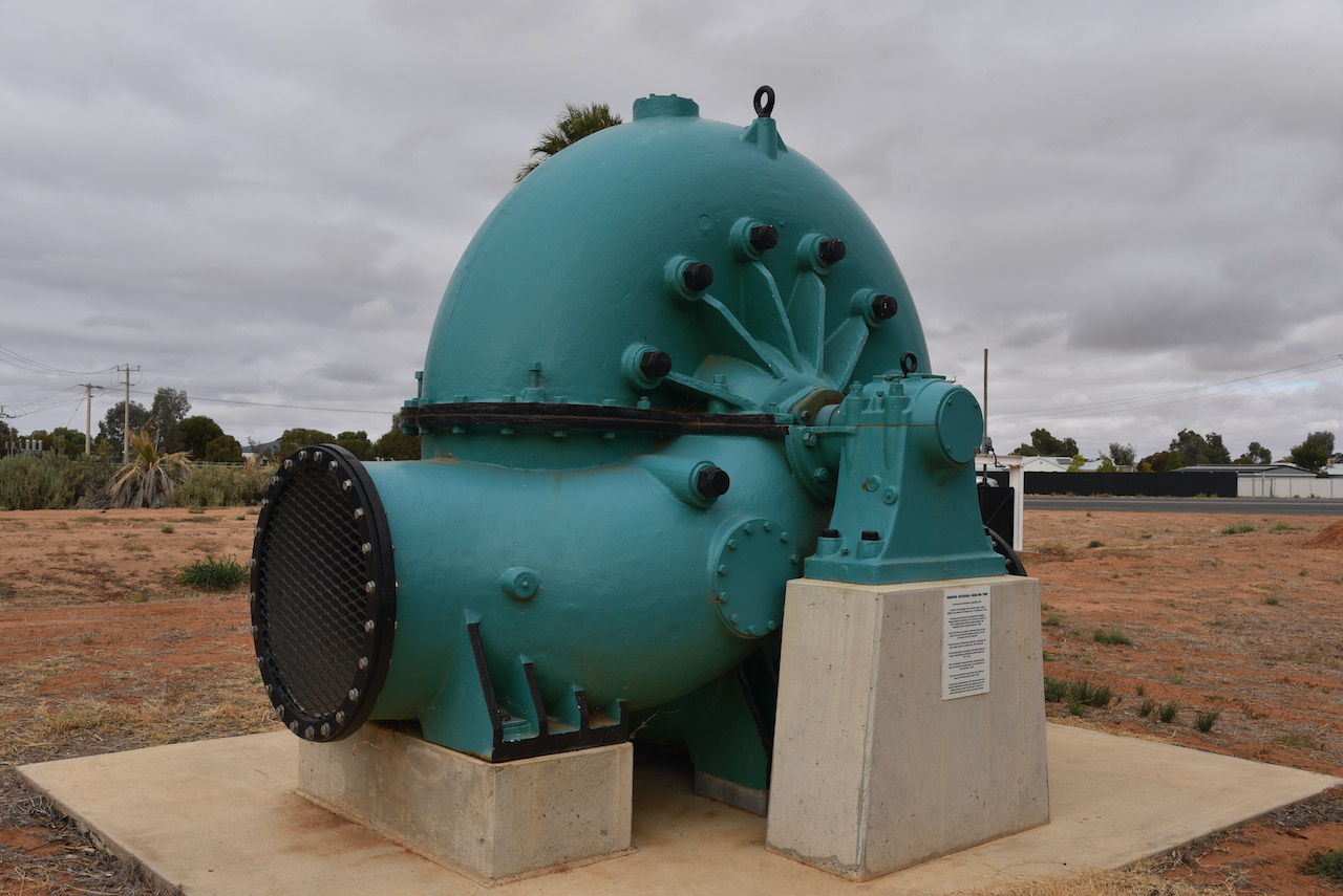
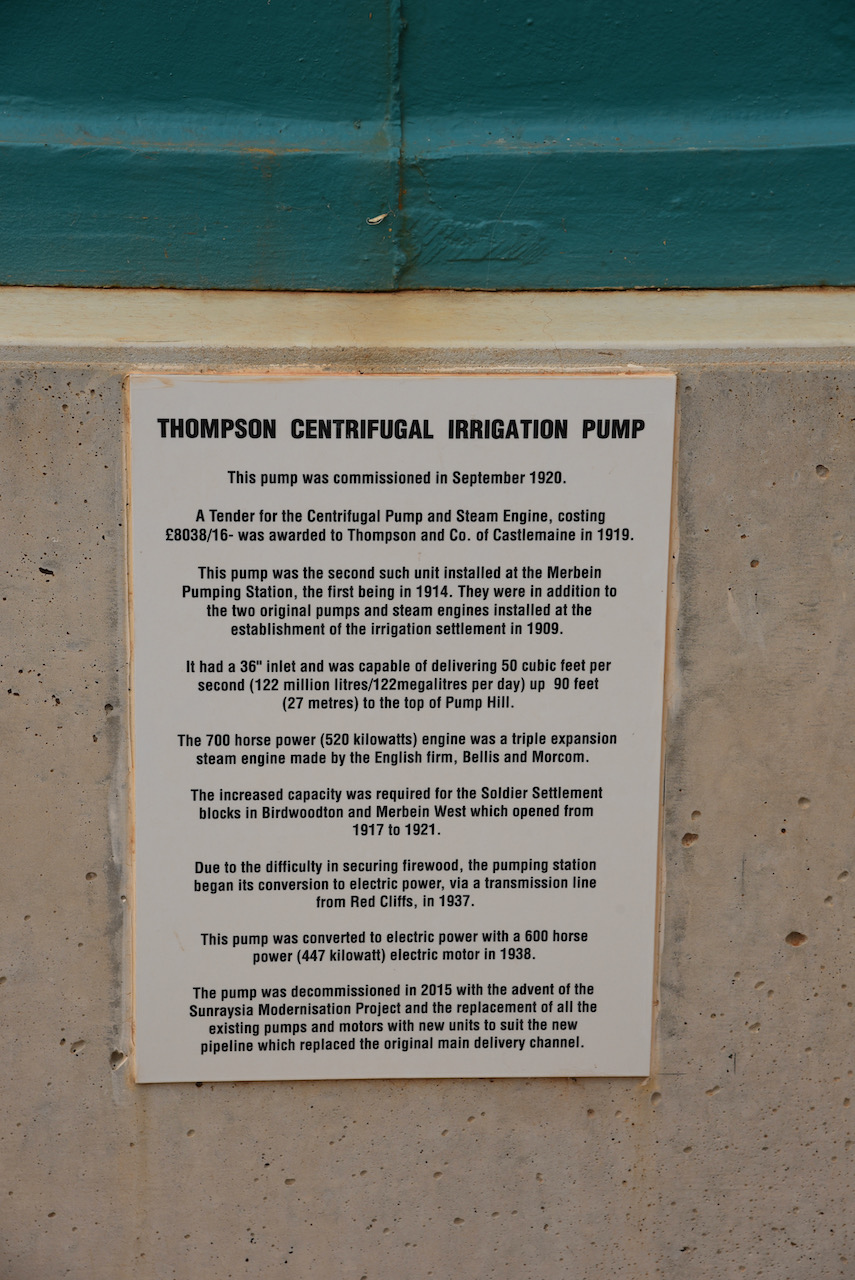
After breakfast we headed out of Mildura to the little town of Merbein where we stopped briefly to look at an old Thompson Centrifugal Irrigation Pump which was commissioned in September 1920 and decommissioned in 2015.
We then drove out on the Old Mail Road and soon reached the Murray Sunset National Park which was well signposted.
The Murray-Sunset National Park is the second-largest National Park in Victoria and comprises an area of 633,000 hectares (1,560,000 acres). The park which borders the South Australia State border is located about 440km north-west of Melbourne. The Sturt Highway passes through the northern section of the park. Most of the park is in the remote area between the Sturt Highway and the Mallee Highway.
Above:- An aerial view of the Murray Sunset National Park. Image c/o Google maps
The Murray Sunset National Park was established in 1979. In 1999 it was expanded to encompass the Pink Lakes State Park. The majority of the park lies within the Murray-Sunset, Hattah and Annuello Important Bird Area, so identified by BirdLife International due to it containing mallee habitat supporting a wide range of threatened mallee bird species including the Malleefowl, Black-eared Miner and Mallee Emu-Wren.
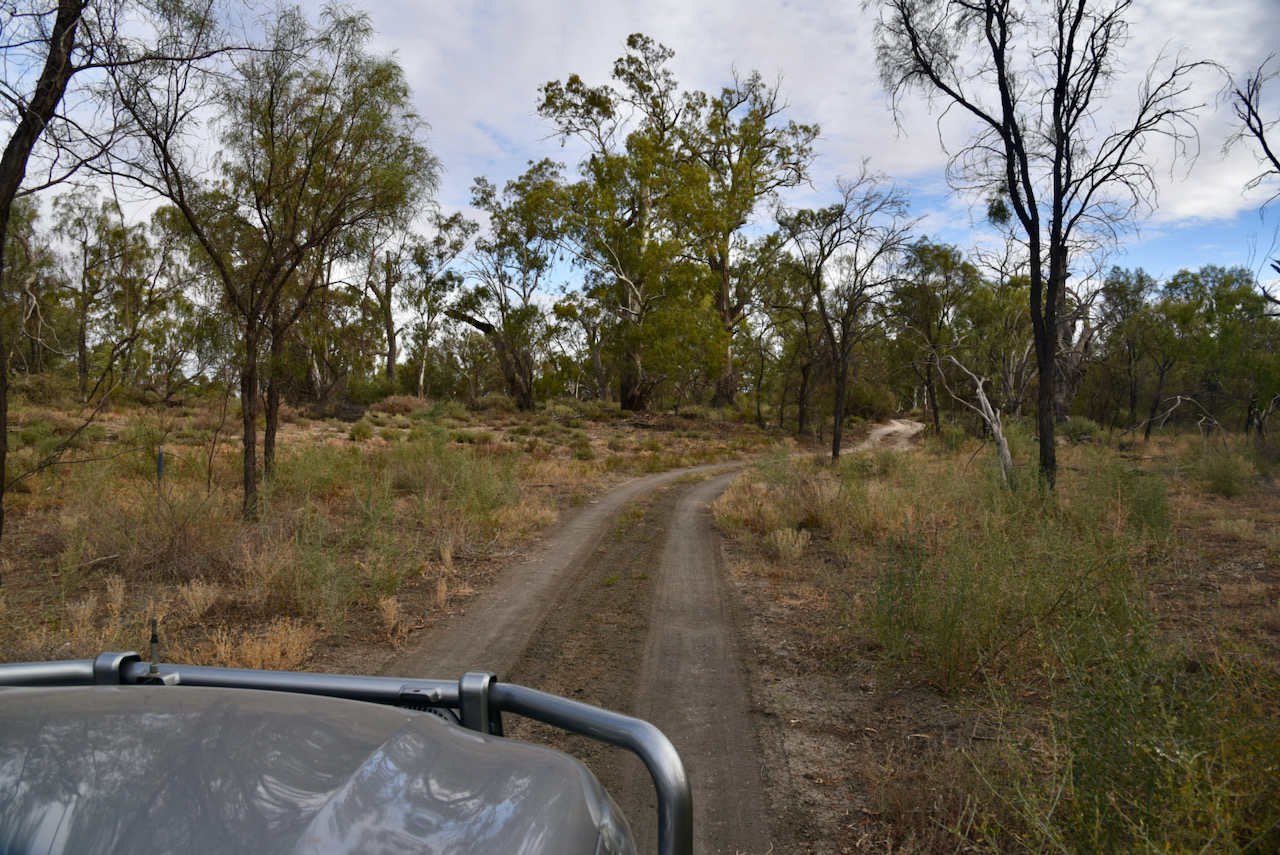
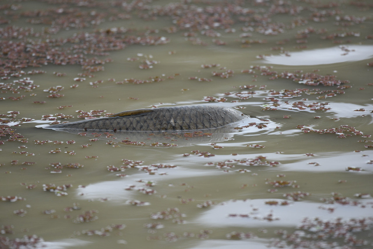
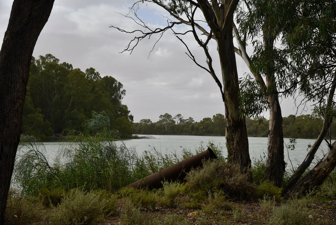
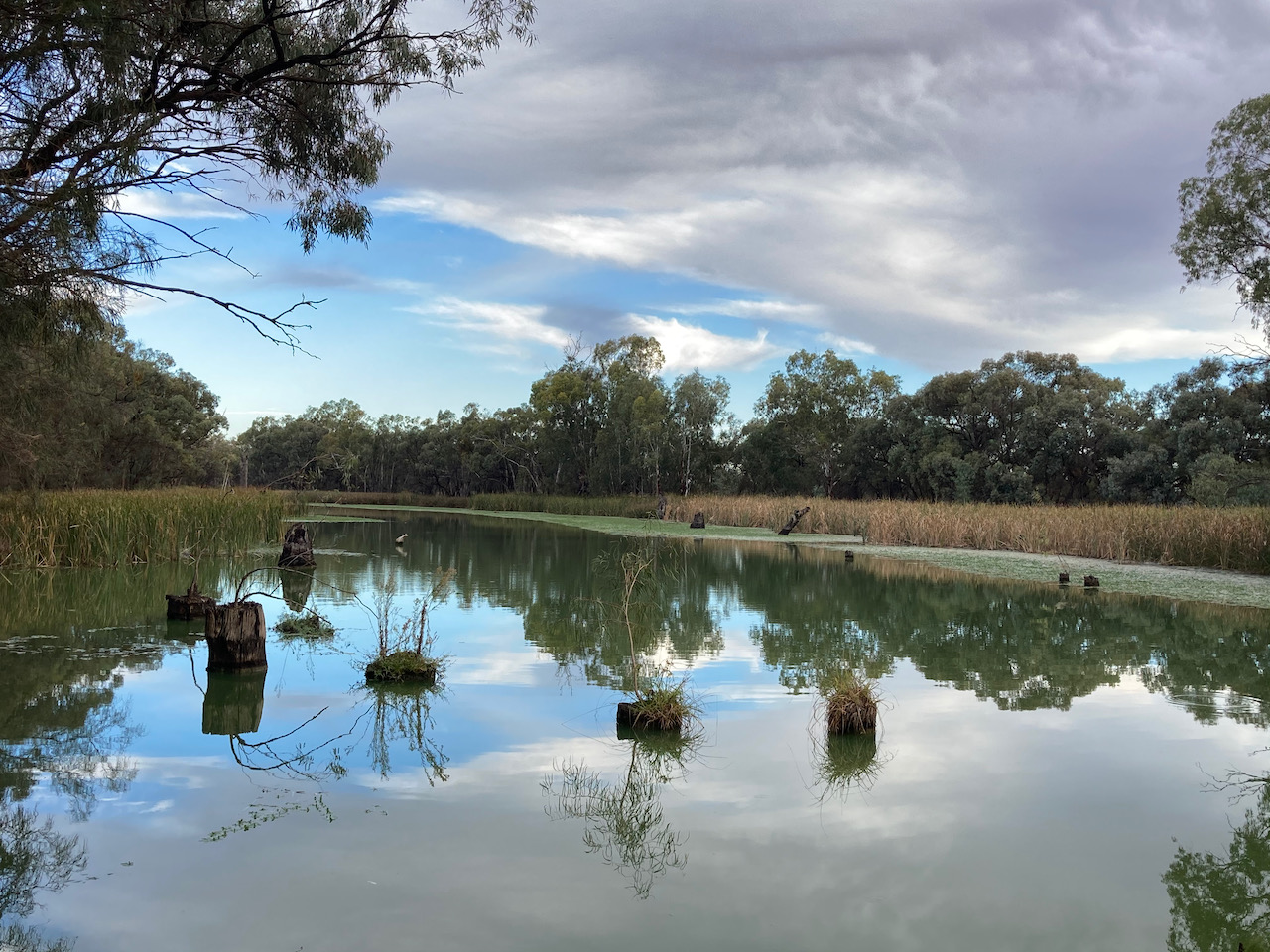
We turned off Old Mail Road and followed a series of 4WD tracks leading down towards the Murray River. We stopped along the way to look at some of the billabongs running off the Murray. Many were full of European Carp, an invasive fish which is an absolute pest in the Murray.
We found a clearing in amongst the scrub and set up our little portable station consisting of the Yaesu FT-857d and the 20/40/80m linked dipole supported by the 7 metre telescopic squid pole.
I called CQ on 7.144 and it was very appropriate that our first station in the log was Tony VK3XV mobile, who is the KRMNPA Award Manager.
Unfortunately during our activation, we had a few sprinkles of rain, so it was out with the bothy bag. This must have been quite a sight, someone huddled underneath a bright orange piece of plastic in the middle of nowhere.
Marija and I logged a total of 170 stations on 40m including the following Park to Park contacts:-
Tony VK3YV – Baw Baw National Park VKFF-0020
Rob VK2VH/3 – Lower Goulburn National Park VKFF-0741
Rob VK4AAC/3 – Lower Goulburn National Park VKFF-0741
VK3UAO/p – Organ Pipes National Park VKFF-0627
VK3PF/p – Warby Ovens National Park VKFF-0742
VK2IO/p – Brisbane Water National Park VKFF-0056
VK4SMA/p – Neurum Creek Conservation Park VKFF-1621
Joe VK3SRC/p – Point Nepean National Park VKFF-0628
Julie VK3FOWL/p – Point Nepean National Park VKFF-0628
Ian VK1DI/p – McQuoids Hill Nature Reserve VKFF-0849
Tony VK3XV/p – Greater Bendigo National Park VKFF-0623
James VK2TER/p – Wyrrabalong National Park VKFF-0550
Peter VK3PF/p – Barmah National Park VKFF-0739
Gerard Vk2IO/p – Popran National Park VKFF-0417
Peter VK3TKK/p – Organ Pipes National Park VKFF-0627
Bryan VK3LF/p – Yarra Ranges National Park VKFF-0556
Bill VK3CWF – Brisbane Ranges National Park VKFF-0055
We logged a total of 10 stations on 80m
I also tried calling on 14.310 on the 20m band but had no takers.
All up we logged 179 QSOs including 33 Park to Park contacts.
Marija worked the following stations on 40m SSB:-
VK3YV/p (Baw Baw National Park VKFF-0020)
VK2VH/3 (Lower Goulburn National Park VKFF-0741)
VK4AAC/3 (Lower Goulburn National Park VKFF-0741)
VK3UAO/p (Organ Pipes National Park VKFF-0627)
VK3PF/p (Warby Ovens National Park VKFF-0742)
VK2IO/p (Brisbane Water National Park VKFF-0056)
VK2KYO
VK2HHA
VK3CRG
VK3MPR
VK3DNH
VK5CZ
VK5FANA
Vk3AWA
VK5KLV
VK3AHR
VK7QP
VK5YX
VK4SMA/p (Neurum Creek Conservation Park VKFF-1621)
VK7EK
Vk3MKE
VK3WTX
VK3NL
VK2PKT
VK3UH
VK3MAB
VK3SQ
VK3MCK
VK3DAC
VK4SM/m
VK5KSW
VK1AD
VK2TH
VK7LTD
VK3ANL
VK2HBG/p
VK3SRC/p (Point Nepean National Park VKFF-0628)
VK3FOWL/p (Point Nepean National Park VKFF-0628)
VK1DI/p (McQuoids Hill Nature Reserve VKFF-0849)
VK3XV/p (Greater Bendigo National Park VKFF-0623)
VK3LF/p
VK4BXX
VK4/NN3Z
VK2TER/p (Wyrrabalong National Park VKFF-0550)
VK2JNA/m
VK5AYL
VK3ZK
Vk3ARH/m
VK4CZ
VK4KLA
VK5PH
VK5DW
VK2YK
VK5GA
VK5HMB
VK5FDMG
VK3PF/p (Barmah National Park VKFF-0739)
VK2IO/p (Popran National Park VKFF-0417)
VK3TKK/p (Organ Pipes National Park VKFF-0627)
VK3LF/p (Yarra Ranges National Park VKFF-0556)
VK5HAA/p (SOTA VK5/ SE-018)
I worked the following stations on 40m SS B:-
VK3XV/m
VK3SQ
VK3PI
VK3MPR
VK3ZK
VK3EJ
VK2PKT
VK1AD
VK2VK
VK7QP
VK5HS
VK2KYO
VK3ANL
VK5ATN
VK3MCK
VK5JBH
VK2HHA
VK3YV/p (Baw Baw National Park VKFF-0620)
VK5FANA
VK7FAMP
VK3UH
VK7LTD
VK5AAY
VK3CRG
VK4KC
VK4MAD
VK4DOG
VK4AAC/3 (Lower Goulburn National Park VKFF-0741)
VK2VH/3 (Lower Goulburn National Park VKFF-0741)
VK3UAO/p (Organ Pipes National Park VKFF-0627)
VK3LF/m
VK3PF/p (Warby Ovens National Park VKFF-0742)
VK2IO/p (Brisbane Water National Park VKFF-0056)
VK4FDJL
VK3OHM
VK3SRC/p (Point Nepean National Park VKFF-)
VK3FOWL/p (Point Nepean National Park VKFF-0628)
VK2XXM
VK3ARH/m
VK5CZ
VK1HF/m
VK3MKE
VK1DI/p (McQuoids Hill Nature Reserve VKFF-0849)
VK3CWF
VK5KSW
VK4BXX
VK4/NN3Z
VK4FHEL
VK4SMA/p (Neurum Creek Conservation Park VKFF-1621)
VK3DNH
VK2KF
VK5WG
VK3MTT
VK3XV/p (Greater Bendigo National Park VKFF-0623)
VK4SM/2
VK2TER/p (Wyrrabalong National Park VKFF-0550)
VK2STG
VK1MIC
VK3PF/p (Barmah National Park VKFF-0739)
VK3PAT
VK5AYL
VK2DG
VK3BNJ
VK5TBC
VK3PT
VK2VEX
VK3VKT
VK5KBJ/m
VK3EY
VK3HSB
VK5TR
VK5PH
VK3GB
Vk3ACZ
VK5FDMG
VK5GY
VK3DPG
VK2IO/p (Popran National Park VKFF-0417)
VK3FD
VK2EXA
VK5IS
VK3ZM
VK3TKK/p (Organ Pipes National Park VKFF-0627)
VK2FAPR
VK2FAPC
ZL3MR
VK5GAZ
VK5KHZ
VK2LF/p (Yarra Ranges National Park VKFF-0556)
VK3CU
Vk2NMZ
VK4HNS
VK7KT
VK7ZGK
VK5HAA/p (SOTA VK5/ SE-018)
I worked the following stations on 80m SSB:-
VK5DW
VK2KYO
VK2YK
VK5GA
VK5CZ
VK2DG
VK5FANA
VK3SQ
VK3BBB
VK2CCP
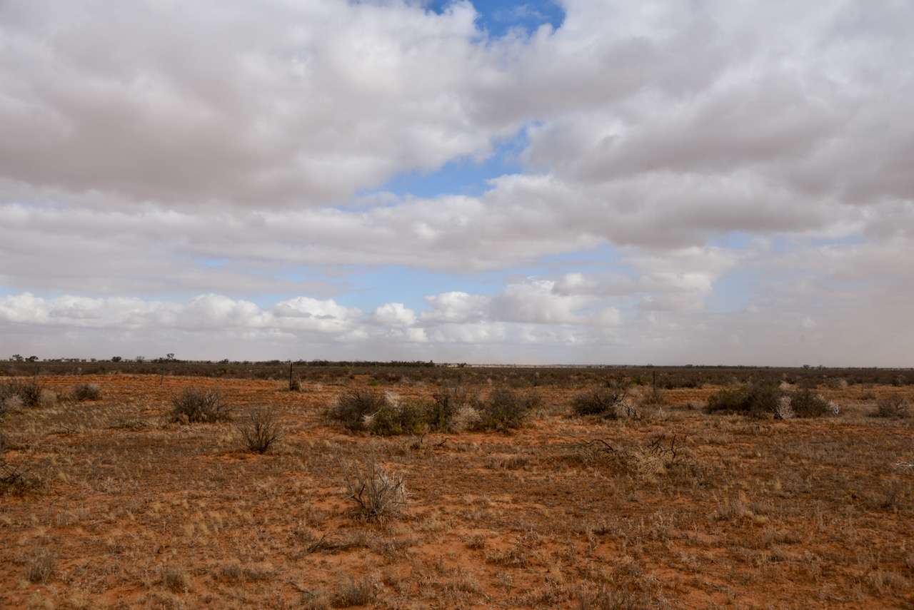
Marija and I packed up at about 3.00 p.m. and continued west on the Old Mail Road. This is a dry weather road only and runs from Meridian Road in Merbein South to Paringa in South Australia. We stopped every now and again just to take in the isolation of the area.
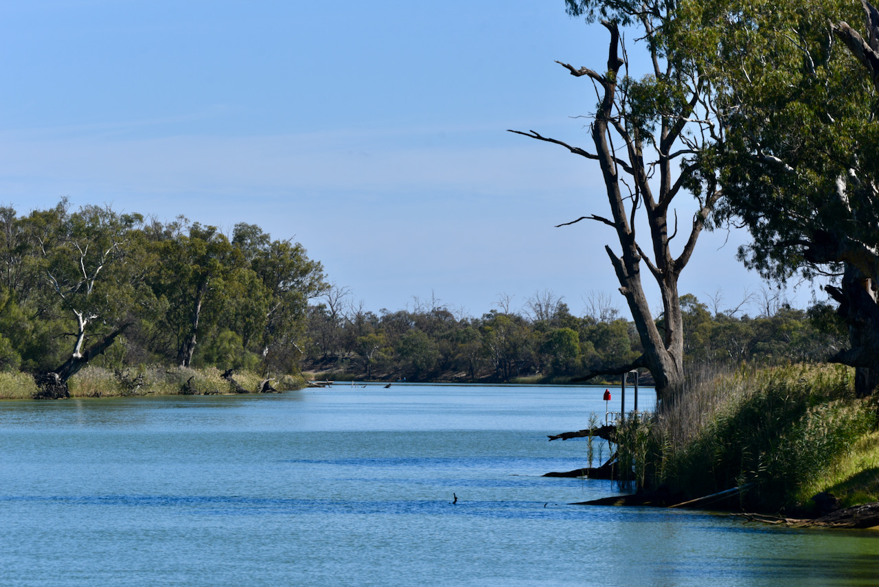
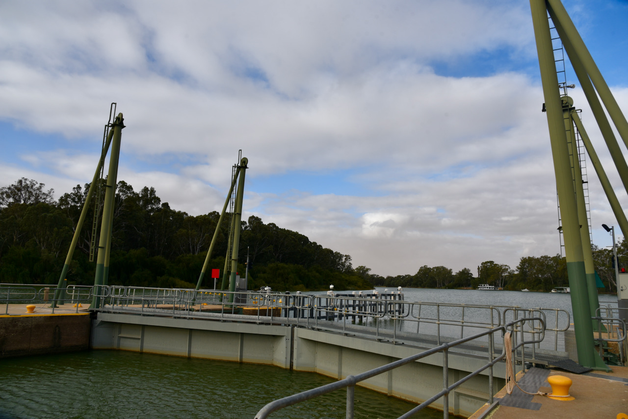
Our next stop was Lock 9 on the Murray River. The first navigational lock on the Murray River was completed at Blanchetown in South Australia in 1922. The weirs and locks were originally constructed to provide year round navigation for commercial cargo and passenger paddle steamers. They were generally built too late to be of benefit to the river trade, as the development of railways and the growth of motorised road haulage had overtaken river transport. Today there are 13 navigation locks on the Murray River.
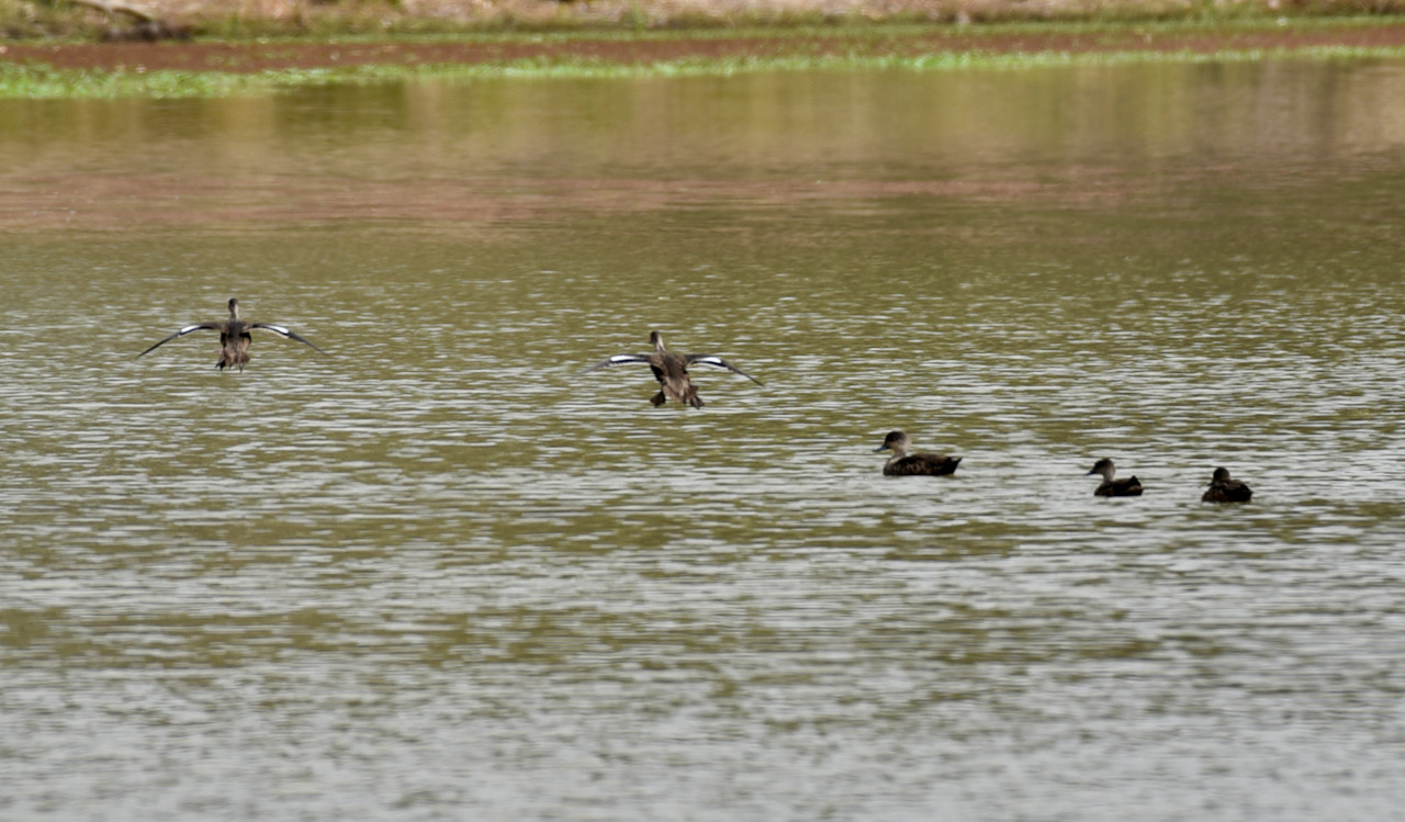
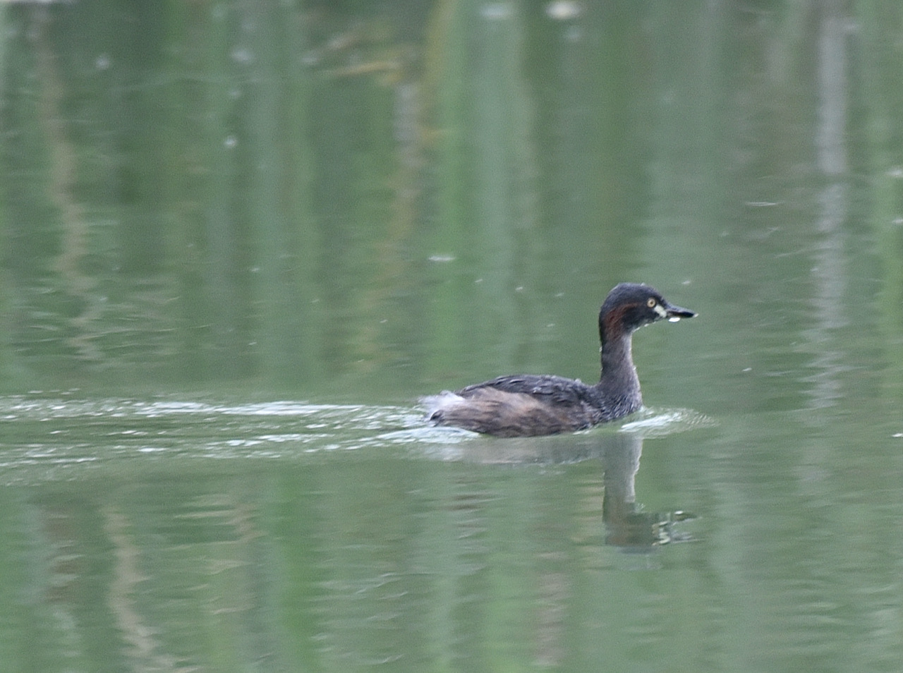
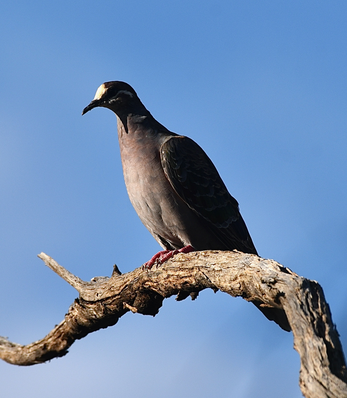
There was plenty of birdlife at Lock 9 and I took the opportunity of taking a few snaps.
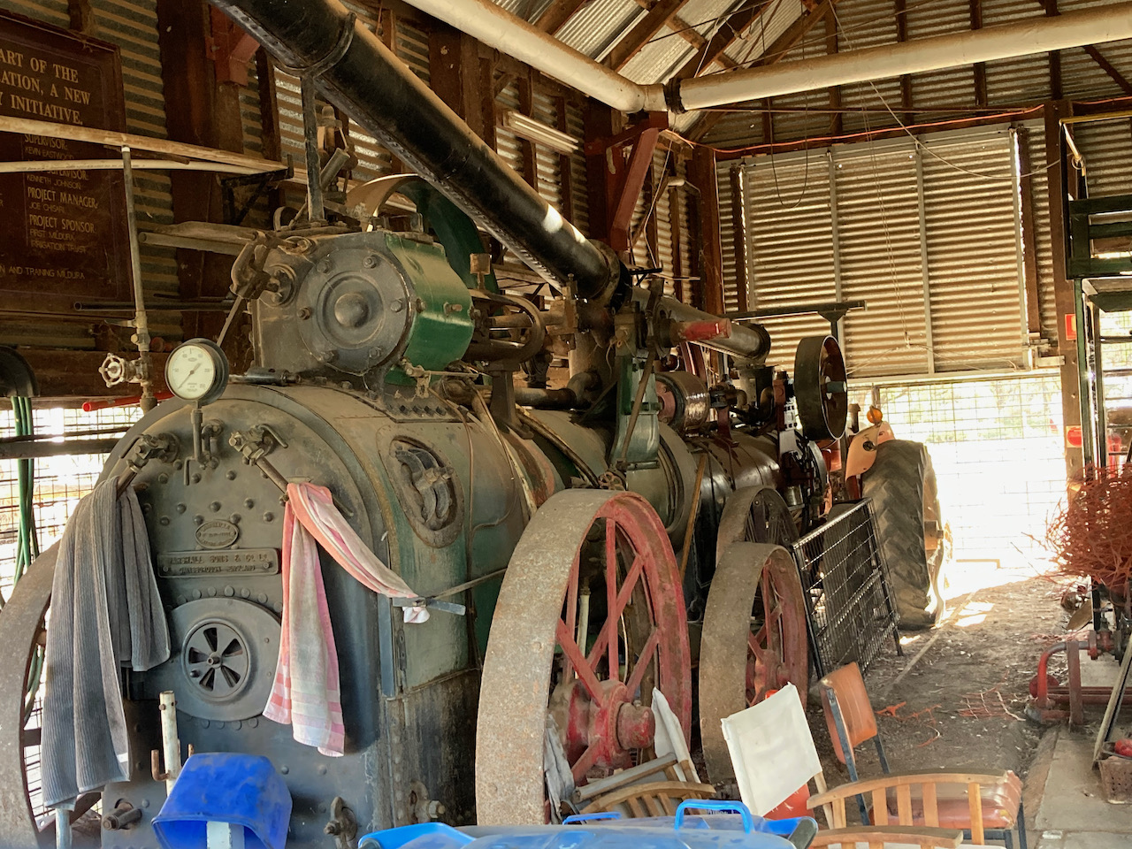
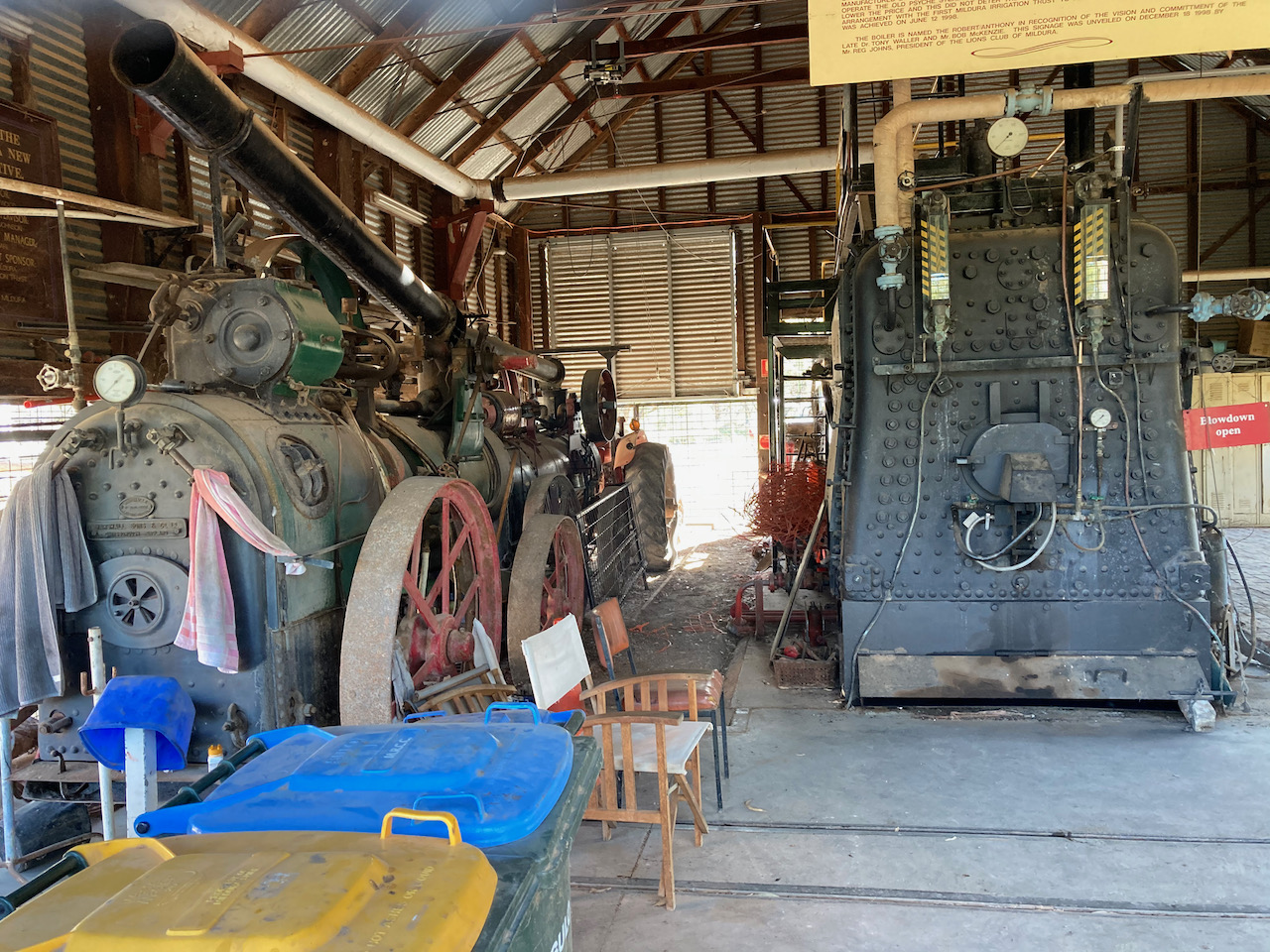
We then visited the historic Lock 9 pumping station which is listed on the Victorian Heritage Register. It was one of the various pumping stations constructed by the Chaffey brothers as part of their vast irrigation scheme built after 1887.
There were some great views of the Murray River at this location.
We then decided to do a little more park activating. We set up again in the Murray Sunset National Park, but this time just downstream from Lock 9.
I called CQ and Andy VK2VOO answered, followed by Tim VK5AV mobile, and then Olga VK5VOB. I logged 38 stations on 40m including the following Park to Park QSOs:-
Bill VK3CWF/p – Brisbane Ranges National Park VKFF-0055
Peter VK3PF/p – Gunbower National Park VKFF-0740
Tom VK5NFT/p – Canunda National Park VKFF-0075
I also worked a total of 26 stations on 80m including the following Park to Park contacts:-
Bill VK3CWF/p – Brisbane Ranges National Park VKFF-0055
Peter VK3PF/p – Terrick Terrick National Park VKFF-0630
Marija worked the following station on 40m SSB:-
VK3CWF/p (Brisbane Ranges National Park VKFF-0055)
Marija worked the following stations on 80m SSB:-
VK3CWF/p (Brisbane Ranges National Park VKFF-0055)
VK3PF/p (Terrick Terrick National Park VKFF-0630)
VK5MWW
I worked the following stations on 40m SSB:-
VK2VOO
VK5AV/m
VK5VOB
VK3CWF/p (Brisbane Ranges National Park VKFF-0055)
VK3ZPF
VK4HAT
VK2HRX
VK7JFD
VK2VK
VK5DC
VK3PF/p (Gunbower National Park VKFF-0740)
VK4CZ
VK4FDJL
VK5BB
ZL1TM
ZL4NVW
VK2AKA/m
VK5IS
VK2MG
VK5LB
VK2PV
VK2NIT
VK3SQ
VK5VBR
VK5NFT/p (Canunda National Park VKFF-0075)
VK4NH
VK4DXA
ZL4TY/VK4
VK4ACX
VK5VGC
VK2DJP
VK5JOB
VK2PBC
VK3CAT
VK7RM
VK3WAR
VK3RW
VK3VLF
I worked the following stations on 80m SSB:-
VK5WG
VK4HNS
VK3RW
VK2MOP
VK2LAT
VK2MG
VK2LEE
VK4CZ
VK4NH
VK4DXA
ZL4TY/VK4
VK3PI
VK3ANL
VK4SMA
VK3GQ
VK3NCR
VK5AYL
VK3CWF/p (Brisbane Ranges National Park VKFF-0055)
VK3ZPF
VK4IDK
VK3MET
VK5CZ
VK5MWW
VK3PF/p (Terrick Terrick National Park VKFF-0630)
VK3AJA/5
VK5GY
This time around we had made 68 QSOs and 7 Park to Park contacts.
For the two activations in Murray Sunset on the day we made a total of 247 QSOs and 40 Park to Park contacts.
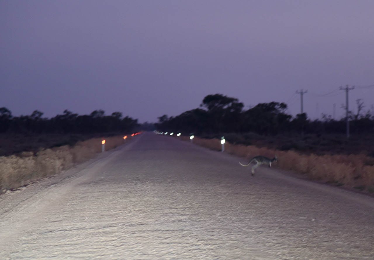
We packed up and drove slowly down Lock 9 Road towards Lake Culleraine and the Sturt Highway. It was slow going as there were plenty of kangaroos out and about.
Day four (Friday 9th April 2021) had rolled around very quickly. We didn’t have any scheduled park activation, rather we planned on doing a lot of sightseeing.
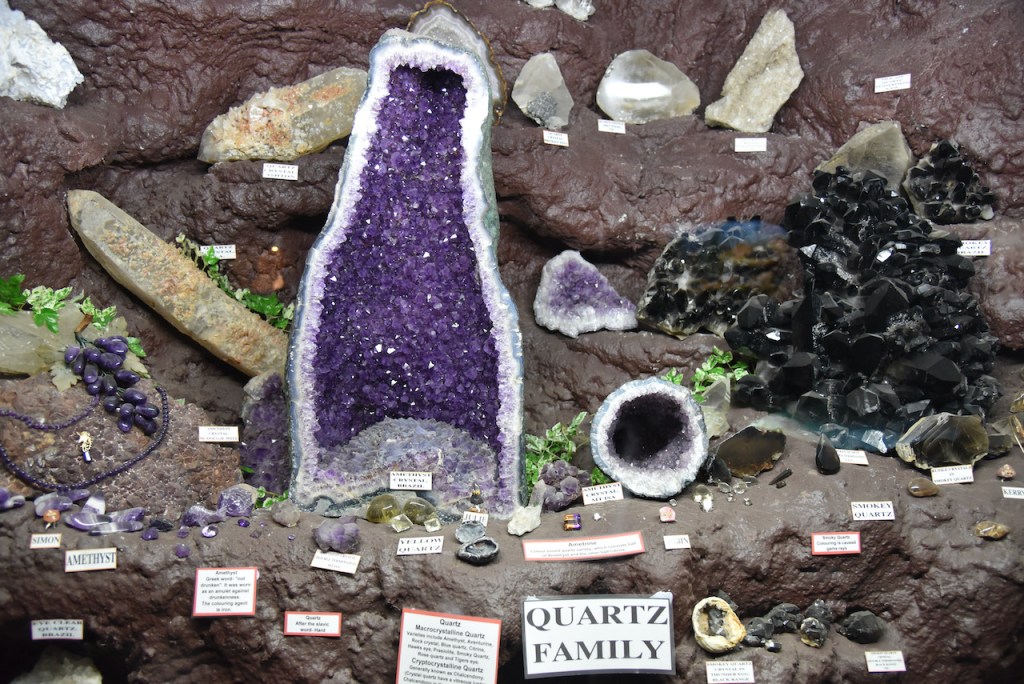
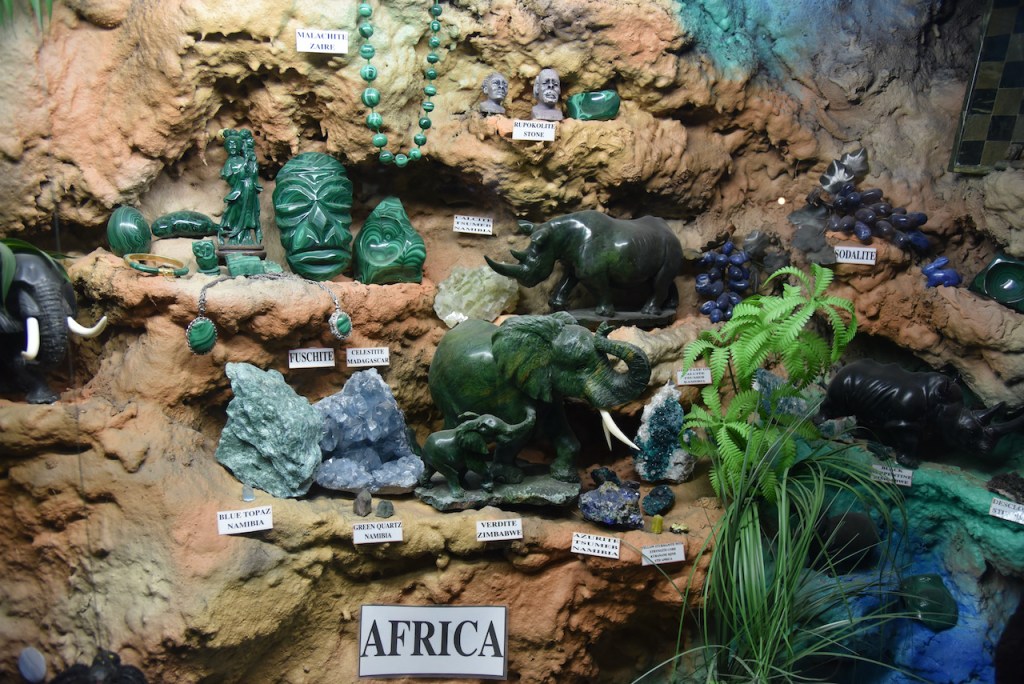
After breakfast we headed to Woodsie’s Gem Shop at Nichols Point just outside of Mildura.
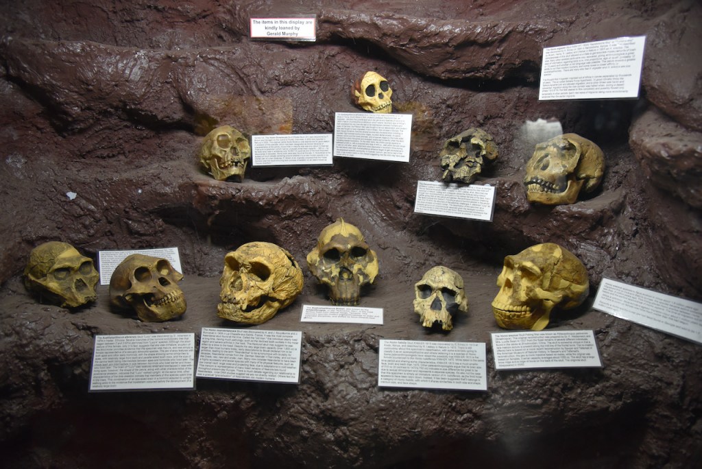
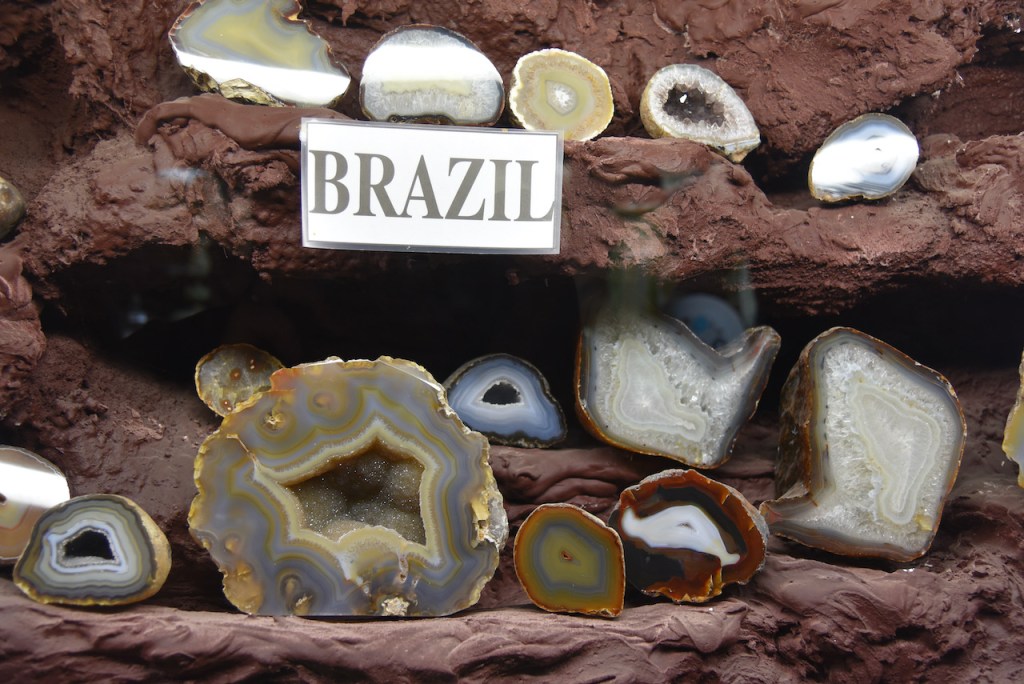
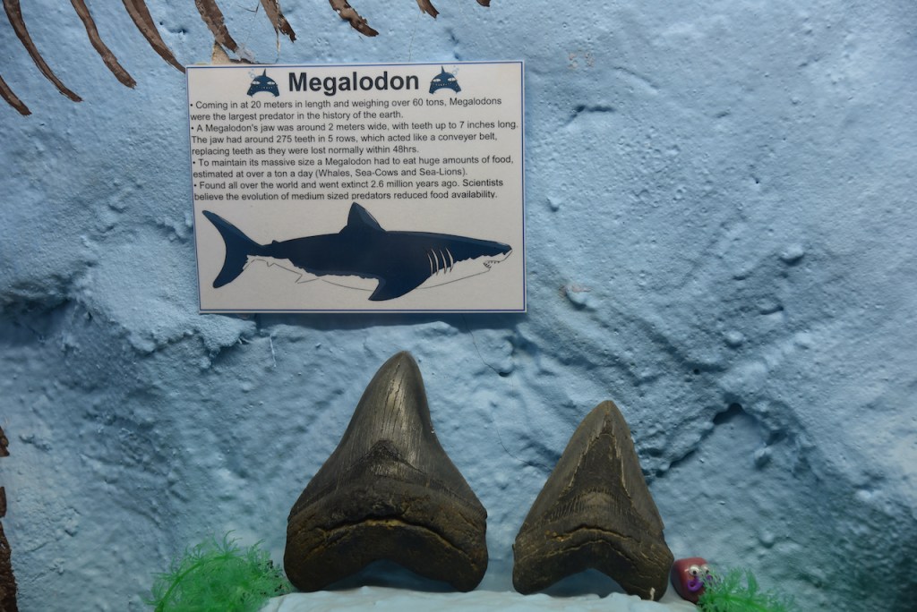
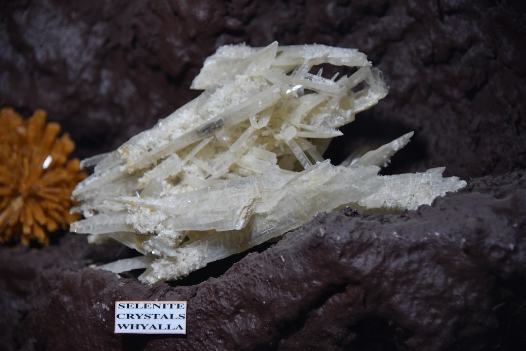
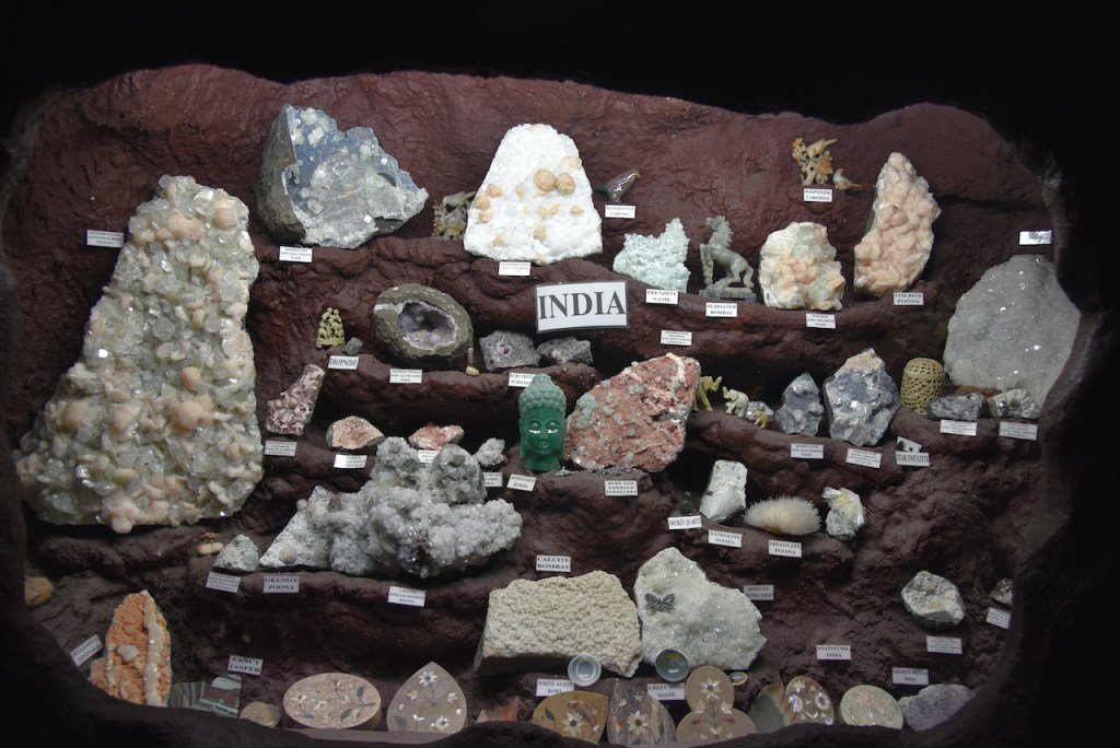
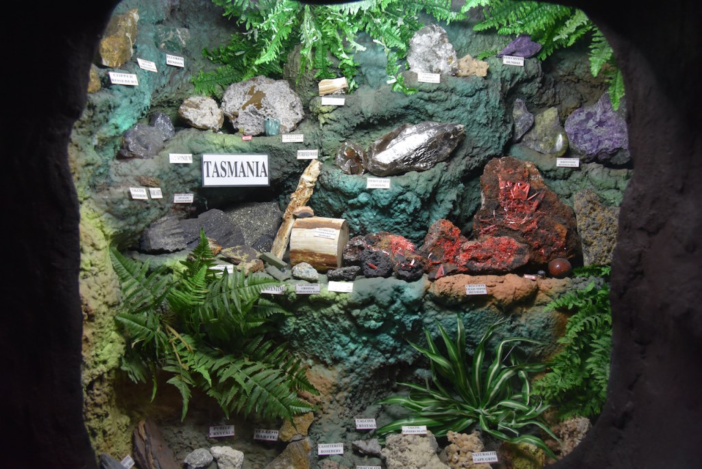
We purchased a little quartz pig from their gift shop/display room and then entered ‘Aladdin’s Cave’ which is the Wood’s family extensive private collection of crystals, fossils, and carvings from around the world. This is an excellent display and we spend quite some time there having a look at the various displays.
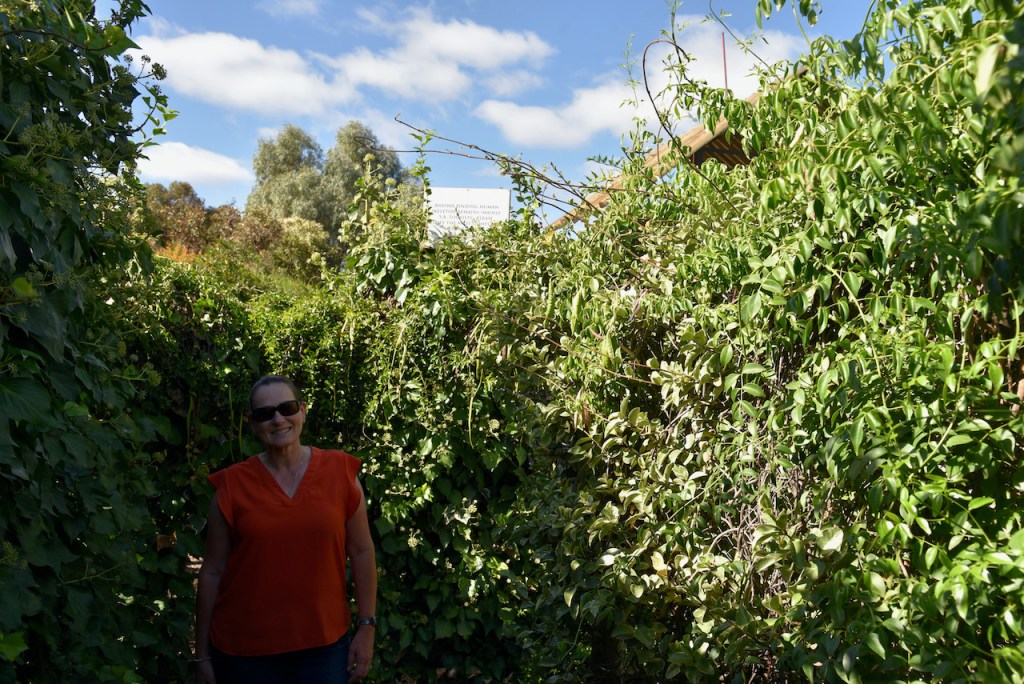
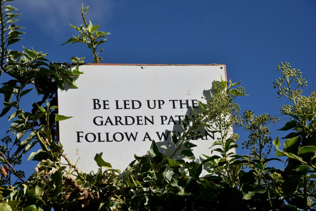
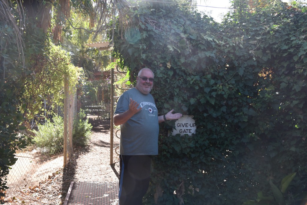
We then tried our luck in the Garden Maze at Woodsie’s. This was quite a challenge and we could not find the end and headed for the ‘Give Up gate’. I am happy to say we were not the only to take the easy way out.
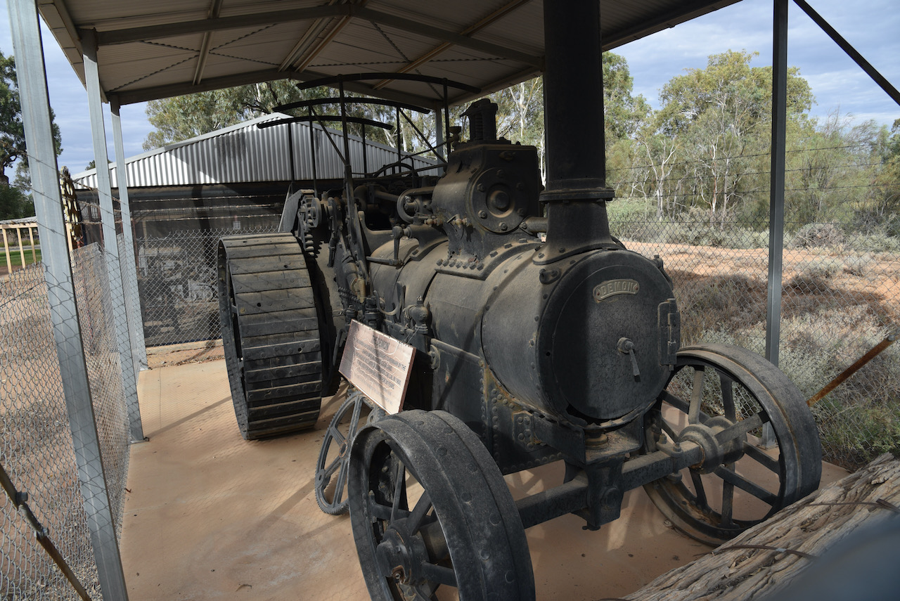
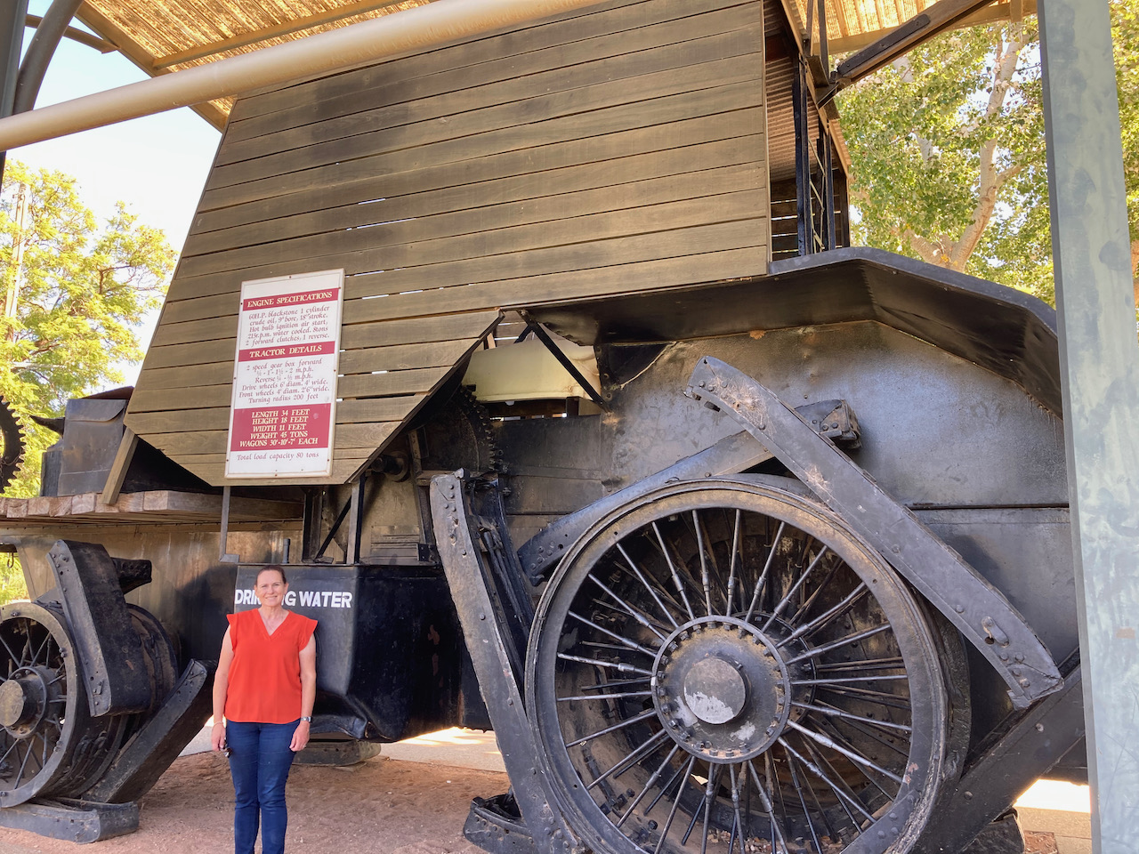
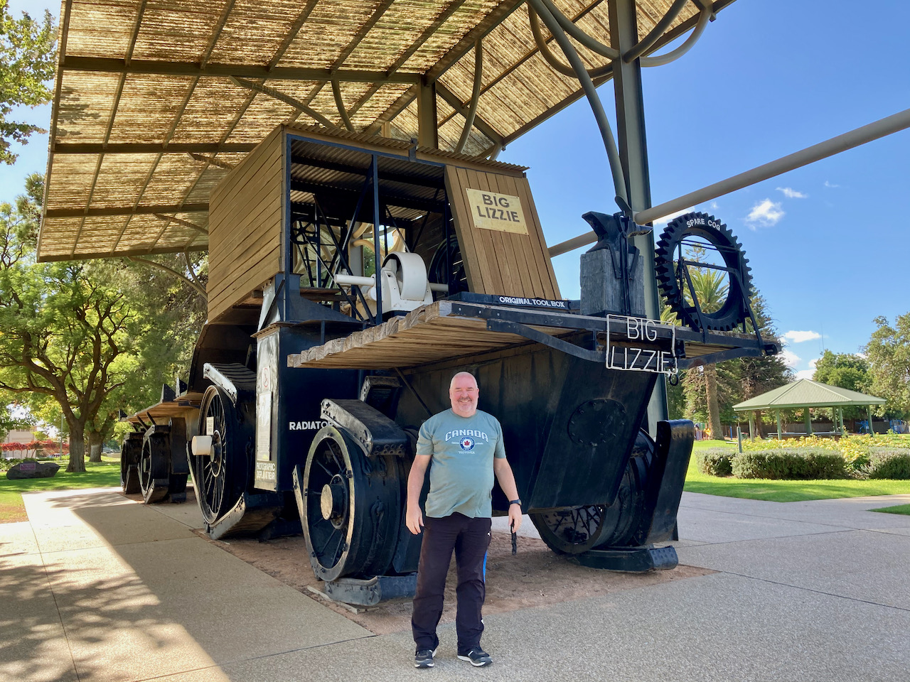
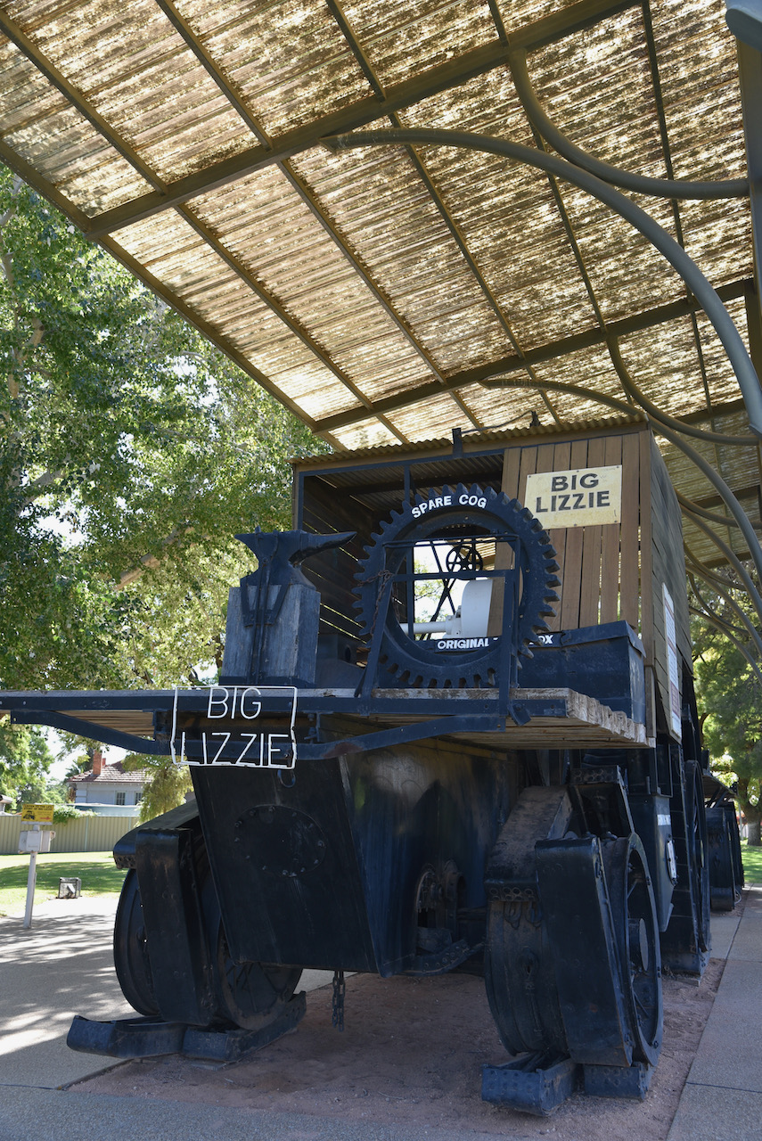
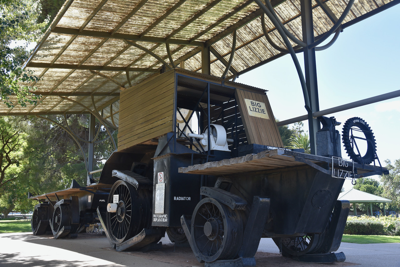
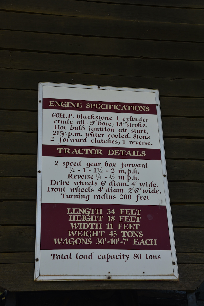
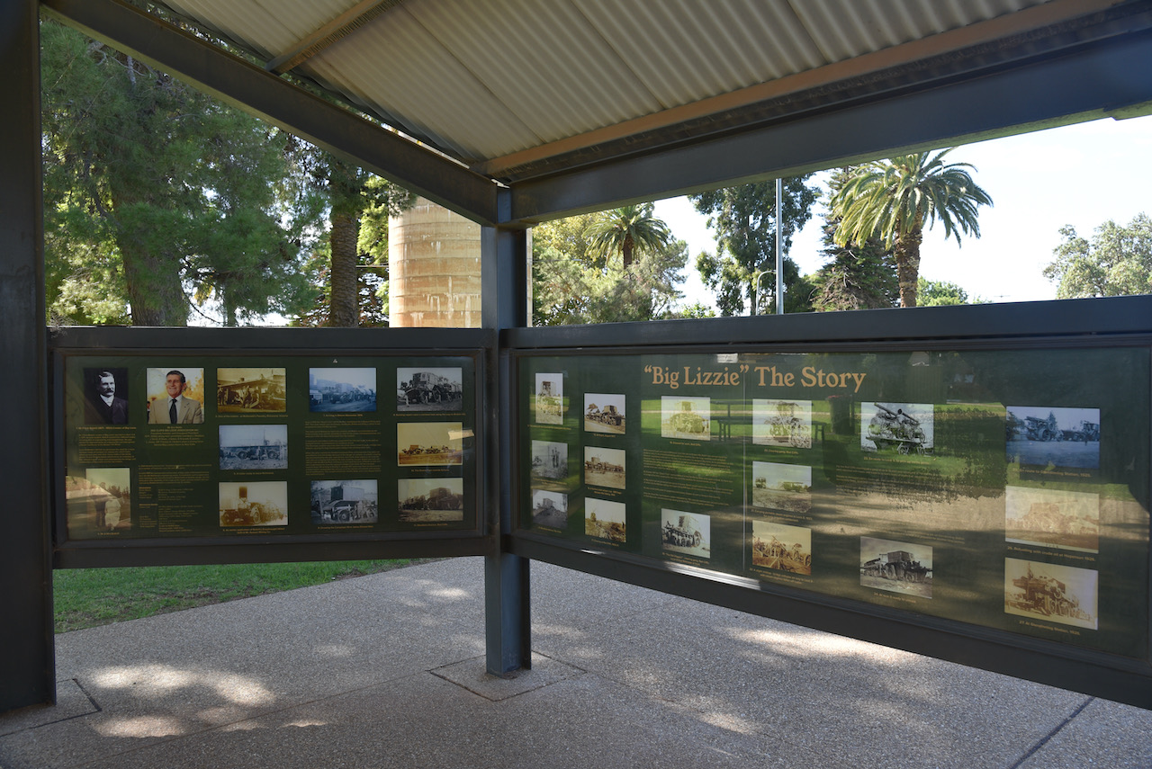
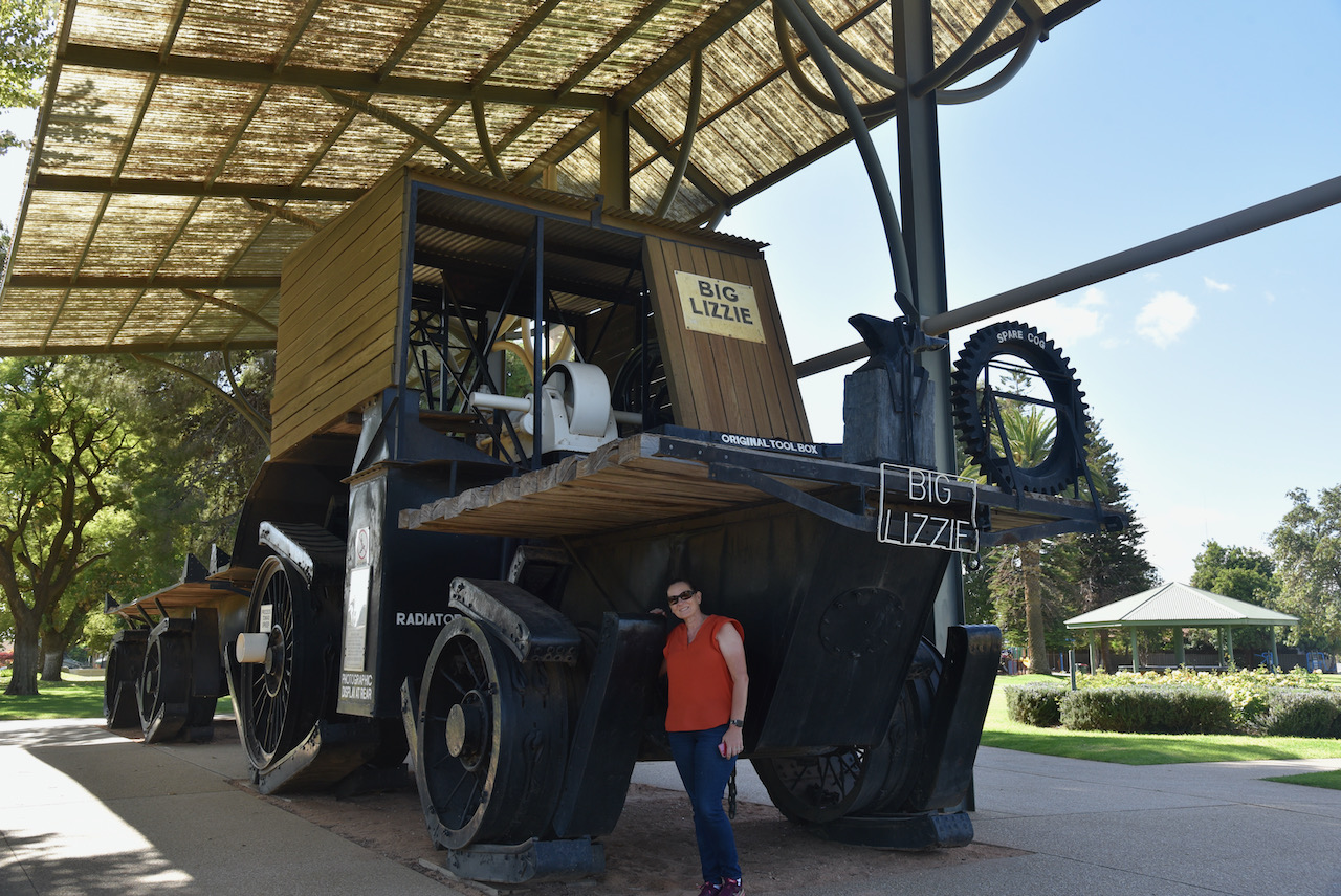
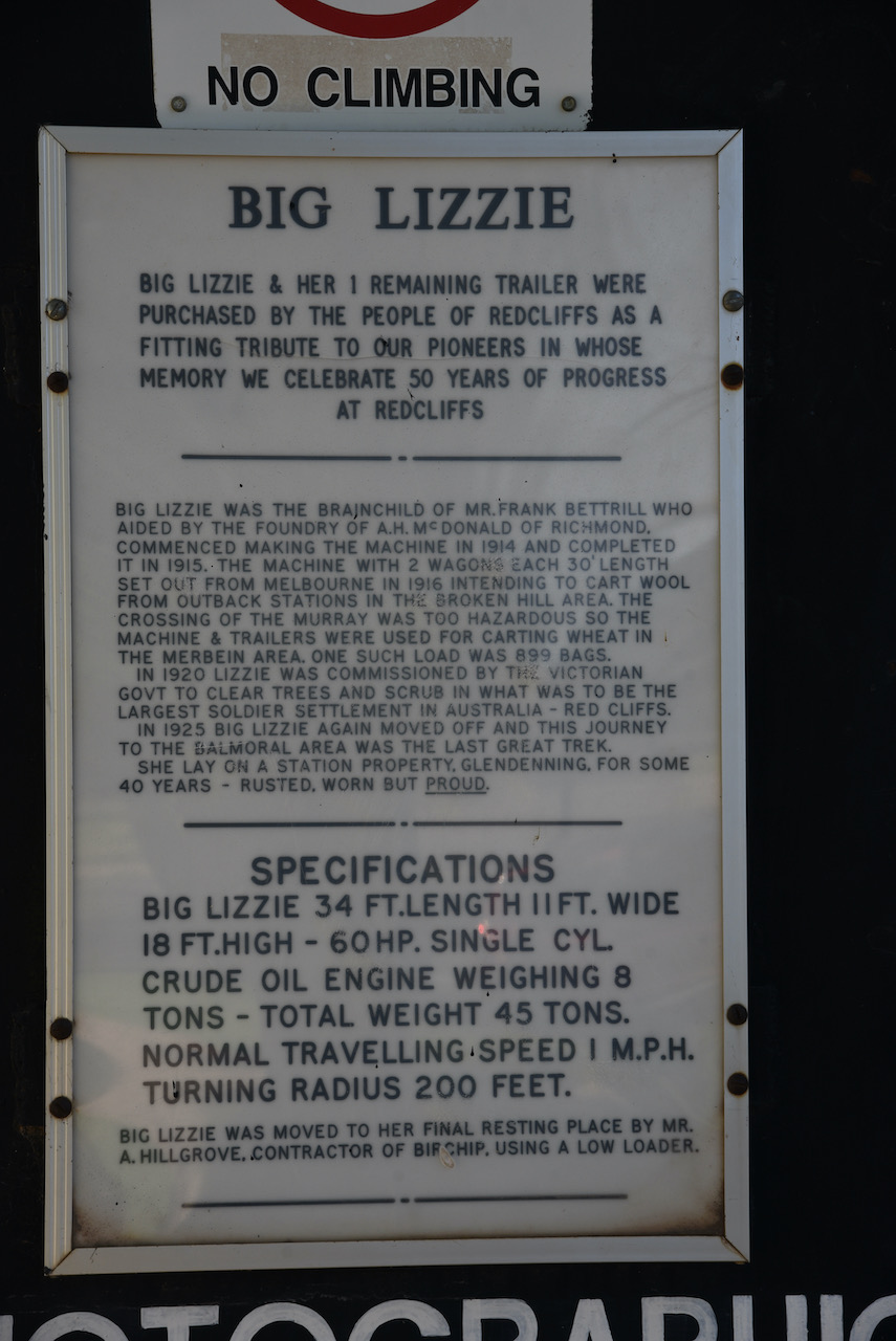
We then drove south on the Calder Highway into the little town of Red Cliffs. We stopped to have a look at Big Lizzie, the largest tractor in the world for its time. In 1914 Mr. Frank Bettrill with the aid of Foundry of A.H. McDonald or Richmond, commenced construction of Big Lizzie. It was completed in 1915. The machine had 2 wagons each 30 feet in length. Big Lizzie set out from Melbourne in 1916 intending to cart wool from outback stations in the Broken Hill area. However the crossing of the Murray River was too hazardous and as a result the machine and trailers were used for carting wheat in the Merbein area, with one such load consisting of 899 bags.
In 1920 Big Lizzie was commissioned by the Victorian Government to clear trees and scrub at the soldier settlement at Red Cliffs. In 1925 Big Lizzie headed to the Balmoral area. She lay on a station property ‘Glendenning’ for some 40 years before being purchased by the people of Red Cliffs and restored.
We then decided that we would activate the Karadoc Nature Conservation Reserve VKFF-2123. This was to be a first time activation of this park by myself and Marija.
The park is located at Iraak, about 41 km south-east of Mildura.
Above:- Map showing the location of the Karadoc Nature Conservation Reserve near Mildura. Map c/o Protected Planet.
The Karadoc Nature Conservation Reserve is about 1.08 km² in size and is located alongside of the Murray River, forming the Victoria and New South Wales State border.
Above:- Aerial view of the Karadoc Nature Conservation Reserve. Image c/o Protected Planet.
Karadoc Nature Conservation Reserve became a reserve as recommended by the River Red Gum Forests Investigation in 2008. The park contains a diverse range of flora and fauna species. There are several wetlands at Karadoc, but these were dry during our visit.
First in the log for this activation was Ron VK3AHR, followed by Dennis VK2HHA, and then Steve VK3MPR. Contact number ten was a QSO with Ken VK2KYO.
Band conditions seemed to be pretty good on 40m, however callers were quite slow here at Karadoc. Once I got 15 QSOs in the log and had qualified the park for VKFF, I swapped over with Marija.
Marija called CQ and very quickly had ten contacts in the log from VK1, VK2, VK3, and VK5. Her 10th QSO was with Stephen VK2STG.
After Marija had logged 12 contacts, I jumped back into the operator’s chair with the hope that I might be able to get 44 QSOs and qualify the park for the global WWFF program. However, based on my earlier go on 40m that was looking unlikely.
I called CQ once again on 7.144 and this was answered by Adrian VK5FANA with a good 5/9 signal, followed by Joe & Julie VK3SRC (VK3YSP & VK3FOWL).
A few QSOs later and I was called by Peter VK3TKK/p who was activating the Shire Dam Swamp Wildlife Reserve VKFF-2438. Marija also logged Peter for a Park to Park contact.
To my great pleasure the number of callers really picked up and after just a little over one hour into the activation I had contact number 44 in the log, a QSO with Stanley VK3BOT. With 51 QSOs in the log for me, and 13 for Marija, we lowered the squid pole.
I called CQ on 14.310 for about 5 minutes but had no takers. I was also competing against the Over the Horizon Radar which was strength 9.
To complete the activation Marija called CQ on 3.610 where she logged 5 stations from VK3 and VK5.
Marija worked the following stations on 40m SSB:-
VK2VK
VK2HHA
VK3AHR
VK3SRC
VK3FOWL
VK1DI
VK5FANA
VK3MPR
VK3PF/m
VK2STG
VK5WG
VK3HP
VK3TKK/p (Shire Dam Wildlife Reserve VKFF-2438)
Marija worked the following stations on 80m SSB:-
VK5FANA
VK3YV
VK5LA
VK5CZ
VK3SQ
I worked the following stations on 40m SSB:-
VK3AHR
VK2HHA
VK3MPR
VK4FDJL
VK1DI
VK7KT
VK2VEX/m
VK3EJ
Vk3PF/m
VK2KYO
VK3TKK/m
VK7DM
VK2VK
VK2IO/m
VK4VCE
VK5FANA
VK3SRC/m
VK3FOWL/m
VK3YSP/m
VK5CLN
VK2VH
VK4AAC/2
VK3TKK/p (Shire Dam Wildlife Reserve VKFF-2438)
VK4CZ
VK7VZ
VK4KC
VK4MAD
VK4DOG
VK4HNS
VK3CAT
VK2WB
VK6WF
VK2EAC
VK2YK/5
VK5GA
VK5PL
VK1MDP
VK3MCK
VK5ATN
VK2PBC
VK3KZ
VK7ZGK
VK2MOR
VK3BOT
VK2QK
VK3GMC
VK3SQ
VK2MOP
VK3YV
VK5AV/m
VK3CM
It had been another fun activation, with 69 QSOs in the log from VK1, VK2, VK4, VK4, VK5 and VK7.
After packing up we headed down to the Murray River within the park to enjoy the view. There was one solitary guy fishing on the banks of the Murray enjoying the beautiful sunny afternoon.
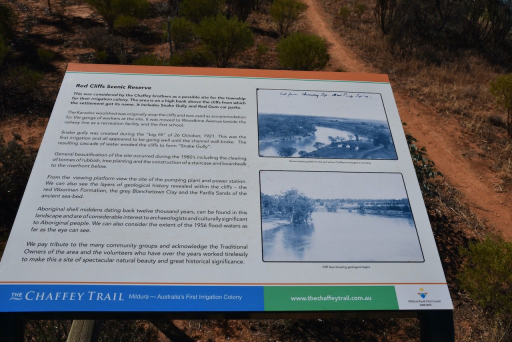
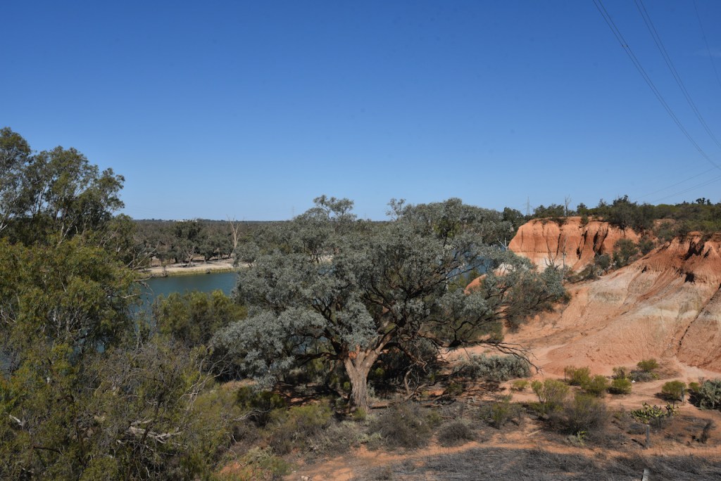
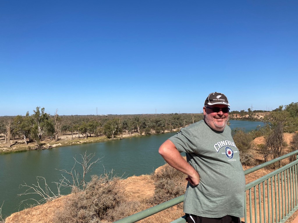
We then drove back into Red Cliffs to get a coffee. Along the way we stopped at the Red Cliffs Scenic Reserve where we enjoyed some brilliant views of the Murray River. This area was considered by the Chaffey Brothers as a possible site for the township for their irrigation colony. The area is on a high bank above the cliffs from which the settlement of Red Cliffs got its name. It includes Snake Gully and Red Gum car parks.
The Chaffey Brothers developed large parts of California and also established the irrigation towns of Renmark in South Australia and Mildura in Victoria.
The Karadoc woolshed was originally atop the cliffs and was used as accomodation for the gangs of workers at the site. It was moved to Woodbine Avenue beside the railway line as a recreation facility and the first school.
Snake Gully was created during the ‘big fill’ of 26th October 1921. This was the first irrigation and all appeared to be going well until the channel wall broke. The resulting cascade of water eroded the cliffs to form Snake Gully.
From the viewing platform you can view the site of the pumping plant and power station.
Aboriginal shell middens dating back 12,000 years can be found in the area. You can also view the extent of the 1956 flood waters.
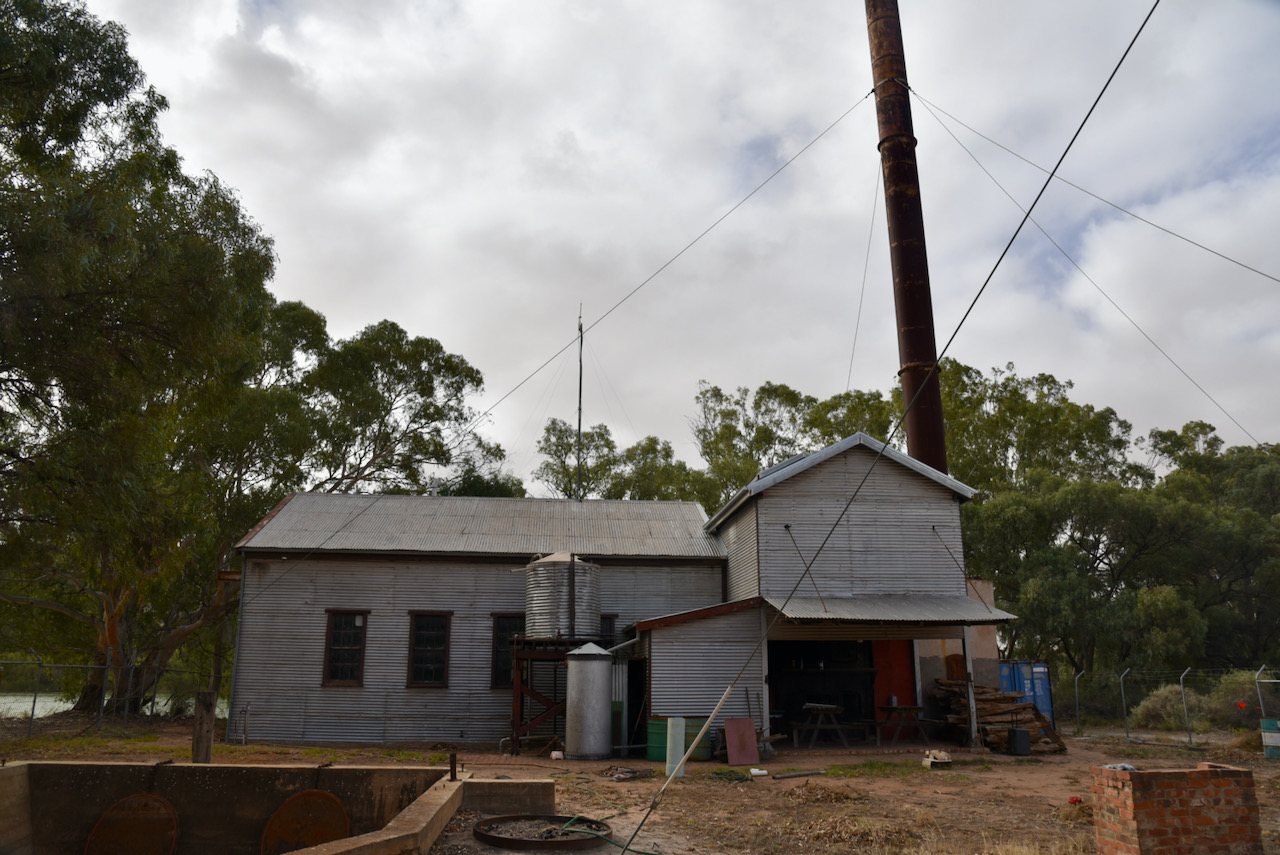
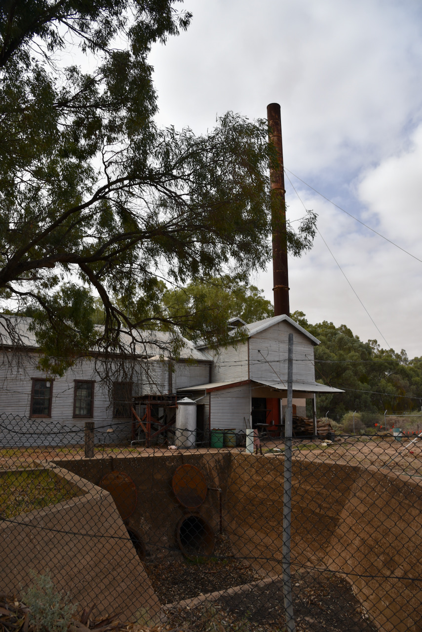
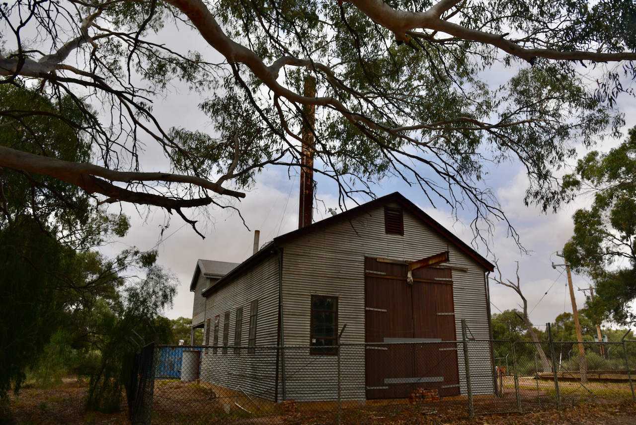
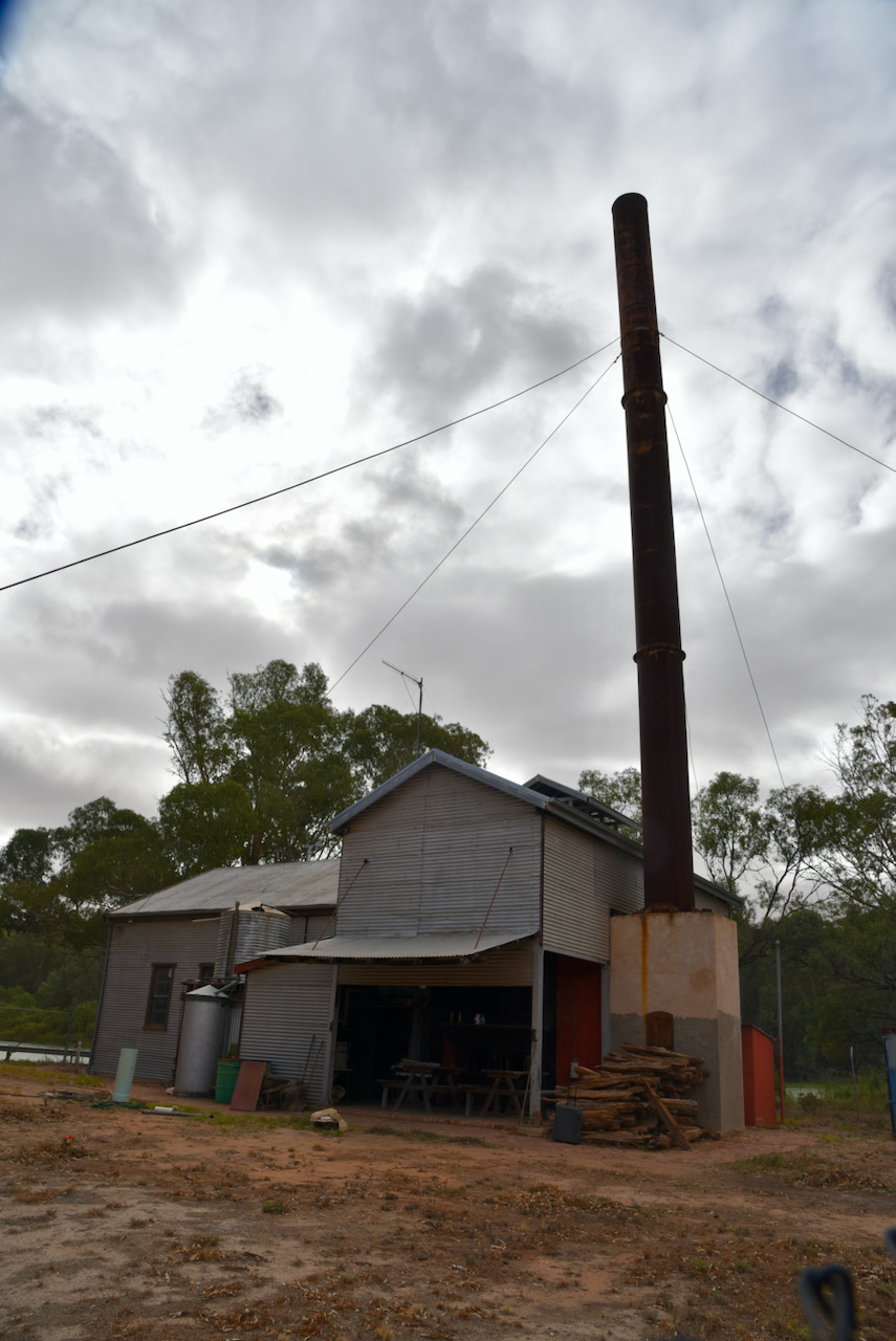
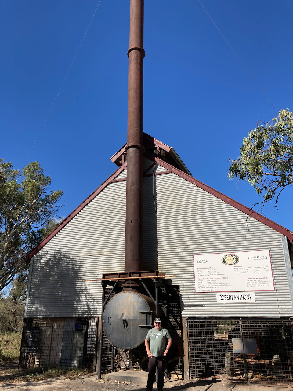
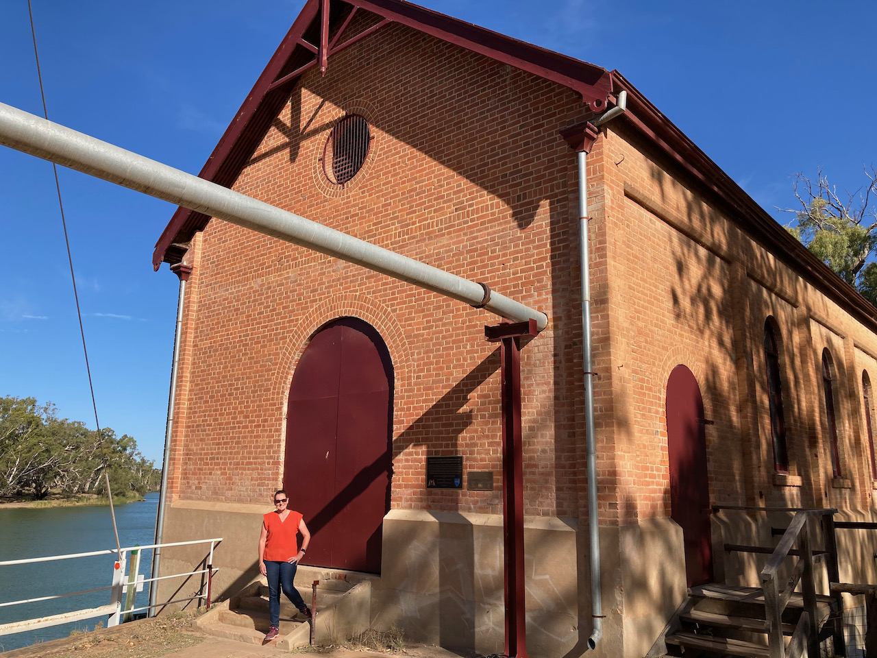
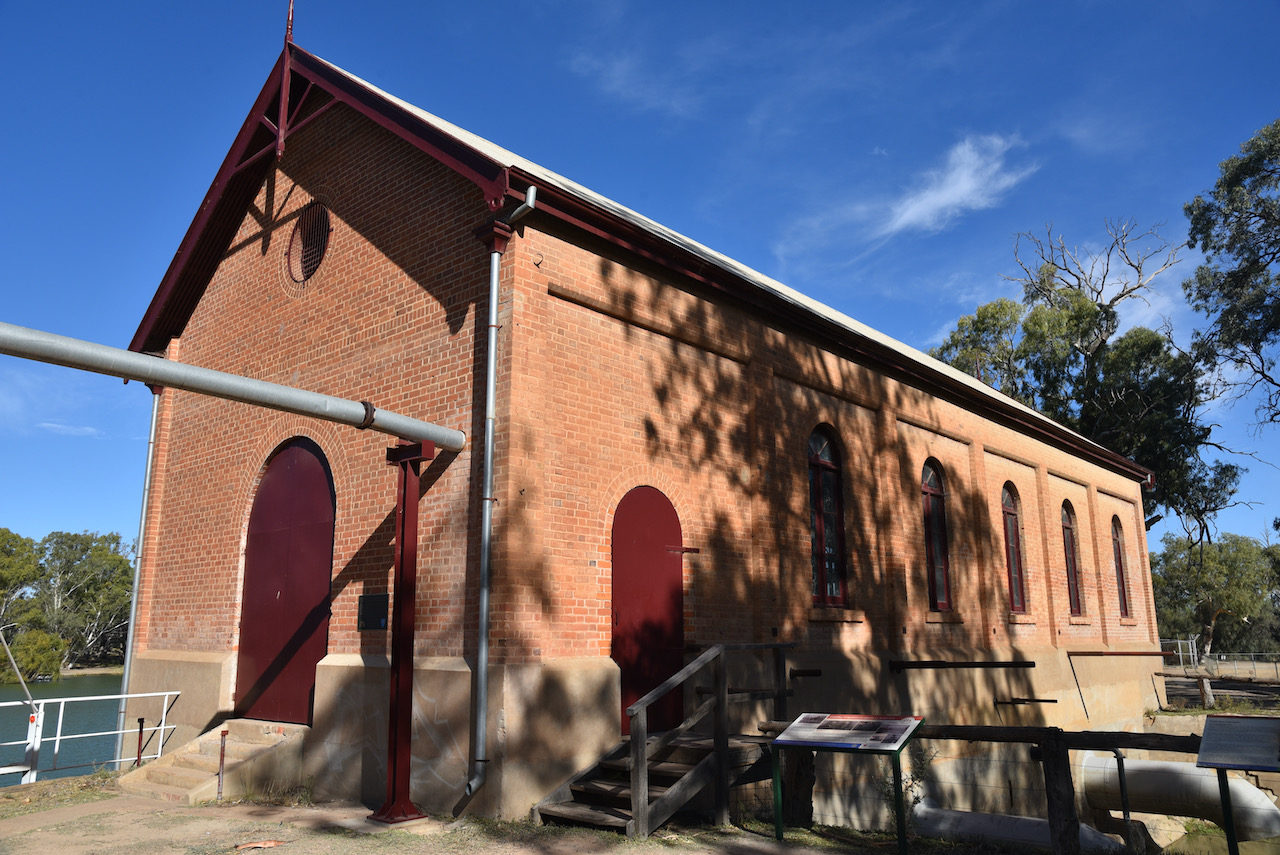
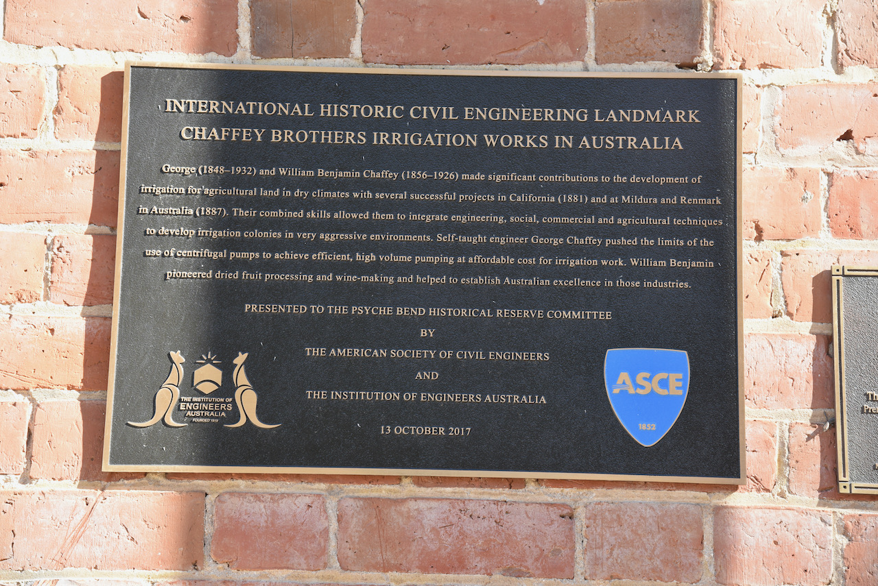
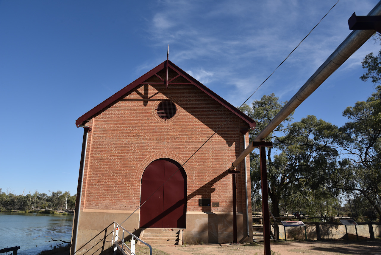
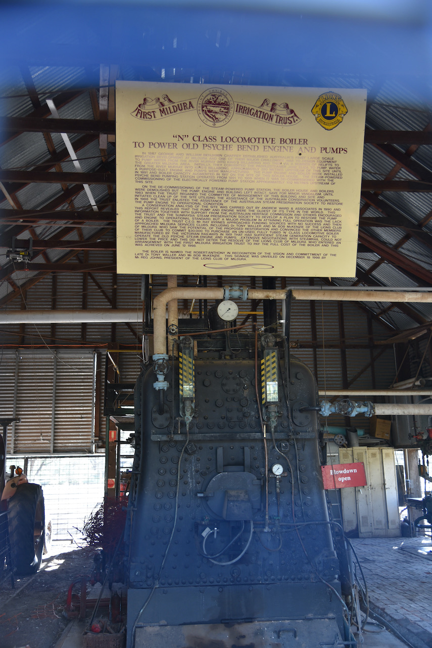
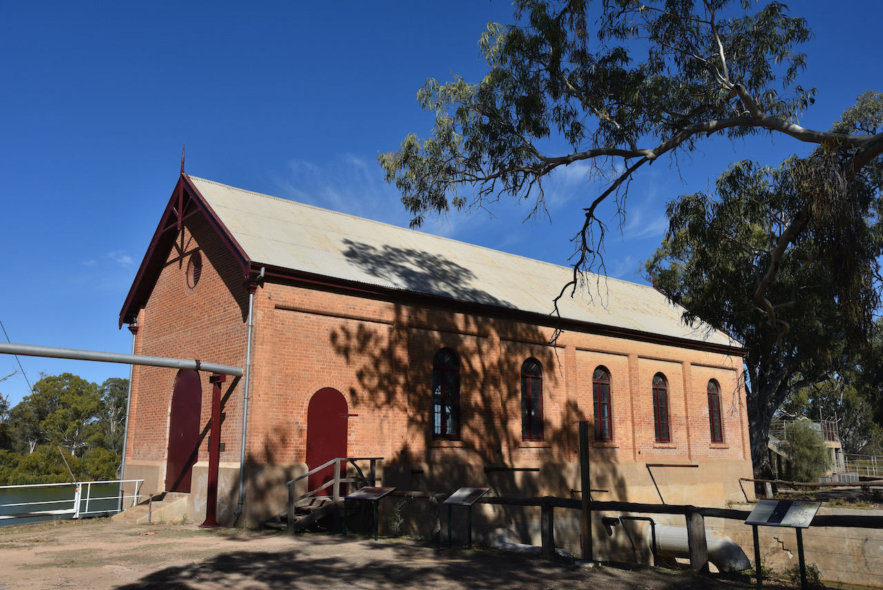
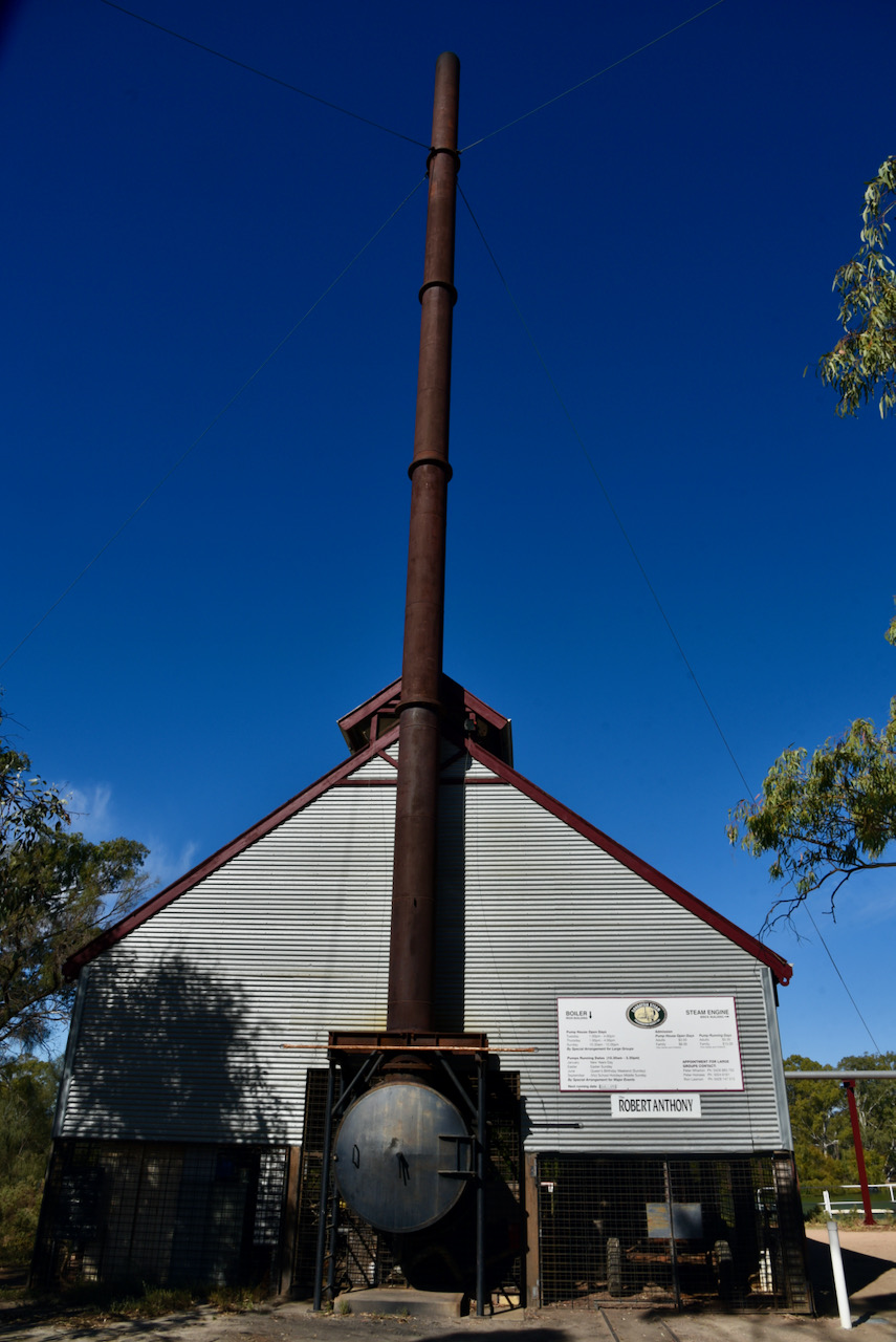
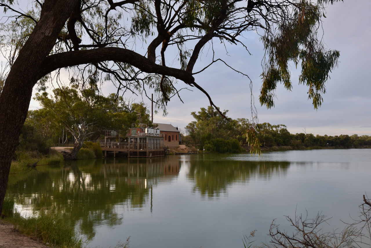
We then drove out to the Psyche Bend Pumping Station. As part of establishing an irrigation system for the region in the late 1800s, the Chaffey Brothers installed pumps at Psyche Bend. They commenced pumping water from the Murray River to Kings Billabong. Today you can view the original pump house which still stands at Psyche Bend, along with the pump which is still operational. It the oldest pump configuration of its type in the world. Unfortunately it was closed during our visit, but we were still able to walk around the building.
The Chaffey steam engine and pumps at Psyche Bend operated until 1959, when electric pumps were installed nearby and the pumping station was decommissioned.
We then did a bit of 4WDing, travelling along the dirt tracks following the Murray River forming the State Border of Victoria and New South Wales.
We also stopped occasionally to view Kings Billabong which took its name from the aboriginal word for still water – billabong, and its European name from Captain James King. During the late 1800s he navigated the Murray River and its tributaries.
Kings Billabong is a Wildlife Reserve but is not yet included in the World Wide Flora Fauna program. I will liaise with Peter VK3ZPF and get this on the list soon as it is a beautiful spot.
It was then time for some birdwatching and photography. Unfortunately we took the wrong track, hoping to get to the Bird Hide, so we wasted a lot of time. The track is not well signposted.
Marija and I packed up and headed back into Mildura where we freshened up and then headed out for dinner.