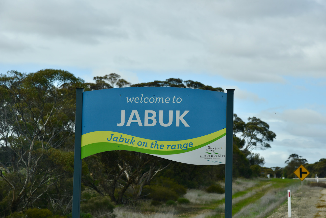
After packing up at Jabuk, I continued east along the Mallee Highway for about 10km and soon reached the little town of Geranium. This was to be my seventh silo activation of the day, the Geranium silos VK-GRM5.
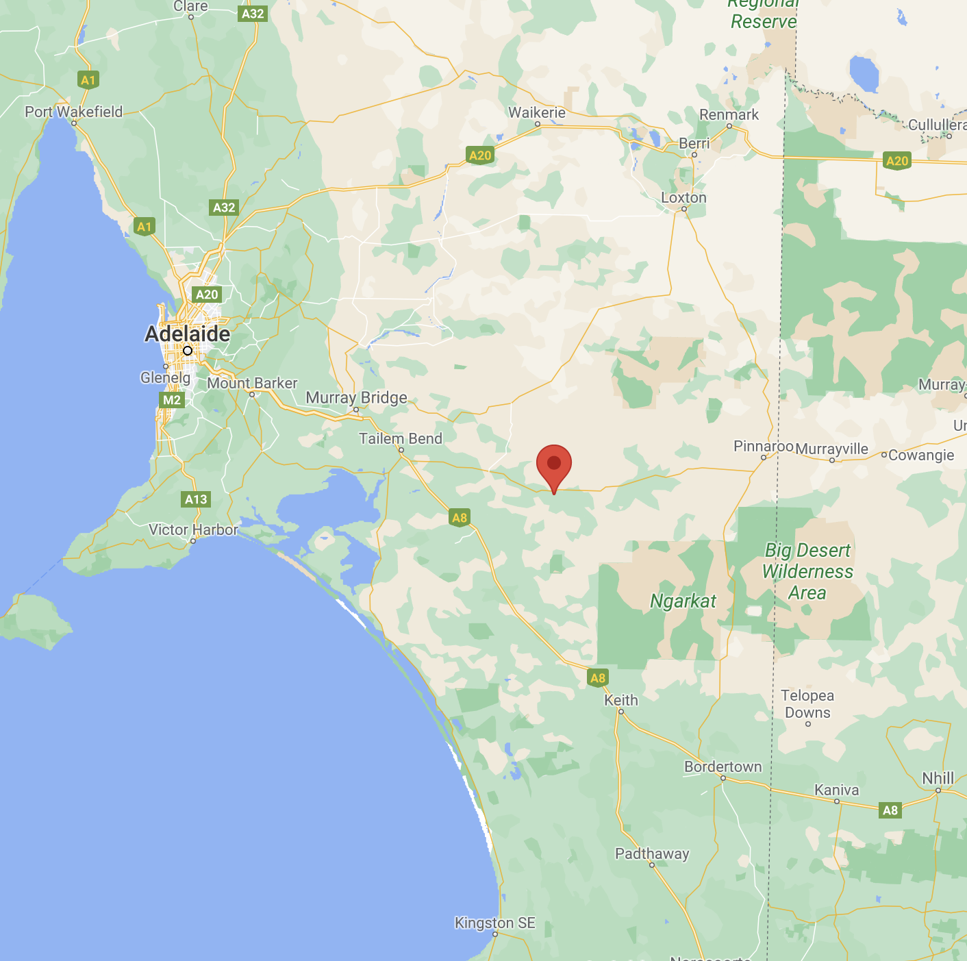
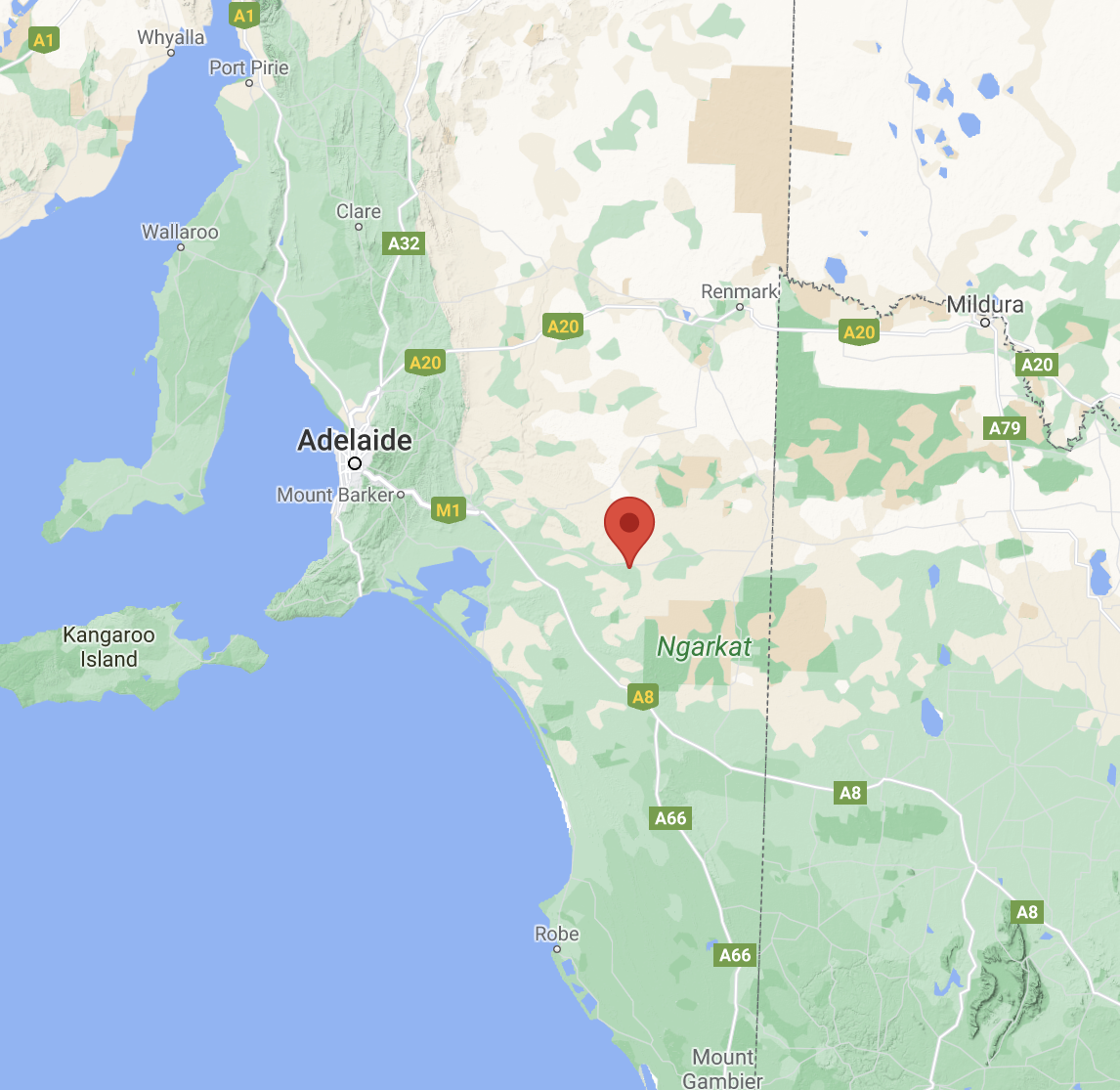
The town of Geranium is about 165 km south-east of the city of Adelaide.
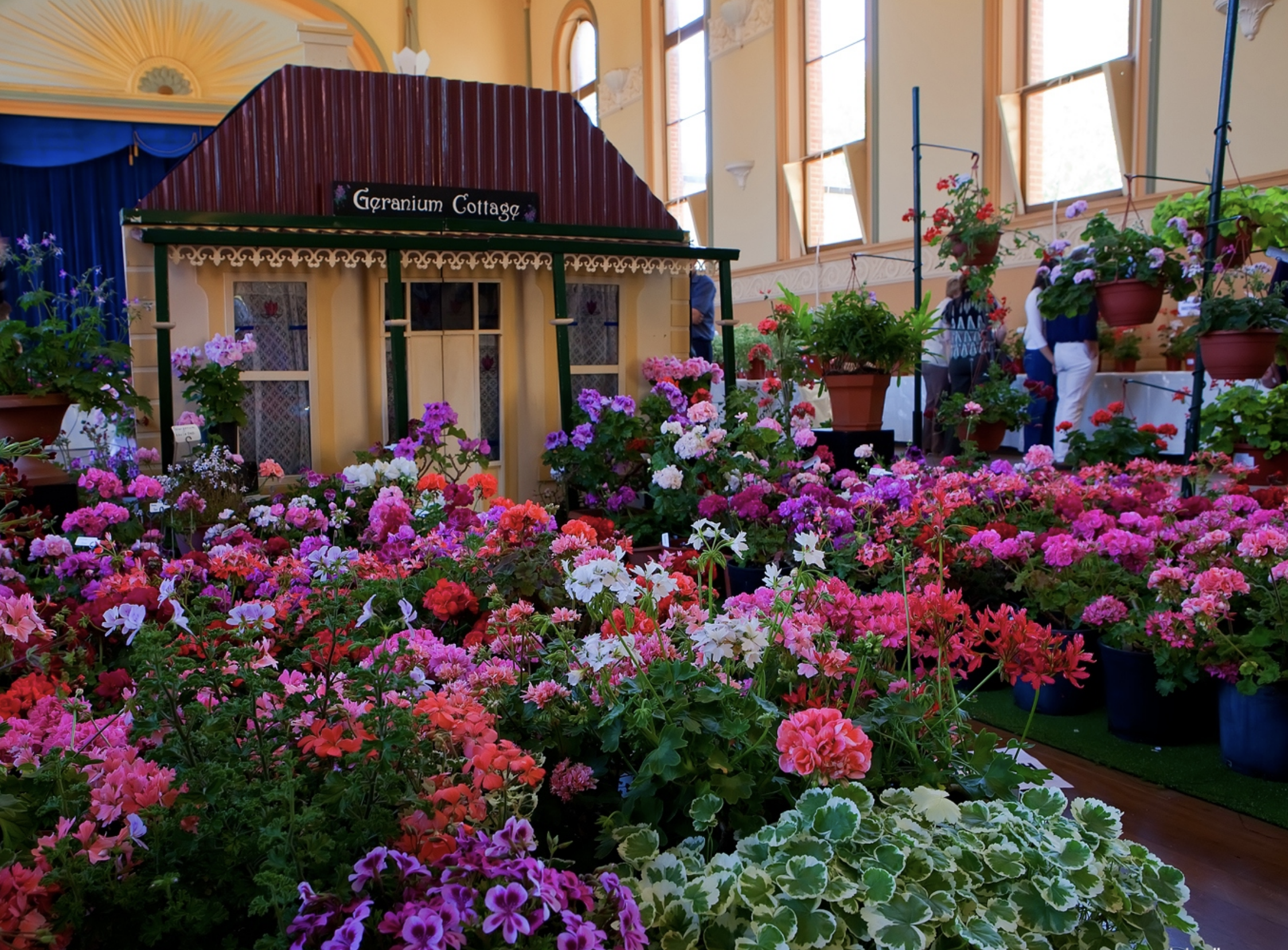
The town of Geranium is located just off the Mallee Highway. The town takes its name from the native plant, Pelargonium australe. This plant was once widespread in the district but is rarely found today due to the clearing of the land for farming purposes. Children of the day called it “knives and forks” because of its unusual seed pod which was three inches long and very pointed.
In 1999, Geranium was named Australia’s Tidiest Town. Geranium won the national competition from a large field of 316 separate communities and 220 schools. Geranium was competing with many towns far greater in size and population.

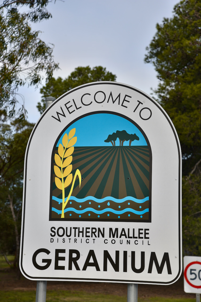
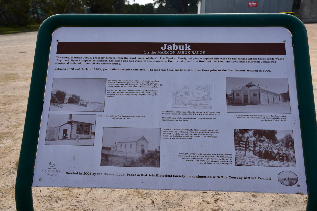
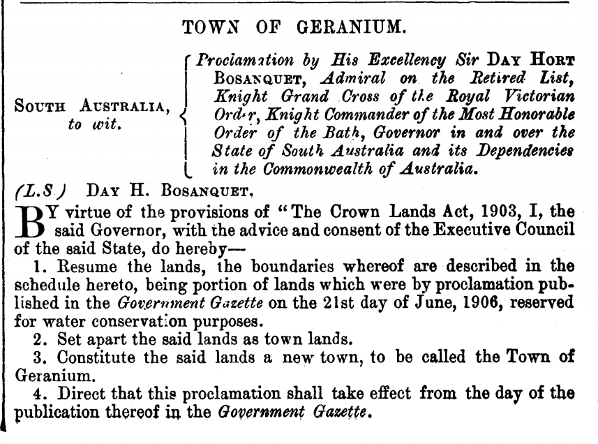
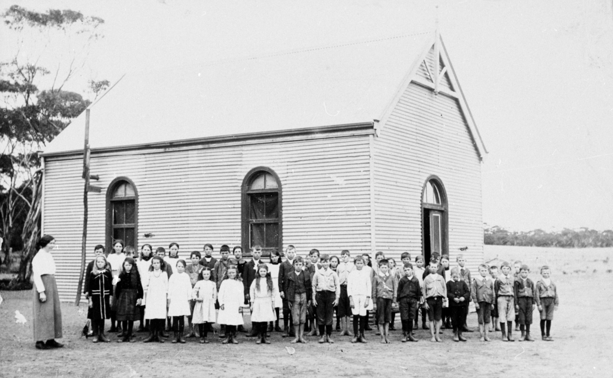
The South Australian Government sank a bore in the area in 1906 and named the location geranium after the wild geraniums found in the area. The town was proclaimed on the 24th day of March 1910. The Geranium School opened in 1913.
School at Geranium was held in the local hall until a stone schoolroom was built in 1929. School attendances at this time were about 40 pupils. In 1965 the new Geranium Area School opened with an enrolment of 247 students, and the little schools at Peake, Jabuk and Parakkie were closed. In 1990 the school again became a primary school, with secondary students travelling to Lameroo by bus.
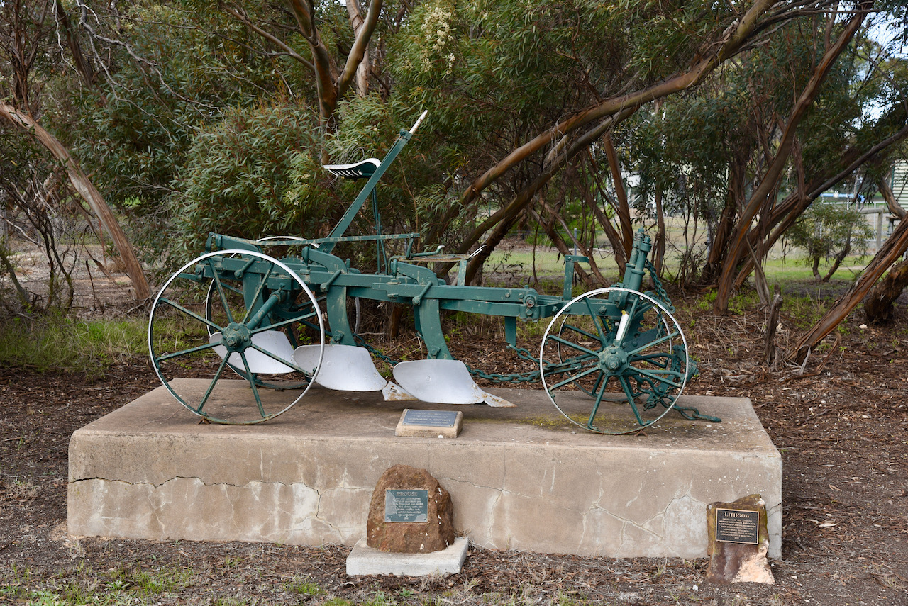
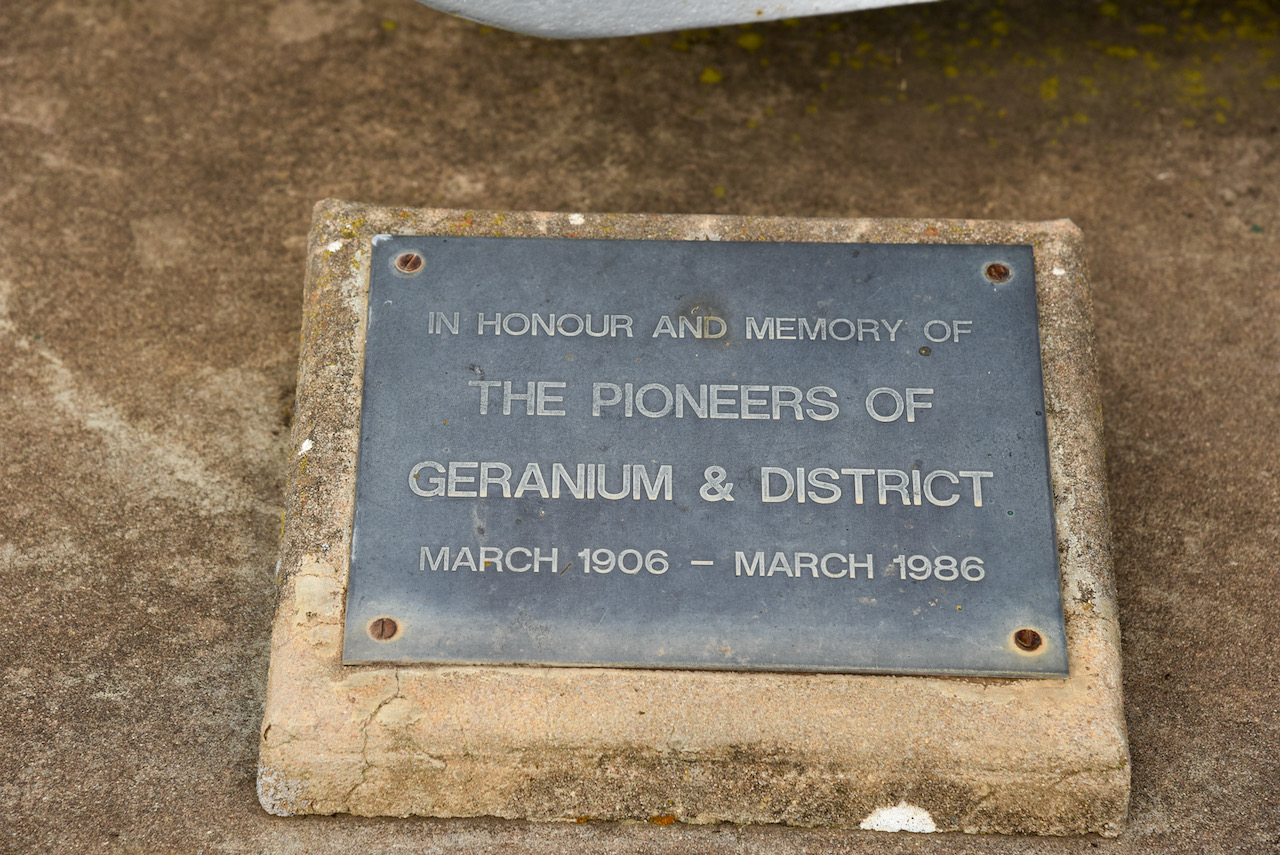
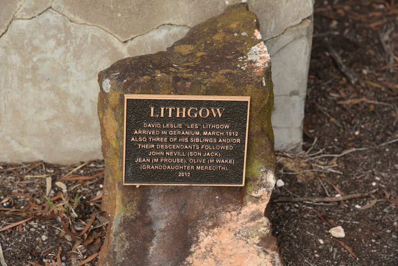
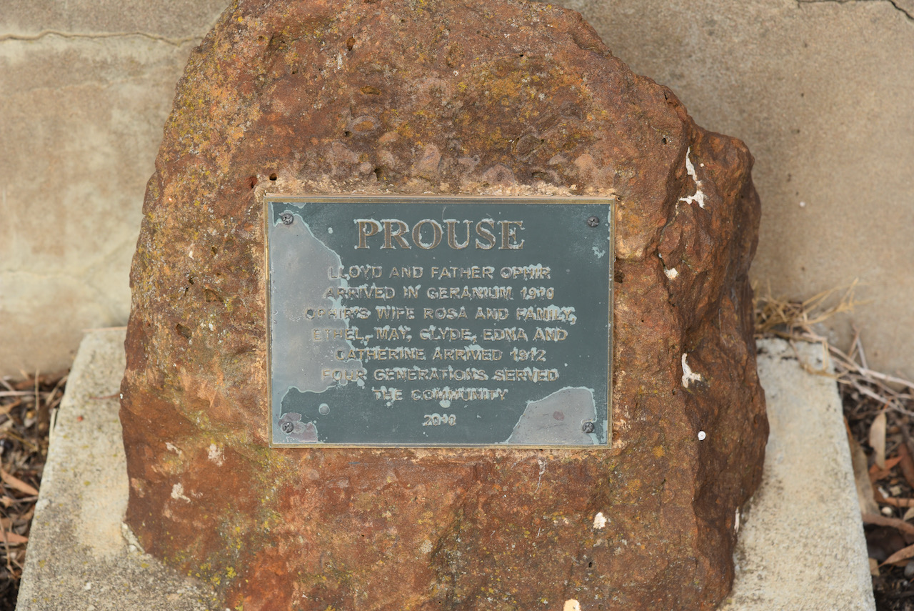
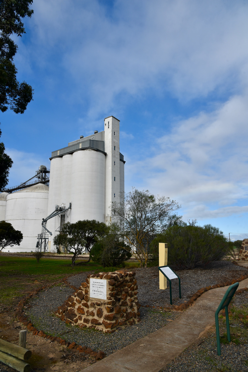
As you enter the town you can view an old plough which is a monument to the pioneers of the Geranium district. There are also some small plaques honouring some of the original Geranium settlers.
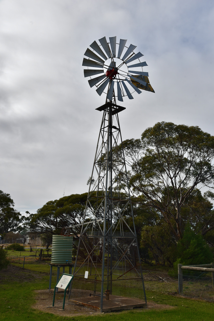
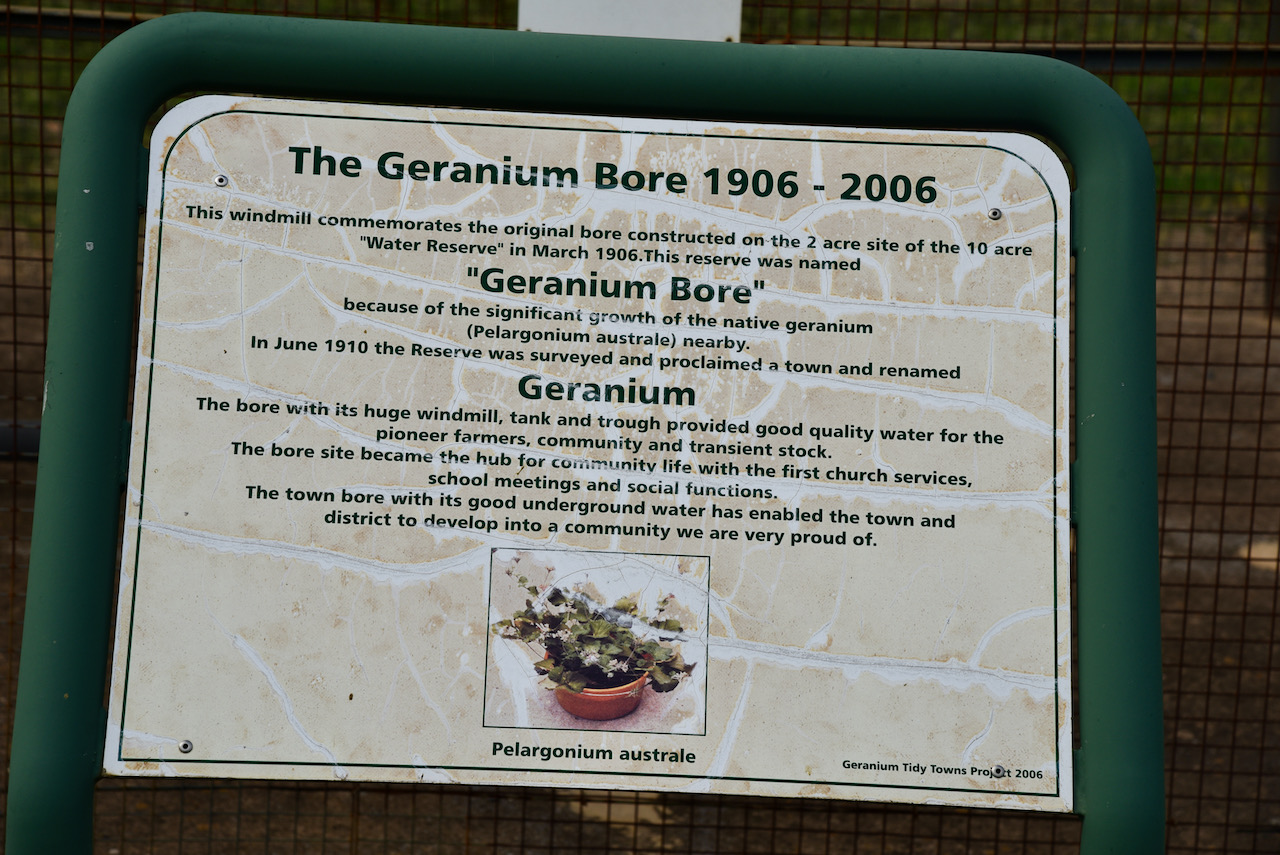
You can also view the Geranium Bore. The windmill commemorates the original bore constructed on the 2 acre site of the 10 acre ‘Water Reserve’ in March 1906. This reserve was named ‘Geranium Bore’ because of the significant growth of the native geranium nearby. The bore with its huge windmill, tank and trough provided good quality water for the pioneer farmers, community and transient stock. The bore site became the hub for community life with the first church services, school meetings and social functions. The town bore with its good underground water allowed Geranium and the district to develop into a community.
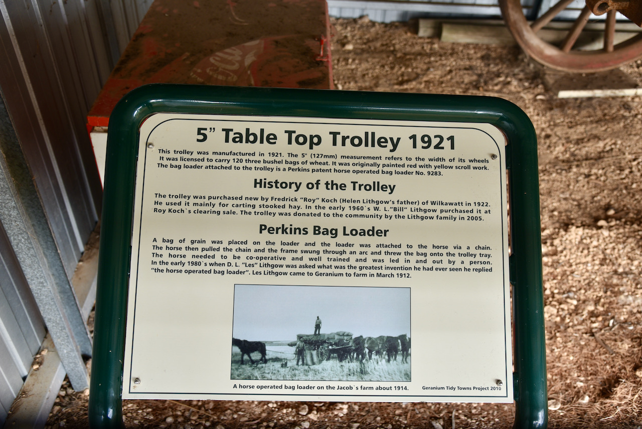
Nearby is an old 5 ” Table Top Trolley. It was manufactured in 1921s The 5″ (127mm) measurement refers to the width of its wheels. It was licenced to carry 120 three bushel bags of wheat. It was originally painted red with yellow scroll work. The bag loader attached to the trolley is a Perkins patent horse operated bag loader No. 9283.
The trolley was purchased new by Frederick ‘Roy’ Koch of WIlkawatt in 1922. He used it mainly for carting stooked hay. In the early 1960s, W.L. ‘Bill’ Lithgow purchased it at Roy Koch’s clearing sale. The trolley was donated to the community by the Lithgow family in 2005.
What was the Perkins Bag Loader? A bag of grain was placed on the loader and the loader was attached to the horse via a chain. The horse then pulled the chain and the frame swung through an arc and threw the bag onto the trolley tray. The horse needed to be co-operative and well trained and was led in and out by a person. In the early 1980s when D.L. ‘Les’ Lithgow was asked what the greatest invention he had ever seen, he replied ‘the horse operated bag loader’. Les Lithgow had come to Geranium to farm in March 1912.

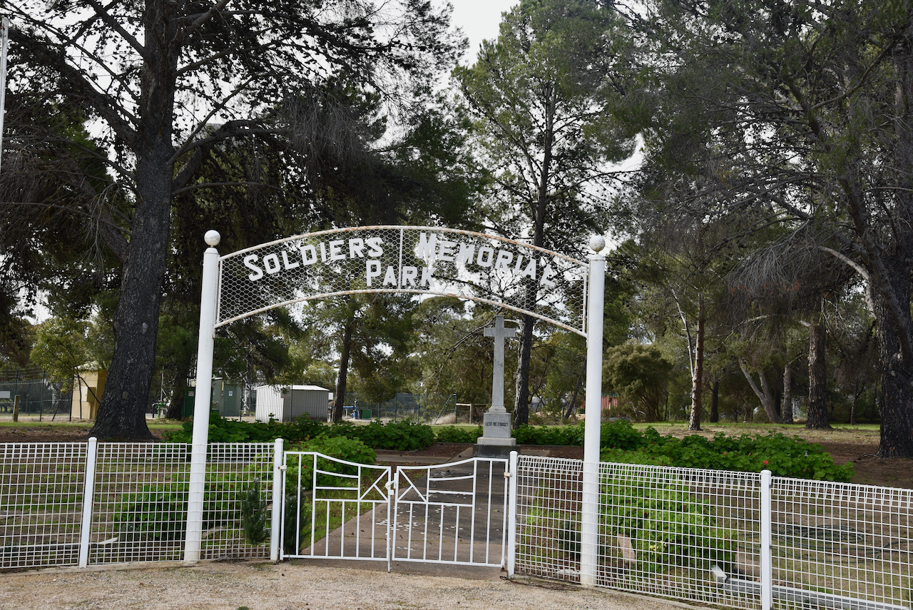
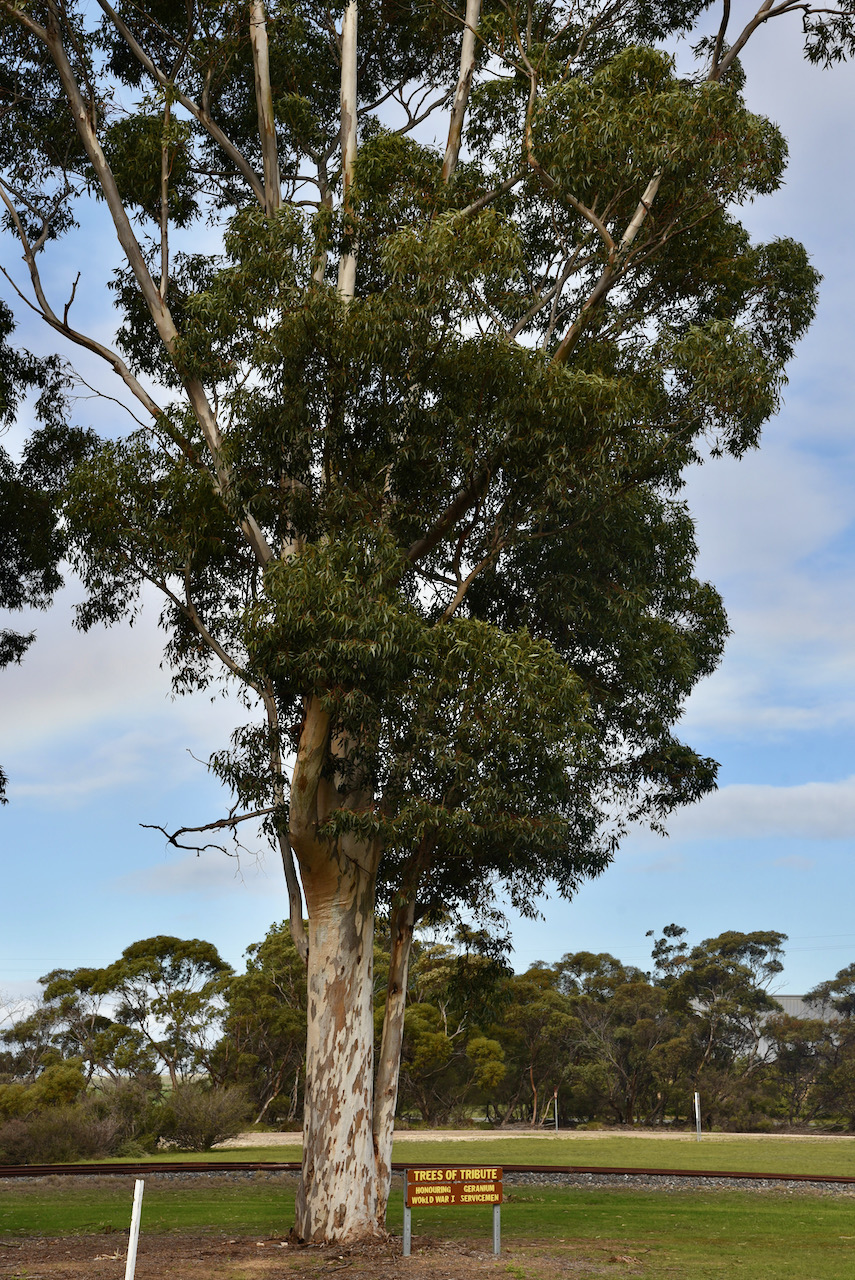
You can also view the Soldiers Memorial Park and the Trees of Tribute, honouring Geranium’s World War One servicemen.
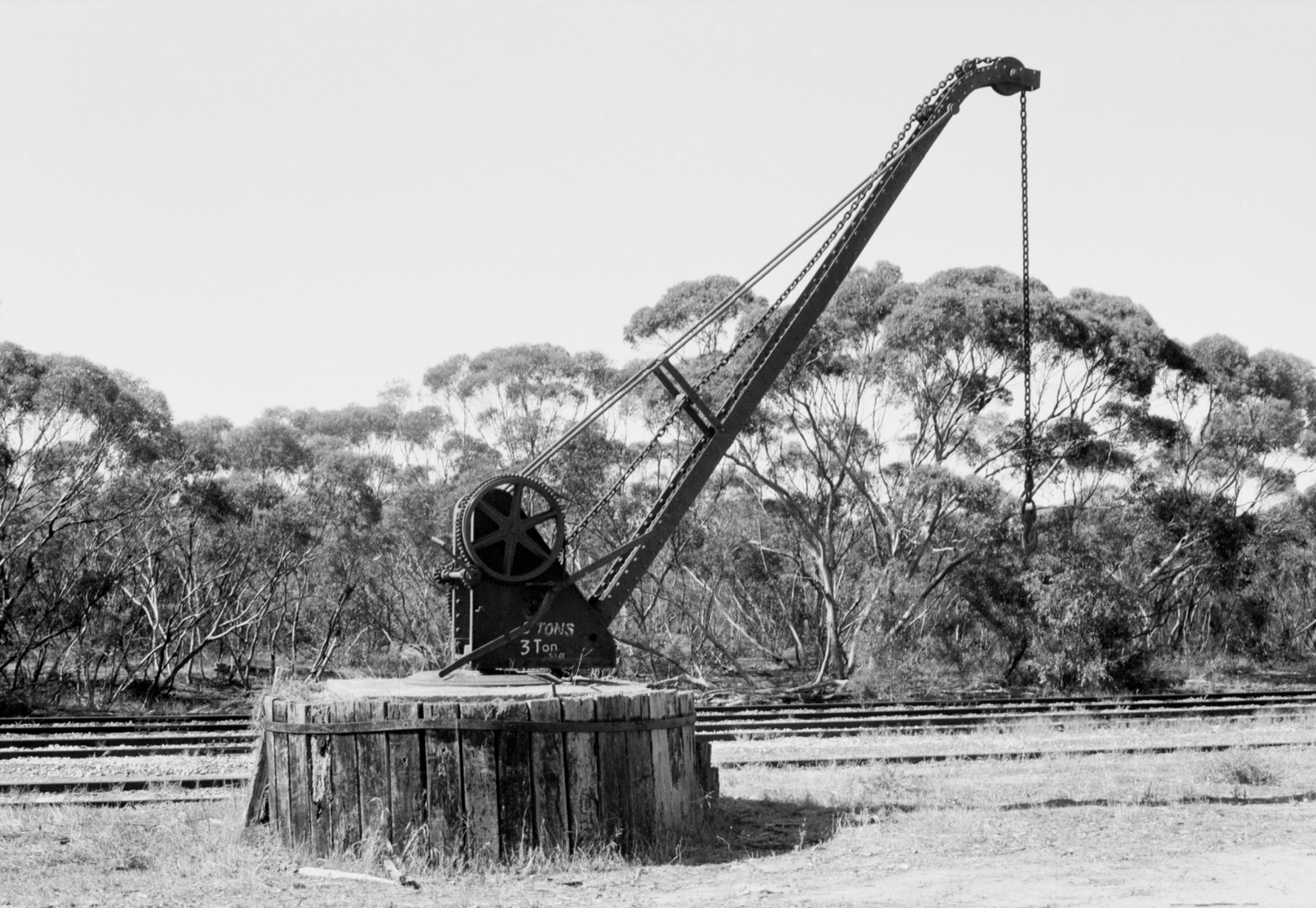
My next stop in the town was at Railway Terrace. Here you can view some information boards on the old Geranium Memorial Hall and some history on the old Geranium Railway yard.
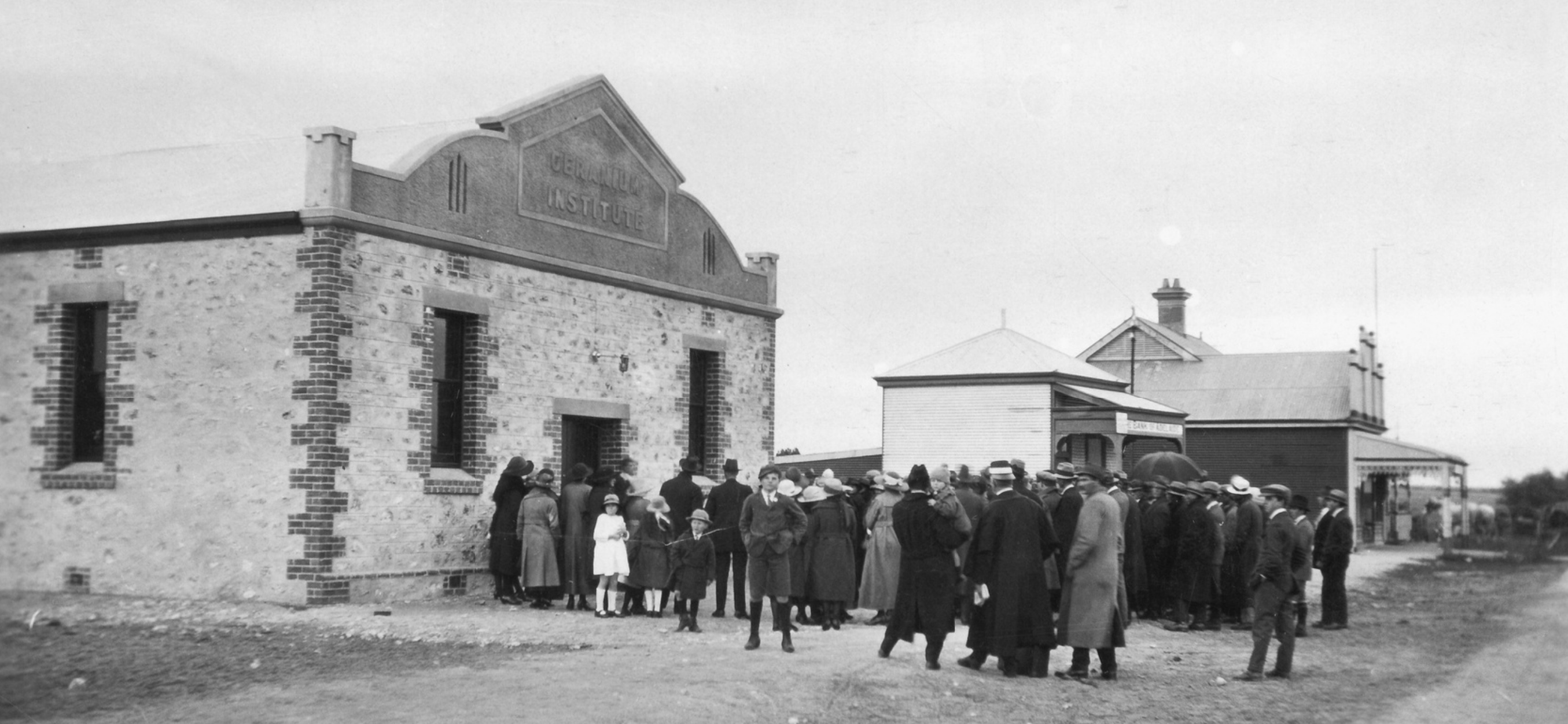
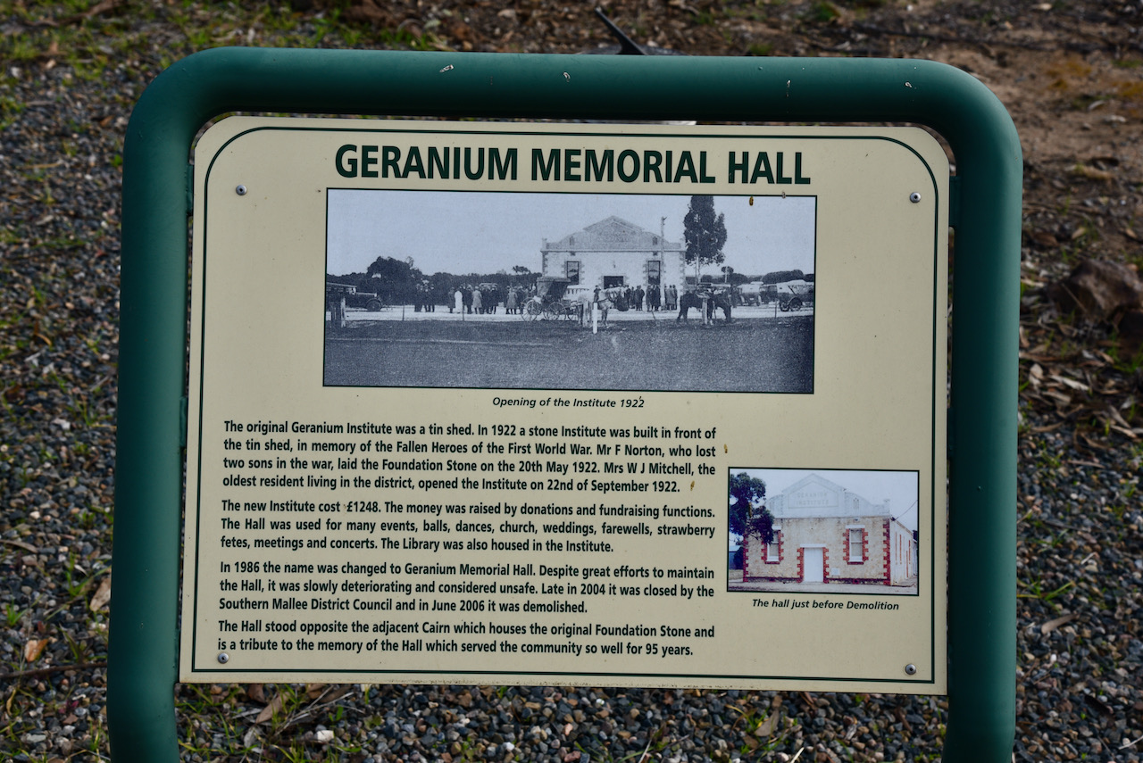
The original Geranium Institute was a tin shed. In 1922 a stone institute building was built in front of the tin shed. It was built in memory of the Fallen Heroes of the First World War. On the 20th day of May 1922, Mr. F. Norton, who lost two sons during the war, laid the Foundation Stone. The Institute was officially opened on the 22nd day of September 1922 by Mrs. W.J. Mitchell, the oldest resident living in the district.
The new Institute cost 1,248 pounds. The money was raised by donations and fundraising functions. The Hall was used for many events, balls, dances, church, weddings, farewells. strawberry fetes, meetings and concerts. The Library was also housed in the Institute.
In 1986 the Institute’s name was changed to the Geranium Memorial Hall. Sadly despite great efforts to maintain the hall, it was slowly deteriorating and was considered unsafe. In late 2004 it was closed by the Southern Mallee District Council and in June 2006 it was demolished. What a sad day for the town. If only those walls could talk.
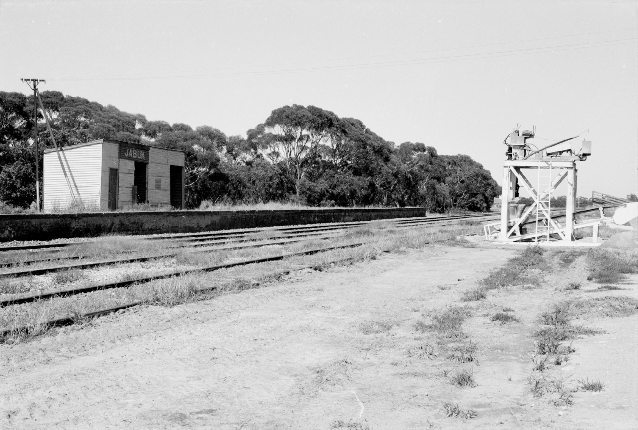
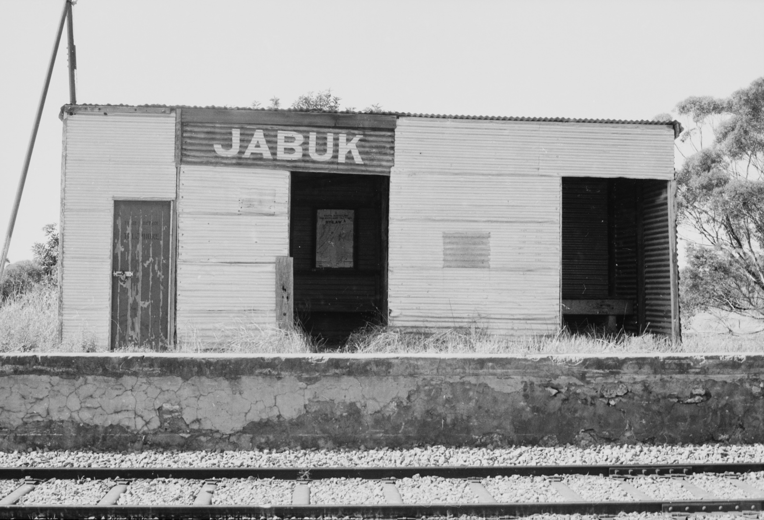
When the railway line opened there was no allowance for a siding between the nearby towns of Peake and Parrakie. As a result, local farmers at Geranium and nearby Jabuk, petitioned the Government. A railway platform and a goods shed was built in 1908, some 2 years before the town was gazetted.


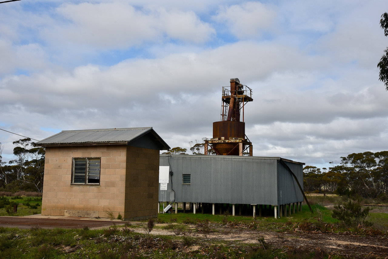
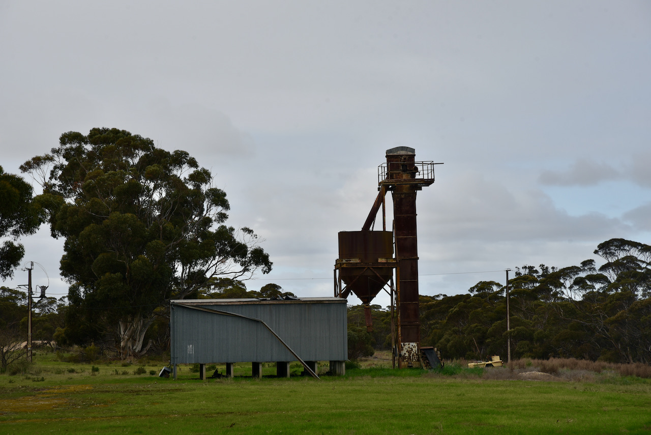
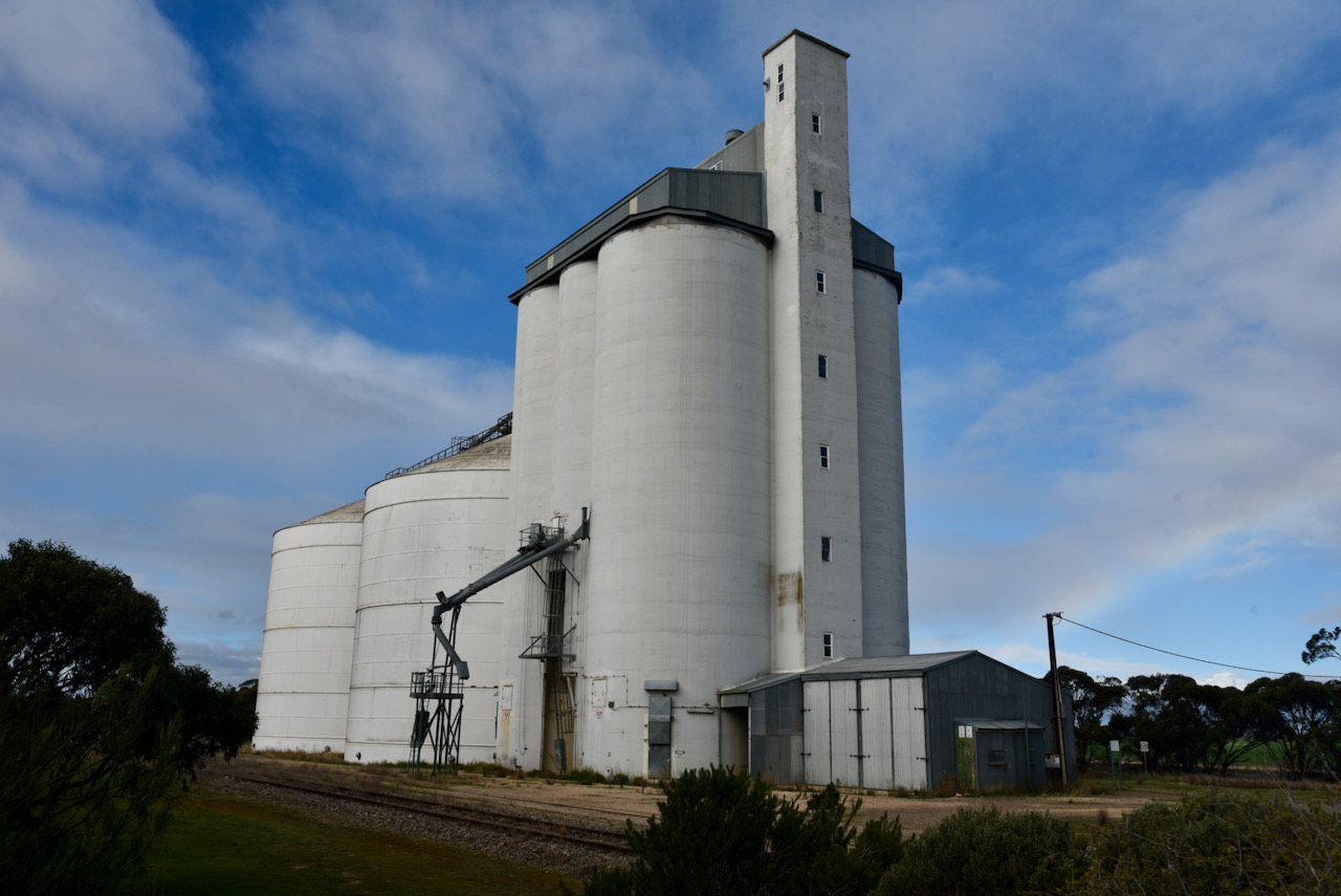
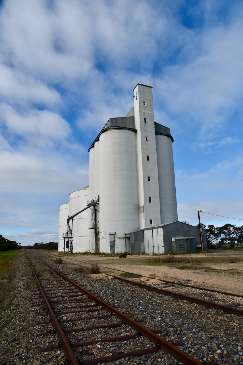
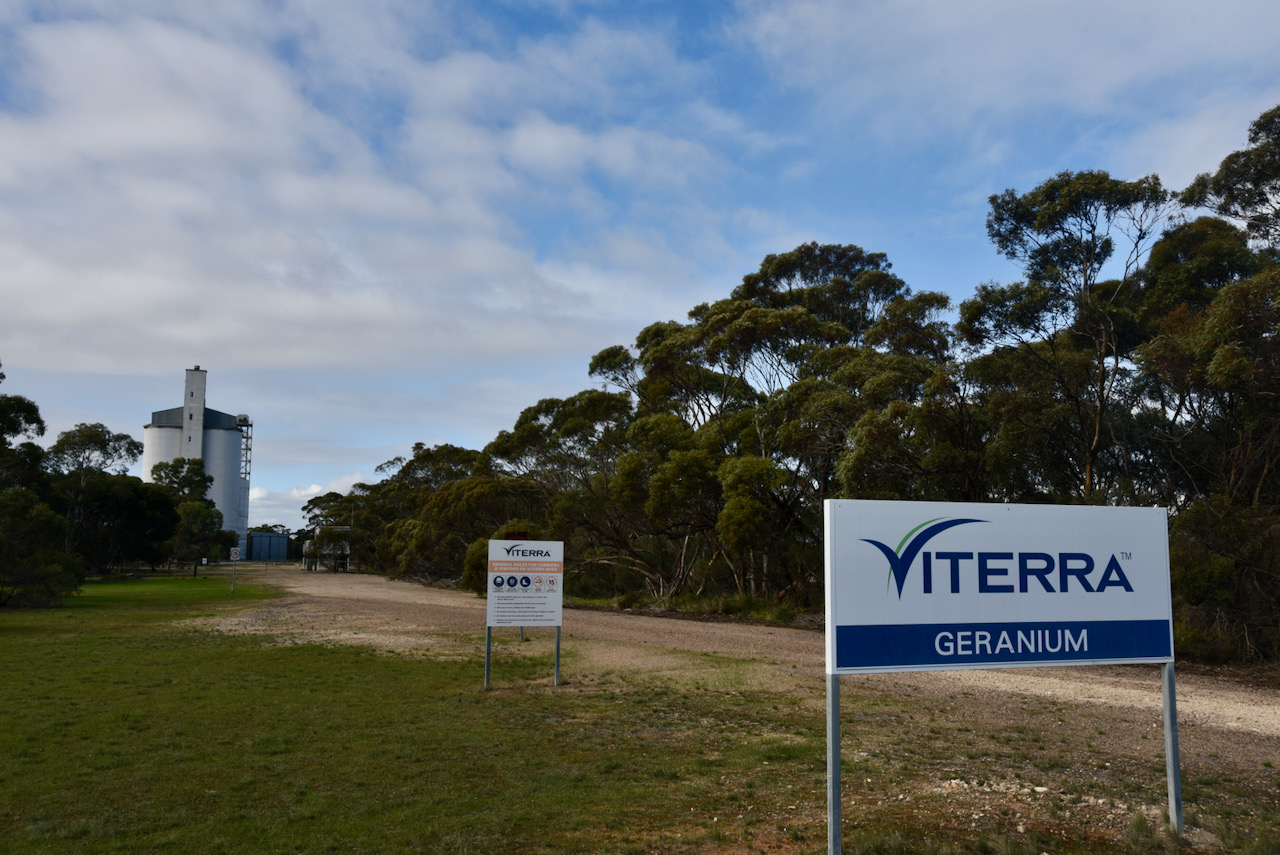
The silos can be found between Railway Terrace and Gravestock Road on the southern edge of the town.

The silos are working silos run by Viterra. The silos were closed in 2012 due to a ‘forecast poor harvest’.
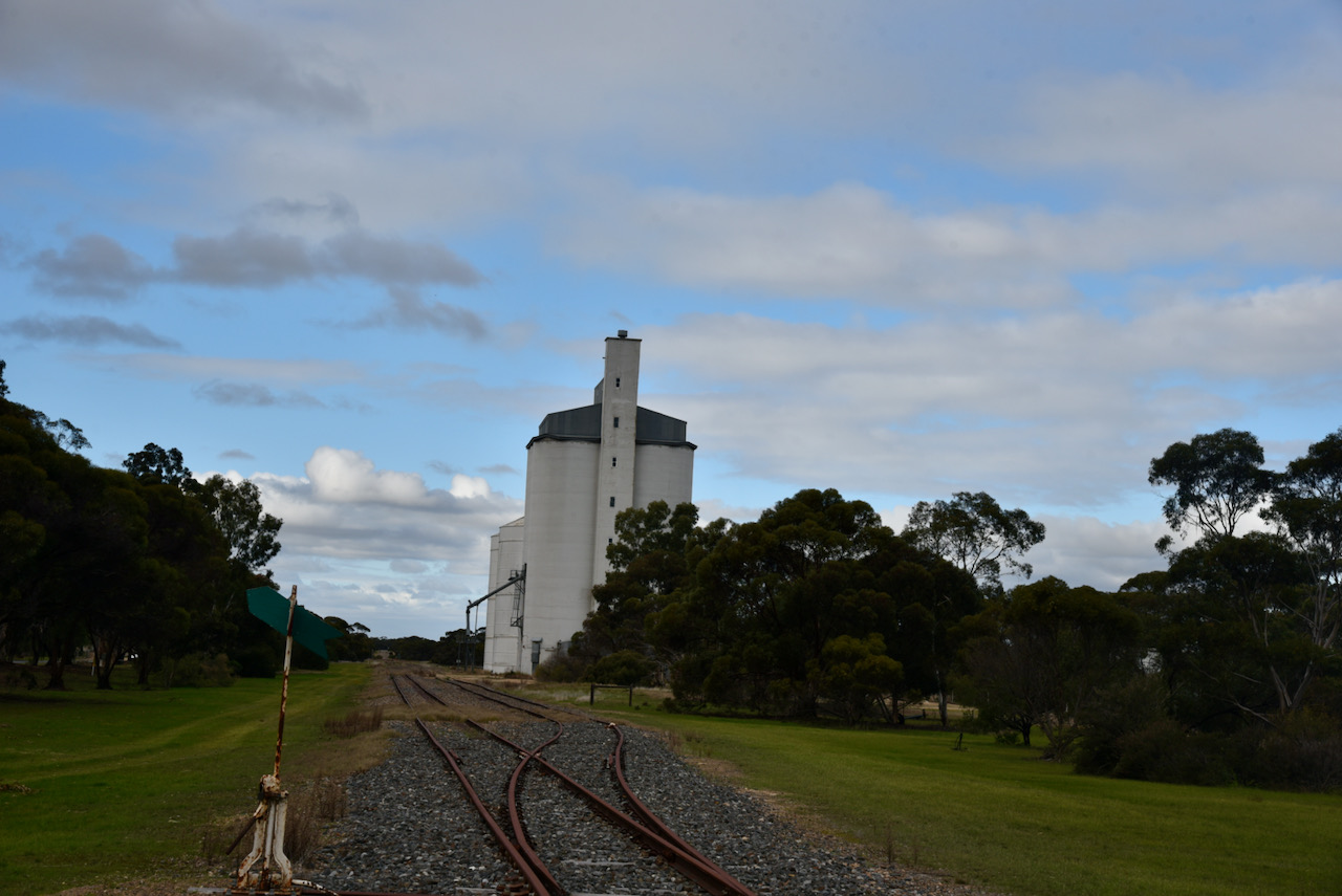
I operated from just outside the gates to the silo. To kick off this activation I started off on 20m, as I was able to tune the antenna this time on that band. First in the log was Rob VK4AAC who was activating the Wooroonooran National Park VKFF-0548.
I then moved down to 14.340 at the request of Peter VK3PF and logged Peter. This was followed by Marija VK5MAZ. With three contacts in the log, I had qualified another silo.
I went on to log a total of 11 stations on 20m including Stuart VK3UAO/p in the Teesdale Sheoak Nature Conservation Reserve VKFF-2206, Gerard VK2IO/p in the Cornubia Forest Nature Refuge VKFF-2865, and Roly ZL1BQD in New Zealand.
I then moved to 40m and logged Gerard VK2HBG/p and Bob VK2BYF/p in the Clyde River National Park VKFF-0102.
I then moved down to 7.139 and called CQ. This was answered by Ade VK4SOE/p and then Marija VK5MAZ. This activation was much busier than the previous silo activations, and I logged a total of 18 stations on 40m. This included some more park activators: Ian VK1DI/2 in the Nadgigomar Nature Reserve VKFF-2679 and Gerard Vk2IO/p in VKFF-2865.
To conclude the activation I headed to 3.610 on the 80m band where I logged a total of 4 stations: Marija VK5MAZ, Adrian VK5FANA, Peter VK5PET, and John VK5BJE.
I worked the following stations on 20m SSB:-
- VK4AAC/p (Wooroonooran National Park VKFF-0548)
- VK3PF
- VK5MAZ
- VK2VW
- VK5PET
- VK3OHM
- VK3UAO/p (Teesdale Sheoak Nature Conservation Reserve VKFF-2206)
- VK2IO/p (Cornubia Forest Nature Refuge VKFF-2865)
- VK3AWA
- VK4HNS
- ZL1BQD
I worked the following stations on 40m SSB:-
- VK2HBG/p (Clyde River National Park VKFF-0102)
- VK2BYF/p (Clyde River National Park VKFF-0102)
- VK4SOE/p
- VK5MAZ
- VK3BEL/p
- VK2MET
- VK3SQ
- VK1DI/2 (Nadgigomar Nature Reserve VKFF-2679)
- VK3AWA
- VK3NFS
- VK2IO/p (Cornubia Forest Nature Refuge VKFF-2865)
- VK2QK
- VK3BEL
- VK5WG
- VK5PET
- VK4COA/p
- VK3OHM
- VK3EJ
I worked the following stations on 80m SSB:-
- VK5MAZ
- VK5FANA
- VK5PET
- VK5BJE
References.
- A Compendium of the Place Names of South Australia, 2021, <https://published.collections.slsa.sa.gov.au/placenamesofsouthaustralia/>, viewed 15th July 2021.
- ABC, 2021, <https://www.abc.net.au/news/2012-11-26/fight-on-to-reopen-grain-silo/4392466>, viewed 15th July 2021.
- Australian Explorer, 2021, <https://www.australianexplorer.com/geranium.htm>, viewed 15th July 2021.
- Discover Murray. 2021, <http://www.murrayriver.com.au/geranium/>, viewed 15th July 2021.