Wolseley Common Conservation Park VKFF-1125

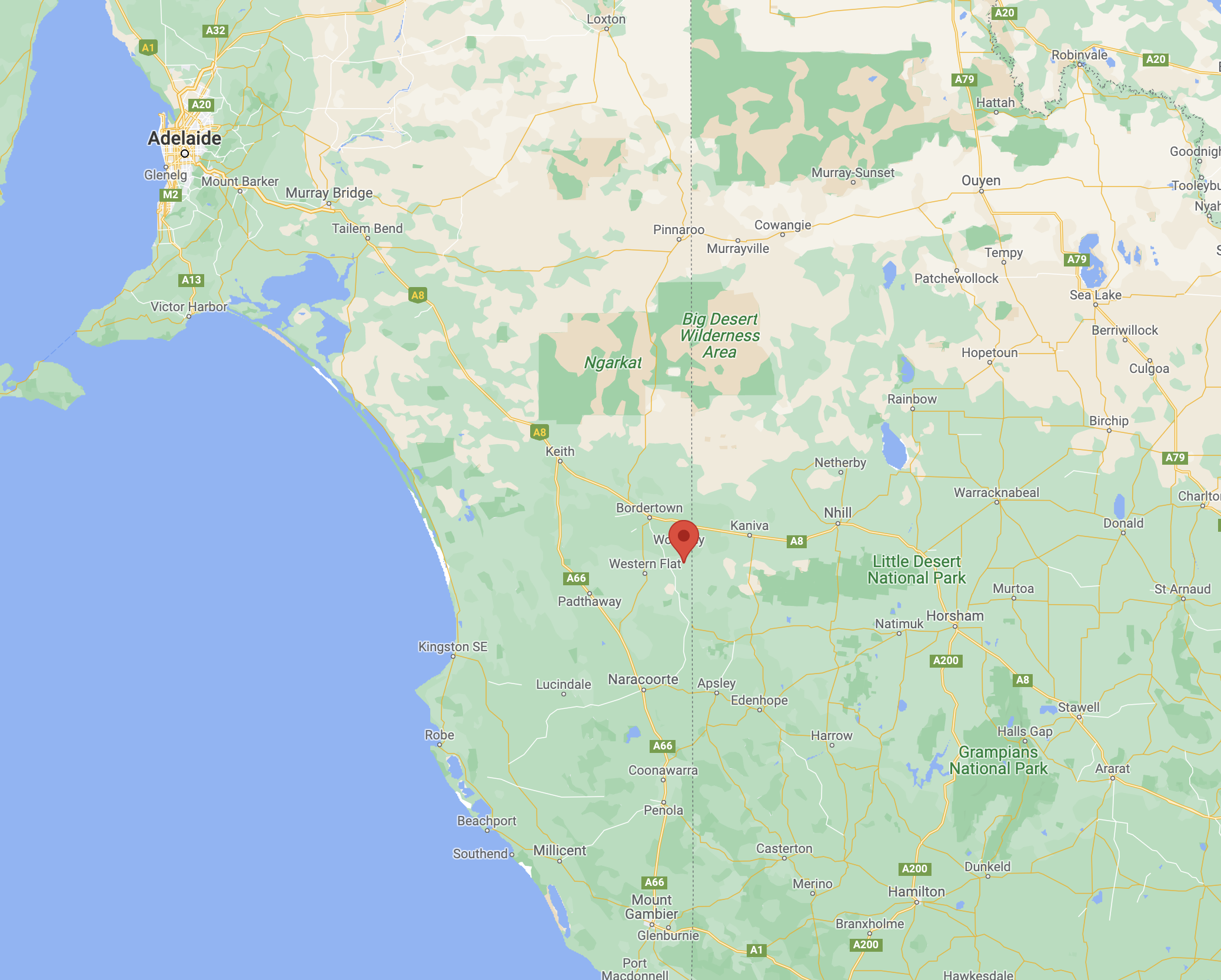
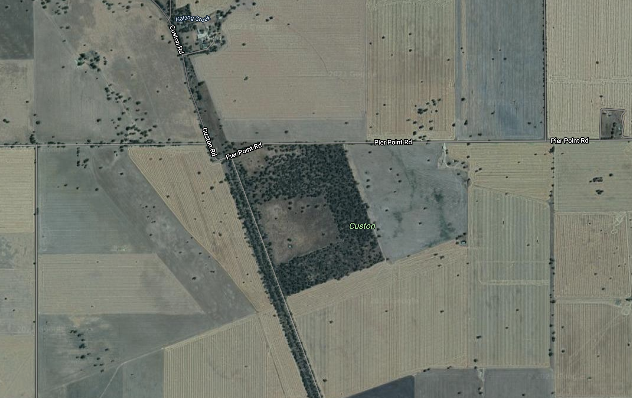
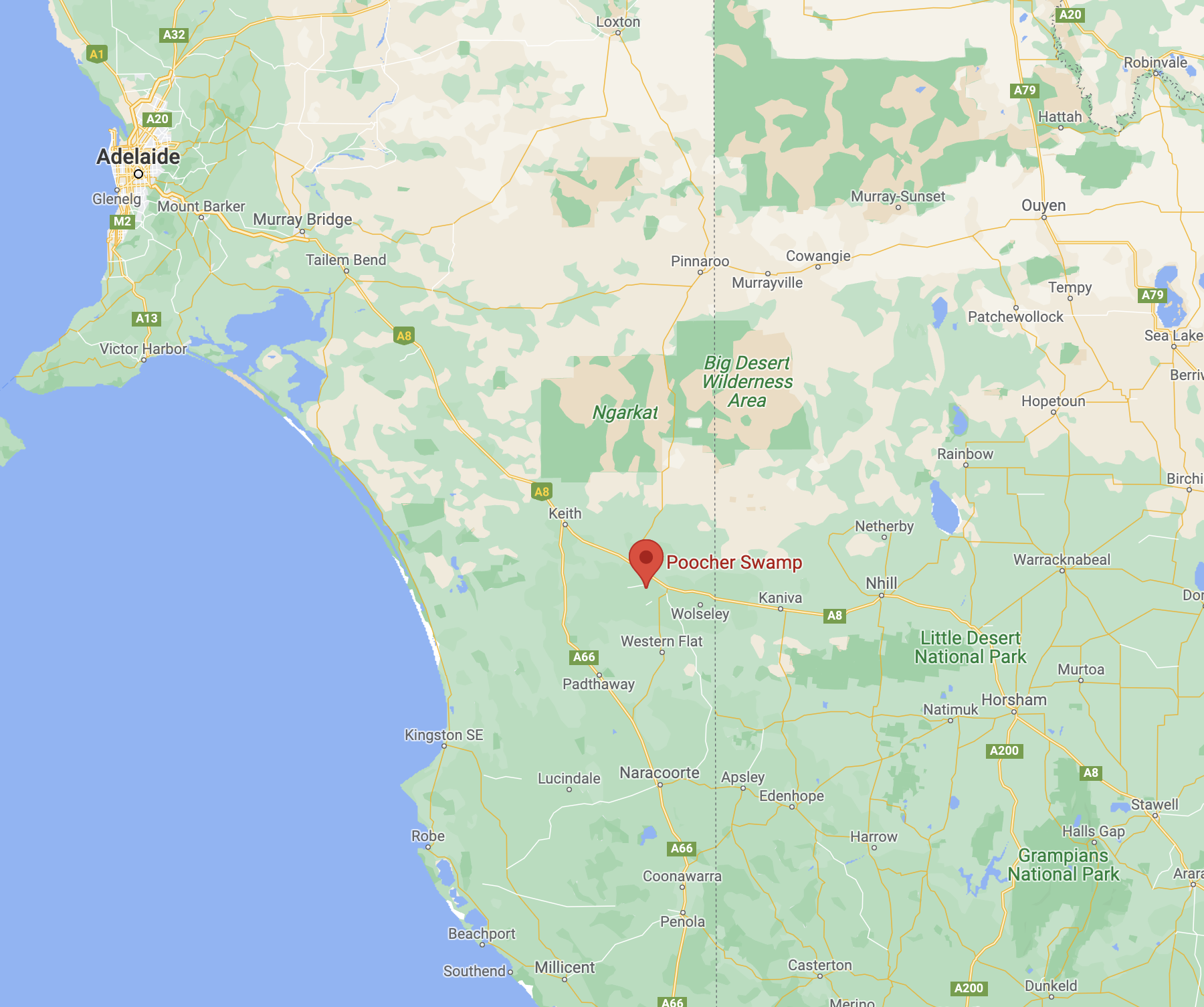
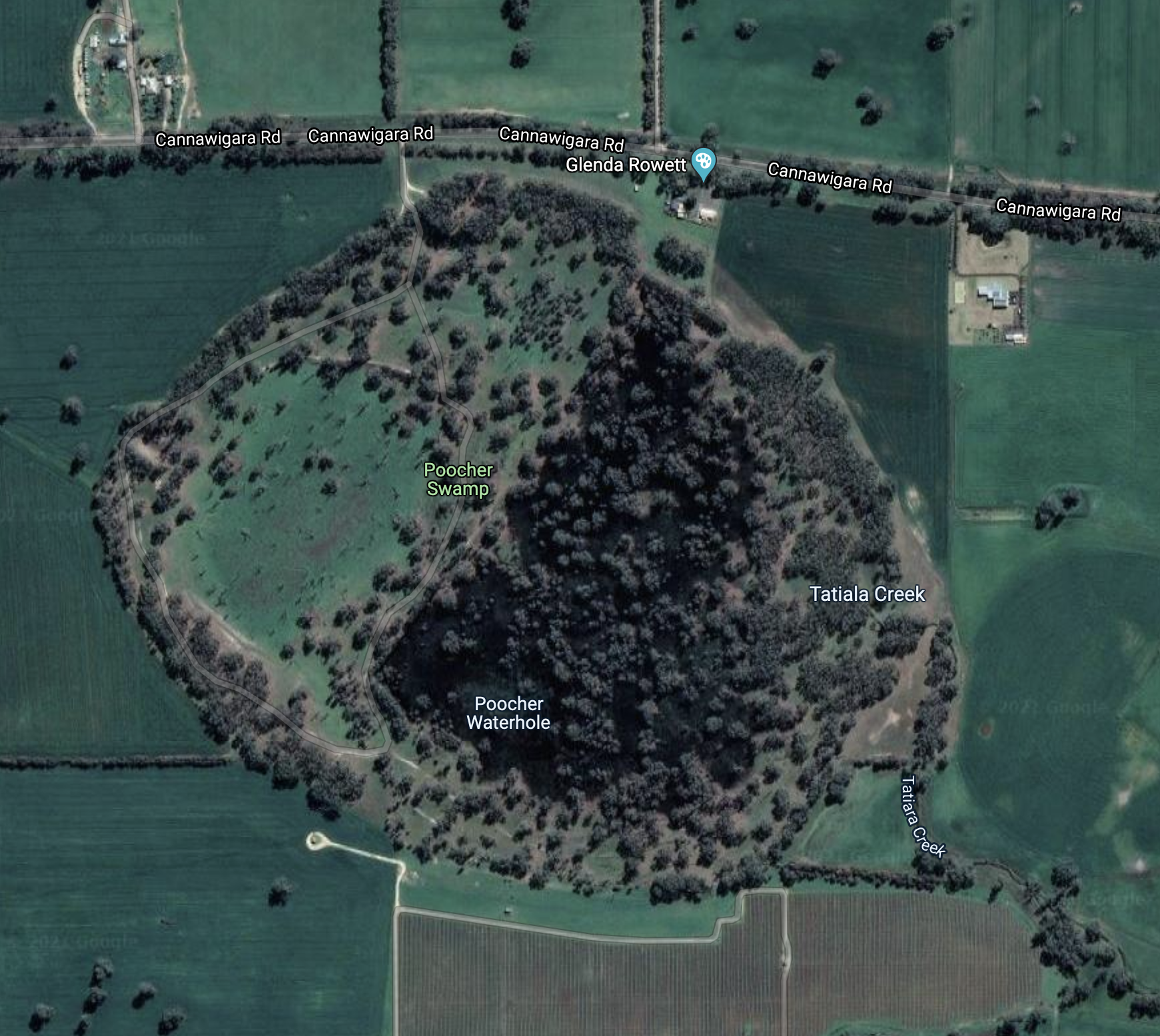
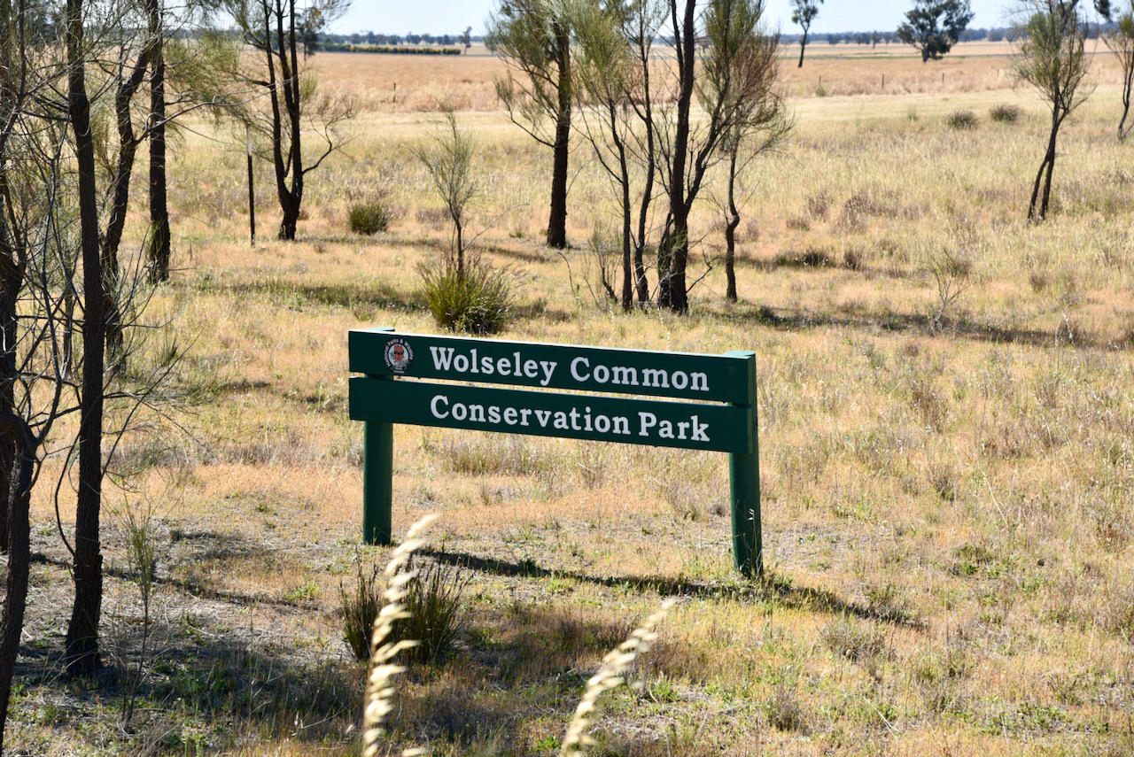
We packed up at Custon and headed to our third and final park for Saturday 27th November 2021 and Day One of the 2021 VKFF Activation Weekend. Our last park was Wolseley Common Conservation Park VKFF-1125, which is located about 285 km southeast of Adelaide, and about 14 km east of Bordertown.

Above:- Map showing the location of Wolseley. Map c/o Google maps

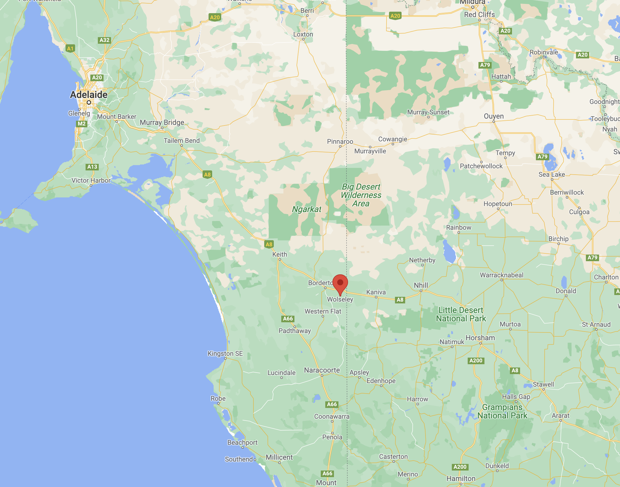
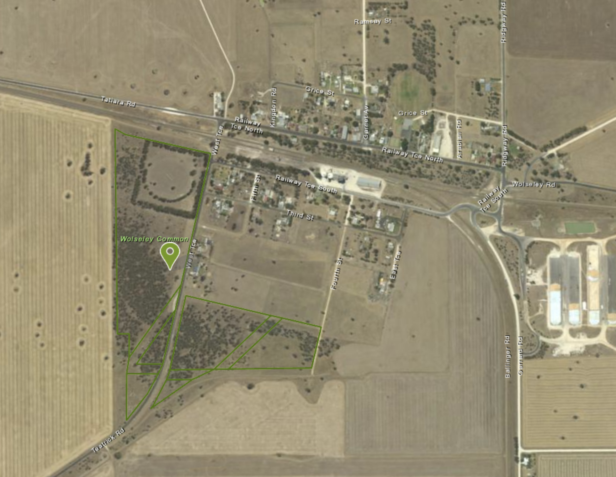
The Wolseley Common Conservation Park is located on the south-western side of the town of Wolseley.

Above:- An aerial view of the town of Wolseley and the park. Image c/o Location SA Map Viewer.

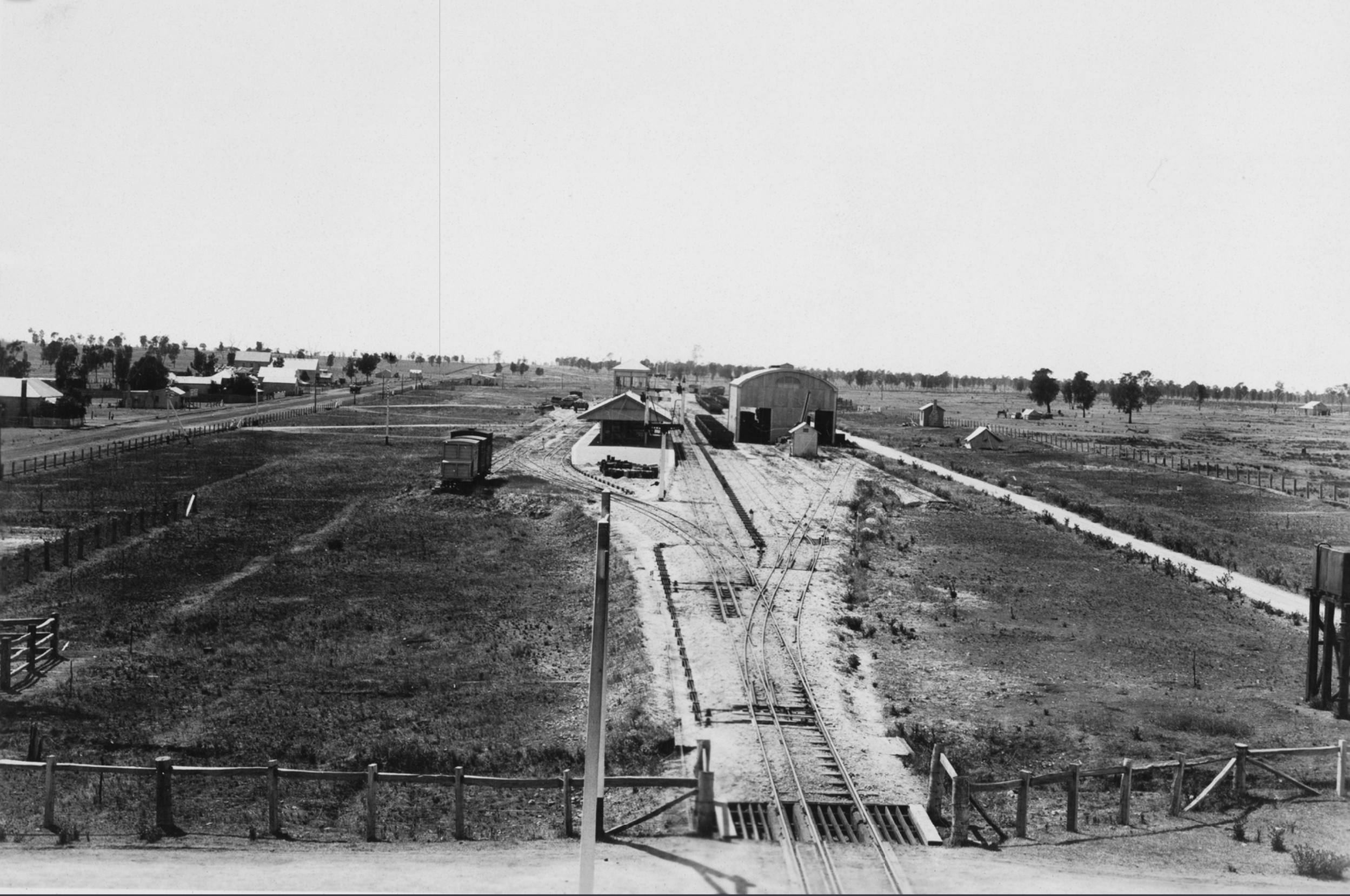
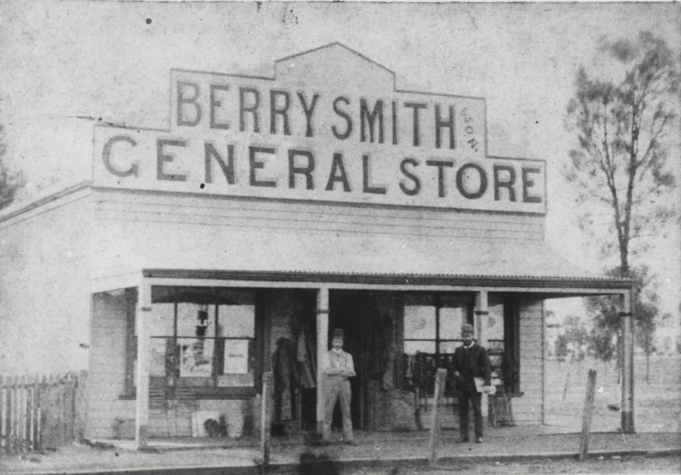
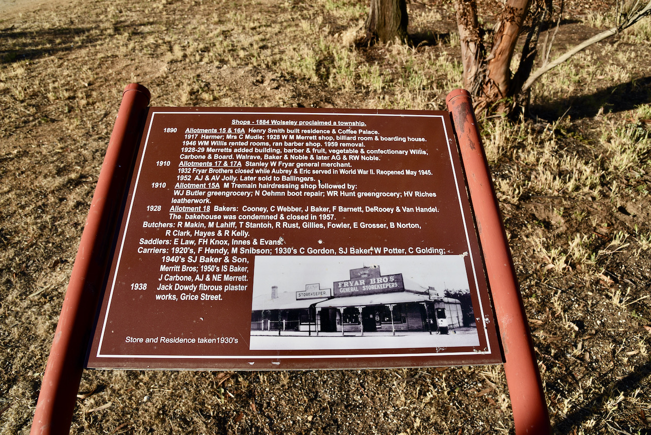
The park takes its name from the town of Wolseley. In August 1882, a general store was opened on a leased portion of land opposite to what was to become the Wolseley Railway Station. By 1883, the Messrs. Grice and Paterson subdivided a section north of the railway yard into allotments.

In 1884 the area was advertised as follows:-

“in the centre of the great wheat-producing districts of Wimmera and Tatiara being larger than the whole of the Northern areas and infinitely more fertile. Nearly all the wheat and wool must come to Wolseley”.

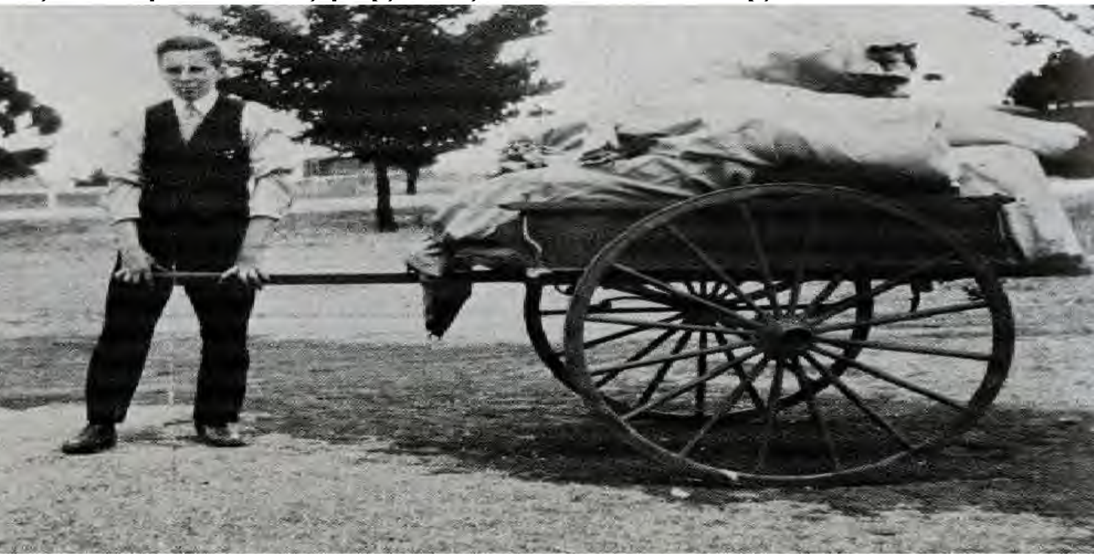
Above:- Images c/o State Library SA.

In 1884, the Government town of Tatiara was surveyed into 168 allotments, south of the Wolseley railway station. It was proclaimed on the 8th day of May 1884. A school was opened in the same year. On 20th February 1941 the name was changed to Wolseley to conform with the name of the railway station

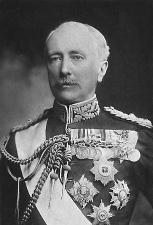
The town was named after Sir. Garnet Joseph Wolseley (1833-1913), also known as Baron Wolseley, who was the Commander-in-Chief of the British Army.

Above:- Sir Garnet Wolseley. Image c/o Wikipedia

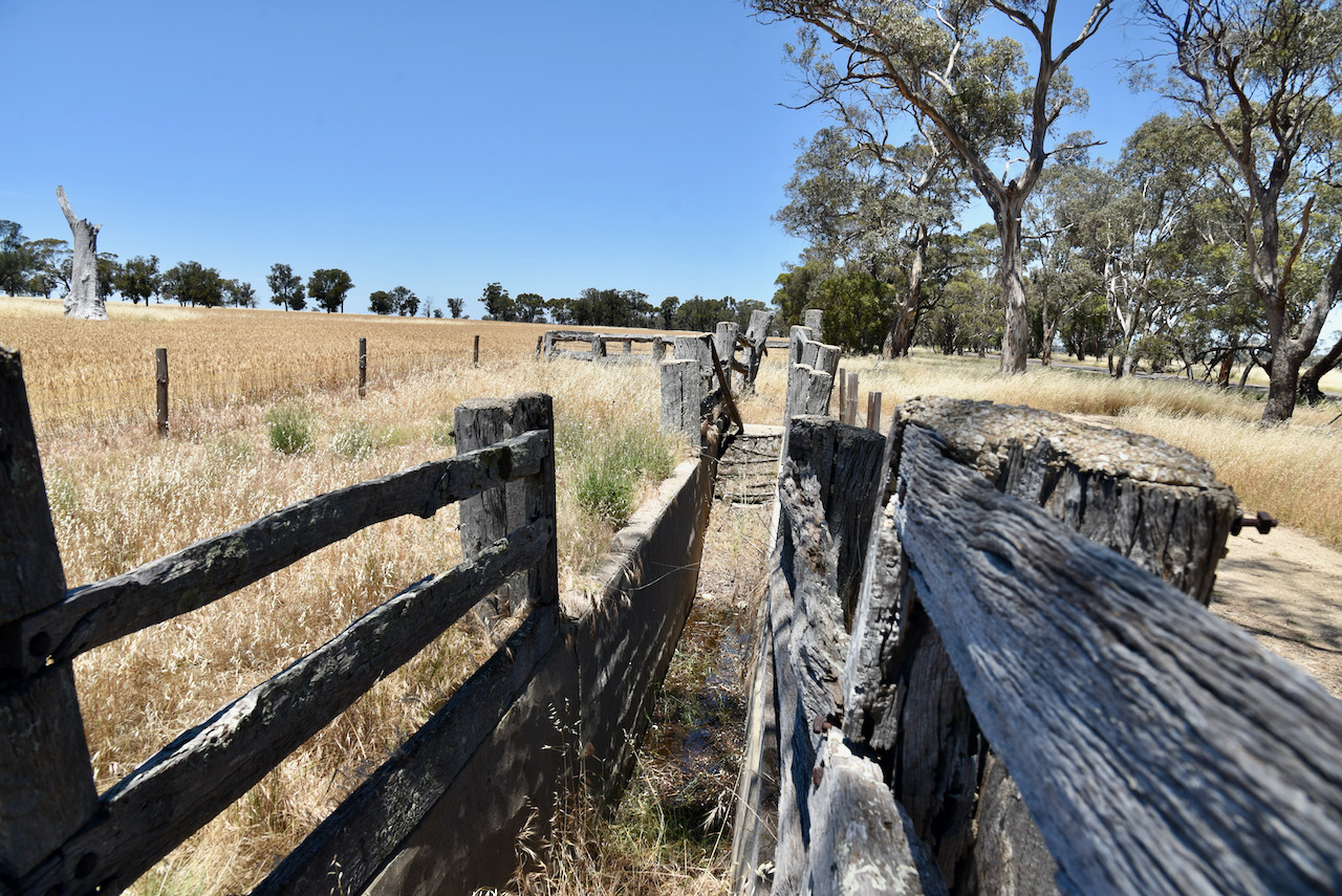
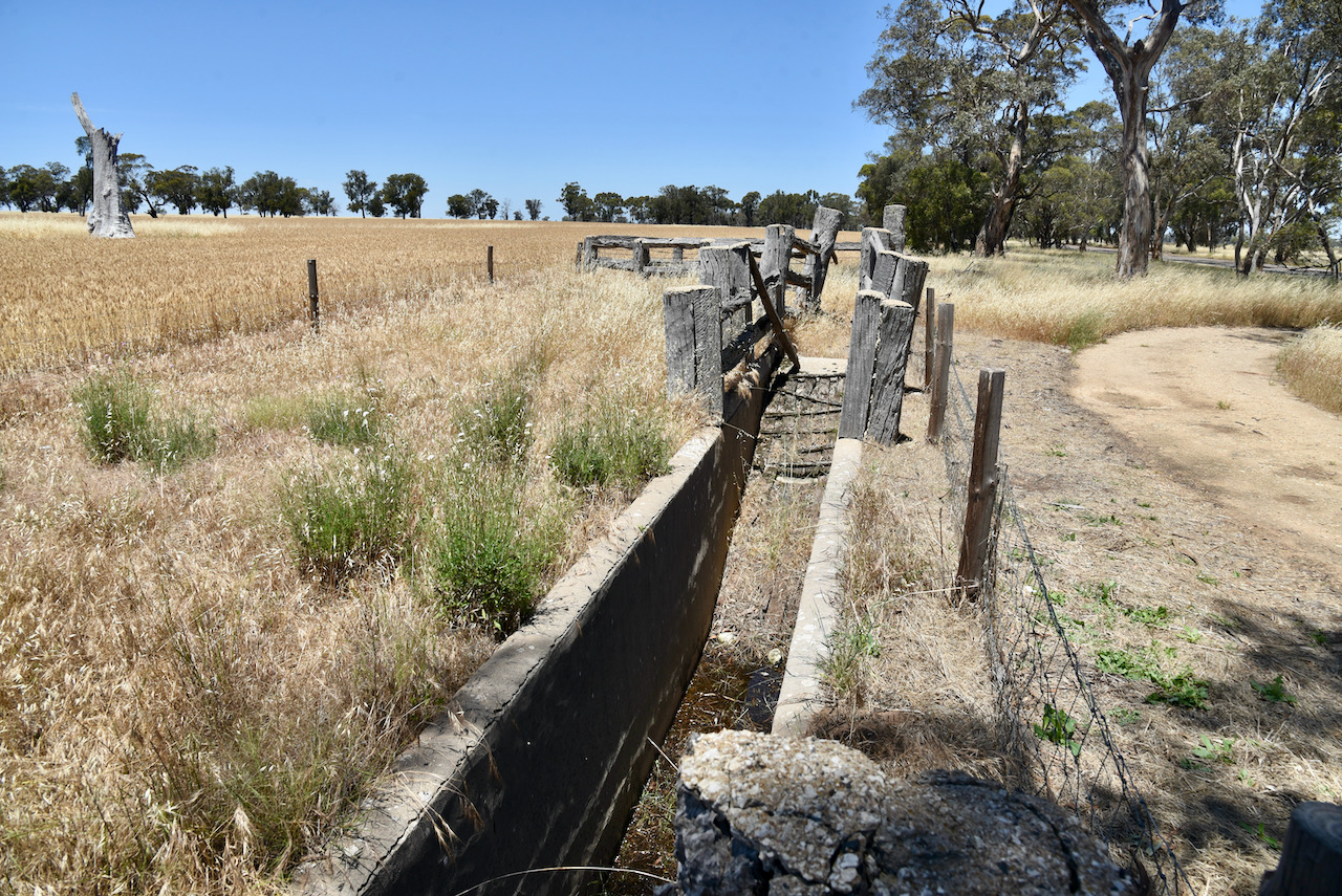
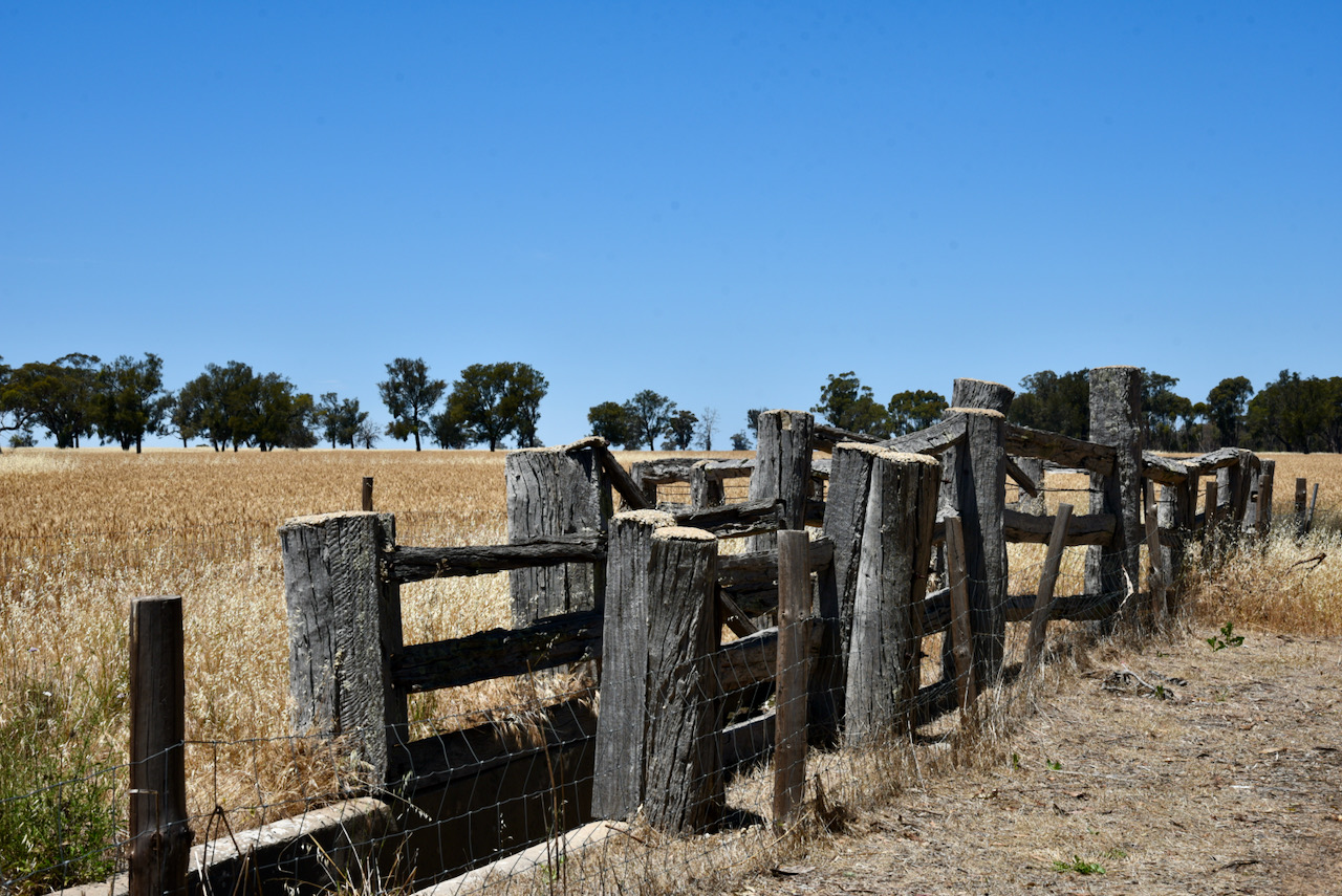
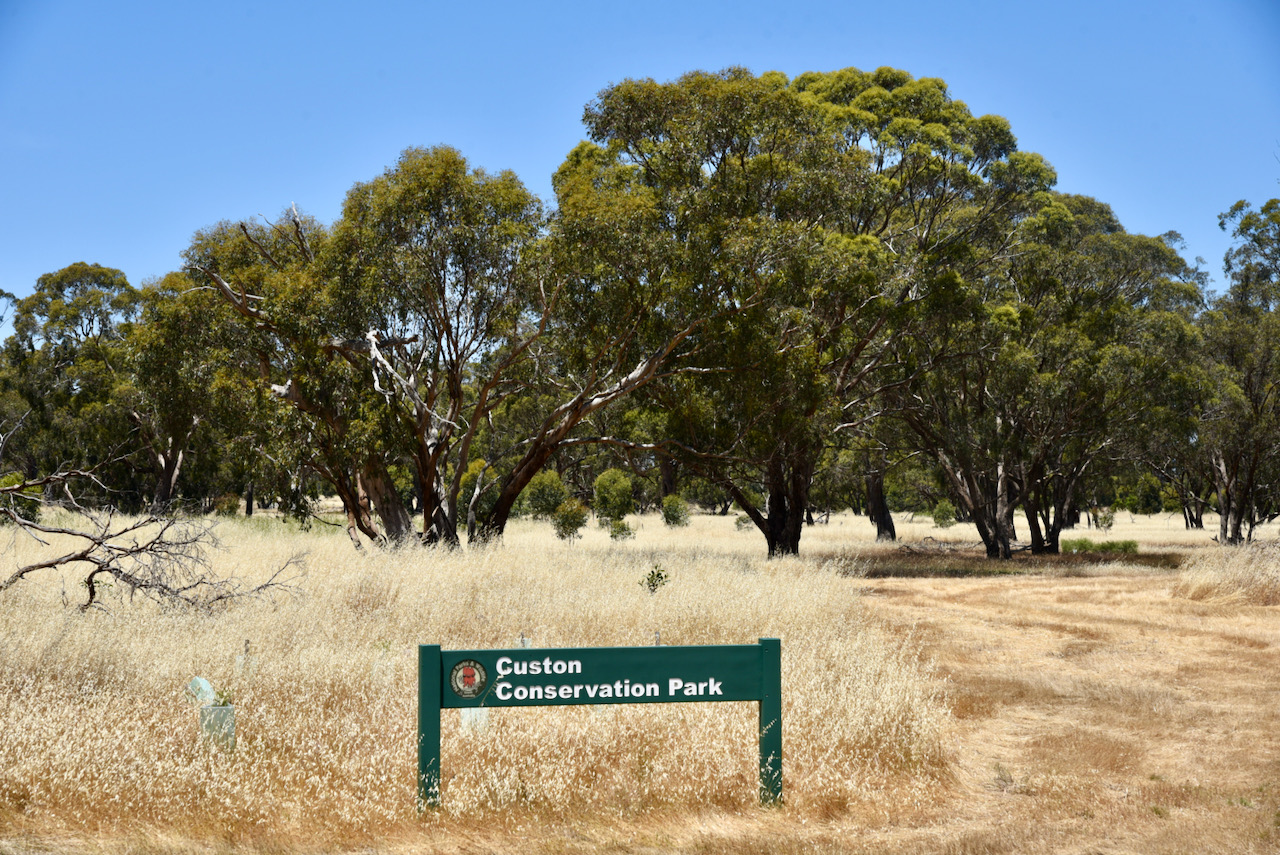
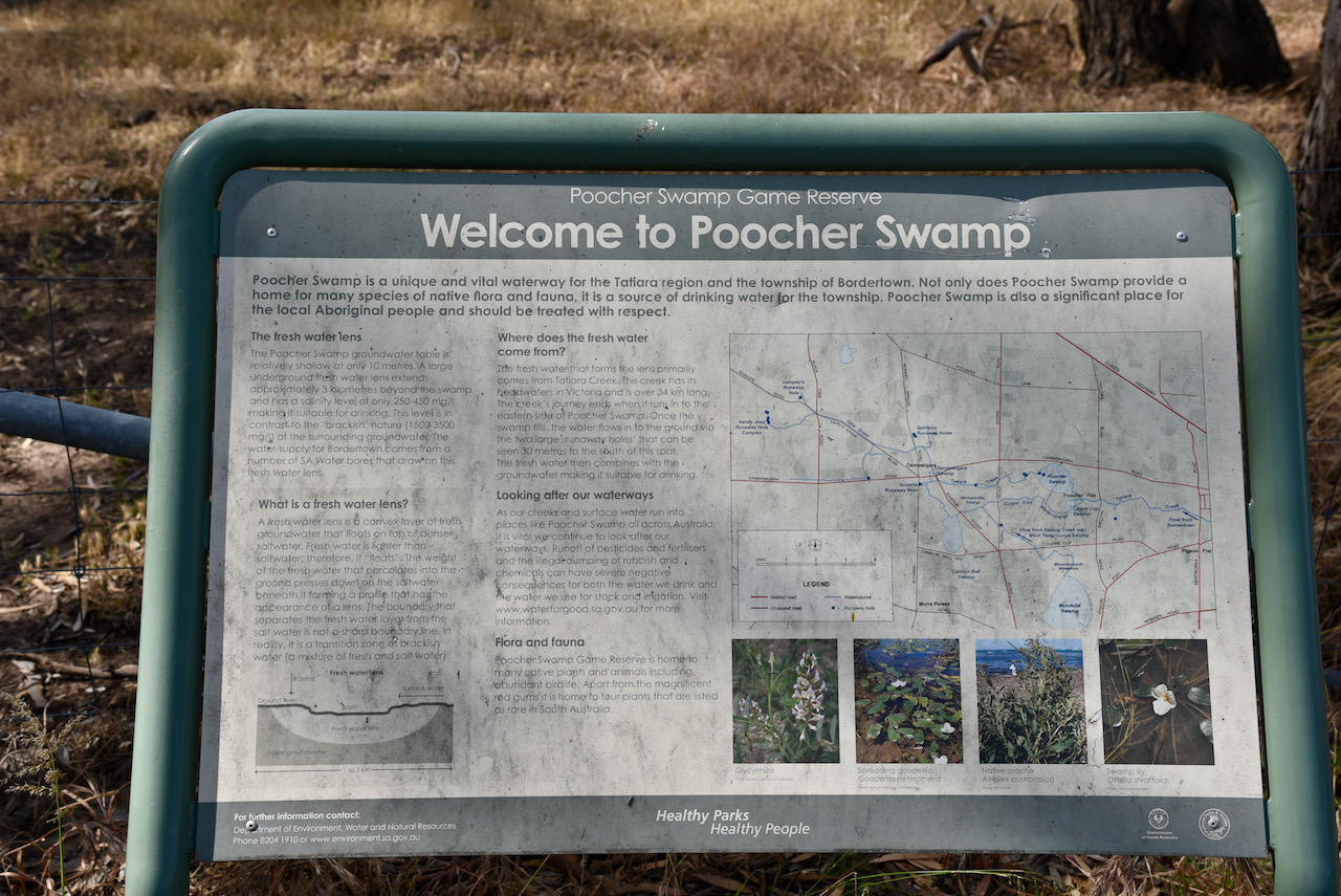
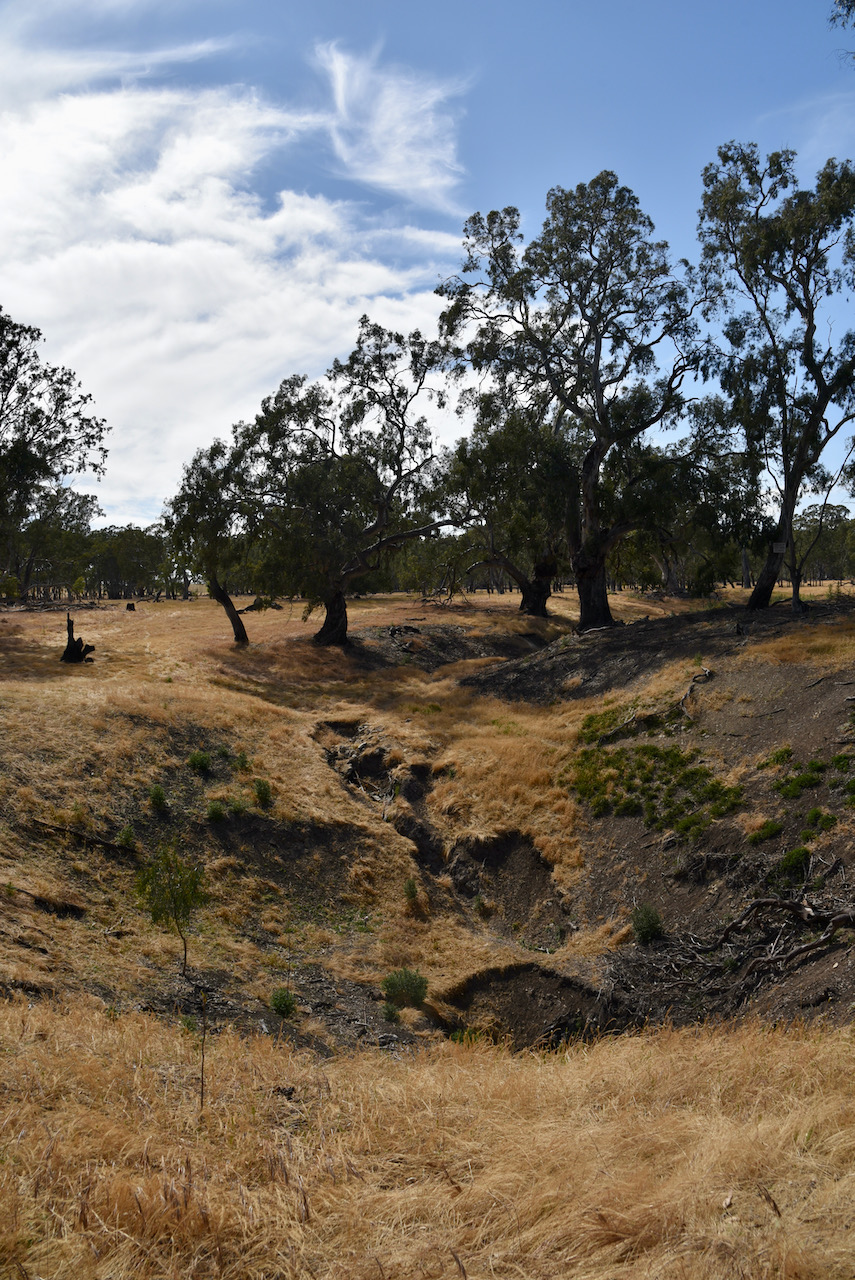
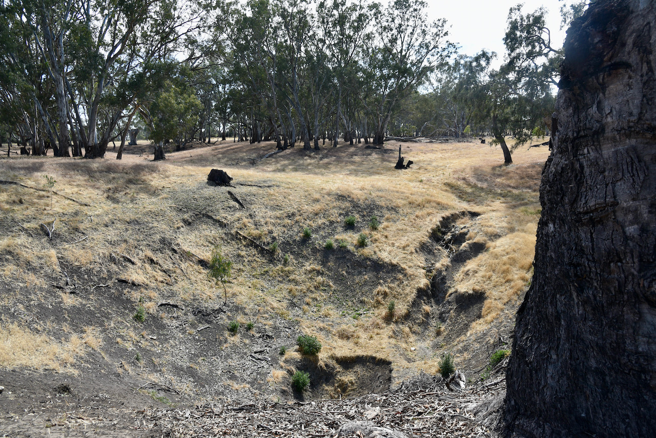
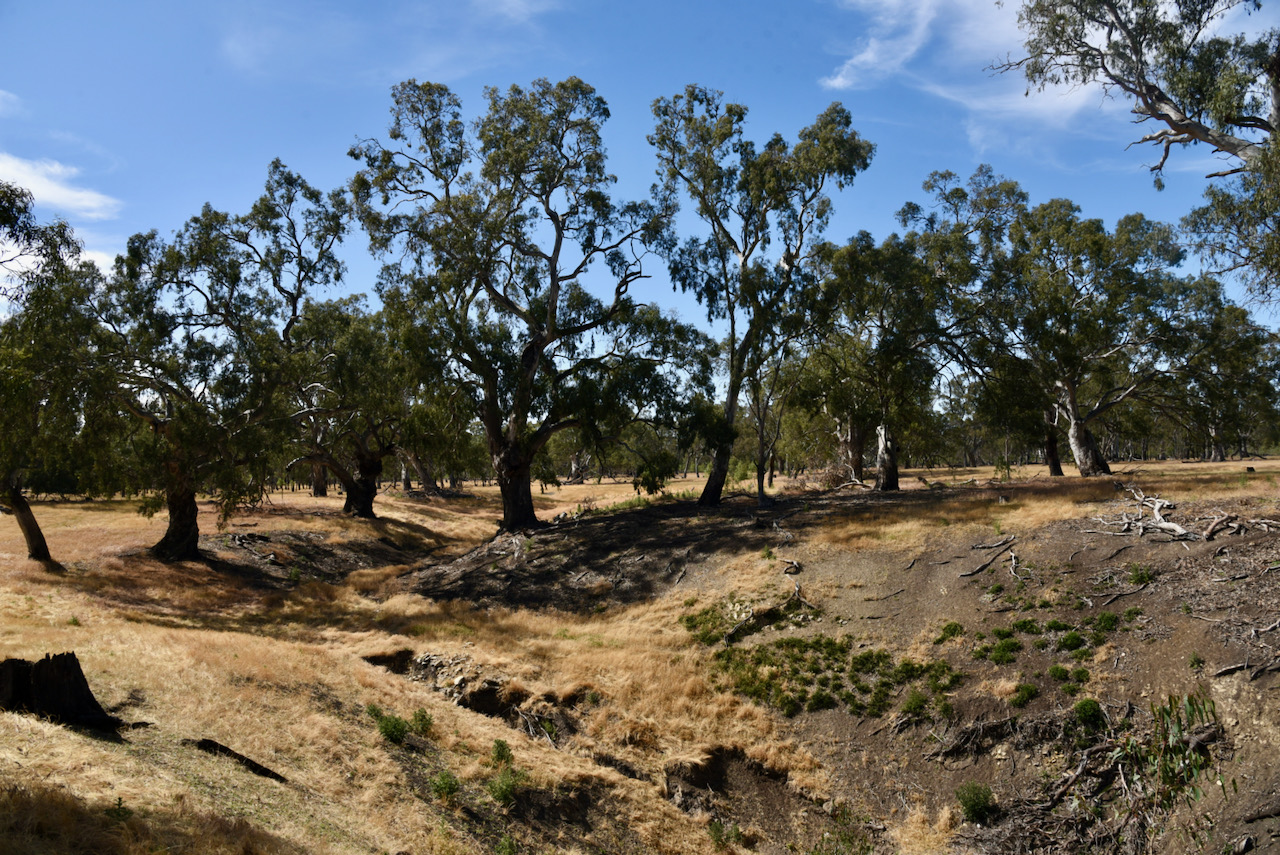
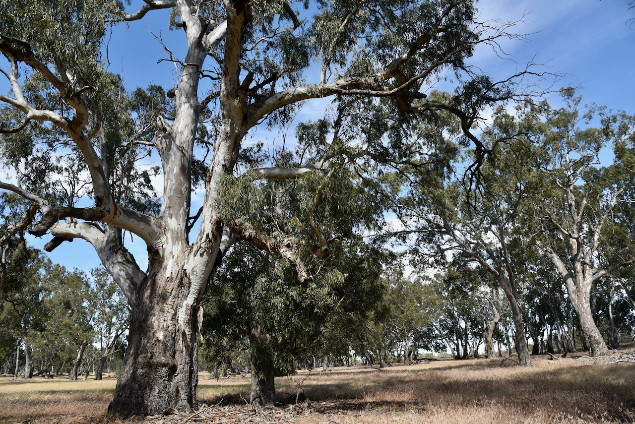
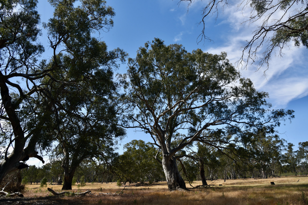
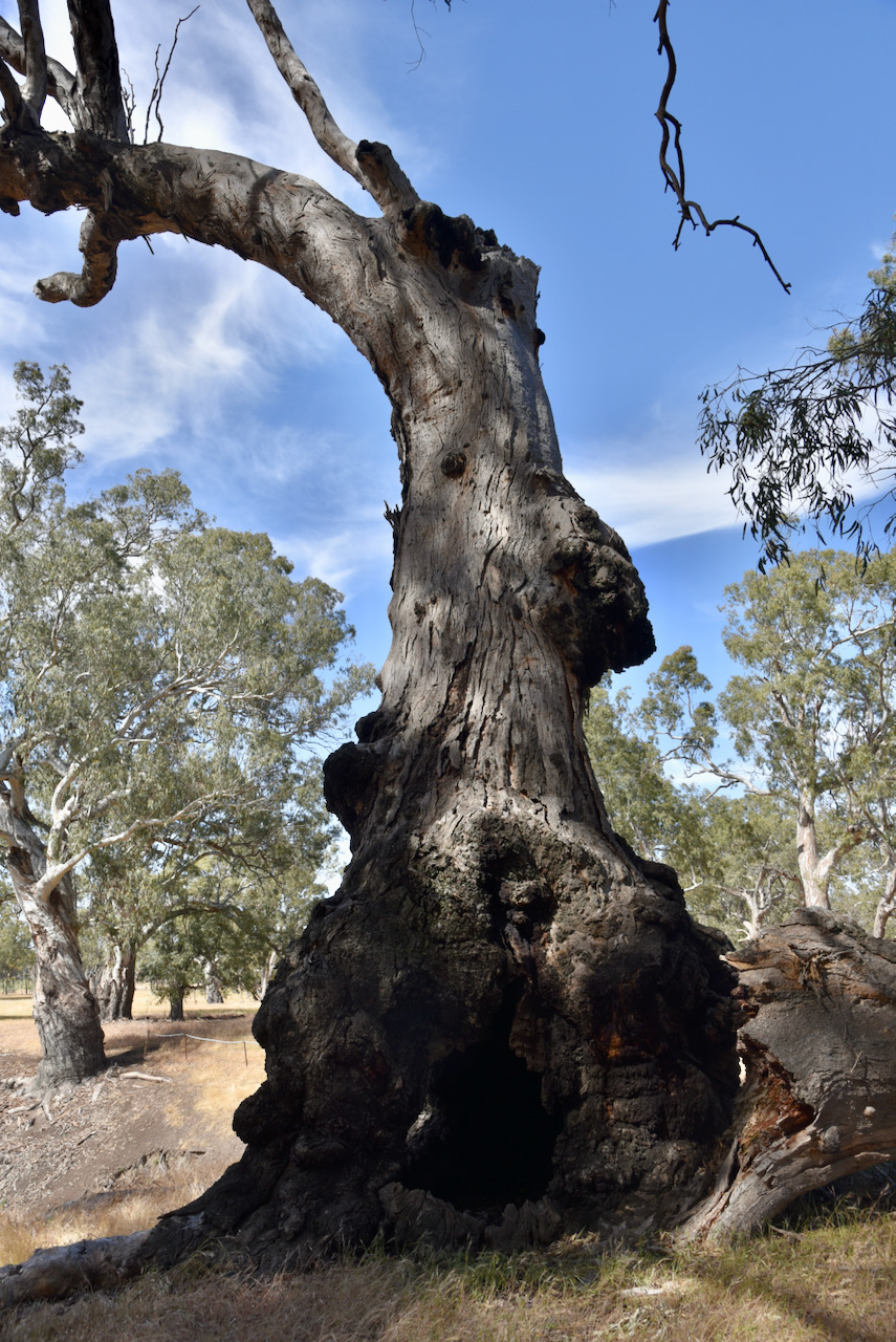
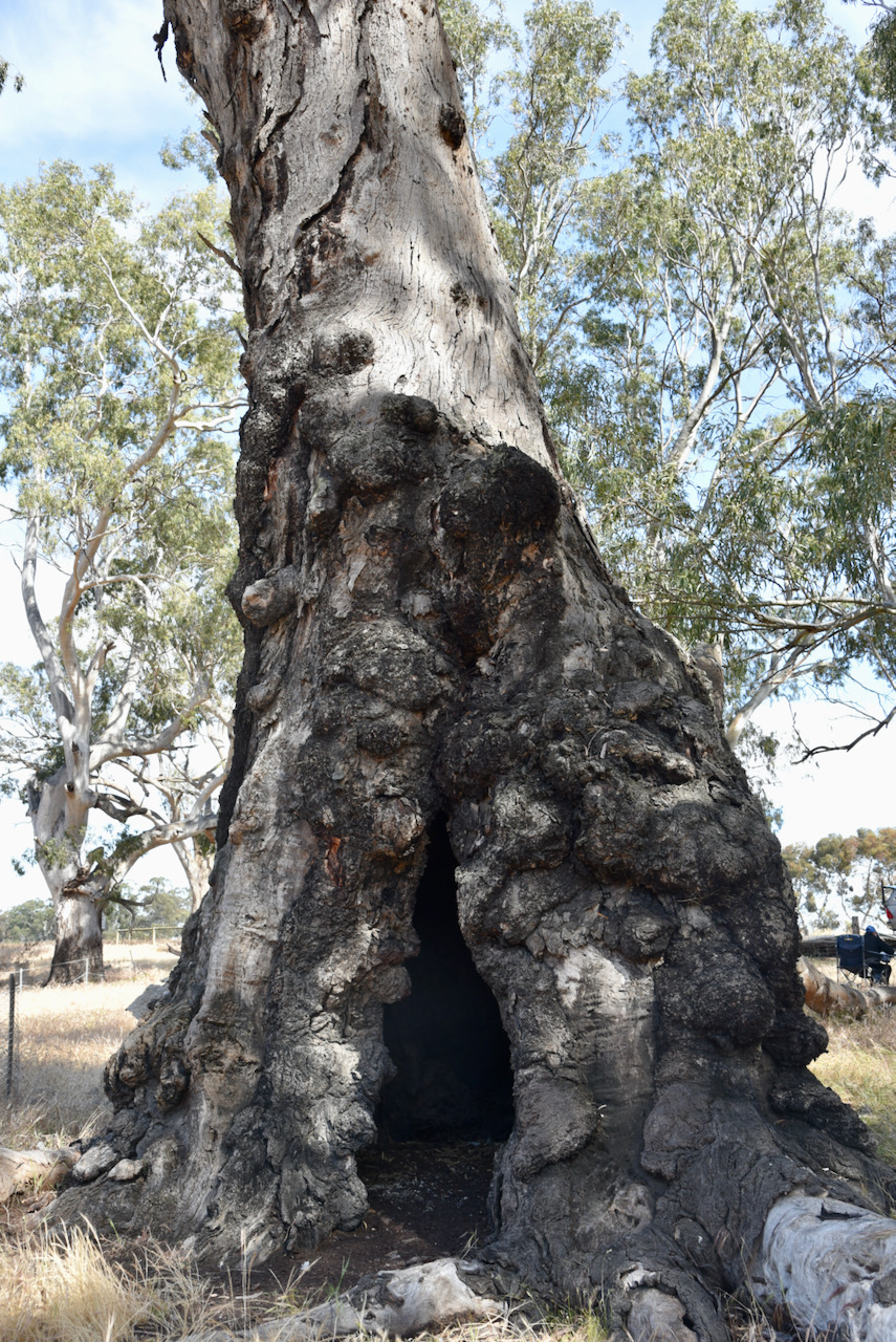
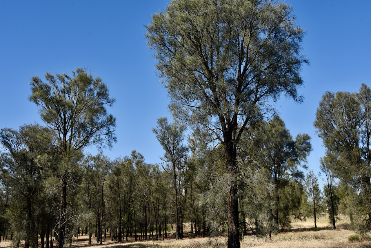
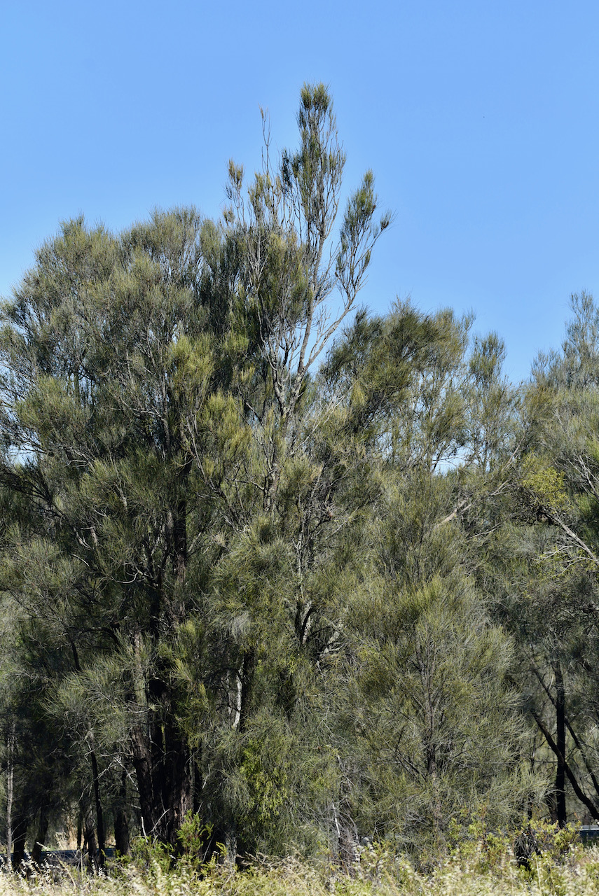
The Wolseley Conservation Park is about 24 hectares (59 acres) in size and was established on the 29th day of November 2001. It was established to protect the nationally threatened Buloke Woodland which is one the last remaining in South Australia.

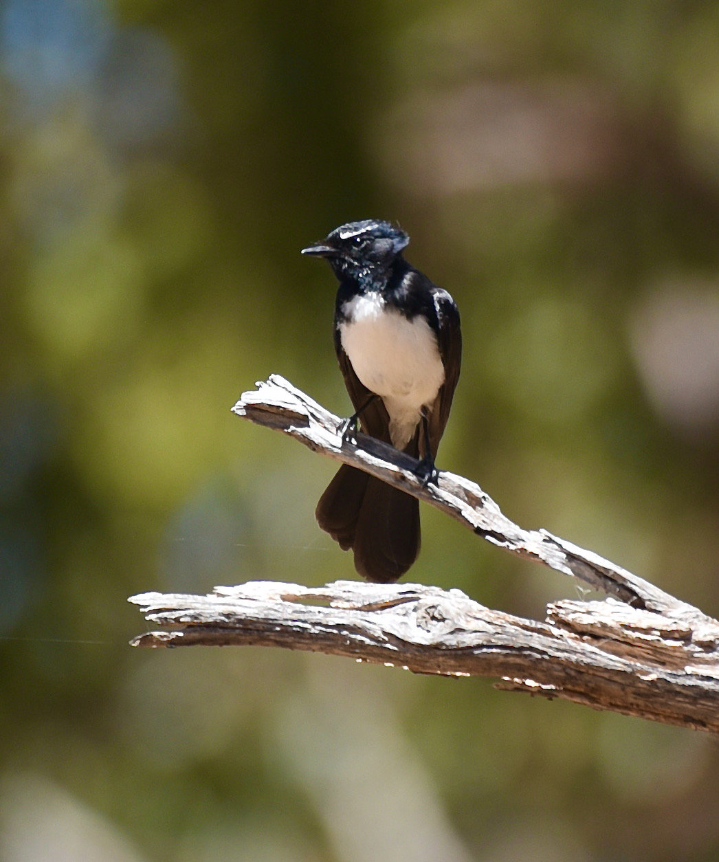
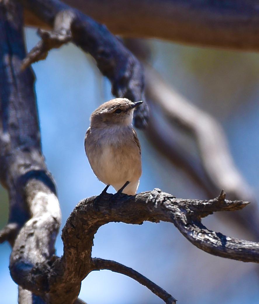
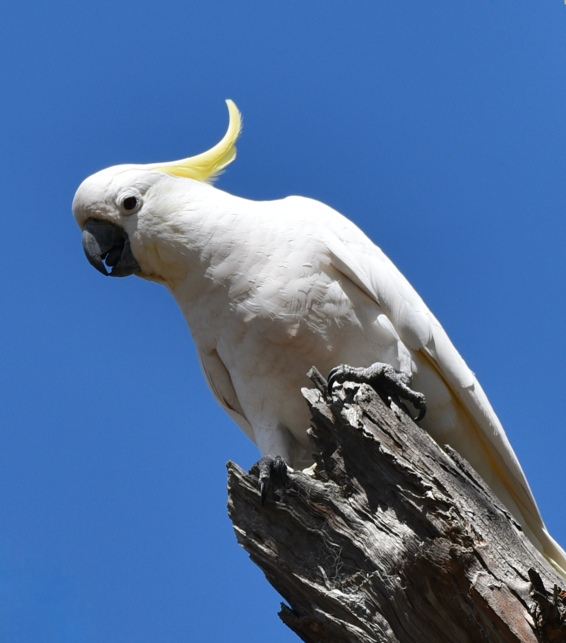
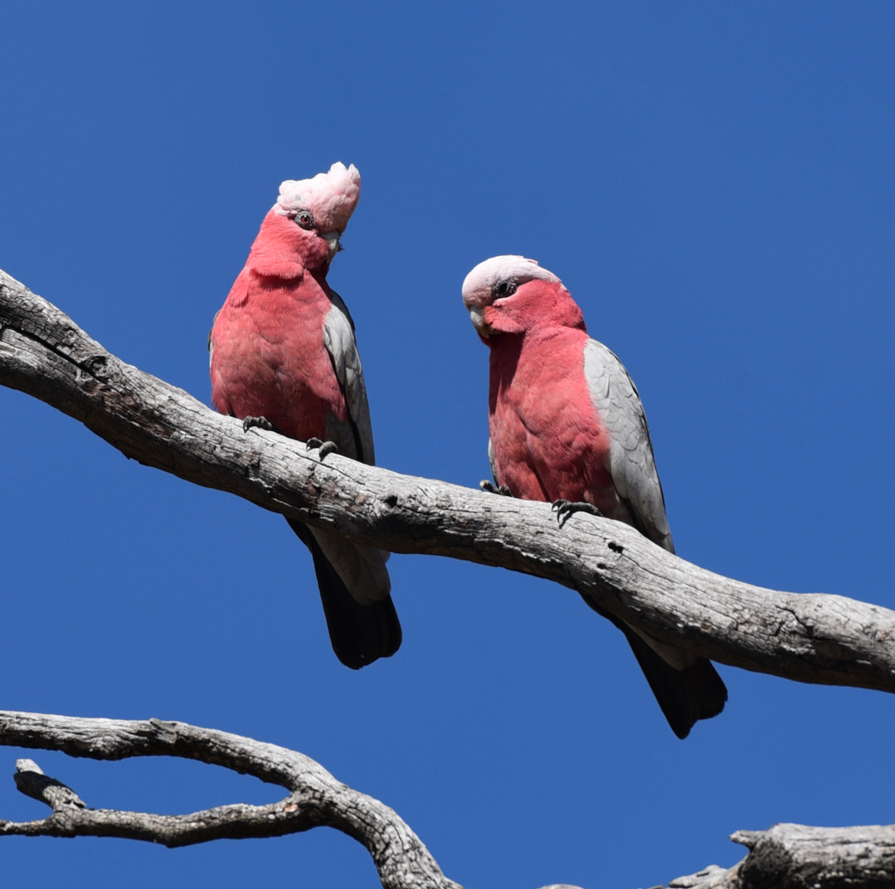
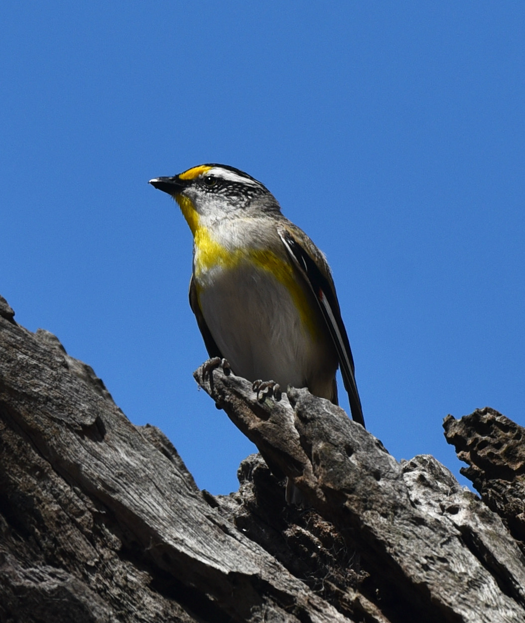
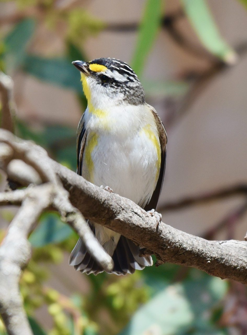
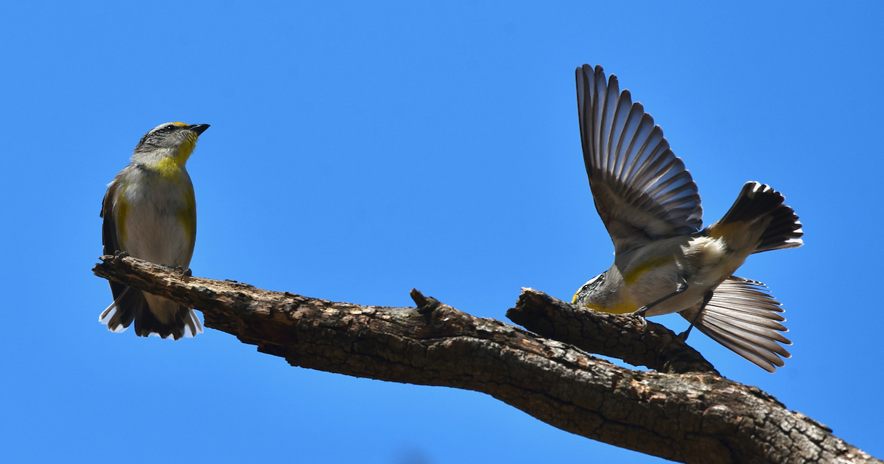
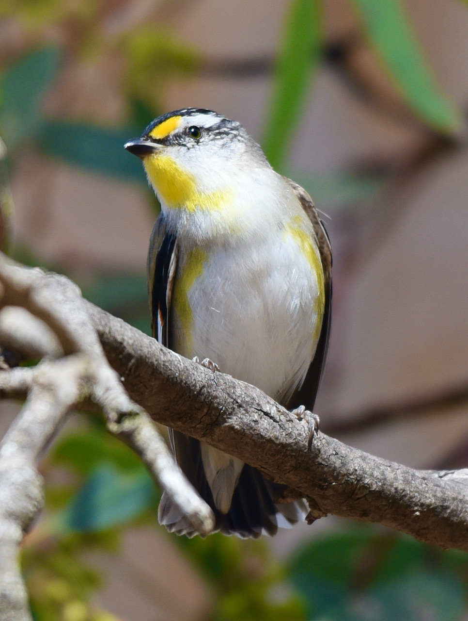
At least 30 species of bird have been recorded in the park including Yellow Thornbill, White-winged Chough, Red-capped Robin, and Collared Sparrowhawk. The park has 68 native plant species of which 11 are listed as threatened.

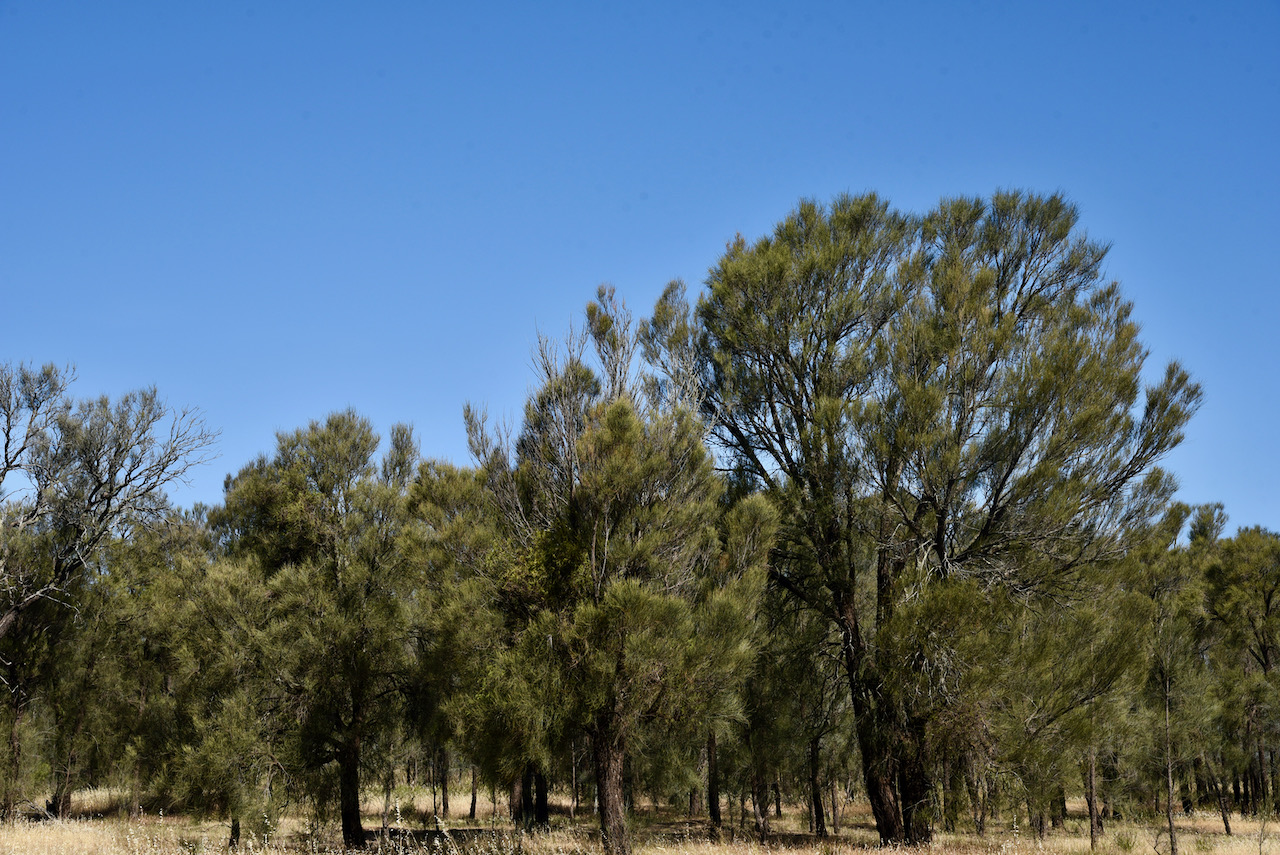
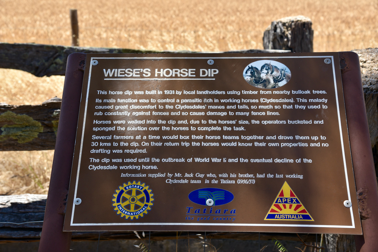
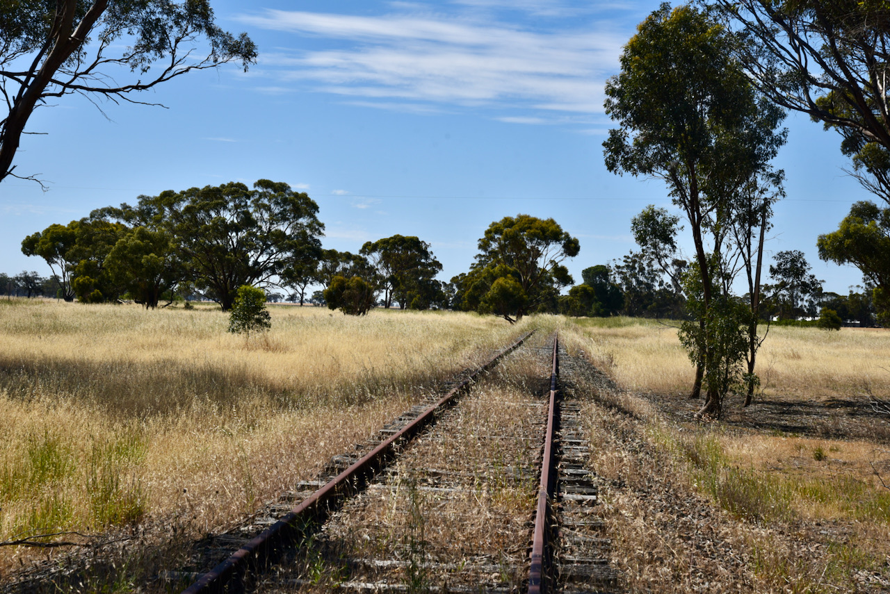
The land which is now the Conservation Park was part of the parklands around the town of Wolseley but had a reputation for depasturing animals, the gathering of firewood and the dumping of rubbish. During the Second World War, part of the land on the western side was cleared to create a sports oval.

By the 1960s the land was reported to be bare ground with only a few scattered Buloke trees. The decline of Wolseley as a railway town reduced further impact on the land which is now the park.

Above:- Cleared farming land alongside of the park.

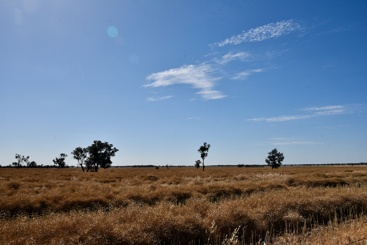
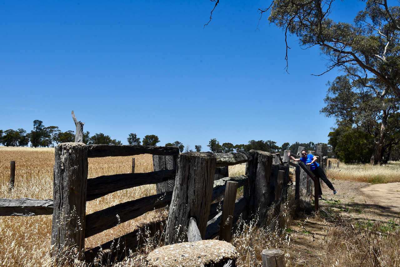
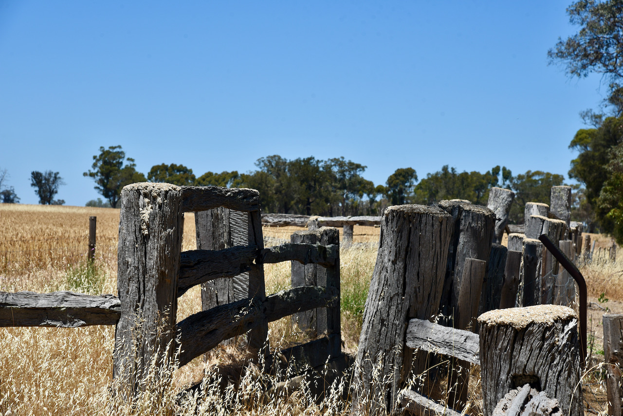
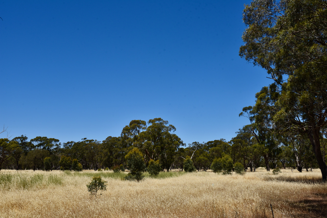
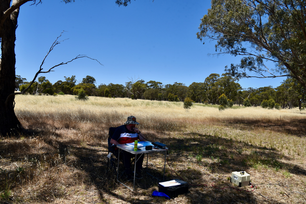
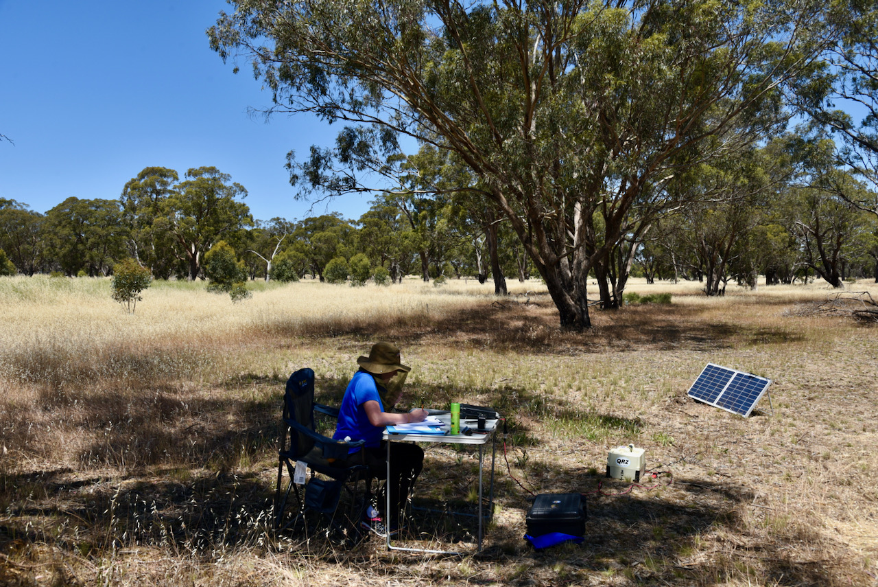
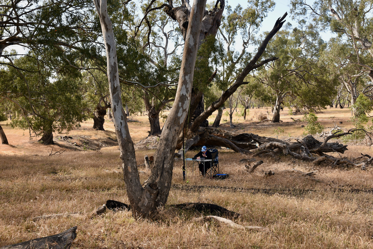
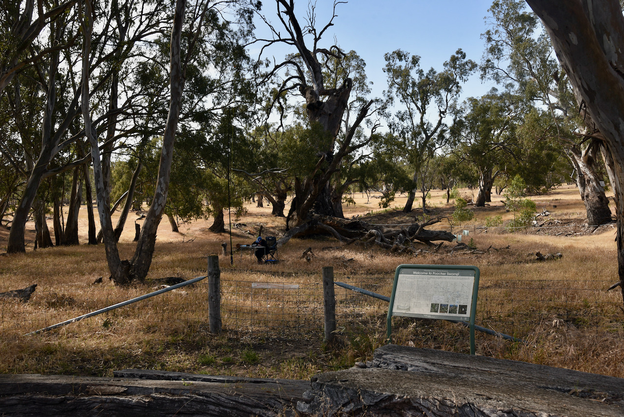
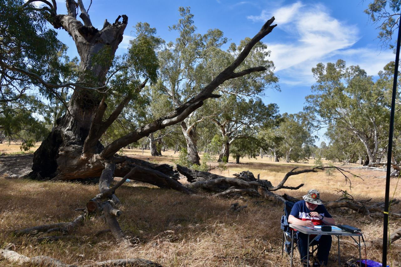
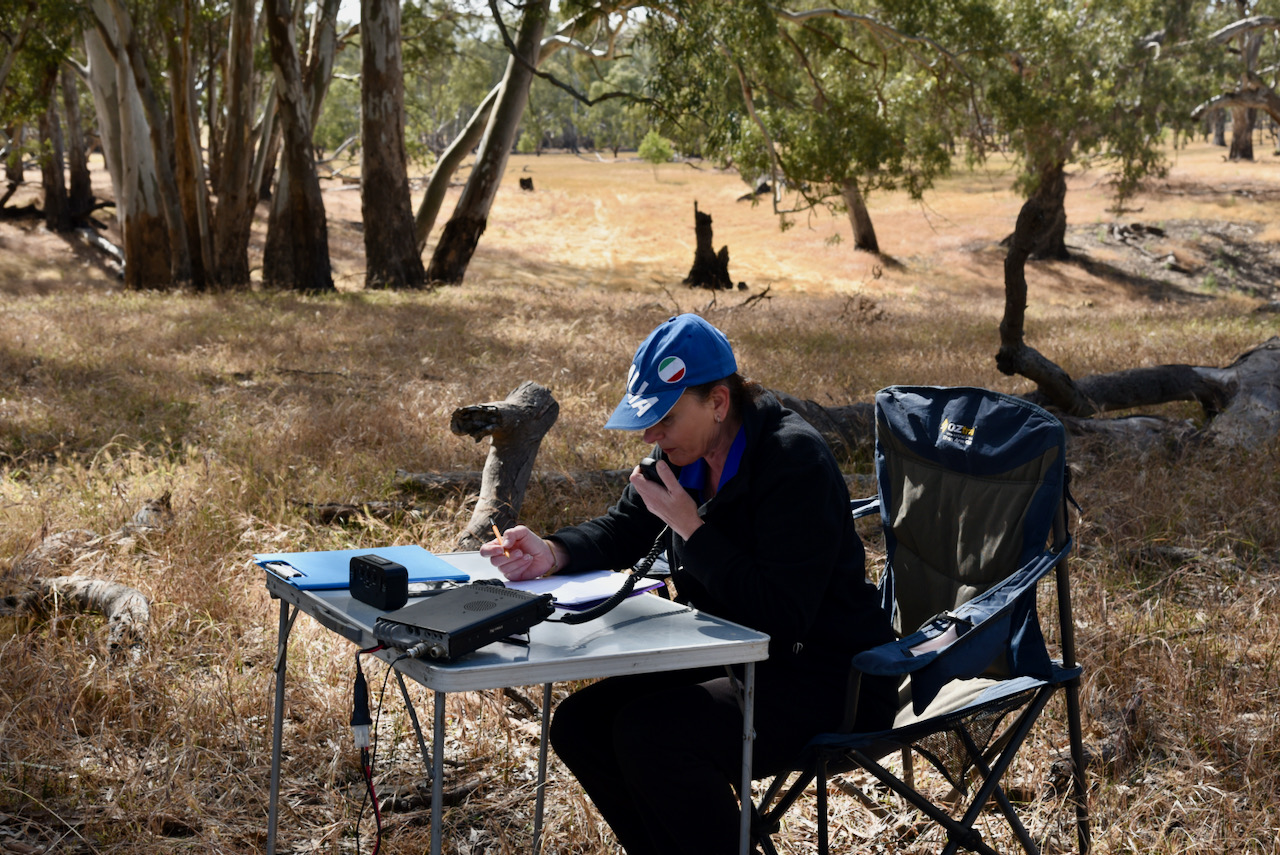
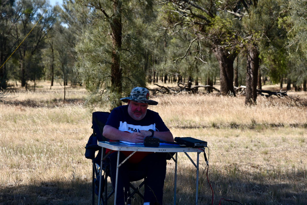
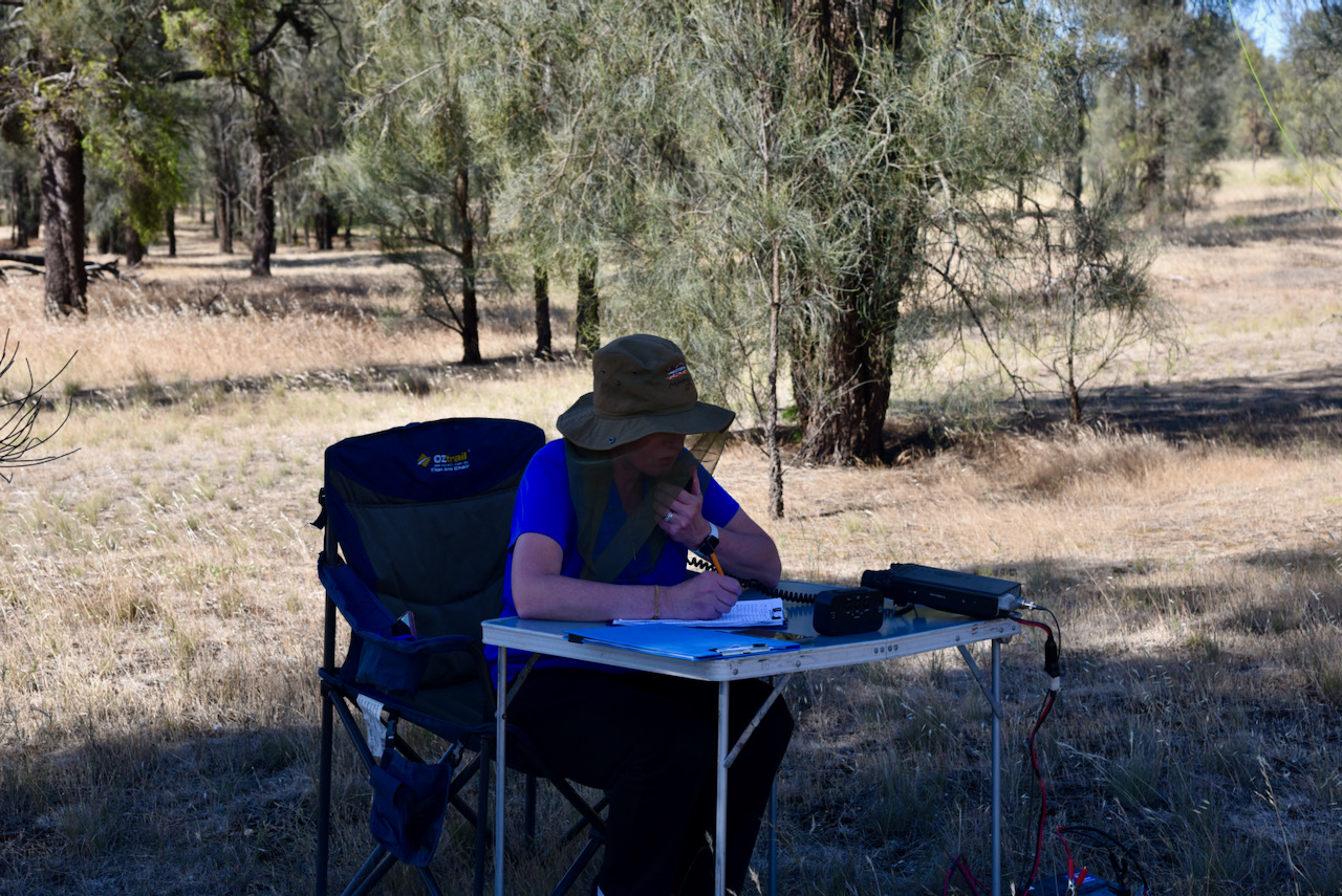
Marija and I drove into the park and found a nice shady spot under some trees. It was a warm day with the temperature in the high twenties.

We operated from Wolseley Common for about 2 hours and made a total of 92 QSOs, including 32 Park to Park contacts.

QSOs were made around Australia and into Japan and New Zealand.

Marija worked the following stations on 40m SSB:-

  1. VK3YV/p (Sweetwater Creek Nature Conservation Reserve VKFF-2200)
  2. VK5KLV/p (Whyalla Conservation Park VKFF-0808)
  3. VK3LF/p (The Lakes National Park VKFF-0484)
  4. VK4MGL/p (Ravensbourne National Park VKFF-0427)
  5. VK2IO/p (Rouse Hill Regional Park VKFF-2784)
  6. VK5FANA
  7. VK7DW
  8. VK3UH
  9. VK2BYF
  10. VK1CT/p (McQuoids Hill Nature Reserve VKFF-0849)
  11. VK2VW
  12. VK2HFI
  13. Vk2YW
  14. VK2NP
  15. Vk7JFD
  16. Vk2PKT
  17. VK3NFS
  18. VK3ACZ
  19. VK3MKE
  20. VK2KA
  21. VK4SMA
  22. VK5CZ/p (Carribie Conservation Park VKFF-0876)
  23. VK3MFU
  24. VK3KXR/p (Swan Bay-Edwards Point Wildlife Reserve VKFF-2444)
  25. VK2EMA
  26. VK3TKK/p (Holden Flora Reserve VKFF-2333)
  27. VK4PRO
  28. VK3FRC
  29. VK3ZPF
  30. VK3PF/p (SOTA VK3/ VC-037 & Bunyip State Park VKFF-0753)
  31. VK4HMI
  32. VK3KXR/p (Port Phillip Heads Marine National Park VKFF-0954)
  33. VK3ZK/p (Echuca Regional Park VKFF-0966)
  34. VK3ANL

Marija worked the following stations on 20m SSB:-

  1. ZL4NVW
  2. JF7RJM
  3. VK6JK
  4. ZL1TM
  5. VK6JKP
  6. VK6ADF/p (Dookanooka Nature Reserve VKFF-2962)

Marija worked the following stations on 80m SSB:-

  1. VK5PE
  2. VK5HS
  3. VK3PF/p (SOTA VK3/ VC-037 & Bunyip State Park VKFF-0753)
  4. VK5FANA
  5. VK5LA
  6. VK5CZ/p (Carribie Conservation Park VKFF-0876)
  7. VK3KXR/p (Port Phillip Heads Marine National Park VKFF-0954)

I worked the following stations on 40m SSB:-

  1. VK3YV/p (Sweetwater Creek Nature Conservation Reserve VKFF-2200)
  2. VK2LBL
  3. Vk2BYF
  4. VK5KLV/p (Whyalla Conservation Park VKFF-0808)
  5. VK3LF/p (The Lakes National Park VKFF-0484)
  6. VK4MGL/p (Ravensbourne National Park VKFF-0427)
  7. VK2IO/p (Rouse Hill Regional Park VKFF-2784)
  8. VK3UH
  9. VK2PKT
  10. VK2NP
  11. VK1CT/p (McQuoids Hill Nature Reserve VKFF-0849)
  12. VK5CZ/p (Carribie Conservation Park VKFF-0876)
  13. VK3KXR/p (Swan Bay-Edwards Point Wildlife Reserve VKFF-2444)
  14. VK3TKK/p (Holden Flora Reserve VKFF-2333)
  15. VK3FRC
  16. VK7JFD
  17. VK2KA
  18. VK4BXX
  19. VK3MPR
  20. VK4PRO
  21. VK3AMO
  22. VK3ZPF
  23. VK3PF/p (SOTA VK3/ VC-037 & Bunyip State Park VKFF-0753)
  24. Vk4HMI
  25. VK3KXR/p (Port Phillip Heads Marine National Park VKFF-0954)
  26. VK3ZK/p (Echuca Regional Park VKFF-0966)
  27. VK3ANL

I worked the following stations on 20m SSB:-

  1. ZL4NVW
  2. JF7RJM
  3. VK6JK
  4. ZL1TM
  5. VK6JKP
  6. VK6ADF/p (Dookanooka Nature Reserve VKFF-2962)

I worked the following stations on 80m SSB:-

  1. VK5HS
  2. VK5PE
  3. VK3PF/p (SOTA VK3/ VC-037 & Bunyip State Park VKFF-0753)
  4. VK5FANA
  5. VK5LA
  6. VK5CZ/p (Carribie Conservation Park VKFF-0876)
  7. VK5IS
  8. VK3ADX
  9. VK3KXR/p (Port Phillip Heads Marine National Park VKFF-0954)
  10. VK5WU
  11. VK3GTV
  12. VK3UFO

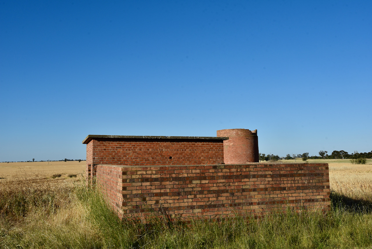
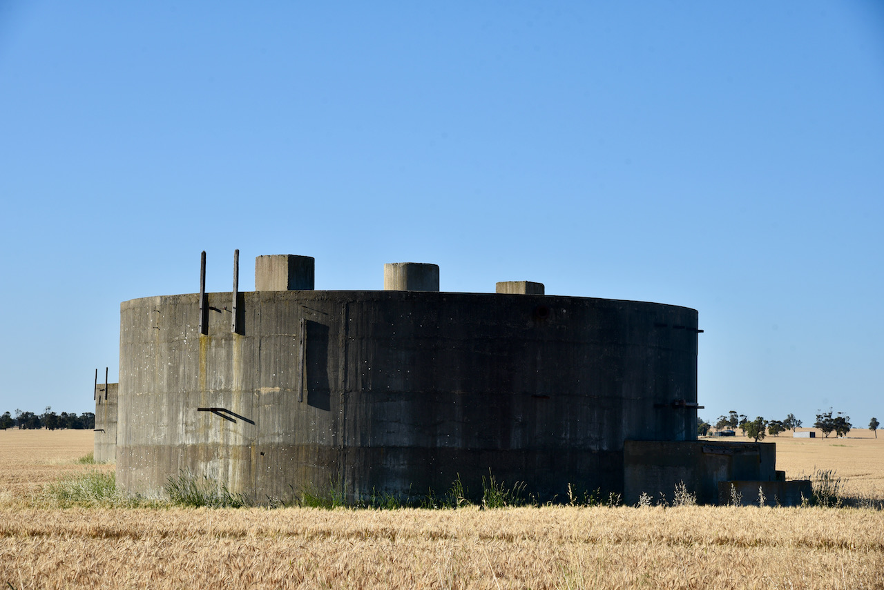
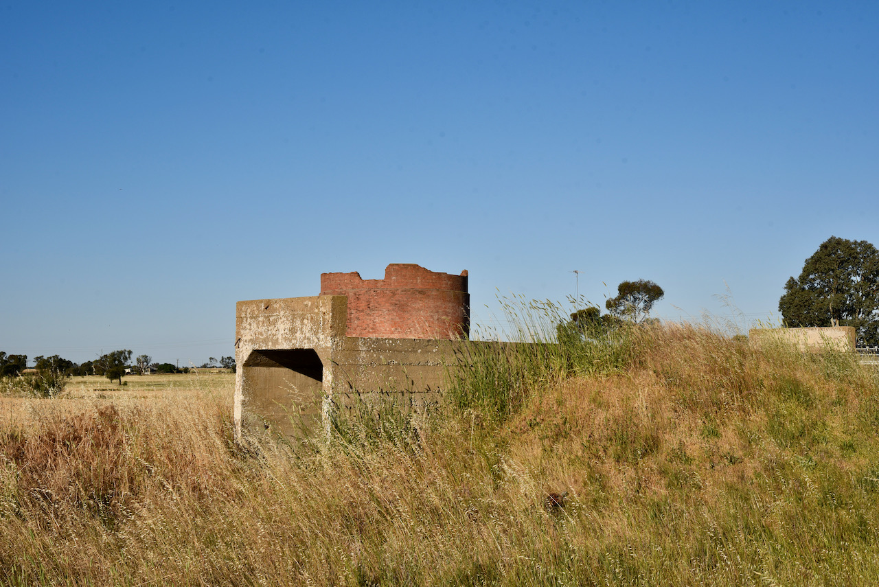
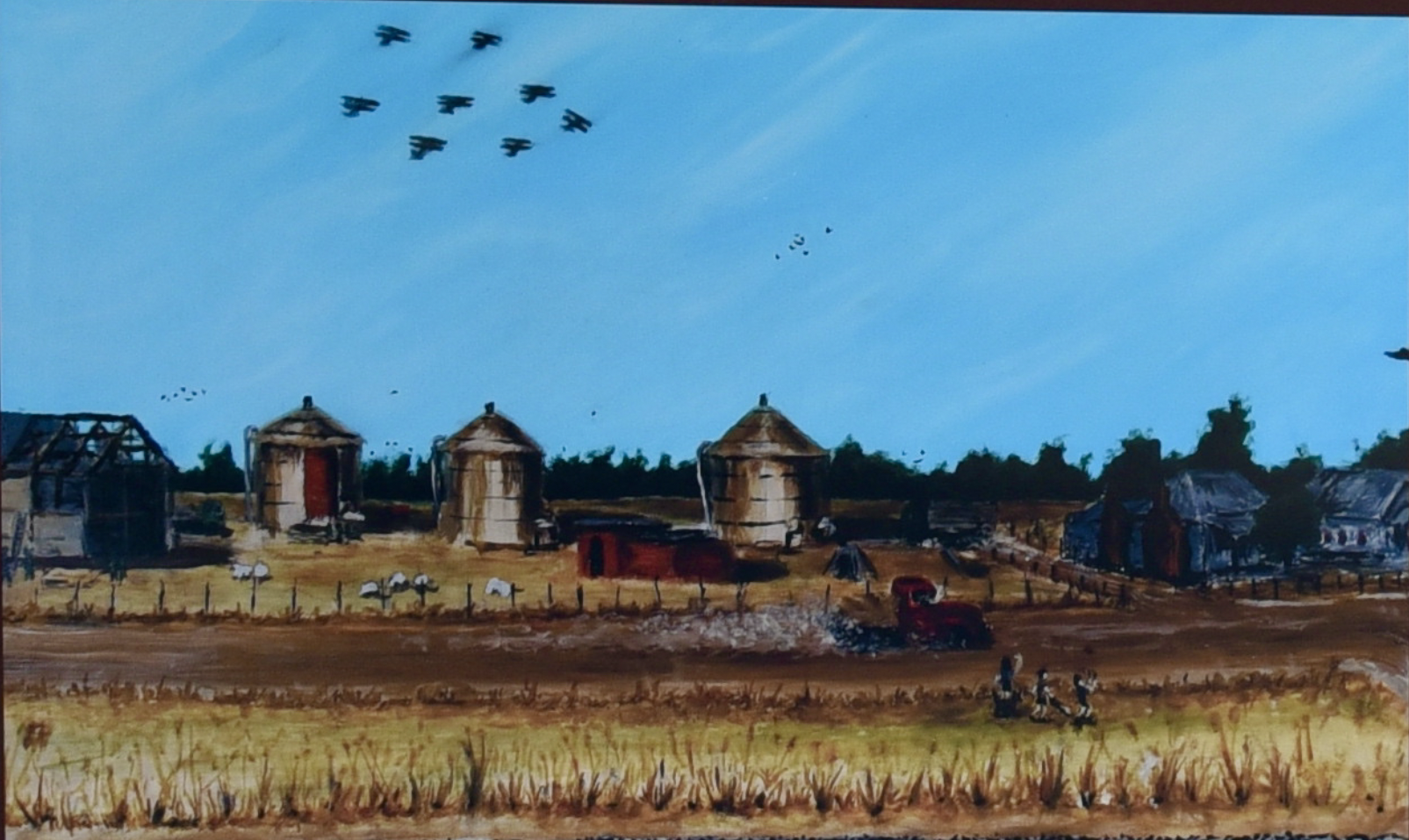
After packing up we stopped to have a look at the old World War Two Wolseley fuel tanks. The site was constructed during the early phase of WW2 with two 120,000 gallon tanks, one 40,000 gallon tank and a barracks. The fuel tanks and barracks were camouflaged to look like farm buildings. Three additional tanks were subsequently added, with the site being disbanded on the 14th day of June 1944.

There are no known surviving photographs taken during the war years of the site. Below is an artists impression of how the area may have looked.

Above:- Image from the Information Board at Wolseley. Painter – Robert ‘Bear’ Cameron.

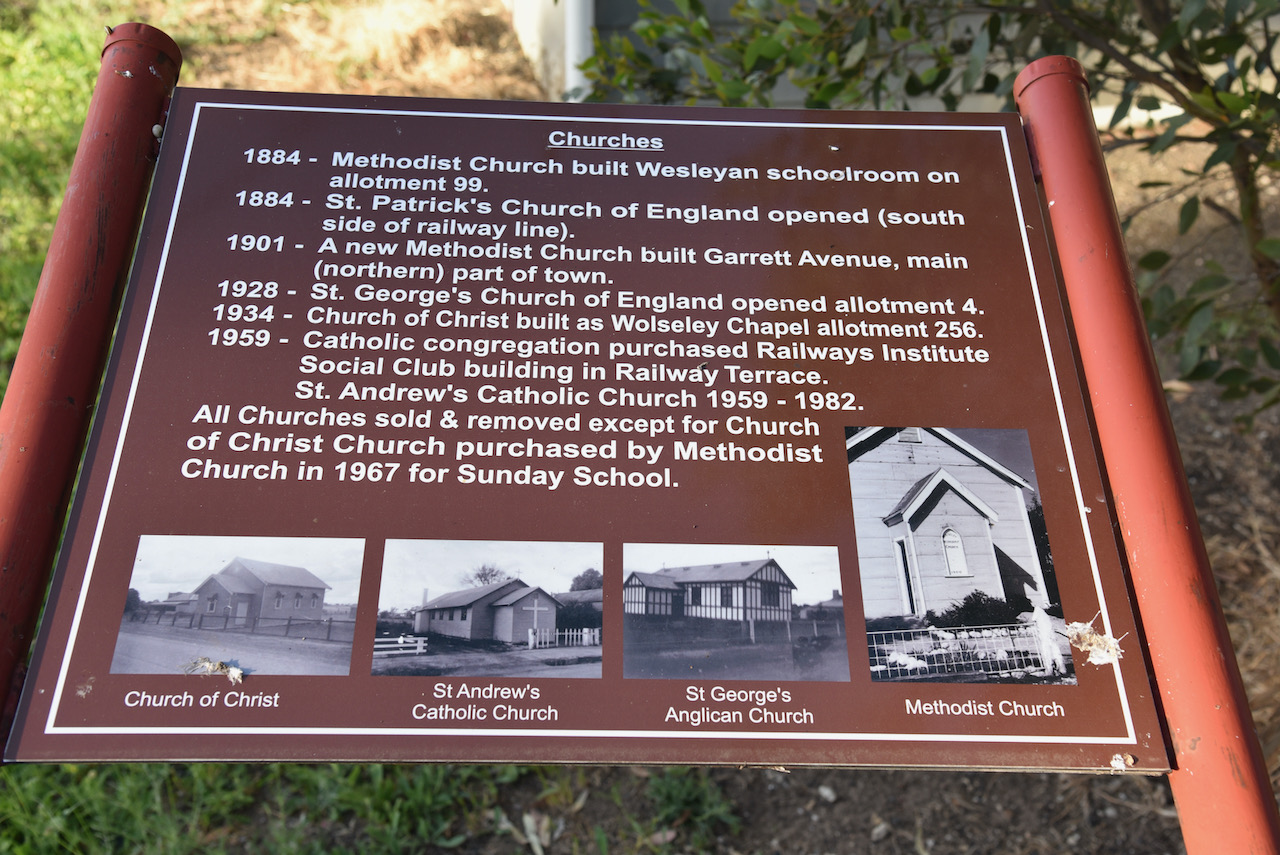
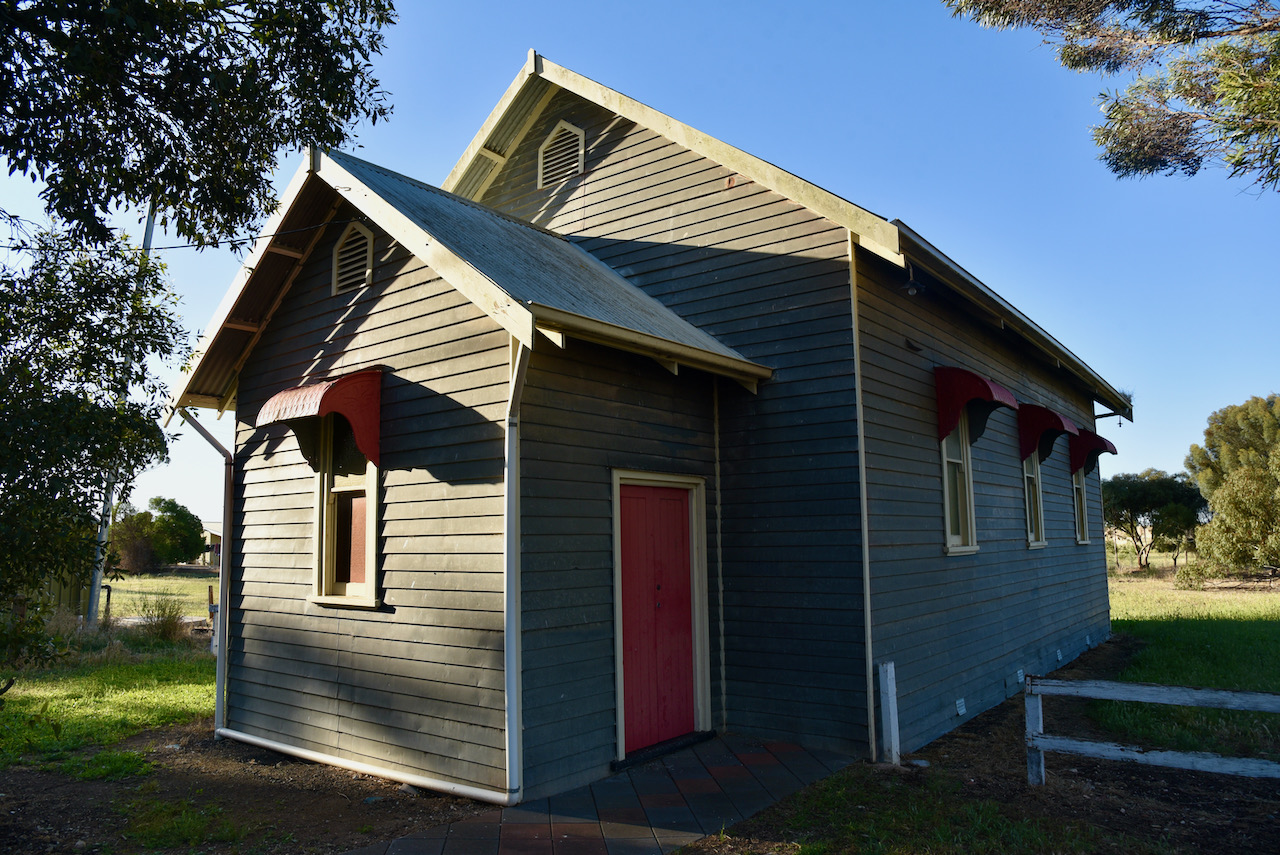
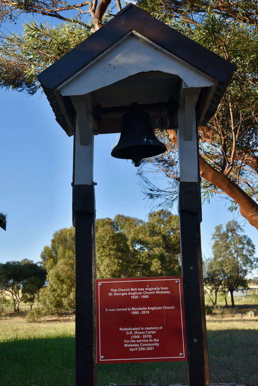
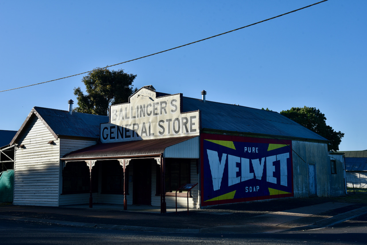
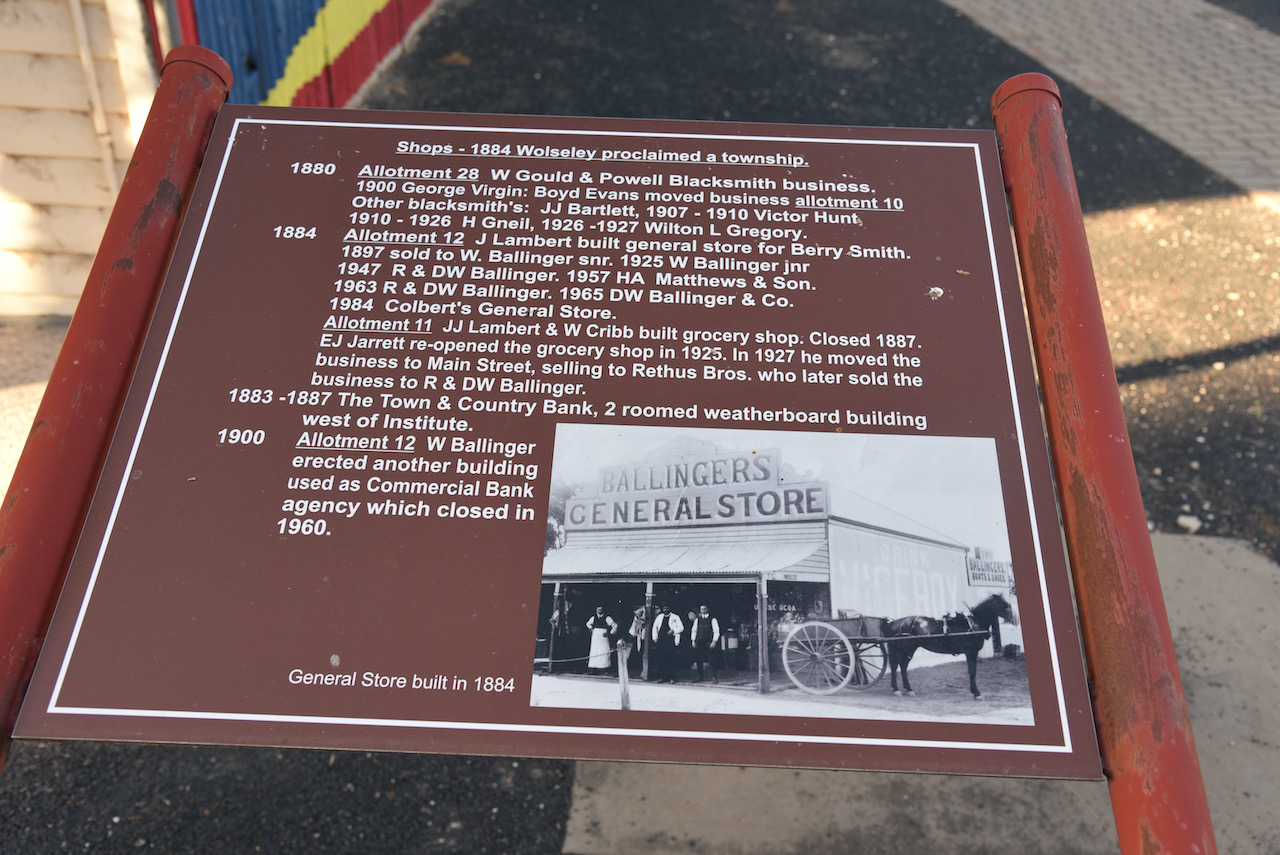
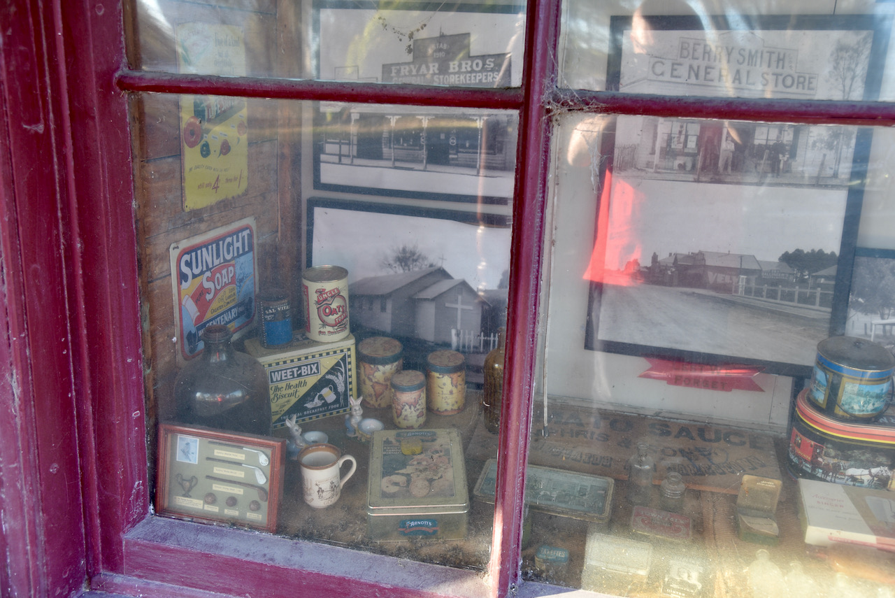
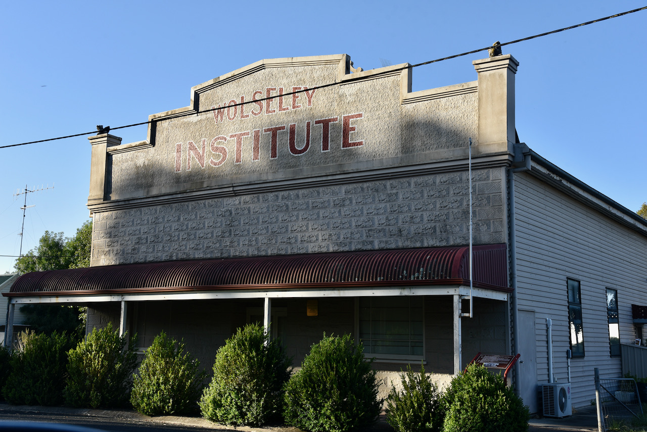
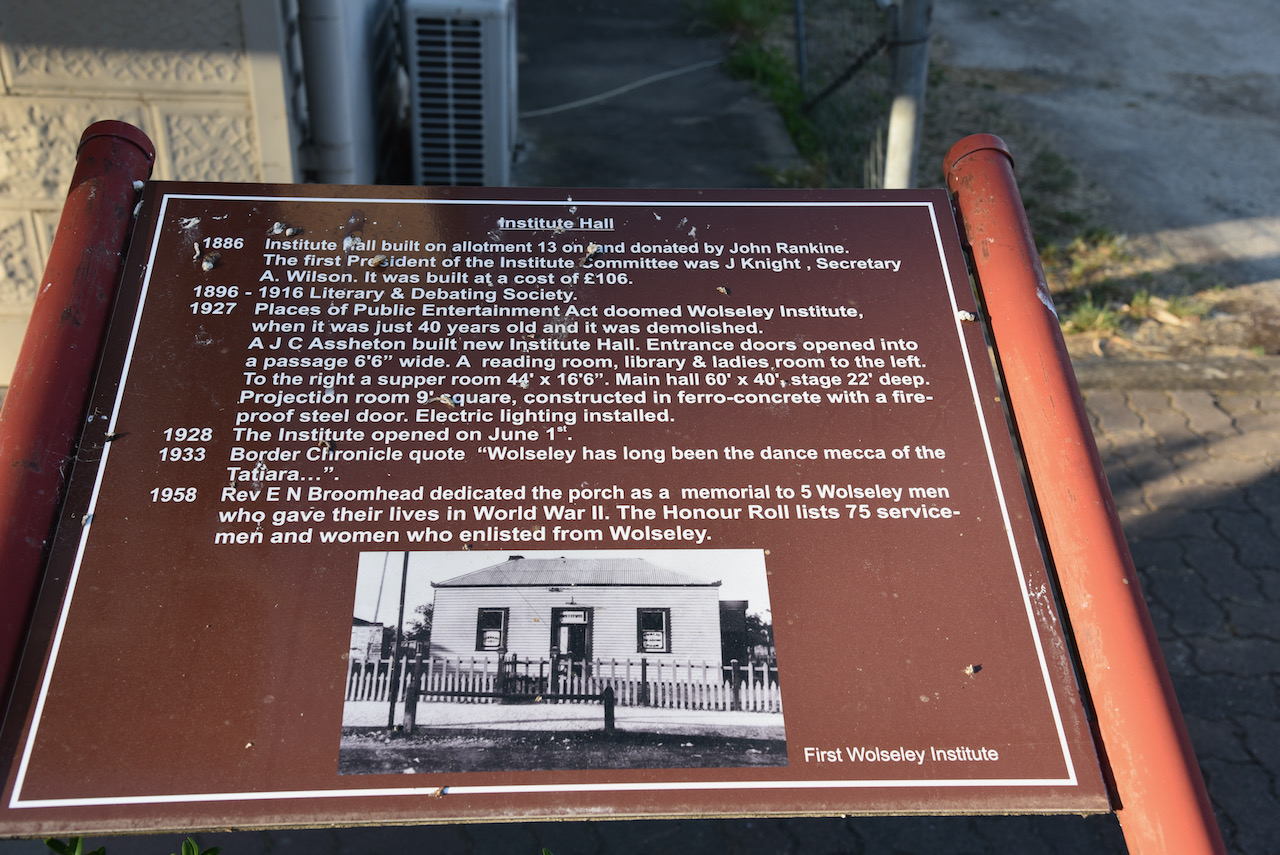
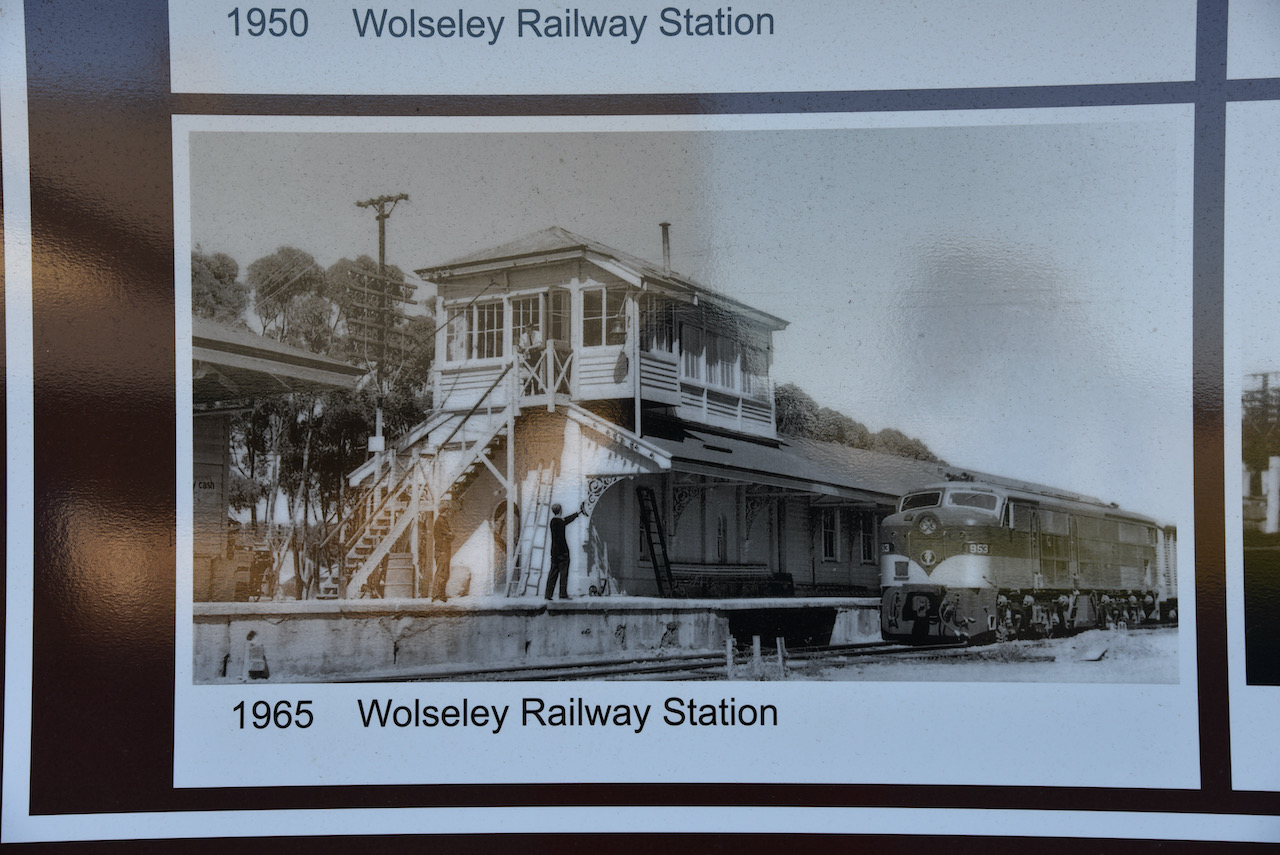
We also had a look through the town of Wolseley which has a number of interesting information boards all about the history of the buildings in the town.

There is a Wolseley Historical Walk brochure which can be obtained from the Bordertown Visitor Information Centre. I have attached a copy below.

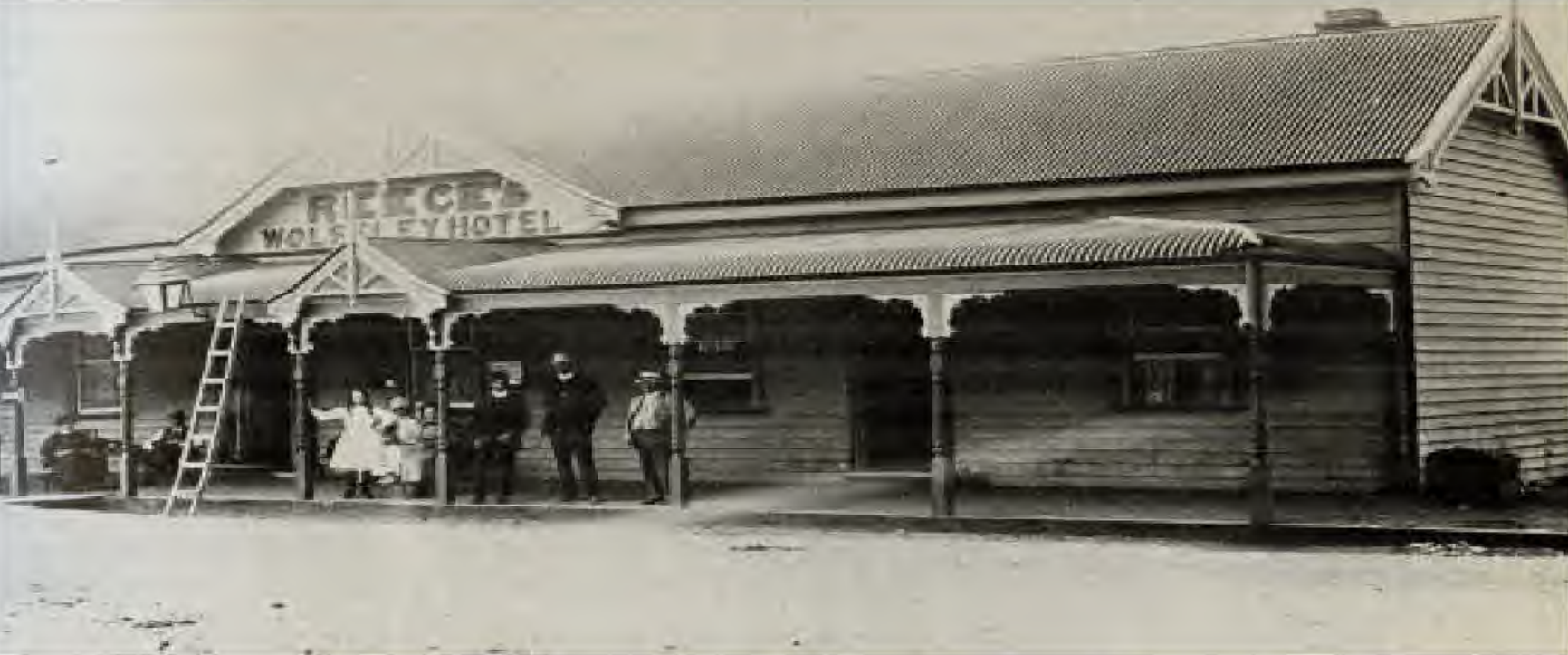
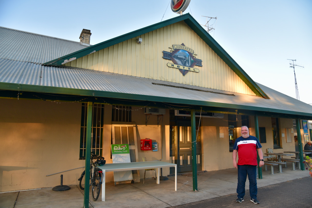
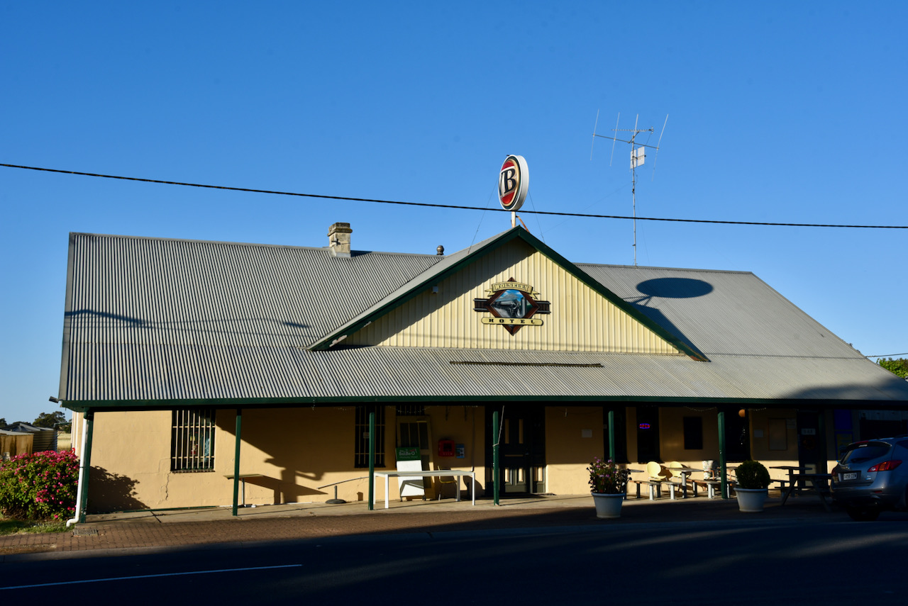
We then decided it was time for a bite to eat, so we called into the Wolseley Hotel. And I am glad we did. It was one of the best pub schnitzels I have had in a long time.

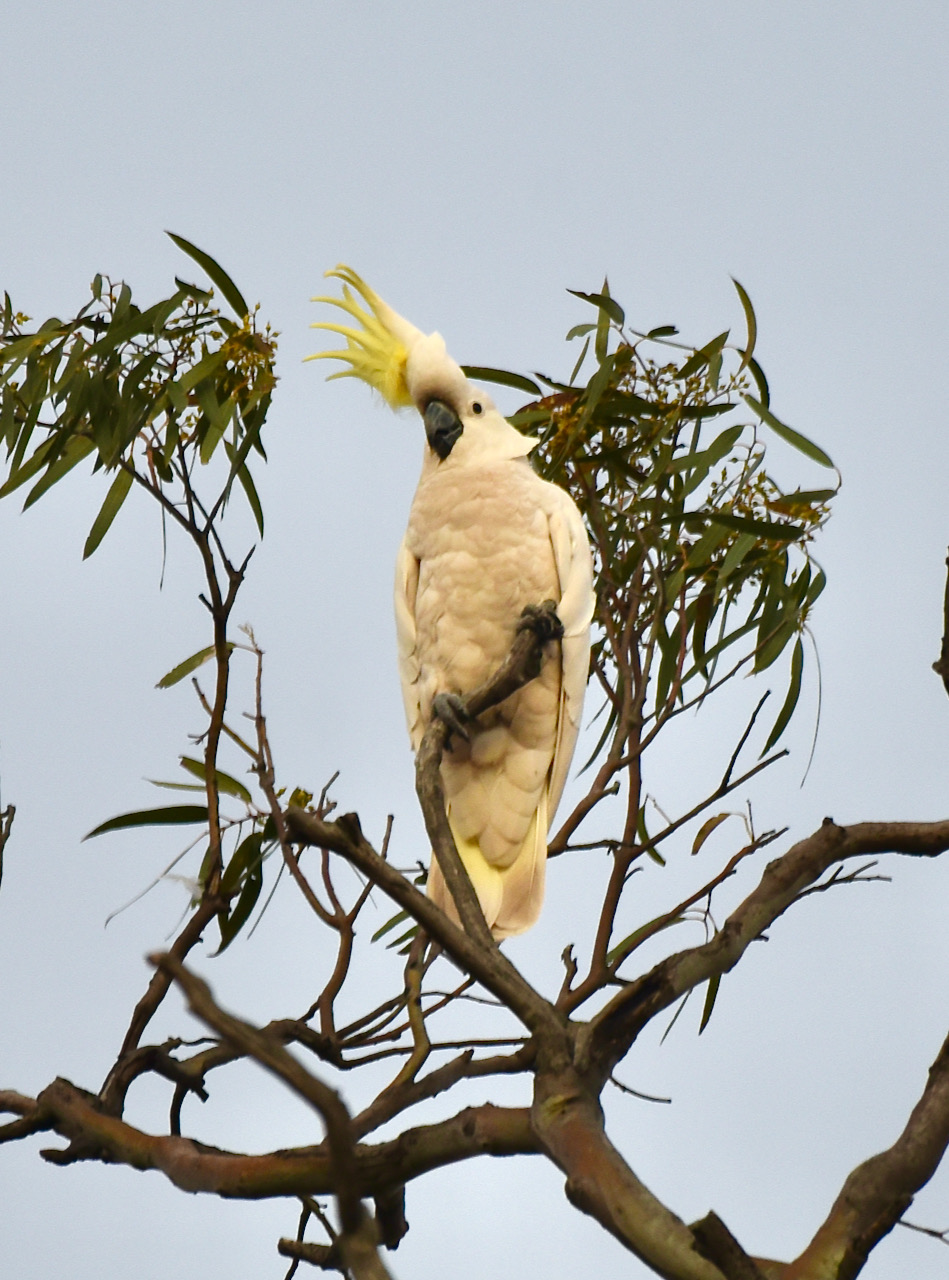
We then drove out to Mundulla and the Mundulla Common hoping to see or hear an endangered Bush Stone Curlew. They are apparently more active on moonlit nights and are more often heard then seen. Sadly we did not see any, but certainly did see and hear plenty of noisy Sulphur Crested Cockatoos.

We then headed back to our motel room. It had been an absolutely brilliant day. Plenty of radio, some sightseeing, and a nice meal.

References.

  1. A Compendium of the Place Names of South Australia, 2021, <https://published.collections.slsa.sa.gov.au/placenamesofsouthaustralia/>, viewed 4th December 2021.
  2. Wikipedia, 2021, <https://en.wikipedia.org/wiki/Wolseley_Common_Conservation_Park>, viewed 4th December 2021.

Custon Conservation Park VKFF-1024

After packing up at Poocher Swamp, Marija and I headed to our second park of the day, the Custon Conservation Park VKFF-1024. The park is located about 298 km southeast of Adelaide and about 27 km southeast of the town of Bordertown.

Above:- Map showing the location of the Custon CP. Map c/o Google maps

Along the way, we stopped to have a look at Wiese’s Horse Dip which was constructed in 1931 by local landholders utilising local timber from bulloak trees. The purpose of the Dip was to control a parasitic itch experienced by the working farm horses, the Clydesdales. The parasitic itch caused great discomfort for the horse’s manes and tails which resulted in them rubbing against fences and thus causing damage.

As a result, the Dip was constructed. Horses were walked into the dip and due to the size of the Clydesdales, the farmers would bucket and sponge a solution over the horses. The Dip was used until the outbreak of the Second World War, and the eventual decline of the use of the Clydesdales.

We drove along Custon Road and crossed over the now disused railway line and we soon reached the park.

Custon Conservation Park is about 64 hectares in size (160 acres) and was established on the 8th day of March 2007. The land originally gained protected area status in 2007, when crown land in section 903 was gazetted as the Custon Conservation Park and was enlarged in 2016 by the addition of additional crown land.

The park consists of grassy woodland of grey box which is listed as ‘endangered in South Australia, with buloke being a co-dominant tree species.

The park takes its name from the town of Custon, which is located about 8 km south of Wolseley, and was proclaimed on the 8th day of December 1881. It was named by Governor Jervois after Reverend William Arthur Purey-Cust (b. 1855. d. 1938).

Prior to the proclamation of the town of Custon, the local railway station was known as ‘University Blocks’. The Custon School opened in 1919 and closed in 1956.

Above:- An aerial view of the Custon Conservation Park. Image c/o Google maps.

I did a little bit of birdwatching and photography from Custon, but I wasn’t overly successful.

Marija and I operated from Custon for about 2 hours and made a total of 94 QSOs including 29 Park to Park contacts.

We operated on the 20, 40, & 80m bands and ran the Yaesu FT857d, 40 watts, and the 20/40/80m linked dipole, inverted vee, supported on the 7-metre telescopic squid pole.

Marija worked the following stations on 40m SSB:-

  1. VK2IO/p (Rouse Hill Regional Park VKFF-2784)
  2. VK3DAC/p (Mount Martha Nature Conservation Reserve VKFF-2152)
  3. VK3LF/p (Gippsland Lakes Coastal Park VKFF-0747)
  4. VK2YAK/p (Tewantin National Park VKFF-1318)
  5. VK4YAK/p (Tewantin National Park VKFF-1318)
  6. VK2EG/p (Talawahl Nature Reserve VKFF-2732)
  7. VK3MKE
  8. VK2EXA
  9. VK2LBL
  10. VK7QP
  11. VK5LN
  12. VK2LX
  13. VK3ZK/p (Echuca Regional Park VKFF-0966)
  14. VK3MPR
  15. VK7DW
  16. VK2GNM
  17. VK1MA
  18. VK3MCD/p (SOTA VK3/ VN-016 & Mount Alexander Regional Park VKFF-0973)
  19. VK3BBB
  20. VK2CCP
  21. VK2IG
  22. VK3AQU/m
  23. VK7JFD
  24. VK1RF/p (Jerrabomba Wetlands Nature Reserve VKFF-0847)
  25. VK4FABN/p (Toohey Forest Conservation Park VKFF-1663)
  26. VK3YSA
  27. VK2HAU/p (Lane Cove National Park VKFF-0281)
  28. VK5WG

Marija worked the following stations on 80m SSB:-

  1. VK3ARH/p (Lake Purrumbete Wildlife Reserve VKFF-2361)
  2. VK3HRA/p (Lake Purrumbete Wildlife Reserve VKFF-2361)
  3. VK5LA
  4. VK3ZK/p (Echuca Regional Park VKFF-0966)
  5. VK5DW

Marija worked the following stations on 20m SSB:-

  1. VK2VW
  2. VK2HFI
  3. VK2HBG
  4. VK6ADF/p (Alexander Morrison National Park VKFF-0002)
  5. VK4KC
  6. VK4MAD
  7. VK4DOG
  8. VK2MG
  9. VK2IO/p (Rouse Hill Regional Park VKFF-2784)
  10. VK6UG
  11. VK4HNS
  12. VK2NP
  13. VK6JK

I worked the following stations on 40m SSB:-

  1. VK2IO/p (Rouse Hill Regional Park VKFF-2784)
  2. VK5GY/m
  3. VK2VW
  4. VK2HFI
  5. VK3DAC/p (Mount Martha Nature Conservation Reserve VKFF-2152)
  6. VK3LF/p (Gippsland Lakes Coastal Park VKFF-0747)
  7. VK2EXA
  8. VK2LEE
  9. VK2YAK/p (Tewantin National Park VKFF-1318)
  10. VK4YAK/p (Tewantin National Park VKFF-1318)
  11. VK2NP
  12. VK2PKT
  13. VK2EG/p (Talawahl Nature Reserve VKFF-2732)
  14. VK3FRC
  15. VK7WUU
  16. VK5FANA
  17. VK2IG
  18. VK7QP
  19. Vk3MPR
  20. VK3MCD/p (SOTA VK3/ VN-016 & Mount Alexander Regional Park VKFF-0973)
  21. VK7JFD
  22. VK2LX
  23. VK1RF/p (Jerrabomberra Wetlands Nature Reserve VKFF-0847)
  24. VK3MKE
  25. VK4FABN/p (Toohey Forest Conservation Park VKFF-1663)
  26. VK3YSA
  27. VK3AQU/m
  28. VK3GMC
  29. VK2HAU/p (Lane Cove National Park VKFF-0281)
  30. VK5WG

I worked the following stations on 80m SSB:-

  1. VK3ARH
  2. VK5LA
  3. VK3ZK/p (Echuca Regional Park VKFF-0966)
  4. VK5DW

I worked the following stations on 20m SSB:-

  1. VK2VW
  2. VK2HFI
  3. VK2HBG
  4. VK6ADF/p (Alexander Morrison National Park VKFF-0002)
  5. VK4KC
  6. VK4MAD
  7. VK4DOG
  8. VK2MG
  9. VK2IO/p (Rouse Hill Regional Park VKFF-2784)
  10. VK6UG
  11. VK4HNS
  12. VK2NP
  13. VK6JK
  14. JF7RJM

References.

  1. A Compendium of the Place Names of South Australia, 2021, <https://published.collections.slsa.sa.gov.au/placenamesofsouthaustralia/>, viewed 4th December 2021.
  2. Wikipedia, 2021, <https://en.wikipedia.org/wiki/Custon_Conservation_Park>, viewed 4th December 2021

Poocher Swamp Game Reserve VKFF-1741

It was now Saturday morning (27th November 2021) and the first day of the 2021 VKFF Activation Weekend. After a shower in the motel room, Marija and I headed to one of the local service stations for some breakfast.

After breakfast, we headed to the first of three parks we intended to activate during the day, the Poocher Swamp Game Reserve VKFF-1741. I had activated this park previously, but this was to be a first-time activation for Marija.

Poocher Swamp is located about 270 km southeast of Adelaide, and about 9 km west of the town of Bordertown, in the southeast of South Australia, not far from the South Australia/Victoria State border.

Above:- Map showing the location of Poocher Swamp. Map c/o Google maps

The park can be accessed via Cannawigara Road. The park is well signposted and there is a large car parking area at the park.

Poocher Swamp Game Reserve is about 77 hectares in size and was proclaimed on the 14th day of November 1985.

Declaration of Poocher Swamp from the SA Govt Gazette.

The town of Bordertown relies on a groundwater supply that is refilled by water draining through the two major runaway holes at Poocher Swamp. The water flows through a hidden underground network of limestone cavities leading to an aquifer.

Above:- An aerial view of Poocher Swamp. Image c/o Google maps.

Birds SA have recorded a total of 85 species of bird at Poocher Swamp including Grey Teal, Pacific Black Duck, Black-tailed Nativehen, Galah, Red-rumped Parrot, Australian Magpie, White-plumed Honeyeater, and Magpielark.

During our visit to the park, we observed numerous Sulphur Crested Cockatoos and Galahs.

There was also a large population of Striated Pardalotes. They are beautiful little birds with a white eyebrow with a yellow spot in front of the eye. They have a black crown which has fine white stripes.

As it was summer, the two runaways were bone dry during our visit. During the 1950s, numerous levee banks were created in Poocher Swamp to impound water and attract birdlife. The swamp fills from Tatiara Creek.

The overflow from Poocher Swamp flows westwards and a series of runaway holes which includes Scotwn’s Runaway Hole.

The video below shows Poocher Swamp when full of water.

Poocher Swamp is home to numerous native plants and animals. Apart from the magnificent Red Gums, the park is home to four plants that are listed as rare in South Australia.

Also located in the park is a large tree, which has now partially collapsed. Known as the Pinkie tree, it was used as a shelter.

You can also view the ‘washpool’ where aboriginal women washed wool in the various pools near station shearing sheds.

The video below includes information on Poocher Swamp and the surrounding area.

We set up just inside the gate at the park. We ran the Yaesu FT-857d , 40 watts, and the 20/40/80m linked dipole for this activation.

Marija and I spent about 3 hours on air at Poocher Swamp. All up we made a total of 122 QSOs and this included 60 Park to Park contacts.

The majority of our contacts were on the 40m band, although we did make some contacts on 80m and 20m. Contacts were made into VK2, VK3, VK4, VK5, VK6, VK7, and New Zealand.

Marija worked the following stations on 40m SSB before the UTC rollover:-

  1. VK2IO/p (Rouse Hill Regional Park VKFF-2784)
  2. VK3OAK/p (Lake Aringa Wildlife Reserve VKFF-2355)
  3. VK2MET/ (Worimi National Park VKFF-0614)
  4. VK2TER/p (Bouddi National Park VKFF-0049)
  5. VK2YAK
  6. VK4YAK
  7. VK4AAC/p (Axedale Nature Conservation Reserve VKFF-2037)
  8. VK2VH/p (Axedale Nature Conservation Reserve VKFF-2037)
  9. VK3SQ
  10. VK2DG
  11. VK3MPR
  12. VK3OF
  13. VK3ARH
  14. VK3HRA
  15. VK5QI
  16. VK5PE
  17. VK5IS
  18. VK3EJS
  19. VK3ZK/p (Echuca Regional Park VKFF-0966)
  20. VK5MRE
  21. VK2PKT
  22. VK3XV/p (Black Range State Park VKFF-0751)
  23. VK2KNV/m
  24. VK5FANA
  25. VK3PF/p (Churchill National Park VKFF-0621)
  26. VK2XSE/m
  27. VK5PET/p (Bullock Hill Conservation Park VKFF-0873)
  28. VK5KLV
  29. VK7QP

Marija worked the following stations on 40m SSB after the UTC rollover:-

  1. VK3VIN
  2. VK5ZSH
  3. VK3EJS
  4. VK3MCA/p (Paddys Ranges State Park VKFF-0772)
  5. VK3FIMD
  6. VK5PL
  7. VK3ACZ
  8. VK3LF/p
  9. VK2TER/p (Bouddi National Park VKFF-0049)
  10. VK3DCQ/p
  11. VK3DAC/p (Mount Martha Nature Conservation Reserve VKFF-2152)
  12. VK3PF/p (Churchill National Park VKFF-0621)
  13. VK4AAC/p (Axedale Nature Conservation Reserve VKFF-2037)
  14. VK2VH/p (Axedale Nature Conservation Reserve VKFF-2037)
  15. VK3MKE
  16. VK6POP/p (Avon Valley National Park VKFF-0008)
  17. VK2BYF/p (Jerrawangala National Park VKFF-0248)
  18. VK2KNV/p (Buckingbong Flora Reserve VKFF-3049)
  19. VK2XSE/p (Buckingbong Flora Reserve VKFF-3049)
  20. VK3KXR/p (Salt Lagoon-St Leonards Wildlife Refuge VKFF-2432)
  21. VK5CZ/p (Warrenben Conservation Park VKFF-0818)
  22. VK3LF/p (Gippsland Lakes Coastal Park VKFF-0747)
  23. VK4AAC/p (Mount Sugarloaf Nature Conservation Reserve VKFF-2158)
  24. VK2VH/p (Mount Sugarloaf Nature Conservation Reserve VKFF-2158)
  25. VK3BCM/p (SOTA VK3/ VC-040)
  26. VK3OAK/p (Pretty Hill Flora Reserve VKFF-2424)
  27. VK3AWA/p (Fryers Ridge Nature Conservation Reserve VKFF-2091)
  28. VK3TV/p (Fryers Ridge Nature Conservation Reserve VKFF-2091)

Marija worked the following stations on 20m SSB:-

  1. VK2IO/p (Rouse Hill Regional Park VKFF-2784)
  2. VK2TER/p (Bouddi National Park VKFF-0049)
  3. ZL1TM

I worked the following stations on 40m SSB before the UTC rollover:-

  1. VK2IO/p (Rouse Hill Regional Park VKFF-2784)
  2. VK2KYO
  3. VK5IS
  4. VK2DJP
  5. VK3BBB
  6. VK2CCP
  7. VK3SQ
  8. VK7QP
  9. VK5PE
  10. VK5LA
  11. VK3OAK/p (Lake Aringa Wildlife Reserve VKFF-2355)
  12. VK2MET/p (Worimi National Park VKFF-0614)
  13. VK2TER/p (Bouddi National Park VKFF-0049)
  14. VK3ZK/p (Echuca Regional Park VKFF-0966)
  15. VK3XV/p (Black Range State Park VKFF-0751)
  16. VK3PF/p (Churchill National Park VKFF-0621)
  17. VK5PET/p (Bullock Hill Conservation Park VKFF-0873)

I worked the following stations on 40m after the UTC rollover:-

  1. VK3MCA/p (Paddys Ranges State Park VKFF-0772)
  2. VK3DAC/p (Mount Martha Nature Conservation Reserve VKFF-2152)
  3. VK3PF/p (Churchill National Park VKFF-0621)
  4. VK4AAC/p (Axedale Nature Conservation Reserve VKFF-2037)
  5. VK2VH/p (Axedale Nature Conservation Reserve VKFF-2037)
  6. VK3MCK
  7. VK3JP
  8. VK3CA
  9. VK3ZH/p
  10. VK3KK/p
  11. VK3VIN
  12. VK3DQW
  13. VK3PDG
  14. VK3FIMD
  15. VK6POP/p (Avon Valley National Park VKFF-0008)
  16. VK5FD
  17. VK3VRA
  18. VK5KSW
  19. VK7ME
  20. VK2BYF/p (Jerrawangala National Park VKFF-0248)
  21. VK2XSE/p (Buckingbong Flora Reserve VKFF-3049)
  22. VK2KNV/p (Buckingbong Flora Reserve VKFF-3049)
  23. VK3KXR/p (Salt Lagoon-St Leonards Wildlife Refuge VKFF-2432)
  24. VK5CZ/p (Warrenben Conservation Park VKFF-0818)
  25. VK3LF/p (Gippsland Lakes Coastal Park VKFF-0747)
  26. VK4AAC/p (Mount Sugarloaf Nature Conservation Reserve VKFF-2158)
  27. VK2VH/p (Mount Sugarloaf Nature Conservation Reserve VKFF-2158)
  28. VK5LA
  29. VK5PET/p (Bullock Hill Conservation Park VKFF-0873)
  30. VK3MPR
  31. VK3JP
  32. VK4BXX
  33. VK3BCM/p (SOTA VK3/ VC-040
  34. VK3OAK/p (Pretty Hill Flora Reserve VKFF-2424)
  35. VK3AWA/p (Fryers Ridge Nature Conservation Reserve VKFF-2091)
  36. VK3TV/p (Fryers Ridge Nature Conservation Reserve VKFF-2091)
  37. VK2VBW
  38. VK2HFI
  39. VK3WTS

I worked the following stations on 20m SSB:-

  1. VK2IO/p (Rouse Hill Regional Park VKFF-784)
  2. VK2TER/p (Bouddi National Park VKFF-0049)
  3. ZL1TM
  4. VK6POP/p (Avon Valley National Park VKFF-0008)

I worked the following stations on 80m SSB:-

  1. VK5HAA/p (Mount Panorama Native Forest Reserve VKFF-2891)
  2. VK5LA

References.

  1. Aberdour and Mount Monster Conservation parks, Desert Camp Conservation Reserve and Poocher Swamp Game Reserve Management Plan, 1997.
  2. Birdlife Australia, 2021, <https://www.birdlife.org.au/bird-profile/striated-pardalote>, viewed 4th December 2021.
  3. Birds SA, 2021, <https://birdssa.asn.au/location/poocher-swamp-game-reserve/>, viewed 4th December 2021.
  4. Bordertown Chronicle, 2021, <https://www.borderchronicle.com.au/story/4936482/poocher-swamp-a-sight-to-be-seen/>, viewed 4th December 2021.
  5. Wikipedia, 2021, <https://en.wikipedia.org/wiki/Poocher_Swamp_Game_Reserve>, viewed 4th December 2021.