
After leaving Ellerslie Nature Reserve on Saturday, 1st November 2026, Marija and I drove south along Hume Highway until we reached the town of Tarcutta.
The explorers Hume and Hovell were the first known Europeans in the Tarcutta district as they passed through the area on their way from Sydney to Port Phillip. (Wikipedia 2025)
In c. 1835, a slab house called ‘Hambledon’ was erected at Tarcutta and became the first inn and post office to be built between Gundagai and Albury. The town of Tarcutta was proclaimed on the 28th day of October 1890. (Wikipedia 2025)
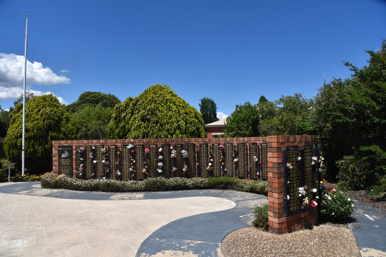
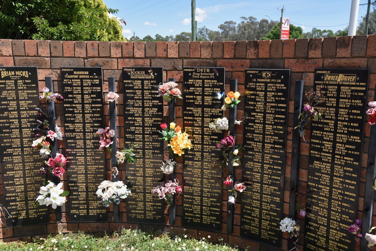
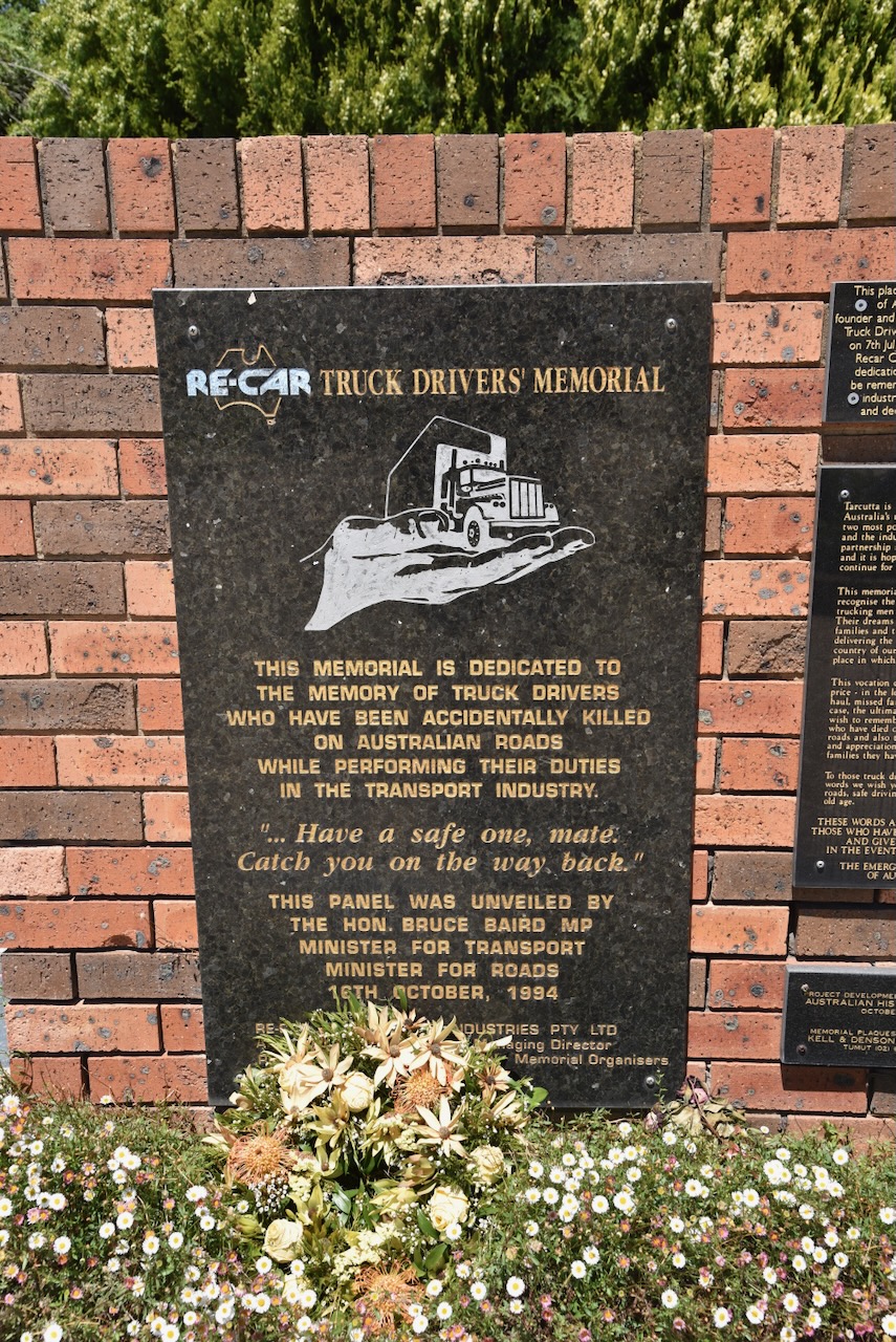
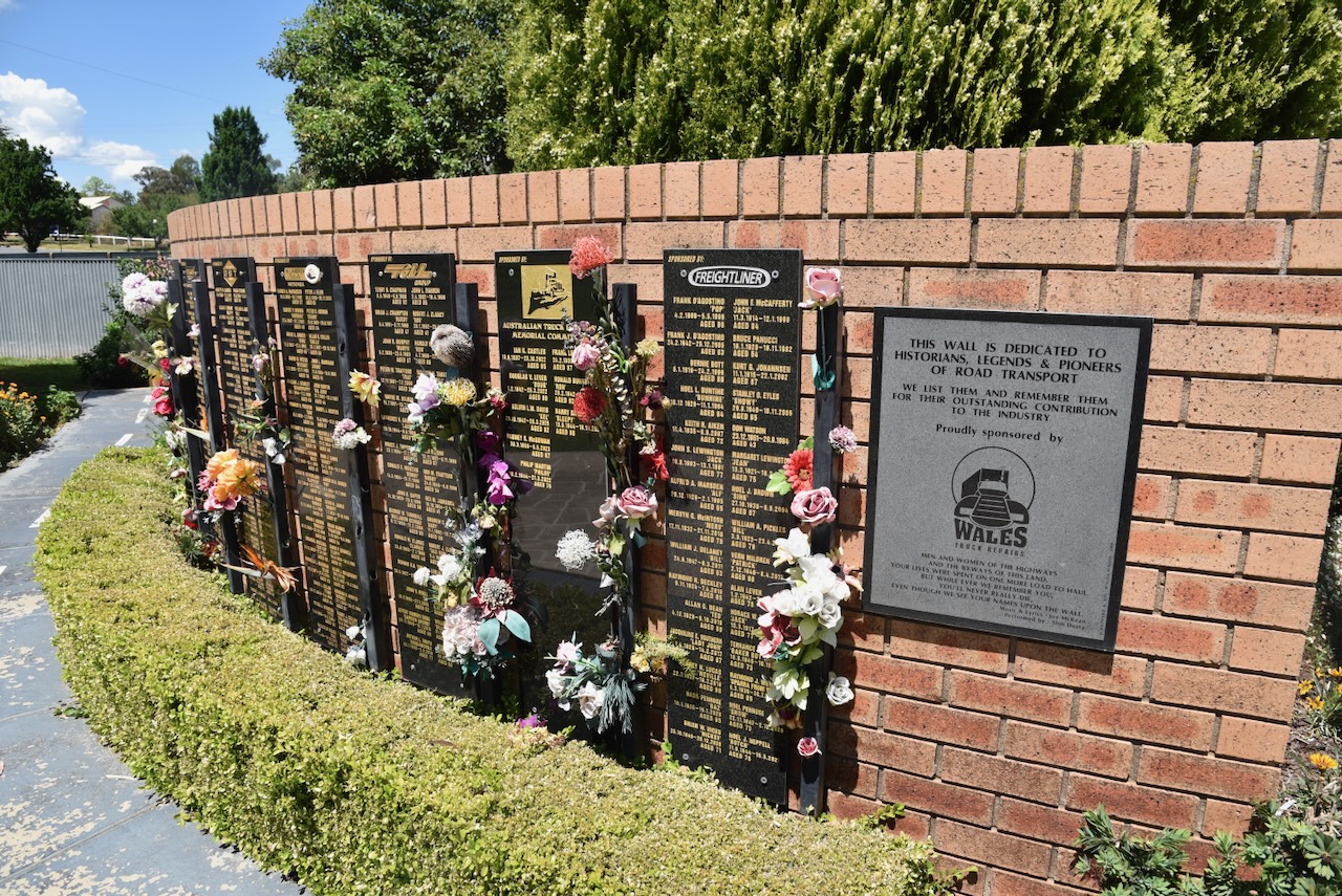
Tarcutta is the home of the Australian Truck Drivers Memorial. The memorial features a memorial brick wall, which features memorial plaques of truck drivers who have been killed whilst at work. The memorial was founded in 1994 by Ronny Pullen. The site for the memorial was chosen as the town of Tarcutta has a long association with the transport industry. The memorial was located on the side of the busy Hume Highway, until the Tarcutta Bypass was established in 2011. (UBC Web Design 2026)
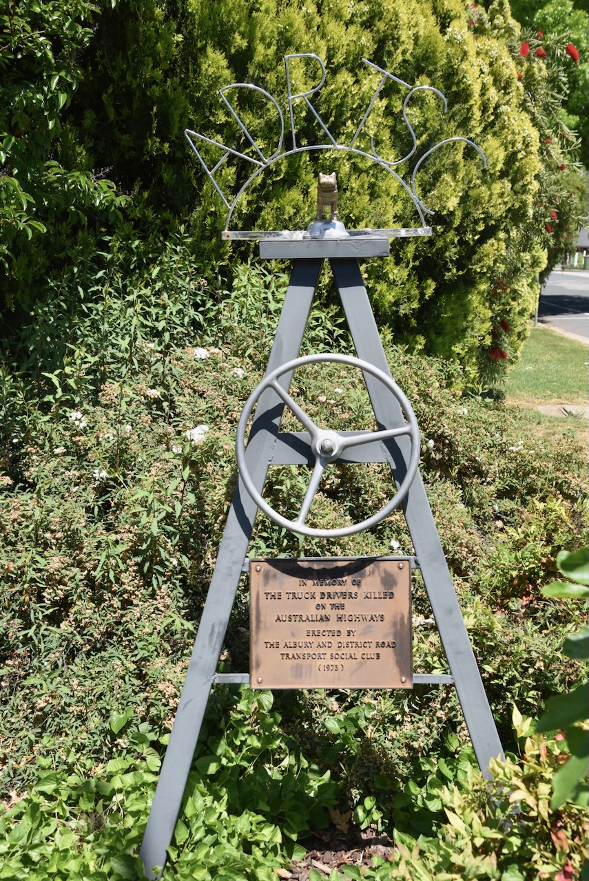
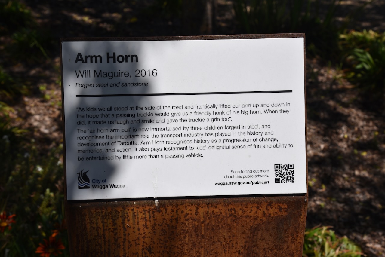
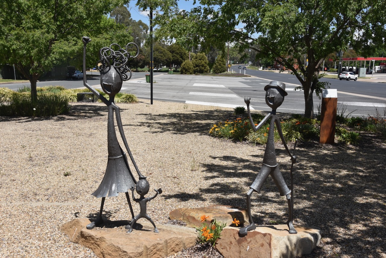
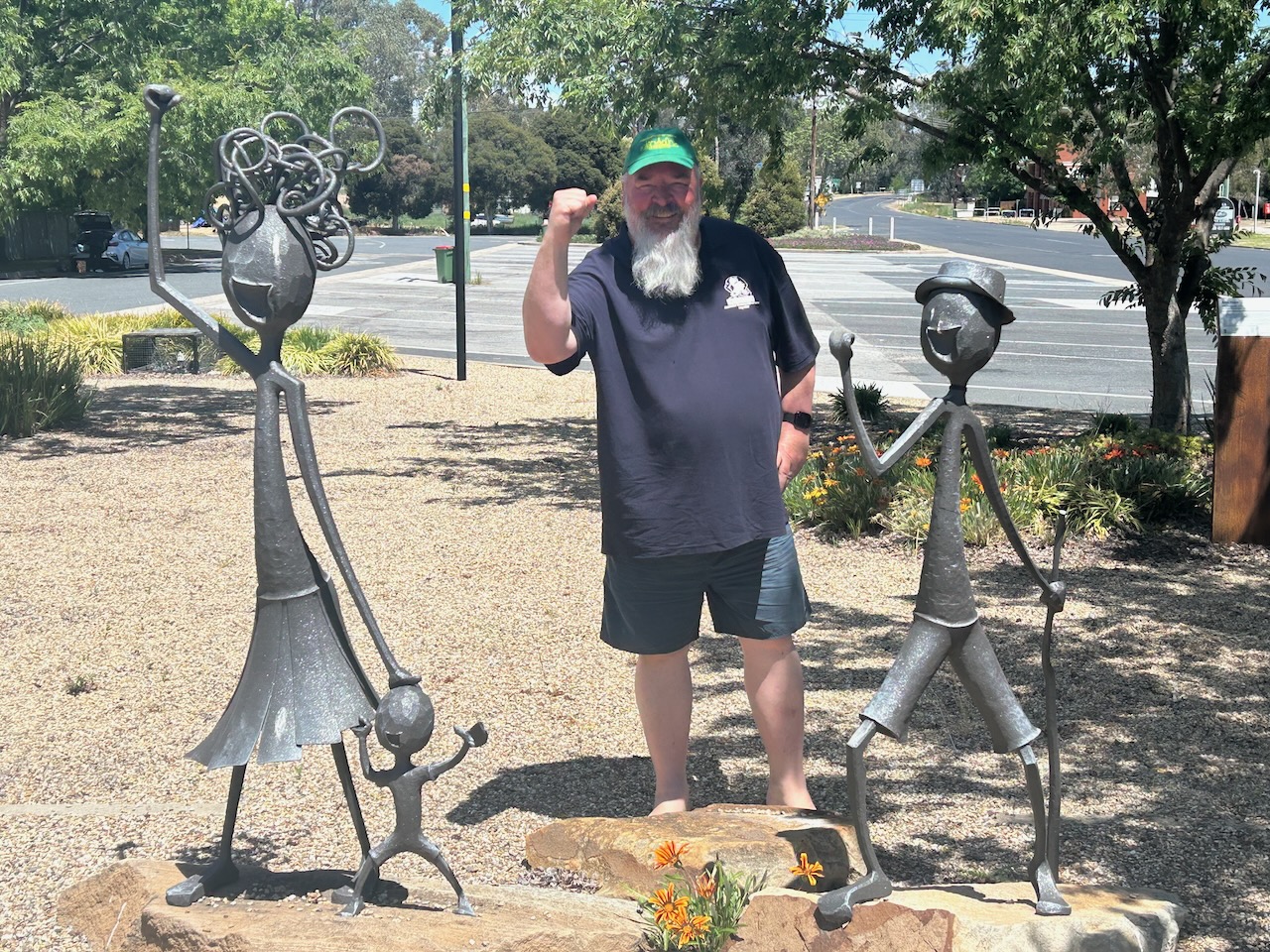
Across the road is the ‘Arm Horn’ sculptures. I am sure most people in Australia can remember as children, standing on the side of a road, gesturing to truckies to honk their horns by lifting their arm up and down.
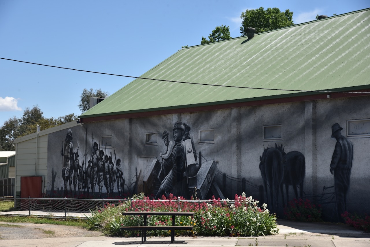
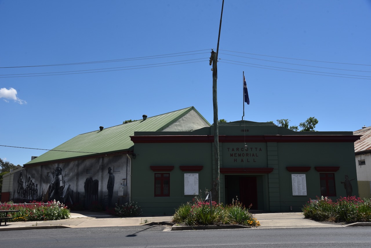
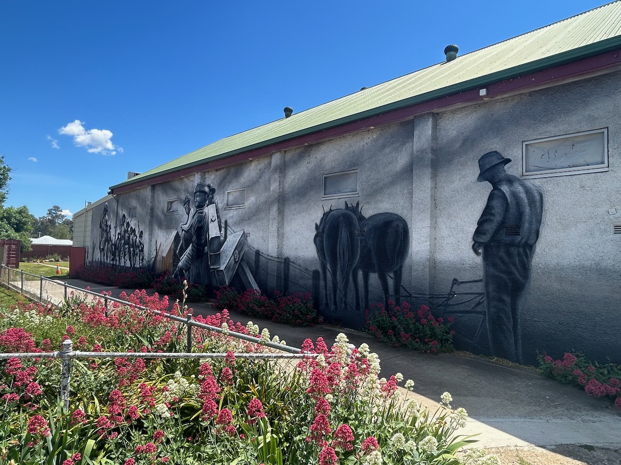
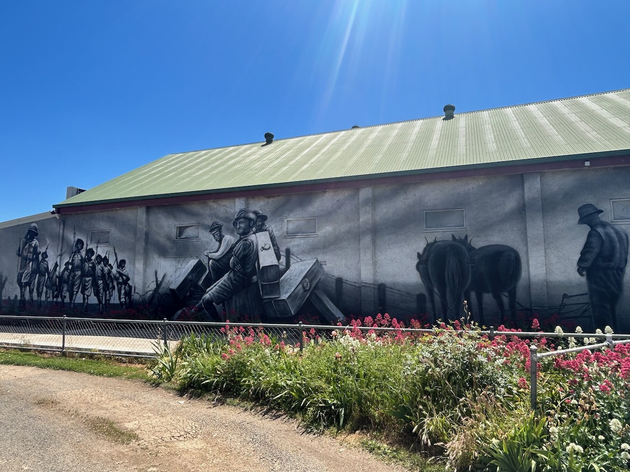
The Tarcutta Memorial Hall features a mural of the district’s military and soldier history. It is the work of Adelaide-based artist Sam Brooks. It was officially opened on ANZAC Day in 2021. (Nsw.gov.au 2021)
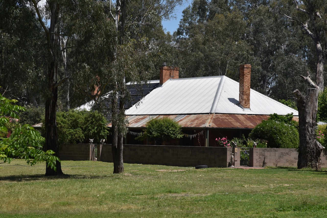
A remaining historic building in Tarcutta is the former Tarcutta Inn, which was built in c. 1836. It was used as a Cobb & Co coach change station. (Chirp Internet 2026)
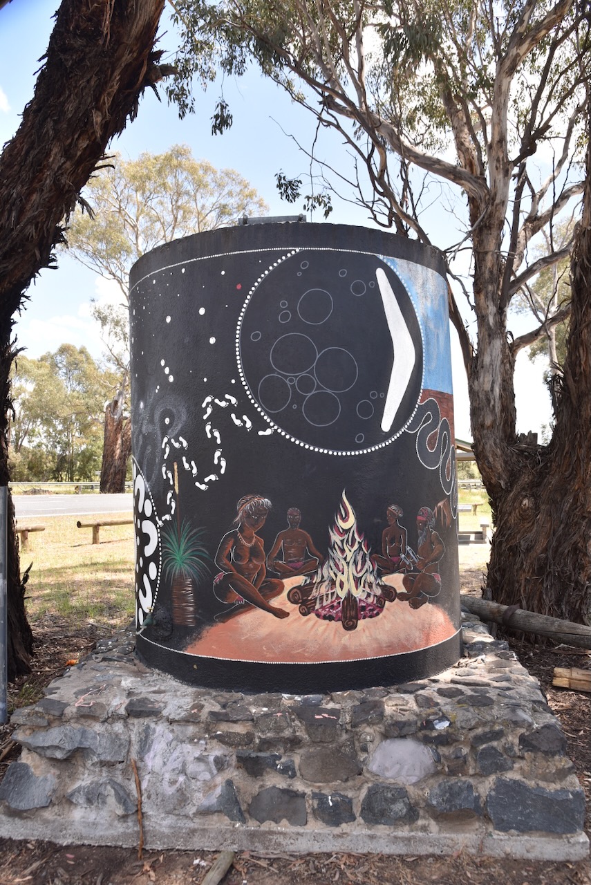
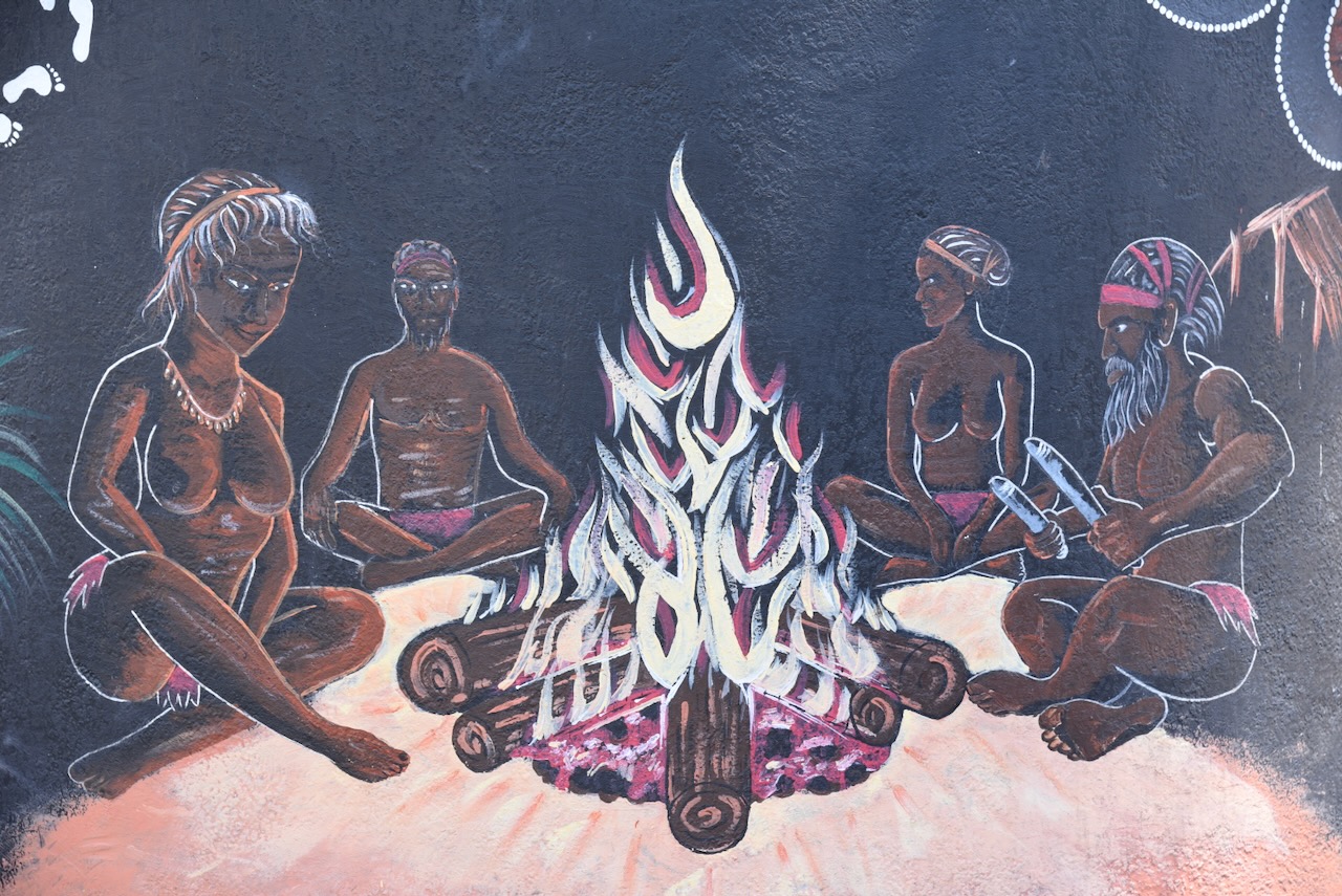
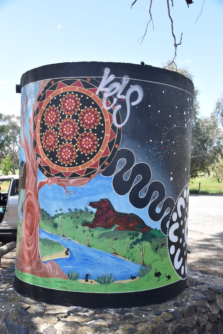
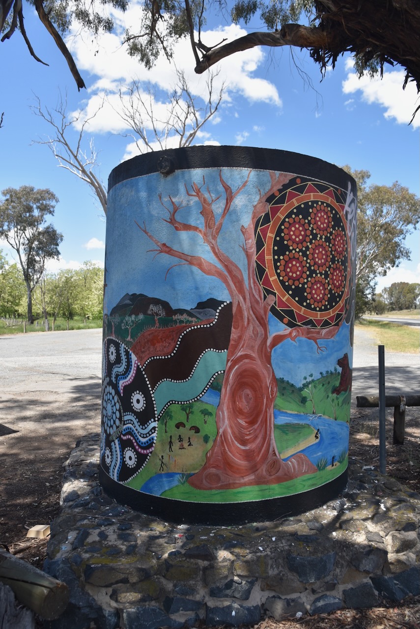
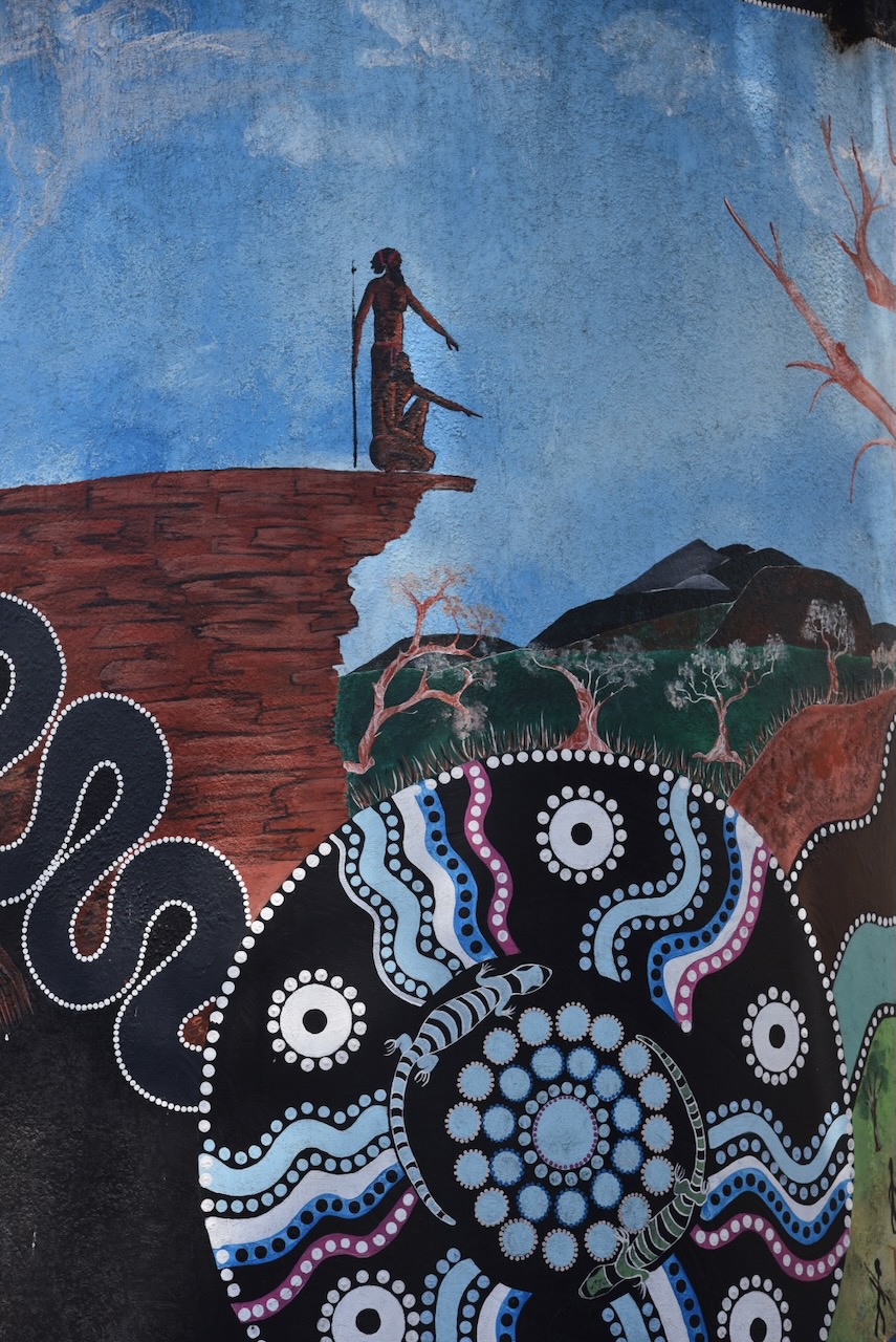
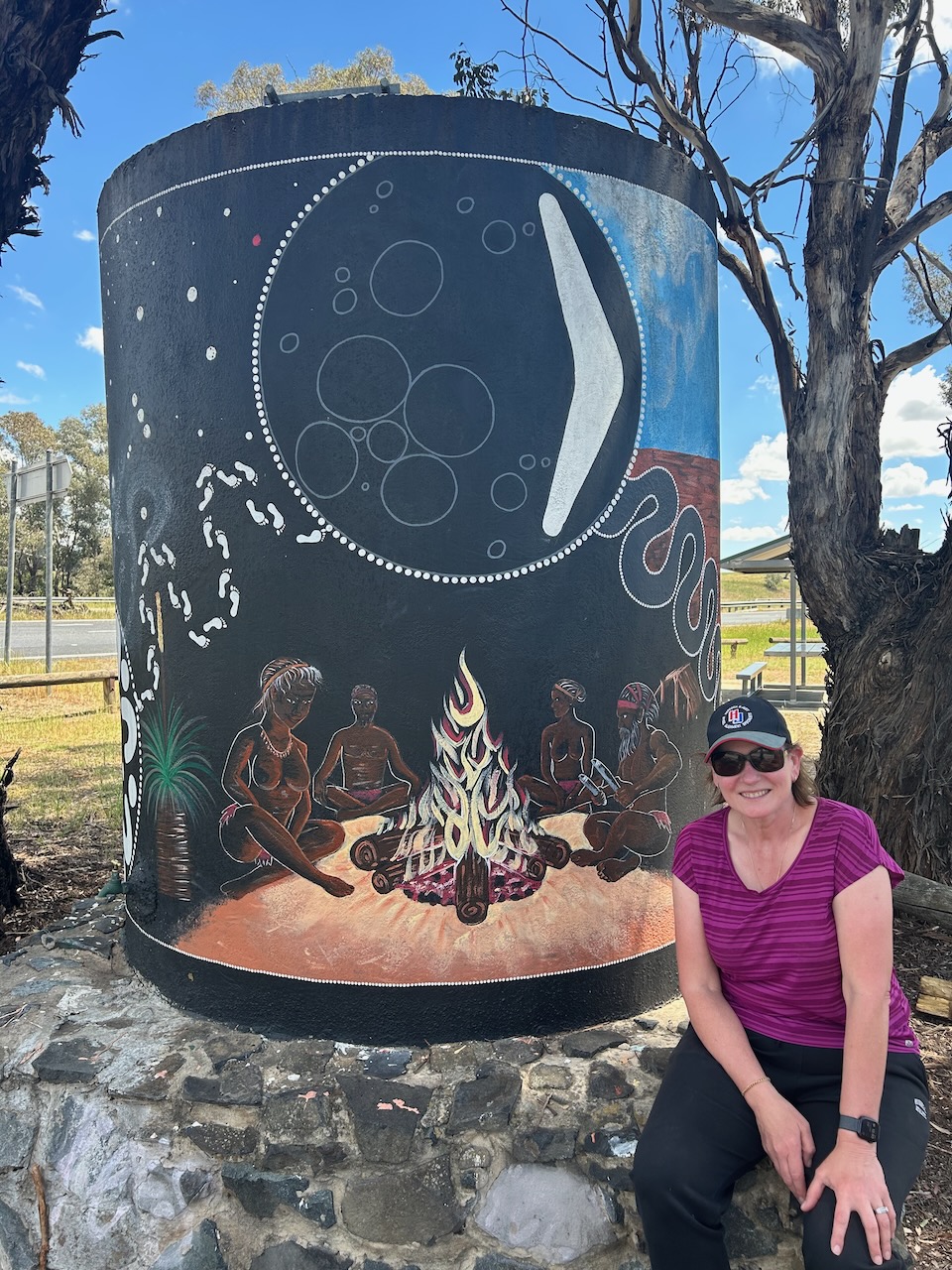
Marija and I then left Tarcutta and headed along the Hume Highway. Our next stop was the Tarcutta Water Tank art at the Kilgowlah Rest Area. It was painted in 2020 by Peter and Samara Ingram. The murals on the water tank feature various Aboriginal scenes. (Australiansiloarttrail.com 2026)
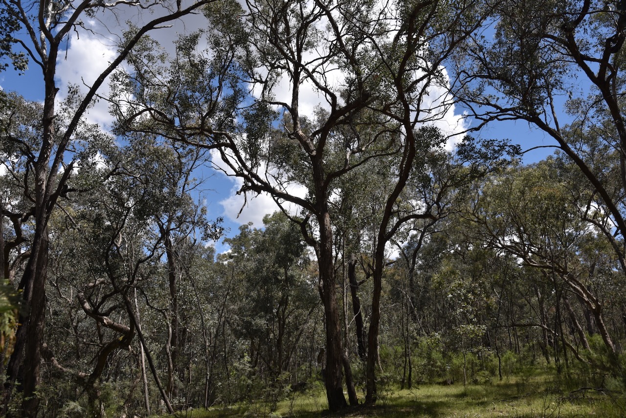
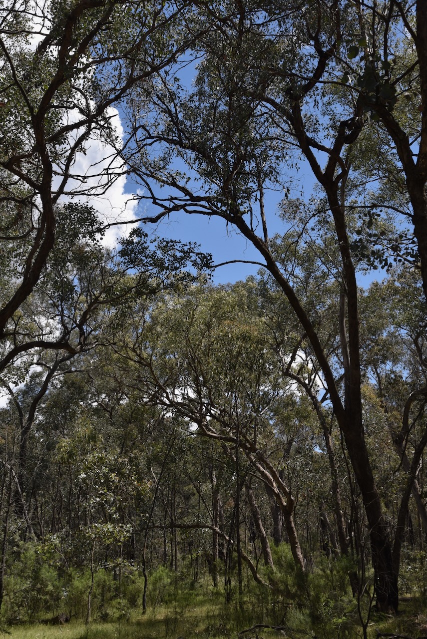
We continued south on the Hume Highway and then took Tumbarumba Road and soon reached the Murraguldrie Flora Reserve VKFF-3076.
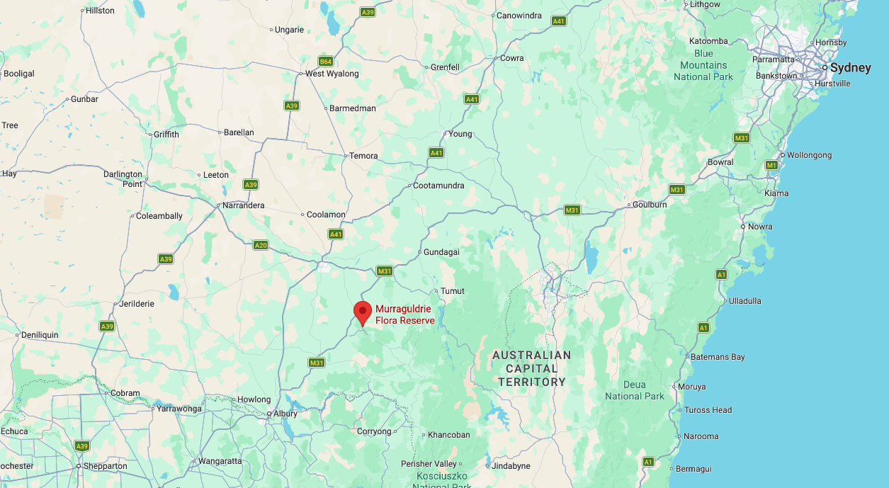
Above: Map showing the location of the Murraguldrie Flora Reserve. Map c/o Google maps
The reserve is located on the eastern side of Tumbarumba Road. A portion of the reserve’s northern boundary is located on Humula Eight Mile Road. It is located in the district of Kyeamba, which is a Wiradjuri Aboriginal word for ‘forehead band.’ The reserve’s eastern boundary adjoins the district of Humula. (Wagga Wagga 2000) (Wikipedia 2024)
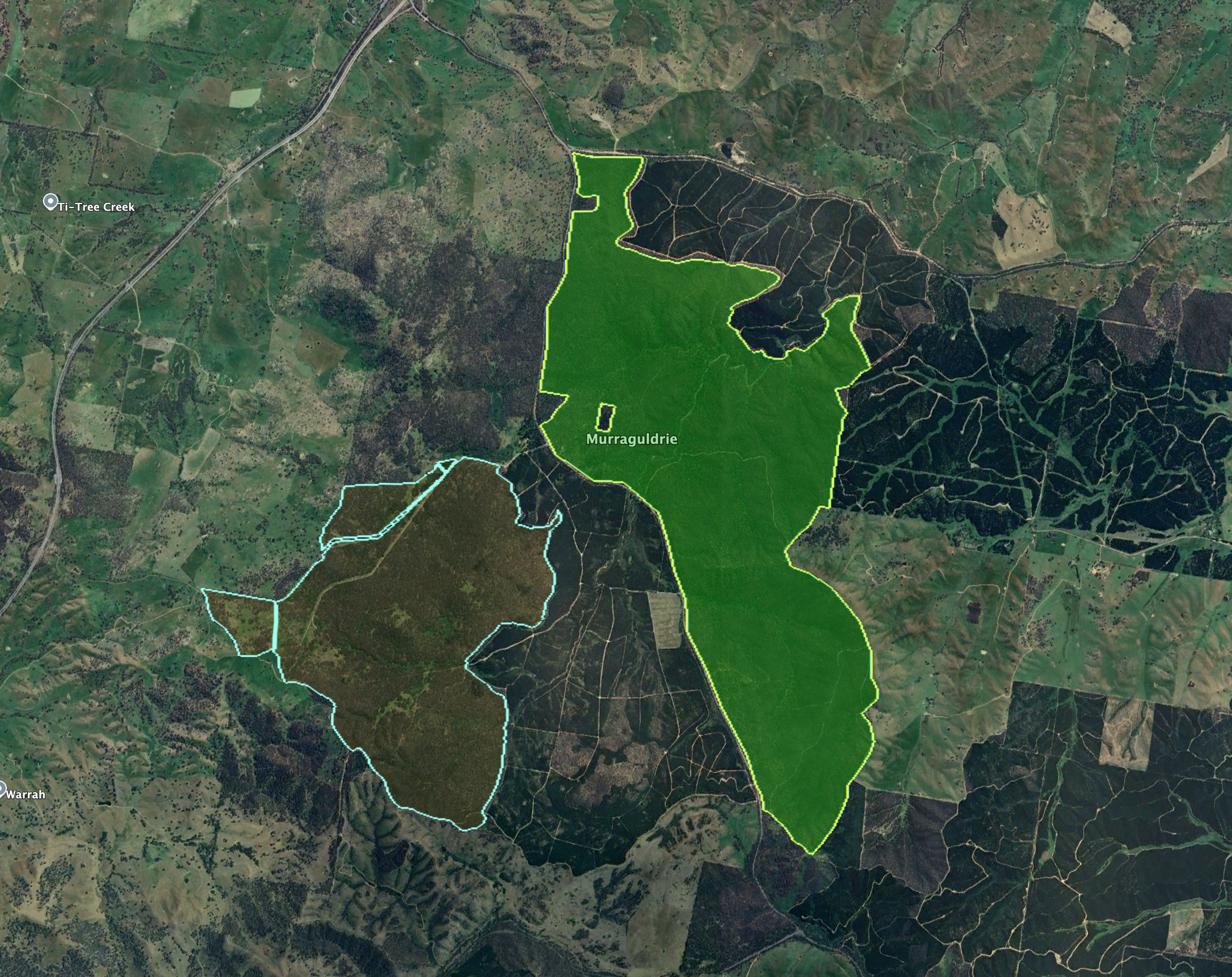
Above: An aerial view of the reserve showing its boundaries. Image c/o Google Earth
Humula was originally known as American Yards, part of the Humula run, which was taken up in the 1850s by William Walker & Co. of Sydney. Gold was discovered in the Humula district in November 1851 by a shepherd. As a result, large numbers of people flocked to the area, including a large number of Chinese. It was called American Yards due to the gold prospectors who came to the district from the California gold fields and building horse yards in the American Corral style. In 1878, a provisional school was established at American Yards. In March 1885, Humula was proclaimed as a town. (Wagga Wagga 2000)
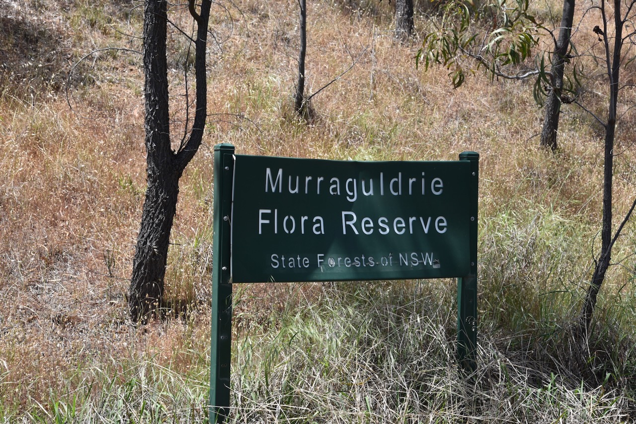
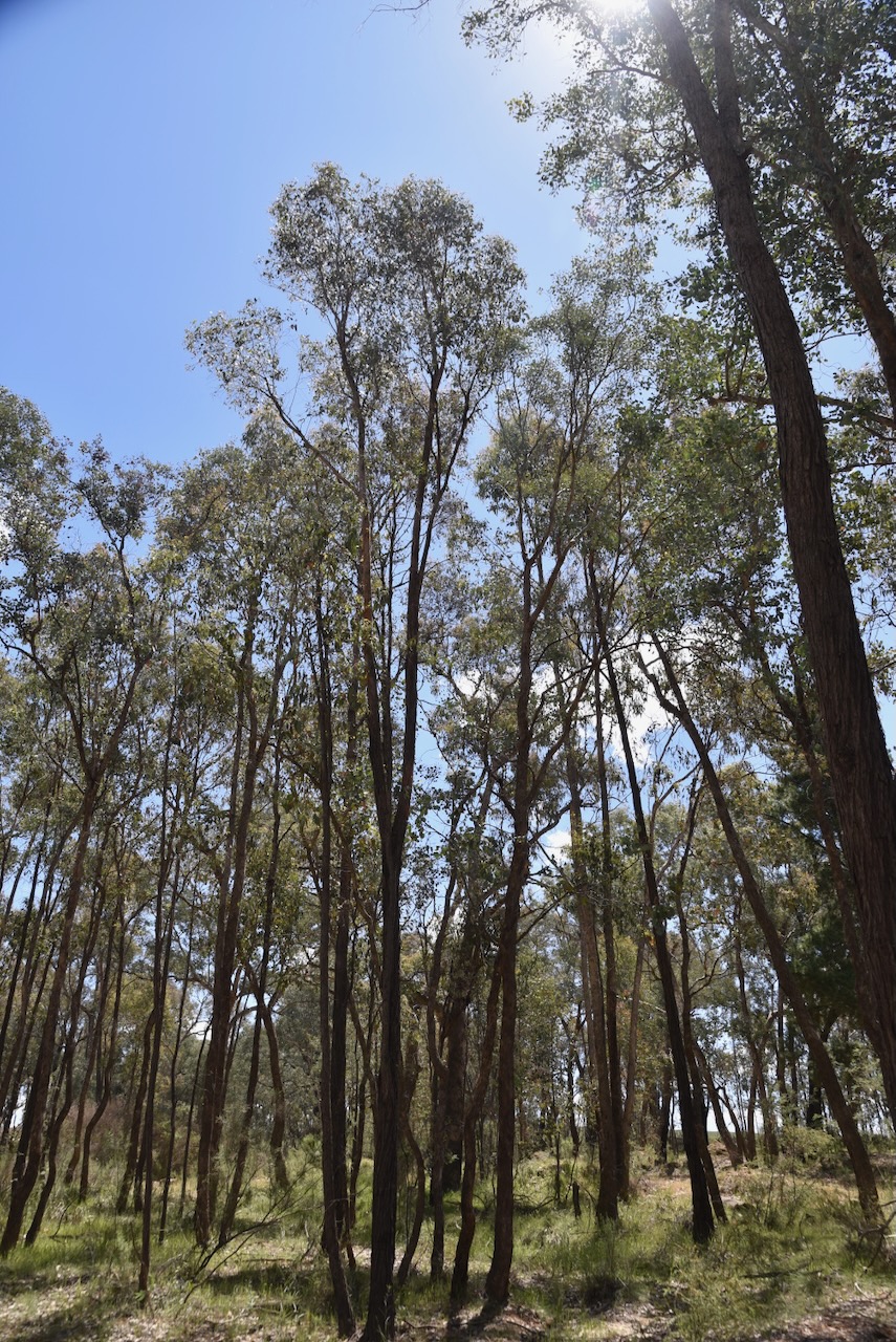
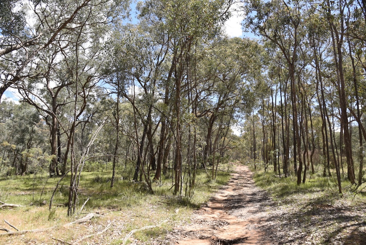
The reserve is about 1,520 hectares in size and was established on the 1st day of January 2001. The reserve includes the endangered White Box Yellow Box Blakely’s Red Gum Woodland. Vulnerable bird species found in the park include Turquoise Parrot, Speckled Warbler, and Brown Treecreeper. Squirrel Gliders, which are listed as endangered, can be found in the reserve. (CAPAD 2024) (Forests NSW n.d.)
Marija worked the following stations on 40m SSB:-
- VK3WSG
- VK3UH
- VK3APJ
- VK2NP
- VK1JV
- VK1MA
- VK2IO/P (VKFF-0865)
- VK2GEZ/P (VKFF-0865)
- VK1AD/P (VKFF-0840)
- VK1NAM/P (VKFF-0840)
- VK3CLD
- VK5QA
- VK2DBF
- VK3PF (VKFF-4549)
- VK3KAI (VKFF-4549)
- VK1CHW/P (VKFF-1775)
- VK2CHW/P (VKFF-1775)
I worked the following stations on 40m SSB:-
- VK3WSG
- VK3UH
- VK3APJ
- VK2NP
- VK1JV
- VK1MA
- VK2IO/P (VKFF-0865)
- VK2GEZ/P (VKFF-0865)
- VK1AD/P (VKFF-0840)
- VK1NAM/P (VKFF-0840)
- VK3CLD
- VK5QA
- VK2DBF
- VK3GJG
- VK3PF (VKFF-4549)
- VK3KAI (VKFF-4549)
- VK1AO
- VK2MET
- VK5LA
- VK5KAW
- VK1JIM
- VK2TER
- VK2BM
- VK2QRP
- VK1RT
- VK1MCW
- VK1QRP
- VK3KLI
- VK7AN
- VK3YSA
- VK3BWS
- VK3ZSC
- VK3BDW
- VK2DA
- VK1DA
- VK1CHW/P (VKFF-1775)
- VK2CHW/P (VKFF-1775)
- VK3ACZ
- VK3ZPF
- VK3JW
- VK3PJF
- VK5HS
- VK2PKT
- VK2KFT
- VK2VH
- VK4AAC
- VK2VW
- VK2HFI
- VK2AKA
- VK2BUG
References.
- Chirp Internet (2026). Former Old Tarcutta Inn in Tarcutta < New South Wales | Gday Pubs – Enjoy our Great Australian Pubs. [online] Gdaypubs.com.au. Available at: https://www.gdaypubs.com.au/NSW/tarcutta/50179/former-old-tarcutta-inn.html#google_vignette [Accessed 13 Mar. 2026].
- Forests NSW, n.d. Murraguldrie Flora Reserve Bo. 179 Working Plan
- Nsw.gov.au. (2021). Tarcutta Memorial Hall Mural | NSW War Memorials Register. [online] Available at: https://www.warmemorialsregister.nsw.gov.au/memorials/tarcutta-memorial-hall-mural [Accessed 13 Mar. 2026].
- UBC Web Design (2026). Australian Truck Drivers Memorial | Monument Australia. [online] Monumentaustralia.org. Available at: https://www.monumentaustralia.org/themes/disaster/land_transport/display/23389-australian-truck-drivers-memorial [Accessed 13 Mar. 2026].
- Wagga Wagga City Council, 2000, Rural Heritage Study Volume 1: The Study
- Wikipedia Contributors (2025). Tarcutta. Wikipedia.
- Wikipedia Contributors (2024). Kyeamba, New South Wales. Wikipedia.
