Finley silo VK-FNY2

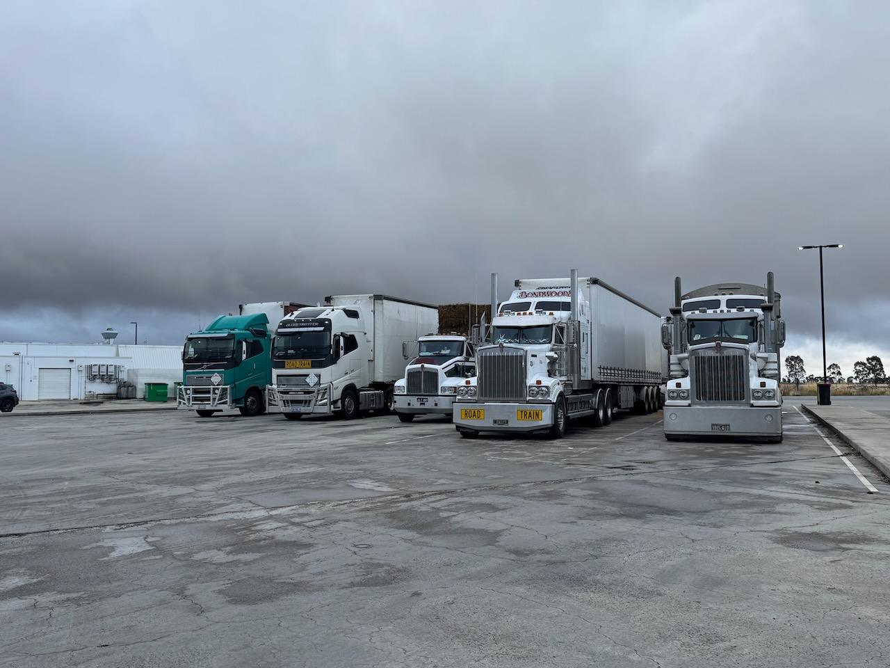
Our start for Tuesday, 4th day of November 2025, was breakfast at the BP Truckstop at Jeridlerie. We enjoyed a very nice breakfast. We also purchased a toy truck for our grandson, Flynn.

A sign that good food is served at truck stops is the number of trucks in the car park.

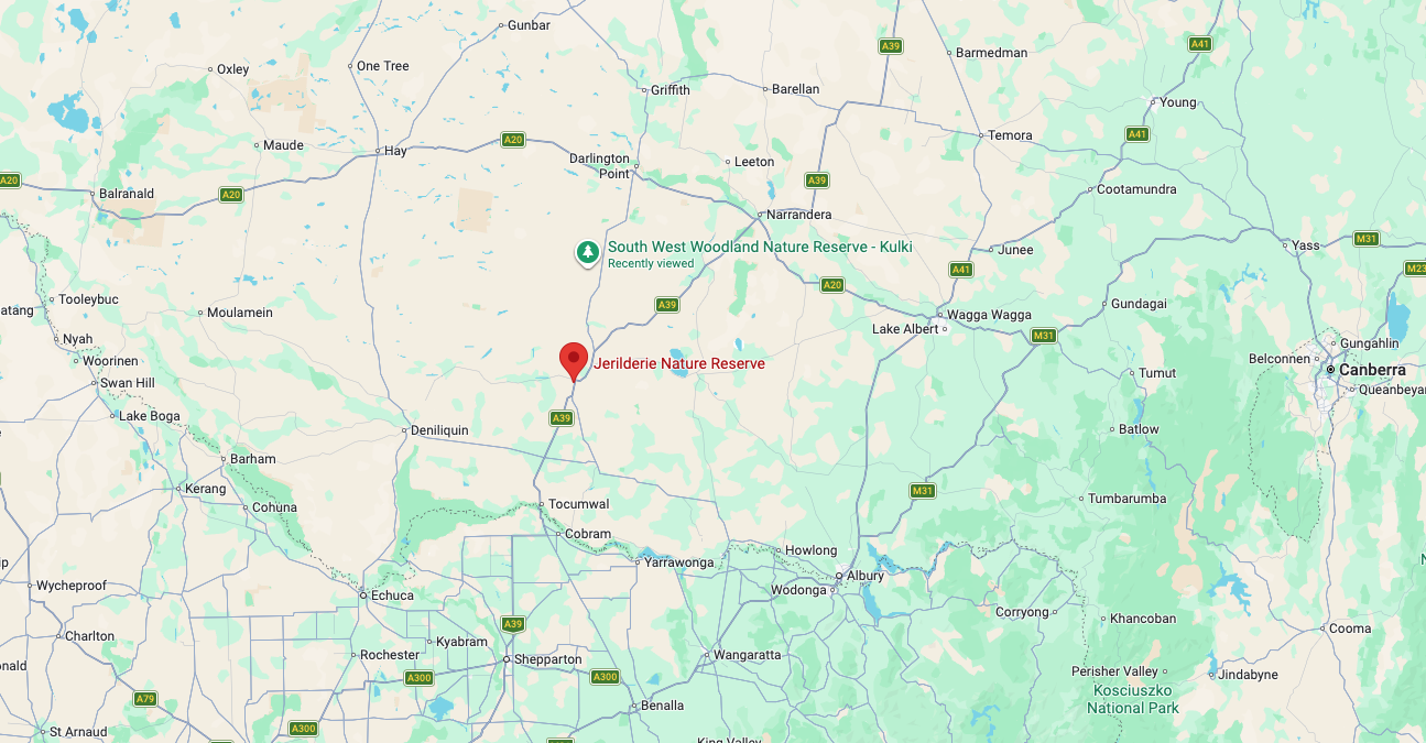
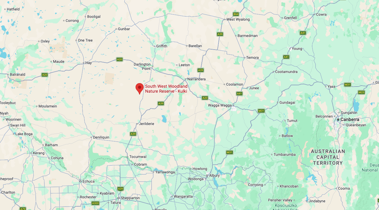
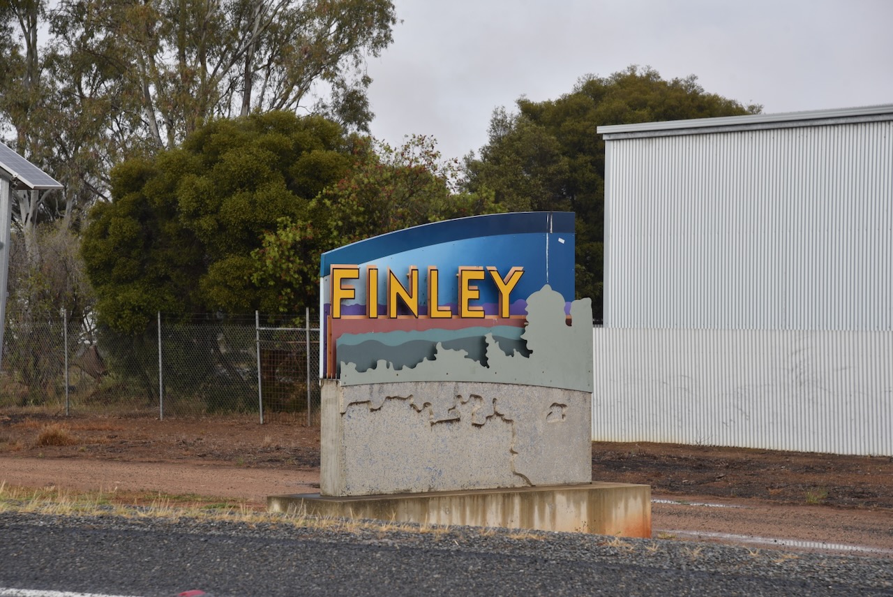
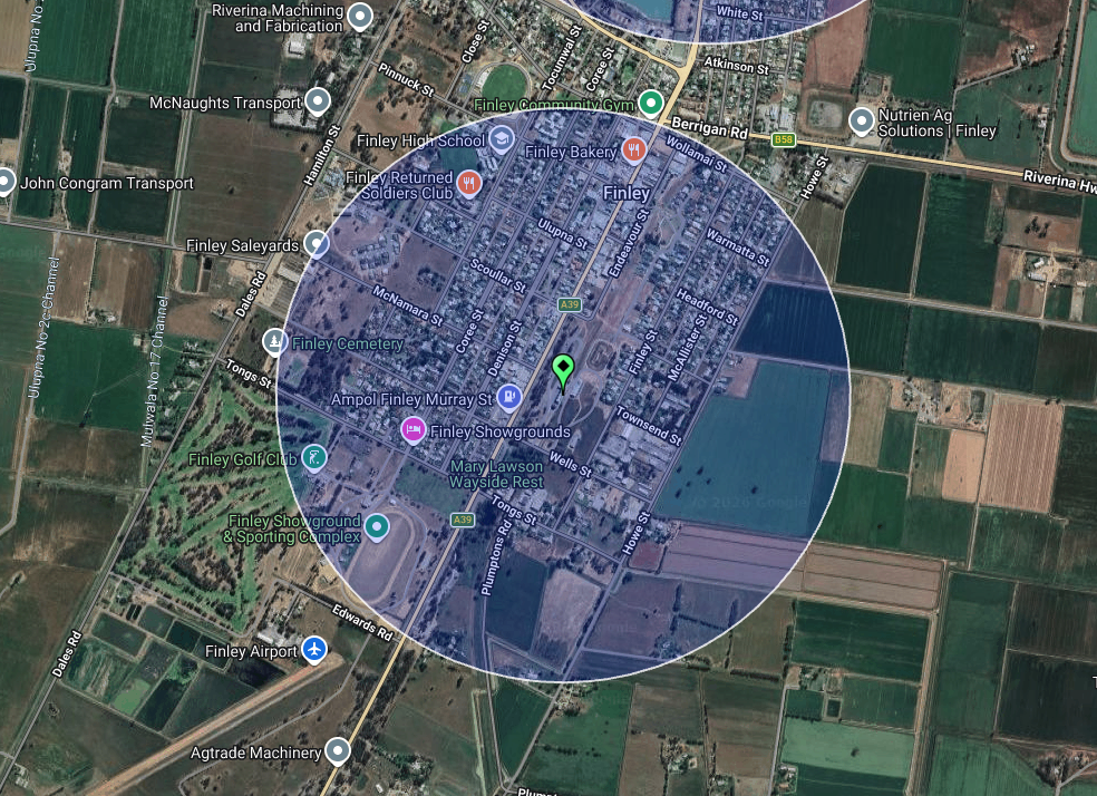
Marija and I finished breakfast and then drove south towards the town of Finley.

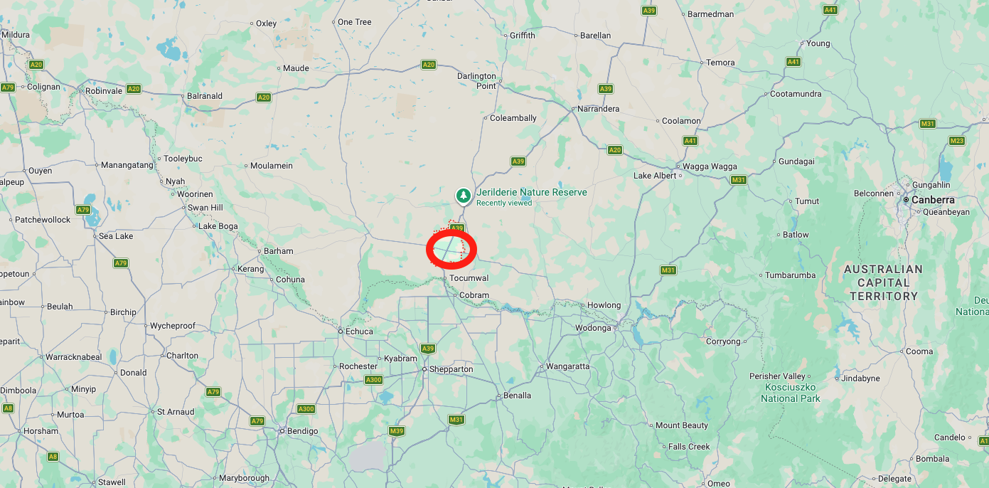
Above: Map showing the location of Finley, N.S.W. Map c/o Google Maps

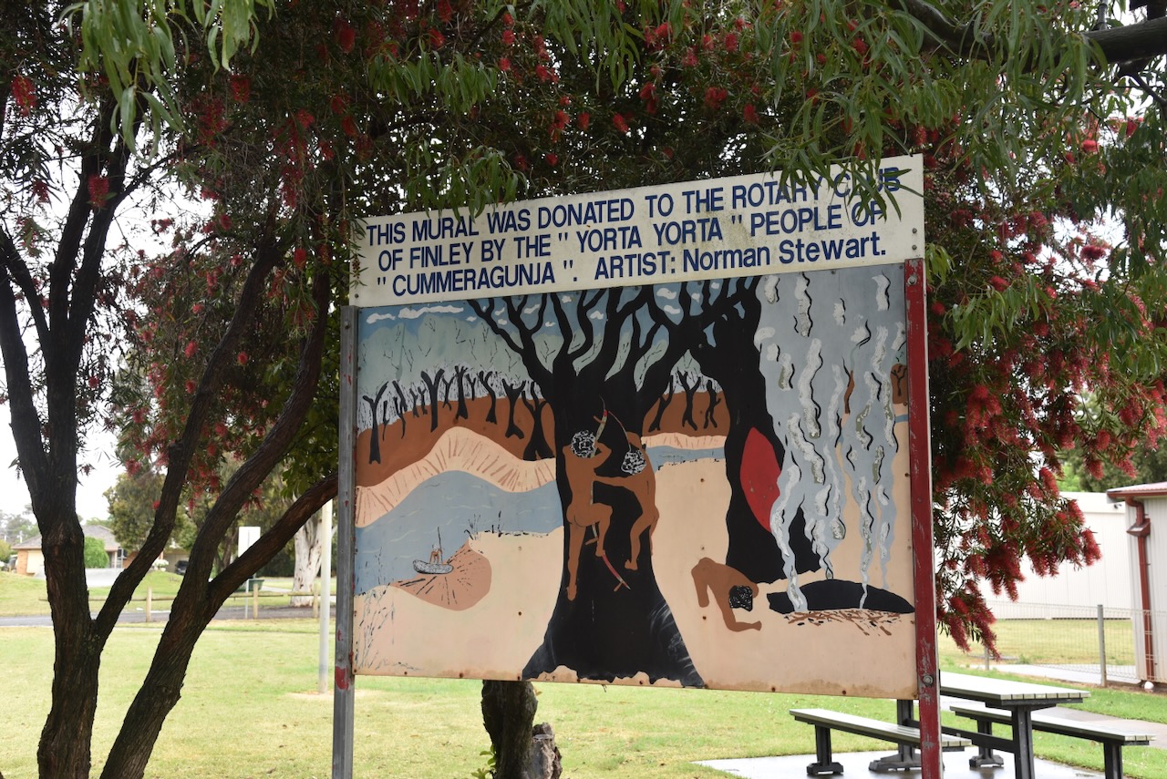
The Finley area is the traditional land of the Yorta Yorta Aboriginal people. Prior to European settlement, the area was called Carawatha, meaning ‘place of pines.’ (Wikipedia 2021)

During the 1840s the district was settled by European pastoralists. Their main crop was wheat. The first permanent residence in the town of Finley was built in 1878. The Post Office opened on the 1st day of January 1881 and was called Murray Hut. It was changed to Finley in 1893. (Wikipedia 2021)

The town was surveyed in 1870 and is named in honour of the surveyor, Francis George Finley. He mapped about 1.2 million hectares of the Riverina district of New South Wales. (Grokipedia 2025)

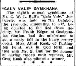
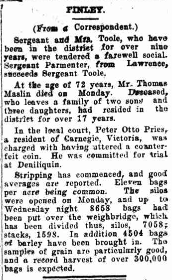
In 1912, the Finley Agricultural & Pastoral Association was established. The first agricultural show as held on the 17th day of September 1913. (Wikipedia 2021)

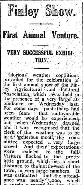
Above: part of an article from the Tocumwal Guardian, Fri 19 Sept 1913. Image c/o Trove

During the 1930s, the Finley district was struck by severe drought and farmers also experienced the Great Depression. These 2 factors caused many farmers to abandon their holdings. In 1935, construction commenced of the Mulwala Canal which brought water to the district’s rich farmland in 1939. (Wikipedia 2021)

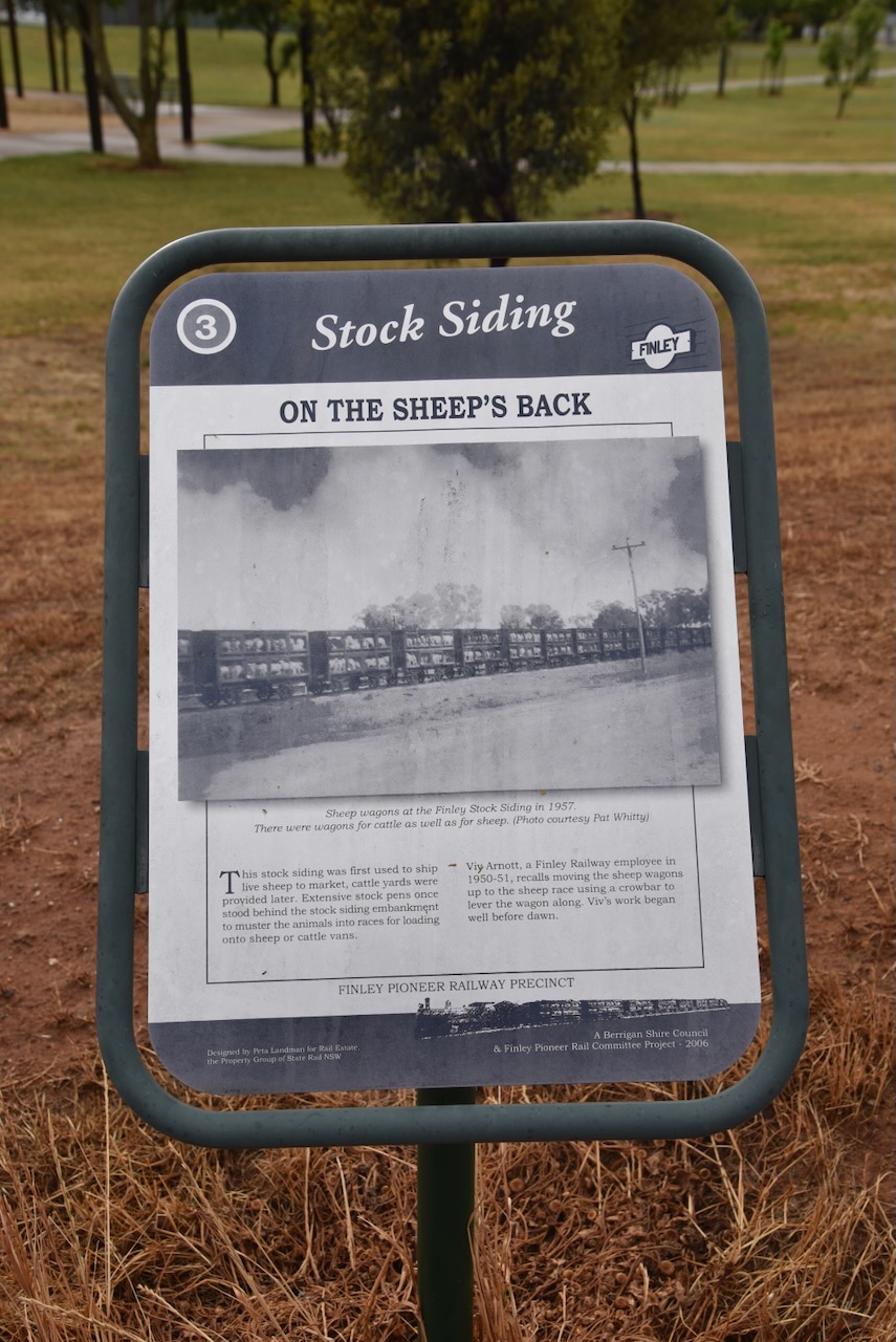
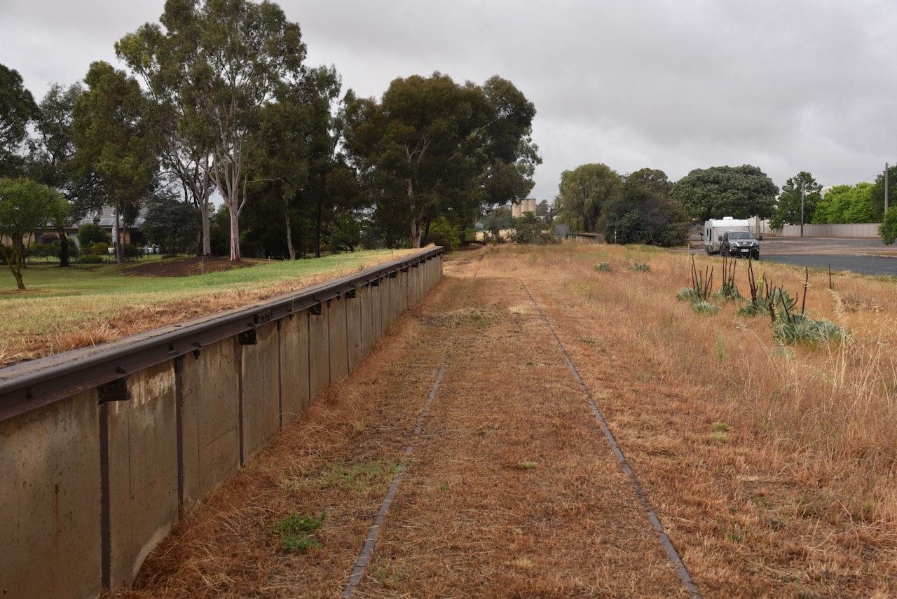
After having a quick drive around the town, Marija and I visited the Finley Railway Precinct. Unfortunately, the museum was closed. In Railway Park, you can view the old stock siding that was used to ship live sheep to market. They have been demolished now, but extensive stock pens once stood behind the stock siding embankment.

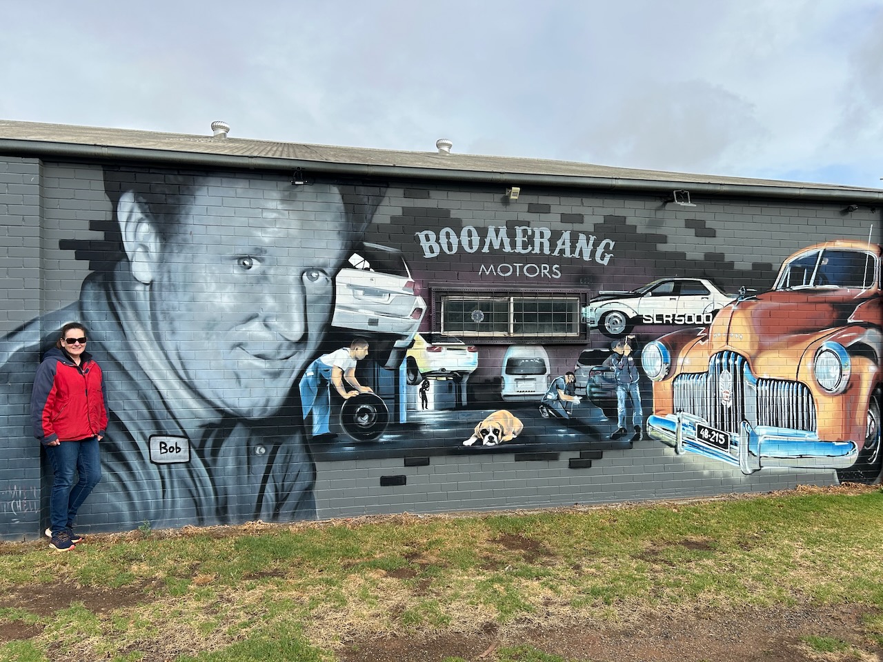
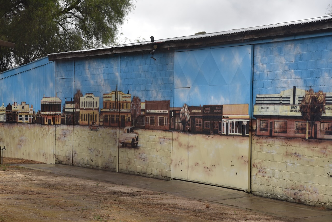
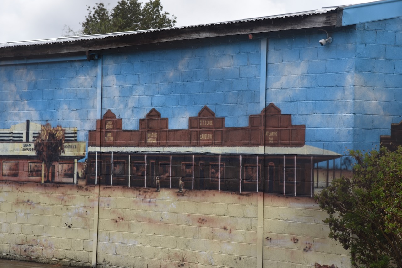
Opposite the railway siding in Endeavour Street is Boomerang Motors. On the side of the building is a magnificent mural, the work of Damien Mitchell. It is one of several murals in Finley. We even spoke with the son of the gentleman who features on the mural.

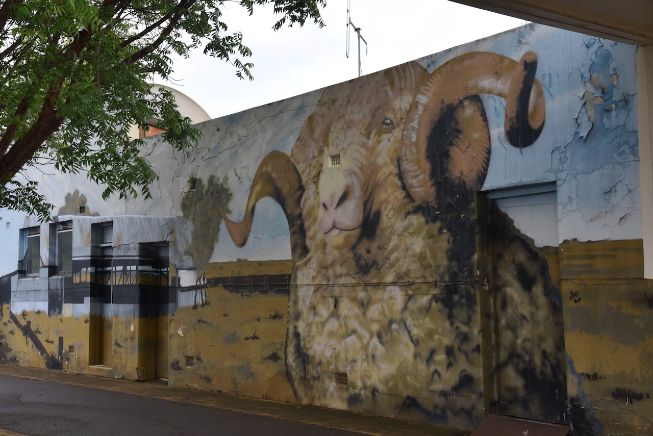
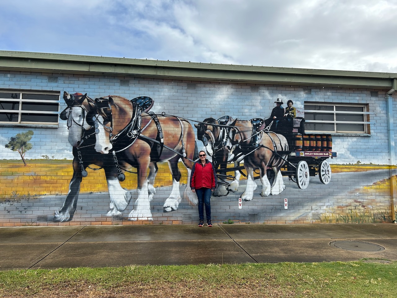
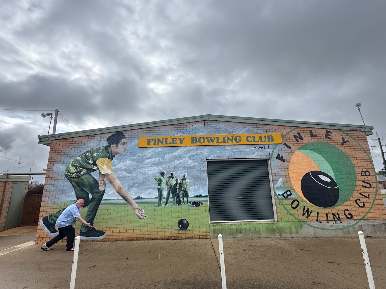
Other murals include a ram on the side of the Tuppal Hotel and Clydesdale horses at the Finley Bowling Club.

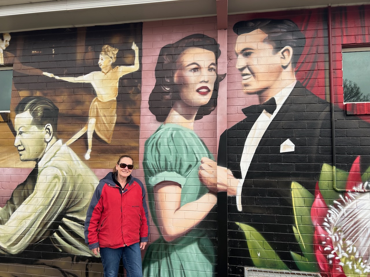
On the side of Finley School of Arts Memorial Hall is another magnificent mural, the work of Heesco and Damien Mitchell. It was painted in 2024 to celebrate the Hall’s 120th Anniversary. (Facebook 2026)

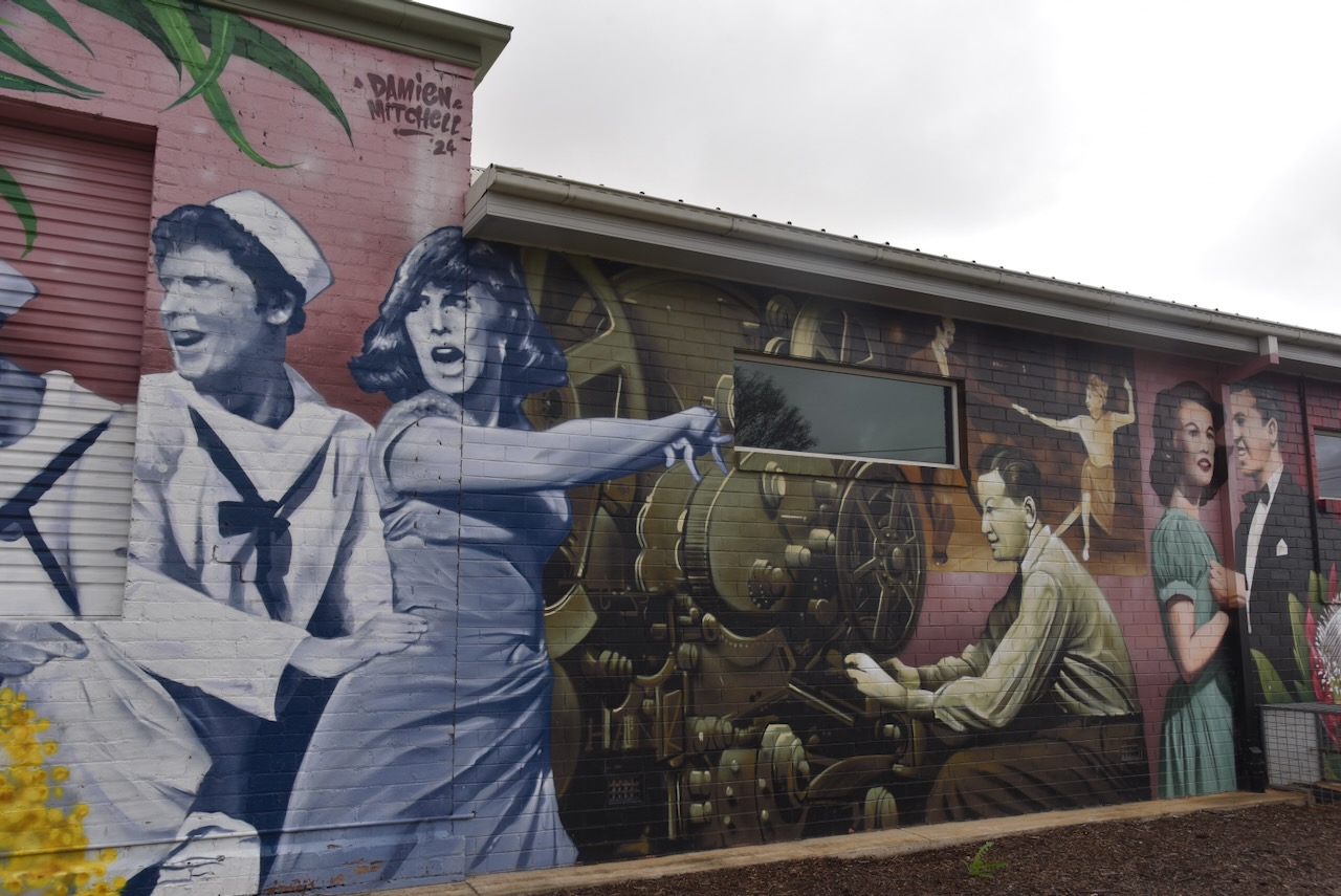
Another work of Heesco and Mitchell can be found at the Finley Bowling Club. It was completed in 2020. (Facebook 2026)

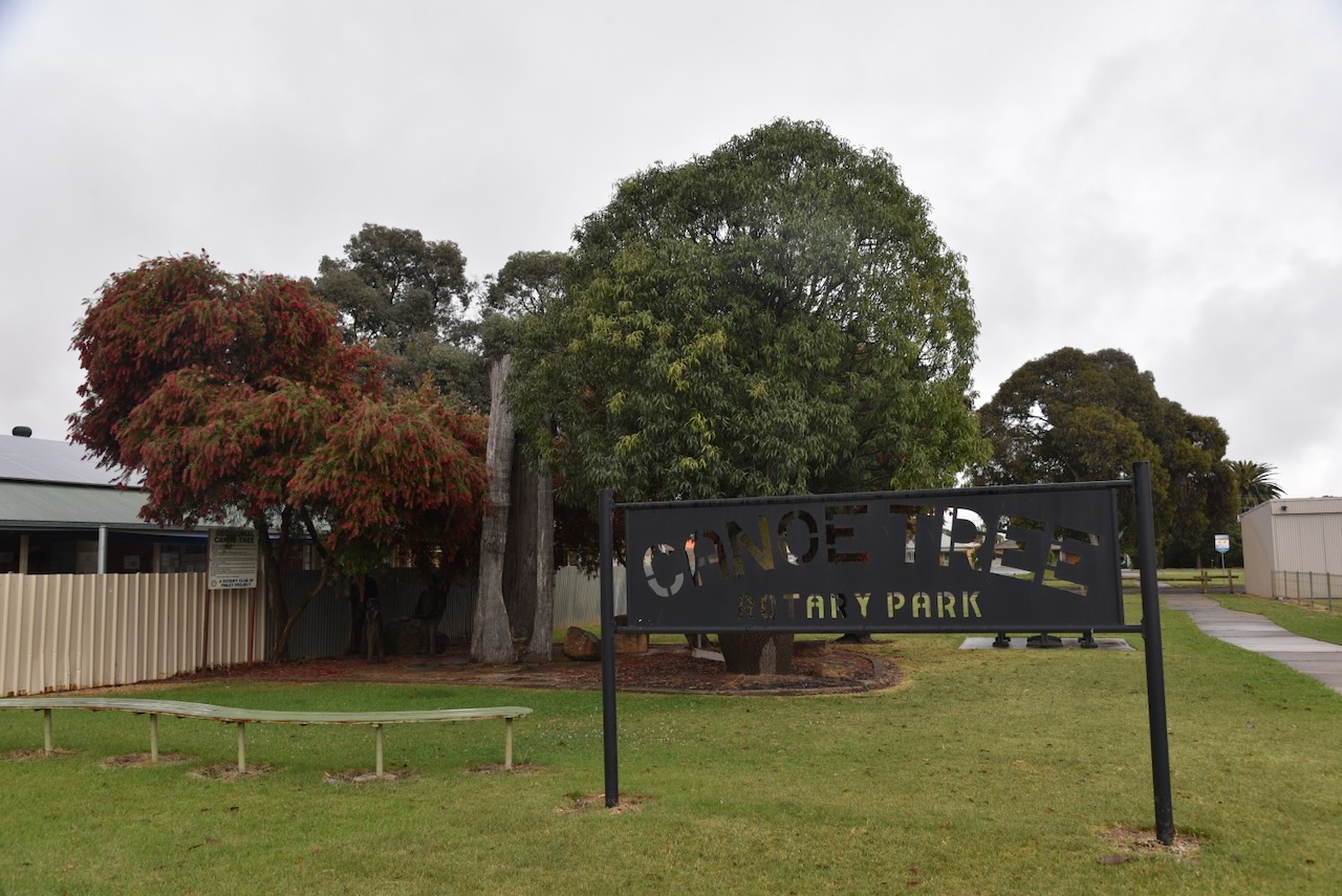
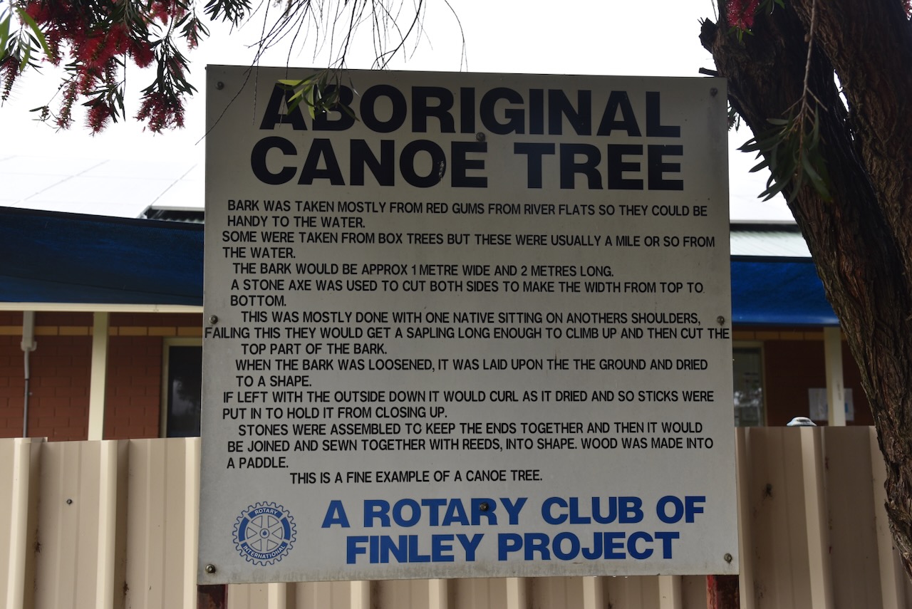
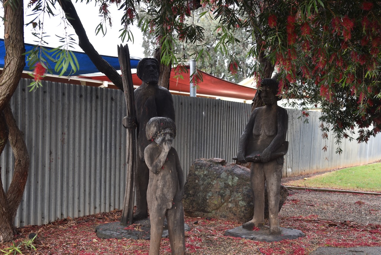
Marija and I then visited the canoe tree in Finley Memorial Park on the Newell Highway.

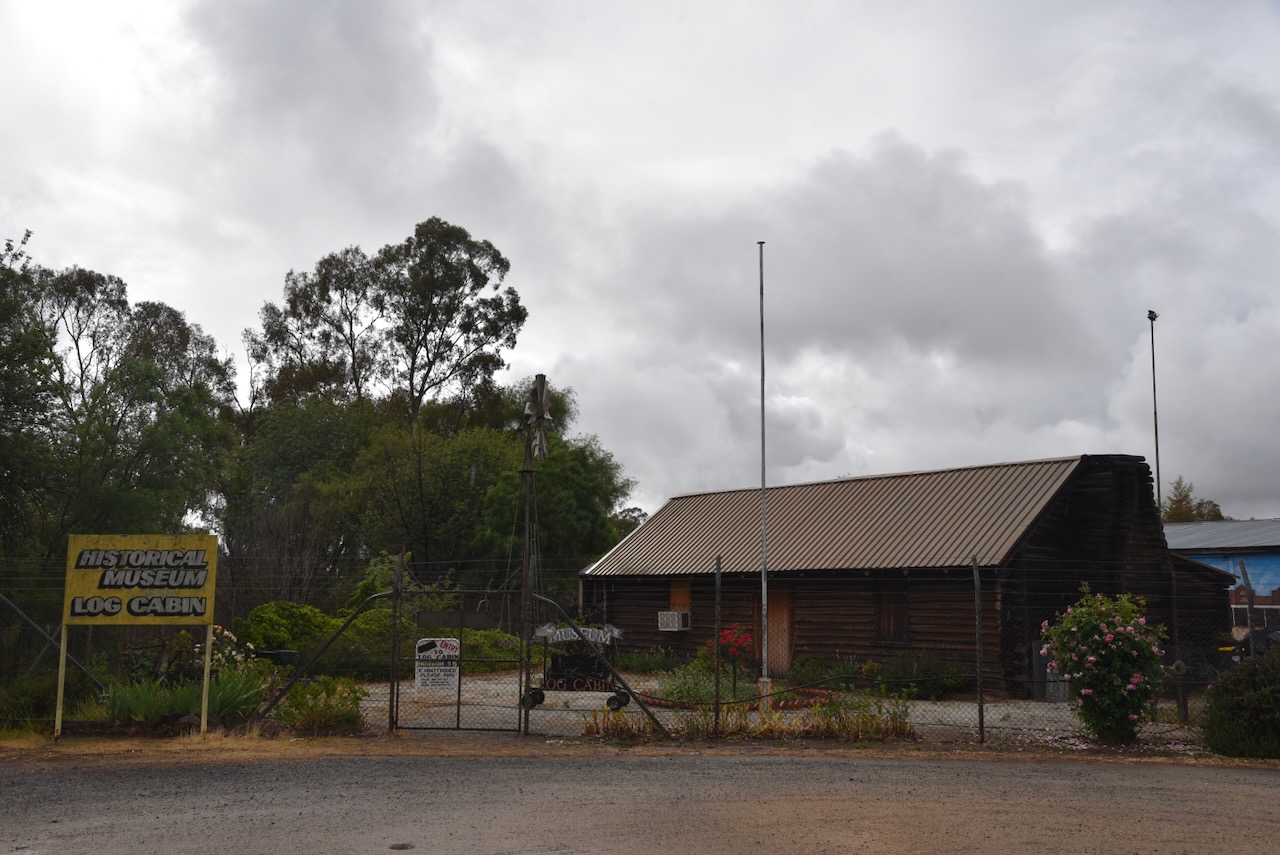
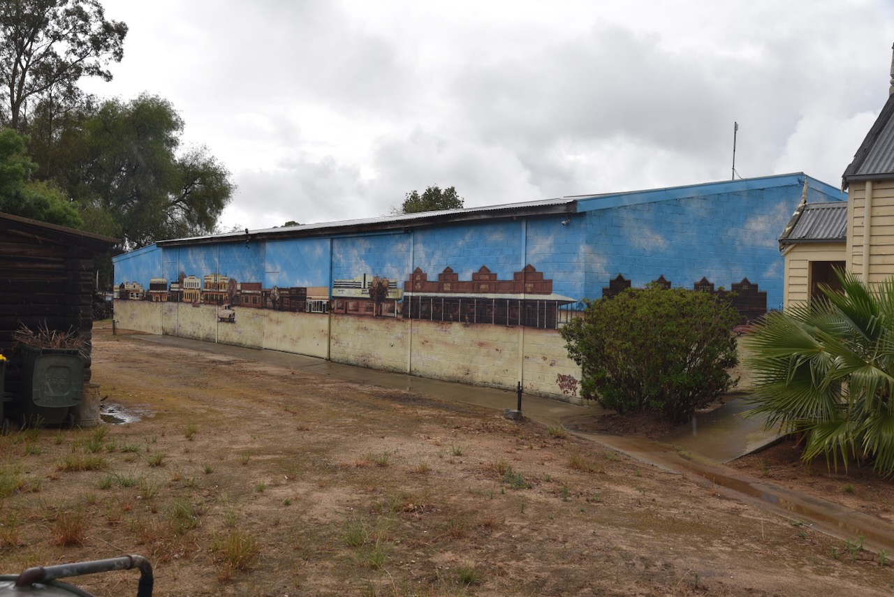
We had hoped to visit the Finley Historical Museum and Log Cabin, but we were a little too early, and it was closed. We were able to view the mural on the side of the museum, which is the work of Damien Mitchell, which was completed in 2022.

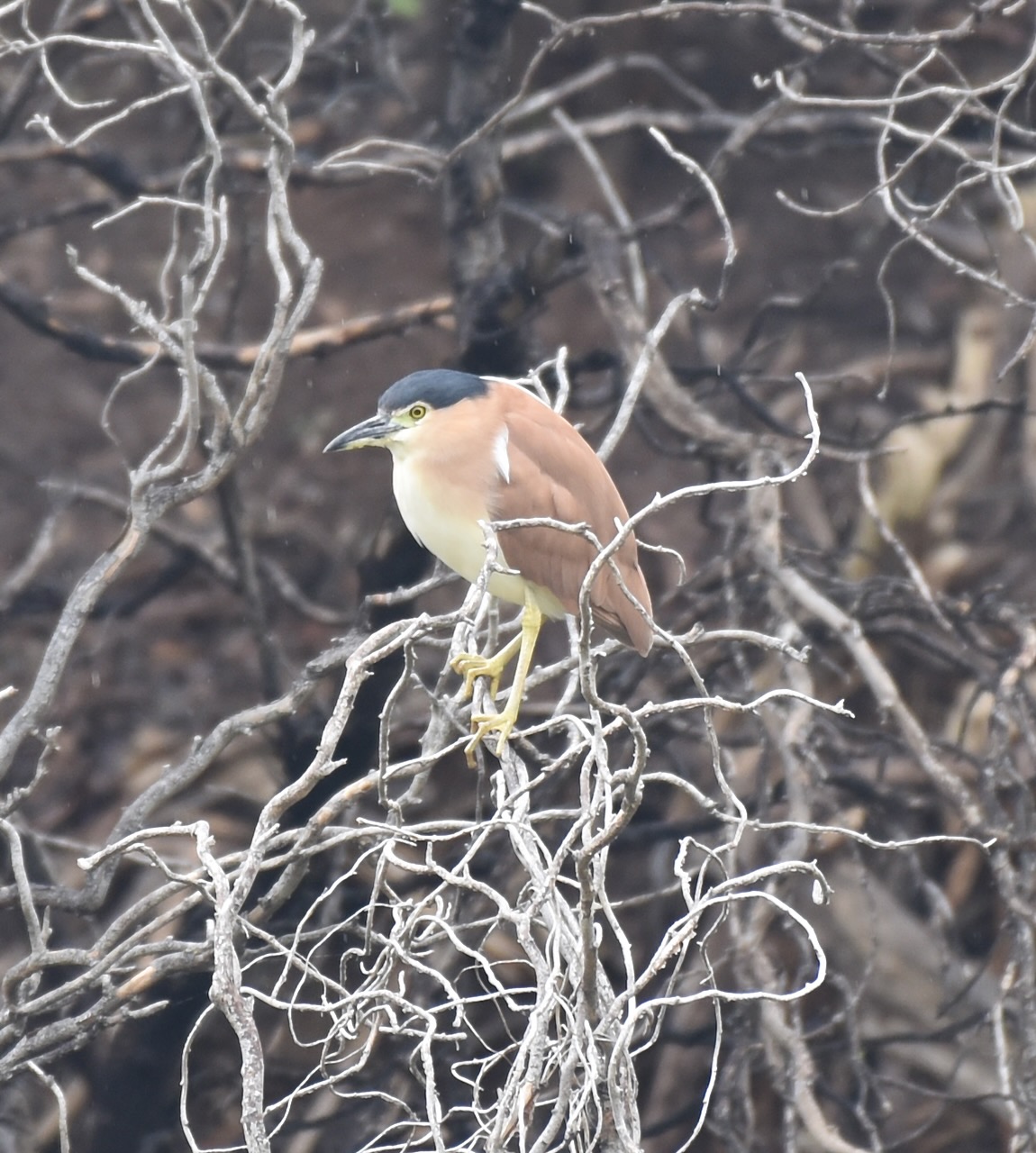
Alongside the museum is the Mary Lawson Wayside Rest Area, which includes a lake. I took the photograph below of a Nankeen Night Heron, a primarily nocturnal bird.

We then drove back a short distance to the Finley murals on Newell Highway.

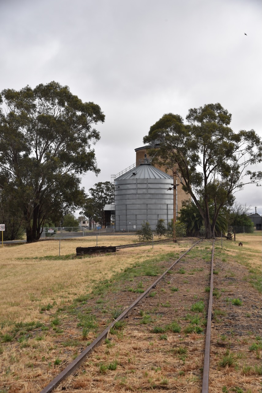
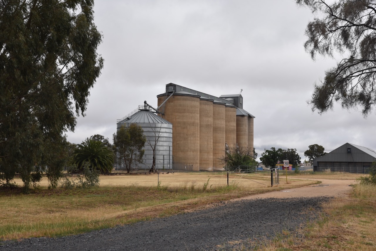
The silos were opened in 1926. (Trove 2026)

Above: article from The Albury Banner & Wodonga Express, Fri 3 Dec 1926. Image c/o Trove

Marija and I parked opposite the murals and operated from the 4WD, running the Icom IC-7000, 100 watts, and the Codan 9350 antenna with the 1.5 metre stainless steel ship.

Above: the activation zone at Finley silo. Image c/o SiOTA website

Marija worked the following stations on 40m SSB:-

  1. VK3PF
  2. VK2VH
  3. VK4AAC
  4. VK2EXA
  5. VK3UP/M

I worked the following stations on 40m SSB:-

  1. VK3PF
  2. VK2VH
  3. VK4AAC
  4. VK2EXA
  5. VK3UP/M
  6. VK3CLD
  7. VK3HBG
  8. VK1AO
  9. VK2MET
  10. VK3DAC

References.

  1. Grokipedia. (2025). Grokipedia. [online] Available at: https://grokipedia.com. [Acessed 26 Mar. 2026]
  2. ‌Trove. (2026). The Albury Banner and Wodonga Express (NSW : 1860 – 1927; 1929 – 1931; 1933 – 1938) – 3 Dec 1926 – p7. [online] Available at: https://trove.nla.gov.au/newspaper/page/10831885?searchTerm=finley%20silo [Accessed 25 Mar. 2026].
  3. ‌Wikipedia. (2021). Finley. [online] Available at: https://en.wikipedia.org/wiki/Finley.‌ [Accessed 26 Mar. 2026]

Jerilderie Nature Reserve VKFF-1942

Our final activation for Monday, 3rd November 2025, was the Jerilderie Nature Reserve VKFF-1942.

Above: Map showing the location of Jerilderie Nature Reserve. Map c/o Google Maps

On our way back into Jerilderie, it was slow going. After running over the kangaroo when leaving South West Woodland, Marija and I travelled even slower. There were dozens of kangaroos on the road and dozens of emus in the paddocks either side of the road.

The Jerilderie Nature Reserve is on the southwestern side of the town of Jerilderie. It is bounded by Watson Lane to the west and south, Rankin Road to the north, and Sleeman Street to the east.

Above: the boundaries of the Jerilderie Nature Reserve. Image c/o Google Earth

The Jerilderie Nature Reserve is about 37 hectares in size and was established in May 2002. (NSW National Parks 2026)

Above: an aerial view of the Jerilderie Nature Reserve. Image c/o Google Maps

This reserve does not look like much. It appears to be just a paddock. However, the reserve protects a small sample of native grassland, including a small population of the threatened plant Swainsona plagiotropis and several other grassland species that are regionally rare. (NSW National Parks 2026)

We entered the park through the unlocked gate and operated with the Yaesu FT857, 40 watts, and the 20/40/80m linked dipole.

Marija worked the following stations on 40m SSB:-

  1. VK1CHW
  2. VK2CHW
  3. VK3XEM
  4. VK2HAK
  5. VK3GJG
  6. VK3SQ
  7. VK3JT
  8. VK2BD
  9. VK5HS/M
  10. VK2IO/P (VKFF-0992)
  11. VK2GEZ/P (VKFF-0992)
  12. VK2YAK
  13. VK4YAK
  14. VK2DA

I worked the following stations on 40m SSB:-

  1. VK1CHW
  2. VK2CHW
  3. VK3XEM
  4. VK2HAK
  5. VK3GJG
  6. VK2DA
  7. VK1DA
  8. VK3SQ
  9. VK3JT
  10. VK2BD
  11. VK5HS/M
  12. VK3PF
  13. VK3KAI
  14. VK2IO/P (VKFF-0992)
  15. VK2GEZ/P (VKFF-0992)
  16. VK5PE/M
  17. VK3WSG
  18. VK2ETI/M
  19. VK2AIT
  20. VK2AIQ
  21. VK2AIX
  22. VK2AIZ
  23. VK1AD
  24. VK1NAM
  25. VK2EXA
  26. VK5LA
  27. VK5KAW
  28. VK5DW
  29. VK3ALF
  30. VK2MG
  31. VK3FTOM
  32. VK2NP
  33. VK2YAK
  34. VK4YAK
  35. VK1JIM
  36. VK2TER
  37. VK2BM
  38. VK2QRP
  39. VK7AAE
  40. VK7DWS
  41. VK7PJM
  42. VK3NL
  43. VK3SMW
  44. VK5FANA
  45. VK5BRU/P

References.

  1. NSW National Parks. (2026). Jerilderie Nature Reserve. [online] Available at: https://www.nationalparks.nsw.gov.au/visit-a-park/parks/jerilderie-nature-reserve [Accessed 25 Mar. 2026].‌

South West Woodland Nature Reserve VKFF-2724

Our next activation for Monday, 3rd November 2025, was South West Woodland Nature Reserve VKFF-2724. This particular section of the reserve is located about 53 km north of Jerilderie.

Above: Map showing the location of South West Woodland Nature Reserve – Kulki. Map c/o Google Maps

The Kulki section of South West Woodland Nature Reserve is located at the junction of Cadell Road and Stud Park N Road, Gala Vale.

Above: The boundaries of South West Woodland Nature Reserve – Kulki. Image c/o Google Earth

Just around the corner from the reserve is Gala Vale homestead. Charles W.L. Bull purchased the property in 1896. He constructed a pise house on the site of the current homestead. Pise houses are built using rammed earth. During the early 1920s, he removed the front section of the pise house, and he commenced building the current homestead. During the 1930s further sections of the homestead were completed, including the kitchen, dining room and sunroom. The last part of the pise house was demolished during the 1960s. This section of the pise house contained the old Gala Vale telephone exchange. (Murrumbidgee Council 2021)

An annual Gymkhana was held at Gala Vale.

Above: article from te Narandera Argus, Tue 24 Oct 1939. Image co Trove

South West Woodland Nature Reserve consists of 27 separate sections which range from Peak Hill in the north to Berrigan in the south, a distance of about 400 km. The total area of the reserve is about 13,840 hectares (34,200-acres). (Wikipedia 2026)

Above: An aerial view of South West Woodland NR – Kulki. Image c/o Google Maps

Prior to the declaration of the reserve on the 1st day of January 2011, the various sections were State Forests, which retained their forest names. They were gazetted State Forests between 1913 and 1977 and were managed by the Forestry Commission of NSW for logging and timber harvesting activities. (Wikipedia 2026)

The Kulki section was declared a State Forest on the 15th day of June 1917. It covers an area of about 172 hectares (430 acres). (Wikipedia 2026)

Upon our arrival near the park, there were dozens of kangaroos. It was very slow going along the road.

Marija and I ran the Yaesu FT857, 40 watts, and the 20/40/80m linked dipole supported on the 7-metre heavy duty squid pole.

Unfortunately we experienced strength 7 lightning crahses on the 40m band and it started to rain towards the end of our activation, which forced us to pack up.

Marija worked the following stations on 40m SSB:-

  1. VK2OKR/P (VKFF-1410)
  2. VK2BXB/P (VKFF-1410)
  3. VK2AUS/P (VKFF-1410)
  4. VK2AUR/P (VKFF-1410)
  5. VK2AUT/P (VKFF-1410)
  6. VK2HAK
  7. VK2NP
  8. VK1AO
  9. VK2MET
  10. VK3SQ
  11. VK3JT
  12. VK3BD
  13. VK2IO/P (VKFF-0992)
  14. VK2GEZ/P (VKFF-0992)

I worked the following stations on 40m SSB:-

  1. VK2OKR/P (VKFF-1410)
  2. VK2BXB/P (VKFF-1410)
  3. VK2AUS/P (VKFF-1410)
  4. VK2AUR/P (VKFF-1410)
  5. VK2AUT/P (VKFF-1410)
  6. VK2HAK
  7. VK2NP
  8. VK1AO
  9. VK2MET
  10. VK3SQ
  11. VK3JT
  12. VK3BD
  13. VK3MIJ
  14. VK3KRL
  15. VK2HBG/M
  16. VK3QA
  17. VK6ASK/M
  18. VK3CLD
  19. VK5QA
  20. VK2DBF
  21. VK3BAP
  22. VK3JSD
  23. VK2GSV
  24. VK5FANA
  25. VK3TDX
  26. VK2DA
  27. VK1DA
  28. VK7PJM
  29. VK2KEV/P
  30. VK5AYL
  31. VK2IO/P (VKFF-0992)
  32. VK2GEZ/P (VKFF-0992)
  33. VK1DI
  34. VK3UH
  35. VK5LA
  36. VK5KAW
  37. VK2AIH
  38. VK4HMI
  39. VK1FM
  40. F5PYI
  41. VK7MAT
  42. VK3HJW
  43. VK2XGB/M
  44. VK1AD
  45. VK1NAM
  46. VK5DMO

At the conclusion of the activation, we made our way back towards Jerilderie, where we planned to get some dinner. It was drizzling with rain at the time, and out in front of ran two kangaroos. Fortunately, I was not travelling too fast at the time, and I managed to brake to avoid hitting them. However, one slipped on the wet road and slid underneath the 4WD, killing it instantly. I stopped to check on its welfare, but sadly, it was deceased and had no joey. The next thing was to check for damage underneath the 4WD. Luckily, there was none.

References.

  1. Murrumbidgee Council, 2021, Murrumbidgee Council Heritage Review Inventory Report
  2. Wikipedia Contributors (2026). South West Woodland Nature Reserve. Wikipedia.‌