Horsnell Gully Conservation Park 5CP-094 and VKFF-0894

Yesterday (Saturday 16th September 2017) I activated the Horsnell Gully Conservation Park 5CP-094 & VKFF-0894.  As I have activated this park previously, and qualified it, this activation was to go towards the newly released Boomerang Award for the World Wide Flora Fauna (WWFF) program.

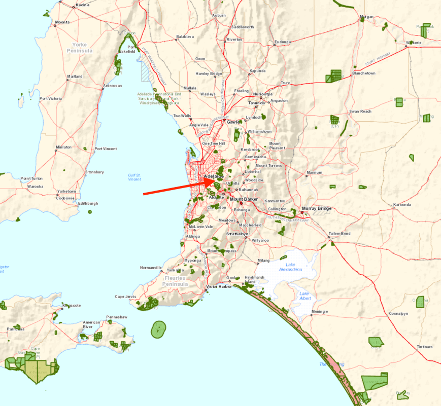
The park is located about 11 km east of the city of Adelaide, and about 33 km north west of my home.
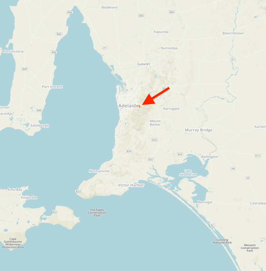
Screen Shot 2017-09-17 at 10.22.20 am.png

Above:- Map showing the location of the Horsnell Gully Conservation Park in the Adelaide Hills.  Map courtesy of Protected Planet.

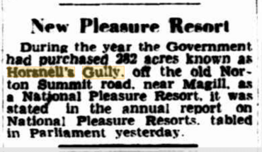
The Horsnell Gully Conservation Park is about 137 hectares in size and was first proclaimed on 1st January 1947 as the Horsnell Gully Pleasure Resort.  The park adjoins the Giles Conservation Park which was formerly Horsnell Gully’s upper eastern section.  Giles was set aside in its own right as a Conservation Park in 1964.
Screen Shot 2017-09-17 at 12.01.23 pm.png

Above: Article from The Advertiser, Wed 6 Aug 1947.  Courtesy of Trove.

Horsnell Gully Conservation Park protects some of the most rugged terrain in the Mount Lofty Ranges ‘Adelaide Hills’.  It features steep gullies, wooded hillsides and a 15m waterfall.  The park contains the watershed for Third Creek, one of the five main tributaries of the River Torrens.  There are a number of walking trails in the park including the Heysen Trail.

Numerous native bird species can be found in the park including Adelaide Rosella, Rainbow Lorikeet, White-throated Treecreeper, Superb Fairywren, New Holland Honeyeater, Crescent Honeyeater, White-naped Honeyeater, Yellow-faced Honeyeater, Black-winged Currawong, Silvereye, Painted Buttonquail, Purple-crowned Lorikeet, White-winged Chough, and Hooded Robin.

Fourteen species of native mammals have been recorded in the park including Western Grey Kangaroo, Koala, Ringtail possum, Brush tail possum, Southern Bush Rat and the Yellow footed antechinus.
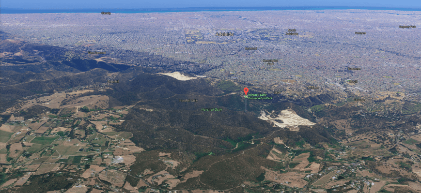
Screen Shot 2017-09-17 at 12.32.10 pm.png

Above:- Aerial shot of the Horsnell Gully Conservation Park.  Image courtesy of Google maps.

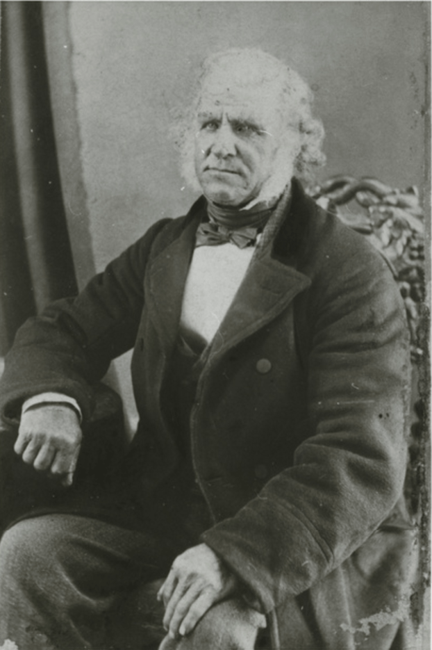
The park is named after the State Governor’s coachman, John Horsnell.  Horsnell was born in Essex in 1812 and emigrated in 1839 at age 27 to South Australia with his wife Elizabeth aboard the SS Lysander.  Enroute to Australia the couple fell ill with smallpox, along with many others aboard the ship.  Sadly, Elizabeth died at sea of the diesease.  Following Horsnell’s arrival in Adelaide, he was quarantined at Torrens Island until he was well enough to leave.  Horsnell visited the infirmary on North Terrace Adelaide and saw the Colonial Surgeon Dr. Cotter.  It is reported that he removed all of Horsnell’s finger nails and toe nails, in an effort to rid him of smallpox.
Screen Shot 2017-09-17 at 10.37.04 am.png

Above:- John Horsnell.  Courtesy of State Library SA.

It was at this time that Horsnell had just a few shillings to his name.  James Cobbledick, a friend of the Governor of South Australia, George Gawler, found John Horsnell his first job as coachman to the Governor and his wife.  Whilst driving Governor Gawler along Coach Road checking on the progress of surveys, it is reported that Horsnell spotted the gully now known as Horsnell Gully and the sources of the Five Creeks.   At this time, Horsnell resided at Belair working on Government Farm, taking care of the horses and tending the gardens.  Horsnell then moved to Waterfall Gully, where he grazed dairy cattle, prior to establishing a garden and grazing property at Woodvale off Third Creek near Magill.

In 1842 John acquired 10 acres of land near Magill plus the Gully, where he built a house and farm stocked with animals from the Government Farm, and established a garden and orchard with plants from the Botanic Gardens, donated by James Cobbledick.  The property was named ‘Wood Vale’.   Horsnell continued to purchase more land for lease in Ashton, Basket Range, Uraidla, Carey’s Gully, Morialta and Deep Creek.

Prior to European settlement the Kaurna aboriginal people inhabited the area.  They were quickly displaced as European settlers fenced the land into farms and properties.  The lack of adequate provisions and the rapid spread of European diseases decimated the aboriginal population.  A small group of Kaurna aboriginals lived in a cave in Horsnell Gully during the first years of Horsnell’s settlement of the area.  Between 1842 to 1853, two brothers known by the Horsnell’s as ‘Billy’ and ‘Jimmy’, their wives and two teenagers used their hunting skill to help Horsnell hunt for wildlife.  They also collected wood for the Horsnell’s neighbours, the Ghandis in exchange for wine.  The family eventually left the valley and was last seen by John Horsnell in Norwood in late 1853.

In 1844 when Horsnell was gored by a bull, he sought medical treatment from neighbour Dr Penfold.  Following his treatment Horsnell returned and shot the bull with a glass marble from a bottle in his stores.  Horsnell was employed him as his gardener until 1856.  Horsnell planted the historic vines for Dr Penfold, which still flourish today.

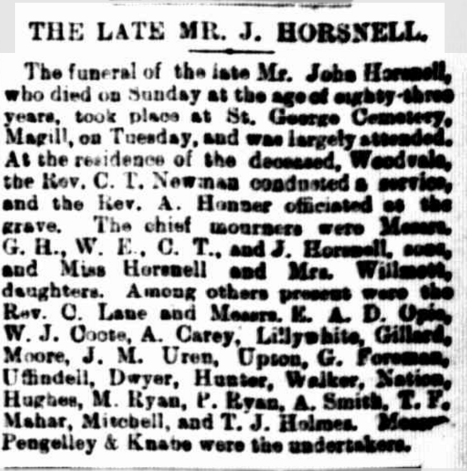
In 1848, John married his second wife Elizabeth Smyth who had been working for Dr & Mrs Penfold as a maidservant.  In 1860 Horsnell built a new home which is now part of the Horsnell Gully Conservation Park and has an onsite caretaker.   At the time of his death  on 23rd November 1895, John Horsnell owned 1,420 acres of land, and left an estate valued at £18,209/13s/6d equivalent to more than $2.5 million.
Screen Shot 2017-09-17 at 12.52.38 pm.png

Above:- from The Register, 27 Nov 1895.  Courtesy of Trove

At the start of the walking trails at the end of Horsnell Gully Road you can find the remains of the coaching sheds, stable and dairy.  A little further along the trail you can find the old homestead.

On my way to the park I stopped briefly on Old Norton Summit Road to watch the rock climbers.  Not for the faint hearted.

I also stopped briefly to have a look at some of the interpretive signs along Old Norton Summit Road.

I accessed the park via Horsnell Gully Road.  The park is well signposted.

I wasn’t quite sure whether to set up in the picnic ground or head back up old Norton Summit Road to the eastern side of the park at Coach Road, from where I have operated previously.  The picnic grounds offered plenty of shade, but I wasn’t able to utilise the two benches/seats as there were trees overhead and this prevented me from erecting the 7m telescopic squid pole.  It was also quite busy.  As it was a beautiful sunny day, there were lots of bushwalkers out and about, and the 80/40/20m linked dipole does take up some room.  I decided to stay put, and I walked a short distance uphill to the old dairy and set up there underneath the shade of some gum trees.
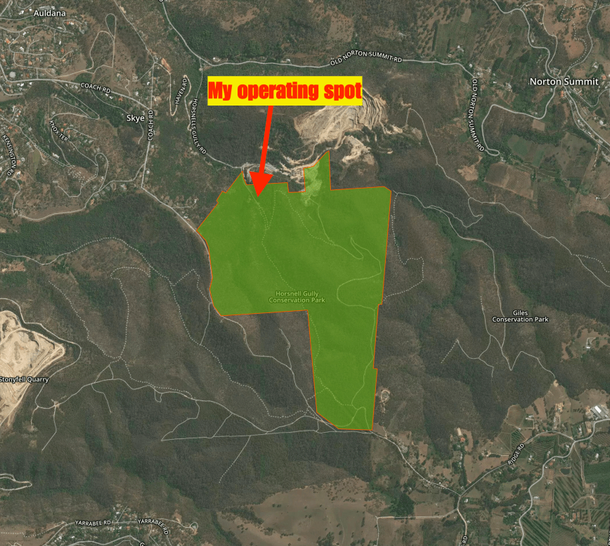
Screen Shot 2017-09-17 at 10.22.05 am.png

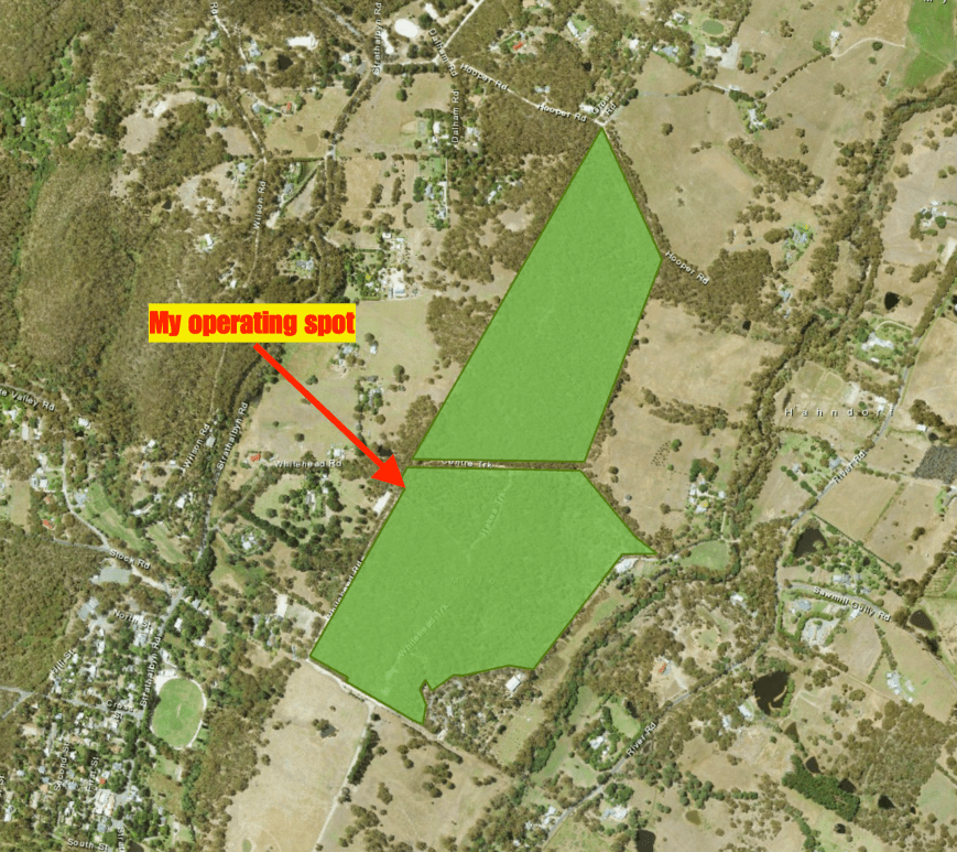
Above:- Aerial shot of the park showing my operating spot.  Image courtesy of Protected Planet.

I headed to 7.144 and heard VK2BNN calling CQ from the Sydney Harbour National Park.  They were very very weak, but I decided to try my luck and gave them a shout.  Sadly they were unable to hear me.  So I headed to 7.140 and started calling CQ.  Greg VK2MTC at Cooma was first in the log with a good 5/8 signal.   This was followed by Tony VK5TT and then a Park to Park, with Les VK5KLV/p who was activating the Whyalla Conservation Park VKFF-0808 on the west coast of South Australia.

Band conditions were quite poor, with signals from Victoria being way down compared to normal.  It took me around 15 minutes to get contact number 10 in the log, that being with Lee VK3BSP (VK3FLJD at the mic).  I went on to work a total of 21 stations on 40m from VK1, VK2, VK3, VK4, and VK5, including another Park to Park, with Dave VK2ZK/p who was in the Blue Mountains National Park VKFF-0041.  Andew VK7DW had told me Gerard VK2JNG was in a park a little further up the band, and when things slowed that is where I headed.

I logged Gerard VK2JNG who was in the Tapin Tops National Park VKFF-0477, with a nice 5/6 signal.  I then headed back to 7.140 and called CQ again.  Mark VK7MPR was my first caller, followed by Rob VK4AAC/p in the D’Aguilar National Park VKFF-0129.  Although we were quite low to each other, Rob and I were able to work each other comfortably due to the non existant man made noise in both parks.  I worked a further 12 stations on 40m including Ron VK3DX at the Warnambool Maritime Museum, and Neil VK4HNS/p who was activating the Bendidee National Park VKFF-0030.

I then headed to 3.610 on the 80m band.  But despite 5 minutes of CQ calls there, my only contact was with my wife Marija VK5FMAZ.  I then tried my luck on 14.310 on the 20m band where I logged Rob VK4AAC in the D’Aguilar National Park VKFF-0129, and Ray VK4NH.  To complete the activation I headed back to 40m where I logged 5 stations including Gerard VK2IO/p who was in the Muogamarra Nature Reserve VKFF0-1973.

It was time to pack up and head off to my second park of the day, Giles Conservation Park.  I had a total of 45 QSOs in the log including 7 Park to Park contacts.

I worked the following stations on 40m SSB:-

  1. VK2MTC
  2. VK5TT
  3. VK5KLV/p (Whyalla Conservation Park VKFF-0808)
  4. VK3KMH
  5. VK2LL
  6. VK3OHM
  7. VK2VU
  8. VK3IRM
  9. VK2VW
  10. VK3BSP
  11. VK3SQ
  12. VK3PF
  13. VK5GJ
  14. VK4XAC
  15. VK1TX
  16. VK2SR
  17. VK3LY
  18. VK7DW
  19. VK2ZK/p (Blue Mountains National Park VKFF-0041)
  20. VK4RF
  21. VK4HA
  22. VK2JNG/p (Tapin Tops National Park VKFF-0477)
  23. VK7MPR
  24. VK4AAC/p (D’Aguilar National Park VKFF-0129)
  25. VK7JON
  26. VK2HHA
  27. VK3KLB
  28. VK3DX
  29. VK5JDS
  30. VK7FOLK
  31. VK3MBW
  32. VK4TJ
  33. VK2EXA
  34. VK3ZPF
  35. VK3FMKE
  36. VK4HNS/p (Bendidee National Park VKFF-0030)
  37. VK2IO/p (Muogamarra Nature Reserve VKFF-1973)
  38. VK3ELH
  39. VK2BHO
  40. VK2YK
  41. VK3QA
  42. VK3OAK

I worked the following stations on 80m SSB:-

  1. VK5FMAZ

I worked the following stations on 20m SSB:-

  1. VK4AAC/p (VKFF-0129)
  2. VK4NH

References.

Birds SA, 2017, <http://www.birdssa.asn.au/location/horsnell-gully-conservation-park/&gt;, viewed 17th September 2017
The Pioneers Association of South Australia, 2017, <http://www.pioneerssa.org.au/files/42%20Horsnell%20APPROVED.pdf&gt;, viewed 17th September 2017

Wikipedia, 2017, <https://en.wikipedia.org/wiki/Horsnell_Gully_Conservation_Park&gt;, viewed 17th September 2017

Mylor Conservation Park 5CP-156 and VKFF-0785

Today (Sunday 3rd September 2017) I had a terrific day with the family for Fathers Day.  We headed over to the Great Eastern Hotel at Littlehampton for lunch.  Once we got home I had a tune across the 40m band and saw that it was another busy day for park activations, as it was yesterday.  The weather was less than ideal, but Marija and I decided to head over to the Mylor Conservation Park 5CP-156 & VKFF-0785 for a quick activation.

I have activated Mylor a number of times previously, so this was going to be another activation for the recently released Boomerang Award for the World Wide Flora Fauna (WWFF) program.

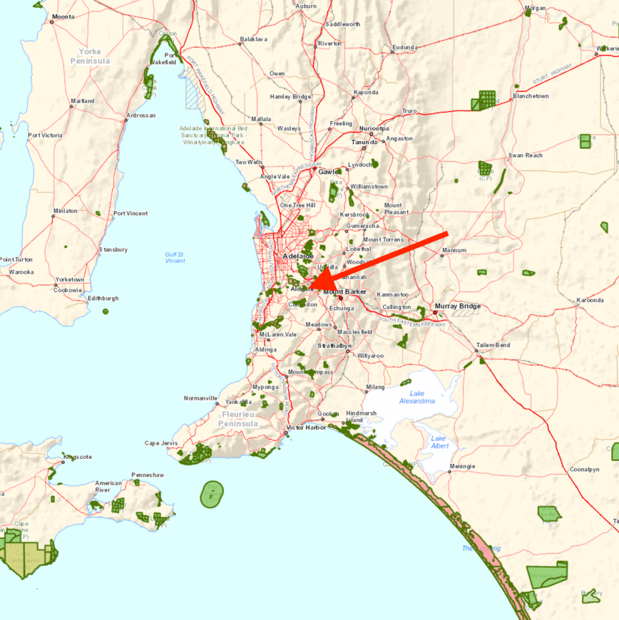
Screen Shot 2017-09-03 at 6.24.26 pm.png

Above:- Map showing the location of the Mylor Conservation Park in the Adelaide Hills.  Map courtesy of Location SA Map Viewer.

The Mylor Conservation Park is about 49 hectares in size and was proclaimed on the 27th day of February 1997.  It is located just outside the little town of Mylor in the Mount Lofty Ranges ‘Adelaide Hills’.

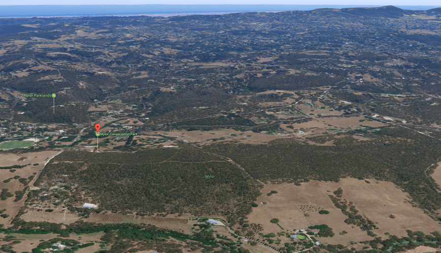
Screen Shot 2017-09-03 at 6.34.40 pm.png

Above:- Aerial shot of the park, looking west.  Image courtesy of Google maps.

Much of the region surrounding Mylor Conservation Park has been cleared for residential and agricultural purposes, but the park preserves a little slice of remnant bushland.  The park is mostly Open Forest with Candlebark Gum, Brown Stringybark, Messmate Stringybark, Cup Gum, Pink Gum and Manna Gum.  Understory plants include Myrtle Wattle, Spiny Wattle, Narrow-leaf Bitter-pea, Large-leaf Bush-pea and Silver Banskia.

As we are now in the early stages of Spring, many of the native plants in the park were starting to come out in flower.

Over 50 species of native birds have been recorded in the park including Adelaide Rosella, White-throated Treecreeper, Superb Fairywren, Grey Fantail, Australian Golden Whistler, Eastern Spinebill, Brown-headed Honeyeater, Scarlet Robin, Rufous Whistler, &  Red-brown Finch.

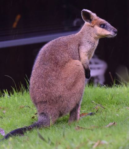
A number of native animals call the park home including Western Grey kangaros and the endangered Southern Brown bandicoot.  During our visit we sighted a Tammar Wallaby.

DSC_8020

The park is well signposted on the Strathalbyn Road and access is via Whitehead Road at the northern end of the town of Mylor.

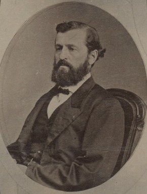
The park is located in close proximity to the little town of Mylor which was surveyed in 1885, with a plan to develop the land as a focal point for orchard development in South Australia.   The town was proclaimed in 1891 by Acting Governor of South Australia, Sir James Boucaut who named it after his Cornish birthplace.

James_Boucaut_4

Above:- Sir James Boucaut.  Image courtesy of wikipedia.

We headed for my normal operating spot which is Centre Track which runs off Whitehead Road.

Screen Shot 2017-09-03 at 6.25.02 pm.png

Above:- Aerial shot of the park showing my operating spot.  Image courtesy of Location SA Map Viewer.

My first contact was with Bill VK4FW/p who was activating the Mudlo National Park VKFF-0697.  I then headed up to 7.150 and asked if the frequency was in use.  Peter VK3PF came back to advise that it was clear.  Peter was kind enough to spot me and as a result a small pile up ensued.  I had contact number 10 in the log after just 6 minutes.

The 40m band was in excellent condition with all signals 5/9 or better.  I worked a total of 48 stations on 40m including two further Park to Park contacts, with Mark VK4MSA/p in the Esk National Park VKFF-0677 and Adam VK2YK in the Werakata State Conservation Area VKFF-1391.

The weather was starting to move in quite quickly and we were experiencing the occasional drop of rain.  I headed off to 14.310 on 20m and I was rewarded with just one contact after 5 minutes of CQ calls.  That was with Tadashi JA1VRY in Japan.  I tuned across the 20m band and heard a few faint European signals and also some faint signals from Japan as the All Asian Contest was in full swing.

As it was almost about to rain, we lowered the squid pole and inserted the links for 80m and called CQ on 3.610, with Marija spotting me on parksnpeaks.  My CQ call was answered by Peter VK3ZPF who was a good 5/7, followed by Adrian VK5FANA on the Yorke Peninsula.  Sadly, the heavens opened up and it was a made scramble to pack up the gear and head back to the vehicle.

I had a total of 52 contacts in the log, including three Park to Park contacts.

Marija did not jump on air during this activation, and was happy to go for a walk through the park.  We will have to return so she can qualify the park.  This won’t present a problem as the park is just a short drive from home.

On the way home I had a nice chat on 40m from the mobile with Chris VK2SR, Peter W5FP, and Gordie W5AZ.  Peter gave me a 5/9 with his stacked arrays and I was 5/5 with Gordie.

I worked the following stations on 40m SSB:-

  1. VK4FW/p (Mudlo National Park VKFF-0697)
  2. VK3PF
  3. VK3GGG
  4. VK3PMG
  5. VK3ZPF
  6. VK5IK
  7. VK5FUZZ
  8. VK3ANL
  9. VK3FSPG
  10. VK3MPR
  11. VK7DW
  12. VK7VZ/3
  13. VK4SMA/p (Esk National Park VKFF-0677)
  14. VK7AN
  15. VK2YK/p (Werakata State Conservation Area VKFF-1391)
  16. VK5NJ
  17. VK5FMWW
  18. VK3BBB
  19. VK3UH
  20. VK2VW
  21. VK3HSR
  22. VK1MA
  23. VK2KT
  24. VK3ZMD
  25. VK3EGR
  26. VK5XD
  27. VK5FANA
  28. VK2VRC
  29. VK2VU
  30. VK4KUS
  31. VK7ZGK
  32. VK5FDEC
  33. VK2HHA
  34. VK4NH
  35. VK5MR
  36. VK5KLV
  37. VK3OAK
  38. VK2NP
  39. VK5NEM
  40. VK2PKT
  41. VK3FRAB
  42. VK2LEE
  43. VK3VZX
  44. VK7JON
  45. VK2LEZ
  46. VK5IS
  47. VK2BHO
  48. VK3FAHS
  49. VK2FOUZ

I worked the following station on 20m SSB:-

  1. JA1VRY

I worked the following stations on 80m SSB:-

  1. VK3ZPF
  2. VK5FANA


References.

Birds SA, 2017, <http://www.birdssa.asn.au/location/mylor-conservation-park/&gt;, viewed 3rd September 2017

Wikipedia, 2017, <https://en.wikipedia.org/wiki/Mylor,_South_Australia&gt;, viewed 3rd September 2017
The Knoll Conservation Park 5CP-229 and VKFF-0937

I didn’t plan on doing a park activation today (Saturday 2nd September 2017), but with a number of other park activators out in the field, and my wife Marija having an afternoon with her girlfriends, I decided to head down the road to The Knoll Conservation Park 5CP-229 & VKFF-0937.  Although I have activated the park previously, this activation was to go towards the recently released Boomerang Award for the World Wide Flora Fauna (WWFF) program.

Screen Shot 2017-09-02 at 8.20.58 pm.png

Above:- Map showing the location of The Knoll Conservation Park in the Adelaide Hills.  Map courtesy of Location SA Map Viewer.

The Knoll Conservation Park is located at Crafers West, about 20 kms south east of Adelaide, in the Mount Lofty Ranges ‘Adelaide Hills’.  Access to the park is via Upper Sturt Road, slightly south of Sheaok Road.  The Knoll sits on a small crest, about 640 metres above sea level.

Screen Shot 2017-09-02 at 8.26.42 pm.png

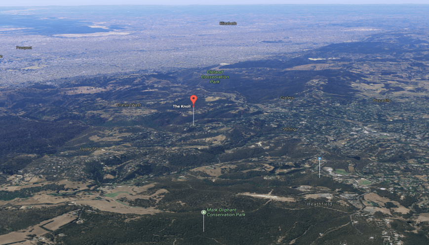
Above:- Aerial shot showing the park, looking north west towards the northern suburbs of Adelaide.  Image courtesy of Google Maps.

The Knoll is quite a small park, being only 2 hecatres in size.  The park was originally known as the Knoll Wildlife Reserve, being dedicated in 1963.  The park was re-named the Knoll National Parks Reserve with the introduction of the National Parks Act in 1966.  It is now known as The Knoll Conservation Park.

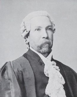
The area was originally donated to the South Australian State Government in 1917 by James George Russell (1848-1918), a lawyer and public servant.  He was a master of the Supreme Court and the Commissioner of Taxes.

James_George_Russell.jpg

Above:- James George Russell.  Courtesy of wikipedia.

The park is surrounded by private properties.  Due to the relatively steep sides of the park, it renders the area unsuitable for agricultural purposes, and as a result, the scrub is intact.

On the edge of the park is a large Manna gum, known locally as the Waverly Ridge Tree.  It is believed the tree’s date of germination is January 1714 and as a result it is classified with the National Trust.  The tree is about 24 metres in height and has a diameter of 2 metres.  There are only five other trees of this sub-species on the register and only one is larger in girth. The sub-species is rated “Rare” in South Australia in the National Parks and Wildlife Act 1972.

There are some very nice views to be had from the park, looking east through the trees out towards Victoria (VK3).

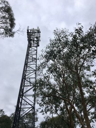
There is a tower in the park which hosts Telstra and CFS services, however no noticeable noise from it can be heard on the bands.

IMG_0521

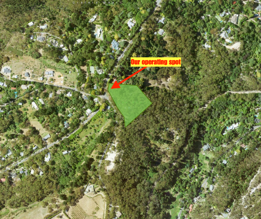
I parked the vehicle in the small car parking area out the front of the park.  I then walked a short distance along the track leading to the tower, and set up.  I ran the Yaesu FT-857d, and the 20/40/80m linked dipole for this activation.  My power output was 40 watts.

Screen Shot 2017-09-02 at 8.20.37 pm.png

Above:- Aerial shot showing my operating spot in the park.  Image courtesy of Location SA Map Viewer.

Sadly there was an S5-6 noise in the park, most likely due to the nearby houses.  So it wasn’t the pristine conditions I normally experience in parks.  Before calling CQ I hunted around the band for the park activators I knew were out and about.  My first four contacts were with:-

  • Neil VK4HNS/p in the Samford Conservation Park VKFF-1639
  • Andrew VK7DW/p in the Holwell Gorge State Park VKFF-1806
  • Rob VK4AAC/p in the Bunyaville Conservation Park VKFF-1493
  • Gerard VK2JNG/p in the Bulahdelah State Conservation Area VKFF-1287

I then propped on 7.110 and called CQ and it wasn’t long before I had a little pile up going.  First in the log was Rob VK2QR with a very strong signal, followed by Peter VK3TKK mobile, Dennis VK2HHA, and then Sergio VK3SFG.

My next Park to Park contact, was QSO number 13, with Peter VK3ZPF/p who was in the Upper Beaconsfield Nature Conservation Reserve VKFF-2219, one of the newly added Victorian parks to the World Wide Flora Fauna program.  I worked a handful more stations and when things slowed down I took the opportunity of sliding down the band to log Helen VK7FOLK/p on 7.090 who was in the Ferndene State Reserve VKFF-1802.

I headed back to 7.110 and logged a further 25 stations including a Park to Park with Jonathan VK7JON in the Ferndene State Reserve VKFF-1802.  It was now around 3.30 p.m. local time and the band was starting to open up with DX stations.  PI4ZU from the Netherlands came up on the frequency and started calling CQ, but his signal was not all that strong, so it didn’t present a huge problem.

Much to my surprise Marija then arrived at the park and I convinced her to pick up the mic to get her 10 contacts to qualify the park for VKFF.

It seems a ladies voice on air certainly stirs up the hunters, as it did not take long for quite a large pile up to ensue.  First in the log for Marija was Geoff VK3SQ, followed by Michael VK3IRM, and then Les VK5KLV/p who was in the Upper Spencer Gulf Marine Park VKFF-1757.  Whilst Marija was on air I went for a bit of a walk through the park to take some photographs.  Unfortunately I had left the good camera at home, so I relied on the i-phone.

Marija logged a further 29 QSOs including the following Park to Park contacts:-

  • Rob VK4AAC/p in the Bunyaville Conservation Park VKFF-1493
  • Hans VK6XN/p in the Len Howard Conservation Park VKFF-1429
  • Peter VK3ZPF/p in the Upper Beaconsfield Nature Conservation Reserve VKFF-2219

Marija decided to head home, so I jumped back on the mic and logged a further 11 stations on 04m including a Park to Park with Les VK5KLV/p in the Upper Spencer Gulf Marine Park VKFF-1757.

At about 4.30 p.m. local time I headed off to the 80m band where I called CQ on 3.60.  This was answered by Geoff in Beechworth, followed by Mick VK3GGG/VK3PMG in western Victoria, and then Adrian VK5FANA on the Yorke Peninsula.  All had strong signals and highlighted again that the 80m band is definitely worth giving a shout during an activation.  I logged a further 4 stations on 80m including Les VK5KLV/p in the Upper Spencer Gulf Marine Park, and Marija VK5FMAZ who had now arrived home.

I then lowered the squid pole and removed the links and headed to 14.310 on the 20m band.  Once there I heard Fred VK4FE/p chatting to Phil VK6ADF/p.  I logged both of these gentlemen for two more Park to Park contacts.  Fred VK4FE was in the Undara Volcanic National Park VKFF-0506, and Phil VK6ADF/p was in the Beekeepers Nature Reserve VKFF-1845.

To finish off the activation I headed back to 40m where I logged a total of 8 QSOs including Mike ZL1MRC in New Zealand and a Park to Park with VK6ADF/p in the Beekeepers Nature Reserve.

It was now about 5.30 p.m. and starting to get a bit cool, so it was time to pack up and head home.  I had a total of 73 contacts in the log, including 13 Park to Park QSOs.  It had been a terrific afternoon.

IMG_0503

Marija worked the following stations on 40m SSB:-

  1. VK3SQ
  2. VK3IRM
  3. VK5KLV/p (Upper Spencer Gulf Marine Park VKFF-1757)
  4. VK3PWG
  5. VK2HHA
  6. VK5FANA
  7. VK4KUS
  8. VK1DI
  9. VK3VIN
  10. VK4AAC/p (Bunyaville Conservation Park VKFF-1493)
  11. VK5BJE
  12. VK5KC
  13. VK5PL
  14. VK5MRE
  15. VK6XN/p (Len Howard Conservation Park VKFF-1429)
  16. VK3ZPF/p (Upper Beaconsfield Nature Conservation Reserve VKFF-2219)
  17. VK3BBB
  18. VK2YK
  19. VK3FRAB
  20. VK4RF
  21. VK4HA
  22. VK3AXH
  23. VK2FOUZ
  24. VK4HNS
  25. VK3UH
  26. VK5KIK
  27. VK3GGG
  28. VK3PMG
  29. VK3AJA
  30. VK7JON/m
  31. VK7FOLK/m

I worked the following stations on 40m SSB:-

  1. VK4HNS/p (Samford Conservation Park VKFF-1639)
  2. VK7DW/p (Holwell Gorge State Park VKFF-1806)
  3. VK4AAC/p (Bunyaville Conservation Park VKFF-1493)
  4. VK2JNG/p (Bulahdelah State Conservation Area VKFF-1287)
  5. VK2QR
  6. VK2SWL
  7. VK3TKK/m
  8. VK2HHA
  9. VK3SFG
  10. VK3SQ
  11. VK2EXA
  12. VK3OAK
  13. VK3ZPF/p (Upper Beaconsfield Nature Conservation Reserve VKFF-2219)
  14. VK3PWG
  15. VK2HPN/m
  16. VK3ARH
  17. VK7FOLK/p (Ferndene State Reserve VKFF-1802)
  18. VK3LCW
  19. VK3CWF
  20. VK4TJ
  21. VK2NP
  22. VK3BBB
  23. VK2KJJ
  24. VK2VRC
  25. VK2KV
  26. VK4GSF
  27. VK5TBC
  28. VK2VU
  29. VK5NAL
  30. VK5FGFK
  31. VK3FOTO/m
  32. VK7JON/p (Ferndene State Reserve VKFF-1802)
  33. VK3ZMD
  34. VK2PKT
  35. VK5NRG
  36. VK3VBI/m
  37. VK3EMI
  38. VK3TFD
  39. VK4FDJL
  40. VK3BSG
  41. VK2FOUZ
  42. VK2IO
  43. VK6XN/p (Len Howard Conservation Park VKFF-1429)
  44. VK5KLV/p (Upper Spencer Gulf Marine Park VKFF-1757)
  45. VK3ZZS/2
  46. VK4HNS
  47. VK2FABE
  48. VK3GGG
  49. VK3PMG
  50. VK3UH
  51. VK4MAY
  52. VK7DW
  53. VK5FAKV
  54. VK3AJA
  55. VK2VW
  56. ZL1MRC
  57. VK7FRJG
  58. VK2LEE
  59. VK6XL/m
  60. VK6ADF/p (Beekeepers Nature Reserve VKFF-1845)
  61. VK3FMPC
  62. VK2LEZ

I worked the following stations on 80m SSB:-

  1. VK3SQ
  2. VK3GGG
  3. VK3PMG
  4. VK5FANA
  5. VK5KLV/p (Upper Spencer Gulf Marine Park VKFF-1757)
  6. VK5FAKV
  7. VK5FMAZ
  8. VK5KS

I worked the following stations on 20m SSB:-

  1. VK4FE/p (Undara Volcanic National Park VKFF-0506)
  2. VK6ADF/p (Beekeepers Nature Reserve VKFF-1845)
  3. VK4SMA


References.

Heddle; E, 1975, ‘Effects of Man on the vegetation in the National Parks of South Australia’.

National Trust, 2017, <http://www.trusttrees.org.au/tree/SA/Crafers_West/On_Road_Reserve_At_Margin_Of_%22The_Knoll%22_Conservation_Park_At_The_Intersection_Of_Waverley_Ridge_Road_And_Upper_Sturt_Road_Crafers_West_Intersection_Waverley_Ridge_Rd_&_Upper_Sturt_Road&gt;, viewed 2nd September 2017
Lawari Conservation Park 5CP-278 and VKFF-1767

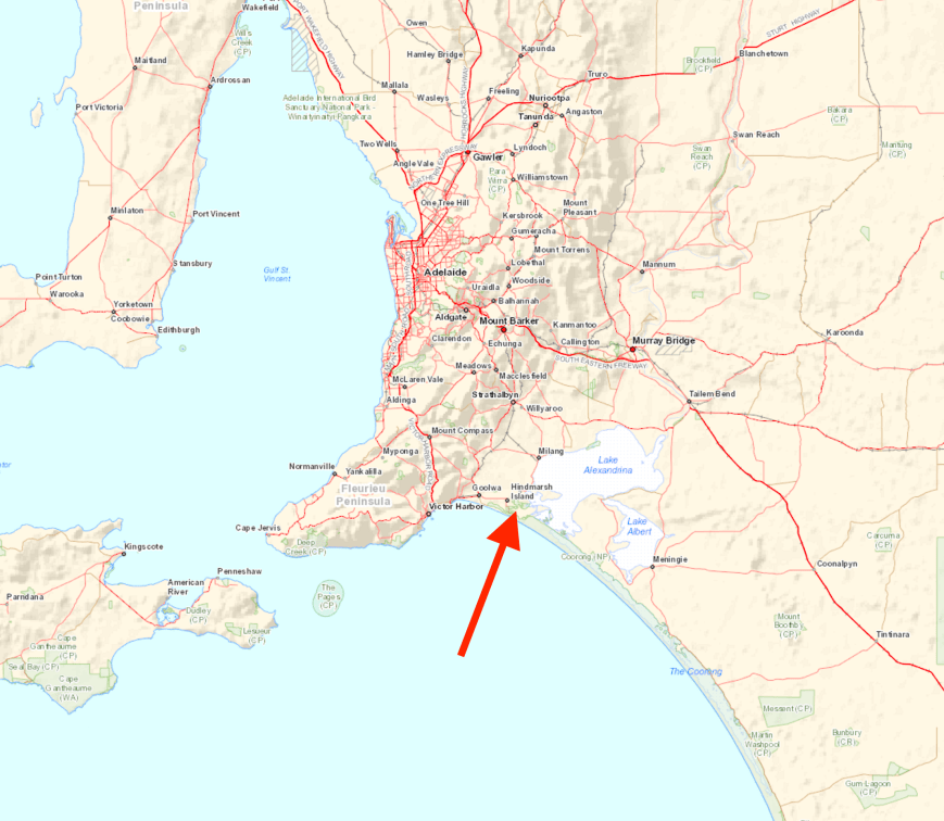
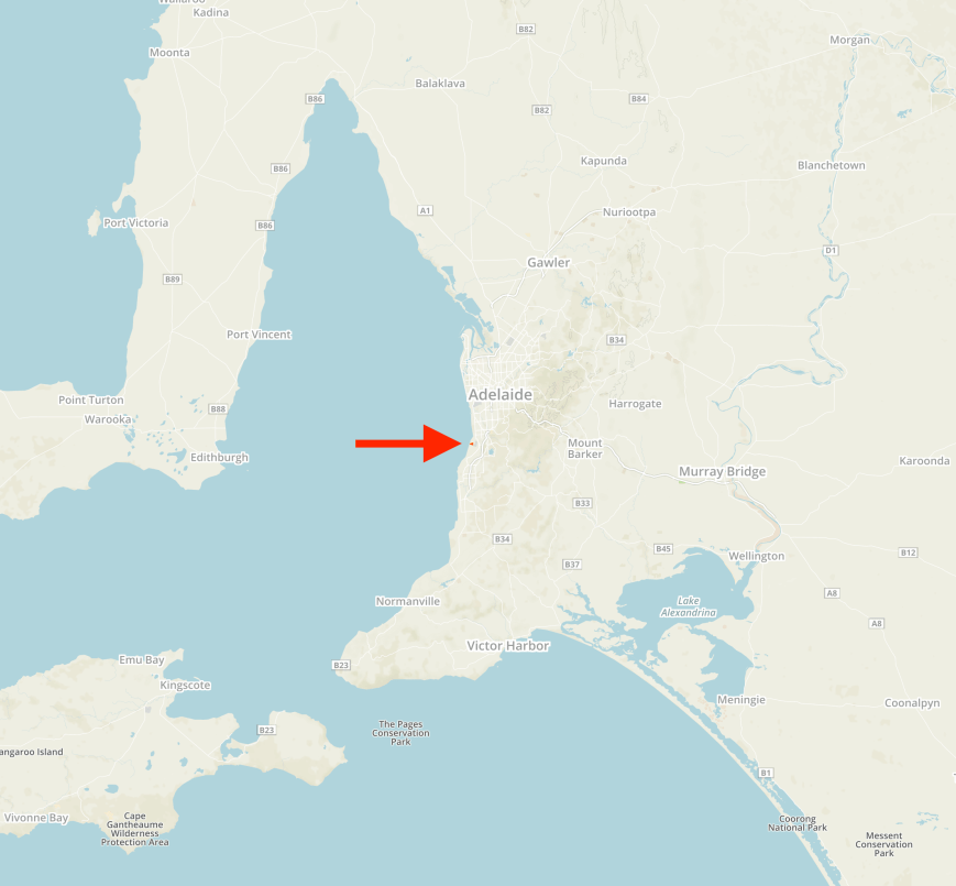
I have just finished 7 days straight at work and I was very keen to head out to activate a park today (Monday 28th August 2017).  I am running out of parks within about 300 km from home, but one park I have not activated is the Lawari Conservation Park 5CP-278 & VKFF-1767.  The park is located about 100 km south of Adelaide and about 56 km south of my home in the Adelaide Hills.

Screen Shot 2017-08-28 at 9.08.42 pm.png

Above:- Map showing the location of the Lawari Conservation Park south of Adelaide.  Map courtesy of Location SA Map Viewer.

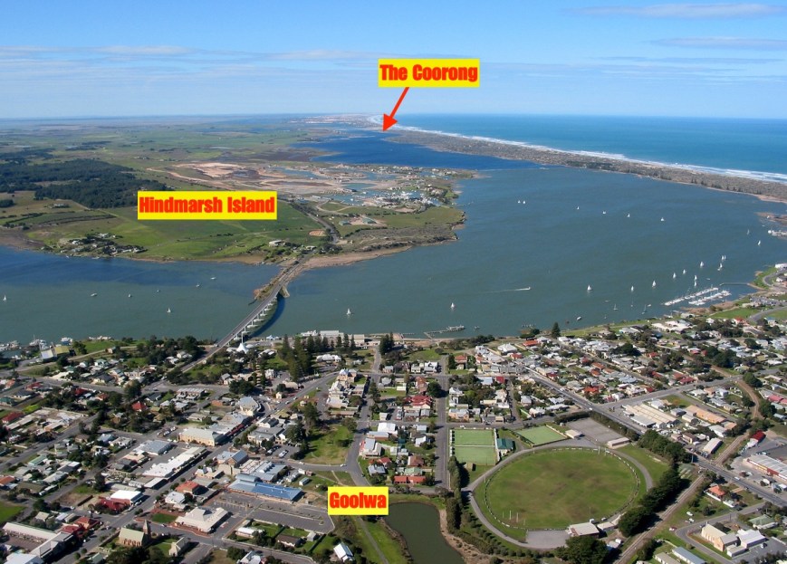
Lawari Conservation Park is located on Hindmarsh Island and is accessed via the township of Goolwa, which is a historic river port on the Murray River near the Murray Mouth.  In the local Ngarrindjeri aboriginal language, Goolwa means ‘elbow’.  The area was known as ‘The Elbow” by many of the early settlers.  Before 1837 the area was briefly considered for the site of the capital of the colony of South Australia.  Goolwa was Australia’s first inland port (1853) built to connect Goolwa to Port Elliot and later extended to Victor Harbor, allowing goods to move from river boats to sea boats, so that neither had to negotiate the Murray Mouth.

01 Goolwa Murray Mouth Aerial.jpg

Above:- Aerial view showing Goolwa, the Hindmarsh Island bridge and the island, and also the Coorong.  Image courtesy of Alexandinra Council.

Hindmarsh Island, known Kumerangk in the local aboriginal language, is a popular tourist destination.  Tourism to the island has increased in popularity since the opening of the Hindmarsh Island bridge in 2001.

DSC_7992.jpg

The island is 45.5 km2 in size, with a length of 14.7 km and a width of 6.5 km.  The island has a coastline of 43.7 km.  Its highest elevation is just 25 metres.  The island’s population is around 1,200.  It has a marina development and tavern.

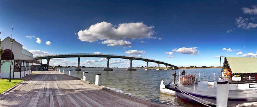
Construction on the Hindmarsh Island bridge, linking the island to Goolwa, commenced in October 1999, with the bridge being completed in March 2001.  The bridge is 319 metres in length, with a height of 19 metres.

The bridge became a focus of national controversy when a group of local Indigenous people, the Ngarrindjeri, and some landowners objected to its construction.  It was alleged that the Ngarrindjeri objectors fabricated the cultural significance of the island (the Secret Women’s Business)  in order to help fight the development.  A later Royal Commission decided that the Secret Women’s Business was in fact made up. Construction was blocked by the Keating Labor Government, but given the go-ahead by the Howard Liberal Government in 1996.

Five years after the Royal Commission findings, the Ngarrindjeri who had stated the bridge desecrated sites sacred to women were vindicated, with a Federal Court Judge finding that restricted women’s knowledge was not fabricated or that it was not part of genuine Aboriginal tradition.

Goolwa Wharf

Above:- the Hindmarsh Island bridge.  Courtesy of Alexandrina Council.

The first European to set foot on Hindmarsh Island was Captain Charles Sturt.  He used the island as a viewing point and from there he sighted the Murray Mouth.  Captain Collet Barker surveyed the Murray Mouth but was killed by aboriginals after swimming across the Mouth.  The island was named by Captain John William Dundas Blenkinsop after South Australia’s first Governor, Sir John Hindmarsh.

Above:- Captain Charles Sturt (left) and Sir John Hindmarsh (right).  Images courtesy of wikipedia.

There is a monument on the island which commemorates explorers Captain Charles Sturt and Captain Collet Barker near the site where Sturt first saw the waters of Encounter Bay.

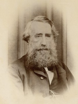
Dr. John Rankine (1801-1864) was granted an occupational licence to become the island’s first grazier.  He is recognised as founding the township of Strathalbyn, just down the road from my home.

John_Rankine

Dr. John Rankine.  Image courtesy of wikipedia

The Lawari Conservation Park is a relatively new park, having been gazetted on 21st March 2017.  The park is 1.058 km2  (1,058-hectare) in size and is located at the eastern end of Hindmarsh Island, within an area of wetlands that support a large number of threatened fish and water bird species.  The park supports three native fauna species of national conservation significance, and a further 30 fauna and one flora species at the state level, including the Far Eastern Curlew and Cape Barren Goose.  It is situated within an area of internationally important wetlands formally recognised as the Coorong and Lakes Alexandrina and Albert Ramsar Reserve.

Lawari Conservation Park comprises two former grazing properties, purchased with assistance from the Commonwealth’s National Reserve System Program for inclusion into the protected area system.  This includes the former Wyndgate property.

The park includes approximately 400 hectares of fenced paddocks where cropping and cattle grazing continue under a lease agreement. These farmed paddocks are managed in a way that provides a high quality summer feeding habitat for Cape Barren geese.  Although I did not sight either of these 2 birds, the park was alive with various other native birds.  See my photos below.

This slideshow requires JavaScript.

Despite this being a large park, there really are limited operating opportunities.  To start off with I travelled along Denver Road towards the old Wyndgate homestead.  I reached a gate, which was open, and ventured a few hundred metres down the road, but found some cars parked at the homestead, so I decided to turn around as I was not sure if I was allowed to be where I was.

DSC_7976.jpg

Above:- the gate at Denver Road

I then travelled back along Denver Road and then onto Randell Road.  I soon had the park to my right.  However, there was an electric fence and no tree cover.

I travelled to the very end of Denver Road, but could not find any suitable places to access the park.  There were some nice views from here across the water to the little town of Clayton.

DSC_7882.jpg

There was even a trig point here, but no SOTA summit!

DSC_7880

I then travelled to the end of Mills Road, but again did not find any suitable access points into the park.  I then tried Goolwa Channel Drive, but with the nearby shacks and holidays homes I decided against this spot due to the possible noise.

I decided to try my luck along Mundoo Channel Drive.  Along the way I detoured to the Murray Mouth lookout.

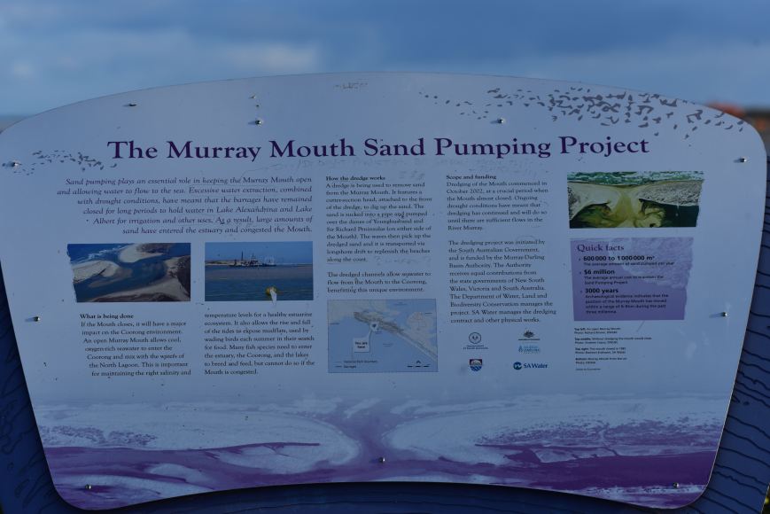
The Murray Mouth is influenced by the flow of River Murray water through the barrages and tidal movement from the Southern Ocean.  When River Murray flows to South Australia are low, barrage releases are low and sand deposits occur inside the mouth causing restrictions and increasing the risk of closure.  It is important that the mouth remains open to maintain connectivity between the river, the Coorong and the Southern Ocean, to discharge salt and other nutrients out to sea, and to maintain healthy ecosystems in the Coorong.

DSC_7957

This is certainly well worth a look if you are on the island.  There are also some great views of the Coorong, a lagoon ecosystem which runs parallel with the coastal dunes for about 140 km.  Its name is thought to be a corruption of the local Aboriginal people’s word kurangh, meaning “long neck”; a reference to the shape of the lagoon system. The name is also thought to be from the Aboriginal word Coorang, “sand dune”, a reference to the sand dunes that form the Younghusband Peninsula.

A huge amount of planting of native plants is being undertaken in the park.  During my visit there were a number of planting teams hard at work in the park.

I set up off Mundoo Channel Drive.  There was a newly created car parking area opposite the boat launching area.  I climbed over the fence and found some shade and set up my deck chair and the fold up table.  I ran the Yaesu FT-857d and the 20/40/80m linked dipole for this activation, with the power output set at 40 watts.

Screen Shot 2017-08-28 at 10.13.23 am.png

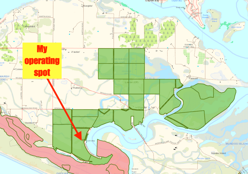
Above:- Map showing the park boundaries (in green) and my operating spot.  Map courtesy of Location SA Map Viewer.

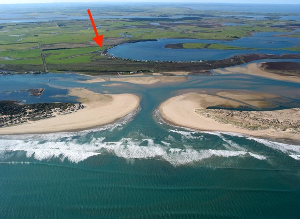
My operating spot was opposite Mundoo Channel and in close proximity to the Coorong National Park and the Mouth of the Murray, as the photo below shows.

Murray_Mouth.jpg

Above:- The Mouth of the Murray.  My operating spot on Hindmarsh Island is indicated with the red arrow.

Screen Shot 2017-08-28 at 9.57.32 pm.png

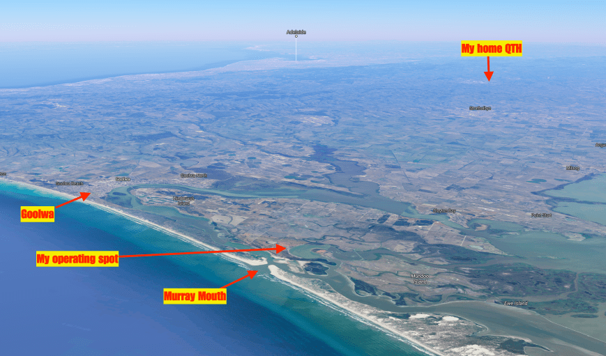
Above:- Aerial view of Hindmarsh Island, showing my operating spot, my home QTH, the Murray Mouth, and Adelaide in the background.  Image courtesy of Google Maps.

I headed to my nominated operating frequency of 7.144 and started calling CQ.  First in the log was Geoff VK3SQ who was become a regular park hunter.  Geoff had a very nice 5/9 signal from Beechworth in north eastern Victoria.  This was followed by Malcom VK1AAH in Canberra, who was also 5/9, followed by Rod VK7FRJG in Tasmania (also 5/9), and then Stuart VK3STU in Melbourne (again 5/9).  Band conditions on 40m seemed very good.

As it was a Monday, calls from the park hunters were not as frenetic as a weekend.  It took me about 20 minutes to reach contact number 10, qualifying the park for me for the VKFF program.  Contact number 10 being with Mike VK3KMH who was 5/9 +.  Callers were steady but it appeared as though I may not get the 44 QSOs required to qualify the park for the global WWFF program.  I had to resort to John VK4TJ giving me his other calls from Canada and the USA, to make up the numbers.

It wasn’t until about one hour into the activation that the callers started to really pick up.  I run a paper log out in the field, and each page contains 34 QSOs.  I always enjoy reaching the 34 QSO mark, as this means a new page, and just 10 QSOs to go for the park to be qualified.

I ended up logging a total of 53 QSOs on 40m from VK1, VK2, VK3, VK4, VK5, and VK7, with the vast majority of signals being very good.  Even the lower down stations were very readable, as there was NO noise in the park.  The band was dead silent when I released the PTT button.  Close in propagation was not working on 40m, with only Les VK5KLV from Port Augusta and Greg VK5GJ logged.

I headed off to 80m where I called CQ, and this was answered by George VK3MVP who had followed me down from 40m.  Next up was Greg VK5GJ running QRP 4 watts with a good 5/8 signal.  I logged a further 8 stations on 80m from VK2, VK3, and VK5.  Again, despite it being daylight, my signal was being quite well heard in Victoria and New South Wales.  I would encourage all park activators to give 80m a go during their activation.

I then headed over to 14.310 on the 20m band and logged just 3 stations.  The first being John VK4TJ, followed by Jonathan VK7JON, and finally Phil VK6ADF.

To complete the activation I head back to 40m for a quick QSO with my wife Marija VK5FMAZ, who had arrived home from work.

After 2 & 1/2 hours in the park I had a total of 67 stations in the log, on 20, 40, & 80m SSB, and another unique park in the bag for me as an activator.

I worked the following stations on 40m SSB:-

  1. VK3SQ
  2. VK1AAH
  3. VK7FRJG
  4. VK3STU
  5. VK2GKA
  6. VK2FABE
  7. VK3BBB
  8. VK3PF
  9. VK2NP
  10. VK3KMH
  11. VK7JON
  12. VK2VRC
  13. VK3TKK/m
  14. VK3ZMD
  15. VK3ARG
  16. VK4RF
  17. VK4HA
  18. VK3PAT/m
  19. VK3OHM
  20. VK3FLJD
  21. VK3MBW
  22. VK4TJ
  23. VK4/AC8WN
  24. VK4/VE6XT
  25. VK1JY
  26. VK1AT
  27. VK3FMAA/m
  28. VK3KMA
  29. VK3VGB
  30. VK2DSG
  31. VK3FJAE
  32. VK3UH
  33. VK2HHA
  34. VK3GGG
  35. VK3PMG
  36. VK5MR
  37. VK3DHI/4
  38. VK3FAHS
  39. VK1FWBK
  40. VK2YMU
  41. VK5KLV
  42. VK3MVP
  43. VK3FOTO/m
  44. VK5GJ
  45. VK4VCO/m
  46. VK4YLU
  47. VK3VIN
  48. VK3GAZ
  49. VK3UT
  50. VK4HNS
  51. VK3PTL
  52. VK2LO
  53. VK2SOL
  54. VK5FMAZ

I worked the following stations on 80m SSB:-

  1. VK3MVP
  2. VK5GJ
  3. VK5ATN
  4. VK5FANA
  5. VK5PL
  6. VK5KLV
  7. VK3PF
  8. VK2EXA
  9. VK3SQ
  10. VK2MOP

I worked the following stations on 20m SSB:-

  1. VK4TJ
  2. VK7JON
  3. VK6ADF


References.

Department of Enviroment, Water and Natural Resources, 2017, <https://www.environment.sa.gov.au/Home/Full_newsevents_listing/News_Events_Listing/170419-new-park-lawari&gt;, viewed 28th August 2017

Natural Resources SA Murray Darling Basin, 2017, <http://www.naturalresources.sa.gov.au/samurraydarlingbasin/projects/all-projects-map/wyndgate-property-planning&gt;, viewed 28th August 2017

Wikipedia, 2016, <https://en.wikipedia.org/wiki/Goolwa,_South_Australia&gt;, viewed 28th August 2017

Wikipedia, 2017, <https://en.wikipedia.org/wiki/Hindmarsh_Island&gt;, viewed 28th August 2017

Wikipedia, 2017, <https://en.wikipedia.org/wiki/Lawari_Conservation_Park&gt;, viewed 28th August 2017
Wikipedia, 2017, <https://en.wikipedia.org/wiki/Coorong_National_Park&gt;, viewed 28th August 2017

ILLW and Marino Conservation Park 5CP-126 and VKFF-1056

Yesterday (Saturday 19th August 2017) my wife Marija VK5FMAZ and I headed down to the southern suburbs of Adelaide and activated the Marino Rocks lighthouse AU-0018 and the Marino Conservation Park 5CP-126 & VKFF-1056 for the 2017 International Lighthouse and Lightship Weekend (ILLW).

The park is located about 44 km from our home in the Adelaide Hills, and about 19 km south of the city of Adelaide.

This was to be a unique park for both Marija and I as activators for both the World Wide Flora Fauna (WWFF) program, and the VK5 National & Conservation Parks Award.

Screen Shot 2017-08-16 at 7.42.22 pm.png

Above:- Map showing the location of the Marino Conservation Park.  Image courtesy of Protected Planet.

The International Lighthouse and Lightship Weekend is held annually every August.  The ILLW is not a contest.  It is a fun weekend to raise the profile of lighthouses, lightvessels and other navigational aids, and preserve our maritime heritage.

illw_logo.jpg

The Marino Rocks lighthouse is a white coloured concrete structure, 14.9 metres (49 feet) high.  The lighthouse is 128 metres (420 feet) above sea level.  It was constructed in 1962 so in relative terms is a young lighthouse.   It shows 2 flashes every 15 seconds with an intensity of 1,000,000 candelas having a range of 42 km.

The Marino Rocks lighthouse supersedes the Wonga Shoal beacon erected on a sandy shoal off Semaphore, which was knocked down by the sailing ship ‘Dimsdale’ in 1912. Consturction of the Wonga Shoal lighthouse was completed by July 1901.  It was an iron structure on screw piles with accommodation for two keepers.  The revolving light, weighing 11 tons floating on a bath of mercury weighing 5 tons, was 74 feet above the highwater and was visible for 19 miles.

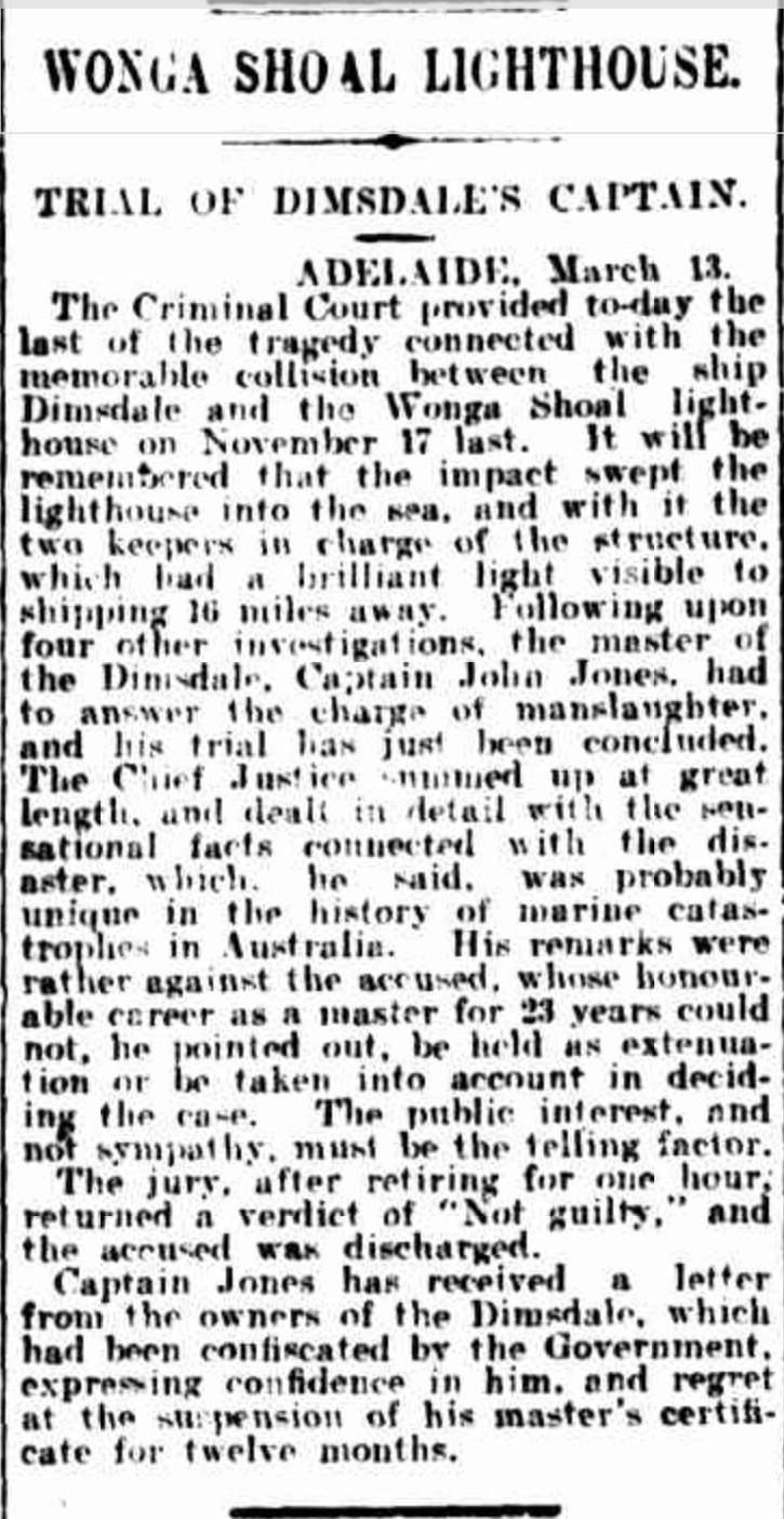
On the evening of 16th November 1912 the British ship Dimsdale sailed up Gulf St Vincent, in ballast, seeking cargo.  The Dimsdale’s captain, Captain John Jones had laid a course for the Wonga light and as he drew near, he ordered the course altered to keep the long on his port bow.  However the Dimsdale was slow to respond and despite desperate efforst to avert the accident, the ship struck the lighthouse which crashed into the sea.  Both lighthouse keepers, Henry Franson and Charles McGowan drowned as a result.

A court of inquiry found Captain Jones guilty of negligence and as a result his master’s certificate was suspended for 12 months.  He was acquitted of the criminal offence of manslaughter.

Screen Shot 2017-08-20 at 5.29.04 pm.png

Above:- A 1913 news article on the outcome of the court case.  Courtesy of Trove.

Following the tragedy, the destroyed lighthouse was replaced temporarily by a lightship, and later by a new steel structure.  When the Marino Rocks lighthouse was completed in the early 1960’s the Wonga Shoal Light was finally extinguished.

The Marino Conservation Park which is 30 ha (74 acres), was established on the 2nd November 1989.  It is located in the southern Adelaide suburb of Marino.  In 1875 a proposal was put forward to build an outer harbour at Marino.  The proposal was furthered in 1880 in a report by Captain H.S. Stanley, R.N.  and in 1901 a Marino Outer Harbour League was formed.  However, in 1908 the construction of the Outer Harbour near Port Adelaide finally laid these plans to rest.

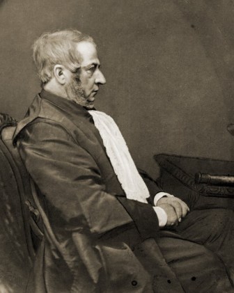
The exact origin of the name of Marino is unclear.   It is generally believed that Marino is named after two landmarks known to Charles Kingston, who bought property in the area in 1849.  Charles Kingston, an Irishman who came out to South Australia on board the Cygnet.  He would often boast that he was “the first Irishman to set foot in the colony”.  Kingston was born in Bandon, County Cork, 19 km from a prominent point called Marino Point.  There was also a Marino district in Dublin.


George_Strickland_Kingston.jpg

Above:- George Strickland Kingston.  Courtesy of wikipedia.

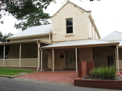
In 1840 a small wooden Marino Inn was built in the area.  Three years later, the Inn closed as the expected trade did not eventuate.  Some years later George Kingston decided to convert it into an ‘occasional residence’.  It eventually grew into a large stone home for the Kingston family.  Following the death of George Kingston the home was occupied by his son Charles, and following his death was the home of his eccentric widow, Lucy Kingston who was known as ‘Mad Lucy’.  She is reported to often carry a big stick and knife with her.  A resident at the time reported that he saw a person ‘chatting pleasantly with Mrs Kingston, who had in her possession a razor, a revolver and a bludgeon, when suddenly she made a blow at his head’.   Fortunately we did not encounter anybody like ‘Mad Lucy’ during our activation.

IMG_3099.jpg

Above:- Kingston House

In the local Aboriginal Kuarna language marra is hand and marrana is the plural – hands. In early maps the area was referred to as Marina.  In the book ‘South Australia.  What’s in a name’ dated 1908, there is a suggestion that the name represents the Italian spelling of the word marine.  A writer in the South Australian Magazine in 1842 states: “Marino was not named as some suppose, from a seaport of Italy, but probably from San Marino, the inland town in a Republic of the same name, situated on that side which is bounded by the Adriatic Sea, and called after its founder, San Marinus”.

The Marino Conservation Park aims to protect flora such as the ground cover Desert Saw Sedge and Twiggy Daisy Bush Oleria ramulosa.  Native grass species such as Danthonia species and Stipa species as well as groundcovers dominate the central and eastern portions of the conservation park.  The Elegant Wattle can also be seen in the conservation park.  The steep west-facing hillside above the railway line contains a very significant remnant area of coastal heath vegetation, including rare plants such as lemon beauty heads, shiny ground berry and native apricot.   

Over 39 species of native bird have been recorded in the park including Crested Pigeon, Singing Honeyeater, Australian Magpie, Little Raven, Willie Wagtail, Silvereye, Australian Pipit, Australian Hobby, Yellow-rumped Thornbill, Black-faced Cuckooshrike, and Brown Songlark.

There is a 1.5 km self-guided botanical trail in the park which starts from the car park with two gentle hills to climb.  There are also a number of wooden benches allowing you to catch your breath and enjoy the amazing views.

There is an active Friends of the Parks group for Marino.  We spoke with a few of those during our activation and they were both very interested in what we were doing.

We accessed the park via Nymboya Road.  There is a car parking area here.  There is no vehicular access into the park beyond the locked gate here.  So we loaded up the gear on a sack trolley and in a backpack, and commenced the 1.5 km walk to the lighthouse.  We followed the 4wd track which ran towards the southern section of the park and then followed the southern boundary of the park.

We set up under the shade of some trees near a walking trail to the north west of the lighthouse.

Screen Shot 2017-08-16 at 7.42.05 pm.png

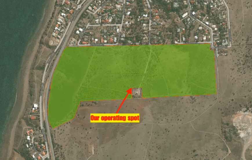
Above:- Aerial view of the park showing our operating spot.  Image courtesy of Protected Planet.

Once we got to the lighthouse we took a breather and enjoyed the sensational views back towards the Adelaide CBD and along the Adelaide coastline.

There were also some sensational views out across the Gulf St Vincent towards Yorke Peninsula.  There were quite a few boats out in the Gulf taking advantage of the fantastic weather.

For this activation we ran the Yaesu FT-857d set at 10 watts PEP for Marija, and 40 watts for me.  Our antenna was a 80/40/20m linked dipole, inverted vee, supported on a 7m heavy duty telescopic squid pole.

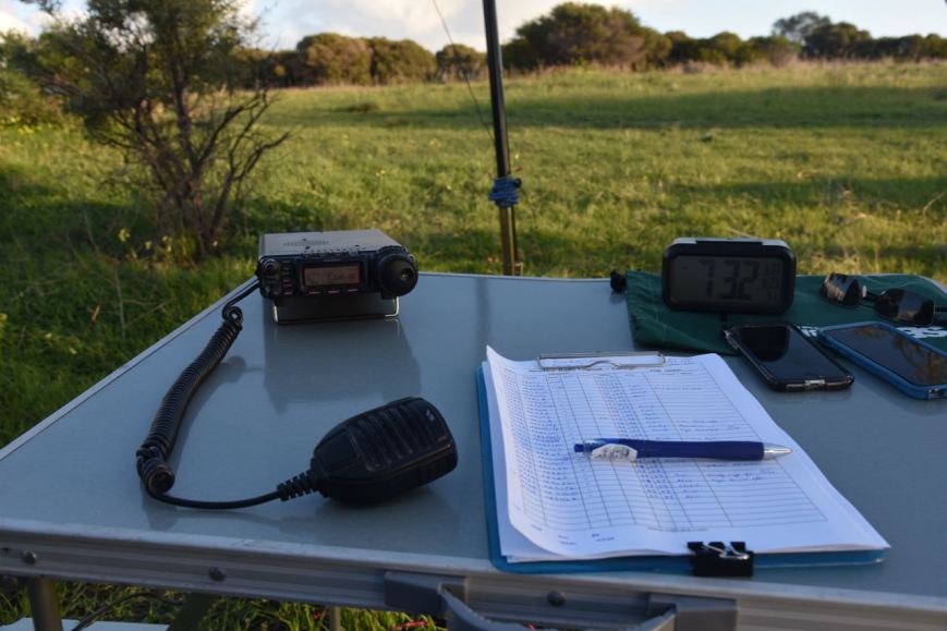
DSC_7869

Above:- ‘the shack’

Despite literature and signs stating that dogs may be walked in the park along designated trails, and that they must remain under your control on a lead at all times, this didn’t occur in practice at the park during our visit.  We even had a woman walking her dog off the lead, with the dog running up to us and peeing alongside our table just after we had set up.

I started off the activation, with number one in the log being Geoff VK3SQ at Beechworth.  This was followed by Julie VK3FOWL, Brett VK2FSAV and then Stuart (VK3STU) VK3SPL at the Split Point lighthouse.  Sadly band conditions on 40m were less than ideal, with lots of fading (QSB) on signals.  Many of the regular Victorian park hunters who are normally S9, were a number of S points lower.  Ten contacts are required to qualify a park for the VKFF program, and these normally come very quickly.  It took me 20 minutes to get to contact number 10, which was with Peter VK3KU.

I continued on until I had 44 contacts in the log.  Contact number 44, qualifying the log for me for the global WWFF program, was with VK5BWR at the Point Lowly lighthouse near Whyalla.  It was a little disappointing, as number one the band was in quite poor shape.  And secondly there did not seem to be a lot of lighthouse stations on air.  I had logged just 5 lighthouse activators.  I had managed three Park to Park QSOs.  They being with Stef VK5HSX/2 in VKFF-0065, Gerard VK2JNG/p in VKFF-1778, and Phil VK6CLL in VKFF-0283.

We then swapped ‘driver’s seats’, with Marija taking charge of the mic.  The power was lowered down to 10 watts PEP, the allowable amount under Marija’s Foundation licence.  Marija’s first contact after calling CQ was with VK5BWR at the Point Lowly lighthouse, followed by VK3OLS at the Cape Otway lightstation, and then Geoff VK3SQ.  Marija’s 10th contact, qualifying the park for her for VKFF was with Garry VK7GG.  Whilst I went off for a walk in the park, Marija continued on and had soon racked up 44 contacts.  QSO number 44 for Marija was with Ken VK3UH.  Marija had seven lighthouse stations in the log, and three Park to Park contacts.

I then jumped back on air on 40m, and logged a further 27 stations from Vk1, VK3, VK4, VK5, and VK7, including five more lighthouse stations and another Park to Park with Gerard VK2JNG/p who had moved to a new park, the Glenrock State Conservation Area VKFF-1319.

I took a short lunch break whilst Marija again took charge of the mic logging another 9 stations including VK3OLS at the Cape Otway lightstation AU-0011 and VK3ATL at Point Lonsdale lighthouse AU-0028.

After lunch I jumped back on the mic, and whilst activating, Ian VK5MA arrived to say g’day.  Marija kept Ian company for about 20 minutes whilst I continued to work the steady pile.  Eventually the callers dried up and it was a good opportunity of putting down the mic to say hello to Ian and catch up on his recent trip to VK6, where he activated a number of parks.

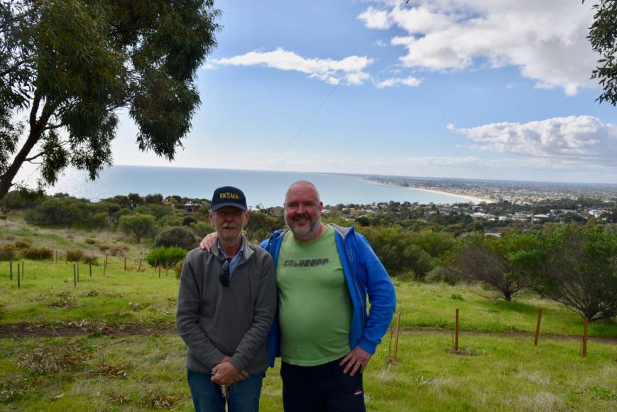
DSC_7865

Above:- with Ian VK5MA.  Adelaide in the background.

After Ian had left, I tried my luck on the 80m band.  Although there had been a small opening on 40m locally, I was hoping to work a lot more VK5’s on 80m.  Sadly, I logged just 4 stations on 80m, with one of those being VK5ARC at the Point Malcolm lighthouse.  It was a real shame that there were not more callers as the band conditions on 80m were excellent.

I then headed to 14.310 on the 20m band where I logged 13 stations, including a few more lighthouse stations.  My only DX worked on 20m was with Barrie W7ALW in Montanna.  No long path Europe was heard.  Being at the bottom of the solar cycle means that the pile up from Europe which I experienced from many parks years ago, is certainly a thing of the past.  Lets hope conditions improve!

I then moved back to 40m where I logged a further 48 stations.  This included a nice contact with ZL1LIG at the Cape Reinga lighthouse NZ-0020 at the very top of the North Island of New Zealand.  As it was now late afternoon, the European & USA stations were starting to come through.  I had 2 USA stations come up on 7.140 where I was operating, with one of those being very loud.  I apologise to those who were calling that I wasn’t able to pull through, as the QRM was just too great.  I boxed on for a few minutes before QSYing to 7.137 where I worked 5 stations before going QRT.

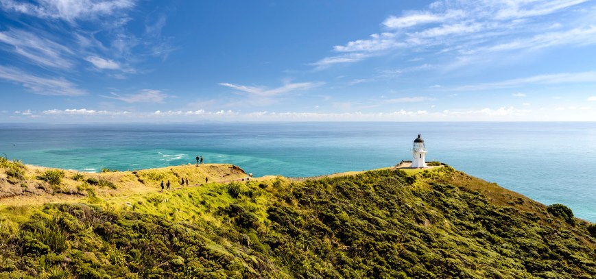
backpacker-bus-cape-reinga.jpg

Above:- Cape Reinga lighthouse.  c/o http://www.backpackerbus.co.nz

It was fast approaching 5.30 p.m. local time and it was starting to get very cold.  The temperature had dropped dramatically to around 8 deg C.  I had pushed my luck with Marija, having been in the park all day.  Marija and I packed up, with a total of 210 contacts in the log, including 22 different Australian lighthouses and one NZ lighthouse.  Amongst that were also 10 Park to Park contacts.  Whilst packing up and walking back to the vehicle we enjoyed a magnificent sunset.

We worked the following lighthouses:-

  • VK2BOR, Tacking Point lighthouse AU-0034
  • VK2EP, Smoky Cape lighthouse AU-0031
  • VK2HBG, Warden Head lighthouse AU-0035
  • VK3DNQ, Cape Nelson lighthouse AU-0055
  • VK3APC, Eastern Light McCrae AU-0017
  • VK3ATL, Point Lonsdale lighthouse AU-0028
  • VK3DJ, Queenscliff ‘Black’ lighthouse AU-0049 & AU-0096
  • VK3ILH, Citadel light Port Albert AU-0110
  • VK3OLS, Cape Otway lightstation AU-0011
  • VK3SPL, Split Point lighthouse AU-0032
  • VK3WI, Williamstown Time Ball Tower AU-0036
  • VK5ARC, Point Malcolm lighthouse AU—29
  • VK5BWR, Point Lowly lightstation AU-0021
  • VK5CJL, Cape Jervis lighthouse AU-0094
  • VK5ZGY/p, Cape Banks lighthouse AU-0121
  • VK5ZII, Tipara Reef lighthouse AU-0053
  • VK6CLL, Cape Leeuwin lighthouse AU-0008
  • VK6CNL, Cape Naturaliste lighthouse AU-0010
  • VK7LH, Low Head lighthouse AU-0048
  • VK7GG, Rocky Cape lighthouse AU-0066
  • VK7TZ, Round Hill Point lighthouse AU-0111
  • ZL1LIG, Cape Reinga lighthouse NZ-0020

illw-net_1_orig

Marija worked the following stations on 40m SSB:-

  1. VK5HSX/2 (Bundjalung National Park VKFF-0065)
  2. VK2JNG/p (Blue Gum Hills Regional Park VKFF-1778)
  3. VK6CLL (Cape Leeuwin lighthouse AU-0008 and Leuwin-Naturaliste National Park VKFF-0283)
  4. VK5BWR (Point Lowly lighthouse AU-0021)
  5. VK3OLS (Cape Otway lightstation AU-0011)
  6. VK3SQ
  7. VK3GGG
  8. VK3PMG
  9. VK7KJL
  10. VK7GG
  11. VK5FANA
  12. VK5FMWW
  13. VK3TKK/m
  14. VK3BNC
  15. VK3SFG
  16. VK7JON
  17. VK3ARH
  18. VK3NLK
  19. VK3PF
  20. VK7TZ (Round Hill Point lighthouse AU-0011)
  21. VK5VCO
  22. VK3MKM
  23. VK5MK
  24. VK3SPL (Split Point lighthouse AU-0032)
  25. VK3ZPF
  26. VK3DX (Lady Bay Upper & Lower lighthouses AU-0049 & AU-0096)
  27. VK5ZGY/p (Cape Banks lighthouse AU-0121)
  28. VK2BOR
  29. VK5KBF
  30. VK3LCW
  31. VK3AFB
  32. VK7RX/3
  33. VK3FLJD
  34. VK3FRDL
  35. VK2PKT
  36. VK5EMI
  37. VK3FOWL
  38. VK2KYO
  39. VK3ANL
  40. VK5DWC
  41. VK3FMMB
  42. VK6JAH/p
  43. VK3HKV
  44. VK3UH
  45. VK5NAL
  46. VK1AT
  47. VK2JNG/p (Glenrock State Conservation Area VKFF-1319)
  48. VK7HSC
  49. VK2YW
  50. VK3FI
  51. VK3OAK
  52. VK3MBW
  53. VK3OLS (Cape Otway lightstation AU-0011)
  54. VK2MTC
  55. VK3ATL (Point Lonsdale lighthouse AU-0028)
  56. VK2HHA
  57. VK3APC/p (Eastern Light McCrae AU-0017)
  58. VK3ILH (Citadel light, Port Albert AU-0110)

I worked the following stations on 40m SSB:-

  1. VK3SQ
  2. VK3FOWL
  3. VK2FSAV
  4. VK3SPL (Split Point lighthouse AU-0032)
  5. VK3MKM
  6. VK4HNS/p
  7. VK5HYZ
  8. VK2WQ
  9. VK3ER
  10. VK3KU
  11. VK5HSX/2 (Bundjalung National Park VKFF-0065)
  12. VK3SFG
  13. VK2VW
  14. VK3DNH
  15. VK2NP
  16. VK3ARH
  17. VK4PDX
  18. VK2UH
  19. VK4RF
  20. VK4HA
  21. VK3PF
  22. VK3ZPF
  23. VK1DI
  24. VK3DJ/p (Queenscliff ‘Black’ lighthouse AU-0050)
  25. VK7VKV/6
  26. VK1HW
  27. VK3KYO
  28. VK3IRM
  29. VK2JNG/p (Blue Gum Hills Regional Park VKFF-1778)
  30. VK3TKK/m
  31. VK6CLL (Cape Leeuwin lighthouse AU-0008 and Leuwin-Naturaliste National Park VKFF-0283)
  32. VK5MK
  33. VK2PKT
  34. VK3PAT
  35. VK3FOGY
  36. VK3JDA
  37. VK3MNZ
  38. VK3MCK
  39. VK3GGG
  40. VK3PMG
  41. VK3OLS (Cape Otway lightstation AU-0011)
  42. VK5FILL
  43. VK7GG
  44. VK5BWR (Point Lowly lighthouse AU-0021)
  45. VK1AT
  46. VK5NAL
  47. VK5ZGY/p (Cape Banks lighthouse AU-0121)
  48. VK5NM
  49. VK5FMLO
  50. VK4QQ
  51. VK5KIK
  52. VK3LCW
  53. VK3PP
  54. VK3RW
  55. VK3GMC
  56. VK3WI (Williamstown Timeball Tower AU-0036)
  57. VK3XV/p
  58. VK2BOR (Tacking Point Lighthouse AU-0034)
  59. VK3UH
  60. VK2HBG/p (Warden Head lighthouse AU-0035)
  61. VK5MR
  62. VK3DNQ/p (Cape Nelson lighthouse AU-0055)
  63. VK3ANL
  64. VK7DW
  65. VK2HHA
  66. VK2JNG/p (Glenrock State Conservation Area VKFF-1319)
  67. VK3MRH
  68. VK2GKA
  69. VK4FARR
  70. VK7HSC
  71. VK2YW
  72. VK3APC (Eastern Light McCrae AU-0017)
  73. VK7OT
  74. VK5ND
  75. VK1RZ
  76. VK1MTS
  77. VK7JON
  78. VK7GG/m (Rocky Cape lighthouse AU-0066)
  79. VK3QS
  80. VK3TCT
  81. VK3YE
  82. VK5YX
  83. VK3MBW
  84. VK2YK
  85. VK2WWV
  86. VK3CCW
  87. VK5FANA
  88. VK2BHO
  89. VK3ILH (Citadel light, Port Albert AU-0110)
  90. VK5DWC
  91. VK5GI
  92. VK5LA
  93. VK5FMWW
  94. VK5DW
  95. VK3FI
  96. VK3PI
  97. VK3LK
  98. VK7LH/p (Low Head lighthouse AU-0048)
  99. VK5NPP/p
  100. VK6CNL (Cape Naturaliste lighthouse AU-0010)
  101. VK2FOUZ
  102. VK5ZII/p (Tipara Reef lighthouse AU-0053)
  103. VK5FPAC
  104. VK4TMZ
  105. VK5XY
  106. VK4CGW/p
  107. VK1MDP
  108. ZL1LIG (Cape Reinga lighthouse NZ-0020)
  109. VK5KC
  110. VK2EP (Smoky Cape lighthouse AU-0031)
  111. VK5CJL (Cape Jervis lighthouse AU-0094)
  112. VK3SPL (Split Point lighthouse AU-0032)
  113. VK3MCD
  114. VK2HLK
  115. VK3NUC
  116. VK3NU
  117. VK2LEE
  118. VK6FFAR
  119. ZL4KD
  120. VK4ZD
  121. VK6BSA
  122. VK4TUB
  123. VK2QK
  124. VK6EA
  125. VK5HBE
  126. VK4PDR
  127. VK2DE
  128. VK4QP/p
  129. VK3MPR
  130. VK2JAZ
  131. VK6FNLW
  132. VK6NTE
  133. VK2PDW
  134. VK5FIVE
  135. VK7FRJG

I worked the following stations on 80m SSB:-

  1. VK5FANA
  2. VK5ARC/p (Point Malcolm lighthouse AU-0029)
  3. VK5SF
  4. VK5GJ

I worked the following stations on 20m SSB:-

  1. VK2VOL
  2. VK6CLL (Cape Leeuwin lighthouse AU-0008 and Leuwin-Naturaliste National Park VKFF-0283)
  3. VK6ADF/p (Cape Leeuwin lighthouse AU-0008 and Leuwin-Naturaliste National Park VKFF-0283)
  4. VK6XN/p (Cape Leeuwin lighthouse AU-0008 and Leuwin-Naturaliste National Park VKFF-0283)
  5. VK2LEE
  6. VK6SN
  7. VK4FI
  8. VK4DP
  9. W7ALW
  10. VK4DL
  11. VK4SMA
  12. VK6NU
  13. VK5NRG


References.

Birds SA, 2017, <http://www.birdssa.asn.au/location/marino-conservation-park/&gt;, viewed 20th August 2017

Cockburn, R., 2002, ‘South Australia What’s in a Name?’

Nicol; S., 1997, Adelaide Region RAA Touring book

Professional Historians Australia, 2017, <http://www.sahistorians.org.au/175/chronology/november/17-november-1912-wonga-shoal.shtml&gt;, viewed 20th August 2017

SeaSide Lights, 2017, <http://www.seasidelights.com.au/au/sa/marinorocks.asp?fState=SA&gt;, viewed 20th August 2017

State Library South Australia, 2017, <http://www.samemory.sa.gov.au/site/page.cfm?u=638&c=2684&gt;, viewed 20th August 2017

Wikipedia, 2017, <https://en.wikipedia.org/wiki/Marino_Conservation_Park&gt;, viewed 20th August 2017

Wikipedia, 2017, <https://en.wikipedia.org/wiki/Marino,_South_Australia&gt;, viewed 20th August 2017

Wikipedia, 2017, <https://en.wikipedia.org/wiki/George_Strickland_Kingston&gt;, viewed 20th August 2017

Adelaide Dolphin Sanctuary VKFF-1880

Yesterday (Monday 14th August 2017) I commenced a few days off from work, and as it was such a beautiful sunny day I decided to head down to Port Adelaide and activate one of the newly added parks for the World Wide Flora Fauna program, the Adelaide Dolphin Sanctuary VKFF-1880.  This was to be the first time that this reference was put on air.

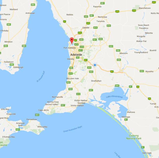
Screen Shot 2017-08-15 at 10.10.21 am.png

Above:- Map showing the location of the Adelaide Dolphin Sanctuary.  Map courtesy of Google maps.

The Adelaide Dolphin Sanctuary is located near Port Adelaide.  You could spend days here wandering around the streets of the Port.  Port Adelaide is well known for its well preserved 19th century buildings which reflect the maritime history of the area.

Amongst the many things to see is the and the Clipper ship, the City of Adelaide, which is the world’s oldest surviving clipper ship.  The City of Adelaide was built in Sunderland, England, and launched on 7th May 1864.  The ship was commissioned in the Royal Navy as HMS Carrick between 1923 and 1948 and, after decommissioning, was known as Carrick until 2001.  At a conference convened by HRH The Duke of Edinburgh in 2001, the decision was made to revert the ship’s name to City of Adelaide, and the duke formally renamed her at a ceremony in 2013.

When the City of Adelaide was decommissioned she was towed to the River Clyde in Scotland where it remained until 1991, when she sank.  She was recovered by the Scottish Maritime Museum and remained there in the slipway until the Scottish Maritime Museum was issued an eviction notice by the owners of the slipway.

In 2010, the Scottish Government decided that the ship would be moved to Adelaide, to be preserved as a museum ship. In September 2013 the ship moved by barge from Scotland to the Netherlands to prepare for transport to Australia. In late November 2013, loaded on the deck of a cargo ship, City of Adelaide departed Europe bound for Port Adelaide, Australia, where she arrived on 3 February 2014.

Port Adelaide is a busy port, although a large amount of the very large ships now berth at Outer Harbor.

Also located close to the sanctuary is the Adelaide Submarine Corporation, a naval shipbuilder for the Royal Australian Navy’s Collins class submarines and Hobart class destroyers.

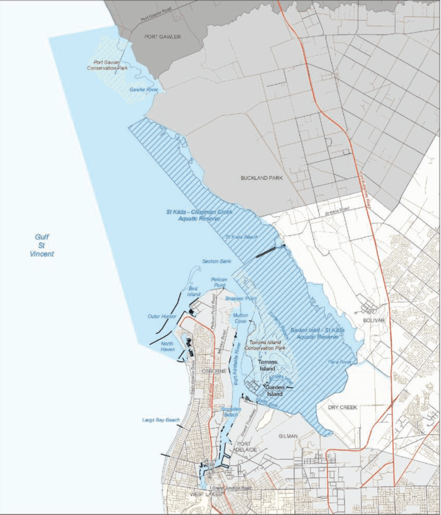
The Adelaide Dolphin Sanctuary was established in June 2005 as a result of community concerns about the safety of the dolphins living in the Port Adelaide River and Barker Inlet and their environment.  During 2002 the South Australian Government undertook public consultation to gain an understanding of how the community wanted the dolphins cared for.  As a result of overwhelming support, the Parliament proclaimed The Adelaide Dolphin Sanctuary Act 2005.

The sanctuary which is known as one of the best and most easily accessible Dolphin Sanctuaries in the world, consists of an area of 118 square kilometres and is located on the eastern shore of Gulf St Vincent.  The sanctuary includes the Port Adelaide River and Barker Inlet and from there it stretches around to North Haven Marina, then north around Outer Harbor and up the coast to the Port Gawler Conservation Park.  The area includes a 10,000 year old mangrove forest, seagrass, saltmarsh, tidal flats, tidal creeks and estuarine rivers, all of which combine to provide habitat for dolphins and their food resources.

Screen Shot 2017-08-14 at 10.47.07 am.png

The sanctuary is home to around 30-40 resident Indo-Pacific bottlenose dolphins.  Around 300 or so dolphins are thought to regularly visit the area.  This species of dolphin grows to 2.6 metres (8.5 ft) long, and weighs up to 230 kilograms.  They are not to be confused with Common bottlenose dolphins.  Indo-Pacific bottlenose dolphins live in groups that can number in the hundreds, but groups of five to 15 dolphins are most common.  Their life span is around 40 years.  Dolphins can dive to depths of more than 500 metres, but they must surface for air every few minutes.  Like whales, dolphins breathe through a blowhole on the top of their heads.

Tursiops_aduncus,_Port_River,_Adelaide,_Australia_-_2003.jpg

A Port River dolphin.  Image courtesy of Wikipedia.

Other wildlife located in the sanctuary include Long nosed fur seals, Southern Eagle Rays, and the endangered Australia Sea Lion.

The area is also a popular bird watching site and shares most of its northern coastal habitat with the Adelaide International Bird Sanctuary.   The sanctuary is home to many species of birds including some rare and endangered species.  More than 250 species have been recorded.  Certainly during my visit, the area was alive with birdlife.  Some of those that I observed are captured in the photographs below.

This slideshow requires JavaScript.

The dolphins within the sanctuary are regularly under threat.  This includes marine litter and entanglement, harrassment and disturbance, disease, habitat degradation and pollution, and vessel strikes and noise.  Human activities include dredging, boat-generated wave action, anchoring, bait digging, illegal rubbish dumping, human foot traffic, industrial discharges, stormwater runoff, construction of wharves and shore reclamation.  Discarded fishing gear poses a high threat to dolphins within the sanctuary, with a number of dolphins having become entangled by fishing line, nets and rope.

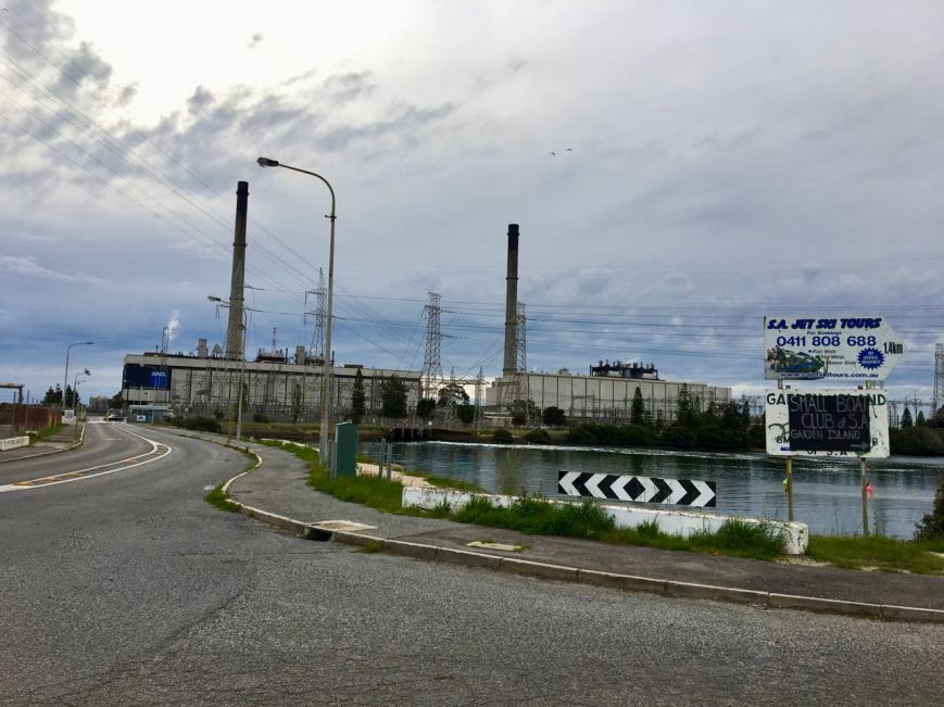
IMG_0413

Above:- the nearby power station.

I decided to travel down Grand Trunkway and onto Garden Island.  The island was a major landfill site until 2001.   Garden Island is well known as being a ship’s graveyard.   Instead of scuttling obsolete vessels in deep water, the South Australian Harbours Board decided that an easier and cheaper option was to beach and further dismantle the stripped hulks at Garden Island.  There are a total of 25 wrecks known to have been abandoned at Garden Island.

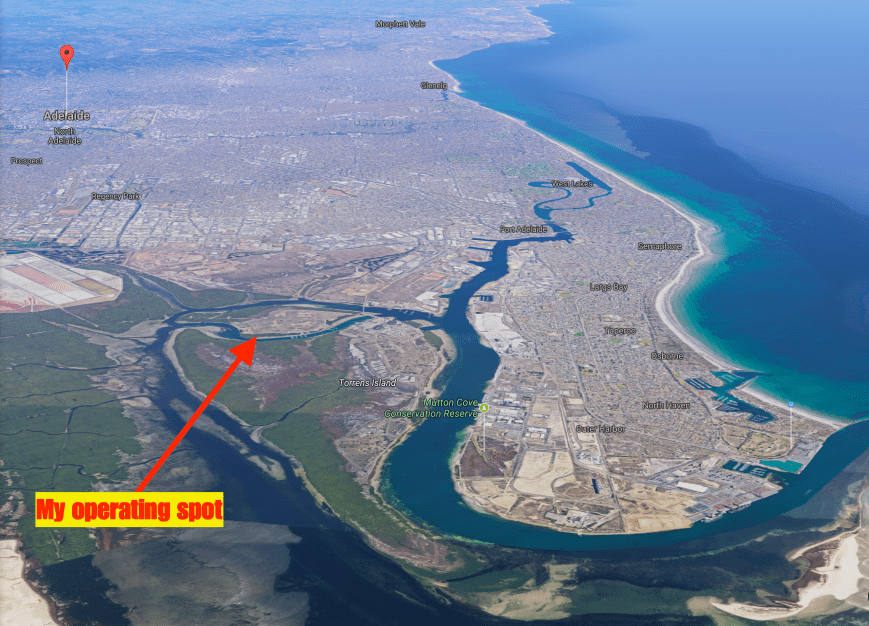
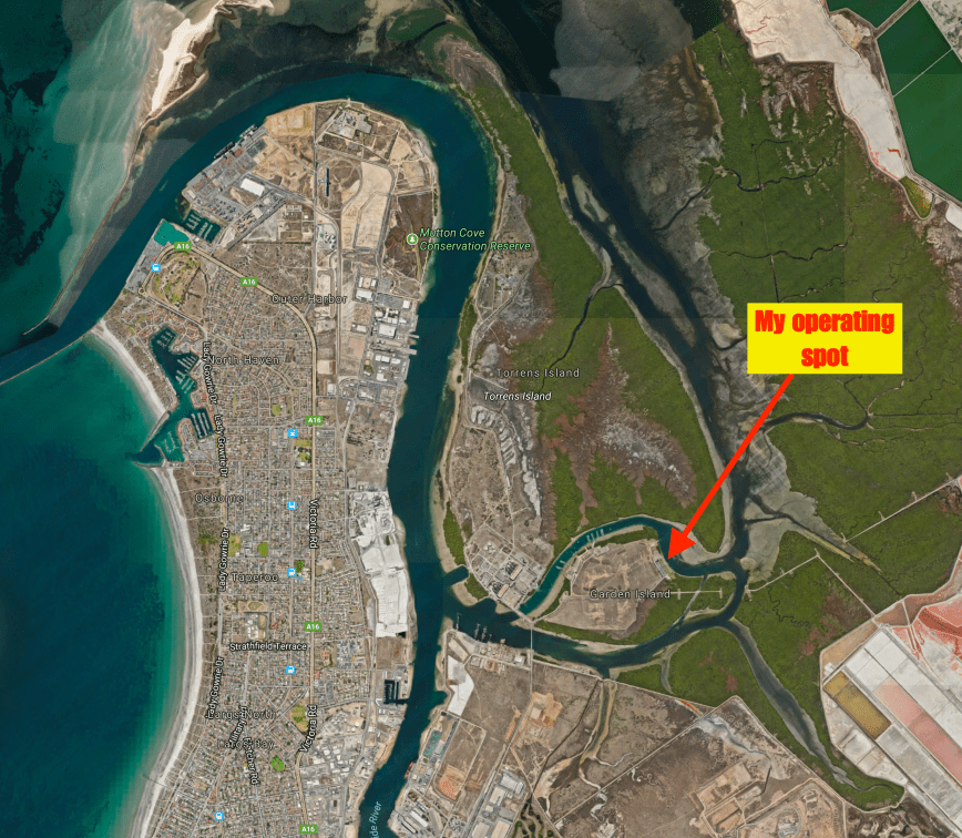
Screen Shot 2017-08-15 at 10.18.48 am.png

Above:- Aerial view of the Adelaide Dolphin Sanctuary, showing my operating spot.  Image courtesy of Google maps.

I travelled to the end of Garden Island Road and set up on the lawned area close to the waters edge, overlooking Angus Inlet.  As it was a warm and sunny day, this was an ideal place to set up, underneath the shade of the trees.

Screen Shot 2017-08-15 at 10.14.44 am.png

Above:- Aerial shot showing my operating spot.  Image courtesy of Google maps.

I was a little worried about potential noise, as the power station was nearby, along with the huge power lines running out of the station to Adelaide.  And my fears were confirmed when I switched on the Yaesu FT-857d.  I had strength 8 noise.  I decided to box on and put up with the noise, rather than packing up and relocating.  I suspect that most operating spots in the sanctuary would be noisy due to the large amount of industry in the area.

First in the log was Yern VK2KJJ, followed by Dennis VK2HHA, and then Tom VK5ZTS in the northern suburbs of Adelaide.  Tom had a great 5/9 + signal.  It was clear that propagation into Adelaide was going to be good during this activation, due to ground wave.  Contact number 10, qualifying the park for me for VKFF was with Nik VK3NLK, about 15 minutes into the activation.

The noise floor did drop to strength 7 during the activation, but it was still very hard going pulling out some of the lower signals.  I apologise to those who were calling that I was unable to work.  I know there were a number of stations who called that I was just unable to pull through the noise.

I logged a total of 47 stations on the 40m band from VK2, VK3, VK4, VK5, VK6 and VK7.  I then called CQ on 3.610 on the 80m band where I logged 3 contacts.  They being with Ron VK5MRE in the Riverland, who had followed me down from 40m.  Also Greg VK5GJ in the Adelaide Hills and Yern VK2KJJ in Wagga Wagga.  Very pleased with that contact considering the time of day on 80m.

To wrap up the activation I called CQ on 14.310 on the 20m band.  Unfortunately Rick VK4RF/VK4HA was the only station logged there.

Whilst activating I observed a number of dolphins cruising by in Angus Inlet.

After just short of 2 hours in the park it was time to go QRT and head for home.  I had a total of 52 contacts in the log and another unique park to add to my activator tally.

I worked the following stations on 40m SSB:-

  1. VK2KJJ
  2. VK2HHA
  3. VK5ZTS
  4. VK3ARH
  5. VK3PF
  6. VK7JON
  7. VK2YK
  8. VK4RZ
  9. VK3SQ
  10. VK3NLK
  11. VK5KIK
  12. VK5KDK
  13. VK4TJ
  14. VK4/AC8WN
  15. VK4/VE6XT
  16. VK5BJE
  17. VK3FLJD
  18. VK3HBG
  19. VK4HNS/p
  20. VK2QK
  21. VK2JNG/m
  22. VK3FNQS
  23. VK3NQS
  24. VK3AMX
  25. VK4RF
  26. VK4HA
  27. VK5HYZ
  28. VK3GGG
  29. VK3PMG
  30. VK2YW
  31. VK3BNJ
  32. VK3LCW
  33. VK2KYO
  34. VK5KLV
  35. VK3BBB
  36. VK3VGB
  37. VK3MROZ/m
  38. VK3MRH
  39. VK2NP
  40. VK6XN
  41. VK4SMA
  42. VK5MR
  43. VK3FI
  44. VK2TH
  45. VK3FLCS
  46. VK5MRE
  47. VK3SFG

I worked the following stations on 80m SSB:-

  1. VK5MRE
  2. VK5GJ
  3. VK2KJJ

I worked the following stations on 20m SSB:-

  1. VK4RF
  2. VK4HA


References.

Department for Environment and Heritage, 2007, Adelaide Dolphin Sanctuary Management Plan.

Department of Environment Water and Natural Resources, 2017, <https://www.environment.sa.gov.au/our-places/Heritage/maritime-heritage/visiting-shipwrecks/shipwreck-trails/Garden_Island&gt;, viewed 15th August 2017

Government of South Australia, 2014, Adelaide Dolphin Sanctuary users Guide

National Parks South Australia, 2017, <https://www.environment.sa.gov.au/parks/Find_a_Park/Browse_by_region/Adelaide/adelaide-dolphin-sanctuary&gt;, viewed 15th August 2017

Wikipedia, 2017, <https://en.wikipedia.org/wiki/Port_Adelaide&gt;, viewed 15th August 2017

Wikipedia, 2017, <https://en.wikipedia.org/wiki/Indo-Pacific_bottlenose_dolphin&gt;, viewed 15th August 2017

Nurragi Conservation Reserve VKFF-2247

On the weekend just gone I was working afternoon shift and as a result would not be able to compete in the Remembrance Day Contest.  This was a real shame as the weather was fantastic and I was hoping to go portable for the contest.  So instead I decided for a quick morning activation on Saturday 12th August 2017.

I headed to the Nurragi Conservation Reserve VKFF-2247, which is located about 70 km south east of Adelaide.  This is a newly added park to the World Wide Flora Fauna (WWFF) program, and my activation would be the first time the park had been put on air.

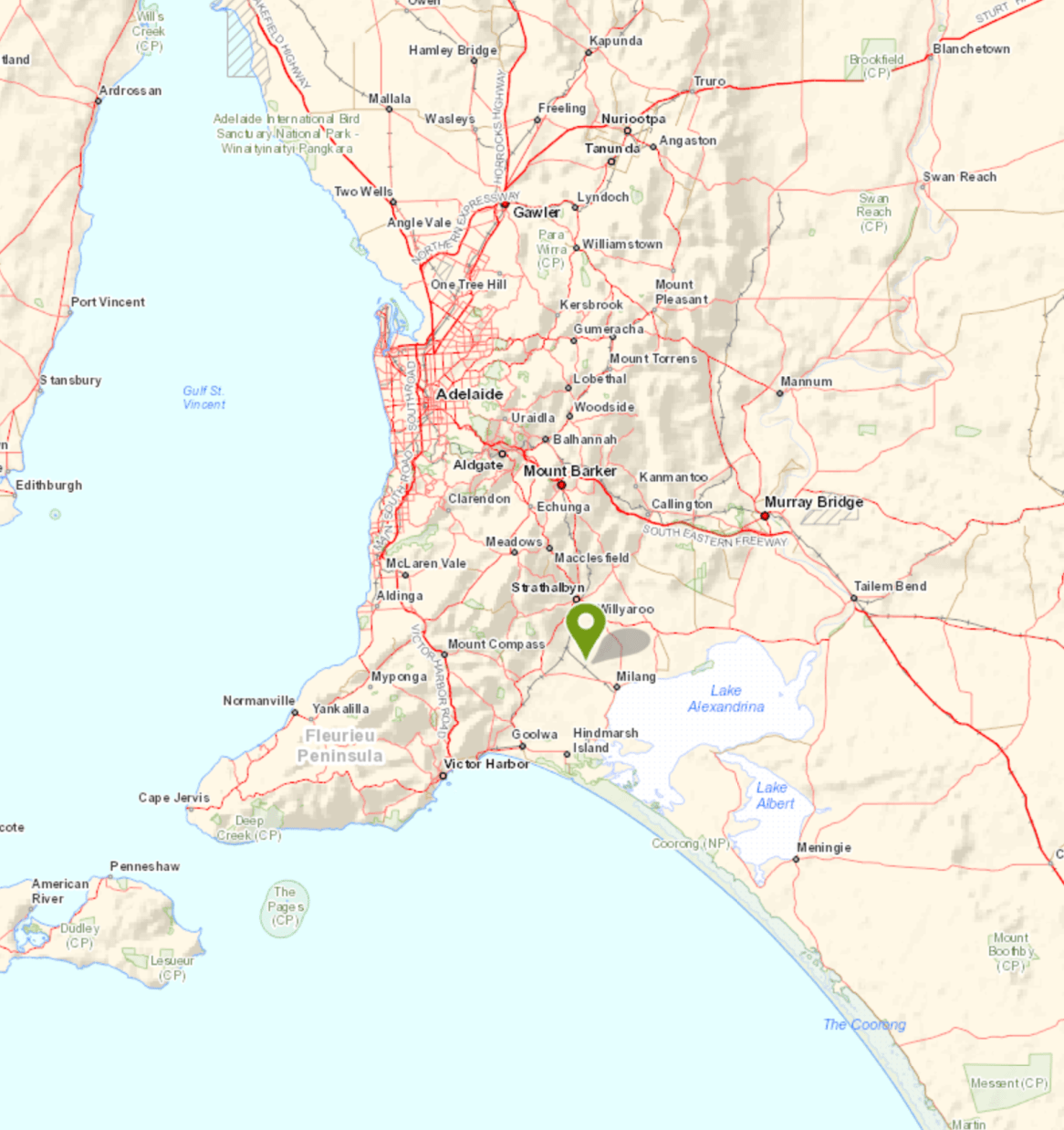
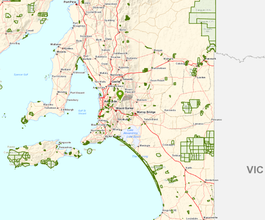
Screen Shot 2017-08-11 at 12.39.04 pm.png

Above: Map showing the location of the Nurragi Conservation Park, south east of Adelaide.  Map courtesy of Location SA Map Viewer.

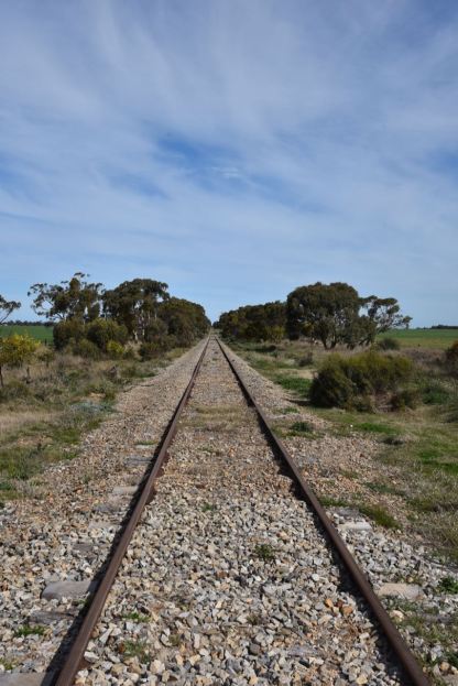
The Nurragi Conservation Reserve follows the old branch railway line to Milang and runs a distance of about 12 km, from Sandergrove to Milang.  The park is about 65 hectares in size.  The Friends of Nurragi was established in 1988 to protect and restore the reserve and in 1991 the Minister of Lands dedicated the area as a Nature Conservation and Plantation Reserve under the Crown Lands Act 1929.

The reserve forms a wildlife corridor linking the eastern Mount Lofty Ranges with Lake Alexandrina and contains extremely important vegetation in a region that has been cleared of over 98% of its original cover.   More than 300 native plant species are present, with over 50 of those being of particular conservation significance (eg rare or endangered).   It preserves remnant mallee vegetation including square-fruited mallee, narrow-leaved red mallee, peppermint box, and native apricot.  Understorey plants include wallowa, needle bush wattle and broombush.

During my visit there were a few flowering native plants, particularly the wattles, which were vivid yellow.

Over 95 species of birds have been recorded in the park including Peaceful Dove, Weebill, Australian Magpie, Little Raven, Grey Shrikethrush, Diamond Firetail, Southern Boobook, Red-capped Robin, Hooded Robin, and Rufous Whistler.  Native mammals found in the park include Western Grey kangaroos, Brush-tailed possums and bats.  About 11 reptile species have been recorded including the Sand Goanna.

During my visit the park was alive with New Holland Honeyeaters and Superb Fairy Wrens.  I also spotted a Shrike Thrush (I think?)

I was pleasantly surprised to find a number of interpretive signs in the park, no doubt the result of the hard work of the Friends of Nurragi.

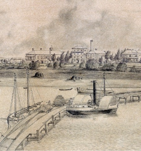
The park commences at the town of Milang, which is located on the banks of Lake Alexandrina.  Between 1860 and 1880 Milang was one of South Australia’s busiest ports.  It connected Adelaide with the thriving river trade.  Wool from the Darling and Upper Murray stations was landed at Milang and then transported by horse and bullock teams to Port Adelaide. Wheat was transported to Milang, processed at its flour mills and then shipped back as flour.

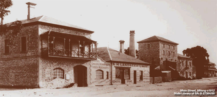
A number of historic buildings remain in Milang.  But sadly, an impressive group of Landseer buildings which stood in the main street were demolished in the 1950’s and replaced by the present day shopping centre.  What a great shame!  Albert Landseer was one of South Australia’s principal river merchants.

KoppDrawing

Above:- Milang in the late 1800’s.  Image courtesy of http://www.milang.org.au

milang-photo.jpg

Above:- the former Landseer buidlings in the main street of Milang.  Image courtesy of http://www.murrayriver.com.au

In May 1854, the first public railway in South Australia was completed, linking Goolwa and Port Elliot.  The success of the Goolwa-Port Elliot line aroused interest in Strathalbyn where local business men saw advantages for them in a direct link with the new port at Victor Harbor.  In 1857 a group of 20 people attended a meeting at the Lake Hotel in Milang, in support of a line from Strathalbyn to Milang.  Unfortunately a larger meeting at Strathalbyn resulted in confirmation that the line would run from Strathalbyn to Middleton on the south coast.

In 1881 there was a new push for a branch line to Milang.  A Select Committee was appointed by the South Australian Government.  On the 8th November 1881 the House of Assembly passed the ‘Strathalbyn and Milang Railway Bill’.  Tenders for the construction of both lines were called on the 18th April 1882 and Walker and Swann were successful in obtaining the joint contract for a price of ₤143,678.

The Milang branch line was opened  on the 17th December 1884 from a junction with the Victor Harbor line at Sandergrove.  At Sandergrove the Milang line served as the passing siding for the station, sharing an island passenger platform with the Victor Harbor main line.  A goods siding also catered for local goods consignments.  The only intermediate station was at Nurragi where there was a 70m long goods siding.  There was also a passenger stop at Punkulde where the line crossed the Milang-Finniss road.

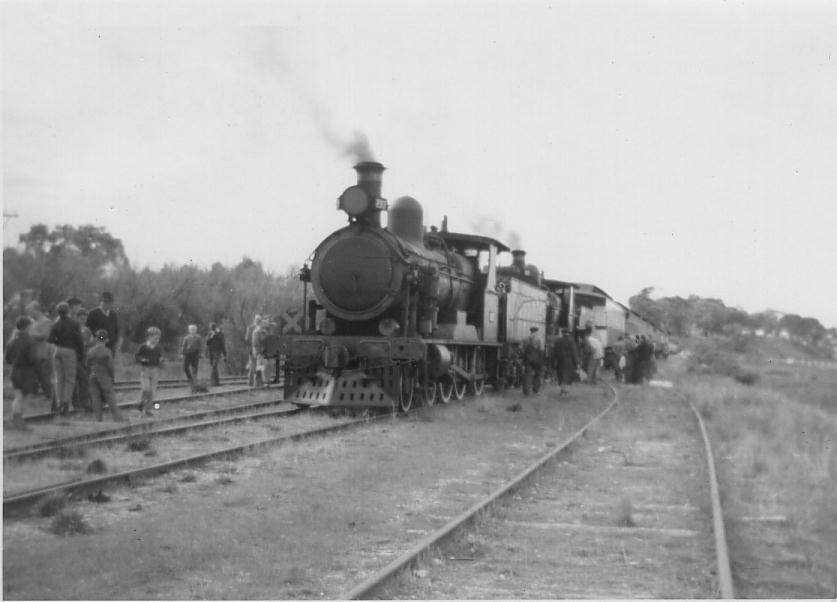
At one stage there was a small turntable at Sandergrove to turn locomotives working to Milang.  Through most of its later life the branchline was operated with Brill railcars.  The last passenger service ran 30 November 1968 with the line closed on 17th June 1970.

PG006.jpg

Above:- a loco on the Milang branch line

If you are in Milang I highly recommend a visit to the Port Milang Historic Railway Museum.  The museum is located on the banks of Lake Alexandrina and tells the story of the Lakes Railways, displays a collection of South Australian rolling stock and equipment.

Although the Milang line has long since closed, the line between Mount Barker where I live, and Victor Harbor, is still used by SteamRanger Heritage Railway which runs a number of different heritage steam and diesel hauled tourist trains through the Adelaide Hills and along the South Coast to Victor Harbor.

DSC_7735

Above:- the Mount Barker to Victor Habor line.

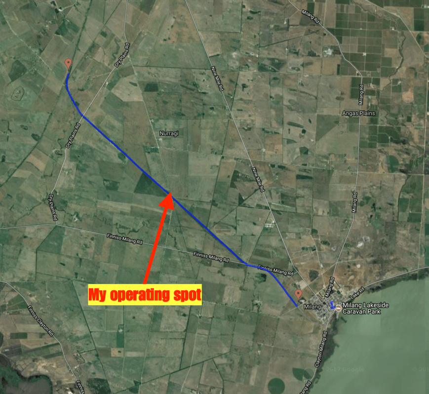
I set up right in the middle of the park, off Nurragi Road.  There was a small area here off the road for me to park the vehicle, and make a short walk to where I set up.  I ran my normal portable set up for this activation consisting of the Yaesu FT-857d, 40 watts output, and the 80/40/20m linked dipole, inverted vee at 7 metres at the apex.

Screen Shot 2017-08-11 at 12.48.27 pm.png

Above:- Aerial shot of the park (indicated in blue), showing my operating spot.  Image courtesy of http://www.railtrails.org.au

I was all set up and ready to go by around 9.30 a.m. local time.  First in the log was Peter VK3PF, who is well and truly leading the pack when it comes to park hunters in Australia.  Next was another keen park hunter, Dennis VK2HHA from Albury, followed by my good wife Marija VK5FMAZ.  It was very slow going and I had real doubts that I was not going to reach my 44 contacts which are required to qualify the park for the global WWFF program.  Contact number 10, qualifying the park for me for the VKFF program, was with Kevin VK3HKK.

Shortly afterwards I worked Stef VK5HSX who was portable in the Girraween National Park VKFF-0198.  It is always nice to get a Park to Park contact in the log during an acivation.  I went on to work a total of 22 stations on the 40m band before callers dried up.  I headed over to the 80m band where I called CQ on 3.610.  This was answered by John VK5NJ in Mount Gambier who was booming in at 5/9 +.  Mark VK5QI then called, followed by Les VK5KLV at Port Augusta in the north of South Australia, and then Mick VK3GGG/VK3PMG in western Victoria.

I then headed back to the 40m band where I logged a further 31 stations from VK2, VK3, VK4, VK5, and VK7.  My 44th contact came at 90 minutes into the activation, with a QSO with Andrew VK5MR at Roxby Downs in the north of South Australia.

I then headed back to 80m hoping to get my wife Marija VK5FMAZ in the log.  She had just arrived home from shopping and we had corresponded via SMS.  Marija was my first taker after calling CQ, followed by David VK5PL in the Barossa Valley and then Wolf VK5WF in Adelaide.  I then worked Geoff VK3SQ at Beechworth in north eastern Victoria, John VK5BJE in the Adelaide Hills, and finally Allen VK3ARH.  More proof that 80m works very well, even in the middle of the day.

I then received a SMS message from David VK5KC to advise he was portable in a park on the Eyre Peninsula.  So I quickly lowered the squid pole and removed the 80m links and headed to 7.144.  I logged David who was activating the Laura Bay Conservation Park VKFF-1048.

I then tried my luck on 20m.  It was too early for any DX, but I did log a total of 4 stations from VK4 and VK6.  To finish off the activation I moved back to 7.135 on 40m where I picked up 2 more stations.

It was approaching 12.30 p.m. and I needed to pack up and head home for some lunch and a shower, and then off to work.  I had a total of 71 contacts in the log and another unique park activated.  Thanks to everyone who called and thanks to those who spotted me.

I worked the following stations on 40m SSB:-

  1. VK3PF
  2. VK2HHA
  3. VK5FMAZ
  4. VK3NLK
  5. VK2WG
  6. VK2MT/p
  7. VK6HRC/p
  8. VK2QK
  9. VK3SFG
  10. VK3HKK
  11. VK4CPS
  12. VK3KMH
  13. VK3MRO/m
  14. VK5HSX/4 (Girraween National Park VKFF-0198)
  15. VK2PKT
  16. VK1DI
  17. VK6XN
  18. VK2NP
  19. VK3JP
  20. VK4PDX
  21. VK3MCK
  22. VK2LEE
  23. VK2KYO
  24. VK2VW
  25. VK4TJ
  26. VK4/AC8WN
  27. VK4/VE6XT
  28. VK2YK
  29. VK3GYH
  30. VK3GGG
  31. VK3PMG
  32. VK3MCD/p
  33. VK3FRAB
  34. VK3FMJP
  35. VK3TKK/m
  36. VK2JDR
  37. VK3FOGY
  38. VK2MTC
  39. VK5MR
  40. VK3BBB
  41. VK3JDA
  42. VK3MKM
  43. VK3ZZS/p
  44. VK3SQ
  45. VK2MSQ
  46. VK5KLV
  47. VK3ZVX
  48. VK3ER
  49. VK3FOTO/m
  50. VK7JON
  51. VK7NWT
  52. VK5GJ
  53. VK2GKA
  54. VK5KC/p (Laura Bay Conservation Park VKFF-1048)
  55. VK3STU
  56. VK7GG

I worked the following stations on 80m SSB:-

  1. VK5NJ
  2. VK5QI
  3. VK5KLV
  4. VK3GGG
  5. VK3PMG
  6. VK5FMAZ
  7. VK5PL
  8. VK5WF
  9. VK3SQ
  10. VK5BJE
  11. VK3ARH

I worked the following stations on 20m SSB:-

  1. VK4QQ
  2. VK4ZD
  3. VK6AKT
  4. VK4TJ


References.

Birds SA, 2017, <http://www.birdssa.asn.au/location/nurragi-conservation-reserve/&gt;, viewed 11th August 2017

Milang, 2017, <http://milang.org.au/history/&gt;, viewed 14th August 2017

National Trust, 2017, <https://www.nationaltrust.org.au/places/nurragi-conservation-reserve/&gt;, viewed 11th August 2017

Steamranger, 2017, <http://www.steamranger.org.au/enthusiast/guides/guide7.htm&gt;, viewed 11th August 2017

Walking SA, 2017, <https://www.walkingsa.org.au/walk/find-a-place-to-walk/nurragi-conservation-reserve-walking-trail/&gt;, viewed 11th August 2017

Charleston Conservation Park 5CP-041 and VKFF-0777

I had a day off today (Saturday 29th July 2017) after a few afternoon shifts, and despite it being a rather unpleasant day outside, I decided late in the morning to head over to the Charleston Conservation Park 5CP-041 & VKFF-0777.  The park is just a short 23 km drive by road from my home, and about 46 km east of Adelaide.

Screen Shot 2017-07-29 at 11.46.44 am.png

Above:- Map showing the location of the Charleston Conservation Park in the Adelaide Hills.  Map courtesy of Location SA Map Viewer.

I have activated the park many times previously, so today’s activation was mostly for the recently released Boomerang Award in the VKFF program, which encourages park activators to head back to the same park.

Screen Shot 2017-07-29 at 11.43.57 am.png

Aerial shot showing the park, with my QTH to the left of the shot.  Adelaide is in the background.  Image courtesy of Google maps.

Charleston is 54 hectares in size and was first proclaimed on the 8th April 1976.  Most of the habitat within the park is Woodland with either Manna Gum or Rough-barked Manna Gum over Golden Wattle.

Over 100 species of bird have been recorded in the park including Adelaide Rosella, Striated Pardalote, Australian Golden Whistler, Grey Shrikethrush, Willie Wagtail, Australian Magpie, and Painted Buttonquail.

This slideshow requires JavaScript.

The park is located about 8 km east of the little town of Charleston, which was laid out in 1857 by Charles Dunn (1796–1881), a brother of the prominent miller John Dunn.  It is believed the town was originally known as “Charlestown”, but the current spelling has always been more common in newspaper reports.

I travelled along some of the ‘back roads’ to get to the park.  As it is winter, the countryside was beautitful and green.

I soon reached the park on Bell Springs Road.  This is the only way to access the park.  There is a small car parking area at gate one.  As I was pulling up at the park I worked Gerard VK2JNG who was portable in the Kwiambal National Park VKFF-0274

I set up on the boundary track on the western side of the park.  My usual portable gear was used for this activation: Yaesu FT-857d, 40 watts, and the 20/40/80m linked deipole, inverted vee @ 7 metres.

Screen Shot 2017-07-29 at 11.46.26 am.png

Above:- Aerial shot of the park showing my operating spot.  Image courtesy of Location SA Map Viewer.

It was incredibly windy with a very nasty storm front approaching from the west.  As a result it took me a little longer than normal to get set up, as I continually got the antenna caught up in the branches of the gum trees.  I headed to 7.144 hoping to get a Park to Park with Gerard VK2JNG, but there was silence.  I asked if the frequency was in use and I was very pleased to hear Gerard come back to me to advise that he was waiting for me.  I logged Gerard who was an excellent 5/9 signal.

I then headed down to 7.139 and asked if the frequency was in use, with Dennis VK2HHA coming back to advise that it was all clear.  I logged Dennis, followed by Peter VK3PF, Marija VK5FMAZ, and then Rick VK4RF/VK4HA.  Despite it being a weekend, there was not the normal flurry of callers.  More like a constant flow.  Contact number 10 was with Steve VK7CW after 10 minutes of being on air in the park.

I had 24 contacts in the log when I was approached by 2 bushwalkers and a young child.  They showed great interest in what I was doing.  Thanks to those who patiently waited whilst I was chatting and explaining the hobby to them.  They were extremely amazed hearing such strong signals coming in from interstate.

When things slowed down a little I took the opportunity of heading down to 7.090 where I had seen a spot on parksnpeaks for Matt VK1MA/2 on a SOTA peak.  When I first heard Matt he was a good 5/7, but within a minute I had almost lost him.  Sadly I wasn’t able to make contact with Matt.  So I headed back up to 7.139 where I logged a further 4 stations.

As I had very few callers I headed back to 7.090 where I managed to get through to Matt after a few goes.  I was hearing Matt okay at 5/3, but he was struggling with my signal, 3/3, at his end.  But we made it.

I then headed off to the 20m band where I called CQ after self spotting on parksnpeaks.  Unfortunately my only contact on 20m was with Anthony VK6MAC in Western Australia.

The weather was moving in fast, so I decided to try my luck on the 80m band.  I called CQ and received a call from Geoff VK3SQ at Beechworth.  I was able to hear Geoff quite well as there was no noise in the park, but sadly Geoff was unable to hear me.  First in the log on 80m was my wife Marija VK5FMAZ, followed by Tony VK5MRT, and finally David VK5PL.

I decided to have one last listen on 40m before calling it quits for the day.  Unfortunately I couldn’t get back onto 7.139 as there were some stations there already, and I had to go up to 7.150 as one of those stations was very wide.  I logged a further 4 stations including Owen VK2AEJ/p at the Cape Don lightship in Sydney.  The MV Cape Don is a former lighthosue tender, now a museum ship in Waverton in New South Wales.

MV_Cape_Don

Above: the MV Cape Don.  Image courtesy of wikipedia

It was time to go QRT as I was just starting to experience some drops of rain.  I had a total of 44 contacts in the log.

After packing up I went for a walk along the boundary track on the western side of the park.  I highly recommend this, as the park becomes very picturesque as you get further into the park.  I came across a few fenced off areas in the park and some other marked out areas.  Not sure what they were for?

I worked the following stations on 40m SSB:-

  1. VK2JNG/p (Kwiambal National Park)
  2. VK2HHA
  3. VK3PF
  4. VK5FMAZ
  5. VK4RF
  6. VK4HA
  7. VK3NCR/m
  8. VK3FAHS/m
  9. VK2LEE
  10. VK7CW
  11. VK3TKK
  12. VK2YK
  13. VK3NLK
  14. VK2KYO
  15. VK3FCMC
  16. VK3ZPF
  17. VK6MAC
  18. VK2VW
  19. VK3ARH
  20. VK2NEO
  21. VK6BEC
  22. VK3SQ
  23. VK3TQ
  24. VK3VEF
  25. VK3ANL
  26. VK2JDR
  27. VK2NP
  28. VK3PAT
  29. VK3FDAP
  30. VK3RU
  31. VK4HNS
  32. VK4TJ
  33. VK2JNG/m
  34. VK7VZ
  35. VK3SIM
  36. VK1MA/2 (SOTA VK2/ ST-001)
  37. VK4AAC
  38. VK2EIR/m
  39. VK2SVM
  40. VK2AEJ/p (MV Cape Don lighthship)

I worked the following station on 20m SSB:-

  1. VK6MAC

I worked the following stations on 80m SSB:-

  1. VK5FMAZ
  2. VK5MRT
  3. VK5PL


References.

Birds SA, 2017, <http://www.birdssa.asn.au/location/charleston-conservation-park/&gt;, viewed 29th July 2017

Wikipedia, 2017, <https://en.wikipedia.org/wiki/Charleston,_South_Australia&gt;, viewed 29th July 2017