Ngarkat Conservation Park

My last planned activation for Wednesday 11th September, 2013, was the Ngarkat Conservation Park, just over the border in South Australia.  So after activating Little Desert National Park I drove west towards S.A. and into the town of Keith.  Just north west of Keith I turned off the Dukes Highway onto Snoswells Road and followed this for a few km north until I reached the park, and an area called Tyms Lookout.  There is a carpark at the end of Snoswells Road, and this is where I set up my gear.

ngarkat-map-large

Ngarkat Conservation Park is large park.  In fact it is one of the largest mallee parks in South Australia.  Its total area is 270,000 hectares which consists of vegetated sand dunes, mallee and heath.  It is located about 209 km south east of Adelaide, 34 km south of Pinaroo, and 5 km north of Keith.  It was named after a tribe of Aboriginals who previously inhabited the area.  The park abounds with wildlife including Western Grey kangaroos and emus.  Over 120 species of birds including the rare Malleefowl have been recorded. There are a number of walking trails and it is home to the legendary Border Track.  The the park has a popular 4WD track.

IMGA0105_5     IMGA0109_4

I started off on 40m and my first contact was with John VK5BJE who had a very strong 5/9 signal.  This was followed by Larry VK5LY who was patiently waiting in the Murray River National Park.  Signal reports of 5/9 both ways were exchanged with Larry.  Another Park to Park contact for the log !  Another Park to Park contact was made with Tony VK3VTH/5 who was portable in the Karte Conservation Park (5/9 both ways).  When things got a little quiet I decided to tune around the band & I heard 2 gentlemen on Lord Howe Island talking to each other.  After about 5 minutes they were signing off, so I decided to give them a call, and much to my surprise they replied. Dick VK9LH, and Des VK9FLHI were both 5/8 signals and I received a 5/1 signal report back from both of them.  I could also hear some European signals coming through, including Jose EA2KC, who had a good strong signal.  I tried calling him but unfortunately I could not get through.

IMGA0116_4

Time was starting to get away from me, but I decided to go to 20m and have a quick listen.  I am glad that I did because I made 2 DX contacts and 1 contact over to my good mate Jess VK6JES in Western Australia.  The 2 DX contacts were with Jose EA2KC (5/9 sent and 5/6 received), and then Jara DL1YD (5/9 sent and 5/5 received).  I was really pleased to have 2 good DX contacts with just 5 watts, and it was now time to pack up and head home.  After all I still had a 2 hour drive to get back to the home qth.

The following stations were worked:-

John VK5BJE; Larry VK5LY/p; Ron VK3AFW; Tony VK3CAT; Dale Vk5FSCK; Brian VK5FMID; Graham VK5KGP; Nick VK3NAL; Tony VK5ZAI; Tony VK3VTH/5; David VK3MIJ; Colin VK3UBY/m; Charles VK5FBAC; Paul VK4CPS; Paul VK4PAR; Dick VK9LH; Des VK9FLHI; David VK5KC; Peter VK3PF; Peter VK3TKK/m; Jose EA2KC; Jara DL1YD; & Jess, VK6JES.

I have placed a video of this activation on You Tube…..

Carpenter Rocks Conservation Park

My last activation for Friday was the Carpenter Rocks Conservation Park which is located on the Lower South East coast, approximately 40 kilometres south-west of Mount Gambier, and 452 km SE of Adelaide.  The park conserves unique coastal habitat in the Lower South East and protect important flora and fauna species, including some of national and international significance.

Carpenter Rocks Conservation Park protects 30.5 hectares of coastal habitat, which was purchased with the assistance of the Australian Government’s Natural Heritage Trust.   A number of threatened species and plant communities are conserved within the park.  The park protects part of the only known population of Carpenter Rocks Manna Gum and provides significant roosting habitat for the Orange-bellied Parrot, which is critically endangered at a national level.

IMGA0109     IMGA0103

The land comprising the reserve is significant for the local Aboriginal Boandik people, with one site of significance located in Carpenter Rocks Conservation Park and another two sites within close proximity.

Carpenter Rocks Conservation Park was proclaimed on 6 September 2001 under the National Parks and Wildlife Act 1972 with a section 43 proclamation providing for existing and future rights for exploration and mining under the Petroleum Act 2000.  The South Australian Government purchased the land with the assistance of the Australian Government through the National Reserve System Program of the Natural Heritage Trust and a contribution from the Nature Foundation SA Inc.

IMGA0113     IMGA0115

To access the park you need to travel along Carpenter Rocks Road, into the little seaside township of Carpenter Rocks.  Then turn left onto Pelican Point Road and travel south east.  You will find a small clearance in the scrub a short distance down on the left, and this is where you enter the park.  You will drive into a small clearing and this is where the park sign is located.  There is a track which then follows a dog leg around to the left and follows the power lines through the park.

Carpenter Rocks map

Carpenter Rocks is a small coastal ton which faces the Southern Ocean and is renowned for its rugged coastline which provides exceptional fishing and diving locations.  Carpenter Rocks supports a significant southern rock lobster industry and Bucks Bay provides a safe haven for the many fishing boats moored there.

Lieutenant James Grant, when on board the HMS Lady Nelson, was the first known British person to view land known today as south eastern South Australia.   On 3 December 1800, he sighted what at first he thought was four unconnected islands, but on a closer look realized they were two mountains and two capes.  One of these he named Cape Banks, just west of today’s township, after English Botanist  Joseph Banks.

On 4 April 1802 the French explorer Nicholas Baudin aboard the ship Geographe noticed the area and made the observation:

“Along the beach we could make out a continuos line of rocks which stretched a little way out to sea and over which the breakers pounded with extraordinary force.  This was the cause of the incessant noise which we could hear”.

The origin of the name is not clear.  There is some suggestion that it was named after Dutch explorer, Captain Pierter Carpentier.  It is also suggested that it was originally called ‘Les Carpentiers’ by Baudin, alluding to their indented and serrated nature, which reminded Baudin of a carpenters saw.

I set up a few hundred metres down the track in a clearing.  The scrub in the park is very very thick, and there are not too many positions to put up a dipole.  I set up my fold up table & deck chair and strapped the 7m squid pole to a shrub and stretched out the legs of the dipole, tying them to shrubs.

  IMGA0110      IMGA0112

My first contact from the Carpenter Rocks CP was another ‘park to Park’ contact with Larry VK5LY who was operating from the Danggali Conservation Park.  Larry had a great 5/8 signal.  I also managed a SOTA contact with Allen VK3HRA who was on the top of Mount Ida, VK3/ VU-009 (5/8 signal reports both ways).

After about 40 minutes in the park it was time to pack up, and head back to Mount Gambier for my presentation to the South East Radio Group.

The following stations were worked:-

Larry VK5LY/p; Ian VK5CZ; Col VK5HCF; Colin VK3UBY; Tony VK3CAT; Bernard VK3AMB; John VK5DJ; Tony VK5ZAI; Graham VK5KGP; John VK2FALL; Greg VK3UT; Wayne VK2PDW; Ivan VK5HS/m; and Allen VK3HRA/p.

Canunda National Park

My second activation for Friday 6th September, 2013, was the Canunda National Park, which is situated about 18 km north west of Millicent and about 430 km south east of Adelaide.

Canunda NP which comprises about 9,300 hectares, stretches from Cape Buffon outside the tonwship of Southend, to Cape Banks near the southern end of Lake Bonney.  The park originated from the Cape Buffon Flora and Fauna Reserve, a 22 hectare reserve dedicated in 1959 at the request of local residents to conserve native vegetation and the variety of bird species.  The reserve was extended and renamed Canunda National Park in 1966.  Since then, more land has been added to bring the park to its present size.

The park has a spectacular coastline with cliffs and long stretched of surf beaches.  It features a diversity of coastal habitats, and offers great opportunities to enjoy bushwalking, observe birdlife, fishing, surfing, or snorkelling.  The northern section of the park is characterised by limestone cliffs, sea stacks, offshore reefs and low dense scrub, whereas the southern section is dominated by mobile sand dunes and stretches of beach which are backed by low foredunes.

The 40km coastline offers great fishing opportunities. Depending on the season and ocean conditions, mulloway, salmon, sharks or rays may tempt a bite. Try your luck off the rocks where sweep, abalone and crayfish may be caught.

Four-wheel driving is possible along the full length of the park by following the marker posts through the dunes and along Geltwood Beach.

IMGA0092      IMGA0096

A variety of wildlife can be found in the park including western grey kangaroos, echidnas, wombats and emus.  The park provides an important winter refuge and feeding area for the endangered orange-bellied parrot.  The rare and secretive swamp antechinus also occurs in areas of dense wetland vegetation in the park.

Evidence of the Aboriginal Boandik people, who once lived in temporary camps along the coast, can be seen throughout the park.  Middens or shell heaps are scattered throughout the park.  These were left by members of the Bunganditj (Bo-an-dik) Aboriginal group who once lived in temporary camps along the coast during summer, and for the rest of the year lived near inland swamps in relatively permanent huts (wurlas).

In 1845 Captain Emmanuel Underwood established a store and jetty at the southern end of Rivoli Bay, now called Southbend.  This was to cater for inland settlers and passing ships.  The following year the town was surveyed and named Greytown after the Governor of South Australia, Sir George Grey.  In 1851 a Scotsman named Peter Brigg took out a 104 square km lease on land incorporating most of what is now Canunda National Park.  He named it Canoonda, thought to be the Aboriginal name for the swamp at the northern end of Lake Bonney.  The Canoonda property was divided into three smaller leases in 1864, which changed ownership  number of times up until the area was dedicated a National Park in 1966.  Sheep grazing andf stock movement, wattle bark stripping and the cutting of sheaok for firewood, together with the effects of rabbits after the 1800’s, undoubtedly altered the natural vegetation of the park.   In addition the introduction of foxes and feral cats would have reduced many pop

I accessed the park via Millicent, which is one of three main entry points to the park.  The others being at Southend and Carpenter Rocks.  I travelled west on Canunda Causeway and entered the park.  I drove a little further south of Oil Rig Square to a parking and camping area near Geltwood Beach.  I found a nice wooden table with benches and set up the gear here.  Whilst setting up I had an inquisitive emu watching activities for a very short time, but unfortunately he/she was camera shy and didn’t want to hang around.

IMGA0086

My first contact was with Tony VK5ZAI from Kingston, and this was followed by another south east resident John VK5DJ.  I also managed another SA ‘Park to Park’ QSO with Larry VK5LY who was portable in the Danggali Conservation Park.  I also spoke with Terry VK3UP who was portable in the Greater Bendigo National Park as part of the Keith Roget Memorial National Parks Award.

IMGA0089

Conditions on 40m were very good throughout VK5 and into Victoria.  Weatherwise it was cloudy with the occasional very light shower.

After about 40 minutes, I decided it was time to pack up, and head off to my next activation at the Carpenter Rocks Conservation Park.  But before I did that I went for a walk down to Geltwood Beach and admired the pounding seas which I could hear from my radio operating position.  I noted that despite the day being a little inclement, that spring was in the air.  The gums, wattles, and other native plants were all in flower.

 IMGA0093     IMGA0100

I had 17 QSO’s on 40m SSB into VK1, VK3, VK5, & VK7.

The following stations were worked:-

Tony VK5ZAI; John VK5DJ; Larry VK5LY/p; Geoff VK3AHT; Terry VK3UP/p; Ron VK3AFW; Tony VK3CAT/p; Bernard VK3AMB; Peter VK3TKK; Peter VK3PF/m; Colin VK3UBY; Col VK5HCF; Gary VK5ZK; Matt VK1MA/m; Dave VK3VCE; Mark VK7FMPR; and Peter VK5NAQ.

Furner Conservation Park

My last activation for Friday 5th September, was the Furner Conservation Park, which was located just south of my previous action at the Reedy Creek CP.

Furner CP is situated about 4 km south east of Kangaroo Inn, and about 7 km north west of the township of Furner.  The park and the town was named after Luke Liddiard Furner who was Member for Wallaroo and Commissioner for Public Works.  The park consists of 286 hectares of gently undulating land.  The major vegetation type is messmate stringy bark with the flats in the eastern part of the park near Reedy Creek, supporting a woodland of river red gum and rough barked manna gum.  There are also areas of swamp gum on the flats.  Vegetation on the stony rises with the park includes pink gum open woodland with isolated drooping sheoaks.

The park was previously used by landholders for sheep grazing, and the park was also burnt during the devastating Ash Wednesday bushfires of 1983.

IMGA0075     IMGA0073

I accessed the park via South Eastern Road off the Princes Highway, and then turned left onto a forestry access road which bisects the pine forest and the park.  The track is fine in a 2wd vehicle with care.

As this was my last park of the day, I decided to relax a bit, and I set up my fold up table and deck chair.  The mosquitoes were out in full force and a good dose of Aerogard was required.  There is a wire fence which separates the park and the forest, so I climbed over the fence which is in poor condition and set my gear up on the table on the park border.  I attached the 7m squid pole to one of the fence posts.

IMGA0068       IMGA0074

Whilst in the park I spotted quite a few of the rare Red tailed black cockatoos.  It is estimated that there are only about 1,500 of the South Eastern species remaining in the wild.  They are spectacular birds to watch in flight with their very distinctive bright red tail.

I was hoping that John VK5BJE would pop up, as I had spoken to him on the local repeater just before I entered the park, and was aware he and wife Jenny were heading for the Naracoorte Caves National Park, South Australia’s only World Heritage site.  And sure enough, my 7th contact was with John within the park.  John had been busy travelling over SA & Victoria, activating parks, and it was great to work John in another SA park as part of the VK5 National & Conservation Parks Award.

Conditions seemed to be very good with good signal reports received from as far as Queensland, the ACT, and New South Wales.

I spent about 40 minutes in the park, before packing up and heading off to my accomodation for the night, the Country Comfort Motel, in Mount Gambier.  I ended up working 13 stations in VK1, VK2, VK3, VK4, & VK5 on 40m SSB.  A good spread around Australia.

The following stations were worked:-

Brian VK5FMID; Colin VK3UBY; John VK2FALL; Peter VK3TKK; Larry VK5LY/m; Mick VK5FMMC; John VK5BJE/p; Matt VK1MA; Colin VK4FAAS; Roy VK5NRG; Graham VK5KGP; Ron VK3AFW; and Theo VK3AP/m.

Reedy Creek Conservation Park

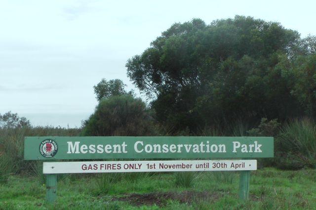
After activating Messent CP, I headed off for my 3rd park activation of the day, the Reedy Creek Conservation Park.  I continued south east along the Princes Highway, passing through Kingston and its famous ‘big crayfish’, and then further south east until I reached Claywells Road and then to the little settlement of Kangaroo Inn.  Don’t blink, you will miss it.

I found the southern end of the park which is on the northern side of Claywells Road, but it is pencil thin (only about 3 metres wide) and there is no access.  So I then travelled north on Jorgensons Road which follows the creekline.

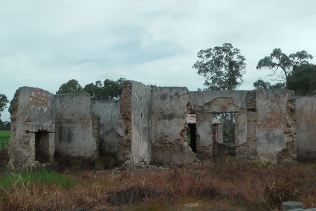
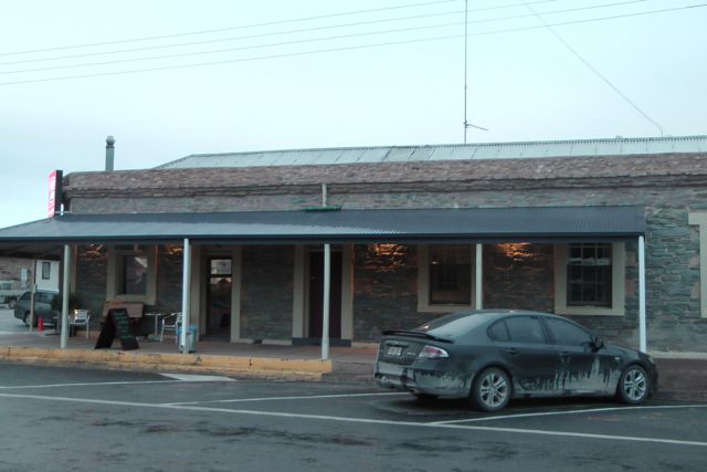
Before I talk about the park, I can’t go passed mentioning some of the interesting history of the Kangaroo Inn area.  If you are going to activate Reedy CP, it is very worthwhile stopping off and having a look at the old hotel ruins, which are directly opposite the Kangaroo Inn Area School.  In its heyday during the construction of the early drains in the area, the Inn serviced traffic from every direction, and was an important stopping point along the Mail Route and bullocky Route.  The Inn, although unlicensed had a popular liquor trade, which was accompanied by its fair share of troubles (including an unsolved murder).  The main wooden door was suspended from hinges, so that it could be lowered quickly to protect the occupants in the event of trouble.  The pub closed when a new hotel opened at nearby Furner.

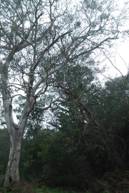
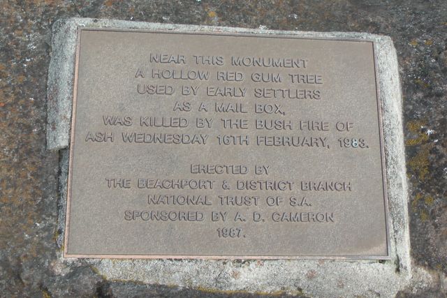
Also nearby is The Post Office Tree a reminder of the mail coach run to Mount Gambier. Mail was placed in a bag, and hung on a hook or branch ready for collection.  Sadly, the tree was burned by bushfires in 1983, but its charred remains still stand.

IMGA0045

IMGA0047

Going back to the Kangaroo Inn….It was built in the 1840’s using stone quarried by pick and shovel from the stony ridges on the site of the present buildings.  Once hewn into bricks with stone chippers, the stone was mortared together with a mixture of lime and sand.  The ceiling consisted of lathe and plaster and the roof slats and iron.  The bar door which was constructed of thick wood, was suspended on hinges at the top, so that it could be quickly lowered to protect the men inside the pub in the event of trouble outside. These old buildings which were built entirely by hand with local labour and none of our present-day machinery, were very strong and have in the main withstood the test of time.

IMGA0048     IMGA0051

The history of the Inn is as varied as it is long.  Originally it was a junction station built prior to the Victorian Gold Rush, and was used as a resting place for mail coach drivers and the general public travelling between Adelaide, Penola and Mt Gambier.  Settlers from Guichen Bay and coaches run by Cobb & Co. would stop at the Kangaroo Inn to refresh, and rest both horses and people.  Back then, it was a 30 mile journey which took about one entire day, before the next inn was reached.  If travelling to Penola, this was Payne’s Inn; Mount Gambier,  the Mt Burr Hotel; or Adelaide, the Telegraph Inn.

Very few Chinese en route for the Victorian Goldfields ever stopped at these inns, as many were illegal immigrants, and frightened of being apprehended by government officials.  Rather, they would build wells, situated well off the worn route.  Some of these are still landmarks in the district today.

Although it was unlicensed, Kangaroo Inn had a popular liquor trade, which in turn brought the district its fair share of troubles.  Once, whilst the Reedy Creek Drain was being excavated by hand, a murder was committed.  After a drunken brawl at the Inn between a Furner resident and a manual labourer working on the drain, the worker was found dead between Kangaroo and “Paynes” Inn.  The case remained unsolved, and even today it is a matter of speculation as to who was the killer — the Furner resident or the local aborigines.

In 1878, the proprietors of the Inn were Mr and Mrs Grant, who later settled in Furner.  During this time railways were taking over the business of mail coaches, so the Inn gradually lost trade.  It was finally closed in 1886, when the Kintore Hotel was opened at Furner by Mr A.H. Bellinger.  Later, the Inn was converted to an overseers cottage for Gillap Station, then owned by Mr N.M. Donald (Senior).  The remains of the shearing shed and old sheep dip can be found nearby.

In the years after this, Kangaroo Inn was mostly deserted, only occasionally being used as a camp by woodcutters.  Nowadays, it has been many years since used, and is in ruins.

Kangaroo Inn is nearly as old as the state of South Australia itself, and has played a large role in the life and decisions of local generations, who toiled with the land to make the district flourish and reach the standard people have today.  “The Inn” has been partially restored thanks to a South Australia Jubilee 150 Youth Grant.

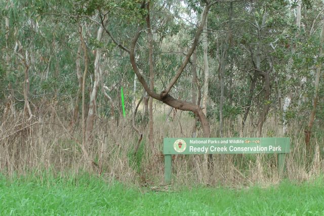
I was running a bit late due to activating the Messent CP (which was unplanned), so after having a quick look at the ruins, I headed north along Jorgensens Road, to access the park, which follows the Reedy Creek Wilmott Drain.

      IMGA0061      IMGA0065

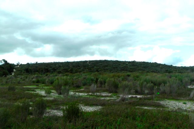
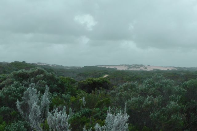
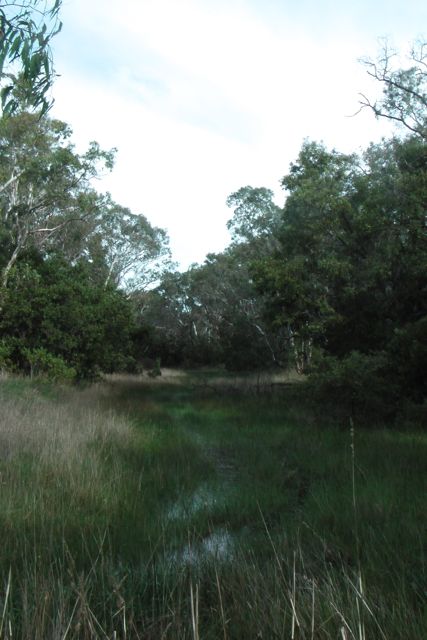
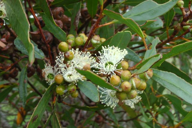
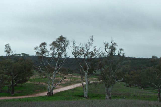
Reedy Creek Conservation Park was established in 1973, and covers an area of about 147 hectares.  It was dedicated due to its fine stand of river red gums, however it was still used for grazing under lease until 1978.  It consists of river red gum, open forest/woodland community, with brown stringy bark woodland along the western boundary.  The southern half of the Park was burnt during the Ash Wednesday fires of 1983.

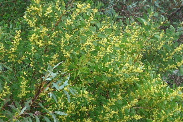
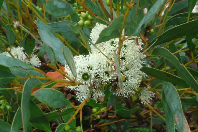
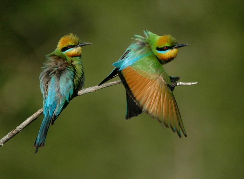
There were quite a few wattle trees in the park which were out in flower, along with large areas of ferns growing under the forest canopy.

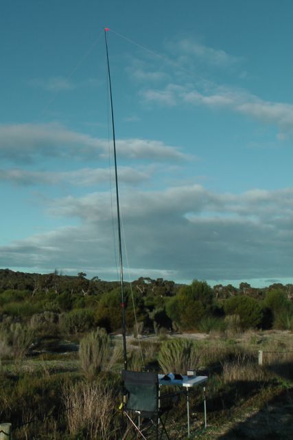
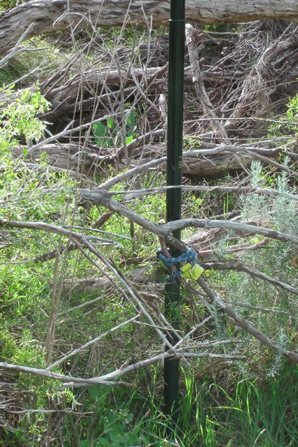
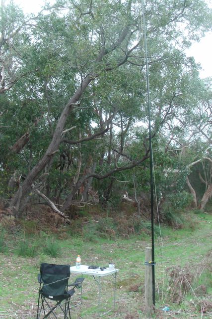
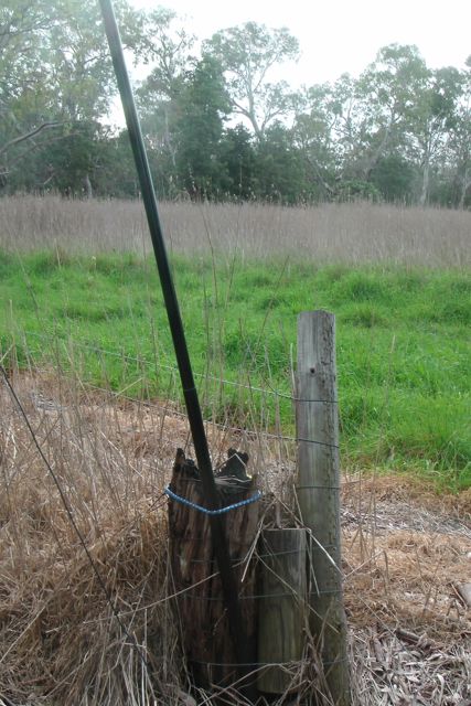
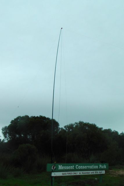
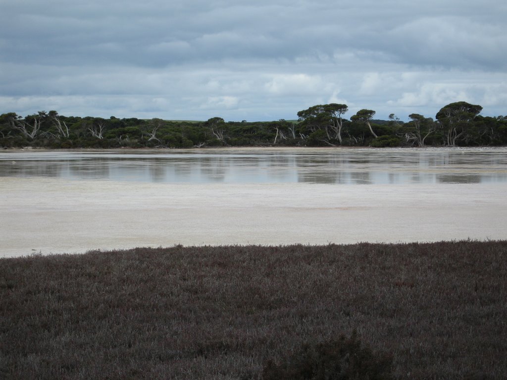
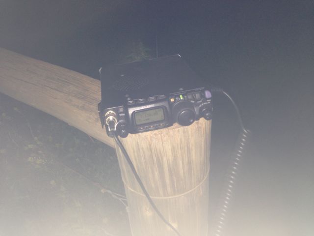
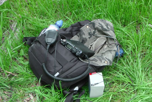
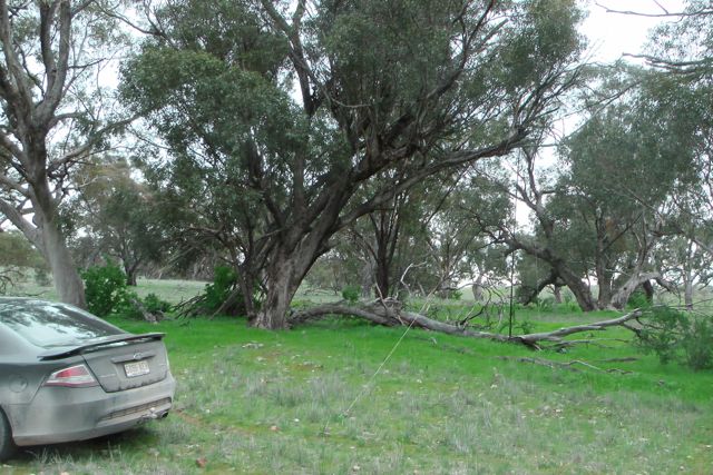
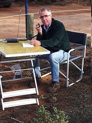
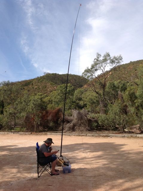
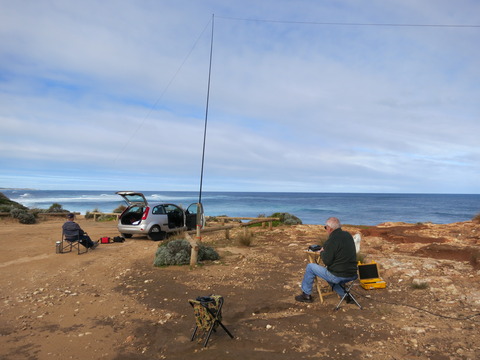
I set up my gear right alongside of the creek using an old wooden fence post to secure the squid pole with some octopus straps.  There was a strategically placed large wooden post nearby which I placed the Yaesu FT-817nd on.  It was very wet and boggy underfoot, with plenty of water in the creek.

IMGA0059     IMGA0055

My first contact in the park was a “Park to Park” QSO with Larry VK5LY who was portable at the Hogwash Bend Conservation Park.  Larry and I exchanged 5/9 signal reports both ways.  My next QSO was another “Park to Park” with John VK5BJE who was portable in the Fairview Conservation Park.  John’s signal was a little weaker (5/6) with a 5/5 signal report in return for me.  It was great to bag another 2 ‘Park to Park’ QSO’s.

I was running late for my planned activation of Furner Conservation Park, so I packed up after only 30 minutes of operating.  I ended up with 10 QSO’s on 40m SSB including a number of the usual Park ‘Hunters’ and a few new calls which was great.  Even managed a good contact into VK2 with John, VK2FALL.

The following stations were worked:-

Larry VK5LY/p; John VK5BJE/p; Col VK5HCF; Brian VK5FMID; Ron VK3AFW; Colin VK3UBY; John VK2FALL; Charles VK5FBAC; VK5FMMC; & Owen VK5HOS.

Messent Conservation Park

After activating the Martin Washpool Conservation Park, I drove ‘across the road’ to the Messent Conservation Park.  This was just a short 1 km drive to the west across Salt Creek Road, and along a sandy track which is passable with care in a 2wd vehicle.  The track disects two fenced farming properties.  It was a bit boggy in parts, but was easily passable after our beautiful stretch of sunny weather over the preceding 5 days.

IMGA0031     IMGA0038

At the end of the 1km track you then come to the start of the park.  There is a Messent Conservation Park sign, and two sandy tracks.  One which continues on to the north west, and another which goes off to the north east.  Both tracks looked way too sandy for me to attempt in the Ford Falcon, so I parked the car at the park sign and set up there.

IMGA0028     IMGA0030

Messent Conservation Park is one of the largest and most significant areas of natural vegetation left in the Upper South East of South Australia.  With an area of 12 250 ha it is large enough to support populations of large animals such as Common Wombats and Emus as well as significant populations of rare plants and animals such as the large-fruit groundsel, and the Southern Emu-wren.  Western Grey Kangaroos are also found within the park, along with the endangered Mallee Fowl and Silky Mouse, echidnas, and a large variety of bird species including Yellow tailed Black cockatoos.

The park has great plant diversity, including brown stringy barks, white and ridge-fruited mallee, desert banksias, fringed myrtle and yacca which grow in the sandy flats.  A number of wild orchids are also found in the park.  The gum trees, wattle, and grevillias were all out in flower, with the local wattle birds and honeyeaters having a ball.

IMGA0034     IMGA0032

IMGA0036     IMGA0035

I am not sure how this park obtained its name.  I have searched the internet without success and even National Parks South Australia were unable to assist.  Sadly this doesn’t surprise me, as I have experienced this before, and their website is sadly lacking in information on all of South Australia’s Conservation Parks.  I understand that are sadly lacking funding from the State Government.

I set up the 7m squid pole utilising the park’s wooden post sign, securing the squid pole with some octopus straps.  Again the weather was very gloomy with the occasional light shower.  I placed the Yaesu FT-817nd up on top of the permapine post park sign and put a call out on 7.100 on 40m SSB.

IMGA0029

First cab off the rank was Ian VK5CZ with a beautiful 5/9 signal from the Clare Valley.  This was followed by Larry VK5LY who was portable in the Ramco Point Conservation Park, west of Waikerie in the Riverland.  Great to achieve another ‘Park to Park’ contact with Larry.  I also spoke with Terry VK3UP who was portable in the Greater Bendigo National Park (Keith Roget Memorial National Parks Award) who was also running a little FT-817nd.  John VK5BJE who was portable in the Mount Scott Conservation Park also called in and signal reports of 5/8 both ways were exchanged with John.  It was great to get John in the log as I knew he had been suffering from some antenna connection problems, and had been helped out by Tony VK5ZAI.

The weather was ever threatening, and at one stage I had to do the dash back to the car as a very heavy shower of rain came through.  Fortunately for the most part the rain stayed away, but at one stage I used my beanie to protect the radio from the light showers.  After an hour in the park, I ended up with a total of 13 QSO’s on 40m SSB into VK3 & VK, with conditions being very good.

The following stations were worked:-

Ian VK5CZ; Larry VK5LY/p; Tony VK5ZAI; Brian VK5FMID; Charles VK5FBAC; Terry VK3UP/p; Col VK5HCF; David VK5KC; John VK5DJ; Mick VK5FMMC; John VK5BJE/p; Peter VK3TKK; and Ron VK3JP.

I took some video of this activation which I have placed on You Tube.

Martin Washpool Conservation Park

The Martin Washpool Conservation Park was my first activation of my 6 day trip.  I left home early on Thursday morning, 5th September, 2013, and drove south east along the Princes Highway following the sensational Coorong National Park.  The weather did not look flash, with light showers and threatening black clouds.  You wouldn’t credit ‘Murphy‘.  The weather had been warm and sunny for a week prior to this.  Upon entering the little township of Salt Creek, I turned left onto Salt Creek Road.  There is a replica oil rig on the corner.

In 1892, a group of entrepreneurs, who believed there was oil located in the Coorong, drilled Australia’s first oil well.  They were unsuccessful, as it was later discovered that the ‘oil’ was in fact a flammable, compacted vegetable substance (known as ‘coorongite’).   A replica of the oil rig has been built as a monument to this enterprise.

I travelled east passed farming land initially and then the park to my right.  As I travelled along the dirt road I saw a number of emus who quickly scrambled off into the scrub when seeing and hearing the car.

IMGA0015

I continued on until reaching a T-junction.  To your right is the entrance to Martin Washpool CP.  To your left is a track which takes you to the nearby Messent CP.  And in front there is a gate for a property called ‘Currawong’ which clearly states that it is private property and that there is no access to National Parks.

Immediately to your right is the entrance to Martin Washpool CP.  There is an unlocked gate and a large rainwater tank at the entrance to the park.  A very sandy fire track continues to run down to the south east following the fenceline, on the north eastern border of the park.  This looked way too sandy for my Ford Falcon, so I parked the car just inside the park near the rain water tank, and set up my gear here.  I didn’t fancy getting bogged on my very first activation !

IMGA0017

Martin Washpool CP is 1,900 hectares in size with swampy Melaleuca flats.  In 2005, the park boundaries were altered, and various sections of Crown land were added to the park.  The park is typical open mallee with with swampy Melaleuca flats.  The gum trees and wattle were out in flower and were putting on a spectacular show.  There were plenty of honeyeaters and wattle birds active in the trees.

IMGA0020      IMGA0021

Wildlife within the park includes Western Grey Kangaroos, the endangered Mallee Fowl, Emus, wombats, Shinglebacks and Bearded Dragons.  Feral deer also populate the park.

Within the park there is a central lake/lagoon of water.  This is located on the south western side of the park.  It is fed by some small tributaries, and eventually flows into the Coorong.

5140879

The park has an interesting history.  It was named after Malachi Martin, also known as Malacky Martin, who was a convicted murderer who lived in South Australia during the 1800’s.  Martin grew up around the Willunga district, south of Adelaide and as a teenager, was charged with theft while working at a post office at Encounter Bay. He was tried at Adelaide but found not guilty.  Six days later, his mother died in strange circumstances by drowning in a pond near the family farm. The inquest into her death declared that she had committed suicide, and it was believed that she was deeply affected by her son’s criminal trial. Her death was made even more tragic because she was heavily pregnant at the time.

A few years later, Martin moved to his father’s new pastoral lease near the Coorong.  Martin also worked as a mail coach driver from Encounter Bay to Kingston SE and Naracoorte.   At the time this was the only main roady from Adelaide to Melbourne.  While living in the area, he became friends with William and Catherine “Nellie” Robinson, who ran an inn, the Traveller’s Rest at Salt Creek.  It was later believed that Catherine and Martin were having an affair which was to have fatal consequences.  On 14 June 1856, William Robinson’s body was discovered with his throat cut.  Martin was a suspect, but was never charged with his murder.  Several weeks later, he moved to Sydney for two years before returning to South Australia and marrying Catherine on 23 June 1858.

During his two-year absence, a young woman named Jane Macmanamin came to work for Catherine as a servant. In 1862 she went missing from Salt Creek and Martin stated she had moved away on a whim to the Mount Gambier area in the colony’s south east.  In April 1862, Jane’s sister, who had constantly stayed in contact with her, sent a letter to the police in Adelaide, suspicious that she had not heard from Jane in some time.  After an investigation and thorough search, Jane’s body was discovered in May 1862, half concealed in a wombat hole at Salt Creek, not far from the Traveller’s Rest.

In June 1862, Martin was charged with the murder of Jane Macmanamin.  Another man, William Wilsen, who claimed he had been engaged to her, was charged with being an accessory after the fact.  Martin was tried and found guilty.  He was hanged at the Adelaide Gaol on 24 December 1862 (Christmas Eve).  He is buried between the walls within the gaol.  Wilsen was found guilty of assisting Martin after the murder and sentenced to four years hard labour.  He was deported to Tasmania to carry out his sentence.

As well as the two murders which were attributed to Martin, there was also suspicion as to the disappearances of two men from the Salt Creek area in 1859.  A traveller found a damaged rosewood jeweller’s box approximately two and half miles from Salt Creek.  On inspection, it contained a piece of linen with the name “G. F. King” written on one of the corners.  It was suggested by Edward Bright, a contemporary diarist that a man named Harry Kirby and a jeweller stayed at the Traveller’s Rest and subsequently disappeared.

The police also investigated reports from local aboriginals that Martin had murdered an aboriginal teenager who he had had an altercation with.  Sometime after the boy’s suspicious disappearance, a group of aboriginal people were bathing in a deep water hole near Salt Creek.  They found the boy’s body in a bag, weighted down by a large stone. This incident occurred sometime in late 1859 or early 1860, but the police were unable to find any witnesses who had actually found the body, only people who had heard the story from others.

It is after Malachi Martin, that Martin’s Washpool Conservation park was named.  It was so named after the pool in which he washed the blood from himself after committing murder.  A macarbe but very interesting history of the park.

I used the park sign to secure the 7m squid pole and rested the Yaesu FT-817nd up on the permapine log.  My first contact was with Larry VK5LY who was portable in the Bakara Conservation Park near Swan Reach.  A good start…a Park to Park contact.  Larry had a very nice 5/8 signal.

The showers held off just long enough for me to male 8 contacts on 40m SSB, with conditions being excellent.  Considering it was a Thursday morning, I was happy with the 8 QSO’s, all of which were VK5’s, other than regular ‘Hunter’ Ron VK3AFW.

The following stations were worked:- Larry VK5LY/p; Col VK5HCF; Brian VK5FMID; Ron VK3AFW; Simon VK5VST; Mick VK5FMMC; Dale VK5DC; Brendan VK5FBFB.

Black Rock Conservation Park

After arriving in Orroroo and booking into the Orroroo pub, I enjoyed a few Bundy & cokes, and a beautiful kangaroo schnitzel.  This pub is a terrific little country hotel that was built in 1877.  Warren & Liz Campbell are the licensees and they took on the operation of the hotel just 18 months ago.  They opened up the accommodation at the hotel, which had not been in operation for about 25-30 years.

IMGA0183      IMGA0190

After dinner, I decided to drive 25 kms east out of town to the Black Rock Conservation Park.  Access to the park is via the Paratoo Road.  The park is 170 hectares in size and has excellent examples of the flora of the area, and is dominated by the Black Oak and Bluebush.  The park has several creek beds with steep banks which are perfect nesting places for Red-back Kingfishers and Rainbow  Bee Eaters.  Unfortunately I didn’t get to see those because it was dark when I arrived.  But below is a picture of what a Rainbow Bee Eater looks like.  They are a spectacular bird.

800px-Rainbow_Bee-eaters_Juffs

I found an access gate at the south eastern end of the park, which unfortunately was locked.  So I put on my headlamp and walked into the park with my gear and my deckchair.  I used a permapine log fencepost to prop the radio on and set up my 40m/20m dipole on the 7m squid pole.

I tuned across 40m and could not hear any VK’s at all.  I could hear quite a lot of North American DX but knew that with my meager 5 watts and dipole, I would be pushing the proverbial uphill.  So I booked in to the 7.130 DX Net.  Unfortunately conditions were not great, but I did work Roy VK7ROY; Andy VK4TH in Kingaroy; John VK2FALL; Ian VK2IW who was qrp; and John ZL2BH.

IMG_3328      IMG_3330

The contact with Ian VK2IN was particularly rewarding though.  Ian was using just 6 watts and a vertical whip in the lounge room of his house.  He was a good 5/4 signal and I received a 5/7 signal report back from Ian.

I also would like to thank John ZL2BH for his persistance.  John and I tried about 6 times during the net to get through to each other, but to no avail until the very end.  John was an excellent 5/8 signal and my signal when he first heard me was also strong.  But by the time we got to call each other the band conditions had changed and we could not make it.  But on our 7th attempt my signal had come back up out of the noise and we managed a good quick QSO, with 5/8 exchanged both ways.

I could hear all of the DX on the net, including William FO5JV in French Polynesia, Bill W1OW in Massachusetts, Juan YV1FPT, and ZL’s.

But sadly, as is the case almost every night on this DX Net, the Indonesians were causing massive QRM.  They were playing music, laughing, and burping.  There is no doubt that they can hear stations on the DX Net, but they simply do not seem to care which is a real shame.  Something really needs to be done to fix this ongoing problem.

At the end of the net, I headed back to Orroroo and enjoyed the rest of the evening watching the AFL and the cricket on TV before getting a good night’s sleep for the next day’s 2 SOTA activations.

Next time I come to this park, will be the day time, so that I can explore the park a bit.

Mount Brown Conservation Park

My 2nd activation of Friday 9th August, 2013, was going to be Richmond Hill, VK5/ NE-089.  But by the time I had driven the 4 horus from home to Quorn, and then negotiated the hard climb at The Devil’s Peak, I was running out of time to get back to Quorn to pick up the key for my proposed Saturday afternoon activation of Stokes Hill, VK5/ NE-050, and then drive the 100 odd kms over to Orroroo for the night(where I had booked accomodation for the weekend).

So rather than heading straight to Orroroo , I decided to drive down the Richmon Valley Road a few kms from The Devils Peak, and activate the Mount Brown Conservation Park.  I had activated this park before as part of my Mount Brown SOTA activation back in May, but it was such a beautiful spot, that I decided to activate the park again and hopefully allow some of the VK5 Parks Award ‘Hunters’ to get a new park.

I entered the Mount Brown CP off Richmond Valley Road, and I parked the car at a large rainwater tank and shelter, and then walked over to a large fallen gum tree limb and set up my gear there. This was at the base of my proposed SOTA activation, Richmond Hill.  It was really frustrating !  I could see the hill, smell the hill, and taste the hill, but I just didn’t have the 3 hours free to climb the hill, activate it, and get back down.  Oh well, plenty of time in the future.

IMGA0166

Mount Brown CP is situated about 14 kms south of Quorn.  The only access is via Richman Valley Road, which runs south out of Quorn.  The Mount Brown summit which is located in the park, is at 964 metres altitude, and is one of the highest peaks in the South Flinders Ranges.  Mount Brown CP is a former forest reserve and is comprised of undulating country with a variety of cover grading to rugged ridges with open woodland and scrub.  It is named after Robert Brown who was the naturalist aboard Matthew Flinders’ Investigator.

I used my yaesu FT-817nd on the 5 watt setting and my 40m/20m linked dipole.  I secured the squid pole with an octopus strap to the squid pole holder, and then made myself comfortable on the log and put out a call on 7.090.  There were plenty of moss rocks to secure the legs of the antenna.

IMGA0163 IMGA0164

My first contact was with Col VK5HCF who was QRP, using just 5 watts.  This was followed by a steady flow of ‘Hunters’ for the next 30 minutes.  It was great to get both Ron VK3AFW and Rik VK3KAN, who were both mobile with good signals.  Other than Col who was QRP, I also spoke with Greg VK3FKAA who was operating QRP with 5 watts.  Greg had a great 5/8 signal, and with my little set up I received a 5/9 in return.  It’s always great to work QRP to QRP when activating a park or a summit.  The noise floor is normally non existant, so 100 watts or more isn’t required by Chasers / Hunters in most instances.

IMGA0167      IMGA0168

I enjoyed the sunshine and worked a total of 15 QSO’s on 40m SSB in 30 minutes.  I was really happy with this, packed up and headed off to collect the key from Quorn, and then off to my accommodation at Orroroo about 100 kms away.

The following stations were worked:- Col VK5HCF/qrp; Larry VK5LY; Nev VK5WG; Brian VK5FMID; Ron VK3AFW/m; Ed VK2JI; Colin VK3UBY; Ernie VK3DET; John VK5BJE; Rik VK3KAN/m; Rob VK2FROB; Greg VK3FKAA; Tony VK3CAT; John VK5FMJC; and Ron VK3JP.

Progress of the VK5 Parks Award

In a few days time, the VK5 National & Conservation Parks Award will be in its 4th month of operation.  In a short space of time it appears to have attracted considerable attention by VK5 operators and interstate operators alike.

ahars_logo_4-1

Unfortunately we don’t have a database like SOTA, so some of the facts and figures below might be a little bit inaccurate.  They are based on postings on the Yahoo Group and other sources on the internet.

Total number of members on Yahoo group…..

  • 36 (from VK1, VK2, VK3, & VK5).

Total number of parks activated….

  • 71

Total number of known activators…..

  • 20

Known activators…..

  1. Larry VK5LY
  2. John, VK5BJE
  3. David, VK5KC
  4. Col, VK5HCF
  5. Brian, VK5FMID
  6. Andy, VK5LA
  7. Paul, VK5PAS
  8. Will, VK5AHV
  9. Andy, VK5AKH
  10. Dave, VK5DGR
  11. Mandy, VK5FMOO
  12. Joel, VK5FJMS
  13. Mark, VK5QI
  14. Kim, VK5FJ
  15. Rod, VK5FTTC
  16. Ia, VK5CZ
  17. Ian, VK1DI/5
  18. Steve, VK5AIM
  19. John, VK5FMJC
  20. Tom, VK5EE

image4     Redbank+CP     IMG_0078

Total number of certificates issued…..

  • 24

Bronze Activator certificates…..

  1. John, VK5BJE
  2. Larry, VK5LY
  3. Paul, VK5PAS

Silver Activator certificates issued…..

  1. John, VK5BJE
  2. Paul, VK5PAS

Gold Activator certificates issued…..

  1. Paul, VK5PAS

Bronze Hunter certificates issued…..

  1. Nick, VK3ANL
  2. Col, VK5HCF
  3. Brian, VK5FMID
  4. Paul, VK5PAS
  5. Larry, VK5LY
  6. John, VK5BJE

Silver Hunter certificates issued…..

  1. Brian, VK5FMID
  2. Col, VK5HCF
  3. Larry, VK5LY
  4. Nick, VK3ANL
  5. John, VK5BJE
  6. Paul, VK5PAS

Gold Hunter certificates issued…..

  1. Brian, VK5FMID
  2. Paul, VK5PAS
  3. John, VK5BJE

Bronze Park to Park certificates issued…..

  1. Larry, VK5LY
  2. Paul, VK5PAS
  3. John, VK5BJE

DSCN2471     IMG_0344

Thanks to everyone who has supported the award program, Activators and Hunters alike.

And here’s hoping that the program gets bigger & bigger, with many more activators coming on board.