I received a couple of new QSL cards today from Doug VK2FMIA re his recent activations at the Couradda National Park and the Mount Kaputar National Park.

")
For information on Doug’s activations, have a look at…..

I received a couple of new QSL cards today from Doug VK2FMIA re his recent activations at the Couradda National Park and the Mount Kaputar National Park.
For information on Doug’s activations, have a look at…..
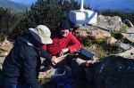
After sharing a story or two with the guys at Bulls Head, Andrew, John, & I, hit the road again and headed for our second summit and park for the day…… Mount Ginini VK1/ AC-008, which is also located in the Namadgi National Park VKFF-377.

Above:- Map showing the location of Mount Ginini. Courtesy of mapcarta.com
Mount Ginini is 1,760 metres above sea level and is worth 8 points for the Summits on the Air (SOTA) program. The summit is located in the Brindabella Ranges and is located on the border between the Australian Capital Territory (ACT) and New South Wales (NSW). The summit is the eighth highest mountain in the Territory.
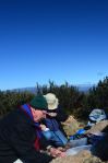
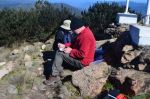
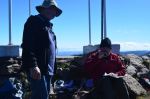
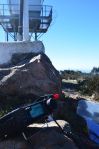
For this activation we drove right up to the very top of the summit and walked to our operating spot, a short distance away. Although it was a little less windy up here compared to Mount Coree, it was a lot colder. In fact very cold! Four (4) degrees celsius.

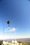
Above:- Mount Ginini. Image courtesy of http://www.sota.org.uk
For this activation we ran QRP 5 watts into a linked dipole. John VK5BJE started off first, adopting his yoga position, and had soon racked up 10 contacts, thus qualifying the summit for Summits on the Air (SOTA) and the park for the World Wide Flora Fauna (WWFF) program. I then tried my luck on 40m and had soon also accrued 10 contacts on 40m including three summit to summit contacts: Andrew VK1NAM on Mount Stromlo VK1/ AC-043, and Onno VK6FLAB and Marc VK3OHM both portable on Mount Coree VK1/ AC-023 (the mountain we had just come from).
Andrew then asked if I would like to try 20m. I didn’t hesitate as I was hoping that I could reach 44 contacts for the Namadgi National Park. I had ten contacts from the last activation, so with the ten on 40m here on Ginini, I just needed another 24 contacts. So down came the squid pole and out came some of the links in the dipole. We tuned to 14.244 but the frequency was already in use. In fact it was Danny OT6V who was portable in a WWFF park, Mosterdpot, ONFF-447. Danny had a few European callers but I patiently waited and gave Danny a call and managed to make contact. Although Danny’s signal was not all that strong, we were able to hear each other very well (5/5 both ways). For more information on Danny’s activation, have a look at the following……
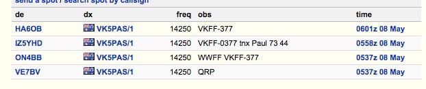
I then moved up to 14.250 and put out a number of CQ calls, and these were finally answered by Bruce VK4YS. This was followed by a call from Dwight VE7BV in Canada, who was kind enough to place me on the DX cluster. This resulted in a number of callers from Europe and North America. I would also like to thank the other 3 stations that placed me on the DX Cluster. It is a big help to drag in callers when this is done.
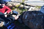
It was so cold on the summit that Andrew and John went back to the vehicle and the warmth of the heater, while I braved the elements, and kept on working the DX on 20m. But it became that cold that I could no longer hold the pen in my hand, so it was time to pack up and head home. I am sorry to those stations that were still calling when I went QRT. It was just way too cold.
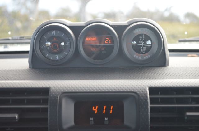
By the time we had packed up the gear and got back into the car, the temperature had gone down to 2 deg C (as can be seen in the photograph below).
I worked the following stations:-

I would like to acknowledge and thank Andrew VK1DA who kindly took John and I out for the day. It was a pleasure to meet Andrew ‘in the flesh’. I had spoken with Andrew many many times previously on air, but this was the first time we had ever met in person. Again, thanks Andrew.
References.
Wikipedia, 2015, <http://en.wikipedia.org/wiki/Mount_Ginini>, viewed 13th May 2015
On Thursday afternoon (7th May 2015) I flew over to Canberra to attend the Wireless Institute of Australia (WIA) Annual General Meeting. I spent a nice Thursday evening with John VK5BJE and a good meal and a few reds. And on Friday morning (8th May 2015), Andrew VK1DA was kind enough to pick myself and John up from our hotel, the Novotel and take us up into the mountains outside of Canberra for two activations for the Summits on the Air (SOTA) program and the World Wide Flora Fauna (WWFF) program. We were very fortunate weather wise, as although it was a very cold morning, there was no rain, and it was quite sunny. It was a beautiful drive out of Canberra up in to the Namadgi National Park.


Our first activation for the day was Mount Coree, VK1/AC-023 which is located in the Namadgi National Park, VKFF-377, about 56 km by road from Canberra. It may have only been a short distance km wise, but it took about 90 minutes to get there due to the terrain. 
Above: Map showing the location of Mount Coree. Image courtesy of mapcarta.com
Mount Coree was formerly known as Pabral, and is 1,421 metres above sea level. It is with 4 points for the Summits on the Air (SOTA) program. The summit is located within the Brindabella Range on the border between the Australian Capital Territory (ACT) and New South Wales (NSW). The actual summit is located within the ACT. The mountain is situated in the Brindabella National Park on the NSW side and in the Namdgi National Park on the ACT side. Prior to European settlement, the mountain was used by local Aboriginal tribes to hunt for Bogong moths. In fact, ‘Coree’ is an aboriginal name for moth. The Bogong moth is a temperate species of night flying moth. The mountain was originally shown as ‘Pabral’ on an 1834 map of the famous explorer, Major Sir Thomas Mitchell. The Namadgi National Park was declared as a National Park in 1984 and covers an area of 106,095 hectares, almost half of the ACT. About 35 species of native mammals can be located in the park including Swamp wallabies, Eastern Grey Kangaroos, echidnas, wombats, emus, pygmy possums and numerous reptiles. There are 13 threatened species documented including the Smoky mouse, River Blackfish, and Northern Corroboree Frog. 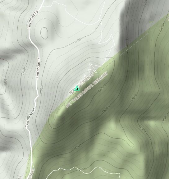
Above:- Map showing the location of the summit on the ACT/NSW border. Image courtesy of http://www.sotamaps.org
Andrew parked his car just off the track leading up to the summit and we walked the remainder of the way, a short distance of about 300 metres.
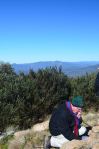
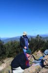
This is a very exposed summit with some amazing views of the Namadgi National Park and the Brindabella National Park. The summit is right on the ACT and New South Wales border and offers spectacular views of the surrounding countryside. And because it was so exposed, it was very windy. And I mean, very windy.
Andrew used the trig point on the summit to secure his squid pole with his home brew linked dipole on the top. John VK5BJE, started off first, followed by myself, and then Andrew. It was very windy and cool on the summit, and after reaching 10 contacts each, John and I were very happy. We had qualified the summit for SOTA and had qualified the National Park for the WWFF program. Of my ten contacts, four were summit to summit contacts: with Peter VK3PF/1 on Bobogon Range VK1/ AC-044, Andrew VK1NAM/2 on VK2/ SM-093, Onno VK6FLAB/1 on Mount Ginini VK1/ AC-008, and Gerard VK2IO/1 on Mount Gingera VK1/ AC-002
I worked the following stations:-  At the bottom of the summit, we stopped for a quick photo opportunity. There was a great view back up to the trig point on the summit. It certainly highlighted the sheer cliff face of Mount Coree.


We then headed to ‘Bulls Head’ picnic/camp ground, for a quick lunch break and a catch up with some other keen amateurs that were out activating summits and parks as well. This included Onno VK6FLAB and Marc VK3OHM. These guys had just activated Mount Ginini and were heading to Mount Coree. And we had just activated Mount Coree and were heading to Mount Ginini.
References. ACT Government, 2015, <http://www.tams.act.gov.au>, viewed 13th May 2015. Visit Canberra, 2015, <http://www.visitcanberra.com.au>, viewed 13th May 2015 Wikipedia, 2015, <http://en.wikipedia.org/wiki/Mount_Coree>, viewed 13th May 2015
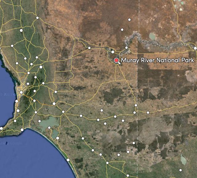
After my activation of Murray Sunset National Park in north western Victoria, I headed back over the border and travelled to the Lyrup Flats section of the Murray River National Park near Renmark in South Australia. I had earlier arranged an activation at Murray River NP with Larry VK5LY, Ivan VK5HS & Peter VK5FLEX.
The park qualifies for the World Wide Flora Fauna (WWFF) program and also the VK5 National and Conservation Parks Award.
The Murray River National Park comprises three sections, Katarapko, Lyrup Flats and Bulyong Island. These three areas of similar habitat form an archipelago (group of islands) park and are important in conserving a number of flood plain environments.
Lyrup Flats encompasses an area along the flood plain on the northern side of the River Murray. Opposite the township of Lyrup, the park is easily reached by turning off the Sturt Highway just past Berri and continuing down to the River Murray. Lyrup Flats provides wonderful opportunities for birdwatching, fishing, camping, and bushwalking along the majestic River Murray.

Above:- Map showing the location of the Murray River NP. Image courtesy of mapcarta.com
I accessed the park off the Sturt Highway and travelled down the dirt road into the park. The park is well sign posted on the Sturt Highway.


As you travel along the dirt road through the park you will notice all of the dead trees. This is due to the salinity in the soil in the Flats area of the park.


I travelled down to one of the smaller dirt tracks leading off to the River itself and set up at one of the campsites. It was a real shame to see that somebody had been there before me, and had left their campfire full of broken bottles and empty food cans. Not surprising really, as I would imagine there is very little policing of the park by DEWNT due to staff shortages. A real pity!
For this activation I used the Yaesu FT-857d and the 40m/20m linked dipole on top of the 7 metre squid pole.

Despite the grubs that had left the campsite untidy, this was a very beautiful spot right alongside of the Murray River. It was a beautiful mild day with minimal breeze and the river was very still most of the time, except for the occasional boat that passed by.
It wasn’t long before Ivan, Larry and Peter were on scene and we were up on air. The main reason for this activation was to get Larry VK5LY out and about in his first park after a long absence due to ill health. And it wasn’t long before Larry had a pile up going on 40m. It was great to see.
Thanks to everyone that called Larry. It was extremely pleasing to see Larry back on air, with a smile on his face, operating from a park.
Peter VK5FLEX then worked a few stations on 40m, and when Peter had finished I jumped on to 20m and worked a total of 28 stations in Europe. But it was starting to get quite late in the afternoon and I still had a 2 & 1/2 hour drive to get home, so I had to go QRT. I am sorry to all those that were still calling.


As I mentioned earlier, the River was very still at times and presented with some excellent photo opportunities, with the River Red Gums on the other side of the river, reflecting off the water.


And as we left the park, there was plenty of wildlife to be seen, including Western Grey kangaroos and Emus.


And I was blessed with a beautiful drive home to the Adelaide Hills. The moon was coming out as the sun started to set in the west. And it was an amazing sunset.


I worked the following stations during the activation:-
References.
Department of Environment and Heritage, 2011, Parks of the Riverland.
My first park for Sunday (3rd May 2015) was to be the Murray Sunset National Park, which is located about 29 km down the Sturt Highway from Renmark and is just over the border in the State of Victoria.
To get to the park I travelled east on the Sturt Highway, back out towards the Pike River Conservation, where I had been on Saturday night. I stopped briefly at a lookout area to view the park during the daylight and also at a few items of interest including an old timber jinker. I continued on towards the Victorian border, and stopped very briefly at Yamba. The Yamba road block was set up in March 1957 to protect South Australia from any fruit fly outbreaks that are likely likely to occur inter State. Initially the road block operated from a caravan which was located on the Sturt Highway, at the Victorian border. Currently it operates from a permanent site located east of Renmark.
Murray-Sunset National Park, in Victoria’s far north-west corner, is in one of the few remaining semi-arid regions in the world where the environment is relatively untouched. This is a big park. It is 677,000 hectares in size and is Victoria’s largest National Park after a further 44,000 hectares were added to the park in 2012. It stretches from the Murray River at Lindsay Island in the north to Pink Lakes near Underbool in the south.
The park which was declared in 1991, protects 183 species of threatened plants and animals. And I certainly saw quite a bit of wildlife including Western Grey kangaroos and emus. Victoria’s largest flower, the Murray lily, the restricted Silvery Emu-bush and the rare Blue-leafed Mallee all grow within the park.

Above:- Map showing the location of Murray Sunset NP. Image courtesy of mapcarta.com
Once I crossed the Victorian border, the signs for the park were very visible either side of the Sturt Highway. I decided to take a track on the northern side of the Sturt Highway. I travelled a few km along the track until I found a nice clearing and that is there I set up. I would not recommend this track if you only have a conventional vehicle….you will get bogged.
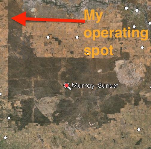
Above:- Map showing my operating spot. Image courtesy of mapcarta.com
It was quite a nice mild morning, although when I first got up it was extremely cold. The fog that I experienced as I approached the Victorian border was starting to burn off and the sun was coming in with quite a bite to it.

Above:- Map showing the park and my operating spot. Courtesy of parks Victoria.
For this activation I ran the Yaesu FT-857d, 40 watts and the 40m/20m linked dipole supported on the top of the 7m squid pole. As I was setting up I was fortunate enough to see quite a bit of the local wildlife, including Western Grey kangaroos and Emus.
I headed for 7.095 and started calling CQ there and this was immediately answered by Scott VK7NWT with a great 5/9 signal, followed by John VK5BJE who was portable in the Belair National Park, VKFF-022, in the Adelaide Hills. John was a nice 5/8. My next caller was local Renmark resident Ivan VK5HS, followed by Adrian VK5FANA over on the Yorke Peninsula, and then Richard VK5U mobile 3 near Barmah.
Quite a steady flow of callers followed from VK1, VK2, VK3, VK4, VK5, VK6. Band conditions on 40m were very good, with excellent signals from all parts of Australia.
It is always great to work the QRP stations, and this activation didn’t disapoint. My first QRP contact for the activation was with Gerard VK2JNG running 2 watts from Orange (5/7 sent and 5/9 received). This was followed by Nick VK3FNCE running 3 watts (5/9 both ways) and then Peter VK3PF running 5 watts (5/9 both ways). Regular park hunter and regular QRP operator, Amanda VK3FQSO then gave me a shout with just 500 milliwatts (5/8 sent and 5/9 received). Next up was Bill VK2YKW running 5 watts from his X1M and an inverted vee antenna from the Hunter Valley, and then George VK4GSF. George initially called on high power (5/9 both ways). He then lowered his power down to 5 watts and was 5/5 with me. And then lowered the power again to just 2 watts, and was still a good 5/4 signal. A little later I spoke with Greg VK5GJ running 4 watts from Meadows in the Adelaide Hills and my last QRP contact was with Damien VK5FDEC running 5 watts from north of Adelaide.
I also was fortunate to be called by two ACT Summits on the Air (SOTA) activators. The first being Andrew VK1DA portable on Mount Majura, VK1/ AC-034 (5/7 sent and 5/8 received). And then Ian VK1DI portable on Booroomba Rocks, VK1/ AC-026 (5/8 both ways).
After working a total of 46 stations on 7.095 I went for a look around the band. I found special event station, VK100ANZAC calling CQ on 7.100 and gave him a call (5/9 sent and 5/8 received).
I then went to 7.105 and again called CQ and much to my great pleasure, my old mate Larry VK5LY gave me a call from nearby Renmark. This was followed by a well known Victorian park activator, Joe VK3YSP, and then Arno VK5ZAR and another Riverland local, Peter VK5FLEX.
I worked a total of 14 stations on 7.105 and I was just about QSY to 20m when the goat bleeted on my i-phone. It was a spot for Ian VK5CZ operating portable from SOTA peak VK5/ SE-007. So I hurriedly headed to 7.112 and found Ian calling CQ, with a very nice 5/9 signal from his end fed antenna.
I then spoke with Andrew (VK1NAM) operating the special call of VI1ANZAC from SOTA peak, Orroral Hill, VK1/ AC-012, contained within the Namadgi National Park VKFF-377 (5/7 sent and 5/8 received).
After working Andrew I headed to 14.310 on 20m and started calling CQ. However, my only taker there was Barry VK5KBJ who was portable on the Fleurieu Peninsula south of Adelaide. So I headed back to 40m and worked Stef VK5HSX who was operating portable from the Hallett Cove Conservation Park south of Adelaide (5/9 both ways). My last contact in the park was with Andrew (VK1NAM) operating as VI1ANZAC on SOTA peak Orroral Hill, VK1/ AC-012 (5/9 both ways). My i-phone had bleeted again just after working Stef, so down came the squid pole and out came the links again in the dipole.
I did listen around on 20m before going QRT but I did not hear a lot of activity. I did hear OD5ZZ in Lebanon, working lots of stations in the USA. I called a number of times, but just couldn’t break through the North American pile up.
This was another very enjoyable activation with a total of 66 contacts in the log, including four SOTA contacts, 2 ACT Park contacts, and 2 South Australian park contacts.
After packing up I headed back over the Victorian/South Australia border, and on to Yamba where I stopped for a cup of coffee and a healthy hot dog with the lot. I then travelled back over the Murray River, where I stopped briefly for some more photographs of the historic Paringa lifting bridge and the mighty Murray River.
The following stations were worked on 40m SSB:-
The following stations were worked on 20m SSB:-
Below is a short video of some of the stations that I heard, in particular Stef VK5HSX/p, John VK5BJE/p and Andrew VK1NAM/p.
References.
Government of South Australia, 2015, <http://www.pir.sa.gov.au/>, viewed 13th May 2015
Parks Victoria, 2015, <http://parkweb.vic.gov.au>, viewed 6th May 2015
After activating the Pooginook Conservation Park, Marija and I headed to the Murray River National Park. The park is located in the Riverland region of South Australia, and is about 220 km north east of Adelaide. The park qualifies for the World Wide Flora Fauna (WWFF) program and is VKFF-372.
Above: Map showing the location of the Murray River NP. Courtesy of mapcarta.com
On the way we stopped off and had a look at the Lake Bonney Hotel ruins. This is also known as Napper’s Ruins, and is located on the north side of Lake Bonney. Napper’s Ruins once stood strong as a hotel built for former workers of Cobdogla Station. It was originally called Lake Bonney Hotel and consisted of 11 rooms that included a well stocked bar and an eating room that could cater for 12 people. This room was occasionally used as a dance room. The hotel is now nothing more than ruins and includes some interpretive information signs.
The ruins are the remains of the accomodation house which was built by William Parnell in 1859 and later sold to William Napper in 1863. Napper’s first wife is buried in Cobdogla and was the first white woman buried in the Riverland. The graves of William Napper and his second wife are also in this cicinity. The cottage behind the ruins is locally known as the Fisherman’s cottage. During the 1956 flood, this building was inundated with water.
The buidlings belong to the local branch of the National Trust but unfortunately have fallen victim to vandals. We were saddened to see all the grafitti over the Fishermans cottage.
We continued on south down through Loveday and into the Katarapko Section of the Murray River National Park. The park is very well signposted and easy to find. We headed down to the water’s edge of Katarapko Creek and set up there, right alongside of the creek.
The Murray River National Park is 13,000 hectares in size and consists of three separate areas: Katarapko, Lyrup Flats, and Bulyong Island. The largest and most popular area of the park is Katarapko. This area features floodplains and several permanent and semi-permanent wetlands. The area is a breeding ground for most of southern Australia’s waterfowl and other waterbirds.
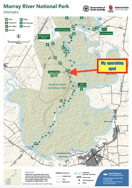
Above: Map showing my operating spot. Map courtesy of National Parks SA.
It was still quite overcast, but fortunately no rain, so ideal for park activating. And it was a very idealic setting alongside of Katarapko Creek. I went to my nominated operating frequency of 7.144 and called CQ and this was answered by my old mate Dave VK3VCE in Victoria, followed by Tom VK5FTRG in Millicent, and then Rex VK3OF and then Les VK5KLV in Port Augusta. This was a good spread for the first 4 callers, all the way from the north of South Australia down to the very south east and across to Victoria. All had 5/9 signals.
Many thanks to Arno VK5ZAR, who was my fifth contact, for placing me on parksnpeaks. A steady flow of callers followed from VK1, VK2, VK3, VK4, and VK5.
But only five calls in, I started to receive extremely bad bleed over from somebody nearby. I tuned down the band and found that it was one of the AM fellas on 7.125. And boy was he wide. I thought perhaps it might have been the sensitive front end of the Yaesu FT-857, but Andrew VK1NAM agreed. The VK2 on 7.125 was 10kc wide.
I worked a total of 21 stations on 40m including a few QRP stations. This included Peter VK3PF and Cleeve VK2MOR who was running just 2 watts (5/9 sent and 5/8 received).
I then QSY’d up to 20m and started calling CQ. My first taker there was Cleeve VK2MOR who had followed me up from 40m. This was followed by Gerard VK2IO and then the first of the DX, Swa ON5SWA and then Albert S58AL. A very big pile up ensued with so many stations calling it made it very very difficult to pull out callsigns. So for the first time ever, I operated split. Because I had not operated split previously using the FT-857d, I had to quickly work out via the menu on how to do this. I couldn’t find out how to listen up, so I listened down 5 kc.
I worked a total of 43 DX stations in Belgium, Italy, Spain, England, Denmark, Germany, Portugal, Slovak Republic, Hungary, Canary Islands, Czech Republic, France, Japan, Puerto Rico, & USA. This included my very good mate Marnix OP7M. And also some VK’s amongst the DX including Greg VK8GM, Adam VK2YK, John VK6NU in the Avon National Park, and Mike VK6MB.
I then headed back to 40m briefly, on 7.144, for any last desperados who would like Murray River National Park. First taker there was John VK2YW in Wagga, followed by Adam VK2YK, Ian VK5CZ, Adrian VK5FANA, and then Adrian VK4FBMW who was running QRP 5 watts.
Whilst I was working Adrian, I heard a very pronounced noise coming from behind me. It sounded like a big gust of wind. However, it was quite calm up until this point and the sun had just set and it was now almost completely dark. As I looked over my should downstream along Katarapko Creek, I soon worked out what the noise was. It wasn’t wind. It was rain…and heavy rain! So unfortunately in the middle of the QSO with Adrian I had to shut down in huge hurry and rush back to the 4WD with the FT-857D. Sorry to cut it short so quickly Adrian. And I am also sorry to others that I know were waiting to work me including Rob VK4FFAB.
So after 90 minutes in Murray River NP, I had a total of 74 contacts in the log. We then headed off the the Barmera Hotel for our evening meal and a few beverages.
The following stations were worked on 40m SSB:-
The following stations were worked on 20m SSB:-
References.
Barmera Visitor Information Centre, Historical Icons
After getting back from our activation at the Point Davenport Conservation Park on Sunday 29th March 2015, I set up directly outside the old Post Office at Inneston in the Innes National Park. This was just a quick activation before dinner.
Unfortunately it was very noisy due to the ETSA power lines passing through the park to provide power for the acommodation. But I boxed on and did make a total of 15 contacts including some very memorable QRP contacts. They included Brian VK7ABY, Adrian VK5FANA, and Tom VK5FTRG. But the most amazing contact was with Peter VK3YE who was true blue QRP at just 100 milliwatts. Peter was an amazing 5/7 signal with this 100mw and his home brew transceiver.
I packed up just as it was getting dark and headed inside for a beautiful meal cooked up by Marija and a nice bottle of red wine from the Clare Valley.
The following stations were worked:-
From Carribie Conservation Park (afternoon of Saturday 28th March) we travelled in to the little town of Corny Point, where stopped to have lunch at the Howling Dog Tavern. What a great name for a pub. Marija and I had eaten here before, back in 2013, during out visit to the Yorke Peninsula for the 6 month anniversary of the VK5 Parks award. The food is good. And the Bundy was nice and cold. We also did some running repairs on the Toyota Hi Lux. One of the spot lights on the bullbar had come loose. In fact I had lost the theft proof bolt holding it in place. It had obviously not been tight enough and had jarred loose on the corrugated roads.
After lunch we took a scenic drive down to the Corny Point lighthouse and then followed the West Coast Road, stopping off regularly to view the coastline. We highly recommend this detour. The West Coast Road will take you all the way down to Point Annie. From there we headed back inland along the Point Annie Road until we reached the Marion Bay Road and then travelled south. A number of kms south, we turned right onto Browns Beach Road and headed down to Gym Beach. The views here are truly amazing. We travelled into the Innes National Park from here and found a little car park all to ourselves. We set up the radio gear there, overlooking the ocean (the Spencer Gulf).
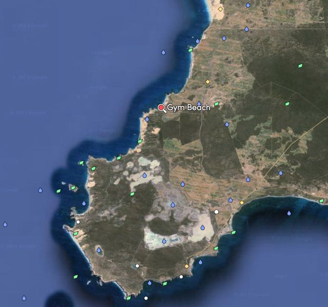
Above: the location of Gym Beach on the north western side of the park. Image courtesy of mapcarta.com
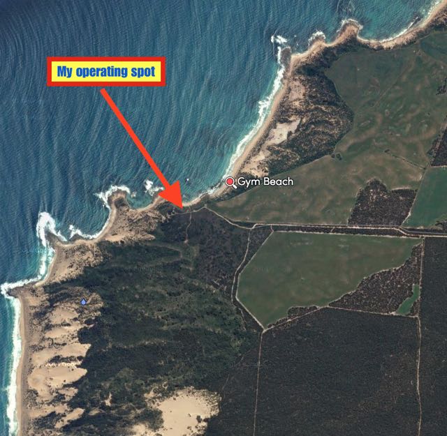 Above: Our operating spot at Gym Beach, close to the ocean. Image courtesy of mapcarta.com
Before calling CQ I had a look around the 40m band and found Andrew VK5MR calling CQ on 7.105 from the Caroona Creek Conservation Park in the Mid North. Andrew was my first contact and my first park to park contact for this activation (5/9 both ways). I then found Hans VK5YX operating portable from the Hallett Cove Conservation Park south of Adelaide (5/9 both ways), and then Richard VK5ZRY operating portable from the Minlacowie Conservation Park on the Yorke Peninsula (5/9 both ways).
I then went up to 7.120 and started calling CQ and this was answered by David VK5KC and Roy VK5NRG who were activating the Mark Oliphant Conservation Park in the Adelaide Hills (again 5/9 both ways). This was followed by a contact with Mark VK5QI in the Coorong National Park. A few QSOs later I was called by Nigel VK5NIG activating the Sandy Creek Conservation Park north of Adelaide in the Barossa, followed by Arno VK5ZAR in the Port Gawler Conservation Park, and then Greg VK5GJ and Norm VK5GI in the Mount Magnificent Conservation Park on the Fleurieu Peninsula.
But that wasn’t the end of the park to park action. I then received a call from David VK5NQP in the Red Banks Conservation Park, followed by Tim VK3MTB/5 in the Naracoorte Caves National Park, and then Greg VK5ZGY in the Paranki Lagoon Conservation Park in the South East, Gary VK5FGRY in the Morialta Conservation Park in the Adelaide Hills, and then Peter VK5KX in the Hogwash bend Conservation Park in the Riverland. All with 5/9 signals. Wow, the park to park activity was great.
But wait, there’s more, as that guy who sold steak knives used to say. I also worked Bill VK5MBD in the Clements Gap Conservation Park in the Mid North, Peter VK5FLEX in the Danggali Conservation Park in the Murray Mallee.
When the callers slowed down I took the opportunity of looking around the band and found Matt Vk1MA portable on SOTA peak VK2/ ST-006 (5/5 sent and 5/7 received).
I then lowered the squid pole and removed the links and headed off to 20m. I started calling CQ on 14.346 and this was answered by Andy VK5AKH in the Coorong National Park. And from there a steady flow of European park hunters called me from Italy, Spain, Hungary, Germany, Russia, Slovenia, France, Belgium, Slovak Republic, Austria, England, and the Czech Republic. Thankyou to everyone that spotted me. This clearly helped in the Europeans finding me. I also received a call from Andrew VK1NAM amongst the European pile up.
I then headed back to 40m and called CQ on 7.115 and my first taker there was another park to park contact, Andrew VK5MR this time in the Mokota Conservation Park. Soon after this was followed by another park to park, this time with Ian VK5CZ activating the Spring Gully Conservation Park up in the wine growing region of the Clare Valley. A handful of QSO’s later, Arno VK5ZAR gave me a shout from the Port Gawler Conservation Park.
But perhaps the highlight of the activation for me, was a contact with Peter VK3YE who was operating true QRP, 100 milliwatts. Peter’s signal was weak (5/3) as you would expect, but perfectly readable. Amazing what you can do with QRP!
This was another successful activation, with a 72 contacts in the log on 40m and 20m SSB in 2 & 1/2 hours.
The following stations were worked:-
The following stations were worked on 20m SSB:-
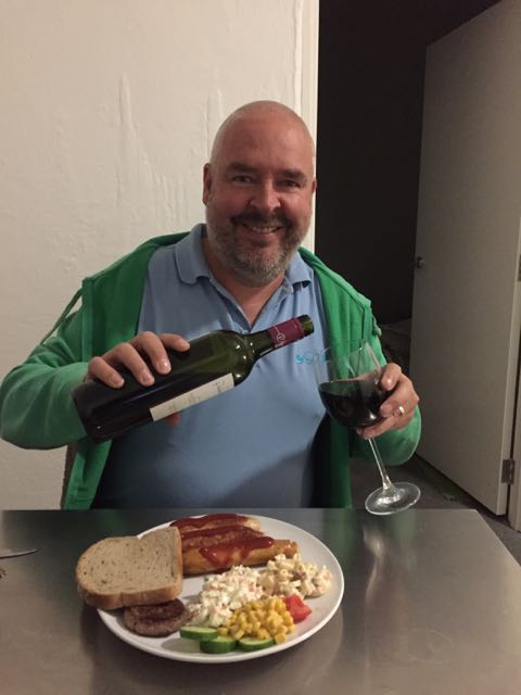
My first park activation for the 2nd year anniversary was the Innes National Park, on Friday 27th March 2015. Marija and I had a 315 km drive ahead of us from the Adelaide Hills down to the bottom of the Yorke Peninsula. We initially drove through the bushfire devastated area of the Mount Lofty Ranges ‘Adelaide Hills’. This is the area around Kersbrook which was severely affected by the bushfires back in January 2015, with 30 homes being destroyed. We were very pleased to see a lot of regrowth with the scrub, but there is a long, long way to go.
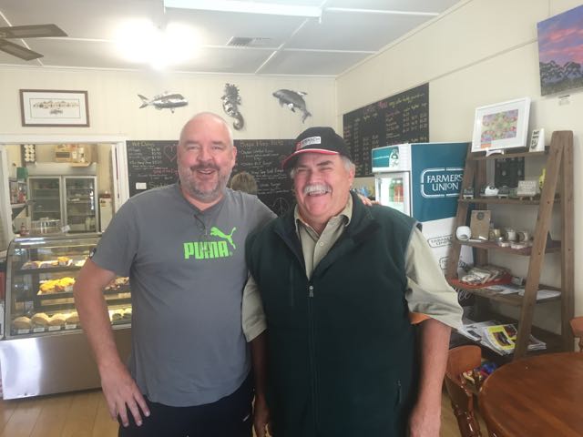
We continued north on to the little town of Ardrossan on the western side of the Yorke Peninsula. Ardrossan is a beautiful little town of about 1,200 people, which faces the Gulf St Vincent. Prior to arriving there, Marija and I had arranged to meet Adrian VK5FANA at the local cafe. Adrian is a very keen park activator and hunter. I had spoken with Adrian many times on air, but I had never met him in person. So we headed for the ‘Stump Jump Cafe’ in the main street of Ardrossan.
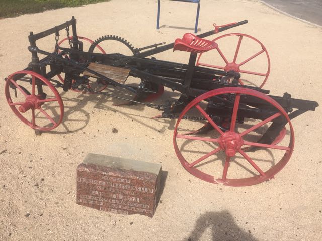
After having a coffee and a morning hotdog, and a chat with Adrian, we had a quick look around Ardrossan. I mentioned the ‘Stump Jump Cafe’ above. I hear you saying now, ‘what a strange name for a cafe’. Well it was named after the stump jump plough. Ardrossan was the home of Clarence Smith’s plough factory where he manufactured the stump jump plough between 1880 to 1935, This South Australian invention was vital in opening mallee country throughout Australia to the plough. Ploughing was difficult using a single furrow plough. These were satisfactory where land had been adequately cleared, but were mallee roots and rocks were found, the ploughs would jump off course. In 1876, Richard Bowyer Smith was ploughing on his farm when one of the bolts on the plough broke. He discovered that it worked much better as it rode over the stumps. This accident produced the concept of the stump jump plough. If you would like some more information on this very unique South Australian invention, have a look at…..
http://en.wikipedia.org/wiki/Stump-jump_plough
After leaving the town of Ardrossan, we took the quick detour up to the dolomite mine lookout where we enjoyed some great views of Ardrossan and along the coastline. We then hit the road again and continued south down the Yorke Peninsula.
Our next stop was the little inland town of Minlaton which is another very interesting little town on the Yorke Peninsula. Minlaton has a population of about 800 people and is known as the “Barley capital of the world”. Minlaton was the home town of Harry Butler, a World War flying ace, who also flew an air mail run from Adelaide across Gult St Vincent to Minlaton back in 1919. His mail run was the first over-water flight in the Southern Hemisphere. Butler’s Bristol M1C monoplane has been restored and is on display in the town. There is also a wildlife park here which is worth a look, which is exactly what we did, whilst we had morning tea. We also called in to the Minlaton Tourist Information Centre which is located in the old Harvest Corner building, which was originally a fuel and fodder store, and a saddlery. The building later became the district’s main shoe store, and in the 1930’s a cafe and delicatessen.
We then headed down to Yorketown, a small town of about 685 people, again with a very interesting history. Yorketown was built on the junction of five roads, and this rather unique junction remains today. Many of the original buildings exist, including the Yorke Hotel built in 1876, and the Melville Hotel built in 1872. Here is how the intersection looks today…..

And here is how the intersection looked at the turn of the century…..
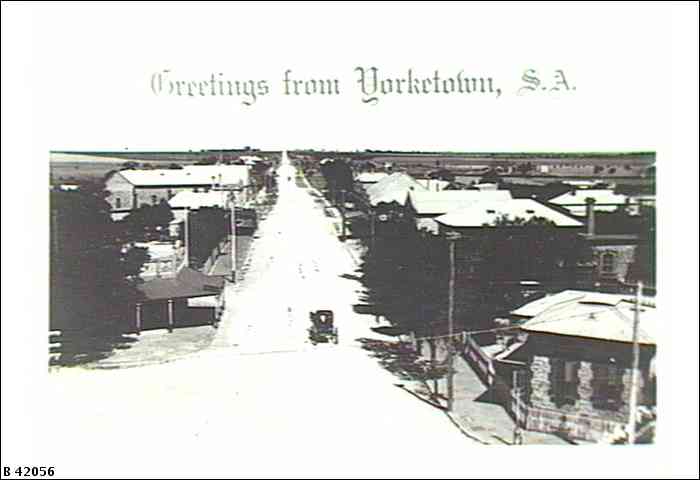
Image courtesy of the State Library South Australia.
After leaving Yorketown, we continued south through the town of Warooka and then on to Marion Bay, which is the gateway to the Innes National Park. Marion Bay is set at the foot of the Yorke Peninsula and has some excellent surf and fishing beaches. It is a very popular tourist destination and its population swells during the holiday periods.
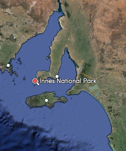
Above:- the lcoation of Innes National Park. Image courtesy of mapcarta.com
We drove into the park and after a short photo stop, we headed for the Innes National Park Tourist Centre, where we needed to collect our accomodation key. Marija and I had visited Innes back in 2013 for the 6 month anniversary of the parks award, and we had fond memories of the park and the visitor centre which had quite a bit to see. However we were saddened to see that the Visitor Centre was closed ‘Until Further Notice’. Now, I normally do not like getting political. But I am going to here. Innes National Park is one of the most popular park in South Australia, with tens of thousands of visitors each year. And the Visitor Centre would not have been cheap to construct. And here it is closed until further notice. My own personal experience with DEWNR is that they are sadly lacking in funds. All I can say is that the South Australian State Government should hang their head in shame.
And further, to enter the park, you are no longer blessed with a friendly ‘ranger’ to provide you with a permit and advice on where to go and what to see. Now you book on line prior to entry to the park. Clearly a cost cutting exercise. Recently whilst up at the Mount Remarkable National Park, we were viewing an information board at the entrance to the park, when a Victorian couple drove in and asked us where they were to pay. We told them about the on-line booking system, and because there was no internet coverage, they drove off. Perhaps our friends in Parliament are trying to disuade visitors to our parks? See the interesting story below about visitors to Innes.
Enough of the negative comments. As we drove towards Inneston, there were some spectacular photo opportunities. Initially we took a detour to Stenhouse Bay to view the historic jetty and the beautiful blue waters of the Bay. We then headed to the Cape Spencer lighthouse, and also enjoyed the amazing views of Chinamans Hat Island, Cable Bay, Althorpe Islands, and across the water to Kangaroo Island.
After settling in at the old Post Office, Marija helped me set up my radio gear. Initially I set up my station at the back of the Post Office as it was a nice sheltered and enclosed area, but after turning on the radio I was saddened to hear that the noise floor was S8. It was pretty much impossible to operate, so down came the antenna and I moved location, amongst the scrub, about 30 metres from our accommodation, close to some of the Inneston ruins. Unfortunately the noise level was not much better. Nearby was an ETSA power line running through the park, to supply power to the accomodation. I suspect this is where the noise was coming from.


I called CQ on 7.088 and this was answered by park stalwart, Peter VK3TKK who was mobile (5/9 both ways). This was followed by Doug VK2FMIA who was portable in the Somerton National Park, VKFF-607, in New South Wales (also 5/9 both ways). So despite the high noise I was experiencing, the band seemed to be in very good condition.
A few calls later I was called by my first VK5 park for the weekend, Chris VK4FR/5 who was in the Dudley Conservation Park, VKFF-809, on Kangaroo Island OC-139. Chris had a great 5/9 signal. Chris was not to be my last park to park contact for this activation. About 15 QSO’s later I was called by Greg VK5ZGY who was portable in the Mount Boothy Conservation Park in the Mallee region of South Australia. Greg also had a nice 5/9 signal.
About a dozen contacts later I was called by Glenn VK6KY/5 who was mobile at Moonta at the top of the Yorke Peninsula. I found out that Greg was travelling with a group of other VK6 amateurs and their wives, and in fact they had been at Inneston earlier in the day and had been standing right outside the old Post Office, reading the information board. It is a small world.
Soon after I took a break for dinner, and when I returned my second caller was Steve VK5RU. I was quite surprised when Steve told me that many years earlier he had lived at Inneston. What is the chance of that? A VK6 who had visited this remote location earlier in the day, and now an amateur who had actually lived at Inneston. It was starting to get dark after quite a beautful sunset, and the Tamar wallabies were out in force. Tamar wallabies were classed as extinct in the Australian wild until recently, and have now been reintroduced to Innes National Park.
I went on to work a dozen or so VK3, VK5 & VK7 stations, and I was then called by Owen ZL2OPB in New Plymouth on the South Island of New Zealand (5/9 both ways).
At about 0935 UTC (8.05 p.m.) I headed off to 7.130 for the 7130 DX Net, run by Roy VK7ROY. I worked a total of 15 stations on the Net including William FO5JV in French Polynesia, John ZL2BH in Blenheim, and Brian ZL2ASH in Wellington.
Following the net, I headed to 7.135 and called CQ and this was answered by Mike VK3AUR, followed by Dennis VK5LDM with a huge signal. I worked a further 3 stations, until I decided it was time to head inside and enjoy a bottle of red.
I had a total of 69 contacts on 40m SSB which I was very pleased with.
The following stations were worked on 40m SSB:-
References.
Wikipedia, 2015, <http://en.wikipedia.org/wiki/Ardrossan,_South_Australia>, viewed 7th April 2015
Wikipedia, 2015, <http://en.wikipedia.org/wiki/Minlaton,_South_Australia>, viewed 7th April 2015
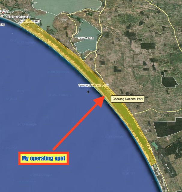
For the 2015 John Moyle Memorial Field Day Contest I headed down to Parnka Point at the Coorong National Park, about 170 km south east of Adelaide.
The Coorong National Park qualifies for the World Wide Flora and Fauna program (it is VKFF-115) and also qualifies for the VK5 National and Conservation Parks Award.
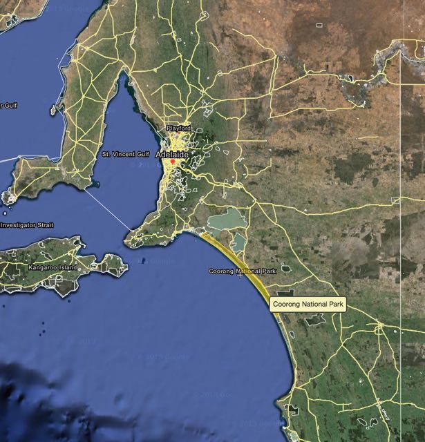
Map courtesy of wikimapia
The park’s name is thought to be a corruption of the local aboriginal word kurangh, meaning ‘long neck’, which is a reference to the shape of the lagoon system. The name is also thought to be from the Aboriginal word Coorang, “sand dune”, a reference to the sand dunes that can be seen between the park and the Southern Ocean.
More information on the Coorong National Park can be found at…..
 map courtesy of wikimapia
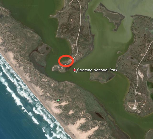
I drove to the end of Parnka Point and set up in a little shelter shed on the western side of the point. Parnka Point is the narrowest part of The Coorong as the water is less than 100 metres wide. Parnka Point is where the northern and southern lagoons of The Coorong meet each other. The water at this point is often referred to as Hells Gate.
The northern lagoon is partly fed by the waters of the River Murray, and varies in salinity from brackish to hyper saline. In contrast the southern lagoon is always hyper saline. While this narrow channel often appears calm, a change in wind direction or water levels can create treacherous currents through this narrow but deep channel.
Parnka Point was a significant meeting site for the five aboriginal tribes that formed the Ngarrindjeri clan. Parnka is a Ngarrindjeri word meaning ‘sandy beach’. As you look out across the lagoon, you can see wooden poles in the seater. These are the remains of a ferry built last century to access the Younghusband Peninsula.
It was a very beautiful outlook, overlooking the lagoons. The weather was sensational…..28 degrees C.
map courtesy of mapcarta.com
I took part in the 6 hour section and I managed a total of 238 contacts. Most of those were on 40m SSB (222), but I did squeeze in 26 on 20m SSB. Most of the contacts on 20m were with other VK’s, but a few Europeans and Japanese gave me a call, and exchanged numbers. They were obviously aware of the JMMFD.
For the contest I used my Yaesu FT-857d and 40 watts on 40m and 80 watts on 20m. The antenna was a 40m/20m linked dipole supported by a 7 metre telescopic squid pole (inverted vee). The radio was powered by a 44 amp hour power pack(2 x 22 amp hour SLAB batteries) which I topped up with the use of some solar panels.
I used my laptop for this activation and Mike’s VK Contest Log. But the inverter which I had purchased to connect the laptop to via the power pack, threw off S8 noise. So I had to take some breaks from the radio, to charge the laptop.
I probably ‘gasbagged’ a bit for the first few hours, telling people a bit about my location and what equipment I was using. This is what I like about the JMMFD. You can take it easy or take it very seriously.
At tea time, I sat back and enjoyed the magnficent sunset and a glass or 2 of red with my evening meal. And then back into it until about 9.00 p.m. SA local time when I packed up and headed home.
Amateur Radio, Short Wave Listening, travel and history
Amateur radio experiences with VK1DA
Brisbane - Australia
german amateur radio station
Summits On The Air
SOTA on the peaks, wilderness QRP and some bushwalking
A fine WordPress.com site
Amateur Radio Adventures
Summits on the Ai
Amateur radio station from Belgium
Radio craft, homebrew, QRP/SOTA, AM
Ego loqui ad viros super montes
My adventures with Amateur Radio and Geocaching!
The rantings of VK2GAZ on his SOTA experiences in Australia
A survivor, with minor cuts and abrasions.
The Art and Craft of Blogging
The latest news on WordPress.com and the WordPress community.
Blog of Justin Giles-Clark VK7TW's SOTA and amateur radio adventures.
Occasional SOTA & Microwave operation
