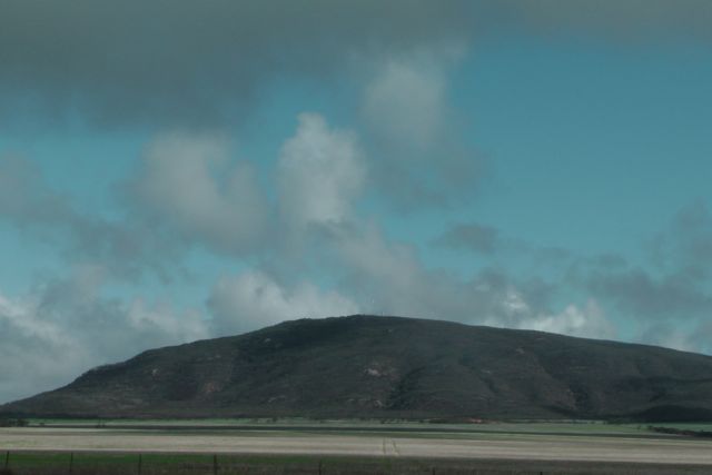
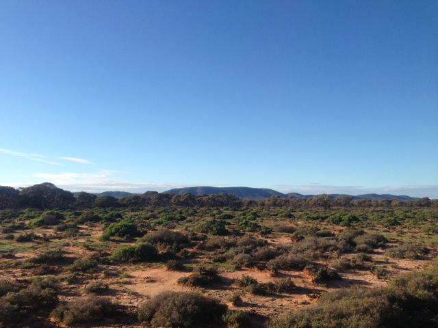
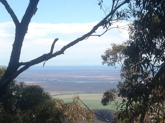
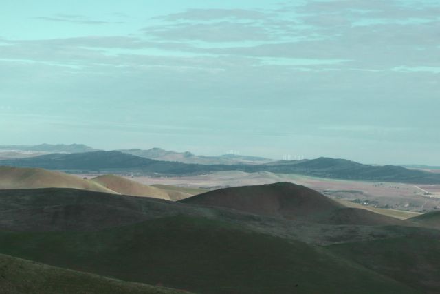
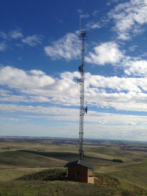
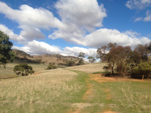
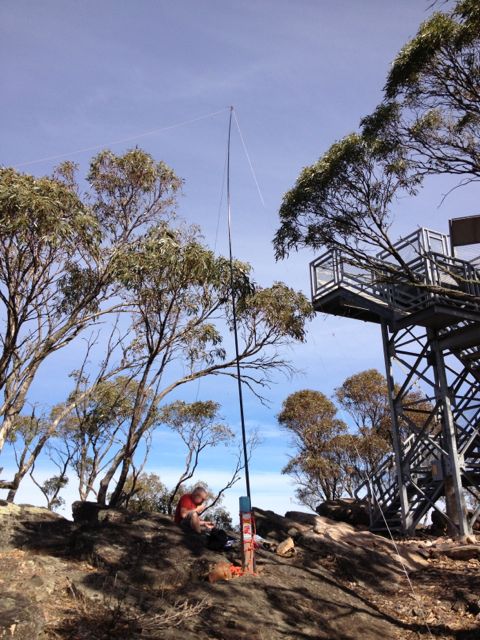
Caralue Bluff, VK5/ SW-002, was my first proposed SOTA activation for Tuesday, 11th June, 2013.
Caralue Bluff is 486 metres above sea level, and is worth 1 point. It is situated about 27kms west of the town of Kimba.
This was a real hit and run activation for me, as the weather during the morning was atrocious. I almost didn’t make it out of ‘Cooyerdoo’ at Iron Knob because of the weather. The upper Eyre Peninsula had torrential rain overnight and it continued until mid morning. And when it did stop raining, the sunny breaks only lasted a short period of time.
Fortunately there is a track which takes you up to the summit. So for the first time it was get 4 contacts and get out quick.
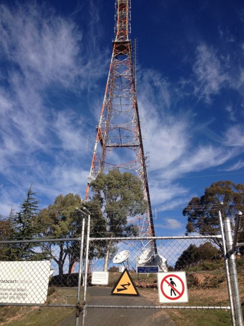
There is a communications tower and also a trig point at the top.
The following stations were worked:- David VK5KC; Peter VK3FPSR; John VK2YW; Peter VK3PF; Roger VK5NWE; Ernie VK3DET; and John VK5MG.
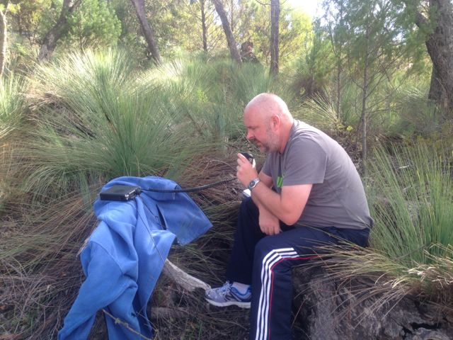
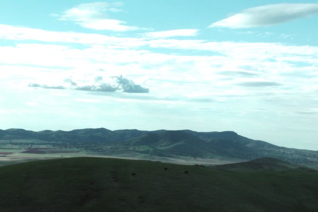
Corruna South, VK5/ SW-017, was my second summit for Monday, 10th June, 2013. It is 396 metres above sea level and is worth 1 point.
Corruna South is located about 10 kms north of Iron Knob, just off the Kingoonya-Iron Knob Road. It is situated on private property owned by Graham FRENCH.
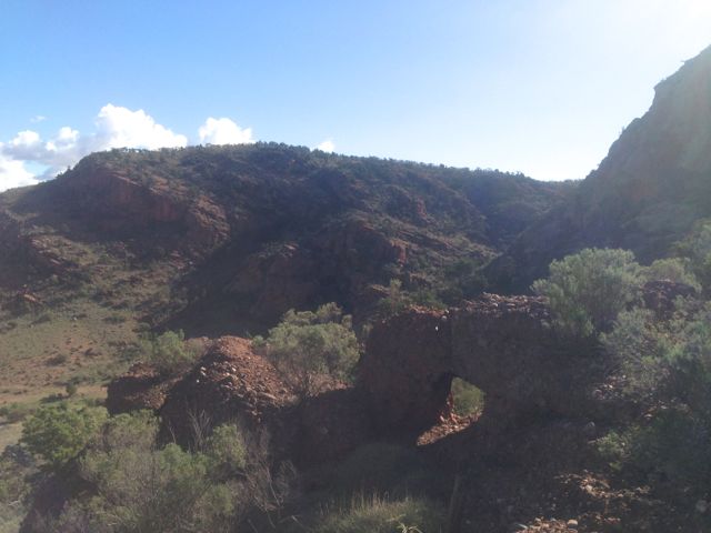
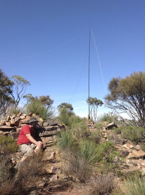
I met up with Graham and said g’day before tackling the hill. It took me about 1 hour to climb to the top. There is no track. There are sheer cliff faces on the southern side and a large waterfall, so I found the best way to tackle the summit was to start climbing from the eastern side. There is no track, so there was a fair bit of rock climbing and bush bashing.
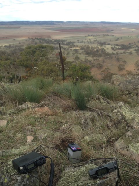
Once at the top, the summit plateaus off quite a bit. There are a lot of rocks and trees at the top which you can attach a dipole to.
Conditions on 40m SSB locally were very good, but into the eastern states they were very poor. I did manage a summit to summit QSO with Ian, VK1DI who was portable on VK3/ VW-007 near Boroka lookout. Ian had a good strong 5/8 signal.
After working all the usual ‘Chasers’ on 40m I QSY’d to 20m SSB and spoke to John ZL2JBR (5/9 both ways). I then had a good chat with Dan K7SS who was 5/9 and I received 4/5 back. My last DX contact for the day was with Pat I5ZSS who was a very strong 5/9. I received a 5/7 signal report back from Pat.
What followed Pat’s QSO, was a constant stream of calls from the eastern states. Signals into VK1, VK2, VK3, & VK4 were excellent.
This just reinforced my ethic of trying 20m for contacts around Australia other than the close in states.
I ended up with a total of 42 QSO’s.
Stations worked were as follows:- Roy VK5NRG; Ian VK5CZ; Peter VK3PF; Graham VK5KGP; Trevor VK5ATW; Steve VK5AIM/p; Warren VK3BYD; Glenn VK3YY; Mal VK5MJ/m; Ernie VK3DET; Allen VK3HRA; Shaun VK5FAKV; Brian VK5FMID; Nick VK3ANL; Ian VK1DI/3 (SOTA); Tony VK3CAT; Paul VK5FUZZ; John VK5FTCT; Wayne VK3WAM/p; Hans VK5YX; Peter VK3ZPF; Ian VK5IS/qrp; Ron VK3AFW/m; John VK5BJE; VK3JP; John ZL2JBR; Dan K7SS; Pat I5ZSS; Bernard VK3AMB; Ed VK2JI; VK3DXJ; VK1OO; Simon VK3SIM; Dennis VK2HHA; Rob VK3EY; VK3XBC; Max VK3MCX; Don VK3MCK; Adam VK2YK; Alan VK4KO; and Tony VK5WC/4.
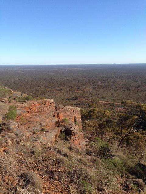
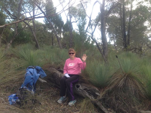
On Monday 10th June, 2013, I activated Mount Middleback North, VK5/ SW-011. This was my 2nd summit on my Eyre Peninsula trip. The summit is 425 metres above sea level, and is worth 1 point.
Mount Middleback North is located on private property, a large sheep station called ‘Cooyerdoo’, about 20 kms from Iron Knob, and about 380 kms north of Adelaide. The property belongs to some very good friends of ours, Matt and Jane, and is 173,000 acres in size.
I left Whyalla early in the morning, before sunrise and headed out towards Iron Knob on the Iron Knob-Whyalla Road. A journey of about 60 km. It was a slow drive out to the station because this is real serious kangaroo country through here. And the big ones too, the Red Kangaroo, which is the largest of all the kangaroos. Hit one of these and they will do serious damage to your car !
I had to drive through the town of Iron Knob prior to reaching the station. The town is a shadow of its former self. Iron ore was originally mined here for use as flux in the copper smelting industry. The iron ore was of such high quality that it started an iron smelting industry as well. It is referred to as the birthplace of the steel industry in Australia. Iron Knob gets its name for the fact that it has a large amount of iron ore and was a major contributor to Australia’s iron industry. Quarrying for iron at the town ended in 1998.
I then travelled west along the Eyre Highway and then down 6kms of dirt road leading to the homestead from the Eyre Highway.
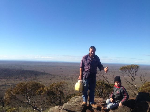
Matt and his young lad, Lachie and I jumped into the 4wd ute and started the 45 minute journey across the station to the base of the summit. Plenty of wildlife seen on the journey including feral goats, Red Kangaroos, and emus.
Once we reached the base of the hill, we started the hour long walk to the top. There is no path, so it was bushbashing through the scrub and over the rocky ground.
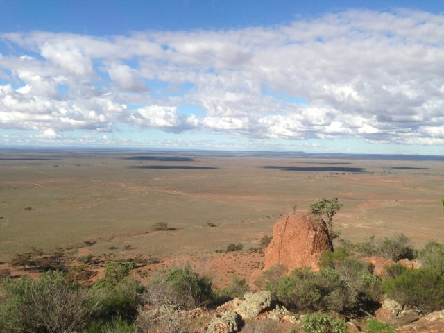
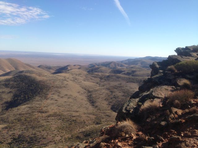
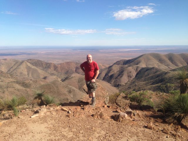
But the journey to the top was worth every bit of sweat. There were spectacular views in all directions, but particularly to the east and to the west. To the east we could see Whyalla and across the Spencer Gulf to Port Pirie. To the west, you could see as far as the eye would allow you to. This pretty rugged country out here. In recent years, a man went missing not far from here and his body was never recovered. It is not surprising when you stand on the top of Mt Midleback North and look out across the outback.
As Matt pointed out to me, this is not a summit to do during the summer. This is real snake country ! And some of the most dangerous snakes in the world, including the Death Adder, Western Brown snake, Tiger snake, and the Taipan (which is about 50 times more toxic than the Asian Cobra). There plenty of big goannas out here as well.
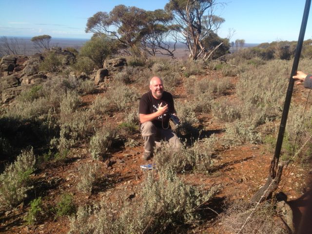
The 3 of us really enjoyed the morning. The climb was quite good, the views were amazing, and the weather was sensational.
Lachie has even borrowed my Foundation manual, so who knows. We may have a young amateur on air soon.
I ended up with a total of 21 QSO’s including 2 summit to summit contacts with Brian VK3MCD who was on top of VK3/ VC-001, and Mark VK3PI was on top of Pretty Sally, VK3/ VC-034.
The following stations were worked:- Steve VK5SE; Peter VK3PF; John VK2YW; Allen VK3HRA; David VK5KC; Marshall VK3MRG/p; Ed VK2JI/p; Rod VK2LAX/p; Peter VK3ZPF/p; Brian VK5FMID; Duncan VK3XBC; Ernie VK3DET; Fred VK3JM; VK1XP; Trevor VK5ATW; Rick VK5FIVE; VK5KBJ/p; John VK5FTCT; Col VK5HCF; Brian VK3MCD/p (SOTA); and Mark VK3PI/p (SOTA).
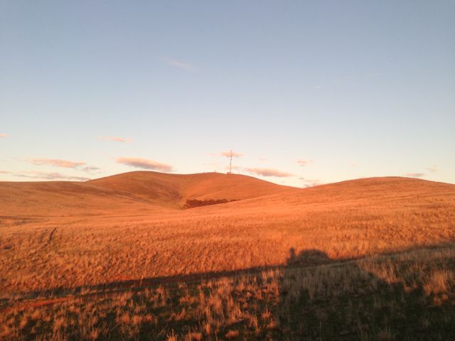
After activating the Clinton Conservation Park, Marija and I continued north along the Augusta Highway towards our destination of Whyalla. On the way, we got a call to say that Marija’s mum would not be out of hospital that day, so it was no longer a priority to get to Whyalla early. So, at Crystal Brook, we deviated to the east and travelled along Main North Road through the towns of Gladstone & Laura, to the eastern side of The Bluff, VK5/ NE-065. A spur of the moment activation.
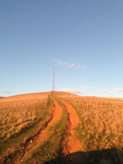
You can’t miss The Bluff if you are travelling along the Augusta Highway, near Port Pirie. There is a huge TV & radio tower on the top.
Access to The Bluff is via Charcoal Road which runs off Main North Road, a few kms north of Laura. Laura is a beautiful little town. It is famous for the being the home of Golden North ice cream. And the famous poet, C.J. Dennis was born here. Travel west along Charcoal Road, and then turn left into Forest Road. This will take you up passed Taralee Orchards and the Wirrabara nursery. This is a very picturesque setting and a great drive. The road is dirt but is in good condition. You will eventually reach a ‘dead end’ where you will find a parking area and the start of a bitumen road which leads to the summit.
However, there is a padlocked gate, preventing vehicles from going any further at this point. In fact the gate has multiple padlocks on it. I think one for each of the stakeholders who use the tower at the top.
From this point, it is about a 5 km walk to the summit. The walk took us about 60 minutes. We mixed it up, using the sealed road and the Heysen trail as we got up higher. The Heysen trail walk through here is spectacular. You will reach a point towards the top of the ridge line where there is a T junction. It is at this point that you turn to the left and either follow the road up to the summit, or take the Heysen trail which is on the left hand side of the road. At this T junction there are spectular views out over Port Pirie and the Spencer Gulf.
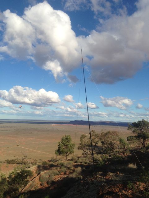
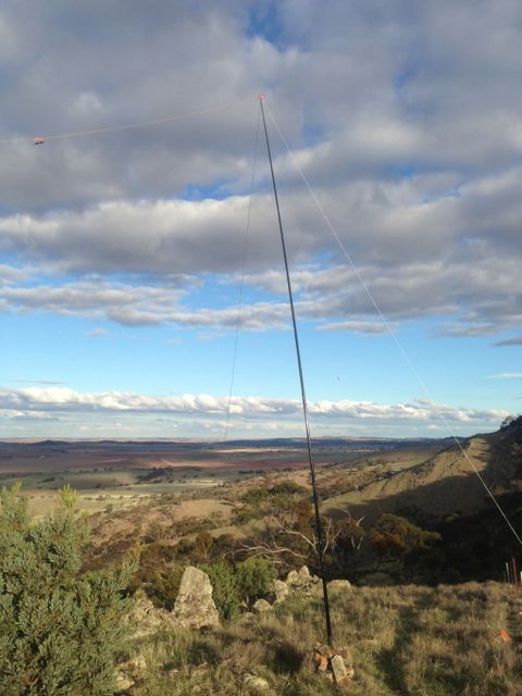
We set up the dipole on the 7m squid pole, just off the Heysen trail, down from the summit. The tower at the top is very big, with lots of antennas for TV and radio, so I expected there would a lot of noise generated from it. It paid off because the noise floor where I activated was very low.
My first QSO of the day was a Summit to Summit, with Wayne, VK3WAM, who was portable on Gurdgaragwurd / D’Alton Peak, VK3/ VW-001. Wayne had a great signal and was very strong. After working Wayne, he kindly allowed me 7.090 and I put out a CQ call. Many of the regular Chasers came back including Ernie VK3DET, Tony VK3CAT, Rik VK3KAN, Brian VK5FMID, and John VK5FTCT. All had terrific signals.
I managed to work David, VK5KC who was portable in the Red Banks Conservation Park, near Burra. That was a new park for me for the VK5 National & Conservation Parks Award. David had a very strong signal and was 5/9 on the top of The Bluff.
I also spoke with Allen, VK3HRA who was portable on Mt St Leonards, VK3/ VC-006, and Darren VK3FDJT who was portable on Mount Alexander, VK3/ VN-016. Two more summit to summit contacts was a real pleasure.
I worked a few more of the regular Chasers including Andrew VK2UH, Ron VK3AFW/mobile, Peter VK3PF, Rhett VK3GHZ, Roy VK5NRG, and John VK5BJE.
Conditions were very good on 40m. Marija went for a quick walk along the Heysen trail, because I think she was getting bored with being my scribe. So I took the opportunity of jumping onto 20m for a little while. I could hear plenty of good strong DX stations, but unfortunately did not work any on this peak.
I ended up with a total of 33 QSO’s. The majority of those were on 40m SSB, but I did sneak in 5 QSO’s into VK1, VK2, VK4, & VK7 on 20m SSB.
The following stations were worked:- Wayne, VK3WAM/p (SOTA); Ernie VK3DET; Tony VK3CAT; David VK5KC/p (Redbanks CP); VK3OHM; Dave VK3VCE; Rik VK3KAN/p; Brian VK5FMID; John VK5FTCT; Allen VK3HRA/p (SOTA); Andrew VK2UH; Ron VK3AFW/m; Peter VK3PF; James VK1DR; Warren VK3BYD; Ian VK3TCX; Mark VK1MDC; Darren VK3FDJT/p (SOTA); Rhett VK3GHZ; Jim VK5TR; Roy VK5NRG; Barry VK5KBJ; Shaun VK5FAKV; John VK5FMJC/p; Bernard VK3AMB; Colin VK2JCC/qrp; John VK5BJE; David VK5UG; Mark VK1MDC; Peter VK4AAV; Neil VK4HNS/p; Ed VK2JI; and Peter VK7KPC.
Below is a video of the activation, which I have placed on You Tube.
After activating VK5/ SE-009, Ian VK5CZ and I drove north of Burra, and onto the Goyder Highway and then north on the Barrier Highway. About 10 kms north of Burra we turned right onto Mount Cone Road and travelled right to the very end of the road which leads to a homestead.
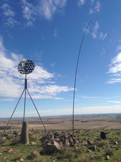
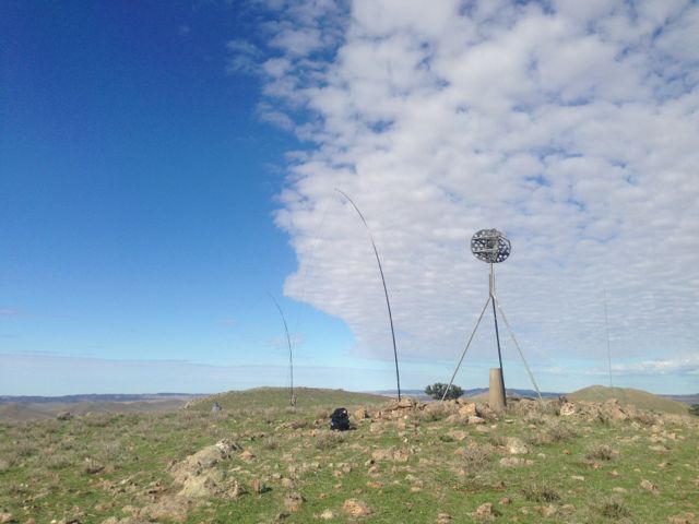
Mount Cone summit is located on private property owned by Mr. Simon ROWE. He is one of the founders of T&R Pastoral company, which is the largest beef and lamb trader and processors in South Australia and one of the largest family owned in Australia. There is another Mount Cone located 100’s of kms away down south on the Fleurieu Peninsula.
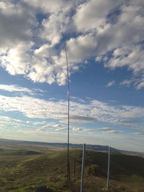
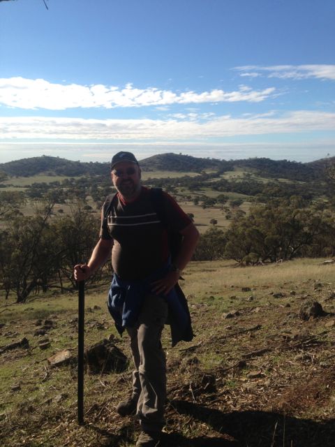
We then followed a dirt track across some paddocks leading up to the summit, busbashing in my Falcon XR6. We parked the car about 300 metres from the tower at the summit, and climbed up hill the rest of the way, which was a steep but fairly easy climb up the dirt trail.
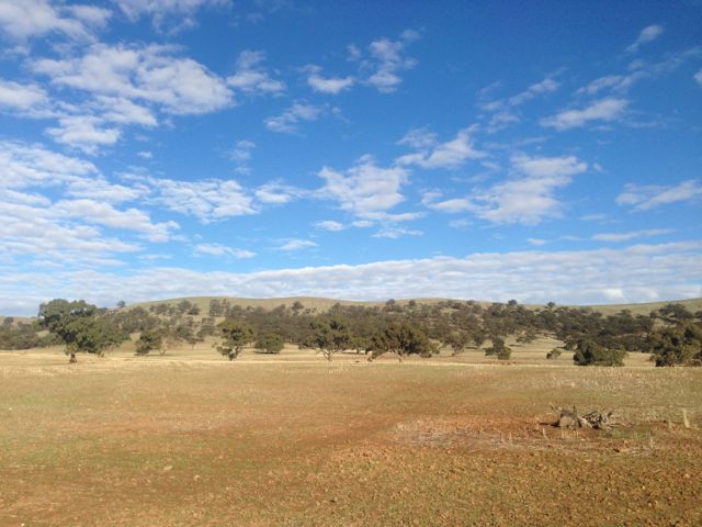
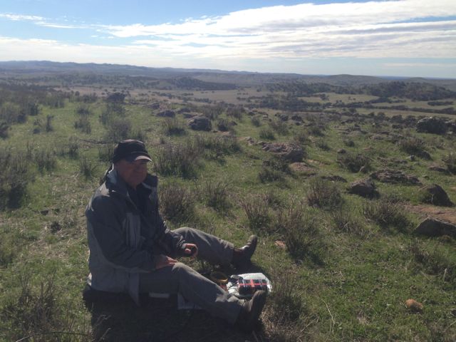
The view from the top of Mount Cone is really quite amazing. You can just see the tops of the Flinders Ranges and Mount Bryan is clearly visible to the north. The big wind farm on the tops of the hills is out to the west, and the town of Burra is clearly visible to the south. It is a great take off out to the east
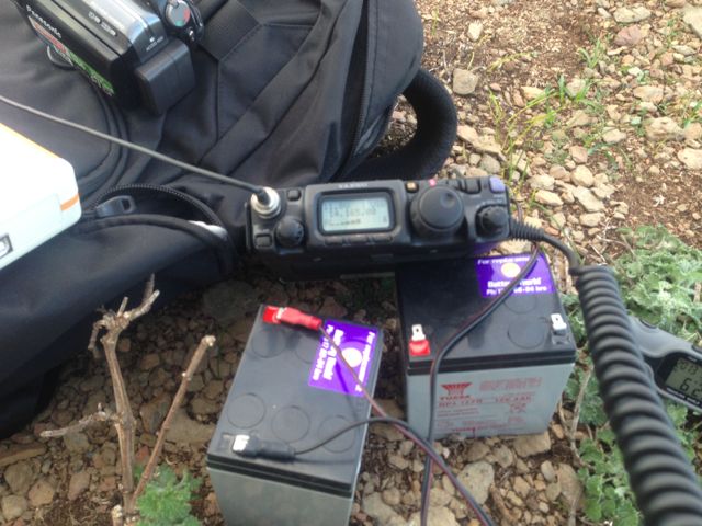
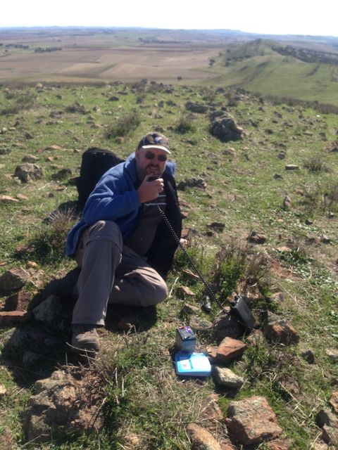
Again, Ian and I set up to stations. He used his Elecraft KX3 and an end fed antenna. I used my little Yaesu FT-817nd and my BandHopper 40m/20m linked dipole. I secured it to a wooden fence post with an occie strap.
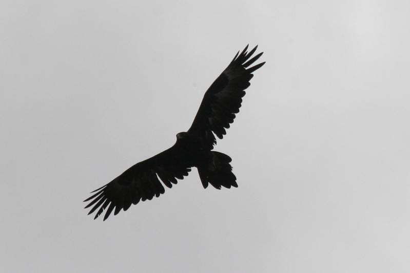
No wildlife seen on the hill, except for a large wedge tailed eagle who was keeping a watchful eye on us. The only animals were cows grazing on the hills. As Ian said to me, they must be the fittest cows in the mid north of S.A.
It was absolutely blowing a gale up here. Incredibly windy and it was a real challenge to keep the squiddies from collapsing….which happened quite a few times. They were certainly bending in the wind, almost as if we had a squid on the end of each of them !
I ended up with a total of 39 QSO’s. This included quite a bit of DX on 20m SSB into the USA and Europe. Another highlight was a summit to summit QSO with Marshall VK3MRG/p, who was on top of Pretty Sally (so to speak), VK3/ VC-034. It was also great to make contact with David VK5KC, and John VK5BJE, who were both operating portable from the Scott Creek Conservation Park in the Adelaide Hills, as part of the VK5 National & Conservation Parks Award. Both had terrific signals up to the mid north.
Thanks also to Wayne, VK7NET, for putting me on the DX cluster.
Stations worked on 40m were:- David VK5KC/p; John VK5BJE/p; Matt VK1MA; Peter VK3PF; Graham VK5KGP; Trevor VK5ATW; Andy VK5LA; Ernie VK3DET; Warren VK3BYD; VK3JM; Peter VK3ZPF; Shaun VK5FAKV; Bernard VK3FABA; VK3MCD; VK3ANL; Al VK1RX; Mike VK5MCB; Darren VK3FDJT/p; Ian VK1DI; Steve VK3MEG; David VK3KR; Peter VK2NEO; Col VK5HCF; Craig VK3CRG/p; Marshall VK3MRG/p (s2s); VK5KFB; Roy VK5NRG; Ray VK3NBL/p; Greg VK2GJC; Dean VK2FLYS; Steve VK4KUS; and Stephen ZL4CZ.
Stations worked on 20m were:- Brian ZL2ASH; John EA7BA; Wayne VK7NET; KD6BZN; Gil IK2KRZ; Keith M0WYZ; and Joe WA4JUK.
I filmed a bit on top of the hill with my i-phone, and I’ve placed it onto You Tube. It can be found at …..
This was the end of 2 enjoyable days for me. I journeyed back the 2 hours to my home qth in the Adelaide Hills. And after the bed at the Burra pub, I certainly enjoyed the hot bath and climbing into my own bed that night.
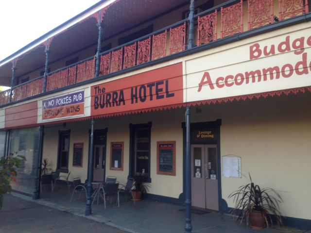
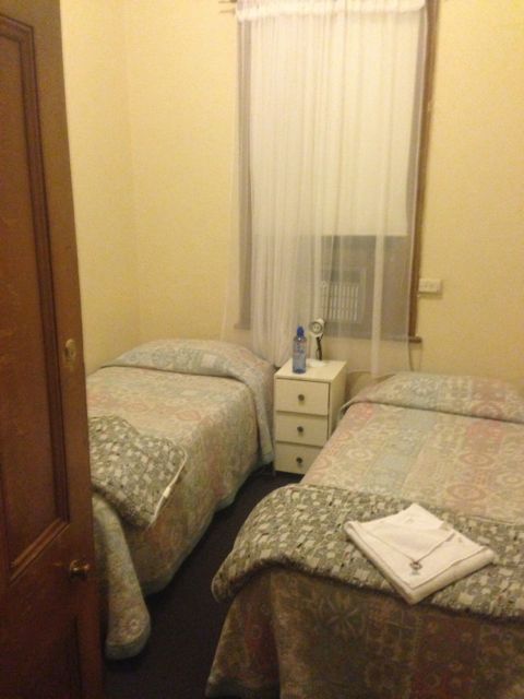
Following my activation of Tothill Range, VK5/ SE-010 on Saturday 18th May, 2013, I headed up to Burra and booked in to the Burra Hotel. Certainly not the Ritz, but it was okay for the night. The beer and the bundy was cold at the bar, which was the main thing.
The following day I got up bright and early, and had my bowl of Corn flakes and coffee, and then met up with Ian VK5CZ, from Clare, out the front of the pub. We then headed south to un-named summit, VK5/ SE-009. We had a bit of difficulty finding the summit because of dodgy internet coverage and the fact that we had been told this summit was Steins Hill. It turns out definitely not to be Steins Hill, which is further to the east from VK5/ SE-009.
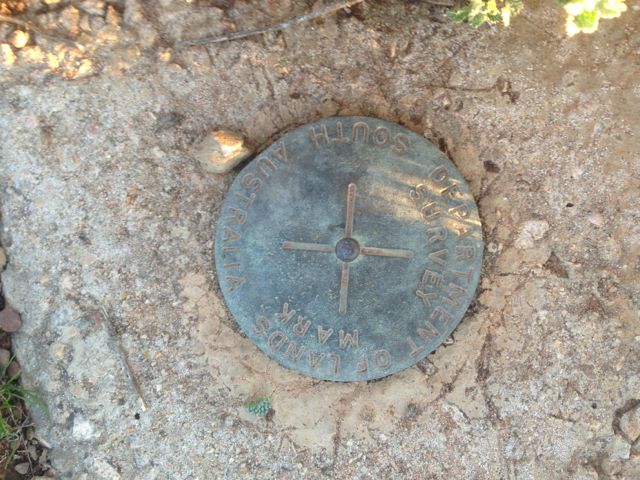
The summit is located on private property owned by Mr. Paul THOMPSON. Access is via Princess Royal Road which runs off the Barrier Highway, just out of the town of Burra. The trig point on the top of the summit is quite visible from the road.
We entered Paul’s land via a cockies gate and travelled across the paddock to an old quarry, and parked the car here. From that point it was about a 2.5 km walk to the top of the summit. The climb is not too bad. We tried to follow the sheep trails as they seem to know the easy way up these hills. Quite a few kangaroos were seen on the way up.
After reaching the top we set up the antennas in fairly trying conditions. It was blowing a gale on the top of the hill. No wonder they are trying to put more wind towers up here ! The westerly that was coming in was certainly getting the the squiddies to lean to the east. I set up my 40m/20m dipole close to the trig point and used a pile of rocks to prop up the squid pole. Ian used an old fence post to secure his squid pole.
The views from the top are quite good, particularly down to the south and up to the north. There is an experimental wind tower on the top of a nearby hill. It is planned for this range to host another series of wind farm towers. They are everywhere up here in the mid north. There is a trig point on the summit. I found the warning of a 20 pound fine for interference to the trig quite interesting. There are no trees on the top of the actual summit. It is rocky and quite bare.
I jumped onto 40m first, while Ian tried his luck on 20m CW. As was the case with the activation the day before, my first contact was a Summit to Summit with Ian, VK1DI/p on VK1/ AC-038 Mount Tuggeranong. Ian was 5/5 and I received a 5/3 back. Ian was kind enough to allow me the frequency and what followed was a mini pile up. I also had 2 more S2S QSO’s. The first being with Marshall VK3MRG/p on Mt Macedon VK3/ VC-007, and the second with Al VK1RX/p on VK1/ AC-019. A real pleasure to bag some more S2S contacts. That is always the highlight of any SOTA trip for me.
I ended up with 20 QSO’s, all on 40m SSB.
Stations worked were:- Ian VK1DI/p (s2s); Ernie VK3DET; Ed VK2JI/p; Rod VK2LAX/p; John VK2YW; Fred VK3JM; Marshall VK3MRG/p (s2s); Al VK1RX/p (s2s); Matt VK1MA; Peter VK3PF; David VK5KC; Shaun VK5FAKV; Peter VK3FPSR; Andy VK5LA; Ken VK7KKV; Allen VK3HRA/m (enroute to another summit); Col VK5HCF; Geoff VK2GM; Peter VK3ZPF/p, and Colin VK3LO.
After a few hours on the top of the hill, Ian and I headed down. Again on the walk down, lots of kangaroos were seen. Ian and I then drove into Burra for a bite to eat, and then headed north for our next summit…..Mount Cone, VK5/ SE-002.
I took a bit of video with my i-phone on the top of the summit, and I’ve placed it on You Tube. It can be found at …..
On Saturday 18th May, 2013, I travelled up to the mid north of South Australia. My plans were to activate 3 summits over the weekend, so after getting a ‘leave pass’ from my wife, I booked in to the Burra Hotel. I headed off after my daughter’s netball match, journeying through the Adelaide Hills where I live, and into the mid north.
On Saturday afternoon, 18th May, 2013, I activated the first summit, the Tothill Range summit, VK5/ SE-010, about 150 kms north of Adelaide. Tothill Range summit is 670 metres above sea level and is worth 4 points.
The summit is located on private property owned by Mr. Peter FATCHEN of Black Springs. I stopped by the farm house to see him prior to climbing the hill. He is a very friendly fella and was very interested in my activities. Peter is in his late 70’s and is still farming the land, along with his son. Peter gave me directions on how to get to to the summit, so I headed up Black Spring Road, and then left onto the Old Burra Road. After travelling a few kms north up the road I entered back onto Peter’s property on the right hand side (the eastern side of the Old Burra Road) and drove across the paddocks. After driving for about 1 km I reached an old bush cottage. The Heysen Trail commences at this point. I kept driving down the Heysen trail to the sheep yards and the creek line, where the car would not go any further. It is about 1 km walk from here to the base of the hill.
Once you reach the base of the hill, the view up to the top is a little daunting. It is straight up obviously, with no track. The side of the hill is covered in rocks and yacka, and the climb is quite steep. The climb took about 45 minutes, with 3 quick rests on the way up. I had quite a few interested onlookers in the way of kangaroos on the journey up.
Once I reached the top, I walked further north along the ridgeline to reach the summit. What really stood out was that I found that the drop away to the east was far more dramatic than on the western side. The view from the top looking out to the east was absolutely spectacular. I even had my own resident Wedge tailed eagle soaring above the cliff face.
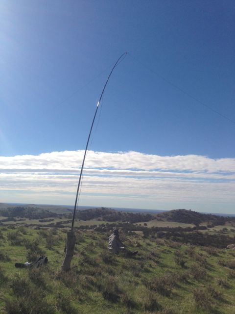
The weather that day was quite mild, but the sun had some real bite behind it, so I found a bit of shade behind a small bush, and I set up the Yaesu FT-817nd on a moss rock. There is no shortage of rocks on the summit, so I propped up the 7m squid pole with some moss rocks. The antenna was my BandHopper 20m/40m linked dipole.
The first station I heard after turning the radio on was Matt, VK1MA/p, who was on the top of VK1/AC-039. I gave Matt a shout who was a good 5/7 (with some QSB) and Matt came back to me with a 5/2 signal report. Really thrilled to have another summit to summit contact. I haven’t really had that many.
I then headed up to 7.095 and called CQ and ended up with quite a pile up which was really good fun. Plenty of the usual suspects including Ed VK2JI, Ernie VK3DET, Peter VK3PF, Glen VK3YY, Marshall VK3MRG, Rik VK3KAN, Andrew VK2UH, Allen VK3HRA, Ian VK1DI, Bernard VK3FABA, A VK1RX, Andrew VK1NAM.
The sunny weather didn’t last too long, with te sun going behind the clouds, and the wind picking up, and it was pretty cold. Probably not as cold as what the fellas in the eastern states were telling me. There was obviously a pretty severe cold snap over there.
My last 40m QSO was with Ian VK5CZ. We decided to try 20m and although my signal was not as strong, we still managed to get through. Ian was good enough to put me on SOTAWatch, so I managed quite a few more QSO’s on 20m from some of the dedicated chasers
I had a total of 55 QSO’s whilst on the top of the hill, over a period of about 2 & 1/2 hours. They consisted of 40 stations on 40m SSB and 15 stations on 20m SSB.
I managed a bit of DX on 20m as well into the USA, Italy, France, Belgium, the Canary Islands, and New Zealand. One of the highlights was making contact with a really good mate of mine, Marnix, OP7M, in Belgium.
It was also good to work Peter VK3NAD, and Jim VK5JW, on 40m, who were both operating QRP with just 5 watts.
Stations worked on 40 m were:- Matt VK1MA/p (SOTA VK1/AC-039); Ed VK2JI; Steve VK3MEG; Col VK5HCF; Ernie VK3DET; David VK5KC; Peter VK3PF; Glenn VK3YY; Marshall VK3MRG; Rik VK3KAN/p; Kas VK5ZKT; VK3YN; Peter VK3FPSR; Andrew VK2UH; Allen VK3HRA; Peter VK3ZPF; Ian VK1DI; Bernard VK3FABA; Brian VK3MCD; Dave VK3AZX; Al VK1RX; Andrew VK1NAM; Nick VK3ANL; Ian VK3IFM; Rod VK2ZRD; Peter VK3NAD/qrp; John VK2YW; Colin VK5FCJM; Peter VK1IRC; Adam VK2YK; Roy VK5NRG; Peter VK2NEO; Ron VK3JP; Victor VK2KVH; Graham VK5AN/p; Graham VK7ZGK; Jim VK5JW/qrp; Graham VK2HAL; Graham VK5KGP; Ian VK5CZ.
Stations worked on 20m were Ian VK5CZ; Adam VK2YK; Ian VK1DI; Frank VK1VK; Lewis VK4LEW; Chuck AE4FZ; Max IK1GPG; James VK1DR; Andrew VK1NAM; Franc F5PAU; Theo OT4A; Marnix OP7M, Manuel EA8JK; Roy VK7ROY; and Jason ZL3JAS.
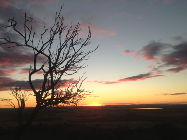
The sunset on the way down was absolutely spectacular. But the beer at the Burra pub was even better. A really fun day on the hill.
I have posted a video on You Tube of the afternoon. It can be found at…..
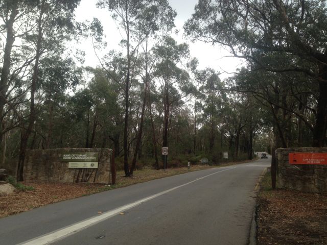
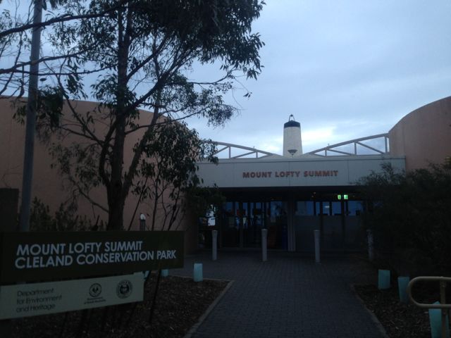
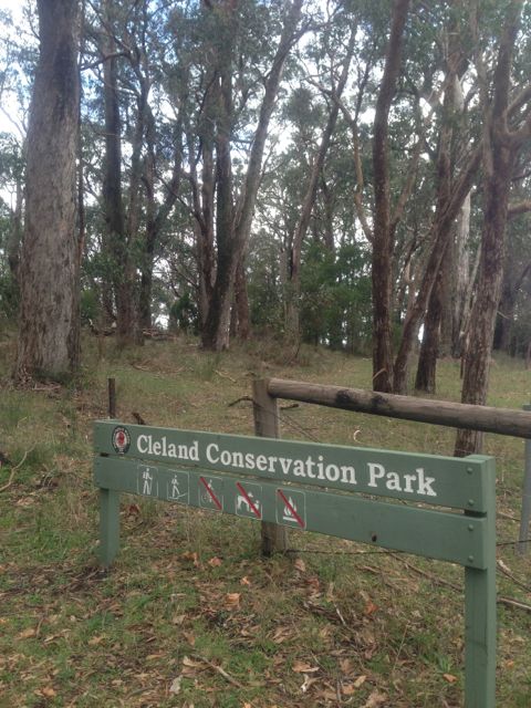
Today (12th May, 2013) was obviously Mother’s Day, and my wife Marija was enjoying a leisurely afternoon on the couch watching re-runs of the Bold & the Beautiful, so I decided to escape to the outdoors while the going was good. Despite the weather being a little bit dodgy I headed over to Mount Lofty summit, VK5/ SE-005 and the Cleland Conservation Park. This is only about 20 kms west of me here in the ‘Adelaide Hills’ Mount Lofty Ranges’. I had activated Mt Lofty as part of SOTA before (so no more SOTA activation points for me), but I hadn’t activated Cleland CP before as part of the VK5 Nat & Cons Parks Award.
Cleland Conservation Park, which is situated about 22 kms south east of Adelaide, was established in 1945. It consists of about 1,000 ha, and conserves a vital area of bushland in the Adelaide Hills. The park features the internationally popular Cleland Wildlife Park, Mt Lofty Summit and the scenic Waterfall Gully. It was named after Professor John Burton CLELAND, a naturalist.
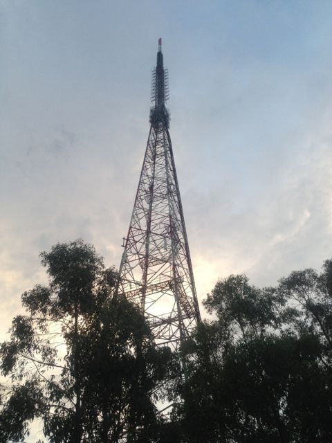
The 3 commercial television transmitter towers are located closely. This area was devastated by the Ash Wednesday bushfires back in 1983.
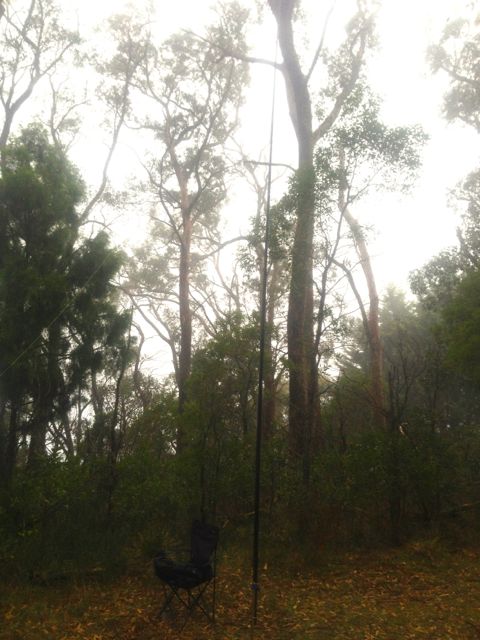
I didn’t do the hard hike this time from Waterfall Gully, but rather walked up into the activation zone, setting up in the scrub on a ridge line overlooking the east. Again used my normal equipment consisting of my Yaesu FT-817nd, and the 40m/20m linked dipole on the 7m squid pole.
The last time I activated this summit, I set up at the lookout which is right outside the cafe & restaurant, and got plenty of strange looks from onlookers. This time I got my fair share of strange looks from bushwalkers again, particularly when ‘SOTA Goat’ went off.
Things were going great until the heavens really opened up and I had to quickly retreat under a nearby large gum tree. By the time I had got back to the car I was absolutely drenched. The hot shower, coffee and glass of port was great when I got home.
I ended up with 17 QSO’s into VK1, VK2, VK3, VK5, & VK7, all on 40m.
Stations worked were:- David VK5KC; Greg VK2GJC; Ed VK2JI; Peter VK3PF; Ian VK1DI; Brian VK5FMID; Peter VK3ZPF; Nick VK3ANL; Ron VK3AFW; John VK5FJHM; Col VK5HCF; Andrew VK1NAM; Bernard VK3FABA; Rod VK5FTTC; Ernie VK3DET, Shaun VK5FAKV; & Geoff VK7HAL.
A real shame about the rain, because I know there were more people there calling & waiting. Sorry about that. And to add to the disappointment, conditions on 40m apeared to be quite good.
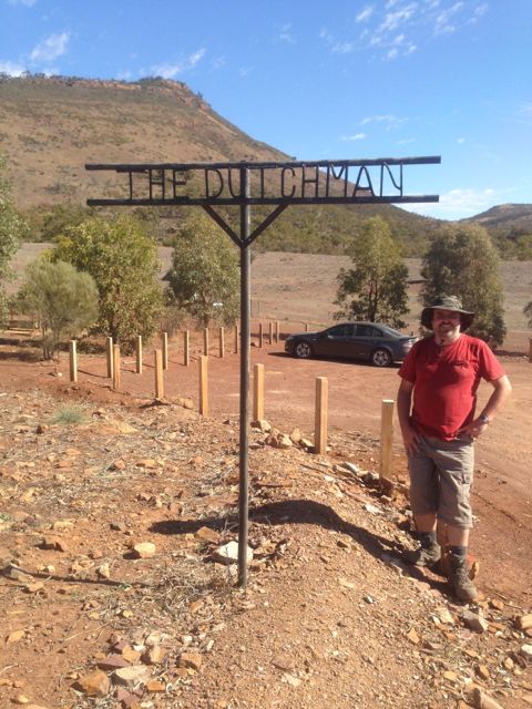
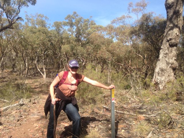
I activated The Dutchman’s Stern summit and the Dutchman’s Stern Conservation Park on Saturday 4th May, 2013. My wife, Marija did the walk/climb with me, which took us about 90 minutes to get to the top.
The Dutchman’s Stern summit is 855 metres ASL, and is worth 6 points.
It is situated within the 3,532 hectare Dutchman’s Stern Conservation Park, in the southern Flinders Ranges. The park gets its name from the bluff’s similarity to Dutch sailing ships of the 18th century. The rocky outcrops and slopes appear to resemble the reverse stern of these ships. The bluff was named by Captain Matthew Flinders who chartered the nearby Spencer Gulf in 1802.
Access is from the Arden Vale Road. The signposted turn-off to the park is 6.5 kms from the Port Augusta road intersection in Quorn. It is then a further 3 km to The Dutchman car park. All walking trails commence at the carpark.
The track leading to the summit is very well maintained and signed. It is a 8.2 km return hike (4 hours return). It took Marija and I about 90 minutes to reach the summit and about 60 minutes back down. There are markers all along the way showing your progress.
We commenced this walk early in the morning and there were kangaroos everywhere. Both Western Greys and Red Kangaroos.
Upon reaching the summit, the views are sensational.
I used my Yaesu FT-817nd, 5 watts, and my BandHopper 40m/20m linked dipole on a 7m squid pole (inverted vee formation).
I used a distance marker post to secure my squid pole to. There is a rock formation with plenty of comfortable large rocks to sit on (if you can get comfortable rocks).
I managed 26 QSO’s on 40m, including a Summit to Summit with Rik, VK3KAN/p.
Stations worked were:- Dave VK3VCE; Glen VK3YY; Peter VK3ZPF; Ian VK1DI; Graham VK5KGP; Allen VK3HRA; Marshall VK3MRG; Mal VK3AZZ; Trevor VK5ATW; Larry VK5LY; Roy VK5NRG; Rik VK3KAN/p (SOTA VK3/ VC-005); Ian VK5CZ; Rex VK5FRCP; Warren VK3BYD; Ernie VK3DET; Steve VK3MEG; Kas VK5ZKT; David VK5KC; Bill VK5FWMA; John VK5FTCT; Peter VK3RV; Peter VK2NEO; Rod VK5FTTC, Jenny VK3WQ; and John VK2PBC/p.
More information can be found on PeakClimbs, at…..
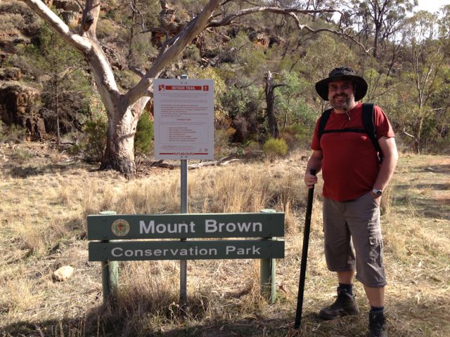
I activated the Mount Brown summit and Mount Brown Conservation Park on Saturday, the 3rd May, 2013.
Mount Brown summit is 951 metres ASL and is worth 8 points.
The Mount Brown summit is situated within the Mount Brown Conservation Park, and is located in the Southern Flinders Ranges, about 300 kms north of Adelaide, and about 14 kms south of Quorn.
Mount Brown is named in honour of Robert Brown, the botanist aboard Matthew Flinder’s survey ship HMS Investigator, who climbed the mountain and viewed Willochra Plain.
Access to the park is from Quorn township. At the Quorn Mill, travel south following the signs to Richman Valley and Waukarie Falls. Drive to the southern end of Richman Valley Road, a total distance of about 14 kms. The hike starts at the Olive Grove Trailhead, situated 200 metres from Olive Grove gate.
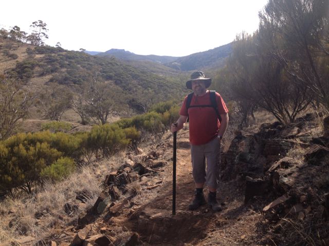
Walk down 50 metres from the Olive Grove Trailhead to checkpoint 1 near Waukarie Falls. Distance measurement markers start from here and are placed every 200 metres along the trail.
My wife Marija accompanied me on this hike which is about 11.6 km return, and took us about 2 hours to reach the summit. It is a moderate hike but is certainly challenging. The first 2 kms are quite flat and follow the creek line, but soon you are climbing up the tracks and it progressively gets steeper.
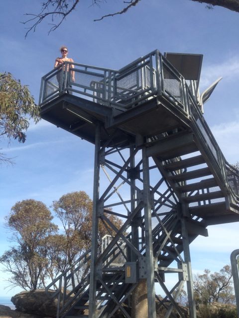
There is a small commemorative lookout at the summit which you can climb to see the spectacular 360 degree views. There are some great interpretaive signs on the lookout as well, which explain about the area & Robert Brown.
There are also some small antenna installations here and some solar panels, which I think were causing a little bit of noise interference, but nothing too drastic.
There are quite a few large gum trees at the summit which afford some shade, and lots of large rocks to sit on or to use to support a squid pole.
At the top of the summit we met a group of volunteers who were maintaing the track leading to the summit. They were extremely interested in the SOTA program and watched with interest as I made a few QSO’s.
I used my Yaesu FT-817nd, 5 watts, and my BandHopper 40m/20m linked dipole supported on the 7m squid pole which I secured to a distance marker.
I managed 17 QSO’s on 40m and 20m. It was a bit of a struggle into VK3 from here. Got in some DX contacts on 20m into Austria, Croatia, & France. Peter VK2NEO, had such a strong signal on 40m he nearly knocked me off the edge of the cliff face.
Stations worked were:- Peter VK3FPSR; John VK5EMI; Ernie VK3DET; David VK5KC; Rob VK2ZRD; Peter VK3PF; Peter VK2NEO; Larry VK5LY; Ron VK3AFW; Paul VK5FUZZ; Mark VK5QI; Rod VK5KFB; Don VK3MNZ/p; OE3DIA; Emil 9A9A; Pierre F8DHE; and Matt VK1MA.
It took about 90 minutes to climb back down to the bottom carpark.
For more information on Mount Brown, have a look at PeakClimbs…..