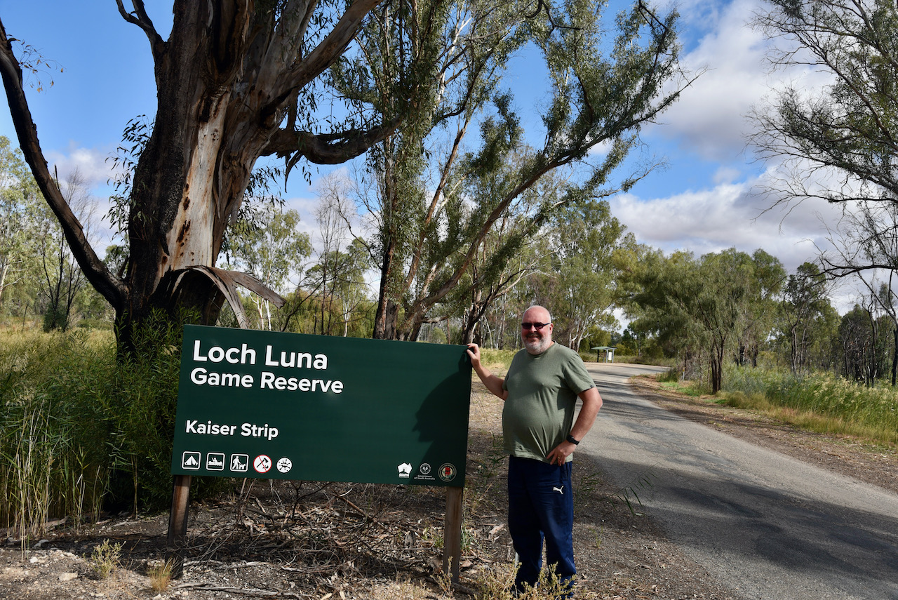
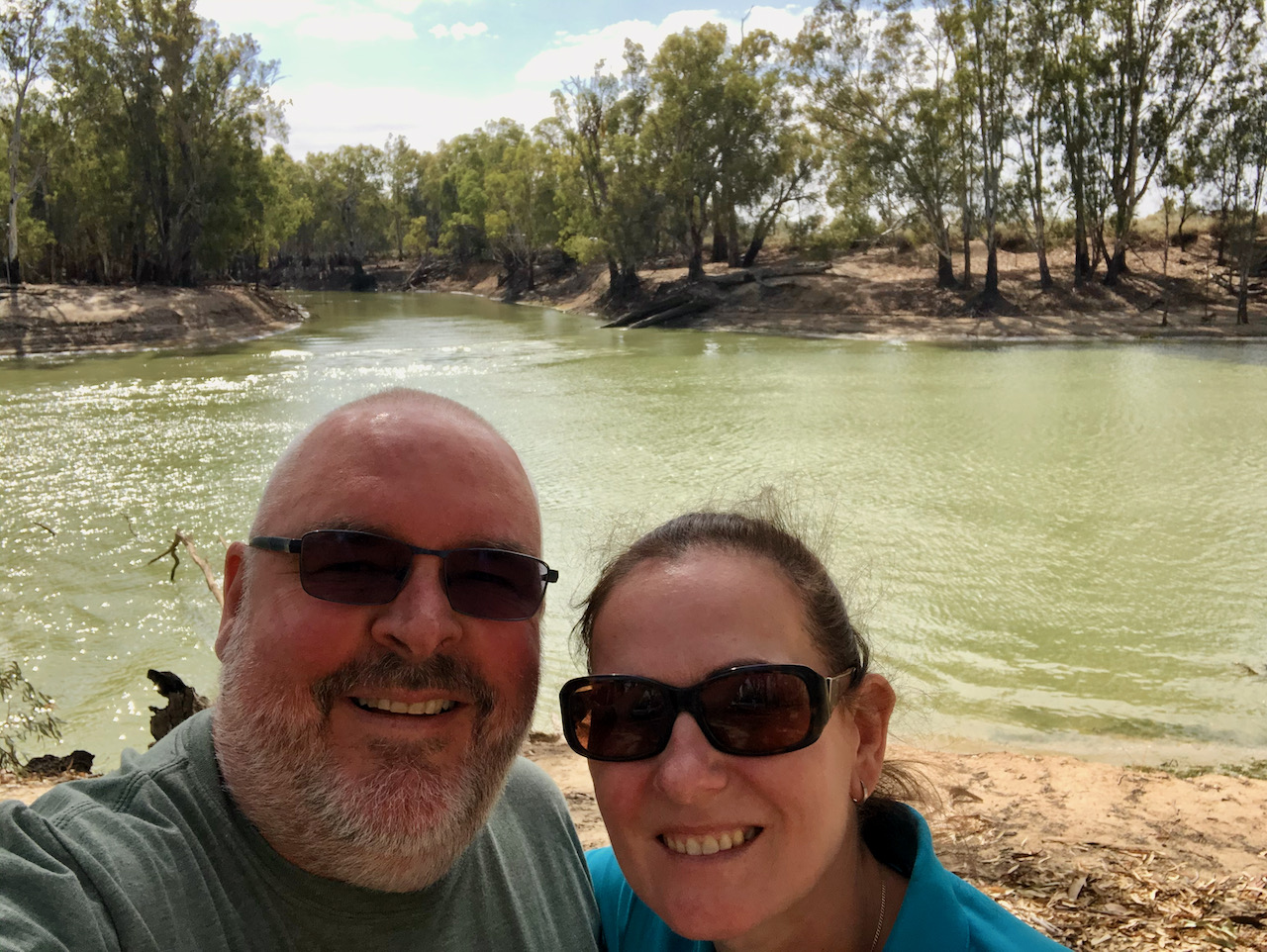
Today (Sunday 18th April 2021) was World Amateur Radio Day. Marija and I planned on activating a park on the way home, but we hadn’t decided which one.
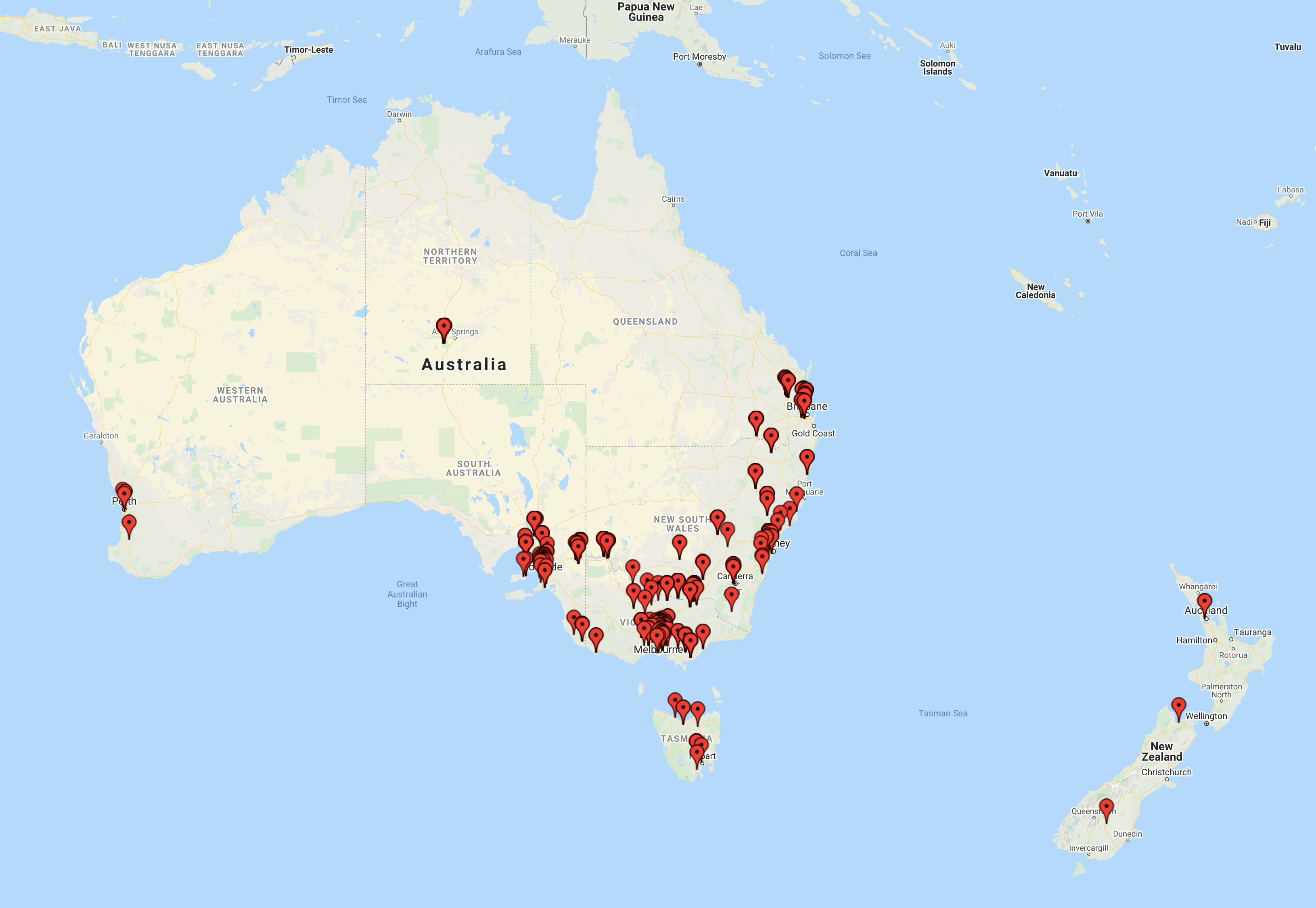
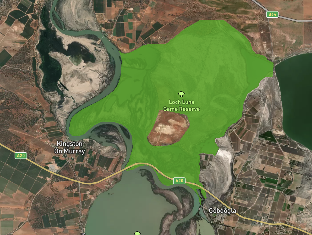
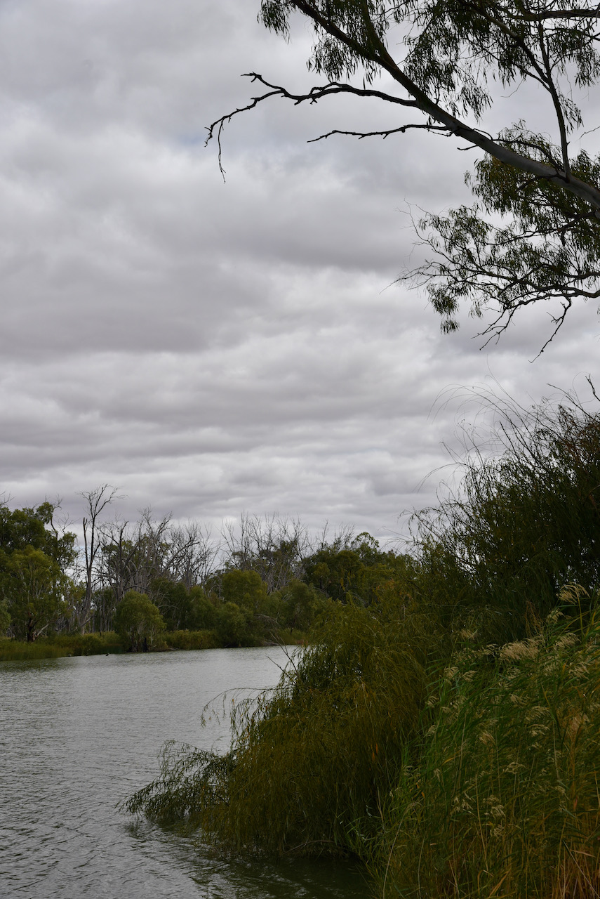
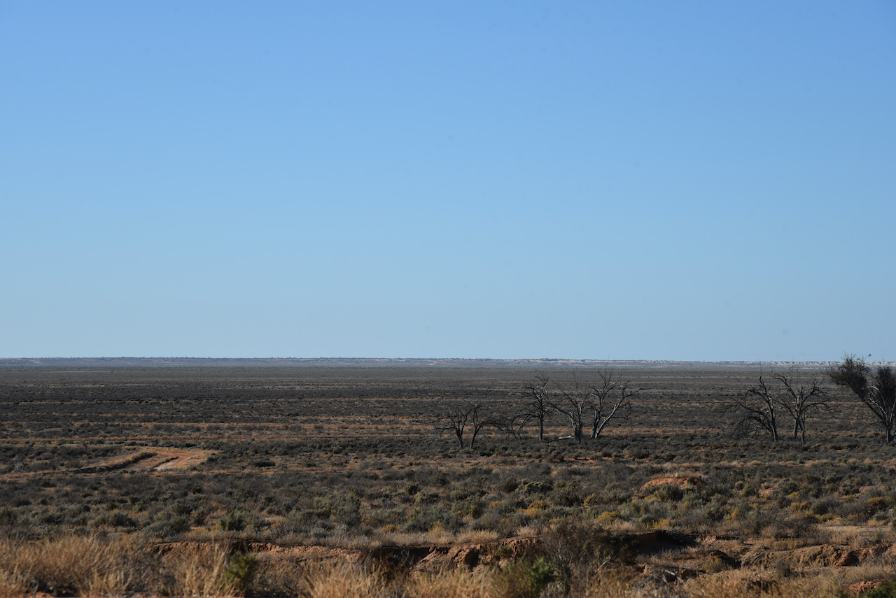
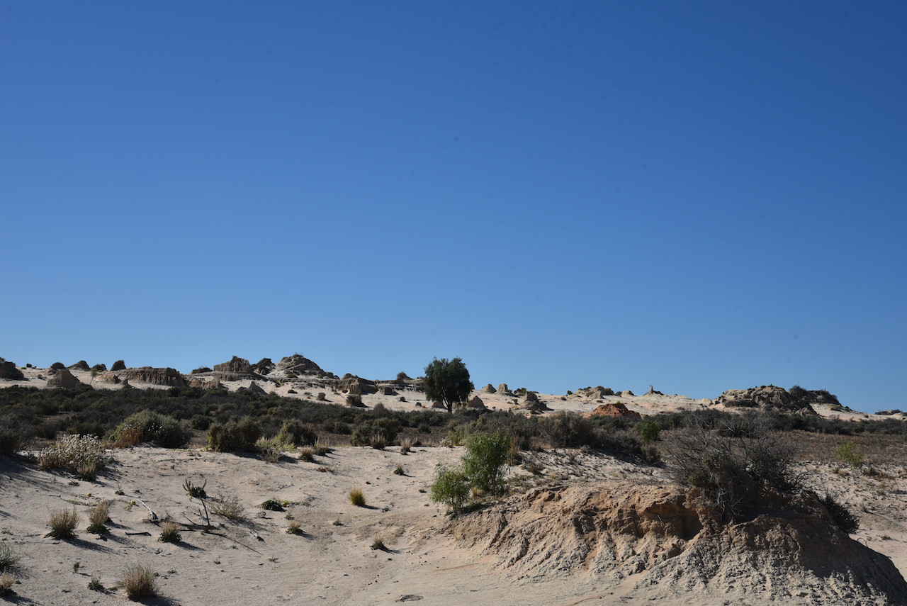
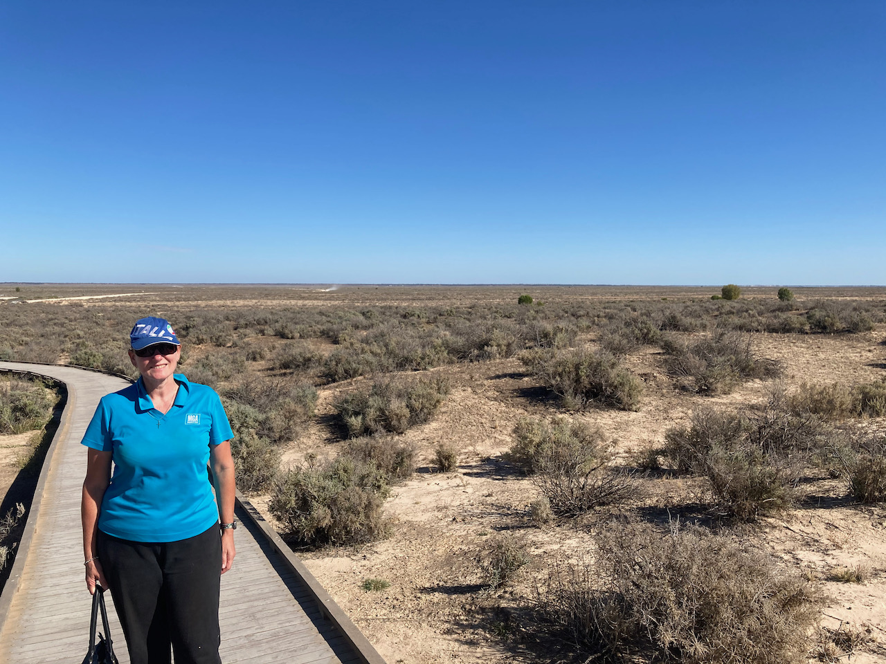
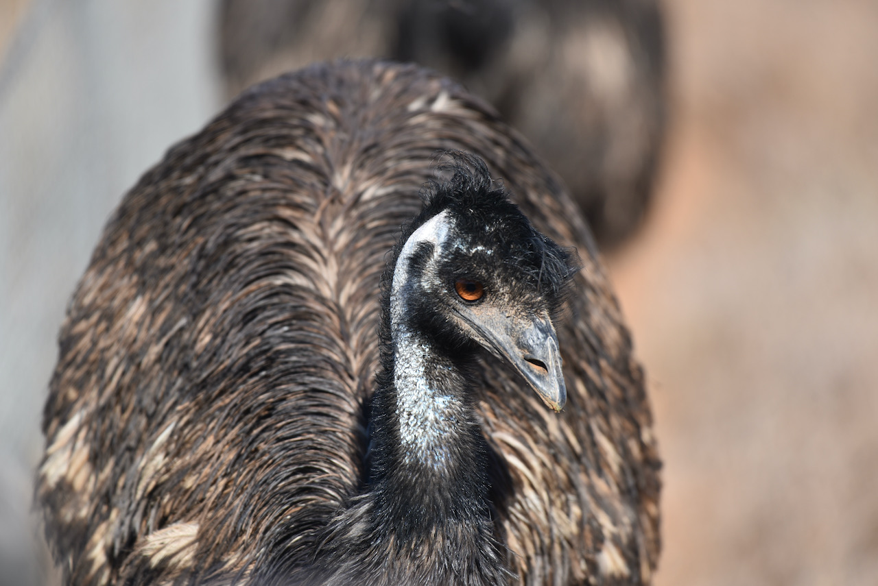
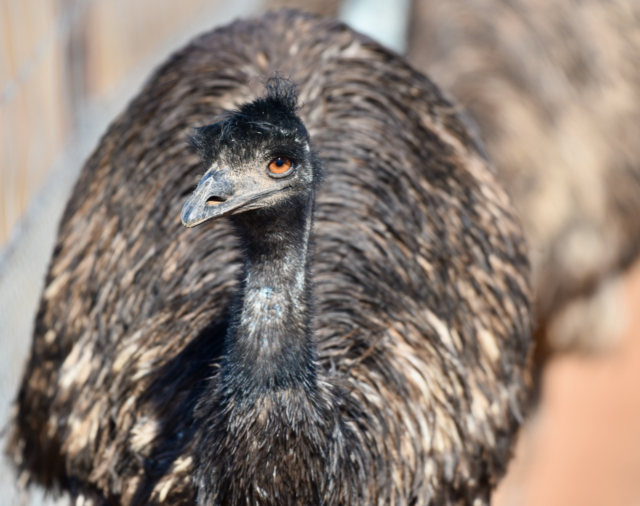
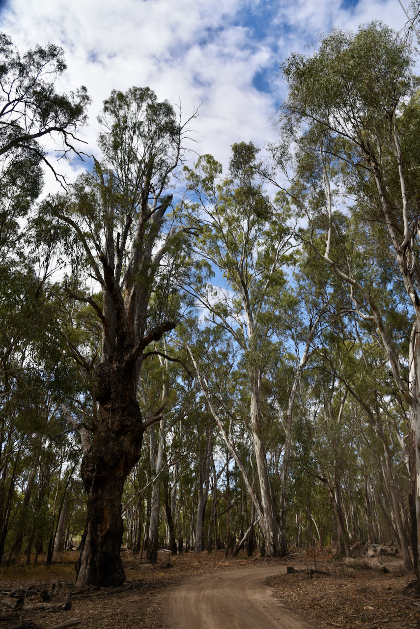
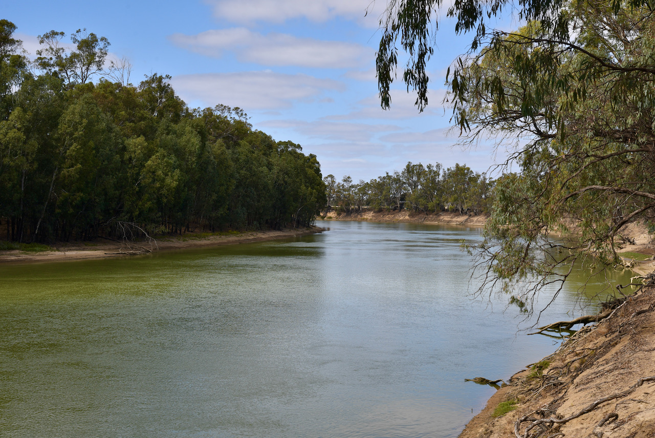
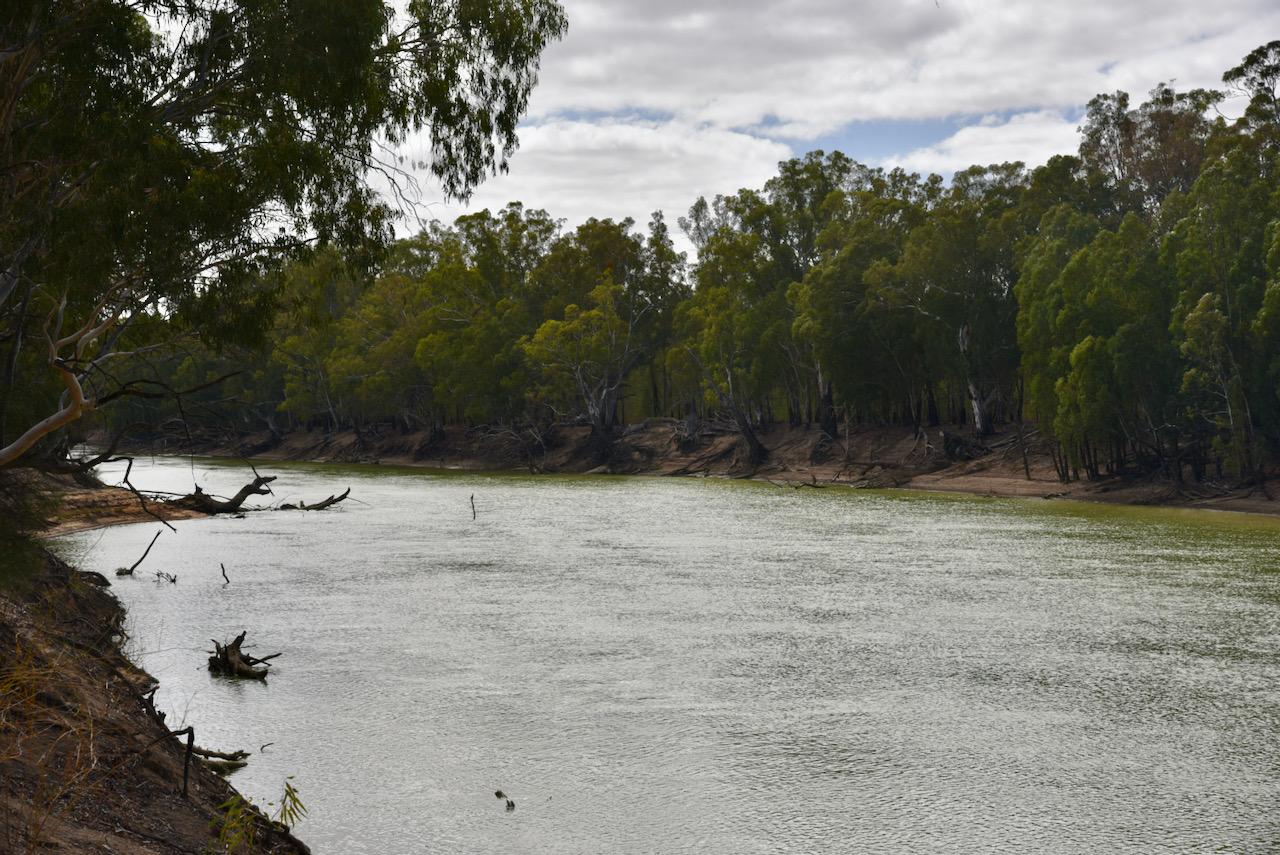
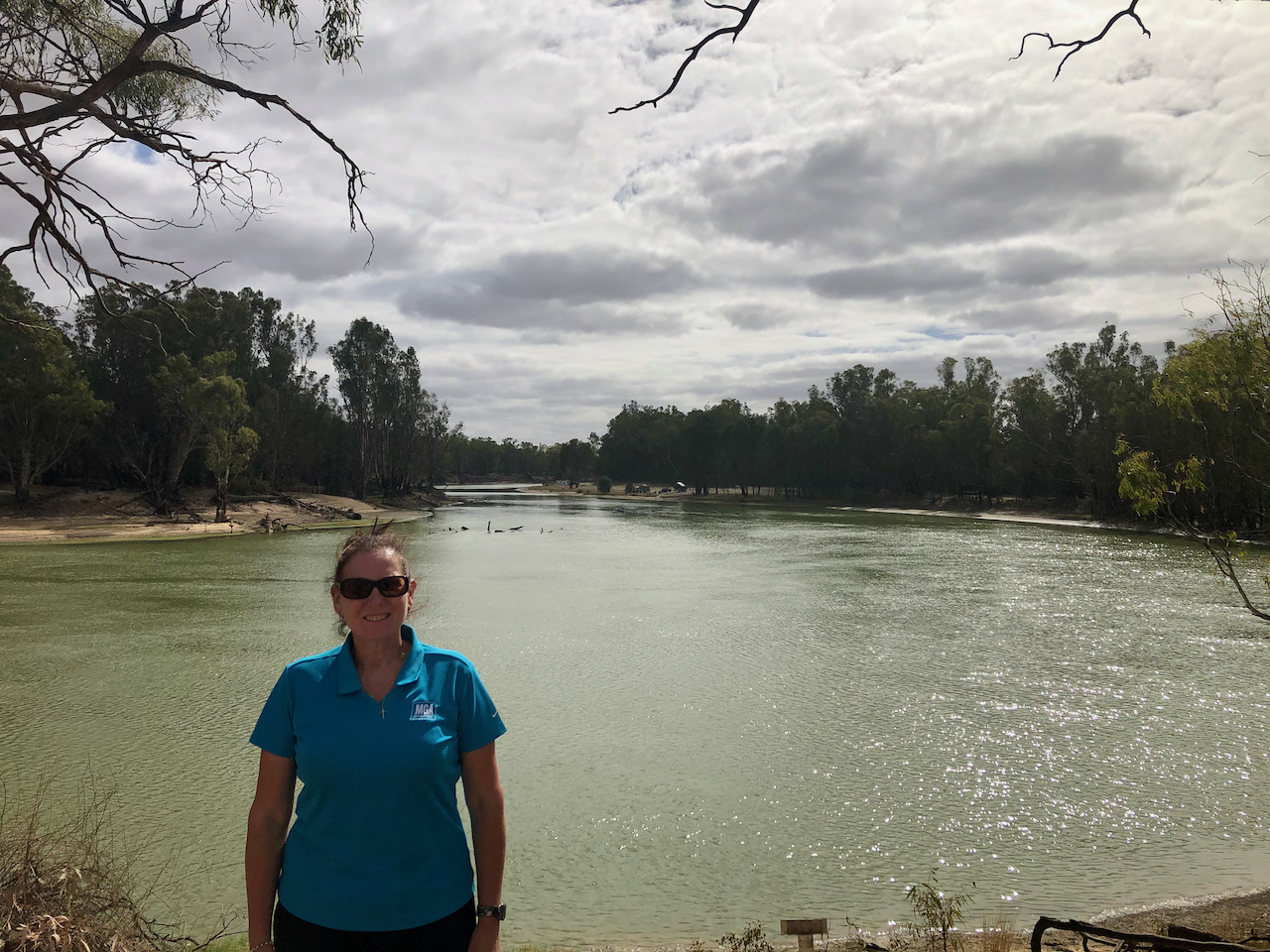
To kick off the day we headed around to the home of Ivan VK5HS and Sheryl who made a beautiful cooked brekfast for us. We then hit the road and decided to activate the Loch Luna Game Reserve VKFF-1723. Loch Luna is about 10 km north-west of Barmera.
Above:- Map showing the location of the Loch Luna Game Reserve. Map c/o Protected Planet.
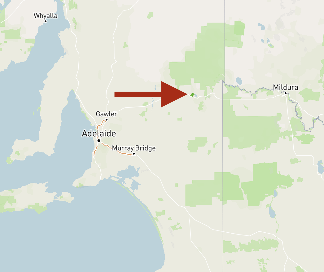
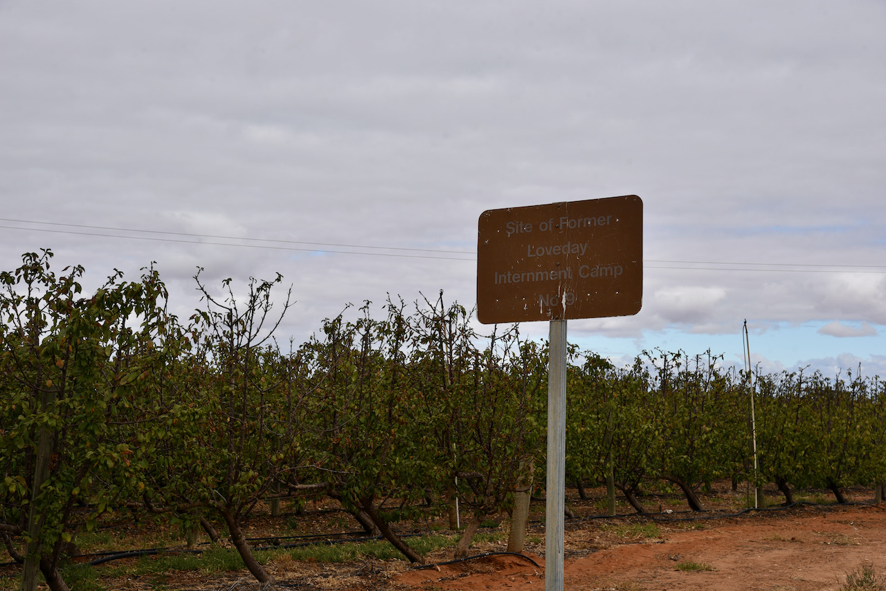
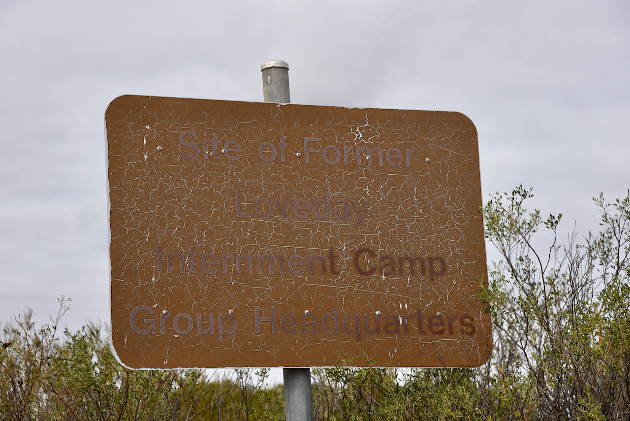
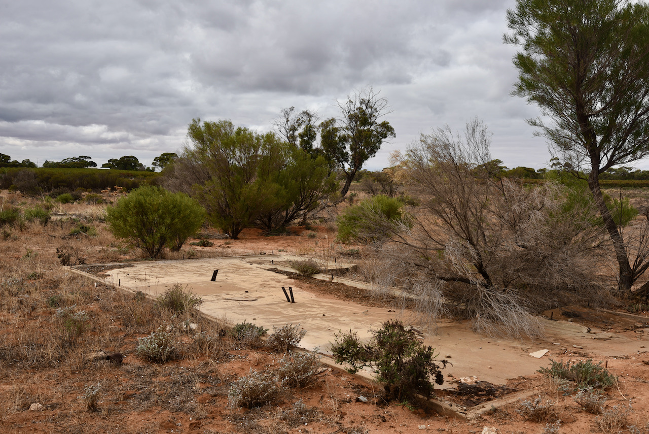
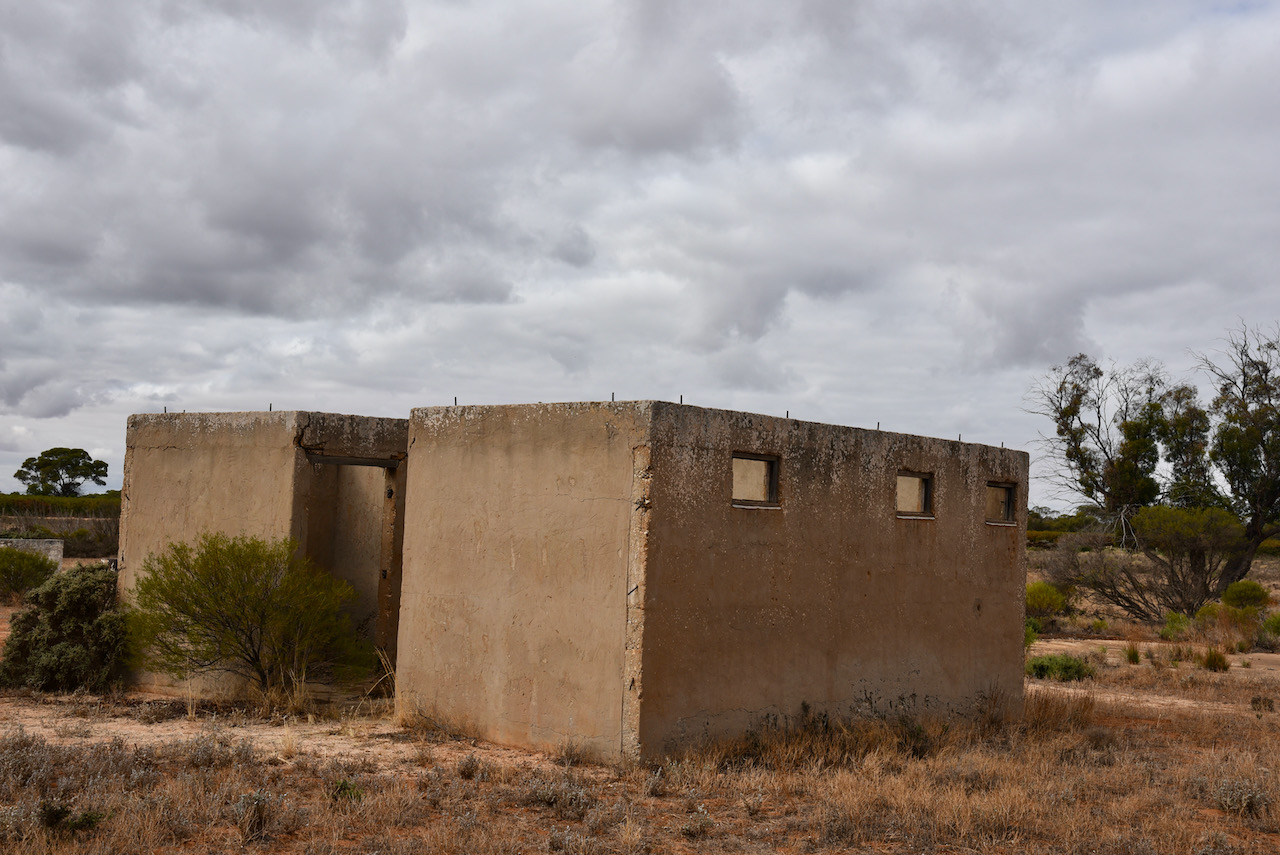
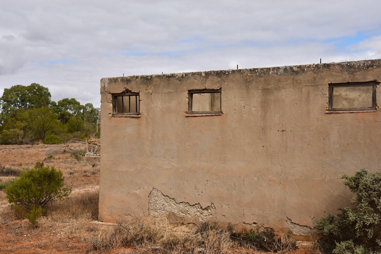
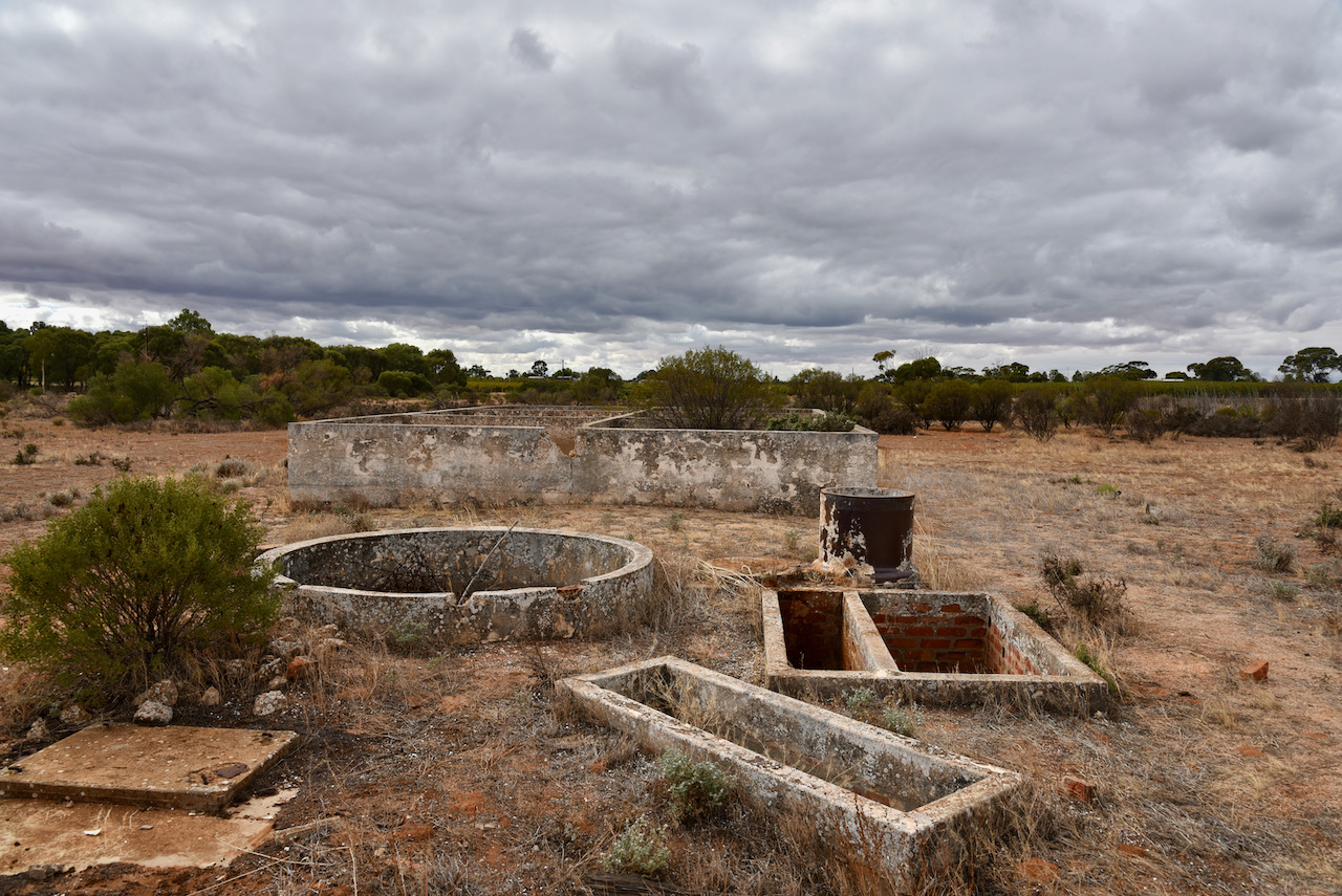
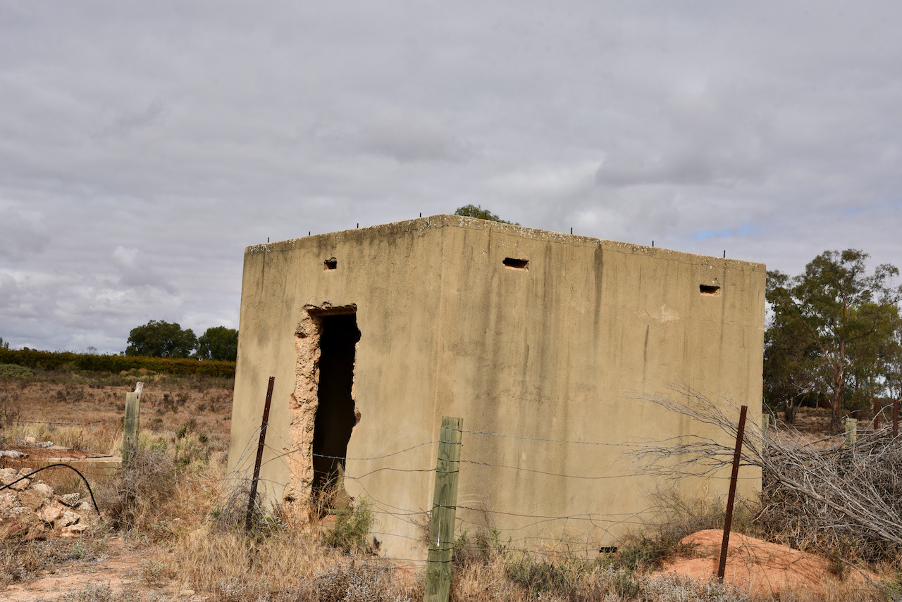
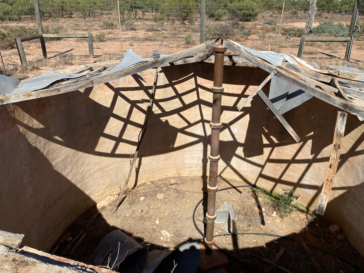
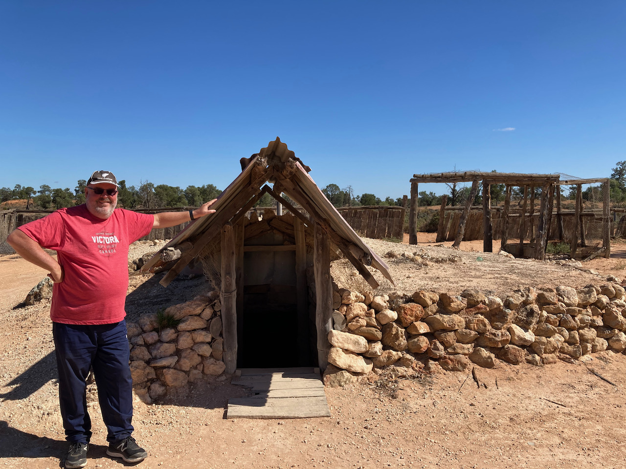
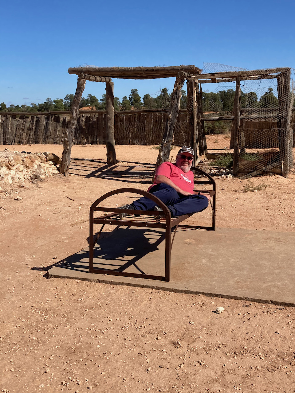
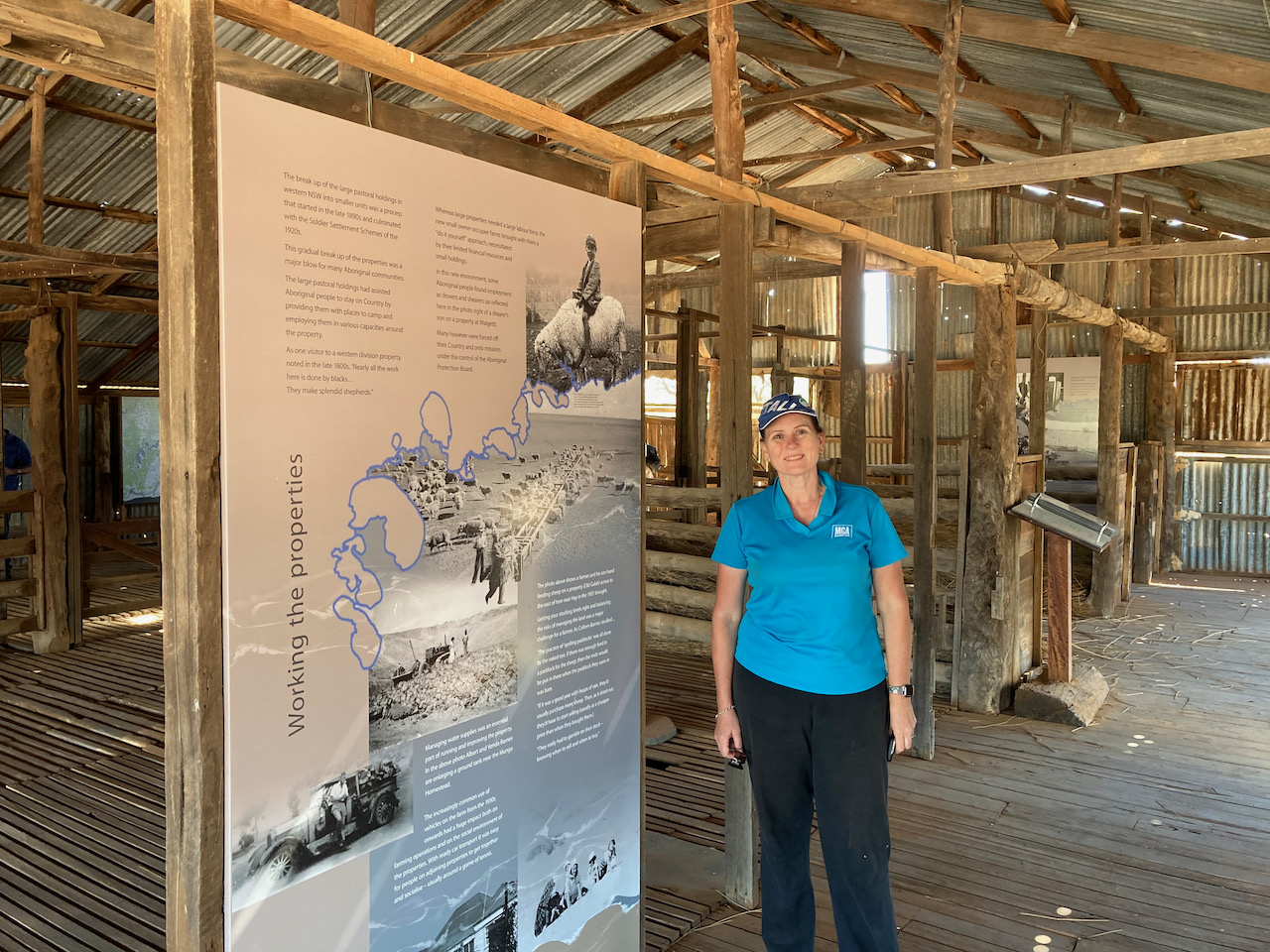
Prior to activating the park we had a look at the old Loveday World War Two (Camp 9) internment camp. It was also known as the Italian Internment Camp. It was one of three main prisoner or war and internee camps located at Loveday in the Riverland. The camp commenced operations in August 1940 and could hold up to 1,000 people, including Italian civillan internees, and Italian prisoners of war.
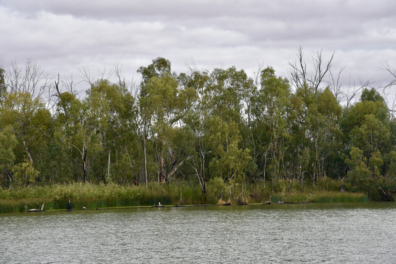
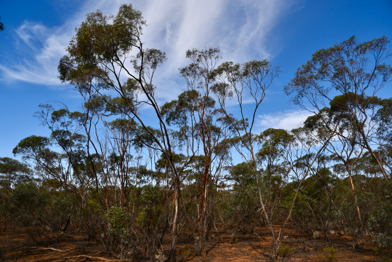
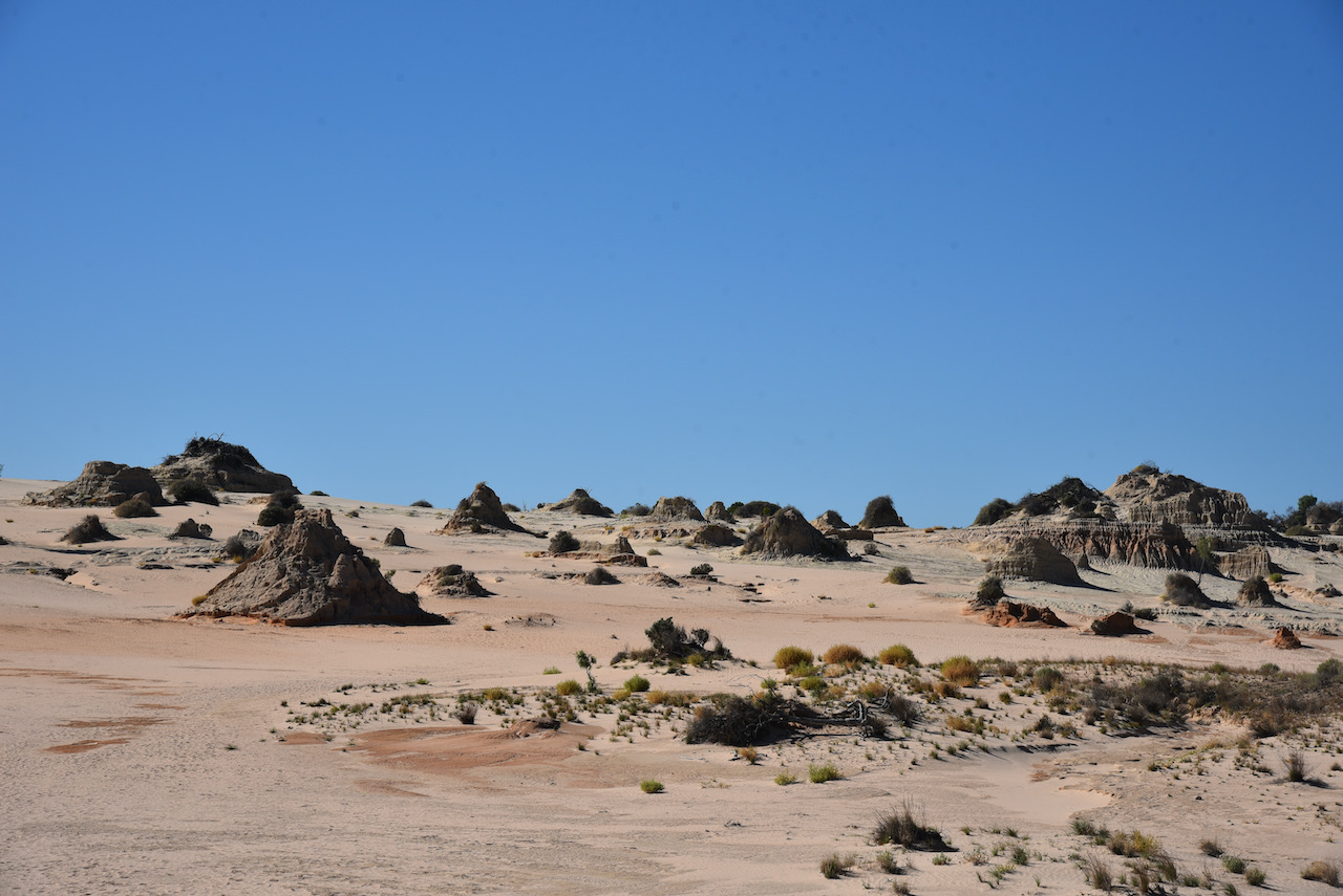
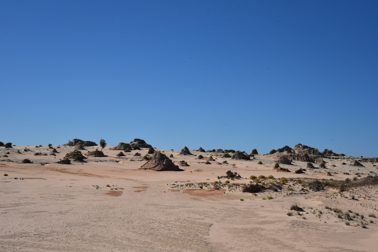
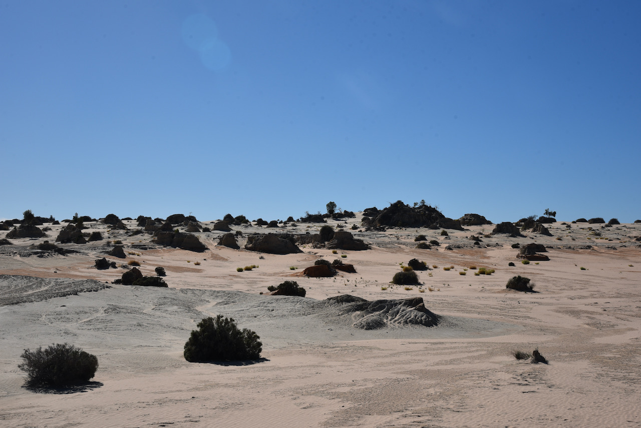
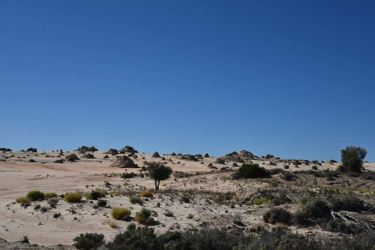
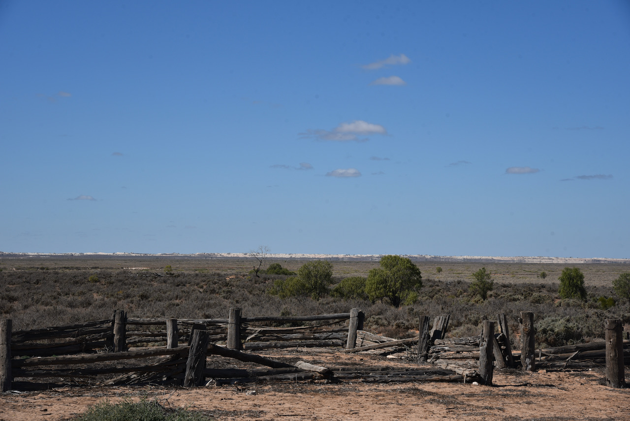
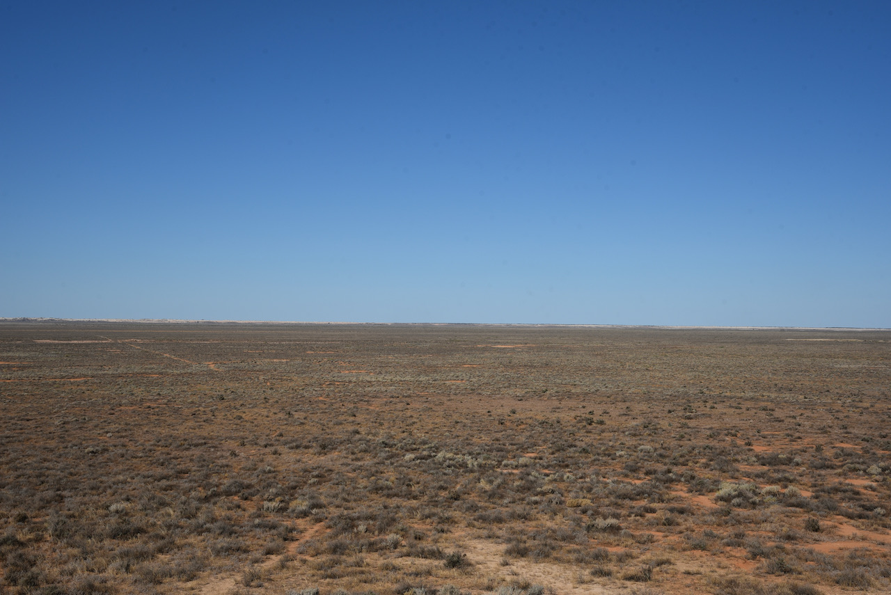
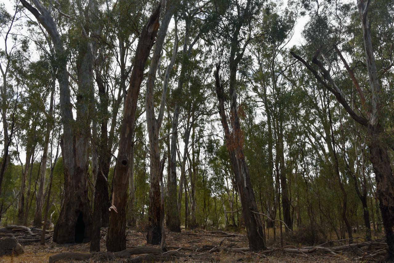
We then headed to Loch Luna Game Reserve. The reserve is about 20.63 km2 in size and was proclaimed on the 7th day of November 1985. As you can see in the aerial shot below there is a parcel of land within the reserve which is not gazetted. It is known as Sugarloaf Hill and has been excluded from protection for the purpose of mining activity.
The Moorok Game Reserve can be located adjacent to Loch Luna.
Above:- An aerial view of the Loch Luna Game Reserve. Image c/o Protected Planet.
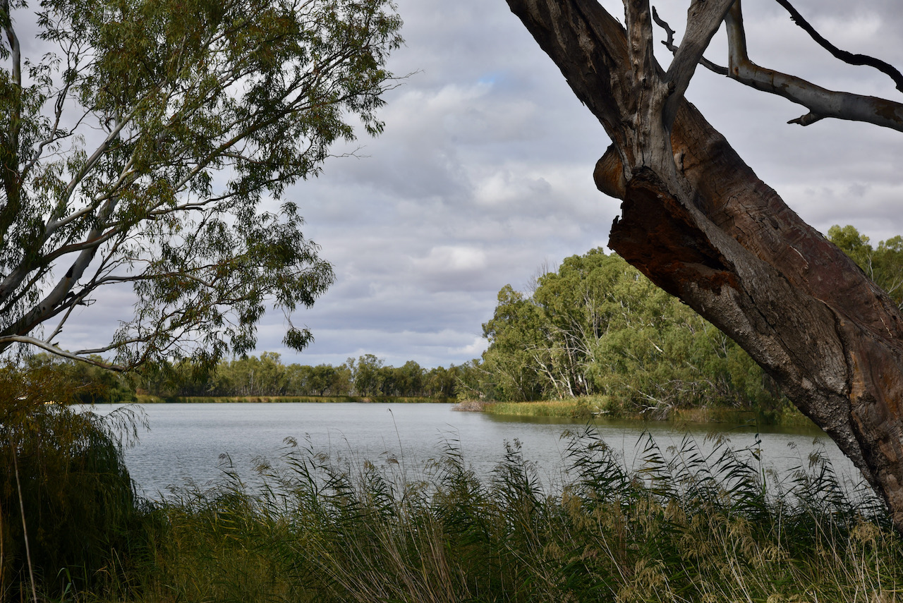
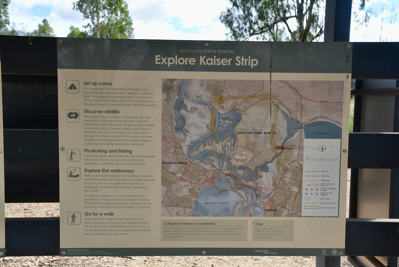
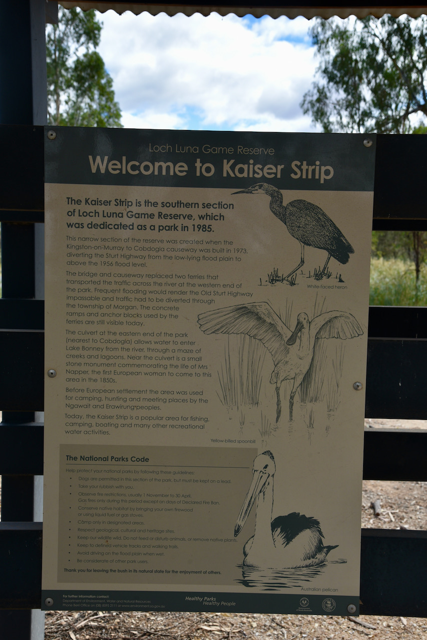
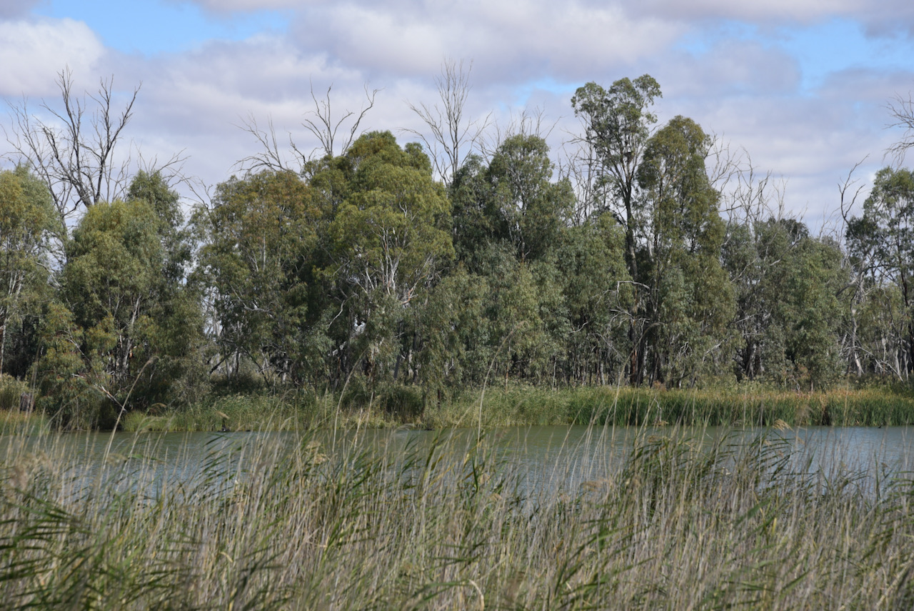
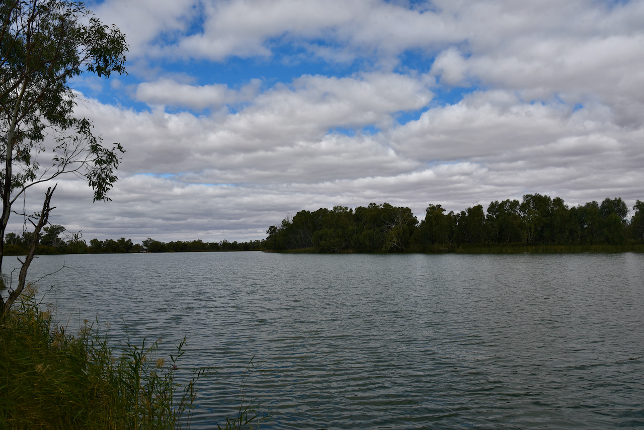
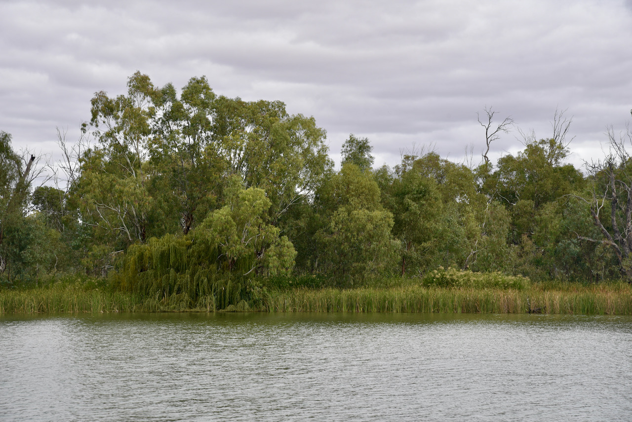
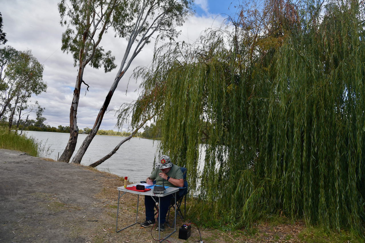
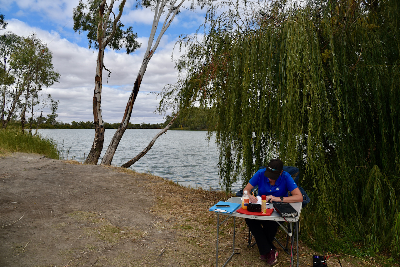
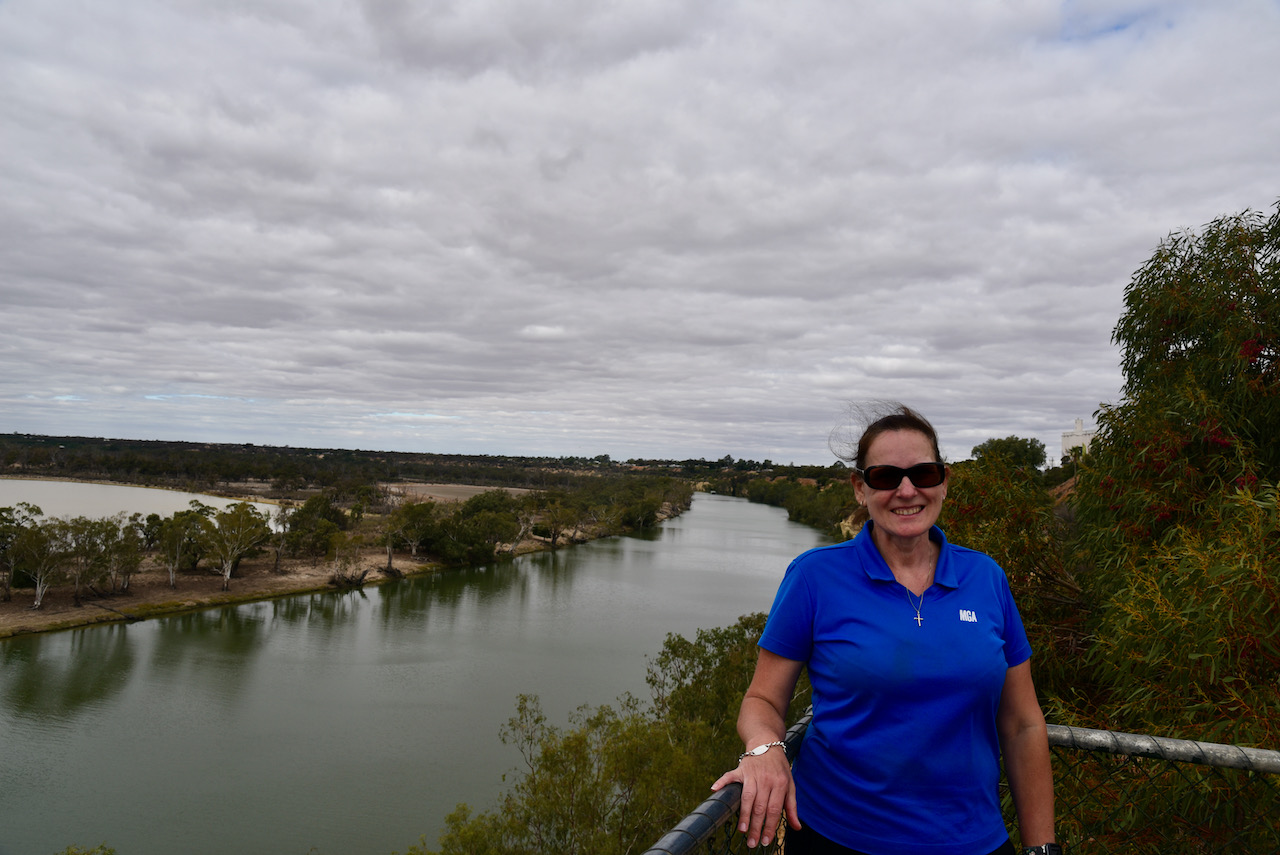
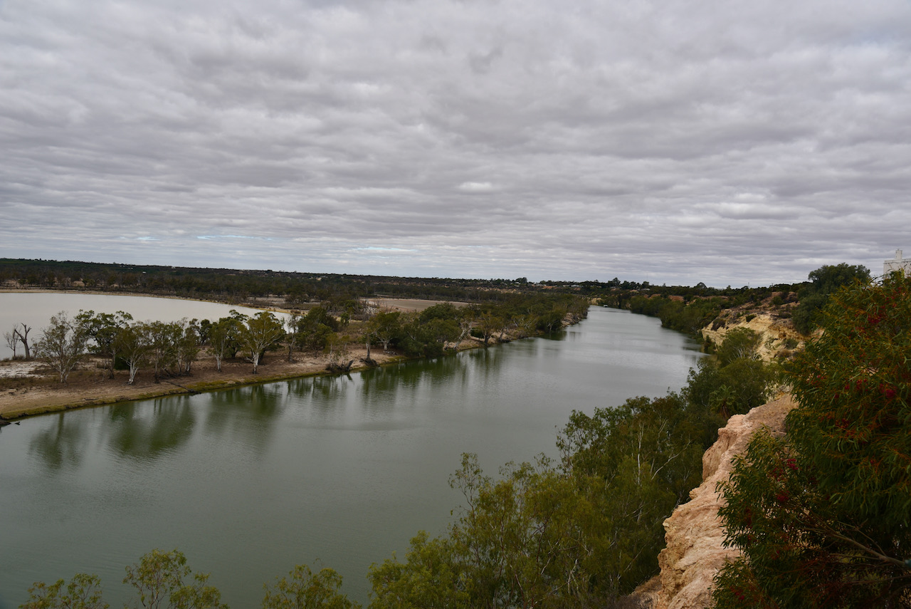
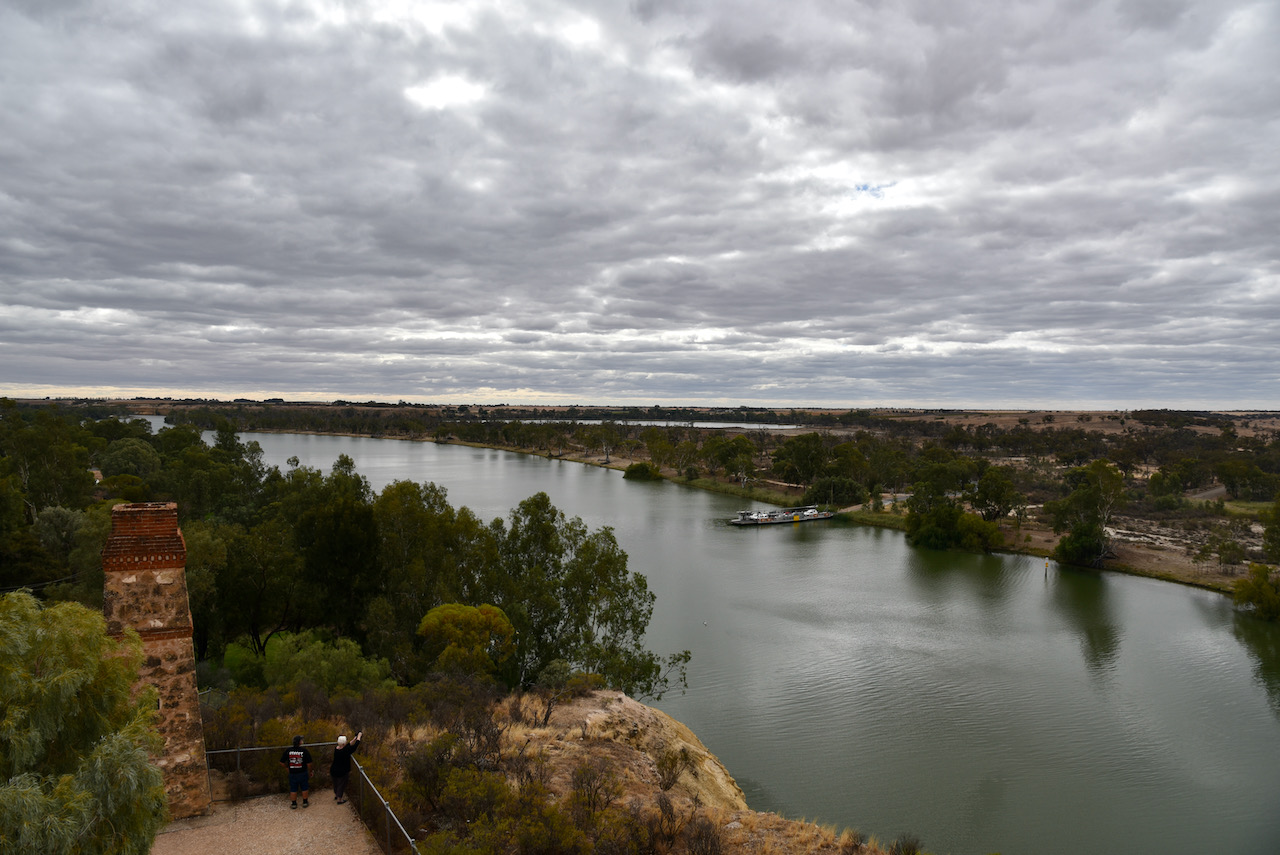
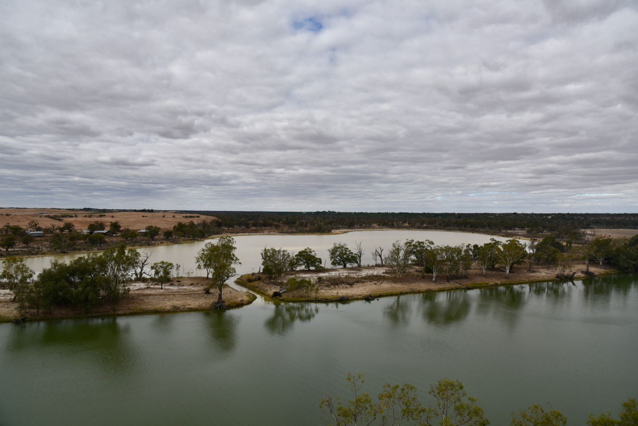
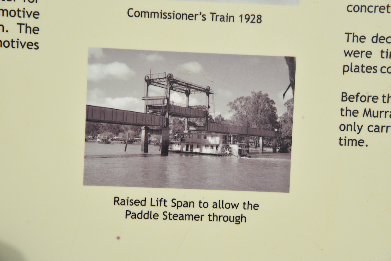
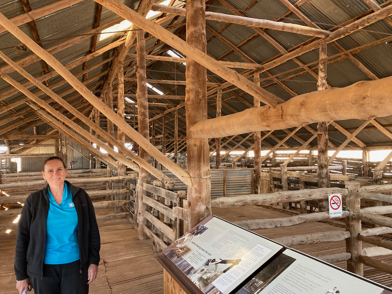
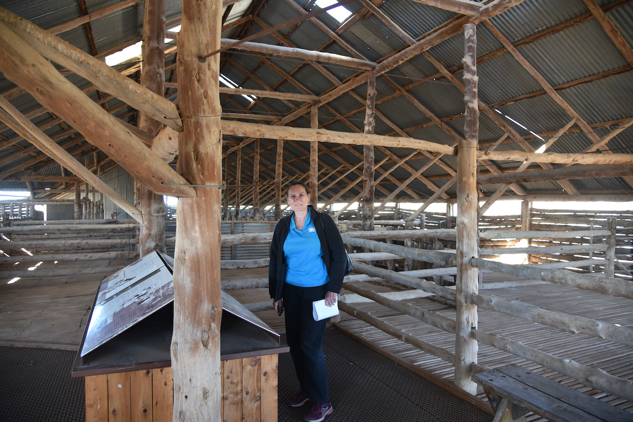
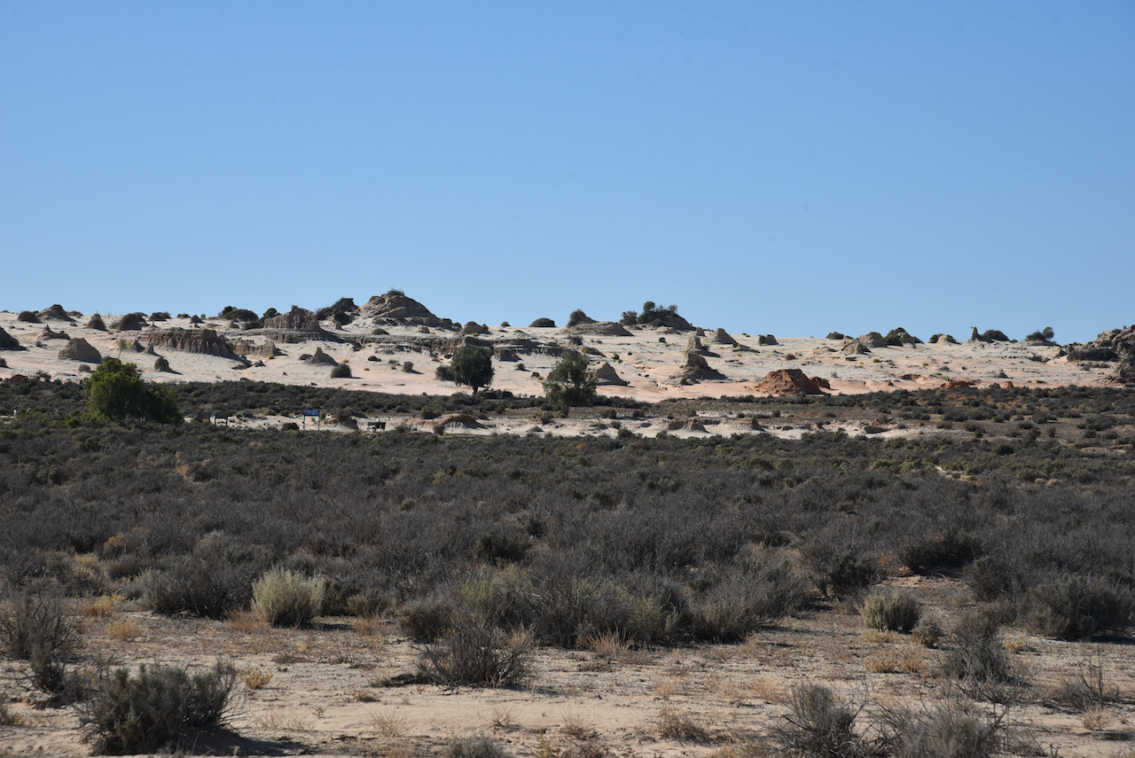
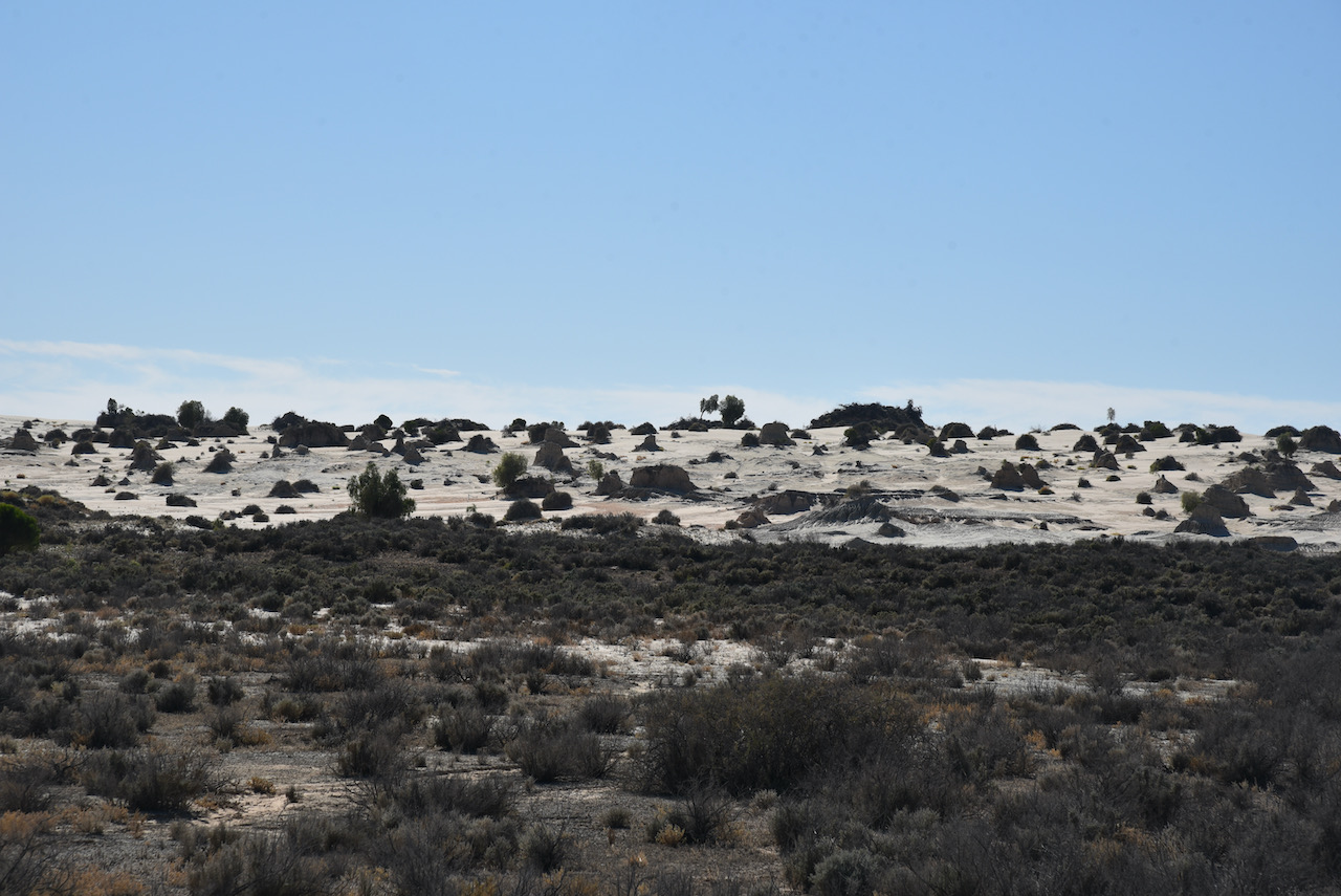
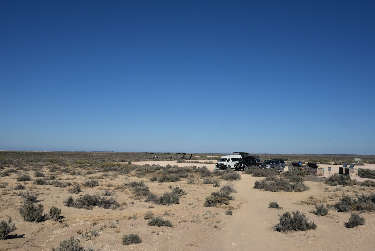
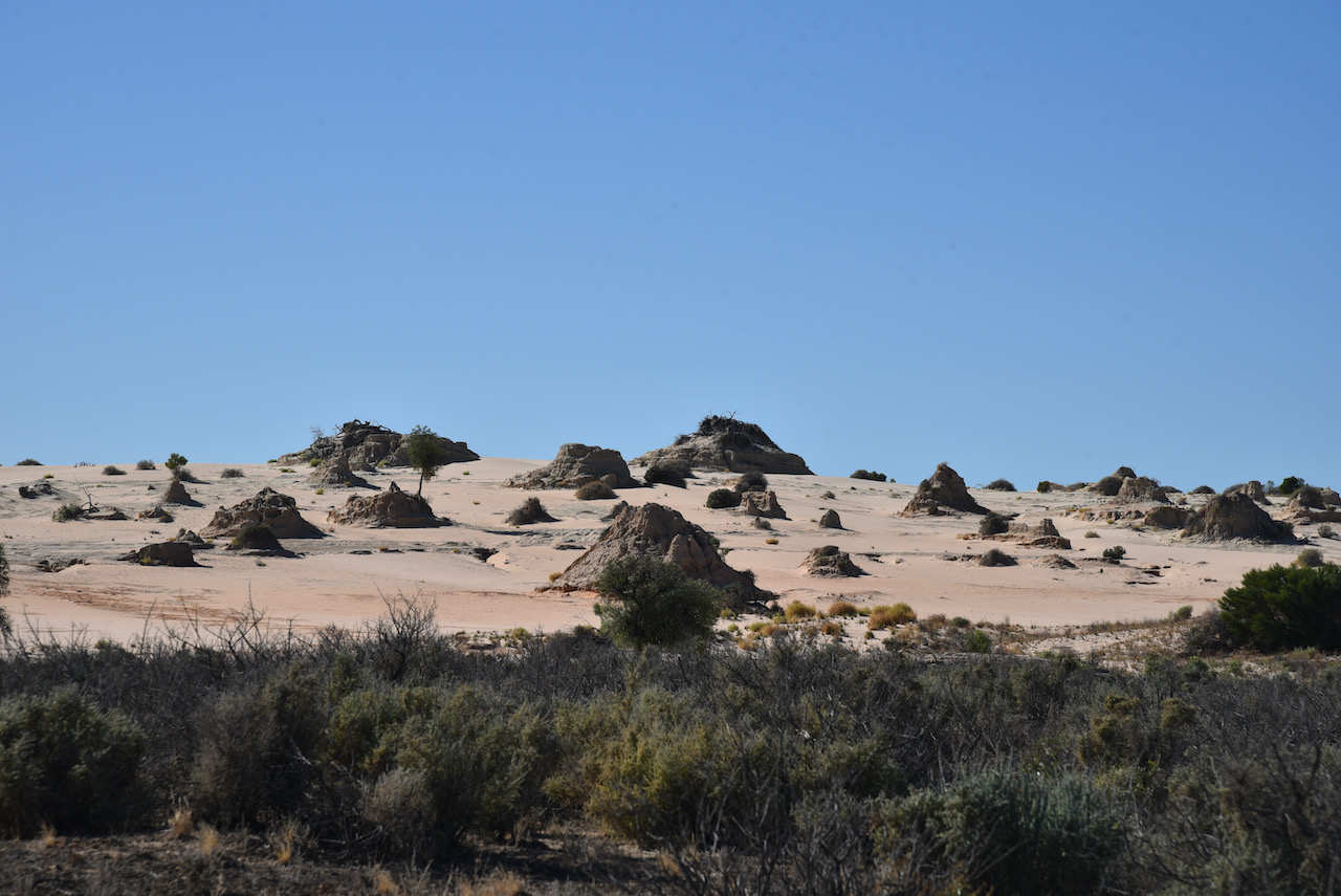
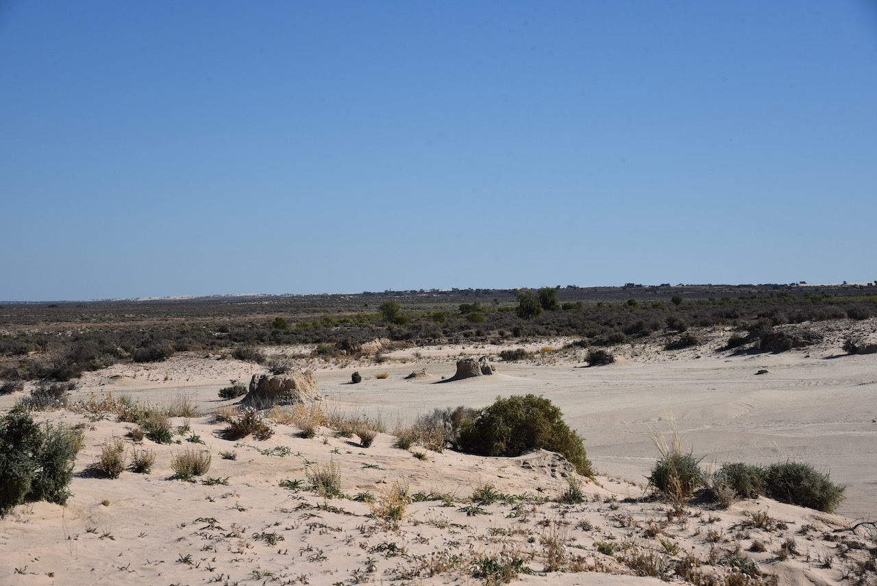
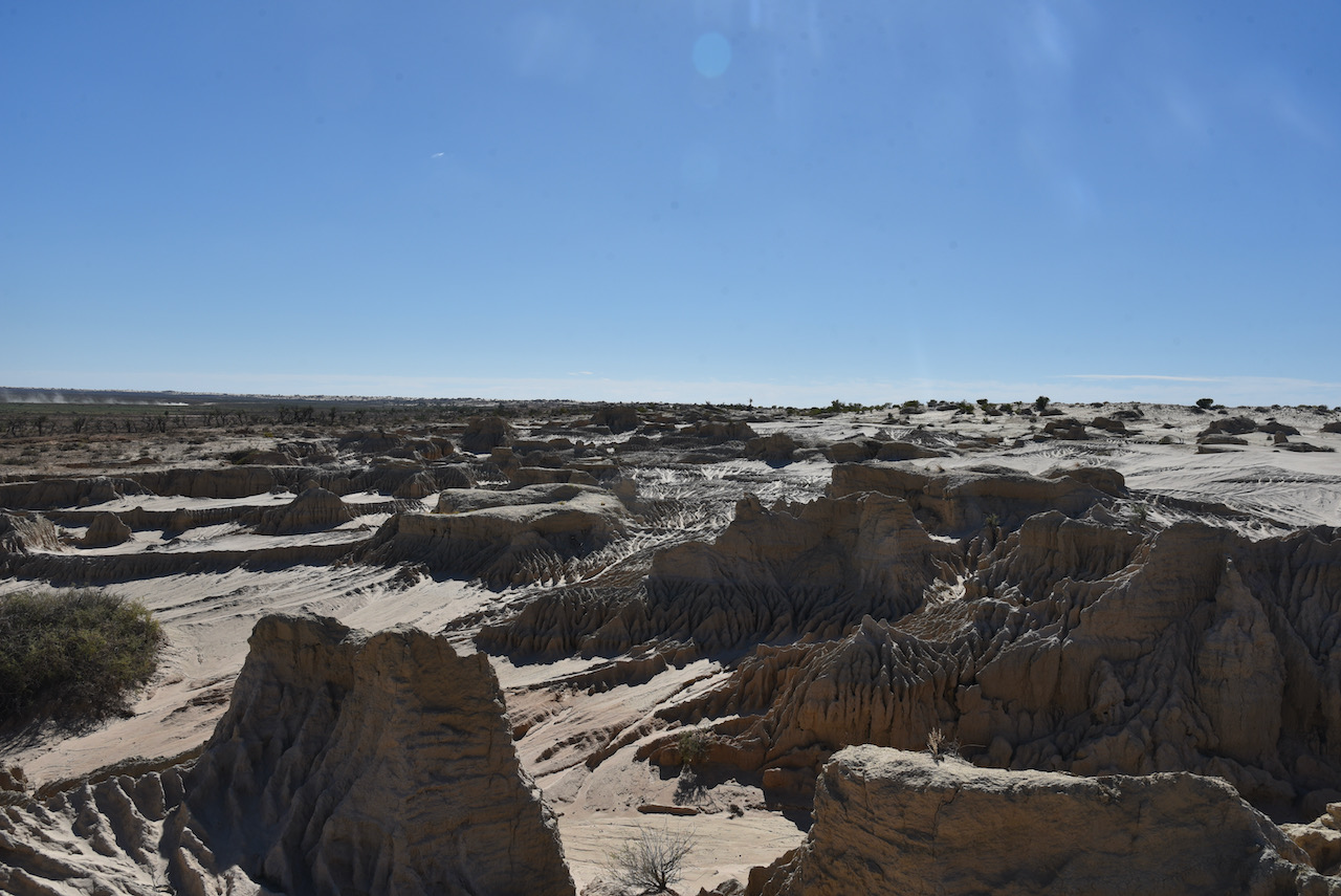
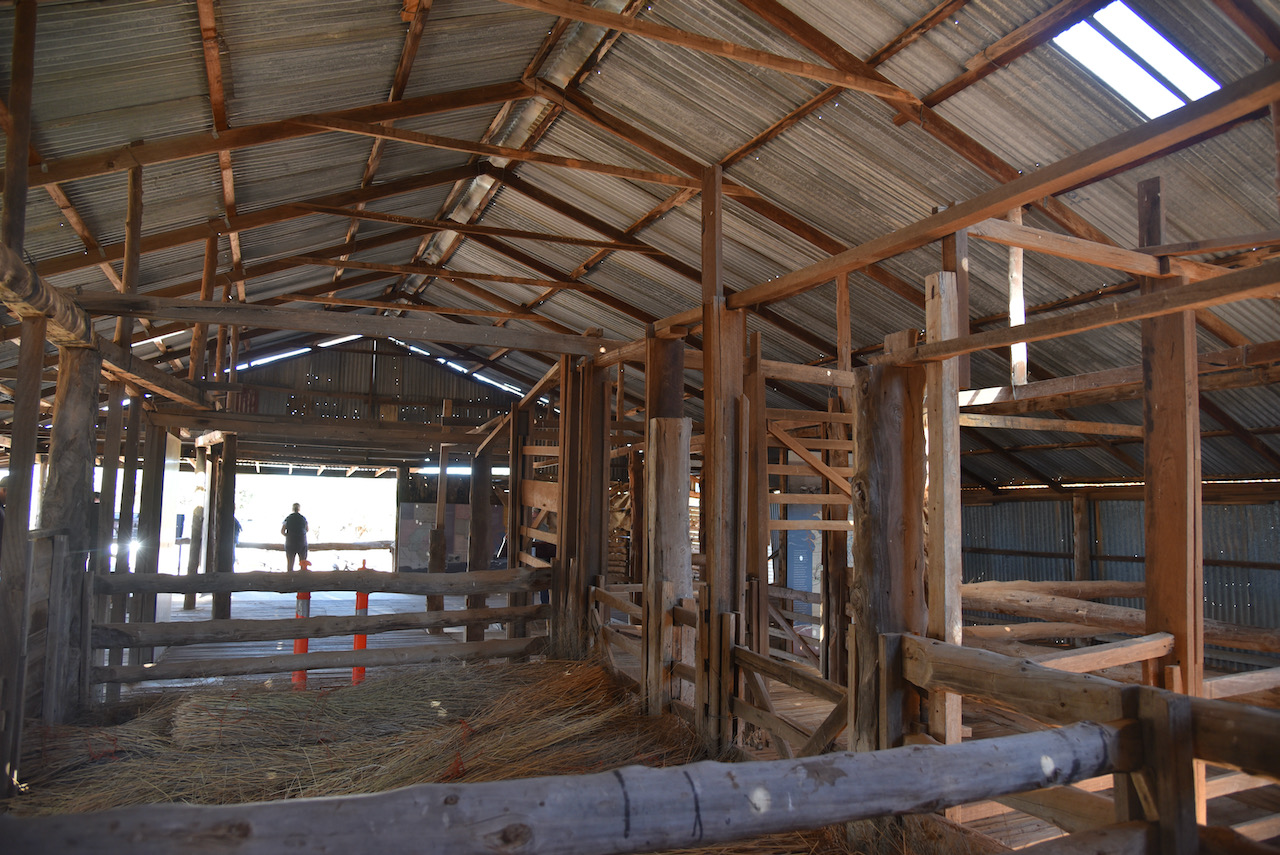
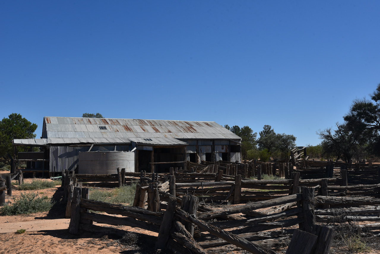
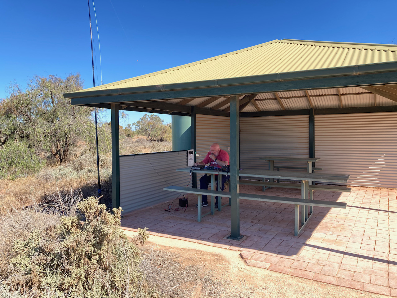
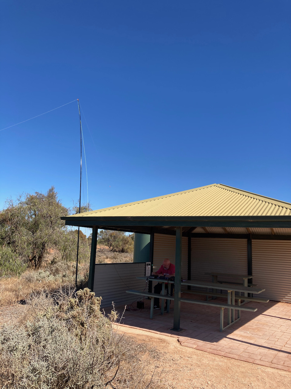
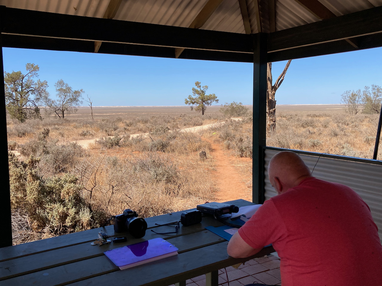
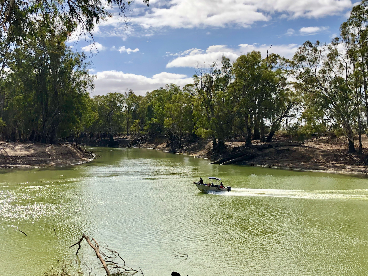
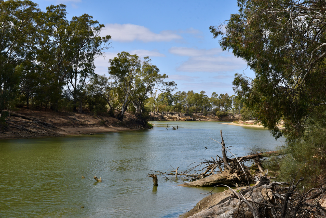
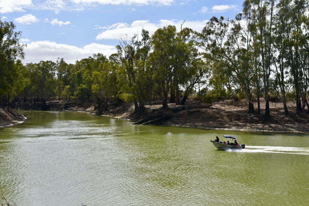
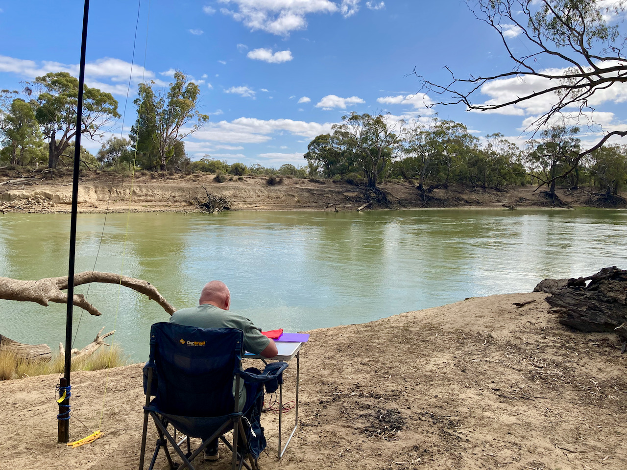
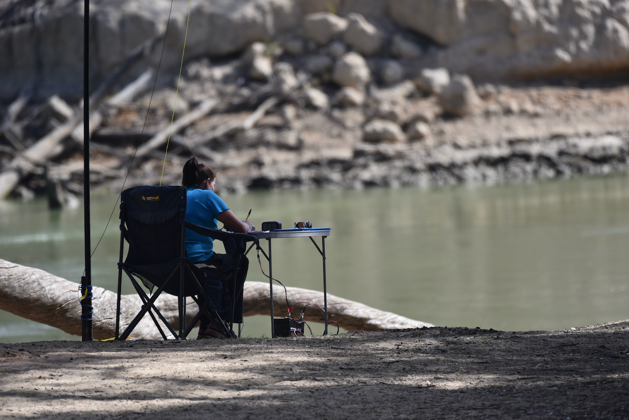
We activated the Kaiser strip in the southern section of the Reserve. This narrow section of the reserve was created when the Kingston-on-Murray to Cobdogla causeway was built in 1973, diverting the Sturt Highway from the low lying flood plain to above the 1956 flood level.
The bridge and causeway replaced two ferries that transported the traffic across the river at the western end of the park. Frequent flooding would render the Old Sturt Highway impassable and traffic had to be diverted through the township of Morgan. The concrete ramps and anchor blocks used by the ferries are still visible today.
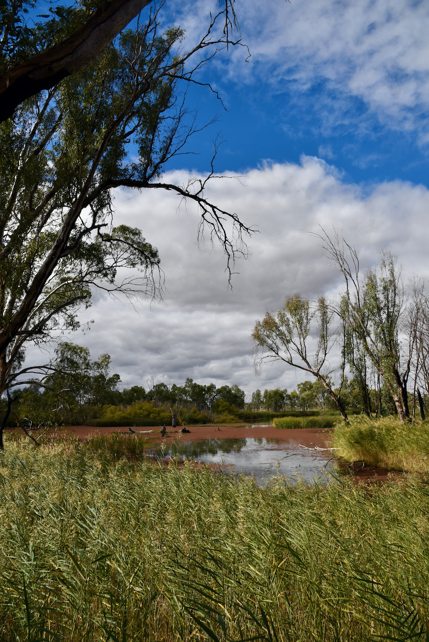
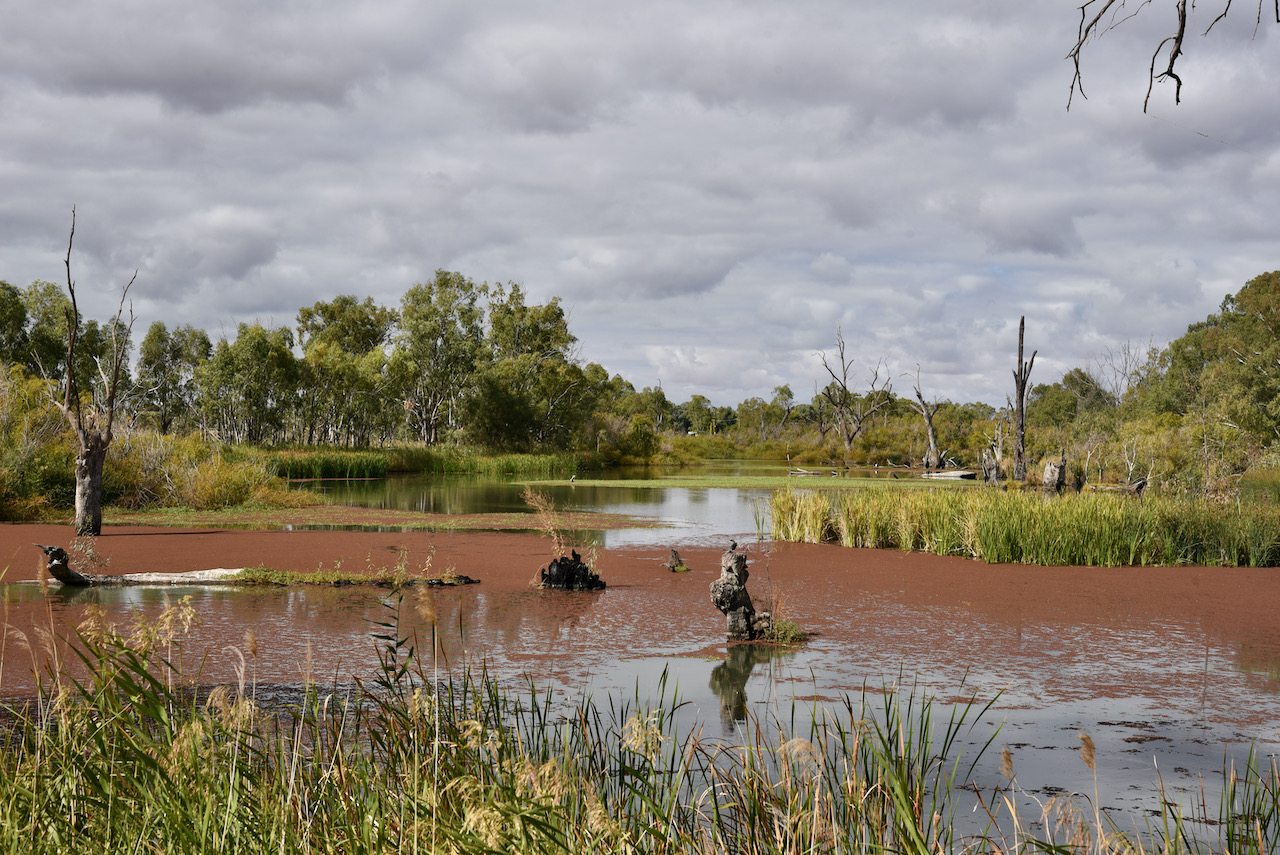
The culvert at the eastern end of the park, nearest of Cobdogla, allows water to enter Lake Bonney from the river, through a maze of creeks and lagoons. Near the culvert is a small stone monument commemorating the life of Mrs. Napper, the first European woman to come to this area in the 1850s.
Before European settlement the area was used for camping, hunting and meeting places by the Ngawait and Erawirung peoples.
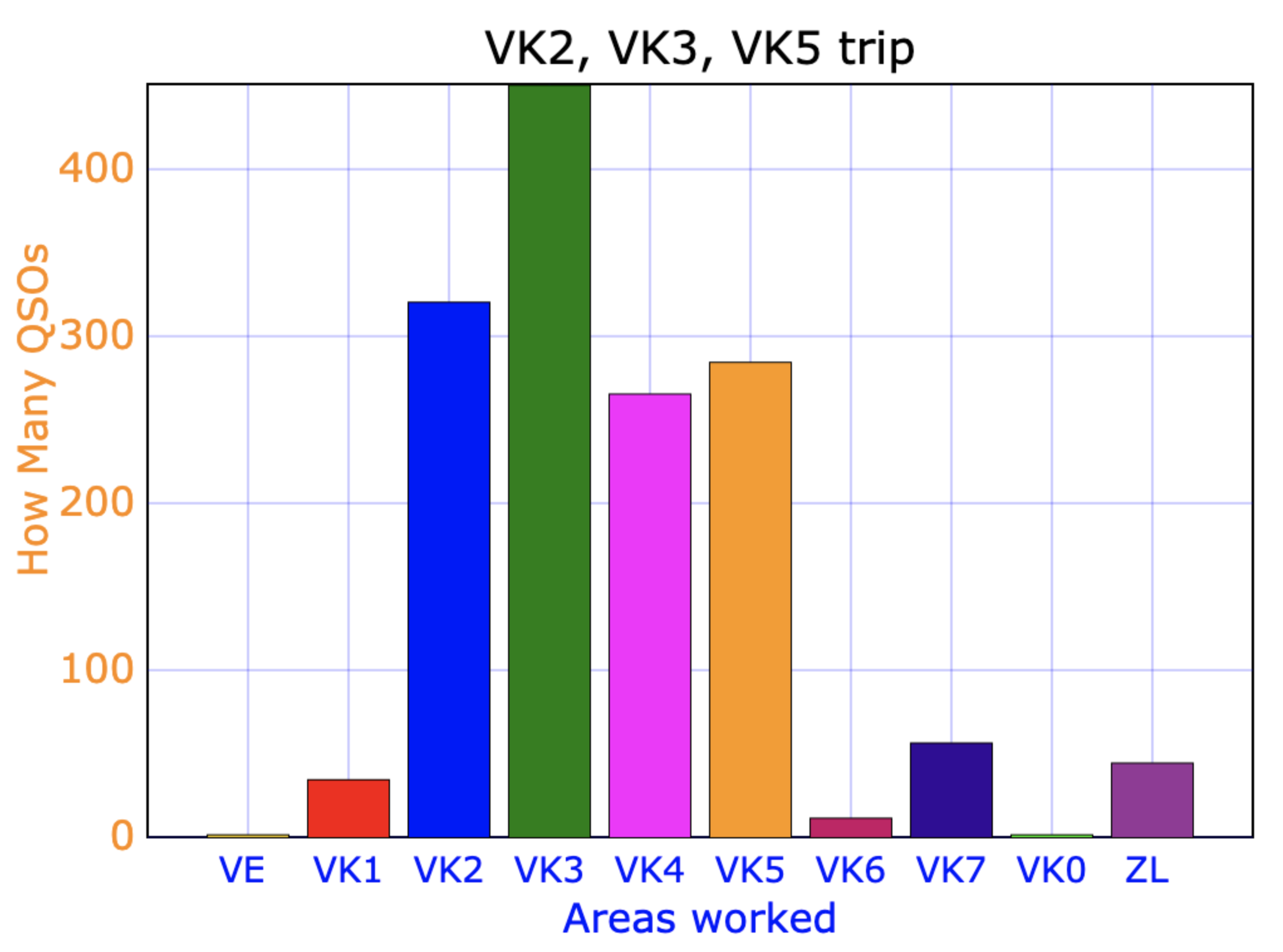
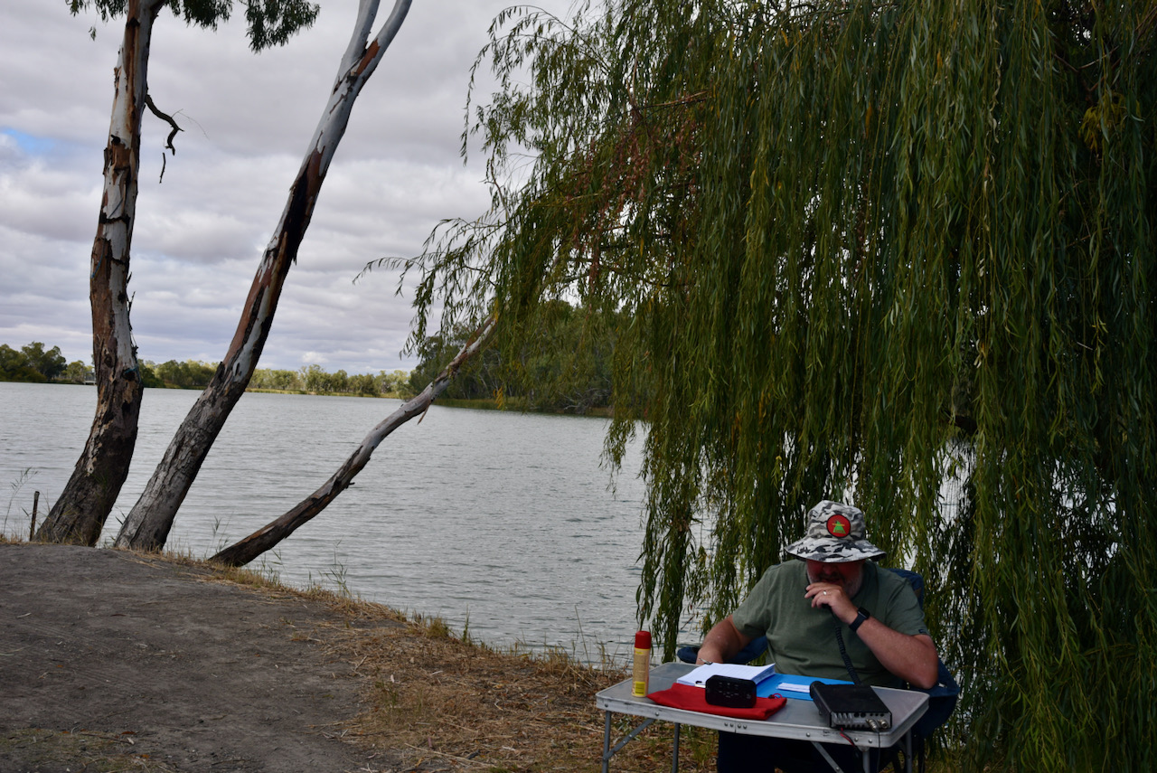
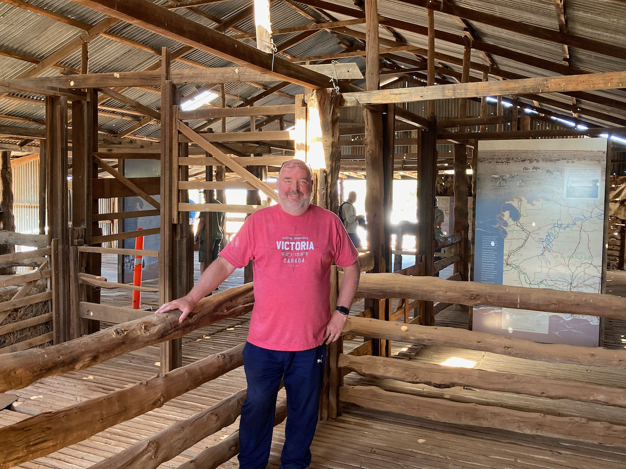
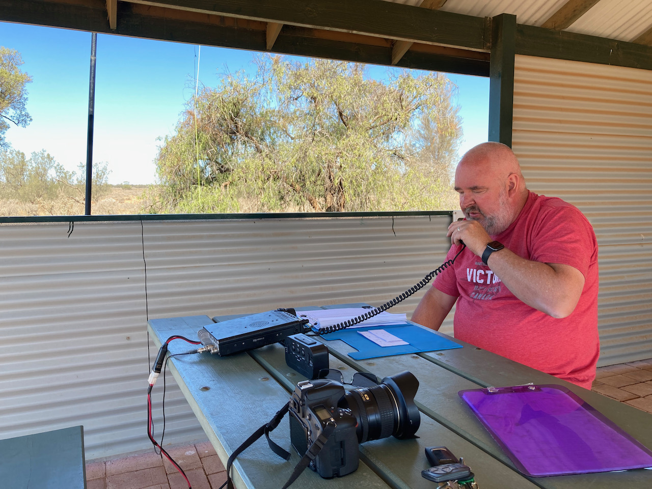
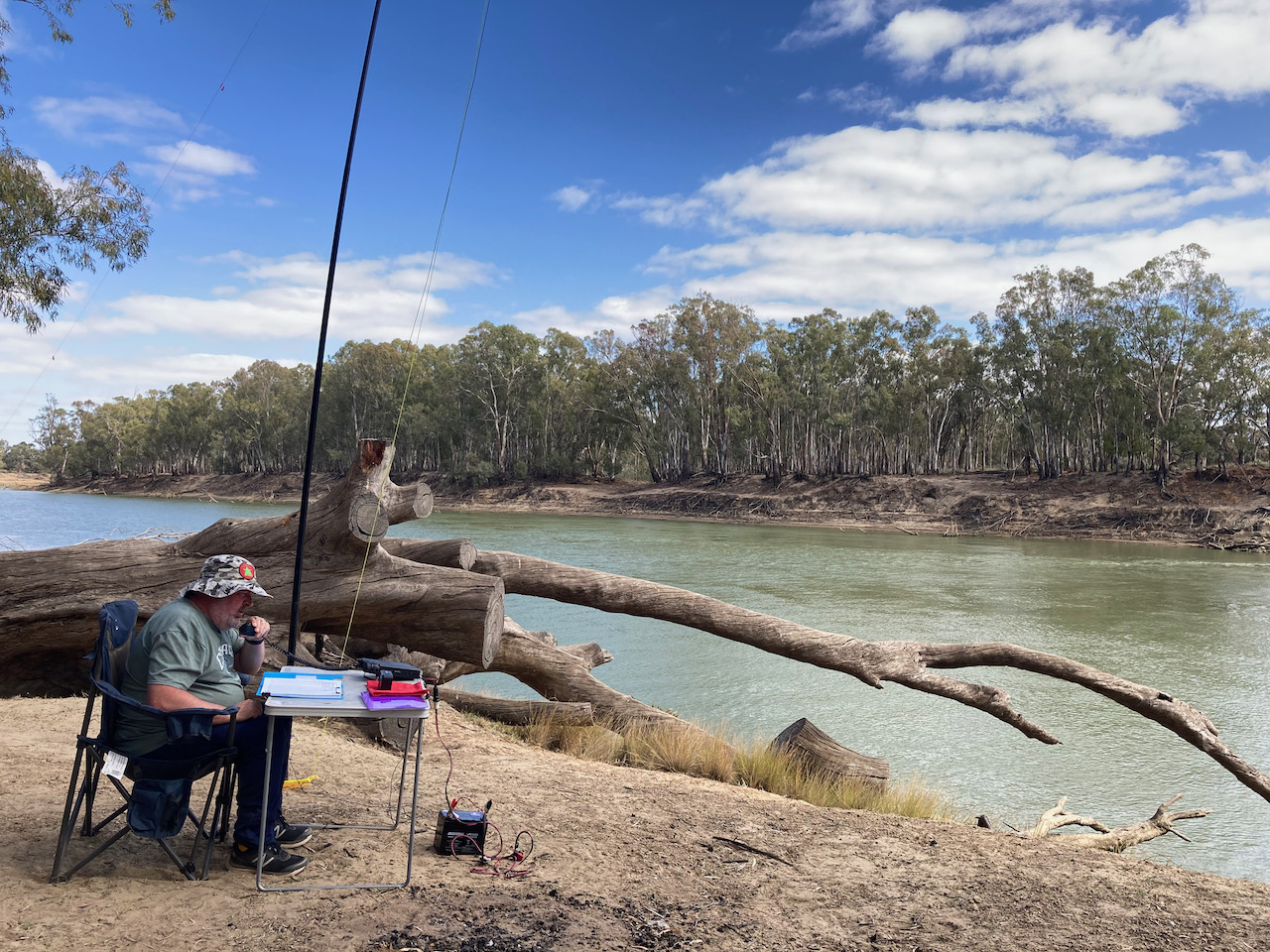
After setting up I called CQ on 7.144 and within 6 minutes I had contact number ten in the log, a QSO with Adam VK2YK. Band conditions on 40m were very good and a mini pile up soon developed. I logged 55 contacts on 40m from VK2, VK3, VK4, VK5, and VK7. This included three Park to Park contacts with Peter VK5PET/p in the Cox Scrub Conservation Park VKFF-1701, James VK2TER/p in the Cockle Bay Nature Reserve VKFF-1908, and Peter VK3TKK/p in the Holden Flora Reserve VKFF-2333. We also logged Gerard VK2IO who was on SOTA summit VK2/ HU-093.
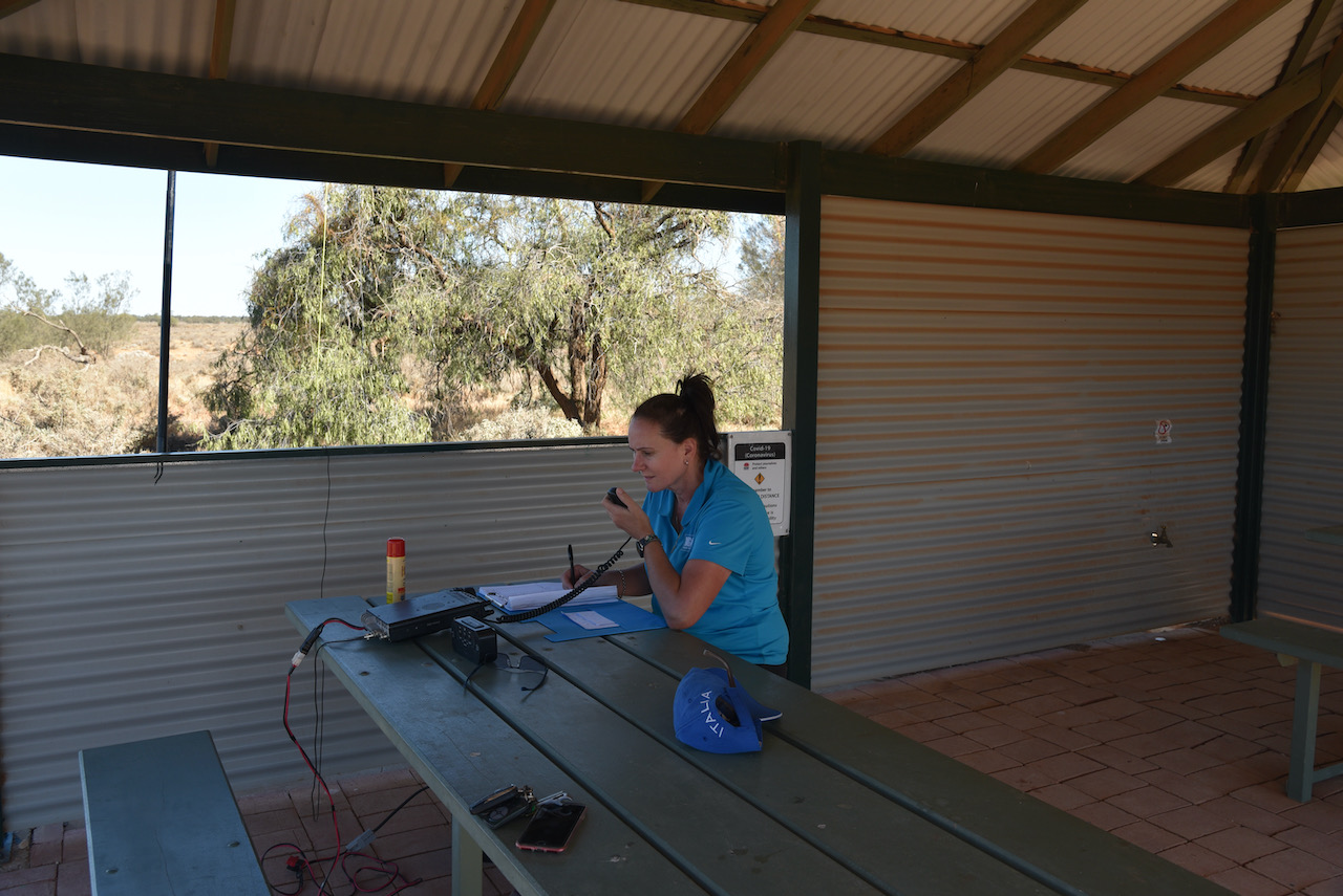
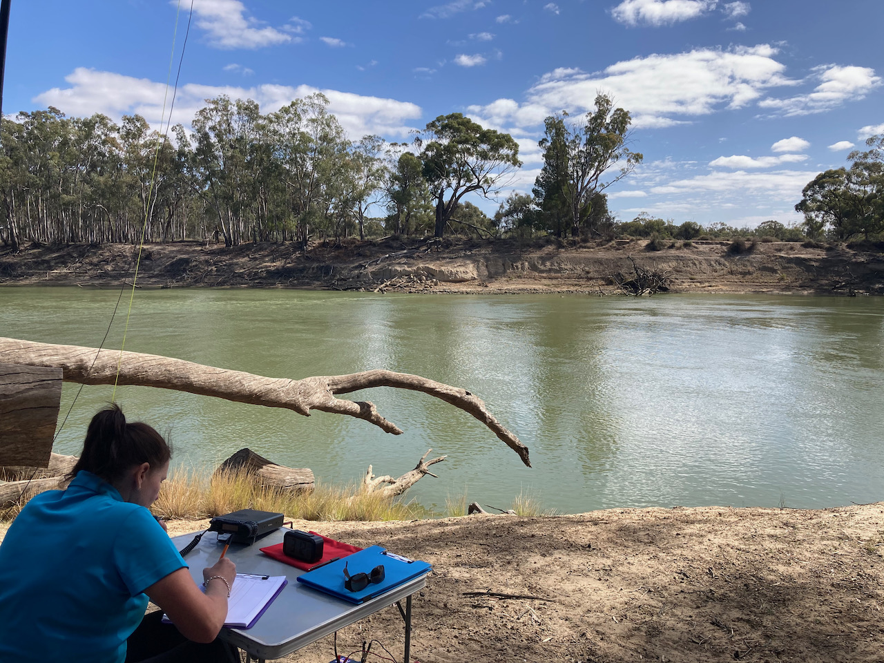
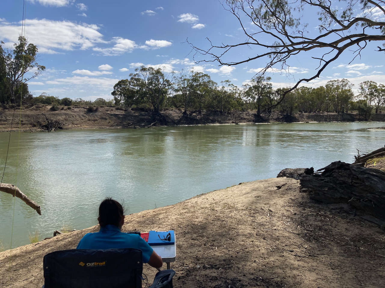
Marija then jumped into the operator’s chair and logged 22 stations on 40m from VK2, VK3, and VK5.
I then took charge of the mic again and logged a further 12 stations on 40m. To conclude the activation I moved to the 20m band where I logged 3 stations from VK3, VK4, and New Zealand.
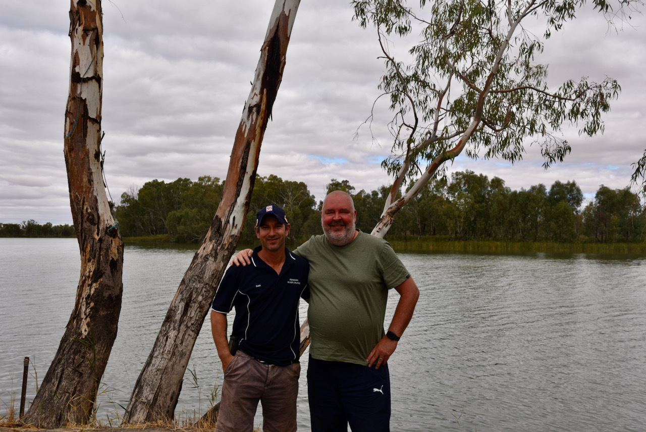
During the activation we were visited by Dan VK5FDMG from Loxton.
Marija worked the following stations on 40m SSB:-
VK5PET/p (Cox Scrub Conservation Park VKFF-1701)
VK3TKK/p (Holden Flora Reserve VKFF-2333)
VK5NJ
VK5JN
VK5MRE
VK3FIMD
Vk3FQSO
VK5DW
VK2HHA
VK3CRG
VK5FANA
VK5YX
VK3UH
VK3SMW
VK3DJC
VK2LEE
VK3MCK
VK5PL
VK3PF
VK3SQ
VK5LA
VK2YK
VK5GA
I worked the following stations on 40m SSB:-
VK3PF
VK5LA
VK3UCD
VK3VDX
VK4BXX
VK4/NN3Z
VK2PET/3
VK3AHR
VK5KLV
VK2YK
VK5GA
VK3TKK/m
VK2LIL/3
VK2TER/p (Cockle Bay Nature Reserve VKFF-1908)
VK3DJC
VK3SWV
VK3FQSO
VK2PKT
VK3AWA
VK3XCI
VK3CWF
VK5FANA
VK3DBP
VK3MPR
VK5PET/p (Cox Scrub Conservation Park VKFF-1701)
VK2LEE
VK5WG
VK3FIMD
VK3MTV
VK2VH
VK4AAC/2
VK5NM
VK5TQ
VK5HS
VK5WU
VK2DG
VK5NIG
VK3SQ
VK2IO/p (SOTA VK2/ HU-093)
VK4SMA
VK3MKE
VK2VW
VK2HFI
VK3TKK/p (Holden Flora Reserve VKFF-2333)
VK7ME
VK3HOT
VK4CX
VK4FDJL
VK2HHA
VK5GY
VK7DIK
VK3CU
VK3PI
VK5MRE
VK3ZPF
VK5NJ
VK5YX
VK2KMI
VK5EE
VK3CRG
VK3DQW
VK5DW
VK3ALA/m
VK3UH
VK3OF
VK5FIVE
VK3NBL
VK2YW
VK5AR/m
I worked the following stations on 20m SSB:-
VK3MPR
VK4HNS
ZL1TM
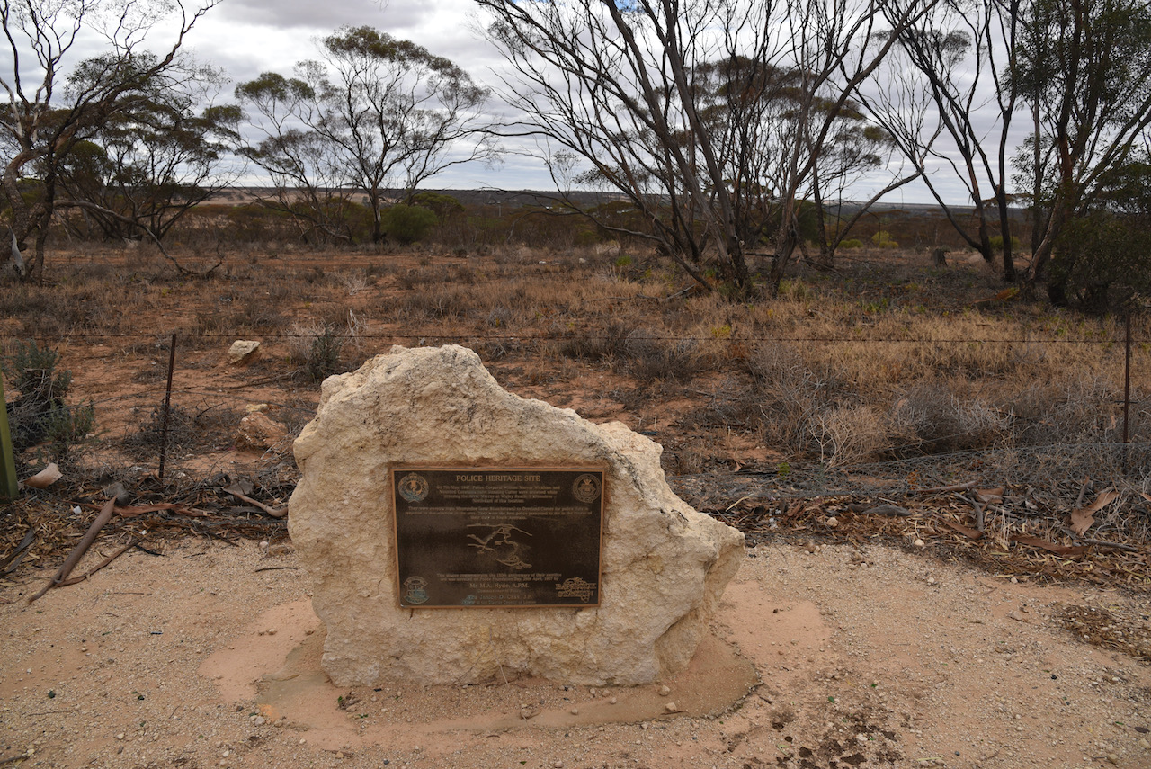
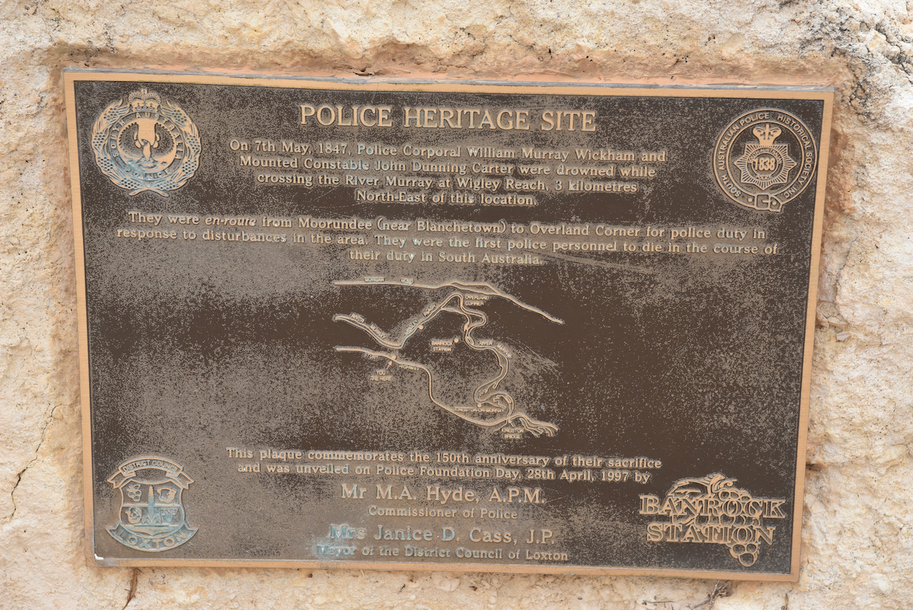
After packing up we continued west on the Sturt Highway and stopped to have a look at the Police Heritage site. The memorial cairn commemorates police officers, Corporal William Murray Wickham and Mounted Constable John Dunning Carter, who drowned on the 7th day of May 1847. They were enroute from Mourundee, near Blanchetown, to Overland Corner for police duty in response to disturbances in the area. They were the first police to die in the line of duty in South Australia.
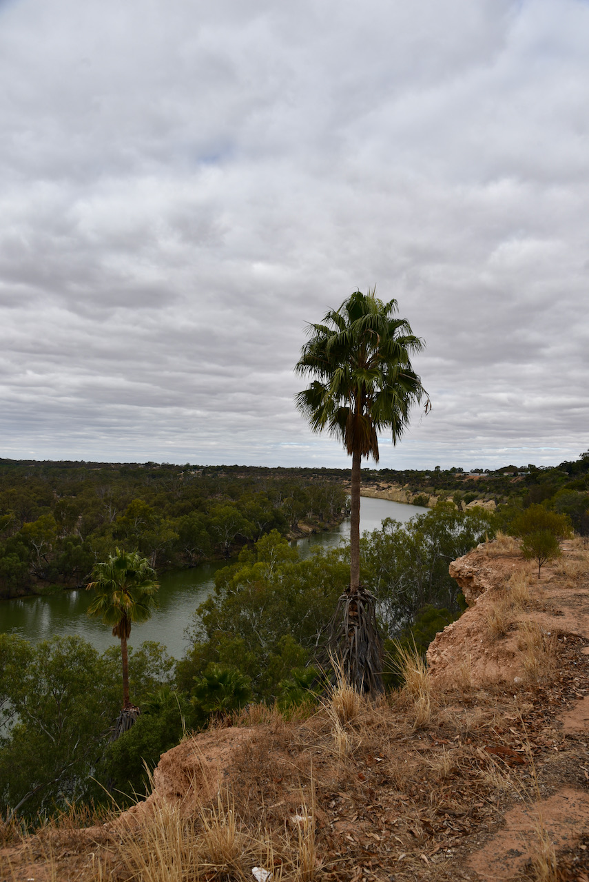
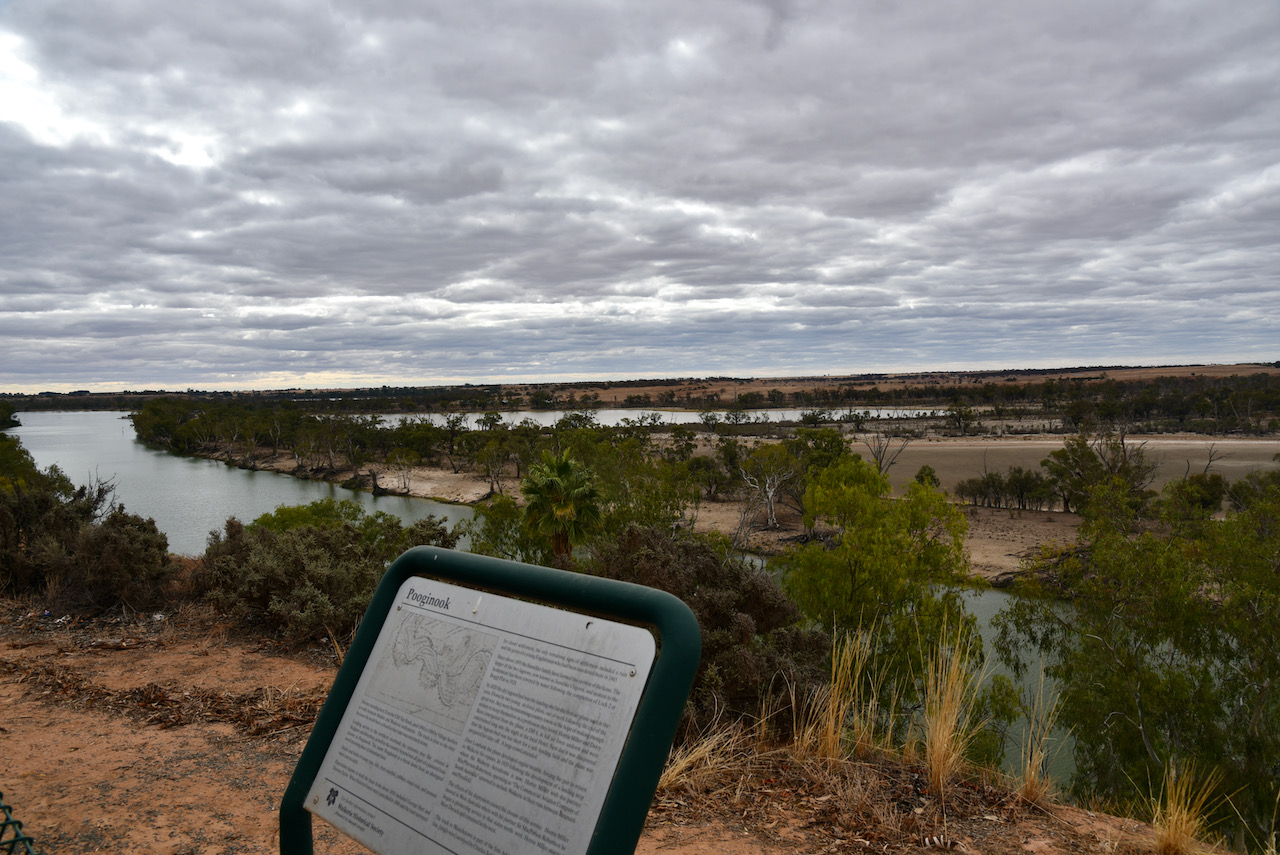
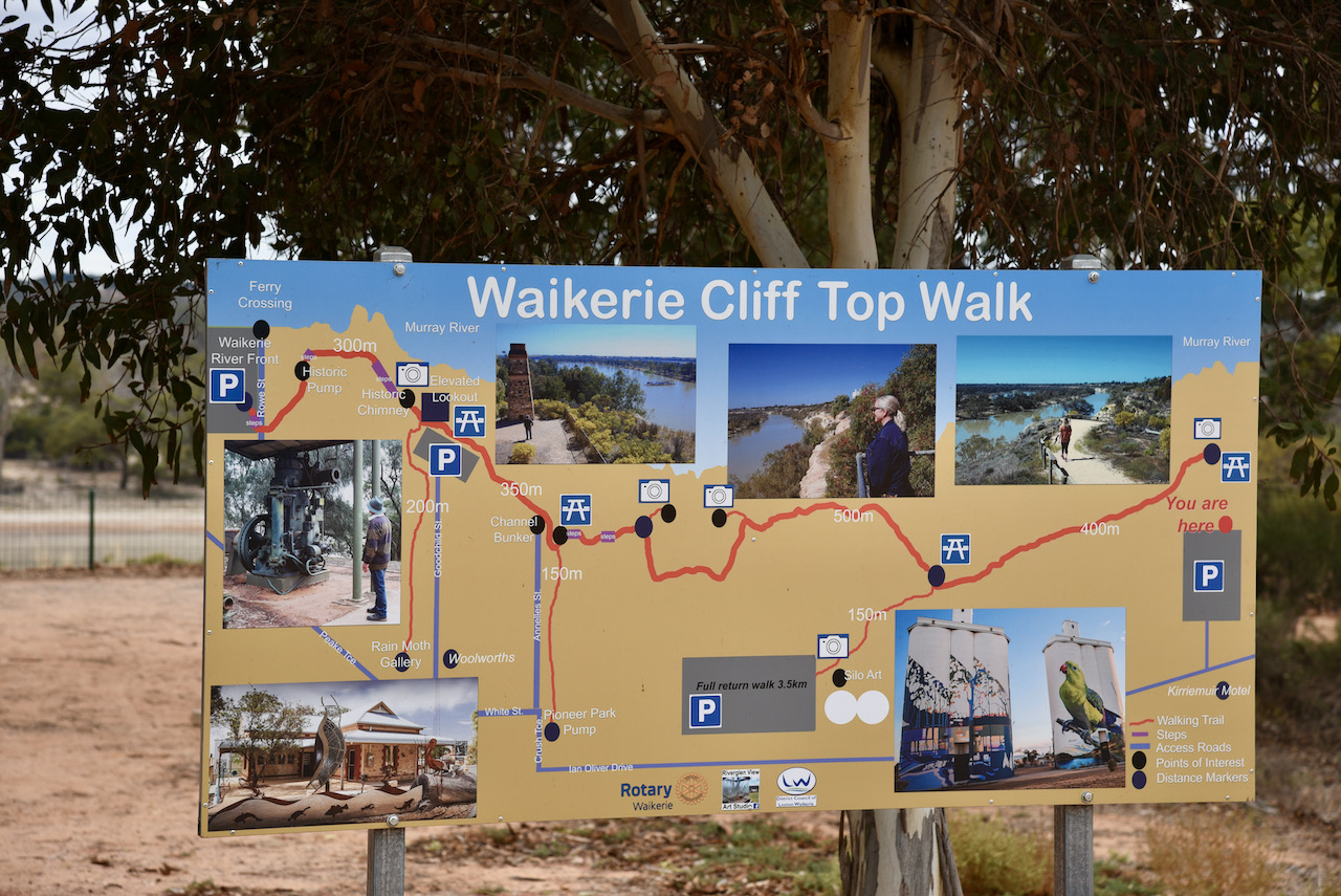
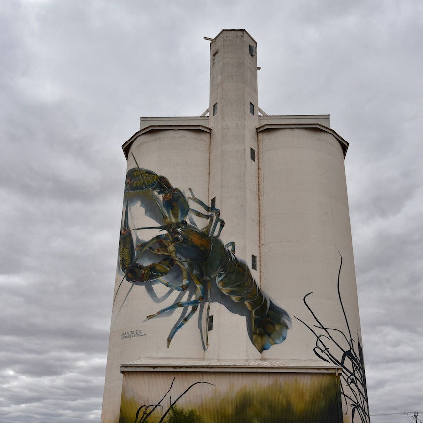
We then stopped at Waikerie to have a look at the Waikerie Cliff Top Walk.
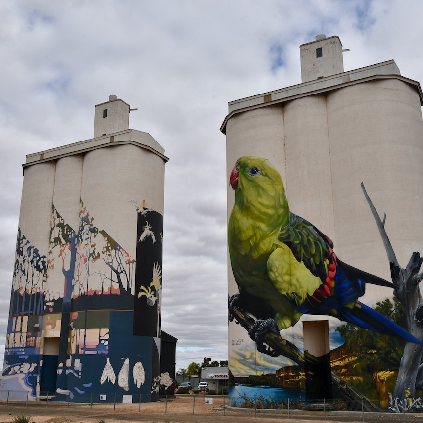
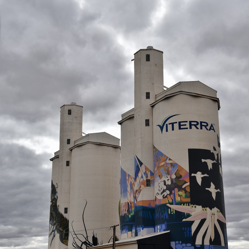
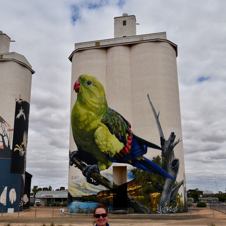
Also the Waikerie silos which are now part of Australia’s very popular silo art project. The non working Viterra Australia grain silos were painted by artists Garry Duncan and Jimmy Dvate in 2018. They were the 25th silo to be included in the Australian Silo Art Trail Collection.
Featured on the silos is a giant Yabby, the endangered Regent Parrot, Murray Hardyhead and the Spiny Daisy.
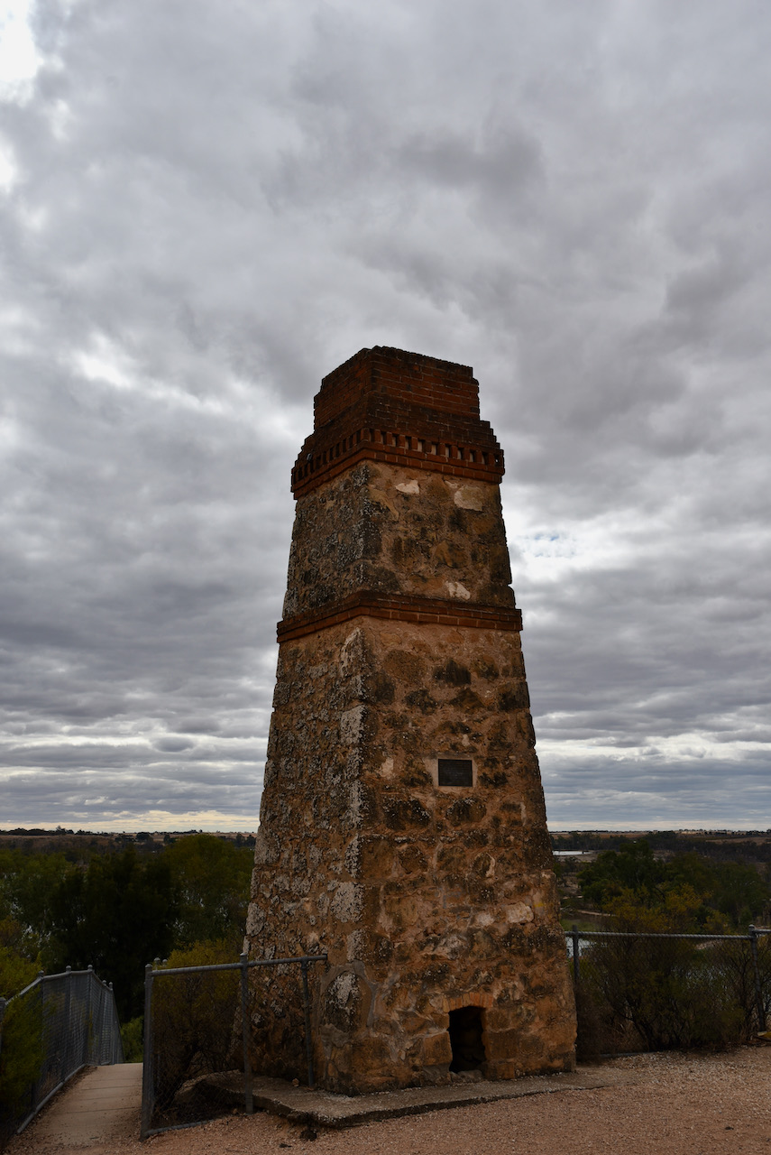
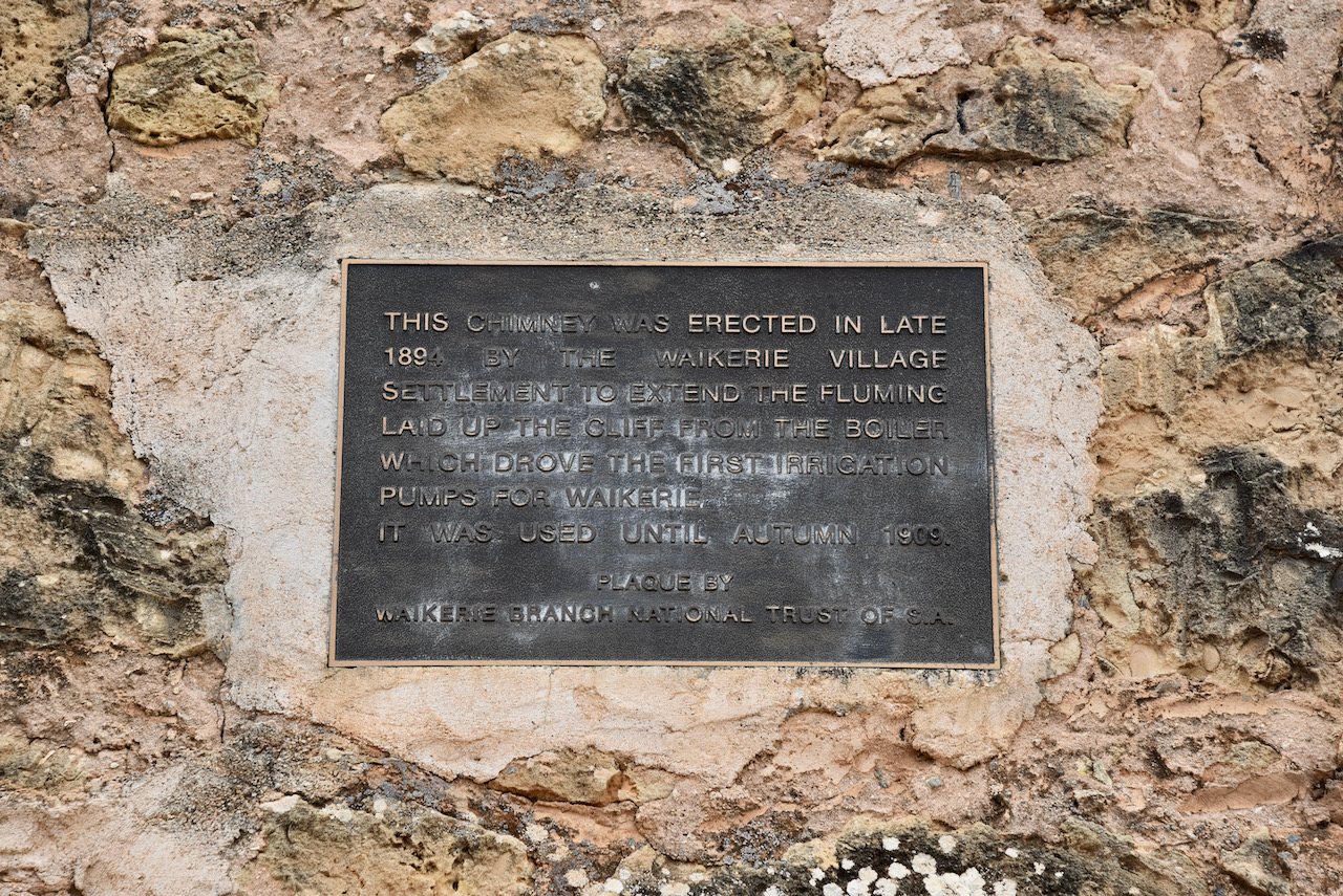
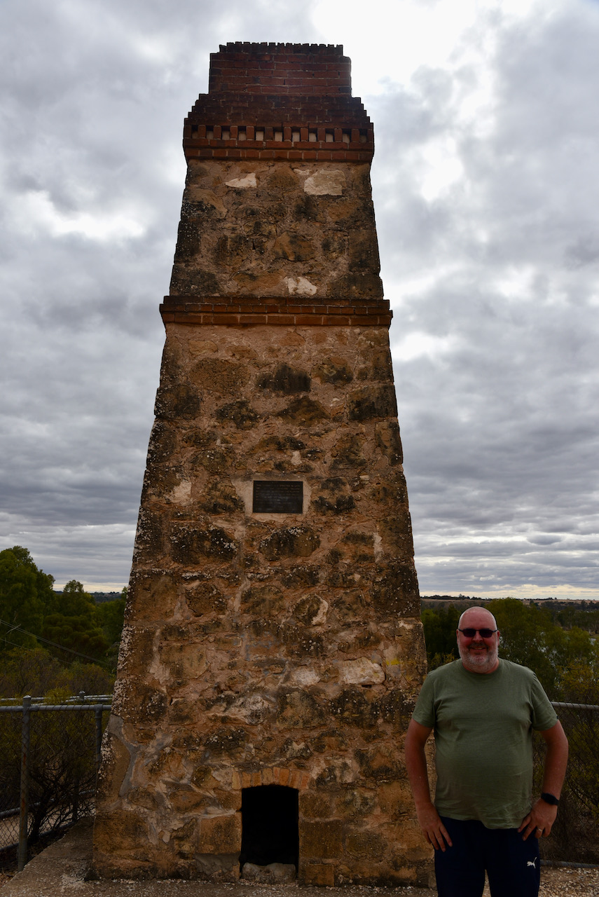
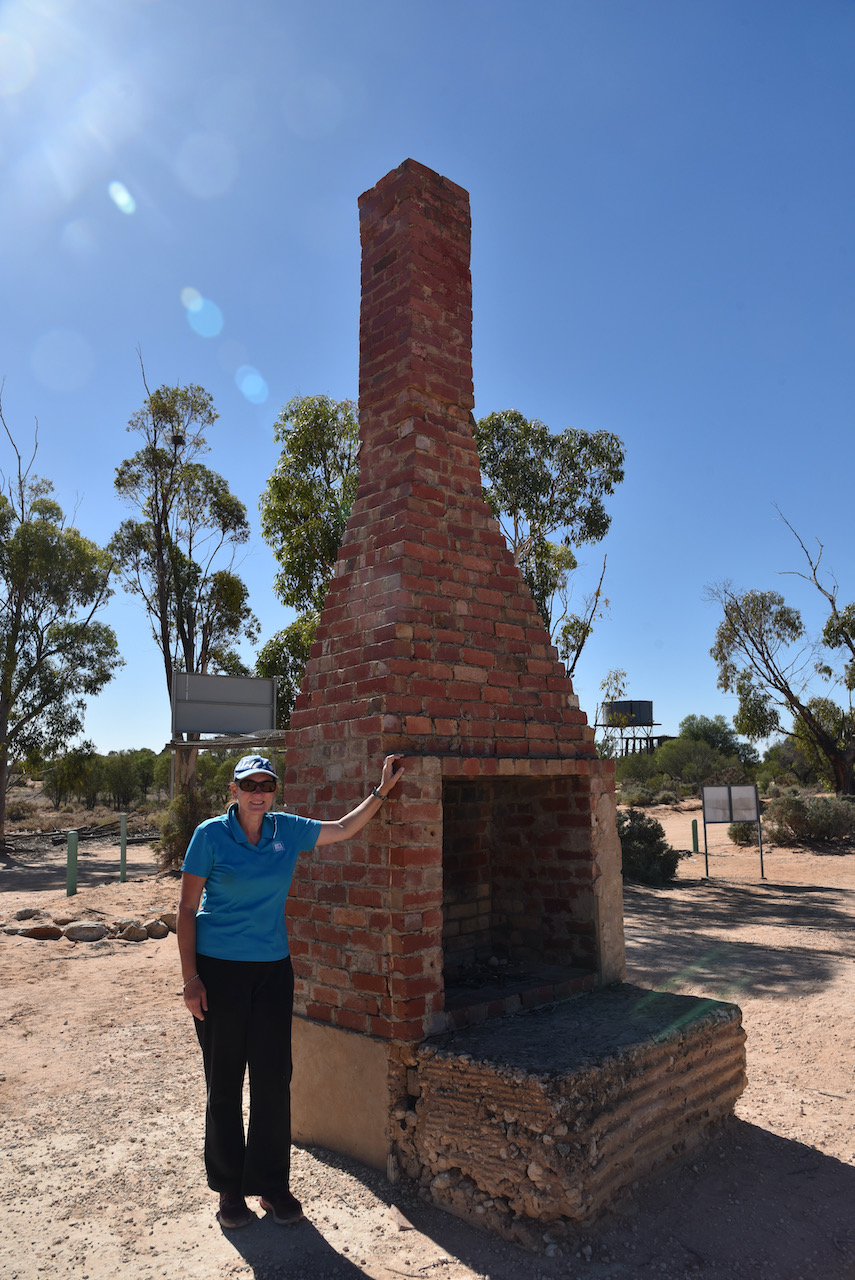
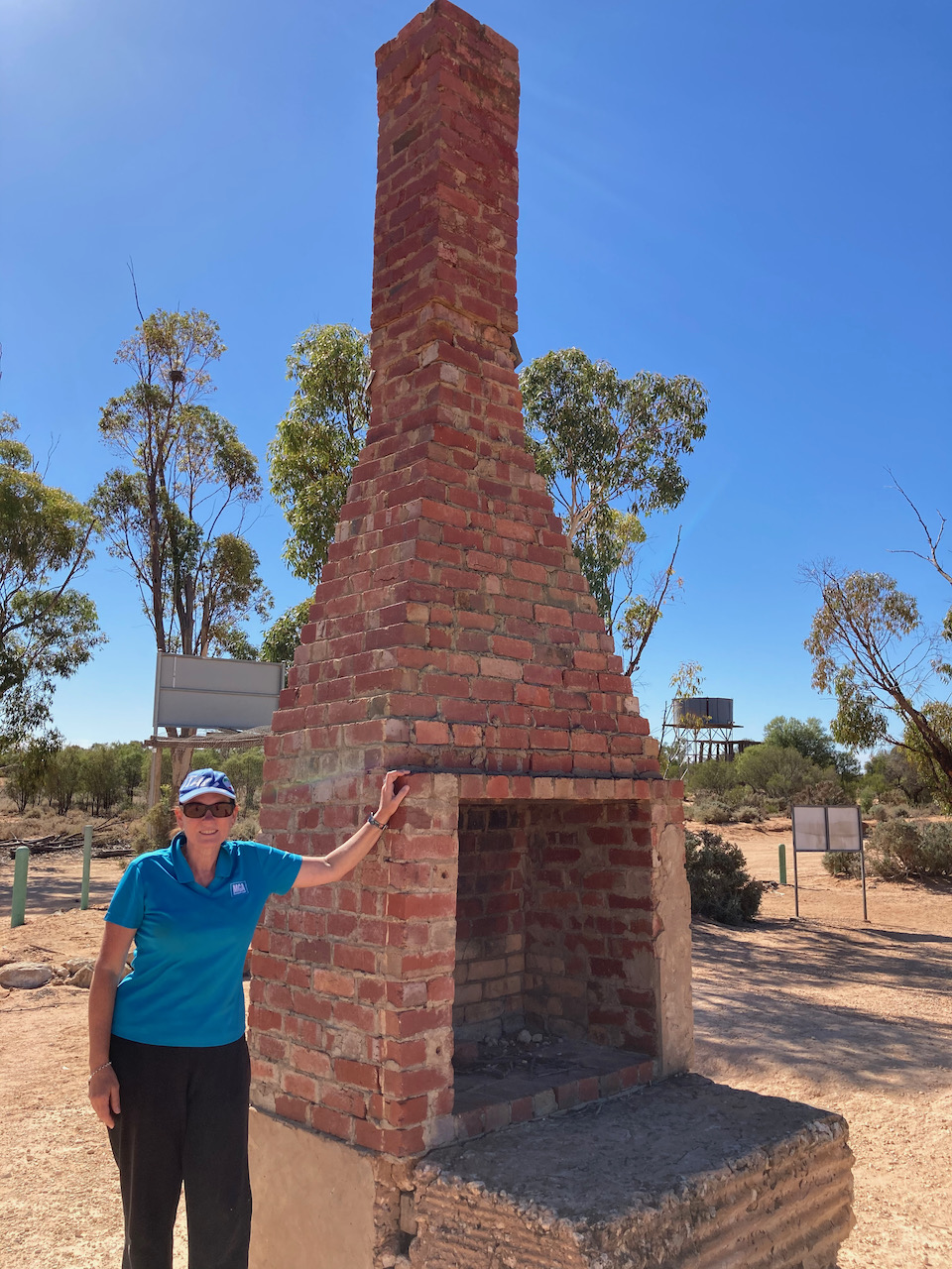
We then had a look at a historic old stone chimney at Waikerie overlooking the Murray River. The chimney was erected in late 1894 by the Waikerie village settlement to extend the fluming laid up the cliff from the boiler which drove the first irrigation pumps for Waikerie. It was used until Autumn 1909.
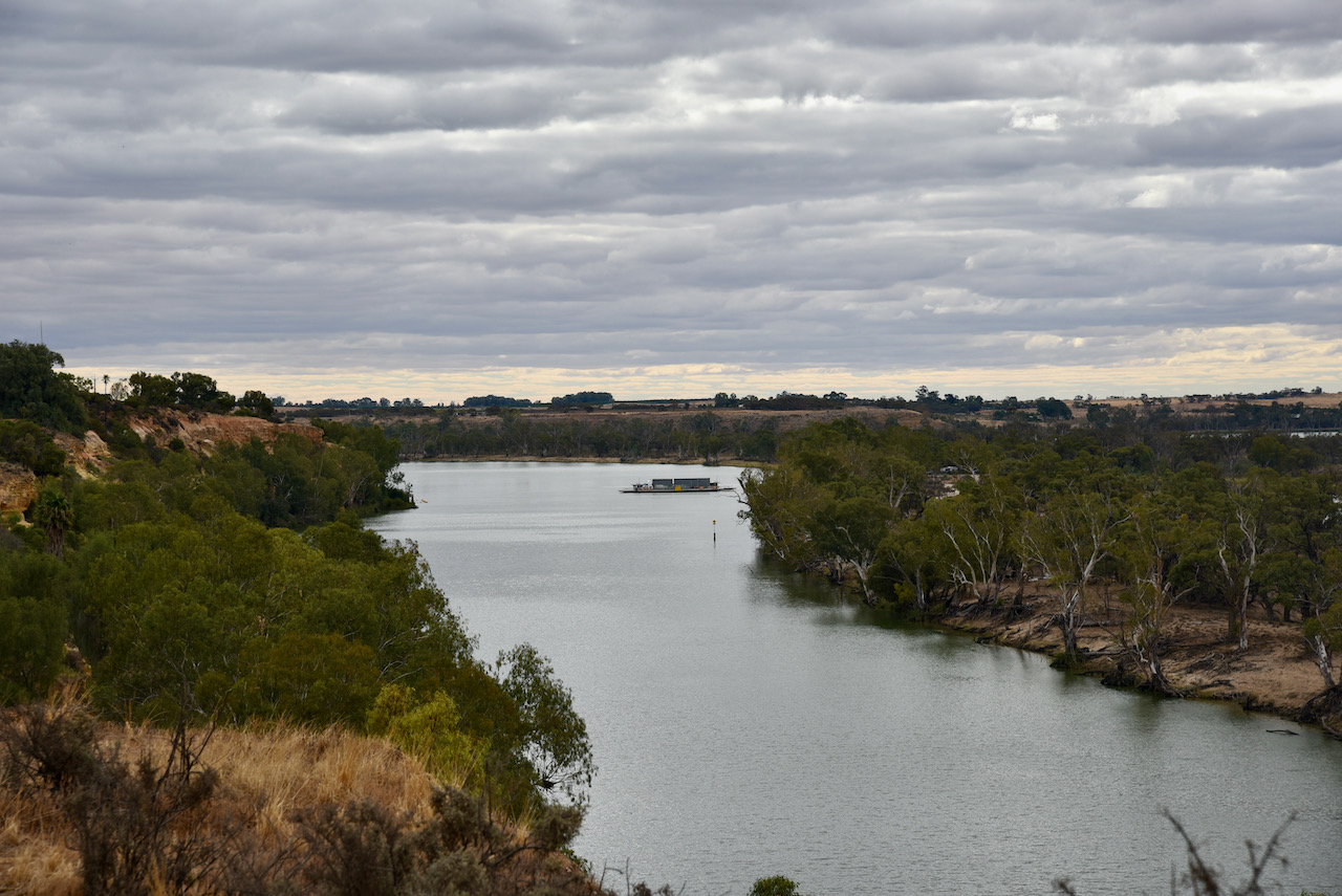
There is an excellent viewing platform at this spot where you can enjoy magnificent views of the Murray River and Jaeschke Lagoon.
We left Waikerie and continued west on the Sturt Highway, passing over the Murray River at Blanchetown and travelling passed the Brookfield Conservation Park.
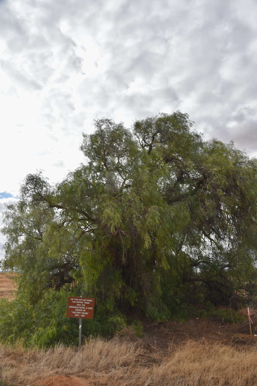
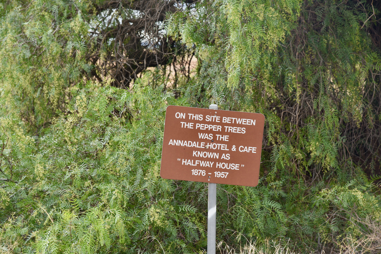
Our final quick stop before reaching home was the site of the olf Annandale Hotel and Cafe at the intersection of the Sturt Highway, Halfway House Road, and Bower Boundary Road. The Annandale Hotel operated between 1876 to 1957.
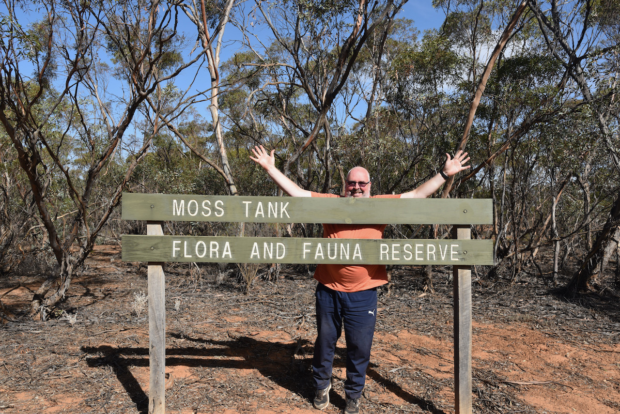
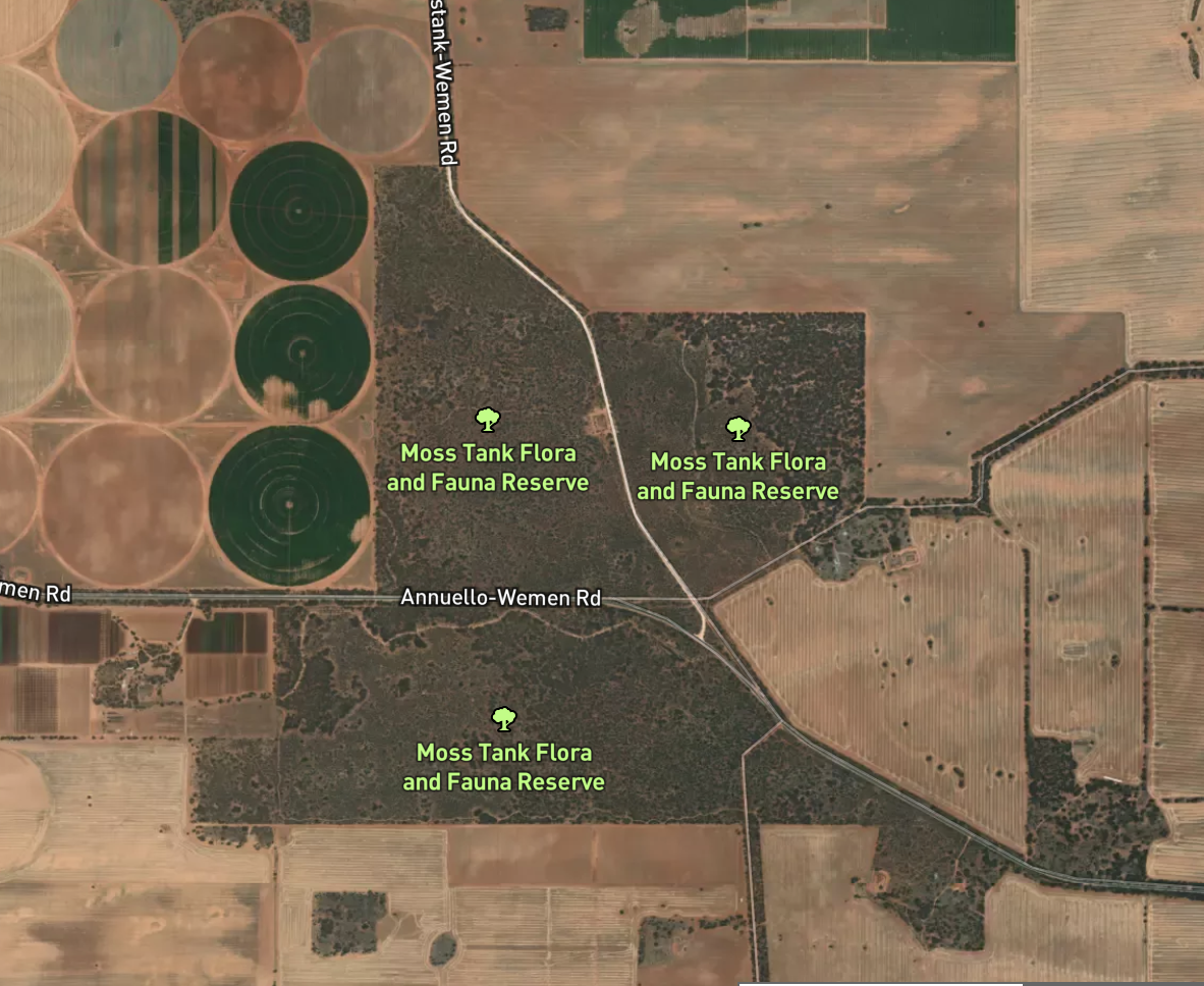
Our fourth and final park for day twelve (Saturday 17th April 2021) was the Moss Tank Flora & Fauna Reserve VKFF-2394. The park is located about 31 km south of Robinvale.
Above:- Map showing the location of the Moss Tank Flora and Fauna Reserve. Map c/o Protected Planet.
This was to be our first activation of this park. Moss Tank has also been activated once before, by Mike VK6MB back in 2019.
We found the park without any problems. It was well signposted on the Annuello-Wemen Road.
Moss Tank Flora and Fauna Reserve is about 3.26 km² in size and was established in 1988.
Above:- An aerial view of the Moss Tank Flora & Fauna Reserve. Image c/o Protected Planet.
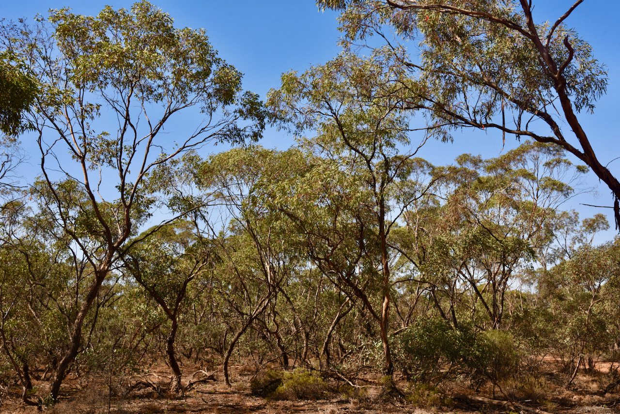
The park is a piece of remnant mallee scrub which is surrounded by cleared farming land. It is located near the town/locality of Annuello which is believed to be an aboriginal word for ‘a camp of bearded men’. During the early 1920’s the Annuello district was subdivided into blocks for Soldier Settlement following the First World War. The railway line to Annuello was opened in 1921, followed by a school in 1924. The Annuello Post Office opened in April 1921.
A wheat variety ‘annuello’ adapted for low and medium rainfall areas was released in 2003, and is suitable for the domestic flour milling industry.
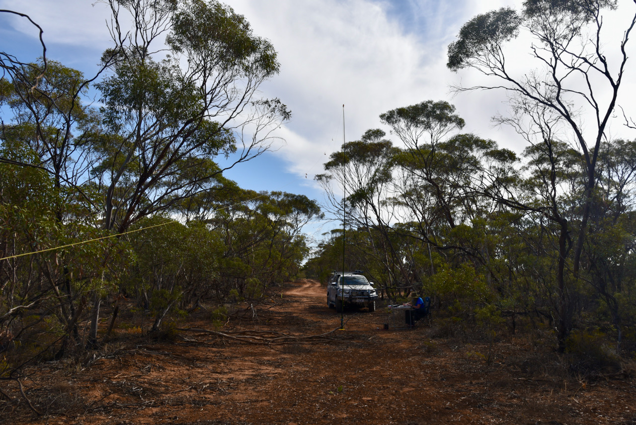
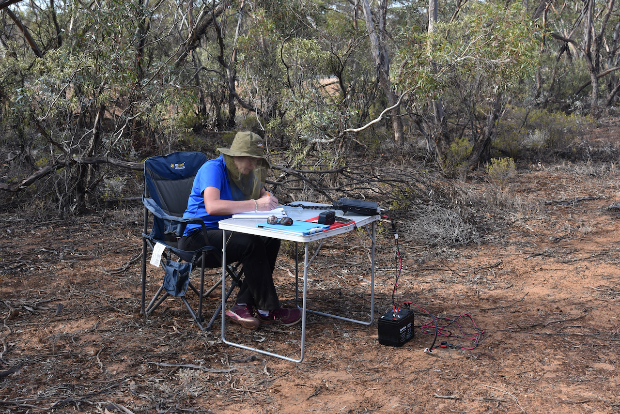
We found a little direct track running off the bitumen and pulled in there off the road. It made an ideal spot to stretch out the 20/40/80m linked dipole.
Within eight minutes I had qualified the park for VKFF, with 11 contacts in the log. Contact number ten was with Alan VK2MET. I then swapped over with Marija and she too qualified the park in quick time, with contact number ten being a QSO with the same park hunter Alan VK2MET.
I then jumped back into the operator’s chair and logged a further 30 contacts on 40m from VK1, VK2, VK3, VK4, VK5, VK7, and New Zealand.
I now had 41 contacts in the log and required just 3 more QSOs to qualify the park for the global WWFF program.
I moved to the 20m band where I logged 6 stations from VK2, VK4, and much to my surprise Canada. It was a terrific way to finish the activation with a contact with Karl VE6KDX in Alberta, Canada.
Marija worked the following stations on 40m SSB:-
VK3KV/m
VK2VOO
VK3UH
VK2FA/m
VK2IO/m
VK4HNS
VK5FANA
VK5KLV
VK2LAX
VK2MET
I worked the following stations on 40m SSB:-
VK5GY
VK4HMI
VK2BHO
VK5CZ/m
VK4SMA
VK4WTN
VK3PF
VK2VOO
VK5KLV
VK2MET
VK3UH
ZL1TM
VK2LAX
VK4HNS
VK4FDJL
VK4VCE
VK2KMI
VK3SS
VK2VW
VK2HFI
VK5IS
VK2NJP
VK2LWK
VK7QP
VK1DI
VK4GCR
VK2IO/m
VK2BYF
VK2VAR
VK2CDS
VK2TM
VK2DJP
VK2YW
VK3KV/m
VK2HAO
VK4IDK
VK2NCL
VK4PHD
VK2SRA
VK2TMC
VK3SQ
I worked the following stations on 20m SSB:-
VK2IJS
VK4KC
VK4MAD
VK4DOG
VK4PHD
VE6KDX
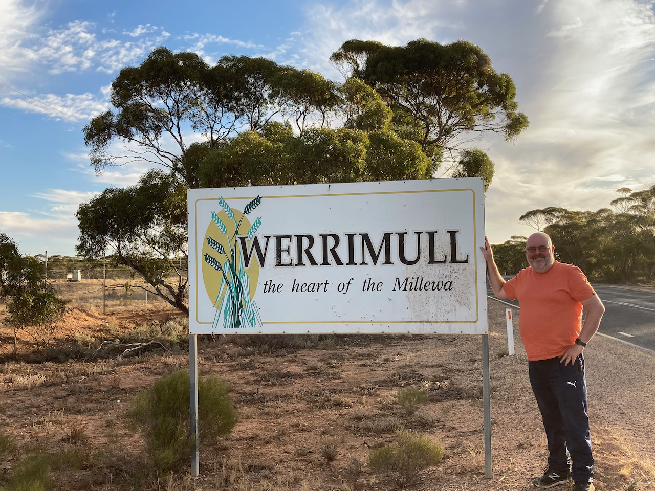
Marija and I had a 245 km drive ahead of us to get to Renmark. We drove back along the Hattah-Robinvale Road and then north on the Calder Highway. We then turned left onto the Millewa Road and through Werrimul.
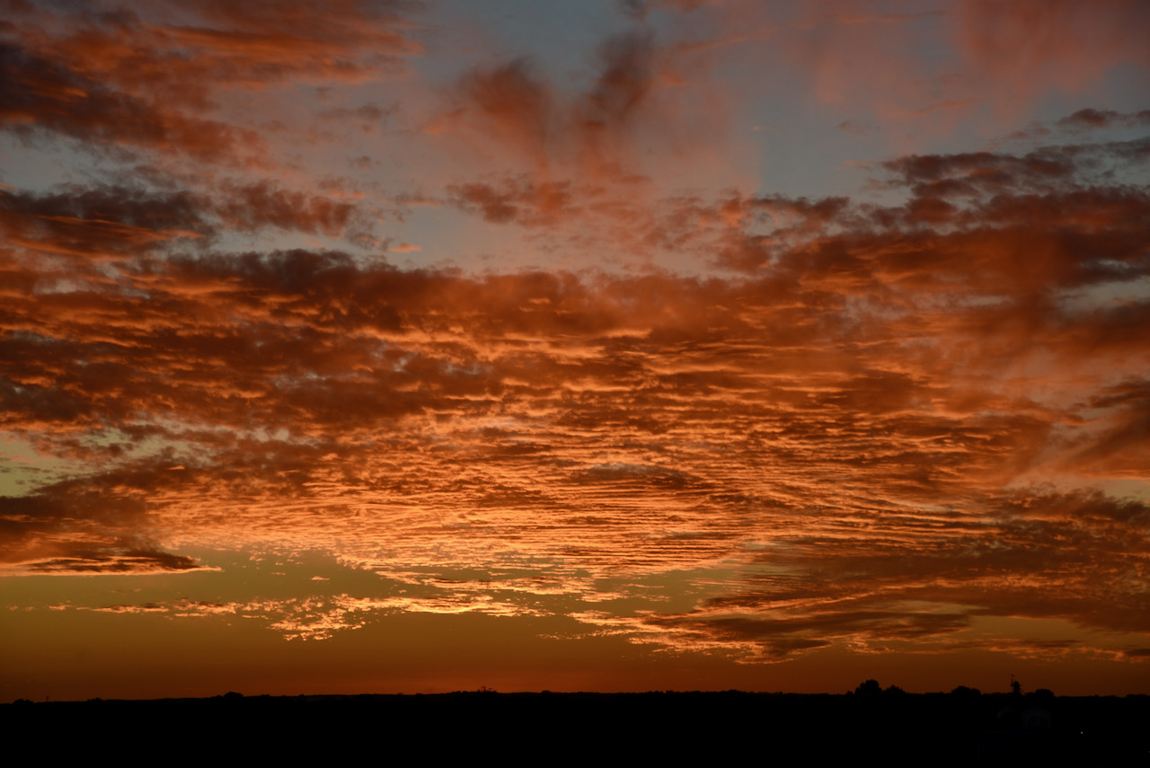
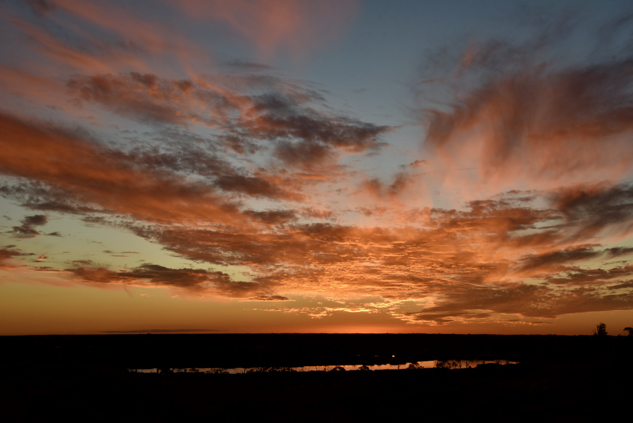
We crossed the Victorian/South Australian border and back into South Australia. The sun was starting to set and we stopped briefly to get some shots of the amazing sunset. The photos below were taken looking over the Pike River Conservation Park just outside of Renmark.
That evening after checking into our accomodation, we grabbed some pizza and beer and headed around to the home of Ivan VK5HS and his wife Sheryl, and had a terrific night there.
Tomorrow we would head home, a journey of around 285 km ahead of us.
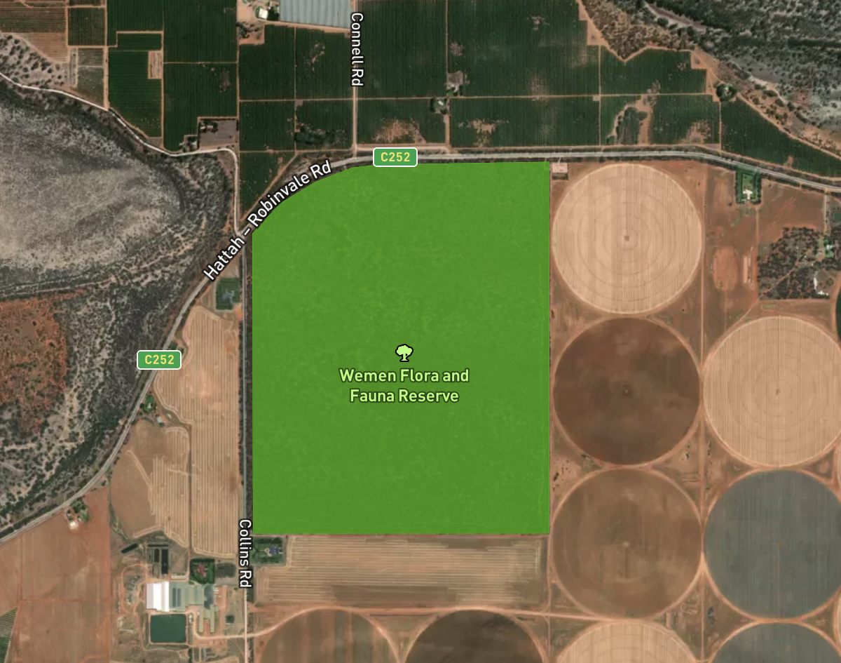
We then continued south-west on the Hattah-Robinvale Road and soon reached our third park for the day, the Wemen Flora & Fauna Reserve VKFF-2483. The park is located about 31 km south-west of Robinvale.
Again this was to be another unique park for myself and Marija, with Mike VK6MB previously activating Wemen back in 2019.
Above:- Map showing the location of the Wemen Flora & Fauna Reserve. Map c/o Protected Planet.
The Wemen Flora & Fauna Reserve is about 2.02 km² in size and was established in 1983. The area around the park has been cleared for agricultural purposes including almond and olive plantations.
Above:- the park boundaries of Wemen Flora & Fauna Reserve. Image c/o Protected Planet.
The park takes its name from the locality of Wemen (pronounced Wee-Man). Wemen was established as a Soldier Settlement after the First World War. The Wemen Post office opened on the 24th day of November 1924 and closed in 1974. There were once three schools in the district.
The little town of Wemen can be located a bit further to the south on the Hattah-Robinvale Road. It is located on the banks of the Murray River. This part of the river was the closest river access for some aboriginal tribes.
Wemen is reportedly a great spot for Murray River Cray when in season.
We accessed the park via a 4WD off Collins Road. We found a small clearing in amongst the scrub and set up our portable station.
I called CQ on 7.144 following a spot on parksnpeaks by Marija. First in the log was Les VK5KLV. Contact number ten followed soon afterwards, with a QSO with Adrian VK5FANA.
Once I had ten contacts in the log and I had qualified the park for VKFF, I swapped the mic with Marija, who also soon qualified the park with 12 contacts. Contact number ten was with Adam VK2YK.
I then jumped back into the operator’s chair and pushed on to hopefully get 44 contacts. The 40m band had certainly improved since our first activation, and I logged a total of 40 stations on 40m before callers dried up.
To conclude the activation I called CQ on 14.310 on the 20m band where I logged 6 stations from VK2, VK4, and VK6. Contact number 44 was with Brett VK2HFI.
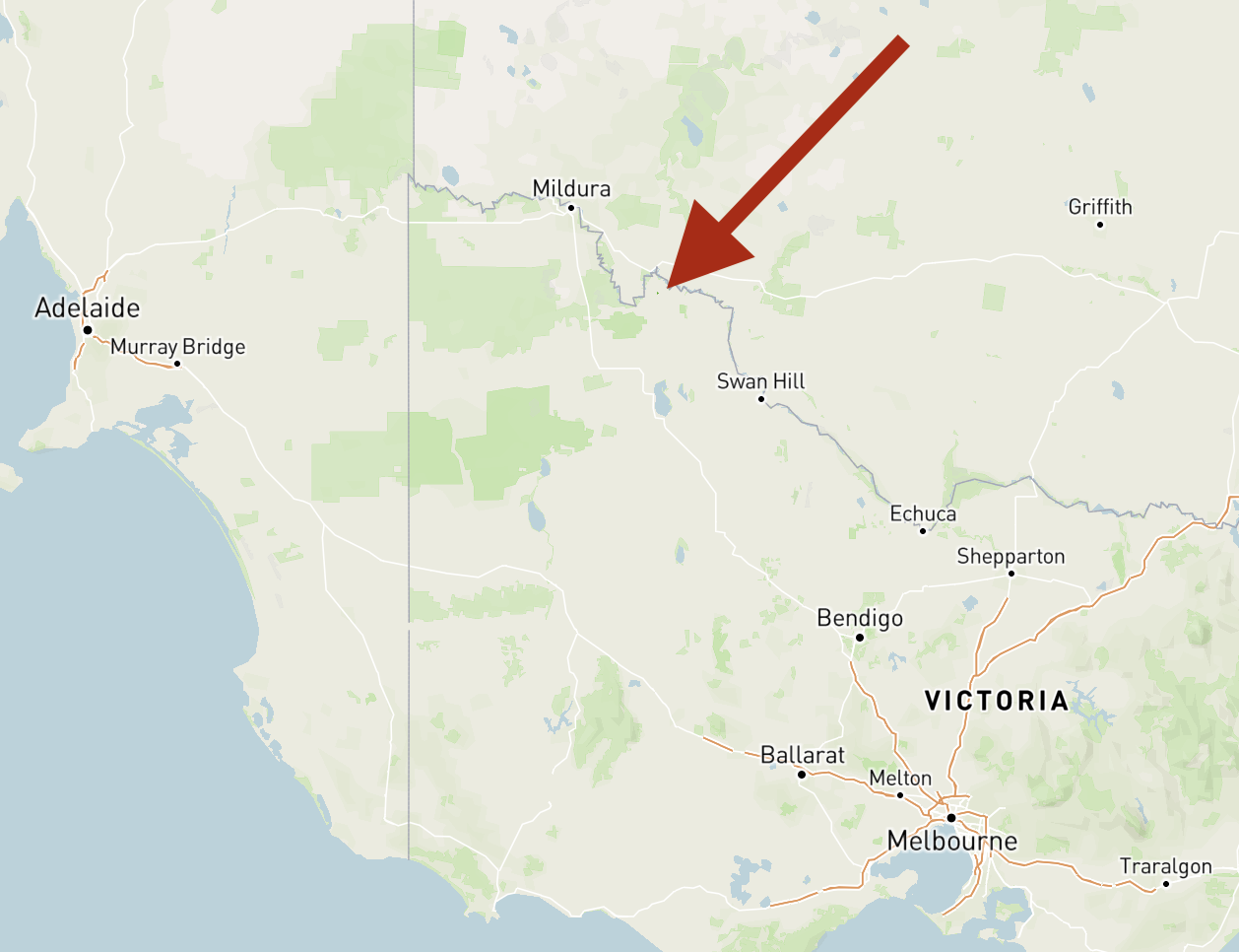
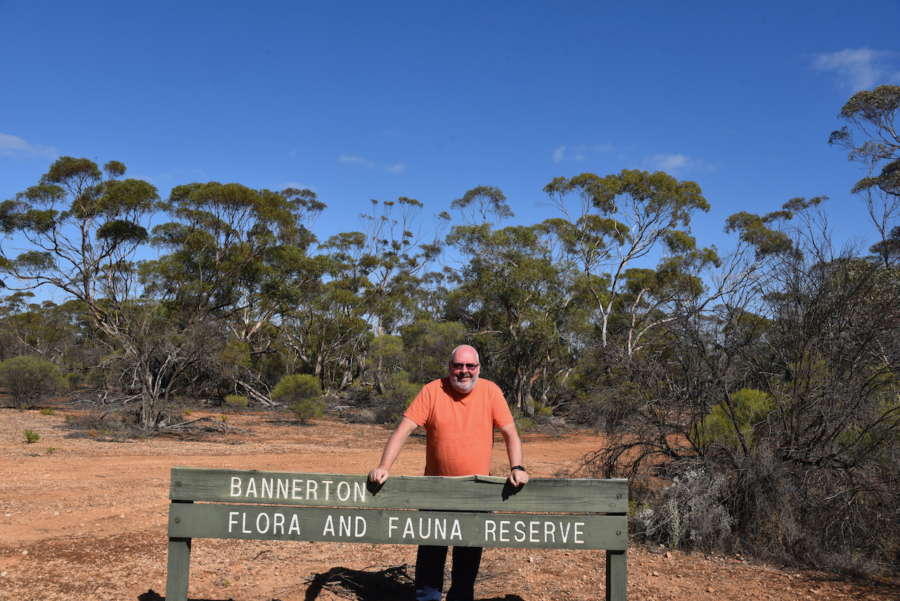
After packing up at Lakes Powell & Carpul, we drove a short distance west along the Hattah-Robinvale Road and reached our next park, the Bannerton Flora & Fauna Reserve VKFF-2261. The park is located about 14 km south of Robinvale.
Above:- Map showing the location of the Bannerton Flora & Fauna Reserve. Map c/o Protected Planet.
We found that the park was well signposted on the Hattah-Robinvale Road. This was to be a first time activation of the park by myself and Marija, and only the second time the park had been activated for the World Wide Flora Fauna program (Mike VK6MB in 2019).
Bannerton Flora & Fauna Reserve is a relatively small park, comprising about 2.0 km² of mallee scrub. It is located on the southern side of the Hattah-Robinvale Road and on the eastern and western side of the Robinvale-Sea Lake Road.
Above:- The boundaries of the Bannerton Flora & Fauna Reserve. Image c/o Protected Planet.
The park takes its name from the locality of Bannerton. The Post office at Bannerton was opened in February 1924 as Banner. It was renamed Tol Tol in 1924 and then Bannerton in 1926. It closed in 1974.
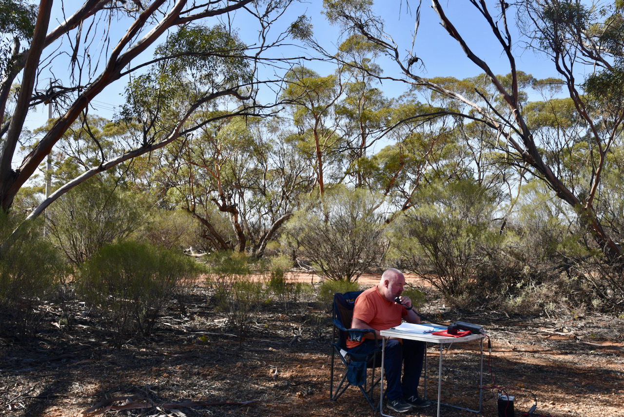
To our great pleasure, band conditions on 40m were much better during this activation compared to our earlier park activation. First in the log was Ron VK3AHR, followed by Geoff VK3SQ, and then Greg VK4BXX. It took just7 minutes for contact number 10, a QSO with Nigel VK5NIG who was portable at the Buy and Sell in Adelaide for the North East Radio Club.
I logged 28 contacts before swapping operator positions with Marija. Marija’s first contact was with Peter Vk3PF. Contact number ten was with Steve VK5KSW on the Yorke Peninsula.
Marija logged a total of 30 stations and was satisfied that she had qualified the park for VKFF, so we swapped chairs once again.
I logged a further 23 stations on 40m. Contact number 44 was with Rob VK4AAC/2.
We decided at this point to pack up and try to squeeze in another 2 parks, and stay one night at Renmark on the way home.
It was now day twelve (Saturday 17th April 2021) and our planned final day of the trip. We planned on doing two park activations on the way home, and had a list of possible parks, but hadn’t decided on which ones.
After breakfast at one of the local cafes consisting of a bacon & egg roll and coffee, we had a bit of a drive around Robinvale.
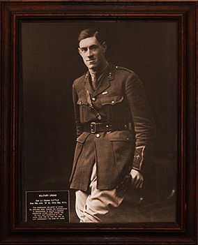
Robinvale is the sister town with Villers-Bretonneux in France. This proud link dates back to the First World War when Lieutenant George Robin Cuttle was killed in air combat over Caix, near the village of Villers-Bretonneux in France. Cuttle was the son of Robinvale’s founding family, Herbert and Margaret Cuttle. In memory of their son, the Cuttle’s renamed their new settlement on the Murray, Robinvale (vale Robin).
Above:- Lt George Robin Cuttle. Image c/o robinvalewarmemorial.com.au
The town of Robinvale and Villers-Bretonneux are of similar size and they both rely on horticulture as their principle ecomonic income.
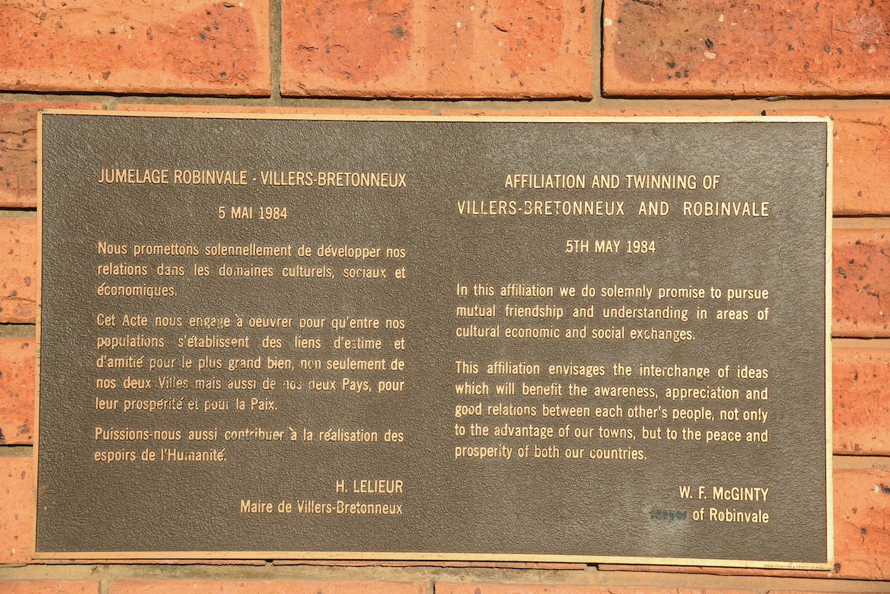
In the main square/park of Robinvale you can find Caix Square and the Robinvale Memorial Arch and the Villers Bretonneux Walk. The arch was opened in 1985 by Madame Huguette Pillon. The bell which can be found at the top of the arch is from the Victoria College at Villers-Bretonneaux. It was presented to the people of Robinvale at the ‘twinning’ ceremony in Villers-Bretonneaux on the 5th May 1984.
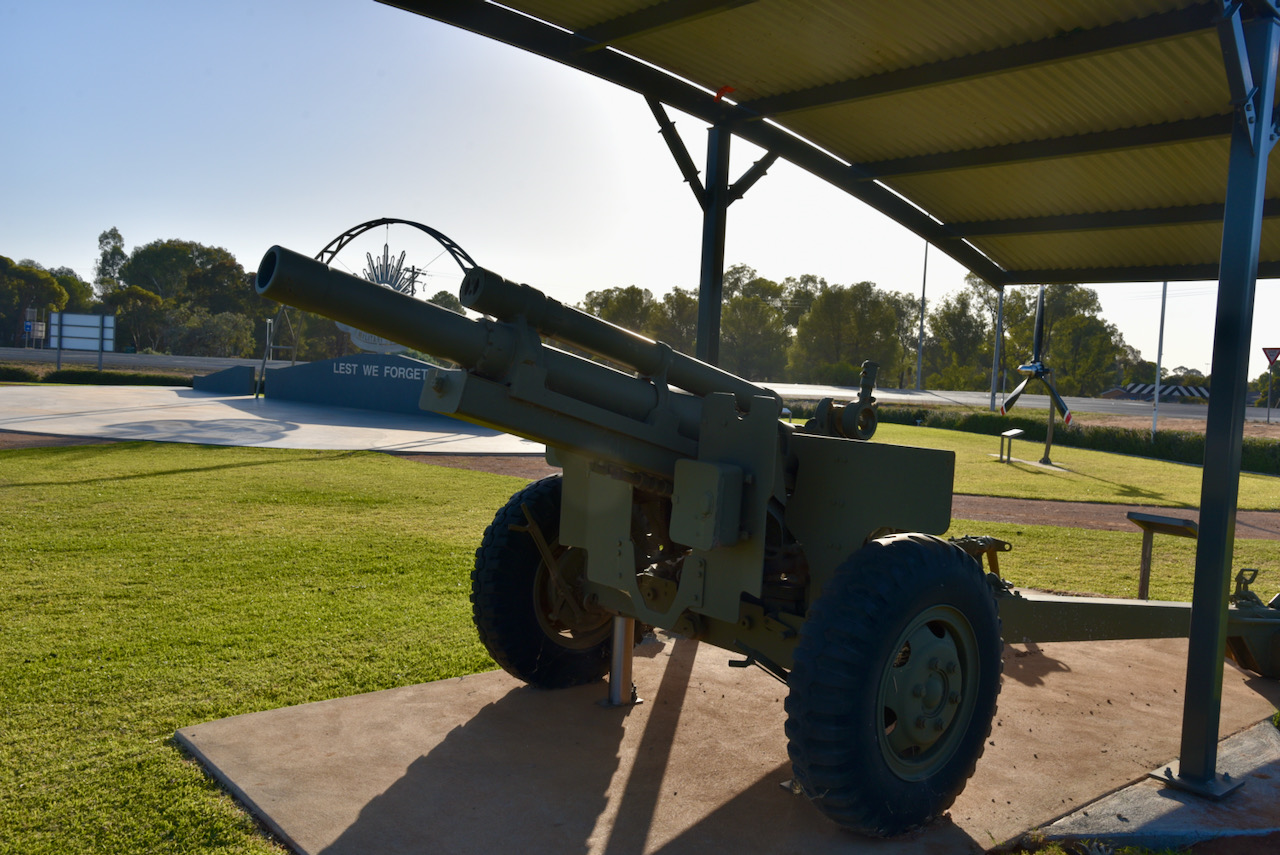
We then visited the Robinvale Regional War Memorial. What an amazing spot for such a little town. The park features a magnificent ‘Rising Sun’, various information boards, a Howitzer, and the propellor from a de Havilland A4 DHC Caribou.
There is an excellent website which contains numerous photos and video on the creation of the War Memorial. It can be found at…..
We then visited the Big Windmill, which is reported to be the largest windmill in the southern hemisphere. It was originally owned by the State Rivers & Water Supply Commission and was used to supply water to Robinvale. In 1961 it was purchased by William ‘Bill’ McGinty when no longer required by the Water Supply Commission. McGinty intended constructing a motel on the site, however approval was not gained. He donated the windmill to the Robinvale and District Lions Club in 1989.
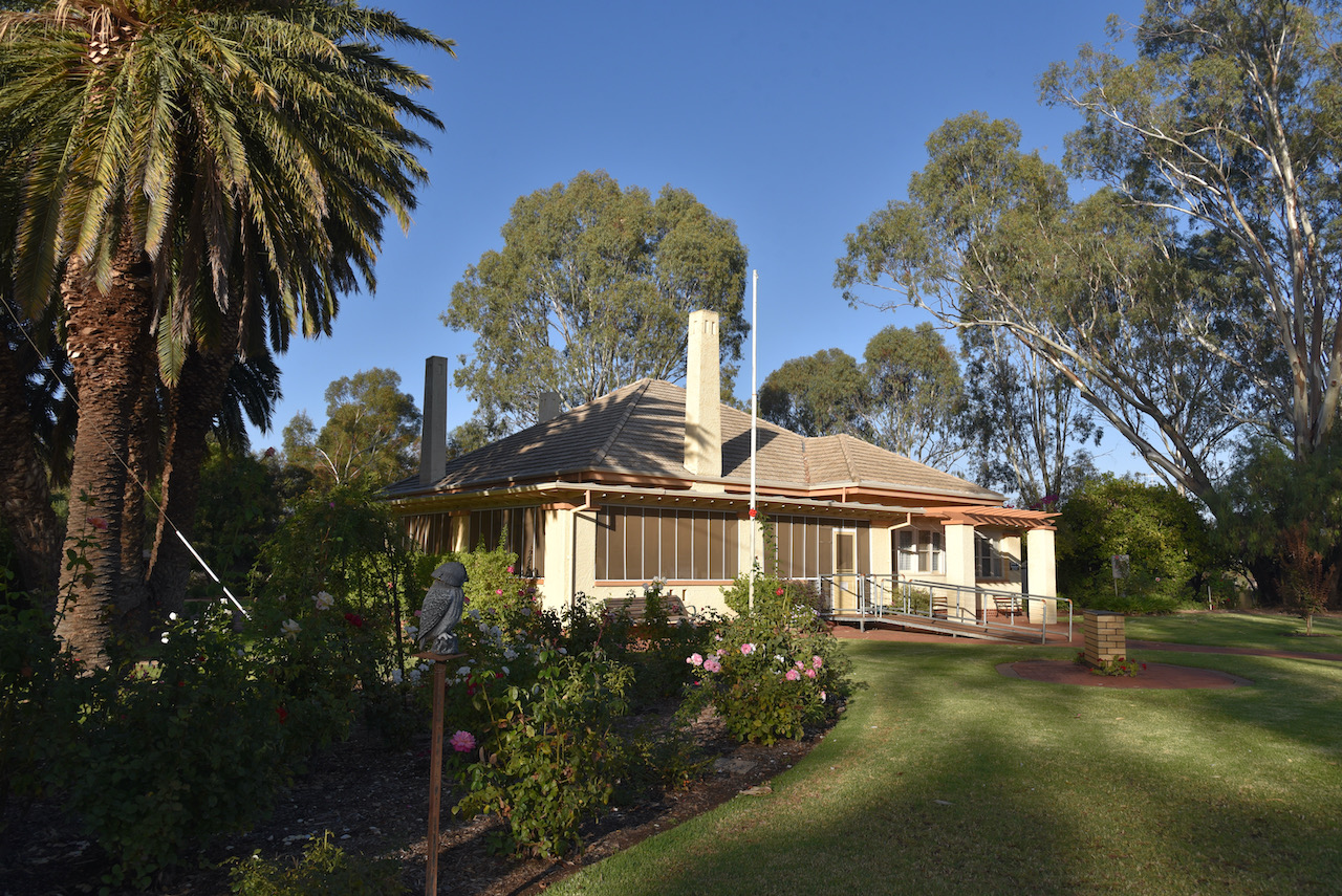
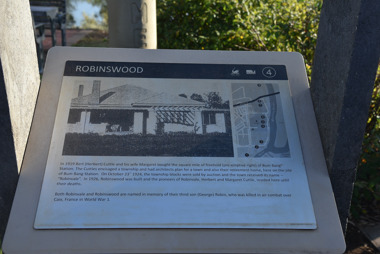
Our next stop was the historic ‘Robinswood’ homestead at Robinvale. In 1919 Herbert ‘Bert’ Cuttle and his wife Margaret brought the square mile of freehold of Bum Bang Station. The Cuttles envisages a township and had architects plan for a town and also their retirement home, here on the site of Bum Bang Station. On the 23rd day of October 1924, the township blocks were sold by auction and the town of Robinvale received its name. In 1926, Robinswood was built and the pioneers of Robinvale, Herbert and Margate Cuttle, resided here until their deaths.
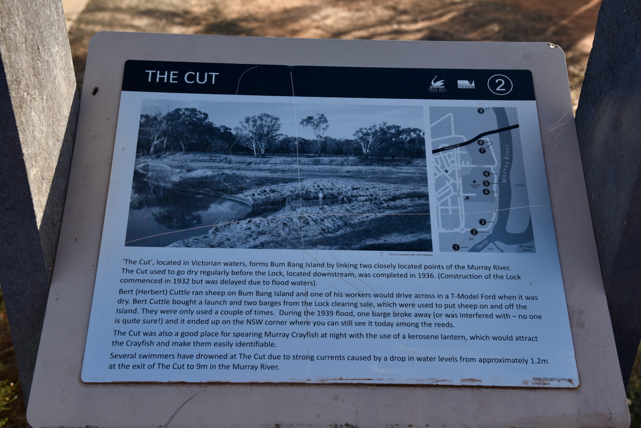
We then drove a short distance to have a look at ‘The Cut’. It is located in Victorian waters and forms Bum Bang Island by linking two closely located points of the Murray River. The Cut used to go dry regularly before the Lock, located downstream was completed in 1936.
Bert Cuttle ran sheep on Bum Bang Island and one of his workers would drive across in a T-model Ford when it was dry. Cuttle bought a launch and two barges from the Lock clearing sale, which were used to put sheep on and off the island. During the 1939 flood, one barge broke away and it ended up on the New South Wales corner.
The Cut was also a good place for spearing Murray Crayfish at night with the use of a kerosene lantern, which would attract the Crayfish and make them easily identifiable.
Several swimmers have drowned at The Cut due to strong currents caused by a drop in water levels from about 1.2 metres at the exit of The Cut to 9 metres in the Murray River.
Our next little stop was the old Span Life bridge at Robinvale. The bridge was part of the complex of bridges for the crossing of the Murray River and the flood plains between Robinvale and east of Euston.
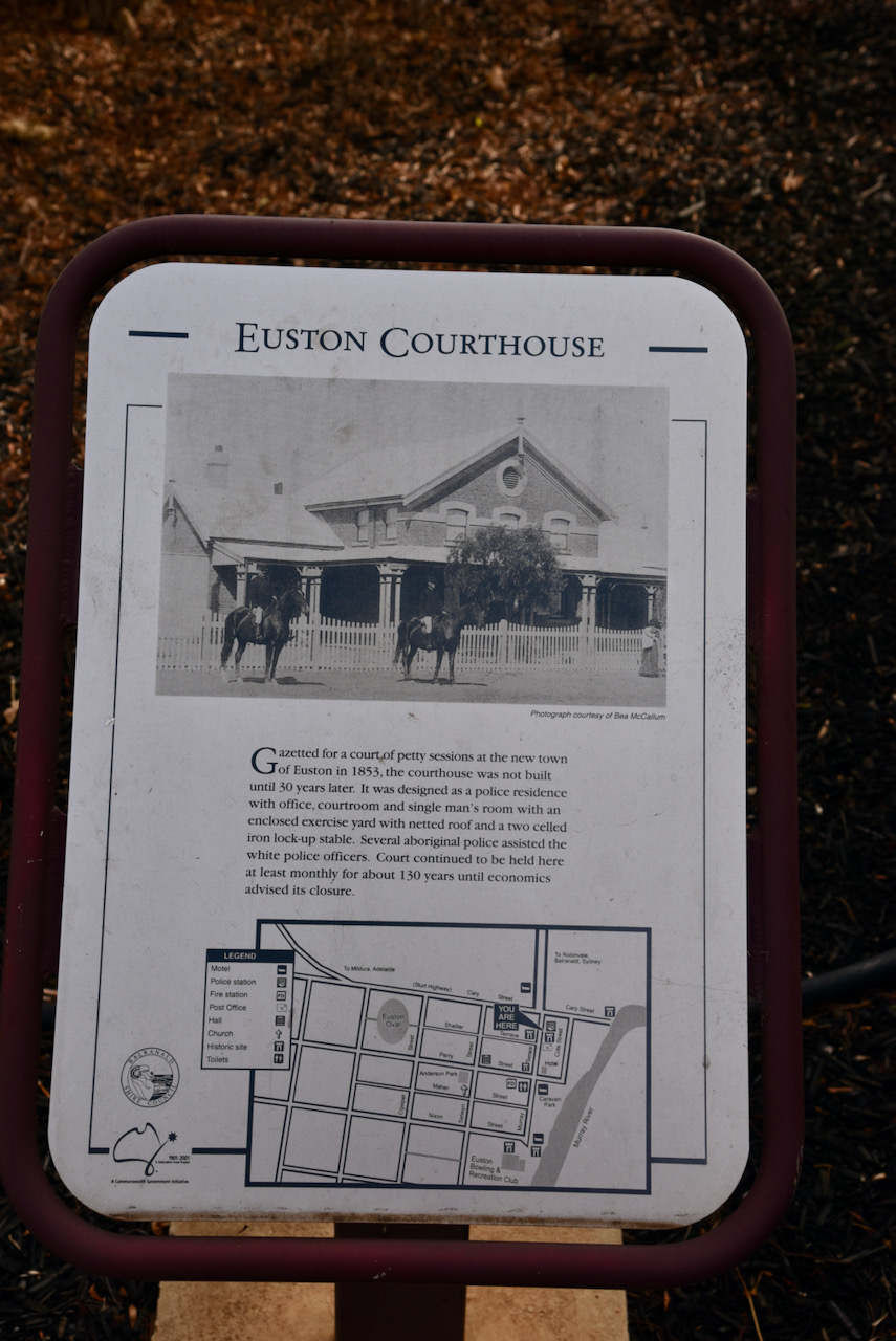
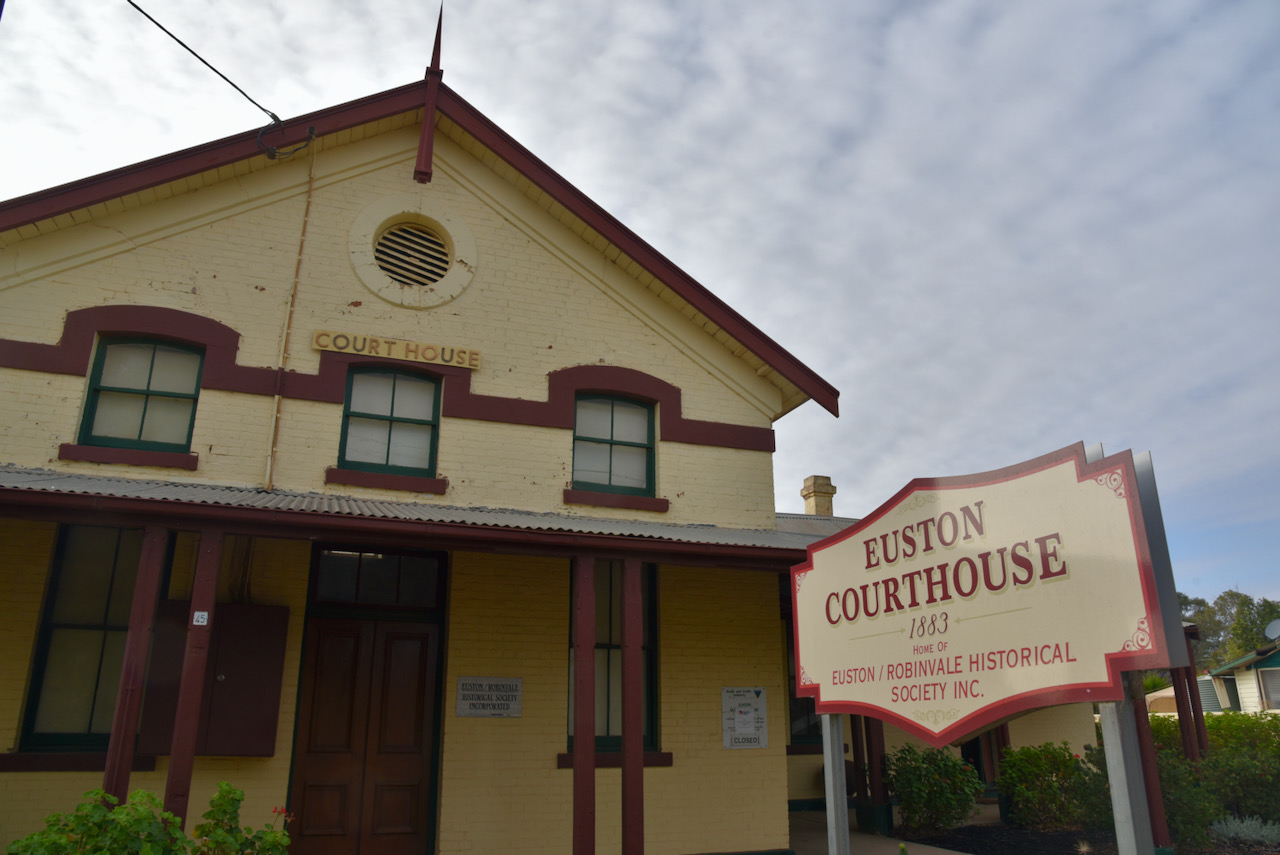
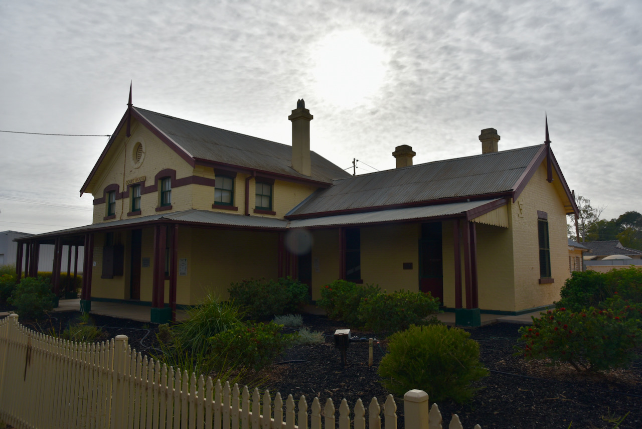
We then drove over the river and into New South Wales to have a look at the historic Euston courthouse. Gazetted for a court of petty sessions at the new town of Euston in 1853, the courthouse was not built until 30 years later. It was designed as a police residence with office, courtroom and single man’s room with an enclosed exercise yard with netted roof and a two celled iron lock up stable. Several aboriginal people assisted the white police officers. Court continued to be held here at least monthly for about 130 years until economics advised its closure.
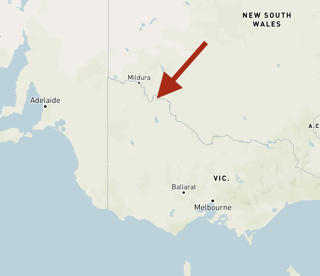
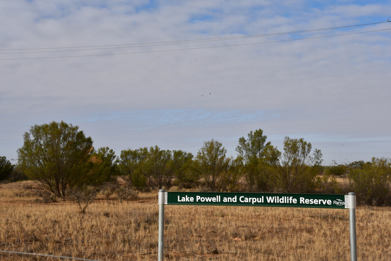
We then drove to our first park activation of the day, the Lakes Powell and Carpul Wildlife Reserve VKFF-2365. The park is located about 18km south-east of Robinvale.
This was to be a first time activation of the park by myself and Marija. Mike VK6MB activated the park previously in 2019.
Above:- Map showing the location of the Lakes Powell & Carpul Wildlife Reserve. Map c/o Protected Planet.
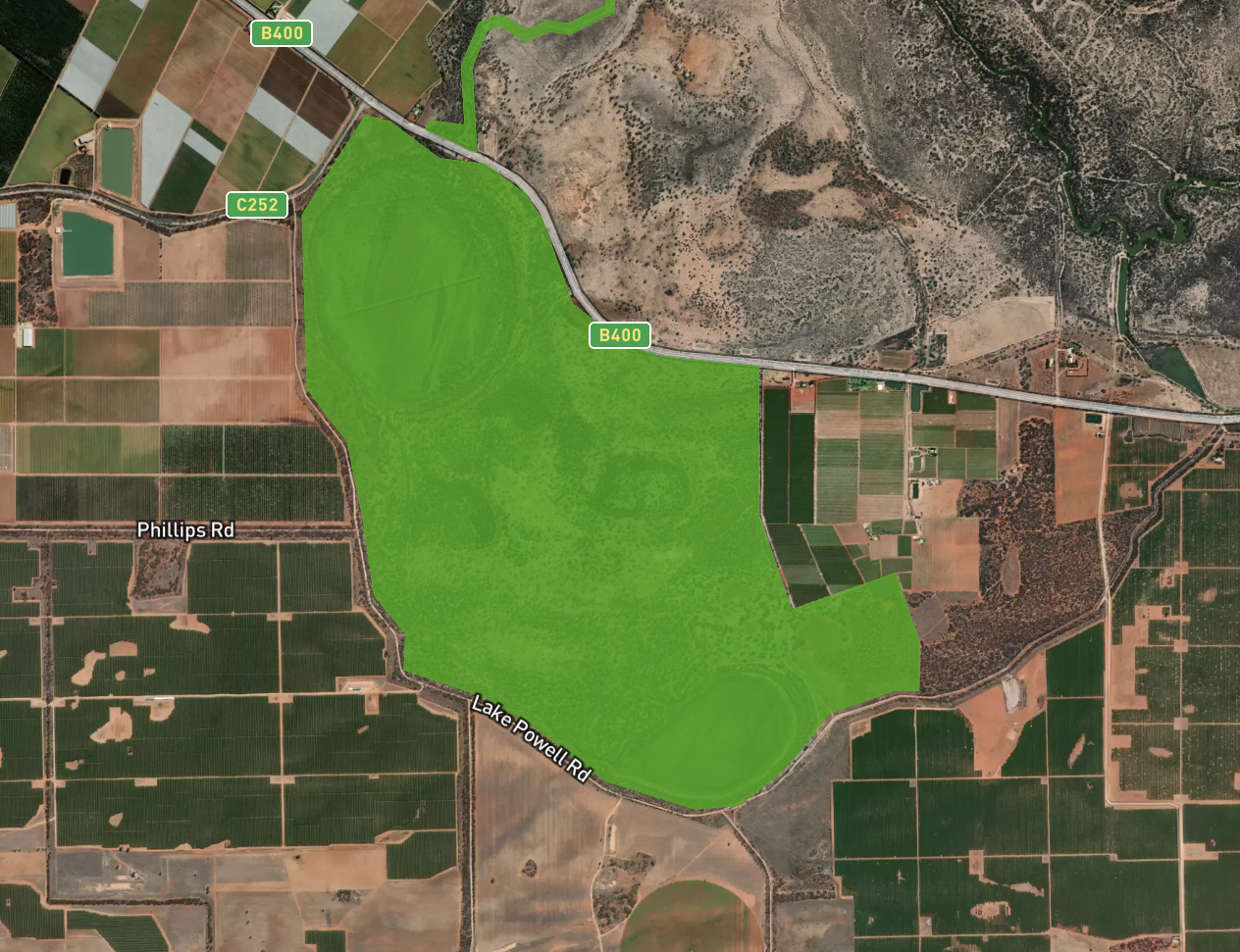
The park is about in 7.24 km² size and was established in 2002.
Above:- The borders of the Lakes Powell and Carpul Wildlife Reserve. Image c/o Protected Planet.
As the name suggests, the park contains two lakes, Lake Powell and Lake Carpul. They were both dry as a bone during our visit. When the lakes are full, over 60 species of native birds can be found at the park including Black Swans and Rainbow Bee Eaters.
During our visit to the park we had a Pied Butcherbird who propped himself/herself in a nearby branch and sang for most of our activation.
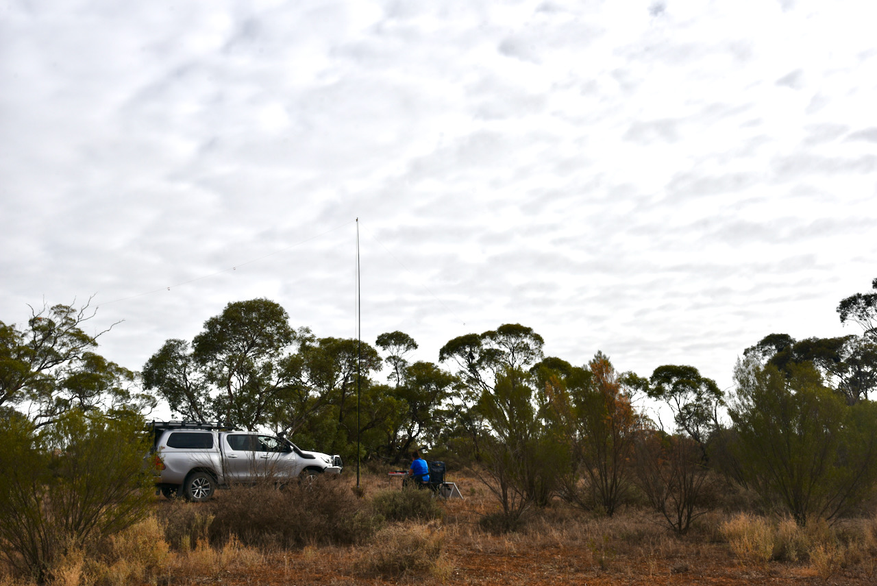
We drove a short distance into the park and set up in a clearing in amongst the scrub. As this was a relatively warm morning with a bit of sunshine through the clouds, we put out the solar panel to top up the battery.
We were set up at about 2330 UTC so we could take advantage of 30 minutes before the UTC rollover. Marija put a spot up for me on parksnpeaks and I called CQ on 7.144. First in the log was Peter VK3PF, with lots of QSB. This was followed by Deryck VK4FDJL who was activating the Millstream Falls National Park VKFF-0315.
Unfortunately callers were very few and far between and after many minutes of calling CQ and with just 5 contacts in the log, I swapped the mic with Marija. This was not looking like it was going to be a memorable park activation.
Marija then called CQ on 7.144 and this was answered by Peter VK3PF, followed by Andrei ZL1TM in New Zealand, and then Kimberly VK2KMI.
Marija logged just 5 stations on 40m as well and callers completely dried up, so we lowered the squid pole hoping that the 80m band might prove a little more fruitful.
Marija logged 6 stations on 80m from VK3 and VK5, with her 10th contact being a QSO with Adam VK5GA. I logged 12 contacts on 80m, with my 10th QSO being with Peter VK3KAI.
I then headed to 20m and called CQ on 14.310 for about 5 minutes but had absolutely no takers. So feeling a little disappointed, I headed back to 7.144 on the 80m band, not really expecting to get many callers.
To my surprise, the number of park hunters picked up and I started to feel it was possible to push on and get 44 contacts.
It took me about 70 minutes, but contact number 44 finally came, a contact with Peter VK3KAI. Thanks Peter for your second callsign, it was greatly appreciated in what was a difficult activation.
Marija worked the following stations on 40m SSB:-
VK4FDJL (Millstream Falls National Park VKFF-0315)
VK3PF
ZL1TM
VK2KMI
VK3UH
Marija worked the following stations on 80m SSB:-
VK3PF
VK3KAI
VK5HS
VK2YK/5
VK5GA
VK5IS
I worked the following stations on 40m SSB before the UTC rollover:-
VK3PF
VK4FDJL/p (Millstream Falls National Park VKFF-0315)
VK2MET
VK2iO
VK7ZGK
I worked the following stations on 80m SSB before the UTC rollover:-
VK5IS
VK2YK/5
VK5GA
VK3PF
VK3KAI
VK5HS
VK5FANA
I worked the following stations on 80m after the UTC rollover:-
VK3PF
VK3KAI
VK5BJE
VK3PI
VK3MCK
I worked the following stations on 40m after the UTC rollover:-
After leaving Mungo National Park Marija and I drove back into the little town of Euston. It was about 5.00 p.m. New South Wales local time and we decided to do a quick activation of the Euston Regional Park VKFF-1782.
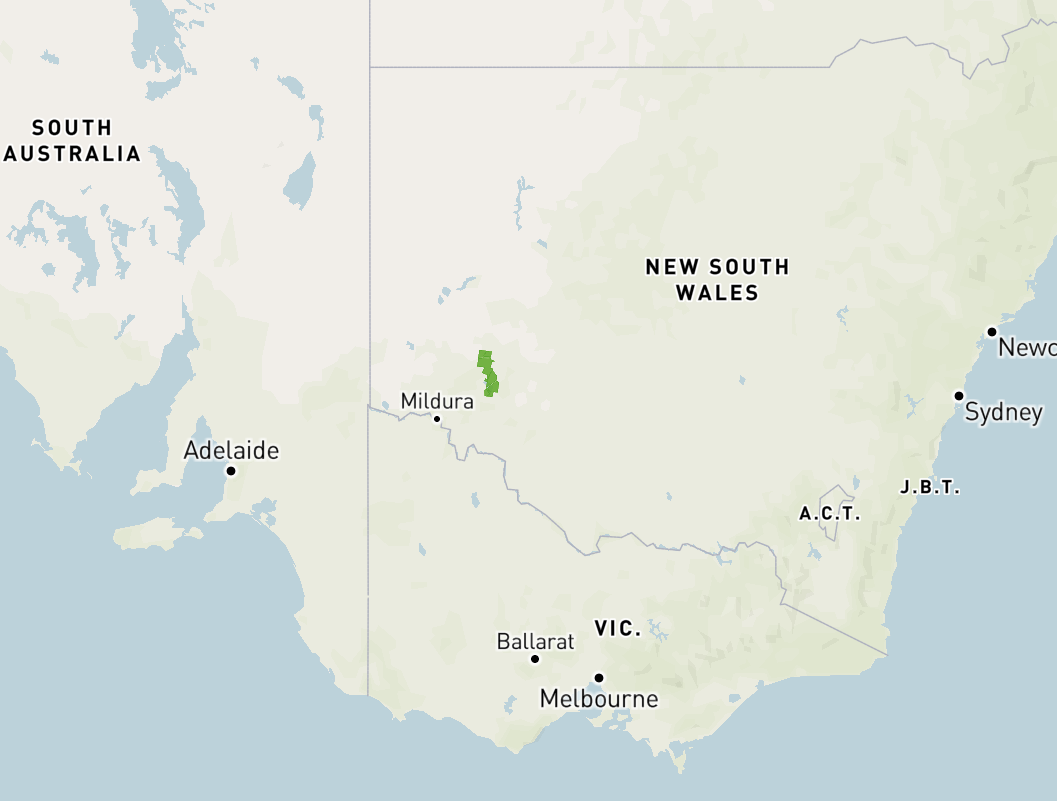
The park is located adjacent to the town of Euston in the far west of New South Wales. It is about 80 kilometres east of Buronga and about 80 kilometres west of Balranald.
Above: – Map showing the location of the Euston Regional Park. Map c/o Protected Planet.
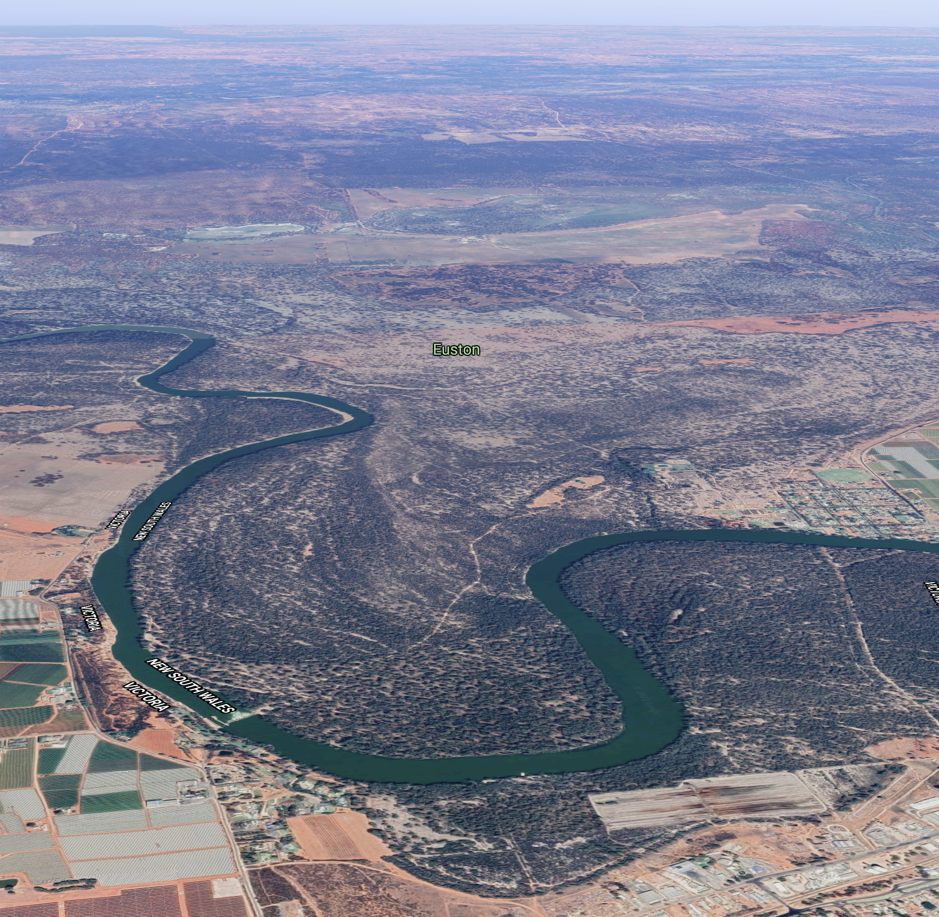
Euston is a beautiful little town situated on the banks of the Murray River. It is the twin town of Robinvale on the Victorian side of the river. Prior to the irrigation development at Robinvale, Euston was the main town in the area.
Below is a short video showing the Euston and Robinvale area.
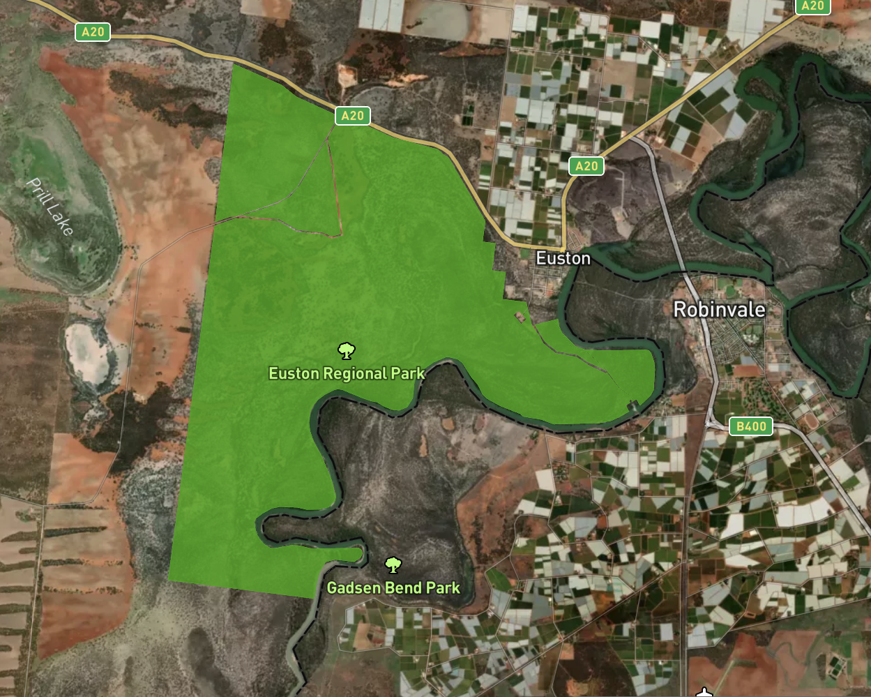
The Euston Regional Park is about 32.45 km² in size and was established on the 1st day of July 2010. The eastern side of the park abuts the Murray River (the State border between New South Wales and Victoria).
Above:- An aerial view of the Euston Regional Park on the border between Victoria and New South Wales. Image c/o Protected Planet
Before becoming the Euston Regional Park, the park was known as the Euston State Forest and was dedicated in 1959 for the purposes of timber production and other permitted uses including beekeeping, grazing, and sand quarrying.
In 2009 the Riverina Bioregion Regional Forest Assessment for River Red Gums and Woodland Forest, conducted by the Natural Resources Commission in 2009 (NRC 2009), recommended the area be managed for conservation and recreation.
The park consists of river red gum forest and includes plant communities that are poorly represented at a national level in the reserve system which include River Red Gum – Black BoxWoodlands and Chenopod – Mallee Shrublands.
The park provides habitat for a range of native animal species including several that are dependent on mature river red gum trees and associated hollows. Threatened species recorded in the park include the southern bell frog and the eastern subspecies of the Regent Parrot.
Above:- An aerial view of the Euston Regional Park. Image c/o Google maps
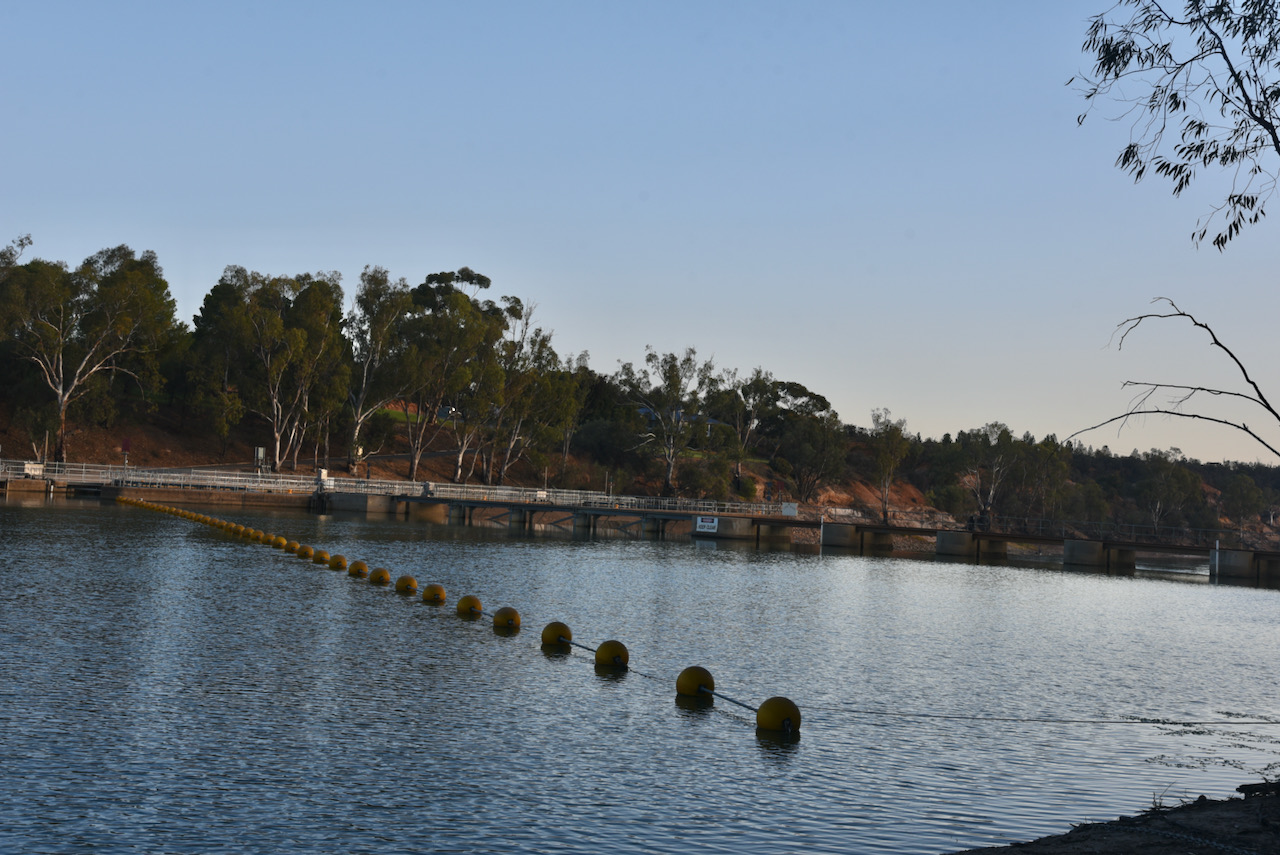
We set up near the Euston Robinvale Lock and Weir 15 which was constructed between 1932 and 1936. The weir pool stretches back 60 km to Meilman East. About 32,000 mega lites of water flows through this system daily. It was the last lock to be built on the Murray River system.
After setting up, Marija popped up a spot for me on parksnpeaks, and I started calling CQ on 7.105. First in the log was Gerard VK2IO, followed by Bill VK3CWF, and then Andrei ZL1TM in New Zealand.
Contact number ten came just 6 minutes into the activation, with a contact with Ian VK5IS in the mid north of South Australia.
I logged a total of 53 stations on 40m from VK1, VK2, VK3, VK4, VK5, VK6, and VK7, and New Zealand.
It was time for Marija to qualify the park and Marija soon had a little pile up going. Contact number ten was just 5 minutes into the activation, with a QSO with Adrian VK5FANA.
Marija logged a total of 40 stations on 40m before callers quickly dried up, so we headed to the 80m band. We were pushed a bit for time as we needed to get back to Robinvale for an evening meal.
On 80m we logged a total of 17 stations from VK1, VK2, VK3, and VK5. Marija’s 44th contact was with Adam VK2YK on 80m.
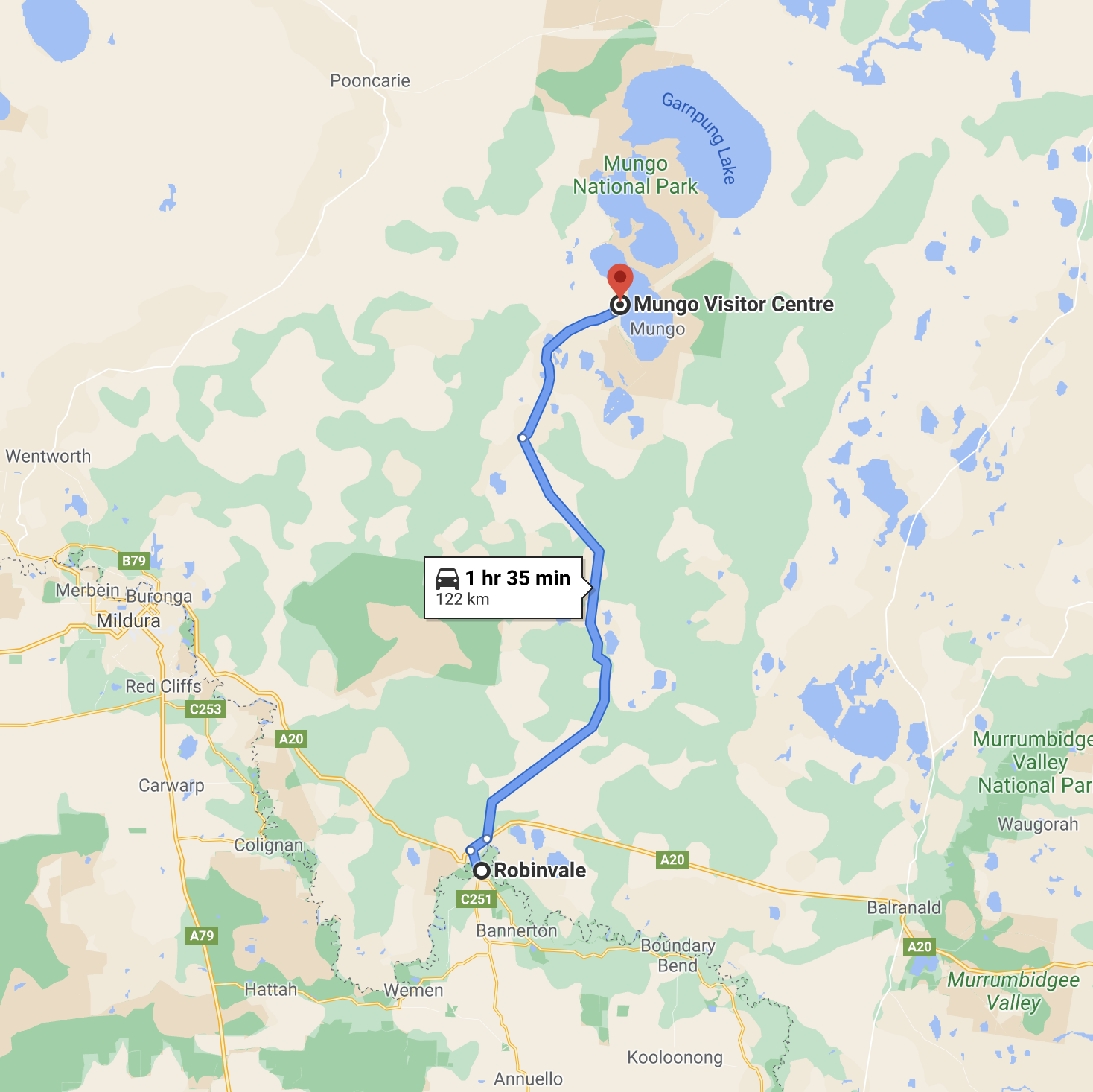
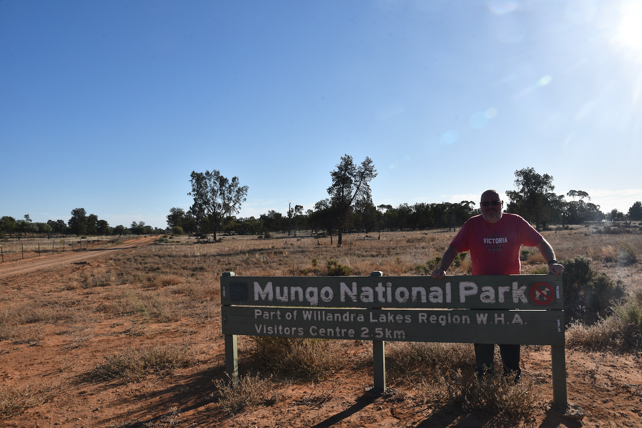
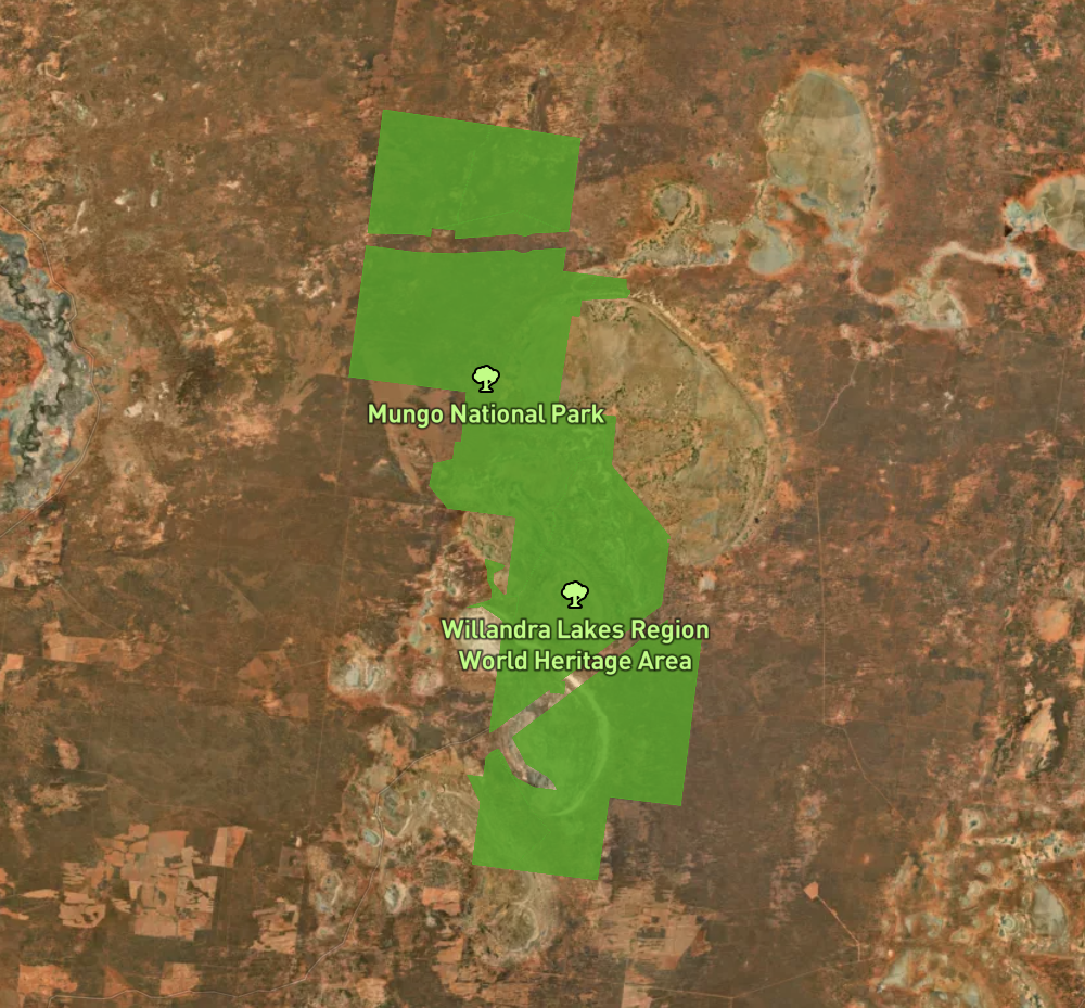
We were getting towards the end of our trip and it was now day eleven (Friday 16th April 2021). Our plan today was to head out to the Mungo National Park in outback south-western New South Wales. Mungo is about 990 km west of the city of Sydney.
Above:- Map showing the location of the Mungo National Park. Map c/o Protected Planet.
Yesterday while we were at the Robinvale Visitor Info Centre we were told it may take up to 3 hours to get out to Mungo, despite the map showing it was 122km. As a result Marija and I left the motel at about 7.00 a.m. and headed out of Robinvale and across the Murray River and the Victoria/New South Wales State Border.
Above:- Map showing our route to Mungo from Robinvale. Map c/o Google maps
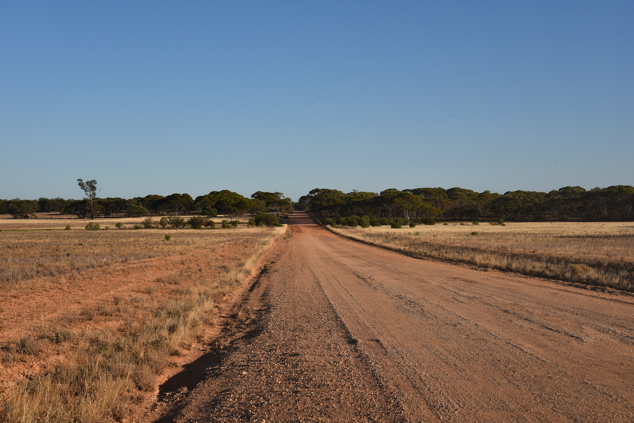
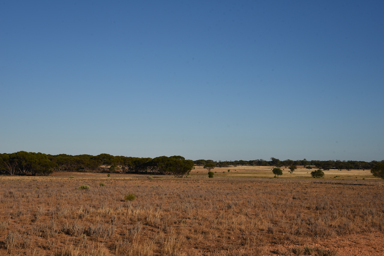
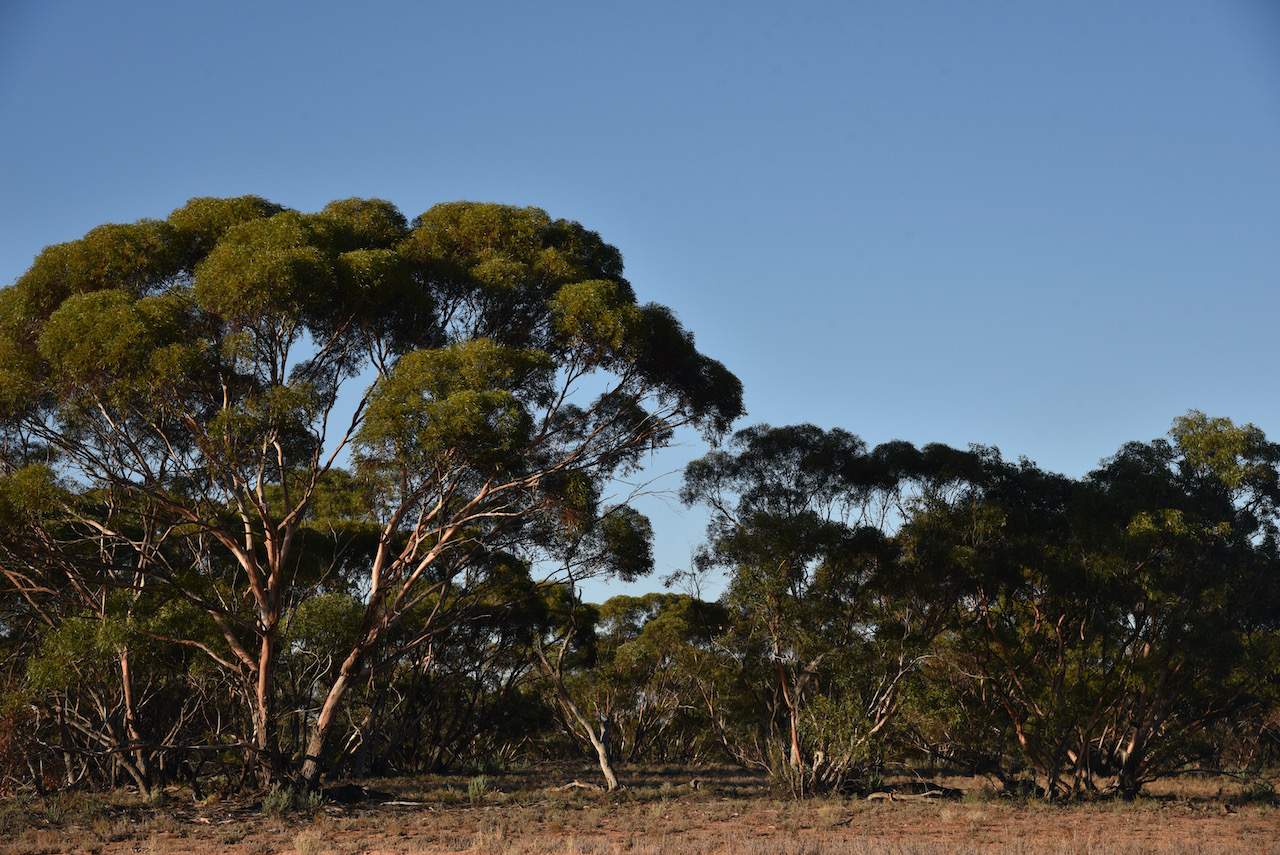
We drove north on the Euston-Prungle Road which was initially bitumen but then turned to dirt. We found the road pretty good with our 4WD, the Toyota Hi Lux, with no problems encountered. The road is rough in parts with lots of corrugations, but this was no issue for the Hi Lux. We could see why it might take a lot longer if you had a conventional vehicle.
The drive took us through magnificent countryside which varied from thick mallee scrub to cleared land where you could see for miles.
After about 90 minutes we reached the Mungo National Park and stopped briefly at the information board and the park sign for a photo.
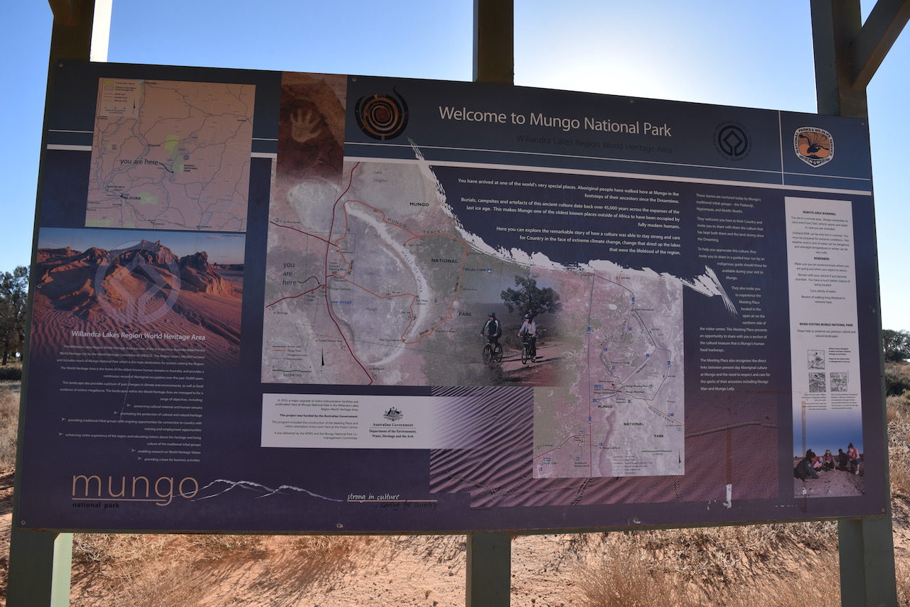
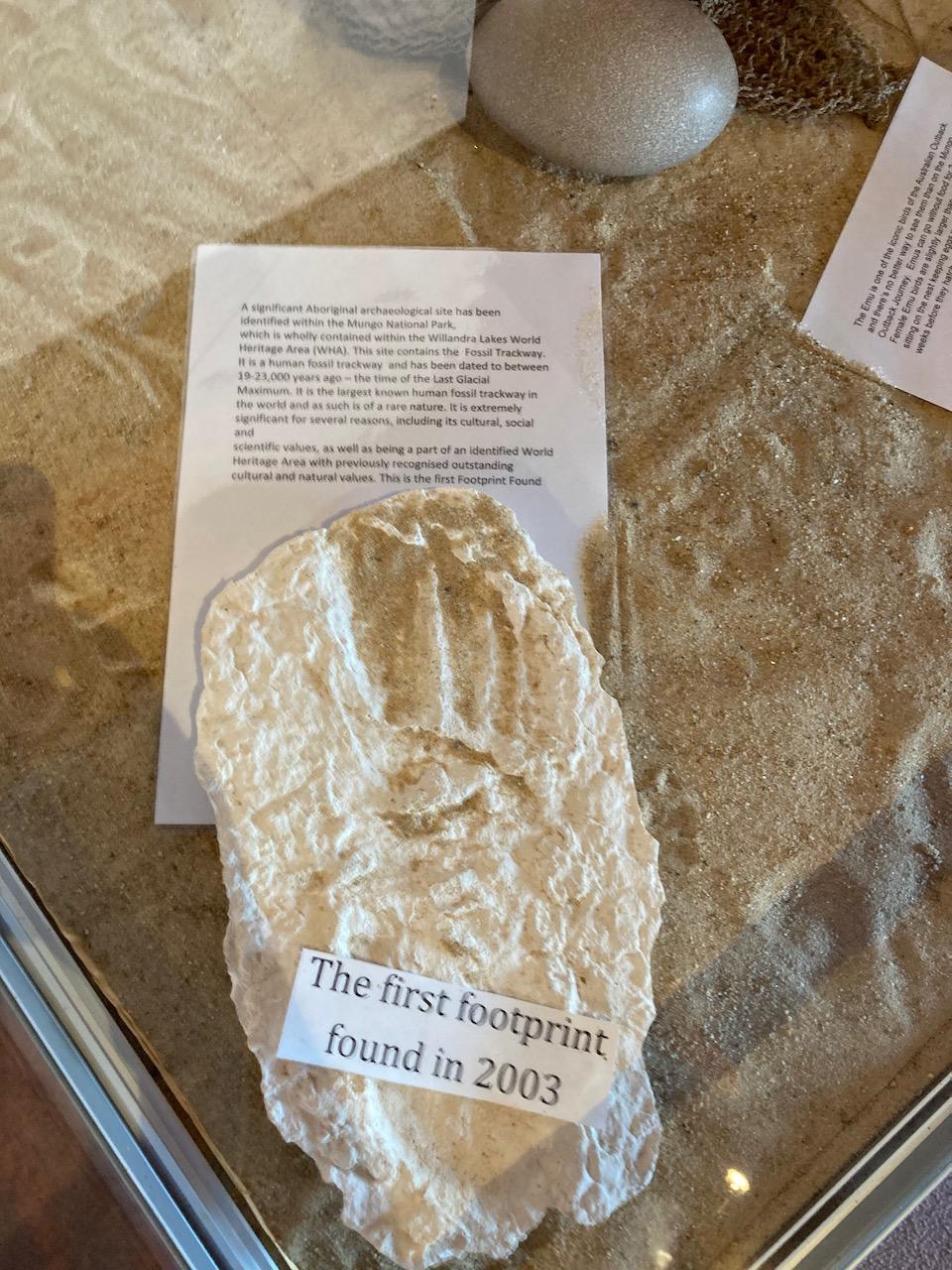
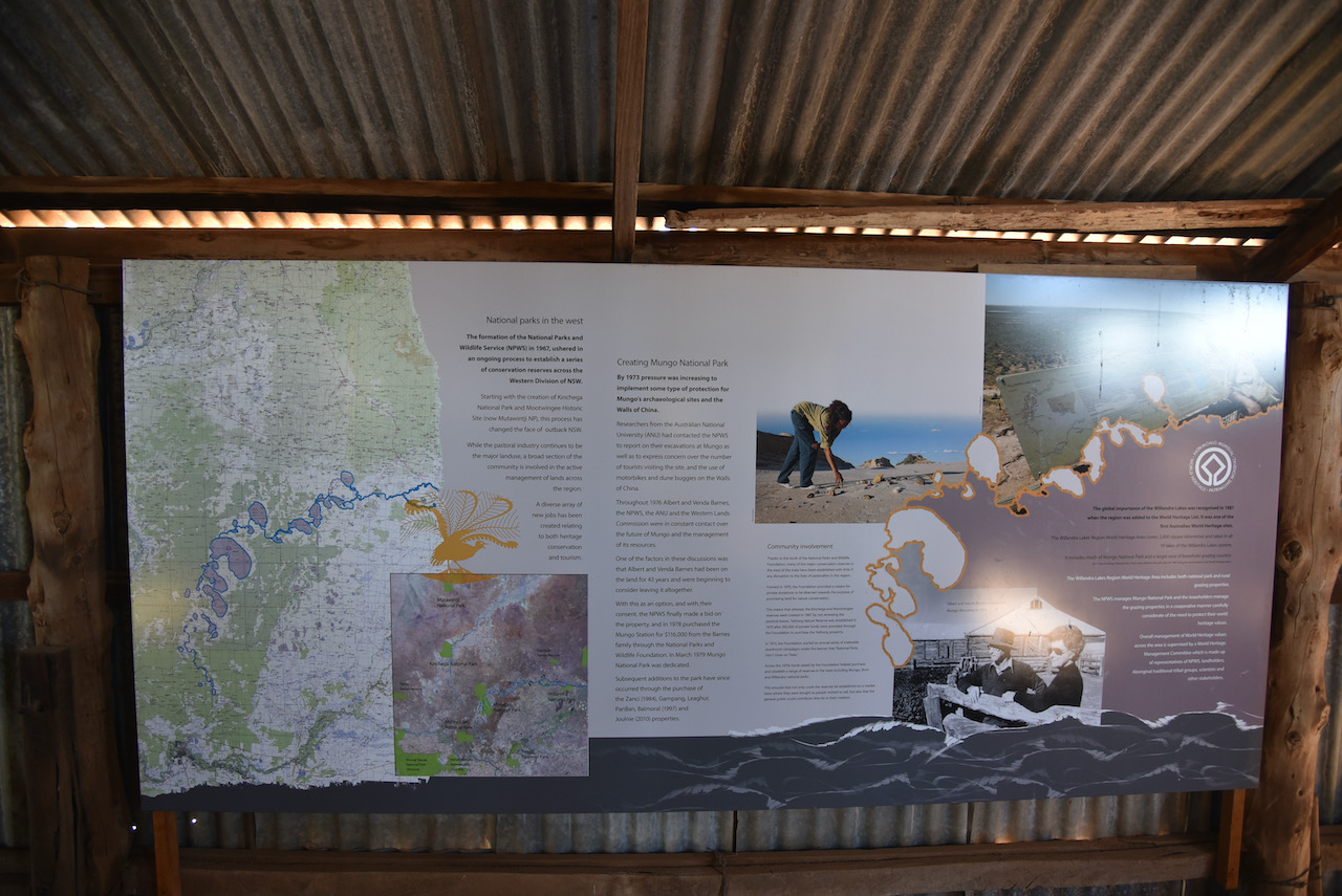
Mungo National Park is 110,967 hectares (274,210-acres) in size and was established on the 6th day of April 1979. The park is part of the UNESCO World Heritage listed Willandra Lakes region, an area of 2,400 square kilometres which incorporates 17 dry lakes. Not all are called Mungo, but they are all declared world heritage.
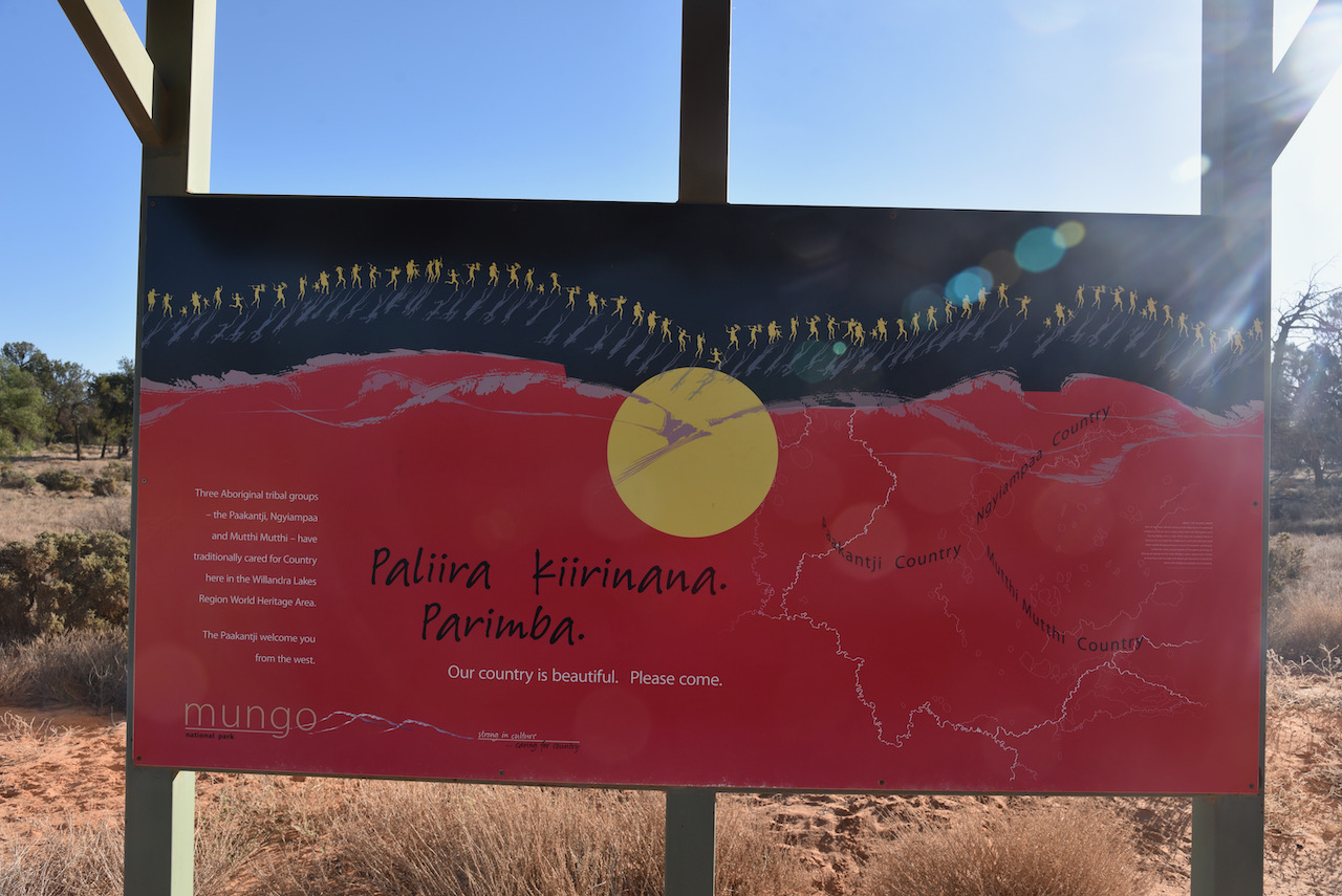
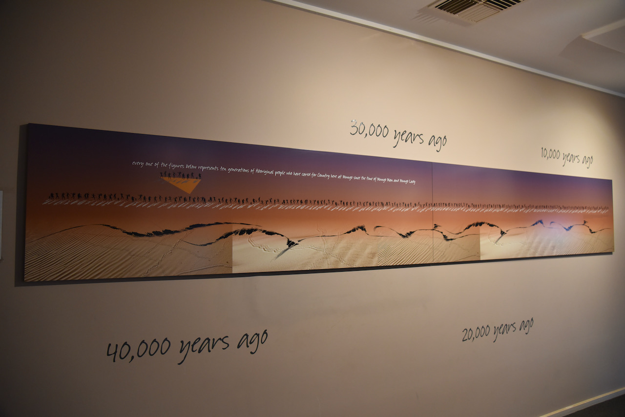
Three aboriginal tribal groups, the Paakantji, Ngyiampaa and Muttthi Mutthi, have traditionally cared for Country here in the Willandra Lakes Region World Heritage Area.
Above:- The borders of the Mungo National Park. Image c/o Protected Planet.
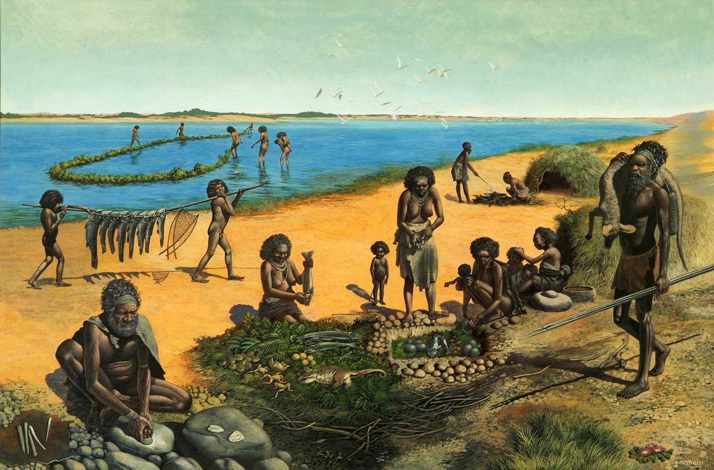
Australia’s landscape has been ever changing over the years. The changes to Mungo’s landscape can be dated back as far as 32 million years when the ocean flooded the Murray Darling basin, turning south-western New SOuth Wales into an inland sea. The ocean retreated after 25 million years, however water levels in the area fluctuated as surrounding river systems flooded. From around 150,000 years ago, Lake Mungo and the surrounding lakes in the Willandra Lakes district had been established. Today however, the lakes are dry.
Above:- An artists impression of what life may have been like at Lake Mungo when the lake was full of water. Image c/p nma.gov.au
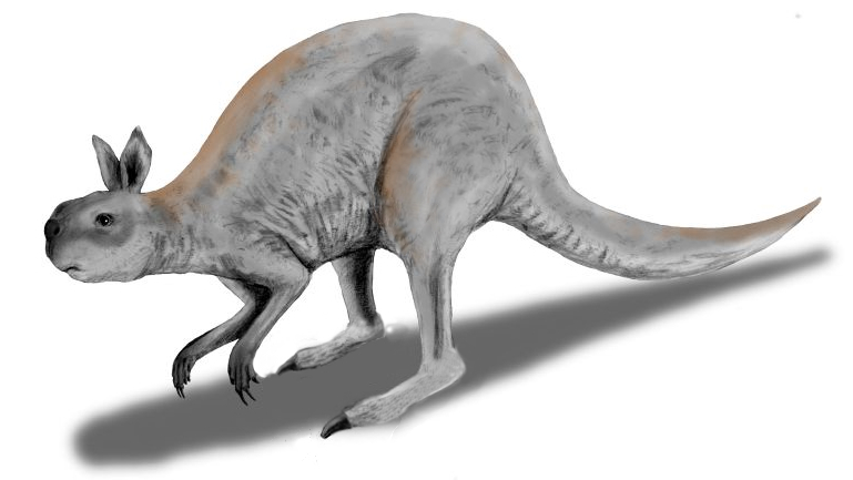
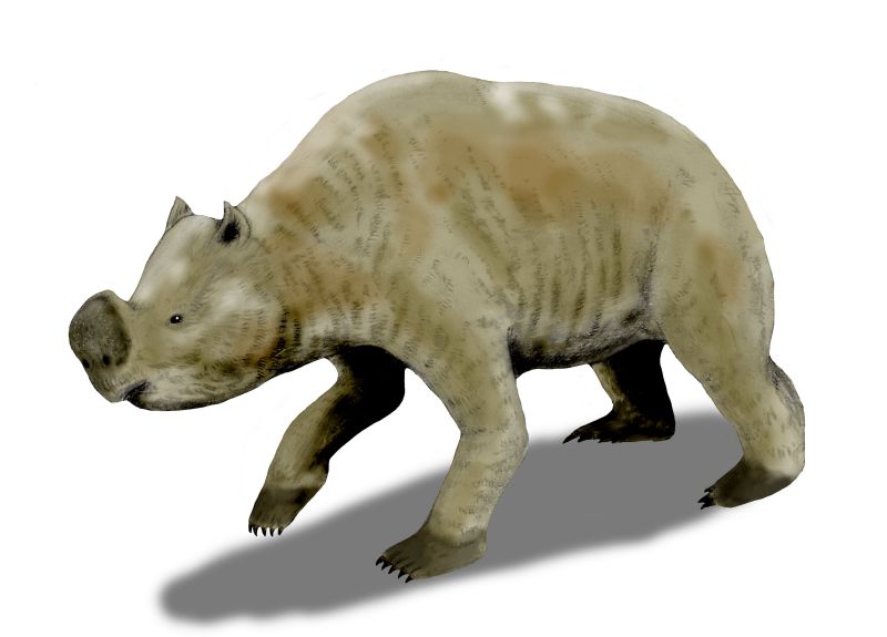
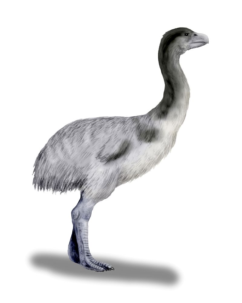
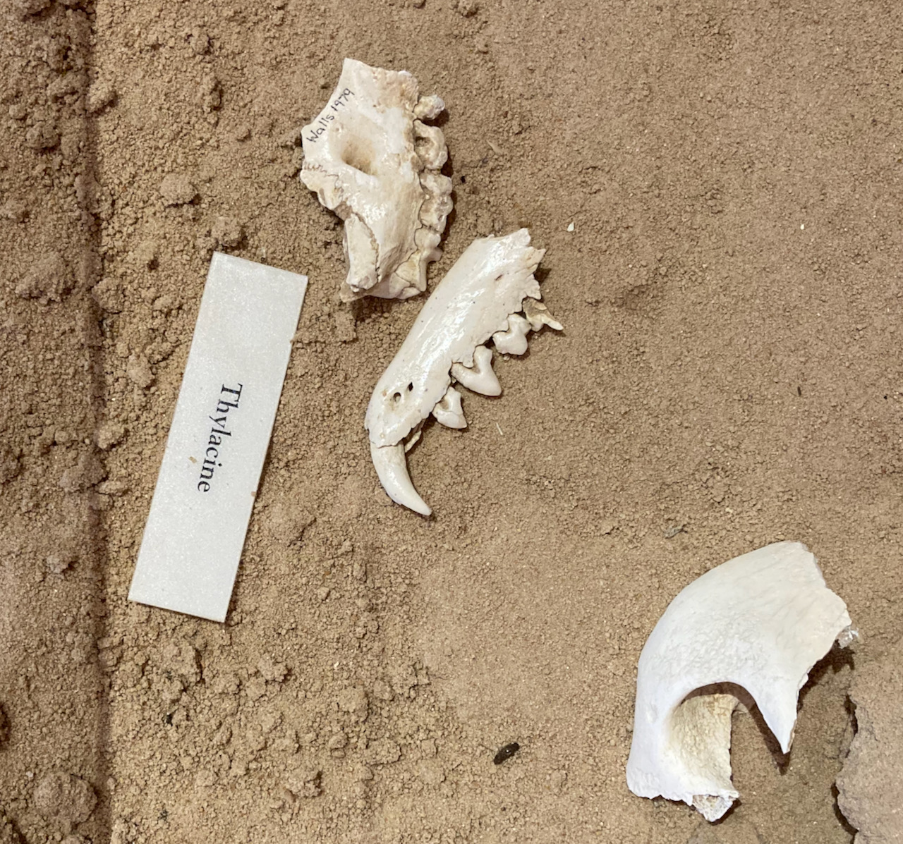
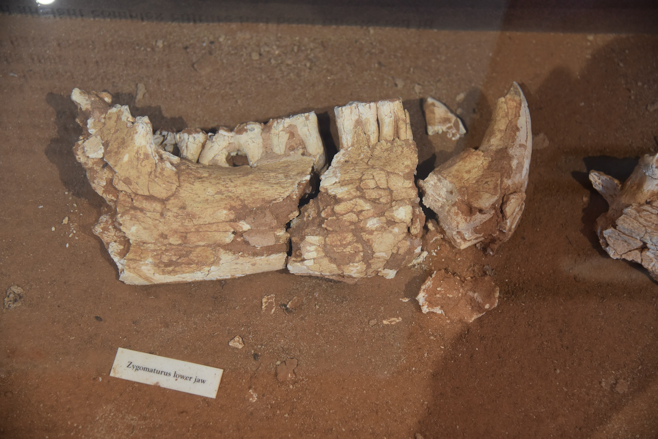
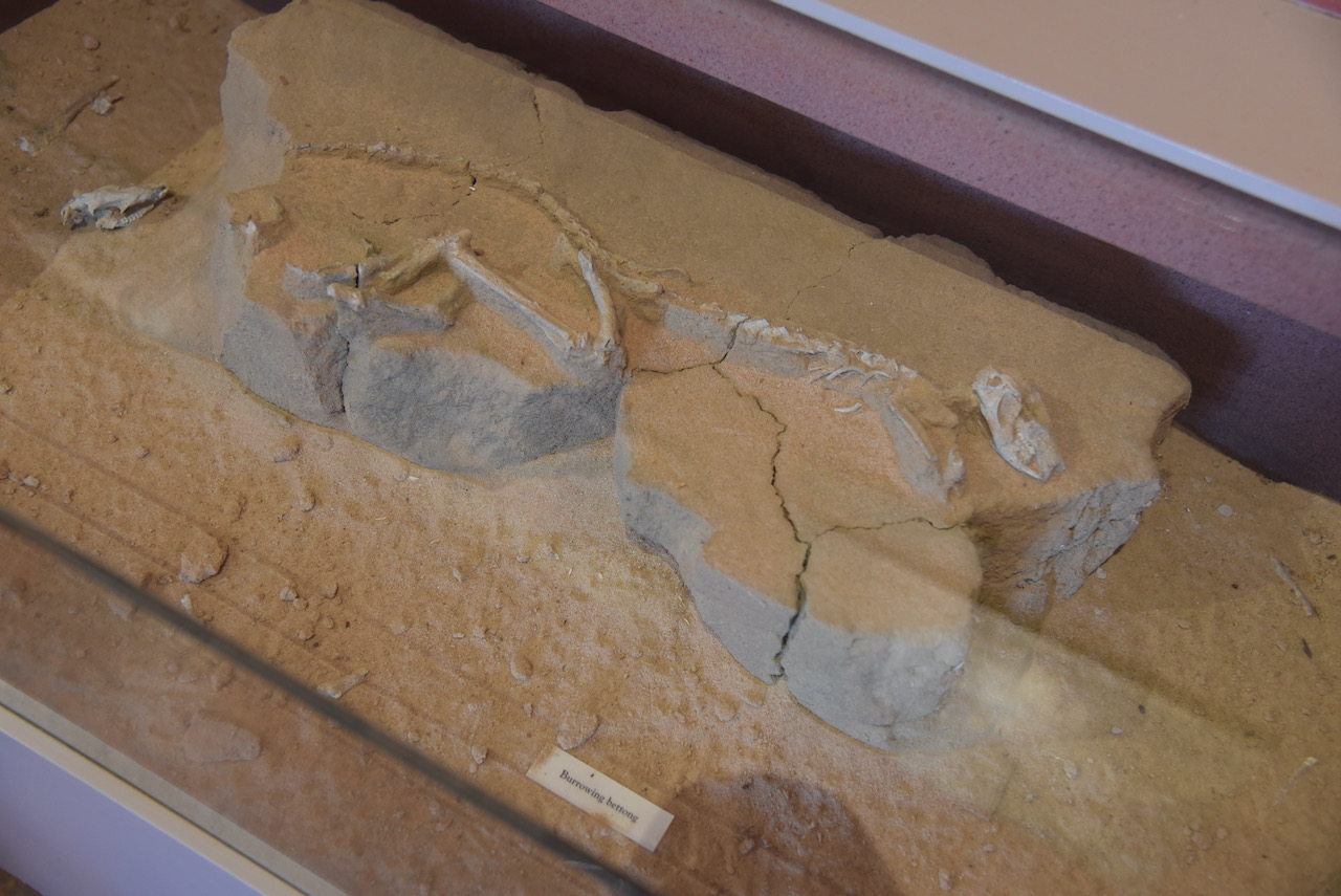
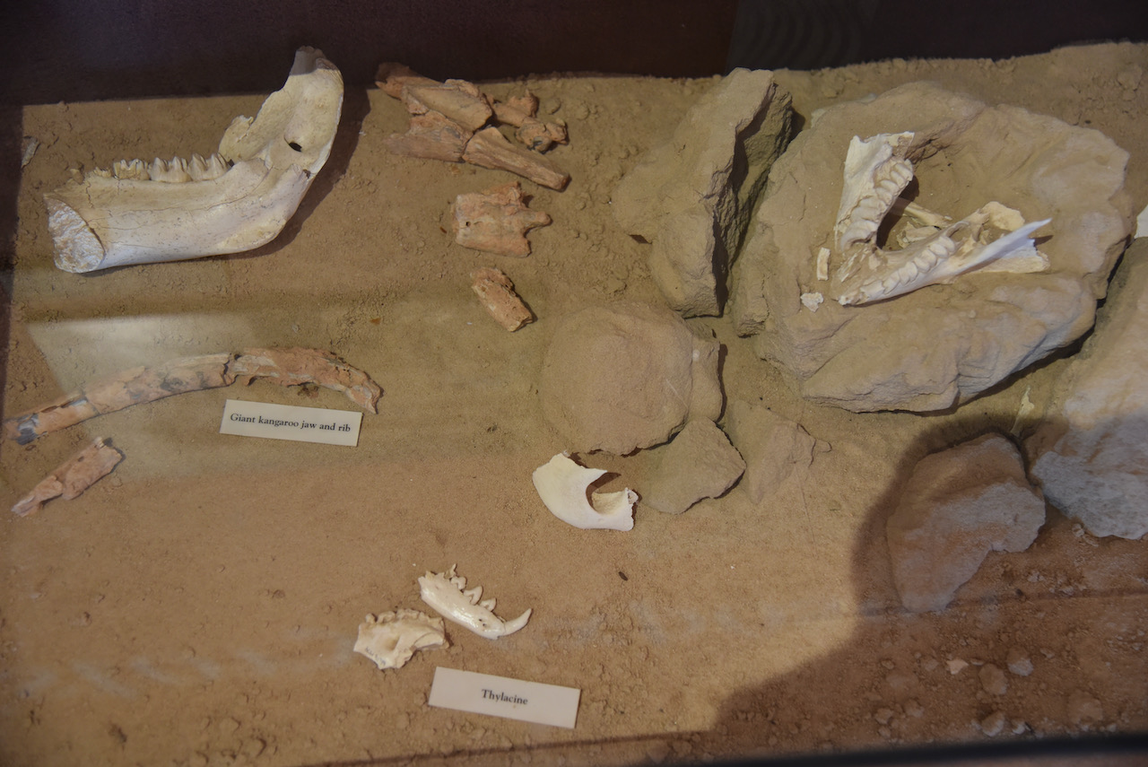
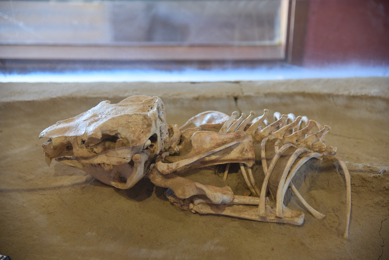
A total of 76 species of mammals, birds, reptiles, fish, amphibians, crustaceans, and sheelfish have been discovered surrounding archaeological sites in the Willandra Lakes. Some of the extinct creatures include Procoptdon sp (giant kangaroo), Zygomaturus tribobus a giant marsupial, and Genyornis newtoni (extinct emu)
Above:- the extinct giant kangaroo, extinct Zygomaturs, and extinct emu. Images c/o Wikipedia.
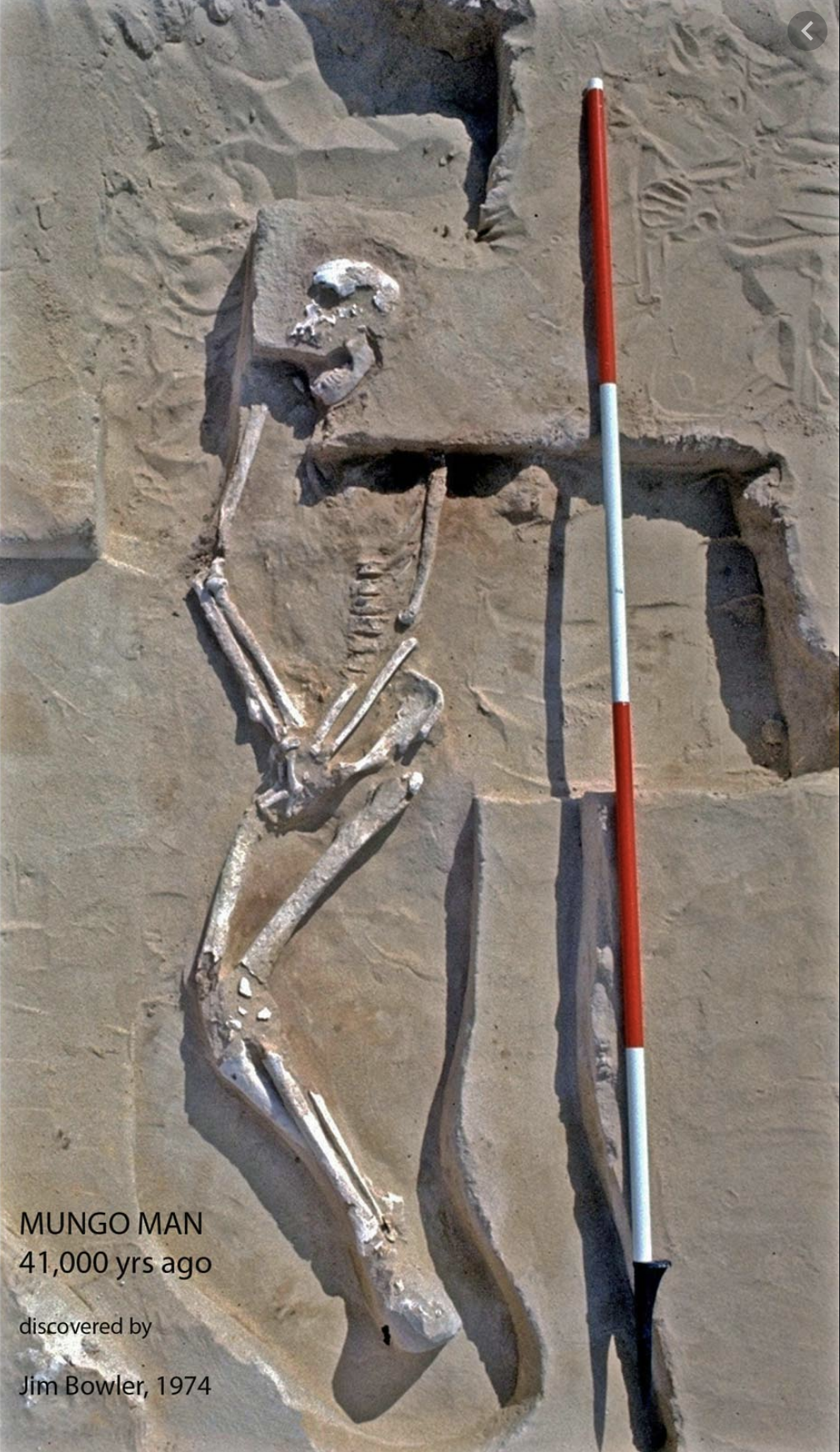
Three prominent human remains have been located at Lake Mungo. This includes Mungo woman which was discovered in 1969 and is one of the world’s oldest known cremations. Mungo Man was discovered in 1974 and is dated at around 40,000 years old, and are the oldest Homo sapiens (human) remains found on the Australian continent.
Above:- Mungo Man. Image c/o britannica.com
Below is a short video on Mungo Man and Mungo Lady.
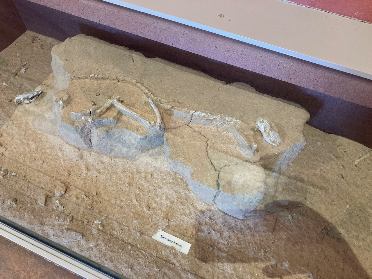
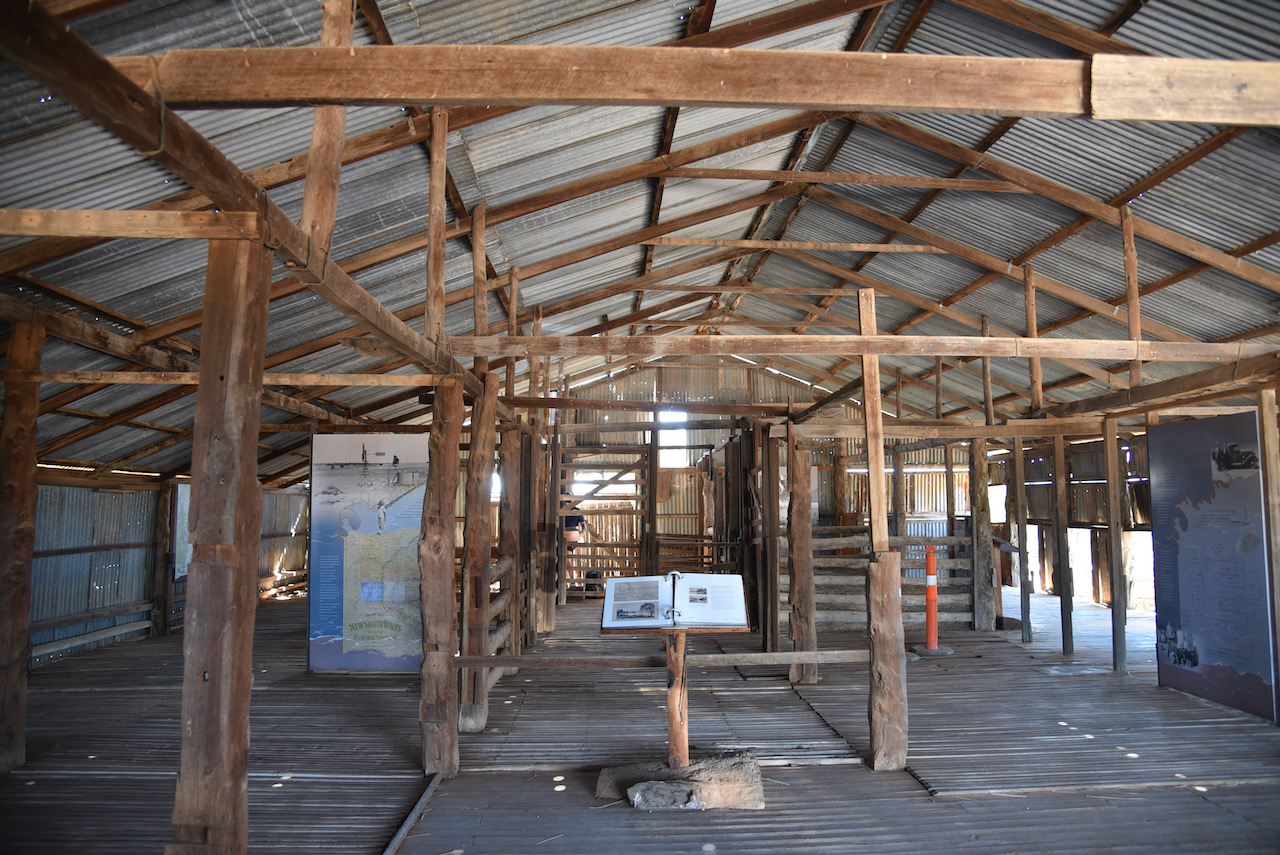
After entering the park our first stop was the Visitor Centre which has an excellent display of information about Mungo. This includes displays of archeological evidence found at Mungo and the megafauna which once lived in the area.
As this is quite a sensitive park, both archaeologically and spiritual for the aboriginals, we spoke to one of the Rangers at the Visitor Centre and told him that we would be setting up a portable amateur radio station. He was very happy with that.
One of the wall displays (seen below) put everything into perspective. Every one of the figures shown represented ten generations of aboriginal people who have lived at Mungo.
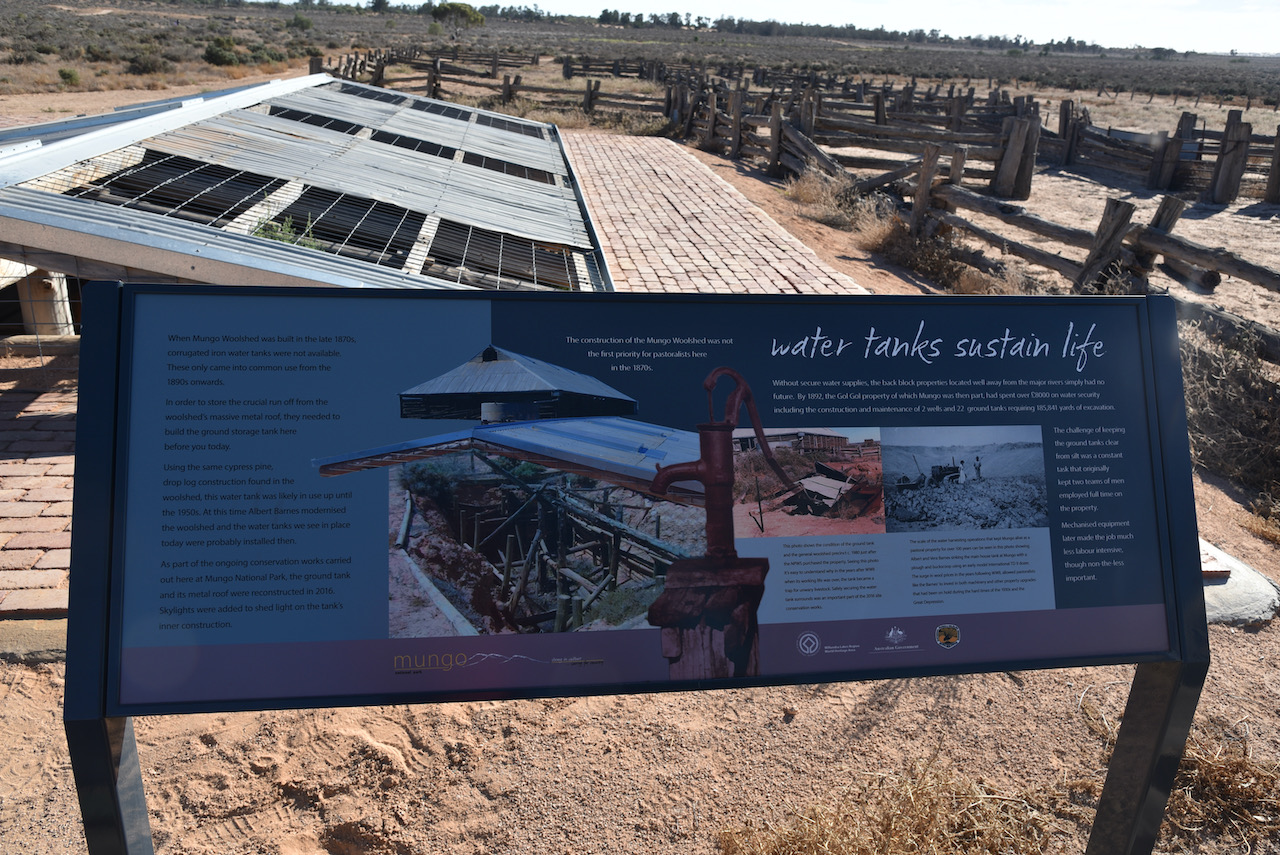
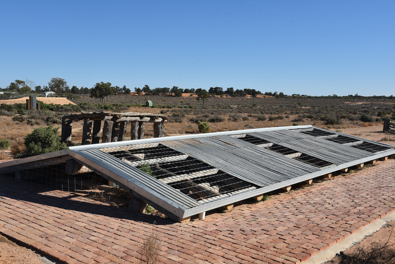
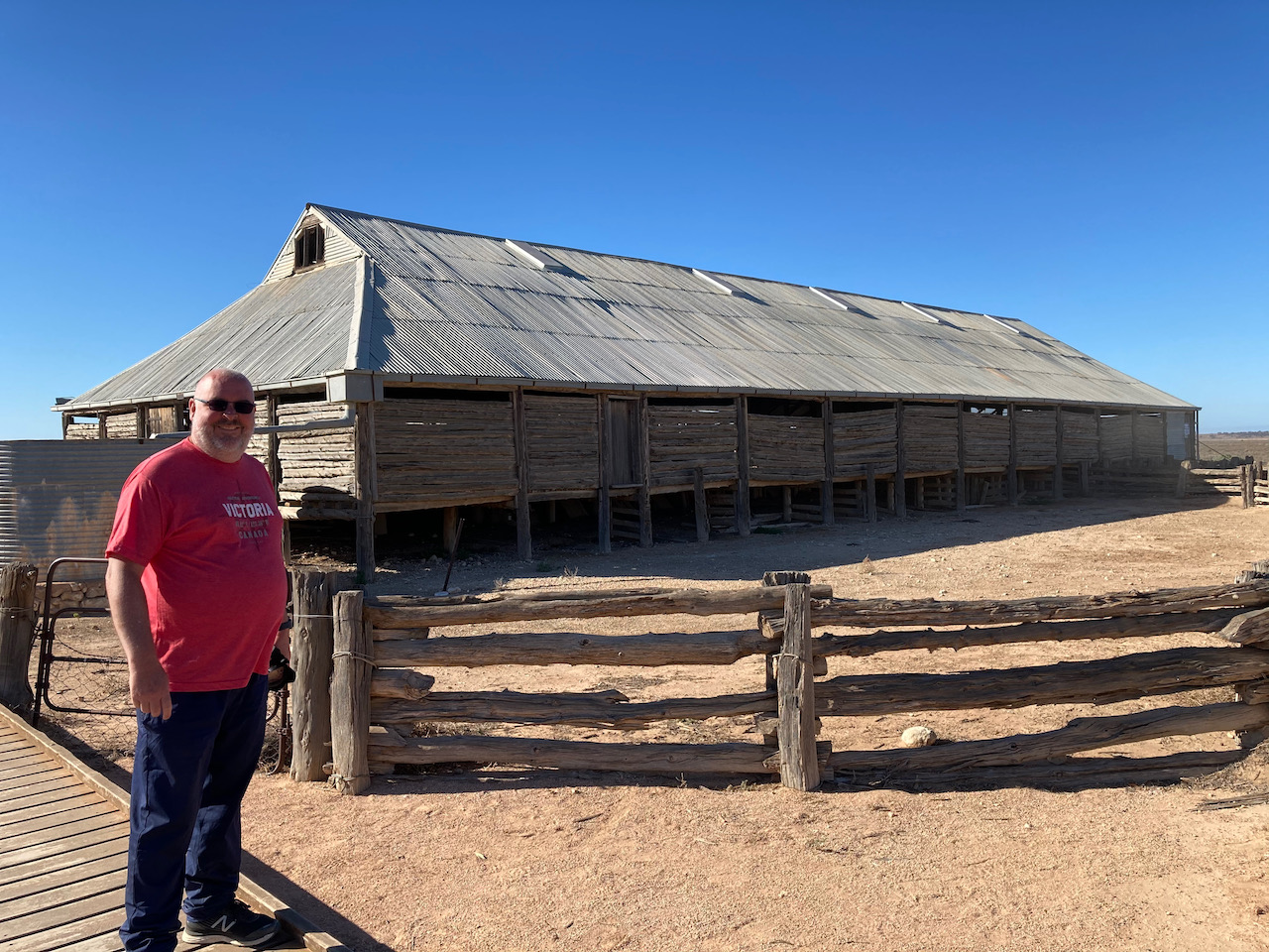
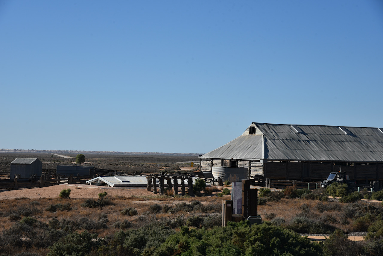
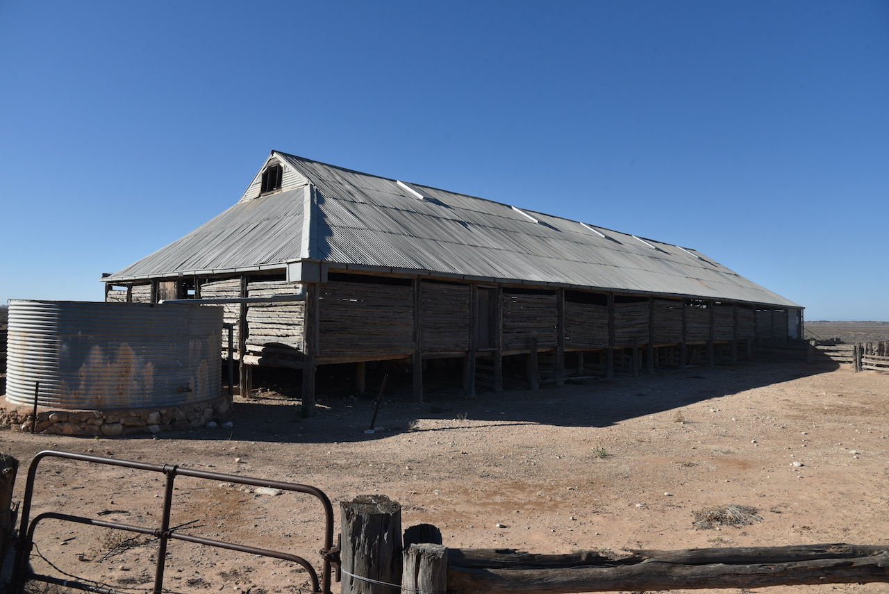
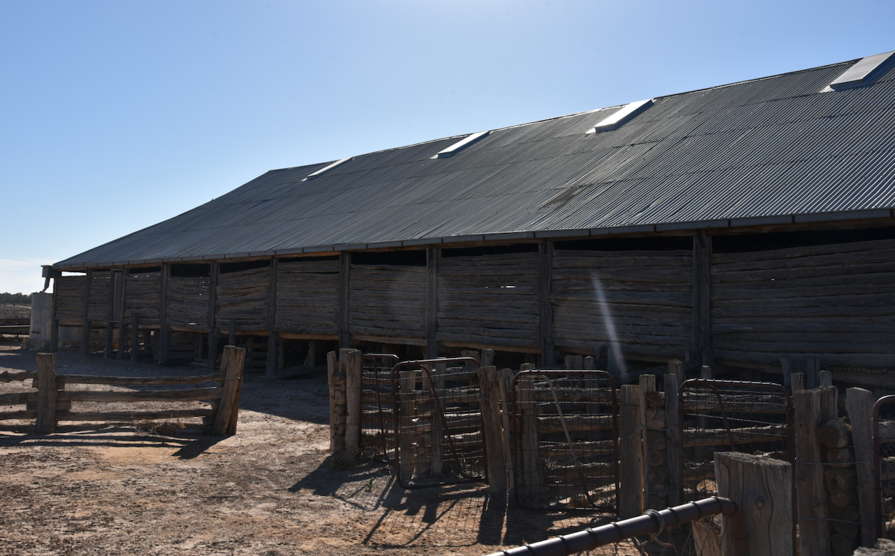
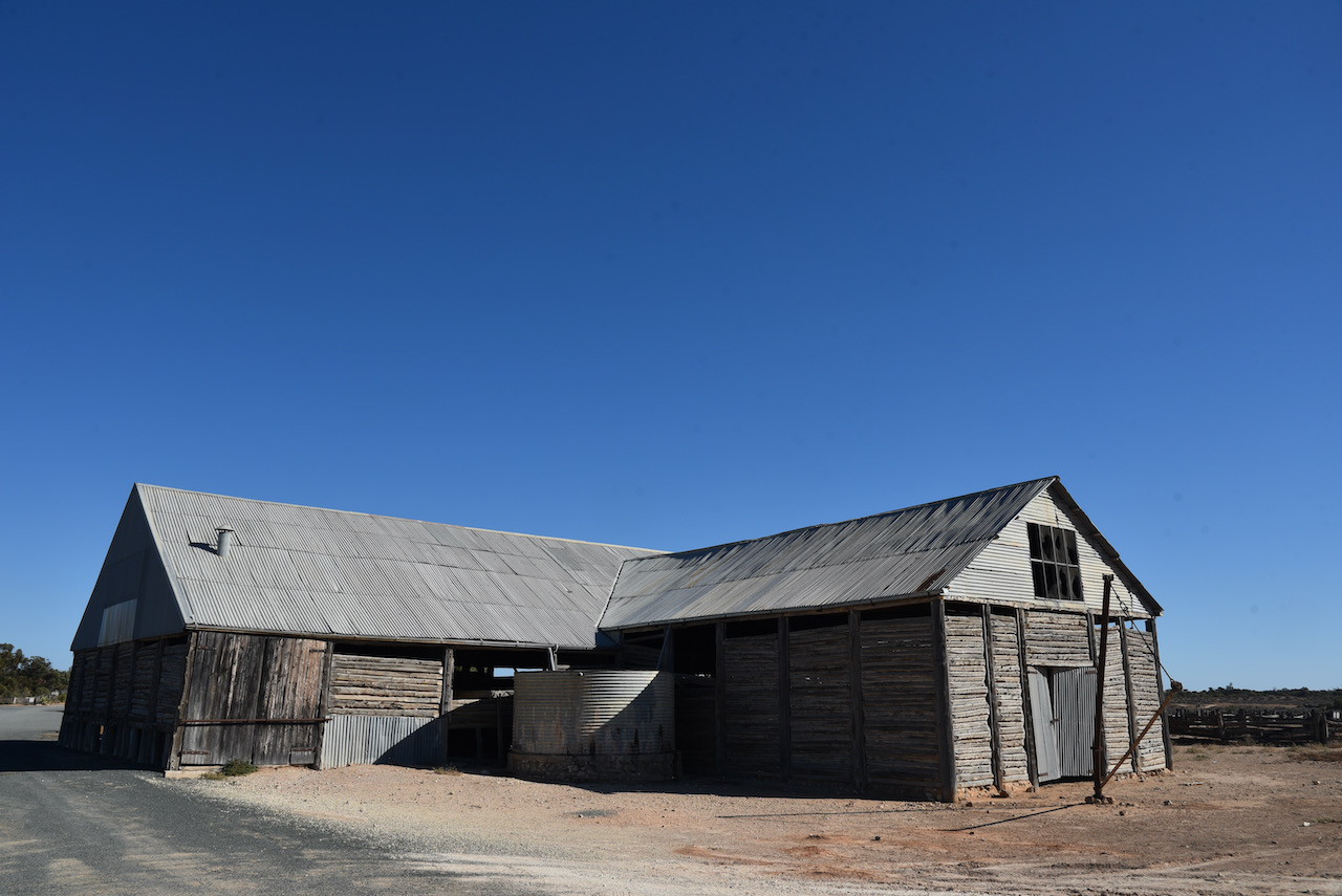
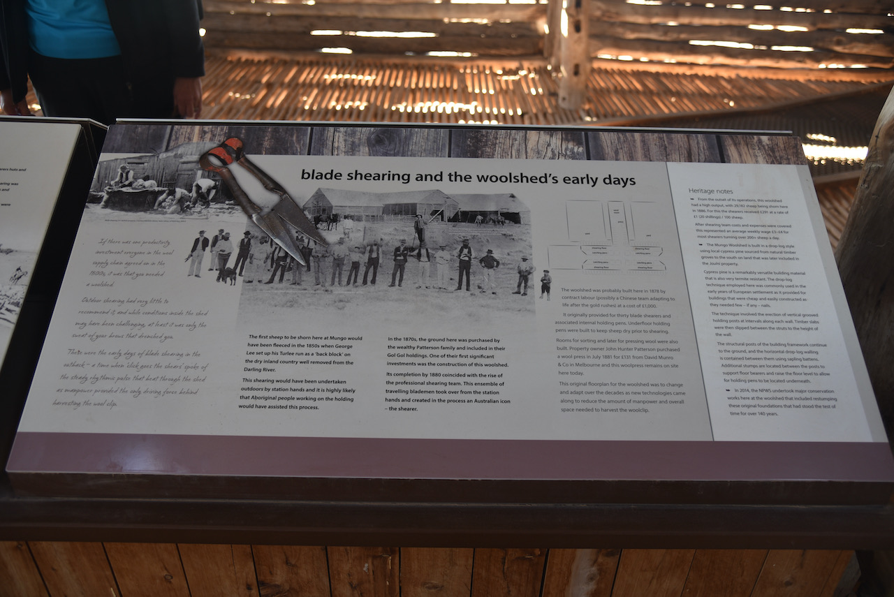
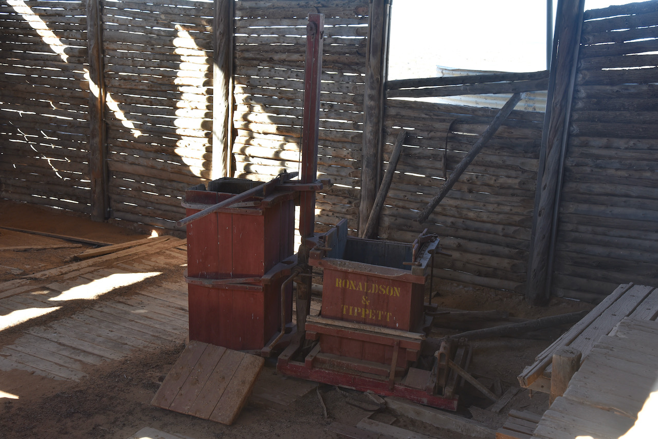
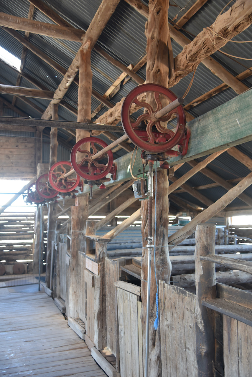
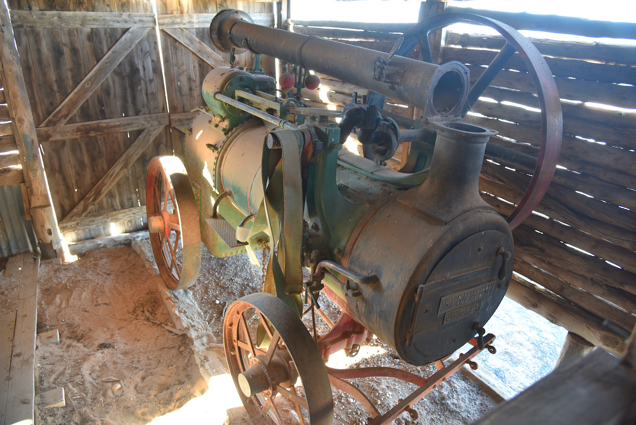
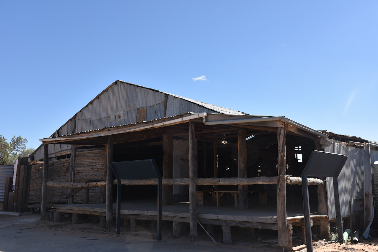
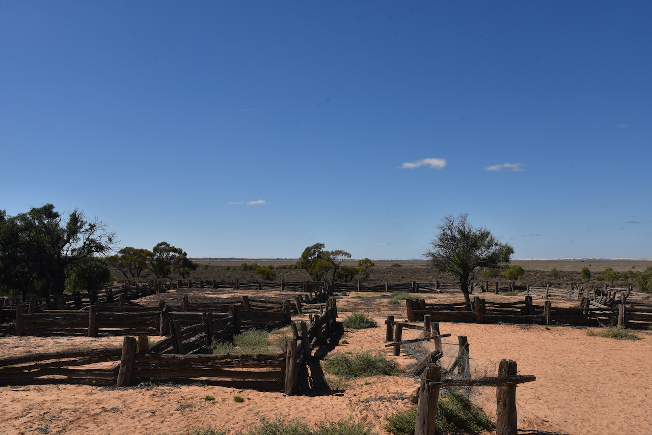
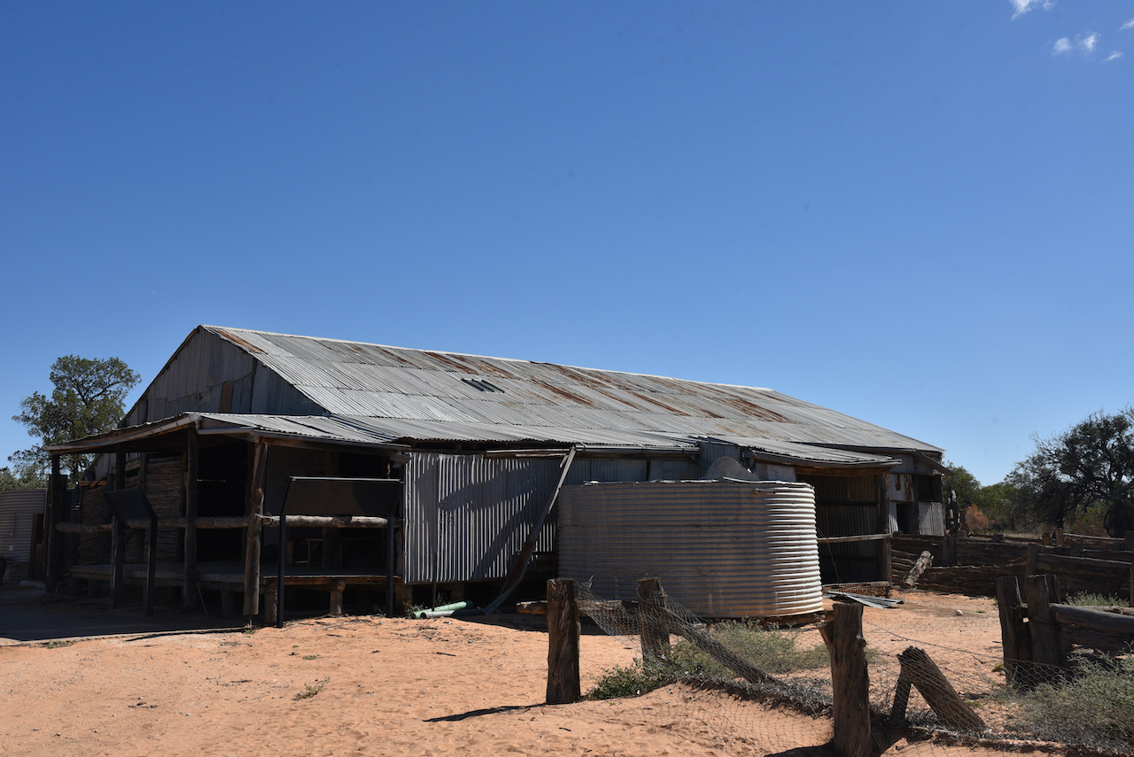
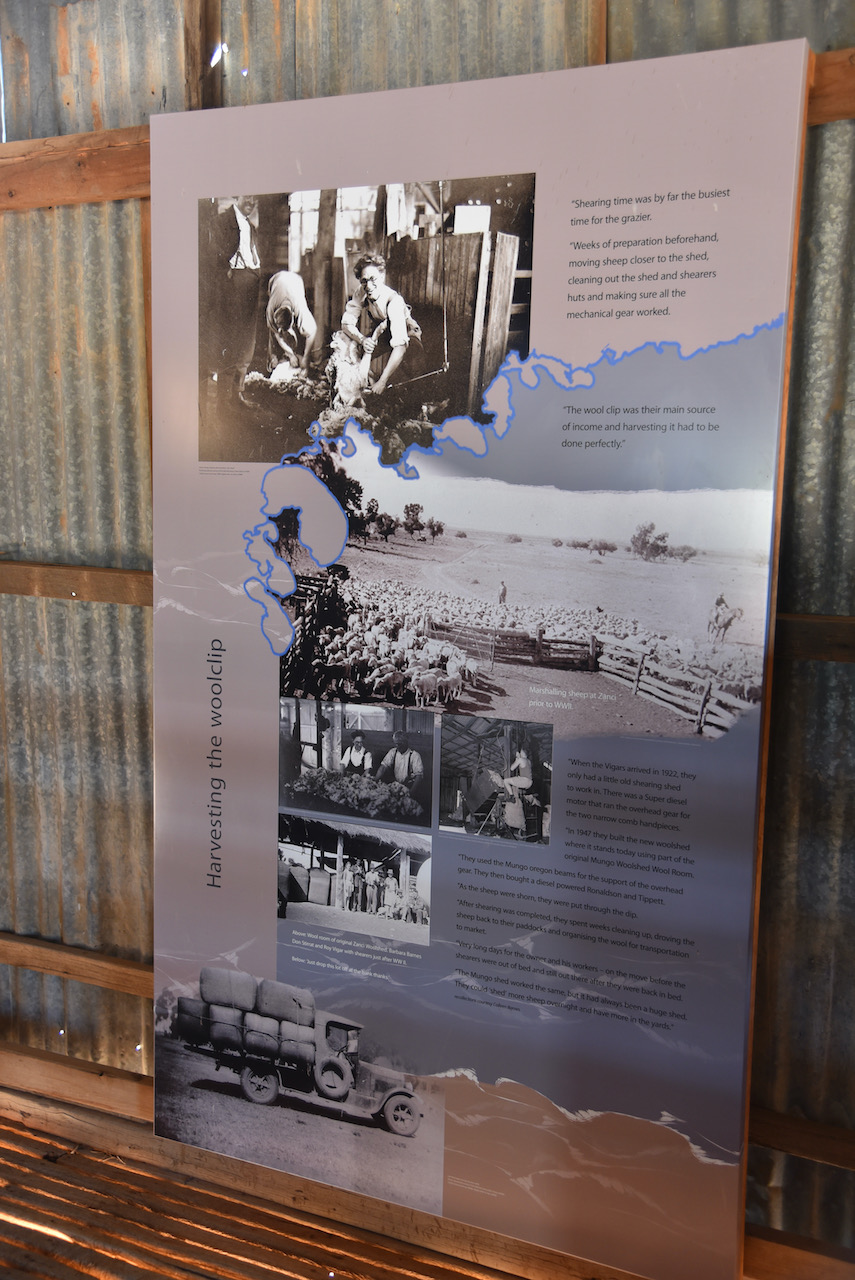
We then walked outside to have a look at the Mungo Woolshed. When Mungo Woolshed was built in the late 1860s corrugated iron water tanks were not available. These only came into common use from the 1890s onwards. In order to store the crucial run off from the wooldshed’s massive metal roof, they needed to build the ground storage tank which can be seen today.
Using the same cyprus pine, drop log construction found in the woolshed, the water tank was likely in use up until the 1950s. A this time Albert Barnes modernised the woolshed and the water tanks which can be seen today were probably installed at that time.
The Mungo woolshed is believed to have been built in 1869. Locally obtained materials were used in its construction as vast distances from freightheads added to the cost. Murray Pine was cut locally and used for the framework and walls. Nails and spikes were forged in the station smithy to pin the frame and walls together. Mallee sticks cut on the station provided material for solid pen gates in the shed.
Corrugated iron for the roof was probably transported by paddlesteamer from Adelaide to the river ports or Euston or Pooncarrie, and overlanded from there to Mungo.
The yards, woolroom, mens hut, shearer’s hut and a two room residence were known as the Turlee Outstation. Today only the woolshed and yards remain. Mungo woolshed was been identified as one of the most significant European buildings in the Willandra Lakes World Heritage Area.
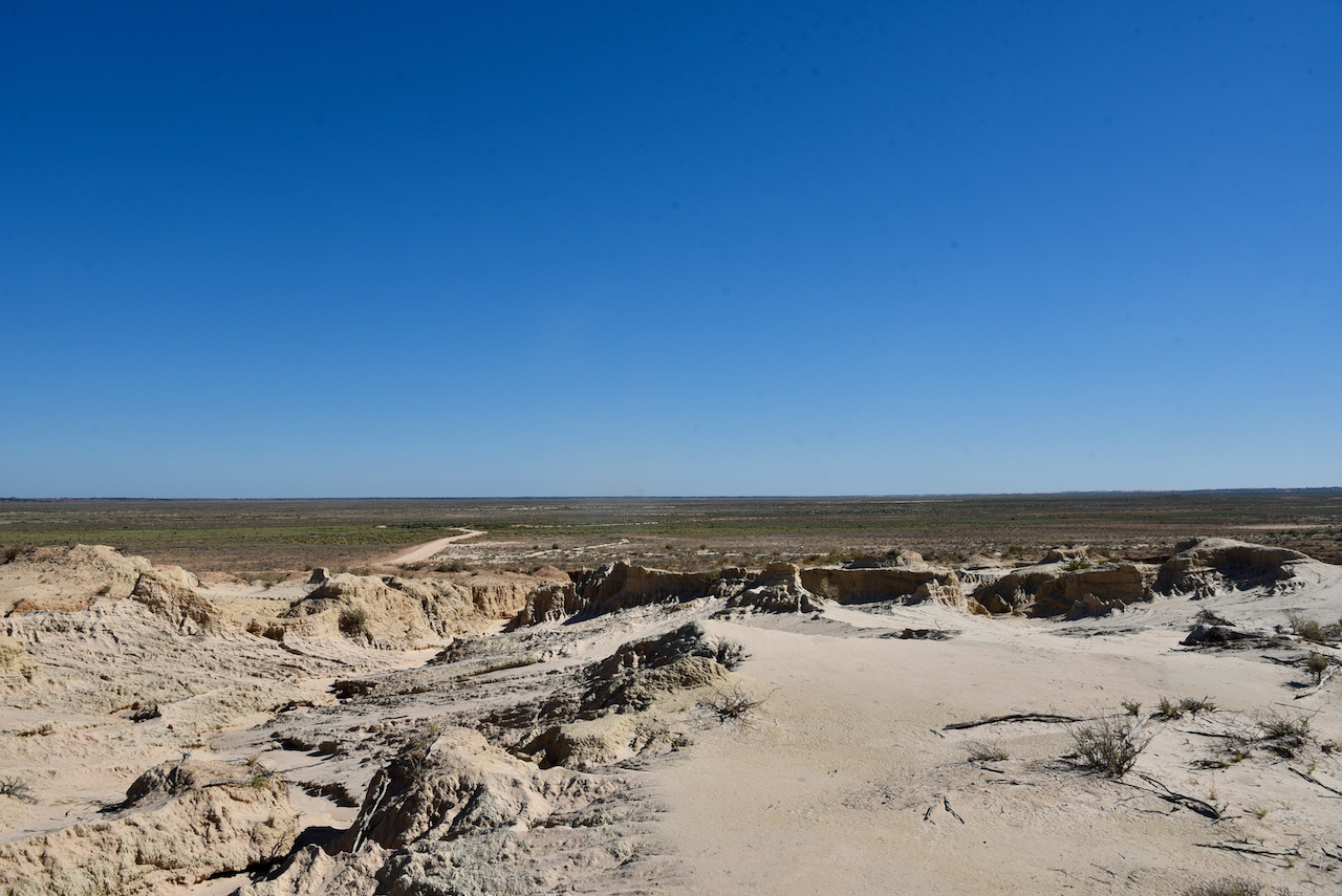
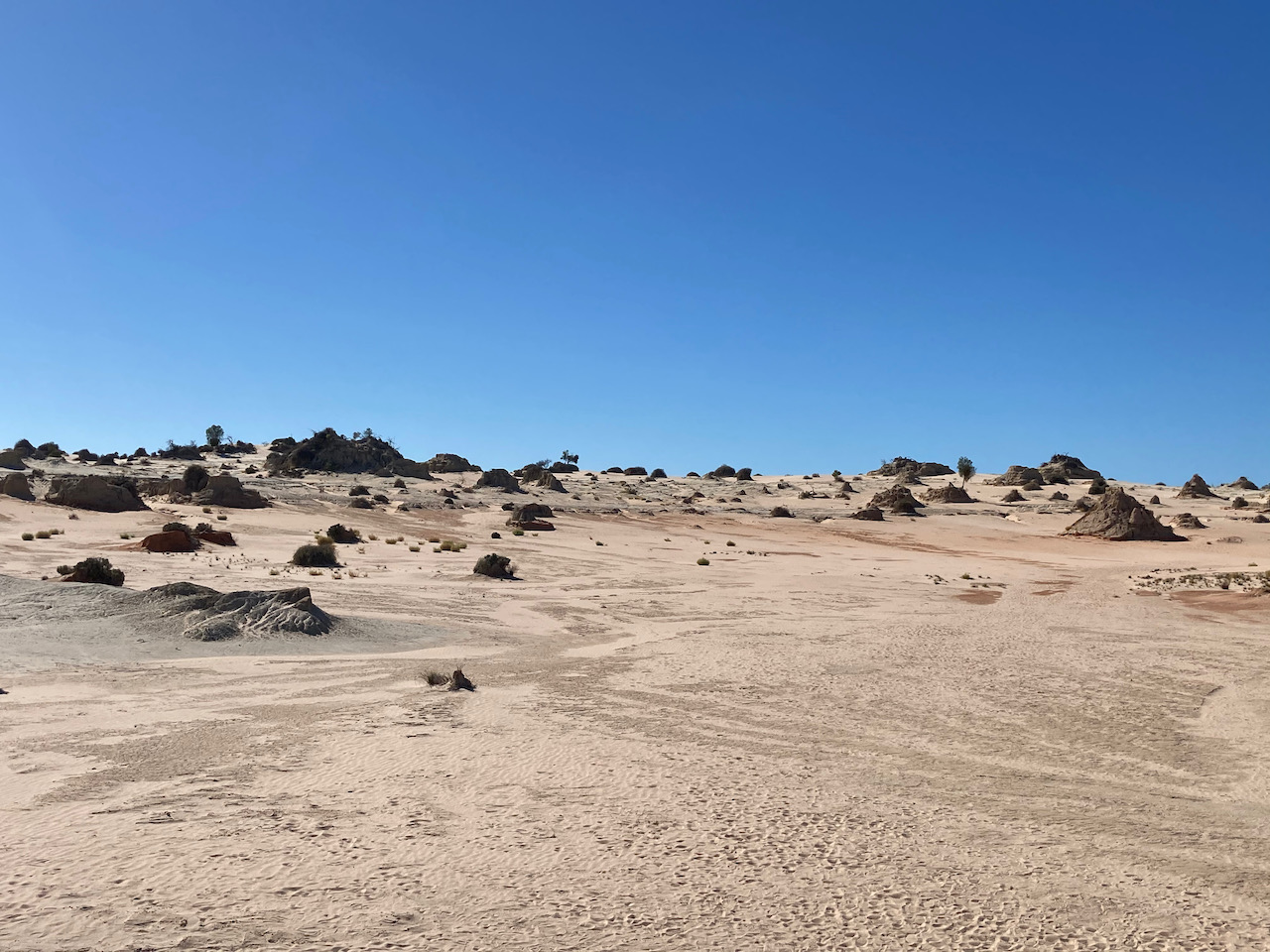
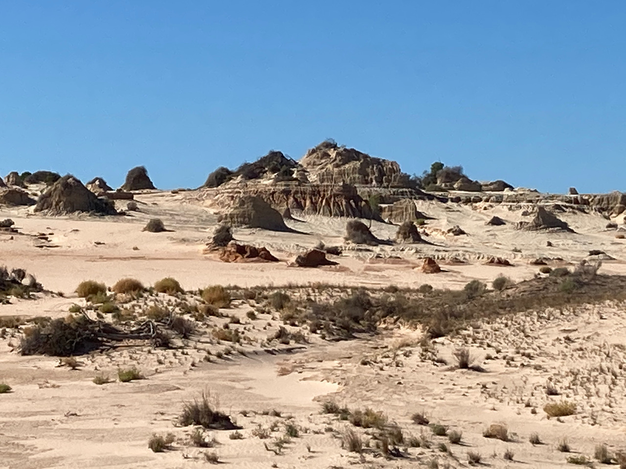
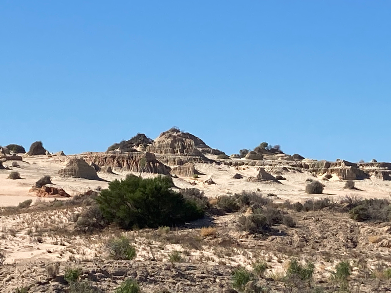
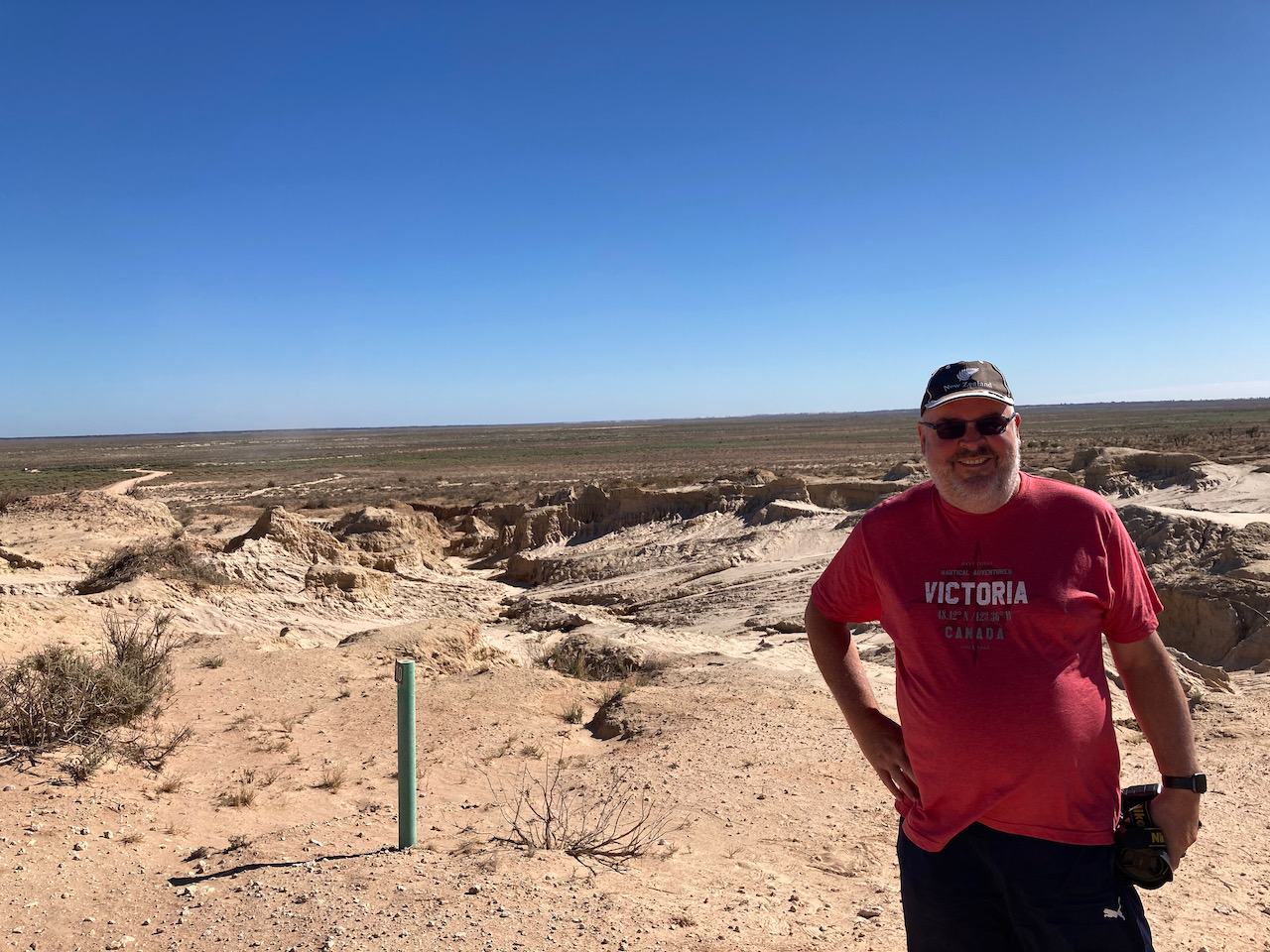
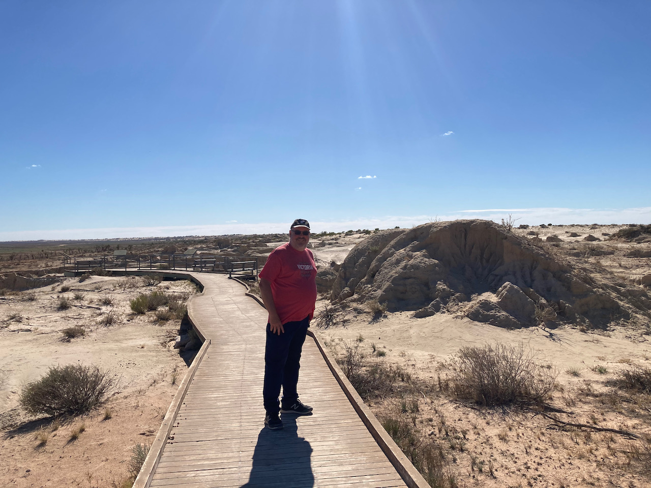
We then drove out to The Walls of China, one of the world’s most signficant archaelogical sites. The Walls of China are a unique feature on the south-eastern edge of what is known as the Lake Mungo lunette. A lunette is a wind formed crescent dune shape
There is a boardwalk here with interpretive signs explaining the history of the formations of the Walls of China. Rain has washed away the soft sand and mud of the lunette, creating characteristic ridges and cracks.
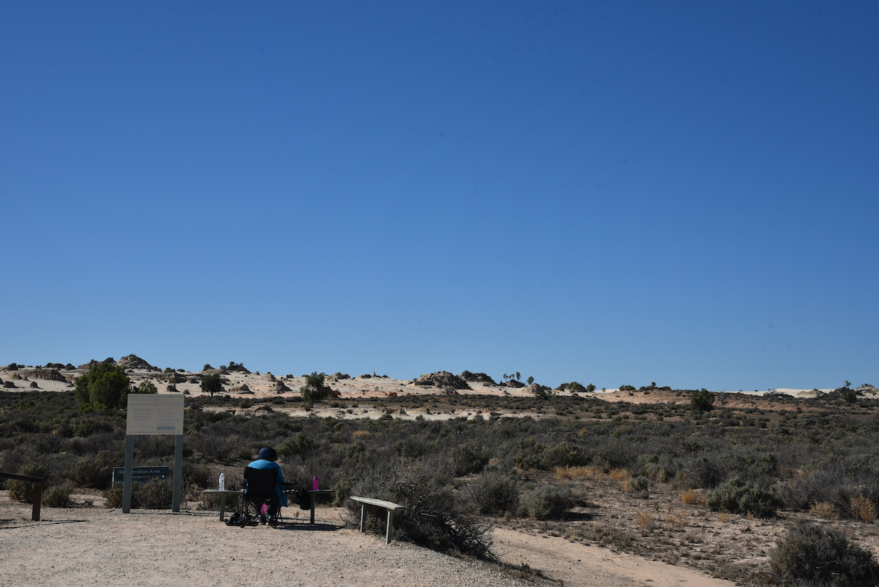
During our visit to the Walls of China there were at least a dozen people either painting or drawing the landscape (see below)
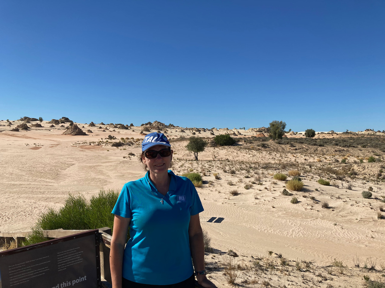
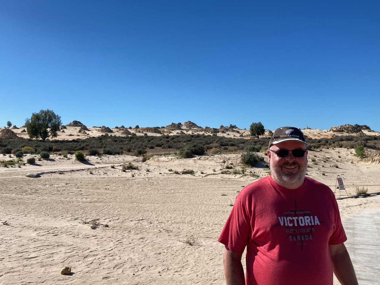
We then drove out to the Walls of China lookout. There is a viewing platform here which offers amazing views of the Walls of China and Lake Mungo.
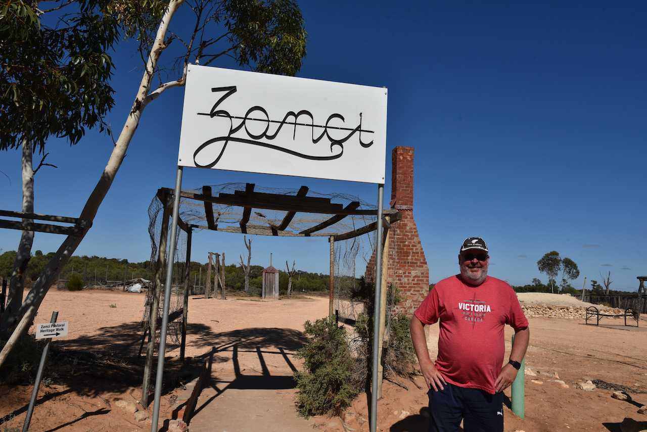
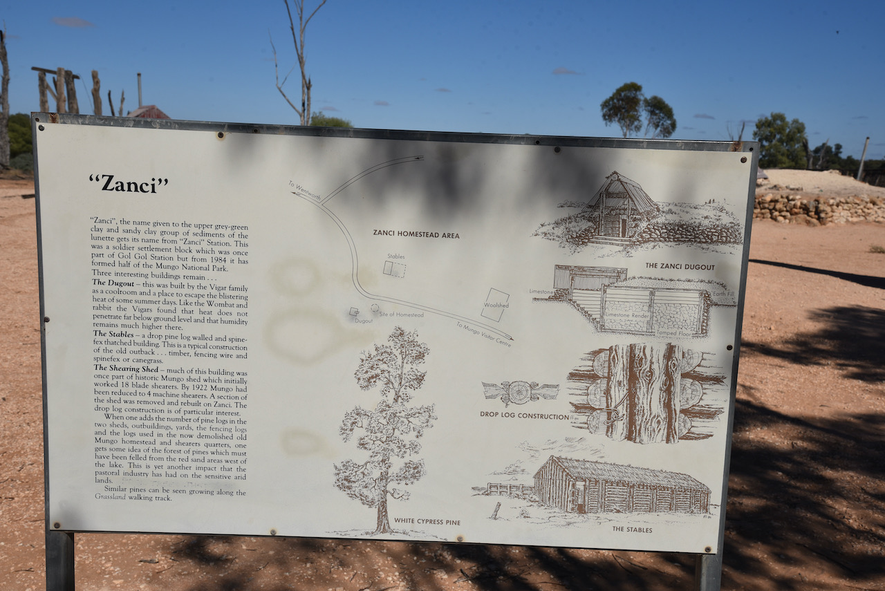
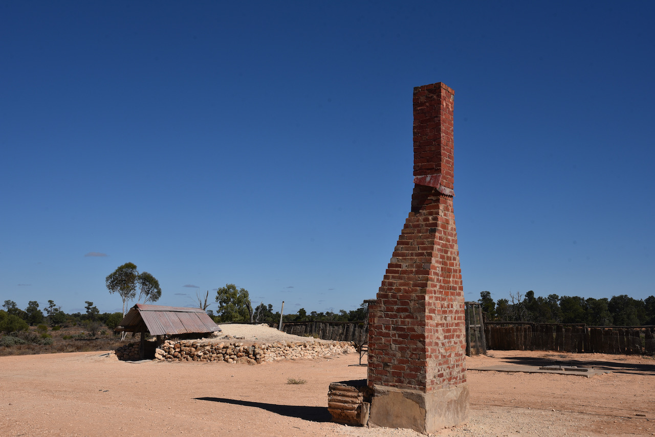
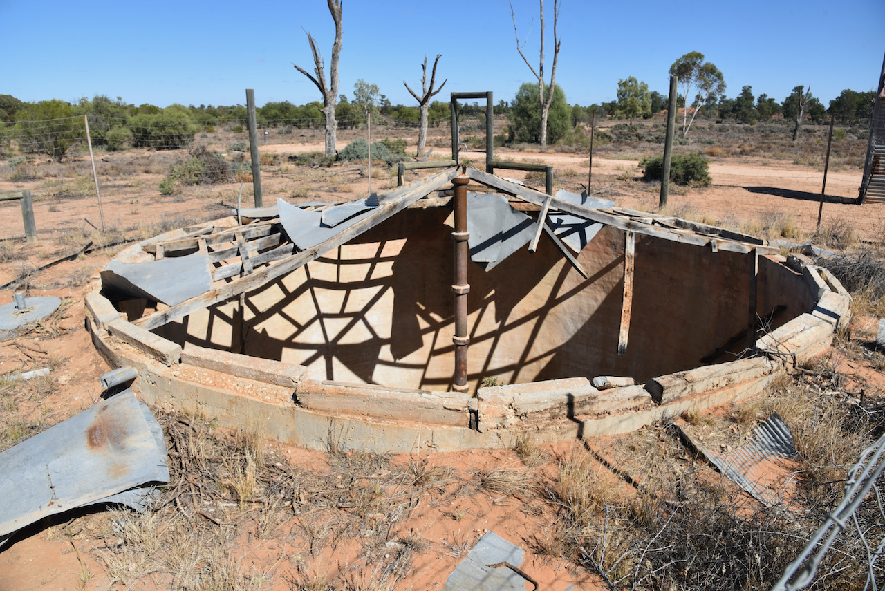
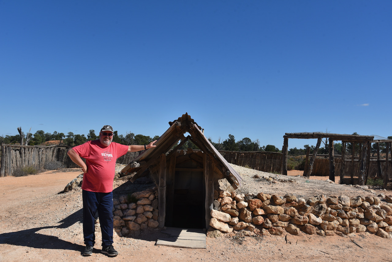
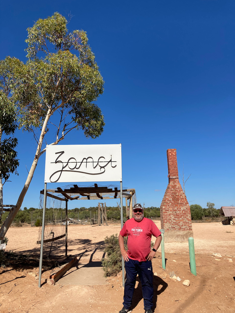
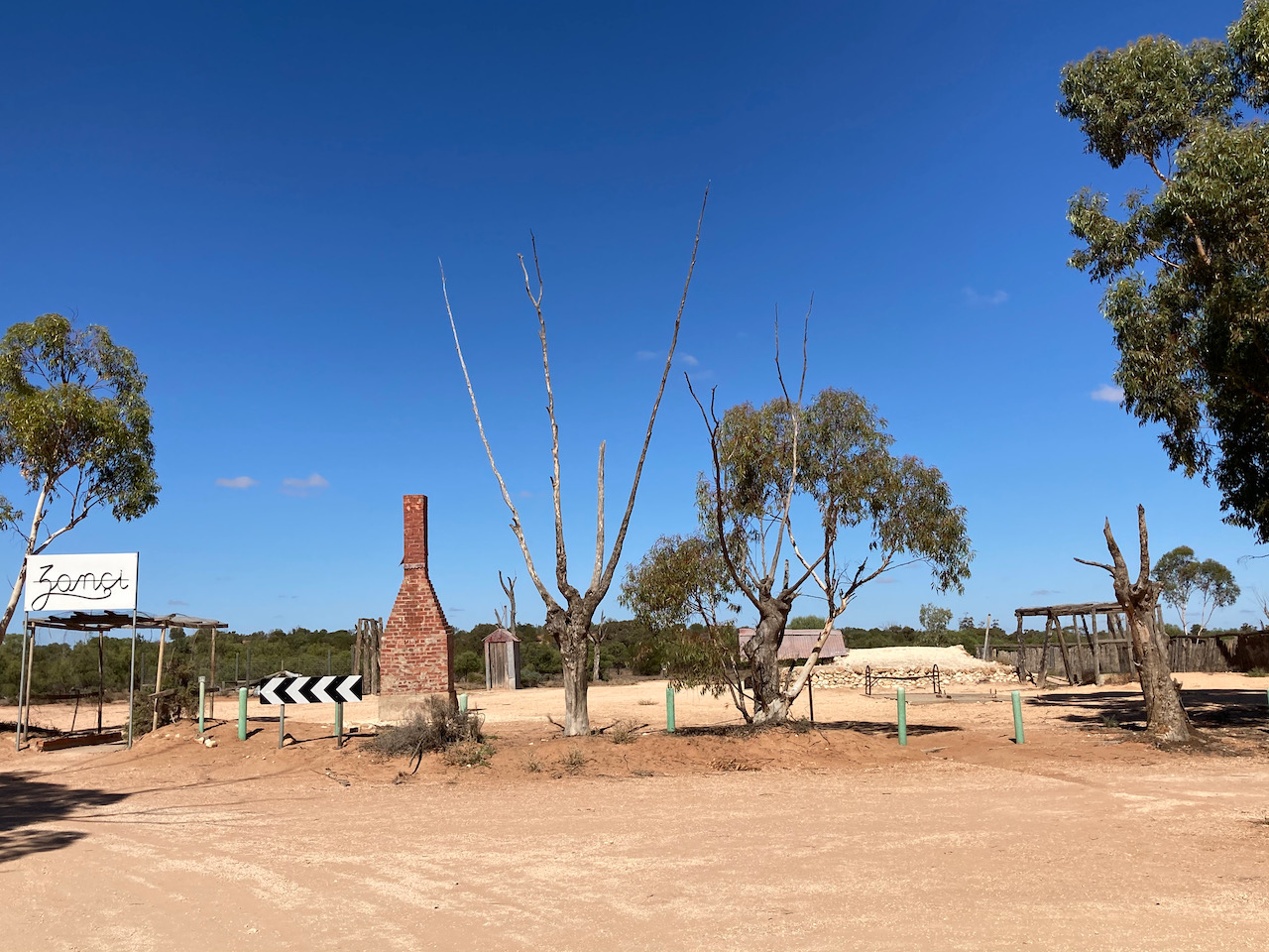
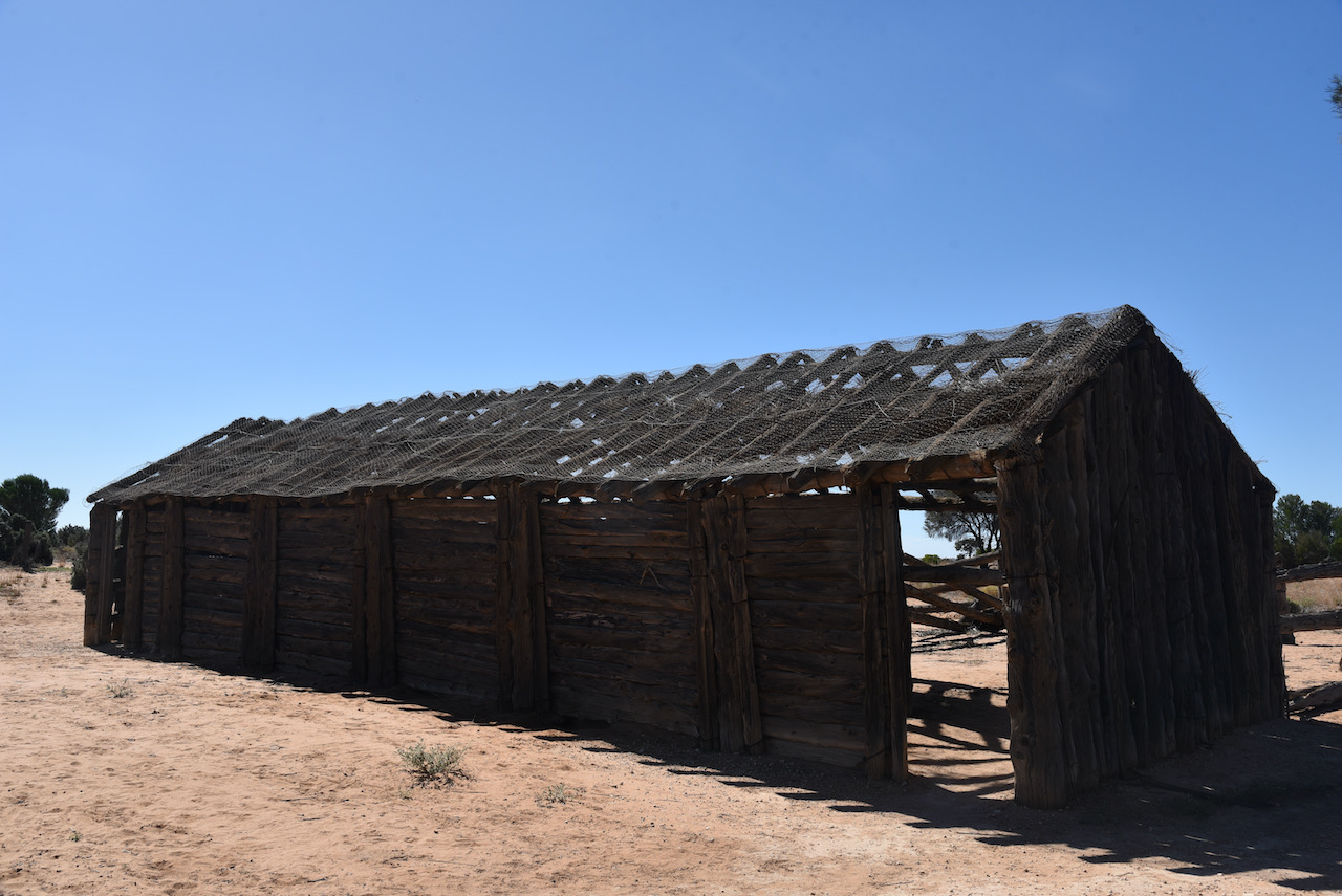
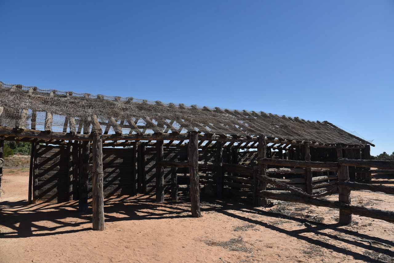
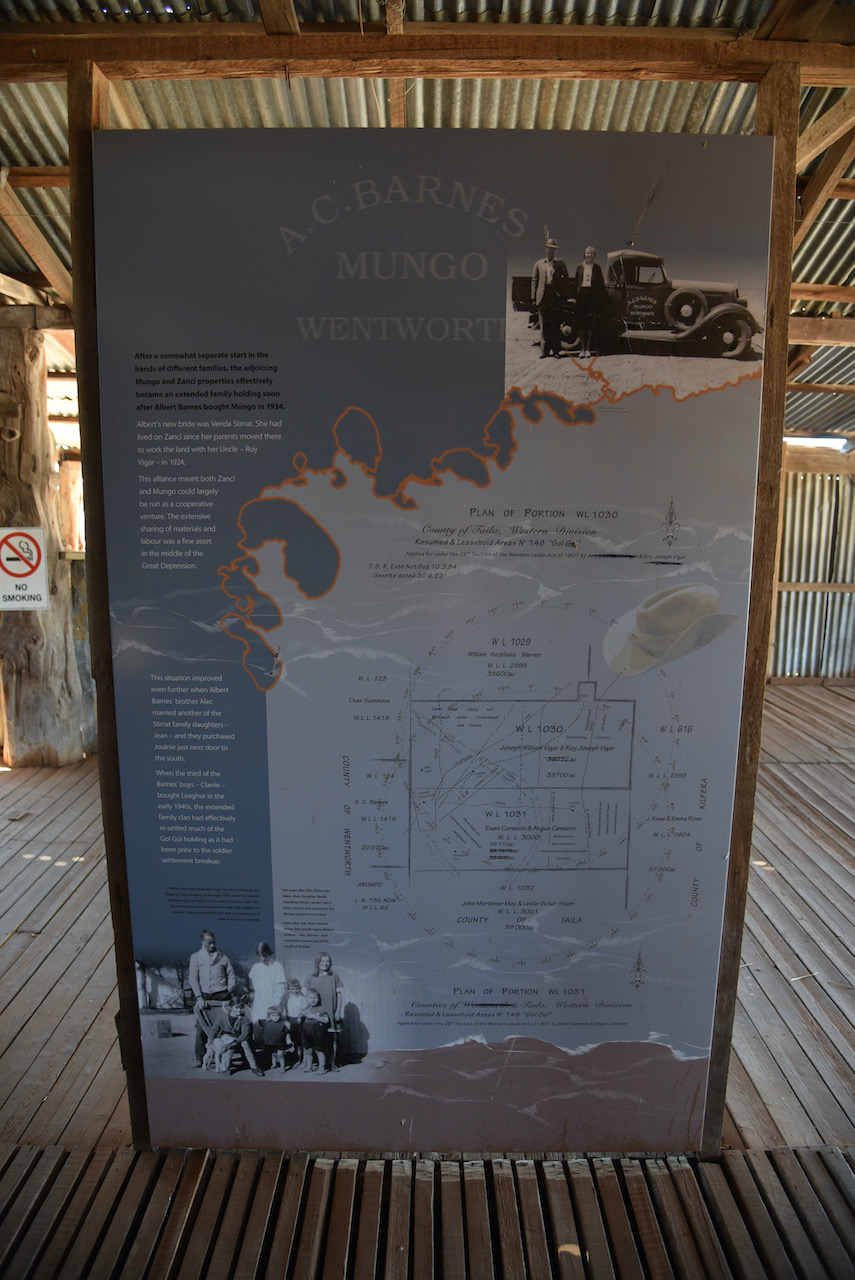
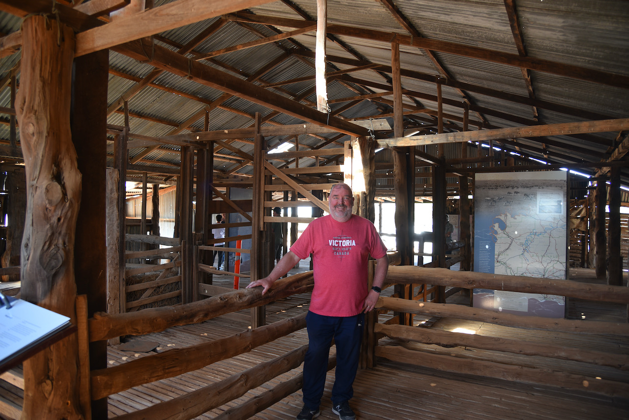
Our next stop was the old Zanci homestead. This was a soldier settlement block which was once part of Gol Gol Station. SInce 1984 it has formed half of the Mungo National Park. Three interesting buildings remain at Zanci, the dugout, the stables, and the shearing shed.
The dugout was built by the Vigar family as a cool-room and a place to escape the blistering heat of summer days. Just like the Wombat and the rabbit, the Vigar family found that heat does not penetrate far below ground level and that humidity remains much higher there.
The stables are a drop pine log walled and spinefex thatched building. This is a typical construction of the old outback, consisting of timber, fencing wire and spinefex or canegrass.
The Zanci shearing shed was once part of the historic Mungo shed which initially worked 18 blade shearers. By 1922 Mungo had been reduced to 4 machine shearers. A section of the shed was removed and rebuilt at Zanci. The drop log construction is of particular interest.
When you add the number of pine logs in the two sheds, the outbuildings, the yards, the fencing logs, and the logs used in the now demolished old Mungo homestead, you can get a feel of the forest of Pines which must have been felled from the red sand area west of the lake.
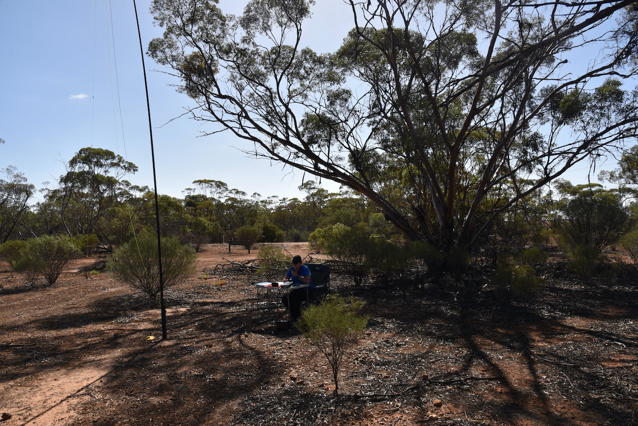
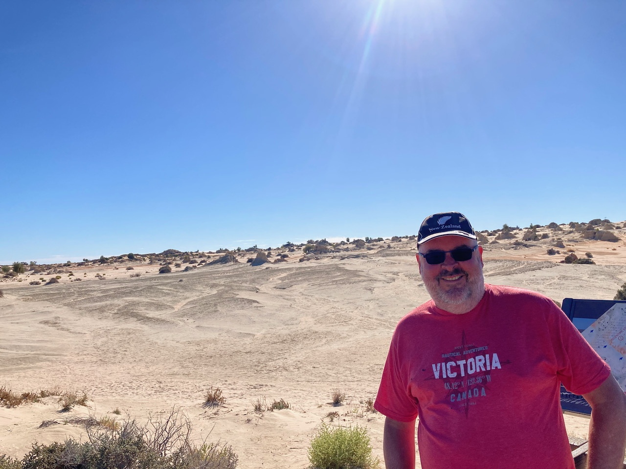
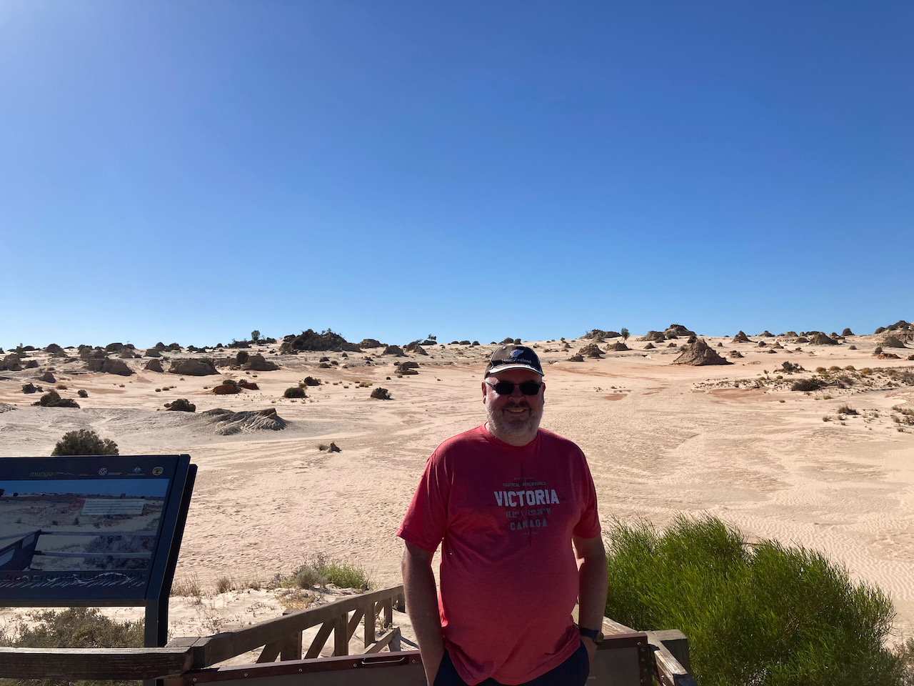
Marija and I headed for the main campsite area at Mungo, however there was a sign saying that campground was full. So operating from there was not going to be an option. We then headed to the Mungo Lookout which appeared to be a quiet location. We found a shelter shed area with nobody around and this proved to be an ideal spot to operate from.
We ran the Yaesu FT-857d and the 20/40/80m linked dipole for this activation. The antenna was inverted vee configuration, supported by a 7 metre telescopic squid pole.
Just a short walk from our operating spot was the Mungo Lookout which offered sensational views of Lake Mungo.
First in the log for the Mungo activation was Tony VK3YV with a Park to Park contact. Tony was activating the Bull Beef Creek Nature Conservation Reserve VKFF-2055. Then all the fun started with a fairly significant pile up of callers. Within 5 minutes I had qualified the park with 10 contacts in the log. Contact number ten was with Dennis VK2HHA.
I decided to keep boxing on and get my 44 and then swap over with Marija. It took just 25 minutes to get QSO number 44 in the log, a contact with David VK3VRA.
I logged a total of 61 contacts on 40m before handing the mic over to Marija. Contacts were made to VK1, VK2, VK3, VK4, VK5, and VK7.
Marija then called CQ on 7.144 and this was answered by Peter VK3PF, followed by Ivan VK5HS and then Phil VK3MB. Marija also developed a little pile up, and in just 5 minutes had contact number 10 in the log, a QSO with Joe VK3SRC.
Marija pushed on with the park hunters and after just 30 minutes had contact number 44 in the log, a QSO with Allen VK3HRA. Contacts were made into VK1, VK2, VK3, VK4, VK5, and VK7. This included a Park to Park contact with Chris VK1CT/2 who was activating the Narrawallee Creek Nature Reserve VKFF-1979.
I then picked up a further 23 contacts on 40m before heading to 14.310 where I just logged 4 QSOs, including a Park to Park with Marty VK4KC who was in the Bribie Island National Park VKFF-0053.
Marija and I packed up, feeling very satisfied with a total of 139 QSOs in the log.
During our activation we had a number of onlookers and we explained to them the hobby of amateur radio and the World Wide Flora Fauna program. We were also visited by one of the Rangers and I must say it was an absolute pleasurable experience. She was very interested in our hobby and the link to nature. I handed her some promotional material and my business card and told her about my Blog. This was a very good interaction. Big thumbs up to the Rangers at Mungo.
Marija worked the following stations on 40m SSB:-
VK3PF
VK5HS
VK3MB
VK3PWG
VK5WG
VK5IS
VK5CZ
VK5BJE
VK3SRC
VK3YSP
VK3FOWL
VK2YW
VK2HHA
VK4BXX
VK4/NN3Z
VK3MPR
VK4CZ
VK5MJC
VK1CT/2 (Narrawallee Creek Nature Reserve VKFF-1979)
VK5FUSE
VK7LTD
VK4NH
VK4DXA
ZL4TY/VK4
VK5LA
VK3UH
VK3GQ
VK3VRA
VK7FAMP
VK2QM
VK2IO/m
VK3MTT
VK3ZPF
VK5NEC
VK5FDMG
VK5SRP
VK2MOR
VK5FR/m
VK3ARH
VK2XSE
VK5DC
VK1DI
VK2PET/5
VK3HRA
VK2KNV
VK3CJN
VK3FQSO
VK3CU
I worked the following stations on 40m SSB:-
VK3YV/p (Bull Beef Creek Nature Conservation Reserve VKFF-2055)
VK3BBB
VK2CCP
VK2YW
VK3CWF
VK3CAT
VK5IS/m
VK5WG
VK2DG
VK2HHA
VK2LEE
VK4HNS
VK4NH
VK4DXA
ZL4TY/VK4
VK3FQSO
VK5FUSE
VK3PF
VK3MB
VK7QP
VK3TKK/m
VK5KSW
VK3MCK
VK5GY
VK2IO/m
VK2VW
VK2HFI
VK3MPR
VK2STG
VK3UH
VK2VAR
VK7FLAR
VK2TM
VK1DI
VK7FAMP
VK3PMC
VK7DIK
VK5HS
VK4CZ
VK3SRC
VK3YSP
VK3FOWL
VK5PL
VK3VRA
VK5MJC
VK5FR/m
VK2RO
VK5CZ
VK7LTD
VK5DIK
VK2VH
VK4AAC/2
VK3PI
VK3MTT
VK4FDJL
VK4BXX
VK4/NN3Z
VK5KLV
VK3MLD
VK4HAW
VK7EE
VK3XCI
VK3PWG
VK1CT/2 (Narrawallee Creek Nature Reserve VKFF-1979)
VK2YK
VK5GA
VK5SRP
VK2HRX
VK2MOR
VK3NCC/m
VK2HBO
VK2PET/5
VK5VK
VK3CJN
VK3FTOM
VK3ARH
VK3APA
VK3KK
VK5BW
VK7LTD
VK3DBP
VK5FDMG
VK2FPAR
VK2FAPC
VK5RK
VK2PBC/m
VK3SQ
I worked the following stations on 20m SSB:-
VK4KC (Bribie Island National Park VKFF-0053)
VK4MAD (Bribie Island National Park VKFF-0053)
VK4DOG (Bribie Island National Park VKFF-0053)
VK4WTN
After packing up we headed to Mungo Lodge on the way out of the park and stopped for a coffee and to buy a few souvenirs. There were a number of kangaroos and emus in the area.
We then headed back into Euston and decided to activate the Euston Regional Park.
While we were still at the Passage Camp Nature Conservation Reserve we discussed what park we would next activate. We decided to head over the State border from Victoria into New South Wales and activate the Yanga National Park VKFF-2249. I had previously activated this park back in 2015.
This was going to be a 100 km drive for us and there were a lot of other parks close by, but Yanga was such an interesting place and I really wanted to show Marija the old Yanga Shearing Shed, and possibly visit the old homestead.
Above:- Map showing the location of the Yanga National Park. Map c/o Protected Planet.
We travelled south on the Murray Valley Highway until we reached the little town of Tooleybuc on the State border and the Murray River.
Although we had been here before, we stopped briefly to have a look at the old Tooleybuc Bridgkeepers Cottage which was built in 1924.
Tooleybuc is the home to a historic bridge which crosses the Murray. It was built in 1925 and was designed to rise to let paddle steamers through. In 1974 the paddle steamer Pevensey collided with the bridge.
We then headed north-east on Yanga Way until we reached the junction with the Sturt Highway. We turned right and turned off shortly afterwards and entered the Yanga National Park.
We soon reached Yanga Homestead which was constructed in the 1860’s. It is built in two parts, the main homestead and the kitchen wing, using drop log and Red Gum slab techniques. It was once surrounded by gardens including ornamental and vegetable plantings. Yanga was a large pastoral station at this time.
Pressed metal ceilings remaining from updates during the 1920’s. Much of the current interior design harks back to the wool boom of the 1950’s.
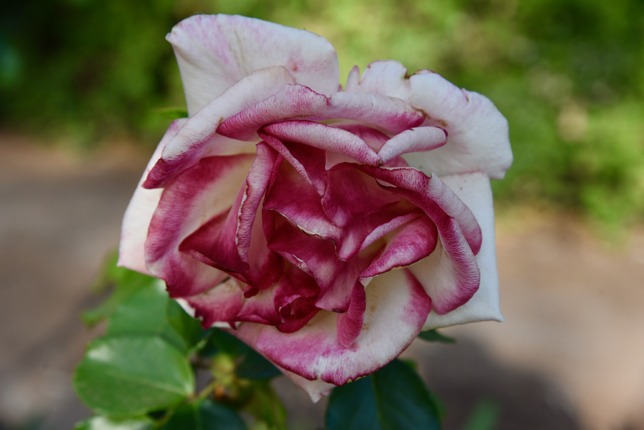
There are some beautiful gardens adjacent to the homestead featuring roses and cottage type plants and flowers.
Nearby is Yanga Lake which is 1,246 hectares in size. It has a maximum depth of 5 metres and holds abut 55,000 megalitres of water which is equivalent to 22,000 Olympic swimming pools. The lake is 24 kilometres around the perimeter. It consists of two connected sub-basins forming what was referred to in the nineteenth century as a ‘spectacle’ lake, shaped like a pair of eye glasses. Current scientific information suggests the lake was formed around 128,000 years ago.
Below are two short videos on Yanga Homestead.
We then headed out to the Yanga Woolshed section of the Yanga National Park which can be reached via Windomal Road which runs off the Sturt Highway.
Maps drawn in 1851 show a woolshed on the western side of Tala Lake and another at the very northern end of what is now Yanga National Park. The current site, an outstation of W.C. Wentworth’s ‘Tala’ Run, named Mamanga, is shown as having only huts and a stock yard. It is likely that a woolshed was added in the late 1850s to take advantage of paddle steamer transport to take the wool to market. The site would have been chose because it is where red ground, which is normally above flood level, meets the river at a point where there is deep water suitable for the location of a wharf.
The Yanga woolshed was once the largest, most modern woolshed in the district, and housed 3,000 sheep and provided work for up to 40 shearers at a time.
This is an incredibly interesting place and we spent quite a bit of time here exploring the woolshed and its surrounds. You can take a self guided tour and read about the woolshed’s incredible history on the the various interpretive boards and you can listen to some interesting tales on the audio guides located throughout the woolshed. It really gives you a feel for what it must have been like in a 19th century woolshed.
The last shearing at Yanga took place on the 10th and 11th November 2005.
We then drove to the nearby Mamanga campground and set up our little portable station for an activation of the Yanga National Park.
Yanga is a large park of about 35,359 hectares and was established on the 28th day of February 2007. It has a frontage of about 170km on the Murrumbidgee River, the second longest river in Australia. The River Red Gum (Eucalyptus camaldulensis) forests in the park are part of the third-largest contiguous stand of river red gum forest in Australia.
Above:- The boundaries of the Yanga National Park in NSW. Map c/o Protected Planet.
The creation of the National Park followed the purchase of Yanga Pastoral Station, a 160-year-old sheep station held under freehold title in November 2005. In its later years, Yanga Station also carried cattle and supported dryland cropping and red gum harvesting for commercial timber.
In 2010 additions were made to the National Park which included the former Kieeta State Forest (617 hectares) and about 140 hectares from the neighbouring Kieeta Station, a working sheep property held under freehold title.
Above:- An aerial view of the Yanga National Park. Image c/o Google maps
We were fortunate that there were very few people in the campground, and we got a very nice spot right alongside of the Murrumbidgee River.
As it was late in the afternoon, the 40m band was very busy with VK, ZL, Europe, and North America. It was quite difficult to find a clear spot. I ended up settling on 7.185 and called CQ which was answered by keen park activator and hunter Marty VK4KC. Band conditions were excellent and it did not take long for a mini pile-up to commence.
Contact number ten was with Peter VK2UXO who had a very big signal.
Within a very quick 25 minutes I had contact number 44 in the log, a QSO with Peter VK3ACZ. With 49 QSOs in the log from VK2, VK3, VK4, VK5, VK7, and New Zealand, I swapped the mic with Marija. Contacts included a Park to Park with Stuart VK3UAO/p who was activating the High Camp Flora Reserve VKFF-2330.
Marija took up where I left off with quite a pile up and it only took here 4 minutes to get her 10th contact in the log, a QSO with Ray ZL4TY/VK4.
Marija logged a total of 20 QSOs before I jumped back into the operator’s chair and logged another 4 stations on 40m.
It was getting quite late, so I had a quick listen on the 80m band where I logged 14 stations from VK2, VK3, VK4, and VK5.
We had a total of 87 QSOs in the log.
Marija worked the following stations on 40m SSB:-
VK3UAO/p (High Camp Flora Reserve VKFF-2330)
VK5FANA
VK3ARH
VK3UH
VK5CZ
VK3TKK/m
VK3IK/m
VK4NH
VK4DXA
ZL4TY/VK4
VK3ANL
VK3MPR
VK4SMA
VK3PF
VK2FPAR
VK2FAPC
VK4KC
VK4MAD
VK4DOG
VK5AYL
I worked the following stations on 40m SSB:-
VK4KC
VK4MAD
VK4DOG
VK2IO
VK2VH
VK4AAC/2
VK3ZPF
VK3PNG
VK5GY
VK2UXO
VK4HNS
VK4FDJL
VK3PF
VK3YV
VK4NH
VK4DXA
ZL4TY/VK4
VK5FDMG
VK5PET
VK2DG
VK3TKK/m
VK3UAO/p (High Camp Flora Reserve VKFF-2330)
VK5WG
VK2HRX
VK5JP
VK3CWF
VK2MSA/m
VK7FCIA
VK3NCR
VK5AYL
VK5PTL
VK4SMA
VK3MCK
VK5CZ
VK2LEE
VK2VW
VK2HFI
VK2SR/m
VK3MTV
ZL4NVW
VK3PT/m
VK3IK/m
VK2PRC
VK3ACZ
VK2PIR
VK3YUN
VK3UH
VK2FPAR
VK2FAPC
VK5FANA
VK3MPR
VK3PI
VK5IJ
I worked the following stations on 80m SSB:-
VK5FANA
VK2FPAR
VK2FAPC
VK3ANL
VK5AYL
VK4HNS
VK3YUN
VK3ZYZ
VK4NH
VK4DXA
ZL4TY/VK4
VK3PNG
VK3YV
VK3ARH
After packing up we headed into the town of Balranald where we stopped off to get some hot chips to contain our hunger. We an 82 km drive back to Robinvale along the Sturt Highway. Once back our motel we ordered a meal to be delivered to our room from the motel’s restaurant.
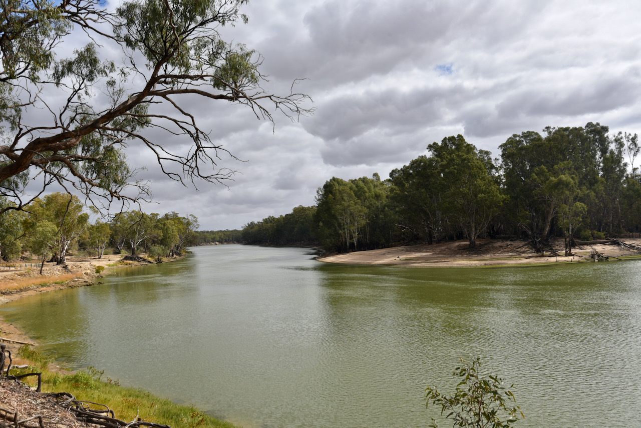
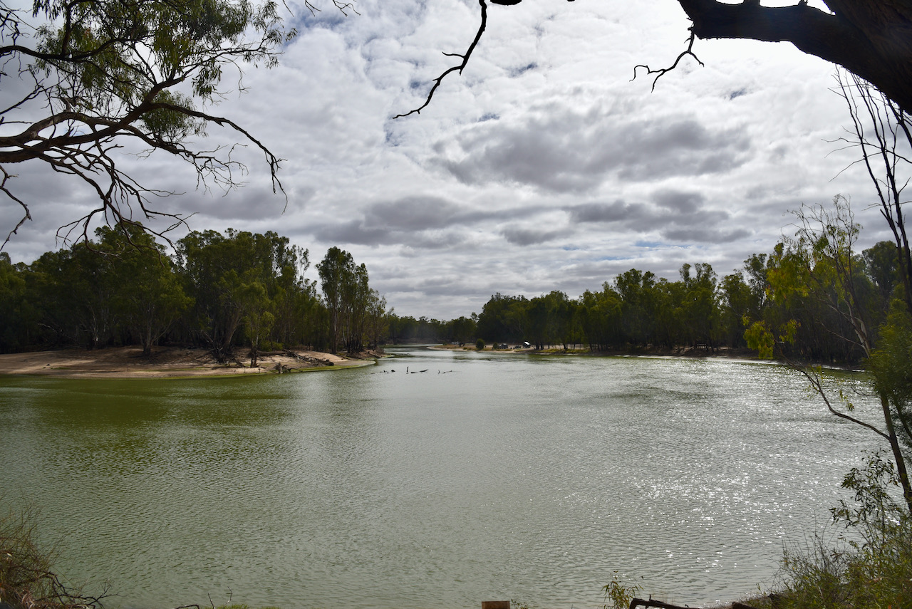
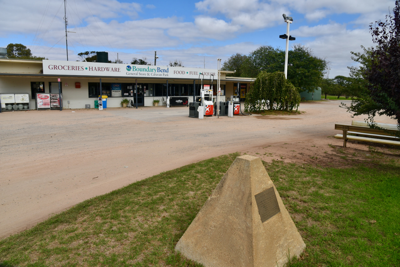
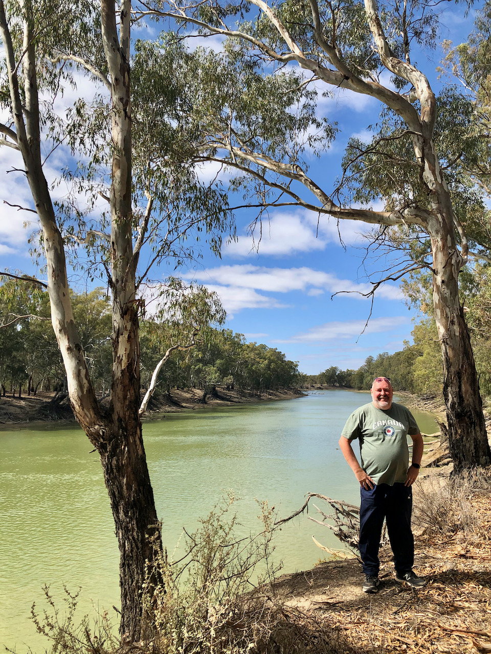
After packing up at Tol Tol, Marija and I drove south along the Murray Valley Highway until we reached the little town of Boundary Bend which is about 50 km east of Robinvale and Euston. We stopped here for a coffee.
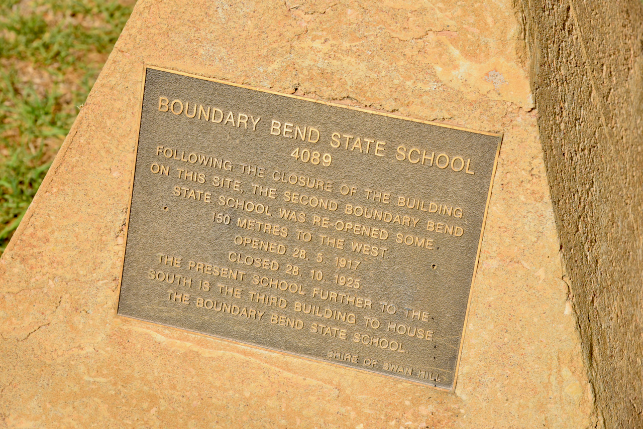
Boundary Bend is a thriving horticultural area with very large olive groves and almond plantations. It is named for the river bend, at the point where the boundary fence between Narrung and Yungera Pastoral Stations met with the Murray River. The town offers a magnificent sweep of the Murray River as its view. There is a small monument here re the old Boundary Bend School which closed in 1925.
Boundary Bend was the home of Arch Conner who died in 1980 at age 93. Known as ‘The Old Man of the Murray’, he was famous in the area as a fisherman on the Murray and Murrumbidgee Rivers. In his latter years he was a fully qualified paddle steamer ‘Master’.
Above:- Photos of Arch Conner, c/o State Library of South AustraliaB 63241/2, PRG 1258/4/79; and whiteburys.com
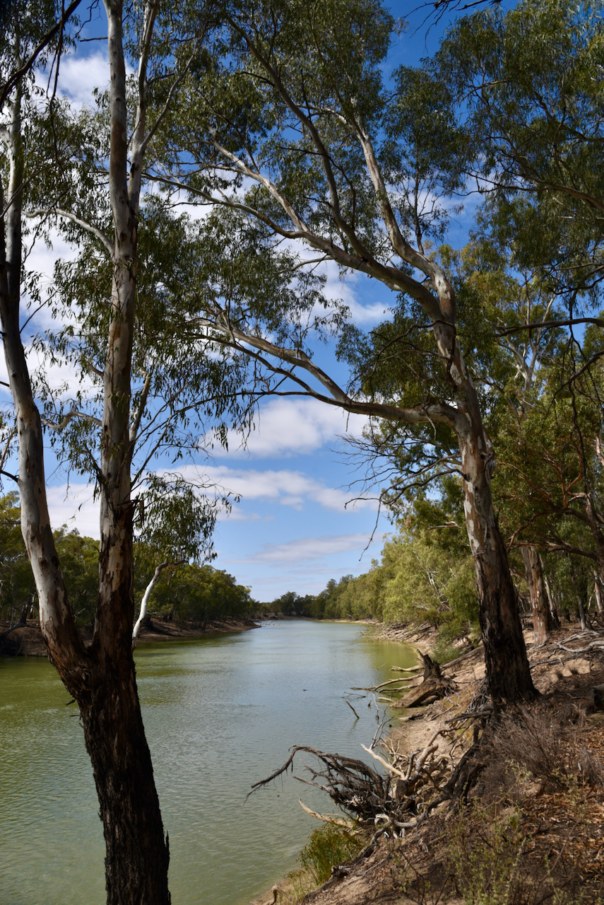
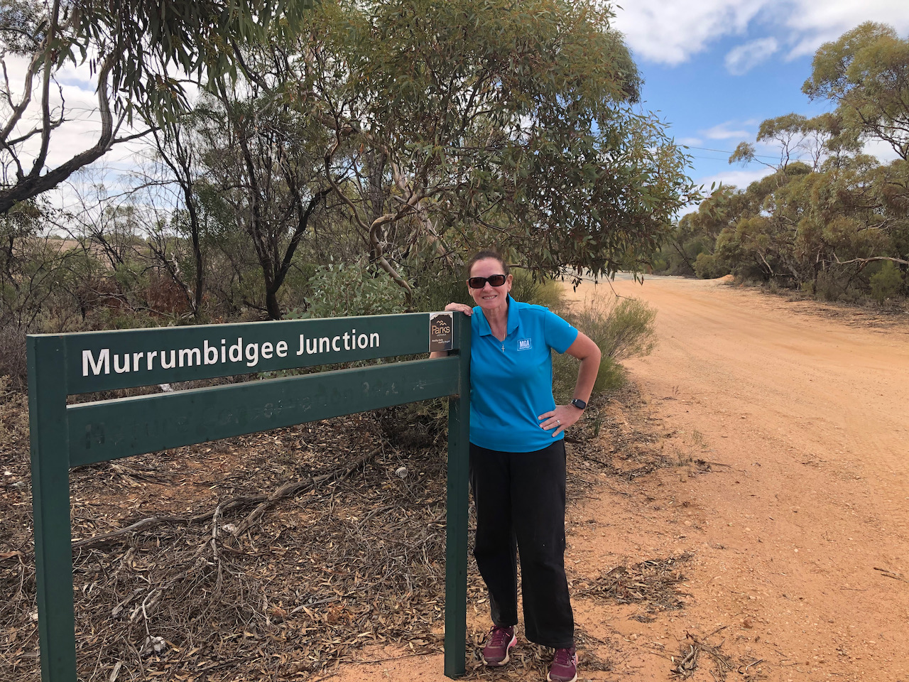
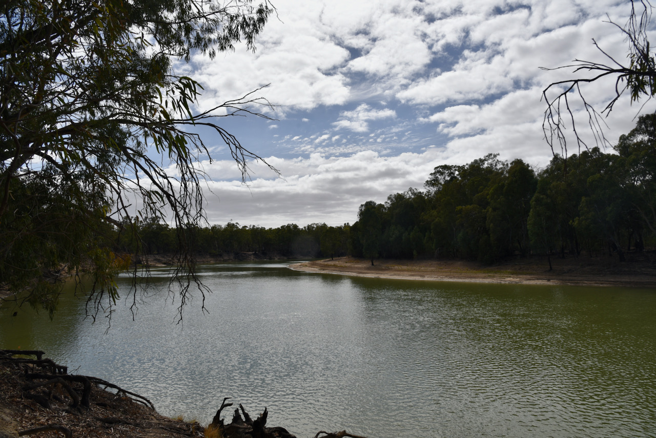
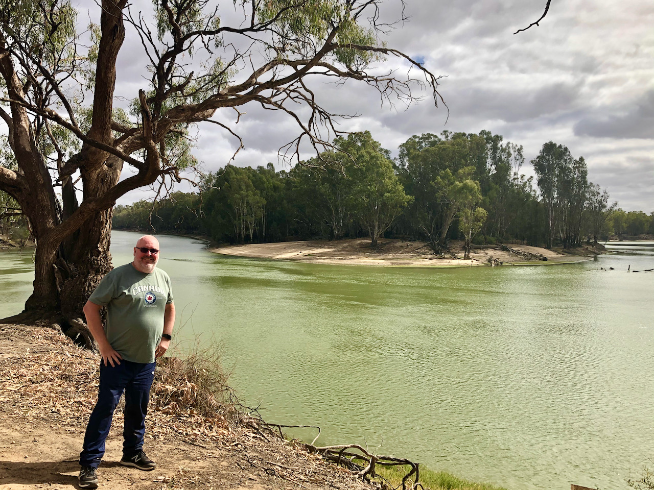
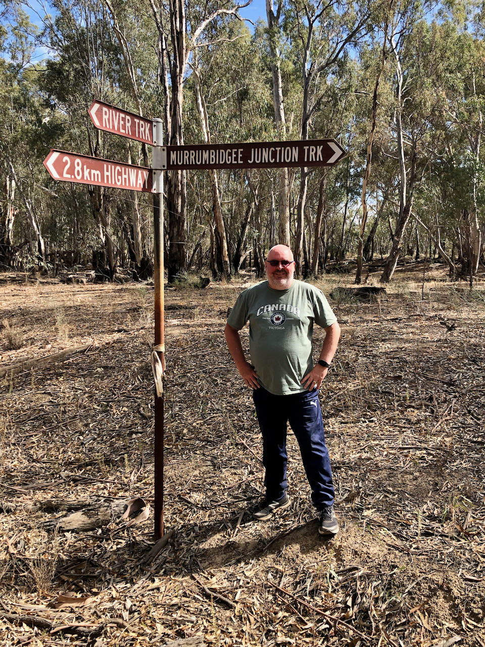
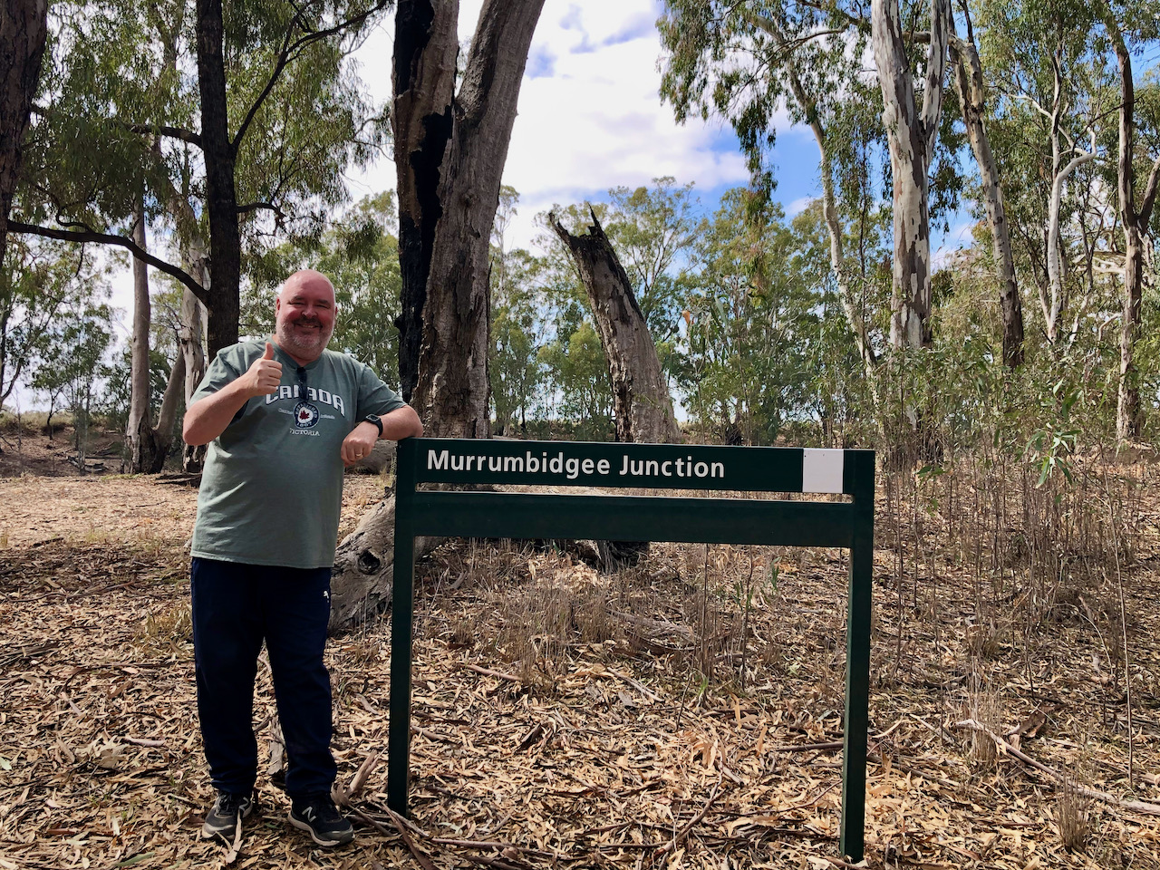
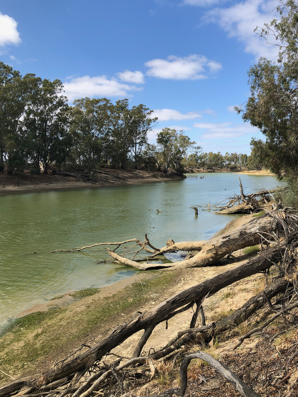
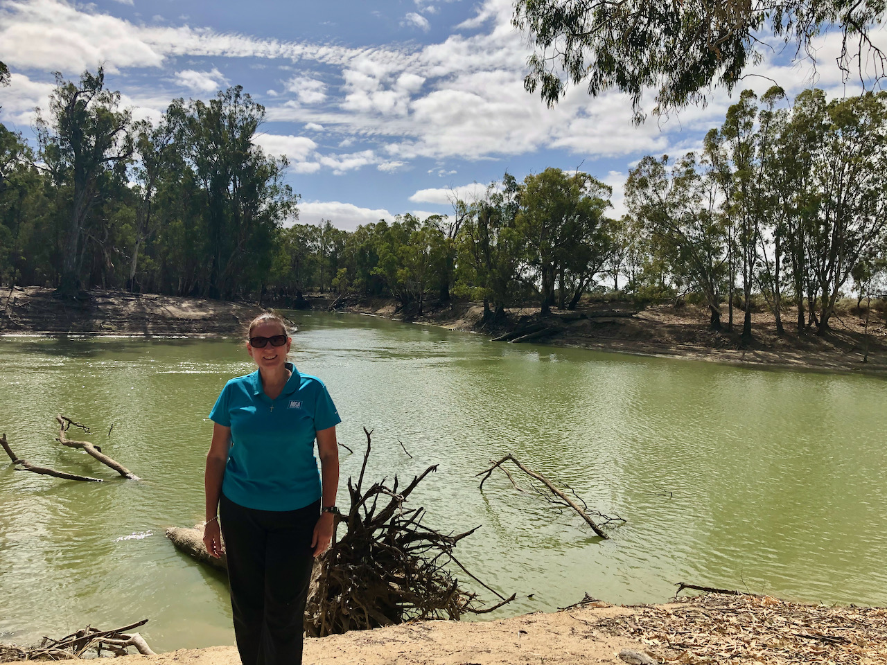
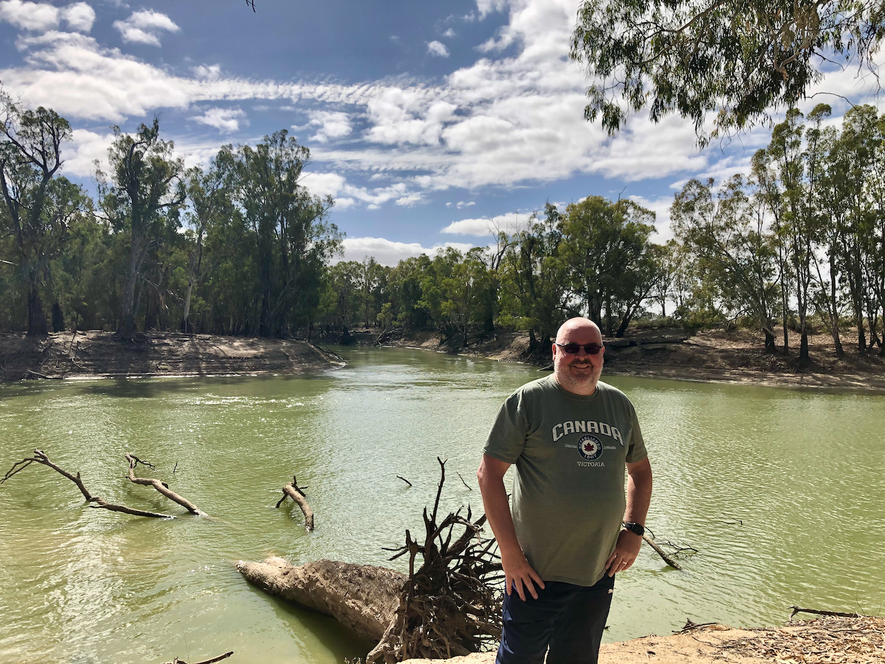
We then turned off the highway onto River Track and followed the 4WD track through magnificent River Red Gum forest and along the mighty Murray River. Our destination was to be the junction of the Murray and the Murrumbidgee Rivers.
We then took the Murrumbidgee Junction Track and soon reached the junction of the two rivers. This was a place I had always wanted to visit, and I was not disappointed. It was a beautiful spot and incredibly quiet.
The Murrumbidgee is a major tributary of the Murray River and is the second longest river in Australia. Murrumbidgee is an aboriginal word meaning ‘plentiful water’ or ‘big water’. It flows through the Australian States of New South Wales and the Australian Capital Territory towards its confluence with the Murray near Boundary Bend.
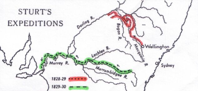
In January 1830, explorer Charles Napier Sturt (1795-1869) and his party rowed down the lower half of the Murrumbidgee River in a stoutly built, large row-boat, from Narrandera to the Murray River, and then down the Murray River to the sea. They then rowed back upstream, against the current, to their starting point.
Sturt wrote:-
“Suddenly the Murrumbidgee took a southern direction but in its tortuous course swept round to every point of the compass with the greatest irregularity. We were carried at a fearful rate down it’s gloomy and contracted banks. At 3 p.m., Hopkinson called out that we were approaching a junction, and in less than a minute afterwards we were hurried into a broad and noble river.”
Above:- Image of Charles Sturt and map showing his expeditions. c/o Wikipedia.
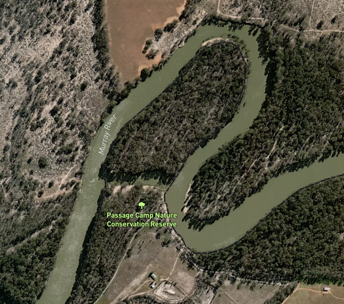
We kept following River Track and headed to the Passage Camp Nature Conservation Reserve VKFF-2173. The park is located about 46 km south-east of the town of Robinvale.
This was to be a first time activation of the park by myself and Marija. Mike VK6MB had previously activated the park back in 2019.
Above:- Map showing the location of the Passage Camp Nature Conservation Reserve. Map c/o Protected Planet.
The Passage Camp Nature Conservation Reserve is 0.21 km² in size and was established in 2015. The park is divided in two by an anabranch of the Murray River.
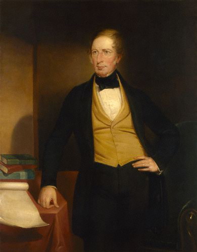
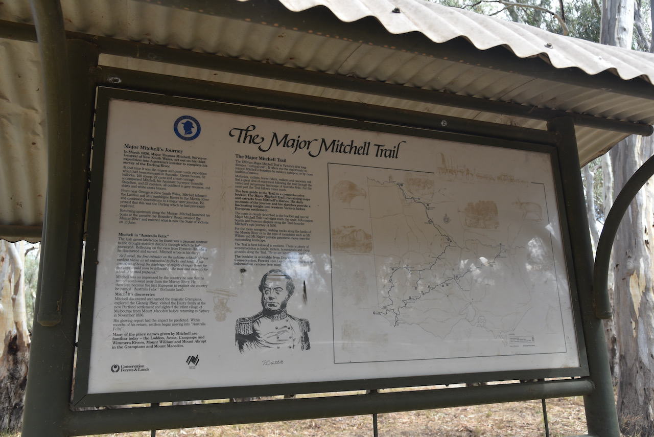
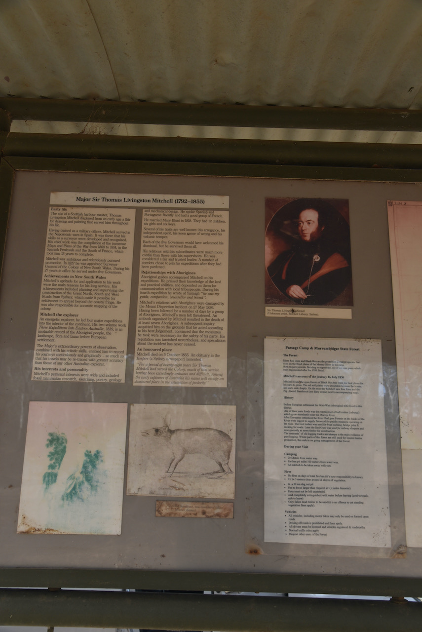
Sir Thomas Livingstone Mitchell (1792-1855) was a surveyor and explorer of south-eastern Australia. Mitchell’s third expedition which commenced in March 1836 was to explore and survey the lower part of the Darling River with instructions to head up the Murray River and then return to the settled areas around Yass.
At the time it was the largest and most costly expedition which had been mounted in Australia. A total of 11 horses, 52 bullocks, 100 sheep, 22 carts and a boat carriage accompanied Mitchell, his Assistant Surveyor Granville Stapylton, and 22 convicts, all outfitted in grey trousers, red shirts and white cross braces.
From near Orange in New South Wales, Mitchell followed the Lachlan and Murrumbidgee Rivers to the Murray River and continued downstream to a major river junction. He proved that this was the Darling which he had previously explored.
Returning upstream along the Murray, Mitchell launched his boats at the present day Boundary Bend, crossed the Murray River and entered what is now the State of Victoria on the 13th June. On the 13th to 16th June 1836 Mitchell and his party camped at Passage Camp.
Above:- Portrait of Major Sir Thomas Livingstone Mitchell, c. 1830’s. Image c/o Wikipedia
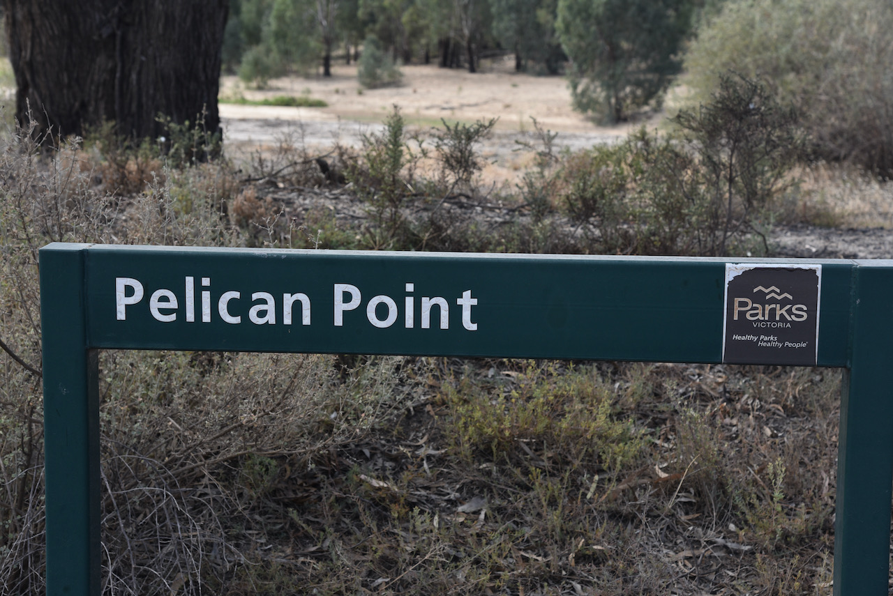
We found an information board at Passage Camp with lots of information about Mitchell which was very interesting. We also stopped to have a look at Pelican Point.
The park was well signposted.
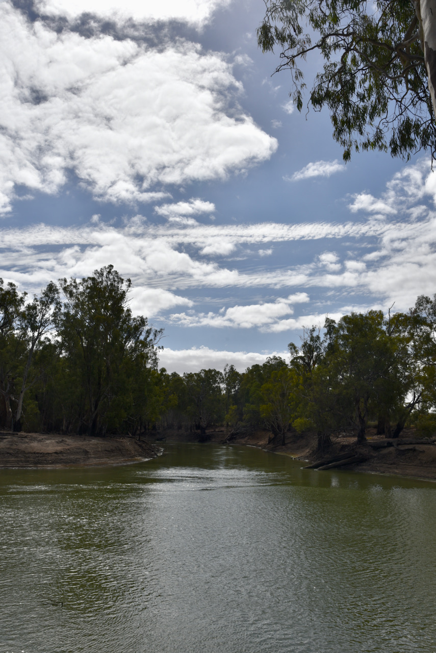
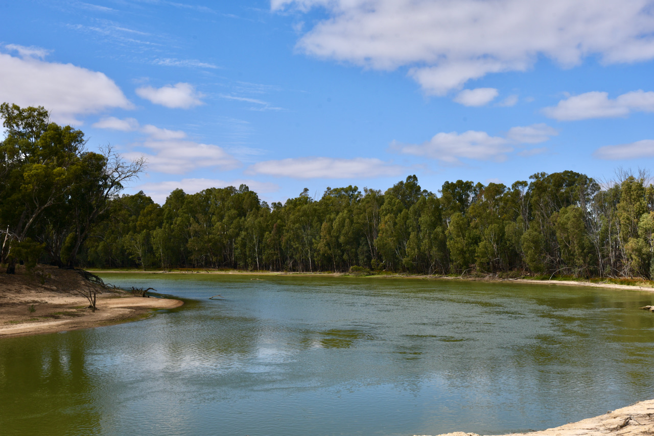
It was another beautiful sunny day and we enjoyed some terrific views of the Murray River from the park.
I kicked off the activation at Passage Camp and called CQ on 7.139 which was answered by Peter VK3PF, followed by Ian VK1DI, and then Steve VK3SMW. Contact number ten was with Brian VK2CCP.
I logged a total of 23 stations on 40m before callers dried up. Contacts were made into VK1, VK2, VK3, VK4, and VK5. This included a Park to Park contact with Stuart VK3UAO/p who was activating the Jallukar Nature Conservation Reserve VKFF-2155. Marija also logged Stuart for a Park to Park QSO.
Marija then jumped into the operator’s chair. Marija’s first contact was with Peter VK3PF, followed by Deryck VK4FDJL and then Joe VK3SRC. Marija’s tenth contact was with Adrian VK5FANA.
Marija logged a total of 29 stations on 40m SSB before handing the mic back to me.
I was keen, if possible, to get my 44 contacts and qualify the park for the global WWFF program. Callers were slow, and with 43 contacts in the log, Marty VK4KC suggested we try 40m AM. I switched off and logged Marty, 5/9 both ways on AM.
I then headed to 80m and called CQ for 5 minutes but had no takers.
We were packing up when we saw a spot for Gerard VK2IO/p in a park on 40m. So we quickly hoisted up the 7 metre squid pole and logged Gerard who was activating the Jervis Bay Marine Park VKFF-1408.