
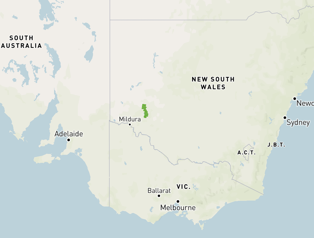
We were getting towards the end of our trip and it was now day eleven (Friday 16th April 2021). Our plan today was to head out to the Mungo National Park in outback south-western New South Wales. Mungo is about 990 km west of the city of Sydney.
Yesterday while we were at the Robinvale Visitor Info Centre we were told it may take up to 3 hours to get out to Mungo, despite the map showing it was 122km. As a result Marija and I left the motel at about 7.00 a.m. and headed out of Robinvale and across the Murray River and the Victoria/New South Wales State Border.
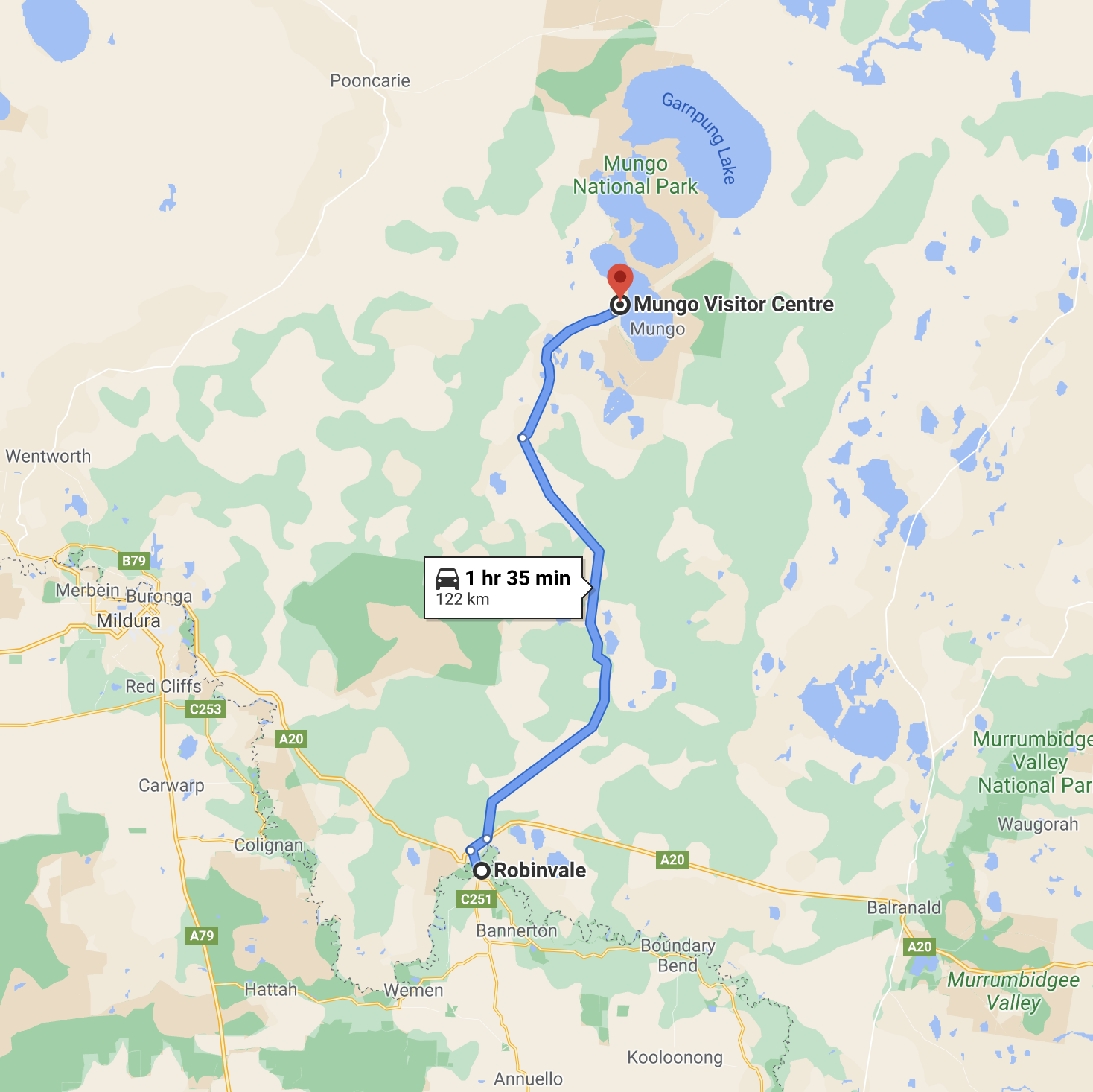
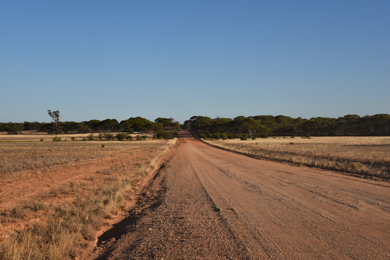
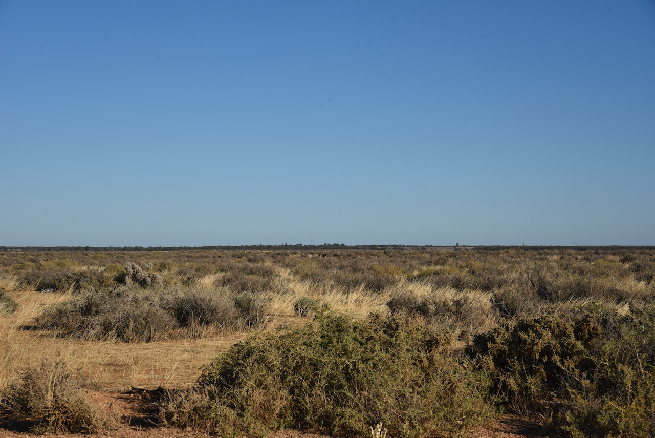
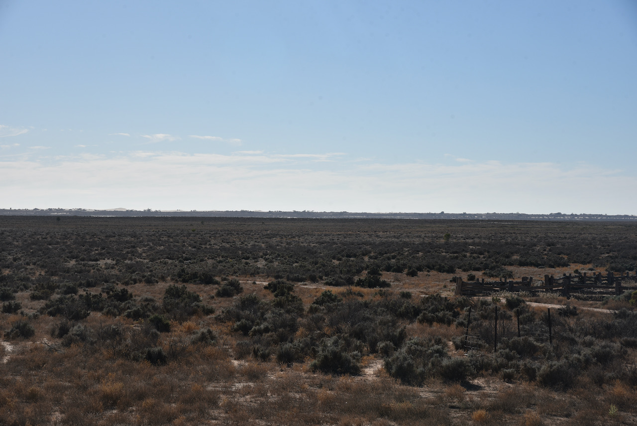
We drove north on the Euston-Prungle Road which was initially bitumen but then turned to dirt. We found the road pretty good with our 4WD, the Toyota Hi Lux, with no problems encountered. The road is rough in parts with lots of corrugations, but this was no issue for the Hi Lux. We could see why it might take a lot longer if you had a conventional vehicle.
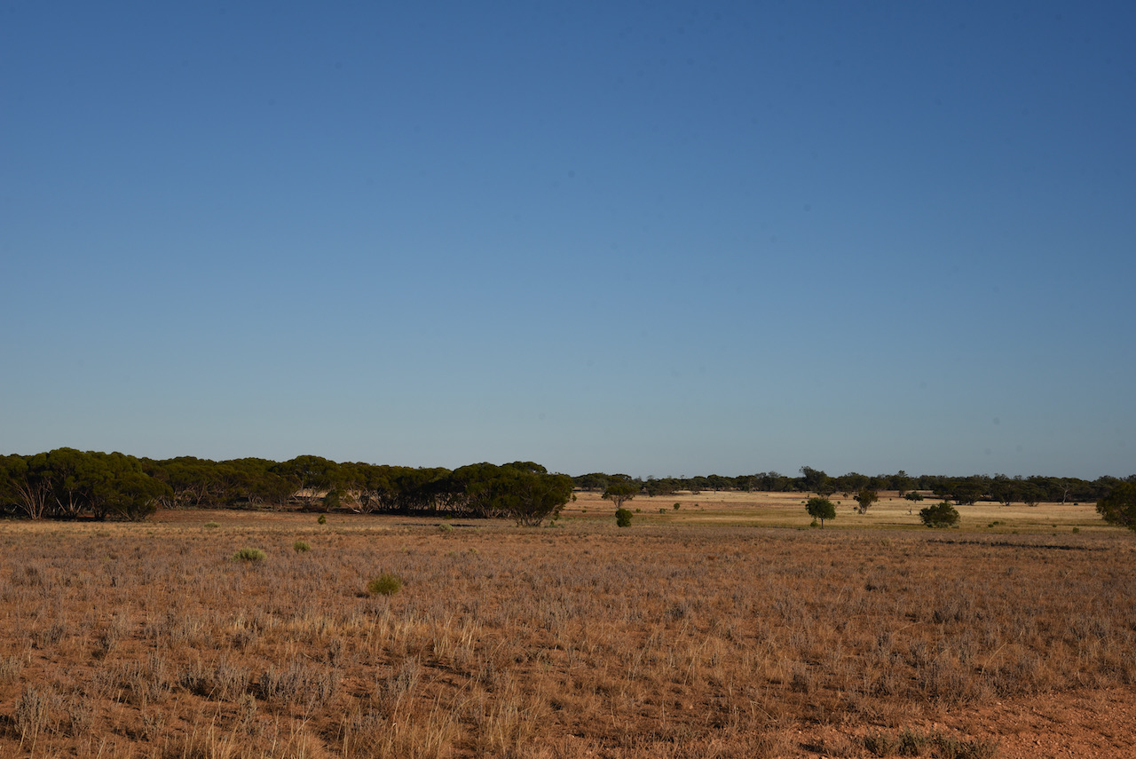
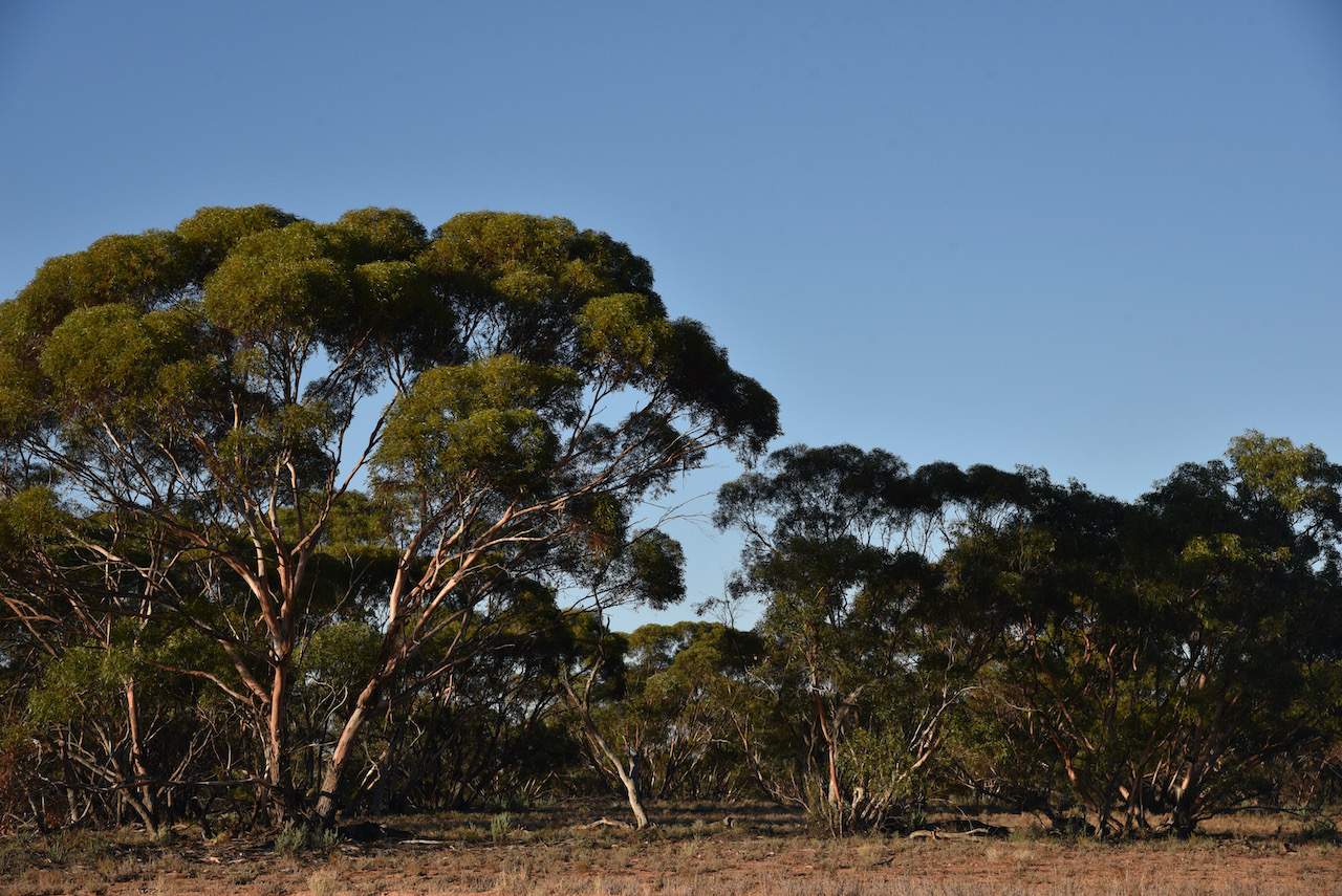
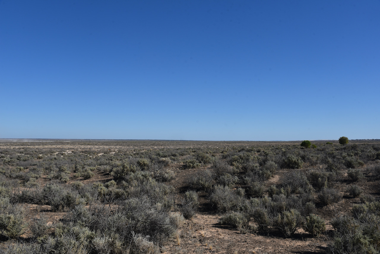
The drive took us through magnificent countryside which varied from thick mallee scrub to cleared land where you could see for miles.
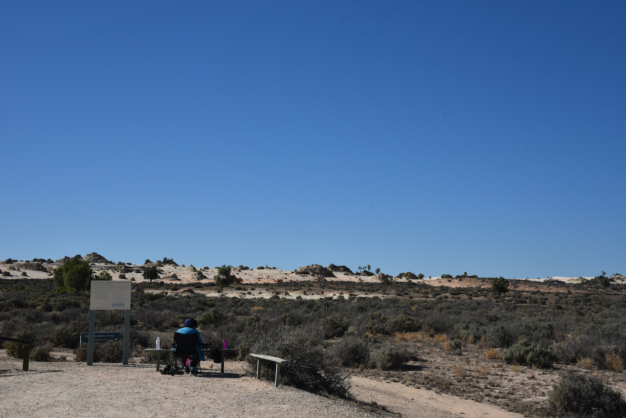
After about 90 minutes we reached the Mungo National Park and stopped briefly at the information board and the park sign for a photo.
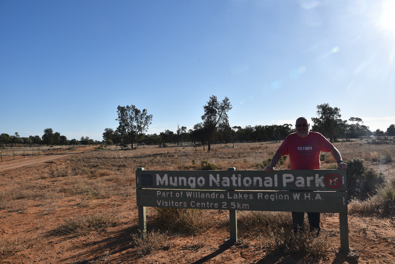
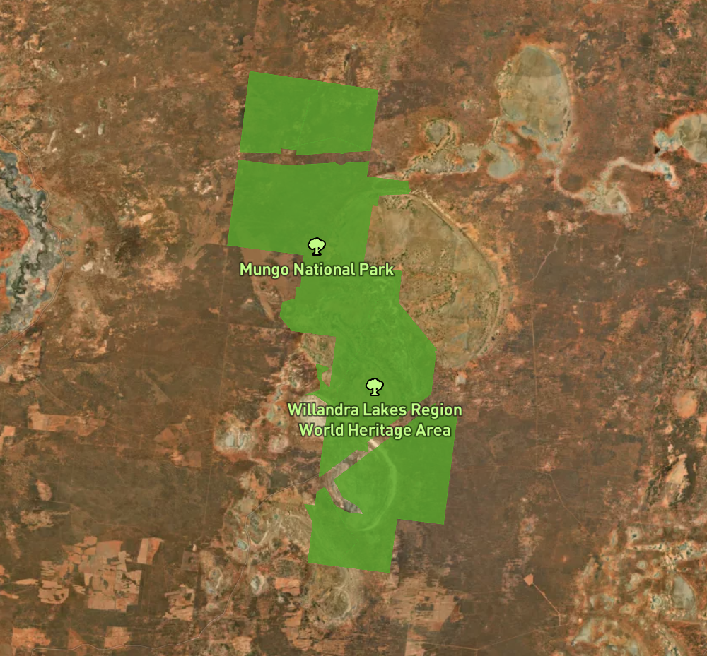
Mungo National Park is 110,967 hectares (274,210-acres) in size and was established on the 6th day of April 1979. The park is part of the UNESCO World Heritage listed Willandra Lakes region, an area of 2,400 square kilometres which incorporates 17 dry lakes. Not all are called Mungo, but they are all declared world heritage.
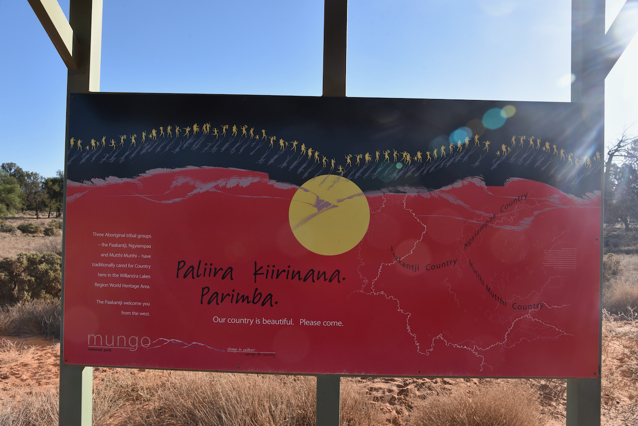
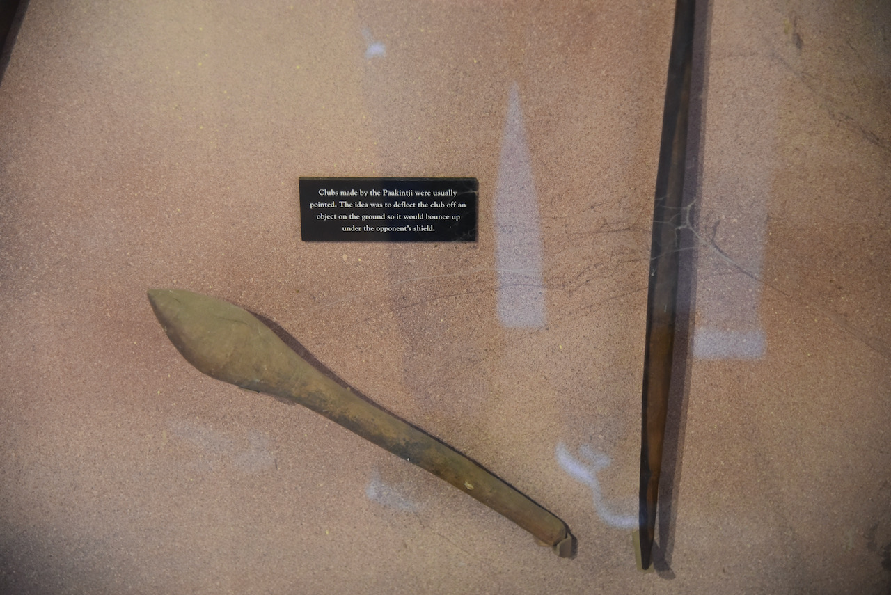
Three aboriginal tribal groups, the Paakantji, Ngyiampaa and Muttthi Mutthi, have traditionally cared for Country here in the Willandra Lakes Region World Heritage Area.
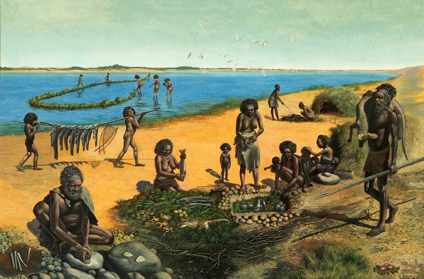
Australia’s landscape has been ever changing over the years. The changes to Mungo’s landscape can be dated back as far as 32 million years when the ocean flooded the Murray Darling basin, turning south-western New SOuth Wales into an inland sea. The ocean retreated after 25 million years, however water levels in the area fluctuated as surrounding river systems flooded. From around 150,000 years ago, Lake Mungo and the surrounding lakes in the Willandra Lakes district had been established. Today however, the lakes are dry.
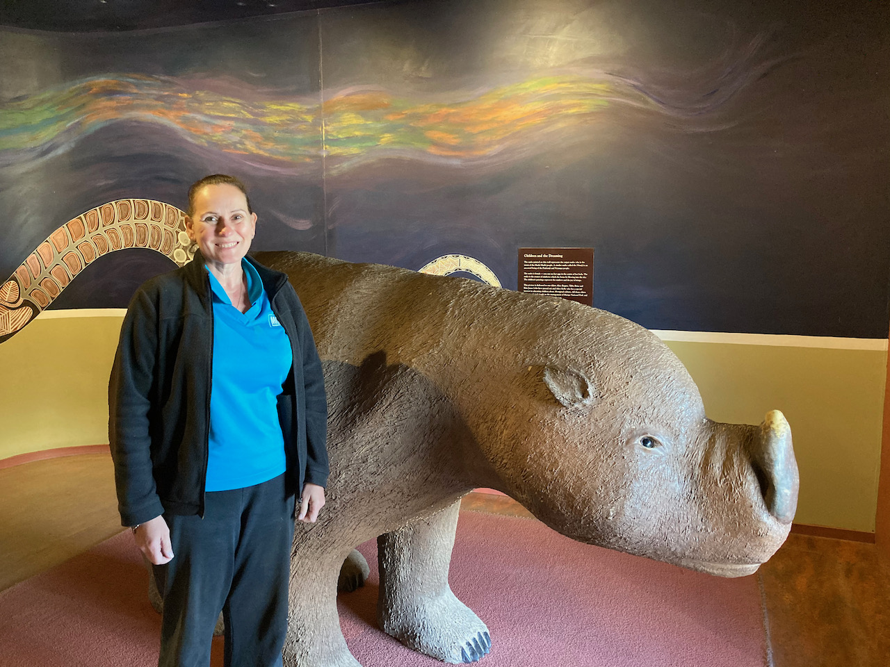
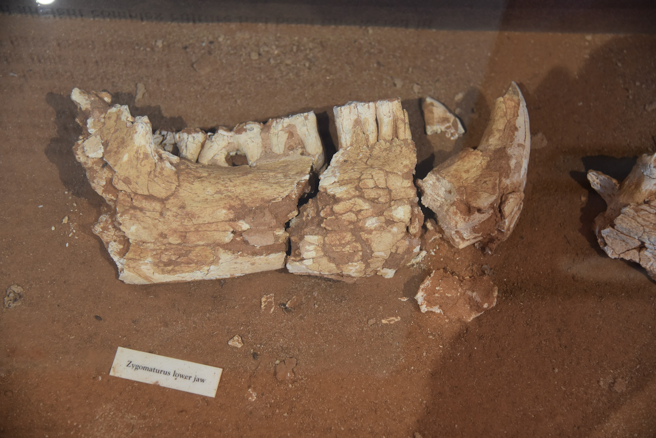
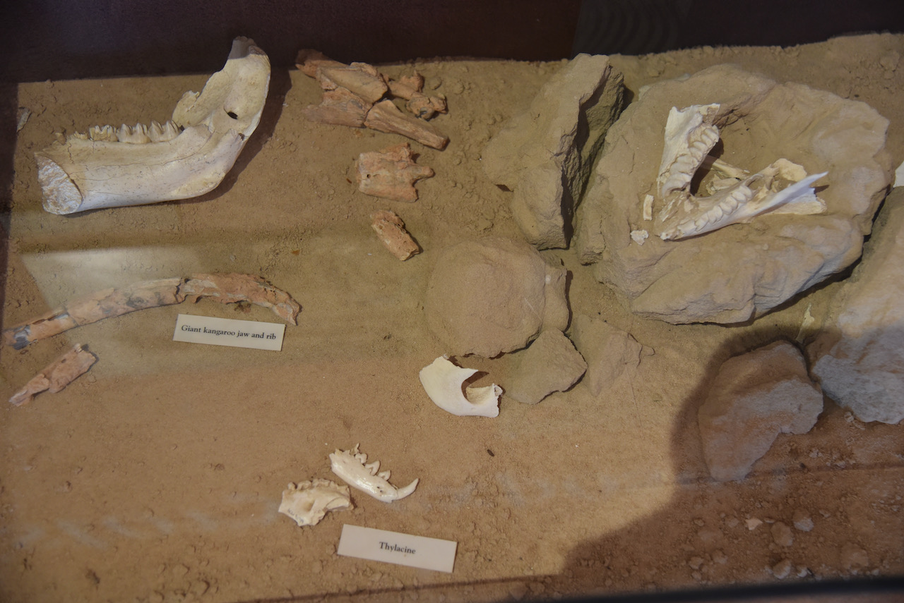
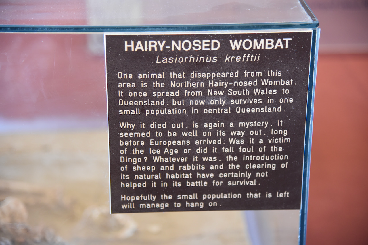
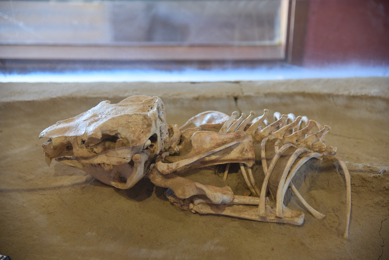
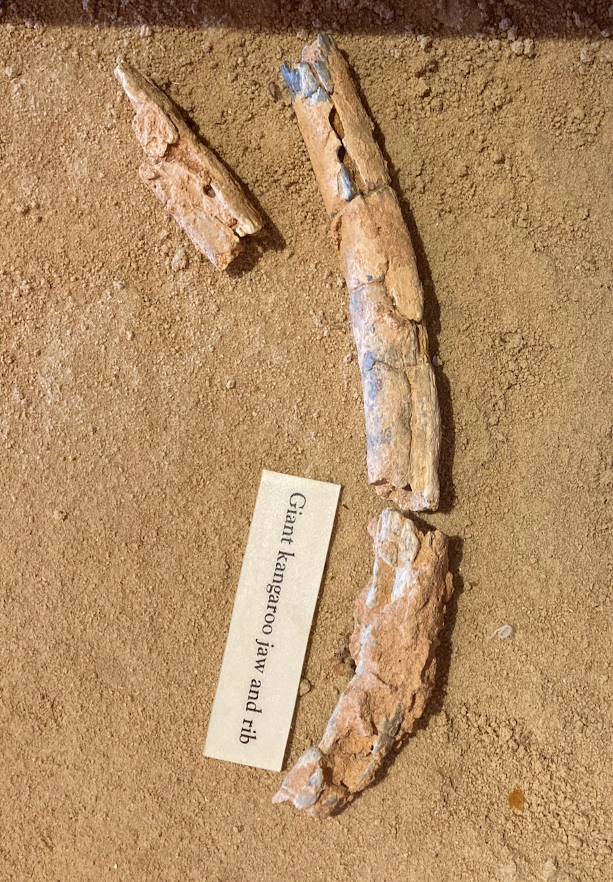
A total of 76 species of mammals, birds, reptiles, fish, amphibians, crustaceans, and sheelfish have been discovered surrounding archaeological sites in the Willandra Lakes. Some of the extinct creatures include Procoptdon sp (giant kangaroo), Zygomaturus tribobus a giant marsupial, and Genyornis newtoni (extinct emu)
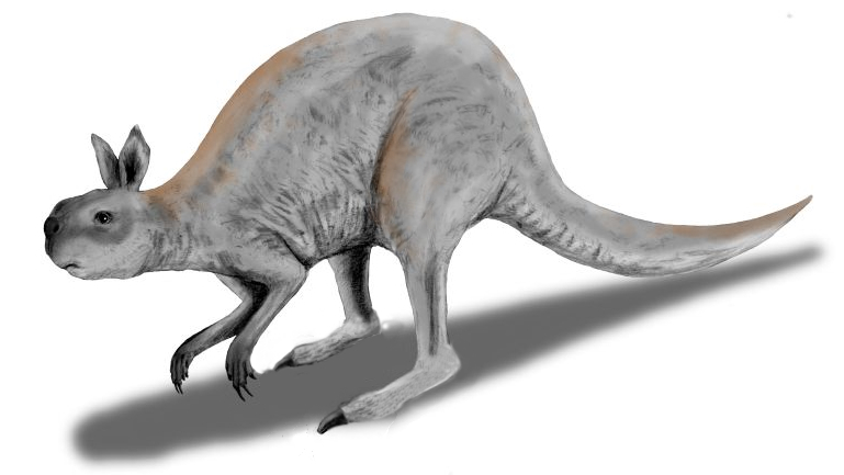
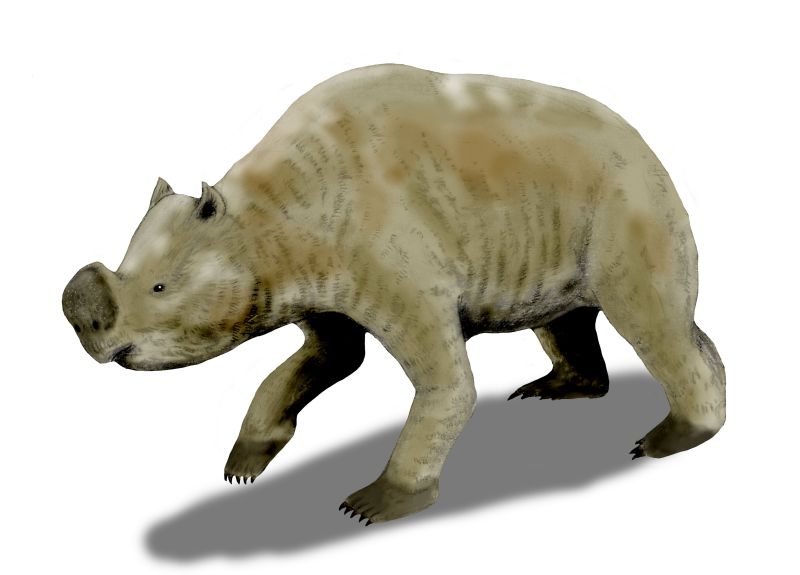
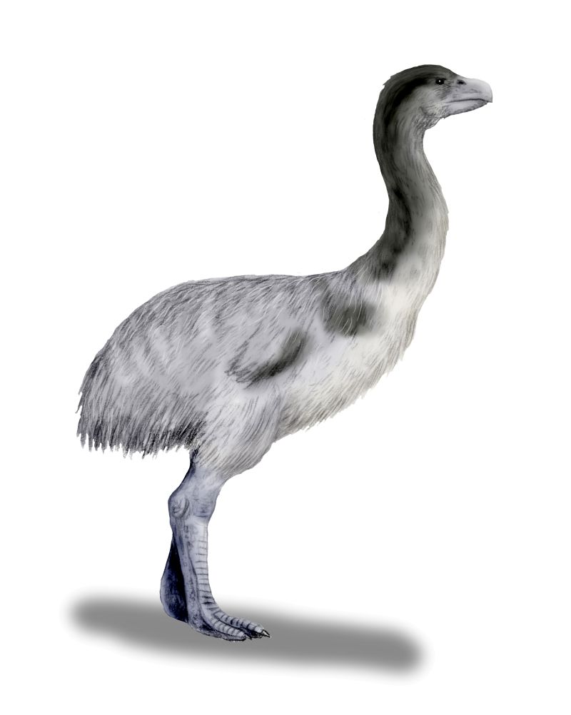
Above:- the extinct giant kangaroo, extinct Zygomaturs, and extinct emu. Images c/o Wikipedia.
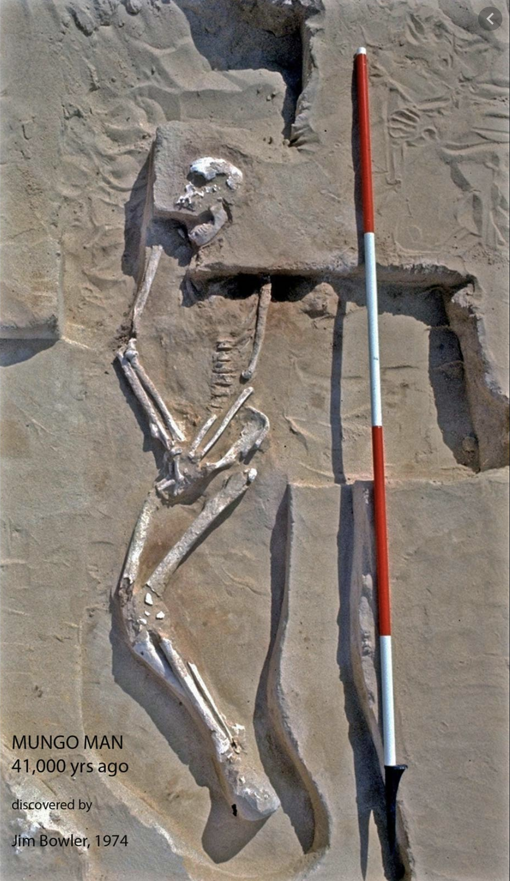
Three prominent human remains have been located at Lake Mungo. This includes Mungo woman which was discovered in 1969 and is one of the world’s oldest known cremations. Mungo Man was discovered in 1974 and is dated at around 40,000 years old, and are the oldest Homo sapiens (human) remains found on the Australian continent.
Below is a short video on Mungo Man and Mungo Lady.
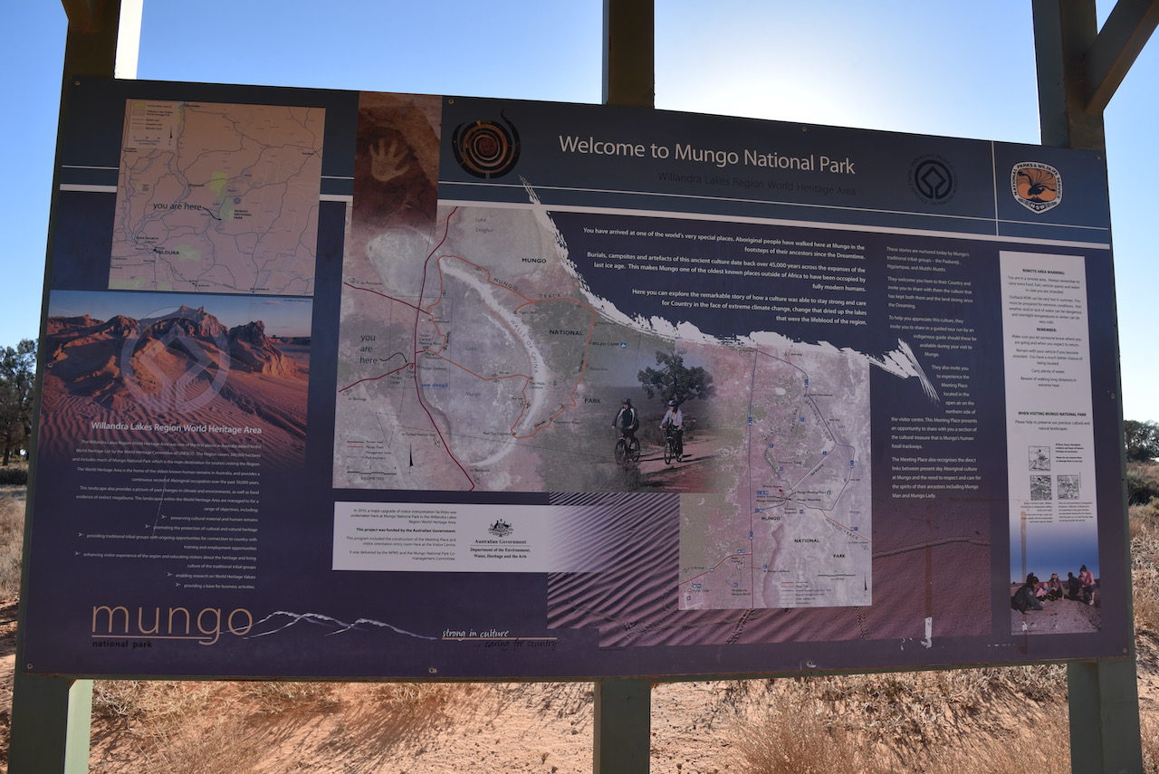
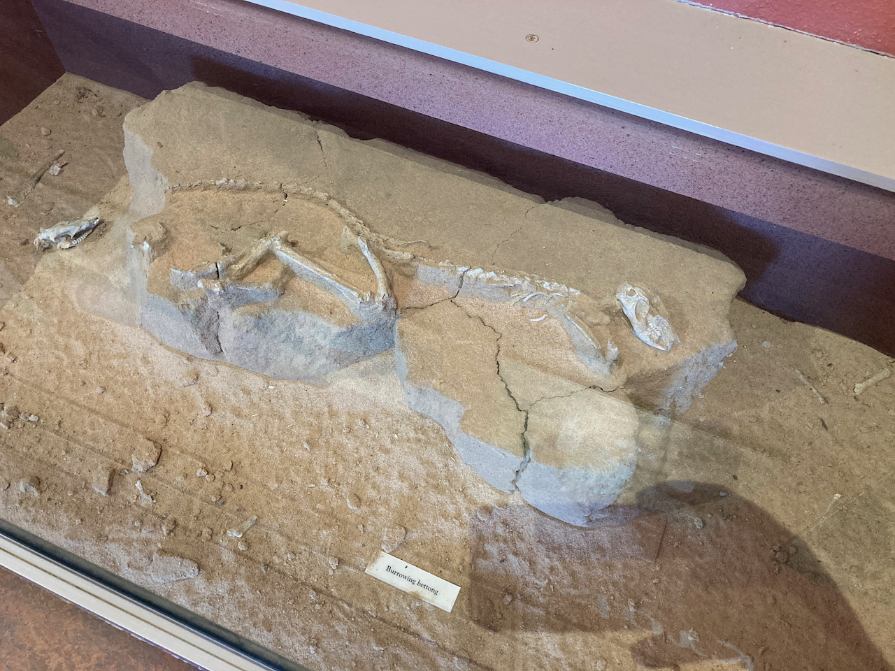
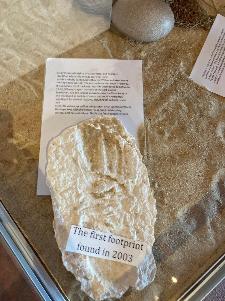
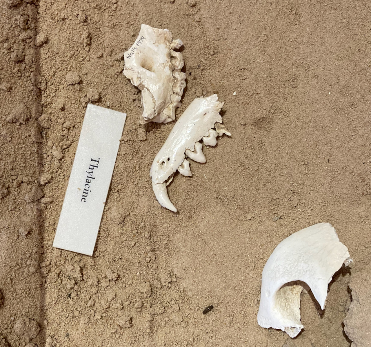
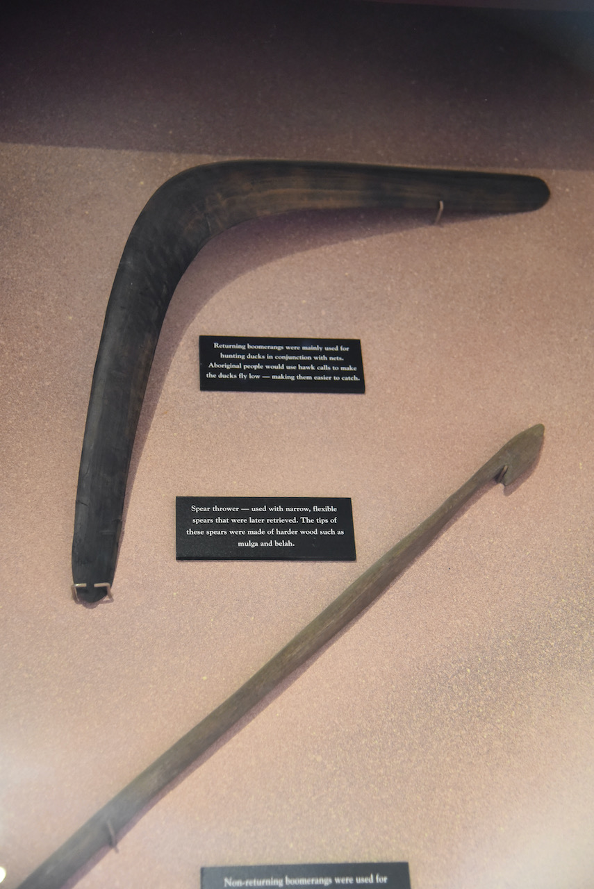
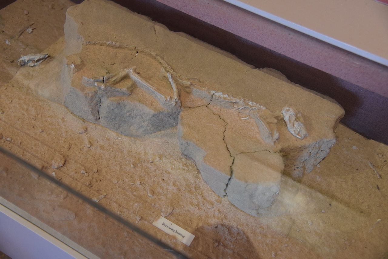
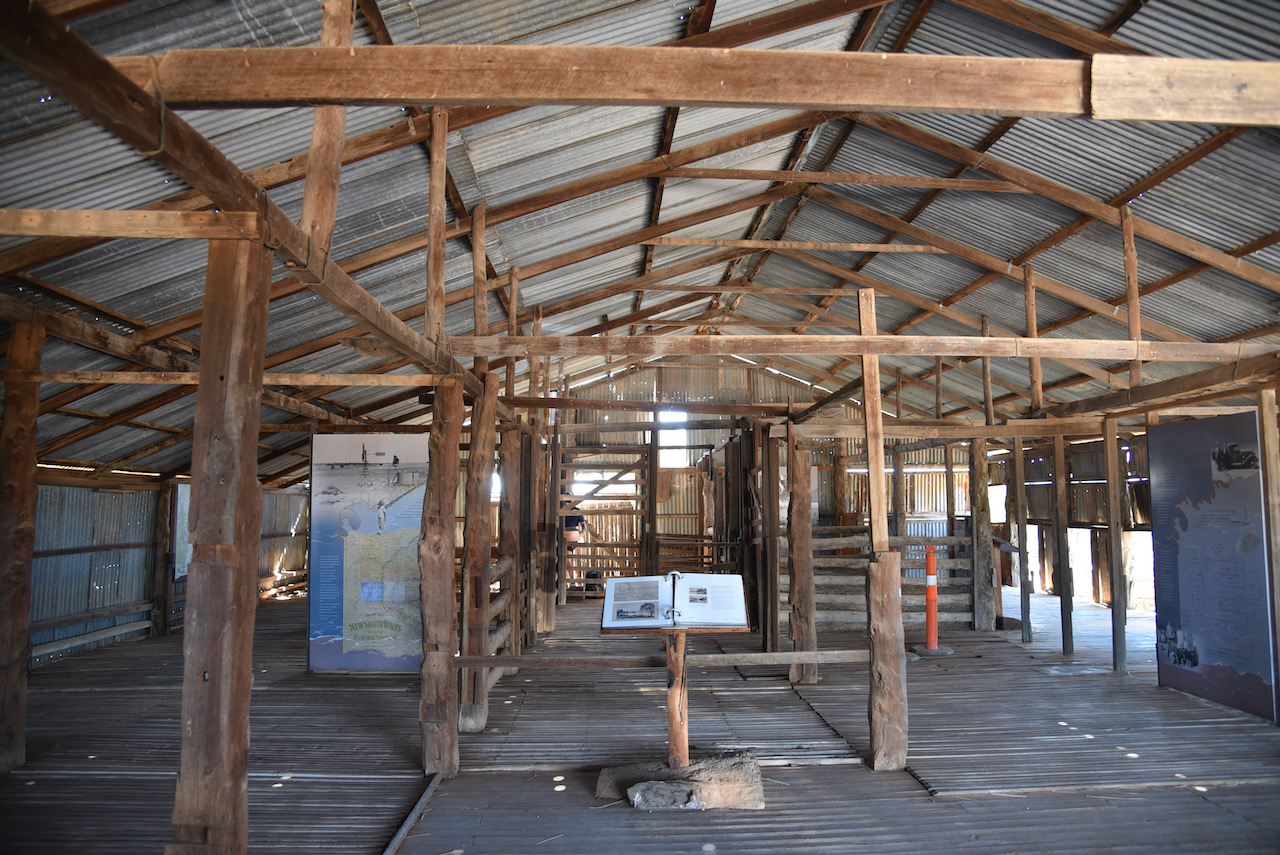
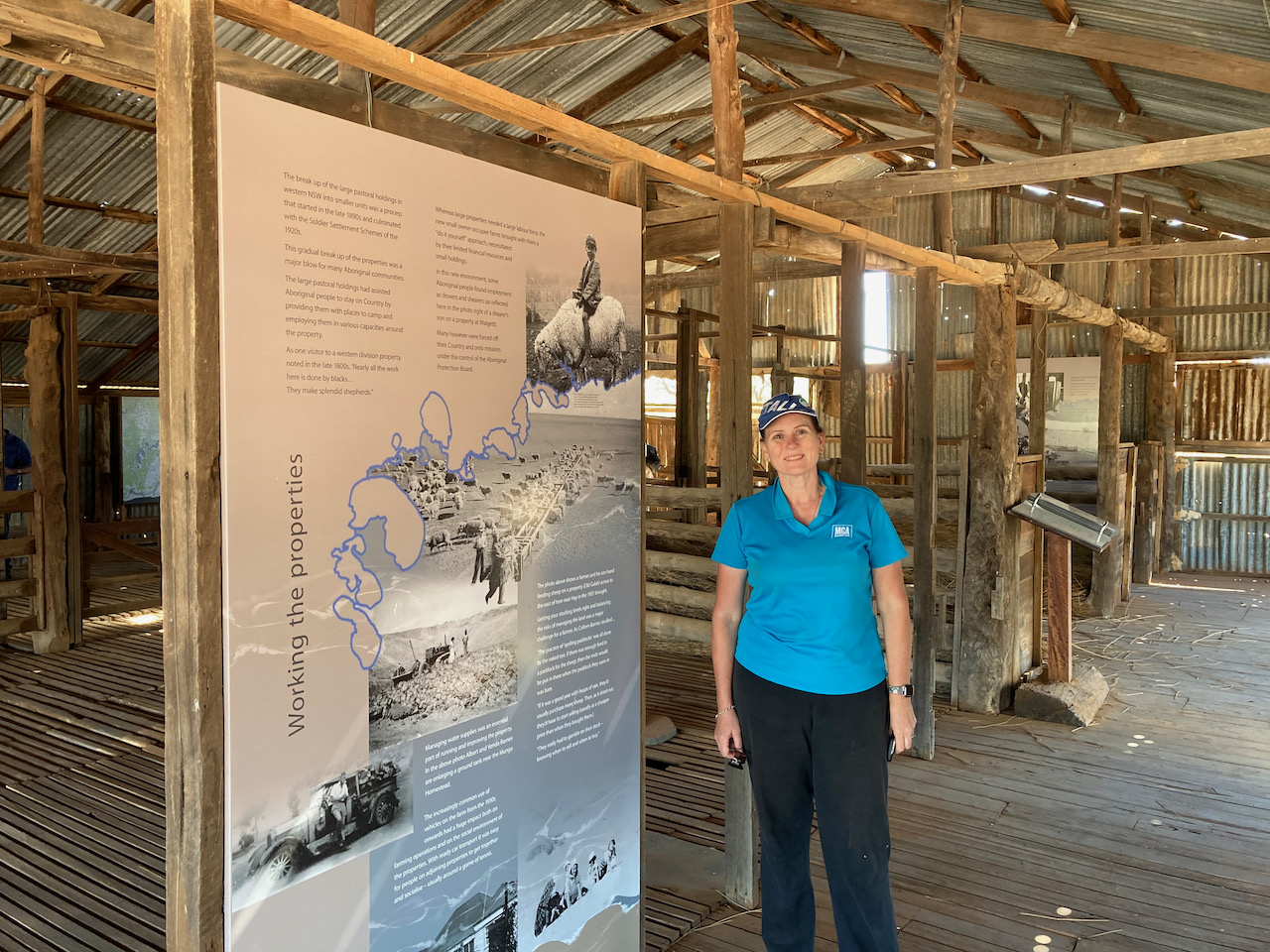
After entering the park our first stop was the Visitor Centre which has an excellent display of information about Mungo. This includes displays of archeological evidence found at Mungo and the megafauna which once lived in the area.
As this is quite a sensitive park, both archaeologically and spiritual for the aboriginals, we spoke to one of the Rangers at the Visitor Centre and told him that we would be setting up a portable amateur radio station. He was very happy with that.
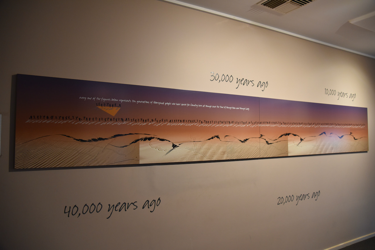
One of the wall displays (seen below) put everything into perspective. Every one of the figures shown represented ten generations of aboriginal people who have lived at Mungo.
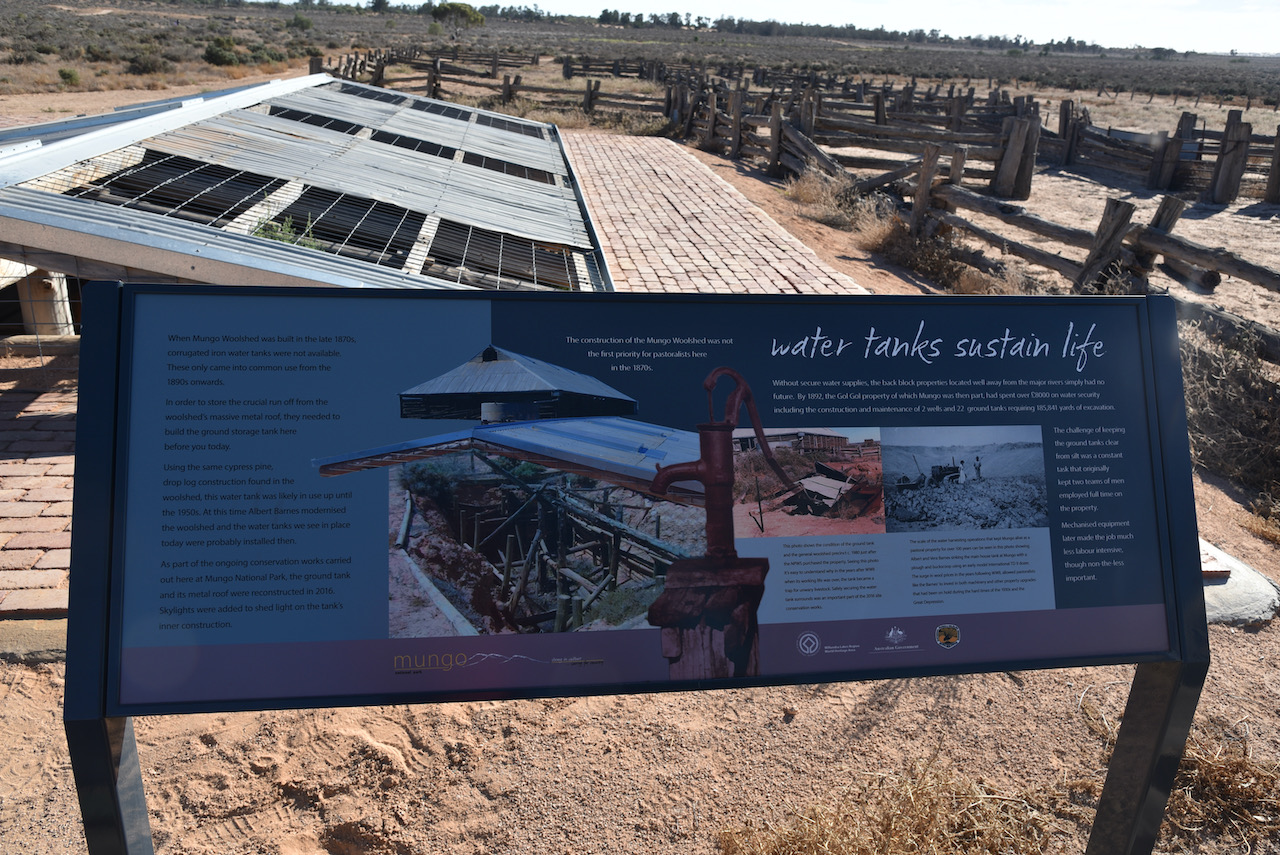
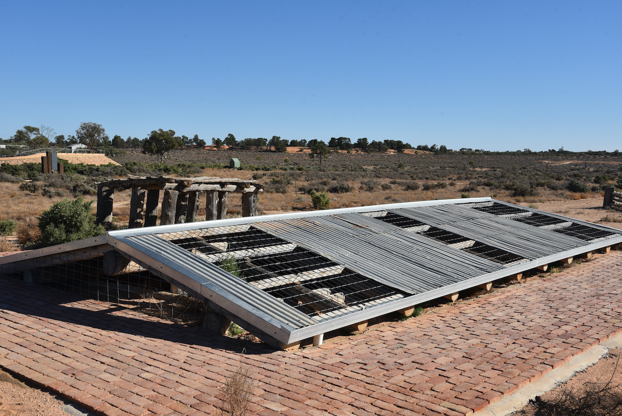
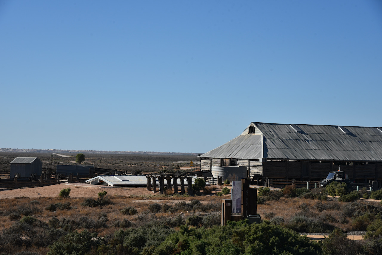
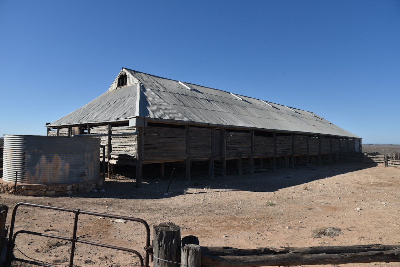
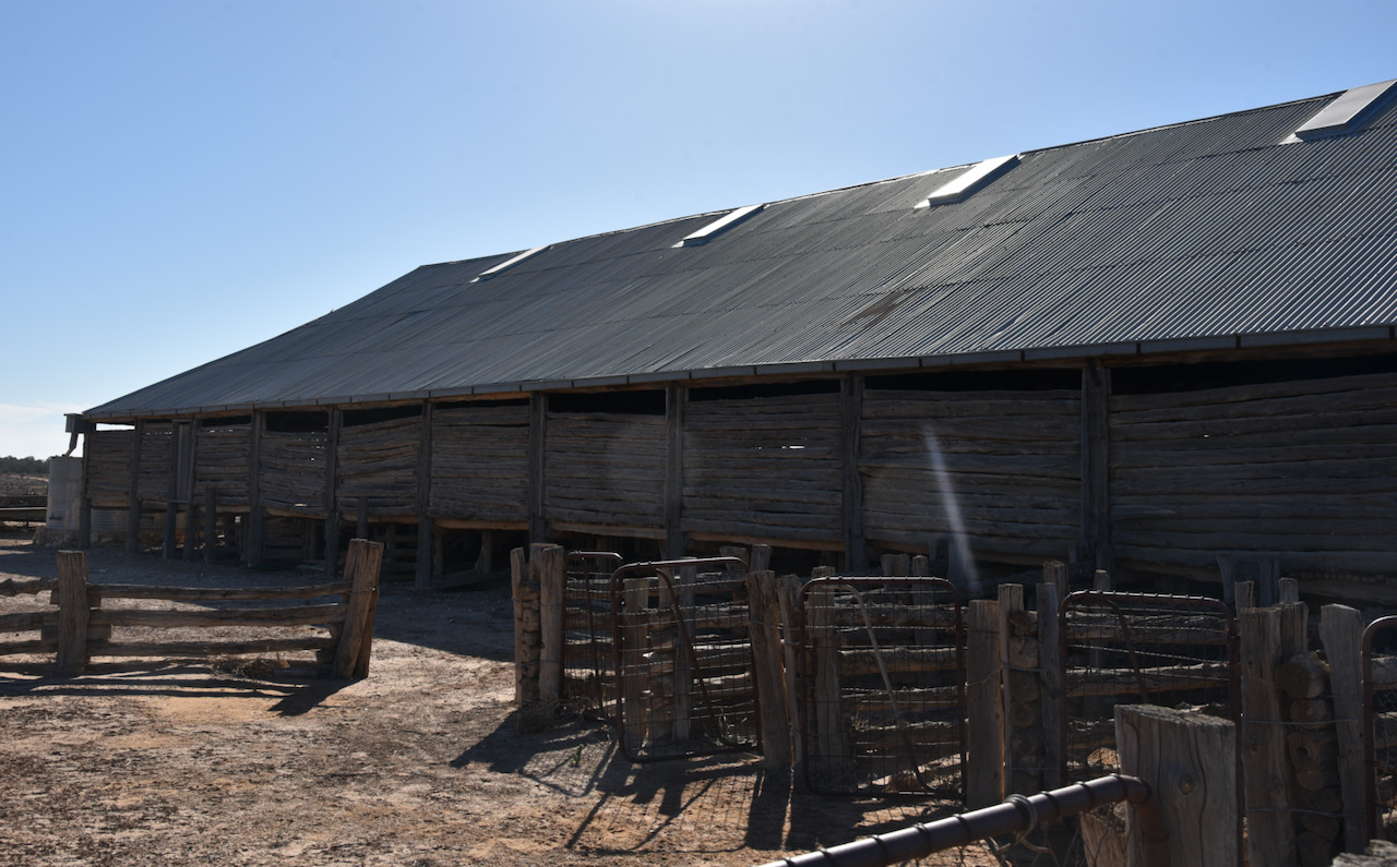
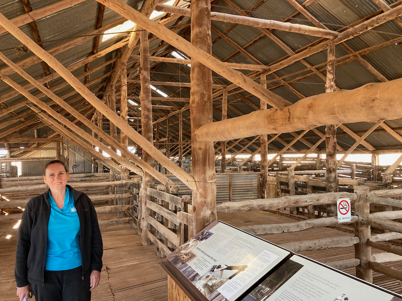
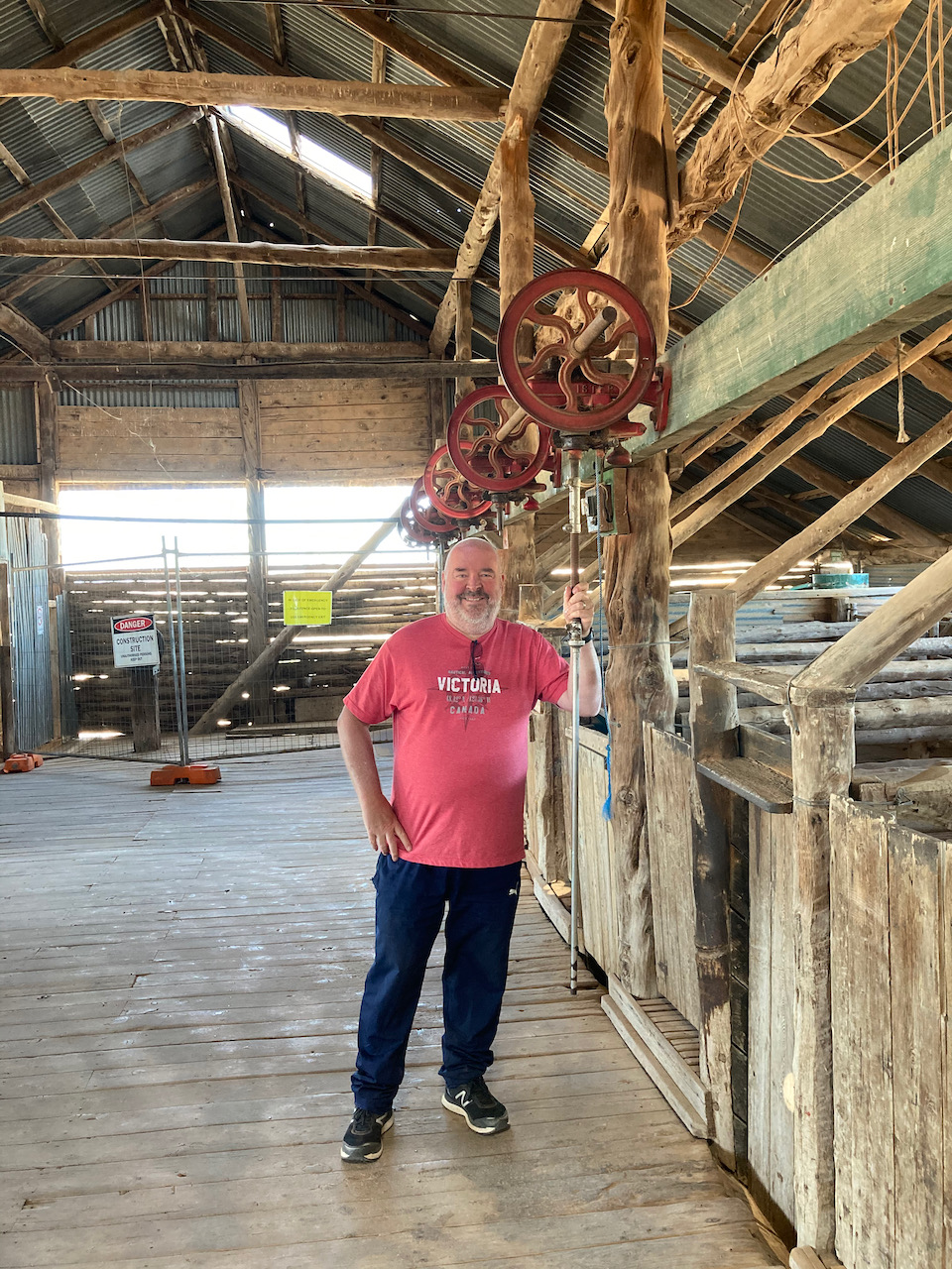
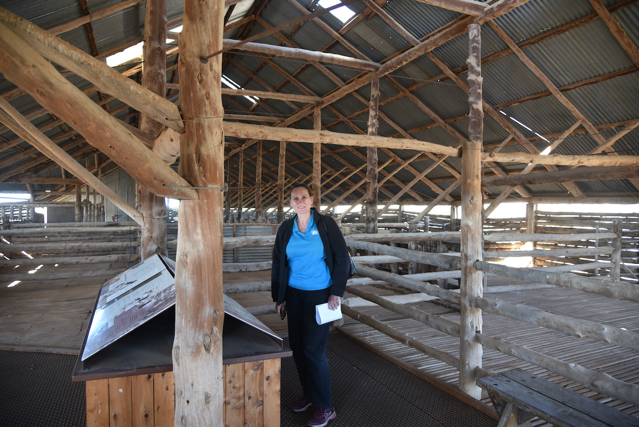
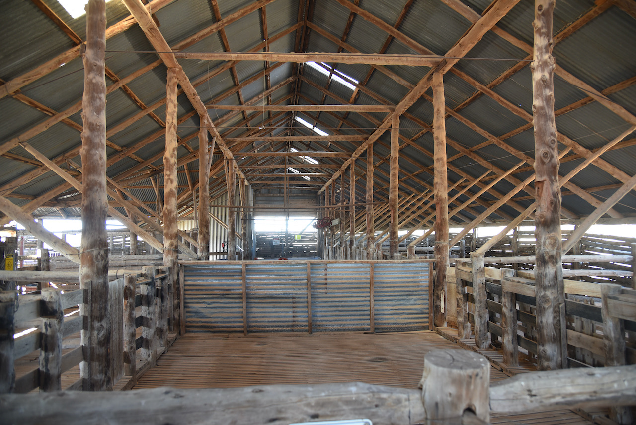
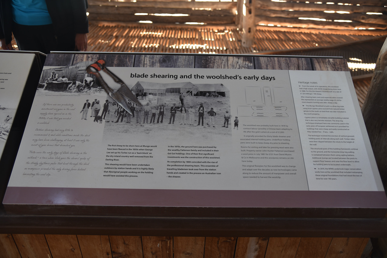
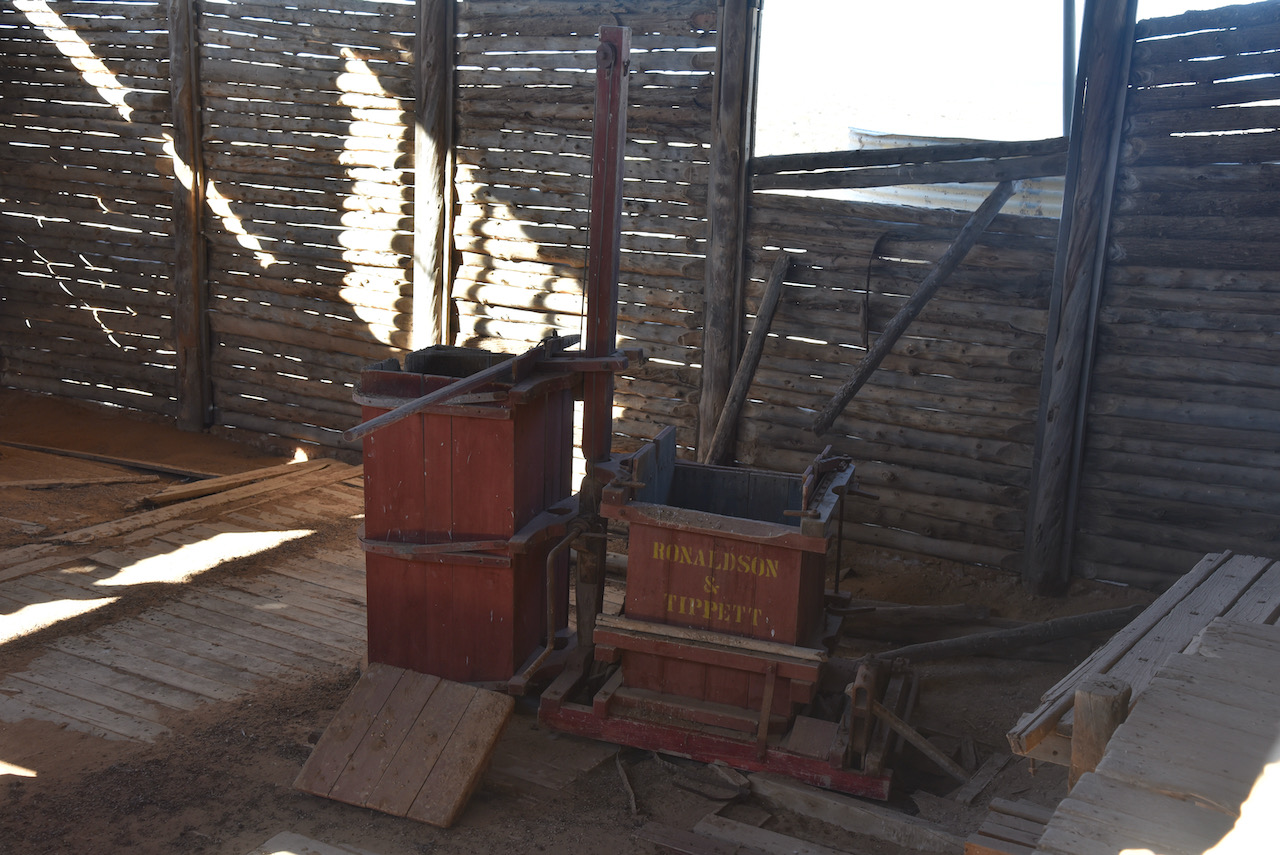
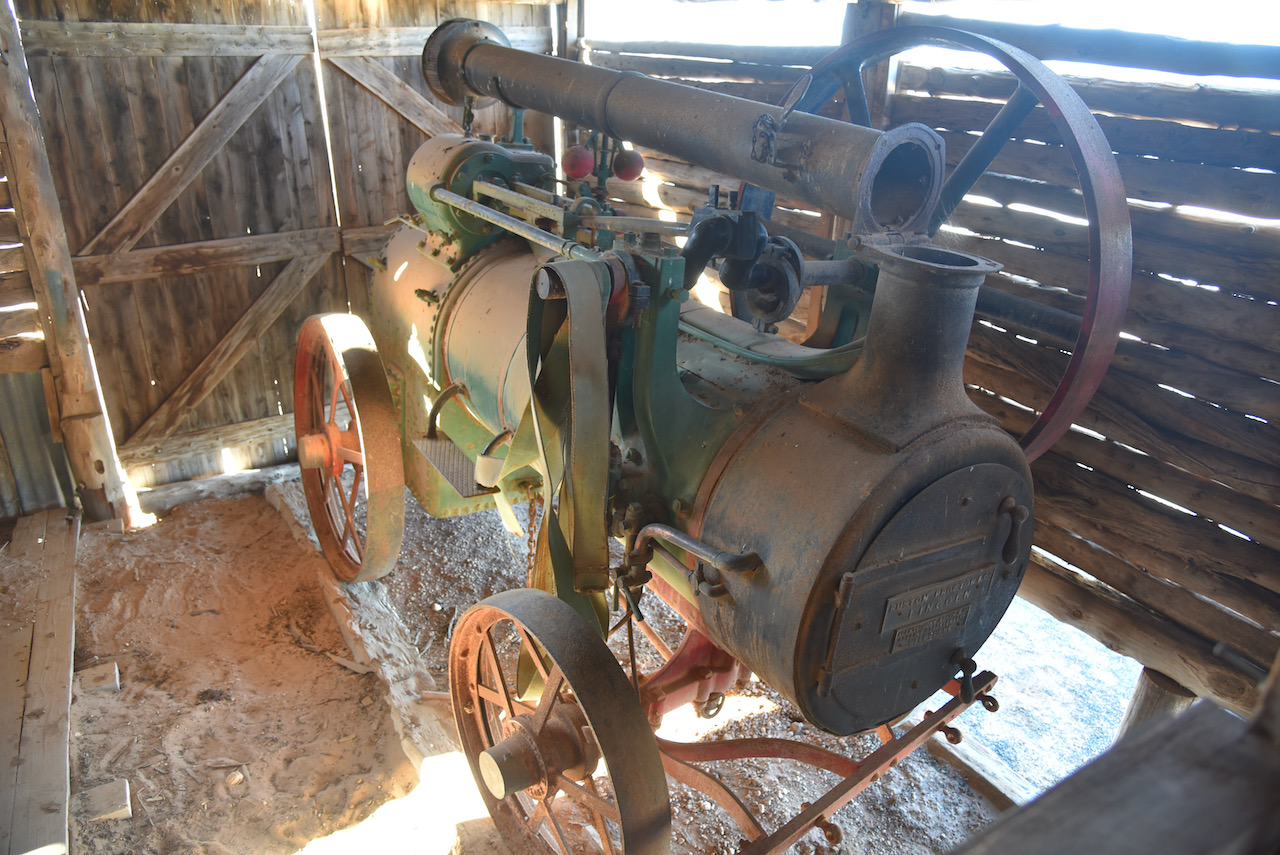
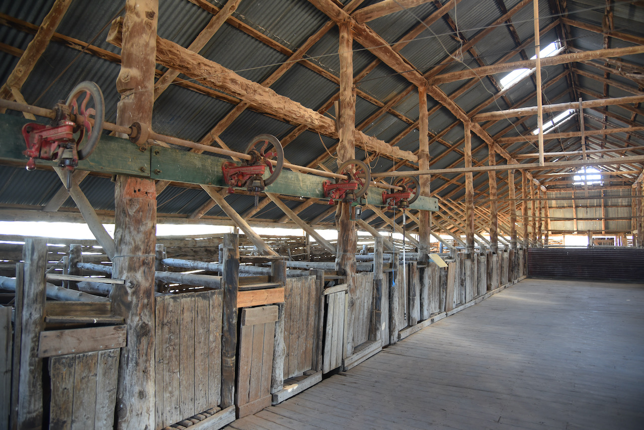
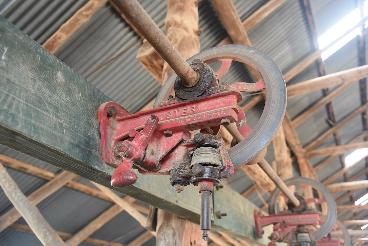
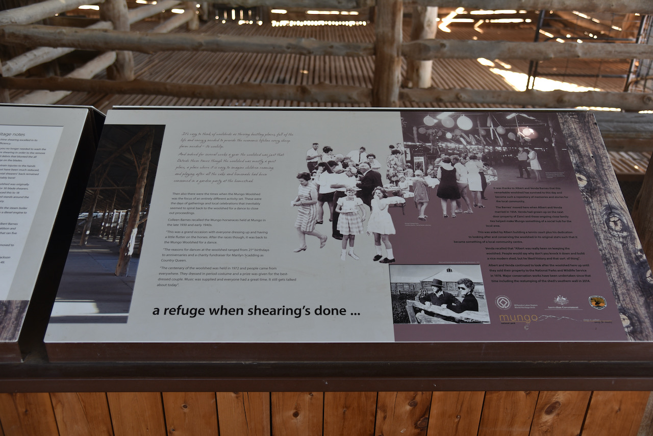
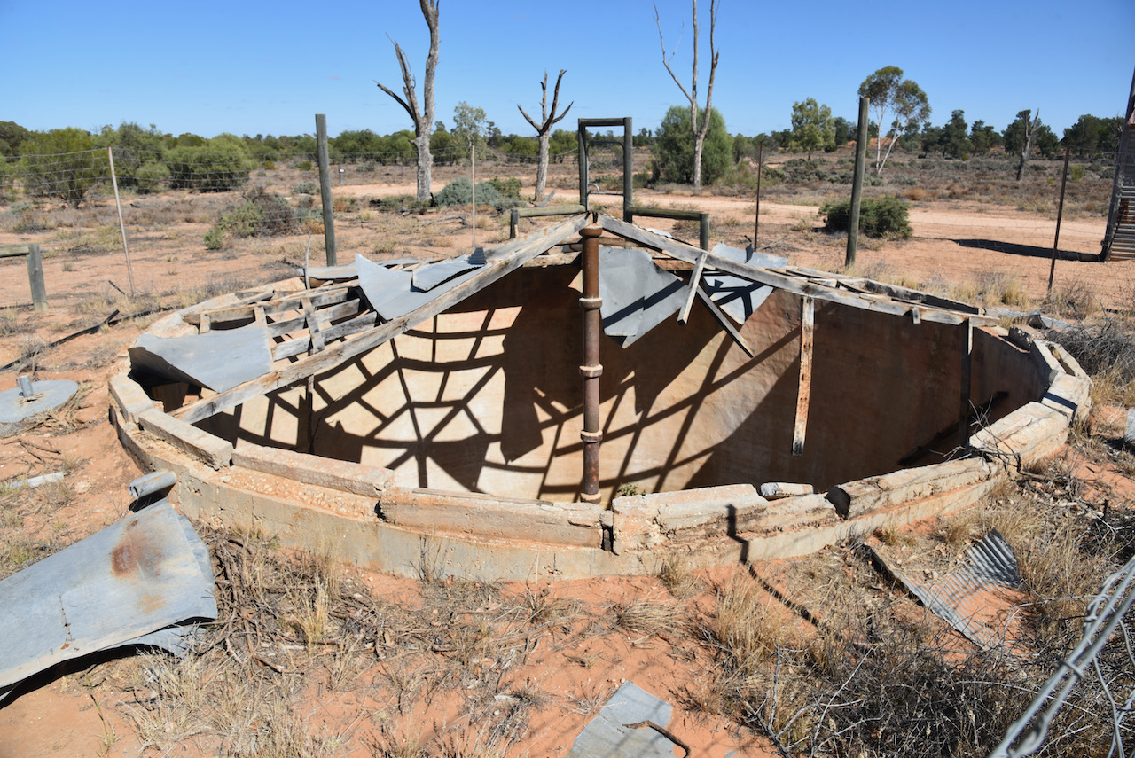
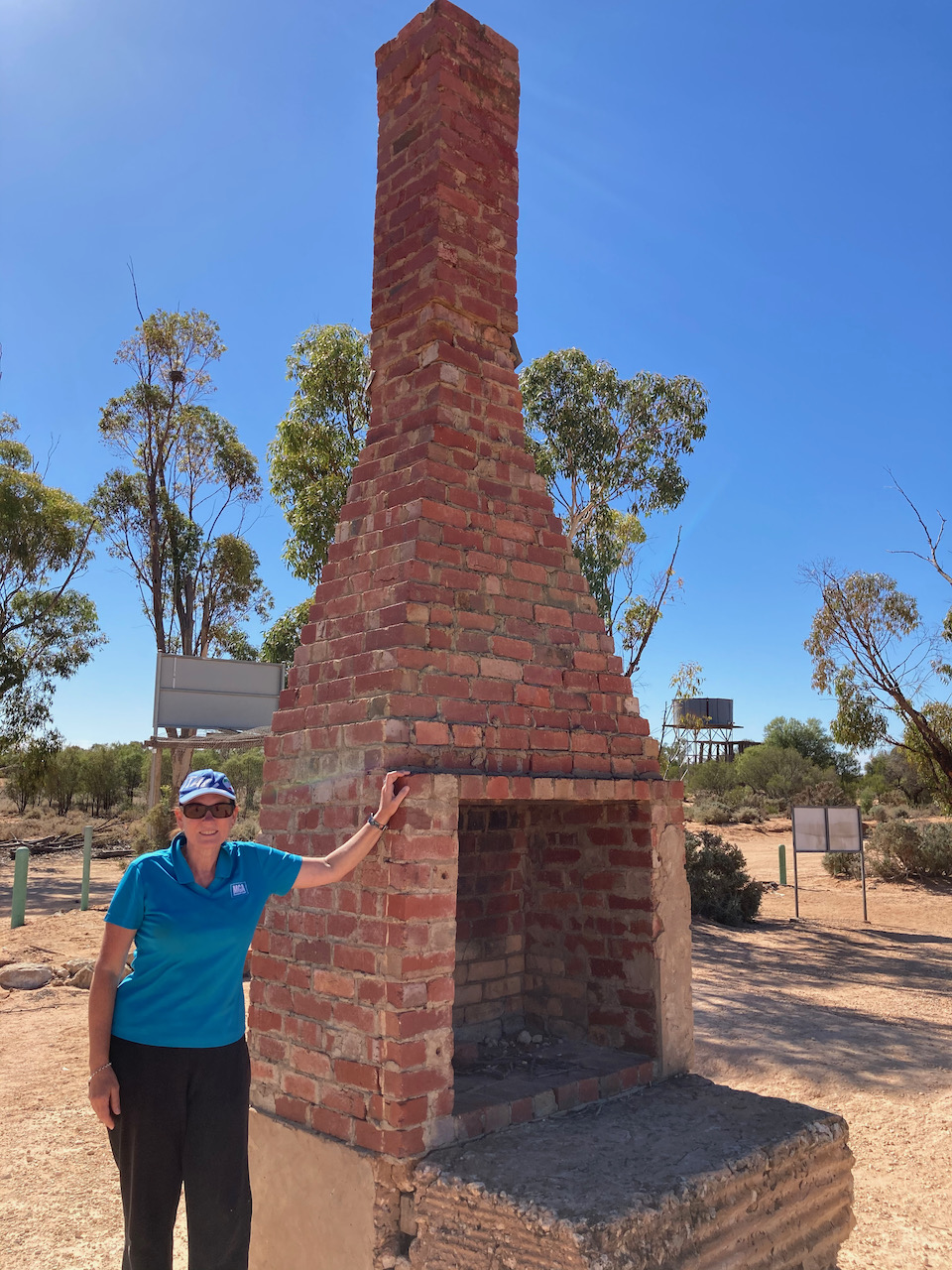
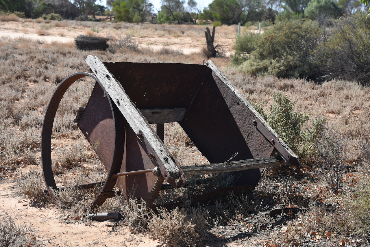
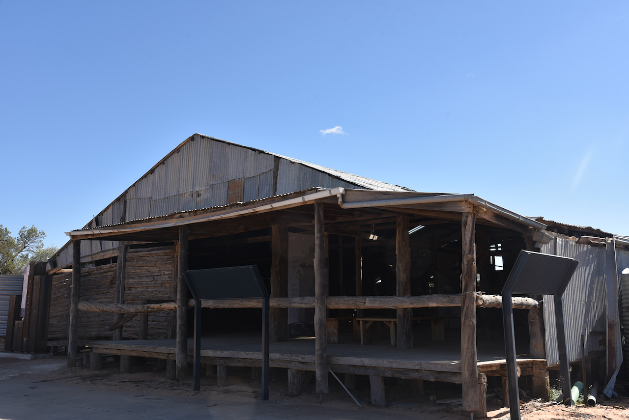
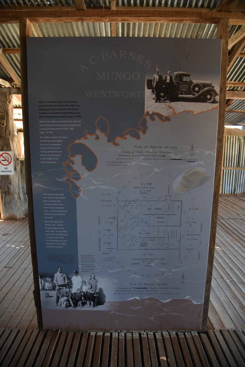
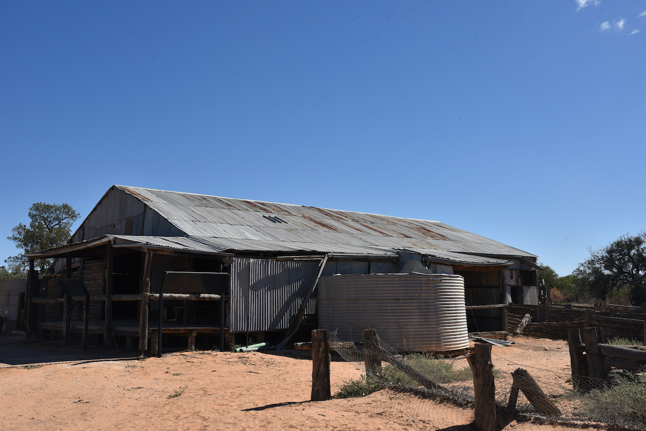
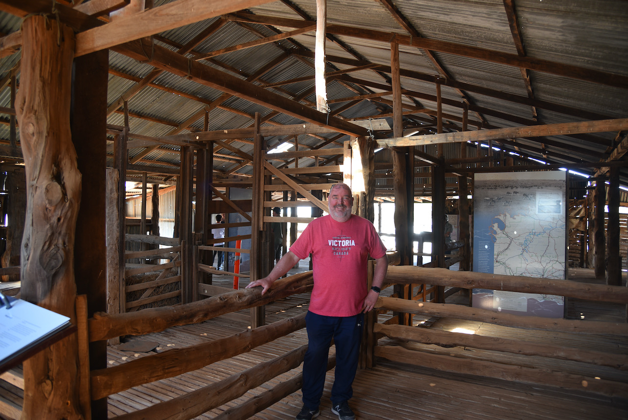
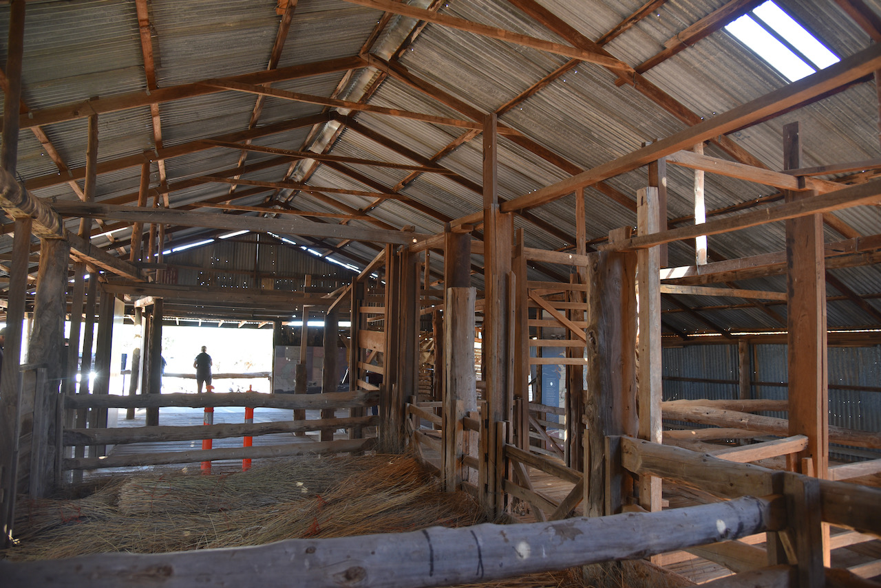
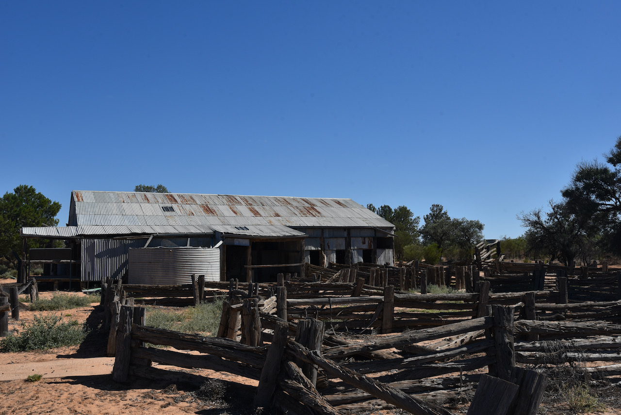
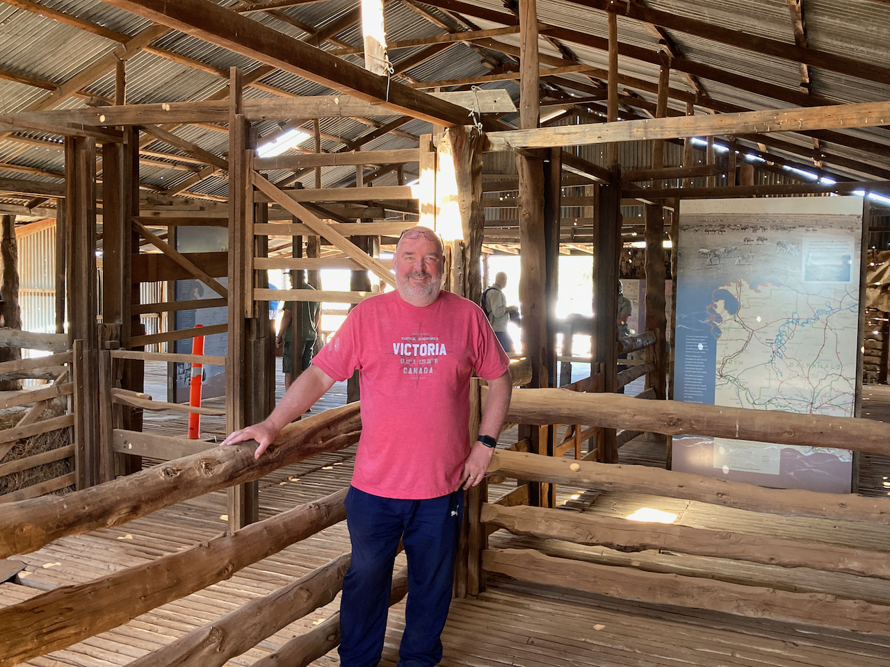
We then walked outside to have a look at the Mungo Woolshed. When Mungo Woolshed was built in the late 1860s corrugated iron water tanks were not available. These only came into common use from the 1890s onwards. In order to store the crucial run off from the wooldshed’s massive metal roof, they needed to build the ground storage tank which can be seen today.
Using the same cyprus pine, drop log construction found in the woolshed, the water tank was likely in use up until the 1950s. A this time Albert Barnes modernised the woolshed and the water tanks which can be seen today were probably installed at that time.
The Mungo woolshed is believed to have been built in 1869. Locally obtained materials were used in its construction as vast distances from freightheads added to the cost. Murray Pine was cut locally and used for the framework and walls. Nails and spikes were forged in the station smithy to pin the frame and walls together. Mallee sticks cut on the station provided material for solid pen gates in the shed.
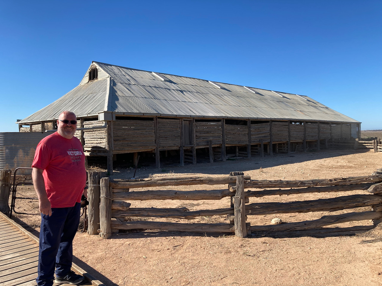
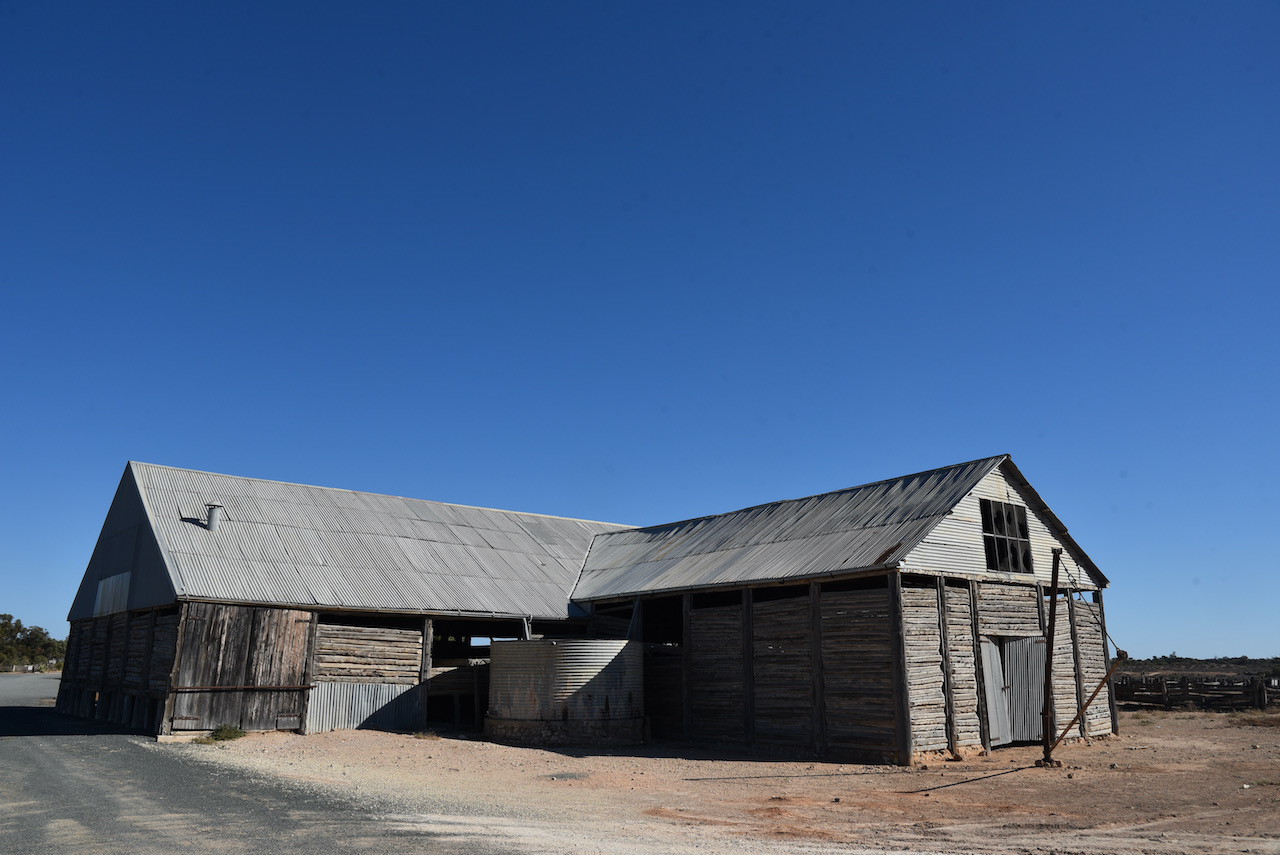
Corrugated iron for the roof was probably transported by paddlesteamer from Adelaide to the river ports or Euston or Pooncarrie, and overlanded from there to Mungo.
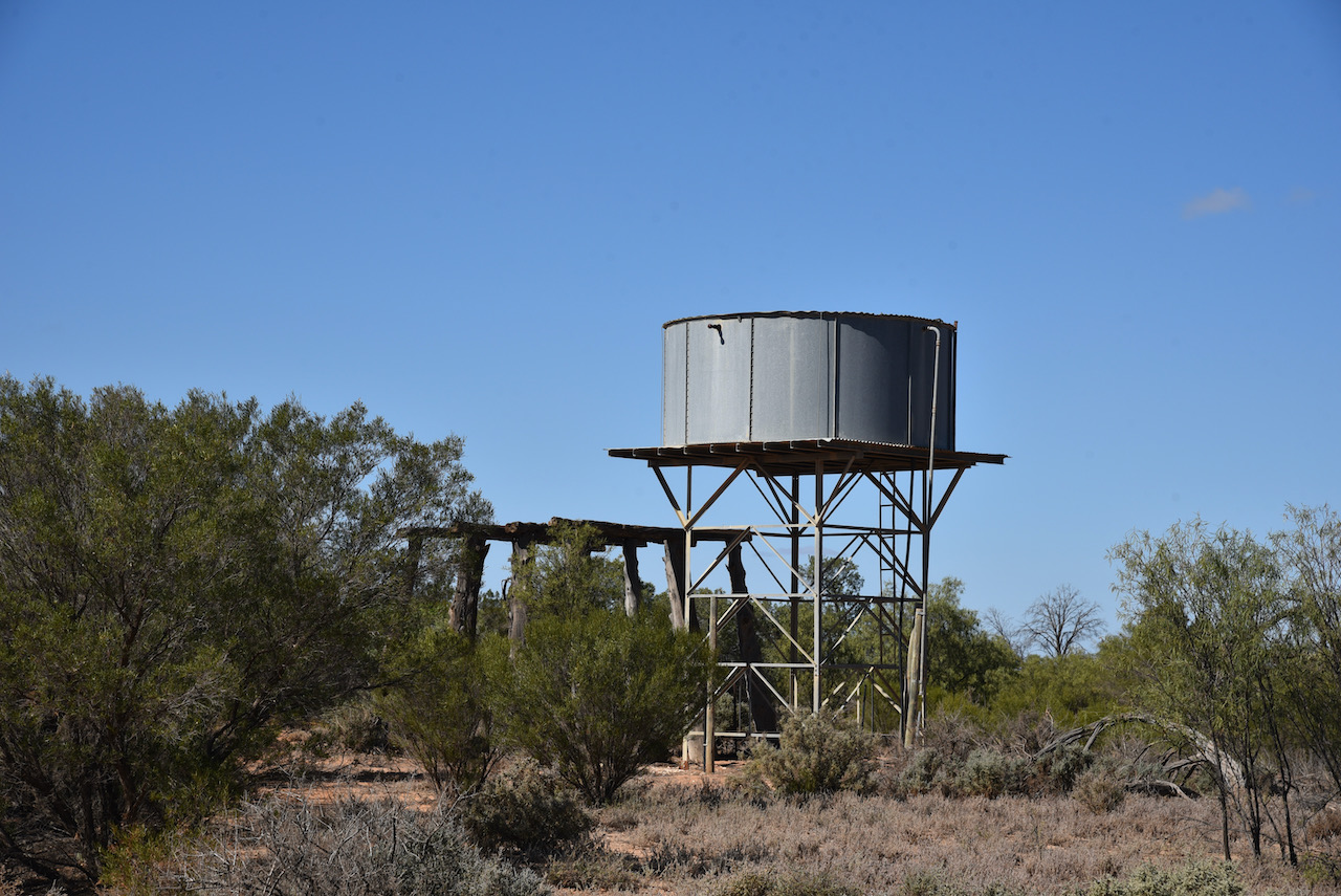
The yards, woolroom, mens hut, shearer’s hut and a two room residence were known as the Turlee Outstation. Today only the woolshed and yards remain. Mungo woolshed was been identified as one of the most significant European buildings in the Willandra Lakes World Heritage Area.
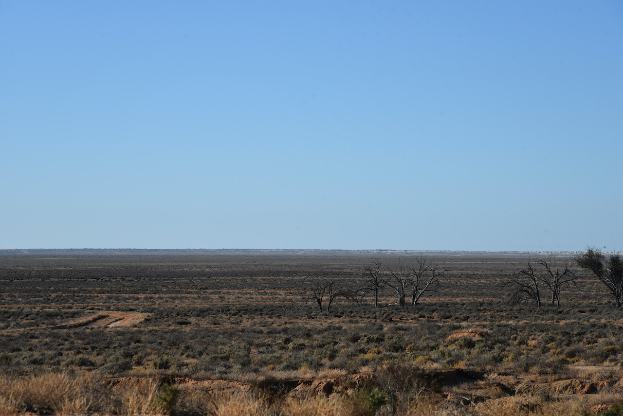
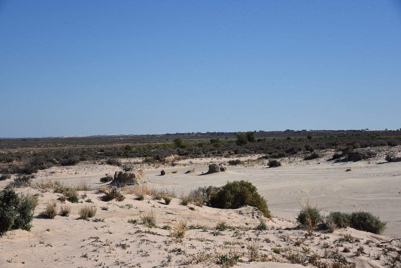
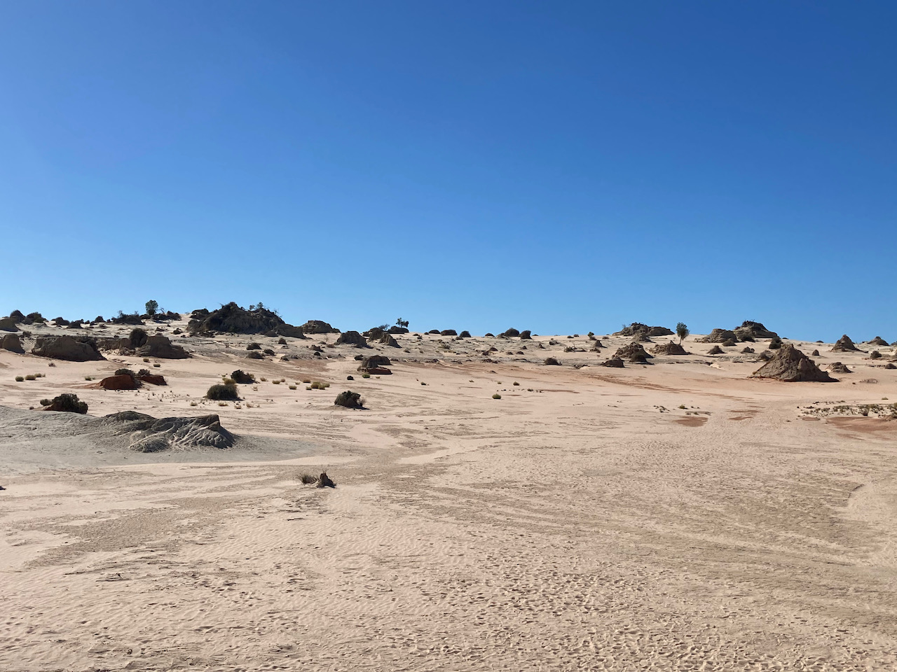
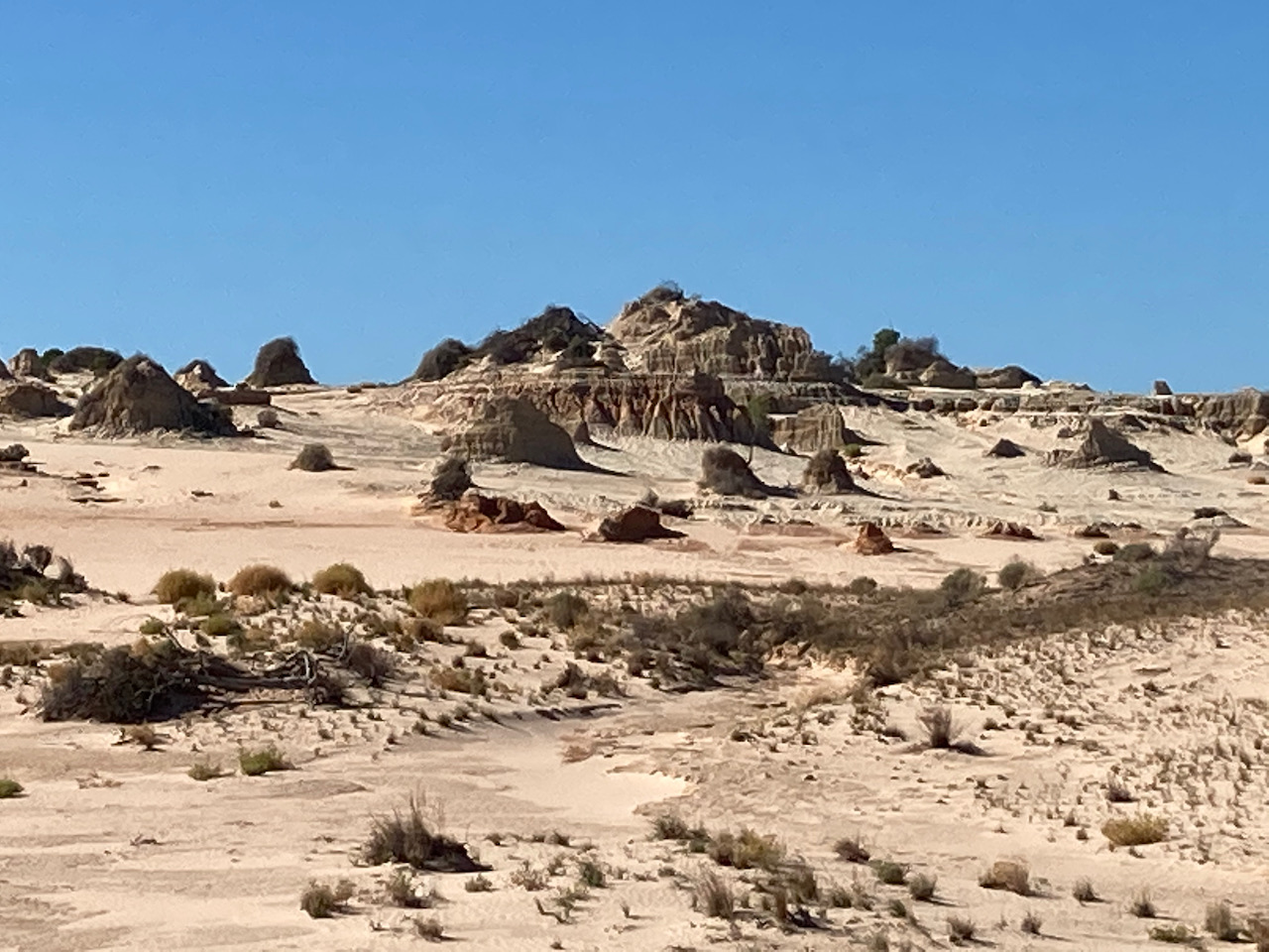
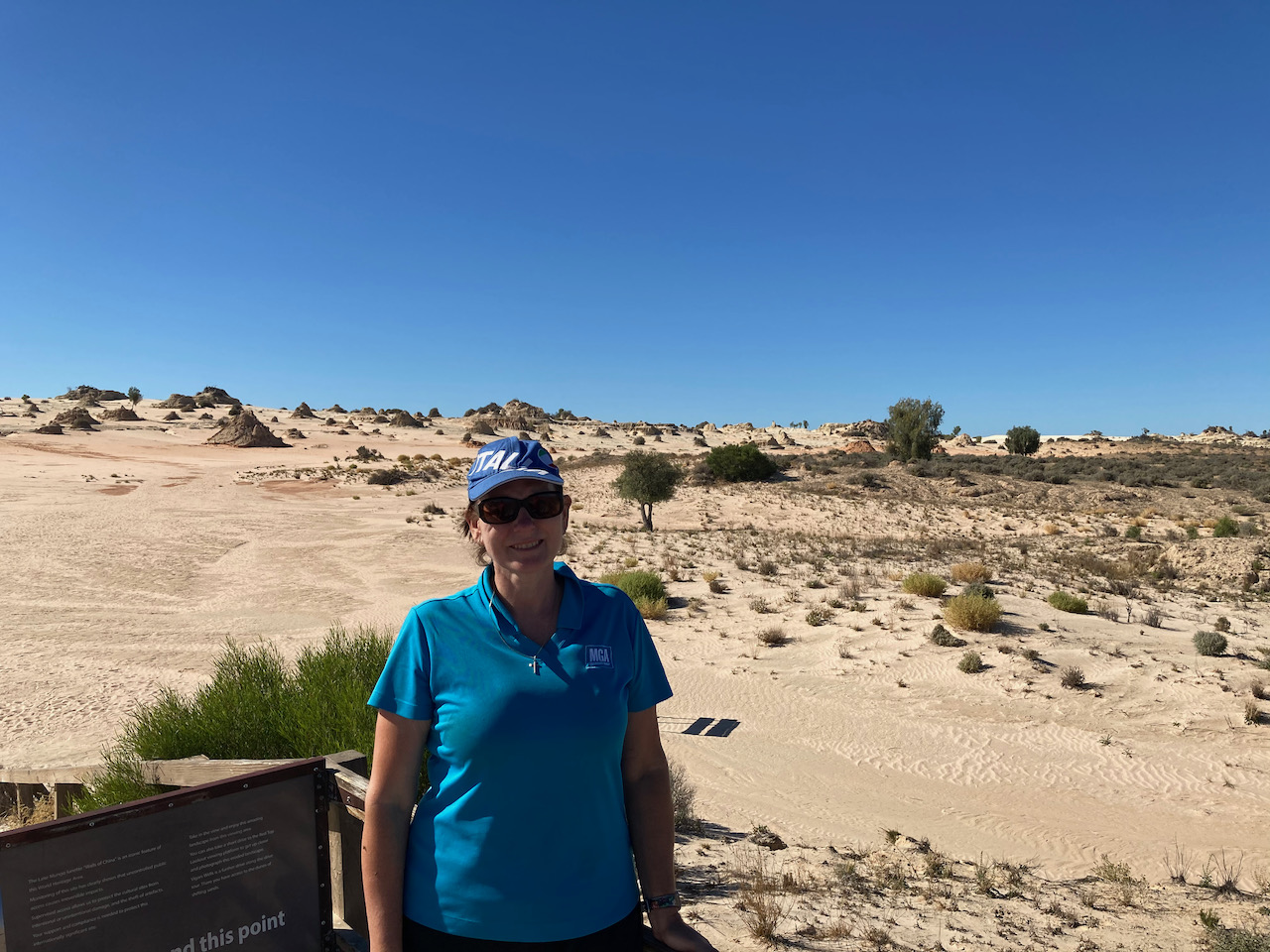
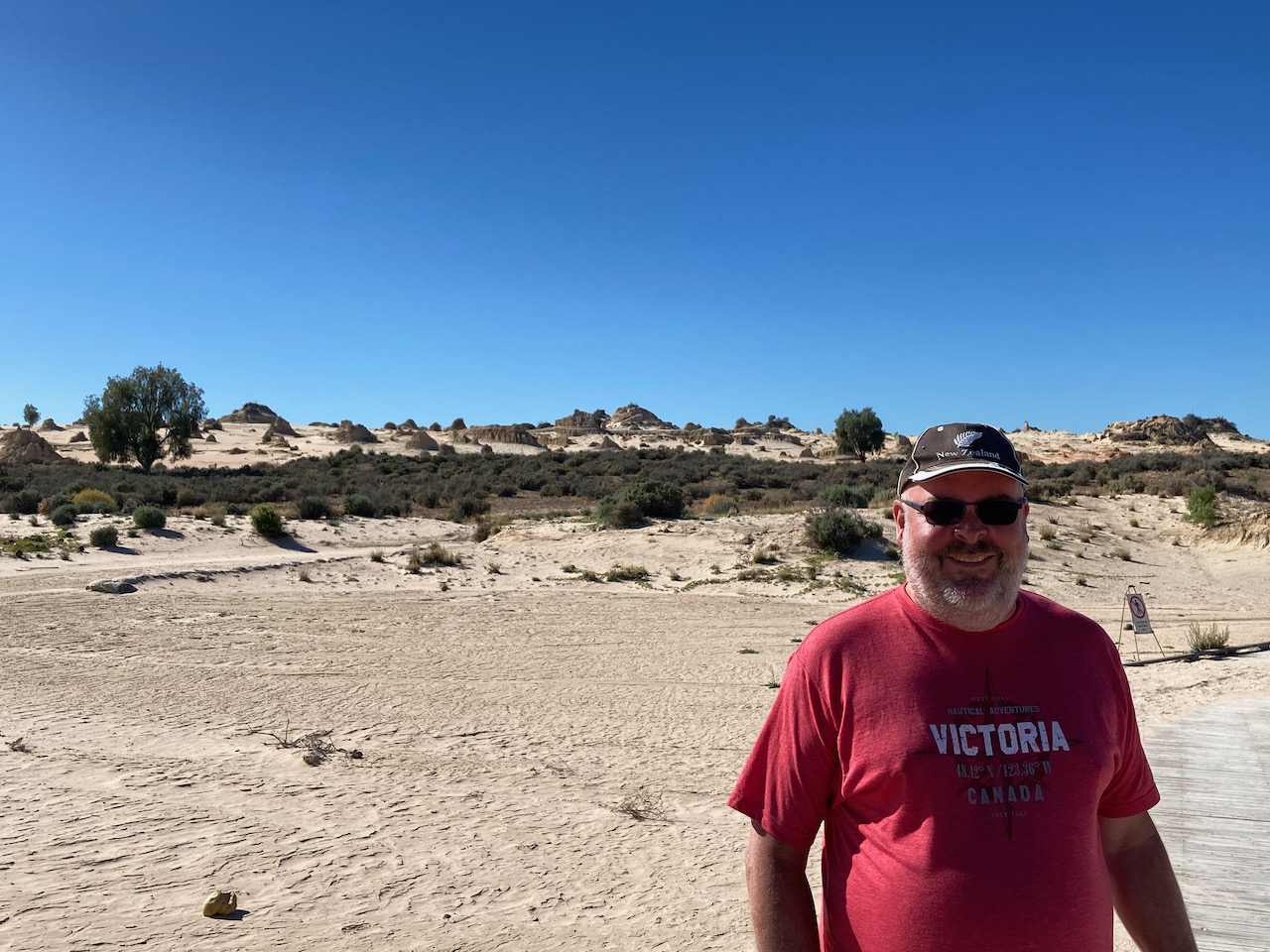
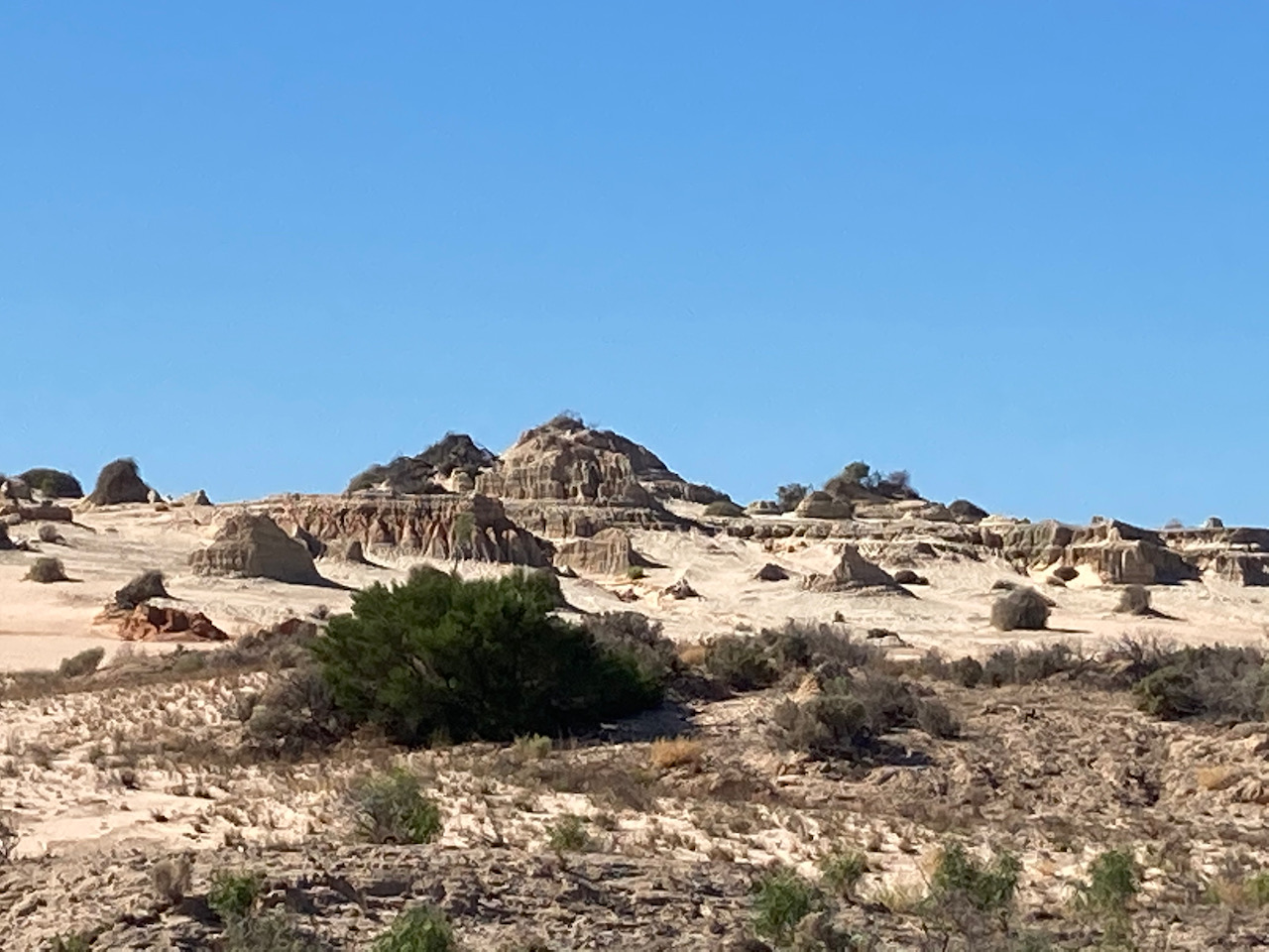
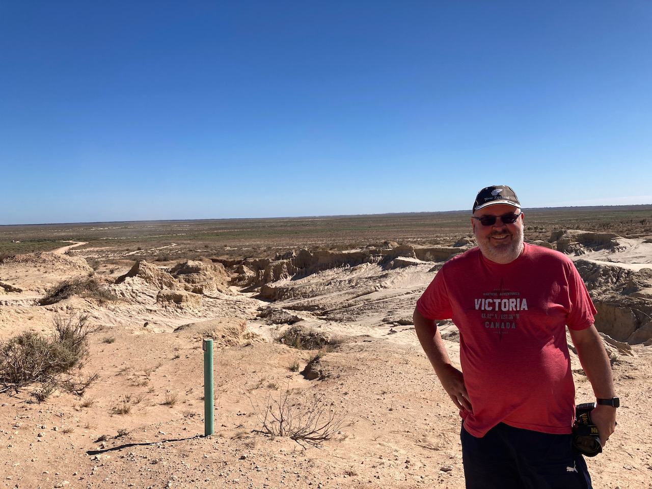
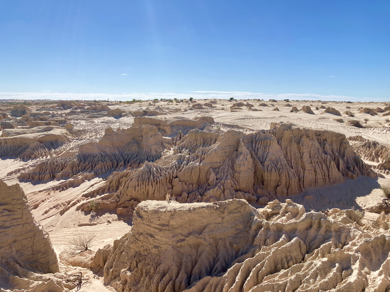
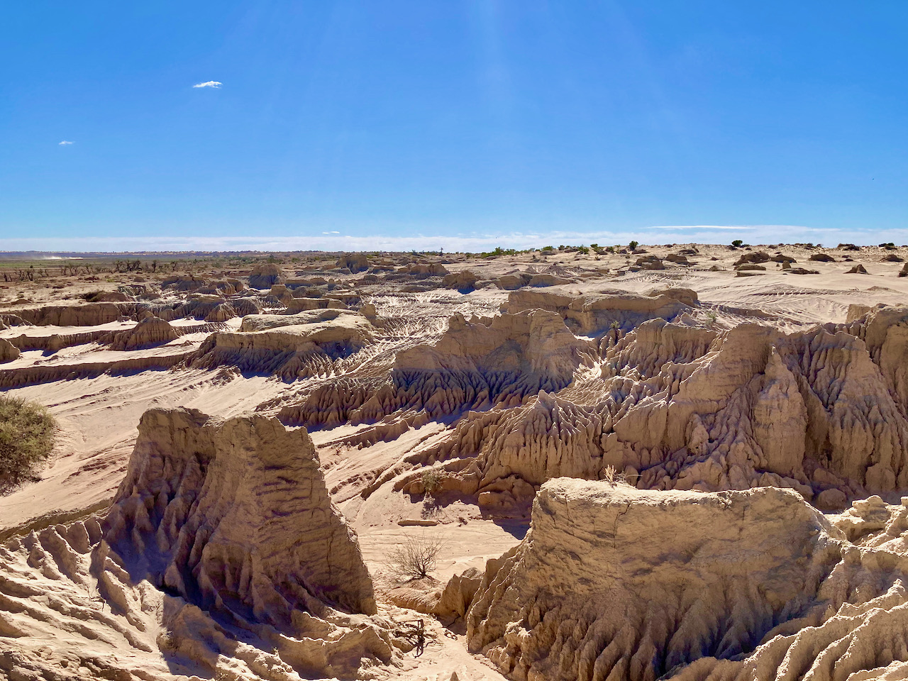
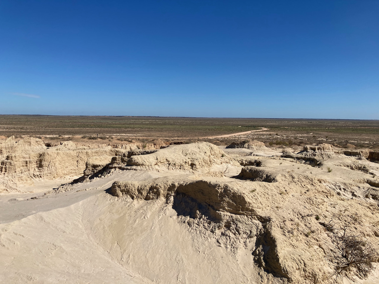
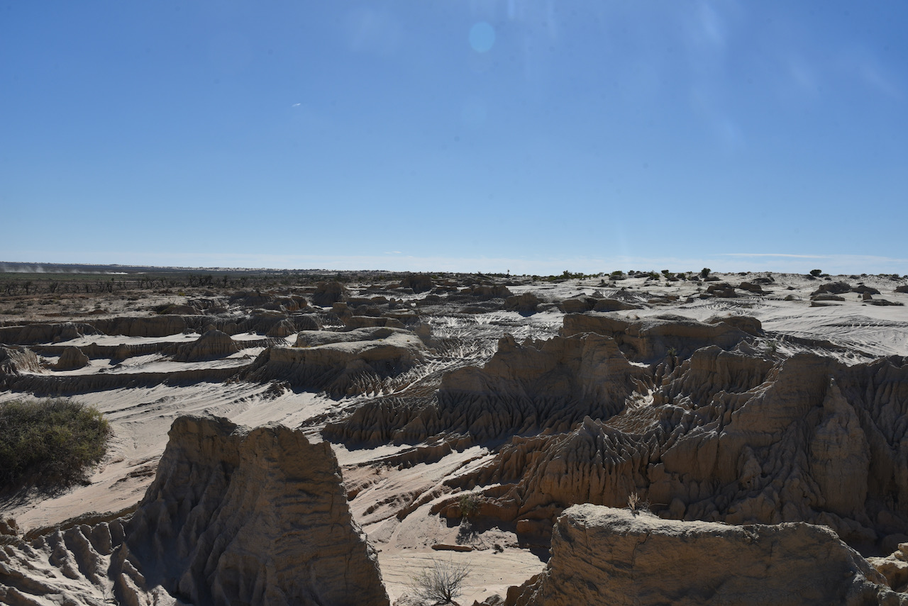
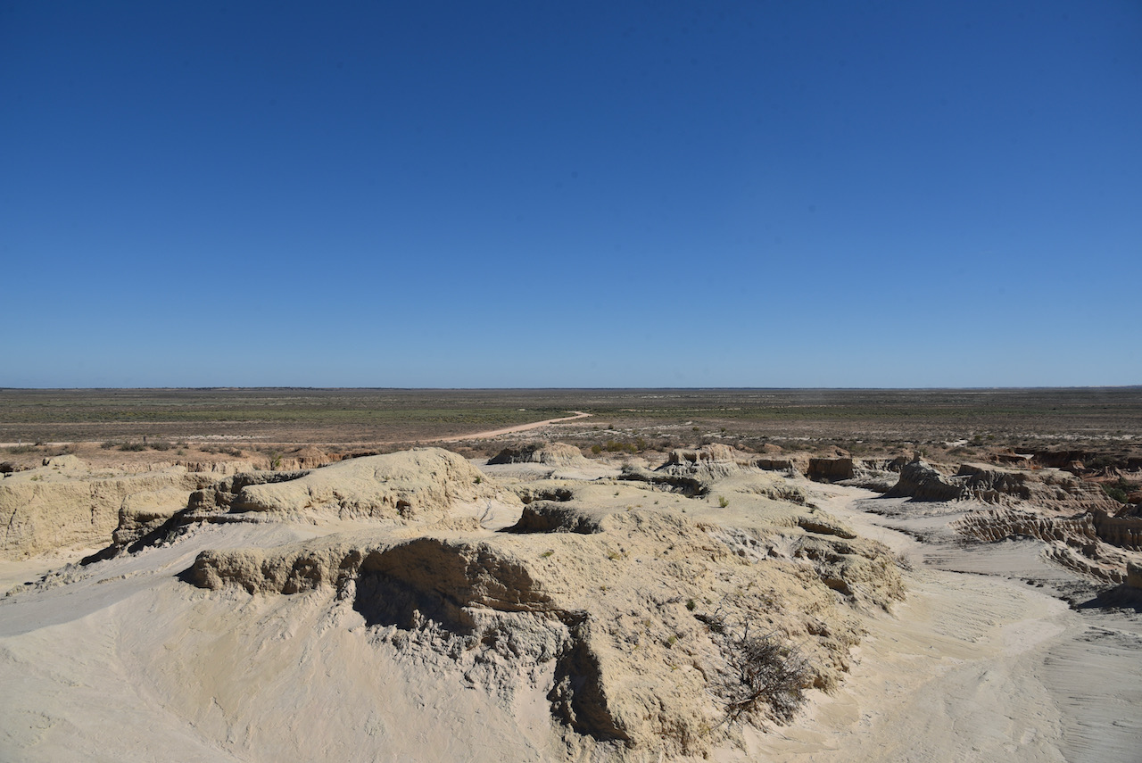
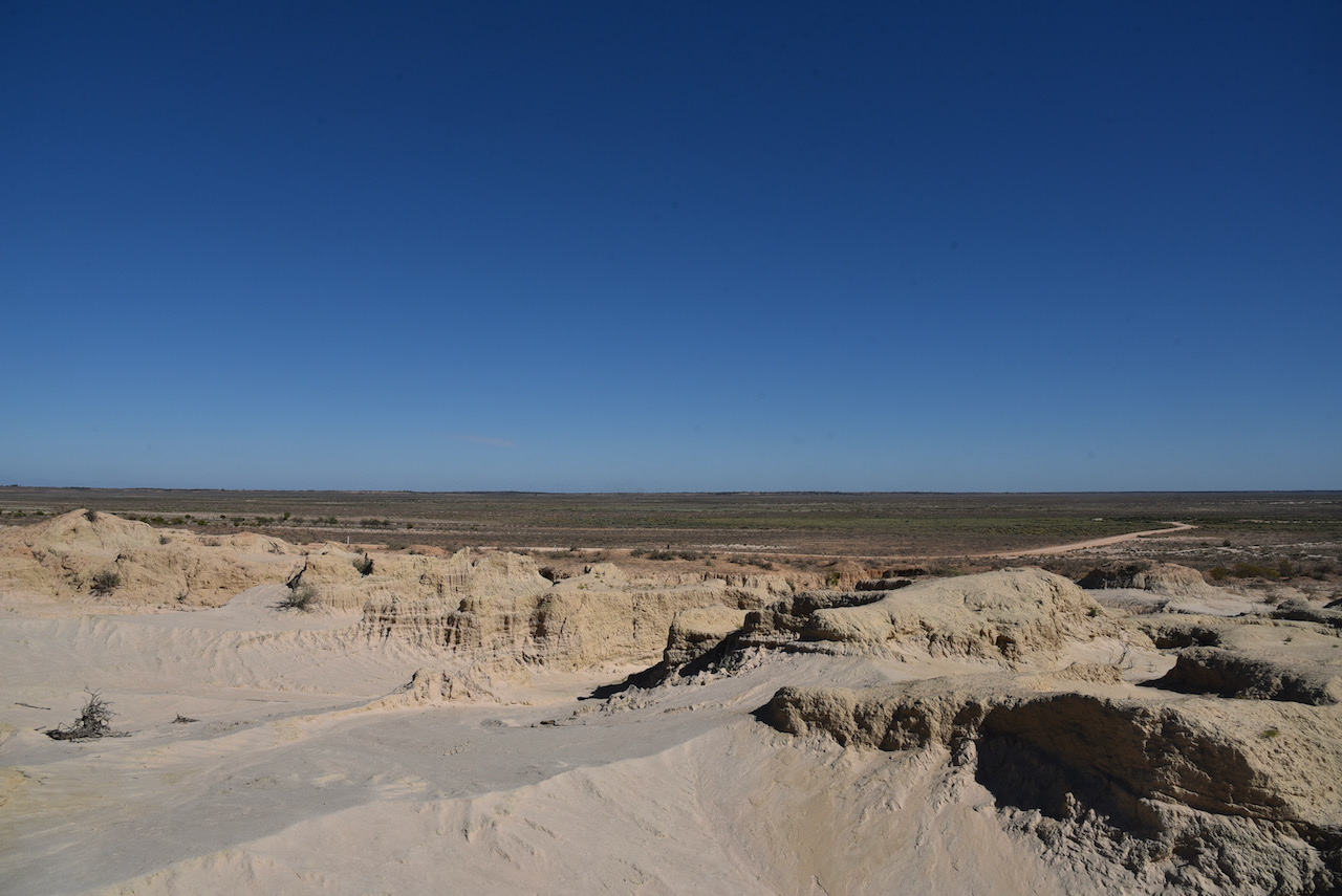
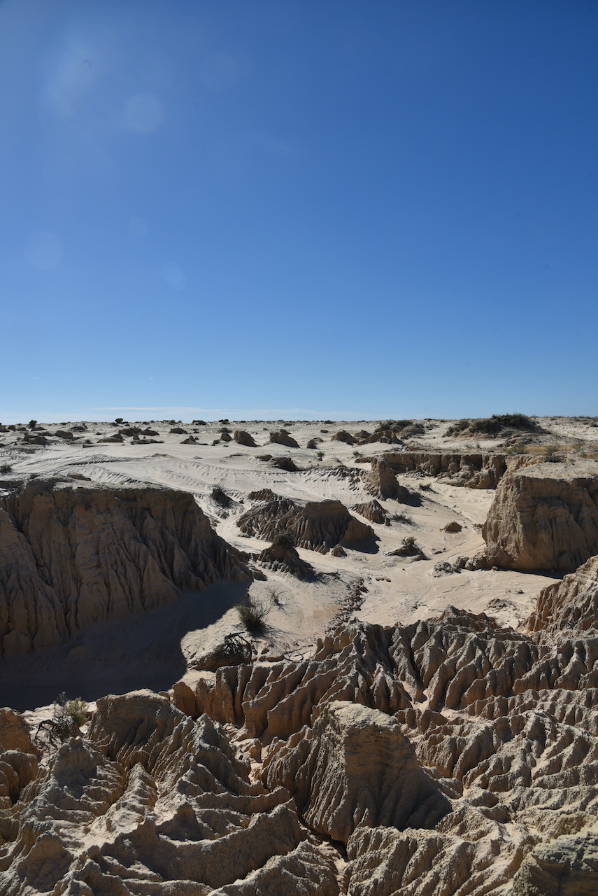
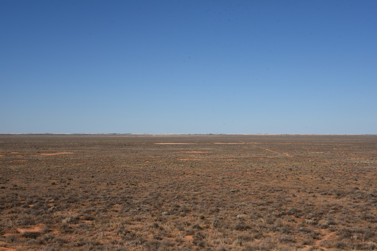
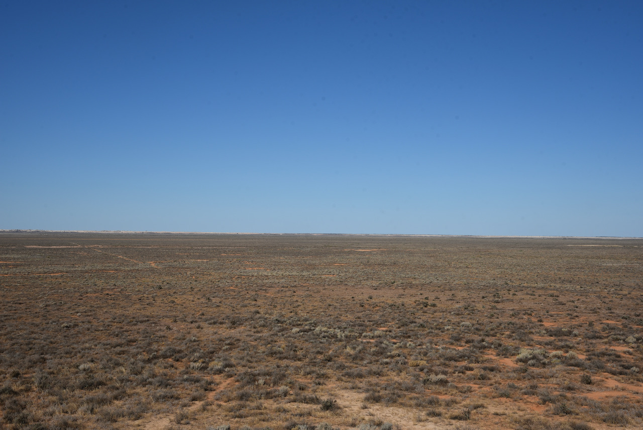
We then drove out to The Walls of China, one of the world’s most signficant archaelogical sites. The Walls of China are a unique feature on the south-eastern edge of what is known as the Lake Mungo lunette. A lunette is a wind formed crescent dune shape
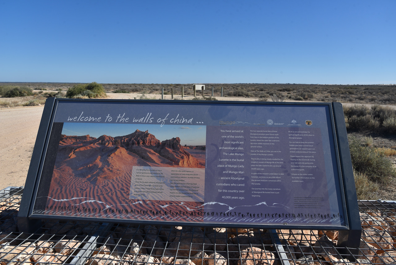
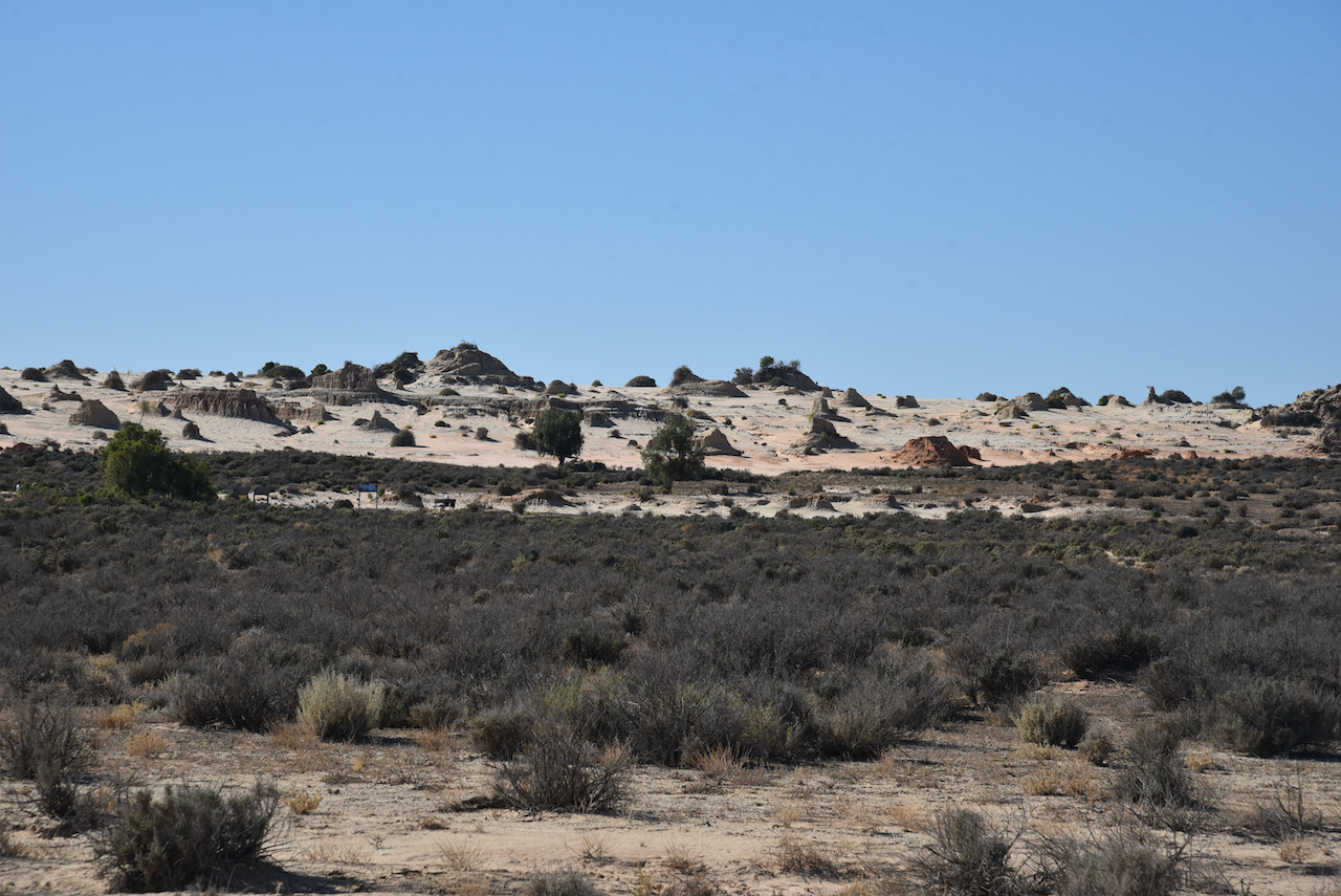
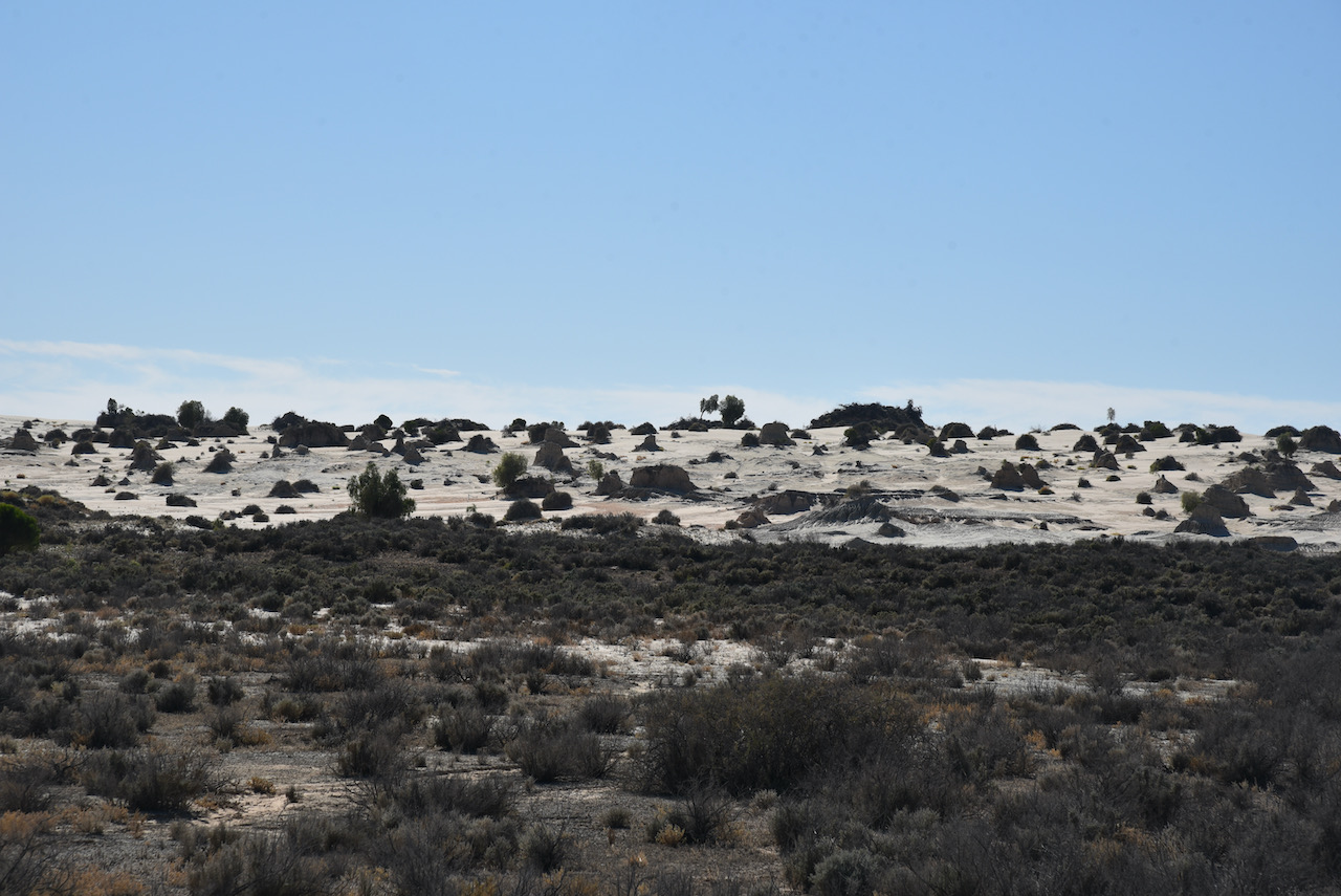
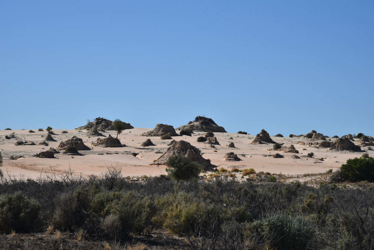
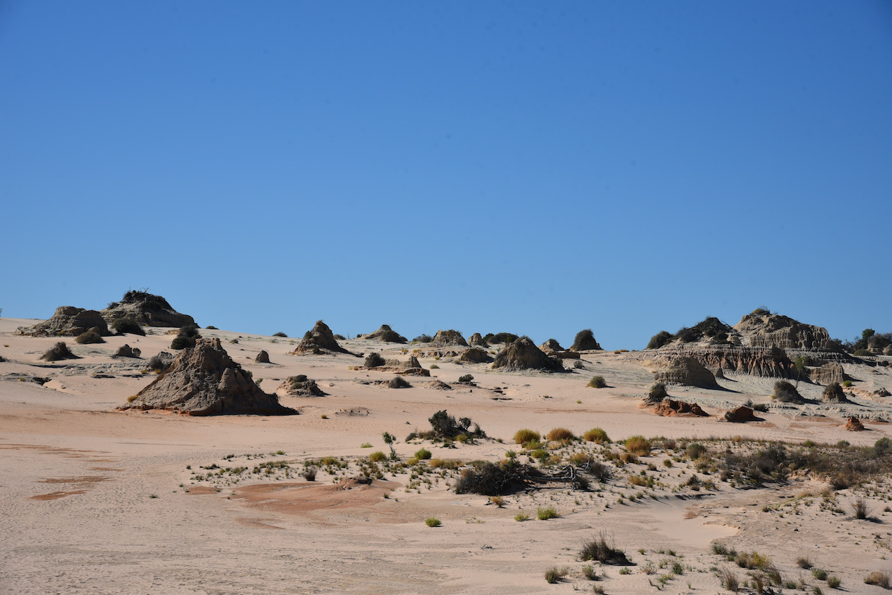

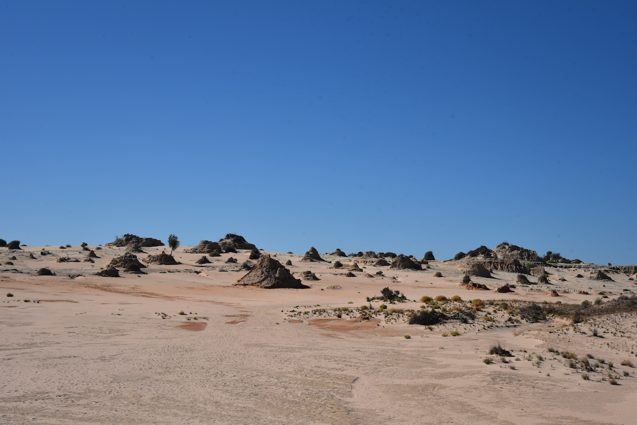
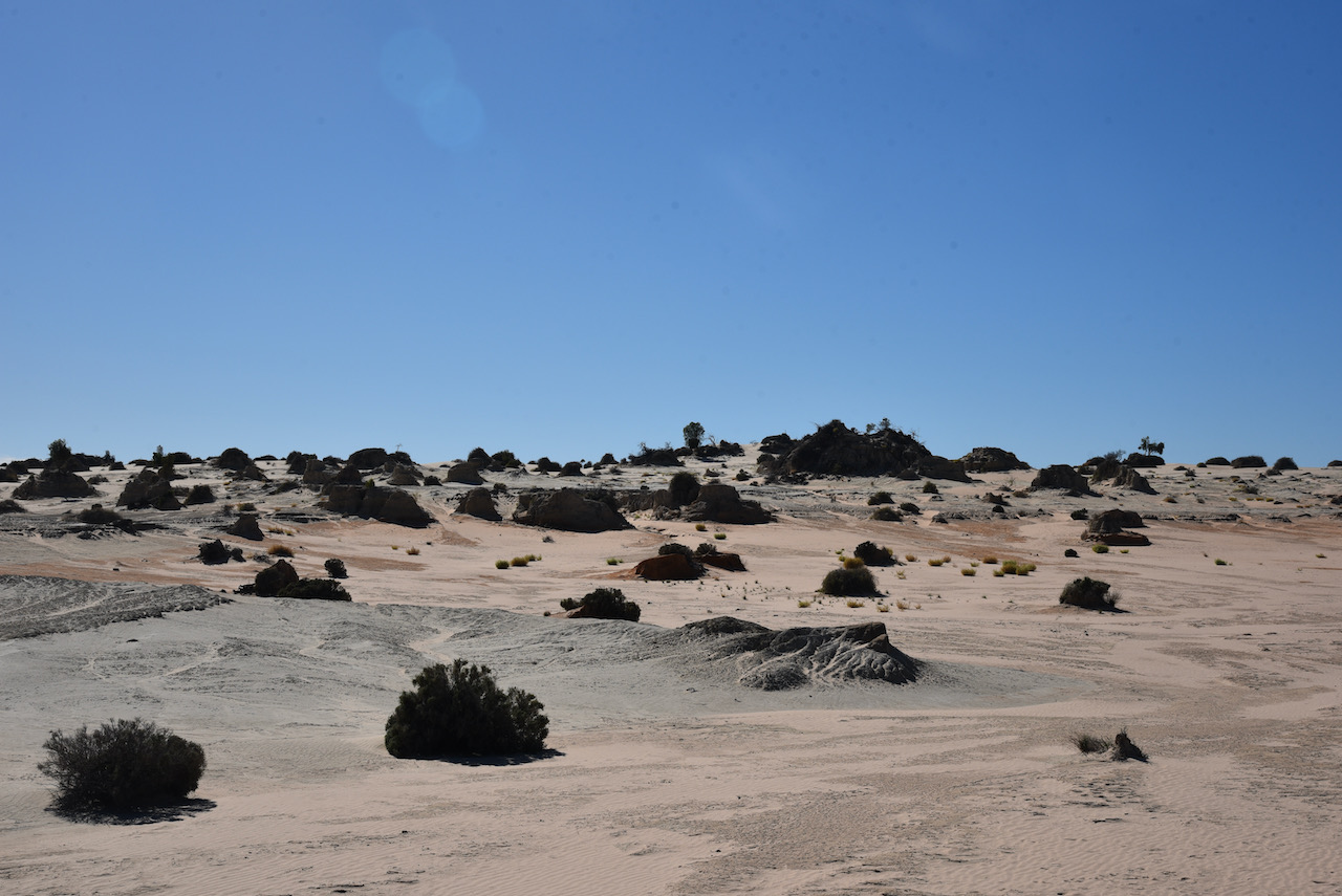
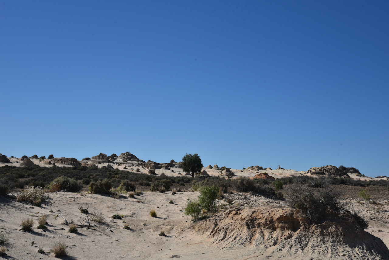
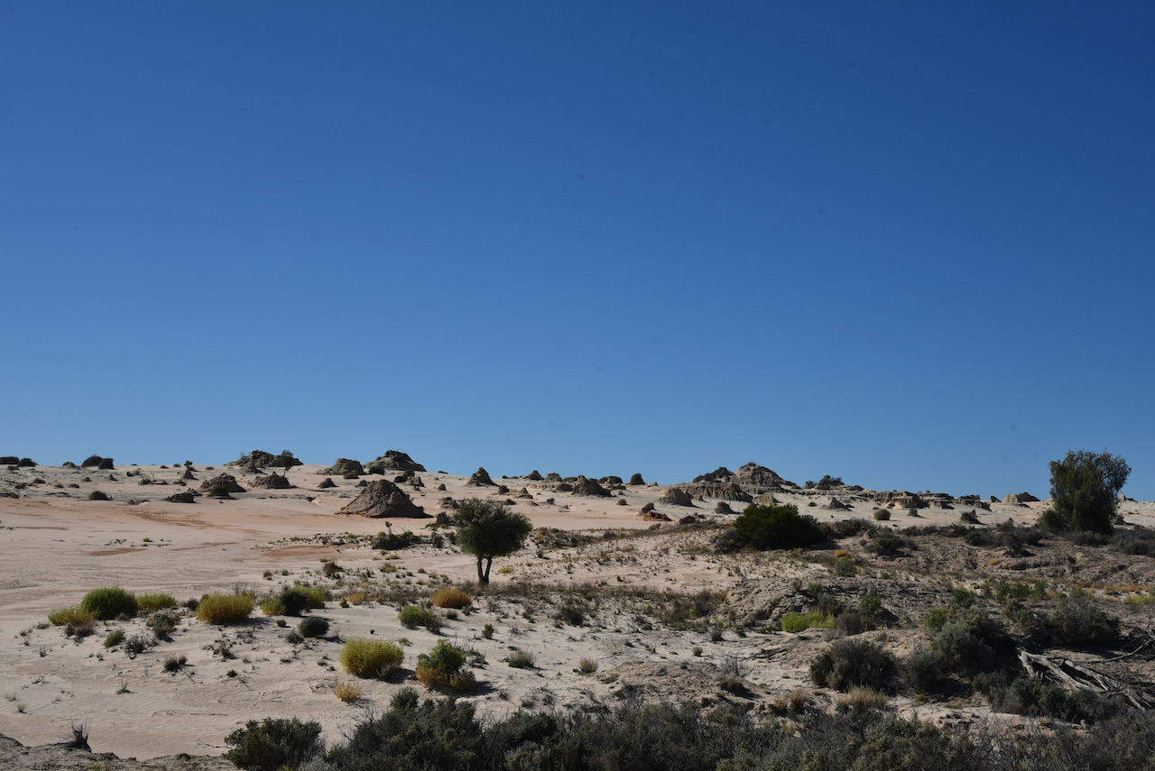
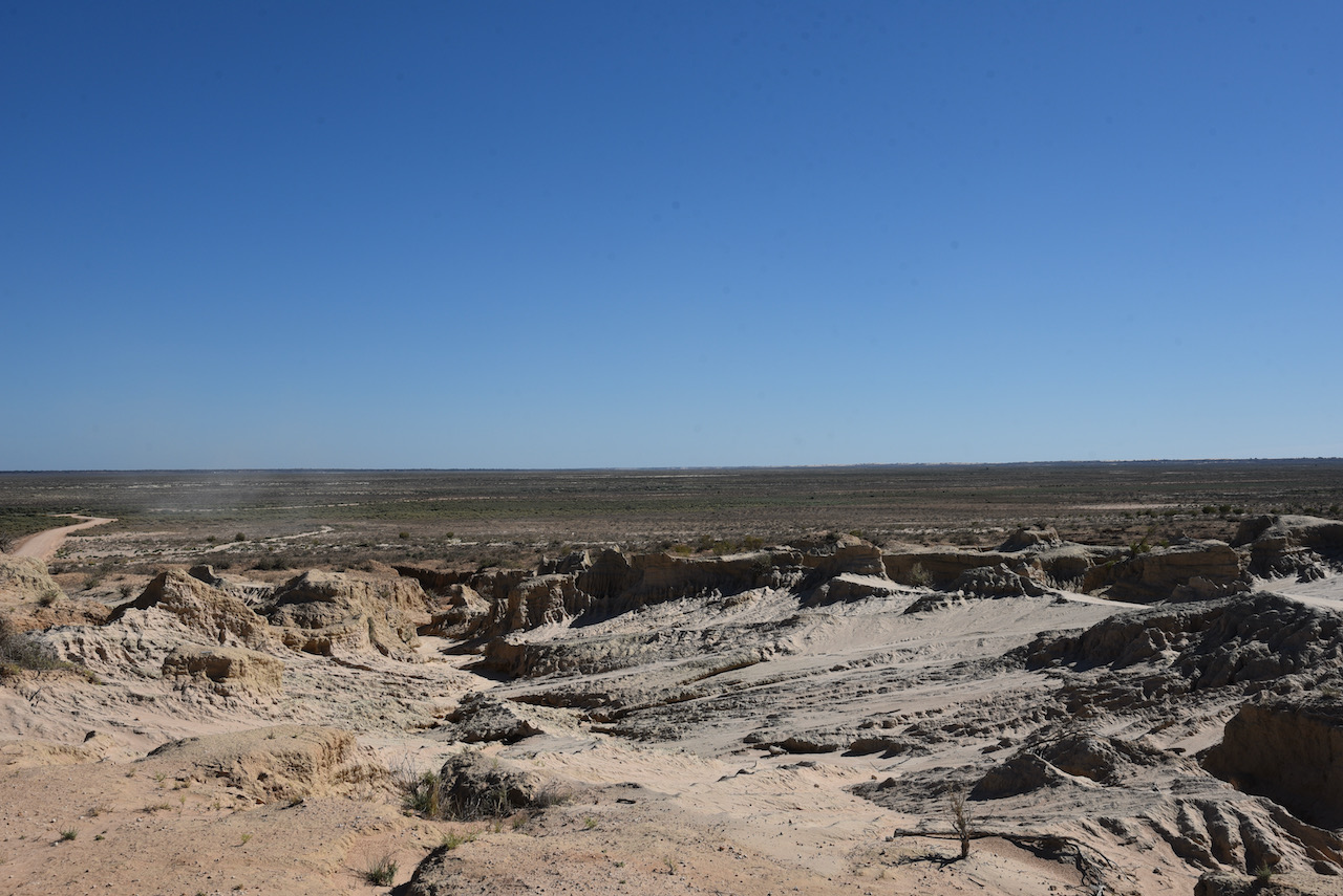
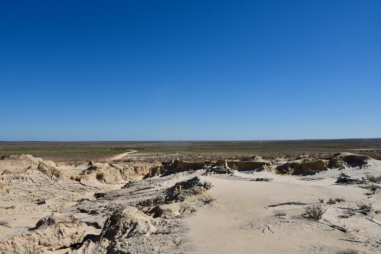
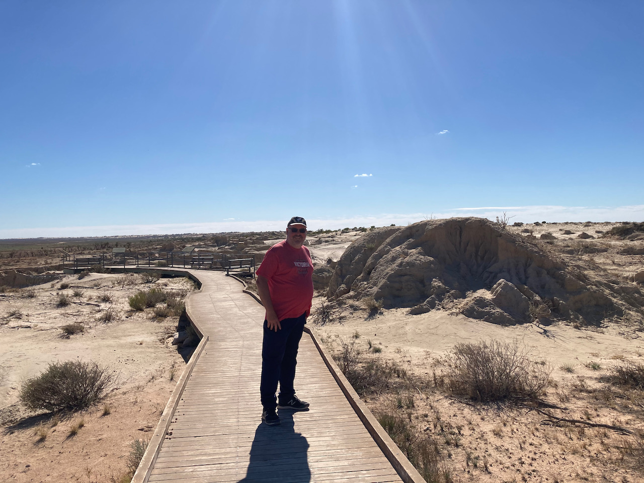
There is a boardwalk here with interpretive signs explaining the history of the formations of the Walls of China. Rain has washed away the soft sand and mud of the lunette, creating characteristic ridges and cracks.
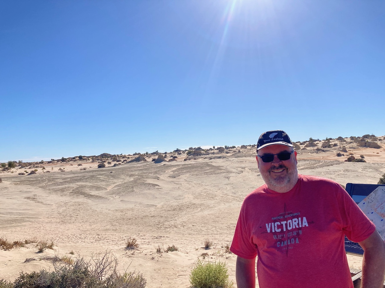
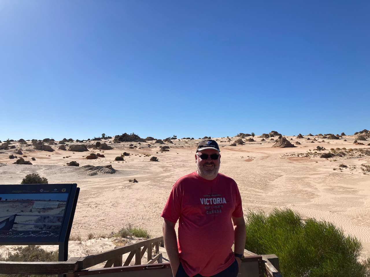
During our visit to the Walls of China there were at least a dozen people either painting or drawing the landscape (see below)
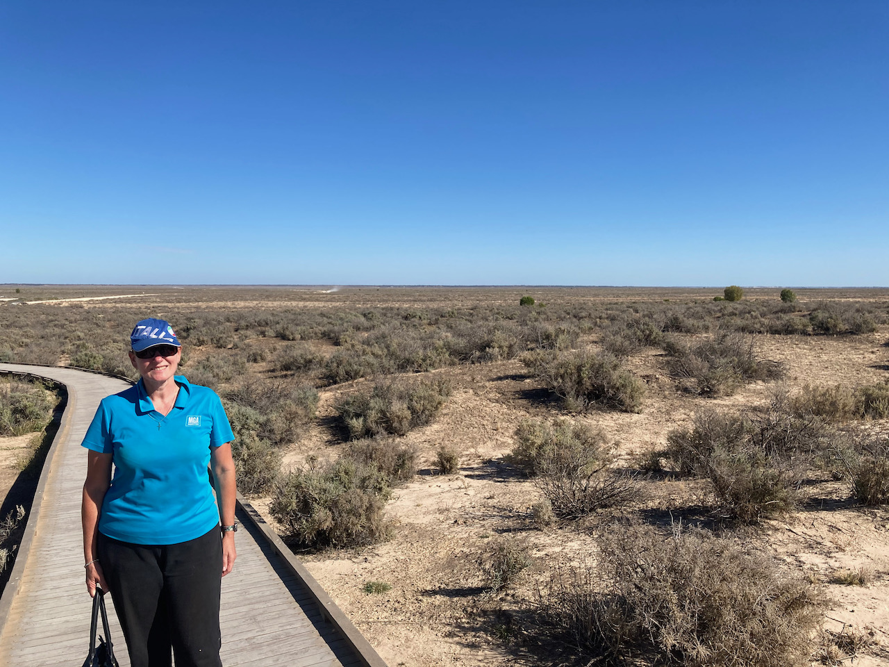
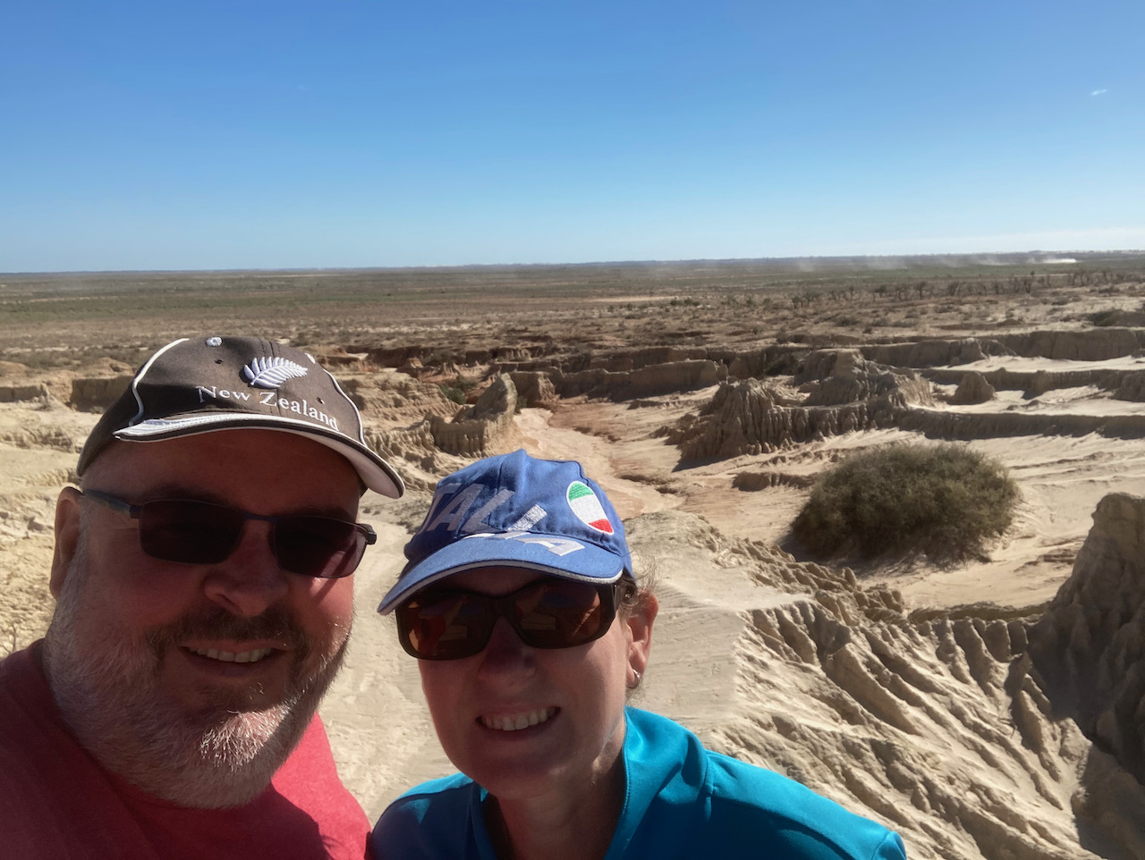
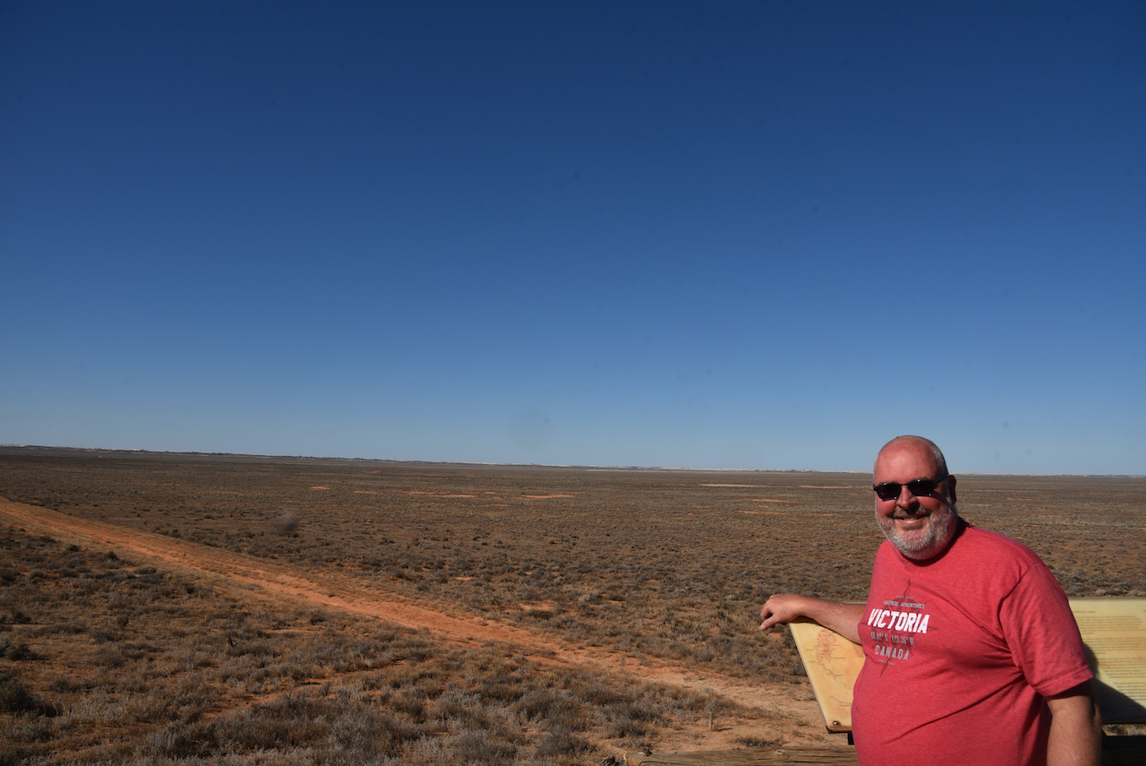
We then drove out to the Walls of China lookout. There is a viewing platform here which offers amazing views of the Walls of China and Lake Mungo.
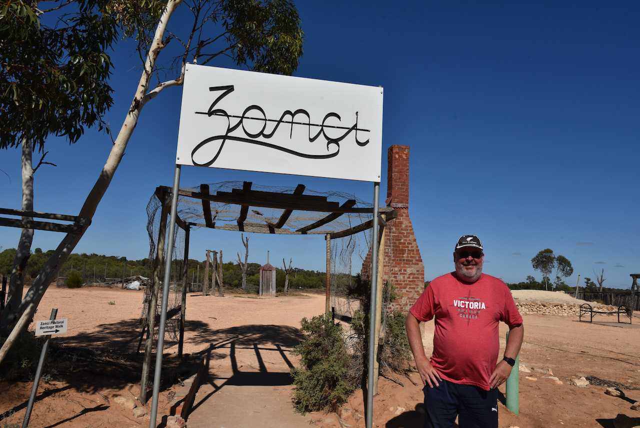
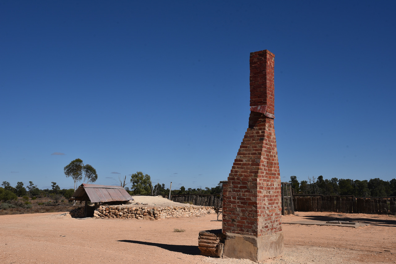
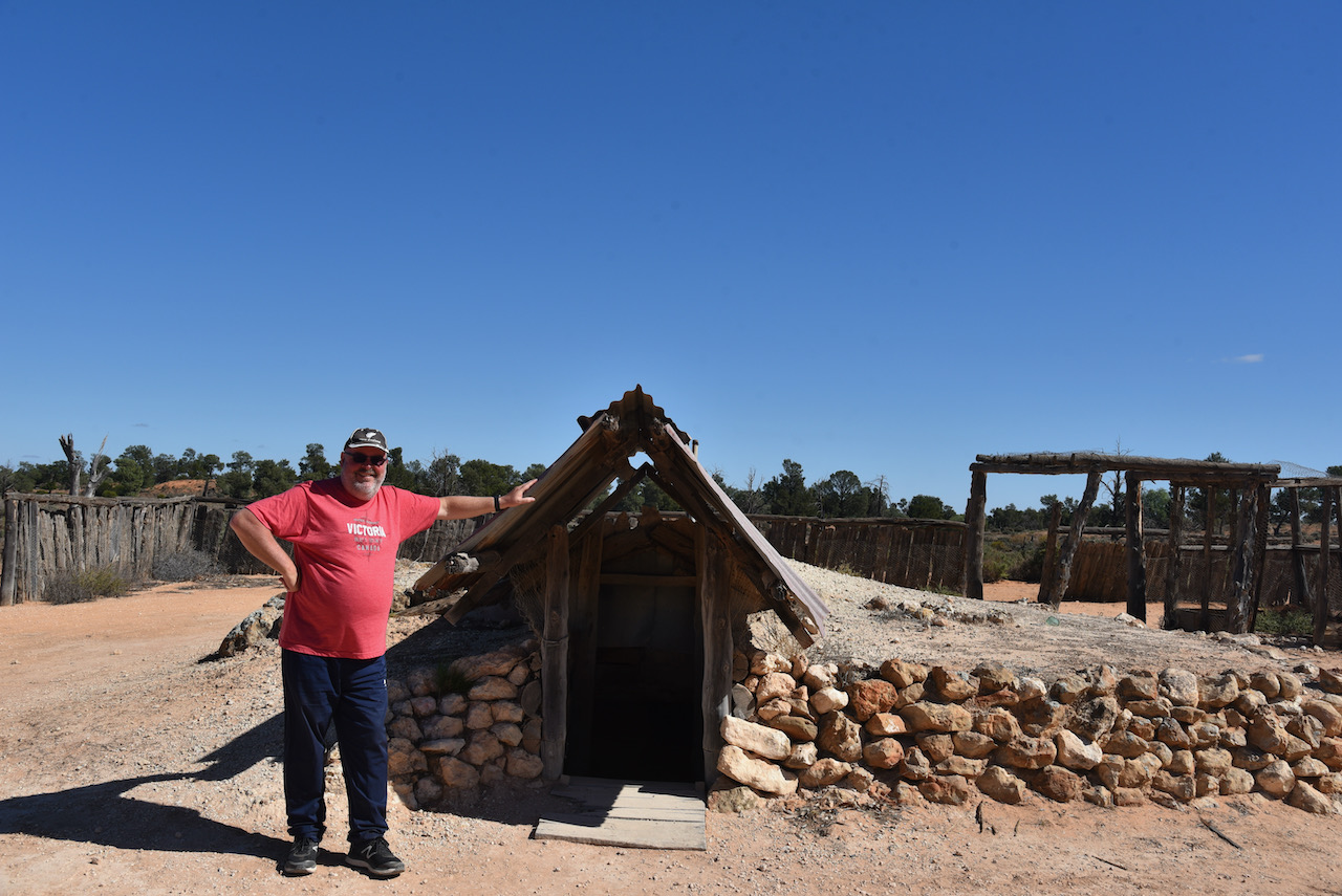
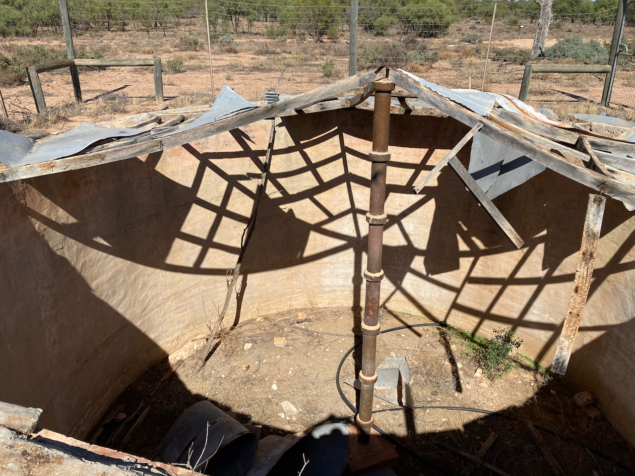
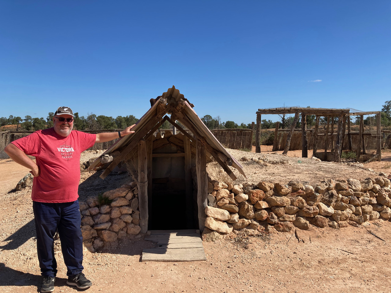
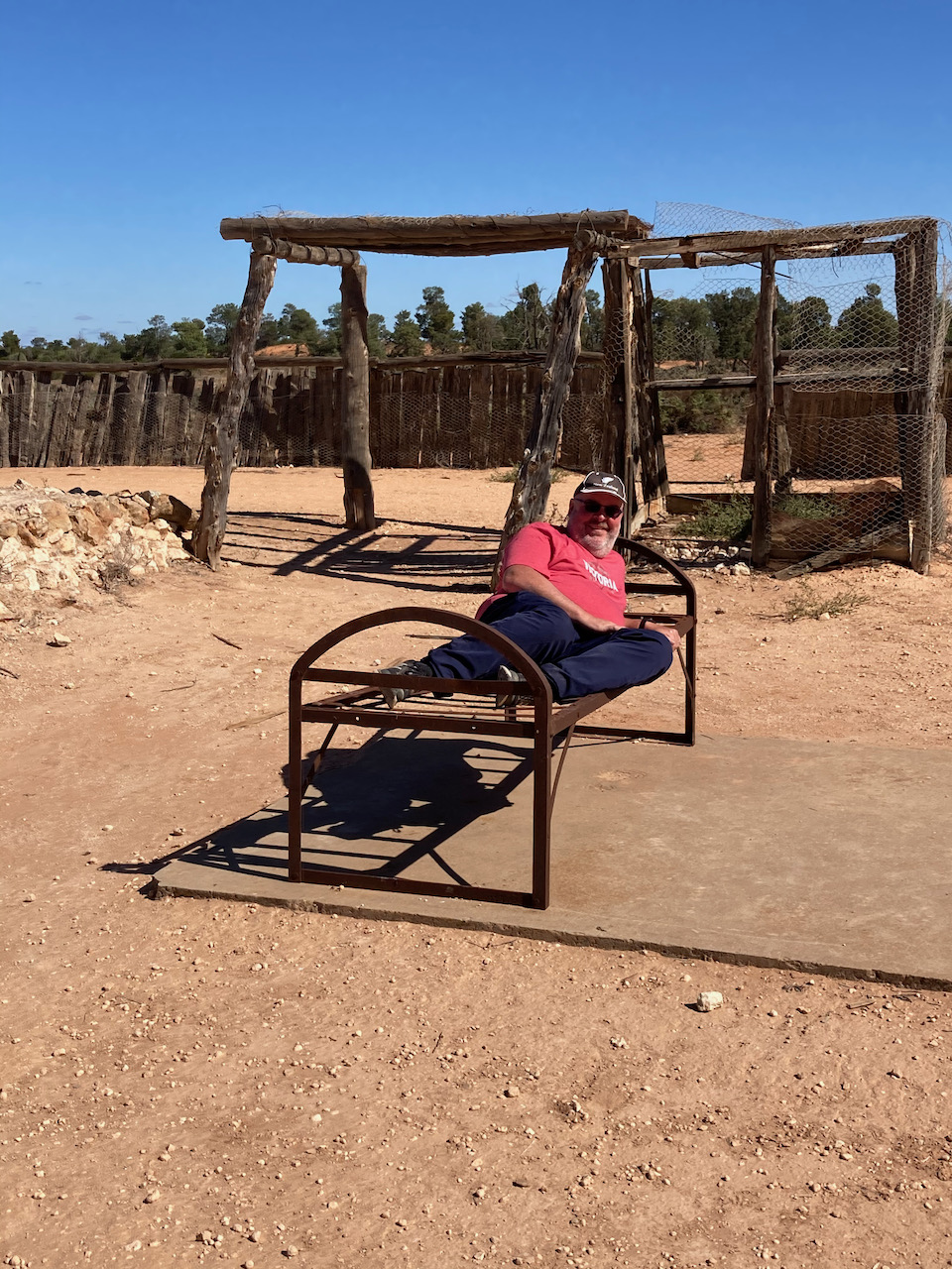
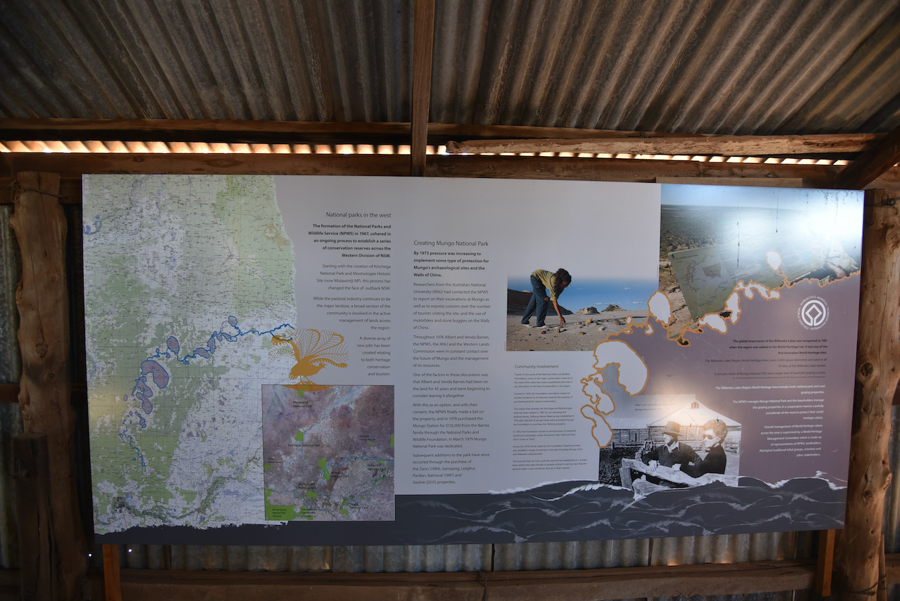
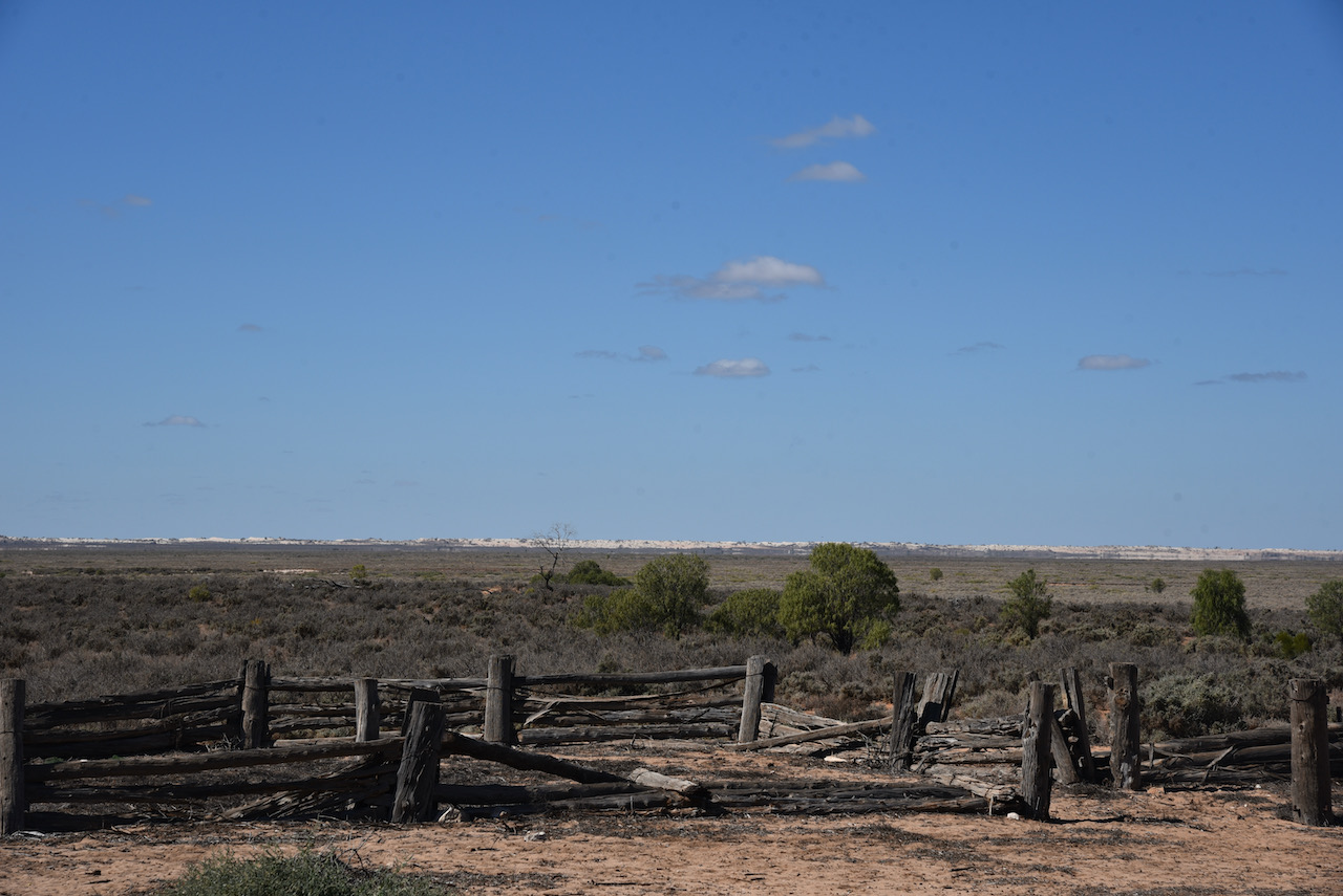
Our next stop was the old Zanci homestead. This was a soldier settlement block which was once part of Gol Gol Station. SInce 1984 it has formed half of the Mungo National Park. Three interesting buildings remain at Zanci, the dugout, the stables, and the shearing shed.
The dugout was built by the Vigar family as a cool-room and a place to escape the blistering heat of summer days. Just like the Wombat and the rabbit, the Vigar family found that heat does not penetrate far below ground level and that humidity remains much higher there.
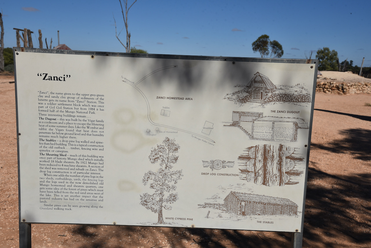
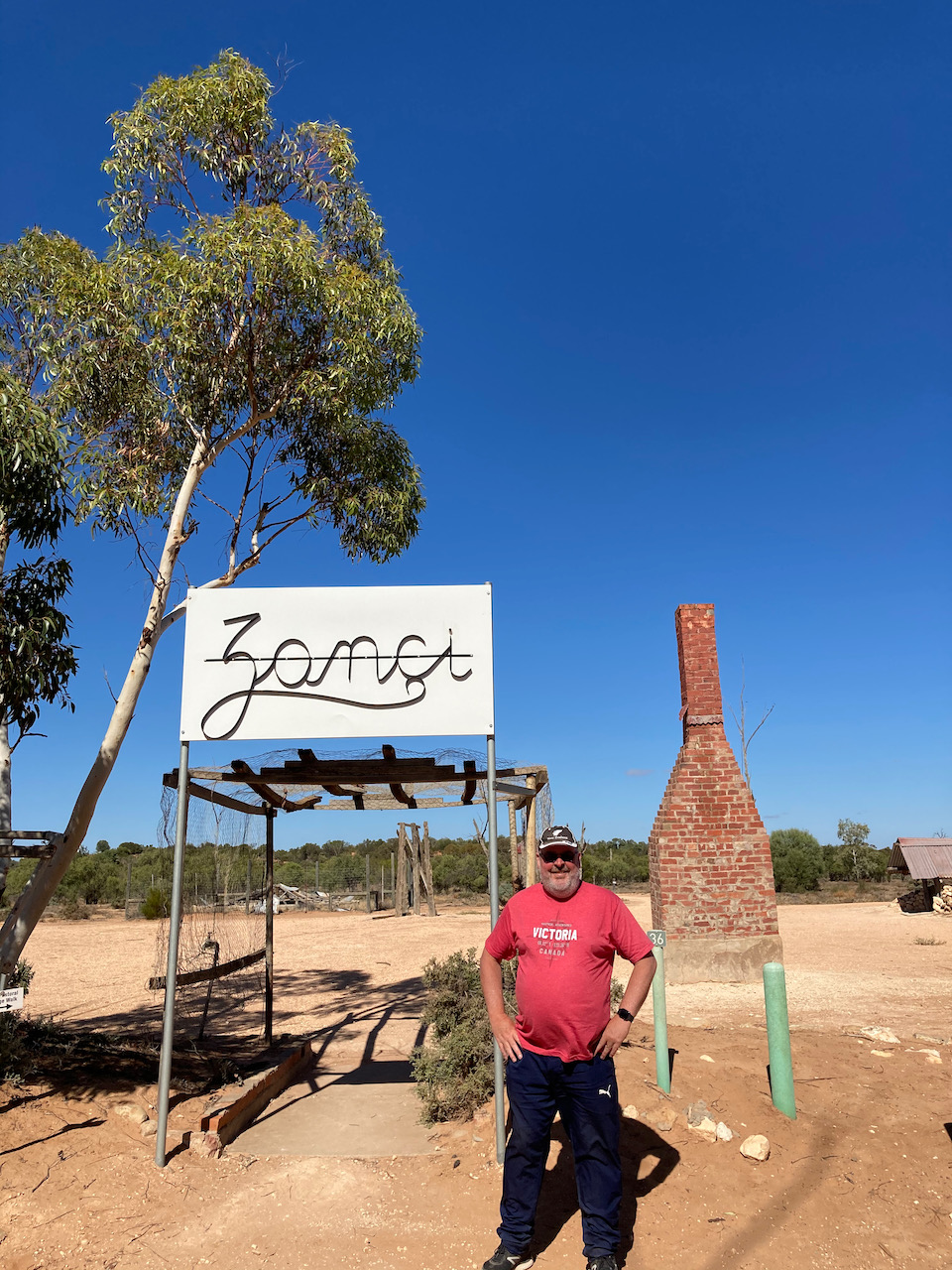
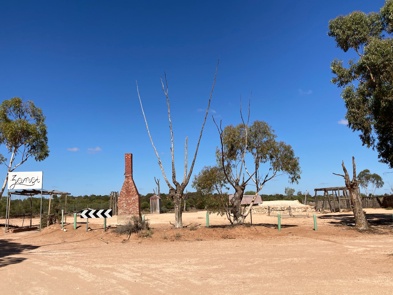
The stables are a drop pine log walled and spinefex thatched building. This is a typical construction of the old outback, consisting of timber, fencing wire and spinefex or canegrass.
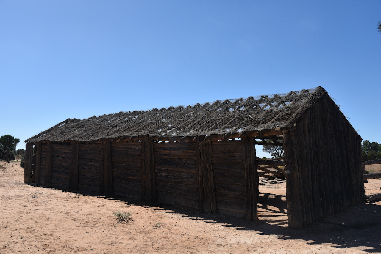
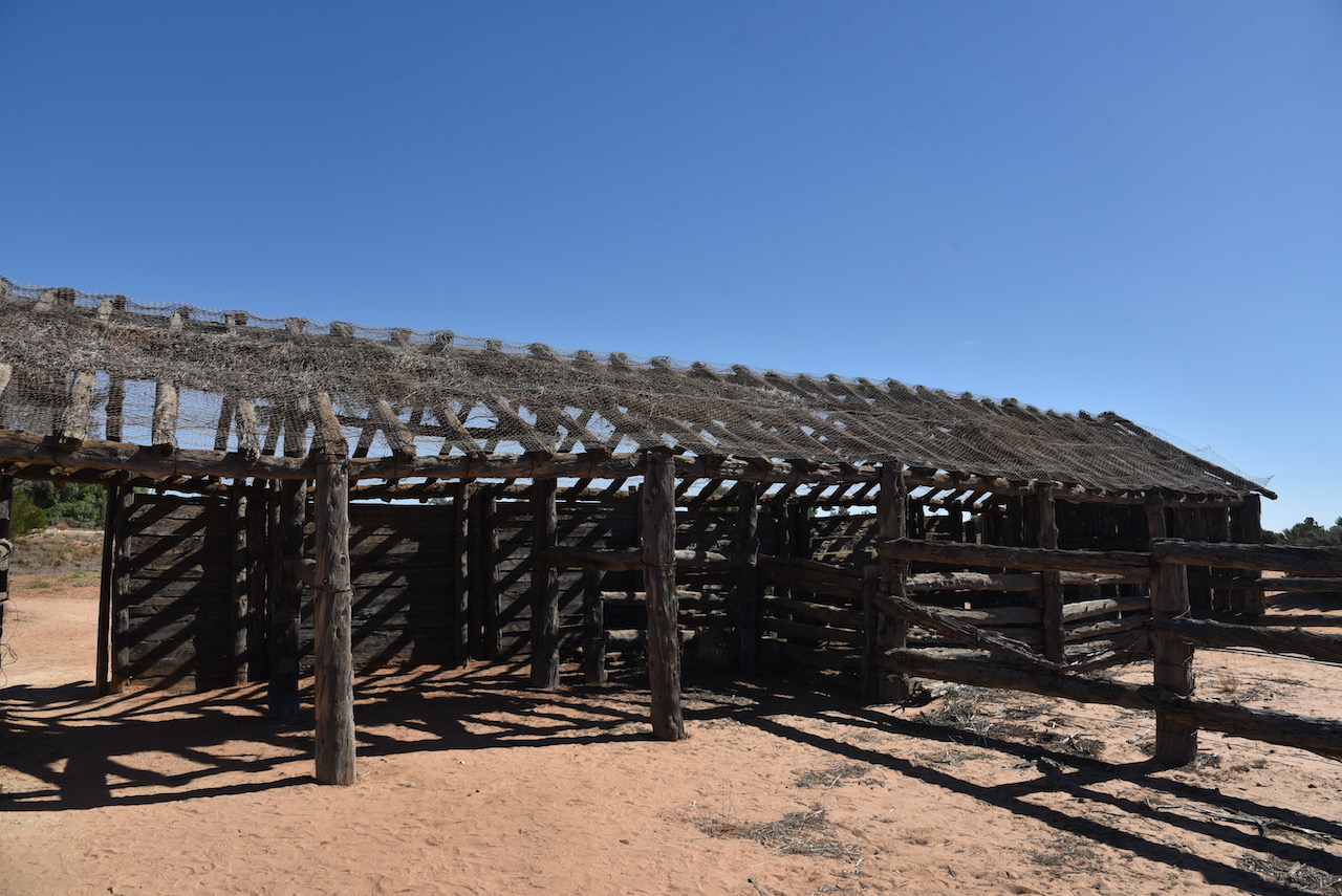
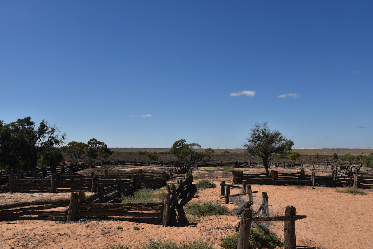
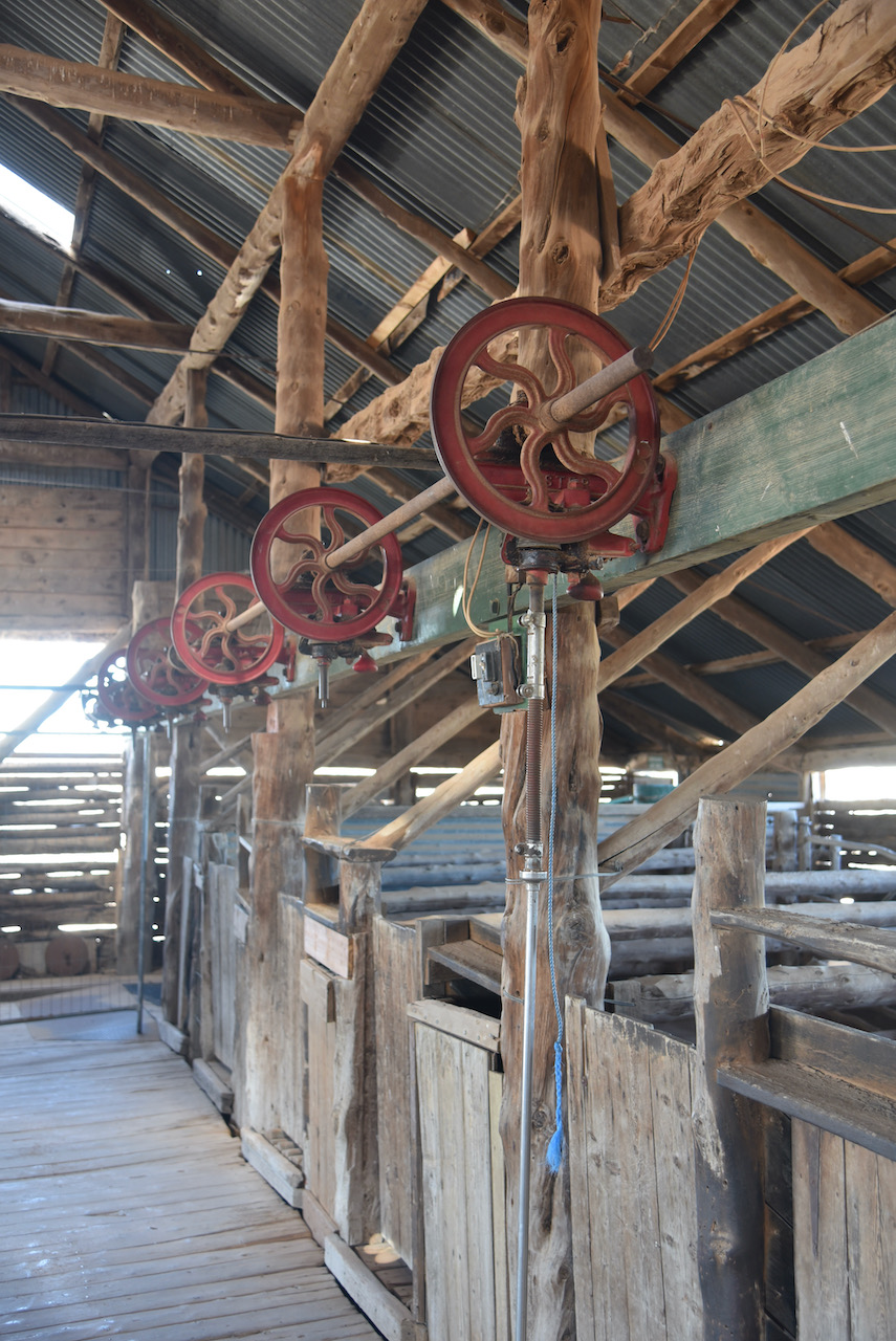
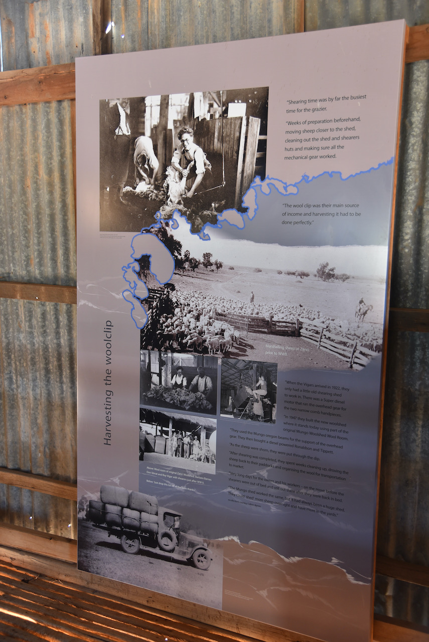
The Zanci shearing shed was once part of the historic Mungo shed which initially worked 18 blade shearers. By 1922 Mungo had been reduced to 4 machine shearers. A section of the shed was removed and rebuilt at Zanci. The drop log construction is of particular interest.
When you add the number of pine logs in the two sheds, the outbuildings, the yards, the fencing logs, and the logs used in the now demolished old Mungo homestead, you can get a feel of the forest of Pines which must have been felled from the red sand area west of the lake.
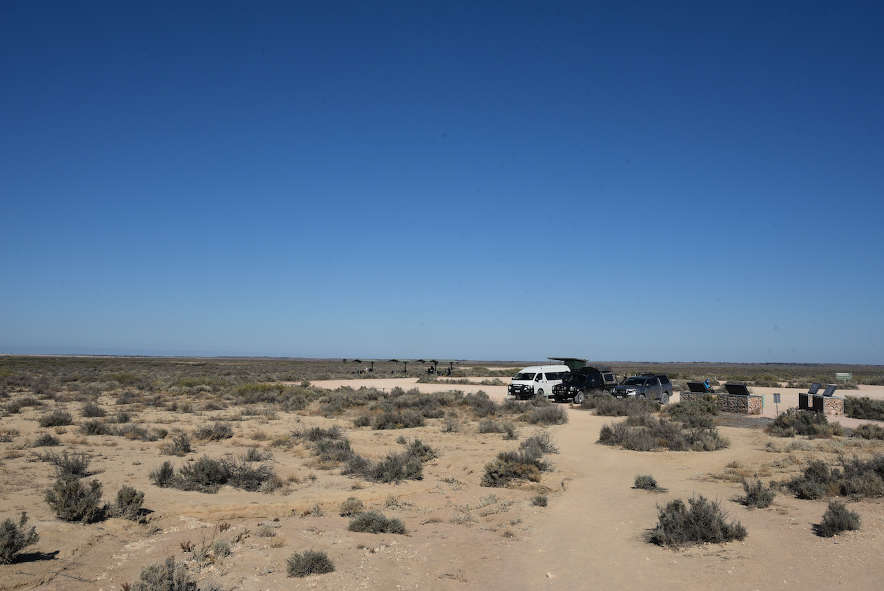
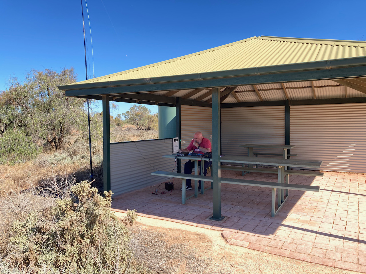
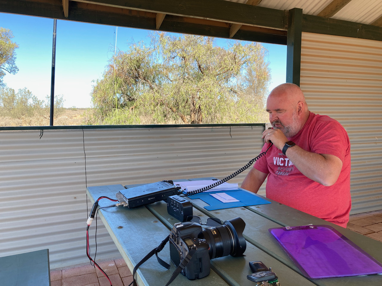
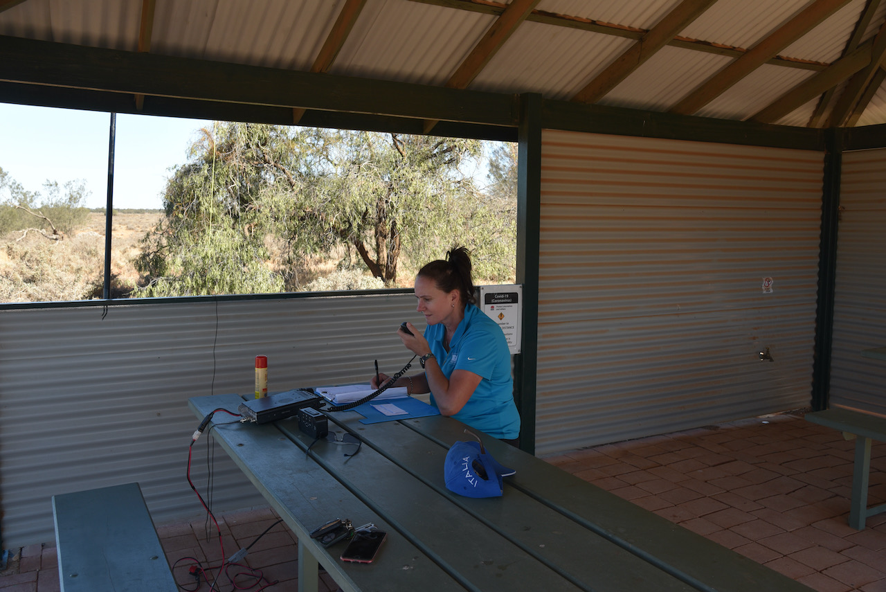
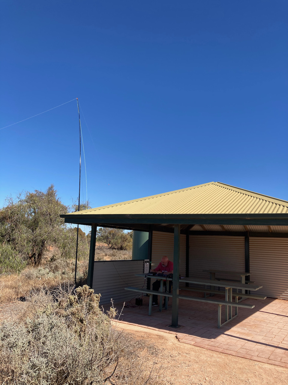
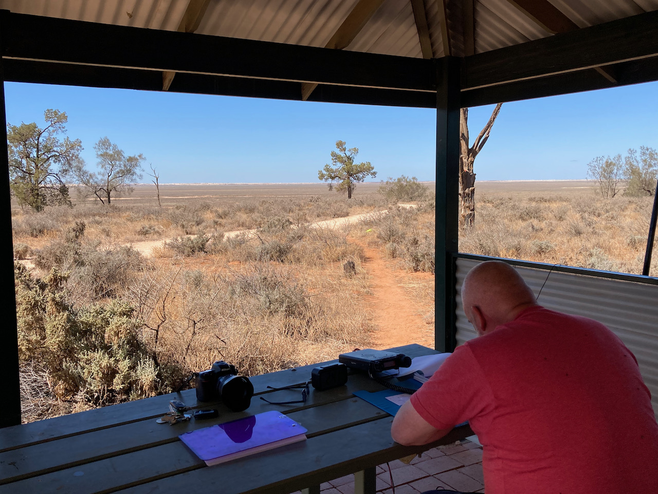
Marija and I headed for the main campsite area at Mungo, however there was a sign saying that campground was full. So operating from there was not going to be an option. We then headed to the Mungo Lookout which appeared to be a quiet location. We found a shelter shed area with nobody around and this proved to be an ideal spot to operate from.
We ran the Yaesu FT-857d and the 20/40/80m linked dipole for this activation. The antenna was inverted vee configuration, supported by a 7 metre telescopic squid pole.
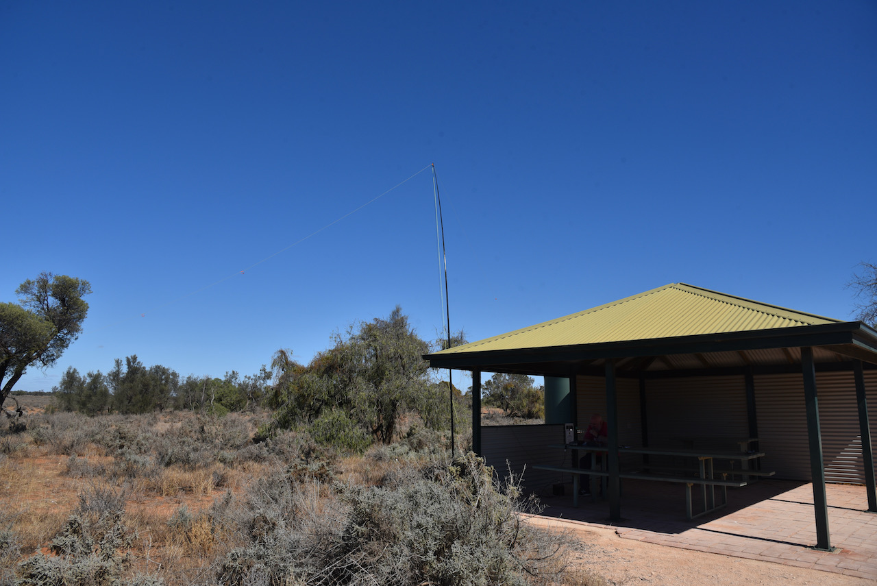
Just a short walk from our operating spot was the Mungo Lookout which offered sensational views of Lake Mungo.
First in the log for the Mungo activation was Tony VK3YV with a Park to Park contact. Tony was activating the Bull Beef Creek Nature Conservation Reserve VKFF-2055. Then all the fun started with a fairly significant pile up of callers. Within 5 minutes I had qualified the park with 10 contacts in the log. Contact number ten was with Dennis VK2HHA.
I decided to keep boxing on and get my 44 and then swap over with Marija. It took just 25 minutes to get QSO number 44 in the log, a contact with David VK3VRA.
I logged a total of 61 contacts on 40m before handing the mic over to Marija. Contacts were made to VK1, VK2, VK3, VK4, VK5, and VK7.
Marija then called CQ on 7.144 and this was answered by Peter VK3PF, followed by Ivan VK5HS and then Phil VK3MB. Marija also developed a little pile up, and in just 5 minutes had contact number 10 in the log, a QSO with Joe VK3SRC.
Marija pushed on with the park hunters and after just 30 minutes had contact number 44 in the log, a QSO with Allen VK3HRA. Contacts were made into VK1, VK2, VK3, VK4, VK5, and VK7. This included a Park to Park contact with Chris VK1CT/2 who was activating the Narrawallee Creek Nature Reserve VKFF-1979.
I then picked up a further 23 contacts on 40m before heading to 14.310 where I just logged 4 QSOs, including a Park to Park with Marty VK4KC who was in the Bribie Island National Park VKFF-0053.
Marija and I packed up, feeling very satisfied with a total of 139 QSOs in the log.
During our activation we had a number of onlookers and we explained to them the hobby of amateur radio and the World Wide Flora Fauna program. We were also visited by one of the Rangers and I must say it was an absolute pleasurable experience. She was very interested in our hobby and the link to nature. I handed her some promotional material and my business card and told her about my Blog. This was a very good interaction. Big thumbs up to the Rangers at Mungo.

Marija worked the following stations on 40m SSB:-
- VK3PF
- VK5HS
- VK3MB
- VK3PWG
- VK5WG
- VK5IS
- VK5CZ
- VK5BJE
- VK3SRC
- VK3YSP
- VK3FOWL
- VK2YW
- VK2HHA
- VK4BXX
- VK4/NN3Z
- VK3MPR
- VK4CZ
- VK5MJC
- VK1CT/2 (Narrawallee Creek Nature Reserve VKFF-1979)
- VK5FUSE
- VK7LTD
- VK4NH
- VK4DXA
- ZL4TY/VK4
- VK5LA
- VK3UH
- VK3GQ
- VK3VRA
- VK7FAMP
- VK2QM
- VK2IO/m
- VK3MTT
- VK3ZPF
- VK5NEC
- VK5FDMG
- VK5SRP
- VK2MOR
- VK5FR/m
- VK3ARH
- VK2XSE
- VK5DC
- VK1DI
- VK2PET/5
- VK3HRA
- VK2KNV
- VK3CJN
- VK3FQSO
- VK3CU
I worked the following stations on 40m SSB:-
- VK3YV/p (Bull Beef Creek Nature Conservation Reserve VKFF-2055)
- VK3BBB
- VK2CCP
- VK2YW
- VK3CWF
- VK3CAT
- VK5IS/m
- VK5WG
- VK2DG
- VK2HHA
- VK2LEE
- VK4HNS
- VK4NH
- VK4DXA
- ZL4TY/VK4
- VK3FQSO
- VK5FUSE
- VK3PF
- VK3MB
- VK7QP
- VK3TKK/m
- VK5KSW
- VK3MCK
- VK5GY
- VK2IO/m
- VK2VW
- VK2HFI
- VK3MPR
- VK2STG
- VK3UH
- VK2VAR
- VK7FLAR
- VK2TM
- VK1DI
- VK7FAMP
- VK3PMC
- VK7DIK
- VK5HS
- VK4CZ
- VK3SRC
- VK3YSP
- VK3FOWL
- VK5PL
- VK3VRA
- VK5MJC
- VK5FR/m
- VK2RO
- VK5CZ
- VK7LTD
- VK5DIK
- VK2VH
- VK4AAC/2
- VK3PI
- VK3MTT
- VK4FDJL
- VK4BXX
- VK4/NN3Z
- VK5KLV
- VK3MLD
- VK4HAW
- VK7EE
- VK3XCI
- VK3PWG
- VK1CT/2 (Narrawallee Creek Nature Reserve VKFF-1979)
- VK2YK
- VK5GA
- VK5SRP
- VK2HRX
- VK2MOR
- VK3NCC/m
- VK2HBO
- VK2PET/5
- VK5VK
- VK3CJN
- VK3FTOM
- VK3ARH
- VK3APA
- VK3KK
- VK5BW
- VK7LTD
- VK3DBP
- VK5FDMG
- VK2FPAR
- VK2FAPC
- VK5RK
- VK2PBC/m
- VK3SQ
I worked the following stations on 20m SSB:-
- VK4KC (Bribie Island National Park VKFF-0053)
- VK4MAD (Bribie Island National Park VKFF-0053)
- VK4DOG (Bribie Island National Park VKFF-0053)
- VK4WTN
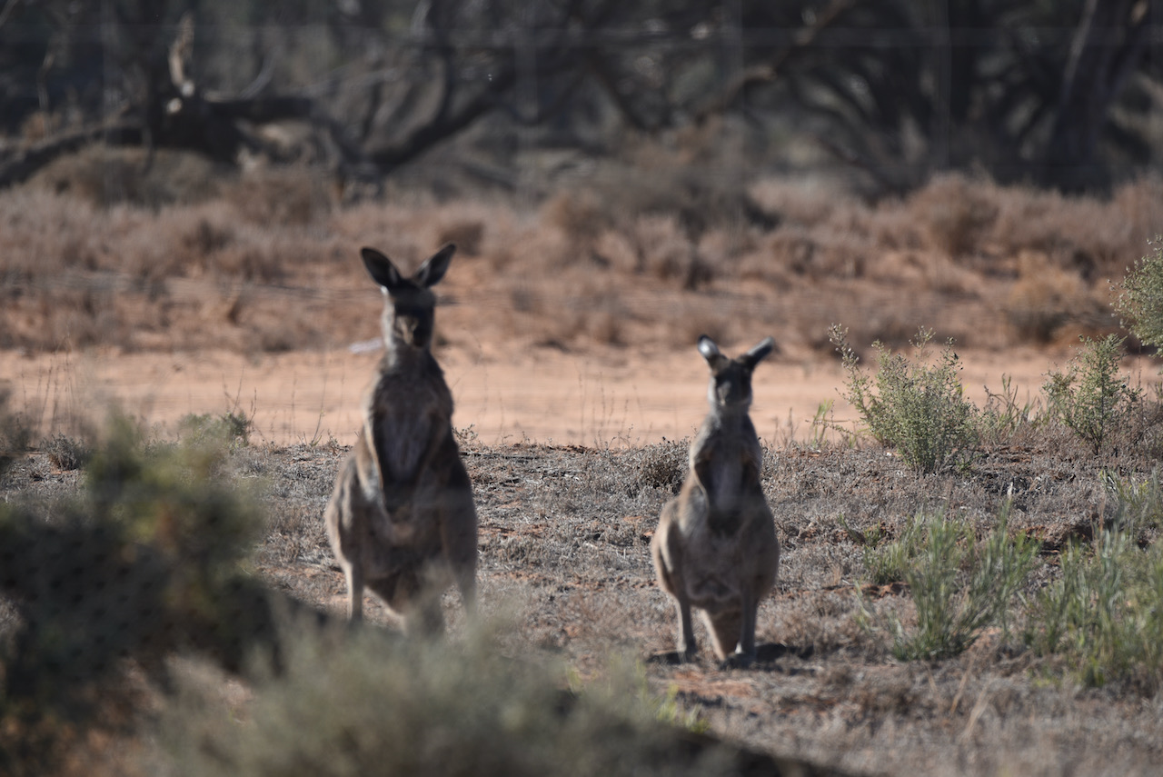
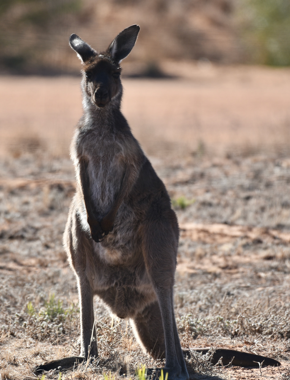
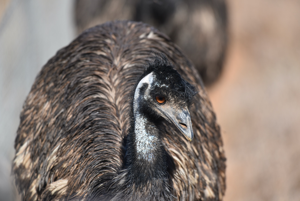
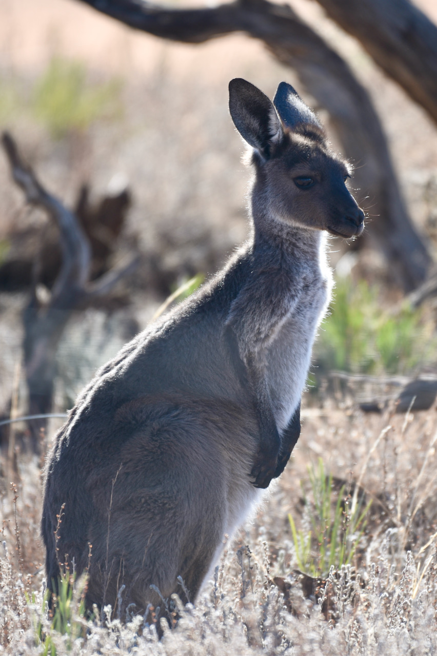
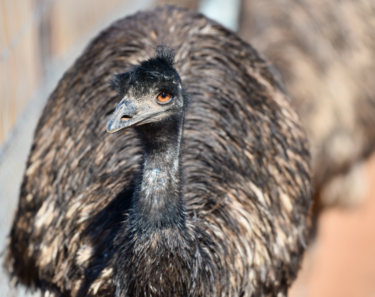
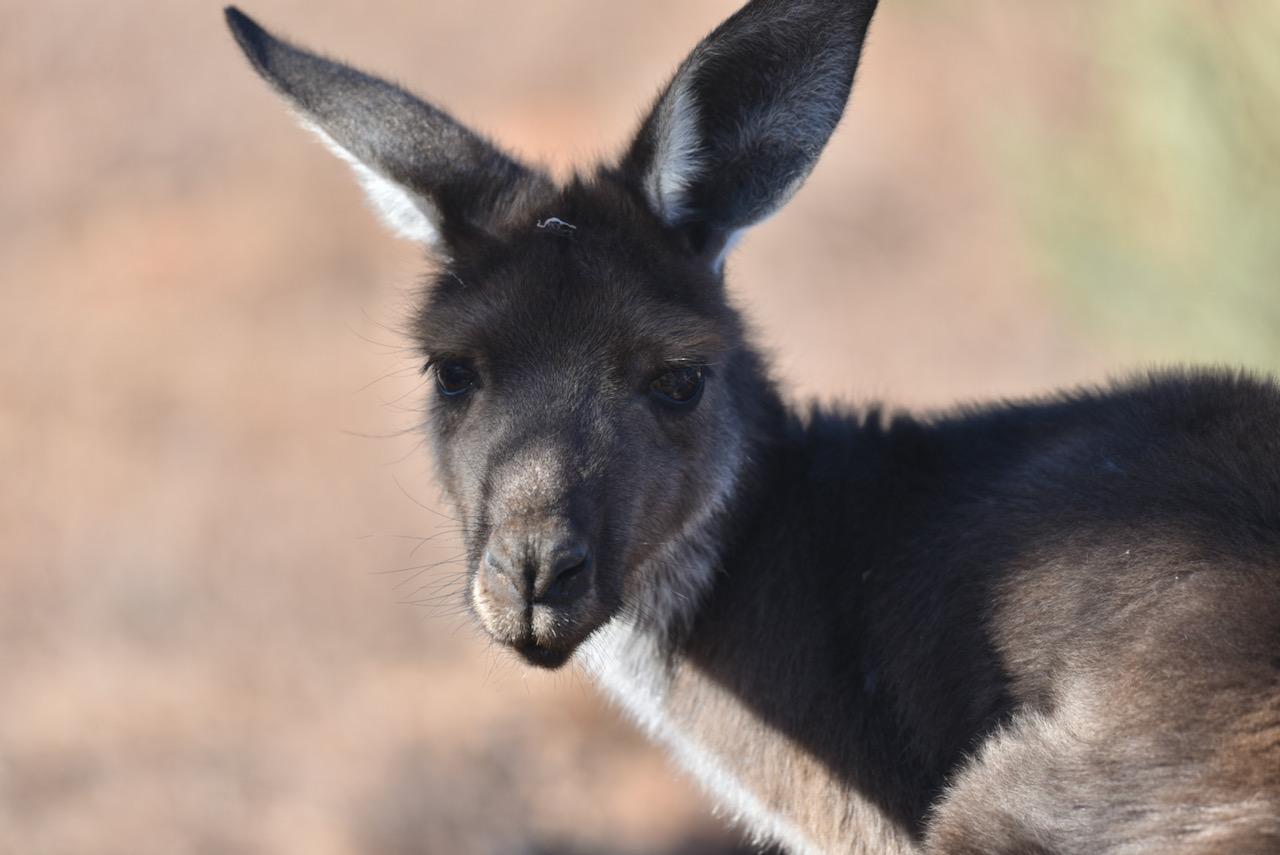
After packing up we headed to Mungo Lodge on the way out of the park and stopped for a coffee and to buy a few souvenirs. There were a number of kangaroos and emus in the area.
We then headed back into Euston and decided to activate the Euston Regional Park.
References.
Wentworth Shire Council, 2021, <https://visitwentworth.com.au/attractions/mungo-national-park-and-the-walls-of-china/>, viewed 12th May 2021.
Wikipedia, 2021, <https://en.wikipedia.org/wiki/Mungo_National_Park>, viewed 12th May 2021.
Wikipedia, 2021, <https://en.wikipedia.org/wiki/Lake_Mungo_remains>, viewed 12th May 2021.
