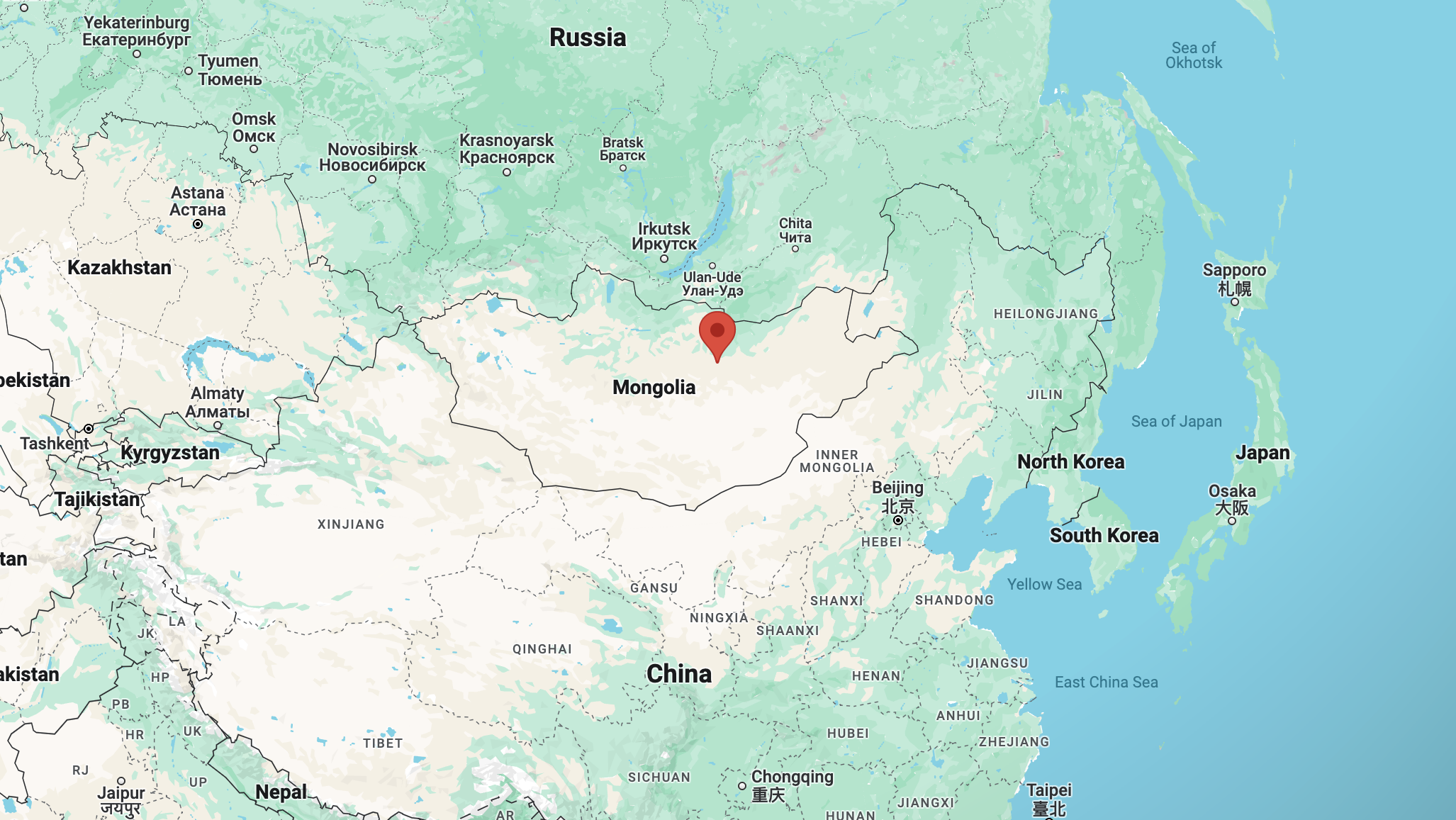
At about 1333 UTC on the 25th day of July 2024, I tuned in to the Voice of Mongolia, broadcasting on 12015 kHz in the Mongolian language.
The signal was coming from the Ulaanbaatar 250kW transmitter in Mongolia. (Short Wave Info 2023)
Above:- Map showing the location of Ulaanbaatar. Map c/o Google Maps.
The overall reception of the Voice of Mongolia was excellent. The signal strength was very strong and there was no fading of the signal. There was no interference from other stations on the frequency or on adjacent frequencies.
S
I
N
P
O
5
5
5
5
5
Below is a short video showing my reception of the Voice of Mongolia.
References.
Short-wave.info. (2023). Short-Wave Radio Frequency Schedule. [online] Available at: http://www.short-wave.info/index.php [Accessed 25 Jul. 2024].
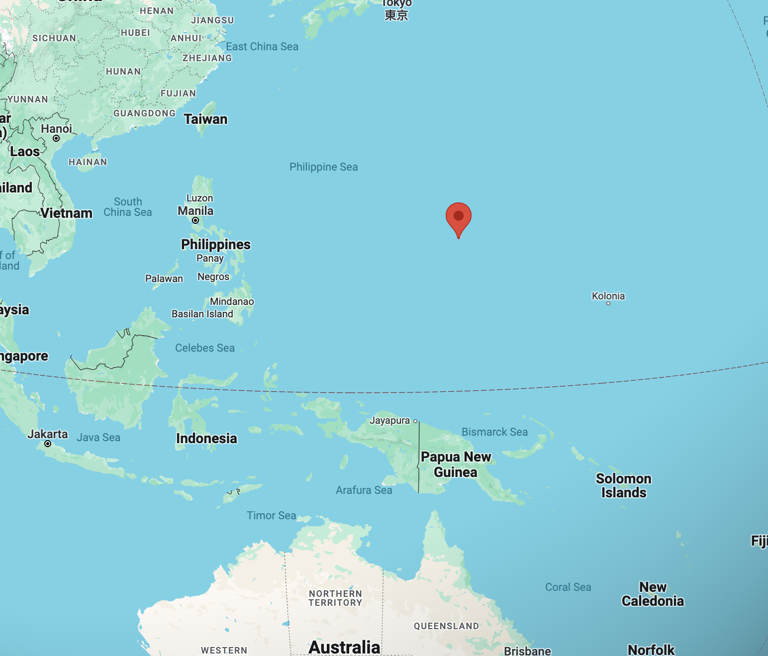
At about 1305 UTC on the 25th day of July 2024, I tuned in to KSDA Guam, broadcasting on 12055 kHz in the Kachin language.
Kachin, also known as Jinghpaw is a Tibeto-Burman language spoken primarily in Kachin State, Myanmar; Northeast India; and Yunnan, China. (Wikipedia 2024)
The signal was coming from the Agat 100kW transmitter in the Mariana Islands. (Short Wave Info 2023)
Above:- Map showing the location of Agat. Map c/o Google Maps.
The overall reception of KSDA was good. The signal strength was good and there was only slight fading of the signal. There was no interference from other stations on the frequency or on adjacent frequencies.
S
I
N
P
O
4
5
4
4
4
Below is a short video showing my reception of KSDA.
References.
Short-wave.info. (2023). Short-Wave Radio Frequency Schedule. [online] Available at: http://www.short-wave.info/index.php [Accessed 25 Jul. 2024].
At about 1130 UTC on the 25th day of July 2024, I tuned in to China Radio International, broadcasting on 13590 kHz in the English language.
The signal was coming from the Beijing 500kW transmitter in China. (Short Wave Info 2023)
Above:- Map showing the location of Beijing. Map c/o Google Maps.
The overall reception of China Radio International was excellent. The signal strength was very strong and there was virtually nil fading of the signal. There was no interference from other stations on the frequency or on adjacent frequencies. The band was also very quiet and there was no atmospheric noise.
S
I
N
P
O
5
5
5
5
5
Below is a short video showing my reception of China Radio International.
References.
Short-wave.info. (2023). Short-Wave Radio Frequency Schedule. [online] Available at: http://www.short-wave.info/index.php [Accessed 25 Jul. 2024].
At about 1030 UTC on the 25th day of July 2024, I tuned in to NHK World Radio, Japan, broadcasting on 17690 kHz in the Russian language.
The signal was coming from the Ibaragi-koga-yamata 300kW transmitter in Japan. (Short Wave Info 2023)
Above:- Map showing the location of Ibaragi-koga-yamata. Map c/o Google Maps.
The overall reception of NHK World Radio was good. The signal strength was good and there was only slight fading of the signal. There was no interference from other stations on the frequency or on adjacent frequencies.
S
I
N
P
O
4
5
4
4
4
Below is a short video showing my reception of NHK World Radio.
References.
Short-wave.info. (2023). Short-Wave Radio Frequency Schedule. [online] Available at: http://www.short-wave.info/index.php [Accessed 25 Jul. 2024].
At about 0947 UTC on the 25th day of July 2024, I tuned in to Radio Sadaye Zindagi, broadcasting on 17865 kHz in the Dari language.
The signal was coming from the Al Dhabbiya 250kW transmitter in the United Arab Emirates. (Short Wave Info 2023)
Above:- Map showing the location of Al Dhabbiya, UAE. Map c/o Google Maps.
The overall reception of Radio Sadaye Zindagi was good. The signal strength was good and there was only slight fading of the signal. There was no interference from other stations on the frequency or on adjacent frequencies.
S
I
N
P
O
4
5
4
4
4
Below is a short video showing my reception of Radio Sadaye Zindagi.
References.
Short-wave.info. (2023). Short-Wave Radio Frequency Schedule. [online] Available at: http://www.short-wave.info/index.php [Accessed 25 Jul. 2024].
At about 1227 UTC on the 24th day of July 2024, I tuned in to the Voice of Turkey, broadcasting on 17580 kHz in the Urdu language.
The program consisted of music.
The signal was coming from the Emirler 500kW transmitter in Turkey. (Short Wave Info 2023)
Above:- Map showing the location of Emiler, Turkey. Map c/o Google Maps.
The overall reception of the Voice of Turkey was good. The signal strength was good and there was only slight fading of the signal. There was no interference from other stations on the frequency or on adjacent frequencies.
S
I
N
P
O
4
5
4
4
4
Below is a short video showing my reception of the Voice of Turkey.
References.
Short-wave.info. (2023). Short-Wave Radio Frequency Schedule. [online] Available at: http://www.short-wave.info/index.php [Accessed 24 Jul. 2024].
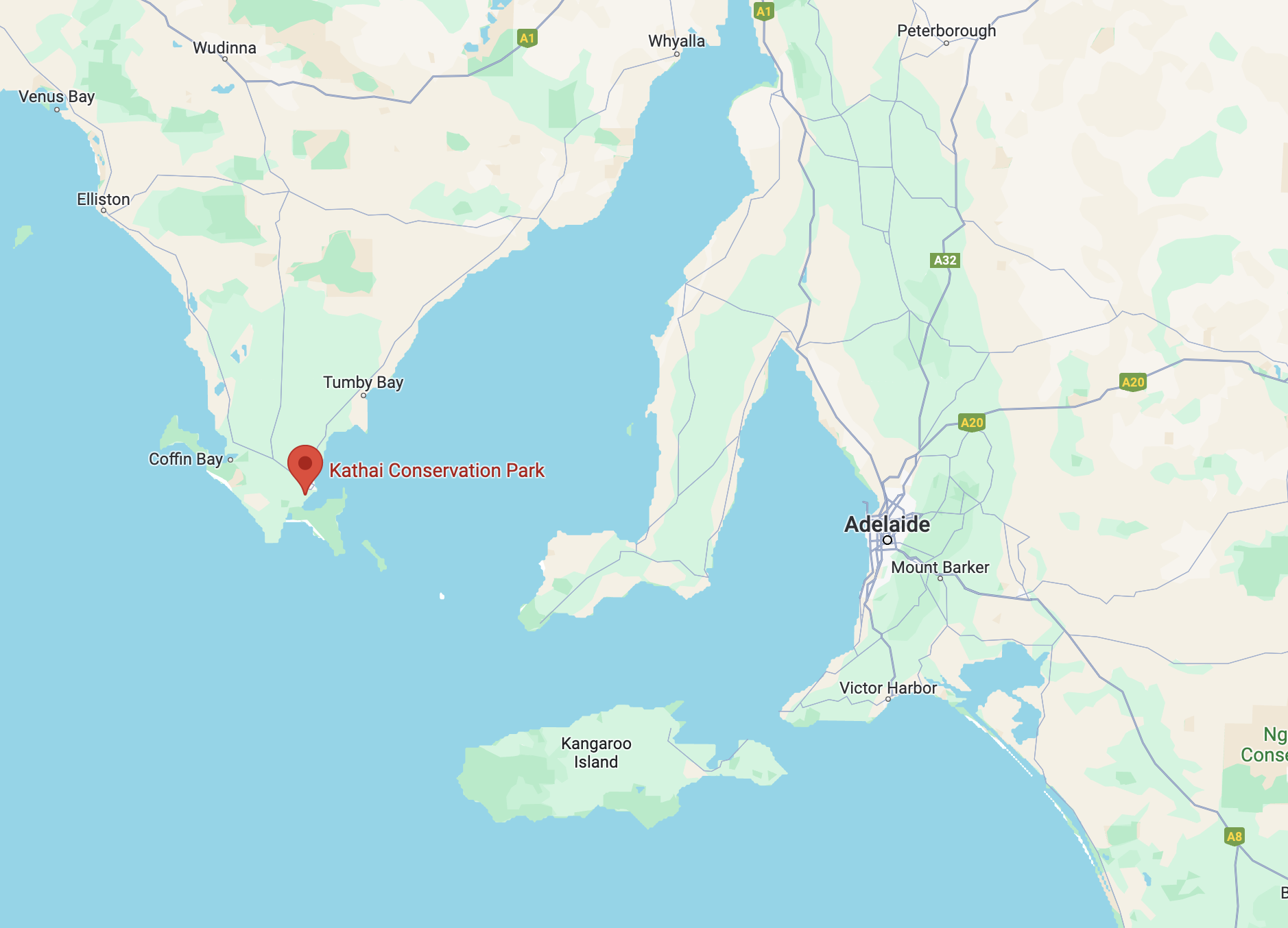
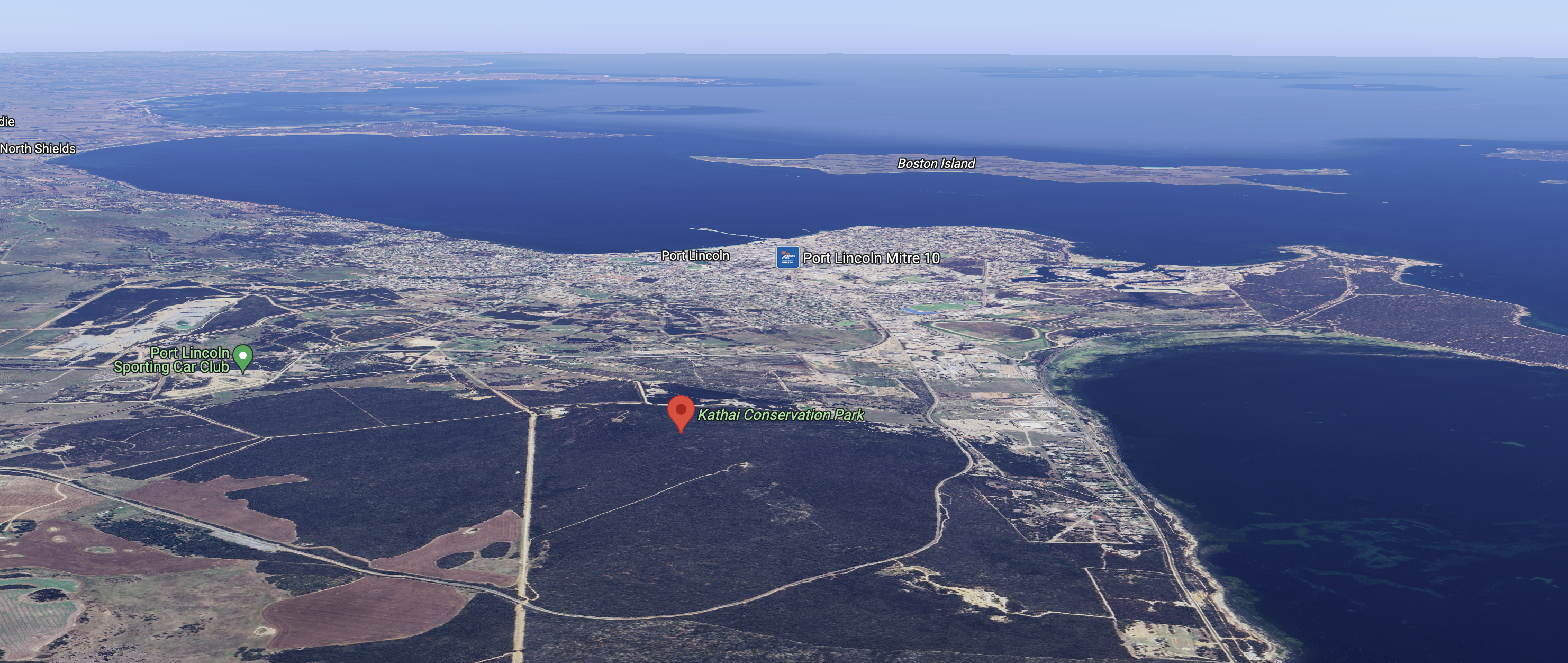
After dinner on Sunday 21st April 2024, I decided to head out to activate the Kathai Conservation Park VKFF-1041.
The park is located in the locality of Duck Ponds, just to the southwest of Port Lincoln on the Eyre Peninsula.
Above:- Map showing the location of the Kathai Conservation Park. Map c/o Google Maps.
The Kathai Conservation Park is about 81 hectares (200 acres) in size and was established on the 7th day of November 1985. (Wikipedia 2024)
Above:- An aerial view of the Kathai Conservation Park. Image c/o Google Maps.
The park includes a large hill rising about 145 metres above sea level. It was proposed that the park be named as the Northside Hill Conservation Park but ‘Kathai’, the aboriginal name for the hill, was approved by the Geographic Names Board. (Cons Parks Eyre Pen 2007) (Wikipedia 2024)
Above:- An aerial view of the park showing the boundaries. Image c/o Google Earth.
The park comprises predominantly Coastal White Mallee open mallee forest over Dryland Tea-tree tall shrubs. The regionally rare Purple-flowered Mallee community is conserved within this park. (Cons Parks Eyre Pen 2007)
I accessed the park via Blue Fin Road. I ran the Yaesu FT857, 40 watts, and the 20/40/80m linked dipole.
I logged a total of 59 stations on 20, 40 & 80m SSB.
I worked the following stations on 20m SSB:-
VK5MAZ
VK4SMA
ZL3MR
VK2IO
DL2ND
F4HZR
VK6NU
UT5PI
VK4ABH
VK6BAP
VK7AAE
F1BLL
IK4IDF
VK7NRT
VK4TMZ
OH1XT
VK6YV
VK4HNS
VK4EMP
VK4TI
2E0IGD
I worked the following stations on 40m SSB:-
VK5BRU/p
VK2IO
VK5MAZ
VK5LA/m
VK5KAW/m
VK3PF
VK3KAI
VK3CEO
VK2USH/p (Vale of Belvoir Conservation Area VKFF-2925)
VK3HJW
VK5TUX
VK5FB
VK4EMP
VK4TI
VK6YV
VK4HNS
ZL2STR
VK5HS/m
VK4SMA
VK7AAE
VK5AMH
VK5LEX
VK3EY
VK2EG
VK5JA
VK4VCO
VK5QA
VK3CLD
VK6GEM
I worked the following stations on 80m SSB:-
VK4VCO
VK5QA
Vk3CLD
VK5MAZ
VK5LA/m
VK5HS/m
VK6WCA
VK5KAW/m
VK5TUX
References.
Department for Environment and Heritage, 2007, Conservation Parks of Lower Eyre Peninsula.
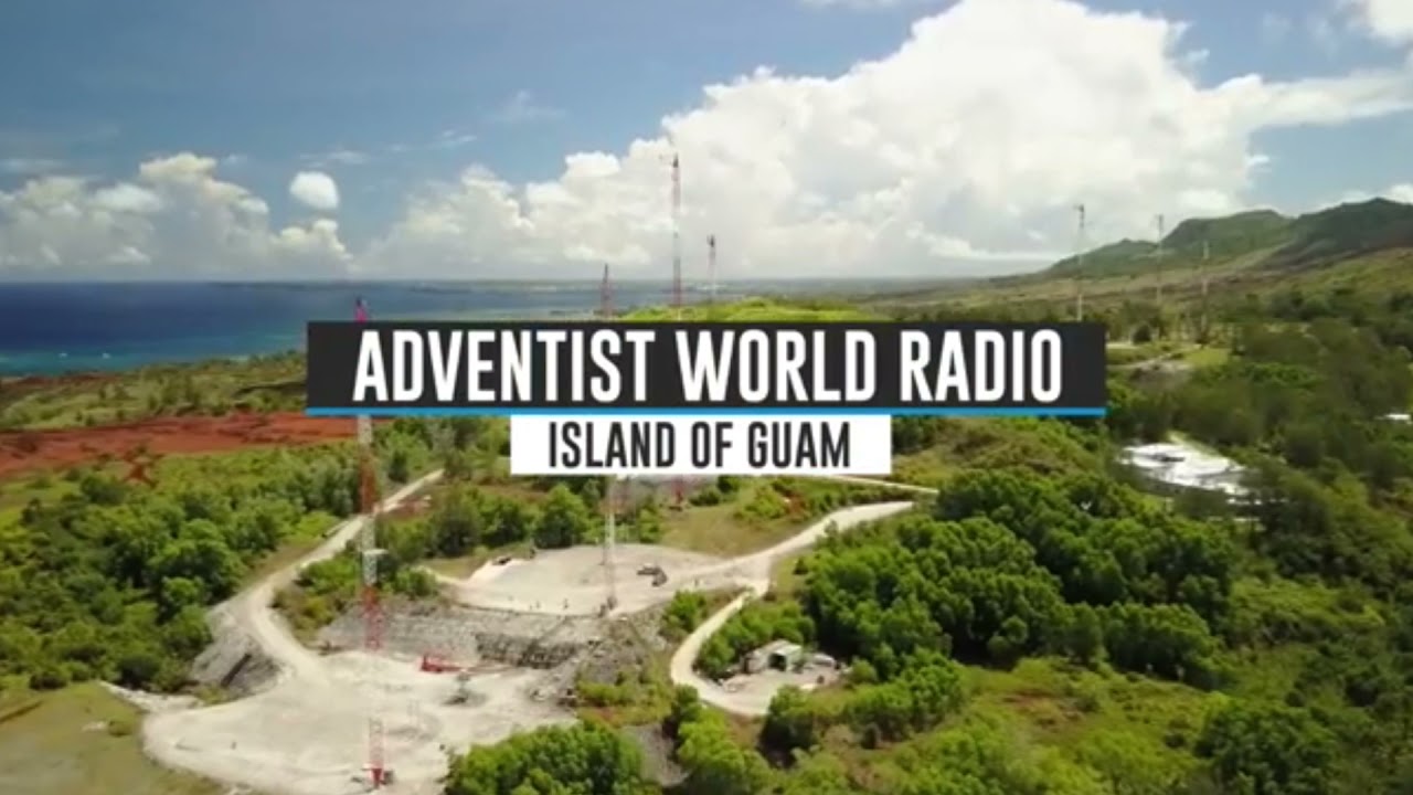
At about 0530 UTC on the 24th day of July 2024, I tuned in to Adventist World Radio, broadcasting on 17790 kHz in the Arabic language.
The signal was coming from the Talata-Volonondry 250kW transmitter in the central highlands of Madagascar. The target area was North Africa and the Middle East. (Short Wave Info 2023) (WRTH 2024)
Above:- Map showing the location of Talata-Volonondry, Madagascar. Map c/o Google Maps.
The overall reception of Adventist World Radio was good. The signal strength was good and there was only slight fading of the signal. There was no interference from other stations on the frequency or on adjacent frequencies.
S
I
N
P
O
4
5
4
4
4
Below is a short video showing my reception of Adventist World Radio.
References.
Short-wave.info. (2023). Short-Wave Radio Frequency Schedule. [online] Available at: http://www.short-wave.info/index.php [Accessed 24 Jul. 2024].
I obtained this eQSL card from the BBC for my reception on 5875 kHz on 22nd July 2024.
The QSL card features a photograph of the BBC Far Eastern Relay Station in Singapore. Transmissions commenced from Kranji Singapore in 1979 and ended in 2023.