My 2nd activation of Friday 9th August, 2013, was going to be Richmond Hill, VK5/ NE-089. But by the time I had driven the 4 horus from home to Quorn, and then negotiated the hard climb at The Devil’s Peak, I was running out of time to get back to Quorn to pick up the key for my proposed Saturday afternoon activation of Stokes Hill, VK5/ NE-050, and then drive the 100 odd kms over to Orroroo for the night(where I had booked accomodation for the weekend).
So rather than heading straight to Orroroo , I decided to drive down the Richmon Valley Road a few kms from The Devils Peak, and activate the Mount Brown Conservation Park. I had activated this park before as part of my Mount Brown SOTA activation back in May, but it was such a beautiful spot, that I decided to activate the park again and hopefully allow some of the VK5 Parks Award ‘Hunters’ to get a new park.
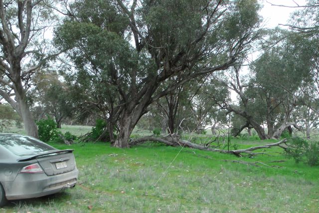
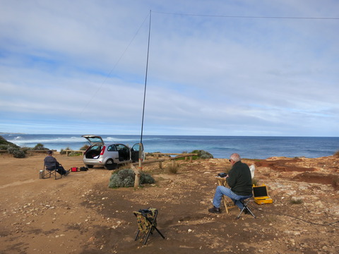
I entered the Mount Brown CP off Richmond Valley Road, and I parked the car at a large rainwater tank and shelter, and then walked over to a large fallen gum tree limb and set up my gear there. This was at the base of my proposed SOTA activation, Richmond Hill. It was really frustrating ! I could see the hill, smell the hill, and taste the hill, but I just didn’t have the 3 hours free to climb the hill, activate it, and get back down. Oh well, plenty of time in the future.
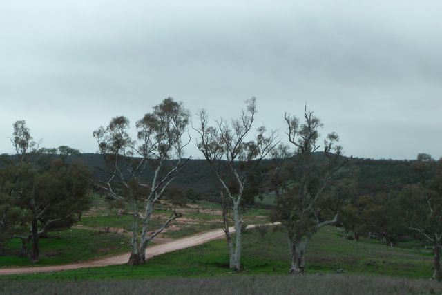
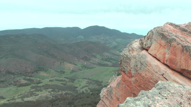
Mount Brown CP is situated about 14 kms south of Quorn. The only access is via Richman Valley Road, which runs south out of Quorn. The Mount Brown summit which is located in the park, is at 964 metres altitude, and is one of the highest peaks in the South Flinders Ranges. Mount Brown CP is a former forest reserve and is comprised of undulating country with a variety of cover grading to rugged ridges with open woodland and scrub. It is named after Robert Brown who was the naturalist aboard Matthew Flinders’ Investigator.
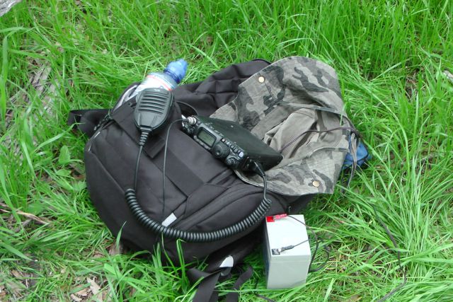
I used my yaesu FT-817nd on the 5 watt setting and my 40m/20m linked dipole. I secured the squid pole with an octopus strap to the squid pole holder, and then made myself comfortable on the log and put out a call on 7.090. There were plenty of moss rocks to secure the legs of the antenna.
My first contact was with Col VK5HCF who was QRP, using just 5 watts. This was followed by a steady flow of ‘Hunters’ for the next 30 minutes. It was great to get both Ron VK3AFW and Rik VK3KAN, who were both mobile with good signals. Other than Col who was QRP, I also spoke with Greg VK3FKAA who was operating QRP with 5 watts. Greg had a great 5/8 signal, and with my little set up I received a 5/9 in return. It’s always great to work QRP to QRP when activating a park or a summit. The noise floor is normally non existant, so 100 watts or more isn’t required by Chasers / Hunters in most instances.
I enjoyed the sunshine and worked a total of 15 QSO’s on 40m SSB in 30 minutes. I was really happy with this, packed up and headed off to collect the key from Quorn, and then off to my accommodation at Orroroo about 100 kms away.
The following stations were worked:- Col VK5HCF/qrp; Larry VK5LY; Nev VK5WG; Brian VK5FMID; Ron VK3AFW/m; Ed VK2JI; Colin VK3UBY; Ernie VK3DET; John VK5BJE; Rik VK3KAN/m; Rob VK2FROB; Greg VK3FKAA; Tony VK3CAT; John VK5FMJC; and Ron VK3JP.
I had planned on activating four SOTA peaks with Ian VK5CZ on the weekend of the 10th & 11th August. So early on Friday morning (9th August 2013), I left home in the Adelaide Hills and travelled north towards Quorn, about 365 kms north from my home (about a 4 hour drive). I needed to collect a key from Quorn for the planned Saturday afternoon SOTA activation of Stokes Hill, north of Orroroo, as the summit is located on private property. And it is a good drive from Quorn to Orroroo. In fact a distance of about 91 kms. So I decided to activate 2 SOTA summits whilst I was in the Quorn area on Friday, including The Devil’s Peak, VK5/ NE-080, in the southern Flinders Ranges.
As I travelled north on the Augusta Highway towards Port Augusta, I could see the imposing figure of Mount Brown to my right. I had climbed this a few months earlier with my wife Marija. And I could also see my first climb of the day, The Devil’s Peak with its distinctive shape. But unfortunately you cannot access this mountain range from the west and need to travel all the way around to the eastern side.
Devil’s Peak is 665 metres above sea level, and in the native aboriginal Adnyamathanha language means ‘eagle’s nest‘ or ‘soaring eagle‘. The Devil’s Peak was so named by the European settlers, as it appeared that it was the devil lying on his back looking skywards.
Once I reached Stirling North, just south of Port Augusta, I turned right to travel west towards Quorn, along the Hawker-Quorn Road. This is a beautiful drive and follows part of the world famous Pichi Richi railroad, which runs between Quorn and Port Augusta. Pichi Richi Railway is an operating museum, operating regular heritage steam train journeys on the oldest remaining section of the famous narrow-gauge old Ghan railway.
Upon reaching the township of Quorn I then travelled south along the Richman Valley Road. This is the only way to access The Devil’s Peak, Mount Richmond, and Mount Brown summits. The road is dirt but is in good condition and easily passable by 2wd traffic. I travelled south along the Richman Valley Road, following the Capowie Creek.
After travelling about 5 kms out of Quorn, you will see a brown sign on your left saying “Devils Peak 6.2″ and a dirt road to your right. At the start of this dirt road you will also see a brown coloured sign saying “Devils Peak Walking Trail” and another brown coloured sign which reads “Devils Peak Walking Trail Fire Ban Season 1st Nov to 15th April“.
Travel west along this dirt road for a few kms and you will then reach an unlocked gate with two signs. One is a yellow sign reading “Dry Weather Road Only” and a brown sign which reads “Commencement of Devils Peak Climb 1.5 km“. Remember, The Devil’s Peak is on private property, so please respect any signs, and please close all gates.
After travelling through this gate, continue south along the dirt road, and you will then reach a parking area. There is at least one other gate at this spot, but this is the furtherest point you can go via vehicle. You need to park your car here and walk the remainder of the way to the top of the summit.
The bushwalk up to Devil’s Peak is steep in places and is recommended for experienced and fit walkers. There are signs warning of this. And although the walk is only 2.6 km return, do not be fooled. This is not an easy walk. It may take one-and-a-half to three hours for the return journey (not including rest periods and periods for enjoying the view). The walk is well worth it, with spectacular panoramic views at the summit of the Spencer Gulf, Port Augusta, Quorn, and Wilpena Pound on a clear day.
The Devil’s Peak Walking Trail is closed from 1 November to 15 April each year due to fire danger season.
The first 1 km walk along the track is quite easy. It is the last 300 metres that are hard and give the impression of 3 km rather than 300 m. There is a well marked track but it is rocky, particularly as you get towards the top. There were quite a few beautiful wild flowers that I saw as I headed up. About 500 metres into the climb you pass through an area of native pine trees and quite amazing rock formations.
The Devil’s Peak supports a wide variety of wildlife including euros, grey kangaroos, echidnas, emus, and a large number of reptiles including snakes. There is also a large variety of birds including eagles. I did see a few euros as I were climbing, but they were camera shy and didn’t want to stick around for a photo.
Once you reach the top of the ridge line, there are very good views out to the east and west. And if you are feeling really brave, you can climb to the very top of the summit itself. Do not attempt this unless you are confident. This part of the climb is quite difficult. You need to scamble over large rocks and make your way through narrow gorges, and then pull yourself up a rock ledge to get to the very top. But it is well worth it as the views are amazing.
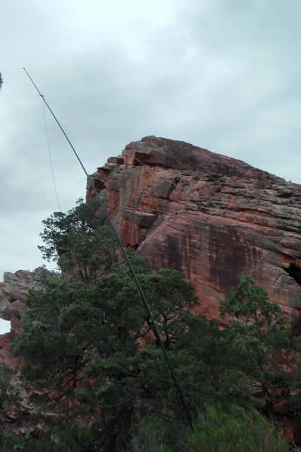
If you do climb to the very top you will be rewarded by amazing views in all directions. The top of the summit is 700 million year old hard weather resistant Pound quartzite. There is a sheer cliff face on the eastern side, so please be careful not to venture too close.
It is impossible to set up at the top as there is virtually nothing to connect your squid pole or antenna to. The actual summit is very exposed and is all rock except for a singular dying small tree. So I decieded I was going to be blown off the cliff face, and I set up just below the summit. I used a large rock to get out of the wind, which was blowing a gale. I secured the squid pole to the base of a small shrub and a moss rock, using some octopus straps. And I then strung out the legs of the dipole and connected them to some trees. There wasn’t a lot of room to move and not a lot of clearance for the dipole.
I turned the radio on to 7.090 on 40 m and put out a call, and my first contact of the day was with Brian VK5FMID in Mount Gambier, who was patiently waiting for me. This was followed by Peter VK3PF, Larry VK5LY, and Brian VK3MCD. This was followed by a number of the regular chasers. Only one QRP contact on this summit and this was with Col VK5HCF, down in Mount Gambier, who was using just 5 watts. Col’s signal was down compared to usual, but he was still very readable (5/2 both ways).
After 30 minutes of operating I ended up with 15 QSO’s on 40m SSB into VK2, VK3, and VK5.
The following stations were worked:- Brian VK5FMID; Peter VK3PF; Larry VK5LY; Brian VK3MCD; Peter VK3FPSR; Col VK5HCF/qrp; Rob VK2FROB; Tony VK3CAT/m; Warren VK3BYD; Ed VK2JI; John VK5FMJC; Graham VK5WK; Colin VK3UBY; Nev VK5WG; and Rhett VK3GHZ.
I found this to be quite a strenuous climb and weather conditions were not great. It was extremely windy, and fortunately the squid pole survived. But I was really happy to have reached the top, and even happier to get 15 contacts on a Friday lunch time.
I have posted a video on You Tube of the activation.
In a few days time, the VK5 National & Conservation Parks Award will be in its 4th month of operation. In a short space of time it appears to have attracted considerable attention by VK5 operators and interstate operators alike.
Unfortunately we don’t have a database like SOTA, so some of the facts and figures below might be a little bit inaccurate. They are based on postings on the Yahoo Group and other sources on the internet.
Total number of members on Yahoo group…..
36 (from VK1, VK2, VK3, & VK5).
Total number of parks activated….
71
Total number of known activators…..
20
Known activators…..
Larry VK5LY
John, VK5BJE
David, VK5KC
Col, VK5HCF
Brian, VK5FMID
Andy, VK5LA
Paul, VK5PAS
Will, VK5AHV
Andy, VK5AKH
Dave, VK5DGR
Mandy, VK5FMOO
Joel, VK5FJMS
Mark, VK5QI
Kim, VK5FJ
Rod, VK5FTTC
Ia, VK5CZ
Ian, VK1DI/5
Steve, VK5AIM
John, VK5FMJC
Tom, VK5EE
Total number of certificates issued…..
24
Bronze Activator certificates…..
John, VK5BJE
Larry, VK5LY
Paul, VK5PAS
Silver Activator certificates issued…..
John, VK5BJE
Paul, VK5PAS
Gold Activator certificates issued…..
Paul, VK5PAS
Bronze Hunter certificates issued…..
Nick, VK3ANL
Col, VK5HCF
Brian, VK5FMID
Paul, VK5PAS
Larry, VK5LY
John, VK5BJE
Silver Hunter certificates issued…..
Brian, VK5FMID
Col, VK5HCF
Larry, VK5LY
Nick, VK3ANL
John, VK5BJE
Paul, VK5PAS
Gold Hunter certificates issued…..
Brian, VK5FMID
Paul, VK5PAS
John, VK5BJE
Bronze Park to Park certificates issued…..
Larry, VK5LY
Paul, VK5PAS
John, VK5BJE
Thanks to everyone who has supported the award program, Activators and Hunters alike.
And here’s hoping that the program gets bigger & bigger, with many more activators coming on board.
Last night I gave a talk on amateur radio to Adelaide Bushwalkers, with particular emphasis on Summits on the Air, the VK5 Parks Award, WWFF, & the KRMNPA. David VK5KC and John VK5BJE came along with me and helped answer questions at the end of the powerpoint presentation. The talk went for about 40 minutes with about 20 minutes of questions at the end.
Membership of Adelaide Bushwalkers offers great opportunities for walking and other outdoor activities. The club holds regular weekend overnight hikes and day-walks, and makes good use of long weekends to do a variety of trips further afield. (This includes multi-walk, chartered bus-trips to the Flinders in June, and the Grampians in October.) Members also lead a number of extended walks e.g. to Tasmania, or the northern Flinders Ranges. In the summer months, kayaking and cycling are also popular pursuits. The club has an active social calendar which throughout the year includes dinners, BBQs, presentations, guest speakers and various unofficial events as well.
There were about 50 people in attendance (young & old) who all showed a keen interest in the topics. Quite a few people took a copy of the brochure “Calling CQ” which is issued/printed by the WIA.
David, John, and I were very impressed with the meeting, and this group is certainly well worth joining.
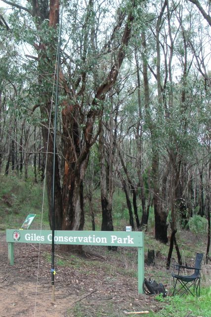
My last park of the day was the Giles Conservation Park, which is literally just around the corner from the Horsnell Gully Conservation Park.
I drove back along Coach Road, the turned left onto Ridge Road, and then along Stony Rise Road towards Ashton. I then turned left onto Woods Hill Road and found a gate on the left leading into the park. There was a good parking spot outside of the gate, so I left my car there.
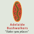
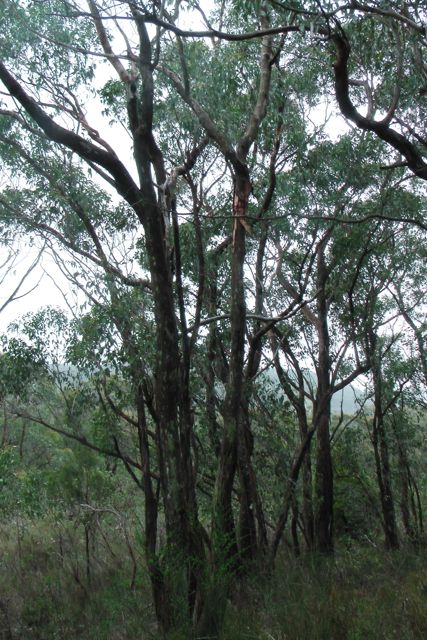
The park consists of heavily wooded eucalyptus forest through steep gullies of the Mount Lofty Ranges ‘Adelaide Hills’. The Heysen trail passes through the park. As does the Yurrebilla trail which is an interpretative bushwalking trail through the Adelaide Hills area that is currently being developed by the Department of Environment, Water and Natural Resources. The trail traverses some of South Australia’s most spectacular and interesting landscapes and provides a link between national and conservation parks in the central Mount Lofty Ranges. The trail was launched by the Hon. John Hill MP, Minister for Environment and Conservation on 2 September 2003.
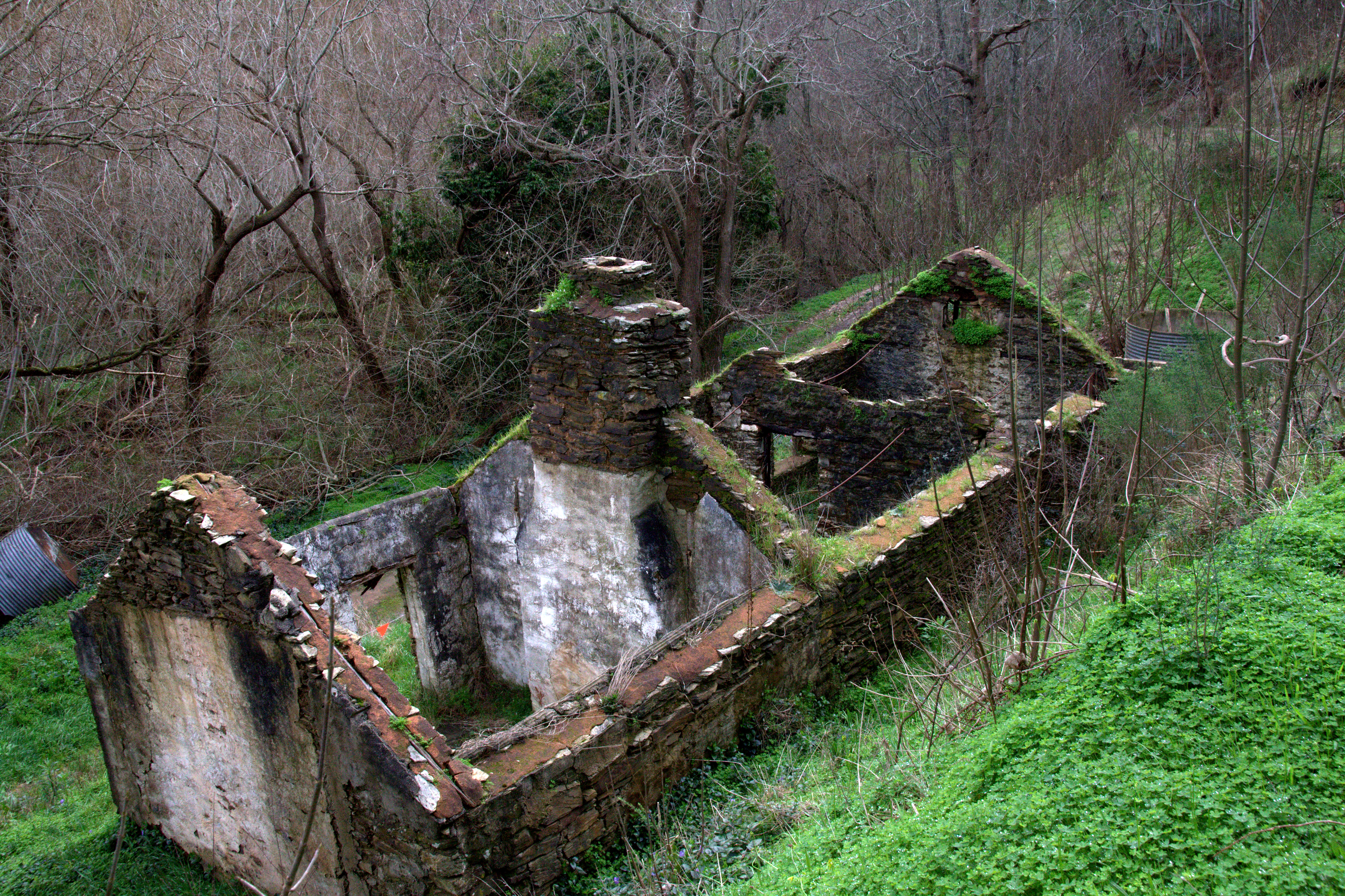
The Giles Conservation Park area was settled by Charles Giles, a pioneer of the horticultural and floricultural industry of South Australia. He purchased the land while living at another property on South Road and walked to the Summit every Monday morning with his week’s provisions, returning home on Saturdays. There was no road up the valley of Third Creek at that time, and to reach his land the creek had to be crossed 21 times. Ruins of the workers’ accommodation huts, once part of an extensive nursery and orchard, can be seen.
Horsnell Gully, including the Giles section, was set aside as a conservation park in 1964 to conserve vegetation associations of the Hills Face Zone, including a number of rare and endangered plants species. In 2007, the eastern section of the park was renamed Giles Conservation Park to honor the Giles family’s historical connections to the park.
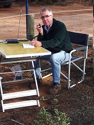
I set up my gear just inside the park boundary and used the Giles Conservation Park sign to rest the Yaesu Ft-817nd on. After erecting the 40m dipole on the 7m squid pole, I sat back in the deck chair and jumped onto 7.100, asking if the frequency was in use. Only to be greeted again by Col VK5HCF and Larry VK5LY. This was followed by a steady call from regular ‘Hunters from VK5 & VK3.
I spoke again with John VK5BJE who was still in the Mount George Conservation Park. So that was some more Park to Park points.
I operated for about half an hour again on 40m SSB and ended up with 18 QSO’s.
The weather was starting to get absolutely freezing, even though it was not quite 3.oo o’clock in the afternoon. I lowered the antenna and adjusted the alligator clips and had a listen on 20m for any possible DX. But my hands were starting to stiffen up from the cold, and as much as I like working DX, I decided to pack up the gear as it was just too damn cold !
The following stations were worked:- Col VK5HCF/qrp; Larry VK5LY; Brian VK5FMID; Dave VK3VCE; Peter VK3PF; John VK5BJE/p; Nev VK5WG; Colin VK3UBY; Andy VK5LA; Tom VK5EE; Ian VK3FNBL; Brenton VK5BZ; Roy VK5NRG; Robin VK5TN; Graham VK5KGP; Mal VK3AZZ; Nick VK3ANL; and John VK5FTCT.
After activating the park, I went for a walk through the park, to warm up and to explore. I walked along a track, that was once the principal road into Adelaide from the east during the 1870s and 1880s. There was a coach gate located on the highest point of ‘Coach Hill’, which is known today as the suburb of Skye. The driver blew a trumpet to tell the settlers that he had been through the gate and they had to climb up to close it. Near the spot where the power lines cross Coach Road, there was a hut for a ‘team’s keeper’ who kept fresh horses for the coaches. Looking around me at the scrub, you can’t help but admire our pioneering history. It must have been an incredibly interesting, but very difficult life.
Headed home to watch the end of the footy. I shouldn’t have rushed home….the Adelaide Crows got beaten by our arch rivals, Port power, by just 3 points !
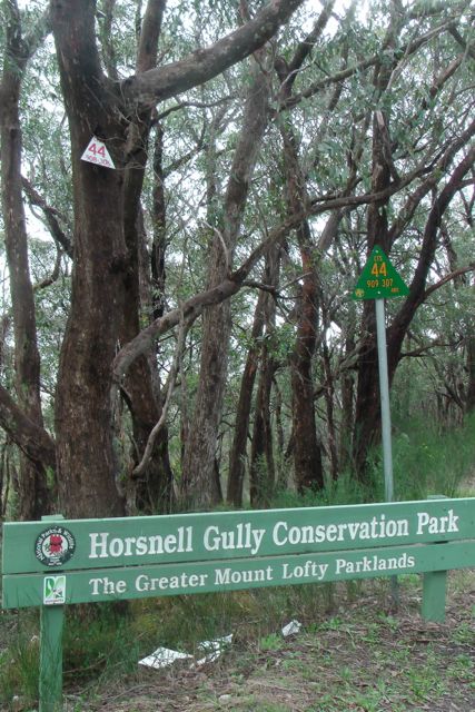
My second park of the day was the Horsnell Gully Conservation Park, which is situated about 8 kms north west of my first activation at the Eurilla Conservation Park
From Eurilla CP, I drove through the Piccadilly Valley, which is a premium market gardening area. And then into the little town of Summertown and then on towards Ashton. The Ashton area is renowned for its fruit orchards including cherries, apples, pears, and lemons. I turned left from Woods Hill Road, into Coach Road.
The Horsnell Gully Conservation Park is located about 10 kilometres east of Adelaide in the rugged terrain of the Mount Lofty Ranges. The 245-hectare area was once farmland owned by the Horsnell and Giles families, and ruins can be found throughout the park and the adjacent Giles Conservation Park.
Today, Horsnell Gully and Giles Conservation Parks are important links in the fragmented band of natural woodland along the Mount Lofty Ranges. There are excellent opportunities for bushwalking, birdwatching, photography, painting, nature study, and mountain biking (as I found out).
Prior to European settlement, the Kaurna (Gar-na) people spent the winter months in locations such as Horsnell Gully and Giles, using the wood and bark from the woodlands for fire, warmth and shelter. During summer they lived on the coast, taking advantage of cool, ocean breezes.
John Horsnell, once coachman to Governor Gawler, settled the gully in 1842, establishing market gardens and orchards of walnut, Osage orange and olive trees – remnants of which can still be seen today. He established an English cottage garden that included roses, violets and agapanthus, and the first dairy in South Australia.
In 1860-61, a house of local sandstone was built and, at one time, housed 14 children. The house remains and a coach house, stable and milking shed can also be found nearby. These ruins are well-maintained and represent one of the earliest farms in the area.
Horsnell Gully, including the Giles section, was set aside as a conservation park in 1964 to conserve vegetation associations of the Hills Face Zone, including a number of rare and endangered plants species. In 2007, the eastern section of the park was renamed Giles Conservation Park to honor the Giles family’s historical connections to the park.
There are a large array of animals that can be found in the park including common ringtail possums, brushtail possums, the elusive yellow-footed antechinus and bush rat, Western grey kangaroos, koalas, and short-beaked echidnas. A variety of Bats are also found in the park.
A large variety of birds can also be found in the park including the crescent honeyeater, striated thornbill, brown thornbill, fan-tailed cuckoo, yellow-faced honeyeater, white-throated treecreeper and scarlet robin, brown treecreeper, restless flycatcher, New Holland honeyeater, striated pardalote, purple-crowned lorikeet, red-browed finch, and yellow-tailed black-cockatoos.
I parked the car at Gate 3, and set up the gear on a dirt track near the entrance gate. Fortunately I didn’t have to walk too far, as the weather was turning ugly. I could see a lot of black clouds out to the west as I looked down the gully towards Adelaide.
I set up the dipole and the deck chair and I jumped onto 7.100 and asked if the frequency was in use, only to get called straight away by Col VK5HCF, Brian VK5FMID, and Larry VK5LY. These three fellas are dedicated ‘Hunters’ and always seem to feature in my log.
I had a good QSO with Greg VK2FGJW who was portable up in the Blue Mountains. I also spoke with Ian VK3FNBL who was operating QRP with just 5 watts (5/6 sent and 5/8 received). And Matt called in again, VK5MLB. This time he was mobile west of Parndarna on Kangaroo Island.
I also managed a Park to Park contact with John, VK5BJE, who had indeed braved the elements, and was operating portable in the Mount George Conservation Park. John was a good strong 5/8 signal and I received a 5/8 back from John.
Whilst in the park I had a chat with a few lads who were mountain biking. They were making the journey up from Skye. There was also a group of about 8 people who I think were ‘Friends of the Park’ or something similar. One of them saw my squid pole and believe it or not asked me if I was catching birds. I explained to him all about the hobby of amateur radio and he seemed ok then.
Again I operated in the park for about 40 minutes and managed 17 QSO’s into VK2, VK3, & VK5 on 40m SSB.
The following stations were worked:- Col VK5HCF; Brian VK5FMID; Larry VK5LY; Nev VK5WG; Tom VK5EE; Greg VK2FGJW/p; Colin VK3UBY; Rod VK5FTTC; Andy VK5LA; Peter VK3PF; Dave VK3VCE; Ian VK3FNBL/qrp; Nick VK3ANL; John VK5BJE/p; Robin VK5TN; Matt VK5MLB/m; and Graham VK5KGP.
Off to the next park, the Giles Conservation Park.
This morning at late notice I decided to head out and activate 3 Conservation Parks. The weather was beautiful at Mount Barker….nice and sunny, and that was the forecast for the day. But unfortunately that did not last long, and by the end of the day it was absolutely freezing. But luckily no rain.
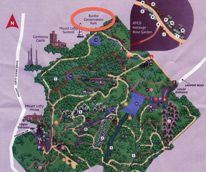
My first park of the day was the Eurilla Conservation Park. I never knew until this morning when checking the internet, that this park even existed. Eurilla CP is located about 16 kms south east of Adelaide. It is located just off the eastern side of Summit Road, which leads to the Mount Lofty summit. The park is situated on the northern border of the Mount Lofty Botanic Garden, and opposite the Cleland Conservation Park.
You cannot access the park via Summit Road, and there are no roads leading into the park. I accessed the park via the Mount Lofty Botanic Garden. I entered the Garden via the lower carpark off Lampert Road, and then walked about 4 kms through the garden, and into the park. It took a bit of climbing and fence jumping, but I eventually got there. Below is a photo looking through the Garden up towards the CP. The three TV transmitter towers are in the background.
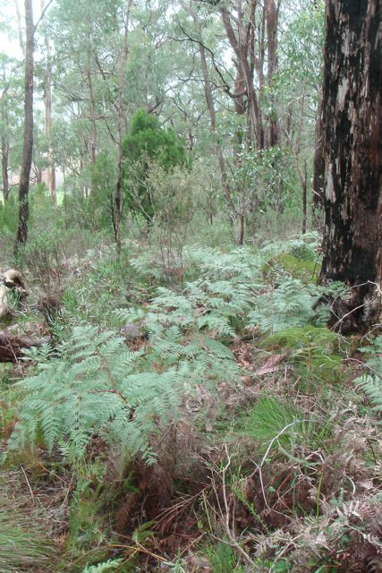
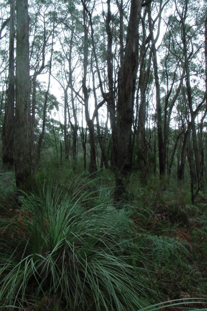
The Eurilla Conservation Park consists of thick eucalyptus forest. However the main feature and the reason for the park being dedicated is an undisturbed bog consiting of a dense mat of the rare coral fern and a large colony of mature king fern, an endangered species in South Australia. These specimens are amongst the finest in the State.
The park was named in honour of Warren Bonython, one of the members of the famous South Australian Bonython family. They lived nearby in ‘Eurilla’ mansion, which was built in1884, but was burnt to the ground during the 1983 Ash Wednesday bushfires.
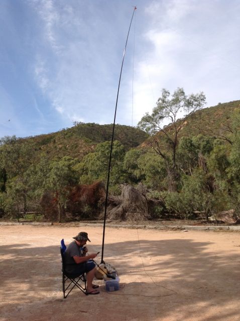
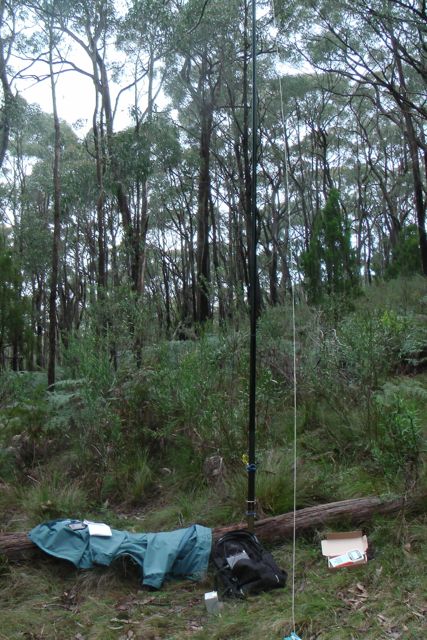
I found a fallen log and used this as a seat, and also to prop the 7 m squid pole against, and secured it with some octopus straps. My i-phone was bleating at me from the SOTA Goat application, so I was keen to get the antenna up and get on air. There were plenty of options in the park re stringing up the ends of the dipole. Lots of tall gum trees.
My first contact of the day was with Tony, VK3CAT who was portable on Mount Dandenong summit VK3/ VC-025. This was Tony’s first SOTA activation, and he had a nice 5/7 signal and I received 5/8 back. So that was a good start. I then QSY’d up to 7.100 and put a call out and worked Larry VK5LY, Brian VK5FMID, and then John VK5BJE. John advised that he was considering going out in the afternoon to activate the Mount George Conservation Park and possibly the Belair National Park. So there were a few more Park to Park opportunities for me.
This was followed by a number of the regular ‘hunters’, all of whom had very good signals.
Matt, VK5MLB gave me a call from the Seddon Conservation Park on Kangaroo Island, and I got excited believing I had another Park to Park for my log. But alas, Matt was working from his car, whilst in the Seddon CP, so it didn’t qualify.
But I did work John VK5FMJC who was portable in the Clements Gap Conservation Park, on his very first VK5 Parks activation. John was using his little FT-817 and just 5 watts and was an excellent 5/9 signal into the Mt Lofty Ranges. Congratulations John.
I also had 2 good QRP contacts. The first being with Col VK5HCF who was using just 5 watts (5/8 signal), and Ian VK5IS who was using just 2 watts (5/8 signal).
After half an hour of sitting on a wet log, I had 18 QSO’s in the log on 40m SSB, into VK3 & VK5.
The following stations were worked:- Tony VK3CAT/p (SOTA); Larry VK5LY; Brian VK5FMID; John VK5BJE; Graham VK5KGP; Dave VK3VCE; Col Vk5HCF/qrp; Roy VK5NRG; Matt VK5MLB/m; Colin VK3UBY; Andy VK5LA; Nev VK5WG; Tom VK5EE; John VK5FMJC/p; Rod VK5FTTC; Peter VK3PF; Ian VK3FNBL; & Ian VK5IS/qrp.
I know there are a few budding VK5 SOTA ops that read this blog, and I thought it might be appropriate to raise a few issues re access to many of the VK5 summits.
So far I have activated about 32 summits since March this year, and the vast majority of those have been situated on private property. And on each occasion I have spoken with the land owners prior to gaining access to the summit either on, or via their property.
And fortunately I have only spoken to 2 x land owners in the past 5 months that have refused access to their land. Their main concerns have been prior bad experience with people tresspassing on their land, or issues with public liability insurance.
I guess I am writing this blog, because all we need is one irresponsible activator, and it might affect any future SOTA activations.
I know that many of the suggestions below are common sense, but from my past experiences in life, this doesn’t always rub off on all people.
Here are a few suggestions to keep land owners happy…..
Contact the land owner prior to accessing the summit. Imagine someone walking into your back yard without seeking prior approval. Other than it being just plain rude, it is also Tresspassing.
Be polite & friendly.
Explain to them what your intentions are and how long you plan to be on the summit.
Explain the SOTA program to them and the hobby of amateur radio.
If you strike a reluctant party, explain the role that amateur radio plays in disasters, and that its not all about a fun activity.
If the land owner is reluctant, ask if they would like to accompany you. I have done this before and it has worked.
If they do decline access, please place this information on the SOTA database, so that other activators don’t ring & pester the land owner again.
Pick up your rubbish. Don’t leave anything behind.
Leave things as you found them.
Close all gates as you find them. If you are not familiar with ‘cokies gates’, ask the land owner if there are any tricky gates.
Be cognisant of sheep and/or stock on the land that you are entering into or plan to operate from.
Don’t discard cigarette butts.
Be aware of your own safety. Other than placing your own health at risk, land owners are not going to be keen to allow other people onto their land in the future, if you happen to break you leg and require to be helicoptered off the summit.
Make sure you are on the right summit. An unhappy neighbour will more than likely get on the telephone to the correct land owner and have a whinge. The correct summit land owner doesn’t need that.
If you are driving across private land, be aware of the limitations of your vehicle. Land owners will be none to pleased if they have to come to tow you out after you’ve got yourself bogged.
Phone the land owner following your activation to let them know you are safely off the hill, and to thank them for allowing you access.
Send the land owner some photos of your activation, or a link to your Tube video of your activation. I have been doing this, and it is amazing how many of them really appreciate it, and enjoy looking at the photos and/or videos.
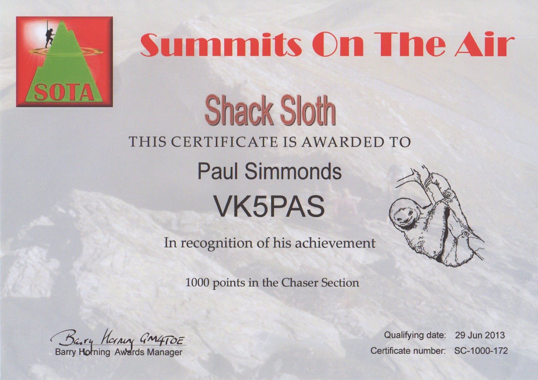
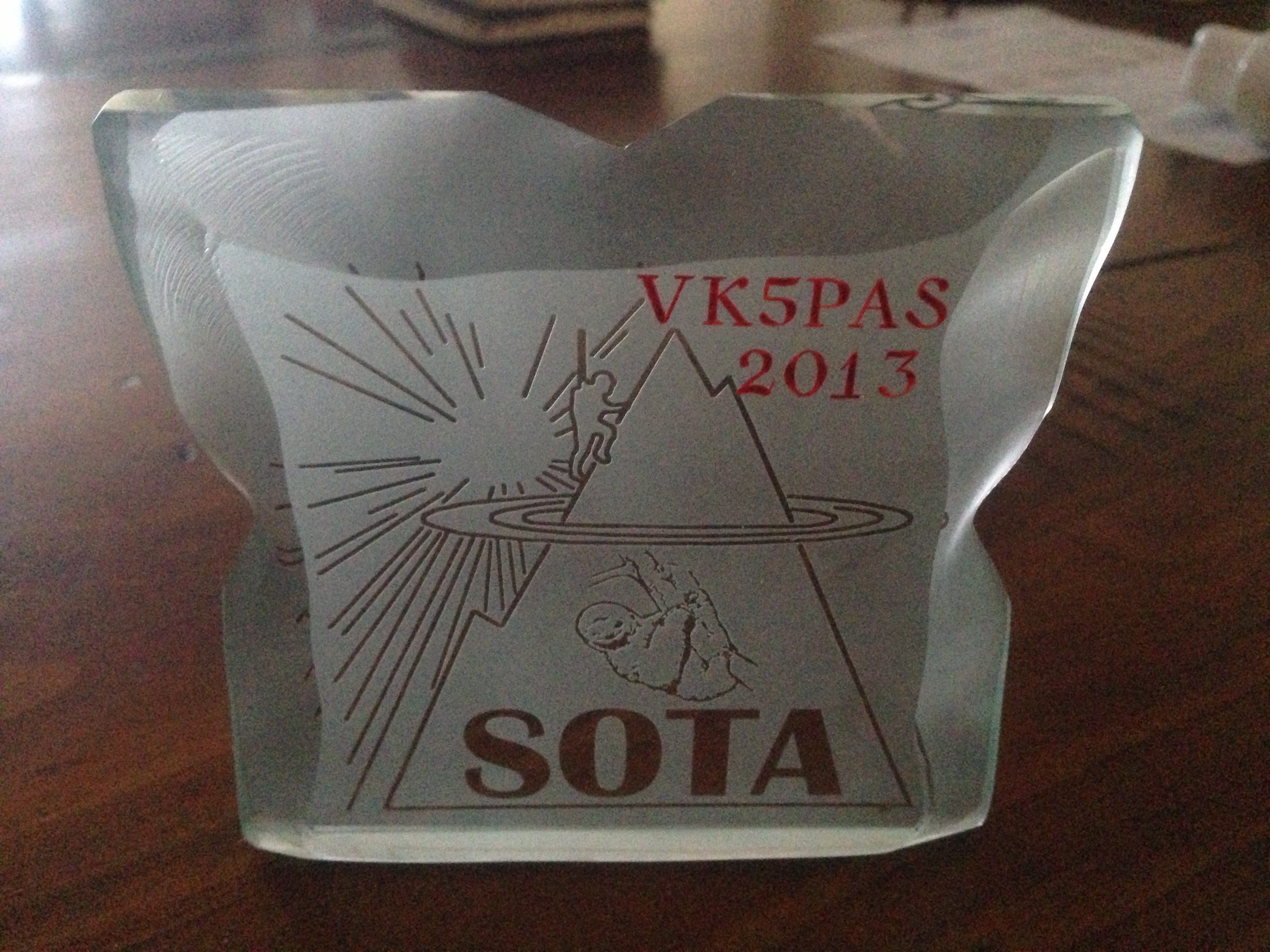
I went to the Post Office this afternoon to find a parcel collection card in the box. I thought it might have been my Shack Sloth certificate and plaque which I had been eagerly awaiting. And sure enough when the parcel was handed over I saw that it was from the UK. And inside was my Shack Sloth certificate for 1000 points as a Chaser, and the glass etched plaque.
Very happy to have received them.
A bit of work to do yet before I even get close to becoming a Mountain Goat.