Mount Boothby Conservation Park 5CP-144 and VKFF-0913

My final activation for the day was to be the Mount Boothby Conservation Park 5CP-144 & VKFF-0913.  Although I had activated this park previously, back in January 2015, this was prior to the park being added to the World Wide Flora Fauna (WWFF) program.  So this was to be a unique WWFF activation for me.

Mount Boothby is about 180 km south east of Adelaide, and around 14 km west of Culburra.

Screen Shot 2017-06-04 at 6.12.05 pm.png

Map showing the location of the Mount Boothby Conservation Park.  Map courtesy of Protected Planet.

Mount Boothby Conservation Park is about 4,045 hectares in size and is the fourth largest area of remnant vegetation in the Upper South East region.  The park supports at least 2 species of conservation significance, namely the metallic Sun-orchid and the Mallee Fowl.  The topography in the park consists predominantly of undulating limestone ridges which are overlain with sand.  These vary in height from 20 to 120 metres above sea level (ASL).  Granite outcrops occur on the dune sides.  The most prominent of these is Mount Boothby which rises to 129 metres ASL.   The two major vegetation types in the park are open woodland and open heath.

Screen Shot 2017-06-04 at 6.17.55 pm.png

Aerial shot of the Mount Boothby Conservation Park with the towns of Coonalpyn, Ki Ki and Yumali in the background.  Image courtesy of Google Maps

After leaving Messent I travelled along the Princes Highway for a number of km and then turned right onto Field Road and travelled north east until I reached Cold and Wet Road.  What a great name for a road.  I then turned right onto Richardson Road.  It was now just after 5.00 p.m. and I enjoyed a magnificent sunset.

Richardson Road shows up on maps and I was expecting a dirt road.  Instead, Richardson Road travels in between 2 sections of private property, leading to the western side of Mount Boothby.  It is in fact a sandy track leading up to the park.  You could traverse this with a conventional vehicle, but only with great care.

DSC_7089

Richardson Road leading to the western side of the park

After travelling around 3.5 km along Richardson Road I reached the north western corner of the park.

I pulled up on a sandy track following the western boundary of the park and set up.  I ran my normal portable station – Yaesu FT-857d, 40 watts, 80/40/20m linked dipole on 7m squid pole.

Screen Shot 2017-06-04 at 6.11.39 pm.png

My operating spot in the north western corner of the park.  Image courtesy of Protected Planet.

As it was getting dark, the temperature had dropped dramatically.  It was now 7 deg C.  But as I wanted to activate the park under the VK5 National & Conservation Park Award rules, I needed to be autonmous from the vehicle.  So I rugged up to keep warm.  I had very spotty internet coverage in the park so I was unable to spot myself.  I headed to 7.144 on the 40m band and started to call CQ.  My first taker was Gerard VK2IO who started off at 5/9, but within an over had almost completely disappeared.  This was followed by Owen VK4FADW who was also experiencing severe fading, and then Adam VK2YK who was a strong 5/9 and reciprocated with a 5/9 for me.  Sadly I was to log just 2 further stations on 40m…Chris VK4BX and finally Peter VK3PF.  Numerous CQ calls went unanswered.  This was not looking good.

I decided that I was wasting my time on 40m and headed to 3.610 on the 80m band.  My first station worked there was Peter VK3PF who was a solid 5/9, much stronger than on 40m.  I then worked Marija VK5FMAZ, Ian VK1DI, Cliff VK2NP and Adrian VK5FANA, all with strong signals.  The 80m band looked as though it was going to provide much better results than 40m.

I was really pleased to hear a constant flow of callers on 80m, and it wasn’t long before I had 20 QSOs in the log, and then 30 QSOs.  It looked as though I might make my target of 44 QSOs afterall.

DSC_7091

The temperature was constantly dropping.  From an initial 7 deg C, down to 4 deg C in 20 minutes and then down to 2 deg C in another 10 minutes time.  It wasn’t long before the temperature was 0.2 deg C.  I was very keen to get my 44 contacts and leave the park.

Contact number 44 came within 90 minutes of being on air at Mount Boothby, and that was with Eugene VK3FEUG.  I was very happy to have reached 44, with the majority of those contacts on the 80m band.  I was also pleased to have 2 Park to Park contacts, with Mark VK3KMF/8 in the Iytwelepenty/Davenport Ranges National Park VKFF-0133, and Chris VK3CJD/p in the Wilsons Promontory National Park VKFF-0956.

Screen Shot 2017-06-04 at 6.49.17 pm.png

I had a total of 49 stations in the log and I was absolutely freezing.  It was time to pack up and head for home, with a 90 minute drive ahead of me.  I had qualified the park in its own right on 80m, which I never expected to do.

I worked the following stations on 40m SSB:-

  1. VK2IO
  2. VK4FADW
  3. VK2YK
  4. VK4BX
  5. VK3PF

I worked the following stations on 80m SSB:-

  1. VK3PF
  2. VK3KAI
  3. VK5FMAZ
  4. VK1DI
  5. VK2NP
  6. VK5FANA
  7. VK3ANL
  8. VK4CPS
  9. VK3GGG
  10. VK3PMG
  11. VK2IO
  12. VK4TJ
  13. VK4/AC8WN
  14. VK4/VE6XT
  15. VK3SQ
  16. VK5KLV
  17. VK3AXF
  18. VK2YK
  19. VK5MRT
  20. VK3EF
  21. VK3SOT
  22. VK2FTEL
  23. VK3KMF/8 (Iytwelepenty/Davenport Ranges National Park VKFF-0133)
  24. VK3BBB
  25. VK5KLJ
  26. VK5PET
  27. VK5ATN
  28. VK3CJD/p (Wilsons Promontory National Park VKFF-0956)
  29. VK3HO/p
  30. VK7KT
  31. VK3SS
  32. VK5FCLK
  33. VK7VH
  34. VK7CW
  35. VK3JP
  36. VK7PRN
  37. VK7FPRN
  38. VK5FMWW
  39. VK3FEUG
  40. VK3MCK
  41. VK5GJ
  42. VK6ZRW/p
  43. VK7GG
  44. VK5NM


References.

Department for Environment Heritage and Aboriginal Affairs, 1999, Mount Boothby Conservation Park Management Plan.

Messent Conservation Park 5CP-133 and VKFF-0799

My second planned activation for Saturday 3rd June 2017 was the Messent Conservation Park 5CP-133 & VKFF-0799.  This was a short 5 minute drive for me from Martin Washpool Conservation Park.   I drove out of the gate and followed a dirt track for about 1 km until I reached the south western corner of Messent.

The track leading to the park is tricky in parts and has become a lot boggier since I was last there.  I probably wouldn’t try traversing it in a conventional vehicle.

Screen Shot 2017-06-04 at 4.25.48 pm.png

Map showing the location of the Messent Conservation Park south east of Adelaide.  Map courtesy of Protected Planet.

Messent Conservation Park is about 1,250 hectares in size and is one of the most significant areas of natural vegetation left in the Upper South East of South Australia.  The park has great plant diversity, including brown stringy barks, white and ridge-fruited mallee, desert banksias, fringed myrtle and yacca which grow in the sandy flats.  A number of wild orchids are also found in the park.  Over 300 plant species have been recorded in the park.

Screen Shot 2017-06-04 at 4.33.15 pm.png

Aerial shot showing the Messent Conservation Park, with Martin Washpool CP to the left, and Mount Boothby CP in the background.  Image courtesy of Google maps.

A large amount of native wildlife can be found in the park including Western Grey kangaroos, Common Wombats, echidnas, and the Silky Mouse.  Over 130 species of bird have been recorded in the park including the Emu and the endangered Malle Fowl.

I set up at the south western corner of the park.  There is a sandy 4WD track that branches off from here which follows the southern boundary of the park, and another 4WD track which heads north following the western side of the park.

Screen Shot 2017-06-04 at 4.25.38 pm.png

Aerial shot of the park showing my operating spot in the south western corner of the park.  Image courtesy of Protected Planet.

After setting up I called CQ on 7.144 on the 40m band and this was answered by Chris VK3PAT, followed by my wife Marija VK5FMAZ, and then Les VK5KLV.  Contact number 10, qualifying the park for VKFF, was reached in 12 minutes, with a Park to Park QSO with Michael VK3FMPP/p who was in the Grampians National Park VKFF-0213.  This was followed by Mark VK3KMF/8 who was in the Iytwelepenty/Davenport Ranges National Park in the Northern Territory.

The 40m band had certainly improved since my first activation at Martin Washpool.  Signals from the eastern States were much stronger.  As a result I had a lot more callers, and it wasn’t long for the mini pile up to commence.  Thanks to everyone for being patient.  For those that called and gave up, please be patient and persistent.  I will get you eventually.

Contact number 22 was with Peter VK3YE who was portable at Chelsea Beach for Melbourne QRP by the Bay.  Shortly afterwards I had another Park to Park, this time with Rob VK4AAC who was in the Solitary Islands Marine Park VKFF-1411.   About 12 QSOs later I spoke with Ben VK3FBIC who was also portable at Chelsea Beach, running just 5 watts.  Ben was a strong 5/8 signal.

I reached contact number 44 in around 47 minutes, and that was with John VK4IAA/2.  A few QSOs later I started to experience a lot of bleedover from 7.146.  A station from Puerto Rico had moved in and was working into Europe.  I remained on 7.144 for another 5 minutes and decided the QRM was just too great to continue.  I know there were some weak stations calling me, including a station from France, but I was just unable to pull them through due to the QRM.

I decided it was time to try 20m.  I called CQ on 14.310 and this was answered by Hans VK6XN who had followed me up from 40m.  I then worked Mick VK6AY, Gerard VK2IO, and then John VK4TJ.  I was running short of time and decided after a few minutes of calling CQ with no further callers, that I would head to 80m.

I called CQ on 3.610 and this was answered by Greg VK5GJ, followed by Mick VK3GGG/VK3PMG, Chris VK3SOT, and finally Marija VK5FMAZ.  Marija advised that Jonathan VK7JON and Helen VK7FOLK were on 7.095 in a park, so I quickly took out the 80m links and headed to 7.095.  I logged both Jonathan and Helen who were in the Mount William National Park VKFF-0366.

DSC_7072

Mallee ringneck parrot

My next park activation was to be Bunbury Conservation Park.  The maps had shown that there was a road heading east-west from Messent out towards the northern side of Bunbury.  But that road was in fact a track behind a gate leading into private property near the north eastern corner of Martin Washpool CP.  The only other way I could see to get through was to follow the sandy 4WD boundary track on the southern side of Messent.  The GPS was showing a different route, with a distance of around 100 km and it was now after 4.00 p.m. local time.  So I decided to cancel the activation of Bunbury, and head to the Mount Boothby Conservation Park instead.

DSC_7053

The 4WD track on the southern side of the park.

I worked the following stations on 40m SSB:-

  1. VK3PAT
  2. VK5FMAZ
  3. VK5KLV
  4. VK2KDP
  5. VK2KYO
  6. VK3PF
  7. VK3KPS
  8. VK3EF
  9. VK7KJL
  10. VK3FMPP/p (Grampians National Park VKFF-0213)
  11. VK3KMF/8 (Iytwelepenty/Davenport Ranges National Park VKFF-0133)
  12. VK5MRE
  13. VK2JNG/3
  14. VK2HHA
  15. VK3FPHG/p
  16. VK3SQ
  17. VK5EE/m
  18. VK3TKK/m
  19. VK3VIN
  20. VK3FCEV
  21. VK3MLU
  22. VK3YE/p
  23. VK4BX
  24. VK3KMH
  25. VK3FRC
  26. VK3GGG
  27. VK3PMG
  28. VK2IO
  29. VK4AAC/ (Solitary Islands Marine Park VKFF-1411)
  30. VK5ATN
  31. VK3RU
  32. VK5PET
  33. VK4RZ
  34. VK5FANA/m
  35. VK3CWF
  36. VK2NP
  37. VK3UT
  38. VK3FSPG
  39. VK3MPR
  40. VK3FBIC/p
  41. VK5CJC
  42. VK3STU
  43. VK3XPT
  44. VK4IAA/2
  45. VK4PDX
  46. VK3FRAB
  47. VK7DIK
  48. VK3ELH
  49. VK4SMA
  50. VK3MCK
  51. VK3ZMD
  52. VK3YSP
  53. VK3WAR
  54. VK3FOWL
  55. VK3SOT
  56. VK6XN
  57. VK6AY
  58. VK7JON/p (Mount William National Park VKFF-0366)
  59. VK7FOLK/p (Mount William National Park VKFF-0366)

I worked the following stations on 20m SSB:-

  1. VK6XN
  2. VK6AY
  3. VK2IO
  4. VK4TJ

I worked the following stations on 80m SSB:-

  1. VK5GJ
  2. VK3GGG
  3. VK3PMG
  4. VK3SOT
  5. VK5FMAZ

References.

Owens H.M; Robinson AC; Lang P.J.; 1994, ‘A biological survey of Messent Conservation Park’.

Martin Washpool Conservation Park 5CP-129 and VKFF-0907

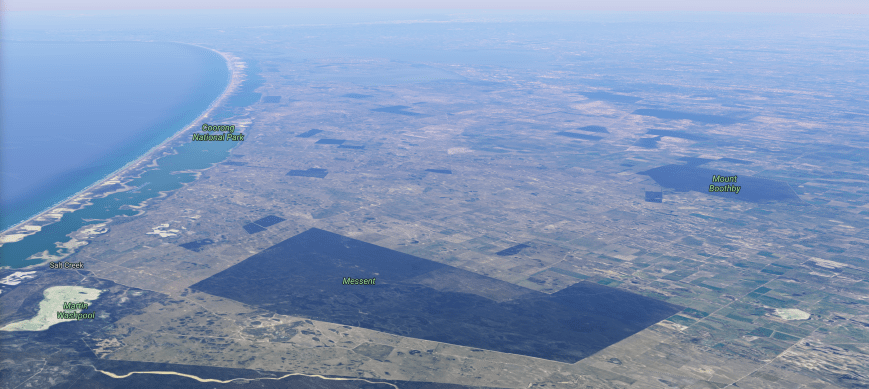
Yesterday morning (Saturday 3rd June 2017) I decided at late notice to head down to the Coorong region to activate three parks: Martin Washpool Conservation Park, Messent Conservation Park, and Bunbury Conservation Reserve.   I had activated both Martin Washpool and Messent previously, but this was prior to them being included in the World Wide Flora Fauna (WWFF) program.  Those activations were exclusively for the VK5 National & Conservation Parks Award.  And I had never activated Bunbury, so these were to be three unique parks for me for WWFF.

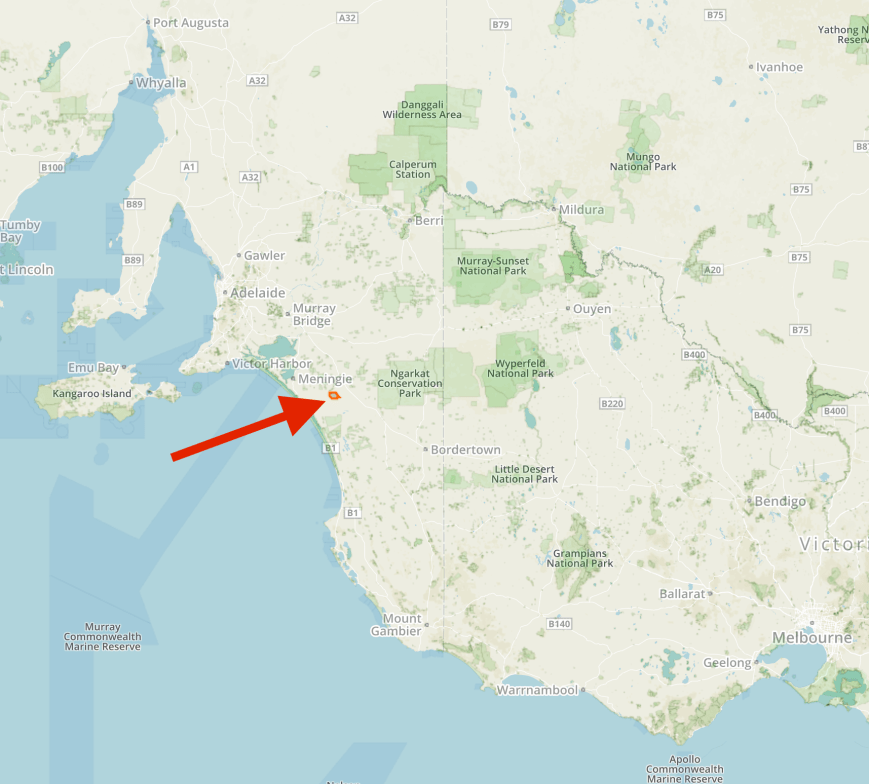
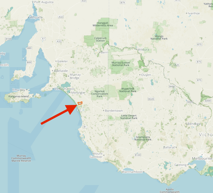
My first park was to be Martin Washpool Conservation Park 5CP-129 & VKFF-0907 which is located about 209 km south east of Adelaide.

Screen Shot 2017-06-04 at 10.59.20 am.png

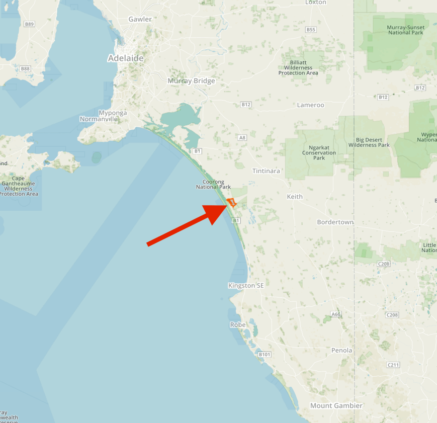
Map showing the location of the Martin Washpool Conservation Park, south east of Adelaide.  Map courtesy of Protected Planet.

Martin Washpool Conservation Park is located in very close proximity to the little settlement of Salt Creek, on the Princes Highway.  The Coorong National Park and the Messent Conservation Park are located very close by to Martin Washpool.

Screen Shot 2017-06-04 at 10.38.09 am.png

Aerial view showing the Martin Washpool CP and the nearby Coorong NP and Messent CP.  Image courtesy of Google maps

The park is 1,900 hectares in size and comprises swampy Melaleuca flats.  The park boundaries were altered in 2005, with various sections of Crown Land being added to the park.

The park is named after Malachi Martin, who was a convicted murderer.  It was so named after the pool in which he washed the blood from himself after committing murder.

Martin grew up around the Willunga district, south of Adelaide and as a teenager, was charged with theft while working at a post office at Encounter Bay. He was tried at Adelaide but found not guilty.  Six days later, his mother died in strange circumstances by drowning in a pond near the family farm. The inquest into her death declared that she had committed suicide, and it was believed that she was deeply affected by her son’s criminal trial. Her death was made even more tragic because she was heavily pregnant at the time.

A few years later, Martin moved to his father’s new pastoral lease near the Coorong.  Martin also worked as a mail coach driver from Encounter Bay to Kingston SE and Naracoorte.   At the time this was the only main roady from Adelaide to Melbourne.  While living in the area, he became friends with William and Catherine “Nellie” Robinson, who ran an inn, the Traveller’s Rest at Salt Creek.  It was later believed that Catherine and Martin were having an affair which was to have fatal consequences.  On 14 June 1856, William Robinson’s body was discovered with his throat cut.  Martin was a suspect, but was never charged with his murder.  Several weeks later, he moved to Sydney for two years before returning to South Australia and marrying Catherine on 23 June 1858.

During his two-year absence, a young woman named Jane Macmanamin came to work for Catherine as a servant. In 1862 she went missing from Salt Creek and Martin stated she had moved away on a whim to the Mount Gambier area in the colony’s south east.  In April 1862, Jane’s sister, who had constantly stayed in contact with her, sent a letter to the police in Adelaide, suspicious that she had not heard from Jane in some time.  After an investigation and thorough search, Jane’s body was discovered in May 1862, half concealed in a wombat hole at Salt Creek, not far from the Traveller’s Rest.

In June 1862, Martin was charged with the murder of Jane Macmanamin.  Another man, William Wilsen, who claimed he had been engaged to her, was charged with being an accessory after the fact.  Martin was tried and found guilty.  He was hanged at the Adelaide Gaol on 24 December 1862 (Christmas Eve).  He is buried between the walls within the gaol.  Wilsen was found guilty of assisting Martin after the murder and sentenced to four years hard labour.  He was deported to Tasmania to carry out his sentence.

As well as the two murders which were attributed to Martin, there was also suspicion as to the disappearances of two men from the Salt Creek area in 1859.  A traveller found a damaged rosewood jeweller’s box approximately two and half miles from Salt Creek.  On inspection, it contained a piece of linen with the name “G. F. King” written on one of the corners.  It was suggested by Edward Bright, a contemporary diarist that a man named Harry Kirby and a jeweller stayed at the Traveller’s Rest and subsequently disappeared.

The police also investigated reports from local aboriginals that Martin had murdered an aboriginal teenager who he had had an altercation with.  Sometime after the boy’s suspicious disappearance, a group of aboriginal people were bathing in a deep water hole near Salt Creek.  They found the boy’s body in a bag, weighted down by a large stone. This incident occurred sometime in late 1859 or early 1860, but the police were unable to find any witnesses who had actually found the body, only people who had heard the story from others.

Screen Shot 2017-06-04 at 12.39.51 pm.png

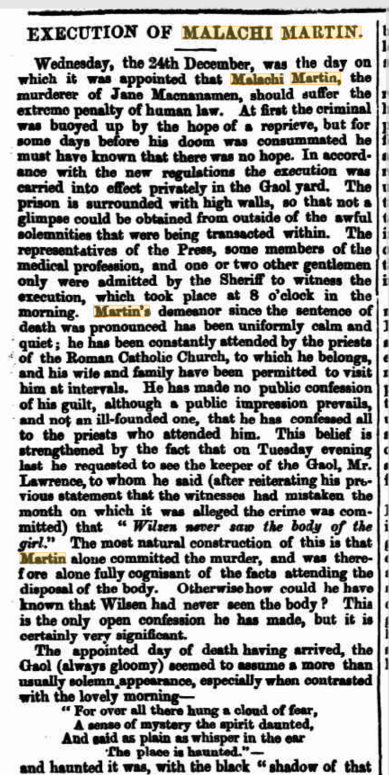
From the South Australian Weekly Chronicle, Sat 27 Dec 1862.  Courtesy of Trove.

To get to the park I travelled down the South Eastern Freeway until I reached Tailem Bend, where I turned right onto the Princes Highway and started heading south, passing the Mowantjie Willauwar Conservation Park.  I soon reached the town of Meningie on the shore of Lake Albert, where I stopped for some early lunch at the bakery.

Meningie was surveyed in 1866 and currently has a population of around 1,000.  Meningie is local aboriginal language, meaning ‘mud’.

Whilst enjoying my sausage rolls I strolled through the park on the shores of Lake Albert.  There are a few interesting things to have a look at here, including the statue and intepretive sign for the Birdman of the Coorong.  John Francis Peggotty was born in County Limerick in 1864.  He was born premature and as a result only ever grew to the size of a 7 year old boy.  During his youth, he exploited his stature, climbing down the chimneys of wealthy Londoners, robbing them of their jewellery.  He emigrated to Australia in 1890 and continued his criminal career in the Coorong region.  He rode on the back of an ostrich, one of many that had been set free when the market for fashionable ostrich feathers ceased.  As a result he became known as the Birdman of the Coorong.  Peggotty met his death in 1899, having remained at large for a number of years.  He was shot dead whilst trying to Rob a local fisherman, Henry Carmichael.

A little further along the foreshore is a monument to commemorate the death of 8 personnel from 6 Service Flying Training School RAAF on 4th August 1942 when their Avro Ansons collided and crashed into Lake Albert.

I then left Meningie and continued along the Princes Highway, passing the sensational Coorong on my right.  The Coorong is a 130 km stretch of saltwater lagoons protected from the Southern Ocean by sweeping sand dunes.  The Coorong is also a wetland of international importance, supporting many significant and endangered flora and fauna.

About 60 km out of Meningie I reached the little settlement of Salt Creek.  There isn’t much here.  Don’t blink as you will miss it.  Just a small general store and a few houses.  What is worth stopping to have a look at in Salt Creek is the replica drill.  In  1852 a police escort bringing a consignment of gold from the Victorian diggings came upon a rubbery bituminous material in the low-lying area to the north of the Coorong known then as Alfred Flat, adjacent to a freshwater lake.  The coorongite was presumed to be from the dried oil seepages and the belief that there must be underground reserves of il resulted in considerable activity by oil speculators and entrepreneurs from the 1860’s through to the 1930’s.

DSC_7022

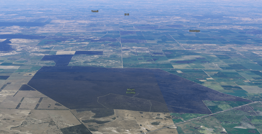
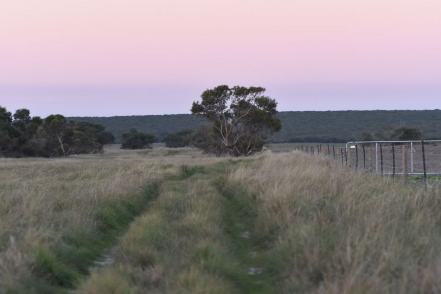
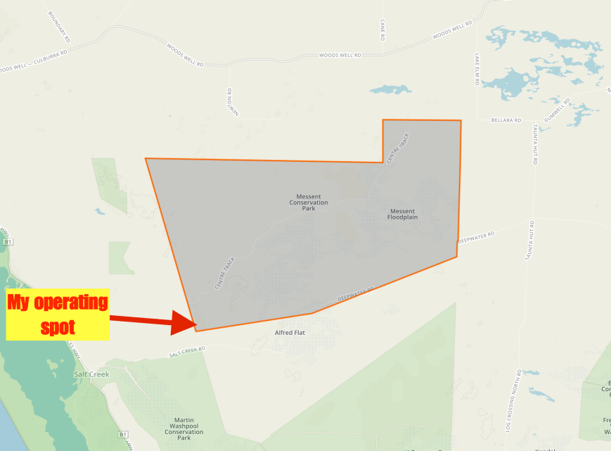
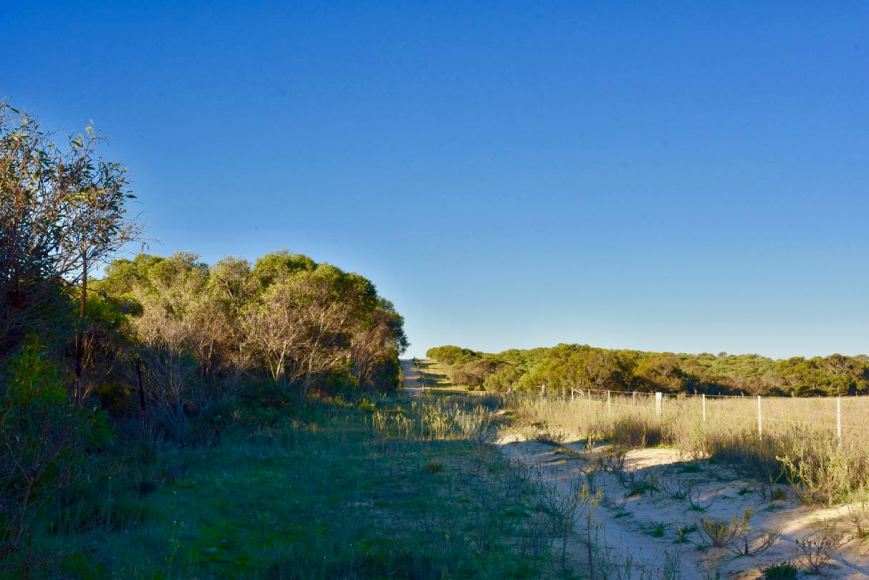
I drove to the end of Salt Creek Road and the north eastern corner of the park.  Although maps show that Salt Creek Road continues to the east, it does not.  There is a gate here which leads into private property.  There is however another gate, which is unlocked, which leads into the park and follows the eastern boundary.  I set up just inside the gate.

Screen Shot 2017-06-04 at 10.58.56 am.png

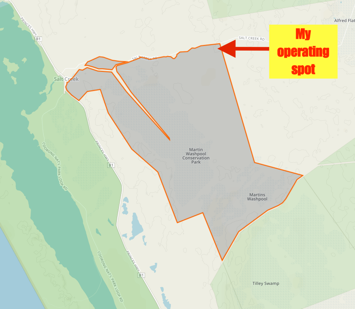
Aerial shot of the park showing my operating spot in the north eastern corner.  Image courtesy of Protected Planet.

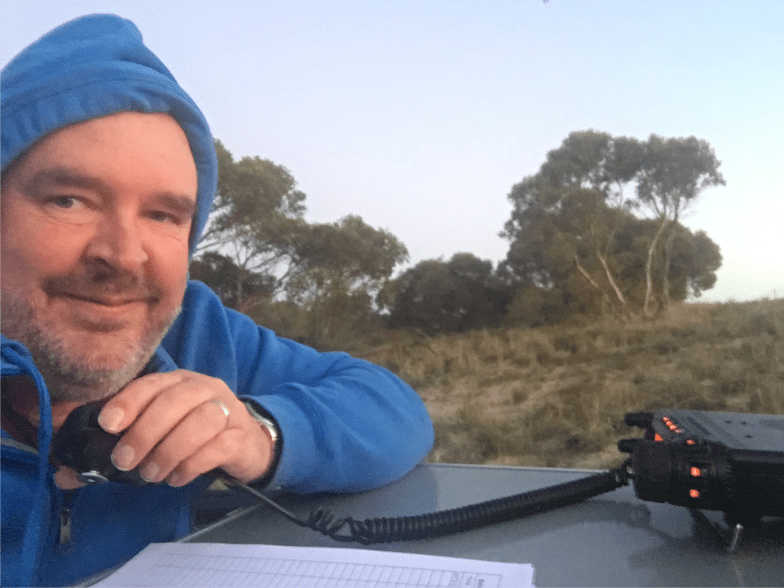
I headed to 7.144 and asked if the frequency was in use and was told that the frequency was occupied.  So I headed to 7.139 and again asked if the frequency was in use.  Rob VK4AAC/p came back to let me know he was on the frequency.  We worked each other, with Rob being portable in the Solitary Islands Marine Park VKFF-1411.

I then moved down to 7.134 and started calling CQ, which was answered by Jonathan VK7JON who was mobile on his way to the Mount William National Park.  I then logged Jonathan’s wife, Helen VK7FOLK/m, followed by Dennis VK2HHA, and then Peter VK3PF.  Four QSOs later I had another Park to Park in the log, this time it was Neil VK4HNS/p who was in the Tingalpa Creek Conservation Park VKFF-1660.

Band conditions seemed to be down a bit, with signals being quite poor at times into the eastern States.  Local propagation was virtually non existant, with only two South Australian stations worked, my wife Marija VK5FMAZ at Mount Barker about 150 km from the park, and Greg VK5GJ at Meadows.

About 45 minutes into the activation I logged Helen VK7FOLK/p and Jonathan VK7JON/ who were now in the Mount William National Park VKFF-0366.  After logging a total of 27 stations on 40m, I headed to the 80m band.  I was seriously believing I was not going to be able to get the required 44 contacts to qualify the park for WWFF.

I called CQ on 3.610 and this was answered by Marija VK5FMAZ, followed by Mick VK3GGG/VK3PMG who was an excellent 5/9 from western Victoria.  It is amazing what the 80m band can do in the middle of the day.  I then logged Peter VK5PET who was booming in from Strathalbyn, followed by Peter VK3PF, Ken VK2KYO and Terry VK5ATN in the Mid North who was also very strong.   I logged a total of 11 stations on 80m from VK2, VK3, and VK5.

I then tried my luck on the 20m band, calling CQ on 14.310.  My first caller there was RK3SWB in Russia, followed by Fred VK4FE and then Gerard VK2IO.  Signals from VK2 and VK4 were way down, and sadly RK3SWB was my only DX logged.

I now had 44 QSOs in the log, with contact number 44 being Cliff VK2NP.  To finish off the activaion I headed back to 7.134 on 40m where I logged a further 9 stations, including a Park to Park with Peter VK3ZPF/p who was activating the Bunyip State Park VKFF-0753.

It was now just after 2.00 p.m. local time and I had a total of 53 stations in the log.  I still had 2 park activations to undertake, so I packed up and headed off to the Messent Conservation Park.

During my activation I was set up alongside various native trees which were in flower and absolutely alive with Wattlebirds and Honeyeaters.

I worked the following stations on 40m SSB:-

  1. VK4AAC/p (Solitary Islands Marine Park VKFF-1411)
  2. VK7JON/m
  3. VK7FOLK/m
  4. VK2HHA
  5. VK3PF
  6. VK2EXA
  7. VK2NP
  8. VK2IO
  9. VK4HNS/p (Tingalpa Creek Conservation Park VKFF-1660)
  10. VK3KRH
  11. VK3EF
  12. VK7NWT
  13. VK3HBG
  14. VK2YK
  15. VK5GJ
  16. VK1DI
  17. VK5FMAZ
  18. VK3NLK
  19. VK7GG
  20. VK7AU
  21. VK3MCK
  22. VK3FSPG
  23. VK3MPR
  24. VK7FOLK/p (Mount William National Park VKFF-0366)
  25. VK7JON/p (Mount William National Park VKFF-0366)
  26. VK3ARH
  27. VK3AJO
  28. VK2TMC
  29. VK3FRJD
  30. VK3SIM
  31. VK3MCX
  32. VK3SQ
  33. VK3ANL
  34. VK3CWF
  35. VK3ZPF/p (Bunyip State Park VKFF-0753)
  36. VK4TJ

I worked the following stations on 80m SSB:-

  1. VK5FMAZ
  2. VK3GGG
  3. VK3PMG
  4. VK5PET
  5. VK3PF
  6. VK2KYO
  7. VK5ATN
  8. VK5MRT
  9. VK5ML
  10. VK5PL
  11. VK5GJ

I worked the following stations on 20m SSB:-

  1. RK3SWB
  2. VK4FE
  3. VK2IO
  4. VK2YK
  5. VK4FI
  6. VK2NP

References.

Australia@War, 2017, <http://www.ozatwar.com/ozcrashes/sa04.htm&gt;, viewed 4th June 2017

National Parks South Australia, 2017, <https://www.environment.sa.gov.au/parks/Find_a_Park/Browse_by_region/Limestone_Coast/coorong-national-park&gt;, viewed 4th June 2017