Lower Glenelg National Park VKFF-0296

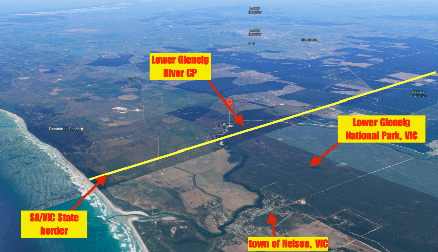
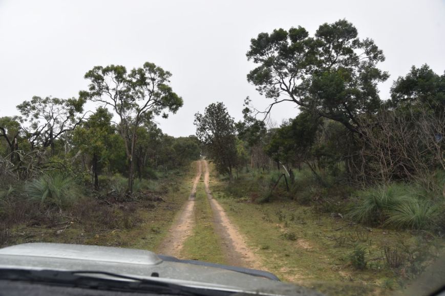
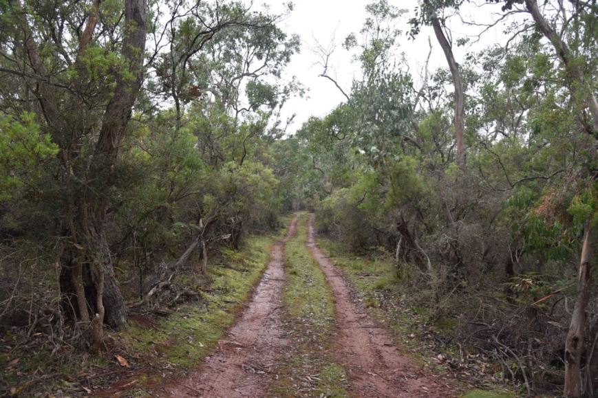
After packing up at the Lower Glenelg Conservation Park, Marija and I drove around 600 metres back down Moores Track and across the State border into Victoria.  Our next activation was to be the Lower Glenelg National Park VKFF-0296.  We had not initially planned to activate this park, but rather the Piccaninnie Ponds Conservation park.  But we decided to activate Lower Glenelg National Park instead, as it was a new Shire for the Hunters for the VK Shires Contest.

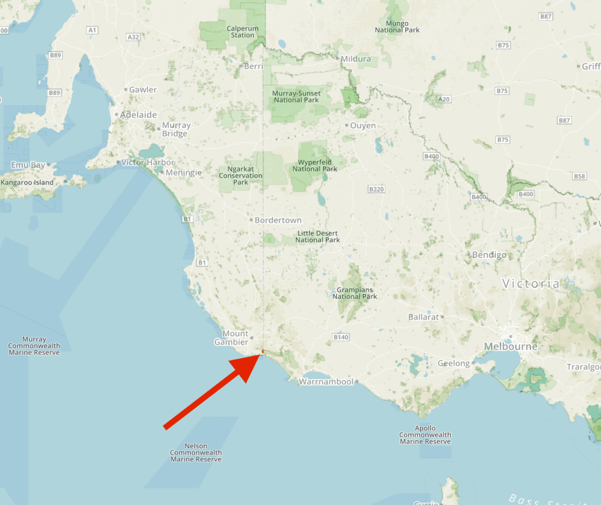
The park is located about 420 km from Melbourne and about 490 km from Adelaide.

Screen Shot 2017-06-13 at 9.35.39 pm.png

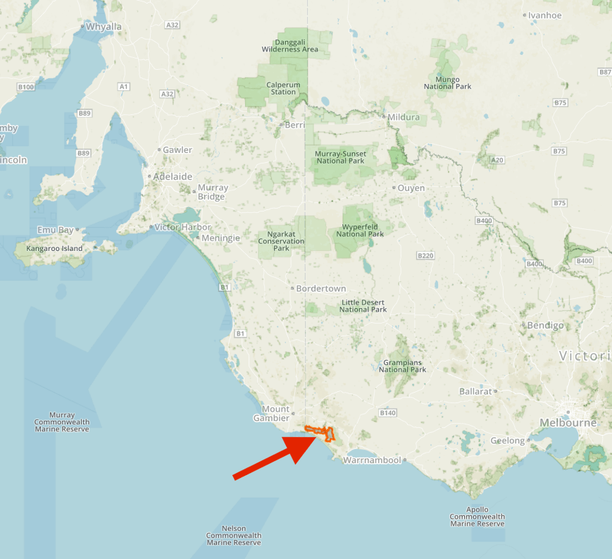
Map showing the location of the Lower Glenelg National Park.  Map courtesy of Protected Planet.

Lower Glenelg National Park is a large park.  It is 27,300 hectares (67,000 acres) in size.  The central feature of the park is the Glenelg River.  A spectacular gorge has been carved by the river along the last part of its winding 400 km path to the Southern Ocean.  Stretching 15km along the lower reaches of the river, the Glenelg River limestone Gorge has cliffs up to 50m in places.  The Princess Margaret Rose Cave is also located within the park.  It is often referred to as the ‘jewell in the crown’ of the park.

The park protects over 700 species of native plants.  The heath and fringing forest areas have over 50 species of orchids, while the tributaries of Moleside Creek support the most westerly tree-fern gullies in Australia.

Lower Glenelg National Park abuts the Cobboboonee National Park in the east and the South Australian border in the west.  To the south lies the Discovery Bay Coastal Park which is adjacent to the Southern Ocean.

Numerous native animals can be found in the park including Eastern Grey kangaroos, Red-necked wallabies, Brush-tail possums, koalas and echidnas.  In the more remote and undisturbed areas, rare animals such as Heath Rats, Swamp Antechinus and Potoroos can be found. Small colonies of Wombats inhabit the park, the only remnants of a once widespread population in the south west region of Victoria.

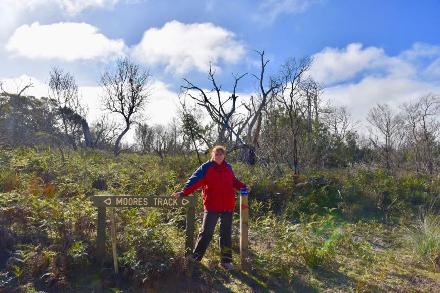
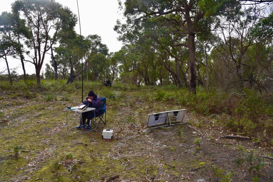
We set up in a clearing just off Moores Track.  As the weather had cleared a little, we initially didn’t roll out the awning.  But we had allowed for sufficient room to the side of the Toyota Hi Lux should the need arise.

Screen Shot 2017-06-13 at 9.35.19 pm.png

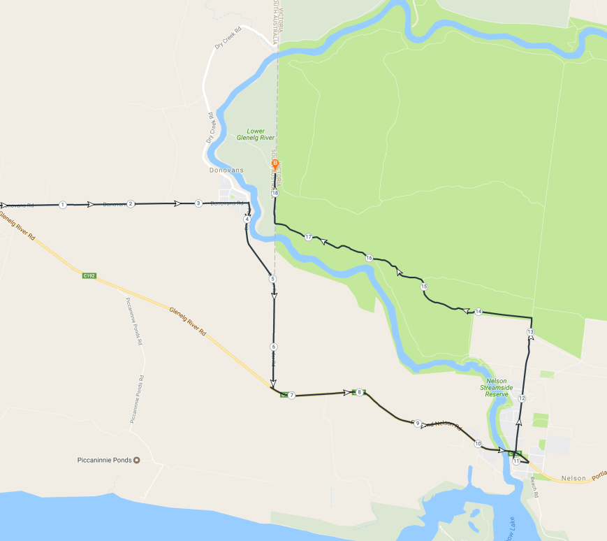
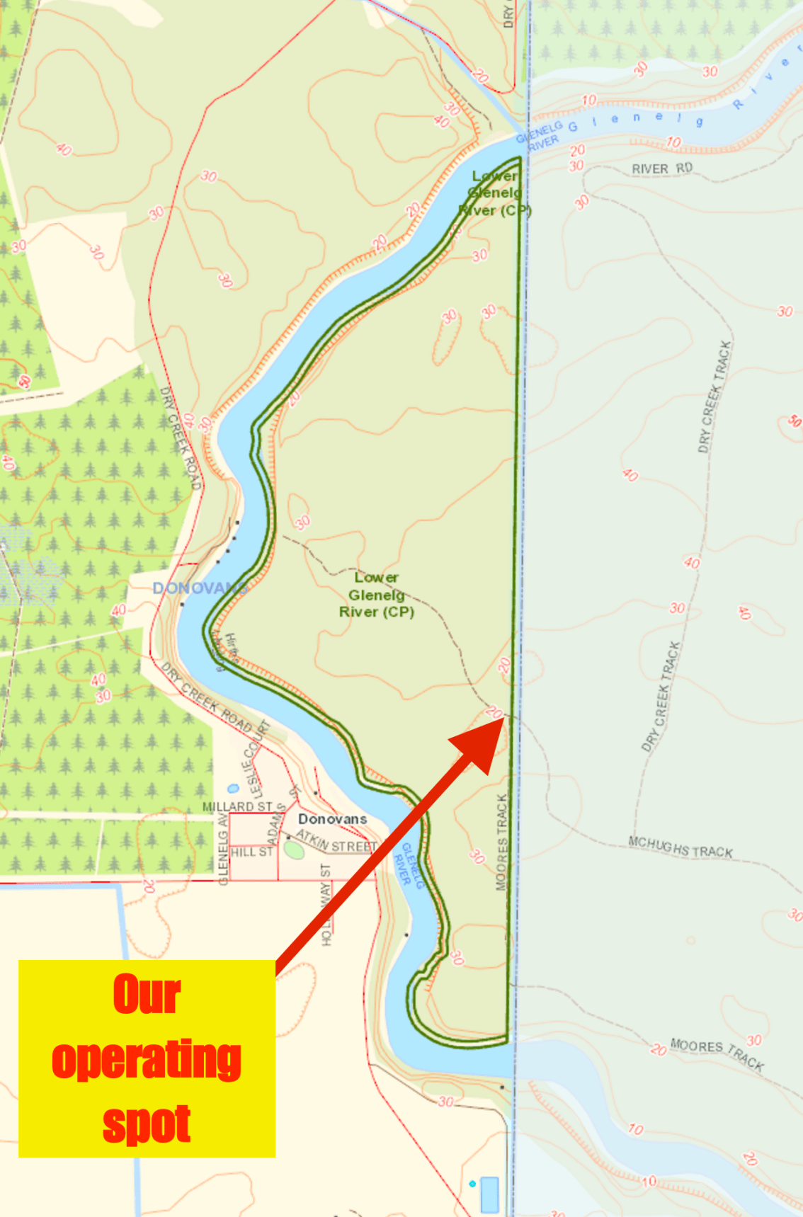
Map of the park, showing our operating spot at the western end of the park.  Map courtesy of Protected Planet.

Once again Marija kicked off the activation, calling CQ on 7.095.  This was to be a unique park as an activator for Marija for both the World Wide Flora Fauna (WWFF) program and the Keith Roget Memorial National Parks Award.  First in the log was Matt VK1MA, followed by Al VK7AN, and then VK3WMM/p.  Callers were a combinations of participants for the VK Shires Contest and the WWFF program and KRMNPA.  In just over 10 minutes Marija had 10 contacts in the log, thus qualifying the park for both VKFF & KRMNPA.  We then swapped the mic.

I logged a total of 25 stations on 40m from VK1, VK2, VK3, VK4, VK5, and VK7.  This included a Park to Park contact with Tony VK3XV/p who was activating the Barmah National Park VKFF-0739.  Marija also logged Tony.

Marija then jumped back on air again, logging a further 34 stations from VK2, VK3, VK5, VK6, and VK7.  This included 3 Park to Park contacts: Gordon VK5GY/p who was in the Pandappa Conservation Park 5CP-170 & VKFF-1131, Gerard VK2JNG/3 in Gunbower National Park VKFF-0740, and Stef VK5HSX/2 in the Paroo Darling National Park VKFF-0410.  I also logged these stations Park to Park.

Just before 2.00 p.m. Victorian local time I picked up the mic again and logged a total of 30 stations.  This included Park to Park contacts with John VK3CU/p and VK3LT who were portable in the Yarra Ranges National Park VKFF-0556, and Peter VK3ZPF/p who was activated the Werribee Gorge State Park VKFF-0774.

DSC_7212

Sadly the sun didn’t stay out for long and we were forced to put out the annexe on the Hi Lux, as the showers became quite persistent and heavy.

To complete the activation we had a quick scan around the 40m band, picking up a few more contacts for the VK Shires Contest, and a few more Park to Park contacts including Ian VK1DI/p who was activating the Batemans Marine Park VKFF-1406, and Adam VK2YK/p who was portable in the Sea Acres National Park VKFF-0606.

It was now approaching 3.30 p.m. local time and we decided we had played radio for long enough during the day.  It was time to head back to Mount Gambier and freshen up before the evening dinner as part of the South East Radio Group (SERG) Convention.

Marija worked the following stations on 40m SSB:-

  1. VK1MA
  2. VK7AN
  3. VK3WMM/p
  4. VK2HHA
  5. VK5FANA
  6. VK3GC
  7. VK3BBB
  8. VK3SQ
  9. VK3HAK
  10. VK3TNL
  11. VK3XV/p (Barmah National Park VKFF-0739)
  12. VK3NLK
  13. VK7TW
  14. VK5HSX/m
  15. VK3MRG/p
  16. VK7PRN
  17. VK2SOL
  18. VK5GY/p (Pandappa Conservation Park 5CP-170 & VKFF-1131)
  19. VK2JNG/3 (Gunbower National Park VKFF-0740)
  20. VK3MRH
  21. VK2MT/p
  22. VK5PL
  23. VK3ZO
  24. VK3SIM
  25. VK2TCL
  26. VK2NSW
  27. VK5UE
  28. VK5HSX/2 (Darling National Park VKFF-0410)
  29. VK5FBJC
  30. VK3FRAB
  31. VK3FRAD
  32. VK3VH
  33. VK5AFZ
  34. VK3OHM
  35. VK5BJE
  36. VK2VVV
  37. VK3LED
  38. VK2UH
  39. VK3PTE
  40. VK5MBD
  41. VK5KLV
  42. VK2MTM
  43. VK6MN
  44. VK5DP
  45. VK4TJ
  46. VK3CU/p (Yarra Ranges National Park VKFF-0556)
  47. VK3LT/p (Yarra Ranges National Park VKFF-0556)
  48. VK3ZPF/p (Werribee Gorge State Park VKFF-0774)
  49. VK4RF
  50. VK4HA
  51. VK1DI/p (Batemans Marine Park VKFF-1406)
  52. VK2YK/p (Sea Acres National Park VKFF-0606)

I worked the following stations on 40m SSB:-

  1. VK3FDAP/p
  2. VK2VVV
  3. VK7PRN
  4. VK4RF
  5. VK4HA
  6. VK1MA
  7. VK2PAW
  8. VK2BFC
  9. VK3PF
  10. VK2SK
  11. VK7EK
  12. VK2NEO
  13. VK2VU
  14. VK5FMWW
  15. VK7JGD
  16. VK3GC
  17. VK3HAK
  18. VK3VIN
  19. VK3SQ
  20. VK3XV/p (Barmah National Park VKFF-0739)
  21. VK3MRG/p
  22. VK3CWF
  23. VK2HHA
  24. VK3NLK
  25. VK2MMM
  26. VK5GY/p (Pandappa Conservation Park 5CP-170 & VKFF-1131)
  27. VK2JNG/3 (Gunbower National Park VKFF-0740)
  28. VK5HSX/2 (Paroo Darling National Park VKFF-0410)
  29. VK5MBD
  30. VK2HRX
  31. VK7FRJG
  32. VK1AT
  33. VK7JON
  34. VK5KLV
  35. VK7MPR
  36. ZL2AYZ
  37. VK4TJ
  38. VK4AAC/2
  39. VK3ZO
  40. VK7DW
  41. VK3GGG/p
  42. VK3PMG/p
  43. VK2VAE
  44. VK3CU/p (Yarra Ranges National Park VKFF-0556)
  45. VK3LT/p (Yarra Ranges National Park VKFF-0556)
  46. VK3ZPF/p (Werribee Gorge State Park VKFF-0774)
  47. VK3NXT
  48. VK2LEE
  49. VK2KYO
  50. VK5ATN
  51. VK2NP
  52. VK5FAKV
  53. VK7FOLK
  54. VK2WFT
  55. VK3ZZS/p
  56. VK2IB
  57. VK5KKT
  58. VK1AL
  59. VK2KDP
  60. VK1DI/p (Batemans Marine Park VKFF-1406)
  61. VK2YK/p (Sea Acres National Park VKFF-0606)
  62. VK2TTL

I worked the following stations on 20m SSB:-

  1. VK4RF
  2. VK4HA
  3. VK4AS

After packing up we headed back into Mount Gambier where we picked up a bottle of red and then headed back to the motel to freshen up.

SERG_LOGO_sml_shad

We enjoyed a fantastic night at the SERG Convention dinner.  We shared a table with my good mate John VK5NJ and his wife Tanina, and Tony VK5ZAI and his wife Jill.  Marija and I even drew the first winning raffle ticket, winning a little BaoFeng hand helf tx.  I can highly recommend the SERG Convention to anyone who has not been before.


References

Parks Victoria, 2017, <http://parkweb.vic.gov.au/explore/parks/lower-glenelg-national-park&gt;, viewed 14th June 2017

Wikipedia, 2017, <https://en.wikipedia.org/wiki/Lower_Glenelg_National_Park&gt;, viewed 14th June 2017

Lower Glenelg River Conservation Park 5CP-122 and VKFF-0905

Our first planned activation for Sunday 11th June 2017 was the Lower Glenelg River Conservation Park 5CP-122 & VKFF-0905.  The park is located about 31 km south east of Mount Gambier, and about 465 km south east of Adelaide, in the south east corner of South Australia.

Screen Shot 2017-06-13 at 9.27.45 pm.png

Map showing the location of the Lower Glenelg River Conservation Park.  Map courtesy of Protected Planet.

The park is located right on the South Australian/Victorian State border.  Access to the park from the South Australian side can only be made via boat.  Or you can access the park via a a 4WD track from the Victorian side which is what Marija and I did.

Screen Shot 2017-06-14 at 4.58.41 pm.png

Aerial shot showing the Lower Glenelg River Conservation Park on the SA/VIC border, and the adjacent Lower Glenelg National Park in Victoria.  Image courtesy of Google maps.

The map below shows our route.  We travelled south east out of Mount Gambier down towards the South Australian/Victorian border.  It was a cold morning with quite a bit of drizzle.  It wasn’t looking good for the activation.

Screen Shot 2017-06-14 at 5.29.06 pm.png

Our route to the park.  Map courtesy of plotaroute.com

Marija and I made a quick detour off the Glenelg River Road, down Donovans Road, into the little town of Donovans which is situated on the banks of the beautiful Glenelg River.  The area was originally known as Donovans Landing, and was owned by, and named after Thomas John Donovan.   He was famous due to him shooting the Tantanoola Tiger, a ‘phantom cat’, which is now preserved in the Tantanoola Hotel.

In 1884 a Bengal Tiger is purported to have escaped from a travelling circus in the South East.  A search was mounted, however the tiger was never located.  There were however, over the next few years, numerous reports of missing sheep in the area, with many suggesting that the tiger was responsible.  Eleven years later, Donovan saw what he thought was the tiger in a paddock, with a sheep in its jaws.  Donovan subsequently shot and killed the animal which turned out to be a Eurasian Wolf.  It is believed that the wolf was a stowaway on board a boat shipwrecked off the coast and somehow made it to shore.  A very interesting tale indeed.

There are some nice views here to be had of the Glenelg River.  The river rises in the Grampian Ranges in western Victoria and flows generally north, then west, then south, for over 350 km.  This makes it the longest river in south west Victoria and the third longest river overall.  A short stretch of the lower end of the river winds through South Eastern South Australia before returning to Victoria to enter Discovery Bay at Nelson.

The river was named after Colonial Secretary Baron Glenelg, Charles Grant (1778-1866), by Major Thomas Mitchell in August 1836.  Grant was a Scottish politician and colonial administrator.

Lord-glenelg

Charles Grant, 1st Baron Glenelg

From Donovans we made the short trip to the South Australian/Victorian State border.  There is an information board here marking the survey of the border.  The boundary between South Australia and Victoria, formerly the Port Phillip District of New South Wales, was marked from the shores of the Southern Ocean to the south bank of the River Murray between 1847 and 1850.

There was also a sign here indicating that we were entering into the Glenelg Shire.  A new shire for us to activate for the VK Shires Contest.

DSC_7229.jpg

We then drove into the little town of Nelson.  This is a small fishing village with a population of around 250 people.  It is located at the mouth of the Glenelg River.  In January 1852 the name of Nelson was adopted for the settlement, after the ship Lady Nelson, which was used by Lieutenant James Grant in explorations of the area in the early 1800’s.

We drove north out of Nelson on the North Nelson Road.  We soon reached the junction with Forest Road and the start of the Lower Glenelg National Park.  We then turned left onto Moores Track and travelled west through the Lower Glenelg National Park in Victoria.

Just after we turned into Moores Track we could see a tree down across the track ahead of us.  Fortunately someone had cut most of it up with a chainsaw, and there was sufficient room for us to pass.

DSC_7220

Morres Track was generally in good condition except for one spot which is shown in the photo below.  It didn’t look much, but the puddle was about 1.5 feet deep and very boggy, but we made it through in the Toyoa Hi Lux without any issues.

DSC_7189

For the remainder of the trip along Moores Track it was clear driving, but slow.  The park was absolutely alive with kangaroos who often darted out in front of us.

DSC_7190

When we reached the right hand turn dog leg on Moores Track, we had reached the State border.

DSC_7208

Marija at the dog leg and the State border

We travelled a little further up Moores Track until we reached the junction with McHughs Track.  There was a Lower Glenelg River Conservation Park sign here.

We decided to travel west down McHughs Track to see if it would take us down to the river.  It was slow going as it was quite overgrown.  Take note, there are no turn around areas, or places to pull off, until you get to the very end of the track.

DSC_7194

Unfortunately there were no places to set up once we got to the end of the track, as the scrub is just too thick.  However, it was worth the drive down, as we were rewarded with some nice views of the Glenelg River, despite the fog.

We returned to the junction of Moores Track and McHughs Track and set up.  As it was still drizzling with rain, Marija and I set up underneath the annexe of the Toyota Hi Lux.  We ran the Yaesu FT-857d for this activation, along with the 80/40/20m linked dipole.

Screen Shot 2017-06-14 at 7.30.03 pm.png

Map of the park showing our operating spot.  Map courtesy of Location SA Viewer.


The Lower Glenelg Conservation Park is 127 hectares in size, and was dedicated in 1993 for the conservation of important vegetation associations and species.  It is an extension of Victoria’s Lower Glenelg National Park, which adjoins it on the eastern boundary.  The Glenelg River forms the western boundary of the park.  The Park contains an endangered vegetation association (Swamp Gum woodland) and several endangered plant species.  Two of the endangered species include the Slender Greenhood and Shining Buttercup.

The Great South West Walk (250 kilometres of walking trail) passes through the Lower Glenelg River Conservation Park.

The Park provides habitat for a variety of threatened fauna species including the Rufous Bristlebird, Yellow-tailed Black Cockatoo, Peregrine Falcon, Azure Kingfisher, Heath Mouse, and Red-necked Wallaby.

This was to be a unique park for both Marija and I, for both the World Wide Flora Fauna (WWFF) program and the VK5 National & Conservation Parks Award.  Marija kicked off the activation, calling CQ on 7.144.  It was a slow start, with around 3 minutes of calls going unanswered.  I had spotty phone coverage but was eventually able to spot Marija, with her first caller following very soon after.  Peter VK3PTE was first in the log, followed by Glen VK2VVV, and then Rick VK4RF/VK4HA.

The WIA broadcast kicked off soon after on 7.146, so we QSY’d down the band to 7.095.  Marija soon had 10 contacts in the log, qualifying the park for her for VKFF.  After logging 12 contacts, Marija was happy to hand the mic to me.  Included in her 12 contacts was a Park to Park QSO with Tony VK3XV/p who was activating the Barmah National Park VKFF-0739.

I then jumped on the mic and called CQ on 7.095.  My CQ call was answered by Peter VK3PF, followed by Geoff VK3SQ, Greg VK2EXA, and then Adrian VK5FANA.  Within 10 minutes I had contact number 10, with VK4AAC/2, in the log, and the park qualified for VKFF.  I logged 21 stations on 40m from VK1, VK2, VK3, VK4, and VK5, before heading over to 3.610 on the 80m band.

I there logged John VK5BJE from the Adelaide Hills with a good 5/5 signal.  Sadly, John was my only contact on 80m.  I then QSYd back to 7.095 hoping to pick up a few more contacts on my quest to 44 contacts to qualify the park for WWFF.  Within another 40 minutes, I had contact number 44 in the log.  It was Graham VK7ZGK with a thumping 5/9 plus signal from Tasmania.

All up I made a total of 51 contacts on 40m and 80m, with a number of contacts made for the VK Shires Contest.  I had one Park to Park contact, that being with Tony VK3XV/p in the Barmah National Park VKFF-0739.

Marija worked the following stations on 40m SSB:-

  1. VK3PTE
  2. VK2VVV
  3. VK4RF
  4. VK4HA
  5. VK2AB
  6. VK4AAC/2
  7. VK5KLV
  8. VK4RF (after the UTC rollover)
  9. VK4HA (after the UTC rollover)
  10. VK1AT
  11. VK2VW
  12. VK3SQ
  13. VK3WMM/p
  14. VK3XV/p (Barmah National ParkVKFF-0739)

I worked the following stations on 40m SSB:-

  1. VK3PF
  2. VK3SQ
  3. VK2EXA
  4. VK5FANA
  5. VK2AB
  6. VK4RF
  7. VK4HA
  8. VK3HBG
  9. VK4TAA
  10. VK4AAC/2
  11. VK2EMI
  12. VK1MA
  13. VK1AT
  14. VK5KLV
  15. VK2KYO
  16. VK2OA
  17. VK5LOL
  18. VK1HW
  19. VK2NP
  20. VK3MCK
  21. VK5HSX/2
  22. VK2ESG
  23. VK3LM
  24. VK5MBD
  25. VK3KAI
  26. VK3GV
  27. VK4TJ
  28. VK4/AC8WN
  29. VK4/VE6XT
  30. VK2HHA
  31. VK7JGD
  32. VK5NJ
  33. VK3CM
  34. VK3MRG/p
  35. VK2TCL
  36. VK3XV/p (Barmah National Park VKFF-0739)
  37. VK5MA/p
  38. VK2XXM
  39. VK7EE
  40. VK2UH
  41. VK5PL
  42. VK5BJE
  43. VK7ZGK
  44. VK6MN
  45. VK5DT
  46. VK3CBP
  47. VK7PAL
  48. VK3ZLD
  49. VK3BBB
  50. VK3MAB

I worked the following station on 80m SSB:-

  1. VK5BJE


References.

Government of South Australia, 2000, Lower Glenelg River Conservation Park Management Plan.

State Library South Australia, 2017, <http://www.samemory.sa.gov.au/site/page.cfm?u=276&gt;, viewed 14th June 2017

Wikipedia, 2017, <https://en.wikipedia.org/wiki/Glenelg_River_(Victoria)&gt;, viewed 14th June 2017

Wikipedia, 2017, <https://en.wikipedia.org/wiki/Charles_Grant,_1st_Baron_Glenelg&gt;, viewed 14th June 2017

Wikipedia, 2017, <https://en.wikipedia.org/wiki/Nelson,_Victoria&gt;, viewed 14th June 2017