Telford Scrub Conservation Park 5CP-226 and VKFF-0805 and the VK Shires Contest

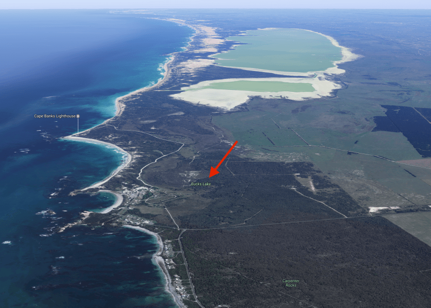
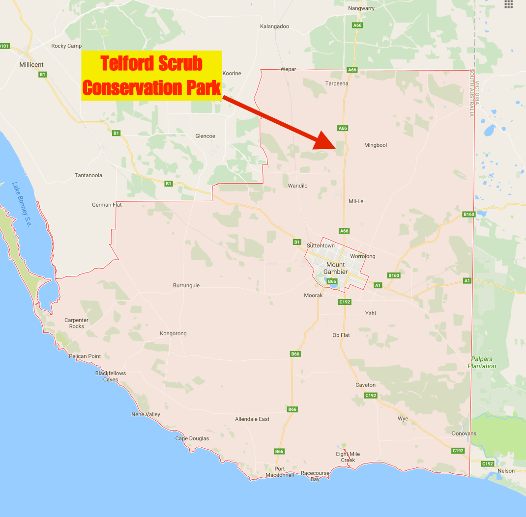
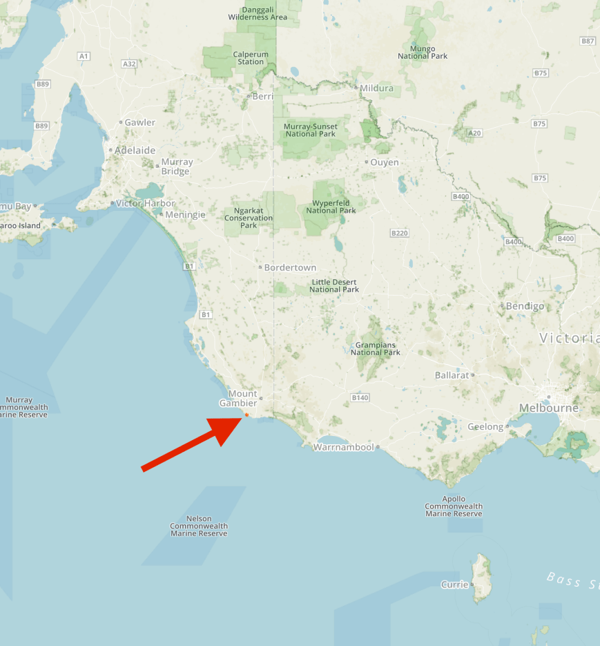
After leaving the SERG Convention, Marija and I decided to head out to the Telford Scrub Conservation Park 5CP-226 & VKFF-0805 for a few hours for the VK Shires Contest which had commenced at 0600 UTC that day (3.30 p.m. South Australian local time).  Telford Scrub is just 15 km north of Mount Gambier, just off the Riddoch Highway.

Screen Shot 2017-06-13 at 7.30.33 pm.png

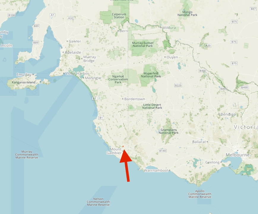
Map showing the location of the Telford Scrub Conservation Park.  Map courtesy of Protected Planet.

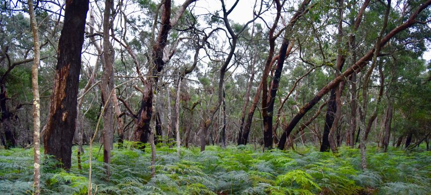
Telford Scrub is 175 hectares in size and was first proclaimed on 12th March 1987.  The park features a 100 metre long boardwalk which takes you along the forest canopy about 4 metres off the ground.  There are various interpretive signs along the way.

Screen Shot 2017-06-13 at 7.26.03 pm.png

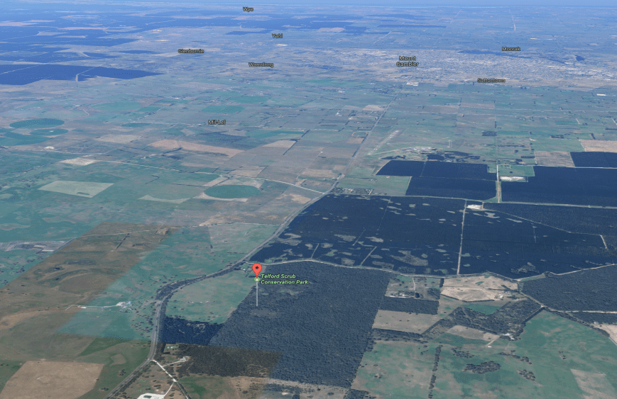
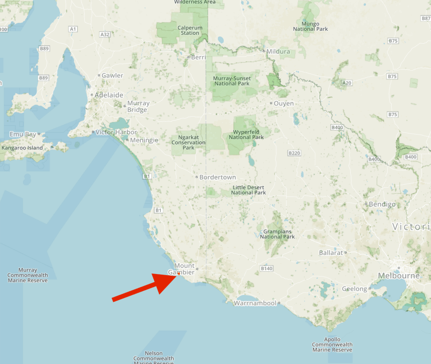
Aerial shot, showing the park, with Mount Gambier in the background.  Image courtesy of Google maps

The park supports four major vegetation types:  Brown Stringybark open woodland, Brown Stringybark/Rough-barked Manna Gum open woodland, Swamp Gum open woodland; and low open shrubland.  More than 20 species of native orchid can be found in the park.

DSC_7175 (1).jpg

About 117 species of bird have been recorded in the park including the Crimson Rosella, Laughing Kookaburra, White-throated Treecreeper, Superb Fairywren, White-browned Scrubwomen, Red-tailed Black Cockatoo, Satin Flycatcher, and Southern Boobook.  During our visit, a vehicle arrived in the carpark.  It was a gentleman about to head off on a night walk through the park to photograph owls and Tawny Fromouths.  It is truly amazing who you meet when you visit these parks.

A large amount of native wildlife can be found in the park including Western Grey kangaroos and koalas.The vulnerable Southern Brown Bandicoot and the endangered Sugar Glider can also be found.

Below is a great video of a Sugar Glider in flight.

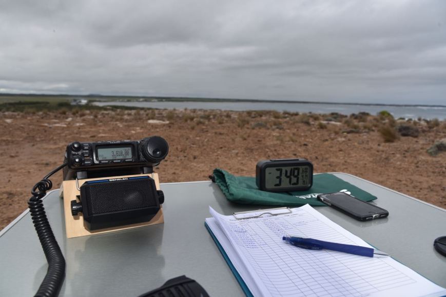
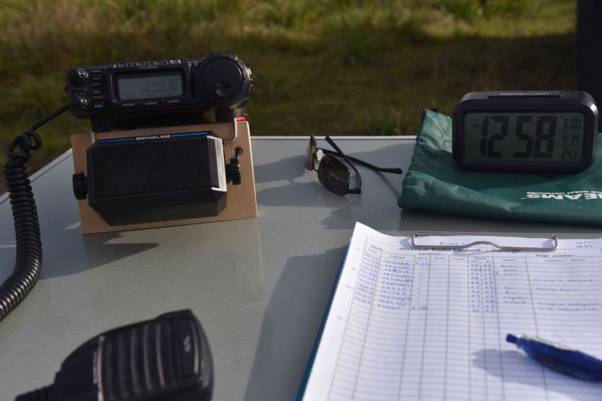
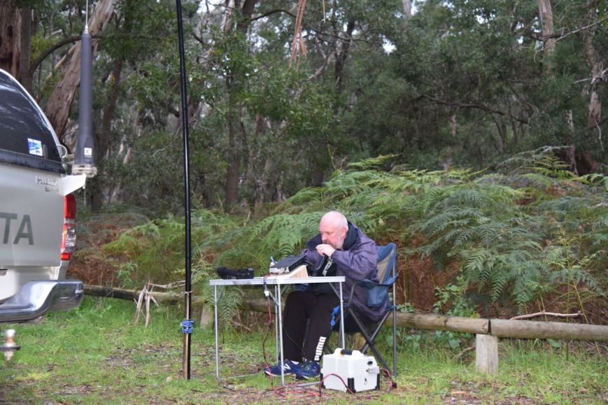
Marija and I set up in the carpark off Grundys Lane.  We were all set up and ready to go by around 0710 UTC (4.40 p.m. South Australian local time).

Screen Shot 2017-06-13 at 7.30.08 pm.png

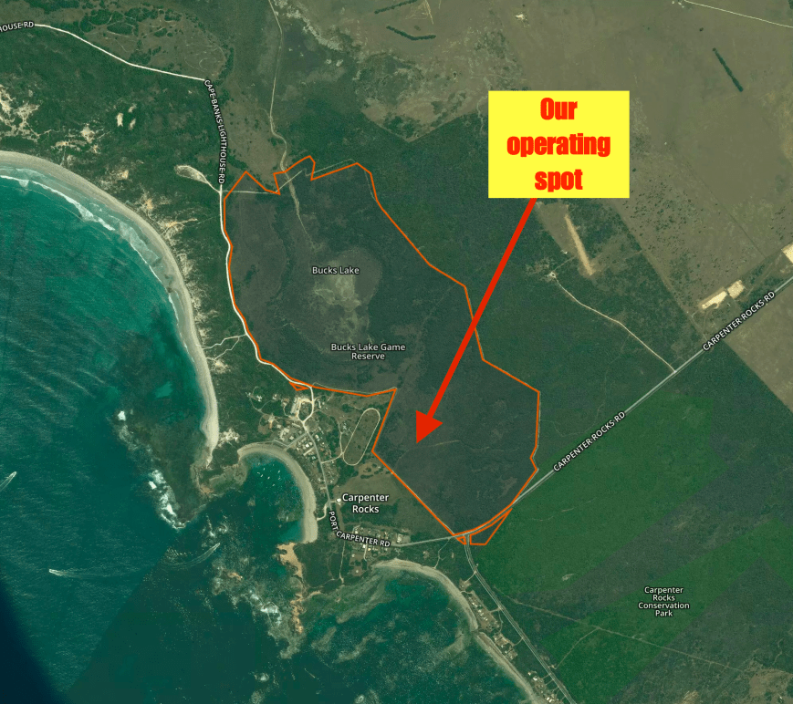
Aerial shot of the park showing our operating spot in the southern section of the park.  Image courtesy of Protected Planet.

There was plenty of room here to string out the 80/40/20m linked dipole.

DSC_7170

Telford Scrub is located in the District Council of Grant (GD5 for the VK Shires Contest).  It is quite strange how it works down in the South East.  The town of Mount Gambier comes under the City of Mount Gambier Council, whilst the land around it is the District Council of Grant.

Screen Shot 2017-06-13 at 8.28.00 pm.png

Map showing the Grant Council area surrounding the town of Mount Gambier, and our operating spot at Telford Scrub.

I started off on 7.115 on the 40m band.  The band was quite busy with stations calling ‘CQ Contest’.  My first station worked was Andrew VK2UH, followed by Geoff VK3SQ, and then Hans VK6XN who was operating portable in the Shoalwater Islands Marine Park VKFF-1454.  I logged a total of 52 stations including another Park to Park contact, this time with Phil VK6ADF/p who was in Lesueur National Park VKFF-0285.

DSC_7172

The 40m band had slowed a little, so I headed to the 80m band.  We found Tony VK3XV/p calling CQ on 3.610 from the Terrick Terrick National Park VKFF-0630.  We both logged Tony, and I then moved down to 3.605 and started calling ‘CQ Contest’.  I logged 12 stations before swapping the mic with Marija.

Marija wasn’t real keen on the contesting, but wanted to qualify the park with 10 QSOs for the VKFF program.  She soon reached that total in around 10 minutes, with contact number 10 being Michael VK3LM.

DSC_7178

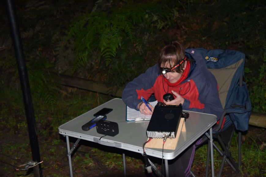
I then took charge of the mic again and logged an additional 15 stations on 80m including Bill ZL2AYZ in Blenhiem in New Zealand.  Marija and I swapped the mic so she could log our good friend Ivan VK5HS when he called in, and also Bill in New Zealand.  To finish off the activation, Marija logged a handful of stations after tuning across the 80m band.

Marija had a total of 15 stations in the log from VK2, VK3, VK5, and New Zealand, all on the 80m band.  I had a total of 80 stations in the log on the 40m and 80m bands.  It was time to head back into Mount Gambier for some dinner, with the local time being just after 7.00 p.m. local time.

I had logged 61 different shires for the contest:

  1. AC2
  2. AC5
  3. BB3
  4. BC3
  5. BL2
  6. BN4
  7. BU7
  8. CB2
  9. CK2
  10. CN2
  11. CO6
  12. CS3
  13. CW6
  14. DG4
  15. DN6
  16. FC3
  17. FC4
  18. GB3
  19. GD5
  20. GG3
  21. GS7
  22. HC7
  23. HI2
  24. IP4
  25. IS3
  26. KH7
  27. KY2
  28. LC3
  29. LE2
  30. LS3
  31. LV4
  32. MD5
  33. MG3
  34. MM3
  35. MO3
  36. MP3
  37. MZ3
  38. NA2
  39. NC2
  40. NS3
  41. OC5
  42. QP2
  43. RP5
  44. RM6
  45. RX5
  46. SB4
  47. SG3
  48. UA2
  49. UH2
  50. UL2
  51. WD2
  52. WH3
  53. WO2
  54. WR3
  55. WV2
  56. WW2
  57. WW7
  58. WY3
  59. YP5
  60. YV2
  61. YV3

We headed to Fasta Pasta, and while Marija was inside ordering, I made a total of 6 contacts on 40m and 80m from the vehicle.  This time in the Mount Gambier Council area (MG5 for the VK Shires Contest).

We then headed back to the motel room for dinner.

Marija worked the following stations on 80m SSB:-

  1. VK3XV/p (Terrick Terrick National Park VKFF-0630)
  2. VK3GH
  3. VK3FSLG
  4. VK5FANA
  5. VK3FAAJ
  6. VK3SQ
  7. VK3ER
  8. VK3WMM/p
  9. VK3PF
  10. VK3LM
  11. VK5HS
  12. ZL2AYZ
  13. VK3C
  14. VK5KBJ
  15. VK2YW/p

I worked the following stations on 40m SSB:-

  1. VK2UH
  2. VK3SQ
  3. VK6XN/p (Shoalwater Islands Marine Park VKFF-1454)
  4. VK2NEO
  5. VK2KDP
  6. VK4QQ
  7. VK2BBQ/p
  8. VK2KJJ
  9. VK2KT
  10. VK5FANA
  11. ZL2AYZ
  12. VK2TCL
  13. VK4NH
  14. VK3OHM
  15. VK2LEE
  16. VK2YW/p
  17. VK7JGD
  18. VK4FMAX
  19. VK3PI
  20. VK2SR
  21. VK5KPR
  22. VK5NJ
  23. VK2MTM
  24. VK2VVV
  25. VK2NSS
  26. VK3GYH/p
  27. VK7ZGK
  28. VK3NLK
  29. VK3ARH
  30. VK3MRG
  31. VK3TNL
  32. VK2PHL
  33. VK2PAW
  34. VK3GC
  35. VK4FE
  36. VK7JON
  37. VK3FPSR
  38. VK2ND
  39. VK3JP
  40. VK2NSW
  41. VK2MT/p
  42. VK6ADF/p (Lesueur National Park VKFF-0285)
  43. VK7DW
  44. VK3GTS
  45. VK2QH
  46. VK3WMM/p
  47. VK2QK
  48. VK6FBOS
  49. VK2VOL
  50. VK4SMA
  51. VK5MR
  52. VK2GGA

I worked the following stations on 80m SSB:-

  1. VK3XV/p (Terrick Terrick National Park VKFF-0630)
  2. VK3SQ
  3. VK5KBJ
  4. VK2YW/p
  5. VK2BFC
  6. VK3LDB
  7. VK3VKT
  8. VK5FANA
  9. VK3WMM/p
  10. VK3LM/p
  11. VK2ARL
  12. VK7GG
  13. VK2GGA
  14. VK3PF
  15. VK3GH
  16. VK5PO
  17. VK5HS
  18. VK3OHM
  19. VK3LM/p
  20. VK3CWF
  21. VK3FSPG
  22. VK3NXT
  23. VK3GC
  24. VK6VCK/p
  25. VK3CWM
  26. ZL2AYZ
  27. VK3ER
  28. VK4QH


References.

Birds SA, 2017, <http://www.birdssa.asn.au/location/telford-scrub-conservation-park/&gt;, viewed 13th June 2017

National Parks South Australia, 2017, <https://www.environment.sa.gov.au/parks/Find_a_Park/Browse_by_region/Limestone_Coast/telford-scrub-conservation-park&gt;, viewed 13th June 2017

Douglas Point Conservation Park 5CP-057 and VKFF-0795

Our second activation for Saturday 10th June 2017 was the Douglas Point Conservation Park 5CP-057 and VKFF-0795.  The park is situated and about 42 km south (by road) of Mount Gambier and about 470 km south east of Adelaide.

Screen Shot 2017-06-13 at 1.44.56 pm.png

Map showing the location of the Douglas Point Conservation Park.  Map courtesy of Protected Planet.

The Douglas Point Conservation Park is 31 hectares in size and was proclaimed on 8th May 1997 to protect the state endangered and nationally vulnerable plant species, Sand Ixodia.  Douglas Point is the only reserve in Australia containing this plant.  In addition to this, the Park is a significant refuge for two plant species of conservation significance.

The habitats of the Douglas Point Conservation Park vary from exposed cliff top to coastal heath, principally Coastal Wattle / Coastal Beard-heath scrubland.

The Park is located within the traditional lands of the Boandik people.  The remains of scattered middens are evidence of Aboriginal habitation in the past.

The exact origins of the name, Cape Douglas, are unknown.  Lieutenant James Grant sailed through the area on the Lady Nelson in December 1800 and named several features including Cape Northumberland.  On the 5th of April 1802, the French navigator Nicholas Baudin passed Cape Northumberland in his ship the ‘Geographe’ whilst travelling west along the coast.  Baudin subsequently met Matthew Flinders, who was travelling from the west to east, in Encounter Bay.  Later in 1802 Matthew Flinders charted the area on the Investigator, with crew including boatswain Charles Douglas. Captain William Bloomfield Douglas helped Captain Benjamin Germain chart the waters around Cape Northumberland and Port MacDonnell in 1860.  It is possible that Cape Douglas was named during one of these exercises.

William_Bloomfield_Douglas.jpg

William Bloomfield Douglas.  Image courtesy of wikipedia

The park is home to over 60 species of bird.  A total of those are of conservation significance including the Rufous Bristlebird and the Beautiful Firetail, and also the nationally endangered Orange-bellied Parrot.

During our visit to the park we spotted a Crested Tern and a Nakeen kestrel (I think).

Recreational activities undertaken in the Park include bush-walking, surfing, diving, fishing and 4WDriving.

Just outside of the park on the Cape Douglas Road, you can view an interpretive sign regarding the Admella, a passenger steamship which was shipwrecked on a submerged reef off the coast of nearby Carpenter Rocks.

DSC_7164

It was during the early hours of Saturday 6 August 1859 that the ship struck the reef, resulting in survivors clinging to the wreck for over a week.  Many took days to die as they glimpsed the land from the sea and watched as one rescue attempt after another failed.  With the loss of 89 lives, mostly due to cold and exposure, it is one of the worst maritime disasters in Australian history.   It remains the greatest loss of life in the history of European settlement in South Australia.  Of the 113 on board 24 survived, including only one woman, Bridget Ledwith.  Of the 89 dead, 14 were children.

Admella_painting.jpg

SS Admella.  Image courtesy of Wikipedia

The GPS showed that we had a short 20 minute drive to get to the park.  WRONG!.  It took us to a carpark at the end of Pelican Point Road at Blackfellows Caves.  There was no access to the park via the coastal road as the GPS indicated.  So we headed inland and eventually reached the park via Cape Douglas Road.

DSC_7135

There weren’t too many operating options here.  It is very exposed to the ocean as you are above some clifftops overlooking the ocean.

Screen Shot 2017-06-13 at 1.44.28 pm.png

Aerial view of the park showing our operating spot.  Image courtesy of Protected Planet.

There is a 4WD track leading further into the park.  And it is definitely 4WD.  It is extremely rocky and then sandy.

Screen Shot 2017-06-13 at 1.46.35 pm

Aerial shot of Douglas Point Conservation Park.  Image courtesy of Google maps 

For this activation we ran the Yaesu FT-857d and the 80/40/20 m linked dipole, supported on the 7m heavy duty squid pole.  It took some belts of the hammer to drive the squid pole holder into the ground, as the ground was very rocky.

DSC_7160

The rugged coastline of Douglas Point provided some great views along the coast and out across the Southern Ocean.  Fortunately there was only a gentle breeze blowing and the rain was holding off.

There were also some nice views back out to Umpherstone Bay and back to Mount Gambier.  Centennary Tower in Mount Gambier and Mount Schank were clearly visible in the distance.

This was to be another unique park for both Marija and I, for both the World Wide Flora Fauna (WWFF) program and the VK5 National & Conservation Parks Award.  Marija started off the activation calling CQ on 7.144.  It didn’t take long and Marija had her first caller in the log, Geoff VK3SQ in norther eastern Victoria.  This was followed by Greg VK2EXA, Andy VK3AJA, and then Paul VK3AFB.  Marija had qualified the park for VKFF, with 10 contacts in the log within 10 minutes.  After logging 11 stations, Marija was happy to hand over the mic.

I then called CQ on 7.144 which was answered by Peter VK3PF, followed by Don VK3MCK, and then Craig VK3NCR.  Mike VK5FMWW then called in and although being quite low was readable in the park.  Sadly Mike was struggling with noise at his end and we couldn’t quite complete the contact with a valid signal report exchange.  Contact number 10 for me, qualifying the park for VKFF, was with Greg VK2MTC in Cooma.

I had reached contact number 40 on 40m within one hour.  I still needed another 4 contacts to qualify the park for the global WWFF program.  As things had slowed a little on 40m I headed off to 14.310 on the 20m band where I logged 4 stations from VK2, VK4 and VK4.  Contact number 44 was with Allen VK3ARH whose signal was very low.  But as there was no noise in the park, and Allen was suffering from a low noise floor at his end, we were able to comfortably log the QSO.

To finish the activation I headed off to 3.610 on the 80m band.  Allen VK3ARH (signing as VK3HRA) had followed me down and was first in the log.  I logged only one further contact, that being with Ken VK2KYO.  Cliff VK2NP also tried, but although readable in the park, Cliff was unable to hear me above his noise floor.

With 11 contacts in the log for Marija, and 46 for me, it was time to pack up and head back into Mount Gambier.

Marija worked the following stations on 40m SSB:-

  1. VK3SQ
  2. VK2EXA
  3. VK3AJA
  4. VK3AFG
  5. VK7DW
  6. VK3ELH
  7. VK4TJ
  8. VK4/AC8WN
  9. VK4/VE6XT
  10. VK5FMWW
  11. VK7FOLK

I worked the following stations on 40m SSB:-

  1. VK3PF
  2. VK3MCK
  3. VK3NCR
  4. VK2EXA
  5. VK3SFG
  6. VK3OHM
  7. VK3AFB
  8. VK3AWG
  9. VK2YS/4
  10. VK2MTC
  11. VK3SQ
  12. VK2NP
  13. VK2HHA
  14. VK7DW
  15. VK3BBB
  16. VK4TJ
  17. VK4/AC8WN
  18. VK4/VE6XT
  19. VK3FRC
  20. VK5IS
  21. VK7GG
  22. VK7AN
  23. VK3ELH
  24. VK2KYO
  25. VK2TCL
  26. VK3PTE
  27. VK2VW
  28. VK3FDAP/p
  29. VK5HSX/2
  30. VK7JON
  31. VK5MBD
  32. VK7FOLK
  33. VK4RF
  34. VK4HA
  35. VK7EE
  36. VK3ZZS/p
  37. VK2UH
  38. VK2FRJH/m
  39. VK6VRO

I worked the following stations on 20m SSB:-

  1. VK4FI
  2. VK2NP
  3. VK2IO/m
  4. VK4AAC/2
  5. VK3ARH

I worked the following stations on 80m SSB:-

  1. VK3HRA
  2. VK2KYO

At the end of the activation Marija and I headed in to Mount Gambier and the Scout Hall for the SERG Convention.  It was great to catch up with a lot of familiar faces.  I also had a browse through the buy and sell.  My only purchase for the day, much to Marija’s pleasure, was a cup of coffee.


References.

Department for Environment and Heritage, May 2003, Douglas Point Conservation Park Management Plan.

Wikipedia, 2017, <https://en.wikipedia.org/wiki/SS_Admella&gt;, viewed 13th June 2017

Bucks Lake Game Reserve VKFF-1690

Marija and I both finished work early on Friday 9th June 2017 and then packed the Hi Lux and headed south east for Mount Gambier.  We had planned to stay at Mount Gambier for 3 nights, and attend the annual convention/buy and sell/fox hunting championships hosted by the South East Radio Group (SERG).

This was a 400 km journey for us from our home in the Adelaide Hills.

Screen Shot 2017-06-13 at 12.28.08 pm.png

Map showing our route down to Mount Gambier from the Adelaide Hills.

Along the way we stopped briefly for a bite to eat and a drink at Coonalpyn.  The silos there have recently been the subject of some great artwork by Guido van Helten.  I had viewed this during a recent interstate trip, but this was the first time Marija had viewed this very impressive artwork.

We also had a quick look at Coonalyn Tunnel Vision, which was originally developed in 1995 to brighten up the railway pedestrian underpass with local art.

We then continued on to Mount Gambier, arriving just after 6.00 p.m. local time.  After booking in to our motel, the Tower Motor Inn, we headed out for tea at Jens Hotel at Mount Gambier, where we enjoyed a very nice meal.  It was then back to the motel room to watch a very nice win by the Adelaide Crows football team.

Our first activation for the trip away was on Saturday 10th June 2017 and was at the Bucks Lake Game Reserve VKFF-1690 which is located about 40 km south west of Mount Gambier, and about 440 km south east of Adelaide.

Screen Shot 2017-06-13 at 10.18.10 am.png

Map showing the location of the Bucks Lake Game Reserve in the South East region of South Australia.  Map courtesy of Protected Planet.

Bucks Lake Game Reserve is 138 hectares in size and consists of near pristine seasonally-inundated coastal wetland.  It is located at the southern end of Lake Bonney which was the primary source of water to  Bucks Lake.  Due to influences by man, the water level of Lake Bonney has descreased, resulting in Bucks Lake and other wetlands near Lake Bonney, becoming degraded from the lack of water supply.

The reserve was originally created as a National Park in 1968 under the National Parks Act 1966 and was re-proclaimed as a game reserve under the National Parks and Wildlife Act 1972 for the purpose of the conservation of wildlife and management of game.

Hunting is allowed in the Reserve during a proclaimed open season with hunters requiring to have an ‘endorsed hunting permit’ and only to harvest maximum numbers of specific species.

Screen Shot 2017-06-13 at 10.37.39 am.png

Aerial shot showing the Bucks Lake Game Reserve with Carpenter Rocks Conservation Park in the foreground.  Image courtesy of Google maps.

The reserve protects habitat for important fauna species such as the state endangered Swamp Antechinus and the Southern Bush Rat.  The Swamp Antechinus is a small carnivorous marsupial which has a very scattered distribution on the Australian mainland, limited to small pockets in South Eastern South Australia and south western Victoria.  It is also found in Tasmania.

Screen Shot 2017-06-13 at 11.31.20 am.png

Swamp Antechinus.  Image courtesy of Nature Glenelg Trust

Screen Shot 2017-06-13 at 11.31.25 am.png

Map showing the habitat of Swamp Antechinus.  Image courtesy of Nature Glenelg Trust

Marija and I were on the road by 7.30 a.m.  We made a quick detour to the local Subway where we purchased some lunch and also a bacon & egg roll for breakfast.  We then headed south west out of Mount Gambier on the Carpenter Rocks Road.  This is kangaroo and wombat country as was evident by the signs.

Prior to activating the reserve, we had a quick look around the little town of Carpenter Rocks which is renmowned for its rugged coastline which provides exceptional fishing and diving locations.

DSC_7110

The coastline at Carpenter Rocks.

We then travelled out along the Cape Banks Lighthouse Road until we reached the northern section of the reserve.  We found a 4WD drive which followed the northern boundary of the park, but could not find anywhere really suitable to set up.  We followed this track all the way around the boundary of the park until we reached the Carpenter Rocks Road again.

We then saw a sign on the northern side of the road which said ‘Fire Water’, so we decided to take this track, heading north, following the western boundary of the reserve.  We then came to a track on the right which took us into the park, and we soon found a sign marking the reserve.

DSC_7111

There was an open gate here and a 4WD heading further east into the park.  We set up just off this track.

Screen Shot 2017-06-13 at 10.17.49 am.png

Aerial shot of the Bucks Lake Game Reserve, showing our operating spot.  Image courtesy of Protected Planet.

For this activation we ran the Yaesu FT-857d and the 80/40/20m linked dipole, inverted vee, supported on the 7m heavy duty telescopic squid pole.  Power output was 10 watts PEP for Marija and 40 watts for myself.

During the week, Al VK2OK, who had been part of the my team out into the field on the Sunday at the 2017 WIA AGM/Convention, sent me a wooden stand for the transceiver which had a Benelec speaker mounted at the front.  It was a great set up, and one which I will continue to use.  Many thanks Al.

DSC_7124

The shack, showing the stand & speaker for the Yaesu FT-857d.

This was to be a unique park for both Marija and I for the World Wide Flora Fauna (WWFF) program.  And hopefully a new park for the hunters.

Marija started off first, working Gerard VK2IO who was on SOTA peak Middle Brother VK2/ MN-066.  Marija and I swapped the mic, so we both could log Gerard.  We then tuned across the 40m band and found Mick VK3PMG/p calling CQ from the Crawford River Regional Park VKFF-0963.  Although Mick’s signal was quite low, we both logged Mick comfortably as there was no noise in Bucks Lake.

Marija then propped on 7.132 and called CQ.  Her first taker was Peter VK3PF, who had activated Bucks Lake a few weeks earlier during his visit to VK5.  This was followed by Les VK5KLV, Jonathan VK7JON, and then Rob VK4AAC/2.

Marija soon had her 10 contacts in the log, qualifying Bucks Lagoon for VKFF.  Contact number 10 was with Rod VK7FRJG in Tasmania with a strong signal.

Marija was happy to qualify the park for VKFF.  I then jumped on the mic and called CQ on 7.132.  This was answered by Rod VK7FRJG, followed by Geoff VK3SQ, Les VK7OT, and then Helen VK7FOLK.  Signals out of Tasmania were exceptionally strong.

Contact number 10, qualifying the park for me for VKFF, was with Bruce VK3SOL/p, operating the club call of the Shepparton & District ARC, who was portable at the Echuca Steam Rally.

Whilst I was operating Marija went off for a walk to try to locate the actual lake in the park.  Sadly, all tracks leading to the lake were completely overgrown.

There was a steady flow of callers and despite a rather slow start, it looked like I was probably going to reach the 44 to qualify the park for WWFF.  I run a paper log out in the field, which contains 35 contacts on each page.  It is always a nice feeling when I reach page number 2, as that always means I only need another 10 contacts to qualify.

I worked a total of 44 stations on 40m within an hour, with contact number 44 being a SOTA contact with Ian VK5CZ/p who was activating Lagoon Hill VK5/ SE-008.  Marija also logged Ian.  Whilst Marija still had the mic she was called by Hans VK6XN who had a strong 58 signal from some 3,000 km to the west.  Not bad at all considering the time of the day.

I then headed off to 20m where I called CQ on 14.310.  This was answered by Hans VK6XN who had followed me up from 40m, and then Phil VK6ADF.  Sadly, they were my only 2 contacts on 20m, despite 5 minutes of CQ calls.

To finish off the activation I headed to 3.610 on the 80m band where I worked 4 stations from VK3, VK5, and VK7.  This included a contact with Mike VK3ZMD who advised that I was his 200th Australian park worked.  Congratulations Mike.

It was now just after 10.30 a.m. and it was time for Marija and I to pack up and head off to our next park, the Douglas Point Conservation Park.  Marija had qualified the park for VKFF, with a total of 12 contacts in the log, whilst I had qualified the park for VKFF & WWFF, with a total of 50 contacts in the log.  Thanks t everyone who called, and many thanks to those who took the time to spot Marija and I, either on parksnpeaks and/or Facebook.

Marija worked the following stations on 40m SSB:-

  1. VK2IO/p (SOTA Middle Brother VK2/ MN-066)
  2. VK3PMG/p (Crawford River Regional Park VKFF-0963)
  3. VK3PF
  4. VK5KLV
  5. VK7JON
  6. VK4AAC/2
  7. VK7FOLK
  8. VK2KYO
  9. VK2NP
  10. VK7FRJG
  11. VK5CZ/p (SOTA Lagoon Hill VK5/ SE-008)
  12. VK6XN

I worked the following stations on 40m SSB:-

  1. VK2IO/p (SOTA Middle Brother VK2/ MN-066)
  2. VK3PMG/p (Crawford River Regional Park VKFF-0963)
  3. VK7FRJG
  4. VK3SQ
  5. VK7OT
  6. VK7FOLK
  7. VK5KLV
  8. VK1HW
  9. VK7JON
  10. VK3SOL/p
  11. VK5FANA
  12. VK7AN
  13. VK4AAC/2
  14. VK5MBD
  15. VK3PF
  16. VK7FGRA
  17. VK7WH
  18. VK3ARH
  19. VK2NP
  20. VK4WC/2
  21. VK4ICE/2
  22. VK5ZGY/m
  23. VK3WAC/m
  24. VK2LX
  25. VK6XN
  26. VK6FSEA
  27. VK2VW
  28. VK3ZPF
  29. VK2VAA
  30. VK3AJA/p
  31. VK4TJ
  32. VK4/AC8WN
  33. VK4/VE6XT
  34. VK2TDB
  35. VK3HKK
  36. VK6BEC
  37. VK3MCK
  38. VK7JON/m
  39. VK7FOLK/m
  40. VK5MA/m
  41. VK3JP
  42. VK7PSJ
  43. VK2JNG/3
  44. VK5CZ/p (SOTA Lagoon Hill VK5/ SE-008)

I worked the following stations on 20m SSB:-

  1. VK6XN
  2. VK6ADF

I worked the following stations on 80m SSB:-

  1. VK5FANA
  2. VK7CW
  3. VK3ZIE/p
  4. VK3ZMD


References.

Department for Environment and Heritage,  2007, Management Plan Carpenter Rocks Conservation Park and Bucks Lake Game Reserve.

Wikipedia, 2017, <https://en.wikipedia.org/wiki/Bucks_Lake_Game_Reserve&gt;, viewed 13th June 2017

South East trip

Marija VK5FMAZ and I are home from our trip to the South East region of South Australia.  We attended the South East Radio Group (SERG) Convention and had a great time.

Whilst away we activated a total of seven parks.  Six of those parks were in South Australia, whilst one was in Victoria.  We made a total of 567 QSOs with 44 of those being Park to Park.  We also competed a bit in the VK Shires Contest.

Bucks Lake Game Reserve VKFF-1690

  • Marija – 12 QSOs (1 Park to Park)
  • Paul -50 QSOs (1 Park to Park)

Douglas Point Conservation Park 5CP-057 & VKFF-0795

  • Marija – 11 QSOs
  • Paul – 46 QSOs

Telford Scrub Conservation Park 5CP-226 & VKFF-0805

  • Marija – 15 QSOs (1 Park to Park)
  • Paul – 80 QSOs (3 Park to Park

Lower Glenelg River Conservation Park 5CP-122 & VKFF-0905

  • Marija – 14 QSOs (1 Park to Park)
  • Paul – 51 QSOs (1 Park to Park)

Lower Glenelg National Park, Victoria VKFF-0296

  • Marija – 52 QSOs (7 Park to Park)
  • Paul – 65 QSOs (9 Park to Park)

Glen Roy Conservation Park 5CP-077 & VKFF-0797

  • Marija – 15 QSOs (5 Park to Park)
  • Paul – 53 QSOs (5 Park to Park

Padthaway Conservation Park 5CP-169 & VKFF-0924

  • Marija – 19 QSOs (4 Park to Park)
  • Paul – 84 QSOs (5 Park to Park)