Mount Moliagul VK3/ VN-024

After leaving St Arnaud after lunch, Marija I commenced our journey to New Gisborne, to the north west of Melbourne.  We had booked in to stay at an apartment in New Gisborne for one night with the intention of activating Mount Macedon in the Macedon Regional Park.  It was a drive of around 187 km from St Arnaud to New Gisborne.

Screen Shot 2017-11-21 at 4.51.41 pm.png

Above:- Map showing our travels on day two, from St Arnaud to New Gisborne.  Map courtesy of Plotaroute.

We drove out of St Arnaud along the Wimmera Highway.  About 4 km out of St Arnaud I stopped briefly to have a look at a monument to commemorate the first prospectors for gold who camped at Orr Creek on 25th December 1854.

DSC_8918

We continued on to the historic Logan Pub, which dates back to the late 1800’s, and was previously known as The Avoca Forest Hotel.  There were three hotels in Logan, but sadly 2 of the historic pubs have been demolished.  There were a large number of ‘social’ bike riders at the pub during our visit.

DSC_8919

Marija and I continued along the Wimmera Highway and soon passed the Moliagul Nature Conservation Reserve which qualifies for the World Wide Flora Fauna (WWFF) program.  Sadly, Marija and I realised that we could just not activate all the parks we drove passed as there were just too many.  But Marija did check the parksnpeaks app on her phone and it showed we were about to drive passed SOTA peak Mount Moliagul VK3/ VN-024 which had a road to the very top.

So we decided to venture off the Highway and head to the top of Mount Moliagul which is located about 37 km south east of St Arnaud.

Screen Shot 2017-11-21 at 12.15.19 pm.png

Above:- Map showing the location of Mount Moliagul VK3/ VN-024.  Map courtesy of google maps.

Mount Moliagul is 525 metres above sea level and is worth 2 points for the Summits on the Air (SOTA) program.  The summit was last activated by Mick VK3GGG back in June 2017.

Screen Shot 2017-11-21 at 12.14.47 pm

Above:- Mount Moliagul VK3/ VN-024.  Image courtesy of OpenStreetMap.

The summit is located near the small township of Moliagul.  The town’s name is believed to be a derivation of the aboriginal word “moliagulk”, meaning “wooded hill”.  The area is notable for the discovery of a number of gold nuggests including the world’s largest, the ‘Welcome Stranger’ which was discovered in 1869 by John Deason and Richard Oates.

William_Parker,_Unearthing_the_Welcome_Stranger_Nugget,_H13298_original.jpg

Above:- Miners and their wives posing with the finders of the nugget, Richard Oates, John Deason and his wife.   Image courtesy of wikipedia

The Welcome Stranger had a calculated refined weight of 3,123 oz (214.1 lbs) 6 dwts 9 gr (97.14 kg). It measured 61 by 31 cm (24 by 12 in).

1489116538471.jpg

Above:- A replica of the Welcome Stranger nugget.  c/o theage.com.au

Moliagul was once a thriving goldfields town, but today is literally a ghost town.  It is estimated that in 1855 there were about 16,000 people living in the immediate Moliagul area during the peak of the Victorian gold rush period. 

The road to the top of Mount Moliagul is dirt and is a bit rough in parts but I think a conventional vehicle would get up there just fine.  There are fantastic views to be enjoyed from the top of the summit.

There is a trig point on the summit along with some communications equipment, but this did not cause any interference on the bands.  It was a hot day and there were no real shade opportunities on the summit.

As this was a quick impromptu activation, we quickly strung out the 20/40/80m linked dipole and I started calling CQ on 7.090.  This was answered by John VK5BJE who we had phoned as we were driving up to the summit.  This was followed by Mark VK7MPR, Nev VK5WG and then Adam VK2YK.  I had qualified the summit with my 4 QSOs and I handed the mic over to Marija who logged John VK5BJE, Gerard VK2IO, Rick VK4RF/VK4HA, Garry VK2GAZ, Mark VK4SMA/p who was in the Ravensbourne National Park VKFF-0427 (I also logged Mark), Steve VK7CW, and finally Andrew VK2UH.

To complete the activation I lowered the squid pole and inserted the 80m links and started calling CQ on 3.610.  This was answered by Ian VK5IS, and then Marc VK3OHM.

This had been a quick but enjoyable activation, and a new summit for Marija and I as SOTA activators.

Marija worked the following stations:-

Screen Shot 2017-11-21 at 12.09.46 pm

I worked the following stations:-

Screen Shot 2017-11-21 at 12.13.11 pm.png


References.

Summits on the Air, 2017, <http://www.sota.org.uk/>, viewed 21st November 2017

Wikipedia, 2017, <https://en.wikipedia.org/wiki/Moliagul>, viewed 21st November 2017

Day two and the St Arnaud Regional Park VKFF-0977

Day two (Sunday 5th November 2017) involved an early start from the motel at St Arnaud.  We were up and going by 7.00 a.m. and headed out to our first activation of the day which was the St Arnaud Regional Park VKFF-0977.  This was to be another new park for both Marija and I as activators for the World Wide Flora Fauna (WWFF) program.

Screen Shot 2017-11-21 at 10.13.34 am.png

Above:- Map showing the location of the St Arnaud Regional Park.  Map courtesy of google maps.

Marija and I headed out of St Arnaud along the Wimmera Highway and turned onto a dirt track into the park and headed to View Point.

DSC_8863

There were some nice views from View Point of nearby St Arnaud and the surrounding countryside.

There was also a wooden table and benches at the lookout, however we did have to put up with a bit of a smell in the area and there was a lot of litter strewn about the lookout.  It never ceases to amaze Marija and I how grubby some people can be, with total disregard for the environment.

Screen Shot 2017-11-21 at 10.15.21 am.png

Above:- Map showing our operating spot in the park.  Map courtesy of google maps.

The St Arnaud Regional Park is about 957 hectares in size and contains distinctive Box-Ironbark Forest.  The park supports one threatened fauna species, the Swift Parrot, and one threatened plant species, Cane Spear Grass.

Despite the smell, Marija and I decided to set up at the lookout.  We again decided to swap the mic during this activation, until Marija had reached her 10 QSOs to qualify the park for VKFF.  So we set the Yaesu FT-857d at 10 watts and headed to our nominated operating frequency of 7.090.  We normally operate higher in the band, on 7.144, but that part of the 40m band is very busy on Sunday mornings with the WIA broadcasts.

When we got to 7.090 we found Rob VK4NHH calling CQ from SOTA peak North of Mount Byron VK4/ SE-043 in the D’Aguilar National Park VKFF-0129.  Rob had a beautiful strong 5/8 signal and he reciprocated with a 5/7 for us.  It was a great way to start the activation with a SOTA summit and a Park to Park.

We then headed to 7.115 and started calling CQ.  John VK5BJE was first in the log on that frequency with a very strong 5/9 signal.  It was at this time that a gentleman arrived at the lookout in his car looking for his 2 dogs which had run off.  Marija continued on, logging stations, whilst I had a chat explaining what we were doing.

Within 20 minutes, Marija had her 10 contacts in the log.  Contact number 10 was with Gerard VK2JNG/mobile.  Once Marija had 16 contacts in the log, she was happy to hand the mic over to me, with a view to me boxing on to hopefully get my 44 contacts to qualify the park for the global WWFF program.

Conditions on the 40m band were quite good, and within 90 minutes I had contact number 44 in the log.  Brett VK2FADV was QSO number 44.  It was clear that close in propagation on 40m was not good, with just two Victorian (VK3) stations in the log on 40m.  So I lowered the squid pole and inserted the 80m links and started calling CQ on 3.610.  Peter VK3PF answered my call, followed by Ian VK3VIN, and then Allen VK3ARH.

I then called CQ on 14.310 but had no takers.  I also tried 5 minutes of CQ calls on 21.250 on the 15m band, but did not have any callers there either.  To complete the activation we headed back to the 40m band for one last quick tune across the band.  We found Peter VK3TKK/p on 7.170 in the Hattah-Kulkyne National Park VKFF-0231.

We packed up and headed back into St Arnaud for a good look around and some lunch.  Marija had 17 contacts in the log, whilst I had 48 contacts.

Marija worked the following stations on 40m SSB:-

  1. VK4NHH (SOTA North of Mt Byron VK4/ SE-043 & D’Aguilar National Park VKFF-0129)
  2. VK5BJE
  3. VK2IO
  4. VK2AKA
  5. VK2YK
  6. VK7KW
  7. VK4NH
  8. VK4DXA
  9. VK2PKT
  10. VK2JNG/m
  11. VK7JON
  12. VK2EIR/m
  13. VK5IS
  14. VK7FOLK
  15. VK5KBJ
  16. VK2VW
  17. VK3TKK/p (Hattah-Kulkyne National Park VKFF-0231)

I worked the following stations on 40m SSB:-

  1. VK4NHH/p(SOTA North of Mt Byron VK4/ SE-043 & D’Aguilar National Park VKFF-0129)
  2. VK5BJE
  3. VK2AKA
  4. VK2YK
  5. VK7KW
  6. VK4NH
  7. VK4DXA
  8. VK2PKT
  9. VK2JNG/m
  10. VK7JON
  11. VK2EIR/m
  12. VK5IS
  13. VK7FOLK
  14. VK5KBJ
  15. VK2VW
  16. VK2NP
  17. VK2ZK
  18. VK2JDC
  19. VK5ZEA
  20. VK2LEE
  21. VK7DX
  22. VK4RF
  23. VK4HA
  24. VK5WG
  25. VK2GAZ
  26. VK5KLV
  27. VK5FUZZ
  28. VK2ESG
  29. VK5KC
  30. VK7DW
  31. VK7FRJG
  32. VK2XXM
  33. VK3HQZ/p
  34. VK7VKV
  35. VK7ABY
  36. VK7DIK
  37. VK2HHA
  38. VK7FGRA
  39. VK1BUB
  40. VK3PF
  41. VK4FBGR
  42. VK2DDZ
  43. VK7RN
  44. VK2FADV
  45. VK3TKK/p (Hattah-Kulkyne National Park VKFF-0231)

I worked the following stations on 80m SSB:-

  1. VK3PF
  2. VK3VIN
  3. VK3ARH

After packing up we ventured back to St Arnaud and paid a visit to the Information Centre.  We then took a walk around St Arnaud viewing some of the historic buildings.  The town is named after French marshal Jacques Leroy de Saint Arnaud, commander-in-chief of the army of the East.  There is a statue in the town of Saint Arnaud.  There is also a statue of William John Wills, whon in 1858 assisted in the surveying of the original streets of the town before embarking on the ill fated Burke and Wills expedition to the Gulf of Carpenteria.

Marija and I enjoyed a great $10.00 lunch at the Botanical Hotel.


References.

Environment Conservation Council, ‘Box-Ironbark Forests and Woodlands Investigation’.

Day one and West of England Fire Tower VK3/ VW-016 in the Kara Kara National Park VKFF-0629

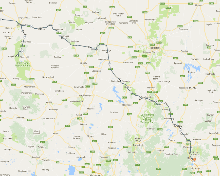
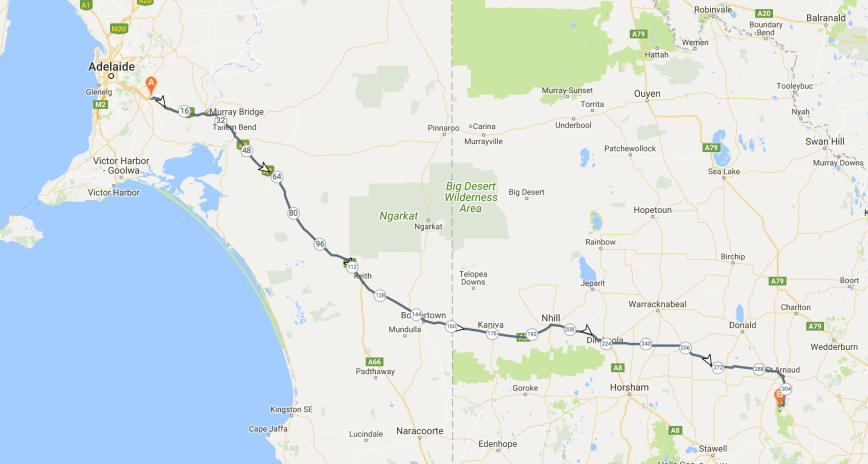
Day one (Saturday 4th November 2017) of our trip to Victoria (VK3) and New South Wales (VK2) involved a 476 km drive from our home in the Adelaide Hills, out along the Dukes Highway and across the South Australian/Victorian State border, and into western Victoria.  Marija and I had planned to stay at St Arnaud for one night and then head off to New Gisborne, just outside of Melbourne the next day.

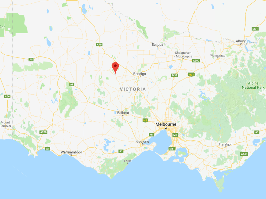
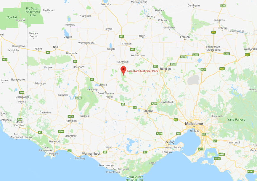
Our main reason for heading to St Arnaud was to activate the Kara Kara National Park, to add another park to our activator list for the Keith Roget Memorial National Parks Award (KRMNPA).  It was also to be a new park for us both as activators for the World Wide Flora Fauna (WWFF) program.

Screen Shot 2017-11-20 at 12.33.58 pm.png

Above:- Map showing our travels on day one, to St Arnaud in western Victoria.  Map courtesy of Plotaroute 

We left home at around 7.30 a.m. South Australian local time.  Marija and I have travelled the distance of the Dukes Highway many times before, but always find something new to have a look at.  The Dukes Highway is around 190 km in length and is the highway corridor in South Australia linking Adelaide to Melbourne.  The highway continues in western Victoria as the Western Highway.  It is a very busy corridor for travellers and trucks carrying freight between the 2 capital cities.  It also follows the Adelaide-Melbourne railway.  The route and many of the settlements, including Bordertown, were established in the 1850s to supply water to horses for the gold escorts from the Victorian goldfields to Adelaide.

Although we have stopped here previously, we again chose to stop off briefly at Coonalpyn to view the silo murals and also grab a cup of coffee from the cafe.  Artist Guido can Helten completed this magnificent feat in early 2017.  The silo art features a number of young children from the Coonalpyn community.

Between Keith and Bordertown we booked in to the Riverland Radio Club Net and worked Dennis VK2HHA and Frank VK3VEF, both who had good 5/7 signals into the mobile.

Our next stop was around 112 km further up the highway, at the town of Bordertown.  The Dukes Highway bypasses the town, which is around 18 km west of the South Australian/Victorian State border.  We detoured into the town and stopped to view the childhood home of former Australian Prime Minister Bob Hawke who was born in the town in 1929.  We also had a look at the Bordertown Wildlife Park which features white kangaroos.  The peackocks also put on a show for us.

We then travelled on to the State border where we stopped very briefly for a photo opportunity.

DSC_8784

Above:- At the South Australian/Victorian State border.

We continued on for another 80km until we reached the town of Nhill in western Victoria, where we stopped for some lunch.  We also had a look at the John Shaw Neilson memorial cottage, birthplace of the lyric poet.  Neilson was born in 1872 and for the majority of his life he worked as a labourer.  He became one of Australia’s finest lyric poets.

It was a nice shady spot to stop for lunch and we enjoyed plenty of bird activity in the gum trees above us.  We also saw an old De Havilland bi plane fly overhead, no doubt out of the nearby Nhill airport where there is a small military aircraft museum, which we have visited previously.

Between Nhill and Dimboola, Marija and I spoke with Gerard VK2JNG/p who was in the Bungawalbin National Park VKFF-0066.  Gerard had a good 5/5 signal and reciprocated with a 5/5 for us.

We then stopped off briefly at the Loch lel ‘Pink Lake’ Reserve near Dimboola.  The pink colour of the water comes from a pigment secreted by microscopic algae. The intensity of the pink varies with the amount of water in the lake.

DSC_8822.jpg

We then turned off the Western Highway and travelled west on the Dimboola-Minyip Road, and soon reached the little town of Minyip which is most famous for being the place where the Flying Doctor television series (1986-1993) was made and to this day the series is still very popular all over the world.

81hJIMomgFL._SL1500_

The Senior Citizens Centre has become famous due to it being known as The Coopers Crossing Base of the Flying Doctor Service.  We stopped off at the cafe for an ice cream as it was a hot day.

Also whilst in Minyip we had a look at the William Farrer Monument.  Farrer (1845-1906) was an Australian agronomist and plant breeder and is best remembered for his Federation strain of wheat which resulted in better quality and yields of the Australian wheat harvest.  Farrer is known as the father of the Australian wheat industry.

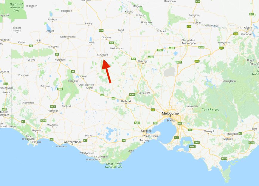
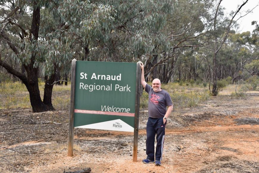
We then continued on a further 70 km until we reached the town of St Arnaud where we booked into the motel.  First impressions were not good with the front of the hotel being overgrown with weeds.  But the motel room was very clean and tidy.

St Arnaud is an old gold mining town, with the land originally inhabited by the Wungaragira Gundidj Aboriginal tribe.  European settlement in the area commenced in 1838 with the establishment of the ‘Tottington’ sheep station to the south in 1838.  In January 1855, gold was discovered about 2 km east of the present townsite of St Arnaud. The area was named “New Bendigo”, and approximately 20,000 men rushed there to make their fortunes.

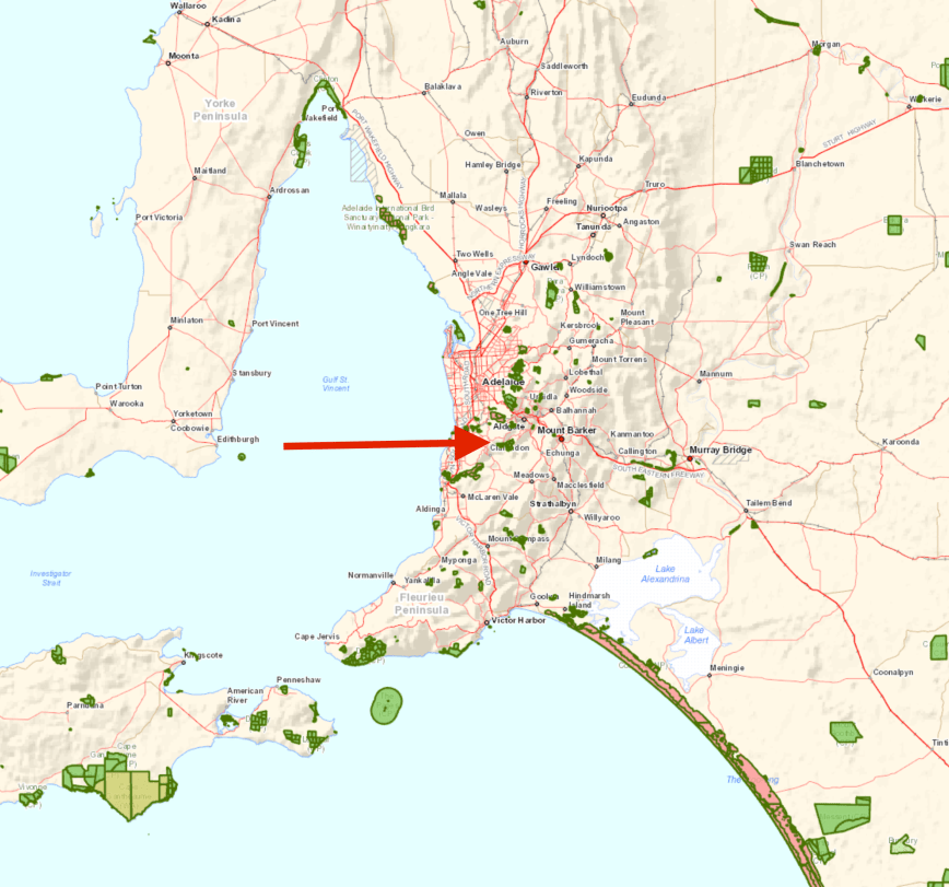
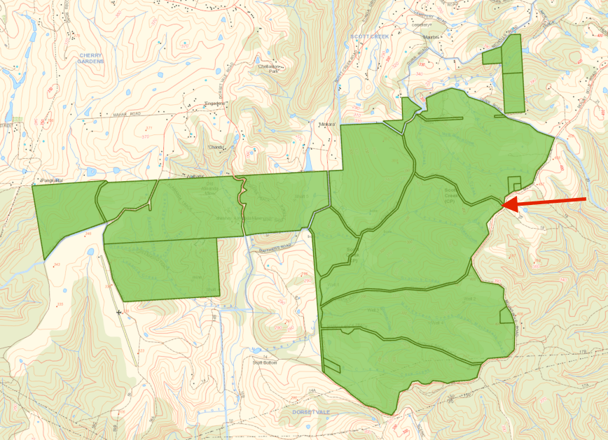
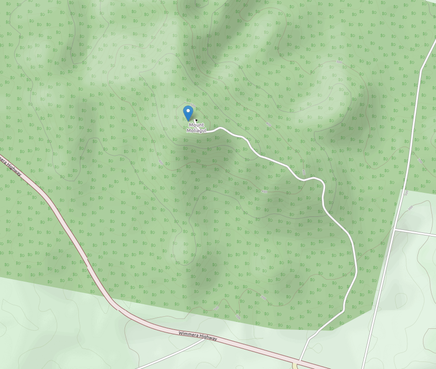
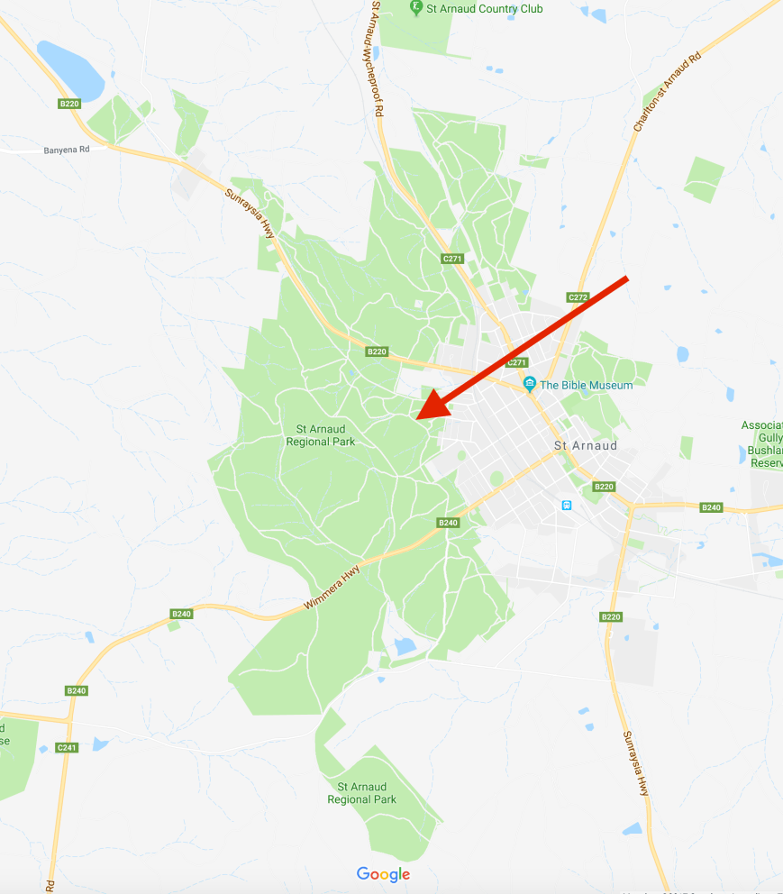
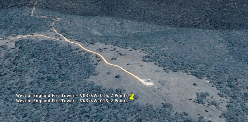
After offloading some bags we headed south out of St Arnaud along the Sunraysia Highway to our first intended summit and park of the trip, West of England Fire Tower VK3/ VW-016 which is located in the Kara Kara National Park VKFF-0629.

Screen Shot 2017-11-20 at 5.46.24 pm.png

Above:- Map showing the location of the Kara Kara National Park.  Map courtesy of Google maps.

We turned off the Sunraysia Highway onto the Rostron-Stuart Mill Road and soon reached the park which was still signposted under its former name of St Arnaud National Park.

The Kara Kara National Park is 13,990-hectares (34,600-acres) in size and was established on 30th October 2002 as the St Arnaud Range National Park.  The park incorporated the former Kara Kara State Park and most of the St Arnaud Range State Forest.  The park was named after the nearby town of St Arnaud, which in turn was named after Armand-Jacques Leroy de Saint-Arnaud (1798-1854), a French soldier and Marshal of France.

Following release of a draft park management plan in April 2009 and subsequent consultations in accordance with the Geographic Places Names Act, 1998 (Vic) and Guidelines for Geographic Names (2010), the park was renamed as the Kara Kara National Park.  Kara Kara is aboriginal meaning ‘Gold Quartz’.

Armand_Jacques_Leroy_de_Saint-Arnaud.jpg

Above:- Saint-Arnaud.  Image courtesy of wikipedia

The park contains one of the most intact large areas of Box-Ironbark vegetation and landscapes in Victoria.  This is what most of the countryside in this area was like before the 1850 Victoria Gold Rush.  Vegetation types in the park include Heathy Dry Forest, Grassy Dry Forest, Valley Grassy Forest, Alluvial Terraces, Herb-rich Woodland and Box-Ironbark Forest.  There are 275 species of native flora recorded in the park including threatened species such as Lowly Greenhood, Green Leek-Orchid and Buloke Mistletoe.

Numerous native animals and birds call the park home including Eastern Grey Kangaroos, Black Wallabies, Yellow footed Antechinus, Sugar Gliders, various owls, kookaburra, and Crimson Rosellas.  Fauna species in the park regarded as threatened include Freckled Duck, Brown Treecreeper, Swift Parrot, Barking Owl, Powerful Owl, Tree Goanna and Bibron’s Toadlet.  The endangered Brush‐tailed Phascogale and Squirrel Glider may also occur in the park.

Marija and I travelled south along Centre Road and soon reached the summit.  The dirt roads leading to the summit were in good condition and would be easily passable in a conventional vehicle.

West of England Fire Tower, VK3/ VW-016 is 525 metres (1,722 feet) above sea level and is worth 2 points for the Summits on the Air (SOTA) program.  It was last activated by my good mate John VK5BJE back in April 2017.

Screen Shot 2017-11-21 at 9.04.30 am.png

Above:- Aerial view of SOTA summit, West of England Fire Tower VK3/ VW-016.  Image courtesy of Google Earth

There is a fire spotting tower at the summit, along with the old trig which was lying on its side.

The tower is not the original.  There were 2 previous towers on the summit.  See the photos below.

And from the top of the summit there are some sensational views to be enjoyed of the surrounding countryside.

And there was even a wooden table and benches, so no need for us to drag out the deck chairs and fold up table.

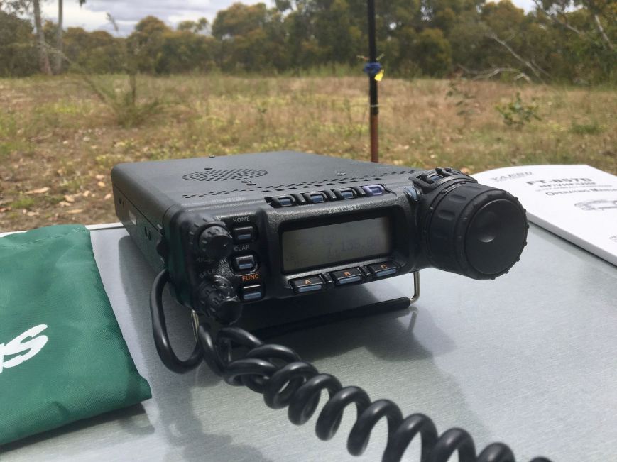
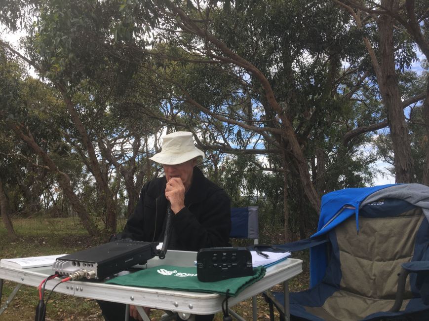
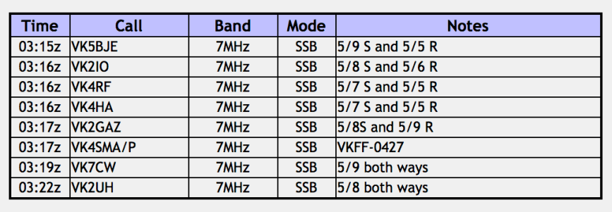
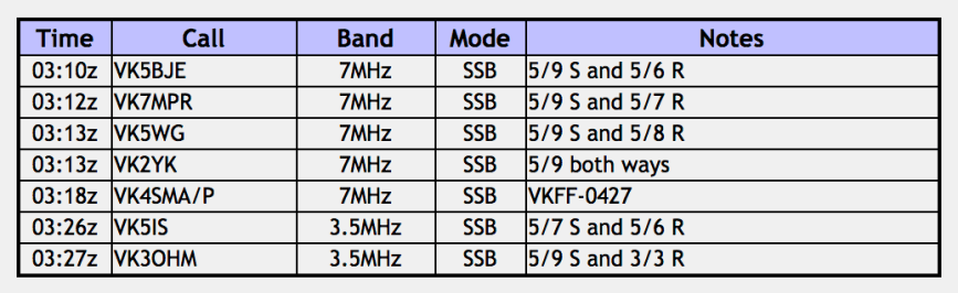
Marija and I decided to swap the mic until Marija had qualified the summit with 4 QSOs and then 10 QSOs for the VKFF program.  It was very appropriate that our first contact in the log was John VK5BJE, who was the last ham to activate the summit.  After logging 12 stations in VK2, VK3, VK4, VK5 and VK7, and qualifying the summit and the park for VKFF, Marija took a break and took some photos whilst I boxed on trying to get 44 contacts to qualify Kara Kara for the global WWFF program.

Band conditions on 40m were quite good and there was a good steady flow of callers from all across Australia except for Western Australia.  It was just a little too early in the afternoon for conditions to be good from one side of Australia to the other.  I logged a further 18 stations and then convinced Marija to come back to the mic as there was a good chance she could get here 44 contacts.

Marija and I then swapped the mic again, logging stations from VK2, VK5 and VK7.  It appeared that the close in propagation around Victoria had dropped out.  It was also very pleasing for us to both log Warren ZL2AJ who was a good 5/7 and with our 10 watts we were 4/4 on 40m into New Zealand.

I then headed off to 20m and called CQ on 14.310 where I logged 5 stations including Warren ZL2AJ who had followed me up from the 40m band.  But despite numerous CQ calls I had no further takers.  So I moved down the band and booked in to the ANZA DX Net on 14.183.  I there logged 6 stations from Vanuatu, New Zealand, VK4, VK3, and the South Cook Islands.  When the net closed I moved back to 14.310 and put out a few more CQ calls, but logged just 2 more stations.

Marija and I then decided to try our luck on the 80m band.  Our first contact there was with Mick VK3GGG/VK3PMG in nearby Stawell who was booming in, followed by Geoff VK3SQ and then Peter VK3PF.  We logged a further 4 stations on 90m from VK3.

Marija was now sitting on 36 contacts, with just a further 8 contacts required to qualify Kara Kara for the global WWFF program.  So she moved back to 40m and had soon reached her 44 with a contact with Alf VK2YAC who was running QRP.

I then saw a request on Facebook from Stuie VK8NSB to try the 15m band if possible.  So Marija and I took down the linked dipole and set up the 15m /12 wave dipole and headed to 21.250 where we comfortably worked Stuie who was 5/9 from Darwin.  But despite 5 minutes of CQ calls our only other taker was Steve VK4QQ in Queensland.

We had both qualified the summit and the park, and it was time to head back into St Arnaud to freshen up and head out for a meal.  Marija had 48 contacts in the log, while I had 65.

Marija worked the following stations:-

Screen Shot 2017-11-20 at 7.56.51 pm.png

I worked the following stations:-

Screen Shot 2017-11-20 at 6.18.47 pm.png

Prior to heading back into St Arnaud we took a quick drive down to the Teddington camping area and the Teddington Reservoir.  The campsite area was full of caravaners and campers.  The southern section of the reservoir was bone dry, but the northern section was full of water.

That night Marija and I went out for tea to the Farmers Arms Hotel in St Arnaud, which we can highly recommend.  Friendly staff and great food.


References.

Dimboola.com, 2017, <http://www.dimboola.com.au/index.aspx?PageID=19>, viewed 20th November 2017

Fire Lookouts Dowunder, 2017, <http://www.firelookoutsdownunder.com/>, viewed 20th November 2017.

Minyip.com. 2017, <http://www.minyip.com.au/>, viewed 20th November 2017

Monuments Australia, 2017, <http://monumentaustralia.org.au/themes/people/arts/display/32925-john-shaw-neilson-national-memorial-cottage>, viewed 20th November 2017

Parks Victoria, 2017, Kara Kara National Park Visitor Guide.

State of Victoria, Department of Environment and Primary Industries 2005, ‘St Arnaud State Forests’

Wikipedia, 2017, <https://en.wikipedia.org/wiki/Dukes_Highway>, viewed 20th November 2017

Wikipedia, 2017, <https://en.wikipedia.org/wiki/Jacques_Leroy_de_Saint_Arnaud>, viewed 21st November 2017

Trip to Victoria and New South Wales

Marija VK5FMAZ and I are home after our 2 week trip away to Victoria and New South Wales.  Whilst away we activated a total of six (6) summits for the Summits on the Air (SOTA) program, and a total of twenty seven (27) parks for the World Wide Flora Fauna (WWFF) program and the Keith Roget Memorial National Parks Award.

We made a total of 1,680 QSOs under some pretty trying band conditions at times.  This included x 2 Summit to Summit contacts, and 138 x Park to Park contacts.

We travelled a distance of 4,450 km.

Below is a breakdown of the summits and parks activated…….

Saturday 4th November 2017

  • SOTA West of England Fire Tower VK3/ VW-016 and the Kara Kara National Park VICTORIA, VKFF-0629
    • Marija – 48 QSOs
      • 1 x Park to Park
    • Paul – 65 QSOs

Sunday 5th November 2017

  • St Arnaud Regional Park VICTORIA, VKFF-0977
    • Marija – 17 QSOs
      • 2 X Park to Park
      • 1 x Summit to Summit
    • Paul – 48 QSOs
      • 2 x Park to Park
      • 1 x Summit to Summit
  • SOTA Mount Moliagul VICTORIA, VK3/ VN-024
    • Marija – 8 QSOs
    • Paul – 7 QSOs
  • SOTA Mount Macedon VK3/ VC-007 and the Macedon Regional Park VICTORIA, VKFF-0972
    • Marija – 12 QSOs
    • Paul – 34 QSOs

Monday 6th November 2017

  • Holey Plains State Park VICTORIA, VKFF-0758
    • Marija -11 QSOs
      • 2 x Park to Park
    • Paul – 47 QSOs
      • 2 x Park to Park
  • Ninety Mile Beach Marine National Park, VICTORIA, VKFF-0951
    • Marija – 11 QSOs
    • Paul – 11 QSOs
  • Gippsland Lakes Coastal Park VICTORIA, VKFF-0747
    • Paul – 4 QSOs

Tuesday 7th November 2017

  • Gippsland Lakes Coastal Park VICTORIA, VKFF-0747
    • Marija – 13 QSOs
    • Paul – 56 QSOs
  • The Lakes National Park VKFF-0484
    • Marija – 12 QSOs
    • Paul – 46 QSOs

Wednesday 8th November 2017

  • Mount Raymond Regional Park VICTORIA, VKFF-0975
    • Marija – 10 QSOs
    • Paul – 28 QSOs
  • Cape Conran Coastal Park VICTORIA, VKFF-0744
    • Marija – 10 QSOs
    • Paul – 45 QSOs

Thursday 9th November 2017

  • SOTA Goonmirk Rocks VK3/ VG-048 and the Errinundra National Park VICTORIA, VKFF-0158
    • Marija – 11 QSOs
    • Paul – 48 QSOs
  • Alpine National Park VICTORIA, VKFF-0619
    • Marija – 10 QSOs
      • 1 x Park to Park
    • Paul – 12 QSOs
      • 1 x Park to Park
  • Snowy River National Park VICTORIA, VKFF-0455
    • Marija – 13 QSOs
    • Paul – 21 QSOs

Friday 10th November 2017

  • Point Hicks Marine National Park VICTORIA, VKFF-0953
    • Marija – 11 QSOs
      • 2 x Park to Park
    • Paul – 54 QSOs
      • 3 x Park to Park
  • Lind National Park VICTORIA, VKFF-0287
    • Paul – 8 QSOs

Saturday 11th November 2017

  • Alfred National Park, VICTORIA, VKFF-0618
    • Marija – 46 QSOs
      • 13 x Park to Park
    • Paul – 64 QSOs
      • 13 x Park to Park
  • Croajinolong National Park VICTORIA, VKFF-0119
    • Marija – 17 QSOs
      • 10 x Park to Park
    • Paul – 49 QSOs
      • 10 x Park to Park

Sunday 12th November 2017

  • Coopracambra National Park VICTORIA, VKFF-0113
    • Marija – 47 QSOs
      • 19 x Park to Park
    • Paul – 73 QSOs
      • 19 x Park to Park
  • South East Forests National Park NEW SOUTH WALES, VKFF-0458
    • Marija – 10 QSOs
      • 6 x Park to Park
    • Paul – 10 QSOs
      • 6 x Park to Park
  • Lind National Park VICTORIA, VKFF-0287
    • Marija – 16 QSOs
      • 5 x Park to Park
    • Paul – 78 QSOs
      • 5 x Park to Park

Monday 13th November 2017

  • Wingan River West Nature Conservation Reserve VICTORIA, VKFF-2231
    • Marija – 11 QSOs
      • 2 x Park to Park
    • Paul – 54 QSOs
      • 2 x Park to Park
  • Nadgee Nature Reserve NEW SOUTH WALES, VKFF-1977
    • Marija – 11 QSOs
    • Paul – 46 QSOs

Wednesday 15th November 2017

  • Lake Tyers State Park VICTORIA, VKFF-0761
    • Marija – 10 QSOs
    • Paul – 44 QSOs
  • Colquhoun Regional Park VICTORIA, VKFF-0962
    • Marija – 10 QSOs
    • Paul – 61 QSOs

Thursday 16th November 2017

  • Tara Bulga National Park VICTORIA, VKFF-0480
    • Marija – 11 QSOs
      • 1 x Park to Park
    • Paul – 45 QSOs
      • 1 x Park to Park
  • Morwell National Park VICTORIA, VKFF-0626
    • Marija – 12 QSOs
      • 2 x Park to Park
    • Paul – 20 QSOs
      • 2 x Park to Park

Friday 17th November 2017

  • Morwell National Park, VICTORIA, VKFF-0626
    • Paul – 25 QSOs
  • Churchill National Park, VICTORIA, VKFF-0621
    • Marija – 10 QSOs
      • 2 x Park to Park
    • Paul – 16 QSOs
      • 2 x Park to Park

Saturday 18th November 2017

  • SOTA Mount Cole, VICTORIA, VK3/ VS-008
    • Marija – 7 QSOs
    • Paul – 32 QSOs
  • SOTA Mount Lonarch VICTORIA, VK3/ VS-013
    • Marija – 19 QSOs
    • Paul – 34 QSOs

Sunday 19th November 2017

  • Deep Lead Nature Conservation Reserve No. 1, VICTORIA, VKFF-2033
    • Marija – 10 QSOs
      • 1 x Park to Park
    • Paul – 51 QSOs
      • 1 Park to Park

This slideshow requires JavaScript.


Results from the 2017 VKFF Team Championship

I have now received all of the logs for the 2017 VKFF Team Championship.  All amateurs who took part in the event as activators have now received a participation certificate via email.  The certificate features a photograph of the Fitzgerald River National Park, Western Australia, from Point Ann.

VK5FMAZ

The winners are as follows……

FOUNDATION SECTION.

‘Team Onka’ comprising Mike VK5FMWW and Larry VK5FLHR.

They will receive a $50.00 voucher kindly donated by Pages of Cobram and a winenrs certificate each.

The certificate features a photograph of Bluff Knoll in the Stirling Range National Park, Western Australia.

VK5FMWW Foundation

QRP SECTION.

‘Special K’s’ comprising Les VK5KLV and Peter VK5KPR.

They will receive a WSPRLite kindly donated by SOTABEAMS, and a winners certificate each.

The certificate features a photograph of Elephant Rocks in the William Bay National Park, Western Australia.

VK5KLV QRP

2 ops/single tx/40 & 80m/wire antenna/100w or less

‘The Walkie Talkies’ comprising Marija VK5FMAZ and Paul VK5PAS.

They will receive a glass etched trophy each and a winners certificate each.

The certificate features a photograph of Wilsons Promontory National Park, Victoria.

VK5PAS 2017 VKFF Team Champ 40 &amp; 80

Overall winners.

‘The Walkie Talkies’ comprising Marija VK5FMAZ and Paul VK5PAS.

They will receive a glass etched trophy each and a winners certificate each.

The certificate features a photograph of Russell Falls in the Mount Field National Park, Tasmania.

VK5FMAZ Overall winner 2017 VKFF Team Champ

Thanks to everyone who took part in the event, both activators and hunters.  The following teams took part:-

  • ‘The VK4WIPeouts’ comprising Mark VK4SMA and Murray VK4MWB.
  • ‘Team Kookaburra’ comprising Mick VK3GGG and Tony VK3XV.
  • ”Team Onka” comprising Mike VK5FMWW and Larry VK5FLHR.
  • ‘The Walkie Talkies’ comprising Paul VK5PAS and Marija VK5FMAZ.
  • “Penguin Pirates” comprising Hans VK6XN and Phil VK6ADF.
  • “The 2 Robbies” comprising Rob VK4AAC and Rob VK4FFAB.


And many thanks to all the sponsors of the event – SOTABEAMS, Pages of Cobram, and those donated some $$$$.  Your involvement is greatly appreciated.

Next years event will be held on Sunday 21st October 2018.  There will be some changes to the event, making it fairer for the VK6 activators.

More information on the 2017 VKFF Team Championship can be found at….

http://www.wwffaustralia.com/2017-results.html

Scott Creek Conservation Park 5CP-207 and VKFF-0788

Today (Thursday 2nd November 2017) I decided to head out into the field to try out my brand new Yaesu FT-857d which I had delivered yesterday.  My original FT-857d which has racked up thousands of QSOs out in the field, gave up and died during an activation last Friday.  So I wanted to give the new rig a run before our planned trip to Victoria and New South Wales.  I also had acquired this week a Yaesu FT-897 from a deceased estate auction through my local radio club, so I wanted to give that a whirl as well.

I chose to activate Scott Creek Conservation Park 5CP-207 & VKFF-0788 as it is close to home.  On the way to the park I phoned my good mate John VK5BJE a call to see if he wanted to accompany me on the activation, as he lives very close to the park.  John agreed, and we made arrangements to meet at the park.

The park is located in the Mount Lofty Ranges ‘Adelaide Hills’, about 20 km south east of the city of Adelaide.

Screen Shot 2017-11-02 at 7.15.51 pm.png

Above:- Map showing the location of the Scott Creek Conservation Park in the Adelaide Hills.  Map courtesy of Location SA Map Viewer.

The Scott Creek Conservation Park is about 712 hectares in size and was contains some of the most diverse areas of native vegetation in the Adelaide Hills.  The park features sloped valleys, lush creeklines and rounded ridgetops.  The Mount Bold Reservoir is located adjacent to the southern and south eastern boundary of the park.

The main upper canopy species is messmate stringybark which is associated with several other species, including South Australian blue gum, pink gum and cup gum.  In some valleys, river red gum and manna gum are the dominant canopy species.  Silky tea-tree, swamp wattle, soft water fern, and several sedge and rush species grow in the cooler, damper creeklines.  Some of the dominant species occurring in the diverse lower canopy include golden wattle, sweet bursaria, silver banksia, needle bush, drooping sheoak and native cherry.  Understorey species such as common heath, flame heath, common fringe myrtle and lavender grevillea are conspicuous  when in flower.

The park was established on the 7th day of November 1985.  The land which is now the park was formerly Peramangk Aboriginal territory.  European settlers first arrived in the late 1830s.  The Mackereth and Hill families cut timber from the land for use in building the city of Adelaide.  Mackareth cottage can be found just outside of the park.  The cottage dates back to 1839/1840, just 3-4 years after the proclamation of South Australia.   For many years the cottage housed a museum and on occasions provided Devonshire teas on weekend openings to visitors.  In 1984 the National Trust relinquished its interests and the cottage was closed.  It has since fallen into the disgraceful condition it is in today, covered in grafitti.  The cottage is located on SA Water land, who I contacted a number of years ago about the state of disrepair the cottage was in.  They seemed totally disinterested.  The South Australian State Government and SA Water should hang their head in shame.

Above:- Mackareth cottage in its glory (left), and what the cottage now looks like (right).

In about 1847 a Mr Scott brought his flock of sheep to the area and pitched a camp, near the bottom of the creek, Scott Creek, where it empties into the Onkaparinga River.  The people of nearby Cherry Gardens would refer to that locality as Scott’s Bottom, and the stream as Scott’s Creek.  Thus the name for the area.

In 1850, the wheel of a dray wagon broke off pieces of rock which contained copper. Subsequent years saw the area mined for copper and eventually silver.  At one stage about 235 claims were pegged along Scott Creek.  The Almanda Silver Mining Association was formed in 1868 and by the time production was stopped in 1887, the mine had produced 10,000 ounces (310kg) of silver.

70372288.jpg

Above:- The Almanda Silver mine, c. 1868.  A drawing by W.A. Cawthorne.  Courtesy of Trove

The land which is now Scott Creek Conservation Park was privately owned until the early 1970s when land was purchased by the South Australian State Government, with the conservation park being officially declared in 1985.

Over 125 species of native bird have been recorded in the park includingCommon Bronzewing, Laughing Kookaburra, Striated Thornbill, White-browed Scrubwren, Superb Fairywren, New Holland Honeyeater,Eurasian Coot, Australian Owlet-nightjar, Shining Bronze Cuckoo, Black-shouldered Kite, Chestnut-rumped Heathwren, Weebill, & Jacky Winter.  During our visit to the park John and I had numerous Red Breasted Robins dancing around where we were operating.  Sadly, I left my camera at home, so I could not get any good bird shots.  All photos were taken on my i-phone.

Numerous native marsupials call the park home including the Southern Brown Bandicoot, the Western Grey Kangaroo, the Koala, the Yellow Footed Antechinus, the Common Ringtail Possum, and the Common Brushtail Possum.  For more information on the fauna of Scott Creek, please have a look at…..

http://users.on.net/~rkwilliams/FoSCCP/Fauna.html

The park has an excellent Friends Group, and more information can be found at….

http://friendsofscottcreek.org.au/

I had just arrived at the park at gate 8 at the start of Cup Gum Track, and was starting to unload the vehicle when John also arrived.  We walked a short distance into the park and set up in the shade of some trees, as it was quite a warm afternoon.

Screen Shot 2017-11-02 at 7.15.35 pm.png

Above:- Map showing the Scott Creek Conservation Park, showing our operating spot.  Map courtesy of Location SA Map Viewer.

We headed to 7.144 and heard Dennis VK2HHA talking with Ron VK3MRH.  We gave them both a call and logged them and then heard Marcus VK2SK come up on the frequency and heard him go back to Gerard VK2JNG who was in a park.  Sadly we were unable to hear Gerard’s signal and we were a little confused at what was going on on the frequency, so we QSYd down to 7.139 where we continued our conversation/s with Dennis and Ron.  Bu then Mick VK3GGG came up to let us know that the other Gerard, Gerard VK2IO was on 7.140 and was in a park.  Again we were unable to hear VK2IO at all, so we QSY’d again, down to 7.135.

John and I swapped the mic, logging stations, using the brand new shiny Yaesu FT-857d.  We were very keen on receiving audio reports and had a number of very useful comments.  All appeared good.  Signals appeared a little down compared to normal, but we still managed QSOs into VK1, VK2, VK3, VK5 and VK7.  This included a Park to Park contact with Gerard VK2IO/p who was activating the Wallumatta Nature Reserve VKFF-2012.  We were a little surprised when Gerard called in, as just 30 minutes earlier we were unable to hear him.   John and I logged a total of 15 stations before deciding to try out the Yaesu FT-897.

IMG_0634

Above:- the brand new Yaeu FT-857d

John and I again swapped the mic, logging a steady flow of callers from VK2, VK3, and VK5.  We then tuned across the band and logged another Park to Park, this time with Gerard VK2JNG/p who was in the Richmond Range National Park VKFF-0431.  Gerard had also been unreadable an hour earlier, but his signal had now come up to a good 5/3, with Gerard running just 15 watts.

IMG_0637

Above:- the Yaesu FT-897

We then headed to the 80m band and started calling CQ on 3.610.  This was answered by Barry VK5BW who had followed us down from 40m.  Barry was roaring in at 5/9 plus from Bridgewater in the Adelaide Hills.  This was followed by Greg VK5GJ who was also strong, and finally Adrian VK5FANA on the Yorke Peninsula.  Sadly, despite the 80m band being open across VK5, and Barry putting out a call for us on the local repeater, Barry, Greg and Adrian were our only callers on 80m.

We then moved to the 20m band and called CQ on 14.310 which was answered by Cliff VK2NP, with a strong 5/8 signal, followed by Colin VK4PDX who was 5/9 and then Gerard VK2IO/p in the Wallumatta Nature Reserve VKFF-2012.  It was terrific to get another Park to Park with Gerard on another band.  This was followed by another Park to Park on 20m, this time with Gerard VK2JNG/p in the Richmond Range National Park VKFF-0431.  We logged a further 4 stations and then booked in to the ANZA DX Net on 14.182.  Conditions there were quite good, and we logged 6 stations each, including Maurice FK8HZ in New Caledonia, Mike YJ0MB in Vanuatu, and Jim E51JD in the Cook Islands.

To complete the activation we moved back to 40m where we logged a further 12 stations from VK2, VK3, VK4, and VK5, including a Park to Park QSO with Peter VK3HSB/p in the Alpine National Park VKFF-0619.

IMG_0630

Above:- John VK5BJE on the mic.

We packed up and both headed home, with a total of 102 stations in the log between us, including some nice Pacific DX contacts on 20m, and five Park to Park contacts.

I worked the following stations on 40m SSB:-

  1. VK2HHA
  2. VK3MRH
  3. VK3PF
  4. VK3GGG
  5. VK3PMG
  6. VK3SQ
  7. VK3ANL
  8. VK2NEO
  9. VK7MPR
  10. VK1LAJ/p
  11. VK2IO/p (Wallumatta Nature Reserve VKFF-2012)
  12. VK7JON
  13. VK5BW
  14. VK7FOLK
  15. VK3VGB
  16. VK2FANT
  17. VK5KBJ
  18. VK5GJ
  19. VK3VIN
  20. VK3UP
  21. VK2JNG/p (Richmond Range National Park VKFF-0431)
  22. VK3NBL
  23. VK2VW
  24. VK5NRG
  25. VK2SVN
  26. VK3NCC
  27. VK3KRH
  28. VK3BBB
  29. VK2ZK
  30. VK4NH
  31. VK3HSB/p (Alpine National Park VKFF-0619)
  32. VK2LEE
  33. VK3FMKE

I worked the following stations on 80m SSB:-

  1. VK5BW
  2. VK5GJ
  3. VK5FANA

I worked the following stations on 20m SSB:-

  1. VK2NP
  2. VK4PDX
  3. VK2IO/p (Wallumatta Nature Reserve VKFF-2012)
  4. VK2JNG/p (Richmond Range National Park VKFF-0431)
  5. VK4RF
  6. VK4HA
  7. VK2HOT
  8. VK4HNS
  9. FK8RZ
  10. VK1TX
  11. YJ0MB
  12. VK4NH
  13. E52JD
  14. VK4DXA


References.

Birds SA, 2017, <https://birdssa.asn.au/location/mount-lofty-botanic-gardens/>, viewed 2nd November 2017

Friends of Scott Creek, 2017, <http://friendsofscottcreek.org.au/Fauna.html>, viewed 2nd November 2017

National Parks South Australia, 2017, <https://www.environment.sa.gov.au/parks/find-a-park/Browse_by_region/Adelaide_Hills/scott-creek-conservation-park>, viewed 2nd November 2017

Wikipedia, 2017, <https://en.wikipedia.org/wiki/Scott_Creek_Conservation_Park>, viewed 2nd November 2017