The 2017 VKFF Activation Weekend, our first park, the Morgan Conservation Park VKFF-0911

Our first activation for the 2017 VKFF Activation Weekend was on Saturday morning (25th November 2017) and was the Morgan Conservation Park VKFF-0911.  Marija and I have both activated and qualified this park previously, but it is such a lovely spot, that we chose to come back here for the weekend.

Screen Shot 2017-12-03 at 8.33.02 pm.png

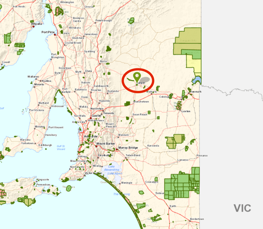
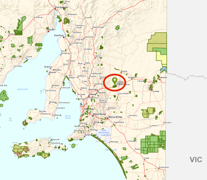
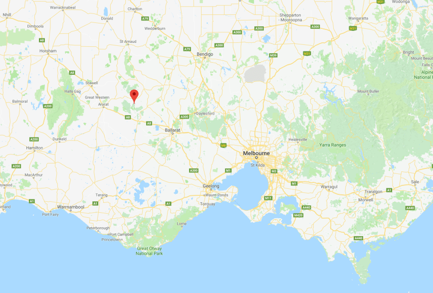
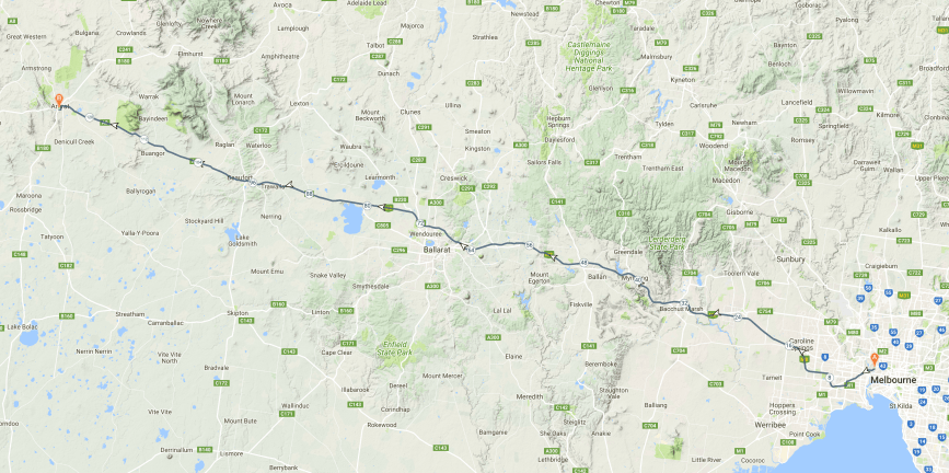
Above:- Map showing the location of the Morgan Conservation Park.  Map courtesy of Location SA Map Viewer.

After breakfast we headed down to the Morgan ferry.  To get to the park we needed to cross the Murray River.  It was another beautiful warm and sunny morning.

Just after getting off the ferry on the Morgan-Cadell Road, we soon reached the park boundary which incorporates the Morgan Lagoon, located either side of the road.

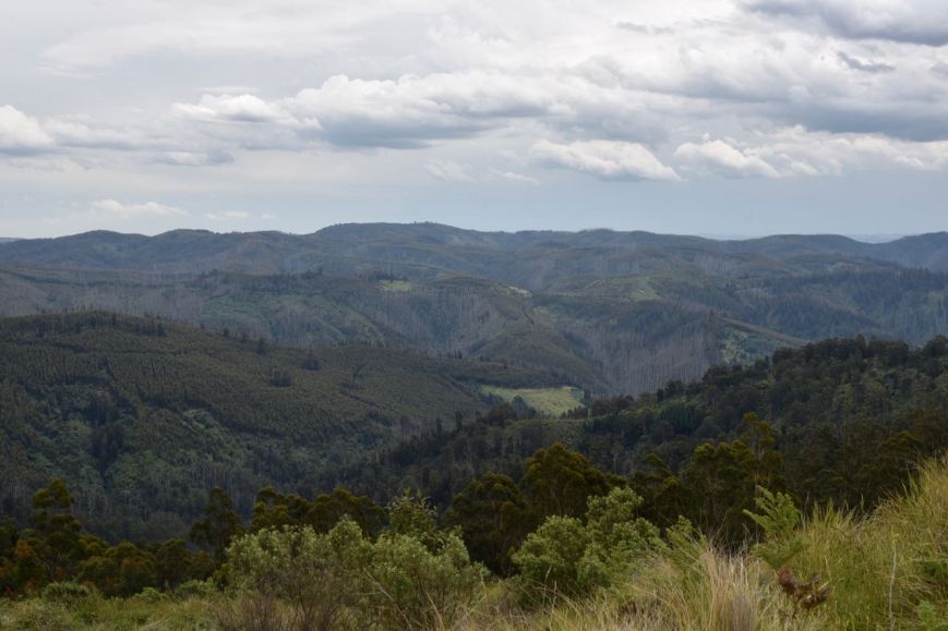
The Morgan Conservation Park is about 376 hectares in size and was first gazetted on the 23rd September 1976 to protect the wetlands with a size of 361 hectares.  On the 4th November 1993 the park was expanded with the addition of 11 more hectares.  The park contains River Red Gum, Red Mallee, Erect Mallee Bluebush, Lignum Open Scrub and Tussock Grassland.

About 147 species of native birds have been recorded in the park including Grey Teal, White-faced Heron, Whistling Kite, Australasian Darter, Whistling Kite, Sulphur-crested Cockatoo, Yellow Rosella, Noisy Miner, Tree Martin, Blue-billed Duck, Black-shouldered Kite, Australasian Bittern, Whiskered Tern, Striped Honeyeater, Apostlebird, and Zebra Finch.

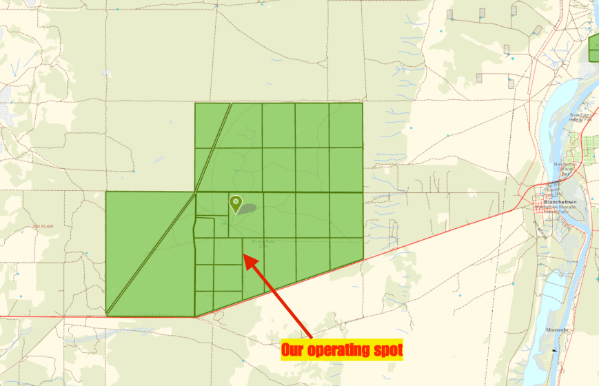
We turned down a dirt track on the southern side of the Morgan-Cadell Road.  The track was obviously dry during our visit and was in good condition.  But it is quite sandy and I would not recommend trying your luck when it is wet in a conventional vehicle.

Screen Shot 2017-12-03 at 8.32.48 pm.png

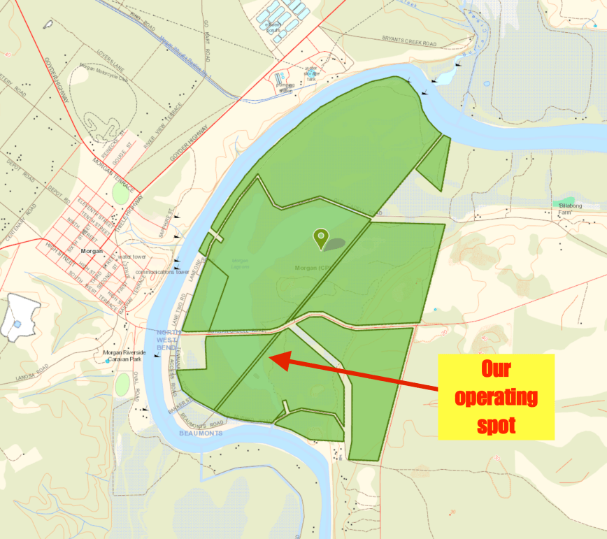
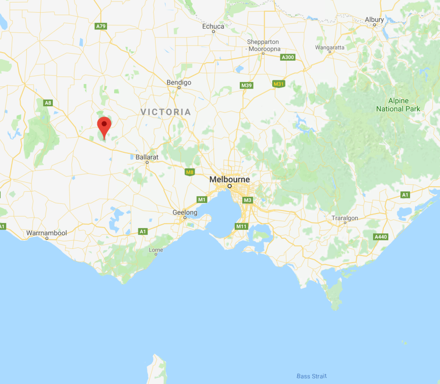
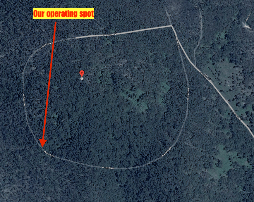
Above:- Map showing the Morgan Conservation Park, and our operating spot.  Map courtesy of Location SA Map Viewer.

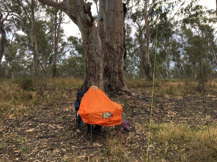
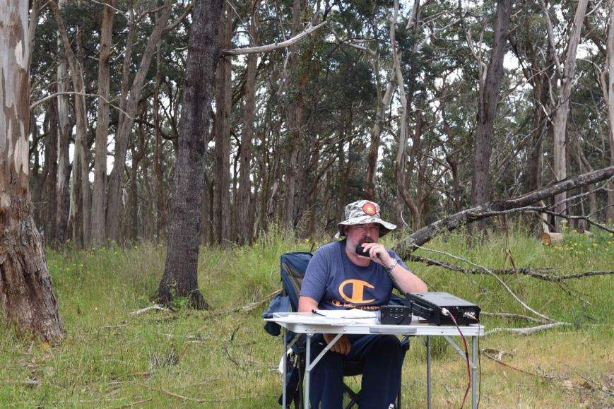
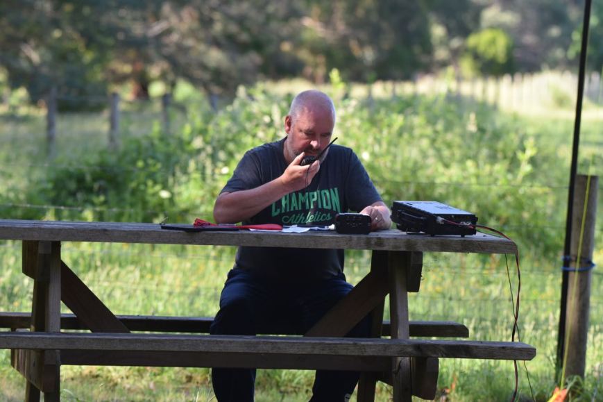
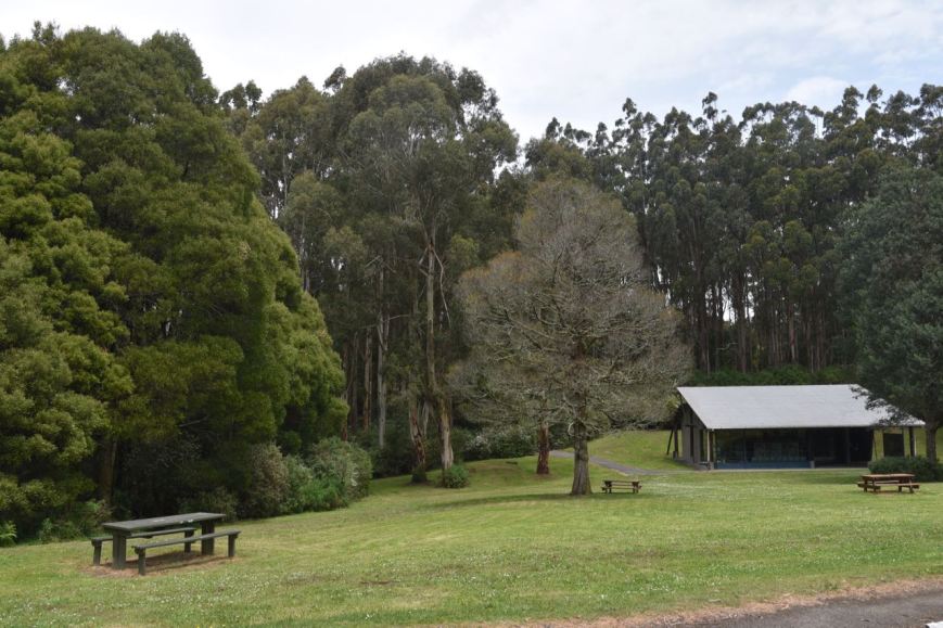
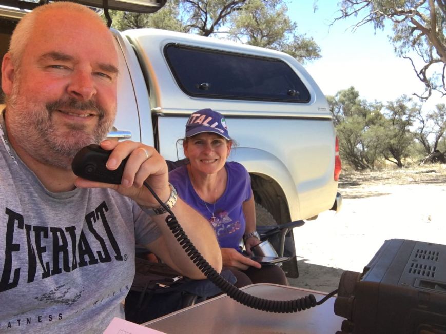
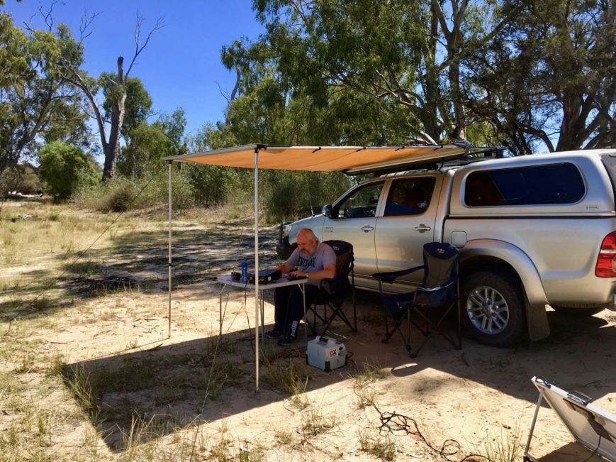
We followed the track for a short distance and set up alongside of the southern lagoon, only a few metres away from the waters edge.  As it was a warm morning we erected the awning/annexe of the Toyota Hi Lux, and sat underneath its shade in the deck chairs and the fold up table.

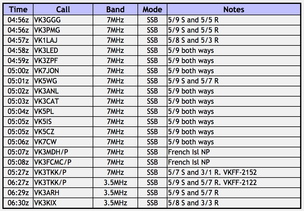
Prior to propping on a frequency and calling CQ, Marija and I had a quick tune across the 40m band to see if there were any other park activators out and about.  It was still qite early, about 9.45 a.m. South Australia local time.  We found Gerard VK2JNG/p on 7.150, who was activating the Moore Park Nature Reserve VKFF-1967 in New South Wales.

After logging Gerard we moved down to 7.144 and I started calling CQ.  This was answered by Les VK3FLES, followed by Peter VK3PF/p who was activating SOTA summit VK3/ VT-047 which was in the Avon Wilderness Park VKFF-0942.  There was a lot of bird activity in the park and I was keen to get some photos, so I handed back the mic to Marija who logged Keith VK2PKT and then Angela VK7FAMP/p and her husband Tony VK7LTD/p in the Eaglehawk Bay State Reserve VKFF-1797.  Whilst taking some photos I ran back quickly to log Angela and Tony as well, Park to Park.  Another couple of Park to Parks followed.  This time it was husband and wife team Jonathan VK7JON/p and Helen VK7FOLK/p who were in the Table Cape State Reserve VKFF-1829 in Tasmania.

Marija and I continued to swap the mic, whilst I took photographs.  The band was in good shape and was alive with callers which was great to see.  We worked stations from VK2, VK3, VK4, VK5, and VK7.  We made the following further Park to Park contacts before the UTC rollover at 10.30 a.m. South Australian time ….

  • Garry VK2GAZ/p in the Blue Mountains National Park VKFF-0041
  • Neil VK4HNS/p in the Sundown National Park VKFF-0471
  • Brett VK3FLCS/p in the Axedale Nature Conservation Reserve VKFF-2037
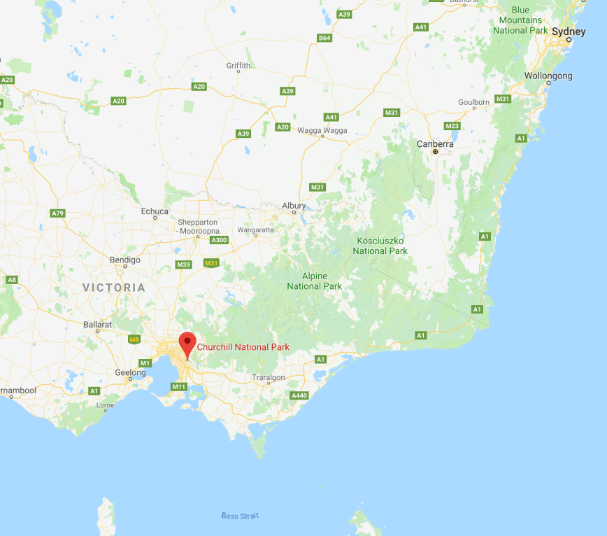
  • Marc VK3OHM/p in the Churchill National Park VKFF-0621

After the UTC rollover the constant flow of callers continued.  We made the following Park to Park contacts on 40m after the UTC rollover…..

  • Garry VK2GAZ/p in the Blue Mountains National Park VKFF-0041
  • Brett VK3FLCS/p in the Axedale Nature Conservation Reserve VKFF-2037
  • Gerard VK2JNG/p in the Moore Park Nature Reserve VKFF-1967
  • Mick VK3PMG/p in the Mount Bolangum Nature Conservation Reserve VKFF-2147
  • Mick VK3GGG/p in the Mount Bolangum Nature Conservation Reserve VKFF-2147
  • Neil VK4HNS/p in the Sundown National Park VKFF-0471
  • Nik VK3NLK/p in the Arthurs Seat State Park VKFF-0750

When things slowed down a little we had a tune across the band and worked Ade VK4SOE/p who was activating the Girraween National Park VKFF-0198 in Queensland.

IMG_0852

We then lowered the squid pole and inserted the 80m links and headed to 3.610 where we I worked Adrian VK5FANA on the Yorke Peninsula, John VK5BJE in the Adelaide Hills, and Tony VK5MRT in Strathalbyn.  We alsomade some Park to Park contacts with Mick VK3GGG/VK3PMG in the Mount Bolangum Nature Conservation Reserve VKFF-2147.  Mick was quite low down to us (3/3), but we made it in the end (thanks to Mick’s patience) exchanging signal reports.

We headed back to 40m and worked Tony VK3XV/p who was activating the Heathcote-Graytown National Park VKFF-0624.  We then propped on 7.144 and called CQ again, where we logged a number of stations including a further 6 Park to Park contacts…..

  • Brett VK3FLCS/p in the Mount Sugarloaf Nature Conservation Reserve VKFF-2158
  • Peter VK3PF/p in the Swallow Lagoon Nature Conservation Reserve VKFF-2199
  • Rob VK4AAC/p in the Glasshouse Mountains National Park VKFF-0200
  • Mick VK3PMG/p in the Big Tottington Nature Conservation Reserve VKFF-2047
  • Mick VK3GGG/p in the Big Tottington Nature Conservation Reserve VKFF-2047
  • Ian VK1DI/p in the Mount Pleasant Nature Reserve VKFF-1775

IMG_0848

I then put out a CQ call on 14.310 on the 20m band.  I logged a total of 19 stations there, with my first contact being Hans VK6XN, followed by Phil VK6ADF.  I always enjoy logging the Western Australian stations because it is a long haul to get across there.  I worked the following Park to Park contacts on 20m…..

  • VK4AAC/p in the Glasshouse Mountains National Park VKFF-0200
  • Neil VK4HNS/p in the Sundown National Park VKFF-0471
  • Peter VK3PF/p in the Swallow Lagoon Nature Conservation Reserve VKFF-2199
  • Nik VK3NLK/p in the Arthurs Seat State Park VKFF-0750

We then headed back to 40m and tuned across the band and logged some more Park to Park contacts as follows…..

  • Angela VK7FAMP/p in the Lime Bay State Reserve VKFF-1144
  • Allen VK3ARH/p in the Corindhap Nature Conservation Reserve VKFF-2070
  • Gerard VK2IO/p on SOTA summit VK2/ CT-032 & Blue Mountains National Park VKFF-0041
Screen Shot 2017-12-03 at 10.06.53 pm.png

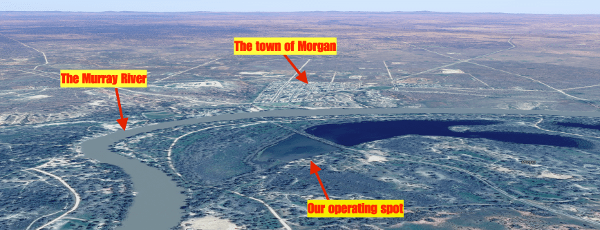
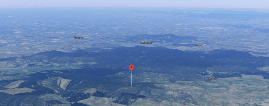
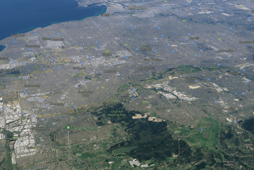
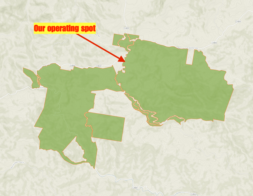
Above:- Aerial shot of the park showing our operating spot, the town of Morgan, and the Murray River.  Courtesy of google maps 

To complete the activation at Morgan, Marija and I decided to try the 15m band.  We were hoping to work some of the Western Australian stations and perhaps some Queensland Foundation operators.  And we were not to be disappointed, with working both.  We also made the following Park to Park contacts on 15m…..

  • Rob VK4AAC/p in the Glasshouse Mountains National Park VKFF-0200
  • Mike VK6MB/p in the Walpole-Normalup Inlets Marine Park VKFF-1456
  • Michael VK6MMB/p in the Walpole-Normalup Inlets Marine Park VKFF-1456
  • Nik VK3NLK/p in the Arthurs Seat State Park VKFF-0750

It was a great way to wrap up the activation.  Marija had 55 contacts on the log, including 33 Park to Park QSOs.  I had 92 contacts in the log, including 38 Park to Park QSOs.  So between us, we had 147 QSOs, including 71 Park to Park contacts.

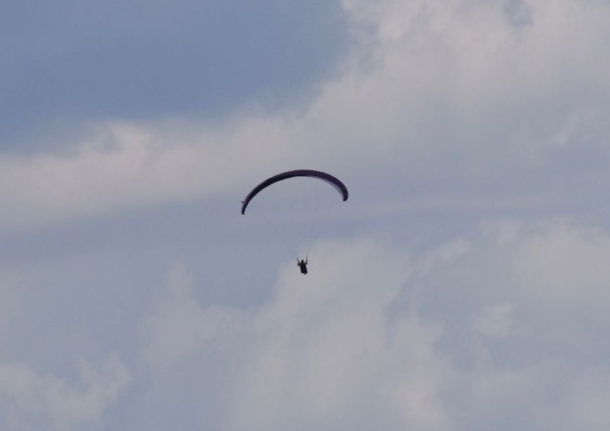
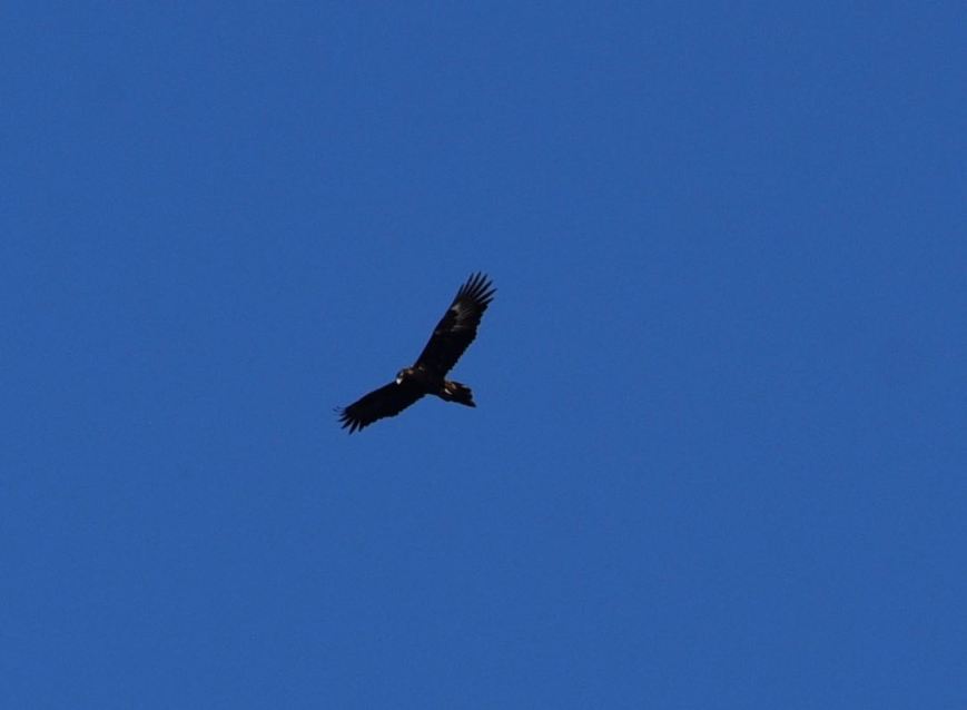
Whilst in the park I did quite a bit of bird watching (of the feathered kind), and took the photos below…..

This slideshow requires JavaScript.

Marija worked the following stations on 40m SSB before the UTC rollover:-

  1. VK2JNG/p (Moore Park Nature Reserve VKFF-1967)
  2. VK3PF/p (SOTA VK3/ VT-047 & Avon Wilderness Park VKFF-0942)
  3. VK3DAC
  4. VK2PKT
  5. VK7FAMP/p (Eaglehawk Bay State Reserve VKFF-1797)
  6. VK7LTD/p (Eaglehawk Bay State Reserve VKFF-1797)
  7. VK7JON/p (Table Cape State Reserve VKFF-1829)
  8. VK7FOLK/p (Table Cape State Reserve VKFF-1829)
  9. VK2GAZ/p (Blue Mountains National Park VKFF-0041)
  10. VK2XXM
  11. VK4HNS/p (Sundown National Park VKFF-0471)
  12. VK2IO/m
  13. VK3UH
  14. VK2KNV/m
  15. VK3ZPF
  16. VK3HOT
  17. VK3FLCS/p (Axedale Nature Conservation Reserve VKFF-2037)
  18. VK4NH
  19. VK4DXA
  20. VK2VW
  21. VK4FDJL
  22. VK3OHM/p (Churchill National Park VKFF-0621)
  23. VK3NLK/m

Marija worked the following stations on 40m SSB after the UTC rollover:-

  1. VK3FLJD
  2. VK2GAZ/p (Blue Mountains National Park VKFF-0041)
  3. VK5JBH
  4. VK4NHH
  5. VK3SQ
  6. VK2FANT
  7. VK3FLCS
  8. VK2JNG/p (Moore Park Nature Reserve VKFF-1967)
  9. VK3PMG/p (Mount Bolangum Nature Conservation Reserve VKFF-2147)
  10. VK3GGG/p (Mount Bolangum Nature Conservation Reserve VKFF-2147)
  11. VK4HNS/p (Sundown National Park VKFF-0471)
  12. VK3NLK/p (Arthurs Seat State Park VKFF-0750)
  13. VK4SOE/p (Girraween National Park VKFF-0198)
  14. VK3XV/p (Heathcote-Graytown National Park VKFF-0624)
  15. VK5WG
  16. VK3FLCS/p (Mount Sugarloaf Nature Conservation Reserve VKFF-2158)
  17. VK3PF/p (Swallow Lagoon Nature Conservation Reserve VKFF-2199)
  18. VK4AAC/p (Glasshouse Mountains National Park VKFF-0200)
  19. VK3PMG/p (Big Tottington Nature Conservation Reserve VKFF-2047)
  20. VK3GGG/p (Big Tottington Nature Conservation Reserve VKFF-2047)
  21. VK7FAMP/p (Lime Bay State Reserve VKFF-1144)
  22. VK3ARH/p (Corindhap Nature Conservation Reserve VKFF-2070)
  23. VK2IO/p (SOTA VK2/ CT-032 & Blue Mountains National Park VKFF-0041)

Marija worked the following stations on 80m SSB:-

  1. VK3PMG/p (Mount Bolangum Nature Conservation Reserve VKFF-2147)
  2. VK3GGG/p (Mount Bolangum Nature Conservation Reserve VKFF-2147)

Marija worked the following stations on 15m SSB:-

  1. VK4FDJL
  2. VK6AY
  3. VK4AAC/p (Glasshouse Mountains National Park VKFF-0200)
  4. VK6FSEA
  5. VK6MB/p (Walpole-Normalup Inlets Marine Park VKFF-1456)
  6. VK6MMB/p (Walpole-Normalup Inlets Marine Park VKFF-1456)
  7. VK3NLK/p (Arthurs Seat State Park VKFF-0750)

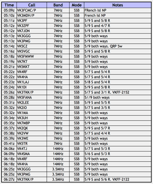
I worked the following stations on 40m SSB before the UTC rollover:-

  1. VK2JNG/p (Moore Park Nature Reserve VKFF-1967)
  2. VK3FLES
  3. VK3PF/p (SOTA VK3/ VT-047 & Avon Wilderness Park VKFF-0942)
  4. VK7FAMP/p (Eaglehawk Bay State Reserve VKFF-1797)
  5. VK7LTD/p (Eaglehawk Bay State Reserve VKFF-1797)
  6. VK7FOLK/p (Table Cape State Reserve VKFF-1829)
  7. VK7JON/p (Table Cape State Reserve VKFF-1829)
  8. VK4HNS/p (Sundown National Park VKFF-0471)
  9. VK2GAZ/p (Blue Mountains National Park VKFF-0041)
  10. VK2YA/p (Blue Mountains National Park VKFF-0041)
  11. VK1WAT/2 (Blue Mountains National Park VKFF-0041)
  12. VK3FLCS/p (Axedale Nature Conservation Reserve VKFF-2037)
  13. VK3OHM/p (Churchill National Park VKFF-0621)

I worked the following stations on 40m SSB after the UTC rollover:-

  1. VK3FLCS/p (Axedale Nature Conservation Reserve VKFF-2037)
  2. VK2HHA
  3. VK2JNG/p (Moore Park Nature Reserve VKFF-1967)
  4. VK3PMG/p (Mount Bolangum Nature Conservation Reserve VKFF-2147)
  5. VK3GGG/p (Mount Bolangum Nature Conservation Reserve VKFF-2147)
  6. VK4RF
  7. VK4HA
  8. VK2YK
  9. VK4HNS/p (Sundown National Park VKFF-0471)
  10. VK3SQ
  11. VK2UH
  12. VK3NLK/p (Arthurs Seat State Park VKFF-0750)
  13. VK4SOE/p (Girraween National Park VKFF-0198)
  14. VK3XV/p (Heathcote-Graytown National Park VKFF-0624)
  15. VK3RW
  16. VK5GJ
  17. VK5GI
  18. VK5WG
  19. VK2WG
  20. VK2YW
  21. VK3UH
  22. VK3MB
  23. VK2NP/p
  24. VK5FANA
  25. VK3BBB
  26. VK2DSG
  27. VK3MRH
  28. VK3FLCS/p (Mount Sugarloaf Nature Conservation Reserve VKFF-2158)
  29. VK3PF/p (Swallow Lagoon Nature Conservation Reserve VKFF-2199)
  30. VK5HS
  31. VK5ATN
  32. VK4AAC/p (Glasshouse Mountains National Park VKFF-0200)
  33. VK5KLV
  34. VK3YSP
  35. VK3PMG/p (Big Tottington Nature Conservation Reserve VKFF-2047)
  36. VK3GGG/p (Big Tottington Nature Conservation Reserve VKFF-2047)
  37. VK5MRT
  38. VK5IS
  39. VK5KBJ
  40. VK5NRG
  41. VK5BJE
  42. VK3KIX
  43. VK7FGRA
  44. VK7DW
  45. VK6XN
  46. VK1DI/p (Mount Pleasant Nature Reserve VKFF-1775)
  47. VK7FAMP/p (Lime Bay State Reserve VKFF-1144)
  48. VK3ARH/p (Corindhap Nature Conservation Reserve VKFF-2070)
  49. VK2IO/p (SOTA VK2/ CT-032 & Blue Mountains National Park VKFF-0041)

I worked the following stations on 80m SSB:-

  1. VK5FANA
  2. VK5BJE
  3. VK3PMG/p (Mount Bolangum Nature Conservation Reserve VKFF-2147)
  4. VK3GGG/p (Mount Bolangum Nature Conservation Reserve VKFF-2147)
  5. VK5MRT

I worked the following stations on 20m SSB:-

  1. VK6XN
  2. VK6ADF
  3. VK4AAC/p (Glasshouse Mountains National Park VKFF-0200)
  4. VK2XXM
  5. VK4RF
  6. VK4HA
  7. VK4HNS/p (Sundown National Park VKFF-0471)
  8. VK4GSF
  9. VK3PF/p (Swallow Lagoon Nature Conservation Reserve VKFF-2199)
  10. VK4TJ
  11. VK2MNM
  12. VK6NI
  13. VK3SQ
  14. VK7PLR
  15. VK3DAC
  16. VK3NLK/p (Arthurs Seat State Park VKFF-0750)
  17. VK3MAB
  18. VK6EA
  19. VK2GKA

I worked the following stations on 15m SSB:-

  • VK4AAC/p (Glasshouse Mountains National Park VKFF-0200)
  • VK4FDJL
  • VK6MB/p (Walpole-Normalup Inlets Marine Park VKFF-1456)
  • VK6MMB/p (Walpole-Normalup Inlets Marine Park VKFF-1456)
  • VK3NLK/p (Arthurs Seat State Park VKFF-0750)
  • VK6AY


References.

Birds SA, 2017, <https://birdssa.asn.au/location/morgan-conservation-park/>, viewed 3rd December 2017

Some sightseeing, a winery, and then the Hogwash Bend Conservation Park VKFF-0892

After packing up at the Brookfield Conservation Park, Marija and I drove a little further east until we reached the small town of Blanchetown, located on the mighty Murray River.  Blanchetown is about 130 km north east of Adelaide and was once an important riverbank terminal where goods were loaded and offloaded from the various paddlesteamers which travelled the length of the river.  The town was surveyed back in 1855 and was one of the first river settlements in the Colony of South Australia.  It was named by Governor Sir Richard Graves McDonnell after his wife, Lady Blanche McDonnell.

Blanchetown is home to Lock and Weir 1, which was completed in 1922, and was the first on the Murray River system.  It was originally consturcted to provide year-round river navigation for commercial cargo boats and for irrigation diversions by pumping or gravity.   On the downward side of the lock, there were dozens of pelicans, all waiting for fish to spill over the lock.

We then drove out of Blanchetown on the Murraylands Road, which is partially bituminised and partially dirt (in good condition).  We passed the little settlement of Roonka, which is where the Roonka Conservation Park is located.  This park has never been activated previously and from what I have read access may not be allowed due to aboriginal skeletons having been found at Roonka.  I will have to do a bit of research and see whether I may be able to activate this park in the near future.

We soon reached the town of Morgan which is situated about 165 km north east of Adelaide.  It is located on what is referred to as the ‘Great Bend’, the ‘Great Elbow’, or the ‘North-west bend’, where the Murray makes a significant 90 degree turn.

Morgan was once one of the busiest river ports in South Australia.  The town was proclaimed in 1878 and was named at that time after Sir William Morgan, then Chief Secretary, and later Premier of South Australia.  At its peak, Morgan was the second busiest port in South Australia (behind only Port Adelaide), with six trains a day carrying freight from the Murray to the sea at Port Adelaide.   Over the years as road transport improved, the river transport declined.  In 1969, the the railway to Morgan finally closed.

Marija and I made a visit to the Tourist Information Centre and then took a short walk to the wharf to have a look at the railway museum, which unfortunately was closed.

We then sat on the banks of the Murray and had some lunch.  The waterfront was alive with Corellas, most of which were taking shade in the gum trees.  It was a very warm day.

There is a lot to see in Morgan, particularly if you are a history buff.  Marija and I took some time out to have a look at some of the sights and then headed to the Morgan Museum.

The Morgan Museum is located in the historic Landseer building in Railway Terrace.  It is well worth a visit and contains a great collection of historical items.  The building itself dates back to 1878 and was built by the shipping firm A.H. Landseer and acted as a Merchants, Commission and Shipping Agents building.

This slideshow requires JavaScript.

We then booked in to our motel, the Morgan Colonial Motel, which we can highly recommend.

DSC_1496

It was now early afternoon and Marija and I decided to head to the Caudo Vineyard at Cadell.  We headed out of Morgan on the Goyder Highway, named after the South Australian Government Surveyor George Goyder, and then took the ferry across the Murray River to Cadell.

Cadell was surveyed in 1919, and was named in 1920 after Captain Francis Cadell, a pioneer of steam powered navigation on the Murray River.

DSC_1545

We soon reached the Caudo Vineyard which is surrounded by beautiful lawned grounds.

DSC_1497

The winery is situated on the banks of the Murray River, and during our visit a houseboat had moored at the winery, with the occupants enjoying some of the wines at Caudo.  The winery is located on what was known as Watchow’s Landing, named after Herman and Emma Watchow, early pioneers of the area.

We sat in one of the booths and enjoyed a cheese platter and a few beverages.  You can endulge in some of Caudo’s Shiraz, Temranillo, or Rose.  But one of Caudo’s specialties is Sangria.  Sangria is of Spannish and Portuguese origin and is a punch, traditionally consisting of red wine and chopped fruit, often with other ingredients such as orange juice or brandy.  As it was a warm afternoon, it was an ideal day to enjoy a few Sangrias.  We highly recommend a visit to Caudo Vineyard if you are in the Cadell area.

We then decided to take the short drive down the end of Hogwash Road, to activate the Hogwash Bend Conservation Park VKFF-0892.  Although both Marija and I had activated the park previously, we decided that a quick activation was a good idea as we still had a bit of time up our sleeve before dinner.

The park was gazetted in 2012 and is about 286 hectares in size.

The park was acquired by the South Australian State Government and the Australian Federal Government under the National Reserve System program to protect the largest breeding colony of Regent Parrots in South Australia.  There are thought to be only 300 breeding pairs of Regent parrots along the Murray.  And in Hogwash Bend, around 50 pairs use the ideal breeding habitat of mature river red gums, nesting sites and large areas of mature mallee scrubland.  Hogwash Bend plays an important role in the bird’s future which is listed as vulnerable at both State and National level.

There is an excellent website dedicated to Regent parrots which can be found at…..

http://regentparrot.org

If you travel to this park, please ensure that you are within the boundaries.  You will find a park sign on the right hand side as you travel down Hogwash Road towards the river.  But the sandy camping area is not part of the park.  You need to go to the scrub to the east of the camping area.

The 40m band was very noisy, with loud static crashes, but despite that the band was full of activity.  I couldn’t get on to 7.144, so I started calling CQ on 7.138, whilst Marija spotted me on parksnpeaks.  My first caller was Keith VK2PKT in Parkes with a strong 5/9 signal.  This was followed by Rob VK2QR, Mick VK3GGG/VK3PMG, and then Andrew VK7DW.  Contact number 10 was with Rob VK7VZ/2 who politely asked if I could shift frequency as he was about to have a sked into Europe.  So after a bit of a chat with Rob I headed to 7.150.

I logged a further 14 stations on 40m, from VK2, VK3, VK4, VK5 and VK7 before heading to 3.610 on the 80m band.  There I logged Ivan VK5HS at nearby Renmark who was very strong, followed by Max VK3HMS/5.   To complete the activation I went to 20m where I logged 4 stations, from VK4, VK6, and VK7.

Although it was a warm afternoon, it was very stormy and very humid.  In fact we had a band of showers go through the area during the activation which resulted in me having to hide underneath the bothy bag for a while.

IMG_0844

Above:- Seeking shelter underneath the bothy bag.

I worked the following stations on 40m SSB:-

  1. VK2PKT
  2. VK2QR
  3. VK3GGG
  4. VK3PMG
  5. VK7DW
  6. VK3OHM
  7. VK3PF
  8. VK2YW
  9. VK5KLV
  10. VK7VZ/2
  11. VK2JNG
  12. VK5FANA
  13. VK5YX
  14. VK5BJE
  15. VK3ZPF
  16. VK7JON
  17. VK3NBL
  18. VK4PDX
  19. VK2IO/m
  20. VK5NRG
  21. VK4RF
  22. VK4HA
  23. VK3NLK/m
  24. VK5HS

I worked the following stations on 80m SSB:-

  1. VK5HS
  2. VK3HMS/5

I worked the following stations on 20m SSB:-

  1. VK7JON
  2. VK4NH
  3. VK4DXA
  4. VK6GLX

After packing up Marija and I drove back into Cadell and took a short drive out  of town on Dalzell Road and did a bit of bird spotting/photography.  There is a bird hide here which allows you to get up relatively close to the birds in the Cadell Basin, near the Murray.

We then took the ferry back over the Murray from Cadell.  Some years ago there was significant debate about this particular ferry over the Murray River closing.  In the Riverland region of South Australia, ferries operate in the townships of Cadell, Morgan, Swan Reach, Walker Flat, Purnong and Mannum.

Our next stop was the Bryan Creek historical lookout.  It forms part of the ‘Disappearance of Henry Bryan Trail’.  There are some brilliant views here to be enjoyed of the Murray.  The story of Henry Bryan is a very interesting one.  Henry Bryan was the youngest son of Reverend Guy Bryan of Woodham-Walter, Essex England, and house guest of the Governor of South Australia Lt. Col. George Gawler.  He was part of the 1939 expedition led by Governor Gawler and the famous explorer Captain Charles Sturt to explore land along the Murray River upsteam and overland from the great North West Bend.  Bryan disappeared during this ill fated journey and his body has never been recovered.  Interestingly his horse made its way all the way back to Adelaide, with its hoofs having grown to enormous length.

For more info on this story, please have a look at…..

http://www.murrayriver.com.au/morgan/mt-bryan-expedition/

As we drove back into Morgan I logged on 14.310 from the mobile, Phil VK6ADF/p who was activating the Coomallo Nature Reserve VKFF-1849.  Once we got back to Morgan we went to the Commercial Hotel for tea.  This is one of two hotels that are in the town.  The meal was average.

DSC_1631

After tea we took the short drive up to the lookout to enjoy a great view of the town of Morgan, and then headed back to the motel room.

DSC_1633


References.

Caudo Vineyards, 2017, <https://caudovineyard.com.au/about-us/>, viewed 3rd December 2017

Discover Murray River, 2017, <http://www.murrayriver.com.au/blanchetown/>, viewed 3rd December 2017

Discover Murray River, 2017, <http://www.murrayriver.com.au/morgan/>, viewed 3rd December 2017

Discover Murray River, 2017, <http://www.murrayriver.com.au/morgan/mt-bryan-expedition/>, viewed 3rd December 2017

Wikipedia, 2017, <https://en.wikipedia.org/wiki/Morgan,_South_Australia>, viewed 3rd December 2017

Our trip to Morgan and a quick activation at Brookfield Conservation Park VKFF-0822

The 2017 VKFF Activation took place on Saturday 25th and Sunday 26th November 2017.   This annual event is very popular and is all about promoting the World Wide Flora & Fauna (WWFF) program down here in Australia.  Marija and I had planned to activate 4 parks in the Riverland region around the Morgan area, and we had booked in to stay at Morgan for 2 nights.

Marija took the Friday (24th November 2017) off work, and I was on holidays, so we headed up to Morgan on Friday morning.  There are a few ways for us to get to Morgan from our home in the Adelaide Hills, but we chose to take the Birdwood, Sedan, Blanchetown route.

After travelling through Mount Pleasant we started heading down the hills towards the Angas Valley.  There are some nice views to be enjoyed as you head down the Angas Valley Road.  The Angas Valley was once a small settlement back in the late 1800’s of Prussian settlers.

We then travelled north through the town of Cambrai along the Ridley Road until we reached the small town of Sedan, about 110 km north east of Adelaide.  Sedan is located about half way between the Barossa Valley and Swan Reach on the River Murray.  The town was proclaimed in 1870 and was named Sedan by one of the first settlers, J.W. Pfeiffer, after a town in France in honor of the great Prussian (German) victory in the Franco-Prussian war of 1870.

There are a number of historic buildings located in the town, and we took the time to have a bit of a drive around the town admiring these, and taking a few photographs.

Here is a link to an excellent website which tells the story of the history of Sedan…..

http://www.sedan.sa.au/town-history/

We continued on to Annadale, located at the corner of Ridley Road and the Sturt Highway.  There are some pepper trees here which was the site of the Annadlae Hotel and Cafe, known as ‘Halfway House’ which operated from 1876-1957.  There is also an installation here, which I suspect has something to do with aircraft, which has a very nice dipole system.  I admired the two towers and wished I had them in my backyard.

We then drove east on the Sturt Highway and soon reached the  southern boundary of the Brookfield Conservation Park, VKFF-0822 which borders the Highway.  I have activated and qualified this park previously, but Marija had not activated the park.  So we decided to call into the park for a quick activation.

Brookfield is located about 130 km north east of Adelaide, and about 15 km west of the town of Blanchetown.

Screen Shot 2017-12-02 at 9.05.53 pm.png

Above:- Map showing the location of the Brookfield Conservation Park.  Map courtesy of Location SA Map Viewer.

The Brookfield Conservation Park is a large park, consisting of 5,515 hectares.  It is managed by Conservation Volunteers Australia.  Some areas of the park are restricted to the public and permission to enter those areas is required.  The public section of the park is open from 7.00 a.m. until sunset, 7 days a week.

Screen Shot 2017-12-02 at 9.42.14 pm.png

Above:- a map of the park showing the public and restricted areas.  Courtesy of National Parks SA.

Various vegetation can be found in Brookfield Conservation Park.  On the ridge in the northern section of the park, and extending north into the adjacent area, ridge-fruited mallee, red mallee and narrow-leaved mallee dominate over porcupine grass and sparse bitter saltbush.  The northwestern corner of the park is dominated by yorrell open mallee over sparse bitter saltbush and pearl bluebush.

In the southeastern section of the park the understorey consists of a large expanse of regenerating pearl bluebush.  Central areas of the park are covered by low woodland and tall shrubland typically dominated by sheep bush and sugarwood in varying densities.  Dryland tea-tree is often found around claypans.  The understorey is characterised by Australian boxthorn, bullock bush, caustic weed  and heron’s bill.

The history of the park is very interesting.  Dr. Peter Crowcroft, the former Director of the South Australian Museum, and the then Director of the Brookfield Zoo in Chicago in the USA, initiated moves to purchase land for the conservation of the Southern Hairy-nosed Wombat.  The land which is now the park was originally a large sheep station known as Glen Leslie Station.  In 1971 the Chicaho Zoological Society purchased the station and renamed the property as the Brookfield Zoo Wombat Reserve.

a541df769ff9a2644d3f5fe5b6a09d93_f71.png

In 1977, due to rising finanical costs, the Reserve was gifted to the South Australian State Government.  In August 1977 the then Department for the Environment assumed financial and managerial responsibility for the reserve and on the 6th July 1978 the reserve was proclaimed as the Brookfield Conservation Park.

The Southern Hairy-nosed Wombat is one of three species of wombat found in Australia, and is the smallest of all three species.  It can be found from the eastern Nullabor Plain to the New South Wales border region. Among the oldest southern hairy-nosed wombats ever documented were a male and a female from Brookfield Zoo.  Their names were Carver, which lived to be 34, and his mother, Vicky, which lived to be 24


Other native animals found in the park include the Fat-tailed Dunnart, Common Dunnart, Red Kangaroo, and Western Grey Kangaroo.  About 141 species of native bird have been recorded in the park including Crested Pigeon, Brown Treecreeper, Purple-backed Fairywren, Splendid Fairywren, Southern Whiteface, Yellow-rumped Thornbill, Chestnut-rumped Thornbill, and Australian Magpie.

Below is a photograph of the old Glen Leslie Homestead which can be found in the park.  There are eco-tourism ventures which take people out to Brookfield for wombat monitoring, with the homestead providing accomodation.

DSC_1451

During our visit to the park there was plenty of evidence of wombat activity, with lots of burrows.  Wombats are excellent diggers, with their burrows measuing from 3 to 30 metres in length and up to 3.5 metres deep.

Marija and I entered the park through the closed (but unlocked gate) off the Sturt Highway.  There is a dirt track here which leads through the park, which is in good condition.

Marija and I drove a short distance down the track and set up alongside of the information board, which offered some shade from the heat of the day.  It was only mid morning, but it was already quite warm.

Screen Shot 2017-12-02 at 9.05.43 pm.png

Above:- Map showing our operating spot in the park.  Map courtesy of Location SA Map Viewer.

I spotted Marija on parksnpeaks and sent out a few SMS messages, whilst Marija called CQ on 7.144.  Her first station in the log was John VK5BJE who was 5/9 plus into Brookfield.  John reciprocated with a 5/9 for Marija.  This was followed by Marc VK3OHM who was also 5/9 plus, followed by park regular Rick VK4RF/VK4HA.

But it was really hard going, with very few callers.  It took Marija 25 minutes to get 10 contacts in the log.  That being a contact with Hans VK5YX from the southern suburbs of Adelaide who was 5/9 plus.  Marija logged 2 further stations, Adrian VK5FANA and Nick VK3ANL, before we decided it was time to pack up and head off to Morgan.

Marija had qualified the park for the VKFF program, with 12 contacts, albeit under very difficult conditions.

As it had been so slow going for Marija, I had sent out a few SMS messages to some of the park ‘die-hards’ to advise that Marija was on 7.144.  One of those was Jonathan VK7JON, who had advised he was mobile and that he was on 10m.  So on our way out of the park I tuned across the 10m band but could not hear anyone.  I decided to put out a few CQ calls from the mobile on 28.490 on the 10m band, and this was answered by Rick VK2RR who was a good 5/7.  I then tried 7.144 from the vehicle and logged Tony VK5MRT, Barry VK5KBJ and Ivan VK5HS, before reaching the boundary of the park.  It was great to get a few contacts from the mobile, particularly the contact on 10m.

Marija worked the following stations on 40m SSB:-

  1. VK5BJE
  2. VK3OHM
  3. VK4RF
  4. VK4HA
  5. VK3NLK
  6. VK5KKT
  7. VK5HS
  8. VK2HHA
  9. VK5KBJ
  10. VK5YX
  11. VK5FANA
  12. VK3ANL

I worked the following station on 10m SSB (from the mobile):-

  1. VK2RR

I worked the following stations on 40m SSB (from the mobile):-

  1. VK5MRT
  2. VK5KBJ
  3. VK5HS


References.

Birds SA, 2017, <https://birdssa.asn.au/location/brookfield-conservation-park/>, viewed 2nd December 2017

Flinders Ranges Research, 2017, <https://www.southaustralianhistory.com.au/angasvalley.htm>, viewed 3rd December 2017

National Parks South Australia, 2017, <https://www.environment.sa.gov.au/parks/find-a-park/Browse_by_region/Murray_River/brookfield-conservation-park>, viewed 2nd December 2017

Sedan Progress Association, 2017, <http://www.sedan.sa.au/town-history/>, viewed 2nd December 2017

Wikipedia, 2017, <https://en.wikipedia.org/wiki/Southern_hairy-nosed_wombat>, viewed 3rd December 2017

Wombat Information Centre, 2017, <http://www.wombania.com/wombats/wombat-burrows.htm>, viewed 3rd December 2017

Day 16 and our final activation, the Deep Lead Nature Conservation Reserve No. 1 VKFF-2033

The final day of our trip had arrived, day 16 (Sunday 19th November 2017).  We had a 492 km drive ahead of us from Ararat in western Victoria to our home in the Adelaide Hills.

Screen Shot 2017-12-02 at 5.53.58 pm.png

Above:- Map showing the route between Ararat in western Victoria to our home in the Adelaide Hills.  Map courtesy of Plotaroute

Although we didn’t have anything official down on our itinerary for this final day, we decided to activate the Deep Lead Nature Conservation Reserve No. 1 VKF-2033, which is located about 241 km north west of Melbourne, and just 5 km out of the little town of Stawell.

Screen Shot 2017-12-02 at 4.56.00 pm.png

Above:- Map showing the location of the Deep Lead Nature Conservation Reserve.  Map courtesy of google maps

We left Ararat after breakfast and headed west on the Western Highway.  We hadn’t got far out of Ararat and we encountered the scene below.  A B-Double truck had run off the road, fortunately to the left and had rolled into a ditch on the side of the road.  Luckily he had not drifted to the right and collided with an oncoming vehicle.  We waited for around 10 minutes until the police allowed us through.

DSC_1380

Marija and I then drove in to the little town of Stawell.  Whenever we are in this part of Victoria we stop off at the Stawell Bakery which has regularly won the award for the best vanilla slice in Australia.  We also were in time to have a look at the clock tower at the Town Hall.  The animated clock and bells chime every hour.

Just out of Stawell we stopped to have a look at the monument to commemorate the exploration of this part of Victoria by Major Thomas Mitchell, Surveyor-General of the Colony of N.S.W., and his party, in 1836.

A little further down the road, not far from Deep Lead is the Doctors Hill Monument.  It commemorates the establishment and erection in 1859 of the first Pleasant Creek Hospital, which served the needs of the gold miners and the rural community of western Victoria.

We soon reached the area of Deep Lead.  It’s not a town, but rather a geographical area.  There isn’t much here, other than a small hall, a monument

Thousands of miners and their families headed to the Stawell are following the discovery of gold in 1853.

Edward_Roper_-_Gold_diggings,_Ararat,_1854.jpg

Above:- Gold diggings at Ararat.  Courtesy of wikipedia

We turned down Cross Street off the Western Highway and crossed the Adelaide-Melbourne railway line and soon found the park sign.

DSC_1388

The Deep Lead Nature Conservation Reserve contains forest eucalypts which provides a habitat for a range of native birds and mammals.   The Reserve consists of two parts, number .1 and number .2 and is about 1,1823 hectares in size.

The Deep Lead Nature Conservation Reserve is the most western area of Victoria’s Box-Ironbark forest and woodland.  Once covering about 3 million hectares, today only 17% of the original forest remains.  It has been described by the Environment Conservation Council as ‘one of the most important sited for nature conservation in Victoria.   It supports at least 21 threatened species, including three plant species not found anywhere else in the world‘.  A total of 350 species of native plants has been recorded in the park.  Native flora found in the park includes Red Ironbark, Yellow Gum, Yellow Box, Longleaf Box, Red Stringybark, River Red Gum and Grey Box.  Wattles, particularly Golden Wattle, dominate the heathy shrubs, often in the company of small orchids.

A large amount of birdlife can be found in the park including Long-billed Corellas, Sulphur-crested Cockatoos, honeyeaters, parrots and lorikeets.  During winter, the endangered Swift Parrot flies in to the area from Tasmania to feed on the flowering gums.  Various native mammals call the park home including Western Grey kangaroos, Swamp wallabies, Sugar Glider, and the endangered Squirrel Glider.

There was plenty of room here to string out the 80/40/20 m linked dipole.

Screen Shot 2017-12-02 at 7.04.44 pm.png

Above:- Aerial shot of the park showing our operating spot.  Image courtesy of google maps

Marija kicked off this activation and called CQ on 7.090.  We stayed clear of 7.144 due to the fact that it was a Sunday, and the higher portion of the 40m is always full on Sunday mornings with the Wireless Institute of Australia (WIA) broadcasts.  Marija’s first caller was John VK5BJE in the Adelaide Hills with a strong 5/9 signal.  This was followed by Les VK5KLV in Port Augusta who was also 5/9.  A few QSOs later Marija logged Al VK1RX/2 who was activating SOTA peak VK2/ ST-042.  Marija soon had 10 contacts in the log.  It only took Marija about 10 minutes, with contact number 10 being a QSO with Gerard VK2IO.

I then jumped on the mic and started calling CQ.  My first in the log was Al VK1RX/2 on his SOTA peak VK2/ ST-042, followed by Gerard BI2IO, Les VK5KLV, and then John VK5BJE.  All had strong signals.  My 10th contact came 16 minutes into the activation, that being a QSO with Rick VK4RF.  I logged a total of 38 stations on 40m including Chris VK5CP who was running QRP 1 watt.  I also spoke with Mas JA7FAS who was holidaying in South Australia, and using his Australian call of VK5FAS.

I then headed to 3.610 on the 80m band where I worked 7 stations from VK3 and VK5.  I then moved back to 40m and worked Peter VK3PF after the rollover, who told me that Marc VK3OHM was up the band working from a park.  So I went up to 7.125 where I logged Marc VK3OHM who was activating the Great Otway National Park VKFF-0405.  I then moved back to 7.090 where I logged 8 stations from VK2, VK4, VK5 and VK7, before I started to experience some interference from the VK6 WIA broadcast.

DSC_1398

During the activation I spoke with Kevin VK3VEK who lives at Stawell and we arranged on air for him to pop out to say hello.  It was great to catch up with Kevin.  We had spoken many times on air but have never met.  Other than having a good chat, I showed Kevin my portable station and he seemed keen to give parks operating a go in the near future.

DSC_1402

Above: with Kevin VK3VEK.

Marija worked the following stations on 40m SSSB:-

  1. VK5BJE
  2. VK5KLV
  3. VK4RF
  4. VK4HA
  5. VK1RX/2 (SOTA VK2/ ST-042)
  6. VK5PL
  7. VK3SQ
  8. VK5HS
  9. VK4NHH
  10. VK2IO

I worked the following stations on 40m SSB:-

  1. VK1RX/2 (SOTA VK2/ ST-042)
  2. VK2IO
  3. VK5KLV
  4. VK5BjE
  5. VK3SQ
  6. VK5HS
  7. VK7NWT
  8. VK7FOLK/m
  9. VK2HHA
  10. VK4RF
  11. VK4HA
  12. VK2PKT
  13. VK2GAZ
  14. VK2YA
  15. VK1WAT
  16. VK5CP
  17. VK2XXM
  18. VK2JNG/p
  19. VK5NJ
  20. VK5PE/m
  21. VK5FMWW
  22. VK3VEK
  23. VK5WG
  24. VK5FANA
  25. VK2NEO
  26. VK5XD
  27. VK5FAS
  28. VK2LEE
  29. VK3PF
  30. VK3UH
  31. VK5NRG
  32. VK1DI
  33. VK2YW
  34. VK4NHH
  35. VK2HJG
  36. VK3BBB
  37. VK3PF
  38. VK3KAI
  39. VK3GV
  40. VK3OHM/p (Great Otway National Park VKFF-0405)
  41. VK7KT
  42. VK4RF
  43. VK4HA
  44. VK2TCL
  45. VK5PL
  46. VK2LEE
  47. VK7MPR
  48. VK7RM

I worked the following stations on 80m SSB:-

  1. VK5HS
  2. VK3PF
  3. VK3KAI
  4. VK3GV
  5. VK3MRH
  6. VK5HS
  7. VK3PF

After leaving the park we headed towards Horsham and caught up with my Uncle and Aunty, and some of my cousins and their families.  On the way I spoke with Ron VK3MRH, Peter VK7RN, and Robert VK7VZ/2 from the mobile.

DSC_1411

After a really enjoyable few hours visiting the rellies in Horsham, we hit the road again.  On the Western Highway between Nhill and Kaniva, Marija and I spoke with Glenn VK3YY/p who was activating SOTA summit VK3/ VN-005.

Marija and I then crossed over the South Australian border and stopped briefly to have a look at the early settlers cottage just out of Keith.  The cottage dates back to 1894 and was built by the Davis family.  The cottage features natural bush timber, railway iron, sleepers and local limestone.

Our next stop to stretch the legs was the little town of Ki Ki on the Dukes Highway.  Ki Ki is aboriginal for ‘food and water’.  The town’s history dates back to the late 1800’s, but it was not proclaimed a town until 1913.  Sadly there is not much here now, of what once once a vibrant town.  The Ki Ki school closed in 1960 and the shop closed in 2003.

It was approaching dinner time, and Marija and I stopped off at the Tailem Bend Hotel, but unfortunately it was not open for another 45 minutes.  We have enjoyed a great meal here previously, so we decided to fill in the time having a look around the town.  We had a look at the ‘Tailem Bend Uneek Animals’ exhibition which was only opened on the 10th November 2017.  We also took a trip over the ferry to Jervois and back.

We returned to the pub, and as we had experienced on a prior occasion, we enjoyed another excellent meal.  Marija and I cam highly recommend the Tailem Bend Riverside Hotel.  There are some great views here as well of the mighty Murray River.

About 45 minutes later and we were home.  It was the end of a great 2 weeks away.

  • 4,500 km travelled
  • 27 parks activated
  • 6 parks activated
  • We made a total of 1,680 QSOs
  • Included 138 x Park to Park contacts and 2 x Summit to Summit contacts.


References.

Parks Victoria, ‘Deep Lead Nature Conservation Reserve Visitor Guide’.

Mount Lonarch VK3/ VS-013

Our final activation for the penultimate day of our trip was to be Mount Lonarch VK3/ VS-013, located about 207 km north east of the city of Melbourne and about 29 km north of the town Beaufort.

Screen Shot 2017-12-02 at 2.49.39 pm.png

Above:- Map showing the location of Mount Lonarch in western Victoria.  Map courtesy of google maps

Mount Lonarch is 788 metres above sea level and is worth 4 points for the Summits on the Air (SOTA) program.

Screen Shot 2017-12-02 at 2.54.00 pm.png

Above:- Aerial view showing Mount Lonarch, looking east.  Image courtesy of google maps

I have activated the summit twice before, back in 2013 and 2015.  Marija had been with me during the 2015 visit to this summit, but didn’t have her amateur licence, so this was to be a unique summit for Marija as an activator.

Screen Shot 2017-12-02 at 2.49.18 pm

After leaving Raglan we turned on to Amphithreatre Road and on to the little town/area of Chute.  There isn’t much here.  BUT, it is the birthplace of Cyril Callister, who is the inventor of ‘vegemite’.  Amazing the places we stumble across when we are out operating portable.

DSC_1279

For anyone reading this from overseas, you are probably asking ‘what is vegemite’.  It is as Australian as a meat pie, as a Holden car, as is a surf beach and Aussie Rules Footy.  Vegemite is a thick, black good spread made from leftover brewers yeast extract with various vegetable and spice additives.  Watch the great video below when Hugh Jackman shows Jimmy Fallon how to eat vegemite.

The Mount Lonarch summit soon came into view.  Also visible to us in the near vicinity were SOTA summits, Ben Moore, Ben Major, Mount Buangor, and Mount Cole which we had just activated.

DSC_1280

The GPS then took us through the Raglan Pine plantation.  There was a bit if ducking wnd weaving along the way as there were many pine trees over the track.

DSC_1283

We enjoyed some magnificent views from the Avoca River Road.

Whilst admiring the view I spotted a paraglider.  Marija and I were to later learnt that they had launched from Mount Lonarch.

DSC_1291

We then turned on to Tower Road and followed the road up to the summit.   As we set up we noticed some vehicles parked in amongst the scrub about 100 feet away on the other side of the fire spotting tower.  At that stage we were not sure why they were there exactly, and assumed they may have been bushwalking.

Marija started off first at Mount Lonarch, calling CQ on 7.095.  This was answered by Mick VK3GGG/VK3PMG, Aaron VK1LAJ, and the Col VK3LED.  Marija had now qualified the summit which was great news.  Marija logged 15 stations including Mark VK3MDH/p and Michael VK3FCMC who were activating the French Island National Park VKFF-0622.  I also logged Mark and Michael.

Marija then handed the mic over to me and headed over to where the vehicles were parked and soon came back to let me know that there were people hangliding off the top of Mount Lonarch.

I logged a further 25 stations on 40m from VK1, VK2, VK3, VK5, and VK7.  Signals back to South Australia were very good, which I can’t say had been the case for a lot of our trip.  I worked Ian VK5CZ who was running QRP 5 watts, and he was 5/9 from the Clare Valley.  I also logged Peter VK3TKK/p in the Mount Martha Nature Conservation Reserve VKFF-2152.  Unfortunately Marija missed out on that contact as she was watching the hang gliding.

DSC_1301

I then took a break from the radio and went over to have a look myself.  One of the guys there was very friendly and explained to us some of the aspects of this exciting hobby.  We were lucky to see a couple of launches off the top of Mount Lonarch.  It was quite amazing.

This slideshow requires JavaScript.

Also in the air that afternoon were a number of Wedge-tailed Eagles.

DSC_1366.jpg

I went back to the radio and logged 4 stations on 14.310 on the 20m band, all from Queensland.  I then called CQ on 3.610 on the 80m band which was answered by Mick VK3GGG/VK3PMG who was a very strong 5/9.  I then logged Peter VK3TKK/p who was in another park, the Kangerong Nature Conservation Reserve VKFF-2122.  Peter was a beautiful strong 5/9 signal on 80m.  Whilst speaking with Peter, Marija started walking back towards me.  So I shouted out that I was working a park, which resulted in Marija running back to the radio to work Peter.

To complete the activation Marija put out a few more CQ calls on 80m, logging Allen VK3ARH and then Robert VK3KIX, whilst I took a little bit of vision of the hang gliders on my iphone.

Marija worked the following stations:-

Screen Shot 2017-12-02 at 1.24.46 pm.png

I worked the following stations:-

Screen Shot 2017-12-02 at 1.33.53 pm.png

We packed up and started our trip into the town of Ararat, stopping briefly to admire some of the magnificent views from Tower Road of the surrounding countryside.

We got back into Ararat and booked in to the motel, freshened up and headed off to a favourite restaurant of ours in Ararat, ‘Sicilians’, where we enjoyed a very nice meal and a few ales.


References.

Summits on the Air, 2017, <http://www.sota.org.uk/Summit/VK3/VS-013>, viewed 2nd December 2017

Wikipedia, 2017, <https://en.wikipedia.org/wiki/Vegemite>, viewed 2nd December 2017

Day 15, Mount Cole VK3/ VS-008

We now had just 2 days of the trip left.  It was day 15 (Saturday 18th November 2017) and we we had two planned activations for the day, both summits for the Summits on the Air (SOTA) program.  We had a 205 km journey ahead of us to our next stop for one night, the town of Ararat.

Screen Shot 2017-12-02 at 2.02.04 pm.png

Above:0 Our journey for day 15, Melbourne to Ararat.  Map courtesy of plotaroute.

After breakfast at Jacqui and Des’ s house in Melbourne we hit the road at about 10.00 a.m. Victorian local time.  We headed out of Melbourne on the Western Highway and to Rockbank where we had arranged to meet Peter VK3TKK at a local servo/McDonalds outlet.  It was great to catch up with Peter and we spent about half an hour chatting and sharing a few laughs.

DSC_1249

Above:- with Peter VK3TKK.

Marija and I then hit the road and continued our journey west on the Western Highway towards our first activation of the day, Mount Cole VK3/ VS-008. which is located in western Victoria, about 179 km west of Melbourne and about 19 km north west of Beaufort.

Screen Shot 2017-12-02 at 1.49.19 pm.png

Above:- Map showing the location of Mount Cole in western Victoria.  Map courtesy of google maps

Mount Cole is 886 metres above sea level and is worth 4 SOTA points.  It had been activated seven times previously, most recently by Allen VK3ARH.  Mount Cole was created about 390 million years ago when hot magma pushing up from deep beneath the earth, but failing to break though, crystallised to form granite rock.  Mount Cole is known as ‘Bereep-bereep’ in the local Beeripmo balug aboriginal language meaning ‘wild’.

Screen Shot 2017-12-02 at 1.50.25 pm.png

Above:- Aerial shot of Mount Cole, VK3/ VS-008.  Image courtesy of google maps

Explorer, Major Mitchell was the first European to explore the area during his 1836 expedition.  Settlers soon moved in to the area with timber harvesting commencing during the mid 1840’s by using axe and cross cut saw.  The use of steam powered mills commenced in 1856.  By 1889, demand from the goldfield towns for building materials, firewood and railway sleepers led to thirty mills operating within the region until 1904. In 1918 the Forests Commission was established and it was soon after that the Mount Cole State Forest was closed for timber harvesting.   In 1947 timber harvesting was reopened by the Forests Commission.  In the 2000’s timber harvesting was significantly scaled back and is largely a by-product of land management activities.

DSC_1265.jpg

Large native trees including Messmate, Manna Gum, and Blue Gums can be seen on the wetter southern half, while woodland species such as Yellow box and Red Stringybark grow to the north.  Plants such as the rare Mt Cole Grevillea can be found in a few locations, as can native orchids and a plethora of wild flowers.

More than 130 species of birds can be found in the Mount Cole State Forest.  Native animals include kangaroos, wallabies, echidna, koalas and possums.

Marija and I headed out of Beaufort on the Main Lead Road, then the Raglan-Elmhurst Road, and then Mount Cole Road.  The summit soon came into view.

DSC_1251

Above:- View of Mount Cole.

We had to pull right off the road at one stage as an oversize truck was coming in the opposite direction, loaded with a very large excavator.

DSC_1252

We soon entered the Mount Cole State Forest, and started making our way up towards the summit.

We turned on to Frees Point Road and then the Mount Cole Track.  The track here was very steep and very rocky.  At one stage Marija got out of the Toyota Hi Lux and did a reccy to make sure we could get up the track.  Our big concern was that if we struck any difficulties there would be no room to turn the vehicle around.  Anyway, much to Marija’s horror I suspect, we continued up the track, very slowly, in low 4WD in the HiLux.

We soon made it to the top and the GPS told us we were within metres of the actual summit point.  There weren’t many options here to set up as the scrub is so thick.  So we decided to set up on the track itself, as we didn’t expect too many visitors on the summit.  In any event we would be able to hear them coming.

Screen Shot 2017-12-02 at 2.26.34 pm.png

Above:- Aerial shot of the summit showing our operating spot.  Image courtesy of google maps

Once again Marija and I shared the mic for this activation, and left the power output at 10 watts PEP, as it was just too hard going in and out of the menu.  We called CQ on 7.095 and this was answered by Geoff VK3SQ with a strong 5/9 signal, followed by Peter VK3PF, Tony VK3CAT who also used the club call sign of VK3APC.  We had qualified the summit.

Marija then decided that she would take a break for a while and explore the summit. I took charge of the mic and logged a further 21 stations on 40m from VK3, VK4, VK5 and VK7.  This included two park activators, Michael VK3FCMC/p and Mark VK3MDH/p who were activating the French Island National Park VKFF-0622.  Marija also logged Michael and Mark.  I had a number of VK5 stations calling, but my apologies, signals from South Australia were so low, that I had real difficulty picking out the calls.  The only VK5’s logged were Ian VK5IS in the Mid North, and David VK5PL in the Barossa Valley.

I then moved down to the 80m band and called CQ on 3.610.  This was answered by Mick VK3GGG who was a strong 5/9, followed by Geoff VK3SQ.  And to finish off the activation I called CQ on 14.310 on the 20m band where I logged 4 stations from VK2 and VK7.

Marija worked the following stations:-

Screen Shot 2017-12-02 at 1.16.56 pm.png

I worked the following stations:-

Screen Shot 2017-12-02 at 1.09.22 pm.png

Marija and I packed up and headed back down the bumpy and rocky track.  Based on info from Nick VK3ANL, we did not do the loop, as apparently the other side is even worse.  So we did a 7 point turn and went back down the way we came up

We headed off towards our next activation, Mount Lonarch, enjoying the view as we headed down off Mount Cole.

We stopped off briefly to have a look at the old Raglan school building, which is now a private residence.


References.

State of Victoria, Department of Sustainability and Environment, 2012, ‘Forest Notes, Mount Cole State Forest’.

Summits on the Air, 2017, <http://www.sota.org.uk/Summit/VK3/VS-008>, viewed 2nd December 2017

An impromptu, quick activation of the Churchill National Park VKFF-0621

We left Moe by mid afternoon and still had a bit of time on our side.  We were to stay in Melbourne that night with some very good friends of ours Jacqui and Des at Kensington, but they were not going to be home from work until around 5.00 p.m. Victorian local time.  So we travelled towards Melbourne along the Princes Highway and decided to duck in to the Churchill National Park VKFF-0621 for an impromptu, quick activation.  This was to be another new park for Marija and I as activators for both the Keith Roget Memorial National Parks Award (KRMNPA) and the World Wide Flora Fauna (WWFF) program.

Screen Shot 2017-12-02 at 11.59.17 am.png

Above:- Map showing the location of the Churchill National Park.  Map courtesy of google maps

The Churchill National Park is 271-hectares (670-acres) in size and was established 12th February 1941, so it is quite an old park.  It is  situated about 31 kilometres south east of the city of Melbourne, adjacent to the suburb of Lysterfield South.  It is located adjacent to Lysterfield Park.  When combined the two parks comprise 1,668 hectares (4,120 acres).  The park is an example of the original landscape found in the region.

Screen Shot 2017-12-02 at 12.00.04 pm.png

The area that is now Churchill National Park was once the police corps headquarters for blacktrackers and provided grazing land for the police horses.  It subsequently became known as the Dandenong Police Paddocks.  Between 1912-1915, the Scoresby Tramway carried crushed rock for the Dandenong Shire Council.  In 1939 the area was set aside as the Dandenong National Park, and was gazetted as such in February 1941.  In 1944, the park was renamed Churchill National Park in honour of Sir Winston Churchill.

1920px-Sir_Winston_Churchill_-_19086236948.jpg

Above:- Sir Winston Churchill, who the park was named in honour of.  Courtesy of wikipedia.

Around 173 different species of birds can be found in the park including the various parrots, honeyeaters, wrens, thornbills, grebes, cockatoos, Australian wood duck and the Pacific black duck.  The migratory Japanese Snipe also visits the park.  Many native mammals are also found in the park, including echidnas, wallabies and kangaroos.

The main entrance to the park is located off Churchill Park Drive.  The park is open from 10.30 a.m. to 4.00  p.m. all year.  And make sure you are out in time, because they lock the gate to get in and there are spikes which prevent entry.   Don’t try crossing the spike the wrong way, because as warned at the gate, they will cause significant damage to your tyres.

Sadly, we came across what you can see below.  It never ceases to amaze Marija and I the grubs that are in this world.

DSC_1241

We set up in the picnic are within the park.  And we pretty much had the area all to ourselves, except for 2 other people.

DSC_1239

After setting up we headed to 7.144 and found Angela VK7FAMP there, calling CQ from the Three Thumbs State Reserve VKFF-1834.  Angela had quite a good signal in amongst the loud static crashes.  After logging Angela we moved down to 7.139 where Marija called CQ.  This was answered by Mick VK3GGG/VK3PMG, followed by Gerard VK2IO, and then Chris VK3PAT.  Sixteen minutes into the activation we had 10 contacts in the log, with a contact with Tony VK7LTD who was with Angela, activating the Three Thumbs State Reserve.

With 10 contacts in the log, I boxed on, hoping to get as many contacts in the log as possible.  I didn’t expect to get 44 as we were running a little short of time and I didn’t want to get locked inside the park.  There was also the ever present fear of rain, as it was very black and stormy.  I logged a further 3 stations on 40m from VK3 and VK5, before trying 3.610 on the 80m band.  On 80m I logged Peter VK3ZPF and Michael VK3FCMC.  To complete the activation I put out a few CQ calls on 14.310 on the 20m band, but only one station was logged there, a local, Peter VK3ZPF.

Marija worked the following stations on 40m SSB:-

  1. VK7FAMP/p (Three Thumbs State Reserve VKFF-1834)
  2. VK3GGG
  3. VK3PMG
  4. VK2IO
  5. VK3PAT
  6. VK5XD
  7. VK3OHM
  8. VK2HHA
  9. VK2VRC
  10. VK7LTD/p (Three Thumbs State Reserve VKFF-1834)

I worked the following stations on 40m SSB:-

  1. VK7FAMP/p (Three Thumbs State Reserve VKFF-1834)
  2. VK3GGG
  3. VK3PMG
  4. VK2IO
  5. VK3PAT
  6. VK5XD
  7. VK3OHM
  8. VK2HHA
  9. VK2VRC
  10. VK7LTD/p (Three Thumbs State Reserve VKFF-1834)
  11. VK5WG
  12. VK3FCMC
  13. VK5FMWW

I worked the following stations on 80m SSB:-

  1. VK3ZPF
  2. VK3FCMC

I worked the following station on 20m SSB:-

  1. VK3ZPF

After packing up we headed into Melbourne, battling the Melbourne traffic, before reaching Jacqui and De’s home.  That night we enjoyed a very enjoyable meal at one of the local pizza bars and of course a few ciders and a few beers.


References.

Parks Victoria, 2017, <http://parkweb.vic.gov.au/explore/parks/churchill-national-park>, viewed 2nd December 2017

Wikipedia, 2017, <https://en.wikipedia.org/wiki/Churchill_National_Park>, viewed 1st December 2017

Day 14, take two Morwell National Park VKFF-0626

It was now day 14 (Friday 17th November 2017) and time to leave Traralgon.  Marija and I had really enjoyed the night before, catching up with the guys from the Gippsland area for dinner.  We had no ‘planned’ activations for the day, but due to the thunderstorm at the Morwell National Park the day before, we decided to head back there for another crack and to see if I could pick up my 44 contacts.  I need 24 more.

After breakfast we headed back to the Billy Creek carpark area of the park.  Marija spotted me on parksnpeaks and I started calling CQ on 7.144.  But 5 minutes of calls went unanswered.  This was not looking good.  I headed down to 3.610 on the 80m band, where Marija again spotted me, and I started calling CQ.  This was answered by Peter VK3PF, who knew I was in need of more calls, so he gave me his two additional call signs of VK3KAI and VK3GV.  We also arranged to try to make a contact on 2m using my little Yaesu handheld.

Next was Sergio VK3SFG, followed by Brian VK3BBB, Chris VK2SR and finally Allen VK3ARH.  All had good 5/7-5/9 signals on the 80m band which was a little bit noisy, with a frying pan type noise.

I then put out a call on 146.500 on the handheld and this was answered by Peter VK3PF who had a great signal from nearby Churchill.  Brian VK3BBB tried calling but we were unable to make it.

DSC_1122

I then headed to the 40m band and called CQ which was answered by Adrian VK5FANA on the Yorke Peninsula.  This was followed by Trevor VK5TW in Adelaide, Cleeve VK2MOR, and then Ivan in the Riverland region.  I had a slow, but steady flow of callers, and I soon had contact number 24 in the log, and as a result I had qualified the park.  This was a QSO with Peter VK2NN who was mobile.  I then spoke with Wayne VK2VRC before calling it quits from Morwell.  Thanks to everyone who called and got me over the line.

Before leaving Morwell National Park we did a little bird of bird watching and I managed to snap a few photographs (se below).

This slideshow requires JavaScript.

I worked the following stations on 80m SSB:-

  1. VK3PF
  2. VK3KAI
  3. VK3GV
  4. VK3SFG
  5. VK3ZPF
  6. VK3BBB
  7. VK2ST
  8. VK3ARH

I worked the following stations on 2m FM:-

  1. VK3PF
  2. VK3KAI
  3. VK3GV

I worked the following stations on 40m SSB:-

  1. VK5FANA
  2. VK5TW
  3. VK2MOR
  4. BK5HS
  5. VK5WG
  6. VK2SB
  7. VK4RF
  8. VK4HA
  9. VK5ATN
  10. VK5MRT
  11. VK7FRJG
  12. VK2JNG/p
  13. VK2NN/m
  14. VK2VRC

After packing up Marija and I headed to Old Gippstown, Gippsland Heritage Park at Moe, which contains a collection of authentic buildings dating back from the 1840’s to the 1930’s.  The site covers about 8 acres and we spent a number of hours here wandering around.  We also had lunch here.  And it was timed well, as the heavens absolutely opened up with torrential rain, thunder and lightning, as we were having lunch.

This slideshow requires JavaScript.

Morwell National Park VKFF-0626

After packing up at the Tarra Bulga National Park, Marija and I headed for our second park of the day, the Morwell National Park VKFF-0626.  The park is located about 170 km east of the city of Melbourne and about 16 km south of the town of Morwell in the Latrobe Valley area of the Gippsland region of Victoria.

After receiving some local info from Peter VK3PF (thank Peter), Marija and I drove back into the town of Morwell and then travelled south out of Churchill to get to the park, rather than trying to take the dirt tracks through the mountains from Tarra Bulga.

Screen Shot 2017-12-01 at 10.21.09 pm.png

Above:- Map showing the location of the Morwell National Park.  Map courtesy of google maps

The Morwell National Park is 565-hectares (1,400-acres) in size and was established on the 26th November 1966. The park is on the lower northern slopes of the Strzelecki Ranges in the Latrobe Valley.  The park preserves a remnant of previously widespread Damp Sclerophyll forest and some Warm Temperate Rainforest remnants restricted to deep creek gullies in the park.  About 320 plant species have been recorded for this park, including five rare or threatened species and 44 orchid species. 

Screen Shot 2017-08-17 at 8.45.14 pm

Above:- Aerial shot showing the Morwell National Park, with the town of Morwell in the background.  Image courtesy of google maps 

About 129 native fauna species have been recorded in the park, including 19 mammals, 96 birds, 11 reptiles and three amphibians.  Native animals include Feathertail Gliders, Sugar Gliders and Greater Gliders, Mountain Brushtail Possum, Koala, White-footed Dunnart, Long-nosed Bandicoot and Dusky Antechinus.  The endangered Powerful Owl can be found in the park, along with the Superb Lyrebird.

Until 1956, timber harvesting occurred in the park.  Much of the park prior to it being gazetted, was privately owned, and the land has been exploited since European settlement.  The majority of the Billy’s Creek Valley, from where we operated, was cleared for grazing.  There is evidence in the park of a timber sawmill, a gravel pit and a mine shaft.

I did a spot of birdwatching from the park.  Most were a little too quick for me, but I did get some shots of some Grey Fantails and some Eastern Yellow Robins.

Marija and I also saw a number of next boxes in the park.  From what I’ve read on the internet it appears these are nesting boxes for the Sugar Gliders, and not birds?

DSC_1060

Marija and I operated from the Billy Creek carpark area of the park which is on Junction Road, which in turn runs off Monash Way.

Screen Shot 2017-12-01 at 10.27.25 pm.png

Above:- The Morwell National Park, showing our operating spot at the Billy Creek carpark.  Courtesy of Parks Victoria.

There was a wooden table and benches here, so we didn’t have to worry about getting out the fold up table and deck chairs.  It was also close to the vehicle should we have to pack up in a hurry, as the sky was getting very black.  I attached the 7m squid pole to a fence post using an octopus strap.

DSC_1051

The weather was very threatening, so again Marija and I decided to share the mic for this activation, hopefully reaching our 10 contacts before the rain hit.  We tuned to 7.144 and found Garry VK2GAZ/p who was activating the Murramarang National Park VKFF-0371.  We logged Garry who was kind enough to hand the frequency over to us.  We then called CQ and this was answered by John VK5BJE.  Next we had another Park to Park contact in the log, with a QSO with Cliff VK2NP/p who was activating the Cecil Hoskins Nature Reserve VKFF-1906.  Contact number 10 came 7 minutes into the activation, with a QSO with Mick VK3PMG.

We were now starting to experience a few drops of rain, so Marija got the bothy bag out of the vehicle.  I logged Gerard VK2IO, then Sergio VK3SFG and then Tony VK7LTD.  The rain drops started to get bigger, so I hid underneath the bothy bag to try to stay dry.  I logged a further 7 stations, before I had to call it quits, as the rain became very heavy, with the rain droplets leaking through the bothy bag.

Sorry to anybody else who was calling, but we had to call it a day as the rain had really set in and we were starting to get a little bit of lightning.  It was a mad dash to pack up the gear and get back to the vehicle.

Marija worked the following stations on 40m SSB:-

  1. VK2GAZ/p (Murramarang National Park VKFF-0371)
  2. VK2YA/p (Murramarang National Park VKFF-03171)
  3. VK1WAT/p (Murramarang National Park VKFF-0371)
  4. VK5BJE
  5. VK2NP/p (Cecil Hoskins Nature Reserve VKFF-1906)
  6. VK3PF
  7. VK3KAI
  8. VK3GV
  9. VK3GGG
  10. VK3PMG
  11. VK2IO
  12. VK3SFG

I worked the following stations on 40m SSB:-

  1. VK2GAZ/p (Murramarang National Park VKFF-0371)
  2. VK2YA/p (Murramarang National Park VKFF-03171)
  3. VK1WAT/p (Murramarang National Park VKFF-0371)
  4. VK5BJE
  5. VK2NP/p (Cecil Hoskins Nature Reserve VKFF-1906)
  6. VK3PF
  7. VK3KAI
  8. VK3GV
  9. VK3GGG
  10. VK3PMG
  11. VK2IO
  12. VK3SFG
  13. VK7LTD
  14. VK4TJ
  15. VK4/AC8WN
  16. VK4/VE6XT
  17. VK5GJ
  18. VK7WH
  19. VK2VW
  20. VK7FAMP

After packing up at the park Marija and I headed back into Traralgon and booked into the motel and freshed up a bit and got out of our wet clothing.  We then headed off to the hotel for tea.  We enjoyed a great meal and terrific company and spent about 3 hours at the hotel with Peter VK3PF, Sergio VK3SFG, Brian VK3BBB, and Ken VK3UH and his wife.  A great night, and thanks to Peter VK3PF for organising it.

DSC_1082

We then headed back to the motel and called it a night.


References.

Parks Victoria, 1998, ‘Morwell National Park Management Plan’.

Wikipedia, 2017, <https://en.wikipedia.org/wiki/Morwell_National_Park>, viewed 1st December 2017

Day 13, Tarra Bulga National Park VKFF-0480

We were now nearly 2 weeks into our trip and day 13 (Thursday 16th November 2017) had really crept up on us quickly.  Today we had a 157 km drive from Lakes Entrance to Traralgon.  I was a little sad to leave Lakes Entrance, as I had really enjoyed the stay there in the cabin.  Our trip would take us back down the Princes Highway into Bairnsdale, then Stratford, Rosedale, and on to Traralgon where we had arranged to stay for one night.

Screen Shot 2017-12-01 at 7.48.27 pm.png

Above:- Map showing our travels on day 13 from Lakes Entrance to Traralgon.  Map courtesy of google maps

We had two planned park activations for the day and then a dinner at night at one of the local pubs in Traralgon with some of the local amateurs.  Our first activation of the day was the Tarra Bulga National Park VKFF-0480, which is about 240 km east of Melbourne and about 33 km south of Traralgon.

Screen Shot 2017-12-01 at 7.31.57 pm.png

Above:- Map showing the location of the Tarra Bulga National Park.  Map courtesy of google maps

Once we got to Stratford we took a bit of a break to stretch our legs.  We stopped to have a look at the memorial to commemorate the crossing of the Avon River at Stratford by the explorer Angus McMillan in 1840.

DSC_0891

We then drove into Sale and quickly drove out to the Royal Australian Air Force base, just outside of the town.  The base opened as a training base in April 1943 and was initially the home to No. 1 Operational Training Unit (1 OTU), equipped with Bristol Beaufort light bombers.  Following World War II, the RAAF Central Flying School was relocated from RAAF Base Point Cook to East Sale in 1947.  About 700 personnel work at the base.

DSC_0896

We then drove south on the Traralgon-Balook Road, enjoying some very nice views.  The weather was still warm and very humid.  But storms were brewing, and we were a bit worried that we may not be able to get our second park activation in.

DSC_0897

We soon reached the north western corner of the Tarra Bulga National Park, which was well signposted.

DSC_0898

Tarra Bulga National Park is quite a large park, comprising 1,522-hectares (3,760-acres) of the last remnants of indigenous eucalypt forest which once covered the region.  The undisturbed mountain ash forests, fern gully communities and associated Myrtle Beech stands within the park are of considerable biogeographical significance.

Screen Shot 2017-12-01 at 7.33.36 pm.png

Above:- Aerial shot of the Tarra Bulga National Park.  Image courtesy of google maps

The area was first set aside as Bulga National Park in 1904, comprising 20 hectares (49 acres).  In 1909 Tarra Valley National Park was designated nearby, with 303 hectares (750 acres) reserved.  Over the years the two parks were gradually enlarged and then merged as the Tarra-Bulga National Park, and proclaimed on 17th June 1986.

The rainforest in the park is a haven for plants and native wildlife, and is particularly well known for its giant mountain ash trees and lush fern gullies.  There are a wide variety of birds residing in the park including the pilotbird, yellow tailed black cockatoo, eastern whipbird, and currawongs.  In the evening possums, owls and bats emerge to feed.  Lyrebirds, wombats, swamp wallabies, gliders and platypuses can also be found within the park.

Screen Shot 2017-12-01 at 7.44.00 pm.png

Above:- The Tarra Bulga National Park, showing our operating spot at the Visitor Centre.  Map courtesy of Protected Planet.

Marija and I headed for the visitor centre.  We weren’t quite sure if this was going to be a viable place to operate from because of the throng of tourists we expected to be there.  But once we arrived we were surprised to see just 2 cars in the car park, and the lawned area in front of the visitor centre was completely free.  And there were a number of wooden tables and benches.

DSC_1027

The only other occupants on the lawn were a large number of Crimson Rosellas.  In fact dozens of them.  And they were very tame.

Once again, Marija and I swapped the microphone until Marija had logged 10 stations and qualifying the park for the VKFF program.  Marija started calling CQ and this was answered by Greg VK5GJ, followed by Peter VK3PF, and then Julie VK3FOWL who was using the School Amateur Radio Club Network call of VK3SRC.  Next was a Park to Park contact, with Garry VK2GAZ/p who was activating the Murramarang National Park VKFF-0371.  Just 3 QSOs later Marija had contact number 10 in the log, with a QSO with Michael VK3FCMC.

Whilst I continued to operate, Marija went for a walk along the Ash Track and through the forest to the suspension bridge.  And Marija was in for a treat.  She photographed a female Superb Lyrebird.  These birds are noted for their elaborate tail and excellent mimicry.  The Superb Lyrebird has an extraordinary ability to accurately mimic a huge variety of sounds. Lyrebirds are shy and difficult to approach, so Marija did particularly well in getting some photos.

During the activation I had a number of rosellas land on the table in front of me.  They appeared completely unphased by the radio and the noise.

Band conditions were good and it only took me about one hour to get 44 contacts in the log.  Contact number 44 was with Des VK3PEF.  Callers in the log were from VK1, VK2, VK3, VK4, VK5, and VK7.  I then tried putting out a few calls on 14.310, but had no takers.  So to finish off the activation I called CQ on 3.610 on the 80m band and this was answered by Sergio VK3SFG.  But sadly, Sergio was my only taker on 80m.

This was another activation where we were able to promote the hobby, with Marija engaging with a few members of the public, explaining the hobby of amateur radio and the parks program.

Marija worked the following stations on 40m SSB:-

  1. VK5GJ
  2. VK3PF
  3. VK3KAI
  4. VK3GV
  5. VK3FOWL
  6. VK3SRC
  7. VK2GAZ/p (Murramarang National Park VKFF-0371)
  8. VK2YA
  9. VK1WAT
  10. VK3FCMC
  11. VK3YSP

I worked the following stations on 40m SSB:-

  1. VK5GJ
  2. VK3PF
  3. VK3KAI
  4. VK3GV
  5. VK3FOWL
  6. VK3SRC
  7. VK2GAZ/p (Murramarang National Park VKFF-0371)
  8. VK2YA/p (Murramarang National Park VKFF-0371)
  9. VK1WAT/p (Murramarang National Park VKFF-0371)
  10. VK3FCMC
  11. VK3ANL
  12. VK3UH
  13. VK5GR
  14. VK7JON
  15. VK3SFG
  16. VK5BJE
  17. VK2XXM
  18. VK5KLV
  19. VK3YSP
  20. VK3CBP
  21. VK3GGG
  22. VK3PMG
  23. VK3KIX
  24. VK7FRJG
  25. VK7VZ/2
  26. VK2HHA
  27. VK3VBI
  28. VK3SQ
  29. VK5FANA
  30. VK3DET
  31. VK3MKM
  32. VK5KKT
  33. VK7LTD
  34. VK2FANT
  35. VK2SK
  36. VK7NWT
  37. VK5FAJH
  38. VK3PNG
  39. VK7FAMP
  40. VK4TJ
  41. VK4/AC8WN
  42. VK4/VE6XT
  43. VK2HPN
  44. VK3PEF

I worked the following station on 80m SSB:-

  1. VK3SFG

Once we packed up Marija and I took a walk along the Ash Track to the Corrigan suspension bridge which stretches through the rainforest canopy.

Sadly I was not able to spot a Lyrebird like Marija.  But I did spot a number of other birds including Yellow-tailed Black cockatoos, Pied Currawongs, and Crescent Honeyeaters.

There are some huge Mountain Ash trees here in the park.  The Mountain Ash is the tallest flowering plant in the world.  The tree show below in the photograph is 75 metres tall, and is only two thirds the size of the largest recorded Mount Ash.  However, it still stands as one of Victoria’s oldest trees

We then made our way back to the vehicle and started making our way to our next activation, the Morwell National Park, admiring the amazing views of the countryside.  Our only issue was that the weather was starting to roll in, with some very black clouds in the sky.

DSC_1030

This is also an active forestry area and we encountered a number of log trucks on our way back to Traralgon.

DSC_1033


References.

Royal Australian Air Force, 2017, <https://airforce.gov.au/Bases/Victoria/RAAF-Base-East-Sale/?RAAF-QuvXzzhcggJm83SkNVAcH6pkA9k5dIb1>, viewed 1st December 2017

Wikipedia, 2017, <https://en.wikipedia.org/wiki/Tarra-Bulga_National_Park>, viewed 1st December 2017

Wikipedia, 2017, <https://en.wikipedia.org/wiki/Superb_lyrebird>, viewed 1st December 2017