
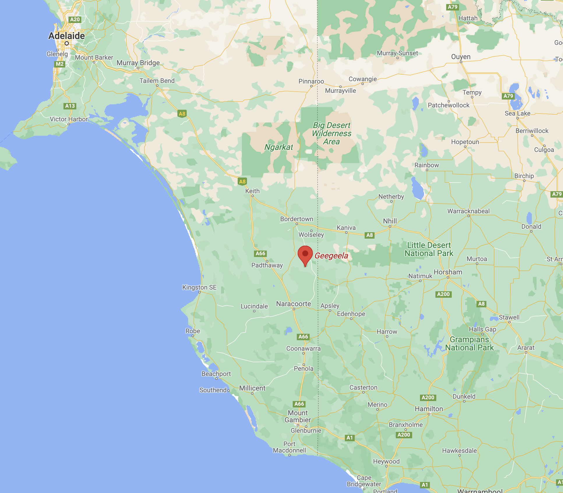
Our final park for Sunday 28th November 2021 and day two of the 2021 VKFF Activation Weekend was the Geegeela Conservation Park VKFF-0883. The park is located about 313 km southeast of the city of Adelaide, and about 42 km south of the town of Bordertown.
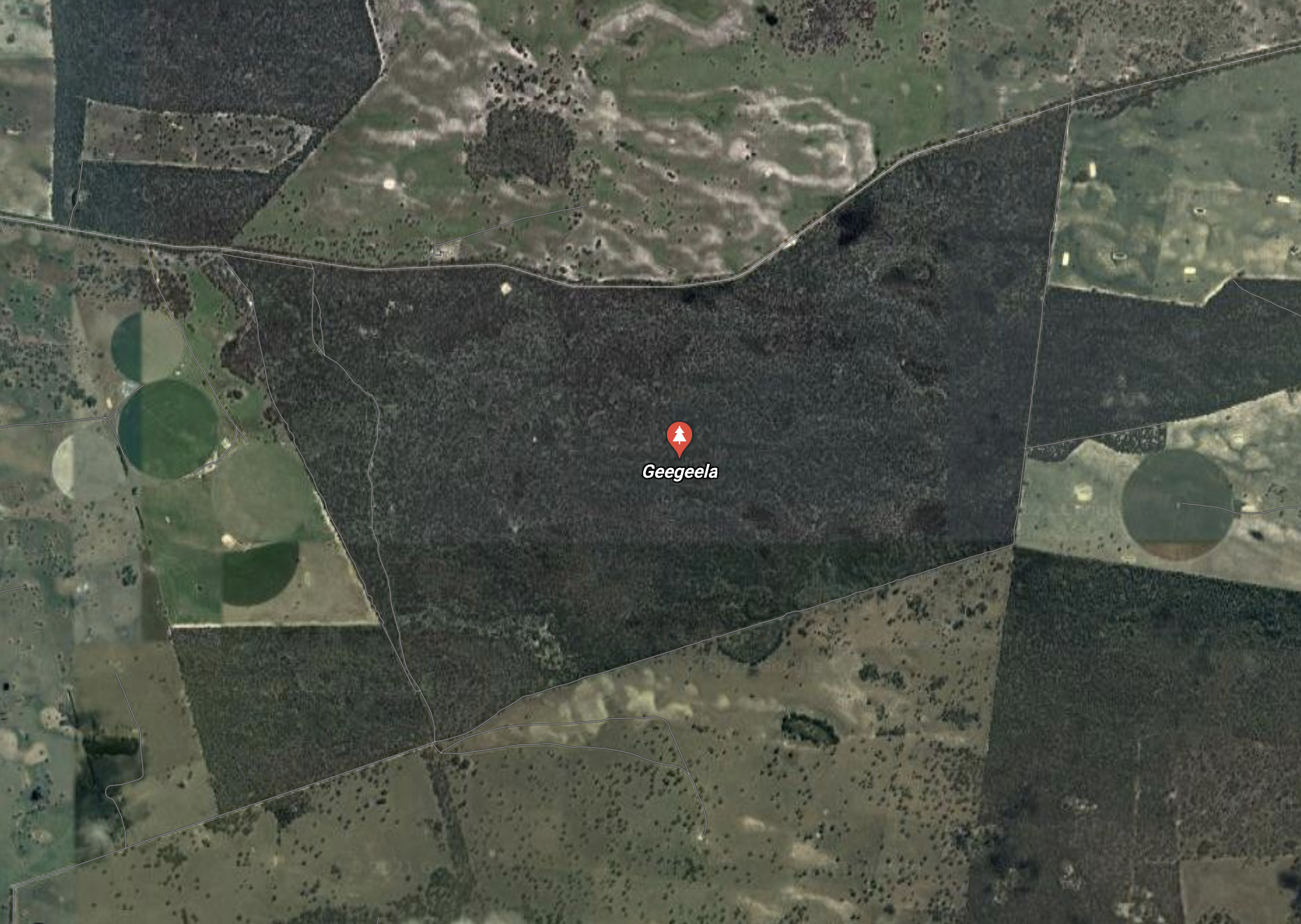
The Geegeela Conservation Park is about 858 hectares in size and was established on the 21st day of July 2005. It can be accessed via My Mi Mi Road. The land was purchased with the assistance of the Australian Government’s Natural Heritage Trust.
The land occupied by the Conservation Park was previously used for agricultural and conservation purposes. About 200 hectares (490 acres) of land which is in the conservation park’s southwestern corner was cleared in 1960 and established as a pasture of native grasses which was grazed for many years. In 1970 a total of 70 hectares (170 acres) was also cleared with limited grazing success. Agricultural activity in the area subsequently ceased and the cleared pasture land was able to regenerate.
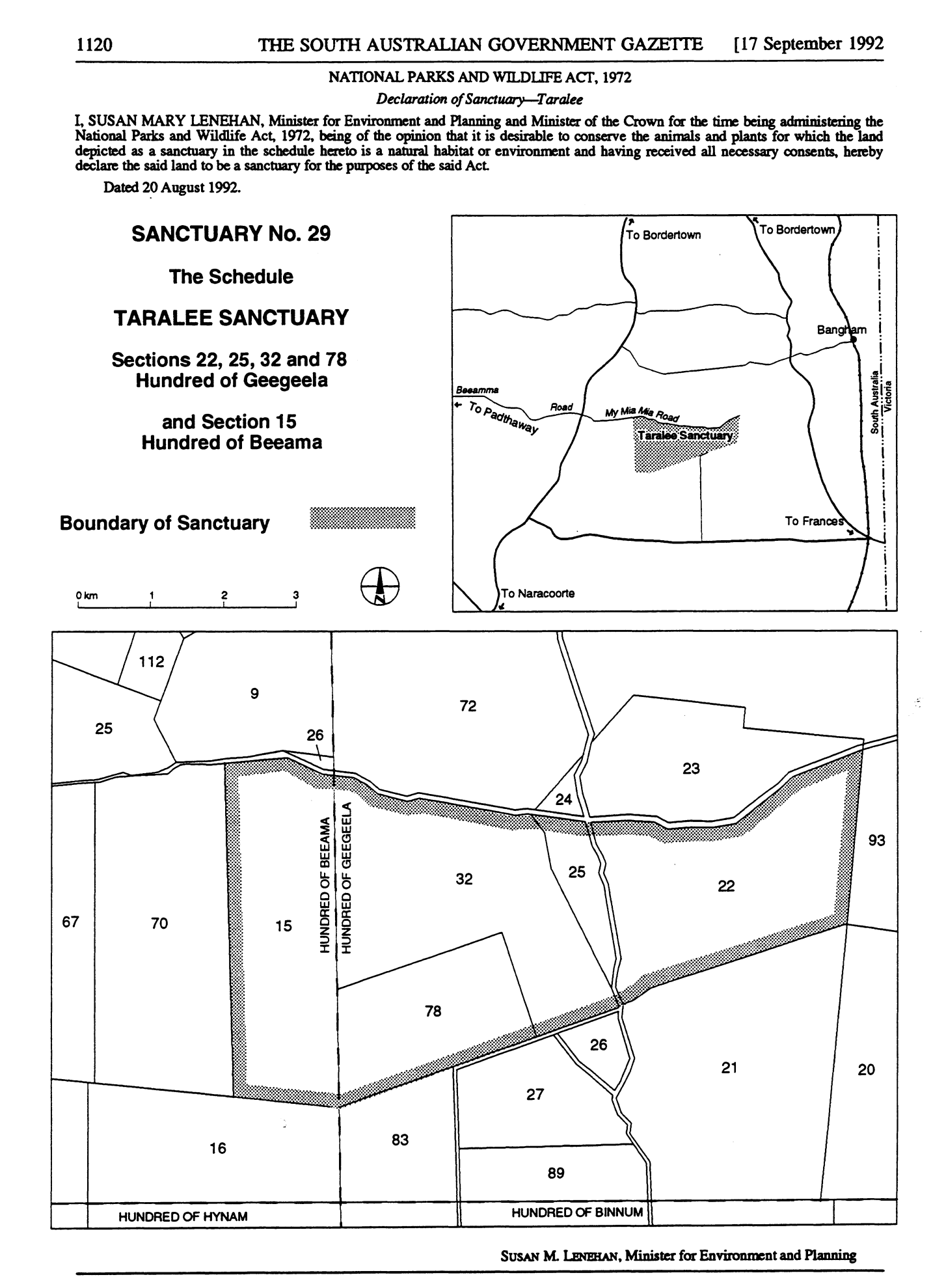
In 1986 the land was acquired as a Private Heritage Agreement Area. In the early 1990s ownership of the land changed, but fortunately, the new owners decided to retain the land as a ‘private conservation area’. In 1992, a parcel of land was proclaimed as a ‘sanctuary as was known as Taralee Sanctuary.
The park takes its name from the Hundred of Geegeela which was proclaimed on the 28th day of October 1907. The name is believed to be derived from the Aboriginal word tjitjila meaning ‘wallaby’.
The name ‘Geegeela Paddock’ appears on early pastoral lease maps and G. Smith applied the name to his lease no. 5009 in 1880.
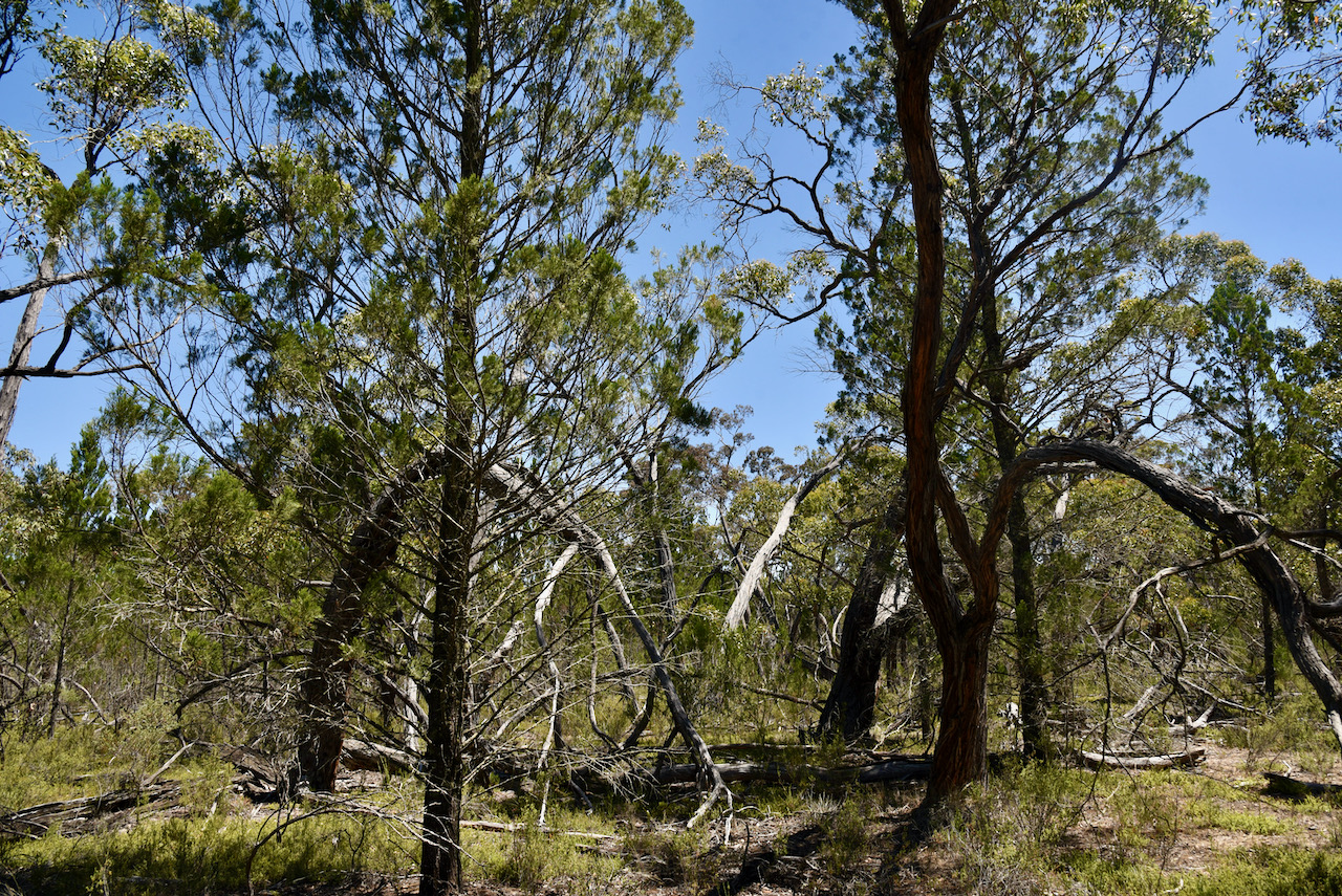
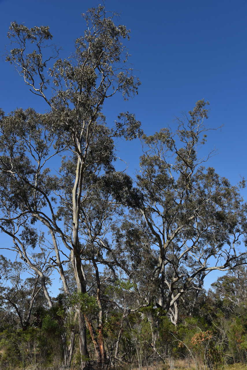
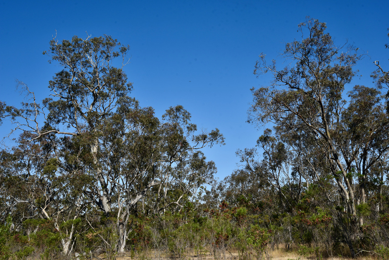
The park consists of Desert Banksia Heath, Blue Gum/Pink Gum open woodlands, and open woodlands and wetlands of Brown Stringybark. There are also small patches of woodland dominated by Rough-barked Manna Gum, River Red Gum and Buloke. Over 240 different plants species have been recorded in the park.


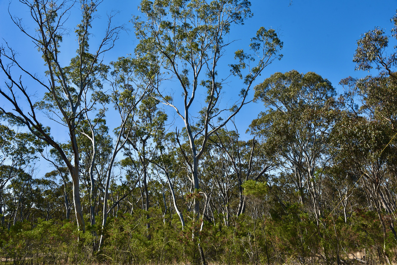
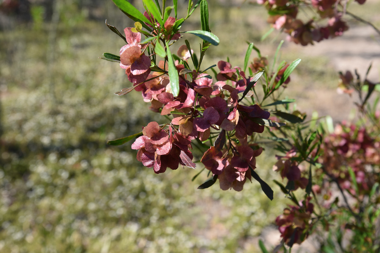
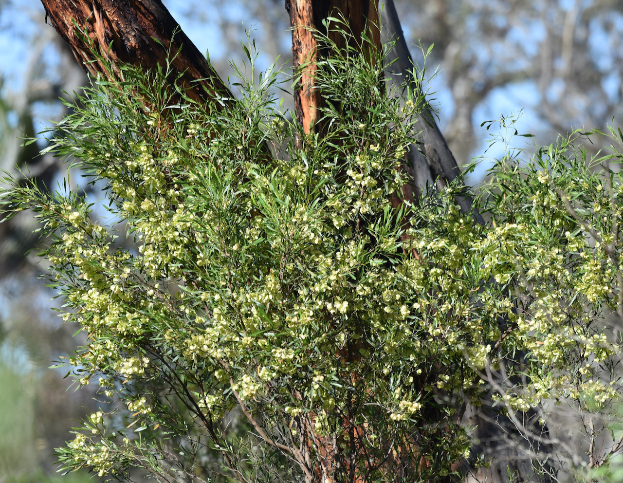
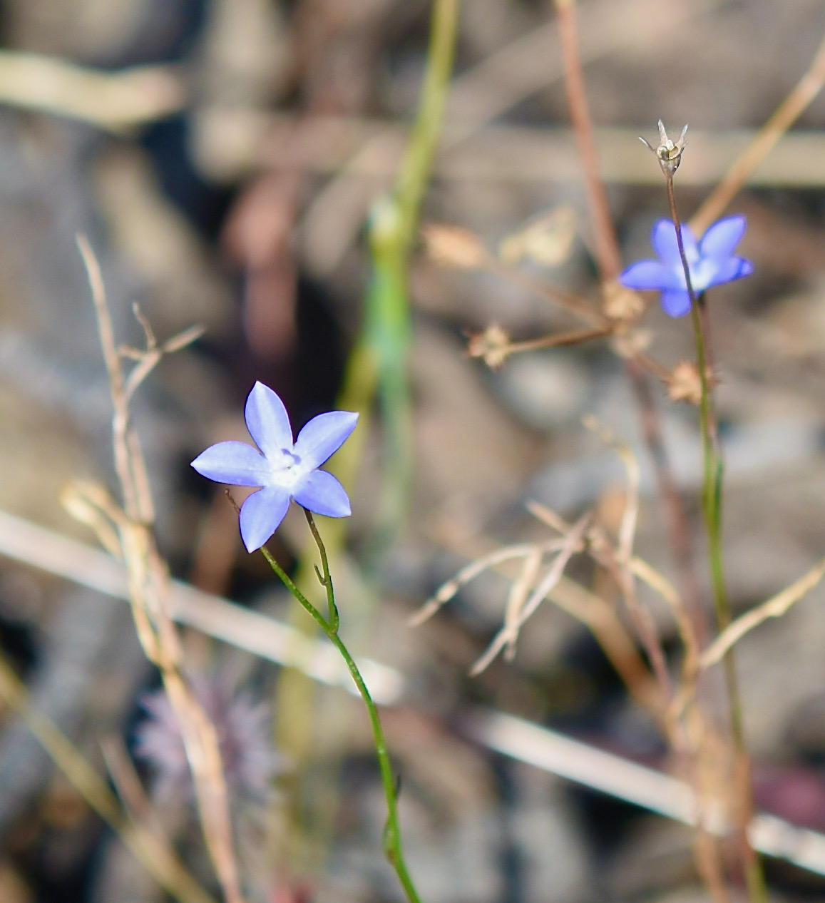
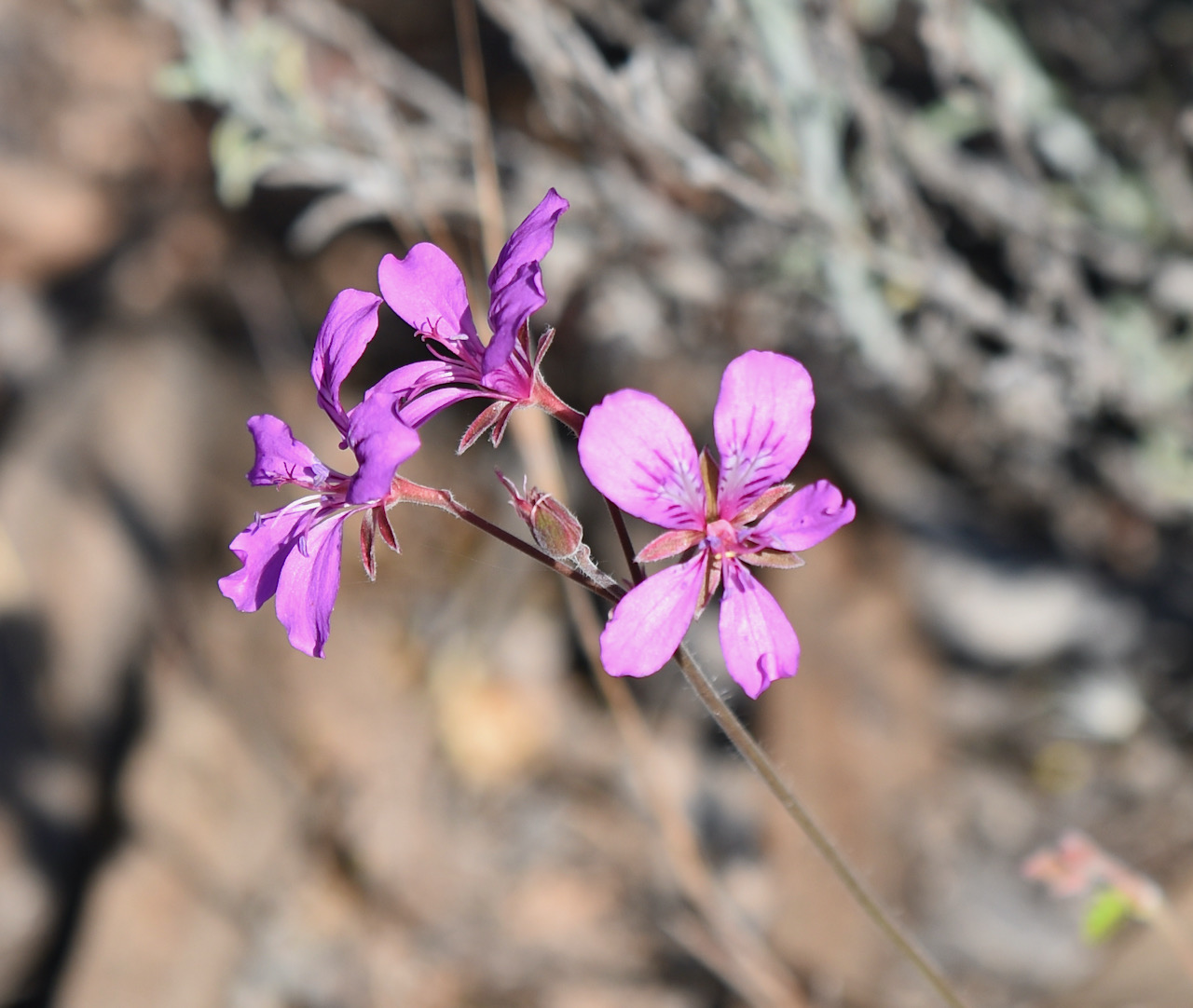
The park is home to numerous rare and endangered plant and animal species.
Five mammal species of South Australian state conservation significance can be found in the park. This includes the Eastern Grey Kangaroo, Sugar Glider, Western Pygmy-possum, Red-necked Wallaby, and the Common Wombat.
About 90 species of bird have been recorded in the park, including 17 threatened species in South Australia, and 29 which have an identified conservation rating in the southeastern region of South Australia. Endangered and vulnerable bird species include Red-tailed black cockatoo, Swift Parrot, Brown Quail, Little Lorikeet, Brolga, Blue-winged parrot, Rare Shining bronze-cuckoo, Blue-faced honeyeater, and Flame Robin.
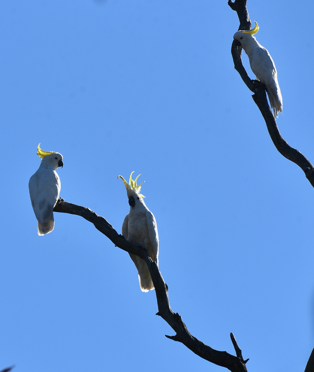
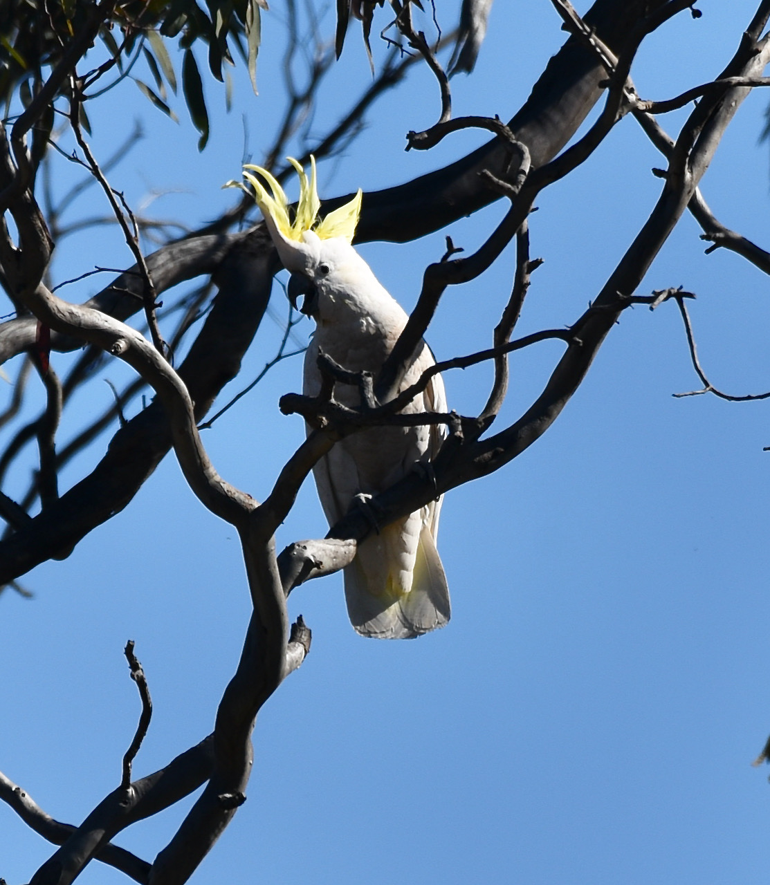
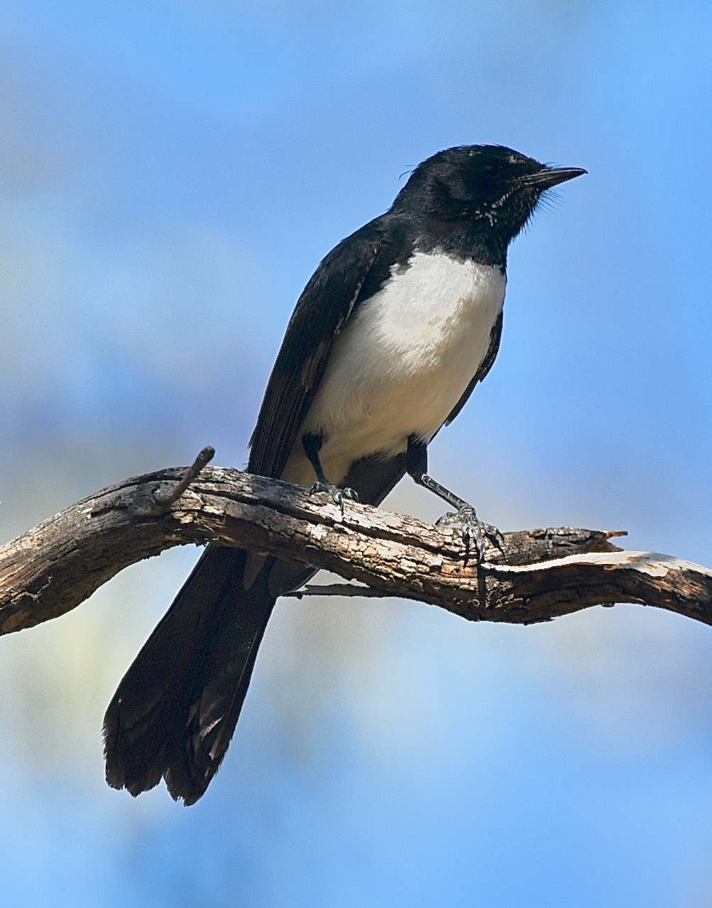
During our visit to the park, I did a little bit of bird watching, but only spotted some Sulphur Crested Cockatoos and Willie Wagtails.
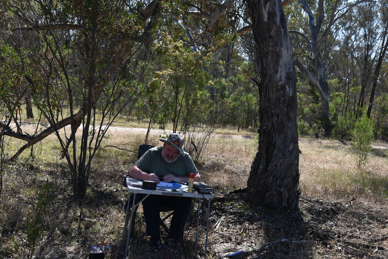
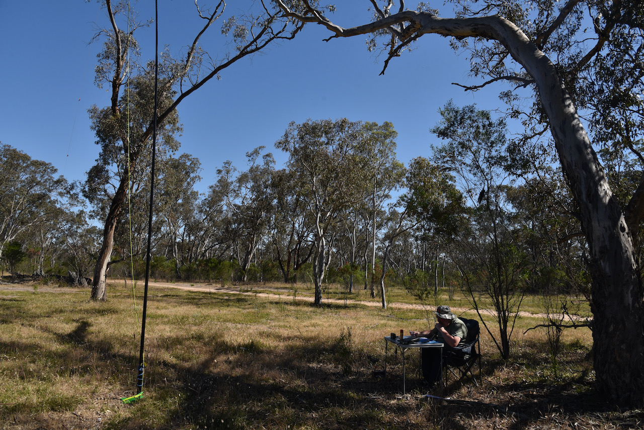
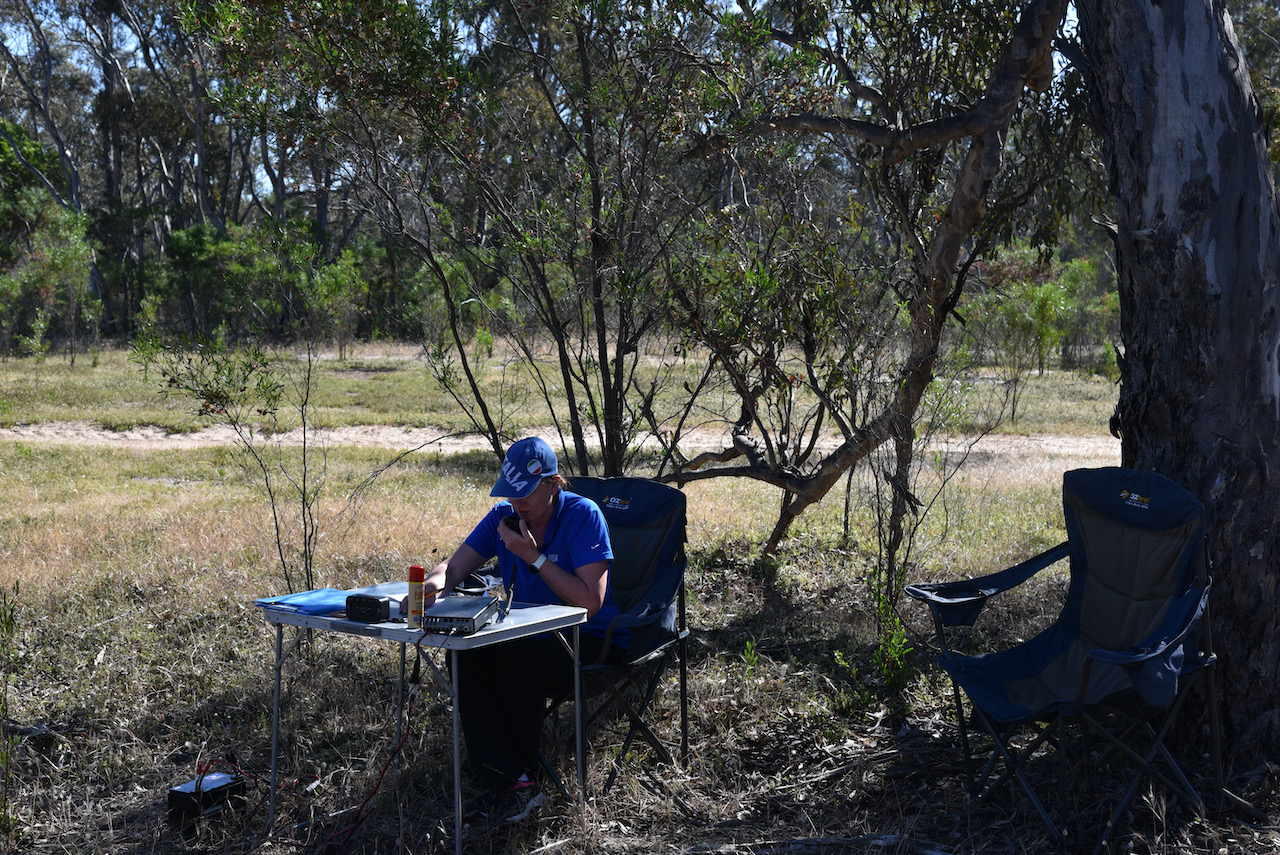
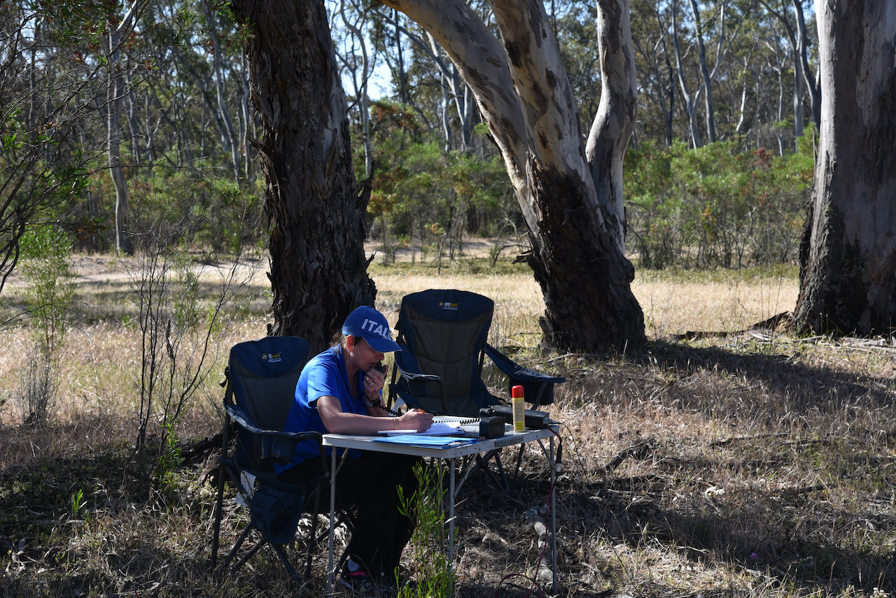
Marija and I spent a little under 2 hours at Geegeela and operated on the 40 & 20m bands. We ran our normal station consisting of the Yaesu FT-857d, 40 watts, and the 20/40/80m linked dipole.
We made a total of 102 QSOs and 37 Park to Park contacts. We did not operate on 80m as the afternoon was getting away from us and we wanted to head to the Mundulla pub for a meal.
A real surprise during this activation was to log Stuie VK8NSB up in Darwin.
Marija worked the following stations on 40m SSB:-
- VK3PF/p (Gormandale Flora Reserve VKFF-2325)
- VK3CWF/p (Brisbane Ranges National Park VKFF-0055)
- VK5AV/p (Gower Conservation Park VKFF-0798)
- VK3TKK/p (Gisborne Flora Reserve VKFF-2322)
- VK3ZPF/p (Kurth Kiln Regional Park VKFF-0971)
- VK2YK/p (Warren Conservation Park VKFF-0941)
- VK2IO/p (Sydney Harbour National Park VKFF-0473)
- VK3DAC/p (Mornington Peninsula National Park VKFF-0333)
- VK4MGL/p (Esk National Park VKFF-0677)
- VK3MCA/p (Mount Charlie Flora Reserve VKFF-2396)
- VK3LF/p (Kurth Kiln Regional Park VKFF-0971)
- VK3PF/p (Callignee Wildlife Reserve VKFF-2287)
- VK4FABN/p (Main Range National ParkVKFF-0300)
- VK3YV/p (Sweetwater Creek Nature Conservation Reserve VKFF-2200)
- VK5CZ/p (Wills Creek Conservation Park VKFF-0819)
- VK3FIMD
- VK3CJN
- VK7HOB
- VK1DI
- Vk3AHR
- VK3MPR
- VK3AAV
- VK7RM
- VK3PF/p (Traralgon South Flora & Fauna Reserve VKFF-2464)
- VK2KNV/m
- VK2XSE/m
- VK3RU
- VK2HRX
- VK7MOO
- VK2YW
- VK4SMA
- VK3ZK/p (Echuca Regional Park VKFF-0966)
- VK6XN/p (McLarty Nature Reserve VKFF-2826)
- VK3EY
Marija worked the following stations on 20m SSB:-
- VK6XN/p (McLarty Nature Reserve VKFF-2826)
- VK4GSF
- VK2VW
- VK2HFI
- VK6NTE
- VK4MWL
- VK2MG/p (Munmorah State Conservation Area VKFF-1361)
- VK4KC
- VK4MAD
- VK4DOG
- VK2LEE
- VK8NSB
I worked the following stations on 40m SSB:-
- VK3PF/p (Gormandale Flora Reserve VKFF-2325)
- VK3CWF/p (Brisbane Ranges National Park VKFF-0055)
- VK5AV/p (Gower Conservation Park VKFF-0798)
- VK3TKK/p (Gisborne Flora Reserve VKFF-2322)
- VK3ZPF/p (Kurth Kiln Regional Park VKFF-0971)
- VK5FANA
- VK2YK/p (Warren Conservation Park VKFF-0941)
- VK2IO/p (Sydney Harbour National Park VKFF-0473)
- VK3UCD
- VK3DAC/p (Mornington Peninsula National Park VKFF-0333)
- VK4MGL/p (Esk National Park VKFF-0677)
- VK3MCA/p (Mount Charlie Flora Reserve VKFF-2396)
- VK3LF/p (Kurth Kiln Regional Park VKFF-0971)
- VK5BMC
- VK2LEE
- VK3SQ
- VK5PET
- VK3KXR
- VK3FIMD
- VK5CZ/m
- VK2NP
- VK3PF/p (Callignee Wildlife Reserve VKFF-2287)
- VK4KLA
- VK3MKE
- VK3CJN
- VK4FABN/p (Main Range National ParkVKFF-0300)
- VK5KVA
- VK2VW
- VK2HFI
- VK3MPR
- VK3AAV
- VK5IS
- VK3HQZ
- VK2FSLC
- VK1DA
- VK5KLV
- VK3SKT
- VK4KC
- VK4MAD
- VK4DOG
- VK2YW
- VK5HAA
- VK3YV/p (Sweetwater Creek Nature Conservation Reserve VKFF-2200)
- VK3BFH/m
- VK3DWL/m
- VK5CZ/p (Wills Creek Conservation Park VKFF-0819)
I worked the following stations on 20m SSB:-
- VK6XN/p (McLarty Nature Reserve VKFF-2826)
- VK2MG/p (Munmorah State Conservation Area VKFF-1361)
- VK8NSB
- VK4AJR
- VK6JK
- VK2LEE
- VK2VW
- VK2HFI
- VK4KUS
- VK6NTE
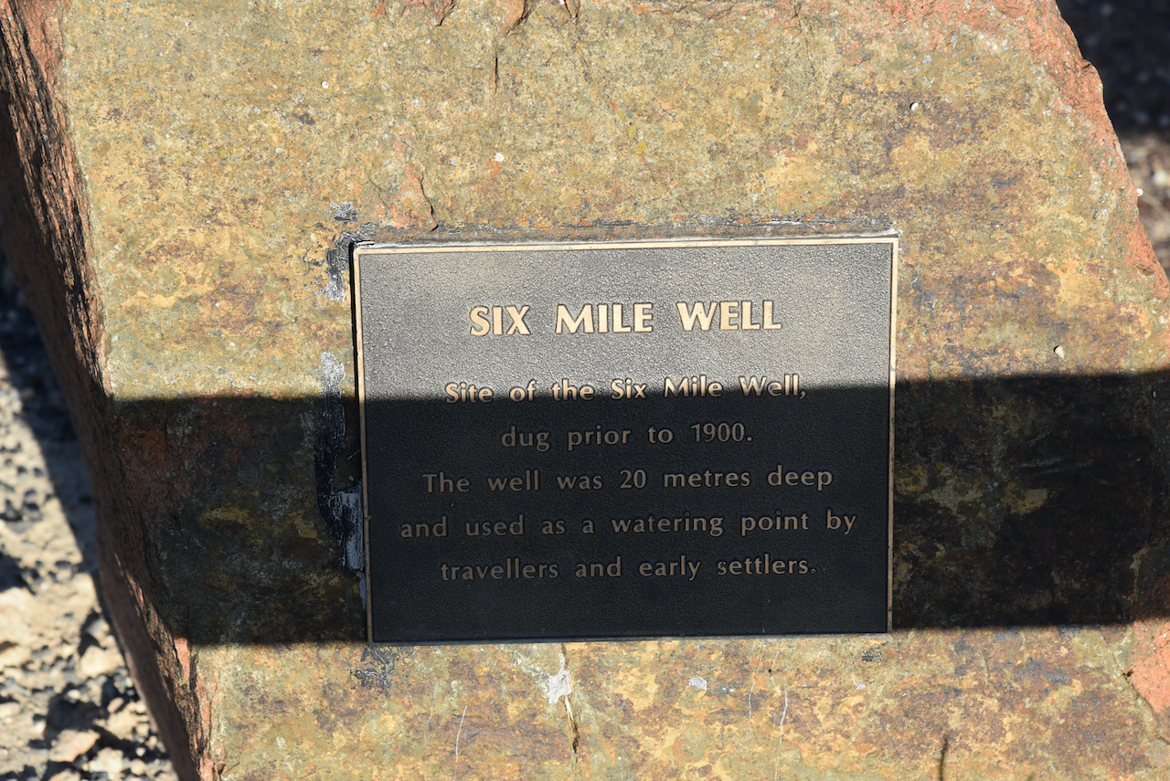
After packing up we started heading towards the town of Mundulla. We stopped briefly to have a look at Six Mile Well, which was dug prior to 1900. The well which was 20 metres deep was used as a watering point by travellers and early settlers.
We soon reached the small town of Mundulla. The town was proclaimed on the 3rd day of April 1873. The name is derived from the aboriginal word ‘mantala’ meaning place of thunder. This originated from the ground which is undermined with caves that rumbled when trampled upon. It was believed that evil spirits frequented such places.
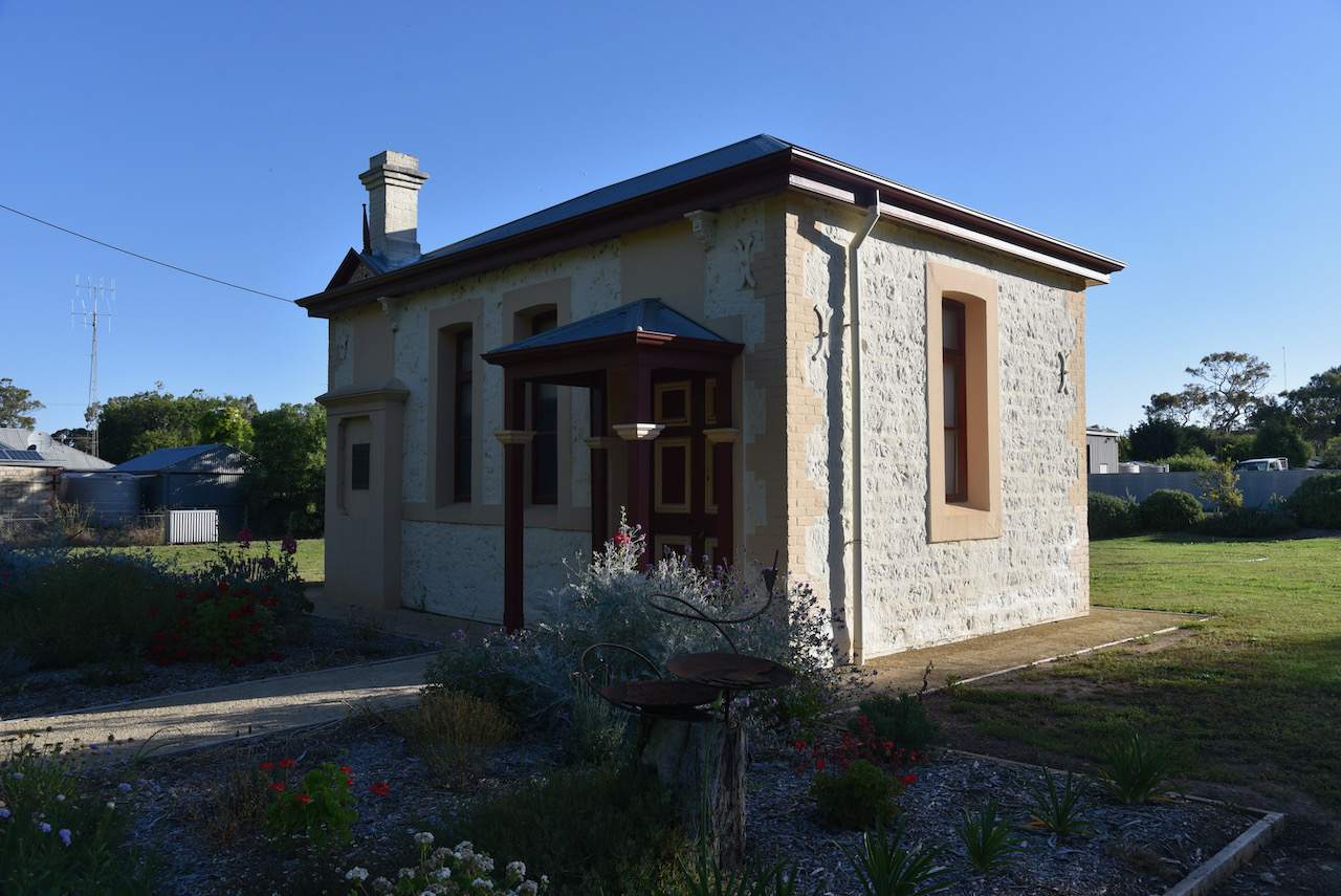
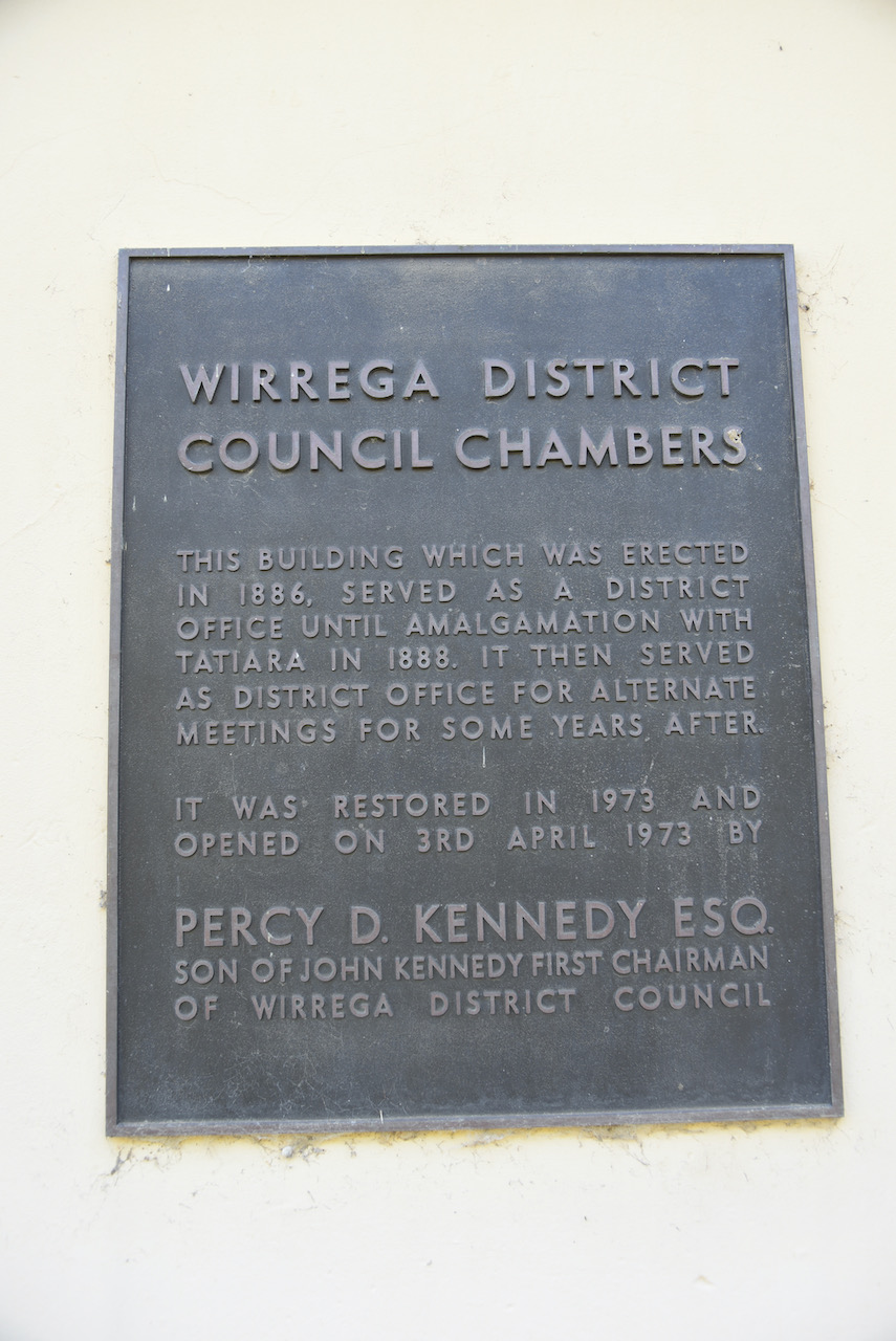
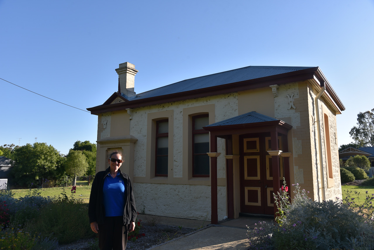
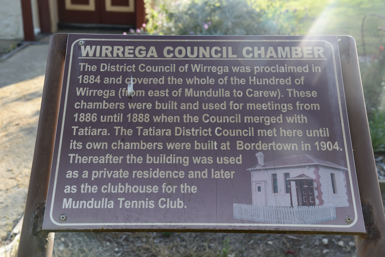
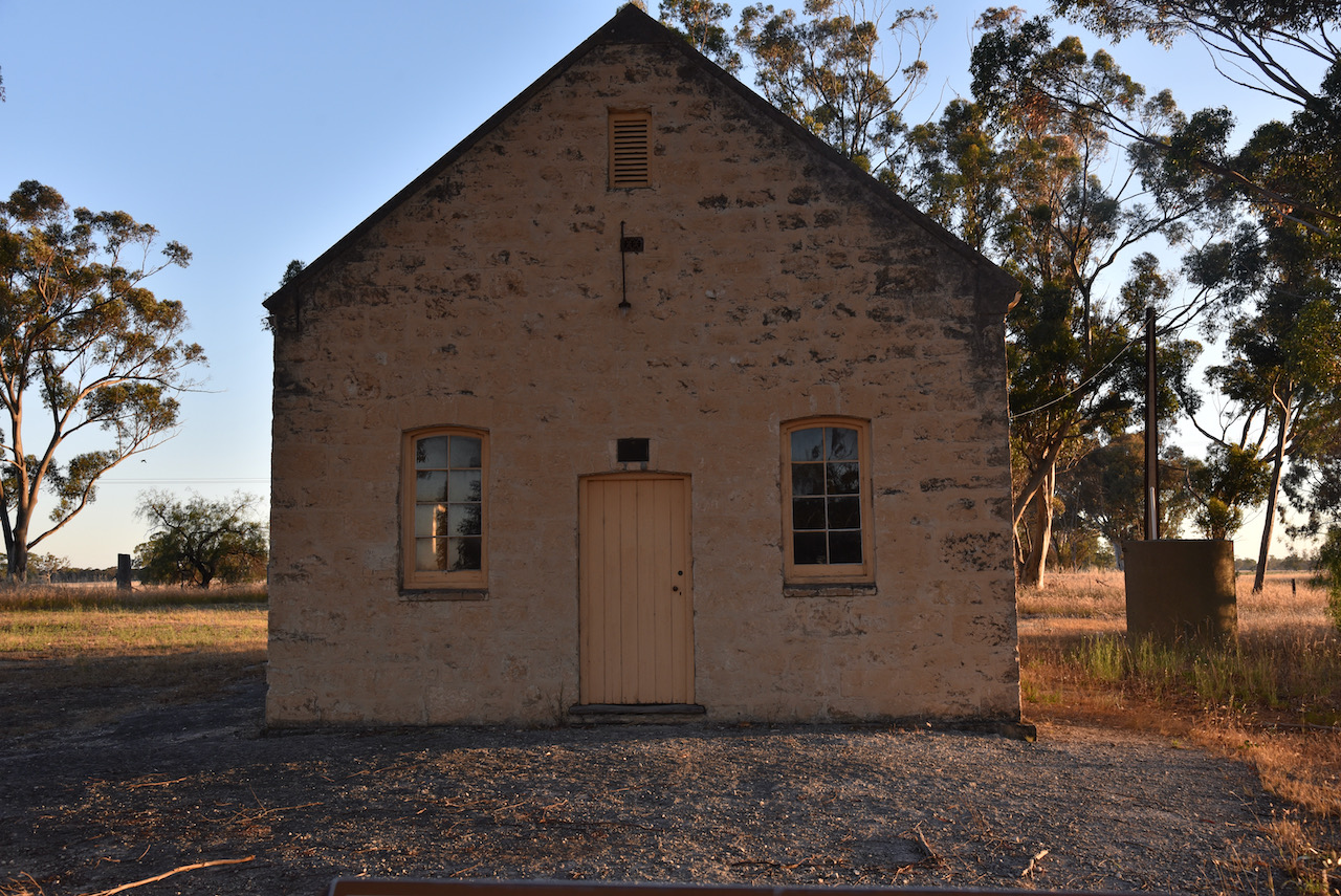
Our first stop was to have a look at the historic old Wirrega District Council Chambers. The building was built in 1886 and served as a District Office until amalgamated with Tatiara in 1888. The building was then used as a District office for alternate meetings some years after that. The building waas restored in 1973.
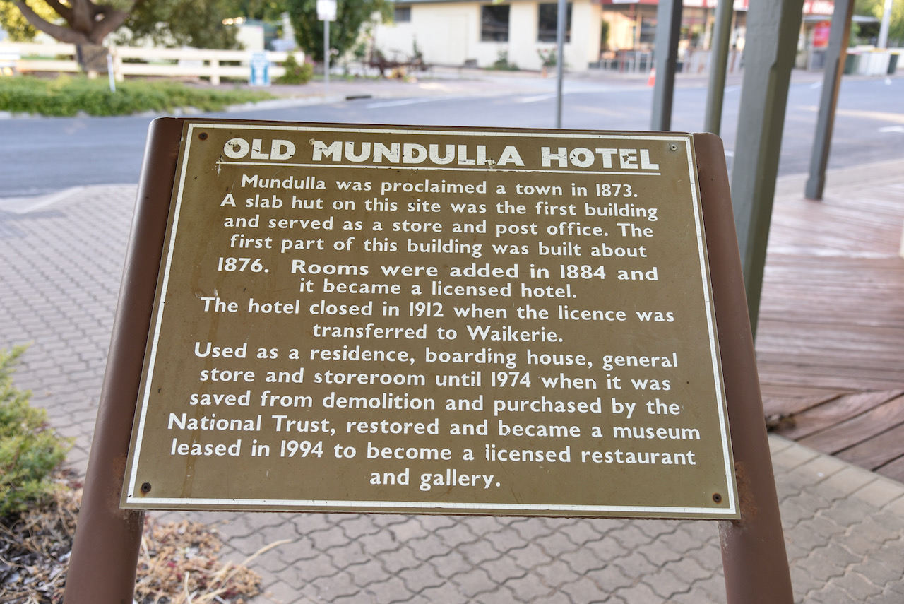
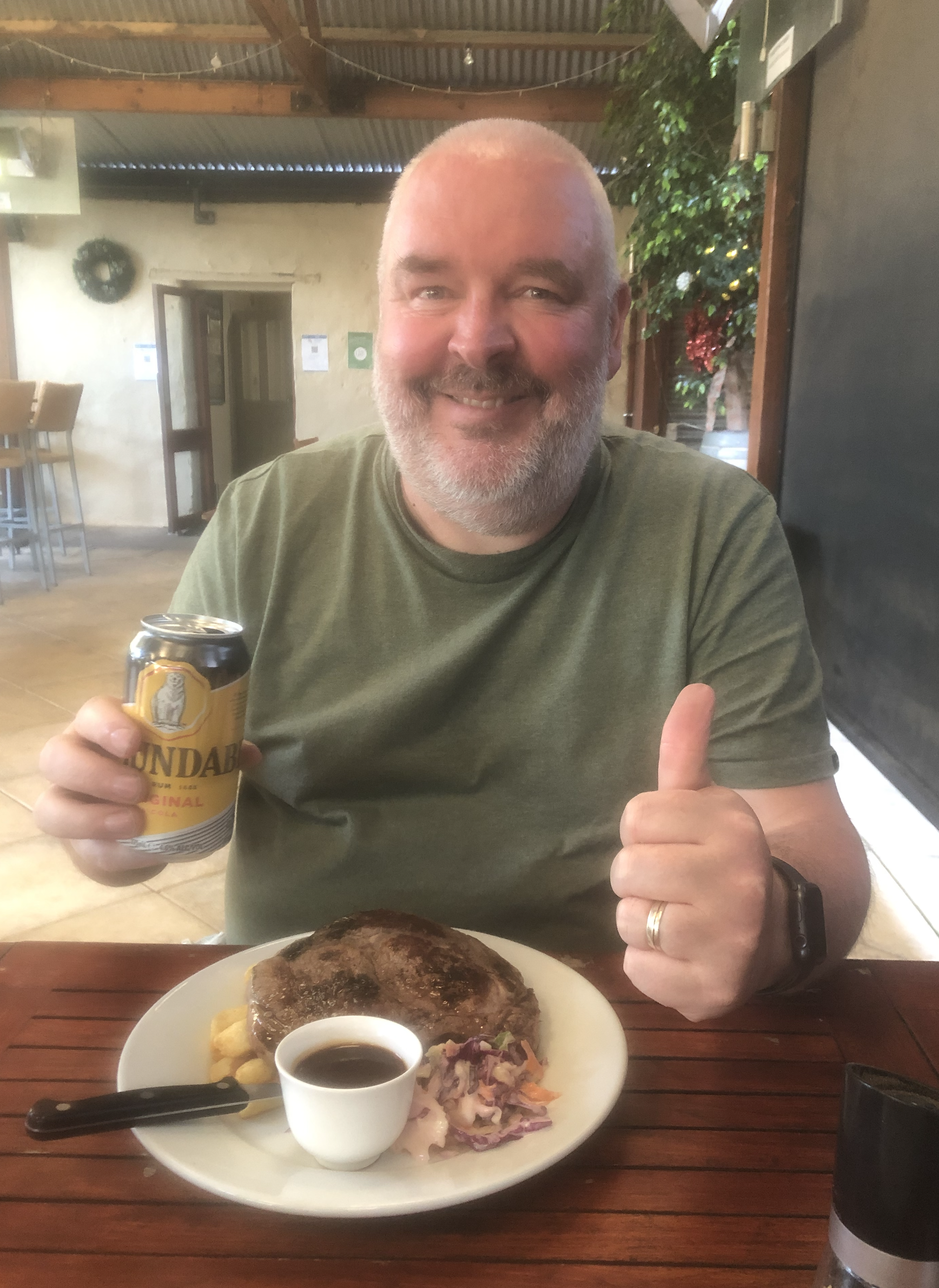
The first section of the Mundulla Hotel was built in about 1876. In 1884 rooms were added and it became a licenced hotel. In 1912 the hotel closed when the licence was transferred to Waikerie in the Riverland region of South Australia. It was then used as a residence, boarding house, general store and storeroom until 1974 when it was saved from demolition and was purchased by the National Trust. It then became a museum and subsequently leased as a licenced restaurant and gallery.
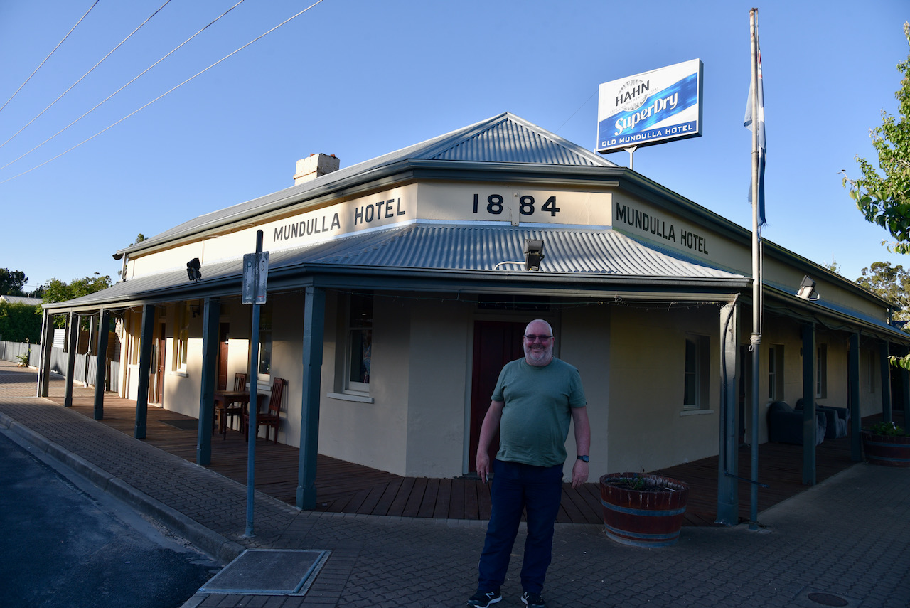
We enjoyed a really nice meal at the hotel.

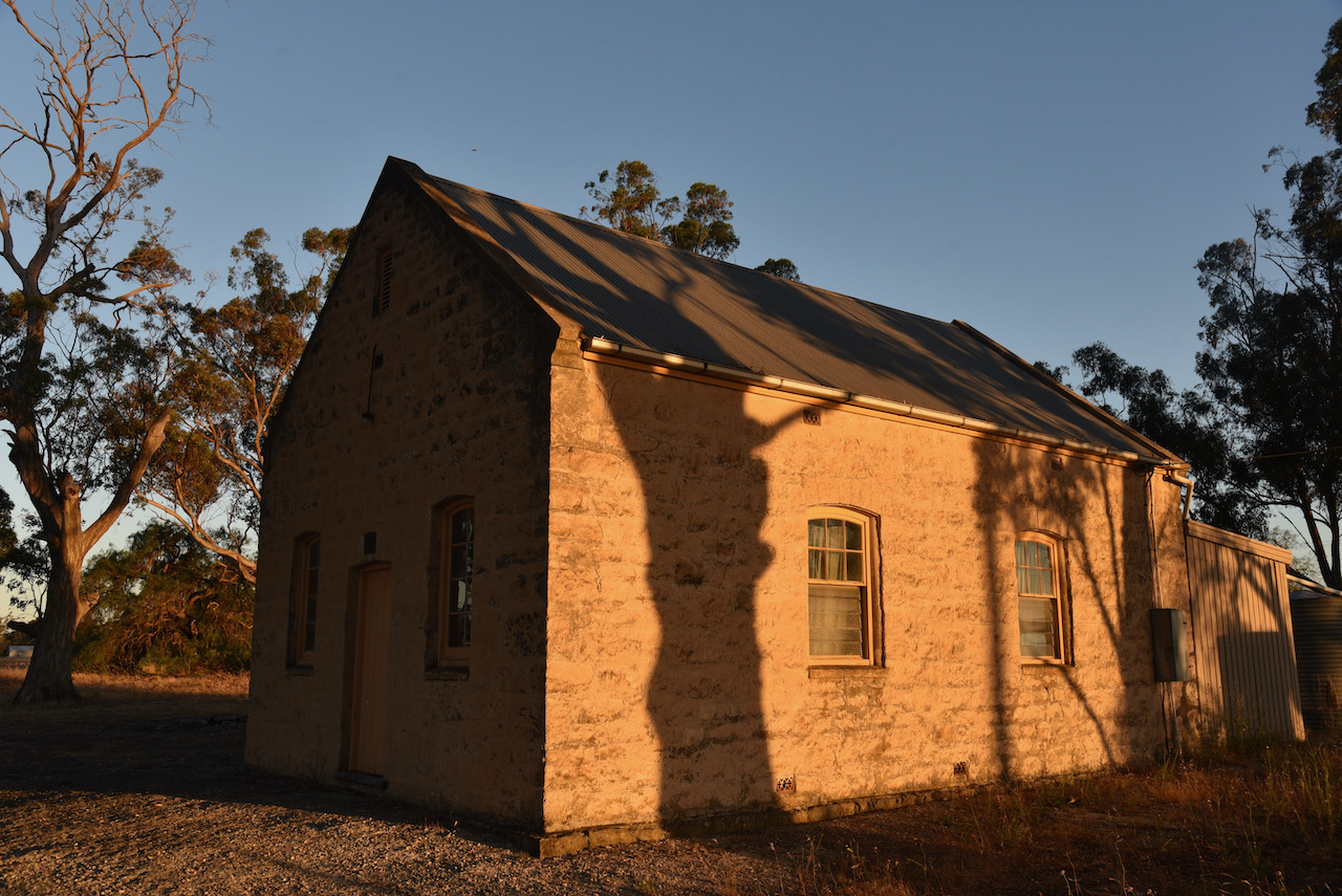
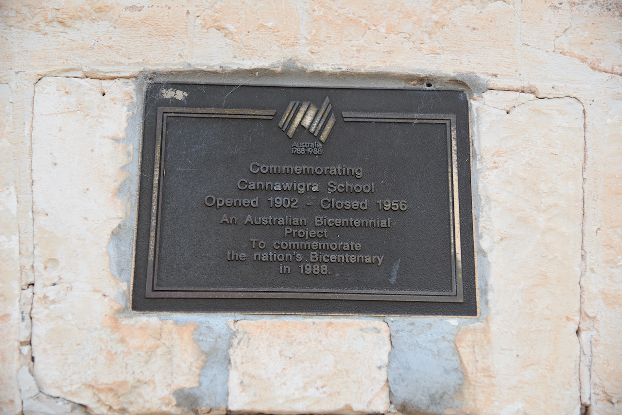
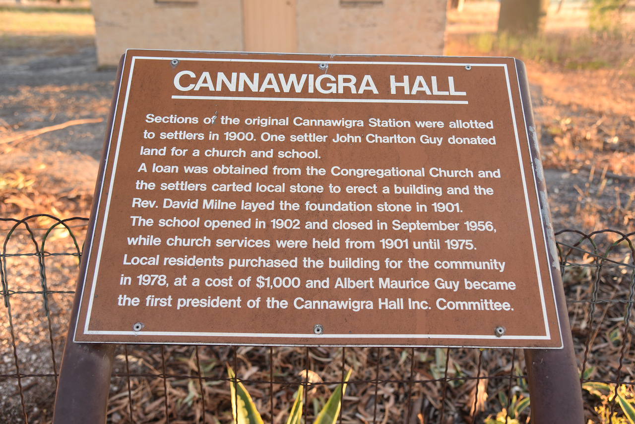
We then headed out to the old Cannawigra Hall. In 1900 sections of the original Cannawigra Station were allotted to settlers. John Charlton Guy, one of the settlers, donated land for a church and a school. A loan was obtained from the Congregational Church and the settlers of the district carted local stone to erect the building. Reverend David Milne laid the foundation stone in 1901. In 1902 the school opened. It closed in September 1956. Church services took place from 1901 until 1975. In 1978 local residents purchased the building for the community at a cost of $1,000 and a Cannawigra Hall Inc. Committee was formed.
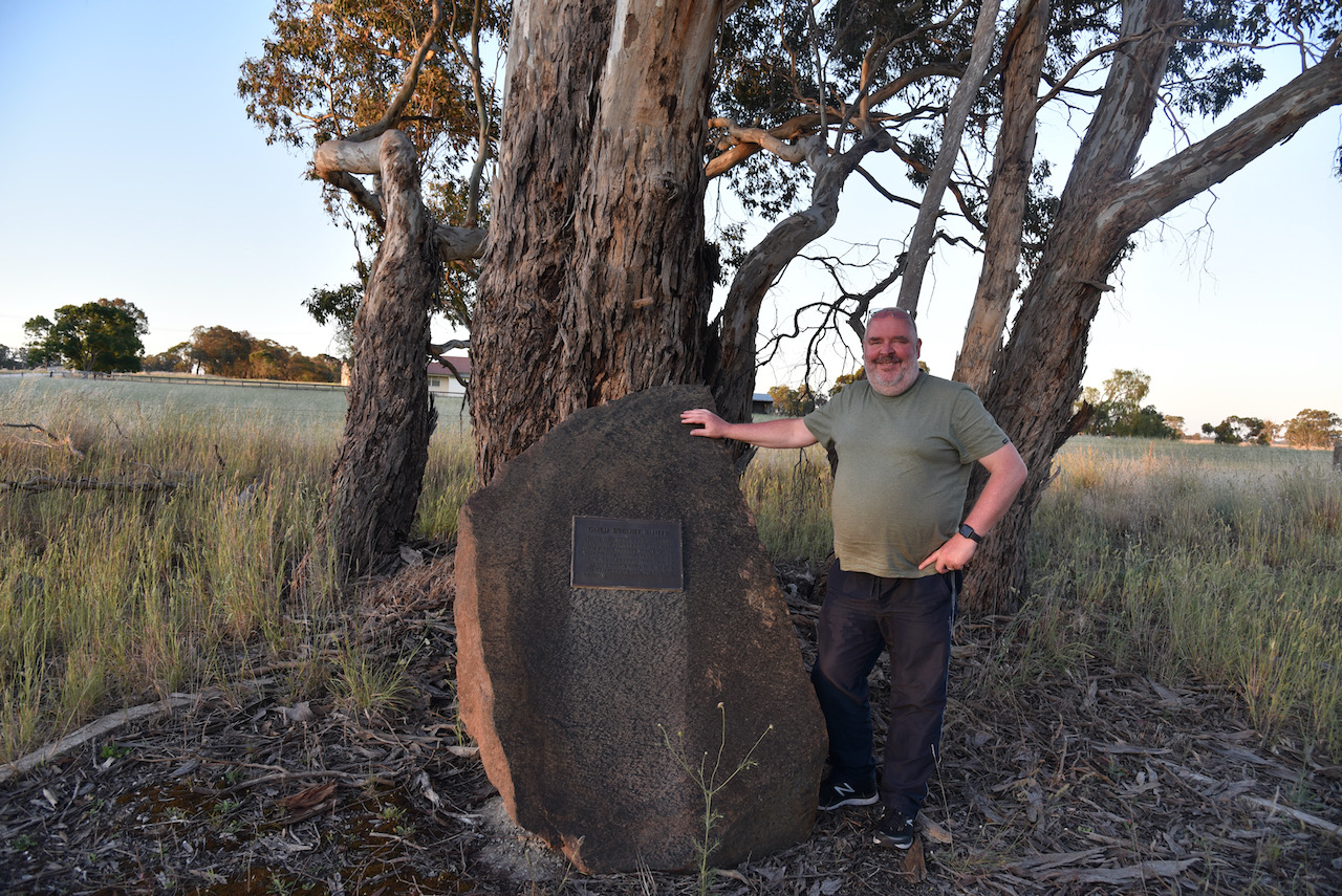
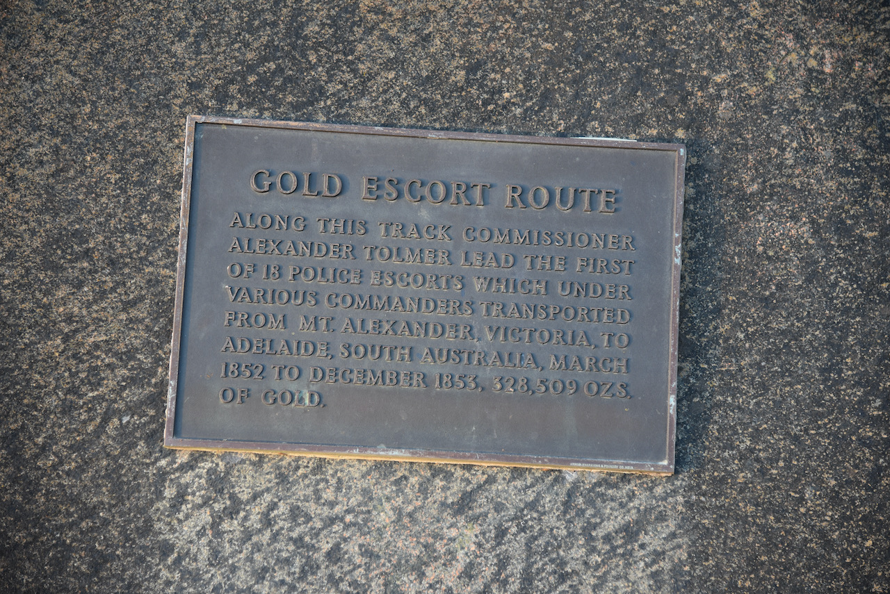
A short distance away is a cairn to commemorate the Gold Escort Route.
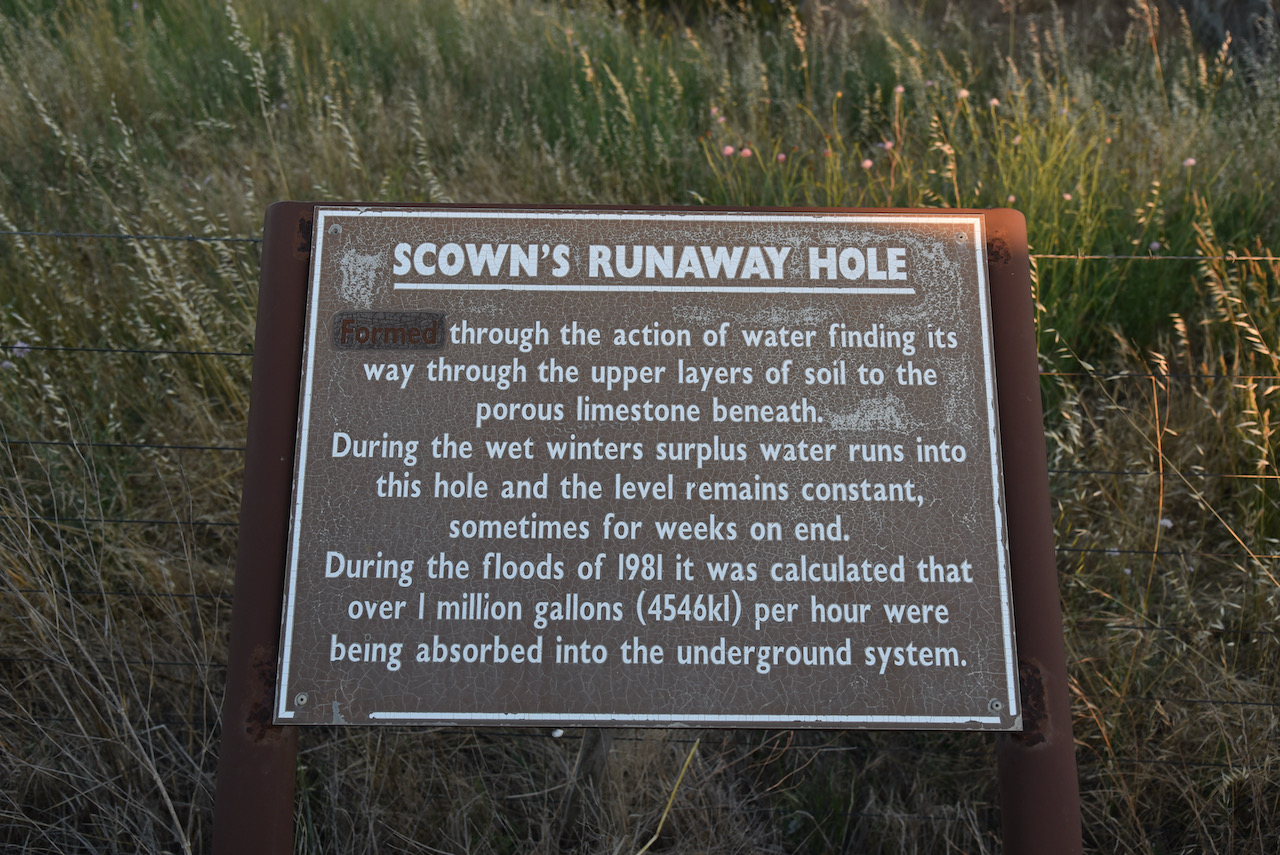
We also stopped to have a look at Scowns Runaway Hole. It was formed through the action of water finding its way through the upper layers of soil to the porous limestone beneath.
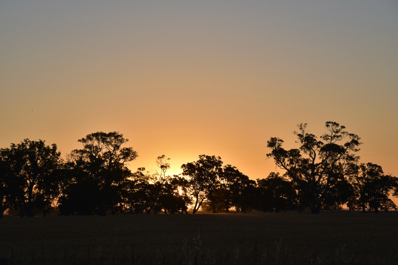
The sun was started to set and we enjoyed a beautiful sunset.
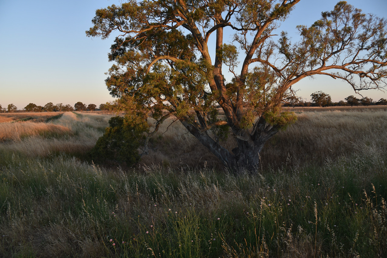
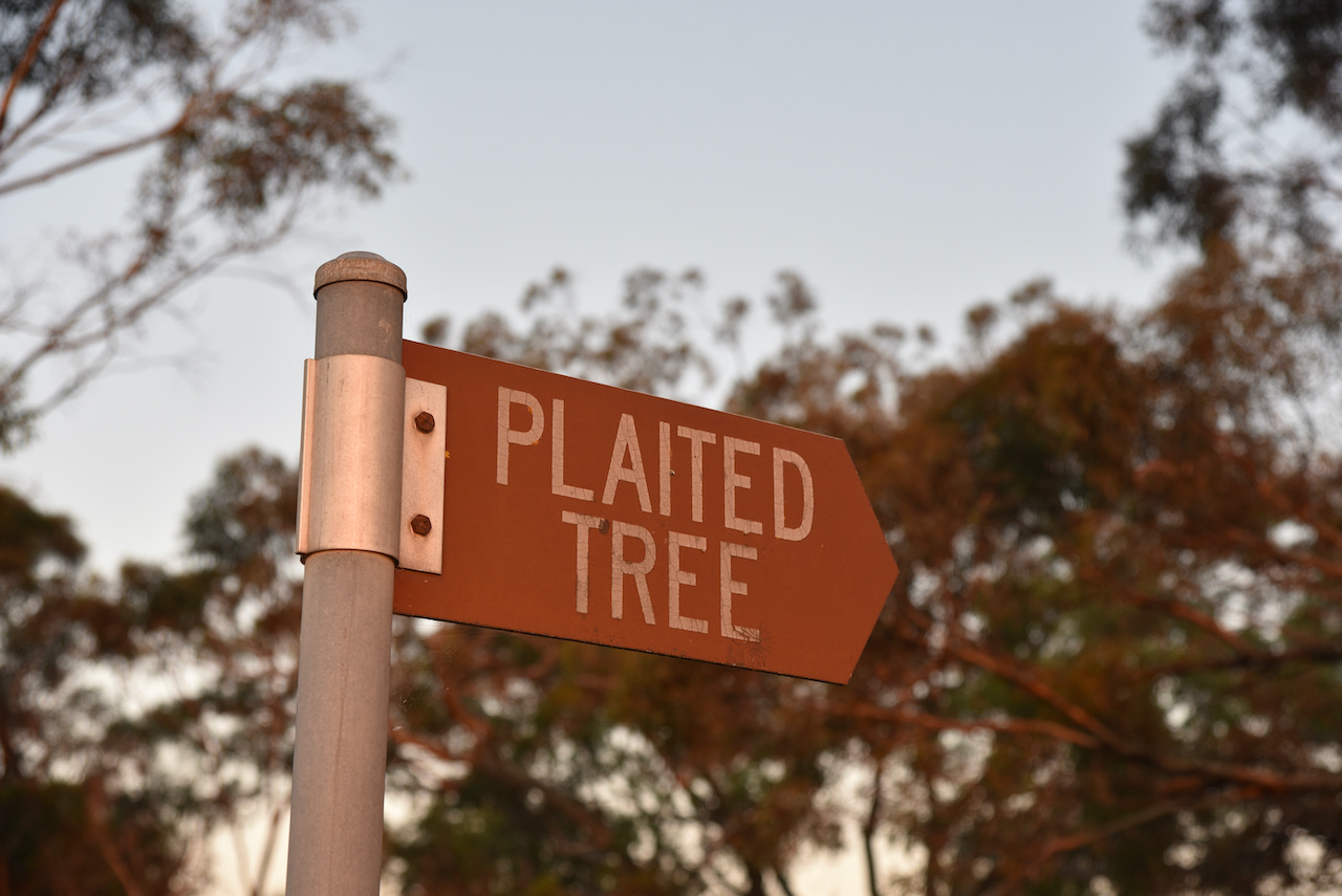
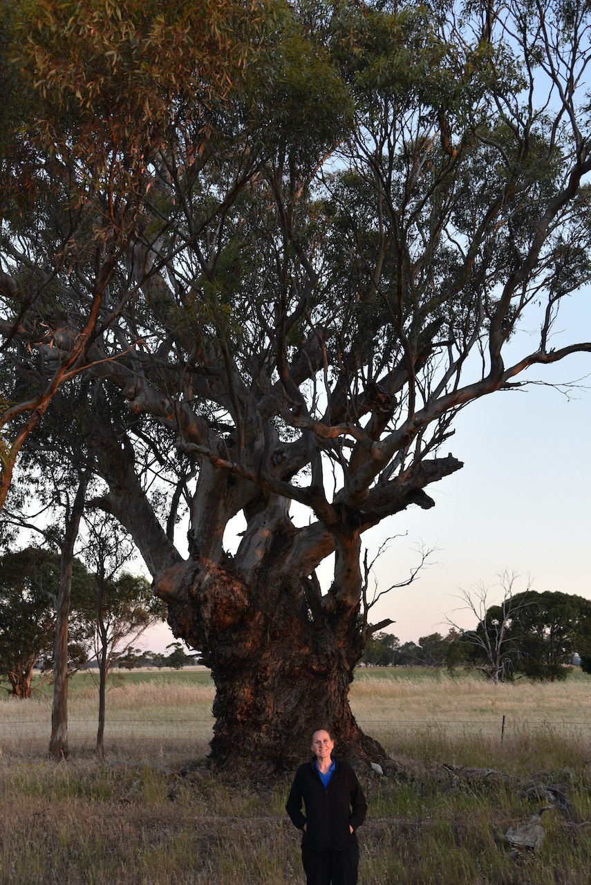
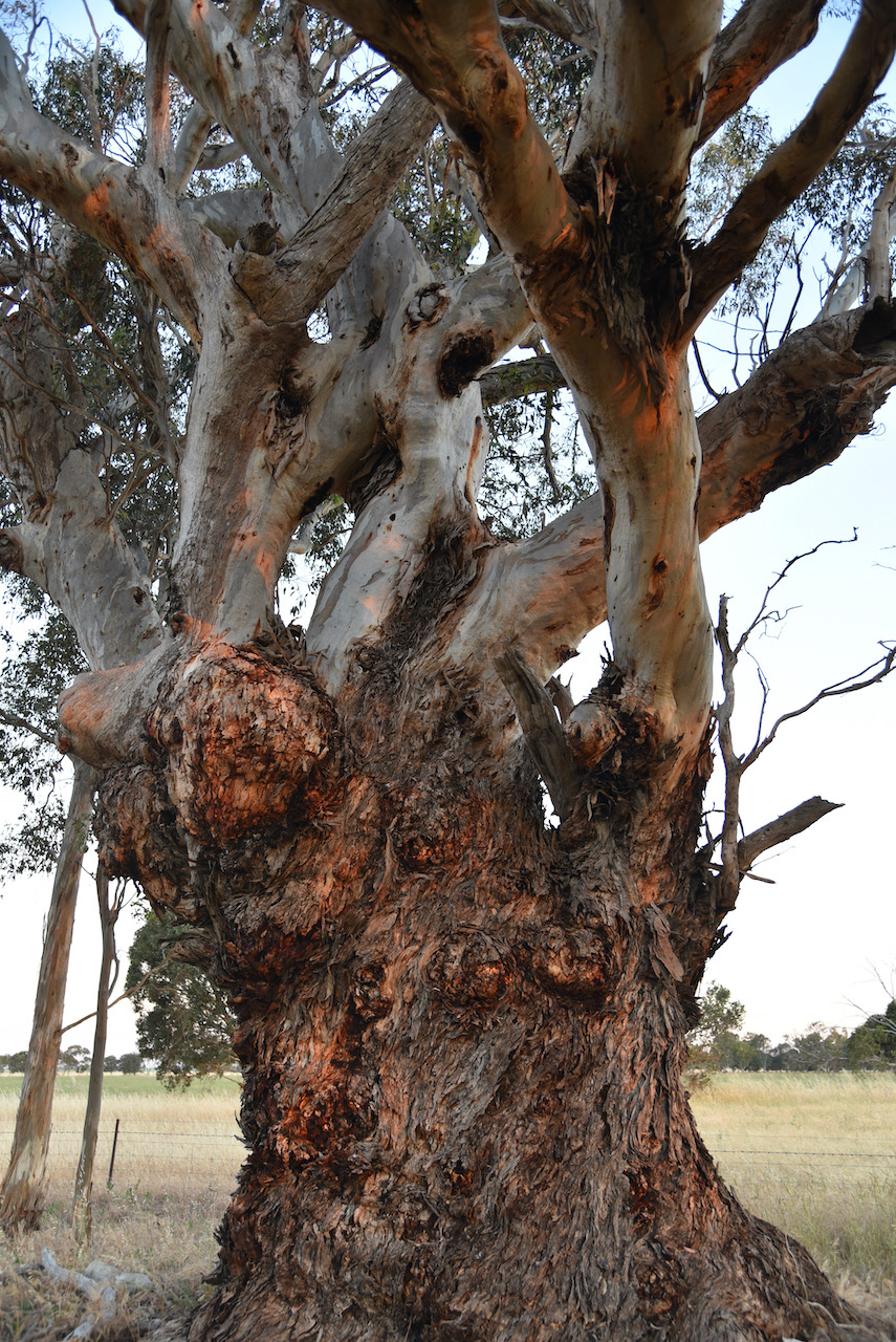
Our next stop was the Plaited Tree. The branches of the tree, which is estimated to be 400 years old, are plaited (or cross over each other). This was an aboriginal meeting point.
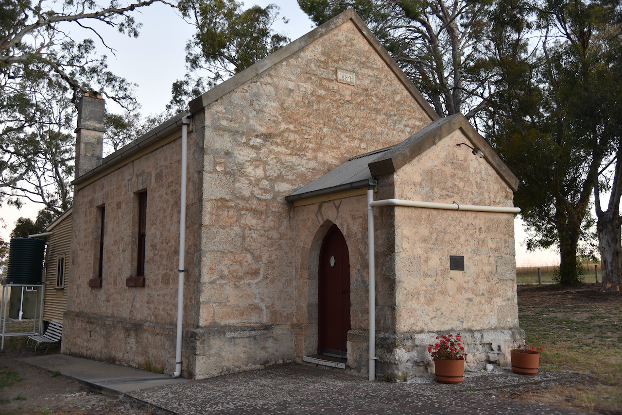
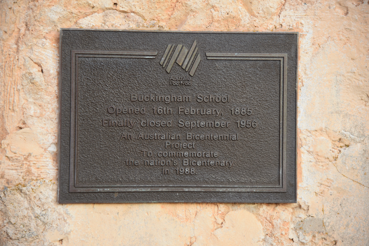
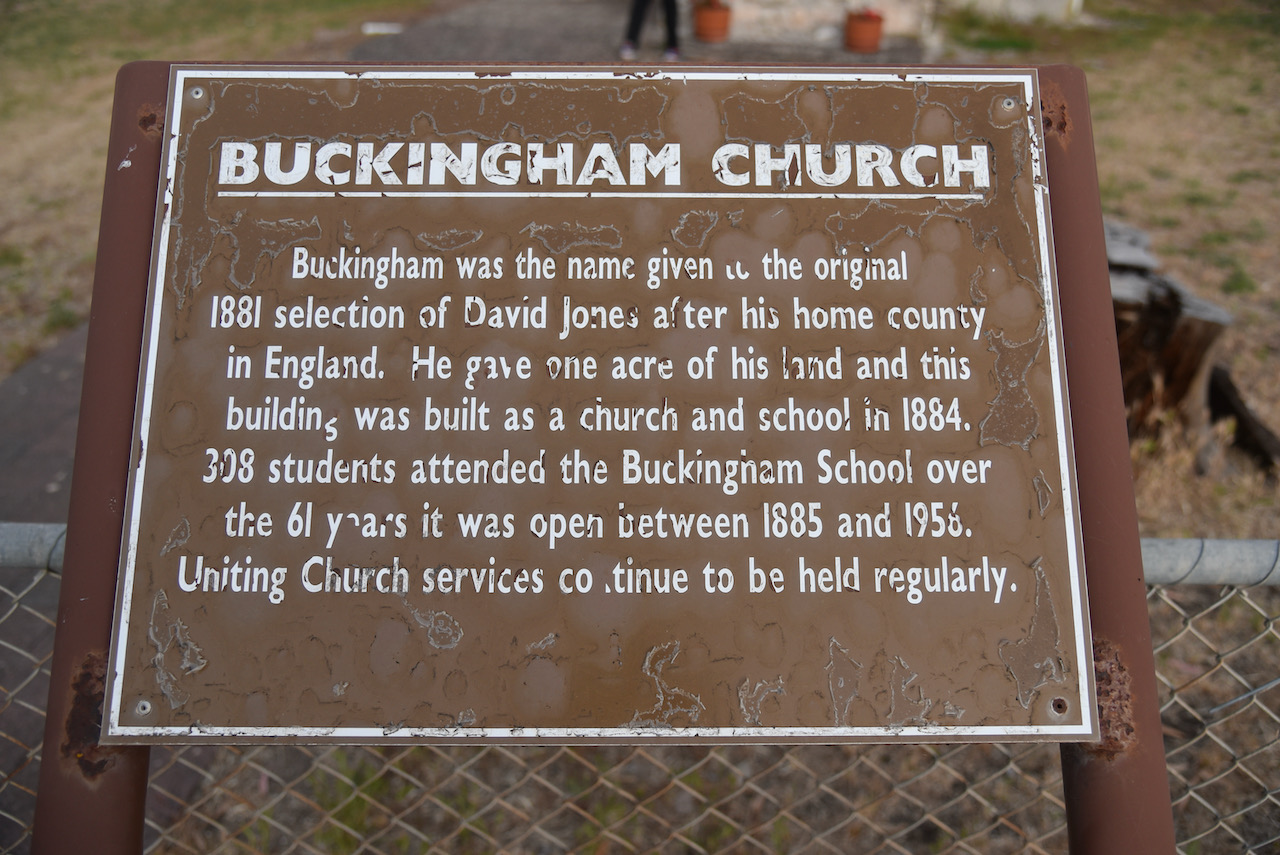
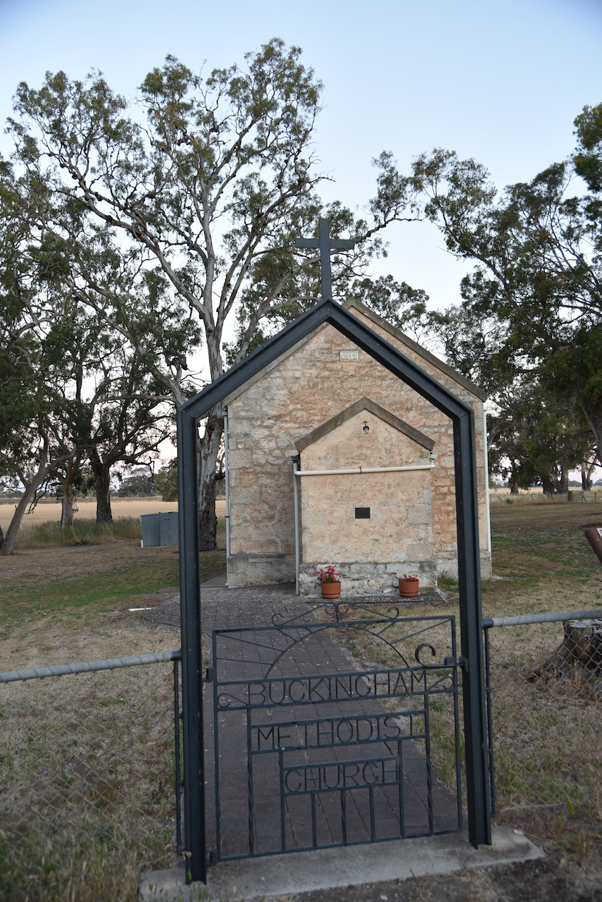
Our final stop was the Buckingham Church and School. Buckingham was the name of the original farm of Mr David Jones, named after his home country of Buckinghamshire in England. In 1884 he gave one acre of land for the building of a church and school. In 1885 the school opened and operated until 1956 when children of the district were taken to school by bus at Mundulla. In its lifetime a total of 338 students attended the school. Uniting Church services continue to be held at the school.

We then headed back to the motel room.
References.
- A Compendium of the Place Names of South Australia, 2021, <https://published.collections.slsa.sa.gov.au/placenamesofsouthaustralia/>, viewed 7th December 2021.
- Geegeela Conservation Park Management Plan, 2006, Department for Environment and Heritage.
- National Parks and Wildlife Service, 2021, <https://www.parks.sa.gov.au/parks/geegeela-conservation-park>, viewed 7th December 2021.
- Tatiara Visitor Guide
- Wikipedia, 2021, <https://en.wikipedia.org/wiki/Geegeela_Conservation_Park>, viewed 7th December 2021.
