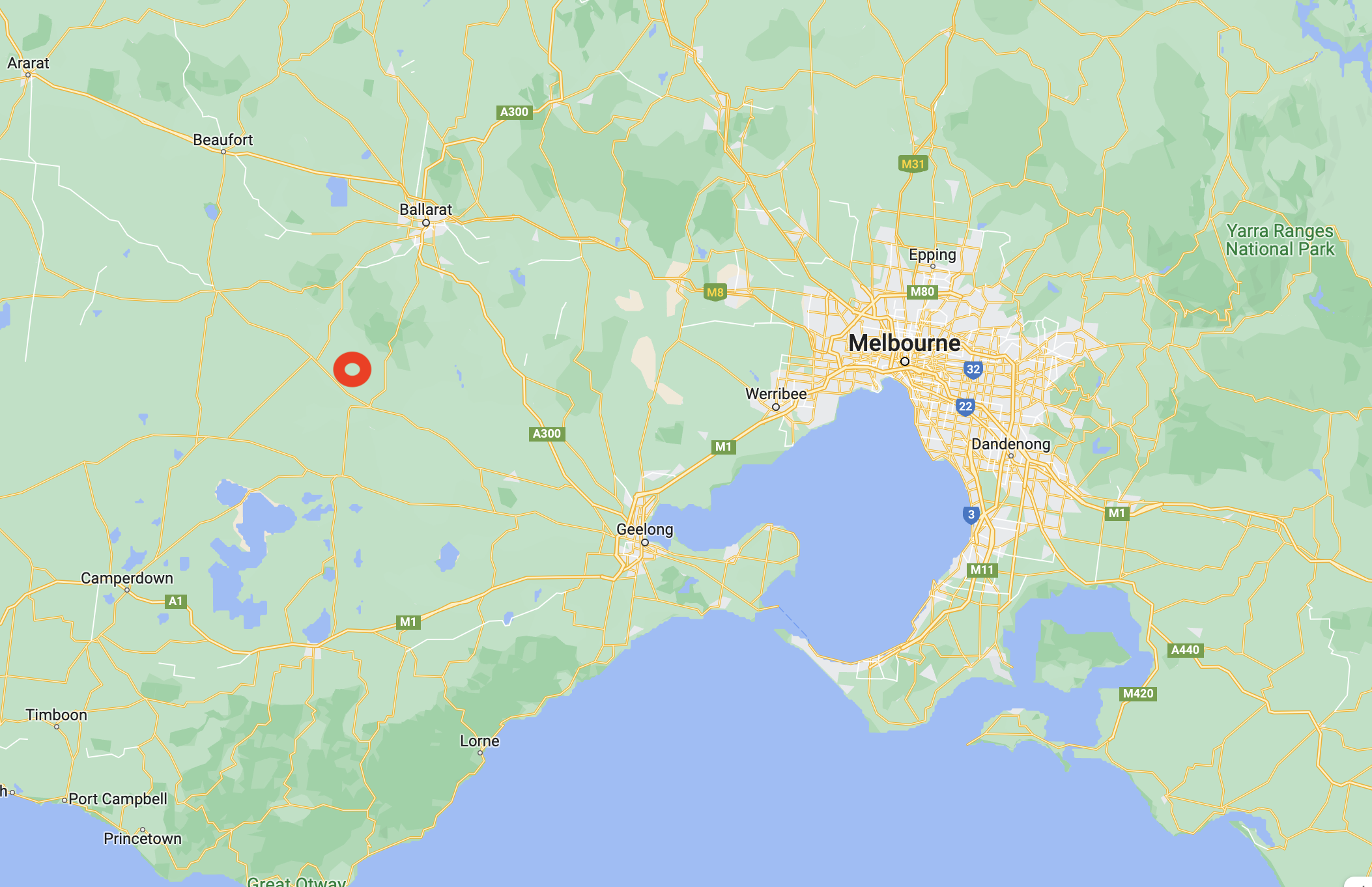
Our fifth park for 7th March 2023 was the Commeralghip Flora Reserve VKFF-2296. The park is about 143 km northwest of Melbourne and about 43 km southwest of Ballarat.
Above:- Map showing the location of the Commeralghip Flora Reserve. Map c/o Google Maps.
The Commeralghip Flora Reserve is a tiny reserve. It is only 3 hectares in size and was established on the 22nd day of April 1993.
The park is located on Chathams Road.
Above:- An aerial view of the park. Image c/o Google Earth.
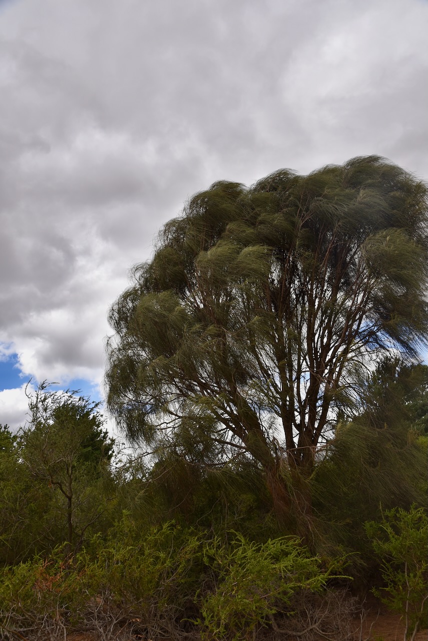
It was absolutely blowing a gale, so we decided to operate from the 4WD. Our antenna was the 20/40/80m linked dipole, inverted vee, supported on a 7-metre heavy duty squid pole.
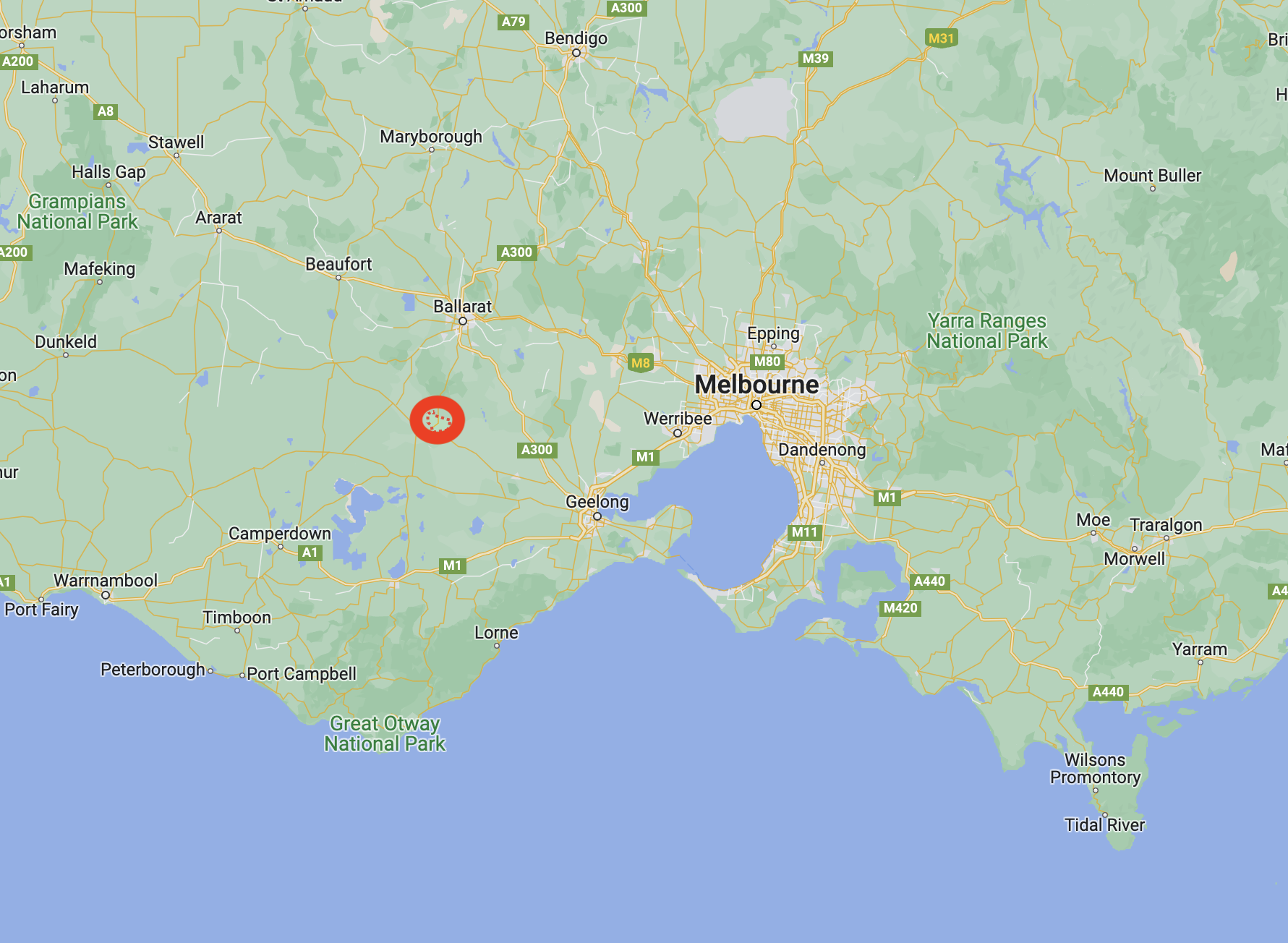
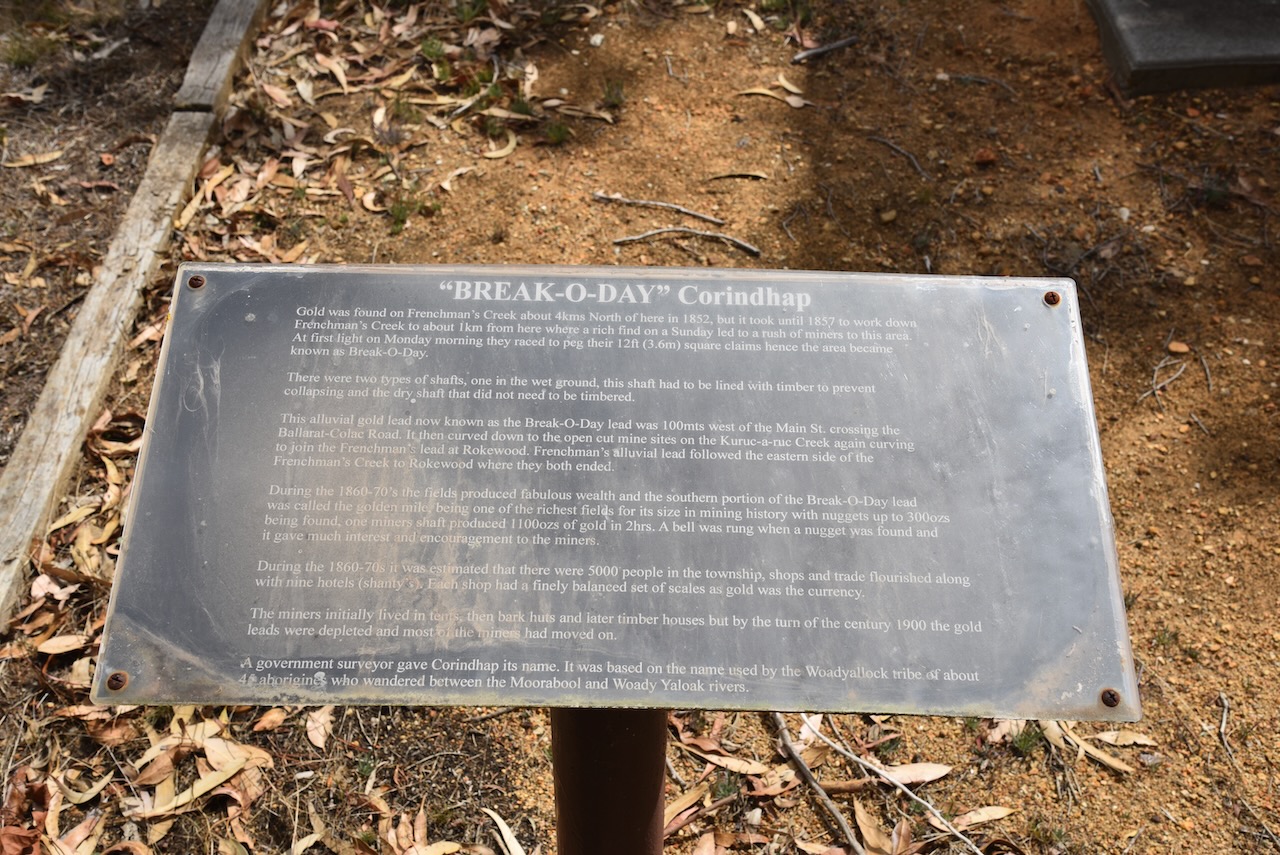
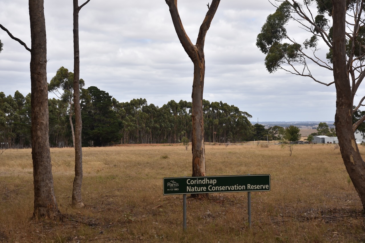
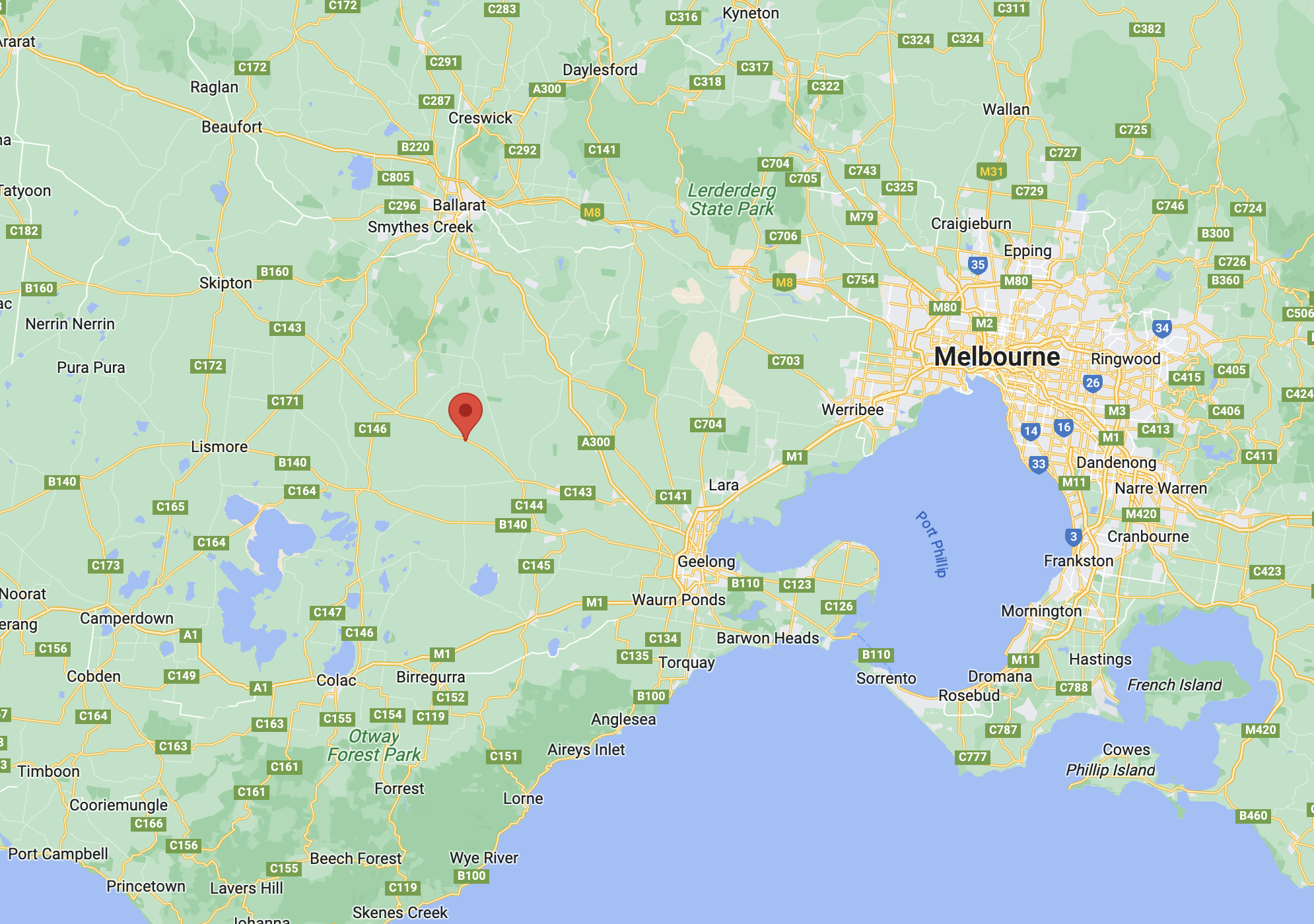
After packing up at Warrambine (7th March 2023), Marija and I made the short 18 km journey to our next park of the day, the Cordinhap Nature Conservation Reserve VKFF-2070. Corindhap is a small town about 35 km south of Ballarat
Above:- Map showing the location of the Cordinhap NCR. Map c/o Google Maps.
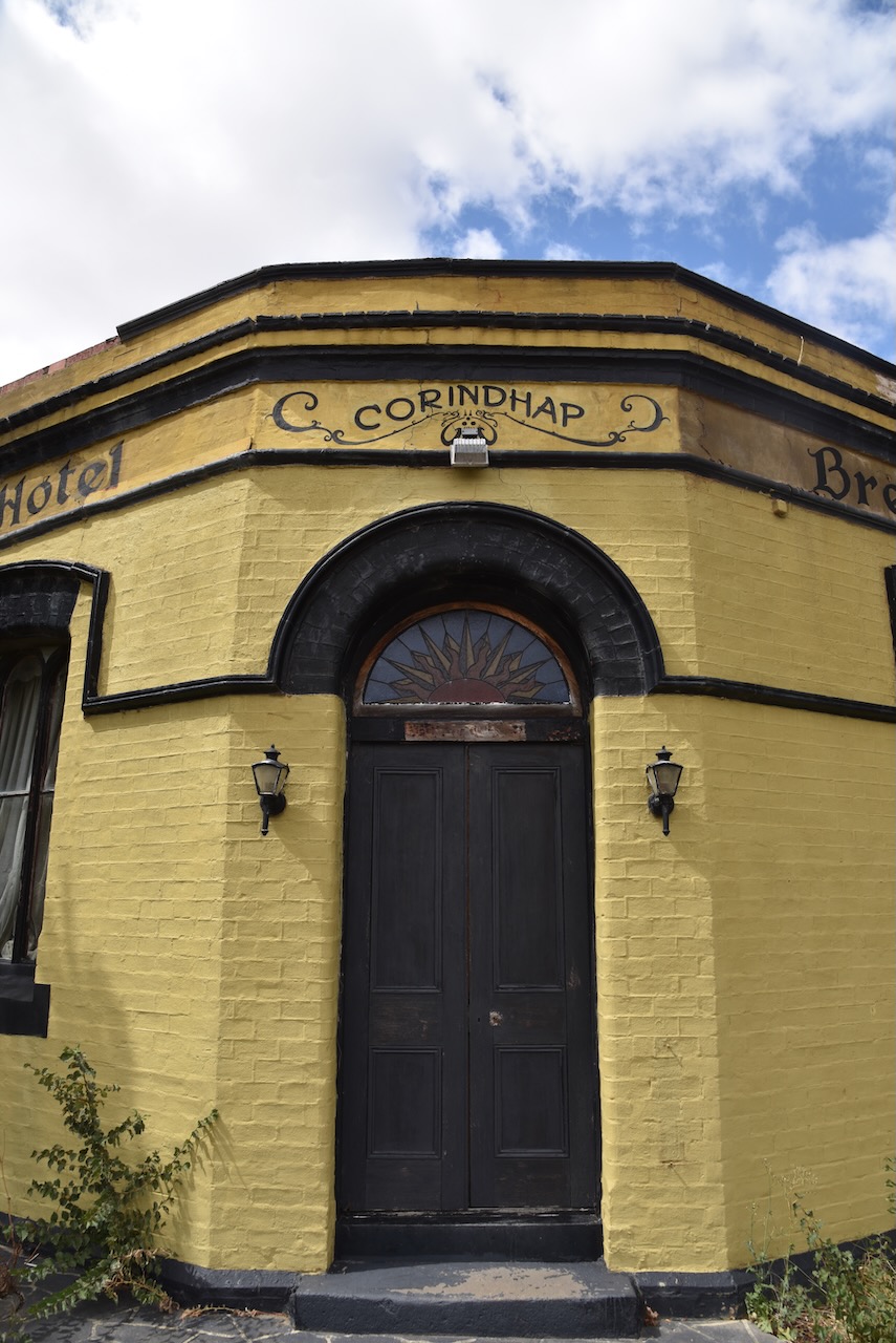
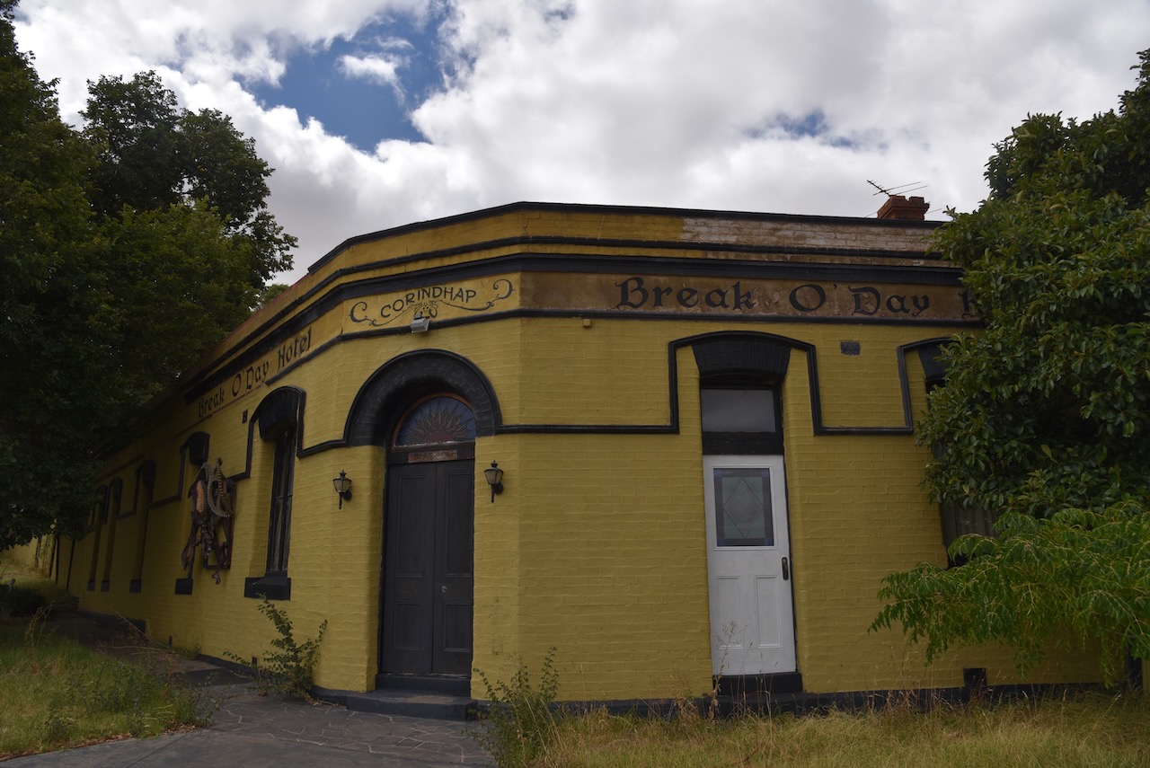
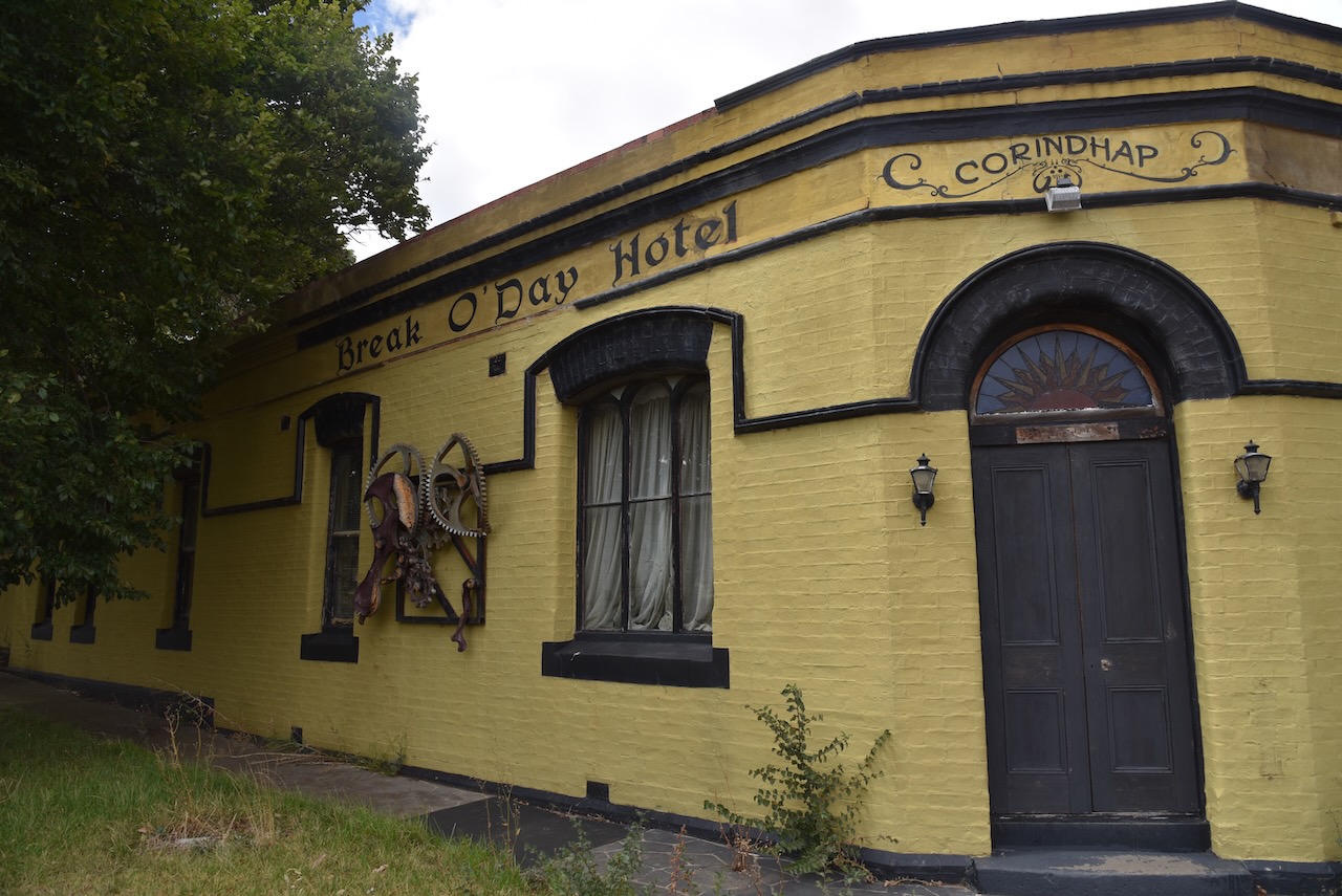
The town was established in 1852 after gold was discovered at Boundary Hill. It was initially known as Break O’Day. By 1857 the town had grown in population to about 5,000 people. The town had four hotels, three bakers, three tailors, two blacksmiths, two drapers, four butchers, two bootmakers, two grocers, two general storekeepers, a tobacconist, and numerous grog shanties. The town also had an Oddfellows Hall, two churches, and a school. The Post office opened on the 25th day of January 1868. It was known as Break O’Day until 1876 and was closed in 1993.
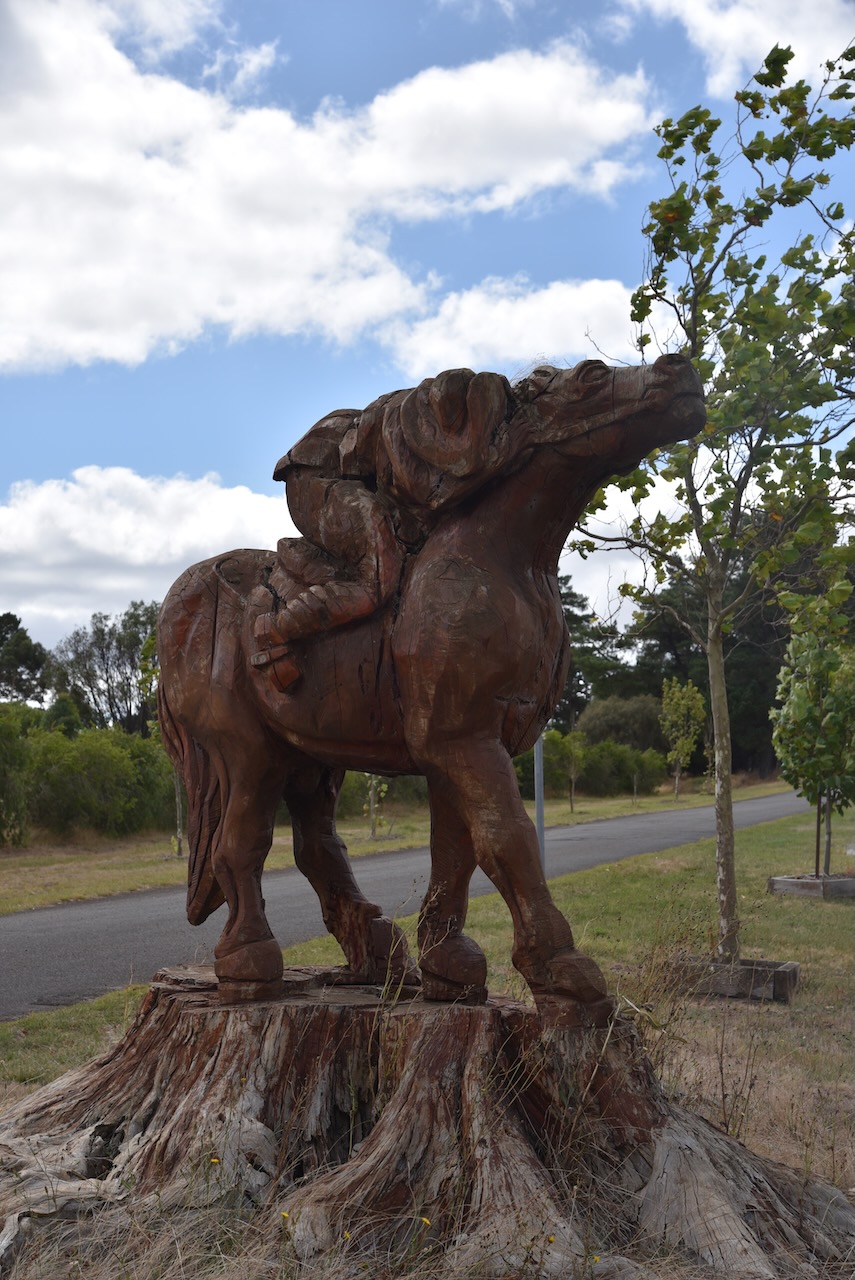
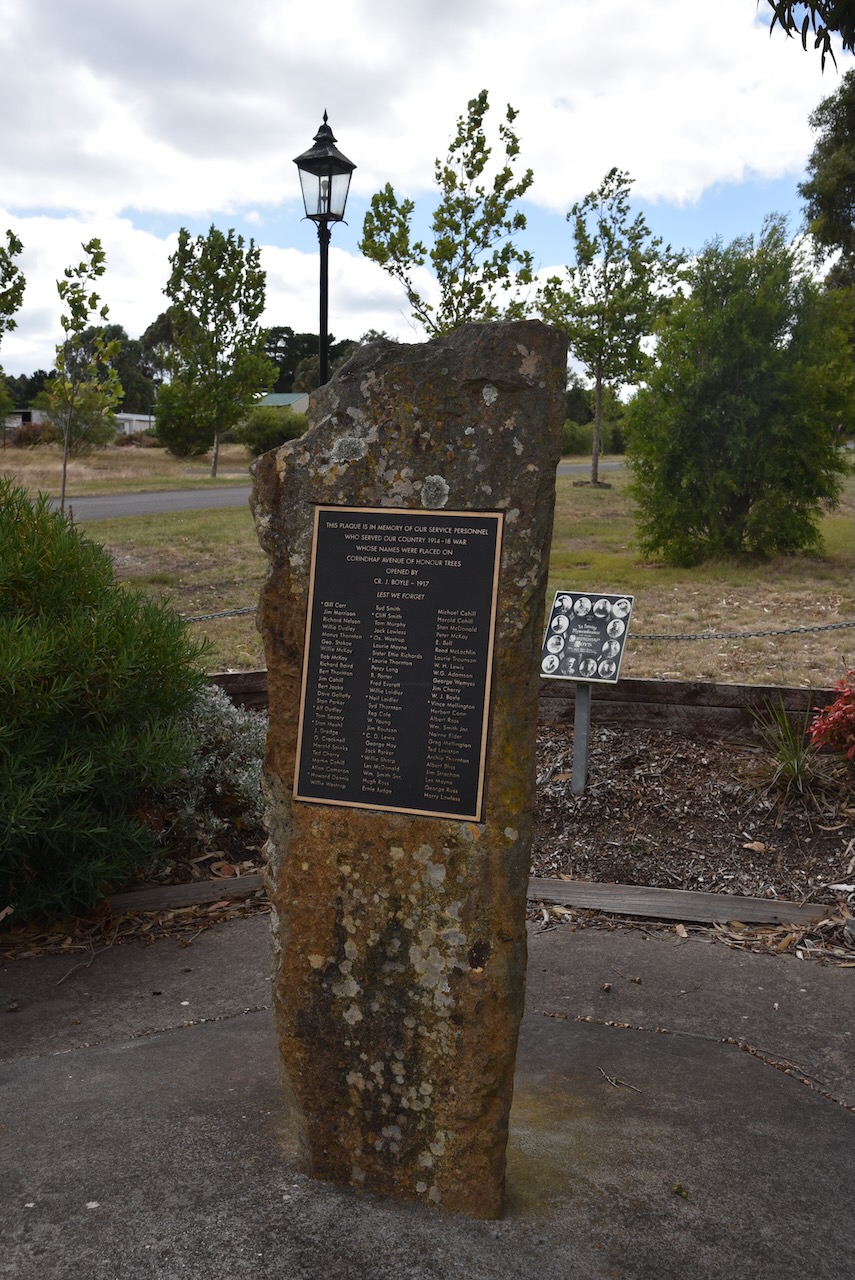
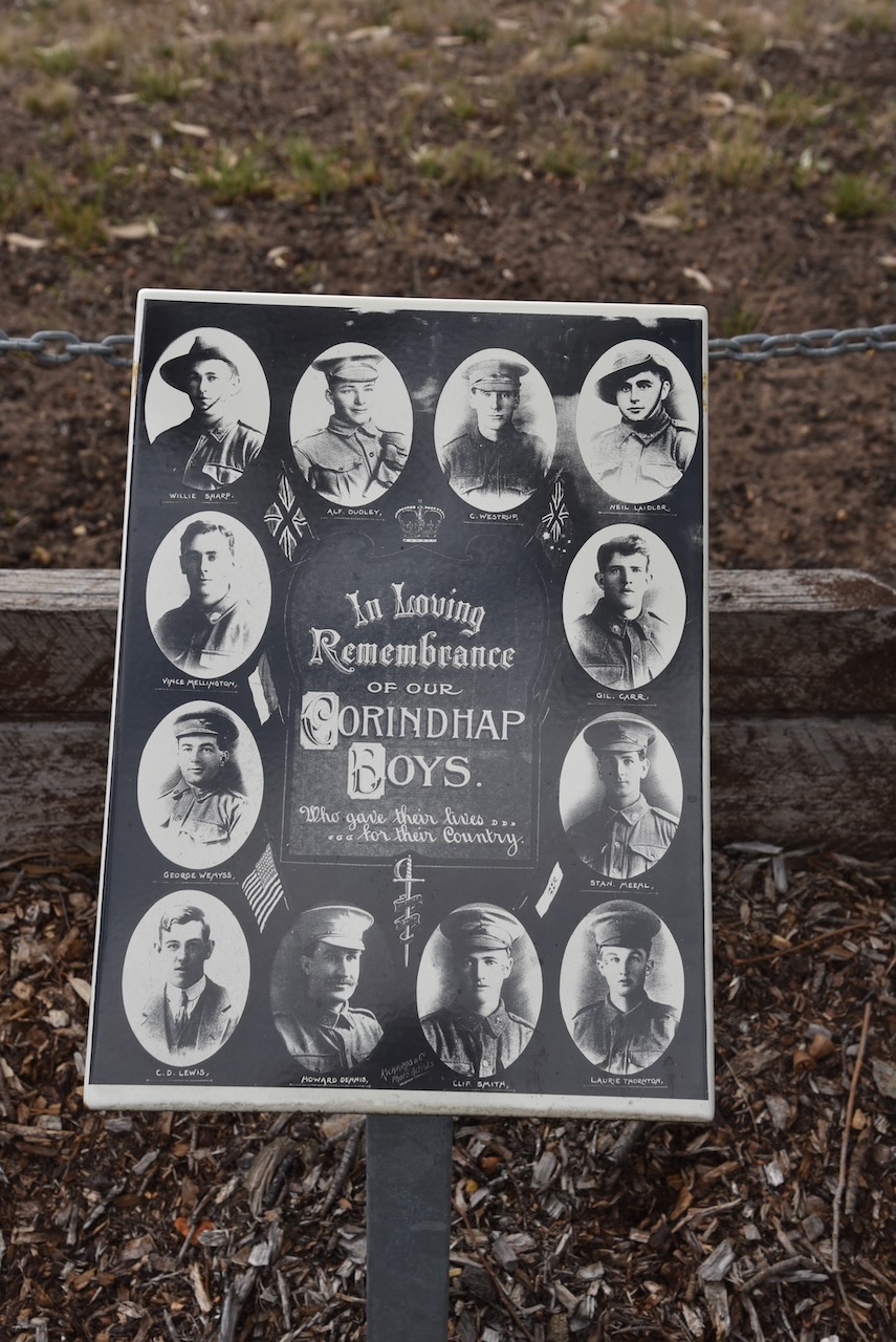
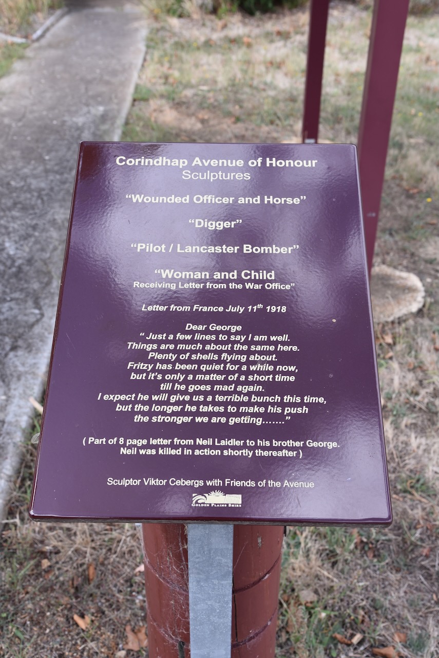
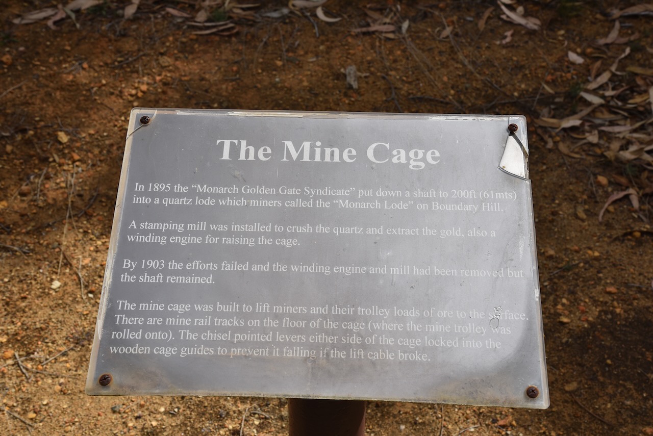
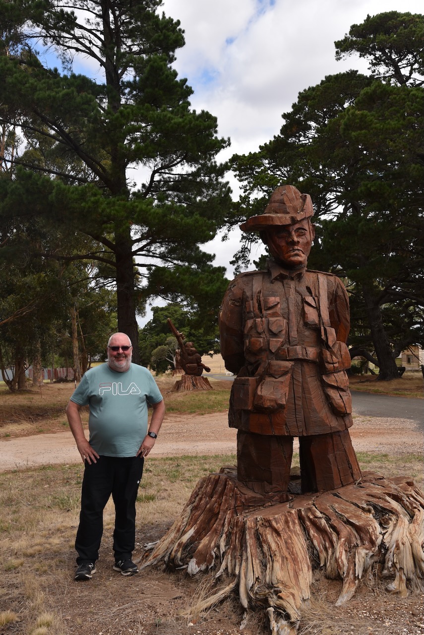
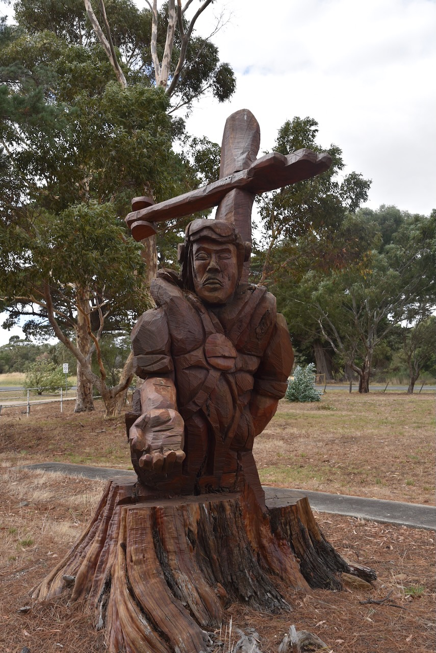
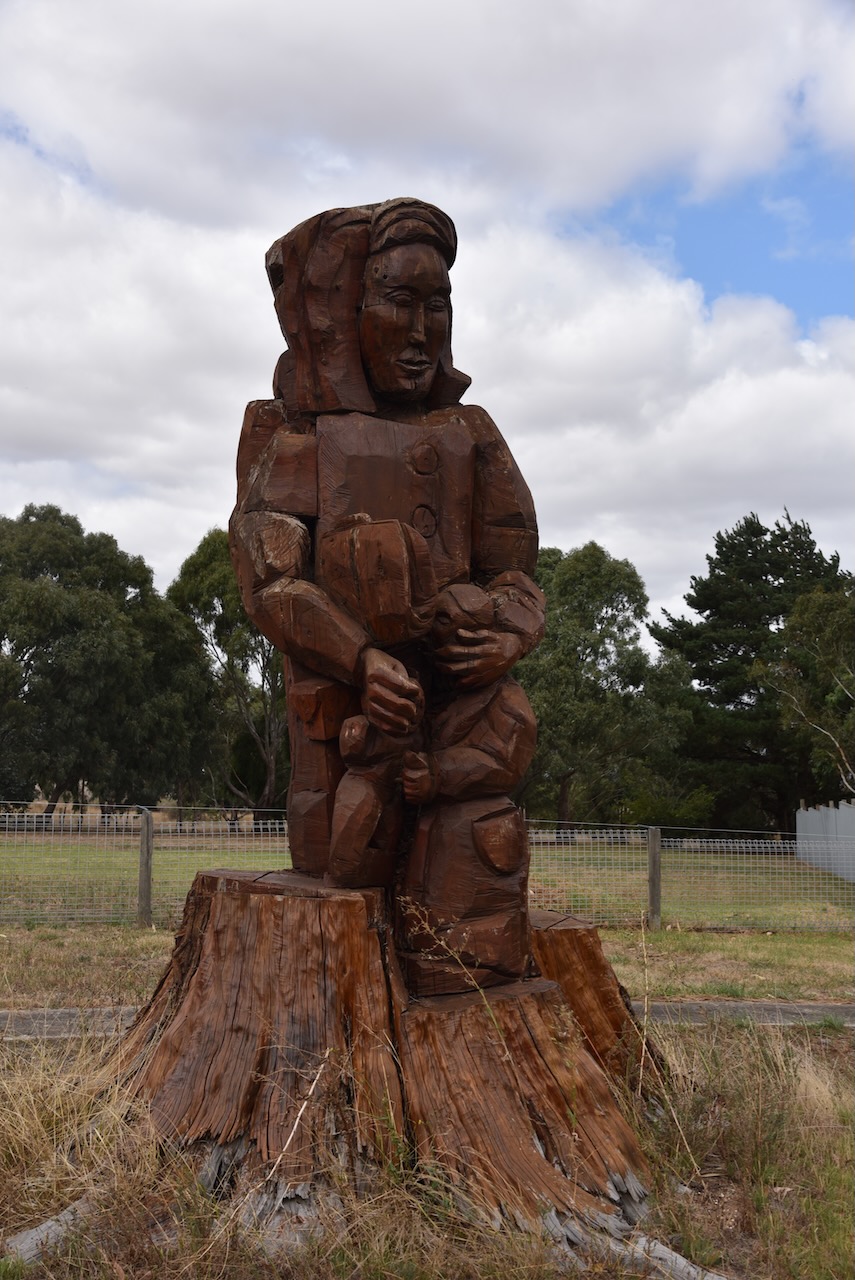
Cordinhap’s Avenue of Honour commemorates those who served in World War One. The Avenue contains a number of wood carvings that depict a wounded officer and horse, a digger, a pilot of a Lancaster bomber, and a woman and child. The carvings were made from Cypress and Radiata pine trees on the avenue which had started to die. Rather than cut the trees down, the lower trunks were kept and local artist Viktor Cebergs transformed the tree stumps into works of art.
The old Break O Day Hotel dates back to 1869. Over the years it has also been known as the Commercial Hotel.
The State School No.1906, at Corindhap officially opened in June 1877. A total of 203 students were enrolled at the school that year.
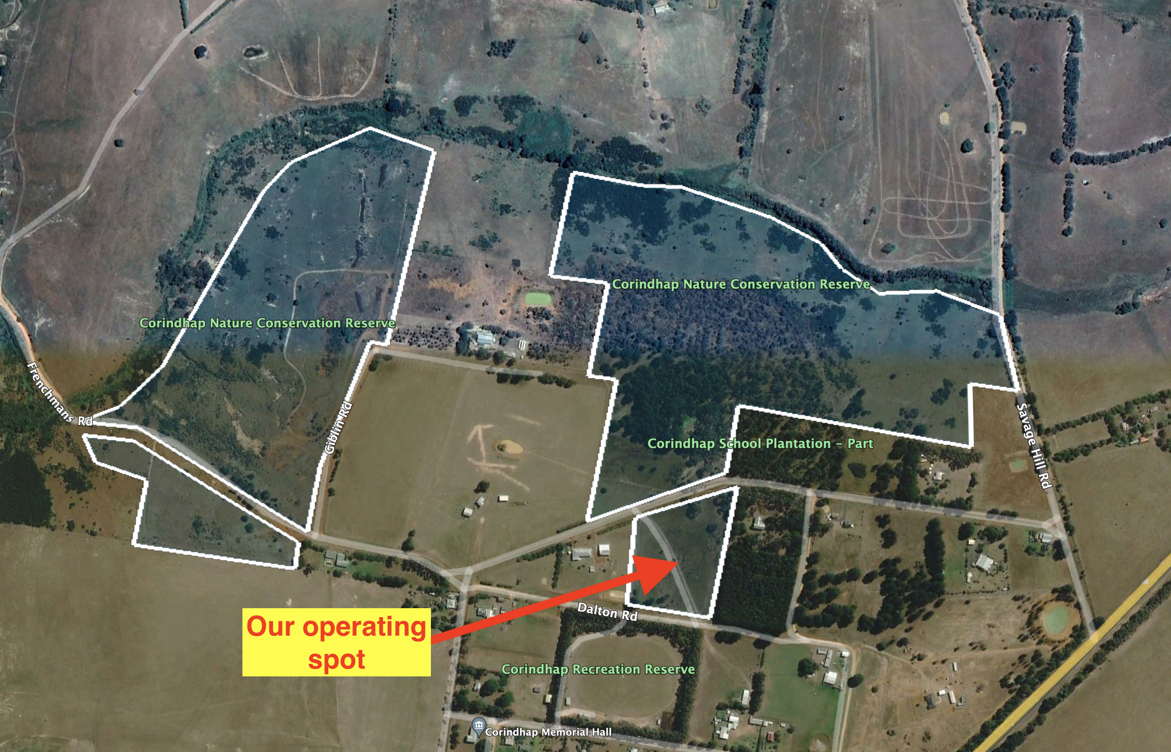
The park is divided into four distinct areas. The first is located north of School Road and west of Savage Hill Road. The second is south of School Road. The third is located north of Frenchmans Road and west of Giblin Road. And the fourth is south of Frenchmans Road.
The park is 39 hectares in size and was established on the 16th day of November 1999.
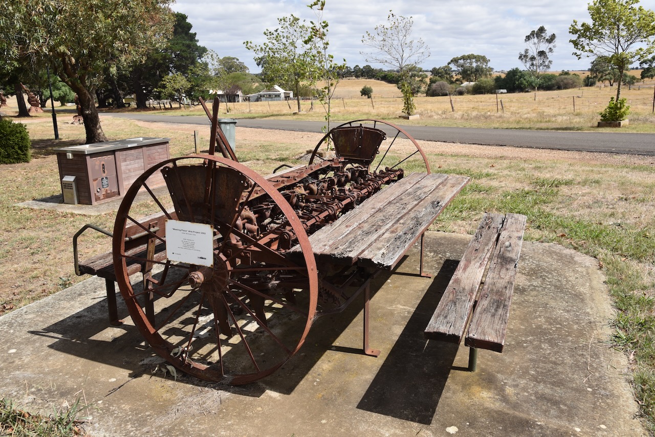
We set up off School Road and ran the Icom IC7000, 100 watts, and the Codan 9350 antenna (1.5 m stainless steel whip).
Above:- An aerial shot of the park showing our operating spot. Image c/o Google Earth.
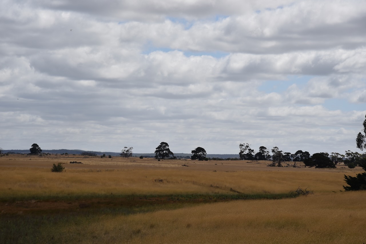
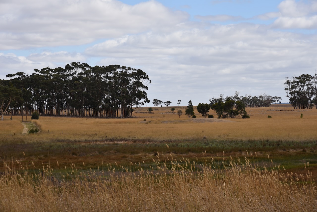
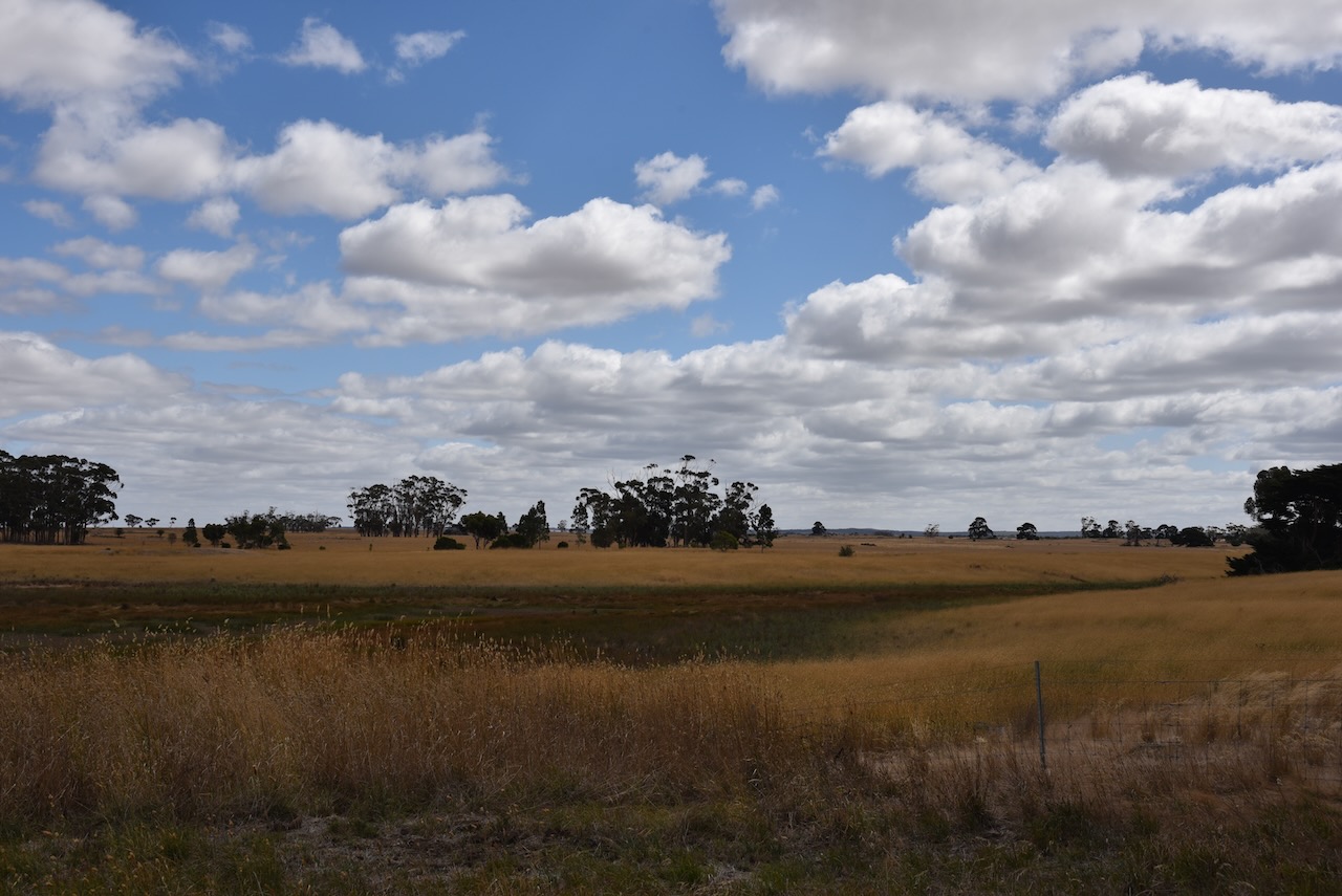
Our next park for 7th March 2023 was the Warrambine Flora Reserve VKFF-2479. It was only a short 12 km drive from Mount Mercer before reaching the park.
Above:- Map showing the location of the Warrambine Flora Reserve. Map c/o Google Maps.
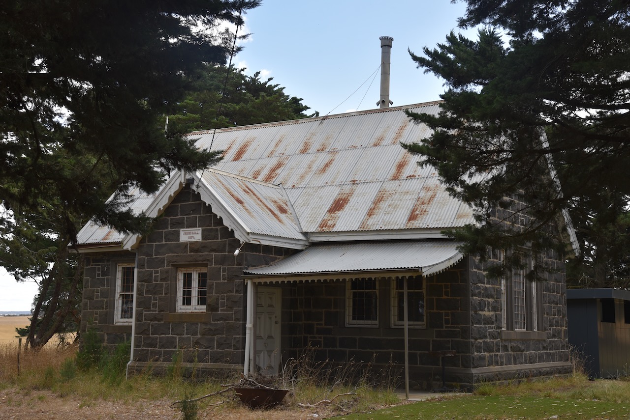
Right alongside the park is the old Warrambine Shire Hall, a beautiful bluestone building that was constructed in 1871. Despite its relatively small size, Warrambine in the late 1800s was the administrative centre for the Shire of Leigh and the site of its shire hall.
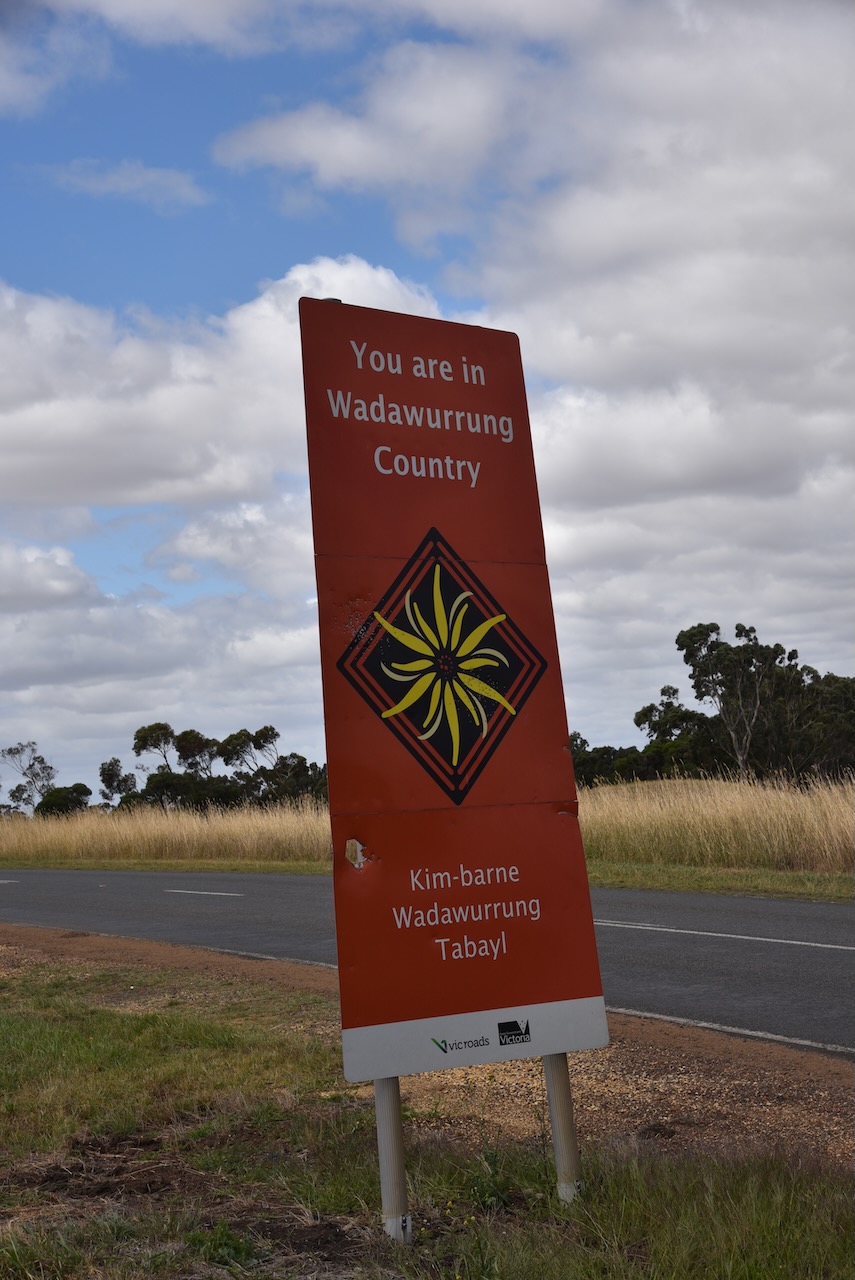
The Wadawurrung Aboriginal people are the traditional owners of the land around Warrambine.
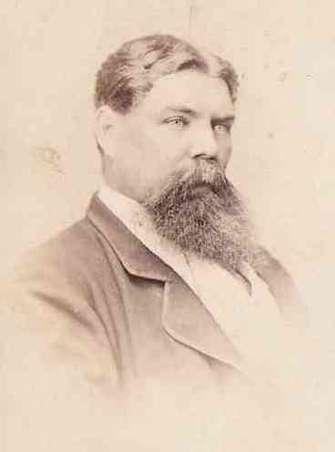
Warrambine takes its name from the Warrambeen pastoral run which was one of the early land leases in the Portland Bay District, Geelong. It had an estimated area of 26,301 acres. Major William Drummond Mercer (b. 1796. d. 1871) held the lease on the property from 1842-1846. It was then leased and owned by “Big John” Bell (b. 1821 d. 1867).
Above:- John Bell. Image c/o bellarmstrong.kohlstrom.com.au
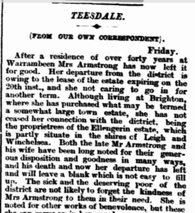
The land was then taken up by Alexander Armstrong (b. 1823. d. 1890). His children attended the state school in the village. Following the closure of the school in 1883, Armstrong provided a hut on his property for a private school, paying the teacher £28 p.a. with lodging. In 1890 this was closed at the time of Armstrong’s death.
His wife Betsy remained on the property until December 1892 when the lease expired.
Above:- part of an article from the Geelong Advertiser, Sat 17 Dec 1892. Image c/o Trove.
In 1863 alongside the Warrambine Creek, Halfway House Inn was built. It was so named due to being located near the halfway point between Geelong and Ballarat on a Cobb & Co. coach route. It was located on the opposite side of the road to the Shire Hall.
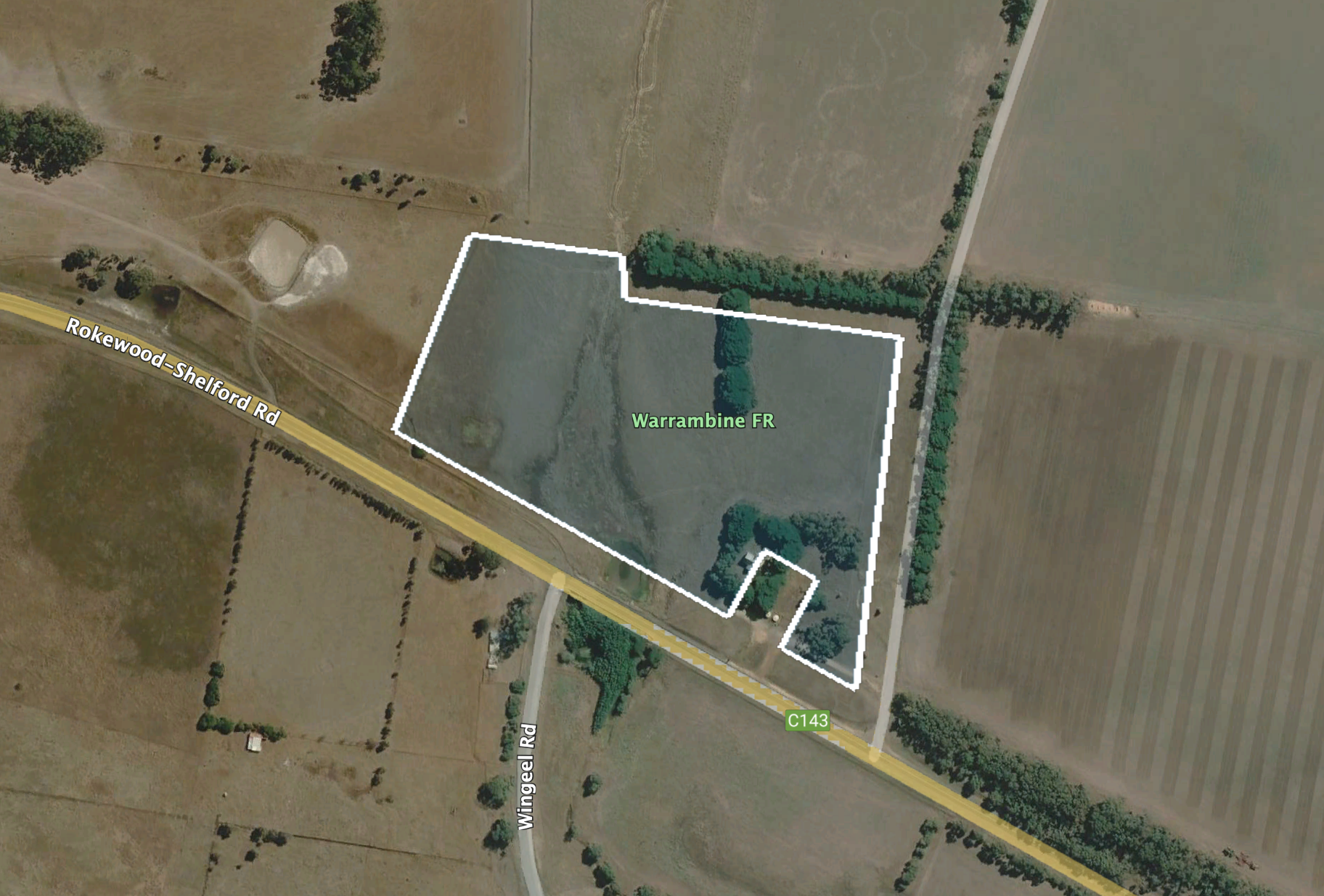
The Warrambine Flora Reserve is located on the northern side of the Rokewood-Shelford Road.
Above:- Aerial view of the park. Image c/o Google Earth.
The park is 6 hectares in size and was established on the 17th day of November 1988.