Goroke silo VK-GRE3

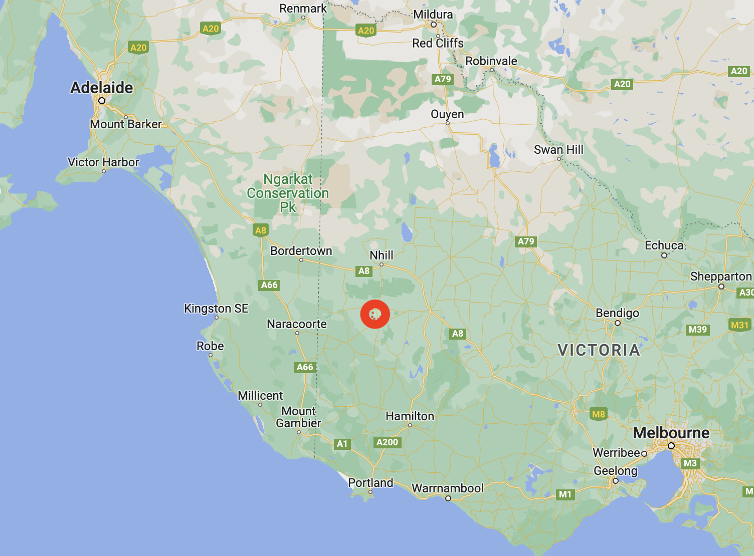
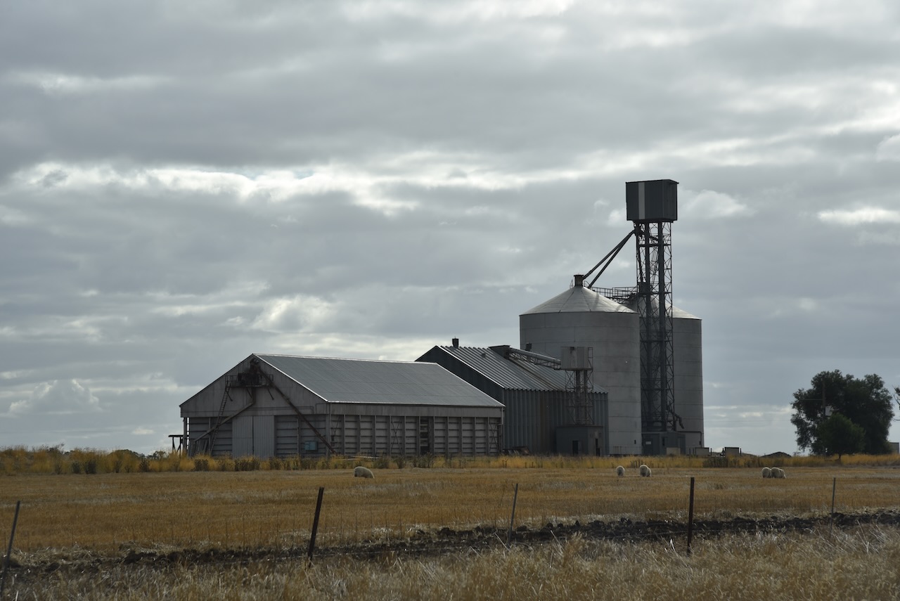
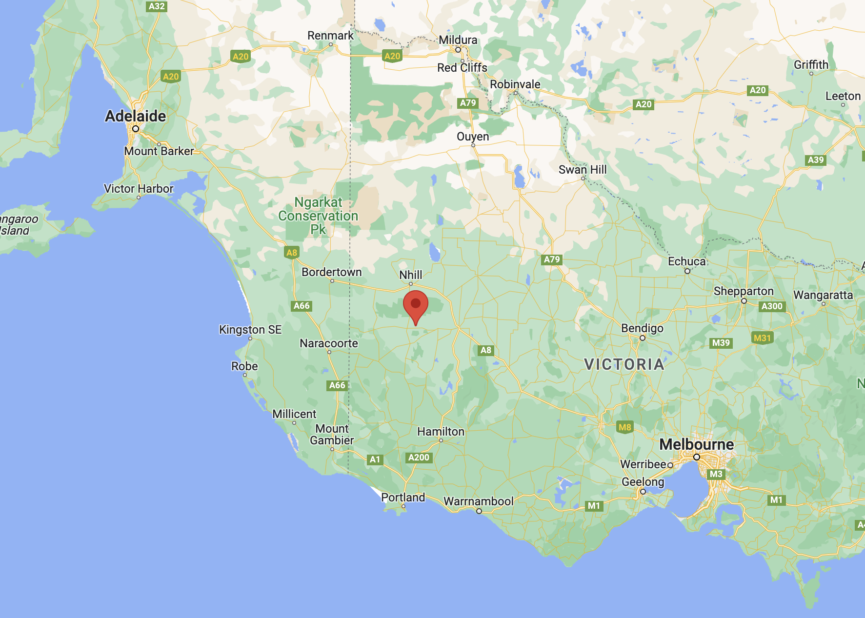
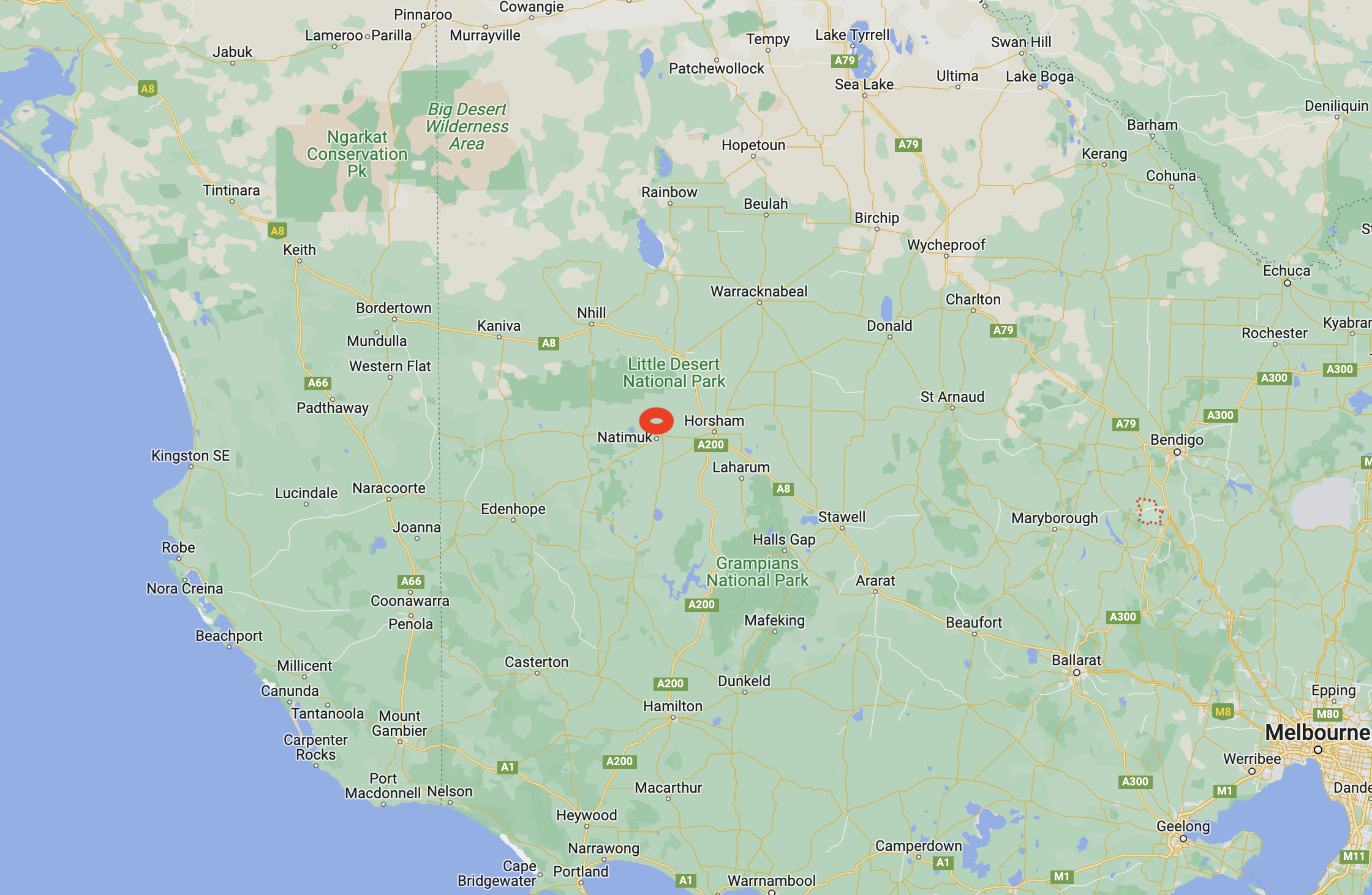
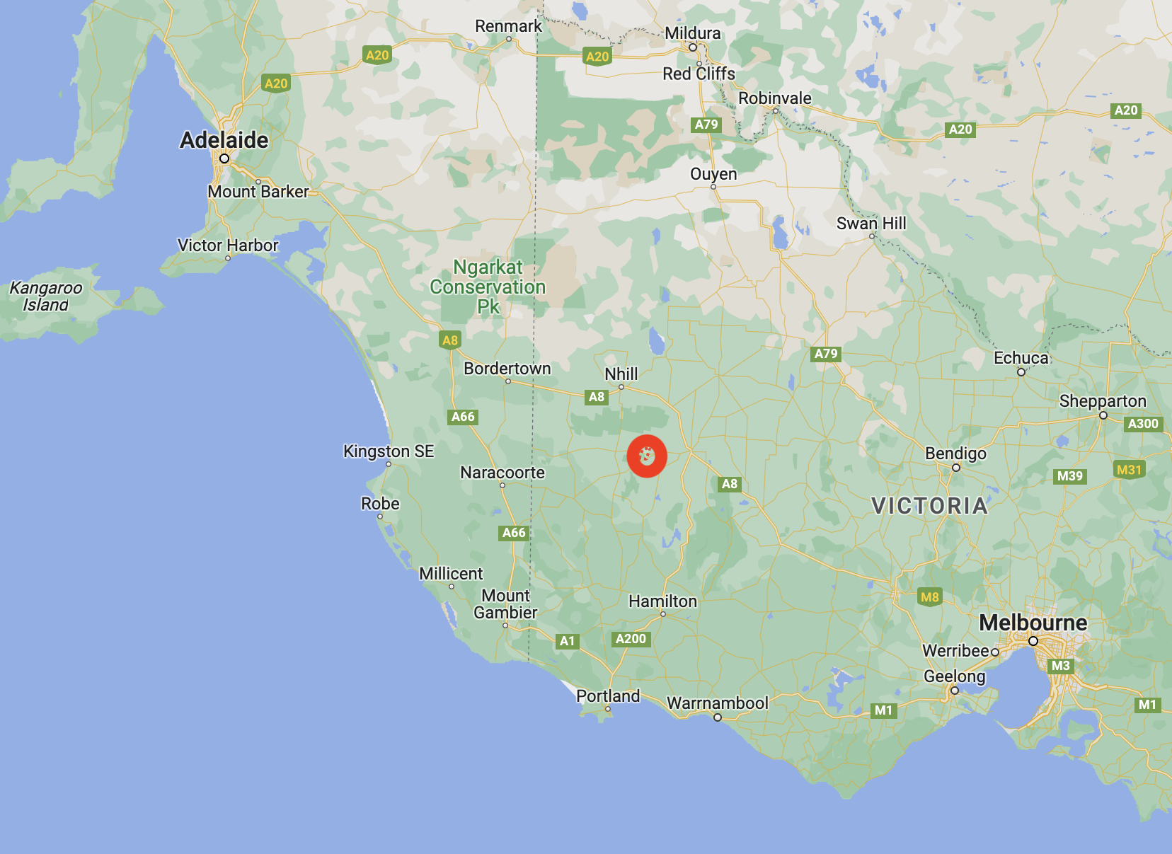
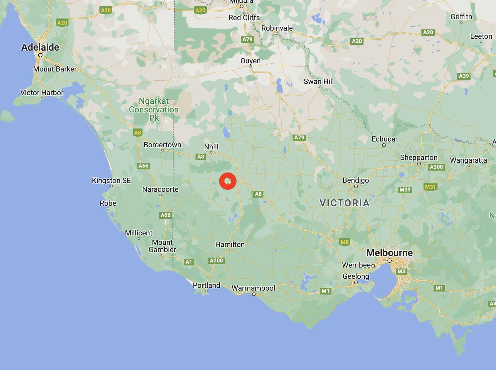
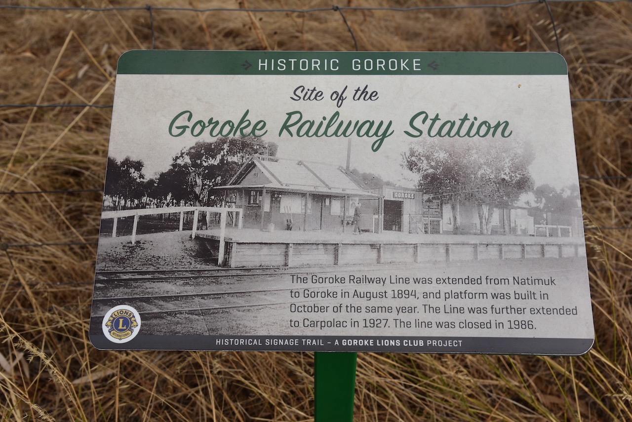
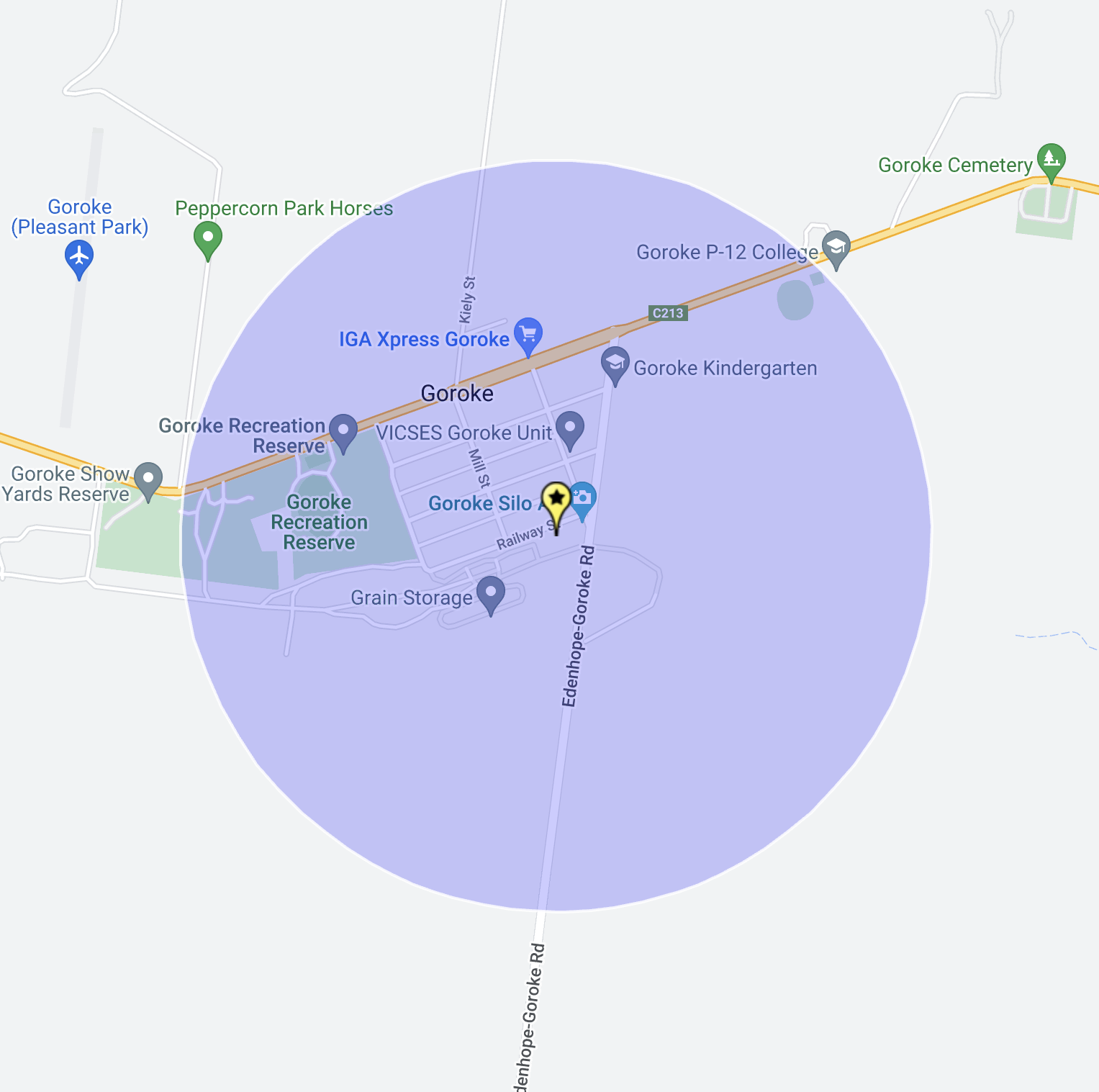
Our final activation for the trip (8th March 2023) was the Goroke silo VK-GRE3. Goroke is located in the Wimmera district of Victoria, about halfway between Horsham and the South Australian State border.

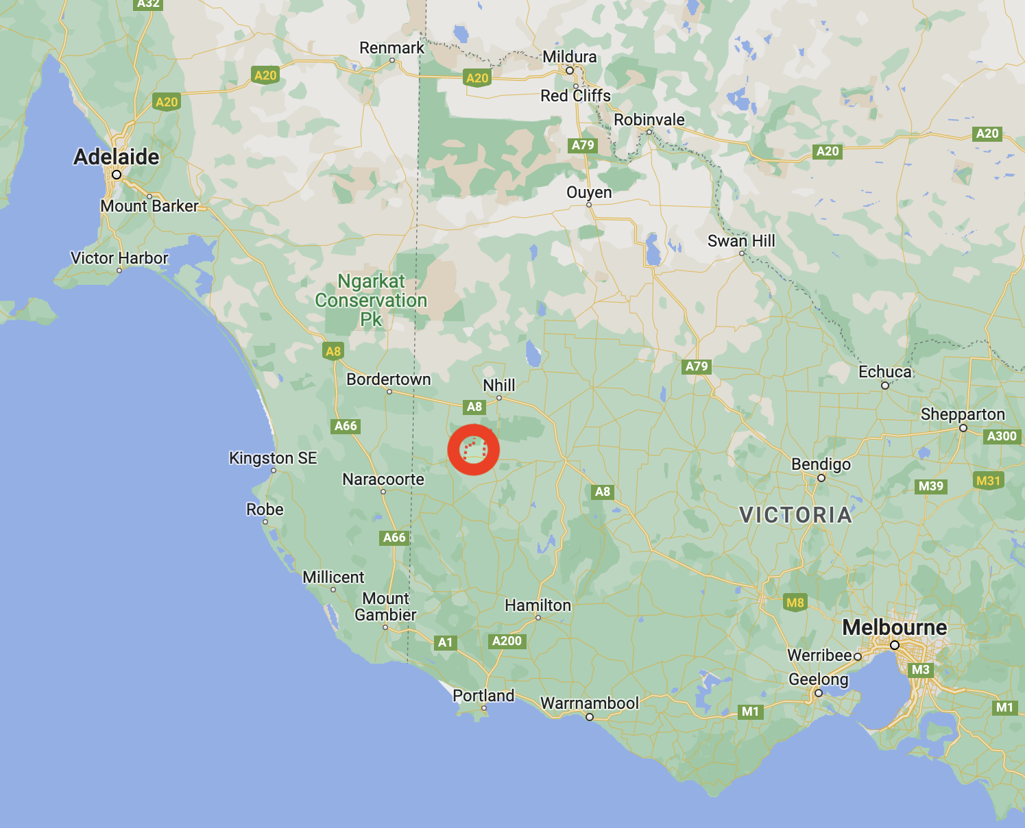
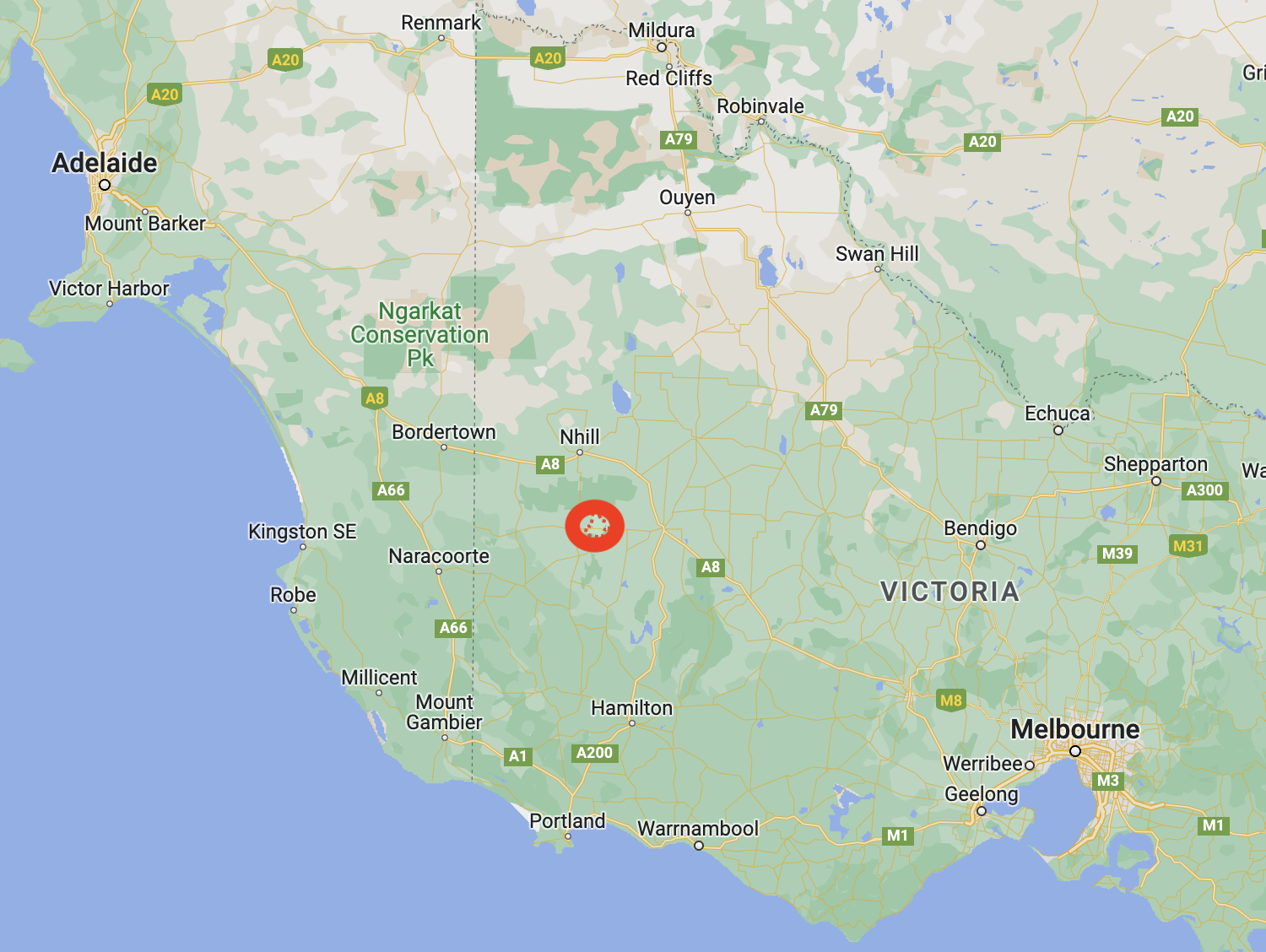
Above:- Map showing the location of Goroke. Map c/o Google Maps.

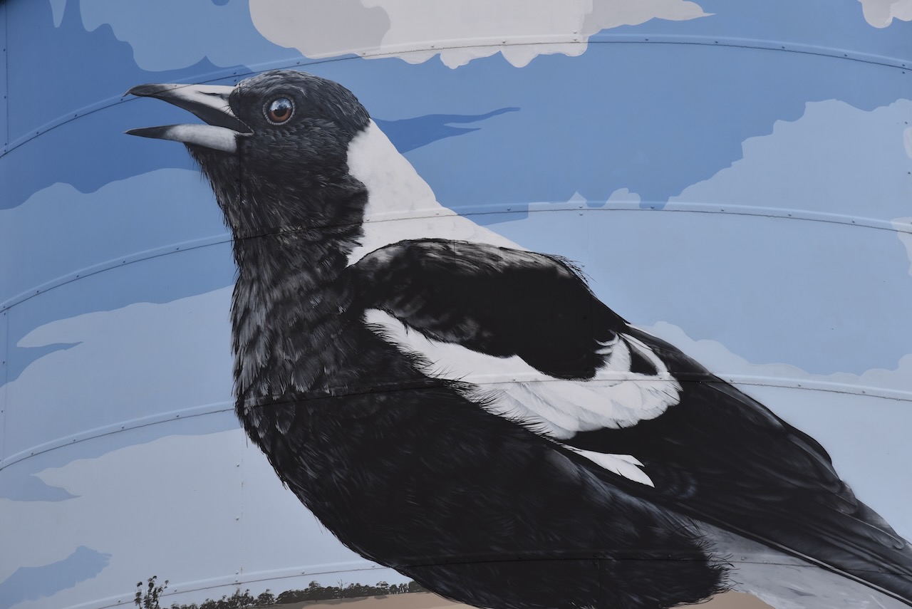
Goroke is believed to be an aboriginal word meaning magpie.

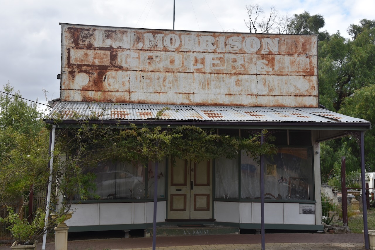
The Goroke area was settled in the mid-1840s by a number of pastoral runs. By the 1870s farm allotments were taken up in the Goroke area. In 1882 the Goroke township was surveyed. In 1885 a school was opened. Within a few years, Goroke had stores, a flour mill, a hotel, and a mechanics institute.

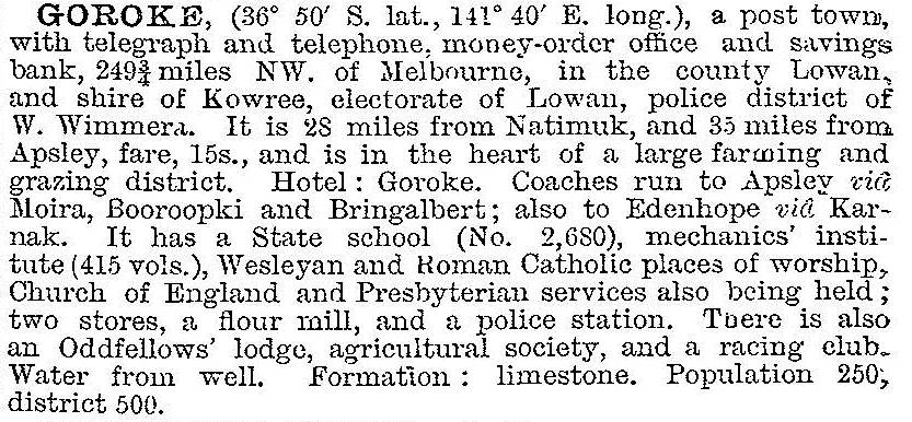
In 1903 Goroke was described in the Australian Handbook as follows:

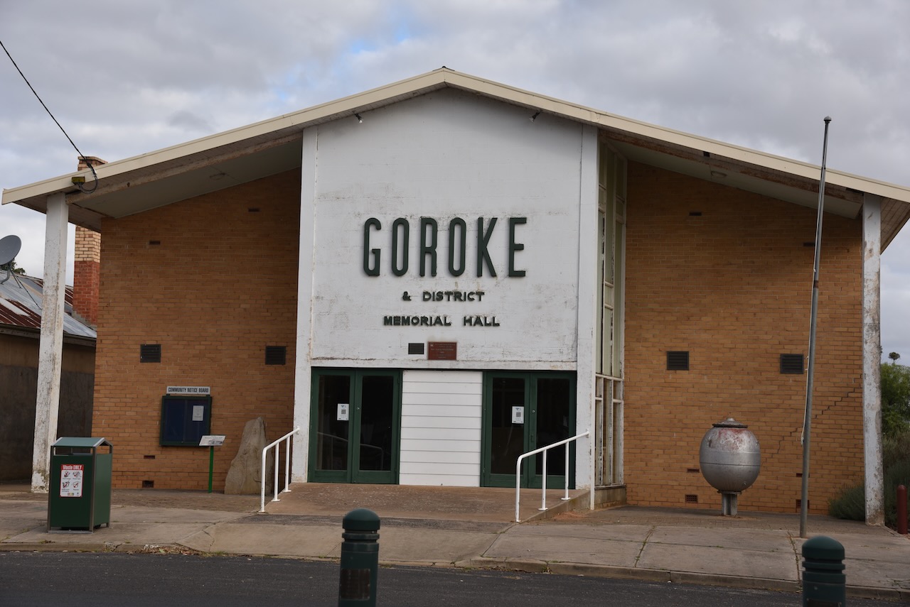
Today the town of Goroke is based around primary production, including wool growing, fat lamb and mutton production.

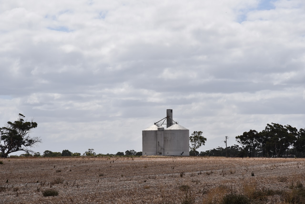
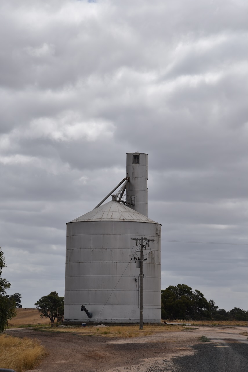
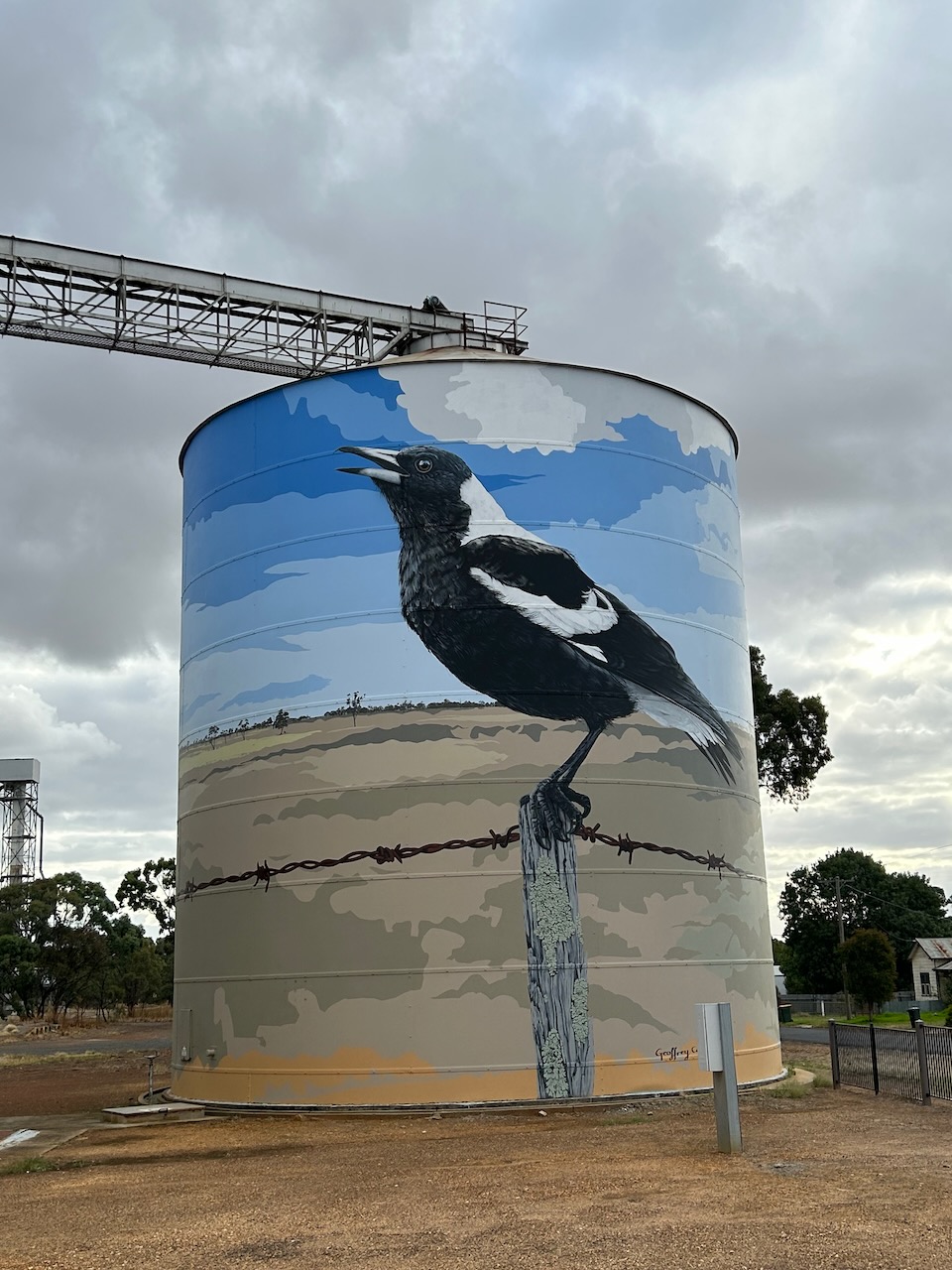
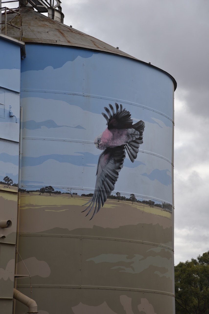
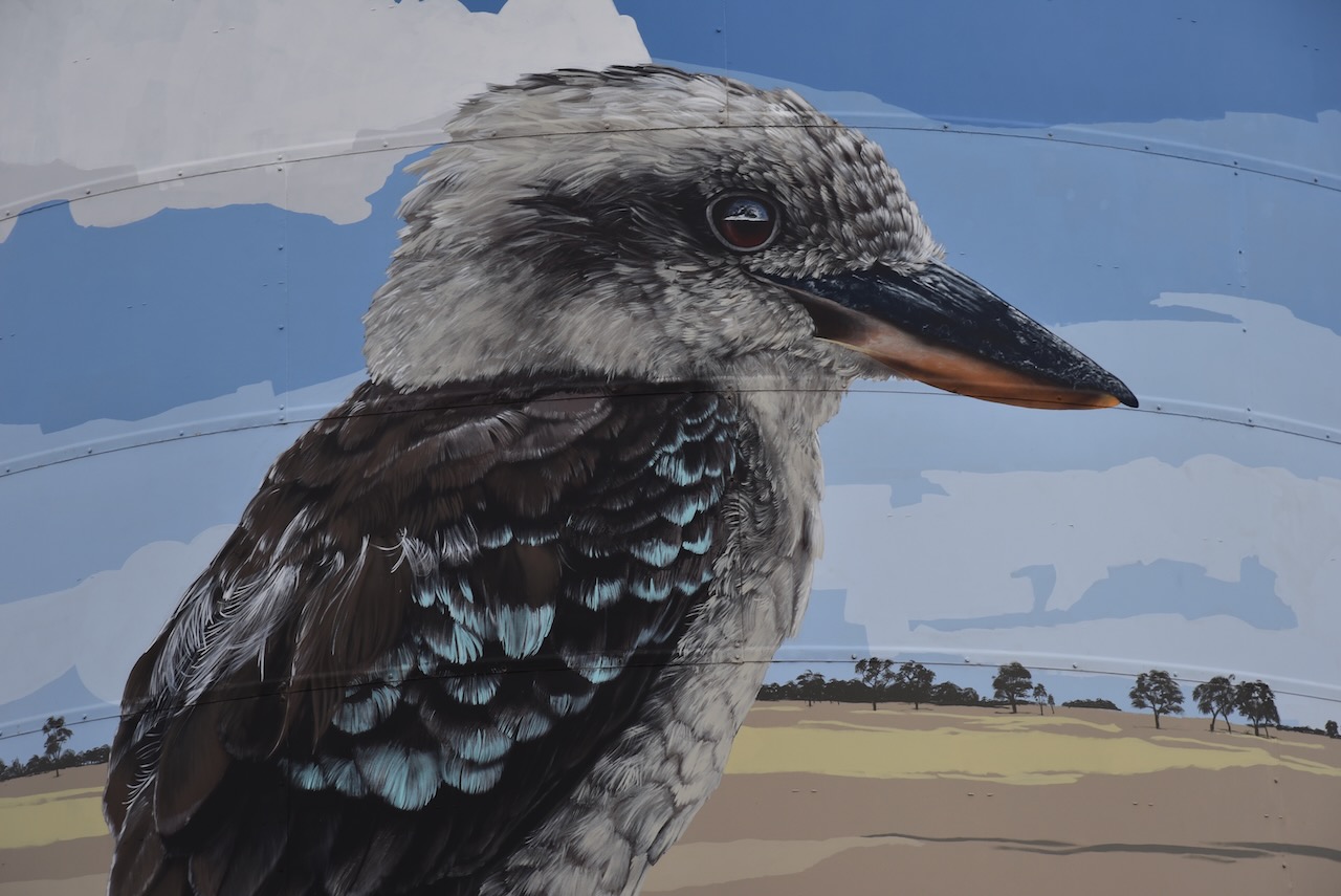
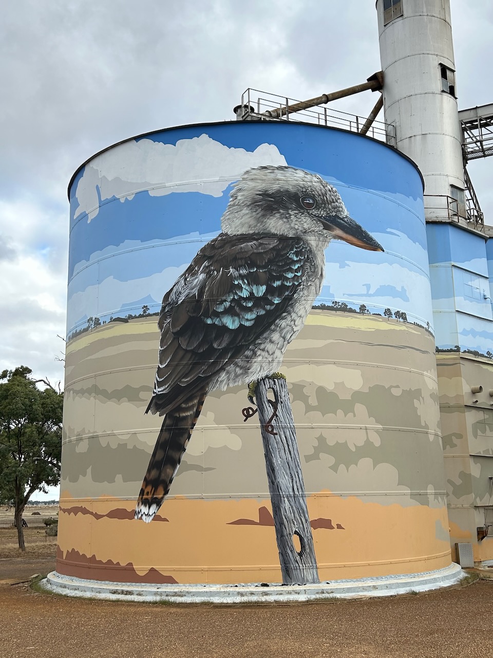
The Goroke silo is a silo mural and was painted by artist Geoffrey Carran. He was inspired by the birdlife in the West Wimmera Shire. As Goroke is an aboriginal word for magpie, the Australian Magpie features heavily on the silos. Other native birds featured on the silos include the Kookaburra and Galah. The silo was completed in late 2020 and took about seven weeks to complete. The Kookaburra and Magpie are both more than 10 metres in height.

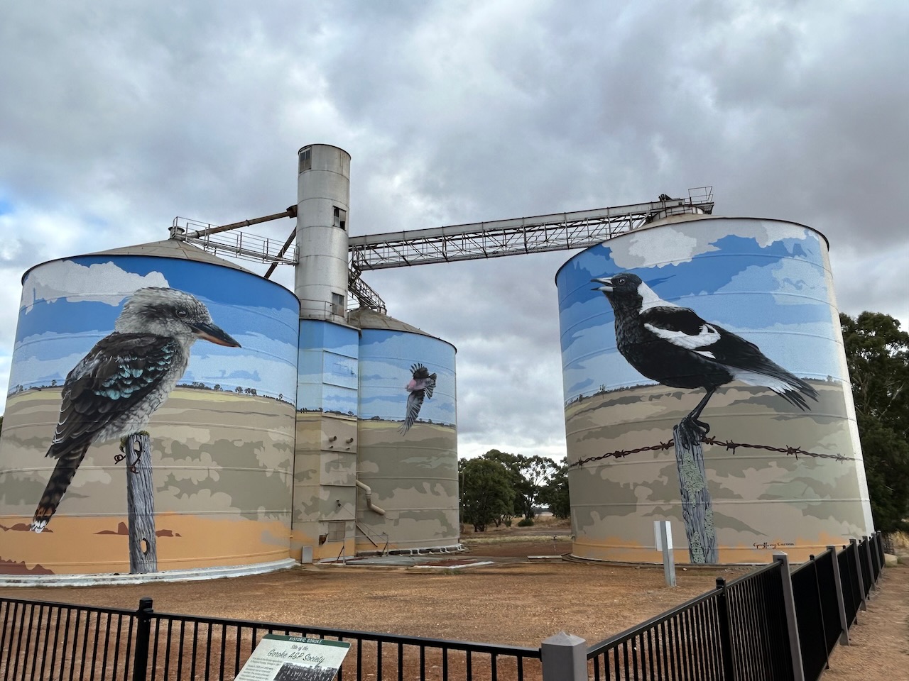
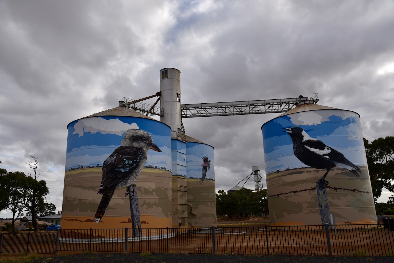
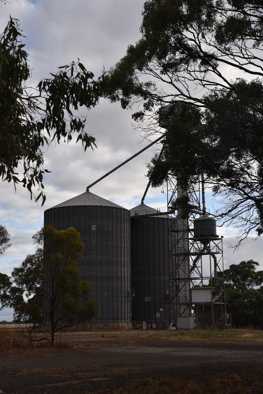
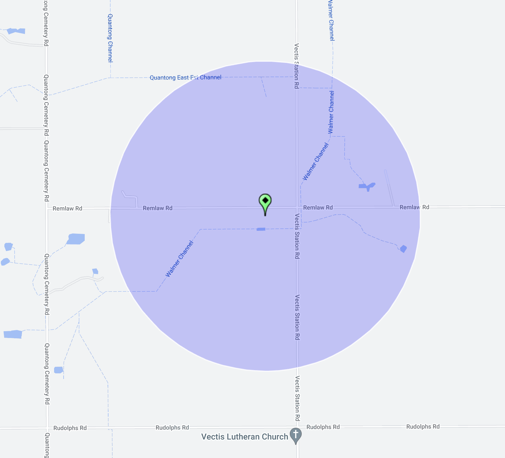
Marija and I operated from the 4WD for this activation in the carpark adjacent to the silos.

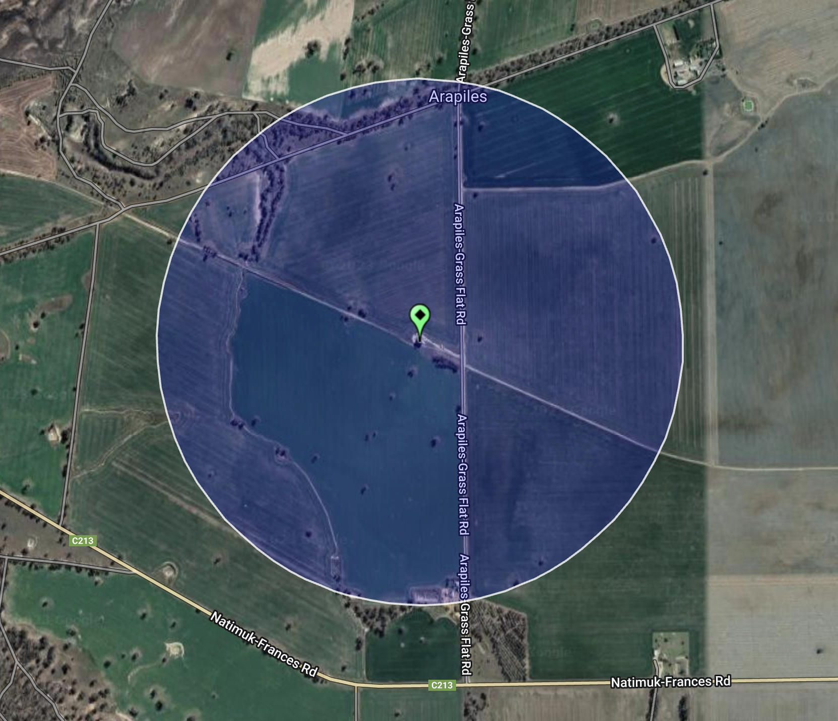
Above:- the silo activation zone at Goroke. Image c/o SiOTA website.

Marija worked the following stations on 40m SSB:-

  1. VK1AO
  2. VK2MET
  3. VK3SMW
  4. VK3PF

I worked the following stations on 40m SSB:-

  1. VK1AO
  2. VK2MET
  3. VK3SMW
  4. VK3PF
  5. VK5CZ
  6. VK5HS
  7. VK2IO
  8. VK3EIR
  9. VK5NZ
  10. VK2MOE
  11. VK2VKB
  12. VK3MDC
  13. VK3DX
  14. VK2YK
  15. VK5GA
  16. VK7FGGT
  17. VK3SKT

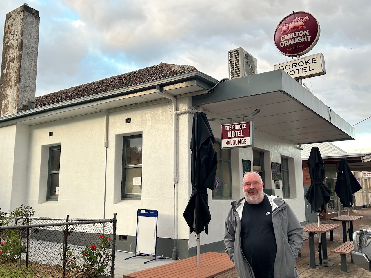
It was late and we were getting hungry, so we decided to have a meal at the Goroke Hotel. We were not disappointed….the meal was very nice.

We then continued home, about a 3 hour & 50-minute drive.

References.

  1. Silo Art Trail, 2023, <http://siloarttrail.com/works/goroke/>, viewed 5th May 2023.
  2. Victorian Places, 2023, <https://www.victorianplaces.com.au/goroke>, viewed 5th May 2023.
  3. Wikipedia, 2023, <https://en.wikipedia.org/wiki/Goroke,_Victoria>, viewed 5th May 2023.

Gymbowen silo VK-GYN3

Marija and I left the town of Mitre (8th March 2023) and we travelled west on the Natimuk-Frances Road to our next silo, the Gymbowen silo VK-GYN3.

Above:- Map showing the location of Gymbowen, Victoria. Map c/o Google Maps.

We stopped briefly at Jane Duff Highway Park. On Friday the 12th day of August 1864, seven-year old Jane Duff and her nine-year old brother Isaac and four-year old brother Frank, set out to gather twigs. They remained lost in the bush for nine days until they were located by aboriginal trackers.

Above:- the discovery of the Duff children. Image c/o Aussie Towns Facebook site.

There is an excellent monument and information board that tells this amazing story of survival.

In 1882 the Post office at Gymbowen was opened. The Gymbowen school was opened in 1891. A hotel was opened some years earlier. Gymbowen served as a coach changing stage. The railway line reached the town by 1894 and was closed in 1986.

Marija and I parked on Hennesseys Road and operated from the 4WD.

Above:- The activation zone at the Gymbowen silo. Image c/o SiOTA website.

Marija worked the following stations on 40m SSB:-

  1. VK3PF
  2. VK5CZ
  3. VK5TN
  4. VK3AWA

I worked the following stations on 40m SSB:-

  1. VK3PF
  2. VK5CZ
  3. VK5TN
  4. VK3AWA
  5. VK4FW
  6. VK8MM
  7. VK2IO

I worked the following stations on 20m SSB:-

  1. Vk4EMP
  2. VK4TI
  3. VK1AO
  4. VK2MET
  5. VK6JKP

References.

  1. Wikipedia, 2023, <https://en.wikipedia.org/wiki/Gymbowen,_Victoria>, viewed 5th May 2023.

Mitre silo VK-MTE3

Marija and I then drove a short distance along the Natimuk-Frances Road and soon reached the little town of Mitre.

Above:- Map showing the location of Mitre, Victoria. Map c/o Google Maps.

Some historic buildings remain in the tiny town of Mitre.

The railway arrived in Mitre in 1894. The station was originally known as St Marys and was renamed in 1904 as Mitre Lake. It was then shortened to Mitre in 1920. A large bulk-head was constructed in 1951 and was demolished in 1972. In 1968 an oat shed was built. The grain silos, some remains of the platform, and a short section of track can still be found at the site. 

Marija and I parked alongside of the silos and operated from the 4WD.

Above:- the activation zone at the Mitre silo. Image c/o SiOTA website.

Marija worked the following stations on 20m SSB:-

  1. VK4FW
  2. VK8MM
  3. VK4HAT

Marija worked the following station on 40m SSB:-

  1. VK3PF

I worked the following stations on 20m SSB:-

  1. VK4FW
  2. VK8MM
  3. VK4HAT

I worked the following stations on 40m SSB:-

  1. VK3PF
  2. VK3NDG/m
  3. VK3APJ
  4. VK3SQ
  5. VK5CZ
  6. VK2IO
  7. VK5TN
  8. VK3PT
  9. VK7JFD
  10. VK4NH
  11. VK4DXA
  12. VK1RF

References.

  1. Wimmera Way Back When, 2023, <https://wimmera-w-b-w.blogspot.com/2012/11/railways-carpolac-line.html>, viewed 5th May 2023.

Nurcoung Flora Reserve VKFF-2417

Our final park activation for 8th March 2023 was the Nurcuoung Flora Reserve VKFF-2417. The park is located about 63 km west of Horsham in western Victoria.

Above:- Map showing the location of the Nurcoung Flora Reserve. Map c/o Google Maps.

Nurcoung once had a State School which officially opened on the 11th day of September 1886 to serve the educational needs of children whose parents were new selectors on Spring Hill Station. The first head teacher was Miss M. Manckton. Prior to the State School being built, the teachers and students utilised an old farmhouse owned by Thomas Sherrif. The school obtained desks from a closed school at Booroopki located west of Goroke. When the Nurcoung school close, the building was taken to the Goroke P-12 College and was used as a classroom.

We accessed the park via a dirt track running off Mitre-Nurcoung Road.

Above:- An aerial view of the park. Image c/o Google Earth.

The Nurcoung Flora Reserve is 588 hectares in size and was established on the 22nd day of September 1987

Marija worked the following stations on 40m SSB:-

  1. VK3PF
  2. VK3BBB
  3. VK2CCP
  4. VK1AO
  5. Vk2MET
  6. VK3APJ
  7. VK2IO
  8. VK3PT
  9. VK5WU
  10. VK3AMO

Marija worked the following station on 40m AM:-

  1. VK3PF

I worked the following stations on 40m SSB:-

  1. VK3PF
  2. VK3BBB
  3. VK2CCP
  4. VK1AO
  5. Vk2MET
  6. VK3APJ
  7. VK2IO
  8. VK3PT
  9. VK5WU
  10. VK3AMO
  11. VK5CZ
  12. VK2YX
  13. VK5TN
  14. VK3LF/m
  15. VK2EXA
  16. VK4FW
  17. VK8MM
  18. VK1DI
  19. VK7JFD
  20. VK5NIG
  21. VK3NDG/m
  22. VK3HY/m
  23. VK5LKJ
  24. VK3CMC
  25. VK4NH
  26. VK4DXA

I worked the following stations on 40m AM:-

  1. VK3PF

I worked the following stations on 20m SSB:-

  1. VK4EMP
  2. VK4TI
  3. VK1AO
  4. VK2MET
  5. VK4NH
  6. VK4DXA
  7. Vk4FW
  8. VK8MM
  9. KG5CIK
  10. UT5PI
  11. VK4TJ
  12. VK4EW
  13. VK6JK

I worked the following stations on 20m AM:-

  1. VK1AO
  2. VK2MET
  3. VK4EMP
  4. VK4TI
  5. VK4FW
  6. VK8MM
  7. Vk4EW
  8. VK6JK
  9. VK4NH
  10. VK4DXA

References.

  1. CAPAD 2020.
  2. Wikipedia, 2023, <https://en.wikipedia.org/wiki/Nurcoung,_Victoria>, viewed 5th May 2023.

Mount Arapiles-Tooan State Park VKFF-0765

We then drove a short distance down the road to Mitre Rock, which is located within the Mount Arapiles-Tooan State Park VKFF-0765.

Above:- Map showing the location of the Mount Arapiles-Tooan State Park. Map c/o Google Maps.

The Mount Arapiles-Tooan State Park encompasses Mount Arapiles, Mitre Rock, and the Tooan block.

Above:- An aerial view of the park showing the different sections. Image c/o Google Earth.

The park covers an area of 7,475 hectares (18,470 acres) and was established in 1987. About 14% of Victoria’s state flora species is represented in the Mount Arapiles area.

Mitre Rock is the ‘little sister’ to Mount Arapiles.

I have previously activated and qualified this park for the World Wide Flora Fauna (WWFF) program, so I made just a handful of contacts, allowing Marija to get as many contacts as possible.

Marija worked the following stations on 40m SSB:-

  1. VK3PF
  2. VK3ZSC
  3. VK3APJ
  4. VK3UH
  5. VK3SQ
  6. VK5HAA
  7. VK2EXA
  8. VK3UAO
  9. VK1AO
  10. VK2MET

Marija worked the following stations on 40m AM:-

  1. VK3PF
  2. VK3SQ

Marija worked the following stations on 20m SSB:-

  1. VK1AO
  2. VK2MET
  3. VK4ND
  4. Vk4DXA
  5. VK4FW
  6. VK8MM
  7. VK4EMP
  8. VK4TJ
  9. KG5CIK
  10. VK4HAT
  11. VK4EW

Marija worked the following stations on 20m AM:-

  1. VK4FW
  2. VK8MM
  3. VK4TJ

I worked the following stations on 40m SSB:-

  1. VK3PF
  2. VK3ZSC
  3. VK3APJ
  4. VK3UH
  5. VK3SQ
  6. VK5HAA
  7. VK2EXA
  8. VK3UAO
  9. Vk1AO
  10. Vk2MET
  11. VK5HS
  12. VK4NH
  13. VK4DXA

I worked the following stations on 40m AM:-

  1. VK3PF
  2. VK3SQ

References.

  1. Wikipedia, 2023, <https://en.wikipedia.org/wiki/Mount_Arapiles-Tooan_State_Park>, viewed 5th May 2023.

Arapiles silo VK-ARS3

Our fourth silo activation for 8th March 2023 for the Silos On The Air (SiOTA) program was the Arapiles silo VK-ARS3.

Above:- Map showing the location of Arapiles. Map c/o Google Maps.

Arapiles is a small locality in western Victoria. The imposing feature in the district is Mount Arapiles. Major Thomas Mitchell discovered the mountain in 1836 and named it after a place in Spain, where his brother died at the battle of Salamanca.

Above:- Major Thomas Mitchell. Image c/o Wikipedia.

Mount Arapiles is 140 metres above sea level and is part of the Mount Arapiles-Tooan State Park.

The Arapiles silos are located on the western side of Arapiles-Grass Flat Road, just north of Natimuk-Frances Road.

Marija and I parked directly outside the gates leading to the silo. We operated from the 4WD, running the Icom IC-7000, 100 watts, and the Codan 9350 antenna (1.5-metre stainless steel whip).

Above:- the activation zone at the Arapiles silo. Image c/o SiOTA website.

Marija worked the following station on 40m SSB:-

  1. VK3PF
  2. VK2EXA
  3. VK3APJ
  4. VK3SQ

Marija worked the following stations on 20m SSB:-

  1. VK1AO
  2. VK2MET

I worked the following stations on 40m SSB:-

  1. VK3PF
  2. VK2EXA
  3. VK3APJ
  4. VK3SQ
  5. VK7XX
  6. VK1AO
  7. VK2MET

I worked the following stations on 20m SSB:-

  1. VK1AO
  2. VK2MET
  3. VK4NH
  4. VK4DXA
  5. VK2IO

References.

  1. Monument Australia, 2023, <https://www.monumentaustralia.org.au/themes/people/exploration/display/32888-major-thomas-mitchell->, viewed 5th May 2023.
  2. Wikipedia, 2023, <https://en.wikipedia.org/wiki/Mount_Arapiles>, viewed 5th May 2023.
    Wikipedia, 2023, <https://en.wikipedia.org/wiki/Mount_Arapiles>, viewed 5th May 2023.

Natimuk silo VK-NTK3

Our next silo activation for 8th March 2023 was the Natimuk silo VK-NTK3 in western Victoria. Natimuk is about 332 km northwest of Melbourne, and about 24 km west of Horsham.

Above:- Map showing the location of Natimuk. Map c/o Google Maps.

Natimuk is one of my favourite little towns. It was also the home to my Nana in her final years.

Natimuk is derived from an aboriginal word meaning little creek. During 18701871 a number of South Australian farmers of German Lutheran tradition arrived in the Natimuk area and commenced farming. By 1874 a Lutheran church was opened. The township of Natimuk was served in 1875. The town was named Natimuk after the creek which empties into Lake Natimuk. In 1875 the Natimuk school was opened. Between 1875 and 1878 a flour mill was established.

There are a number of historic buildings in Natimuk, and Marija and I spent some time wandering up and down the main street admiring these old buildings.

The video below shows the town of Natimuk and nearby Mount Arapiles.

The Natimuk silos are located on Station Street, at the site of the old Natimuk railway station which has been demolished. Natimuk-based arts organisation ACT Natimuk has undertaken projections on the silos for the Natimuk Frinj Biennale.

Marija and I parked right alongside the silo and operated from the 4WD for this activation, running the Icom IC-7000, 100 watts, and the Codan 9350 (1.5-metre stainless steel whip).

Above:- The activation zone at the Natimuk silo. Image c/o SiOTA website.

Marija worked the following stations on 40m SSB:-

  1. VK5IS/m
  2. VK3PF
  3. VK7ALB
  4. VK1AO
  5. VK2MET

Marija worked the following stations on 20m SSB:-

  1. VK1AO
  2. VK2MET
  3. VK2IO

I worked the following stations on 40m SSB:-

  1. VK5IS/m
  2. VK3PF
  3. VK7ALB
  4. VK1AO
  5. VK2MET
  6. VK2EXA
  7. VK5BJE
  8. VK3UAO

I worked the following stations on 20m SSB:-

  1. VK1AO
  2. VK2MET
  3. VK2IO
  4. VK2LEE

References.

  1. Victorian Places, 2023, <>, viewed 5th May 2023.

Walmer silo VK-WLR3

Our next silo for 8th March 2023 was the Walmer silo VK-WLR3, located a few km west of Horsham in western Victoria in the Wimmera region.

Above:- Map showing the location of the Walmer silo. Map c/o Google Maps.

Walmer is an aboriginal word meaning ‘the water of the visitor’.

The Walmer pastoral run was taken up in 1845 by Charles Wilson (b. 1817. d. 1896). The homestead is located on the Natimuk Road, about 5km west of Horsham. Wilson was a native of BallyCloughan, Antrim Ireland. He was a “Local Protector’ under the Central Board for the Protection of the Aborigines established in 1861.

The Colonial Government of Victoria was prompted to establish the Board due to the unjust and unchecked treatment of Aboriginal people. The system relied upon locally appointed ‘protectors’. They provided rations of food and clothing to Aboriginal people in their district and maintained a register of the local Aboriginal population. Wilson was named as an honourary correspondent to the Board in 1861, In 1868 he again served as an honourary correspondent.

Above:- Charles Wilson. Image c/o ancestry.com.au.

In 1860 Robert O’Hara Bourke and William John Wills departed Royal Park in Victoria on their ill-fated expedition of Australia’s interior. In 1861, when they failed to return, a relief expedition discovered what was left of the original expedition. In 1862 another expedition was sent out to bring back the remains of Burke and Wills. They also returned with a number of camels that had accompanied the original expedition. These camels were brought to a pastoral lease at Vectis owned by Alexander Wilson, the brother of Charles.

Not all of the camels which had been imported from Afghanistan and northern India were taken on the ill-fated Burke and Wills Journey. Some remained at Royal Park. In May 1861, another Wilson brother, Sir Samuel Wilson offered the use of one of his paddocks for the camels. His offer was initially declined but subsequently taken up.

Above:- Sir Samuel Wilson. Image co Wikipedia

In September 1862 the first of the camels arrived at the Walmer property of Charles Wilson. They were kept there until his brother Samuel Wilson was ready to take them at his Longerenong property. Essau Khan had accompanied the camels from India, and he was one of the parties who conveyed the camels from Royal Park to the Wilson property at Walmer.

Above:- a sketch of Esau Khan, who accompanied the camels. Image c/o Public Record Office Victoria.

The camels which had been returned from the Burke and Wills expedition now needed a home. In December 1861 seventeen camels arrived at the Wilson property. They were quarantined in a separate paddock by Charles Wilson.

Above:- Walmer Station, the early 1900s. Image c/o Lost Horsham Facebook site.

The silo is located on the corner of Remlaw Road and Vectis Station Road.

We parked directly opposite the silos and operated from the 4WD. We ran the Icom IC-7000, 100 watts, and the Codan 9350 (1.5 metre stainless steel whip).

Above:- the activation zone at the Walmer Silo. Image c/o SiOTA website.

Marija worked the following stations on 40m SSB:-

  1. VK3PF
  2. VK2HRX/p (SOTA VK2/ CT-043)
  3. VK3UH
  4. VK1AO
  5. VK2MET
  6. VK3APJ

I worked the following stations on 40m SSB:-

  1. VK3PF
  2. VK2HRX/p (SOTA VK2/ CT-043)
  3. VK3UH
  4. VK1AO
  5. VK2MET
  6. VK3APJ
  7. VK2LEE
  8. VK3UAO

I worked the following stations on 20m SSB:-

  1. VK2HRX/p (SOTA VK2/ CT-043)
  2. VK2IO
  3. VK2LEE
  4. VK4NH
  5. VK4DXA
  6. VK1AO
  7. VK2MET

References.

  1. Horsham Heritage Study, August 2014.
  2. Mildura and District Genealogical Society, the grapeline, Sept 200, Vol 8. No. 3
  3. Public Record Office Victoria, 2023, <https://prov.vic.gov.au/explore-collection/provenance-journal/provenance-2010/what-happened-camels-burke-and-wills#_edn23>, viewed 5th May 2023.
  4. Trove, 2023, <https://trove.nla.gov.au/work/247796002?keyword=walmer%20station>, viewed 5th May 2023.
  5. Wikipedia, 2023, <https://en.wikipedia.org/wiki/Aboriginal_Protection_Board>, viewed 5th May 2023.