Remlaw silo VK-RMW3

Marija and I left Ararat and drove to Horsham where we called in for morning tea to my Aunty Dawn and Uncle Jack’s home. It was great to catch up. We also drove passed my Nana’s old house in Horsham which brought back lots of fond memories from my childhood.

We then headed to the Remlaw silo VK-RMW3. Remlaw is a small district a few km west of Horsham in western Victoria.

Above:- Map showing the location of Remlaw. Map c/o Google Maps.

The silos are located at the intersection of Remlaw Road and Remlaw Station Road.

The silo is located alongside the old Carpolac railway line which served a number of grain silos in the Wimmera district of Victoria. The line branched off of the Serviceton railway line at Horsham and was opened in stages. It was opened from Horsham to East Natimuk in August 1887, East Natimuk to Goroke in July 1894, and then from Goroke to Carpolac in May 1927.

Above:- A stack of wheat bags at Remlaw surrounded by a mouse guard. Image c/o Trove.

During the 1980s the line closed in various stages, with the section between the junction to East Natimuk and Horsham being the last to close.

We parked right alongside the silo. The noise floor was zero as we were quite some distance from any noise-causing sources. We operated from the 4WD, running the Icom IC-7000, 100 watts, and the Codan 8350 1.5 metre stainless steel whip).

Above:- The activation zone at the Remlaw silo. Image c/o SiOTA website.

Marija worked the following stations on 40m SSB:-

  1. VK3SQ
  2. VK3PF
  3. VK3ZSC
  4. VK5HS
  5. VK2LEE

Marija worked the following station on 20m SSB:-

  1. VK3APJ

I worked the following stations on 40m SSB:-

  1. VK3SQ
  2. VK3PF
  3. VK3ZSC
  4. VK5HS
  5. VK2LEE
  6. VK3SMW
  7. VK5IS
  8. VK7LG
  9. VK1AO
  10. VK2MET
  11. VK3NP

I worked the following stations on 20m SSB:-

  1. VK3APJ
  2. VK2IO
  3. VK7XX
  4. VK5CZ

References.

  1. Railpage, 2023, <https://www.railpage.com.au/photos/54046>, viewed 4th May 2023.
  2. SiOTA, 2023, <https://www.silosontheair.com/silos/>, viewed 4th May 2023.
  3. Wikipedia, 2023, <https://en.wikipedia.org/wiki/Carpolac_railway_line>, viewed 4th May 2023.

One Tree Hill VK3/ VS-036 and Ararat Hills Regional Park VKFF-0958

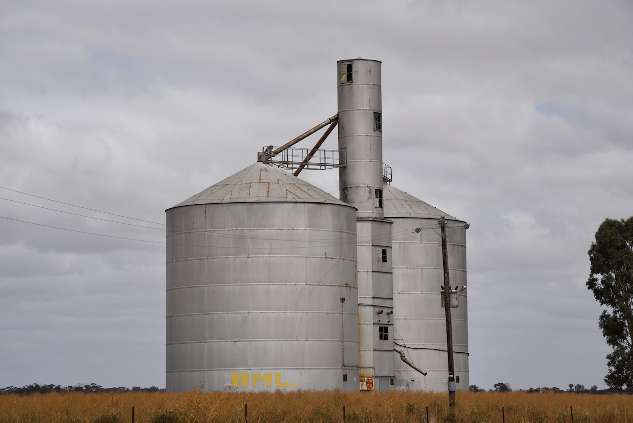
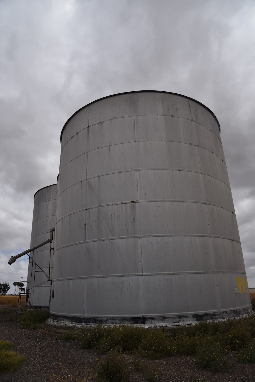
It was now Tuesday 7th March 2023, and time for Marija and I to head home. We had planned to activate a number of silos for the Silos On The Air (SiOTA) program, and also some parks and a summit.

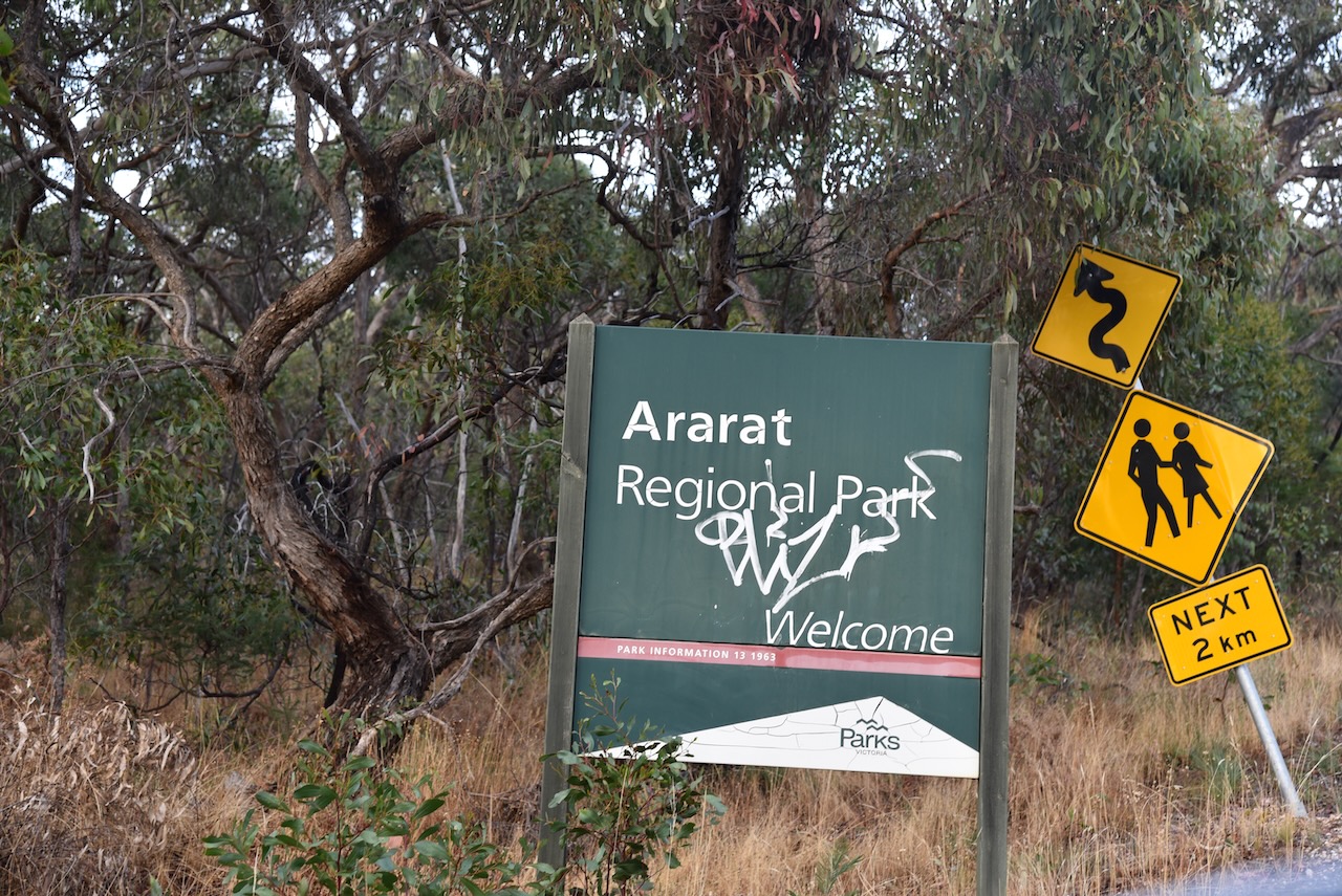
Our first activation for the day was One Tree Hill VK3/ VS-036 for Summits On The Air (SOTA). The summit is located in the Ararat Hills Regional Park VKFF-0958.

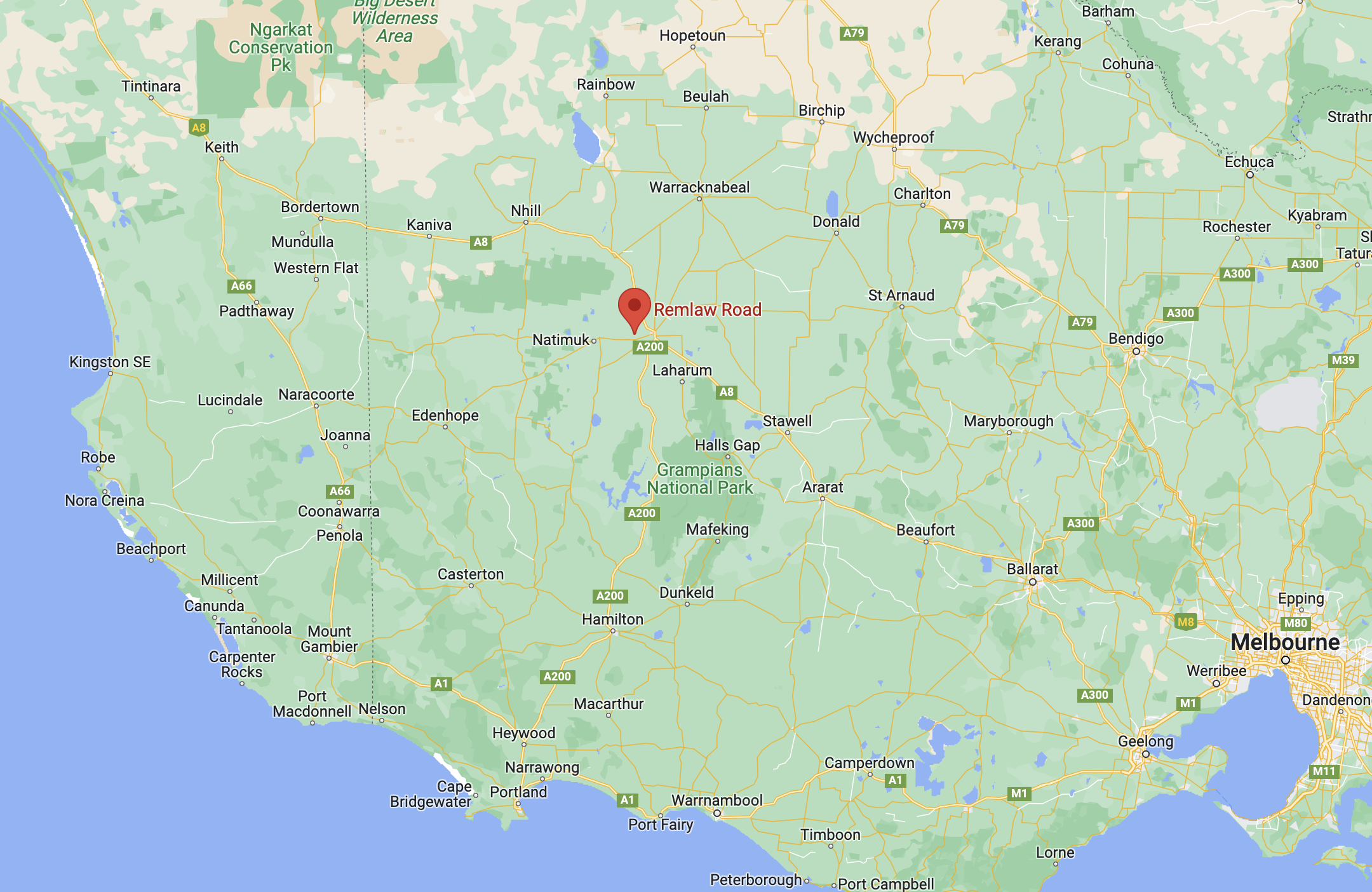
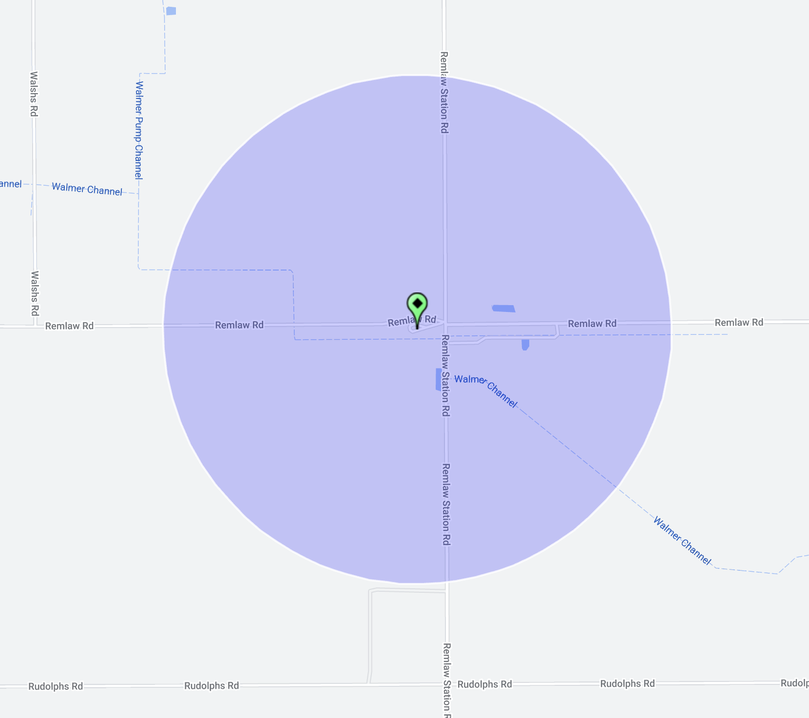
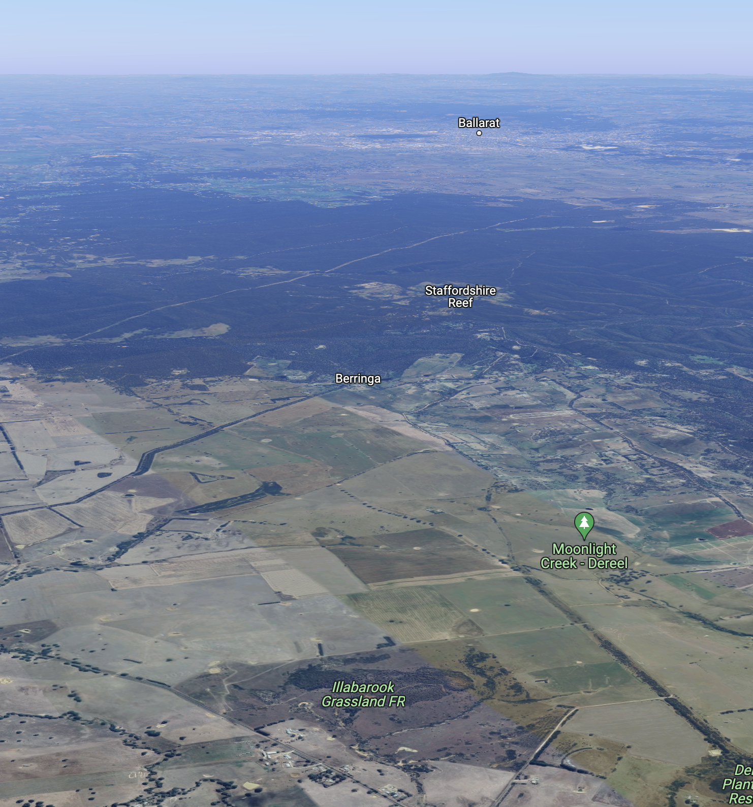
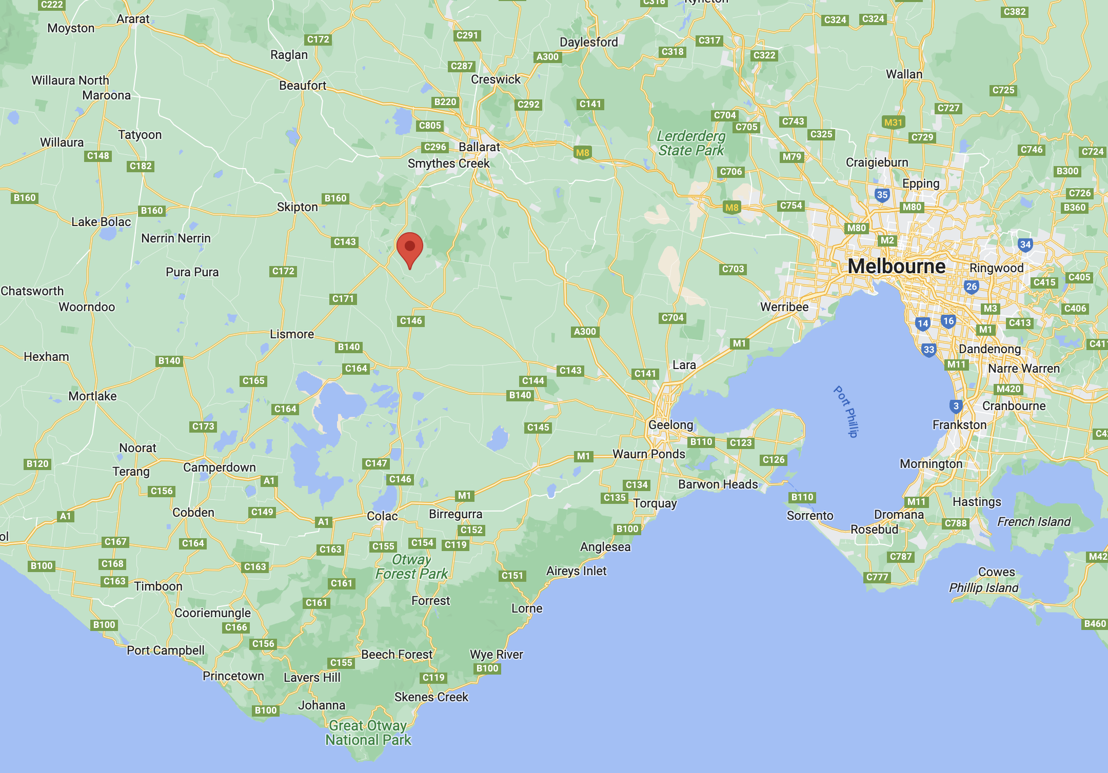
Above:- Map showing the location of Ararat. Map c/o Google Maps.

The city of Ararat is located about 85 km west of Ballarat and about 198 km northwest of Melbourne. The city’s name originates from Horatio Spencer Howe Wills (b. 1811. d. 1861), a pastoralist/explorer, who arrived in the district in 1841. He named a rise ‘Mount Ararat’, for ‘like the arc, we rested there’. Wills established the 125,000 acre Lexington pastoral run near Moyston. The Lexington homestead was built in 1851 and is on the Australian and Victorian historic buildings registers.

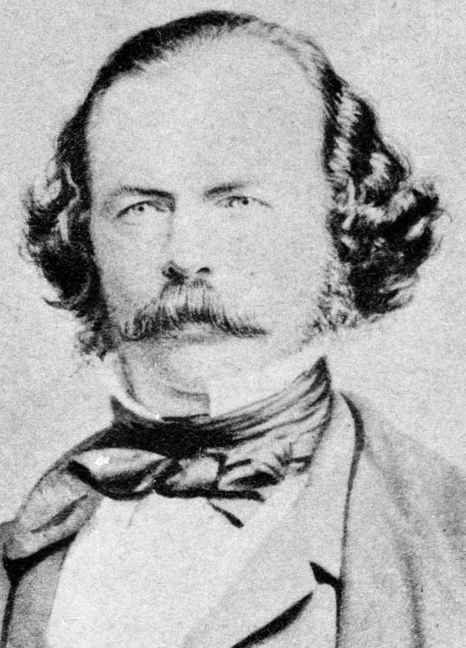
The life of Wills is an interesting one. He was born in 1811 and was raised by his mother Sarah Harding who was free settler, and his stepfather, George Howe who was a convict. Wills father Edward Spencer Wills was also aconvict who had been transported to Australia in 1799 for highway robbery. He died five months before the birth of Wills.

Above:- Horatio Wills. Image c/o Wikipedia.

Wills had nine children, including Tom Wills, who was Australia’s first great cricketer, and founder of Australian Rules Football.

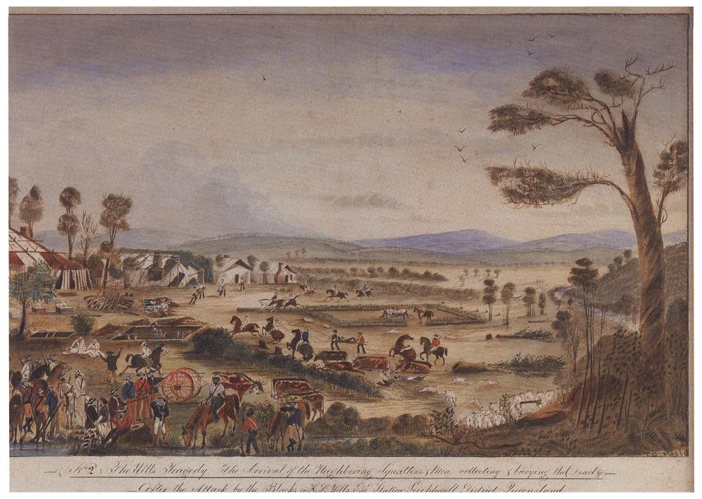
In 1861, Horatio Wills moved to Cullin-la-ringo, near Rockhampton in Queensland, Less than 3 weeks after his arrival, on the 17th day of October 1861, he was murdered, along with 18 other people, by local aboriginal people, at what has been referred to as the Cullin-la-ringo massacre. This event is reported to be the largest massacre of Europeans by aboriginal people in Australian history.

Above:- A painting by T.G. Moyle. The caption reads: “The arrival of the neighbouring squatters and Mon collecting and burying the dead, after the attack by the blacks on H.R. Wills ESQ. Stationed Leichhardt district, Queensland.’ Image c/o Wikipedia.

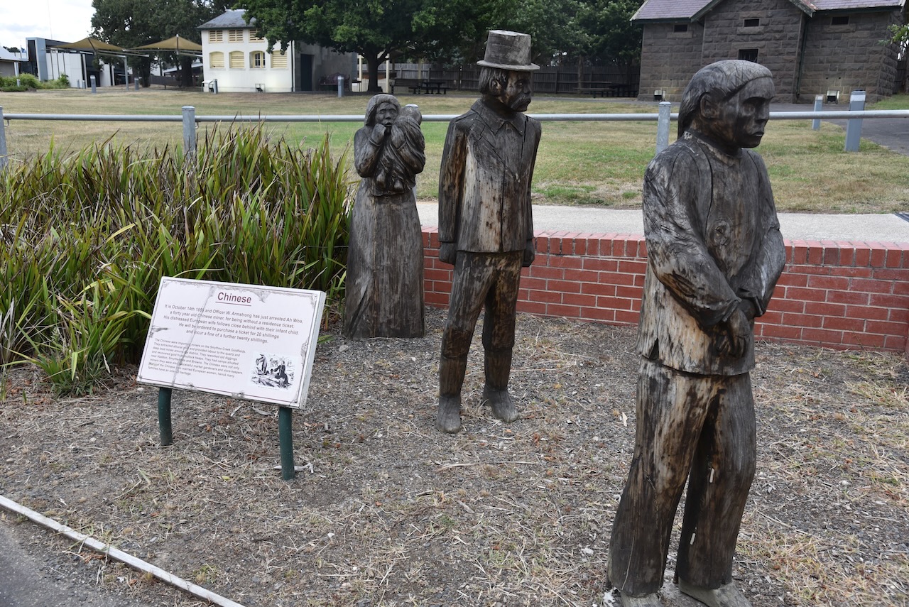
The township of Ararat arose due to the discovery of gold in 1856. As a result, there was a surge of 15,000 people to the area, including numerous persons of Chinese origin. Allotments of land were sold in 1858, and on the 24th day of September 1858 a municipality was created.

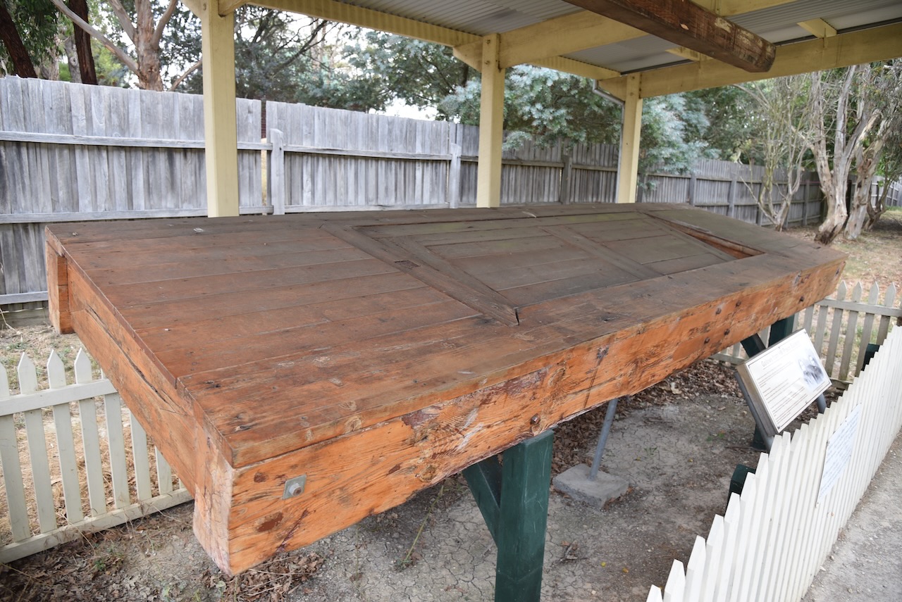
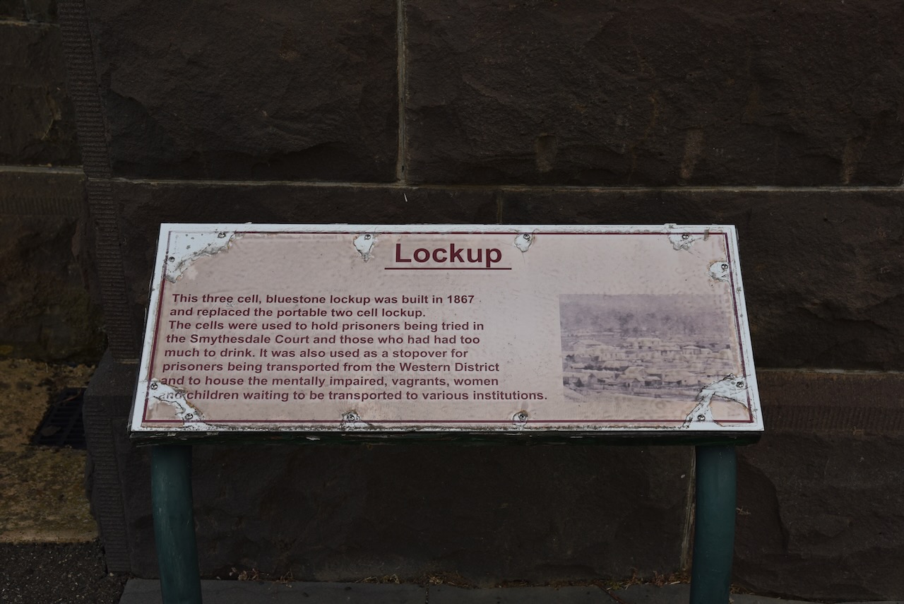
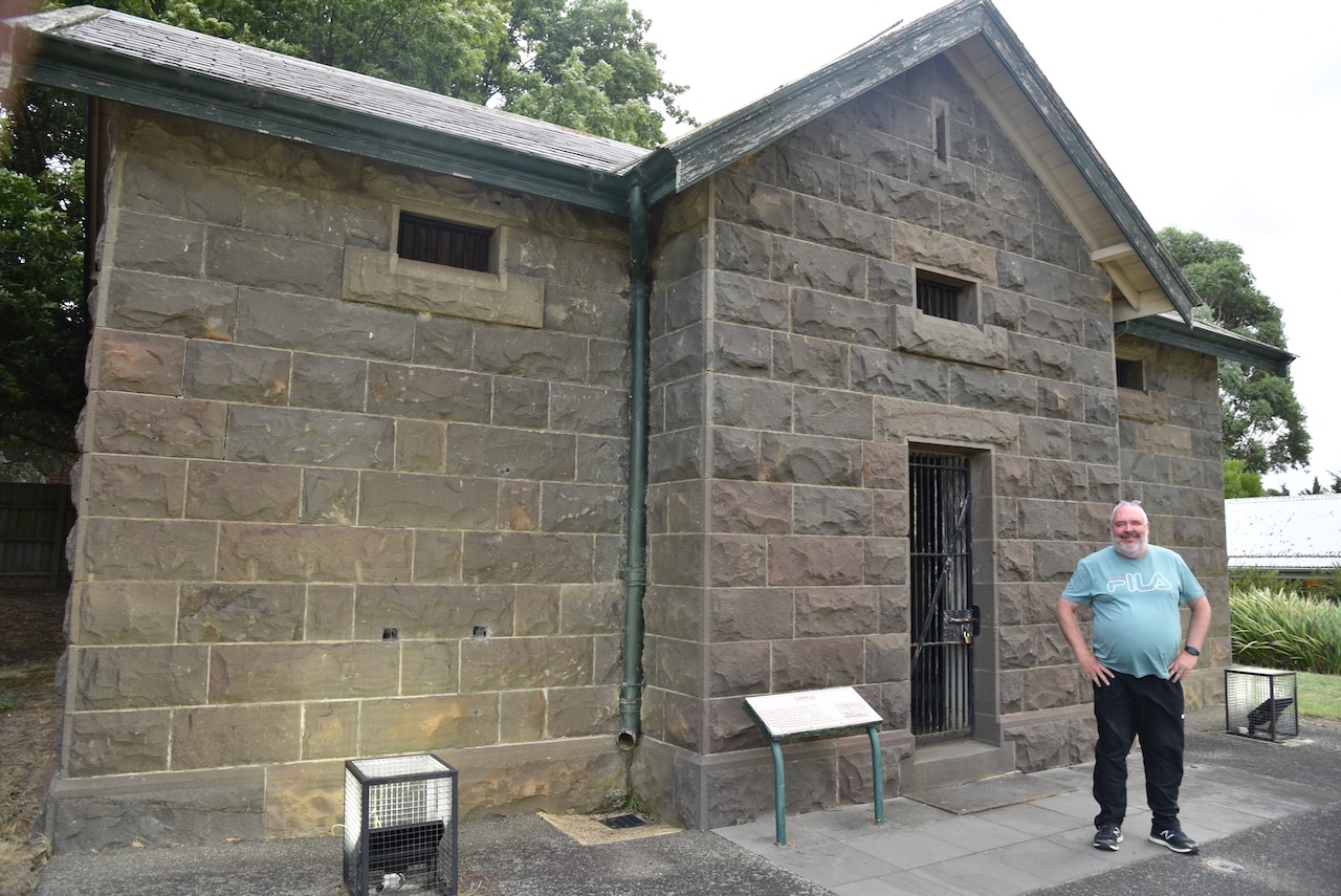
By 1857 Anglican and Catholic schools were opened, followed by a Presbyterian church in 1859. A Presbyterian church was established. In 1859 a courthouse was opened, followed by a hospital in 1860. In that same year, the Ararat gaol was established. In 1865 a mental asylum was opened.

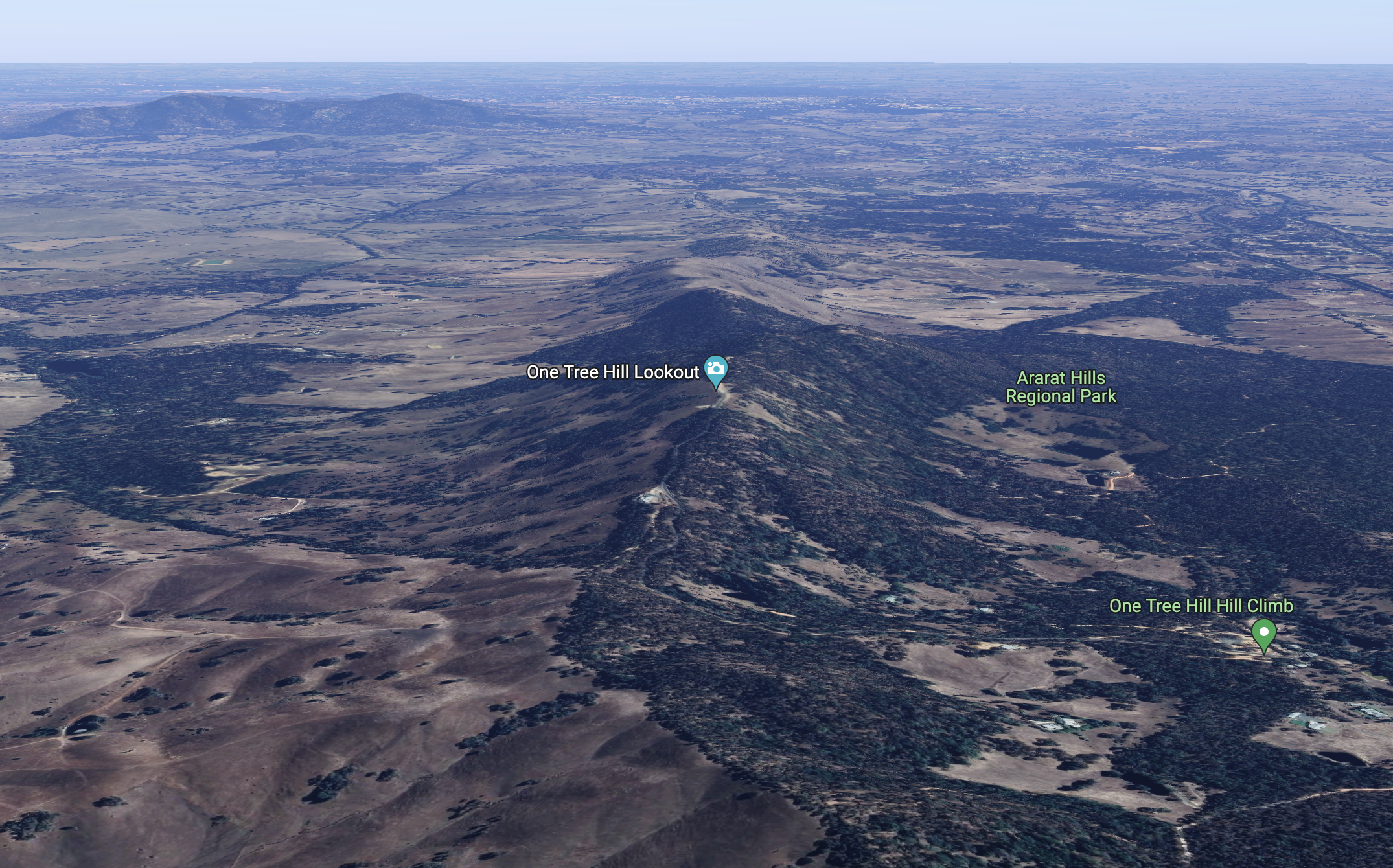
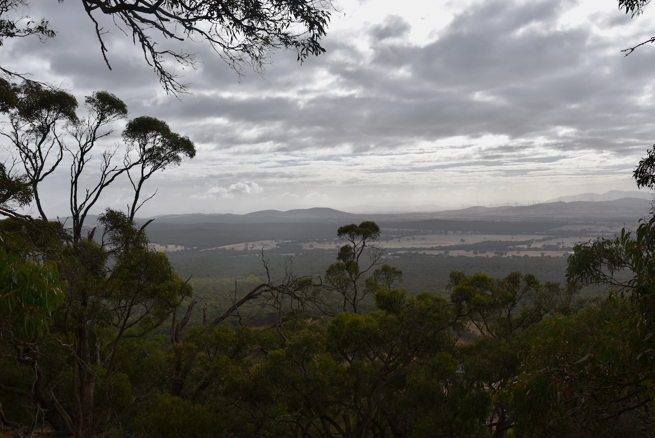
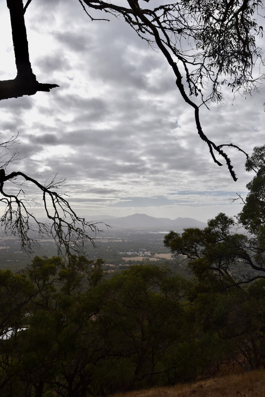
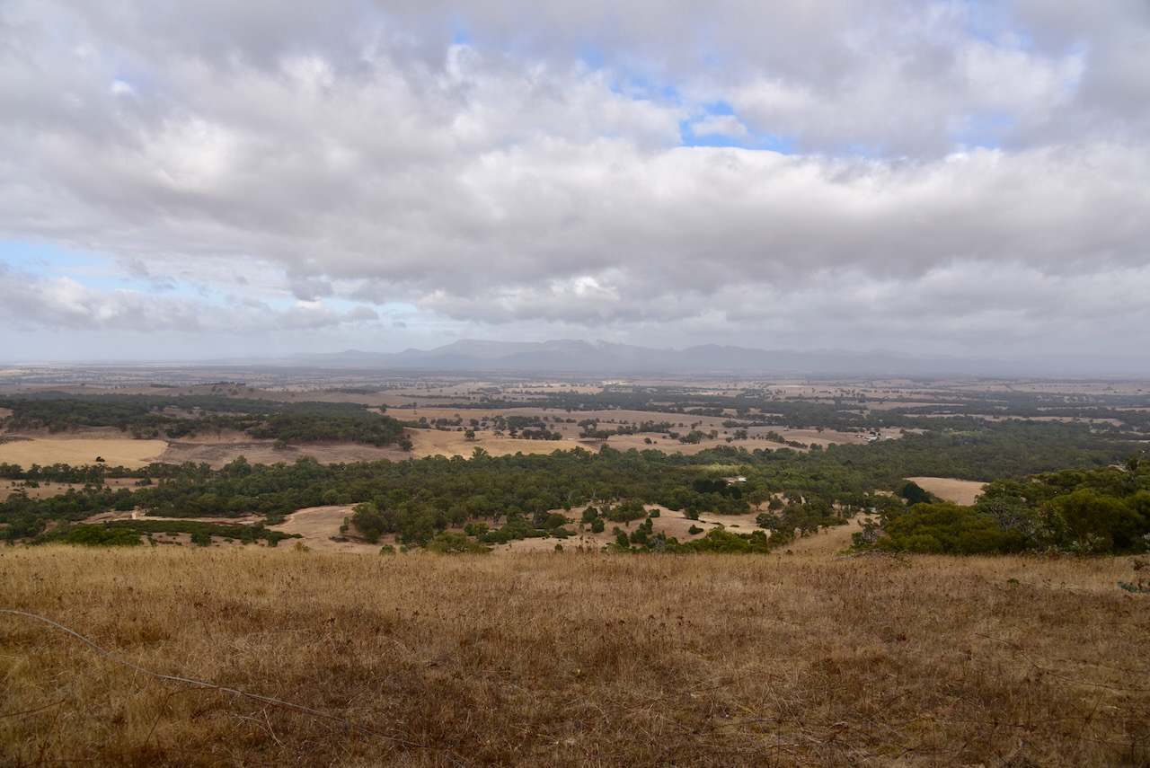
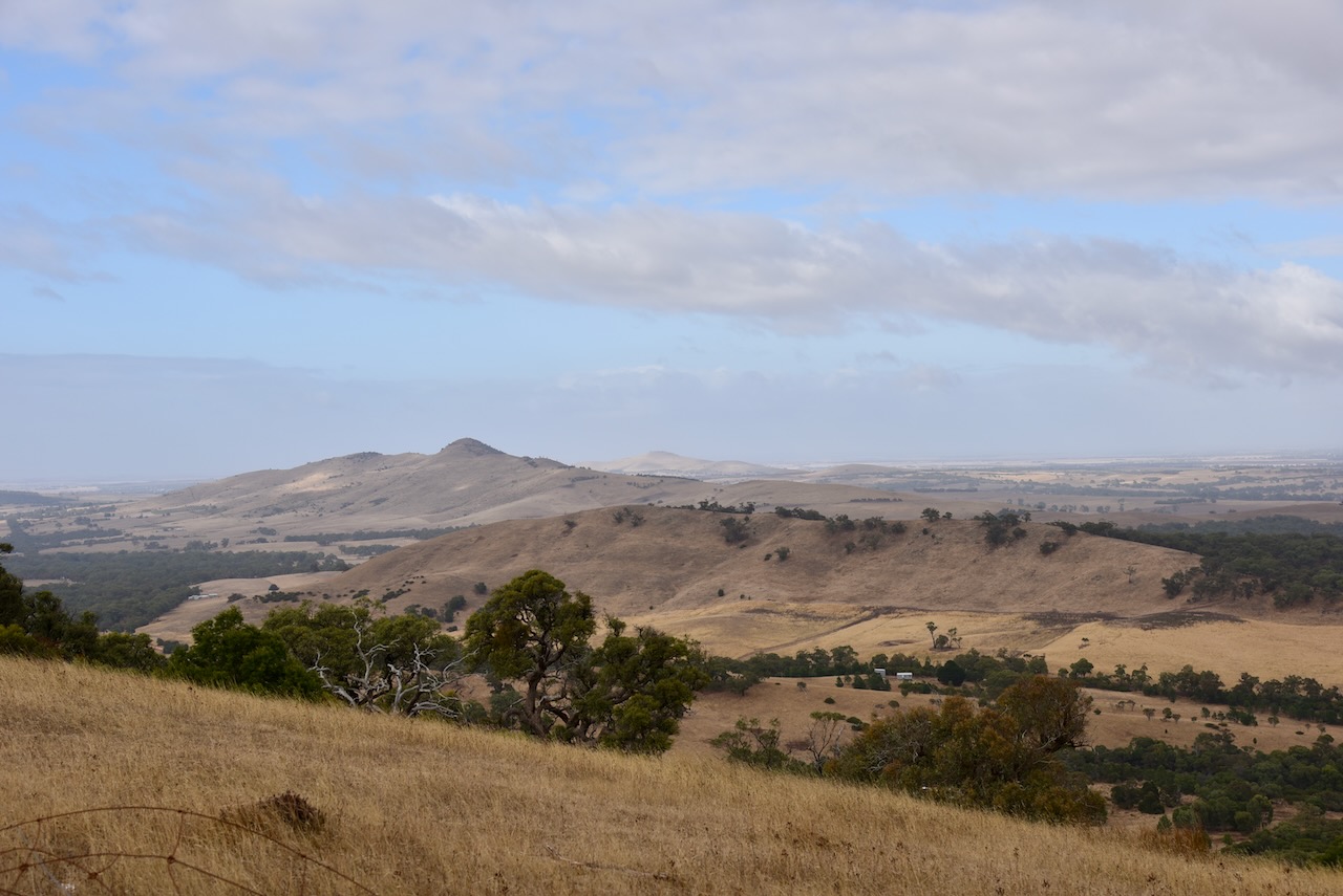
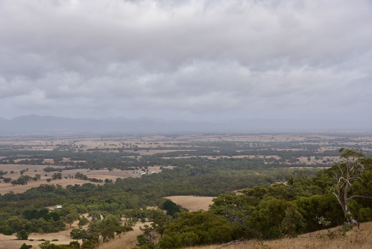
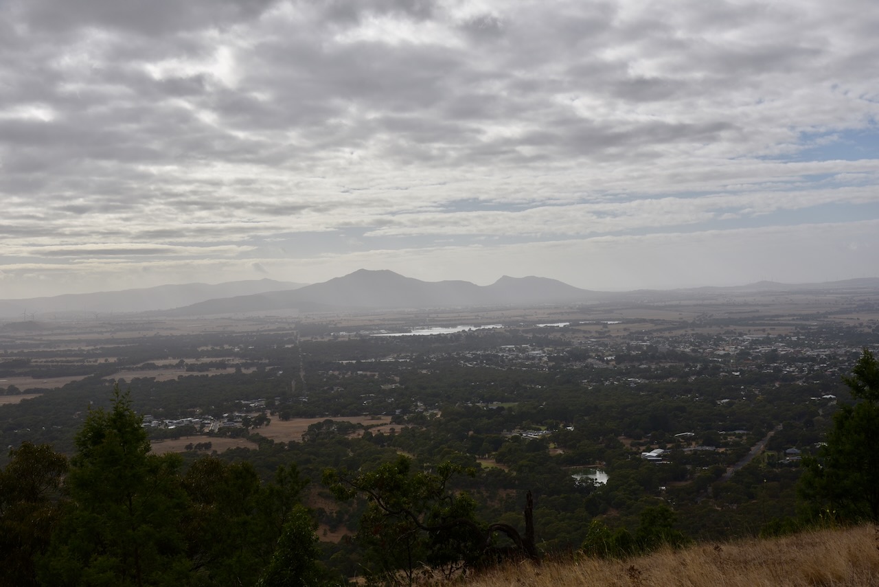
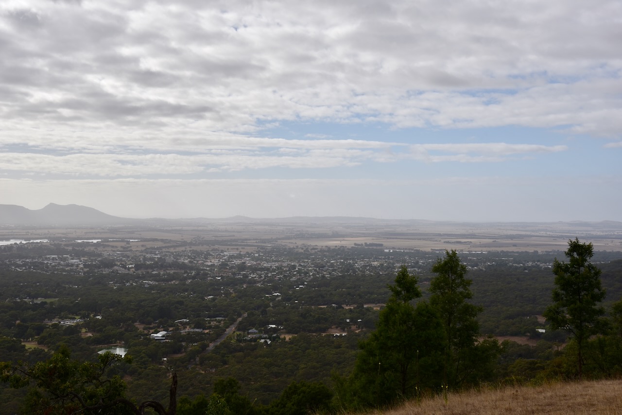
One Tree Hill summit is 576 metres above sea level and is worth 2 points in the SOTA program.

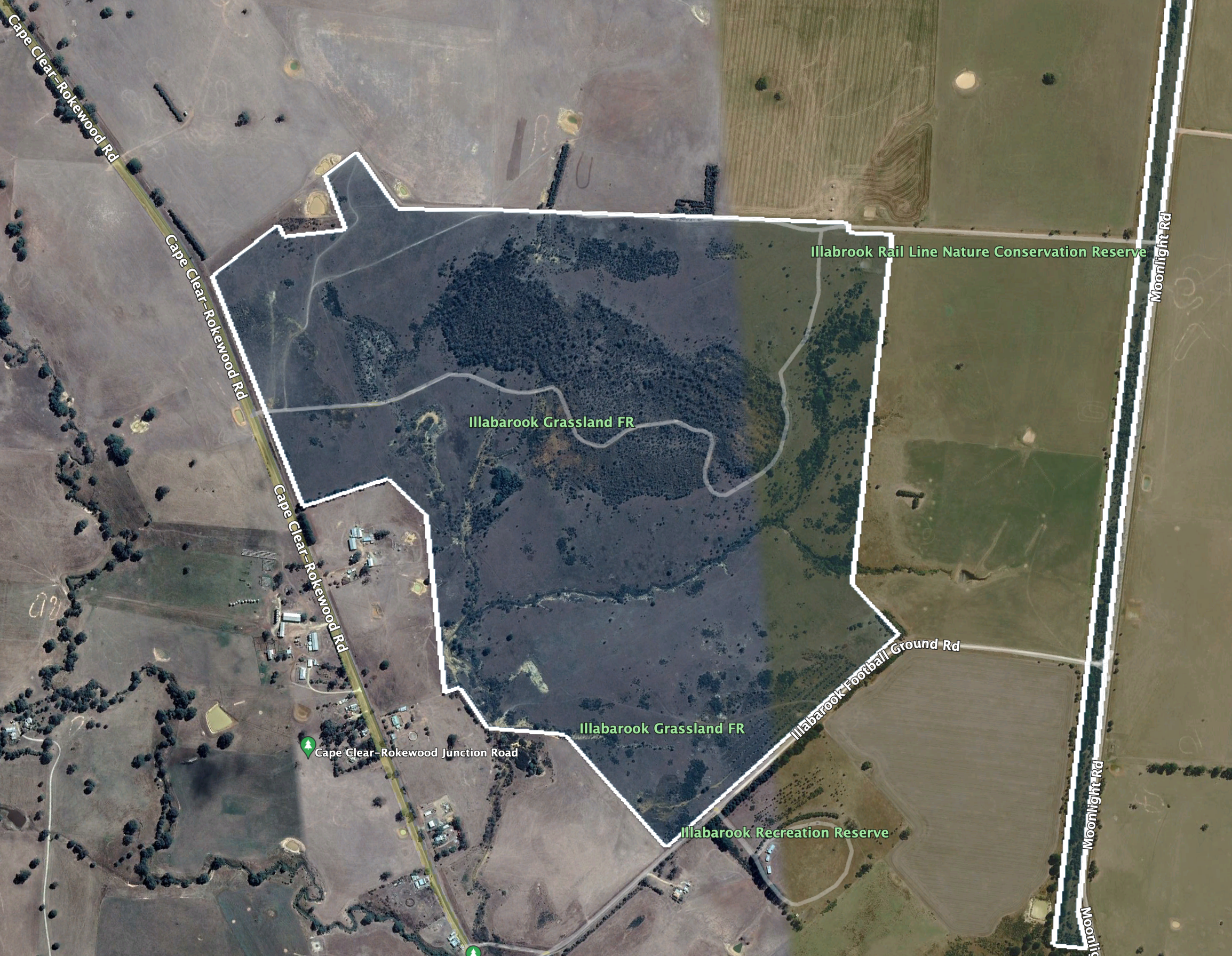
Above:- An aerial view of the summit and park. Image c/o Google Maps.

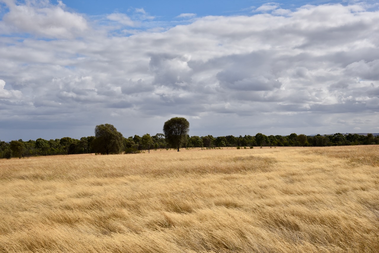
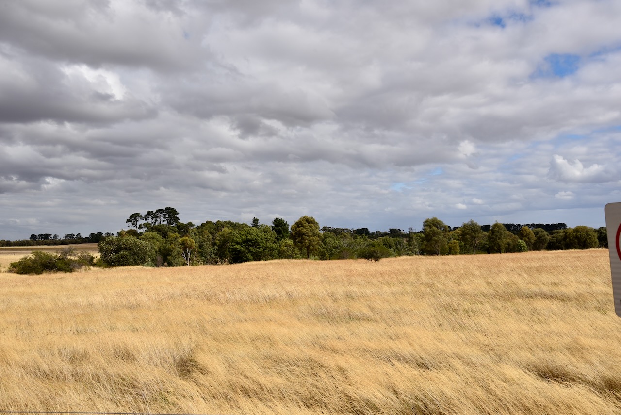
The park is about 2,400 acres and offers sensational views of the surrounding area including Mount Cole Plateau and Mount Langi Girhan. More than 200 species of native plants have been recorded in the park, including a number of native orchids.

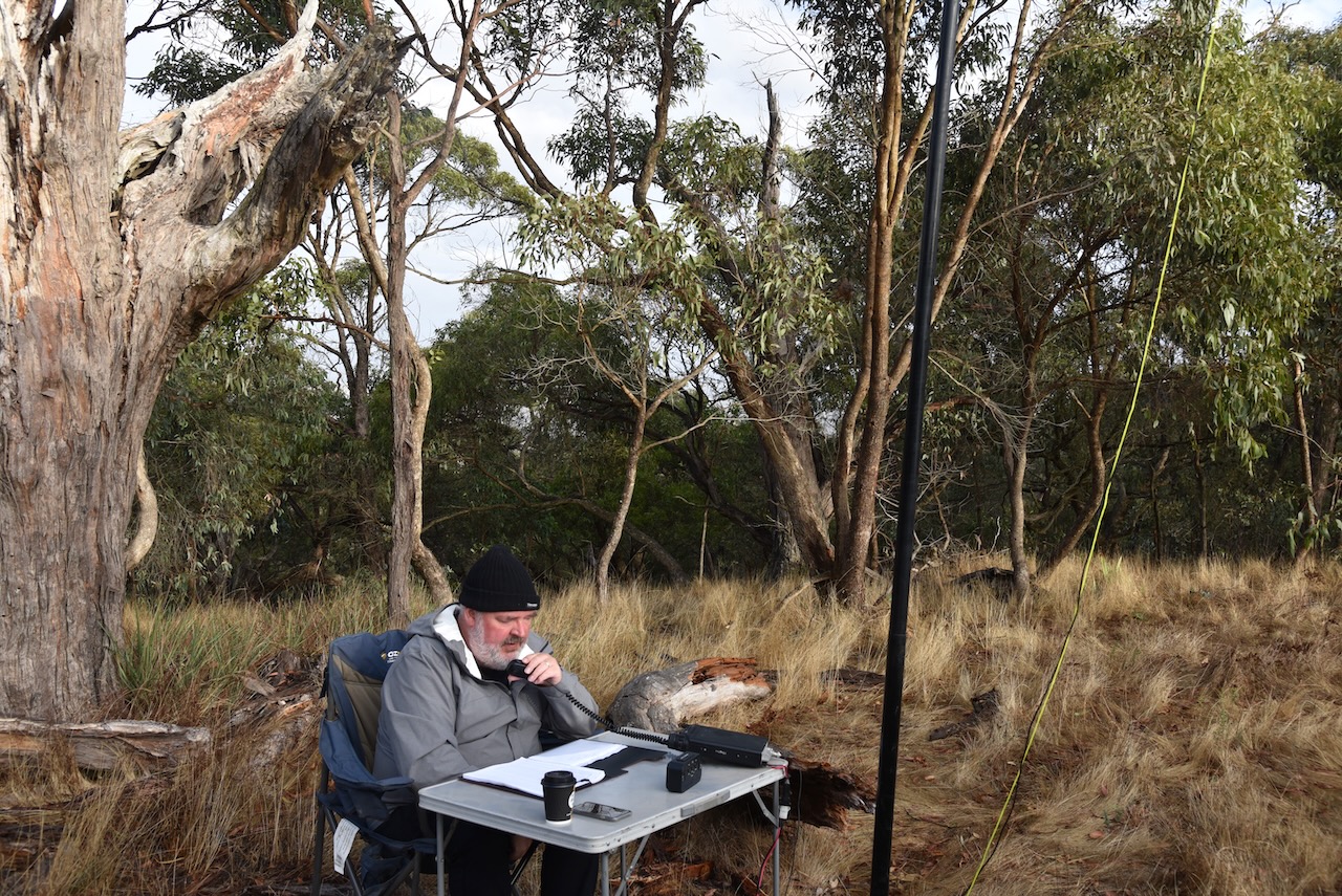
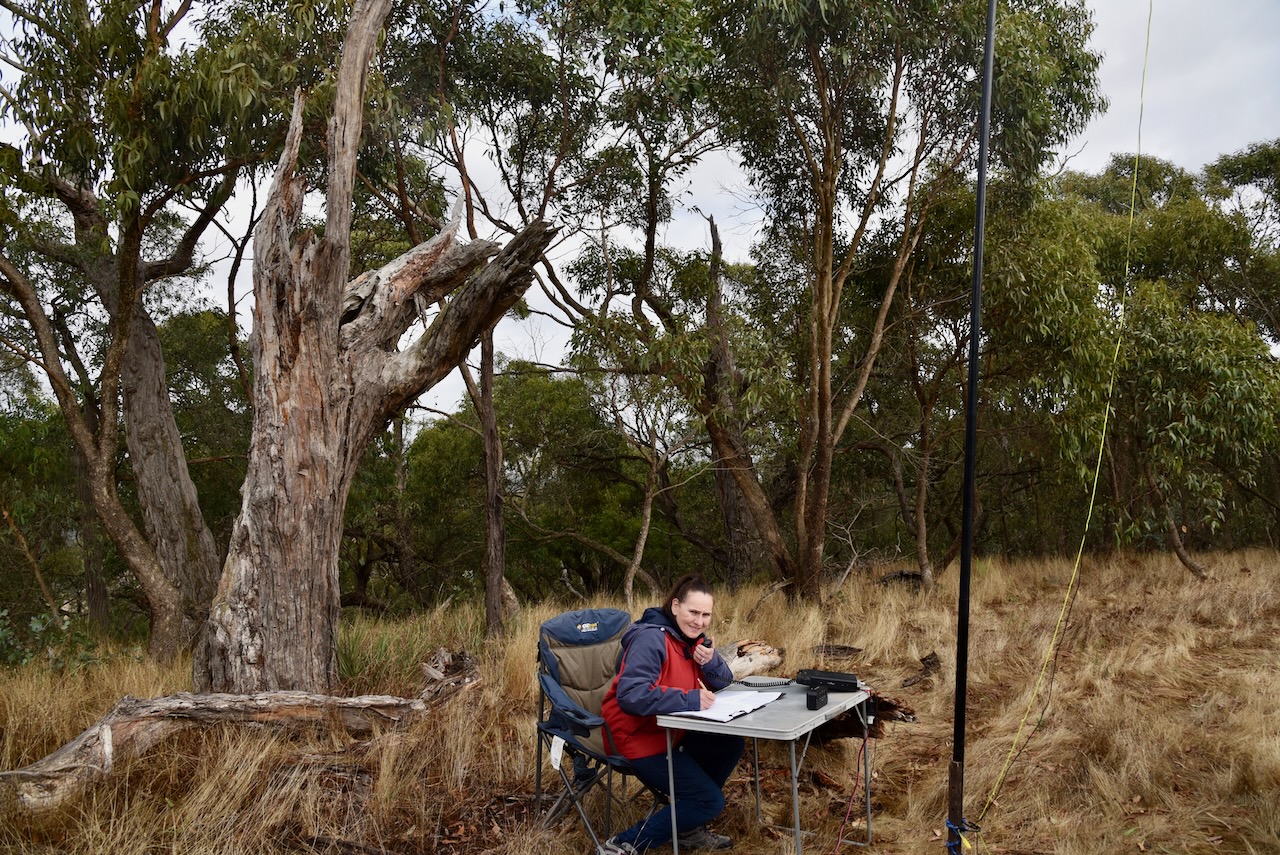
We drove along the 4WD track from the lookout and found a clearing in the scrub. We strung out the 20/40/80m linked dipole which was supported by the 7-metre heavy-duty telescopic squid pole. We ran the Yaesu FT-857d and 40 watts.

It was a chilly morning but fortunately no rain. We had experienced rain during the majority of the evening.

Marija worked the following stations on 40m SSB:-

  1. VK3VIN
  2. VK3UAO
  3. VK1AD
  4. VK3QH
  5. Vk4TJ
  6. VK2WWV
  7. VK5HAA
  8. VK3OB
  9. Vk1RF
  10. VK2IO

I worked the following stations on 40m SSB:-

  1. VK3VIN
  2. VK3UAO
  3. VK1AD
  4. VK3QH
  5. VK4TJ
  6. VK2WWV
  7. VK5HAA
  8. VK3OB
  9. VK1RF
  10. VK2IO
  11. VK3AWA
  12. VK4EMP
  13. VK4TI
  14. VK3NBL
  15. VK4FW
  16. VK8MM
  17. VK3MDC
  18. VK2EXA
  19. VK5AYL
  20. VK1DI
  21. VK2MOP
  22. VK3MAB
  23. VK7ID
  24. VK7JFD
  25. ZL3RIK
  26. VK5FD
  27. VK3PF
  28. VK3APJ
  29. VK3SQ
  30. VK3CTM
  31. VK5GY
  32. VK5IS
  33. VK3DA
  34. VK3TDK
  35. VK5CZ
  36. VK3ANL

I worked the following stations on 40m AM:-

  1. VK3SQ
  2. VK3PF

I worked the following stations on 20m SSB:-

  1. F4WBN
  2. ZL1TZP
  3. ZL3RIK
  4. VK1AO
  5. VK2MET
  6. VK4EMP
  7. VK4TI
  8. ZL3QR
  9. ZL1KB
  10. KG5CIK
  11. BX8AAD
  12. VK4TJ

I worked the following station on 20m AM:-

  1. VK4TJ

References.

  1. Grampians Point, 2023, <https://www.grampianspoint.com.au/attractions/ararat-hills-regional-park/>, viewed 4th May 2023.
  2. Summits On The Air, 2023, <https://www.sotadata.org.uk/en/summits>, viewed 4th May 2023.
  3. Victorian Places, 2023, <https://www.victorianplaces.com.au/ararat>, viewed 4th May 2023.
  4. Wikipedia, 2023, <https://en.wikipedia.org/wiki/Horatio_Wills>, viewed 4th May 2023.
  5. Wikipedia, 2023, <https://en.wikipedia.org/wiki/Cullin-la-ringo_massacre>, viewed 4th May 2023.

Illabrook Grassland Flora Reserve VKFF-2335

Our seventh and final park for 7th March 2023 was the Illabrook Grassland Flora Reserve VKFF-2335. The park is about 158 km west of Melbourne and about 44 km south of Ballarat.

Above:- Map showing the location of the Illabrook Grassland Flora Reserve. Map c/o Google Maps.

The Illabrook Grassland Flora Reserve is 126 hectares in size and was established on the 21st day of May 1996.

Above:- An aerial view of the park. Image c/o Google Maps.

The park is bordered on the west by Cape Clear-Rokewood Road and to the east by Moonlight Road. The park’s southern boundary is Illabrook Football Ground Road.

Above:- An aerial view of the Illabrook Grassland Flora Reserve. Image c/o Google Earth.

The park is significant due to the majority of Victoria’s grasslands having been cleared for agriculture. European settlers found that the expansive grasslands in Victoria were excellent for grazing and easy to convert to cropping. Other than grassland, the park contains numerous orchid, daisy, and pea species.

Marija worked the following stations on 20m SSB:-

  1. VK4EMP
  2. VK4TI
  3. VK4FW
  4. VK8MM
  5. VK4TJ
  6. VK2IO
  7. VK6GLX
  8. K5RX

Marija worked the following stations on 20m AM:-

  1. VK4FW
  2. VK8MM
  3. VK4TJ

I worked the following stations on 20m SSB:-

  1. VK4EMP
  2. VK4TI
  3. VK4FW
  4. VK8MM
  5. F1BLL
  6. KG5CIK
  7. VK4TJ
  8. VK2IO
  9. VK6GLX
  10. K5RX
  11. IW2BNA

I worked the following stations on 20m AM:-

  1. VK4FW
  2. VK8MM
  3. VK4TJ

I worked the following stations on 40m SSB:-

  1. VK3APJ
  2. VK3PF
  3. VK5BJE
  4. Vk2EXA
  5. VK5PE/m
  6. VK1TTY
  7. VK5TN
  8. VK3VIN
  9. VK5HS
  10. VK1RF
  11. VK3UAO
  12. VK3CWF
  13. VK5KRX
  14. VK3CAT
  15. VK4FW
  16. VK8MM
  17. VK2MOE
  18. VK3PWG
  19. VK2IO
  20. VK4NH
  21. VK4DXA
  22. VK3HJW
  23. VK3KR

I worked the following stations on 40m AM:-

  1. VK5HS
  2. VK3VIN
  3. VK3APJ

I worked the following stations on 80m SSB:-

  1. VK3CWF
  2. VK3GJG
  3. VK3PF
  4. VK3UAO
  5. VK3APJ

I worked the following stations on 80m AM:-

  1. VK3CWF
  2. VK3PF

After leaving the park we drove north to the little town of Smythesdale which is located about 18 km southwest of Ballarat.

The town was named after John Smythe who took up a pastoral lease Nentinball in the district in 1849. In 1853 gold was discovered at Smythesdale, and soon after southwards along Smythese Creek toward Cape Clear. By 1856 an Anglican school was opened and in 1861 a courthouse was opened. Smythesdale’s largest population was during the 1860s when the town had a mechanics institute, a free library, a foundry, a sawmill, a brewery and numerous hotels. Smythesdale residents laid out a public park and a racecourse. They formed several sporting clubs and an amateur theatrical club.

The 1903 Australian Handbook 1903 describes Smythesdale as follows:

The town has a number of magnificent historical buildings and interpretive signs. We spent quite a bit of time wandering around this fascinating little town.

It was dinner time, so we ventured to the Court House Hotel, where we enjoyed a very nice meal and some refreshing ales. The hotel commenced as a wooden building in 1850, and the current brick building was built in 1856.

We then drove about 86 km to the town of Ararat where we had booked into the caravan park. It was the end of a long, but very enjoyable day.

References.

  1. CAPAD 2020.
  2. Parks Victoria, park-update august 217
  3. Victorian Places, 2023, <https://www.victorianplaces.com.au/smythesdale>, viewed 4th May 2023.
  4. Wikipedia, 2023, <https://bih.federation.edu.au/index.php/Court_House_Hotel_(Smythesdale)>, viewed 4th May 2023.

Illabrook Rail Line Nature Conservation Reserve VKFF-2110

Our next park activation for 7th March 2023 was the Illabrook Rail Line Nature Conservation Reserve VKFF-2110. The park is about 144 km west of Melbourne and about 44 km south of Ballarat.

Above:- Map showing the location of the Illabrook Rail Line NCR. Map c/o Google Maps.

Illabarook was formerly a gold mining town, located in the arc of gold-bearing country from Scarsdale to Rokewood In 1855 gold was discovered at Illabrook on the Bulldog diggings.

Above:- part of an article from The Age, Melbourne, Sat 2 Oct 1858. Image c/o Trove.

The area was known as Bulldog until 1874. The town is located on the Illabrook Creek. It is believed that Illabrook is derived from an aboriginal word meaning a fly. In 1861 a school was opened and this was followed by the Post Office in 1862.

The Pitfield gold diggings then became associated with Bulldog as mining activity joined them as one area. During the 1860s mining activity declined. By the mid 1890s mining had recommenced. A new village of Illabrook evolved. The town was described in the Australian Handbook of 1903 as follows:

Between 1911-53 a railway from Newtown to Cressy passed through Illabarook. This is now the Illabrook Rail Line Nature Conservation Reserve, which can be found on the western side of Moonlight Road.

Above:- An aerial view of the park. Image c/o Google Earth.

The railway line at Illabrook was part of the Colac-Ballarat railway line that branches from the Warnambool line, just east of Colac. It ran in a northerly direction to join the Ballarat0Skipton line at Newtown, and from there ran to Ballarat station. The line was 112 km in length. Construction of the line commenced in the 1880s. The purpose of the line was to convey goods from Victoria’s Western District to the industrial centre of Ballarat. The line was constructed in sections.

Above:- Part of an article from The Colac Herald, Fri 22 Sep 1882. Image c/o Trove.

Today the track has been completely removed, with the majority of the land returned to adjoining farmers. However, the last section of the Skipton to Ballarat line has been converted to the Ballarat-Skipton Rail Line, while the site of Illabrook station is now the Illabrook Rail Line NCR. 

The park is 22 hectares in size and was established on the 22nd day of March 2005.  The park features remnants of the endangered Lower Slops Grassy Woodland ecological vegetation community. It contains one of the best populations of Silver Banksias and Drooping Sheokes in the area.

Marija worked the following stations on 40m SSB:-

  1. VK3GRK/p (Alpine National Park VKFF-0619)
  2. VK5HAA
  3. VK3PF
  4. VK3APJ
  5. VK5HS
  6. VK3GJG
  7. VK3SQ
  8. VK7MOO
  9. VK4FW
  10. VK8MM
  11. Vk2EXA

I worked the following stations on 40m SSB:-

  1. VK3GRK/p (Alpine National Park VKFF-0619)
  2. VK5HAA
  3. VK3PF
  4. VK3APJ
  5. VK5HS
  6. VK3GJG
  7. VK3SQ
  8. VK2EXA
  9. VK4FW
  10. VK8MM
  11. VK1AD
  12. VK1RF
  13. VK5TN
  14. Vk7MOO
  15. VK5BJE
  16. VK3ZSC
  17. VK5SFA
  18. VK3UCS
  19. Vk5BAD
  20. VK3EMB/p
  21. VK5NBL
  22. VK5CZ
  23. VK7JFD
  24. VK2IO
  25. VK3SGA
  26. VK7AN
  27. VK3NBL
  28. VK3KST
  29. VK7EE
  30. VK3UH
  31. VK3PWG

I worked the following stations on 20m SSB:-

  1. VK4FW
  2. VK8MM
  3. VK7AN
  4. KG5CIK
  5. VK4EMP
  6. VK4TI
  7. VK2DA
  8. VK1DA
  9. VK7EE
  10. VK4TJ
  11. VK7AAE
  12. ZL1KB

I worked the following stations on 20m AM:-

  1. VK4FW
  2. VK8MM

References.

  1. The Field Naturalists Ballarat, 2023, <https://fieldnatballarat.wordpress.com/2018/11/07/a-day-out-at-illabarook/>, viewed 4th May 2023.
  2. Victorian Places, 2023, <https://www.victorianplaces.com.au/illabarook>, viewed 4th May 2023.
  3. Wikipedia, 2023, <https://en.wikipedia.org/wiki/Colac%E2%80%93Ballarat_railway_line#cite_note-2>, viewed 4th May 2023.