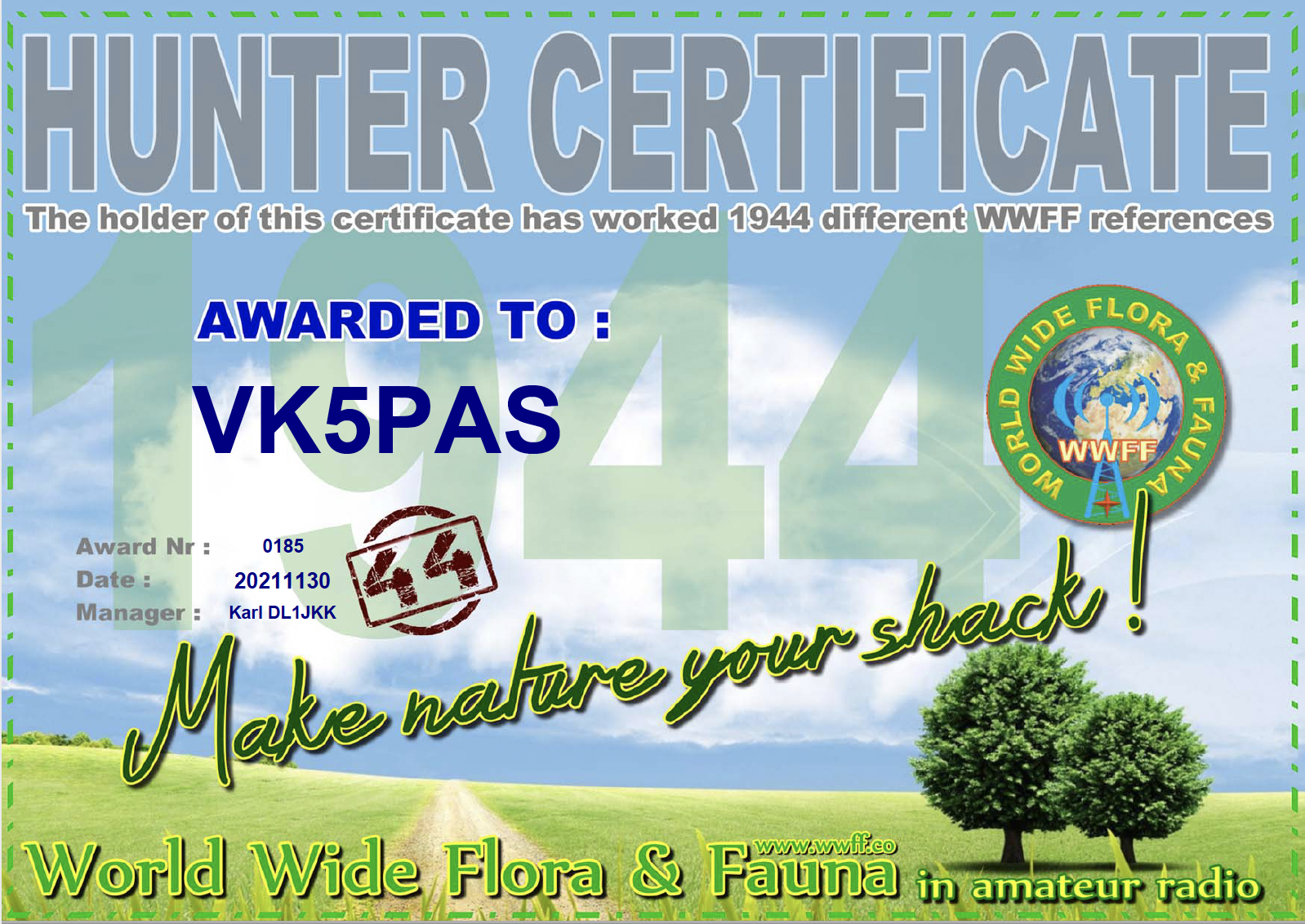
In 2021 I launched a special award for the Australian chapter of the World Wide Flora Fauna (WWFF) program, the 2021 VKFF Ladies Award. The award is open to both activators and hunters. More information on the award can be found at…….
In the past week, I received my latest World Wide Flora Fauna (WWFF) Park to Park award, issued for having made 1,344 Park to Park contacts.
I’ve actually made 1,663 Park to Park contacts, but there are a significant number of mismatches in Logsearch. One day when I get time I will have a look.
Thanks to all of the VKFF Activators, and thanks to Swa ON5SWA, the P2P Awards Manager.
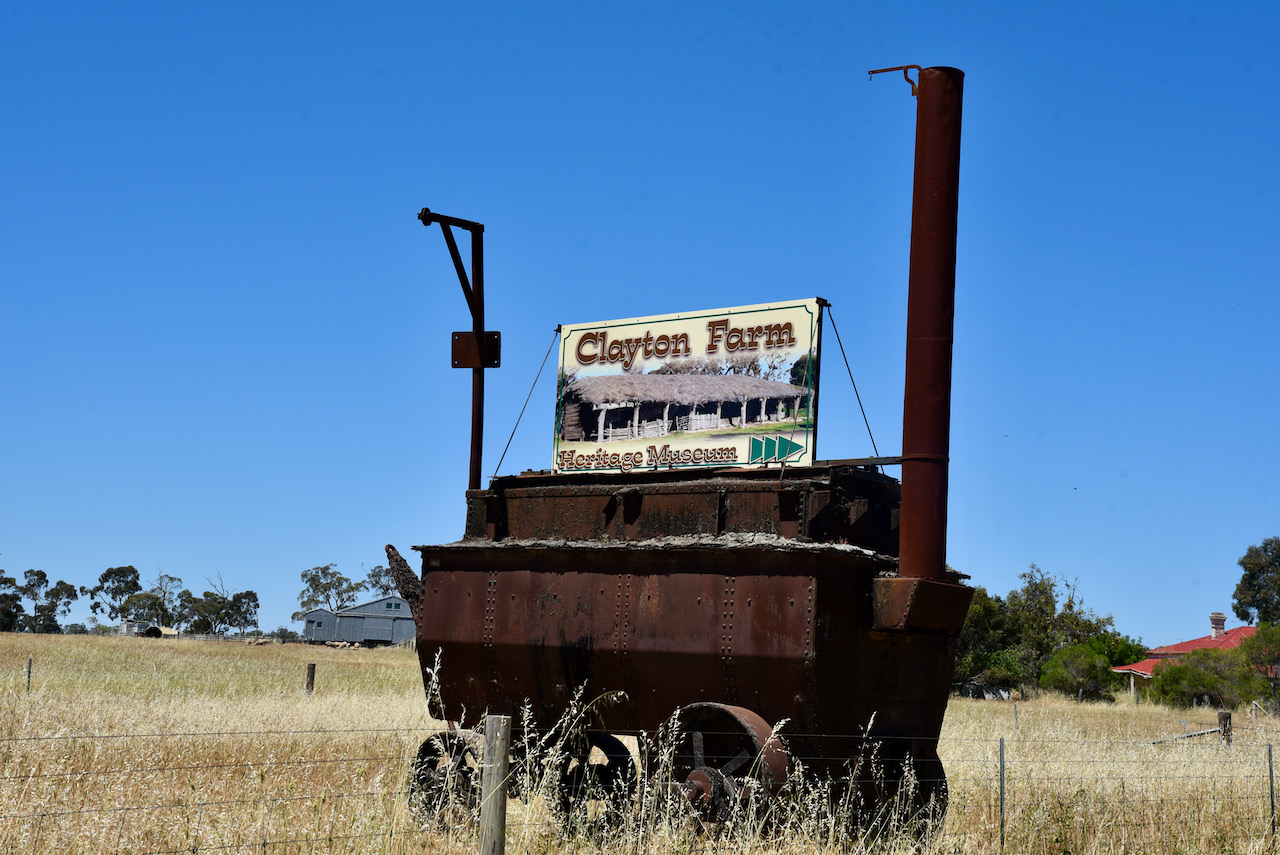
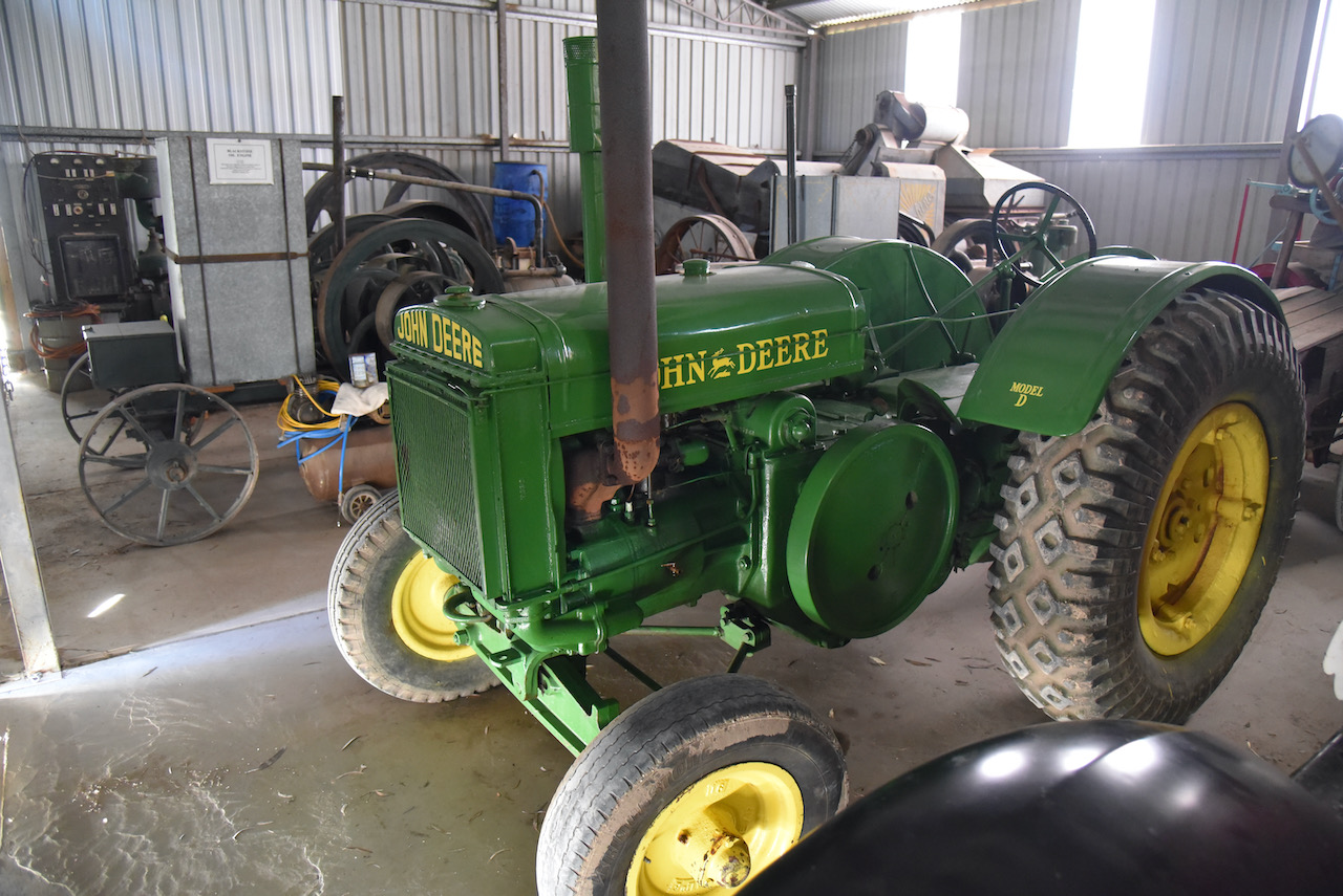
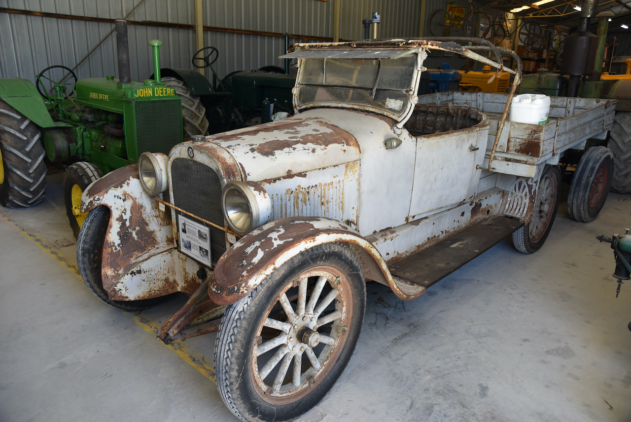
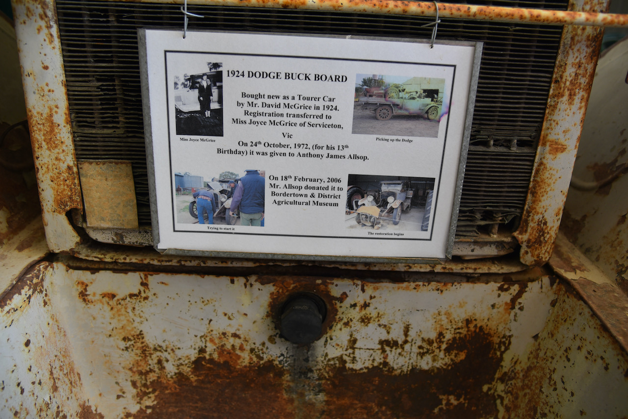
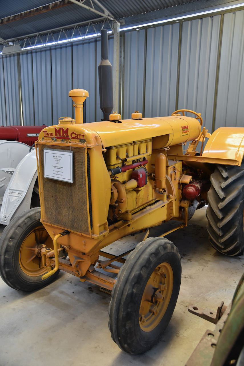
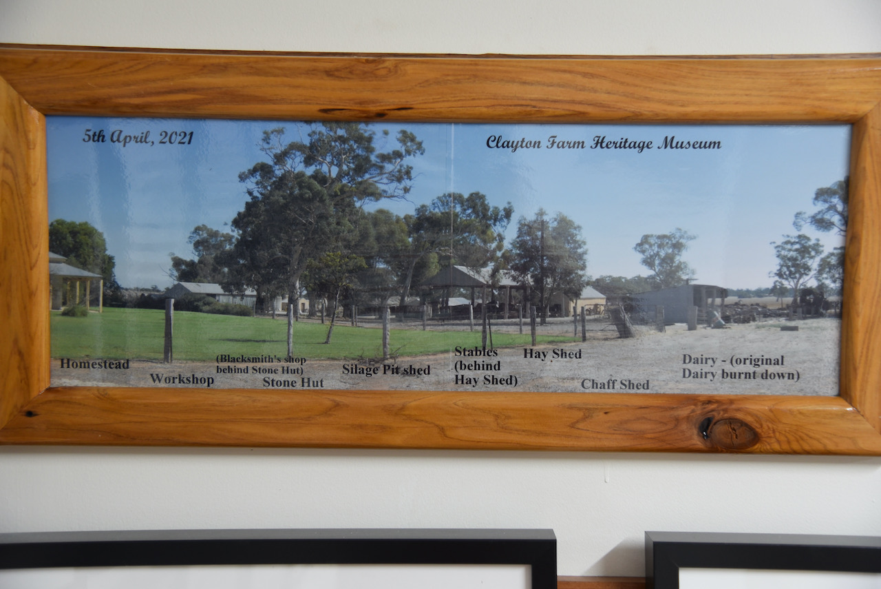
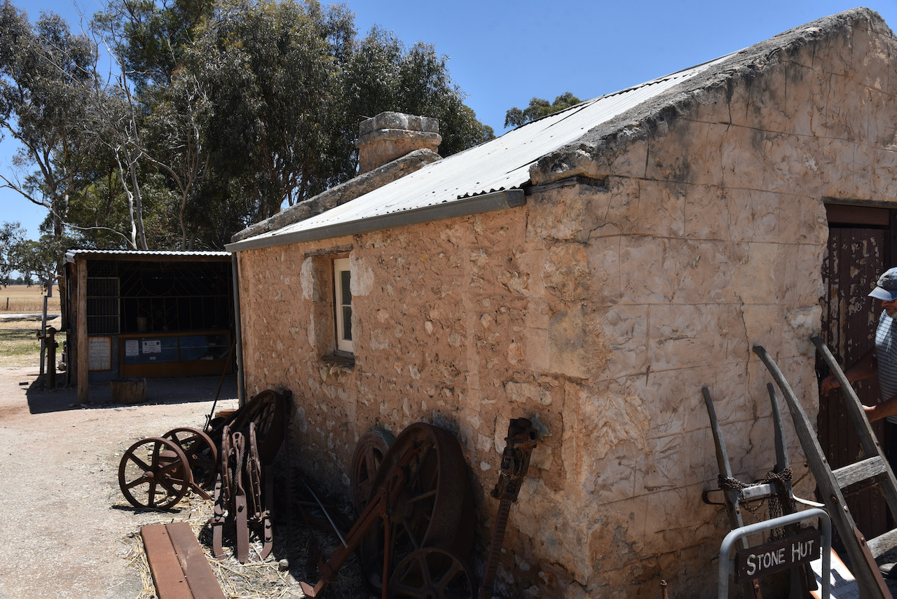
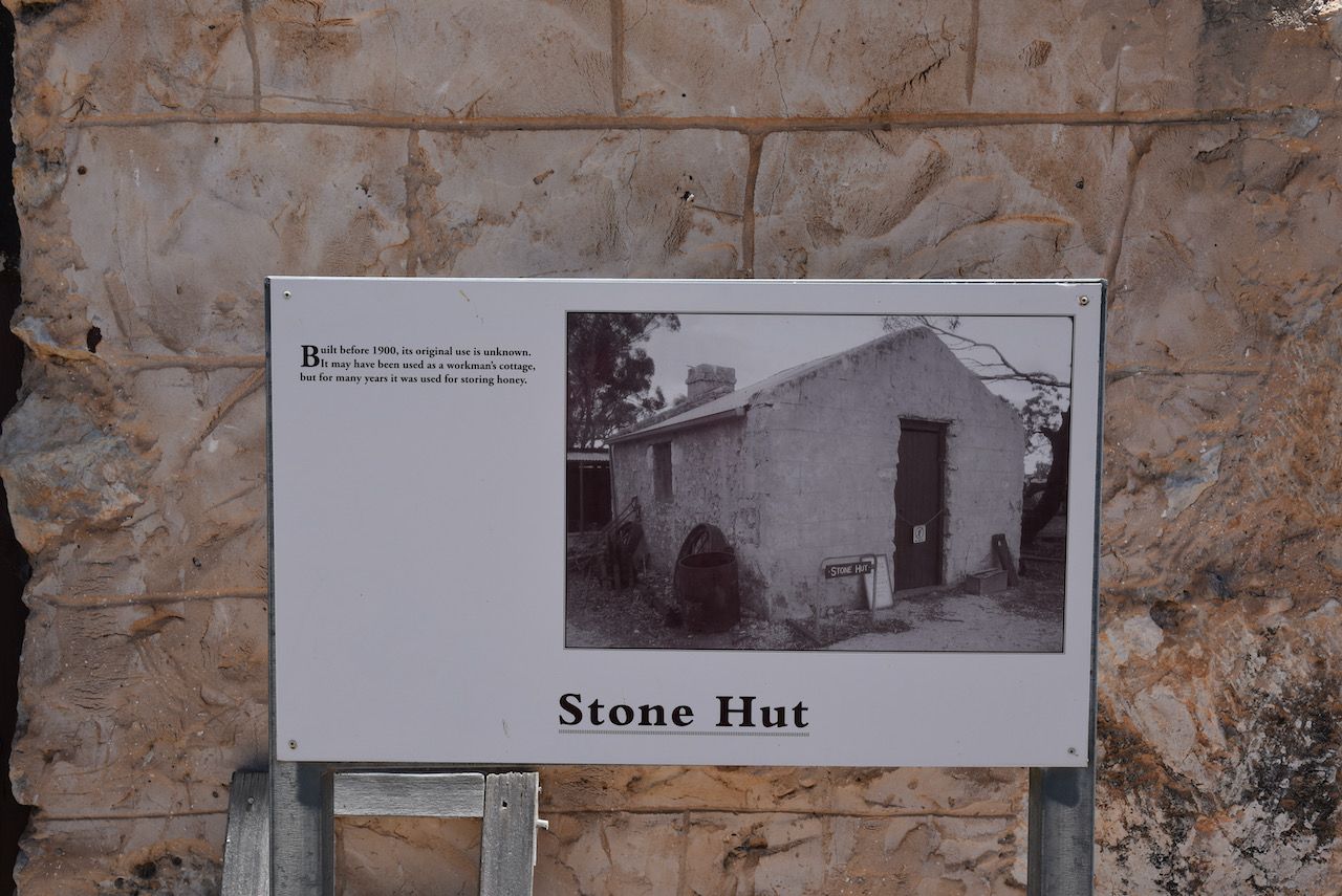
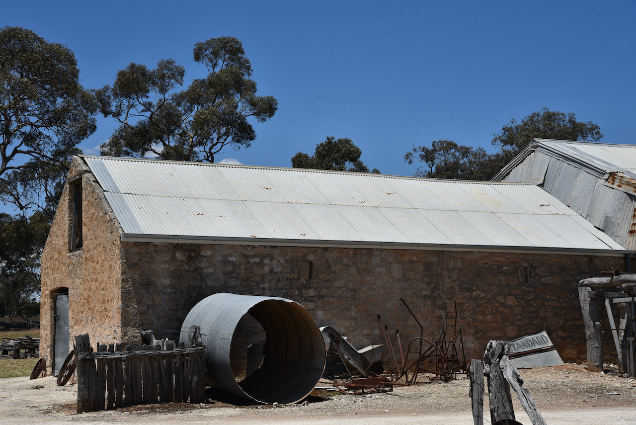
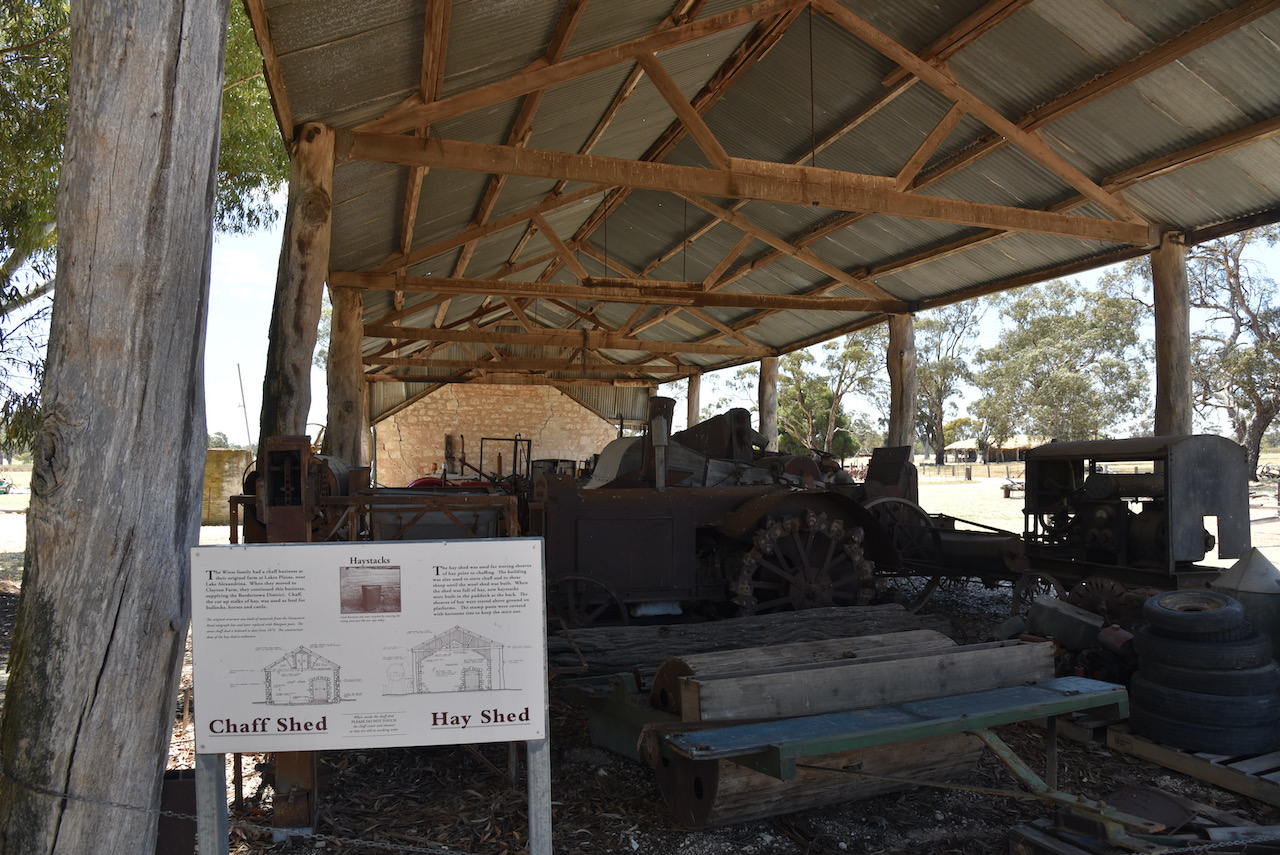
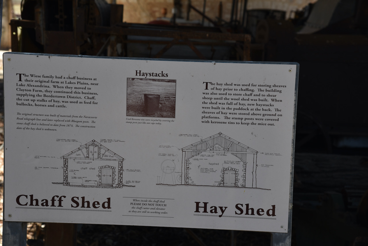
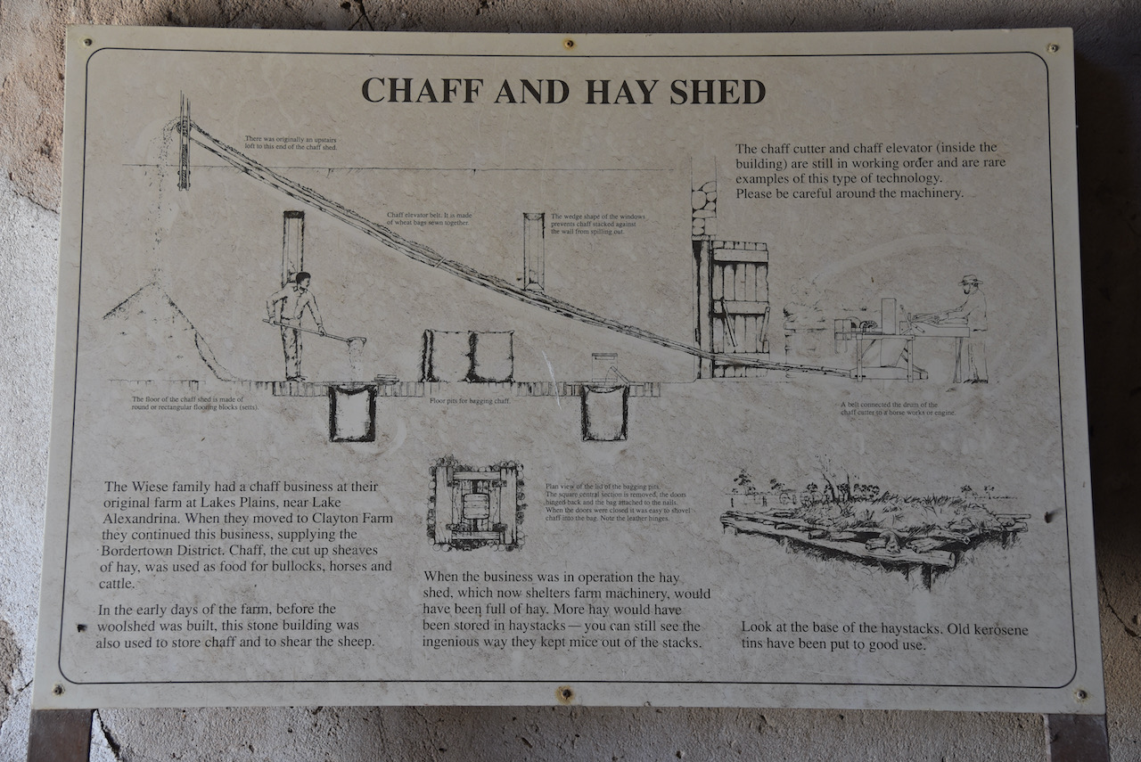
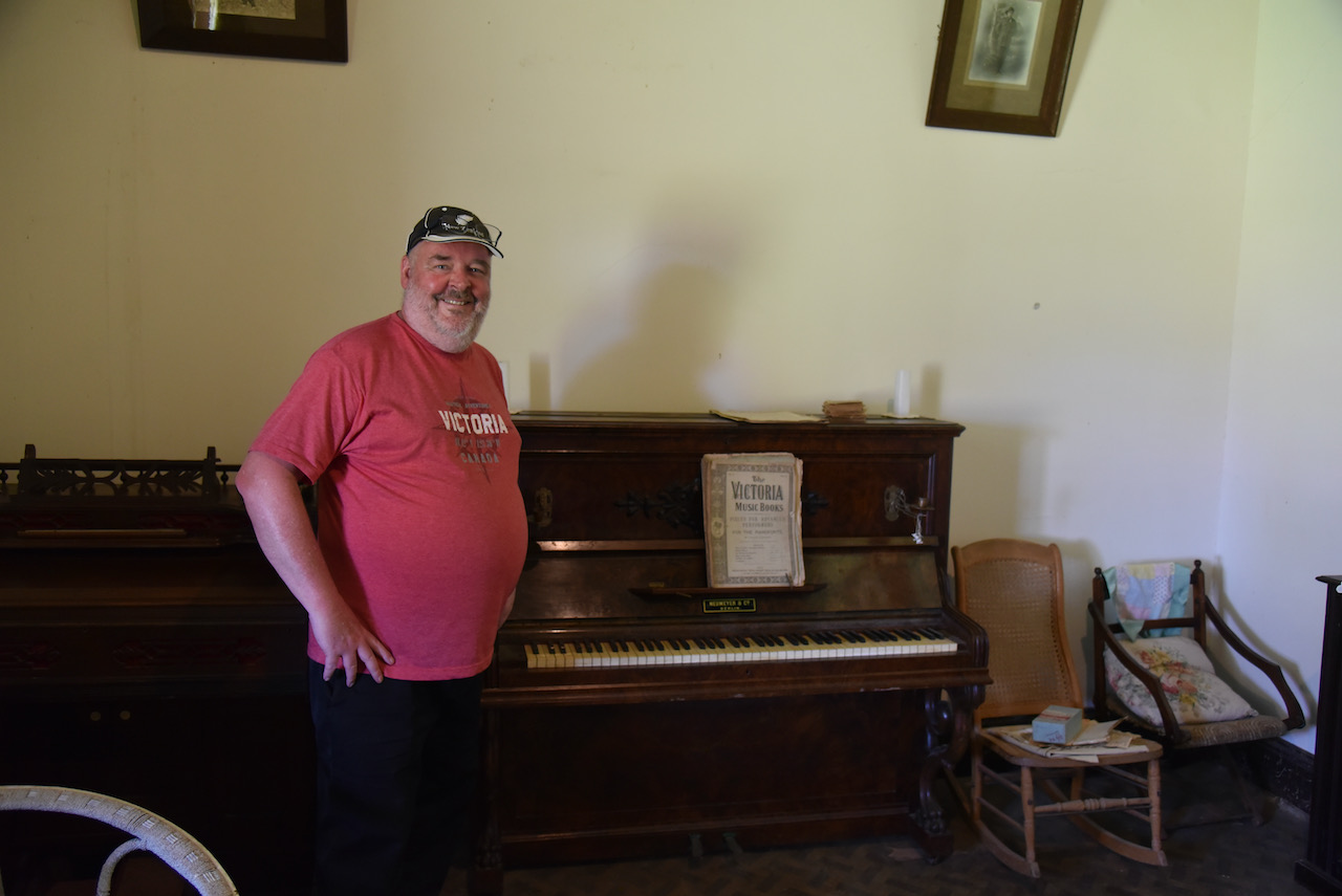
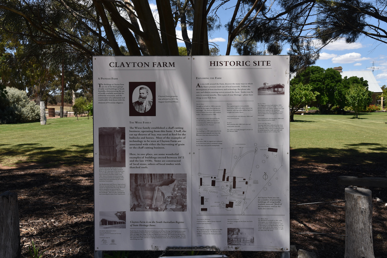
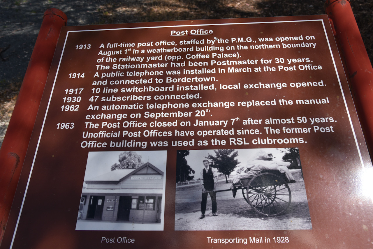
After leaving the Bordertown East silo we headed to Clayton Farm at Bordertown.
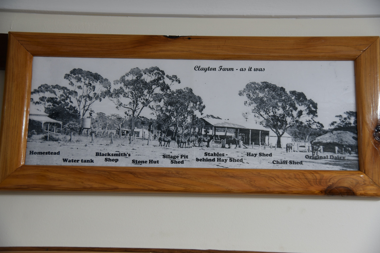
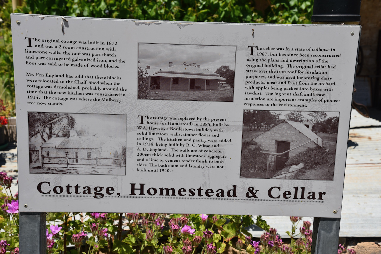
The first Undred of Tatiara was opened for land selection in 1872. One of the first settlers were August and Carl Wiese who took up blocks in the area. August settled on three blocks just to the south of Bordertown and called his farm Clayton.
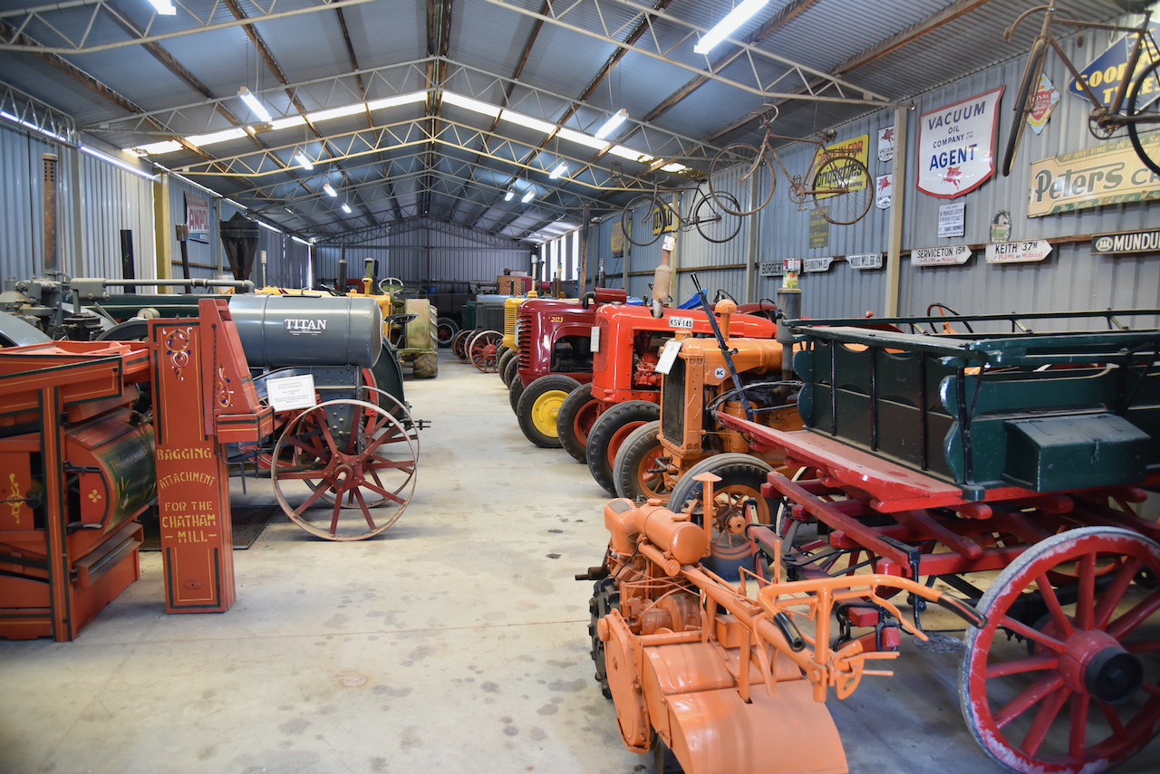
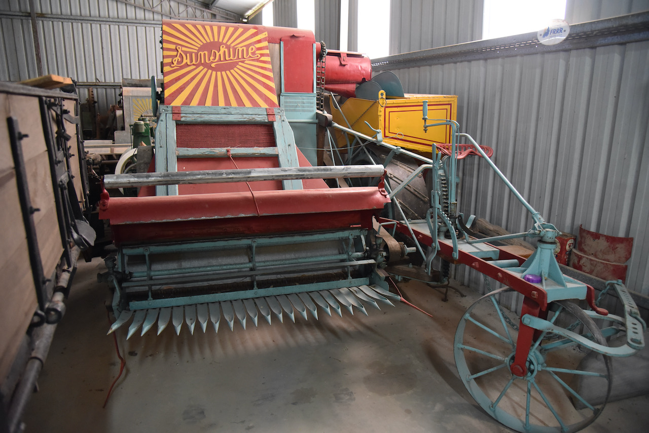
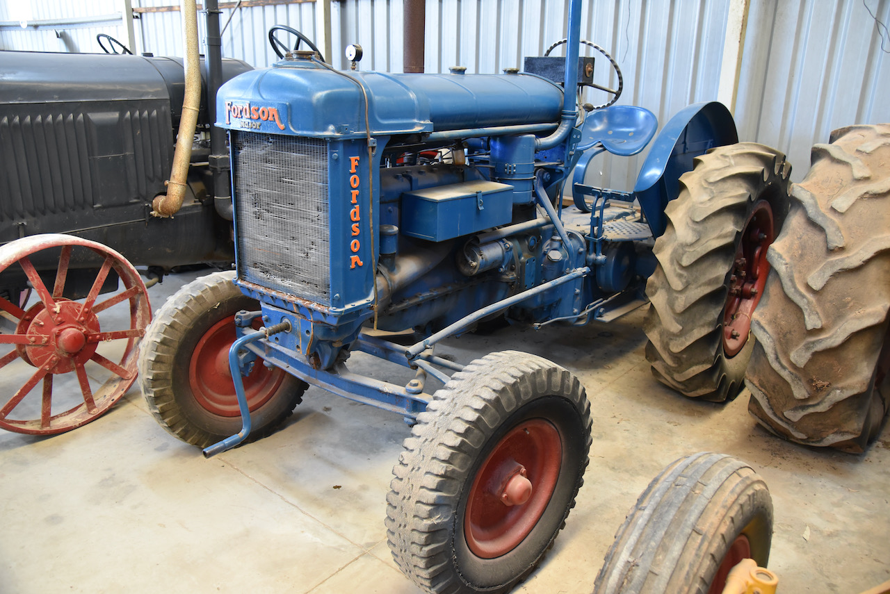
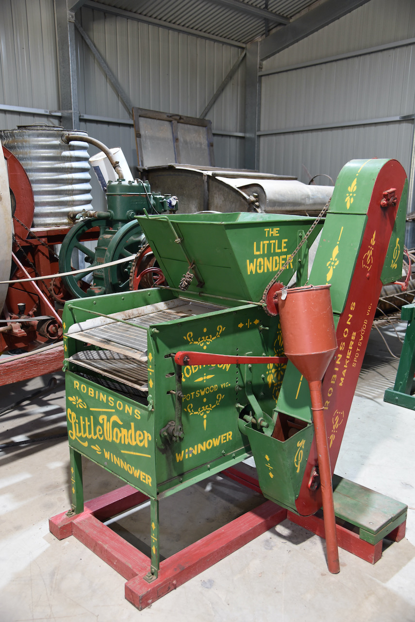
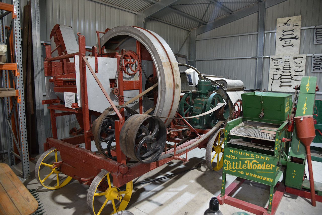
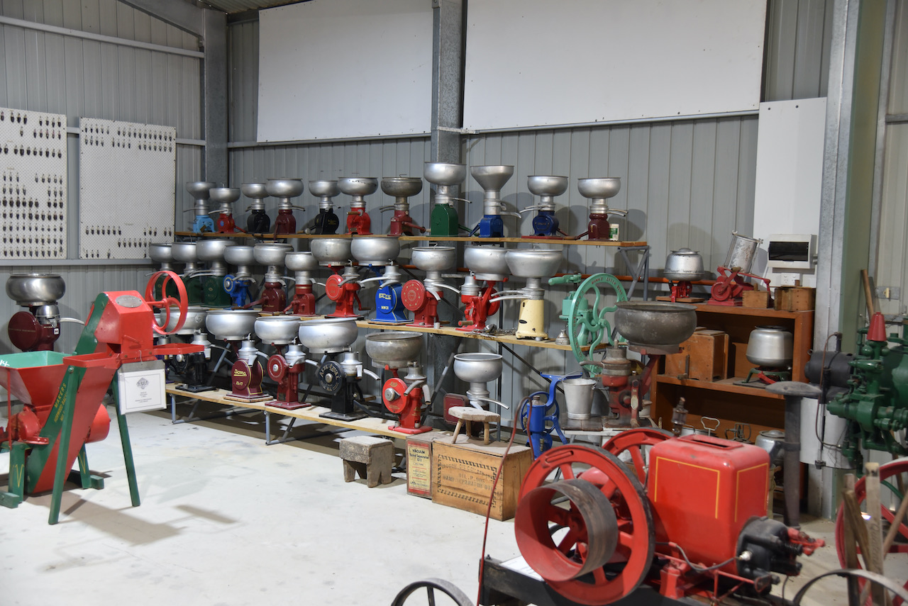
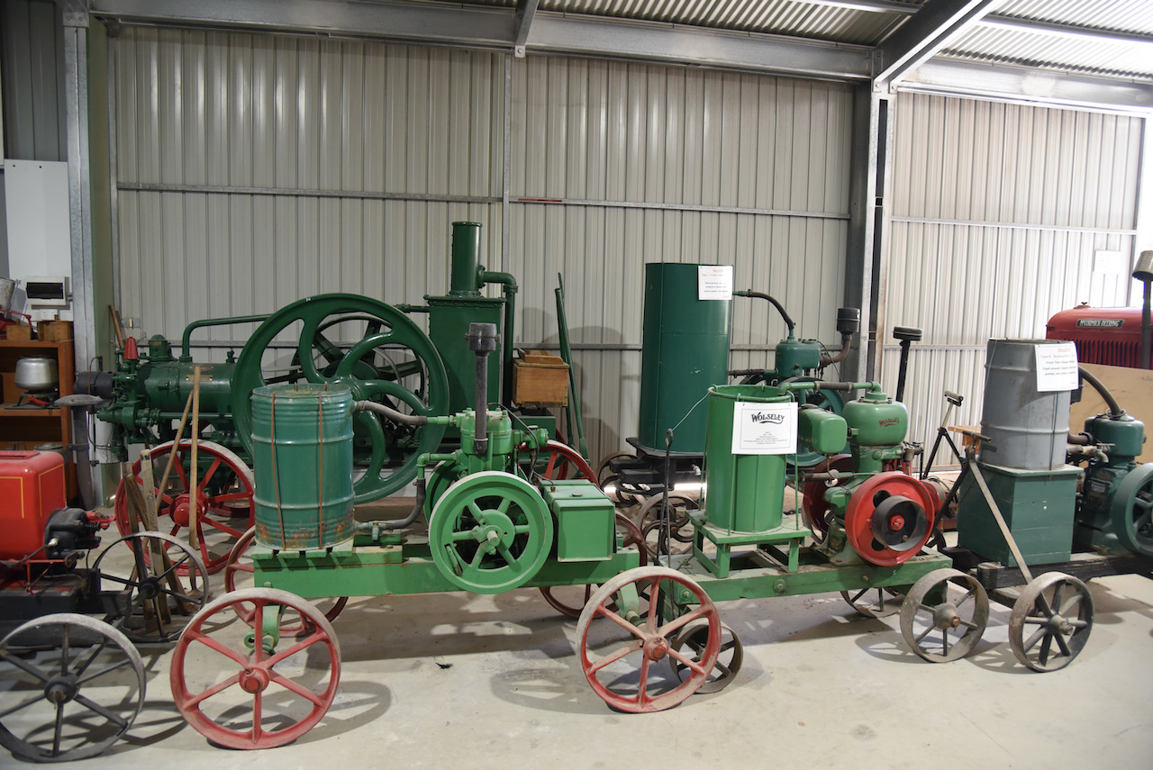
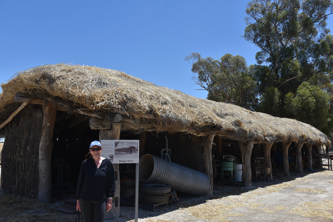
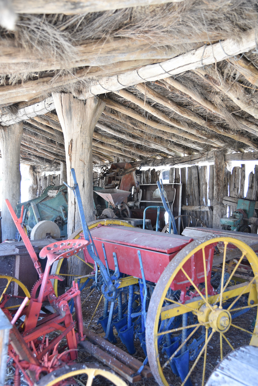
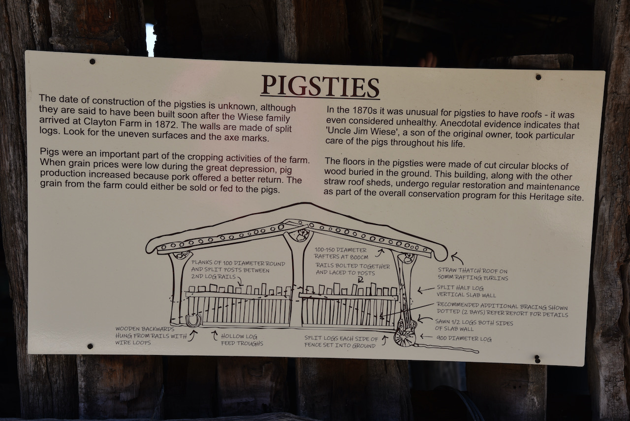
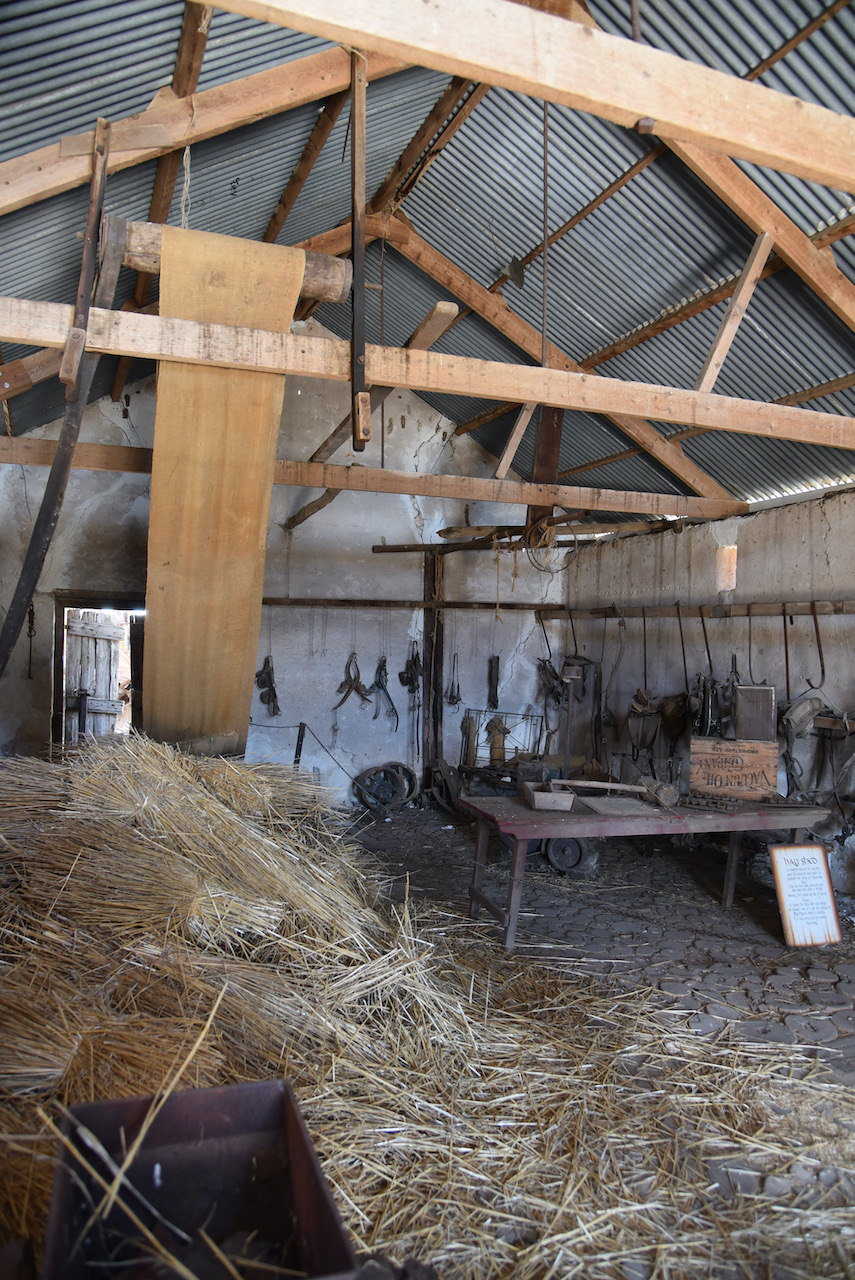
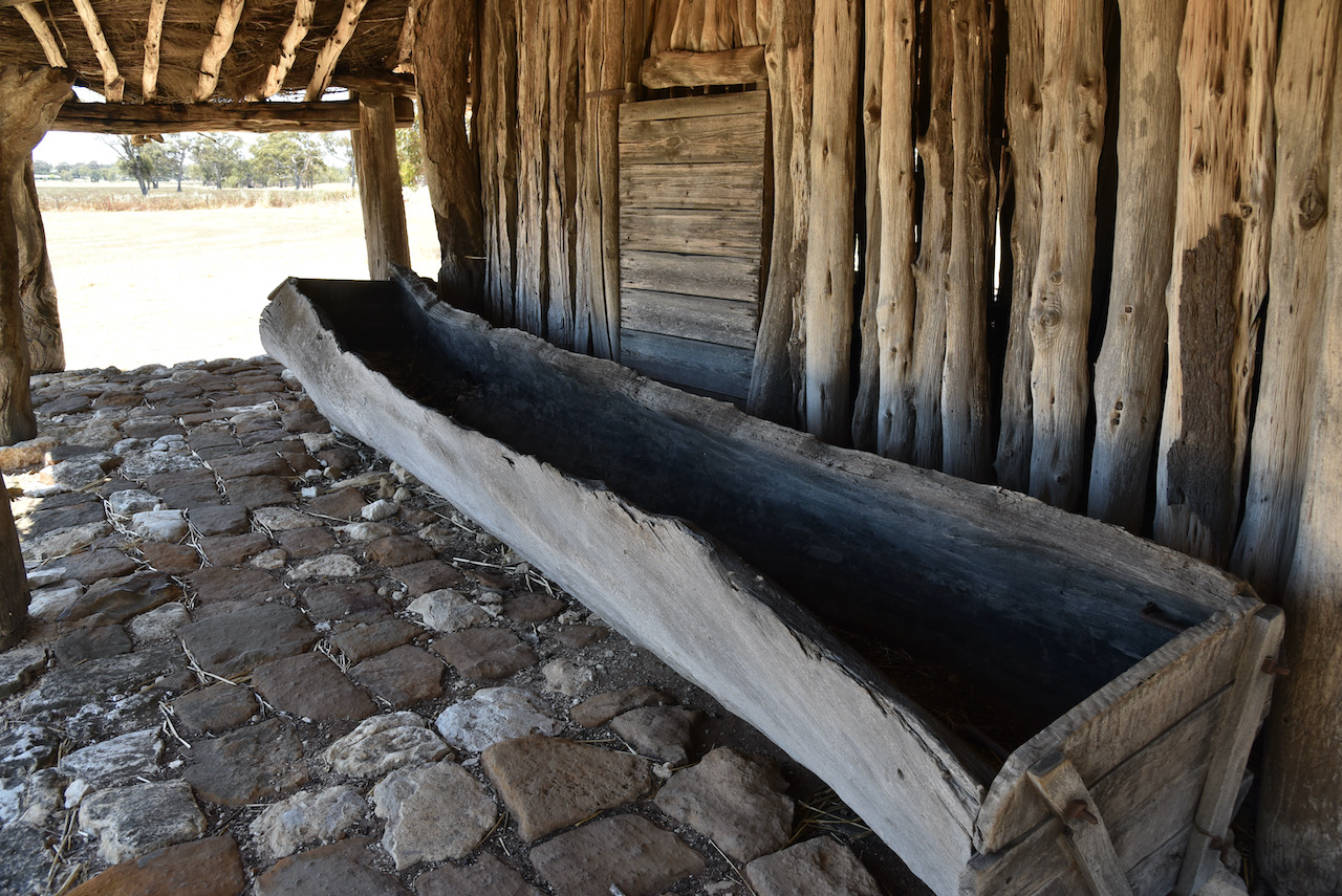
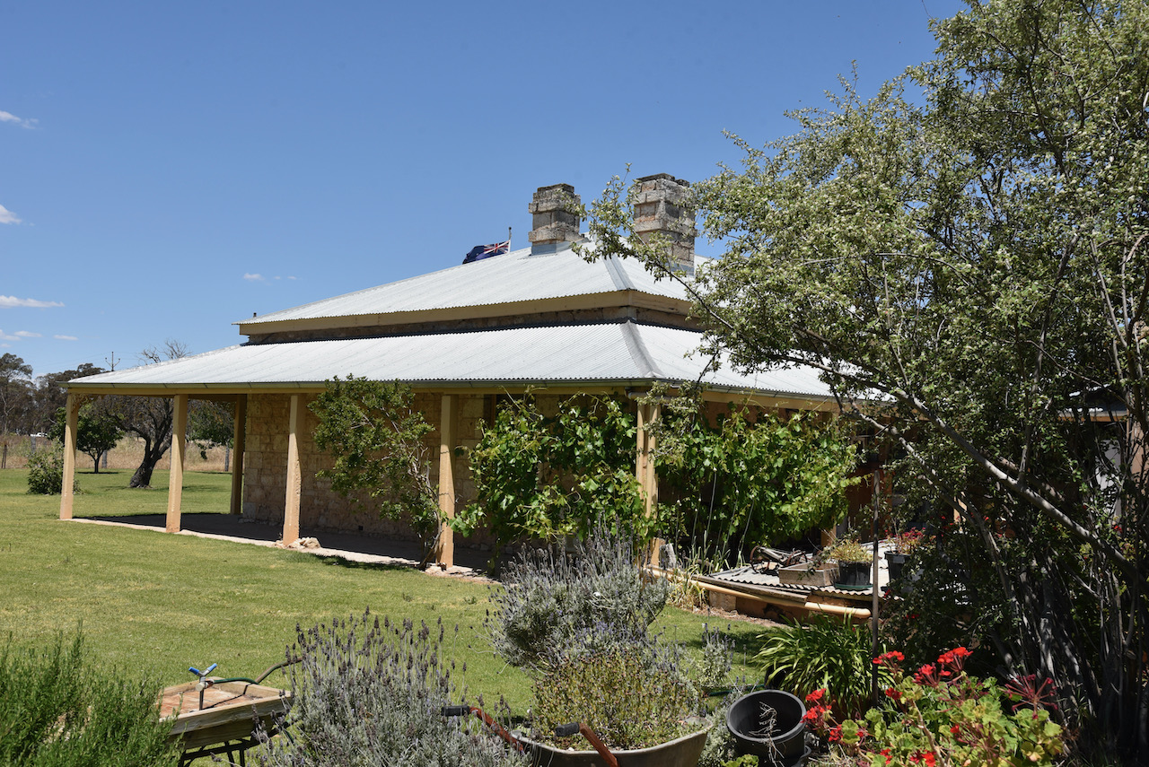
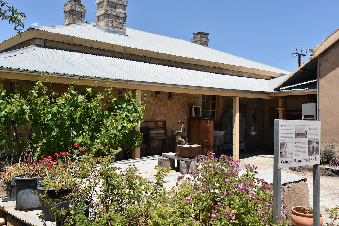
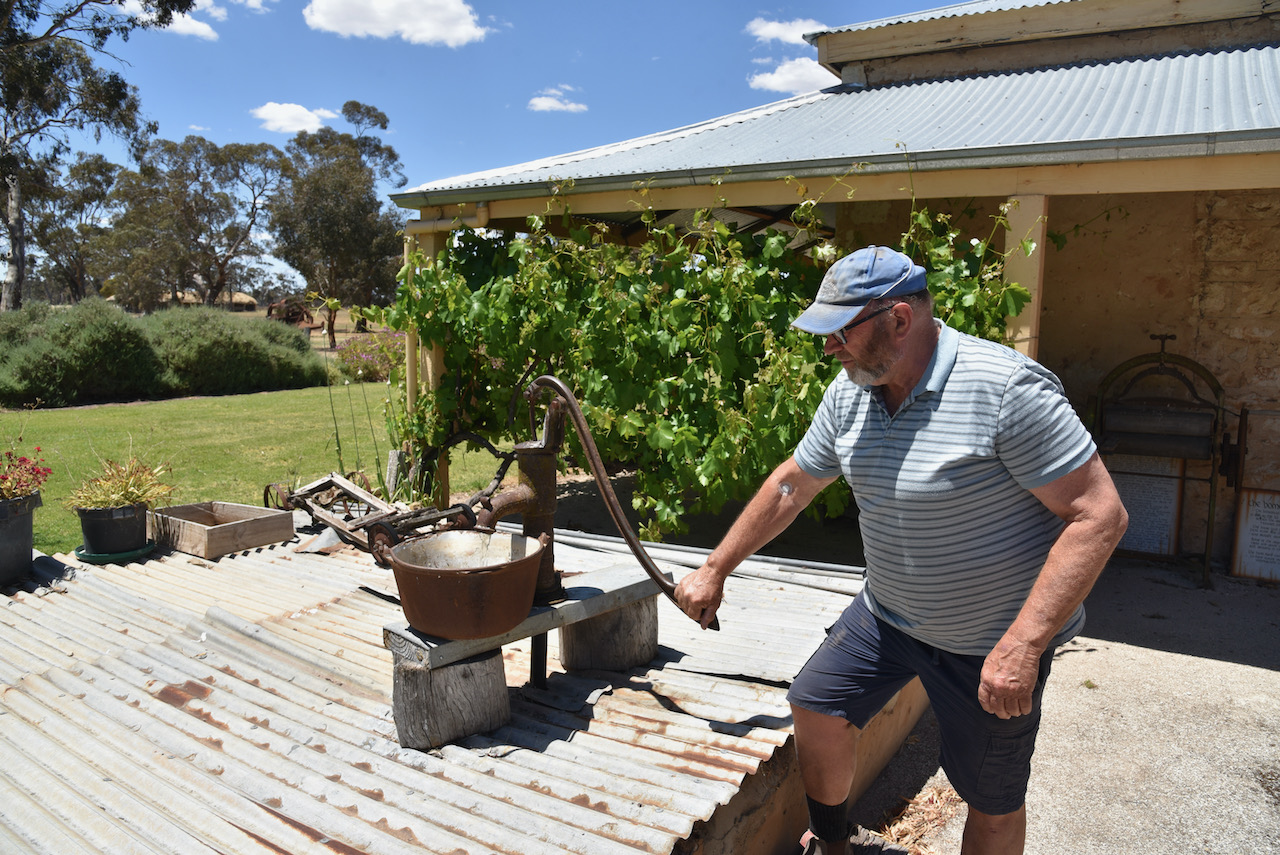
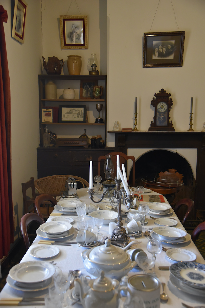
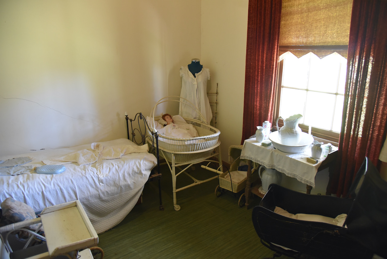
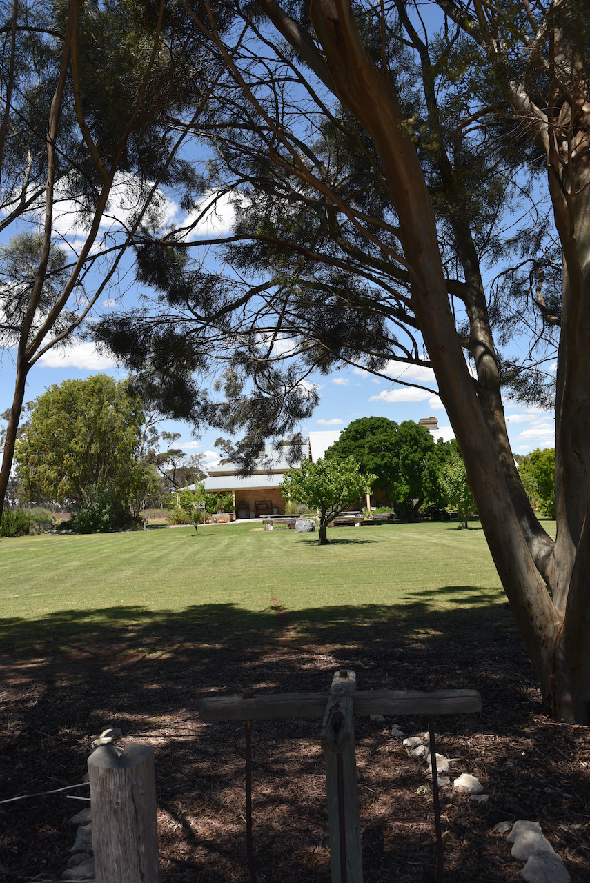
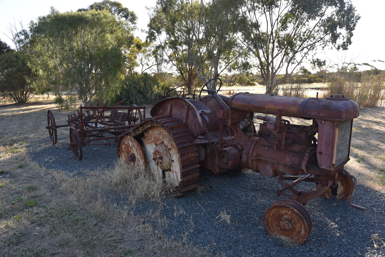
Clayton Farm features a recently restored and refurbished homestead and a magnificent display of vintage farm machinery, tractors, and vehicles. There are various historic buildings including the silage, pigsty, and the woolshed which is the largest thatched roof woolshed in the southern hemisphere. We had a terrific guide who showed us around the property which took about 3 hours.
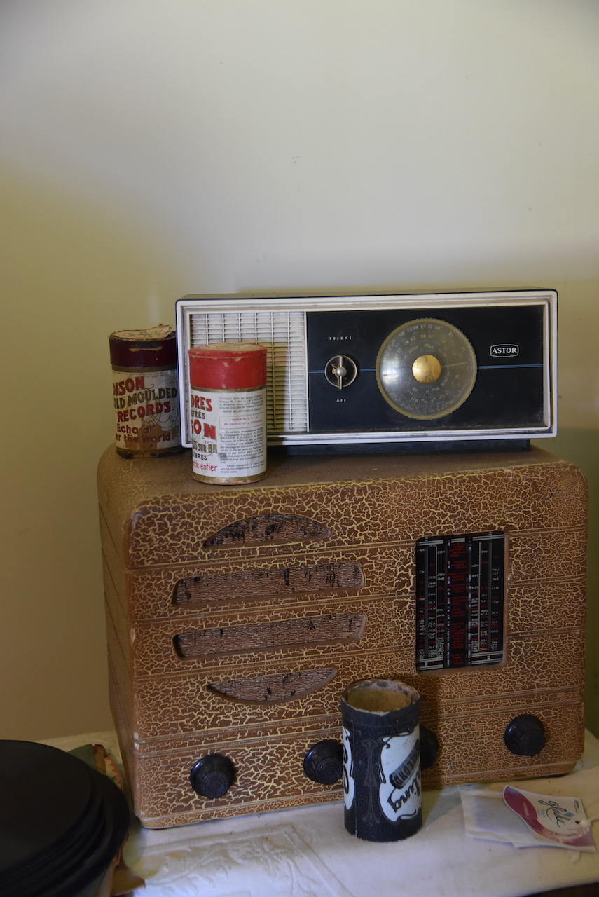
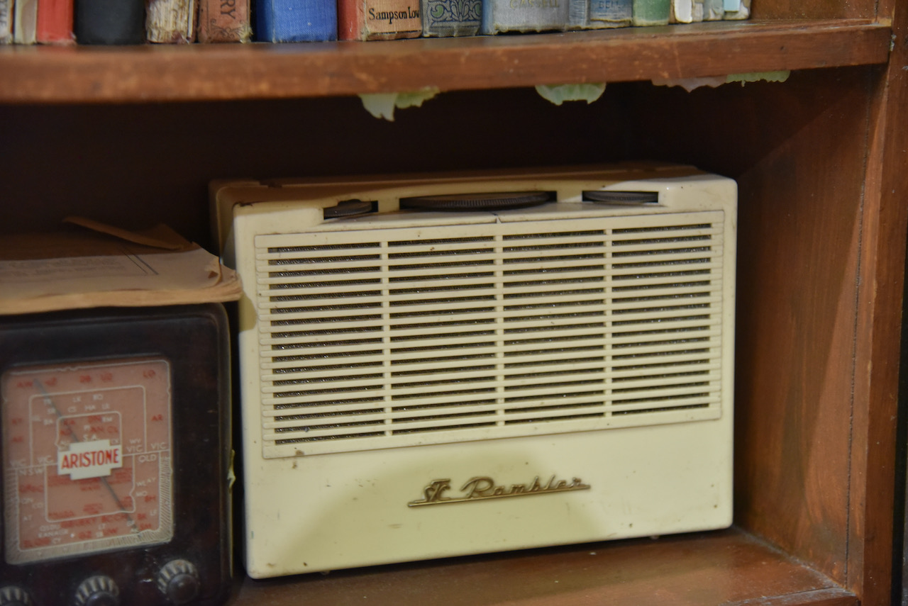
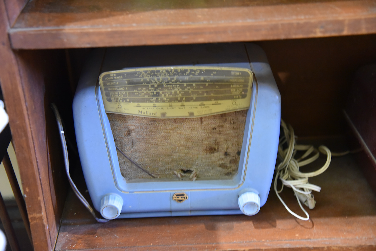
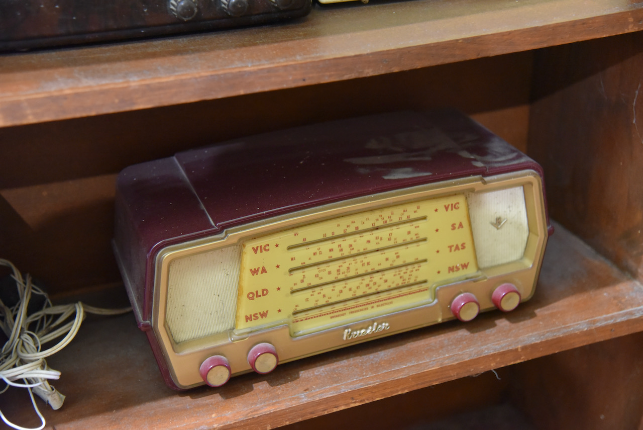
I even found some old radios in our travels at Clayton Farm.
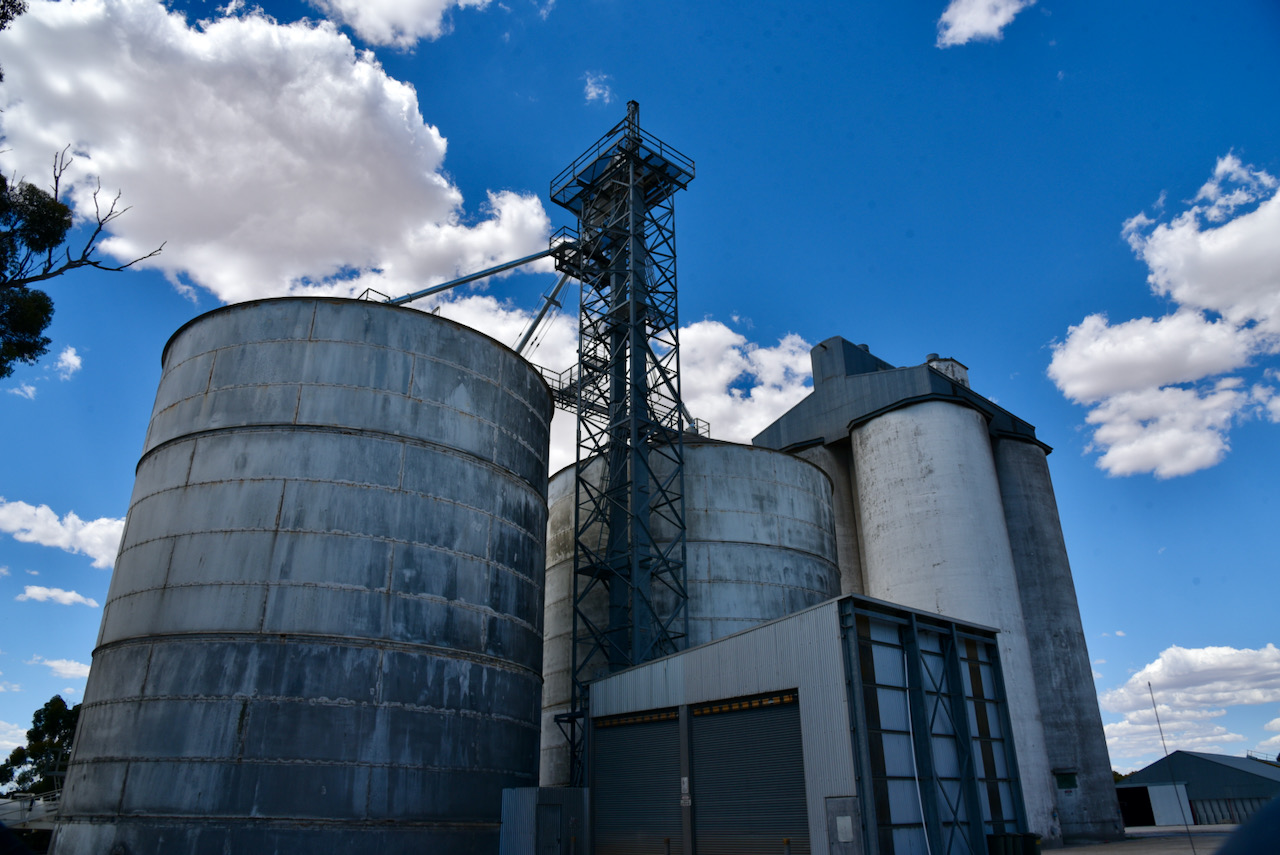
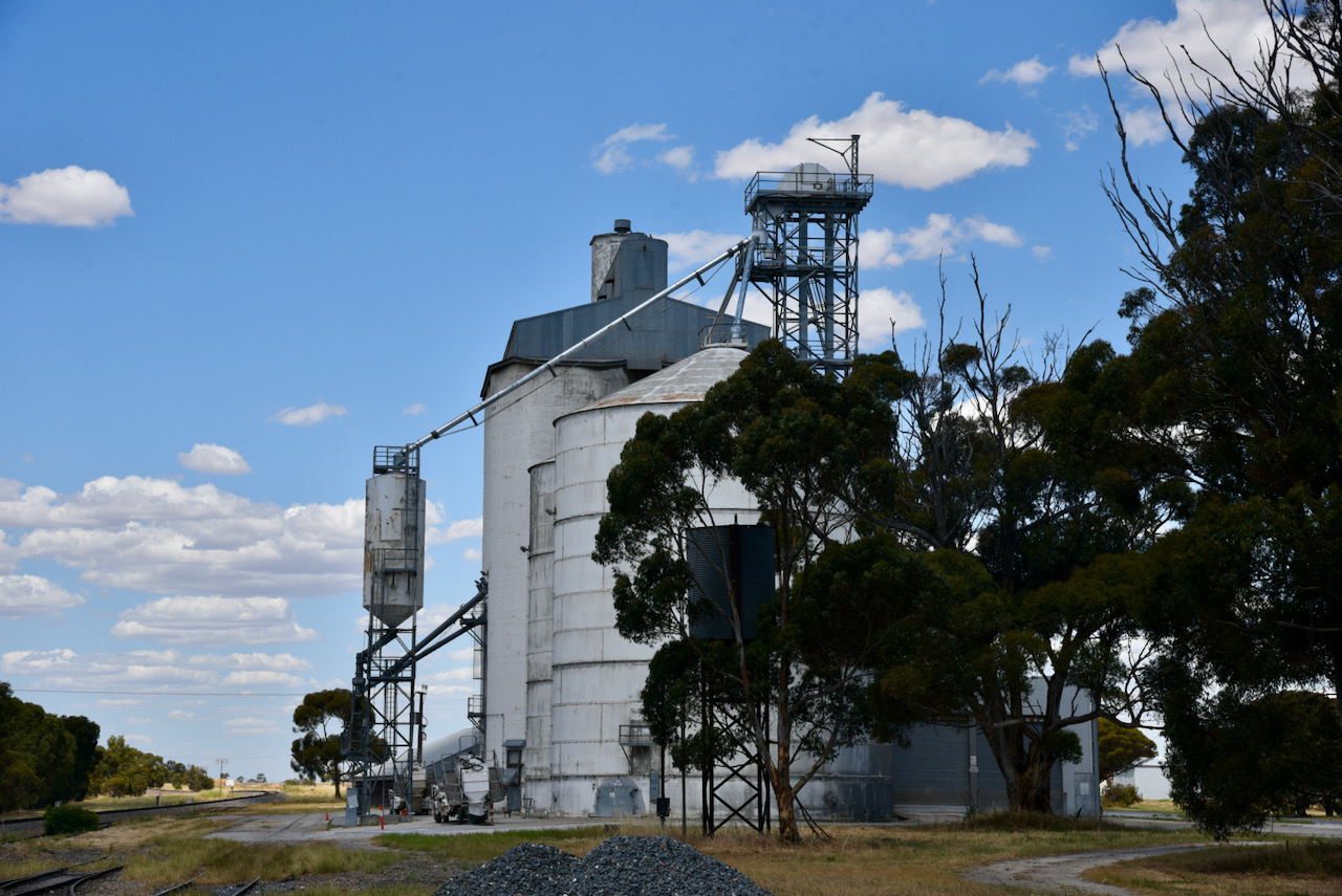
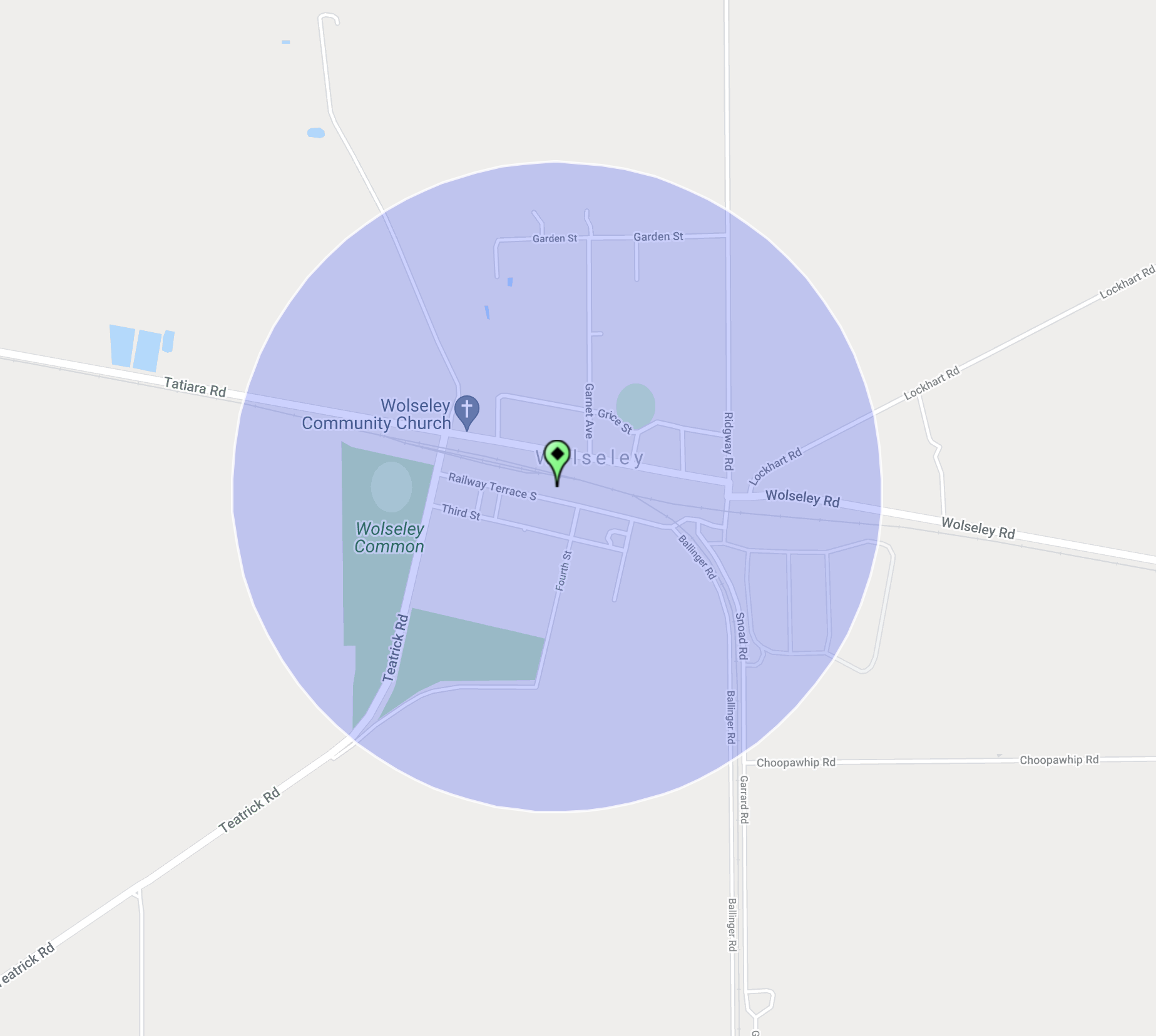
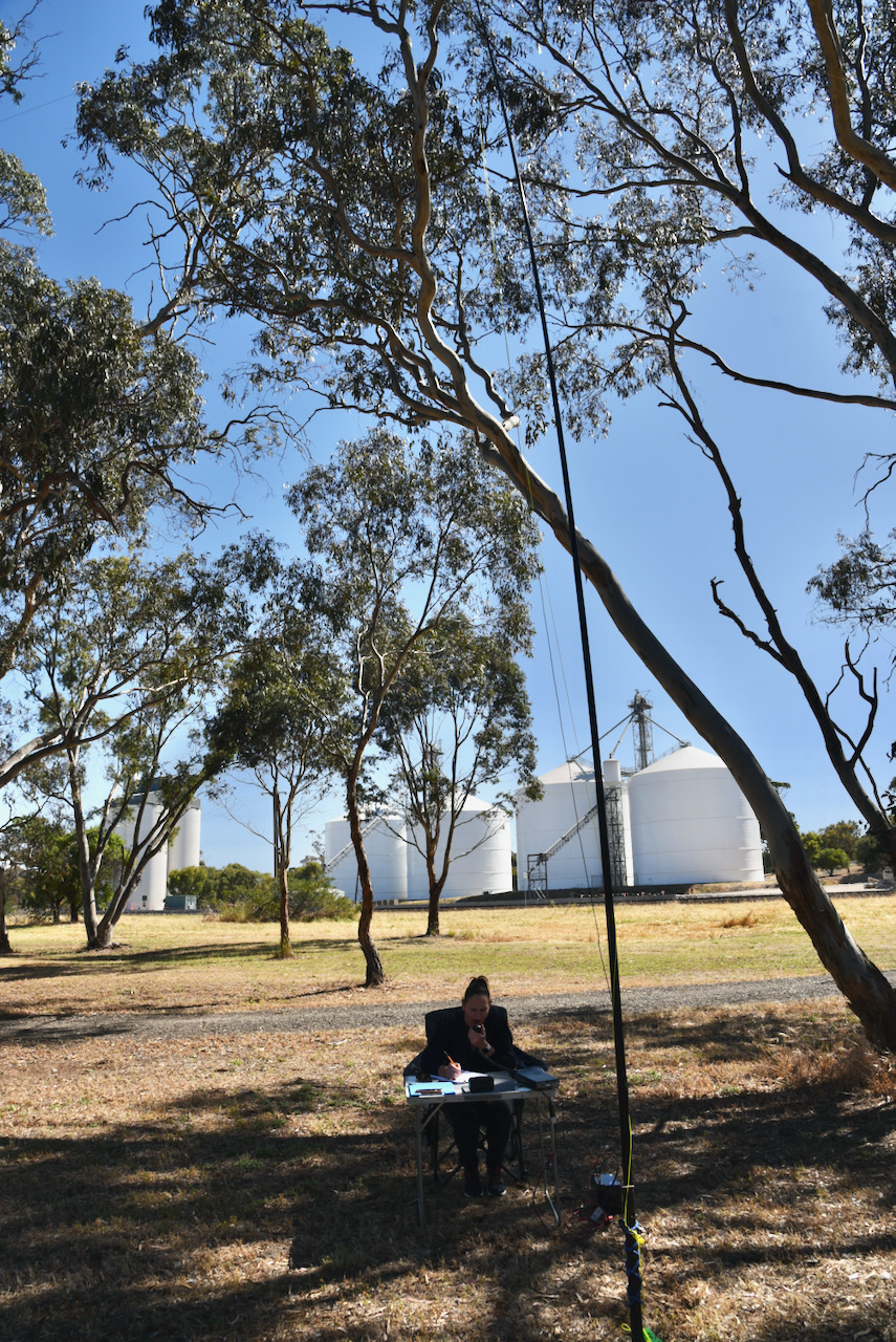
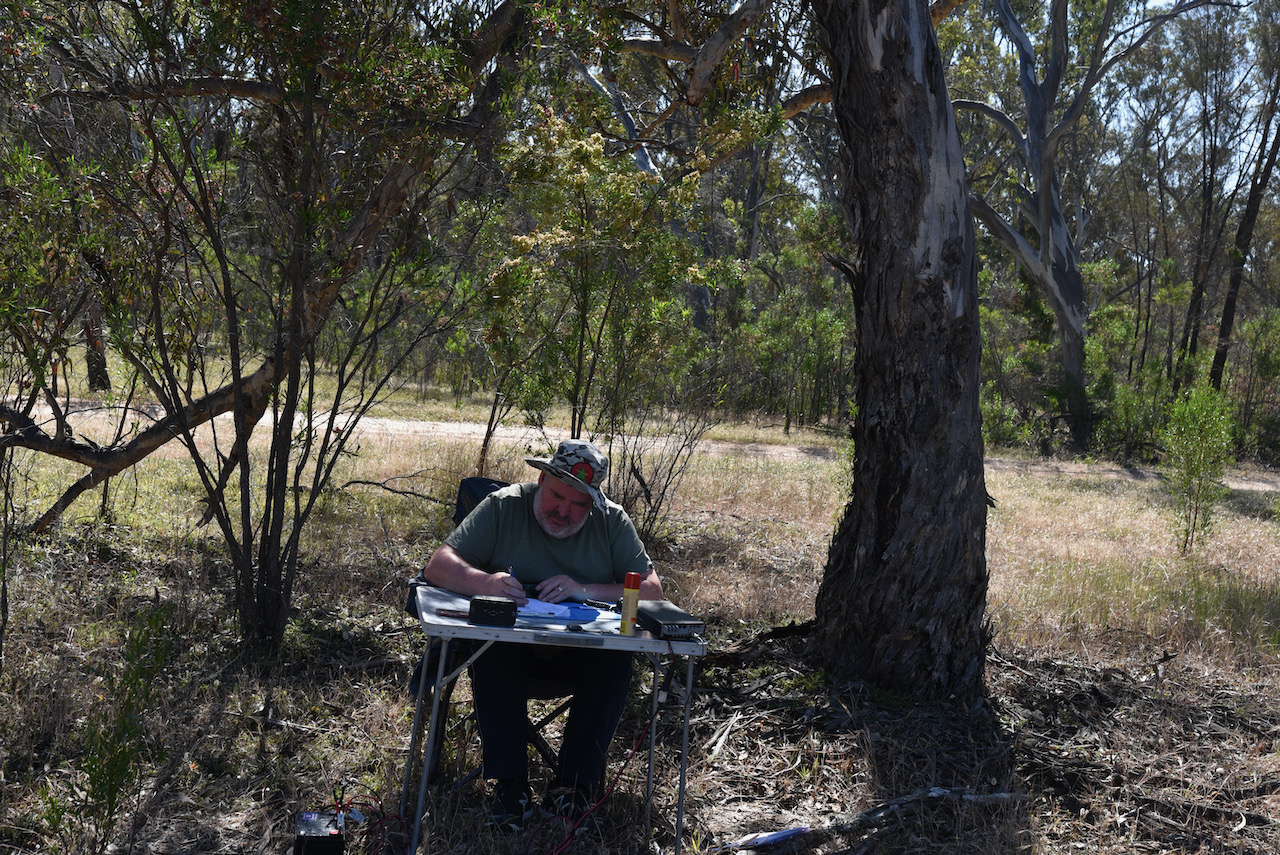
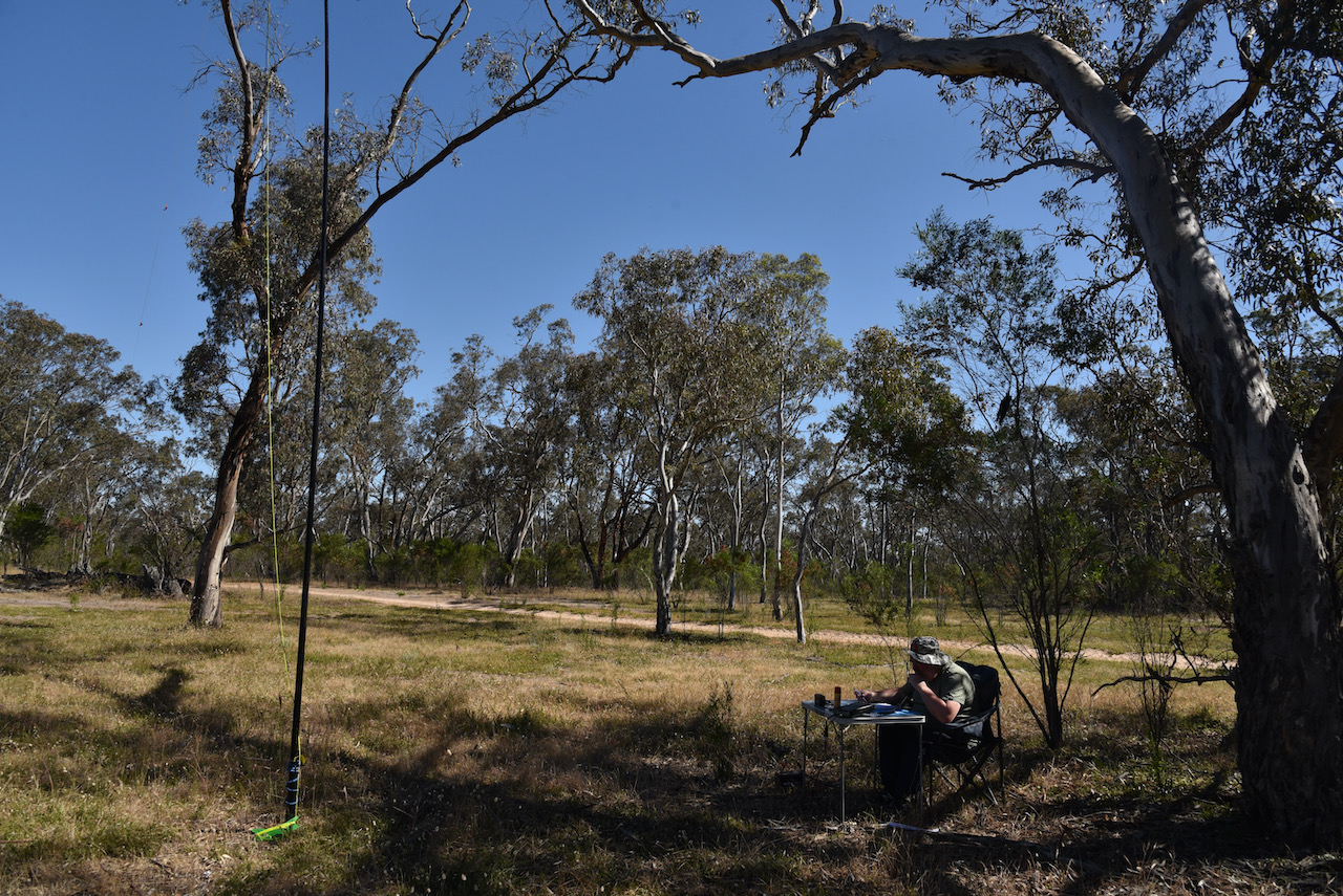
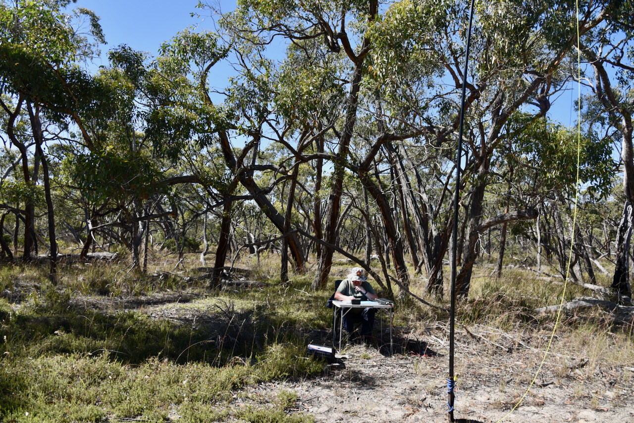
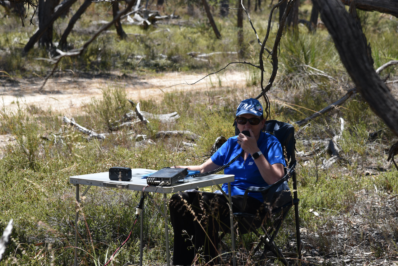
We then headed to Wolseley for another silo activation for the Silos On The Air program. This time, the Wolseley silo VK-WLY5.
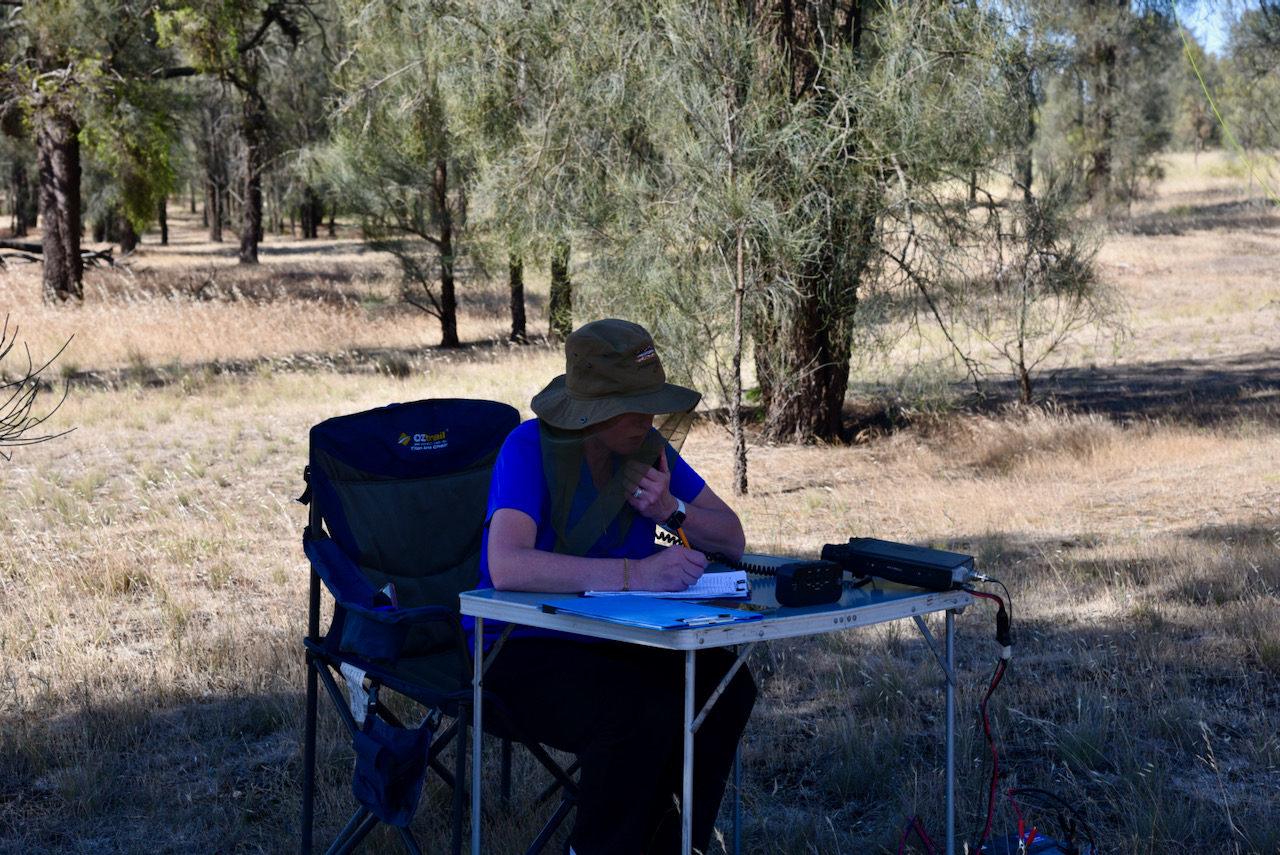
We struggled to find a quiet RF location near the silo so we drove to the end of Railway Terrace and entered the Wolseley Common Conservation Park, which we had activated on Saturday for the 2021 VKFF Activation Weekend. It was much quieter on the bands to operate from here.
In the SiOTA program, the activation zone is 1 km of the silo, so we were well and truly inside that.
Above:- Activation zone for Wolseley silo.
It was a ‘double-whammy, a silo activation and a park activation.
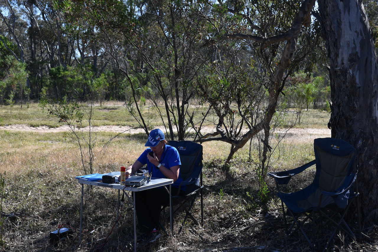
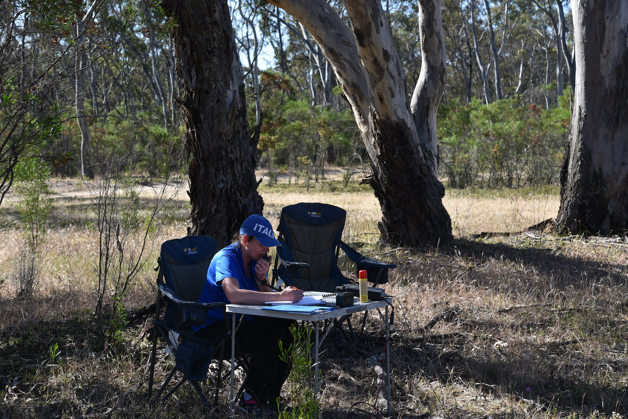
We spent about 45 minutes at the silo/park and made a total of 34 QSOs on 40m SSB. We had run out of time to try 20m and 80m.
Marija made the following QSOs on 40m SSB;-
VK5ZSH
VK5FANA
VK3PI
VK3TV
VK3PF
VK5KLV
VK2VW
VK2HFI
VK2PKT
VK3FIMD
I made the following QSOs on 40m SSB:-
VK3PF
VK5ZSH
VK5KLV
VK3FKL
VK2PKT
VK5WG
VK1DI
VK3FIMD
VK5FANA
VK3JP
VK3VIN
VK3MKE
VK5HS
VK3TV
VK2VW
VK2HFI
VK2YAK
VK4YAK
VK4NH
VK7EE
VK3AWA
VK3IH/m
VK3AMO
VK3CA
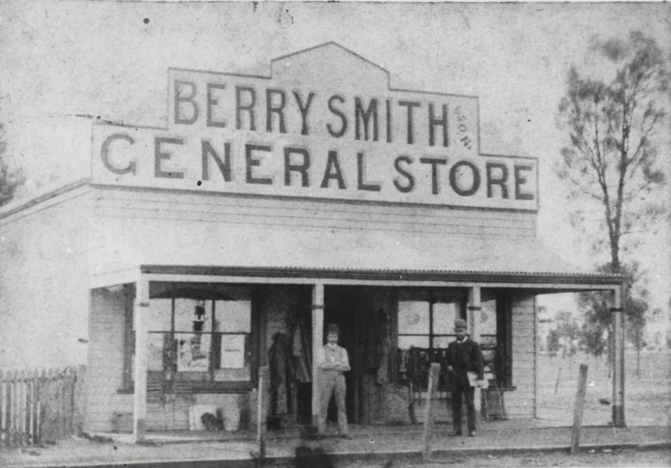
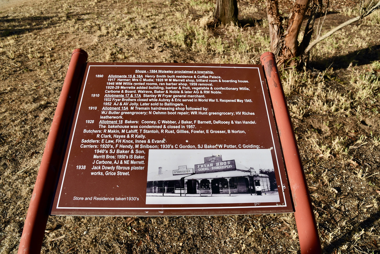
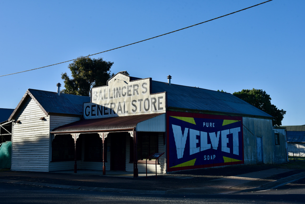
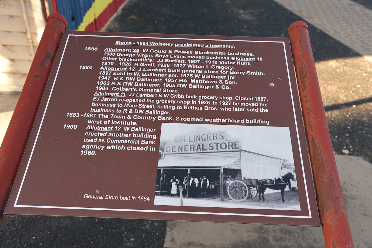
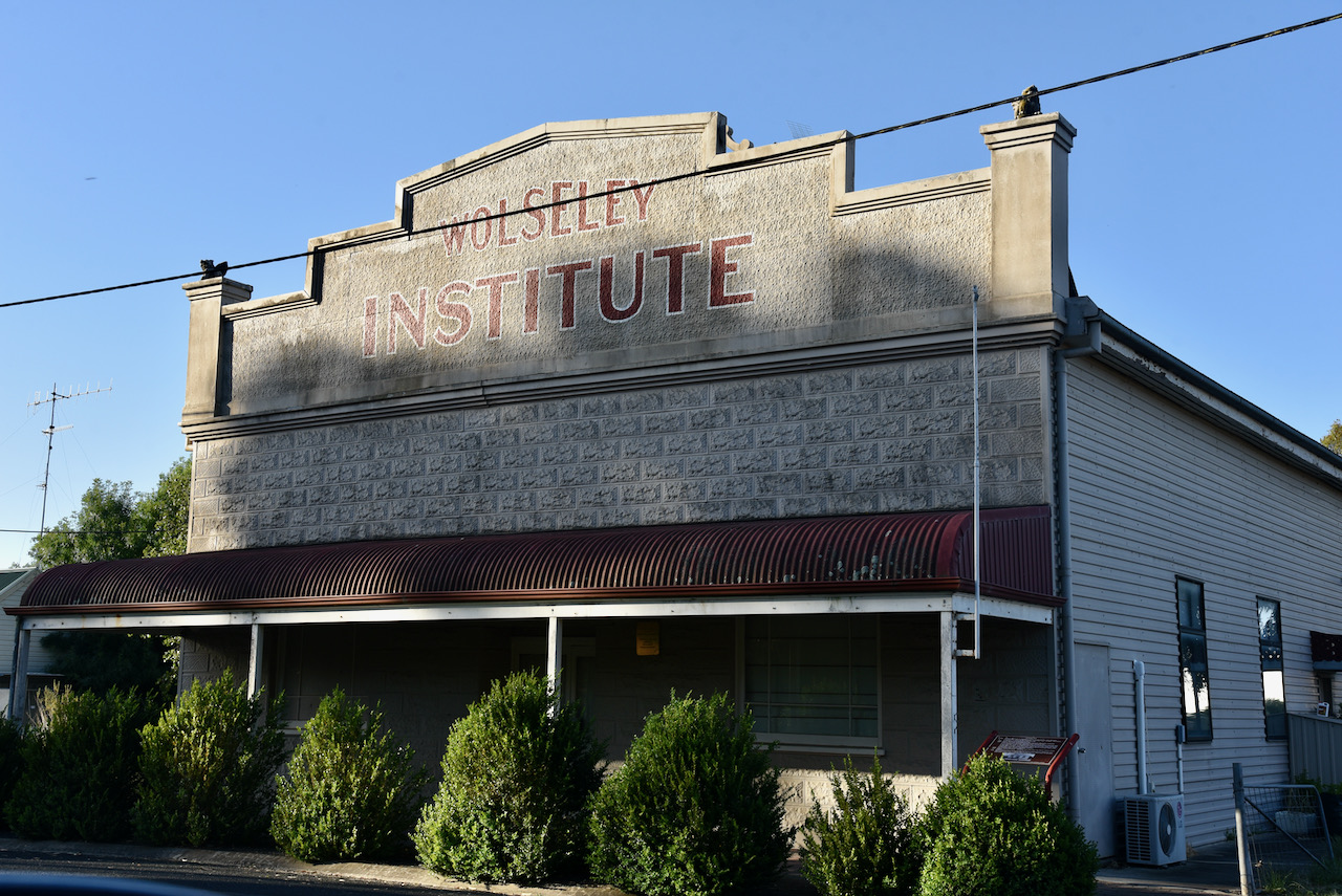
We then packed up and headed back into the town of Wolseley. Although we had looked around the town on Saturday, there were still some interesting things to have a look at in this very historic little town.
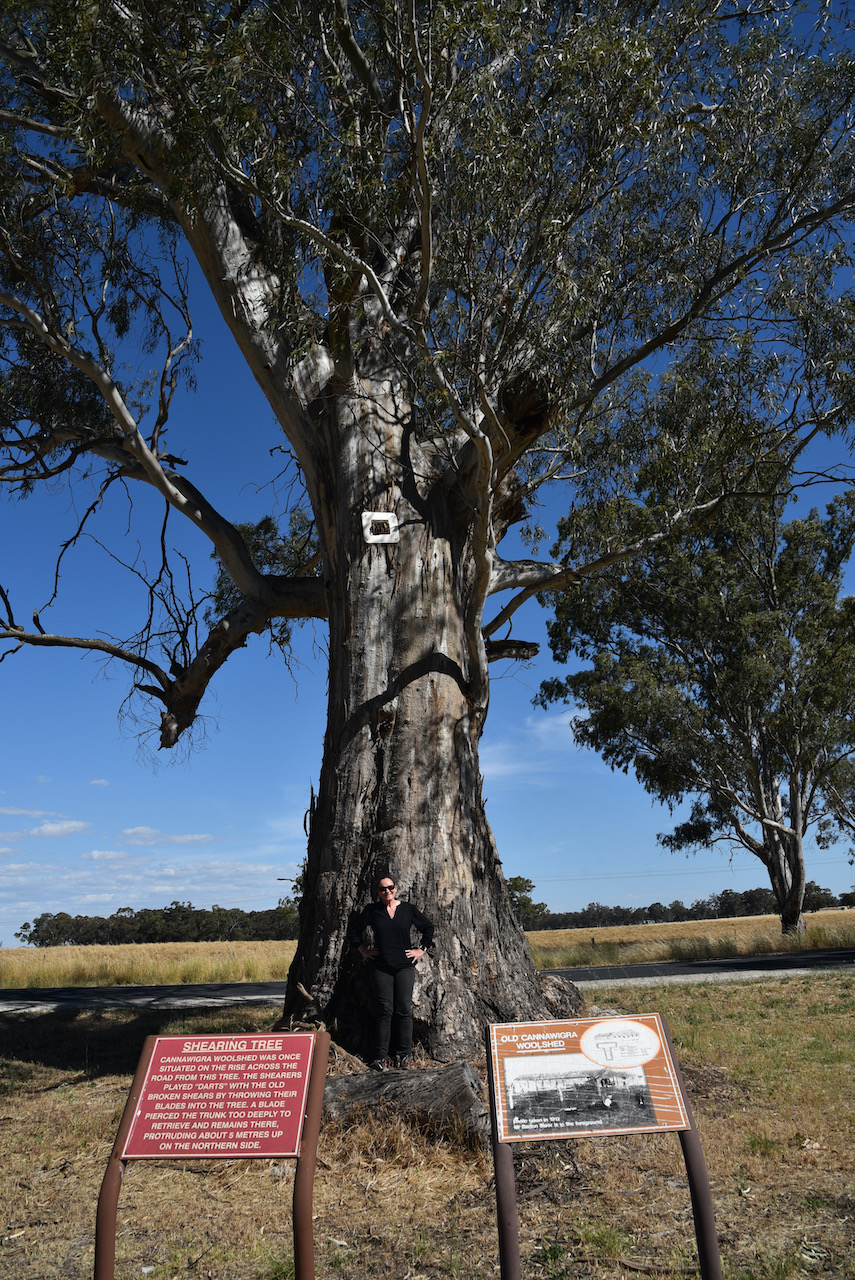
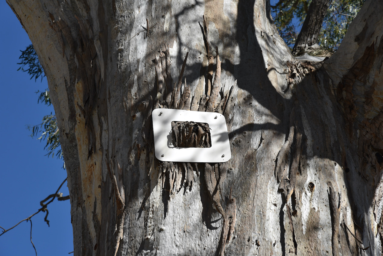
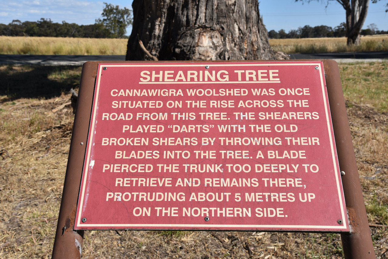
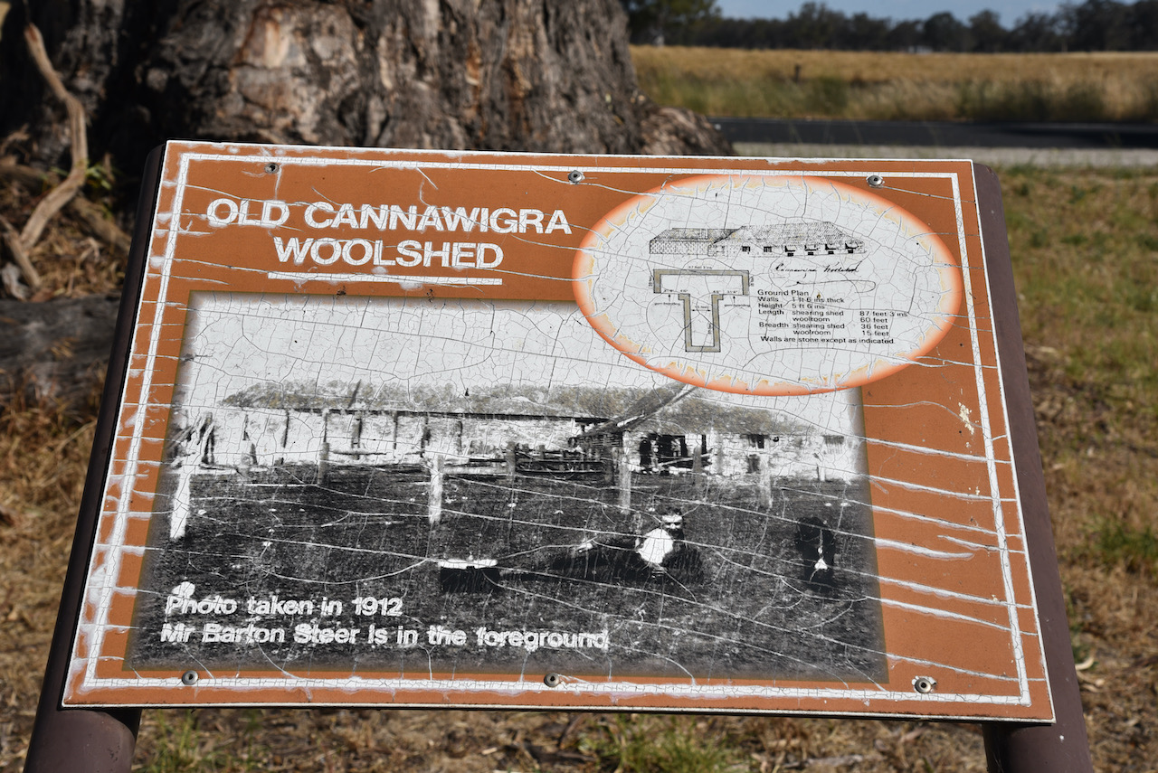
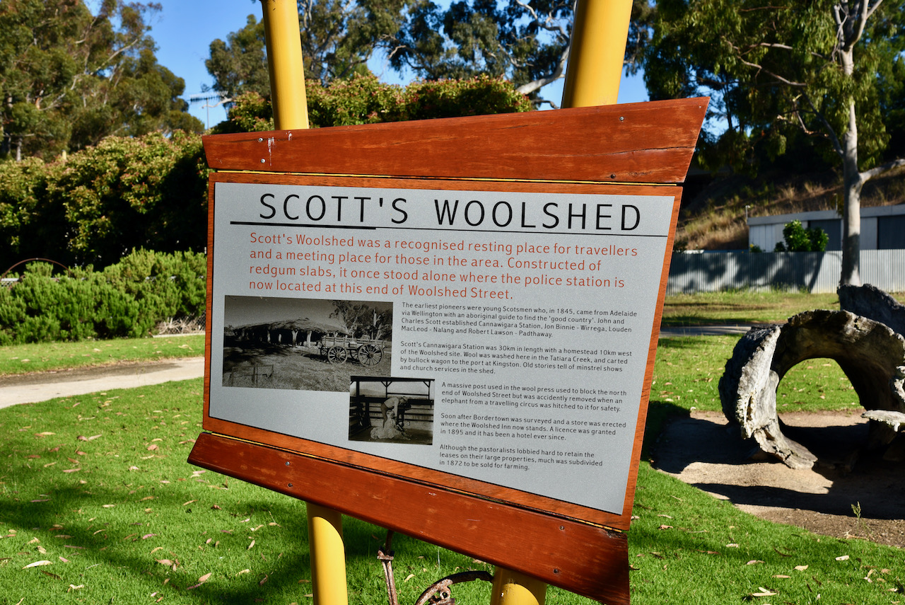
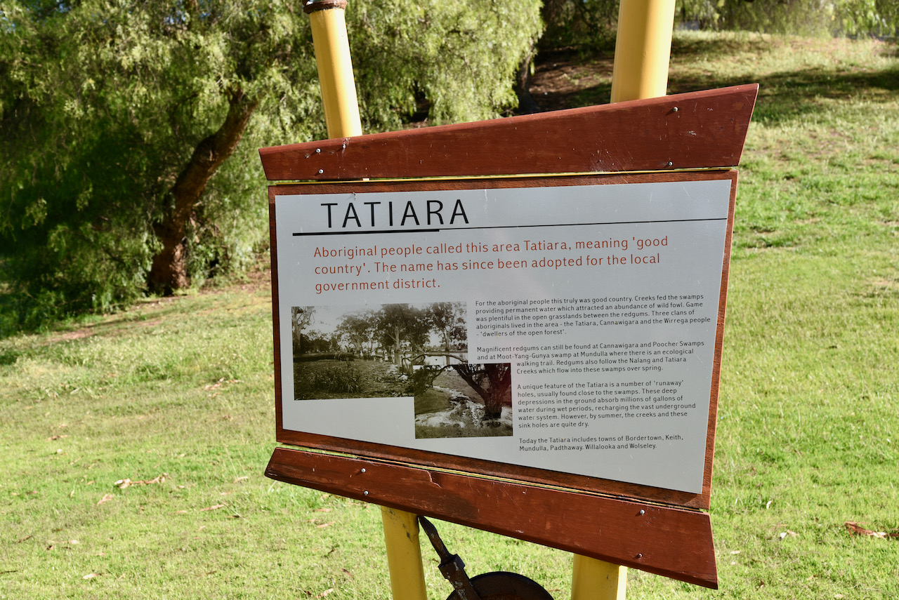
As we had not found the Shearing Tree over the weekend, we headed back into Bordertown and drove out on the Tatiara Historic Drive. We soon found the tree. The Canawiga Woolshed once stood on the rise across the road from the tree. The shearers would play ‘darts’ with old broken shears by throwing the blades into the tree. A blade pierced the trunk too deeply and it was unable to be retrieved. It remains embedded in the tree today.
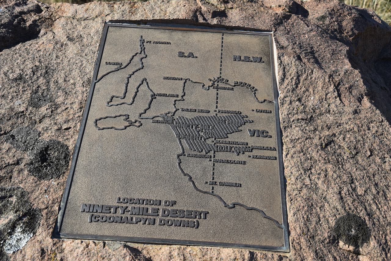
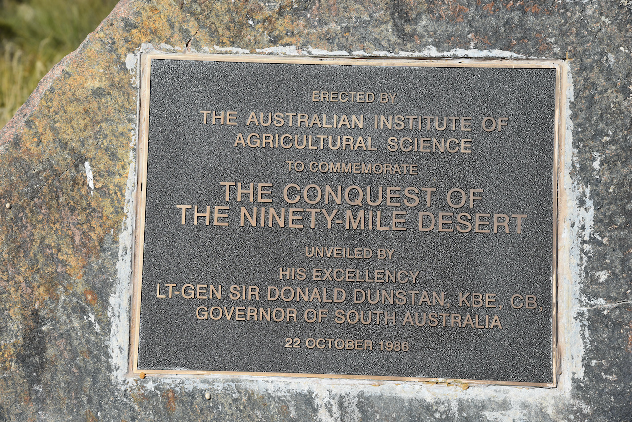
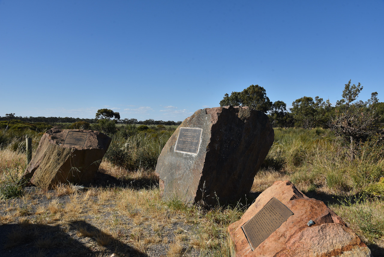
We then started our journey home, stopping briefly on the Dukes Highway to view the monument for the ‘Conquest of the Ninety Mile Desert’.
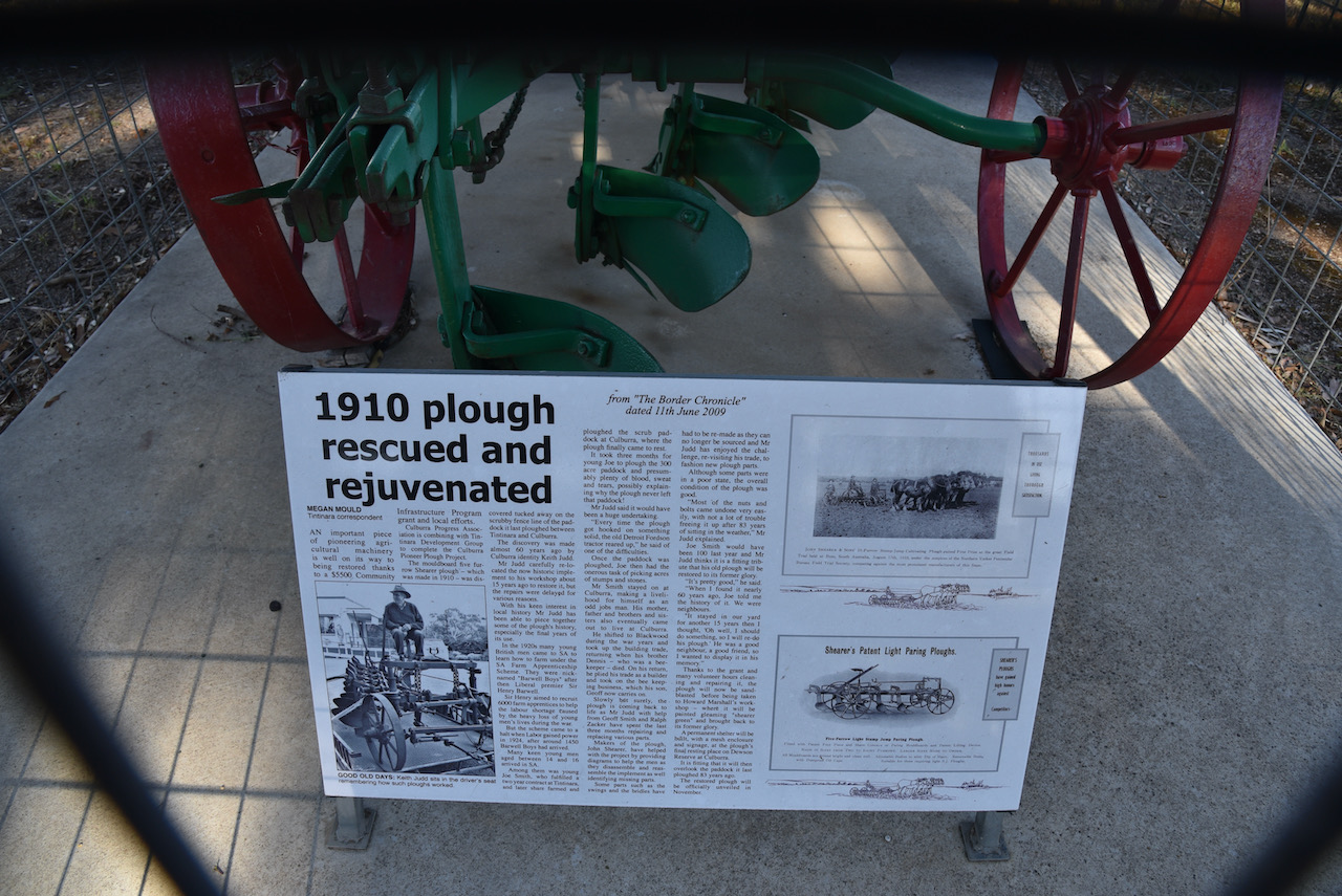
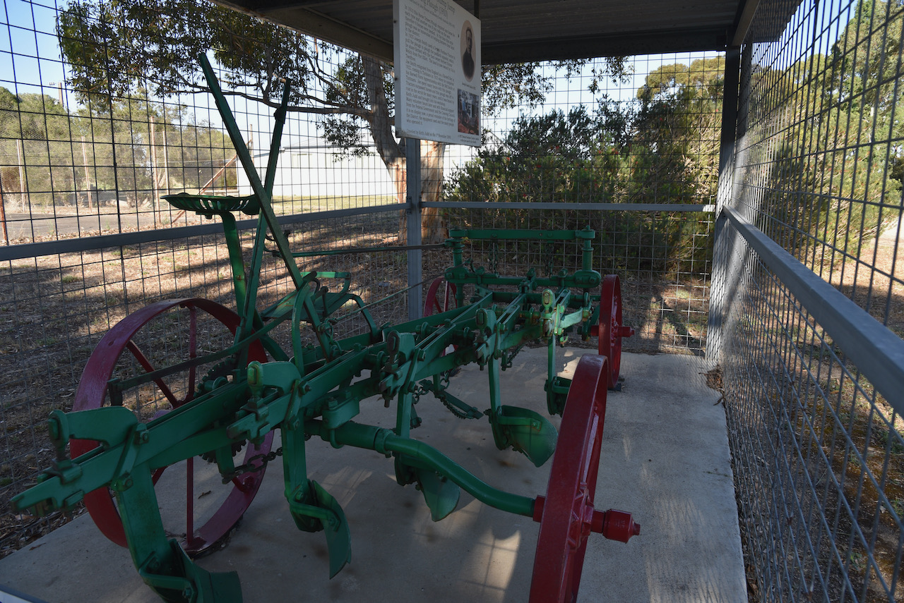
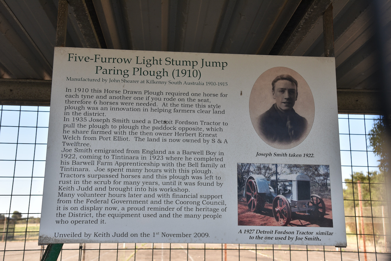
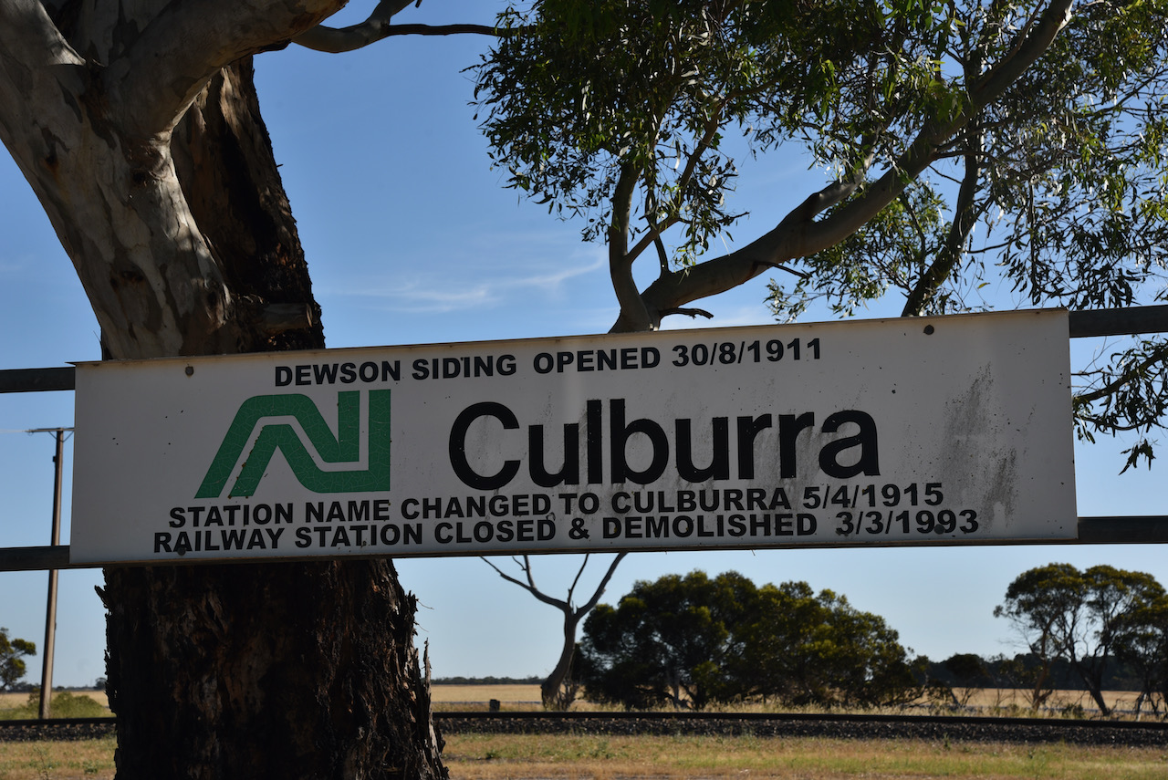
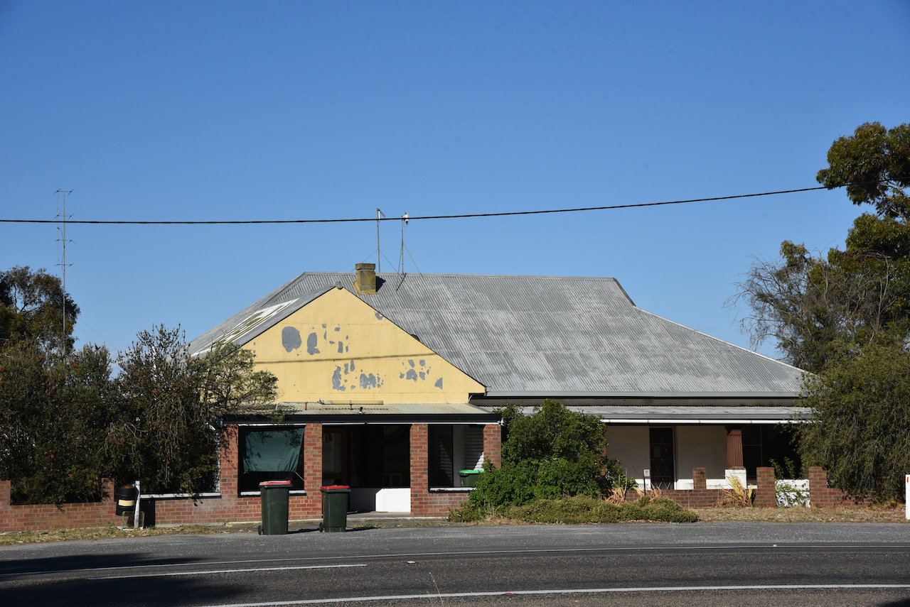
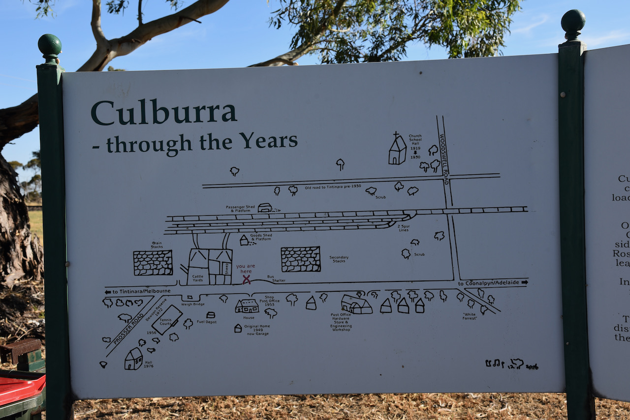
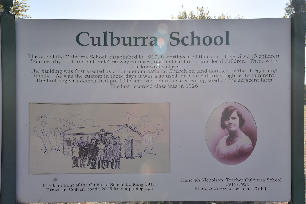
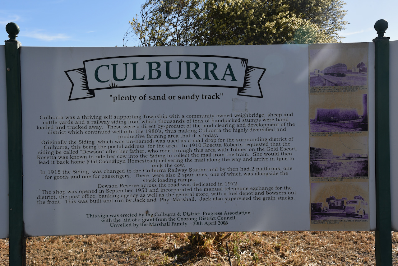
We then stopped at the little town of Culburra, which is an aboriginal word meaning ‘plenty of sand’. The town was once a thriving township with a church, school, railway siding, goods shed and platform, shop, post office, hardware store, engineering workshop, cattle yards. In 1908, 16 petitioners requested that the Commissioner of Railways, create a railway siding at Culburra, as the nearest railway siding was ’18 miles’ away.
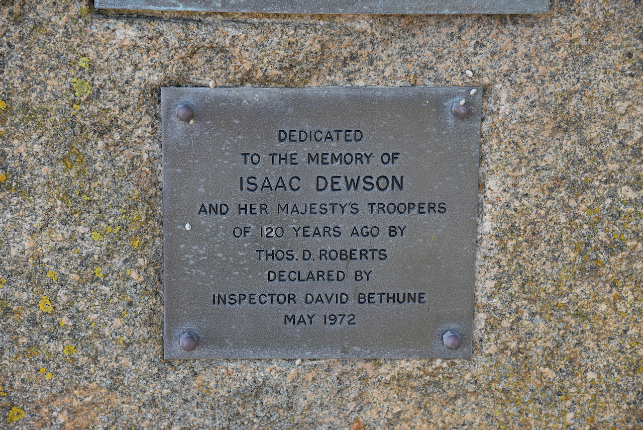
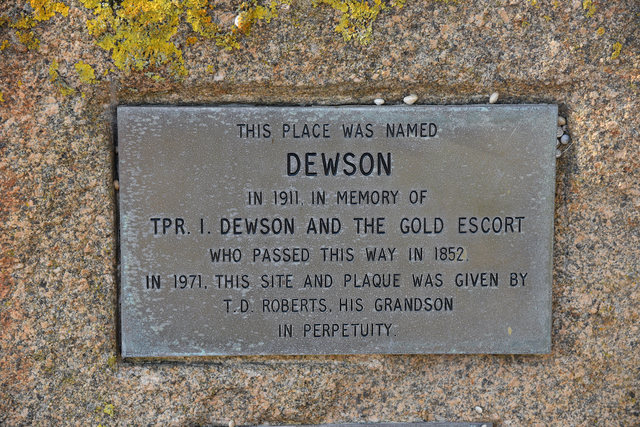
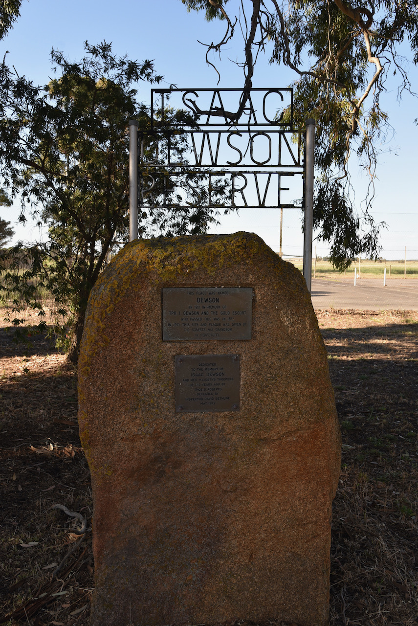
In 1910 the railway siding was constructed and was named Dewson. In 1911 the name was changed to avoid confusion with Dawson near Peterborough.
In 1914 the town of Culburra was laid out by Thomas Roberts into 17 allotments.
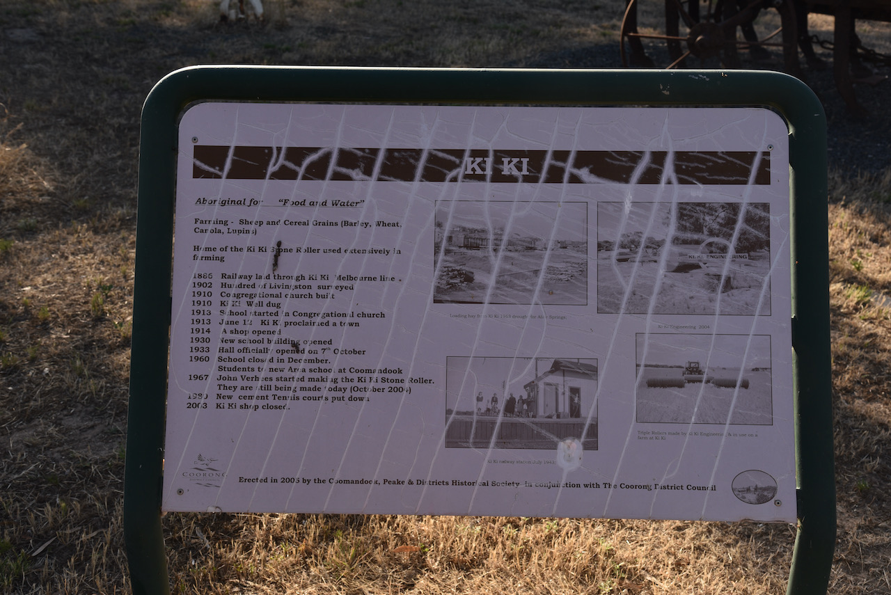
We then stopped at the tiny town of Ki Ki which is aboriginal for ‘food and water’. The town is best known as the home of the Ki Ki Stone Roller which was used extensively in farming. The Congregational church was built in 1910. In the same year, the Ki Ki Well was dug. The Ki Ki Post office opened in January 1912 and the Ki Ki School in 1913. In 1914 a shop was opened. The school closed in December 1960, with students attending the new Area School at Coomandook.
Our final stop for the trip was Tailem Bend.
We went out for tea at the Riverside Hotel at Tailem Bend, one of our favourite country pubs. And the meal this time did not disapoint.
THANKYOU to everyone who called us whilst we were away for the 4 days. We had a terrific time of amateur radio and sightseeing.
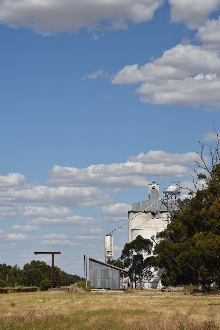
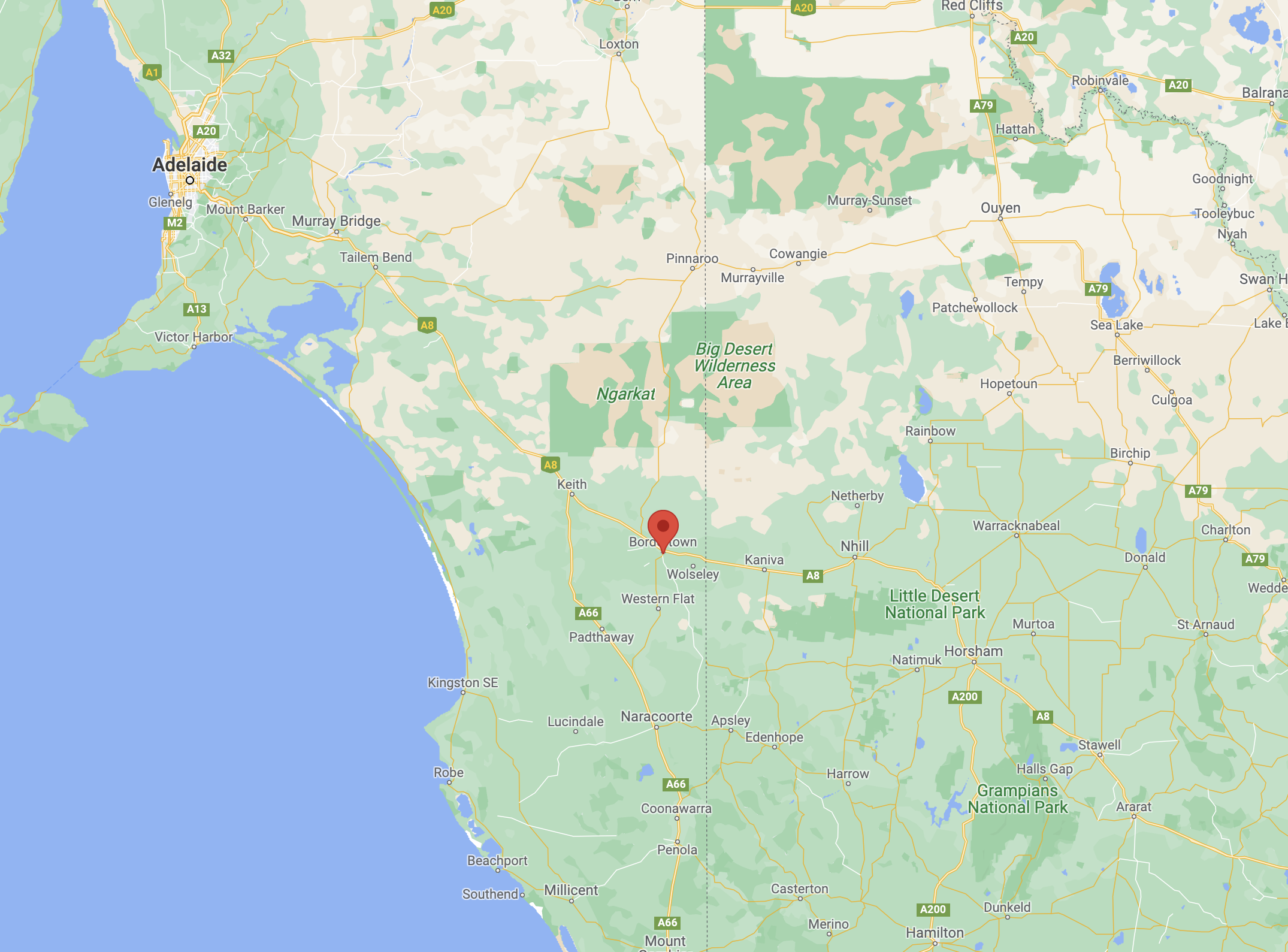
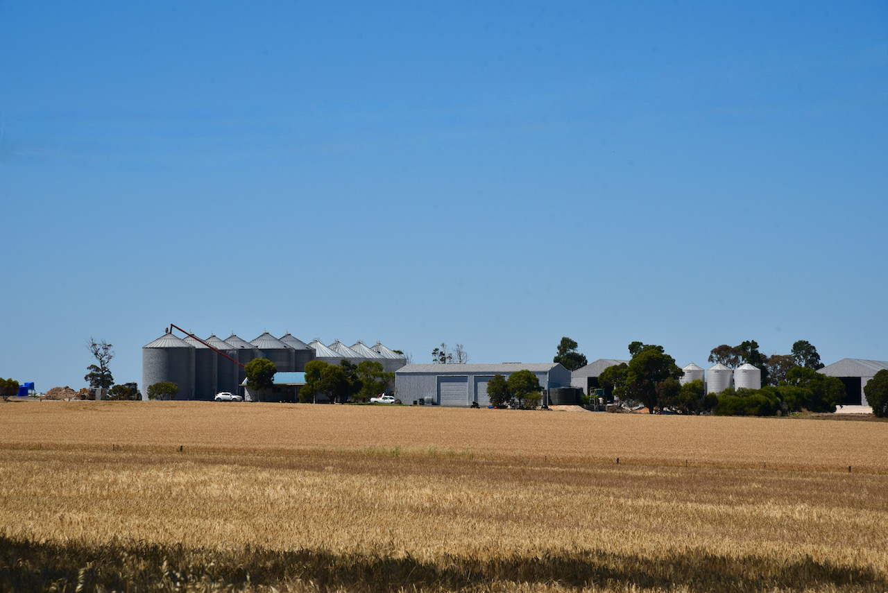
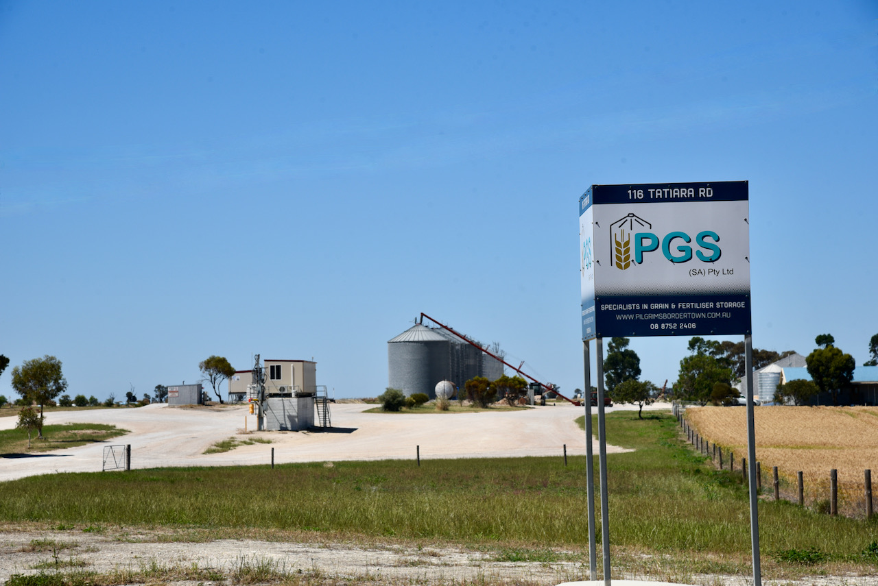
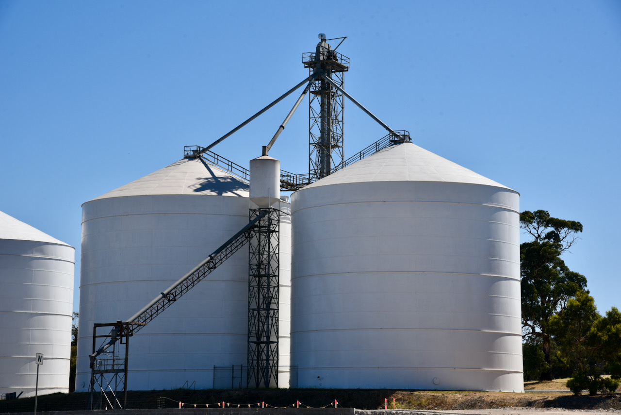
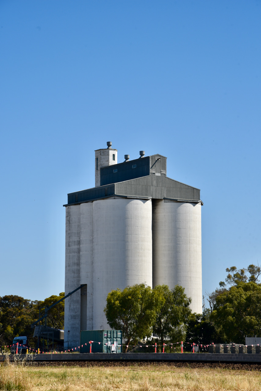
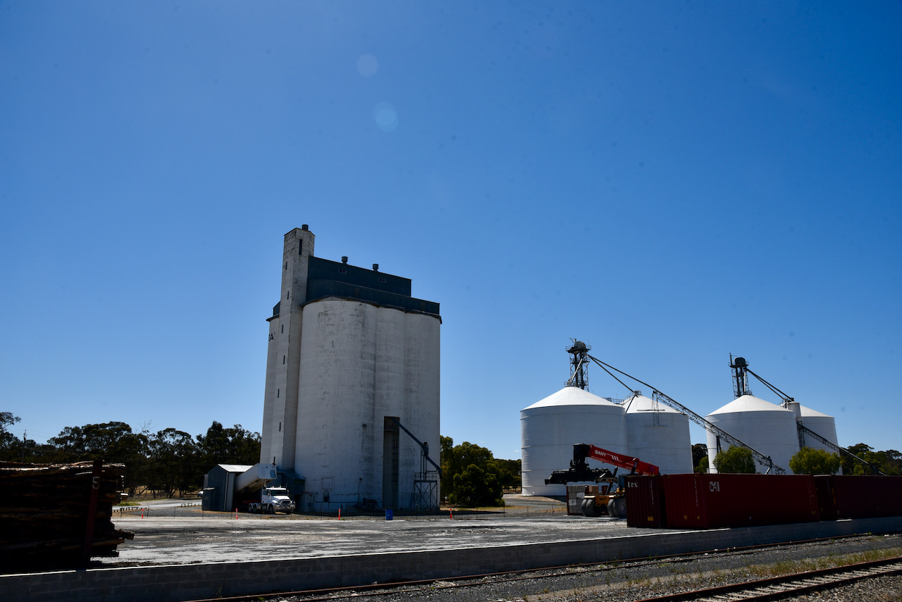
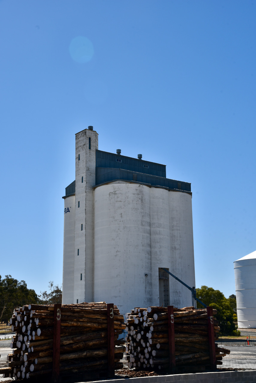
Our second silo activation on Monday 29th December 2021 was the Bordertown East silo VK-BRT5.
Above:- Map showing the location of Bordertown. Map c/o Google maps
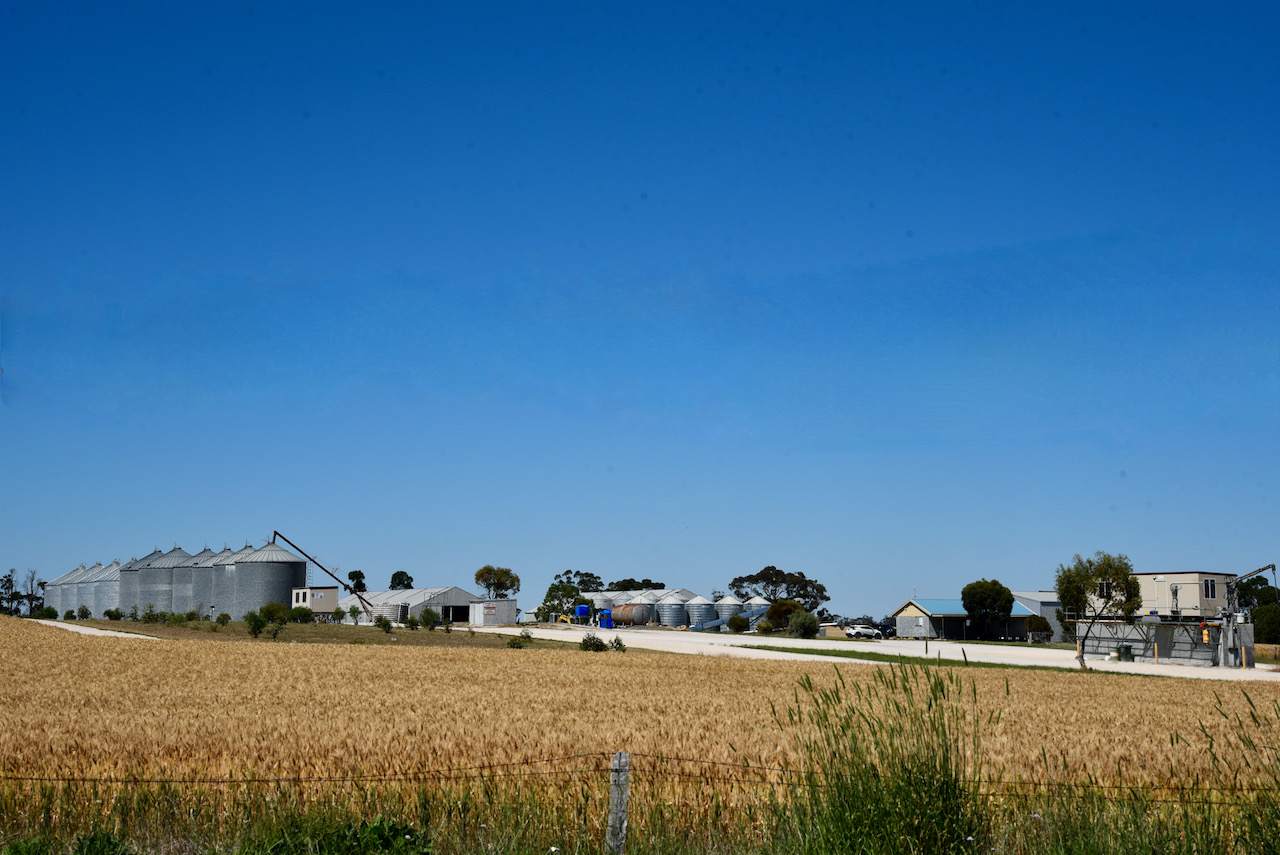
The silo is located on Tatitara Road, just a short distance out of the town of Bordertown. It is run by the company Pilgrim Grain Storage – PGS (SA) Pty Ltd. Pilgrims specialise in the storage of grains including wheat, barley, oats, canola, and beans.
Marija and I spent 45 minutes at the silo and made a total of 31 QSOs. We operated from the vehicle for this activation and ran the Icom IC-7000 and the Codan 9350 self-tuning antenna mounted on the tailgate of the Toyota Hi-Lux.
Our contacts were into VK1, VK2, VK3, VK4, VK5, and VK7.
Marija worked the following stations on 40m SSB:-
VK5FANA
VK3OHM
VK5WG
VK3NFS
VK3PF
VK2DG
VK4NH
VK5IS
VK2BYF/p (Burragorang State Conservation Area VKFF-1292)
I worked the following stations on 40m SSB:-
VK3SQ
VK5WG
VK3OHM
VK5FANA
VK5IS
VK2DG
VK4NH
VK7DM
VK2VW
VK2HFI
VK3IK/m
VK3VIN
VK3EJ
VK3DJC
VK3PF
VK2BYF/p (Burragorang State Conservation Area VKFF-1292)
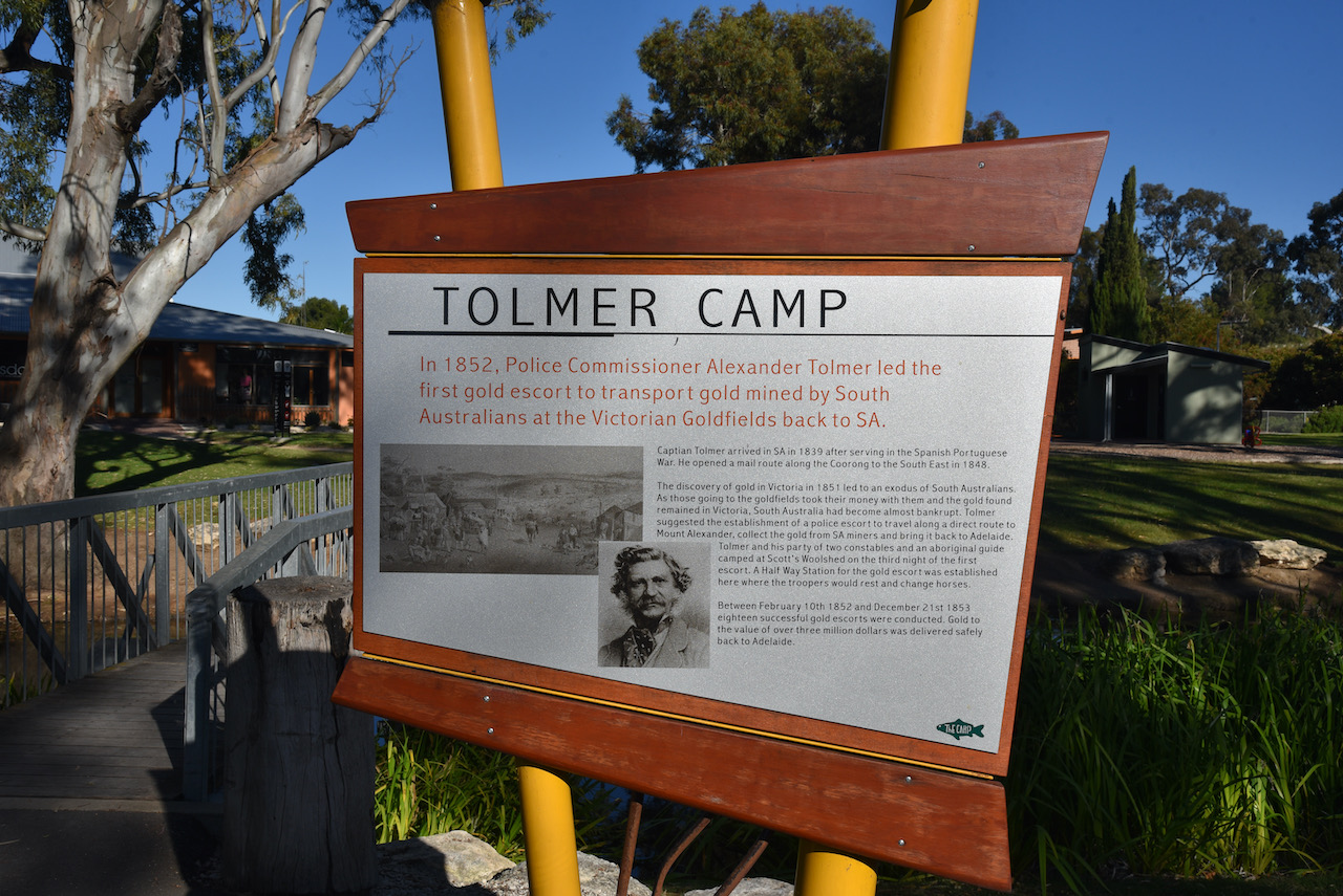
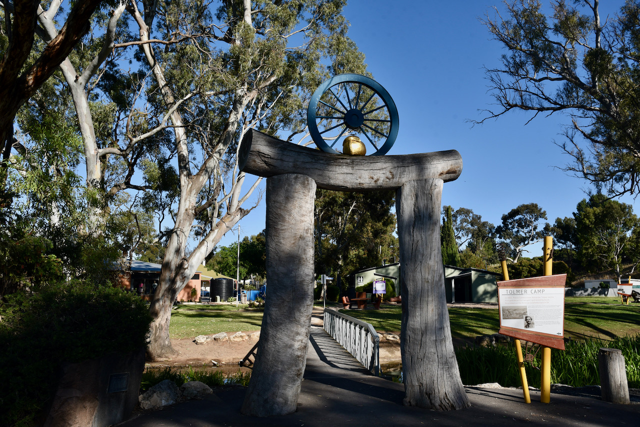
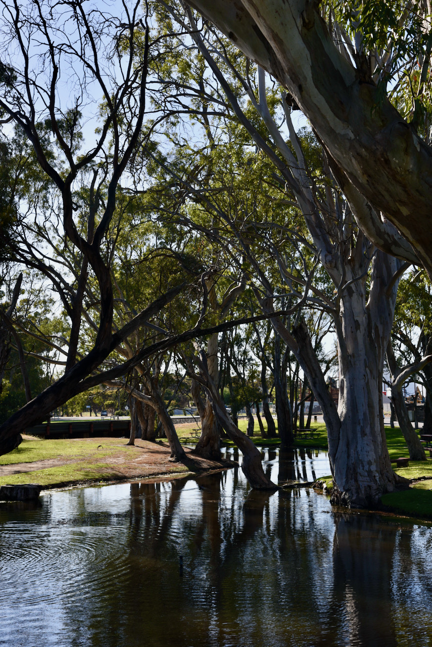
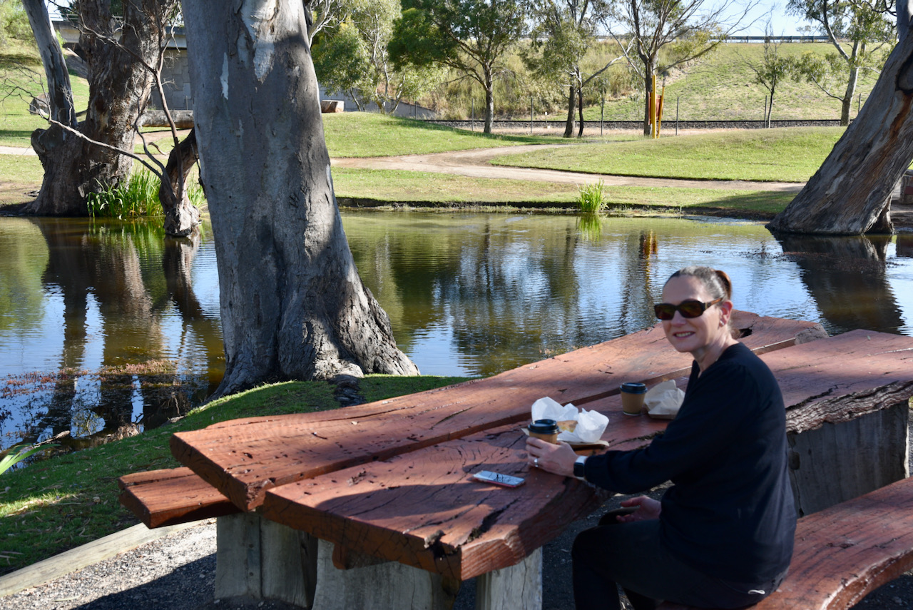
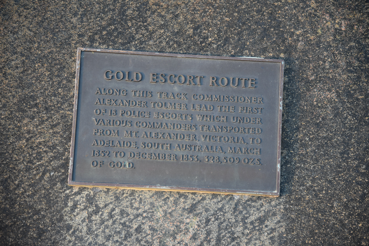
It was now Monday 29th November 2021 and Marija and I headed to the Bordertown Bakery for some coffee and some egg & bacon rolls. It was a beautiful morning, so we sat in Tolmer Park opposite the bakery and enjoyed our breakfast.
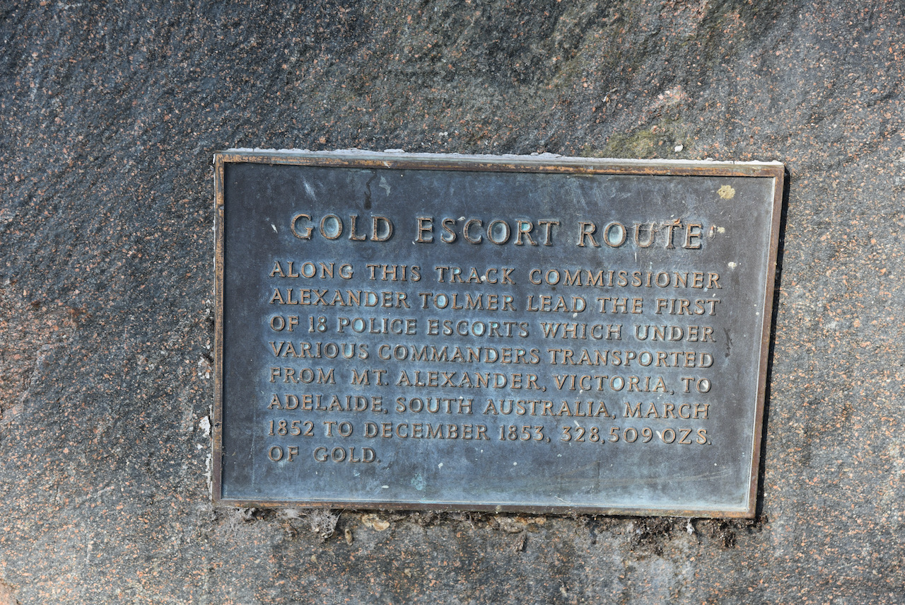
Tolmer Park takes its name from Alexander Tolmer, a South Australian Police Officer who led numerous Gold Escorts along the Gold Escort Route from Victoria to Adelaide. Tolmer used this spot as a stopover on the gold escort route due to the permanent water supply. The creek in the park has been widened and filled. There are a number of interpretive signs in the park.
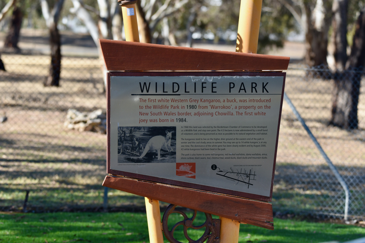
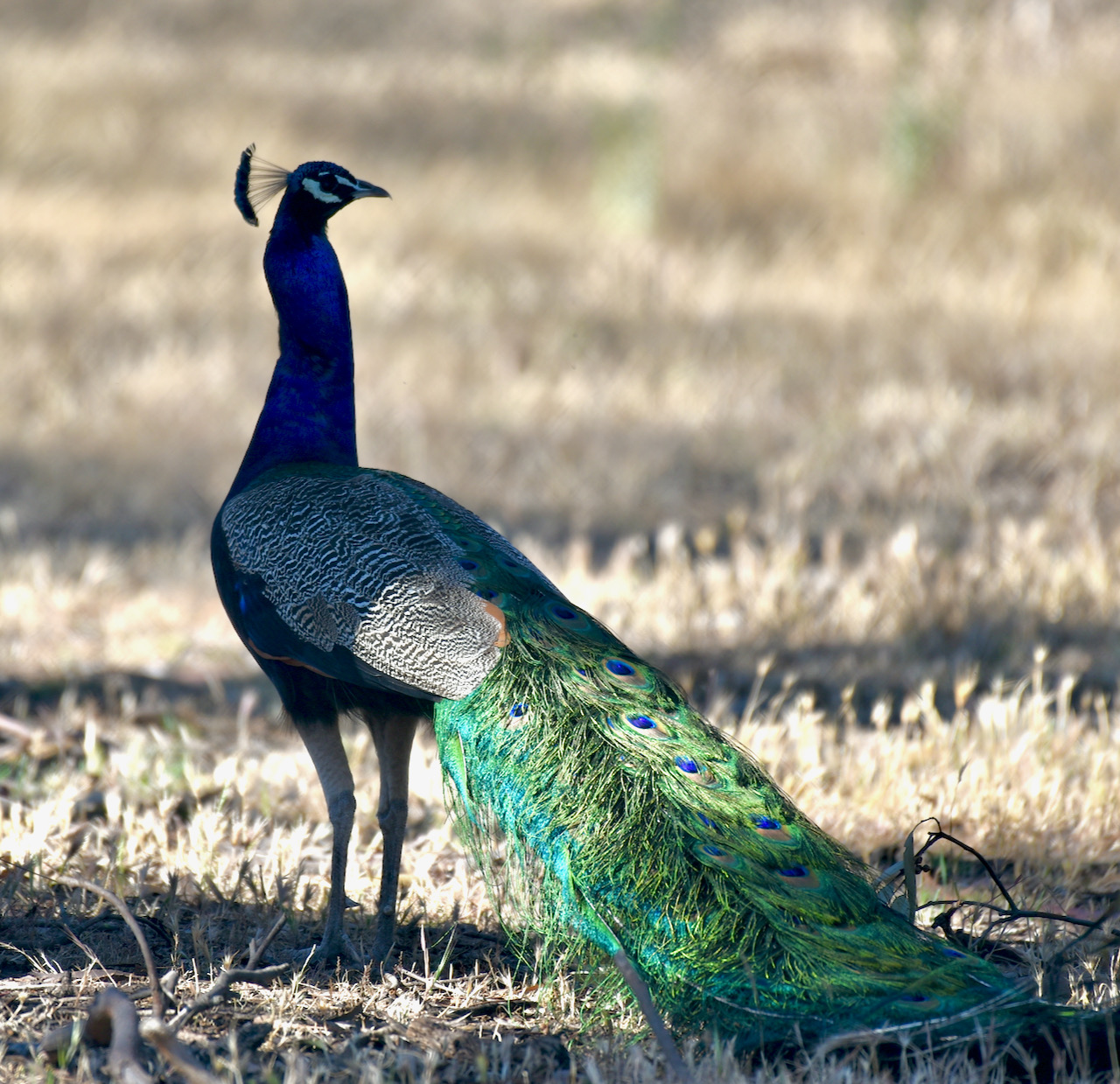
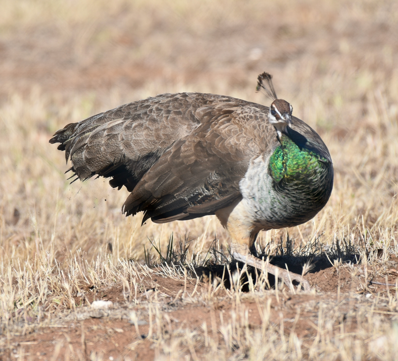
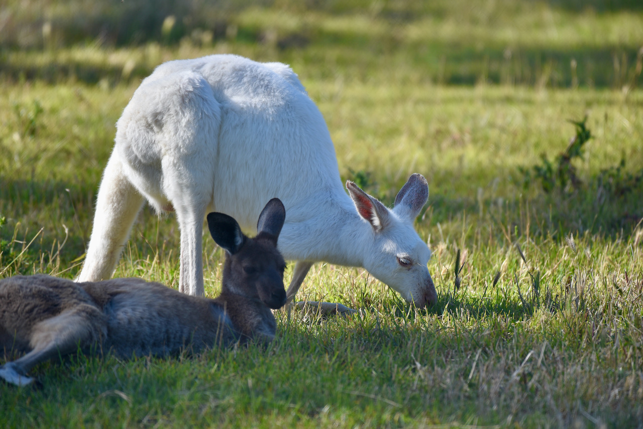
We then headed to the Bordertown Wildlife Park which was established in 1968. You can find Bordertown’s famous White Kangaroos in the park. They were first introduced in 1980. Various other wildlife can be found in the park including wallabies, Bush Stone Curlews, Emus, Black Swans, Peacocks, and ducks.
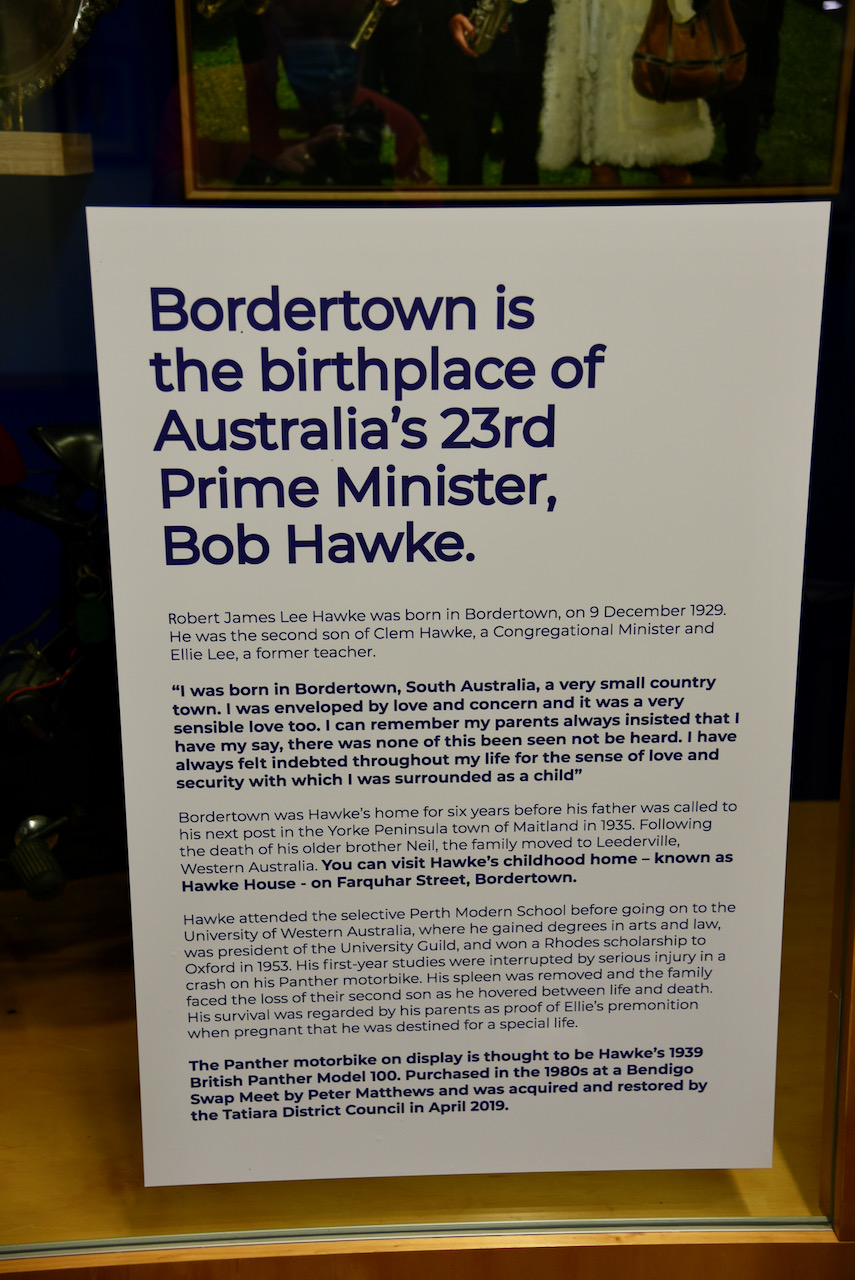
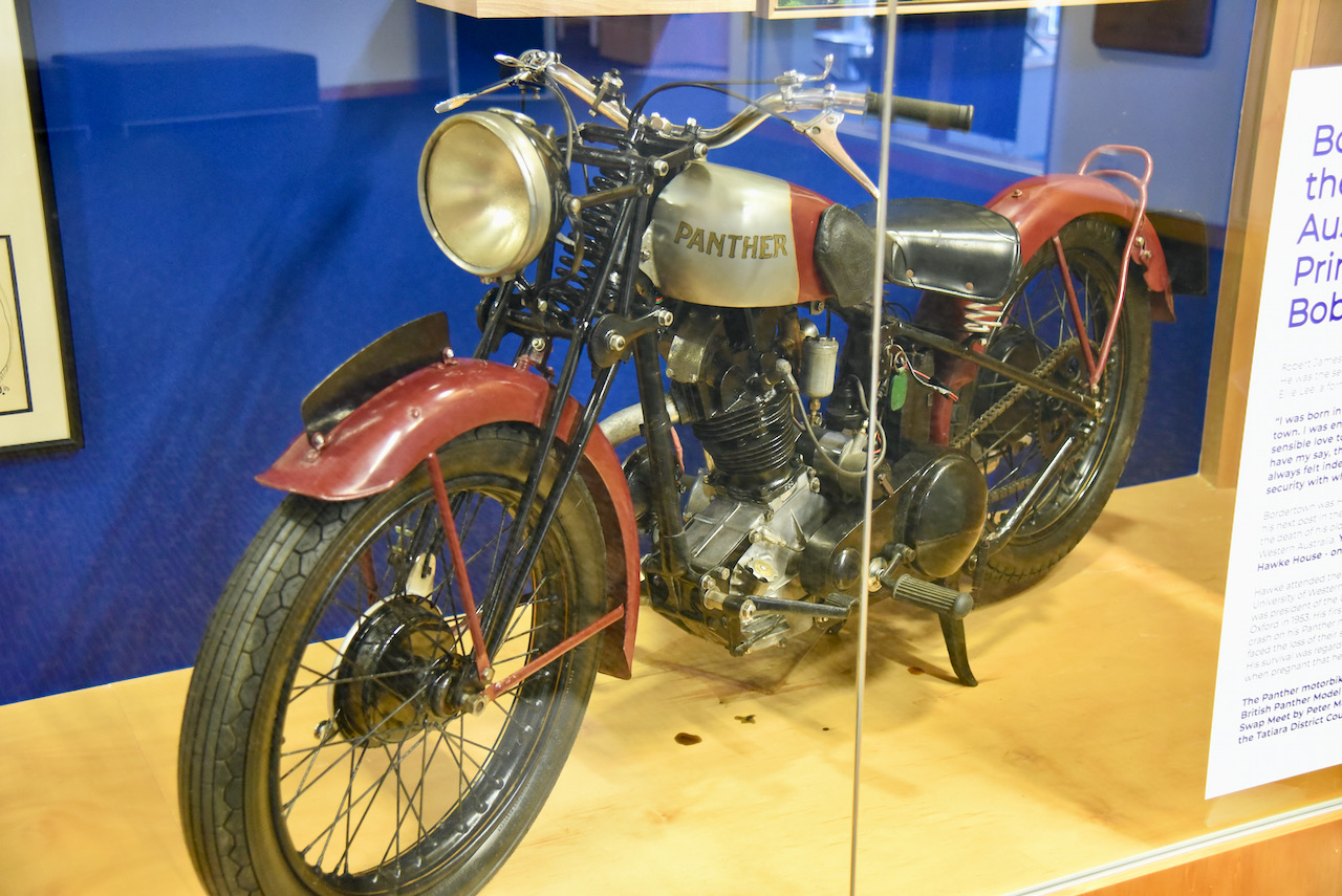
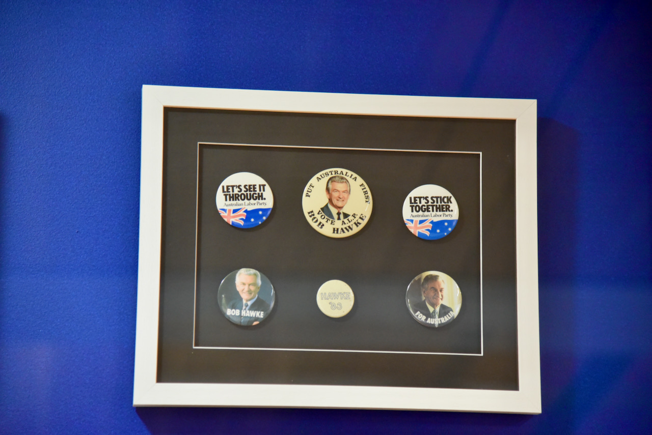
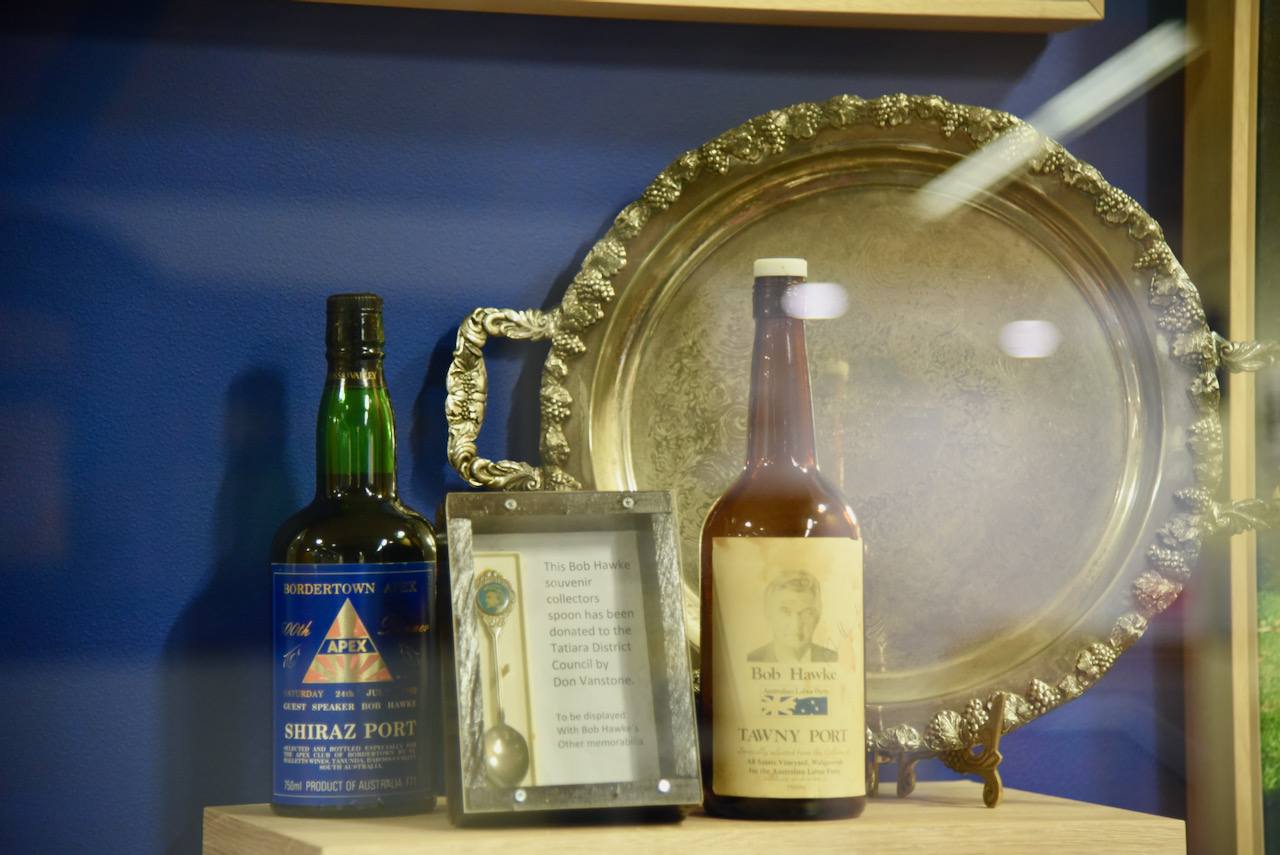
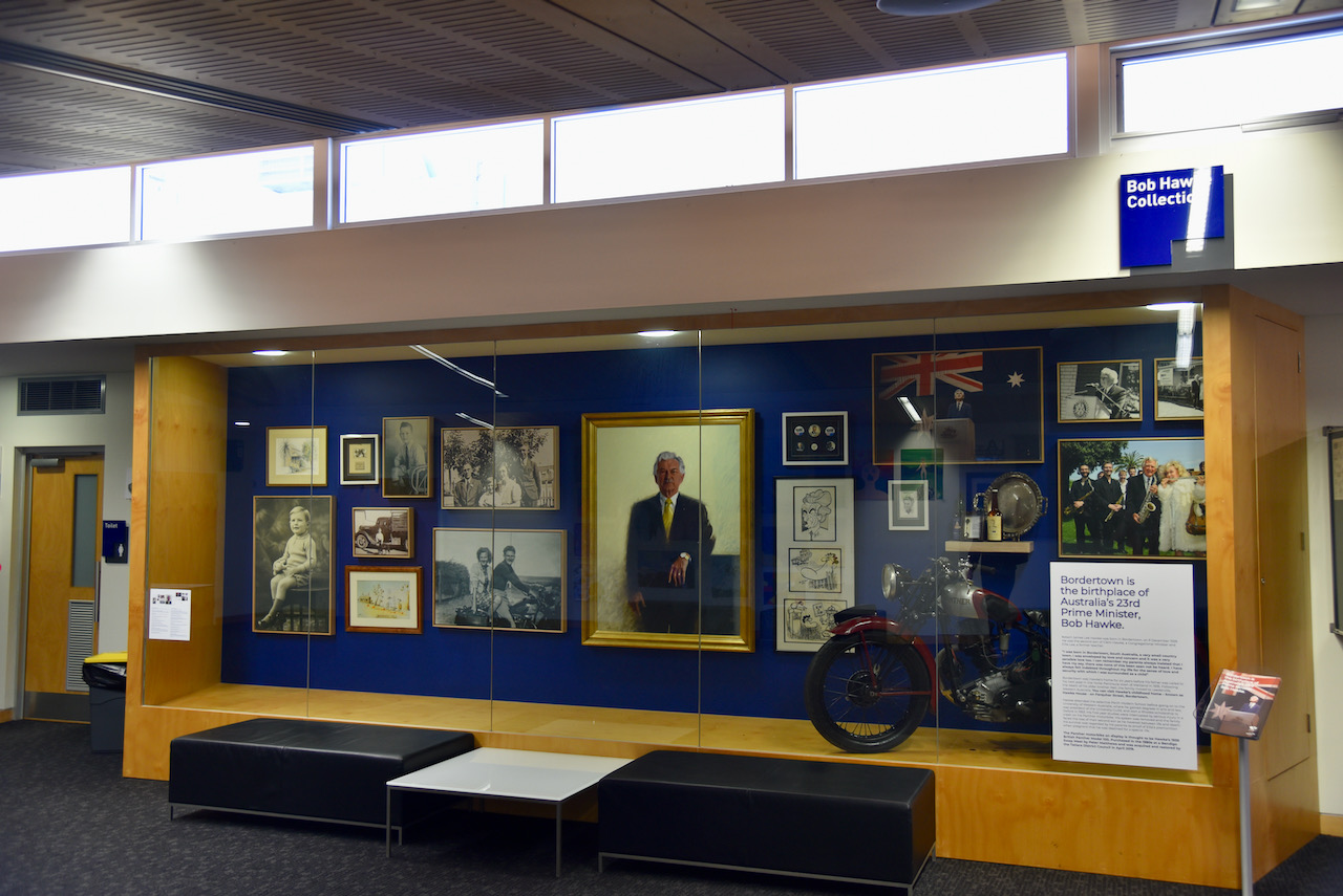
Our next stop was the Tatiara Visitor Centre and the Bob Hawke Gallery. Bordertown is the birthplace of Australia’s 23rd Prime Minister, Robert ‘Bob’ James Lee Hawke. Unfortunately, the famous gold jacket which he wore during the America’s Cup win in 1983 was on loan to the Adelaide University. We did get to see a collection of photographs, news clippings, cartoons, paintings and various other memorabilia. This included a Panther motorcycle which is believed to be Hawke’s 1939 British Panther.
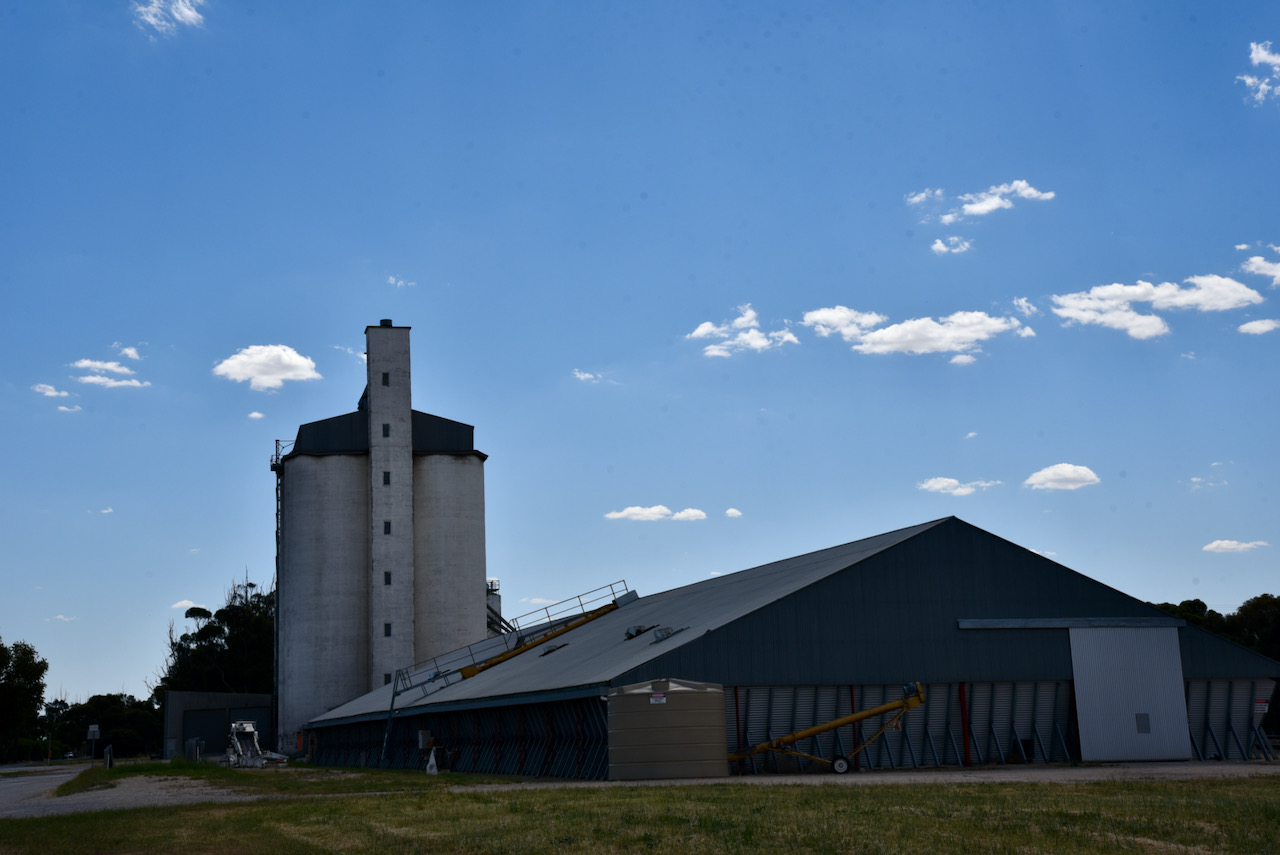
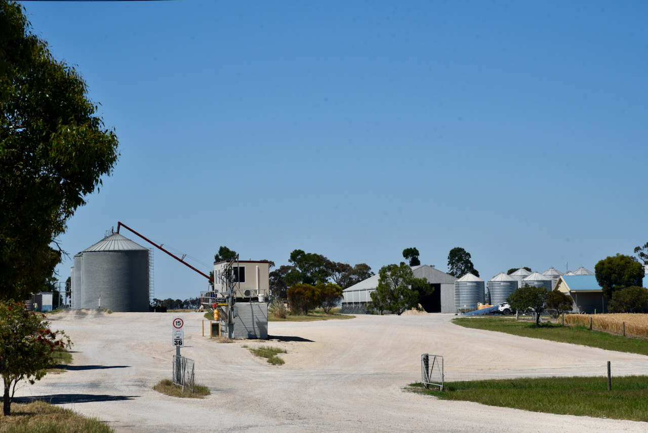
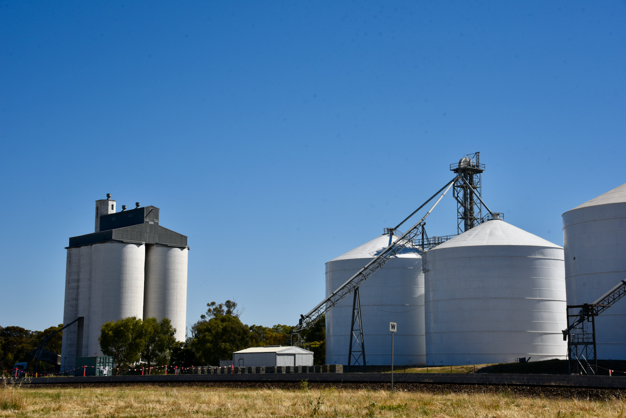
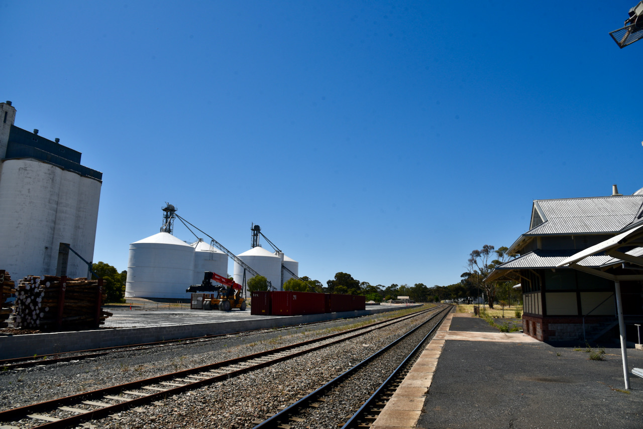
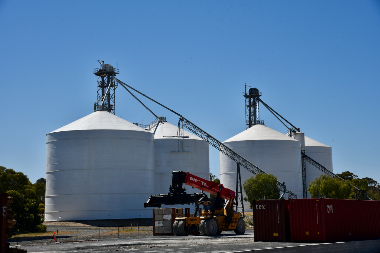
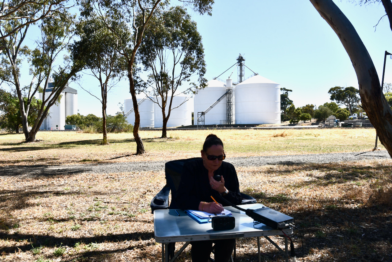
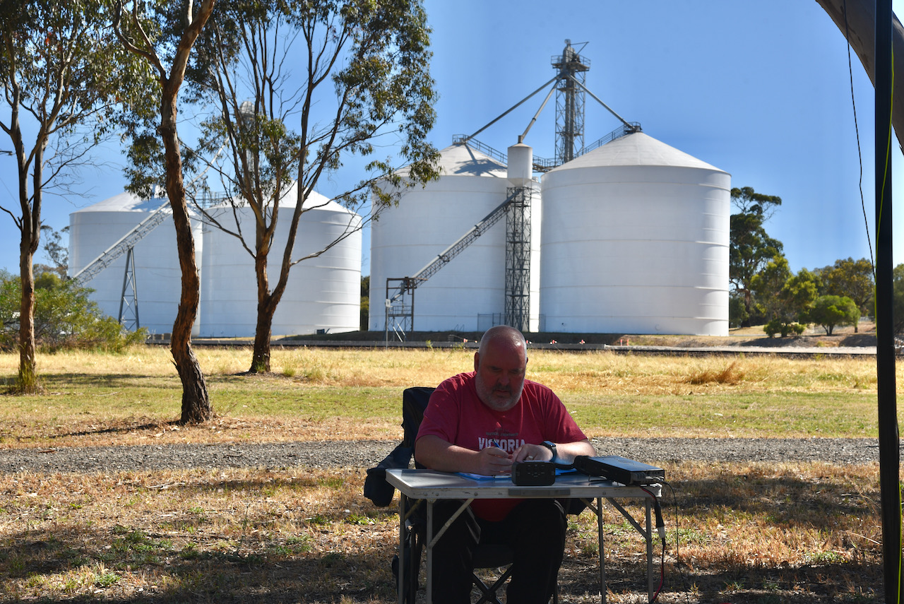
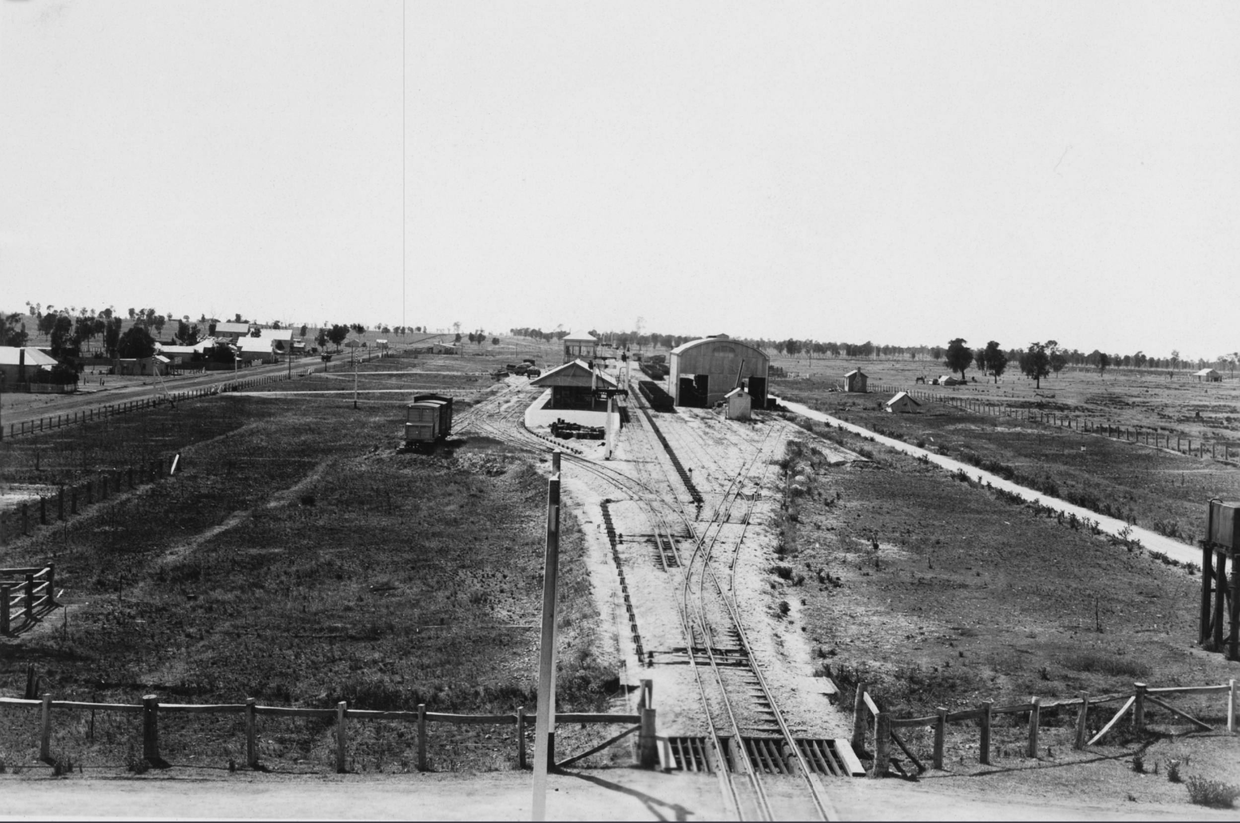
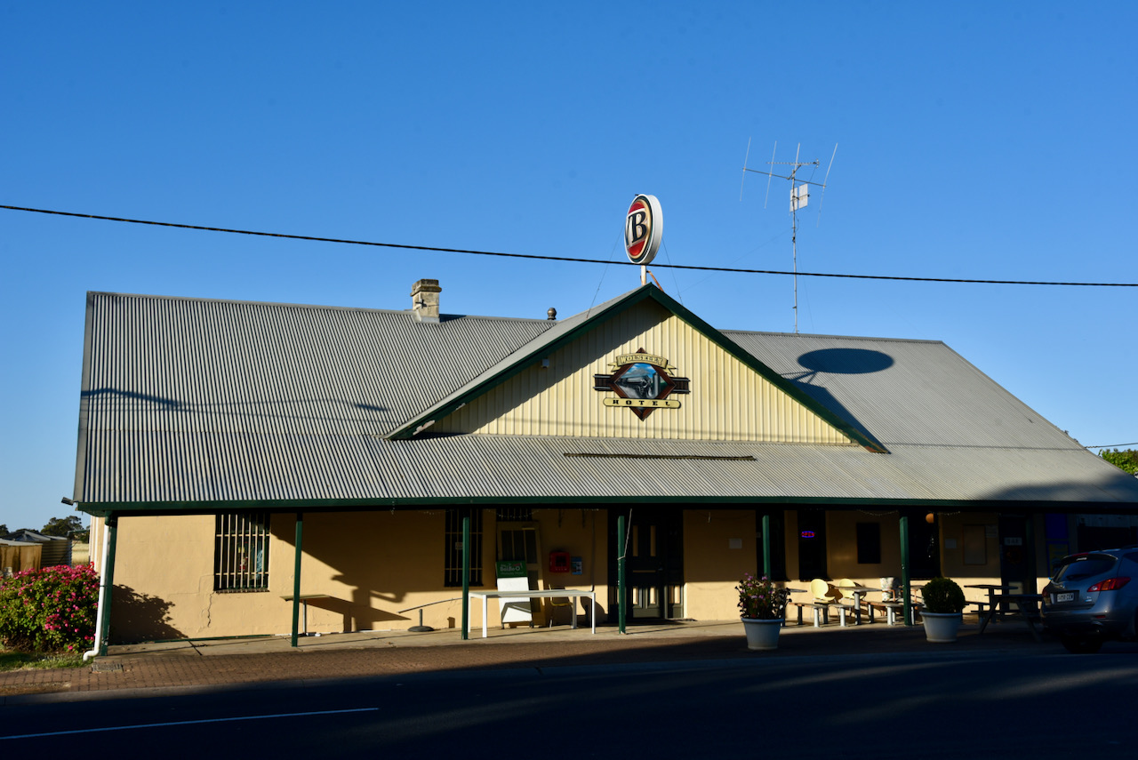
We then headed to the Bordertown silos VK-BRN5 for an activation for the Silos On The Air (SiOTA) program. The silos are located in Brown Terrace and are alongside the Bordertown-Wolseley railway line (Melbourne-Adelaide railway). The silos are operated by the company Viterra.
We set up in Possum Park on Power House Road, in close proximity to the silos. We were very pleased that there was no man-made noise at all at this location on the 40m band. Unfortunately, we did experience strength 6 noise on the 80m band. There was no noise on 20m, but the Over The Horizon Radar was present on 20m once again.
Marija and I spent about 50 minutes at the silo and we made a total of 23 QSOs to VK2, VK3, VK4, VK5, and VK7.
We had at least one very interested onlooker during our activation. Marija took the time to chat with the lady concerned and explained to her the hobby of amateur radio and the SiOTA program.
Marija worked the following stations on 40m SSB:-
VK2BYF/p (Thirmlere Lakes National Park VKFF-0486)
VK4NH
VK5FANA
VK5HS
VK3PF
VK3OHM
VK7JFD
I worked the following stations on 40m SSB:-
VK2BYF/p (Thirmlere Lakes National Park VKFF-0486)
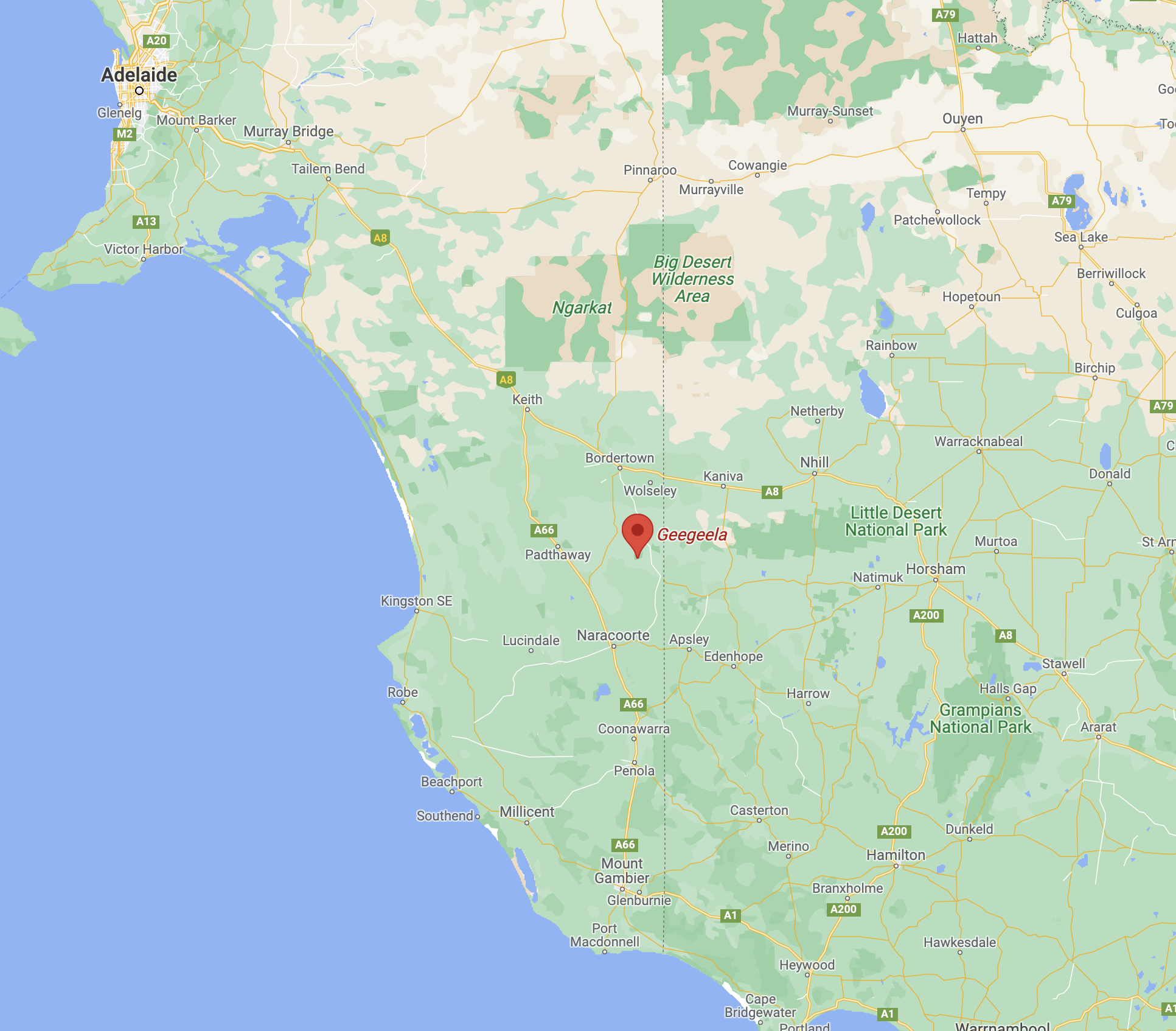
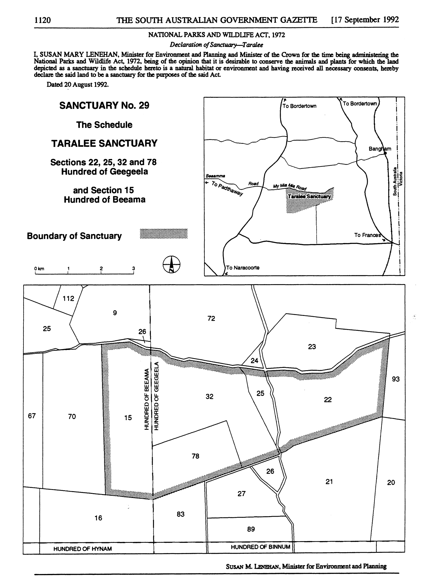
Our final park for Sunday 28th November 2021 and day two of the 2021 VKFF Activation Weekend was the Geegeela Conservation Park VKFF-0883. The park is located about 313 km southeast of the city of Adelaide, and about 42 km south of the town of Bordertown.
Above:- Map showing the location of Geegeela. Map c/o Google maps
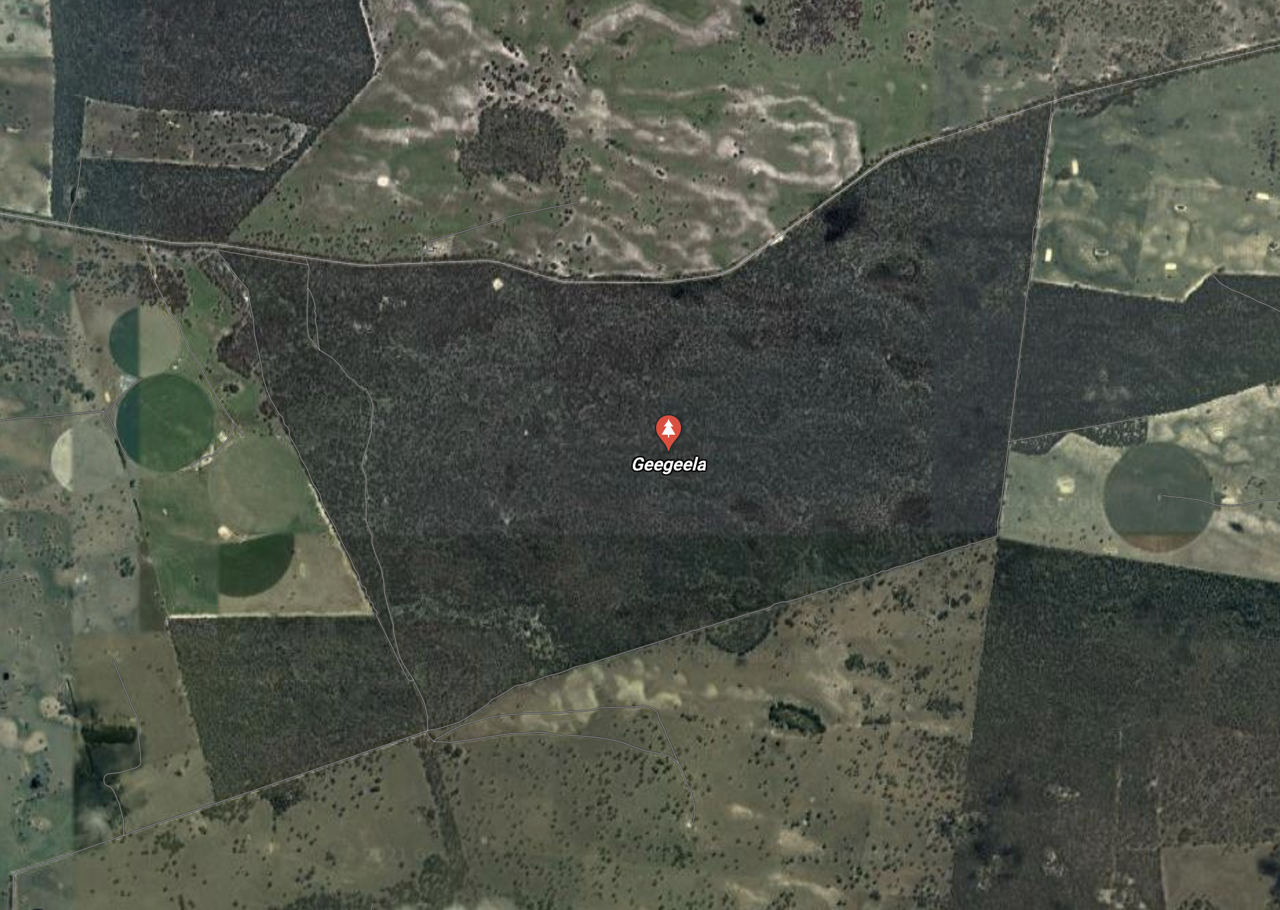
The Geegeela Conservation Park is about 858 hectares in size and was established on the 21st day of July 2005. It can be accessed via My Mi Mi Road. The land was purchased with the assistance of the Australian Government’s Natural Heritage Trust.
Above:- An aerial view of Geegeela. Image c/o Google maps
The land occupied by the Conservation Park was previously used for agricultural and conservation purposes. About 200 hectares (490 acres) of land which is in the conservation park’s southwestern corner was cleared in 1960 and established as a pasture of native grasses which was grazed for many years. In 1970 a total of 70 hectares (170 acres) was also cleared with limited grazing success. Agricultural activity in the area subsequently ceased and the cleared pasture land was able to regenerate.
In 1986 the land was acquired as a Private Heritage Agreement Area. In the early 1990s ownership of the land changed, but fortunately, the new owners decided to retain the land as a ‘private conservation area’. In 1992, a parcel of land was proclaimed as a ‘sanctuary as was known as Taralee Sanctuary.
Above:- SA Govt Gazette reference to Taralee Sanctuary. Image c/o Wikipedia
The park takes its name from the Hundred of Geegeela which was proclaimed on the 28th day of October 1907. The name is believed to be derived from the Aboriginal word tjitjila meaning ‘wallaby’. The name ‘Geegeela Paddock’ appears on early pastoral lease maps and G. Smith applied the name to his lease no. 5009 in 1880.
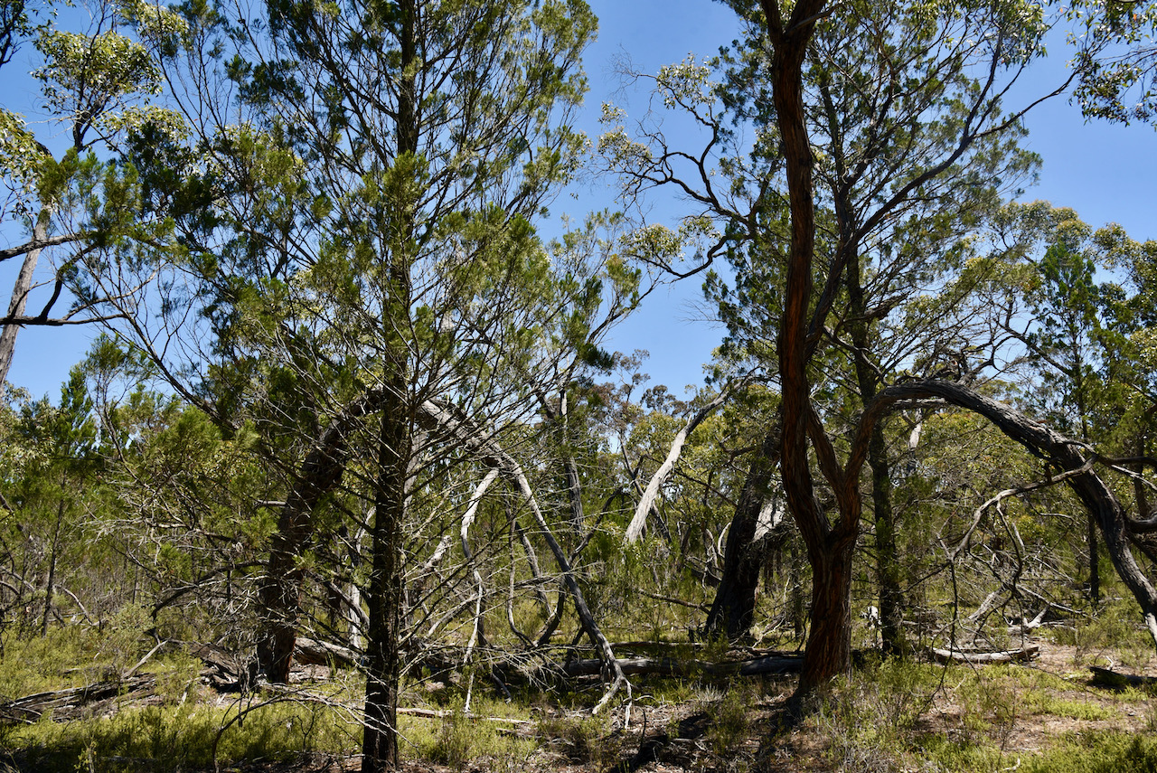
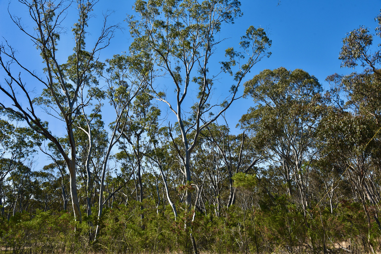
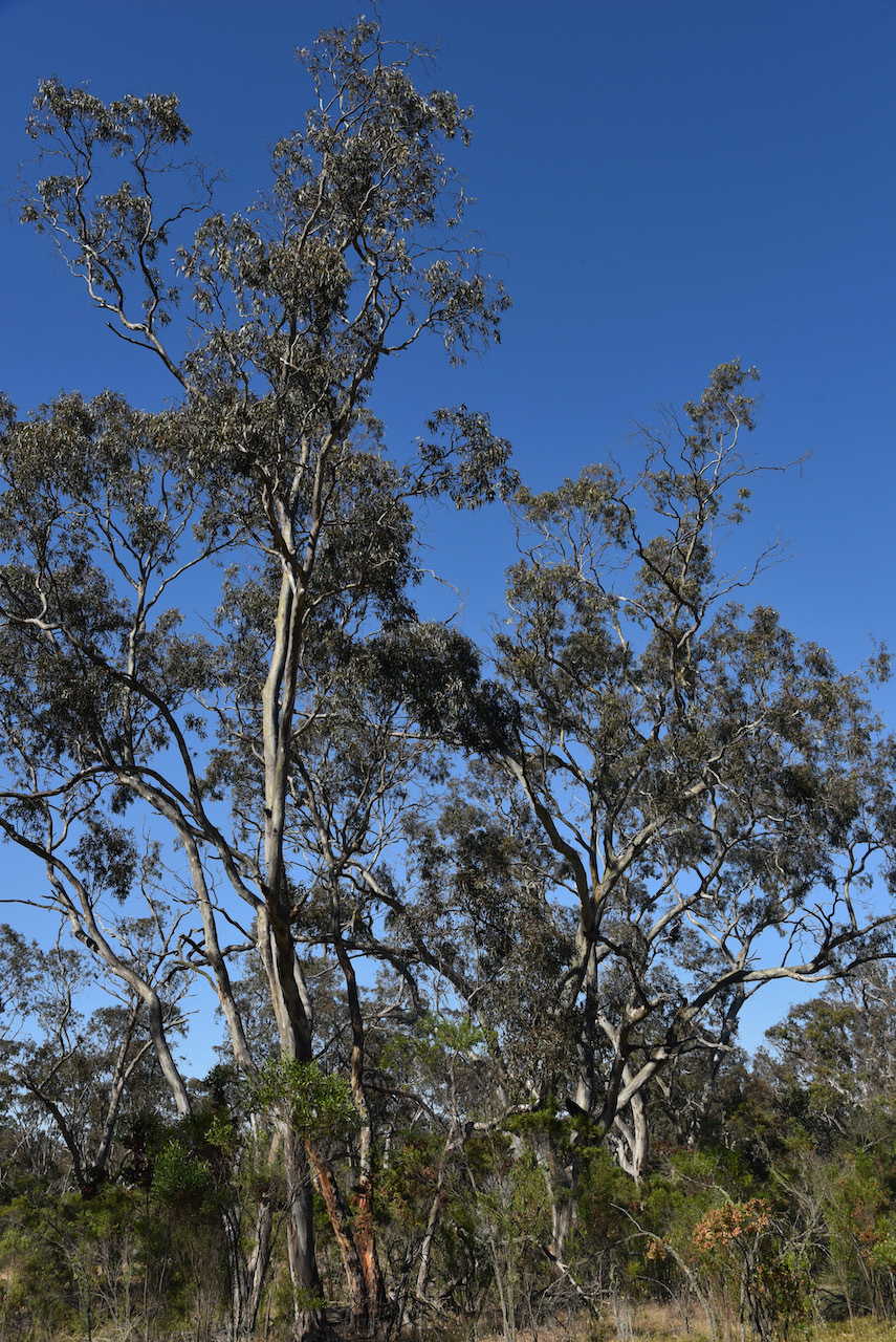
The park consists of Desert Banksia Heath, Blue Gum/Pink Gum open woodlands, and open woodlands and wetlands of Brown Stringybark. There are also small patches of woodland dominated by Rough-barked Manna Gum, River Red Gum and Buloke. Over 240 different plants species have been recorded in the park.
The park is home to numerous rare and endangered plant and animal species.
Five mammal species of South Australian state conservation significance can be found in the park. This includes the Eastern Grey Kangaroo, Sugar Glider, Western Pygmy-possum, Red-necked Wallaby, and the Common Wombat.
About 90 species of bird have been recorded in the park, including 17 threatened species in South Australia, and 29 which have an identified conservation rating in the southeastern region of South Australia. Endangered and vulnerable bird species include Red-tailed black cockatoo, Swift Parrot, Brown Quail, Little Lorikeet, Brolga, Blue-winged parrot, Rare Shining bronze-cuckoo, Blue-faced honeyeater, and Flame Robin.
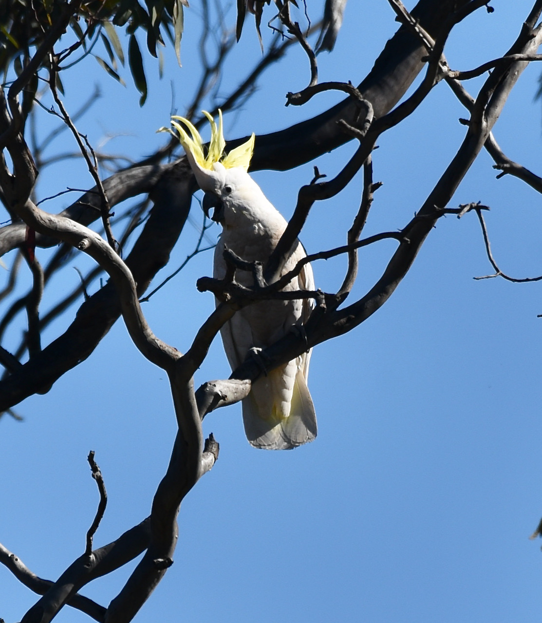
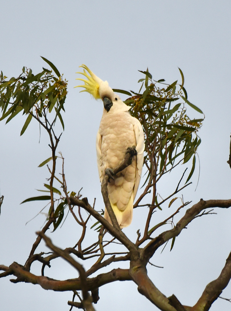
During our visit to the park, I did a little bit of bird watching, but only spotted some Sulphur Crested Cockatoos and Willie Wagtails.
Marija and I spent a little under 2 hours at Geegeela and operated on the 40 & 20m bands. We ran our normal station consisting of the Yaesu FT-857d, 40 watts, and the 20/40/80m linked dipole.
We made a total of 102 QSOs and 37 Park to Park contacts. We did not operate on 80m as the afternoon was getting away from us and we wanted to head to the Mundulla pub for a meal.
A real surprise during this activation was to log Stuie VK8NSB up in Darwin.
Marija worked the following stations on 40m SSB:-
VK3PF/p (Gormandale Flora Reserve VKFF-2325)
VK3CWF/p (Brisbane Ranges National Park VKFF-0055)
VK5AV/p (Gower Conservation Park VKFF-0798)
VK3TKK/p (Gisborne Flora Reserve VKFF-2322)
VK3ZPF/p (Kurth Kiln Regional Park VKFF-0971)
VK2YK/p (Warren Conservation Park VKFF-0941)
VK2IO/p (Sydney Harbour National Park VKFF-0473)
VK3DAC/p (Mornington Peninsula National Park VKFF-0333)
VK4MGL/p (Esk National Park VKFF-0677)
VK3MCA/p (Mount Charlie Flora Reserve VKFF-2396)
VK3LF/p (Kurth Kiln Regional Park VKFF-0971)
VK3PF/p (Callignee Wildlife Reserve VKFF-2287)
VK4FABN/p (Main Range National ParkVKFF-0300)
VK3YV/p (Sweetwater Creek Nature Conservation Reserve VKFF-2200)
VK5CZ/p (Wills Creek Conservation Park VKFF-0819)
VK3FIMD
VK3CJN
VK7HOB
VK1DI
Vk3AHR
VK3MPR
VK3AAV
VK7RM
VK3PF/p (Traralgon South Flora & Fauna Reserve VKFF-2464)
VK2KNV/m
VK2XSE/m
VK3RU
VK2HRX
VK7MOO
VK2YW
VK4SMA
VK3ZK/p (Echuca Regional Park VKFF-0966)
VK6XN/p (McLarty Nature Reserve VKFF-2826)
VK3EY
Marija worked the following stations on 20m SSB:-
VK6XN/p (McLarty Nature Reserve VKFF-2826)
VK4GSF
VK2VW
VK2HFI
VK6NTE
VK4MWL
VK2MG/p (Munmorah State Conservation Area VKFF-1361)
VK4KC
VK4MAD
VK4DOG
VK2LEE
VK8NSB
I worked the following stations on 40m SSB:-
VK3PF/p (Gormandale Flora Reserve VKFF-2325)
VK3CWF/p (Brisbane Ranges National Park VKFF-0055)
VK5AV/p (Gower Conservation Park VKFF-0798)
VK3TKK/p (Gisborne Flora Reserve VKFF-2322)
VK3ZPF/p (Kurth Kiln Regional Park VKFF-0971)
VK5FANA
VK2YK/p (Warren Conservation Park VKFF-0941)
VK2IO/p (Sydney Harbour National Park VKFF-0473)
VK3UCD
VK3DAC/p (Mornington Peninsula National Park VKFF-0333)
VK4MGL/p (Esk National Park VKFF-0677)
VK3MCA/p (Mount Charlie Flora Reserve VKFF-2396)
VK3LF/p (Kurth Kiln Regional Park VKFF-0971)
VK5BMC
VK2LEE
VK3SQ
VK5PET
VK3KXR
VK3FIMD
VK5CZ/m
VK2NP
VK3PF/p (Callignee Wildlife Reserve VKFF-2287)
VK4KLA
VK3MKE
VK3CJN
VK4FABN/p (Main Range National ParkVKFF-0300)
VK5KVA
VK2VW
VK2HFI
VK3MPR
VK3AAV
VK5IS
VK3HQZ
VK2FSLC
VK1DA
VK5KLV
VK3SKT
VK4KC
VK4MAD
VK4DOG
VK2YW
VK5HAA
VK3YV/p (Sweetwater Creek Nature Conservation Reserve VKFF-2200)
VK3BFH/m
VK3DWL/m
VK5CZ/p (Wills Creek Conservation Park VKFF-0819)
I worked the following stations on 20m SSB:-
VK6XN/p (McLarty Nature Reserve VKFF-2826)
VK2MG/p (Munmorah State Conservation Area VKFF-1361)
VK8NSB
VK4AJR
VK6JK
VK2LEE
VK2VW
VK2HFI
VK4KUS
VK6NTE
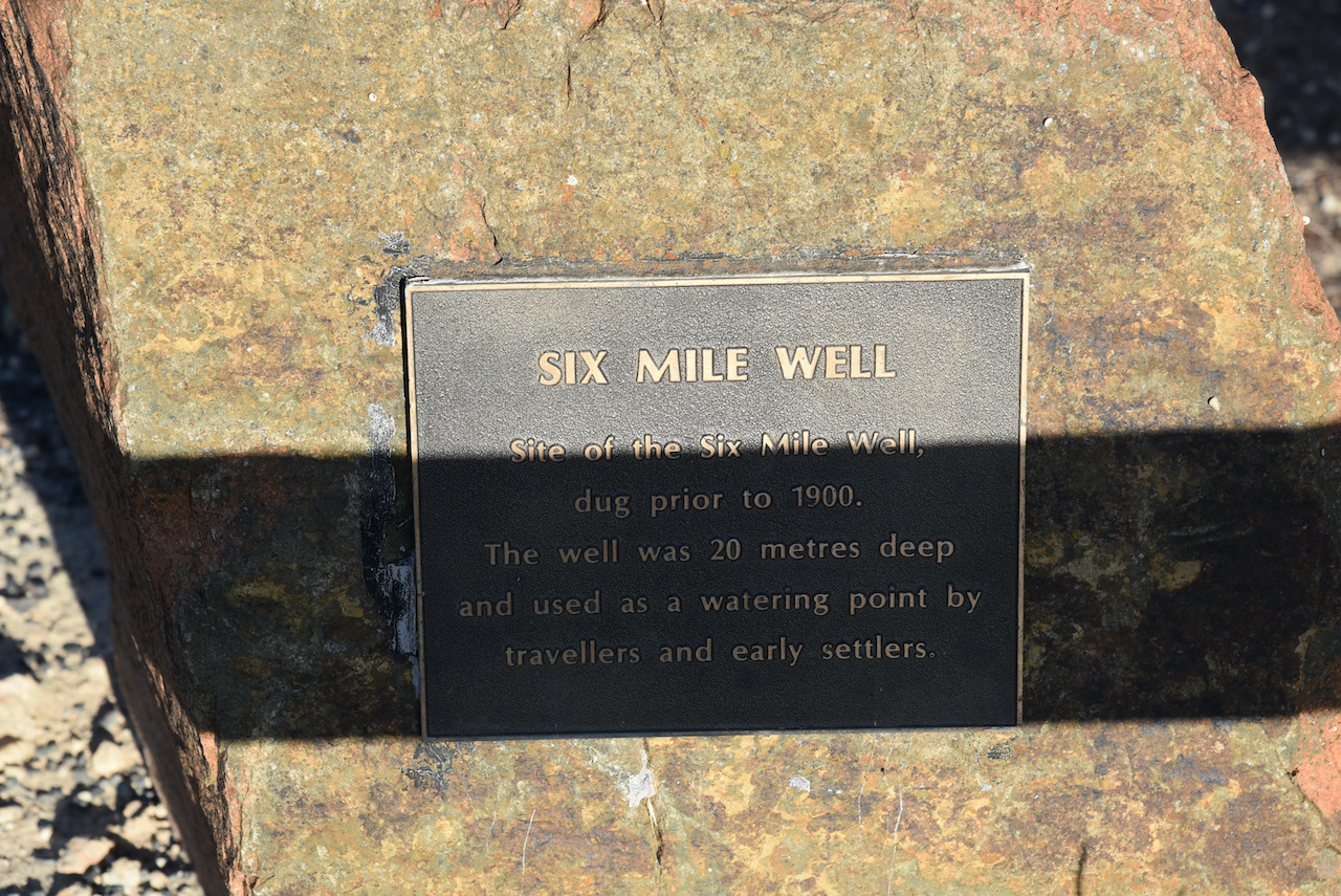
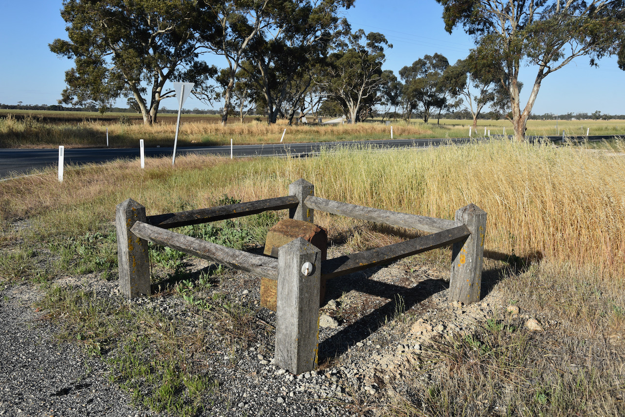
After packing up we started heading towards the town of Mundulla. We stopped briefly to have a look at Six Mile Well, which was dug prior to 1900. The well which was 20 metres deep was used as a watering point by travellers and early settlers.
We soon reached the small town of Mundulla. The town was proclaimed on the 3rd day of April 1873. The name is derived from the aboriginal word ‘mantala’ meaning place of thunder. This originated from the ground which is undermined with caves that rumbled when trampled upon. It was believed that evil spirits frequented such places.
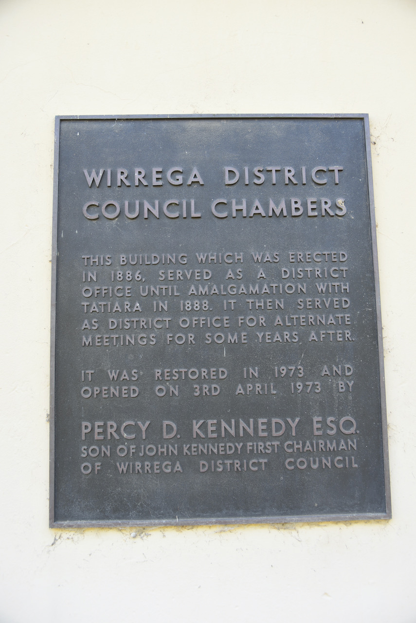
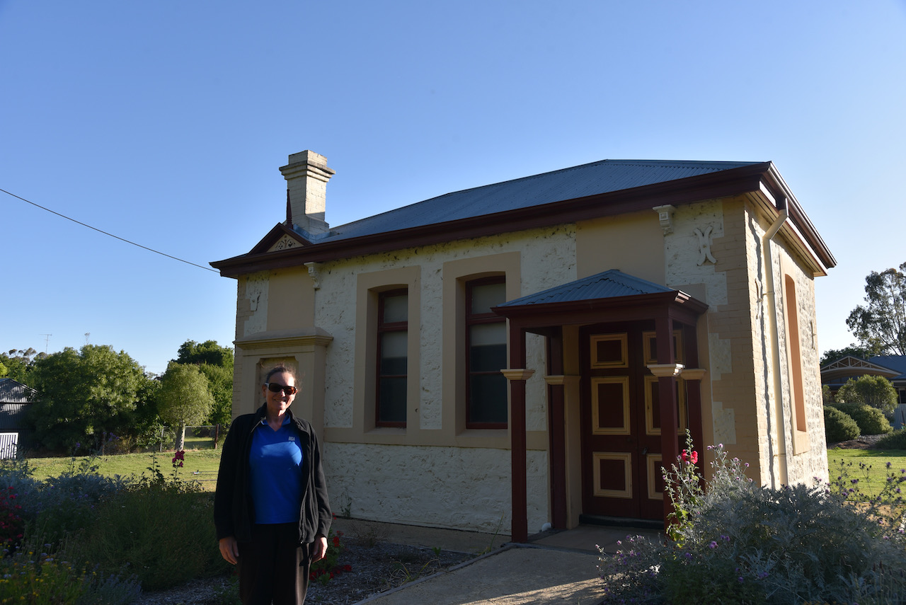
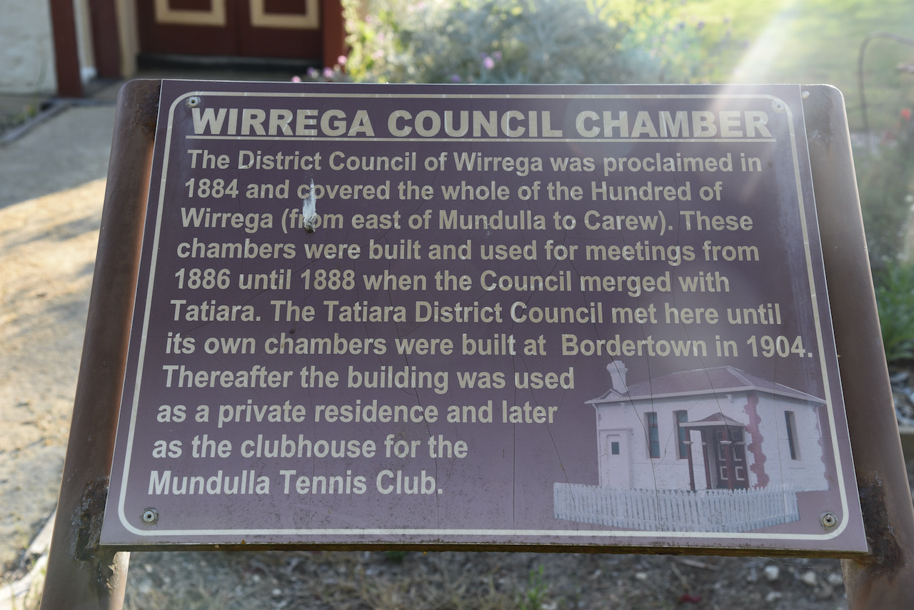
Our first stop was to have a look at the historic old Wirrega District Council Chambers. The building was built in 1886 and served as a District Office until amalgamated with Tatiara in 1888. The building was then used as a District office for alternate meetings some years after that. The building waas restored in 1973.
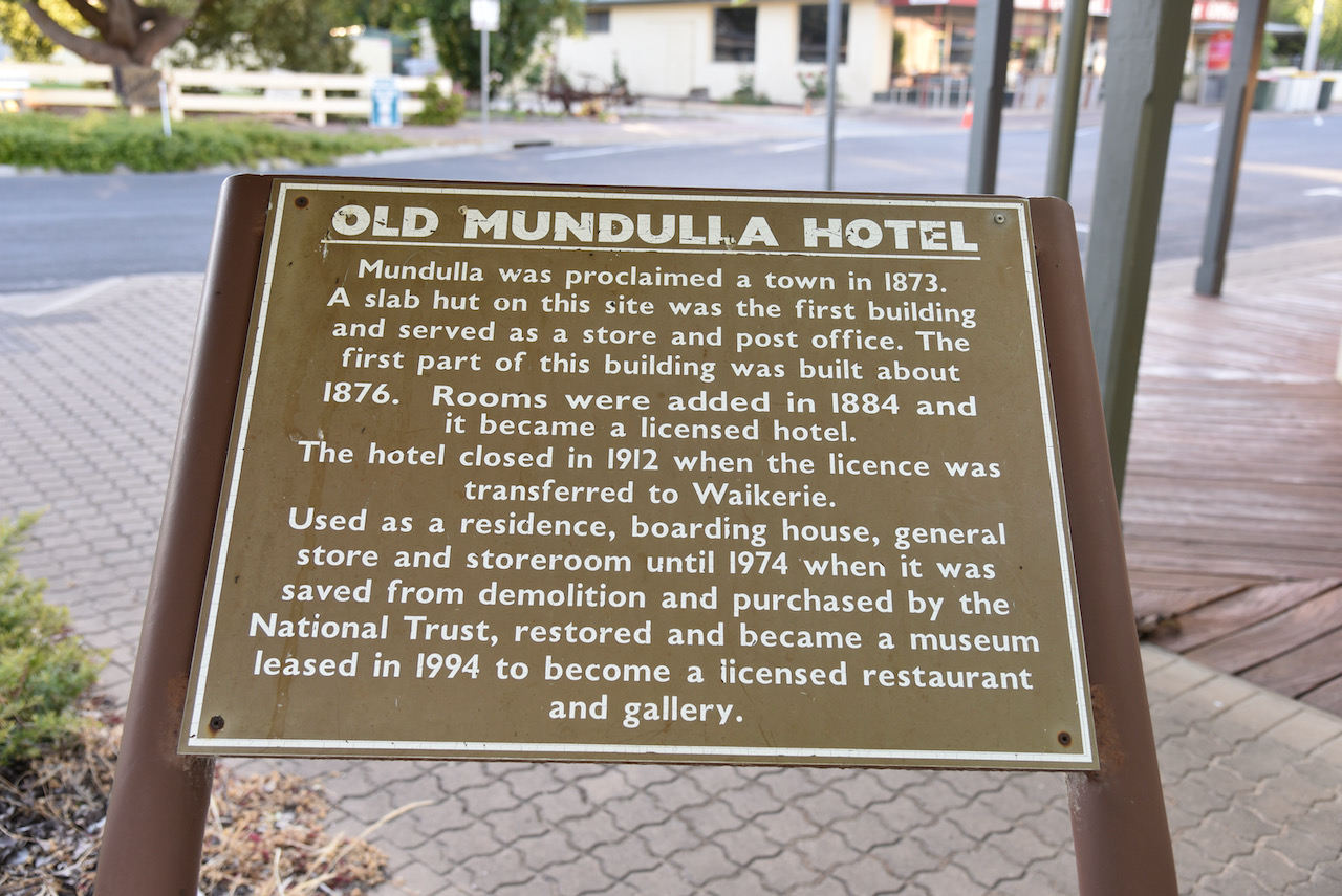
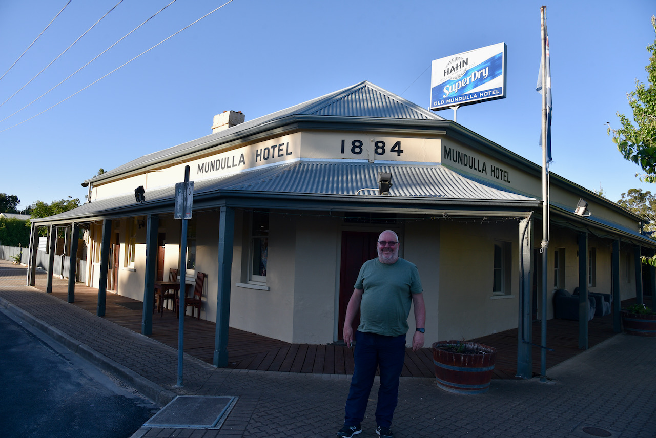
The first section of the Mundulla Hotel was built in about 1876. In 1884 rooms were added and it became a licenced hotel. In 1912 the hotel closed when the licence was transferred to Waikerie in the Riverland region of South Australia. It was then used as a residence, boarding house, general store and storeroom until 1974 when it was saved from demolition and was purchased by the National Trust. It then became a museum and subsequently leased as a licenced restaurant and gallery.
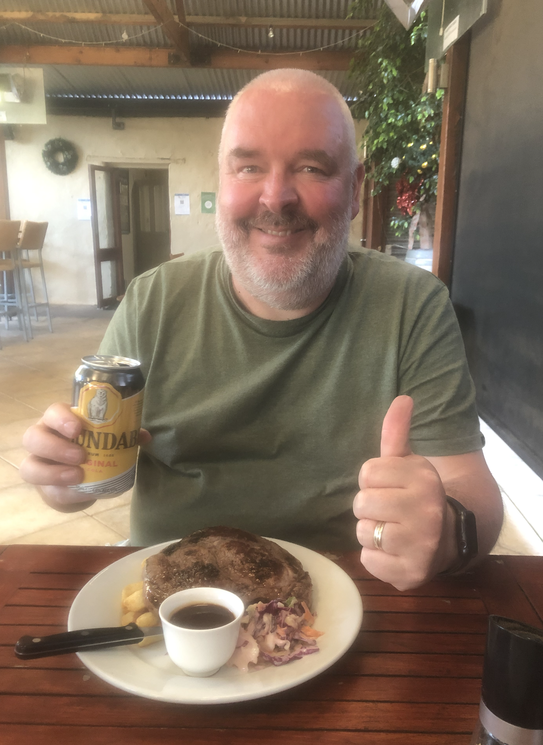
We enjoyed a really nice meal at the hotel.
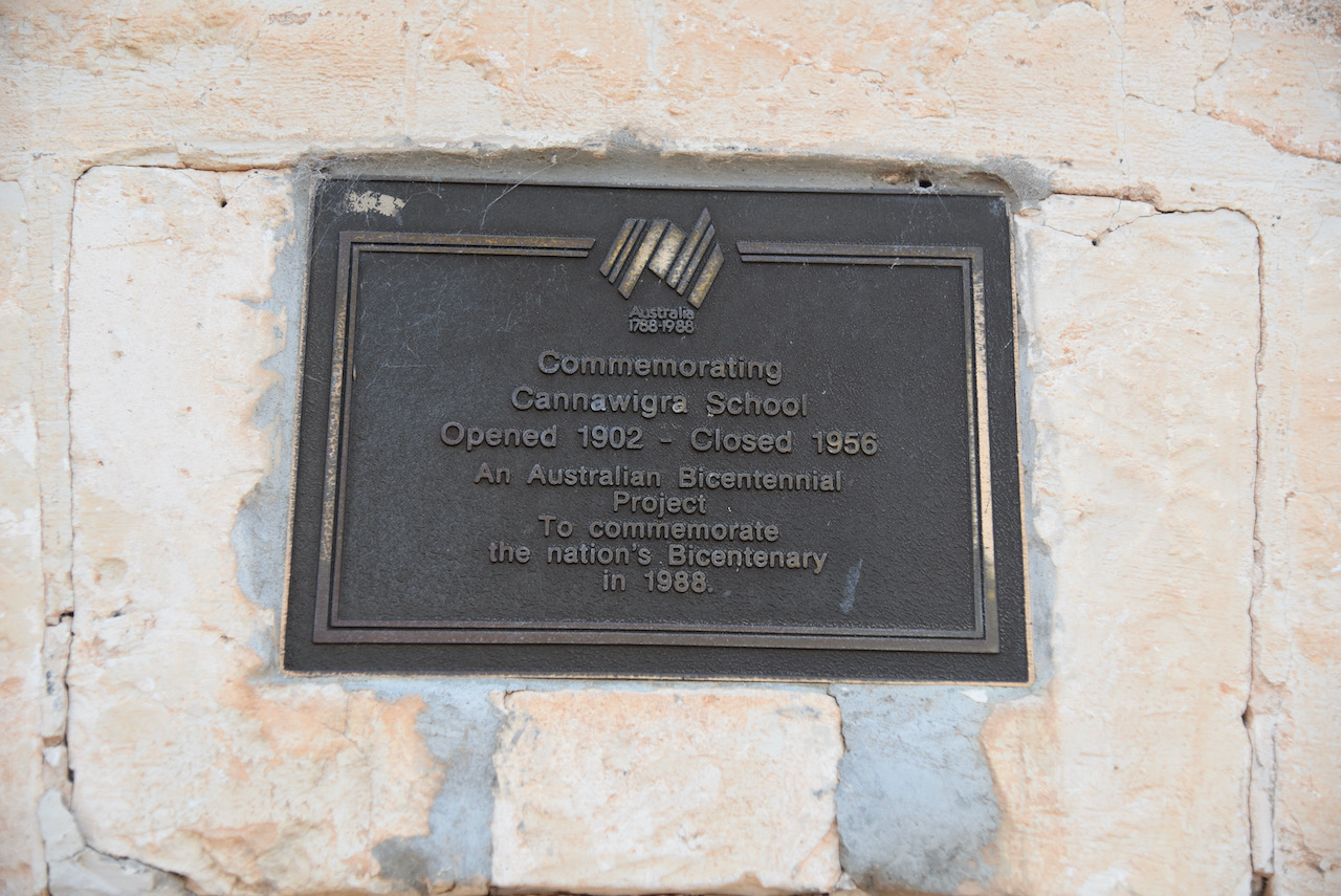
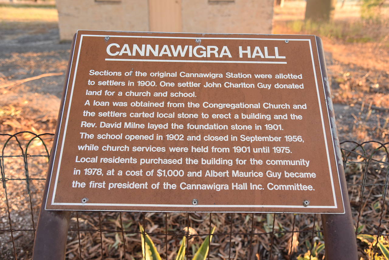
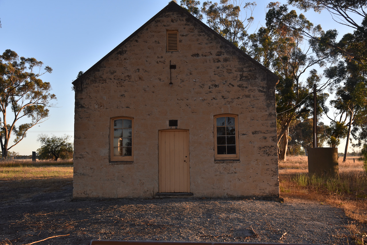
We then headed out to the old Cannawigra Hall. In 1900 sections of the original Cannawigra Station were allotted to settlers. John Charlton Guy, one of the settlers, donated land for a church and a school. A loan was obtained from the Congregational Church and the settlers of the district carted local stone to erect the building. Reverend David Milne laid the foundation stone in 1901. In 1902 the school opened. It closed in September 1956. Church services took place from 1901 until 1975. In 1978 local residents purchased the building for the community at a cost of $1,000 and a Cannawigra Hall Inc. Committee was formed.
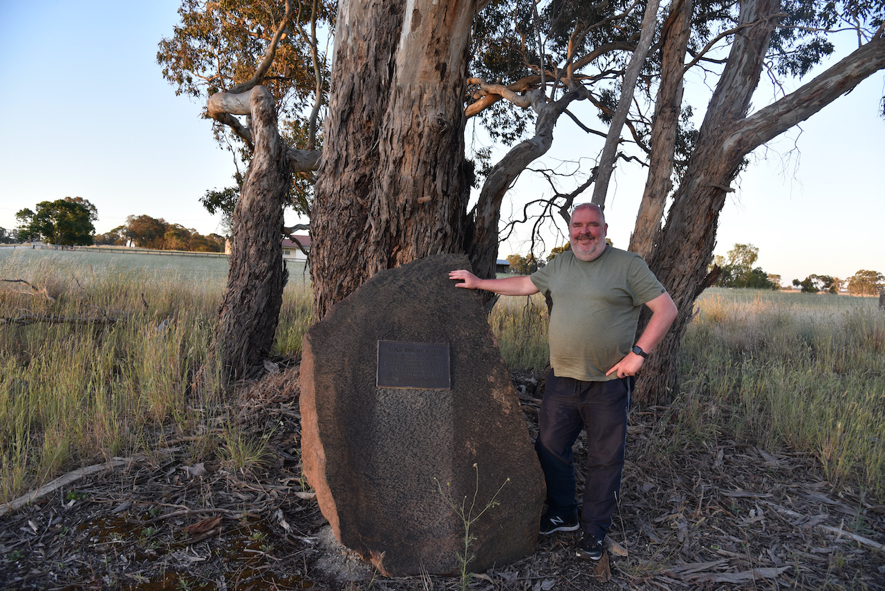
A short distance away is a cairn to commemorate the Gold Escort Route.
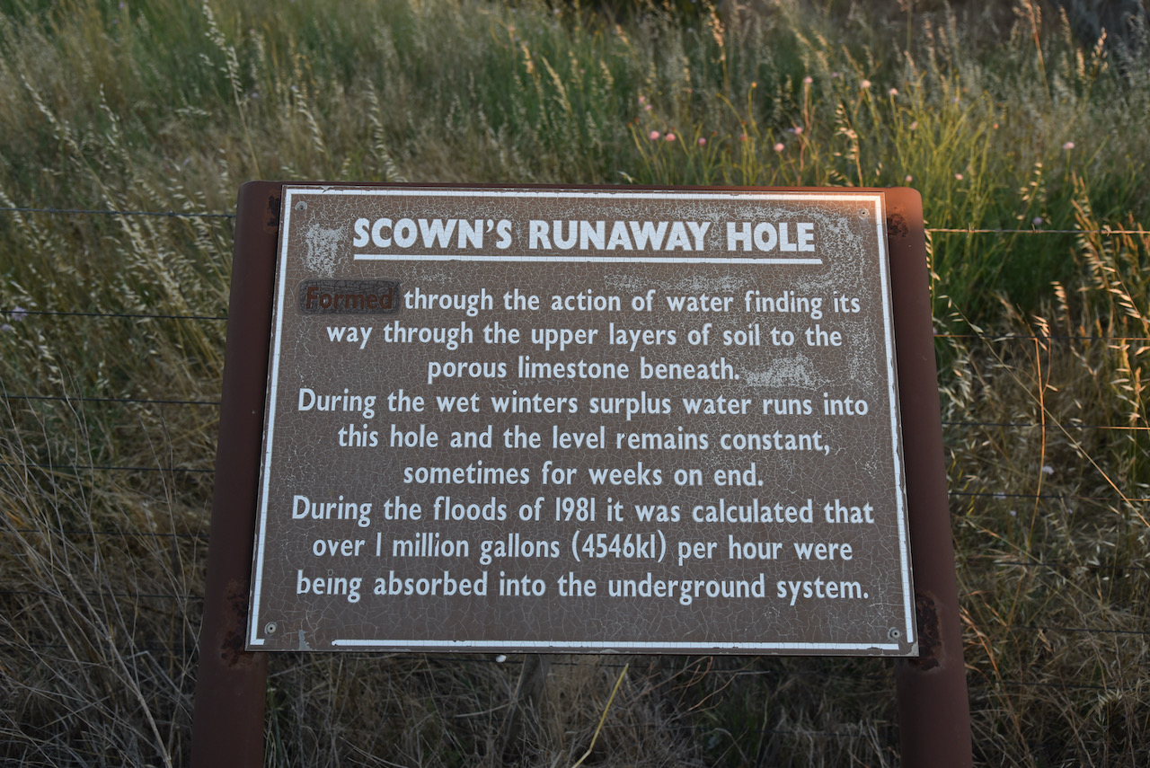
We also stopped to have a look at Scowns Runaway Hole. It was formed through the action of water finding its way through the upper layers of soil to the porous limestone beneath.
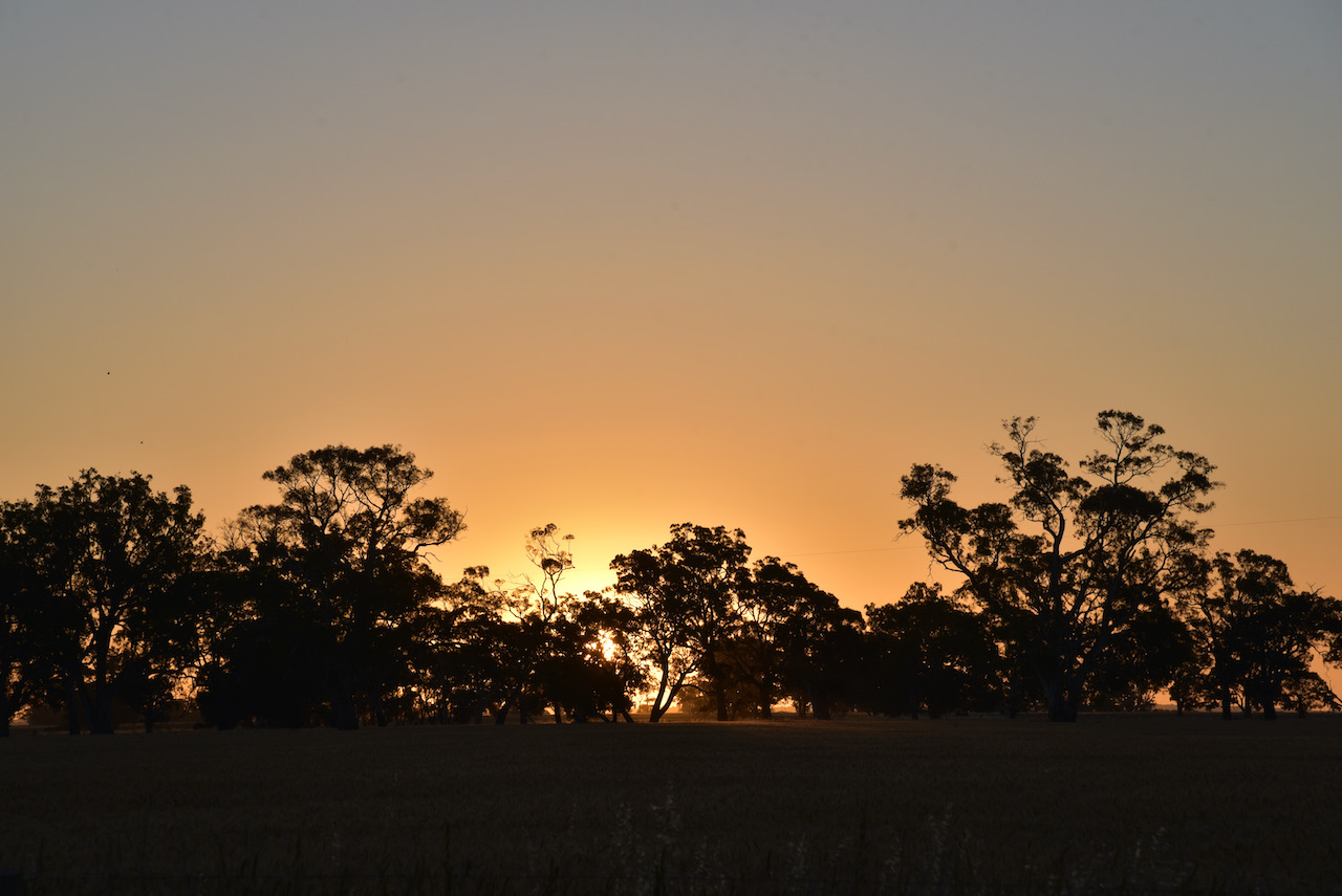
The sun was started to set and we enjoyed a beautiful sunset.
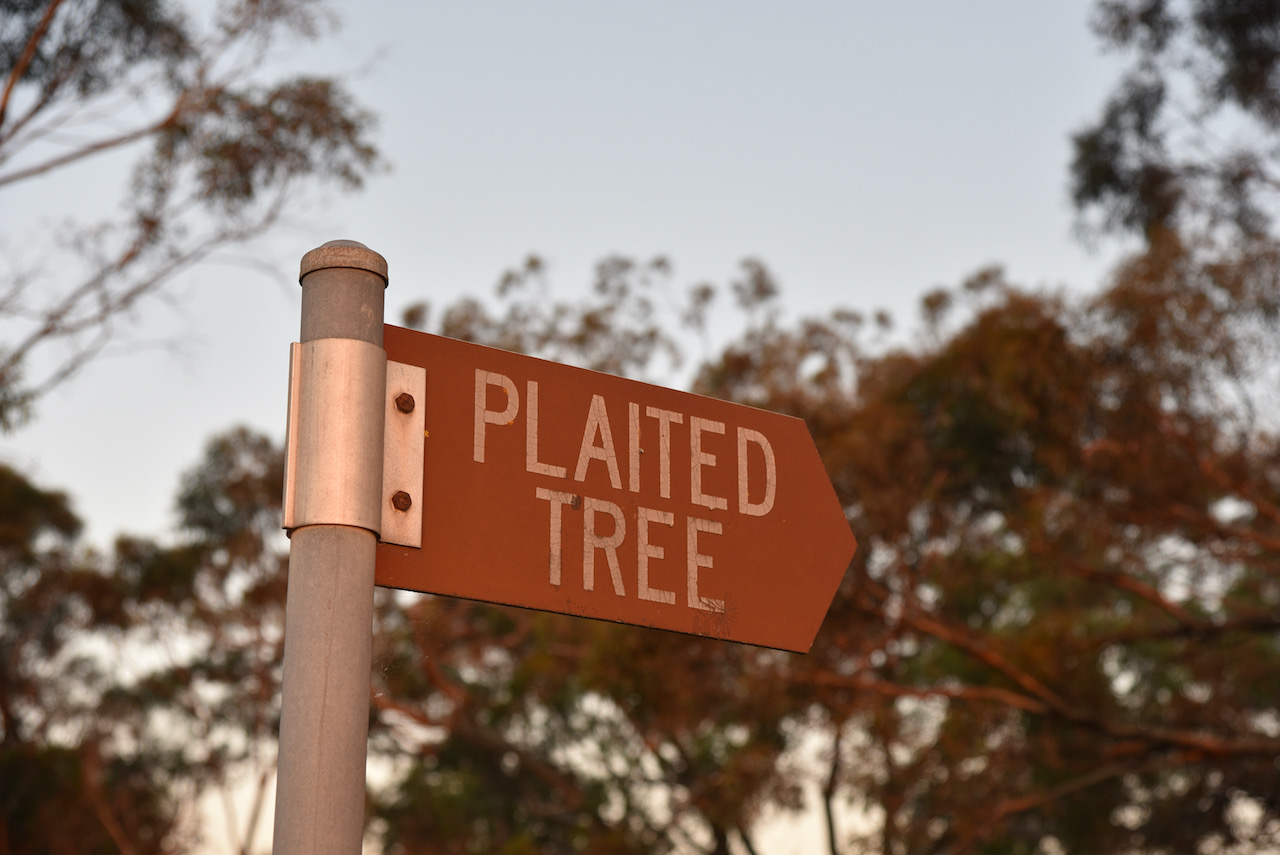
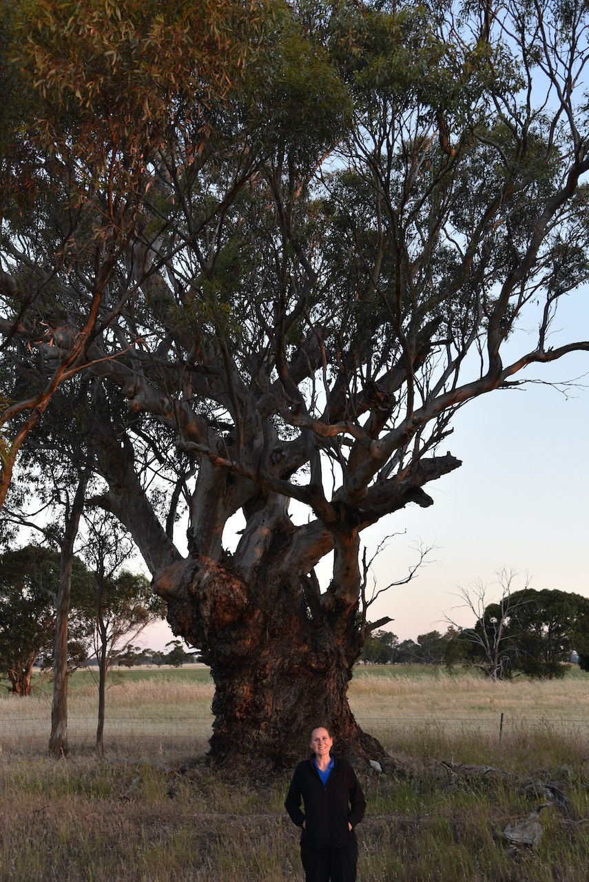
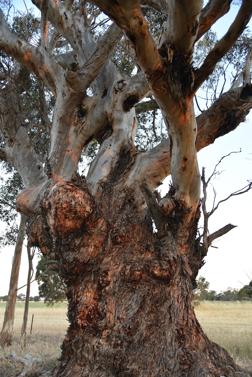
Our next stop was the Plaited Tree. The branches of the tree, which is estimated to be 400 years old, are plaited (or cross over each other). This was an aboriginal meeting point.
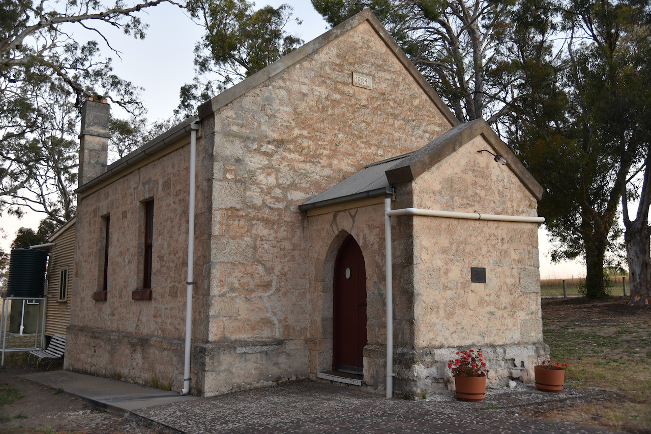
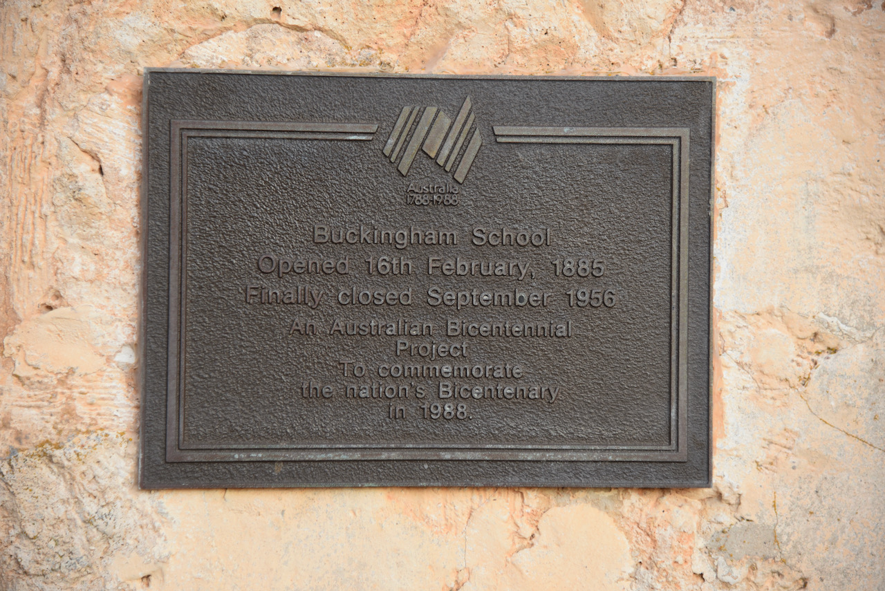
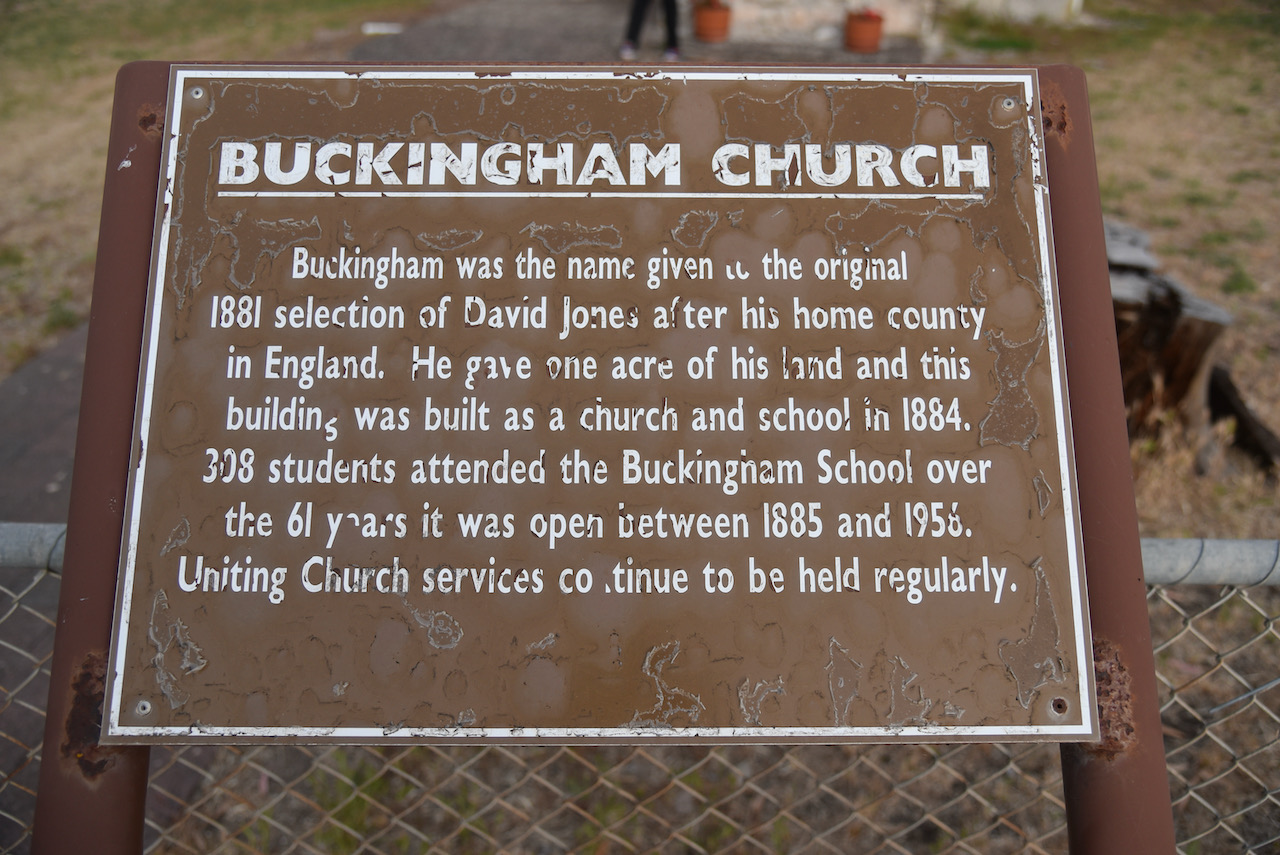
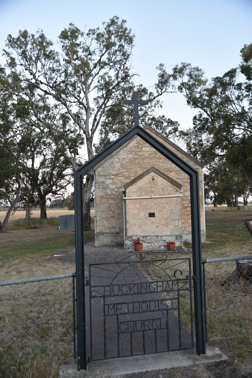
Our final stop was the Buckingham Church and School. Buckingham was the name of the original farm of Mr David Jones, named after his home country of Buckinghamshire in England. In 1884 he gave one acre of land for the building of a church and school. In 1885 the school opened and operated until 1956 when children of the district were taken to school by bus at Mundulla. In its lifetime a total of 338 students attended the school. Uniting Church services continue to be held at the school.
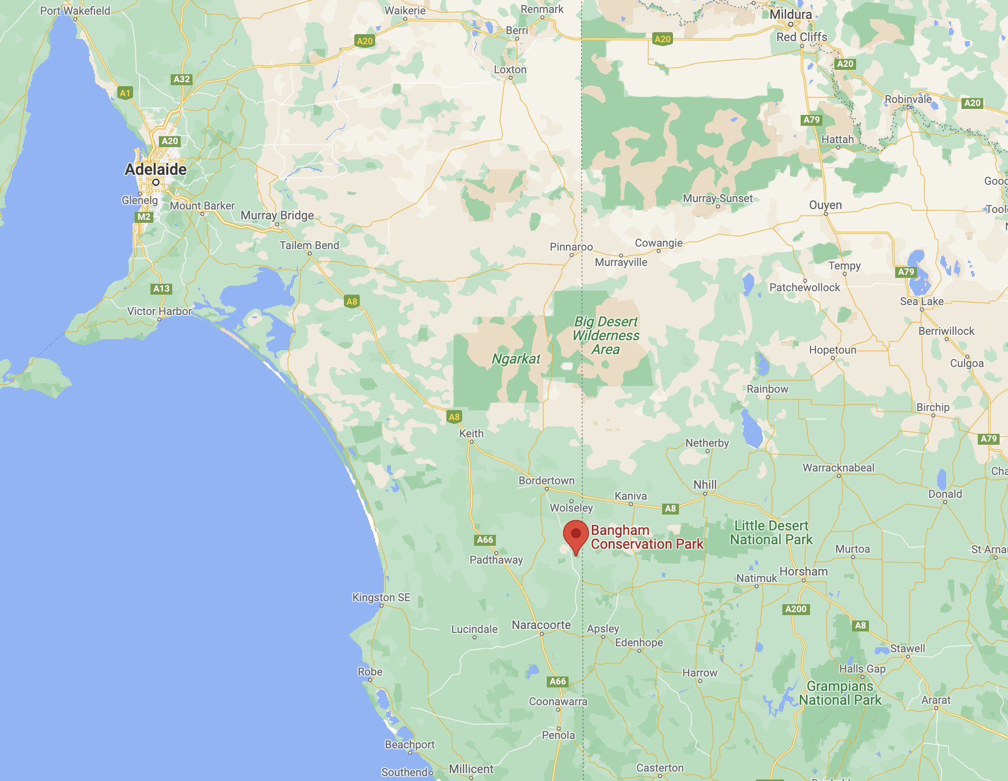
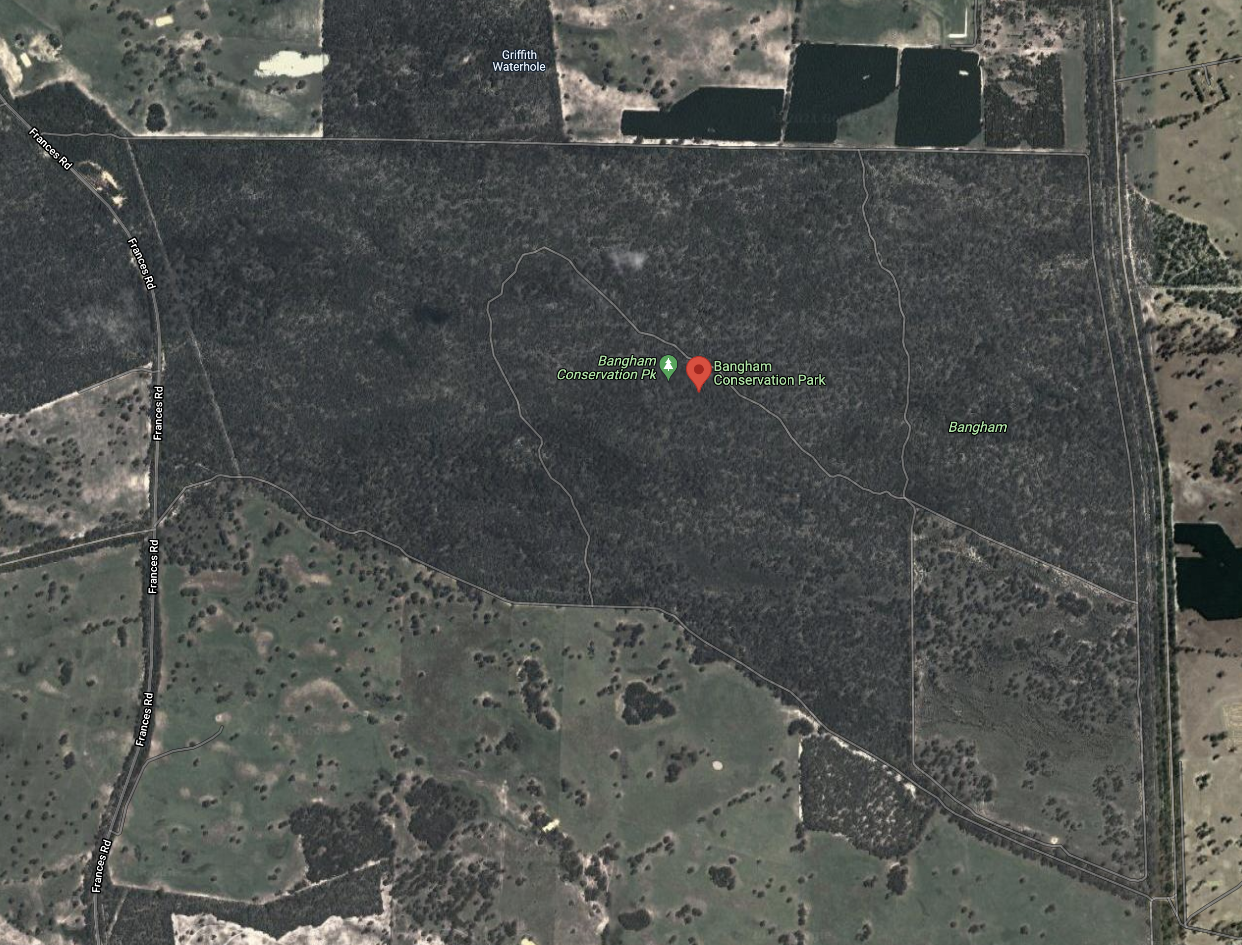
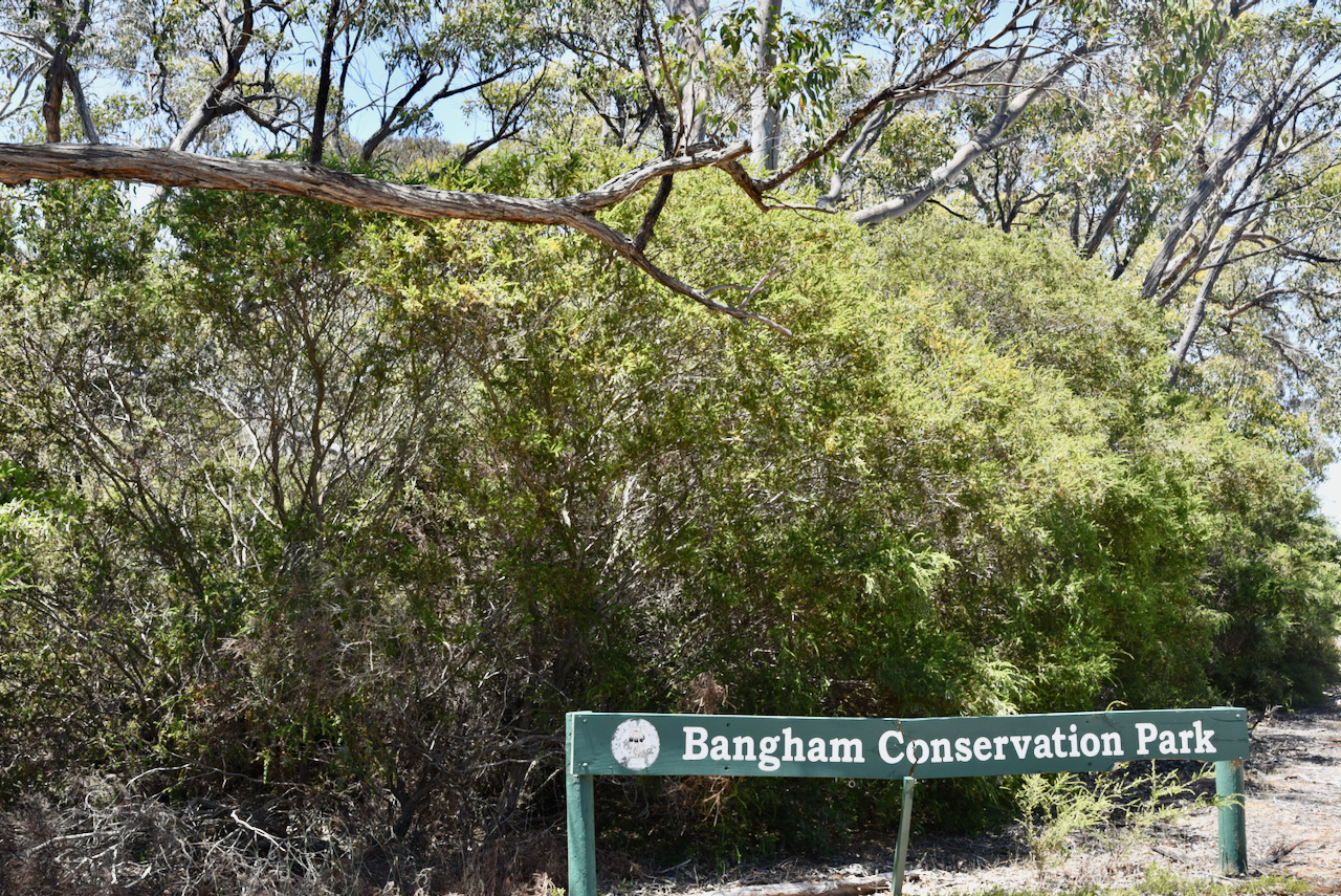
Our second park for Sunday 28th December 2021 was the Bangham Conservation Park VKFF-0869, which is located about 312 km southeast of Adelaide, and about 41 km south of the town of Bordertown.
Above:- Map showing the location of the Bangham CP. Map c/o Google maps
The Bangham Conservation Park is about 869 hectares in size and was established on the 22nd day of November 1973. A total of 675.8 hectares of native scrub and 125 hectares of cleared land was offered for conservation purposes. In 1982 an experimental plot of 1000m2 of native trees was established adjacent to the northern fence line of the cleared area. This area was fenced and Eucalypt branches containing fruits and seeds were laid across the area. However, the vegetation was destroyed by drought. Further land was added to the park on the 18th day of February 2010.
Above:- An aerial view of the park. Image c/o Google maps
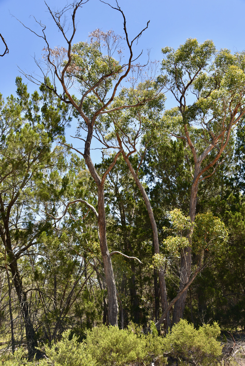
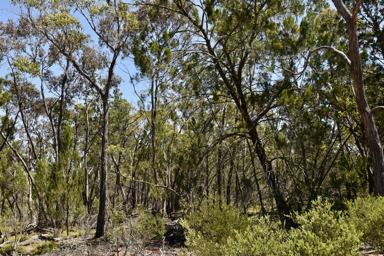
The park comprises South Australian Blue Gum open forest-woodland, River Red Gum, and Brown Stringybark open forest-low open forest.
Birds SA have recorded about 135 species of bird in the park including Sulphur-crested Cockatoo, Crimson Rosella, White-throated Treecreeper, Brown Treecreeper, Superb Fairywren, Tawny-crowned Honeyeater, Red Wattlebird, and Black-chinned Honeyeater.
The park takes its name from the area of Bangham. Edward Bangham held land under occupation licence during the 1840s. He subsequently sold the land in 1846 to Mr. McLean. From 1851 Bryan Cussen held the land under pastoral lease number 154.
In 1908 a Government survey described the area as follows:-
“greater part undulating white sand, with stringybark, buck honeysuckle, heath, yacca with a few pines and supporting a little grass considered to be inferior pasture”.
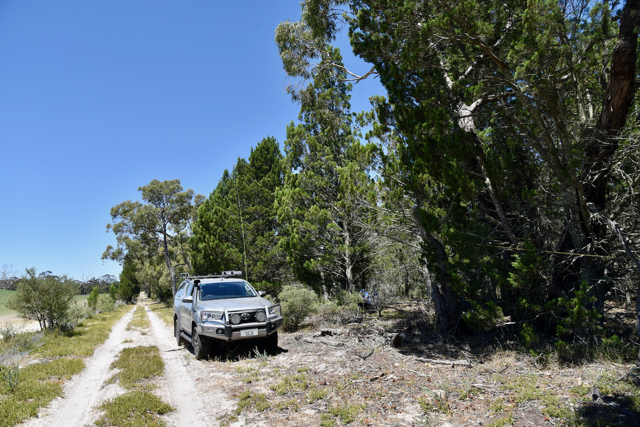
Marija and I drove along a sandy 4WD track that lead off Frances Road and then followed the northern boundary of the park. The park is very heavily wooded and we were seeking some shade as it was a hot afternoon. We eventually found a spot where we could pull the Toyota Hi-Lux off the track and get in under some shade under some trees.
Marija and I spent 2 hours in the park and made a total of 124 QSOs, including 56 Park to Park contacts. Out QSOs were on the 40m and 20m band. We did try 80m but we had very little, if any internet coverage in the park, so we were unable to post a spot.
It was now day two of the 2021 VKFF Activation Weekend, Sunday 28th November 2021. Marija and I had three parks to activate.
To kick off the morning we headed to Subway for some coffee and some Bacon & Egg rolls.
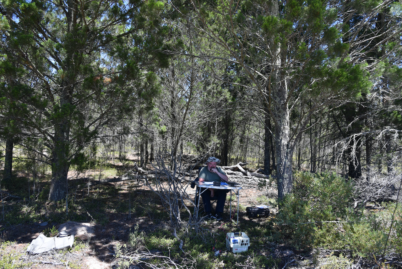
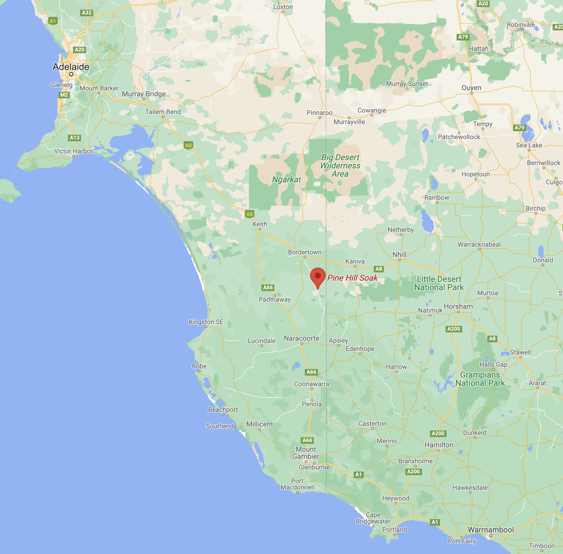
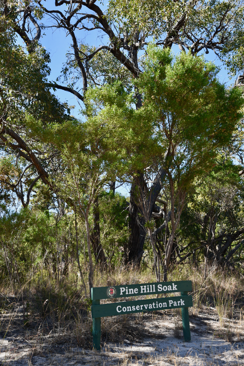
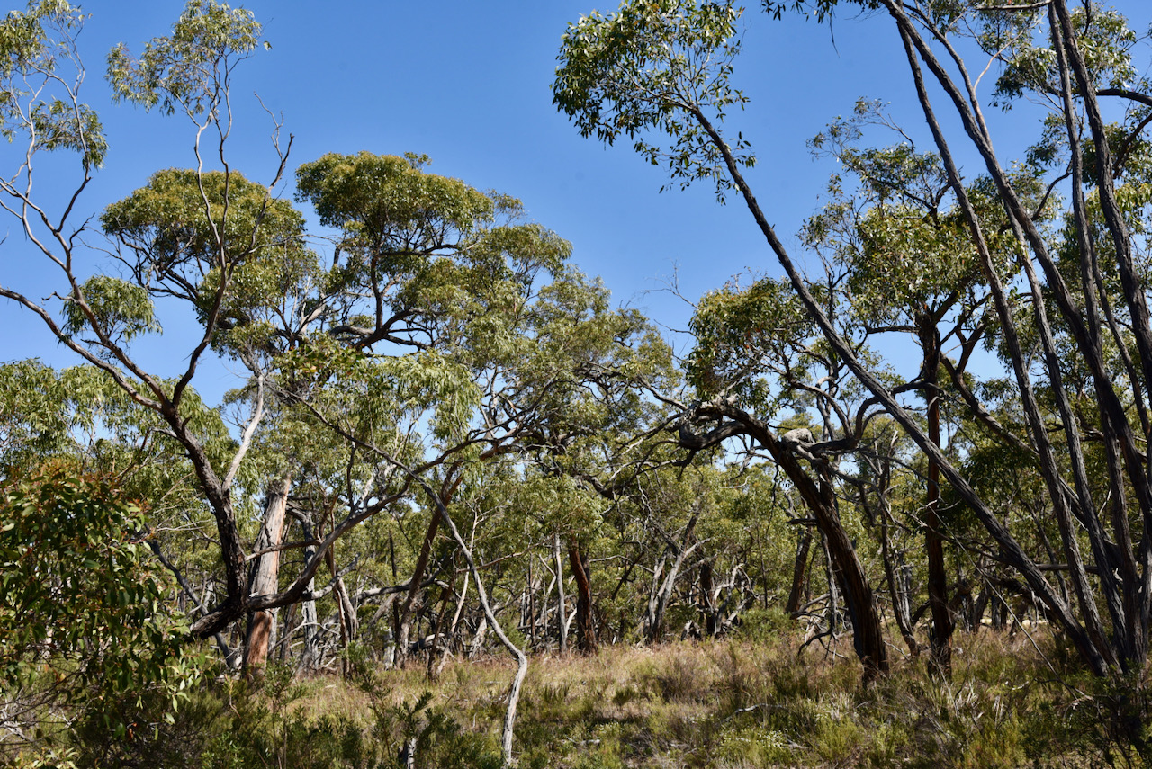
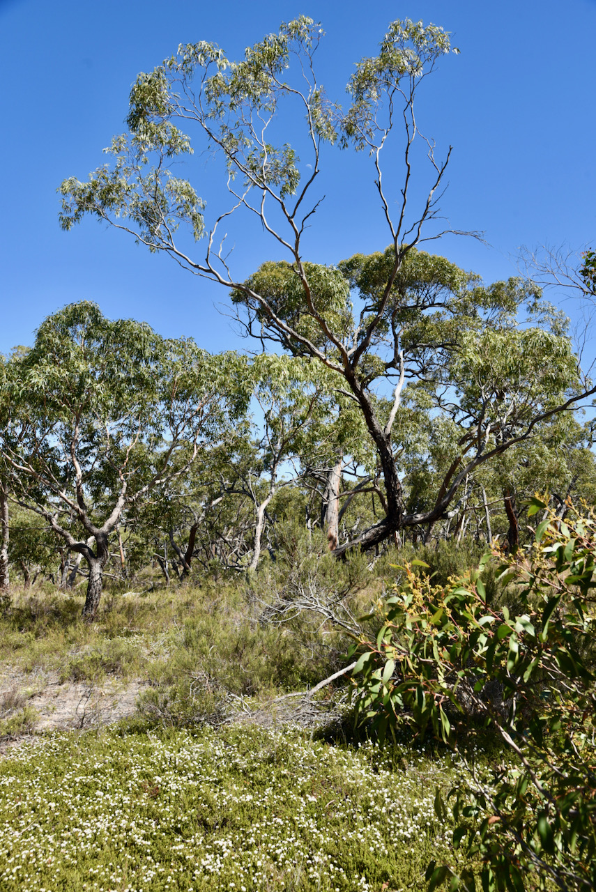
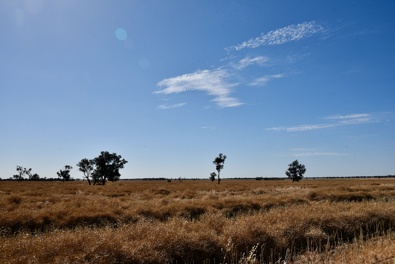
We then headed southeast out of Bordertown to our first park of the day, the Pine Hill Soak Conservation Park VKFF-1078. The park is located about 301 km south-east of Adelaide, and about 30 km south of the town of Bordertown.
Above:- Map showing the location of the Pine Hill Soak CP. Map c/o Google maps
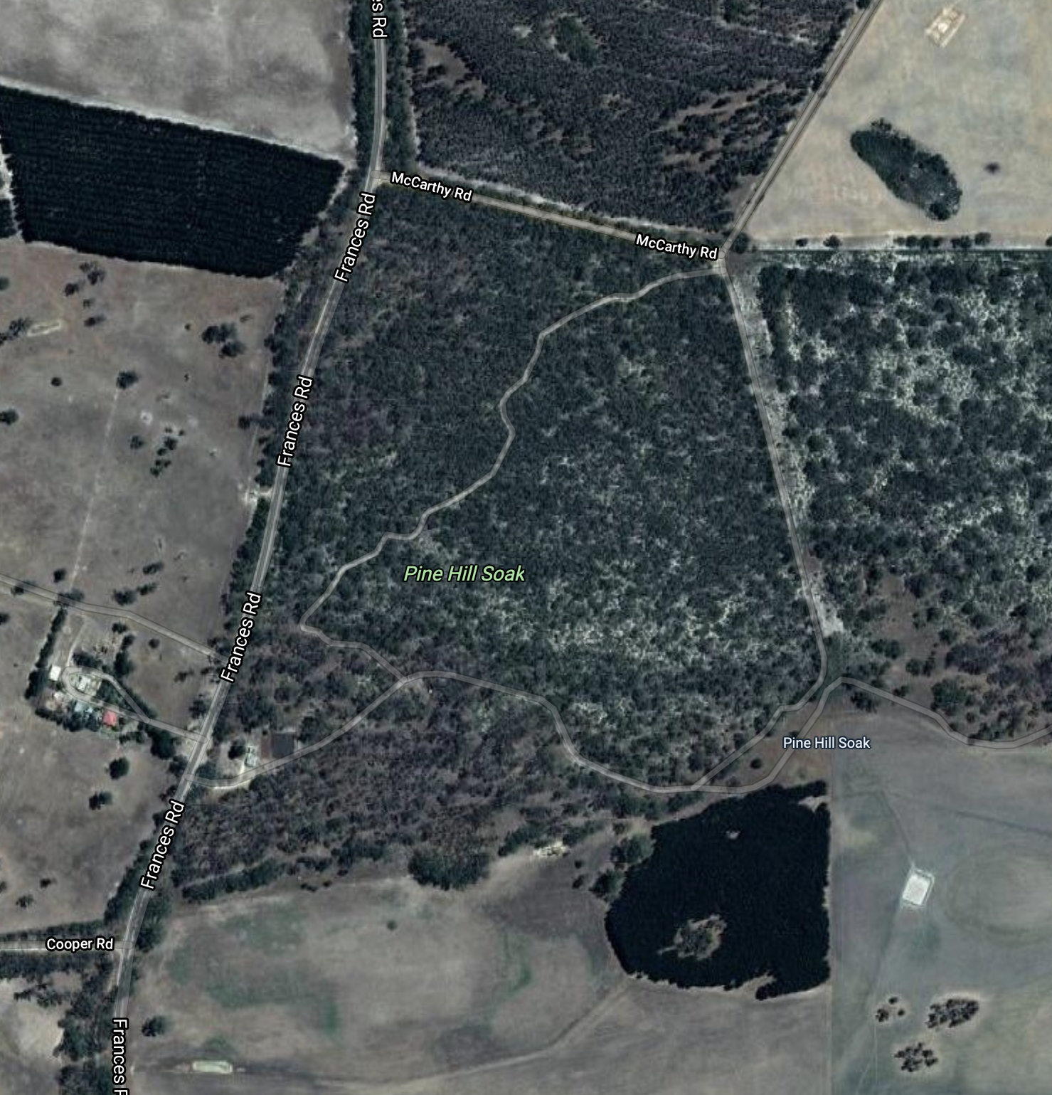
The park is located at the intersection of Frances Road and McCarthy Road. There is scrub to the north and east of the park, but this is not part of Pine Hill Soak Conservation Park.
Above:- An aerial shot of the park. Image c/o Google maps
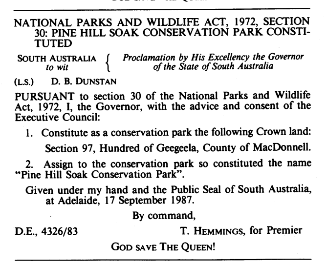
The Pine Hill Soak Conservation Park is about 51 hectares (130 acres) in size and was established on the 17th day of September 1987.
Above:- SA Govt Gazette re Pine Hill Soak CP.
The park’s name is derived from a soak known as Pine Hill Soak which is located near the southern boundary of the park. A soak or soakage, is a source of water and is so called because the water generally seeps into the and, and is stored below, sometimes as part of an ephemeral river or creek.
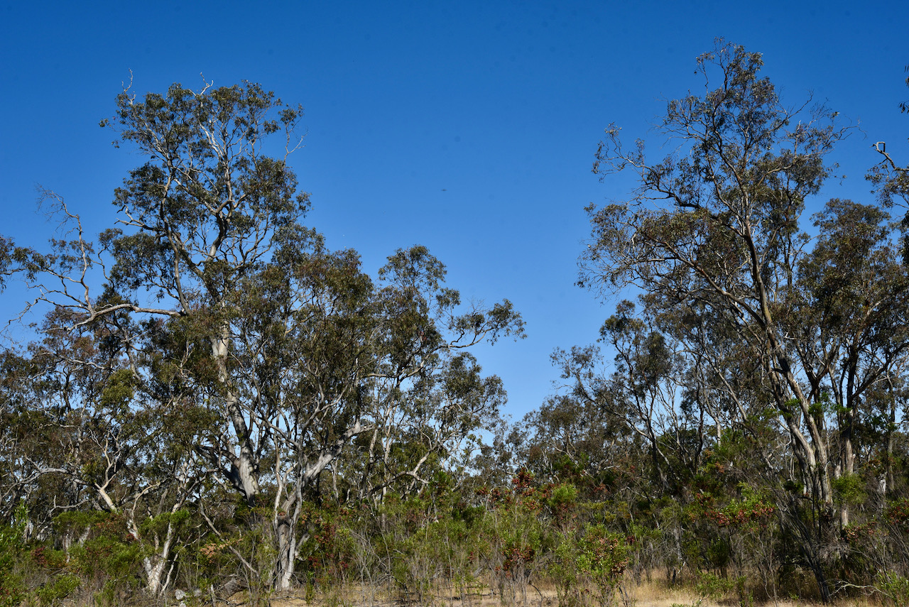
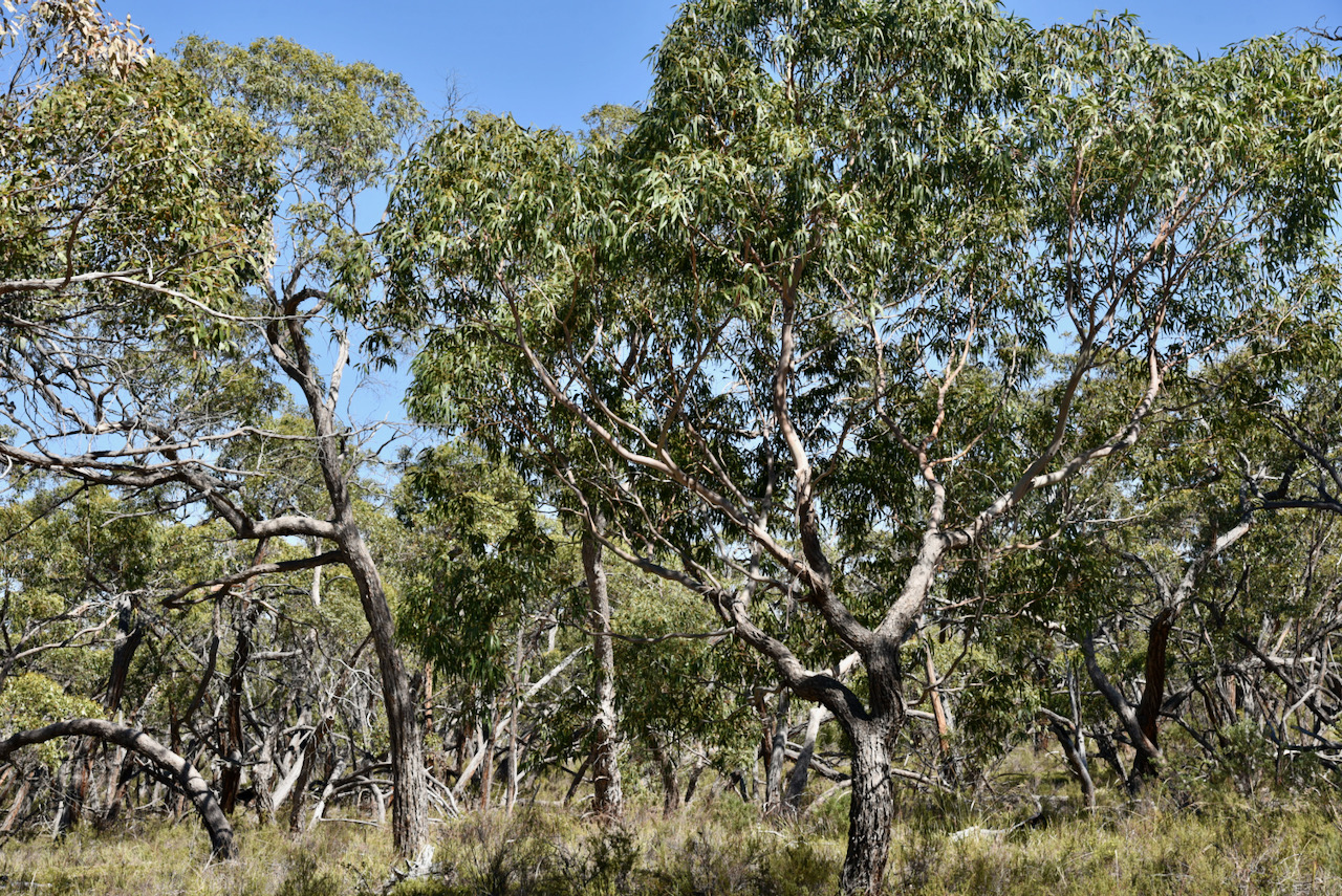
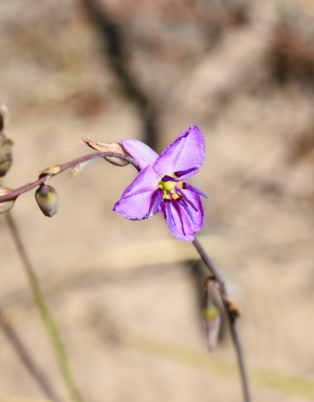
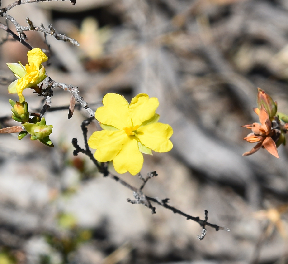
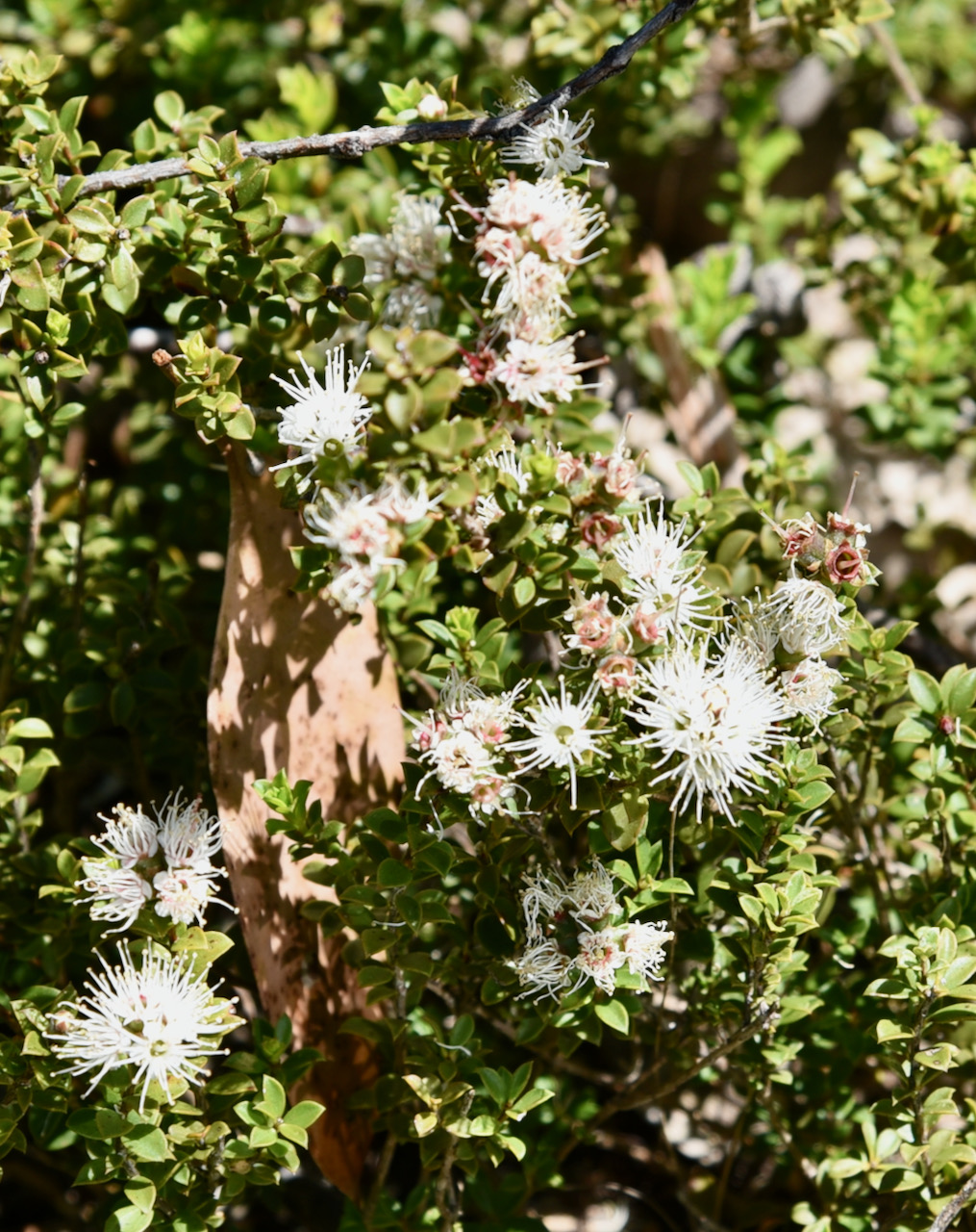
The park consists of Brown Stringybark open forest with desert Banksia with some River Red Gum and South Australian Blue Gum. The park also contains Native Pine.
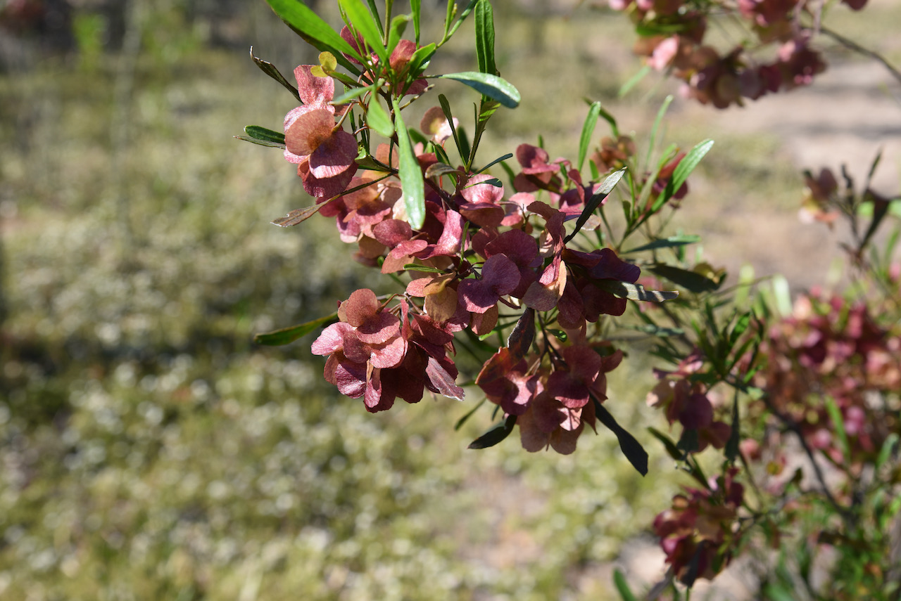
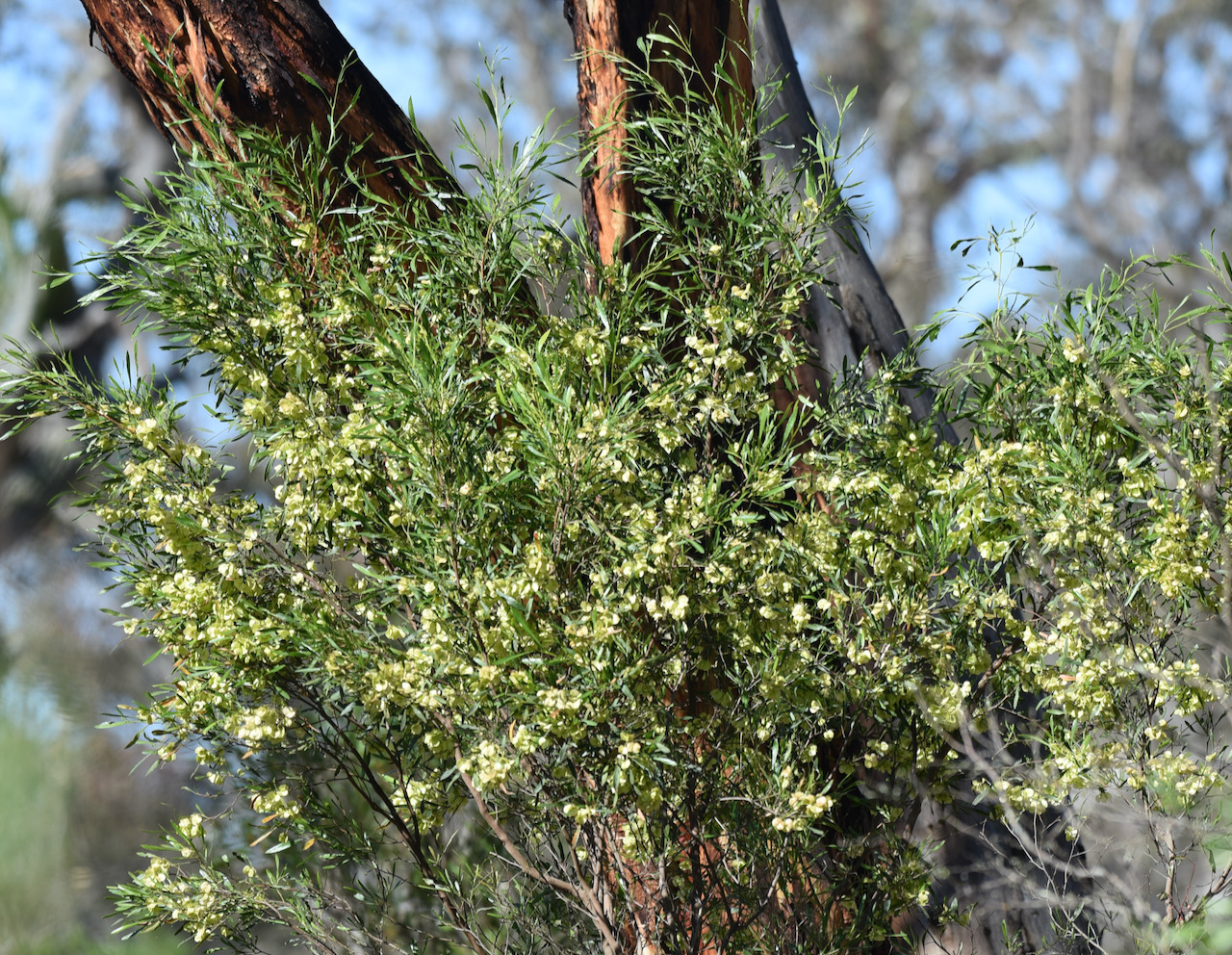
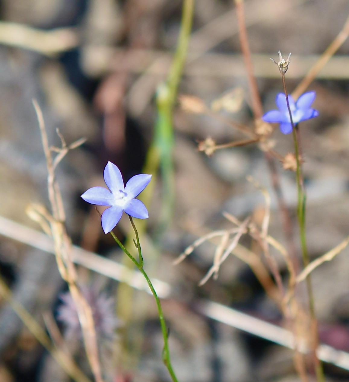
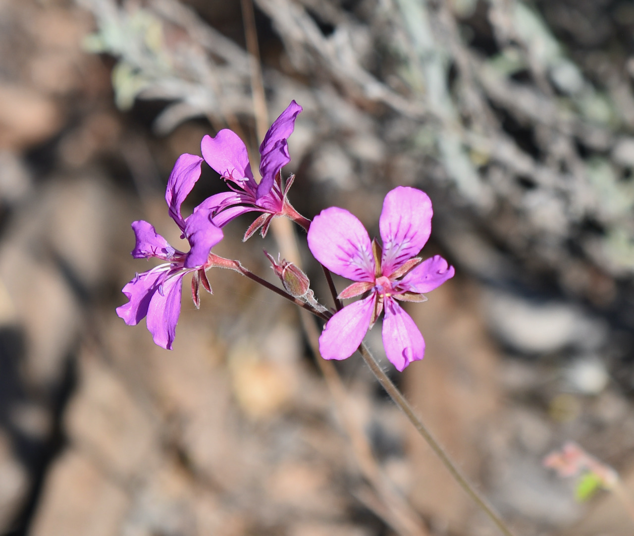
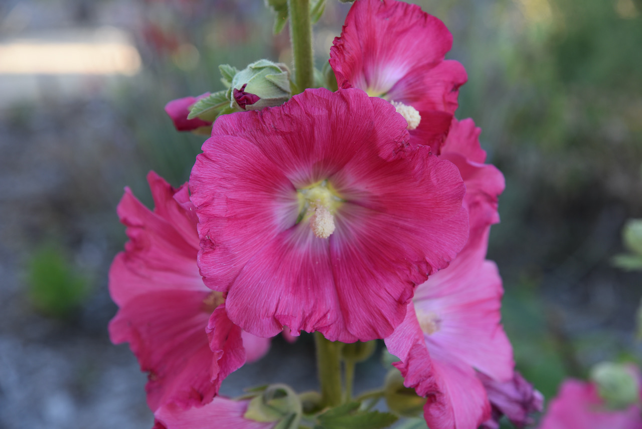
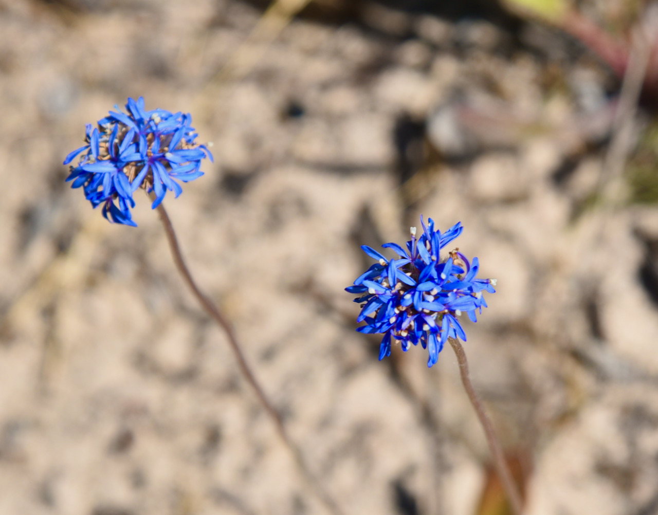
During our visit to the park, there were a number of plants in flower.
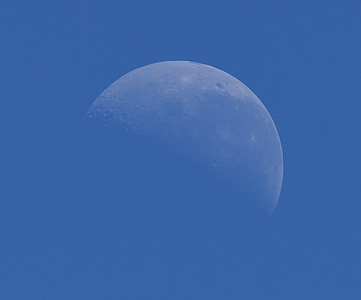
It was a beautiful warm morning, with not a cloud in the sky. The moon was out in all its glory.
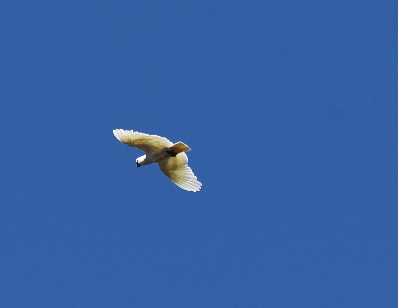
It was incredibly quiet in the park except for the occasional screech of a Sulphur Crested Cockatoo flying overhead.
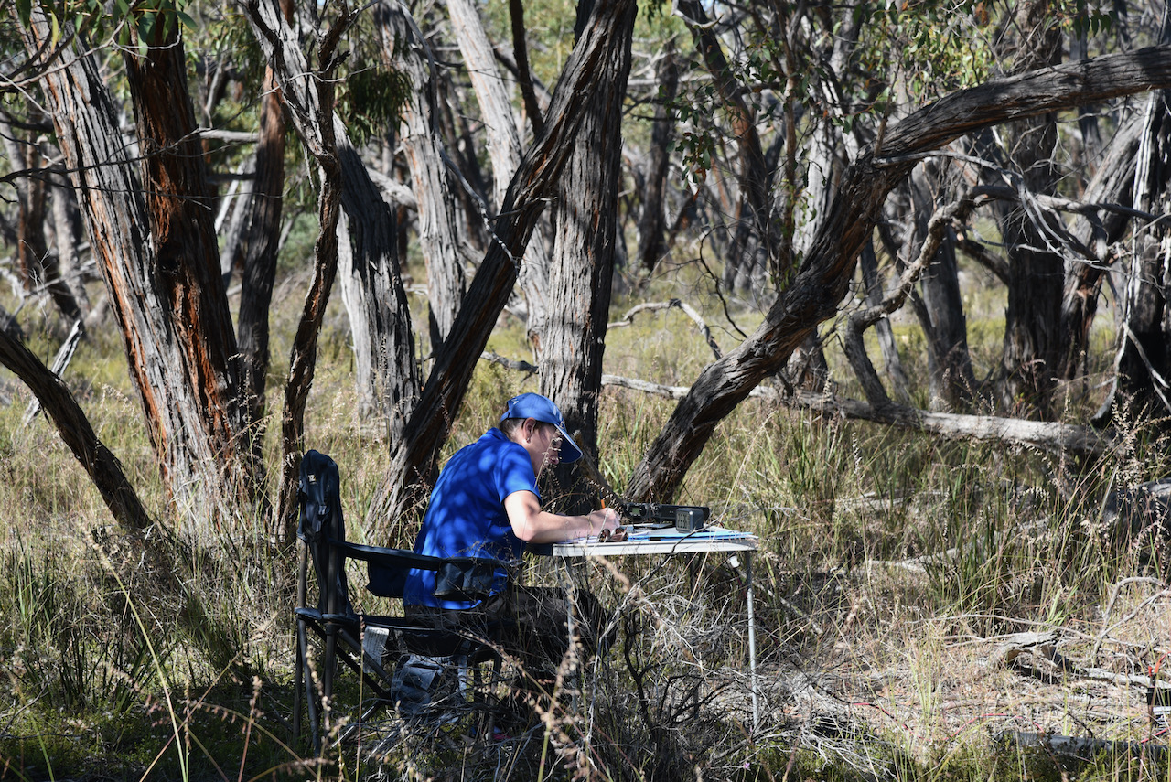
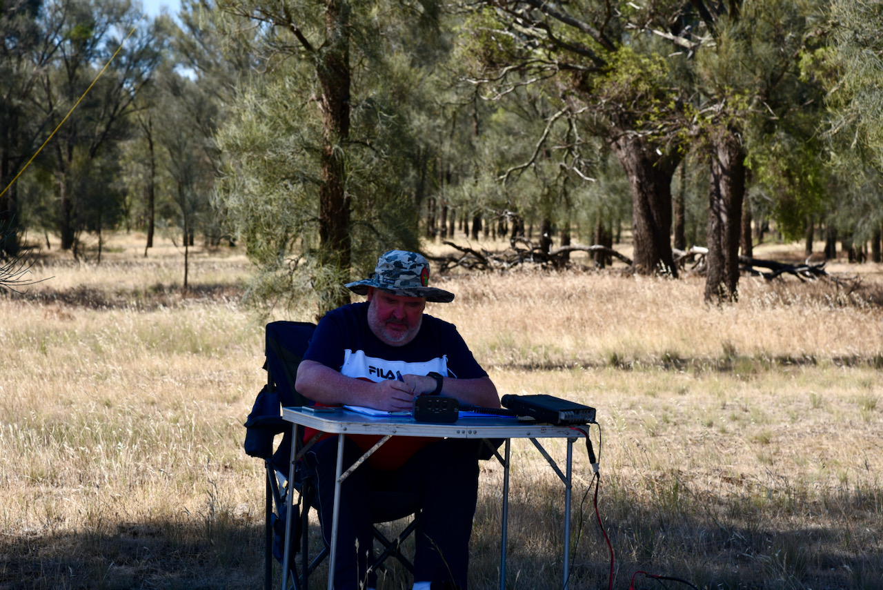
Marija and I were set up and ready to go in the park by about 9.30 a.m. South Australian local time. We spent hours in the park and operated on 20, 40, & 80m SSB using the Yaesu FT857d, 40 watts, and the 20/40/80m linked dipole.
We made a total of 116 QSOs, which included 52 Park to Park contacts.
Band conditions on 40m were much better compared to Saturday.
Marija worked the following stations on 40m SSB before the UTC rollover:-
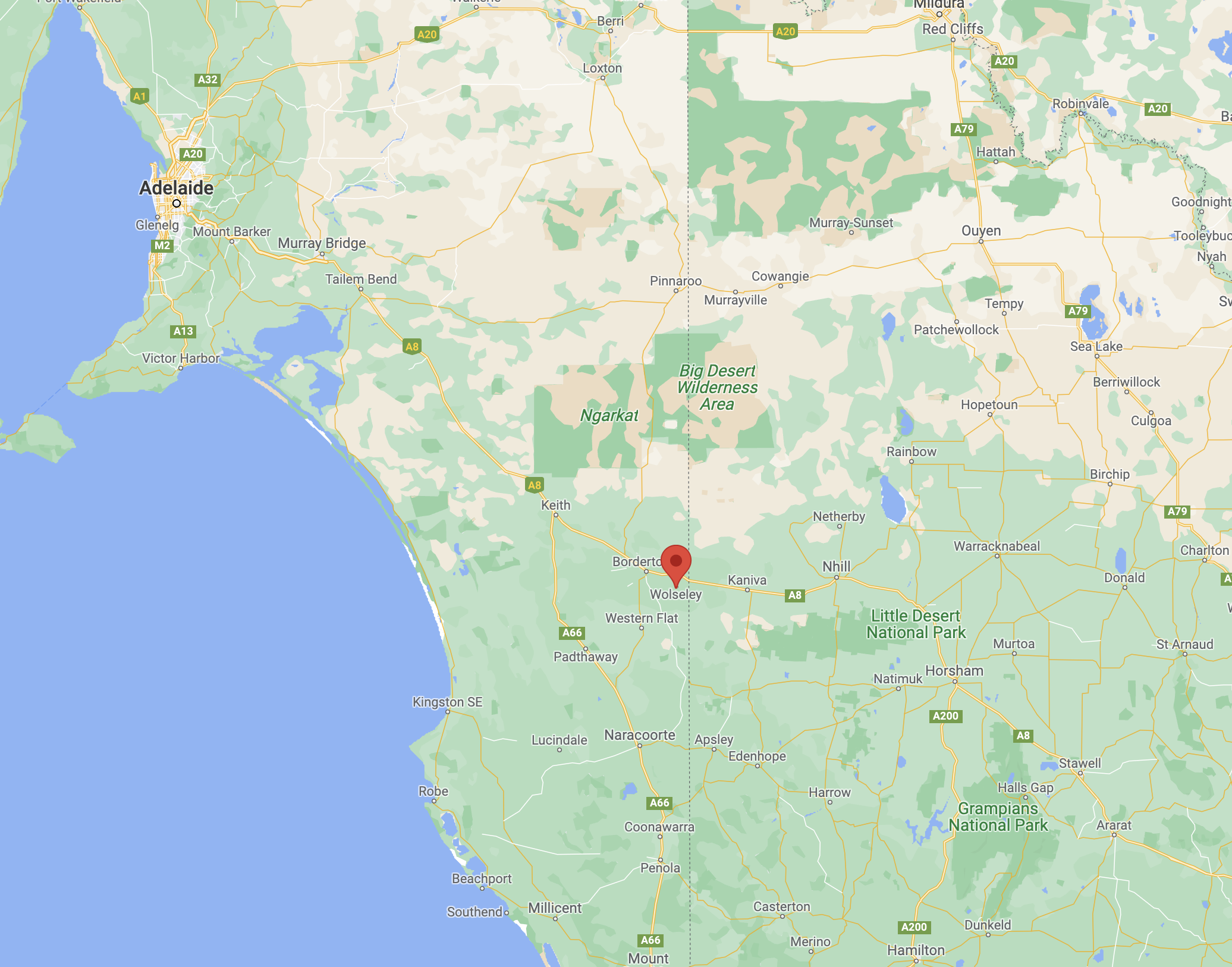
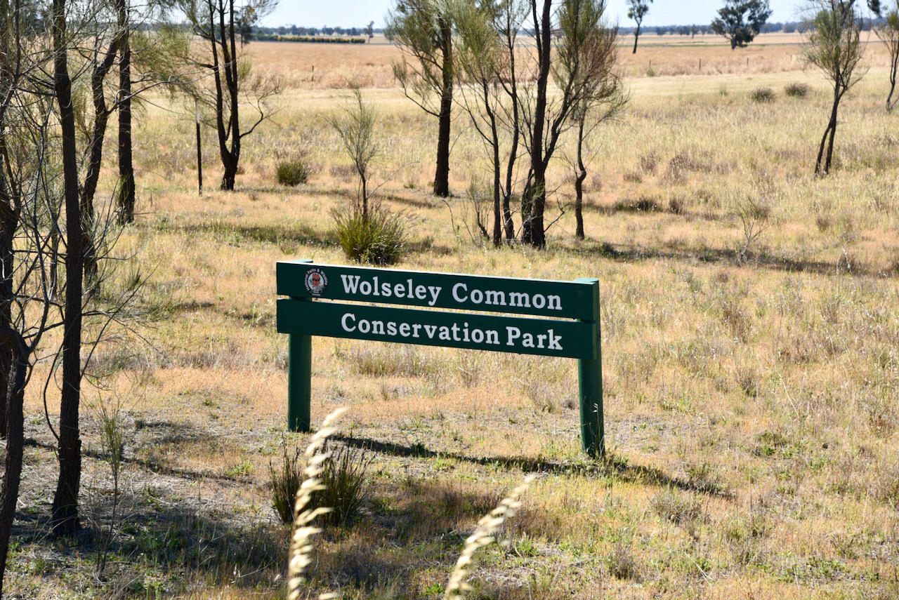
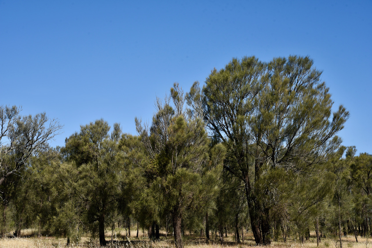
We packed up at Custon and headed to our third and final park for Saturday 27th November 2021 and Day One of the 2021 VKFF Activation Weekend. Our last park was Wolseley Common Conservation Park VKFF-1125, which is located about 285 km southeast of Adelaide, and about 14 km east of Bordertown.
Above:- Map showing the location of Wolseley. Map c/o Google maps
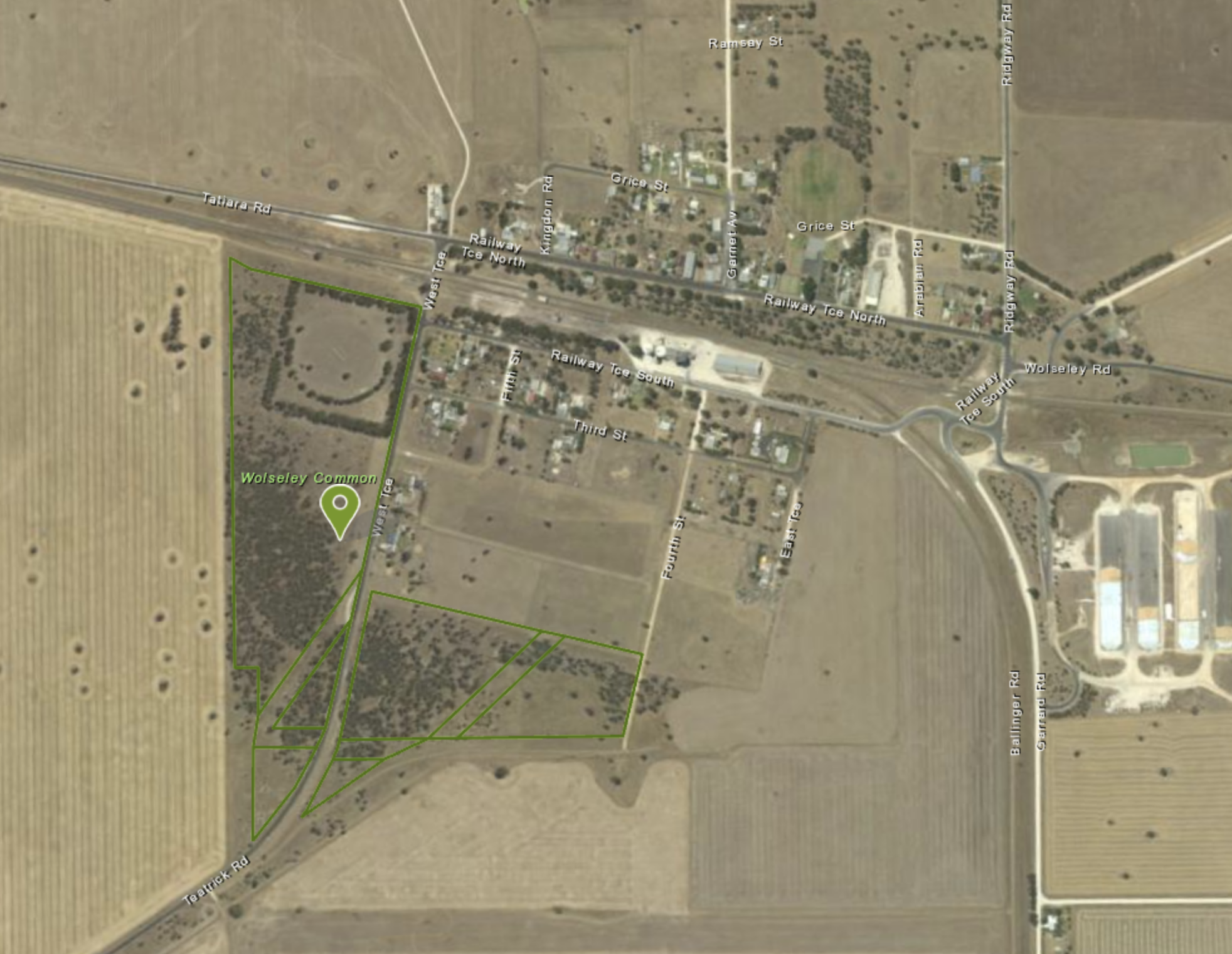
The Wolseley Common Conservation Park is located on the south-western side of the town of Wolseley.
Above:- An aerial view of the town of Wolseley and the park. Image c/o Location SA Map Viewer.
The park takes its name from the town of Wolseley. In August 1882, a general store was opened on a leased portion of land opposite to what was to become the Wolseley Railway Station. By 1883, the Messrs. Grice and Paterson subdivided a section north of the railway yard into allotments.
In 1884 the area was advertised as follows:-
“in the centre of the great wheat-producing districts of Wimmera and Tatiara being larger than the whole of the Northern areas and infinitely more fertile. Nearly all the wheat and wool must come to Wolseley”.
Above:- Images c/o State Library SA.
In 1884, the Government town of Tatiara was surveyed into 168 allotments, south of the Wolseley railway station. It was proclaimed on the 8th day of May 1884. A school was opened in the same year. On 20th February 1941 the name was changed to Wolseley to conform with the name of the railway station
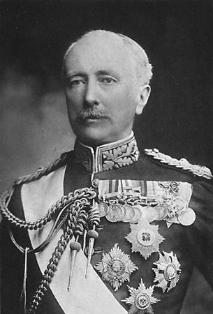
The town was named after Sir. Garnet Joseph Wolseley (1833-1913), also known as Baron Wolseley, who was the Commander-in-Chief of the British Army.
Above:- Sir Garnet Wolseley. Image c/o Wikipedia
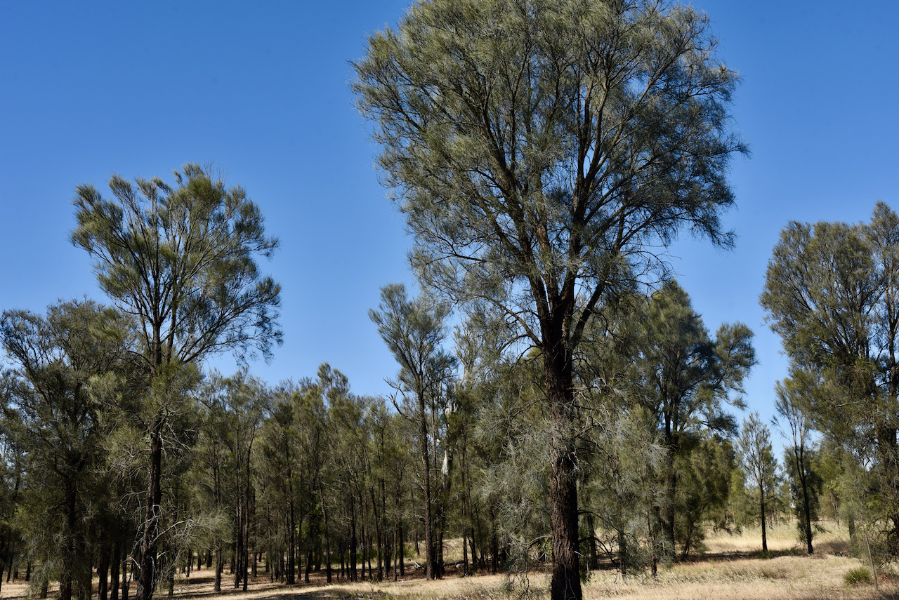
The Wolseley Conservation Park is about 24 hectares (59 acres) in size and was established on the 29th day of November 2001. It was established to protect the nationally threatened Buloke Woodland which is one the last remaining in South Australia.
At least 30 species of bird have been recorded in the park including Yellow Thornbill, White-winged Chough, Red-capped Robin, and Collared Sparrowhawk. The park has 68 native plant species of which 11 are listed as threatened.
The land which is now the Conservation Park was part of the parklands around the town of Wolseley but had a reputation for depasturing animals, the gathering of firewood and the dumping of rubbish. During the Second World War, part of the land on the western side was cleared to create a sports oval.
By the 1960s the land was reported to be bare ground with only a few scattered Buloke trees. The decline of Wolseley as a railway town reduced further impact on the land which is now the park.
Above:- Cleared farming land alongside of the park.
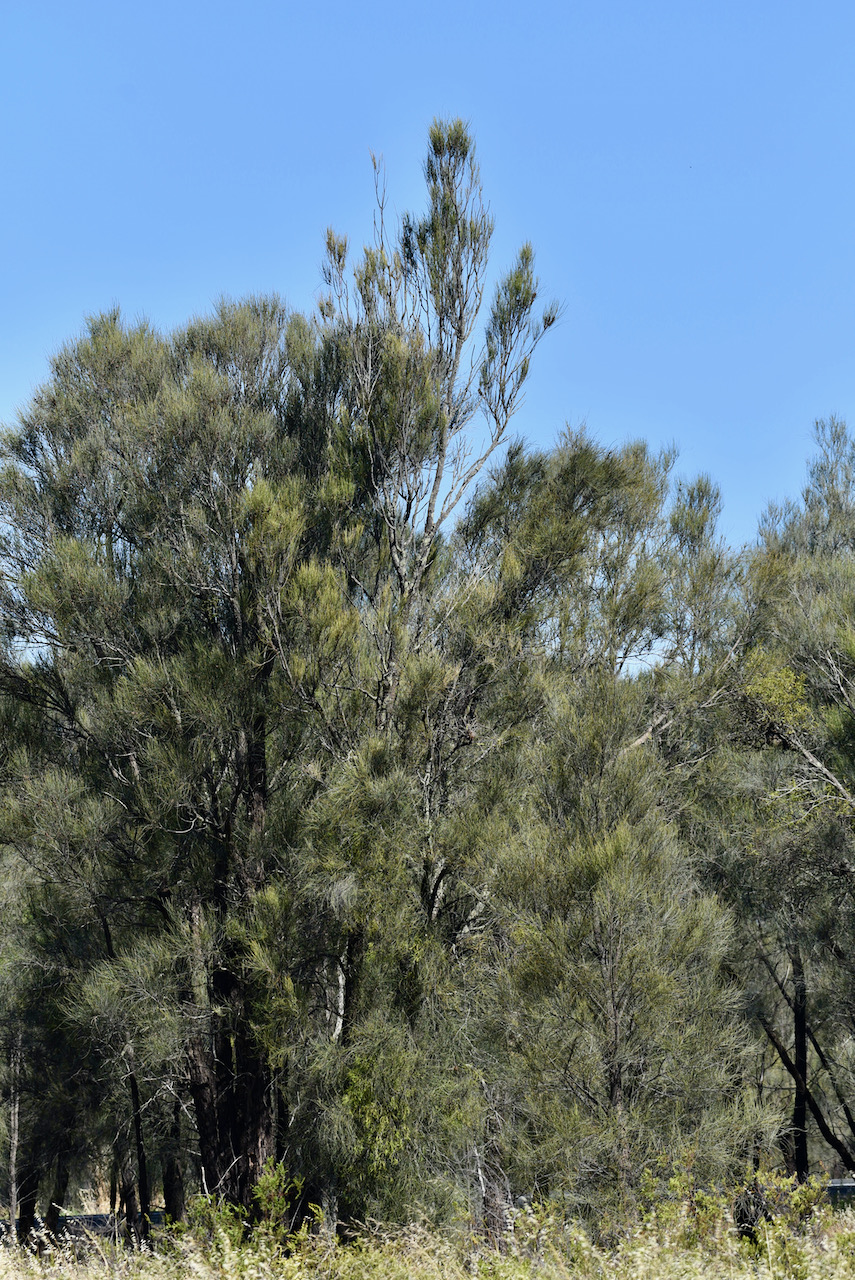
Marija and I drove into the park and found a nice shady spot under some trees. It was a warm day with the temperature in the high twenties.
We operated from Wolseley Common for about 2 hours and made a total of 92 QSOs, including 32 Park to Park contacts.
QSOs were made around Australia and into Japan and New Zealand.
Marija worked the following stations on 40m SSB:-
VK3YV/p (Sweetwater Creek Nature Conservation Reserve VKFF-2200)
VK5KLV/p (Whyalla Conservation Park VKFF-0808)
VK3LF/p (The Lakes National Park VKFF-0484)
VK4MGL/p (Ravensbourne National Park VKFF-0427)
VK2IO/p (Rouse Hill Regional Park VKFF-2784)
VK5FANA
VK7DW
VK3UH
VK2BYF
VK1CT/p (McQuoids Hill Nature Reserve VKFF-0849)
VK2VW
VK2HFI
Vk2YW
VK2NP
Vk7JFD
Vk2PKT
VK3NFS
VK3ACZ
VK3MKE
VK2KA
VK4SMA
VK5CZ/p (Carribie Conservation Park VKFF-0876)
VK3MFU
VK3KXR/p (Swan Bay-Edwards Point Wildlife Reserve VKFF-2444)
VK2EMA
VK3TKK/p (Holden Flora Reserve VKFF-2333)
VK4PRO
VK3FRC
VK3ZPF
VK3PF/p (SOTA VK3/ VC-037 & Bunyip State Park VKFF-0753)
VK4HMI
VK3KXR/p (Port Phillip Heads Marine National Park VKFF-0954)
VK3ZK/p (Echuca Regional Park VKFF-0966)
VK3ANL
Marija worked the following stations on 20m SSB:-
ZL4NVW
JF7RJM
VK6JK
ZL1TM
VK6JKP
VK6ADF/p (Dookanooka Nature Reserve VKFF-2962)
Marija worked the following stations on 80m SSB:-
VK5PE
VK5HS
VK3PF/p (SOTA VK3/ VC-037 & Bunyip State Park VKFF-0753)
VK5FANA
VK5LA
VK5CZ/p (Carribie Conservation Park VKFF-0876)
VK3KXR/p (Port Phillip Heads Marine National Park VKFF-0954)
I worked the following stations on 40m SSB:-
VK3YV/p (Sweetwater Creek Nature Conservation Reserve VKFF-2200)
VK2LBL
Vk2BYF
VK5KLV/p (Whyalla Conservation Park VKFF-0808)
VK3LF/p (The Lakes National Park VKFF-0484)
VK4MGL/p (Ravensbourne National Park VKFF-0427)
VK2IO/p (Rouse Hill Regional Park VKFF-2784)
VK3UH
VK2PKT
VK2NP
VK1CT/p (McQuoids Hill Nature Reserve VKFF-0849)
VK5CZ/p (Carribie Conservation Park VKFF-0876)
VK3KXR/p (Swan Bay-Edwards Point Wildlife Reserve VKFF-2444)
VK3TKK/p (Holden Flora Reserve VKFF-2333)
VK3FRC
VK7JFD
VK2KA
VK4BXX
VK3MPR
VK4PRO
VK3AMO
VK3ZPF
VK3PF/p (SOTA VK3/ VC-037 & Bunyip State Park VKFF-0753)
Vk4HMI
VK3KXR/p (Port Phillip Heads Marine National Park VKFF-0954)
VK3ZK/p (Echuca Regional Park VKFF-0966)
VK3ANL
I worked the following stations on 20m SSB:-
ZL4NVW
JF7RJM
VK6JK
ZL1TM
VK6JKP
VK6ADF/p (Dookanooka Nature Reserve VKFF-2962)
I worked the following stations on 80m SSB:-
VK5HS
VK5PE
VK3PF/p (SOTA VK3/ VC-037 & Bunyip State Park VKFF-0753)
VK5FANA
VK5LA
VK5CZ/p (Carribie Conservation Park VKFF-0876)
VK5IS
VK3ADX
VK3KXR/p (Port Phillip Heads Marine National Park VKFF-0954)
VK5WU
VK3GTV
VK3UFO
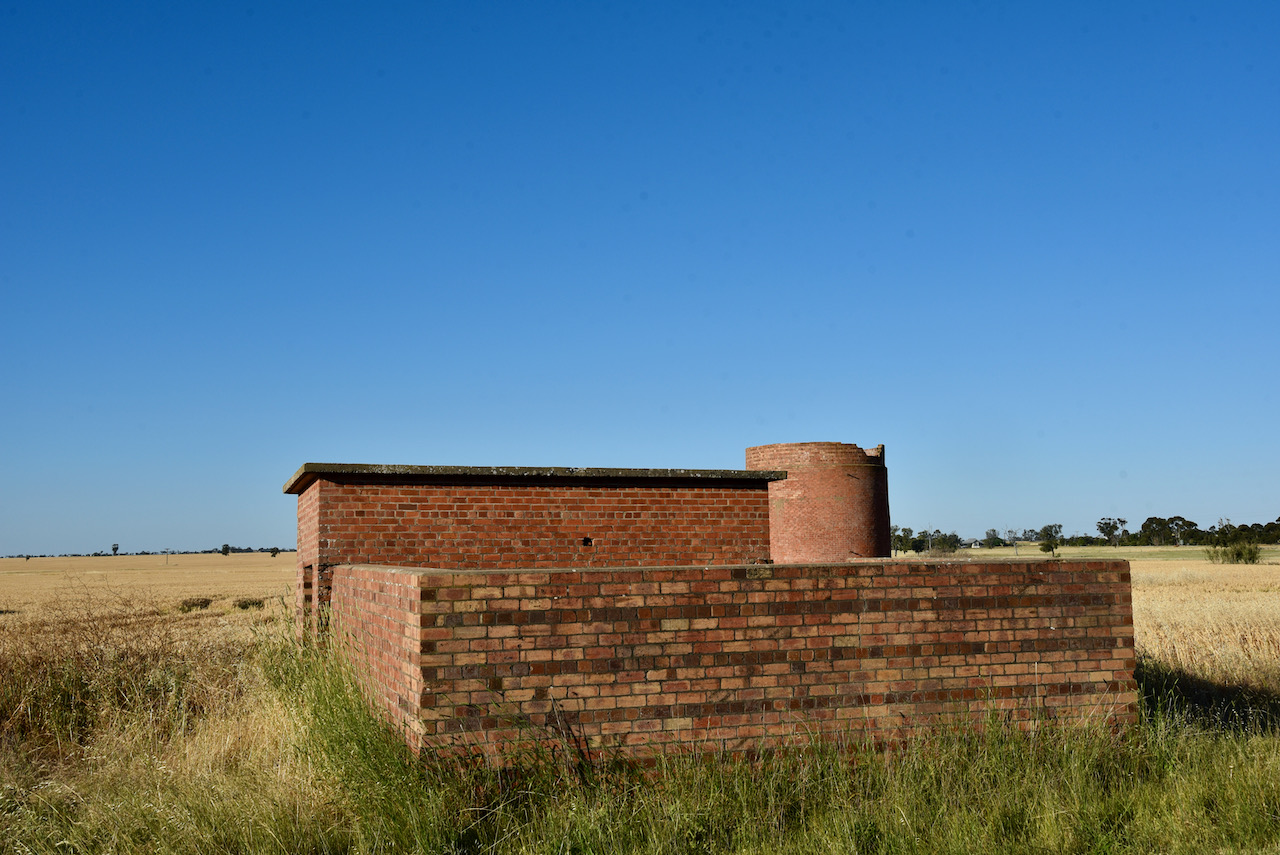
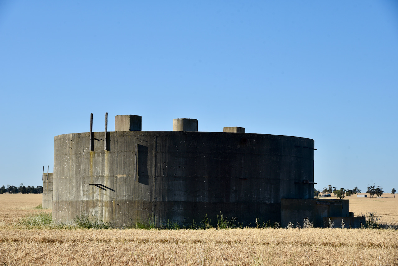
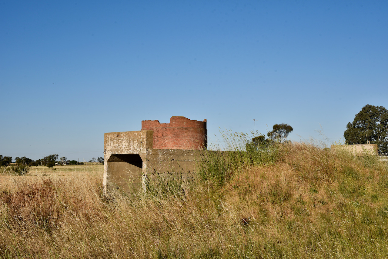
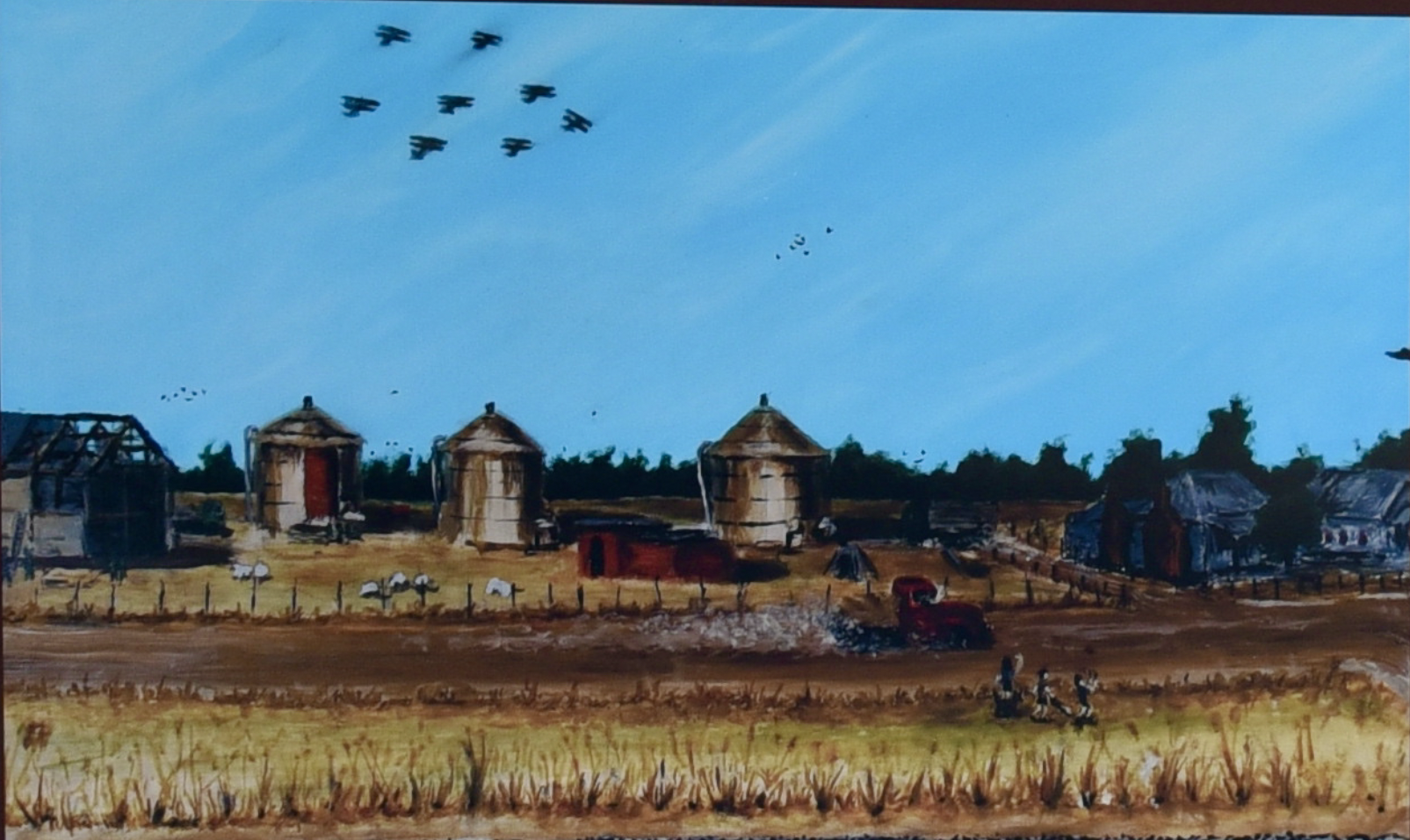
After packing up we stopped to have a look at the old World War Two Wolseley fuel tanks. The site was constructed during the early phase of WW2 with two 120,000 gallon tanks, one 40,000 gallon tank and a barracks. The fuel tanks and barracks were camouflaged to look like farm buildings. Three additional tanks were subsequently added, with the site being disbanded on the 14th day of June 1944.
There are no known surviving photographs taken during the war years of the site. Below is an artists impression of how the area may have looked.
Above:- Image from the Information Board at Wolseley. Painter – Robert ‘Bear’ Cameron.
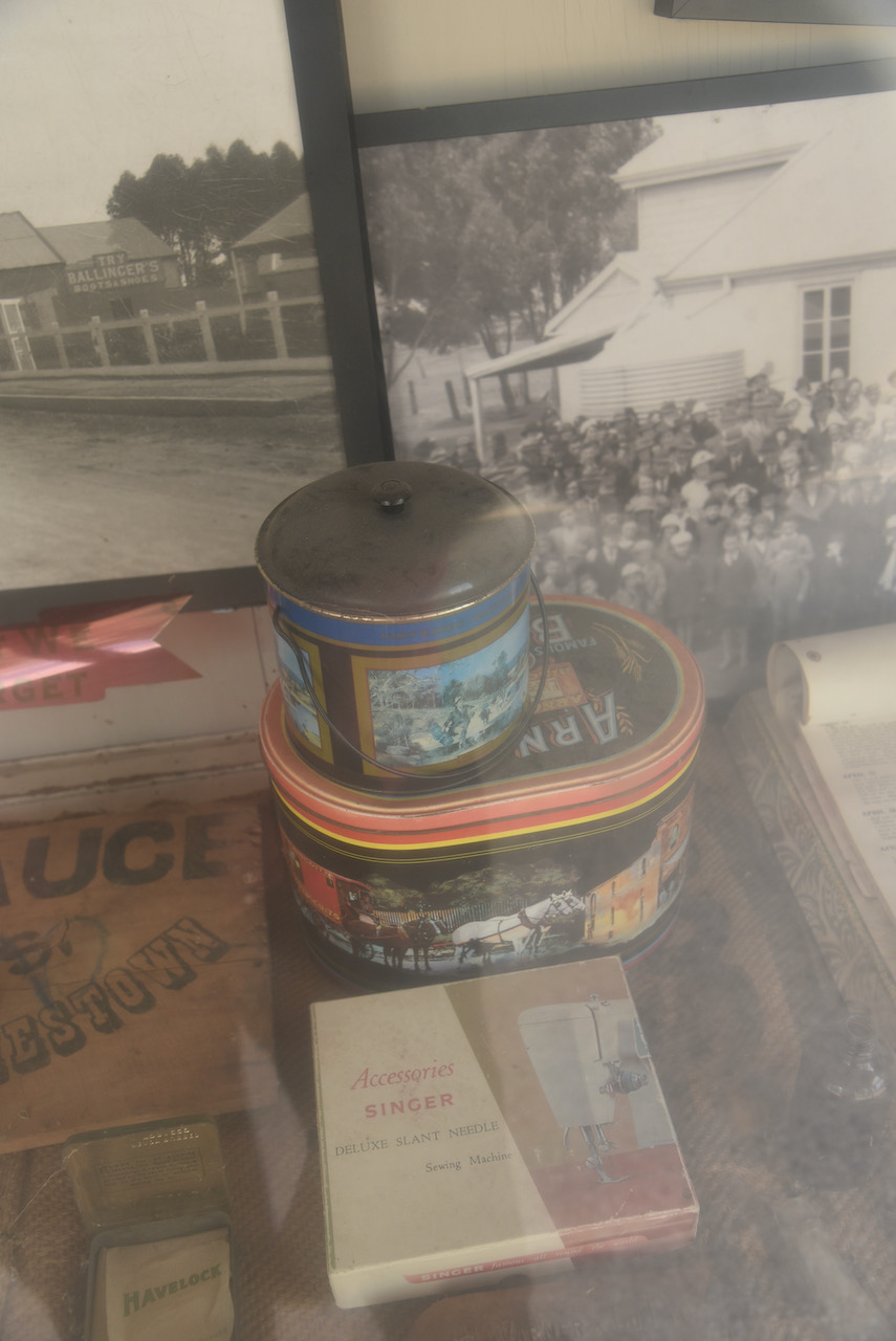
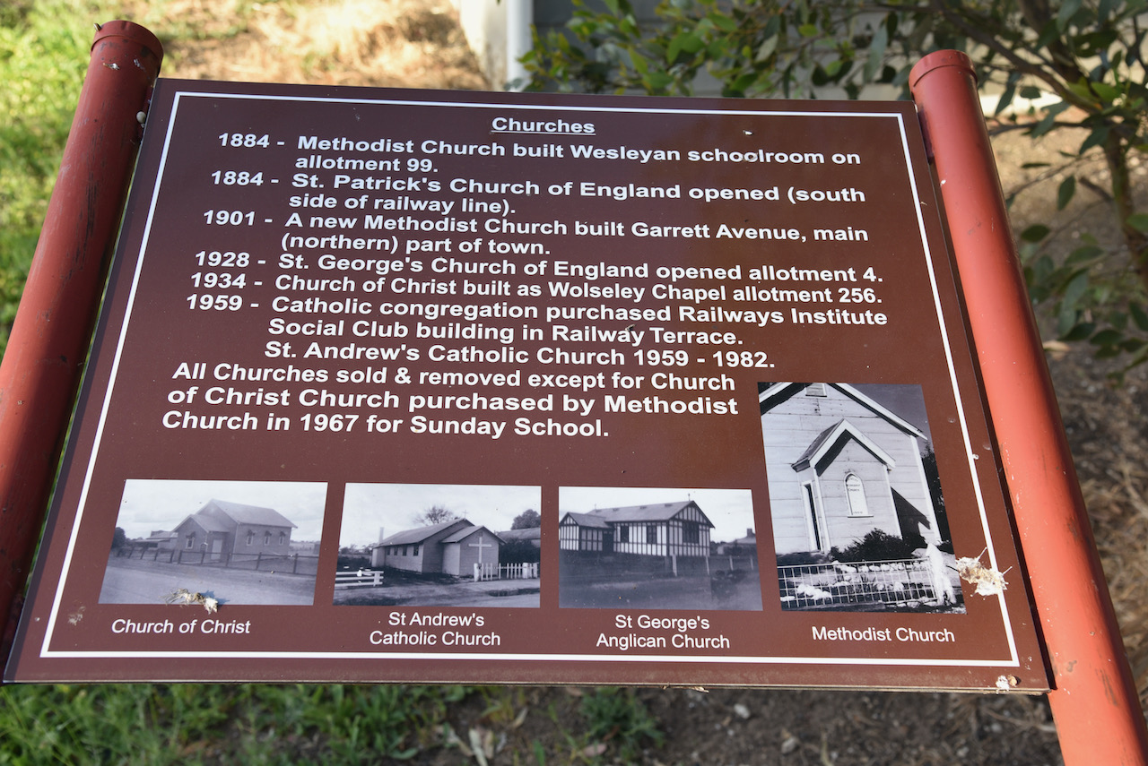
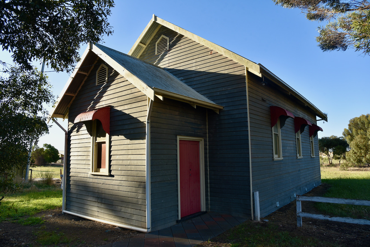
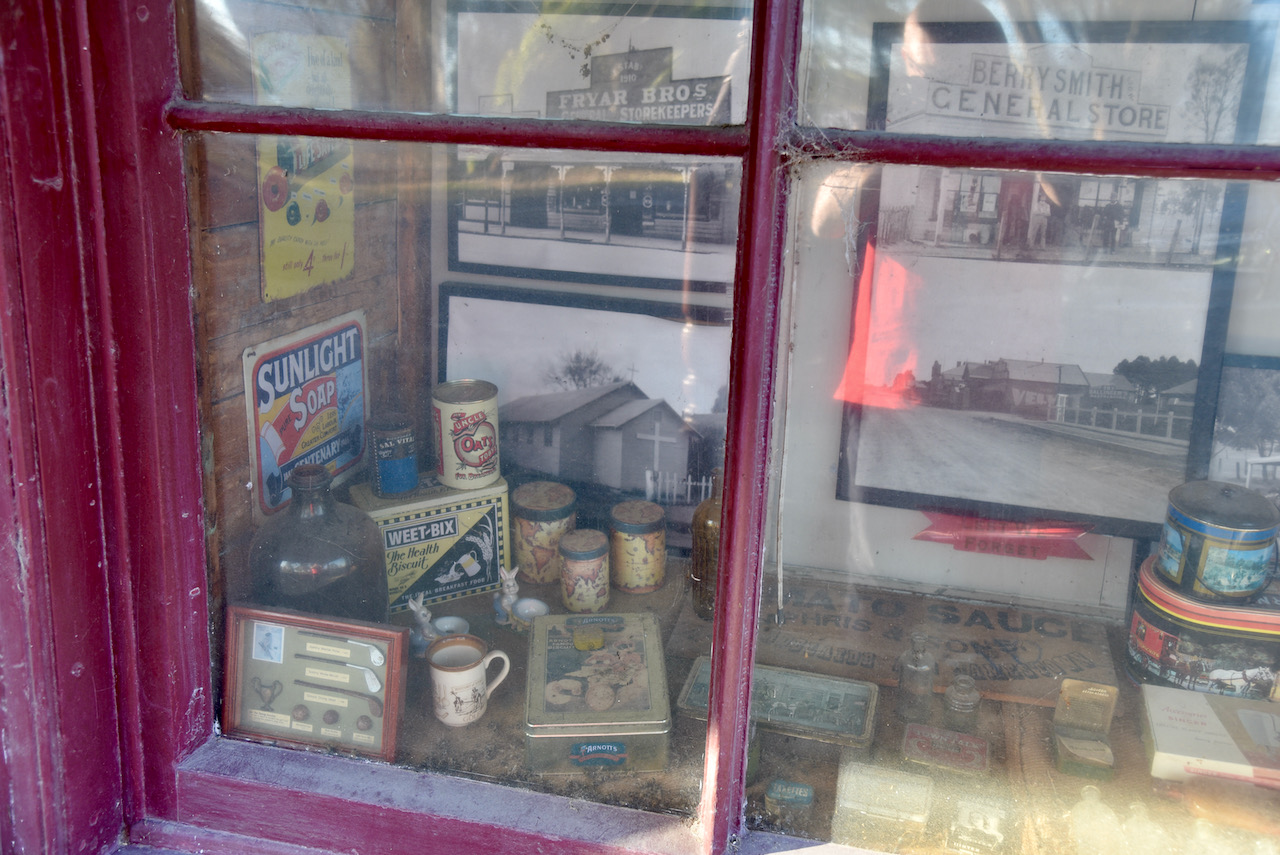
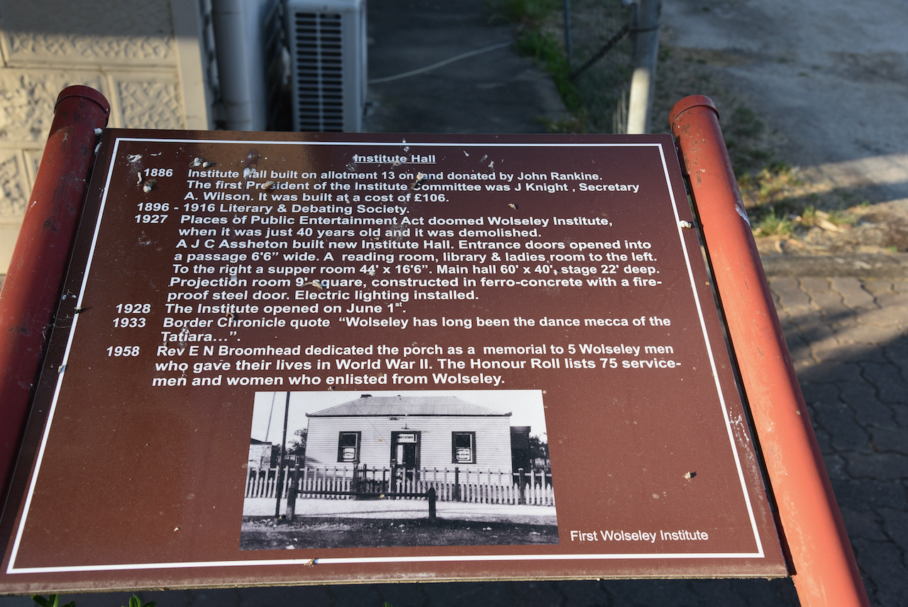
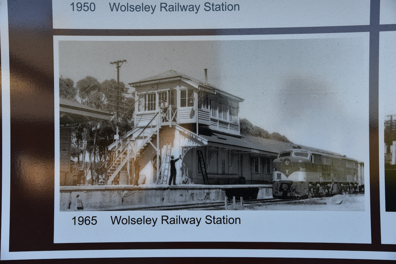
We also had a look through the town of Wolseley which has a number of interesting information boards all about the history of the buildings in the town.
There is a Wolseley Historical Walk brochure which can be obtained from the Bordertown Visitor Information Centre. I have attached a copy below.
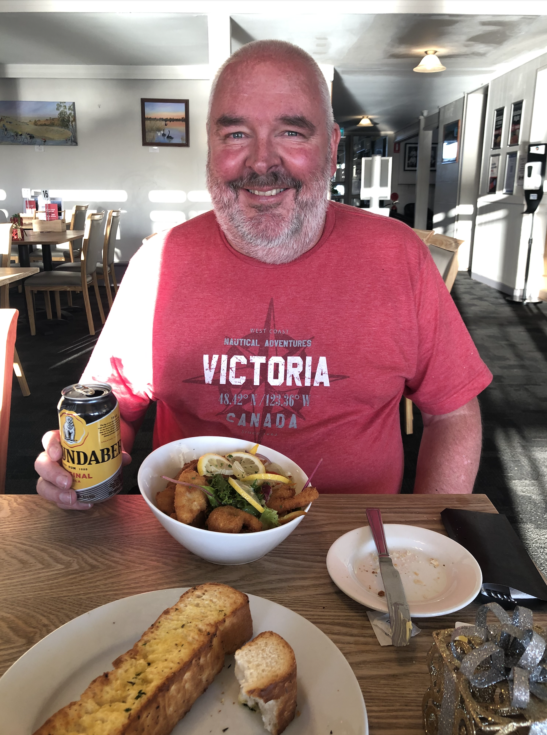
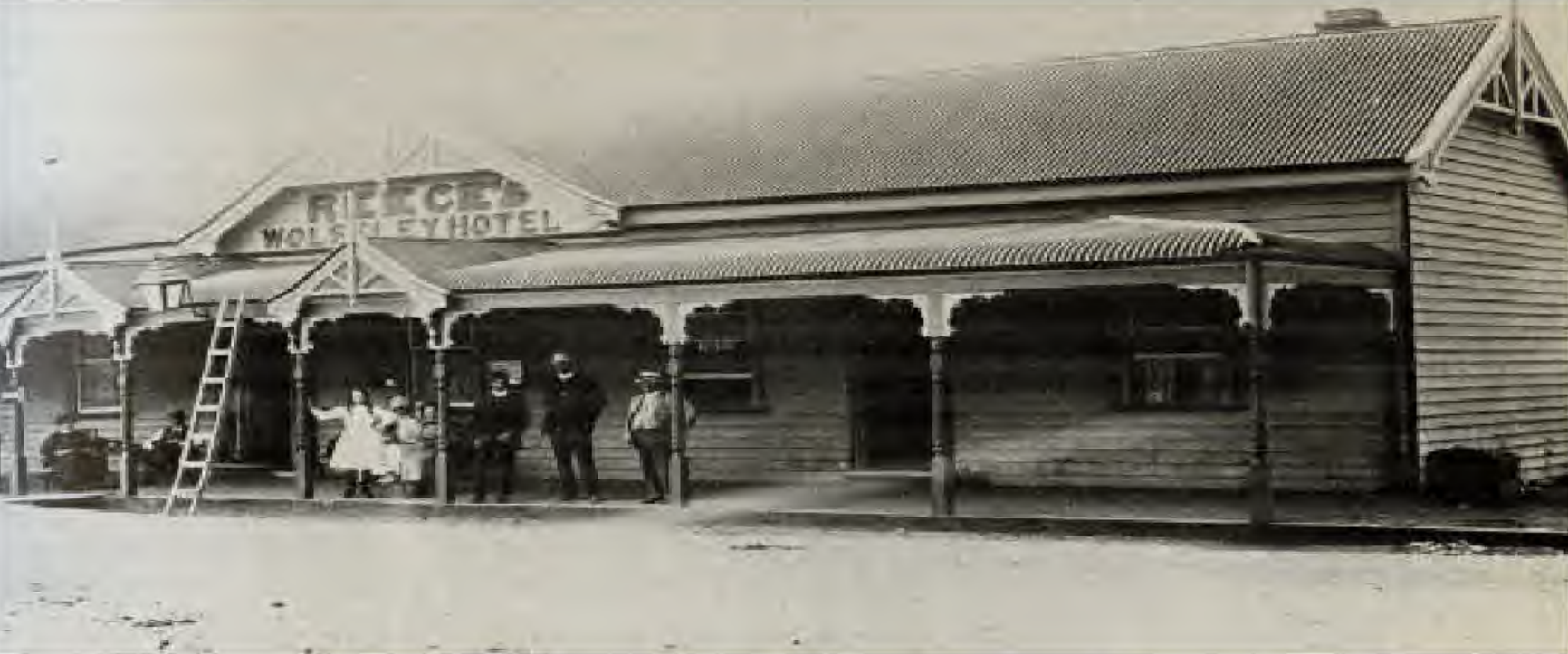
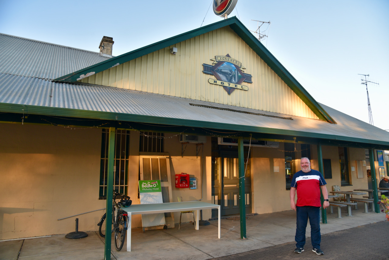
We then decided it was time for a bite to eat, so we called into the Wolseley Hotel. And I am glad we did. It was one of the best pub schnitzels I have had in a long time.
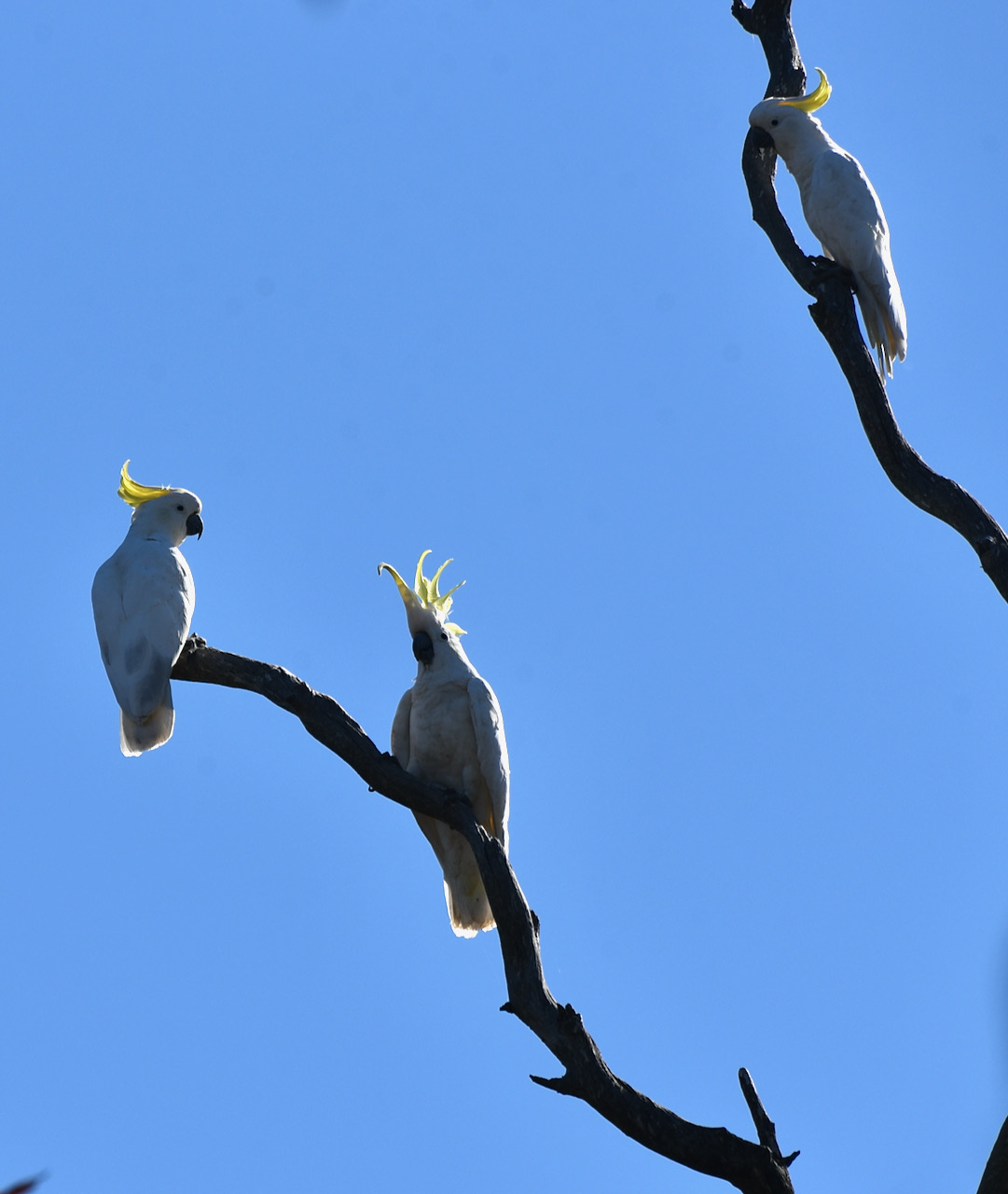
We then drove out to Mundulla and the Mundulla Common hoping to see or hear an endangered Bush Stone Curlew. They are apparently more active on moonlit nights and are more often heard then seen. Sadly we did not see any, but certainly did see and hear plenty of noisy Sulphur Crested Cockatoos.
We then headed back to our motel room. It had been an absolutely brilliant day. Plenty of radio, some sightseeing, and a nice meal.